Deprecated: Creation of dynamic property Zend_View::$sMode is deprecated in /var/www/stall-frei/htdocs/staging.stall-frei.de/library/vendor/shardj/zf1-future/library/Zend/View/Abstract.php on line 308
Stallplatz oder Offenstall in Kirchhundem
Gesucht wird in "Beul, Kirchhundem, Nordrhein-Westfalen, Deutschland"
6.330 Einträge
Deprecated: Creation of dynamic property Zend_View::$listObjects is deprecated in /var/www/stall-frei/htdocs/staging.stall-frei.de/library/vendor/shardj/zf1-future/library/Zend/View/Abstract.php on line 308
Gesponsort


Deprecated: Creation of dynamic property Zend_View::$listMode is deprecated in /var/www/stall-frei/htdocs/staging.stall-frei.de/library/vendor/shardj/zf1-future/library/Zend/View/Abstract.php on line 308
Deprecated: Creation of dynamic property Zend_View::$renderedObjects is deprecated in /var/www/stall-frei/htdocs/staging.stall-frei.de/library/vendor/shardj/zf1-future/library/Zend/View/Abstract.php on line 308
Deprecated: Creation of dynamic property Zend_View::$index is deprecated in /var/www/stall-frei/htdocs/staging.stall-frei.de/library/vendor/shardj/zf1-future/library/Zend/View/Abstract.php on line 308
Deprecated: Creation of dynamic property Zend_View::$displayMode is deprecated in /var/www/stall-frei/htdocs/staging.stall-frei.de/library/vendor/shardj/zf1-future/library/Zend/View/Abstract.php on line 308
Deprecated: Creation of dynamic property Zend_View::$remarketingIds is deprecated in /var/www/stall-frei/htdocs/staging.stall-frei.de/library/vendor/shardj/zf1-future/library/Zend/View/Abstract.php on line 308
Deprecated: Creation of dynamic property Zend_View::$listItem is deprecated in /var/www/stall-frei/htdocs/staging.stall-frei.de/library/vendor/shardj/zf1-future/library/Zend/View/Abstract.php on line 308
Deprecated: Creation of dynamic property Zend_View::$object is deprecated in /var/www/stall-frei/htdocs/staging.stall-frei.de/library/vendor/shardj/zf1-future/library/Zend/View/Abstract.php on line 308
Deprecated: Creation of dynamic property Zend_View::$attributes is deprecated in /var/www/stall-frei/htdocs/staging.stall-frei.de/library/vendor/shardj/zf1-future/library/Zend/View/Abstract.php on line 308
Leider kein Vorschaubild
Leider kein Vorschaubild
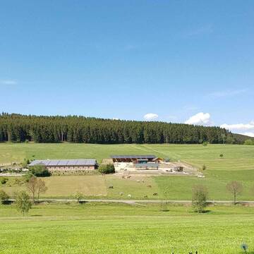
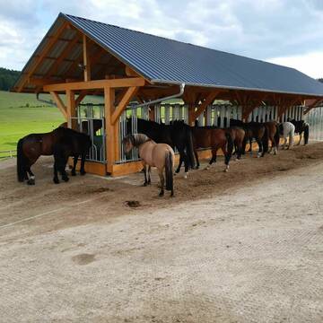
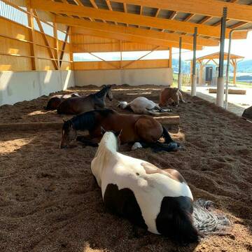
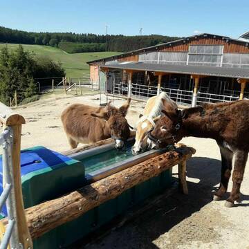
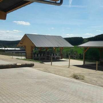
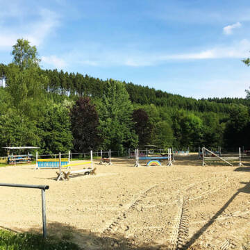
Offenstall mit Paddocktrail / Wallachherde
Kirchhundem
Pensionsstall Hof Poggel
@Poggel-Held
Fahrstall, Kutschwagen
Freizeitstall
Vermieten
Hunde willkommen
Krankenbox
Gnadenbrothof
Notfallboxen
21 weitere...
B
Deprecated: Creation of dynamic property Zend_View_Helper_Ads::$adLink is deprecated in /var/www/stall-frei/htdocs/staging.stall-frei.de/library/Psf/View/Helper/Ads.php on line 108

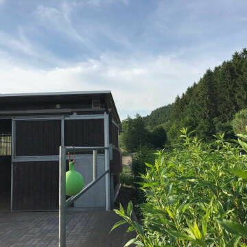
Futtersack HeuToy, Fressbremse in pink
Mechtersen
STALL-FREIde Marketing
@STALL-FREI-Marketing
Stundenlange Beschäftigung die
Koliken vorbeugt, geringe Staubinhalation mit
steuerbarer Futterentnahme
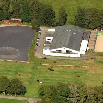
Reiterhof Kruberg Aktivstall, Bewegungsstall,Boxen
Kirchhundem
Reiterhof-Kruberg
@Reiterhof-Kruberg
Freizeitstall
Geländestrecke
Krankenbox
Longierzirkel/Roundpen
Allergikerstall
Gnadenbrothof
Außenbox mit Paddock
Außenboxen
25 weitere...
P+


Reitstall Jung
Wilnsdorf
Reitstall-Burkhard-Jung
@Reitstall-Burkhard-Jung
FN-Mitglied
Freizeitstall
Vermieten
Führanlage
Hunde willkommen
Hengsthaltung möglich
Hufrehe geeignet
23 weitere...
S

Rai Ausbildungszentrum Sauerland LAG 7-fach Gold
Schmallenberg
Cramer & Hurtienne GbR
@Cramer-und-Hurtienne-GbR
Freizeitstall
Geländestrecke
Krankenbox
Paddock
Allergikerstall
Gnadenbrothof
Bewegungsstall
Paddock Trail
18 weitere...
P
Reitanlage am Sonnenhang: Paddockboxen
Kreuztal
Reitanlage am Sonnenhang
@Reitanlage-am-Sonnenhang-57223
Freizeitstall
Pferdeausbildung
Vermieten
Verpachten
Hunde willkommen
Krankenbox
Allergikerstall
Hufrehe geeignet
17 weitere...
P

Offenstallplatz frei
Sellinghausen
Stephanie Franke
@Stephaniefranke
Geländestrecke
Vermieten
Hunde willkommen
Krankenbox
Notfallboxen
7 weitere...
aktuell
P
Reitanlage Wassmann
siegen
Pensionsstall und Pferdezucht Henrik Wassmann
@reitstallwassmann
FN-Mitglied
Freizeitstall
Vermieten
Führanlage
Hunde willkommen
Pferdezucht
23 weitere...
P+

Job gesucht?
Mechtersen
STALL-FREIde Marketing
@STALL-FREI-Marketing
Sie suchen einen Job und arbeiten gerne mit Pferden oder auf Reitanlagen?
Besuchen Sie jetzt unseren Stellenmarkt!
Pferderei-Schönau
Wenden- Schönau
Pferderei-Schoenau
@Pferderei-Schoenau
Freizeitstall
Geländestrecke
Krankenbox
Paddock
Allergikerstall
Hufrehe geeignet
Bewegungsstall
Offenstall
15 weitere...
P
Im Grünen gelegener Ausbildungs- und Pensionssta...
Siegen
Hofgut-Dautenbach1
@Hofgut-Dautenbach1
FN-Mitglied
Freizeitstall
Vermieten
Verpachten
Führanlage
Hunde willkommen
Fohlenaufzucht möglich
Hengsthaltung möglich
32 weitere...
P
Pferdepension mit Reitanlage in Olpe
Olpe
Stinn Georg
@StinnGeorg
Freizeitstall
Geländestrecke
Longierzirkel/Roundpen
Paddock
Gnadenbrothof
Außenbox mit Paddock
Innenbox
7 weitere...
P
Deprecated: Creation of dynamic property Zend_View::$pageCount is deprecated in /var/www/stall-frei/htdocs/staging.stall-frei.de/library/vendor/shardj/zf1-future/library/Zend/View/Abstract.php on line 308
Deprecated: Creation of dynamic property Zend_View::$itemCountPerPage is deprecated in /var/www/stall-frei/htdocs/staging.stall-frei.de/library/vendor/shardj/zf1-future/library/Zend/View/Abstract.php on line 308
Deprecated: Creation of dynamic property Zend_View::$first is deprecated in /var/www/stall-frei/htdocs/staging.stall-frei.de/library/vendor/shardj/zf1-future/library/Zend/View/Abstract.php on line 308
Deprecated: Creation of dynamic property Zend_View::$current is deprecated in /var/www/stall-frei/htdocs/staging.stall-frei.de/library/vendor/shardj/zf1-future/library/Zend/View/Abstract.php on line 308
Deprecated: Creation of dynamic property Zend_View::$last is deprecated in /var/www/stall-frei/htdocs/staging.stall-frei.de/library/vendor/shardj/zf1-future/library/Zend/View/Abstract.php on line 308
Deprecated: Creation of dynamic property Zend_View::$next is deprecated in /var/www/stall-frei/htdocs/staging.stall-frei.de/library/vendor/shardj/zf1-future/library/Zend/View/Abstract.php on line 308
Deprecated: Creation of dynamic property Zend_View::$pagesInRange is deprecated in /var/www/stall-frei/htdocs/staging.stall-frei.de/library/vendor/shardj/zf1-future/library/Zend/View/Abstract.php on line 308
Deprecated: Creation of dynamic property Zend_View::$firstPageInRange is deprecated in /var/www/stall-frei/htdocs/staging.stall-frei.de/library/vendor/shardj/zf1-future/library/Zend/View/Abstract.php on line 308
Deprecated: Creation of dynamic property Zend_View::$lastPageInRange is deprecated in /var/www/stall-frei/htdocs/staging.stall-frei.de/library/vendor/shardj/zf1-future/library/Zend/View/Abstract.php on line 308
Deprecated: Creation of dynamic property Zend_View::$currentItemCount is deprecated in /var/www/stall-frei/htdocs/staging.stall-frei.de/library/vendor/shardj/zf1-future/library/Zend/View/Abstract.php on line 308
Deprecated: Creation of dynamic property Zend_View::$totalItemCount is deprecated in /var/www/stall-frei/htdocs/staging.stall-frei.de/library/vendor/shardj/zf1-future/library/Zend/View/Abstract.php on line 308
Deprecated: Creation of dynamic property Zend_View::$firstItemNumber is deprecated in /var/www/stall-frei/htdocs/staging.stall-frei.de/library/vendor/shardj/zf1-future/library/Zend/View/Abstract.php on line 308
Deprecated: Creation of dynamic property Zend_View::$lastItemNumber is deprecated in /var/www/stall-frei/htdocs/staging.stall-frei.de/library/vendor/shardj/zf1-future/library/Zend/View/Abstract.php on line 308
Deprecated: Creation of dynamic property Zend_View::$router is deprecated in /var/www/stall-frei/htdocs/staging.stall-frei.de/library/vendor/shardj/zf1-future/library/Zend/View/Abstract.php on line 308
Deprecated: Creation of dynamic property Zend_View::$urlParams is deprecated in /var/www/stall-frei/htdocs/staging.stall-frei.de/library/vendor/shardj/zf1-future/library/Zend/View/Abstract.php on line 308
Deprecated: Creation of dynamic property Zend_View::$showAds is deprecated in /var/www/stall-frei/htdocs/staging.stall-frei.de/library/vendor/shardj/zf1-future/library/Zend/View/Abstract.php on line 308
Deprecated: Creation of dynamic property Zend_View::$objectIds is deprecated in /var/www/stall-frei/htdocs/staging.stall-frei.de/library/vendor/shardj/zf1-future/library/Zend/View/Abstract.php on line 308
Deprecated: Creation of dynamic property Zend_View::$showNavbar is deprecated in /var/www/stall-frei/htdocs/staging.stall-frei.de/library/vendor/shardj/zf1-future/library/Zend/View/Abstract.php on line 308
Deprecated: Creation of dynamic property Zend_View::$showBreadcrumb is deprecated in /var/www/stall-frei/htdocs/staging.stall-frei.de/library/vendor/shardj/zf1-future/library/Zend/View/Abstract.php on line 308
Deprecated: Creation of dynamic property Zend_View::$showFooter is deprecated in /var/www/stall-frei/htdocs/staging.stall-frei.de/library/vendor/shardj/zf1-future/library/Zend/View/Abstract.php on line 308
Deprecated: Creation of dynamic property Zend_View::$showInternalAds is deprecated in /var/www/stall-frei/htdocs/staging.stall-frei.de/library/vendor/shardj/zf1-future/library/Zend/View/Abstract.php on line 308
Deprecated: Creation of dynamic property Zend_View::$blNoContent is deprecated in /var/www/stall-frei/htdocs/staging.stall-frei.de/library/vendor/shardj/zf1-future/library/Zend/View/Abstract.php on line 308
Deprecated: Creation of dynamic property Zend_View::$sMetaDesc is deprecated in /var/www/stall-frei/htdocs/staging.stall-frei.de/library/vendor/shardj/zf1-future/library/Zend/View/Abstract.php on line 308
Deprecated: Creation of dynamic property Zend_View::$useGmaps is deprecated in /var/www/stall-frei/htdocs/staging.stall-frei.de/library/vendor/shardj/zf1-future/library/Zend/View/Abstract.php on line 308
Deprecated: Creation of dynamic property Zend_View::$touches is deprecated in /var/www/stall-frei/htdocs/staging.stall-frei.de/library/vendor/shardj/zf1-future/library/Zend/View/Abstract.php on line 308
Deprecated: Creation of dynamic property Zend_View::$oProject is deprecated in /var/www/stall-frei/htdocs/staging.stall-frei.de/library/vendor/shardj/zf1-future/library/Zend/View/Abstract.php on line 308
Deprecated: Creation of dynamic property Zend_View::$pageHeadline is deprecated in /var/www/stall-frei/htdocs/staging.stall-frei.de/library/vendor/shardj/zf1-future/library/Zend/View/Abstract.php on line 308
Deprecated: Creation of dynamic property Zend_View::$disableLocationField is deprecated in /var/www/stall-frei/htdocs/staging.stall-frei.de/library/vendor/shardj/zf1-future/library/Zend/View/Abstract.php on line 308
Deprecated: Creation of dynamic property Zend_View::$isSearch is deprecated in /var/www/stall-frei/htdocs/staging.stall-frei.de/library/vendor/shardj/zf1-future/library/Zend/View/Abstract.php on line 308
Deprecated: Creation of dynamic property Zend_View::$pageTitle is deprecated in /var/www/stall-frei/htdocs/staging.stall-frei.de/library/vendor/shardj/zf1-future/library/Zend/View/Abstract.php on line 308
Deprecated: Creation of dynamic property Psf_Form_Element_Text::$class is deprecated in /var/www/stall-frei/htdocs/staging.stall-frei.de/library/vendor/shardj/zf1-future/library/Zend/Form/Element.php on line 874
Deprecated: Creation of dynamic property Psf_Form_Element_Text::$size is deprecated in /var/www/stall-frei/htdocs/staging.stall-frei.de/library/vendor/shardj/zf1-future/library/Zend/Form/Element.php on line 874
Deprecated: Creation of dynamic property Psf_Form_Element_Text::$placeholder is deprecated in /var/www/stall-frei/htdocs/staging.stall-frei.de/library/vendor/shardj/zf1-future/library/Zend/Form/Element.php on line 874
Deprecated: Creation of dynamic property Psf_Form_Element_Hidden::$class is deprecated in /var/www/stall-frei/htdocs/staging.stall-frei.de/library/vendor/shardj/zf1-future/library/Zend/Form/Element.php on line 874
Deprecated: Creation of dynamic property Psf_Form_Element_Hidden::$class is deprecated in /var/www/stall-frei/htdocs/staging.stall-frei.de/library/vendor/shardj/zf1-future/library/Zend/Form/Element.php on line 874
Deprecated: Creation of dynamic property Psf_Form_Element_Hidden::$class is deprecated in /var/www/stall-frei/htdocs/staging.stall-frei.de/library/vendor/shardj/zf1-future/library/Zend/Form/Element.php on line 874
Deprecated: Creation of dynamic property Psf_Form_Element_Hidden::$class is deprecated in /var/www/stall-frei/htdocs/staging.stall-frei.de/library/vendor/shardj/zf1-future/library/Zend/Form/Element.php on line 874
Deprecated: Creation of dynamic property Psf_Form_Element_Select::$class is deprecated in /var/www/stall-frei/htdocs/staging.stall-frei.de/library/vendor/shardj/zf1-future/library/Zend/Form/Element.php on line 874
Deprecated: Creation of dynamic property Psf_Form_Element_Select::$class is deprecated in /var/www/stall-frei/htdocs/staging.stall-frei.de/library/vendor/shardj/zf1-future/library/Zend/Form/Element.php on line 874
Deprecated: Creation of dynamic property Psf_Form_Element_Select::$class is deprecated in /var/www/stall-frei/htdocs/staging.stall-frei.de/library/vendor/shardj/zf1-future/library/Zend/Form/Element.php on line 874
Deprecated: Creation of dynamic property Psf_Form_Element_Select::$class is deprecated in /var/www/stall-frei/htdocs/staging.stall-frei.de/library/vendor/shardj/zf1-future/library/Zend/Form/Element.php on line 874
Deprecated: Creation of dynamic property Psf_Form_Element_Text::$class is deprecated in /var/www/stall-frei/htdocs/staging.stall-frei.de/library/vendor/shardj/zf1-future/library/Zend/Form/Element.php on line 874
Deprecated: Creation of dynamic property Psf_Form_Element_Checkbox::$label is deprecated in /var/www/stall-frei/htdocs/staging.stall-frei.de/library/vendor/shardj/zf1-future/library/Zend/Form/Element.php on line 874
Deprecated: Creation of dynamic property Zend_View::$sort is deprecated in /var/www/stall-frei/htdocs/staging.stall-frei.de/library/vendor/shardj/zf1-future/library/Zend/View/Abstract.php on line 308
Deprecated: Creation of dynamic property Zend_View::$searchLocation is deprecated in /var/www/stall-frei/htdocs/staging.stall-frei.de/library/vendor/shardj/zf1-future/library/Zend/View/Abstract.php on line 308
Deprecated: Creation of dynamic property Zend_View::$locationHint is deprecated in /var/www/stall-frei/htdocs/staging.stall-frei.de/library/vendor/shardj/zf1-future/library/Zend/View/Abstract.php on line 308
Psf_GeoCoder_Abstract::getLocation: Beul Get Location CachedOrLive
Psf_GeoCoder_Abstract::getCachedOrLive: Beul
Psf_GeoCoder_OpenCageData::makeApiRequest: response:
Array
(
[documentation] => https://opencagedata.com/api
[licenses] => Array
(
[0] => Array
(
[name] => see attribution guide
[url] => https://opencagedata.com/credits
)
)
[results] => Array
(
[0] => Array
(
[bounds] => Array
(
[northeast] => Array
(
[lat] => 51.0844597
[lng] => 8.14121
)
[southwest] => Array
(
[lat] => 51.0843597
[lng] => 8.14111
)
)
[components] => Array
(
[ISO_3166-1_alpha-2] => DE
[ISO_3166-1_alpha-3] => DEU
[ISO_3166-2] => Array
(
[0] => DE-NW
)
[_category] => natural/water
[_normalized_city] => Kirchhundem
[_type] => peak
[continent] => Europe
[country] => Deutschland
[country_code] => de
[county] => Kreis Olpe
[peak] => Beul
[political_union] => European Union
[state] => Nordrhein-Westfalen
[state_code] => NW
[town] => Kirchhundem
)
[confidence] => 9
[formatted] => Beul, Kirchhundem, Nordrhein-Westfalen, Deutschland
[geometry] => Array
(
[lat] => 51.0844097
[lng] => 8.14116
)
)
[1] => Array
(
[bounds] => Array
(
[northeast] => Array
(
[lat] => 50.7489819
[lng] => 7.6478112
)
[southwest] => Array
(
[lat] => 50.7089819
[lng] => 7.6078112
)
)
[components] => Array
(
[ISO_3166-1_alpha-2] => DE
[ISO_3166-1_alpha-3] => DEU
[ISO_3166-2] => Array
(
[0] => DE-RP
)
[_category] => place
[_normalized_city] => Busenhausen
[_type] => village
[city] => Busenhausen
[continent] => Europe
[country] => Deutschland
[country_code] => de
[county] => Landkreis Altenkirchen (Westerwald)
[municipality] => Altenkirchen-Flammersfeld
[political_union] => European Union
[postcode] => 57612
[state] => Rheinland-Pfalz
[state_code] => RP
[village] => Beul
)
[confidence] => 7
[formatted] => 57612 Beul, Deutschland
[geometry] => Array
(
[lat] => 50.7289819
[lng] => 7.6278112
)
)
[2] => Array
(
[bounds] => Array
(
[northeast] => Array
(
[lat] => 51.2256849
[lng] => 7.7997095
)
[southwest] => Array
(
[lat] => 51.1856849
[lng] => 7.7597095
)
)
[components] => Array
(
[ISO_3166-1_alpha-2] => DE
[ISO_3166-1_alpha-3] => DEU
[ISO_3166-2] => Array
(
[0] => DE-NW
)
[_category] => place
[_normalized_city] => Herscheid
[_type] => hamlet
[continent] => Europe
[country] => Deutschland
[country_code] => de
[county] => Märkischer Kreis
[hamlet] => Beul
[political_union] => European Union
[postcode] => 58849
[state] => Nordrhein-Westfalen
[state_code] => NW
[town] => Herscheid
)
[confidence] => 7
[formatted] => Beul, 58849 Herscheid, Deutschland
[geometry] => Array
(
[lat] => 51.2056849
[lng] => 7.7797095
)
)
[3] => Array
(
[bounds] => Array
(
[northeast] => Array
(
[lat] => 51.2479239
[lng] => 7.7431426
)
[southwest] => Array
(
[lat] => 51.2476664
[lng] => 7.7422681
)
)
[components] => Array
(
[ISO_3166-1_alpha-2] => DE
[ISO_3166-1_alpha-3] => DEU
[ISO_3166-2] => Array
(
[0] => DE-NW
)
[_category] => building
[_normalized_city] => Werdohl
[_type] => building
[continent] => Europe
[country] => Deutschland
[country_code] => de
[county] => Märkischer Kreis
[isolated_dwelling] => Beul
[political_union] => European Union
[postcode] => 58791
[state] => Nordrhein-Westfalen
[state_code] => NW
[suburb] => Ütterlingsen
[town] => Werdohl
)
[confidence] => 10
[formatted] => Beul, 58791 Werdohl, Deutschland
[geometry] => Array
(
[lat] => 51.2478157
[lng] => 7.7427019
)
)
[4] => Array
(
[bounds] => Array
(
[northeast] => Array
(
[lat] => 51.2478988
[lng] => 7.7444331
)
[southwest] => Array
(
[lat] => 51.2477988
[lng] => 7.7443331
)
)
[components] => Array
(
[ISO_3166-1_alpha-2] => DE
[ISO_3166-1_alpha-3] => DEU
[ISO_3166-2] => Array
(
[0] => DE-NW
)
[_category] => building
[_normalized_city] => Werdohl
[_type] => building
[continent] => Europe
[country] => Deutschland
[country_code] => de
[county] => Märkischer Kreis
[isolated_dwelling] => Beul
[political_union] => European Union
[postcode] => 58791
[state] => Nordrhein-Westfalen
[state_code] => NW
[suburb] => Ütterlingsen
[town] => Werdohl
)
[confidence] => 10
[formatted] => Beul, 58791 Werdohl, Deutschland
[geometry] => Array
(
[lat] => 51.2478488
[lng] => 7.7443831
)
)
[5] => Array
(
[bounds] => Array
(
[northeast] => Array
(
[lat] => 51.0666873
[lng] => 7.7383766
)
[southwest] => Array
(
[lat] => 51.0630699
[lng] => 7.7324704
)
)
[components] => Array
(
[ISO_3166-1_alpha-2] => DE
[ISO_3166-1_alpha-3] => DEU
[ISO_3166-2] => Array
(
[0] => DE-NW
)
[_category] => place
[_normalized_city] => Drolshagen
[_type] => hamlet
[continent] => Europe
[country] => Deutschland
[country_code] => de
[county] => Kreis Olpe
[hamlet] => Simonspike
[political_union] => European Union
[postcode] => 57489
[residential] => Beul
[state] => Nordrhein-Westfalen
[state_code] => NW
[town] => Drolshagen
)
[confidence] => 9
[formatted] => Simonspike, 57489 Drolshagen, Deutschland
[geometry] => Array
(
[lat] => 51.0647674
[lng] => 7.7336232
)
)
[6] => Array
(
[bounds] => Array
(
[northeast] => Array
(
[lat] => 50.2478791
[lng] => 7.6467875
)
[southwest] => Array
(
[lat] => 50.2278791
[lng] => 7.6267875
)
)
[components] => Array
(
[ISO_3166-1_alpha-2] => DE
[ISO_3166-1_alpha-3] => DEU
[ISO_3166-2] => Array
(
[0] => DE-RP
)
[_category] => place
[_normalized_city] => Osterspai
[_type] => hamlet
[continent] => Europe
[country] => Deutschland
[country_code] => de
[county] => Rhein-Lahn-Kreis
[locality] => Beul
[municipality] => Loreley
[political_union] => European Union
[postcode] => 56340
[state] => Rheinland-Pfalz
[state_code] => RP
[village] => Osterspai
)
[confidence] => 8
[formatted] => Beul, 56340 Osterspai, Deutschland
[geometry] => Array
(
[lat] => 50.2378791
[lng] => 7.6367875
)
)
[7] => Array
(
[bounds] => Array
(
[northeast] => Array
(
[lat] => 51.0061458
[lng] => 7.8421552
)
[southwest] => Array
(
[lat] => 50.9861458
[lng] => 7.8221552
)
)
[components] => Array
(
[ISO_3166-1_alpha-2] => DE
[ISO_3166-1_alpha-3] => DEU
[ISO_3166-2] => Array
(
[0] => DE-NW
)
[_category] => place
[_normalized_city] => Olpe
[_type] => hamlet
[continent] => Europe
[country] => Deutschland
[country_code] => de
[county] => Kreis Olpe
[locality] => Beul
[political_union] => European Union
[postcode] => 57462
[state] => Nordrhein-Westfalen
[state_code] => NW
[town] => Olpe
)
[confidence] => 8
[formatted] => Beul, 57462 Olpe, Deutschland
[geometry] => Array
(
[lat] => 50.9961458
[lng] => 7.8321552
)
)
[8] => Array
(
[bounds] => Array
(
[northeast] => Array
(
[lat] => 51.2057289
[lng] => 7.7797674
)
[southwest] => Array
(
[lat] => 51.2054604
[lng] => 7.7795783
)
)
[components] => Array
(
[ISO_3166-1_alpha-2] => DE
[ISO_3166-1_alpha-3] => DEU
[ISO_3166-2] => Array
(
[0] => DE-NW
)
[_category] => road
[_normalized_city] => Herscheid
[_type] => road
[continent] => Europe
[country] => Deutschland
[country_code] => de
[county] => Märkischer Kreis
[hamlet] => Beul
[political_union] => European Union
[postcode] => 58849
[road] => Beul
[road_type] => service
[state] => Nordrhein-Westfalen
[state_code] => NW
[town] => Herscheid
)
[confidence] => 9
[formatted] => Beul, 58849 Herscheid, Deutschland
[geometry] => Array
(
[lat] => 51.2055971
[lng] => 7.7796762
)
)
[9] => Array
(
[components] => Array
(
[ISO_3166-1_alpha-2] => FR
[ISO_3166-1_alpha-3] => FRA
[ISO_3166-2] => Array
(
[0] => FR-ARA
[1] => FR-01
)
[_category] => road
[_normalized_city] => Ségny
[_type] => road
[city] => Ségny
[continent] => Europe
[country] => France
[country_code] => fr
[county] => Ain
[local_authority] => Pays de Gex agglo
[political_union] => European Union
[postcode] => 01170
[road] => Chemin de Beule
[state] => Auvergne-Rhône-Alpes
[state_code] => ARA
)
[confidence] => 2
[formatted] => Chemin de Beule, 01170 Ségny, France
[geometry] => Array
(
[lat] => 46.299475
[lng] => 6.065517
)
)
)
[status] => Array
(
[code] => 200
[message] => OK
)
[stay_informed] => Array
(
[blog] => https://blog.opencagedata.com
[mastodon] => https://en.osm.town/@opencage
)
[thanks] => For using an OpenCage API
[timestamp] => Array
(
[created_http] => Sun, 08 Feb 2026 06:10:45 GMT
[created_unix] => 1770531045
)
[total_results] => 10
)
Psf_GeoCoder_Abstract::convertLocationResult
{"documentation":"https:\/\/opencagedata.com\/api","licenses":[{"name":"see attribution guide","url":"https:\/\/opencagedata.com\/credits"}],"results":[{"bounds":{"northeast":{"lat":51.0844597,"lng":8.14121},"southwest":{"lat":51.0843597,"lng":8.14111}},"components":{"ISO_3166-1_alpha-2":"DE","ISO_3166-1_alpha-3":"DEU","ISO_3166-2":["DE-NW"],"_category":"natural\/water","_normalized_city":"Kirchhundem","_type":"peak","continent":"Europe","country":"Deutschland","country_code":"de","county":"Kreis Olpe","peak":"Beul","political_union":"European Union","state":"Nordrhein-Westfalen","state_code":"NW","town":"Kirchhundem"},"confidence":9,"formatted":"Beul, Kirchhundem, Nordrhein-Westfalen, Deutschland","geometry":{"lat":51.0844097,"lng":8.14116}},{"bounds":{"northeast":{"lat":50.7489819,"lng":7.6478112},"southwest":{"lat":50.7089819,"lng":7.6078112}},"components":{"ISO_3166-1_alpha-2":"DE","ISO_3166-1_alpha-3":"DEU","ISO_3166-2":["DE-RP"],"_category":"place","_normalized_city":"Busenhausen","_type":"village","city":"Busenhausen","continent":"Europe","country":"Deutschland","country_code":"de","county":"Landkreis Altenkirchen (Westerwald)","municipality":"Altenkirchen-Flammersfeld","political_union":"European Union","postcode":"57612","state":"Rheinland-Pfalz","state_code":"RP","village":"Beul"},"confidence":7,"formatted":"57612 Beul, Deutschland","geometry":{"lat":50.7289819,"lng":7.6278112}},{"bounds":{"northeast":{"lat":51.2256849,"lng":7.7997095},"southwest":{"lat":51.1856849,"lng":7.7597095}},"components":{"ISO_3166-1_alpha-2":"DE","ISO_3166-1_alpha-3":"DEU","ISO_3166-2":["DE-NW"],"_category":"place","_normalized_city":"Herscheid","_type":"hamlet","continent":"Europe","country":"Deutschland","country_code":"de","county":"M\u00e4rkischer Kreis","hamlet":"Beul","political_union":"European Union","postcode":"58849","state":"Nordrhein-Westfalen","state_code":"NW","town":"Herscheid"},"confidence":7,"formatted":"Beul, 58849 Herscheid, Deutschland","geometry":{"lat":51.2056849,"lng":7.7797095}},{"bounds":{"northeast":{"lat":51.2479239,"lng":7.7431426},"southwest":{"lat":51.2476664,"lng":7.7422681}},"components":{"ISO_3166-1_alpha-2":"DE","ISO_3166-1_alpha-3":"DEU","ISO_3166-2":["DE-NW"],"_category":"building","_normalized_city":"Werdohl","_type":"building","continent":"Europe","country":"Deutschland","country_code":"de","county":"M\u00e4rkischer Kreis","isolated_dwelling":"Beul","political_union":"European Union","postcode":"58791","state":"Nordrhein-Westfalen","state_code":"NW","suburb":"\u00dctterlingsen","town":"Werdohl"},"confidence":10,"formatted":"Beul, 58791 Werdohl, Deutschland","geometry":{"lat":51.2478157,"lng":7.7427019}},{"bounds":{"northeast":{"lat":51.2478988,"lng":7.7444331},"southwest":{"lat":51.2477988,"lng":7.7443331}},"components":{"ISO_3166-1_alpha-2":"DE","ISO_3166-1_alpha-3":"DEU","ISO_3166-2":["DE-NW"],"_category":"building","_normalized_city":"Werdohl","_type":"building","continent":"Europe","country":"Deutschland","country_code":"de","county":"M\u00e4rkischer Kreis","isolated_dwelling":"Beul","political_union":"European Union","postcode":"58791","state":"Nordrhein-Westfalen","state_code":"NW","suburb":"\u00dctterlingsen","town":"Werdohl"},"confidence":10,"formatted":"Beul, 58791 Werdohl, Deutschland","geometry":{"lat":51.2478488,"lng":7.7443831}},{"bounds":{"northeast":{"lat":51.0666873,"lng":7.7383766},"southwest":{"lat":51.0630699,"lng":7.7324704}},"components":{"ISO_3166-1_alpha-2":"DE","ISO_3166-1_alpha-3":"DEU","ISO_3166-2":["DE-NW"],"_category":"place","_normalized_city":"Drolshagen","_type":"hamlet","continent":"Europe","country":"Deutschland","country_code":"de","county":"Kreis Olpe","hamlet":"Simonspike","political_union":"European Union","postcode":"57489","residential":"Beul","state":"Nordrhein-Westfalen","state_code":"NW","town":"Drolshagen"},"confidence":9,"formatted":"Simonspike, 57489 Drolshagen, Deutschland","geometry":{"lat":51.0647674,"lng":7.7336232}},{"bounds":{"northeast":{"lat":50.2478791,"lng":7.6467875},"southwest":{"lat":50.2278791,"lng":7.6267875}},"components":{"ISO_3166-1_alpha-2":"DE","ISO_3166-1_alpha-3":"DEU","ISO_3166-2":["DE-RP"],"_category":"place","_normalized_city":"Osterspai","_type":"hamlet","continent":"Europe","country":"Deutschland","country_code":"de","county":"Rhein-Lahn-Kreis","locality":"Beul","municipality":"Loreley","political_union":"European Union","postcode":"56340","state":"Rheinland-Pfalz","state_code":"RP","village":"Osterspai"},"confidence":8,"formatted":"Beul, 56340 Osterspai, Deutschland","geometry":{"lat":50.2378791,"lng":7.6367875}},{"bounds":{"northeast":{"lat":51.0061458,"lng":7.8421552},"southwest":{"lat":50.9861458,"lng":7.8221552}},"components":{"ISO_3166-1_alpha-2":"DE","ISO_3166-1_alpha-3":"DEU","ISO_3166-2":["DE-NW"],"_category":"place","_normalized_city":"Olpe","_type":"hamlet","continent":"Europe","country":"Deutschland","country_code":"de","county":"Kreis Olpe","locality":"Beul","political_union":"European Union","postcode":"57462","state":"Nordrhein-Westfalen","state_code":"NW","town":"Olpe"},"confidence":8,"formatted":"Beul, 57462 Olpe, Deutschland","geometry":{"lat":50.9961458,"lng":7.8321552}},{"bounds":{"northeast":{"lat":51.2057289,"lng":7.7797674},"southwest":{"lat":51.2054604,"lng":7.7795783}},"components":{"ISO_3166-1_alpha-2":"DE","ISO_3166-1_alpha-3":"DEU","ISO_3166-2":["DE-NW"],"_category":"road","_normalized_city":"Herscheid","_type":"road","continent":"Europe","country":"Deutschland","country_code":"de","county":"M\u00e4rkischer Kreis","hamlet":"Beul","political_union":"European Union","postcode":"58849","road":"Beul","road_type":"service","state":"Nordrhein-Westfalen","state_code":"NW","town":"Herscheid"},"confidence":9,"formatted":"Beul, 58849 Herscheid, Deutschland","geometry":{"lat":51.2055971,"lng":7.7796762}},{"components":{"ISO_3166-1_alpha-2":"FR","ISO_3166-1_alpha-3":"FRA","ISO_3166-2":["FR-ARA","FR-01"],"_category":"road","_normalized_city":"S\u00e9gny","_type":"road","city":"S\u00e9gny","continent":"Europe","country":"France","country_code":"fr","county":"Ain","local_authority":"Pays de Gex agglo","political_union":"European Union","postcode":"01170","road":"Chemin de Beule","state":"Auvergne-Rh\u00f4ne-Alpes","state_code":"ARA"},"confidence":2,"formatted":"Chemin de Beule, 01170 S\u00e9gny, France","geometry":{"lat":46.299475,"lng":6.065517}}],"status":{"code":200,"message":"OK"},"stay_informed":{"blog":"https:\/\/blog.opencagedata.com","mastodon":"https:\/\/en.osm.town\/@opencage"},"thanks":"For using an OpenCage API","timestamp":{"created_http":"Sun, 08 Feb 2026 06:10:45 GMT","created_unix":1770531045},"total_results":10}Array
(
[0] => stdClass Object
(
[bounds] => stdClass Object
(
[northeast] => stdClass Object
(
[lat] => 51.0844597
[lng] => 8.14121
)
[southwest] => stdClass Object
(
[lat] => 51.0843597
[lng] => 8.14111
)
)
[components] => stdClass Object
(
[ISO_3166-1_alpha-2] => DE
[ISO_3166-1_alpha-3] => DEU
[ISO_3166-2] => Array
(
[0] => DE-NW
)
[_category] => natural/water
[_normalized_city] => Kirchhundem
[_type] => peak
[continent] => Europe
[country] => Deutschland
[country_code] => de
[county] => Kreis Olpe
[peak] => Beul
[political_union] => European Union
[state] => Nordrhein-Westfalen
[state_code] => NW
[town] => Kirchhundem
)
[confidence] => 9
[formatted] => Beul, Kirchhundem, Nordrhein-Westfalen, Deutschland
[geometry] => stdClass Object
(
[lat] => 51.0844097
[lng] => 8.14116
)
)
[1] => stdClass Object
(
[bounds] => stdClass Object
(
[northeast] => stdClass Object
(
[lat] => 50.7489819
[lng] => 7.6478112
)
[southwest] => stdClass Object
(
[lat] => 50.7089819
[lng] => 7.6078112
)
)
[components] => stdClass Object
(
[ISO_3166-1_alpha-2] => DE
[ISO_3166-1_alpha-3] => DEU
[ISO_3166-2] => Array
(
[0] => DE-RP
)
[_category] => place
[_normalized_city] => Busenhausen
[_type] => village
[city] => Busenhausen
[continent] => Europe
[country] => Deutschland
[country_code] => de
[county] => Landkreis Altenkirchen (Westerwald)
[municipality] => Altenkirchen-Flammersfeld
[political_union] => European Union
[postcode] => 57612
[state] => Rheinland-Pfalz
[state_code] => RP
[village] => Beul
)
[confidence] => 7
[formatted] => 57612 Beul, Deutschland
[geometry] => stdClass Object
(
[lat] => 50.7289819
[lng] => 7.6278112
)
)
[2] => stdClass Object
(
[bounds] => stdClass Object
(
[northeast] => stdClass Object
(
[lat] => 51.2256849
[lng] => 7.7997095
)
[southwest] => stdClass Object
(
[lat] => 51.1856849
[lng] => 7.7597095
)
)
[components] => stdClass Object
(
[ISO_3166-1_alpha-2] => DE
[ISO_3166-1_alpha-3] => DEU
[ISO_3166-2] => Array
(
[0] => DE-NW
)
[_category] => place
[_normalized_city] => Herscheid
[_type] => hamlet
[continent] => Europe
[country] => Deutschland
[country_code] => de
[county] => Märkischer Kreis
[hamlet] => Beul
[political_union] => European Union
[postcode] => 58849
[state] => Nordrhein-Westfalen
[state_code] => NW
[town] => Herscheid
)
[confidence] => 7
[formatted] => Beul, 58849 Herscheid, Deutschland
[geometry] => stdClass Object
(
[lat] => 51.2056849
[lng] => 7.7797095
)
)
[3] => stdClass Object
(
[bounds] => stdClass Object
(
[northeast] => stdClass Object
(
[lat] => 51.2479239
[lng] => 7.7431426
)
[southwest] => stdClass Object
(
[lat] => 51.2476664
[lng] => 7.7422681
)
)
[components] => stdClass Object
(
[ISO_3166-1_alpha-2] => DE
[ISO_3166-1_alpha-3] => DEU
[ISO_3166-2] => Array
(
[0] => DE-NW
)
[_category] => building
[_normalized_city] => Werdohl
[_type] => building
[continent] => Europe
[country] => Deutschland
[country_code] => de
[county] => Märkischer Kreis
[isolated_dwelling] => Beul
[political_union] => European Union
[postcode] => 58791
[state] => Nordrhein-Westfalen
[state_code] => NW
[suburb] => Ütterlingsen
[town] => Werdohl
)
[confidence] => 10
[formatted] => Beul, 58791 Werdohl, Deutschland
[geometry] => stdClass Object
(
[lat] => 51.2478157
[lng] => 7.7427019
)
)
[4] => stdClass Object
(
[bounds] => stdClass Object
(
[northeast] => stdClass Object
(
[lat] => 51.2478988
[lng] => 7.7444331
)
[southwest] => stdClass Object
(
[lat] => 51.2477988
[lng] => 7.7443331
)
)
[components] => stdClass Object
(
[ISO_3166-1_alpha-2] => DE
[ISO_3166-1_alpha-3] => DEU
[ISO_3166-2] => Array
(
[0] => DE-NW
)
[_category] => building
[_normalized_city] => Werdohl
[_type] => building
[continent] => Europe
[country] => Deutschland
[country_code] => de
[county] => Märkischer Kreis
[isolated_dwelling] => Beul
[political_union] => European Union
[postcode] => 58791
[state] => Nordrhein-Westfalen
[state_code] => NW
[suburb] => Ütterlingsen
[town] => Werdohl
)
[confidence] => 10
[formatted] => Beul, 58791 Werdohl, Deutschland
[geometry] => stdClass Object
(
[lat] => 51.2478488
[lng] => 7.7443831
)
)
[5] => stdClass Object
(
[bounds] => stdClass Object
(
[northeast] => stdClass Object
(
[lat] => 51.0666873
[lng] => 7.7383766
)
[southwest] => stdClass Object
(
[lat] => 51.0630699
[lng] => 7.7324704
)
)
[components] => stdClass Object
(
[ISO_3166-1_alpha-2] => DE
[ISO_3166-1_alpha-3] => DEU
[ISO_3166-2] => Array
(
[0] => DE-NW
)
[_category] => place
[_normalized_city] => Drolshagen
[_type] => hamlet
[continent] => Europe
[country] => Deutschland
[country_code] => de
[county] => Kreis Olpe
[hamlet] => Simonspike
[political_union] => European Union
[postcode] => 57489
[residential] => Beul
[state] => Nordrhein-Westfalen
[state_code] => NW
[town] => Drolshagen
)
[confidence] => 9
[formatted] => Simonspike, 57489 Drolshagen, Deutschland
[geometry] => stdClass Object
(
[lat] => 51.0647674
[lng] => 7.7336232
)
)
[6] => stdClass Object
(
[bounds] => stdClass Object
(
[northeast] => stdClass Object
(
[lat] => 50.2478791
[lng] => 7.6467875
)
[southwest] => stdClass Object
(
[lat] => 50.2278791
[lng] => 7.6267875
)
)
[components] => stdClass Object
(
[ISO_3166-1_alpha-2] => DE
[ISO_3166-1_alpha-3] => DEU
[ISO_3166-2] => Array
(
[0] => DE-RP
)
[_category] => place
[_normalized_city] => Osterspai
[_type] => hamlet
[continent] => Europe
[country] => Deutschland
[country_code] => de
[county] => Rhein-Lahn-Kreis
[locality] => Beul
[municipality] => Loreley
[political_union] => European Union
[postcode] => 56340
[state] => Rheinland-Pfalz
[state_code] => RP
[village] => Osterspai
)
[confidence] => 8
[formatted] => Beul, 56340 Osterspai, Deutschland
[geometry] => stdClass Object
(
[lat] => 50.2378791
[lng] => 7.6367875
)
)
[7] => stdClass Object
(
[bounds] => stdClass Object
(
[northeast] => stdClass Object
(
[lat] => 51.0061458
[lng] => 7.8421552
)
[southwest] => stdClass Object
(
[lat] => 50.9861458
[lng] => 7.8221552
)
)
[components] => stdClass Object
(
[ISO_3166-1_alpha-2] => DE
[ISO_3166-1_alpha-3] => DEU
[ISO_3166-2] => Array
(
[0] => DE-NW
)
[_category] => place
[_normalized_city] => Olpe
[_type] => hamlet
[continent] => Europe
[country] => Deutschland
[country_code] => de
[county] => Kreis Olpe
[locality] => Beul
[political_union] => European Union
[postcode] => 57462
[state] => Nordrhein-Westfalen
[state_code] => NW
[town] => Olpe
)
[confidence] => 8
[formatted] => Beul, 57462 Olpe, Deutschland
[geometry] => stdClass Object
(
[lat] => 50.9961458
[lng] => 7.8321552
)
)
[8] => stdClass Object
(
[bounds] => stdClass Object
(
[northeast] => stdClass Object
(
[lat] => 51.2057289
[lng] => 7.7797674
)
[southwest] => stdClass Object
(
[lat] => 51.2054604
[lng] => 7.7795783
)
)
[components] => stdClass Object
(
[ISO_3166-1_alpha-2] => DE
[ISO_3166-1_alpha-3] => DEU
[ISO_3166-2] => Array
(
[0] => DE-NW
)
[_category] => road
[_normalized_city] => Herscheid
[_type] => road
[continent] => Europe
[country] => Deutschland
[country_code] => de
[county] => Märkischer Kreis
[hamlet] => Beul
[political_union] => European Union
[postcode] => 58849
[road] => Beul
[road_type] => service
[state] => Nordrhein-Westfalen
[state_code] => NW
[town] => Herscheid
)
[confidence] => 9
[formatted] => Beul, 58849 Herscheid, Deutschland
[geometry] => stdClass Object
(
[lat] => 51.2055971
[lng] => 7.7796762
)
)
[9] => stdClass Object
(
[components] => stdClass Object
(
[ISO_3166-1_alpha-2] => FR
[ISO_3166-1_alpha-3] => FRA
[ISO_3166-2] => Array
(
[0] => FR-ARA
[1] => FR-01
)
[_category] => road
[_normalized_city] => Ségny
[_type] => road
[city] => Ségny
[continent] => Europe
[country] => France
[country_code] => fr
[county] => Ain
[local_authority] => Pays de Gex agglo
[political_union] => European Union
[postcode] => 01170
[road] => Chemin de Beule
[state] => Auvergne-Rhône-Alpes
[state_code] => ARA
)
[confidence] => 2
[formatted] => Chemin de Beule, 01170 Ségny, France
[geometry] => stdClass Object
(
[lat] => 46.299475
[lng] => 6.065517
)
)
)
Psf_GeoCoder_OpenCageData::getKeyMap: 0
stdClass Object
(
    [bounds] => stdClass Object
        (
            [northeast] => stdClass Object
                (
                    [lat] => 51.0844597
                    [lng] => 8.14121
                )

            [southwest] => stdClass Object
                (
                    [lat] => 51.0843597
                    [lng] => 8.14111
                )

        )

    [components] => stdClass Object
        (
            [ISO_3166-1_alpha-2] => DE
            [ISO_3166-1_alpha-3] => DEU
            [ISO_3166-2] => Array
                (
                    [0] => DE-NW
                )

            [_category] => natural/water
            [_normalized_city] => Kirchhundem
            [_type] => peak
            [continent] => Europe
            [country] => Deutschland
            [country_code] => de
            [county] => Kreis Olpe
            [peak] => Beul
            [political_union] => European Union
            [state] => Nordrhein-Westfalen
            [state_code] => NW
            [town] => Kirchhundem
        )

    [confidence] => 9
    [formatted] => Beul, Kirchhundem, Nordrhein-Westfalen, Deutschland
    [geometry] => stdClass Object
        (
            [lat] => 51.0844097
            [lng] => 8.14116
        )

)
Psf_GeoCoder_OpenCageData::getCounty: Olpe
Psf_GeoCoder_OpenCageData::addMissingData REFETCH!
Array
(
    [address] => Beul, Kirchhundem, Nordrhein-Westfalen, Deutschland
    [type] => peak
    [street] =>
    [city] => Kirchhundem
    [county] => Olpe
    [state] => Nordrhein-Westfalen
    [zip] =>
    [country] => Deutschland
    [suburb] =>
    [countrycode] => de
    [latitude] => 51.0844097
    [longitude] => 8.14116
    [accuracy] => 1
    [confidence] => 9
    [bounds] => stdClass Object
        (
            [northeast] => stdClass Object
                (
                    [lat] => 51.0844597
                    [lng] => 8.14121
                )

            [southwest] => stdClass Object
                (
                    [lat] => 51.0843597
                    [lng] => 8.14111
                )

        )

)
reformat!
Array
(
    [address] => Beul, Kirchhundem, Nordrhein-Westfalen, Deutschland
    [type] => peak
    [street] =>
    [city] => Kirchhundem
    [county] => Olpe
    [state] => Nordrhein-Westfalen
    [zip] =>
    [country] => Deutschland
    [suburb] =>
    [countrycode] => de
    [latitude] => 51.0844097
    [longitude] => 8.14116
    [accuracy] => 1
    [confidence] => 9
    [bounds] => stdClass Object
        (
            [northeast] => stdClass Object
                (
                    [lat] => 51.0844597
                    [lng] => 8.14121
                )

            [southwest] => stdClass Object
                (
                    [lat] => 51.0843597
                    [lng] => 8.14111
                )

        )

    [place] => Kirchhundem, Nordrhein-Westfalen
    [hash] => e623361a90e0decacaa268242854ffba
)
Psf_GeoCoder_OpenCageData::getKeyMap: 1
stdClass Object
(
    [bounds] => stdClass Object
        (
            [northeast] => stdClass Object
                (
                    [lat] => 50.7489819
                    [lng] => 7.6478112
                )

            [southwest] => stdClass Object
                (
                    [lat] => 50.7089819
                    [lng] => 7.6078112
                )

        )

    [components] => stdClass Object
        (
            [ISO_3166-1_alpha-2] => DE
            [ISO_3166-1_alpha-3] => DEU
            [ISO_3166-2] => Array
                (
                    [0] => DE-RP
                )

            [_category] => place
            [_normalized_city] => Busenhausen
            [_type] => village
            [city] => Busenhausen
            [continent] => Europe
            [country] => Deutschland
            [country_code] => de
            [county] => Landkreis Altenkirchen (Westerwald)
            [municipality] => Altenkirchen-Flammersfeld
            [political_union] => European Union
            [postcode] => 57612
            [state] => Rheinland-Pfalz
            [state_code] => RP
            [village] => Beul
        )

    [confidence] => 7
    [formatted] => 57612 Beul, Deutschland
    [geometry] => stdClass Object
        (
            [lat] => 50.7289819
            [lng] => 7.6278112
        )

)
Psf_GeoCoder_OpenCageData::getCounty: Altenkirchen (Westerwald)
Psf_GeoCoder_OpenCageData::addMissingData REFETCH!
Array
(
    [address] => 57612 Beul, Deutschland
    [type] => village
    [street] =>
    [city] => Beul
    [county] => Altenkirchen (Westerwald)
    [state] => Rheinland-Pfalz
    [zip] => 57612
    [country] => Deutschland
    [suburb] =>
    [countrycode] => de
    [latitude] => 50.7289819
    [longitude] => 7.6278112
    [accuracy] => 1
    [confidence] => 7
    [bounds] => stdClass Object
        (
            [northeast] => stdClass Object
                (
                    [lat] => 50.7489819
                    [lng] => 7.6478112
                )

            [southwest] => stdClass Object
                (
                    [lat] => 50.7089819
                    [lng] => 7.6078112
                )

        )

)
reformat!
Array
(
    [address] => 57612 Beul, Deutschland
    [type] => village
    [street] =>
    [city] => Beul
    [county] => Altenkirchen (Westerwald)
    [state] => Rheinland-Pfalz
    [zip] => 57612
    [country] => Deutschland
    [suburb] =>
    [countrycode] => de
    [latitude] => 50.7289819
    [longitude] => 7.6278112
    [accuracy] => 1
    [confidence] => 7
    [bounds] => stdClass Object
        (
            [northeast] => stdClass Object
                (
                    [lat] => 50.7489819
                    [lng] => 7.6478112
                )

            [southwest] => stdClass Object
                (
                    [lat] => 50.7089819
                    [lng] => 7.6078112
                )

        )

    [place] => 57612 Beul, Rheinland-Pfalz
    [hash] => c3b4cf78018680313beb6b5c69cbbc5d
)
Psf_GeoCoder_OpenCageData::getKeyMap: 2
stdClass Object
(
    [bounds] => stdClass Object
        (
            [northeast] => stdClass Object
                (
                    [lat] => 51.2256849
                    [lng] => 7.7997095
                )

            [southwest] => stdClass Object
                (
                    [lat] => 51.1856849
                    [lng] => 7.7597095
                )

        )

    [components] => stdClass Object
        (
            [ISO_3166-1_alpha-2] => DE
            [ISO_3166-1_alpha-3] => DEU
            [ISO_3166-2] => Array
                (
                    [0] => DE-NW
                )

            [_category] => place
            [_normalized_city] => Herscheid
            [_type] => hamlet
            [continent] => Europe
            [country] => Deutschland
            [country_code] => de
            [county] => Märkischer Kreis
            [hamlet] => Beul
            [political_union] => European Union
            [postcode] => 58849
            [state] => Nordrhein-Westfalen
            [state_code] => NW
            [town] => Herscheid
        )

    [confidence] => 7
    [formatted] => Beul, 58849 Herscheid, Deutschland
    [geometry] => stdClass Object
        (
            [lat] => 51.2056849
            [lng] => 7.7797095
        )

)
Psf_GeoCoder_OpenCageData::getCounty: Märkischer Kreis
Psf_GeoCoder_OpenCageData::addMissingData REFETCH!
Array
(
    [address] => Beul, 58849 Herscheid, Deutschland
    [type] => hamlet
    [street] => Beul
    [city] => Herscheid
    [county] => Märkischer Kreis
    [state] => Nordrhein-Westfalen
    [zip] => 58849
    [country] => Deutschland
    [suburb] =>
    [countrycode] => de
    [latitude] => 51.2056849
    [longitude] => 7.7797095
    [accuracy] => 1
    [confidence] => 7
    [bounds] => stdClass Object
        (
            [northeast] => stdClass Object
                (
                    [lat] => 51.2256849
                    [lng] => 7.7997095
                )

            [southwest] => stdClass Object
                (
                    [lat] => 51.1856849
                    [lng] => 7.7597095
                )

        )

)
reformat!
Array
(
    [address] => Beul, 58849 Herscheid, Deutschland
    [type] => hamlet
    [street] => Beul
    [city] => Herscheid
    [county] => Märkischer Kreis
    [state] => Nordrhein-Westfalen
    [zip] => 58849
    [country] => Deutschland
    [suburb] =>
    [countrycode] => de
    [latitude] => 51.2056849
    [longitude] => 7.7797095
    [accuracy] => 1
    [confidence] => 7
    [bounds] => stdClass Object
        (
            [northeast] => stdClass Object
                (
                    [lat] => 51.2256849
                    [lng] => 7.7997095
                )

            [southwest] => stdClass Object
                (
                    [lat] => 51.1856849
                    [lng] => 7.7597095
                )

        )

    [place] => Beul, 58849 Herscheid, Nordrhein-Westfalen
    [hash] => 445e6edcd65180bcd5a46c8aa13d30bd
)
Psf_GeoCoder_OpenCageData::getKeyMap: 3
stdClass Object
(
    [bounds] => stdClass Object
        (
            [northeast] => stdClass Object
                (
                    [lat] => 51.2479239
                    [lng] => 7.7431426
                )

            [southwest] => stdClass Object
                (
                    [lat] => 51.2476664
                    [lng] => 7.7422681
                )

        )

    [components] => stdClass Object
        (
            [ISO_3166-1_alpha-2] => DE
            [ISO_3166-1_alpha-3] => DEU
            [ISO_3166-2] => Array
                (
                    [0] => DE-NW
                )

            [_category] => building
            [_normalized_city] => Werdohl
            [_type] => building
            [continent] => Europe
            [country] => Deutschland
            [country_code] => de
            [county] => Märkischer Kreis
            [isolated_dwelling] => Beul
            [political_union] => European Union
            [postcode] => 58791
            [state] => Nordrhein-Westfalen
            [state_code] => NW
            [suburb] => Ütterlingsen
            [town] => Werdohl
        )

    [confidence] => 10
    [formatted] => Beul, 58791 Werdohl, Deutschland
    [geometry] => stdClass Object
        (
            [lat] => 51.2478157
            [lng] => 7.7427019
        )

)
Psf_GeoCoder_OpenCageData::getCounty: Märkischer Kreis
Psf_GeoCoder_OpenCageData::addMissingData REFETCH!
Array
(
    [address] => Beul, 58791 Werdohl, Deutschland
    [type] => building
    [street] =>
    [city] => Werdohl
    [county] => Märkischer Kreis
    [state] => Nordrhein-Westfalen
    [zip] => 58791
    [country] => Deutschland
    [suburb] => Ütterlingsen
    [countrycode] => de
    [latitude] => 51.2478157
    [longitude] => 7.7427019
    [accuracy] => 1
    [confidence] => 10
    [bounds] => stdClass Object
        (
            [northeast] => stdClass Object
                (
                    [lat] => 51.2479239
                    [lng] => 7.7431426
                )

            [southwest] => stdClass Object
                (
                    [lat] => 51.2476664
                    [lng] => 7.7422681
                )

        )

)
reformat!
Array
(
    [address] => Beul, 58791 Werdohl, Deutschland
    [type] => building
    [street] =>
    [city] => Werdohl
    [county] => Märkischer Kreis
    [state] => Nordrhein-Westfalen
    [zip] => 58791
    [country] => Deutschland
    [suburb] => Ütterlingsen
    [countrycode] => de
    [latitude] => 51.2478157
    [longitude] => 7.7427019
    [accuracy] => 1
    [confidence] => 10
    [bounds] => stdClass Object
        (
            [northeast] => stdClass Object
                (
                    [lat] => 51.2479239
                    [lng] => 7.7431426
                )

            [southwest] => stdClass Object
                (
                    [lat] => 51.2476664
                    [lng] => 7.7422681
                )

        )

    [place] => 58791 Werdohl, Nordrhein-Westfalen
    [hash] => 4e52f66fe8e5d184c66e42b8b4707dce
)
Psf_GeoCoder_OpenCageData::getKeyMap: 4
stdClass Object
(
    [bounds] => stdClass Object
        (
            [northeast] => stdClass Object
                (
                    [lat] => 51.2478988
                    [lng] => 7.7444331
                )

            [southwest] => stdClass Object
                (
                    [lat] => 51.2477988
                    [lng] => 7.7443331
                )

        )

    [components] => stdClass Object
        (
            [ISO_3166-1_alpha-2] => DE
            [ISO_3166-1_alpha-3] => DEU
            [ISO_3166-2] => Array
                (
                    [0] => DE-NW
                )

            [_category] => building
            [_normalized_city] => Werdohl
            [_type] => building
            [continent] => Europe
            [country] => Deutschland
            [country_code] => de
            [county] => Märkischer Kreis
            [isolated_dwelling] => Beul
            [political_union] => European Union
            [postcode] => 58791
            [state] => Nordrhein-Westfalen
            [state_code] => NW
            [suburb] => Ütterlingsen
            [town] => Werdohl
        )

    [confidence] => 10
    [formatted] => Beul, 58791 Werdohl, Deutschland
    [geometry] => stdClass Object
        (
            [lat] => 51.2478488
            [lng] => 7.7443831
        )

)
Psf_GeoCoder_OpenCageData::getCounty: Märkischer Kreis
Psf_GeoCoder_OpenCageData::addMissingData REFETCH!
Array
(
    [address] => Beul, 58791 Werdohl, Deutschland
    [type] => building
    [street] =>
    [city] => Werdohl
    [county] => Märkischer Kreis
    [state] => Nordrhein-Westfalen
    [zip] => 58791
    [country] => Deutschland
    [suburb] => Ütterlingsen
    [countrycode] => de
    [latitude] => 51.2478488
    [longitude] => 7.7443831
    [accuracy] => 1
    [confidence] => 10
    [bounds] => stdClass Object
        (
            [northeast] => stdClass Object
                (
                    [lat] => 51.2478988
                    [lng] => 7.7444331
                )

            [southwest] => stdClass Object
                (
                    [lat] => 51.2477988
                    [lng] => 7.7443331
                )

        )

)
reformat!
Array
(
    [address] => Beul, 58791 Werdohl, Deutschland
    [type] => building
    [street] =>
    [city] => Werdohl
    [county] => Märkischer Kreis
    [state] => Nordrhein-Westfalen
    [zip] => 58791
    [country] => Deutschland
    [suburb] => Ütterlingsen
    [countrycode] => de
    [latitude] => 51.2478488
    [longitude] => 7.7443831
    [accuracy] => 1
    [confidence] => 10
    [bounds] => stdClass Object
        (
            [northeast] => stdClass Object
                (
                    [lat] => 51.2478988
                    [lng] => 7.7444331
                )

            [southwest] => stdClass Object
                (
                    [lat] => 51.2477988
                    [lng] => 7.7443331
                )

        )

    [place] => 58791 Werdohl, Nordrhein-Westfalen
    [hash] => 4e52f66fe8e5d184c66e42b8b4707dce
)
Psf_GeoCoder_OpenCageData::getKeyMap: 5
stdClass Object
(
    [bounds] => stdClass Object
        (
            [northeast] => stdClass Object
                (
                    [lat] => 51.0666873
                    [lng] => 7.7383766
                )

            [southwest] => stdClass Object
                (
                    [lat] => 51.0630699
                    [lng] => 7.7324704
                )

        )

    [components] => stdClass Object
        (
            [ISO_3166-1_alpha-2] => DE
            [ISO_3166-1_alpha-3] => DEU
            [ISO_3166-2] => Array
                (
                    [0] => DE-NW
                )

            [_category] => place
            [_normalized_city] => Drolshagen
            [_type] => hamlet
            [continent] => Europe
            [country] => Deutschland
            [country_code] => de
            [county] => Kreis Olpe
            [hamlet] => Simonspike
            [political_union] => European Union
            [postcode] => 57489
            [residential] => Beul
            [state] => Nordrhein-Westfalen
            [state_code] => NW
            [town] => Drolshagen
        )

    [confidence] => 9
    [formatted] => Simonspike, 57489 Drolshagen, Deutschland
    [geometry] => stdClass Object
        (
            [lat] => 51.0647674
            [lng] => 7.7336232
        )

)
Psf_GeoCoder_OpenCageData::getCounty: Olpe
Psf_GeoCoder_OpenCageData::addMissingData REFETCH!
Array
(
    [address] => Simonspike, 57489 Drolshagen, Deutschland
    [type] => hamlet
    [street] => Simonspike
    [city] => Drolshagen
    [county] => Olpe
    [state] => Nordrhein-Westfalen
    [zip] => 57489
    [country] => Deutschland
    [suburb] =>
    [countrycode] => de
    [latitude] => 51.0647674
    [longitude] => 7.7336232
    [accuracy] => 1
    [confidence] => 9
    [bounds] => stdClass Object
        (
            [northeast] => stdClass Object
                (
                    [lat] => 51.0666873
                    [lng] => 7.7383766
                )

            [southwest] => stdClass Object
                (
                    [lat] => 51.0630699
                    [lng] => 7.7324704
                )

        )

)
reformat!
Array
(
    [address] => Simonspike, 57489 Drolshagen, Deutschland
    [type] => hamlet
    [street] => Simonspike
    [city] => Drolshagen
    [county] => Olpe
    [state] => Nordrhein-Westfalen
    [zip] => 57489
    [country] => Deutschland
    [suburb] =>
    [countrycode] => de
    [latitude] => 51.0647674
    [longitude] => 7.7336232
    [accuracy] => 1
    [confidence] => 9
    [bounds] => stdClass Object
        (
            [northeast] => stdClass Object
                (
                    [lat] => 51.0666873
                    [lng] => 7.7383766
                )

            [southwest] => stdClass Object
                (
                    [lat] => 51.0630699
                    [lng] => 7.7324704
                )

        )

    [place] => Simonspike, 57489 Drolshagen, Nordrhein-Westfalen
    [hash] => 370284a60e2898bec2cff223c4639454
)
Psf_GeoCoder_OpenCageData::getKeyMap: 6
stdClass Object
(
    [bounds] => stdClass Object
        (
            [northeast] => stdClass Object
                (
                    [lat] => 50.2478791
                    [lng] => 7.6467875
                )

            [southwest] => stdClass Object
                (
                    [lat] => 50.2278791
                    [lng] => 7.6267875
                )

        )

    [components] => stdClass Object
        (
            [ISO_3166-1_alpha-2] => DE
            [ISO_3166-1_alpha-3] => DEU
            [ISO_3166-2] => Array
                (
                    [0] => DE-RP
                )

            [_category] => place
            [_normalized_city] => Osterspai
            [_type] => hamlet
            [continent] => Europe
            [country] => Deutschland
            [country_code] => de
            [county] => Rhein-Lahn-Kreis
            [locality] => Beul
            [municipality] => Loreley
            [political_union] => European Union
            [postcode] => 56340
            [state] => Rheinland-Pfalz
            [state_code] => RP
            [village] => Osterspai
        )

    [confidence] => 8
    [formatted] => Beul, 56340 Osterspai, Deutschland
    [geometry] => stdClass Object
        (
            [lat] => 50.2378791
            [lng] => 7.6367875
        )

)
Psf_GeoCoder_OpenCageData::getCounty: Rhein-Lahn-Kreis
Psf_GeoCoder_OpenCageData::addMissingData REFETCH!
Array
(
    [address] => Beul, 56340 Osterspai, Deutschland
    [type] => hamlet
    [street] =>
    [city] => Osterspai
    [county] => Rhein-Lahn-Kreis
    [state] => Rheinland-Pfalz
    [zip] => 56340
    [country] => Deutschland
    [suburb] =>
    [countrycode] => de
    [latitude] => 50.2378791
    [longitude] => 7.6367875
    [accuracy] => 1
    [confidence] => 8
    [bounds] => stdClass Object
        (
            [northeast] => stdClass Object
                (
                    [lat] => 50.2478791
                    [lng] => 7.6467875
                )

            [southwest] => stdClass Object
                (
                    [lat] => 50.2278791
                    [lng] => 7.6267875
                )

        )

)
reformat!
Array
(
    [address] => Beul, 56340 Osterspai, Deutschland
    [type] => hamlet
    [street] =>
    [city] => Osterspai
    [county] => Rhein-Lahn-Kreis
    [state] => Rheinland-Pfalz
    [zip] => 56340
    [country] => Deutschland
    [suburb] =>
    [countrycode] => de
    [latitude] => 50.2378791
    [longitude] => 7.6367875
    [accuracy] => 1
    [confidence] => 8
    [bounds] => stdClass Object
        (
            [northeast] => stdClass Object
                (
                    [lat] => 50.2478791
                    [lng] => 7.6467875
                )

            [southwest] => stdClass Object
                (
                    [lat] => 50.2278791
                    [lng] => 7.6267875
                )

        )

    [place] => 56340 Osterspai, Rheinland-Pfalz
    [hash] => 49f81ebf0295d0f95eb9c1235e1ef6cd
)
Psf_GeoCoder_OpenCageData::getKeyMap: 7
stdClass Object
(
    [bounds] => stdClass Object
        (
            [northeast] => stdClass Object
                (
                    [lat] => 51.0061458
                    [lng] => 7.8421552
                )

            [southwest] => stdClass Object
                (
                    [lat] => 50.9861458
                    [lng] => 7.8221552
                )

        )

    [components] => stdClass Object
        (
            [ISO_3166-1_alpha-2] => DE
            [ISO_3166-1_alpha-3] => DEU
            [ISO_3166-2] => Array
                (
                    [0] => DE-NW
                )

            [_category] => place
            [_normalized_city] => Olpe
            [_type] => hamlet
            [continent] => Europe
            [country] => Deutschland
            [country_code] => de
            [county] => Kreis Olpe
            [locality] => Beul
            [political_union] => European Union
            [postcode] => 57462
            [state] => Nordrhein-Westfalen
            [state_code] => NW
            [town] => Olpe
        )

    [confidence] => 8
    [formatted] => Beul, 57462 Olpe, Deutschland
    [geometry] => stdClass Object
        (
            [lat] => 50.9961458
            [lng] => 7.8321552
        )

)
Psf_GeoCoder_OpenCageData::getCounty: Olpe
Psf_GeoCoder_OpenCageData::addMissingData REFETCH!
Array
(
    [address] => Beul, 57462 Olpe, Deutschland
    [type] => hamlet
    [street] =>
    [city] => Olpe
    [county] => Olpe
    [state] => Nordrhein-Westfalen
    [zip] => 57462
    [country] => Deutschland
    [suburb] =>
    [countrycode] => de
    [latitude] => 50.9961458
    [longitude] => 7.8321552
    [accuracy] => 1
    [confidence] => 8
    [bounds] => stdClass Object
        (
            [northeast] => stdClass Object
                (
                    [lat] => 51.0061458
                    [lng] => 7.8421552
                )

            [southwest] => stdClass Object
                (
                    [lat] => 50.9861458
                    [lng] => 7.8221552
                )

        )

)
reformat!
Array
(
    [address] => Beul, 57462 Olpe, Deutschland
    [type] => hamlet
    [street] =>
    [city] => Olpe
    [county] => Olpe
    [state] => Nordrhein-Westfalen
    [zip] => 57462
    [country] => Deutschland
    [suburb] =>
    [countrycode] => de
    [latitude] => 50.9961458
    [longitude] => 7.8321552
    [accuracy] => 1
    [confidence] => 8
    [bounds] => stdClass Object
        (
            [northeast] => stdClass Object
                (
                    [lat] => 51.0061458
                    [lng] => 7.8421552
                )

            [southwest] => stdClass Object
                (
                    [lat] => 50.9861458
                    [lng] => 7.8221552
                )

        )

    [place] => 57462 Olpe, Nordrhein-Westfalen
    [hash] => e808aab9645896bddf00f6ac04732278
)
Psf_GeoCoder_OpenCageData::getKeyMap: 8
stdClass Object
(
    [bounds] => stdClass Object
        (
            [northeast] => stdClass Object
                (
                    [lat] => 51.2057289
                    [lng] => 7.7797674
                )

            [southwest] => stdClass Object
                (
                    [lat] => 51.2054604
                    [lng] => 7.7795783
                )

        )

    [components] => stdClass Object
        (
            [ISO_3166-1_alpha-2] => DE
            [ISO_3166-1_alpha-3] => DEU
            [ISO_3166-2] => Array
                (
                    [0] => DE-NW
                )

            [_category] => road
            [_normalized_city] => Herscheid
            [_type] => road
            [continent] => Europe
            [country] => Deutschland
            [country_code] => de
            [county] => Märkischer Kreis
            [hamlet] => Beul
            [political_union] => European Union
            [postcode] => 58849
            [road] => Beul
            [road_type] => service
            [state] => Nordrhein-Westfalen
            [state_code] => NW
            [town] => Herscheid
        )

    [confidence] => 9
    [formatted] => Beul, 58849 Herscheid, Deutschland
    [geometry] => stdClass Object
        (
            [lat] => 51.2055971
            [lng] => 7.7796762
        )

)
Psf_GeoCoder_OpenCageData::getCounty: Märkischer Kreis
Psf_GeoCoder_OpenCageData::addMissingData REFETCH!
Array
(
    [address] => Beul, 58849 Herscheid, Deutschland
    [type] => road
    [street] => Beul
    [city] => Herscheid
    [county] => Märkischer Kreis
    [state] => Nordrhein-Westfalen
    [zip] => 58849
    [country] => Deutschland
    [suburb] =>
    [countrycode] => de
    [latitude] => 51.2055971
    [longitude] => 7.7796762
    [accuracy] => 1
    [confidence] => 9
    [bounds] => stdClass Object
        (
            [northeast] => stdClass Object
                (
                    [lat] => 51.2057289
                    [lng] => 7.7797674
                )

            [southwest] => stdClass Object
                (
                    [lat] => 51.2054604
                    [lng] => 7.7795783
                )

        )

)
reformat!
Array
(
    [address] => Beul, 58849 Herscheid, Deutschland
    [type] => road
    [street] => Beul
    [city] => Herscheid
    [county] => Märkischer Kreis
    [state] => Nordrhein-Westfalen
    [zip] => 58849
    [country] => Deutschland
    [suburb] =>
    [countrycode] => de
    [latitude] => 51.2055971
    [longitude] => 7.7796762
    [accuracy] => 1
    [confidence] => 9
    [bounds] => stdClass Object
        (
            [northeast] => stdClass Object
                (
                    [lat] => 51.2057289
                    [lng] => 7.7797674
                )

            [southwest] => stdClass Object
                (
                    [lat] => 51.2054604
                    [lng] => 7.7795783
                )

        )

    [place] => Beul, 58849 Herscheid, Nordrhein-Westfalen
    [hash] => 445e6edcd65180bcd5a46c8aa13d30bd
)
Psf_GeoCoder_OpenCageData::getKeyMap: 9
stdClass Object
(
    [components] => stdClass Object
        (
            [ISO_3166-1_alpha-2] => FR
            [ISO_3166-1_alpha-3] => FRA
            [ISO_3166-2] => Array
                (
                    [0] => FR-ARA
                    [1] => FR-01
                )

            [_category] => road
            [_normalized_city] => Ségny
            [_type] => road
            [city] => Ségny
            [continent] => Europe
            [country] => France
            [country_code] => fr
            [county] => Ain
            [local_authority] => Pays de Gex agglo
            [political_union] => European Union
            [postcode] => 01170
            [road] => Chemin de Beule
            [state] => Auvergne-Rhône-Alpes
            [state_code] => ARA
        )

    [confidence] => 2
    [formatted] => Chemin de Beule, 01170 Ségny, France
    [geometry] => stdClass Object
        (
            [lat] => 46.299475
            [lng] => 6.065517
        )

)
Psf_GeoCoder_OpenCageData::getCounty: Ain
Psf_GeoCoder_OpenCageData::addMissingData REFETCH!
Array
(
    [address] => Chemin de Beule, 01170 Ségny, France
    [type] => road
    [street] => Chemin de Beule
    [city] => Ségny
    [county] => Ain
    [state] => Auvergne-Rhône-Alpes
    [zip] => 01170
    [country] => France
    [suburb] =>
    [countrycode] => fr
    [latitude] => 46.299475
    [longitude] => 6.065517
    [accuracy] => 1
    [confidence] => 2
    [bounds] =>
)
reformat!
Array
(
    [address] => Chemin de Beule, 01170 Ségny, France
    [type] => road
    [street] => Chemin de Beule
    [city] => Ségny
    [county] => Ain
    [state] => Auvergne-Rhône-Alpes
    [zip] => 01170
    [country] => France
    [suburb] =>
    [countrycode] => fr
    [latitude] => 46.299475
    [longitude] => 6.065517
    [accuracy] => 1
    [confidence] => 2
    [bounds] =>
    [place] => Chemin de Beule, 01170 Ségny, Auvergne-Rhône-Alpes
    [hash] => 8643cad0dffc1fae1a7c0abafdfbca2a
)
Deprecated: Creation of dynamic property Zend_View::$locationHintStyle is deprecated in /var/www/stall-frei/htdocs/staging.stall-frei.de/library/vendor/shardj/zf1-future/library/Zend/View/Abstract.php on line 308
Deprecated: Creation of dynamic property Zend_View::$adGeoLocation is deprecated in /var/www/stall-frei/htdocs/staging.stall-frei.de/library/vendor/shardj/zf1-future/library/Zend/View/Abstract.php on line 308
Deprecated: Creation of dynamic property Zend_View::$recordCount is deprecated in /var/www/stall-frei/htdocs/staging.stall-frei.de/library/vendor/shardj/zf1-future/library/Zend/View/Abstract.php on line 308
Deprecated: explode(): Passing null to parameter #2 ($string) of type string is deprecated in /var/www/stall-frei/htdocs/staging.stall-frei.de/application/models/SearchAgent.php on line 100
Deprecated: explode(): Passing null to parameter #2 ($string) of type string is deprecated in /var/www/stall-frei/htdocs/staging.stall-frei.de/application/models/SearchAgent.php on line 100
Deprecated: explode(): Passing null to parameter #2 ($string) of type string is deprecated in /var/www/stall-frei/htdocs/staging.stall-frei.de/application/models/SearchAgent.php on line 100
Deprecated: explode(): Passing null to parameter #2 ($string) of type string is deprecated in /var/www/stall-frei/htdocs/staging.stall-frei.de/application/models/SearchAgent.php on line 100
Deprecated: explode(): Passing null to parameter #2 ($string) of type string is deprecated in /var/www/stall-frei/htdocs/staging.stall-frei.de/application/models/SearchAgent.php on line 100
Deprecated: explode(): Passing null to parameter #2 ($string) of type string is deprecated in /var/www/stall-frei/htdocs/staging.stall-frei.de/application/models/SearchAgent.php on line 100
Deprecated: explode(): Passing null to parameter #2 ($string) of type string is deprecated in /var/www/stall-frei/htdocs/staging.stall-frei.de/application/models/SearchAgent.php on line 100
Deprecated: explode(): Passing null to parameter #2 ($string) of type string is deprecated in /var/www/stall-frei/htdocs/staging.stall-frei.de/application/models/SearchAgent.php on line 100
Deprecated: explode(): Passing null to parameter #2 ($string) of type string is deprecated in /var/www/stall-frei/htdocs/staging.stall-frei.de/application/models/SearchAgent.php on line 100
Deprecated: trim(): Passing null to parameter #1 ($string) of type string is deprecated in /var/www/stall-frei/htdocs/staging.stall-frei.de/application/models/Account/Search.php on line 82
Warning: Cannot modify header information - headers already sent by (output started at /var/www/stall-frei/htdocs/staging.stall-frei.de/library/vendor/shardj/zf1-future/library/Zend/View/Abstract.php:308) in /var/www/stall-frei/htdocs/staging.stall-frei.de/application/models/Account/Search.php on line 71
Deprecated: Creation of dynamic property Zend_View::$paginationParams is deprecated in /var/www/stall-frei/htdocs/staging.stall-frei.de/library/vendor/shardj/zf1-future/library/Zend/View/Abstract.php on line 308
Deprecated: Creation of dynamic property Zend_View::$objectPaginator is deprecated in /var/www/stall-frei/htdocs/staging.stall-frei.de/library/vendor/shardj/zf1-future/library/Zend/View/Abstract.php on line 308
Deprecated: Creation of dynamic property Zend_View::$featuredObjects is deprecated in /var/www/stall-frei/htdocs/staging.stall-frei.de/library/vendor/shardj/zf1-future/library/Zend/View/Abstract.php on line 308
Deprecated: Creation of dynamic property Zend_View::$hints is deprecated in /var/www/stall-frei/htdocs/staging.stall-frei.de/library/vendor/shardj/zf1-future/library/Zend/View/Abstract.php on line 308
Deprecated: Creation of dynamic property Zend_View::$attributeHints is deprecated in /var/www/stall-frei/htdocs/staging.stall-frei.de/library/vendor/shardj/zf1-future/library/Zend/View/Abstract.php on line 308
Deprecated: Creation of dynamic property Zend_View::$oSearchForm is deprecated in /var/www/stall-frei/htdocs/staging.stall-frei.de/library/vendor/shardj/zf1-future/library/Zend/View/Abstract.php on line 308