Deprecated: Creation of dynamic property Zend_View::$sMode is deprecated in /var/www/stall-frei/htdocs/staging.stall-frei.de/library/vendor/shardj/zf1-future/library/Zend/View/Abstract.php on line 308
Stallplatz oder Offenstall in Stolberg
Gesucht wird in "52223 Stolberg"
6.332 Einträge
Deprecated: Creation of dynamic property Zend_View::$listObjects is deprecated in /var/www/stall-frei/htdocs/staging.stall-frei.de/library/vendor/shardj/zf1-future/library/Zend/View/Abstract.php on line 308
Gesponsort


Deprecated: Creation of dynamic property Zend_View::$listMode is deprecated in /var/www/stall-frei/htdocs/staging.stall-frei.de/library/vendor/shardj/zf1-future/library/Zend/View/Abstract.php on line 308
Deprecated: Creation of dynamic property Zend_View::$renderedObjects is deprecated in /var/www/stall-frei/htdocs/staging.stall-frei.de/library/vendor/shardj/zf1-future/library/Zend/View/Abstract.php on line 308
Deprecated: Creation of dynamic property Zend_View::$index is deprecated in /var/www/stall-frei/htdocs/staging.stall-frei.de/library/vendor/shardj/zf1-future/library/Zend/View/Abstract.php on line 308
Deprecated: Creation of dynamic property Zend_View::$displayMode is deprecated in /var/www/stall-frei/htdocs/staging.stall-frei.de/library/vendor/shardj/zf1-future/library/Zend/View/Abstract.php on line 308
Deprecated: Creation of dynamic property Zend_View::$remarketingIds is deprecated in /var/www/stall-frei/htdocs/staging.stall-frei.de/library/vendor/shardj/zf1-future/library/Zend/View/Abstract.php on line 308
Deprecated: Creation of dynamic property Zend_View::$listItem is deprecated in /var/www/stall-frei/htdocs/staging.stall-frei.de/library/vendor/shardj/zf1-future/library/Zend/View/Abstract.php on line 308
Deprecated: Creation of dynamic property Zend_View::$object is deprecated in /var/www/stall-frei/htdocs/staging.stall-frei.de/library/vendor/shardj/zf1-future/library/Zend/View/Abstract.php on line 308
Deprecated: Creation of dynamic property Zend_View::$attributes is deprecated in /var/www/stall-frei/htdocs/staging.stall-frei.de/library/vendor/shardj/zf1-future/library/Zend/View/Abstract.php on line 308

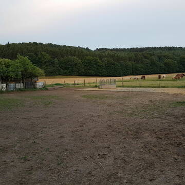


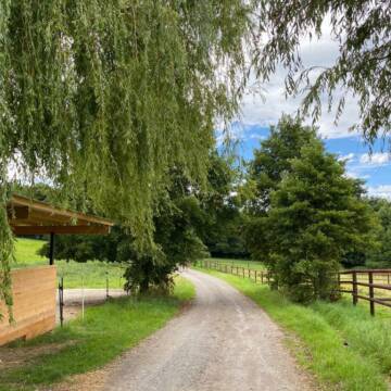
Herdenhaltung Offenstall Gemmenich
Gemmenich bei Aachen
Waheeda
@Waheeda
FN-Mitglied
Freizeitstall
Vermieten
Krankenbox
Longierzirkel/Roundpen
Notfallboxen
10 weitere...
ganz aktuell
S
Deprecated: Creation of dynamic property Zend_View_Helper_Ads::$adLink is deprecated in /var/www/stall-frei/htdocs/staging.stall-frei.de/library/Psf/View/Helper/Ads.php on line 108

Frisches Stroh zu verkaufen!
Mechtersen
STALL-FREIde Marketing
@STALL-FREI-Marketing
Kaufe frisches Stroh für dein Pferd!

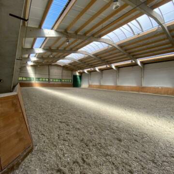
Pferdeboxen in Stolberg-Büsbach
Stolberg
Peter Conrads
@PeterConrads
Freizeitstall
Vermieten
Führanlage
Hunde willkommen
Zuchtstutenhaltung möglich
16 weitere...
P
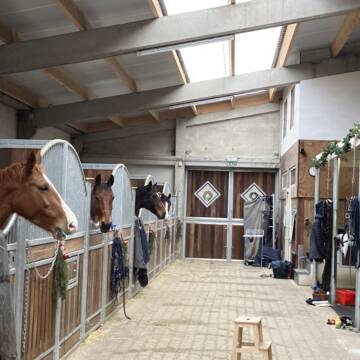
Sport-&Gesundheitsstall bei Aachen
Eynatten
Sportpferde-Nachtsheim
@Sportpferde-Nachtsheim
Vermieten
Longierzirkel/Roundpen
Paddock
Zuchtstutenhaltung möglich
Außenbox mit Paddock
Innenbox
13 weitere...
aktuell
P+

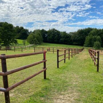
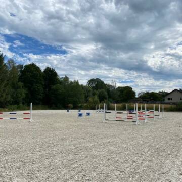
Tolle Paddockboxen zu vermieten
Aachen
Dressurstall Braun
@Dressurstall_Braun
Gastronomie
Pferdeausbildung
Führanlage
Hunde willkommen
Außenbox mit Paddock
Vollpension
11 weitere...
P
Leider kein Vorschaubild
Leider kein Vorschaubild
Pferdewelt Venwegen
Stolberg-Venwegen
Pferdewelt-Venwegen
@Pferdewelt-Venwegen
Freizeitstall
Hunde willkommen
Krankenbox
Außenbox mit Paddock
Innenbox
Vollpension
13 weitere...
B


Reitschule und Pensionsstall im Aachener Süden
Aachen
Reitverein Gut Hanbruch
@reitverein-guthanbruch
FN-Mitglied
Gastronomie
Hunde willkommen
Longierzirkel/Roundpen
Außenbox mit Paddock
Außenboxen
Vollpension
17 weitere...
P+
Leider kein Vorschaubild
Leider kein Vorschaubild
Prämierte Reitanlage bietet artgerechte Haltung
Aachen
Gut-Schlauser-Mühle
@Gut-Schlauser-Muehle
FN-Mitglied
Freizeitstall
Vermieten
Hunde willkommen
Krankenbox
Allergikerstall
Hufrehe geeignet
22 weitere...
B
Reitanlage Gut Landwehring
Eynatten
Viktoria Hauswirth
@ViktoriaHauswirth
Reitlehrer und -unterricht
Vermieten
Führanlage
Paddock
Außenboxen
Innenbox
10 weitere...
P

Heu aus neuer Ernte
Mechtersen
STALL-FREIde Marketing
@STALL-FREI-Marketing
Heulage und Pferdeheu aus der neuen Ernte findest du in unserem Futtermarkt
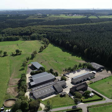
Turnier/Freizeit/Aufzucht/Rentnerstall
Hürtgenwald
Reitstall-Fassbender
@Reitstall-Fassbender
FN-Mitglied
Freizeitstall
Vermieten
Hunde willkommen
Krankenbox
Gnadenbrothof
Notfallboxen
26 weitere...
P

Gut Tannenhof
Langerwehe
Reitanlage Röthgener Burg
@SportKugel
FN-Mitglied
Freizeitstall
Vermieten
Hunde willkommen
Longierzirkel/Roundpen
Außenbox mit Paddock
Außenboxen
19 weitere...
P
Deprecated: Creation of dynamic property Zend_View::$pageCount is deprecated in /var/www/stall-frei/htdocs/staging.stall-frei.de/library/vendor/shardj/zf1-future/library/Zend/View/Abstract.php on line 308
Deprecated: Creation of dynamic property Zend_View::$itemCountPerPage is deprecated in /var/www/stall-frei/htdocs/staging.stall-frei.de/library/vendor/shardj/zf1-future/library/Zend/View/Abstract.php on line 308
Deprecated: Creation of dynamic property Zend_View::$first is deprecated in /var/www/stall-frei/htdocs/staging.stall-frei.de/library/vendor/shardj/zf1-future/library/Zend/View/Abstract.php on line 308
Deprecated: Creation of dynamic property Zend_View::$current is deprecated in /var/www/stall-frei/htdocs/staging.stall-frei.de/library/vendor/shardj/zf1-future/library/Zend/View/Abstract.php on line 308
Deprecated: Creation of dynamic property Zend_View::$last is deprecated in /var/www/stall-frei/htdocs/staging.stall-frei.de/library/vendor/shardj/zf1-future/library/Zend/View/Abstract.php on line 308
Deprecated: Creation of dynamic property Zend_View::$next is deprecated in /var/www/stall-frei/htdocs/staging.stall-frei.de/library/vendor/shardj/zf1-future/library/Zend/View/Abstract.php on line 308
Deprecated: Creation of dynamic property Zend_View::$pagesInRange is deprecated in /var/www/stall-frei/htdocs/staging.stall-frei.de/library/vendor/shardj/zf1-future/library/Zend/View/Abstract.php on line 308
Deprecated: Creation of dynamic property Zend_View::$firstPageInRange is deprecated in /var/www/stall-frei/htdocs/staging.stall-frei.de/library/vendor/shardj/zf1-future/library/Zend/View/Abstract.php on line 308
Deprecated: Creation of dynamic property Zend_View::$lastPageInRange is deprecated in /var/www/stall-frei/htdocs/staging.stall-frei.de/library/vendor/shardj/zf1-future/library/Zend/View/Abstract.php on line 308
Deprecated: Creation of dynamic property Zend_View::$currentItemCount is deprecated in /var/www/stall-frei/htdocs/staging.stall-frei.de/library/vendor/shardj/zf1-future/library/Zend/View/Abstract.php on line 308
Deprecated: Creation of dynamic property Zend_View::$totalItemCount is deprecated in /var/www/stall-frei/htdocs/staging.stall-frei.de/library/vendor/shardj/zf1-future/library/Zend/View/Abstract.php on line 308
Deprecated: Creation of dynamic property Zend_View::$firstItemNumber is deprecated in /var/www/stall-frei/htdocs/staging.stall-frei.de/library/vendor/shardj/zf1-future/library/Zend/View/Abstract.php on line 308
Deprecated: Creation of dynamic property Zend_View::$lastItemNumber is deprecated in /var/www/stall-frei/htdocs/staging.stall-frei.de/library/vendor/shardj/zf1-future/library/Zend/View/Abstract.php on line 308
Deprecated: Creation of dynamic property Zend_View::$router is deprecated in /var/www/stall-frei/htdocs/staging.stall-frei.de/library/vendor/shardj/zf1-future/library/Zend/View/Abstract.php on line 308
Deprecated: Creation of dynamic property Zend_View::$urlParams is deprecated in /var/www/stall-frei/htdocs/staging.stall-frei.de/library/vendor/shardj/zf1-future/library/Zend/View/Abstract.php on line 308
Deprecated: Creation of dynamic property Zend_View::$showAds is deprecated in /var/www/stall-frei/htdocs/staging.stall-frei.de/library/vendor/shardj/zf1-future/library/Zend/View/Abstract.php on line 308
Deprecated: Creation of dynamic property Zend_View::$objectIds is deprecated in /var/www/stall-frei/htdocs/staging.stall-frei.de/library/vendor/shardj/zf1-future/library/Zend/View/Abstract.php on line 308
Deprecated: Creation of dynamic property Zend_View::$showNavbar is deprecated in /var/www/stall-frei/htdocs/staging.stall-frei.de/library/vendor/shardj/zf1-future/library/Zend/View/Abstract.php on line 308
Deprecated: Creation of dynamic property Zend_View::$showBreadcrumb is deprecated in /var/www/stall-frei/htdocs/staging.stall-frei.de/library/vendor/shardj/zf1-future/library/Zend/View/Abstract.php on line 308
Deprecated: Creation of dynamic property Zend_View::$showFooter is deprecated in /var/www/stall-frei/htdocs/staging.stall-frei.de/library/vendor/shardj/zf1-future/library/Zend/View/Abstract.php on line 308
Deprecated: Creation of dynamic property Zend_View::$showInternalAds is deprecated in /var/www/stall-frei/htdocs/staging.stall-frei.de/library/vendor/shardj/zf1-future/library/Zend/View/Abstract.php on line 308
Deprecated: Creation of dynamic property Zend_View::$blNoContent is deprecated in /var/www/stall-frei/htdocs/staging.stall-frei.de/library/vendor/shardj/zf1-future/library/Zend/View/Abstract.php on line 308
Deprecated: Creation of dynamic property Zend_View::$sMetaDesc is deprecated in /var/www/stall-frei/htdocs/staging.stall-frei.de/library/vendor/shardj/zf1-future/library/Zend/View/Abstract.php on line 308
Deprecated: Creation of dynamic property Zend_View::$useGmaps is deprecated in /var/www/stall-frei/htdocs/staging.stall-frei.de/library/vendor/shardj/zf1-future/library/Zend/View/Abstract.php on line 308
Deprecated: Creation of dynamic property Zend_View::$touches is deprecated in /var/www/stall-frei/htdocs/staging.stall-frei.de/library/vendor/shardj/zf1-future/library/Zend/View/Abstract.php on line 308
Deprecated: Creation of dynamic property Zend_View::$oProject is deprecated in /var/www/stall-frei/htdocs/staging.stall-frei.de/library/vendor/shardj/zf1-future/library/Zend/View/Abstract.php on line 308
Deprecated: Creation of dynamic property Zend_View::$pageHeadline is deprecated in /var/www/stall-frei/htdocs/staging.stall-frei.de/library/vendor/shardj/zf1-future/library/Zend/View/Abstract.php on line 308
Deprecated: Creation of dynamic property Zend_View::$disableLocationField is deprecated in /var/www/stall-frei/htdocs/staging.stall-frei.de/library/vendor/shardj/zf1-future/library/Zend/View/Abstract.php on line 308
Deprecated: Creation of dynamic property Zend_View::$isSearch is deprecated in /var/www/stall-frei/htdocs/staging.stall-frei.de/library/vendor/shardj/zf1-future/library/Zend/View/Abstract.php on line 308
Deprecated: Creation of dynamic property Zend_View::$pageTitle is deprecated in /var/www/stall-frei/htdocs/staging.stall-frei.de/library/vendor/shardj/zf1-future/library/Zend/View/Abstract.php on line 308
Deprecated: Creation of dynamic property Psf_Form_Element_Text::$class is deprecated in /var/www/stall-frei/htdocs/staging.stall-frei.de/library/vendor/shardj/zf1-future/library/Zend/Form/Element.php on line 874
Deprecated: Creation of dynamic property Psf_Form_Element_Text::$size is deprecated in /var/www/stall-frei/htdocs/staging.stall-frei.de/library/vendor/shardj/zf1-future/library/Zend/Form/Element.php on line 874
Deprecated: Creation of dynamic property Psf_Form_Element_Text::$placeholder is deprecated in /var/www/stall-frei/htdocs/staging.stall-frei.de/library/vendor/shardj/zf1-future/library/Zend/Form/Element.php on line 874
Deprecated: Creation of dynamic property Psf_Form_Element_Hidden::$class is deprecated in /var/www/stall-frei/htdocs/staging.stall-frei.de/library/vendor/shardj/zf1-future/library/Zend/Form/Element.php on line 874
Deprecated: Creation of dynamic property Psf_Form_Element_Hidden::$class is deprecated in /var/www/stall-frei/htdocs/staging.stall-frei.de/library/vendor/shardj/zf1-future/library/Zend/Form/Element.php on line 874
Deprecated: Creation of dynamic property Psf_Form_Element_Hidden::$class is deprecated in /var/www/stall-frei/htdocs/staging.stall-frei.de/library/vendor/shardj/zf1-future/library/Zend/Form/Element.php on line 874
Deprecated: Creation of dynamic property Psf_Form_Element_Hidden::$class is deprecated in /var/www/stall-frei/htdocs/staging.stall-frei.de/library/vendor/shardj/zf1-future/library/Zend/Form/Element.php on line 874
Deprecated: Creation of dynamic property Psf_Form_Element_Select::$class is deprecated in /var/www/stall-frei/htdocs/staging.stall-frei.de/library/vendor/shardj/zf1-future/library/Zend/Form/Element.php on line 874
Deprecated: Creation of dynamic property Psf_Form_Element_Select::$class is deprecated in /var/www/stall-frei/htdocs/staging.stall-frei.de/library/vendor/shardj/zf1-future/library/Zend/Form/Element.php on line 874
Deprecated: Creation of dynamic property Psf_Form_Element_Select::$class is deprecated in /var/www/stall-frei/htdocs/staging.stall-frei.de/library/vendor/shardj/zf1-future/library/Zend/Form/Element.php on line 874
Deprecated: Creation of dynamic property Psf_Form_Element_Select::$class is deprecated in /var/www/stall-frei/htdocs/staging.stall-frei.de/library/vendor/shardj/zf1-future/library/Zend/Form/Element.php on line 874
Deprecated: Creation of dynamic property Psf_Form_Element_Text::$class is deprecated in /var/www/stall-frei/htdocs/staging.stall-frei.de/library/vendor/shardj/zf1-future/library/Zend/Form/Element.php on line 874
Deprecated: Creation of dynamic property Psf_Form_Element_Checkbox::$label is deprecated in /var/www/stall-frei/htdocs/staging.stall-frei.de/library/vendor/shardj/zf1-future/library/Zend/Form/Element.php on line 874
Deprecated: Creation of dynamic property Zend_View::$sort is deprecated in /var/www/stall-frei/htdocs/staging.stall-frei.de/library/vendor/shardj/zf1-future/library/Zend/View/Abstract.php on line 308
Deprecated: Creation of dynamic property Zend_View::$searchLocation is deprecated in /var/www/stall-frei/htdocs/staging.stall-frei.de/library/vendor/shardj/zf1-future/library/Zend/View/Abstract.php on line 308
Deprecated: Creation of dynamic property Zend_View::$locationHint is deprecated in /var/www/stall-frei/htdocs/staging.stall-frei.de/library/vendor/shardj/zf1-future/library/Zend/View/Abstract.php on line 308
Psf_GeoCoder_Abstract::getLocation: Breinig Get Location CachedOrLive
Psf_GeoCoder_Abstract::getCachedOrLive: Breinig
Psf_GeoCoder_OpenCageData::makeApiRequest: response:
Array
(
[documentation] => https://opencagedata.com/api
[licenses] => Array
(
[0] => Array
(
[name] => see attribution guide
[url] => https://opencagedata.com/credits
)
)
[results] => Array
(
[0] => Array
(
[bounds] => Array
(
[northeast] => Array
(
[lat] => 50.7518443
[lng] => 6.2371958
)
[southwest] => Array
(
[lat] => 50.7118443
[lng] => 6.1971958
)
)
[components] => Array
(
[ISO_3166-1_alpha-2] => DE
[ISO_3166-1_alpha-3] => DEU
[ISO_3166-2] => Array
(
[0] => DE-NW
)
[_category] => place
[_normalized_city] => Stolberg
[_type] => village
[continent] => Europe
[country] => Deutschland
[country_code] => de
[county] => Städteregion Aachen
[political_union] => European Union
[postcode] => 52223
[state] => Nordrhein-Westfalen
[state_code] => NW
[town] => Stolberg
[village] => Breinig
)
[confidence] => 7
[formatted] => 52223 Breinig, Deutschland
[geometry] => Array
(
[lat] => 50.7318443
[lng] => 6.2171958
)
)
[1] => Array
(
[bounds] => Array
(
[northeast] => Array
(
[lat] => 50.7311564
[lng] => 6.2139573
)
[southwest] => Array
(
[lat] => 50.7310564
[lng] => 6.2138573
)
)
[components] => Array
(
[ISO_3166-1_alpha-2] => DE
[ISO_3166-1_alpha-3] => DEU
[ISO_3166-2] => Array
(
[0] => DE-NW
)
[_category] => transportation
[_normalized_city] => Stolberg
[_type] => railway
[continent] => Europe
[country] => Deutschland
[country_code] => de
[county] => Städteregion Aachen
[political_union] => European Union
[postcode] => 52223
[railway] => Breinig
[road] => Kastanienweg
[state] => Nordrhein-Westfalen
[state_code] => NW
[town] => Stolberg
[village] => Breinig
)
[confidence] => 9
[formatted] => Breinig, Kastanienweg, 52223 Breinig, Deutschland
[geometry] => Array
(
[lat] => 50.7311064
[lng] => 6.2139073
)
)
[2] => Array
(
[components] => Array
(
[ISO_3166-1_alpha-2] => FR
[ISO_3166-1_alpha-3] => FRA
[ISO_3166-2] => Array
(
[0] => FR-IDF
[1] => FR-92
)
[_category] => road
[_normalized_city] => Levallois-Perret
[_type] => road
[city] => Levallois-Perret
[continent] => Europe
[country] => France
[country_code] => fr
[county] => Hauts-de-Seine
[local_authority] => Métropole du Grand Paris
[political_union] => European Union
[postcode] => 92300
[road] => Rue Charles Deutschmann
[state] => Île-de-France
[state_code] => IDF
)
[confidence] => 2
[formatted] => Rue Charles Deutschmann, 92300 Levallois-Perret, France
[geometry] => Array
(
[lat] => 48.900049
[lng] => 2.2842
)
)
[3] => Array
(
[components] => Array
(
[ISO_3166-1_alpha-2] => FR
[ISO_3166-1_alpha-3] => FRA
[ISO_3166-2] => Array
(
[0] => FR-PDL
[1] => FR-44
)
[_category] => road
[_normalized_city] => Guérande
[_type] => road
[city] => Guérande
[continent] => Europe
[country] => France
[country_code] => fr
[county] => Loire-Atlantique
[local_authority] => Communauté d'agglomération de la Presqu'île de Guérande - Atlantique
[political_union] => European Union
[postcode] => 44350
[road] => Rue de Bréhany
[state] => Pays de la Loire
[state_code] => PDL
)
[confidence] => 2
[formatted] => Rue de Bréhany, 44350 Guérande, France
[geometry] => Array
(
[lat] => 47.322745
[lng] => -2.41051
)
)
[4] => Array
(
[components] => Array
(
[ISO_3166-1_alpha-2] => FR
[ISO_3166-1_alpha-3] => FRA
[ISO_3166-2] => Array
(
[0] => FR-ARA
[1] => FR-74
)
[_category] => road
[_normalized_city] => Viuz-en-Sallaz
[_type] => road
[city] => Viuz-en-Sallaz
[continent] => Europe
[country] => France
[country_code] => fr
[county] => Haute-Savoie
[local_authority] => Communauté de communes des Quatre Rivières
[political_union] => European Union
[postcode] => 74250
[road] => Route de bregny
[state] => Auvergne-Rhône-Alpes
[state_code] => ARA
)
[confidence] => 2
[formatted] => Route de bregny, 74250 Viuz-en-Sallaz, France
[geometry] => Array
(
[lat] => 46.147538
[lng] => 6.392831
)
)
[5] => Array
(
[components] => Array
(
[ISO_3166-1_alpha-2] => FR
[ISO_3166-1_alpha-3] => FRA
[ISO_3166-2] => Array
(
[0] => FR-NAQ
[1] => FR-24
)
[_category] => road
[_normalized_city] => Urval
[_type] => road
[city] => Urval
[continent] => Europe
[country] => France
[country_code] => fr
[county] => Dordogne
[local_authority] => Communauté de communes des Bastides Dordogne-Périgord
[political_union] => European Union
[postcode] => 24480
[road] => Chemin de la Bleynie
[state] => Nouvelle-Aquitaine
[state_code] => NAQ
)
[confidence] => 10
[formatted] => Chemin de la Bleynie, 24480 Urval, France
[geometry] => Array
(
[lat] => 44.814746
[lng] => 0.937735
)
)
[6] => Array
(
[components] => Array
(
[ISO_3166-1_alpha-2] => FR
[ISO_3166-1_alpha-3] => FRA
[ISO_3166-2] => Array
(
[0] => FR-ARA
[1] => FR-03
)
[_category] => road
[_normalized_city] => Charmeil
[_type] => road
[city] => Charmeil
[continent] => Europe
[country] => France
[country_code] => fr
[county] => Allier
[local_authority] => Vichy Communauté
[political_union] => European Union
[postcode] => 03110
[road] => Rue Breynat Saint Verand
[state] => Auvergne-Rhône-Alpes
[state_code] => ARA
)
[confidence] => 10
[formatted] => Rue Breynat Saint Verand, 03110 Charmeil, France
[geometry] => Array
(
[lat] => 46.16326
[lng] => 3.391811
)
)
[7] => Array
(
[components] => Array
(
[ISO_3166-1_alpha-2] => FR
[ISO_3166-1_alpha-3] => FRA
[ISO_3166-2] => Array
(
[0] => FR-PDL
[1] => FR-44
)
[_category] => place
[_normalized_city] => Guérande
[_type] => place
[city] => Guérande
[continent] => Europe
[country] => France
[country_code] => fr
[county] => Loire-Atlantique
[local_authority] => Communauté d'agglomération de la Presqu'île de Guérande - Atlantique
[place] => Giratoire de Bréhany
[political_union] => European Union
[postcode] => 44350
[state] => Pays de la Loire
[state_code] => PDL
)
[confidence] => 10
[formatted] => Giratoire de Bréhany, 44350 Guérande, France
[geometry] => Array
(
[lat] => 47.325159
[lng] => -2.410405
)
)
[8] => Array
(
[components] => Array
(
[ISO_3166-1_alpha-2] => FR
[ISO_3166-1_alpha-3] => FRA
[ISO_3166-2] => Array
(
[0] => FR-PAC
[1] => FR-84
)
[_category] => road
[_normalized_city] => Monteux
[_type] => road
[city] => Monteux
[continent] => Europe
[country] => France
[country_code] => fr
[county] => Vaucluse
[local_authority] => Communauté d'agglomération Les Sorgues du Comtat
[political_union] => European Union
[postcode] => 84170
[road] => Allée de Breynat
[state] => Provence-Alpes-Côte d'Azur
[state_code] => PAC
)
[confidence] => 10
[formatted] => Allée de Breynat, 84170 Monteux, France
[geometry] => Array
(
[lat] => 44.03262
[lng] => 5.000146
)
)
[9] => Array
(
[components] => Array
(
[ISO_3166-1_alpha-2] => FR
[ISO_3166-1_alpha-3] => FRA
[ISO_3166-2] => Array
(
[0] => FR-NAQ
[1] => FR-19
)
[_category] => road
[_normalized_city] => Espartignac
[_type] => road
[city] => Espartignac
[continent] => Europe
[country] => France
[country_code] => fr
[county] => Corrèze
[local_authority] => Communauté de communes du Pays d'Uzerche
[political_union] => European Union
[postcode] => 19140
[road] => Chemin de la Bleynie Basse
[state] => Nouvelle-Aquitaine
[state_code] => NAQ
)
[confidence] => 10
[formatted] => Chemin de la Bleynie Basse, 19140 Espartignac, France
[geometry] => Array
(
[lat] => 45.385767
[lng] => 1.584036
)
)
)
[status] => Array
(
[code] => 200
[message] => OK
)
[stay_informed] => Array
(
[blog] => https://blog.opencagedata.com
[mastodon] => https://en.osm.town/@opencage
)
[thanks] => For using an OpenCage API
[timestamp] => Array
(
[created_http] => Mon, 09 Feb 2026 10:01:19 GMT
[created_unix] => 1770631279
)
[total_results] => 10
)
Psf_GeoCoder_Abstract::convertLocationResult
{"documentation":"https:\/\/opencagedata.com\/api","licenses":[{"name":"see attribution guide","url":"https:\/\/opencagedata.com\/credits"}],"results":[{"bounds":{"northeast":{"lat":50.7518443,"lng":6.2371958},"southwest":{"lat":50.7118443,"lng":6.1971958}},"components":{"ISO_3166-1_alpha-2":"DE","ISO_3166-1_alpha-3":"DEU","ISO_3166-2":["DE-NW"],"_category":"place","_normalized_city":"Stolberg","_type":"village","continent":"Europe","country":"Deutschland","country_code":"de","county":"St\u00e4dteregion Aachen","political_union":"European Union","postcode":"52223","state":"Nordrhein-Westfalen","state_code":"NW","town":"Stolberg","village":"Breinig"},"confidence":7,"formatted":"52223 Breinig, Deutschland","geometry":{"lat":50.7318443,"lng":6.2171958}},{"bounds":{"northeast":{"lat":50.7311564,"lng":6.2139573},"southwest":{"lat":50.7310564,"lng":6.2138573}},"components":{"ISO_3166-1_alpha-2":"DE","ISO_3166-1_alpha-3":"DEU","ISO_3166-2":["DE-NW"],"_category":"transportation","_normalized_city":"Stolberg","_type":"railway","continent":"Europe","country":"Deutschland","country_code":"de","county":"St\u00e4dteregion Aachen","political_union":"European Union","postcode":"52223","railway":"Breinig","road":"Kastanienweg","state":"Nordrhein-Westfalen","state_code":"NW","town":"Stolberg","village":"Breinig"},"confidence":9,"formatted":"Breinig, Kastanienweg, 52223 Breinig, Deutschland","geometry":{"lat":50.7311064,"lng":6.2139073}},{"components":{"ISO_3166-1_alpha-2":"FR","ISO_3166-1_alpha-3":"FRA","ISO_3166-2":["FR-IDF","FR-92"],"_category":"road","_normalized_city":"Levallois-Perret","_type":"road","city":"Levallois-Perret","continent":"Europe","country":"France","country_code":"fr","county":"Hauts-de-Seine","local_authority":"M\u00e9tropole du Grand Paris","political_union":"European Union","postcode":"92300","road":"Rue Charles Deutschmann","state":"\u00cele-de-France","state_code":"IDF"},"confidence":2,"formatted":"Rue Charles Deutschmann, 92300 Levallois-Perret, France","geometry":{"lat":48.900049,"lng":2.2842}},{"components":{"ISO_3166-1_alpha-2":"FR","ISO_3166-1_alpha-3":"FRA","ISO_3166-2":["FR-PDL","FR-44"],"_category":"road","_normalized_city":"Gu\u00e9rande","_type":"road","city":"Gu\u00e9rande","continent":"Europe","country":"France","country_code":"fr","county":"Loire-Atlantique","local_authority":"Communaut\u00e9 d'agglom\u00e9ration de la Presqu'\u00eele de Gu\u00e9rande - Atlantique","political_union":"European Union","postcode":"44350","road":"Rue de Br\u00e9hany","state":"Pays de la Loire","state_code":"PDL"},"confidence":2,"formatted":"Rue de Br\u00e9hany, 44350 Gu\u00e9rande, France","geometry":{"lat":47.322745,"lng":-2.41051}},{"components":{"ISO_3166-1_alpha-2":"FR","ISO_3166-1_alpha-3":"FRA","ISO_3166-2":["FR-ARA","FR-74"],"_category":"road","_normalized_city":"Viuz-en-Sallaz","_type":"road","city":"Viuz-en-Sallaz","continent":"Europe","country":"France","country_code":"fr","county":"Haute-Savoie","local_authority":"Communaut\u00e9 de communes des Quatre Rivi\u00e8res","political_union":"European Union","postcode":"74250","road":"Route de bregny","state":"Auvergne-Rh\u00f4ne-Alpes","state_code":"ARA"},"confidence":2,"formatted":"Route de bregny, 74250 Viuz-en-Sallaz, France","geometry":{"lat":46.147538,"lng":6.392831}},{"components":{"ISO_3166-1_alpha-2":"FR","ISO_3166-1_alpha-3":"FRA","ISO_3166-2":["FR-NAQ","FR-24"],"_category":"road","_normalized_city":"Urval","_type":"road","city":"Urval","continent":"Europe","country":"France","country_code":"fr","county":"Dordogne","local_authority":"Communaut\u00e9 de communes des Bastides Dordogne-P\u00e9rigord","political_union":"European Union","postcode":"24480","road":"Chemin de la Bleynie","state":"Nouvelle-Aquitaine","state_code":"NAQ"},"confidence":10,"formatted":"Chemin de la Bleynie, 24480 Urval, France","geometry":{"lat":44.814746,"lng":0.937735}},{"components":{"ISO_3166-1_alpha-2":"FR","ISO_3166-1_alpha-3":"FRA","ISO_3166-2":["FR-ARA","FR-03"],"_category":"road","_normalized_city":"Charmeil","_type":"road","city":"Charmeil","continent":"Europe","country":"France","country_code":"fr","county":"Allier","local_authority":"Vichy Communaut\u00e9","political_union":"European Union","postcode":"03110","road":"Rue Breynat Saint Verand","state":"Auvergne-Rh\u00f4ne-Alpes","state_code":"ARA"},"confidence":10,"formatted":"Rue Breynat Saint Verand, 03110 Charmeil, France","geometry":{"lat":46.16326,"lng":3.391811}},{"components":{"ISO_3166-1_alpha-2":"FR","ISO_3166-1_alpha-3":"FRA","ISO_3166-2":["FR-PDL","FR-44"],"_category":"place","_normalized_city":"Gu\u00e9rande","_type":"place","city":"Gu\u00e9rande","continent":"Europe","country":"France","country_code":"fr","county":"Loire-Atlantique","local_authority":"Communaut\u00e9 d'agglom\u00e9ration de la Presqu'\u00eele de Gu\u00e9rande - Atlantique","place":"Giratoire de Br\u00e9hany","political_union":"European Union","postcode":"44350","state":"Pays de la Loire","state_code":"PDL"},"confidence":10,"formatted":"Giratoire de Br\u00e9hany, 44350 Gu\u00e9rande, France","geometry":{"lat":47.325159,"lng":-2.410405}},{"components":{"ISO_3166-1_alpha-2":"FR","ISO_3166-1_alpha-3":"FRA","ISO_3166-2":["FR-PAC","FR-84"],"_category":"road","_normalized_city":"Monteux","_type":"road","city":"Monteux","continent":"Europe","country":"France","country_code":"fr","county":"Vaucluse","local_authority":"Communaut\u00e9 d'agglom\u00e9ration Les Sorgues du Comtat","political_union":"European Union","postcode":"84170","road":"All\u00e9e de Breynat","state":"Provence-Alpes-C\u00f4te d'Azur","state_code":"PAC"},"confidence":10,"formatted":"All\u00e9e de Breynat, 84170 Monteux, France","geometry":{"lat":44.03262,"lng":5.000146}},{"components":{"ISO_3166-1_alpha-2":"FR","ISO_3166-1_alpha-3":"FRA","ISO_3166-2":["FR-NAQ","FR-19"],"_category":"road","_normalized_city":"Espartignac","_type":"road","city":"Espartignac","continent":"Europe","country":"France","country_code":"fr","county":"Corr\u00e8ze","local_authority":"Communaut\u00e9 de communes du Pays d'Uzerche","political_union":"European Union","postcode":"19140","road":"Chemin de la Bleynie Basse","state":"Nouvelle-Aquitaine","state_code":"NAQ"},"confidence":10,"formatted":"Chemin de la Bleynie Basse, 19140 Espartignac, France","geometry":{"lat":45.385767,"lng":1.584036}}],"status":{"code":200,"message":"OK"},"stay_informed":{"blog":"https:\/\/blog.opencagedata.com","mastodon":"https:\/\/en.osm.town\/@opencage"},"thanks":"For using an OpenCage API","timestamp":{"created_http":"Mon, 09 Feb 2026 10:01:19 GMT","created_unix":1770631279},"total_results":10}Array
(
[0] => stdClass Object
(
[bounds] => stdClass Object
(
[northeast] => stdClass Object
(
[lat] => 50.7518443
[lng] => 6.2371958
)
[southwest] => stdClass Object
(
[lat] => 50.7118443
[lng] => 6.1971958
)
)
[components] => stdClass Object
(
[ISO_3166-1_alpha-2] => DE
[ISO_3166-1_alpha-3] => DEU
[ISO_3166-2] => Array
(
[0] => DE-NW
)
[_category] => place
[_normalized_city] => Stolberg
[_type] => village
[continent] => Europe
[country] => Deutschland
[country_code] => de
[county] => Städteregion Aachen
[political_union] => European Union
[postcode] => 52223
[state] => Nordrhein-Westfalen
[state_code] => NW
[town] => Stolberg
[village] => Breinig
)
[confidence] => 7
[formatted] => 52223 Breinig, Deutschland
[geometry] => stdClass Object
(
[lat] => 50.7318443
[lng] => 6.2171958
)
)
[1] => stdClass Object
(
[bounds] => stdClass Object
(
[northeast] => stdClass Object
(
[lat] => 50.7311564
[lng] => 6.2139573
)
[southwest] => stdClass Object
(
[lat] => 50.7310564
[lng] => 6.2138573
)
)
[components] => stdClass Object
(
[ISO_3166-1_alpha-2] => DE
[ISO_3166-1_alpha-3] => DEU
[ISO_3166-2] => Array
(
[0] => DE-NW
)
[_category] => transportation
[_normalized_city] => Stolberg
[_type] => railway
[continent] => Europe
[country] => Deutschland
[country_code] => de
[county] => Städteregion Aachen
[political_union] => European Union
[postcode] => 52223
[railway] => Breinig
[road] => Kastanienweg
[state] => Nordrhein-Westfalen
[state_code] => NW
[town] => Stolberg
[village] => Breinig
)
[confidence] => 9
[formatted] => Breinig, Kastanienweg, 52223 Breinig, Deutschland
[geometry] => stdClass Object
(
[lat] => 50.7311064
[lng] => 6.2139073
)
)
[2] => stdClass Object
(
[components] => stdClass Object
(
[ISO_3166-1_alpha-2] => FR
[ISO_3166-1_alpha-3] => FRA
[ISO_3166-2] => Array
(
[0] => FR-IDF
[1] => FR-92
)
[_category] => road
[_normalized_city] => Levallois-Perret
[_type] => road
[city] => Levallois-Perret
[continent] => Europe
[country] => France
[country_code] => fr
[county] => Hauts-de-Seine
[local_authority] => Métropole du Grand Paris
[political_union] => European Union
[postcode] => 92300
[road] => Rue Charles Deutschmann
[state] => Île-de-France
[state_code] => IDF
)
[confidence] => 2
[formatted] => Rue Charles Deutschmann, 92300 Levallois-Perret, France
[geometry] => stdClass Object
(
[lat] => 48.900049
[lng] => 2.2842
)
)
[3] => stdClass Object
(
[components] => stdClass Object
(
[ISO_3166-1_alpha-2] => FR
[ISO_3166-1_alpha-3] => FRA
[ISO_3166-2] => Array
(
[0] => FR-PDL
[1] => FR-44
)
[_category] => road
[_normalized_city] => Guérande
[_type] => road
[city] => Guérande
[continent] => Europe
[country] => France
[country_code] => fr
[county] => Loire-Atlantique
[local_authority] => Communauté d'agglomération de la Presqu'île de Guérande - Atlantique
[political_union] => European Union
[postcode] => 44350
[road] => Rue de Bréhany
[state] => Pays de la Loire
[state_code] => PDL
)
[confidence] => 2
[formatted] => Rue de Bréhany, 44350 Guérande, France
[geometry] => stdClass Object
(
[lat] => 47.322745
[lng] => -2.41051
)
)
[4] => stdClass Object
(
[components] => stdClass Object
(
[ISO_3166-1_alpha-2] => FR
[ISO_3166-1_alpha-3] => FRA
[ISO_3166-2] => Array
(
[0] => FR-ARA
[1] => FR-74
)
[_category] => road
[_normalized_city] => Viuz-en-Sallaz
[_type] => road
[city] => Viuz-en-Sallaz
[continent] => Europe
[country] => France
[country_code] => fr
[county] => Haute-Savoie
[local_authority] => Communauté de communes des Quatre Rivières
[political_union] => European Union
[postcode] => 74250
[road] => Route de bregny
[state] => Auvergne-Rhône-Alpes
[state_code] => ARA
)
[confidence] => 2
[formatted] => Route de bregny, 74250 Viuz-en-Sallaz, France
[geometry] => stdClass Object
(
[lat] => 46.147538
[lng] => 6.392831
)
)
[5] => stdClass Object
(
[components] => stdClass Object
(
[ISO_3166-1_alpha-2] => FR
[ISO_3166-1_alpha-3] => FRA
[ISO_3166-2] => Array
(
[0] => FR-NAQ
[1] => FR-24
)
[_category] => road
[_normalized_city] => Urval
[_type] => road
[city] => Urval
[continent] => Europe
[country] => France
[country_code] => fr
[county] => Dordogne
[local_authority] => Communauté de communes des Bastides Dordogne-Périgord
[political_union] => European Union
[postcode] => 24480
[road] => Chemin de la Bleynie
[state] => Nouvelle-Aquitaine
[state_code] => NAQ
)
[confidence] => 10
[formatted] => Chemin de la Bleynie, 24480 Urval, France
[geometry] => stdClass Object
(
[lat] => 44.814746
[lng] => 0.937735
)
)
[6] => stdClass Object
(
[components] => stdClass Object
(
[ISO_3166-1_alpha-2] => FR
[ISO_3166-1_alpha-3] => FRA
[ISO_3166-2] => Array
(
[0] => FR-ARA
[1] => FR-03
)
[_category] => road
[_normalized_city] => Charmeil
[_type] => road
[city] => Charmeil
[continent] => Europe
[country] => France
[country_code] => fr
[county] => Allier
[local_authority] => Vichy Communauté
[political_union] => European Union
[postcode] => 03110
[road] => Rue Breynat Saint Verand
[state] => Auvergne-Rhône-Alpes
[state_code] => ARA
)
[confidence] => 10
[formatted] => Rue Breynat Saint Verand, 03110 Charmeil, France
[geometry] => stdClass Object
(
[lat] => 46.16326
[lng] => 3.391811
)
)
[7] => stdClass Object
(
[components] => stdClass Object
(
[ISO_3166-1_alpha-2] => FR
[ISO_3166-1_alpha-3] => FRA
[ISO_3166-2] => Array
(
[0] => FR-PDL
[1] => FR-44
)
[_category] => place
[_normalized_city] => Guérande
[_type] => place
[city] => Guérande
[continent] => Europe
[country] => France
[country_code] => fr
[county] => Loire-Atlantique
[local_authority] => Communauté d'agglomération de la Presqu'île de Guérande - Atlantique
[place] => Giratoire de Bréhany
[political_union] => European Union
[postcode] => 44350
[state] => Pays de la Loire
[state_code] => PDL
)
[confidence] => 10
[formatted] => Giratoire de Bréhany, 44350 Guérande, France
[geometry] => stdClass Object
(
[lat] => 47.325159
[lng] => -2.410405
)
)
[8] => stdClass Object
(
[components] => stdClass Object
(
[ISO_3166-1_alpha-2] => FR
[ISO_3166-1_alpha-3] => FRA
[ISO_3166-2] => Array
(
[0] => FR-PAC
[1] => FR-84
)
[_category] => road
[_normalized_city] => Monteux
[_type] => road
[city] => Monteux
[continent] => Europe
[country] => France
[country_code] => fr
[county] => Vaucluse
[local_authority] => Communauté d'agglomération Les Sorgues du Comtat
[political_union] => European Union
[postcode] => 84170
[road] => Allée de Breynat
[state] => Provence-Alpes-Côte d'Azur
[state_code] => PAC
)
[confidence] => 10
[formatted] => Allée de Breynat, 84170 Monteux, France
[geometry] => stdClass Object
(
[lat] => 44.03262
[lng] => 5.000146
)
)
[9] => stdClass Object
(
[components] => stdClass Object
(
[ISO_3166-1_alpha-2] => FR
[ISO_3166-1_alpha-3] => FRA
[ISO_3166-2] => Array
(
[0] => FR-NAQ
[1] => FR-19
)
[_category] => road
[_normalized_city] => Espartignac
[_type] => road
[city] => Espartignac
[continent] => Europe
[country] => France
[country_code] => fr
[county] => Corrèze
[local_authority] => Communauté de communes du Pays d'Uzerche
[political_union] => European Union
[postcode] => 19140
[road] => Chemin de la Bleynie Basse
[state] => Nouvelle-Aquitaine
[state_code] => NAQ
)
[confidence] => 10
[formatted] => Chemin de la Bleynie Basse, 19140 Espartignac, France
[geometry] => stdClass Object
(
[lat] => 45.385767
[lng] => 1.584036
)
)
)
Psf_GeoCoder_OpenCageData::getKeyMap: 0
stdClass Object
(
    [bounds] => stdClass Object
        (
            [northeast] => stdClass Object
                (
                    [lat] => 50.7518443
                    [lng] => 6.2371958
                )

            [southwest] => stdClass Object
                (
                    [lat] => 50.7118443
                    [lng] => 6.1971958
                )

        )

    [components] => stdClass Object
        (
            [ISO_3166-1_alpha-2] => DE
            [ISO_3166-1_alpha-3] => DEU
            [ISO_3166-2] => Array
                (
                    [0] => DE-NW
                )

            [_category] => place
            [_normalized_city] => Stolberg
            [_type] => village
            [continent] => Europe
            [country] => Deutschland
            [country_code] => de
            [county] => Städteregion Aachen
            [political_union] => European Union
            [postcode] => 52223
            [state] => Nordrhein-Westfalen
            [state_code] => NW
            [town] => Stolberg
            [village] => Breinig
        )

    [confidence] => 7
    [formatted] => 52223 Breinig, Deutschland
    [geometry] => stdClass Object
        (
            [lat] => 50.7318443
            [lng] => 6.2171958
        )

)
Psf_GeoCoder_OpenCageData::getCounty: Städteregion Aachen
Psf_GeoCoder_OpenCageData::addMissingData REFETCH!
Array
(
    [address] => 52223 Breinig, Deutschland
    [type] => village
    [street] =>
    [city] => Stolberg
    [county] => Städteregion Aachen
    [state] => Nordrhein-Westfalen
    [zip] => 52223
    [country] => Deutschland
    [suburb] =>
    [countrycode] => de
    [latitude] => 50.7318443
    [longitude] => 6.2171958
    [accuracy] => 1
    [confidence] => 7
    [bounds] => stdClass Object
        (
            [northeast] => stdClass Object
                (
                    [lat] => 50.7518443
                    [lng] => 6.2371958
                )

            [southwest] => stdClass Object
                (
                    [lat] => 50.7118443
                    [lng] => 6.1971958
                )

        )

)
reformat!
Array
(
    [address] => 52223 Stolberg
    [type] => village
    [street] =>
    [city] => Stolberg
    [county] => Städteregion Aachen
    [state] => Nordrhein-Westfalen
    [zip] => 52223
    [country] => Deutschland
    [suburb] =>
    [countrycode] => de
    [latitude] => 50.7318443
    [longitude] => 6.2171958
    [accuracy] => 1
    [confidence] => 7
    [bounds] => stdClass Object
        (
            [northeast] => stdClass Object
                (
                    [lat] => 50.7518443
                    [lng] => 6.2371958
                )

            [southwest] => stdClass Object
                (
                    [lat] => 50.7118443
                    [lng] => 6.1971958
                )

        )

    [place] => 52223 Stolberg, Nordrhein-Westfalen
    [hash] => 9043701df9db076b004dec714a71d37f
)
Psf_GeoCoder_OpenCageData::getKeyMap: 1
stdClass Object
(
    [bounds] => stdClass Object
        (
            [northeast] => stdClass Object
                (
                    [lat] => 50.7311564
                    [lng] => 6.2139573
                )

            [southwest] => stdClass Object
                (
                    [lat] => 50.7310564
                    [lng] => 6.2138573
                )

        )

    [components] => stdClass Object
        (
            [ISO_3166-1_alpha-2] => DE
            [ISO_3166-1_alpha-3] => DEU
            [ISO_3166-2] => Array
                (
                    [0] => DE-NW
                )

            [_category] => transportation
            [_normalized_city] => Stolberg
            [_type] => railway
            [continent] => Europe
            [country] => Deutschland
            [country_code] => de
            [county] => Städteregion Aachen
            [political_union] => European Union
            [postcode] => 52223
            [railway] => Breinig
            [road] => Kastanienweg
            [state] => Nordrhein-Westfalen
            [state_code] => NW
            [town] => Stolberg
            [village] => Breinig
        )

    [confidence] => 9
    [formatted] => Breinig, Kastanienweg, 52223 Breinig, Deutschland
    [geometry] => stdClass Object
        (
            [lat] => 50.7311064
            [lng] => 6.2139073
        )

)
Psf_GeoCoder_OpenCageData::getCounty: Städteregion Aachen
Psf_GeoCoder_OpenCageData::addMissingData REFETCH!
Array
(
    [address] => Breinig, Kastanienweg, 52223 Breinig, Deutschland
    [type] => railway
    [street] => Kastanienweg
    [city] => Stolberg
    [county] => Städteregion Aachen
    [state] => Nordrhein-Westfalen
    [zip] => 52223
    [country] => Deutschland
    [suburb] =>
    [countrycode] => de
    [latitude] => 50.7311064
    [longitude] => 6.2139073
    [accuracy] => 1
    [confidence] => 9
    [bounds] => stdClass Object
        (
            [northeast] => stdClass Object
                (
                    [lat] => 50.7311564
                    [lng] => 6.2139573
                )

            [southwest] => stdClass Object
                (
                    [lat] => 50.7310564
                    [lng] => 6.2138573
                )

        )

)
reformat!
Array
(
    [address] => Kastanienweg, 52223 Stolberg
    [type] => railway
    [street] => Kastanienweg
    [city] => Stolberg
    [county] => Städteregion Aachen
    [state] => Nordrhein-Westfalen
    [zip] => 52223
    [country] => Deutschland
    [suburb] =>
    [countrycode] => de
    [latitude] => 50.7311064
    [longitude] => 6.2139073
    [accuracy] => 1
    [confidence] => 9
    [bounds] => stdClass Object
        (
            [northeast] => stdClass Object
                (
                    [lat] => 50.7311564
                    [lng] => 6.2139573
                )

            [southwest] => stdClass Object
                (
                    [lat] => 50.7310564
                    [lng] => 6.2138573
                )

        )

    [place] => Kastanienweg, 52223 Stolberg, Nordrhein-Westfalen
    [hash] => 3d49661f113c95ced0c9c6d4a172c81a
)
Psf_GeoCoder_OpenCageData::getKeyMap: 2
stdClass Object
(
    [components] => stdClass Object
        (
            [ISO_3166-1_alpha-2] => FR
            [ISO_3166-1_alpha-3] => FRA
            [ISO_3166-2] => Array
                (
                    [0] => FR-IDF
                    [1] => FR-92
                )

            [_category] => road
            [_normalized_city] => Levallois-Perret
            [_type] => road
            [city] => Levallois-Perret
            [continent] => Europe
            [country] => France
            [country_code] => fr
            [county] => Hauts-de-Seine
            [local_authority] => Métropole du Grand Paris
            [political_union] => European Union
            [postcode] => 92300
            [road] => Rue Charles Deutschmann
            [state] => Île-de-France
            [state_code] => IDF
        )

    [confidence] => 2
    [formatted] => Rue Charles Deutschmann, 92300 Levallois-Perret, France
    [geometry] => stdClass Object
        (
            [lat] => 48.900049
            [lng] => 2.2842
        )

)
Psf_GeoCoder_OpenCageData::getCounty: Hauts-de-Seine
Psf_GeoCoder_OpenCageData::addMissingData REFETCH!
Array
(
    [address] => Rue Charles Deutschmann, 92300 Levallois-Perret, France
    [type] => road
    [street] => Rue Charles Deutschmann
    [city] => Levallois-Perret
    [county] => Hauts-de-Seine
    [state] => Île-de-France
    [zip] => 92300
    [country] => France
    [suburb] =>
    [countrycode] => fr
    [latitude] => 48.900049
    [longitude] => 2.2842
    [accuracy] => 1
    [confidence] => 2
    [bounds] =>
)
reformat!
Array
(
    [address] => Rue Charles Deutschmann, 92300 Levallois-Perret, France
    [type] => road
    [street] => Rue Charles Deutschmann
    [city] => Levallois-Perret
    [county] => Hauts-de-Seine
    [state] => Île-de-France
    [zip] => 92300
    [country] => France
    [suburb] =>
    [countrycode] => fr
    [latitude] => 48.900049
    [longitude] => 2.2842
    [accuracy] => 1
    [confidence] => 2
    [bounds] =>
    [place] => Rue Charles Deutschmann, 92300 Levallois-Perret, Île-de-France
    [hash] => b7dc44def3990e8a7eaf18e019eca466
)
Psf_GeoCoder_OpenCageData::getKeyMap: 3
stdClass Object
(
    [components] => stdClass Object
        (
            [ISO_3166-1_alpha-2] => FR
            [ISO_3166-1_alpha-3] => FRA
            [ISO_3166-2] => Array
                (
                    [0] => FR-PDL
                    [1] => FR-44
                )

            [_category] => road
            [_normalized_city] => Guérande
            [_type] => road
            [city] => Guérande
            [continent] => Europe
            [country] => France
            [country_code] => fr
            [county] => Loire-Atlantique
            [local_authority] => Communauté d'agglomération de la Presqu'île de Guérande - Atlantique
            [political_union] => European Union
            [postcode] => 44350
            [road] => Rue de Bréhany
            [state] => Pays de la Loire
            [state_code] => PDL
        )

    [confidence] => 2
    [formatted] => Rue de Bréhany, 44350 Guérande, France
    [geometry] => stdClass Object
        (
            [lat] => 47.322745
            [lng] => -2.41051
        )

)
Psf_GeoCoder_OpenCageData::getCounty: Loire-Atlantique
Psf_GeoCoder_OpenCageData::addMissingData REFETCH!
Array
(
    [address] => Rue de Bréhany, 44350 Guérande, France
    [type] => road
    [street] => Rue de Bréhany
    [city] => Guérande
    [county] => Loire-Atlantique
    [state] => Pays de la Loire
    [zip] => 44350
    [country] => France
    [suburb] =>
    [countrycode] => fr
    [latitude] => 47.322745
    [longitude] => -2.41051
    [accuracy] => 1
    [confidence] => 2
    [bounds] =>
)
reformat!
Array
(
    [address] => Rue de Bréhany, 44350 Guérande, France
    [type] => road
    [street] => Rue de Bréhany
    [city] => Guérande
    [county] => Loire-Atlantique
    [state] => Pays de la Loire
    [zip] => 44350
    [country] => France
    [suburb] =>
    [countrycode] => fr
    [latitude] => 47.322745
    [longitude] => -2.41051
    [accuracy] => 1
    [confidence] => 2
    [bounds] =>
    [place] => Rue de Bréhany, 44350 Guérande, Pays de la Loire
    [hash] => a7ff24a8d08544aeed6a92344d2abfba
)
Psf_GeoCoder_OpenCageData::getKeyMap: 4
stdClass Object
(
    [components] => stdClass Object
        (
            [ISO_3166-1_alpha-2] => FR
            [ISO_3166-1_alpha-3] => FRA
            [ISO_3166-2] => Array
                (
                    [0] => FR-ARA
                    [1] => FR-74
                )

            [_category] => road
            [_normalized_city] => Viuz-en-Sallaz
            [_type] => road
            [city] => Viuz-en-Sallaz
            [continent] => Europe
            [country] => France
            [country_code] => fr
            [county] => Haute-Savoie
            [local_authority] => Communauté de communes des Quatre Rivières
            [political_union] => European Union
            [postcode] => 74250
            [road] => Route de bregny
            [state] => Auvergne-Rhône-Alpes
            [state_code] => ARA
        )

    [confidence] => 2
    [formatted] => Route de bregny, 74250 Viuz-en-Sallaz, France
    [geometry] => stdClass Object
        (
            [lat] => 46.147538
            [lng] => 6.392831
        )

)
Psf_GeoCoder_OpenCageData::getCounty: Haute-Savoie
Psf_GeoCoder_OpenCageData::addMissingData REFETCH!
Array
(
    [address] => Route de bregny, 74250 Viuz-en-Sallaz, France
    [type] => road
    [street] => Route de bregny
    [city] => Viuz-en-Sallaz
    [county] => Haute-Savoie
    [state] => Auvergne-Rhône-Alpes
    [zip] => 74250
    [country] => France
    [suburb] =>
    [countrycode] => fr
    [latitude] => 46.147538
    [longitude] => 6.392831
    [accuracy] => 1
    [confidence] => 2
    [bounds] =>
)
reformat!
Array
(
    [address] => Route de bregny, 74250 Viuz-en-Sallaz, France
    [type] => road
    [street] => Route de bregny
    [city] => Viuz-en-Sallaz
    [county] => Haute-Savoie
    [state] => Auvergne-Rhône-Alpes
    [zip] => 74250
    [country] => France
    [suburb] =>
    [countrycode] => fr
    [latitude] => 46.147538
    [longitude] => 6.392831
    [accuracy] => 1
    [confidence] => 2
    [bounds] =>
    [place] => Route de bregny, 74250 Viuz-en-Sallaz, Auvergne-Rhône-Alpes
    [hash] => f09161f7549d2b6ef901289da82b870c
)
Psf_GeoCoder_OpenCageData::getKeyMap: 5
stdClass Object
(
    [components] => stdClass Object
        (
            [ISO_3166-1_alpha-2] => FR
            [ISO_3166-1_alpha-3] => FRA
            [ISO_3166-2] => Array
                (
                    [0] => FR-NAQ
                    [1] => FR-24
                )

            [_category] => road
            [_normalized_city] => Urval
            [_type] => road
            [city] => Urval
            [continent] => Europe
            [country] => France
            [country_code] => fr
            [county] => Dordogne
            [local_authority] => Communauté de communes des Bastides Dordogne-Périgord
            [political_union] => European Union
            [postcode] => 24480
            [road] => Chemin de la Bleynie
            [state] => Nouvelle-Aquitaine
            [state_code] => NAQ
        )

    [confidence] => 10
    [formatted] => Chemin de la Bleynie, 24480 Urval, France
    [geometry] => stdClass Object
        (
            [lat] => 44.814746
            [lng] => 0.937735
        )

)
Psf_GeoCoder_OpenCageData::getCounty: Dordogne
Psf_GeoCoder_OpenCageData::addMissingData REFETCH!
Array
(
    [address] => Chemin de la Bleynie, 24480 Urval, France
    [type] => road
    [street] => Chemin de la Bleynie
    [city] => Urval
    [county] => Dordogne
    [state] => Nouvelle-Aquitaine
    [zip] => 24480
    [country] => France
    [suburb] =>
    [countrycode] => fr
    [latitude] => 44.814746
    [longitude] => 0.937735
    [accuracy] => 1
    [confidence] => 10
    [bounds] =>
)
reformat!
Array
(
    [address] => Chemin de la Bleynie, 24480 Urval, France
    [type] => road
    [street] => Chemin de la Bleynie
    [city] => Urval
    [county] => Dordogne
    [state] => Nouvelle-Aquitaine
    [zip] => 24480
    [country] => France
    [suburb] =>
    [countrycode] => fr
    [latitude] => 44.814746
    [longitude] => 0.937735
    [accuracy] => 1
    [confidence] => 10
    [bounds] =>
    [place] => Chemin de la Bleynie, 24480 Urval, Nouvelle-Aquitaine
    [hash] => 3d7d44d31f5c46d5d2e75006f5ec37bb
)
Psf_GeoCoder_OpenCageData::getKeyMap: 6
stdClass Object
(
    [components] => stdClass Object
        (
            [ISO_3166-1_alpha-2] => FR
            [ISO_3166-1_alpha-3] => FRA
            [ISO_3166-2] => Array
                (
                    [0] => FR-ARA
                    [1] => FR-03
                )

            [_category] => road
            [_normalized_city] => Charmeil
            [_type] => road
            [city] => Charmeil
            [continent] => Europe
            [country] => France
            [country_code] => fr
            [county] => Allier
            [local_authority] => Vichy Communauté
            [political_union] => European Union
            [postcode] => 03110
            [road] => Rue Breynat Saint Verand
            [state] => Auvergne-Rhône-Alpes
            [state_code] => ARA
        )

    [confidence] => 10
    [formatted] => Rue Breynat Saint Verand, 03110 Charmeil, France
    [geometry] => stdClass Object
        (
            [lat] => 46.16326
            [lng] => 3.391811
        )

)
Psf_GeoCoder_OpenCageData::getCounty: Allier
Psf_GeoCoder_OpenCageData::addMissingData REFETCH!
Array
(
    [address] => Rue Breynat Saint Verand, 03110 Charmeil, France
    [type] => road
    [street] => Rue Breynat Saint Verand
    [city] => Charmeil
    [county] => Allier
    [state] => Auvergne-Rhône-Alpes
    [zip] => 03110
    [country] => France
    [suburb] =>
    [countrycode] => fr
    [latitude] => 46.16326
    [longitude] => 3.391811
    [accuracy] => 1
    [confidence] => 10
    [bounds] =>
)
reformat!
Array
(
    [address] => Rue Breynat Saint Verand, 03110 Charmeil, France
    [type] => road
    [street] => Rue Breynat Saint Verand
    [city] => Charmeil
    [county] => Allier
    [state] => Auvergne-Rhône-Alpes
    [zip] => 03110
    [country] => France
    [suburb] =>
    [countrycode] => fr
    [latitude] => 46.16326
    [longitude] => 3.391811
    [accuracy] => 1
    [confidence] => 10
    [bounds] =>
    [place] => Rue Breynat Saint Verand, 03110 Charmeil, Auvergne-Rhône-Alpes
    [hash] => 9acee63bb9f03625c8f8c607988013ee
)
Psf_GeoCoder_OpenCageData::getKeyMap: 7
stdClass Object
(
    [components] => stdClass Object
        (
            [ISO_3166-1_alpha-2] => FR
            [ISO_3166-1_alpha-3] => FRA
            [ISO_3166-2] => Array
                (
                    [0] => FR-PDL
                    [1] => FR-44
                )

            [_category] => place
            [_normalized_city] => Guérande
            [_type] => place
            [city] => Guérande
            [continent] => Europe
            [country] => France
            [country_code] => fr
            [county] => Loire-Atlantique
            [local_authority] => Communauté d'agglomération de la Presqu'île de Guérande - Atlantique
            [place] => Giratoire de Bréhany
            [political_union] => European Union
            [postcode] => 44350
            [state] => Pays de la Loire
            [state_code] => PDL
        )

    [confidence] => 10
    [formatted] => Giratoire de Bréhany, 44350 Guérande, France
    [geometry] => stdClass Object
        (
            [lat] => 47.325159
            [lng] => -2.410405
        )

)
Psf_GeoCoder_OpenCageData::getCounty: Loire-Atlantique
Psf_GeoCoder_OpenCageData::addMissingData REFETCH!
Array
(
    [address] => Giratoire de Bréhany, 44350 Guérande, France
    [type] => place
    [street] =>
    [city] => Guérande
    [county] => Loire-Atlantique
    [state] => Pays de la Loire
    [zip] => 44350
    [country] => France
    [suburb] =>
    [countrycode] => fr
    [latitude] => 47.325159
    [longitude] => -2.410405
    [accuracy] => 1
    [confidence] => 10
    [bounds] =>
)
reformat!
Array
(
    [address] => Giratoire de Bréhany, 44350 Guérande, France
    [type] => place
    [street] =>
    [city] => Guérande
    [county] => Loire-Atlantique
    [state] => Pays de la Loire
    [zip] => 44350
    [country] => France
    [suburb] =>
    [countrycode] => fr
    [latitude] => 47.325159
    [longitude] => -2.410405
    [accuracy] => 1
    [confidence] => 10
    [bounds] =>
    [place] => 44350 Guérande, Pays de la Loire
    [hash] => f7d7a49fb0f65ae884ea34af5acebb0a
)
Psf_GeoCoder_OpenCageData::getKeyMap: 8
stdClass Object
(
    [components] => stdClass Object
        (
            [ISO_3166-1_alpha-2] => FR
            [ISO_3166-1_alpha-3] => FRA
            [ISO_3166-2] => Array
                (
                    [0] => FR-PAC
                    [1] => FR-84
                )

            [_category] => road
            [_normalized_city] => Monteux
            [_type] => road
            [city] => Monteux
            [continent] => Europe
            [country] => France
            [country_code] => fr
            [county] => Vaucluse
            [local_authority] => Communauté d'agglomération Les Sorgues du Comtat
            [political_union] => European Union
            [postcode] => 84170
            [road] => Allée de Breynat
            [state] => Provence-Alpes-Côte d'Azur
            [state_code] => PAC
        )

    [confidence] => 10
    [formatted] => Allée de Breynat, 84170 Monteux, France
    [geometry] => stdClass Object
        (
            [lat] => 44.03262
            [lng] => 5.000146
        )

)
Psf_GeoCoder_OpenCageData::getCounty: Vaucluse
Psf_GeoCoder_OpenCageData::addMissingData REFETCH!
Array
(
    [address] => Allée de Breynat, 84170 Monteux, France
    [type] => road
    [street] => Allée de Breynat
    [city] => Monteux
    [county] => Vaucluse
    [state] => Provence-Alpes-Côte d'Azur
    [zip] => 84170
    [country] => France
    [suburb] =>
    [countrycode] => fr
    [latitude] => 44.03262
    [longitude] => 5.000146
    [accuracy] => 1
    [confidence] => 10
    [bounds] =>
)
reformat!
Array
(
    [address] => Allée de Breynat, 84170 Monteux, France
    [type] => road
    [street] => Allée de Breynat
    [city] => Monteux
    [county] => Vaucluse
    [state] => Provence-Alpes-Côte d'Azur
    [zip] => 84170
    [country] => France
    [suburb] =>
    [countrycode] => fr
    [latitude] => 44.03262
    [longitude] => 5.000146
    [accuracy] => 1
    [confidence] => 10
    [bounds] =>
    [place] => Allée de Breynat, 84170 Monteux, Provence-Alpes-Côte d'Azur
    [hash] => d329ff2b8931b68f4cf0713f8c4a2cb5
)
Psf_GeoCoder_OpenCageData::getKeyMap: 9
stdClass Object
(
    [components] => stdClass Object
        (
            [ISO_3166-1_alpha-2] => FR
            [ISO_3166-1_alpha-3] => FRA
            [ISO_3166-2] => Array
                (
                    [0] => FR-NAQ
                    [1] => FR-19
                )

            [_category] => road
            [_normalized_city] => Espartignac
            [_type] => road
            [city] => Espartignac
            [continent] => Europe
            [country] => France
            [country_code] => fr
            [county] => Corrèze
            [local_authority] => Communauté de communes du Pays d'Uzerche
            [political_union] => European Union
            [postcode] => 19140
            [road] => Chemin de la Bleynie Basse
            [state] => Nouvelle-Aquitaine
            [state_code] => NAQ
        )

    [confidence] => 10
    [formatted] => Chemin de la Bleynie Basse, 19140 Espartignac, France
    [geometry] => stdClass Object
        (
            [lat] => 45.385767
            [lng] => 1.584036
        )

)
Psf_GeoCoder_OpenCageData::getCounty: Corrèze
Psf_GeoCoder_OpenCageData::addMissingData REFETCH!
Array
(
    [address] => Chemin de la Bleynie Basse, 19140 Espartignac, France
    [type] => road
    [street] => Chemin de la Bleynie Basse
    [city] => Espartignac
    [county] => Corrèze
    [state] => Nouvelle-Aquitaine
    [zip] => 19140
    [country] => France
    [suburb] =>
    [countrycode] => fr
    [latitude] => 45.385767
    [longitude] => 1.584036
    [accuracy] => 1
    [confidence] => 10
    [bounds] =>
)
reformat!
Array
(
    [address] => Chemin de la Bleynie Basse, 19140 Espartignac, France
    [type] => road
    [street] => Chemin de la Bleynie Basse
    [city] => Espartignac
    [county] => Corrèze
    [state] => Nouvelle-Aquitaine
    [zip] => 19140
    [country] => France
    [suburb] =>
    [countrycode] => fr
    [latitude] => 45.385767
    [longitude] => 1.584036
    [accuracy] => 1
    [confidence] => 10
    [bounds] =>
    [place] => Chemin de la Bleynie Basse, 19140 Espartignac, Nouvelle-Aquitaine
    [hash] => 40c754b5b01ccb78c401619a1fc7ce18
)
Deprecated: Creation of dynamic property Zend_View::$locationHintStyle is deprecated in /var/www/stall-frei/htdocs/staging.stall-frei.de/library/vendor/shardj/zf1-future/library/Zend/View/Abstract.php on line 308
Deprecated: Creation of dynamic property Zend_View::$adGeoLocation is deprecated in /var/www/stall-frei/htdocs/staging.stall-frei.de/library/vendor/shardj/zf1-future/library/Zend/View/Abstract.php on line 308
Deprecated: Creation of dynamic property Zend_View::$recordCount is deprecated in /var/www/stall-frei/htdocs/staging.stall-frei.de/library/vendor/shardj/zf1-future/library/Zend/View/Abstract.php on line 308
Deprecated: explode(): Passing null to parameter #2 ($string) of type string is deprecated in /var/www/stall-frei/htdocs/staging.stall-frei.de/application/models/SearchAgent.php on line 100
Deprecated: explode(): Passing null to parameter #2 ($string) of type string is deprecated in /var/www/stall-frei/htdocs/staging.stall-frei.de/application/models/SearchAgent.php on line 100
Deprecated: explode(): Passing null to parameter #2 ($string) of type string is deprecated in /var/www/stall-frei/htdocs/staging.stall-frei.de/application/models/SearchAgent.php on line 100
Deprecated: explode(): Passing null to parameter #2 ($string) of type string is deprecated in /var/www/stall-frei/htdocs/staging.stall-frei.de/application/models/SearchAgent.php on line 100
Deprecated: explode(): Passing null to parameter #2 ($string) of type string is deprecated in /var/www/stall-frei/htdocs/staging.stall-frei.de/application/models/SearchAgent.php on line 100
Deprecated: explode(): Passing null to parameter #2 ($string) of type string is deprecated in /var/www/stall-frei/htdocs/staging.stall-frei.de/application/models/SearchAgent.php on line 100
Deprecated: explode(): Passing null to parameter #2 ($string) of type string is deprecated in /var/www/stall-frei/htdocs/staging.stall-frei.de/application/models/SearchAgent.php on line 100
Deprecated: explode(): Passing null to parameter #2 ($string) of type string is deprecated in /var/www/stall-frei/htdocs/staging.stall-frei.de/application/models/SearchAgent.php on line 100
Deprecated: explode(): Passing null to parameter #2 ($string) of type string is deprecated in /var/www/stall-frei/htdocs/staging.stall-frei.de/application/models/SearchAgent.php on line 100
Deprecated: trim(): Passing null to parameter #1 ($string) of type string is deprecated in /var/www/stall-frei/htdocs/staging.stall-frei.de/application/models/Account/Search.php on line 82
Warning: Cannot modify header information - headers already sent by (output started at /var/www/stall-frei/htdocs/staging.stall-frei.de/library/vendor/shardj/zf1-future/library/Zend/View/Abstract.php:308) in /var/www/stall-frei/htdocs/staging.stall-frei.de/application/models/Account/Search.php on line 71
Deprecated: Creation of dynamic property Zend_View::$paginationParams is deprecated in /var/www/stall-frei/htdocs/staging.stall-frei.de/library/vendor/shardj/zf1-future/library/Zend/View/Abstract.php on line 308
Deprecated: Creation of dynamic property Zend_View::$objectPaginator is deprecated in /var/www/stall-frei/htdocs/staging.stall-frei.de/library/vendor/shardj/zf1-future/library/Zend/View/Abstract.php on line 308
Deprecated: Creation of dynamic property Zend_View::$featuredObjects is deprecated in /var/www/stall-frei/htdocs/staging.stall-frei.de/library/vendor/shardj/zf1-future/library/Zend/View/Abstract.php on line 308
Deprecated: Creation of dynamic property Zend_View::$hints is deprecated in /var/www/stall-frei/htdocs/staging.stall-frei.de/library/vendor/shardj/zf1-future/library/Zend/View/Abstract.php on line 308
Deprecated: Creation of dynamic property Zend_View::$attributeHints is deprecated in /var/www/stall-frei/htdocs/staging.stall-frei.de/library/vendor/shardj/zf1-future/library/Zend/View/Abstract.php on line 308
Deprecated: Creation of dynamic property Zend_View::$oSearchForm is deprecated in /var/www/stall-frei/htdocs/staging.stall-frei.de/library/vendor/shardj/zf1-future/library/Zend/View/Abstract.php on line 308