Deprecated: Creation of dynamic property Zend_View::$sMode is deprecated in /var/www/stall-frei/htdocs/staging.stall-frei.de/library/vendor/shardj/zf1-future/library/Zend/View/Abstract.php on line 308
Stallplatz oder Offenstall in Lindlar
Gesucht wird in "Köttingen, 51491 Lindlar, Deutschland"
6.329 Einträge
Deprecated: Creation of dynamic property Zend_View::$listObjects is deprecated in /var/www/stall-frei/htdocs/staging.stall-frei.de/library/vendor/shardj/zf1-future/library/Zend/View/Abstract.php on line 308
Gesponsort


Deprecated: Creation of dynamic property Zend_View::$listMode is deprecated in /var/www/stall-frei/htdocs/staging.stall-frei.de/library/vendor/shardj/zf1-future/library/Zend/View/Abstract.php on line 308
Deprecated: Creation of dynamic property Zend_View::$renderedObjects is deprecated in /var/www/stall-frei/htdocs/staging.stall-frei.de/library/vendor/shardj/zf1-future/library/Zend/View/Abstract.php on line 308
Deprecated: Creation of dynamic property Zend_View::$index is deprecated in /var/www/stall-frei/htdocs/staging.stall-frei.de/library/vendor/shardj/zf1-future/library/Zend/View/Abstract.php on line 308
Deprecated: Creation of dynamic property Zend_View::$displayMode is deprecated in /var/www/stall-frei/htdocs/staging.stall-frei.de/library/vendor/shardj/zf1-future/library/Zend/View/Abstract.php on line 308
Deprecated: Creation of dynamic property Zend_View::$remarketingIds is deprecated in /var/www/stall-frei/htdocs/staging.stall-frei.de/library/vendor/shardj/zf1-future/library/Zend/View/Abstract.php on line 308
Deprecated: Creation of dynamic property Zend_View::$listItem is deprecated in /var/www/stall-frei/htdocs/staging.stall-frei.de/library/vendor/shardj/zf1-future/library/Zend/View/Abstract.php on line 308
Deprecated: Creation of dynamic property Zend_View::$object is deprecated in /var/www/stall-frei/htdocs/staging.stall-frei.de/library/vendor/shardj/zf1-future/library/Zend/View/Abstract.php on line 308
Deprecated: Creation of dynamic property Zend_View::$attributes is deprecated in /var/www/stall-frei/htdocs/staging.stall-frei.de/library/vendor/shardj/zf1-future/library/Zend/View/Abstract.php on line 308
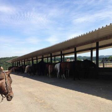
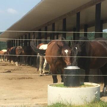

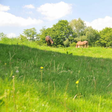
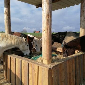
LAG *******Offenstallanlage mit Winterweiden
Overath
Tina Frensch
@TinaFrensch
Freizeitstall
Geländestrecke
Hunde willkommen
Krankenbox
Gnadenbrothof
Notfallboxen
Außenbox mit Paddock
Bewegungsstall
27 weitere...
P+
Deprecated: Creation of dynamic property Zend_View_Helper_Ads::$adLink is deprecated in /var/www/stall-frei/htdocs/staging.stall-frei.de/library/Psf/View/Helper/Ads.php on line 108

Futtersack HeuToy, Fressbremse in pink
Mechtersen
STALL-FREIde Marketing
@STALL-FREI-Marketing
Stundenlange Beschäftigung die
Koliken vorbeugt, geringe Staubinhalation mit
steuerbarer Futterentnahme


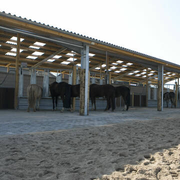
Reitstall Eschbach GbR
Overath
Reitstall Eschbach GbR
@ReitstallEschbachGbR
Vermieten
Führanlage
Hunde willkommen
Außenbox mit Paddock
Offenstall
Vollpension
12 weitere...
P+


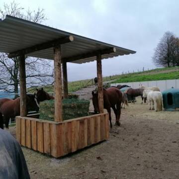
Offenstallplatz KLEINpferd frei!!!
Much
Trollwaldhof
@Trollwaldhof
Gangpferdereiten
Pferdeausbildung
Vermieten
Paddock
Reithalle
Allergikerstall
8 weitere...
S
Schöner Offenstallplatz
Overath
Die Offenstallpferde Overath
@Die-Offenstallpferde-Overath
Freizeitstall
Geländestrecke
Longierzirkel/Roundpen
Paddock
Bewegungsstall
Offenstall
Selbstversorgung
Vollpension
9 weitere...
P+


Historische Reitanlage in Köln-Dellbrück
Köln
RGS Kornspringer Köln e. V.
@Kornspringer
FN-Mitglied
Freizeitstall
Vermieten
Führanlage
Hunde willkommen
bedampftes/gewaschenes Heu
Notfallboxen
21 weitere...
S


Paddockboxen zu vermieten!!!
Much
Stefan Frings
@Stefan20
Freizeitstall
Vermieten
Hunde willkommen
Krankenbox
Allergikerstall
Hufrehe geeignet
18 weitere...
S

Frisches Stroh zu verkaufen!
Mechtersen
STALL-FREIde Marketing
@STALL-FREI-Marketing
Kaufe frisches Stroh für dein Pferd!

"Equine Instinct" Box, Stallplatz,
Lindlar
Offenstall-Leienhöhe
@Offenstall-Leienhoehe
Freizeitstall
Ponyverleih
Vermieten
Hunde willkommen
Krankenbox
Hufrehe geeignet
Notfallboxen
17 weitere...
P
Offenstall "Equine Instinct"
Lindlar
Offenstall-Leienhöhe
@Offenstall-Leienhoehe
Freizeitstall
Geländestrecke
Hunde willkommen
Krankenbox
Bewegungsstall
Laufstall
Vollpension
16 weitere...
P
Offenstall "Equine Instinct"
Lindlar
Offenstall-Leienhöhe
@Offenstall-Leienhoehe
Freizeitstall
Gangpferdereiten
Hunde willkommen
Krankenbox
Gnadenbrothof
Bewegungsstall
Offenstall
16 weitere...
P


Reitanlage G. und H.-P. Werheid
Bergisch Gladbach
Reitanlage-Werheid
@Reitanlage-Werheid
FN-Mitglied
Freizeitstall
Vermieten
Führanlage
Krankenbox
Fohlenaufzucht möglich
Hufrehe geeignet
29 weitere...
P+
Deprecated: Creation of dynamic property Zend_View::$pageCount is deprecated in /var/www/stall-frei/htdocs/staging.stall-frei.de/library/vendor/shardj/zf1-future/library/Zend/View/Abstract.php on line 308
Deprecated: Creation of dynamic property Zend_View::$itemCountPerPage is deprecated in /var/www/stall-frei/htdocs/staging.stall-frei.de/library/vendor/shardj/zf1-future/library/Zend/View/Abstract.php on line 308
Deprecated: Creation of dynamic property Zend_View::$first is deprecated in /var/www/stall-frei/htdocs/staging.stall-frei.de/library/vendor/shardj/zf1-future/library/Zend/View/Abstract.php on line 308
Deprecated: Creation of dynamic property Zend_View::$current is deprecated in /var/www/stall-frei/htdocs/staging.stall-frei.de/library/vendor/shardj/zf1-future/library/Zend/View/Abstract.php on line 308
Deprecated: Creation of dynamic property Zend_View::$last is deprecated in /var/www/stall-frei/htdocs/staging.stall-frei.de/library/vendor/shardj/zf1-future/library/Zend/View/Abstract.php on line 308
Deprecated: Creation of dynamic property Zend_View::$next is deprecated in /var/www/stall-frei/htdocs/staging.stall-frei.de/library/vendor/shardj/zf1-future/library/Zend/View/Abstract.php on line 308
Deprecated: Creation of dynamic property Zend_View::$pagesInRange is deprecated in /var/www/stall-frei/htdocs/staging.stall-frei.de/library/vendor/shardj/zf1-future/library/Zend/View/Abstract.php on line 308
Deprecated: Creation of dynamic property Zend_View::$firstPageInRange is deprecated in /var/www/stall-frei/htdocs/staging.stall-frei.de/library/vendor/shardj/zf1-future/library/Zend/View/Abstract.php on line 308
Deprecated: Creation of dynamic property Zend_View::$lastPageInRange is deprecated in /var/www/stall-frei/htdocs/staging.stall-frei.de/library/vendor/shardj/zf1-future/library/Zend/View/Abstract.php on line 308
Deprecated: Creation of dynamic property Zend_View::$currentItemCount is deprecated in /var/www/stall-frei/htdocs/staging.stall-frei.de/library/vendor/shardj/zf1-future/library/Zend/View/Abstract.php on line 308
Deprecated: Creation of dynamic property Zend_View::$totalItemCount is deprecated in /var/www/stall-frei/htdocs/staging.stall-frei.de/library/vendor/shardj/zf1-future/library/Zend/View/Abstract.php on line 308
Deprecated: Creation of dynamic property Zend_View::$firstItemNumber is deprecated in /var/www/stall-frei/htdocs/staging.stall-frei.de/library/vendor/shardj/zf1-future/library/Zend/View/Abstract.php on line 308
Deprecated: Creation of dynamic property Zend_View::$lastItemNumber is deprecated in /var/www/stall-frei/htdocs/staging.stall-frei.de/library/vendor/shardj/zf1-future/library/Zend/View/Abstract.php on line 308
Deprecated: Creation of dynamic property Zend_View::$router is deprecated in /var/www/stall-frei/htdocs/staging.stall-frei.de/library/vendor/shardj/zf1-future/library/Zend/View/Abstract.php on line 308
Deprecated: Creation of dynamic property Zend_View::$urlParams is deprecated in /var/www/stall-frei/htdocs/staging.stall-frei.de/library/vendor/shardj/zf1-future/library/Zend/View/Abstract.php on line 308
Deprecated: Creation of dynamic property Zend_View::$showAds is deprecated in /var/www/stall-frei/htdocs/staging.stall-frei.de/library/vendor/shardj/zf1-future/library/Zend/View/Abstract.php on line 308
Deprecated: Creation of dynamic property Zend_View::$objectIds is deprecated in /var/www/stall-frei/htdocs/staging.stall-frei.de/library/vendor/shardj/zf1-future/library/Zend/View/Abstract.php on line 308
Deprecated: Creation of dynamic property Zend_View::$showNavbar is deprecated in /var/www/stall-frei/htdocs/staging.stall-frei.de/library/vendor/shardj/zf1-future/library/Zend/View/Abstract.php on line 308
Deprecated: Creation of dynamic property Zend_View::$showBreadcrumb is deprecated in /var/www/stall-frei/htdocs/staging.stall-frei.de/library/vendor/shardj/zf1-future/library/Zend/View/Abstract.php on line 308
Deprecated: Creation of dynamic property Zend_View::$showFooter is deprecated in /var/www/stall-frei/htdocs/staging.stall-frei.de/library/vendor/shardj/zf1-future/library/Zend/View/Abstract.php on line 308
Deprecated: Creation of dynamic property Zend_View::$showInternalAds is deprecated in /var/www/stall-frei/htdocs/staging.stall-frei.de/library/vendor/shardj/zf1-future/library/Zend/View/Abstract.php on line 308
Deprecated: Creation of dynamic property Zend_View::$blNoContent is deprecated in /var/www/stall-frei/htdocs/staging.stall-frei.de/library/vendor/shardj/zf1-future/library/Zend/View/Abstract.php on line 308
Deprecated: Creation of dynamic property Zend_View::$sMetaDesc is deprecated in /var/www/stall-frei/htdocs/staging.stall-frei.de/library/vendor/shardj/zf1-future/library/Zend/View/Abstract.php on line 308
Deprecated: Creation of dynamic property Zend_View::$useGmaps is deprecated in /var/www/stall-frei/htdocs/staging.stall-frei.de/library/vendor/shardj/zf1-future/library/Zend/View/Abstract.php on line 308
Deprecated: Creation of dynamic property Zend_View::$touches is deprecated in /var/www/stall-frei/htdocs/staging.stall-frei.de/library/vendor/shardj/zf1-future/library/Zend/View/Abstract.php on line 308
Deprecated: Creation of dynamic property Zend_View::$oProject is deprecated in /var/www/stall-frei/htdocs/staging.stall-frei.de/library/vendor/shardj/zf1-future/library/Zend/View/Abstract.php on line 308
Deprecated: Creation of dynamic property Zend_View::$pageHeadline is deprecated in /var/www/stall-frei/htdocs/staging.stall-frei.de/library/vendor/shardj/zf1-future/library/Zend/View/Abstract.php on line 308
Deprecated: Creation of dynamic property Zend_View::$disableLocationField is deprecated in /var/www/stall-frei/htdocs/staging.stall-frei.de/library/vendor/shardj/zf1-future/library/Zend/View/Abstract.php on line 308
Deprecated: Creation of dynamic property Zend_View::$isSearch is deprecated in /var/www/stall-frei/htdocs/staging.stall-frei.de/library/vendor/shardj/zf1-future/library/Zend/View/Abstract.php on line 308
Deprecated: Creation of dynamic property Zend_View::$pageTitle is deprecated in /var/www/stall-frei/htdocs/staging.stall-frei.de/library/vendor/shardj/zf1-future/library/Zend/View/Abstract.php on line 308
Deprecated: Creation of dynamic property Psf_Form_Element_Text::$class is deprecated in /var/www/stall-frei/htdocs/staging.stall-frei.de/library/vendor/shardj/zf1-future/library/Zend/Form/Element.php on line 874
Deprecated: Creation of dynamic property Psf_Form_Element_Text::$size is deprecated in /var/www/stall-frei/htdocs/staging.stall-frei.de/library/vendor/shardj/zf1-future/library/Zend/Form/Element.php on line 874
Deprecated: Creation of dynamic property Psf_Form_Element_Text::$placeholder is deprecated in /var/www/stall-frei/htdocs/staging.stall-frei.de/library/vendor/shardj/zf1-future/library/Zend/Form/Element.php on line 874
Deprecated: Creation of dynamic property Psf_Form_Element_Hidden::$class is deprecated in /var/www/stall-frei/htdocs/staging.stall-frei.de/library/vendor/shardj/zf1-future/library/Zend/Form/Element.php on line 874
Deprecated: Creation of dynamic property Psf_Form_Element_Hidden::$class is deprecated in /var/www/stall-frei/htdocs/staging.stall-frei.de/library/vendor/shardj/zf1-future/library/Zend/Form/Element.php on line 874
Deprecated: Creation of dynamic property Psf_Form_Element_Hidden::$class is deprecated in /var/www/stall-frei/htdocs/staging.stall-frei.de/library/vendor/shardj/zf1-future/library/Zend/Form/Element.php on line 874
Deprecated: Creation of dynamic property Psf_Form_Element_Hidden::$class is deprecated in /var/www/stall-frei/htdocs/staging.stall-frei.de/library/vendor/shardj/zf1-future/library/Zend/Form/Element.php on line 874
Deprecated: Creation of dynamic property Psf_Form_Element_Select::$class is deprecated in /var/www/stall-frei/htdocs/staging.stall-frei.de/library/vendor/shardj/zf1-future/library/Zend/Form/Element.php on line 874
Deprecated: Creation of dynamic property Psf_Form_Element_Select::$class is deprecated in /var/www/stall-frei/htdocs/staging.stall-frei.de/library/vendor/shardj/zf1-future/library/Zend/Form/Element.php on line 874
Deprecated: Creation of dynamic property Psf_Form_Element_Select::$class is deprecated in /var/www/stall-frei/htdocs/staging.stall-frei.de/library/vendor/shardj/zf1-future/library/Zend/Form/Element.php on line 874
Deprecated: Creation of dynamic property Psf_Form_Element_Select::$class is deprecated in /var/www/stall-frei/htdocs/staging.stall-frei.de/library/vendor/shardj/zf1-future/library/Zend/Form/Element.php on line 874
Deprecated: Creation of dynamic property Psf_Form_Element_Text::$class is deprecated in /var/www/stall-frei/htdocs/staging.stall-frei.de/library/vendor/shardj/zf1-future/library/Zend/Form/Element.php on line 874
Deprecated: Creation of dynamic property Psf_Form_Element_Checkbox::$label is deprecated in /var/www/stall-frei/htdocs/staging.stall-frei.de/library/vendor/shardj/zf1-future/library/Zend/Form/Element.php on line 874
Deprecated: Creation of dynamic property Zend_View::$sort is deprecated in /var/www/stall-frei/htdocs/staging.stall-frei.de/library/vendor/shardj/zf1-future/library/Zend/View/Abstract.php on line 308
Deprecated: Creation of dynamic property Zend_View::$searchLocation is deprecated in /var/www/stall-frei/htdocs/staging.stall-frei.de/library/vendor/shardj/zf1-future/library/Zend/View/Abstract.php on line 308
Deprecated: Creation of dynamic property Zend_View::$locationHint is deprecated in /var/www/stall-frei/htdocs/staging.stall-frei.de/library/vendor/shardj/zf1-future/library/Zend/View/Abstract.php on line 308
Psf_GeoCoder_Abstract::getLocation: Köttingen Get Location CachedOrLive
Psf_GeoCoder_Abstract::getCachedOrLive: Köttingen
Psf_GeoCoder_OpenCageData::makeApiRequest: response:
Array
(
[documentation] => https://opencagedata.com/api
[licenses] => Array
(
[0] => Array
(
[name] => see attribution guide
[url] => https://opencagedata.com/credits
)
)
[results] => Array
(
[0] => Array
(
[bounds] => Array
(
[northeast] => Array
(
[lat] => 51.0018817
[lng] => 7.3134857
)
[southwest] => Array
(
[lat] => 50.9618817
[lng] => 7.2734857
)
)
[components] => Array
(
[ISO_3166-1_alpha-2] => DE
[ISO_3166-1_alpha-3] => DEU
[ISO_3166-2] => Array
(
[0] => DE-NW
)
[_category] => place
[_normalized_city] => Lindlar
[_type] => hamlet
[continent] => Europe
[country] => Deutschland
[country_code] => de
[county] => Oberbergischer Kreis
[hamlet] => Köttingen
[political_union] => European Union
[postcode] => 51491
[state] => Nordrhein-Westfalen
[state_code] => NW
[town] => Lindlar
)
[confidence] => 7
[formatted] => Köttingen, 51491 Lindlar, Deutschland
[geometry] => Array
(
[lat] => 50.9818817
[lng] => 7.2934857
)
)
[1] => Array
(
[bounds] => Array
(
[northeast] => Array
(
[lat] => 50.8031394
[lng] => 7.5038186
)
[southwest] => Array
(
[lat] => 50.7631394
[lng] => 7.4638186
)
)
[components] => Array
(
[ISO_3166-1_alpha-2] => DE
[ISO_3166-1_alpha-3] => DEU
[ISO_3166-2] => Array
(
[0] => DE-NW
)
[_category] => place
[_normalized_city] => Eitorf
[_type] => village
[continent] => Europe
[country] => Deutschland
[country_code] => de
[county] => Rhein-Sieg-Kreis
[political_union] => European Union
[postcode] => 53783
[state] => Nordrhein-Westfalen
[state_code] => NW
[town] => Eitorf
[village] => Köttingen
)
[confidence] => 7
[formatted] => 53783 Köttingen, Deutschland
[geometry] => Array
(
[lat] => 50.7831394
[lng] => 7.4838186
)
)
[2] => Array
(
[bounds] => Array
(
[northeast] => Array
(
[lat] => 50.847556
[lng] => 6.8266618
)
[southwest] => Array
(
[lat] => 50.807556
[lng] => 6.7866618
)
)
[components] => Array
(
[ISO_3166-1_alpha-2] => DE
[ISO_3166-1_alpha-3] => DEU
[ISO_3166-2] => Array
(
[0] => DE-NW
)
[_category] => place
[_normalized_city] => Köttingen
[_type] => village
[continent] => Europe
[country] => Deutschland
[country_code] => de
[county] => Rhein-Erft-Kreis
[municipality] => Erftstadt
[political_union] => European Union
[postcode] => 50374
[state] => Nordrhein-Westfalen
[state_code] => NW
[village] => Köttingen
)
[confidence] => 7
[formatted] => 50374 Köttingen, Deutschland
[geometry] => Array
(
[lat] => 50.827556
[lng] => 6.8066618
)
)
[3] => Array
(
[bounds] => Array
(
[northeast] => Array
(
[lat] => 50.6747813
[lng] => 7.4083878
)
[southwest] => Array
(
[lat] => 50.6347813
[lng] => 7.3683878
)
)
[components] => Array
(
[ISO_3166-1_alpha-2] => DE
[ISO_3166-1_alpha-3] => DEU
[ISO_3166-2] => Array
(
[0] => DE-RP
)
[_category] => place
[_normalized_city] => Köttingen
[_type] => village
[continent] => Europe
[country] => Deutschland
[country_code] => de
[county] => Landkreis Neuwied
[municipality] => Asbach
[political_union] => European Union
[postcode] => 53567
[state] => Rheinland-Pfalz
[state_code] => RP
[village] => Köttingen
)
[confidence] => 7
[formatted] => 53567 Köttingen, Deutschland
[geometry] => Array
(
[lat] => 50.6547813
[lng] => 7.3883878
)
)
[4] => Array
(
[bounds] => Array
(
[northeast] => Array
(
[lat] => 50.79141
[lng] => 7.7617278
)
[southwest] => Array
(
[lat] => 50.75141
[lng] => 7.7217278
)
)
[components] => Array
(
[ISO_3166-1_alpha-2] => DE
[ISO_3166-1_alpha-3] => DEU
[ISO_3166-2] => Array
(
[0] => DE-RP
)
[_category] => place
[_normalized_city] => Wissen
[_type] => neighbourhood
[continent] => Europe
[country] => Deutschland
[country_code] => de
[county] => Landkreis Altenkirchen (Westerwald)
[municipality] => Wissen
[political_union] => European Union
[postcode] => 57537
[state] => Rheinland-Pfalz
[state_code] => RP
[suburb] => Köttingen
[town] => Wissen
)
[confidence] => 7
[formatted] => 57537 Wissen, Deutschland
[geometry] => Array
(
[lat] => 50.77141
[lng] => 7.7417278
)
)
[5] => Array
(
[bounds] => Array
(
[northeast] => Array
(
[lat] => 50.784734
[lng] => 7.4852528
)
[southwest] => Array
(
[lat] => 50.7822508
[lng] => 7.4816131
)
)
[components] => Array
(
[ISO_3166-1_alpha-2] => DE
[ISO_3166-1_alpha-3] => DEU
[ISO_3166-2] => Array
(
[0] => DE-NW
)
[_category] => place
[_normalized_city] => Eitorf
[_type] => hamlet
[continent] => Europe
[country] => Deutschland
[country_code] => de
[county] => Rhein-Sieg-Kreis
[hamlet] => Köttingen
[political_union] => European Union
[postcode] => 53783
[state] => Nordrhein-Westfalen
[state_code] => NW
[suburb] => Probach
[town] => Eitorf
)
[confidence] => 9
[formatted] => Köttingen, 53783 Eitorf, Deutschland
[geometry] => Array
(
[lat] => 50.7834836
[lng] => 7.4838404
)
)
[6] => Array
(
[bounds] => Array
(
[northeast] => Array
(
[lat] => 50.8700573
[lng] => 7.5076846
)
[southwest] => Array
(
[lat] => 50.8300573
[lng] => 7.4676846
)
)
[components] => Array
(
[ISO_3166-1_alpha-2] => DE
[ISO_3166-1_alpha-3] => DEU
[ISO_3166-2] => Array
(
[0] => DE-NW
)
[_category] => place
[_normalized_city] => Ruppichteroth
[_type] => hamlet
[city] => Ruppichteroth
[continent] => Europe
[country] => Deutschland
[country_code] => de
[county] => Rhein-Sieg-Kreis
[hamlet] => Köttingen
[political_union] => European Union
[postcode] => 53809
[state] => Nordrhein-Westfalen
[state_code] => NW
)
[confidence] => 7
[formatted] => Köttingen, 53809 Ruppichteroth, Deutschland
[geometry] => Array
(
[lat] => 50.8500573
[lng] => 7.4876846
)
)
[7] => Array
(
[bounds] => Array
(
[northeast] => Array
(
[lat] => 51.3464655
[lng] => 7.3359136
)
[southwest] => Array
(
[lat] => 51.3264655
[lng] => 7.3159136
)
)
[components] => Array
(
[ISO_3166-1_alpha-2] => DE
[ISO_3166-1_alpha-3] => DEU
[ISO_3166-2] => Array
(
[0] => DE-NW
)
[_category] => place
[_normalized_city] => Gevelsberg
[_type] => hamlet
[continent] => Europe
[country] => Deutschland
[country_code] => de
[county] => Ennepe-Ruhr-Kreis
[locality] => Köttingen
[political_union] => European Union
[postcode] => 58285
[state] => Nordrhein-Westfalen
[state_code] => NW
[suburb] => Asbeck
[town] => Gevelsberg
)
[confidence] => 8
[formatted] => Köttingen, 58285 Gevelsberg, Deutschland
[geometry] => Array
(
[lat] => 51.3364655
[lng] => 7.3259136
)
)
[8] => Array
(
[bounds] => Array
(
[northeast] => Array
(
[lat] => 50.8515563
[lng] => 7.488283
)
[southwest] => Array
(
[lat] => 50.8488291
[lng] => 7.4854988
)
)
[components] => Array
(
[ISO_3166-1_alpha-2] => DE
[ISO_3166-1_alpha-3] => DEU
[ISO_3166-2] => Array
(
[0] => DE-NW
)
[_category] => road
[_normalized_city] => Ruppichteroth
[_type] => road
[continent] => Europe
[country] => Deutschland
[country_code] => de
[county] => Rhein-Sieg-Kreis
[hamlet] => Köttingen
[neighbourhood] => Ruppichteroth
[political_union] => European Union
[postcode] => 53809
[road] => Köttingen
[road_type] => residential
[state] => Nordrhein-Westfalen
[state_code] => NW
)
[confidence] => 9
[formatted] => Köttingen, 53809 Köttingen, Deutschland
[geometry] => Array
(
[lat] => 50.8497943
[lng] => 7.4872881
)
)
[9] => Array
(
[bounds] => Array
(
[northeast] => Array
(
[lat] => 50.9826188
[lng] => 7.2944477
)
[southwest] => Array
(
[lat] => 50.9812287
[lng] => 7.2910546
)
)
[components] => Array
(
[ISO_3166-1_alpha-2] => DE
[ISO_3166-1_alpha-3] => DEU
[ISO_3166-2] => Array
(
[0] => DE-NW
)
[_category] => road
[_normalized_city] => Lindlar
[_type] => road
[continent] => Europe
[country] => Deutschland
[country_code] => de
[county] => Oberbergischer Kreis
[hamlet] => Köttingen
[political_union] => European Union
[postcode] => 51789
[road] => Köttingen
[road_type] => residential
[state] => Nordrhein-Westfalen
[state_code] => NW
[town] => Lindlar
)
[confidence] => 9
[formatted] => Köttingen, 51789 Lindlar, Deutschland
[geometry] => Array
(
[lat] => 50.981329
[lng] => 7.2929623
)
)
)
[status] => Array
(
[code] => 200
[message] => OK
)
[stay_informed] => Array
(
[blog] => https://blog.opencagedata.com
[mastodon] => https://en.osm.town/@opencage
)
[thanks] => For using an OpenCage API
[timestamp] => Array
(
[created_http] => Sat, 07 Feb 2026 23:07:06 GMT
[created_unix] => 1770505626
)
[total_results] => 10
)
Psf_GeoCoder_Abstract::convertLocationResult
{"documentation":"https:\/\/opencagedata.com\/api","licenses":[{"name":"see attribution guide","url":"https:\/\/opencagedata.com\/credits"}],"results":[{"bounds":{"northeast":{"lat":51.0018817,"lng":7.3134857},"southwest":{"lat":50.9618817,"lng":7.2734857}},"components":{"ISO_3166-1_alpha-2":"DE","ISO_3166-1_alpha-3":"DEU","ISO_3166-2":["DE-NW"],"_category":"place","_normalized_city":"Lindlar","_type":"hamlet","continent":"Europe","country":"Deutschland","country_code":"de","county":"Oberbergischer Kreis","hamlet":"K\u00f6ttingen","political_union":"European Union","postcode":"51491","state":"Nordrhein-Westfalen","state_code":"NW","town":"Lindlar"},"confidence":7,"formatted":"K\u00f6ttingen, 51491 Lindlar, Deutschland","geometry":{"lat":50.9818817,"lng":7.2934857}},{"bounds":{"northeast":{"lat":50.8031394,"lng":7.5038186},"southwest":{"lat":50.7631394,"lng":7.4638186}},"components":{"ISO_3166-1_alpha-2":"DE","ISO_3166-1_alpha-3":"DEU","ISO_3166-2":["DE-NW"],"_category":"place","_normalized_city":"Eitorf","_type":"village","continent":"Europe","country":"Deutschland","country_code":"de","county":"Rhein-Sieg-Kreis","political_union":"European Union","postcode":"53783","state":"Nordrhein-Westfalen","state_code":"NW","town":"Eitorf","village":"K\u00f6ttingen"},"confidence":7,"formatted":"53783 K\u00f6ttingen, Deutschland","geometry":{"lat":50.7831394,"lng":7.4838186}},{"bounds":{"northeast":{"lat":50.847556,"lng":6.8266618},"southwest":{"lat":50.807556,"lng":6.7866618}},"components":{"ISO_3166-1_alpha-2":"DE","ISO_3166-1_alpha-3":"DEU","ISO_3166-2":["DE-NW"],"_category":"place","_normalized_city":"K\u00f6ttingen","_type":"village","continent":"Europe","country":"Deutschland","country_code":"de","county":"Rhein-Erft-Kreis","municipality":"Erftstadt","political_union":"European Union","postcode":"50374","state":"Nordrhein-Westfalen","state_code":"NW","village":"K\u00f6ttingen"},"confidence":7,"formatted":"50374 K\u00f6ttingen, Deutschland","geometry":{"lat":50.827556,"lng":6.8066618}},{"bounds":{"northeast":{"lat":50.6747813,"lng":7.4083878},"southwest":{"lat":50.6347813,"lng":7.3683878}},"components":{"ISO_3166-1_alpha-2":"DE","ISO_3166-1_alpha-3":"DEU","ISO_3166-2":["DE-RP"],"_category":"place","_normalized_city":"K\u00f6ttingen","_type":"village","continent":"Europe","country":"Deutschland","country_code":"de","county":"Landkreis Neuwied","municipality":"Asbach","political_union":"European Union","postcode":"53567","state":"Rheinland-Pfalz","state_code":"RP","village":"K\u00f6ttingen"},"confidence":7,"formatted":"53567 K\u00f6ttingen, Deutschland","geometry":{"lat":50.6547813,"lng":7.3883878}},{"bounds":{"northeast":{"lat":50.79141,"lng":7.7617278},"southwest":{"lat":50.75141,"lng":7.7217278}},"components":{"ISO_3166-1_alpha-2":"DE","ISO_3166-1_alpha-3":"DEU","ISO_3166-2":["DE-RP"],"_category":"place","_normalized_city":"Wissen","_type":"neighbourhood","continent":"Europe","country":"Deutschland","country_code":"de","county":"Landkreis Altenkirchen (Westerwald)","municipality":"Wissen","political_union":"European Union","postcode":"57537","state":"Rheinland-Pfalz","state_code":"RP","suburb":"K\u00f6ttingen","town":"Wissen"},"confidence":7,"formatted":"57537 Wissen, Deutschland","geometry":{"lat":50.77141,"lng":7.7417278}},{"bounds":{"northeast":{"lat":50.784734,"lng":7.4852528},"southwest":{"lat":50.7822508,"lng":7.4816131}},"components":{"ISO_3166-1_alpha-2":"DE","ISO_3166-1_alpha-3":"DEU","ISO_3166-2":["DE-NW"],"_category":"place","_normalized_city":"Eitorf","_type":"hamlet","continent":"Europe","country":"Deutschland","country_code":"de","county":"Rhein-Sieg-Kreis","hamlet":"K\u00f6ttingen","political_union":"European Union","postcode":"53783","state":"Nordrhein-Westfalen","state_code":"NW","suburb":"Probach","town":"Eitorf"},"confidence":9,"formatted":"K\u00f6ttingen, 53783 Eitorf, Deutschland","geometry":{"lat":50.7834836,"lng":7.4838404}},{"bounds":{"northeast":{"lat":50.8700573,"lng":7.5076846},"southwest":{"lat":50.8300573,"lng":7.4676846}},"components":{"ISO_3166-1_alpha-2":"DE","ISO_3166-1_alpha-3":"DEU","ISO_3166-2":["DE-NW"],"_category":"place","_normalized_city":"Ruppichteroth","_type":"hamlet","city":"Ruppichteroth","continent":"Europe","country":"Deutschland","country_code":"de","county":"Rhein-Sieg-Kreis","hamlet":"K\u00f6ttingen","political_union":"European Union","postcode":"53809","state":"Nordrhein-Westfalen","state_code":"NW"},"confidence":7,"formatted":"K\u00f6ttingen, 53809 Ruppichteroth, Deutschland","geometry":{"lat":50.8500573,"lng":7.4876846}},{"bounds":{"northeast":{"lat":51.3464655,"lng":7.3359136},"southwest":{"lat":51.3264655,"lng":7.3159136}},"components":{"ISO_3166-1_alpha-2":"DE","ISO_3166-1_alpha-3":"DEU","ISO_3166-2":["DE-NW"],"_category":"place","_normalized_city":"Gevelsberg","_type":"hamlet","continent":"Europe","country":"Deutschland","country_code":"de","county":"Ennepe-Ruhr-Kreis","locality":"K\u00f6ttingen","political_union":"European Union","postcode":"58285","state":"Nordrhein-Westfalen","state_code":"NW","suburb":"Asbeck","town":"Gevelsberg"},"confidence":8,"formatted":"K\u00f6ttingen, 58285 Gevelsberg, Deutschland","geometry":{"lat":51.3364655,"lng":7.3259136}},{"bounds":{"northeast":{"lat":50.8515563,"lng":7.488283},"southwest":{"lat":50.8488291,"lng":7.4854988}},"components":{"ISO_3166-1_alpha-2":"DE","ISO_3166-1_alpha-3":"DEU","ISO_3166-2":["DE-NW"],"_category":"road","_normalized_city":"Ruppichteroth","_type":"road","continent":"Europe","country":"Deutschland","country_code":"de","county":"Rhein-Sieg-Kreis","hamlet":"K\u00f6ttingen","neighbourhood":"Ruppichteroth","political_union":"European Union","postcode":"53809","road":"K\u00f6ttingen","road_type":"residential","state":"Nordrhein-Westfalen","state_code":"NW"},"confidence":9,"formatted":"K\u00f6ttingen, 53809 K\u00f6ttingen, Deutschland","geometry":{"lat":50.8497943,"lng":7.4872881}},{"bounds":{"northeast":{"lat":50.9826188,"lng":7.2944477},"southwest":{"lat":50.9812287,"lng":7.2910546}},"components":{"ISO_3166-1_alpha-2":"DE","ISO_3166-1_alpha-3":"DEU","ISO_3166-2":["DE-NW"],"_category":"road","_normalized_city":"Lindlar","_type":"road","continent":"Europe","country":"Deutschland","country_code":"de","county":"Oberbergischer Kreis","hamlet":"K\u00f6ttingen","political_union":"European Union","postcode":"51789","road":"K\u00f6ttingen","road_type":"residential","state":"Nordrhein-Westfalen","state_code":"NW","town":"Lindlar"},"confidence":9,"formatted":"K\u00f6ttingen, 51789 Lindlar, Deutschland","geometry":{"lat":50.981329,"lng":7.2929623}}],"status":{"code":200,"message":"OK"},"stay_informed":{"blog":"https:\/\/blog.opencagedata.com","mastodon":"https:\/\/en.osm.town\/@opencage"},"thanks":"For using an OpenCage API","timestamp":{"created_http":"Sat, 07 Feb 2026 23:07:06 GMT","created_unix":1770505626},"total_results":10}Array
(
[0] => stdClass Object
(
[bounds] => stdClass Object
(
[northeast] => stdClass Object
(
[lat] => 51.0018817
[lng] => 7.3134857
)
[southwest] => stdClass Object
(
[lat] => 50.9618817
[lng] => 7.2734857
)
)
[components] => stdClass Object
(
[ISO_3166-1_alpha-2] => DE
[ISO_3166-1_alpha-3] => DEU
[ISO_3166-2] => Array
(
[0] => DE-NW
)
[_category] => place
[_normalized_city] => Lindlar
[_type] => hamlet
[continent] => Europe
[country] => Deutschland
[country_code] => de
[county] => Oberbergischer Kreis
[hamlet] => Köttingen
[political_union] => European Union
[postcode] => 51491
[state] => Nordrhein-Westfalen
[state_code] => NW
[town] => Lindlar
)
[confidence] => 7
[formatted] => Köttingen, 51491 Lindlar, Deutschland
[geometry] => stdClass Object
(
[lat] => 50.9818817
[lng] => 7.2934857
)
)
[1] => stdClass Object
(
[bounds] => stdClass Object
(
[northeast] => stdClass Object
(
[lat] => 50.8031394
[lng] => 7.5038186
)
[southwest] => stdClass Object
(
[lat] => 50.7631394
[lng] => 7.4638186
)
)
[components] => stdClass Object
(
[ISO_3166-1_alpha-2] => DE
[ISO_3166-1_alpha-3] => DEU
[ISO_3166-2] => Array
(
[0] => DE-NW
)
[_category] => place
[_normalized_city] => Eitorf
[_type] => village
[continent] => Europe
[country] => Deutschland
[country_code] => de
[county] => Rhein-Sieg-Kreis
[political_union] => European Union
[postcode] => 53783
[state] => Nordrhein-Westfalen
[state_code] => NW
[town] => Eitorf
[village] => Köttingen
)
[confidence] => 7
[formatted] => 53783 Köttingen, Deutschland
[geometry] => stdClass Object
(
[lat] => 50.7831394
[lng] => 7.4838186
)
)
[2] => stdClass Object
(
[bounds] => stdClass Object
(
[northeast] => stdClass Object
(
[lat] => 50.847556
[lng] => 6.8266618
)
[southwest] => stdClass Object
(
[lat] => 50.807556
[lng] => 6.7866618
)
)
[components] => stdClass Object
(
[ISO_3166-1_alpha-2] => DE
[ISO_3166-1_alpha-3] => DEU
[ISO_3166-2] => Array
(
[0] => DE-NW
)
[_category] => place
[_normalized_city] => Köttingen
[_type] => village
[continent] => Europe
[country] => Deutschland
[country_code] => de
[county] => Rhein-Erft-Kreis
[municipality] => Erftstadt
[political_union] => European Union
[postcode] => 50374
[state] => Nordrhein-Westfalen
[state_code] => NW
[village] => Köttingen
)
[confidence] => 7
[formatted] => 50374 Köttingen, Deutschland
[geometry] => stdClass Object
(
[lat] => 50.827556
[lng] => 6.8066618
)
)
[3] => stdClass Object
(
[bounds] => stdClass Object
(
[northeast] => stdClass Object
(
[lat] => 50.6747813
[lng] => 7.4083878
)
[southwest] => stdClass Object
(
[lat] => 50.6347813
[lng] => 7.3683878
)
)
[components] => stdClass Object
(
[ISO_3166-1_alpha-2] => DE
[ISO_3166-1_alpha-3] => DEU
[ISO_3166-2] => Array
(
[0] => DE-RP
)
[_category] => place
[_normalized_city] => Köttingen
[_type] => village
[continent] => Europe
[country] => Deutschland
[country_code] => de
[county] => Landkreis Neuwied
[municipality] => Asbach
[political_union] => European Union
[postcode] => 53567
[state] => Rheinland-Pfalz
[state_code] => RP
[village] => Köttingen
)
[confidence] => 7
[formatted] => 53567 Köttingen, Deutschland
[geometry] => stdClass Object
(
[lat] => 50.6547813
[lng] => 7.3883878
)
)
[4] => stdClass Object
(
[bounds] => stdClass Object
(
[northeast] => stdClass Object
(
[lat] => 50.79141
[lng] => 7.7617278
)
[southwest] => stdClass Object
(
[lat] => 50.75141
[lng] => 7.7217278
)
)
[components] => stdClass Object
(
[ISO_3166-1_alpha-2] => DE
[ISO_3166-1_alpha-3] => DEU
[ISO_3166-2] => Array
(
[0] => DE-RP
)
[_category] => place
[_normalized_city] => Wissen
[_type] => neighbourhood
[continent] => Europe
[country] => Deutschland
[country_code] => de
[county] => Landkreis Altenkirchen (Westerwald)
[municipality] => Wissen
[political_union] => European Union
[postcode] => 57537
[state] => Rheinland-Pfalz
[state_code] => RP
[suburb] => Köttingen
[town] => Wissen
)
[confidence] => 7
[formatted] => 57537 Wissen, Deutschland
[geometry] => stdClass Object
(
[lat] => 50.77141
[lng] => 7.7417278
)
)
[5] => stdClass Object
(
[bounds] => stdClass Object
(
[northeast] => stdClass Object
(
[lat] => 50.784734
[lng] => 7.4852528
)
[southwest] => stdClass Object
(
[lat] => 50.7822508
[lng] => 7.4816131
)
)
[components] => stdClass Object
(
[ISO_3166-1_alpha-2] => DE
[ISO_3166-1_alpha-3] => DEU
[ISO_3166-2] => Array
(
[0] => DE-NW
)
[_category] => place
[_normalized_city] => Eitorf
[_type] => hamlet
[continent] => Europe
[country] => Deutschland
[country_code] => de
[county] => Rhein-Sieg-Kreis
[hamlet] => Köttingen
[political_union] => European Union
[postcode] => 53783
[state] => Nordrhein-Westfalen
[state_code] => NW
[suburb] => Probach
[town] => Eitorf
)
[confidence] => 9
[formatted] => Köttingen, 53783 Eitorf, Deutschland
[geometry] => stdClass Object
(
[lat] => 50.7834836
[lng] => 7.4838404
)
)
[6] => stdClass Object
(
[bounds] => stdClass Object
(
[northeast] => stdClass Object
(
[lat] => 50.8700573
[lng] => 7.5076846
)
[southwest] => stdClass Object
(
[lat] => 50.8300573
[lng] => 7.4676846
)
)
[components] => stdClass Object
(
[ISO_3166-1_alpha-2] => DE
[ISO_3166-1_alpha-3] => DEU
[ISO_3166-2] => Array
(
[0] => DE-NW
)
[_category] => place
[_normalized_city] => Ruppichteroth
[_type] => hamlet
[city] => Ruppichteroth
[continent] => Europe
[country] => Deutschland
[country_code] => de
[county] => Rhein-Sieg-Kreis
[hamlet] => Köttingen
[political_union] => European Union
[postcode] => 53809
[state] => Nordrhein-Westfalen
[state_code] => NW
)
[confidence] => 7
[formatted] => Köttingen, 53809 Ruppichteroth, Deutschland
[geometry] => stdClass Object
(
[lat] => 50.8500573
[lng] => 7.4876846
)
)
[7] => stdClass Object
(
[bounds] => stdClass Object
(
[northeast] => stdClass Object
(
[lat] => 51.3464655
[lng] => 7.3359136
)
[southwest] => stdClass Object
(
[lat] => 51.3264655
[lng] => 7.3159136
)
)
[components] => stdClass Object
(
[ISO_3166-1_alpha-2] => DE
[ISO_3166-1_alpha-3] => DEU
[ISO_3166-2] => Array
(
[0] => DE-NW
)
[_category] => place
[_normalized_city] => Gevelsberg
[_type] => hamlet
[continent] => Europe
[country] => Deutschland
[country_code] => de
[county] => Ennepe-Ruhr-Kreis
[locality] => Köttingen
[political_union] => European Union
[postcode] => 58285
[state] => Nordrhein-Westfalen
[state_code] => NW
[suburb] => Asbeck
[town] => Gevelsberg
)
[confidence] => 8
[formatted] => Köttingen, 58285 Gevelsberg, Deutschland
[geometry] => stdClass Object
(
[lat] => 51.3364655
[lng] => 7.3259136
)
)
[8] => stdClass Object
(
[bounds] => stdClass Object
(
[northeast] => stdClass Object
(
[lat] => 50.8515563
[lng] => 7.488283
)
[southwest] => stdClass Object
(
[lat] => 50.8488291
[lng] => 7.4854988
)
)
[components] => stdClass Object
(
[ISO_3166-1_alpha-2] => DE
[ISO_3166-1_alpha-3] => DEU
[ISO_3166-2] => Array
(
[0] => DE-NW
)
[_category] => road
[_normalized_city] => Ruppichteroth
[_type] => road
[continent] => Europe
[country] => Deutschland
[country_code] => de
[county] => Rhein-Sieg-Kreis
[hamlet] => Köttingen
[neighbourhood] => Ruppichteroth
[political_union] => European Union
[postcode] => 53809
[road] => Köttingen
[road_type] => residential
[state] => Nordrhein-Westfalen
[state_code] => NW
)
[confidence] => 9
[formatted] => Köttingen, 53809 Köttingen, Deutschland
[geometry] => stdClass Object
(
[lat] => 50.8497943
[lng] => 7.4872881
)
)
[9] => stdClass Object
(
[bounds] => stdClass Object
(
[northeast] => stdClass Object
(
[lat] => 50.9826188
[lng] => 7.2944477
)
[southwest] => stdClass Object
(
[lat] => 50.9812287
[lng] => 7.2910546
)
)
[components] => stdClass Object
(
[ISO_3166-1_alpha-2] => DE
[ISO_3166-1_alpha-3] => DEU
[ISO_3166-2] => Array
(
[0] => DE-NW
)
[_category] => road
[_normalized_city] => Lindlar
[_type] => road
[continent] => Europe
[country] => Deutschland
[country_code] => de
[county] => Oberbergischer Kreis
[hamlet] => Köttingen
[political_union] => European Union
[postcode] => 51789
[road] => Köttingen
[road_type] => residential
[state] => Nordrhein-Westfalen
[state_code] => NW
[town] => Lindlar
)
[confidence] => 9
[formatted] => Köttingen, 51789 Lindlar, Deutschland
[geometry] => stdClass Object
(
[lat] => 50.981329
[lng] => 7.2929623
)
)
)
Psf_GeoCoder_OpenCageData::getKeyMap: 0
stdClass Object
(
    [bounds] => stdClass Object
        (
            [northeast] => stdClass Object
                (
                    [lat] => 51.0018817
                    [lng] => 7.3134857
                )

            [southwest] => stdClass Object
                (
                    [lat] => 50.9618817
                    [lng] => 7.2734857
                )

        )

    [components] => stdClass Object
        (
            [ISO_3166-1_alpha-2] => DE
            [ISO_3166-1_alpha-3] => DEU
            [ISO_3166-2] => Array
                (
                    [0] => DE-NW
                )

            [_category] => place
            [_normalized_city] => Lindlar
            [_type] => hamlet
            [continent] => Europe
            [country] => Deutschland
            [country_code] => de
            [county] => Oberbergischer Kreis
            [hamlet] => Köttingen
            [political_union] => European Union
            [postcode] => 51491
            [state] => Nordrhein-Westfalen
            [state_code] => NW
            [town] => Lindlar
        )

    [confidence] => 7
    [formatted] => Köttingen, 51491 Lindlar, Deutschland
    [geometry] => stdClass Object
        (
            [lat] => 50.9818817
            [lng] => 7.2934857
        )

)
Psf_GeoCoder_OpenCageData::getCounty: Oberbergischer Kreis
Psf_GeoCoder_OpenCageData::addMissingData REFETCH!
Array
(
    [address] => Köttingen, 51491 Lindlar, Deutschland
    [type] => hamlet
    [street] => Köttingen
    [city] => Lindlar
    [county] => Oberbergischer Kreis
    [state] => Nordrhein-Westfalen
    [zip] => 51491
    [country] => Deutschland
    [suburb] =>
    [countrycode] => de
    [latitude] => 50.9818817
    [longitude] => 7.2934857
    [accuracy] => 1
    [confidence] => 7
    [bounds] => stdClass Object
        (
            [northeast] => stdClass Object
                (
                    [lat] => 51.0018817
                    [lng] => 7.3134857
                )

            [southwest] => stdClass Object
                (
                    [lat] => 50.9618817
                    [lng] => 7.2734857
                )

        )

)
reformat!
Array
(
    [address] => Köttingen, 51491 Lindlar, Deutschland
    [type] => hamlet
    [street] => Köttingen
    [city] => Lindlar
    [county] => Oberbergischer Kreis
    [state] => Nordrhein-Westfalen
    [zip] => 51491
    [country] => Deutschland
    [suburb] =>
    [countrycode] => de
    [latitude] => 50.9818817
    [longitude] => 7.2934857
    [accuracy] => 1
    [confidence] => 7
    [bounds] => stdClass Object
        (
            [northeast] => stdClass Object
                (
                    [lat] => 51.0018817
                    [lng] => 7.3134857
                )

            [southwest] => stdClass Object
                (
                    [lat] => 50.9618817
                    [lng] => 7.2734857
                )

        )

    [place] => Köttingen, 51491 Lindlar, Nordrhein-Westfalen
    [hash] => 927baf16daa07488ebece861d17ed9e3
)
Psf_GeoCoder_OpenCageData::getKeyMap: 1
stdClass Object
(
    [bounds] => stdClass Object
        (
            [northeast] => stdClass Object
                (
                    [lat] => 50.8031394
                    [lng] => 7.5038186
                )

            [southwest] => stdClass Object
                (
                    [lat] => 50.7631394
                    [lng] => 7.4638186
                )

        )

    [components] => stdClass Object
        (
            [ISO_3166-1_alpha-2] => DE
            [ISO_3166-1_alpha-3] => DEU
            [ISO_3166-2] => Array
                (
                    [0] => DE-NW
                )

            [_category] => place
            [_normalized_city] => Eitorf
            [_type] => village
            [continent] => Europe
            [country] => Deutschland
            [country_code] => de
            [county] => Rhein-Sieg-Kreis
            [political_union] => European Union
            [postcode] => 53783
            [state] => Nordrhein-Westfalen
            [state_code] => NW
            [town] => Eitorf
            [village] => Köttingen
        )

    [confidence] => 7
    [formatted] => 53783 Köttingen, Deutschland
    [geometry] => stdClass Object
        (
            [lat] => 50.7831394
            [lng] => 7.4838186
        )

)
Psf_GeoCoder_OpenCageData::getCounty: Rhein-Sieg-Kreis
Psf_GeoCoder_OpenCageData::addMissingData REFETCH!
Array
(
    [address] => 53783 Köttingen, Deutschland
    [type] => village
    [street] =>
    [city] => Eitorf
    [county] => Rhein-Sieg-Kreis
    [state] => Nordrhein-Westfalen
    [zip] => 53783
    [country] => Deutschland
    [suburb] =>
    [countrycode] => de
    [latitude] => 50.7831394
    [longitude] => 7.4838186
    [accuracy] => 1
    [confidence] => 7
    [bounds] => stdClass Object
        (
            [northeast] => stdClass Object
                (
                    [lat] => 50.8031394
                    [lng] => 7.5038186
                )

            [southwest] => stdClass Object
                (
                    [lat] => 50.7631394
                    [lng] => 7.4638186
                )

        )

)
reformat!
Array
(
    [address] => 53783 Eitorf
    [type] => village
    [street] =>
    [city] => Eitorf
    [county] => Rhein-Sieg-Kreis
    [state] => Nordrhein-Westfalen
    [zip] => 53783
    [country] => Deutschland
    [suburb] =>
    [countrycode] => de
    [latitude] => 50.7831394
    [longitude] => 7.4838186
    [accuracy] => 1
    [confidence] => 7
    [bounds] => stdClass Object
        (
            [northeast] => stdClass Object
                (
                    [lat] => 50.8031394
                    [lng] => 7.5038186
                )

            [southwest] => stdClass Object
                (
                    [lat] => 50.7631394
                    [lng] => 7.4638186
                )

        )

    [place] => 53783 Eitorf, Nordrhein-Westfalen
    [hash] => 34e2a1d4601e0e9f0478d59de59e914b
)
Psf_GeoCoder_OpenCageData::getKeyMap: 2
stdClass Object
(
    [bounds] => stdClass Object
        (
            [northeast] => stdClass Object
                (
                    [lat] => 50.847556
                    [lng] => 6.8266618
                )

            [southwest] => stdClass Object
                (
                    [lat] => 50.807556
                    [lng] => 6.7866618
                )

        )

    [components] => stdClass Object
        (
            [ISO_3166-1_alpha-2] => DE
            [ISO_3166-1_alpha-3] => DEU
            [ISO_3166-2] => Array
                (
                    [0] => DE-NW
                )

            [_category] => place
            [_normalized_city] => Köttingen
            [_type] => village
            [continent] => Europe
            [country] => Deutschland
            [country_code] => de
            [county] => Rhein-Erft-Kreis
            [municipality] => Erftstadt
            [political_union] => European Union
            [postcode] => 50374
            [state] => Nordrhein-Westfalen
            [state_code] => NW
            [village] => Köttingen
        )

    [confidence] => 7
    [formatted] => 50374 Köttingen, Deutschland
    [geometry] => stdClass Object
        (
            [lat] => 50.827556
            [lng] => 6.8066618
        )

)
Psf_GeoCoder_OpenCageData::getCounty: Rhein-Erft-Kreis
Psf_GeoCoder_OpenCageData::addMissingData REFETCH!
Array
(
    [address] => 50374 Köttingen, Deutschland
    [type] => village
    [street] =>
    [city] => Köttingen
    [county] => Rhein-Erft-Kreis
    [state] => Nordrhein-Westfalen
    [zip] => 50374
    [country] => Deutschland
    [suburb] =>
    [countrycode] => de
    [latitude] => 50.827556
    [longitude] => 6.8066618
    [accuracy] => 1
    [confidence] => 7
    [bounds] => stdClass Object
        (
            [northeast] => stdClass Object
                (
                    [lat] => 50.847556
                    [lng] => 6.8266618
                )

            [southwest] => stdClass Object
                (
                    [lat] => 50.807556
                    [lng] => 6.7866618
                )

        )

)
reformat!
Array
(
    [address] => 50374 Köttingen, Deutschland
    [type] => village
    [street] =>
    [city] => Köttingen
    [county] => Rhein-Erft-Kreis
    [state] => Nordrhein-Westfalen
    [zip] => 50374
    [country] => Deutschland
    [suburb] =>
    [countrycode] => de
    [latitude] => 50.827556
    [longitude] => 6.8066618
    [accuracy] => 1
    [confidence] => 7
    [bounds] => stdClass Object
        (
            [northeast] => stdClass Object
                (
                    [lat] => 50.847556
                    [lng] => 6.8266618
                )

            [southwest] => stdClass Object
                (
                    [lat] => 50.807556
                    [lng] => 6.7866618
                )

        )

    [place] => 50374 Köttingen, Nordrhein-Westfalen
    [hash] => 96502e1f5260938cc6718b8e70af7230
)
Psf_GeoCoder_OpenCageData::getKeyMap: 3
stdClass Object
(
    [bounds] => stdClass Object
        (
            [northeast] => stdClass Object
                (
                    [lat] => 50.6747813
                    [lng] => 7.4083878
                )

            [southwest] => stdClass Object
                (
                    [lat] => 50.6347813
                    [lng] => 7.3683878
                )

        )

    [components] => stdClass Object
        (
            [ISO_3166-1_alpha-2] => DE
            [ISO_3166-1_alpha-3] => DEU
            [ISO_3166-2] => Array
                (
                    [0] => DE-RP
                )

            [_category] => place
            [_normalized_city] => Köttingen
            [_type] => village
            [continent] => Europe
            [country] => Deutschland
            [country_code] => de
            [county] => Landkreis Neuwied
            [municipality] => Asbach
            [political_union] => European Union
            [postcode] => 53567
            [state] => Rheinland-Pfalz
            [state_code] => RP
            [village] => Köttingen
        )

    [confidence] => 7
    [formatted] => 53567 Köttingen, Deutschland
    [geometry] => stdClass Object
        (
            [lat] => 50.6547813
            [lng] => 7.3883878
        )

)
Psf_GeoCoder_OpenCageData::getCounty: Neuwied
Psf_GeoCoder_OpenCageData::addMissingData REFETCH!
Array
(
    [address] => 53567 Köttingen, Deutschland
    [type] => village
    [street] =>
    [city] => Köttingen
    [county] => Neuwied
    [state] => Rheinland-Pfalz
    [zip] => 53567
    [country] => Deutschland
    [suburb] =>
    [countrycode] => de
    [latitude] => 50.6547813
    [longitude] => 7.3883878
    [accuracy] => 1
    [confidence] => 7
    [bounds] => stdClass Object
        (
            [northeast] => stdClass Object
                (
                    [lat] => 50.6747813
                    [lng] => 7.4083878
                )

            [southwest] => stdClass Object
                (
                    [lat] => 50.6347813
                    [lng] => 7.3683878
                )

        )

)
reformat!
Array
(
    [address] => 53567 Köttingen, Deutschland
    [type] => village
    [street] =>
    [city] => Köttingen
    [county] => Neuwied
    [state] => Rheinland-Pfalz
    [zip] => 53567
    [country] => Deutschland
    [suburb] =>
    [countrycode] => de
    [latitude] => 50.6547813
    [longitude] => 7.3883878
    [accuracy] => 1
    [confidence] => 7
    [bounds] => stdClass Object
        (
            [northeast] => stdClass Object
                (
                    [lat] => 50.6747813
                    [lng] => 7.4083878
                )

            [southwest] => stdClass Object
                (
                    [lat] => 50.6347813
                    [lng] => 7.3683878
                )

        )

    [place] => 53567 Köttingen, Rheinland-Pfalz
    [hash] => 2f223ffa29028fe23d16da0be12759e2
)
Psf_GeoCoder_OpenCageData::getKeyMap: 4
stdClass Object
(
    [bounds] => stdClass Object
        (
            [northeast] => stdClass Object
                (
                    [lat] => 50.79141
                    [lng] => 7.7617278
                )

            [southwest] => stdClass Object
                (
                    [lat] => 50.75141
                    [lng] => 7.7217278
                )

        )

    [components] => stdClass Object
        (
            [ISO_3166-1_alpha-2] => DE
            [ISO_3166-1_alpha-3] => DEU
            [ISO_3166-2] => Array
                (
                    [0] => DE-RP
                )

            [_category] => place
            [_normalized_city] => Wissen
            [_type] => neighbourhood
            [continent] => Europe
            [country] => Deutschland
            [country_code] => de
            [county] => Landkreis Altenkirchen (Westerwald)
            [municipality] => Wissen
            [political_union] => European Union
            [postcode] => 57537
            [state] => Rheinland-Pfalz
            [state_code] => RP
            [suburb] => Köttingen
            [town] => Wissen
        )

    [confidence] => 7
    [formatted] => 57537 Wissen, Deutschland
    [geometry] => stdClass Object
        (
            [lat] => 50.77141
            [lng] => 7.7417278
        )

)
Psf_GeoCoder_OpenCageData::getCounty: Altenkirchen (Westerwald)
Psf_GeoCoder_OpenCageData::addMissingData REFETCH!
Array
(
    [address] => 57537 Wissen, Deutschland
    [type] => neighbourhood
    [street] =>
    [city] => Wissen
    [county] => Altenkirchen (Westerwald)
    [state] => Rheinland-Pfalz
    [zip] => 57537
    [country] => Deutschland
    [suburb] => Köttingen
    [countrycode] => de
    [latitude] => 50.77141
    [longitude] => 7.7417278
    [accuracy] => 1
    [confidence] => 7
    [bounds] => stdClass Object
        (
            [northeast] => stdClass Object
                (
                    [lat] => 50.79141
                    [lng] => 7.7617278
                )

            [southwest] => stdClass Object
                (
                    [lat] => 50.75141
                    [lng] => 7.7217278
                )

        )

)
reformat!
Array
(
    [address] => 57537 Wissen, Deutschland
    [type] => neighbourhood
    [street] =>
    [city] => Wissen
    [county] => Altenkirchen (Westerwald)
    [state] => Rheinland-Pfalz
    [zip] => 57537
    [country] => Deutschland
    [suburb] => Köttingen
    [countrycode] => de
    [latitude] => 50.77141
    [longitude] => 7.7417278
    [accuracy] => 1
    [confidence] => 7
    [bounds] => stdClass Object
        (
            [northeast] => stdClass Object
                (
                    [lat] => 50.79141
                    [lng] => 7.7617278
                )

            [southwest] => stdClass Object
                (
                    [lat] => 50.75141
                    [lng] => 7.7217278
                )

        )

    [place] => 57537 Wissen, Rheinland-Pfalz
    [hash] => f76c1a59727cabccd716fad1dfa5741b
)
Psf_GeoCoder_OpenCageData::getKeyMap: 5
stdClass Object
(
    [bounds] => stdClass Object
        (
            [northeast] => stdClass Object
                (
                    [lat] => 50.784734
                    [lng] => 7.4852528
                )

            [southwest] => stdClass Object
                (
                    [lat] => 50.7822508
                    [lng] => 7.4816131
                )

        )

    [components] => stdClass Object
        (
            [ISO_3166-1_alpha-2] => DE
            [ISO_3166-1_alpha-3] => DEU
            [ISO_3166-2] => Array
                (
                    [0] => DE-NW
                )

            [_category] => place
            [_normalized_city] => Eitorf
            [_type] => hamlet
            [continent] => Europe
            [country] => Deutschland
            [country_code] => de
            [county] => Rhein-Sieg-Kreis
            [hamlet] => Köttingen
            [political_union] => European Union
            [postcode] => 53783
            [state] => Nordrhein-Westfalen
            [state_code] => NW
            [suburb] => Probach
            [town] => Eitorf
        )

    [confidence] => 9
    [formatted] => Köttingen, 53783 Eitorf, Deutschland
    [geometry] => stdClass Object
        (
            [lat] => 50.7834836
            [lng] => 7.4838404
        )

)
Psf_GeoCoder_OpenCageData::getCounty: Rhein-Sieg-Kreis
Psf_GeoCoder_OpenCageData::addMissingData REFETCH!
Array
(
    [address] => Köttingen, 53783 Eitorf, Deutschland
    [type] => hamlet
    [street] => Köttingen
    [city] => Eitorf
    [county] => Rhein-Sieg-Kreis
    [state] => Nordrhein-Westfalen
    [zip] => 53783
    [country] => Deutschland
    [suburb] => Probach
    [countrycode] => de
    [latitude] => 50.7834836
    [longitude] => 7.4838404
    [accuracy] => 1
    [confidence] => 9
    [bounds] => stdClass Object
        (
            [northeast] => stdClass Object
                (
                    [lat] => 50.784734
                    [lng] => 7.4852528
                )

            [southwest] => stdClass Object
                (
                    [lat] => 50.7822508
                    [lng] => 7.4816131
                )

        )

)
reformat!
Array
(
    [address] => Köttingen, 53783 Eitorf, Deutschland
    [type] => hamlet
    [street] => Köttingen
    [city] => Eitorf
    [county] => Rhein-Sieg-Kreis
    [state] => Nordrhein-Westfalen
    [zip] => 53783
    [country] => Deutschland
    [suburb] => Probach
    [countrycode] => de
    [latitude] => 50.7834836
    [longitude] => 7.4838404
    [accuracy] => 1
    [confidence] => 9
    [bounds] => stdClass Object
        (
            [northeast] => stdClass Object
                (
                    [lat] => 50.784734
                    [lng] => 7.4852528
                )

            [southwest] => stdClass Object
                (
                    [lat] => 50.7822508
                    [lng] => 7.4816131
                )

        )

    [place] => Köttingen, 53783 Eitorf, Nordrhein-Westfalen
    [hash] => 9c5cec83c846e8bb4b10fad1d7203a03
)
Psf_GeoCoder_OpenCageData::getKeyMap: 6
stdClass Object
(
    [bounds] => stdClass Object
        (
            [northeast] => stdClass Object
                (
                    [lat] => 50.8700573
                    [lng] => 7.5076846
                )

            [southwest] => stdClass Object
                (
                    [lat] => 50.8300573
                    [lng] => 7.4676846
                )

        )

    [components] => stdClass Object
        (
            [ISO_3166-1_alpha-2] => DE
            [ISO_3166-1_alpha-3] => DEU
            [ISO_3166-2] => Array
                (
                    [0] => DE-NW
                )

            [_category] => place
            [_normalized_city] => Ruppichteroth
            [_type] => hamlet
            [city] => Ruppichteroth
            [continent] => Europe
            [country] => Deutschland
            [country_code] => de
            [county] => Rhein-Sieg-Kreis
            [hamlet] => Köttingen
            [political_union] => European Union
            [postcode] => 53809
            [state] => Nordrhein-Westfalen
            [state_code] => NW
        )

    [confidence] => 7
    [formatted] => Köttingen, 53809 Ruppichteroth, Deutschland
    [geometry] => stdClass Object
        (
            [lat] => 50.8500573
            [lng] => 7.4876846
        )

)
Psf_GeoCoder_OpenCageData::getCounty: Rhein-Sieg-Kreis
Psf_GeoCoder_OpenCageData::addMissingData REFETCH!
Array
(
    [address] => Köttingen, 53809 Ruppichteroth, Deutschland
    [type] => hamlet
    [street] => Köttingen
    [city] => Ruppichteroth
    [county] => Rhein-Sieg-Kreis
    [state] => Nordrhein-Westfalen
    [zip] => 53809
    [country] => Deutschland
    [suburb] =>
    [countrycode] => de
    [latitude] => 50.8500573
    [longitude] => 7.4876846
    [accuracy] => 1
    [confidence] => 7
    [bounds] => stdClass Object
        (
            [northeast] => stdClass Object
                (
                    [lat] => 50.8700573
                    [lng] => 7.5076846
                )

            [southwest] => stdClass Object
                (
                    [lat] => 50.8300573
                    [lng] => 7.4676846
                )

        )

)
reformat!
Array
(
    [address] => Köttingen, 53809 Ruppichteroth, Deutschland
    [type] => hamlet
    [street] => Köttingen
    [city] => Ruppichteroth
    [county] => Rhein-Sieg-Kreis
    [state] => Nordrhein-Westfalen
    [zip] => 53809
    [country] => Deutschland
    [suburb] =>
    [countrycode] => de
    [latitude] => 50.8500573
    [longitude] => 7.4876846
    [accuracy] => 1
    [confidence] => 7
    [bounds] => stdClass Object
        (
            [northeast] => stdClass Object
                (
                    [lat] => 50.8700573
                    [lng] => 7.5076846
                )

            [southwest] => stdClass Object
                (
                    [lat] => 50.8300573
                    [lng] => 7.4676846
                )

        )

    [place] => Köttingen, 53809 Ruppichteroth, Nordrhein-Westfalen
    [hash] => 5a7aaf006e3f27e7331073a5d59560fc
)
Psf_GeoCoder_OpenCageData::getKeyMap: 7
stdClass Object
(
    [bounds] => stdClass Object
        (
            [northeast] => stdClass Object
                (
                    [lat] => 51.3464655
                    [lng] => 7.3359136
                )

            [southwest] => stdClass Object
                (
                    [lat] => 51.3264655
                    [lng] => 7.3159136
                )

        )

    [components] => stdClass Object
        (
            [ISO_3166-1_alpha-2] => DE
            [ISO_3166-1_alpha-3] => DEU
            [ISO_3166-2] => Array
                (
                    [0] => DE-NW
                )

            [_category] => place
            [_normalized_city] => Gevelsberg
            [_type] => hamlet
            [continent] => Europe
            [country] => Deutschland
            [country_code] => de
            [county] => Ennepe-Ruhr-Kreis
            [locality] => Köttingen
            [political_union] => European Union
            [postcode] => 58285
            [state] => Nordrhein-Westfalen
            [state_code] => NW
            [suburb] => Asbeck
            [town] => Gevelsberg
        )

    [confidence] => 8
    [formatted] => Köttingen, 58285 Gevelsberg, Deutschland
    [geometry] => stdClass Object
        (
            [lat] => 51.3364655
            [lng] => 7.3259136
        )

)
Psf_GeoCoder_OpenCageData::getCounty: Ennepe-Ruhr-Kreis
Psf_GeoCoder_OpenCageData::addMissingData REFETCH!
Array
(
    [address] => Köttingen, 58285 Gevelsberg, Deutschland
    [type] => hamlet
    [street] =>
    [city] => Gevelsberg
    [county] => Ennepe-Ruhr-Kreis
    [state] => Nordrhein-Westfalen
    [zip] => 58285
    [country] => Deutschland
    [suburb] => Asbeck
    [countrycode] => de
    [latitude] => 51.3364655
    [longitude] => 7.3259136
    [accuracy] => 1
    [confidence] => 8
    [bounds] => stdClass Object
        (
            [northeast] => stdClass Object
                (
                    [lat] => 51.3464655
                    [lng] => 7.3359136
                )

            [southwest] => stdClass Object
                (
                    [lat] => 51.3264655
                    [lng] => 7.3159136
                )

        )

)
reformat!
Array
(
    [address] => Köttingen, 58285 Gevelsberg, Deutschland
    [type] => hamlet
    [street] =>
    [city] => Gevelsberg
    [county] => Ennepe-Ruhr-Kreis
    [state] => Nordrhein-Westfalen
    [zip] => 58285
    [country] => Deutschland
    [suburb] => Asbeck
    [countrycode] => de
    [latitude] => 51.3364655
    [longitude] => 7.3259136
    [accuracy] => 1
    [confidence] => 8
    [bounds] => stdClass Object
        (
            [northeast] => stdClass Object
                (
                    [lat] => 51.3464655
                    [lng] => 7.3359136
                )

            [southwest] => stdClass Object
                (
                    [lat] => 51.3264655
                    [lng] => 7.3159136
                )

        )

    [place] => 58285 Gevelsberg, Nordrhein-Westfalen
    [hash] => 0330292aea66e1ae90f65974dd8b8127
)
Psf_GeoCoder_OpenCageData::getKeyMap: 8
stdClass Object
(
    [bounds] => stdClass Object
        (
            [northeast] => stdClass Object
                (
                    [lat] => 50.8515563
                    [lng] => 7.488283
                )

            [southwest] => stdClass Object
                (
                    [lat] => 50.8488291
                    [lng] => 7.4854988
                )

        )

    [components] => stdClass Object
        (
            [ISO_3166-1_alpha-2] => DE
            [ISO_3166-1_alpha-3] => DEU
            [ISO_3166-2] => Array
                (
                    [0] => DE-NW
                )

            [_category] => road
            [_normalized_city] => Ruppichteroth
            [_type] => road
            [continent] => Europe
            [country] => Deutschland
            [country_code] => de
            [county] => Rhein-Sieg-Kreis
            [hamlet] => Köttingen
            [neighbourhood] => Ruppichteroth
            [political_union] => European Union
            [postcode] => 53809
            [road] => Köttingen
            [road_type] => residential
            [state] => Nordrhein-Westfalen
            [state_code] => NW
        )

    [confidence] => 9
    [formatted] => Köttingen, 53809 Köttingen, Deutschland
    [geometry] => stdClass Object
        (
            [lat] => 50.8497943
            [lng] => 7.4872881
        )

)
Psf_GeoCoder_OpenCageData::getCounty: Rhein-Sieg-Kreis
Psf_GeoCoder_OpenCageData::addMissingData REFETCH!
Array
(
    [address] => Köttingen, 53809 Köttingen, Deutschland
    [type] => road
    [street] => Köttingen
    [city] =>
    [county] => Rhein-Sieg-Kreis
    [state] => Nordrhein-Westfalen
    [zip] => 53809
    [country] => Deutschland
    [suburb] =>
    [countrycode] => de
    [latitude] => 50.8497943
    [longitude] => 7.4872881
    [accuracy] => 1
    [confidence] => 9
    [bounds] => stdClass Object
        (
            [northeast] => stdClass Object
                (
                    [lat] => 50.8515563
                    [lng] => 7.488283
                )

            [southwest] => stdClass Object
                (
                    [lat] => 50.8488291
                    [lng] => 7.4854988
                )

        )

)
reformat!
Array
(
    [address] => Köttingen, 53809 Köttingen, Deutschland
    [type] => road
    [street] => Köttingen
    [city] =>
    [county] => Rhein-Sieg-Kreis
    [state] => Nordrhein-Westfalen
    [zip] => 53809
    [country] => Deutschland
    [suburb] =>
    [countrycode] => de
    [latitude] => 50.8497943
    [longitude] => 7.4872881
    [accuracy] => 1
    [confidence] => 9
    [bounds] => stdClass Object
        (
            [northeast] => stdClass Object
                (
                    [lat] => 50.8515563
                    [lng] => 7.488283
                )

            [southwest] => stdClass Object
                (
                    [lat] => 50.8488291
                    [lng] => 7.4854988
                )

        )

    [place] => Köttingen, 53809 , Nordrhein-Westfalen
    [hash] => b43c16e5e9ca95f40f8e61f5dd1b2ac3
)
Psf_GeoCoder_OpenCageData::getKeyMap: 9
stdClass Object
(
    [bounds] => stdClass Object
        (
            [northeast] => stdClass Object
                (
                    [lat] => 50.9826188
                    [lng] => 7.2944477
                )

            [southwest] => stdClass Object
                (
                    [lat] => 50.9812287
                    [lng] => 7.2910546
                )

        )

    [components] => stdClass Object
        (
            [ISO_3166-1_alpha-2] => DE
            [ISO_3166-1_alpha-3] => DEU
            [ISO_3166-2] => Array
                (
                    [0] => DE-NW
                )

            [_category] => road
            [_normalized_city] => Lindlar
            [_type] => road
            [continent] => Europe
            [country] => Deutschland
            [country_code] => de
            [county] => Oberbergischer Kreis
            [hamlet] => Köttingen
            [political_union] => European Union
            [postcode] => 51789
            [road] => Köttingen
            [road_type] => residential
            [state] => Nordrhein-Westfalen
            [state_code] => NW
            [town] => Lindlar
        )

    [confidence] => 9
    [formatted] => Köttingen, 51789 Lindlar, Deutschland
    [geometry] => stdClass Object
        (
            [lat] => 50.981329
            [lng] => 7.2929623
        )

)
Psf_GeoCoder_OpenCageData::getCounty: Oberbergischer Kreis
Psf_GeoCoder_OpenCageData::addMissingData REFETCH!
Array
(
    [address] => Köttingen, 51789 Lindlar, Deutschland
    [type] => road
    [street] => Köttingen
    [city] => Lindlar
    [county] => Oberbergischer Kreis
    [state] => Nordrhein-Westfalen
    [zip] => 51789
    [country] => Deutschland
    [suburb] =>
    [countrycode] => de
    [latitude] => 50.981329
    [longitude] => 7.2929623
    [accuracy] => 1
    [confidence] => 9
    [bounds] => stdClass Object
        (
            [northeast] => stdClass Object
                (
                    [lat] => 50.9826188
                    [lng] => 7.2944477
                )

            [southwest] => stdClass Object
                (
                    [lat] => 50.9812287
                    [lng] => 7.2910546
                )

        )

)
reformat!
Array
(
    [address] => Köttingen, 51789 Lindlar, Deutschland
    [type] => road
    [street] => Köttingen
    [city] => Lindlar
    [county] => Oberbergischer Kreis
    [state] => Nordrhein-Westfalen
    [zip] => 51789
    [country] => Deutschland
    [suburb] =>
    [countrycode] => de
    [latitude] => 50.981329
    [longitude] => 7.2929623
    [accuracy] => 1
    [confidence] => 9
    [bounds] => stdClass Object
        (
            [northeast] => stdClass Object
                (
                    [lat] => 50.9826188
                    [lng] => 7.2944477
                )

            [southwest] => stdClass Object
                (
                    [lat] => 50.9812287
                    [lng] => 7.2910546
                )

        )

    [place] => Köttingen, 51789 Lindlar, Nordrhein-Westfalen
    [hash] => 0be05f5bda886d7ca97f0a7a3a77016b
)
Deprecated: Creation of dynamic property Zend_View::$locationHintStyle is deprecated in /var/www/stall-frei/htdocs/staging.stall-frei.de/library/vendor/shardj/zf1-future/library/Zend/View/Abstract.php on line 308
Deprecated: Creation of dynamic property Zend_View::$adGeoLocation is deprecated in /var/www/stall-frei/htdocs/staging.stall-frei.de/library/vendor/shardj/zf1-future/library/Zend/View/Abstract.php on line 308
Deprecated: Creation of dynamic property Zend_View::$recordCount is deprecated in /var/www/stall-frei/htdocs/staging.stall-frei.de/library/vendor/shardj/zf1-future/library/Zend/View/Abstract.php on line 308
Deprecated: explode(): Passing null to parameter #2 ($string) of type string is deprecated in /var/www/stall-frei/htdocs/staging.stall-frei.de/application/models/SearchAgent.php on line 100
Deprecated: explode(): Passing null to parameter #2 ($string) of type string is deprecated in /var/www/stall-frei/htdocs/staging.stall-frei.de/application/models/SearchAgent.php on line 100
Deprecated: explode(): Passing null to parameter #2 ($string) of type string is deprecated in /var/www/stall-frei/htdocs/staging.stall-frei.de/application/models/SearchAgent.php on line 100
Deprecated: explode(): Passing null to parameter #2 ($string) of type string is deprecated in /var/www/stall-frei/htdocs/staging.stall-frei.de/application/models/SearchAgent.php on line 100
Deprecated: explode(): Passing null to parameter #2 ($string) of type string is deprecated in /var/www/stall-frei/htdocs/staging.stall-frei.de/application/models/SearchAgent.php on line 100
Deprecated: explode(): Passing null to parameter #2 ($string) of type string is deprecated in /var/www/stall-frei/htdocs/staging.stall-frei.de/application/models/SearchAgent.php on line 100
Deprecated: explode(): Passing null to parameter #2 ($string) of type string is deprecated in /var/www/stall-frei/htdocs/staging.stall-frei.de/application/models/SearchAgent.php on line 100
Deprecated: explode(): Passing null to parameter #2 ($string) of type string is deprecated in /var/www/stall-frei/htdocs/staging.stall-frei.de/application/models/SearchAgent.php on line 100
Deprecated: explode(): Passing null to parameter #2 ($string) of type string is deprecated in /var/www/stall-frei/htdocs/staging.stall-frei.de/application/models/SearchAgent.php on line 100
Deprecated: trim(): Passing null to parameter #1 ($string) of type string is deprecated in /var/www/stall-frei/htdocs/staging.stall-frei.de/application/models/Account/Search.php on line 82
Warning: Cannot modify header information - headers already sent by (output started at /var/www/stall-frei/htdocs/staging.stall-frei.de/library/vendor/shardj/zf1-future/library/Zend/View/Abstract.php:308) in /var/www/stall-frei/htdocs/staging.stall-frei.de/application/models/Account/Search.php on line 71
Deprecated: Creation of dynamic property Zend_View::$paginationParams is deprecated in /var/www/stall-frei/htdocs/staging.stall-frei.de/library/vendor/shardj/zf1-future/library/Zend/View/Abstract.php on line 308
Deprecated: Creation of dynamic property Zend_View::$objectPaginator is deprecated in /var/www/stall-frei/htdocs/staging.stall-frei.de/library/vendor/shardj/zf1-future/library/Zend/View/Abstract.php on line 308
Deprecated: Creation of dynamic property Zend_View::$featuredObjects is deprecated in /var/www/stall-frei/htdocs/staging.stall-frei.de/library/vendor/shardj/zf1-future/library/Zend/View/Abstract.php on line 308
Deprecated: Creation of dynamic property Zend_View::$hints is deprecated in /var/www/stall-frei/htdocs/staging.stall-frei.de/library/vendor/shardj/zf1-future/library/Zend/View/Abstract.php on line 308
Deprecated: Creation of dynamic property Zend_View::$attributeHints is deprecated in /var/www/stall-frei/htdocs/staging.stall-frei.de/library/vendor/shardj/zf1-future/library/Zend/View/Abstract.php on line 308
Deprecated: Creation of dynamic property Zend_View::$oSearchForm is deprecated in /var/www/stall-frei/htdocs/staging.stall-frei.de/library/vendor/shardj/zf1-future/library/Zend/View/Abstract.php on line 308