Deprecated: Creation of dynamic property Zend_View::$sMode is deprecated in /var/www/stall-frei/htdocs/staging.stall-frei.de/library/vendor/shardj/zf1-future/library/Zend/View/Abstract.php on line 308
Stallplatz oder Offenstall in Hahnwald
Gesucht wird in "Hahnwald, Köln, Nordrhein-Westfalen, Deutschland"
6.331 Einträge
Deprecated: Creation of dynamic property Zend_View::$listObjects is deprecated in /var/www/stall-frei/htdocs/staging.stall-frei.de/library/vendor/shardj/zf1-future/library/Zend/View/Abstract.php on line 308
Gesponsort


Deprecated: Creation of dynamic property Zend_View::$listMode is deprecated in /var/www/stall-frei/htdocs/staging.stall-frei.de/library/vendor/shardj/zf1-future/library/Zend/View/Abstract.php on line 308
Deprecated: Creation of dynamic property Zend_View::$renderedObjects is deprecated in /var/www/stall-frei/htdocs/staging.stall-frei.de/library/vendor/shardj/zf1-future/library/Zend/View/Abstract.php on line 308
Deprecated: Creation of dynamic property Zend_View::$index is deprecated in /var/www/stall-frei/htdocs/staging.stall-frei.de/library/vendor/shardj/zf1-future/library/Zend/View/Abstract.php on line 308
Deprecated: Creation of dynamic property Zend_View::$displayMode is deprecated in /var/www/stall-frei/htdocs/staging.stall-frei.de/library/vendor/shardj/zf1-future/library/Zend/View/Abstract.php on line 308
Deprecated: Creation of dynamic property Zend_View::$remarketingIds is deprecated in /var/www/stall-frei/htdocs/staging.stall-frei.de/library/vendor/shardj/zf1-future/library/Zend/View/Abstract.php on line 308
Deprecated: Creation of dynamic property Zend_View::$listItem is deprecated in /var/www/stall-frei/htdocs/staging.stall-frei.de/library/vendor/shardj/zf1-future/library/Zend/View/Abstract.php on line 308
Deprecated: Creation of dynamic property Zend_View::$object is deprecated in /var/www/stall-frei/htdocs/staging.stall-frei.de/library/vendor/shardj/zf1-future/library/Zend/View/Abstract.php on line 308
Deprecated: Creation of dynamic property Zend_View::$attributes is deprecated in /var/www/stall-frei/htdocs/staging.stall-frei.de/library/vendor/shardj/zf1-future/library/Zend/View/Abstract.php on line 308
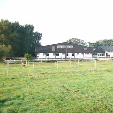
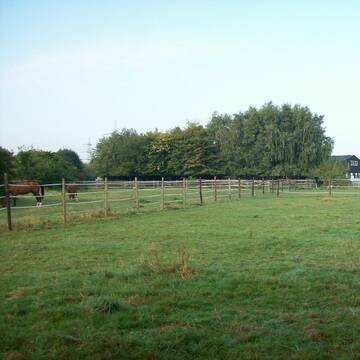
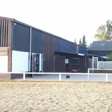
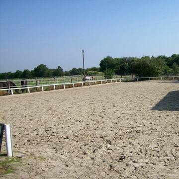
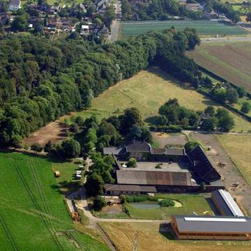
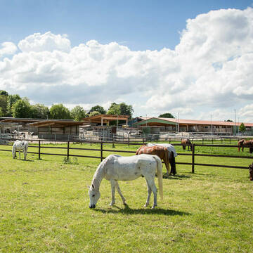
Reitstall Mühlenbeck
Hürth
Reitstall-Muehlenbeck
@Reitstall-Muehlenbeck
FN-Mitglied
Freizeitstall
Vermieten
Hunde willkommen
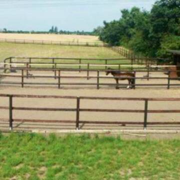
Longierzirkel/Roundpen
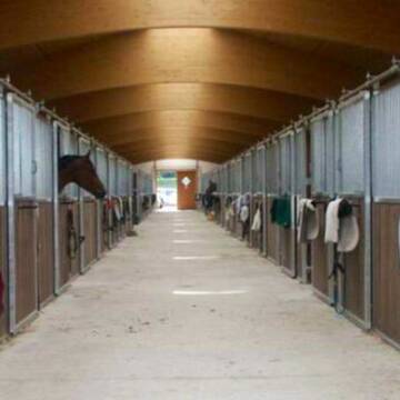
Außenbox mit Paddock
Außenboxen
19 weitere...
aktuell
S
Deprecated: Creation of dynamic property Zend_View_Helper_Ads::$adLink is deprecated in /var/www/stall-frei/htdocs/staging.stall-frei.de/library/Psf/View/Helper/Ads.php on line 108

Frisches Stroh zu verkaufen!
Mechtersen
STALL-FREIde Marketing
@STALL-FREI-Marketing
Kaufe frisches Stroh für dein Pferd!


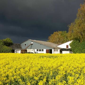
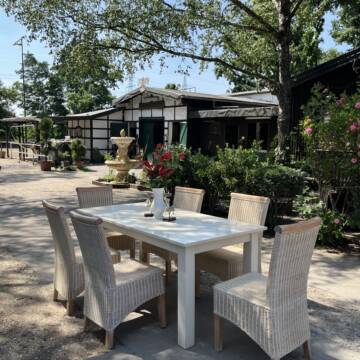
Historische Reitanlage in Köln-Dellbrück
Köln
RGS Kornspringer Köln e. V.
@Kornspringer
FN-Mitglied
Freizeitstall
Vermieten
Führanlage
Hunde willkommen
bedampftes/gewaschenes Heu
Notfallboxen
21 weitere...
S


***Reitstall Birkenhof*** Pferdegerechte Haltung
Köln
Daniele-Fazzi
@Daniele-Fazzi
Freizeitstall
Geländestrecke
Vermieten
Verpachten
Hunde willkommen
Longierzirkel/Roundpen
Allergikerstall
Hufrehe geeignet
23 weitere...
ganz aktuell
S


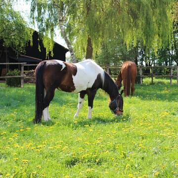
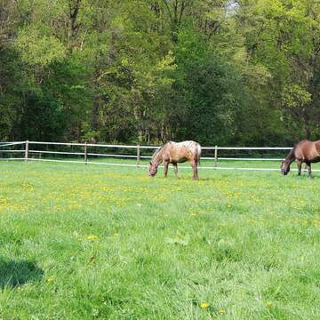
nur 30 Pferde privat und pferdegerecht
Weilerswist
Beate Horn-Moll&Mike Horn
@SchwalbenhofGBR
Freizeitstall
Geländestrecke
Vermieten
Hunde willkommen
Longierzirkel/Roundpen
Fohlenaufzucht möglich
Notfallboxen
23 weitere...
S

Offenstall Platz
Köln
Offenstall
@Offenstall-KoelnRodenkirchen
Freizeitstall
Hunde willkommen
Paddock
Hufrehe geeignet
Notfallboxen
Offenstall
6 weitere...
P
Konraderhof
Köln
Konraderhof
@Konraderhof
FN-Mitglied
Freizeitstall
Vermieten
Hunde willkommen
Krankenbox
Außenboxen
Innenbox
17 weitere...
P

Wir haben aktuell Paddockbox-Fensterbox frei
Pulheim
Schumacher
@Reitanlage-Junkerhof
FN-Mitglied
Pferdeausbildung
Führanlage
Hunde willkommen
Allergikerstall
bedampftes/gewaschenes Heu
Außenbox mit Paddock
Außenboxen
26 weitere...
aktuell
S

Heinrichshof Aktivstall
Köln Fühlingen
Frenger GbR - Heinrichshof
@Frenger-GbR
FN-Mitglied
Freizeitstall
Hunde willkommen
Krankenbox
Allergikerstall
bedampftes/gewaschenes Heu
Außenbox mit Paddock
Bewegungsstall
22 weitere...
S

Boxen frei im Sportpferdezentrum Köln
Köln
Brüse GbR
@SportpferdezentrumKoeln
FN-Mitglied
Freizeitstall
Vermieten
Führanlage
Krankenbox
Notfallboxen
22 weitere...
P
Pensions und Sportstall Gestüt Lindenbusch
Frechen
Mercedes Fischer-Busse
@Mercedes Fischer-Busse
FN-Mitglied
Freizeitstall
Vermieten
Führanlage
Laufband
Pferdezucht
Zuchtstutenhaltung möglich
19 weitere...
P+
Deprecated: Creation of dynamic property Zend_View::$pageCount is deprecated in /var/www/stall-frei/htdocs/staging.stall-frei.de/library/vendor/shardj/zf1-future/library/Zend/View/Abstract.php on line 308
Deprecated: Creation of dynamic property Zend_View::$itemCountPerPage is deprecated in /var/www/stall-frei/htdocs/staging.stall-frei.de/library/vendor/shardj/zf1-future/library/Zend/View/Abstract.php on line 308
Deprecated: Creation of dynamic property Zend_View::$first is deprecated in /var/www/stall-frei/htdocs/staging.stall-frei.de/library/vendor/shardj/zf1-future/library/Zend/View/Abstract.php on line 308
Deprecated: Creation of dynamic property Zend_View::$current is deprecated in /var/www/stall-frei/htdocs/staging.stall-frei.de/library/vendor/shardj/zf1-future/library/Zend/View/Abstract.php on line 308
Deprecated: Creation of dynamic property Zend_View::$last is deprecated in /var/www/stall-frei/htdocs/staging.stall-frei.de/library/vendor/shardj/zf1-future/library/Zend/View/Abstract.php on line 308
Deprecated: Creation of dynamic property Zend_View::$next is deprecated in /var/www/stall-frei/htdocs/staging.stall-frei.de/library/vendor/shardj/zf1-future/library/Zend/View/Abstract.php on line 308
Deprecated: Creation of dynamic property Zend_View::$pagesInRange is deprecated in /var/www/stall-frei/htdocs/staging.stall-frei.de/library/vendor/shardj/zf1-future/library/Zend/View/Abstract.php on line 308
Deprecated: Creation of dynamic property Zend_View::$firstPageInRange is deprecated in /var/www/stall-frei/htdocs/staging.stall-frei.de/library/vendor/shardj/zf1-future/library/Zend/View/Abstract.php on line 308
Deprecated: Creation of dynamic property Zend_View::$lastPageInRange is deprecated in /var/www/stall-frei/htdocs/staging.stall-frei.de/library/vendor/shardj/zf1-future/library/Zend/View/Abstract.php on line 308
Deprecated: Creation of dynamic property Zend_View::$currentItemCount is deprecated in /var/www/stall-frei/htdocs/staging.stall-frei.de/library/vendor/shardj/zf1-future/library/Zend/View/Abstract.php on line 308
Deprecated: Creation of dynamic property Zend_View::$totalItemCount is deprecated in /var/www/stall-frei/htdocs/staging.stall-frei.de/library/vendor/shardj/zf1-future/library/Zend/View/Abstract.php on line 308
Deprecated: Creation of dynamic property Zend_View::$firstItemNumber is deprecated in /var/www/stall-frei/htdocs/staging.stall-frei.de/library/vendor/shardj/zf1-future/library/Zend/View/Abstract.php on line 308
Deprecated: Creation of dynamic property Zend_View::$lastItemNumber is deprecated in /var/www/stall-frei/htdocs/staging.stall-frei.de/library/vendor/shardj/zf1-future/library/Zend/View/Abstract.php on line 308
Deprecated: Creation of dynamic property Zend_View::$router is deprecated in /var/www/stall-frei/htdocs/staging.stall-frei.de/library/vendor/shardj/zf1-future/library/Zend/View/Abstract.php on line 308
Deprecated: Creation of dynamic property Zend_View::$urlParams is deprecated in /var/www/stall-frei/htdocs/staging.stall-frei.de/library/vendor/shardj/zf1-future/library/Zend/View/Abstract.php on line 308
Deprecated: Creation of dynamic property Zend_View::$showAds is deprecated in /var/www/stall-frei/htdocs/staging.stall-frei.de/library/vendor/shardj/zf1-future/library/Zend/View/Abstract.php on line 308
Deprecated: Creation of dynamic property Zend_View::$objectIds is deprecated in /var/www/stall-frei/htdocs/staging.stall-frei.de/library/vendor/shardj/zf1-future/library/Zend/View/Abstract.php on line 308
Deprecated: Creation of dynamic property Zend_View::$showNavbar is deprecated in /var/www/stall-frei/htdocs/staging.stall-frei.de/library/vendor/shardj/zf1-future/library/Zend/View/Abstract.php on line 308
Deprecated: Creation of dynamic property Zend_View::$showBreadcrumb is deprecated in /var/www/stall-frei/htdocs/staging.stall-frei.de/library/vendor/shardj/zf1-future/library/Zend/View/Abstract.php on line 308
Deprecated: Creation of dynamic property Zend_View::$showFooter is deprecated in /var/www/stall-frei/htdocs/staging.stall-frei.de/library/vendor/shardj/zf1-future/library/Zend/View/Abstract.php on line 308
Deprecated: Creation of dynamic property Zend_View::$showInternalAds is deprecated in /var/www/stall-frei/htdocs/staging.stall-frei.de/library/vendor/shardj/zf1-future/library/Zend/View/Abstract.php on line 308
Deprecated: Creation of dynamic property Zend_View::$blNoContent is deprecated in /var/www/stall-frei/htdocs/staging.stall-frei.de/library/vendor/shardj/zf1-future/library/Zend/View/Abstract.php on line 308
Deprecated: Creation of dynamic property Zend_View::$sMetaDesc is deprecated in /var/www/stall-frei/htdocs/staging.stall-frei.de/library/vendor/shardj/zf1-future/library/Zend/View/Abstract.php on line 308
Deprecated: Creation of dynamic property Zend_View::$useGmaps is deprecated in /var/www/stall-frei/htdocs/staging.stall-frei.de/library/vendor/shardj/zf1-future/library/Zend/View/Abstract.php on line 308
Deprecated: Creation of dynamic property Zend_View::$touches is deprecated in /var/www/stall-frei/htdocs/staging.stall-frei.de/library/vendor/shardj/zf1-future/library/Zend/View/Abstract.php on line 308
Deprecated: Creation of dynamic property Zend_View::$oProject is deprecated in /var/www/stall-frei/htdocs/staging.stall-frei.de/library/vendor/shardj/zf1-future/library/Zend/View/Abstract.php on line 308
Deprecated: Creation of dynamic property Zend_View::$pageHeadline is deprecated in /var/www/stall-frei/htdocs/staging.stall-frei.de/library/vendor/shardj/zf1-future/library/Zend/View/Abstract.php on line 308
Deprecated: Creation of dynamic property Zend_View::$disableLocationField is deprecated in /var/www/stall-frei/htdocs/staging.stall-frei.de/library/vendor/shardj/zf1-future/library/Zend/View/Abstract.php on line 308
Deprecated: Creation of dynamic property Zend_View::$isSearch is deprecated in /var/www/stall-frei/htdocs/staging.stall-frei.de/library/vendor/shardj/zf1-future/library/Zend/View/Abstract.php on line 308
Deprecated: Creation of dynamic property Zend_View::$pageTitle is deprecated in /var/www/stall-frei/htdocs/staging.stall-frei.de/library/vendor/shardj/zf1-future/library/Zend/View/Abstract.php on line 308
Deprecated: Creation of dynamic property Psf_Form_Element_Text::$class is deprecated in /var/www/stall-frei/htdocs/staging.stall-frei.de/library/vendor/shardj/zf1-future/library/Zend/Form/Element.php on line 874
Deprecated: Creation of dynamic property Psf_Form_Element_Text::$size is deprecated in /var/www/stall-frei/htdocs/staging.stall-frei.de/library/vendor/shardj/zf1-future/library/Zend/Form/Element.php on line 874
Deprecated: Creation of dynamic property Psf_Form_Element_Text::$placeholder is deprecated in /var/www/stall-frei/htdocs/staging.stall-frei.de/library/vendor/shardj/zf1-future/library/Zend/Form/Element.php on line 874
Deprecated: Creation of dynamic property Psf_Form_Element_Hidden::$class is deprecated in /var/www/stall-frei/htdocs/staging.stall-frei.de/library/vendor/shardj/zf1-future/library/Zend/Form/Element.php on line 874
Deprecated: Creation of dynamic property Psf_Form_Element_Hidden::$class is deprecated in /var/www/stall-frei/htdocs/staging.stall-frei.de/library/vendor/shardj/zf1-future/library/Zend/Form/Element.php on line 874
Deprecated: Creation of dynamic property Psf_Form_Element_Hidden::$class is deprecated in /var/www/stall-frei/htdocs/staging.stall-frei.de/library/vendor/shardj/zf1-future/library/Zend/Form/Element.php on line 874
Deprecated: Creation of dynamic property Psf_Form_Element_Hidden::$class is deprecated in /var/www/stall-frei/htdocs/staging.stall-frei.de/library/vendor/shardj/zf1-future/library/Zend/Form/Element.php on line 874
Deprecated: Creation of dynamic property Psf_Form_Element_Select::$class is deprecated in /var/www/stall-frei/htdocs/staging.stall-frei.de/library/vendor/shardj/zf1-future/library/Zend/Form/Element.php on line 874
Deprecated: Creation of dynamic property Psf_Form_Element_Select::$class is deprecated in /var/www/stall-frei/htdocs/staging.stall-frei.de/library/vendor/shardj/zf1-future/library/Zend/Form/Element.php on line 874
Deprecated: Creation of dynamic property Psf_Form_Element_Select::$class is deprecated in /var/www/stall-frei/htdocs/staging.stall-frei.de/library/vendor/shardj/zf1-future/library/Zend/Form/Element.php on line 874
Deprecated: Creation of dynamic property Psf_Form_Element_Select::$class is deprecated in /var/www/stall-frei/htdocs/staging.stall-frei.de/library/vendor/shardj/zf1-future/library/Zend/Form/Element.php on line 874
Deprecated: Creation of dynamic property Psf_Form_Element_Text::$class is deprecated in /var/www/stall-frei/htdocs/staging.stall-frei.de/library/vendor/shardj/zf1-future/library/Zend/Form/Element.php on line 874
Deprecated: Creation of dynamic property Psf_Form_Element_Checkbox::$label is deprecated in /var/www/stall-frei/htdocs/staging.stall-frei.de/library/vendor/shardj/zf1-future/library/Zend/Form/Element.php on line 874
Deprecated: Creation of dynamic property Zend_View::$sort is deprecated in /var/www/stall-frei/htdocs/staging.stall-frei.de/library/vendor/shardj/zf1-future/library/Zend/View/Abstract.php on line 308
Deprecated: Creation of dynamic property Zend_View::$searchLocation is deprecated in /var/www/stall-frei/htdocs/staging.stall-frei.de/library/vendor/shardj/zf1-future/library/Zend/View/Abstract.php on line 308
Deprecated: Creation of dynamic property Zend_View::$locationHint is deprecated in /var/www/stall-frei/htdocs/staging.stall-frei.de/library/vendor/shardj/zf1-future/library/Zend/View/Abstract.php on line 308
Psf_GeoCoder_Abstract::getLocation: Hahnwald Get Location CachedOrLive
Psf_GeoCoder_Abstract::getCachedOrLive: Hahnwald
Psf_GeoCoder_OpenCageData::makeApiRequest: response:
Array
(
[documentation] => https://opencagedata.com/api
[licenses] => Array
(
[0] => Array
(
[name] => see attribution guide
[url] => https://opencagedata.com/credits
)
)
[results] => Array
(
[0] => Array
(
[bounds] => Array
(
[northeast] => Array
(
[lat] => 50.882965
[lng] => 7.0001027
)
[southwest] => Array
(
[lat] => 50.8637366
[lng] => 6.9681372
)
)
[components] => Array
(
[ISO_3166-1_alpha-2] => DE
[ISO_3166-1_alpha-3] => DEU
[ISO_3166-2] => Array
(
[0] => DE-NW
)
[_category] => place
[_normalized_city] => Köln
[_type] => neighbourhood
[city] => Köln
[city_district] => Rodenkirchen
[continent] => Europe
[country] => Deutschland
[country_code] => de
[political_union] => European Union
[state] => Nordrhein-Westfalen
[state_code] => NW
[suburb] => Hahnwald
)
[confidence] => 7
[formatted] => Hahnwald, Köln, Nordrhein-Westfalen, Deutschland
[geometry] => Array
(
[lat] => 50.8738192
[lng] => 6.9789269
)
)
[1] => Array
(
[bounds] => Array
(
[northeast] => Array
(
[lat] => 49.3720747
[lng] => 7.0027649
)
[southwest] => Array
(
[lat] => 49.3593183
[lng] => 6.9857962
)
)
[components] => Array
(
[ISO_3166-1_alpha-2] => DE
[ISO_3166-1_alpha-3] => DEU
[ISO_3166-2] => Array
(
[0] => DE-SL
)
[_category] => natural/water
[_normalized_city] => Illingen
[_type] => forest
[city] => Illingen
[continent] => Europe
[country] => Deutschland
[country_code] => de
[county] => Landkreis Neunkirchen
[forest] => Hahnwald
[political_union] => European Union
[state] => Saarland
[state_code] => SL
[village] => Uchtelfangen
)
[confidence] => 8
[formatted] => Hahnwald, Uchtelfangen, Saarland, Deutschland
[geometry] => Array
(
[lat] => 49.3656811
[lng] => 6.9973633
)
)
[2] => Array
(
[bounds] => Array
(
[northeast] => Array
(
[lat] => 49.9412923
[lng] => 10.3151563
)
[southwest] => Array
(
[lat] => 49.9363515
[lng] => 10.2992698
)
)
[components] => Array
(
[ISO_3166-1_alpha-2] => DE
[ISO_3166-1_alpha-3] => DEU
[ISO_3166-2] => Array
(
[0] => DE-BY
)
[_category] => natural/water
[_normalized_city] => Kolitzheim
[_type] => forest
[city] => Kolitzheim
[continent] => Europe
[country] => Deutschland
[country_code] => de
[county] => Landkreis Schweinfurt
[forest] => Hahnwald
[municipality] => Gerolzhofen (VGem)
[political_union] => European Union
[postcode] => 97509
[state] => Bayern
[state_code] => BY
)
[confidence] => 9
[formatted] => Hahnwald, 97509 Kolitzheim, Deutschland
[geometry] => Array
(
[lat] => 49.9388592
[lng] => 10.3073477
)
)
[3] => Array
(
[bounds] => Array
(
[northeast] => Array
(
[lat] => 48.7547211
[lng] => 9.1668291
)
[southwest] => Array
(
[lat] => 48.7525647
[lng] => 9.1610923
)
)
[components] => Array
(
[ISO_3166-1_alpha-2] => DE
[ISO_3166-1_alpha-3] => DEU
[ISO_3166-2] => Array
(
[0] => DE-BW
)
[_category] => outdoors/recreation
[_normalized_city] => Stuttgart
[_type] => allotments
[allotments] => Hahnwald
[city] => Stuttgart
[city_district] => Stuttgart-Süd
[continent] => Europe
[country] => Deutschland
[country_code] => de
[political_union] => European Union
[postcode] => 70199
[state] => Baden-Württemberg
[state_code] => BW
[suburb] => Heslach
)
[confidence] => 9
[formatted] => Hahnwald, 70199 Stuttgart, Deutschland
[geometry] => Array
(
[lat] => 48.7536262
[lng] => 9.1633319
)
)
[4] => Array
(
[bounds] => Array
(
[northeast] => Array
(
[lat] => 50.1647229
[lng] => 8.3191377
)
[southwest] => Array
(
[lat] => 50.1447229
[lng] => 8.2991377
)
)
[components] => Array
(
[ISO_3166-1_alpha-2] => DE
[ISO_3166-1_alpha-3] => DEU
[ISO_3166-2] => Array
(
[0] => DE-HE
)
[_category] => place
[_normalized_city] => Niedernhausen
[_type] => hamlet
[continent] => Europe
[country] => Deutschland
[country_code] => de
[county] => Rheingau-Taunus-Kreis
[locality] => Hahnwald
[municipality] => Niedernhausen
[political_union] => European Union
[postcode] => 65527
[state] => Hessen
[state_code] => HE
[town] => Niedernhausen
)
[confidence] => 8
[formatted] => Hahnwald, 65527 Niedernhausen, Deutschland
[geometry] => Array
(
[lat] => 50.1547229
[lng] => 8.3091377
)
)
[5] => Array
(
[bounds] => Array
(
[northeast] => Array
(
[lat] => 49.6724074
[lng] => 9.2752207
)
[southwest] => Array
(
[lat] => 49.6524074
[lng] => 9.2552207
)
)
[components] => Array
(
[ISO_3166-1_alpha-2] => DE
[ISO_3166-1_alpha-3] => DEU
[ISO_3166-2] => Array
(
[0] => DE-BY
)
[_category] => place
[_normalized_city] => Weilbach
[_type] => hamlet
[continent] => Europe
[country] => Deutschland
[country_code] => de
[county] => Landkreis Miltenberg
[hamlet] => Reuenthal
[locality] => Hahnwald
[political_union] => European Union
[postcode] => 63937
[state] => Bayern
[state_code] => BY
[village] => Weilbach
)
[confidence] => 8
[formatted] => Reuenthal, 63937 Weilbach, Deutschland
[geometry] => Array
(
[lat] => 49.6624074
[lng] => 9.2652207
)
)
[6] => Array
(
[components] => Array
(
[ISO_3166-1_alpha-2] => FR
[ISO_3166-1_alpha-3] => FRA
[ISO_3166-2] => Array
(
[0] => FR-PAC
[1] => FR-06
)
[_category] => road
[_normalized_city] => Mandelieu-la-Napoule
[_type] => road
[city] => Mandelieu-la-Napoule
[continent] => Europe
[country] => France
[country_code] => fr
[county] => Alpes-Maritimes
[local_authority] => Communauté d'agglomération Cannes Pays de Lérins
[political_union] => European Union
[postcode] => 06210
[road] => Rue du Chantier naval
[state] => Provence-Alpes-Côte d'Azur
[state_code] => PAC
)
[confidence] => 2
[formatted] => Rue du Chantier naval, 06210 Mandelieu-la-Napoule, France
[geometry] => Array
(
[lat] => 43.525315
[lng] => 6.941797
)
)
[7] => Array
(
[components] => Array
(
[ISO_3166-1_alpha-2] => FR
[ISO_3166-1_alpha-3] => FRA
[ISO_3166-2] => Array
(
[0] => FR-NOR
[1] => FR-14
)
[_category] => road
[_normalized_city] => Blainville-sur-Orne
[_type] => road
[city] => Blainville-sur-Orne
[continent] => Europe
[country] => France
[country_code] => fr
[county] => Calvados
[local_authority] => Communauté urbaine Caen la Mer
[political_union] => European Union
[postcode] => 14550
[road] => Rue des Chantiers Navals
[state] => Normandie
[state_code] => NOR
)
[confidence] => 2
[formatted] => Rue des Chantiers Navals, 14550 Blainville-sur-Orne, France
[geometry] => Array
(
[lat] => 49.233995
[lng] => -0.297851
)
)
[8] => Array
(
[components] => Array
(
[ISO_3166-1_alpha-2] => FR
[ISO_3166-1_alpha-3] => FRA
[ISO_3166-2] => Array
(
[0] => FR-PDL
[1] => FR-44
)
[_category] => road
[_normalized_city] => Couëron
[_type] => road
[city] => Couëron
[continent] => Europe
[country] => France
[country_code] => fr
[county] => Loire-Atlantique
[local_authority] => Nantes Métropole
[political_union] => European Union
[postcode] => 44220
[road] => Route de la Navale
[state] => Pays de la Loire
[state_code] => PDL
)
[confidence] => 2
[formatted] => Route de la Navale, 44220 Couëron, France
[geometry] => Array
(
[lat] => 47.20981
[lng] => -1.702613
)
)
[9] => Array
(
[components] => Array
(
[ISO_3166-1_alpha-2] => FR
[ISO_3166-1_alpha-3] => FRA
[ISO_3166-2] => Array
(
[0] => FR-PDL
[1] => FR-44
)
[_category] => road
[_normalized_city] => Nantes
[_type] => road
[city] => Nantes
[continent] => Europe
[country] => France
[country_code] => fr
[county] => Loire-Atlantique
[local_authority] => Nantes Métropole
[political_union] => European Union
[postcode] => 44100
[road] => Esplanade de la Navale
[state] => Pays de la Loire
[state_code] => PDL
)
[confidence] => 10
[formatted] => Esplanade de la Navale, 44100 Nantes, France
[geometry] => Array
(
[lat] => 47.200054
[lng] => -1.592999
)
)
)
[status] => Array
(
[code] => 200
[message] => OK
)
[stay_informed] => Array
(
[blog] => https://blog.opencagedata.com
[mastodon] => https://en.osm.town/@opencage
)
[thanks] => For using an OpenCage API
[timestamp] => Array
(
[created_http] => Sun, 08 Feb 2026 10:32:45 GMT
[created_unix] => 1770546765
)
[total_results] => 10
)
Psf_GeoCoder_Abstract::convertLocationResult
{"documentation":"https:\/\/opencagedata.com\/api","licenses":[{"name":"see attribution guide","url":"https:\/\/opencagedata.com\/credits"}],"results":[{"bounds":{"northeast":{"lat":50.882965,"lng":7.0001027},"southwest":{"lat":50.8637366,"lng":6.9681372}},"components":{"ISO_3166-1_alpha-2":"DE","ISO_3166-1_alpha-3":"DEU","ISO_3166-2":["DE-NW"],"_category":"place","_normalized_city":"K\u00f6ln","_type":"neighbourhood","city":"K\u00f6ln","city_district":"Rodenkirchen","continent":"Europe","country":"Deutschland","country_code":"de","political_union":"European Union","state":"Nordrhein-Westfalen","state_code":"NW","suburb":"Hahnwald"},"confidence":7,"formatted":"Hahnwald, K\u00f6ln, Nordrhein-Westfalen, Deutschland","geometry":{"lat":50.8738192,"lng":6.9789269}},{"bounds":{"northeast":{"lat":49.3720747,"lng":7.0027649},"southwest":{"lat":49.3593183,"lng":6.9857962}},"components":{"ISO_3166-1_alpha-2":"DE","ISO_3166-1_alpha-3":"DEU","ISO_3166-2":["DE-SL"],"_category":"natural\/water","_normalized_city":"Illingen","_type":"forest","city":"Illingen","continent":"Europe","country":"Deutschland","country_code":"de","county":"Landkreis Neunkirchen","forest":"Hahnwald","political_union":"European Union","state":"Saarland","state_code":"SL","village":"Uchtelfangen"},"confidence":8,"formatted":"Hahnwald, Uchtelfangen, Saarland, Deutschland","geometry":{"lat":49.3656811,"lng":6.9973633}},{"bounds":{"northeast":{"lat":49.9412923,"lng":10.3151563},"southwest":{"lat":49.9363515,"lng":10.2992698}},"components":{"ISO_3166-1_alpha-2":"DE","ISO_3166-1_alpha-3":"DEU","ISO_3166-2":["DE-BY"],"_category":"natural\/water","_normalized_city":"Kolitzheim","_type":"forest","city":"Kolitzheim","continent":"Europe","country":"Deutschland","country_code":"de","county":"Landkreis Schweinfurt","forest":"Hahnwald","municipality":"Gerolzhofen (VGem)","political_union":"European Union","postcode":"97509","state":"Bayern","state_code":"BY"},"confidence":9,"formatted":"Hahnwald, 97509 Kolitzheim, Deutschland","geometry":{"lat":49.9388592,"lng":10.3073477}},{"bounds":{"northeast":{"lat":48.7547211,"lng":9.1668291},"southwest":{"lat":48.7525647,"lng":9.1610923}},"components":{"ISO_3166-1_alpha-2":"DE","ISO_3166-1_alpha-3":"DEU","ISO_3166-2":["DE-BW"],"_category":"outdoors\/recreation","_normalized_city":"Stuttgart","_type":"allotments","allotments":"Hahnwald","city":"Stuttgart","city_district":"Stuttgart-S\u00fcd","continent":"Europe","country":"Deutschland","country_code":"de","political_union":"European Union","postcode":"70199","state":"Baden-W\u00fcrttemberg","state_code":"BW","suburb":"Heslach"},"confidence":9,"formatted":"Hahnwald, 70199 Stuttgart, Deutschland","geometry":{"lat":48.7536262,"lng":9.1633319}},{"bounds":{"northeast":{"lat":50.1647229,"lng":8.3191377},"southwest":{"lat":50.1447229,"lng":8.2991377}},"components":{"ISO_3166-1_alpha-2":"DE","ISO_3166-1_alpha-3":"DEU","ISO_3166-2":["DE-HE"],"_category":"place","_normalized_city":"Niedernhausen","_type":"hamlet","continent":"Europe","country":"Deutschland","country_code":"de","county":"Rheingau-Taunus-Kreis","locality":"Hahnwald","municipality":"Niedernhausen","political_union":"European Union","postcode":"65527","state":"Hessen","state_code":"HE","town":"Niedernhausen"},"confidence":8,"formatted":"Hahnwald, 65527 Niedernhausen, Deutschland","geometry":{"lat":50.1547229,"lng":8.3091377}},{"bounds":{"northeast":{"lat":49.6724074,"lng":9.2752207},"southwest":{"lat":49.6524074,"lng":9.2552207}},"components":{"ISO_3166-1_alpha-2":"DE","ISO_3166-1_alpha-3":"DEU","ISO_3166-2":["DE-BY"],"_category":"place","_normalized_city":"Weilbach","_type":"hamlet","continent":"Europe","country":"Deutschland","country_code":"de","county":"Landkreis Miltenberg","hamlet":"Reuenthal","locality":"Hahnwald","political_union":"European Union","postcode":"63937","state":"Bayern","state_code":"BY","village":"Weilbach"},"confidence":8,"formatted":"Reuenthal, 63937 Weilbach, Deutschland","geometry":{"lat":49.6624074,"lng":9.2652207}},{"components":{"ISO_3166-1_alpha-2":"FR","ISO_3166-1_alpha-3":"FRA","ISO_3166-2":["FR-PAC","FR-06"],"_category":"road","_normalized_city":"Mandelieu-la-Napoule","_type":"road","city":"Mandelieu-la-Napoule","continent":"Europe","country":"France","country_code":"fr","county":"Alpes-Maritimes","local_authority":"Communaut\u00e9 d'agglom\u00e9ration Cannes Pays de L\u00e9rins","political_union":"European Union","postcode":"06210","road":"Rue du Chantier naval","state":"Provence-Alpes-C\u00f4te d'Azur","state_code":"PAC"},"confidence":2,"formatted":"Rue du Chantier naval, 06210 Mandelieu-la-Napoule, France","geometry":{"lat":43.525315,"lng":6.941797}},{"components":{"ISO_3166-1_alpha-2":"FR","ISO_3166-1_alpha-3":"FRA","ISO_3166-2":["FR-NOR","FR-14"],"_category":"road","_normalized_city":"Blainville-sur-Orne","_type":"road","city":"Blainville-sur-Orne","continent":"Europe","country":"France","country_code":"fr","county":"Calvados","local_authority":"Communaut\u00e9 urbaine Caen la Mer","political_union":"European Union","postcode":"14550","road":"Rue des Chantiers Navals","state":"Normandie","state_code":"NOR"},"confidence":2,"formatted":"Rue des Chantiers Navals, 14550 Blainville-sur-Orne, France","geometry":{"lat":49.233995,"lng":-0.297851}},{"components":{"ISO_3166-1_alpha-2":"FR","ISO_3166-1_alpha-3":"FRA","ISO_3166-2":["FR-PDL","FR-44"],"_category":"road","_normalized_city":"Cou\u00ebron","_type":"road","city":"Cou\u00ebron","continent":"Europe","country":"France","country_code":"fr","county":"Loire-Atlantique","local_authority":"Nantes M\u00e9tropole","political_union":"European Union","postcode":"44220","road":"Route de la Navale","state":"Pays de la Loire","state_code":"PDL"},"confidence":2,"formatted":"Route de la Navale, 44220 Cou\u00ebron, France","geometry":{"lat":47.20981,"lng":-1.702613}},{"components":{"ISO_3166-1_alpha-2":"FR","ISO_3166-1_alpha-3":"FRA","ISO_3166-2":["FR-PDL","FR-44"],"_category":"road","_normalized_city":"Nantes","_type":"road","city":"Nantes","continent":"Europe","country":"France","country_code":"fr","county":"Loire-Atlantique","local_authority":"Nantes M\u00e9tropole","political_union":"European Union","postcode":"44100","road":"Esplanade de la Navale","state":"Pays de la Loire","state_code":"PDL"},"confidence":10,"formatted":"Esplanade de la Navale, 44100 Nantes, France","geometry":{"lat":47.200054,"lng":-1.592999}}],"status":{"code":200,"message":"OK"},"stay_informed":{"blog":"https:\/\/blog.opencagedata.com","mastodon":"https:\/\/en.osm.town\/@opencage"},"thanks":"For using an OpenCage API","timestamp":{"created_http":"Sun, 08 Feb 2026 10:32:45 GMT","created_unix":1770546765},"total_results":10}Array
(
[0] => stdClass Object
(
[bounds] => stdClass Object
(
[northeast] => stdClass Object
(
[lat] => 50.882965
[lng] => 7.0001027
)
[southwest] => stdClass Object
(
[lat] => 50.8637366
[lng] => 6.9681372
)
)
[components] => stdClass Object
(
[ISO_3166-1_alpha-2] => DE
[ISO_3166-1_alpha-3] => DEU
[ISO_3166-2] => Array
(
[0] => DE-NW
)
[_category] => place
[_normalized_city] => Köln
[_type] => neighbourhood
[city] => Köln
[city_district] => Rodenkirchen
[continent] => Europe
[country] => Deutschland
[country_code] => de
[political_union] => European Union
[state] => Nordrhein-Westfalen
[state_code] => NW
[suburb] => Hahnwald
)
[confidence] => 7
[formatted] => Hahnwald, Köln, Nordrhein-Westfalen, Deutschland
[geometry] => stdClass Object
(
[lat] => 50.8738192
[lng] => 6.9789269
)
)
[1] => stdClass Object
(
[bounds] => stdClass Object
(
[northeast] => stdClass Object
(
[lat] => 49.3720747
[lng] => 7.0027649
)
[southwest] => stdClass Object
(
[lat] => 49.3593183
[lng] => 6.9857962
)
)
[components] => stdClass Object
(
[ISO_3166-1_alpha-2] => DE
[ISO_3166-1_alpha-3] => DEU
[ISO_3166-2] => Array
(
[0] => DE-SL
)
[_category] => natural/water
[_normalized_city] => Illingen
[_type] => forest
[city] => Illingen
[continent] => Europe
[country] => Deutschland
[country_code] => de
[county] => Landkreis Neunkirchen
[forest] => Hahnwald
[political_union] => European Union
[state] => Saarland
[state_code] => SL
[village] => Uchtelfangen
)
[confidence] => 8
[formatted] => Hahnwald, Uchtelfangen, Saarland, Deutschland
[geometry] => stdClass Object
(
[lat] => 49.3656811
[lng] => 6.9973633
)
)
[2] => stdClass Object
(
[bounds] => stdClass Object
(
[northeast] => stdClass Object
(
[lat] => 49.9412923
[lng] => 10.3151563
)
[southwest] => stdClass Object
(
[lat] => 49.9363515
[lng] => 10.2992698
)
)
[components] => stdClass Object
(
[ISO_3166-1_alpha-2] => DE
[ISO_3166-1_alpha-3] => DEU
[ISO_3166-2] => Array
(
[0] => DE-BY
)
[_category] => natural/water
[_normalized_city] => Kolitzheim
[_type] => forest
[city] => Kolitzheim
[continent] => Europe
[country] => Deutschland
[country_code] => de
[county] => Landkreis Schweinfurt
[forest] => Hahnwald
[municipality] => Gerolzhofen (VGem)
[political_union] => European Union
[postcode] => 97509
[state] => Bayern
[state_code] => BY
)
[confidence] => 9
[formatted] => Hahnwald, 97509 Kolitzheim, Deutschland
[geometry] => stdClass Object
(
[lat] => 49.9388592
[lng] => 10.3073477
)
)
[3] => stdClass Object
(
[bounds] => stdClass Object
(
[northeast] => stdClass Object
(
[lat] => 48.7547211
[lng] => 9.1668291
)
[southwest] => stdClass Object
(
[lat] => 48.7525647
[lng] => 9.1610923
)
)
[components] => stdClass Object
(
[ISO_3166-1_alpha-2] => DE
[ISO_3166-1_alpha-3] => DEU
[ISO_3166-2] => Array
(
[0] => DE-BW
)
[_category] => outdoors/recreation
[_normalized_city] => Stuttgart
[_type] => allotments
[allotments] => Hahnwald
[city] => Stuttgart
[city_district] => Stuttgart-Süd
[continent] => Europe
[country] => Deutschland
[country_code] => de
[political_union] => European Union
[postcode] => 70199
[state] => Baden-Württemberg
[state_code] => BW
[suburb] => Heslach
)
[confidence] => 9
[formatted] => Hahnwald, 70199 Stuttgart, Deutschland
[geometry] => stdClass Object
(
[lat] => 48.7536262
[lng] => 9.1633319
)
)
[4] => stdClass Object
(
[bounds] => stdClass Object
(
[northeast] => stdClass Object
(
[lat] => 50.1647229
[lng] => 8.3191377
)
[southwest] => stdClass Object
(
[lat] => 50.1447229
[lng] => 8.2991377
)
)
[components] => stdClass Object
(
[ISO_3166-1_alpha-2] => DE
[ISO_3166-1_alpha-3] => DEU
[ISO_3166-2] => Array
(
[0] => DE-HE
)
[_category] => place
[_normalized_city] => Niedernhausen
[_type] => hamlet
[continent] => Europe
[country] => Deutschland
[country_code] => de
[county] => Rheingau-Taunus-Kreis
[locality] => Hahnwald
[municipality] => Niedernhausen
[political_union] => European Union
[postcode] => 65527
[state] => Hessen
[state_code] => HE
[town] => Niedernhausen
)
[confidence] => 8
[formatted] => Hahnwald, 65527 Niedernhausen, Deutschland
[geometry] => stdClass Object
(
[lat] => 50.1547229
[lng] => 8.3091377
)
)
[5] => stdClass Object
(
[bounds] => stdClass Object
(
[northeast] => stdClass Object
(
[lat] => 49.6724074
[lng] => 9.2752207
)
[southwest] => stdClass Object
(
[lat] => 49.6524074
[lng] => 9.2552207
)
)
[components] => stdClass Object
(
[ISO_3166-1_alpha-2] => DE
[ISO_3166-1_alpha-3] => DEU
[ISO_3166-2] => Array
(
[0] => DE-BY
)
[_category] => place
[_normalized_city] => Weilbach
[_type] => hamlet
[continent] => Europe
[country] => Deutschland
[country_code] => de
[county] => Landkreis Miltenberg
[hamlet] => Reuenthal
[locality] => Hahnwald
[political_union] => European Union
[postcode] => 63937
[state] => Bayern
[state_code] => BY
[village] => Weilbach
)
[confidence] => 8
[formatted] => Reuenthal, 63937 Weilbach, Deutschland
[geometry] => stdClass Object
(
[lat] => 49.6624074
[lng] => 9.2652207
)
)
[6] => stdClass Object
(
[components] => stdClass Object
(
[ISO_3166-1_alpha-2] => FR
[ISO_3166-1_alpha-3] => FRA
[ISO_3166-2] => Array
(
[0] => FR-PAC
[1] => FR-06
)
[_category] => road
[_normalized_city] => Mandelieu-la-Napoule
[_type] => road
[city] => Mandelieu-la-Napoule
[continent] => Europe
[country] => France
[country_code] => fr
[county] => Alpes-Maritimes
[local_authority] => Communauté d'agglomération Cannes Pays de Lérins
[political_union] => European Union
[postcode] => 06210
[road] => Rue du Chantier naval
[state] => Provence-Alpes-Côte d'Azur
[state_code] => PAC
)
[confidence] => 2
[formatted] => Rue du Chantier naval, 06210 Mandelieu-la-Napoule, France
[geometry] => stdClass Object
(
[lat] => 43.525315
[lng] => 6.941797
)
)
[7] => stdClass Object
(
[components] => stdClass Object
(
[ISO_3166-1_alpha-2] => FR
[ISO_3166-1_alpha-3] => FRA
[ISO_3166-2] => Array
(
[0] => FR-NOR
[1] => FR-14
)
[_category] => road
[_normalized_city] => Blainville-sur-Orne
[_type] => road
[city] => Blainville-sur-Orne
[continent] => Europe
[country] => France
[country_code] => fr
[county] => Calvados
[local_authority] => Communauté urbaine Caen la Mer
[political_union] => European Union
[postcode] => 14550
[road] => Rue des Chantiers Navals
[state] => Normandie
[state_code] => NOR
)
[confidence] => 2
[formatted] => Rue des Chantiers Navals, 14550 Blainville-sur-Orne, France
[geometry] => stdClass Object
(
[lat] => 49.233995
[lng] => -0.297851
)
)
[8] => stdClass Object
(
[components] => stdClass Object
(
[ISO_3166-1_alpha-2] => FR
[ISO_3166-1_alpha-3] => FRA
[ISO_3166-2] => Array
(
[0] => FR-PDL
[1] => FR-44
)
[_category] => road
[_normalized_city] => Couëron
[_type] => road
[city] => Couëron
[continent] => Europe
[country] => France
[country_code] => fr
[county] => Loire-Atlantique
[local_authority] => Nantes Métropole
[political_union] => European Union
[postcode] => 44220
[road] => Route de la Navale
[state] => Pays de la Loire
[state_code] => PDL
)
[confidence] => 2
[formatted] => Route de la Navale, 44220 Couëron, France
[geometry] => stdClass Object
(
[lat] => 47.20981
[lng] => -1.702613
)
)
[9] => stdClass Object
(
[components] => stdClass Object
(
[ISO_3166-1_alpha-2] => FR
[ISO_3166-1_alpha-3] => FRA
[ISO_3166-2] => Array
(
[0] => FR-PDL
[1] => FR-44
)
[_category] => road
[_normalized_city] => Nantes
[_type] => road
[city] => Nantes
[continent] => Europe
[country] => France
[country_code] => fr
[county] => Loire-Atlantique
[local_authority] => Nantes Métropole
[political_union] => European Union
[postcode] => 44100
[road] => Esplanade de la Navale
[state] => Pays de la Loire
[state_code] => PDL
)
[confidence] => 10
[formatted] => Esplanade de la Navale, 44100 Nantes, France
[geometry] => stdClass Object
(
[lat] => 47.200054
[lng] => -1.592999
)
)
)
Psf_GeoCoder_OpenCageData::getKeyMap: 0
stdClass Object
(
    [bounds] => stdClass Object
        (
            [northeast] => stdClass Object
                (
                    [lat] => 50.882965
                    [lng] => 7.0001027
                )

            [southwest] => stdClass Object
                (
                    [lat] => 50.8637366
                    [lng] => 6.9681372
                )

        )

    [components] => stdClass Object
        (
            [ISO_3166-1_alpha-2] => DE
            [ISO_3166-1_alpha-3] => DEU
            [ISO_3166-2] => Array
                (
                    [0] => DE-NW
                )

            [_category] => place
            [_normalized_city] => Köln
            [_type] => neighbourhood
            [city] => Köln
            [city_district] => Rodenkirchen
            [continent] => Europe
            [country] => Deutschland
            [country_code] => de
            [political_union] => European Union
            [state] => Nordrhein-Westfalen
            [state_code] => NW
            [suburb] => Hahnwald
        )

    [confidence] => 7
    [formatted] => Hahnwald, Köln, Nordrhein-Westfalen, Deutschland
    [geometry] => stdClass Object
        (
            [lat] => 50.8738192
            [lng] => 6.9789269
        )

)
Psf_GeoCoder_OpenCageData::getCounty: Köln
Psf_GeoCoder_OpenCageData::addMissingData REFETCH!
Array
(
    [address] => Hahnwald, Köln, Nordrhein-Westfalen, Deutschland
    [type] => neighbourhood
    [street] =>
    [city] => Hahnwald
    [county] => Köln
    [state] => Nordrhein-Westfalen
    [zip] =>
    [country] => Deutschland
    [suburb] => Hahnwald
    [countrycode] => de
    [latitude] => 50.8738192
    [longitude] => 6.9789269
    [accuracy] => 1
    [confidence] => 7
    [bounds] => stdClass Object
        (
            [northeast] => stdClass Object
                (
                    [lat] => 50.882965
                    [lng] => 7.0001027
                )

            [southwest] => stdClass Object
                (
                    [lat] => 50.8637366
                    [lng] => 6.9681372
                )

        )

)
reformat!
Array
(
    [address] => Hahnwald, Köln, Nordrhein-Westfalen, Deutschland
    [type] => neighbourhood
    [street] =>
    [city] => Hahnwald
    [county] => Köln
    [state] => Nordrhein-Westfalen
    [zip] =>
    [country] => Deutschland
    [suburb] => Hahnwald
    [countrycode] => de
    [latitude] => 50.8738192
    [longitude] => 6.9789269
    [accuracy] => 1
    [confidence] => 7
    [bounds] => stdClass Object
        (
            [northeast] => stdClass Object
                (
                    [lat] => 50.882965
                    [lng] => 7.0001027
                )

            [southwest] => stdClass Object
                (
                    [lat] => 50.8637366
                    [lng] => 6.9681372
                )

        )

    [place] => Hahnwald, Nordrhein-Westfalen
    [hash] => e83dfc08ac52a95f7e83b21b93714605
)
Psf_GeoCoder_OpenCageData::getKeyMap: 1
stdClass Object
(
    [bounds] => stdClass Object
        (
            [northeast] => stdClass Object
                (
                    [lat] => 49.3720747
                    [lng] => 7.0027649
                )

            [southwest] => stdClass Object
                (
                    [lat] => 49.3593183
                    [lng] => 6.9857962
                )

        )

    [components] => stdClass Object
        (
            [ISO_3166-1_alpha-2] => DE
            [ISO_3166-1_alpha-3] => DEU
            [ISO_3166-2] => Array
                (
                    [0] => DE-SL
                )

            [_category] => natural/water
            [_normalized_city] => Illingen
            [_type] => forest
            [city] => Illingen
            [continent] => Europe
            [country] => Deutschland
            [country_code] => de
            [county] => Landkreis Neunkirchen
            [forest] => Hahnwald
            [political_union] => European Union
            [state] => Saarland
            [state_code] => SL
            [village] => Uchtelfangen
        )

    [confidence] => 8
    [formatted] => Hahnwald, Uchtelfangen, Saarland, Deutschland
    [geometry] => stdClass Object
        (
            [lat] => 49.3656811
            [lng] => 6.9973633
        )

)
Psf_GeoCoder_OpenCageData::getCounty: Neunkirchen
Psf_GeoCoder_OpenCageData::addMissingData REFETCH!
Array
(
    [address] => Hahnwald, Uchtelfangen, Saarland, Deutschland
    [type] => forest
    [street] =>
    [city] => Uchtelfangen
    [county] => Neunkirchen
    [state] => Saarland
    [zip] =>
    [country] => Deutschland
    [suburb] =>
    [countrycode] => de
    [latitude] => 49.3656811
    [longitude] => 6.9973633
    [accuracy] => 1
    [confidence] => 8
    [bounds] => stdClass Object
        (
            [northeast] => stdClass Object
                (
                    [lat] => 49.3720747
                    [lng] => 7.0027649
                )

            [southwest] => stdClass Object
                (
                    [lat] => 49.3593183
                    [lng] => 6.9857962
                )

        )

)
reformat!
Array
(
    [address] => Hahnwald, Uchtelfangen, Saarland, Deutschland
    [type] => forest
    [street] =>
    [city] => Uchtelfangen
    [county] => Neunkirchen
    [state] => Saarland
    [zip] =>
    [country] => Deutschland
    [suburb] =>
    [countrycode] => de
    [latitude] => 49.3656811
    [longitude] => 6.9973633
    [accuracy] => 1
    [confidence] => 8
    [bounds] => stdClass Object
        (
            [northeast] => stdClass Object
                (
                    [lat] => 49.3720747
                    [lng] => 7.0027649
                )

            [southwest] => stdClass Object
                (
                    [lat] => 49.3593183
                    [lng] => 6.9857962
                )

        )

    [place] => Uchtelfangen, Saarland
    [hash] => bfa371b4e6796ad0277680e541479137
)
Psf_GeoCoder_OpenCageData::getKeyMap: 2
stdClass Object
(
    [bounds] => stdClass Object
        (
            [northeast] => stdClass Object
                (
                    [lat] => 49.9412923
                    [lng] => 10.3151563
                )

            [southwest] => stdClass Object
                (
                    [lat] => 49.9363515
                    [lng] => 10.2992698
                )

        )

    [components] => stdClass Object
        (
            [ISO_3166-1_alpha-2] => DE
            [ISO_3166-1_alpha-3] => DEU
            [ISO_3166-2] => Array
                (
                    [0] => DE-BY
                )

            [_category] => natural/water
            [_normalized_city] => Kolitzheim
            [_type] => forest
            [city] => Kolitzheim
            [continent] => Europe
            [country] => Deutschland
            [country_code] => de
            [county] => Landkreis Schweinfurt
            [forest] => Hahnwald
            [municipality] => Gerolzhofen (VGem)
            [political_union] => European Union
            [postcode] => 97509
            [state] => Bayern
            [state_code] => BY
        )

    [confidence] => 9
    [formatted] => Hahnwald, 97509 Kolitzheim, Deutschland
    [geometry] => stdClass Object
        (
            [lat] => 49.9388592
            [lng] => 10.3073477
        )

)
Psf_GeoCoder_OpenCageData::getCounty: Schweinfurt
Psf_GeoCoder_OpenCageData::addMissingData REFETCH!
Array
(
    [address] => Hahnwald, 97509 Kolitzheim, Deutschland
    [type] => forest
    [street] =>
    [city] => Kolitzheim
    [county] => Schweinfurt
    [state] => Bayern
    [zip] => 97509
    [country] => Deutschland
    [suburb] =>
    [countrycode] => de
    [latitude] => 49.9388592
    [longitude] => 10.3073477
    [accuracy] => 1
    [confidence] => 9
    [bounds] => stdClass Object
        (
            [northeast] => stdClass Object
                (
                    [lat] => 49.9412923
                    [lng] => 10.3151563
                )

            [southwest] => stdClass Object
                (
                    [lat] => 49.9363515
                    [lng] => 10.2992698
                )

        )

)
reformat!
Array
(
    [address] => Hahnwald, 97509 Kolitzheim, Deutschland
    [type] => forest
    [street] =>
    [city] => Kolitzheim
    [county] => Schweinfurt
    [state] => Bayern
    [zip] => 97509
    [country] => Deutschland
    [suburb] =>
    [countrycode] => de
    [latitude] => 49.9388592
    [longitude] => 10.3073477
    [accuracy] => 1
    [confidence] => 9
    [bounds] => stdClass Object
        (
            [northeast] => stdClass Object
                (
                    [lat] => 49.9412923
                    [lng] => 10.3151563
                )

            [southwest] => stdClass Object
                (
                    [lat] => 49.9363515
                    [lng] => 10.2992698
                )

        )

    [place] => 97509 Kolitzheim, Bayern
    [hash] => db0d313d5778c69488dd3119a6c01c8a
)
Psf_GeoCoder_OpenCageData::getKeyMap: 3
stdClass Object
(
    [bounds] => stdClass Object
        (
            [northeast] => stdClass Object
                (
                    [lat] => 48.7547211
                    [lng] => 9.1668291
                )

            [southwest] => stdClass Object
                (
                    [lat] => 48.7525647
                    [lng] => 9.1610923
                )

        )

    [components] => stdClass Object
        (
            [ISO_3166-1_alpha-2] => DE
            [ISO_3166-1_alpha-3] => DEU
            [ISO_3166-2] => Array
                (
                    [0] => DE-BW
                )

            [_category] => outdoors/recreation
            [_normalized_city] => Stuttgart
            [_type] => allotments
            [allotments] => Hahnwald
            [city] => Stuttgart
            [city_district] => Stuttgart-Süd
            [continent] => Europe
            [country] => Deutschland
            [country_code] => de
            [political_union] => European Union
            [postcode] => 70199
            [state] => Baden-Württemberg
            [state_code] => BW
            [suburb] => Heslach
        )

    [confidence] => 9
    [formatted] => Hahnwald, 70199 Stuttgart, Deutschland
    [geometry] => stdClass Object
        (
            [lat] => 48.7536262
            [lng] => 9.1633319
        )

)
Psf_GeoCoder_OpenCageData::getCounty: Stuttgart
Psf_GeoCoder_OpenCageData::addMissingData REFETCH!
Array
(
    [address] => Hahnwald, 70199 Stuttgart, Deutschland
    [type] => allotments
    [street] =>
    [city] => Heslach
    [county] => Stuttgart
    [state] => Baden-Württemberg
    [zip] => 70199
    [country] => Deutschland
    [suburb] => Heslach
    [countrycode] => de
    [latitude] => 48.7536262
    [longitude] => 9.1633319
    [accuracy] => 1
    [confidence] => 9
    [bounds] => stdClass Object
        (
            [northeast] => stdClass Object
                (
                    [lat] => 48.7547211
                    [lng] => 9.1668291
                )

            [southwest] => stdClass Object
                (
                    [lat] => 48.7525647
                    [lng] => 9.1610923
                )

        )

)
reformat!
Array
(
    [address] => 70199 Heslach
    [type] => allotments
    [street] =>
    [city] => Heslach
    [county] => Stuttgart
    [state] => Baden-Württemberg
    [zip] => 70199
    [country] => Deutschland
    [suburb] => Heslach
    [countrycode] => de
    [latitude] => 48.7536262
    [longitude] => 9.1633319
    [accuracy] => 1
    [confidence] => 9
    [bounds] => stdClass Object
        (
            [northeast] => stdClass Object
                (
                    [lat] => 48.7547211
                    [lng] => 9.1668291
                )

            [southwest] => stdClass Object
                (
                    [lat] => 48.7525647
                    [lng] => 9.1610923
                )

        )

    [place] => 70199 Heslach, Baden-Württemberg
    [hash] => 351e1e0767826073a72e98387e68ef5b
)
Psf_GeoCoder_OpenCageData::getKeyMap: 4
stdClass Object
(
    [bounds] => stdClass Object
        (
            [northeast] => stdClass Object
                (
                    [lat] => 50.1647229
                    [lng] => 8.3191377
                )

            [southwest] => stdClass Object
                (
                    [lat] => 50.1447229
                    [lng] => 8.2991377
                )

        )

    [components] => stdClass Object
        (
            [ISO_3166-1_alpha-2] => DE
            [ISO_3166-1_alpha-3] => DEU
            [ISO_3166-2] => Array
                (
                    [0] => DE-HE
                )

            [_category] => place
            [_normalized_city] => Niedernhausen
            [_type] => hamlet
            [continent] => Europe
            [country] => Deutschland
            [country_code] => de
            [county] => Rheingau-Taunus-Kreis
            [locality] => Hahnwald
            [municipality] => Niedernhausen
            [political_union] => European Union
            [postcode] => 65527
            [state] => Hessen
            [state_code] => HE
            [town] => Niedernhausen
        )

    [confidence] => 8
    [formatted] => Hahnwald, 65527 Niedernhausen, Deutschland
    [geometry] => stdClass Object
        (
            [lat] => 50.1547229
            [lng] => 8.3091377
        )

)
Psf_GeoCoder_OpenCageData::getCounty: Rheingau-Taunus-Kreis
Psf_GeoCoder_OpenCageData::addMissingData REFETCH!
Array
(
    [address] => Hahnwald, 65527 Niedernhausen, Deutschland
    [type] => hamlet
    [street] =>
    [city] => Niedernhausen
    [county] => Rheingau-Taunus-Kreis
    [state] => Hessen
    [zip] => 65527
    [country] => Deutschland
    [suburb] =>
    [countrycode] => de
    [latitude] => 50.1547229
    [longitude] => 8.3091377
    [accuracy] => 1
    [confidence] => 8
    [bounds] => stdClass Object
        (
            [northeast] => stdClass Object
                (
                    [lat] => 50.1647229
                    [lng] => 8.3191377
                )

            [southwest] => stdClass Object
                (
                    [lat] => 50.1447229
                    [lng] => 8.2991377
                )

        )

)
reformat!
Array
(
    [address] => Hahnwald, 65527 Niedernhausen, Deutschland
    [type] => hamlet
    [street] =>
    [city] => Niedernhausen
    [county] => Rheingau-Taunus-Kreis
    [state] => Hessen
    [zip] => 65527
    [country] => Deutschland
    [suburb] =>
    [countrycode] => de
    [latitude] => 50.1547229
    [longitude] => 8.3091377
    [accuracy] => 1
    [confidence] => 8
    [bounds] => stdClass Object
        (
            [northeast] => stdClass Object
                (
                    [lat] => 50.1647229
                    [lng] => 8.3191377
                )

            [southwest] => stdClass Object
                (
                    [lat] => 50.1447229
                    [lng] => 8.2991377
                )

        )

    [place] => 65527 Niedernhausen, Hessen
    [hash] => ddc81c039b0a83c7c9758772f4103c23
)
Psf_GeoCoder_OpenCageData::getKeyMap: 5
stdClass Object
(
    [bounds] => stdClass Object
        (
            [northeast] => stdClass Object
                (
                    [lat] => 49.6724074
                    [lng] => 9.2752207
                )

            [southwest] => stdClass Object
                (
                    [lat] => 49.6524074
                    [lng] => 9.2552207
                )

        )

    [components] => stdClass Object
        (
            [ISO_3166-1_alpha-2] => DE
            [ISO_3166-1_alpha-3] => DEU
            [ISO_3166-2] => Array
                (
                    [0] => DE-BY
                )

            [_category] => place
            [_normalized_city] => Weilbach
            [_type] => hamlet
            [continent] => Europe
            [country] => Deutschland
            [country_code] => de
            [county] => Landkreis Miltenberg
            [hamlet] => Reuenthal
            [locality] => Hahnwald
            [political_union] => European Union
            [postcode] => 63937
            [state] => Bayern
            [state_code] => BY
            [village] => Weilbach
        )

    [confidence] => 8
    [formatted] => Reuenthal, 63937 Weilbach, Deutschland
    [geometry] => stdClass Object
        (
            [lat] => 49.6624074
            [lng] => 9.2652207
        )

)
Psf_GeoCoder_OpenCageData::getCounty: Miltenberg
Psf_GeoCoder_OpenCageData::addMissingData REFETCH!
Array
(
    [address] => Reuenthal, 63937 Weilbach, Deutschland
    [type] => hamlet
    [street] => Reuenthal
    [city] => Weilbach
    [county] => Miltenberg
    [state] => Bayern
    [zip] => 63937
    [country] => Deutschland
    [suburb] =>
    [countrycode] => de
    [latitude] => 49.6624074
    [longitude] => 9.2652207
    [accuracy] => 1
    [confidence] => 8
    [bounds] => stdClass Object
        (
            [northeast] => stdClass Object
                (
                    [lat] => 49.6724074
                    [lng] => 9.2752207
                )

            [southwest] => stdClass Object
                (
                    [lat] => 49.6524074
                    [lng] => 9.2552207
                )

        )

)
reformat!
Array
(
    [address] => Reuenthal, 63937 Weilbach, Deutschland
    [type] => hamlet
    [street] => Reuenthal
    [city] => Weilbach
    [county] => Miltenberg
    [state] => Bayern
    [zip] => 63937
    [country] => Deutschland
    [suburb] =>
    [countrycode] => de
    [latitude] => 49.6624074
    [longitude] => 9.2652207
    [accuracy] => 1
    [confidence] => 8
    [bounds] => stdClass Object
        (
            [northeast] => stdClass Object
                (
                    [lat] => 49.6724074
                    [lng] => 9.2752207
                )

            [southwest] => stdClass Object
                (
                    [lat] => 49.6524074
                    [lng] => 9.2552207
                )

        )

    [place] => Reuenthal, 63937 Weilbach, Bayern
    [hash] => 2d32afeeb425fa30efa75fb41d6462db
)
Psf_GeoCoder_OpenCageData::getKeyMap: 6
stdClass Object
(
    [components] => stdClass Object
        (
            [ISO_3166-1_alpha-2] => FR
            [ISO_3166-1_alpha-3] => FRA
            [ISO_3166-2] => Array
                (
                    [0] => FR-PAC
                    [1] => FR-06
                )

            [_category] => road
            [_normalized_city] => Mandelieu-la-Napoule
            [_type] => road
            [city] => Mandelieu-la-Napoule
            [continent] => Europe
            [country] => France
            [country_code] => fr
            [county] => Alpes-Maritimes
            [local_authority] => Communauté d'agglomération Cannes Pays de Lérins
            [political_union] => European Union
            [postcode] => 06210
            [road] => Rue du Chantier naval
            [state] => Provence-Alpes-Côte d'Azur
            [state_code] => PAC
        )

    [confidence] => 2
    [formatted] => Rue du Chantier naval, 06210 Mandelieu-la-Napoule, France
    [geometry] => stdClass Object
        (
            [lat] => 43.525315
            [lng] => 6.941797
        )

)
Psf_GeoCoder_OpenCageData::getCounty: Alpes-Maritimes
Psf_GeoCoder_OpenCageData::addMissingData REFETCH!
Array
(
    [address] => Rue du Chantier naval, 06210 Mandelieu-la-Napoule, France
    [type] => road
    [street] => Rue du Chantier naval
    [city] => Mandelieu-la-Napoule
    [county] => Alpes-Maritimes
    [state] => Provence-Alpes-Côte d'Azur
    [zip] => 06210
    [country] => France
    [suburb] =>
    [countrycode] => fr
    [latitude] => 43.525315
    [longitude] => 6.941797
    [accuracy] => 1
    [confidence] => 2
    [bounds] =>
)
reformat!
Array
(
    [address] => Rue du Chantier naval, 06210 Mandelieu-la-Napoule, France
    [type] => road
    [street] => Rue du Chantier naval
    [city] => Mandelieu-la-Napoule
    [county] => Alpes-Maritimes
    [state] => Provence-Alpes-Côte d'Azur
    [zip] => 06210
    [country] => France
    [suburb] =>
    [countrycode] => fr
    [latitude] => 43.525315
    [longitude] => 6.941797
    [accuracy] => 1
    [confidence] => 2
    [bounds] =>
    [place] => Rue du Chantier naval, 06210 Mandelieu-la-Napoule, Provence-Alpes-Côte d'Azur
    [hash] => d561510e05f7956c65f54562f50bf2dc
)
Psf_GeoCoder_OpenCageData::getKeyMap: 7
stdClass Object
(
    [components] => stdClass Object
        (
            [ISO_3166-1_alpha-2] => FR
            [ISO_3166-1_alpha-3] => FRA
            [ISO_3166-2] => Array
                (
                    [0] => FR-NOR
                    [1] => FR-14
                )

            [_category] => road
            [_normalized_city] => Blainville-sur-Orne
            [_type] => road
            [city] => Blainville-sur-Orne
            [continent] => Europe
            [country] => France
            [country_code] => fr
            [county] => Calvados
            [local_authority] => Communauté urbaine Caen la Mer
            [political_union] => European Union
            [postcode] => 14550
            [road] => Rue des Chantiers Navals
            [state] => Normandie
            [state_code] => NOR
        )

    [confidence] => 2
    [formatted] => Rue des Chantiers Navals, 14550 Blainville-sur-Orne, France
    [geometry] => stdClass Object
        (
            [lat] => 49.233995
            [lng] => -0.297851
        )

)
Psf_GeoCoder_OpenCageData::getCounty: Calvados
Psf_GeoCoder_OpenCageData::addMissingData REFETCH!
Array
(
    [address] => Rue des Chantiers Navals, 14550 Blainville-sur-Orne, France
    [type] => road
    [street] => Rue des Chantiers Navals
    [city] => Blainville-sur-Orne
    [county] => Calvados
    [state] => Normandie
    [zip] => 14550
    [country] => France
    [suburb] =>
    [countrycode] => fr
    [latitude] => 49.233995
    [longitude] => -0.297851
    [accuracy] => 1
    [confidence] => 2
    [bounds] =>
)
reformat!
Array
(
    [address] => Rue des Chantiers Navals, 14550 Blainville-sur-Orne, France
    [type] => road
    [street] => Rue des Chantiers Navals
    [city] => Blainville-sur-Orne
    [county] => Calvados
    [state] => Normandie
    [zip] => 14550
    [country] => France
    [suburb] =>
    [countrycode] => fr
    [latitude] => 49.233995
    [longitude] => -0.297851
    [accuracy] => 1
    [confidence] => 2
    [bounds] =>
    [place] => Rue des Chantiers Navals, 14550 Blainville-sur-Orne, Normandie
    [hash] => 171cd487f92c2e826193e2e55004bf8b
)
Psf_GeoCoder_OpenCageData::getKeyMap: 8
stdClass Object
(
    [components] => stdClass Object
        (
            [ISO_3166-1_alpha-2] => FR
            [ISO_3166-1_alpha-3] => FRA
            [ISO_3166-2] => Array
                (
                    [0] => FR-PDL
                    [1] => FR-44
                )

            [_category] => road
            [_normalized_city] => Couëron
            [_type] => road
            [city] => Couëron
            [continent] => Europe
            [country] => France
            [country_code] => fr
            [county] => Loire-Atlantique
            [local_authority] => Nantes Métropole
            [political_union] => European Union
            [postcode] => 44220
            [road] => Route de la Navale
            [state] => Pays de la Loire
            [state_code] => PDL
        )

    [confidence] => 2
    [formatted] => Route de la Navale, 44220 Couëron, France
    [geometry] => stdClass Object
        (
            [lat] => 47.20981
            [lng] => -1.702613
        )

)
Psf_GeoCoder_OpenCageData::getCounty: Loire-Atlantique
Psf_GeoCoder_OpenCageData::addMissingData REFETCH!
Array
(
    [address] => Route de la Navale, 44220 Couëron, France
    [type] => road
    [street] => Route de la Navale
    [city] => Couëron
    [county] => Loire-Atlantique
    [state] => Pays de la Loire
    [zip] => 44220
    [country] => France
    [suburb] =>
    [countrycode] => fr
    [latitude] => 47.20981
    [longitude] => -1.702613
    [accuracy] => 1
    [confidence] => 2
    [bounds] =>
)
reformat!
Array
(
    [address] => Route de la Navale, 44220 Couëron, France
    [type] => road
    [street] => Route de la Navale
    [city] => Couëron
    [county] => Loire-Atlantique
    [state] => Pays de la Loire
    [zip] => 44220
    [country] => France
    [suburb] =>
    [countrycode] => fr
    [latitude] => 47.20981
    [longitude] => -1.702613
    [accuracy] => 1
    [confidence] => 2
    [bounds] =>
    [place] => Route de la Navale, 44220 Couëron, Pays de la Loire
    [hash] => ed633e628e9135dae1e72c887af50c40
)
Psf_GeoCoder_OpenCageData::getKeyMap: 9
stdClass Object
(
    [components] => stdClass Object
        (
            [ISO_3166-1_alpha-2] => FR
            [ISO_3166-1_alpha-3] => FRA
            [ISO_3166-2] => Array
                (
                    [0] => FR-PDL
                    [1] => FR-44
                )

            [_category] => road
            [_normalized_city] => Nantes
            [_type] => road
            [city] => Nantes
            [continent] => Europe
            [country] => France
            [country_code] => fr
            [county] => Loire-Atlantique
            [local_authority] => Nantes Métropole
            [political_union] => European Union
            [postcode] => 44100
            [road] => Esplanade de la Navale
            [state] => Pays de la Loire
            [state_code] => PDL
        )

    [confidence] => 10
    [formatted] => Esplanade de la Navale, 44100 Nantes, France
    [geometry] => stdClass Object
        (
            [lat] => 47.200054
            [lng] => -1.592999
        )

)
Psf_GeoCoder_OpenCageData::getCounty: Loire-Atlantique
Psf_GeoCoder_OpenCageData::addMissingData REFETCH!
Array
(
    [address] => Esplanade de la Navale, 44100 Nantes, France
    [type] => road
    [street] => Esplanade de la Navale
    [city] => Nantes
    [county] => Loire-Atlantique
    [state] => Pays de la Loire
    [zip] => 44100
    [country] => France
    [suburb] =>
    [countrycode] => fr
    [latitude] => 47.200054
    [longitude] => -1.592999
    [accuracy] => 1
    [confidence] => 10
    [bounds] =>
)
reformat!
Array
(
    [address] => Esplanade de la Navale, 44100 Nantes, France
    [type] => road
    [street] => Esplanade de la Navale
    [city] => Nantes
    [county] => Loire-Atlantique
    [state] => Pays de la Loire
    [zip] => 44100
    [country] => France
    [suburb] =>
    [countrycode] => fr
    [latitude] => 47.200054
    [longitude] => -1.592999
    [accuracy] => 1
    [confidence] => 10
    [bounds] =>
    [place] => Esplanade de la Navale, 44100 Nantes, Pays de la Loire
    [hash] => 6459ad011548c4ce9da5b9d4bbf357ed
)
Deprecated: Creation of dynamic property Zend_View::$locationHintStyle is deprecated in /var/www/stall-frei/htdocs/staging.stall-frei.de/library/vendor/shardj/zf1-future/library/Zend/View/Abstract.php on line 308
Deprecated: Creation of dynamic property Zend_View::$adGeoLocation is deprecated in /var/www/stall-frei/htdocs/staging.stall-frei.de/library/vendor/shardj/zf1-future/library/Zend/View/Abstract.php on line 308
Deprecated: Creation of dynamic property Zend_View::$recordCount is deprecated in /var/www/stall-frei/htdocs/staging.stall-frei.de/library/vendor/shardj/zf1-future/library/Zend/View/Abstract.php on line 308
Deprecated: explode(): Passing null to parameter #2 ($string) of type string is deprecated in /var/www/stall-frei/htdocs/staging.stall-frei.de/application/models/SearchAgent.php on line 100
Deprecated: explode(): Passing null to parameter #2 ($string) of type string is deprecated in /var/www/stall-frei/htdocs/staging.stall-frei.de/application/models/SearchAgent.php on line 100
Deprecated: explode(): Passing null to parameter #2 ($string) of type string is deprecated in /var/www/stall-frei/htdocs/staging.stall-frei.de/application/models/SearchAgent.php on line 100
Deprecated: explode(): Passing null to parameter #2 ($string) of type string is deprecated in /var/www/stall-frei/htdocs/staging.stall-frei.de/application/models/SearchAgent.php on line 100
Deprecated: explode(): Passing null to parameter #2 ($string) of type string is deprecated in /var/www/stall-frei/htdocs/staging.stall-frei.de/application/models/SearchAgent.php on line 100
Deprecated: explode(): Passing null to parameter #2 ($string) of type string is deprecated in /var/www/stall-frei/htdocs/staging.stall-frei.de/application/models/SearchAgent.php on line 100
Deprecated: explode(): Passing null to parameter #2 ($string) of type string is deprecated in /var/www/stall-frei/htdocs/staging.stall-frei.de/application/models/SearchAgent.php on line 100
Deprecated: explode(): Passing null to parameter #2 ($string) of type string is deprecated in /var/www/stall-frei/htdocs/staging.stall-frei.de/application/models/SearchAgent.php on line 100
Deprecated: explode(): Passing null to parameter #2 ($string) of type string is deprecated in /var/www/stall-frei/htdocs/staging.stall-frei.de/application/models/SearchAgent.php on line 100
Deprecated: trim(): Passing null to parameter #1 ($string) of type string is deprecated in /var/www/stall-frei/htdocs/staging.stall-frei.de/application/models/Account/Search.php on line 82
Warning: Cannot modify header information - headers already sent by (output started at /var/www/stall-frei/htdocs/staging.stall-frei.de/library/vendor/shardj/zf1-future/library/Zend/View/Abstract.php:308) in /var/www/stall-frei/htdocs/staging.stall-frei.de/application/models/Account/Search.php on line 71
Deprecated: Creation of dynamic property Zend_View::$paginationParams is deprecated in /var/www/stall-frei/htdocs/staging.stall-frei.de/library/vendor/shardj/zf1-future/library/Zend/View/Abstract.php on line 308
Deprecated: Creation of dynamic property Zend_View::$objectPaginator is deprecated in /var/www/stall-frei/htdocs/staging.stall-frei.de/library/vendor/shardj/zf1-future/library/Zend/View/Abstract.php on line 308
Deprecated: Creation of dynamic property Zend_View::$featuredObjects is deprecated in /var/www/stall-frei/htdocs/staging.stall-frei.de/library/vendor/shardj/zf1-future/library/Zend/View/Abstract.php on line 308
Deprecated: Creation of dynamic property Zend_View::$hints is deprecated in /var/www/stall-frei/htdocs/staging.stall-frei.de/library/vendor/shardj/zf1-future/library/Zend/View/Abstract.php on line 308
Deprecated: Creation of dynamic property Zend_View::$attributeHints is deprecated in /var/www/stall-frei/htdocs/staging.stall-frei.de/library/vendor/shardj/zf1-future/library/Zend/View/Abstract.php on line 308
Deprecated: Creation of dynamic property Zend_View::$oSearchForm is deprecated in /var/www/stall-frei/htdocs/staging.stall-frei.de/library/vendor/shardj/zf1-future/library/Zend/View/Abstract.php on line 308