Deprecated: Creation of dynamic property Zend_View::$sMode is deprecated in /var/www/stall-frei/htdocs/staging.stall-frei.de/library/vendor/shardj/zf1-future/library/Zend/View/Abstract.php on line 308
Stallplatz oder Offenstall in Rutha
Gesucht wird in "07747 Rutha, Deutschland"
6.333 Einträge
Deprecated: Creation of dynamic property Zend_View::$listObjects is deprecated in /var/www/stall-frei/htdocs/staging.stall-frei.de/library/vendor/shardj/zf1-future/library/Zend/View/Abstract.php on line 308
Gesponsort


Deprecated: Creation of dynamic property Zend_View::$listMode is deprecated in /var/www/stall-frei/htdocs/staging.stall-frei.de/library/vendor/shardj/zf1-future/library/Zend/View/Abstract.php on line 308
Deprecated: Creation of dynamic property Zend_View::$renderedObjects is deprecated in /var/www/stall-frei/htdocs/staging.stall-frei.de/library/vendor/shardj/zf1-future/library/Zend/View/Abstract.php on line 308
Deprecated: Creation of dynamic property Zend_View::$index is deprecated in /var/www/stall-frei/htdocs/staging.stall-frei.de/library/vendor/shardj/zf1-future/library/Zend/View/Abstract.php on line 308
Deprecated: Creation of dynamic property Zend_View::$displayMode is deprecated in /var/www/stall-frei/htdocs/staging.stall-frei.de/library/vendor/shardj/zf1-future/library/Zend/View/Abstract.php on line 308
Deprecated: Creation of dynamic property Zend_View::$remarketingIds is deprecated in /var/www/stall-frei/htdocs/staging.stall-frei.de/library/vendor/shardj/zf1-future/library/Zend/View/Abstract.php on line 308
Deprecated: Creation of dynamic property Zend_View::$listItem is deprecated in /var/www/stall-frei/htdocs/staging.stall-frei.de/library/vendor/shardj/zf1-future/library/Zend/View/Abstract.php on line 308
Deprecated: Creation of dynamic property Zend_View::$object is deprecated in /var/www/stall-frei/htdocs/staging.stall-frei.de/library/vendor/shardj/zf1-future/library/Zend/View/Abstract.php on line 308
Deprecated: Creation of dynamic property Zend_View::$attributes is deprecated in /var/www/stall-frei/htdocs/staging.stall-frei.de/library/vendor/shardj/zf1-future/library/Zend/View/Abstract.php on line 308
Reitverein Heideland e.V.
Heideland OT Etzdorf
Reitverein-Heideland-e-V
@Reitverein-Heideland-e-V
Fahrstall, Kutschwagen
FN-Mitglied
Vermieten
Hunde willkommen
Krankenbox
Allergikerstall
Gnadenbrothof
34 weitere...
S

Pensionsstall, Beritt/ Korrekturberitt, Unterricht
Bad Sulza
Landwirtschaft-Zucht-u-Pensionsstall-Knauer
@Reitstallknauer
FN-Mitglied
Pferdeausbildung
Paddock
Parkplatz für Pferdeanhänger
Pferdezucht
Außenbox mit Paddock
11 weitere...
P
Deprecated: Creation of dynamic property Zend_View_Helper_Ads::$adLink is deprecated in /var/www/stall-frei/htdocs/staging.stall-frei.de/library/Psf/View/Helper/Ads.php on line 108

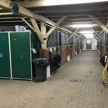
...lichtdurchfluteter Stall,grüne Wiesen...
Apolda
Reit-und-Fahrverein-Apolda-e-V
@Reit-und-Fahrverein-Apolda-e-V
Geländestrecke
Reitlehrer und -unterricht
Krankenbox
Longierzirkel/Roundpen
Bewegungsstall
Innenbox
Halbpension
Vollpension
15 weitere...
P
Leider kein Vorschaubild
Leider kein Vorschaubild
Reitanlage Linda
Mechelroda
Nils Burmeister Reitanlage Lin
@Reit- und Fahrverein Weimar-Li...
FN-Mitglied
Freizeitstall
Vermieten
Longierzirkel/Roundpen
Paddock
Gnadenbrothof
Hengsthaltung möglich
28 weitere...
B

Pensionsstall, Reitunterricht, Beritt, Schulpferde
Ilmtal-Weinstraße
Rosshof Becker
@Rosshof-Becker1
FN-Mitglied
Freizeitstall
Vermieten
Krankenbox
Longierzirkel/Roundpen
Fohlenaufzucht möglich
Hengsthaltung möglich
23 weitere...
P
Leider kein Vorschaubild
Leider kein Vorschaubild
Großzügige Boxen frei für Pferde, Ponys, Rentner...
Dornburg-Camburg
Diana Tigges
@PferdeundPonyfreundePosewitz
Freizeitstall
Vermieten
Hunde willkommen
Parkplatz für Pferdeanhänger
Innenbox
7 weitere...
B

Heu und Heulage verkaufen
Mechtersen
STALL-FREIde Marketing
@STALL-FREI-Marketing
Verkaufen Sie Ihr Heu und Ihre Heulage direkt an Reiter, Pferdeställe und Reitanlagen
Leider kein Vorschaubild
Leider kein Vorschaubild
Vollpension, Box frei in Zöthen bei Jena
Dornburg-Camburg
Tina Unger
@ReitstallUnger
Freizeitstall
Pferdeausbildung
Vermieten
Hunde willkommen
Krankenbox
Fohlenaufzucht möglich
Gnadenbrothof
24 weitere...
B
Leider kein Vorschaubild
Leider kein Vorschaubild
Plätze in Offenstallhaltung
Schkölen
Sandra
@Sandra1406
Freizeitstall
Pferdeausbildung
Vermieten
Krankenbox
Paddock
Notfallboxen
19 weitere...
B

Offenstallplätze o. Box für die Nacht für 4 Pfer...
Naumburg OT Meyhen
Reitanlage & Pferdepension
@Reitanlage-Naumburg-Meyhen
Fahrstall, Kutschwagen
Freizeitstall
Vermieten
Hunde willkommen
Longierzirkel/Roundpen
Innenbox
Laufbox
11 weitere...
P


EQUITANAS Reitsport
Zeitz
Equitanas Reitsport gGmbH
@EQUITANAS
Geländestrecke
Pferdeausbildung
Vermieten
Hunde willkommen
Krankenbox
Hufrehe geeignet
Notfallboxen
19 weitere...
P+
Deprecated: Creation of dynamic property Zend_View::$pageCount is deprecated in /var/www/stall-frei/htdocs/staging.stall-frei.de/library/vendor/shardj/zf1-future/library/Zend/View/Abstract.php on line 308
Deprecated: Creation of dynamic property Zend_View::$itemCountPerPage is deprecated in /var/www/stall-frei/htdocs/staging.stall-frei.de/library/vendor/shardj/zf1-future/library/Zend/View/Abstract.php on line 308
Deprecated: Creation of dynamic property Zend_View::$first is deprecated in /var/www/stall-frei/htdocs/staging.stall-frei.de/library/vendor/shardj/zf1-future/library/Zend/View/Abstract.php on line 308
Deprecated: Creation of dynamic property Zend_View::$current is deprecated in /var/www/stall-frei/htdocs/staging.stall-frei.de/library/vendor/shardj/zf1-future/library/Zend/View/Abstract.php on line 308
Deprecated: Creation of dynamic property Zend_View::$last is deprecated in /var/www/stall-frei/htdocs/staging.stall-frei.de/library/vendor/shardj/zf1-future/library/Zend/View/Abstract.php on line 308
Deprecated: Creation of dynamic property Zend_View::$next is deprecated in /var/www/stall-frei/htdocs/staging.stall-frei.de/library/vendor/shardj/zf1-future/library/Zend/View/Abstract.php on line 308
Deprecated: Creation of dynamic property Zend_View::$pagesInRange is deprecated in /var/www/stall-frei/htdocs/staging.stall-frei.de/library/vendor/shardj/zf1-future/library/Zend/View/Abstract.php on line 308
Deprecated: Creation of dynamic property Zend_View::$firstPageInRange is deprecated in /var/www/stall-frei/htdocs/staging.stall-frei.de/library/vendor/shardj/zf1-future/library/Zend/View/Abstract.php on line 308
Deprecated: Creation of dynamic property Zend_View::$lastPageInRange is deprecated in /var/www/stall-frei/htdocs/staging.stall-frei.de/library/vendor/shardj/zf1-future/library/Zend/View/Abstract.php on line 308
Deprecated: Creation of dynamic property Zend_View::$currentItemCount is deprecated in /var/www/stall-frei/htdocs/staging.stall-frei.de/library/vendor/shardj/zf1-future/library/Zend/View/Abstract.php on line 308
Deprecated: Creation of dynamic property Zend_View::$totalItemCount is deprecated in /var/www/stall-frei/htdocs/staging.stall-frei.de/library/vendor/shardj/zf1-future/library/Zend/View/Abstract.php on line 308
Deprecated: Creation of dynamic property Zend_View::$firstItemNumber is deprecated in /var/www/stall-frei/htdocs/staging.stall-frei.de/library/vendor/shardj/zf1-future/library/Zend/View/Abstract.php on line 308
Deprecated: Creation of dynamic property Zend_View::$lastItemNumber is deprecated in /var/www/stall-frei/htdocs/staging.stall-frei.de/library/vendor/shardj/zf1-future/library/Zend/View/Abstract.php on line 308
Deprecated: Creation of dynamic property Zend_View::$router is deprecated in /var/www/stall-frei/htdocs/staging.stall-frei.de/library/vendor/shardj/zf1-future/library/Zend/View/Abstract.php on line 308
Deprecated: Creation of dynamic property Zend_View::$urlParams is deprecated in /var/www/stall-frei/htdocs/staging.stall-frei.de/library/vendor/shardj/zf1-future/library/Zend/View/Abstract.php on line 308
Deprecated: Creation of dynamic property Zend_View::$showAds is deprecated in /var/www/stall-frei/htdocs/staging.stall-frei.de/library/vendor/shardj/zf1-future/library/Zend/View/Abstract.php on line 308
Deprecated: Creation of dynamic property Zend_View::$objectIds is deprecated in /var/www/stall-frei/htdocs/staging.stall-frei.de/library/vendor/shardj/zf1-future/library/Zend/View/Abstract.php on line 308
Deprecated: Creation of dynamic property Zend_View::$showNavbar is deprecated in /var/www/stall-frei/htdocs/staging.stall-frei.de/library/vendor/shardj/zf1-future/library/Zend/View/Abstract.php on line 308
Deprecated: Creation of dynamic property Zend_View::$showBreadcrumb is deprecated in /var/www/stall-frei/htdocs/staging.stall-frei.de/library/vendor/shardj/zf1-future/library/Zend/View/Abstract.php on line 308
Deprecated: Creation of dynamic property Zend_View::$showFooter is deprecated in /var/www/stall-frei/htdocs/staging.stall-frei.de/library/vendor/shardj/zf1-future/library/Zend/View/Abstract.php on line 308
Deprecated: Creation of dynamic property Zend_View::$showInternalAds is deprecated in /var/www/stall-frei/htdocs/staging.stall-frei.de/library/vendor/shardj/zf1-future/library/Zend/View/Abstract.php on line 308
Deprecated: Creation of dynamic property Zend_View::$blNoContent is deprecated in /var/www/stall-frei/htdocs/staging.stall-frei.de/library/vendor/shardj/zf1-future/library/Zend/View/Abstract.php on line 308
Deprecated: Creation of dynamic property Zend_View::$sMetaDesc is deprecated in /var/www/stall-frei/htdocs/staging.stall-frei.de/library/vendor/shardj/zf1-future/library/Zend/View/Abstract.php on line 308
Deprecated: Creation of dynamic property Zend_View::$useGmaps is deprecated in /var/www/stall-frei/htdocs/staging.stall-frei.de/library/vendor/shardj/zf1-future/library/Zend/View/Abstract.php on line 308
Deprecated: Creation of dynamic property Zend_View::$touches is deprecated in /var/www/stall-frei/htdocs/staging.stall-frei.de/library/vendor/shardj/zf1-future/library/Zend/View/Abstract.php on line 308
Deprecated: Creation of dynamic property Zend_View::$oProject is deprecated in /var/www/stall-frei/htdocs/staging.stall-frei.de/library/vendor/shardj/zf1-future/library/Zend/View/Abstract.php on line 308
Deprecated: Creation of dynamic property Zend_View::$pageHeadline is deprecated in /var/www/stall-frei/htdocs/staging.stall-frei.de/library/vendor/shardj/zf1-future/library/Zend/View/Abstract.php on line 308
Deprecated: Creation of dynamic property Zend_View::$disableLocationField is deprecated in /var/www/stall-frei/htdocs/staging.stall-frei.de/library/vendor/shardj/zf1-future/library/Zend/View/Abstract.php on line 308
Deprecated: Creation of dynamic property Zend_View::$isSearch is deprecated in /var/www/stall-frei/htdocs/staging.stall-frei.de/library/vendor/shardj/zf1-future/library/Zend/View/Abstract.php on line 308
Deprecated: Creation of dynamic property Zend_View::$pageTitle is deprecated in /var/www/stall-frei/htdocs/staging.stall-frei.de/library/vendor/shardj/zf1-future/library/Zend/View/Abstract.php on line 308
Deprecated: Creation of dynamic property Psf_Form_Element_Text::$class is deprecated in /var/www/stall-frei/htdocs/staging.stall-frei.de/library/vendor/shardj/zf1-future/library/Zend/Form/Element.php on line 874
Deprecated: Creation of dynamic property Psf_Form_Element_Text::$size is deprecated in /var/www/stall-frei/htdocs/staging.stall-frei.de/library/vendor/shardj/zf1-future/library/Zend/Form/Element.php on line 874
Deprecated: Creation of dynamic property Psf_Form_Element_Text::$placeholder is deprecated in /var/www/stall-frei/htdocs/staging.stall-frei.de/library/vendor/shardj/zf1-future/library/Zend/Form/Element.php on line 874
Deprecated: Creation of dynamic property Psf_Form_Element_Hidden::$class is deprecated in /var/www/stall-frei/htdocs/staging.stall-frei.de/library/vendor/shardj/zf1-future/library/Zend/Form/Element.php on line 874
Deprecated: Creation of dynamic property Psf_Form_Element_Hidden::$class is deprecated in /var/www/stall-frei/htdocs/staging.stall-frei.de/library/vendor/shardj/zf1-future/library/Zend/Form/Element.php on line 874
Deprecated: Creation of dynamic property Psf_Form_Element_Hidden::$class is deprecated in /var/www/stall-frei/htdocs/staging.stall-frei.de/library/vendor/shardj/zf1-future/library/Zend/Form/Element.php on line 874
Deprecated: Creation of dynamic property Psf_Form_Element_Hidden::$class is deprecated in /var/www/stall-frei/htdocs/staging.stall-frei.de/library/vendor/shardj/zf1-future/library/Zend/Form/Element.php on line 874
Deprecated: Creation of dynamic property Psf_Form_Element_Select::$class is deprecated in /var/www/stall-frei/htdocs/staging.stall-frei.de/library/vendor/shardj/zf1-future/library/Zend/Form/Element.php on line 874
Deprecated: Creation of dynamic property Psf_Form_Element_Select::$class is deprecated in /var/www/stall-frei/htdocs/staging.stall-frei.de/library/vendor/shardj/zf1-future/library/Zend/Form/Element.php on line 874
Deprecated: Creation of dynamic property Psf_Form_Element_Select::$class is deprecated in /var/www/stall-frei/htdocs/staging.stall-frei.de/library/vendor/shardj/zf1-future/library/Zend/Form/Element.php on line 874
Deprecated: Creation of dynamic property Psf_Form_Element_Select::$class is deprecated in /var/www/stall-frei/htdocs/staging.stall-frei.de/library/vendor/shardj/zf1-future/library/Zend/Form/Element.php on line 874
Deprecated: Creation of dynamic property Psf_Form_Element_Text::$class is deprecated in /var/www/stall-frei/htdocs/staging.stall-frei.de/library/vendor/shardj/zf1-future/library/Zend/Form/Element.php on line 874
Deprecated: Creation of dynamic property Psf_Form_Element_Checkbox::$label is deprecated in /var/www/stall-frei/htdocs/staging.stall-frei.de/library/vendor/shardj/zf1-future/library/Zend/Form/Element.php on line 874
Deprecated: Creation of dynamic property Zend_View::$sort is deprecated in /var/www/stall-frei/htdocs/staging.stall-frei.de/library/vendor/shardj/zf1-future/library/Zend/View/Abstract.php on line 308
Deprecated: Creation of dynamic property Zend_View::$searchLocation is deprecated in /var/www/stall-frei/htdocs/staging.stall-frei.de/library/vendor/shardj/zf1-future/library/Zend/View/Abstract.php on line 308
Deprecated: Creation of dynamic property Zend_View::$locationHint is deprecated in /var/www/stall-frei/htdocs/staging.stall-frei.de/library/vendor/shardj/zf1-future/library/Zend/View/Abstract.php on line 308
Psf_GeoCoder_Abstract::getLocation: Rutha Get Location CachedOrLive
Psf_GeoCoder_Abstract::getCachedOrLive: Rutha
Psf_GeoCoder_OpenCageData::makeApiRequest: response:
Array
(
[documentation] => https://opencagedata.com/api
[licenses] => Array
(
[0] => Array
(
[name] => see attribution guide
[url] => https://opencagedata.com/credits
)
)
[results] => Array
(
[0] => Array
(
[bounds] => Array
(
[northeast] => Array
(
[lat] => 50.8951012
[lng] => 11.6413004
)
[southwest] => Array
(
[lat] => 50.8551012
[lng] => 11.6013004
)
)
[components] => Array
(
[ISO_3166-1_alpha-2] => DE
[ISO_3166-1_alpha-3] => DEU
[ISO_3166-2] => Array
(
[0] => DE-TH
)
[_category] => place
[_normalized_city] => Sulza
[_type] => village
[city] => Sulza
[continent] => Europe
[country] => Deutschland
[country_code] => de
[county] => Saale-Holzland-Kreis
[municipality] => Südliches Saaletal
[political_union] => European Union
[postcode] => 07747
[state] => Thüringen
[state_code] => TH
[village] => Rutha
)
[confidence] => 7
[formatted] => 07747 Rutha, Deutschland
[geometry] => Array
(
[lat] => 50.8751012
[lng] => 11.6213004
)
)
[1] => Array
(
[bounds] => Array
(
[northeast] => Array
(
[lat] => 50.8753193
[lng] => 11.6204996
)
[southwest] => Array
(
[lat] => 50.8749814
[lng] => 11.6153546
)
)
[components] => Array
(
[ISO_3166-1_alpha-2] => DE
[ISO_3166-1_alpha-3] => DEU
[ISO_3166-2] => Array
(
[0] => DE-TH
)
[_category] => road
[_normalized_city] => Sulza
[_type] => road
[city] => Sulza
[continent] => Europe
[country] => Deutschland
[country_code] => de
[county] => Saale-Holzland-Kreis
[municipality] => Südliches Saaletal
[political_union] => European Union
[postcode] => 07751
[road] => Rutha
[road_type] => tertiary
[state] => Thüringen
[state_code] => TH
[village] => Rutha
)
[confidence] => 9
[formatted] => Rutha, 07751 Rutha, Deutschland
[geometry] => Array
(
[lat] => 50.8749815
[lng] => 11.6179432
)
)
[2] => Array
(
[components] => Array
(
[ISO_3166-1_alpha-2] => FR
[ISO_3166-1_alpha-3] => FRA
[ISO_3166-2] => Array
(
[0] => FR-OCC
[1] => FR-66
)
[_category] => road
[_normalized_city] => Formiguères
[_type] => road
[city] => Formiguères
[continent] => Europe
[country] => France
[country_code] => fr
[county] => Pyrénées-Orientales
[local_authority] => Communauté de communes Pyrénées catalanes
[political_union] => European Union
[postcode] => 66210
[road] => Ruta de Villanova
[state] => Occitanie
[state_code] => OCC
)
[confidence] => 2
[formatted] => Ruta de Villanova, 66210 Formiguères, France
[geometry] => Array
(
[lat] => 42.614903
[lng] => 2.110249
)
)
[3] => Array
(
[components] => Array
(
[ISO_3166-1_alpha-2] => FR
[ISO_3166-1_alpha-3] => FRA
[ISO_3166-2] => Array
(
[0] => FR-OCC
[1] => FR-66
)
[_category] => road
[_normalized_city] => Villelongue-dels-Monts
[_type] => road
[city] => Villelongue-dels-Monts
[continent] => Europe
[country] => France
[country_code] => fr
[county] => Pyrénées-Orientales
[local_authority] => Communauté de communes des Albères, de la Côte Vermeille et de l'Illibéris
[political_union] => European Union
[postcode] => 66740
[road] => Ruta de la Roca
[state] => Occitanie
[state_code] => OCC
)
[confidence] => 2
[formatted] => Ruta de la Roca, 66740 Villelongue-dels-Monts, France
[geometry] => Array
(
[lat] => 42.52513
[lng] => 2.906963
)
)
[4] => Array
(
[components] => Array
(
[ISO_3166-1_alpha-2] => FR
[ISO_3166-1_alpha-3] => FRA
[ISO_3166-2] => Array
(
[0] => FR-OCC
[1] => FR-66
)
[_category] => road
[_normalized_city] => Baillestavy
[_type] => road
[city] => Baillestavy
[continent] => Europe
[country] => France
[country_code] => fr
[county] => Pyrénées-Orientales
[local_authority] => Communauté de communes Conflent-Canigó
[political_union] => European Union
[postcode] => 66320
[road] => Ruta de la Coma
[state] => Occitanie
[state_code] => OCC
)
[confidence] => 2
[formatted] => Ruta de la Coma, 66320 Baillestavy, France
[geometry] => Array
(
[lat] => 42.564634
[lng] => 2.524092
)
)
[5] => Array
(
[components] => Array
(
[ISO_3166-1_alpha-2] => FR
[ISO_3166-1_alpha-3] => FRA
[ISO_3166-2] => Array
(
[0] => FR-OCC
[1] => FR-66
)
[_category] => road
[_normalized_city] => Fillols
[_type] => road
[city] => Fillols
[continent] => Europe
[country] => France
[country_code] => fr
[county] => Pyrénées-Orientales
[local_authority] => Communauté de communes Conflent-Canigó
[political_union] => European Union
[postcode] => 66820
[road] => Ruta de Corneilla
[state] => Occitanie
[state_code] => OCC
)
[confidence] => 2
[formatted] => Ruta de Corneilla, 66820 Fillols, France
[geometry] => Array
(
[lat] => 42.562592
[lng] => 2.406922
)
)
[6] => Array
(
[components] => Array
(
[ISO_3166-1_alpha-2] => FR
[ISO_3166-1_alpha-3] => FRA
[ISO_3166-2] => Array
(
[0] => FR-OCC
[1] => FR-66
)
[_category] => road
[_normalized_city] => Villelongue-dels-Monts
[_type] => road
[city] => Villelongue-dels-Monts
[continent] => Europe
[country] => France
[country_code] => fr
[county] => Pyrénées-Orientales
[local_authority] => Communauté de communes des Albères, de la Côte Vermeille et de l'Illibéris
[political_union] => European Union
[postcode] => 66740
[road] => Ruta Del Bolo
[state] => Occitanie
[state_code] => OCC
)
[confidence] => 2
[formatted] => Ruta Del Bolo, 66740 Villelongue-dels-Monts, France
[geometry] => Array
(
[lat] => 42.542924
[lng] => 2.902496
)
)
[7] => Array
(
[components] => Array
(
[ISO_3166-1_alpha-2] => FR
[ISO_3166-1_alpha-3] => FRA
[ISO_3166-2] => Array
(
[0] => FR-OCC
[1] => FR-66
)
[_category] => road
[_normalized_city] => Rodès
[_type] => road
[city] => Rodès
[continent] => Europe
[country] => France
[country_code] => fr
[county] => Pyrénées-Orientales
[local_authority] => Communauté de communes Roussillon Conflent
[political_union] => European Union
[postcode] => 66320
[road] => Ruta Dels Turons
[state] => Occitanie
[state_code] => OCC
)
[confidence] => 2
[formatted] => Ruta Dels Turons, 66320 Rodès, France
[geometry] => Array
(
[lat] => 42.654013
[lng] => 2.562306
)
)
[8] => Array
(
[components] => Array
(
[ISO_3166-1_alpha-2] => FR
[ISO_3166-1_alpha-3] => FRA
[ISO_3166-2] => Array
(
[0] => FR-OCC
[1] => FR-66
)
[_category] => road
[_normalized_city] => Fillols
[_type] => road
[city] => Fillols
[continent] => Europe
[country] => France
[country_code] => fr
[county] => Pyrénées-Orientales
[local_authority] => Communauté de communes Conflent-Canigó
[political_union] => European Union
[postcode] => 66820
[road] => Ruta de Taurinya
[state] => Occitanie
[state_code] => OCC
)
[confidence] => 2
[formatted] => Ruta de Taurinya, 66820 Fillols, France
[geometry] => Array
(
[lat] => 42.564995
[lng] => 2.412247
)
)
[9] => Array
(
[components] => Array
(
[ISO_3166-1_alpha-2] => FR
[ISO_3166-1_alpha-3] => FRA
[ISO_3166-2] => Array
(
[0] => FR-OCC
[1] => FR-66
)
[_category] => road
[_normalized_city] => Villelongue-dels-Monts
[_type] => road
[city] => Villelongue-dels-Monts
[continent] => Europe
[country] => France
[country_code] => fr
[county] => Pyrénées-Orientales
[local_authority] => Communauté de communes des Albères, de la Côte Vermeille et de l'Illibéris
[political_union] => European Union
[postcode] => 66740
[road] => Ruta de Montesquiu
[state] => Occitanie
[state_code] => OCC
)
[confidence] => 2
[formatted] => Ruta de Montesquiu, 66740 Villelongue-dels-Monts, France
[geometry] => Array
(
[lat] => 42.525584
[lng] => 2.898823
)
)
)
[status] => Array
(
[code] => 200
[message] => OK
)
[stay_informed] => Array
(
[blog] => https://blog.opencagedata.com
[mastodon] => https://en.osm.town/@opencage
)
[thanks] => For using an OpenCage API
[timestamp] => Array
(
[created_http] => Mon, 09 Feb 2026 04:55:29 GMT
[created_unix] => 1770612929
)
[total_results] => 10
)
Psf_GeoCoder_Abstract::convertLocationResult
{"documentation":"https:\/\/opencagedata.com\/api","licenses":[{"name":"see attribution guide","url":"https:\/\/opencagedata.com\/credits"}],"results":[{"bounds":{"northeast":{"lat":50.8951012,"lng":11.6413004},"southwest":{"lat":50.8551012,"lng":11.6013004}},"components":{"ISO_3166-1_alpha-2":"DE","ISO_3166-1_alpha-3":"DEU","ISO_3166-2":["DE-TH"],"_category":"place","_normalized_city":"Sulza","_type":"village","city":"Sulza","continent":"Europe","country":"Deutschland","country_code":"de","county":"Saale-Holzland-Kreis","municipality":"S\u00fcdliches Saaletal","political_union":"European Union","postcode":"07747","state":"Th\u00fcringen","state_code":"TH","village":"Rutha"},"confidence":7,"formatted":"07747 Rutha, Deutschland","geometry":{"lat":50.8751012,"lng":11.6213004}},{"bounds":{"northeast":{"lat":50.8753193,"lng":11.6204996},"southwest":{"lat":50.8749814,"lng":11.6153546}},"components":{"ISO_3166-1_alpha-2":"DE","ISO_3166-1_alpha-3":"DEU","ISO_3166-2":["DE-TH"],"_category":"road","_normalized_city":"Sulza","_type":"road","city":"Sulza","continent":"Europe","country":"Deutschland","country_code":"de","county":"Saale-Holzland-Kreis","municipality":"S\u00fcdliches Saaletal","political_union":"European Union","postcode":"07751","road":"Rutha","road_type":"tertiary","state":"Th\u00fcringen","state_code":"TH","village":"Rutha"},"confidence":9,"formatted":"Rutha, 07751 Rutha, Deutschland","geometry":{"lat":50.8749815,"lng":11.6179432}},{"components":{"ISO_3166-1_alpha-2":"FR","ISO_3166-1_alpha-3":"FRA","ISO_3166-2":["FR-OCC","FR-66"],"_category":"road","_normalized_city":"Formigu\u00e8res","_type":"road","city":"Formigu\u00e8res","continent":"Europe","country":"France","country_code":"fr","county":"Pyr\u00e9n\u00e9es-Orientales","local_authority":"Communaut\u00e9 de communes Pyr\u00e9n\u00e9es catalanes","political_union":"European Union","postcode":"66210","road":"Ruta de Villanova","state":"Occitanie","state_code":"OCC"},"confidence":2,"formatted":"Ruta de Villanova, 66210 Formigu\u00e8res, France","geometry":{"lat":42.614903,"lng":2.110249}},{"components":{"ISO_3166-1_alpha-2":"FR","ISO_3166-1_alpha-3":"FRA","ISO_3166-2":["FR-OCC","FR-66"],"_category":"road","_normalized_city":"Villelongue-dels-Monts","_type":"road","city":"Villelongue-dels-Monts","continent":"Europe","country":"France","country_code":"fr","county":"Pyr\u00e9n\u00e9es-Orientales","local_authority":"Communaut\u00e9 de communes des Alb\u00e8res, de la C\u00f4te Vermeille et de l'Illib\u00e9ris","political_union":"European Union","postcode":"66740","road":"Ruta de la Roca","state":"Occitanie","state_code":"OCC"},"confidence":2,"formatted":"Ruta de la Roca, 66740 Villelongue-dels-Monts, France","geometry":{"lat":42.52513,"lng":2.906963}},{"components":{"ISO_3166-1_alpha-2":"FR","ISO_3166-1_alpha-3":"FRA","ISO_3166-2":["FR-OCC","FR-66"],"_category":"road","_normalized_city":"Baillestavy","_type":"road","city":"Baillestavy","continent":"Europe","country":"France","country_code":"fr","county":"Pyr\u00e9n\u00e9es-Orientales","local_authority":"Communaut\u00e9 de communes Conflent-Canig\u00f3","political_union":"European Union","postcode":"66320","road":"Ruta de la Coma","state":"Occitanie","state_code":"OCC"},"confidence":2,"formatted":"Ruta de la Coma, 66320 Baillestavy, France","geometry":{"lat":42.564634,"lng":2.524092}},{"components":{"ISO_3166-1_alpha-2":"FR","ISO_3166-1_alpha-3":"FRA","ISO_3166-2":["FR-OCC","FR-66"],"_category":"road","_normalized_city":"Fillols","_type":"road","city":"Fillols","continent":"Europe","country":"France","country_code":"fr","county":"Pyr\u00e9n\u00e9es-Orientales","local_authority":"Communaut\u00e9 de communes Conflent-Canig\u00f3","political_union":"European Union","postcode":"66820","road":"Ruta de Corneilla","state":"Occitanie","state_code":"OCC"},"confidence":2,"formatted":"Ruta de Corneilla, 66820 Fillols, France","geometry":{"lat":42.562592,"lng":2.406922}},{"components":{"ISO_3166-1_alpha-2":"FR","ISO_3166-1_alpha-3":"FRA","ISO_3166-2":["FR-OCC","FR-66"],"_category":"road","_normalized_city":"Villelongue-dels-Monts","_type":"road","city":"Villelongue-dels-Monts","continent":"Europe","country":"France","country_code":"fr","county":"Pyr\u00e9n\u00e9es-Orientales","local_authority":"Communaut\u00e9 de communes des Alb\u00e8res, de la C\u00f4te Vermeille et de l'Illib\u00e9ris","political_union":"European Union","postcode":"66740","road":"Ruta Del Bolo","state":"Occitanie","state_code":"OCC"},"confidence":2,"formatted":"Ruta Del Bolo, 66740 Villelongue-dels-Monts, France","geometry":{"lat":42.542924,"lng":2.902496}},{"components":{"ISO_3166-1_alpha-2":"FR","ISO_3166-1_alpha-3":"FRA","ISO_3166-2":["FR-OCC","FR-66"],"_category":"road","_normalized_city":"Rod\u00e8s","_type":"road","city":"Rod\u00e8s","continent":"Europe","country":"France","country_code":"fr","county":"Pyr\u00e9n\u00e9es-Orientales","local_authority":"Communaut\u00e9 de communes Roussillon Conflent","political_union":"European Union","postcode":"66320","road":"Ruta Dels Turons","state":"Occitanie","state_code":"OCC"},"confidence":2,"formatted":"Ruta Dels Turons, 66320 Rod\u00e8s, France","geometry":{"lat":42.654013,"lng":2.562306}},{"components":{"ISO_3166-1_alpha-2":"FR","ISO_3166-1_alpha-3":"FRA","ISO_3166-2":["FR-OCC","FR-66"],"_category":"road","_normalized_city":"Fillols","_type":"road","city":"Fillols","continent":"Europe","country":"France","country_code":"fr","county":"Pyr\u00e9n\u00e9es-Orientales","local_authority":"Communaut\u00e9 de communes Conflent-Canig\u00f3","political_union":"European Union","postcode":"66820","road":"Ruta de Taurinya","state":"Occitanie","state_code":"OCC"},"confidence":2,"formatted":"Ruta de Taurinya, 66820 Fillols, France","geometry":{"lat":42.564995,"lng":2.412247}},{"components":{"ISO_3166-1_alpha-2":"FR","ISO_3166-1_alpha-3":"FRA","ISO_3166-2":["FR-OCC","FR-66"],"_category":"road","_normalized_city":"Villelongue-dels-Monts","_type":"road","city":"Villelongue-dels-Monts","continent":"Europe","country":"France","country_code":"fr","county":"Pyr\u00e9n\u00e9es-Orientales","local_authority":"Communaut\u00e9 de communes des Alb\u00e8res, de la C\u00f4te Vermeille et de l'Illib\u00e9ris","political_union":"European Union","postcode":"66740","road":"Ruta de Montesquiu","state":"Occitanie","state_code":"OCC"},"confidence":2,"formatted":"Ruta de Montesquiu, 66740 Villelongue-dels-Monts, France","geometry":{"lat":42.525584,"lng":2.898823}}],"status":{"code":200,"message":"OK"},"stay_informed":{"blog":"https:\/\/blog.opencagedata.com","mastodon":"https:\/\/en.osm.town\/@opencage"},"thanks":"For using an OpenCage API","timestamp":{"created_http":"Mon, 09 Feb 2026 04:55:29 GMT","created_unix":1770612929},"total_results":10}Array
(
[0] => stdClass Object
(
[bounds] => stdClass Object
(
[northeast] => stdClass Object
(
[lat] => 50.8951012
[lng] => 11.6413004
)
[southwest] => stdClass Object
(
[lat] => 50.8551012
[lng] => 11.6013004
)
)
[components] => stdClass Object
(
[ISO_3166-1_alpha-2] => DE
[ISO_3166-1_alpha-3] => DEU
[ISO_3166-2] => Array
(
[0] => DE-TH
)
[_category] => place
[_normalized_city] => Sulza
[_type] => village
[city] => Sulza
[continent] => Europe
[country] => Deutschland
[country_code] => de
[county] => Saale-Holzland-Kreis
[municipality] => Südliches Saaletal
[political_union] => European Union
[postcode] => 07747
[state] => Thüringen
[state_code] => TH
[village] => Rutha
)
[confidence] => 7
[formatted] => 07747 Rutha, Deutschland
[geometry] => stdClass Object
(
[lat] => 50.8751012
[lng] => 11.6213004
)
)
[1] => stdClass Object
(
[bounds] => stdClass Object
(
[northeast] => stdClass Object
(
[lat] => 50.8753193
[lng] => 11.6204996
)
[southwest] => stdClass Object
(
[lat] => 50.8749814
[lng] => 11.6153546
)
)
[components] => stdClass Object
(
[ISO_3166-1_alpha-2] => DE
[ISO_3166-1_alpha-3] => DEU
[ISO_3166-2] => Array
(
[0] => DE-TH
)
[_category] => road
[_normalized_city] => Sulza
[_type] => road
[city] => Sulza
[continent] => Europe
[country] => Deutschland
[country_code] => de
[county] => Saale-Holzland-Kreis
[municipality] => Südliches Saaletal
[political_union] => European Union
[postcode] => 07751
[road] => Rutha
[road_type] => tertiary
[state] => Thüringen
[state_code] => TH
[village] => Rutha
)
[confidence] => 9
[formatted] => Rutha, 07751 Rutha, Deutschland
[geometry] => stdClass Object
(
[lat] => 50.8749815
[lng] => 11.6179432
)
)
[2] => stdClass Object
(
[components] => stdClass Object
(
[ISO_3166-1_alpha-2] => FR
[ISO_3166-1_alpha-3] => FRA
[ISO_3166-2] => Array
(
[0] => FR-OCC
[1] => FR-66
)
[_category] => road
[_normalized_city] => Formiguères
[_type] => road
[city] => Formiguères
[continent] => Europe
[country] => France
[country_code] => fr
[county] => Pyrénées-Orientales
[local_authority] => Communauté de communes Pyrénées catalanes
[political_union] => European Union
[postcode] => 66210
[road] => Ruta de Villanova
[state] => Occitanie
[state_code] => OCC
)
[confidence] => 2
[formatted] => Ruta de Villanova, 66210 Formiguères, France
[geometry] => stdClass Object
(
[lat] => 42.614903
[lng] => 2.110249
)
)
[3] => stdClass Object
(
[components] => stdClass Object
(
[ISO_3166-1_alpha-2] => FR
[ISO_3166-1_alpha-3] => FRA
[ISO_3166-2] => Array
(
[0] => FR-OCC
[1] => FR-66
)
[_category] => road
[_normalized_city] => Villelongue-dels-Monts
[_type] => road
[city] => Villelongue-dels-Monts
[continent] => Europe
[country] => France
[country_code] => fr
[county] => Pyrénées-Orientales
[local_authority] => Communauté de communes des Albères, de la Côte Vermeille et de l'Illibéris
[political_union] => European Union
[postcode] => 66740
[road] => Ruta de la Roca
[state] => Occitanie
[state_code] => OCC
)
[confidence] => 2
[formatted] => Ruta de la Roca, 66740 Villelongue-dels-Monts, France
[geometry] => stdClass Object
(
[lat] => 42.52513
[lng] => 2.906963
)
)
[4] => stdClass Object
(
[components] => stdClass Object
(
[ISO_3166-1_alpha-2] => FR
[ISO_3166-1_alpha-3] => FRA
[ISO_3166-2] => Array
(
[0] => FR-OCC
[1] => FR-66
)
[_category] => road
[_normalized_city] => Baillestavy
[_type] => road
[city] => Baillestavy
[continent] => Europe
[country] => France
[country_code] => fr
[county] => Pyrénées-Orientales
[local_authority] => Communauté de communes Conflent-Canigó
[political_union] => European Union
[postcode] => 66320
[road] => Ruta de la Coma
[state] => Occitanie
[state_code] => OCC
)
[confidence] => 2
[formatted] => Ruta de la Coma, 66320 Baillestavy, France
[geometry] => stdClass Object
(
[lat] => 42.564634
[lng] => 2.524092
)
)
[5] => stdClass Object
(
[components] => stdClass Object
(
[ISO_3166-1_alpha-2] => FR
[ISO_3166-1_alpha-3] => FRA
[ISO_3166-2] => Array
(
[0] => FR-OCC
[1] => FR-66
)
[_category] => road
[_normalized_city] => Fillols
[_type] => road
[city] => Fillols
[continent] => Europe
[country] => France
[country_code] => fr
[county] => Pyrénées-Orientales
[local_authority] => Communauté de communes Conflent-Canigó
[political_union] => European Union
[postcode] => 66820
[road] => Ruta de Corneilla
[state] => Occitanie
[state_code] => OCC
)
[confidence] => 2
[formatted] => Ruta de Corneilla, 66820 Fillols, France
[geometry] => stdClass Object
(
[lat] => 42.562592
[lng] => 2.406922
)
)
[6] => stdClass Object
(
[components] => stdClass Object
(
[ISO_3166-1_alpha-2] => FR
[ISO_3166-1_alpha-3] => FRA
[ISO_3166-2] => Array
(
[0] => FR-OCC
[1] => FR-66
)
[_category] => road
[_normalized_city] => Villelongue-dels-Monts
[_type] => road
[city] => Villelongue-dels-Monts
[continent] => Europe
[country] => France
[country_code] => fr
[county] => Pyrénées-Orientales
[local_authority] => Communauté de communes des Albères, de la Côte Vermeille et de l'Illibéris
[political_union] => European Union
[postcode] => 66740
[road] => Ruta Del Bolo
[state] => Occitanie
[state_code] => OCC
)
[confidence] => 2
[formatted] => Ruta Del Bolo, 66740 Villelongue-dels-Monts, France
[geometry] => stdClass Object
(
[lat] => 42.542924
[lng] => 2.902496
)
)
[7] => stdClass Object
(
[components] => stdClass Object
(
[ISO_3166-1_alpha-2] => FR
[ISO_3166-1_alpha-3] => FRA
[ISO_3166-2] => Array
(
[0] => FR-OCC
[1] => FR-66
)
[_category] => road
[_normalized_city] => Rodès
[_type] => road
[city] => Rodès
[continent] => Europe
[country] => France
[country_code] => fr
[county] => Pyrénées-Orientales
[local_authority] => Communauté de communes Roussillon Conflent
[political_union] => European Union
[postcode] => 66320
[road] => Ruta Dels Turons
[state] => Occitanie
[state_code] => OCC
)
[confidence] => 2
[formatted] => Ruta Dels Turons, 66320 Rodès, France
[geometry] => stdClass Object
(
[lat] => 42.654013
[lng] => 2.562306
)
)
[8] => stdClass Object
(
[components] => stdClass Object
(
[ISO_3166-1_alpha-2] => FR
[ISO_3166-1_alpha-3] => FRA
[ISO_3166-2] => Array
(
[0] => FR-OCC
[1] => FR-66
)
[_category] => road
[_normalized_city] => Fillols
[_type] => road
[city] => Fillols
[continent] => Europe
[country] => France
[country_code] => fr
[county] => Pyrénées-Orientales
[local_authority] => Communauté de communes Conflent-Canigó
[political_union] => European Union
[postcode] => 66820
[road] => Ruta de Taurinya
[state] => Occitanie
[state_code] => OCC
)
[confidence] => 2
[formatted] => Ruta de Taurinya, 66820 Fillols, France
[geometry] => stdClass Object
(
[lat] => 42.564995
[lng] => 2.412247
)
)
[9] => stdClass Object
(
[components] => stdClass Object
(
[ISO_3166-1_alpha-2] => FR
[ISO_3166-1_alpha-3] => FRA
[ISO_3166-2] => Array
(
[0] => FR-OCC
[1] => FR-66
)
[_category] => road
[_normalized_city] => Villelongue-dels-Monts
[_type] => road
[city] => Villelongue-dels-Monts
[continent] => Europe
[country] => France
[country_code] => fr
[county] => Pyrénées-Orientales
[local_authority] => Communauté de communes des Albères, de la Côte Vermeille et de l'Illibéris
[political_union] => European Union
[postcode] => 66740
[road] => Ruta de Montesquiu
[state] => Occitanie
[state_code] => OCC
)
[confidence] => 2
[formatted] => Ruta de Montesquiu, 66740 Villelongue-dels-Monts, France
[geometry] => stdClass Object
(
[lat] => 42.525584
[lng] => 2.898823
)
)
)
Psf_GeoCoder_OpenCageData::getKeyMap: 0
stdClass Object
(
    [bounds] => stdClass Object
        (
            [northeast] => stdClass Object
                (
                    [lat] => 50.8951012
                    [lng] => 11.6413004
                )

            [southwest] => stdClass Object
                (
                    [lat] => 50.8551012
                    [lng] => 11.6013004
                )

        )

    [components] => stdClass Object
        (
            [ISO_3166-1_alpha-2] => DE
            [ISO_3166-1_alpha-3] => DEU
            [ISO_3166-2] => Array
                (
                    [0] => DE-TH
                )

            [_category] => place
            [_normalized_city] => Sulza
            [_type] => village
            [city] => Sulza
            [continent] => Europe
            [country] => Deutschland
            [country_code] => de
            [county] => Saale-Holzland-Kreis
            [municipality] => Südliches Saaletal
            [political_union] => European Union
            [postcode] => 07747
            [state] => Thüringen
            [state_code] => TH
            [village] => Rutha
        )

    [confidence] => 7
    [formatted] => 07747 Rutha, Deutschland
    [geometry] => stdClass Object
        (
            [lat] => 50.8751012
            [lng] => 11.6213004
        )

)
Psf_GeoCoder_OpenCageData::getCounty: Saale-Holzland-Kreis
Psf_GeoCoder_OpenCageData::addMissingData REFETCH!
Array
(
    [address] => 07747 Rutha, Deutschland
    [type] => village
    [street] =>
    [city] => Rutha
    [county] => Saale-Holzland-Kreis
    [state] => Thüringen
    [zip] => 07747
    [country] => Deutschland
    [suburb] =>
    [countrycode] => de
    [latitude] => 50.8751012
    [longitude] => 11.6213004
    [accuracy] => 1
    [confidence] => 7
    [bounds] => stdClass Object
        (
            [northeast] => stdClass Object
                (
                    [lat] => 50.8951012
                    [lng] => 11.6413004
                )

            [southwest] => stdClass Object
                (
                    [lat] => 50.8551012
                    [lng] => 11.6013004
                )

        )

)
reformat!
Array
(
    [address] => 07747 Rutha, Deutschland
    [type] => village
    [street] =>
    [city] => Rutha
    [county] => Saale-Holzland-Kreis
    [state] => Thüringen
    [zip] => 07747
    [country] => Deutschland
    [suburb] =>
    [countrycode] => de
    [latitude] => 50.8751012
    [longitude] => 11.6213004
    [accuracy] => 1
    [confidence] => 7
    [bounds] => stdClass Object
        (
            [northeast] => stdClass Object
                (
                    [lat] => 50.8951012
                    [lng] => 11.6413004
                )

            [southwest] => stdClass Object
                (
                    [lat] => 50.8551012
                    [lng] => 11.6013004
                )

        )

    [place] => 07747 Rutha, Thüringen
    [hash] => fcdce934ba9b069546eef5a31a872fb5
)
Psf_GeoCoder_OpenCageData::getKeyMap: 1
stdClass Object
(
    [bounds] => stdClass Object
        (
            [northeast] => stdClass Object
                (
                    [lat] => 50.8753193
                    [lng] => 11.6204996
                )

            [southwest] => stdClass Object
                (
                    [lat] => 50.8749814
                    [lng] => 11.6153546
                )

        )

    [components] => stdClass Object
        (
            [ISO_3166-1_alpha-2] => DE
            [ISO_3166-1_alpha-3] => DEU
            [ISO_3166-2] => Array
                (
                    [0] => DE-TH
                )

            [_category] => road
            [_normalized_city] => Sulza
            [_type] => road
            [city] => Sulza
            [continent] => Europe
            [country] => Deutschland
            [country_code] => de
            [county] => Saale-Holzland-Kreis
            [municipality] => Südliches Saaletal
            [political_union] => European Union
            [postcode] => 07751
            [road] => Rutha
            [road_type] => tertiary
            [state] => Thüringen
            [state_code] => TH
            [village] => Rutha
        )

    [confidence] => 9
    [formatted] => Rutha, 07751 Rutha, Deutschland
    [geometry] => stdClass Object
        (
            [lat] => 50.8749815
            [lng] => 11.6179432
        )

)
Psf_GeoCoder_OpenCageData::getCounty: Saale-Holzland-Kreis
Psf_GeoCoder_OpenCageData::addMissingData REFETCH!
Array
(
    [address] => Rutha, 07751 Rutha, Deutschland
    [type] => road
    [street] => Rutha
    [city] => Rutha
    [county] => Saale-Holzland-Kreis
    [state] => Thüringen
    [zip] => 07751
    [country] => Deutschland
    [suburb] =>
    [countrycode] => de
    [latitude] => 50.8749815
    [longitude] => 11.6179432
    [accuracy] => 1
    [confidence] => 9
    [bounds] => stdClass Object
        (
            [northeast] => stdClass Object
                (
                    [lat] => 50.8753193
                    [lng] => 11.6204996
                )

            [southwest] => stdClass Object
                (
                    [lat] => 50.8749814
                    [lng] => 11.6153546
                )

        )

)
reformat!
Array
(
    [address] => Rutha, 07751 Rutha, Deutschland
    [type] => road
    [street] => Rutha
    [city] => Rutha
    [county] => Saale-Holzland-Kreis
    [state] => Thüringen
    [zip] => 07751
    [country] => Deutschland
    [suburb] =>
    [countrycode] => de
    [latitude] => 50.8749815
    [longitude] => 11.6179432
    [accuracy] => 1
    [confidence] => 9
    [bounds] => stdClass Object
        (
            [northeast] => stdClass Object
                (
                    [lat] => 50.8753193
                    [lng] => 11.6204996
                )

            [southwest] => stdClass Object
                (
                    [lat] => 50.8749814
                    [lng] => 11.6153546
                )

        )

    [place] => Rutha, 07751 Rutha, Thüringen
    [hash] => 5e5ce4c989f7d9426f1d18e320e3ef26
)
Psf_GeoCoder_OpenCageData::getKeyMap: 2
stdClass Object
(
    [components] => stdClass Object
        (
            [ISO_3166-1_alpha-2] => FR
            [ISO_3166-1_alpha-3] => FRA
            [ISO_3166-2] => Array
                (
                    [0] => FR-OCC
                    [1] => FR-66
                )

            [_category] => road
            [_normalized_city] => Formiguères
            [_type] => road
            [city] => Formiguères
            [continent] => Europe
            [country] => France
            [country_code] => fr
            [county] => Pyrénées-Orientales
            [local_authority] => Communauté de communes Pyrénées catalanes
            [political_union] => European Union
            [postcode] => 66210
            [road] => Ruta de Villanova
            [state] => Occitanie
            [state_code] => OCC
        )

    [confidence] => 2
    [formatted] => Ruta de Villanova, 66210 Formiguères, France
    [geometry] => stdClass Object
        (
            [lat] => 42.614903
            [lng] => 2.110249
        )

)
Psf_GeoCoder_OpenCageData::getCounty: Pyrénées-Orientales
Psf_GeoCoder_OpenCageData::addMissingData REFETCH!
Array
(
    [address] => Ruta de Villanova, 66210 Formiguères, France
    [type] => road
    [street] => Ruta de Villanova
    [city] => Formiguères
    [county] => Pyrénées-Orientales
    [state] => Occitanie
    [zip] => 66210
    [country] => France
    [suburb] =>
    [countrycode] => fr
    [latitude] => 42.614903
    [longitude] => 2.110249
    [accuracy] => 1
    [confidence] => 2
    [bounds] =>
)
reformat!
Array
(
    [address] => Ruta de Villanova, 66210 Formiguères, France
    [type] => road
    [street] => Ruta de Villanova
    [city] => Formiguères
    [county] => Pyrénées-Orientales
    [state] => Occitanie
    [zip] => 66210
    [country] => France
    [suburb] =>
    [countrycode] => fr
    [latitude] => 42.614903
    [longitude] => 2.110249
    [accuracy] => 1
    [confidence] => 2
    [bounds] =>
    [place] => Ruta de Villanova, 66210 Formiguères, Occitanie
    [hash] => 5281555d93f9fe6cc4e7818d9321d11c
)
Psf_GeoCoder_OpenCageData::getKeyMap: 3
stdClass Object
(
    [components] => stdClass Object
        (
            [ISO_3166-1_alpha-2] => FR
            [ISO_3166-1_alpha-3] => FRA
            [ISO_3166-2] => Array
                (
                    [0] => FR-OCC
                    [1] => FR-66
                )

            [_category] => road
            [_normalized_city] => Villelongue-dels-Monts
            [_type] => road
            [city] => Villelongue-dels-Monts
            [continent] => Europe
            [country] => France
            [country_code] => fr
            [county] => Pyrénées-Orientales
            [local_authority] => Communauté de communes des Albères, de la Côte Vermeille et de l'Illibéris
            [political_union] => European Union
            [postcode] => 66740
            [road] => Ruta de la Roca
            [state] => Occitanie
            [state_code] => OCC
        )

    [confidence] => 2
    [formatted] => Ruta de la Roca, 66740 Villelongue-dels-Monts, France
    [geometry] => stdClass Object
        (
            [lat] => 42.52513
            [lng] => 2.906963
        )

)
Psf_GeoCoder_OpenCageData::getCounty: Pyrénées-Orientales
Psf_GeoCoder_OpenCageData::addMissingData REFETCH!
Array
(
    [address] => Ruta de la Roca, 66740 Villelongue-dels-Monts, France
    [type] => road
    [street] => Ruta de la Roca
    [city] => Villelongue-dels-Monts
    [county] => Pyrénées-Orientales
    [state] => Occitanie
    [zip] => 66740
    [country] => France
    [suburb] =>
    [countrycode] => fr
    [latitude] => 42.52513
    [longitude] => 2.906963
    [accuracy] => 1
    [confidence] => 2
    [bounds] =>
)
reformat!
Array
(
    [address] => Ruta de la Roca, 66740 Villelongue-dels-Monts, France
    [type] => road
    [street] => Ruta de la Roca
    [city] => Villelongue-dels-Monts
    [county] => Pyrénées-Orientales
    [state] => Occitanie
    [zip] => 66740
    [country] => France
    [suburb] =>
    [countrycode] => fr
    [latitude] => 42.52513
    [longitude] => 2.906963
    [accuracy] => 1
    [confidence] => 2
    [bounds] =>
    [place] => Ruta de la Roca, 66740 Villelongue-dels-Monts, Occitanie
    [hash] => 51a1f66422179ff83923a3dd8340f66d
)
Psf_GeoCoder_OpenCageData::getKeyMap: 4
stdClass Object
(
    [components] => stdClass Object
        (
            [ISO_3166-1_alpha-2] => FR
            [ISO_3166-1_alpha-3] => FRA
            [ISO_3166-2] => Array
                (
                    [0] => FR-OCC
                    [1] => FR-66
                )

            [_category] => road
            [_normalized_city] => Baillestavy
            [_type] => road
            [city] => Baillestavy
            [continent] => Europe
            [country] => France
            [country_code] => fr
            [county] => Pyrénées-Orientales
            [local_authority] => Communauté de communes Conflent-Canigó
            [political_union] => European Union
            [postcode] => 66320
            [road] => Ruta de la Coma
            [state] => Occitanie
            [state_code] => OCC
        )

    [confidence] => 2
    [formatted] => Ruta de la Coma, 66320 Baillestavy, France
    [geometry] => stdClass Object
        (
            [lat] => 42.564634
            [lng] => 2.524092
        )

)
Psf_GeoCoder_OpenCageData::getCounty: Pyrénées-Orientales
Psf_GeoCoder_OpenCageData::addMissingData REFETCH!
Array
(
    [address] => Ruta de la Coma, 66320 Baillestavy, France
    [type] => road
    [street] => Ruta de la Coma
    [city] => Baillestavy
    [county] => Pyrénées-Orientales
    [state] => Occitanie
    [zip] => 66320
    [country] => France
    [suburb] =>
    [countrycode] => fr
    [latitude] => 42.564634
    [longitude] => 2.524092
    [accuracy] => 1
    [confidence] => 2
    [bounds] =>
)
reformat!
Array
(
    [address] => Ruta de la Coma, 66320 Baillestavy, France
    [type] => road
    [street] => Ruta de la Coma
    [city] => Baillestavy
    [county] => Pyrénées-Orientales
    [state] => Occitanie
    [zip] => 66320
    [country] => France
    [suburb] =>
    [countrycode] => fr
    [latitude] => 42.564634
    [longitude] => 2.524092
    [accuracy] => 1
    [confidence] => 2
    [bounds] =>
    [place] => Ruta de la Coma, 66320 Baillestavy, Occitanie
    [hash] => e962986defaf05efd7fd726d0facb91d
)
Psf_GeoCoder_OpenCageData::getKeyMap: 5
stdClass Object
(
    [components] => stdClass Object
        (
            [ISO_3166-1_alpha-2] => FR
            [ISO_3166-1_alpha-3] => FRA
            [ISO_3166-2] => Array
                (
                    [0] => FR-OCC
                    [1] => FR-66
                )

            [_category] => road
            [_normalized_city] => Fillols
            [_type] => road
            [city] => Fillols
            [continent] => Europe
            [country] => France
            [country_code] => fr
            [county] => Pyrénées-Orientales
            [local_authority] => Communauté de communes Conflent-Canigó
            [political_union] => European Union
            [postcode] => 66820
            [road] => Ruta de Corneilla
            [state] => Occitanie
            [state_code] => OCC
        )

    [confidence] => 2
    [formatted] => Ruta de Corneilla, 66820 Fillols, France
    [geometry] => stdClass Object
        (
            [lat] => 42.562592
            [lng] => 2.406922
        )

)
Psf_GeoCoder_OpenCageData::getCounty: Pyrénées-Orientales
Psf_GeoCoder_OpenCageData::addMissingData REFETCH!
Array
(
    [address] => Ruta de Corneilla, 66820 Fillols, France
    [type] => road
    [street] => Ruta de Corneilla
    [city] => Fillols
    [county] => Pyrénées-Orientales
    [state] => Occitanie
    [zip] => 66820
    [country] => France
    [suburb] =>
    [countrycode] => fr
    [latitude] => 42.562592
    [longitude] => 2.406922
    [accuracy] => 1
    [confidence] => 2
    [bounds] =>
)
reformat!
Array
(
    [address] => Ruta de Corneilla, 66820 Fillols, France
    [type] => road
    [street] => Ruta de Corneilla
    [city] => Fillols
    [county] => Pyrénées-Orientales
    [state] => Occitanie
    [zip] => 66820
    [country] => France
    [suburb] =>
    [countrycode] => fr
    [latitude] => 42.562592
    [longitude] => 2.406922
    [accuracy] => 1
    [confidence] => 2
    [bounds] =>
    [place] => Ruta de Corneilla, 66820 Fillols, Occitanie
    [hash] => 696a9362f722971c0637bd83a30fcf70
)
Psf_GeoCoder_OpenCageData::getKeyMap: 6
stdClass Object
(
    [components] => stdClass Object
        (
            [ISO_3166-1_alpha-2] => FR
            [ISO_3166-1_alpha-3] => FRA
            [ISO_3166-2] => Array
                (
                    [0] => FR-OCC
                    [1] => FR-66
                )

            [_category] => road
            [_normalized_city] => Villelongue-dels-Monts
            [_type] => road
            [city] => Villelongue-dels-Monts
            [continent] => Europe
            [country] => France
            [country_code] => fr
            [county] => Pyrénées-Orientales
            [local_authority] => Communauté de communes des Albères, de la Côte Vermeille et de l'Illibéris
            [political_union] => European Union
            [postcode] => 66740
            [road] => Ruta Del Bolo
            [state] => Occitanie
            [state_code] => OCC
        )

    [confidence] => 2
    [formatted] => Ruta Del Bolo, 66740 Villelongue-dels-Monts, France
    [geometry] => stdClass Object
        (
            [lat] => 42.542924
            [lng] => 2.902496
        )

)
Psf_GeoCoder_OpenCageData::getCounty: Pyrénées-Orientales
Psf_GeoCoder_OpenCageData::addMissingData REFETCH!
Array
(
    [address] => Ruta Del Bolo, 66740 Villelongue-dels-Monts, France
    [type] => road
    [street] => Ruta Del Bolo
    [city] => Villelongue-dels-Monts
    [county] => Pyrénées-Orientales
    [state] => Occitanie
    [zip] => 66740
    [country] => France
    [suburb] =>
    [countrycode] => fr
    [latitude] => 42.542924
    [longitude] => 2.902496
    [accuracy] => 1
    [confidence] => 2
    [bounds] =>
)
reformat!
Array
(
    [address] => Ruta Del Bolo, 66740 Villelongue-dels-Monts, France
    [type] => road
    [street] => Ruta Del Bolo
    [city] => Villelongue-dels-Monts
    [county] => Pyrénées-Orientales
    [state] => Occitanie
    [zip] => 66740
    [country] => France
    [suburb] =>
    [countrycode] => fr
    [latitude] => 42.542924
    [longitude] => 2.902496
    [accuracy] => 1
    [confidence] => 2
    [bounds] =>
    [place] => Ruta Del Bolo, 66740 Villelongue-dels-Monts, Occitanie
    [hash] => f888f48209303cb9179ee568ec4864d9
)
Psf_GeoCoder_OpenCageData::getKeyMap: 7
stdClass Object
(
    [components] => stdClass Object
        (
            [ISO_3166-1_alpha-2] => FR
            [ISO_3166-1_alpha-3] => FRA
            [ISO_3166-2] => Array
                (
                    [0] => FR-OCC
                    [1] => FR-66
                )

            [_category] => road
            [_normalized_city] => Rodès
            [_type] => road
            [city] => Rodès
            [continent] => Europe
            [country] => France
            [country_code] => fr
            [county] => Pyrénées-Orientales
            [local_authority] => Communauté de communes Roussillon Conflent
            [political_union] => European Union
            [postcode] => 66320
            [road] => Ruta Dels Turons
            [state] => Occitanie
            [state_code] => OCC
        )

    [confidence] => 2
    [formatted] => Ruta Dels Turons, 66320 Rodès, France
    [geometry] => stdClass Object
        (
            [lat] => 42.654013
            [lng] => 2.562306
        )

)
Psf_GeoCoder_OpenCageData::getCounty: Pyrénées-Orientales
Psf_GeoCoder_OpenCageData::addMissingData REFETCH!
Array
(
    [address] => Ruta Dels Turons, 66320 Rodès, France
    [type] => road
    [street] => Ruta Dels Turons
    [city] => Rodès
    [county] => Pyrénées-Orientales
    [state] => Occitanie
    [zip] => 66320
    [country] => France
    [suburb] =>
    [countrycode] => fr
    [latitude] => 42.654013
    [longitude] => 2.562306
    [accuracy] => 1
    [confidence] => 2
    [bounds] =>
)
reformat!
Array
(
    [address] => Ruta Dels Turons, 66320 Rodès, France
    [type] => road
    [street] => Ruta Dels Turons
    [city] => Rodès
    [county] => Pyrénées-Orientales
    [state] => Occitanie
    [zip] => 66320
    [country] => France
    [suburb] =>
    [countrycode] => fr
    [latitude] => 42.654013
    [longitude] => 2.562306
    [accuracy] => 1
    [confidence] => 2
    [bounds] =>
    [place] => Ruta Dels Turons, 66320 Rodès, Occitanie
    [hash] => 2e16fc386bfa4e06df631cdcb23d7f4f
)
Psf_GeoCoder_OpenCageData::getKeyMap: 8
stdClass Object
(
    [components] => stdClass Object
        (
            [ISO_3166-1_alpha-2] => FR
            [ISO_3166-1_alpha-3] => FRA
            [ISO_3166-2] => Array
                (
                    [0] => FR-OCC
                    [1] => FR-66
                )

            [_category] => road
            [_normalized_city] => Fillols
            [_type] => road
            [city] => Fillols
            [continent] => Europe
            [country] => France
            [country_code] => fr
            [county] => Pyrénées-Orientales
            [local_authority] => Communauté de communes Conflent-Canigó
            [political_union] => European Union
            [postcode] => 66820
            [road] => Ruta de Taurinya
            [state] => Occitanie
            [state_code] => OCC
        )

    [confidence] => 2
    [formatted] => Ruta de Taurinya, 66820 Fillols, France
    [geometry] => stdClass Object
        (
            [lat] => 42.564995
            [lng] => 2.412247
        )

)
Psf_GeoCoder_OpenCageData::getCounty: Pyrénées-Orientales
Psf_GeoCoder_OpenCageData::addMissingData REFETCH!
Array
(
    [address] => Ruta de Taurinya, 66820 Fillols, France
    [type] => road
    [street] => Ruta de Taurinya
    [city] => Fillols
    [county] => Pyrénées-Orientales
    [state] => Occitanie
    [zip] => 66820
    [country] => France
    [suburb] =>
    [countrycode] => fr
    [latitude] => 42.564995
    [longitude] => 2.412247
    [accuracy] => 1
    [confidence] => 2
    [bounds] =>
)
reformat!
Array
(
    [address] => Ruta de Taurinya, 66820 Fillols, France
    [type] => road
    [street] => Ruta de Taurinya
    [city] => Fillols
    [county] => Pyrénées-Orientales
    [state] => Occitanie
    [zip] => 66820
    [country] => France
    [suburb] =>
    [countrycode] => fr
    [latitude] => 42.564995
    [longitude] => 2.412247
    [accuracy] => 1
    [confidence] => 2
    [bounds] =>
    [place] => Ruta de Taurinya, 66820 Fillols, Occitanie
    [hash] => 4e2da308ca0ea541f600d9e069b40af5
)
Psf_GeoCoder_OpenCageData::getKeyMap: 9
stdClass Object
(
    [components] => stdClass Object
        (
            [ISO_3166-1_alpha-2] => FR
            [ISO_3166-1_alpha-3] => FRA
            [ISO_3166-2] => Array
                (
                    [0] => FR-OCC
                    [1] => FR-66
                )

            [_category] => road
            [_normalized_city] => Villelongue-dels-Monts
            [_type] => road
            [city] => Villelongue-dels-Monts
            [continent] => Europe
            [country] => France
            [country_code] => fr
            [county] => Pyrénées-Orientales
            [local_authority] => Communauté de communes des Albères, de la Côte Vermeille et de l'Illibéris
            [political_union] => European Union
            [postcode] => 66740
            [road] => Ruta de Montesquiu
            [state] => Occitanie
            [state_code] => OCC
        )

    [confidence] => 2
    [formatted] => Ruta de Montesquiu, 66740 Villelongue-dels-Monts, France
    [geometry] => stdClass Object
        (
            [lat] => 42.525584
            [lng] => 2.898823
        )

)
Psf_GeoCoder_OpenCageData::getCounty: Pyrénées-Orientales
Psf_GeoCoder_OpenCageData::addMissingData REFETCH!
Array
(
    [address] => Ruta de Montesquiu, 66740 Villelongue-dels-Monts, France
    [type] => road
    [street] => Ruta de Montesquiu
    [city] => Villelongue-dels-Monts
    [county] => Pyrénées-Orientales
    [state] => Occitanie
    [zip] => 66740
    [country] => France
    [suburb] =>
    [countrycode] => fr
    [latitude] => 42.525584
    [longitude] => 2.898823
    [accuracy] => 1
    [confidence] => 2
    [bounds] =>
)
reformat!
Array
(
    [address] => Ruta de Montesquiu, 66740 Villelongue-dels-Monts, France
    [type] => road
    [street] => Ruta de Montesquiu
    [city] => Villelongue-dels-Monts
    [county] => Pyrénées-Orientales
    [state] => Occitanie
    [zip] => 66740
    [country] => France
    [suburb] =>
    [countrycode] => fr
    [latitude] => 42.525584
    [longitude] => 2.898823
    [accuracy] => 1
    [confidence] => 2
    [bounds] =>
    [place] => Ruta de Montesquiu, 66740 Villelongue-dels-Monts, Occitanie
    [hash] => 1429bbab64d698c91dd5a650b7125a55
)
Deprecated: Creation of dynamic property Zend_View::$locationHintStyle is deprecated in /var/www/stall-frei/htdocs/staging.stall-frei.de/library/vendor/shardj/zf1-future/library/Zend/View/Abstract.php on line 308
Deprecated: Creation of dynamic property Zend_View::$adGeoLocation is deprecated in /var/www/stall-frei/htdocs/staging.stall-frei.de/library/vendor/shardj/zf1-future/library/Zend/View/Abstract.php on line 308
Deprecated: Creation of dynamic property Zend_View::$recordCount is deprecated in /var/www/stall-frei/htdocs/staging.stall-frei.de/library/vendor/shardj/zf1-future/library/Zend/View/Abstract.php on line 308
Deprecated: explode(): Passing null to parameter #2 ($string) of type string is deprecated in /var/www/stall-frei/htdocs/staging.stall-frei.de/application/models/SearchAgent.php on line 100
Deprecated: explode(): Passing null to parameter #2 ($string) of type string is deprecated in /var/www/stall-frei/htdocs/staging.stall-frei.de/application/models/SearchAgent.php on line 100
Deprecated: explode(): Passing null to parameter #2 ($string) of type string is deprecated in /var/www/stall-frei/htdocs/staging.stall-frei.de/application/models/SearchAgent.php on line 100
Deprecated: explode(): Passing null to parameter #2 ($string) of type string is deprecated in /var/www/stall-frei/htdocs/staging.stall-frei.de/application/models/SearchAgent.php on line 100
Deprecated: explode(): Passing null to parameter #2 ($string) of type string is deprecated in /var/www/stall-frei/htdocs/staging.stall-frei.de/application/models/SearchAgent.php on line 100
Deprecated: explode(): Passing null to parameter #2 ($string) of type string is deprecated in /var/www/stall-frei/htdocs/staging.stall-frei.de/application/models/SearchAgent.php on line 100
Deprecated: explode(): Passing null to parameter #2 ($string) of type string is deprecated in /var/www/stall-frei/htdocs/staging.stall-frei.de/application/models/SearchAgent.php on line 100
Deprecated: explode(): Passing null to parameter #2 ($string) of type string is deprecated in /var/www/stall-frei/htdocs/staging.stall-frei.de/application/models/SearchAgent.php on line 100
Deprecated: explode(): Passing null to parameter #2 ($string) of type string is deprecated in /var/www/stall-frei/htdocs/staging.stall-frei.de/application/models/SearchAgent.php on line 100
Deprecated: trim(): Passing null to parameter #1 ($string) of type string is deprecated in /var/www/stall-frei/htdocs/staging.stall-frei.de/application/models/Account/Search.php on line 82
Warning: Cannot modify header information - headers already sent by (output started at /var/www/stall-frei/htdocs/staging.stall-frei.de/library/vendor/shardj/zf1-future/library/Zend/View/Abstract.php:308) in /var/www/stall-frei/htdocs/staging.stall-frei.de/application/models/Account/Search.php on line 71
Deprecated: Creation of dynamic property Zend_View::$paginationParams is deprecated in /var/www/stall-frei/htdocs/staging.stall-frei.de/library/vendor/shardj/zf1-future/library/Zend/View/Abstract.php on line 308
Deprecated: Creation of dynamic property Zend_View::$objectPaginator is deprecated in /var/www/stall-frei/htdocs/staging.stall-frei.de/library/vendor/shardj/zf1-future/library/Zend/View/Abstract.php on line 308
Deprecated: Creation of dynamic property Zend_View::$featuredObjects is deprecated in /var/www/stall-frei/htdocs/staging.stall-frei.de/library/vendor/shardj/zf1-future/library/Zend/View/Abstract.php on line 308
Deprecated: Creation of dynamic property Zend_View::$hints is deprecated in /var/www/stall-frei/htdocs/staging.stall-frei.de/library/vendor/shardj/zf1-future/library/Zend/View/Abstract.php on line 308
Deprecated: Creation of dynamic property Zend_View::$attributeHints is deprecated in /var/www/stall-frei/htdocs/staging.stall-frei.de/library/vendor/shardj/zf1-future/library/Zend/View/Abstract.php on line 308
Deprecated: Creation of dynamic property Zend_View::$oSearchForm is deprecated in /var/www/stall-frei/htdocs/staging.stall-frei.de/library/vendor/shardj/zf1-future/library/Zend/View/Abstract.php on line 308