Deprecated: Creation of dynamic property Zend_View::$sMode is deprecated in /var/www/stall-frei/htdocs/staging.stall-frei.de/library/vendor/shardj/zf1-future/library/Zend/View/Abstract.php on line 308
Stallplatz oder Offenstall in Neu-Frankenforst
Gesucht wird in "51427 Neu-Frankenforst"
6.349 Einträge
Deprecated: Creation of dynamic property Zend_View::$listObjects is deprecated in /var/www/stall-frei/htdocs/staging.stall-frei.de/library/vendor/shardj/zf1-future/library/Zend/View/Abstract.php on line 308
Gesponsort


Deprecated: Creation of dynamic property Zend_View::$listMode is deprecated in /var/www/stall-frei/htdocs/staging.stall-frei.de/library/vendor/shardj/zf1-future/library/Zend/View/Abstract.php on line 308
Deprecated: Creation of dynamic property Zend_View::$renderedObjects is deprecated in /var/www/stall-frei/htdocs/staging.stall-frei.de/library/vendor/shardj/zf1-future/library/Zend/View/Abstract.php on line 308
Deprecated: Creation of dynamic property Zend_View::$index is deprecated in /var/www/stall-frei/htdocs/staging.stall-frei.de/library/vendor/shardj/zf1-future/library/Zend/View/Abstract.php on line 308
Deprecated: Creation of dynamic property Zend_View::$displayMode is deprecated in /var/www/stall-frei/htdocs/staging.stall-frei.de/library/vendor/shardj/zf1-future/library/Zend/View/Abstract.php on line 308
Deprecated: Creation of dynamic property Zend_View::$remarketingIds is deprecated in /var/www/stall-frei/htdocs/staging.stall-frei.de/library/vendor/shardj/zf1-future/library/Zend/View/Abstract.php on line 308
Deprecated: Creation of dynamic property Zend_View::$listItem is deprecated in /var/www/stall-frei/htdocs/staging.stall-frei.de/library/vendor/shardj/zf1-future/library/Zend/View/Abstract.php on line 308
Deprecated: Creation of dynamic property Zend_View::$object is deprecated in /var/www/stall-frei/htdocs/staging.stall-frei.de/library/vendor/shardj/zf1-future/library/Zend/View/Abstract.php on line 308
Deprecated: Creation of dynamic property Zend_View::$attributes is deprecated in /var/www/stall-frei/htdocs/staging.stall-frei.de/library/vendor/shardj/zf1-future/library/Zend/View/Abstract.php on line 308


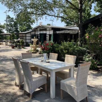
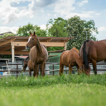
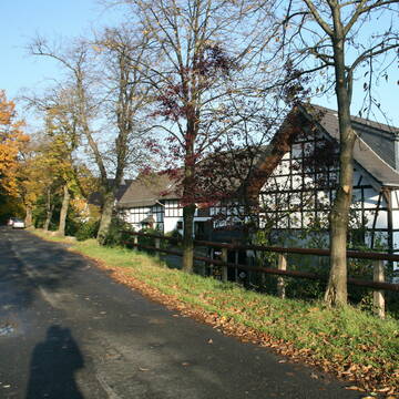
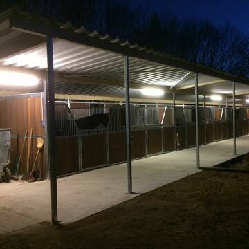
Historische Reitanlage in Köln-Dellbrück
Köln
RGS Kornspringer Köln e. V.
@Kornspringer
FN-Mitglied
Freizeitstall
Vermieten
Führanlage
Hunde willkommen
bedampftes/gewaschenes Heu
Notfallboxen
21 weitere...
S


***Reitstall Birkenhof*** Pferdegerechte Haltung
Köln
Daniele-Fazzi
@Daniele-Fazzi
Freizeitstall
Geländestrecke
Vermieten
Verpachten
Hunde willkommen
Longierzirkel/Roundpen
Allergikerstall
Hufrehe geeignet
23 weitere...
ganz aktuell
S
Deprecated: Creation of dynamic property Zend_View_Helper_Ads::$adLink is deprecated in /var/www/stall-frei/htdocs/staging.stall-frei.de/library/Psf/View/Helper/Ads.php on line 108

***Reitstall Birkenhof*** Pferdegerechte Haltung
Köln
Daniele-Fazzi
@Daniele-Fazzi
Herzlich Willkommen
auf dem Reitstall Birkenhof
Jetzt neu ‼️ auf dem Birkenhof:
Private Geländestrecke rund um unser


Bergische Weidegründe
Burscheid
Bergische Weidegründe
@HufRehastation-Allergiker
Freizeitstall
Geländestrecke
Hunde willkommen
Krankenbox
Allergikerstall
Gnadenbrothof
Bewegungsstall
Laufstall
28 weitere...
ganz aktuell
S


Reitanlage G. und H.-P. Werheid
Bergisch Gladbach
Reitanlage-Werheid
@Reitanlage-Werheid
FN-Mitglied
Freizeitstall
Vermieten
Führanlage
Krankenbox
Fohlenaufzucht möglich
Hufrehe geeignet
29 weitere...
P+
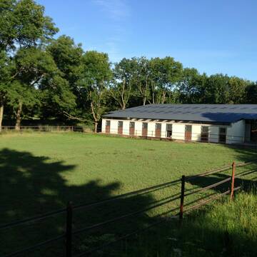
Gut Beningsfeld ,Refrath
Bergisch Gladbach
Fjordpferdehof-Gut-Beningsfeld
@Fjordpferdehof-Gut-Beningsfeld
FN-Mitglied
Geländestrecke
Longierzirkel/Roundpen
Parkplatz für Pferdeanhänger
Pferdezucht
Innenbox
11 weitere...
P
Stall Boskamp
Köln
Stall-Boskamp
@Stall-Boskamp
FN-Mitglied
Freizeitstall
Vermieten
Führanlage
Laufband
Allergikerstall
bedampftes/gewaschenes Heu
28 weitere...
P


Heinrichshof Aktivstall
Köln Fühlingen
Frenger GbR - Heinrichshof
@Frenger-GbR
FN-Mitglied
Freizeitstall
Hunde willkommen
Krankenbox
Allergikerstall
bedampftes/gewaschenes Heu
Außenbox mit Paddock
Bewegungsstall
22 weitere...
S


Pferdeland Leide Aktivstallhaltung
Leichlingen
Pferdeland Leide
@info2
FN-Mitglied
Freizeitstall
Hunde willkommen
Krankenbox
Allergikerstall
Hufrehe geeignet
Bewegungsstall
Laufstall
22 weitere...
S
Reitanlage Gut Horst
Bergisch Gladbach
Gut-Horst
@Gut-Horst
Pferdeausbildung
Reitlehrer und -unterricht
Paddock
Parkplatz für Pferdeanhänger
Pferdezucht
Außenboxen
Innenbox
9 weitere...
P
Reit-und Wohnanlage Gut Scheuerhof
Köln
Gut-Scheuerhof
@Gut-Scheuerhof
FN-Mitglied
Pferdeausbildung
Führanlage
Hunde willkommen
Außenbox mit Paddock
Außenboxen
Vollpension
14 weitere...
P+
Deprecated: Creation of dynamic property Zend_View::$pageCount is deprecated in /var/www/stall-frei/htdocs/staging.stall-frei.de/library/vendor/shardj/zf1-future/library/Zend/View/Abstract.php on line 308
Deprecated: Creation of dynamic property Zend_View::$itemCountPerPage is deprecated in /var/www/stall-frei/htdocs/staging.stall-frei.de/library/vendor/shardj/zf1-future/library/Zend/View/Abstract.php on line 308
Deprecated: Creation of dynamic property Zend_View::$first is deprecated in /var/www/stall-frei/htdocs/staging.stall-frei.de/library/vendor/shardj/zf1-future/library/Zend/View/Abstract.php on line 308
Deprecated: Creation of dynamic property Zend_View::$current is deprecated in /var/www/stall-frei/htdocs/staging.stall-frei.de/library/vendor/shardj/zf1-future/library/Zend/View/Abstract.php on line 308
Deprecated: Creation of dynamic property Zend_View::$last is deprecated in /var/www/stall-frei/htdocs/staging.stall-frei.de/library/vendor/shardj/zf1-future/library/Zend/View/Abstract.php on line 308
Deprecated: Creation of dynamic property Zend_View::$next is deprecated in /var/www/stall-frei/htdocs/staging.stall-frei.de/library/vendor/shardj/zf1-future/library/Zend/View/Abstract.php on line 308
Deprecated: Creation of dynamic property Zend_View::$pagesInRange is deprecated in /var/www/stall-frei/htdocs/staging.stall-frei.de/library/vendor/shardj/zf1-future/library/Zend/View/Abstract.php on line 308
Deprecated: Creation of dynamic property Zend_View::$firstPageInRange is deprecated in /var/www/stall-frei/htdocs/staging.stall-frei.de/library/vendor/shardj/zf1-future/library/Zend/View/Abstract.php on line 308
Deprecated: Creation of dynamic property Zend_View::$lastPageInRange is deprecated in /var/www/stall-frei/htdocs/staging.stall-frei.de/library/vendor/shardj/zf1-future/library/Zend/View/Abstract.php on line 308
Deprecated: Creation of dynamic property Zend_View::$currentItemCount is deprecated in /var/www/stall-frei/htdocs/staging.stall-frei.de/library/vendor/shardj/zf1-future/library/Zend/View/Abstract.php on line 308
Deprecated: Creation of dynamic property Zend_View::$totalItemCount is deprecated in /var/www/stall-frei/htdocs/staging.stall-frei.de/library/vendor/shardj/zf1-future/library/Zend/View/Abstract.php on line 308
Deprecated: Creation of dynamic property Zend_View::$firstItemNumber is deprecated in /var/www/stall-frei/htdocs/staging.stall-frei.de/library/vendor/shardj/zf1-future/library/Zend/View/Abstract.php on line 308
Deprecated: Creation of dynamic property Zend_View::$lastItemNumber is deprecated in /var/www/stall-frei/htdocs/staging.stall-frei.de/library/vendor/shardj/zf1-future/library/Zend/View/Abstract.php on line 308
Deprecated: Creation of dynamic property Zend_View::$router is deprecated in /var/www/stall-frei/htdocs/staging.stall-frei.de/library/vendor/shardj/zf1-future/library/Zend/View/Abstract.php on line 308
Deprecated: Creation of dynamic property Zend_View::$urlParams is deprecated in /var/www/stall-frei/htdocs/staging.stall-frei.de/library/vendor/shardj/zf1-future/library/Zend/View/Abstract.php on line 308
Deprecated: Creation of dynamic property Zend_View::$showAds is deprecated in /var/www/stall-frei/htdocs/staging.stall-frei.de/library/vendor/shardj/zf1-future/library/Zend/View/Abstract.php on line 308
Deprecated: Creation of dynamic property Zend_View::$objectIds is deprecated in /var/www/stall-frei/htdocs/staging.stall-frei.de/library/vendor/shardj/zf1-future/library/Zend/View/Abstract.php on line 308
Deprecated: Creation of dynamic property Zend_View::$showNavbar is deprecated in /var/www/stall-frei/htdocs/staging.stall-frei.de/library/vendor/shardj/zf1-future/library/Zend/View/Abstract.php on line 308
Deprecated: Creation of dynamic property Zend_View::$showBreadcrumb is deprecated in /var/www/stall-frei/htdocs/staging.stall-frei.de/library/vendor/shardj/zf1-future/library/Zend/View/Abstract.php on line 308
Deprecated: Creation of dynamic property Zend_View::$showFooter is deprecated in /var/www/stall-frei/htdocs/staging.stall-frei.de/library/vendor/shardj/zf1-future/library/Zend/View/Abstract.php on line 308
Deprecated: Creation of dynamic property Zend_View::$showInternalAds is deprecated in /var/www/stall-frei/htdocs/staging.stall-frei.de/library/vendor/shardj/zf1-future/library/Zend/View/Abstract.php on line 308
Deprecated: Creation of dynamic property Zend_View::$blNoContent is deprecated in /var/www/stall-frei/htdocs/staging.stall-frei.de/library/vendor/shardj/zf1-future/library/Zend/View/Abstract.php on line 308
Deprecated: Creation of dynamic property Zend_View::$sMetaDesc is deprecated in /var/www/stall-frei/htdocs/staging.stall-frei.de/library/vendor/shardj/zf1-future/library/Zend/View/Abstract.php on line 308
Deprecated: Creation of dynamic property Zend_View::$useGmaps is deprecated in /var/www/stall-frei/htdocs/staging.stall-frei.de/library/vendor/shardj/zf1-future/library/Zend/View/Abstract.php on line 308
Deprecated: Creation of dynamic property Zend_View::$touches is deprecated in /var/www/stall-frei/htdocs/staging.stall-frei.de/library/vendor/shardj/zf1-future/library/Zend/View/Abstract.php on line 308
Deprecated: Creation of dynamic property Zend_View::$oProject is deprecated in /var/www/stall-frei/htdocs/staging.stall-frei.de/library/vendor/shardj/zf1-future/library/Zend/View/Abstract.php on line 308
Deprecated: Creation of dynamic property Zend_View::$pageHeadline is deprecated in /var/www/stall-frei/htdocs/staging.stall-frei.de/library/vendor/shardj/zf1-future/library/Zend/View/Abstract.php on line 308
Deprecated: Creation of dynamic property Zend_View::$disableLocationField is deprecated in /var/www/stall-frei/htdocs/staging.stall-frei.de/library/vendor/shardj/zf1-future/library/Zend/View/Abstract.php on line 308
Deprecated: Creation of dynamic property Zend_View::$isSearch is deprecated in /var/www/stall-frei/htdocs/staging.stall-frei.de/library/vendor/shardj/zf1-future/library/Zend/View/Abstract.php on line 308
Deprecated: Creation of dynamic property Zend_View::$pageTitle is deprecated in /var/www/stall-frei/htdocs/staging.stall-frei.de/library/vendor/shardj/zf1-future/library/Zend/View/Abstract.php on line 308
Deprecated: Creation of dynamic property Psf_Form_Element_Text::$class is deprecated in /var/www/stall-frei/htdocs/staging.stall-frei.de/library/vendor/shardj/zf1-future/library/Zend/Form/Element.php on line 874
Deprecated: Creation of dynamic property Psf_Form_Element_Text::$size is deprecated in /var/www/stall-frei/htdocs/staging.stall-frei.de/library/vendor/shardj/zf1-future/library/Zend/Form/Element.php on line 874
Deprecated: Creation of dynamic property Psf_Form_Element_Text::$placeholder is deprecated in /var/www/stall-frei/htdocs/staging.stall-frei.de/library/vendor/shardj/zf1-future/library/Zend/Form/Element.php on line 874
Deprecated: Creation of dynamic property Psf_Form_Element_Hidden::$class is deprecated in /var/www/stall-frei/htdocs/staging.stall-frei.de/library/vendor/shardj/zf1-future/library/Zend/Form/Element.php on line 874
Deprecated: Creation of dynamic property Psf_Form_Element_Hidden::$class is deprecated in /var/www/stall-frei/htdocs/staging.stall-frei.de/library/vendor/shardj/zf1-future/library/Zend/Form/Element.php on line 874
Deprecated: Creation of dynamic property Psf_Form_Element_Hidden::$class is deprecated in /var/www/stall-frei/htdocs/staging.stall-frei.de/library/vendor/shardj/zf1-future/library/Zend/Form/Element.php on line 874
Deprecated: Creation of dynamic property Psf_Form_Element_Hidden::$class is deprecated in /var/www/stall-frei/htdocs/staging.stall-frei.de/library/vendor/shardj/zf1-future/library/Zend/Form/Element.php on line 874
Deprecated: Creation of dynamic property Psf_Form_Element_Select::$class is deprecated in /var/www/stall-frei/htdocs/staging.stall-frei.de/library/vendor/shardj/zf1-future/library/Zend/Form/Element.php on line 874
Deprecated: Creation of dynamic property Psf_Form_Element_Select::$class is deprecated in /var/www/stall-frei/htdocs/staging.stall-frei.de/library/vendor/shardj/zf1-future/library/Zend/Form/Element.php on line 874
Deprecated: Creation of dynamic property Psf_Form_Element_Select::$class is deprecated in /var/www/stall-frei/htdocs/staging.stall-frei.de/library/vendor/shardj/zf1-future/library/Zend/Form/Element.php on line 874
Deprecated: Creation of dynamic property Psf_Form_Element_Select::$class is deprecated in /var/www/stall-frei/htdocs/staging.stall-frei.de/library/vendor/shardj/zf1-future/library/Zend/Form/Element.php on line 874
Deprecated: Creation of dynamic property Psf_Form_Element_Text::$class is deprecated in /var/www/stall-frei/htdocs/staging.stall-frei.de/library/vendor/shardj/zf1-future/library/Zend/Form/Element.php on line 874
Deprecated: Creation of dynamic property Psf_Form_Element_Checkbox::$label is deprecated in /var/www/stall-frei/htdocs/staging.stall-frei.de/library/vendor/shardj/zf1-future/library/Zend/Form/Element.php on line 874
Deprecated: Creation of dynamic property Zend_View::$sort is deprecated in /var/www/stall-frei/htdocs/staging.stall-frei.de/library/vendor/shardj/zf1-future/library/Zend/View/Abstract.php on line 308
Deprecated: Creation of dynamic property Zend_View::$searchLocation is deprecated in /var/www/stall-frei/htdocs/staging.stall-frei.de/library/vendor/shardj/zf1-future/library/Zend/View/Abstract.php on line 308
Deprecated: Creation of dynamic property Zend_View::$locationHint is deprecated in /var/www/stall-frei/htdocs/staging.stall-frei.de/library/vendor/shardj/zf1-future/library/Zend/View/Abstract.php on line 308
Psf_GeoCoder_Abstract::getLocation: Neu-Frankenforst Get Location CachedOrLive
Psf_GeoCoder_Abstract::getCachedOrLive: Neu-Frankenforst
Psf_GeoCoder_OpenCageData::makeApiRequest: response:
Array
(
[documentation] => https://opencagedata.com/api
[licenses] => Array
(
[0] => Array
(
[name] => see attribution guide
[url] => https://opencagedata.com/credits
)
)
[results] => Array
(
[0] => Array
(
[bounds] => Array
(
[northeast] => Array
(
[lat] => 50.9734269
[lng] => 7.1486252
)
[southwest] => Array
(
[lat] => 50.9334269
[lng] => 7.1086252
)
)
[components] => Array
(
[ISO_3166-1_alpha-2] => DE
[ISO_3166-1_alpha-3] => DEU
[ISO_3166-2] => Array
(
[0] => DE-NW
)
[_category] => place
[_normalized_city] => Bergisch Gladbach
[_type] => neighbourhood
[city] => Bergisch Gladbach
[continent] => Europe
[country] => Deutschland
[country_code] => de
[county] => Rheinisch-Bergischer Kreis
[political_union] => European Union
[postcode] => 51427
[state] => Nordrhein-Westfalen
[state_code] => NW
[suburb] => Neu-Frankenforst
)
[confidence] => 7
[formatted] => 51427 Bergisch Gladbach, Deutschland
[geometry] => Array
(
[lat] => 50.9534269
[lng] => 7.1286252
)
)
[1] => Array
(
[components] => Array
(
[ISO_3166-1_alpha-2] => FR
[ISO_3166-1_alpha-3] => FRA
[ISO_3166-2] => Array
(
[0] => FR-CVL
[1] => FR-18
)
[_category] => road
[_normalized_city] => Saint-Florent-sur-Cher
[_type] => road
[city] => Saint-Florent-sur-Cher
[continent] => Europe
[country] => France
[country_code] => fr
[county] => Cher
[local_authority] => Communauté de communes FerCher
[political_union] => European Union
[postcode] => 18400
[road] => Rue de Neu Anspach
[state] => Centre-Val de Loire
[state_code] => CVL
)
[confidence] => 2
[formatted] => Rue de Neu Anspach, 18400 Saint-Florent-sur-Cher, France
[geometry] => Array
(
[lat] => 47.001413
[lng] => 2.246241
)
)
[2] => Array
(
[components] => Array
(
[ISO_3166-1_alpha-2] => FR
[ISO_3166-1_alpha-3] => FRA
[ISO_3166-2] => Array
(
[0] => FR-HDF
[1] => FR-59
)
[_category] => road
[_normalized_city] => Coudekerque-Branche
[_type] => road
[city] => Coudekerque-Branche
[continent] => Europe
[country] => France
[country_code] => fr
[county] => Nord
[local_authority] => Communauté urbaine de Dunkerque
[political_union] => European Union
[postcode] => 59210
[road] => Rue Louis Neuts
[state] => Hauts-de-France
[state_code] => HDF
)
[confidence] => 2
[formatted] => Rue Louis Neuts, 59210 Coudekerque-Branche, France
[geometry] => Array
(
[lat] => 51.024148
[lng] => 2.370865
)
)
[3] => Array
(
[components] => Array
(
[ISO_3166-1_alpha-2] => FR
[ISO_3166-1_alpha-3] => FRA
[ISO_3166-2] => Array
(
[0] => FR-HDF
[1] => FR-59
)
[_category] => road
[_normalized_city] => Dunkerque
[_type] => road
[city] => Dunkerque
[continent] => Europe
[country] => France
[country_code] => fr
[county] => Nord
[local_authority] => Communauté urbaine de Dunkerque
[political_union] => European Union
[postcode] => 59240
[road] => Rue Gaspard Neuts
[state] => Hauts-de-France
[state_code] => HDF
)
[confidence] => 2
[formatted] => Rue Gaspard Neuts, 59240 Dunkerque, France
[geometry] => Array
(
[lat] => 51.046649
[lng] => 2.397168
)
)
[4] => Array
(
[components] => Array
(
[ISO_3166-1_alpha-2] => FR
[ISO_3166-1_alpha-3] => FRA
[ISO_3166-2] => Array
(
[0] => FR-HDF
[1] => FR-59
)
[_category] => road
[_normalized_city] => Dunkerque
[_type] => road
[city] => Dunkerque
[continent] => Europe
[country] => France
[country_code] => fr
[county] => Nord
[local_authority] => Communauté urbaine de Dunkerque
[political_union] => European Union
[postcode] => 59140
[road] => Rue Louis Neuts
[state] => Hauts-de-France
[state_code] => HDF
)
[confidence] => 2
[formatted] => Rue Louis Neuts, 59140 Dunkerque, France
[geometry] => Array
(
[lat] => 51.024774
[lng] => 2.368515
)
)
[5] => Array
(
[components] => Array
(
[ISO_3166-1_alpha-2] => FR
[ISO_3166-1_alpha-3] => FRA
[ISO_3166-2] => Array
(
[0] => FR-BRE
[1] => FR-56
)
[_category] => road
[_normalized_city] => Crach
[_type] => road
[city] => Crach
[continent] => Europe
[country] => France
[country_code] => fr
[county] => Morbihan
[local_authority] => Auray Quiberon Terre Atlantique
[political_union] => European Union
[postcode] => 56950
[road] => Lieu Dit Ty Nehue
[state] => Bretagne
[state_code] => BRE
)
[confidence] => 10
[formatted] => Lieu Dit Ty Nehue, 56950 Crach, France
[geometry] => Array
(
[lat] => 47.620287
[lng] => -2.991369
)
)
[6] => Array
(
[components] => Array
(
[ISO_3166-1_alpha-2] => FR
[ISO_3166-1_alpha-3] => FRA
[ISO_3166-2] => Array
(
[0] => FR-PDL
[1] => FR-49
)
[_category] => road
[_normalized_city] => Segré-en-Anjou Bleu
[_type] => road
[city] => Segré-en-Anjou Bleu
[continent] => Europe
[country] => France
[country_code] => fr
[county] => Maine-et-Loire
[local_authority] => Anjou Bleu Communauté
[political_union] => European Union
[postcode] => 49500
[road] => Chemin de la Noeud
[state] => Pays de la Loire
[state_code] => PDL
)
[confidence] => 10
[formatted] => Chemin de la Noeud, 49500 Segré-en-Anjou Bleu, France
[geometry] => Array
(
[lat] => 47.64304
[lng] => -0.886136
)
)
[7] => Array
(
[components] => Array
(
[ISO_3166-1_alpha-2] => FR
[ISO_3166-1_alpha-3] => FRA
[ISO_3166-2] => Array
(
[0] => FR-GES
[1] => FR-6AE
[2] => FR-67
)
[_category] => place
[_normalized_city] => Duttlenheim
[_type] => place
[city] => Duttlenheim
[continent] => Europe
[country] => France
[country_code] => fr
[county] => Bas-Rhin
[local_authority] => Communauté de communes de la Région de Molsheim-Mutzig
[place] => Neue Stuecke
[political_union] => European Union
[postcode] => 67120
[state] => Grand Est
[state_code] => GES
)
[confidence] => 10
[formatted] => Neue Stuecke, 67120 Duttlenheim, France
[geometry] => Array
(
[lat] => 48.53937
[lng] => 7.582961
)
)
[8] => Array
(
[components] => Array
(
[ISO_3166-1_alpha-2] => FR
[ISO_3166-1_alpha-3] => FRA
[ISO_3166-2] => Array
(
[0] => FR-BFC
[1] => FR-71
)
[_category] => road
[_normalized_city] => Solutré-Pouilly
[_type] => road
[city] => Solutré-Pouilly
[continent] => Europe
[country] => France
[country_code] => fr
[county] => Saône-et-Loire
[local_authority] => Mâconnais Beaujolais Agglomération
[political_union] => European Union
[postcode] => 71960
[road] => Route des Grands Noeuds
[state] => Bourgogne-Franche-Comté
[state_code] => BFC
)
[confidence] => 10
[formatted] => Route des Grands Noeuds, 71960 Solutré-Pouilly, France
[geometry] => Array
(
[lat] => 46.292606
[lng] => 4.740949
)
)
[9] => Array
(
[components] => Array
(
[ISO_3166-1_alpha-2] => FR
[ISO_3166-1_alpha-3] => FRA
[ISO_3166-2] => Array
(
[0] => FR-GES
[1] => FR-57
)
[_category] => place
[_normalized_city] => Folschviller
[_type] => place
[city] => Folschviller
[continent] => Europe
[country] => France
[country_code] => fr
[county] => Moselle
[local_authority] => Communauté d’agglomération Saint-Avold Synergie
[place] => Neue Berfang
[political_union] => European Union
[postcode] => 57730
[state] => Grand Est
[state_code] => GES
)
[confidence] => 10
[formatted] => Neue Berfang, 57730 Folschviller, France
[geometry] => Array
(
[lat] => 49.075898
[lng] => 6.666387
)
)
)
[status] => Array
(
[code] => 200
[message] => OK
)
[stay_informed] => Array
(
[blog] => https://blog.opencagedata.com
[mastodon] => https://en.osm.town/@opencage
)
[thanks] => For using an OpenCage API
[timestamp] => Array
(
[created_http] => Sat, 07 Feb 2026 00:37:15 GMT
[created_unix] => 1770424635
)
[total_results] => 10
)
Psf_GeoCoder_Abstract::convertLocationResult
{"documentation":"https:\/\/opencagedata.com\/api","licenses":[{"name":"see attribution guide","url":"https:\/\/opencagedata.com\/credits"}],"results":[{"bounds":{"northeast":{"lat":50.9734269,"lng":7.1486252},"southwest":{"lat":50.9334269,"lng":7.1086252}},"components":{"ISO_3166-1_alpha-2":"DE","ISO_3166-1_alpha-3":"DEU","ISO_3166-2":["DE-NW"],"_category":"place","_normalized_city":"Bergisch Gladbach","_type":"neighbourhood","city":"Bergisch Gladbach","continent":"Europe","country":"Deutschland","country_code":"de","county":"Rheinisch-Bergischer Kreis","political_union":"European Union","postcode":"51427","state":"Nordrhein-Westfalen","state_code":"NW","suburb":"Neu-Frankenforst"},"confidence":7,"formatted":"51427 Bergisch Gladbach, Deutschland","geometry":{"lat":50.9534269,"lng":7.1286252}},{"components":{"ISO_3166-1_alpha-2":"FR","ISO_3166-1_alpha-3":"FRA","ISO_3166-2":["FR-CVL","FR-18"],"_category":"road","_normalized_city":"Saint-Florent-sur-Cher","_type":"road","city":"Saint-Florent-sur-Cher","continent":"Europe","country":"France","country_code":"fr","county":"Cher","local_authority":"Communaut\u00e9 de communes FerCher","political_union":"European Union","postcode":"18400","road":"Rue de Neu Anspach","state":"Centre-Val de Loire","state_code":"CVL"},"confidence":2,"formatted":"Rue de Neu Anspach, 18400 Saint-Florent-sur-Cher, France","geometry":{"lat":47.001413,"lng":2.246241}},{"components":{"ISO_3166-1_alpha-2":"FR","ISO_3166-1_alpha-3":"FRA","ISO_3166-2":["FR-HDF","FR-59"],"_category":"road","_normalized_city":"Coudekerque-Branche","_type":"road","city":"Coudekerque-Branche","continent":"Europe","country":"France","country_code":"fr","county":"Nord","local_authority":"Communaut\u00e9 urbaine de Dunkerque","political_union":"European Union","postcode":"59210","road":"Rue Louis Neuts","state":"Hauts-de-France","state_code":"HDF"},"confidence":2,"formatted":"Rue Louis Neuts, 59210 Coudekerque-Branche, France","geometry":{"lat":51.024148,"lng":2.370865}},{"components":{"ISO_3166-1_alpha-2":"FR","ISO_3166-1_alpha-3":"FRA","ISO_3166-2":["FR-HDF","FR-59"],"_category":"road","_normalized_city":"Dunkerque","_type":"road","city":"Dunkerque","continent":"Europe","country":"France","country_code":"fr","county":"Nord","local_authority":"Communaut\u00e9 urbaine de Dunkerque","political_union":"European Union","postcode":"59240","road":"Rue Gaspard Neuts","state":"Hauts-de-France","state_code":"HDF"},"confidence":2,"formatted":"Rue Gaspard Neuts, 59240 Dunkerque, France","geometry":{"lat":51.046649,"lng":2.397168}},{"components":{"ISO_3166-1_alpha-2":"FR","ISO_3166-1_alpha-3":"FRA","ISO_3166-2":["FR-HDF","FR-59"],"_category":"road","_normalized_city":"Dunkerque","_type":"road","city":"Dunkerque","continent":"Europe","country":"France","country_code":"fr","county":"Nord","local_authority":"Communaut\u00e9 urbaine de Dunkerque","political_union":"European Union","postcode":"59140","road":"Rue Louis Neuts","state":"Hauts-de-France","state_code":"HDF"},"confidence":2,"formatted":"Rue Louis Neuts, 59140 Dunkerque, France","geometry":{"lat":51.024774,"lng":2.368515}},{"components":{"ISO_3166-1_alpha-2":"FR","ISO_3166-1_alpha-3":"FRA","ISO_3166-2":["FR-BRE","FR-56"],"_category":"road","_normalized_city":"Crach","_type":"road","city":"Crach","continent":"Europe","country":"France","country_code":"fr","county":"Morbihan","local_authority":"Auray Quiberon Terre Atlantique","political_union":"European Union","postcode":"56950","road":"Lieu Dit Ty Nehue","state":"Bretagne","state_code":"BRE"},"confidence":10,"formatted":"Lieu Dit Ty Nehue, 56950 Crach, France","geometry":{"lat":47.620287,"lng":-2.991369}},{"components":{"ISO_3166-1_alpha-2":"FR","ISO_3166-1_alpha-3":"FRA","ISO_3166-2":["FR-PDL","FR-49"],"_category":"road","_normalized_city":"Segr\u00e9-en-Anjou Bleu","_type":"road","city":"Segr\u00e9-en-Anjou Bleu","continent":"Europe","country":"France","country_code":"fr","county":"Maine-et-Loire","local_authority":"Anjou Bleu Communaut\u00e9","political_union":"European Union","postcode":"49500","road":"Chemin de la Noeud","state":"Pays de la Loire","state_code":"PDL"},"confidence":10,"formatted":"Chemin de la Noeud, 49500 Segr\u00e9-en-Anjou Bleu, France","geometry":{"lat":47.64304,"lng":-0.886136}},{"components":{"ISO_3166-1_alpha-2":"FR","ISO_3166-1_alpha-3":"FRA","ISO_3166-2":["FR-GES","FR-6AE","FR-67"],"_category":"place","_normalized_city":"Duttlenheim","_type":"place","city":"Duttlenheim","continent":"Europe","country":"France","country_code":"fr","county":"Bas-Rhin","local_authority":"Communaut\u00e9 de communes de la R\u00e9gion de Molsheim-Mutzig","place":"Neue Stuecke","political_union":"European Union","postcode":"67120","state":"Grand Est","state_code":"GES"},"confidence":10,"formatted":"Neue Stuecke, 67120 Duttlenheim, France","geometry":{"lat":48.53937,"lng":7.582961}},{"components":{"ISO_3166-1_alpha-2":"FR","ISO_3166-1_alpha-3":"FRA","ISO_3166-2":["FR-BFC","FR-71"],"_category":"road","_normalized_city":"Solutr\u00e9-Pouilly","_type":"road","city":"Solutr\u00e9-Pouilly","continent":"Europe","country":"France","country_code":"fr","county":"Sa\u00f4ne-et-Loire","local_authority":"M\u00e2connais Beaujolais Agglom\u00e9ration","political_union":"European Union","postcode":"71960","road":"Route des Grands Noeuds","state":"Bourgogne-Franche-Comt\u00e9","state_code":"BFC"},"confidence":10,"formatted":"Route des Grands Noeuds, 71960 Solutr\u00e9-Pouilly, France","geometry":{"lat":46.292606,"lng":4.740949}},{"components":{"ISO_3166-1_alpha-2":"FR","ISO_3166-1_alpha-3":"FRA","ISO_3166-2":["FR-GES","FR-57"],"_category":"place","_normalized_city":"Folschviller","_type":"place","city":"Folschviller","continent":"Europe","country":"France","country_code":"fr","county":"Moselle","local_authority":"Communaut\u00e9 d\u2019agglom\u00e9ration Saint-Avold Synergie","place":"Neue Berfang","political_union":"European Union","postcode":"57730","state":"Grand Est","state_code":"GES"},"confidence":10,"formatted":"Neue Berfang, 57730 Folschviller, France","geometry":{"lat":49.075898,"lng":6.666387}}],"status":{"code":200,"message":"OK"},"stay_informed":{"blog":"https:\/\/blog.opencagedata.com","mastodon":"https:\/\/en.osm.town\/@opencage"},"thanks":"For using an OpenCage API","timestamp":{"created_http":"Sat, 07 Feb 2026 00:37:15 GMT","created_unix":1770424635},"total_results":10}Array
(
[0] => stdClass Object
(
[bounds] => stdClass Object
(
[northeast] => stdClass Object
(
[lat] => 50.9734269
[lng] => 7.1486252
)
[southwest] => stdClass Object
(
[lat] => 50.9334269
[lng] => 7.1086252
)
)
[components] => stdClass Object
(
[ISO_3166-1_alpha-2] => DE
[ISO_3166-1_alpha-3] => DEU
[ISO_3166-2] => Array
(
[0] => DE-NW
)
[_category] => place
[_normalized_city] => Bergisch Gladbach
[_type] => neighbourhood
[city] => Bergisch Gladbach
[continent] => Europe
[country] => Deutschland
[country_code] => de
[county] => Rheinisch-Bergischer Kreis
[political_union] => European Union
[postcode] => 51427
[state] => Nordrhein-Westfalen
[state_code] => NW
[suburb] => Neu-Frankenforst
)
[confidence] => 7
[formatted] => 51427 Bergisch Gladbach, Deutschland
[geometry] => stdClass Object
(
[lat] => 50.9534269
[lng] => 7.1286252
)
)
[1] => stdClass Object
(
[components] => stdClass Object
(
[ISO_3166-1_alpha-2] => FR
[ISO_3166-1_alpha-3] => FRA
[ISO_3166-2] => Array
(
[0] => FR-CVL
[1] => FR-18
)
[_category] => road
[_normalized_city] => Saint-Florent-sur-Cher
[_type] => road
[city] => Saint-Florent-sur-Cher
[continent] => Europe
[country] => France
[country_code] => fr
[county] => Cher
[local_authority] => Communauté de communes FerCher
[political_union] => European Union
[postcode] => 18400
[road] => Rue de Neu Anspach
[state] => Centre-Val de Loire
[state_code] => CVL
)
[confidence] => 2
[formatted] => Rue de Neu Anspach, 18400 Saint-Florent-sur-Cher, France
[geometry] => stdClass Object
(
[lat] => 47.001413
[lng] => 2.246241
)
)
[2] => stdClass Object
(
[components] => stdClass Object
(
[ISO_3166-1_alpha-2] => FR
[ISO_3166-1_alpha-3] => FRA
[ISO_3166-2] => Array
(
[0] => FR-HDF
[1] => FR-59
)
[_category] => road
[_normalized_city] => Coudekerque-Branche
[_type] => road
[city] => Coudekerque-Branche
[continent] => Europe
[country] => France
[country_code] => fr
[county] => Nord
[local_authority] => Communauté urbaine de Dunkerque
[political_union] => European Union
[postcode] => 59210
[road] => Rue Louis Neuts
[state] => Hauts-de-France
[state_code] => HDF
)
[confidence] => 2
[formatted] => Rue Louis Neuts, 59210 Coudekerque-Branche, France
[geometry] => stdClass Object
(
[lat] => 51.024148
[lng] => 2.370865
)
)
[3] => stdClass Object
(
[components] => stdClass Object
(
[ISO_3166-1_alpha-2] => FR
[ISO_3166-1_alpha-3] => FRA
[ISO_3166-2] => Array
(
[0] => FR-HDF
[1] => FR-59
)
[_category] => road
[_normalized_city] => Dunkerque
[_type] => road
[city] => Dunkerque
[continent] => Europe
[country] => France
[country_code] => fr
[county] => Nord
[local_authority] => Communauté urbaine de Dunkerque
[political_union] => European Union
[postcode] => 59240
[road] => Rue Gaspard Neuts
[state] => Hauts-de-France
[state_code] => HDF
)
[confidence] => 2
[formatted] => Rue Gaspard Neuts, 59240 Dunkerque, France
[geometry] => stdClass Object
(
[lat] => 51.046649
[lng] => 2.397168
)
)
[4] => stdClass Object
(
[components] => stdClass Object
(
[ISO_3166-1_alpha-2] => FR
[ISO_3166-1_alpha-3] => FRA
[ISO_3166-2] => Array
(
[0] => FR-HDF
[1] => FR-59
)
[_category] => road
[_normalized_city] => Dunkerque
[_type] => road
[city] => Dunkerque
[continent] => Europe
[country] => France
[country_code] => fr
[county] => Nord
[local_authority] => Communauté urbaine de Dunkerque
[political_union] => European Union
[postcode] => 59140
[road] => Rue Louis Neuts
[state] => Hauts-de-France
[state_code] => HDF
)
[confidence] => 2
[formatted] => Rue Louis Neuts, 59140 Dunkerque, France
[geometry] => stdClass Object
(
[lat] => 51.024774
[lng] => 2.368515
)
)
[5] => stdClass Object
(
[components] => stdClass Object
(
[ISO_3166-1_alpha-2] => FR
[ISO_3166-1_alpha-3] => FRA
[ISO_3166-2] => Array
(
[0] => FR-BRE
[1] => FR-56
)
[_category] => road
[_normalized_city] => Crach
[_type] => road
[city] => Crach
[continent] => Europe
[country] => France
[country_code] => fr
[county] => Morbihan
[local_authority] => Auray Quiberon Terre Atlantique
[political_union] => European Union
[postcode] => 56950
[road] => Lieu Dit Ty Nehue
[state] => Bretagne
[state_code] => BRE
)
[confidence] => 10
[formatted] => Lieu Dit Ty Nehue, 56950 Crach, France
[geometry] => stdClass Object
(
[lat] => 47.620287
[lng] => -2.991369
)
)
[6] => stdClass Object
(
[components] => stdClass Object
(
[ISO_3166-1_alpha-2] => FR
[ISO_3166-1_alpha-3] => FRA
[ISO_3166-2] => Array
(
[0] => FR-PDL
[1] => FR-49
)
[_category] => road
[_normalized_city] => Segré-en-Anjou Bleu
[_type] => road
[city] => Segré-en-Anjou Bleu
[continent] => Europe
[country] => France
[country_code] => fr
[county] => Maine-et-Loire
[local_authority] => Anjou Bleu Communauté
[political_union] => European Union
[postcode] => 49500
[road] => Chemin de la Noeud
[state] => Pays de la Loire
[state_code] => PDL
)
[confidence] => 10
[formatted] => Chemin de la Noeud, 49500 Segré-en-Anjou Bleu, France
[geometry] => stdClass Object
(
[lat] => 47.64304
[lng] => -0.886136
)
)
[7] => stdClass Object
(
[components] => stdClass Object
(
[ISO_3166-1_alpha-2] => FR
[ISO_3166-1_alpha-3] => FRA
[ISO_3166-2] => Array
(
[0] => FR-GES
[1] => FR-6AE
[2] => FR-67
)
[_category] => place
[_normalized_city] => Duttlenheim
[_type] => place
[city] => Duttlenheim
[continent] => Europe
[country] => France
[country_code] => fr
[county] => Bas-Rhin
[local_authority] => Communauté de communes de la Région de Molsheim-Mutzig
[place] => Neue Stuecke
[political_union] => European Union
[postcode] => 67120
[state] => Grand Est
[state_code] => GES
)
[confidence] => 10
[formatted] => Neue Stuecke, 67120 Duttlenheim, France
[geometry] => stdClass Object
(
[lat] => 48.53937
[lng] => 7.582961
)
)
[8] => stdClass Object
(
[components] => stdClass Object
(
[ISO_3166-1_alpha-2] => FR
[ISO_3166-1_alpha-3] => FRA
[ISO_3166-2] => Array
(
[0] => FR-BFC
[1] => FR-71
)
[_category] => road
[_normalized_city] => Solutré-Pouilly
[_type] => road
[city] => Solutré-Pouilly
[continent] => Europe
[country] => France
[country_code] => fr
[county] => Saône-et-Loire
[local_authority] => Mâconnais Beaujolais Agglomération
[political_union] => European Union
[postcode] => 71960
[road] => Route des Grands Noeuds
[state] => Bourgogne-Franche-Comté
[state_code] => BFC
)
[confidence] => 10
[formatted] => Route des Grands Noeuds, 71960 Solutré-Pouilly, France
[geometry] => stdClass Object
(
[lat] => 46.292606
[lng] => 4.740949
)
)
[9] => stdClass Object
(
[components] => stdClass Object
(
[ISO_3166-1_alpha-2] => FR
[ISO_3166-1_alpha-3] => FRA
[ISO_3166-2] => Array
(
[0] => FR-GES
[1] => FR-57
)
[_category] => place
[_normalized_city] => Folschviller
[_type] => place
[city] => Folschviller
[continent] => Europe
[country] => France
[country_code] => fr
[county] => Moselle
[local_authority] => Communauté d’agglomération Saint-Avold Synergie
[place] => Neue Berfang
[political_union] => European Union
[postcode] => 57730
[state] => Grand Est
[state_code] => GES
)
[confidence] => 10
[formatted] => Neue Berfang, 57730 Folschviller, France
[geometry] => stdClass Object
(
[lat] => 49.075898
[lng] => 6.666387
)
)
)
Psf_GeoCoder_OpenCageData::getKeyMap: 0
stdClass Object
(
    [bounds] => stdClass Object
        (
            [northeast] => stdClass Object
                (
                    [lat] => 50.9734269
                    [lng] => 7.1486252
                )

            [southwest] => stdClass Object
                (
                    [lat] => 50.9334269
                    [lng] => 7.1086252
                )

        )

    [components] => stdClass Object
        (
            [ISO_3166-1_alpha-2] => DE
            [ISO_3166-1_alpha-3] => DEU
            [ISO_3166-2] => Array
                (
                    [0] => DE-NW
                )

            [_category] => place
            [_normalized_city] => Bergisch Gladbach
            [_type] => neighbourhood
            [city] => Bergisch Gladbach
            [continent] => Europe
            [country] => Deutschland
            [country_code] => de
            [county] => Rheinisch-Bergischer Kreis
            [political_union] => European Union
            [postcode] => 51427
            [state] => Nordrhein-Westfalen
            [state_code] => NW
            [suburb] => Neu-Frankenforst
        )

    [confidence] => 7
    [formatted] => 51427 Bergisch Gladbach, Deutschland
    [geometry] => stdClass Object
        (
            [lat] => 50.9534269
            [lng] => 7.1286252
        )

)
Psf_GeoCoder_OpenCageData::getCounty: Rheinisch-Bergischer Kreis
Psf_GeoCoder_OpenCageData::addMissingData REFETCH!
Array
(
    [address] => 51427 Bergisch Gladbach, Deutschland
    [type] => neighbourhood
    [street] =>
    [city] => Neu-Frankenforst
    [county] => Rheinisch-Bergischer Kreis
    [state] => Nordrhein-Westfalen
    [zip] => 51427
    [country] => Deutschland
    [suburb] => Neu-Frankenforst
    [countrycode] => de
    [latitude] => 50.9534269
    [longitude] => 7.1286252
    [accuracy] => 1
    [confidence] => 7
    [bounds] => stdClass Object
        (
            [northeast] => stdClass Object
                (
                    [lat] => 50.9734269
                    [lng] => 7.1486252
                )

            [southwest] => stdClass Object
                (
                    [lat] => 50.9334269
                    [lng] => 7.1086252
                )

        )

)
reformat!
Array
(
    [address] => 51427 Neu-Frankenforst
    [type] => neighbourhood
    [street] =>
    [city] => Neu-Frankenforst
    [county] => Rheinisch-Bergischer Kreis
    [state] => Nordrhein-Westfalen
    [zip] => 51427
    [country] => Deutschland
    [suburb] => Neu-Frankenforst
    [countrycode] => de
    [latitude] => 50.9534269
    [longitude] => 7.1286252
    [accuracy] => 1
    [confidence] => 7
    [bounds] => stdClass Object
        (
            [northeast] => stdClass Object
                (
                    [lat] => 50.9734269
                    [lng] => 7.1486252
                )

            [southwest] => stdClass Object
                (
                    [lat] => 50.9334269
                    [lng] => 7.1086252
                )

        )

    [place] => 51427 Neu-Frankenforst, Nordrhein-Westfalen
    [hash] => 8f3d7764a6873ae922d3578d4401a9b2
)
Psf_GeoCoder_OpenCageData::getKeyMap: 1
stdClass Object
(
    [components] => stdClass Object
        (
            [ISO_3166-1_alpha-2] => FR
            [ISO_3166-1_alpha-3] => FRA
            [ISO_3166-2] => Array
                (
                    [0] => FR-CVL
                    [1] => FR-18
                )

            [_category] => road
            [_normalized_city] => Saint-Florent-sur-Cher
            [_type] => road
            [city] => Saint-Florent-sur-Cher
            [continent] => Europe
            [country] => France
            [country_code] => fr
            [county] => Cher
            [local_authority] => Communauté de communes FerCher
            [political_union] => European Union
            [postcode] => 18400
            [road] => Rue de Neu Anspach
            [state] => Centre-Val de Loire
            [state_code] => CVL
        )

    [confidence] => 2
    [formatted] => Rue de Neu Anspach, 18400 Saint-Florent-sur-Cher, France
    [geometry] => stdClass Object
        (
            [lat] => 47.001413
            [lng] => 2.246241
        )

)
Psf_GeoCoder_OpenCageData::getCounty: Cher
Psf_GeoCoder_OpenCageData::addMissingData REFETCH!
Array
(
    [address] => Rue de Neu Anspach, 18400 Saint-Florent-sur-Cher, France
    [type] => road
    [street] => Rue de Neu Anspach
    [city] => Saint-Florent-sur-Cher
    [county] => Cher
    [state] => Centre-Val de Loire
    [zip] => 18400
    [country] => France
    [suburb] =>
    [countrycode] => fr
    [latitude] => 47.001413
    [longitude] => 2.246241
    [accuracy] => 1
    [confidence] => 2
    [bounds] =>
)
reformat!
Array
(
    [address] => Rue de Neu Anspach, 18400 Saint-Florent-sur-Cher, France
    [type] => road
    [street] => Rue de Neu Anspach
    [city] => Saint-Florent-sur-Cher
    [county] => Cher
    [state] => Centre-Val de Loire
    [zip] => 18400
    [country] => France
    [suburb] =>
    [countrycode] => fr
    [latitude] => 47.001413
    [longitude] => 2.246241
    [accuracy] => 1
    [confidence] => 2
    [bounds] =>
    [place] => Rue de Neu Anspach, 18400 Saint-Florent-sur-Cher, Centre-Val de Loire
    [hash] => 9d00feb09eee2fb593d750efab1a1339
)
Psf_GeoCoder_OpenCageData::getKeyMap: 2
stdClass Object
(
    [components] => stdClass Object
        (
            [ISO_3166-1_alpha-2] => FR
            [ISO_3166-1_alpha-3] => FRA
            [ISO_3166-2] => Array
                (
                    [0] => FR-HDF
                    [1] => FR-59
                )

            [_category] => road
            [_normalized_city] => Coudekerque-Branche
            [_type] => road
            [city] => Coudekerque-Branche
            [continent] => Europe
            [country] => France
            [country_code] => fr
            [county] => Nord
            [local_authority] => Communauté urbaine de Dunkerque
            [political_union] => European Union
            [postcode] => 59210
            [road] => Rue Louis Neuts
            [state] => Hauts-de-France
            [state_code] => HDF
        )

    [confidence] => 2
    [formatted] => Rue Louis Neuts, 59210 Coudekerque-Branche, France
    [geometry] => stdClass Object
        (
            [lat] => 51.024148
            [lng] => 2.370865
        )

)
Psf_GeoCoder_OpenCageData::getCounty: Nord
Psf_GeoCoder_OpenCageData::addMissingData REFETCH!
Array
(
    [address] => Rue Louis Neuts, 59210 Coudekerque-Branche, France
    [type] => road
    [street] => Rue Louis Neuts
    [city] => Coudekerque-Branche
    [county] => Nord
    [state] => Hauts-de-France
    [zip] => 59210
    [country] => France
    [suburb] =>
    [countrycode] => fr
    [latitude] => 51.024148
    [longitude] => 2.370865
    [accuracy] => 1
    [confidence] => 2
    [bounds] =>
)
reformat!
Array
(
    [address] => Rue Louis Neuts, 59210 Coudekerque-Branche, France
    [type] => road
    [street] => Rue Louis Neuts
    [city] => Coudekerque-Branche
    [county] => Nord
    [state] => Hauts-de-France
    [zip] => 59210
    [country] => France
    [suburb] =>
    [countrycode] => fr
    [latitude] => 51.024148
    [longitude] => 2.370865
    [accuracy] => 1
    [confidence] => 2
    [bounds] =>
    [place] => Rue Louis Neuts, 59210 Coudekerque-Branche, Hauts-de-France
    [hash] => 6987fb18bb089a86c073194ec029918e
)
Psf_GeoCoder_OpenCageData::getKeyMap: 3
stdClass Object
(
    [components] => stdClass Object
        (
            [ISO_3166-1_alpha-2] => FR
            [ISO_3166-1_alpha-3] => FRA
            [ISO_3166-2] => Array
                (
                    [0] => FR-HDF
                    [1] => FR-59
                )

            [_category] => road
            [_normalized_city] => Dunkerque
            [_type] => road
            [city] => Dunkerque
            [continent] => Europe
            [country] => France
            [country_code] => fr
            [county] => Nord
            [local_authority] => Communauté urbaine de Dunkerque
            [political_union] => European Union
            [postcode] => 59240
            [road] => Rue Gaspard Neuts
            [state] => Hauts-de-France
            [state_code] => HDF
        )

    [confidence] => 2
    [formatted] => Rue Gaspard Neuts, 59240 Dunkerque, France
    [geometry] => stdClass Object
        (
            [lat] => 51.046649
            [lng] => 2.397168
        )

)
Psf_GeoCoder_OpenCageData::getCounty: Nord
Psf_GeoCoder_OpenCageData::addMissingData REFETCH!
Array
(
    [address] => Rue Gaspard Neuts, 59240 Dunkerque, France
    [type] => road
    [street] => Rue Gaspard Neuts
    [city] => Dunkerque
    [county] => Nord
    [state] => Hauts-de-France
    [zip] => 59240
    [country] => France
    [suburb] =>
    [countrycode] => fr
    [latitude] => 51.046649
    [longitude] => 2.397168
    [accuracy] => 1
    [confidence] => 2
    [bounds] =>
)
reformat!
Array
(
    [address] => Rue Gaspard Neuts, 59240 Dunkerque, France
    [type] => road
    [street] => Rue Gaspard Neuts
    [city] => Dunkerque
    [county] => Nord
    [state] => Hauts-de-France
    [zip] => 59240
    [country] => France
    [suburb] =>
    [countrycode] => fr
    [latitude] => 51.046649
    [longitude] => 2.397168
    [accuracy] => 1
    [confidence] => 2
    [bounds] =>
    [place] => Rue Gaspard Neuts, 59240 Dunkerque, Hauts-de-France
    [hash] => f48beae68c5e7749dcc58fcc283b5bc0
)
Psf_GeoCoder_OpenCageData::getKeyMap: 4
stdClass Object
(
    [components] => stdClass Object
        (
            [ISO_3166-1_alpha-2] => FR
            [ISO_3166-1_alpha-3] => FRA
            [ISO_3166-2] => Array
                (
                    [0] => FR-HDF
                    [1] => FR-59
                )

            [_category] => road
            [_normalized_city] => Dunkerque
            [_type] => road
            [city] => Dunkerque
            [continent] => Europe
            [country] => France
            [country_code] => fr
            [county] => Nord
            [local_authority] => Communauté urbaine de Dunkerque
            [political_union] => European Union
            [postcode] => 59140
            [road] => Rue Louis Neuts
            [state] => Hauts-de-France
            [state_code] => HDF
        )

    [confidence] => 2
    [formatted] => Rue Louis Neuts, 59140 Dunkerque, France
    [geometry] => stdClass Object
        (
            [lat] => 51.024774
            [lng] => 2.368515
        )

)
Psf_GeoCoder_OpenCageData::getCounty: Nord
Psf_GeoCoder_OpenCageData::addMissingData REFETCH!
Array
(
    [address] => Rue Louis Neuts, 59140 Dunkerque, France
    [type] => road
    [street] => Rue Louis Neuts
    [city] => Dunkerque
    [county] => Nord
    [state] => Hauts-de-France
    [zip] => 59140
    [country] => France
    [suburb] =>
    [countrycode] => fr
    [latitude] => 51.024774
    [longitude] => 2.368515
    [accuracy] => 1
    [confidence] => 2
    [bounds] =>
)
reformat!
Array
(
    [address] => Rue Louis Neuts, 59140 Dunkerque, France
    [type] => road
    [street] => Rue Louis Neuts
    [city] => Dunkerque
    [county] => Nord
    [state] => Hauts-de-France
    [zip] => 59140
    [country] => France
    [suburb] =>
    [countrycode] => fr
    [latitude] => 51.024774
    [longitude] => 2.368515
    [accuracy] => 1
    [confidence] => 2
    [bounds] =>
    [place] => Rue Louis Neuts, 59140 Dunkerque, Hauts-de-France
    [hash] => e0a79f1afee7bcbb8b8419bff5e08b10
)
Psf_GeoCoder_OpenCageData::getKeyMap: 5
stdClass Object
(
    [components] => stdClass Object
        (
            [ISO_3166-1_alpha-2] => FR
            [ISO_3166-1_alpha-3] => FRA
            [ISO_3166-2] => Array
                (
                    [0] => FR-BRE
                    [1] => FR-56
                )

            [_category] => road
            [_normalized_city] => Crach
            [_type] => road
            [city] => Crach
            [continent] => Europe
            [country] => France
            [country_code] => fr
            [county] => Morbihan
            [local_authority] => Auray Quiberon Terre Atlantique
            [political_union] => European Union
            [postcode] => 56950
            [road] => Lieu Dit Ty Nehue
            [state] => Bretagne
            [state_code] => BRE
        )

    [confidence] => 10
    [formatted] => Lieu Dit Ty Nehue, 56950 Crach, France
    [geometry] => stdClass Object
        (
            [lat] => 47.620287
            [lng] => -2.991369
        )

)
Psf_GeoCoder_OpenCageData::getCounty: Morbihan
Psf_GeoCoder_OpenCageData::addMissingData REFETCH!
Array
(
    [address] => Lieu Dit Ty Nehue, 56950 Crach, France
    [type] => road
    [street] => Lieu Dit Ty Nehue
    [city] => Crach
    [county] => Morbihan
    [state] => Bretagne
    [zip] => 56950
    [country] => France
    [suburb] =>
    [countrycode] => fr
    [latitude] => 47.620287
    [longitude] => -2.991369
    [accuracy] => 1
    [confidence] => 10
    [bounds] =>
)
reformat!
Array
(
    [address] => Lieu Dit Ty Nehue, 56950 Crach, France
    [type] => road
    [street] => Lieu Dit Ty Nehue
    [city] => Crach
    [county] => Morbihan
    [state] => Bretagne
    [zip] => 56950
    [country] => France
    [suburb] =>
    [countrycode] => fr
    [latitude] => 47.620287
    [longitude] => -2.991369
    [accuracy] => 1
    [confidence] => 10
    [bounds] =>
    [place] => Lieu Dit Ty Nehue, 56950 Crach, Bretagne
    [hash] => b849cc1fdada00e5b5d99d147a9639aa
)
Psf_GeoCoder_OpenCageData::getKeyMap: 6
stdClass Object
(
    [components] => stdClass Object
        (
            [ISO_3166-1_alpha-2] => FR
            [ISO_3166-1_alpha-3] => FRA
            [ISO_3166-2] => Array
                (
                    [0] => FR-PDL
                    [1] => FR-49
                )

            [_category] => road
            [_normalized_city] => Segré-en-Anjou Bleu
            [_type] => road
            [city] => Segré-en-Anjou Bleu
            [continent] => Europe
            [country] => France
            [country_code] => fr
            [county] => Maine-et-Loire
            [local_authority] => Anjou Bleu Communauté
            [political_union] => European Union
            [postcode] => 49500
            [road] => Chemin de la Noeud
            [state] => Pays de la Loire
            [state_code] => PDL
        )

    [confidence] => 10
    [formatted] => Chemin de la Noeud, 49500 Segré-en-Anjou Bleu, France
    [geometry] => stdClass Object
        (
            [lat] => 47.64304
            [lng] => -0.886136
        )

)
Psf_GeoCoder_OpenCageData::getCounty: Maine-et-Loire
Psf_GeoCoder_OpenCageData::addMissingData REFETCH!
Array
(
    [address] => Chemin de la Noeud, 49500 Segré-en-Anjou Bleu, France
    [type] => road
    [street] => Chemin de la Noeud
    [city] => Segré-en-Anjou Bleu
    [county] => Maine-et-Loire
    [state] => Pays de la Loire
    [zip] => 49500
    [country] => France
    [suburb] =>
    [countrycode] => fr
    [latitude] => 47.64304
    [longitude] => -0.886136
    [accuracy] => 1
    [confidence] => 10
    [bounds] =>
)
reformat!
Array
(
    [address] => Chemin de la Noeud, 49500 Segré-en-Anjou Bleu, France
    [type] => road
    [street] => Chemin de la Noeud
    [city] => Segré-en-Anjou Bleu
    [county] => Maine-et-Loire
    [state] => Pays de la Loire
    [zip] => 49500
    [country] => France
    [suburb] =>
    [countrycode] => fr
    [latitude] => 47.64304
    [longitude] => -0.886136
    [accuracy] => 1
    [confidence] => 10
    [bounds] =>
    [place] => Chemin de la Noeud, 49500 Segré-en-Anjou Bleu, Pays de la Loire
    [hash] => 82392c06b5da06525c87ced1b8417ba6
)
Psf_GeoCoder_OpenCageData::getKeyMap: 7
stdClass Object
(
    [components] => stdClass Object
        (
            [ISO_3166-1_alpha-2] => FR
            [ISO_3166-1_alpha-3] => FRA
            [ISO_3166-2] => Array
                (
                    [0] => FR-GES
                    [1] => FR-6AE
                    [2] => FR-67
                )

            [_category] => place
            [_normalized_city] => Duttlenheim
            [_type] => place
            [city] => Duttlenheim
            [continent] => Europe
            [country] => France
            [country_code] => fr
            [county] => Bas-Rhin
            [local_authority] => Communauté de communes de la Région de Molsheim-Mutzig
            [place] => Neue Stuecke
            [political_union] => European Union
            [postcode] => 67120
            [state] => Grand Est
            [state_code] => GES
        )

    [confidence] => 10
    [formatted] => Neue Stuecke, 67120 Duttlenheim, France
    [geometry] => stdClass Object
        (
            [lat] => 48.53937
            [lng] => 7.582961
        )

)
Psf_GeoCoder_OpenCageData::getCounty: Bas-Rhin
Psf_GeoCoder_OpenCageData::addMissingData REFETCH!
Array
(
    [address] => Neue Stuecke, 67120 Duttlenheim, France
    [type] => place
    [street] =>
    [city] => Duttlenheim
    [county] => Bas-Rhin
    [state] => Grand Est
    [zip] => 67120
    [country] => France
    [suburb] =>
    [countrycode] => fr
    [latitude] => 48.53937
    [longitude] => 7.582961
    [accuracy] => 1
    [confidence] => 10
    [bounds] =>
)
reformat!
Array
(
    [address] => Neue Stuecke, 67120 Duttlenheim, France
    [type] => place
    [street] =>
    [city] => Duttlenheim
    [county] => Bas-Rhin
    [state] => Grand Est
    [zip] => 67120
    [country] => France
    [suburb] =>
    [countrycode] => fr
    [latitude] => 48.53937
    [longitude] => 7.582961
    [accuracy] => 1
    [confidence] => 10
    [bounds] =>
    [place] => 67120 Duttlenheim, Grand Est
    [hash] => c90e1d266849da91af3b70031f714548
)
Psf_GeoCoder_OpenCageData::getKeyMap: 8
stdClass Object
(
    [components] => stdClass Object
        (
            [ISO_3166-1_alpha-2] => FR
            [ISO_3166-1_alpha-3] => FRA
            [ISO_3166-2] => Array
                (
                    [0] => FR-BFC
                    [1] => FR-71
                )

            [_category] => road
            [_normalized_city] => Solutré-Pouilly
            [_type] => road
            [city] => Solutré-Pouilly
            [continent] => Europe
            [country] => France
            [country_code] => fr
            [county] => Saône-et-Loire
            [local_authority] => Mâconnais Beaujolais Agglomération
            [political_union] => European Union
            [postcode] => 71960
            [road] => Route des Grands Noeuds
            [state] => Bourgogne-Franche-Comté
            [state_code] => BFC
        )

    [confidence] => 10
    [formatted] => Route des Grands Noeuds, 71960 Solutré-Pouilly, France
    [geometry] => stdClass Object
        (
            [lat] => 46.292606
            [lng] => 4.740949
        )

)
Psf_GeoCoder_OpenCageData::getCounty: Saône-et-Loire
Psf_GeoCoder_OpenCageData::addMissingData REFETCH!
Array
(
    [address] => Route des Grands Noeuds, 71960 Solutré-Pouilly, France
    [type] => road
    [street] => Route des Grands Noeuds
    [city] => Solutré-Pouilly
    [county] => Saône-et-Loire
    [state] => Bourgogne-Franche-Comté
    [zip] => 71960
    [country] => France
    [suburb] =>
    [countrycode] => fr
    [latitude] => 46.292606
    [longitude] => 4.740949
    [accuracy] => 1
    [confidence] => 10
    [bounds] =>
)
reformat!
Array
(
    [address] => Route des Grands Noeuds, 71960 Solutré-Pouilly, France
    [type] => road
    [street] => Route des Grands Noeuds
    [city] => Solutré-Pouilly
    [county] => Saône-et-Loire
    [state] => Bourgogne-Franche-Comté
    [zip] => 71960
    [country] => France
    [suburb] =>
    [countrycode] => fr
    [latitude] => 46.292606
    [longitude] => 4.740949
    [accuracy] => 1
    [confidence] => 10
    [bounds] =>
    [place] => Route des Grands Noeuds, 71960 Solutré-Pouilly, Bourgogne-Franche-Comté
    [hash] => aac03dedf2f2316e2ab6d72bd32fc45c
)
Psf_GeoCoder_OpenCageData::getKeyMap: 9
stdClass Object
(
    [components] => stdClass Object
        (
            [ISO_3166-1_alpha-2] => FR
            [ISO_3166-1_alpha-3] => FRA
            [ISO_3166-2] => Array
                (
                    [0] => FR-GES
                    [1] => FR-57
                )

            [_category] => place
            [_normalized_city] => Folschviller
            [_type] => place
            [city] => Folschviller
            [continent] => Europe
            [country] => France
            [country_code] => fr
            [county] => Moselle
            [local_authority] => Communauté d’agglomération Saint-Avold Synergie
            [place] => Neue Berfang
            [political_union] => European Union
            [postcode] => 57730
            [state] => Grand Est
            [state_code] => GES
        )

    [confidence] => 10
    [formatted] => Neue Berfang, 57730 Folschviller, France
    [geometry] => stdClass Object
        (
            [lat] => 49.075898
            [lng] => 6.666387
        )

)
Psf_GeoCoder_OpenCageData::getCounty: Moselle
Psf_GeoCoder_OpenCageData::addMissingData REFETCH!
Array
(
    [address] => Neue Berfang, 57730 Folschviller, France
    [type] => place
    [street] =>
    [city] => Folschviller
    [county] => Moselle
    [state] => Grand Est
    [zip] => 57730
    [country] => France
    [suburb] =>
    [countrycode] => fr
    [latitude] => 49.075898
    [longitude] => 6.666387
    [accuracy] => 1
    [confidence] => 10
    [bounds] =>
)
reformat!
Array
(
    [address] => Neue Berfang, 57730 Folschviller, France
    [type] => place
    [street] =>
    [city] => Folschviller
    [county] => Moselle
    [state] => Grand Est
    [zip] => 57730
    [country] => France
    [suburb] =>
    [countrycode] => fr
    [latitude] => 49.075898
    [longitude] => 6.666387
    [accuracy] => 1
    [confidence] => 10
    [bounds] =>
    [place] => 57730 Folschviller, Grand Est
    [hash] => 654f12e03c53533cc6611f451979b059
)
Deprecated: Creation of dynamic property Zend_View::$locationHintStyle is deprecated in /var/www/stall-frei/htdocs/staging.stall-frei.de/library/vendor/shardj/zf1-future/library/Zend/View/Abstract.php on line 308
Deprecated: Creation of dynamic property Zend_View::$adGeoLocation is deprecated in /var/www/stall-frei/htdocs/staging.stall-frei.de/library/vendor/shardj/zf1-future/library/Zend/View/Abstract.php on line 308
Deprecated: Creation of dynamic property Zend_View::$recordCount is deprecated in /var/www/stall-frei/htdocs/staging.stall-frei.de/library/vendor/shardj/zf1-future/library/Zend/View/Abstract.php on line 308
Deprecated: explode(): Passing null to parameter #2 ($string) of type string is deprecated in /var/www/stall-frei/htdocs/staging.stall-frei.de/application/models/SearchAgent.php on line 100
Deprecated: explode(): Passing null to parameter #2 ($string) of type string is deprecated in /var/www/stall-frei/htdocs/staging.stall-frei.de/application/models/SearchAgent.php on line 100
Deprecated: explode(): Passing null to parameter #2 ($string) of type string is deprecated in /var/www/stall-frei/htdocs/staging.stall-frei.de/application/models/SearchAgent.php on line 100
Deprecated: explode(): Passing null to parameter #2 ($string) of type string is deprecated in /var/www/stall-frei/htdocs/staging.stall-frei.de/application/models/SearchAgent.php on line 100
Deprecated: explode(): Passing null to parameter #2 ($string) of type string is deprecated in /var/www/stall-frei/htdocs/staging.stall-frei.de/application/models/SearchAgent.php on line 100
Deprecated: explode(): Passing null to parameter #2 ($string) of type string is deprecated in /var/www/stall-frei/htdocs/staging.stall-frei.de/application/models/SearchAgent.php on line 100
Deprecated: explode(): Passing null to parameter #2 ($string) of type string is deprecated in /var/www/stall-frei/htdocs/staging.stall-frei.de/application/models/SearchAgent.php on line 100
Deprecated: explode(): Passing null to parameter #2 ($string) of type string is deprecated in /var/www/stall-frei/htdocs/staging.stall-frei.de/application/models/SearchAgent.php on line 100
Deprecated: explode(): Passing null to parameter #2 ($string) of type string is deprecated in /var/www/stall-frei/htdocs/staging.stall-frei.de/application/models/SearchAgent.php on line 100
Deprecated: trim(): Passing null to parameter #1 ($string) of type string is deprecated in /var/www/stall-frei/htdocs/staging.stall-frei.de/application/models/Account/Search.php on line 82
Warning: Cannot modify header information - headers already sent by (output started at /var/www/stall-frei/htdocs/staging.stall-frei.de/library/vendor/shardj/zf1-future/library/Zend/View/Abstract.php:308) in /var/www/stall-frei/htdocs/staging.stall-frei.de/application/models/Account/Search.php on line 71
Deprecated: Creation of dynamic property Zend_View::$paginationParams is deprecated in /var/www/stall-frei/htdocs/staging.stall-frei.de/library/vendor/shardj/zf1-future/library/Zend/View/Abstract.php on line 308
Deprecated: Creation of dynamic property Zend_View::$objectPaginator is deprecated in /var/www/stall-frei/htdocs/staging.stall-frei.de/library/vendor/shardj/zf1-future/library/Zend/View/Abstract.php on line 308
Deprecated: Creation of dynamic property Zend_View::$featuredObjects is deprecated in /var/www/stall-frei/htdocs/staging.stall-frei.de/library/vendor/shardj/zf1-future/library/Zend/View/Abstract.php on line 308
Deprecated: Creation of dynamic property Zend_View::$hints is deprecated in /var/www/stall-frei/htdocs/staging.stall-frei.de/library/vendor/shardj/zf1-future/library/Zend/View/Abstract.php on line 308
Deprecated: Creation of dynamic property Zend_View::$attributeHints is deprecated in /var/www/stall-frei/htdocs/staging.stall-frei.de/library/vendor/shardj/zf1-future/library/Zend/View/Abstract.php on line 308
Deprecated: Creation of dynamic property Zend_View::$oSearchForm is deprecated in /var/www/stall-frei/htdocs/staging.stall-frei.de/library/vendor/shardj/zf1-future/library/Zend/View/Abstract.php on line 308