Deprecated: Creation of dynamic property Zend_View::$sMode is deprecated in /var/www/stall-frei/htdocs/staging.stall-frei.de/library/vendor/shardj/zf1-future/library/Zend/View/Abstract.php on line 308
Stallplatz oder Offenstall in Stahe
Gesucht wird in "Stahe, Nordrhein-Westfalen, Deutschland"
6.334 Einträge
Deprecated: Creation of dynamic property Zend_View::$listObjects is deprecated in /var/www/stall-frei/htdocs/staging.stall-frei.de/library/vendor/shardj/zf1-future/library/Zend/View/Abstract.php on line 308
Gesponsort


Deprecated: Creation of dynamic property Zend_View::$listMode is deprecated in /var/www/stall-frei/htdocs/staging.stall-frei.de/library/vendor/shardj/zf1-future/library/Zend/View/Abstract.php on line 308
Deprecated: Creation of dynamic property Zend_View::$renderedObjects is deprecated in /var/www/stall-frei/htdocs/staging.stall-frei.de/library/vendor/shardj/zf1-future/library/Zend/View/Abstract.php on line 308
Deprecated: Creation of dynamic property Zend_View::$index is deprecated in /var/www/stall-frei/htdocs/staging.stall-frei.de/library/vendor/shardj/zf1-future/library/Zend/View/Abstract.php on line 308
Deprecated: Creation of dynamic property Zend_View::$displayMode is deprecated in /var/www/stall-frei/htdocs/staging.stall-frei.de/library/vendor/shardj/zf1-future/library/Zend/View/Abstract.php on line 308
Deprecated: Creation of dynamic property Zend_View::$remarketingIds is deprecated in /var/www/stall-frei/htdocs/staging.stall-frei.de/library/vendor/shardj/zf1-future/library/Zend/View/Abstract.php on line 308
Deprecated: Creation of dynamic property Zend_View::$listItem is deprecated in /var/www/stall-frei/htdocs/staging.stall-frei.de/library/vendor/shardj/zf1-future/library/Zend/View/Abstract.php on line 308
Deprecated: Creation of dynamic property Zend_View::$object is deprecated in /var/www/stall-frei/htdocs/staging.stall-frei.de/library/vendor/shardj/zf1-future/library/Zend/View/Abstract.php on line 308
Deprecated: Creation of dynamic property Zend_View::$attributes is deprecated in /var/www/stall-frei/htdocs/staging.stall-frei.de/library/vendor/shardj/zf1-future/library/Zend/View/Abstract.php on line 308


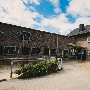
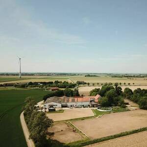
Wunderschöne Pferdeboxen zu vermieten
Geilenkirchen
PensionsstallHappySporthorses
@PensionsstallHappySporthorses
Fahrstall, Kutschwagen
FN-Mitglied
Vermieten
Führanlage
Hunde willkommen
Allergikerstall
Hengsthaltung möglich
29 weitere...
S
Deprecated: Creation of dynamic property Zend_View_Helper_Ads::$adLink is deprecated in /var/www/stall-frei/htdocs/staging.stall-frei.de/library/Psf/View/Helper/Ads.php on line 108

***Reitstall Birkenhof*** Pferdegerechte Haltung
Köln
Daniele-Fazzi
@Daniele-Fazzi
Herzlich Willkommen
auf dem Reitstall Birkenhof
Jetzt neu ‼️ auf dem Birkenhof:
Private Geländestrecke rund um unser


FN-Pferdeanlage mit allem Komfort
Heinsberg
Reitsportzentrum Pütt
@ReitsportzentrumPuett
FN-Mitglied
Freizeitstall
Vermieten
Führanlage
Longierzirkel/Roundpen
Hengsthaltung möglich
Pferdezucht
21 weitere...
aktuell
P+


Pferdezucht- und Pensionsstall in Heinsberg
Gangelt
Saskia Ritter-Moll
@Selfkant-Ranch-Saskia-Ritter
FN-Mitglied
Freizeitstall
Vermieten
Hunde willkommen
Longierzirkel/Roundpen
Allergikerstall
Fohlenaufzucht möglich
26 weitere...
P+
Boxen frei, Paddockbox, Halle, Reitplatz, Wiesen
Heinsberg
Donseler Hof
@Donselerhof
FN-Mitglied
Freizeitstall
Vermieten
Führanlage
Krankenbox
Allergikerstall
Gnadenbrothof
36 weitere...
P
Leider kein Vorschaubild
Leider kein Vorschaubild
Pferde-Kompetenz unter einem Dach !
Mindergangelt
Sandra-Goertz
@Sandra-Goertz
Freizeitstall
Pferdeausbildung
Vermieten
Krankenbox
Longierzirkel/Roundpen
Allergikerstall
Gnadenbrothof
23 weitere...
B


Pferdeboxen auf dem Savelhof
Herzogenrath
Susanne Hubert
@Savelhof
FN-Mitglied
Hunde willkommen
Longierzirkel/Roundpen
Außenboxen
Vollpension
9 weitere...
P+

Equineworld- Mehr Raum. Mehr Herz. Mehr Pferd.
Selfkant
Equineworld
@Gini2718
Freizeitstall
Pferdeausbildung
Vermieten
Paddock
Reitplatz (z.B. Dressur, Springen, Reining)
Allergikerstall
15 weitere...
aktuell
P


Aktivstall Molder Hof
Übach-Palenberg
Krings
@Krings
Hunde willkommen
Krankenbox
Notfallboxen
Bewegungsstall
Offenstall
Vollpension
10 weitere...
P
Leider kein Vorschaubild
Leider kein Vorschaubild
Offenstall frei , Halle, Platz, ab 180 Euro mtl
Heinsberg
Stallgasse
@M.N.
Freizeitstall
Vermieten
Reithalle
Reitplatz (z.B. Dressur, Springen, Reining)
Offenstall
6 weitere...
B


Herdenhaltung Offenstall Gemmenich
Gemmenich bei Aachen
Waheeda
@Waheeda
FN-Mitglied
Freizeitstall
Vermieten
Krankenbox
Longierzirkel/Roundpen
Notfallboxen
10 weitere...
ganz aktuell
S
Deprecated: Creation of dynamic property Zend_View::$pageCount is deprecated in /var/www/stall-frei/htdocs/staging.stall-frei.de/library/vendor/shardj/zf1-future/library/Zend/View/Abstract.php on line 308
Deprecated: Creation of dynamic property Zend_View::$itemCountPerPage is deprecated in /var/www/stall-frei/htdocs/staging.stall-frei.de/library/vendor/shardj/zf1-future/library/Zend/View/Abstract.php on line 308
Deprecated: Creation of dynamic property Zend_View::$first is deprecated in /var/www/stall-frei/htdocs/staging.stall-frei.de/library/vendor/shardj/zf1-future/library/Zend/View/Abstract.php on line 308
Deprecated: Creation of dynamic property Zend_View::$current is deprecated in /var/www/stall-frei/htdocs/staging.stall-frei.de/library/vendor/shardj/zf1-future/library/Zend/View/Abstract.php on line 308
Deprecated: Creation of dynamic property Zend_View::$last is deprecated in /var/www/stall-frei/htdocs/staging.stall-frei.de/library/vendor/shardj/zf1-future/library/Zend/View/Abstract.php on line 308
Deprecated: Creation of dynamic property Zend_View::$next is deprecated in /var/www/stall-frei/htdocs/staging.stall-frei.de/library/vendor/shardj/zf1-future/library/Zend/View/Abstract.php on line 308
Deprecated: Creation of dynamic property Zend_View::$pagesInRange is deprecated in /var/www/stall-frei/htdocs/staging.stall-frei.de/library/vendor/shardj/zf1-future/library/Zend/View/Abstract.php on line 308
Deprecated: Creation of dynamic property Zend_View::$firstPageInRange is deprecated in /var/www/stall-frei/htdocs/staging.stall-frei.de/library/vendor/shardj/zf1-future/library/Zend/View/Abstract.php on line 308
Deprecated: Creation of dynamic property Zend_View::$lastPageInRange is deprecated in /var/www/stall-frei/htdocs/staging.stall-frei.de/library/vendor/shardj/zf1-future/library/Zend/View/Abstract.php on line 308
Deprecated: Creation of dynamic property Zend_View::$currentItemCount is deprecated in /var/www/stall-frei/htdocs/staging.stall-frei.de/library/vendor/shardj/zf1-future/library/Zend/View/Abstract.php on line 308
Deprecated: Creation of dynamic property Zend_View::$totalItemCount is deprecated in /var/www/stall-frei/htdocs/staging.stall-frei.de/library/vendor/shardj/zf1-future/library/Zend/View/Abstract.php on line 308
Deprecated: Creation of dynamic property Zend_View::$firstItemNumber is deprecated in /var/www/stall-frei/htdocs/staging.stall-frei.de/library/vendor/shardj/zf1-future/library/Zend/View/Abstract.php on line 308
Deprecated: Creation of dynamic property Zend_View::$lastItemNumber is deprecated in /var/www/stall-frei/htdocs/staging.stall-frei.de/library/vendor/shardj/zf1-future/library/Zend/View/Abstract.php on line 308
Deprecated: Creation of dynamic property Zend_View::$router is deprecated in /var/www/stall-frei/htdocs/staging.stall-frei.de/library/vendor/shardj/zf1-future/library/Zend/View/Abstract.php on line 308
Deprecated: Creation of dynamic property Zend_View::$urlParams is deprecated in /var/www/stall-frei/htdocs/staging.stall-frei.de/library/vendor/shardj/zf1-future/library/Zend/View/Abstract.php on line 308
Deprecated: Creation of dynamic property Zend_View::$showAds is deprecated in /var/www/stall-frei/htdocs/staging.stall-frei.de/library/vendor/shardj/zf1-future/library/Zend/View/Abstract.php on line 308
Deprecated: Creation of dynamic property Zend_View::$objectIds is deprecated in /var/www/stall-frei/htdocs/staging.stall-frei.de/library/vendor/shardj/zf1-future/library/Zend/View/Abstract.php on line 308
Deprecated: Creation of dynamic property Zend_View::$showNavbar is deprecated in /var/www/stall-frei/htdocs/staging.stall-frei.de/library/vendor/shardj/zf1-future/library/Zend/View/Abstract.php on line 308
Deprecated: Creation of dynamic property Zend_View::$showBreadcrumb is deprecated in /var/www/stall-frei/htdocs/staging.stall-frei.de/library/vendor/shardj/zf1-future/library/Zend/View/Abstract.php on line 308
Deprecated: Creation of dynamic property Zend_View::$showFooter is deprecated in /var/www/stall-frei/htdocs/staging.stall-frei.de/library/vendor/shardj/zf1-future/library/Zend/View/Abstract.php on line 308
Deprecated: Creation of dynamic property Zend_View::$showInternalAds is deprecated in /var/www/stall-frei/htdocs/staging.stall-frei.de/library/vendor/shardj/zf1-future/library/Zend/View/Abstract.php on line 308
Deprecated: Creation of dynamic property Zend_View::$blNoContent is deprecated in /var/www/stall-frei/htdocs/staging.stall-frei.de/library/vendor/shardj/zf1-future/library/Zend/View/Abstract.php on line 308
Deprecated: Creation of dynamic property Zend_View::$sMetaDesc is deprecated in /var/www/stall-frei/htdocs/staging.stall-frei.de/library/vendor/shardj/zf1-future/library/Zend/View/Abstract.php on line 308
Deprecated: Creation of dynamic property Zend_View::$useGmaps is deprecated in /var/www/stall-frei/htdocs/staging.stall-frei.de/library/vendor/shardj/zf1-future/library/Zend/View/Abstract.php on line 308
Deprecated: Creation of dynamic property Zend_View::$touches is deprecated in /var/www/stall-frei/htdocs/staging.stall-frei.de/library/vendor/shardj/zf1-future/library/Zend/View/Abstract.php on line 308
Deprecated: Creation of dynamic property Zend_View::$oProject is deprecated in /var/www/stall-frei/htdocs/staging.stall-frei.de/library/vendor/shardj/zf1-future/library/Zend/View/Abstract.php on line 308
Deprecated: Creation of dynamic property Zend_View::$pageHeadline is deprecated in /var/www/stall-frei/htdocs/staging.stall-frei.de/library/vendor/shardj/zf1-future/library/Zend/View/Abstract.php on line 308
Deprecated: Creation of dynamic property Zend_View::$disableLocationField is deprecated in /var/www/stall-frei/htdocs/staging.stall-frei.de/library/vendor/shardj/zf1-future/library/Zend/View/Abstract.php on line 308
Deprecated: Creation of dynamic property Zend_View::$isSearch is deprecated in /var/www/stall-frei/htdocs/staging.stall-frei.de/library/vendor/shardj/zf1-future/library/Zend/View/Abstract.php on line 308
Deprecated: Creation of dynamic property Zend_View::$pageTitle is deprecated in /var/www/stall-frei/htdocs/staging.stall-frei.de/library/vendor/shardj/zf1-future/library/Zend/View/Abstract.php on line 308
Deprecated: Creation of dynamic property Psf_Form_Element_Text::$class is deprecated in /var/www/stall-frei/htdocs/staging.stall-frei.de/library/vendor/shardj/zf1-future/library/Zend/Form/Element.php on line 874
Deprecated: Creation of dynamic property Psf_Form_Element_Text::$size is deprecated in /var/www/stall-frei/htdocs/staging.stall-frei.de/library/vendor/shardj/zf1-future/library/Zend/Form/Element.php on line 874
Deprecated: Creation of dynamic property Psf_Form_Element_Text::$placeholder is deprecated in /var/www/stall-frei/htdocs/staging.stall-frei.de/library/vendor/shardj/zf1-future/library/Zend/Form/Element.php on line 874
Deprecated: Creation of dynamic property Psf_Form_Element_Hidden::$class is deprecated in /var/www/stall-frei/htdocs/staging.stall-frei.de/library/vendor/shardj/zf1-future/library/Zend/Form/Element.php on line 874
Deprecated: Creation of dynamic property Psf_Form_Element_Hidden::$class is deprecated in /var/www/stall-frei/htdocs/staging.stall-frei.de/library/vendor/shardj/zf1-future/library/Zend/Form/Element.php on line 874
Deprecated: Creation of dynamic property Psf_Form_Element_Hidden::$class is deprecated in /var/www/stall-frei/htdocs/staging.stall-frei.de/library/vendor/shardj/zf1-future/library/Zend/Form/Element.php on line 874
Deprecated: Creation of dynamic property Psf_Form_Element_Hidden::$class is deprecated in /var/www/stall-frei/htdocs/staging.stall-frei.de/library/vendor/shardj/zf1-future/library/Zend/Form/Element.php on line 874
Deprecated: Creation of dynamic property Psf_Form_Element_Select::$class is deprecated in /var/www/stall-frei/htdocs/staging.stall-frei.de/library/vendor/shardj/zf1-future/library/Zend/Form/Element.php on line 874
Deprecated: Creation of dynamic property Psf_Form_Element_Select::$class is deprecated in /var/www/stall-frei/htdocs/staging.stall-frei.de/library/vendor/shardj/zf1-future/library/Zend/Form/Element.php on line 874
Deprecated: Creation of dynamic property Psf_Form_Element_Select::$class is deprecated in /var/www/stall-frei/htdocs/staging.stall-frei.de/library/vendor/shardj/zf1-future/library/Zend/Form/Element.php on line 874
Deprecated: Creation of dynamic property Psf_Form_Element_Select::$class is deprecated in /var/www/stall-frei/htdocs/staging.stall-frei.de/library/vendor/shardj/zf1-future/library/Zend/Form/Element.php on line 874
Deprecated: Creation of dynamic property Psf_Form_Element_Text::$class is deprecated in /var/www/stall-frei/htdocs/staging.stall-frei.de/library/vendor/shardj/zf1-future/library/Zend/Form/Element.php on line 874
Deprecated: Creation of dynamic property Psf_Form_Element_Checkbox::$label is deprecated in /var/www/stall-frei/htdocs/staging.stall-frei.de/library/vendor/shardj/zf1-future/library/Zend/Form/Element.php on line 874
Deprecated: Creation of dynamic property Zend_View::$sort is deprecated in /var/www/stall-frei/htdocs/staging.stall-frei.de/library/vendor/shardj/zf1-future/library/Zend/View/Abstract.php on line 308
Deprecated: Creation of dynamic property Zend_View::$searchLocation is deprecated in /var/www/stall-frei/htdocs/staging.stall-frei.de/library/vendor/shardj/zf1-future/library/Zend/View/Abstract.php on line 308
Deprecated: Creation of dynamic property Zend_View::$locationHint is deprecated in /var/www/stall-frei/htdocs/staging.stall-frei.de/library/vendor/shardj/zf1-future/library/Zend/View/Abstract.php on line 308
Psf_GeoCoder_Abstract::getLocation: Stahe Get Location CachedOrLive
Psf_GeoCoder_Abstract::getCachedOrLive: Stahe
Psf_GeoCoder_OpenCageData::makeApiRequest: response:
Array
(
[documentation] => https://opencagedata.com/api
[licenses] => Array
(
[0] => Array
(
[name] => see attribution guide
[url] => https://opencagedata.com/credits
)
)
[results] => Array
(
[0] => Array
(
[bounds] => Array
(
[northeast] => Array
(
[lat] => 51.0074604
[lng] => 6.0534146
)
[southwest] => Array
(
[lat] => 50.9674604
[lng] => 6.0134146
)
)
[components] => Array
(
[ISO_3166-1_alpha-2] => DE
[ISO_3166-1_alpha-3] => DEU
[ISO_3166-2] => Array
(
[0] => DE-NW
)
[_category] => place
[_normalized_city] => Gangelt
[_type] => village
[city] => Gangelt
[continent] => Europe
[country] => Deutschland
[country_code] => de
[county] => Kreis Heinsberg
[political_union] => European Union
[state] => Nordrhein-Westfalen
[state_code] => NW
[village] => Stahe
)
[confidence] => 7
[formatted] => Stahe, Nordrhein-Westfalen, Deutschland
[geometry] => Array
(
[lat] => 50.9874604
[lng] => 6.0334146
)
)
[1] => Array
(
[bounds] => Array
(
[northeast] => Array
(
[lat] => 51.0001883
[lng] => 6.018494
)
[southwest] => Array
(
[lat] => 50.9801883
[lng] => 5.998494
)
)
[components] => Array
(
[ISO_3166-1_alpha-2] => DE
[ISO_3166-1_alpha-3] => DEU
[ISO_3166-2] => Array
(
[0] => DE-NW
)
[_category] => place
[_normalized_city] => Gangelt
[_type] => hamlet
[continent] => Europe
[country] => Deutschland
[country_code] => de
[county] => Kreis Heinsberg
[locality] => Stahe
[political_union] => European Union
[postcode] => 52538
[state] => Nordrhein-Westfalen
[state_code] => NW
[village] => Gangelt
)
[confidence] => 8
[formatted] => Stahe, 52538 Gangelt, Deutschland
[geometry] => Array
(
[lat] => 50.9901883
[lng] => 6.008494
)
)
[2] => Array
(
[bounds] => Array
(
[northeast] => Array
(
[lat] => 51.0961103
[lng] => 6.104739
)
[southwest] => Array
(
[lat] => 51.0937602
[lng] => 6.1035502
)
)
[components] => Array
(
[ISO_3166-1_alpha-2] => DE
[ISO_3166-1_alpha-3] => DEU
[ISO_3166-2] => Array
(
[0] => DE-NW
)
[_category] => road
[_normalized_city] => Heinsberg
[_type] => road
[continent] => Europe
[country] => Deutschland
[country_code] => de
[county] => Kreis Heinsberg
[political_union] => European Union
[postcode] => 52525
[road] => Stahe
[road_type] => tertiary
[state] => Nordrhein-Westfalen
[state_code] => NW
[town] => Heinsberg
)
[confidence] => 9
[formatted] => Stahe, 52525 Heinsberg, Deutschland
[geometry] => Array
(
[lat] => 51.0949778
[lng] => 6.1040568
)
)
[3] => Array
(
[bounds] => Array
(
[northeast] => Array
(
[lat] => 50.9843358
[lng] => 6.0619643
)
[southwest] => Array
(
[lat] => 50.9839129
[lng] => 6.0610661
)
)
[components] => Array
(
[ISO_3166-1_alpha-2] => DE
[ISO_3166-1_alpha-3] => DEU
[ISO_3166-2] => Array
(
[0] => DE-NW
)
[_category] => road
[_normalized_city] => Geilenkirchen
[_type] => road
[continent] => Europe
[country] => Deutschland
[country_code] => de
[county] => Kreis Heinsberg
[political_union] => European Union
[postcode] => 52511
[road] => Stahe
[road_type] => track
[state] => Nordrhein-Westfalen
[state_code] => NW
[town] => Geilenkirchen
)
[confidence] => 9
[formatted] => Stahe, 52511 Geilenkirchen, Deutschland
[geometry] => Array
(
[lat] => 50.9841091
[lng] => 6.0615082
)
)
[4] => Array
(
[bounds] => Array
(
[northeast] => Array
(
[lat] => 51.0980032
[lng] => 6.1048716
)
[southwest] => Array
(
[lat] => 51.0974711
[lng] => 6.1047946
)
)
[components] => Array
(
[ISO_3166-1_alpha-2] => DE
[ISO_3166-1_alpha-3] => DEU
[ISO_3166-2] => Array
(
[0] => DE-NW
)
[_category] => road
[_normalized_city] => Wassenberg
[_type] => road
[continent] => Europe
[country] => Deutschland
[country_code] => de
[county] => Kreis Heinsberg
[political_union] => European Union
[postcode] => 41849
[road] => Stahe
[road_type] => tertiary
[state] => Nordrhein-Westfalen
[state_code] => NW
[town] => Wassenberg
)
[confidence] => 9
[formatted] => Stahe, 41849 Wassenberg, Deutschland
[geometry] => Array
(
[lat] => 51.0977387
[lng] => 6.104842
)
)
[5] => Array
(
[bounds] => Array
(
[northeast] => Array
(
[lat] => 50.9840582
[lng] => 6.0618508
)
[southwest] => Array
(
[lat] => 50.9839582
[lng] => 6.0617508
)
)
[components] => Array
(
[ISO_3166-1_alpha-2] => DE
[ISO_3166-1_alpha-3] => DEU
[ISO_3166-2] => Array
(
[0] => DE-NW
)
[_category] => transportation
[_normalized_city] => Geilenkirchen
[_type] => railway
[continent] => Europe
[country] => Deutschland
[country_code] => de
[county] => Kreis Heinsberg
[political_union] => European Union
[postcode] => 52511
[railway] => Stahe
[road] => Stahe
[state] => Nordrhein-Westfalen
[state_code] => NW
[town] => Geilenkirchen
)
[confidence] => 9
[formatted] => Stahe, 52511 Geilenkirchen, Deutschland
[geometry] => Array
(
[lat] => 50.9840082
[lng] => 6.0618008
)
)
[6] => Array
(
[components] => Array
(
[ISO_3166-1_alpha-2] => FR
[ISO_3166-1_alpha-3] => FRA
[ISO_3166-2] => Array
(
[0] => FR-OCC
[1] => FR-31
)
[_category] => road
[_normalized_city] => Belberaud
[_type] => road
[city] => Belberaud
[continent] => Europe
[country] => France
[country_code] => fr
[county] => Haute-Garonne
[local_authority] => Sicoval
[political_union] => European Union
[postcode] => 31450
[road] => Chemin de la Satte
[state] => Occitanie
[state_code] => OCC
)
[confidence] => 2
[formatted] => Chemin de la Satte, 31450 Belberaud, France
[geometry] => Array
(
[lat] => 43.506533
[lng] => 1.580319
)
)
[7] => Array
(
[components] => Array
(
[ISO_3166-1_alpha-2] => FR
[ISO_3166-1_alpha-3] => FRA
[ISO_3166-2] => Array
(
[0] => FR-CVL
[1] => FR-45
)
[_category] => road
[_normalized_city] => Bazoches-les-Gallerandes
[_type] => road
[city] => Bazoches-les-Gallerandes
[continent] => Europe
[country] => France
[country_code] => fr
[county] => Loiret
[local_authority] => Communauté de communes de la Plaine du Nord Loiret
[political_union] => European Union
[postcode] => 45480
[road] => Stas
[state] => Centre-Val de Loire
[state_code] => CVL
)
[confidence] => 2
[formatted] => Stas, 45480 Bazoches-les-Gallerandes, France
[geometry] => Array
(
[lat] => 48.179667
[lng] => 2.063513
)
)
[8] => Array
(
[components] => Array
(
[ISO_3166-1_alpha-2] => FR
[ISO_3166-1_alpha-3] => FRA
[ISO_3166-2] => Array
(
[0] => FR-HDF
[1] => FR-62
)
[_category] => road
[_normalized_city] => Fréthun
[_type] => road
[city] => Fréthun
[continent] => Europe
[country] => France
[country_code] => fr
[county] => Pas-de-Calais
[local_authority] => Grand Calais Terres et Mers
[political_union] => European Union
[postcode] => 62185
[road] => Rue de l'Abbé Sta
[state] => Hauts-de-France
[state_code] => HDF
)
[confidence] => 2
[formatted] => Rue de l'Abbé Sta, 62185 Fréthun, France
[geometry] => Array
(
[lat] => 50.906268
[lng] => 1.81249
)
)
[9] => Array
(
[components] => Array
(
[ISO_3166-1_alpha-2] => FR
[ISO_3166-1_alpha-3] => FRA
[ISO_3166-2] => Array
(
[0] => FR-CVL
[1] => FR-45
)
[_category] => place
[_normalized_city] => Bazoches-les-Gallerandes
[_type] => place
[city] => Bazoches-les-Gallerandes
[continent] => Europe
[country] => France
[country_code] => fr
[county] => Loiret
[local_authority] => Communauté de communes de la Plaine du Nord Loiret
[place] => Stas
[political_union] => European Union
[postcode] => 45480
[state] => Centre-Val de Loire
[state_code] => CVL
)
[confidence] => 2
[formatted] => Stas, 45480 Bazoches-les-Gallerandes, France
[geometry] => Array
(
[lat] => 48.179668
[lng] => 2.063183
)
)
)
[status] => Array
(
[code] => 200
[message] => OK
)
[stay_informed] => Array
(
[blog] => https://blog.opencagedata.com
[mastodon] => https://en.osm.town/@opencage
)
[thanks] => For using an OpenCage API
[timestamp] => Array
(
[created_http] => Sun, 08 Feb 2026 14:54:16 GMT
[created_unix] => 1770562456
)
[total_results] => 10
)
Psf_GeoCoder_Abstract::convertLocationResult
{"documentation":"https:\/\/opencagedata.com\/api","licenses":[{"name":"see attribution guide","url":"https:\/\/opencagedata.com\/credits"}],"results":[{"bounds":{"northeast":{"lat":51.0074604,"lng":6.0534146},"southwest":{"lat":50.9674604,"lng":6.0134146}},"components":{"ISO_3166-1_alpha-2":"DE","ISO_3166-1_alpha-3":"DEU","ISO_3166-2":["DE-NW"],"_category":"place","_normalized_city":"Gangelt","_type":"village","city":"Gangelt","continent":"Europe","country":"Deutschland","country_code":"de","county":"Kreis Heinsberg","political_union":"European Union","state":"Nordrhein-Westfalen","state_code":"NW","village":"Stahe"},"confidence":7,"formatted":"Stahe, Nordrhein-Westfalen, Deutschland","geometry":{"lat":50.9874604,"lng":6.0334146}},{"bounds":{"northeast":{"lat":51.0001883,"lng":6.018494},"southwest":{"lat":50.9801883,"lng":5.998494}},"components":{"ISO_3166-1_alpha-2":"DE","ISO_3166-1_alpha-3":"DEU","ISO_3166-2":["DE-NW"],"_category":"place","_normalized_city":"Gangelt","_type":"hamlet","continent":"Europe","country":"Deutschland","country_code":"de","county":"Kreis Heinsberg","locality":"Stahe","political_union":"European Union","postcode":"52538","state":"Nordrhein-Westfalen","state_code":"NW","village":"Gangelt"},"confidence":8,"formatted":"Stahe, 52538 Gangelt, Deutschland","geometry":{"lat":50.9901883,"lng":6.008494}},{"bounds":{"northeast":{"lat":51.0961103,"lng":6.104739},"southwest":{"lat":51.0937602,"lng":6.1035502}},"components":{"ISO_3166-1_alpha-2":"DE","ISO_3166-1_alpha-3":"DEU","ISO_3166-2":["DE-NW"],"_category":"road","_normalized_city":"Heinsberg","_type":"road","continent":"Europe","country":"Deutschland","country_code":"de","county":"Kreis Heinsberg","political_union":"European Union","postcode":"52525","road":"Stahe","road_type":"tertiary","state":"Nordrhein-Westfalen","state_code":"NW","town":"Heinsberg"},"confidence":9,"formatted":"Stahe, 52525 Heinsberg, Deutschland","geometry":{"lat":51.0949778,"lng":6.1040568}},{"bounds":{"northeast":{"lat":50.9843358,"lng":6.0619643},"southwest":{"lat":50.9839129,"lng":6.0610661}},"components":{"ISO_3166-1_alpha-2":"DE","ISO_3166-1_alpha-3":"DEU","ISO_3166-2":["DE-NW"],"_category":"road","_normalized_city":"Geilenkirchen","_type":"road","continent":"Europe","country":"Deutschland","country_code":"de","county":"Kreis Heinsberg","political_union":"European Union","postcode":"52511","road":"Stahe","road_type":"track","state":"Nordrhein-Westfalen","state_code":"NW","town":"Geilenkirchen"},"confidence":9,"formatted":"Stahe, 52511 Geilenkirchen, Deutschland","geometry":{"lat":50.9841091,"lng":6.0615082}},{"bounds":{"northeast":{"lat":51.0980032,"lng":6.1048716},"southwest":{"lat":51.0974711,"lng":6.1047946}},"components":{"ISO_3166-1_alpha-2":"DE","ISO_3166-1_alpha-3":"DEU","ISO_3166-2":["DE-NW"],"_category":"road","_normalized_city":"Wassenberg","_type":"road","continent":"Europe","country":"Deutschland","country_code":"de","county":"Kreis Heinsberg","political_union":"European Union","postcode":"41849","road":"Stahe","road_type":"tertiary","state":"Nordrhein-Westfalen","state_code":"NW","town":"Wassenberg"},"confidence":9,"formatted":"Stahe, 41849 Wassenberg, Deutschland","geometry":{"lat":51.0977387,"lng":6.104842}},{"bounds":{"northeast":{"lat":50.9840582,"lng":6.0618508},"southwest":{"lat":50.9839582,"lng":6.0617508}},"components":{"ISO_3166-1_alpha-2":"DE","ISO_3166-1_alpha-3":"DEU","ISO_3166-2":["DE-NW"],"_category":"transportation","_normalized_city":"Geilenkirchen","_type":"railway","continent":"Europe","country":"Deutschland","country_code":"de","county":"Kreis Heinsberg","political_union":"European Union","postcode":"52511","railway":"Stahe","road":"Stahe","state":"Nordrhein-Westfalen","state_code":"NW","town":"Geilenkirchen"},"confidence":9,"formatted":"Stahe, 52511 Geilenkirchen, Deutschland","geometry":{"lat":50.9840082,"lng":6.0618008}},{"components":{"ISO_3166-1_alpha-2":"FR","ISO_3166-1_alpha-3":"FRA","ISO_3166-2":["FR-OCC","FR-31"],"_category":"road","_normalized_city":"Belberaud","_type":"road","city":"Belberaud","continent":"Europe","country":"France","country_code":"fr","county":"Haute-Garonne","local_authority":"Sicoval","political_union":"European Union","postcode":"31450","road":"Chemin de la Satte","state":"Occitanie","state_code":"OCC"},"confidence":2,"formatted":"Chemin de la Satte, 31450 Belberaud, France","geometry":{"lat":43.506533,"lng":1.580319}},{"components":{"ISO_3166-1_alpha-2":"FR","ISO_3166-1_alpha-3":"FRA","ISO_3166-2":["FR-CVL","FR-45"],"_category":"road","_normalized_city":"Bazoches-les-Gallerandes","_type":"road","city":"Bazoches-les-Gallerandes","continent":"Europe","country":"France","country_code":"fr","county":"Loiret","local_authority":"Communaut\u00e9 de communes de la Plaine du Nord Loiret","political_union":"European Union","postcode":"45480","road":"Stas","state":"Centre-Val de Loire","state_code":"CVL"},"confidence":2,"formatted":"Stas, 45480 Bazoches-les-Gallerandes, France","geometry":{"lat":48.179667,"lng":2.063513}},{"components":{"ISO_3166-1_alpha-2":"FR","ISO_3166-1_alpha-3":"FRA","ISO_3166-2":["FR-HDF","FR-62"],"_category":"road","_normalized_city":"Fr\u00e9thun","_type":"road","city":"Fr\u00e9thun","continent":"Europe","country":"France","country_code":"fr","county":"Pas-de-Calais","local_authority":"Grand Calais Terres et Mers","political_union":"European Union","postcode":"62185","road":"Rue de l'Abb\u00e9 Sta","state":"Hauts-de-France","state_code":"HDF"},"confidence":2,"formatted":"Rue de l'Abb\u00e9 Sta, 62185 Fr\u00e9thun, France","geometry":{"lat":50.906268,"lng":1.81249}},{"components":{"ISO_3166-1_alpha-2":"FR","ISO_3166-1_alpha-3":"FRA","ISO_3166-2":["FR-CVL","FR-45"],"_category":"place","_normalized_city":"Bazoches-les-Gallerandes","_type":"place","city":"Bazoches-les-Gallerandes","continent":"Europe","country":"France","country_code":"fr","county":"Loiret","local_authority":"Communaut\u00e9 de communes de la Plaine du Nord Loiret","place":"Stas","political_union":"European Union","postcode":"45480","state":"Centre-Val de Loire","state_code":"CVL"},"confidence":2,"formatted":"Stas, 45480 Bazoches-les-Gallerandes, France","geometry":{"lat":48.179668,"lng":2.063183}}],"status":{"code":200,"message":"OK"},"stay_informed":{"blog":"https:\/\/blog.opencagedata.com","mastodon":"https:\/\/en.osm.town\/@opencage"},"thanks":"For using an OpenCage API","timestamp":{"created_http":"Sun, 08 Feb 2026 14:54:16 GMT","created_unix":1770562456},"total_results":10}Array
(
[0] => stdClass Object
(
[bounds] => stdClass Object
(
[northeast] => stdClass Object
(
[lat] => 51.0074604
[lng] => 6.0534146
)
[southwest] => stdClass Object
(
[lat] => 50.9674604
[lng] => 6.0134146
)
)
[components] => stdClass Object
(
[ISO_3166-1_alpha-2] => DE
[ISO_3166-1_alpha-3] => DEU
[ISO_3166-2] => Array
(
[0] => DE-NW
)
[_category] => place
[_normalized_city] => Gangelt
[_type] => village
[city] => Gangelt
[continent] => Europe
[country] => Deutschland
[country_code] => de
[county] => Kreis Heinsberg
[political_union] => European Union
[state] => Nordrhein-Westfalen
[state_code] => NW
[village] => Stahe
)
[confidence] => 7
[formatted] => Stahe, Nordrhein-Westfalen, Deutschland
[geometry] => stdClass Object
(
[lat] => 50.9874604
[lng] => 6.0334146
)
)
[1] => stdClass Object
(
[bounds] => stdClass Object
(
[northeast] => stdClass Object
(
[lat] => 51.0001883
[lng] => 6.018494
)
[southwest] => stdClass Object
(
[lat] => 50.9801883
[lng] => 5.998494
)
)
[components] => stdClass Object
(
[ISO_3166-1_alpha-2] => DE
[ISO_3166-1_alpha-3] => DEU
[ISO_3166-2] => Array
(
[0] => DE-NW
)
[_category] => place
[_normalized_city] => Gangelt
[_type] => hamlet
[continent] => Europe
[country] => Deutschland
[country_code] => de
[county] => Kreis Heinsberg
[locality] => Stahe
[political_union] => European Union
[postcode] => 52538
[state] => Nordrhein-Westfalen
[state_code] => NW
[village] => Gangelt
)
[confidence] => 8
[formatted] => Stahe, 52538 Gangelt, Deutschland
[geometry] => stdClass Object
(
[lat] => 50.9901883
[lng] => 6.008494
)
)
[2] => stdClass Object
(
[bounds] => stdClass Object
(
[northeast] => stdClass Object
(
[lat] => 51.0961103
[lng] => 6.104739
)
[southwest] => stdClass Object
(
[lat] => 51.0937602
[lng] => 6.1035502
)
)
[components] => stdClass Object
(
[ISO_3166-1_alpha-2] => DE
[ISO_3166-1_alpha-3] => DEU
[ISO_3166-2] => Array
(
[0] => DE-NW
)
[_category] => road
[_normalized_city] => Heinsberg
[_type] => road
[continent] => Europe
[country] => Deutschland
[country_code] => de
[county] => Kreis Heinsberg
[political_union] => European Union
[postcode] => 52525
[road] => Stahe
[road_type] => tertiary
[state] => Nordrhein-Westfalen
[state_code] => NW
[town] => Heinsberg
)
[confidence] => 9
[formatted] => Stahe, 52525 Heinsberg, Deutschland
[geometry] => stdClass Object
(
[lat] => 51.0949778
[lng] => 6.1040568
)
)
[3] => stdClass Object
(
[bounds] => stdClass Object
(
[northeast] => stdClass Object
(
[lat] => 50.9843358
[lng] => 6.0619643
)
[southwest] => stdClass Object
(
[lat] => 50.9839129
[lng] => 6.0610661
)
)
[components] => stdClass Object
(
[ISO_3166-1_alpha-2] => DE
[ISO_3166-1_alpha-3] => DEU
[ISO_3166-2] => Array
(
[0] => DE-NW
)
[_category] => road
[_normalized_city] => Geilenkirchen
[_type] => road
[continent] => Europe
[country] => Deutschland
[country_code] => de
[county] => Kreis Heinsberg
[political_union] => European Union
[postcode] => 52511
[road] => Stahe
[road_type] => track
[state] => Nordrhein-Westfalen
[state_code] => NW
[town] => Geilenkirchen
)
[confidence] => 9
[formatted] => Stahe, 52511 Geilenkirchen, Deutschland
[geometry] => stdClass Object
(
[lat] => 50.9841091
[lng] => 6.0615082
)
)
[4] => stdClass Object
(
[bounds] => stdClass Object
(
[northeast] => stdClass Object
(
[lat] => 51.0980032
[lng] => 6.1048716
)
[southwest] => stdClass Object
(
[lat] => 51.0974711
[lng] => 6.1047946
)
)
[components] => stdClass Object
(
[ISO_3166-1_alpha-2] => DE
[ISO_3166-1_alpha-3] => DEU
[ISO_3166-2] => Array
(
[0] => DE-NW
)
[_category] => road
[_normalized_city] => Wassenberg
[_type] => road
[continent] => Europe
[country] => Deutschland
[country_code] => de
[county] => Kreis Heinsberg
[political_union] => European Union
[postcode] => 41849
[road] => Stahe
[road_type] => tertiary
[state] => Nordrhein-Westfalen
[state_code] => NW
[town] => Wassenberg
)
[confidence] => 9
[formatted] => Stahe, 41849 Wassenberg, Deutschland
[geometry] => stdClass Object
(
[lat] => 51.0977387
[lng] => 6.104842
)
)
[5] => stdClass Object
(
[bounds] => stdClass Object
(
[northeast] => stdClass Object
(
[lat] => 50.9840582
[lng] => 6.0618508
)
[southwest] => stdClass Object
(
[lat] => 50.9839582
[lng] => 6.0617508
)
)
[components] => stdClass Object
(
[ISO_3166-1_alpha-2] => DE
[ISO_3166-1_alpha-3] => DEU
[ISO_3166-2] => Array
(
[0] => DE-NW
)
[_category] => transportation
[_normalized_city] => Geilenkirchen
[_type] => railway
[continent] => Europe
[country] => Deutschland
[country_code] => de
[county] => Kreis Heinsberg
[political_union] => European Union
[postcode] => 52511
[railway] => Stahe
[road] => Stahe
[state] => Nordrhein-Westfalen
[state_code] => NW
[town] => Geilenkirchen
)
[confidence] => 9
[formatted] => Stahe, 52511 Geilenkirchen, Deutschland
[geometry] => stdClass Object
(
[lat] => 50.9840082
[lng] => 6.0618008
)
)
[6] => stdClass Object
(
[components] => stdClass Object
(
[ISO_3166-1_alpha-2] => FR
[ISO_3166-1_alpha-3] => FRA
[ISO_3166-2] => Array
(
[0] => FR-OCC
[1] => FR-31
)
[_category] => road
[_normalized_city] => Belberaud
[_type] => road
[city] => Belberaud
[continent] => Europe
[country] => France
[country_code] => fr
[county] => Haute-Garonne
[local_authority] => Sicoval
[political_union] => European Union
[postcode] => 31450
[road] => Chemin de la Satte
[state] => Occitanie
[state_code] => OCC
)
[confidence] => 2
[formatted] => Chemin de la Satte, 31450 Belberaud, France
[geometry] => stdClass Object
(
[lat] => 43.506533
[lng] => 1.580319
)
)
[7] => stdClass Object
(
[components] => stdClass Object
(
[ISO_3166-1_alpha-2] => FR
[ISO_3166-1_alpha-3] => FRA
[ISO_3166-2] => Array
(
[0] => FR-CVL
[1] => FR-45
)
[_category] => road
[_normalized_city] => Bazoches-les-Gallerandes
[_type] => road
[city] => Bazoches-les-Gallerandes
[continent] => Europe
[country] => France
[country_code] => fr
[county] => Loiret
[local_authority] => Communauté de communes de la Plaine du Nord Loiret
[political_union] => European Union
[postcode] => 45480
[road] => Stas
[state] => Centre-Val de Loire
[state_code] => CVL
)
[confidence] => 2
[formatted] => Stas, 45480 Bazoches-les-Gallerandes, France
[geometry] => stdClass Object
(
[lat] => 48.179667
[lng] => 2.063513
)
)
[8] => stdClass Object
(
[components] => stdClass Object
(
[ISO_3166-1_alpha-2] => FR
[ISO_3166-1_alpha-3] => FRA
[ISO_3166-2] => Array
(
[0] => FR-HDF
[1] => FR-62
)
[_category] => road
[_normalized_city] => Fréthun
[_type] => road
[city] => Fréthun
[continent] => Europe
[country] => France
[country_code] => fr
[county] => Pas-de-Calais
[local_authority] => Grand Calais Terres et Mers
[political_union] => European Union
[postcode] => 62185
[road] => Rue de l'Abbé Sta
[state] => Hauts-de-France
[state_code] => HDF
)
[confidence] => 2
[formatted] => Rue de l'Abbé Sta, 62185 Fréthun, France
[geometry] => stdClass Object
(
[lat] => 50.906268
[lng] => 1.81249
)
)
[9] => stdClass Object
(
[components] => stdClass Object
(
[ISO_3166-1_alpha-2] => FR
[ISO_3166-1_alpha-3] => FRA
[ISO_3166-2] => Array
(
[0] => FR-CVL
[1] => FR-45
)
[_category] => place
[_normalized_city] => Bazoches-les-Gallerandes
[_type] => place
[city] => Bazoches-les-Gallerandes
[continent] => Europe
[country] => France
[country_code] => fr
[county] => Loiret
[local_authority] => Communauté de communes de la Plaine du Nord Loiret
[place] => Stas
[political_union] => European Union
[postcode] => 45480
[state] => Centre-Val de Loire
[state_code] => CVL
)
[confidence] => 2
[formatted] => Stas, 45480 Bazoches-les-Gallerandes, France
[geometry] => stdClass Object
(
[lat] => 48.179668
[lng] => 2.063183
)
)
)
Psf_GeoCoder_OpenCageData::getKeyMap: 0
stdClass Object
(
    [bounds] => stdClass Object
        (
            [northeast] => stdClass Object
                (
                    [lat] => 51.0074604
                    [lng] => 6.0534146
                )

            [southwest] => stdClass Object
                (
                    [lat] => 50.9674604
                    [lng] => 6.0134146
                )

        )

    [components] => stdClass Object
        (
            [ISO_3166-1_alpha-2] => DE
            [ISO_3166-1_alpha-3] => DEU
            [ISO_3166-2] => Array
                (
                    [0] => DE-NW
                )

            [_category] => place
            [_normalized_city] => Gangelt
            [_type] => village
            [city] => Gangelt
            [continent] => Europe
            [country] => Deutschland
            [country_code] => de
            [county] => Kreis Heinsberg
            [political_union] => European Union
            [state] => Nordrhein-Westfalen
            [state_code] => NW
            [village] => Stahe
        )

    [confidence] => 7
    [formatted] => Stahe, Nordrhein-Westfalen, Deutschland
    [geometry] => stdClass Object
        (
            [lat] => 50.9874604
            [lng] => 6.0334146
        )

)
Psf_GeoCoder_OpenCageData::getCounty: Heinsberg
Psf_GeoCoder_OpenCageData::addMissingData REFETCH!
Array
(
    [address] => Stahe, Nordrhein-Westfalen, Deutschland
    [type] => village
    [street] =>
    [city] => Stahe
    [county] => Heinsberg
    [state] => Nordrhein-Westfalen
    [zip] =>
    [country] => Deutschland
    [suburb] =>
    [countrycode] => de
    [latitude] => 50.9874604
    [longitude] => 6.0334146
    [accuracy] => 1
    [confidence] => 7
    [bounds] => stdClass Object
        (
            [northeast] => stdClass Object
                (
                    [lat] => 51.0074604
                    [lng] => 6.0534146
                )

            [southwest] => stdClass Object
                (
                    [lat] => 50.9674604
                    [lng] => 6.0134146
                )

        )

)
reformat!
Array
(
    [address] => Stahe, Nordrhein-Westfalen, Deutschland
    [type] => village
    [street] =>
    [city] => Stahe
    [county] => Heinsberg
    [state] => Nordrhein-Westfalen
    [zip] =>
    [country] => Deutschland
    [suburb] =>
    [countrycode] => de
    [latitude] => 50.9874604
    [longitude] => 6.0334146
    [accuracy] => 1
    [confidence] => 7
    [bounds] => stdClass Object
        (
            [northeast] => stdClass Object
                (
                    [lat] => 51.0074604
                    [lng] => 6.0534146
                )

            [southwest] => stdClass Object
                (
                    [lat] => 50.9674604
                    [lng] => 6.0134146
                )

        )

    [place] => Stahe, Nordrhein-Westfalen
    [hash] => 1e10e7493135d94ed838ef2f57869235
)
Psf_GeoCoder_OpenCageData::getKeyMap: 1
stdClass Object
(
    [bounds] => stdClass Object
        (
            [northeast] => stdClass Object
                (
                    [lat] => 51.0001883
                    [lng] => 6.018494
                )

            [southwest] => stdClass Object
                (
                    [lat] => 50.9801883
                    [lng] => 5.998494
                )

        )

    [components] => stdClass Object
        (
            [ISO_3166-1_alpha-2] => DE
            [ISO_3166-1_alpha-3] => DEU
            [ISO_3166-2] => Array
                (
                    [0] => DE-NW
                )

            [_category] => place
            [_normalized_city] => Gangelt
            [_type] => hamlet
            [continent] => Europe
            [country] => Deutschland
            [country_code] => de
            [county] => Kreis Heinsberg
            [locality] => Stahe
            [political_union] => European Union
            [postcode] => 52538
            [state] => Nordrhein-Westfalen
            [state_code] => NW
            [village] => Gangelt
        )

    [confidence] => 8
    [formatted] => Stahe, 52538 Gangelt, Deutschland
    [geometry] => stdClass Object
        (
            [lat] => 50.9901883
            [lng] => 6.008494
        )

)
Psf_GeoCoder_OpenCageData::getCounty: Heinsberg
Psf_GeoCoder_OpenCageData::addMissingData REFETCH!
Array
(
    [address] => Stahe, 52538 Gangelt, Deutschland
    [type] => hamlet
    [street] =>
    [city] => Gangelt
    [county] => Heinsberg
    [state] => Nordrhein-Westfalen
    [zip] => 52538
    [country] => Deutschland
    [suburb] =>
    [countrycode] => de
    [latitude] => 50.9901883
    [longitude] => 6.008494
    [accuracy] => 1
    [confidence] => 8
    [bounds] => stdClass Object
        (
            [northeast] => stdClass Object
                (
                    [lat] => 51.0001883
                    [lng] => 6.018494
                )

            [southwest] => stdClass Object
                (
                    [lat] => 50.9801883
                    [lng] => 5.998494
                )

        )

)
reformat!
Array
(
    [address] => Stahe, 52538 Gangelt, Deutschland
    [type] => hamlet
    [street] =>
    [city] => Gangelt
    [county] => Heinsberg
    [state] => Nordrhein-Westfalen
    [zip] => 52538
    [country] => Deutschland
    [suburb] =>
    [countrycode] => de
    [latitude] => 50.9901883
    [longitude] => 6.008494
    [accuracy] => 1
    [confidence] => 8
    [bounds] => stdClass Object
        (
            [northeast] => stdClass Object
                (
                    [lat] => 51.0001883
                    [lng] => 6.018494
                )

            [southwest] => stdClass Object
                (
                    [lat] => 50.9801883
                    [lng] => 5.998494
                )

        )

    [place] => 52538 Gangelt, Nordrhein-Westfalen
    [hash] => cfc2dc718856a3c8ea4fafd7b1cd4cbe
)
Psf_GeoCoder_OpenCageData::getKeyMap: 2
stdClass Object
(
    [bounds] => stdClass Object
        (
            [northeast] => stdClass Object
                (
                    [lat] => 51.0961103
                    [lng] => 6.104739
                )

            [southwest] => stdClass Object
                (
                    [lat] => 51.0937602
                    [lng] => 6.1035502
                )

        )

    [components] => stdClass Object
        (
            [ISO_3166-1_alpha-2] => DE
            [ISO_3166-1_alpha-3] => DEU
            [ISO_3166-2] => Array
                (
                    [0] => DE-NW
                )

            [_category] => road
            [_normalized_city] => Heinsberg
            [_type] => road
            [continent] => Europe
            [country] => Deutschland
            [country_code] => de
            [county] => Kreis Heinsberg
            [political_union] => European Union
            [postcode] => 52525
            [road] => Stahe
            [road_type] => tertiary
            [state] => Nordrhein-Westfalen
            [state_code] => NW
            [town] => Heinsberg
        )

    [confidence] => 9
    [formatted] => Stahe, 52525 Heinsberg, Deutschland
    [geometry] => stdClass Object
        (
            [lat] => 51.0949778
            [lng] => 6.1040568
        )

)
Psf_GeoCoder_OpenCageData::getCounty: Heinsberg
Psf_GeoCoder_OpenCageData::addMissingData REFETCH!
Array
(
    [address] => Stahe, 52525 Heinsberg, Deutschland
    [type] => road
    [street] => Stahe
    [city] => Heinsberg
    [county] => Heinsberg
    [state] => Nordrhein-Westfalen
    [zip] => 52525
    [country] => Deutschland
    [suburb] =>
    [countrycode] => de
    [latitude] => 51.0949778
    [longitude] => 6.1040568
    [accuracy] => 1
    [confidence] => 9
    [bounds] => stdClass Object
        (
            [northeast] => stdClass Object
                (
                    [lat] => 51.0961103
                    [lng] => 6.104739
                )

            [southwest] => stdClass Object
                (
                    [lat] => 51.0937602
                    [lng] => 6.1035502
                )

        )

)
reformat!
Array
(
    [address] => Stahe, 52525 Heinsberg, Deutschland
    [type] => road
    [street] => Stahe
    [city] => Heinsberg
    [county] => Heinsberg
    [state] => Nordrhein-Westfalen
    [zip] => 52525
    [country] => Deutschland
    [suburb] =>
    [countrycode] => de
    [latitude] => 51.0949778
    [longitude] => 6.1040568
    [accuracy] => 1
    [confidence] => 9
    [bounds] => stdClass Object
        (
            [northeast] => stdClass Object
                (
                    [lat] => 51.0961103
                    [lng] => 6.104739
                )

            [southwest] => stdClass Object
                (
                    [lat] => 51.0937602
                    [lng] => 6.1035502
                )

        )

    [place] => Stahe, 52525 Heinsberg, Nordrhein-Westfalen
    [hash] => 8fde7599b35777f0aeb5c428b8a33c79
)
Psf_GeoCoder_OpenCageData::getKeyMap: 3
stdClass Object
(
    [bounds] => stdClass Object
        (
            [northeast] => stdClass Object
                (
                    [lat] => 50.9843358
                    [lng] => 6.0619643
                )

            [southwest] => stdClass Object
                (
                    [lat] => 50.9839129
                    [lng] => 6.0610661
                )

        )

    [components] => stdClass Object
        (
            [ISO_3166-1_alpha-2] => DE
            [ISO_3166-1_alpha-3] => DEU
            [ISO_3166-2] => Array
                (
                    [0] => DE-NW
                )

            [_category] => road
            [_normalized_city] => Geilenkirchen
            [_type] => road
            [continent] => Europe
            [country] => Deutschland
            [country_code] => de
            [county] => Kreis Heinsberg
            [political_union] => European Union
            [postcode] => 52511
            [road] => Stahe
            [road_type] => track
            [state] => Nordrhein-Westfalen
            [state_code] => NW
            [town] => Geilenkirchen
        )

    [confidence] => 9
    [formatted] => Stahe, 52511 Geilenkirchen, Deutschland
    [geometry] => stdClass Object
        (
            [lat] => 50.9841091
            [lng] => 6.0615082
        )

)
Psf_GeoCoder_OpenCageData::getCounty: Heinsberg
Psf_GeoCoder_OpenCageData::addMissingData REFETCH!
Array
(
    [address] => Stahe, 52511 Geilenkirchen, Deutschland
    [type] => road
    [street] => Stahe
    [city] => Geilenkirchen
    [county] => Heinsberg
    [state] => Nordrhein-Westfalen
    [zip] => 52511
    [country] => Deutschland
    [suburb] =>
    [countrycode] => de
    [latitude] => 50.9841091
    [longitude] => 6.0615082
    [accuracy] => 1
    [confidence] => 9
    [bounds] => stdClass Object
        (
            [northeast] => stdClass Object
                (
                    [lat] => 50.9843358
                    [lng] => 6.0619643
                )

            [southwest] => stdClass Object
                (
                    [lat] => 50.9839129
                    [lng] => 6.0610661
                )

        )

)
reformat!
Array
(
    [address] => Stahe, 52511 Geilenkirchen, Deutschland
    [type] => road
    [street] => Stahe
    [city] => Geilenkirchen
    [county] => Heinsberg
    [state] => Nordrhein-Westfalen
    [zip] => 52511
    [country] => Deutschland
    [suburb] =>
    [countrycode] => de
    [latitude] => 50.9841091
    [longitude] => 6.0615082
    [accuracy] => 1
    [confidence] => 9
    [bounds] => stdClass Object
        (
            [northeast] => stdClass Object
                (
                    [lat] => 50.9843358
                    [lng] => 6.0619643
                )

            [southwest] => stdClass Object
                (
                    [lat] => 50.9839129
                    [lng] => 6.0610661
                )

        )

    [place] => Stahe, 52511 Geilenkirchen, Nordrhein-Westfalen
    [hash] => ac985a99fe29d735cfec01ece4bdc5ea
)
Psf_GeoCoder_OpenCageData::getKeyMap: 4
stdClass Object
(
    [bounds] => stdClass Object
        (
            [northeast] => stdClass Object
                (
                    [lat] => 51.0980032
                    [lng] => 6.1048716
                )

            [southwest] => stdClass Object
                (
                    [lat] => 51.0974711
                    [lng] => 6.1047946
                )

        )

    [components] => stdClass Object
        (
            [ISO_3166-1_alpha-2] => DE
            [ISO_3166-1_alpha-3] => DEU
            [ISO_3166-2] => Array
                (
                    [0] => DE-NW
                )

            [_category] => road
            [_normalized_city] => Wassenberg
            [_type] => road
            [continent] => Europe
            [country] => Deutschland
            [country_code] => de
            [county] => Kreis Heinsberg
            [political_union] => European Union
            [postcode] => 41849
            [road] => Stahe
            [road_type] => tertiary
            [state] => Nordrhein-Westfalen
            [state_code] => NW
            [town] => Wassenberg
        )

    [confidence] => 9
    [formatted] => Stahe, 41849 Wassenberg, Deutschland
    [geometry] => stdClass Object
        (
            [lat] => 51.0977387
            [lng] => 6.104842
        )

)
Psf_GeoCoder_OpenCageData::getCounty: Heinsberg
Psf_GeoCoder_OpenCageData::addMissingData REFETCH!
Array
(
    [address] => Stahe, 41849 Wassenberg, Deutschland
    [type] => road
    [street] => Stahe
    [city] => Wassenberg
    [county] => Heinsberg
    [state] => Nordrhein-Westfalen
    [zip] => 41849
    [country] => Deutschland
    [suburb] =>
    [countrycode] => de
    [latitude] => 51.0977387
    [longitude] => 6.104842
    [accuracy] => 1
    [confidence] => 9
    [bounds] => stdClass Object
        (
            [northeast] => stdClass Object
                (
                    [lat] => 51.0980032
                    [lng] => 6.1048716
                )

            [southwest] => stdClass Object
                (
                    [lat] => 51.0974711
                    [lng] => 6.1047946
                )

        )

)
reformat!
Array
(
    [address] => Stahe, 41849 Wassenberg, Deutschland
    [type] => road
    [street] => Stahe
    [city] => Wassenberg
    [county] => Heinsberg
    [state] => Nordrhein-Westfalen
    [zip] => 41849
    [country] => Deutschland
    [suburb] =>
    [countrycode] => de
    [latitude] => 51.0977387
    [longitude] => 6.104842
    [accuracy] => 1
    [confidence] => 9
    [bounds] => stdClass Object
        (
            [northeast] => stdClass Object
                (
                    [lat] => 51.0980032
                    [lng] => 6.1048716
                )

            [southwest] => stdClass Object
                (
                    [lat] => 51.0974711
                    [lng] => 6.1047946
                )

        )

    [place] => Stahe, 41849 Wassenberg, Nordrhein-Westfalen
    [hash] => efae1a590b972b5697a485922db6512b
)
Psf_GeoCoder_OpenCageData::getKeyMap: 5
stdClass Object
(
    [bounds] => stdClass Object
        (
            [northeast] => stdClass Object
                (
                    [lat] => 50.9840582
                    [lng] => 6.0618508
                )

            [southwest] => stdClass Object
                (
                    [lat] => 50.9839582
                    [lng] => 6.0617508
                )

        )

    [components] => stdClass Object
        (
            [ISO_3166-1_alpha-2] => DE
            [ISO_3166-1_alpha-3] => DEU
            [ISO_3166-2] => Array
                (
                    [0] => DE-NW
                )

            [_category] => transportation
            [_normalized_city] => Geilenkirchen
            [_type] => railway
            [continent] => Europe
            [country] => Deutschland
            [country_code] => de
            [county] => Kreis Heinsberg
            [political_union] => European Union
            [postcode] => 52511
            [railway] => Stahe
            [road] => Stahe
            [state] => Nordrhein-Westfalen
            [state_code] => NW
            [town] => Geilenkirchen
        )

    [confidence] => 9
    [formatted] => Stahe, 52511 Geilenkirchen, Deutschland
    [geometry] => stdClass Object
        (
            [lat] => 50.9840082
            [lng] => 6.0618008
        )

)
Psf_GeoCoder_OpenCageData::getCounty: Heinsberg
Psf_GeoCoder_OpenCageData::addMissingData REFETCH!
Array
(
    [address] => Stahe, 52511 Geilenkirchen, Deutschland
    [type] => railway
    [street] => Stahe
    [city] => Geilenkirchen
    [county] => Heinsberg
    [state] => Nordrhein-Westfalen
    [zip] => 52511
    [country] => Deutschland
    [suburb] =>
    [countrycode] => de
    [latitude] => 50.9840082
    [longitude] => 6.0618008
    [accuracy] => 1
    [confidence] => 9
    [bounds] => stdClass Object
        (
            [northeast] => stdClass Object
                (
                    [lat] => 50.9840582
                    [lng] => 6.0618508
                )

            [southwest] => stdClass Object
                (
                    [lat] => 50.9839582
                    [lng] => 6.0617508
                )

        )

)
reformat!
Array
(
    [address] => Stahe, 52511 Geilenkirchen, Deutschland
    [type] => railway
    [street] => Stahe
    [city] => Geilenkirchen
    [county] => Heinsberg
    [state] => Nordrhein-Westfalen
    [zip] => 52511
    [country] => Deutschland
    [suburb] =>
    [countrycode] => de
    [latitude] => 50.9840082
    [longitude] => 6.0618008
    [accuracy] => 1
    [confidence] => 9
    [bounds] => stdClass Object
        (
            [northeast] => stdClass Object
                (
                    [lat] => 50.9840582
                    [lng] => 6.0618508
                )

            [southwest] => stdClass Object
                (
                    [lat] => 50.9839582
                    [lng] => 6.0617508
                )

        )

    [place] => Stahe, 52511 Geilenkirchen, Nordrhein-Westfalen
    [hash] => ac985a99fe29d735cfec01ece4bdc5ea
)
Psf_GeoCoder_OpenCageData::getKeyMap: 6
stdClass Object
(
    [components] => stdClass Object
        (
            [ISO_3166-1_alpha-2] => FR
            [ISO_3166-1_alpha-3] => FRA
            [ISO_3166-2] => Array
                (
                    [0] => FR-OCC
                    [1] => FR-31
                )

            [_category] => road
            [_normalized_city] => Belberaud
            [_type] => road
            [city] => Belberaud
            [continent] => Europe
            [country] => France
            [country_code] => fr
            [county] => Haute-Garonne
            [local_authority] => Sicoval
            [political_union] => European Union
            [postcode] => 31450
            [road] => Chemin de la Satte
            [state] => Occitanie
            [state_code] => OCC
        )

    [confidence] => 2
    [formatted] => Chemin de la Satte, 31450 Belberaud, France
    [geometry] => stdClass Object
        (
            [lat] => 43.506533
            [lng] => 1.580319
        )

)
Psf_GeoCoder_OpenCageData::getCounty: Haute-Garonne
Psf_GeoCoder_OpenCageData::addMissingData REFETCH!
Array
(
    [address] => Chemin de la Satte, 31450 Belberaud, France
    [type] => road
    [street] => Chemin de la Satte
    [city] => Belberaud
    [county] => Haute-Garonne
    [state] => Occitanie
    [zip] => 31450
    [country] => France
    [suburb] =>
    [countrycode] => fr
    [latitude] => 43.506533
    [longitude] => 1.580319
    [accuracy] => 1
    [confidence] => 2
    [bounds] =>
)
reformat!
Array
(
    [address] => Chemin de la Satte, 31450 Belberaud, France
    [type] => road
    [street] => Chemin de la Satte
    [city] => Belberaud
    [county] => Haute-Garonne
    [state] => Occitanie
    [zip] => 31450
    [country] => France
    [suburb] =>
    [countrycode] => fr
    [latitude] => 43.506533
    [longitude] => 1.580319
    [accuracy] => 1
    [confidence] => 2
    [bounds] =>
    [place] => Chemin de la Satte, 31450 Belberaud, Occitanie
    [hash] => c6308ddb3830976f10aeeb5d67721c92
)
Psf_GeoCoder_OpenCageData::getKeyMap: 7
stdClass Object
(
    [components] => stdClass Object
        (
            [ISO_3166-1_alpha-2] => FR
            [ISO_3166-1_alpha-3] => FRA
            [ISO_3166-2] => Array
                (
                    [0] => FR-CVL
                    [1] => FR-45
                )

            [_category] => road
            [_normalized_city] => Bazoches-les-Gallerandes
            [_type] => road
            [city] => Bazoches-les-Gallerandes
            [continent] => Europe
            [country] => France
            [country_code] => fr
            [county] => Loiret
            [local_authority] => Communauté de communes de la Plaine du Nord Loiret
            [political_union] => European Union
            [postcode] => 45480
            [road] => Stas
            [state] => Centre-Val de Loire
            [state_code] => CVL
        )

    [confidence] => 2
    [formatted] => Stas, 45480 Bazoches-les-Gallerandes, France
    [geometry] => stdClass Object
        (
            [lat] => 48.179667
            [lng] => 2.063513
        )

)
Psf_GeoCoder_OpenCageData::getCounty: Loiret
Psf_GeoCoder_OpenCageData::addMissingData REFETCH!
Array
(
    [address] => Stas, 45480 Bazoches-les-Gallerandes, France
    [type] => road
    [street] => Stas
    [city] => Bazoches-les-Gallerandes
    [county] => Loiret
    [state] => Centre-Val de Loire
    [zip] => 45480
    [country] => France
    [suburb] =>
    [countrycode] => fr
    [latitude] => 48.179667
    [longitude] => 2.063513
    [accuracy] => 1
    [confidence] => 2
    [bounds] =>
)
reformat!
Array
(
    [address] => Stas, 45480 Bazoches-les-Gallerandes, France
    [type] => road
    [street] => Stas
    [city] => Bazoches-les-Gallerandes
    [county] => Loiret
    [state] => Centre-Val de Loire
    [zip] => 45480
    [country] => France
    [suburb] =>
    [countrycode] => fr
    [latitude] => 48.179667
    [longitude] => 2.063513
    [accuracy] => 1
    [confidence] => 2
    [bounds] =>
    [place] => Stas, 45480 Bazoches-les-Gallerandes, Centre-Val de Loire
    [hash] => 23fd8906a71e60f9501a263d5ff8421f
)
Psf_GeoCoder_OpenCageData::getKeyMap: 8
stdClass Object
(
    [components] => stdClass Object
        (
            [ISO_3166-1_alpha-2] => FR
            [ISO_3166-1_alpha-3] => FRA
            [ISO_3166-2] => Array
                (
                    [0] => FR-HDF
                    [1] => FR-62
                )

            [_category] => road
            [_normalized_city] => Fréthun
            [_type] => road
            [city] => Fréthun
            [continent] => Europe
            [country] => France
            [country_code] => fr
            [county] => Pas-de-Calais
            [local_authority] => Grand Calais Terres et Mers
            [political_union] => European Union
            [postcode] => 62185
            [road] => Rue de l'Abbé Sta
            [state] => Hauts-de-France
            [state_code] => HDF
        )

    [confidence] => 2
    [formatted] => Rue de l'Abbé Sta, 62185 Fréthun, France
    [geometry] => stdClass Object
        (
            [lat] => 50.906268
            [lng] => 1.81249
        )

)
Psf_GeoCoder_OpenCageData::getCounty: Pas-de-Calais
Psf_GeoCoder_OpenCageData::addMissingData REFETCH!
Array
(
    [address] => Rue de l'Abbé Sta, 62185 Fréthun, France
    [type] => road
    [street] => Rue de l'Abbé Sta
    [city] => Fréthun
    [county] => Pas-de-Calais
    [state] => Hauts-de-France
    [zip] => 62185
    [country] => France
    [suburb] =>
    [countrycode] => fr
    [latitude] => 50.906268
    [longitude] => 1.81249
    [accuracy] => 1
    [confidence] => 2
    [bounds] =>
)
reformat!
Array
(
    [address] => Rue de l'Abbé Sta, 62185 Fréthun, France
    [type] => road
    [street] => Rue de l'Abbé Sta
    [city] => Fréthun
    [county] => Pas-de-Calais
    [state] => Hauts-de-France
    [zip] => 62185
    [country] => France
    [suburb] =>
    [countrycode] => fr
    [latitude] => 50.906268
    [longitude] => 1.81249
    [accuracy] => 1
    [confidence] => 2
    [bounds] =>
    [place] => Rue de l'Abbé Sta, 62185 Fréthun, Hauts-de-France
    [hash] => b690ab774868e15d95e309387e61adb2
)
Psf_GeoCoder_OpenCageData::getKeyMap: 9
stdClass Object
(
    [components] => stdClass Object
        (
            [ISO_3166-1_alpha-2] => FR
            [ISO_3166-1_alpha-3] => FRA
            [ISO_3166-2] => Array
                (
                    [0] => FR-CVL
                    [1] => FR-45
                )

            [_category] => place
            [_normalized_city] => Bazoches-les-Gallerandes
            [_type] => place
            [city] => Bazoches-les-Gallerandes
            [continent] => Europe
            [country] => France
            [country_code] => fr
            [county] => Loiret
            [local_authority] => Communauté de communes de la Plaine du Nord Loiret
            [place] => Stas
            [political_union] => European Union
            [postcode] => 45480
            [state] => Centre-Val de Loire
            [state_code] => CVL
        )

    [confidence] => 2
    [formatted] => Stas, 45480 Bazoches-les-Gallerandes, France
    [geometry] => stdClass Object
        (
            [lat] => 48.179668
            [lng] => 2.063183
        )

)
Psf_GeoCoder_OpenCageData::getCounty: Loiret
Psf_GeoCoder_OpenCageData::addMissingData REFETCH!
Array
(
    [address] => Stas, 45480 Bazoches-les-Gallerandes, France
    [type] => place
    [street] =>
    [city] => Bazoches-les-Gallerandes
    [county] => Loiret
    [state] => Centre-Val de Loire
    [zip] => 45480
    [country] => France
    [suburb] =>
    [countrycode] => fr
    [latitude] => 48.179668
    [longitude] => 2.063183
    [accuracy] => 1
    [confidence] => 2
    [bounds] =>
)
reformat!
Array
(
    [address] => Stas, 45480 Bazoches-les-Gallerandes, France
    [type] => place
    [street] =>
    [city] => Bazoches-les-Gallerandes
    [county] => Loiret
    [state] => Centre-Val de Loire
    [zip] => 45480
    [country] => France
    [suburb] =>
    [countrycode] => fr
    [latitude] => 48.179668
    [longitude] => 2.063183
    [accuracy] => 1
    [confidence] => 2
    [bounds] =>
    [place] => 45480 Bazoches-les-Gallerandes, Centre-Val de Loire
    [hash] => 39243a816566d23b1f46e01fbfc2f903
)
Deprecated: Creation of dynamic property Zend_View::$locationHintStyle is deprecated in /var/www/stall-frei/htdocs/staging.stall-frei.de/library/vendor/shardj/zf1-future/library/Zend/View/Abstract.php on line 308
Deprecated: Creation of dynamic property Zend_View::$adGeoLocation is deprecated in /var/www/stall-frei/htdocs/staging.stall-frei.de/library/vendor/shardj/zf1-future/library/Zend/View/Abstract.php on line 308
Deprecated: Creation of dynamic property Zend_View::$recordCount is deprecated in /var/www/stall-frei/htdocs/staging.stall-frei.de/library/vendor/shardj/zf1-future/library/Zend/View/Abstract.php on line 308
Deprecated: explode(): Passing null to parameter #2 ($string) of type string is deprecated in /var/www/stall-frei/htdocs/staging.stall-frei.de/application/models/SearchAgent.php on line 100
Deprecated: explode(): Passing null to parameter #2 ($string) of type string is deprecated in /var/www/stall-frei/htdocs/staging.stall-frei.de/application/models/SearchAgent.php on line 100
Deprecated: explode(): Passing null to parameter #2 ($string) of type string is deprecated in /var/www/stall-frei/htdocs/staging.stall-frei.de/application/models/SearchAgent.php on line 100
Deprecated: explode(): Passing null to parameter #2 ($string) of type string is deprecated in /var/www/stall-frei/htdocs/staging.stall-frei.de/application/models/SearchAgent.php on line 100
Deprecated: explode(): Passing null to parameter #2 ($string) of type string is deprecated in /var/www/stall-frei/htdocs/staging.stall-frei.de/application/models/SearchAgent.php on line 100
Deprecated: explode(): Passing null to parameter #2 ($string) of type string is deprecated in /var/www/stall-frei/htdocs/staging.stall-frei.de/application/models/SearchAgent.php on line 100
Deprecated: explode(): Passing null to parameter #2 ($string) of type string is deprecated in /var/www/stall-frei/htdocs/staging.stall-frei.de/application/models/SearchAgent.php on line 100
Deprecated: explode(): Passing null to parameter #2 ($string) of type string is deprecated in /var/www/stall-frei/htdocs/staging.stall-frei.de/application/models/SearchAgent.php on line 100
Deprecated: explode(): Passing null to parameter #2 ($string) of type string is deprecated in /var/www/stall-frei/htdocs/staging.stall-frei.de/application/models/SearchAgent.php on line 100
Deprecated: trim(): Passing null to parameter #1 ($string) of type string is deprecated in /var/www/stall-frei/htdocs/staging.stall-frei.de/application/models/Account/Search.php on line 82
Warning: Cannot modify header information - headers already sent by (output started at /var/www/stall-frei/htdocs/staging.stall-frei.de/library/vendor/shardj/zf1-future/library/Zend/View/Abstract.php:308) in /var/www/stall-frei/htdocs/staging.stall-frei.de/application/models/Account/Search.php on line 71
Deprecated: Creation of dynamic property Zend_View::$paginationParams is deprecated in /var/www/stall-frei/htdocs/staging.stall-frei.de/library/vendor/shardj/zf1-future/library/Zend/View/Abstract.php on line 308
Deprecated: Creation of dynamic property Zend_View::$objectPaginator is deprecated in /var/www/stall-frei/htdocs/staging.stall-frei.de/library/vendor/shardj/zf1-future/library/Zend/View/Abstract.php on line 308
Deprecated: Creation of dynamic property Zend_View::$featuredObjects is deprecated in /var/www/stall-frei/htdocs/staging.stall-frei.de/library/vendor/shardj/zf1-future/library/Zend/View/Abstract.php on line 308
Deprecated: Creation of dynamic property Zend_View::$hints is deprecated in /var/www/stall-frei/htdocs/staging.stall-frei.de/library/vendor/shardj/zf1-future/library/Zend/View/Abstract.php on line 308
Deprecated: Creation of dynamic property Zend_View::$attributeHints is deprecated in /var/www/stall-frei/htdocs/staging.stall-frei.de/library/vendor/shardj/zf1-future/library/Zend/View/Abstract.php on line 308
Deprecated: Creation of dynamic property Zend_View::$oSearchForm is deprecated in /var/www/stall-frei/htdocs/staging.stall-frei.de/library/vendor/shardj/zf1-future/library/Zend/View/Abstract.php on line 308