Deprecated: Creation of dynamic property Zend_View::$sMode is deprecated in /var/www/stall-frei/htdocs/staging.stall-frei.de/library/vendor/shardj/zf1-future/library/Zend/View/Abstract.php on line 308
Stallplatz oder Offenstall in Heinsberg
Gesucht wird in "41849 Heinsberg"
6.330 Einträge
Deprecated: Creation of dynamic property Zend_View::$listObjects is deprecated in /var/www/stall-frei/htdocs/staging.stall-frei.de/library/vendor/shardj/zf1-future/library/Zend/View/Abstract.php on line 308
Gesponsort


Deprecated: Creation of dynamic property Zend_View::$listMode is deprecated in /var/www/stall-frei/htdocs/staging.stall-frei.de/library/vendor/shardj/zf1-future/library/Zend/View/Abstract.php on line 308
Deprecated: Creation of dynamic property Zend_View::$renderedObjects is deprecated in /var/www/stall-frei/htdocs/staging.stall-frei.de/library/vendor/shardj/zf1-future/library/Zend/View/Abstract.php on line 308
Deprecated: Creation of dynamic property Zend_View::$index is deprecated in /var/www/stall-frei/htdocs/staging.stall-frei.de/library/vendor/shardj/zf1-future/library/Zend/View/Abstract.php on line 308
Deprecated: Creation of dynamic property Zend_View::$displayMode is deprecated in /var/www/stall-frei/htdocs/staging.stall-frei.de/library/vendor/shardj/zf1-future/library/Zend/View/Abstract.php on line 308
Deprecated: Creation of dynamic property Zend_View::$remarketingIds is deprecated in /var/www/stall-frei/htdocs/staging.stall-frei.de/library/vendor/shardj/zf1-future/library/Zend/View/Abstract.php on line 308
Deprecated: Creation of dynamic property Zend_View::$listItem is deprecated in /var/www/stall-frei/htdocs/staging.stall-frei.de/library/vendor/shardj/zf1-future/library/Zend/View/Abstract.php on line 308
Deprecated: Creation of dynamic property Zend_View::$object is deprecated in /var/www/stall-frei/htdocs/staging.stall-frei.de/library/vendor/shardj/zf1-future/library/Zend/View/Abstract.php on line 308
Deprecated: Creation of dynamic property Zend_View::$attributes is deprecated in /var/www/stall-frei/htdocs/staging.stall-frei.de/library/vendor/shardj/zf1-future/library/Zend/View/Abstract.php on line 308


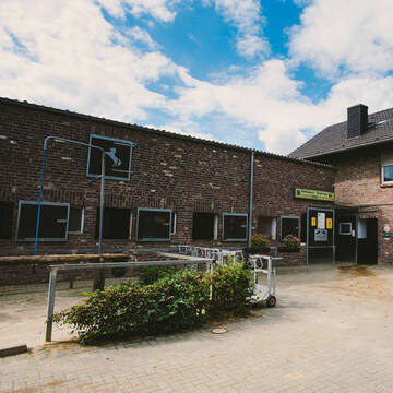
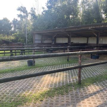
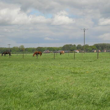
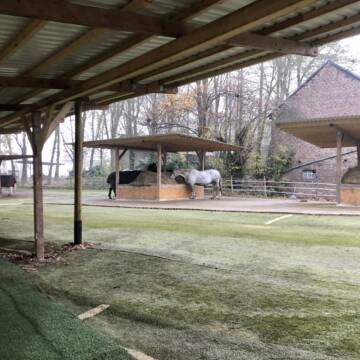
Wunderschöne Pferdeboxen zu vermieten
Geilenkirchen
PensionsstallHappySporthorses
@PensionsstallHappySporthorses
Fahrstall, Kutschwagen
FN-Mitglied
Vermieten
Führanlage
Hunde willkommen
Allergikerstall
Hengsthaltung möglich
29 weitere...
S


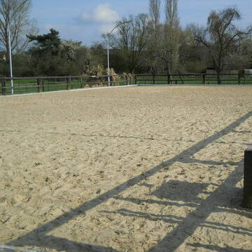
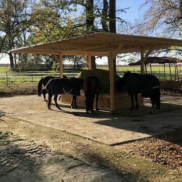
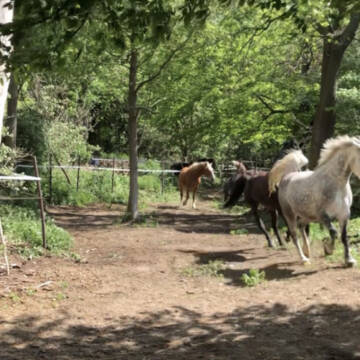
FN-Pferdeanlage mit allem Komfort
Heinsberg
Reitsportzentrum Pütt
@ReitsportzentrumPuett
FN-Mitglied
Freizeitstall
Vermieten
Führanlage
Longierzirkel/Roundpen
Hengsthaltung möglich
Pferdezucht
21 weitere...
aktuell
P+
Deprecated: Creation of dynamic property Zend_View_Helper_Ads::$adLink is deprecated in /var/www/stall-frei/htdocs/staging.stall-frei.de/library/Psf/View/Helper/Ads.php on line 108

Frisches Stroh zu verkaufen!
Mechtersen
STALL-FREIde Marketing
@STALL-FREI-Marketing
Kaufe frisches Stroh für dein Pferd!

Private Reitgemeinschaft Heinsberg-Kempen
Heinsberg-Kempen
Stephen-WORGAN
@Stephen-WORGAN
FN-Mitglied
Freizeitstall
Vermieten
Longierzirkel/Roundpen
Paddock
Gnadenbrothof
13 weitere...
P
Boxen frei, Paddockbox, Halle, Reitplatz, Wiesen
Heinsberg
Donseler Hof
@Donselerhof
FN-Mitglied
Freizeitstall
Vermieten
Führanlage
Krankenbox
Allergikerstall
Gnadenbrothof
36 weitere...
P


Pferdezucht- und Pensionsstall in Heinsberg
Gangelt
Saskia Ritter-Moll
@Selfkant-Ranch-Saskia-Ritter
FN-Mitglied
Freizeitstall
Vermieten
Hunde willkommen
Longierzirkel/Roundpen
Allergikerstall
Fohlenaufzucht möglich
26 weitere...
P+

Futtersack HeuToy, Fressbremse in pink
Mechtersen
STALL-FREIde Marketing
@STALL-FREI-Marketing
Stundenlange Beschäftigung die
Koliken vorbeugt, geringe Staubinhalation mit
steuerbarer Futterentnahme
Leider kein Vorschaubild
Leider kein Vorschaubild
4er Stallgasse frei, Halle Platz Wiesen SV oder VP
Heinsberg
Stallgasse
@M.N.
Gastronomie
Vermieten
Verpachten
Paddock
Reithalle
Halbpension
Selbstversorgung
9 weitere...
aktuell
B

Große, helle Box
Mönchengladbach
Reithof Küppers
@ReithofKueppers
Freizeitstall
Geländestrecke
Longierzirkel/Roundpen
Paddock
Außenbox mit Paddock
Außenboxen
Halbpension
Selbstversorgung
16 weitere...
P+
Leider kein Vorschaubild
Leider kein Vorschaubild
Privater Offenstall bei Geilenkirchen
Geilenkirchen-Leiffahrt
Müller
@Mueller77
Freizeitstall
Gangpferdereiten
Vermieten
Hunde willkommen
Longierzirkel/Roundpen
Allergikerstall
Gnadenbrothof
12 weitere...
B
Hacienda Gut Isenkroidt Aktiv-/Offenstall
Titz
Hacienda Gut Isenkroidt
@Verena-Conzen
Freizeitstall
Pferdeausbildung
Hunde willkommen
Krankenbox
Notfallboxen
Bewegungsstall
Laufstall
16 weitere...
P+
Paddockboxen/Boxen mit 20x60 Halle
Wegberg
Reitstall-Pappers
@Reitstall-Pappers
Vermieten
Hunde willkommen
Longierzirkel/Roundpen
Allergikerstall
Hufrehe geeignet
Außenbox mit Paddock
Innenbox
14 weitere...
P
Deprecated: Creation of dynamic property Zend_View::$pageCount is deprecated in /var/www/stall-frei/htdocs/staging.stall-frei.de/library/vendor/shardj/zf1-future/library/Zend/View/Abstract.php on line 308
Deprecated: Creation of dynamic property Zend_View::$itemCountPerPage is deprecated in /var/www/stall-frei/htdocs/staging.stall-frei.de/library/vendor/shardj/zf1-future/library/Zend/View/Abstract.php on line 308
Deprecated: Creation of dynamic property Zend_View::$first is deprecated in /var/www/stall-frei/htdocs/staging.stall-frei.de/library/vendor/shardj/zf1-future/library/Zend/View/Abstract.php on line 308
Deprecated: Creation of dynamic property Zend_View::$current is deprecated in /var/www/stall-frei/htdocs/staging.stall-frei.de/library/vendor/shardj/zf1-future/library/Zend/View/Abstract.php on line 308
Deprecated: Creation of dynamic property Zend_View::$last is deprecated in /var/www/stall-frei/htdocs/staging.stall-frei.de/library/vendor/shardj/zf1-future/library/Zend/View/Abstract.php on line 308
Deprecated: Creation of dynamic property Zend_View::$next is deprecated in /var/www/stall-frei/htdocs/staging.stall-frei.de/library/vendor/shardj/zf1-future/library/Zend/View/Abstract.php on line 308
Deprecated: Creation of dynamic property Zend_View::$pagesInRange is deprecated in /var/www/stall-frei/htdocs/staging.stall-frei.de/library/vendor/shardj/zf1-future/library/Zend/View/Abstract.php on line 308
Deprecated: Creation of dynamic property Zend_View::$firstPageInRange is deprecated in /var/www/stall-frei/htdocs/staging.stall-frei.de/library/vendor/shardj/zf1-future/library/Zend/View/Abstract.php on line 308
Deprecated: Creation of dynamic property Zend_View::$lastPageInRange is deprecated in /var/www/stall-frei/htdocs/staging.stall-frei.de/library/vendor/shardj/zf1-future/library/Zend/View/Abstract.php on line 308
Deprecated: Creation of dynamic property Zend_View::$currentItemCount is deprecated in /var/www/stall-frei/htdocs/staging.stall-frei.de/library/vendor/shardj/zf1-future/library/Zend/View/Abstract.php on line 308
Deprecated: Creation of dynamic property Zend_View::$totalItemCount is deprecated in /var/www/stall-frei/htdocs/staging.stall-frei.de/library/vendor/shardj/zf1-future/library/Zend/View/Abstract.php on line 308
Deprecated: Creation of dynamic property Zend_View::$firstItemNumber is deprecated in /var/www/stall-frei/htdocs/staging.stall-frei.de/library/vendor/shardj/zf1-future/library/Zend/View/Abstract.php on line 308
Deprecated: Creation of dynamic property Zend_View::$lastItemNumber is deprecated in /var/www/stall-frei/htdocs/staging.stall-frei.de/library/vendor/shardj/zf1-future/library/Zend/View/Abstract.php on line 308
Deprecated: Creation of dynamic property Zend_View::$router is deprecated in /var/www/stall-frei/htdocs/staging.stall-frei.de/library/vendor/shardj/zf1-future/library/Zend/View/Abstract.php on line 308
Deprecated: Creation of dynamic property Zend_View::$urlParams is deprecated in /var/www/stall-frei/htdocs/staging.stall-frei.de/library/vendor/shardj/zf1-future/library/Zend/View/Abstract.php on line 308
Deprecated: Creation of dynamic property Zend_View::$showAds is deprecated in /var/www/stall-frei/htdocs/staging.stall-frei.de/library/vendor/shardj/zf1-future/library/Zend/View/Abstract.php on line 308
Deprecated: Creation of dynamic property Zend_View::$objectIds is deprecated in /var/www/stall-frei/htdocs/staging.stall-frei.de/library/vendor/shardj/zf1-future/library/Zend/View/Abstract.php on line 308
Deprecated: Creation of dynamic property Zend_View::$showNavbar is deprecated in /var/www/stall-frei/htdocs/staging.stall-frei.de/library/vendor/shardj/zf1-future/library/Zend/View/Abstract.php on line 308
Deprecated: Creation of dynamic property Zend_View::$showBreadcrumb is deprecated in /var/www/stall-frei/htdocs/staging.stall-frei.de/library/vendor/shardj/zf1-future/library/Zend/View/Abstract.php on line 308
Deprecated: Creation of dynamic property Zend_View::$showFooter is deprecated in /var/www/stall-frei/htdocs/staging.stall-frei.de/library/vendor/shardj/zf1-future/library/Zend/View/Abstract.php on line 308
Deprecated: Creation of dynamic property Zend_View::$showInternalAds is deprecated in /var/www/stall-frei/htdocs/staging.stall-frei.de/library/vendor/shardj/zf1-future/library/Zend/View/Abstract.php on line 308
Deprecated: Creation of dynamic property Zend_View::$blNoContent is deprecated in /var/www/stall-frei/htdocs/staging.stall-frei.de/library/vendor/shardj/zf1-future/library/Zend/View/Abstract.php on line 308
Deprecated: Creation of dynamic property Zend_View::$sMetaDesc is deprecated in /var/www/stall-frei/htdocs/staging.stall-frei.de/library/vendor/shardj/zf1-future/library/Zend/View/Abstract.php on line 308
Deprecated: Creation of dynamic property Zend_View::$useGmaps is deprecated in /var/www/stall-frei/htdocs/staging.stall-frei.de/library/vendor/shardj/zf1-future/library/Zend/View/Abstract.php on line 308
Deprecated: Creation of dynamic property Zend_View::$touches is deprecated in /var/www/stall-frei/htdocs/staging.stall-frei.de/library/vendor/shardj/zf1-future/library/Zend/View/Abstract.php on line 308
Deprecated: Creation of dynamic property Zend_View::$oProject is deprecated in /var/www/stall-frei/htdocs/staging.stall-frei.de/library/vendor/shardj/zf1-future/library/Zend/View/Abstract.php on line 308
Deprecated: Creation of dynamic property Zend_View::$pageHeadline is deprecated in /var/www/stall-frei/htdocs/staging.stall-frei.de/library/vendor/shardj/zf1-future/library/Zend/View/Abstract.php on line 308
Deprecated: Creation of dynamic property Zend_View::$disableLocationField is deprecated in /var/www/stall-frei/htdocs/staging.stall-frei.de/library/vendor/shardj/zf1-future/library/Zend/View/Abstract.php on line 308
Deprecated: Creation of dynamic property Zend_View::$isSearch is deprecated in /var/www/stall-frei/htdocs/staging.stall-frei.de/library/vendor/shardj/zf1-future/library/Zend/View/Abstract.php on line 308
Deprecated: Creation of dynamic property Zend_View::$pageTitle is deprecated in /var/www/stall-frei/htdocs/staging.stall-frei.de/library/vendor/shardj/zf1-future/library/Zend/View/Abstract.php on line 308
Deprecated: Creation of dynamic property Psf_Form_Element_Text::$class is deprecated in /var/www/stall-frei/htdocs/staging.stall-frei.de/library/vendor/shardj/zf1-future/library/Zend/Form/Element.php on line 874
Deprecated: Creation of dynamic property Psf_Form_Element_Text::$size is deprecated in /var/www/stall-frei/htdocs/staging.stall-frei.de/library/vendor/shardj/zf1-future/library/Zend/Form/Element.php on line 874
Deprecated: Creation of dynamic property Psf_Form_Element_Text::$placeholder is deprecated in /var/www/stall-frei/htdocs/staging.stall-frei.de/library/vendor/shardj/zf1-future/library/Zend/Form/Element.php on line 874
Deprecated: Creation of dynamic property Psf_Form_Element_Hidden::$class is deprecated in /var/www/stall-frei/htdocs/staging.stall-frei.de/library/vendor/shardj/zf1-future/library/Zend/Form/Element.php on line 874
Deprecated: Creation of dynamic property Psf_Form_Element_Hidden::$class is deprecated in /var/www/stall-frei/htdocs/staging.stall-frei.de/library/vendor/shardj/zf1-future/library/Zend/Form/Element.php on line 874
Deprecated: Creation of dynamic property Psf_Form_Element_Hidden::$class is deprecated in /var/www/stall-frei/htdocs/staging.stall-frei.de/library/vendor/shardj/zf1-future/library/Zend/Form/Element.php on line 874
Deprecated: Creation of dynamic property Psf_Form_Element_Hidden::$class is deprecated in /var/www/stall-frei/htdocs/staging.stall-frei.de/library/vendor/shardj/zf1-future/library/Zend/Form/Element.php on line 874
Deprecated: Creation of dynamic property Psf_Form_Element_Select::$class is deprecated in /var/www/stall-frei/htdocs/staging.stall-frei.de/library/vendor/shardj/zf1-future/library/Zend/Form/Element.php on line 874
Deprecated: Creation of dynamic property Psf_Form_Element_Select::$class is deprecated in /var/www/stall-frei/htdocs/staging.stall-frei.de/library/vendor/shardj/zf1-future/library/Zend/Form/Element.php on line 874
Deprecated: Creation of dynamic property Psf_Form_Element_Select::$class is deprecated in /var/www/stall-frei/htdocs/staging.stall-frei.de/library/vendor/shardj/zf1-future/library/Zend/Form/Element.php on line 874
Deprecated: Creation of dynamic property Psf_Form_Element_Select::$class is deprecated in /var/www/stall-frei/htdocs/staging.stall-frei.de/library/vendor/shardj/zf1-future/library/Zend/Form/Element.php on line 874
Deprecated: Creation of dynamic property Psf_Form_Element_Text::$class is deprecated in /var/www/stall-frei/htdocs/staging.stall-frei.de/library/vendor/shardj/zf1-future/library/Zend/Form/Element.php on line 874
Deprecated: Creation of dynamic property Psf_Form_Element_Checkbox::$label is deprecated in /var/www/stall-frei/htdocs/staging.stall-frei.de/library/vendor/shardj/zf1-future/library/Zend/Form/Element.php on line 874
Deprecated: Creation of dynamic property Zend_View::$sort is deprecated in /var/www/stall-frei/htdocs/staging.stall-frei.de/library/vendor/shardj/zf1-future/library/Zend/View/Abstract.php on line 308
Deprecated: Creation of dynamic property Zend_View::$searchLocation is deprecated in /var/www/stall-frei/htdocs/staging.stall-frei.de/library/vendor/shardj/zf1-future/library/Zend/View/Abstract.php on line 308
Deprecated: Creation of dynamic property Zend_View::$locationHint is deprecated in /var/www/stall-frei/htdocs/staging.stall-frei.de/library/vendor/shardj/zf1-future/library/Zend/View/Abstract.php on line 308
Psf_GeoCoder_Abstract::getLocation: Oberbruch Get Location CachedOrLive
Psf_GeoCoder_Abstract::getCachedOrLive: Oberbruch
Psf_GeoCoder_OpenCageData::makeApiRequest: response:
Array
(
[documentation] => https://opencagedata.com/api
[licenses] => Array
(
[0] => Array
(
[name] => see attribution guide
[url] => https://opencagedata.com/credits
)
)
[results] => Array
(
[0] => Array
(
[bounds] => Array
(
[northeast] => Array
(
[lat] => 51.0807511
[lng] => 6.1675699
)
[southwest] => Array
(
[lat] => 51.0407511
[lng] => 6.1275699
)
)
[components] => Array
(
[ISO_3166-1_alpha-2] => DE
[ISO_3166-1_alpha-3] => DEU
[ISO_3166-2] => Array
(
[0] => DE-NW
)
[_category] => place
[_normalized_city] => Heinsberg
[_type] => village
[continent] => Europe
[country] => Deutschland
[country_code] => de
[county] => Kreis Heinsberg
[political_union] => European Union
[postcode] => 41849
[state] => Nordrhein-Westfalen
[state_code] => NW
[town] => Heinsberg
[village] => Oberbruch
)
[confidence] => 7
[formatted] => 41849 Oberbruch, Deutschland
[geometry] => Array
(
[lat] => 51.0607511
[lng] => 6.1475699
)
)
[1] => Array
(
[bounds] => Array
(
[northeast] => Array
(
[lat] => 48.7486651
[lng] => 8.109451
)
[southwest] => Array
(
[lat] => 48.7086651
[lng] => 8.069451
)
)
[components] => Array
(
[ISO_3166-1_alpha-2] => DE
[ISO_3166-1_alpha-3] => DEU
[ISO_3166-2] => Array
(
[0] => DE-BW
)
[_category] => place
[_normalized_city] => Bühl
[_type] => village
[continent] => Europe
[country] => Deutschland
[country_code] => de
[county] => Landkreis Rastatt
[municipality] => VVG der Stadt Bühl
[political_union] => European Union
[state] => Baden-Württemberg
[state_code] => BW
[town] => Bühl
[village] => Oberbruch
)
[confidence] => 7
[formatted] => Oberbruch, Baden-Württemberg, Deutschland
[geometry] => Array
(
[lat] => 48.7286651
[lng] => 8.089451
)
)
[2] => Array
(
[bounds] => Array
(
[northeast] => Array
(
[lat] => 48.7451684
[lng] => 8.1086937
)
[southwest] => Array
(
[lat] => 48.7145648
[lng] => 8.0722645
)
)
[components] => Array
(
[ISO_3166-1_alpha-2] => DE
[ISO_3166-1_alpha-3] => DEU
[ISO_3166-2] => Array
(
[0] => DE-BW
)
[_category] => place
[_normalized_city] => Bühl
[_type] => neighbourhood
[continent] => Europe
[country] => Deutschland
[country_code] => de
[county] => Landkreis Rastatt
[municipality] => VVG der Stadt Bühl
[political_union] => European Union
[state] => Baden-Württemberg
[state_code] => BW
[suburb] => Oberbruch
[town] => Bühl
)
[confidence] => 7
[formatted] => Oberbruch, Bühl, Baden-Württemberg, Deutschland
[geometry] => Array
(
[lat] => 48.7298837
[lng] => 8.0870115
)
)
[3] => Array
(
[bounds] => Array
(
[northeast] => Array
(
[lat] => 51.8677327
[lng] => 12.1947706
)
[southwest] => Array
(
[lat] => 51.8550853
[lng] => 12.1800467
)
)
[components] => Array
(
[ISO_3166-1_alpha-2] => DE
[ISO_3166-1_alpha-3] => DEU
[ISO_3166-2] => Array
(
[0] => DE-ST
)
[_category] => natural/water
[_normalized_city] => Dessau
[_type] => meadow
[city_district] => Dessau
[continent] => Europe
[country] => Deutschland
[country_code] => de
[county] => Dessau-Roßlau
[meadow] => Oberbruch
[political_union] => European Union
[state] => Sachsen-Anhalt
[state_code] => ST
)
[confidence] => 8
[formatted] => Oberbruch, Dessau, Dessau-Roßlau, Sachsen-Anhalt, Deutschland
[geometry] => Array
(
[lat] => 51.8614299
[lng] => 12.1877182
)
)
[4] => Array
(
[bounds] => Array
(
[northeast] => Array
(
[lat] => 51.6660932
[lng] => 10.7142752
)
[southwest] => Array
(
[lat] => 51.665187
[lng] => 10.7111637
)
)
[components] => Array
(
[ISO_3166-1_alpha-2] => DE
[ISO_3166-1_alpha-3] => DEU
[ISO_3166-2] => Array
(
[0] => DE-ST
)
[_category] => road
[_normalized_city] => Benneckenstein
[_type] => road
[continent] => Europe
[country] => Deutschland
[country_code] => de
[county] => Landkreis Harz
[municipality] => Oberharz am Brocken
[political_union] => European Union
[postcode] => 38877
[road] => Oberbruch
[road_type] => residential
[state] => Sachsen-Anhalt
[state_code] => ST
[town] => Benneckenstein
)
[confidence] => 9
[formatted] => Oberbruch, 38877 Benneckenstein, Deutschland
[geometry] => Array
(
[lat] => 51.6658983
[lng] => 10.7126474
)
)
[5] => Array
(
[bounds] => Array
(
[northeast] => Array
(
[lat] => 51.4909429
[lng] => 6.9148555
)
[southwest] => Array
(
[lat] => 51.490026
[lng] => 6.9146173
)
)
[components] => Array
(
[ISO_3166-1_alpha-2] => DE
[ISO_3166-1_alpha-3] => DEU
[ISO_3166-2] => Array
(
[0] => DE-NW
)
[_category] => road
[_normalized_city] => Oberhausen
[_type] => road
[city] => Oberhausen
[city_district] => Alt-Oberhausen
[continent] => Europe
[country] => Deutschland
[country_code] => de
[political_union] => European Union
[postcode] => 46117
[road] => Oberbruch
[road_type] => residential
[state] => Nordrhein-Westfalen
[state_code] => NW
[suburb] => Borbeck
)
[confidence] => 9
[formatted] => Oberbruch, 46117 Oberhausen, Deutschland
[geometry] => Array
(
[lat] => 51.4904748
[lng] => 6.9147014
)
)
[6] => Array
(
[components] => Array
(
[ISO_3166-1_alpha-2] => FR
[ISO_3166-1_alpha-3] => FRA
[ISO_3166-2] => Array
(
[0] => FR-GES
[1] => FR-6AE
[2] => FR-67
)
[_category] => road
[_normalized_city] => Hoffen
[_type] => road
[city] => Hoffen
[continent] => Europe
[country] => France
[country_code] => fr
[county] => Bas-Rhin
[local_authority] => Communauté de communes de l'Outre-Forêt
[political_union] => European Union
[postcode] => 67250
[road] => Oberbruch
[state] => Grand Est
[state_code] => GES
)
[confidence] => 3
[formatted] => Oberbruch, 67250 Hoffen, France
[geometry] => Array
(
[lat] => 48.934729
[lng] => 7.941107
)
)
[7] => Array
(
[components] => Array
(
[ISO_3166-1_alpha-2] => FR
[ISO_3166-1_alpha-3] => FRA
[ISO_3166-2] => Array
(
[0] => FR-GES
[1] => FR-6AE
[2] => FR-68
)
[_category] => road
[_normalized_city] => Oberbruck
[_type] => road
[city] => Oberbruck
[continent] => Europe
[country] => France
[country_code] => fr
[county] => Haut-Rhin
[local_authority] => Communauté de communes de la Vallée de la Doller et du Soultzbach
[political_union] => European Union
[postcode] => 68290
[road] => Rue de Rimbach
[state] => Grand Est
[state_code] => GES
)
[confidence] => 3
[formatted] => Rue de Rimbach, 68290 Oberbruck, France
[geometry] => Array
(
[lat] => 47.812212
[lng] => 6.944042
)
)
[8] => Array
(
[components] => Array
(
[ISO_3166-1_alpha-2] => FR
[ISO_3166-1_alpha-3] => FRA
[ISO_3166-2] => Array
(
[0] => FR-GES
[1] => FR-6AE
[2] => FR-68
)
[_category] => place
[_normalized_city] => Oberbruck
[_type] => city
[city] => Oberbruck
[continent] => Europe
[country] => France
[country_code] => fr
[county] => Haut-Rhin
[local_authority] => Communauté de communes de la Vallée de la Doller et du Soultzbach
[political_union] => European Union
[postcode] => 68290
[state] => Grand Est
[state_code] => GES
)
[confidence] => 3
[formatted] => Oberbruck, Haut-Rhin, France
[geometry] => Array
(
[lat] => 47.810575
[lng] => 6.943309
)
)
[9] => Array
(
[components] => Array
(
[ISO_3166-1_alpha-2] => FR
[ISO_3166-1_alpha-3] => FRA
[ISO_3166-2] => Array
(
[0] => FR-GES
[1] => FR-6AE
[2] => FR-68
)
[_category] => road
[_normalized_city] => Oberbruck
[_type] => road
[city] => Oberbruck
[continent] => Europe
[country] => France
[country_code] => fr
[county] => Haut-Rhin
[local_authority] => Communauté de communes de la Vallée de la Doller et du Soultzbach
[political_union] => European Union
[postcode] => 68290
[road] => Rue des Champs
[state] => Grand Est
[state_code] => GES
)
[confidence] => 3
[formatted] => Rue des Champs, 68290 Oberbruck, France
[geometry] => Array
(
[lat] => 47.811929
[lng] => 6.942723
)
)
)
[status] => Array
(
[code] => 200
[message] => OK
)
[stay_informed] => Array
(
[blog] => https://blog.opencagedata.com
[mastodon] => https://en.osm.town/@opencage
)
[thanks] => For using an OpenCage API
[timestamp] => Array
(
[created_http] => Sun, 08 Feb 2026 10:19:58 GMT
[created_unix] => 1770545998
)
[total_results] => 10
)
Psf_GeoCoder_Abstract::convertLocationResult
{"documentation":"https:\/\/opencagedata.com\/api","licenses":[{"name":"see attribution guide","url":"https:\/\/opencagedata.com\/credits"}],"results":[{"bounds":{"northeast":{"lat":51.0807511,"lng":6.1675699},"southwest":{"lat":51.0407511,"lng":6.1275699}},"components":{"ISO_3166-1_alpha-2":"DE","ISO_3166-1_alpha-3":"DEU","ISO_3166-2":["DE-NW"],"_category":"place","_normalized_city":"Heinsberg","_type":"village","continent":"Europe","country":"Deutschland","country_code":"de","county":"Kreis Heinsberg","political_union":"European Union","postcode":"41849","state":"Nordrhein-Westfalen","state_code":"NW","town":"Heinsberg","village":"Oberbruch"},"confidence":7,"formatted":"41849 Oberbruch, Deutschland","geometry":{"lat":51.0607511,"lng":6.1475699}},{"bounds":{"northeast":{"lat":48.7486651,"lng":8.109451},"southwest":{"lat":48.7086651,"lng":8.069451}},"components":{"ISO_3166-1_alpha-2":"DE","ISO_3166-1_alpha-3":"DEU","ISO_3166-2":["DE-BW"],"_category":"place","_normalized_city":"B\u00fchl","_type":"village","continent":"Europe","country":"Deutschland","country_code":"de","county":"Landkreis Rastatt","municipality":"VVG der Stadt B\u00fchl","political_union":"European Union","state":"Baden-W\u00fcrttemberg","state_code":"BW","town":"B\u00fchl","village":"Oberbruch"},"confidence":7,"formatted":"Oberbruch, Baden-W\u00fcrttemberg, Deutschland","geometry":{"lat":48.7286651,"lng":8.089451}},{"bounds":{"northeast":{"lat":48.7451684,"lng":8.1086937},"southwest":{"lat":48.7145648,"lng":8.0722645}},"components":{"ISO_3166-1_alpha-2":"DE","ISO_3166-1_alpha-3":"DEU","ISO_3166-2":["DE-BW"],"_category":"place","_normalized_city":"B\u00fchl","_type":"neighbourhood","continent":"Europe","country":"Deutschland","country_code":"de","county":"Landkreis Rastatt","municipality":"VVG der Stadt B\u00fchl","political_union":"European Union","state":"Baden-W\u00fcrttemberg","state_code":"BW","suburb":"Oberbruch","town":"B\u00fchl"},"confidence":7,"formatted":"Oberbruch, B\u00fchl, Baden-W\u00fcrttemberg, Deutschland","geometry":{"lat":48.7298837,"lng":8.0870115}},{"bounds":{"northeast":{"lat":51.8677327,"lng":12.1947706},"southwest":{"lat":51.8550853,"lng":12.1800467}},"components":{"ISO_3166-1_alpha-2":"DE","ISO_3166-1_alpha-3":"DEU","ISO_3166-2":["DE-ST"],"_category":"natural\/water","_normalized_city":"Dessau","_type":"meadow","city_district":"Dessau","continent":"Europe","country":"Deutschland","country_code":"de","county":"Dessau-Ro\u00dflau","meadow":"Oberbruch","political_union":"European Union","state":"Sachsen-Anhalt","state_code":"ST"},"confidence":8,"formatted":"Oberbruch, Dessau, Dessau-Ro\u00dflau, Sachsen-Anhalt, Deutschland","geometry":{"lat":51.8614299,"lng":12.1877182}},{"bounds":{"northeast":{"lat":51.6660932,"lng":10.7142752},"southwest":{"lat":51.665187,"lng":10.7111637}},"components":{"ISO_3166-1_alpha-2":"DE","ISO_3166-1_alpha-3":"DEU","ISO_3166-2":["DE-ST"],"_category":"road","_normalized_city":"Benneckenstein","_type":"road","continent":"Europe","country":"Deutschland","country_code":"de","county":"Landkreis Harz","municipality":"Oberharz am Brocken","political_union":"European Union","postcode":"38877","road":"Oberbruch","road_type":"residential","state":"Sachsen-Anhalt","state_code":"ST","town":"Benneckenstein"},"confidence":9,"formatted":"Oberbruch, 38877 Benneckenstein, Deutschland","geometry":{"lat":51.6658983,"lng":10.7126474}},{"bounds":{"northeast":{"lat":51.4909429,"lng":6.9148555},"southwest":{"lat":51.490026,"lng":6.9146173}},"components":{"ISO_3166-1_alpha-2":"DE","ISO_3166-1_alpha-3":"DEU","ISO_3166-2":["DE-NW"],"_category":"road","_normalized_city":"Oberhausen","_type":"road","city":"Oberhausen","city_district":"Alt-Oberhausen","continent":"Europe","country":"Deutschland","country_code":"de","political_union":"European Union","postcode":"46117","road":"Oberbruch","road_type":"residential","state":"Nordrhein-Westfalen","state_code":"NW","suburb":"Borbeck"},"confidence":9,"formatted":"Oberbruch, 46117 Oberhausen, Deutschland","geometry":{"lat":51.4904748,"lng":6.9147014}},{"components":{"ISO_3166-1_alpha-2":"FR","ISO_3166-1_alpha-3":"FRA","ISO_3166-2":["FR-GES","FR-6AE","FR-67"],"_category":"road","_normalized_city":"Hoffen","_type":"road","city":"Hoffen","continent":"Europe","country":"France","country_code":"fr","county":"Bas-Rhin","local_authority":"Communaut\u00e9 de communes de l'Outre-For\u00eat","political_union":"European Union","postcode":"67250","road":"Oberbruch","state":"Grand Est","state_code":"GES"},"confidence":3,"formatted":"Oberbruch, 67250 Hoffen, France","geometry":{"lat":48.934729,"lng":7.941107}},{"components":{"ISO_3166-1_alpha-2":"FR","ISO_3166-1_alpha-3":"FRA","ISO_3166-2":["FR-GES","FR-6AE","FR-68"],"_category":"road","_normalized_city":"Oberbruck","_type":"road","city":"Oberbruck","continent":"Europe","country":"France","country_code":"fr","county":"Haut-Rhin","local_authority":"Communaut\u00e9 de communes de la Vall\u00e9e de la Doller et du Soultzbach","political_union":"European Union","postcode":"68290","road":"Rue de Rimbach","state":"Grand Est","state_code":"GES"},"confidence":3,"formatted":"Rue de Rimbach, 68290 Oberbruck, France","geometry":{"lat":47.812212,"lng":6.944042}},{"components":{"ISO_3166-1_alpha-2":"FR","ISO_3166-1_alpha-3":"FRA","ISO_3166-2":["FR-GES","FR-6AE","FR-68"],"_category":"place","_normalized_city":"Oberbruck","_type":"city","city":"Oberbruck","continent":"Europe","country":"France","country_code":"fr","county":"Haut-Rhin","local_authority":"Communaut\u00e9 de communes de la Vall\u00e9e de la Doller et du Soultzbach","political_union":"European Union","postcode":"68290","state":"Grand Est","state_code":"GES"},"confidence":3,"formatted":"Oberbruck, Haut-Rhin, France","geometry":{"lat":47.810575,"lng":6.943309}},{"components":{"ISO_3166-1_alpha-2":"FR","ISO_3166-1_alpha-3":"FRA","ISO_3166-2":["FR-GES","FR-6AE","FR-68"],"_category":"road","_normalized_city":"Oberbruck","_type":"road","city":"Oberbruck","continent":"Europe","country":"France","country_code":"fr","county":"Haut-Rhin","local_authority":"Communaut\u00e9 de communes de la Vall\u00e9e de la Doller et du Soultzbach","political_union":"European Union","postcode":"68290","road":"Rue des Champs","state":"Grand Est","state_code":"GES"},"confidence":3,"formatted":"Rue des Champs, 68290 Oberbruck, France","geometry":{"lat":47.811929,"lng":6.942723}}],"status":{"code":200,"message":"OK"},"stay_informed":{"blog":"https:\/\/blog.opencagedata.com","mastodon":"https:\/\/en.osm.town\/@opencage"},"thanks":"For using an OpenCage API","timestamp":{"created_http":"Sun, 08 Feb 2026 10:19:58 GMT","created_unix":1770545998},"total_results":10}Array
(
[0] => stdClass Object
(
[bounds] => stdClass Object
(
[northeast] => stdClass Object
(
[lat] => 51.0807511
[lng] => 6.1675699
)
[southwest] => stdClass Object
(
[lat] => 51.0407511
[lng] => 6.1275699
)
)
[components] => stdClass Object
(
[ISO_3166-1_alpha-2] => DE
[ISO_3166-1_alpha-3] => DEU
[ISO_3166-2] => Array
(
[0] => DE-NW
)
[_category] => place
[_normalized_city] => Heinsberg
[_type] => village
[continent] => Europe
[country] => Deutschland
[country_code] => de
[county] => Kreis Heinsberg
[political_union] => European Union
[postcode] => 41849
[state] => Nordrhein-Westfalen
[state_code] => NW
[town] => Heinsberg
[village] => Oberbruch
)
[confidence] => 7
[formatted] => 41849 Oberbruch, Deutschland
[geometry] => stdClass Object
(
[lat] => 51.0607511
[lng] => 6.1475699
)
)
[1] => stdClass Object
(
[bounds] => stdClass Object
(
[northeast] => stdClass Object
(
[lat] => 48.7486651
[lng] => 8.109451
)
[southwest] => stdClass Object
(
[lat] => 48.7086651
[lng] => 8.069451
)
)
[components] => stdClass Object
(
[ISO_3166-1_alpha-2] => DE
[ISO_3166-1_alpha-3] => DEU
[ISO_3166-2] => Array
(
[0] => DE-BW
)
[_category] => place
[_normalized_city] => Bühl
[_type] => village
[continent] => Europe
[country] => Deutschland
[country_code] => de
[county] => Landkreis Rastatt
[municipality] => VVG der Stadt Bühl
[political_union] => European Union
[state] => Baden-Württemberg
[state_code] => BW
[town] => Bühl
[village] => Oberbruch
)
[confidence] => 7
[formatted] => Oberbruch, Baden-Württemberg, Deutschland
[geometry] => stdClass Object
(
[lat] => 48.7286651
[lng] => 8.089451
)
)
[2] => stdClass Object
(
[bounds] => stdClass Object
(
[northeast] => stdClass Object
(
[lat] => 48.7451684
[lng] => 8.1086937
)
[southwest] => stdClass Object
(
[lat] => 48.7145648
[lng] => 8.0722645
)
)
[components] => stdClass Object
(
[ISO_3166-1_alpha-2] => DE
[ISO_3166-1_alpha-3] => DEU
[ISO_3166-2] => Array
(
[0] => DE-BW
)
[_category] => place
[_normalized_city] => Bühl
[_type] => neighbourhood
[continent] => Europe
[country] => Deutschland
[country_code] => de
[county] => Landkreis Rastatt
[municipality] => VVG der Stadt Bühl
[political_union] => European Union
[state] => Baden-Württemberg
[state_code] => BW
[suburb] => Oberbruch
[town] => Bühl
)
[confidence] => 7
[formatted] => Oberbruch, Bühl, Baden-Württemberg, Deutschland
[geometry] => stdClass Object
(
[lat] => 48.7298837
[lng] => 8.0870115
)
)
[3] => stdClass Object
(
[bounds] => stdClass Object
(
[northeast] => stdClass Object
(
[lat] => 51.8677327
[lng] => 12.1947706
)
[southwest] => stdClass Object
(
[lat] => 51.8550853
[lng] => 12.1800467
)
)
[components] => stdClass Object
(
[ISO_3166-1_alpha-2] => DE
[ISO_3166-1_alpha-3] => DEU
[ISO_3166-2] => Array
(
[0] => DE-ST
)
[_category] => natural/water
[_normalized_city] => Dessau
[_type] => meadow
[city_district] => Dessau
[continent] => Europe
[country] => Deutschland
[country_code] => de
[county] => Dessau-Roßlau
[meadow] => Oberbruch
[political_union] => European Union
[state] => Sachsen-Anhalt
[state_code] => ST
)
[confidence] => 8
[formatted] => Oberbruch, Dessau, Dessau-Roßlau, Sachsen-Anhalt, Deutschland
[geometry] => stdClass Object
(
[lat] => 51.8614299
[lng] => 12.1877182
)
)
[4] => stdClass Object
(
[bounds] => stdClass Object
(
[northeast] => stdClass Object
(
[lat] => 51.6660932
[lng] => 10.7142752
)
[southwest] => stdClass Object
(
[lat] => 51.665187
[lng] => 10.7111637
)
)
[components] => stdClass Object
(
[ISO_3166-1_alpha-2] => DE
[ISO_3166-1_alpha-3] => DEU
[ISO_3166-2] => Array
(
[0] => DE-ST
)
[_category] => road
[_normalized_city] => Benneckenstein
[_type] => road
[continent] => Europe
[country] => Deutschland
[country_code] => de
[county] => Landkreis Harz
[municipality] => Oberharz am Brocken
[political_union] => European Union
[postcode] => 38877
[road] => Oberbruch
[road_type] => residential
[state] => Sachsen-Anhalt
[state_code] => ST
[town] => Benneckenstein
)
[confidence] => 9
[formatted] => Oberbruch, 38877 Benneckenstein, Deutschland
[geometry] => stdClass Object
(
[lat] => 51.6658983
[lng] => 10.7126474
)
)
[5] => stdClass Object
(
[bounds] => stdClass Object
(
[northeast] => stdClass Object
(
[lat] => 51.4909429
[lng] => 6.9148555
)
[southwest] => stdClass Object
(
[lat] => 51.490026
[lng] => 6.9146173
)
)
[components] => stdClass Object
(
[ISO_3166-1_alpha-2] => DE
[ISO_3166-1_alpha-3] => DEU
[ISO_3166-2] => Array
(
[0] => DE-NW
)
[_category] => road
[_normalized_city] => Oberhausen
[_type] => road
[city] => Oberhausen
[city_district] => Alt-Oberhausen
[continent] => Europe
[country] => Deutschland
[country_code] => de
[political_union] => European Union
[postcode] => 46117
[road] => Oberbruch
[road_type] => residential
[state] => Nordrhein-Westfalen
[state_code] => NW
[suburb] => Borbeck
)
[confidence] => 9
[formatted] => Oberbruch, 46117 Oberhausen, Deutschland
[geometry] => stdClass Object
(
[lat] => 51.4904748
[lng] => 6.9147014
)
)
[6] => stdClass Object
(
[components] => stdClass Object
(
[ISO_3166-1_alpha-2] => FR
[ISO_3166-1_alpha-3] => FRA
[ISO_3166-2] => Array
(
[0] => FR-GES
[1] => FR-6AE
[2] => FR-67
)
[_category] => road
[_normalized_city] => Hoffen
[_type] => road
[city] => Hoffen
[continent] => Europe
[country] => France
[country_code] => fr
[county] => Bas-Rhin
[local_authority] => Communauté de communes de l'Outre-Forêt
[political_union] => European Union
[postcode] => 67250
[road] => Oberbruch
[state] => Grand Est
[state_code] => GES
)
[confidence] => 3
[formatted] => Oberbruch, 67250 Hoffen, France
[geometry] => stdClass Object
(
[lat] => 48.934729
[lng] => 7.941107
)
)
[7] => stdClass Object
(
[components] => stdClass Object
(
[ISO_3166-1_alpha-2] => FR
[ISO_3166-1_alpha-3] => FRA
[ISO_3166-2] => Array
(
[0] => FR-GES
[1] => FR-6AE
[2] => FR-68
)
[_category] => road
[_normalized_city] => Oberbruck
[_type] => road
[city] => Oberbruck
[continent] => Europe
[country] => France
[country_code] => fr
[county] => Haut-Rhin
[local_authority] => Communauté de communes de la Vallée de la Doller et du Soultzbach
[political_union] => European Union
[postcode] => 68290
[road] => Rue de Rimbach
[state] => Grand Est
[state_code] => GES
)
[confidence] => 3
[formatted] => Rue de Rimbach, 68290 Oberbruck, France
[geometry] => stdClass Object
(
[lat] => 47.812212
[lng] => 6.944042
)
)
[8] => stdClass Object
(
[components] => stdClass Object
(
[ISO_3166-1_alpha-2] => FR
[ISO_3166-1_alpha-3] => FRA
[ISO_3166-2] => Array
(
[0] => FR-GES
[1] => FR-6AE
[2] => FR-68
)
[_category] => place
[_normalized_city] => Oberbruck
[_type] => city
[city] => Oberbruck
[continent] => Europe
[country] => France
[country_code] => fr
[county] => Haut-Rhin
[local_authority] => Communauté de communes de la Vallée de la Doller et du Soultzbach
[political_union] => European Union
[postcode] => 68290
[state] => Grand Est
[state_code] => GES
)
[confidence] => 3
[formatted] => Oberbruck, Haut-Rhin, France
[geometry] => stdClass Object
(
[lat] => 47.810575
[lng] => 6.943309
)
)
[9] => stdClass Object
(
[components] => stdClass Object
(
[ISO_3166-1_alpha-2] => FR
[ISO_3166-1_alpha-3] => FRA
[ISO_3166-2] => Array
(
[0] => FR-GES
[1] => FR-6AE
[2] => FR-68
)
[_category] => road
[_normalized_city] => Oberbruck
[_type] => road
[city] => Oberbruck
[continent] => Europe
[country] => France
[country_code] => fr
[county] => Haut-Rhin
[local_authority] => Communauté de communes de la Vallée de la Doller et du Soultzbach
[political_union] => European Union
[postcode] => 68290
[road] => Rue des Champs
[state] => Grand Est
[state_code] => GES
)
[confidence] => 3
[formatted] => Rue des Champs, 68290 Oberbruck, France
[geometry] => stdClass Object
(
[lat] => 47.811929
[lng] => 6.942723
)
)
)
Psf_GeoCoder_OpenCageData::getKeyMap: 0
stdClass Object
(
    [bounds] => stdClass Object
        (
            [northeast] => stdClass Object
                (
                    [lat] => 51.0807511
                    [lng] => 6.1675699
                )

            [southwest] => stdClass Object
                (
                    [lat] => 51.0407511
                    [lng] => 6.1275699
                )

        )

    [components] => stdClass Object
        (
            [ISO_3166-1_alpha-2] => DE
            [ISO_3166-1_alpha-3] => DEU
            [ISO_3166-2] => Array
                (
                    [0] => DE-NW
                )

            [_category] => place
            [_normalized_city] => Heinsberg
            [_type] => village
            [continent] => Europe
            [country] => Deutschland
            [country_code] => de
            [county] => Kreis Heinsberg
            [political_union] => European Union
            [postcode] => 41849
            [state] => Nordrhein-Westfalen
            [state_code] => NW
            [town] => Heinsberg
            [village] => Oberbruch
        )

    [confidence] => 7
    [formatted] => 41849 Oberbruch, Deutschland
    [geometry] => stdClass Object
        (
            [lat] => 51.0607511
            [lng] => 6.1475699
        )

)
Psf_GeoCoder_OpenCageData::getCounty: Heinsberg
Psf_GeoCoder_OpenCageData::addMissingData REFETCH!
Array
(
    [address] => 41849 Oberbruch, Deutschland
    [type] => village
    [street] =>
    [city] => Heinsberg
    [county] => Heinsberg
    [state] => Nordrhein-Westfalen
    [zip] => 41849
    [country] => Deutschland
    [suburb] =>
    [countrycode] => de
    [latitude] => 51.0607511
    [longitude] => 6.1475699
    [accuracy] => 1
    [confidence] => 7
    [bounds] => stdClass Object
        (
            [northeast] => stdClass Object
                (
                    [lat] => 51.0807511
                    [lng] => 6.1675699
                )

            [southwest] => stdClass Object
                (
                    [lat] => 51.0407511
                    [lng] => 6.1275699
                )

        )

)
reformat!
Array
(
    [address] => 41849 Heinsberg
    [type] => village
    [street] =>
    [city] => Heinsberg
    [county] => Heinsberg
    [state] => Nordrhein-Westfalen
    [zip] => 41849
    [country] => Deutschland
    [suburb] =>
    [countrycode] => de
    [latitude] => 51.0607511
    [longitude] => 6.1475699
    [accuracy] => 1
    [confidence] => 7
    [bounds] => stdClass Object
        (
            [northeast] => stdClass Object
                (
                    [lat] => 51.0807511
                    [lng] => 6.1675699
                )

            [southwest] => stdClass Object
                (
                    [lat] => 51.0407511
                    [lng] => 6.1275699
                )

        )

    [place] => 41849 Heinsberg, Nordrhein-Westfalen
    [hash] => 261035b97baea9317f372c91b883c5ac
)
Psf_GeoCoder_OpenCageData::getKeyMap: 1
stdClass Object
(
    [bounds] => stdClass Object
        (
            [northeast] => stdClass Object
                (
                    [lat] => 48.7486651
                    [lng] => 8.109451
                )

            [southwest] => stdClass Object
                (
                    [lat] => 48.7086651
                    [lng] => 8.069451
                )

        )

    [components] => stdClass Object
        (
            [ISO_3166-1_alpha-2] => DE
            [ISO_3166-1_alpha-3] => DEU
            [ISO_3166-2] => Array
                (
                    [0] => DE-BW
                )

            [_category] => place
            [_normalized_city] => Bühl
            [_type] => village
            [continent] => Europe
            [country] => Deutschland
            [country_code] => de
            [county] => Landkreis Rastatt
            [municipality] => VVG der Stadt Bühl
            [political_union] => European Union
            [state] => Baden-Württemberg
            [state_code] => BW
            [town] => Bühl
            [village] => Oberbruch
        )

    [confidence] => 7
    [formatted] => Oberbruch, Baden-Württemberg, Deutschland
    [geometry] => stdClass Object
        (
            [lat] => 48.7286651
            [lng] => 8.089451
        )

)
Psf_GeoCoder_OpenCageData::getCounty: Rastatt
Psf_GeoCoder_OpenCageData::addMissingData REFETCH!
Array
(
    [address] => Oberbruch, Baden-Württemberg, Deutschland
    [type] => village
    [street] =>
    [city] => Bühl
    [county] => Rastatt
    [state] => Baden-Württemberg
    [zip] =>
    [country] => Deutschland
    [suburb] =>
    [countrycode] => de
    [latitude] => 48.7286651
    [longitude] => 8.089451
    [accuracy] => 1
    [confidence] => 7
    [bounds] => stdClass Object
        (
            [northeast] => stdClass Object
                (
                    [lat] => 48.7486651
                    [lng] => 8.109451
                )

            [southwest] => stdClass Object
                (
                    [lat] => 48.7086651
                    [lng] => 8.069451
                )

        )

)
reformat!
Array
(
    [address] => Bühl
    [type] => village
    [street] =>
    [city] => Bühl
    [county] => Rastatt
    [state] => Baden-Württemberg
    [zip] =>
    [country] => Deutschland
    [suburb] =>
    [countrycode] => de
    [latitude] => 48.7286651
    [longitude] => 8.089451
    [accuracy] => 1
    [confidence] => 7
    [bounds] => stdClass Object
        (
            [northeast] => stdClass Object
                (
                    [lat] => 48.7486651
                    [lng] => 8.109451
                )

            [southwest] => stdClass Object
                (
                    [lat] => 48.7086651
                    [lng] => 8.069451
                )

        )

    [place] => Bühl, Baden-Württemberg
    [hash] => 9d56f29cca197385c72b468a77e286c8
)
Psf_GeoCoder_OpenCageData::getKeyMap: 2
stdClass Object
(
    [bounds] => stdClass Object
        (
            [northeast] => stdClass Object
                (
                    [lat] => 48.7451684
                    [lng] => 8.1086937
                )

            [southwest] => stdClass Object
                (
                    [lat] => 48.7145648
                    [lng] => 8.0722645
                )

        )

    [components] => stdClass Object
        (
            [ISO_3166-1_alpha-2] => DE
            [ISO_3166-1_alpha-3] => DEU
            [ISO_3166-2] => Array
                (
                    [0] => DE-BW
                )

            [_category] => place
            [_normalized_city] => Bühl
            [_type] => neighbourhood
            [continent] => Europe
            [country] => Deutschland
            [country_code] => de
            [county] => Landkreis Rastatt
            [municipality] => VVG der Stadt Bühl
            [political_union] => European Union
            [state] => Baden-Württemberg
            [state_code] => BW
            [suburb] => Oberbruch
            [town] => Bühl
        )

    [confidence] => 7
    [formatted] => Oberbruch, Bühl, Baden-Württemberg, Deutschland
    [geometry] => stdClass Object
        (
            [lat] => 48.7298837
            [lng] => 8.0870115
        )

)
Psf_GeoCoder_OpenCageData::getCounty: Rastatt
Psf_GeoCoder_OpenCageData::addMissingData REFETCH!
Array
(
    [address] => Oberbruch, Bühl, Baden-Württemberg, Deutschland
    [type] => neighbourhood
    [street] =>
    [city] => Bühl
    [county] => Rastatt
    [state] => Baden-Württemberg
    [zip] =>
    [country] => Deutschland
    [suburb] => Oberbruch
    [countrycode] => de
    [latitude] => 48.7298837
    [longitude] => 8.0870115
    [accuracy] => 1
    [confidence] => 7
    [bounds] => stdClass Object
        (
            [northeast] => stdClass Object
                (
                    [lat] => 48.7451684
                    [lng] => 8.1086937
                )

            [southwest] => stdClass Object
                (
                    [lat] => 48.7145648
                    [lng] => 8.0722645
                )

        )

)
reformat!
Array
(
    [address] => Oberbruch, Bühl, Baden-Württemberg, Deutschland
    [type] => neighbourhood
    [street] =>
    [city] => Bühl
    [county] => Rastatt
    [state] => Baden-Württemberg
    [zip] =>
    [country] => Deutschland
    [suburb] => Oberbruch
    [countrycode] => de
    [latitude] => 48.7298837
    [longitude] => 8.0870115
    [accuracy] => 1
    [confidence] => 7
    [bounds] => stdClass Object
        (
            [northeast] => stdClass Object
                (
                    [lat] => 48.7451684
                    [lng] => 8.1086937
                )

            [southwest] => stdClass Object
                (
                    [lat] => 48.7145648
                    [lng] => 8.0722645
                )

        )

    [place] => Bühl, Baden-Württemberg
    [hash] => 9d56f29cca197385c72b468a77e286c8
)
Psf_GeoCoder_OpenCageData::getKeyMap: 3
stdClass Object
(
    [bounds] => stdClass Object
        (
            [northeast] => stdClass Object
                (
                    [lat] => 51.8677327
                    [lng] => 12.1947706
                )

            [southwest] => stdClass Object
                (
                    [lat] => 51.8550853
                    [lng] => 12.1800467
                )

        )

    [components] => stdClass Object
        (
            [ISO_3166-1_alpha-2] => DE
            [ISO_3166-1_alpha-3] => DEU
            [ISO_3166-2] => Array
                (
                    [0] => DE-ST
                )

            [_category] => natural/water
            [_normalized_city] => Dessau
            [_type] => meadow
            [city_district] => Dessau
            [continent] => Europe
            [country] => Deutschland
            [country_code] => de
            [county] => Dessau-Roßlau
            [meadow] => Oberbruch
            [political_union] => European Union
            [state] => Sachsen-Anhalt
            [state_code] => ST
        )

    [confidence] => 8
    [formatted] => Oberbruch, Dessau, Dessau-Roßlau, Sachsen-Anhalt, Deutschland
    [geometry] => stdClass Object
        (
            [lat] => 51.8614299
            [lng] => 12.1877182
        )

)
Psf_GeoCoder_OpenCageData::getCounty: Dessau-Roßlau
Psf_GeoCoder_OpenCageData::addMissingData REFETCH!
Array
(
    [address] => Oberbruch, Dessau, Dessau-Roßlau, Sachsen-Anhalt, Deutschland
    [type] => meadow
    [street] =>
    [city] => Dessau
    [county] => Dessau-Roßlau
    [state] => Sachsen-Anhalt
    [zip] =>
    [country] => Deutschland
    [suburb] =>
    [countrycode] => de
    [latitude] => 51.8614299
    [longitude] => 12.1877182
    [accuracy] => 1
    [confidence] => 8
    [bounds] => stdClass Object
        (
            [northeast] => stdClass Object
                (
                    [lat] => 51.8677327
                    [lng] => 12.1947706
                )

            [southwest] => stdClass Object
                (
                    [lat] => 51.8550853
                    [lng] => 12.1800467
                )

        )

)
reformat!
Array
(
    [address] => Oberbruch, Dessau, Dessau-Roßlau, Sachsen-Anhalt, Deutschland
    [type] => meadow
    [street] =>
    [city] => Dessau
    [county] => Dessau-Roßlau
    [state] => Sachsen-Anhalt
    [zip] =>
    [country] => Deutschland
    [suburb] =>
    [countrycode] => de
    [latitude] => 51.8614299
    [longitude] => 12.1877182
    [accuracy] => 1
    [confidence] => 8
    [bounds] => stdClass Object
        (
            [northeast] => stdClass Object
                (
                    [lat] => 51.8677327
                    [lng] => 12.1947706
                )

            [southwest] => stdClass Object
                (
                    [lat] => 51.8550853
                    [lng] => 12.1800467
                )

        )

    [place] => Dessau, Sachsen-Anhalt
    [hash] => e4e8bce44f95f663d9d1ed233961a3c6
)
Psf_GeoCoder_OpenCageData::getKeyMap: 4
stdClass Object
(
    [bounds] => stdClass Object
        (
            [northeast] => stdClass Object
                (
                    [lat] => 51.6660932
                    [lng] => 10.7142752
                )

            [southwest] => stdClass Object
                (
                    [lat] => 51.665187
                    [lng] => 10.7111637
                )

        )

    [components] => stdClass Object
        (
            [ISO_3166-1_alpha-2] => DE
            [ISO_3166-1_alpha-3] => DEU
            [ISO_3166-2] => Array
                (
                    [0] => DE-ST
                )

            [_category] => road
            [_normalized_city] => Benneckenstein
            [_type] => road
            [continent] => Europe
            [country] => Deutschland
            [country_code] => de
            [county] => Landkreis Harz
            [municipality] => Oberharz am Brocken
            [political_union] => European Union
            [postcode] => 38877
            [road] => Oberbruch
            [road_type] => residential
            [state] => Sachsen-Anhalt
            [state_code] => ST
            [town] => Benneckenstein
        )

    [confidence] => 9
    [formatted] => Oberbruch, 38877 Benneckenstein, Deutschland
    [geometry] => stdClass Object
        (
            [lat] => 51.6658983
            [lng] => 10.7126474
        )

)
Psf_GeoCoder_OpenCageData::getCounty: Harz
Psf_GeoCoder_OpenCageData::addMissingData REFETCH!
Array
(
    [address] => Oberbruch, 38877 Benneckenstein, Deutschland
    [type] => road
    [street] => Oberbruch
    [city] => Benneckenstein
    [county] => Harz
    [state] => Sachsen-Anhalt
    [zip] => 38877
    [country] => Deutschland
    [suburb] =>
    [countrycode] => de
    [latitude] => 51.6658983
    [longitude] => 10.7126474
    [accuracy] => 1
    [confidence] => 9
    [bounds] => stdClass Object
        (
            [northeast] => stdClass Object
                (
                    [lat] => 51.6660932
                    [lng] => 10.7142752
                )

            [southwest] => stdClass Object
                (
                    [lat] => 51.665187
                    [lng] => 10.7111637
                )

        )

)
reformat!
Array
(
    [address] => Oberbruch, 38877 Benneckenstein, Deutschland
    [type] => road
    [street] => Oberbruch
    [city] => Benneckenstein
    [county] => Harz
    [state] => Sachsen-Anhalt
    [zip] => 38877
    [country] => Deutschland
    [suburb] =>
    [countrycode] => de
    [latitude] => 51.6658983
    [longitude] => 10.7126474
    [accuracy] => 1
    [confidence] => 9
    [bounds] => stdClass Object
        (
            [northeast] => stdClass Object
                (
                    [lat] => 51.6660932
                    [lng] => 10.7142752
                )

            [southwest] => stdClass Object
                (
                    [lat] => 51.665187
                    [lng] => 10.7111637
                )

        )

    [place] => Oberbruch, 38877 Benneckenstein, Sachsen-Anhalt
    [hash] => 008787645b0d32a688fbcfb732b24c7a
)
Psf_GeoCoder_OpenCageData::getKeyMap: 5
stdClass Object
(
    [bounds] => stdClass Object
        (
            [northeast] => stdClass Object
                (
                    [lat] => 51.4909429
                    [lng] => 6.9148555
                )

            [southwest] => stdClass Object
                (
                    [lat] => 51.490026
                    [lng] => 6.9146173
                )

        )

    [components] => stdClass Object
        (
            [ISO_3166-1_alpha-2] => DE
            [ISO_3166-1_alpha-3] => DEU
            [ISO_3166-2] => Array
                (
                    [0] => DE-NW
                )

            [_category] => road
            [_normalized_city] => Oberhausen
            [_type] => road
            [city] => Oberhausen
            [city_district] => Alt-Oberhausen
            [continent] => Europe
            [country] => Deutschland
            [country_code] => de
            [political_union] => European Union
            [postcode] => 46117
            [road] => Oberbruch
            [road_type] => residential
            [state] => Nordrhein-Westfalen
            [state_code] => NW
            [suburb] => Borbeck
        )

    [confidence] => 9
    [formatted] => Oberbruch, 46117 Oberhausen, Deutschland
    [geometry] => stdClass Object
        (
            [lat] => 51.4904748
            [lng] => 6.9147014
        )

)
Psf_GeoCoder_OpenCageData::getCounty: Oberhausen
Psf_GeoCoder_OpenCageData::addMissingData REFETCH!
Array
(
    [address] => Oberbruch, 46117 Oberhausen, Deutschland
    [type] => road
    [street] => Oberbruch
    [city] => Borbeck
    [county] => Oberhausen
    [state] => Nordrhein-Westfalen
    [zip] => 46117
    [country] => Deutschland
    [suburb] => Borbeck
    [countrycode] => de
    [latitude] => 51.4904748
    [longitude] => 6.9147014
    [accuracy] => 1
    [confidence] => 9
    [bounds] => stdClass Object
        (
            [northeast] => stdClass Object
                (
                    [lat] => 51.4909429
                    [lng] => 6.9148555
                )

            [southwest] => stdClass Object
                (
                    [lat] => 51.490026
                    [lng] => 6.9146173
                )

        )

)
reformat!
Array
(
    [address] => Oberbruch, 46117 Borbeck
    [type] => road
    [street] => Oberbruch
    [city] => Borbeck
    [county] => Oberhausen
    [state] => Nordrhein-Westfalen
    [zip] => 46117
    [country] => Deutschland
    [suburb] => Borbeck
    [countrycode] => de
    [latitude] => 51.4904748
    [longitude] => 6.9147014
    [accuracy] => 1
    [confidence] => 9
    [bounds] => stdClass Object
        (
            [northeast] => stdClass Object
                (
                    [lat] => 51.4909429
                    [lng] => 6.9148555
                )

            [southwest] => stdClass Object
                (
                    [lat] => 51.490026
                    [lng] => 6.9146173
                )

        )

    [place] => Oberbruch, 46117 Borbeck, Nordrhein-Westfalen
    [hash] => 923aab4b0b7c597b6ea4405d5055d7f6
)
Psf_GeoCoder_OpenCageData::getKeyMap: 6
stdClass Object
(
    [components] => stdClass Object
        (
            [ISO_3166-1_alpha-2] => FR
            [ISO_3166-1_alpha-3] => FRA
            [ISO_3166-2] => Array
                (
                    [0] => FR-GES
                    [1] => FR-6AE
                    [2] => FR-67
                )

            [_category] => road
            [_normalized_city] => Hoffen
            [_type] => road
            [city] => Hoffen
            [continent] => Europe
            [country] => France
            [country_code] => fr
            [county] => Bas-Rhin
            [local_authority] => Communauté de communes de l'Outre-Forêt
            [political_union] => European Union
            [postcode] => 67250
            [road] => Oberbruch
            [state] => Grand Est
            [state_code] => GES
        )

    [confidence] => 3
    [formatted] => Oberbruch, 67250 Hoffen, France
    [geometry] => stdClass Object
        (
            [lat] => 48.934729
            [lng] => 7.941107
        )

)
Psf_GeoCoder_OpenCageData::getCounty: Bas-Rhin
Psf_GeoCoder_OpenCageData::addMissingData REFETCH!
Array
(
    [address] => Oberbruch, 67250 Hoffen, France
    [type] => road
    [street] => Oberbruch
    [city] => Hoffen
    [county] => Bas-Rhin
    [state] => Grand Est
    [zip] => 67250
    [country] => France
    [suburb] =>
    [countrycode] => fr
    [latitude] => 48.934729
    [longitude] => 7.941107
    [accuracy] => 1
    [confidence] => 3
    [bounds] =>
)
reformat!
Array
(
    [address] => Oberbruch, 67250 Hoffen, France
    [type] => road
    [street] => Oberbruch
    [city] => Hoffen
    [county] => Bas-Rhin
    [state] => Grand Est
    [zip] => 67250
    [country] => France
    [suburb] =>
    [countrycode] => fr
    [latitude] => 48.934729
    [longitude] => 7.941107
    [accuracy] => 1
    [confidence] => 3
    [bounds] =>
    [place] => Oberbruch, 67250 Hoffen, Grand Est
    [hash] => 97de1fab51e630fc78aaf0ef12478ac8
)
Psf_GeoCoder_OpenCageData::getKeyMap: 7
stdClass Object
(
    [components] => stdClass Object
        (
            [ISO_3166-1_alpha-2] => FR
            [ISO_3166-1_alpha-3] => FRA
            [ISO_3166-2] => Array
                (
                    [0] => FR-GES
                    [1] => FR-6AE
                    [2] => FR-68
                )

            [_category] => road
            [_normalized_city] => Oberbruck
            [_type] => road
            [city] => Oberbruck
            [continent] => Europe
            [country] => France
            [country_code] => fr
            [county] => Haut-Rhin
            [local_authority] => Communauté de communes de la Vallée de la Doller et du Soultzbach
            [political_union] => European Union
            [postcode] => 68290
            [road] => Rue de Rimbach
            [state] => Grand Est
            [state_code] => GES
        )

    [confidence] => 3
    [formatted] => Rue de Rimbach, 68290 Oberbruck, France
    [geometry] => stdClass Object
        (
            [lat] => 47.812212
            [lng] => 6.944042
        )

)
Psf_GeoCoder_OpenCageData::getCounty: Haut-Rhin
Psf_GeoCoder_OpenCageData::addMissingData REFETCH!
Array
(
    [address] => Rue de Rimbach, 68290 Oberbruck, France
    [type] => road
    [street] => Rue de Rimbach
    [city] => Oberbruck
    [county] => Haut-Rhin
    [state] => Grand Est
    [zip] => 68290
    [country] => France
    [suburb] =>
    [countrycode] => fr
    [latitude] => 47.812212
    [longitude] => 6.944042
    [accuracy] => 1
    [confidence] => 3
    [bounds] =>
)
reformat!
Array
(
    [address] => Rue de Rimbach, 68290 Oberbruck, France
    [type] => road
    [street] => Rue de Rimbach
    [city] => Oberbruck
    [county] => Haut-Rhin
    [state] => Grand Est
    [zip] => 68290
    [country] => France
    [suburb] =>
    [countrycode] => fr
    [latitude] => 47.812212
    [longitude] => 6.944042
    [accuracy] => 1
    [confidence] => 3
    [bounds] =>
    [place] => Rue de Rimbach, 68290 Oberbruck, Grand Est
    [hash] => 3690ebd0832dbe35242d2dc6684a0a87
)
Psf_GeoCoder_OpenCageData::getKeyMap: 8
stdClass Object
(
    [components] => stdClass Object
        (
            [ISO_3166-1_alpha-2] => FR
            [ISO_3166-1_alpha-3] => FRA
            [ISO_3166-2] => Array
                (
                    [0] => FR-GES
                    [1] => FR-6AE
                    [2] => FR-68
                )

            [_category] => place
            [_normalized_city] => Oberbruck
            [_type] => city
            [city] => Oberbruck
            [continent] => Europe
            [country] => France
            [country_code] => fr
            [county] => Haut-Rhin
            [local_authority] => Communauté de communes de la Vallée de la Doller et du Soultzbach
            [political_union] => European Union
            [postcode] => 68290
            [state] => Grand Est
            [state_code] => GES
        )

    [confidence] => 3
    [formatted] => Oberbruck, Haut-Rhin, France
    [geometry] => stdClass Object
        (
            [lat] => 47.810575
            [lng] => 6.943309
        )

)
Psf_GeoCoder_OpenCageData::getCounty: Haut-Rhin
Psf_GeoCoder_OpenCageData::addMissingData REFETCH!
Array
(
    [address] => Oberbruck, Haut-Rhin, France
    [type] => city
    [street] =>
    [city] => Oberbruck
    [county] => Haut-Rhin
    [state] => Grand Est
    [zip] => 68290
    [country] => France
    [suburb] =>
    [countrycode] => fr
    [latitude] => 47.810575
    [longitude] => 6.943309
    [accuracy] => 1
    [confidence] => 3
    [bounds] =>
)
reformat!
Array
(
    [address] => Oberbruck, Haut-Rhin, France
    [type] => city
    [street] =>
    [city] => Oberbruck
    [county] => Haut-Rhin
    [state] => Grand Est
    [zip] => 68290
    [country] => France
    [suburb] =>
    [countrycode] => fr
    [latitude] => 47.810575
    [longitude] => 6.943309
    [accuracy] => 1
    [confidence] => 3
    [bounds] =>
    [place] => 68290 Oberbruck, Grand Est
    [hash] => 785cb65868b5ff7b1080b98f7ff88400
)
Psf_GeoCoder_OpenCageData::getKeyMap: 9
stdClass Object
(
    [components] => stdClass Object
        (
            [ISO_3166-1_alpha-2] => FR
            [ISO_3166-1_alpha-3] => FRA
            [ISO_3166-2] => Array
                (
                    [0] => FR-GES
                    [1] => FR-6AE
                    [2] => FR-68
                )

            [_category] => road
            [_normalized_city] => Oberbruck
            [_type] => road
            [city] => Oberbruck
            [continent] => Europe
            [country] => France
            [country_code] => fr
            [county] => Haut-Rhin
            [local_authority] => Communauté de communes de la Vallée de la Doller et du Soultzbach
            [political_union] => European Union
            [postcode] => 68290
            [road] => Rue des Champs
            [state] => Grand Est
            [state_code] => GES
        )

    [confidence] => 3
    [formatted] => Rue des Champs, 68290 Oberbruck, France
    [geometry] => stdClass Object
        (
            [lat] => 47.811929
            [lng] => 6.942723
        )

)
Psf_GeoCoder_OpenCageData::getCounty: Haut-Rhin
Psf_GeoCoder_OpenCageData::addMissingData REFETCH!
Array
(
    [address] => Rue des Champs, 68290 Oberbruck, France
    [type] => road
    [street] => Rue des Champs
    [city] => Oberbruck
    [county] => Haut-Rhin
    [state] => Grand Est
    [zip] => 68290
    [country] => France
    [suburb] =>
    [countrycode] => fr
    [latitude] => 47.811929
    [longitude] => 6.942723
    [accuracy] => 1
    [confidence] => 3
    [bounds] =>
)
reformat!
Array
(
    [address] => Rue des Champs, 68290 Oberbruck, France
    [type] => road
    [street] => Rue des Champs
    [city] => Oberbruck
    [county] => Haut-Rhin
    [state] => Grand Est
    [zip] => 68290
    [country] => France
    [suburb] =>
    [countrycode] => fr
    [latitude] => 47.811929
    [longitude] => 6.942723
    [accuracy] => 1
    [confidence] => 3
    [bounds] =>
    [place] => Rue des Champs, 68290 Oberbruck, Grand Est
    [hash] => 337425cea422228f5043489305e979a5
)
Deprecated: Creation of dynamic property Zend_View::$locationHintStyle is deprecated in /var/www/stall-frei/htdocs/staging.stall-frei.de/library/vendor/shardj/zf1-future/library/Zend/View/Abstract.php on line 308
Deprecated: Creation of dynamic property Zend_View::$adGeoLocation is deprecated in /var/www/stall-frei/htdocs/staging.stall-frei.de/library/vendor/shardj/zf1-future/library/Zend/View/Abstract.php on line 308
Deprecated: Creation of dynamic property Zend_View::$recordCount is deprecated in /var/www/stall-frei/htdocs/staging.stall-frei.de/library/vendor/shardj/zf1-future/library/Zend/View/Abstract.php on line 308
Deprecated: explode(): Passing null to parameter #2 ($string) of type string is deprecated in /var/www/stall-frei/htdocs/staging.stall-frei.de/application/models/SearchAgent.php on line 100
Deprecated: explode(): Passing null to parameter #2 ($string) of type string is deprecated in /var/www/stall-frei/htdocs/staging.stall-frei.de/application/models/SearchAgent.php on line 100
Deprecated: explode(): Passing null to parameter #2 ($string) of type string is deprecated in /var/www/stall-frei/htdocs/staging.stall-frei.de/application/models/SearchAgent.php on line 100
Deprecated: explode(): Passing null to parameter #2 ($string) of type string is deprecated in /var/www/stall-frei/htdocs/staging.stall-frei.de/application/models/SearchAgent.php on line 100
Deprecated: explode(): Passing null to parameter #2 ($string) of type string is deprecated in /var/www/stall-frei/htdocs/staging.stall-frei.de/application/models/SearchAgent.php on line 100
Deprecated: explode(): Passing null to parameter #2 ($string) of type string is deprecated in /var/www/stall-frei/htdocs/staging.stall-frei.de/application/models/SearchAgent.php on line 100
Deprecated: explode(): Passing null to parameter #2 ($string) of type string is deprecated in /var/www/stall-frei/htdocs/staging.stall-frei.de/application/models/SearchAgent.php on line 100
Deprecated: explode(): Passing null to parameter #2 ($string) of type string is deprecated in /var/www/stall-frei/htdocs/staging.stall-frei.de/application/models/SearchAgent.php on line 100
Deprecated: explode(): Passing null to parameter #2 ($string) of type string is deprecated in /var/www/stall-frei/htdocs/staging.stall-frei.de/application/models/SearchAgent.php on line 100
Deprecated: trim(): Passing null to parameter #1 ($string) of type string is deprecated in /var/www/stall-frei/htdocs/staging.stall-frei.de/application/models/Account/Search.php on line 82
Warning: Cannot modify header information - headers already sent by (output started at /var/www/stall-frei/htdocs/staging.stall-frei.de/library/vendor/shardj/zf1-future/library/Zend/View/Abstract.php:308) in /var/www/stall-frei/htdocs/staging.stall-frei.de/application/models/Account/Search.php on line 71
Deprecated: Creation of dynamic property Zend_View::$paginationParams is deprecated in /var/www/stall-frei/htdocs/staging.stall-frei.de/library/vendor/shardj/zf1-future/library/Zend/View/Abstract.php on line 308
Deprecated: Creation of dynamic property Zend_View::$objectPaginator is deprecated in /var/www/stall-frei/htdocs/staging.stall-frei.de/library/vendor/shardj/zf1-future/library/Zend/View/Abstract.php on line 308
Deprecated: Creation of dynamic property Zend_View::$featuredObjects is deprecated in /var/www/stall-frei/htdocs/staging.stall-frei.de/library/vendor/shardj/zf1-future/library/Zend/View/Abstract.php on line 308
Deprecated: Creation of dynamic property Zend_View::$hints is deprecated in /var/www/stall-frei/htdocs/staging.stall-frei.de/library/vendor/shardj/zf1-future/library/Zend/View/Abstract.php on line 308
Deprecated: Creation of dynamic property Zend_View::$attributeHints is deprecated in /var/www/stall-frei/htdocs/staging.stall-frei.de/library/vendor/shardj/zf1-future/library/Zend/View/Abstract.php on line 308
Deprecated: Creation of dynamic property Zend_View::$oSearchForm is deprecated in /var/www/stall-frei/htdocs/staging.stall-frei.de/library/vendor/shardj/zf1-future/library/Zend/View/Abstract.php on line 308