Deprecated: Creation of dynamic property Zend_View::$sMode is deprecated in /var/www/stall-frei/htdocs/staging.stall-frei.de/library/vendor/shardj/zf1-future/library/Zend/View/Abstract.php on line 308
Stallplatz oder Offenstall in Wittmund
Gesucht wird in "Harle, Wittmund, Niedersachsen, Deutschland"
6.331 Einträge
Deprecated: Creation of dynamic property Zend_View::$listObjects is deprecated in /var/www/stall-frei/htdocs/staging.stall-frei.de/library/vendor/shardj/zf1-future/library/Zend/View/Abstract.php on line 308
Gesponsort


Deprecated: Creation of dynamic property Zend_View::$listMode is deprecated in /var/www/stall-frei/htdocs/staging.stall-frei.de/library/vendor/shardj/zf1-future/library/Zend/View/Abstract.php on line 308
Deprecated: Creation of dynamic property Zend_View::$renderedObjects is deprecated in /var/www/stall-frei/htdocs/staging.stall-frei.de/library/vendor/shardj/zf1-future/library/Zend/View/Abstract.php on line 308
Deprecated: Creation of dynamic property Zend_View::$index is deprecated in /var/www/stall-frei/htdocs/staging.stall-frei.de/library/vendor/shardj/zf1-future/library/Zend/View/Abstract.php on line 308
Deprecated: Creation of dynamic property Zend_View::$displayMode is deprecated in /var/www/stall-frei/htdocs/staging.stall-frei.de/library/vendor/shardj/zf1-future/library/Zend/View/Abstract.php on line 308
Deprecated: Creation of dynamic property Zend_View::$remarketingIds is deprecated in /var/www/stall-frei/htdocs/staging.stall-frei.de/library/vendor/shardj/zf1-future/library/Zend/View/Abstract.php on line 308
Deprecated: Creation of dynamic property Zend_View::$listItem is deprecated in /var/www/stall-frei/htdocs/staging.stall-frei.de/library/vendor/shardj/zf1-future/library/Zend/View/Abstract.php on line 308
Deprecated: Creation of dynamic property Zend_View::$object is deprecated in /var/www/stall-frei/htdocs/staging.stall-frei.de/library/vendor/shardj/zf1-future/library/Zend/View/Abstract.php on line 308
Deprecated: Creation of dynamic property Zend_View::$attributes is deprecated in /var/www/stall-frei/htdocs/staging.stall-frei.de/library/vendor/shardj/zf1-future/library/Zend/View/Abstract.php on line 308

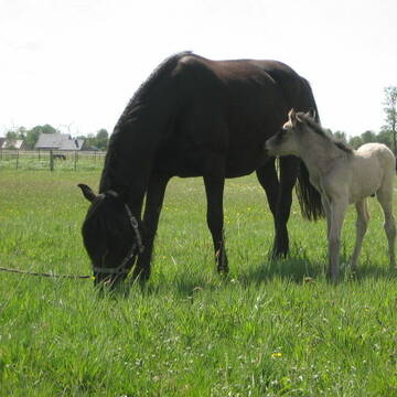


Nordsee! Allergiker, Rentner, Pferde aller Art
Großefehn
Möwenhof GbR
@Moewenhof
Rehabilitationsstall
VFD-Mitglied
Vermieten
Hunde willkommen
Krankenbox
Allergikerstall
bedampftes/gewaschenes Heu
20 weitere...
S


Paddocktrailplatz für Wallach frei
Großefehn
Michael Sund
@Pianova_reitakademie
Freizeitstall
Geländestrecke
Vermieten
Hunde willkommen
Krankenbox
Allergikerstall
Fohlenaufzucht möglich
27 weitere...
P+
Deprecated: Creation of dynamic property Zend_View_Helper_Ads::$adLink is deprecated in /var/www/stall-frei/htdocs/staging.stall-frei.de/library/Psf/View/Helper/Ads.php on line 108

Frisches Stroh zu verkaufen!
Mechtersen
STALL-FREIde Marketing
@STALL-FREI-Marketing
Kaufe frisches Stroh für dein Pferd!

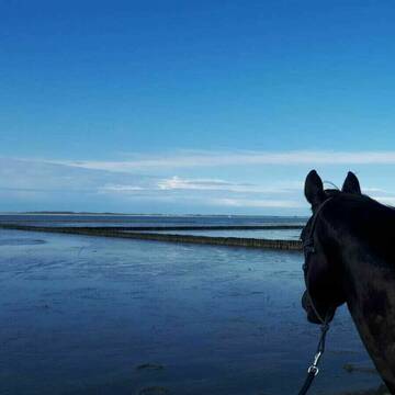
Pferdepension direkt an der Nordsee
Dornum
Pferdepension-Dühringshof
@Pferdepension-Duehringshof
Pensions- und Gastboxen
Reitplatz (z.B. Dressur, Springen, Reining)
Außenbox mit Paddock
Innenbox
1 weitere...
P+
Leider kein Vorschaubild
Leider kein Vorschaubild
Tolle Helle Pferdeboxen auf privater Reitanlage
Friedeburg
ReitsportFriedeburg
@RPFReitsportFriedeburg
Freizeitstall
Pferdeausbildung
Vermieten
Führanlage
Krankenbox
Allergikerstall
bedampftes/gewaschenes Heu
26 weitere...
B
Leider kein Vorschaubild
Leider kein Vorschaubild
Boxen frei, Reithalle, Reitplatz, Westernreiten
Neuschoo
Voßhörnerhof
@Vosshoernerhof
Freizeitstall
Geländestrecke
Vermieten
Hunde willkommen
Krankenbox
Außenbox mit Paddock
Außenboxen
19 weitere...
B

Bewegungsstall/Offenstall
Aurich
Bewegungsstall-Wiesens
@Bewegungsstall-Wiesens
Freizeitstall
Vermieten
Hunde willkommen
Krankenbox
Notfallboxen
12 weitere...
P
Leider kein Vorschaubild
Leider kein Vorschaubild
Stutenplatz Offenstall
Lena Rücker
@Lena_6
Freizeitstall
Vermieten
Krankenbox
Reitplatz (z.B. Dressur, Springen, Reining)
Allergikerstall
Notfallboxen
4 weitere...
B
Leider kein Vorschaubild
Leider kein Vorschaubild
Offenstall Allergiker freundlich
Neuschoo
Schawe
@FellAktiv-Ostfriesland
Allergikerstall
Notfallboxen
B

Hof ShaBaLi Stutenplatz frei
Westerstede
Mellie Wempen-Grave
@HofShaBaLi
Herzlich Willkommen auf dem Hof ShaBaLi
Ein Pensionstall mit Augenmerk auf artgerechte Haltung für deine Pferd oder Pony.
Ar
Leider kein Vorschaubild
Leider kein Vorschaubild
Pferde-/Ponybox frei
Wilhelmshaven
Wideira
@Wideira
Freizeitstall
Vermieten
Reitplatz (z.B. Dressur, Springen, Reining)
Sattelkammer/Sattelschränke
Allergikerstall
4 weitere...
B


Reha-Stall Danecki Kurstall Horsemanship
Leezdorf
Nastasia-Danecki
@Nastasia-Danecki
Freizeitstall
Pferdeausbildung
Vermieten
Hunde willkommen
Krankenbox
Allergikerstall
Gnadenbrothof
27 weitere...
P+
Deprecated: Creation of dynamic property Zend_View::$pageCount is deprecated in /var/www/stall-frei/htdocs/staging.stall-frei.de/library/vendor/shardj/zf1-future/library/Zend/View/Abstract.php on line 308
Deprecated: Creation of dynamic property Zend_View::$itemCountPerPage is deprecated in /var/www/stall-frei/htdocs/staging.stall-frei.de/library/vendor/shardj/zf1-future/library/Zend/View/Abstract.php on line 308
Deprecated: Creation of dynamic property Zend_View::$first is deprecated in /var/www/stall-frei/htdocs/staging.stall-frei.de/library/vendor/shardj/zf1-future/library/Zend/View/Abstract.php on line 308
Deprecated: Creation of dynamic property Zend_View::$current is deprecated in /var/www/stall-frei/htdocs/staging.stall-frei.de/library/vendor/shardj/zf1-future/library/Zend/View/Abstract.php on line 308
Deprecated: Creation of dynamic property Zend_View::$last is deprecated in /var/www/stall-frei/htdocs/staging.stall-frei.de/library/vendor/shardj/zf1-future/library/Zend/View/Abstract.php on line 308
Deprecated: Creation of dynamic property Zend_View::$next is deprecated in /var/www/stall-frei/htdocs/staging.stall-frei.de/library/vendor/shardj/zf1-future/library/Zend/View/Abstract.php on line 308
Deprecated: Creation of dynamic property Zend_View::$pagesInRange is deprecated in /var/www/stall-frei/htdocs/staging.stall-frei.de/library/vendor/shardj/zf1-future/library/Zend/View/Abstract.php on line 308
Deprecated: Creation of dynamic property Zend_View::$firstPageInRange is deprecated in /var/www/stall-frei/htdocs/staging.stall-frei.de/library/vendor/shardj/zf1-future/library/Zend/View/Abstract.php on line 308
Deprecated: Creation of dynamic property Zend_View::$lastPageInRange is deprecated in /var/www/stall-frei/htdocs/staging.stall-frei.de/library/vendor/shardj/zf1-future/library/Zend/View/Abstract.php on line 308
Deprecated: Creation of dynamic property Zend_View::$currentItemCount is deprecated in /var/www/stall-frei/htdocs/staging.stall-frei.de/library/vendor/shardj/zf1-future/library/Zend/View/Abstract.php on line 308
Deprecated: Creation of dynamic property Zend_View::$totalItemCount is deprecated in /var/www/stall-frei/htdocs/staging.stall-frei.de/library/vendor/shardj/zf1-future/library/Zend/View/Abstract.php on line 308
Deprecated: Creation of dynamic property Zend_View::$firstItemNumber is deprecated in /var/www/stall-frei/htdocs/staging.stall-frei.de/library/vendor/shardj/zf1-future/library/Zend/View/Abstract.php on line 308
Deprecated: Creation of dynamic property Zend_View::$lastItemNumber is deprecated in /var/www/stall-frei/htdocs/staging.stall-frei.de/library/vendor/shardj/zf1-future/library/Zend/View/Abstract.php on line 308
Deprecated: Creation of dynamic property Zend_View::$router is deprecated in /var/www/stall-frei/htdocs/staging.stall-frei.de/library/vendor/shardj/zf1-future/library/Zend/View/Abstract.php on line 308
Deprecated: Creation of dynamic property Zend_View::$urlParams is deprecated in /var/www/stall-frei/htdocs/staging.stall-frei.de/library/vendor/shardj/zf1-future/library/Zend/View/Abstract.php on line 308
Deprecated: Creation of dynamic property Zend_View::$showAds is deprecated in /var/www/stall-frei/htdocs/staging.stall-frei.de/library/vendor/shardj/zf1-future/library/Zend/View/Abstract.php on line 308
Deprecated: Creation of dynamic property Zend_View::$objectIds is deprecated in /var/www/stall-frei/htdocs/staging.stall-frei.de/library/vendor/shardj/zf1-future/library/Zend/View/Abstract.php on line 308
Deprecated: Creation of dynamic property Zend_View::$showNavbar is deprecated in /var/www/stall-frei/htdocs/staging.stall-frei.de/library/vendor/shardj/zf1-future/library/Zend/View/Abstract.php on line 308
Deprecated: Creation of dynamic property Zend_View::$showBreadcrumb is deprecated in /var/www/stall-frei/htdocs/staging.stall-frei.de/library/vendor/shardj/zf1-future/library/Zend/View/Abstract.php on line 308
Deprecated: Creation of dynamic property Zend_View::$showFooter is deprecated in /var/www/stall-frei/htdocs/staging.stall-frei.de/library/vendor/shardj/zf1-future/library/Zend/View/Abstract.php on line 308
Deprecated: Creation of dynamic property Zend_View::$showInternalAds is deprecated in /var/www/stall-frei/htdocs/staging.stall-frei.de/library/vendor/shardj/zf1-future/library/Zend/View/Abstract.php on line 308
Deprecated: Creation of dynamic property Zend_View::$blNoContent is deprecated in /var/www/stall-frei/htdocs/staging.stall-frei.de/library/vendor/shardj/zf1-future/library/Zend/View/Abstract.php on line 308
Deprecated: Creation of dynamic property Zend_View::$sMetaDesc is deprecated in /var/www/stall-frei/htdocs/staging.stall-frei.de/library/vendor/shardj/zf1-future/library/Zend/View/Abstract.php on line 308
Deprecated: Creation of dynamic property Zend_View::$useGmaps is deprecated in /var/www/stall-frei/htdocs/staging.stall-frei.de/library/vendor/shardj/zf1-future/library/Zend/View/Abstract.php on line 308
Deprecated: Creation of dynamic property Zend_View::$touches is deprecated in /var/www/stall-frei/htdocs/staging.stall-frei.de/library/vendor/shardj/zf1-future/library/Zend/View/Abstract.php on line 308
Deprecated: Creation of dynamic property Zend_View::$oProject is deprecated in /var/www/stall-frei/htdocs/staging.stall-frei.de/library/vendor/shardj/zf1-future/library/Zend/View/Abstract.php on line 308
Deprecated: Creation of dynamic property Zend_View::$pageHeadline is deprecated in /var/www/stall-frei/htdocs/staging.stall-frei.de/library/vendor/shardj/zf1-future/library/Zend/View/Abstract.php on line 308
Deprecated: Creation of dynamic property Zend_View::$disableLocationField is deprecated in /var/www/stall-frei/htdocs/staging.stall-frei.de/library/vendor/shardj/zf1-future/library/Zend/View/Abstract.php on line 308
Deprecated: Creation of dynamic property Zend_View::$isSearch is deprecated in /var/www/stall-frei/htdocs/staging.stall-frei.de/library/vendor/shardj/zf1-future/library/Zend/View/Abstract.php on line 308
Deprecated: Creation of dynamic property Zend_View::$pageTitle is deprecated in /var/www/stall-frei/htdocs/staging.stall-frei.de/library/vendor/shardj/zf1-future/library/Zend/View/Abstract.php on line 308
Deprecated: Creation of dynamic property Psf_Form_Element_Text::$class is deprecated in /var/www/stall-frei/htdocs/staging.stall-frei.de/library/vendor/shardj/zf1-future/library/Zend/Form/Element.php on line 874
Deprecated: Creation of dynamic property Psf_Form_Element_Text::$size is deprecated in /var/www/stall-frei/htdocs/staging.stall-frei.de/library/vendor/shardj/zf1-future/library/Zend/Form/Element.php on line 874
Deprecated: Creation of dynamic property Psf_Form_Element_Text::$placeholder is deprecated in /var/www/stall-frei/htdocs/staging.stall-frei.de/library/vendor/shardj/zf1-future/library/Zend/Form/Element.php on line 874
Deprecated: Creation of dynamic property Psf_Form_Element_Hidden::$class is deprecated in /var/www/stall-frei/htdocs/staging.stall-frei.de/library/vendor/shardj/zf1-future/library/Zend/Form/Element.php on line 874
Deprecated: Creation of dynamic property Psf_Form_Element_Hidden::$class is deprecated in /var/www/stall-frei/htdocs/staging.stall-frei.de/library/vendor/shardj/zf1-future/library/Zend/Form/Element.php on line 874
Deprecated: Creation of dynamic property Psf_Form_Element_Hidden::$class is deprecated in /var/www/stall-frei/htdocs/staging.stall-frei.de/library/vendor/shardj/zf1-future/library/Zend/Form/Element.php on line 874
Deprecated: Creation of dynamic property Psf_Form_Element_Hidden::$class is deprecated in /var/www/stall-frei/htdocs/staging.stall-frei.de/library/vendor/shardj/zf1-future/library/Zend/Form/Element.php on line 874
Deprecated: Creation of dynamic property Psf_Form_Element_Select::$class is deprecated in /var/www/stall-frei/htdocs/staging.stall-frei.de/library/vendor/shardj/zf1-future/library/Zend/Form/Element.php on line 874
Deprecated: Creation of dynamic property Psf_Form_Element_Select::$class is deprecated in /var/www/stall-frei/htdocs/staging.stall-frei.de/library/vendor/shardj/zf1-future/library/Zend/Form/Element.php on line 874
Deprecated: Creation of dynamic property Psf_Form_Element_Select::$class is deprecated in /var/www/stall-frei/htdocs/staging.stall-frei.de/library/vendor/shardj/zf1-future/library/Zend/Form/Element.php on line 874
Deprecated: Creation of dynamic property Psf_Form_Element_Select::$class is deprecated in /var/www/stall-frei/htdocs/staging.stall-frei.de/library/vendor/shardj/zf1-future/library/Zend/Form/Element.php on line 874
Deprecated: Creation of dynamic property Psf_Form_Element_Text::$class is deprecated in /var/www/stall-frei/htdocs/staging.stall-frei.de/library/vendor/shardj/zf1-future/library/Zend/Form/Element.php on line 874
Deprecated: Creation of dynamic property Psf_Form_Element_Checkbox::$label is deprecated in /var/www/stall-frei/htdocs/staging.stall-frei.de/library/vendor/shardj/zf1-future/library/Zend/Form/Element.php on line 874
Deprecated: Creation of dynamic property Zend_View::$sort is deprecated in /var/www/stall-frei/htdocs/staging.stall-frei.de/library/vendor/shardj/zf1-future/library/Zend/View/Abstract.php on line 308
Deprecated: Creation of dynamic property Zend_View::$searchLocation is deprecated in /var/www/stall-frei/htdocs/staging.stall-frei.de/library/vendor/shardj/zf1-future/library/Zend/View/Abstract.php on line 308
Deprecated: Creation of dynamic property Zend_View::$locationHint is deprecated in /var/www/stall-frei/htdocs/staging.stall-frei.de/library/vendor/shardj/zf1-future/library/Zend/View/Abstract.php on line 308
Psf_GeoCoder_Abstract::getLocation: Harle Get Location CachedOrLive
Psf_GeoCoder_Abstract::getCachedOrLive: Harle
Psf_GeoCoder_OpenCageData::makeApiRequest: response:
Array
(
[documentation] => https://opencagedata.com/api
[licenses] => Array
(
[0] => Array
(
[name] => see attribution guide
[url] => https://opencagedata.com/credits
)
)
[results] => Array
(
[0] => Array
(
[bounds] => Array
(
[northeast] => Array
(
[lat] => 53.706944
[lng] => 7.8093535
)
[southwest] => Array
(
[lat] => 53.5508165
[lng] => 7.7411723
)
)
[components] => Array
(
[ISO_3166-1_alpha-2] => DE
[ISO_3166-1_alpha-3] => DEU
[ISO_3166-2] => Array
(
[0] => DE-NI
)
[_category] => natural/water
[_normalized_city] => Wittmund
[_type] => river
[continent] => Europe
[country] => Deutschland
[country_code] => de
[county] => Landkreis Wittmund
[political_union] => European Union
[river] => Harle
[state] => Niedersachsen
[state_code] => NI
[town] => Wittmund
)
[confidence] => 6
[formatted] => Harle, Wittmund, Niedersachsen, Deutschland
[geometry] => Array
(
[lat] => 53.6165002
[lng] => 7.7799151
)
)
[1] => Array
(
[bounds] => Array
(
[northeast] => Array
(
[lat] => 51.1114715
[lng] => 9.4131233
)
[southwest] => Array
(
[lat] => 51.0872851
[lng] => 9.3645372
)
)
[components] => Array
(
[ISO_3166-1_alpha-2] => DE
[ISO_3166-1_alpha-3] => DEU
[ISO_3166-2] => Array
(
[0] => DE-HE
)
[_category] => place
[_normalized_city] => Harle
[_type] => village
[continent] => Europe
[country] => Deutschland
[country_code] => de
[county] => Schwalm-Eder-Kreis
[municipality] => Wabern
[political_union] => European Union
[state] => Hessen
[state_code] => HE
[village] => Harle
)
[confidence] => 7
[formatted] => Harle, Hessen, Deutschland
[geometry] => Array
(
[lat] => 51.0996824
[lng] => 9.3861146
)
)
[2] => Array
(
[bounds] => Array
(
[northeast] => Array
(
[lat] => 51.4102517
[lng] => 6.4089273
)
[southwest] => Array
(
[lat] => 51.4099789
[lng] => 6.407058
)
)
[components] => Array
(
[ISO_3166-1_alpha-2] => DE
[ISO_3166-1_alpha-3] => DEU
[ISO_3166-2] => Array
(
[0] => DE-NW
)
[_category] => place
[_normalized_city] => Kempen
[_type] => neighbourhood
[continent] => Europe
[country] => Deutschland
[country_code] => de
[county] => Kreis Viersen
[political_union] => European Union
[postcode] => 47906
[residential] => Harle
[state] => Nordrhein-Westfalen
[state_code] => NW
[town] => Kempen
)
[confidence] => 9
[formatted] => 47906 Kempen, Deutschland
[geometry] => Array
(
[lat] => 51.4101389
[lng] => 6.4080634
)
)
[3] => Array
(
[bounds] => Array
(
[northeast] => Array
(
[lat] => 51.9392131
[lng] => 7.261369
)
[southwest] => Array
(
[lat] => 51.9192131
[lng] => 7.241369
)
)
[components] => Array
(
[ISO_3166-1_alpha-2] => DE
[ISO_3166-1_alpha-3] => DEU
[ISO_3166-2] => Array
(
[0] => DE-NW
)
[_category] => place
[_normalized_city] => Coesfeld
[_type] => hamlet
[continent] => Europe
[country] => Deutschland
[country_code] => de
[county] => Kreis Coesfeld
[locality] => Harle
[political_union] => European Union
[postcode] => 48653
[state] => Nordrhein-Westfalen
[state_code] => NW
[town] => Coesfeld
)
[confidence] => 8
[formatted] => Harle, 48653 Coesfeld, Deutschland
[geometry] => Array
(
[lat] => 51.9292131
[lng] => 7.251369
)
)
[4] => Array
(
[bounds] => Array
(
[northeast] => Array
(
[lat] => 51.9240133
[lng] => 7.238903
)
[southwest] => Array
(
[lat] => 51.9126554
[lng] => 7.2210068
)
)
[components] => Array
(
[ISO_3166-1_alpha-2] => DE
[ISO_3166-1_alpha-3] => DEU
[ISO_3166-2] => Array
(
[0] => DE-NW
)
[_category] => road
[_normalized_city] => Coesfeld
[_type] => road
[continent] => Europe
[country] => Deutschland
[country_code] => de
[county] => Kreis Coesfeld
[political_union] => European Union
[postcode] => 48653
[road] => Harle
[road_type] => residential
[state] => Nordrhein-Westfalen
[state_code] => NW
[town] => Coesfeld
)
[confidence] => 8
[formatted] => Harle, 48653 Coesfeld, Deutschland
[geometry] => Array
(
[lat] => 51.9205921
[lng] => 7.2311917
)
)
[5] => Array
(
[bounds] => Array
(
[northeast] => Array
(
[lat] => 51.9113239
[lng] => 7.2433338
)
[southwest] => Array
(
[lat] => 51.9026856
[lng] => 7.2381153
)
)
[components] => Array
(
[ISO_3166-1_alpha-2] => DE
[ISO_3166-1_alpha-3] => DEU
[ISO_3166-2] => Array
(
[0] => DE-NW
)
[_category] => road
[_normalized_city] => Dülmen
[_type] => road
[continent] => Europe
[country] => Deutschland
[country_code] => de
[county] => Kreis Coesfeld
[hamlet] => Holsterbrink
[political_union] => European Union
[postcode] => 48249
[road] => Harle
[road_type] => residential
[state] => Nordrhein-Westfalen
[state_code] => NW
[town] => Dülmen
)
[confidence] => 9
[formatted] => Harle, 48249 Dülmen, Deutschland
[geometry] => Array
(
[lat] => 51.9064863
[lng] => 7.240406
)
)
[6] => Array
(
[components] => Array
(
[ISO_3166-1_alpha-2] => FR
[ISO_3166-1_alpha-3] => FRA
[ISO_3166-2] => Array
(
[0] => FR-PDL
[1] => FR-44
)
[_category] => road
[_normalized_city] => Saint-Nazaire
[_type] => road
[city] => Saint-Nazaire
[continent] => Europe
[country] => France
[country_code] => fr
[county] => Loire-Atlantique
[local_authority] => Communauté d'agglomération de la Région Nazairienne et de l'Estuaire
[political_union] => European Union
[postcode] => 44600
[road] => Allée des Harles
[state] => Pays de la Loire
[state_code] => PDL
)
[confidence] => 3
[formatted] => Allée des Harles, 44600 Saint-Nazaire, France
[geometry] => Array
(
[lat] => 47.258698
[lng] => -2.24218
)
)
[7] => Array
(
[components] => Array
(
[ISO_3166-1_alpha-2] => FR
[ISO_3166-1_alpha-3] => FRA
[ISO_3166-2] => Array
(
[0] => FR-PAC
[1] => FR-13
)
[_category] => road
[_normalized_city] => Arles
[_type] => road
[city] => Arles
[continent] => Europe
[country] => France
[country_code] => fr
[county] => Bouches-du-Rhône
[local_authority] => Communauté d'agglomération Arles-Crau-Camargue-Montagnette
[political_union] => European Union
[postcode] => 13200
[road] => Chemin de Margaillan
[state] => Provence-Alpes-Côte d'Azur
[state_code] => PAC
)
[confidence] => 3
[formatted] => Chemin de Margaillan, 13200 Arles, France
[geometry] => Array
(
[lat] => 43.667097
[lng] => 4.663689
)
)
[8] => Array
(
[components] => Array
(
[ISO_3166-1_alpha-2] => FR
[ISO_3166-1_alpha-3] => FRA
[ISO_3166-2] => Array
(
[0] => FR-PAC
[1] => FR-13
)
[_category] => road
[_normalized_city] => Arles
[_type] => road
[city] => Arles
[continent] => Europe
[country] => France
[country_code] => fr
[county] => Bouches-du-Rhône
[local_authority] => Communauté d'agglomération Arles-Crau-Camargue-Montagnette
[political_union] => European Union
[postcode] => 13200
[road] => Route de la Crau
[state] => Provence-Alpes-Côte d'Azur
[state_code] => PAC
)
[confidence] => 3
[formatted] => Route de la Crau, 13200 Arles, France
[geometry] => Array
(
[lat] => 43.652578
[lng] => 4.696799
)
)
[9] => Array
(
[components] => Array
(
[ISO_3166-1_alpha-2] => FR
[ISO_3166-1_alpha-3] => FRA
[ISO_3166-2] => Array
(
[0] => FR-PAC
[1] => FR-13
)
[_category] => road
[_normalized_city] => Salon-de-Provence
[_type] => road
[city] => Salon-de-Provence
[continent] => Europe
[country] => France
[country_code] => fr
[county] => Bouches-du-Rhône
[local_authority] => Aix-Marseille-Provence
[political_union] => European Union
[postcode] => 13300
[road] => Route d’Arles
[state] => Provence-Alpes-Côte d'Azur
[state_code] => PAC
)
[confidence] => 3
[formatted] => Route d’Arles, 13300 Salon-de-Provence, France
[geometry] => Array
(
[lat] => 43.640349
[lng] => 5.01006
)
)
)
[status] => Array
(
[code] => 200
[message] => OK
)
[stay_informed] => Array
(
[blog] => https://blog.opencagedata.com
[mastodon] => https://en.osm.town/@opencage
)
[thanks] => For using an OpenCage API
[timestamp] => Array
(
[created_http] => Sun, 08 Feb 2026 18:06:12 GMT
[created_unix] => 1770573972
)
[total_results] => 10
)
Psf_GeoCoder_Abstract::convertLocationResult
{"documentation":"https:\/\/opencagedata.com\/api","licenses":[{"name":"see attribution guide","url":"https:\/\/opencagedata.com\/credits"}],"results":[{"bounds":{"northeast":{"lat":53.706944,"lng":7.8093535},"southwest":{"lat":53.5508165,"lng":7.7411723}},"components":{"ISO_3166-1_alpha-2":"DE","ISO_3166-1_alpha-3":"DEU","ISO_3166-2":["DE-NI"],"_category":"natural\/water","_normalized_city":"Wittmund","_type":"river","continent":"Europe","country":"Deutschland","country_code":"de","county":"Landkreis Wittmund","political_union":"European Union","river":"Harle","state":"Niedersachsen","state_code":"NI","town":"Wittmund"},"confidence":6,"formatted":"Harle, Wittmund, Niedersachsen, Deutschland","geometry":{"lat":53.6165002,"lng":7.7799151}},{"bounds":{"northeast":{"lat":51.1114715,"lng":9.4131233},"southwest":{"lat":51.0872851,"lng":9.3645372}},"components":{"ISO_3166-1_alpha-2":"DE","ISO_3166-1_alpha-3":"DEU","ISO_3166-2":["DE-HE"],"_category":"place","_normalized_city":"Harle","_type":"village","continent":"Europe","country":"Deutschland","country_code":"de","county":"Schwalm-Eder-Kreis","municipality":"Wabern","political_union":"European Union","state":"Hessen","state_code":"HE","village":"Harle"},"confidence":7,"formatted":"Harle, Hessen, Deutschland","geometry":{"lat":51.0996824,"lng":9.3861146}},{"bounds":{"northeast":{"lat":51.4102517,"lng":6.4089273},"southwest":{"lat":51.4099789,"lng":6.407058}},"components":{"ISO_3166-1_alpha-2":"DE","ISO_3166-1_alpha-3":"DEU","ISO_3166-2":["DE-NW"],"_category":"place","_normalized_city":"Kempen","_type":"neighbourhood","continent":"Europe","country":"Deutschland","country_code":"de","county":"Kreis Viersen","political_union":"European Union","postcode":"47906","residential":"Harle","state":"Nordrhein-Westfalen","state_code":"NW","town":"Kempen"},"confidence":9,"formatted":"47906 Kempen, Deutschland","geometry":{"lat":51.4101389,"lng":6.4080634}},{"bounds":{"northeast":{"lat":51.9392131,"lng":7.261369},"southwest":{"lat":51.9192131,"lng":7.241369}},"components":{"ISO_3166-1_alpha-2":"DE","ISO_3166-1_alpha-3":"DEU","ISO_3166-2":["DE-NW"],"_category":"place","_normalized_city":"Coesfeld","_type":"hamlet","continent":"Europe","country":"Deutschland","country_code":"de","county":"Kreis Coesfeld","locality":"Harle","political_union":"European Union","postcode":"48653","state":"Nordrhein-Westfalen","state_code":"NW","town":"Coesfeld"},"confidence":8,"formatted":"Harle, 48653 Coesfeld, Deutschland","geometry":{"lat":51.9292131,"lng":7.251369}},{"bounds":{"northeast":{"lat":51.9240133,"lng":7.238903},"southwest":{"lat":51.9126554,"lng":7.2210068}},"components":{"ISO_3166-1_alpha-2":"DE","ISO_3166-1_alpha-3":"DEU","ISO_3166-2":["DE-NW"],"_category":"road","_normalized_city":"Coesfeld","_type":"road","continent":"Europe","country":"Deutschland","country_code":"de","county":"Kreis Coesfeld","political_union":"European Union","postcode":"48653","road":"Harle","road_type":"residential","state":"Nordrhein-Westfalen","state_code":"NW","town":"Coesfeld"},"confidence":8,"formatted":"Harle, 48653 Coesfeld, Deutschland","geometry":{"lat":51.9205921,"lng":7.2311917}},{"bounds":{"northeast":{"lat":51.9113239,"lng":7.2433338},"southwest":{"lat":51.9026856,"lng":7.2381153}},"components":{"ISO_3166-1_alpha-2":"DE","ISO_3166-1_alpha-3":"DEU","ISO_3166-2":["DE-NW"],"_category":"road","_normalized_city":"D\u00fclmen","_type":"road","continent":"Europe","country":"Deutschland","country_code":"de","county":"Kreis Coesfeld","hamlet":"Holsterbrink","political_union":"European Union","postcode":"48249","road":"Harle","road_type":"residential","state":"Nordrhein-Westfalen","state_code":"NW","town":"D\u00fclmen"},"confidence":9,"formatted":"Harle, 48249 D\u00fclmen, Deutschland","geometry":{"lat":51.9064863,"lng":7.240406}},{"components":{"ISO_3166-1_alpha-2":"FR","ISO_3166-1_alpha-3":"FRA","ISO_3166-2":["FR-PDL","FR-44"],"_category":"road","_normalized_city":"Saint-Nazaire","_type":"road","city":"Saint-Nazaire","continent":"Europe","country":"France","country_code":"fr","county":"Loire-Atlantique","local_authority":"Communaut\u00e9 d'agglom\u00e9ration de la R\u00e9gion Nazairienne et de l'Estuaire","political_union":"European Union","postcode":"44600","road":"All\u00e9e des Harles","state":"Pays de la Loire","state_code":"PDL"},"confidence":3,"formatted":"All\u00e9e des Harles, 44600 Saint-Nazaire, France","geometry":{"lat":47.258698,"lng":-2.24218}},{"components":{"ISO_3166-1_alpha-2":"FR","ISO_3166-1_alpha-3":"FRA","ISO_3166-2":["FR-PAC","FR-13"],"_category":"road","_normalized_city":"Arles","_type":"road","city":"Arles","continent":"Europe","country":"France","country_code":"fr","county":"Bouches-du-Rh\u00f4ne","local_authority":"Communaut\u00e9 d'agglom\u00e9ration Arles-Crau-Camargue-Montagnette","political_union":"European Union","postcode":"13200","road":"Chemin de Margaillan","state":"Provence-Alpes-C\u00f4te d'Azur","state_code":"PAC"},"confidence":3,"formatted":"Chemin de Margaillan, 13200 Arles, France","geometry":{"lat":43.667097,"lng":4.663689}},{"components":{"ISO_3166-1_alpha-2":"FR","ISO_3166-1_alpha-3":"FRA","ISO_3166-2":["FR-PAC","FR-13"],"_category":"road","_normalized_city":"Arles","_type":"road","city":"Arles","continent":"Europe","country":"France","country_code":"fr","county":"Bouches-du-Rh\u00f4ne","local_authority":"Communaut\u00e9 d'agglom\u00e9ration Arles-Crau-Camargue-Montagnette","political_union":"European Union","postcode":"13200","road":"Route de la Crau","state":"Provence-Alpes-C\u00f4te d'Azur","state_code":"PAC"},"confidence":3,"formatted":"Route de la Crau, 13200 Arles, France","geometry":{"lat":43.652578,"lng":4.696799}},{"components":{"ISO_3166-1_alpha-2":"FR","ISO_3166-1_alpha-3":"FRA","ISO_3166-2":["FR-PAC","FR-13"],"_category":"road","_normalized_city":"Salon-de-Provence","_type":"road","city":"Salon-de-Provence","continent":"Europe","country":"France","country_code":"fr","county":"Bouches-du-Rh\u00f4ne","local_authority":"Aix-Marseille-Provence","political_union":"European Union","postcode":"13300","road":"Route d\u2019Arles","state":"Provence-Alpes-C\u00f4te d'Azur","state_code":"PAC"},"confidence":3,"formatted":"Route d\u2019Arles, 13300 Salon-de-Provence, France","geometry":{"lat":43.640349,"lng":5.01006}}],"status":{"code":200,"message":"OK"},"stay_informed":{"blog":"https:\/\/blog.opencagedata.com","mastodon":"https:\/\/en.osm.town\/@opencage"},"thanks":"For using an OpenCage API","timestamp":{"created_http":"Sun, 08 Feb 2026 18:06:12 GMT","created_unix":1770573972},"total_results":10}Array
(
[0] => stdClass Object
(
[bounds] => stdClass Object
(
[northeast] => stdClass Object
(
[lat] => 53.706944
[lng] => 7.8093535
)
[southwest] => stdClass Object
(
[lat] => 53.5508165
[lng] => 7.7411723
)
)
[components] => stdClass Object
(
[ISO_3166-1_alpha-2] => DE
[ISO_3166-1_alpha-3] => DEU
[ISO_3166-2] => Array
(
[0] => DE-NI
)
[_category] => natural/water
[_normalized_city] => Wittmund
[_type] => river
[continent] => Europe
[country] => Deutschland
[country_code] => de
[county] => Landkreis Wittmund
[political_union] => European Union
[river] => Harle
[state] => Niedersachsen
[state_code] => NI
[town] => Wittmund
)
[confidence] => 6
[formatted] => Harle, Wittmund, Niedersachsen, Deutschland
[geometry] => stdClass Object
(
[lat] => 53.6165002
[lng] => 7.7799151
)
)
[1] => stdClass Object
(
[bounds] => stdClass Object
(
[northeast] => stdClass Object
(
[lat] => 51.1114715
[lng] => 9.4131233
)
[southwest] => stdClass Object
(
[lat] => 51.0872851
[lng] => 9.3645372
)
)
[components] => stdClass Object
(
[ISO_3166-1_alpha-2] => DE
[ISO_3166-1_alpha-3] => DEU
[ISO_3166-2] => Array
(
[0] => DE-HE
)
[_category] => place
[_normalized_city] => Harle
[_type] => village
[continent] => Europe
[country] => Deutschland
[country_code] => de
[county] => Schwalm-Eder-Kreis
[municipality] => Wabern
[political_union] => European Union
[state] => Hessen
[state_code] => HE
[village] => Harle
)
[confidence] => 7
[formatted] => Harle, Hessen, Deutschland
[geometry] => stdClass Object
(
[lat] => 51.0996824
[lng] => 9.3861146
)
)
[2] => stdClass Object
(
[bounds] => stdClass Object
(
[northeast] => stdClass Object
(
[lat] => 51.4102517
[lng] => 6.4089273
)
[southwest] => stdClass Object
(
[lat] => 51.4099789
[lng] => 6.407058
)
)
[components] => stdClass Object
(
[ISO_3166-1_alpha-2] => DE
[ISO_3166-1_alpha-3] => DEU
[ISO_3166-2] => Array
(
[0] => DE-NW
)
[_category] => place
[_normalized_city] => Kempen
[_type] => neighbourhood
[continent] => Europe
[country] => Deutschland
[country_code] => de
[county] => Kreis Viersen
[political_union] => European Union
[postcode] => 47906
[residential] => Harle
[state] => Nordrhein-Westfalen
[state_code] => NW
[town] => Kempen
)
[confidence] => 9
[formatted] => 47906 Kempen, Deutschland
[geometry] => stdClass Object
(
[lat] => 51.4101389
[lng] => 6.4080634
)
)
[3] => stdClass Object
(
[bounds] => stdClass Object
(
[northeast] => stdClass Object
(
[lat] => 51.9392131
[lng] => 7.261369
)
[southwest] => stdClass Object
(
[lat] => 51.9192131
[lng] => 7.241369
)
)
[components] => stdClass Object
(
[ISO_3166-1_alpha-2] => DE
[ISO_3166-1_alpha-3] => DEU
[ISO_3166-2] => Array
(
[0] => DE-NW
)
[_category] => place
[_normalized_city] => Coesfeld
[_type] => hamlet
[continent] => Europe
[country] => Deutschland
[country_code] => de
[county] => Kreis Coesfeld
[locality] => Harle
[political_union] => European Union
[postcode] => 48653
[state] => Nordrhein-Westfalen
[state_code] => NW
[town] => Coesfeld
)
[confidence] => 8
[formatted] => Harle, 48653 Coesfeld, Deutschland
[geometry] => stdClass Object
(
[lat] => 51.9292131
[lng] => 7.251369
)
)
[4] => stdClass Object
(
[bounds] => stdClass Object
(
[northeast] => stdClass Object
(
[lat] => 51.9240133
[lng] => 7.238903
)
[southwest] => stdClass Object
(
[lat] => 51.9126554
[lng] => 7.2210068
)
)
[components] => stdClass Object
(
[ISO_3166-1_alpha-2] => DE
[ISO_3166-1_alpha-3] => DEU
[ISO_3166-2] => Array
(
[0] => DE-NW
)
[_category] => road
[_normalized_city] => Coesfeld
[_type] => road
[continent] => Europe
[country] => Deutschland
[country_code] => de
[county] => Kreis Coesfeld
[political_union] => European Union
[postcode] => 48653
[road] => Harle
[road_type] => residential
[state] => Nordrhein-Westfalen
[state_code] => NW
[town] => Coesfeld
)
[confidence] => 8
[formatted] => Harle, 48653 Coesfeld, Deutschland
[geometry] => stdClass Object
(
[lat] => 51.9205921
[lng] => 7.2311917
)
)
[5] => stdClass Object
(
[bounds] => stdClass Object
(
[northeast] => stdClass Object
(
[lat] => 51.9113239
[lng] => 7.2433338
)
[southwest] => stdClass Object
(
[lat] => 51.9026856
[lng] => 7.2381153
)
)
[components] => stdClass Object
(
[ISO_3166-1_alpha-2] => DE
[ISO_3166-1_alpha-3] => DEU
[ISO_3166-2] => Array
(
[0] => DE-NW
)
[_category] => road
[_normalized_city] => Dülmen
[_type] => road
[continent] => Europe
[country] => Deutschland
[country_code] => de
[county] => Kreis Coesfeld
[hamlet] => Holsterbrink
[political_union] => European Union
[postcode] => 48249
[road] => Harle
[road_type] => residential
[state] => Nordrhein-Westfalen
[state_code] => NW
[town] => Dülmen
)
[confidence] => 9
[formatted] => Harle, 48249 Dülmen, Deutschland
[geometry] => stdClass Object
(
[lat] => 51.9064863
[lng] => 7.240406
)
)
[6] => stdClass Object
(
[components] => stdClass Object
(
[ISO_3166-1_alpha-2] => FR
[ISO_3166-1_alpha-3] => FRA
[ISO_3166-2] => Array
(
[0] => FR-PDL
[1] => FR-44
)
[_category] => road
[_normalized_city] => Saint-Nazaire
[_type] => road
[city] => Saint-Nazaire
[continent] => Europe
[country] => France
[country_code] => fr
[county] => Loire-Atlantique
[local_authority] => Communauté d'agglomération de la Région Nazairienne et de l'Estuaire
[political_union] => European Union
[postcode] => 44600
[road] => Allée des Harles
[state] => Pays de la Loire
[state_code] => PDL
)
[confidence] => 3
[formatted] => Allée des Harles, 44600 Saint-Nazaire, France
[geometry] => stdClass Object
(
[lat] => 47.258698
[lng] => -2.24218
)
)
[7] => stdClass Object
(
[components] => stdClass Object
(
[ISO_3166-1_alpha-2] => FR
[ISO_3166-1_alpha-3] => FRA
[ISO_3166-2] => Array
(
[0] => FR-PAC
[1] => FR-13
)
[_category] => road
[_normalized_city] => Arles
[_type] => road
[city] => Arles
[continent] => Europe
[country] => France
[country_code] => fr
[county] => Bouches-du-Rhône
[local_authority] => Communauté d'agglomération Arles-Crau-Camargue-Montagnette
[political_union] => European Union
[postcode] => 13200
[road] => Chemin de Margaillan
[state] => Provence-Alpes-Côte d'Azur
[state_code] => PAC
)
[confidence] => 3
[formatted] => Chemin de Margaillan, 13200 Arles, France
[geometry] => stdClass Object
(
[lat] => 43.667097
[lng] => 4.663689
)
)
[8] => stdClass Object
(
[components] => stdClass Object
(
[ISO_3166-1_alpha-2] => FR
[ISO_3166-1_alpha-3] => FRA
[ISO_3166-2] => Array
(
[0] => FR-PAC
[1] => FR-13
)
[_category] => road
[_normalized_city] => Arles
[_type] => road
[city] => Arles
[continent] => Europe
[country] => France
[country_code] => fr
[county] => Bouches-du-Rhône
[local_authority] => Communauté d'agglomération Arles-Crau-Camargue-Montagnette
[political_union] => European Union
[postcode] => 13200
[road] => Route de la Crau
[state] => Provence-Alpes-Côte d'Azur
[state_code] => PAC
)
[confidence] => 3
[formatted] => Route de la Crau, 13200 Arles, France
[geometry] => stdClass Object
(
[lat] => 43.652578
[lng] => 4.696799
)
)
[9] => stdClass Object
(
[components] => stdClass Object
(
[ISO_3166-1_alpha-2] => FR
[ISO_3166-1_alpha-3] => FRA
[ISO_3166-2] => Array
(
[0] => FR-PAC
[1] => FR-13
)
[_category] => road
[_normalized_city] => Salon-de-Provence
[_type] => road
[city] => Salon-de-Provence
[continent] => Europe
[country] => France
[country_code] => fr
[county] => Bouches-du-Rhône
[local_authority] => Aix-Marseille-Provence
[political_union] => European Union
[postcode] => 13300
[road] => Route d’Arles
[state] => Provence-Alpes-Côte d'Azur
[state_code] => PAC
)
[confidence] => 3
[formatted] => Route d’Arles, 13300 Salon-de-Provence, France
[geometry] => stdClass Object
(
[lat] => 43.640349
[lng] => 5.01006
)
)
)
Psf_GeoCoder_OpenCageData::getKeyMap: 0
stdClass Object
(
    [bounds] => stdClass Object
        (
            [northeast] => stdClass Object
                (
                    [lat] => 53.706944
                    [lng] => 7.8093535
                )

            [southwest] => stdClass Object
                (
                    [lat] => 53.5508165
                    [lng] => 7.7411723
                )

        )

    [components] => stdClass Object
        (
            [ISO_3166-1_alpha-2] => DE
            [ISO_3166-1_alpha-3] => DEU
            [ISO_3166-2] => Array
                (
                    [0] => DE-NI
                )

            [_category] => natural/water
            [_normalized_city] => Wittmund
            [_type] => river
            [continent] => Europe
            [country] => Deutschland
            [country_code] => de
            [county] => Landkreis Wittmund
            [political_union] => European Union
            [river] => Harle
            [state] => Niedersachsen
            [state_code] => NI
            [town] => Wittmund
        )

    [confidence] => 6
    [formatted] => Harle, Wittmund, Niedersachsen, Deutschland
    [geometry] => stdClass Object
        (
            [lat] => 53.6165002
            [lng] => 7.7799151
        )

)
Psf_GeoCoder_OpenCageData::getCounty: Wittmund
Psf_GeoCoder_OpenCageData::addMissingData REFETCH!
Array
(
    [address] => Harle, Wittmund, Niedersachsen, Deutschland
    [type] => river
    [street] =>
    [city] => Wittmund
    [county] => Wittmund
    [state] => Niedersachsen
    [zip] =>
    [country] => Deutschland
    [suburb] =>
    [countrycode] => de
    [latitude] => 53.6165002
    [longitude] => 7.7799151
    [accuracy] => 1
    [confidence] => 6
    [bounds] => stdClass Object
        (
            [northeast] => stdClass Object
                (
                    [lat] => 53.706944
                    [lng] => 7.8093535
                )

            [southwest] => stdClass Object
                (
                    [lat] => 53.5508165
                    [lng] => 7.7411723
                )

        )

)
reformat!
Array
(
    [address] => Harle, Wittmund, Niedersachsen, Deutschland
    [type] => river
    [street] =>
    [city] => Wittmund
    [county] => Wittmund
    [state] => Niedersachsen
    [zip] =>
    [country] => Deutschland
    [suburb] =>
    [countrycode] => de
    [latitude] => 53.6165002
    [longitude] => 7.7799151
    [accuracy] => 1
    [confidence] => 6
    [bounds] => stdClass Object
        (
            [northeast] => stdClass Object
                (
                    [lat] => 53.706944
                    [lng] => 7.8093535
                )

            [southwest] => stdClass Object
                (
                    [lat] => 53.5508165
                    [lng] => 7.7411723
                )

        )

    [place] => Wittmund, Niedersachsen
    [hash] => f158010e8a1b7d26049141f4fcffa831
)
Psf_GeoCoder_OpenCageData::getKeyMap: 1
stdClass Object
(
    [bounds] => stdClass Object
        (
            [northeast] => stdClass Object
                (
                    [lat] => 51.1114715
                    [lng] => 9.4131233
                )

            [southwest] => stdClass Object
                (
                    [lat] => 51.0872851
                    [lng] => 9.3645372
                )

        )

    [components] => stdClass Object
        (
            [ISO_3166-1_alpha-2] => DE
            [ISO_3166-1_alpha-3] => DEU
            [ISO_3166-2] => Array
                (
                    [0] => DE-HE
                )

            [_category] => place
            [_normalized_city] => Harle
            [_type] => village
            [continent] => Europe
            [country] => Deutschland
            [country_code] => de
            [county] => Schwalm-Eder-Kreis
            [municipality] => Wabern
            [political_union] => European Union
            [state] => Hessen
            [state_code] => HE
            [village] => Harle
        )

    [confidence] => 7
    [formatted] => Harle, Hessen, Deutschland
    [geometry] => stdClass Object
        (
            [lat] => 51.0996824
            [lng] => 9.3861146
        )

)
Psf_GeoCoder_OpenCageData::getCounty: Schwalm-Eder-Kreis
Psf_GeoCoder_OpenCageData::addMissingData REFETCH!
Array
(
    [address] => Harle, Hessen, Deutschland
    [type] => village
    [street] =>
    [city] => Harle
    [county] => Schwalm-Eder-Kreis
    [state] => Hessen
    [zip] =>
    [country] => Deutschland
    [suburb] =>
    [countrycode] => de
    [latitude] => 51.0996824
    [longitude] => 9.3861146
    [accuracy] => 1
    [confidence] => 7
    [bounds] => stdClass Object
        (
            [northeast] => stdClass Object
                (
                    [lat] => 51.1114715
                    [lng] => 9.4131233
                )

            [southwest] => stdClass Object
                (
                    [lat] => 51.0872851
                    [lng] => 9.3645372
                )

        )

)
reformat!
Array
(
    [address] => Harle, Hessen, Deutschland
    [type] => village
    [street] =>
    [city] => Harle
    [county] => Schwalm-Eder-Kreis
    [state] => Hessen
    [zip] =>
    [country] => Deutschland
    [suburb] =>
    [countrycode] => de
    [latitude] => 51.0996824
    [longitude] => 9.3861146
    [accuracy] => 1
    [confidence] => 7
    [bounds] => stdClass Object
        (
            [northeast] => stdClass Object
                (
                    [lat] => 51.1114715
                    [lng] => 9.4131233
                )

            [southwest] => stdClass Object
                (
                    [lat] => 51.0872851
                    [lng] => 9.3645372
                )

        )

    [place] => Harle, Hessen
    [hash] => 318ae8c0446e36577c3a18e9840fe6cf
)
Psf_GeoCoder_OpenCageData::getKeyMap: 2
stdClass Object
(
    [bounds] => stdClass Object
        (
            [northeast] => stdClass Object
                (
                    [lat] => 51.4102517
                    [lng] => 6.4089273
                )

            [southwest] => stdClass Object
                (
                    [lat] => 51.4099789
                    [lng] => 6.407058
                )

        )

    [components] => stdClass Object
        (
            [ISO_3166-1_alpha-2] => DE
            [ISO_3166-1_alpha-3] => DEU
            [ISO_3166-2] => Array
                (
                    [0] => DE-NW
                )

            [_category] => place
            [_normalized_city] => Kempen
            [_type] => neighbourhood
            [continent] => Europe
            [country] => Deutschland
            [country_code] => de
            [county] => Kreis Viersen
            [political_union] => European Union
            [postcode] => 47906
            [residential] => Harle
            [state] => Nordrhein-Westfalen
            [state_code] => NW
            [town] => Kempen
        )

    [confidence] => 9
    [formatted] => 47906 Kempen, Deutschland
    [geometry] => stdClass Object
        (
            [lat] => 51.4101389
            [lng] => 6.4080634
        )

)
Psf_GeoCoder_OpenCageData::getCounty: Viersen
Psf_GeoCoder_OpenCageData::addMissingData REFETCH!
Array
(
    [address] => 47906 Kempen, Deutschland
    [type] => neighbourhood
    [street] =>
    [city] => Kempen
    [county] => Viersen
    [state] => Nordrhein-Westfalen
    [zip] => 47906
    [country] => Deutschland
    [suburb] =>
    [countrycode] => de
    [latitude] => 51.4101389
    [longitude] => 6.4080634
    [accuracy] => 1
    [confidence] => 9
    [bounds] => stdClass Object
        (
            [northeast] => stdClass Object
                (
                    [lat] => 51.4102517
                    [lng] => 6.4089273
                )

            [southwest] => stdClass Object
                (
                    [lat] => 51.4099789
                    [lng] => 6.407058
                )

        )

)
reformat!
Array
(
    [address] => 47906 Kempen, Deutschland
    [type] => neighbourhood
    [street] =>
    [city] => Kempen
    [county] => Viersen
    [state] => Nordrhein-Westfalen
    [zip] => 47906
    [country] => Deutschland
    [suburb] =>
    [countrycode] => de
    [latitude] => 51.4101389
    [longitude] => 6.4080634
    [accuracy] => 1
    [confidence] => 9
    [bounds] => stdClass Object
        (
            [northeast] => stdClass Object
                (
                    [lat] => 51.4102517
                    [lng] => 6.4089273
                )

            [southwest] => stdClass Object
                (
                    [lat] => 51.4099789
                    [lng] => 6.407058
                )

        )

    [place] => 47906 Kempen, Nordrhein-Westfalen
    [hash] => 7ce8806de538ce6d415c9b88703464ca
)
Psf_GeoCoder_OpenCageData::getKeyMap: 3
stdClass Object
(
    [bounds] => stdClass Object
        (
            [northeast] => stdClass Object
                (
                    [lat] => 51.9392131
                    [lng] => 7.261369
                )

            [southwest] => stdClass Object
                (
                    [lat] => 51.9192131
                    [lng] => 7.241369
                )

        )

    [components] => stdClass Object
        (
            [ISO_3166-1_alpha-2] => DE
            [ISO_3166-1_alpha-3] => DEU
            [ISO_3166-2] => Array
                (
                    [0] => DE-NW
                )

            [_category] => place
            [_normalized_city] => Coesfeld
            [_type] => hamlet
            [continent] => Europe
            [country] => Deutschland
            [country_code] => de
            [county] => Kreis Coesfeld
            [locality] => Harle
            [political_union] => European Union
            [postcode] => 48653
            [state] => Nordrhein-Westfalen
            [state_code] => NW
            [town] => Coesfeld
        )

    [confidence] => 8
    [formatted] => Harle, 48653 Coesfeld, Deutschland
    [geometry] => stdClass Object
        (
            [lat] => 51.9292131
            [lng] => 7.251369
        )

)
Psf_GeoCoder_OpenCageData::getCounty: Coesfeld
Psf_GeoCoder_OpenCageData::addMissingData REFETCH!
Array
(
    [address] => Harle, 48653 Coesfeld, Deutschland
    [type] => hamlet
    [street] =>
    [city] => Coesfeld
    [county] => Coesfeld
    [state] => Nordrhein-Westfalen
    [zip] => 48653
    [country] => Deutschland
    [suburb] =>
    [countrycode] => de
    [latitude] => 51.9292131
    [longitude] => 7.251369
    [accuracy] => 1
    [confidence] => 8
    [bounds] => stdClass Object
        (
            [northeast] => stdClass Object
                (
                    [lat] => 51.9392131
                    [lng] => 7.261369
                )

            [southwest] => stdClass Object
                (
                    [lat] => 51.9192131
                    [lng] => 7.241369
                )

        )

)
reformat!
Array
(
    [address] => Harle, 48653 Coesfeld, Deutschland
    [type] => hamlet
    [street] =>
    [city] => Coesfeld
    [county] => Coesfeld
    [state] => Nordrhein-Westfalen
    [zip] => 48653
    [country] => Deutschland
    [suburb] =>
    [countrycode] => de
    [latitude] => 51.9292131
    [longitude] => 7.251369
    [accuracy] => 1
    [confidence] => 8
    [bounds] => stdClass Object
        (
            [northeast] => stdClass Object
                (
                    [lat] => 51.9392131
                    [lng] => 7.261369
                )

            [southwest] => stdClass Object
                (
                    [lat] => 51.9192131
                    [lng] => 7.241369
                )

        )

    [place] => 48653 Coesfeld, Nordrhein-Westfalen
    [hash] => 033388b2926f0931410ac4c62c28c25e
)
Psf_GeoCoder_OpenCageData::getKeyMap: 4
stdClass Object
(
    [bounds] => stdClass Object
        (
            [northeast] => stdClass Object
                (
                    [lat] => 51.9240133
                    [lng] => 7.238903
                )

            [southwest] => stdClass Object
                (
                    [lat] => 51.9126554
                    [lng] => 7.2210068
                )

        )

    [components] => stdClass Object
        (
            [ISO_3166-1_alpha-2] => DE
            [ISO_3166-1_alpha-3] => DEU
            [ISO_3166-2] => Array
                (
                    [0] => DE-NW
                )

            [_category] => road
            [_normalized_city] => Coesfeld
            [_type] => road
            [continent] => Europe
            [country] => Deutschland
            [country_code] => de
            [county] => Kreis Coesfeld
            [political_union] => European Union
            [postcode] => 48653
            [road] => Harle
            [road_type] => residential
            [state] => Nordrhein-Westfalen
            [state_code] => NW
            [town] => Coesfeld
        )

    [confidence] => 8
    [formatted] => Harle, 48653 Coesfeld, Deutschland
    [geometry] => stdClass Object
        (
            [lat] => 51.9205921
            [lng] => 7.2311917
        )

)
Psf_GeoCoder_OpenCageData::getCounty: Coesfeld
Psf_GeoCoder_OpenCageData::addMissingData REFETCH!
Array
(
    [address] => Harle, 48653 Coesfeld, Deutschland
    [type] => road
    [street] => Harle
    [city] => Coesfeld
    [county] => Coesfeld
    [state] => Nordrhein-Westfalen
    [zip] => 48653
    [country] => Deutschland
    [suburb] =>
    [countrycode] => de
    [latitude] => 51.9205921
    [longitude] => 7.2311917
    [accuracy] => 1
    [confidence] => 8
    [bounds] => stdClass Object
        (
            [northeast] => stdClass Object
                (
                    [lat] => 51.9240133
                    [lng] => 7.238903
                )

            [southwest] => stdClass Object
                (
                    [lat] => 51.9126554
                    [lng] => 7.2210068
                )

        )

)
reformat!
Array
(
    [address] => Harle, 48653 Coesfeld, Deutschland
    [type] => road
    [street] => Harle
    [city] => Coesfeld
    [county] => Coesfeld
    [state] => Nordrhein-Westfalen
    [zip] => 48653
    [country] => Deutschland
    [suburb] =>
    [countrycode] => de
    [latitude] => 51.9205921
    [longitude] => 7.2311917
    [accuracy] => 1
    [confidence] => 8
    [bounds] => stdClass Object
        (
            [northeast] => stdClass Object
                (
                    [lat] => 51.9240133
                    [lng] => 7.238903
                )

            [southwest] => stdClass Object
                (
                    [lat] => 51.9126554
                    [lng] => 7.2210068
                )

        )

    [place] => Harle, 48653 Coesfeld, Nordrhein-Westfalen
    [hash] => 0eef41ad9680b72428edaed08fb7c140
)
Psf_GeoCoder_OpenCageData::getKeyMap: 5
stdClass Object
(
    [bounds] => stdClass Object
        (
            [northeast] => stdClass Object
                (
                    [lat] => 51.9113239
                    [lng] => 7.2433338
                )

            [southwest] => stdClass Object
                (
                    [lat] => 51.9026856
                    [lng] => 7.2381153
                )

        )

    [components] => stdClass Object
        (
            [ISO_3166-1_alpha-2] => DE
            [ISO_3166-1_alpha-3] => DEU
            [ISO_3166-2] => Array
                (
                    [0] => DE-NW
                )

            [_category] => road
            [_normalized_city] => Dülmen
            [_type] => road
            [continent] => Europe
            [country] => Deutschland
            [country_code] => de
            [county] => Kreis Coesfeld
            [hamlet] => Holsterbrink
            [political_union] => European Union
            [postcode] => 48249
            [road] => Harle
            [road_type] => residential
            [state] => Nordrhein-Westfalen
            [state_code] => NW
            [town] => Dülmen
        )

    [confidence] => 9
    [formatted] => Harle, 48249 Dülmen, Deutschland
    [geometry] => stdClass Object
        (
            [lat] => 51.9064863
            [lng] => 7.240406
        )

)
Psf_GeoCoder_OpenCageData::getCounty: Coesfeld
Psf_GeoCoder_OpenCageData::addMissingData REFETCH!
Array
(
    [address] => Harle, 48249 Dülmen, Deutschland
    [type] => road
    [street] => Harle
    [city] => Dülmen
    [county] => Coesfeld
    [state] => Nordrhein-Westfalen
    [zip] => 48249
    [country] => Deutschland
    [suburb] =>
    [countrycode] => de
    [latitude] => 51.9064863
    [longitude] => 7.240406
    [accuracy] => 1
    [confidence] => 9
    [bounds] => stdClass Object
        (
            [northeast] => stdClass Object
                (
                    [lat] => 51.9113239
                    [lng] => 7.2433338
                )

            [southwest] => stdClass Object
                (
                    [lat] => 51.9026856
                    [lng] => 7.2381153
                )

        )

)
reformat!
Array
(
    [address] => Harle, 48249 Dülmen, Deutschland
    [type] => road
    [street] => Harle
    [city] => Dülmen
    [county] => Coesfeld
    [state] => Nordrhein-Westfalen
    [zip] => 48249
    [country] => Deutschland
    [suburb] =>
    [countrycode] => de
    [latitude] => 51.9064863
    [longitude] => 7.240406
    [accuracy] => 1
    [confidence] => 9
    [bounds] => stdClass Object
        (
            [northeast] => stdClass Object
                (
                    [lat] => 51.9113239
                    [lng] => 7.2433338
                )

            [southwest] => stdClass Object
                (
                    [lat] => 51.9026856
                    [lng] => 7.2381153
                )

        )

    [place] => Harle, 48249 Dülmen, Nordrhein-Westfalen
    [hash] => 9036eac51a85bfe315e3a8243e75b043
)
Psf_GeoCoder_OpenCageData::getKeyMap: 6
stdClass Object
(
    [components] => stdClass Object
        (
            [ISO_3166-1_alpha-2] => FR
            [ISO_3166-1_alpha-3] => FRA
            [ISO_3166-2] => Array
                (
                    [0] => FR-PDL
                    [1] => FR-44
                )

            [_category] => road
            [_normalized_city] => Saint-Nazaire
            [_type] => road
            [city] => Saint-Nazaire
            [continent] => Europe
            [country] => France
            [country_code] => fr
            [county] => Loire-Atlantique
            [local_authority] => Communauté d'agglomération de la Région Nazairienne et de l'Estuaire
            [political_union] => European Union
            [postcode] => 44600
            [road] => Allée des Harles
            [state] => Pays de la Loire
            [state_code] => PDL
        )

    [confidence] => 3
    [formatted] => Allée des Harles, 44600 Saint-Nazaire, France
    [geometry] => stdClass Object
        (
            [lat] => 47.258698
            [lng] => -2.24218
        )

)
Psf_GeoCoder_OpenCageData::getCounty: Loire-Atlantique
Psf_GeoCoder_OpenCageData::addMissingData REFETCH!
Array
(
    [address] => Allée des Harles, 44600 Saint-Nazaire, France
    [type] => road
    [street] => Allée des Harles
    [city] => Saint-Nazaire
    [county] => Loire-Atlantique
    [state] => Pays de la Loire
    [zip] => 44600
    [country] => France
    [suburb] =>
    [countrycode] => fr
    [latitude] => 47.258698
    [longitude] => -2.24218
    [accuracy] => 1
    [confidence] => 3
    [bounds] =>
)
reformat!
Array
(
    [address] => Allée des Harles, 44600 Saint-Nazaire, France
    [type] => road
    [street] => Allée des Harles
    [city] => Saint-Nazaire
    [county] => Loire-Atlantique
    [state] => Pays de la Loire
    [zip] => 44600
    [country] => France
    [suburb] =>
    [countrycode] => fr
    [latitude] => 47.258698
    [longitude] => -2.24218
    [accuracy] => 1
    [confidence] => 3
    [bounds] =>
    [place] => Allée des Harles, 44600 Saint-Nazaire, Pays de la Loire
    [hash] => ca7390fcb1b4be81e941bc5fa58aa91a
)
Psf_GeoCoder_OpenCageData::getKeyMap: 7
stdClass Object
(
    [components] => stdClass Object
        (
            [ISO_3166-1_alpha-2] => FR
            [ISO_3166-1_alpha-3] => FRA
            [ISO_3166-2] => Array
                (
                    [0] => FR-PAC
                    [1] => FR-13
                )

            [_category] => road
            [_normalized_city] => Arles
            [_type] => road
            [city] => Arles
            [continent] => Europe
            [country] => France
            [country_code] => fr
            [county] => Bouches-du-Rhône
            [local_authority] => Communauté d'agglomération Arles-Crau-Camargue-Montagnette
            [political_union] => European Union
            [postcode] => 13200
            [road] => Chemin de Margaillan
            [state] => Provence-Alpes-Côte d'Azur
            [state_code] => PAC
        )

    [confidence] => 3
    [formatted] => Chemin de Margaillan, 13200 Arles, France
    [geometry] => stdClass Object
        (
            [lat] => 43.667097
            [lng] => 4.663689
        )

)
Psf_GeoCoder_OpenCageData::getCounty: Bouches-du-Rhône
Psf_GeoCoder_OpenCageData::addMissingData REFETCH!
Array
(
    [address] => Chemin de Margaillan, 13200 Arles, France
    [type] => road
    [street] => Chemin de Margaillan
    [city] => Arles
    [county] => Bouches-du-Rhône
    [state] => Provence-Alpes-Côte d'Azur
    [zip] => 13200
    [country] => France
    [suburb] =>
    [countrycode] => fr
    [latitude] => 43.667097
    [longitude] => 4.663689
    [accuracy] => 1
    [confidence] => 3
    [bounds] =>
)
reformat!
Array
(
    [address] => Chemin de Margaillan, 13200 Arles, France
    [type] => road
    [street] => Chemin de Margaillan
    [city] => Arles
    [county] => Bouches-du-Rhône
    [state] => Provence-Alpes-Côte d'Azur
    [zip] => 13200
    [country] => France
    [suburb] =>
    [countrycode] => fr
    [latitude] => 43.667097
    [longitude] => 4.663689
    [accuracy] => 1
    [confidence] => 3
    [bounds] =>
    [place] => Chemin de Margaillan, 13200 Arles, Provence-Alpes-Côte d'Azur
    [hash] => f06c9ddeb443ea104f02f1127474ab53
)
Psf_GeoCoder_OpenCageData::getKeyMap: 8
stdClass Object
(
    [components] => stdClass Object
        (
            [ISO_3166-1_alpha-2] => FR
            [ISO_3166-1_alpha-3] => FRA
            [ISO_3166-2] => Array
                (
                    [0] => FR-PAC
                    [1] => FR-13
                )

            [_category] => road
            [_normalized_city] => Arles
            [_type] => road
            [city] => Arles
            [continent] => Europe
            [country] => France
            [country_code] => fr
            [county] => Bouches-du-Rhône
            [local_authority] => Communauté d'agglomération Arles-Crau-Camargue-Montagnette
            [political_union] => European Union
            [postcode] => 13200
            [road] => Route de la Crau
            [state] => Provence-Alpes-Côte d'Azur
            [state_code] => PAC
        )

    [confidence] => 3
    [formatted] => Route de la Crau, 13200 Arles, France
    [geometry] => stdClass Object
        (
            [lat] => 43.652578
            [lng] => 4.696799
        )

)
Psf_GeoCoder_OpenCageData::getCounty: Bouches-du-Rhône
Psf_GeoCoder_OpenCageData::addMissingData REFETCH!
Array
(
    [address] => Route de la Crau, 13200 Arles, France
    [type] => road
    [street] => Route de la Crau
    [city] => Arles
    [county] => Bouches-du-Rhône
    [state] => Provence-Alpes-Côte d'Azur
    [zip] => 13200
    [country] => France
    [suburb] =>
    [countrycode] => fr
    [latitude] => 43.652578
    [longitude] => 4.696799
    [accuracy] => 1
    [confidence] => 3
    [bounds] =>
)
reformat!
Array
(
    [address] => Route de la Crau, 13200 Arles, France
    [type] => road
    [street] => Route de la Crau
    [city] => Arles
    [county] => Bouches-du-Rhône
    [state] => Provence-Alpes-Côte d'Azur
    [zip] => 13200
    [country] => France
    [suburb] =>
    [countrycode] => fr
    [latitude] => 43.652578
    [longitude] => 4.696799
    [accuracy] => 1
    [confidence] => 3
    [bounds] =>
    [place] => Route de la Crau, 13200 Arles, Provence-Alpes-Côte d'Azur
    [hash] => 6e8caa53ac0fed077b6ed67cc0b99375
)
Psf_GeoCoder_OpenCageData::getKeyMap: 9
stdClass Object
(
    [components] => stdClass Object
        (
            [ISO_3166-1_alpha-2] => FR
            [ISO_3166-1_alpha-3] => FRA
            [ISO_3166-2] => Array
                (
                    [0] => FR-PAC
                    [1] => FR-13
                )

            [_category] => road
            [_normalized_city] => Salon-de-Provence
            [_type] => road
            [city] => Salon-de-Provence
            [continent] => Europe
            [country] => France
            [country_code] => fr
            [county] => Bouches-du-Rhône
            [local_authority] => Aix-Marseille-Provence
            [political_union] => European Union
            [postcode] => 13300
            [road] => Route d’Arles
            [state] => Provence-Alpes-Côte d'Azur
            [state_code] => PAC
        )

    [confidence] => 3
    [formatted] => Route d’Arles, 13300 Salon-de-Provence, France
    [geometry] => stdClass Object
        (
            [lat] => 43.640349
            [lng] => 5.01006
        )

)
Psf_GeoCoder_OpenCageData::getCounty: Bouches-du-Rhône
Psf_GeoCoder_OpenCageData::addMissingData REFETCH!
Array
(
    [address] => Route d’Arles, 13300 Salon-de-Provence, France
    [type] => road
    [street] => Route d’Arles
    [city] => Salon-de-Provence
    [county] => Bouches-du-Rhône
    [state] => Provence-Alpes-Côte d'Azur
    [zip] => 13300
    [country] => France
    [suburb] =>
    [countrycode] => fr
    [latitude] => 43.640349
    [longitude] => 5.01006
    [accuracy] => 1
    [confidence] => 3
    [bounds] =>
)
reformat!
Array
(
    [address] => Route d’Arles, 13300 Salon-de-Provence, France
    [type] => road
    [street] => Route d’Arles
    [city] => Salon-de-Provence
    [county] => Bouches-du-Rhône
    [state] => Provence-Alpes-Côte d'Azur
    [zip] => 13300
    [country] => France
    [suburb] =>
    [countrycode] => fr
    [latitude] => 43.640349
    [longitude] => 5.01006
    [accuracy] => 1
    [confidence] => 3
    [bounds] =>
    [place] => Route d’Arles, 13300 Salon-de-Provence, Provence-Alpes-Côte d'Azur
    [hash] => a2b4756b6cffd8e56b3e0add1169b172
)
Deprecated: Creation of dynamic property Zend_View::$locationHintStyle is deprecated in /var/www/stall-frei/htdocs/staging.stall-frei.de/library/vendor/shardj/zf1-future/library/Zend/View/Abstract.php on line 308
Deprecated: Creation of dynamic property Zend_View::$adGeoLocation is deprecated in /var/www/stall-frei/htdocs/staging.stall-frei.de/library/vendor/shardj/zf1-future/library/Zend/View/Abstract.php on line 308
Deprecated: Creation of dynamic property Zend_View::$recordCount is deprecated in /var/www/stall-frei/htdocs/staging.stall-frei.de/library/vendor/shardj/zf1-future/library/Zend/View/Abstract.php on line 308
Deprecated: explode(): Passing null to parameter #2 ($string) of type string is deprecated in /var/www/stall-frei/htdocs/staging.stall-frei.de/application/models/SearchAgent.php on line 100
Deprecated: explode(): Passing null to parameter #2 ($string) of type string is deprecated in /var/www/stall-frei/htdocs/staging.stall-frei.de/application/models/SearchAgent.php on line 100
Deprecated: explode(): Passing null to parameter #2 ($string) of type string is deprecated in /var/www/stall-frei/htdocs/staging.stall-frei.de/application/models/SearchAgent.php on line 100
Deprecated: explode(): Passing null to parameter #2 ($string) of type string is deprecated in /var/www/stall-frei/htdocs/staging.stall-frei.de/application/models/SearchAgent.php on line 100
Deprecated: explode(): Passing null to parameter #2 ($string) of type string is deprecated in /var/www/stall-frei/htdocs/staging.stall-frei.de/application/models/SearchAgent.php on line 100
Deprecated: explode(): Passing null to parameter #2 ($string) of type string is deprecated in /var/www/stall-frei/htdocs/staging.stall-frei.de/application/models/SearchAgent.php on line 100
Deprecated: explode(): Passing null to parameter #2 ($string) of type string is deprecated in /var/www/stall-frei/htdocs/staging.stall-frei.de/application/models/SearchAgent.php on line 100
Deprecated: explode(): Passing null to parameter #2 ($string) of type string is deprecated in /var/www/stall-frei/htdocs/staging.stall-frei.de/application/models/SearchAgent.php on line 100
Deprecated: explode(): Passing null to parameter #2 ($string) of type string is deprecated in /var/www/stall-frei/htdocs/staging.stall-frei.de/application/models/SearchAgent.php on line 100
Deprecated: trim(): Passing null to parameter #1 ($string) of type string is deprecated in /var/www/stall-frei/htdocs/staging.stall-frei.de/application/models/Account/Search.php on line 82
Warning: Cannot modify header information - headers already sent by (output started at /var/www/stall-frei/htdocs/staging.stall-frei.de/library/vendor/shardj/zf1-future/library/Zend/View/Abstract.php:308) in /var/www/stall-frei/htdocs/staging.stall-frei.de/application/models/Account/Search.php on line 71
Deprecated: Creation of dynamic property Zend_View::$paginationParams is deprecated in /var/www/stall-frei/htdocs/staging.stall-frei.de/library/vendor/shardj/zf1-future/library/Zend/View/Abstract.php on line 308
Deprecated: Creation of dynamic property Zend_View::$objectPaginator is deprecated in /var/www/stall-frei/htdocs/staging.stall-frei.de/library/vendor/shardj/zf1-future/library/Zend/View/Abstract.php on line 308
Deprecated: Creation of dynamic property Zend_View::$featuredObjects is deprecated in /var/www/stall-frei/htdocs/staging.stall-frei.de/library/vendor/shardj/zf1-future/library/Zend/View/Abstract.php on line 308
Deprecated: Creation of dynamic property Zend_View::$hints is deprecated in /var/www/stall-frei/htdocs/staging.stall-frei.de/library/vendor/shardj/zf1-future/library/Zend/View/Abstract.php on line 308
Deprecated: Creation of dynamic property Zend_View::$attributeHints is deprecated in /var/www/stall-frei/htdocs/staging.stall-frei.de/library/vendor/shardj/zf1-future/library/Zend/View/Abstract.php on line 308
Deprecated: Creation of dynamic property Zend_View::$oSearchForm is deprecated in /var/www/stall-frei/htdocs/staging.stall-frei.de/library/vendor/shardj/zf1-future/library/Zend/View/Abstract.php on line 308