Deprecated: Creation of dynamic property Zend_View::$sMode is deprecated in /var/www/stall-frei/htdocs/staging.stall-frei.de/library/vendor/shardj/zf1-future/library/Zend/View/Abstract.php on line 308
Stallplatz oder Offenstall in Wermelskirchen
Gesucht wird in "42929 Wermelskirchen"
6.349 Einträge
Deprecated: Creation of dynamic property Zend_View::$listObjects is deprecated in /var/www/stall-frei/htdocs/staging.stall-frei.de/library/vendor/shardj/zf1-future/library/Zend/View/Abstract.php on line 308
Gesponsort


Deprecated: Creation of dynamic property Zend_View::$listMode is deprecated in /var/www/stall-frei/htdocs/staging.stall-frei.de/library/vendor/shardj/zf1-future/library/Zend/View/Abstract.php on line 308
Deprecated: Creation of dynamic property Zend_View::$renderedObjects is deprecated in /var/www/stall-frei/htdocs/staging.stall-frei.de/library/vendor/shardj/zf1-future/library/Zend/View/Abstract.php on line 308
Deprecated: Creation of dynamic property Zend_View::$index is deprecated in /var/www/stall-frei/htdocs/staging.stall-frei.de/library/vendor/shardj/zf1-future/library/Zend/View/Abstract.php on line 308
Deprecated: Creation of dynamic property Zend_View::$displayMode is deprecated in /var/www/stall-frei/htdocs/staging.stall-frei.de/library/vendor/shardj/zf1-future/library/Zend/View/Abstract.php on line 308
Deprecated: Creation of dynamic property Zend_View::$remarketingIds is deprecated in /var/www/stall-frei/htdocs/staging.stall-frei.de/library/vendor/shardj/zf1-future/library/Zend/View/Abstract.php on line 308
Deprecated: Creation of dynamic property Zend_View::$listItem is deprecated in /var/www/stall-frei/htdocs/staging.stall-frei.de/library/vendor/shardj/zf1-future/library/Zend/View/Abstract.php on line 308
Deprecated: Creation of dynamic property Zend_View::$object is deprecated in /var/www/stall-frei/htdocs/staging.stall-frei.de/library/vendor/shardj/zf1-future/library/Zend/View/Abstract.php on line 308
Deprecated: Creation of dynamic property Zend_View::$attributes is deprecated in /var/www/stall-frei/htdocs/staging.stall-frei.de/library/vendor/shardj/zf1-future/library/Zend/View/Abstract.php on line 308


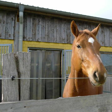
Pferdeland Leide Aktivstallhaltung
Leichlingen
Pferdeland Leide
@info2
FN-Mitglied
Freizeitstall
Hunde willkommen
Krankenbox
Allergikerstall
Hufrehe geeignet
Bewegungsstall
Laufstall
22 weitere...
S


Bergische Weidegründe
Burscheid
Bergische Weidegründe
@HufRehastation-Allergiker
Freizeitstall
Geländestrecke
Hunde willkommen
Krankenbox
Allergikerstall
Gnadenbrothof
Bewegungsstall
Laufstall
28 weitere...
ganz aktuell
S
Deprecated: Creation of dynamic property Zend_View_Helper_Ads::$adLink is deprecated in /var/www/stall-frei/htdocs/staging.stall-frei.de/library/Psf/View/Helper/Ads.php on line 108

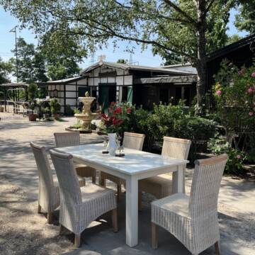
***Reitstall Birkenhof*** Pferdegerechte Haltung
Köln
Daniele-Fazzi
@Daniele-Fazzi
Herzlich Willkommen
auf dem Reitstall Birkenhof
Jetzt neu ‼️ auf dem Birkenhof:
Private Geländestrecke rund um unser


Reitstall Conrad in Haan Gruiten
Haan, Rheinland
Reitstall Conrad
@MirkoConrad
FN-Mitglied
Freizeitstall
Vermieten
Führanlage
Hunde willkommen
Allergikerstall
Fohlenaufzucht möglich
29 weitere...
S
Reitanlage Jöferhof in Wuppertal Cronenberg
Wuppertal
Joeferhof
@Joeferhof
Freizeitstall
Geländestrecke
Vermieten
Paddock
Parkplatz für Pferdeanhänger
Allergikerstall
bedampftes/gewaschenes Heu
18 weitere...
P+
Reitanlage zu Schloss Burg
Wermelskirchen
Meiko Kutscher
@MeikoKutscher
FN-Mitglied
Freizeitstall
Longierzirkel/Roundpen
Paddock
Außenbox mit Paddock
Halbpension
Selbstversorgung
12 weitere...
P

2 Offenstallplätze für kleine Robustpferde frei
Remscheid
Offenstall Remscheid
@Offenstall-Hermanns
Freizeitstall
Gangpferdereiten
Vermieten
Hunde willkommen
Krankenbox
Notfallboxen
22 weitere...
P

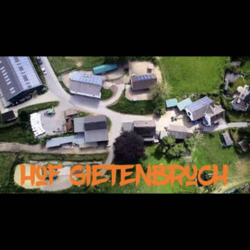


Hof Gietenbruch
Wuppertal
frank-gietenbruch
@frank-gietenbruch
Freizeitstall
Pferdeausbildung
Führanlage
Hunde willkommen
Bewegungsstall
Offenstall
Vollpension
12 weitere...
P+


***Reitstall Birkenhof*** Pferdegerechte Haltung
Köln
Daniele-Fazzi
@Daniele-Fazzi
Freizeitstall
Geländestrecke
Vermieten
Verpachten
Hunde willkommen
Longierzirkel/Roundpen
Allergikerstall
Hufrehe geeignet
23 weitere...
ganz aktuell
S

Heu und Heulage verkaufen
Mechtersen
STALL-FREIde Marketing
@STALL-FREI-Marketing
Verkaufen Sie Ihr Heu und Ihre Heulage direkt an Reiter, Pferdeställe und Reitanlagen


Offenstall Pferdefreunde Enkeln
Kürten
Pferdefreunde Enkeln
@Pferdefreunde-Enkeln
Freizeitstall
Vermieten
Hunde willkommen
Krankenbox
Notfallboxen
12 weitere...
P+


Historische Reitanlage in Köln-Dellbrück
Köln
RGS Kornspringer Köln e. V.
@Kornspringer
FN-Mitglied
Freizeitstall
Vermieten
Führanlage
Hunde willkommen
bedampftes/gewaschenes Heu
Notfallboxen
21 weitere...
S
Deprecated: Creation of dynamic property Zend_View::$pageCount is deprecated in /var/www/stall-frei/htdocs/staging.stall-frei.de/library/vendor/shardj/zf1-future/library/Zend/View/Abstract.php on line 308
Deprecated: Creation of dynamic property Zend_View::$itemCountPerPage is deprecated in /var/www/stall-frei/htdocs/staging.stall-frei.de/library/vendor/shardj/zf1-future/library/Zend/View/Abstract.php on line 308
Deprecated: Creation of dynamic property Zend_View::$first is deprecated in /var/www/stall-frei/htdocs/staging.stall-frei.de/library/vendor/shardj/zf1-future/library/Zend/View/Abstract.php on line 308
Deprecated: Creation of dynamic property Zend_View::$current is deprecated in /var/www/stall-frei/htdocs/staging.stall-frei.de/library/vendor/shardj/zf1-future/library/Zend/View/Abstract.php on line 308
Deprecated: Creation of dynamic property Zend_View::$last is deprecated in /var/www/stall-frei/htdocs/staging.stall-frei.de/library/vendor/shardj/zf1-future/library/Zend/View/Abstract.php on line 308
Deprecated: Creation of dynamic property Zend_View::$next is deprecated in /var/www/stall-frei/htdocs/staging.stall-frei.de/library/vendor/shardj/zf1-future/library/Zend/View/Abstract.php on line 308
Deprecated: Creation of dynamic property Zend_View::$pagesInRange is deprecated in /var/www/stall-frei/htdocs/staging.stall-frei.de/library/vendor/shardj/zf1-future/library/Zend/View/Abstract.php on line 308
Deprecated: Creation of dynamic property Zend_View::$firstPageInRange is deprecated in /var/www/stall-frei/htdocs/staging.stall-frei.de/library/vendor/shardj/zf1-future/library/Zend/View/Abstract.php on line 308
Deprecated: Creation of dynamic property Zend_View::$lastPageInRange is deprecated in /var/www/stall-frei/htdocs/staging.stall-frei.de/library/vendor/shardj/zf1-future/library/Zend/View/Abstract.php on line 308
Deprecated: Creation of dynamic property Zend_View::$currentItemCount is deprecated in /var/www/stall-frei/htdocs/staging.stall-frei.de/library/vendor/shardj/zf1-future/library/Zend/View/Abstract.php on line 308
Deprecated: Creation of dynamic property Zend_View::$totalItemCount is deprecated in /var/www/stall-frei/htdocs/staging.stall-frei.de/library/vendor/shardj/zf1-future/library/Zend/View/Abstract.php on line 308
Deprecated: Creation of dynamic property Zend_View::$firstItemNumber is deprecated in /var/www/stall-frei/htdocs/staging.stall-frei.de/library/vendor/shardj/zf1-future/library/Zend/View/Abstract.php on line 308
Deprecated: Creation of dynamic property Zend_View::$lastItemNumber is deprecated in /var/www/stall-frei/htdocs/staging.stall-frei.de/library/vendor/shardj/zf1-future/library/Zend/View/Abstract.php on line 308
Deprecated: Creation of dynamic property Zend_View::$router is deprecated in /var/www/stall-frei/htdocs/staging.stall-frei.de/library/vendor/shardj/zf1-future/library/Zend/View/Abstract.php on line 308
Deprecated: Creation of dynamic property Zend_View::$urlParams is deprecated in /var/www/stall-frei/htdocs/staging.stall-frei.de/library/vendor/shardj/zf1-future/library/Zend/View/Abstract.php on line 308
Deprecated: Creation of dynamic property Zend_View::$showAds is deprecated in /var/www/stall-frei/htdocs/staging.stall-frei.de/library/vendor/shardj/zf1-future/library/Zend/View/Abstract.php on line 308
Deprecated: Creation of dynamic property Zend_View::$objectIds is deprecated in /var/www/stall-frei/htdocs/staging.stall-frei.de/library/vendor/shardj/zf1-future/library/Zend/View/Abstract.php on line 308
Deprecated: Creation of dynamic property Zend_View::$showNavbar is deprecated in /var/www/stall-frei/htdocs/staging.stall-frei.de/library/vendor/shardj/zf1-future/library/Zend/View/Abstract.php on line 308
Deprecated: Creation of dynamic property Zend_View::$showBreadcrumb is deprecated in /var/www/stall-frei/htdocs/staging.stall-frei.de/library/vendor/shardj/zf1-future/library/Zend/View/Abstract.php on line 308
Deprecated: Creation of dynamic property Zend_View::$showFooter is deprecated in /var/www/stall-frei/htdocs/staging.stall-frei.de/library/vendor/shardj/zf1-future/library/Zend/View/Abstract.php on line 308
Deprecated: Creation of dynamic property Zend_View::$showInternalAds is deprecated in /var/www/stall-frei/htdocs/staging.stall-frei.de/library/vendor/shardj/zf1-future/library/Zend/View/Abstract.php on line 308
Deprecated: Creation of dynamic property Zend_View::$blNoContent is deprecated in /var/www/stall-frei/htdocs/staging.stall-frei.de/library/vendor/shardj/zf1-future/library/Zend/View/Abstract.php on line 308
Deprecated: Creation of dynamic property Zend_View::$sMetaDesc is deprecated in /var/www/stall-frei/htdocs/staging.stall-frei.de/library/vendor/shardj/zf1-future/library/Zend/View/Abstract.php on line 308
Deprecated: Creation of dynamic property Zend_View::$useGmaps is deprecated in /var/www/stall-frei/htdocs/staging.stall-frei.de/library/vendor/shardj/zf1-future/library/Zend/View/Abstract.php on line 308
Deprecated: Creation of dynamic property Zend_View::$touches is deprecated in /var/www/stall-frei/htdocs/staging.stall-frei.de/library/vendor/shardj/zf1-future/library/Zend/View/Abstract.php on line 308
Deprecated: Creation of dynamic property Zend_View::$oProject is deprecated in /var/www/stall-frei/htdocs/staging.stall-frei.de/library/vendor/shardj/zf1-future/library/Zend/View/Abstract.php on line 308
Deprecated: Creation of dynamic property Zend_View::$pageHeadline is deprecated in /var/www/stall-frei/htdocs/staging.stall-frei.de/library/vendor/shardj/zf1-future/library/Zend/View/Abstract.php on line 308
Deprecated: Creation of dynamic property Zend_View::$disableLocationField is deprecated in /var/www/stall-frei/htdocs/staging.stall-frei.de/library/vendor/shardj/zf1-future/library/Zend/View/Abstract.php on line 308
Deprecated: Creation of dynamic property Zend_View::$isSearch is deprecated in /var/www/stall-frei/htdocs/staging.stall-frei.de/library/vendor/shardj/zf1-future/library/Zend/View/Abstract.php on line 308
Deprecated: Creation of dynamic property Zend_View::$pageTitle is deprecated in /var/www/stall-frei/htdocs/staging.stall-frei.de/library/vendor/shardj/zf1-future/library/Zend/View/Abstract.php on line 308
Deprecated: Creation of dynamic property Psf_Form_Element_Text::$class is deprecated in /var/www/stall-frei/htdocs/staging.stall-frei.de/library/vendor/shardj/zf1-future/library/Zend/Form/Element.php on line 874
Deprecated: Creation of dynamic property Psf_Form_Element_Text::$size is deprecated in /var/www/stall-frei/htdocs/staging.stall-frei.de/library/vendor/shardj/zf1-future/library/Zend/Form/Element.php on line 874
Deprecated: Creation of dynamic property Psf_Form_Element_Text::$placeholder is deprecated in /var/www/stall-frei/htdocs/staging.stall-frei.de/library/vendor/shardj/zf1-future/library/Zend/Form/Element.php on line 874
Deprecated: Creation of dynamic property Psf_Form_Element_Hidden::$class is deprecated in /var/www/stall-frei/htdocs/staging.stall-frei.de/library/vendor/shardj/zf1-future/library/Zend/Form/Element.php on line 874
Deprecated: Creation of dynamic property Psf_Form_Element_Hidden::$class is deprecated in /var/www/stall-frei/htdocs/staging.stall-frei.de/library/vendor/shardj/zf1-future/library/Zend/Form/Element.php on line 874
Deprecated: Creation of dynamic property Psf_Form_Element_Hidden::$class is deprecated in /var/www/stall-frei/htdocs/staging.stall-frei.de/library/vendor/shardj/zf1-future/library/Zend/Form/Element.php on line 874
Deprecated: Creation of dynamic property Psf_Form_Element_Hidden::$class is deprecated in /var/www/stall-frei/htdocs/staging.stall-frei.de/library/vendor/shardj/zf1-future/library/Zend/Form/Element.php on line 874
Deprecated: Creation of dynamic property Psf_Form_Element_Select::$class is deprecated in /var/www/stall-frei/htdocs/staging.stall-frei.de/library/vendor/shardj/zf1-future/library/Zend/Form/Element.php on line 874
Deprecated: Creation of dynamic property Psf_Form_Element_Select::$class is deprecated in /var/www/stall-frei/htdocs/staging.stall-frei.de/library/vendor/shardj/zf1-future/library/Zend/Form/Element.php on line 874
Deprecated: Creation of dynamic property Psf_Form_Element_Select::$class is deprecated in /var/www/stall-frei/htdocs/staging.stall-frei.de/library/vendor/shardj/zf1-future/library/Zend/Form/Element.php on line 874
Deprecated: Creation of dynamic property Psf_Form_Element_Select::$class is deprecated in /var/www/stall-frei/htdocs/staging.stall-frei.de/library/vendor/shardj/zf1-future/library/Zend/Form/Element.php on line 874
Deprecated: Creation of dynamic property Psf_Form_Element_Text::$class is deprecated in /var/www/stall-frei/htdocs/staging.stall-frei.de/library/vendor/shardj/zf1-future/library/Zend/Form/Element.php on line 874
Deprecated: Creation of dynamic property Psf_Form_Element_Checkbox::$label is deprecated in /var/www/stall-frei/htdocs/staging.stall-frei.de/library/vendor/shardj/zf1-future/library/Zend/Form/Element.php on line 874
Deprecated: Creation of dynamic property Zend_View::$sort is deprecated in /var/www/stall-frei/htdocs/staging.stall-frei.de/library/vendor/shardj/zf1-future/library/Zend/View/Abstract.php on line 308
Deprecated: Creation of dynamic property Zend_View::$searchLocation is deprecated in /var/www/stall-frei/htdocs/staging.stall-frei.de/library/vendor/shardj/zf1-future/library/Zend/View/Abstract.php on line 308
Deprecated: Creation of dynamic property Zend_View::$locationHint is deprecated in /var/www/stall-frei/htdocs/staging.stall-frei.de/library/vendor/shardj/zf1-future/library/Zend/View/Abstract.php on line 308
Psf_GeoCoder_Abstract::getLocation: Hünger Get Location CachedOrLive
Psf_GeoCoder_Abstract::getCachedOrLive: Hünger
Psf_GeoCoder_OpenCageData::makeApiRequest: response:
Array
(
[documentation] => https://opencagedata.com/api
[licenses] => Array
(
[0] => Array
(
[name] => see attribution guide
[url] => https://opencagedata.com/credits
)
)
[results] => Array
(
[0] => Array
(
[bounds] => Array
(
[northeast] => Array
(
[lat] => 51.1587805
[lng] => 7.2024194
)
[southwest] => Array
(
[lat] => 51.1187805
[lng] => 7.1624194
)
)
[components] => Array
(
[ISO_3166-1_alpha-2] => DE
[ISO_3166-1_alpha-3] => DEU
[ISO_3166-2] => Array
(
[0] => DE-NW
)
[_category] => place
[_normalized_city] => Wermelskirchen
[_type] => village
[continent] => Europe
[country] => Deutschland
[country_code] => de
[county] => Rheinisch-Bergischer Kreis
[political_union] => European Union
[postcode] => 42929
[state] => Nordrhein-Westfalen
[state_code] => NW
[town] => Wermelskirchen
[village] => Hünger
)
[confidence] => 7
[formatted] => 42929 Hünger, Deutschland
[geometry] => Array
(
[lat] => 51.1387805
[lng] => 7.1824194
)
)
[1] => Array
(
[bounds] => Array
(
[northeast] => Array
(
[lat] => 51.1388208
[lng] => 7.1873133
)
[southwest] => Array
(
[lat] => 51.1384127
[lng] => 7.1824217
)
)
[components] => Array
(
[ISO_3166-1_alpha-2] => DE
[ISO_3166-1_alpha-3] => DEU
[ISO_3166-2] => Array
(
[0] => DE-NW
)
[_category] => road
[_normalized_city] => Wermelskirchen
[_type] => road
[continent] => Europe
[country] => Deutschland
[country_code] => de
[county] => Rheinisch-Bergischer Kreis
[hamlet] => Haid
[political_union] => European Union
[postcode] => 42929
[road] => Hünger
[road_type] => secondary
[state] => Nordrhein-Westfalen
[state_code] => NW
[town] => Wermelskirchen
[village] => Hünger
)
[confidence] => 9
[formatted] => Hünger, 42929 Hünger, Deutschland
[geometry] => Array
(
[lat] => 51.1387129
[lng] => 7.1848764
)
)
[2] => Array
(
[components] => Array
(
[ISO_3166-1_alpha-2] => FR
[ISO_3166-1_alpha-3] => FRA
[ISO_3166-2] => Array
(
[0] => FR-PDL
[1] => FR-49
)
[_category] => road
[_normalized_city] => Candé
[_type] => road
[city] => Candé
[continent] => Europe
[country] => France
[country_code] => fr
[county] => Maine-et-Loire
[local_authority] => Anjou Bleu Communauté
[political_union] => European Union
[postcode] => 49440
[road] => Route d’angers
[state] => Pays de la Loire
[state_code] => PDL
)
[confidence] => 3
[formatted] => Route d’angers, 49440 Candé, France
[geometry] => Array
(
[lat] => 47.560223
[lng] => -1.028856
)
)
[3] => Array
(
[components] => Array
(
[ISO_3166-1_alpha-2] => FR
[ISO_3166-1_alpha-3] => FRA
[ISO_3166-2] => Array
(
[0] => FR-PDL
[1] => FR-49
)
[_category] => road
[_normalized_city] => Angers
[_type] => road
[city] => Angers
[continent] => Europe
[country] => France
[country_code] => fr
[county] => Maine-et-Loire
[local_authority] => Angers Loire Métropole
[political_union] => European Union
[postcode] => 49000
[road] => Rue de Frémur
[state] => Pays de la Loire
[state_code] => PDL
)
[confidence] => 2
[formatted] => Rue de Frémur, 49000 Angers, France
[geometry] => Array
(
[lat] => 47.457808
[lng] => -0.560653
)
)
[4] => Array
(
[components] => Array
(
[ISO_3166-1_alpha-2] => FR
[ISO_3166-1_alpha-3] => FRA
[ISO_3166-2] => Array
(
[0] => FR-ARA
[1] => FR-38
)
[_category] => road
[_normalized_city] => Saint-Martin-d'Uriage
[_type] => road
[city] => Saint-Martin-d'Uriage
[continent] => Europe
[country] => France
[country_code] => fr
[county] => Isère
[local_authority] => Communauté de communes Le Grésivaudan
[political_union] => European Union
[postcode] => 38410
[road] => Route des Angères
[state] => Auvergne-Rhône-Alpes
[state_code] => ARA
)
[confidence] => 2
[formatted] => Route des Angères, 38410 Saint-Martin-d'Uriage, France
[geometry] => Array
(
[lat] => 45.150166
[lng] => 5.848309
)
)
[5] => Array
(
[components] => Array
(
[ISO_3166-1_alpha-2] => FR
[ISO_3166-1_alpha-3] => FRA
[ISO_3166-2] => Array
(
[0] => FR-PDL
[1] => FR-49
)
[_category] => road
[_normalized_city] => Angers
[_type] => road
[city] => Angers
[continent] => Europe
[country] => France
[country_code] => fr
[county] => Maine-et-Loire
[local_authority] => Angers Loire Métropole
[political_union] => European Union
[postcode] => 49100
[road] => Rue de la Chalouère
[state] => Pays de la Loire
[state_code] => PDL
)
[confidence] => 2
[formatted] => Rue de la Chalouère, 49100 Angers, France
[geometry] => Array
(
[lat] => 47.481024
[lng] => -0.538357
)
)
[6] => Array
(
[components] => Array
(
[ISO_3166-1_alpha-2] => FR
[ISO_3166-1_alpha-3] => FRA
[ISO_3166-2] => Array
(
[0] => FR-PDL
[1] => FR-53
)
[_category] => road
[_normalized_city] => Laval
[_type] => road
[city] => Laval
[continent] => Europe
[country] => France
[country_code] => fr
[county] => Mayenne
[local_authority] => Laval Agglomération
[political_union] => European Union
[postcode] => 53000
[road] => Route d'Angers
[state] => Pays de la Loire
[state_code] => PDL
)
[confidence] => 2
[formatted] => Route d'Angers, 53000 Laval, France
[geometry] => Array
(
[lat] => 48.040461
[lng] => -0.741813
)
)
[7] => Array
(
[components] => Array
(
[ISO_3166-1_alpha-2] => FR
[ISO_3166-1_alpha-3] => FRA
[ISO_3166-2] => Array
(
[0] => FR-PDL
[1] => FR-49
)
[_category] => road
[_normalized_city] => Saint-Barthélemy-d'Anjou
[_type] => road
[city] => Saint-Barthélemy-d'Anjou
[continent] => Europe
[country] => France
[country_code] => fr
[county] => Maine-et-Loire
[local_authority] => Angers Loire Métropole
[political_union] => European Union
[postcode] => 49124
[road] => Route d'Angers
[state] => Pays de la Loire
[state_code] => PDL
)
[confidence] => 2
[formatted] => Route d'Angers, 49124 Saint-Barthélemy-d'Anjou, France
[geometry] => Array
(
[lat] => 47.467875
[lng] => -0.503014
)
)
[8] => Array
(
[components] => Array
(
[ISO_3166-1_alpha-2] => FR
[ISO_3166-1_alpha-3] => FRA
[ISO_3166-2] => Array
(
[0] => FR-PDL
[1] => FR-72
)
[_category] => road
[_normalized_city] => La Flèche
[_type] => road
[city] => La Flèche
[continent] => Europe
[country] => France
[country_code] => fr
[county] => Sarthe
[local_authority] => Communauté de communes du Pays Fléchois
[political_union] => European Union
[postcode] => 72200
[road] => Route d'Angers
[state] => Pays de la Loire
[state_code] => PDL
)
[confidence] => 2
[formatted] => Route d'Angers, 72200 La Flèche, France
[geometry] => Array
(
[lat] => 47.695187
[lng] => -0.104121
)
)
[9] => Array
(
[components] => Array
(
[ISO_3166-1_alpha-2] => FR
[ISO_3166-1_alpha-3] => FRA
[ISO_3166-2] => Array
(
[0] => FR-PDL
[1] => FR-49
)
[_category] => road
[_normalized_city] => Segré-en-Anjou Bleu
[_type] => road
[city] => Segré-en-Anjou Bleu
[continent] => Europe
[country] => France
[country_code] => fr
[county] => Maine-et-Loire
[local_authority] => Anjou Bleu Communauté
[political_union] => European Union
[postcode] => 49500
[road] => Route d'Angers
[state] => Pays de la Loire
[state_code] => PDL
)
[confidence] => 2
[formatted] => Route d'Angers, 49500 Segré-en-Anjou Bleu, France
[geometry] => Array
(
[lat] => 47.672104
[lng] => -0.809793
)
)
)
[status] => Array
(
[code] => 200
[message] => OK
)
[stay_informed] => Array
(
[blog] => https://blog.opencagedata.com
[mastodon] => https://en.osm.town/@opencage
)
[thanks] => For using an OpenCage API
[timestamp] => Array
(
[created_http] => Sat, 07 Feb 2026 06:50:53 GMT
[created_unix] => 1770447053
)
[total_results] => 10
)
Psf_GeoCoder_Abstract::convertLocationResult
{"documentation":"https:\/\/opencagedata.com\/api","licenses":[{"name":"see attribution guide","url":"https:\/\/opencagedata.com\/credits"}],"results":[{"bounds":{"northeast":{"lat":51.1587805,"lng":7.2024194},"southwest":{"lat":51.1187805,"lng":7.1624194}},"components":{"ISO_3166-1_alpha-2":"DE","ISO_3166-1_alpha-3":"DEU","ISO_3166-2":["DE-NW"],"_category":"place","_normalized_city":"Wermelskirchen","_type":"village","continent":"Europe","country":"Deutschland","country_code":"de","county":"Rheinisch-Bergischer Kreis","political_union":"European Union","postcode":"42929","state":"Nordrhein-Westfalen","state_code":"NW","town":"Wermelskirchen","village":"H\u00fcnger"},"confidence":7,"formatted":"42929 H\u00fcnger, Deutschland","geometry":{"lat":51.1387805,"lng":7.1824194}},{"bounds":{"northeast":{"lat":51.1388208,"lng":7.1873133},"southwest":{"lat":51.1384127,"lng":7.1824217}},"components":{"ISO_3166-1_alpha-2":"DE","ISO_3166-1_alpha-3":"DEU","ISO_3166-2":["DE-NW"],"_category":"road","_normalized_city":"Wermelskirchen","_type":"road","continent":"Europe","country":"Deutschland","country_code":"de","county":"Rheinisch-Bergischer Kreis","hamlet":"Haid","political_union":"European Union","postcode":"42929","road":"H\u00fcnger","road_type":"secondary","state":"Nordrhein-Westfalen","state_code":"NW","town":"Wermelskirchen","village":"H\u00fcnger"},"confidence":9,"formatted":"H\u00fcnger, 42929 H\u00fcnger, Deutschland","geometry":{"lat":51.1387129,"lng":7.1848764}},{"components":{"ISO_3166-1_alpha-2":"FR","ISO_3166-1_alpha-3":"FRA","ISO_3166-2":["FR-PDL","FR-49"],"_category":"road","_normalized_city":"Cand\u00e9","_type":"road","city":"Cand\u00e9","continent":"Europe","country":"France","country_code":"fr","county":"Maine-et-Loire","local_authority":"Anjou Bleu Communaut\u00e9","political_union":"European Union","postcode":"49440","road":"Route d\u2019angers","state":"Pays de la Loire","state_code":"PDL"},"confidence":3,"formatted":"Route d\u2019angers, 49440 Cand\u00e9, France","geometry":{"lat":47.560223,"lng":-1.028856}},{"components":{"ISO_3166-1_alpha-2":"FR","ISO_3166-1_alpha-3":"FRA","ISO_3166-2":["FR-PDL","FR-49"],"_category":"road","_normalized_city":"Angers","_type":"road","city":"Angers","continent":"Europe","country":"France","country_code":"fr","county":"Maine-et-Loire","local_authority":"Angers Loire M\u00e9tropole","political_union":"European Union","postcode":"49000","road":"Rue de Fr\u00e9mur","state":"Pays de la Loire","state_code":"PDL"},"confidence":2,"formatted":"Rue de Fr\u00e9mur, 49000 Angers, France","geometry":{"lat":47.457808,"lng":-0.560653}},{"components":{"ISO_3166-1_alpha-2":"FR","ISO_3166-1_alpha-3":"FRA","ISO_3166-2":["FR-ARA","FR-38"],"_category":"road","_normalized_city":"Saint-Martin-d'Uriage","_type":"road","city":"Saint-Martin-d'Uriage","continent":"Europe","country":"France","country_code":"fr","county":"Is\u00e8re","local_authority":"Communaut\u00e9 de communes Le Gr\u00e9sivaudan","political_union":"European Union","postcode":"38410","road":"Route des Ang\u00e8res","state":"Auvergne-Rh\u00f4ne-Alpes","state_code":"ARA"},"confidence":2,"formatted":"Route des Ang\u00e8res, 38410 Saint-Martin-d'Uriage, France","geometry":{"lat":45.150166,"lng":5.848309}},{"components":{"ISO_3166-1_alpha-2":"FR","ISO_3166-1_alpha-3":"FRA","ISO_3166-2":["FR-PDL","FR-49"],"_category":"road","_normalized_city":"Angers","_type":"road","city":"Angers","continent":"Europe","country":"France","country_code":"fr","county":"Maine-et-Loire","local_authority":"Angers Loire M\u00e9tropole","political_union":"European Union","postcode":"49100","road":"Rue de la Chalou\u00e8re","state":"Pays de la Loire","state_code":"PDL"},"confidence":2,"formatted":"Rue de la Chalou\u00e8re, 49100 Angers, France","geometry":{"lat":47.481024,"lng":-0.538357}},{"components":{"ISO_3166-1_alpha-2":"FR","ISO_3166-1_alpha-3":"FRA","ISO_3166-2":["FR-PDL","FR-53"],"_category":"road","_normalized_city":"Laval","_type":"road","city":"Laval","continent":"Europe","country":"France","country_code":"fr","county":"Mayenne","local_authority":"Laval Agglom\u00e9ration","political_union":"European Union","postcode":"53000","road":"Route d'Angers","state":"Pays de la Loire","state_code":"PDL"},"confidence":2,"formatted":"Route d'Angers, 53000 Laval, France","geometry":{"lat":48.040461,"lng":-0.741813}},{"components":{"ISO_3166-1_alpha-2":"FR","ISO_3166-1_alpha-3":"FRA","ISO_3166-2":["FR-PDL","FR-49"],"_category":"road","_normalized_city":"Saint-Barth\u00e9lemy-d'Anjou","_type":"road","city":"Saint-Barth\u00e9lemy-d'Anjou","continent":"Europe","country":"France","country_code":"fr","county":"Maine-et-Loire","local_authority":"Angers Loire M\u00e9tropole","political_union":"European Union","postcode":"49124","road":"Route d'Angers","state":"Pays de la Loire","state_code":"PDL"},"confidence":2,"formatted":"Route d'Angers, 49124 Saint-Barth\u00e9lemy-d'Anjou, France","geometry":{"lat":47.467875,"lng":-0.503014}},{"components":{"ISO_3166-1_alpha-2":"FR","ISO_3166-1_alpha-3":"FRA","ISO_3166-2":["FR-PDL","FR-72"],"_category":"road","_normalized_city":"La Fl\u00e8che","_type":"road","city":"La Fl\u00e8che","continent":"Europe","country":"France","country_code":"fr","county":"Sarthe","local_authority":"Communaut\u00e9 de communes du Pays Fl\u00e9chois","political_union":"European Union","postcode":"72200","road":"Route d'Angers","state":"Pays de la Loire","state_code":"PDL"},"confidence":2,"formatted":"Route d'Angers, 72200 La Fl\u00e8che, France","geometry":{"lat":47.695187,"lng":-0.104121}},{"components":{"ISO_3166-1_alpha-2":"FR","ISO_3166-1_alpha-3":"FRA","ISO_3166-2":["FR-PDL","FR-49"],"_category":"road","_normalized_city":"Segr\u00e9-en-Anjou Bleu","_type":"road","city":"Segr\u00e9-en-Anjou Bleu","continent":"Europe","country":"France","country_code":"fr","county":"Maine-et-Loire","local_authority":"Anjou Bleu Communaut\u00e9","political_union":"European Union","postcode":"49500","road":"Route d'Angers","state":"Pays de la Loire","state_code":"PDL"},"confidence":2,"formatted":"Route d'Angers, 49500 Segr\u00e9-en-Anjou Bleu, France","geometry":{"lat":47.672104,"lng":-0.809793}}],"status":{"code":200,"message":"OK"},"stay_informed":{"blog":"https:\/\/blog.opencagedata.com","mastodon":"https:\/\/en.osm.town\/@opencage"},"thanks":"For using an OpenCage API","timestamp":{"created_http":"Sat, 07 Feb 2026 06:50:53 GMT","created_unix":1770447053},"total_results":10}Array
(
[0] => stdClass Object
(
[bounds] => stdClass Object
(
[northeast] => stdClass Object
(
[lat] => 51.1587805
[lng] => 7.2024194
)
[southwest] => stdClass Object
(
[lat] => 51.1187805
[lng] => 7.1624194
)
)
[components] => stdClass Object
(
[ISO_3166-1_alpha-2] => DE
[ISO_3166-1_alpha-3] => DEU
[ISO_3166-2] => Array
(
[0] => DE-NW
)
[_category] => place
[_normalized_city] => Wermelskirchen
[_type] => village
[continent] => Europe
[country] => Deutschland
[country_code] => de
[county] => Rheinisch-Bergischer Kreis
[political_union] => European Union
[postcode] => 42929
[state] => Nordrhein-Westfalen
[state_code] => NW
[town] => Wermelskirchen
[village] => Hünger
)
[confidence] => 7
[formatted] => 42929 Hünger, Deutschland
[geometry] => stdClass Object
(
[lat] => 51.1387805
[lng] => 7.1824194
)
)
[1] => stdClass Object
(
[bounds] => stdClass Object
(
[northeast] => stdClass Object
(
[lat] => 51.1388208
[lng] => 7.1873133
)
[southwest] => stdClass Object
(
[lat] => 51.1384127
[lng] => 7.1824217
)
)
[components] => stdClass Object
(
[ISO_3166-1_alpha-2] => DE
[ISO_3166-1_alpha-3] => DEU
[ISO_3166-2] => Array
(
[0] => DE-NW
)
[_category] => road
[_normalized_city] => Wermelskirchen
[_type] => road
[continent] => Europe
[country] => Deutschland
[country_code] => de
[county] => Rheinisch-Bergischer Kreis
[hamlet] => Haid
[political_union] => European Union
[postcode] => 42929
[road] => Hünger
[road_type] => secondary
[state] => Nordrhein-Westfalen
[state_code] => NW
[town] => Wermelskirchen
[village] => Hünger
)
[confidence] => 9
[formatted] => Hünger, 42929 Hünger, Deutschland
[geometry] => stdClass Object
(
[lat] => 51.1387129
[lng] => 7.1848764
)
)
[2] => stdClass Object
(
[components] => stdClass Object
(
[ISO_3166-1_alpha-2] => FR
[ISO_3166-1_alpha-3] => FRA
[ISO_3166-2] => Array
(
[0] => FR-PDL
[1] => FR-49
)
[_category] => road
[_normalized_city] => Candé
[_type] => road
[city] => Candé
[continent] => Europe
[country] => France
[country_code] => fr
[county] => Maine-et-Loire
[local_authority] => Anjou Bleu Communauté
[political_union] => European Union
[postcode] => 49440
[road] => Route d’angers
[state] => Pays de la Loire
[state_code] => PDL
)
[confidence] => 3
[formatted] => Route d’angers, 49440 Candé, France
[geometry] => stdClass Object
(
[lat] => 47.560223
[lng] => -1.028856
)
)
[3] => stdClass Object
(
[components] => stdClass Object
(
[ISO_3166-1_alpha-2] => FR
[ISO_3166-1_alpha-3] => FRA
[ISO_3166-2] => Array
(
[0] => FR-PDL
[1] => FR-49
)
[_category] => road
[_normalized_city] => Angers
[_type] => road
[city] => Angers
[continent] => Europe
[country] => France
[country_code] => fr
[county] => Maine-et-Loire
[local_authority] => Angers Loire Métropole
[political_union] => European Union
[postcode] => 49000
[road] => Rue de Frémur
[state] => Pays de la Loire
[state_code] => PDL
)
[confidence] => 2
[formatted] => Rue de Frémur, 49000 Angers, France
[geometry] => stdClass Object
(
[lat] => 47.457808
[lng] => -0.560653
)
)
[4] => stdClass Object
(
[components] => stdClass Object
(
[ISO_3166-1_alpha-2] => FR
[ISO_3166-1_alpha-3] => FRA
[ISO_3166-2] => Array
(
[0] => FR-ARA
[1] => FR-38
)
[_category] => road
[_normalized_city] => Saint-Martin-d'Uriage
[_type] => road
[city] => Saint-Martin-d'Uriage
[continent] => Europe
[country] => France
[country_code] => fr
[county] => Isère
[local_authority] => Communauté de communes Le Grésivaudan
[political_union] => European Union
[postcode] => 38410
[road] => Route des Angères
[state] => Auvergne-Rhône-Alpes
[state_code] => ARA
)
[confidence] => 2
[formatted] => Route des Angères, 38410 Saint-Martin-d'Uriage, France
[geometry] => stdClass Object
(
[lat] => 45.150166
[lng] => 5.848309
)
)
[5] => stdClass Object
(
[components] => stdClass Object
(
[ISO_3166-1_alpha-2] => FR
[ISO_3166-1_alpha-3] => FRA
[ISO_3166-2] => Array
(
[0] => FR-PDL
[1] => FR-49
)
[_category] => road
[_normalized_city] => Angers
[_type] => road
[city] => Angers
[continent] => Europe
[country] => France
[country_code] => fr
[county] => Maine-et-Loire
[local_authority] => Angers Loire Métropole
[political_union] => European Union
[postcode] => 49100
[road] => Rue de la Chalouère
[state] => Pays de la Loire
[state_code] => PDL
)
[confidence] => 2
[formatted] => Rue de la Chalouère, 49100 Angers, France
[geometry] => stdClass Object
(
[lat] => 47.481024
[lng] => -0.538357
)
)
[6] => stdClass Object
(
[components] => stdClass Object
(
[ISO_3166-1_alpha-2] => FR
[ISO_3166-1_alpha-3] => FRA
[ISO_3166-2] => Array
(
[0] => FR-PDL
[1] => FR-53
)
[_category] => road
[_normalized_city] => Laval
[_type] => road
[city] => Laval
[continent] => Europe
[country] => France
[country_code] => fr
[county] => Mayenne
[local_authority] => Laval Agglomération
[political_union] => European Union
[postcode] => 53000
[road] => Route d'Angers
[state] => Pays de la Loire
[state_code] => PDL
)
[confidence] => 2
[formatted] => Route d'Angers, 53000 Laval, France
[geometry] => stdClass Object
(
[lat] => 48.040461
[lng] => -0.741813
)
)
[7] => stdClass Object
(
[components] => stdClass Object
(
[ISO_3166-1_alpha-2] => FR
[ISO_3166-1_alpha-3] => FRA
[ISO_3166-2] => Array
(
[0] => FR-PDL
[1] => FR-49
)
[_category] => road
[_normalized_city] => Saint-Barthélemy-d'Anjou
[_type] => road
[city] => Saint-Barthélemy-d'Anjou
[continent] => Europe
[country] => France
[country_code] => fr
[county] => Maine-et-Loire
[local_authority] => Angers Loire Métropole
[political_union] => European Union
[postcode] => 49124
[road] => Route d'Angers
[state] => Pays de la Loire
[state_code] => PDL
)
[confidence] => 2
[formatted] => Route d'Angers, 49124 Saint-Barthélemy-d'Anjou, France
[geometry] => stdClass Object
(
[lat] => 47.467875
[lng] => -0.503014
)
)
[8] => stdClass Object
(
[components] => stdClass Object
(
[ISO_3166-1_alpha-2] => FR
[ISO_3166-1_alpha-3] => FRA
[ISO_3166-2] => Array
(
[0] => FR-PDL
[1] => FR-72
)
[_category] => road
[_normalized_city] => La Flèche
[_type] => road
[city] => La Flèche
[continent] => Europe
[country] => France
[country_code] => fr
[county] => Sarthe
[local_authority] => Communauté de communes du Pays Fléchois
[political_union] => European Union
[postcode] => 72200
[road] => Route d'Angers
[state] => Pays de la Loire
[state_code] => PDL
)
[confidence] => 2
[formatted] => Route d'Angers, 72200 La Flèche, France
[geometry] => stdClass Object
(
[lat] => 47.695187
[lng] => -0.104121
)
)
[9] => stdClass Object
(
[components] => stdClass Object
(
[ISO_3166-1_alpha-2] => FR
[ISO_3166-1_alpha-3] => FRA
[ISO_3166-2] => Array
(
[0] => FR-PDL
[1] => FR-49
)
[_category] => road
[_normalized_city] => Segré-en-Anjou Bleu
[_type] => road
[city] => Segré-en-Anjou Bleu
[continent] => Europe
[country] => France
[country_code] => fr
[county] => Maine-et-Loire
[local_authority] => Anjou Bleu Communauté
[political_union] => European Union
[postcode] => 49500
[road] => Route d'Angers
[state] => Pays de la Loire
[state_code] => PDL
)
[confidence] => 2
[formatted] => Route d'Angers, 49500 Segré-en-Anjou Bleu, France
[geometry] => stdClass Object
(
[lat] => 47.672104
[lng] => -0.809793
)
)
)
Psf_GeoCoder_OpenCageData::getKeyMap: 0
stdClass Object
(
    [bounds] => stdClass Object
        (
            [northeast] => stdClass Object
                (
                    [lat] => 51.1587805
                    [lng] => 7.2024194
                )

            [southwest] => stdClass Object
                (
                    [lat] => 51.1187805
                    [lng] => 7.1624194
                )

        )

    [components] => stdClass Object
        (
            [ISO_3166-1_alpha-2] => DE
            [ISO_3166-1_alpha-3] => DEU
            [ISO_3166-2] => Array
                (
                    [0] => DE-NW
                )

            [_category] => place
            [_normalized_city] => Wermelskirchen
            [_type] => village
            [continent] => Europe
            [country] => Deutschland
            [country_code] => de
            [county] => Rheinisch-Bergischer Kreis
            [political_union] => European Union
            [postcode] => 42929
            [state] => Nordrhein-Westfalen
            [state_code] => NW
            [town] => Wermelskirchen
            [village] => Hünger
        )

    [confidence] => 7
    [formatted] => 42929 Hünger, Deutschland
    [geometry] => stdClass Object
        (
            [lat] => 51.1387805
            [lng] => 7.1824194
        )

)
Psf_GeoCoder_OpenCageData::getCounty: Rheinisch-Bergischer Kreis
Psf_GeoCoder_OpenCageData::addMissingData REFETCH!
Array
(
    [address] => 42929 Hünger, Deutschland
    [type] => village
    [street] =>
    [city] => Wermelskirchen
    [county] => Rheinisch-Bergischer Kreis
    [state] => Nordrhein-Westfalen
    [zip] => 42929
    [country] => Deutschland
    [suburb] =>
    [countrycode] => de
    [latitude] => 51.1387805
    [longitude] => 7.1824194
    [accuracy] => 1
    [confidence] => 7
    [bounds] => stdClass Object
        (
            [northeast] => stdClass Object
                (
                    [lat] => 51.1587805
                    [lng] => 7.2024194
                )

            [southwest] => stdClass Object
                (
                    [lat] => 51.1187805
                    [lng] => 7.1624194
                )

        )

)
reformat!
Array
(
    [address] => 42929 Wermelskirchen
    [type] => village
    [street] =>
    [city] => Wermelskirchen
    [county] => Rheinisch-Bergischer Kreis
    [state] => Nordrhein-Westfalen
    [zip] => 42929
    [country] => Deutschland
    [suburb] =>
    [countrycode] => de
    [latitude] => 51.1387805
    [longitude] => 7.1824194
    [accuracy] => 1
    [confidence] => 7
    [bounds] => stdClass Object
        (
            [northeast] => stdClass Object
                (
                    [lat] => 51.1587805
                    [lng] => 7.2024194
                )

            [southwest] => stdClass Object
                (
                    [lat] => 51.1187805
                    [lng] => 7.1624194
                )

        )

    [place] => 42929 Wermelskirchen, Nordrhein-Westfalen
    [hash] => d2c1812fc8429fb437a135d64b04e9c6
)
Psf_GeoCoder_OpenCageData::getKeyMap: 1
stdClass Object
(
    [bounds] => stdClass Object
        (
            [northeast] => stdClass Object
                (
                    [lat] => 51.1388208
                    [lng] => 7.1873133
                )

            [southwest] => stdClass Object
                (
                    [lat] => 51.1384127
                    [lng] => 7.1824217
                )

        )

    [components] => stdClass Object
        (
            [ISO_3166-1_alpha-2] => DE
            [ISO_3166-1_alpha-3] => DEU
            [ISO_3166-2] => Array
                (
                    [0] => DE-NW
                )

            [_category] => road
            [_normalized_city] => Wermelskirchen
            [_type] => road
            [continent] => Europe
            [country] => Deutschland
            [country_code] => de
            [county] => Rheinisch-Bergischer Kreis
            [hamlet] => Haid
            [political_union] => European Union
            [postcode] => 42929
            [road] => Hünger
            [road_type] => secondary
            [state] => Nordrhein-Westfalen
            [state_code] => NW
            [town] => Wermelskirchen
            [village] => Hünger
        )

    [confidence] => 9
    [formatted] => Hünger, 42929 Hünger, Deutschland
    [geometry] => stdClass Object
        (
            [lat] => 51.1387129
            [lng] => 7.1848764
        )

)
Psf_GeoCoder_OpenCageData::getCounty: Rheinisch-Bergischer Kreis
Psf_GeoCoder_OpenCageData::addMissingData REFETCH!
Array
(
    [address] => Hünger, 42929 Hünger, Deutschland
    [type] => road
    [street] => Hünger
    [city] => Wermelskirchen
    [county] => Rheinisch-Bergischer Kreis
    [state] => Nordrhein-Westfalen
    [zip] => 42929
    [country] => Deutschland
    [suburb] =>
    [countrycode] => de
    [latitude] => 51.1387129
    [longitude] => 7.1848764
    [accuracy] => 1
    [confidence] => 9
    [bounds] => stdClass Object
        (
            [northeast] => stdClass Object
                (
                    [lat] => 51.1388208
                    [lng] => 7.1873133
                )

            [southwest] => stdClass Object
                (
                    [lat] => 51.1384127
                    [lng] => 7.1824217
                )

        )

)
reformat!
Array
(
    [address] => Hünger, 42929 Wermelskirchen
    [type] => road
    [street] => Hünger
    [city] => Wermelskirchen
    [county] => Rheinisch-Bergischer Kreis
    [state] => Nordrhein-Westfalen
    [zip] => 42929
    [country] => Deutschland
    [suburb] =>
    [countrycode] => de
    [latitude] => 51.1387129
    [longitude] => 7.1848764
    [accuracy] => 1
    [confidence] => 9
    [bounds] => stdClass Object
        (
            [northeast] => stdClass Object
                (
                    [lat] => 51.1388208
                    [lng] => 7.1873133
                )

            [southwest] => stdClass Object
                (
                    [lat] => 51.1384127
                    [lng] => 7.1824217
                )

        )

    [place] => Hünger, 42929 Wermelskirchen, Nordrhein-Westfalen
    [hash] => bd365900a03e7a5800822cf27b8d1f97
)
Psf_GeoCoder_OpenCageData::getKeyMap: 2
stdClass Object
(
    [components] => stdClass Object
        (
            [ISO_3166-1_alpha-2] => FR
            [ISO_3166-1_alpha-3] => FRA
            [ISO_3166-2] => Array
                (
                    [0] => FR-PDL
                    [1] => FR-49
                )

            [_category] => road
            [_normalized_city] => Candé
            [_type] => road
            [city] => Candé
            [continent] => Europe
            [country] => France
            [country_code] => fr
            [county] => Maine-et-Loire
            [local_authority] => Anjou Bleu Communauté
            [political_union] => European Union
            [postcode] => 49440
            [road] => Route  d’angers
            [state] => Pays de la Loire
            [state_code] => PDL
        )

    [confidence] => 3
    [formatted] => Route d’angers, 49440 Candé, France
    [geometry] => stdClass Object
        (
            [lat] => 47.560223
            [lng] => -1.028856
        )

)
Psf_GeoCoder_OpenCageData::getCounty: Maine-et-Loire
Psf_GeoCoder_OpenCageData::addMissingData REFETCH!
Array
(
    [address] => Route d’angers, 49440 Candé, France
    [type] => road
    [street] => Route  d’angers
    [city] => Candé
    [county] => Maine-et-Loire
    [state] => Pays de la Loire
    [zip] => 49440
    [country] => France
    [suburb] =>
    [countrycode] => fr
    [latitude] => 47.560223
    [longitude] => -1.028856
    [accuracy] => 1
    [confidence] => 3
    [bounds] =>
)
reformat!
Array
(
    [address] => Route d’angers, 49440 Candé, France
    [type] => road
    [street] => Route  d’angers
    [city] => Candé
    [county] => Maine-et-Loire
    [state] => Pays de la Loire
    [zip] => 49440
    [country] => France
    [suburb] =>
    [countrycode] => fr
    [latitude] => 47.560223
    [longitude] => -1.028856
    [accuracy] => 1
    [confidence] => 3
    [bounds] =>
    [place] => Route  d’angers, 49440 Candé, Pays de la Loire
    [hash] => b688dceff6eb144269e2bcf848764945
)
Psf_GeoCoder_OpenCageData::getKeyMap: 3
stdClass Object
(
    [components] => stdClass Object
        (
            [ISO_3166-1_alpha-2] => FR
            [ISO_3166-1_alpha-3] => FRA
            [ISO_3166-2] => Array
                (
                    [0] => FR-PDL
                    [1] => FR-49
                )

            [_category] => road
            [_normalized_city] => Angers
            [_type] => road
            [city] => Angers
            [continent] => Europe
            [country] => France
            [country_code] => fr
            [county] => Maine-et-Loire
            [local_authority] => Angers Loire Métropole
            [political_union] => European Union
            [postcode] => 49000
            [road] => Rue de Frémur
            [state] => Pays de la Loire
            [state_code] => PDL
        )

    [confidence] => 2
    [formatted] => Rue de Frémur, 49000 Angers, France
    [geometry] => stdClass Object
        (
            [lat] => 47.457808
            [lng] => -0.560653
        )

)
Psf_GeoCoder_OpenCageData::getCounty: Maine-et-Loire
Psf_GeoCoder_OpenCageData::addMissingData REFETCH!
Array
(
    [address] => Rue de Frémur, 49000 Angers, France
    [type] => road
    [street] => Rue de Frémur
    [city] => Angers
    [county] => Maine-et-Loire
    [state] => Pays de la Loire
    [zip] => 49000
    [country] => France
    [suburb] =>
    [countrycode] => fr
    [latitude] => 47.457808
    [longitude] => -0.560653
    [accuracy] => 1
    [confidence] => 2
    [bounds] =>
)
reformat!
Array
(
    [address] => Rue de Frémur, 49000 Angers, France
    [type] => road
    [street] => Rue de Frémur
    [city] => Angers
    [county] => Maine-et-Loire
    [state] => Pays de la Loire
    [zip] => 49000
    [country] => France
    [suburb] =>
    [countrycode] => fr
    [latitude] => 47.457808
    [longitude] => -0.560653
    [accuracy] => 1
    [confidence] => 2
    [bounds] =>
    [place] => Rue de Frémur, 49000 Angers, Pays de la Loire
    [hash] => 01a396e8e40e5fec44fae4353e1746cf
)
Psf_GeoCoder_OpenCageData::getKeyMap: 4
stdClass Object
(
    [components] => stdClass Object
        (
            [ISO_3166-1_alpha-2] => FR
            [ISO_3166-1_alpha-3] => FRA
            [ISO_3166-2] => Array
                (
                    [0] => FR-ARA
                    [1] => FR-38
                )

            [_category] => road
            [_normalized_city] => Saint-Martin-d'Uriage
            [_type] => road
            [city] => Saint-Martin-d'Uriage
            [continent] => Europe
            [country] => France
            [country_code] => fr
            [county] => Isère
            [local_authority] => Communauté de communes Le Grésivaudan
            [political_union] => European Union
            [postcode] => 38410
            [road] => Route des Angères
            [state] => Auvergne-Rhône-Alpes
            [state_code] => ARA
        )

    [confidence] => 2
    [formatted] => Route des Angères, 38410 Saint-Martin-d'Uriage, France
    [geometry] => stdClass Object
        (
            [lat] => 45.150166
            [lng] => 5.848309
        )

)
Psf_GeoCoder_OpenCageData::getCounty: Isère
Psf_GeoCoder_OpenCageData::addMissingData REFETCH!
Array
(
    [address] => Route des Angères, 38410 Saint-Martin-d'Uriage, France
    [type] => road
    [street] => Route des Angères
    [city] => Saint-Martin-d'Uriage
    [county] => Isère
    [state] => Auvergne-Rhône-Alpes
    [zip] => 38410
    [country] => France
    [suburb] =>
    [countrycode] => fr
    [latitude] => 45.150166
    [longitude] => 5.848309
    [accuracy] => 1
    [confidence] => 2
    [bounds] =>
)
reformat!
Array
(
    [address] => Route des Angères, 38410 Saint-Martin-d'Uriage, France
    [type] => road
    [street] => Route des Angères
    [city] => Saint-Martin-d'Uriage
    [county] => Isère
    [state] => Auvergne-Rhône-Alpes
    [zip] => 38410
    [country] => France
    [suburb] =>
    [countrycode] => fr
    [latitude] => 45.150166
    [longitude] => 5.848309
    [accuracy] => 1
    [confidence] => 2
    [bounds] =>
    [place] => Route des Angères, 38410 Saint-Martin-d'Uriage, Auvergne-Rhône-Alpes
    [hash] => 0aa8f61fc74c70ce293a687e45f43b88
)
Psf_GeoCoder_OpenCageData::getKeyMap: 5
stdClass Object
(
    [components] => stdClass Object
        (
            [ISO_3166-1_alpha-2] => FR
            [ISO_3166-1_alpha-3] => FRA
            [ISO_3166-2] => Array
                (
                    [0] => FR-PDL
                    [1] => FR-49
                )

            [_category] => road
            [_normalized_city] => Angers
            [_type] => road
            [city] => Angers
            [continent] => Europe
            [country] => France
            [country_code] => fr
            [county] => Maine-et-Loire
            [local_authority] => Angers Loire Métropole
            [political_union] => European Union
            [postcode] => 49100
            [road] => Rue de la Chalouère
            [state] => Pays de la Loire
            [state_code] => PDL
        )

    [confidence] => 2
    [formatted] => Rue de la Chalouère, 49100 Angers, France
    [geometry] => stdClass Object
        (
            [lat] => 47.481024
            [lng] => -0.538357
        )

)
Psf_GeoCoder_OpenCageData::getCounty: Maine-et-Loire
Psf_GeoCoder_OpenCageData::addMissingData REFETCH!
Array
(
    [address] => Rue de la Chalouère, 49100 Angers, France
    [type] => road
    [street] => Rue de la Chalouère
    [city] => Angers
    [county] => Maine-et-Loire
    [state] => Pays de la Loire
    [zip] => 49100
    [country] => France
    [suburb] =>
    [countrycode] => fr
    [latitude] => 47.481024
    [longitude] => -0.538357
    [accuracy] => 1
    [confidence] => 2
    [bounds] =>
)
reformat!
Array
(
    [address] => Rue de la Chalouère, 49100 Angers, France
    [type] => road
    [street] => Rue de la Chalouère
    [city] => Angers
    [county] => Maine-et-Loire
    [state] => Pays de la Loire
    [zip] => 49100
    [country] => France
    [suburb] =>
    [countrycode] => fr
    [latitude] => 47.481024
    [longitude] => -0.538357
    [accuracy] => 1
    [confidence] => 2
    [bounds] =>
    [place] => Rue de la Chalouère, 49100 Angers, Pays de la Loire
    [hash] => 650a131fe77beca29255c130c21a1d62
)
Psf_GeoCoder_OpenCageData::getKeyMap: 6
stdClass Object
(
    [components] => stdClass Object
        (
            [ISO_3166-1_alpha-2] => FR
            [ISO_3166-1_alpha-3] => FRA
            [ISO_3166-2] => Array
                (
                    [0] => FR-PDL
                    [1] => FR-53
                )

            [_category] => road
            [_normalized_city] => Laval
            [_type] => road
            [city] => Laval
            [continent] => Europe
            [country] => France
            [country_code] => fr
            [county] => Mayenne
            [local_authority] => Laval Agglomération
            [political_union] => European Union
            [postcode] => 53000
            [road] => Route d'Angers
            [state] => Pays de la Loire
            [state_code] => PDL
        )

    [confidence] => 2
    [formatted] => Route d'Angers, 53000 Laval, France
    [geometry] => stdClass Object
        (
            [lat] => 48.040461
            [lng] => -0.741813
        )

)
Psf_GeoCoder_OpenCageData::getCounty: Mayenne
Psf_GeoCoder_OpenCageData::addMissingData REFETCH!
Array
(
    [address] => Route d'Angers, 53000 Laval, France
    [type] => road
    [street] => Route d'Angers
    [city] => Laval
    [county] => Mayenne
    [state] => Pays de la Loire
    [zip] => 53000
    [country] => France
    [suburb] =>
    [countrycode] => fr
    [latitude] => 48.040461
    [longitude] => -0.741813
    [accuracy] => 1
    [confidence] => 2
    [bounds] =>
)
reformat!
Array
(
    [address] => Route d'Angers, 53000 Laval, France
    [type] => road
    [street] => Route d'Angers
    [city] => Laval
    [county] => Mayenne
    [state] => Pays de la Loire
    [zip] => 53000
    [country] => France
    [suburb] =>
    [countrycode] => fr
    [latitude] => 48.040461
    [longitude] => -0.741813
    [accuracy] => 1
    [confidence] => 2
    [bounds] =>
    [place] => Route d'Angers, 53000 Laval, Pays de la Loire
    [hash] => 25fcaee11c958154face5c376cd728c3
)
Psf_GeoCoder_OpenCageData::getKeyMap: 7
stdClass Object
(
    [components] => stdClass Object
        (
            [ISO_3166-1_alpha-2] => FR
            [ISO_3166-1_alpha-3] => FRA
            [ISO_3166-2] => Array
                (
                    [0] => FR-PDL
                    [1] => FR-49
                )

            [_category] => road
            [_normalized_city] => Saint-Barthélemy-d'Anjou
            [_type] => road
            [city] => Saint-Barthélemy-d'Anjou
            [continent] => Europe
            [country] => France
            [country_code] => fr
            [county] => Maine-et-Loire
            [local_authority] => Angers Loire Métropole
            [political_union] => European Union
            [postcode] => 49124
            [road] => Route d'Angers
            [state] => Pays de la Loire
            [state_code] => PDL
        )

    [confidence] => 2
    [formatted] => Route d'Angers, 49124 Saint-Barthélemy-d'Anjou, France
    [geometry] => stdClass Object
        (
            [lat] => 47.467875
            [lng] => -0.503014
        )

)
Psf_GeoCoder_OpenCageData::getCounty: Maine-et-Loire
Psf_GeoCoder_OpenCageData::addMissingData REFETCH!
Array
(
    [address] => Route d'Angers, 49124 Saint-Barthélemy-d'Anjou, France
    [type] => road
    [street] => Route d'Angers
    [city] => Saint-Barthélemy-d'Anjou
    [county] => Maine-et-Loire
    [state] => Pays de la Loire
    [zip] => 49124
    [country] => France
    [suburb] =>
    [countrycode] => fr
    [latitude] => 47.467875
    [longitude] => -0.503014
    [accuracy] => 1
    [confidence] => 2
    [bounds] =>
)
reformat!
Array
(
    [address] => Route d'Angers, 49124 Saint-Barthélemy-d'Anjou, France
    [type] => road
    [street] => Route d'Angers
    [city] => Saint-Barthélemy-d'Anjou
    [county] => Maine-et-Loire
    [state] => Pays de la Loire
    [zip] => 49124
    [country] => France
    [suburb] =>
    [countrycode] => fr
    [latitude] => 47.467875
    [longitude] => -0.503014
    [accuracy] => 1
    [confidence] => 2
    [bounds] =>
    [place] => Route d'Angers, 49124 Saint-Barthélemy-d'Anjou, Pays de la Loire
    [hash] => 68c8559bad04482cf8d799b809c5ed51
)
Psf_GeoCoder_OpenCageData::getKeyMap: 8
stdClass Object
(
    [components] => stdClass Object
        (
            [ISO_3166-1_alpha-2] => FR
            [ISO_3166-1_alpha-3] => FRA
            [ISO_3166-2] => Array
                (
                    [0] => FR-PDL
                    [1] => FR-72
                )

            [_category] => road
            [_normalized_city] => La Flèche
            [_type] => road
            [city] => La Flèche
            [continent] => Europe
            [country] => France
            [country_code] => fr
            [county] => Sarthe
            [local_authority] => Communauté de communes du Pays Fléchois
            [political_union] => European Union
            [postcode] => 72200
            [road] => Route d'Angers
            [state] => Pays de la Loire
            [state_code] => PDL
        )

    [confidence] => 2
    [formatted] => Route d'Angers, 72200 La Flèche, France
    [geometry] => stdClass Object
        (
            [lat] => 47.695187
            [lng] => -0.104121
        )

)
Psf_GeoCoder_OpenCageData::getCounty: Sarthe
Psf_GeoCoder_OpenCageData::addMissingData REFETCH!
Array
(
    [address] => Route d'Angers, 72200 La Flèche, France
    [type] => road
    [street] => Route d'Angers
    [city] => La Flèche
    [county] => Sarthe
    [state] => Pays de la Loire
    [zip] => 72200
    [country] => France
    [suburb] =>
    [countrycode] => fr
    [latitude] => 47.695187
    [longitude] => -0.104121
    [accuracy] => 1
    [confidence] => 2
    [bounds] =>
)
reformat!
Array
(
    [address] => Route d'Angers, 72200 La Flèche, France
    [type] => road
    [street] => Route d'Angers
    [city] => La Flèche
    [county] => Sarthe
    [state] => Pays de la Loire
    [zip] => 72200
    [country] => France
    [suburb] =>
    [countrycode] => fr
    [latitude] => 47.695187
    [longitude] => -0.104121
    [accuracy] => 1
    [confidence] => 2
    [bounds] =>
    [place] => Route d'Angers, 72200 La Flèche, Pays de la Loire
    [hash] => d0a8ad1d0795221ba9b1917cbbcd8b5a
)
Psf_GeoCoder_OpenCageData::getKeyMap: 9
stdClass Object
(
    [components] => stdClass Object
        (
            [ISO_3166-1_alpha-2] => FR
            [ISO_3166-1_alpha-3] => FRA
            [ISO_3166-2] => Array
                (
                    [0] => FR-PDL
                    [1] => FR-49
                )

            [_category] => road
            [_normalized_city] => Segré-en-Anjou Bleu
            [_type] => road
            [city] => Segré-en-Anjou Bleu
            [continent] => Europe
            [country] => France
            [country_code] => fr
            [county] => Maine-et-Loire
            [local_authority] => Anjou Bleu Communauté
            [political_union] => European Union
            [postcode] => 49500
            [road] => Route d'Angers
            [state] => Pays de la Loire
            [state_code] => PDL
        )

    [confidence] => 2
    [formatted] => Route d'Angers, 49500 Segré-en-Anjou Bleu, France
    [geometry] => stdClass Object
        (
            [lat] => 47.672104
            [lng] => -0.809793
        )

)
Psf_GeoCoder_OpenCageData::getCounty: Maine-et-Loire
Psf_GeoCoder_OpenCageData::addMissingData REFETCH!
Array
(
    [address] => Route d'Angers, 49500 Segré-en-Anjou Bleu, France
    [type] => road
    [street] => Route d'Angers
    [city] => Segré-en-Anjou Bleu
    [county] => Maine-et-Loire
    [state] => Pays de la Loire
    [zip] => 49500
    [country] => France
    [suburb] =>
    [countrycode] => fr
    [latitude] => 47.672104
    [longitude] => -0.809793
    [accuracy] => 1
    [confidence] => 2
    [bounds] =>
)
reformat!
Array
(
    [address] => Route d'Angers, 49500 Segré-en-Anjou Bleu, France
    [type] => road
    [street] => Route d'Angers
    [city] => Segré-en-Anjou Bleu
    [county] => Maine-et-Loire
    [state] => Pays de la Loire
    [zip] => 49500
    [country] => France
    [suburb] =>
    [countrycode] => fr
    [latitude] => 47.672104
    [longitude] => -0.809793
    [accuracy] => 1
    [confidence] => 2
    [bounds] =>
    [place] => Route d'Angers, 49500 Segré-en-Anjou Bleu, Pays de la Loire
    [hash] => d03a0349b7eef7adde471015b6ba7203
)
Deprecated: Creation of dynamic property Zend_View::$locationHintStyle is deprecated in /var/www/stall-frei/htdocs/staging.stall-frei.de/library/vendor/shardj/zf1-future/library/Zend/View/Abstract.php on line 308
Deprecated: Creation of dynamic property Zend_View::$adGeoLocation is deprecated in /var/www/stall-frei/htdocs/staging.stall-frei.de/library/vendor/shardj/zf1-future/library/Zend/View/Abstract.php on line 308
Deprecated: Creation of dynamic property Zend_View::$recordCount is deprecated in /var/www/stall-frei/htdocs/staging.stall-frei.de/library/vendor/shardj/zf1-future/library/Zend/View/Abstract.php on line 308
Deprecated: explode(): Passing null to parameter #2 ($string) of type string is deprecated in /var/www/stall-frei/htdocs/staging.stall-frei.de/application/models/SearchAgent.php on line 100
Deprecated: explode(): Passing null to parameter #2 ($string) of type string is deprecated in /var/www/stall-frei/htdocs/staging.stall-frei.de/application/models/SearchAgent.php on line 100
Deprecated: explode(): Passing null to parameter #2 ($string) of type string is deprecated in /var/www/stall-frei/htdocs/staging.stall-frei.de/application/models/SearchAgent.php on line 100
Deprecated: explode(): Passing null to parameter #2 ($string) of type string is deprecated in /var/www/stall-frei/htdocs/staging.stall-frei.de/application/models/SearchAgent.php on line 100
Deprecated: explode(): Passing null to parameter #2 ($string) of type string is deprecated in /var/www/stall-frei/htdocs/staging.stall-frei.de/application/models/SearchAgent.php on line 100
Deprecated: explode(): Passing null to parameter #2 ($string) of type string is deprecated in /var/www/stall-frei/htdocs/staging.stall-frei.de/application/models/SearchAgent.php on line 100
Deprecated: explode(): Passing null to parameter #2 ($string) of type string is deprecated in /var/www/stall-frei/htdocs/staging.stall-frei.de/application/models/SearchAgent.php on line 100
Deprecated: explode(): Passing null to parameter #2 ($string) of type string is deprecated in /var/www/stall-frei/htdocs/staging.stall-frei.de/application/models/SearchAgent.php on line 100
Deprecated: explode(): Passing null to parameter #2 ($string) of type string is deprecated in /var/www/stall-frei/htdocs/staging.stall-frei.de/application/models/SearchAgent.php on line 100
Deprecated: trim(): Passing null to parameter #1 ($string) of type string is deprecated in /var/www/stall-frei/htdocs/staging.stall-frei.de/application/models/Account/Search.php on line 82
Warning: Cannot modify header information - headers already sent by (output started at /var/www/stall-frei/htdocs/staging.stall-frei.de/library/vendor/shardj/zf1-future/library/Zend/View/Abstract.php:308) in /var/www/stall-frei/htdocs/staging.stall-frei.de/application/models/Account/Search.php on line 71
Deprecated: Creation of dynamic property Zend_View::$paginationParams is deprecated in /var/www/stall-frei/htdocs/staging.stall-frei.de/library/vendor/shardj/zf1-future/library/Zend/View/Abstract.php on line 308
Deprecated: Creation of dynamic property Zend_View::$objectPaginator is deprecated in /var/www/stall-frei/htdocs/staging.stall-frei.de/library/vendor/shardj/zf1-future/library/Zend/View/Abstract.php on line 308
Deprecated: Creation of dynamic property Zend_View::$featuredObjects is deprecated in /var/www/stall-frei/htdocs/staging.stall-frei.de/library/vendor/shardj/zf1-future/library/Zend/View/Abstract.php on line 308
Deprecated: Creation of dynamic property Zend_View::$hints is deprecated in /var/www/stall-frei/htdocs/staging.stall-frei.de/library/vendor/shardj/zf1-future/library/Zend/View/Abstract.php on line 308
Deprecated: Creation of dynamic property Zend_View::$attributeHints is deprecated in /var/www/stall-frei/htdocs/staging.stall-frei.de/library/vendor/shardj/zf1-future/library/Zend/View/Abstract.php on line 308
Deprecated: Creation of dynamic property Zend_View::$oSearchForm is deprecated in /var/www/stall-frei/htdocs/staging.stall-frei.de/library/vendor/shardj/zf1-future/library/Zend/View/Abstract.php on line 308