Deprecated: Creation of dynamic property Zend_View::$sMode is deprecated in /var/www/stall-frei/htdocs/staging.stall-frei.de/library/vendor/shardj/zf1-future/library/Zend/View/Abstract.php on line 308
Stallplatz oder Offenstall in Mitte
Gesucht wird in "10178 Mitte"
6.333 Einträge
Deprecated: Creation of dynamic property Zend_View::$listObjects is deprecated in /var/www/stall-frei/htdocs/staging.stall-frei.de/library/vendor/shardj/zf1-future/library/Zend/View/Abstract.php on line 308
Gesponsort


Deprecated: Creation of dynamic property Zend_View::$listMode is deprecated in /var/www/stall-frei/htdocs/staging.stall-frei.de/library/vendor/shardj/zf1-future/library/Zend/View/Abstract.php on line 308
Deprecated: Creation of dynamic property Zend_View::$renderedObjects is deprecated in /var/www/stall-frei/htdocs/staging.stall-frei.de/library/vendor/shardj/zf1-future/library/Zend/View/Abstract.php on line 308
Deprecated: Creation of dynamic property Zend_View::$index is deprecated in /var/www/stall-frei/htdocs/staging.stall-frei.de/library/vendor/shardj/zf1-future/library/Zend/View/Abstract.php on line 308
Deprecated: Creation of dynamic property Zend_View::$displayMode is deprecated in /var/www/stall-frei/htdocs/staging.stall-frei.de/library/vendor/shardj/zf1-future/library/Zend/View/Abstract.php on line 308
Deprecated: Creation of dynamic property Zend_View::$remarketingIds is deprecated in /var/www/stall-frei/htdocs/staging.stall-frei.de/library/vendor/shardj/zf1-future/library/Zend/View/Abstract.php on line 308
Deprecated: Creation of dynamic property Zend_View::$listItem is deprecated in /var/www/stall-frei/htdocs/staging.stall-frei.de/library/vendor/shardj/zf1-future/library/Zend/View/Abstract.php on line 308
Deprecated: Creation of dynamic property Zend_View::$object is deprecated in /var/www/stall-frei/htdocs/staging.stall-frei.de/library/vendor/shardj/zf1-future/library/Zend/View/Abstract.php on line 308
Deprecated: Creation of dynamic property Zend_View::$attributes is deprecated in /var/www/stall-frei/htdocs/staging.stall-frei.de/library/vendor/shardj/zf1-future/library/Zend/View/Abstract.php on line 308


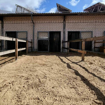
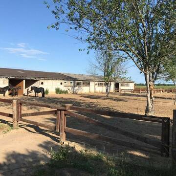
Plätze für Therapiepferde, tiergestützte Therapi...
Berlin
Jochen Zick
@PferdehofamMauerweg
Freizeitstall
Hunde willkommen
Krankenbox
Hufrehe geeignet
Notfallboxen
Innenbox
Offenstall
12 weitere...
aktuell
S
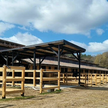
Boxen frei, Reithalle, Roundpen, Allwetterplatz
Bötzow
Maren-Brand
@Maren-Brand
Reitlehrer und -unterricht
Hunde willkommen
Longierzirkel/Roundpen
Außenboxen
Innenbox
Vollpension
11 weitere...
S
Deprecated: Creation of dynamic property Zend_View_Helper_Ads::$adLink is deprecated in /var/www/stall-frei/htdocs/staging.stall-frei.de/library/Psf/View/Helper/Ads.php on line 108

Mitarbeiter gesucht?
Mechtersen
STALL-FREIde Marketing
@STALL-FREI-Marketing
Stellenangebote kostenlos veröffentlichen!
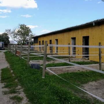
Reitanlage am Katharinensee
Schildow
Selina-Sieber
@Selina-Sieber
Freizeitstall
Geländestrecke
Vermieten
Verpachten
Führanlage
Hunde willkommen
Allergikerstall
bedampftes/gewaschenes Heu
33 weitere...
P+


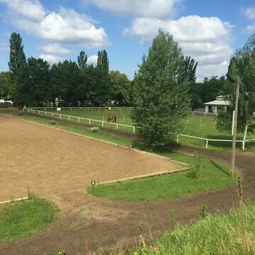
Offenstall Mahlow freie Plätze
Mahlow
Sabine Schwerin
@Kajamaus
Freizeitstall
Krankenbox
Longierzirkel/Roundpen
Hufrehe geeignet
Notfallboxen
Offenstall
4 weitere...
P+

Offenstallplätze verfügbar - in Berlin-Pankow
Berlin
Cindy.Neuendorf
@Cindy.Neuendorf
Freizeitstall
Geländestrecke
Hunde willkommen
Krankenbox
Notfallboxen
Bewegungsstall
Laufstall
13 weitere...
P
Reiterhof Familie Heer
Berlin
Reiterhof-Heer
@Reiterhof-Heer
Freizeitstall
Geländestrecke
Führanlage
Krankenbox
Allergikerstall
Hufrehe geeignet
Außenbox mit Paddock
Außenboxen
19 weitere...
P
Pferdeboxen ab 275€
Berlin
BSV-AdW
@BSV-AdW
FN-Mitglied
Freizeitstall
Vermieten
Führanlage
Hunde willkommen
Hufrehe geeignet
21 weitere...
ganz aktuell
P
Job gesucht?
Mechtersen
STALL-FREIde Marketing
@STALL-FREI-Marketing
Sie suchen einen Job und arbeiten gerne mit Pferden oder auf Reitanlagen?
Besuchen Sie jetzt unseren Stellenmarkt!

Liebe 12 jährige Stute sucht Stallpartner
Berlin
Catrin Schlagwein
@Catrin-Schlagwein-51
Freizeitstall
Vermieten
Hunde willkommen
Paddock
Innenbox
6 weitere...
P
Leider kein Vorschaubild
Leider kein Vorschaubild
Unsere Kunden sind die Pferde
Berlin
Reitanlage-Fiebich
@Reitanlage-Fiebich
Vermieten
Longierzirkel/Roundpen
Paddock
Allergikerstall
bedampftes/gewaschenes Heu
Außenbox mit Paddock
Außenboxen
12 weitere...
P

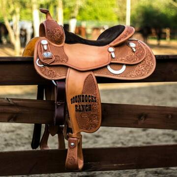
Schöner Offenstall
Stahnsdorf
Boondocks Ranch
@Boondocks-Ranch
Freizeitstall
Westernreiten
Vermieten
Hunde willkommen
Krankenbox
Notfallboxen
13 weitere...
P+
Deprecated: Creation of dynamic property Zend_View::$pageCount is deprecated in /var/www/stall-frei/htdocs/staging.stall-frei.de/library/vendor/shardj/zf1-future/library/Zend/View/Abstract.php on line 308
Deprecated: Creation of dynamic property Zend_View::$itemCountPerPage is deprecated in /var/www/stall-frei/htdocs/staging.stall-frei.de/library/vendor/shardj/zf1-future/library/Zend/View/Abstract.php on line 308
Deprecated: Creation of dynamic property Zend_View::$first is deprecated in /var/www/stall-frei/htdocs/staging.stall-frei.de/library/vendor/shardj/zf1-future/library/Zend/View/Abstract.php on line 308
Deprecated: Creation of dynamic property Zend_View::$current is deprecated in /var/www/stall-frei/htdocs/staging.stall-frei.de/library/vendor/shardj/zf1-future/library/Zend/View/Abstract.php on line 308
Deprecated: Creation of dynamic property Zend_View::$last is deprecated in /var/www/stall-frei/htdocs/staging.stall-frei.de/library/vendor/shardj/zf1-future/library/Zend/View/Abstract.php on line 308
Deprecated: Creation of dynamic property Zend_View::$next is deprecated in /var/www/stall-frei/htdocs/staging.stall-frei.de/library/vendor/shardj/zf1-future/library/Zend/View/Abstract.php on line 308
Deprecated: Creation of dynamic property Zend_View::$pagesInRange is deprecated in /var/www/stall-frei/htdocs/staging.stall-frei.de/library/vendor/shardj/zf1-future/library/Zend/View/Abstract.php on line 308
Deprecated: Creation of dynamic property Zend_View::$firstPageInRange is deprecated in /var/www/stall-frei/htdocs/staging.stall-frei.de/library/vendor/shardj/zf1-future/library/Zend/View/Abstract.php on line 308
Deprecated: Creation of dynamic property Zend_View::$lastPageInRange is deprecated in /var/www/stall-frei/htdocs/staging.stall-frei.de/library/vendor/shardj/zf1-future/library/Zend/View/Abstract.php on line 308
Deprecated: Creation of dynamic property Zend_View::$currentItemCount is deprecated in /var/www/stall-frei/htdocs/staging.stall-frei.de/library/vendor/shardj/zf1-future/library/Zend/View/Abstract.php on line 308
Deprecated: Creation of dynamic property Zend_View::$totalItemCount is deprecated in /var/www/stall-frei/htdocs/staging.stall-frei.de/library/vendor/shardj/zf1-future/library/Zend/View/Abstract.php on line 308
Deprecated: Creation of dynamic property Zend_View::$firstItemNumber is deprecated in /var/www/stall-frei/htdocs/staging.stall-frei.de/library/vendor/shardj/zf1-future/library/Zend/View/Abstract.php on line 308
Deprecated: Creation of dynamic property Zend_View::$lastItemNumber is deprecated in /var/www/stall-frei/htdocs/staging.stall-frei.de/library/vendor/shardj/zf1-future/library/Zend/View/Abstract.php on line 308
Deprecated: Creation of dynamic property Zend_View::$router is deprecated in /var/www/stall-frei/htdocs/staging.stall-frei.de/library/vendor/shardj/zf1-future/library/Zend/View/Abstract.php on line 308
Deprecated: Creation of dynamic property Zend_View::$urlParams is deprecated in /var/www/stall-frei/htdocs/staging.stall-frei.de/library/vendor/shardj/zf1-future/library/Zend/View/Abstract.php on line 308
Deprecated: Creation of dynamic property Zend_View::$showAds is deprecated in /var/www/stall-frei/htdocs/staging.stall-frei.de/library/vendor/shardj/zf1-future/library/Zend/View/Abstract.php on line 308
Deprecated: Creation of dynamic property Zend_View::$objectIds is deprecated in /var/www/stall-frei/htdocs/staging.stall-frei.de/library/vendor/shardj/zf1-future/library/Zend/View/Abstract.php on line 308
Deprecated: Creation of dynamic property Zend_View::$showNavbar is deprecated in /var/www/stall-frei/htdocs/staging.stall-frei.de/library/vendor/shardj/zf1-future/library/Zend/View/Abstract.php on line 308
Deprecated: Creation of dynamic property Zend_View::$showBreadcrumb is deprecated in /var/www/stall-frei/htdocs/staging.stall-frei.de/library/vendor/shardj/zf1-future/library/Zend/View/Abstract.php on line 308
Deprecated: Creation of dynamic property Zend_View::$showFooter is deprecated in /var/www/stall-frei/htdocs/staging.stall-frei.de/library/vendor/shardj/zf1-future/library/Zend/View/Abstract.php on line 308
Deprecated: Creation of dynamic property Zend_View::$showInternalAds is deprecated in /var/www/stall-frei/htdocs/staging.stall-frei.de/library/vendor/shardj/zf1-future/library/Zend/View/Abstract.php on line 308
Deprecated: Creation of dynamic property Zend_View::$blNoContent is deprecated in /var/www/stall-frei/htdocs/staging.stall-frei.de/library/vendor/shardj/zf1-future/library/Zend/View/Abstract.php on line 308
Deprecated: Creation of dynamic property Zend_View::$sMetaDesc is deprecated in /var/www/stall-frei/htdocs/staging.stall-frei.de/library/vendor/shardj/zf1-future/library/Zend/View/Abstract.php on line 308
Deprecated: Creation of dynamic property Zend_View::$useGmaps is deprecated in /var/www/stall-frei/htdocs/staging.stall-frei.de/library/vendor/shardj/zf1-future/library/Zend/View/Abstract.php on line 308
Deprecated: Creation of dynamic property Zend_View::$touches is deprecated in /var/www/stall-frei/htdocs/staging.stall-frei.de/library/vendor/shardj/zf1-future/library/Zend/View/Abstract.php on line 308
Deprecated: Creation of dynamic property Zend_View::$oProject is deprecated in /var/www/stall-frei/htdocs/staging.stall-frei.de/library/vendor/shardj/zf1-future/library/Zend/View/Abstract.php on line 308
Deprecated: Creation of dynamic property Zend_View::$pageHeadline is deprecated in /var/www/stall-frei/htdocs/staging.stall-frei.de/library/vendor/shardj/zf1-future/library/Zend/View/Abstract.php on line 308
Deprecated: Creation of dynamic property Zend_View::$disableLocationField is deprecated in /var/www/stall-frei/htdocs/staging.stall-frei.de/library/vendor/shardj/zf1-future/library/Zend/View/Abstract.php on line 308
Deprecated: Creation of dynamic property Zend_View::$isSearch is deprecated in /var/www/stall-frei/htdocs/staging.stall-frei.de/library/vendor/shardj/zf1-future/library/Zend/View/Abstract.php on line 308
Deprecated: Creation of dynamic property Zend_View::$pageTitle is deprecated in /var/www/stall-frei/htdocs/staging.stall-frei.de/library/vendor/shardj/zf1-future/library/Zend/View/Abstract.php on line 308
Deprecated: Creation of dynamic property Psf_Form_Element_Text::$class is deprecated in /var/www/stall-frei/htdocs/staging.stall-frei.de/library/vendor/shardj/zf1-future/library/Zend/Form/Element.php on line 874
Deprecated: Creation of dynamic property Psf_Form_Element_Text::$size is deprecated in /var/www/stall-frei/htdocs/staging.stall-frei.de/library/vendor/shardj/zf1-future/library/Zend/Form/Element.php on line 874
Deprecated: Creation of dynamic property Psf_Form_Element_Text::$placeholder is deprecated in /var/www/stall-frei/htdocs/staging.stall-frei.de/library/vendor/shardj/zf1-future/library/Zend/Form/Element.php on line 874
Deprecated: Creation of dynamic property Psf_Form_Element_Hidden::$class is deprecated in /var/www/stall-frei/htdocs/staging.stall-frei.de/library/vendor/shardj/zf1-future/library/Zend/Form/Element.php on line 874
Deprecated: Creation of dynamic property Psf_Form_Element_Hidden::$class is deprecated in /var/www/stall-frei/htdocs/staging.stall-frei.de/library/vendor/shardj/zf1-future/library/Zend/Form/Element.php on line 874
Deprecated: Creation of dynamic property Psf_Form_Element_Hidden::$class is deprecated in /var/www/stall-frei/htdocs/staging.stall-frei.de/library/vendor/shardj/zf1-future/library/Zend/Form/Element.php on line 874
Deprecated: Creation of dynamic property Psf_Form_Element_Hidden::$class is deprecated in /var/www/stall-frei/htdocs/staging.stall-frei.de/library/vendor/shardj/zf1-future/library/Zend/Form/Element.php on line 874
Deprecated: Creation of dynamic property Psf_Form_Element_Select::$class is deprecated in /var/www/stall-frei/htdocs/staging.stall-frei.de/library/vendor/shardj/zf1-future/library/Zend/Form/Element.php on line 874
Deprecated: Creation of dynamic property Psf_Form_Element_Select::$class is deprecated in /var/www/stall-frei/htdocs/staging.stall-frei.de/library/vendor/shardj/zf1-future/library/Zend/Form/Element.php on line 874
Deprecated: Creation of dynamic property Psf_Form_Element_Select::$class is deprecated in /var/www/stall-frei/htdocs/staging.stall-frei.de/library/vendor/shardj/zf1-future/library/Zend/Form/Element.php on line 874
Deprecated: Creation of dynamic property Psf_Form_Element_Select::$class is deprecated in /var/www/stall-frei/htdocs/staging.stall-frei.de/library/vendor/shardj/zf1-future/library/Zend/Form/Element.php on line 874
Deprecated: Creation of dynamic property Psf_Form_Element_Text::$class is deprecated in /var/www/stall-frei/htdocs/staging.stall-frei.de/library/vendor/shardj/zf1-future/library/Zend/Form/Element.php on line 874
Deprecated: Creation of dynamic property Psf_Form_Element_Checkbox::$label is deprecated in /var/www/stall-frei/htdocs/staging.stall-frei.de/library/vendor/shardj/zf1-future/library/Zend/Form/Element.php on line 874
Deprecated: Creation of dynamic property Zend_View::$sort is deprecated in /var/www/stall-frei/htdocs/staging.stall-frei.de/library/vendor/shardj/zf1-future/library/Zend/View/Abstract.php on line 308
Deprecated: Creation of dynamic property Zend_View::$searchLocation is deprecated in /var/www/stall-frei/htdocs/staging.stall-frei.de/library/vendor/shardj/zf1-future/library/Zend/View/Abstract.php on line 308
Deprecated: Creation of dynamic property Zend_View::$locationHint is deprecated in /var/www/stall-frei/htdocs/staging.stall-frei.de/library/vendor/shardj/zf1-future/library/Zend/View/Abstract.php on line 308
Psf_GeoCoder_Abstract::getLocation: Cölln Get Location CachedOrLive
Psf_GeoCoder_Abstract::getCachedOrLive: Cölln
Psf_GeoCoder_OpenCageData::makeApiRequest: response:
Array
(
[documentation] => https://opencagedata.com/api
[licenses] => Array
(
[0] => Array
(
[name] => see attribution guide
[url] => https://opencagedata.com/credits
)
)
[results] => Array
(
[0] => Array
(
[bounds] => Array
(
[northeast] => Array
(
[lat] => 52.5185581
[lng] => 13.4113279
)
[southwest] => Array
(
[lat] => 52.5114782
[lng] => 13.3984688
)
)
[components] => Array
(
[ISO_3166-1_alpha-2] => DE
[ISO_3166-1_alpha-3] => DEU
[ISO_3166-2] => Array
(
[0] => DE-BE
)
[_category] => place
[_normalized_city] => Berlin
[_type] => hamlet
[borough] => Mitte
[city] => Berlin
[continent] => Europe
[country] => Deutschland
[country_code] => de
[locality] => Alt-Kölln;Cölln
[political_union] => European Union
[postcode] => 10178
[state] => Berlin
[state_code] => BE
[suburb] => Mitte
)
[confidence] => 9
[formatted] => Alt-Kölln;Cölln, 10178 Berlin, Deutschland
[geometry] => Array
(
[lat] => 52.5135993
[lng] => 13.4043946
)
)
[1] => Array
(
[bounds] => Array
(
[northeast] => Array
(
[lat] => 51.1803114
[lng] => 13.5077715
)
[southwest] => Array
(
[lat] => 51.1403114
[lng] => 13.4677715
)
)
[components] => Array
(
[ISO_3166-1_alpha-2] => DE
[ISO_3166-1_alpha-3] => DEU
[ISO_3166-2] => Array
(
[0] => DE-SN
)
[_category] => place
[_normalized_city] => Meißen
[_type] => neighbourhood
[continent] => Europe
[country] => Deutschland
[country_code] => de
[county] => Meißen
[political_union] => European Union
[postcode] => 01662
[state] => Sachsen
[state_code] => SN
[suburb] => Cölln
[town] => Meißen
)
[confidence] => 7
[formatted] => 01662 Meißen, Deutschland
[geometry] => Array
(
[lat] => 51.1603114
[lng] => 13.4877715
)
)
[2] => Array
(
[bounds] => Array
(
[northeast] => Array
(
[lat] => 51.2460891
[lng] => 14.4087484
)
[southwest] => Array
(
[lat] => 51.2060891
[lng] => 14.3687484
)
)
[components] => Array
(
[ISO_3166-1_alpha-2] => DE
[ISO_3166-1_alpha-3] => DEU
[ISO_3166-2] => Array
(
[0] => DE-SN
)
[_category] => place
[_normalized_city] => Radibor
[_type] => village
[city] => Radibor
[continent] => Europe
[country] => Deutschland
[country_code] => de
[county] => Bautzen
[political_union] => European Union
[state] => Sachsen
[state_code] => SN
[village] => Cölln
)
[confidence] => 7
[formatted] => Cölln, Sachsen, Deutschland
[geometry] => Array
(
[lat] => 51.2260891
[lng] => 14.3887484
)
)
[3] => Array
(
[bounds] => Array
(
[northeast] => Array
(
[lat] => 49.6992371
[lng] => 7.8297645
)
[southwest] => Array
(
[lat] => 49.6808428
[lng] => 7.7771111
)
)
[components] => Array
(
[ISO_3166-1_alpha-2] => DE
[ISO_3166-1_alpha-3] => DEU
[ISO_3166-2] => Array
(
[0] => DE-RP
)
[_category] => place
[_normalized_city] => Cölln
[_type] => village
[continent] => Europe
[country] => Deutschland
[country_code] => de
[county] => Donnersbergkreis
[municipality] => Nordpfälzer Land
[political_union] => European Union
[state] => Rheinland-Pfalz
[state_code] => RP
[village] => Cölln
)
[confidence] => 7
[formatted] => Cölln, Rheinland-Pfalz, Deutschland
[geometry] => Array
(
[lat] => 49.6900839
[lng] => 7.8051903
)
)
[4] => Array
(
[components] => Array
(
[ISO_3166-1_alpha-2] => FR
[ISO_3166-1_alpha-3] => FRA
[ISO_3166-2] => Array
(
[0] => FR-IDF
[1] => FR-92
)
[_category] => road
[_normalized_city] => Levallois-Perret
[_type] => road
[city] => Levallois-Perret
[continent] => Europe
[country] => France
[country_code] => fr
[county] => Hauts-de-Seine
[local_authority] => Métropole du Grand Paris
[political_union] => European Union
[postcode] => 92300
[road] => Rue Charles Deutschmann
[state] => Île-de-France
[state_code] => IDF
)
[confidence] => 2
[formatted] => Rue Charles Deutschmann, 92300 Levallois-Perret, France
[geometry] => Array
(
[lat] => 48.900049
[lng] => 2.2842
)
)
[5] => Array
(
[components] => Array
(
[ISO_3166-1_alpha-2] => FR
[ISO_3166-1_alpha-3] => FRA
[ISO_3166-2] => Array
(
[0] => FR-PDL
[1] => FR-49
)
[_category] => road
[_normalized_city] => Angers
[_type] => road
[city] => Angers
[continent] => Europe
[country] => France
[country_code] => fr
[county] => Maine-et-Loire
[local_authority] => Angers Loire Métropole
[political_union] => European Union
[postcode] => 49000
[road] => Rue du Clon
[state] => Pays de la Loire
[state_code] => PDL
)
[confidence] => 10
[formatted] => Rue du Clon, 49000 Angers, France
[geometry] => Array
(
[lat] => 47.461633
[lng] => -0.551759
)
)
[6] => Array
(
[components] => Array
(
[ISO_3166-1_alpha-2] => FR
[ISO_3166-1_alpha-3] => FRA
[ISO_3166-2] => Array
(
[0] => FR-NAQ
[1] => FR-17
)
[_category] => place
[_normalized_city] => Virollet
[_type] => place
[city] => Virollet
[continent] => Europe
[country] => France
[country_code] => fr
[county] => Charente-Maritime
[local_authority] => Communauté de communes de Gémozac et de la Saintonge Viticole
[place] => clone des cherves
[political_union] => European Union
[postcode] => 17260
[state] => Nouvelle-Aquitaine
[state_code] => NAQ
)
[confidence] => 10
[formatted] => clone des cherves, 17260 Virollet, France
[geometry] => Array
(
[lat] => 45.521679
[lng] => -0.727427
)
)
[7] => Array
(
[components] => Array
(
[ISO_3166-1_alpha-2] => FR
[ISO_3166-1_alpha-3] => FRA
[ISO_3166-2] => Array
(
[0] => FR-NAQ
[1] => FR-17
)
[_category] => road
[_normalized_city] => Cozes
[_type] => road
[city] => Cozes
[continent] => Europe
[country] => France
[country_code] => fr
[county] => Charente-Maritime
[local_authority] => Communauté d'agglomération Royan Atlantique
[political_union] => European Union
[postcode] => 17120
[road] => Chemin du Clone
[state] => Nouvelle-Aquitaine
[state_code] => NAQ
)
[confidence] => 10
[formatted] => Chemin du Clone, 17120 Cozes, France
[geometry] => Array
(
[lat] => 45.588743
[lng] => -0.826213
)
)
[8] => Array
(
[components] => Array
(
[ISO_3166-1_alpha-2] => FR
[ISO_3166-1_alpha-3] => FRA
[ISO_3166-2] => Array
(
[0] => FR-NAQ
[1] => FR-17
)
[_category] => road
[_normalized_city] => Corme-Royal
[_type] => road
[city] => Corme-Royal
[continent] => Europe
[country] => France
[country_code] => fr
[county] => Charente-Maritime
[local_authority] => Saintes - Grandes Rives - L'Agglo
[political_union] => European Union
[postcode] => 17600
[road] => Chemin du Clône
[state] => Nouvelle-Aquitaine
[state_code] => NAQ
)
[confidence] => 10
[formatted] => Chemin du Clône, 17600 Corme-Royal, France
[geometry] => Array
(
[lat] => 45.741971
[lng] => -0.806902
)
)
[9] => Array
(
[components] => Array
(
[ISO_3166-1_alpha-2] => FR
[ISO_3166-1_alpha-3] => FRA
[ISO_3166-2] => Array
(
[0] => FR-NAQ
[1] => FR-17
)
[_category] => road
[_normalized_city] => Guitinières
[_type] => road
[city] => Guitinières
[continent] => Europe
[country] => France
[country_code] => fr
[county] => Charente-Maritime
[local_authority] => Communauté de communes de la Haute Saintonge
[political_union] => European Union
[postcode] => 17500
[road] => Chemin du Clone
[state] => Nouvelle-Aquitaine
[state_code] => NAQ
)
[confidence] => 10
[formatted] => Chemin du Clone, 17500 Guitinières, France
[geometry] => Array
(
[lat] => 45.450435
[lng] => -0.491015
)
)
)
[status] => Array
(
[code] => 200
[message] => OK
)
[stay_informed] => Array
(
[blog] => https://blog.opencagedata.com
[mastodon] => https://en.osm.town/@opencage
)
[thanks] => For using an OpenCage API
[timestamp] => Array
(
[created_http] => Mon, 09 Feb 2026 05:54:06 GMT
[created_unix] => 1770616446
)
[total_results] => 10
)
Psf_GeoCoder_Abstract::convertLocationResult
{"documentation":"https:\/\/opencagedata.com\/api","licenses":[{"name":"see attribution guide","url":"https:\/\/opencagedata.com\/credits"}],"results":[{"bounds":{"northeast":{"lat":52.5185581,"lng":13.4113279},"southwest":{"lat":52.5114782,"lng":13.3984688}},"components":{"ISO_3166-1_alpha-2":"DE","ISO_3166-1_alpha-3":"DEU","ISO_3166-2":["DE-BE"],"_category":"place","_normalized_city":"Berlin","_type":"hamlet","borough":"Mitte","city":"Berlin","continent":"Europe","country":"Deutschland","country_code":"de","locality":"Alt-K\u00f6lln;C\u00f6lln","political_union":"European Union","postcode":"10178","state":"Berlin","state_code":"BE","suburb":"Mitte"},"confidence":9,"formatted":"Alt-K\u00f6lln;C\u00f6lln, 10178 Berlin, Deutschland","geometry":{"lat":52.5135993,"lng":13.4043946}},{"bounds":{"northeast":{"lat":51.1803114,"lng":13.5077715},"southwest":{"lat":51.1403114,"lng":13.4677715}},"components":{"ISO_3166-1_alpha-2":"DE","ISO_3166-1_alpha-3":"DEU","ISO_3166-2":["DE-SN"],"_category":"place","_normalized_city":"Mei\u00dfen","_type":"neighbourhood","continent":"Europe","country":"Deutschland","country_code":"de","county":"Mei\u00dfen","political_union":"European Union","postcode":"01662","state":"Sachsen","state_code":"SN","suburb":"C\u00f6lln","town":"Mei\u00dfen"},"confidence":7,"formatted":"01662 Mei\u00dfen, Deutschland","geometry":{"lat":51.1603114,"lng":13.4877715}},{"bounds":{"northeast":{"lat":51.2460891,"lng":14.4087484},"southwest":{"lat":51.2060891,"lng":14.3687484}},"components":{"ISO_3166-1_alpha-2":"DE","ISO_3166-1_alpha-3":"DEU","ISO_3166-2":["DE-SN"],"_category":"place","_normalized_city":"Radibor","_type":"village","city":"Radibor","continent":"Europe","country":"Deutschland","country_code":"de","county":"Bautzen","political_union":"European Union","state":"Sachsen","state_code":"SN","village":"C\u00f6lln"},"confidence":7,"formatted":"C\u00f6lln, Sachsen, Deutschland","geometry":{"lat":51.2260891,"lng":14.3887484}},{"bounds":{"northeast":{"lat":49.6992371,"lng":7.8297645},"southwest":{"lat":49.6808428,"lng":7.7771111}},"components":{"ISO_3166-1_alpha-2":"DE","ISO_3166-1_alpha-3":"DEU","ISO_3166-2":["DE-RP"],"_category":"place","_normalized_city":"C\u00f6lln","_type":"village","continent":"Europe","country":"Deutschland","country_code":"de","county":"Donnersbergkreis","municipality":"Nordpf\u00e4lzer Land","political_union":"European Union","state":"Rheinland-Pfalz","state_code":"RP","village":"C\u00f6lln"},"confidence":7,"formatted":"C\u00f6lln, Rheinland-Pfalz, Deutschland","geometry":{"lat":49.6900839,"lng":7.8051903}},{"components":{"ISO_3166-1_alpha-2":"FR","ISO_3166-1_alpha-3":"FRA","ISO_3166-2":["FR-IDF","FR-92"],"_category":"road","_normalized_city":"Levallois-Perret","_type":"road","city":"Levallois-Perret","continent":"Europe","country":"France","country_code":"fr","county":"Hauts-de-Seine","local_authority":"M\u00e9tropole du Grand Paris","political_union":"European Union","postcode":"92300","road":"Rue Charles Deutschmann","state":"\u00cele-de-France","state_code":"IDF"},"confidence":2,"formatted":"Rue Charles Deutschmann, 92300 Levallois-Perret, France","geometry":{"lat":48.900049,"lng":2.2842}},{"components":{"ISO_3166-1_alpha-2":"FR","ISO_3166-1_alpha-3":"FRA","ISO_3166-2":["FR-PDL","FR-49"],"_category":"road","_normalized_city":"Angers","_type":"road","city":"Angers","continent":"Europe","country":"France","country_code":"fr","county":"Maine-et-Loire","local_authority":"Angers Loire M\u00e9tropole","political_union":"European Union","postcode":"49000","road":"Rue du Clon","state":"Pays de la Loire","state_code":"PDL"},"confidence":10,"formatted":"Rue du Clon, 49000 Angers, France","geometry":{"lat":47.461633,"lng":-0.551759}},{"components":{"ISO_3166-1_alpha-2":"FR","ISO_3166-1_alpha-3":"FRA","ISO_3166-2":["FR-NAQ","FR-17"],"_category":"place","_normalized_city":"Virollet","_type":"place","city":"Virollet","continent":"Europe","country":"France","country_code":"fr","county":"Charente-Maritime","local_authority":"Communaut\u00e9 de communes de G\u00e9mozac et de la Saintonge Viticole","place":"clone des cherves","political_union":"European Union","postcode":"17260","state":"Nouvelle-Aquitaine","state_code":"NAQ"},"confidence":10,"formatted":"clone des cherves, 17260 Virollet, France","geometry":{"lat":45.521679,"lng":-0.727427}},{"components":{"ISO_3166-1_alpha-2":"FR","ISO_3166-1_alpha-3":"FRA","ISO_3166-2":["FR-NAQ","FR-17"],"_category":"road","_normalized_city":"Cozes","_type":"road","city":"Cozes","continent":"Europe","country":"France","country_code":"fr","county":"Charente-Maritime","local_authority":"Communaut\u00e9 d'agglom\u00e9ration Royan Atlantique","political_union":"European Union","postcode":"17120","road":"Chemin du Clone","state":"Nouvelle-Aquitaine","state_code":"NAQ"},"confidence":10,"formatted":"Chemin du Clone, 17120 Cozes, France","geometry":{"lat":45.588743,"lng":-0.826213}},{"components":{"ISO_3166-1_alpha-2":"FR","ISO_3166-1_alpha-3":"FRA","ISO_3166-2":["FR-NAQ","FR-17"],"_category":"road","_normalized_city":"Corme-Royal","_type":"road","city":"Corme-Royal","continent":"Europe","country":"France","country_code":"fr","county":"Charente-Maritime","local_authority":"Saintes - Grandes Rives - L'Agglo","political_union":"European Union","postcode":"17600","road":"Chemin du Cl\u00f4ne","state":"Nouvelle-Aquitaine","state_code":"NAQ"},"confidence":10,"formatted":"Chemin du Cl\u00f4ne, 17600 Corme-Royal, France","geometry":{"lat":45.741971,"lng":-0.806902}},{"components":{"ISO_3166-1_alpha-2":"FR","ISO_3166-1_alpha-3":"FRA","ISO_3166-2":["FR-NAQ","FR-17"],"_category":"road","_normalized_city":"Guitini\u00e8res","_type":"road","city":"Guitini\u00e8res","continent":"Europe","country":"France","country_code":"fr","county":"Charente-Maritime","local_authority":"Communaut\u00e9 de communes de la Haute Saintonge","political_union":"European Union","postcode":"17500","road":"Chemin du Clone","state":"Nouvelle-Aquitaine","state_code":"NAQ"},"confidence":10,"formatted":"Chemin du Clone, 17500 Guitini\u00e8res, France","geometry":{"lat":45.450435,"lng":-0.491015}}],"status":{"code":200,"message":"OK"},"stay_informed":{"blog":"https:\/\/blog.opencagedata.com","mastodon":"https:\/\/en.osm.town\/@opencage"},"thanks":"For using an OpenCage API","timestamp":{"created_http":"Mon, 09 Feb 2026 05:54:06 GMT","created_unix":1770616446},"total_results":10}Array
(
[0] => stdClass Object
(
[bounds] => stdClass Object
(
[northeast] => stdClass Object
(
[lat] => 52.5185581
[lng] => 13.4113279
)
[southwest] => stdClass Object
(
[lat] => 52.5114782
[lng] => 13.3984688
)
)
[components] => stdClass Object
(
[ISO_3166-1_alpha-2] => DE
[ISO_3166-1_alpha-3] => DEU
[ISO_3166-2] => Array
(
[0] => DE-BE
)
[_category] => place
[_normalized_city] => Berlin
[_type] => hamlet
[borough] => Mitte
[city] => Berlin
[continent] => Europe
[country] => Deutschland
[country_code] => de
[locality] => Alt-Kölln;Cölln
[political_union] => European Union
[postcode] => 10178
[state] => Berlin
[state_code] => BE
[suburb] => Mitte
)
[confidence] => 9
[formatted] => Alt-Kölln;Cölln, 10178 Berlin, Deutschland
[geometry] => stdClass Object
(
[lat] => 52.5135993
[lng] => 13.4043946
)
)
[1] => stdClass Object
(
[bounds] => stdClass Object
(
[northeast] => stdClass Object
(
[lat] => 51.1803114
[lng] => 13.5077715
)
[southwest] => stdClass Object
(
[lat] => 51.1403114
[lng] => 13.4677715
)
)
[components] => stdClass Object
(
[ISO_3166-1_alpha-2] => DE
[ISO_3166-1_alpha-3] => DEU
[ISO_3166-2] => Array
(
[0] => DE-SN
)
[_category] => place
[_normalized_city] => Meißen
[_type] => neighbourhood
[continent] => Europe
[country] => Deutschland
[country_code] => de
[county] => Meißen
[political_union] => European Union
[postcode] => 01662
[state] => Sachsen
[state_code] => SN
[suburb] => Cölln
[town] => Meißen
)
[confidence] => 7
[formatted] => 01662 Meißen, Deutschland
[geometry] => stdClass Object
(
[lat] => 51.1603114
[lng] => 13.4877715
)
)
[2] => stdClass Object
(
[bounds] => stdClass Object
(
[northeast] => stdClass Object
(
[lat] => 51.2460891
[lng] => 14.4087484
)
[southwest] => stdClass Object
(
[lat] => 51.2060891
[lng] => 14.3687484
)
)
[components] => stdClass Object
(
[ISO_3166-1_alpha-2] => DE
[ISO_3166-1_alpha-3] => DEU
[ISO_3166-2] => Array
(
[0] => DE-SN
)
[_category] => place
[_normalized_city] => Radibor
[_type] => village
[city] => Radibor
[continent] => Europe
[country] => Deutschland
[country_code] => de
[county] => Bautzen
[political_union] => European Union
[state] => Sachsen
[state_code] => SN
[village] => Cölln
)
[confidence] => 7
[formatted] => Cölln, Sachsen, Deutschland
[geometry] => stdClass Object
(
[lat] => 51.2260891
[lng] => 14.3887484
)
)
[3] => stdClass Object
(
[bounds] => stdClass Object
(
[northeast] => stdClass Object
(
[lat] => 49.6992371
[lng] => 7.8297645
)
[southwest] => stdClass Object
(
[lat] => 49.6808428
[lng] => 7.7771111
)
)
[components] => stdClass Object
(
[ISO_3166-1_alpha-2] => DE
[ISO_3166-1_alpha-3] => DEU
[ISO_3166-2] => Array
(
[0] => DE-RP
)
[_category] => place
[_normalized_city] => Cölln
[_type] => village
[continent] => Europe
[country] => Deutschland
[country_code] => de
[county] => Donnersbergkreis
[municipality] => Nordpfälzer Land
[political_union] => European Union
[state] => Rheinland-Pfalz
[state_code] => RP
[village] => Cölln
)
[confidence] => 7
[formatted] => Cölln, Rheinland-Pfalz, Deutschland
[geometry] => stdClass Object
(
[lat] => 49.6900839
[lng] => 7.8051903
)
)
[4] => stdClass Object
(
[components] => stdClass Object
(
[ISO_3166-1_alpha-2] => FR
[ISO_3166-1_alpha-3] => FRA
[ISO_3166-2] => Array
(
[0] => FR-IDF
[1] => FR-92
)
[_category] => road
[_normalized_city] => Levallois-Perret
[_type] => road
[city] => Levallois-Perret
[continent] => Europe
[country] => France
[country_code] => fr
[county] => Hauts-de-Seine
[local_authority] => Métropole du Grand Paris
[political_union] => European Union
[postcode] => 92300
[road] => Rue Charles Deutschmann
[state] => Île-de-France
[state_code] => IDF
)
[confidence] => 2
[formatted] => Rue Charles Deutschmann, 92300 Levallois-Perret, France
[geometry] => stdClass Object
(
[lat] => 48.900049
[lng] => 2.2842
)
)
[5] => stdClass Object
(
[components] => stdClass Object
(
[ISO_3166-1_alpha-2] => FR
[ISO_3166-1_alpha-3] => FRA
[ISO_3166-2] => Array
(
[0] => FR-PDL
[1] => FR-49
)
[_category] => road
[_normalized_city] => Angers
[_type] => road
[city] => Angers
[continent] => Europe
[country] => France
[country_code] => fr
[county] => Maine-et-Loire
[local_authority] => Angers Loire Métropole
[political_union] => European Union
[postcode] => 49000
[road] => Rue du Clon
[state] => Pays de la Loire
[state_code] => PDL
)
[confidence] => 10
[formatted] => Rue du Clon, 49000 Angers, France
[geometry] => stdClass Object
(
[lat] => 47.461633
[lng] => -0.551759
)
)
[6] => stdClass Object
(
[components] => stdClass Object
(
[ISO_3166-1_alpha-2] => FR
[ISO_3166-1_alpha-3] => FRA
[ISO_3166-2] => Array
(
[0] => FR-NAQ
[1] => FR-17
)
[_category] => place
[_normalized_city] => Virollet
[_type] => place
[city] => Virollet
[continent] => Europe
[country] => France
[country_code] => fr
[county] => Charente-Maritime
[local_authority] => Communauté de communes de Gémozac et de la Saintonge Viticole
[place] => clone des cherves
[political_union] => European Union
[postcode] => 17260
[state] => Nouvelle-Aquitaine
[state_code] => NAQ
)
[confidence] => 10
[formatted] => clone des cherves, 17260 Virollet, France
[geometry] => stdClass Object
(
[lat] => 45.521679
[lng] => -0.727427
)
)
[7] => stdClass Object
(
[components] => stdClass Object
(
[ISO_3166-1_alpha-2] => FR
[ISO_3166-1_alpha-3] => FRA
[ISO_3166-2] => Array
(
[0] => FR-NAQ
[1] => FR-17
)
[_category] => road
[_normalized_city] => Cozes
[_type] => road
[city] => Cozes
[continent] => Europe
[country] => France
[country_code] => fr
[county] => Charente-Maritime
[local_authority] => Communauté d'agglomération Royan Atlantique
[political_union] => European Union
[postcode] => 17120
[road] => Chemin du Clone
[state] => Nouvelle-Aquitaine
[state_code] => NAQ
)
[confidence] => 10
[formatted] => Chemin du Clone, 17120 Cozes, France
[geometry] => stdClass Object
(
[lat] => 45.588743
[lng] => -0.826213
)
)
[8] => stdClass Object
(
[components] => stdClass Object
(
[ISO_3166-1_alpha-2] => FR
[ISO_3166-1_alpha-3] => FRA
[ISO_3166-2] => Array
(
[0] => FR-NAQ
[1] => FR-17
)
[_category] => road
[_normalized_city] => Corme-Royal
[_type] => road
[city] => Corme-Royal
[continent] => Europe
[country] => France
[country_code] => fr
[county] => Charente-Maritime
[local_authority] => Saintes - Grandes Rives - L'Agglo
[political_union] => European Union
[postcode] => 17600
[road] => Chemin du Clône
[state] => Nouvelle-Aquitaine
[state_code] => NAQ
)
[confidence] => 10
[formatted] => Chemin du Clône, 17600 Corme-Royal, France
[geometry] => stdClass Object
(
[lat] => 45.741971
[lng] => -0.806902
)
)
[9] => stdClass Object
(
[components] => stdClass Object
(
[ISO_3166-1_alpha-2] => FR
[ISO_3166-1_alpha-3] => FRA
[ISO_3166-2] => Array
(
[0] => FR-NAQ
[1] => FR-17
)
[_category] => road
[_normalized_city] => Guitinières
[_type] => road
[city] => Guitinières
[continent] => Europe
[country] => France
[country_code] => fr
[county] => Charente-Maritime
[local_authority] => Communauté de communes de la Haute Saintonge
[political_union] => European Union
[postcode] => 17500
[road] => Chemin du Clone
[state] => Nouvelle-Aquitaine
[state_code] => NAQ
)
[confidence] => 10
[formatted] => Chemin du Clone, 17500 Guitinières, France
[geometry] => stdClass Object
(
[lat] => 45.450435
[lng] => -0.491015
)
)
)
Psf_GeoCoder_OpenCageData::getKeyMap: 0
stdClass Object
(
    [bounds] => stdClass Object
        (
            [northeast] => stdClass Object
                (
                    [lat] => 52.5185581
                    [lng] => 13.4113279
                )

            [southwest] => stdClass Object
                (
                    [lat] => 52.5114782
                    [lng] => 13.3984688
                )

        )

    [components] => stdClass Object
        (
            [ISO_3166-1_alpha-2] => DE
            [ISO_3166-1_alpha-3] => DEU
            [ISO_3166-2] => Array
                (
                    [0] => DE-BE
                )

            [_category] => place
            [_normalized_city] => Berlin
            [_type] => hamlet
            [borough] => Mitte
            [city] => Berlin
            [continent] => Europe
            [country] => Deutschland
            [country_code] => de
            [locality] => Alt-Kölln;Cölln
            [political_union] => European Union
            [postcode] => 10178
            [state] => Berlin
            [state_code] => BE
            [suburb] => Mitte
        )

    [confidence] => 9
    [formatted] => Alt-Kölln;Cölln, 10178 Berlin, Deutschland
    [geometry] => stdClass Object
        (
            [lat] => 52.5135993
            [lng] => 13.4043946
        )

)
Psf_GeoCoder_OpenCageData::getCounty: Berlin
Psf_GeoCoder_OpenCageData::addMissingData REFETCH!
Array
(
    [address] => Alt-Kölln;Cölln, 10178 Berlin, Deutschland
    [type] => hamlet
    [street] =>
    [city] => Mitte
    [county] => Berlin
    [state] => Berlin
    [zip] => 10178
    [country] => Deutschland
    [suburb] => Mitte
    [countrycode] => de
    [latitude] => 52.5135993
    [longitude] => 13.4043946
    [accuracy] => 1
    [confidence] => 9
    [bounds] => stdClass Object
        (
            [northeast] => stdClass Object
                (
                    [lat] => 52.5185581
                    [lng] => 13.4113279
                )

            [southwest] => stdClass Object
                (
                    [lat] => 52.5114782
                    [lng] => 13.3984688
                )

        )

)
reformat!
Array
(
    [address] => 10178 Mitte
    [type] => hamlet
    [street] =>
    [city] => Mitte
    [county] => Berlin
    [state] => Berlin
    [zip] => 10178
    [country] => Deutschland
    [suburb] => Mitte
    [countrycode] => de
    [latitude] => 52.5135993
    [longitude] => 13.4043946
    [accuracy] => 1
    [confidence] => 9
    [bounds] => stdClass Object
        (
            [northeast] => stdClass Object
                (
                    [lat] => 52.5185581
                    [lng] => 13.4113279
                )

            [southwest] => stdClass Object
                (
                    [lat] => 52.5114782
                    [lng] => 13.3984688
                )

        )

    [place] => 10178 Mitte, Berlin
    [hash] => 03cf923a7b60442e556c2f2fa4ebe4cf
)
Psf_GeoCoder_OpenCageData::getKeyMap: 1
stdClass Object
(
    [bounds] => stdClass Object
        (
            [northeast] => stdClass Object
                (
                    [lat] => 51.1803114
                    [lng] => 13.5077715
                )

            [southwest] => stdClass Object
                (
                    [lat] => 51.1403114
                    [lng] => 13.4677715
                )

        )

    [components] => stdClass Object
        (
            [ISO_3166-1_alpha-2] => DE
            [ISO_3166-1_alpha-3] => DEU
            [ISO_3166-2] => Array
                (
                    [0] => DE-SN
                )

            [_category] => place
            [_normalized_city] => Meißen
            [_type] => neighbourhood
            [continent] => Europe
            [country] => Deutschland
            [country_code] => de
            [county] => Meißen
            [political_union] => European Union
            [postcode] => 01662
            [state] => Sachsen
            [state_code] => SN
            [suburb] => Cölln
            [town] => Meißen
        )

    [confidence] => 7
    [formatted] => 01662 Meißen, Deutschland
    [geometry] => stdClass Object
        (
            [lat] => 51.1603114
            [lng] => 13.4877715
        )

)
Psf_GeoCoder_OpenCageData::getCounty: Meißen
Psf_GeoCoder_OpenCageData::addMissingData REFETCH!
Array
(
    [address] => 01662 Meißen, Deutschland
    [type] => neighbourhood
    [street] =>
    [city] => Meißen
    [county] => Meißen
    [state] => Sachsen
    [zip] => 01662
    [country] => Deutschland
    [suburb] => Cölln
    [countrycode] => de
    [latitude] => 51.1603114
    [longitude] => 13.4877715
    [accuracy] => 1
    [confidence] => 7
    [bounds] => stdClass Object
        (
            [northeast] => stdClass Object
                (
                    [lat] => 51.1803114
                    [lng] => 13.5077715
                )

            [southwest] => stdClass Object
                (
                    [lat] => 51.1403114
                    [lng] => 13.4677715
                )

        )

)
reformat!
Array
(
    [address] => 01662 Meißen, Deutschland
    [type] => neighbourhood
    [street] =>
    [city] => Meißen
    [county] => Meißen
    [state] => Sachsen
    [zip] => 01662
    [country] => Deutschland
    [suburb] => Cölln
    [countrycode] => de
    [latitude] => 51.1603114
    [longitude] => 13.4877715
    [accuracy] => 1
    [confidence] => 7
    [bounds] => stdClass Object
        (
            [northeast] => stdClass Object
                (
                    [lat] => 51.1803114
                    [lng] => 13.5077715
                )

            [southwest] => stdClass Object
                (
                    [lat] => 51.1403114
                    [lng] => 13.4677715
                )

        )

    [place] => 01662 Meißen, Sachsen
    [hash] => cd473335ae9d603d6a72d270ad660d7a
)
Psf_GeoCoder_OpenCageData::getKeyMap: 2
stdClass Object
(
    [bounds] => stdClass Object
        (
            [northeast] => stdClass Object
                (
                    [lat] => 51.2460891
                    [lng] => 14.4087484
                )

            [southwest] => stdClass Object
                (
                    [lat] => 51.2060891
                    [lng] => 14.3687484
                )

        )

    [components] => stdClass Object
        (
            [ISO_3166-1_alpha-2] => DE
            [ISO_3166-1_alpha-3] => DEU
            [ISO_3166-2] => Array
                (
                    [0] => DE-SN
                )

            [_category] => place
            [_normalized_city] => Radibor
            [_type] => village
            [city] => Radibor
            [continent] => Europe
            [country] => Deutschland
            [country_code] => de
            [county] => Bautzen
            [political_union] => European Union
            [state] => Sachsen
            [state_code] => SN
            [village] => Cölln
        )

    [confidence] => 7
    [formatted] => Cölln, Sachsen, Deutschland
    [geometry] => stdClass Object
        (
            [lat] => 51.2260891
            [lng] => 14.3887484
        )

)
Psf_GeoCoder_OpenCageData::getCounty: Bautzen
Psf_GeoCoder_OpenCageData::addMissingData REFETCH!
Array
(
    [address] => Cölln, Sachsen, Deutschland
    [type] => village
    [street] =>
    [city] => Cölln
    [county] => Bautzen
    [state] => Sachsen
    [zip] =>
    [country] => Deutschland
    [suburb] =>
    [countrycode] => de
    [latitude] => 51.2260891
    [longitude] => 14.3887484
    [accuracy] => 1
    [confidence] => 7
    [bounds] => stdClass Object
        (
            [northeast] => stdClass Object
                (
                    [lat] => 51.2460891
                    [lng] => 14.4087484
                )

            [southwest] => stdClass Object
                (
                    [lat] => 51.2060891
                    [lng] => 14.3687484
                )

        )

)
reformat!
Array
(
    [address] => Cölln, Sachsen, Deutschland
    [type] => village
    [street] =>
    [city] => Cölln
    [county] => Bautzen
    [state] => Sachsen
    [zip] =>
    [country] => Deutschland
    [suburb] =>
    [countrycode] => de
    [latitude] => 51.2260891
    [longitude] => 14.3887484
    [accuracy] => 1
    [confidence] => 7
    [bounds] => stdClass Object
        (
            [northeast] => stdClass Object
                (
                    [lat] => 51.2460891
                    [lng] => 14.4087484
                )

            [southwest] => stdClass Object
                (
                    [lat] => 51.2060891
                    [lng] => 14.3687484
                )

        )

    [place] => Cölln, Sachsen
    [hash] => 31408258be9a41394ed089dc4fad9dd4
)
Psf_GeoCoder_OpenCageData::getKeyMap: 3
stdClass Object
(
    [bounds] => stdClass Object
        (
            [northeast] => stdClass Object
                (
                    [lat] => 49.6992371
                    [lng] => 7.8297645
                )

            [southwest] => stdClass Object
                (
                    [lat] => 49.6808428
                    [lng] => 7.7771111
                )

        )

    [components] => stdClass Object
        (
            [ISO_3166-1_alpha-2] => DE
            [ISO_3166-1_alpha-3] => DEU
            [ISO_3166-2] => Array
                (
                    [0] => DE-RP
                )

            [_category] => place
            [_normalized_city] => Cölln
            [_type] => village
            [continent] => Europe
            [country] => Deutschland
            [country_code] => de
            [county] => Donnersbergkreis
            [municipality] => Nordpfälzer Land
            [political_union] => European Union
            [state] => Rheinland-Pfalz
            [state_code] => RP
            [village] => Cölln
        )

    [confidence] => 7
    [formatted] => Cölln, Rheinland-Pfalz, Deutschland
    [geometry] => stdClass Object
        (
            [lat] => 49.6900839
            [lng] => 7.8051903
        )

)
Psf_GeoCoder_OpenCageData::getCounty: Donnersbergkreis
Psf_GeoCoder_OpenCageData::addMissingData REFETCH!
Array
(
    [address] => Cölln, Rheinland-Pfalz, Deutschland
    [type] => village
    [street] =>
    [city] => Cölln
    [county] => Donnersbergkreis
    [state] => Rheinland-Pfalz
    [zip] =>
    [country] => Deutschland
    [suburb] =>
    [countrycode] => de
    [latitude] => 49.6900839
    [longitude] => 7.8051903
    [accuracy] => 1
    [confidence] => 7
    [bounds] => stdClass Object
        (
            [northeast] => stdClass Object
                (
                    [lat] => 49.6992371
                    [lng] => 7.8297645
                )

            [southwest] => stdClass Object
                (
                    [lat] => 49.6808428
                    [lng] => 7.7771111
                )

        )

)
reformat!
Array
(
    [address] => Cölln, Rheinland-Pfalz, Deutschland
    [type] => village
    [street] =>
    [city] => Cölln
    [county] => Donnersbergkreis
    [state] => Rheinland-Pfalz
    [zip] =>
    [country] => Deutschland
    [suburb] =>
    [countrycode] => de
    [latitude] => 49.6900839
    [longitude] => 7.8051903
    [accuracy] => 1
    [confidence] => 7
    [bounds] => stdClass Object
        (
            [northeast] => stdClass Object
                (
                    [lat] => 49.6992371
                    [lng] => 7.8297645
                )

            [southwest] => stdClass Object
                (
                    [lat] => 49.6808428
                    [lng] => 7.7771111
                )

        )

    [place] => Cölln, Rheinland-Pfalz
    [hash] => 0ef630628c1b4f5bb5325ce7a4972203
)
Psf_GeoCoder_OpenCageData::getKeyMap: 4
stdClass Object
(
    [components] => stdClass Object
        (
            [ISO_3166-1_alpha-2] => FR
            [ISO_3166-1_alpha-3] => FRA
            [ISO_3166-2] => Array
                (
                    [0] => FR-IDF
                    [1] => FR-92
                )

            [_category] => road
            [_normalized_city] => Levallois-Perret
            [_type] => road
            [city] => Levallois-Perret
            [continent] => Europe
            [country] => France
            [country_code] => fr
            [county] => Hauts-de-Seine
            [local_authority] => Métropole du Grand Paris
            [political_union] => European Union
            [postcode] => 92300
            [road] => Rue Charles Deutschmann
            [state] => Île-de-France
            [state_code] => IDF
        )

    [confidence] => 2
    [formatted] => Rue Charles Deutschmann, 92300 Levallois-Perret, France
    [geometry] => stdClass Object
        (
            [lat] => 48.900049
            [lng] => 2.2842
        )

)
Psf_GeoCoder_OpenCageData::getCounty: Hauts-de-Seine
Psf_GeoCoder_OpenCageData::addMissingData REFETCH!
Array
(
    [address] => Rue Charles Deutschmann, 92300 Levallois-Perret, France
    [type] => road
    [street] => Rue Charles Deutschmann
    [city] => Levallois-Perret
    [county] => Hauts-de-Seine
    [state] => Île-de-France
    [zip] => 92300
    [country] => France
    [suburb] =>
    [countrycode] => fr
    [latitude] => 48.900049
    [longitude] => 2.2842
    [accuracy] => 1
    [confidence] => 2
    [bounds] =>
)
reformat!
Array
(
    [address] => Rue Charles Deutschmann, 92300 Levallois-Perret, France
    [type] => road
    [street] => Rue Charles Deutschmann
    [city] => Levallois-Perret
    [county] => Hauts-de-Seine
    [state] => Île-de-France
    [zip] => 92300
    [country] => France
    [suburb] =>
    [countrycode] => fr
    [latitude] => 48.900049
    [longitude] => 2.2842
    [accuracy] => 1
    [confidence] => 2
    [bounds] =>
    [place] => Rue Charles Deutschmann, 92300 Levallois-Perret, Île-de-France
    [hash] => b7dc44def3990e8a7eaf18e019eca466
)
Psf_GeoCoder_OpenCageData::getKeyMap: 5
stdClass Object
(
    [components] => stdClass Object
        (
            [ISO_3166-1_alpha-2] => FR
            [ISO_3166-1_alpha-3] => FRA
            [ISO_3166-2] => Array
                (
                    [0] => FR-PDL
                    [1] => FR-49
                )

            [_category] => road
            [_normalized_city] => Angers
            [_type] => road
            [city] => Angers
            [continent] => Europe
            [country] => France
            [country_code] => fr
            [county] => Maine-et-Loire
            [local_authority] => Angers Loire Métropole
            [political_union] => European Union
            [postcode] => 49000
            [road] => Rue du Clon
            [state] => Pays de la Loire
            [state_code] => PDL
        )

    [confidence] => 10
    [formatted] => Rue du Clon, 49000 Angers, France
    [geometry] => stdClass Object
        (
            [lat] => 47.461633
            [lng] => -0.551759
        )

)
Psf_GeoCoder_OpenCageData::getCounty: Maine-et-Loire
Psf_GeoCoder_OpenCageData::addMissingData REFETCH!
Array
(
    [address] => Rue du Clon, 49000 Angers, France
    [type] => road
    [street] => Rue du Clon
    [city] => Angers
    [county] => Maine-et-Loire
    [state] => Pays de la Loire
    [zip] => 49000
    [country] => France
    [suburb] =>
    [countrycode] => fr
    [latitude] => 47.461633
    [longitude] => -0.551759
    [accuracy] => 1
    [confidence] => 10
    [bounds] =>
)
reformat!
Array
(
    [address] => Rue du Clon, 49000 Angers, France
    [type] => road
    [street] => Rue du Clon
    [city] => Angers
    [county] => Maine-et-Loire
    [state] => Pays de la Loire
    [zip] => 49000
    [country] => France
    [suburb] =>
    [countrycode] => fr
    [latitude] => 47.461633
    [longitude] => -0.551759
    [accuracy] => 1
    [confidence] => 10
    [bounds] =>
    [place] => Rue du Clon, 49000 Angers, Pays de la Loire
    [hash] => 686e15e51cc9c9f73062ab9a4d53e47c
)
Psf_GeoCoder_OpenCageData::getKeyMap: 6
stdClass Object
(
    [components] => stdClass Object
        (
            [ISO_3166-1_alpha-2] => FR
            [ISO_3166-1_alpha-3] => FRA
            [ISO_3166-2] => Array
                (
                    [0] => FR-NAQ
                    [1] => FR-17
                )

            [_category] => place
            [_normalized_city] => Virollet
            [_type] => place
            [city] => Virollet
            [continent] => Europe
            [country] => France
            [country_code] => fr
            [county] => Charente-Maritime
            [local_authority] => Communauté de communes de Gémozac et de la Saintonge Viticole
            [place] => clone des cherves
            [political_union] => European Union
            [postcode] => 17260
            [state] => Nouvelle-Aquitaine
            [state_code] => NAQ
        )

    [confidence] => 10
    [formatted] => clone des cherves, 17260 Virollet, France
    [geometry] => stdClass Object
        (
            [lat] => 45.521679
            [lng] => -0.727427
        )

)
Psf_GeoCoder_OpenCageData::getCounty: Charente-Maritime
Psf_GeoCoder_OpenCageData::addMissingData REFETCH!
Array
(
    [address] => clone des cherves, 17260 Virollet, France
    [type] => place
    [street] =>
    [city] => Virollet
    [county] => Charente-Maritime
    [state] => Nouvelle-Aquitaine
    [zip] => 17260
    [country] => France
    [suburb] =>
    [countrycode] => fr
    [latitude] => 45.521679
    [longitude] => -0.727427
    [accuracy] => 1
    [confidence] => 10
    [bounds] =>
)
reformat!
Array
(
    [address] => clone des cherves, 17260 Virollet, France
    [type] => place
    [street] =>
    [city] => Virollet
    [county] => Charente-Maritime
    [state] => Nouvelle-Aquitaine
    [zip] => 17260
    [country] => France
    [suburb] =>
    [countrycode] => fr
    [latitude] => 45.521679
    [longitude] => -0.727427
    [accuracy] => 1
    [confidence] => 10
    [bounds] =>
    [place] => 17260 Virollet, Nouvelle-Aquitaine
    [hash] => 6680471156294b1f436405fdaaddf6c5
)
Psf_GeoCoder_OpenCageData::getKeyMap: 7
stdClass Object
(
    [components] => stdClass Object
        (
            [ISO_3166-1_alpha-2] => FR
            [ISO_3166-1_alpha-3] => FRA
            [ISO_3166-2] => Array
                (
                    [0] => FR-NAQ
                    [1] => FR-17
                )

            [_category] => road
            [_normalized_city] => Cozes
            [_type] => road
            [city] => Cozes
            [continent] => Europe
            [country] => France
            [country_code] => fr
            [county] => Charente-Maritime
            [local_authority] => Communauté d'agglomération Royan Atlantique
            [political_union] => European Union
            [postcode] => 17120
            [road] => Chemin du Clone
            [state] => Nouvelle-Aquitaine
            [state_code] => NAQ
        )

    [confidence] => 10
    [formatted] => Chemin du Clone, 17120 Cozes, France
    [geometry] => stdClass Object
        (
            [lat] => 45.588743
            [lng] => -0.826213
        )

)
Psf_GeoCoder_OpenCageData::getCounty: Charente-Maritime
Psf_GeoCoder_OpenCageData::addMissingData REFETCH!
Array
(
    [address] => Chemin du Clone, 17120 Cozes, France
    [type] => road
    [street] => Chemin du Clone
    [city] => Cozes
    [county] => Charente-Maritime
    [state] => Nouvelle-Aquitaine
    [zip] => 17120
    [country] => France
    [suburb] =>
    [countrycode] => fr
    [latitude] => 45.588743
    [longitude] => -0.826213
    [accuracy] => 1
    [confidence] => 10
    [bounds] =>
)
reformat!
Array
(
    [address] => Chemin du Clone, 17120 Cozes, France
    [type] => road
    [street] => Chemin du Clone
    [city] => Cozes
    [county] => Charente-Maritime
    [state] => Nouvelle-Aquitaine
    [zip] => 17120
    [country] => France
    [suburb] =>
    [countrycode] => fr
    [latitude] => 45.588743
    [longitude] => -0.826213
    [accuracy] => 1
    [confidence] => 10
    [bounds] =>
    [place] => Chemin du Clone, 17120 Cozes, Nouvelle-Aquitaine
    [hash] => 5d703766b40a64007a65afb2ff6d17b7
)
Psf_GeoCoder_OpenCageData::getKeyMap: 8
stdClass Object
(
    [components] => stdClass Object
        (
            [ISO_3166-1_alpha-2] => FR
            [ISO_3166-1_alpha-3] => FRA
            [ISO_3166-2] => Array
                (
                    [0] => FR-NAQ
                    [1] => FR-17
                )

            [_category] => road
            [_normalized_city] => Corme-Royal
            [_type] => road
            [city] => Corme-Royal
            [continent] => Europe
            [country] => France
            [country_code] => fr
            [county] => Charente-Maritime
            [local_authority] => Saintes - Grandes Rives - L'Agglo
            [political_union] => European Union
            [postcode] => 17600
            [road] => Chemin du Clône
            [state] => Nouvelle-Aquitaine
            [state_code] => NAQ
        )

    [confidence] => 10
    [formatted] => Chemin du Clône, 17600 Corme-Royal, France
    [geometry] => stdClass Object
        (
            [lat] => 45.741971
            [lng] => -0.806902
        )

)
Psf_GeoCoder_OpenCageData::getCounty: Charente-Maritime
Psf_GeoCoder_OpenCageData::addMissingData REFETCH!
Array
(
    [address] => Chemin du Clône, 17600 Corme-Royal, France
    [type] => road
    [street] => Chemin du Clône
    [city] => Corme-Royal
    [county] => Charente-Maritime
    [state] => Nouvelle-Aquitaine
    [zip] => 17600
    [country] => France
    [suburb] =>
    [countrycode] => fr
    [latitude] => 45.741971
    [longitude] => -0.806902
    [accuracy] => 1
    [confidence] => 10
    [bounds] =>
)
reformat!
Array
(
    [address] => Chemin du Clône, 17600 Corme-Royal, France
    [type] => road
    [street] => Chemin du Clône
    [city] => Corme-Royal
    [county] => Charente-Maritime
    [state] => Nouvelle-Aquitaine
    [zip] => 17600
    [country] => France
    [suburb] =>
    [countrycode] => fr
    [latitude] => 45.741971
    [longitude] => -0.806902
    [accuracy] => 1
    [confidence] => 10
    [bounds] =>
    [place] => Chemin du Clône, 17600 Corme-Royal, Nouvelle-Aquitaine
    [hash] => 80048747dda131872b530812a5f53a69
)
Psf_GeoCoder_OpenCageData::getKeyMap: 9
stdClass Object
(
    [components] => stdClass Object
        (
            [ISO_3166-1_alpha-2] => FR
            [ISO_3166-1_alpha-3] => FRA
            [ISO_3166-2] => Array
                (
                    [0] => FR-NAQ
                    [1] => FR-17
                )

            [_category] => road
            [_normalized_city] => Guitinières
            [_type] => road
            [city] => Guitinières
            [continent] => Europe
            [country] => France
            [country_code] => fr
            [county] => Charente-Maritime
            [local_authority] => Communauté de communes de la Haute Saintonge
            [political_union] => European Union
            [postcode] => 17500
            [road] => Chemin du Clone
            [state] => Nouvelle-Aquitaine
            [state_code] => NAQ
        )

    [confidence] => 10
    [formatted] => Chemin du Clone, 17500 Guitinières, France
    [geometry] => stdClass Object
        (
            [lat] => 45.450435
            [lng] => -0.491015
        )

)
Psf_GeoCoder_OpenCageData::getCounty: Charente-Maritime
Psf_GeoCoder_OpenCageData::addMissingData REFETCH!
Array
(
    [address] => Chemin du Clone, 17500 Guitinières, France
    [type] => road
    [street] => Chemin du Clone
    [city] => Guitinières
    [county] => Charente-Maritime
    [state] => Nouvelle-Aquitaine
    [zip] => 17500
    [country] => France
    [suburb] =>
    [countrycode] => fr
    [latitude] => 45.450435
    [longitude] => -0.491015
    [accuracy] => 1
    [confidence] => 10
    [bounds] =>
)
reformat!
Array
(
    [address] => Chemin du Clone, 17500 Guitinières, France
    [type] => road
    [street] => Chemin du Clone
    [city] => Guitinières
    [county] => Charente-Maritime
    [state] => Nouvelle-Aquitaine
    [zip] => 17500
    [country] => France
    [suburb] =>
    [countrycode] => fr
    [latitude] => 45.450435
    [longitude] => -0.491015
    [accuracy] => 1
    [confidence] => 10
    [bounds] =>
    [place] => Chemin du Clone, 17500 Guitinières, Nouvelle-Aquitaine
    [hash] => 6fe3d858a0df19e8426694bd7c749fb3
)
Deprecated: Creation of dynamic property Zend_View::$locationHintStyle is deprecated in /var/www/stall-frei/htdocs/staging.stall-frei.de/library/vendor/shardj/zf1-future/library/Zend/View/Abstract.php on line 308
Deprecated: Creation of dynamic property Zend_View::$adGeoLocation is deprecated in /var/www/stall-frei/htdocs/staging.stall-frei.de/library/vendor/shardj/zf1-future/library/Zend/View/Abstract.php on line 308
Deprecated: Creation of dynamic property Zend_View::$recordCount is deprecated in /var/www/stall-frei/htdocs/staging.stall-frei.de/library/vendor/shardj/zf1-future/library/Zend/View/Abstract.php on line 308
Deprecated: explode(): Passing null to parameter #2 ($string) of type string is deprecated in /var/www/stall-frei/htdocs/staging.stall-frei.de/application/models/SearchAgent.php on line 100
Deprecated: explode(): Passing null to parameter #2 ($string) of type string is deprecated in /var/www/stall-frei/htdocs/staging.stall-frei.de/application/models/SearchAgent.php on line 100
Deprecated: explode(): Passing null to parameter #2 ($string) of type string is deprecated in /var/www/stall-frei/htdocs/staging.stall-frei.de/application/models/SearchAgent.php on line 100
Deprecated: explode(): Passing null to parameter #2 ($string) of type string is deprecated in /var/www/stall-frei/htdocs/staging.stall-frei.de/application/models/SearchAgent.php on line 100
Deprecated: explode(): Passing null to parameter #2 ($string) of type string is deprecated in /var/www/stall-frei/htdocs/staging.stall-frei.de/application/models/SearchAgent.php on line 100
Deprecated: explode(): Passing null to parameter #2 ($string) of type string is deprecated in /var/www/stall-frei/htdocs/staging.stall-frei.de/application/models/SearchAgent.php on line 100
Deprecated: explode(): Passing null to parameter #2 ($string) of type string is deprecated in /var/www/stall-frei/htdocs/staging.stall-frei.de/application/models/SearchAgent.php on line 100
Deprecated: explode(): Passing null to parameter #2 ($string) of type string is deprecated in /var/www/stall-frei/htdocs/staging.stall-frei.de/application/models/SearchAgent.php on line 100
Deprecated: explode(): Passing null to parameter #2 ($string) of type string is deprecated in /var/www/stall-frei/htdocs/staging.stall-frei.de/application/models/SearchAgent.php on line 100
Deprecated: trim(): Passing null to parameter #1 ($string) of type string is deprecated in /var/www/stall-frei/htdocs/staging.stall-frei.de/application/models/Account/Search.php on line 82
Warning: Cannot modify header information - headers already sent by (output started at /var/www/stall-frei/htdocs/staging.stall-frei.de/library/vendor/shardj/zf1-future/library/Zend/View/Abstract.php:308) in /var/www/stall-frei/htdocs/staging.stall-frei.de/application/models/Account/Search.php on line 71
Deprecated: Creation of dynamic property Zend_View::$paginationParams is deprecated in /var/www/stall-frei/htdocs/staging.stall-frei.de/library/vendor/shardj/zf1-future/library/Zend/View/Abstract.php on line 308
Deprecated: Creation of dynamic property Zend_View::$objectPaginator is deprecated in /var/www/stall-frei/htdocs/staging.stall-frei.de/library/vendor/shardj/zf1-future/library/Zend/View/Abstract.php on line 308
Deprecated: Creation of dynamic property Zend_View::$featuredObjects is deprecated in /var/www/stall-frei/htdocs/staging.stall-frei.de/library/vendor/shardj/zf1-future/library/Zend/View/Abstract.php on line 308
Deprecated: Creation of dynamic property Zend_View::$hints is deprecated in /var/www/stall-frei/htdocs/staging.stall-frei.de/library/vendor/shardj/zf1-future/library/Zend/View/Abstract.php on line 308
Deprecated: Creation of dynamic property Zend_View::$attributeHints is deprecated in /var/www/stall-frei/htdocs/staging.stall-frei.de/library/vendor/shardj/zf1-future/library/Zend/View/Abstract.php on line 308
Deprecated: Creation of dynamic property Zend_View::$oSearchForm is deprecated in /var/www/stall-frei/htdocs/staging.stall-frei.de/library/vendor/shardj/zf1-future/library/Zend/View/Abstract.php on line 308