Deprecated: Creation of dynamic property Zend_View::$sMode is deprecated in /var/www/stall-frei/htdocs/staging.stall-frei.de/library/vendor/shardj/zf1-future/library/Zend/View/Abstract.php on line 308
Stallplatz oder Offenstall in Windberg
Gesucht wird in "Windberg, Bayern, Deutschland"
6.350 Einträge
Deprecated: Creation of dynamic property Zend_View::$listObjects is deprecated in /var/www/stall-frei/htdocs/staging.stall-frei.de/library/vendor/shardj/zf1-future/library/Zend/View/Abstract.php on line 308
Gesponsort


Deprecated: Creation of dynamic property Zend_View::$listMode is deprecated in /var/www/stall-frei/htdocs/staging.stall-frei.de/library/vendor/shardj/zf1-future/library/Zend/View/Abstract.php on line 308
Deprecated: Creation of dynamic property Zend_View::$renderedObjects is deprecated in /var/www/stall-frei/htdocs/staging.stall-frei.de/library/vendor/shardj/zf1-future/library/Zend/View/Abstract.php on line 308
Deprecated: Creation of dynamic property Zend_View::$index is deprecated in /var/www/stall-frei/htdocs/staging.stall-frei.de/library/vendor/shardj/zf1-future/library/Zend/View/Abstract.php on line 308
Deprecated: Creation of dynamic property Zend_View::$displayMode is deprecated in /var/www/stall-frei/htdocs/staging.stall-frei.de/library/vendor/shardj/zf1-future/library/Zend/View/Abstract.php on line 308
Deprecated: Creation of dynamic property Zend_View::$remarketingIds is deprecated in /var/www/stall-frei/htdocs/staging.stall-frei.de/library/vendor/shardj/zf1-future/library/Zend/View/Abstract.php on line 308
Deprecated: Creation of dynamic property Zend_View::$listItem is deprecated in /var/www/stall-frei/htdocs/staging.stall-frei.de/library/vendor/shardj/zf1-future/library/Zend/View/Abstract.php on line 308
Deprecated: Creation of dynamic property Zend_View::$object is deprecated in /var/www/stall-frei/htdocs/staging.stall-frei.de/library/vendor/shardj/zf1-future/library/Zend/View/Abstract.php on line 308
Deprecated: Creation of dynamic property Zend_View::$attributes is deprecated in /var/www/stall-frei/htdocs/staging.stall-frei.de/library/vendor/shardj/zf1-future/library/Zend/View/Abstract.php on line 308


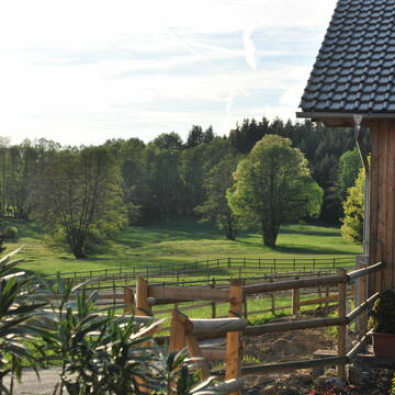
Pferdeboxen/Stallplätze/Einstellplätze
Bogen
Steven Schwarz
@BlackHillsideRanch
Freizeitstall
Geländestrecke
Hunde willkommen
Paddock
Gnadenbrothof
Hufrehe geeignet
Innenbox
12 weitere...
P+
Deprecated: Creation of dynamic property Zend_View_Helper_Ads::$adLink is deprecated in /var/www/stall-frei/htdocs/staging.stall-frei.de/library/Psf/View/Helper/Ads.php on line 108

Futtersack HeuToy, Fressbremse in pink
Mechtersen
STALL-FREIde Marketing
@STALL-FREI-Marketing
Stundenlange Beschäftigung die
Koliken vorbeugt, geringe Staubinhalation mit
steuerbarer Futterentnahme
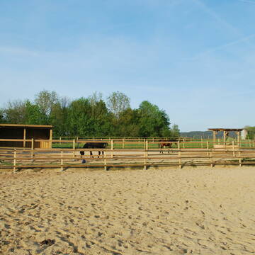
Reitanlage Gut Kirchhof
Haibach
Reitanlage-Gut-Kirchhof
@Reitanlage-Gut-Kirchhof
Freizeitstall
Pferdeausbildung
Vermieten
Hunde willkommen
Krankenbox
Außenboxen
Innenbox
16 weitere...
P+

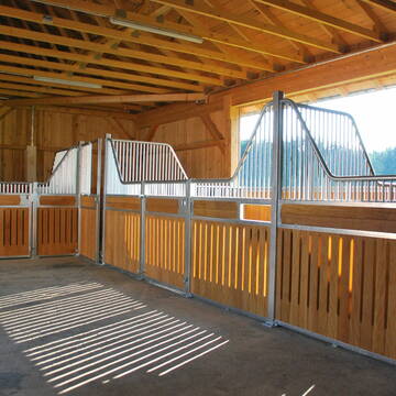
Reitschule Gold - RFV Mitterfels e.V.
Mitterfels
Reitschule Gold
@ReitschuleGold
Freizeitstall
Reitlehrer und -unterricht
Vermieten
Hunde willkommen
Laufband
Außenboxen
Innenbox
16 weitere...
P


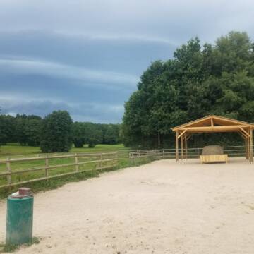
Pferde Bewegungsstall Gut Sommersdorf
Mariaposching
Gut Sommersdorf
@Gut-Sommersdorf
Hunde willkommen
Krankenbox
Notfallboxen
Bewegungsstall
Offenstall
Schauer-Bewegungsstall
11 weitere...
P+
Leider kein Vorschaubild
Leider kein Vorschaubild
Paddockboxen
Bogen
Marion Christ
@Marion-Christ
Freizeitstall
Vermieten
Hunde willkommen
Paddock
Außenbox mit Paddock
Innenbox
11 weitere...
B
Leider kein Vorschaubild
Leider kein Vorschaubild
Box/Paddock frei
Ascha
Reitstall Susan-Peikert
@Reitstall-Susan-Peikert
Fahrstall, Kutschwagen
Freizeitstall
Vermieten
Hunde willkommen
Krankenbox
Gnadenbrothof
Hengsthaltung möglich
23 weitere...
B
Leider kein Vorschaubild
Leider kein Vorschaubild
Aktivstall, Offenstall in Ascha, Platz frei
Ascha
Daniela Foierl
@daniela-foierl
Vermieten
Hunde willkommen
Krankenbox
Fohlenaufzucht möglich
Hufrehe geeignet
Bewegungsstall
Laufstall
17 weitere...
B

Persönlichkeitsentwicklung mit Pferden
Bad Salzuflen
Katja Dors
@Pferdezeiten
Begleite andere auf ihrem Entwicklungsweg und entdecke die transformative Kraft der pferdegestützten Persönlichkeitsentwicklung !
neu
R
Leider kein Vorschaubild
Leider kein Vorschaubild
B
Leider kein Vorschaubild
Leider kein Vorschaubild
B


Wohnen mit Pferd(en) oder Offenstallplätze
Falkenstein
KnallerbsenHof
@KnallerbsenHof
Vermieten
Hunde willkommen
Parkplatz für Pferdeanhänger
Offenstall
Selbstversorgung
8 weitere...
P+
Deprecated: Creation of dynamic property Zend_View::$pageCount is deprecated in /var/www/stall-frei/htdocs/staging.stall-frei.de/library/vendor/shardj/zf1-future/library/Zend/View/Abstract.php on line 308
Deprecated: Creation of dynamic property Zend_View::$itemCountPerPage is deprecated in /var/www/stall-frei/htdocs/staging.stall-frei.de/library/vendor/shardj/zf1-future/library/Zend/View/Abstract.php on line 308
Deprecated: Creation of dynamic property Zend_View::$first is deprecated in /var/www/stall-frei/htdocs/staging.stall-frei.de/library/vendor/shardj/zf1-future/library/Zend/View/Abstract.php on line 308
Deprecated: Creation of dynamic property Zend_View::$current is deprecated in /var/www/stall-frei/htdocs/staging.stall-frei.de/library/vendor/shardj/zf1-future/library/Zend/View/Abstract.php on line 308
Deprecated: Creation of dynamic property Zend_View::$last is deprecated in /var/www/stall-frei/htdocs/staging.stall-frei.de/library/vendor/shardj/zf1-future/library/Zend/View/Abstract.php on line 308
Deprecated: Creation of dynamic property Zend_View::$next is deprecated in /var/www/stall-frei/htdocs/staging.stall-frei.de/library/vendor/shardj/zf1-future/library/Zend/View/Abstract.php on line 308
Deprecated: Creation of dynamic property Zend_View::$pagesInRange is deprecated in /var/www/stall-frei/htdocs/staging.stall-frei.de/library/vendor/shardj/zf1-future/library/Zend/View/Abstract.php on line 308
Deprecated: Creation of dynamic property Zend_View::$firstPageInRange is deprecated in /var/www/stall-frei/htdocs/staging.stall-frei.de/library/vendor/shardj/zf1-future/library/Zend/View/Abstract.php on line 308
Deprecated: Creation of dynamic property Zend_View::$lastPageInRange is deprecated in /var/www/stall-frei/htdocs/staging.stall-frei.de/library/vendor/shardj/zf1-future/library/Zend/View/Abstract.php on line 308
Deprecated: Creation of dynamic property Zend_View::$currentItemCount is deprecated in /var/www/stall-frei/htdocs/staging.stall-frei.de/library/vendor/shardj/zf1-future/library/Zend/View/Abstract.php on line 308
Deprecated: Creation of dynamic property Zend_View::$totalItemCount is deprecated in /var/www/stall-frei/htdocs/staging.stall-frei.de/library/vendor/shardj/zf1-future/library/Zend/View/Abstract.php on line 308
Deprecated: Creation of dynamic property Zend_View::$firstItemNumber is deprecated in /var/www/stall-frei/htdocs/staging.stall-frei.de/library/vendor/shardj/zf1-future/library/Zend/View/Abstract.php on line 308
Deprecated: Creation of dynamic property Zend_View::$lastItemNumber is deprecated in /var/www/stall-frei/htdocs/staging.stall-frei.de/library/vendor/shardj/zf1-future/library/Zend/View/Abstract.php on line 308
Deprecated: Creation of dynamic property Zend_View::$router is deprecated in /var/www/stall-frei/htdocs/staging.stall-frei.de/library/vendor/shardj/zf1-future/library/Zend/View/Abstract.php on line 308
Deprecated: Creation of dynamic property Zend_View::$urlParams is deprecated in /var/www/stall-frei/htdocs/staging.stall-frei.de/library/vendor/shardj/zf1-future/library/Zend/View/Abstract.php on line 308
Deprecated: Creation of dynamic property Zend_View::$showAds is deprecated in /var/www/stall-frei/htdocs/staging.stall-frei.de/library/vendor/shardj/zf1-future/library/Zend/View/Abstract.php on line 308
Deprecated: Creation of dynamic property Zend_View::$objectIds is deprecated in /var/www/stall-frei/htdocs/staging.stall-frei.de/library/vendor/shardj/zf1-future/library/Zend/View/Abstract.php on line 308
Deprecated: Creation of dynamic property Zend_View::$showNavbar is deprecated in /var/www/stall-frei/htdocs/staging.stall-frei.de/library/vendor/shardj/zf1-future/library/Zend/View/Abstract.php on line 308
Deprecated: Creation of dynamic property Zend_View::$showBreadcrumb is deprecated in /var/www/stall-frei/htdocs/staging.stall-frei.de/library/vendor/shardj/zf1-future/library/Zend/View/Abstract.php on line 308
Deprecated: Creation of dynamic property Zend_View::$showFooter is deprecated in /var/www/stall-frei/htdocs/staging.stall-frei.de/library/vendor/shardj/zf1-future/library/Zend/View/Abstract.php on line 308
Deprecated: Creation of dynamic property Zend_View::$showInternalAds is deprecated in /var/www/stall-frei/htdocs/staging.stall-frei.de/library/vendor/shardj/zf1-future/library/Zend/View/Abstract.php on line 308
Deprecated: Creation of dynamic property Zend_View::$blNoContent is deprecated in /var/www/stall-frei/htdocs/staging.stall-frei.de/library/vendor/shardj/zf1-future/library/Zend/View/Abstract.php on line 308
Deprecated: Creation of dynamic property Zend_View::$sMetaDesc is deprecated in /var/www/stall-frei/htdocs/staging.stall-frei.de/library/vendor/shardj/zf1-future/library/Zend/View/Abstract.php on line 308
Deprecated: Creation of dynamic property Zend_View::$useGmaps is deprecated in /var/www/stall-frei/htdocs/staging.stall-frei.de/library/vendor/shardj/zf1-future/library/Zend/View/Abstract.php on line 308
Deprecated: Creation of dynamic property Zend_View::$touches is deprecated in /var/www/stall-frei/htdocs/staging.stall-frei.de/library/vendor/shardj/zf1-future/library/Zend/View/Abstract.php on line 308
Deprecated: Creation of dynamic property Zend_View::$oProject is deprecated in /var/www/stall-frei/htdocs/staging.stall-frei.de/library/vendor/shardj/zf1-future/library/Zend/View/Abstract.php on line 308
Deprecated: Creation of dynamic property Zend_View::$pageHeadline is deprecated in /var/www/stall-frei/htdocs/staging.stall-frei.de/library/vendor/shardj/zf1-future/library/Zend/View/Abstract.php on line 308
Deprecated: Creation of dynamic property Zend_View::$disableLocationField is deprecated in /var/www/stall-frei/htdocs/staging.stall-frei.de/library/vendor/shardj/zf1-future/library/Zend/View/Abstract.php on line 308
Deprecated: Creation of dynamic property Zend_View::$isSearch is deprecated in /var/www/stall-frei/htdocs/staging.stall-frei.de/library/vendor/shardj/zf1-future/library/Zend/View/Abstract.php on line 308
Deprecated: Creation of dynamic property Zend_View::$pageTitle is deprecated in /var/www/stall-frei/htdocs/staging.stall-frei.de/library/vendor/shardj/zf1-future/library/Zend/View/Abstract.php on line 308
Deprecated: Creation of dynamic property Psf_Form_Element_Text::$class is deprecated in /var/www/stall-frei/htdocs/staging.stall-frei.de/library/vendor/shardj/zf1-future/library/Zend/Form/Element.php on line 874
Deprecated: Creation of dynamic property Psf_Form_Element_Text::$size is deprecated in /var/www/stall-frei/htdocs/staging.stall-frei.de/library/vendor/shardj/zf1-future/library/Zend/Form/Element.php on line 874
Deprecated: Creation of dynamic property Psf_Form_Element_Text::$placeholder is deprecated in /var/www/stall-frei/htdocs/staging.stall-frei.de/library/vendor/shardj/zf1-future/library/Zend/Form/Element.php on line 874
Deprecated: Creation of dynamic property Psf_Form_Element_Hidden::$class is deprecated in /var/www/stall-frei/htdocs/staging.stall-frei.de/library/vendor/shardj/zf1-future/library/Zend/Form/Element.php on line 874
Deprecated: Creation of dynamic property Psf_Form_Element_Hidden::$class is deprecated in /var/www/stall-frei/htdocs/staging.stall-frei.de/library/vendor/shardj/zf1-future/library/Zend/Form/Element.php on line 874
Deprecated: Creation of dynamic property Psf_Form_Element_Hidden::$class is deprecated in /var/www/stall-frei/htdocs/staging.stall-frei.de/library/vendor/shardj/zf1-future/library/Zend/Form/Element.php on line 874
Deprecated: Creation of dynamic property Psf_Form_Element_Hidden::$class is deprecated in /var/www/stall-frei/htdocs/staging.stall-frei.de/library/vendor/shardj/zf1-future/library/Zend/Form/Element.php on line 874
Deprecated: Creation of dynamic property Psf_Form_Element_Select::$class is deprecated in /var/www/stall-frei/htdocs/staging.stall-frei.de/library/vendor/shardj/zf1-future/library/Zend/Form/Element.php on line 874
Deprecated: Creation of dynamic property Psf_Form_Element_Select::$class is deprecated in /var/www/stall-frei/htdocs/staging.stall-frei.de/library/vendor/shardj/zf1-future/library/Zend/Form/Element.php on line 874
Deprecated: Creation of dynamic property Psf_Form_Element_Select::$class is deprecated in /var/www/stall-frei/htdocs/staging.stall-frei.de/library/vendor/shardj/zf1-future/library/Zend/Form/Element.php on line 874
Deprecated: Creation of dynamic property Psf_Form_Element_Select::$class is deprecated in /var/www/stall-frei/htdocs/staging.stall-frei.de/library/vendor/shardj/zf1-future/library/Zend/Form/Element.php on line 874
Deprecated: Creation of dynamic property Psf_Form_Element_Text::$class is deprecated in /var/www/stall-frei/htdocs/staging.stall-frei.de/library/vendor/shardj/zf1-future/library/Zend/Form/Element.php on line 874
Deprecated: Creation of dynamic property Psf_Form_Element_Checkbox::$label is deprecated in /var/www/stall-frei/htdocs/staging.stall-frei.de/library/vendor/shardj/zf1-future/library/Zend/Form/Element.php on line 874
Deprecated: Creation of dynamic property Zend_View::$sort is deprecated in /var/www/stall-frei/htdocs/staging.stall-frei.de/library/vendor/shardj/zf1-future/library/Zend/View/Abstract.php on line 308
Deprecated: Creation of dynamic property Zend_View::$searchLocation is deprecated in /var/www/stall-frei/htdocs/staging.stall-frei.de/library/vendor/shardj/zf1-future/library/Zend/View/Abstract.php on line 308
Deprecated: Creation of dynamic property Zend_View::$locationHint is deprecated in /var/www/stall-frei/htdocs/staging.stall-frei.de/library/vendor/shardj/zf1-future/library/Zend/View/Abstract.php on line 308
Psf_GeoCoder_Abstract::getLocation: Windberg Get Location CachedOrLive
Psf_GeoCoder_Abstract::getCachedOrLive: Windberg
Psf_GeoCoder_OpenCageData::makeApiRequest: response:
Array
(
[documentation] => https://opencagedata.com/api
[licenses] => Array
(
[0] => Array
(
[name] => see attribution guide
[url] => https://opencagedata.com/credits
)
)
[results] => Array
(
[0] => Array
(
[bounds] => Array
(
[northeast] => Array
(
[lat] => 48.9627484
[lng] => 12.7900694
)
[southwest] => Array
(
[lat] => 48.9302842
[lng] => 12.7360367
)
)
[components] => Array
(
[ISO_3166-1_alpha-2] => DE
[ISO_3166-1_alpha-3] => DEU
[ISO_3166-2] => Array
(
[0] => DE-BY
)
[_category] => place
[_normalized_city] => Windberg
[_type] => village
[continent] => Europe
[country] => Deutschland
[country_code] => de
[county] => Landkreis Straubing-Bogen
[municipality] => Hunderdorf (VGem)
[political_union] => European Union
[state] => Bayern
[state_code] => BY
[village] => Windberg
)
[confidence] => 7
[formatted] => Windberg, Bayern, Deutschland
[geometry] => Array
(
[lat] => 48.9412587
[lng] => 12.7458649
)
)
[1] => Array
(
[bounds] => Array
(
[northeast] => Array
(
[lat] => 51.2258863
[lng] => 6.4424375
)
[southwest] => Array
(
[lat] => 51.1999429
[lng] => 6.3953428
)
)
[components] => Array
(
[ISO_3166-1_alpha-2] => DE
[ISO_3166-1_alpha-3] => DEU
[ISO_3166-2] => Array
(
[0] => DE-NW
)
[_category] => place
[_normalized_city] => Mönchengladbach
[_type] => neighbourhood
[city] => Mönchengladbach
[city_district] => Nord
[continent] => Europe
[country] => Deutschland
[country_code] => de
[political_union] => European Union
[postcode] => 41063
[state] => Nordrhein-Westfalen
[state_code] => NW
[suburb] => Windberg
)
[confidence] => 7
[formatted] => 41063 Mönchengladbach, Deutschland
[geometry] => Array
(
[lat] => 51.207131
[lng] => 6.418503
)
)
[2] => Array
(
[bounds] => Array
(
[northeast] => Array
(
[lat] => 51.0005624
[lng] => 13.6832973
)
[southwest] => Array
(
[lat] => 50.984998
[lng] => 13.6554871
)
)
[components] => Array
(
[ISO_3166-1_alpha-2] => DE
[ISO_3166-1_alpha-3] => DEU
[ISO_3166-2] => Array
(
[0] => DE-SN
)
[_category] => natural/water
[_normalized_city] => Freital
[_type] => nature_reserve
[city_district] => Kleinnaundorf
[continent] => Europe
[country] => Deutschland
[country_code] => de
[county] => Sächsische Schweiz-Osterzgebirge
[nature_reserve] => Windberg
[political_union] => European Union
[state] => Sachsen
[state_code] => SN
[town] => Freital
)
[confidence] => 8
[formatted] => Windberg, Kleinnaundorf, Freital, Sachsen, Deutschland
[geometry] => Array
(
[lat] => 50.992698
[lng] => 13.6692401
)
)
[3] => Array
(
[bounds] => Array
(
[northeast] => Array
(
[lat] => 50.9967849
[lng] => 13.6624762
)
[southwest] => Array
(
[lat] => 50.9966849
[lng] => 13.6623762
)
)
[components] => Array
(
[ISO_3166-1_alpha-2] => DE
[ISO_3166-1_alpha-3] => DEU
[ISO_3166-2] => Array
(
[0] => DE-SN
)
[_category] => natural/water
[_normalized_city] => Freital
[_type] => peak
[continent] => Europe
[country] => Deutschland
[country_code] => de
[county] => Sächsische Schweiz-Osterzgebirge
[peak] => Windberg
[political_union] => European Union
[postcode] => 01705
[state] => Sachsen
[state_code] => SN
[town] => Freital
)
[confidence] => 9
[formatted] => Windberg, 01705 Freital, Deutschland
[geometry] => Array
(
[lat] => 50.9967349
[lng] => 13.6624262
)
)
[4] => Array
(
[bounds] => Array
(
[northeast] => Array
(
[lat] => 50.6447764
[lng] => 10.1318459
)
[southwest] => Array
(
[lat] => 50.6446764
[lng] => 10.1317459
)
)
[components] => Array
(
[ISO_3166-1_alpha-2] => DE
[ISO_3166-1_alpha-3] => DEU
[ISO_3166-2] => Array
(
[0] => DE-TH
)
[_category] => natural/water
[_normalized_city] => Kaltennordheim
[_type] => peak
[continent] => Europe
[country] => Deutschland
[country_code] => de
[county] => Landkreis Schmalkalden-Meiningen
[municipality] => Hohe Rhön
[peak] => Windberg
[political_union] => European Union
[postcode] => 36452
[state] => Thüringen
[state_code] => TH
[town] => Kaltennordheim
)
[confidence] => 9
[formatted] => Windberg, 36452 Kaltennordheim, Deutschland
[geometry] => Array
(
[lat] => 50.6447264
[lng] => 10.1317959
)
)
[5] => Array
(
[bounds] => Array
(
[northeast] => Array
(
[lat] => 50.9059577
[lng] => 12.7724357
)
[southwest] => Array
(
[lat] => 50.9058577
[lng] => 12.7723357
)
)
[components] => Array
(
[ISO_3166-1_alpha-2] => DE
[ISO_3166-1_alpha-3] => DEU
[ISO_3166-2] => Array
(
[0] => DE-SN
)
[_category] => natural/water
[_normalized_city] => Mühlau
[_type] => peak
[continent] => Europe
[country] => Deutschland
[country_code] => de
[county] => Mittelsachsen
[municipality] => Burgstädt
[peak] => Windberg
[political_union] => European Union
[postcode] => 09241
[state] => Sachsen
[state_code] => SN
[village] => Mühlau
)
[confidence] => 9
[formatted] => Windberg, 09241 Mühlau, Deutschland
[geometry] => Array
(
[lat] => 50.9059077
[lng] => 12.7723857
)
)
[6] => Array
(
[bounds] => Array
(
[northeast] => Array
(
[lat] => 50.5204155
[lng] => 10.6184692
)
[southwest] => Array
(
[lat] => 50.5203155
[lng] => 10.6183692
)
)
[components] => Array
(
[ISO_3166-1_alpha-2] => DE
[ISO_3166-1_alpha-3] => DEU
[ISO_3166-2] => Array
(
[0] => DE-TH
)
[_category] => natural/water
[_normalized_city] => Themar
[_type] => peak
[continent] => Europe
[country] => Deutschland
[country_code] => de
[county] => Landkreis Hildburghausen
[municipality] => Feldstein
[peak] => Windberg
[political_union] => European Union
[postcode] => 98660
[state] => Thüringen
[state_code] => TH
[town] => Themar
)
[confidence] => 9
[formatted] => Windberg, 98660 Themar, Deutschland
[geometry] => Array
(
[lat] => 50.5203655
[lng] => 10.6184192
)
)
[7] => Array
(
[bounds] => Array
(
[northeast] => Array
(
[lat] => 50.582124
[lng] => 10.5845525
)
[southwest] => Array
(
[lat] => 50.582024
[lng] => 10.5844525
)
)
[components] => Array
(
[ISO_3166-1_alpha-2] => DE
[ISO_3166-1_alpha-3] => DEU
[ISO_3166-2] => Array
(
[0] => DE-TH
)
[_category] => natural/water
[_normalized_city] => Schmeheim
[_type] => peak
[continent] => Europe
[country] => Deutschland
[country_code] => de
[county] => Landkreis Hildburghausen
[municipality] => Feldstein
[peak] => Windberg
[political_union] => European Union
[postcode] => 98530
[state] => Thüringen
[state_code] => TH
[village] => Schmeheim
)
[confidence] => 9
[formatted] => Windberg, 98530 Schmeheim, Deutschland
[geometry] => Array
(
[lat] => 50.582074
[lng] => 10.5845025
)
)
[8] => Array
(
[bounds] => Array
(
[northeast] => Array
(
[lat] => 50.8271214
[lng] => 11.1953741
)
[southwest] => Array
(
[lat] => 50.8270214
[lng] => 11.1952741
)
)
[components] => Array
(
[ISO_3166-1_alpha-2] => DE
[ISO_3166-1_alpha-3] => DEU
[ISO_3166-2] => Array
(
[0] => DE-TH
)
[_category] => natural/water
[_normalized_city] => Kranichfeld
[_type] => peak
[continent] => Europe
[country] => Deutschland
[country_code] => de
[county] => Landkreis Weimarer Land
[municipality] => Kranichfeld
[peak] => Windberg
[political_union] => European Union
[postcode] => 99448
[state] => Thüringen
[state_code] => TH
[town] => Kranichfeld
)
[confidence] => 9
[formatted] => Windberg, 99448 Kranichfeld, Deutschland
[geometry] => Array
(
[lat] => 50.8270714
[lng] => 11.1953241
)
)
[9] => Array
(
[bounds] => Array
(
[northeast] => Array
(
[lat] => 47.674418
[lng] => 11.6940566
)
[southwest] => Array
(
[lat] => 47.674318
[lng] => 11.6939566
)
)
[components] => Array
(
[ISO_3166-1_alpha-2] => DE
[ISO_3166-1_alpha-3] => DEU
[ISO_3166-2] => Array
(
[0] => DE-BY
)
[_category] => natural/water
[_normalized_city] => Kreuth
[_type] => peak
[continent] => Europe
[country] => Deutschland
[country_code] => de
[county] => Landkreis Miesbach
[peak] => Windberg
[political_union] => European Union
[postcode] => 83707
[state] => Bayern
[state_code] => BY
[village] => Kreuth
)
[confidence] => 9
[formatted] => Windberg, 83707 Kreuth, Deutschland
[geometry] => Array
(
[lat] => 47.674368
[lng] => 11.6940066
)
)
)
[status] => Array
(
[code] => 200
[message] => OK
)
[stay_informed] => Array
(
[blog] => https://blog.opencagedata.com
[mastodon] => https://en.osm.town/@opencage
)
[thanks] => For using an OpenCage API
[timestamp] => Array
(
[created_http] => Sat, 07 Feb 2026 07:31:16 GMT
[created_unix] => 1770449476
)
[total_results] => 10
)
Psf_GeoCoder_Abstract::convertLocationResult
{"documentation":"https:\/\/opencagedata.com\/api","licenses":[{"name":"see attribution guide","url":"https:\/\/opencagedata.com\/credits"}],"results":[{"bounds":{"northeast":{"lat":48.9627484,"lng":12.7900694},"southwest":{"lat":48.9302842,"lng":12.7360367}},"components":{"ISO_3166-1_alpha-2":"DE","ISO_3166-1_alpha-3":"DEU","ISO_3166-2":["DE-BY"],"_category":"place","_normalized_city":"Windberg","_type":"village","continent":"Europe","country":"Deutschland","country_code":"de","county":"Landkreis Straubing-Bogen","municipality":"Hunderdorf (VGem)","political_union":"European Union","state":"Bayern","state_code":"BY","village":"Windberg"},"confidence":7,"formatted":"Windberg, Bayern, Deutschland","geometry":{"lat":48.9412587,"lng":12.7458649}},{"bounds":{"northeast":{"lat":51.2258863,"lng":6.4424375},"southwest":{"lat":51.1999429,"lng":6.3953428}},"components":{"ISO_3166-1_alpha-2":"DE","ISO_3166-1_alpha-3":"DEU","ISO_3166-2":["DE-NW"],"_category":"place","_normalized_city":"M\u00f6nchengladbach","_type":"neighbourhood","city":"M\u00f6nchengladbach","city_district":"Nord","continent":"Europe","country":"Deutschland","country_code":"de","political_union":"European Union","postcode":"41063","state":"Nordrhein-Westfalen","state_code":"NW","suburb":"Windberg"},"confidence":7,"formatted":"41063 M\u00f6nchengladbach, Deutschland","geometry":{"lat":51.207131,"lng":6.418503}},{"bounds":{"northeast":{"lat":51.0005624,"lng":13.6832973},"southwest":{"lat":50.984998,"lng":13.6554871}},"components":{"ISO_3166-1_alpha-2":"DE","ISO_3166-1_alpha-3":"DEU","ISO_3166-2":["DE-SN"],"_category":"natural\/water","_normalized_city":"Freital","_type":"nature_reserve","city_district":"Kleinnaundorf","continent":"Europe","country":"Deutschland","country_code":"de","county":"S\u00e4chsische Schweiz-Osterzgebirge","nature_reserve":"Windberg","political_union":"European Union","state":"Sachsen","state_code":"SN","town":"Freital"},"confidence":8,"formatted":"Windberg, Kleinnaundorf, Freital, Sachsen, Deutschland","geometry":{"lat":50.992698,"lng":13.6692401}},{"bounds":{"northeast":{"lat":50.9967849,"lng":13.6624762},"southwest":{"lat":50.9966849,"lng":13.6623762}},"components":{"ISO_3166-1_alpha-2":"DE","ISO_3166-1_alpha-3":"DEU","ISO_3166-2":["DE-SN"],"_category":"natural\/water","_normalized_city":"Freital","_type":"peak","continent":"Europe","country":"Deutschland","country_code":"de","county":"S\u00e4chsische Schweiz-Osterzgebirge","peak":"Windberg","political_union":"European Union","postcode":"01705","state":"Sachsen","state_code":"SN","town":"Freital"},"confidence":9,"formatted":"Windberg, 01705 Freital, Deutschland","geometry":{"lat":50.9967349,"lng":13.6624262}},{"bounds":{"northeast":{"lat":50.6447764,"lng":10.1318459},"southwest":{"lat":50.6446764,"lng":10.1317459}},"components":{"ISO_3166-1_alpha-2":"DE","ISO_3166-1_alpha-3":"DEU","ISO_3166-2":["DE-TH"],"_category":"natural\/water","_normalized_city":"Kaltennordheim","_type":"peak","continent":"Europe","country":"Deutschland","country_code":"de","county":"Landkreis Schmalkalden-Meiningen","municipality":"Hohe Rh\u00f6n","peak":"Windberg","political_union":"European Union","postcode":"36452","state":"Th\u00fcringen","state_code":"TH","town":"Kaltennordheim"},"confidence":9,"formatted":"Windberg, 36452 Kaltennordheim, Deutschland","geometry":{"lat":50.6447264,"lng":10.1317959}},{"bounds":{"northeast":{"lat":50.9059577,"lng":12.7724357},"southwest":{"lat":50.9058577,"lng":12.7723357}},"components":{"ISO_3166-1_alpha-2":"DE","ISO_3166-1_alpha-3":"DEU","ISO_3166-2":["DE-SN"],"_category":"natural\/water","_normalized_city":"M\u00fchlau","_type":"peak","continent":"Europe","country":"Deutschland","country_code":"de","county":"Mittelsachsen","municipality":"Burgst\u00e4dt","peak":"Windberg","political_union":"European Union","postcode":"09241","state":"Sachsen","state_code":"SN","village":"M\u00fchlau"},"confidence":9,"formatted":"Windberg, 09241 M\u00fchlau, Deutschland","geometry":{"lat":50.9059077,"lng":12.7723857}},{"bounds":{"northeast":{"lat":50.5204155,"lng":10.6184692},"southwest":{"lat":50.5203155,"lng":10.6183692}},"components":{"ISO_3166-1_alpha-2":"DE","ISO_3166-1_alpha-3":"DEU","ISO_3166-2":["DE-TH"],"_category":"natural\/water","_normalized_city":"Themar","_type":"peak","continent":"Europe","country":"Deutschland","country_code":"de","county":"Landkreis Hildburghausen","municipality":"Feldstein","peak":"Windberg","political_union":"European Union","postcode":"98660","state":"Th\u00fcringen","state_code":"TH","town":"Themar"},"confidence":9,"formatted":"Windberg, 98660 Themar, Deutschland","geometry":{"lat":50.5203655,"lng":10.6184192}},{"bounds":{"northeast":{"lat":50.582124,"lng":10.5845525},"southwest":{"lat":50.582024,"lng":10.5844525}},"components":{"ISO_3166-1_alpha-2":"DE","ISO_3166-1_alpha-3":"DEU","ISO_3166-2":["DE-TH"],"_category":"natural\/water","_normalized_city":"Schmeheim","_type":"peak","continent":"Europe","country":"Deutschland","country_code":"de","county":"Landkreis Hildburghausen","municipality":"Feldstein","peak":"Windberg","political_union":"European Union","postcode":"98530","state":"Th\u00fcringen","state_code":"TH","village":"Schmeheim"},"confidence":9,"formatted":"Windberg, 98530 Schmeheim, Deutschland","geometry":{"lat":50.582074,"lng":10.5845025}},{"bounds":{"northeast":{"lat":50.8271214,"lng":11.1953741},"southwest":{"lat":50.8270214,"lng":11.1952741}},"components":{"ISO_3166-1_alpha-2":"DE","ISO_3166-1_alpha-3":"DEU","ISO_3166-2":["DE-TH"],"_category":"natural\/water","_normalized_city":"Kranichfeld","_type":"peak","continent":"Europe","country":"Deutschland","country_code":"de","county":"Landkreis Weimarer Land","municipality":"Kranichfeld","peak":"Windberg","political_union":"European Union","postcode":"99448","state":"Th\u00fcringen","state_code":"TH","town":"Kranichfeld"},"confidence":9,"formatted":"Windberg, 99448 Kranichfeld, Deutschland","geometry":{"lat":50.8270714,"lng":11.1953241}},{"bounds":{"northeast":{"lat":47.674418,"lng":11.6940566},"southwest":{"lat":47.674318,"lng":11.6939566}},"components":{"ISO_3166-1_alpha-2":"DE","ISO_3166-1_alpha-3":"DEU","ISO_3166-2":["DE-BY"],"_category":"natural\/water","_normalized_city":"Kreuth","_type":"peak","continent":"Europe","country":"Deutschland","country_code":"de","county":"Landkreis Miesbach","peak":"Windberg","political_union":"European Union","postcode":"83707","state":"Bayern","state_code":"BY","village":"Kreuth"},"confidence":9,"formatted":"Windberg, 83707 Kreuth, Deutschland","geometry":{"lat":47.674368,"lng":11.6940066}}],"status":{"code":200,"message":"OK"},"stay_informed":{"blog":"https:\/\/blog.opencagedata.com","mastodon":"https:\/\/en.osm.town\/@opencage"},"thanks":"For using an OpenCage API","timestamp":{"created_http":"Sat, 07 Feb 2026 07:31:16 GMT","created_unix":1770449476},"total_results":10}Array
(
[0] => stdClass Object
(
[bounds] => stdClass Object
(
[northeast] => stdClass Object
(
[lat] => 48.9627484
[lng] => 12.7900694
)
[southwest] => stdClass Object
(
[lat] => 48.9302842
[lng] => 12.7360367
)
)
[components] => stdClass Object
(
[ISO_3166-1_alpha-2] => DE
[ISO_3166-1_alpha-3] => DEU
[ISO_3166-2] => Array
(
[0] => DE-BY
)
[_category] => place
[_normalized_city] => Windberg
[_type] => village
[continent] => Europe
[country] => Deutschland
[country_code] => de
[county] => Landkreis Straubing-Bogen
[municipality] => Hunderdorf (VGem)
[political_union] => European Union
[state] => Bayern
[state_code] => BY
[village] => Windberg
)
[confidence] => 7
[formatted] => Windberg, Bayern, Deutschland
[geometry] => stdClass Object
(
[lat] => 48.9412587
[lng] => 12.7458649
)
)
[1] => stdClass Object
(
[bounds] => stdClass Object
(
[northeast] => stdClass Object
(
[lat] => 51.2258863
[lng] => 6.4424375
)
[southwest] => stdClass Object
(
[lat] => 51.1999429
[lng] => 6.3953428
)
)
[components] => stdClass Object
(
[ISO_3166-1_alpha-2] => DE
[ISO_3166-1_alpha-3] => DEU
[ISO_3166-2] => Array
(
[0] => DE-NW
)
[_category] => place
[_normalized_city] => Mönchengladbach
[_type] => neighbourhood
[city] => Mönchengladbach
[city_district] => Nord
[continent] => Europe
[country] => Deutschland
[country_code] => de
[political_union] => European Union
[postcode] => 41063
[state] => Nordrhein-Westfalen
[state_code] => NW
[suburb] => Windberg
)
[confidence] => 7
[formatted] => 41063 Mönchengladbach, Deutschland
[geometry] => stdClass Object
(
[lat] => 51.207131
[lng] => 6.418503
)
)
[2] => stdClass Object
(
[bounds] => stdClass Object
(
[northeast] => stdClass Object
(
[lat] => 51.0005624
[lng] => 13.6832973
)
[southwest] => stdClass Object
(
[lat] => 50.984998
[lng] => 13.6554871
)
)
[components] => stdClass Object
(
[ISO_3166-1_alpha-2] => DE
[ISO_3166-1_alpha-3] => DEU
[ISO_3166-2] => Array
(
[0] => DE-SN
)
[_category] => natural/water
[_normalized_city] => Freital
[_type] => nature_reserve
[city_district] => Kleinnaundorf
[continent] => Europe
[country] => Deutschland
[country_code] => de
[county] => Sächsische Schweiz-Osterzgebirge
[nature_reserve] => Windberg
[political_union] => European Union
[state] => Sachsen
[state_code] => SN
[town] => Freital
)
[confidence] => 8
[formatted] => Windberg, Kleinnaundorf, Freital, Sachsen, Deutschland
[geometry] => stdClass Object
(
[lat] => 50.992698
[lng] => 13.6692401
)
)
[3] => stdClass Object
(
[bounds] => stdClass Object
(
[northeast] => stdClass Object
(
[lat] => 50.9967849
[lng] => 13.6624762
)
[southwest] => stdClass Object
(
[lat] => 50.9966849
[lng] => 13.6623762
)
)
[components] => stdClass Object
(
[ISO_3166-1_alpha-2] => DE
[ISO_3166-1_alpha-3] => DEU
[ISO_3166-2] => Array
(
[0] => DE-SN
)
[_category] => natural/water
[_normalized_city] => Freital
[_type] => peak
[continent] => Europe
[country] => Deutschland
[country_code] => de
[county] => Sächsische Schweiz-Osterzgebirge
[peak] => Windberg
[political_union] => European Union
[postcode] => 01705
[state] => Sachsen
[state_code] => SN
[town] => Freital
)
[confidence] => 9
[formatted] => Windberg, 01705 Freital, Deutschland
[geometry] => stdClass Object
(
[lat] => 50.9967349
[lng] => 13.6624262
)
)
[4] => stdClass Object
(
[bounds] => stdClass Object
(
[northeast] => stdClass Object
(
[lat] => 50.6447764
[lng] => 10.1318459
)
[southwest] => stdClass Object
(
[lat] => 50.6446764
[lng] => 10.1317459
)
)
[components] => stdClass Object
(
[ISO_3166-1_alpha-2] => DE
[ISO_3166-1_alpha-3] => DEU
[ISO_3166-2] => Array
(
[0] => DE-TH
)
[_category] => natural/water
[_normalized_city] => Kaltennordheim
[_type] => peak
[continent] => Europe
[country] => Deutschland
[country_code] => de
[county] => Landkreis Schmalkalden-Meiningen
[municipality] => Hohe Rhön
[peak] => Windberg
[political_union] => European Union
[postcode] => 36452
[state] => Thüringen
[state_code] => TH
[town] => Kaltennordheim
)
[confidence] => 9
[formatted] => Windberg, 36452 Kaltennordheim, Deutschland
[geometry] => stdClass Object
(
[lat] => 50.6447264
[lng] => 10.1317959
)
)
[5] => stdClass Object
(
[bounds] => stdClass Object
(
[northeast] => stdClass Object
(
[lat] => 50.9059577
[lng] => 12.7724357
)
[southwest] => stdClass Object
(
[lat] => 50.9058577
[lng] => 12.7723357
)
)
[components] => stdClass Object
(
[ISO_3166-1_alpha-2] => DE
[ISO_3166-1_alpha-3] => DEU
[ISO_3166-2] => Array
(
[0] => DE-SN
)
[_category] => natural/water
[_normalized_city] => Mühlau
[_type] => peak
[continent] => Europe
[country] => Deutschland
[country_code] => de
[county] => Mittelsachsen
[municipality] => Burgstädt
[peak] => Windberg
[political_union] => European Union
[postcode] => 09241
[state] => Sachsen
[state_code] => SN
[village] => Mühlau
)
[confidence] => 9
[formatted] => Windberg, 09241 Mühlau, Deutschland
[geometry] => stdClass Object
(
[lat] => 50.9059077
[lng] => 12.7723857
)
)
[6] => stdClass Object
(
[bounds] => stdClass Object
(
[northeast] => stdClass Object
(
[lat] => 50.5204155
[lng] => 10.6184692
)
[southwest] => stdClass Object
(
[lat] => 50.5203155
[lng] => 10.6183692
)
)
[components] => stdClass Object
(
[ISO_3166-1_alpha-2] => DE
[ISO_3166-1_alpha-3] => DEU
[ISO_3166-2] => Array
(
[0] => DE-TH
)
[_category] => natural/water
[_normalized_city] => Themar
[_type] => peak
[continent] => Europe
[country] => Deutschland
[country_code] => de
[county] => Landkreis Hildburghausen
[municipality] => Feldstein
[peak] => Windberg
[political_union] => European Union
[postcode] => 98660
[state] => Thüringen
[state_code] => TH
[town] => Themar
)
[confidence] => 9
[formatted] => Windberg, 98660 Themar, Deutschland
[geometry] => stdClass Object
(
[lat] => 50.5203655
[lng] => 10.6184192
)
)
[7] => stdClass Object
(
[bounds] => stdClass Object
(
[northeast] => stdClass Object
(
[lat] => 50.582124
[lng] => 10.5845525
)
[southwest] => stdClass Object
(
[lat] => 50.582024
[lng] => 10.5844525
)
)
[components] => stdClass Object
(
[ISO_3166-1_alpha-2] => DE
[ISO_3166-1_alpha-3] => DEU
[ISO_3166-2] => Array
(
[0] => DE-TH
)
[_category] => natural/water
[_normalized_city] => Schmeheim
[_type] => peak
[continent] => Europe
[country] => Deutschland
[country_code] => de
[county] => Landkreis Hildburghausen
[municipality] => Feldstein
[peak] => Windberg
[political_union] => European Union
[postcode] => 98530
[state] => Thüringen
[state_code] => TH
[village] => Schmeheim
)
[confidence] => 9
[formatted] => Windberg, 98530 Schmeheim, Deutschland
[geometry] => stdClass Object
(
[lat] => 50.582074
[lng] => 10.5845025
)
)
[8] => stdClass Object
(
[bounds] => stdClass Object
(
[northeast] => stdClass Object
(
[lat] => 50.8271214
[lng] => 11.1953741
)
[southwest] => stdClass Object
(
[lat] => 50.8270214
[lng] => 11.1952741
)
)
[components] => stdClass Object
(
[ISO_3166-1_alpha-2] => DE
[ISO_3166-1_alpha-3] => DEU
[ISO_3166-2] => Array
(
[0] => DE-TH
)
[_category] => natural/water
[_normalized_city] => Kranichfeld
[_type] => peak
[continent] => Europe
[country] => Deutschland
[country_code] => de
[county] => Landkreis Weimarer Land
[municipality] => Kranichfeld
[peak] => Windberg
[political_union] => European Union
[postcode] => 99448
[state] => Thüringen
[state_code] => TH
[town] => Kranichfeld
)
[confidence] => 9
[formatted] => Windberg, 99448 Kranichfeld, Deutschland
[geometry] => stdClass Object
(
[lat] => 50.8270714
[lng] => 11.1953241
)
)
[9] => stdClass Object
(
[bounds] => stdClass Object
(
[northeast] => stdClass Object
(
[lat] => 47.674418
[lng] => 11.6940566
)
[southwest] => stdClass Object
(
[lat] => 47.674318
[lng] => 11.6939566
)
)
[components] => stdClass Object
(
[ISO_3166-1_alpha-2] => DE
[ISO_3166-1_alpha-3] => DEU
[ISO_3166-2] => Array
(
[0] => DE-BY
)
[_category] => natural/water
[_normalized_city] => Kreuth
[_type] => peak
[continent] => Europe
[country] => Deutschland
[country_code] => de
[county] => Landkreis Miesbach
[peak] => Windberg
[political_union] => European Union
[postcode] => 83707
[state] => Bayern
[state_code] => BY
[village] => Kreuth
)
[confidence] => 9
[formatted] => Windberg, 83707 Kreuth, Deutschland
[geometry] => stdClass Object
(
[lat] => 47.674368
[lng] => 11.6940066
)
)
)
Psf_GeoCoder_OpenCageData::getKeyMap: 0
stdClass Object
(
    [bounds] => stdClass Object
        (
            [northeast] => stdClass Object
                (
                    [lat] => 48.9627484
                    [lng] => 12.7900694
                )

            [southwest] => stdClass Object
                (
                    [lat] => 48.9302842
                    [lng] => 12.7360367
                )

        )

    [components] => stdClass Object
        (
            [ISO_3166-1_alpha-2] => DE
            [ISO_3166-1_alpha-3] => DEU
            [ISO_3166-2] => Array
                (
                    [0] => DE-BY
                )

            [_category] => place
            [_normalized_city] => Windberg
            [_type] => village
            [continent] => Europe
            [country] => Deutschland
            [country_code] => de
            [county] => Landkreis Straubing-Bogen
            [municipality] => Hunderdorf (VGem)
            [political_union] => European Union
            [state] => Bayern
            [state_code] => BY
            [village] => Windberg
        )

    [confidence] => 7
    [formatted] => Windberg, Bayern, Deutschland
    [geometry] => stdClass Object
        (
            [lat] => 48.9412587
            [lng] => 12.7458649
        )

)
Psf_GeoCoder_OpenCageData::getCounty: Straubing-Bogen
Psf_GeoCoder_OpenCageData::addMissingData REFETCH!
Array
(
    [address] => Windberg, Bayern, Deutschland
    [type] => village
    [street] =>
    [city] => Windberg
    [county] => Straubing-Bogen
    [state] => Bayern
    [zip] =>
    [country] => Deutschland
    [suburb] =>
    [countrycode] => de
    [latitude] => 48.9412587
    [longitude] => 12.7458649
    [accuracy] => 1
    [confidence] => 7
    [bounds] => stdClass Object
        (
            [northeast] => stdClass Object
                (
                    [lat] => 48.9627484
                    [lng] => 12.7900694
                )

            [southwest] => stdClass Object
                (
                    [lat] => 48.9302842
                    [lng] => 12.7360367
                )

        )

)
reformat!
Array
(
    [address] => Windberg, Bayern, Deutschland
    [type] => village
    [street] =>
    [city] => Windberg
    [county] => Straubing-Bogen
    [state] => Bayern
    [zip] =>
    [country] => Deutschland
    [suburb] =>
    [countrycode] => de
    [latitude] => 48.9412587
    [longitude] => 12.7458649
    [accuracy] => 1
    [confidence] => 7
    [bounds] => stdClass Object
        (
            [northeast] => stdClass Object
                (
                    [lat] => 48.9627484
                    [lng] => 12.7900694
                )

            [southwest] => stdClass Object
                (
                    [lat] => 48.9302842
                    [lng] => 12.7360367
                )

        )

    [place] => Windberg, Bayern
    [hash] => 5b24d479e7083d0dfa812567f28a0d9b
)
Psf_GeoCoder_OpenCageData::getKeyMap: 1
stdClass Object
(
    [bounds] => stdClass Object
        (
            [northeast] => stdClass Object
                (
                    [lat] => 51.2258863
                    [lng] => 6.4424375
                )

            [southwest] => stdClass Object
                (
                    [lat] => 51.1999429
                    [lng] => 6.3953428
                )

        )

    [components] => stdClass Object
        (
            [ISO_3166-1_alpha-2] => DE
            [ISO_3166-1_alpha-3] => DEU
            [ISO_3166-2] => Array
                (
                    [0] => DE-NW
                )

            [_category] => place
            [_normalized_city] => Mönchengladbach
            [_type] => neighbourhood
            [city] => Mönchengladbach
            [city_district] => Nord
            [continent] => Europe
            [country] => Deutschland
            [country_code] => de
            [political_union] => European Union
            [postcode] => 41063
            [state] => Nordrhein-Westfalen
            [state_code] => NW
            [suburb] => Windberg
        )

    [confidence] => 7
    [formatted] => 41063 Mönchengladbach, Deutschland
    [geometry] => stdClass Object
        (
            [lat] => 51.207131
            [lng] => 6.418503
        )

)
Psf_GeoCoder_OpenCageData::getCounty: Mönchengladbach
Psf_GeoCoder_OpenCageData::addMissingData REFETCH!
Array
(
    [address] => 41063 Mönchengladbach, Deutschland
    [type] => neighbourhood
    [street] =>
    [city] => Windberg
    [county] => Mönchengladbach
    [state] => Nordrhein-Westfalen
    [zip] => 41063
    [country] => Deutschland
    [suburb] => Windberg
    [countrycode] => de
    [latitude] => 51.207131
    [longitude] => 6.418503
    [accuracy] => 1
    [confidence] => 7
    [bounds] => stdClass Object
        (
            [northeast] => stdClass Object
                (
                    [lat] => 51.2258863
                    [lng] => 6.4424375
                )

            [southwest] => stdClass Object
                (
                    [lat] => 51.1999429
                    [lng] => 6.3953428
                )

        )

)
reformat!
Array
(
    [address] => 41063 Windberg
    [type] => neighbourhood
    [street] =>
    [city] => Windberg
    [county] => Mönchengladbach
    [state] => Nordrhein-Westfalen
    [zip] => 41063
    [country] => Deutschland
    [suburb] => Windberg
    [countrycode] => de
    [latitude] => 51.207131
    [longitude] => 6.418503
    [accuracy] => 1
    [confidence] => 7
    [bounds] => stdClass Object
        (
            [northeast] => stdClass Object
                (
                    [lat] => 51.2258863
                    [lng] => 6.4424375
                )

            [southwest] => stdClass Object
                (
                    [lat] => 51.1999429
                    [lng] => 6.3953428
                )

        )

    [place] => 41063 Windberg, Nordrhein-Westfalen
    [hash] => c643fcd2ee16f021bae77547520468c4
)
Psf_GeoCoder_OpenCageData::getKeyMap: 2
stdClass Object
(
    [bounds] => stdClass Object
        (
            [northeast] => stdClass Object
                (
                    [lat] => 51.0005624
                    [lng] => 13.6832973
                )

            [southwest] => stdClass Object
                (
                    [lat] => 50.984998
                    [lng] => 13.6554871
                )

        )

    [components] => stdClass Object
        (
            [ISO_3166-1_alpha-2] => DE
            [ISO_3166-1_alpha-3] => DEU
            [ISO_3166-2] => Array
                (
                    [0] => DE-SN
                )

            [_category] => natural/water
            [_normalized_city] => Freital
            [_type] => nature_reserve
            [city_district] => Kleinnaundorf
            [continent] => Europe
            [country] => Deutschland
            [country_code] => de
            [county] => Sächsische Schweiz-Osterzgebirge
            [nature_reserve] => Windberg
            [political_union] => European Union
            [state] => Sachsen
            [state_code] => SN
            [town] => Freital
        )

    [confidence] => 8
    [formatted] => Windberg, Kleinnaundorf, Freital, Sachsen, Deutschland
    [geometry] => stdClass Object
        (
            [lat] => 50.992698
            [lng] => 13.6692401
        )

)
Psf_GeoCoder_OpenCageData::getCounty: Sächsische Schweiz-Osterzgebirge
Psf_GeoCoder_OpenCageData::addMissingData REFETCH!
Array
(
    [address] => Windberg, Kleinnaundorf, Freital, Sachsen, Deutschland
    [type] => nature_reserve
    [street] =>
    [city] => Freital
    [county] => Sächsische Schweiz-Osterzgebirge
    [state] => Sachsen
    [zip] =>
    [country] => Deutschland
    [suburb] =>
    [countrycode] => de
    [latitude] => 50.992698
    [longitude] => 13.6692401
    [accuracy] => 1
    [confidence] => 8
    [bounds] => stdClass Object
        (
            [northeast] => stdClass Object
                (
                    [lat] => 51.0005624
                    [lng] => 13.6832973
                )

            [southwest] => stdClass Object
                (
                    [lat] => 50.984998
                    [lng] => 13.6554871
                )

        )

)
reformat!
Array
(
    [address] => Windberg, Kleinnaundorf, Freital, Sachsen, Deutschland
    [type] => nature_reserve
    [street] =>
    [city] => Freital
    [county] => Sächsische Schweiz-Osterzgebirge
    [state] => Sachsen
    [zip] =>
    [country] => Deutschland
    [suburb] =>
    [countrycode] => de
    [latitude] => 50.992698
    [longitude] => 13.6692401
    [accuracy] => 1
    [confidence] => 8
    [bounds] => stdClass Object
        (
            [northeast] => stdClass Object
                (
                    [lat] => 51.0005624
                    [lng] => 13.6832973
                )

            [southwest] => stdClass Object
                (
                    [lat] => 50.984998
                    [lng] => 13.6554871
                )

        )

    [place] => Freital, Sachsen
    [hash] => e3f0f5493806381d75e810d7843a87dd
)
Psf_GeoCoder_OpenCageData::getKeyMap: 3
stdClass Object
(
    [bounds] => stdClass Object
        (
            [northeast] => stdClass Object
                (
                    [lat] => 50.9967849
                    [lng] => 13.6624762
                )

            [southwest] => stdClass Object
                (
                    [lat] => 50.9966849
                    [lng] => 13.6623762
                )

        )

    [components] => stdClass Object
        (
            [ISO_3166-1_alpha-2] => DE
            [ISO_3166-1_alpha-3] => DEU
            [ISO_3166-2] => Array
                (
                    [0] => DE-SN
                )

            [_category] => natural/water
            [_normalized_city] => Freital
            [_type] => peak
            [continent] => Europe
            [country] => Deutschland
            [country_code] => de
            [county] => Sächsische Schweiz-Osterzgebirge
            [peak] => Windberg
            [political_union] => European Union
            [postcode] => 01705
            [state] => Sachsen
            [state_code] => SN
            [town] => Freital
        )

    [confidence] => 9
    [formatted] => Windberg, 01705 Freital, Deutschland
    [geometry] => stdClass Object
        (
            [lat] => 50.9967349
            [lng] => 13.6624262
        )

)
Psf_GeoCoder_OpenCageData::getCounty: Sächsische Schweiz-Osterzgebirge
Psf_GeoCoder_OpenCageData::addMissingData REFETCH!
Array
(
    [address] => Windberg, 01705 Freital, Deutschland
    [type] => peak
    [street] =>
    [city] => Freital
    [county] => Sächsische Schweiz-Osterzgebirge
    [state] => Sachsen
    [zip] => 01705
    [country] => Deutschland
    [suburb] =>
    [countrycode] => de
    [latitude] => 50.9967349
    [longitude] => 13.6624262
    [accuracy] => 1
    [confidence] => 9
    [bounds] => stdClass Object
        (
            [northeast] => stdClass Object
                (
                    [lat] => 50.9967849
                    [lng] => 13.6624762
                )

            [southwest] => stdClass Object
                (
                    [lat] => 50.9966849
                    [lng] => 13.6623762
                )

        )

)
reformat!
Array
(
    [address] => Windberg, 01705 Freital, Deutschland
    [type] => peak
    [street] =>
    [city] => Freital
    [county] => Sächsische Schweiz-Osterzgebirge
    [state] => Sachsen
    [zip] => 01705
    [country] => Deutschland
    [suburb] =>
    [countrycode] => de
    [latitude] => 50.9967349
    [longitude] => 13.6624262
    [accuracy] => 1
    [confidence] => 9
    [bounds] => stdClass Object
        (
            [northeast] => stdClass Object
                (
                    [lat] => 50.9967849
                    [lng] => 13.6624762
                )

            [southwest] => stdClass Object
                (
                    [lat] => 50.9966849
                    [lng] => 13.6623762
                )

        )

    [place] => 01705 Freital, Sachsen
    [hash] => 45aa0bd5544d69b1db6ab7dcffce1941
)
Psf_GeoCoder_OpenCageData::getKeyMap: 4
stdClass Object
(
    [bounds] => stdClass Object
        (
            [northeast] => stdClass Object
                (
                    [lat] => 50.6447764
                    [lng] => 10.1318459
                )

            [southwest] => stdClass Object
                (
                    [lat] => 50.6446764
                    [lng] => 10.1317459
                )

        )

    [components] => stdClass Object
        (
            [ISO_3166-1_alpha-2] => DE
            [ISO_3166-1_alpha-3] => DEU
            [ISO_3166-2] => Array
                (
                    [0] => DE-TH
                )

            [_category] => natural/water
            [_normalized_city] => Kaltennordheim
            [_type] => peak
            [continent] => Europe
            [country] => Deutschland
            [country_code] => de
            [county] => Landkreis Schmalkalden-Meiningen
            [municipality] => Hohe Rhön
            [peak] => Windberg
            [political_union] => European Union
            [postcode] => 36452
            [state] => Thüringen
            [state_code] => TH
            [town] => Kaltennordheim
        )

    [confidence] => 9
    [formatted] => Windberg, 36452 Kaltennordheim, Deutschland
    [geometry] => stdClass Object
        (
            [lat] => 50.6447264
            [lng] => 10.1317959
        )

)
Psf_GeoCoder_OpenCageData::getCounty: Schmalkalden-Meiningen
Psf_GeoCoder_OpenCageData::addMissingData REFETCH!
Array
(
    [address] => Windberg, 36452 Kaltennordheim, Deutschland
    [type] => peak
    [street] =>
    [city] => Kaltennordheim
    [county] => Schmalkalden-Meiningen
    [state] => Thüringen
    [zip] => 36452
    [country] => Deutschland
    [suburb] =>
    [countrycode] => de
    [latitude] => 50.6447264
    [longitude] => 10.1317959
    [accuracy] => 1
    [confidence] => 9
    [bounds] => stdClass Object
        (
            [northeast] => stdClass Object
                (
                    [lat] => 50.6447764
                    [lng] => 10.1318459
                )

            [southwest] => stdClass Object
                (
                    [lat] => 50.6446764
                    [lng] => 10.1317459
                )

        )

)
reformat!
Array
(
    [address] => Windberg, 36452 Kaltennordheim, Deutschland
    [type] => peak
    [street] =>
    [city] => Kaltennordheim
    [county] => Schmalkalden-Meiningen
    [state] => Thüringen
    [zip] => 36452
    [country] => Deutschland
    [suburb] =>
    [countrycode] => de
    [latitude] => 50.6447264
    [longitude] => 10.1317959
    [accuracy] => 1
    [confidence] => 9
    [bounds] => stdClass Object
        (
            [northeast] => stdClass Object
                (
                    [lat] => 50.6447764
                    [lng] => 10.1318459
                )

            [southwest] => stdClass Object
                (
                    [lat] => 50.6446764
                    [lng] => 10.1317459
                )

        )

    [place] => 36452 Kaltennordheim, Thüringen
    [hash] => 5ea15b297fc3c62d880bfc948b6d2920
)
Psf_GeoCoder_OpenCageData::getKeyMap: 5
stdClass Object
(
    [bounds] => stdClass Object
        (
            [northeast] => stdClass Object
                (
                    [lat] => 50.9059577
                    [lng] => 12.7724357
                )

            [southwest] => stdClass Object
                (
                    [lat] => 50.9058577
                    [lng] => 12.7723357
                )

        )

    [components] => stdClass Object
        (
            [ISO_3166-1_alpha-2] => DE
            [ISO_3166-1_alpha-3] => DEU
            [ISO_3166-2] => Array
                (
                    [0] => DE-SN
                )

            [_category] => natural/water
            [_normalized_city] => Mühlau
            [_type] => peak
            [continent] => Europe
            [country] => Deutschland
            [country_code] => de
            [county] => Mittelsachsen
            [municipality] => Burgstädt
            [peak] => Windberg
            [political_union] => European Union
            [postcode] => 09241
            [state] => Sachsen
            [state_code] => SN
            [village] => Mühlau
        )

    [confidence] => 9
    [formatted] => Windberg, 09241 Mühlau, Deutschland
    [geometry] => stdClass Object
        (
            [lat] => 50.9059077
            [lng] => 12.7723857
        )

)
Psf_GeoCoder_OpenCageData::getCounty: Mittelsachsen
Psf_GeoCoder_OpenCageData::addMissingData REFETCH!
Array
(
    [address] => Windberg, 09241 Mühlau, Deutschland
    [type] => peak
    [street] =>
    [city] => Mühlau
    [county] => Mittelsachsen
    [state] => Sachsen
    [zip] => 09241
    [country] => Deutschland
    [suburb] =>
    [countrycode] => de
    [latitude] => 50.9059077
    [longitude] => 12.7723857
    [accuracy] => 1
    [confidence] => 9
    [bounds] => stdClass Object
        (
            [northeast] => stdClass Object
                (
                    [lat] => 50.9059577
                    [lng] => 12.7724357
                )

            [southwest] => stdClass Object
                (
                    [lat] => 50.9058577
                    [lng] => 12.7723357
                )

        )

)
reformat!
Array
(
    [address] => Windberg, 09241 Mühlau, Deutschland
    [type] => peak
    [street] =>
    [city] => Mühlau
    [county] => Mittelsachsen
    [state] => Sachsen
    [zip] => 09241
    [country] => Deutschland
    [suburb] =>
    [countrycode] => de
    [latitude] => 50.9059077
    [longitude] => 12.7723857
    [accuracy] => 1
    [confidence] => 9
    [bounds] => stdClass Object
        (
            [northeast] => stdClass Object
                (
                    [lat] => 50.9059577
                    [lng] => 12.7724357
                )

            [southwest] => stdClass Object
                (
                    [lat] => 50.9058577
                    [lng] => 12.7723357
                )

        )

    [place] => 09241 Mühlau, Sachsen
    [hash] => 74254150116d1ddd2e97456a4b81df16
)
Psf_GeoCoder_OpenCageData::getKeyMap: 6
stdClass Object
(
    [bounds] => stdClass Object
        (
            [northeast] => stdClass Object
                (
                    [lat] => 50.5204155
                    [lng] => 10.6184692
                )

            [southwest] => stdClass Object
                (
                    [lat] => 50.5203155
                    [lng] => 10.6183692
                )

        )

    [components] => stdClass Object
        (
            [ISO_3166-1_alpha-2] => DE
            [ISO_3166-1_alpha-3] => DEU
            [ISO_3166-2] => Array
                (
                    [0] => DE-TH
                )

            [_category] => natural/water
            [_normalized_city] => Themar
            [_type] => peak
            [continent] => Europe
            [country] => Deutschland
            [country_code] => de
            [county] => Landkreis Hildburghausen
            [municipality] => Feldstein
            [peak] => Windberg
            [political_union] => European Union
            [postcode] => 98660
            [state] => Thüringen
            [state_code] => TH
            [town] => Themar
        )

    [confidence] => 9
    [formatted] => Windberg, 98660 Themar, Deutschland
    [geometry] => stdClass Object
        (
            [lat] => 50.5203655
            [lng] => 10.6184192
        )

)
Psf_GeoCoder_OpenCageData::getCounty: Hildburghausen
Psf_GeoCoder_OpenCageData::addMissingData REFETCH!
Array
(
    [address] => Windberg, 98660 Themar, Deutschland
    [type] => peak
    [street] =>
    [city] => Themar
    [county] => Hildburghausen
    [state] => Thüringen
    [zip] => 98660
    [country] => Deutschland
    [suburb] =>
    [countrycode] => de
    [latitude] => 50.5203655
    [longitude] => 10.6184192
    [accuracy] => 1
    [confidence] => 9
    [bounds] => stdClass Object
        (
            [northeast] => stdClass Object
                (
                    [lat] => 50.5204155
                    [lng] => 10.6184692
                )

            [southwest] => stdClass Object
                (
                    [lat] => 50.5203155
                    [lng] => 10.6183692
                )

        )

)
reformat!
Array
(
    [address] => Windberg, 98660 Themar, Deutschland
    [type] => peak
    [street] =>
    [city] => Themar
    [county] => Hildburghausen
    [state] => Thüringen
    [zip] => 98660
    [country] => Deutschland
    [suburb] =>
    [countrycode] => de
    [latitude] => 50.5203655
    [longitude] => 10.6184192
    [accuracy] => 1
    [confidence] => 9
    [bounds] => stdClass Object
        (
            [northeast] => stdClass Object
                (
                    [lat] => 50.5204155
                    [lng] => 10.6184692
                )

            [southwest] => stdClass Object
                (
                    [lat] => 50.5203155
                    [lng] => 10.6183692
                )

        )

    [place] => 98660 Themar, Thüringen
    [hash] => c25c408ecd8772e2a8c211fccf4b1326
)
Psf_GeoCoder_OpenCageData::getKeyMap: 7
stdClass Object
(
    [bounds] => stdClass Object
        (
            [northeast] => stdClass Object
                (
                    [lat] => 50.582124
                    [lng] => 10.5845525
                )

            [southwest] => stdClass Object
                (
                    [lat] => 50.582024
                    [lng] => 10.5844525
                )

        )

    [components] => stdClass Object
        (
            [ISO_3166-1_alpha-2] => DE
            [ISO_3166-1_alpha-3] => DEU
            [ISO_3166-2] => Array
                (
                    [0] => DE-TH
                )

            [_category] => natural/water
            [_normalized_city] => Schmeheim
            [_type] => peak
            [continent] => Europe
            [country] => Deutschland
            [country_code] => de
            [county] => Landkreis Hildburghausen
            [municipality] => Feldstein
            [peak] => Windberg
            [political_union] => European Union
            [postcode] => 98530
            [state] => Thüringen
            [state_code] => TH
            [village] => Schmeheim
        )

    [confidence] => 9
    [formatted] => Windberg, 98530 Schmeheim, Deutschland
    [geometry] => stdClass Object
        (
            [lat] => 50.582074
            [lng] => 10.5845025
        )

)
Psf_GeoCoder_OpenCageData::getCounty: Hildburghausen
Psf_GeoCoder_OpenCageData::addMissingData REFETCH!
Array
(
    [address] => Windberg, 98530 Schmeheim, Deutschland
    [type] => peak
    [street] =>
    [city] => Schmeheim
    [county] => Hildburghausen
    [state] => Thüringen
    [zip] => 98530
    [country] => Deutschland
    [suburb] =>
    [countrycode] => de
    [latitude] => 50.582074
    [longitude] => 10.5845025
    [accuracy] => 1
    [confidence] => 9
    [bounds] => stdClass Object
        (
            [northeast] => stdClass Object
                (
                    [lat] => 50.582124
                    [lng] => 10.5845525
                )

            [southwest] => stdClass Object
                (
                    [lat] => 50.582024
                    [lng] => 10.5844525
                )

        )

)
reformat!
Array
(
    [address] => Windberg, 98530 Schmeheim, Deutschland
    [type] => peak
    [street] =>
    [city] => Schmeheim
    [county] => Hildburghausen
    [state] => Thüringen
    [zip] => 98530
    [country] => Deutschland
    [suburb] =>
    [countrycode] => de
    [latitude] => 50.582074
    [longitude] => 10.5845025
    [accuracy] => 1
    [confidence] => 9
    [bounds] => stdClass Object
        (
            [northeast] => stdClass Object
                (
                    [lat] => 50.582124
                    [lng] => 10.5845525
                )

            [southwest] => stdClass Object
                (
                    [lat] => 50.582024
                    [lng] => 10.5844525
                )

        )

    [place] => 98530 Schmeheim, Thüringen
    [hash] => 3fdf163433354e7e9271985206c34239
)
Psf_GeoCoder_OpenCageData::getKeyMap: 8
stdClass Object
(
    [bounds] => stdClass Object
        (
            [northeast] => stdClass Object
                (
                    [lat] => 50.8271214
                    [lng] => 11.1953741
                )

            [southwest] => stdClass Object
                (
                    [lat] => 50.8270214
                    [lng] => 11.1952741
                )

        )

    [components] => stdClass Object
        (
            [ISO_3166-1_alpha-2] => DE
            [ISO_3166-1_alpha-3] => DEU
            [ISO_3166-2] => Array
                (
                    [0] => DE-TH
                )

            [_category] => natural/water
            [_normalized_city] => Kranichfeld
            [_type] => peak
            [continent] => Europe
            [country] => Deutschland
            [country_code] => de
            [county] => Landkreis Weimarer Land
            [municipality] => Kranichfeld
            [peak] => Windberg
            [political_union] => European Union
            [postcode] => 99448
            [state] => Thüringen
            [state_code] => TH
            [town] => Kranichfeld
        )

    [confidence] => 9
    [formatted] => Windberg, 99448 Kranichfeld, Deutschland
    [geometry] => stdClass Object
        (
            [lat] => 50.8270714
            [lng] => 11.1953241
        )

)
Psf_GeoCoder_OpenCageData::getCounty: Weimarer Land
Psf_GeoCoder_OpenCageData::addMissingData REFETCH!
Array
(
    [address] => Windberg, 99448 Kranichfeld, Deutschland
    [type] => peak
    [street] =>
    [city] => Kranichfeld
    [county] => Weimarer Land
    [state] => Thüringen
    [zip] => 99448
    [country] => Deutschland
    [suburb] =>
    [countrycode] => de
    [latitude] => 50.8270714
    [longitude] => 11.1953241
    [accuracy] => 1
    [confidence] => 9
    [bounds] => stdClass Object
        (
            [northeast] => stdClass Object
                (
                    [lat] => 50.8271214
                    [lng] => 11.1953741
                )

            [southwest] => stdClass Object
                (
                    [lat] => 50.8270214
                    [lng] => 11.1952741
                )

        )

)
reformat!
Array
(
    [address] => Windberg, 99448 Kranichfeld, Deutschland
    [type] => peak
    [street] =>
    [city] => Kranichfeld
    [county] => Weimarer Land
    [state] => Thüringen
    [zip] => 99448
    [country] => Deutschland
    [suburb] =>
    [countrycode] => de
    [latitude] => 50.8270714
    [longitude] => 11.1953241
    [accuracy] => 1
    [confidence] => 9
    [bounds] => stdClass Object
        (
            [northeast] => stdClass Object
                (
                    [lat] => 50.8271214
                    [lng] => 11.1953741
                )

            [southwest] => stdClass Object
                (
                    [lat] => 50.8270214
                    [lng] => 11.1952741
                )

        )

    [place] => 99448 Kranichfeld, Thüringen
    [hash] => 5ae0e4b19361679e7c6cc0a515618527
)
Psf_GeoCoder_OpenCageData::getKeyMap: 9
stdClass Object
(
    [bounds] => stdClass Object
        (
            [northeast] => stdClass Object
                (
                    [lat] => 47.674418
                    [lng] => 11.6940566
                )

            [southwest] => stdClass Object
                (
                    [lat] => 47.674318
                    [lng] => 11.6939566
                )

        )

    [components] => stdClass Object
        (
            [ISO_3166-1_alpha-2] => DE
            [ISO_3166-1_alpha-3] => DEU
            [ISO_3166-2] => Array
                (
                    [0] => DE-BY
                )

            [_category] => natural/water
            [_normalized_city] => Kreuth
            [_type] => peak
            [continent] => Europe
            [country] => Deutschland
            [country_code] => de
            [county] => Landkreis Miesbach
            [peak] => Windberg
            [political_union] => European Union
            [postcode] => 83707
            [state] => Bayern
            [state_code] => BY
            [village] => Kreuth
        )

    [confidence] => 9
    [formatted] => Windberg, 83707 Kreuth, Deutschland
    [geometry] => stdClass Object
        (
            [lat] => 47.674368
            [lng] => 11.6940066
        )

)
Psf_GeoCoder_OpenCageData::getCounty: Miesbach
Psf_GeoCoder_OpenCageData::addMissingData REFETCH!
Array
(
    [address] => Windberg, 83707 Kreuth, Deutschland
    [type] => peak
    [street] =>
    [city] => Kreuth
    [county] => Miesbach
    [state] => Bayern
    [zip] => 83707
    [country] => Deutschland
    [suburb] =>
    [countrycode] => de
    [latitude] => 47.674368
    [longitude] => 11.6940066
    [accuracy] => 1
    [confidence] => 9
    [bounds] => stdClass Object
        (
            [northeast] => stdClass Object
                (
                    [lat] => 47.674418
                    [lng] => 11.6940566
                )

            [southwest] => stdClass Object
                (
                    [lat] => 47.674318
                    [lng] => 11.6939566
                )

        )

)
reformat!
Array
(
    [address] => Windberg, 83707 Kreuth, Deutschland
    [type] => peak
    [street] =>
    [city] => Kreuth
    [county] => Miesbach
    [state] => Bayern
    [zip] => 83707
    [country] => Deutschland
    [suburb] =>
    [countrycode] => de
    [latitude] => 47.674368
    [longitude] => 11.6940066
    [accuracy] => 1
    [confidence] => 9
    [bounds] => stdClass Object
        (
            [northeast] => stdClass Object
                (
                    [lat] => 47.674418
                    [lng] => 11.6940566
                )

            [southwest] => stdClass Object
                (
                    [lat] => 47.674318
                    [lng] => 11.6939566
                )

        )

    [place] => 83707 Kreuth, Bayern
    [hash] => 0eaf89263dbaaed6b830f93444a16b2a
)
Deprecated: Creation of dynamic property Zend_View::$locationHintStyle is deprecated in /var/www/stall-frei/htdocs/staging.stall-frei.de/library/vendor/shardj/zf1-future/library/Zend/View/Abstract.php on line 308
Deprecated: Creation of dynamic property Zend_View::$adGeoLocation is deprecated in /var/www/stall-frei/htdocs/staging.stall-frei.de/library/vendor/shardj/zf1-future/library/Zend/View/Abstract.php on line 308
Deprecated: Creation of dynamic property Zend_View::$recordCount is deprecated in /var/www/stall-frei/htdocs/staging.stall-frei.de/library/vendor/shardj/zf1-future/library/Zend/View/Abstract.php on line 308
Deprecated: explode(): Passing null to parameter #2 ($string) of type string is deprecated in /var/www/stall-frei/htdocs/staging.stall-frei.de/application/models/SearchAgent.php on line 100
Deprecated: explode(): Passing null to parameter #2 ($string) of type string is deprecated in /var/www/stall-frei/htdocs/staging.stall-frei.de/application/models/SearchAgent.php on line 100
Deprecated: explode(): Passing null to parameter #2 ($string) of type string is deprecated in /var/www/stall-frei/htdocs/staging.stall-frei.de/application/models/SearchAgent.php on line 100
Deprecated: explode(): Passing null to parameter #2 ($string) of type string is deprecated in /var/www/stall-frei/htdocs/staging.stall-frei.de/application/models/SearchAgent.php on line 100
Deprecated: explode(): Passing null to parameter #2 ($string) of type string is deprecated in /var/www/stall-frei/htdocs/staging.stall-frei.de/application/models/SearchAgent.php on line 100
Deprecated: explode(): Passing null to parameter #2 ($string) of type string is deprecated in /var/www/stall-frei/htdocs/staging.stall-frei.de/application/models/SearchAgent.php on line 100
Deprecated: explode(): Passing null to parameter #2 ($string) of type string is deprecated in /var/www/stall-frei/htdocs/staging.stall-frei.de/application/models/SearchAgent.php on line 100
Deprecated: explode(): Passing null to parameter #2 ($string) of type string is deprecated in /var/www/stall-frei/htdocs/staging.stall-frei.de/application/models/SearchAgent.php on line 100
Deprecated: explode(): Passing null to parameter #2 ($string) of type string is deprecated in /var/www/stall-frei/htdocs/staging.stall-frei.de/application/models/SearchAgent.php on line 100
Deprecated: trim(): Passing null to parameter #1 ($string) of type string is deprecated in /var/www/stall-frei/htdocs/staging.stall-frei.de/application/models/Account/Search.php on line 82
Warning: Cannot modify header information - headers already sent by (output started at /var/www/stall-frei/htdocs/staging.stall-frei.de/library/vendor/shardj/zf1-future/library/Zend/View/Abstract.php:308) in /var/www/stall-frei/htdocs/staging.stall-frei.de/application/models/Account/Search.php on line 71
Deprecated: Creation of dynamic property Zend_View::$paginationParams is deprecated in /var/www/stall-frei/htdocs/staging.stall-frei.de/library/vendor/shardj/zf1-future/library/Zend/View/Abstract.php on line 308
Deprecated: Creation of dynamic property Zend_View::$objectPaginator is deprecated in /var/www/stall-frei/htdocs/staging.stall-frei.de/library/vendor/shardj/zf1-future/library/Zend/View/Abstract.php on line 308
Deprecated: Creation of dynamic property Zend_View::$featuredObjects is deprecated in /var/www/stall-frei/htdocs/staging.stall-frei.de/library/vendor/shardj/zf1-future/library/Zend/View/Abstract.php on line 308
Deprecated: Creation of dynamic property Zend_View::$hints is deprecated in /var/www/stall-frei/htdocs/staging.stall-frei.de/library/vendor/shardj/zf1-future/library/Zend/View/Abstract.php on line 308
Deprecated: Creation of dynamic property Zend_View::$attributeHints is deprecated in /var/www/stall-frei/htdocs/staging.stall-frei.de/library/vendor/shardj/zf1-future/library/Zend/View/Abstract.php on line 308
Deprecated: Creation of dynamic property Zend_View::$oSearchForm is deprecated in /var/www/stall-frei/htdocs/staging.stall-frei.de/library/vendor/shardj/zf1-future/library/Zend/View/Abstract.php on line 308