Deprecated: Creation of dynamic property Zend_View::$sMode is deprecated in /var/www/stall-frei/htdocs/staging.stall-frei.de/library/vendor/shardj/zf1-future/library/Zend/View/Abstract.php on line 308
Stallplatz oder Offenstall
Gesucht wird in "37276 Meinhard, Deutschland"
6.328 Einträge
Deprecated: Creation of dynamic property Zend_View::$listObjects is deprecated in /var/www/stall-frei/htdocs/staging.stall-frei.de/library/vendor/shardj/zf1-future/library/Zend/View/Abstract.php on line 308
Gesponsort


Deprecated: Creation of dynamic property Zend_View::$listMode is deprecated in /var/www/stall-frei/htdocs/staging.stall-frei.de/library/vendor/shardj/zf1-future/library/Zend/View/Abstract.php on line 308
Deprecated: Creation of dynamic property Zend_View::$renderedObjects is deprecated in /var/www/stall-frei/htdocs/staging.stall-frei.de/library/vendor/shardj/zf1-future/library/Zend/View/Abstract.php on line 308
Deprecated: Creation of dynamic property Zend_View::$index is deprecated in /var/www/stall-frei/htdocs/staging.stall-frei.de/library/vendor/shardj/zf1-future/library/Zend/View/Abstract.php on line 308
Deprecated: Creation of dynamic property Zend_View::$displayMode is deprecated in /var/www/stall-frei/htdocs/staging.stall-frei.de/library/vendor/shardj/zf1-future/library/Zend/View/Abstract.php on line 308
Deprecated: Creation of dynamic property Zend_View::$remarketingIds is deprecated in /var/www/stall-frei/htdocs/staging.stall-frei.de/library/vendor/shardj/zf1-future/library/Zend/View/Abstract.php on line 308
Deprecated: Creation of dynamic property Zend_View::$listItem is deprecated in /var/www/stall-frei/htdocs/staging.stall-frei.de/library/vendor/shardj/zf1-future/library/Zend/View/Abstract.php on line 308
Deprecated: Creation of dynamic property Zend_View::$object is deprecated in /var/www/stall-frei/htdocs/staging.stall-frei.de/library/vendor/shardj/zf1-future/library/Zend/View/Abstract.php on line 308
Deprecated: Creation of dynamic property Zend_View::$attributes is deprecated in /var/www/stall-frei/htdocs/staging.stall-frei.de/library/vendor/shardj/zf1-future/library/Zend/View/Abstract.php on line 308
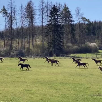


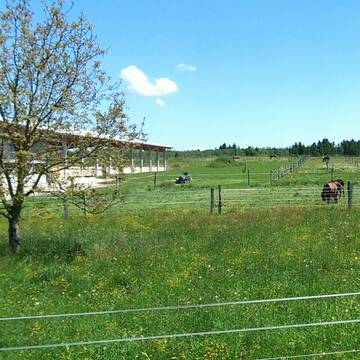
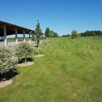
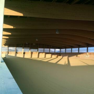
Reiterhof Unterm Dün in Westhausen
Bodenrode-Westhausen
Reiterhof Riethmüller
@riethmueller-westhausen
Freizeitstall
Geländestrecke
Hunde willkommen
Paddock
Hengsthaltung möglich
Pferdezucht
Außenbox mit Paddock
Außenboxen
16 weitere...
P+
Reitstall hat Box zu vermieten
Sontra
Reitstall
@Reitstall0
FN-Mitglied
Freizeitstall
Vermieten
Hunde willkommen
Krankenbox
Allergikerstall
Pferdezucht
24 weitere...
aktuell
P
Deprecated: Creation of dynamic property Zend_View_Helper_Ads::$adLink is deprecated in /var/www/stall-frei/htdocs/staging.stall-frei.de/library/Psf/View/Helper/Ads.php on line 108


großzügige Box mit Außenpaddock
Waldsee
Johanneshof in der Pfalz UG
@Johanneshof-Pfalz
Freizeitstall
Gangpferdereiten
Vermieten
Führanlage
Krankenbox
Gnadenbrothof
Hengsthaltung möglich
22 weitere...
P+
Westernreitschule am Lenzhof
Sehlen
Westernreitschule-am-Lenzhof
@Westernreitschule-am-Lenzhof
Pferdeausbildung
Reitlehrer und -unterricht
Hunde willkommen
Krankenbox
Allergikerstall
Außenbox mit Paddock
Außenboxen
15 weitere...
P+

Westernreitanlage - Training - Fohlenaufzucht
Tuntenhausen/Dettendorf
Westernreitanlage Drexler
@Westernreitanlage-Drexler
Freizeitstall
Pferdeausbildung
Vermieten
Führanlage
Longierzirkel/Roundpen
Hengsthaltung möglich
Pferdezucht
15 weitere...
P+
Großzügiger Offenstalltrail in Witzenhausen
Witzenhausen
maximianweiland
@maximianweiland
Vermieten
Hunde willkommen
Krankenbox
Hufrehe geeignet
Bewegungsstall
Laufstall
13 weitere...
P

Plätze frei in großzügiger Altenteiler Pferdeanl...
Witzenhausen
AnjaMedina
@AnjaMedina
Hunde willkommen
Paddock
Laufstall
Offenstall
Biofutter
Vollpension
4 weitere...
P

Heu und Heulage verkaufen
Mechtersen
STALL-FREIde Marketing
@STALL-FREI-Marketing
Verkaufen Sie Ihr Heu und Ihre Heulage direkt an Reiter, Pferdeställe und Reitanlagen

Boxen und Offenstall frei
Gleichen
Unity-Fellponys
@Unity-Fellponys
Geländestrecke
Reitlehrer und -unterricht
Vermieten
Hunde willkommen
Paddock
Pferdezucht
16 weitere...
P


Outback Corona
Willich/ Schiefbahn
Outback-Corona
@Outback-Corona
FN-Mitglied
Freizeitstall
Vermieten
Führanlage
Hunde willkommen
Allergikerstall
bedampftes/gewaschenes Heu
32 weitere...
S


Freie Offenstall-Plätze auf dem Gut Wildeck
Wildeck
Gut Wildeck
@GutWildeck
Freizeitstall
Geländestrecke
Vermieten
Hunde willkommen
Paddock
Offenstall
11 weitere...
aktuell
P+
Deprecated: Creation of dynamic property Zend_View::$pageCount is deprecated in /var/www/stall-frei/htdocs/staging.stall-frei.de/library/vendor/shardj/zf1-future/library/Zend/View/Abstract.php on line 308
Deprecated: Creation of dynamic property Zend_View::$itemCountPerPage is deprecated in /var/www/stall-frei/htdocs/staging.stall-frei.de/library/vendor/shardj/zf1-future/library/Zend/View/Abstract.php on line 308
Deprecated: Creation of dynamic property Zend_View::$first is deprecated in /var/www/stall-frei/htdocs/staging.stall-frei.de/library/vendor/shardj/zf1-future/library/Zend/View/Abstract.php on line 308
Deprecated: Creation of dynamic property Zend_View::$current is deprecated in /var/www/stall-frei/htdocs/staging.stall-frei.de/library/vendor/shardj/zf1-future/library/Zend/View/Abstract.php on line 308
Deprecated: Creation of dynamic property Zend_View::$last is deprecated in /var/www/stall-frei/htdocs/staging.stall-frei.de/library/vendor/shardj/zf1-future/library/Zend/View/Abstract.php on line 308
Deprecated: Creation of dynamic property Zend_View::$next is deprecated in /var/www/stall-frei/htdocs/staging.stall-frei.de/library/vendor/shardj/zf1-future/library/Zend/View/Abstract.php on line 308
Deprecated: Creation of dynamic property Zend_View::$pagesInRange is deprecated in /var/www/stall-frei/htdocs/staging.stall-frei.de/library/vendor/shardj/zf1-future/library/Zend/View/Abstract.php on line 308
Deprecated: Creation of dynamic property Zend_View::$firstPageInRange is deprecated in /var/www/stall-frei/htdocs/staging.stall-frei.de/library/vendor/shardj/zf1-future/library/Zend/View/Abstract.php on line 308
Deprecated: Creation of dynamic property Zend_View::$lastPageInRange is deprecated in /var/www/stall-frei/htdocs/staging.stall-frei.de/library/vendor/shardj/zf1-future/library/Zend/View/Abstract.php on line 308
Deprecated: Creation of dynamic property Zend_View::$currentItemCount is deprecated in /var/www/stall-frei/htdocs/staging.stall-frei.de/library/vendor/shardj/zf1-future/library/Zend/View/Abstract.php on line 308
Deprecated: Creation of dynamic property Zend_View::$totalItemCount is deprecated in /var/www/stall-frei/htdocs/staging.stall-frei.de/library/vendor/shardj/zf1-future/library/Zend/View/Abstract.php on line 308
Deprecated: Creation of dynamic property Zend_View::$firstItemNumber is deprecated in /var/www/stall-frei/htdocs/staging.stall-frei.de/library/vendor/shardj/zf1-future/library/Zend/View/Abstract.php on line 308
Deprecated: Creation of dynamic property Zend_View::$lastItemNumber is deprecated in /var/www/stall-frei/htdocs/staging.stall-frei.de/library/vendor/shardj/zf1-future/library/Zend/View/Abstract.php on line 308
Deprecated: Creation of dynamic property Zend_View::$router is deprecated in /var/www/stall-frei/htdocs/staging.stall-frei.de/library/vendor/shardj/zf1-future/library/Zend/View/Abstract.php on line 308
Deprecated: Creation of dynamic property Zend_View::$urlParams is deprecated in /var/www/stall-frei/htdocs/staging.stall-frei.de/library/vendor/shardj/zf1-future/library/Zend/View/Abstract.php on line 308
Deprecated: Creation of dynamic property Zend_View::$showAds is deprecated in /var/www/stall-frei/htdocs/staging.stall-frei.de/library/vendor/shardj/zf1-future/library/Zend/View/Abstract.php on line 308
Deprecated: Creation of dynamic property Zend_View::$objectIds is deprecated in /var/www/stall-frei/htdocs/staging.stall-frei.de/library/vendor/shardj/zf1-future/library/Zend/View/Abstract.php on line 308
Deprecated: Creation of dynamic property Zend_View::$showNavbar is deprecated in /var/www/stall-frei/htdocs/staging.stall-frei.de/library/vendor/shardj/zf1-future/library/Zend/View/Abstract.php on line 308
Deprecated: Creation of dynamic property Zend_View::$showBreadcrumb is deprecated in /var/www/stall-frei/htdocs/staging.stall-frei.de/library/vendor/shardj/zf1-future/library/Zend/View/Abstract.php on line 308
Deprecated: Creation of dynamic property Zend_View::$showFooter is deprecated in /var/www/stall-frei/htdocs/staging.stall-frei.de/library/vendor/shardj/zf1-future/library/Zend/View/Abstract.php on line 308
Deprecated: Creation of dynamic property Zend_View::$showInternalAds is deprecated in /var/www/stall-frei/htdocs/staging.stall-frei.de/library/vendor/shardj/zf1-future/library/Zend/View/Abstract.php on line 308
Deprecated: Creation of dynamic property Zend_View::$blNoContent is deprecated in /var/www/stall-frei/htdocs/staging.stall-frei.de/library/vendor/shardj/zf1-future/library/Zend/View/Abstract.php on line 308
Deprecated: Creation of dynamic property Zend_View::$sMetaDesc is deprecated in /var/www/stall-frei/htdocs/staging.stall-frei.de/library/vendor/shardj/zf1-future/library/Zend/View/Abstract.php on line 308
Deprecated: Creation of dynamic property Zend_View::$useGmaps is deprecated in /var/www/stall-frei/htdocs/staging.stall-frei.de/library/vendor/shardj/zf1-future/library/Zend/View/Abstract.php on line 308
Deprecated: Creation of dynamic property Zend_View::$touches is deprecated in /var/www/stall-frei/htdocs/staging.stall-frei.de/library/vendor/shardj/zf1-future/library/Zend/View/Abstract.php on line 308
Deprecated: Creation of dynamic property Zend_View::$oProject is deprecated in /var/www/stall-frei/htdocs/staging.stall-frei.de/library/vendor/shardj/zf1-future/library/Zend/View/Abstract.php on line 308
Deprecated: Creation of dynamic property Zend_View::$pageHeadline is deprecated in /var/www/stall-frei/htdocs/staging.stall-frei.de/library/vendor/shardj/zf1-future/library/Zend/View/Abstract.php on line 308
Deprecated: Creation of dynamic property Zend_View::$disableLocationField is deprecated in /var/www/stall-frei/htdocs/staging.stall-frei.de/library/vendor/shardj/zf1-future/library/Zend/View/Abstract.php on line 308
Deprecated: Creation of dynamic property Zend_View::$isSearch is deprecated in /var/www/stall-frei/htdocs/staging.stall-frei.de/library/vendor/shardj/zf1-future/library/Zend/View/Abstract.php on line 308
Deprecated: Creation of dynamic property Zend_View::$pageTitle is deprecated in /var/www/stall-frei/htdocs/staging.stall-frei.de/library/vendor/shardj/zf1-future/library/Zend/View/Abstract.php on line 308
Deprecated: Creation of dynamic property Psf_Form_Element_Text::$class is deprecated in /var/www/stall-frei/htdocs/staging.stall-frei.de/library/vendor/shardj/zf1-future/library/Zend/Form/Element.php on line 874
Deprecated: Creation of dynamic property Psf_Form_Element_Text::$size is deprecated in /var/www/stall-frei/htdocs/staging.stall-frei.de/library/vendor/shardj/zf1-future/library/Zend/Form/Element.php on line 874
Deprecated: Creation of dynamic property Psf_Form_Element_Text::$placeholder is deprecated in /var/www/stall-frei/htdocs/staging.stall-frei.de/library/vendor/shardj/zf1-future/library/Zend/Form/Element.php on line 874
Deprecated: Creation of dynamic property Psf_Form_Element_Hidden::$class is deprecated in /var/www/stall-frei/htdocs/staging.stall-frei.de/library/vendor/shardj/zf1-future/library/Zend/Form/Element.php on line 874
Deprecated: Creation of dynamic property Psf_Form_Element_Hidden::$class is deprecated in /var/www/stall-frei/htdocs/staging.stall-frei.de/library/vendor/shardj/zf1-future/library/Zend/Form/Element.php on line 874
Deprecated: Creation of dynamic property Psf_Form_Element_Hidden::$class is deprecated in /var/www/stall-frei/htdocs/staging.stall-frei.de/library/vendor/shardj/zf1-future/library/Zend/Form/Element.php on line 874
Deprecated: Creation of dynamic property Psf_Form_Element_Hidden::$class is deprecated in /var/www/stall-frei/htdocs/staging.stall-frei.de/library/vendor/shardj/zf1-future/library/Zend/Form/Element.php on line 874
Deprecated: Creation of dynamic property Psf_Form_Element_Select::$class is deprecated in /var/www/stall-frei/htdocs/staging.stall-frei.de/library/vendor/shardj/zf1-future/library/Zend/Form/Element.php on line 874
Deprecated: Creation of dynamic property Psf_Form_Element_Select::$class is deprecated in /var/www/stall-frei/htdocs/staging.stall-frei.de/library/vendor/shardj/zf1-future/library/Zend/Form/Element.php on line 874
Deprecated: Creation of dynamic property Psf_Form_Element_Select::$class is deprecated in /var/www/stall-frei/htdocs/staging.stall-frei.de/library/vendor/shardj/zf1-future/library/Zend/Form/Element.php on line 874
Deprecated: Creation of dynamic property Psf_Form_Element_Select::$class is deprecated in /var/www/stall-frei/htdocs/staging.stall-frei.de/library/vendor/shardj/zf1-future/library/Zend/Form/Element.php on line 874
Deprecated: Creation of dynamic property Psf_Form_Element_Text::$class is deprecated in /var/www/stall-frei/htdocs/staging.stall-frei.de/library/vendor/shardj/zf1-future/library/Zend/Form/Element.php on line 874
Deprecated: Creation of dynamic property Psf_Form_Element_Checkbox::$label is deprecated in /var/www/stall-frei/htdocs/staging.stall-frei.de/library/vendor/shardj/zf1-future/library/Zend/Form/Element.php on line 874
Deprecated: Creation of dynamic property Zend_View::$sort is deprecated in /var/www/stall-frei/htdocs/staging.stall-frei.de/library/vendor/shardj/zf1-future/library/Zend/View/Abstract.php on line 308
Deprecated: Creation of dynamic property Zend_View::$searchLocation is deprecated in /var/www/stall-frei/htdocs/staging.stall-frei.de/library/vendor/shardj/zf1-future/library/Zend/View/Abstract.php on line 308
Deprecated: Creation of dynamic property Zend_View::$locationHint is deprecated in /var/www/stall-frei/htdocs/staging.stall-frei.de/library/vendor/shardj/zf1-future/library/Zend/View/Abstract.php on line 308
Psf_GeoCoder_Abstract::getLocation: Meinhard Get Location CachedOrLive
Psf_GeoCoder_Abstract::getCachedOrLive: Meinhard
Psf_GeoCoder_OpenCageData::makeApiRequest: response:
Array
(
[documentation] => https://opencagedata.com/api
[licenses] => Array
(
[0] => Array
(
[name] => see attribution guide
[url] => https://opencagedata.com/credits
)
)
[results] => Array
(
[0] => Array
(
[bounds] => Array
(
[northeast] => Array
(
[lat] => 51.2546707
[lng] => 10.1495071
)
[southwest] => Array
(
[lat] => 51.1844523
[lng] => 9.9956029
)
)
[components] => Array
(
[ISO_3166-1_alpha-2] => DE
[ISO_3166-1_alpha-3] => DEU
[ISO_3166-2] => Array
(
[0] => DE-HE
)
[_category] => place
[_normalized_city] => Meinhard
[_type] => municipality
[continent] => Europe
[country] => Deutschland
[country_code] => de
[county] => Werra-Meißner-Kreis
[municipality] => Meinhard
[political_union] => European Union
[postcode] => 37276
[state] => Hessen
[state_code] => HE
)
[confidence] => 7
[formatted] => 37276 Meinhard, Deutschland
[geometry] => Array
(
[lat] => 51.2140398
[lng] => 10.0610708
)
)
[1] => Array
(
[bounds] => Array
(
[northeast] => Array
(
[lat] => 51.2245267
[lng] => 10.0725129
)
[southwest] => Array
(
[lat] => 51.2244267
[lng] => 10.0724129
)
)
[components] => Array
(
[ISO_3166-1_alpha-2] => DE
[ISO_3166-1_alpha-3] => DEU
[ISO_3166-2] => Array
(
[0] => DE-HE
)
[_category] => natural/water
[_normalized_city] => Neuerode
[_type] => peak
[continent] => Europe
[country] => Deutschland
[country_code] => de
[county] => Werra-Meißner-Kreis
[municipality] => Meinhard
[peak] => Meinhard
[political_union] => European Union
[postcode] => 37276
[state] => Hessen
[state_code] => HE
[village] => Neuerode
)
[confidence] => 9
[formatted] => Meinhard, 37276 Neuerode, Deutschland
[geometry] => Array
(
[lat] => 51.2244767
[lng] => 10.0724629
)
)
[2] => Array
(
[components] => Array
(
[ISO_3166-1_alpha-2] => GP
[ISO_3166-1_alpha-3] => GLP
[ISO_3166-2] => Array
(
[0] => FR-971
)
[_category] => road
[_normalized_city] => Petit-Bourg
[_type] => road
[city] => Petit-Bourg
[continent] => North America
[country] => France
[country_code] => fr
[county] => Guadeloupe
[local_authority] => Communauté d'agglomération du Nord Basse-Terre
[political_union] => European Union
[postcode] => 97170
[road] => Chemin de Meynard
[state] =>
)
[confidence] => 2
[formatted] => Chemin de Meynard, 97170 Petit-Bourg, France
[geometry] => Array
(
[lat] => 16.203372
[lng] => -61.630282
)
)
[3] => Array
(
[components] => Array
(
[ISO_3166-1_alpha-2] => FR
[ISO_3166-1_alpha-3] => FRA
[ISO_3166-2] => Array
(
[0] => FR-ARA
[1] => FR-38
)
[_category] => road
[_normalized_city] => La Chapelle-de-Surieu
[_type] => road
[city] => La Chapelle-de-Surieu
[continent] => Europe
[country] => France
[country_code] => fr
[county] => Isère
[local_authority] => Communauté de communes d'Entre Bièvre et Rhône
[political_union] => European Union
[postcode] => 38150
[road] => Chemin du Meinard
[state] => Auvergne-Rhône-Alpes
[state_code] => ARA
)
[confidence] => 2
[formatted] => Chemin du Meinard, 38150 La Chapelle-de-Surieu, France
[geometry] => Array
(
[lat] => 45.394542
[lng] => 4.899176
)
)
[4] => Array
(
[components] => Array
(
[ISO_3166-1_alpha-2] => FR
[ISO_3166-1_alpha-3] => FRA
[ISO_3166-2] => Array
(
[0] => FR-NAQ
[1] => FR-47
)
[_category] => road
[_normalized_city] => Moncaut
[_type] => road
[city] => Moncaut
[continent] => Europe
[country] => France
[country_code] => fr
[county] => Lot-et-Garonne
[local_authority] => Albret Communauté
[political_union] => European Union
[postcode] => 47310
[road] => Chemin de Meynard
[state] => Nouvelle-Aquitaine
[state_code] => NAQ
)
[confidence] => 2
[formatted] => Chemin de Meynard, 47310 Moncaut, France
[geometry] => Array
(
[lat] => 44.161636
[lng] => 0.511598
)
)
[5] => Array
(
[components] => Array
(
[ISO_3166-1_alpha-2] => FR
[ISO_3166-1_alpha-3] => FRA
[ISO_3166-2] => Array
(
[0] => FR-NAQ
[1] => FR-40
)
[_category] => road
[_normalized_city] => Amou
[_type] => road
[city] => Amou
[continent] => Europe
[country] => France
[country_code] => fr
[county] => Landes
[local_authority] => Communauté de communes Coteaux et Vallées des Luys
[political_union] => European Union
[postcode] => 40330
[road] => Chemin de Meynard
[state] => Nouvelle-Aquitaine
[state_code] => NAQ
)
[confidence] => 2
[formatted] => Chemin de Meynard, 40330 Amou, France
[geometry] => Array
(
[lat] => 43.602887
[lng] => -0.775622
)
)
[6] => Array
(
[components] => Array
(
[ISO_3166-1_alpha-2] => FR
[ISO_3166-1_alpha-3] => FRA
[ISO_3166-2] => Array
(
[0] => FR-NAQ
[1] => FR-33
)
[_category] => road
[_normalized_city] => Sallebœuf
[_type] => road
[city] => Sallebœuf
[continent] => Europe
[country] => France
[country_code] => fr
[county] => Gironde
[local_authority] => Communauté de communes des Coteaux Bordelais
[political_union] => European Union
[postcode] => 33370
[road] => Chemin de Meynard
[state] => Nouvelle-Aquitaine
[state_code] => NAQ
)
[confidence] => 2
[formatted] => Chemin de Meynard, 33370 Sallebœuf, France
[geometry] => Array
(
[lat] => 44.846994
[lng] => -0.366334
)
)
[7] => Array
(
[components] => Array
(
[ISO_3166-1_alpha-2] => FR
[ISO_3166-1_alpha-3] => FRA
[ISO_3166-2] => Array
(
[0] => FR-NAQ
[1] => FR-24
)
[_category] => road
[_normalized_city] => Coux et Bigaroque-Mouzens
[_type] => road
[city] => Coux et Bigaroque-Mouzens
[continent] => Europe
[country] => France
[country_code] => fr
[county] => Dordogne
[local_authority] => Communauté de communes Vallée de la Dordogne et Forêt Bessède
[political_union] => European Union
[postcode] => 24220
[road] => Chemin De Meynard
[state] => Nouvelle-Aquitaine
[state_code] => NAQ
)
[confidence] => 2
[formatted] => Chemin De Meynard, 24220 Coux et Bigaroque-Mouzens, France
[geometry] => Array
(
[lat] => 44.858934
[lng] => 0.981512
)
)
[8] => Array
(
[components] => Array
(
[ISO_3166-1_alpha-2] => FR
[ISO_3166-1_alpha-3] => FRA
[ISO_3166-2] => Array
(
[0] => FR-NAQ
[1] => FR-33
)
[_category] => road
[_normalized_city] => Villegouge
[_type] => road
[city] => Villegouge
[continent] => Europe
[country] => France
[country_code] => fr
[county] => Gironde
[local_authority] => Communauté de communes du Fronsadais
[political_union] => European Union
[postcode] => 33141
[road] => Chemin de Meynard
[state] => Nouvelle-Aquitaine
[state_code] => NAQ
)
[confidence] => 2
[formatted] => Chemin de Meynard, 33141 Villegouge, France
[geometry] => Array
(
[lat] => 44.960954
[lng] => -0.295542
)
)
[9] => Array
(
[components] => Array
(
[ISO_3166-1_alpha-2] => FR
[ISO_3166-1_alpha-3] => FRA
[ISO_3166-2] => Array
(
[0] => FR-ARA
[1] => FR-38
)
[_category] => road
[_normalized_city] => Saint-Romain-de-Surieu
[_type] => road
[city] => Saint-Romain-de-Surieu
[continent] => Europe
[country] => France
[country_code] => fr
[county] => Isère
[local_authority] => Communauté de communes d'Entre Bièvre et Rhône
[political_union] => European Union
[postcode] => 38150
[road] => Chemin du Meinard
[state] => Auvergne-Rhône-Alpes
[state_code] => ARA
)
[confidence] => 2
[formatted] => Chemin du Meinard, 38150 Saint-Romain-de-Surieu, France
[geometry] => Array
(
[lat] => 45.393311
[lng] => 4.8943
)
)
)
[status] => Array
(
[code] => 200
[message] => OK
)
[stay_informed] => Array
(
[blog] => https://blog.opencagedata.com
[mastodon] => https://en.osm.town/@opencage
)
[thanks] => For using an OpenCage API
[timestamp] => Array
(
[created_http] => Sun, 08 Feb 2026 07:56:51 GMT
[created_unix] => 1770537411
)
[total_results] => 10
)
Psf_GeoCoder_Abstract::convertLocationResult
{"documentation":"https:\/\/opencagedata.com\/api","licenses":[{"name":"see attribution guide","url":"https:\/\/opencagedata.com\/credits"}],"results":[{"bounds":{"northeast":{"lat":51.2546707,"lng":10.1495071},"southwest":{"lat":51.1844523,"lng":9.9956029}},"components":{"ISO_3166-1_alpha-2":"DE","ISO_3166-1_alpha-3":"DEU","ISO_3166-2":["DE-HE"],"_category":"place","_normalized_city":"Meinhard","_type":"municipality","continent":"Europe","country":"Deutschland","country_code":"de","county":"Werra-Mei\u00dfner-Kreis","municipality":"Meinhard","political_union":"European Union","postcode":"37276","state":"Hessen","state_code":"HE"},"confidence":7,"formatted":"37276 Meinhard, Deutschland","geometry":{"lat":51.2140398,"lng":10.0610708}},{"bounds":{"northeast":{"lat":51.2245267,"lng":10.0725129},"southwest":{"lat":51.2244267,"lng":10.0724129}},"components":{"ISO_3166-1_alpha-2":"DE","ISO_3166-1_alpha-3":"DEU","ISO_3166-2":["DE-HE"],"_category":"natural\/water","_normalized_city":"Neuerode","_type":"peak","continent":"Europe","country":"Deutschland","country_code":"de","county":"Werra-Mei\u00dfner-Kreis","municipality":"Meinhard","peak":"Meinhard","political_union":"European Union","postcode":"37276","state":"Hessen","state_code":"HE","village":"Neuerode"},"confidence":9,"formatted":"Meinhard, 37276 Neuerode, Deutschland","geometry":{"lat":51.2244767,"lng":10.0724629}},{"components":{"ISO_3166-1_alpha-2":"GP","ISO_3166-1_alpha-3":"GLP","ISO_3166-2":["FR-971"],"_category":"road","_normalized_city":"Petit-Bourg","_type":"road","city":"Petit-Bourg","continent":"North America","country":"France","country_code":"fr","county":"Guadeloupe","local_authority":"Communaut\u00e9 d'agglom\u00e9ration du Nord Basse-Terre","political_union":"European Union","postcode":"97170","road":"Chemin de Meynard","state":null},"confidence":2,"formatted":"Chemin de Meynard, 97170 Petit-Bourg, France","geometry":{"lat":16.203372,"lng":-61.630282}},{"components":{"ISO_3166-1_alpha-2":"FR","ISO_3166-1_alpha-3":"FRA","ISO_3166-2":["FR-ARA","FR-38"],"_category":"road","_normalized_city":"La Chapelle-de-Surieu","_type":"road","city":"La Chapelle-de-Surieu","continent":"Europe","country":"France","country_code":"fr","county":"Is\u00e8re","local_authority":"Communaut\u00e9 de communes d'Entre Bi\u00e8vre et Rh\u00f4ne","political_union":"European Union","postcode":"38150","road":"Chemin du Meinard","state":"Auvergne-Rh\u00f4ne-Alpes","state_code":"ARA"},"confidence":2,"formatted":"Chemin du Meinard, 38150 La Chapelle-de-Surieu, France","geometry":{"lat":45.394542,"lng":4.899176}},{"components":{"ISO_3166-1_alpha-2":"FR","ISO_3166-1_alpha-3":"FRA","ISO_3166-2":["FR-NAQ","FR-47"],"_category":"road","_normalized_city":"Moncaut","_type":"road","city":"Moncaut","continent":"Europe","country":"France","country_code":"fr","county":"Lot-et-Garonne","local_authority":"Albret Communaut\u00e9","political_union":"European Union","postcode":"47310","road":"Chemin de Meynard","state":"Nouvelle-Aquitaine","state_code":"NAQ"},"confidence":2,"formatted":"Chemin de Meynard, 47310 Moncaut, France","geometry":{"lat":44.161636,"lng":0.511598}},{"components":{"ISO_3166-1_alpha-2":"FR","ISO_3166-1_alpha-3":"FRA","ISO_3166-2":["FR-NAQ","FR-40"],"_category":"road","_normalized_city":"Amou","_type":"road","city":"Amou","continent":"Europe","country":"France","country_code":"fr","county":"Landes","local_authority":"Communaut\u00e9 de communes Coteaux et Vall\u00e9es des Luys","political_union":"European Union","postcode":"40330","road":"Chemin de Meynard","state":"Nouvelle-Aquitaine","state_code":"NAQ"},"confidence":2,"formatted":"Chemin de Meynard, 40330 Amou, France","geometry":{"lat":43.602887,"lng":-0.775622}},{"components":{"ISO_3166-1_alpha-2":"FR","ISO_3166-1_alpha-3":"FRA","ISO_3166-2":["FR-NAQ","FR-33"],"_category":"road","_normalized_city":"Salleb\u0153uf","_type":"road","city":"Salleb\u0153uf","continent":"Europe","country":"France","country_code":"fr","county":"Gironde","local_authority":"Communaut\u00e9 de communes des Coteaux Bordelais","political_union":"European Union","postcode":"33370","road":"Chemin de Meynard","state":"Nouvelle-Aquitaine","state_code":"NAQ"},"confidence":2,"formatted":"Chemin de Meynard, 33370 Salleb\u0153uf, France","geometry":{"lat":44.846994,"lng":-0.366334}},{"components":{"ISO_3166-1_alpha-2":"FR","ISO_3166-1_alpha-3":"FRA","ISO_3166-2":["FR-NAQ","FR-24"],"_category":"road","_normalized_city":"Coux et Bigaroque-Mouzens","_type":"road","city":"Coux et Bigaroque-Mouzens","continent":"Europe","country":"France","country_code":"fr","county":"Dordogne","local_authority":"Communaut\u00e9 de communes Vall\u00e9e de la Dordogne et For\u00eat Bess\u00e8de","political_union":"European Union","postcode":"24220","road":"Chemin De Meynard","state":"Nouvelle-Aquitaine","state_code":"NAQ"},"confidence":2,"formatted":"Chemin De Meynard, 24220 Coux et Bigaroque-Mouzens, France","geometry":{"lat":44.858934,"lng":0.981512}},{"components":{"ISO_3166-1_alpha-2":"FR","ISO_3166-1_alpha-3":"FRA","ISO_3166-2":["FR-NAQ","FR-33"],"_category":"road","_normalized_city":"Villegouge","_type":"road","city":"Villegouge","continent":"Europe","country":"France","country_code":"fr","county":"Gironde","local_authority":"Communaut\u00e9 de communes du Fronsadais","political_union":"European Union","postcode":"33141","road":"Chemin de Meynard","state":"Nouvelle-Aquitaine","state_code":"NAQ"},"confidence":2,"formatted":"Chemin de Meynard, 33141 Villegouge, France","geometry":{"lat":44.960954,"lng":-0.295542}},{"components":{"ISO_3166-1_alpha-2":"FR","ISO_3166-1_alpha-3":"FRA","ISO_3166-2":["FR-ARA","FR-38"],"_category":"road","_normalized_city":"Saint-Romain-de-Surieu","_type":"road","city":"Saint-Romain-de-Surieu","continent":"Europe","country":"France","country_code":"fr","county":"Is\u00e8re","local_authority":"Communaut\u00e9 de communes d'Entre Bi\u00e8vre et Rh\u00f4ne","political_union":"European Union","postcode":"38150","road":"Chemin du Meinard","state":"Auvergne-Rh\u00f4ne-Alpes","state_code":"ARA"},"confidence":2,"formatted":"Chemin du Meinard, 38150 Saint-Romain-de-Surieu, France","geometry":{"lat":45.393311,"lng":4.8943}}],"status":{"code":200,"message":"OK"},"stay_informed":{"blog":"https:\/\/blog.opencagedata.com","mastodon":"https:\/\/en.osm.town\/@opencage"},"thanks":"For using an OpenCage API","timestamp":{"created_http":"Sun, 08 Feb 2026 07:56:51 GMT","created_unix":1770537411},"total_results":10}Array
(
[0] => stdClass Object
(
[bounds] => stdClass Object
(
[northeast] => stdClass Object
(
[lat] => 51.2546707
[lng] => 10.1495071
)
[southwest] => stdClass Object
(
[lat] => 51.1844523
[lng] => 9.9956029
)
)
[components] => stdClass Object
(
[ISO_3166-1_alpha-2] => DE
[ISO_3166-1_alpha-3] => DEU
[ISO_3166-2] => Array
(
[0] => DE-HE
)
[_category] => place
[_normalized_city] => Meinhard
[_type] => municipality
[continent] => Europe
[country] => Deutschland
[country_code] => de
[county] => Werra-Meißner-Kreis
[municipality] => Meinhard
[political_union] => European Union
[postcode] => 37276
[state] => Hessen
[state_code] => HE
)
[confidence] => 7
[formatted] => 37276 Meinhard, Deutschland
[geometry] => stdClass Object
(
[lat] => 51.2140398
[lng] => 10.0610708
)
)
[1] => stdClass Object
(
[bounds] => stdClass Object
(
[northeast] => stdClass Object
(
[lat] => 51.2245267
[lng] => 10.0725129
)
[southwest] => stdClass Object
(
[lat] => 51.2244267
[lng] => 10.0724129
)
)
[components] => stdClass Object
(
[ISO_3166-1_alpha-2] => DE
[ISO_3166-1_alpha-3] => DEU
[ISO_3166-2] => Array
(
[0] => DE-HE
)
[_category] => natural/water
[_normalized_city] => Neuerode
[_type] => peak
[continent] => Europe
[country] => Deutschland
[country_code] => de
[county] => Werra-Meißner-Kreis
[municipality] => Meinhard
[peak] => Meinhard
[political_union] => European Union
[postcode] => 37276
[state] => Hessen
[state_code] => HE
[village] => Neuerode
)
[confidence] => 9
[formatted] => Meinhard, 37276 Neuerode, Deutschland
[geometry] => stdClass Object
(
[lat] => 51.2244767
[lng] => 10.0724629
)
)
[2] => stdClass Object
(
[components] => stdClass Object
(
[ISO_3166-1_alpha-2] => GP
[ISO_3166-1_alpha-3] => GLP
[ISO_3166-2] => Array
(
[0] => FR-971
)
[_category] => road
[_normalized_city] => Petit-Bourg
[_type] => road
[city] => Petit-Bourg
[continent] => North America
[country] => France
[country_code] => fr
[county] => Guadeloupe
[local_authority] => Communauté d'agglomération du Nord Basse-Terre
[political_union] => European Union
[postcode] => 97170
[road] => Chemin de Meynard
[state] =>
)
[confidence] => 2
[formatted] => Chemin de Meynard, 97170 Petit-Bourg, France
[geometry] => stdClass Object
(
[lat] => 16.203372
[lng] => -61.630282
)
)
[3] => stdClass Object
(
[components] => stdClass Object
(
[ISO_3166-1_alpha-2] => FR
[ISO_3166-1_alpha-3] => FRA
[ISO_3166-2] => Array
(
[0] => FR-ARA
[1] => FR-38
)
[_category] => road
[_normalized_city] => La Chapelle-de-Surieu
[_type] => road
[city] => La Chapelle-de-Surieu
[continent] => Europe
[country] => France
[country_code] => fr
[county] => Isère
[local_authority] => Communauté de communes d'Entre Bièvre et Rhône
[political_union] => European Union
[postcode] => 38150
[road] => Chemin du Meinard
[state] => Auvergne-Rhône-Alpes
[state_code] => ARA
)
[confidence] => 2
[formatted] => Chemin du Meinard, 38150 La Chapelle-de-Surieu, France
[geometry] => stdClass Object
(
[lat] => 45.394542
[lng] => 4.899176
)
)
[4] => stdClass Object
(
[components] => stdClass Object
(
[ISO_3166-1_alpha-2] => FR
[ISO_3166-1_alpha-3] => FRA
[ISO_3166-2] => Array
(
[0] => FR-NAQ
[1] => FR-47
)
[_category] => road
[_normalized_city] => Moncaut
[_type] => road
[city] => Moncaut
[continent] => Europe
[country] => France
[country_code] => fr
[county] => Lot-et-Garonne
[local_authority] => Albret Communauté
[political_union] => European Union
[postcode] => 47310
[road] => Chemin de Meynard
[state] => Nouvelle-Aquitaine
[state_code] => NAQ
)
[confidence] => 2
[formatted] => Chemin de Meynard, 47310 Moncaut, France
[geometry] => stdClass Object
(
[lat] => 44.161636
[lng] => 0.511598
)
)
[5] => stdClass Object
(
[components] => stdClass Object
(
[ISO_3166-1_alpha-2] => FR
[ISO_3166-1_alpha-3] => FRA
[ISO_3166-2] => Array
(
[0] => FR-NAQ
[1] => FR-40
)
[_category] => road
[_normalized_city] => Amou
[_type] => road
[city] => Amou
[continent] => Europe
[country] => France
[country_code] => fr
[county] => Landes
[local_authority] => Communauté de communes Coteaux et Vallées des Luys
[political_union] => European Union
[postcode] => 40330
[road] => Chemin de Meynard
[state] => Nouvelle-Aquitaine
[state_code] => NAQ
)
[confidence] => 2
[formatted] => Chemin de Meynard, 40330 Amou, France
[geometry] => stdClass Object
(
[lat] => 43.602887
[lng] => -0.775622
)
)
[6] => stdClass Object
(
[components] => stdClass Object
(
[ISO_3166-1_alpha-2] => FR
[ISO_3166-1_alpha-3] => FRA
[ISO_3166-2] => Array
(
[0] => FR-NAQ
[1] => FR-33
)
[_category] => road
[_normalized_city] => Sallebœuf
[_type] => road
[city] => Sallebœuf
[continent] => Europe
[country] => France
[country_code] => fr
[county] => Gironde
[local_authority] => Communauté de communes des Coteaux Bordelais
[political_union] => European Union
[postcode] => 33370
[road] => Chemin de Meynard
[state] => Nouvelle-Aquitaine
[state_code] => NAQ
)
[confidence] => 2
[formatted] => Chemin de Meynard, 33370 Sallebœuf, France
[geometry] => stdClass Object
(
[lat] => 44.846994
[lng] => -0.366334
)
)
[7] => stdClass Object
(
[components] => stdClass Object
(
[ISO_3166-1_alpha-2] => FR
[ISO_3166-1_alpha-3] => FRA
[ISO_3166-2] => Array
(
[0] => FR-NAQ
[1] => FR-24
)
[_category] => road
[_normalized_city] => Coux et Bigaroque-Mouzens
[_type] => road
[city] => Coux et Bigaroque-Mouzens
[continent] => Europe
[country] => France
[country_code] => fr
[county] => Dordogne
[local_authority] => Communauté de communes Vallée de la Dordogne et Forêt Bessède
[political_union] => European Union
[postcode] => 24220
[road] => Chemin De Meynard
[state] => Nouvelle-Aquitaine
[state_code] => NAQ
)
[confidence] => 2
[formatted] => Chemin De Meynard, 24220 Coux et Bigaroque-Mouzens, France
[geometry] => stdClass Object
(
[lat] => 44.858934
[lng] => 0.981512
)
)
[8] => stdClass Object
(
[components] => stdClass Object
(
[ISO_3166-1_alpha-2] => FR
[ISO_3166-1_alpha-3] => FRA
[ISO_3166-2] => Array
(
[0] => FR-NAQ
[1] => FR-33
)
[_category] => road
[_normalized_city] => Villegouge
[_type] => road
[city] => Villegouge
[continent] => Europe
[country] => France
[country_code] => fr
[county] => Gironde
[local_authority] => Communauté de communes du Fronsadais
[political_union] => European Union
[postcode] => 33141
[road] => Chemin de Meynard
[state] => Nouvelle-Aquitaine
[state_code] => NAQ
)
[confidence] => 2
[formatted] => Chemin de Meynard, 33141 Villegouge, France
[geometry] => stdClass Object
(
[lat] => 44.960954
[lng] => -0.295542
)
)
[9] => stdClass Object
(
[components] => stdClass Object
(
[ISO_3166-1_alpha-2] => FR
[ISO_3166-1_alpha-3] => FRA
[ISO_3166-2] => Array
(
[0] => FR-ARA
[1] => FR-38
)
[_category] => road
[_normalized_city] => Saint-Romain-de-Surieu
[_type] => road
[city] => Saint-Romain-de-Surieu
[continent] => Europe
[country] => France
[country_code] => fr
[county] => Isère
[local_authority] => Communauté de communes d'Entre Bièvre et Rhône
[political_union] => European Union
[postcode] => 38150
[road] => Chemin du Meinard
[state] => Auvergne-Rhône-Alpes
[state_code] => ARA
)
[confidence] => 2
[formatted] => Chemin du Meinard, 38150 Saint-Romain-de-Surieu, France
[geometry] => stdClass Object
(
[lat] => 45.393311
[lng] => 4.8943
)
)
)
Psf_GeoCoder_OpenCageData::getKeyMap: 0
stdClass Object
(
    [bounds] => stdClass Object
        (
            [northeast] => stdClass Object
                (
                    [lat] => 51.2546707
                    [lng] => 10.1495071
                )

            [southwest] => stdClass Object
                (
                    [lat] => 51.1844523
                    [lng] => 9.9956029
                )

        )

    [components] => stdClass Object
        (
            [ISO_3166-1_alpha-2] => DE
            [ISO_3166-1_alpha-3] => DEU
            [ISO_3166-2] => Array
                (
                    [0] => DE-HE
                )

            [_category] => place
            [_normalized_city] => Meinhard
            [_type] => municipality
            [continent] => Europe
            [country] => Deutschland
            [country_code] => de
            [county] => Werra-Meißner-Kreis
            [municipality] => Meinhard
            [political_union] => European Union
            [postcode] => 37276
            [state] => Hessen
            [state_code] => HE
        )

    [confidence] => 7
    [formatted] => 37276 Meinhard, Deutschland
    [geometry] => stdClass Object
        (
            [lat] => 51.2140398
            [lng] => 10.0610708
        )

)
Psf_GeoCoder_OpenCageData::getCounty: Werra-Meißner-Kreis
Psf_GeoCoder_OpenCageData::addMissingData REFETCH!
Array
(
    [address] => 37276 Meinhard, Deutschland
    [type] => municipality
    [street] =>
    [city] =>
    [county] => Werra-Meißner-Kreis
    [state] => Hessen
    [zip] => 37276
    [country] => Deutschland
    [suburb] =>
    [countrycode] => de
    [latitude] => 51.2140398
    [longitude] => 10.0610708
    [accuracy] => 1
    [confidence] => 7
    [bounds] => stdClass Object
        (
            [northeast] => stdClass Object
                (
                    [lat] => 51.2546707
                    [lng] => 10.1495071
                )

            [southwest] => stdClass Object
                (
                    [lat] => 51.1844523
                    [lng] => 9.9956029
                )

        )

)
reformat!
Array
(
    [address] => 37276 Meinhard, Deutschland
    [type] => municipality
    [street] =>
    [city] =>
    [county] => Werra-Meißner-Kreis
    [state] => Hessen
    [zip] => 37276
    [country] => Deutschland
    [suburb] =>
    [countrycode] => de
    [latitude] => 51.2140398
    [longitude] => 10.0610708
    [accuracy] => 1
    [confidence] => 7
    [bounds] => stdClass Object
        (
            [northeast] => stdClass Object
                (
                    [lat] => 51.2546707
                    [lng] => 10.1495071
                )

            [southwest] => stdClass Object
                (
                    [lat] => 51.1844523
                    [lng] => 9.9956029
                )

        )

    [place] => 37276 , Hessen
    [hash] => e1b52b1cee9fa572bfd823a6fcd736e1
)
Psf_GeoCoder_OpenCageData::getKeyMap: 1
stdClass Object
(
    [bounds] => stdClass Object
        (
            [northeast] => stdClass Object
                (
                    [lat] => 51.2245267
                    [lng] => 10.0725129
                )

            [southwest] => stdClass Object
                (
                    [lat] => 51.2244267
                    [lng] => 10.0724129
                )

        )

    [components] => stdClass Object
        (
            [ISO_3166-1_alpha-2] => DE
            [ISO_3166-1_alpha-3] => DEU
            [ISO_3166-2] => Array
                (
                    [0] => DE-HE
                )

            [_category] => natural/water
            [_normalized_city] => Neuerode
            [_type] => peak
            [continent] => Europe
            [country] => Deutschland
            [country_code] => de
            [county] => Werra-Meißner-Kreis
            [municipality] => Meinhard
            [peak] => Meinhard
            [political_union] => European Union
            [postcode] => 37276
            [state] => Hessen
            [state_code] => HE
            [village] => Neuerode
        )

    [confidence] => 9
    [formatted] => Meinhard, 37276 Neuerode, Deutschland
    [geometry] => stdClass Object
        (
            [lat] => 51.2244767
            [lng] => 10.0724629
        )

)
Psf_GeoCoder_OpenCageData::getCounty: Werra-Meißner-Kreis
Psf_GeoCoder_OpenCageData::addMissingData REFETCH!
Array
(
    [address] => Meinhard, 37276 Neuerode, Deutschland
    [type] => peak
    [street] =>
    [city] => Neuerode
    [county] => Werra-Meißner-Kreis
    [state] => Hessen
    [zip] => 37276
    [country] => Deutschland
    [suburb] =>
    [countrycode] => de
    [latitude] => 51.2244767
    [longitude] => 10.0724629
    [accuracy] => 1
    [confidence] => 9
    [bounds] => stdClass Object
        (
            [northeast] => stdClass Object
                (
                    [lat] => 51.2245267
                    [lng] => 10.0725129
                )

            [southwest] => stdClass Object
                (
                    [lat] => 51.2244267
                    [lng] => 10.0724129
                )

        )

)
reformat!
Array
(
    [address] => Meinhard, 37276 Neuerode, Deutschland
    [type] => peak
    [street] =>
    [city] => Neuerode
    [county] => Werra-Meißner-Kreis
    [state] => Hessen
    [zip] => 37276
    [country] => Deutschland
    [suburb] =>
    [countrycode] => de
    [latitude] => 51.2244767
    [longitude] => 10.0724629
    [accuracy] => 1
    [confidence] => 9
    [bounds] => stdClass Object
        (
            [northeast] => stdClass Object
                (
                    [lat] => 51.2245267
                    [lng] => 10.0725129
                )

            [southwest] => stdClass Object
                (
                    [lat] => 51.2244267
                    [lng] => 10.0724129
                )

        )

    [place] => 37276 Neuerode, Hessen
    [hash] => 58e40e682364488e9d8e277089e78c8a
)
Psf_GeoCoder_OpenCageData::getKeyMap: 2
stdClass Object
(
    [components] => stdClass Object
        (
            [ISO_3166-1_alpha-2] => GP
            [ISO_3166-1_alpha-3] => GLP
            [ISO_3166-2] => Array
                (
                    [0] => FR-971
                )

            [_category] => road
            [_normalized_city] => Petit-Bourg
            [_type] => road
            [city] => Petit-Bourg
            [continent] => North America
            [country] => France
            [country_code] => fr
            [county] => Guadeloupe
            [local_authority] => Communauté d'agglomération du Nord Basse-Terre
            [political_union] => European Union
            [postcode] => 97170
            [road] => Chemin de Meynard
            [state] =>
        )

    [confidence] => 2
    [formatted] => Chemin de Meynard, 97170 Petit-Bourg, France
    [geometry] => stdClass Object
        (
            [lat] => 16.203372
            [lng] => -61.630282
        )

)
Psf_GeoCoder_OpenCageData::getCounty: Guadeloupe
Psf_GeoCoder_OpenCageData::addMissingData REFETCH!
Array
(
    [address] => Chemin de Meynard, 97170 Petit-Bourg, France
    [type] => road
    [street] => Chemin de Meynard
    [city] => Petit-Bourg
    [county] => Guadeloupe
    [state] =>
    [zip] => 97170
    [country] => France
    [suburb] =>
    [countrycode] => fr
    [latitude] => 16.203372
    [longitude] => -61.630282
    [accuracy] => 1
    [confidence] => 2
    [bounds] =>
)
reformat!
Array
(
    [address] => Chemin de Meynard, 97170 Petit-Bourg, France
    [type] => road
    [street] => Chemin de Meynard
    [city] => Petit-Bourg
    [county] => Guadeloupe
    [state] =>
    [zip] => 97170
    [country] => France
    [suburb] =>
    [countrycode] => fr
    [latitude] => 16.203372
    [longitude] => -61.630282
    [accuracy] => 1
    [confidence] => 2
    [bounds] =>
    [place] => Chemin de Meynard, 97170 Petit-Bourg, France
    [hash] => 92adc6da13461e098238e7773309dfe5
)
Psf_GeoCoder_OpenCageData::getKeyMap: 3
stdClass Object
(
    [components] => stdClass Object
        (
            [ISO_3166-1_alpha-2] => FR
            [ISO_3166-1_alpha-3] => FRA
            [ISO_3166-2] => Array
                (
                    [0] => FR-ARA
                    [1] => FR-38
                )

            [_category] => road
            [_normalized_city] => La Chapelle-de-Surieu
            [_type] => road
            [city] => La Chapelle-de-Surieu
            [continent] => Europe
            [country] => France
            [country_code] => fr
            [county] => Isère
            [local_authority] => Communauté de communes d'Entre Bièvre et Rhône
            [political_union] => European Union
            [postcode] => 38150
            [road] => Chemin du Meinard
            [state] => Auvergne-Rhône-Alpes
            [state_code] => ARA
        )

    [confidence] => 2
    [formatted] => Chemin du Meinard, 38150 La Chapelle-de-Surieu, France
    [geometry] => stdClass Object
        (
            [lat] => 45.394542
            [lng] => 4.899176
        )

)
Psf_GeoCoder_OpenCageData::getCounty: Isère
Psf_GeoCoder_OpenCageData::addMissingData REFETCH!
Array
(
    [address] => Chemin du Meinard, 38150 La Chapelle-de-Surieu, France
    [type] => road
    [street] => Chemin du Meinard
    [city] => La Chapelle-de-Surieu
    [county] => Isère
    [state] => Auvergne-Rhône-Alpes
    [zip] => 38150
    [country] => France
    [suburb] =>
    [countrycode] => fr
    [latitude] => 45.394542
    [longitude] => 4.899176
    [accuracy] => 1
    [confidence] => 2
    [bounds] =>
)
reformat!
Array
(
    [address] => Chemin du Meinard, 38150 La Chapelle-de-Surieu, France
    [type] => road
    [street] => Chemin du Meinard
    [city] => La Chapelle-de-Surieu
    [county] => Isère
    [state] => Auvergne-Rhône-Alpes
    [zip] => 38150
    [country] => France
    [suburb] =>
    [countrycode] => fr
    [latitude] => 45.394542
    [longitude] => 4.899176
    [accuracy] => 1
    [confidence] => 2
    [bounds] =>
    [place] => Chemin du Meinard, 38150 La Chapelle-de-Surieu, Auvergne-Rhône-Alpes
    [hash] => f6563c85e56078eeec5f08f3636ddfd8
)
Psf_GeoCoder_OpenCageData::getKeyMap: 4
stdClass Object
(
    [components] => stdClass Object
        (
            [ISO_3166-1_alpha-2] => FR
            [ISO_3166-1_alpha-3] => FRA
            [ISO_3166-2] => Array
                (
                    [0] => FR-NAQ
                    [1] => FR-47
                )

            [_category] => road
            [_normalized_city] => Moncaut
            [_type] => road
            [city] => Moncaut
            [continent] => Europe
            [country] => France
            [country_code] => fr
            [county] => Lot-et-Garonne
            [local_authority] => Albret Communauté
            [political_union] => European Union
            [postcode] => 47310
            [road] => Chemin de Meynard
            [state] => Nouvelle-Aquitaine
            [state_code] => NAQ
        )

    [confidence] => 2
    [formatted] => Chemin de Meynard, 47310 Moncaut, France
    [geometry] => stdClass Object
        (
            [lat] => 44.161636
            [lng] => 0.511598
        )

)
Psf_GeoCoder_OpenCageData::getCounty: Lot-et-Garonne
Psf_GeoCoder_OpenCageData::addMissingData REFETCH!
Array
(
    [address] => Chemin de Meynard, 47310 Moncaut, France
    [type] => road
    [street] => Chemin de Meynard
    [city] => Moncaut
    [county] => Lot-et-Garonne
    [state] => Nouvelle-Aquitaine
    [zip] => 47310
    [country] => France
    [suburb] =>
    [countrycode] => fr
    [latitude] => 44.161636
    [longitude] => 0.511598
    [accuracy] => 1
    [confidence] => 2
    [bounds] =>
)
reformat!
Array
(
    [address] => Chemin de Meynard, 47310 Moncaut, France
    [type] => road
    [street] => Chemin de Meynard
    [city] => Moncaut
    [county] => Lot-et-Garonne
    [state] => Nouvelle-Aquitaine
    [zip] => 47310
    [country] => France
    [suburb] =>
    [countrycode] => fr
    [latitude] => 44.161636
    [longitude] => 0.511598
    [accuracy] => 1
    [confidence] => 2
    [bounds] =>
    [place] => Chemin de Meynard, 47310 Moncaut, Nouvelle-Aquitaine
    [hash] => 6468ac7ad5b161d4b30727888ff5280f
)
Psf_GeoCoder_OpenCageData::getKeyMap: 5
stdClass Object
(
    [components] => stdClass Object
        (
            [ISO_3166-1_alpha-2] => FR
            [ISO_3166-1_alpha-3] => FRA
            [ISO_3166-2] => Array
                (
                    [0] => FR-NAQ
                    [1] => FR-40
                )

            [_category] => road
            [_normalized_city] => Amou
            [_type] => road
            [city] => Amou
            [continent] => Europe
            [country] => France
            [country_code] => fr
            [county] => Landes
            [local_authority] => Communauté de communes Coteaux et Vallées des Luys
            [political_union] => European Union
            [postcode] => 40330
            [road] => Chemin de Meynard
            [state] => Nouvelle-Aquitaine
            [state_code] => NAQ
        )

    [confidence] => 2
    [formatted] => Chemin de Meynard, 40330 Amou, France
    [geometry] => stdClass Object
        (
            [lat] => 43.602887
            [lng] => -0.775622
        )

)
Psf_GeoCoder_OpenCageData::getCounty: Landes
Psf_GeoCoder_OpenCageData::addMissingData REFETCH!
Array
(
    [address] => Chemin de Meynard, 40330 Amou, France
    [type] => road
    [street] => Chemin de Meynard
    [city] => Amou
    [county] => Landes
    [state] => Nouvelle-Aquitaine
    [zip] => 40330
    [country] => France
    [suburb] =>
    [countrycode] => fr
    [latitude] => 43.602887
    [longitude] => -0.775622
    [accuracy] => 1
    [confidence] => 2
    [bounds] =>
)
reformat!
Array
(
    [address] => Chemin de Meynard, 40330 Amou, France
    [type] => road
    [street] => Chemin de Meynard
    [city] => Amou
    [county] => Landes
    [state] => Nouvelle-Aquitaine
    [zip] => 40330
    [country] => France
    [suburb] =>
    [countrycode] => fr
    [latitude] => 43.602887
    [longitude] => -0.775622
    [accuracy] => 1
    [confidence] => 2
    [bounds] =>
    [place] => Chemin de Meynard, 40330 Amou, Nouvelle-Aquitaine
    [hash] => f57864915d7f7eb31f7a9640f2be18b2
)
Psf_GeoCoder_OpenCageData::getKeyMap: 6
stdClass Object
(
    [components] => stdClass Object
        (
            [ISO_3166-1_alpha-2] => FR
            [ISO_3166-1_alpha-3] => FRA
            [ISO_3166-2] => Array
                (
                    [0] => FR-NAQ
                    [1] => FR-33
                )

            [_category] => road
            [_normalized_city] => Sallebœuf
            [_type] => road
            [city] => Sallebœuf
            [continent] => Europe
            [country] => France
            [country_code] => fr
            [county] => Gironde
            [local_authority] => Communauté de communes des Coteaux Bordelais
            [political_union] => European Union
            [postcode] => 33370
            [road] => Chemin de Meynard
            [state] => Nouvelle-Aquitaine
            [state_code] => NAQ
        )

    [confidence] => 2
    [formatted] => Chemin de Meynard, 33370 Sallebœuf, France
    [geometry] => stdClass Object
        (
            [lat] => 44.846994
            [lng] => -0.366334
        )

)
Psf_GeoCoder_OpenCageData::getCounty: Gironde
Psf_GeoCoder_OpenCageData::addMissingData REFETCH!
Array
(
    [address] => Chemin de Meynard, 33370 Sallebœuf, France
    [type] => road
    [street] => Chemin de Meynard
    [city] => Sallebœuf
    [county] => Gironde
    [state] => Nouvelle-Aquitaine
    [zip] => 33370
    [country] => France
    [suburb] =>
    [countrycode] => fr
    [latitude] => 44.846994
    [longitude] => -0.366334
    [accuracy] => 1
    [confidence] => 2
    [bounds] =>
)
reformat!
Array
(
    [address] => Chemin de Meynard, 33370 Sallebœuf, France
    [type] => road
    [street] => Chemin de Meynard
    [city] => Sallebœuf
    [county] => Gironde
    [state] => Nouvelle-Aquitaine
    [zip] => 33370
    [country] => France
    [suburb] =>
    [countrycode] => fr
    [latitude] => 44.846994
    [longitude] => -0.366334
    [accuracy] => 1
    [confidence] => 2
    [bounds] =>
    [place] => Chemin de Meynard, 33370 Sallebœuf, Nouvelle-Aquitaine
    [hash] => 247ad582a5ca1197c75ae36067e6d458
)
Psf_GeoCoder_OpenCageData::getKeyMap: 7
stdClass Object
(
    [components] => stdClass Object
        (
            [ISO_3166-1_alpha-2] => FR
            [ISO_3166-1_alpha-3] => FRA
            [ISO_3166-2] => Array
                (
                    [0] => FR-NAQ
                    [1] => FR-24
                )

            [_category] => road
            [_normalized_city] => Coux et Bigaroque-Mouzens
            [_type] => road
            [city] => Coux et Bigaroque-Mouzens
            [continent] => Europe
            [country] => France
            [country_code] => fr
            [county] => Dordogne
            [local_authority] => Communauté de communes Vallée de la Dordogne et Forêt Bessède
            [political_union] => European Union
            [postcode] => 24220
            [road] => Chemin De Meynard
            [state] => Nouvelle-Aquitaine
            [state_code] => NAQ
        )

    [confidence] => 2
    [formatted] => Chemin De Meynard, 24220 Coux et Bigaroque-Mouzens, France
    [geometry] => stdClass Object
        (
            [lat] => 44.858934
            [lng] => 0.981512
        )

)
Psf_GeoCoder_OpenCageData::getCounty: Dordogne
Psf_GeoCoder_OpenCageData::addMissingData REFETCH!
Array
(
    [address] => Chemin De Meynard, 24220 Coux et Bigaroque-Mouzens, France
    [type] => road
    [street] => Chemin De Meynard
    [city] => Coux et Bigaroque-Mouzens
    [county] => Dordogne
    [state] => Nouvelle-Aquitaine
    [zip] => 24220
    [country] => France
    [suburb] =>
    [countrycode] => fr
    [latitude] => 44.858934
    [longitude] => 0.981512
    [accuracy] => 1
    [confidence] => 2
    [bounds] =>
)
reformat!
Array
(
    [address] => Chemin De Meynard, 24220 Coux et Bigaroque-Mouzens, France
    [type] => road
    [street] => Chemin De Meynard
    [city] => Coux et Bigaroque-Mouzens
    [county] => Dordogne
    [state] => Nouvelle-Aquitaine
    [zip] => 24220
    [country] => France
    [suburb] =>
    [countrycode] => fr
    [latitude] => 44.858934
    [longitude] => 0.981512
    [accuracy] => 1
    [confidence] => 2
    [bounds] =>
    [place] => Chemin De Meynard, 24220 Coux et Bigaroque-Mouzens, Nouvelle-Aquitaine
    [hash] => 840199c05157292e57da19db27784e8b
)
Psf_GeoCoder_OpenCageData::getKeyMap: 8
stdClass Object
(
    [components] => stdClass Object
        (
            [ISO_3166-1_alpha-2] => FR
            [ISO_3166-1_alpha-3] => FRA
            [ISO_3166-2] => Array
                (
                    [0] => FR-NAQ
                    [1] => FR-33
                )

            [_category] => road
            [_normalized_city] => Villegouge
            [_type] => road
            [city] => Villegouge
            [continent] => Europe
            [country] => France
            [country_code] => fr
            [county] => Gironde
            [local_authority] => Communauté de communes du Fronsadais
            [political_union] => European Union
            [postcode] => 33141
            [road] => Chemin de Meynard
            [state] => Nouvelle-Aquitaine
            [state_code] => NAQ
        )

    [confidence] => 2
    [formatted] => Chemin de Meynard, 33141 Villegouge, France
    [geometry] => stdClass Object
        (
            [lat] => 44.960954
            [lng] => -0.295542
        )

)
Psf_GeoCoder_OpenCageData::getCounty: Gironde
Psf_GeoCoder_OpenCageData::addMissingData REFETCH!
Array
(
    [address] => Chemin de Meynard, 33141 Villegouge, France
    [type] => road
    [street] => Chemin de Meynard
    [city] => Villegouge
    [county] => Gironde
    [state] => Nouvelle-Aquitaine
    [zip] => 33141
    [country] => France
    [suburb] =>
    [countrycode] => fr
    [latitude] => 44.960954
    [longitude] => -0.295542
    [accuracy] => 1
    [confidence] => 2
    [bounds] =>
)
reformat!
Array
(
    [address] => Chemin de Meynard, 33141 Villegouge, France
    [type] => road
    [street] => Chemin de Meynard
    [city] => Villegouge
    [county] => Gironde
    [state] => Nouvelle-Aquitaine
    [zip] => 33141
    [country] => France
    [suburb] =>
    [countrycode] => fr
    [latitude] => 44.960954
    [longitude] => -0.295542
    [accuracy] => 1
    [confidence] => 2
    [bounds] =>
    [place] => Chemin de Meynard, 33141 Villegouge, Nouvelle-Aquitaine
    [hash] => 999e804f665f3df54ae3e55230e77cd0
)
Psf_GeoCoder_OpenCageData::getKeyMap: 9
stdClass Object
(
    [components] => stdClass Object
        (
            [ISO_3166-1_alpha-2] => FR
            [ISO_3166-1_alpha-3] => FRA
            [ISO_3166-2] => Array
                (
                    [0] => FR-ARA
                    [1] => FR-38
                )

            [_category] => road
            [_normalized_city] => Saint-Romain-de-Surieu
            [_type] => road
            [city] => Saint-Romain-de-Surieu
            [continent] => Europe
            [country] => France
            [country_code] => fr
            [county] => Isère
            [local_authority] => Communauté de communes d'Entre Bièvre et Rhône
            [political_union] => European Union
            [postcode] => 38150
            [road] => Chemin du Meinard
            [state] => Auvergne-Rhône-Alpes
            [state_code] => ARA
        )

    [confidence] => 2
    [formatted] => Chemin du Meinard, 38150 Saint-Romain-de-Surieu, France
    [geometry] => stdClass Object
        (
            [lat] => 45.393311
            [lng] => 4.8943
        )

)
Psf_GeoCoder_OpenCageData::getCounty: Isère
Psf_GeoCoder_OpenCageData::addMissingData REFETCH!
Array
(
    [address] => Chemin du Meinard, 38150 Saint-Romain-de-Surieu, France
    [type] => road
    [street] => Chemin du Meinard
    [city] => Saint-Romain-de-Surieu
    [county] => Isère
    [state] => Auvergne-Rhône-Alpes
    [zip] => 38150
    [country] => France
    [suburb] =>
    [countrycode] => fr
    [latitude] => 45.393311
    [longitude] => 4.8943
    [accuracy] => 1
    [confidence] => 2
    [bounds] =>
)
reformat!
Array
(
    [address] => Chemin du Meinard, 38150 Saint-Romain-de-Surieu, France
    [type] => road
    [street] => Chemin du Meinard
    [city] => Saint-Romain-de-Surieu
    [county] => Isère
    [state] => Auvergne-Rhône-Alpes
    [zip] => 38150
    [country] => France
    [suburb] =>
    [countrycode] => fr
    [latitude] => 45.393311
    [longitude] => 4.8943
    [accuracy] => 1
    [confidence] => 2
    [bounds] =>
    [place] => Chemin du Meinard, 38150 Saint-Romain-de-Surieu, Auvergne-Rhône-Alpes
    [hash] => c7bd9a514a205083294b493e819080fb
)
Deprecated: Creation of dynamic property Zend_View::$locationHintStyle is deprecated in /var/www/stall-frei/htdocs/staging.stall-frei.de/library/vendor/shardj/zf1-future/library/Zend/View/Abstract.php on line 308
Deprecated: Creation of dynamic property Zend_View::$adGeoLocation is deprecated in /var/www/stall-frei/htdocs/staging.stall-frei.de/library/vendor/shardj/zf1-future/library/Zend/View/Abstract.php on line 308
Deprecated: Creation of dynamic property Zend_View::$recordCount is deprecated in /var/www/stall-frei/htdocs/staging.stall-frei.de/library/vendor/shardj/zf1-future/library/Zend/View/Abstract.php on line 308
Deprecated: explode(): Passing null to parameter #2 ($string) of type string is deprecated in /var/www/stall-frei/htdocs/staging.stall-frei.de/application/models/SearchAgent.php on line 100
Deprecated: explode(): Passing null to parameter #2 ($string) of type string is deprecated in /var/www/stall-frei/htdocs/staging.stall-frei.de/application/models/SearchAgent.php on line 100
Deprecated: explode(): Passing null to parameter #2 ($string) of type string is deprecated in /var/www/stall-frei/htdocs/staging.stall-frei.de/application/models/SearchAgent.php on line 100
Deprecated: explode(): Passing null to parameter #2 ($string) of type string is deprecated in /var/www/stall-frei/htdocs/staging.stall-frei.de/application/models/SearchAgent.php on line 100
Deprecated: explode(): Passing null to parameter #2 ($string) of type string is deprecated in /var/www/stall-frei/htdocs/staging.stall-frei.de/application/models/SearchAgent.php on line 100
Deprecated: explode(): Passing null to parameter #2 ($string) of type string is deprecated in /var/www/stall-frei/htdocs/staging.stall-frei.de/application/models/SearchAgent.php on line 100
Deprecated: explode(): Passing null to parameter #2 ($string) of type string is deprecated in /var/www/stall-frei/htdocs/staging.stall-frei.de/application/models/SearchAgent.php on line 100
Deprecated: explode(): Passing null to parameter #2 ($string) of type string is deprecated in /var/www/stall-frei/htdocs/staging.stall-frei.de/application/models/SearchAgent.php on line 100
Deprecated: explode(): Passing null to parameter #2 ($string) of type string is deprecated in /var/www/stall-frei/htdocs/staging.stall-frei.de/application/models/SearchAgent.php on line 100
Deprecated: trim(): Passing null to parameter #1 ($string) of type string is deprecated in /var/www/stall-frei/htdocs/staging.stall-frei.de/application/models/Account/Search.php on line 82
Warning: Cannot modify header information - headers already sent by (output started at /var/www/stall-frei/htdocs/staging.stall-frei.de/library/vendor/shardj/zf1-future/library/Zend/View/Abstract.php:308) in /var/www/stall-frei/htdocs/staging.stall-frei.de/application/models/Account/Search.php on line 71
Deprecated: Creation of dynamic property Zend_View::$paginationParams is deprecated in /var/www/stall-frei/htdocs/staging.stall-frei.de/library/vendor/shardj/zf1-future/library/Zend/View/Abstract.php on line 308
Deprecated: Creation of dynamic property Zend_View::$objectPaginator is deprecated in /var/www/stall-frei/htdocs/staging.stall-frei.de/library/vendor/shardj/zf1-future/library/Zend/View/Abstract.php on line 308
Deprecated: Creation of dynamic property Zend_View::$featuredObjects is deprecated in /var/www/stall-frei/htdocs/staging.stall-frei.de/library/vendor/shardj/zf1-future/library/Zend/View/Abstract.php on line 308
Deprecated: Creation of dynamic property Zend_View::$hints is deprecated in /var/www/stall-frei/htdocs/staging.stall-frei.de/library/vendor/shardj/zf1-future/library/Zend/View/Abstract.php on line 308
Deprecated: Creation of dynamic property Zend_View::$attributeHints is deprecated in /var/www/stall-frei/htdocs/staging.stall-frei.de/library/vendor/shardj/zf1-future/library/Zend/View/Abstract.php on line 308
Deprecated: Creation of dynamic property Zend_View::$oSearchForm is deprecated in /var/www/stall-frei/htdocs/staging.stall-frei.de/library/vendor/shardj/zf1-future/library/Zend/View/Abstract.php on line 308