Deprecated: Creation of dynamic property Zend_View::$sMode is deprecated in /var/www/stall-frei/htdocs/staging.stall-frei.de/library/vendor/shardj/zf1-future/library/Zend/View/Abstract.php on line 308
Stallplatz oder Offenstall in Schriesheim
Gesucht wird in "Ölberg, 69198 Schriesheim, Deutschland"
6.329 Einträge
Deprecated: Creation of dynamic property Zend_View::$listObjects is deprecated in /var/www/stall-frei/htdocs/staging.stall-frei.de/library/vendor/shardj/zf1-future/library/Zend/View/Abstract.php on line 308
Gesponsort


Deprecated: Creation of dynamic property Zend_View::$listMode is deprecated in /var/www/stall-frei/htdocs/staging.stall-frei.de/library/vendor/shardj/zf1-future/library/Zend/View/Abstract.php on line 308
Deprecated: Creation of dynamic property Zend_View::$renderedObjects is deprecated in /var/www/stall-frei/htdocs/staging.stall-frei.de/library/vendor/shardj/zf1-future/library/Zend/View/Abstract.php on line 308
Deprecated: Creation of dynamic property Zend_View::$index is deprecated in /var/www/stall-frei/htdocs/staging.stall-frei.de/library/vendor/shardj/zf1-future/library/Zend/View/Abstract.php on line 308
Deprecated: Creation of dynamic property Zend_View::$displayMode is deprecated in /var/www/stall-frei/htdocs/staging.stall-frei.de/library/vendor/shardj/zf1-future/library/Zend/View/Abstract.php on line 308
Deprecated: Creation of dynamic property Zend_View::$remarketingIds is deprecated in /var/www/stall-frei/htdocs/staging.stall-frei.de/library/vendor/shardj/zf1-future/library/Zend/View/Abstract.php on line 308
Deprecated: Creation of dynamic property Zend_View::$listItem is deprecated in /var/www/stall-frei/htdocs/staging.stall-frei.de/library/vendor/shardj/zf1-future/library/Zend/View/Abstract.php on line 308
Deprecated: Creation of dynamic property Zend_View::$object is deprecated in /var/www/stall-frei/htdocs/staging.stall-frei.de/library/vendor/shardj/zf1-future/library/Zend/View/Abstract.php on line 308
Deprecated: Creation of dynamic property Zend_View::$attributes is deprecated in /var/www/stall-frei/htdocs/staging.stall-frei.de/library/vendor/shardj/zf1-future/library/Zend/View/Abstract.php on line 308
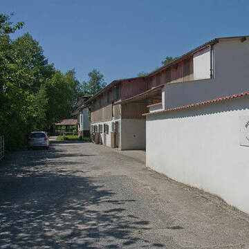
Birkenhof Gauangelloch
Leimen-Gauangelloch
Friedwalt-Treiber
@Friedwalt-Treiber
FN-Mitglied
Freizeitstall
Longierzirkel/Roundpen
Pensions- und Gastboxen
Außenboxen
Innenbox
Vollpension
11 weitere...
S


Paddockboxen ab Januar 2026 - Aktivstall ab 04/26
Hirschberg an der Bergstr
Isabell Bachhuber
@Isabell_Bachhuber
Freizeitstall
Reitlehrer und -unterricht
Vermieten
Hunde willkommen
Longierzirkel/Roundpen
Außenbox mit Paddock
Außenboxen
21 weitere...
P+
Deprecated: Creation of dynamic property Zend_View_Helper_Ads::$adLink is deprecated in /var/www/stall-frei/htdocs/staging.stall-frei.de/library/Psf/View/Helper/Ads.php on line 108

Persönlichkeitsentwicklung mit Pferden
Bad Salzuflen
Katja Dors
@Pferdezeiten
Begleite andere auf ihrem Entwicklungsweg und entdecke die transformative Kraft der pferdegestützten Persönlichkeitsentwicklung !
neu
R


KRONENHOF KETSCH | Wagner
Ketsch
Kronenhof Ketsch | Wagner
@Kronenhof-Ketsch
FN-Mitglied
Freizeitstall
Vermieten
Führanlage
Paddock
Allergikerstall
Hengsthaltung möglich
16 weitere...
aktuell
S

Familiäre Reitanlage
Edingen-Neckarhausen
Laura-Buehler
@Laura-Buehler
Pferdeausbildung
Reitlehrer und -unterricht
Vermieten
Führanlage
Longierzirkel/Roundpen
Außenbox mit Paddock
Außenboxen
13 weitere...
P+

Reitstall Müller-Heberle Schriesheim
Schriesheim
Reitstall Müller-Heberle
@ReitstallMueller-Heberle
FN-Mitglied
Freizeitstall
Vermieten
Laufband
Longierzirkel/Roundpen
Hengsthaltung möglich
19 weitere...
P


FREIE PADDOCKBOXEN🐴🏠
Mannheim
Reit- und Fahrverein
@RFV_Mannheim-Sandhofen_eV
FN-Mitglied
Freizeitstall
Vermieten
Hunde willkommen
Krankenbox
Hengsthaltung möglich
Hufrehe geeignet
23 weitere...
S

Offenstall/Paddockbox für Pony oder Kleinpferd
Glashütten
Tatjana Bommersheim
@TatjanaBommersheim
Wir haben ab dem 1.04.26 eine Platz in einem unsere Offenställe (Wallach oder Stute)und eine unserer Paddockboxen (Wallach oder S
neu
R


Reitanlage die keine Wünsche offen lässt
Mannheim
juergen-dehoust
@juergen-dehoust
Freizeitstall
Geländestrecke
Führanlage
Hunde willkommen
Gnadenbrothof
Hengsthaltung möglich
Außenbox mit Paddock
Außenboxen
19 weitere...
P+

Birkenhof Oberflockenbach
Oberflockenbach
Birkenhof
@Birkenhof-Oberflockenbach
Freizeitstall
Pferdeausbildung
Vermieten
Hunde willkommen
Krankenbox
Notfallboxen
14 weitere...
P
Leider kein Vorschaubild
Leider kein Vorschaubild
Offenstallplatz für Stute frei
Schriesheim
Melanie Kullmann
@M.Kullmann
Freizeitstall
Pferdeausbildung
Vermieten
Reitplatz (z.B. Dressur, Springen, Reining)
Sommerweide
Offenstall
5 weitere...
B


REITSPORTANLAGE ADLERHOF - 24/7 HEU
Viernheim
Adlerhof Viernheim
@AdlerhofViernheim
Geländestrecke
Pferdeausbildung
Führanlage
Hunde willkommen
Außenbox mit Paddock
Bewegungsstall
Vollpension
16 weitere...
P+
Deprecated: Creation of dynamic property Zend_View::$pageCount is deprecated in /var/www/stall-frei/htdocs/staging.stall-frei.de/library/vendor/shardj/zf1-future/library/Zend/View/Abstract.php on line 308
Deprecated: Creation of dynamic property Zend_View::$itemCountPerPage is deprecated in /var/www/stall-frei/htdocs/staging.stall-frei.de/library/vendor/shardj/zf1-future/library/Zend/View/Abstract.php on line 308
Deprecated: Creation of dynamic property Zend_View::$first is deprecated in /var/www/stall-frei/htdocs/staging.stall-frei.de/library/vendor/shardj/zf1-future/library/Zend/View/Abstract.php on line 308
Deprecated: Creation of dynamic property Zend_View::$current is deprecated in /var/www/stall-frei/htdocs/staging.stall-frei.de/library/vendor/shardj/zf1-future/library/Zend/View/Abstract.php on line 308
Deprecated: Creation of dynamic property Zend_View::$last is deprecated in /var/www/stall-frei/htdocs/staging.stall-frei.de/library/vendor/shardj/zf1-future/library/Zend/View/Abstract.php on line 308
Deprecated: Creation of dynamic property Zend_View::$next is deprecated in /var/www/stall-frei/htdocs/staging.stall-frei.de/library/vendor/shardj/zf1-future/library/Zend/View/Abstract.php on line 308
Deprecated: Creation of dynamic property Zend_View::$pagesInRange is deprecated in /var/www/stall-frei/htdocs/staging.stall-frei.de/library/vendor/shardj/zf1-future/library/Zend/View/Abstract.php on line 308
Deprecated: Creation of dynamic property Zend_View::$firstPageInRange is deprecated in /var/www/stall-frei/htdocs/staging.stall-frei.de/library/vendor/shardj/zf1-future/library/Zend/View/Abstract.php on line 308
Deprecated: Creation of dynamic property Zend_View::$lastPageInRange is deprecated in /var/www/stall-frei/htdocs/staging.stall-frei.de/library/vendor/shardj/zf1-future/library/Zend/View/Abstract.php on line 308
Deprecated: Creation of dynamic property Zend_View::$currentItemCount is deprecated in /var/www/stall-frei/htdocs/staging.stall-frei.de/library/vendor/shardj/zf1-future/library/Zend/View/Abstract.php on line 308
Deprecated: Creation of dynamic property Zend_View::$totalItemCount is deprecated in /var/www/stall-frei/htdocs/staging.stall-frei.de/library/vendor/shardj/zf1-future/library/Zend/View/Abstract.php on line 308
Deprecated: Creation of dynamic property Zend_View::$firstItemNumber is deprecated in /var/www/stall-frei/htdocs/staging.stall-frei.de/library/vendor/shardj/zf1-future/library/Zend/View/Abstract.php on line 308
Deprecated: Creation of dynamic property Zend_View::$lastItemNumber is deprecated in /var/www/stall-frei/htdocs/staging.stall-frei.de/library/vendor/shardj/zf1-future/library/Zend/View/Abstract.php on line 308
Deprecated: Creation of dynamic property Zend_View::$router is deprecated in /var/www/stall-frei/htdocs/staging.stall-frei.de/library/vendor/shardj/zf1-future/library/Zend/View/Abstract.php on line 308
Deprecated: Creation of dynamic property Zend_View::$urlParams is deprecated in /var/www/stall-frei/htdocs/staging.stall-frei.de/library/vendor/shardj/zf1-future/library/Zend/View/Abstract.php on line 308
Deprecated: Creation of dynamic property Zend_View::$showAds is deprecated in /var/www/stall-frei/htdocs/staging.stall-frei.de/library/vendor/shardj/zf1-future/library/Zend/View/Abstract.php on line 308
Deprecated: Creation of dynamic property Zend_View::$objectIds is deprecated in /var/www/stall-frei/htdocs/staging.stall-frei.de/library/vendor/shardj/zf1-future/library/Zend/View/Abstract.php on line 308
Deprecated: Creation of dynamic property Zend_View::$showNavbar is deprecated in /var/www/stall-frei/htdocs/staging.stall-frei.de/library/vendor/shardj/zf1-future/library/Zend/View/Abstract.php on line 308
Deprecated: Creation of dynamic property Zend_View::$showBreadcrumb is deprecated in /var/www/stall-frei/htdocs/staging.stall-frei.de/library/vendor/shardj/zf1-future/library/Zend/View/Abstract.php on line 308
Deprecated: Creation of dynamic property Zend_View::$showFooter is deprecated in /var/www/stall-frei/htdocs/staging.stall-frei.de/library/vendor/shardj/zf1-future/library/Zend/View/Abstract.php on line 308
Deprecated: Creation of dynamic property Zend_View::$showInternalAds is deprecated in /var/www/stall-frei/htdocs/staging.stall-frei.de/library/vendor/shardj/zf1-future/library/Zend/View/Abstract.php on line 308
Deprecated: Creation of dynamic property Zend_View::$blNoContent is deprecated in /var/www/stall-frei/htdocs/staging.stall-frei.de/library/vendor/shardj/zf1-future/library/Zend/View/Abstract.php on line 308
Deprecated: Creation of dynamic property Zend_View::$sMetaDesc is deprecated in /var/www/stall-frei/htdocs/staging.stall-frei.de/library/vendor/shardj/zf1-future/library/Zend/View/Abstract.php on line 308
Deprecated: Creation of dynamic property Zend_View::$useGmaps is deprecated in /var/www/stall-frei/htdocs/staging.stall-frei.de/library/vendor/shardj/zf1-future/library/Zend/View/Abstract.php on line 308
Deprecated: Creation of dynamic property Zend_View::$touches is deprecated in /var/www/stall-frei/htdocs/staging.stall-frei.de/library/vendor/shardj/zf1-future/library/Zend/View/Abstract.php on line 308
Deprecated: Creation of dynamic property Zend_View::$oProject is deprecated in /var/www/stall-frei/htdocs/staging.stall-frei.de/library/vendor/shardj/zf1-future/library/Zend/View/Abstract.php on line 308
Deprecated: Creation of dynamic property Zend_View::$pageHeadline is deprecated in /var/www/stall-frei/htdocs/staging.stall-frei.de/library/vendor/shardj/zf1-future/library/Zend/View/Abstract.php on line 308
Deprecated: Creation of dynamic property Zend_View::$disableLocationField is deprecated in /var/www/stall-frei/htdocs/staging.stall-frei.de/library/vendor/shardj/zf1-future/library/Zend/View/Abstract.php on line 308
Deprecated: Creation of dynamic property Zend_View::$isSearch is deprecated in /var/www/stall-frei/htdocs/staging.stall-frei.de/library/vendor/shardj/zf1-future/library/Zend/View/Abstract.php on line 308
Deprecated: Creation of dynamic property Zend_View::$pageTitle is deprecated in /var/www/stall-frei/htdocs/staging.stall-frei.de/library/vendor/shardj/zf1-future/library/Zend/View/Abstract.php on line 308
Deprecated: Creation of dynamic property Psf_Form_Element_Text::$class is deprecated in /var/www/stall-frei/htdocs/staging.stall-frei.de/library/vendor/shardj/zf1-future/library/Zend/Form/Element.php on line 874
Deprecated: Creation of dynamic property Psf_Form_Element_Text::$size is deprecated in /var/www/stall-frei/htdocs/staging.stall-frei.de/library/vendor/shardj/zf1-future/library/Zend/Form/Element.php on line 874
Deprecated: Creation of dynamic property Psf_Form_Element_Text::$placeholder is deprecated in /var/www/stall-frei/htdocs/staging.stall-frei.de/library/vendor/shardj/zf1-future/library/Zend/Form/Element.php on line 874
Deprecated: Creation of dynamic property Psf_Form_Element_Hidden::$class is deprecated in /var/www/stall-frei/htdocs/staging.stall-frei.de/library/vendor/shardj/zf1-future/library/Zend/Form/Element.php on line 874
Deprecated: Creation of dynamic property Psf_Form_Element_Hidden::$class is deprecated in /var/www/stall-frei/htdocs/staging.stall-frei.de/library/vendor/shardj/zf1-future/library/Zend/Form/Element.php on line 874
Deprecated: Creation of dynamic property Psf_Form_Element_Hidden::$class is deprecated in /var/www/stall-frei/htdocs/staging.stall-frei.de/library/vendor/shardj/zf1-future/library/Zend/Form/Element.php on line 874
Deprecated: Creation of dynamic property Psf_Form_Element_Hidden::$class is deprecated in /var/www/stall-frei/htdocs/staging.stall-frei.de/library/vendor/shardj/zf1-future/library/Zend/Form/Element.php on line 874
Deprecated: Creation of dynamic property Psf_Form_Element_Select::$class is deprecated in /var/www/stall-frei/htdocs/staging.stall-frei.de/library/vendor/shardj/zf1-future/library/Zend/Form/Element.php on line 874
Deprecated: Creation of dynamic property Psf_Form_Element_Select::$class is deprecated in /var/www/stall-frei/htdocs/staging.stall-frei.de/library/vendor/shardj/zf1-future/library/Zend/Form/Element.php on line 874
Deprecated: Creation of dynamic property Psf_Form_Element_Select::$class is deprecated in /var/www/stall-frei/htdocs/staging.stall-frei.de/library/vendor/shardj/zf1-future/library/Zend/Form/Element.php on line 874
Deprecated: Creation of dynamic property Psf_Form_Element_Select::$class is deprecated in /var/www/stall-frei/htdocs/staging.stall-frei.de/library/vendor/shardj/zf1-future/library/Zend/Form/Element.php on line 874
Deprecated: Creation of dynamic property Psf_Form_Element_Text::$class is deprecated in /var/www/stall-frei/htdocs/staging.stall-frei.de/library/vendor/shardj/zf1-future/library/Zend/Form/Element.php on line 874
Deprecated: Creation of dynamic property Psf_Form_Element_Checkbox::$label is deprecated in /var/www/stall-frei/htdocs/staging.stall-frei.de/library/vendor/shardj/zf1-future/library/Zend/Form/Element.php on line 874
Deprecated: Creation of dynamic property Zend_View::$sort is deprecated in /var/www/stall-frei/htdocs/staging.stall-frei.de/library/vendor/shardj/zf1-future/library/Zend/View/Abstract.php on line 308
Deprecated: Creation of dynamic property Zend_View::$searchLocation is deprecated in /var/www/stall-frei/htdocs/staging.stall-frei.de/library/vendor/shardj/zf1-future/library/Zend/View/Abstract.php on line 308
Deprecated: Creation of dynamic property Zend_View::$locationHint is deprecated in /var/www/stall-frei/htdocs/staging.stall-frei.de/library/vendor/shardj/zf1-future/library/Zend/View/Abstract.php on line 308
Psf_GeoCoder_Abstract::getLocation: Ölberg Get Location CachedOrLive
Psf_GeoCoder_Abstract::getCachedOrLive: Ölberg
Psf_GeoCoder_OpenCageData::makeApiRequest: response:
Array
(
[documentation] => https://opencagedata.com/api
[licenses] => Array
(
[0] => Array
(
[name] => see attribution guide
[url] => https://opencagedata.com/credits
)
)
[results] => Array
(
[0] => Array
(
[bounds] => Array
(
[northeast] => Array
(
[lat] => 49.4675401
[lng] => 8.6804335
)
[southwest] => Array
(
[lat] => 49.4674401
[lng] => 8.6803335
)
)
[components] => Array
(
[ISO_3166-1_alpha-2] => DE
[ISO_3166-1_alpha-3] => DEU
[ISO_3166-2] => Array
(
[0] => DE-BW
)
[_category] => natural/water
[_normalized_city] => Schriesheim
[_type] => peak
[continent] => Europe
[country] => Deutschland
[country_code] => de
[county] => Rhein-Neckar-Kreis
[peak] => Ölberg
[political_union] => European Union
[postcode] => 69198
[state] => Baden-Württemberg
[state_code] => BW
[town] => Schriesheim
)
[confidence] => 9
[formatted] => Ölberg, 69198 Schriesheim, Deutschland
[geometry] => Array
(
[lat] => 49.4674901
[lng] => 8.6803835
)
)
[1] => Array
(
[bounds] => Array
(
[northeast] => Array
(
[lat] => 51.2795952
[lng] => 7.1549157
)
[southwest] => Array
(
[lat] => 51.2395952
[lng] => 7.1149157
)
)
[components] => Array
(
[ISO_3166-1_alpha-2] => DE
[ISO_3166-1_alpha-3] => DEU
[ISO_3166-2] => Array
(
[0] => DE-NW
)
[_category] => place
[_normalized_city] => Wuppertal
[_type] => neighbourhood
[city] => Wuppertal
[city_district] => Elberfeld
[continent] => Europe
[country] => Deutschland
[country_code] => de
[political_union] => European Union
[postcode] => 42105
[state] => Nordrhein-Westfalen
[state_code] => NW
[suburb] => Ölberg
)
[confidence] => 7
[formatted] => 42105 Wuppertal, Deutschland
[geometry] => Array
(
[lat] => 51.2595952
[lng] => 7.1349157
)
)
[2] => Array
(
[bounds] => Array
(
[northeast] => Array
(
[lat] => 49.2198377
[lng] => 9.0435232
)
[southwest] => Array
(
[lat] => 49.2197377
[lng] => 9.0434232
)
)
[components] => Array
(
[ISO_3166-1_alpha-2] => DE
[ISO_3166-1_alpha-3] => DEU
[ISO_3166-2] => Array
(
[0] => DE-BW
)
[_category] => natural/water
[_normalized_city] => Bad Rappenau
[_type] => peak
[continent] => Europe
[country] => Deutschland
[country_code] => de
[county] => Landkreis Heilbronn
[municipality] => VVG der Stadt Bad Rappenau
[peak] => Ölberg
[political_union] => European Union
[postcode] => 74252
[state] => Baden-Württemberg
[state_code] => BW
[town] => Bad Rappenau
)
[confidence] => 9
[formatted] => Ölberg, 74252 Bad Rappenau, Deutschland
[geometry] => Array
(
[lat] => 49.2197877
[lng] => 9.0434732
)
)
[3] => Array
(
[bounds] => Array
(
[northeast] => Array
(
[lat] => 50.1084822
[lng] => 9.3193236
)
[southwest] => Array
(
[lat] => 50.1083822
[lng] => 9.3192236
)
)
[components] => Array
(
[ISO_3166-1_alpha-2] => DE
[ISO_3166-1_alpha-3] => DEU
[ISO_3166-2] => Array
(
[0] => DE-BY
)
[_category] => natural/water
[_normalized_city] => Schöllkrippener Forst
[_type] => peak
[city] => Schöllkrippener Forst
[continent] => Europe
[country] => Deutschland
[country_code] => de
[county] => Landkreis Aschaffenburg
[peak] => Ölberg
[political_union] => European Union
[postcode] => 63828
[state] => Bayern
[state_code] => BY
)
[confidence] => 9
[formatted] => Ölberg, 63828 Schöllkrippener Forst, Deutschland
[geometry] => Array
(
[lat] => 50.1084322
[lng] => 9.3192736
)
)
[4] => Array
(
[bounds] => Array
(
[northeast] => Array
(
[lat] => 50.9308634
[lng] => 11.731264
)
[southwest] => Array
(
[lat] => 50.9307634
[lng] => 11.731164
)
)
[components] => Array
(
[ISO_3166-1_alpha-2] => DE
[ISO_3166-1_alpha-3] => DEU
[ISO_3166-2] => Array
(
[0] => DE-TH
)
[_category] => natural/water
[_normalized_city] => Bürgel
[_type] => peak
[continent] => Europe
[country] => Deutschland
[country_code] => de
[county] => Saale-Holzland-Kreis
[municipality] => Bürgel
[peak] => Ölberg
[political_union] => European Union
[postcode] => 07616
[state] => Thüringen
[state_code] => TH
[town] => Bürgel
)
[confidence] => 9
[formatted] => Ölberg, 07616 Bürgel, Deutschland
[geometry] => Array
(
[lat] => 50.9308134
[lng] => 11.731214
)
)
[5] => Array
(
[bounds] => Array
(
[northeast] => Array
(
[lat] => 49.8557228
[lng] => 12.2215447
)
[southwest] => Array
(
[lat] => 49.8556228
[lng] => 12.2214447
)
)
[components] => Array
(
[ISO_3166-1_alpha-2] => DE
[ISO_3166-1_alpha-3] => DEU
[ISO_3166-2] => Array
(
[0] => DE-BY
)
[_category] => natural/water
[_normalized_city] => Falkenberg
[_type] => peak
[continent] => Europe
[country] => Deutschland
[country_code] => de
[county] => Landkreis Tirschenreuth
[municipality] => Wiesau (VGem)
[peak] => Ölberg
[political_union] => European Union
[postcode] => 95685
[state] => Bayern
[state_code] => BY
[village] => Falkenberg
)
[confidence] => 9
[formatted] => Ölberg, 95685 Falkenberg, Deutschland
[geometry] => Array
(
[lat] => 49.8556728
[lng] => 12.2214947
)
)
[6] => Array
(
[bounds] => Array
(
[northeast] => Array
(
[lat] => 50.744085
[lng] => 10.6363974
)
[southwest] => Array
(
[lat] => 50.743985
[lng] => 10.6362974
)
)
[components] => Array
(
[ISO_3166-1_alpha-2] => DE
[ISO_3166-1_alpha-3] => DEU
[ISO_3166-2] => Array
(
[0] => DE-TH
)
[_category] => natural/water
[_normalized_city] => Tambach-Dietharz
[_type] => peak
[continent] => Europe
[country] => Deutschland
[country_code] => de
[county] => Landkreis Gotha
[peak] => Ölberg
[political_union] => European Union
[state] => Thüringen
[state_code] => TH
[town] => Tambach-Dietharz
)
[confidence] => 9
[formatted] => Ölberg, Tambach-Dietharz, Thüringen, Deutschland
[geometry] => Array
(
[lat] => 50.744035
[lng] => 10.6363474
)
)
[7] => Array
(
[bounds] => Array
(
[northeast] => Array
(
[lat] => 50.4818214
[lng] => 7.646704
)
[southwest] => Array
(
[lat] => 50.4817214
[lng] => 7.646604
)
)
[components] => Array
(
[ISO_3166-1_alpha-2] => DE
[ISO_3166-1_alpha-3] => DEU
[ISO_3166-2] => Array
(
[0] => DE-RP
)
[_category] => natural/water
[_normalized_city] => Sessenbach
[_type] => peak
[continent] => Europe
[country] => Deutschland
[country_code] => de
[county] => Westerwaldkreis
[municipality] => Ransbach-Baumbach
[peak] => Ölberg
[political_union] => European Union
[postcode] => 56237
[state] => Rheinland-Pfalz
[state_code] => RP
[village] => Sessenbach
)
[confidence] => 9
[formatted] => Ölberg, 56237 Sessenbach, Deutschland
[geometry] => Array
(
[lat] => 50.4817714
[lng] => 7.646654
)
)
[8] => Array
(
[bounds] => Array
(
[northeast] => Array
(
[lat] => 47.7260199
[lng] => 10.1009058
)
[southwest] => Array
(
[lat] => 47.7259199
[lng] => 10.1008058
)
)
[components] => Array
(
[ISO_3166-1_alpha-2] => DE
[ISO_3166-1_alpha-3] => DEU
[ISO_3166-2] => Array
(
[0] => DE-BW
)
[_category] => natural/water
[_normalized_city] => Isny im Allgäu
[_type] => peak
[continent] => Europe
[country] => Deutschland
[country_code] => de
[county] => Landkreis Ravensburg
[peak] => Ölberg
[political_union] => European Union
[state] => Baden-Württemberg
[state_code] => BW
[town] => Isny im Allgäu
)
[confidence] => 9
[formatted] => Ölberg, Isny im Allgäu, Baden-Württemberg, Deutschland
[geometry] => Array
(
[lat] => 47.7259699
[lng] => 10.1008558
)
)
[9] => Array
(
[components] => Array
(
[ISO_3166-1_alpha-2] => FR
[ISO_3166-1_alpha-3] => FRA
[ISO_3166-2] => Array
(
[0] => FR-IDF
[1] => FR-92
)
[_category] => road
[_normalized_city] => Levallois-Perret
[_type] => road
[city] => Levallois-Perret
[continent] => Europe
[country] => France
[country_code] => fr
[county] => Hauts-de-Seine
[local_authority] => Métropole du Grand Paris
[political_union] => European Union
[postcode] => 92300
[road] => Rue Charles Deutschmann
[state] => Île-de-France
[state_code] => IDF
)
[confidence] => 2
[formatted] => Rue Charles Deutschmann, 92300 Levallois-Perret, France
[geometry] => Array
(
[lat] => 48.900049
[lng] => 2.2842
)
)
)
[status] => Array
(
[code] => 200
[message] => OK
)
[stay_informed] => Array
(
[blog] => https://blog.opencagedata.com
[mastodon] => https://en.osm.town/@opencage
)
[thanks] => For using an OpenCage API
[timestamp] => Array
(
[created_http] => Sat, 07 Feb 2026 21:15:52 GMT
[created_unix] => 1770498952
)
[total_results] => 10
)
Psf_GeoCoder_Abstract::convertLocationResult
{"documentation":"https:\/\/opencagedata.com\/api","licenses":[{"name":"see attribution guide","url":"https:\/\/opencagedata.com\/credits"}],"results":[{"bounds":{"northeast":{"lat":49.4675401,"lng":8.6804335},"southwest":{"lat":49.4674401,"lng":8.6803335}},"components":{"ISO_3166-1_alpha-2":"DE","ISO_3166-1_alpha-3":"DEU","ISO_3166-2":["DE-BW"],"_category":"natural\/water","_normalized_city":"Schriesheim","_type":"peak","continent":"Europe","country":"Deutschland","country_code":"de","county":"Rhein-Neckar-Kreis","peak":"\u00d6lberg","political_union":"European Union","postcode":"69198","state":"Baden-W\u00fcrttemberg","state_code":"BW","town":"Schriesheim"},"confidence":9,"formatted":"\u00d6lberg, 69198 Schriesheim, Deutschland","geometry":{"lat":49.4674901,"lng":8.6803835}},{"bounds":{"northeast":{"lat":51.2795952,"lng":7.1549157},"southwest":{"lat":51.2395952,"lng":7.1149157}},"components":{"ISO_3166-1_alpha-2":"DE","ISO_3166-1_alpha-3":"DEU","ISO_3166-2":["DE-NW"],"_category":"place","_normalized_city":"Wuppertal","_type":"neighbourhood","city":"Wuppertal","city_district":"Elberfeld","continent":"Europe","country":"Deutschland","country_code":"de","political_union":"European Union","postcode":"42105","state":"Nordrhein-Westfalen","state_code":"NW","suburb":"\u00d6lberg"},"confidence":7,"formatted":"42105 Wuppertal, Deutschland","geometry":{"lat":51.2595952,"lng":7.1349157}},{"bounds":{"northeast":{"lat":49.2198377,"lng":9.0435232},"southwest":{"lat":49.2197377,"lng":9.0434232}},"components":{"ISO_3166-1_alpha-2":"DE","ISO_3166-1_alpha-3":"DEU","ISO_3166-2":["DE-BW"],"_category":"natural\/water","_normalized_city":"Bad Rappenau","_type":"peak","continent":"Europe","country":"Deutschland","country_code":"de","county":"Landkreis Heilbronn","municipality":"VVG der Stadt Bad Rappenau","peak":"\u00d6lberg","political_union":"European Union","postcode":"74252","state":"Baden-W\u00fcrttemberg","state_code":"BW","town":"Bad Rappenau"},"confidence":9,"formatted":"\u00d6lberg, 74252 Bad Rappenau, Deutschland","geometry":{"lat":49.2197877,"lng":9.0434732}},{"bounds":{"northeast":{"lat":50.1084822,"lng":9.3193236},"southwest":{"lat":50.1083822,"lng":9.3192236}},"components":{"ISO_3166-1_alpha-2":"DE","ISO_3166-1_alpha-3":"DEU","ISO_3166-2":["DE-BY"],"_category":"natural\/water","_normalized_city":"Sch\u00f6llkrippener Forst","_type":"peak","city":"Sch\u00f6llkrippener Forst","continent":"Europe","country":"Deutschland","country_code":"de","county":"Landkreis Aschaffenburg","peak":"\u00d6lberg","political_union":"European Union","postcode":"63828","state":"Bayern","state_code":"BY"},"confidence":9,"formatted":"\u00d6lberg, 63828 Sch\u00f6llkrippener Forst, Deutschland","geometry":{"lat":50.1084322,"lng":9.3192736}},{"bounds":{"northeast":{"lat":50.9308634,"lng":11.731264},"southwest":{"lat":50.9307634,"lng":11.731164}},"components":{"ISO_3166-1_alpha-2":"DE","ISO_3166-1_alpha-3":"DEU","ISO_3166-2":["DE-TH"],"_category":"natural\/water","_normalized_city":"B\u00fcrgel","_type":"peak","continent":"Europe","country":"Deutschland","country_code":"de","county":"Saale-Holzland-Kreis","municipality":"B\u00fcrgel","peak":"\u00d6lberg","political_union":"European Union","postcode":"07616","state":"Th\u00fcringen","state_code":"TH","town":"B\u00fcrgel"},"confidence":9,"formatted":"\u00d6lberg, 07616 B\u00fcrgel, Deutschland","geometry":{"lat":50.9308134,"lng":11.731214}},{"bounds":{"northeast":{"lat":49.8557228,"lng":12.2215447},"southwest":{"lat":49.8556228,"lng":12.2214447}},"components":{"ISO_3166-1_alpha-2":"DE","ISO_3166-1_alpha-3":"DEU","ISO_3166-2":["DE-BY"],"_category":"natural\/water","_normalized_city":"Falkenberg","_type":"peak","continent":"Europe","country":"Deutschland","country_code":"de","county":"Landkreis Tirschenreuth","municipality":"Wiesau (VGem)","peak":"\u00d6lberg","political_union":"European Union","postcode":"95685","state":"Bayern","state_code":"BY","village":"Falkenberg"},"confidence":9,"formatted":"\u00d6lberg, 95685 Falkenberg, Deutschland","geometry":{"lat":49.8556728,"lng":12.2214947}},{"bounds":{"northeast":{"lat":50.744085,"lng":10.6363974},"southwest":{"lat":50.743985,"lng":10.6362974}},"components":{"ISO_3166-1_alpha-2":"DE","ISO_3166-1_alpha-3":"DEU","ISO_3166-2":["DE-TH"],"_category":"natural\/water","_normalized_city":"Tambach-Dietharz","_type":"peak","continent":"Europe","country":"Deutschland","country_code":"de","county":"Landkreis Gotha","peak":"\u00d6lberg","political_union":"European Union","state":"Th\u00fcringen","state_code":"TH","town":"Tambach-Dietharz"},"confidence":9,"formatted":"\u00d6lberg, Tambach-Dietharz, Th\u00fcringen, Deutschland","geometry":{"lat":50.744035,"lng":10.6363474}},{"bounds":{"northeast":{"lat":50.4818214,"lng":7.646704},"southwest":{"lat":50.4817214,"lng":7.646604}},"components":{"ISO_3166-1_alpha-2":"DE","ISO_3166-1_alpha-3":"DEU","ISO_3166-2":["DE-RP"],"_category":"natural\/water","_normalized_city":"Sessenbach","_type":"peak","continent":"Europe","country":"Deutschland","country_code":"de","county":"Westerwaldkreis","municipality":"Ransbach-Baumbach","peak":"\u00d6lberg","political_union":"European Union","postcode":"56237","state":"Rheinland-Pfalz","state_code":"RP","village":"Sessenbach"},"confidence":9,"formatted":"\u00d6lberg, 56237 Sessenbach, Deutschland","geometry":{"lat":50.4817714,"lng":7.646654}},{"bounds":{"northeast":{"lat":47.7260199,"lng":10.1009058},"southwest":{"lat":47.7259199,"lng":10.1008058}},"components":{"ISO_3166-1_alpha-2":"DE","ISO_3166-1_alpha-3":"DEU","ISO_3166-2":["DE-BW"],"_category":"natural\/water","_normalized_city":"Isny im Allg\u00e4u","_type":"peak","continent":"Europe","country":"Deutschland","country_code":"de","county":"Landkreis Ravensburg","peak":"\u00d6lberg","political_union":"European Union","state":"Baden-W\u00fcrttemberg","state_code":"BW","town":"Isny im Allg\u00e4u"},"confidence":9,"formatted":"\u00d6lberg, Isny im Allg\u00e4u, Baden-W\u00fcrttemberg, Deutschland","geometry":{"lat":47.7259699,"lng":10.1008558}},{"components":{"ISO_3166-1_alpha-2":"FR","ISO_3166-1_alpha-3":"FRA","ISO_3166-2":["FR-IDF","FR-92"],"_category":"road","_normalized_city":"Levallois-Perret","_type":"road","city":"Levallois-Perret","continent":"Europe","country":"France","country_code":"fr","county":"Hauts-de-Seine","local_authority":"M\u00e9tropole du Grand Paris","political_union":"European Union","postcode":"92300","road":"Rue Charles Deutschmann","state":"\u00cele-de-France","state_code":"IDF"},"confidence":2,"formatted":"Rue Charles Deutschmann, 92300 Levallois-Perret, France","geometry":{"lat":48.900049,"lng":2.2842}}],"status":{"code":200,"message":"OK"},"stay_informed":{"blog":"https:\/\/blog.opencagedata.com","mastodon":"https:\/\/en.osm.town\/@opencage"},"thanks":"For using an OpenCage API","timestamp":{"created_http":"Sat, 07 Feb 2026 21:15:52 GMT","created_unix":1770498952},"total_results":10}Array
(
[0] => stdClass Object
(
[bounds] => stdClass Object
(
[northeast] => stdClass Object
(
[lat] => 49.4675401
[lng] => 8.6804335
)
[southwest] => stdClass Object
(
[lat] => 49.4674401
[lng] => 8.6803335
)
)
[components] => stdClass Object
(
[ISO_3166-1_alpha-2] => DE
[ISO_3166-1_alpha-3] => DEU
[ISO_3166-2] => Array
(
[0] => DE-BW
)
[_category] => natural/water
[_normalized_city] => Schriesheim
[_type] => peak
[continent] => Europe
[country] => Deutschland
[country_code] => de
[county] => Rhein-Neckar-Kreis
[peak] => Ölberg
[political_union] => European Union
[postcode] => 69198
[state] => Baden-Württemberg
[state_code] => BW
[town] => Schriesheim
)
[confidence] => 9
[formatted] => Ölberg, 69198 Schriesheim, Deutschland
[geometry] => stdClass Object
(
[lat] => 49.4674901
[lng] => 8.6803835
)
)
[1] => stdClass Object
(
[bounds] => stdClass Object
(
[northeast] => stdClass Object
(
[lat] => 51.2795952
[lng] => 7.1549157
)
[southwest] => stdClass Object
(
[lat] => 51.2395952
[lng] => 7.1149157
)
)
[components] => stdClass Object
(
[ISO_3166-1_alpha-2] => DE
[ISO_3166-1_alpha-3] => DEU
[ISO_3166-2] => Array
(
[0] => DE-NW
)
[_category] => place
[_normalized_city] => Wuppertal
[_type] => neighbourhood
[city] => Wuppertal
[city_district] => Elberfeld
[continent] => Europe
[country] => Deutschland
[country_code] => de
[political_union] => European Union
[postcode] => 42105
[state] => Nordrhein-Westfalen
[state_code] => NW
[suburb] => Ölberg
)
[confidence] => 7
[formatted] => 42105 Wuppertal, Deutschland
[geometry] => stdClass Object
(
[lat] => 51.2595952
[lng] => 7.1349157
)
)
[2] => stdClass Object
(
[bounds] => stdClass Object
(
[northeast] => stdClass Object
(
[lat] => 49.2198377
[lng] => 9.0435232
)
[southwest] => stdClass Object
(
[lat] => 49.2197377
[lng] => 9.0434232
)
)
[components] => stdClass Object
(
[ISO_3166-1_alpha-2] => DE
[ISO_3166-1_alpha-3] => DEU
[ISO_3166-2] => Array
(
[0] => DE-BW
)
[_category] => natural/water
[_normalized_city] => Bad Rappenau
[_type] => peak
[continent] => Europe
[country] => Deutschland
[country_code] => de
[county] => Landkreis Heilbronn
[municipality] => VVG der Stadt Bad Rappenau
[peak] => Ölberg
[political_union] => European Union
[postcode] => 74252
[state] => Baden-Württemberg
[state_code] => BW
[town] => Bad Rappenau
)
[confidence] => 9
[formatted] => Ölberg, 74252 Bad Rappenau, Deutschland
[geometry] => stdClass Object
(
[lat] => 49.2197877
[lng] => 9.0434732
)
)
[3] => stdClass Object
(
[bounds] => stdClass Object
(
[northeast] => stdClass Object
(
[lat] => 50.1084822
[lng] => 9.3193236
)
[southwest] => stdClass Object
(
[lat] => 50.1083822
[lng] => 9.3192236
)
)
[components] => stdClass Object
(
[ISO_3166-1_alpha-2] => DE
[ISO_3166-1_alpha-3] => DEU
[ISO_3166-2] => Array
(
[0] => DE-BY
)
[_category] => natural/water
[_normalized_city] => Schöllkrippener Forst
[_type] => peak
[city] => Schöllkrippener Forst
[continent] => Europe
[country] => Deutschland
[country_code] => de
[county] => Landkreis Aschaffenburg
[peak] => Ölberg
[political_union] => European Union
[postcode] => 63828
[state] => Bayern
[state_code] => BY
)
[confidence] => 9
[formatted] => Ölberg, 63828 Schöllkrippener Forst, Deutschland
[geometry] => stdClass Object
(
[lat] => 50.1084322
[lng] => 9.3192736
)
)
[4] => stdClass Object
(
[bounds] => stdClass Object
(
[northeast] => stdClass Object
(
[lat] => 50.9308634
[lng] => 11.731264
)
[southwest] => stdClass Object
(
[lat] => 50.9307634
[lng] => 11.731164
)
)
[components] => stdClass Object
(
[ISO_3166-1_alpha-2] => DE
[ISO_3166-1_alpha-3] => DEU
[ISO_3166-2] => Array
(
[0] => DE-TH
)
[_category] => natural/water
[_normalized_city] => Bürgel
[_type] => peak
[continent] => Europe
[country] => Deutschland
[country_code] => de
[county] => Saale-Holzland-Kreis
[municipality] => Bürgel
[peak] => Ölberg
[political_union] => European Union
[postcode] => 07616
[state] => Thüringen
[state_code] => TH
[town] => Bürgel
)
[confidence] => 9
[formatted] => Ölberg, 07616 Bürgel, Deutschland
[geometry] => stdClass Object
(
[lat] => 50.9308134
[lng] => 11.731214
)
)
[5] => stdClass Object
(
[bounds] => stdClass Object
(
[northeast] => stdClass Object
(
[lat] => 49.8557228
[lng] => 12.2215447
)
[southwest] => stdClass Object
(
[lat] => 49.8556228
[lng] => 12.2214447
)
)
[components] => stdClass Object
(
[ISO_3166-1_alpha-2] => DE
[ISO_3166-1_alpha-3] => DEU
[ISO_3166-2] => Array
(
[0] => DE-BY
)
[_category] => natural/water
[_normalized_city] => Falkenberg
[_type] => peak
[continent] => Europe
[country] => Deutschland
[country_code] => de
[county] => Landkreis Tirschenreuth
[municipality] => Wiesau (VGem)
[peak] => Ölberg
[political_union] => European Union
[postcode] => 95685
[state] => Bayern
[state_code] => BY
[village] => Falkenberg
)
[confidence] => 9
[formatted] => Ölberg, 95685 Falkenberg, Deutschland
[geometry] => stdClass Object
(
[lat] => 49.8556728
[lng] => 12.2214947
)
)
[6] => stdClass Object
(
[bounds] => stdClass Object
(
[northeast] => stdClass Object
(
[lat] => 50.744085
[lng] => 10.6363974
)
[southwest] => stdClass Object
(
[lat] => 50.743985
[lng] => 10.6362974
)
)
[components] => stdClass Object
(
[ISO_3166-1_alpha-2] => DE
[ISO_3166-1_alpha-3] => DEU
[ISO_3166-2] => Array
(
[0] => DE-TH
)
[_category] => natural/water
[_normalized_city] => Tambach-Dietharz
[_type] => peak
[continent] => Europe
[country] => Deutschland
[country_code] => de
[county] => Landkreis Gotha
[peak] => Ölberg
[political_union] => European Union
[state] => Thüringen
[state_code] => TH
[town] => Tambach-Dietharz
)
[confidence] => 9
[formatted] => Ölberg, Tambach-Dietharz, Thüringen, Deutschland
[geometry] => stdClass Object
(
[lat] => 50.744035
[lng] => 10.6363474
)
)
[7] => stdClass Object
(
[bounds] => stdClass Object
(
[northeast] => stdClass Object
(
[lat] => 50.4818214
[lng] => 7.646704
)
[southwest] => stdClass Object
(
[lat] => 50.4817214
[lng] => 7.646604
)
)
[components] => stdClass Object
(
[ISO_3166-1_alpha-2] => DE
[ISO_3166-1_alpha-3] => DEU
[ISO_3166-2] => Array
(
[0] => DE-RP
)
[_category] => natural/water
[_normalized_city] => Sessenbach
[_type] => peak
[continent] => Europe
[country] => Deutschland
[country_code] => de
[county] => Westerwaldkreis
[municipality] => Ransbach-Baumbach
[peak] => Ölberg
[political_union] => European Union
[postcode] => 56237
[state] => Rheinland-Pfalz
[state_code] => RP
[village] => Sessenbach
)
[confidence] => 9
[formatted] => Ölberg, 56237 Sessenbach, Deutschland
[geometry] => stdClass Object
(
[lat] => 50.4817714
[lng] => 7.646654
)
)
[8] => stdClass Object
(
[bounds] => stdClass Object
(
[northeast] => stdClass Object
(
[lat] => 47.7260199
[lng] => 10.1009058
)
[southwest] => stdClass Object
(
[lat] => 47.7259199
[lng] => 10.1008058
)
)
[components] => stdClass Object
(
[ISO_3166-1_alpha-2] => DE
[ISO_3166-1_alpha-3] => DEU
[ISO_3166-2] => Array
(
[0] => DE-BW
)
[_category] => natural/water
[_normalized_city] => Isny im Allgäu
[_type] => peak
[continent] => Europe
[country] => Deutschland
[country_code] => de
[county] => Landkreis Ravensburg
[peak] => Ölberg
[political_union] => European Union
[state] => Baden-Württemberg
[state_code] => BW
[town] => Isny im Allgäu
)
[confidence] => 9
[formatted] => Ölberg, Isny im Allgäu, Baden-Württemberg, Deutschland
[geometry] => stdClass Object
(
[lat] => 47.7259699
[lng] => 10.1008558
)
)
[9] => stdClass Object
(
[components] => stdClass Object
(
[ISO_3166-1_alpha-2] => FR
[ISO_3166-1_alpha-3] => FRA
[ISO_3166-2] => Array
(
[0] => FR-IDF
[1] => FR-92
)
[_category] => road
[_normalized_city] => Levallois-Perret
[_type] => road
[city] => Levallois-Perret
[continent] => Europe
[country] => France
[country_code] => fr
[county] => Hauts-de-Seine
[local_authority] => Métropole du Grand Paris
[political_union] => European Union
[postcode] => 92300
[road] => Rue Charles Deutschmann
[state] => Île-de-France
[state_code] => IDF
)
[confidence] => 2
[formatted] => Rue Charles Deutschmann, 92300 Levallois-Perret, France
[geometry] => stdClass Object
(
[lat] => 48.900049
[lng] => 2.2842
)
)
)
Psf_GeoCoder_OpenCageData::getKeyMap: 0
stdClass Object
(
    [bounds] => stdClass Object
        (
            [northeast] => stdClass Object
                (
                    [lat] => 49.4675401
                    [lng] => 8.6804335
                )

            [southwest] => stdClass Object
                (
                    [lat] => 49.4674401
                    [lng] => 8.6803335
                )

        )

    [components] => stdClass Object
        (
            [ISO_3166-1_alpha-2] => DE
            [ISO_3166-1_alpha-3] => DEU
            [ISO_3166-2] => Array
                (
                    [0] => DE-BW
                )

            [_category] => natural/water
            [_normalized_city] => Schriesheim
            [_type] => peak
            [continent] => Europe
            [country] => Deutschland
            [country_code] => de
            [county] => Rhein-Neckar-Kreis
            [peak] => Ölberg
            [political_union] => European Union
            [postcode] => 69198
            [state] => Baden-Württemberg
            [state_code] => BW
            [town] => Schriesheim
        )

    [confidence] => 9
    [formatted] => Ölberg, 69198 Schriesheim, Deutschland
    [geometry] => stdClass Object
        (
            [lat] => 49.4674901
            [lng] => 8.6803835
        )

)
Psf_GeoCoder_OpenCageData::getCounty: Rhein-Neckar-Kreis
Psf_GeoCoder_OpenCageData::addMissingData REFETCH!
Array
(
    [address] => Ölberg, 69198 Schriesheim, Deutschland
    [type] => peak
    [street] =>
    [city] => Schriesheim
    [county] => Rhein-Neckar-Kreis
    [state] => Baden-Württemberg
    [zip] => 69198
    [country] => Deutschland
    [suburb] =>
    [countrycode] => de
    [latitude] => 49.4674901
    [longitude] => 8.6803835
    [accuracy] => 1
    [confidence] => 9
    [bounds] => stdClass Object
        (
            [northeast] => stdClass Object
                (
                    [lat] => 49.4675401
                    [lng] => 8.6804335
                )

            [southwest] => stdClass Object
                (
                    [lat] => 49.4674401
                    [lng] => 8.6803335
                )

        )

)
reformat!
Array
(
    [address] => Ölberg, 69198 Schriesheim, Deutschland
    [type] => peak
    [street] =>
    [city] => Schriesheim
    [county] => Rhein-Neckar-Kreis
    [state] => Baden-Württemberg
    [zip] => 69198
    [country] => Deutschland
    [suburb] =>
    [countrycode] => de
    [latitude] => 49.4674901
    [longitude] => 8.6803835
    [accuracy] => 1
    [confidence] => 9
    [bounds] => stdClass Object
        (
            [northeast] => stdClass Object
                (
                    [lat] => 49.4675401
                    [lng] => 8.6804335
                )

            [southwest] => stdClass Object
                (
                    [lat] => 49.4674401
                    [lng] => 8.6803335
                )

        )

    [place] => 69198 Schriesheim, Baden-Württemberg
    [hash] => 5cda4e54033acf928b9ec765150283c8
)
Psf_GeoCoder_OpenCageData::getKeyMap: 1
stdClass Object
(
    [bounds] => stdClass Object
        (
            [northeast] => stdClass Object
                (
                    [lat] => 51.2795952
                    [lng] => 7.1549157
                )

            [southwest] => stdClass Object
                (
                    [lat] => 51.2395952
                    [lng] => 7.1149157
                )

        )

    [components] => stdClass Object
        (
            [ISO_3166-1_alpha-2] => DE
            [ISO_3166-1_alpha-3] => DEU
            [ISO_3166-2] => Array
                (
                    [0] => DE-NW
                )

            [_category] => place
            [_normalized_city] => Wuppertal
            [_type] => neighbourhood
            [city] => Wuppertal
            [city_district] => Elberfeld
            [continent] => Europe
            [country] => Deutschland
            [country_code] => de
            [political_union] => European Union
            [postcode] => 42105
            [state] => Nordrhein-Westfalen
            [state_code] => NW
            [suburb] => Ölberg
        )

    [confidence] => 7
    [formatted] => 42105 Wuppertal, Deutschland
    [geometry] => stdClass Object
        (
            [lat] => 51.2595952
            [lng] => 7.1349157
        )

)
Psf_GeoCoder_OpenCageData::getCounty: Wuppertal
Psf_GeoCoder_OpenCageData::addMissingData REFETCH!
Array
(
    [address] => 42105 Wuppertal, Deutschland
    [type] => neighbourhood
    [street] =>
    [city] => Ölberg
    [county] => Wuppertal
    [state] => Nordrhein-Westfalen
    [zip] => 42105
    [country] => Deutschland
    [suburb] => Ölberg
    [countrycode] => de
    [latitude] => 51.2595952
    [longitude] => 7.1349157
    [accuracy] => 1
    [confidence] => 7
    [bounds] => stdClass Object
        (
            [northeast] => stdClass Object
                (
                    [lat] => 51.2795952
                    [lng] => 7.1549157
                )

            [southwest] => stdClass Object
                (
                    [lat] => 51.2395952
                    [lng] => 7.1149157
                )

        )

)
reformat!
Array
(
    [address] => 42105 Ölberg
    [type] => neighbourhood
    [street] =>
    [city] => Ölberg
    [county] => Wuppertal
    [state] => Nordrhein-Westfalen
    [zip] => 42105
    [country] => Deutschland
    [suburb] => Ölberg
    [countrycode] => de
    [latitude] => 51.2595952
    [longitude] => 7.1349157
    [accuracy] => 1
    [confidence] => 7
    [bounds] => stdClass Object
        (
            [northeast] => stdClass Object
                (
                    [lat] => 51.2795952
                    [lng] => 7.1549157
                )

            [southwest] => stdClass Object
                (
                    [lat] => 51.2395952
                    [lng] => 7.1149157
                )

        )

    [place] => 42105 Ölberg, Nordrhein-Westfalen
    [hash] => 2ea84299b02561ab5f418e034c68e058
)
Psf_GeoCoder_OpenCageData::getKeyMap: 2
stdClass Object
(
    [bounds] => stdClass Object
        (
            [northeast] => stdClass Object
                (
                    [lat] => 49.2198377
                    [lng] => 9.0435232
                )

            [southwest] => stdClass Object
                (
                    [lat] => 49.2197377
                    [lng] => 9.0434232
                )

        )

    [components] => stdClass Object
        (
            [ISO_3166-1_alpha-2] => DE
            [ISO_3166-1_alpha-3] => DEU
            [ISO_3166-2] => Array
                (
                    [0] => DE-BW
                )

            [_category] => natural/water
            [_normalized_city] => Bad Rappenau
            [_type] => peak
            [continent] => Europe
            [country] => Deutschland
            [country_code] => de
            [county] => Landkreis Heilbronn
            [municipality] => VVG der Stadt Bad Rappenau
            [peak] => Ölberg
            [political_union] => European Union
            [postcode] => 74252
            [state] => Baden-Württemberg
            [state_code] => BW
            [town] => Bad Rappenau
        )

    [confidence] => 9
    [formatted] => Ölberg, 74252 Bad Rappenau, Deutschland
    [geometry] => stdClass Object
        (
            [lat] => 49.2197877
            [lng] => 9.0434732
        )

)
Psf_GeoCoder_OpenCageData::getCounty: Heilbronn
Psf_GeoCoder_OpenCageData::addMissingData REFETCH!
Array
(
    [address] => Ölberg, 74252 Bad Rappenau, Deutschland
    [type] => peak
    [street] =>
    [city] => Bad Rappenau
    [county] => Heilbronn
    [state] => Baden-Württemberg
    [zip] => 74252
    [country] => Deutschland
    [suburb] =>
    [countrycode] => de
    [latitude] => 49.2197877
    [longitude] => 9.0434732
    [accuracy] => 1
    [confidence] => 9
    [bounds] => stdClass Object
        (
            [northeast] => stdClass Object
                (
                    [lat] => 49.2198377
                    [lng] => 9.0435232
                )

            [southwest] => stdClass Object
                (
                    [lat] => 49.2197377
                    [lng] => 9.0434232
                )

        )

)
reformat!
Array
(
    [address] => Ölberg, 74252 Bad Rappenau, Deutschland
    [type] => peak
    [street] =>
    [city] => Bad Rappenau
    [county] => Heilbronn
    [state] => Baden-Württemberg
    [zip] => 74252
    [country] => Deutschland
    [suburb] =>
    [countrycode] => de
    [latitude] => 49.2197877
    [longitude] => 9.0434732
    [accuracy] => 1
    [confidence] => 9
    [bounds] => stdClass Object
        (
            [northeast] => stdClass Object
                (
                    [lat] => 49.2198377
                    [lng] => 9.0435232
                )

            [southwest] => stdClass Object
                (
                    [lat] => 49.2197377
                    [lng] => 9.0434232
                )

        )

    [place] => 74252 Bad Rappenau, Baden-Württemberg
    [hash] => 3b023be2974b3c17075bf106a75eeea3
)
Psf_GeoCoder_OpenCageData::getKeyMap: 3
stdClass Object
(
    [bounds] => stdClass Object
        (
            [northeast] => stdClass Object
                (
                    [lat] => 50.1084822
                    [lng] => 9.3193236
                )

            [southwest] => stdClass Object
                (
                    [lat] => 50.1083822
                    [lng] => 9.3192236
                )

        )

    [components] => stdClass Object
        (
            [ISO_3166-1_alpha-2] => DE
            [ISO_3166-1_alpha-3] => DEU
            [ISO_3166-2] => Array
                (
                    [0] => DE-BY
                )

            [_category] => natural/water
            [_normalized_city] => Schöllkrippener Forst
            [_type] => peak
            [city] => Schöllkrippener Forst
            [continent] => Europe
            [country] => Deutschland
            [country_code] => de
            [county] => Landkreis Aschaffenburg
            [peak] => Ölberg
            [political_union] => European Union
            [postcode] => 63828
            [state] => Bayern
            [state_code] => BY
        )

    [confidence] => 9
    [formatted] => Ölberg, 63828 Schöllkrippener Forst, Deutschland
    [geometry] => stdClass Object
        (
            [lat] => 50.1084322
            [lng] => 9.3192736
        )

)
Psf_GeoCoder_OpenCageData::getCounty: Aschaffenburg
Psf_GeoCoder_OpenCageData::addMissingData REFETCH!
Array
(
    [address] => Ölberg, 63828 Schöllkrippener Forst, Deutschland
    [type] => peak
    [street] =>
    [city] => Schöllkrippener Forst
    [county] => Aschaffenburg
    [state] => Bayern
    [zip] => 63828
    [country] => Deutschland
    [suburb] =>
    [countrycode] => de
    [latitude] => 50.1084322
    [longitude] => 9.3192736
    [accuracy] => 1
    [confidence] => 9
    [bounds] => stdClass Object
        (
            [northeast] => stdClass Object
                (
                    [lat] => 50.1084822
                    [lng] => 9.3193236
                )

            [southwest] => stdClass Object
                (
                    [lat] => 50.1083822
                    [lng] => 9.3192236
                )

        )

)
reformat!
Array
(
    [address] => Ölberg, 63828 Schöllkrippener Forst, Deutschland
    [type] => peak
    [street] =>
    [city] => Schöllkrippener Forst
    [county] => Aschaffenburg
    [state] => Bayern
    [zip] => 63828
    [country] => Deutschland
    [suburb] =>
    [countrycode] => de
    [latitude] => 50.1084322
    [longitude] => 9.3192736
    [accuracy] => 1
    [confidence] => 9
    [bounds] => stdClass Object
        (
            [northeast] => stdClass Object
                (
                    [lat] => 50.1084822
                    [lng] => 9.3193236
                )

            [southwest] => stdClass Object
                (
                    [lat] => 50.1083822
                    [lng] => 9.3192236
                )

        )

    [place] => 63828 Schöllkrippener Forst, Bayern
    [hash] => acbfa6cbdb70de0bd1aa1b8e3d255384
)
Psf_GeoCoder_OpenCageData::getKeyMap: 4
stdClass Object
(
    [bounds] => stdClass Object
        (
            [northeast] => stdClass Object
                (
                    [lat] => 50.9308634
                    [lng] => 11.731264
                )

            [southwest] => stdClass Object
                (
                    [lat] => 50.9307634
                    [lng] => 11.731164
                )

        )

    [components] => stdClass Object
        (
            [ISO_3166-1_alpha-2] => DE
            [ISO_3166-1_alpha-3] => DEU
            [ISO_3166-2] => Array
                (
                    [0] => DE-TH
                )

            [_category] => natural/water
            [_normalized_city] => Bürgel
            [_type] => peak
            [continent] => Europe
            [country] => Deutschland
            [country_code] => de
            [county] => Saale-Holzland-Kreis
            [municipality] => Bürgel
            [peak] => Ölberg
            [political_union] => European Union
            [postcode] => 07616
            [state] => Thüringen
            [state_code] => TH
            [town] => Bürgel
        )

    [confidence] => 9
    [formatted] => Ölberg, 07616 Bürgel, Deutschland
    [geometry] => stdClass Object
        (
            [lat] => 50.9308134
            [lng] => 11.731214
        )

)
Psf_GeoCoder_OpenCageData::getCounty: Saale-Holzland-Kreis
Psf_GeoCoder_OpenCageData::addMissingData REFETCH!
Array
(
    [address] => Ölberg, 07616 Bürgel, Deutschland
    [type] => peak
    [street] =>
    [city] => Bürgel
    [county] => Saale-Holzland-Kreis
    [state] => Thüringen
    [zip] => 07616
    [country] => Deutschland
    [suburb] =>
    [countrycode] => de
    [latitude] => 50.9308134
    [longitude] => 11.731214
    [accuracy] => 1
    [confidence] => 9
    [bounds] => stdClass Object
        (
            [northeast] => stdClass Object
                (
                    [lat] => 50.9308634
                    [lng] => 11.731264
                )

            [southwest] => stdClass Object
                (
                    [lat] => 50.9307634
                    [lng] => 11.731164
                )

        )

)
reformat!
Array
(
    [address] => Ölberg, 07616 Bürgel, Deutschland
    [type] => peak
    [street] =>
    [city] => Bürgel
    [county] => Saale-Holzland-Kreis
    [state] => Thüringen
    [zip] => 07616
    [country] => Deutschland
    [suburb] =>
    [countrycode] => de
    [latitude] => 50.9308134
    [longitude] => 11.731214
    [accuracy] => 1
    [confidence] => 9
    [bounds] => stdClass Object
        (
            [northeast] => stdClass Object
                (
                    [lat] => 50.9308634
                    [lng] => 11.731264
                )

            [southwest] => stdClass Object
                (
                    [lat] => 50.9307634
                    [lng] => 11.731164
                )

        )

    [place] => 07616 Bürgel, Thüringen
    [hash] => 3542a7d520f9784d491f21aace3c8061
)
Psf_GeoCoder_OpenCageData::getKeyMap: 5
stdClass Object
(
    [bounds] => stdClass Object
        (
            [northeast] => stdClass Object
                (
                    [lat] => 49.8557228
                    [lng] => 12.2215447
                )

            [southwest] => stdClass Object
                (
                    [lat] => 49.8556228
                    [lng] => 12.2214447
                )

        )

    [components] => stdClass Object
        (
            [ISO_3166-1_alpha-2] => DE
            [ISO_3166-1_alpha-3] => DEU
            [ISO_3166-2] => Array
                (
                    [0] => DE-BY
                )

            [_category] => natural/water
            [_normalized_city] => Falkenberg
            [_type] => peak
            [continent] => Europe
            [country] => Deutschland
            [country_code] => de
            [county] => Landkreis Tirschenreuth
            [municipality] => Wiesau (VGem)
            [peak] => Ölberg
            [political_union] => European Union
            [postcode] => 95685
            [state] => Bayern
            [state_code] => BY
            [village] => Falkenberg
        )

    [confidence] => 9
    [formatted] => Ölberg, 95685 Falkenberg, Deutschland
    [geometry] => stdClass Object
        (
            [lat] => 49.8556728
            [lng] => 12.2214947
        )

)
Psf_GeoCoder_OpenCageData::getCounty: Tirschenreuth
Psf_GeoCoder_OpenCageData::addMissingData REFETCH!
Array
(
    [address] => Ölberg, 95685 Falkenberg, Deutschland
    [type] => peak
    [street] =>
    [city] => Falkenberg
    [county] => Tirschenreuth
    [state] => Bayern
    [zip] => 95685
    [country] => Deutschland
    [suburb] =>
    [countrycode] => de
    [latitude] => 49.8556728
    [longitude] => 12.2214947
    [accuracy] => 1
    [confidence] => 9
    [bounds] => stdClass Object
        (
            [northeast] => stdClass Object
                (
                    [lat] => 49.8557228
                    [lng] => 12.2215447
                )

            [southwest] => stdClass Object
                (
                    [lat] => 49.8556228
                    [lng] => 12.2214447
                )

        )

)
reformat!
Array
(
    [address] => Ölberg, 95685 Falkenberg, Deutschland
    [type] => peak
    [street] =>
    [city] => Falkenberg
    [county] => Tirschenreuth
    [state] => Bayern
    [zip] => 95685
    [country] => Deutschland
    [suburb] =>
    [countrycode] => de
    [latitude] => 49.8556728
    [longitude] => 12.2214947
    [accuracy] => 1
    [confidence] => 9
    [bounds] => stdClass Object
        (
            [northeast] => stdClass Object
                (
                    [lat] => 49.8557228
                    [lng] => 12.2215447
                )

            [southwest] => stdClass Object
                (
                    [lat] => 49.8556228
                    [lng] => 12.2214447
                )

        )

    [place] => 95685 Falkenberg, Bayern
    [hash] => 0980e7e26c0acc7f1a3a79d99420be54
)
Psf_GeoCoder_OpenCageData::getKeyMap: 6
stdClass Object
(
    [bounds] => stdClass Object
        (
            [northeast] => stdClass Object
                (
                    [lat] => 50.744085
                    [lng] => 10.6363974
                )

            [southwest] => stdClass Object
                (
                    [lat] => 50.743985
                    [lng] => 10.6362974
                )

        )

    [components] => stdClass Object
        (
            [ISO_3166-1_alpha-2] => DE
            [ISO_3166-1_alpha-3] => DEU
            [ISO_3166-2] => Array
                (
                    [0] => DE-TH
                )

            [_category] => natural/water
            [_normalized_city] => Tambach-Dietharz
            [_type] => peak
            [continent] => Europe
            [country] => Deutschland
            [country_code] => de
            [county] => Landkreis Gotha
            [peak] => Ölberg
            [political_union] => European Union
            [state] => Thüringen
            [state_code] => TH
            [town] => Tambach-Dietharz
        )

    [confidence] => 9
    [formatted] => Ölberg, Tambach-Dietharz, Thüringen, Deutschland
    [geometry] => stdClass Object
        (
            [lat] => 50.744035
            [lng] => 10.6363474
        )

)
Psf_GeoCoder_OpenCageData::getCounty: Gotha
Psf_GeoCoder_OpenCageData::addMissingData REFETCH!
Array
(
    [address] => Ölberg, Tambach-Dietharz, Thüringen, Deutschland
    [type] => peak
    [street] =>
    [city] => Tambach-Dietharz
    [county] => Gotha
    [state] => Thüringen
    [zip] =>
    [country] => Deutschland
    [suburb] =>
    [countrycode] => de
    [latitude] => 50.744035
    [longitude] => 10.6363474
    [accuracy] => 1
    [confidence] => 9
    [bounds] => stdClass Object
        (
            [northeast] => stdClass Object
                (
                    [lat] => 50.744085
                    [lng] => 10.6363974
                )

            [southwest] => stdClass Object
                (
                    [lat] => 50.743985
                    [lng] => 10.6362974
                )

        )

)
reformat!
Array
(
    [address] => Ölberg, Tambach-Dietharz, Thüringen, Deutschland
    [type] => peak
    [street] =>
    [city] => Tambach-Dietharz
    [county] => Gotha
    [state] => Thüringen
    [zip] =>
    [country] => Deutschland
    [suburb] =>
    [countrycode] => de
    [latitude] => 50.744035
    [longitude] => 10.6363474
    [accuracy] => 1
    [confidence] => 9
    [bounds] => stdClass Object
        (
            [northeast] => stdClass Object
                (
                    [lat] => 50.744085
                    [lng] => 10.6363974
                )

            [southwest] => stdClass Object
                (
                    [lat] => 50.743985
                    [lng] => 10.6362974
                )

        )

    [place] => Tambach-Dietharz, Thüringen
    [hash] => 6c233a648a9fe6e7500499fe355693c4
)
Psf_GeoCoder_OpenCageData::getKeyMap: 7
stdClass Object
(
    [bounds] => stdClass Object
        (
            [northeast] => stdClass Object
                (
                    [lat] => 50.4818214
                    [lng] => 7.646704
                )

            [southwest] => stdClass Object
                (
                    [lat] => 50.4817214
                    [lng] => 7.646604
                )

        )

    [components] => stdClass Object
        (
            [ISO_3166-1_alpha-2] => DE
            [ISO_3166-1_alpha-3] => DEU
            [ISO_3166-2] => Array
                (
                    [0] => DE-RP
                )

            [_category] => natural/water
            [_normalized_city] => Sessenbach
            [_type] => peak
            [continent] => Europe
            [country] => Deutschland
            [country_code] => de
            [county] => Westerwaldkreis
            [municipality] => Ransbach-Baumbach
            [peak] => Ölberg
            [political_union] => European Union
            [postcode] => 56237
            [state] => Rheinland-Pfalz
            [state_code] => RP
            [village] => Sessenbach
        )

    [confidence] => 9
    [formatted] => Ölberg, 56237 Sessenbach, Deutschland
    [geometry] => stdClass Object
        (
            [lat] => 50.4817714
            [lng] => 7.646654
        )

)
Psf_GeoCoder_OpenCageData::getCounty: Westerwaldkreis
Psf_GeoCoder_OpenCageData::addMissingData REFETCH!
Array
(
    [address] => Ölberg, 56237 Sessenbach, Deutschland
    [type] => peak
    [street] =>
    [city] => Sessenbach
    [county] => Westerwaldkreis
    [state] => Rheinland-Pfalz
    [zip] => 56237
    [country] => Deutschland
    [suburb] =>
    [countrycode] => de
    [latitude] => 50.4817714
    [longitude] => 7.646654
    [accuracy] => 1
    [confidence] => 9
    [bounds] => stdClass Object
        (
            [northeast] => stdClass Object
                (
                    [lat] => 50.4818214
                    [lng] => 7.646704
                )

            [southwest] => stdClass Object
                (
                    [lat] => 50.4817214
                    [lng] => 7.646604
                )

        )

)
reformat!
Array
(
    [address] => Ölberg, 56237 Sessenbach, Deutschland
    [type] => peak
    [street] =>
    [city] => Sessenbach
    [county] => Westerwaldkreis
    [state] => Rheinland-Pfalz
    [zip] => 56237
    [country] => Deutschland
    [suburb] =>
    [countrycode] => de
    [latitude] => 50.4817714
    [longitude] => 7.646654
    [accuracy] => 1
    [confidence] => 9
    [bounds] => stdClass Object
        (
            [northeast] => stdClass Object
                (
                    [lat] => 50.4818214
                    [lng] => 7.646704
                )

            [southwest] => stdClass Object
                (
                    [lat] => 50.4817214
                    [lng] => 7.646604
                )

        )

    [place] => 56237 Sessenbach, Rheinland-Pfalz
    [hash] => 3f378e32cca18cf2a938ef186f6bf065
)
Psf_GeoCoder_OpenCageData::getKeyMap: 8
stdClass Object
(
    [bounds] => stdClass Object
        (
            [northeast] => stdClass Object
                (
                    [lat] => 47.7260199
                    [lng] => 10.1009058
                )

            [southwest] => stdClass Object
                (
                    [lat] => 47.7259199
                    [lng] => 10.1008058
                )

        )

    [components] => stdClass Object
        (
            [ISO_3166-1_alpha-2] => DE
            [ISO_3166-1_alpha-3] => DEU
            [ISO_3166-2] => Array
                (
                    [0] => DE-BW
                )

            [_category] => natural/water
            [_normalized_city] => Isny im Allgäu
            [_type] => peak
            [continent] => Europe
            [country] => Deutschland
            [country_code] => de
            [county] => Landkreis Ravensburg
            [peak] => Ölberg
            [political_union] => European Union
            [state] => Baden-Württemberg
            [state_code] => BW
            [town] => Isny im Allgäu
        )

    [confidence] => 9
    [formatted] => Ölberg, Isny im Allgäu, Baden-Württemberg, Deutschland
    [geometry] => stdClass Object
        (
            [lat] => 47.7259699
            [lng] => 10.1008558
        )

)
Psf_GeoCoder_OpenCageData::getCounty: Ravensburg
Psf_GeoCoder_OpenCageData::addMissingData REFETCH!
Array
(
    [address] => Ölberg, Isny im Allgäu, Baden-Württemberg, Deutschland
    [type] => peak
    [street] =>
    [city] => Isny im Allgäu
    [county] => Ravensburg
    [state] => Baden-Württemberg
    [zip] =>
    [country] => Deutschland
    [suburb] =>
    [countrycode] => de
    [latitude] => 47.7259699
    [longitude] => 10.1008558
    [accuracy] => 1
    [confidence] => 9
    [bounds] => stdClass Object
        (
            [northeast] => stdClass Object
                (
                    [lat] => 47.7260199
                    [lng] => 10.1009058
                )

            [southwest] => stdClass Object
                (
                    [lat] => 47.7259199
                    [lng] => 10.1008058
                )

        )

)
reformat!
Array
(
    [address] => Ölberg, Isny im Allgäu, Baden-Württemberg, Deutschland
    [type] => peak
    [street] =>
    [city] => Isny im Allgäu
    [county] => Ravensburg
    [state] => Baden-Württemberg
    [zip] =>
    [country] => Deutschland
    [suburb] =>
    [countrycode] => de
    [latitude] => 47.7259699
    [longitude] => 10.1008558
    [accuracy] => 1
    [confidence] => 9
    [bounds] => stdClass Object
        (
            [northeast] => stdClass Object
                (
                    [lat] => 47.7260199
                    [lng] => 10.1009058
                )

            [southwest] => stdClass Object
                (
                    [lat] => 47.7259199
                    [lng] => 10.1008058
                )

        )

    [place] => Isny im Allgäu, Baden-Württemberg
    [hash] => 611078dcdf766fd0d44756c81c7782dc
)
Psf_GeoCoder_OpenCageData::getKeyMap: 9
stdClass Object
(
    [components] => stdClass Object
        (
            [ISO_3166-1_alpha-2] => FR
            [ISO_3166-1_alpha-3] => FRA
            [ISO_3166-2] => Array
                (
                    [0] => FR-IDF
                    [1] => FR-92
                )

            [_category] => road
            [_normalized_city] => Levallois-Perret
            [_type] => road
            [city] => Levallois-Perret
            [continent] => Europe
            [country] => France
            [country_code] => fr
            [county] => Hauts-de-Seine
            [local_authority] => Métropole du Grand Paris
            [political_union] => European Union
            [postcode] => 92300
            [road] => Rue Charles Deutschmann
            [state] => Île-de-France
            [state_code] => IDF
        )

    [confidence] => 2
    [formatted] => Rue Charles Deutschmann, 92300 Levallois-Perret, France
    [geometry] => stdClass Object
        (
            [lat] => 48.900049
            [lng] => 2.2842
        )

)
Psf_GeoCoder_OpenCageData::getCounty: Hauts-de-Seine
Psf_GeoCoder_OpenCageData::addMissingData REFETCH!
Array
(
    [address] => Rue Charles Deutschmann, 92300 Levallois-Perret, France
    [type] => road
    [street] => Rue Charles Deutschmann
    [city] => Levallois-Perret
    [county] => Hauts-de-Seine
    [state] => Île-de-France
    [zip] => 92300
    [country] => France
    [suburb] =>
    [countrycode] => fr
    [latitude] => 48.900049
    [longitude] => 2.2842
    [accuracy] => 1
    [confidence] => 2
    [bounds] =>
)
reformat!
Array
(
    [address] => Rue Charles Deutschmann, 92300 Levallois-Perret, France
    [type] => road
    [street] => Rue Charles Deutschmann
    [city] => Levallois-Perret
    [county] => Hauts-de-Seine
    [state] => Île-de-France
    [zip] => 92300
    [country] => France
    [suburb] =>
    [countrycode] => fr
    [latitude] => 48.900049
    [longitude] => 2.2842
    [accuracy] => 1
    [confidence] => 2
    [bounds] =>
    [place] => Rue Charles Deutschmann, 92300 Levallois-Perret, Île-de-France
    [hash] => b7dc44def3990e8a7eaf18e019eca466
)
Deprecated: Creation of dynamic property Zend_View::$locationHintStyle is deprecated in /var/www/stall-frei/htdocs/staging.stall-frei.de/library/vendor/shardj/zf1-future/library/Zend/View/Abstract.php on line 308
Deprecated: Creation of dynamic property Zend_View::$adGeoLocation is deprecated in /var/www/stall-frei/htdocs/staging.stall-frei.de/library/vendor/shardj/zf1-future/library/Zend/View/Abstract.php on line 308
Deprecated: Creation of dynamic property Zend_View::$recordCount is deprecated in /var/www/stall-frei/htdocs/staging.stall-frei.de/library/vendor/shardj/zf1-future/library/Zend/View/Abstract.php on line 308
Deprecated: explode(): Passing null to parameter #2 ($string) of type string is deprecated in /var/www/stall-frei/htdocs/staging.stall-frei.de/application/models/SearchAgent.php on line 100
Deprecated: explode(): Passing null to parameter #2 ($string) of type string is deprecated in /var/www/stall-frei/htdocs/staging.stall-frei.de/application/models/SearchAgent.php on line 100
Deprecated: explode(): Passing null to parameter #2 ($string) of type string is deprecated in /var/www/stall-frei/htdocs/staging.stall-frei.de/application/models/SearchAgent.php on line 100
Deprecated: explode(): Passing null to parameter #2 ($string) of type string is deprecated in /var/www/stall-frei/htdocs/staging.stall-frei.de/application/models/SearchAgent.php on line 100
Deprecated: explode(): Passing null to parameter #2 ($string) of type string is deprecated in /var/www/stall-frei/htdocs/staging.stall-frei.de/application/models/SearchAgent.php on line 100
Deprecated: explode(): Passing null to parameter #2 ($string) of type string is deprecated in /var/www/stall-frei/htdocs/staging.stall-frei.de/application/models/SearchAgent.php on line 100
Deprecated: explode(): Passing null to parameter #2 ($string) of type string is deprecated in /var/www/stall-frei/htdocs/staging.stall-frei.de/application/models/SearchAgent.php on line 100
Deprecated: explode(): Passing null to parameter #2 ($string) of type string is deprecated in /var/www/stall-frei/htdocs/staging.stall-frei.de/application/models/SearchAgent.php on line 100
Deprecated: explode(): Passing null to parameter #2 ($string) of type string is deprecated in /var/www/stall-frei/htdocs/staging.stall-frei.de/application/models/SearchAgent.php on line 100
Deprecated: trim(): Passing null to parameter #1 ($string) of type string is deprecated in /var/www/stall-frei/htdocs/staging.stall-frei.de/application/models/Account/Search.php on line 82
Warning: Cannot modify header information - headers already sent by (output started at /var/www/stall-frei/htdocs/staging.stall-frei.de/library/vendor/shardj/zf1-future/library/Zend/View/Abstract.php:308) in /var/www/stall-frei/htdocs/staging.stall-frei.de/application/models/Account/Search.php on line 71
Deprecated: Creation of dynamic property Zend_View::$paginationParams is deprecated in /var/www/stall-frei/htdocs/staging.stall-frei.de/library/vendor/shardj/zf1-future/library/Zend/View/Abstract.php on line 308
Deprecated: Creation of dynamic property Zend_View::$objectPaginator is deprecated in /var/www/stall-frei/htdocs/staging.stall-frei.de/library/vendor/shardj/zf1-future/library/Zend/View/Abstract.php on line 308
Deprecated: Creation of dynamic property Zend_View::$featuredObjects is deprecated in /var/www/stall-frei/htdocs/staging.stall-frei.de/library/vendor/shardj/zf1-future/library/Zend/View/Abstract.php on line 308
Deprecated: Creation of dynamic property Zend_View::$hints is deprecated in /var/www/stall-frei/htdocs/staging.stall-frei.de/library/vendor/shardj/zf1-future/library/Zend/View/Abstract.php on line 308
Deprecated: Creation of dynamic property Zend_View::$attributeHints is deprecated in /var/www/stall-frei/htdocs/staging.stall-frei.de/library/vendor/shardj/zf1-future/library/Zend/View/Abstract.php on line 308
Deprecated: Creation of dynamic property Zend_View::$oSearchForm is deprecated in /var/www/stall-frei/htdocs/staging.stall-frei.de/library/vendor/shardj/zf1-future/library/Zend/View/Abstract.php on line 308