Deprecated: Creation of dynamic property Zend_View::$sMode is deprecated in /var/www/stall-frei/htdocs/staging.stall-frei.de/library/vendor/shardj/zf1-future/library/Zend/View/Abstract.php on line 308
Stallplatz oder Offenstall in Vogelsang
Gesucht wird in "50829 Vogelsang"
6.331 Einträge
Deprecated: Creation of dynamic property Zend_View::$listObjects is deprecated in /var/www/stall-frei/htdocs/staging.stall-frei.de/library/vendor/shardj/zf1-future/library/Zend/View/Abstract.php on line 308
Gesponsort


Deprecated: Creation of dynamic property Zend_View::$listMode is deprecated in /var/www/stall-frei/htdocs/staging.stall-frei.de/library/vendor/shardj/zf1-future/library/Zend/View/Abstract.php on line 308
Deprecated: Creation of dynamic property Zend_View::$renderedObjects is deprecated in /var/www/stall-frei/htdocs/staging.stall-frei.de/library/vendor/shardj/zf1-future/library/Zend/View/Abstract.php on line 308
Deprecated: Creation of dynamic property Zend_View::$index is deprecated in /var/www/stall-frei/htdocs/staging.stall-frei.de/library/vendor/shardj/zf1-future/library/Zend/View/Abstract.php on line 308
Deprecated: Creation of dynamic property Zend_View::$displayMode is deprecated in /var/www/stall-frei/htdocs/staging.stall-frei.de/library/vendor/shardj/zf1-future/library/Zend/View/Abstract.php on line 308
Deprecated: Creation of dynamic property Zend_View::$remarketingIds is deprecated in /var/www/stall-frei/htdocs/staging.stall-frei.de/library/vendor/shardj/zf1-future/library/Zend/View/Abstract.php on line 308
Deprecated: Creation of dynamic property Zend_View::$listItem is deprecated in /var/www/stall-frei/htdocs/staging.stall-frei.de/library/vendor/shardj/zf1-future/library/Zend/View/Abstract.php on line 308
Deprecated: Creation of dynamic property Zend_View::$object is deprecated in /var/www/stall-frei/htdocs/staging.stall-frei.de/library/vendor/shardj/zf1-future/library/Zend/View/Abstract.php on line 308
Deprecated: Creation of dynamic property Zend_View::$attributes is deprecated in /var/www/stall-frei/htdocs/staging.stall-frei.de/library/vendor/shardj/zf1-future/library/Zend/View/Abstract.php on line 308
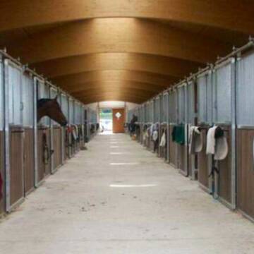
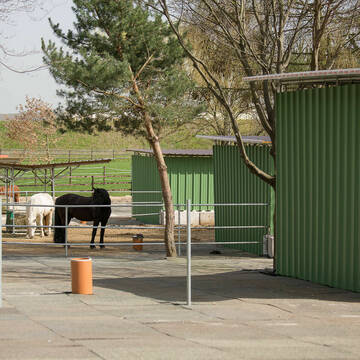
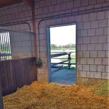
Wir haben aktuell Paddockbox-Fensterbox frei
Pulheim
Schumacher
@Reitanlage-Junkerhof
FN-Mitglied
Pferdeausbildung
Führanlage
Hunde willkommen
Allergikerstall
bedampftes/gewaschenes Heu
Außenbox mit Paddock
Außenboxen
26 weitere...
aktuell
S
Deprecated: Creation of dynamic property Zend_View_Helper_Ads::$adLink is deprecated in /var/www/stall-frei/htdocs/staging.stall-frei.de/library/Psf/View/Helper/Ads.php on line 108

Mitarbeiter gesucht?
Mechtersen
STALL-FREIde Marketing
@STALL-FREI-Marketing
Stellenangebote kostenlos veröffentlichen!

Heinrichshof Aktivstall
Köln Fühlingen
Frenger GbR - Heinrichshof
@Frenger-GbR
FN-Mitglied
Freizeitstall
Hunde willkommen
Krankenbox
Allergikerstall
bedampftes/gewaschenes Heu
Außenbox mit Paddock
Bewegungsstall
22 weitere...
S
Reitstall Mühlenbeck
Hürth
Reitstall-Muehlenbeck
@Reitstall-Muehlenbeck
FN-Mitglied
Freizeitstall
Vermieten
Hunde willkommen
Longierzirkel/Roundpen
Außenbox mit Paddock
Außenboxen
19 weitere...
aktuell
S


***Reitstall Birkenhof*** Pferdegerechte Haltung
Köln
Daniele-Fazzi
@Daniele-Fazzi
Freizeitstall
Geländestrecke
Vermieten
Verpachten
Hunde willkommen
Longierzirkel/Roundpen
Allergikerstall
Hufrehe geeignet
23 weitere...
ganz aktuell
S


Historische Reitanlage in Köln-Dellbrück
Köln
RGS Kornspringer Köln e. V.
@Kornspringer
FN-Mitglied
Freizeitstall
Vermieten
Führanlage
Hunde willkommen
bedampftes/gewaschenes Heu
Notfallboxen
21 weitere...
S
Paddockbox / Offenstall 24 / 7 Heu
Rommerskirchen
Gaby Rixen
@Wilfried-Rixen
Fahrstall, Kutschwagen
FN-Mitglied
Krankenbox
Longierzirkel/Roundpen
Außenbox mit Paddock
Außenboxen
Vollpension
20 weitere...
S

Futtersack HeuToy, Fressbremse in pink
Mechtersen
STALL-FREIde Marketing
@STALL-FREI-Marketing
Stundenlange Beschäftigung die
Koliken vorbeugt, geringe Staubinhalation mit
steuerbarer Futterentnahme

Gut Pletschmühle Dressur-Spring-Freizeit Stall
Pulheim
Wiebke-Alt
@Wiebke-Alt
Fahrstall, Kutschwagen
FN-Mitglied
Führanlage
Hunde willkommen
Notfallboxen
Außenbox mit Paddock
Außenboxen
24 weitere...
P+


Aktivstall-Andreashof
Dormagen
Aktivstall-Andreashof
@Aktivstall-Andreashof
FN-Mitglied
Freizeitstall
Vermieten
Hunde willkommen
Krankenbox
Allergikerstall
Hufrehe geeignet
21 weitere...
S


Exklusive Reitanlage in Kerpen
Kerpen
Reitanlage Im Jagdfeld
@Andrea77
Führanlage
Hunde willkommen
Hengsthaltung möglich
Halbpension
Vollpension
Einzelne Boxen oder Stallplätze
16 weitere...
S

Reitanlage Martinshof in Pulheim hat Boxen frei
Pulheim
Melanie Engelbrecht
@Melanie51
Vermieten
Führanlage
Hunde willkommen
Außenbox mit Paddock
Außenboxen
Vollpension
10 weitere...
P+
Deprecated: Creation of dynamic property Zend_View::$pageCount is deprecated in /var/www/stall-frei/htdocs/staging.stall-frei.de/library/vendor/shardj/zf1-future/library/Zend/View/Abstract.php on line 308
Deprecated: Creation of dynamic property Zend_View::$itemCountPerPage is deprecated in /var/www/stall-frei/htdocs/staging.stall-frei.de/library/vendor/shardj/zf1-future/library/Zend/View/Abstract.php on line 308
Deprecated: Creation of dynamic property Zend_View::$first is deprecated in /var/www/stall-frei/htdocs/staging.stall-frei.de/library/vendor/shardj/zf1-future/library/Zend/View/Abstract.php on line 308
Deprecated: Creation of dynamic property Zend_View::$current is deprecated in /var/www/stall-frei/htdocs/staging.stall-frei.de/library/vendor/shardj/zf1-future/library/Zend/View/Abstract.php on line 308
Deprecated: Creation of dynamic property Zend_View::$last is deprecated in /var/www/stall-frei/htdocs/staging.stall-frei.de/library/vendor/shardj/zf1-future/library/Zend/View/Abstract.php on line 308
Deprecated: Creation of dynamic property Zend_View::$next is deprecated in /var/www/stall-frei/htdocs/staging.stall-frei.de/library/vendor/shardj/zf1-future/library/Zend/View/Abstract.php on line 308
Deprecated: Creation of dynamic property Zend_View::$pagesInRange is deprecated in /var/www/stall-frei/htdocs/staging.stall-frei.de/library/vendor/shardj/zf1-future/library/Zend/View/Abstract.php on line 308
Deprecated: Creation of dynamic property Zend_View::$firstPageInRange is deprecated in /var/www/stall-frei/htdocs/staging.stall-frei.de/library/vendor/shardj/zf1-future/library/Zend/View/Abstract.php on line 308
Deprecated: Creation of dynamic property Zend_View::$lastPageInRange is deprecated in /var/www/stall-frei/htdocs/staging.stall-frei.de/library/vendor/shardj/zf1-future/library/Zend/View/Abstract.php on line 308
Deprecated: Creation of dynamic property Zend_View::$currentItemCount is deprecated in /var/www/stall-frei/htdocs/staging.stall-frei.de/library/vendor/shardj/zf1-future/library/Zend/View/Abstract.php on line 308
Deprecated: Creation of dynamic property Zend_View::$totalItemCount is deprecated in /var/www/stall-frei/htdocs/staging.stall-frei.de/library/vendor/shardj/zf1-future/library/Zend/View/Abstract.php on line 308
Deprecated: Creation of dynamic property Zend_View::$firstItemNumber is deprecated in /var/www/stall-frei/htdocs/staging.stall-frei.de/library/vendor/shardj/zf1-future/library/Zend/View/Abstract.php on line 308
Deprecated: Creation of dynamic property Zend_View::$lastItemNumber is deprecated in /var/www/stall-frei/htdocs/staging.stall-frei.de/library/vendor/shardj/zf1-future/library/Zend/View/Abstract.php on line 308
Deprecated: Creation of dynamic property Zend_View::$router is deprecated in /var/www/stall-frei/htdocs/staging.stall-frei.de/library/vendor/shardj/zf1-future/library/Zend/View/Abstract.php on line 308
Deprecated: Creation of dynamic property Zend_View::$urlParams is deprecated in /var/www/stall-frei/htdocs/staging.stall-frei.de/library/vendor/shardj/zf1-future/library/Zend/View/Abstract.php on line 308
Deprecated: Creation of dynamic property Zend_View::$showAds is deprecated in /var/www/stall-frei/htdocs/staging.stall-frei.de/library/vendor/shardj/zf1-future/library/Zend/View/Abstract.php on line 308
Deprecated: Creation of dynamic property Zend_View::$objectIds is deprecated in /var/www/stall-frei/htdocs/staging.stall-frei.de/library/vendor/shardj/zf1-future/library/Zend/View/Abstract.php on line 308
Deprecated: Creation of dynamic property Zend_View::$showNavbar is deprecated in /var/www/stall-frei/htdocs/staging.stall-frei.de/library/vendor/shardj/zf1-future/library/Zend/View/Abstract.php on line 308
Deprecated: Creation of dynamic property Zend_View::$showBreadcrumb is deprecated in /var/www/stall-frei/htdocs/staging.stall-frei.de/library/vendor/shardj/zf1-future/library/Zend/View/Abstract.php on line 308
Deprecated: Creation of dynamic property Zend_View::$showFooter is deprecated in /var/www/stall-frei/htdocs/staging.stall-frei.de/library/vendor/shardj/zf1-future/library/Zend/View/Abstract.php on line 308
Deprecated: Creation of dynamic property Zend_View::$showInternalAds is deprecated in /var/www/stall-frei/htdocs/staging.stall-frei.de/library/vendor/shardj/zf1-future/library/Zend/View/Abstract.php on line 308
Deprecated: Creation of dynamic property Zend_View::$blNoContent is deprecated in /var/www/stall-frei/htdocs/staging.stall-frei.de/library/vendor/shardj/zf1-future/library/Zend/View/Abstract.php on line 308
Deprecated: Creation of dynamic property Zend_View::$sMetaDesc is deprecated in /var/www/stall-frei/htdocs/staging.stall-frei.de/library/vendor/shardj/zf1-future/library/Zend/View/Abstract.php on line 308
Deprecated: Creation of dynamic property Zend_View::$useGmaps is deprecated in /var/www/stall-frei/htdocs/staging.stall-frei.de/library/vendor/shardj/zf1-future/library/Zend/View/Abstract.php on line 308
Deprecated: Creation of dynamic property Zend_View::$touches is deprecated in /var/www/stall-frei/htdocs/staging.stall-frei.de/library/vendor/shardj/zf1-future/library/Zend/View/Abstract.php on line 308
Deprecated: Creation of dynamic property Zend_View::$oProject is deprecated in /var/www/stall-frei/htdocs/staging.stall-frei.de/library/vendor/shardj/zf1-future/library/Zend/View/Abstract.php on line 308
Deprecated: Creation of dynamic property Zend_View::$pageHeadline is deprecated in /var/www/stall-frei/htdocs/staging.stall-frei.de/library/vendor/shardj/zf1-future/library/Zend/View/Abstract.php on line 308
Deprecated: Creation of dynamic property Zend_View::$disableLocationField is deprecated in /var/www/stall-frei/htdocs/staging.stall-frei.de/library/vendor/shardj/zf1-future/library/Zend/View/Abstract.php on line 308
Deprecated: Creation of dynamic property Zend_View::$isSearch is deprecated in /var/www/stall-frei/htdocs/staging.stall-frei.de/library/vendor/shardj/zf1-future/library/Zend/View/Abstract.php on line 308
Deprecated: Creation of dynamic property Zend_View::$pageTitle is deprecated in /var/www/stall-frei/htdocs/staging.stall-frei.de/library/vendor/shardj/zf1-future/library/Zend/View/Abstract.php on line 308
Deprecated: Creation of dynamic property Psf_Form_Element_Text::$class is deprecated in /var/www/stall-frei/htdocs/staging.stall-frei.de/library/vendor/shardj/zf1-future/library/Zend/Form/Element.php on line 874
Deprecated: Creation of dynamic property Psf_Form_Element_Text::$size is deprecated in /var/www/stall-frei/htdocs/staging.stall-frei.de/library/vendor/shardj/zf1-future/library/Zend/Form/Element.php on line 874
Deprecated: Creation of dynamic property Psf_Form_Element_Text::$placeholder is deprecated in /var/www/stall-frei/htdocs/staging.stall-frei.de/library/vendor/shardj/zf1-future/library/Zend/Form/Element.php on line 874
Deprecated: Creation of dynamic property Psf_Form_Element_Hidden::$class is deprecated in /var/www/stall-frei/htdocs/staging.stall-frei.de/library/vendor/shardj/zf1-future/library/Zend/Form/Element.php on line 874
Deprecated: Creation of dynamic property Psf_Form_Element_Hidden::$class is deprecated in /var/www/stall-frei/htdocs/staging.stall-frei.de/library/vendor/shardj/zf1-future/library/Zend/Form/Element.php on line 874
Deprecated: Creation of dynamic property Psf_Form_Element_Hidden::$class is deprecated in /var/www/stall-frei/htdocs/staging.stall-frei.de/library/vendor/shardj/zf1-future/library/Zend/Form/Element.php on line 874
Deprecated: Creation of dynamic property Psf_Form_Element_Hidden::$class is deprecated in /var/www/stall-frei/htdocs/staging.stall-frei.de/library/vendor/shardj/zf1-future/library/Zend/Form/Element.php on line 874
Deprecated: Creation of dynamic property Psf_Form_Element_Select::$class is deprecated in /var/www/stall-frei/htdocs/staging.stall-frei.de/library/vendor/shardj/zf1-future/library/Zend/Form/Element.php on line 874
Deprecated: Creation of dynamic property Psf_Form_Element_Select::$class is deprecated in /var/www/stall-frei/htdocs/staging.stall-frei.de/library/vendor/shardj/zf1-future/library/Zend/Form/Element.php on line 874
Deprecated: Creation of dynamic property Psf_Form_Element_Select::$class is deprecated in /var/www/stall-frei/htdocs/staging.stall-frei.de/library/vendor/shardj/zf1-future/library/Zend/Form/Element.php on line 874
Deprecated: Creation of dynamic property Psf_Form_Element_Select::$class is deprecated in /var/www/stall-frei/htdocs/staging.stall-frei.de/library/vendor/shardj/zf1-future/library/Zend/Form/Element.php on line 874
Deprecated: Creation of dynamic property Psf_Form_Element_Text::$class is deprecated in /var/www/stall-frei/htdocs/staging.stall-frei.de/library/vendor/shardj/zf1-future/library/Zend/Form/Element.php on line 874
Deprecated: Creation of dynamic property Psf_Form_Element_Checkbox::$label is deprecated in /var/www/stall-frei/htdocs/staging.stall-frei.de/library/vendor/shardj/zf1-future/library/Zend/Form/Element.php on line 874
Deprecated: Creation of dynamic property Zend_View::$sort is deprecated in /var/www/stall-frei/htdocs/staging.stall-frei.de/library/vendor/shardj/zf1-future/library/Zend/View/Abstract.php on line 308
Deprecated: Creation of dynamic property Zend_View::$searchLocation is deprecated in /var/www/stall-frei/htdocs/staging.stall-frei.de/library/vendor/shardj/zf1-future/library/Zend/View/Abstract.php on line 308
Deprecated: Creation of dynamic property Zend_View::$locationHint is deprecated in /var/www/stall-frei/htdocs/staging.stall-frei.de/library/vendor/shardj/zf1-future/library/Zend/View/Abstract.php on line 308
Psf_GeoCoder_Abstract::getLocation: Venlo Get Location CachedOrLive
Psf_GeoCoder_Abstract::getCachedOrLive: Venlo
Psf_GeoCoder_OpenCageData::makeApiRequest: response:
Array
(
[documentation] => https://opencagedata.com/api
[licenses] => Array
(
[0] => Array
(
[name] => see attribution guide
[url] => https://opencagedata.com/credits
)
)
[results] => Array
(
[0] => Array
(
[bounds] => Array
(
[northeast] => Array
(
[lat] => 50.9661196
[lng] => 6.8803292
)
[southwest] => Array
(
[lat] => 50.9656311
[lng] => 6.8795755
)
)
[components] => Array
(
[ISO_3166-1_alpha-2] => DE
[ISO_3166-1_alpha-3] => DEU
[ISO_3166-2] => Array
(
[0] => DE-NW
)
[_category] => place
[_normalized_city] => Köln
[_type] => neighbourhood
[city] => Köln
[city_district] => Ehrenfeld
[continent] => Europe
[country] => Deutschland
[country_code] => de
[industrial] => Hauptverteilerstation Venlo
[political_union] => European Union
[postcode] => 50829
[state] => Nordrhein-Westfalen
[state_code] => NW
[suburb] => Vogelsang
)
[confidence] => 9
[formatted] => 50829 Köln, Deutschland
[geometry] => Array
(
[lat] => 50.9658616
[lng] => 6.8799426
)
)
[1] => Array
(
[bounds] => Array
(
[northeast] => Array
(
[lat] => 51.4496845
[lng] => 6.2779745
)
[southwest] => Array
(
[lat] => 51.4491696
[lng] => 6.2776916
)
)
[components] => Array
(
[ISO_3166-1_alpha-2] => DE
[ISO_3166-1_alpha-3] => DEU
[ISO_3166-2] => Array
(
[0] => DE-NW
)
[_category] => road
[_normalized_city] => Straelen
[_type] => road
[continent] => Europe
[country] => Deutschland
[country_code] => de
[county] => Kreis Kleve
[political_union] => European Union
[postcode] => 47638
[road] => ex Venlo - Wesel
[road_type] => path
[state] => Nordrhein-Westfalen
[state_code] => NW
[town] => Straelen
)
[confidence] => 9
[formatted] => ex Venlo - Wesel, 47638 Straelen, Deutschland
[geometry] => Array
(
[lat] => 51.4494271
[lng] => 6.2778331
)
)
[2] => Array
(
[bounds] => Array
(
[northeast] => Array
(
[lat] => 51.321142
[lng] => 6.196516
)
[southwest] => Array
(
[lat] => 51.3210062
[lng] => 6.1961718
)
)
[components] => Array
(
[ISO_3166-1_alpha-2] => DE
[ISO_3166-1_alpha-3] => DEU
[ISO_3166-2] => Array
(
[0] => DE-NW
)
[_category] => building
[_normalized_city] => Kaldenkirchen
[_type] => building
[building] => Gaststätte Stadt Venlo
[continent] => Europe
[country] => Deutschland
[country_code] => de
[county] => Kreis Viersen
[municipality] => Nettetal
[political_union] => European Union
[postcode] => 41334
[road] => Venloer Straße
[state] => Nordrhein-Westfalen
[state_code] => NW
[town] => Kaldenkirchen
)
[confidence] => 10
[formatted] => Gaststätte Stadt Venlo, Venloer Straße, 41334 Kaldenkirchen, Deutschland
[geometry] => Array
(
[lat] => 51.3210711
[lng] => 6.1963459
)
)
[3] => Array
(
[bounds] => Array
(
[northeast] => Array
(
[lat] => 51.3594023
[lng] => 6.2247513
)
[southwest] => Array
(
[lat] => 51.3592361
[lng] => 6.2244715
)
)
[components] => Array
(
[ISO_3166-1_alpha-2] => DE
[ISO_3166-1_alpha-3] => DEU
[ISO_3166-2] => Array
(
[0] => DE-NW
)
[_category] => travel/tourism
[_normalized_city] => Nettetal
[_type] => memorial
[continent] => Europe
[country] => Deutschland
[country_code] => de
[county] => Kreis Viersen
[memorial] => Gedenkstätte Fliegerhorst Venlo
[municipality] => Nettetal
[political_union] => European Union
[postcode] => 41334
[road] => Poelvenn
[state] => Nordrhein-Westfalen
[state_code] => NW
)
[confidence] => 9
[formatted] => Gedenkstätte Fliegerhorst Venlo, Poelvenn, 41334 Nettetal, Deutschland
[geometry] => Array
(
[lat] => 51.3593453
[lng] => 6.2246552
)
)
[4] => Array
(
[bounds] => Array
(
[northeast] => Array
(
[lat] => 50.9524783
[lng] => 6.9135853
)
[southwest] => Array
(
[lat] => 50.9523783
[lng] => 6.9134853
)
)
[components] => Array
(
[ISO_3166-1_alpha-2] => DE
[ISO_3166-1_alpha-3] => DEU
[ISO_3166-2] => Array
(
[0] => DE-NW
)
[_category] => commerce
[_normalized_city] => Köln
[_type] => shop
[city] => Köln
[city_district] => Ehrenfeld
[continent] => Europe
[country] => Deutschland
[country_code] => de
[house_number] => 394
[political_union] => European Union
[postcode] => 50825
[road] => Venloer Straße
[shop] => Venlo Kiosk
[state] => Nordrhein-Westfalen
[state_code] => NW
[suburb] => Ehrenfeld
)
[confidence] => 9
[formatted] => Venlo Kiosk, Venloer Straße 394, 50825 Köln, Deutschland
[geometry] => Array
(
[lat] => 50.9524283
[lng] => 6.9135353
)
)
[5] => Array
(
[bounds] => Array
(
[northeast] => Array
(
[lat] => 51.2922443
[lng] => 6.1377065
)
[southwest] => Array
(
[lat] => 51.2921443
[lng] => 6.1376065
)
)
[components] => Array
(
[ISO_3166-1_alpha-2] => DE
[ISO_3166-1_alpha-3] => DEU
[ISO_3166-2] => Array
(
[0] => DE-NW
)
[_category] => travel/tourism
[_normalized_city] => Brüggen
[_type] => information
[continent] => Europe
[country] => Deutschland
[country_code] => de
[county] => Kreis Viersen
[information] => Wanderroutennetzwerk Gemeinde Venlo: Belfeld
[political_union] => European Union
[postcode] => 41379
[road] => Bovenste Schorfweg
[state] => Nordrhein-Westfalen
[state_code] => NW
[town] => Brüggen
)
[confidence] => 9
[formatted] => Wanderroutennetzwerk Gemeinde Venlo: Belfeld, Bovenste Schorfweg, 41379 Brüggen, Deutschland
[geometry] => Array
(
[lat] => 51.2921943
[lng] => 6.1376565
)
)
[6] => Array
(
[bounds] => Array
(
[northeast] => Array
(
[lat] => 51.4438176
[lng] => 6.6751954
)
[southwest] => Array
(
[lat] => 51.4437176
[lng] => 6.6750954
)
)
[components] => Array
(
[ISO_3166-1_alpha-2] => DE
[ISO_3166-1_alpha-3] => DEU
[ISO_3166-2] => Array
(
[0] => DE-NW
)
[_category] => transportation
[_normalized_city] => Duisburg
[_type] => bus_stop
[city] => Duisburg
[city_district] => Homberg/Ruhrort/Baerl
[continent] => Europe
[country] => Deutschland
[country_code] => de
[highway] => Asberger Straße
[political_union] => European Union
[postcode] => 47198
[road] => Asberger Straße
[state] => Nordrhein-Westfalen
[state_code] => NW
[suburb] => Hochheide
)
[confidence] => 9
[formatted] => Asberger Straße, 47198 Duisburg, Deutschland
[geometry] => Array
(
[lat] => 51.4437676
[lng] => 6.6751454
)
)
[7] => Array
(
[components] => Array
(
[ISO_3166-1_alpha-2] => FR
[ISO_3166-1_alpha-3] => FRA
[ISO_3166-2] => Array
(
[0] => FR-IDF
[1] => FR-92
)
[_category] => road
[_normalized_city] => Levallois-Perret
[_type] => road
[city] => Levallois-Perret
[continent] => Europe
[country] => France
[country_code] => fr
[county] => Hauts-de-Seine
[local_authority] => Métropole du Grand Paris
[political_union] => European Union
[postcode] => 92300
[road] => Rue Charles Deutschmann
[state] => Île-de-France
[state_code] => IDF
)
[confidence] => 2
[formatted] => Rue Charles Deutschmann, 92300 Levallois-Perret, France
[geometry] => Array
(
[lat] => 48.900049
[lng] => 2.2842
)
)
[8] => Array
(
[components] => Array
(
[ISO_3166-1_alpha-2] => FR
[ISO_3166-1_alpha-3] => FRA
[ISO_3166-2] => Array
(
[0] => FR-ARA
[1] => FR-43
)
[_category] => road
[_normalized_city] => Loudes
[_type] => road
[city] => Loudes
[continent] => Europe
[country] => France
[country_code] => fr
[county] => Haute-Loire
[local_authority] => Communauté d'agglomération du Puy-en-Velay
[political_union] => European Union
[postcode] => 43320
[road] => Vendos
[state] => Auvergne-Rhône-Alpes
[state_code] => ARA
)
[confidence] => 2
[formatted] => Vendos, 43320 Loudes, France
[geometry] => Array
(
[lat] => 45.095974
[lng] => 3.766515
)
)
[9] => Array
(
[components] => Array
(
[ISO_3166-1_alpha-2] => FR
[ISO_3166-1_alpha-3] => FRA
[ISO_3166-2] => Array
(
[0] => FR-PAC
[1] => FR-13
)
[_category] => road
[_normalized_city] => Aix-en-Provence
[_type] => road
[city] => Aix-en-Provence
[continent] => Europe
[country] => France
[country_code] => fr
[county] => Bouches-du-Rhône
[local_authority] => Aix-Marseille-Provence
[political_union] => European Union
[postcode] => 13100
[road] => Rue Vanloo
[state] => Provence-Alpes-Côte d'Azur
[state_code] => PAC
)
[confidence] => 2
[formatted] => Rue Vanloo, 13100 Aix-en-Provence, France
[geometry] => Array
(
[lat] => 43.52985
[lng] => 5.443403
)
)
)
[status] => Array
(
[code] => 200
[message] => OK
)
[stay_informed] => Array
(
[blog] => https://blog.opencagedata.com
[mastodon] => https://en.osm.town/@opencage
)
[thanks] => For using an OpenCage API
[timestamp] => Array
(
[created_http] => Sun, 08 Feb 2026 14:17:09 GMT
[created_unix] => 1770560229
)
[total_results] => 10
)
Psf_GeoCoder_Abstract::convertLocationResult
{"documentation":"https:\/\/opencagedata.com\/api","licenses":[{"name":"see attribution guide","url":"https:\/\/opencagedata.com\/credits"}],"results":[{"bounds":{"northeast":{"lat":50.9661196,"lng":6.8803292},"southwest":{"lat":50.9656311,"lng":6.8795755}},"components":{"ISO_3166-1_alpha-2":"DE","ISO_3166-1_alpha-3":"DEU","ISO_3166-2":["DE-NW"],"_category":"place","_normalized_city":"K\u00f6ln","_type":"neighbourhood","city":"K\u00f6ln","city_district":"Ehrenfeld","continent":"Europe","country":"Deutschland","country_code":"de","industrial":"Hauptverteilerstation Venlo","political_union":"European Union","postcode":"50829","state":"Nordrhein-Westfalen","state_code":"NW","suburb":"Vogelsang"},"confidence":9,"formatted":"50829 K\u00f6ln, Deutschland","geometry":{"lat":50.9658616,"lng":6.8799426}},{"bounds":{"northeast":{"lat":51.4496845,"lng":6.2779745},"southwest":{"lat":51.4491696,"lng":6.2776916}},"components":{"ISO_3166-1_alpha-2":"DE","ISO_3166-1_alpha-3":"DEU","ISO_3166-2":["DE-NW"],"_category":"road","_normalized_city":"Straelen","_type":"road","continent":"Europe","country":"Deutschland","country_code":"de","county":"Kreis Kleve","political_union":"European Union","postcode":"47638","road":"ex Venlo - Wesel","road_type":"path","state":"Nordrhein-Westfalen","state_code":"NW","town":"Straelen"},"confidence":9,"formatted":"ex Venlo - Wesel, 47638 Straelen, Deutschland","geometry":{"lat":51.4494271,"lng":6.2778331}},{"bounds":{"northeast":{"lat":51.321142,"lng":6.196516},"southwest":{"lat":51.3210062,"lng":6.1961718}},"components":{"ISO_3166-1_alpha-2":"DE","ISO_3166-1_alpha-3":"DEU","ISO_3166-2":["DE-NW"],"_category":"building","_normalized_city":"Kaldenkirchen","_type":"building","building":"Gastst\u00e4tte Stadt Venlo","continent":"Europe","country":"Deutschland","country_code":"de","county":"Kreis Viersen","municipality":"Nettetal","political_union":"European Union","postcode":"41334","road":"Venloer Stra\u00dfe","state":"Nordrhein-Westfalen","state_code":"NW","town":"Kaldenkirchen"},"confidence":10,"formatted":"Gastst\u00e4tte Stadt Venlo, Venloer Stra\u00dfe, 41334 Kaldenkirchen, Deutschland","geometry":{"lat":51.3210711,"lng":6.1963459}},{"bounds":{"northeast":{"lat":51.3594023,"lng":6.2247513},"southwest":{"lat":51.3592361,"lng":6.2244715}},"components":{"ISO_3166-1_alpha-2":"DE","ISO_3166-1_alpha-3":"DEU","ISO_3166-2":["DE-NW"],"_category":"travel\/tourism","_normalized_city":"Nettetal","_type":"memorial","continent":"Europe","country":"Deutschland","country_code":"de","county":"Kreis Viersen","memorial":"Gedenkst\u00e4tte Fliegerhorst Venlo","municipality":"Nettetal","political_union":"European Union","postcode":"41334","road":"Poelvenn","state":"Nordrhein-Westfalen","state_code":"NW"},"confidence":9,"formatted":"Gedenkst\u00e4tte Fliegerhorst Venlo, Poelvenn, 41334 Nettetal, Deutschland","geometry":{"lat":51.3593453,"lng":6.2246552}},{"bounds":{"northeast":{"lat":50.9524783,"lng":6.9135853},"southwest":{"lat":50.9523783,"lng":6.9134853}},"components":{"ISO_3166-1_alpha-2":"DE","ISO_3166-1_alpha-3":"DEU","ISO_3166-2":["DE-NW"],"_category":"commerce","_normalized_city":"K\u00f6ln","_type":"shop","city":"K\u00f6ln","city_district":"Ehrenfeld","continent":"Europe","country":"Deutschland","country_code":"de","house_number":"394","political_union":"European Union","postcode":"50825","road":"Venloer Stra\u00dfe","shop":"Venlo Kiosk","state":"Nordrhein-Westfalen","state_code":"NW","suburb":"Ehrenfeld"},"confidence":9,"formatted":"Venlo Kiosk, Venloer Stra\u00dfe 394, 50825 K\u00f6ln, Deutschland","geometry":{"lat":50.9524283,"lng":6.9135353}},{"bounds":{"northeast":{"lat":51.2922443,"lng":6.1377065},"southwest":{"lat":51.2921443,"lng":6.1376065}},"components":{"ISO_3166-1_alpha-2":"DE","ISO_3166-1_alpha-3":"DEU","ISO_3166-2":["DE-NW"],"_category":"travel\/tourism","_normalized_city":"Br\u00fcggen","_type":"information","continent":"Europe","country":"Deutschland","country_code":"de","county":"Kreis Viersen","information":"Wanderroutennetzwerk Gemeinde Venlo: Belfeld","political_union":"European Union","postcode":"41379","road":"Bovenste Schorfweg","state":"Nordrhein-Westfalen","state_code":"NW","town":"Br\u00fcggen"},"confidence":9,"formatted":"Wanderroutennetzwerk Gemeinde Venlo: Belfeld, Bovenste Schorfweg, 41379 Br\u00fcggen, Deutschland","geometry":{"lat":51.2921943,"lng":6.1376565}},{"bounds":{"northeast":{"lat":51.4438176,"lng":6.6751954},"southwest":{"lat":51.4437176,"lng":6.6750954}},"components":{"ISO_3166-1_alpha-2":"DE","ISO_3166-1_alpha-3":"DEU","ISO_3166-2":["DE-NW"],"_category":"transportation","_normalized_city":"Duisburg","_type":"bus_stop","city":"Duisburg","city_district":"Homberg\/Ruhrort\/Baerl","continent":"Europe","country":"Deutschland","country_code":"de","highway":"Asberger Stra\u00dfe","political_union":"European Union","postcode":"47198","road":"Asberger Stra\u00dfe","state":"Nordrhein-Westfalen","state_code":"NW","suburb":"Hochheide"},"confidence":9,"formatted":"Asberger Stra\u00dfe, 47198 Duisburg, Deutschland","geometry":{"lat":51.4437676,"lng":6.6751454}},{"components":{"ISO_3166-1_alpha-2":"FR","ISO_3166-1_alpha-3":"FRA","ISO_3166-2":["FR-IDF","FR-92"],"_category":"road","_normalized_city":"Levallois-Perret","_type":"road","city":"Levallois-Perret","continent":"Europe","country":"France","country_code":"fr","county":"Hauts-de-Seine","local_authority":"M\u00e9tropole du Grand Paris","political_union":"European Union","postcode":"92300","road":"Rue Charles Deutschmann","state":"\u00cele-de-France","state_code":"IDF"},"confidence":2,"formatted":"Rue Charles Deutschmann, 92300 Levallois-Perret, France","geometry":{"lat":48.900049,"lng":2.2842}},{"components":{"ISO_3166-1_alpha-2":"FR","ISO_3166-1_alpha-3":"FRA","ISO_3166-2":["FR-ARA","FR-43"],"_category":"road","_normalized_city":"Loudes","_type":"road","city":"Loudes","continent":"Europe","country":"France","country_code":"fr","county":"Haute-Loire","local_authority":"Communaut\u00e9 d'agglom\u00e9ration du Puy-en-Velay","political_union":"European Union","postcode":"43320","road":"Vendos","state":"Auvergne-Rh\u00f4ne-Alpes","state_code":"ARA"},"confidence":2,"formatted":"Vendos, 43320 Loudes, France","geometry":{"lat":45.095974,"lng":3.766515}},{"components":{"ISO_3166-1_alpha-2":"FR","ISO_3166-1_alpha-3":"FRA","ISO_3166-2":["FR-PAC","FR-13"],"_category":"road","_normalized_city":"Aix-en-Provence","_type":"road","city":"Aix-en-Provence","continent":"Europe","country":"France","country_code":"fr","county":"Bouches-du-Rh\u00f4ne","local_authority":"Aix-Marseille-Provence","political_union":"European Union","postcode":"13100","road":"Rue Vanloo","state":"Provence-Alpes-C\u00f4te d'Azur","state_code":"PAC"},"confidence":2,"formatted":"Rue Vanloo, 13100 Aix-en-Provence, France","geometry":{"lat":43.52985,"lng":5.443403}}],"status":{"code":200,"message":"OK"},"stay_informed":{"blog":"https:\/\/blog.opencagedata.com","mastodon":"https:\/\/en.osm.town\/@opencage"},"thanks":"For using an OpenCage API","timestamp":{"created_http":"Sun, 08 Feb 2026 14:17:09 GMT","created_unix":1770560229},"total_results":10}Array
(
[0] => stdClass Object
(
[bounds] => stdClass Object
(
[northeast] => stdClass Object
(
[lat] => 50.9661196
[lng] => 6.8803292
)
[southwest] => stdClass Object
(
[lat] => 50.9656311
[lng] => 6.8795755
)
)
[components] => stdClass Object
(
[ISO_3166-1_alpha-2] => DE
[ISO_3166-1_alpha-3] => DEU
[ISO_3166-2] => Array
(
[0] => DE-NW
)
[_category] => place
[_normalized_city] => Köln
[_type] => neighbourhood
[city] => Köln
[city_district] => Ehrenfeld
[continent] => Europe
[country] => Deutschland
[country_code] => de
[industrial] => Hauptverteilerstation Venlo
[political_union] => European Union
[postcode] => 50829
[state] => Nordrhein-Westfalen
[state_code] => NW
[suburb] => Vogelsang
)
[confidence] => 9
[formatted] => 50829 Köln, Deutschland
[geometry] => stdClass Object
(
[lat] => 50.9658616
[lng] => 6.8799426
)
)
[1] => stdClass Object
(
[bounds] => stdClass Object
(
[northeast] => stdClass Object
(
[lat] => 51.4496845
[lng] => 6.2779745
)
[southwest] => stdClass Object
(
[lat] => 51.4491696
[lng] => 6.2776916
)
)
[components] => stdClass Object
(
[ISO_3166-1_alpha-2] => DE
[ISO_3166-1_alpha-3] => DEU
[ISO_3166-2] => Array
(
[0] => DE-NW
)
[_category] => road
[_normalized_city] => Straelen
[_type] => road
[continent] => Europe
[country] => Deutschland
[country_code] => de
[county] => Kreis Kleve
[political_union] => European Union
[postcode] => 47638
[road] => ex Venlo - Wesel
[road_type] => path
[state] => Nordrhein-Westfalen
[state_code] => NW
[town] => Straelen
)
[confidence] => 9
[formatted] => ex Venlo - Wesel, 47638 Straelen, Deutschland
[geometry] => stdClass Object
(
[lat] => 51.4494271
[lng] => 6.2778331
)
)
[2] => stdClass Object
(
[bounds] => stdClass Object
(
[northeast] => stdClass Object
(
[lat] => 51.321142
[lng] => 6.196516
)
[southwest] => stdClass Object
(
[lat] => 51.3210062
[lng] => 6.1961718
)
)
[components] => stdClass Object
(
[ISO_3166-1_alpha-2] => DE
[ISO_3166-1_alpha-3] => DEU
[ISO_3166-2] => Array
(
[0] => DE-NW
)
[_category] => building
[_normalized_city] => Kaldenkirchen
[_type] => building
[building] => Gaststätte Stadt Venlo
[continent] => Europe
[country] => Deutschland
[country_code] => de
[county] => Kreis Viersen
[municipality] => Nettetal
[political_union] => European Union
[postcode] => 41334
[road] => Venloer Straße
[state] => Nordrhein-Westfalen
[state_code] => NW
[town] => Kaldenkirchen
)
[confidence] => 10
[formatted] => Gaststätte Stadt Venlo, Venloer Straße, 41334 Kaldenkirchen, Deutschland
[geometry] => stdClass Object
(
[lat] => 51.3210711
[lng] => 6.1963459
)
)
[3] => stdClass Object
(
[bounds] => stdClass Object
(
[northeast] => stdClass Object
(
[lat] => 51.3594023
[lng] => 6.2247513
)
[southwest] => stdClass Object
(
[lat] => 51.3592361
[lng] => 6.2244715
)
)
[components] => stdClass Object
(
[ISO_3166-1_alpha-2] => DE
[ISO_3166-1_alpha-3] => DEU
[ISO_3166-2] => Array
(
[0] => DE-NW
)
[_category] => travel/tourism
[_normalized_city] => Nettetal
[_type] => memorial
[continent] => Europe
[country] => Deutschland
[country_code] => de
[county] => Kreis Viersen
[memorial] => Gedenkstätte Fliegerhorst Venlo
[municipality] => Nettetal
[political_union] => European Union
[postcode] => 41334
[road] => Poelvenn
[state] => Nordrhein-Westfalen
[state_code] => NW
)
[confidence] => 9
[formatted] => Gedenkstätte Fliegerhorst Venlo, Poelvenn, 41334 Nettetal, Deutschland
[geometry] => stdClass Object
(
[lat] => 51.3593453
[lng] => 6.2246552
)
)
[4] => stdClass Object
(
[bounds] => stdClass Object
(
[northeast] => stdClass Object
(
[lat] => 50.9524783
[lng] => 6.9135853
)
[southwest] => stdClass Object
(
[lat] => 50.9523783
[lng] => 6.9134853
)
)
[components] => stdClass Object
(
[ISO_3166-1_alpha-2] => DE
[ISO_3166-1_alpha-3] => DEU
[ISO_3166-2] => Array
(
[0] => DE-NW
)
[_category] => commerce
[_normalized_city] => Köln
[_type] => shop
[city] => Köln
[city_district] => Ehrenfeld
[continent] => Europe
[country] => Deutschland
[country_code] => de
[house_number] => 394
[political_union] => European Union
[postcode] => 50825
[road] => Venloer Straße
[shop] => Venlo Kiosk
[state] => Nordrhein-Westfalen
[state_code] => NW
[suburb] => Ehrenfeld
)
[confidence] => 9
[formatted] => Venlo Kiosk, Venloer Straße 394, 50825 Köln, Deutschland
[geometry] => stdClass Object
(
[lat] => 50.9524283
[lng] => 6.9135353
)
)
[5] => stdClass Object
(
[bounds] => stdClass Object
(
[northeast] => stdClass Object
(
[lat] => 51.2922443
[lng] => 6.1377065
)
[southwest] => stdClass Object
(
[lat] => 51.2921443
[lng] => 6.1376065
)
)
[components] => stdClass Object
(
[ISO_3166-1_alpha-2] => DE
[ISO_3166-1_alpha-3] => DEU
[ISO_3166-2] => Array
(
[0] => DE-NW
)
[_category] => travel/tourism
[_normalized_city] => Brüggen
[_type] => information
[continent] => Europe
[country] => Deutschland
[country_code] => de
[county] => Kreis Viersen
[information] => Wanderroutennetzwerk Gemeinde Venlo: Belfeld
[political_union] => European Union
[postcode] => 41379
[road] => Bovenste Schorfweg
[state] => Nordrhein-Westfalen
[state_code] => NW
[town] => Brüggen
)
[confidence] => 9
[formatted] => Wanderroutennetzwerk Gemeinde Venlo: Belfeld, Bovenste Schorfweg, 41379 Brüggen, Deutschland
[geometry] => stdClass Object
(
[lat] => 51.2921943
[lng] => 6.1376565
)
)
[6] => stdClass Object
(
[bounds] => stdClass Object
(
[northeast] => stdClass Object
(
[lat] => 51.4438176
[lng] => 6.6751954
)
[southwest] => stdClass Object
(
[lat] => 51.4437176
[lng] => 6.6750954
)
)
[components] => stdClass Object
(
[ISO_3166-1_alpha-2] => DE
[ISO_3166-1_alpha-3] => DEU
[ISO_3166-2] => Array
(
[0] => DE-NW
)
[_category] => transportation
[_normalized_city] => Duisburg
[_type] => bus_stop
[city] => Duisburg
[city_district] => Homberg/Ruhrort/Baerl
[continent] => Europe
[country] => Deutschland
[country_code] => de
[highway] => Asberger Straße
[political_union] => European Union
[postcode] => 47198
[road] => Asberger Straße
[state] => Nordrhein-Westfalen
[state_code] => NW
[suburb] => Hochheide
)
[confidence] => 9
[formatted] => Asberger Straße, 47198 Duisburg, Deutschland
[geometry] => stdClass Object
(
[lat] => 51.4437676
[lng] => 6.6751454
)
)
[7] => stdClass Object
(
[components] => stdClass Object
(
[ISO_3166-1_alpha-2] => FR
[ISO_3166-1_alpha-3] => FRA
[ISO_3166-2] => Array
(
[0] => FR-IDF
[1] => FR-92
)
[_category] => road
[_normalized_city] => Levallois-Perret
[_type] => road
[city] => Levallois-Perret
[continent] => Europe
[country] => France
[country_code] => fr
[county] => Hauts-de-Seine
[local_authority] => Métropole du Grand Paris
[political_union] => European Union
[postcode] => 92300
[road] => Rue Charles Deutschmann
[state] => Île-de-France
[state_code] => IDF
)
[confidence] => 2
[formatted] => Rue Charles Deutschmann, 92300 Levallois-Perret, France
[geometry] => stdClass Object
(
[lat] => 48.900049
[lng] => 2.2842
)
)
[8] => stdClass Object
(
[components] => stdClass Object
(
[ISO_3166-1_alpha-2] => FR
[ISO_3166-1_alpha-3] => FRA
[ISO_3166-2] => Array
(
[0] => FR-ARA
[1] => FR-43
)
[_category] => road
[_normalized_city] => Loudes
[_type] => road
[city] => Loudes
[continent] => Europe
[country] => France
[country_code] => fr
[county] => Haute-Loire
[local_authority] => Communauté d'agglomération du Puy-en-Velay
[political_union] => European Union
[postcode] => 43320
[road] => Vendos
[state] => Auvergne-Rhône-Alpes
[state_code] => ARA
)
[confidence] => 2
[formatted] => Vendos, 43320 Loudes, France
[geometry] => stdClass Object
(
[lat] => 45.095974
[lng] => 3.766515
)
)
[9] => stdClass Object
(
[components] => stdClass Object
(
[ISO_3166-1_alpha-2] => FR
[ISO_3166-1_alpha-3] => FRA
[ISO_3166-2] => Array
(
[0] => FR-PAC
[1] => FR-13
)
[_category] => road
[_normalized_city] => Aix-en-Provence
[_type] => road
[city] => Aix-en-Provence
[continent] => Europe
[country] => France
[country_code] => fr
[county] => Bouches-du-Rhône
[local_authority] => Aix-Marseille-Provence
[political_union] => European Union
[postcode] => 13100
[road] => Rue Vanloo
[state] => Provence-Alpes-Côte d'Azur
[state_code] => PAC
)
[confidence] => 2
[formatted] => Rue Vanloo, 13100 Aix-en-Provence, France
[geometry] => stdClass Object
(
[lat] => 43.52985
[lng] => 5.443403
)
)
)
Psf_GeoCoder_OpenCageData::getKeyMap: 0
stdClass Object
(
    [bounds] => stdClass Object
        (
            [northeast] => stdClass Object
                (
                    [lat] => 50.9661196
                    [lng] => 6.8803292
                )

            [southwest] => stdClass Object
                (
                    [lat] => 50.9656311
                    [lng] => 6.8795755
                )

        )

    [components] => stdClass Object
        (
            [ISO_3166-1_alpha-2] => DE
            [ISO_3166-1_alpha-3] => DEU
            [ISO_3166-2] => Array
                (
                    [0] => DE-NW
                )

            [_category] => place
            [_normalized_city] => Köln
            [_type] => neighbourhood
            [city] => Köln
            [city_district] => Ehrenfeld
            [continent] => Europe
            [country] => Deutschland
            [country_code] => de
            [industrial] => Hauptverteilerstation Venlo
            [political_union] => European Union
            [postcode] => 50829
            [state] => Nordrhein-Westfalen
            [state_code] => NW
            [suburb] => Vogelsang
        )

    [confidence] => 9
    [formatted] => 50829 Köln, Deutschland
    [geometry] => stdClass Object
        (
            [lat] => 50.9658616
            [lng] => 6.8799426
        )

)
Psf_GeoCoder_OpenCageData::getCounty: Köln
Psf_GeoCoder_OpenCageData::addMissingData REFETCH!
Array
(
    [address] => 50829 Köln, Deutschland
    [type] => neighbourhood
    [street] =>
    [city] => Vogelsang
    [county] => Köln
    [state] => Nordrhein-Westfalen
    [zip] => 50829
    [country] => Deutschland
    [suburb] => Vogelsang
    [countrycode] => de
    [latitude] => 50.9658616
    [longitude] => 6.8799426
    [accuracy] => 1
    [confidence] => 9
    [bounds] => stdClass Object
        (
            [northeast] => stdClass Object
                (
                    [lat] => 50.9661196
                    [lng] => 6.8803292
                )

            [southwest] => stdClass Object
                (
                    [lat] => 50.9656311
                    [lng] => 6.8795755
                )

        )

)
reformat!
Array
(
    [address] => 50829 Vogelsang
    [type] => neighbourhood
    [street] =>
    [city] => Vogelsang
    [county] => Köln
    [state] => Nordrhein-Westfalen
    [zip] => 50829
    [country] => Deutschland
    [suburb] => Vogelsang
    [countrycode] => de
    [latitude] => 50.9658616
    [longitude] => 6.8799426
    [accuracy] => 1
    [confidence] => 9
    [bounds] => stdClass Object
        (
            [northeast] => stdClass Object
                (
                    [lat] => 50.9661196
                    [lng] => 6.8803292
                )

            [southwest] => stdClass Object
                (
                    [lat] => 50.9656311
                    [lng] => 6.8795755
                )

        )

    [place] => 50829 Vogelsang, Nordrhein-Westfalen
    [hash] => 9864319d7d2e604d717281fefb776039
)
Psf_GeoCoder_OpenCageData::getKeyMap: 1
stdClass Object
(
    [bounds] => stdClass Object
        (
            [northeast] => stdClass Object
                (
                    [lat] => 51.4496845
                    [lng] => 6.2779745
                )

            [southwest] => stdClass Object
                (
                    [lat] => 51.4491696
                    [lng] => 6.2776916
                )

        )

    [components] => stdClass Object
        (
            [ISO_3166-1_alpha-2] => DE
            [ISO_3166-1_alpha-3] => DEU
            [ISO_3166-2] => Array
                (
                    [0] => DE-NW
                )

            [_category] => road
            [_normalized_city] => Straelen
            [_type] => road
            [continent] => Europe
            [country] => Deutschland
            [country_code] => de
            [county] => Kreis Kleve
            [political_union] => European Union
            [postcode] => 47638
            [road] => ex Venlo - Wesel
            [road_type] => path
            [state] => Nordrhein-Westfalen
            [state_code] => NW
            [town] => Straelen
        )

    [confidence] => 9
    [formatted] => ex Venlo - Wesel, 47638 Straelen, Deutschland
    [geometry] => stdClass Object
        (
            [lat] => 51.4494271
            [lng] => 6.2778331
        )

)
Psf_GeoCoder_OpenCageData::getCounty: Kleve
Psf_GeoCoder_OpenCageData::addMissingData REFETCH!
Array
(
    [address] => ex Venlo - Wesel, 47638 Straelen, Deutschland
    [type] => road
    [street] => ex Venlo - Wesel
    [city] => Straelen
    [county] => Kleve
    [state] => Nordrhein-Westfalen
    [zip] => 47638
    [country] => Deutschland
    [suburb] =>
    [countrycode] => de
    [latitude] => 51.4494271
    [longitude] => 6.2778331
    [accuracy] => 1
    [confidence] => 9
    [bounds] => stdClass Object
        (
            [northeast] => stdClass Object
                (
                    [lat] => 51.4496845
                    [lng] => 6.2779745
                )

            [southwest] => stdClass Object
                (
                    [lat] => 51.4491696
                    [lng] => 6.2776916
                )

        )

)
reformat!
Array
(
    [address] => ex Venlo - Wesel, 47638 Straelen, Deutschland
    [type] => road
    [street] => ex Venlo - Wesel
    [city] => Straelen
    [county] => Kleve
    [state] => Nordrhein-Westfalen
    [zip] => 47638
    [country] => Deutschland
    [suburb] =>
    [countrycode] => de
    [latitude] => 51.4494271
    [longitude] => 6.2778331
    [accuracy] => 1
    [confidence] => 9
    [bounds] => stdClass Object
        (
            [northeast] => stdClass Object
                (
                    [lat] => 51.4496845
                    [lng] => 6.2779745
                )

            [southwest] => stdClass Object
                (
                    [lat] => 51.4491696
                    [lng] => 6.2776916
                )

        )

    [place] => ex Venlo - Wesel, 47638 Straelen, Nordrhein-Westfalen
    [hash] => 4390870f5421e305c5827baee463ce19
)
Psf_GeoCoder_OpenCageData::getKeyMap: 2
stdClass Object
(
    [bounds] => stdClass Object
        (
            [northeast] => stdClass Object
                (
                    [lat] => 51.321142
                    [lng] => 6.196516
                )

            [southwest] => stdClass Object
                (
                    [lat] => 51.3210062
                    [lng] => 6.1961718
                )

        )

    [components] => stdClass Object
        (
            [ISO_3166-1_alpha-2] => DE
            [ISO_3166-1_alpha-3] => DEU
            [ISO_3166-2] => Array
                (
                    [0] => DE-NW
                )

            [_category] => building
            [_normalized_city] => Kaldenkirchen
            [_type] => building
            [building] => Gaststätte Stadt Venlo
            [continent] => Europe
            [country] => Deutschland
            [country_code] => de
            [county] => Kreis Viersen
            [municipality] => Nettetal
            [political_union] => European Union
            [postcode] => 41334
            [road] => Venloer Straße
            [state] => Nordrhein-Westfalen
            [state_code] => NW
            [town] => Kaldenkirchen
        )

    [confidence] => 10
    [formatted] => Gaststätte Stadt Venlo, Venloer Straße, 41334 Kaldenkirchen, Deutschland
    [geometry] => stdClass Object
        (
            [lat] => 51.3210711
            [lng] => 6.1963459
        )

)
Psf_GeoCoder_OpenCageData::getCounty: Viersen
Psf_GeoCoder_OpenCageData::addMissingData REFETCH!
Array
(
    [address] => Gaststätte Stadt Venlo, Venloer Straße, 41334 Kaldenkirchen, Deutschland
    [type] => building
    [street] => Venloer Straße
    [city] => Kaldenkirchen
    [county] => Viersen
    [state] => Nordrhein-Westfalen
    [zip] => 41334
    [country] => Deutschland
    [suburb] =>
    [countrycode] => de
    [latitude] => 51.3210711
    [longitude] => 6.1963459
    [accuracy] => 1
    [confidence] => 10
    [bounds] => stdClass Object
        (
            [northeast] => stdClass Object
                (
                    [lat] => 51.321142
                    [lng] => 6.196516
                )

            [southwest] => stdClass Object
                (
                    [lat] => 51.3210062
                    [lng] => 6.1961718
                )

        )

)
reformat!
Array
(
    [address] => Gaststätte Stadt Venlo, Venloer Straße, 41334 Kaldenkirchen, Deutschland
    [type] => building
    [street] => Venloer Straße
    [city] => Kaldenkirchen
    [county] => Viersen
    [state] => Nordrhein-Westfalen
    [zip] => 41334
    [country] => Deutschland
    [suburb] =>
    [countrycode] => de
    [latitude] => 51.3210711
    [longitude] => 6.1963459
    [accuracy] => 1
    [confidence] => 10
    [bounds] => stdClass Object
        (
            [northeast] => stdClass Object
                (
                    [lat] => 51.321142
                    [lng] => 6.196516
                )

            [southwest] => stdClass Object
                (
                    [lat] => 51.3210062
                    [lng] => 6.1961718
                )

        )

    [place] => Venloer Straße, 41334 Kaldenkirchen, Nordrhein-Westfalen
    [hash] => f55e97a6b74ed02badf83196c49e8ff5
)
Psf_GeoCoder_OpenCageData::getKeyMap: 3
stdClass Object
(
    [bounds] => stdClass Object
        (
            [northeast] => stdClass Object
                (
                    [lat] => 51.3594023
                    [lng] => 6.2247513
                )

            [southwest] => stdClass Object
                (
                    [lat] => 51.3592361
                    [lng] => 6.2244715
                )

        )

    [components] => stdClass Object
        (
            [ISO_3166-1_alpha-2] => DE
            [ISO_3166-1_alpha-3] => DEU
            [ISO_3166-2] => Array
                (
                    [0] => DE-NW
                )

            [_category] => travel/tourism
            [_normalized_city] => Nettetal
            [_type] => memorial
            [continent] => Europe
            [country] => Deutschland
            [country_code] => de
            [county] => Kreis Viersen
            [memorial] => Gedenkstätte Fliegerhorst Venlo
            [municipality] => Nettetal
            [political_union] => European Union
            [postcode] => 41334
            [road] => Poelvenn
            [state] => Nordrhein-Westfalen
            [state_code] => NW
        )

    [confidence] => 9
    [formatted] => Gedenkstätte Fliegerhorst Venlo, Poelvenn, 41334 Nettetal, Deutschland
    [geometry] => stdClass Object
        (
            [lat] => 51.3593453
            [lng] => 6.2246552
        )

)
Psf_GeoCoder_OpenCageData::getCounty: Viersen
Psf_GeoCoder_OpenCageData::addMissingData REFETCH!
Array
(
    [address] => Gedenkstätte Fliegerhorst Venlo, Poelvenn, 41334 Nettetal, Deutschland
    [type] => memorial
    [street] => Poelvenn
    [city] =>
    [county] => Viersen
    [state] => Nordrhein-Westfalen
    [zip] => 41334
    [country] => Deutschland
    [suburb] =>
    [countrycode] => de
    [latitude] => 51.3593453
    [longitude] => 6.2246552
    [accuracy] => 1
    [confidence] => 9
    [bounds] => stdClass Object
        (
            [northeast] => stdClass Object
                (
                    [lat] => 51.3594023
                    [lng] => 6.2247513
                )

            [southwest] => stdClass Object
                (
                    [lat] => 51.3592361
                    [lng] => 6.2244715
                )

        )

)
reformat!
Array
(
    [address] => Gedenkstätte Fliegerhorst Venlo, Poelvenn, 41334 Nettetal, Deutschland
    [type] => memorial
    [street] => Poelvenn
    [city] =>
    [county] => Viersen
    [state] => Nordrhein-Westfalen
    [zip] => 41334
    [country] => Deutschland
    [suburb] =>
    [countrycode] => de
    [latitude] => 51.3593453
    [longitude] => 6.2246552
    [accuracy] => 1
    [confidence] => 9
    [bounds] => stdClass Object
        (
            [northeast] => stdClass Object
                (
                    [lat] => 51.3594023
                    [lng] => 6.2247513
                )

            [southwest] => stdClass Object
                (
                    [lat] => 51.3592361
                    [lng] => 6.2244715
                )

        )

    [place] => Poelvenn, 41334 , Nordrhein-Westfalen
    [hash] => 50edddec4c61a749a40c4fd55432f247
)
Psf_GeoCoder_OpenCageData::getKeyMap: 4
stdClass Object
(
    [bounds] => stdClass Object
        (
            [northeast] => stdClass Object
                (
                    [lat] => 50.9524783
                    [lng] => 6.9135853
                )

            [southwest] => stdClass Object
                (
                    [lat] => 50.9523783
                    [lng] => 6.9134853
                )

        )

    [components] => stdClass Object
        (
            [ISO_3166-1_alpha-2] => DE
            [ISO_3166-1_alpha-3] => DEU
            [ISO_3166-2] => Array
                (
                    [0] => DE-NW
                )

            [_category] => commerce
            [_normalized_city] => Köln
            [_type] => shop
            [city] => Köln
            [city_district] => Ehrenfeld
            [continent] => Europe
            [country] => Deutschland
            [country_code] => de
            [house_number] => 394
            [political_union] => European Union
            [postcode] => 50825
            [road] => Venloer Straße
            [shop] => Venlo Kiosk
            [state] => Nordrhein-Westfalen
            [state_code] => NW
            [suburb] => Ehrenfeld
        )

    [confidence] => 9
    [formatted] => Venlo Kiosk, Venloer Straße 394, 50825 Köln, Deutschland
    [geometry] => stdClass Object
        (
            [lat] => 50.9524283
            [lng] => 6.9135353
        )

)
Psf_GeoCoder_OpenCageData::getCounty: Köln
Psf_GeoCoder_OpenCageData::addMissingData REFETCH!
Array
(
    [address] => Venlo Kiosk, Venloer Straße 394, 50825 Köln, Deutschland
    [type] => shop
    [street] => Venloer Straße 394
    [city] => Ehrenfeld
    [county] => Köln
    [state] => Nordrhein-Westfalen
    [zip] => 50825
    [country] => Deutschland
    [suburb] => Ehrenfeld
    [countrycode] => de
    [latitude] => 50.9524283
    [longitude] => 6.9135353
    [accuracy] => 1
    [confidence] => 9
    [bounds] => stdClass Object
        (
            [northeast] => stdClass Object
                (
                    [lat] => 50.9524783
                    [lng] => 6.9135853
                )

            [southwest] => stdClass Object
                (
                    [lat] => 50.9523783
                    [lng] => 6.9134853
                )

        )

)
reformat!
Array
(
    [address] => Venloer Straße 394, 50825 Ehrenfeld
    [type] => shop
    [street] => Venloer Straße 394
    [city] => Ehrenfeld
    [county] => Köln
    [state] => Nordrhein-Westfalen
    [zip] => 50825
    [country] => Deutschland
    [suburb] => Ehrenfeld
    [countrycode] => de
    [latitude] => 50.9524283
    [longitude] => 6.9135353
    [accuracy] => 1
    [confidence] => 9
    [bounds] => stdClass Object
        (
            [northeast] => stdClass Object
                (
                    [lat] => 50.9524783
                    [lng] => 6.9135853
                )

            [southwest] => stdClass Object
                (
                    [lat] => 50.9523783
                    [lng] => 6.9134853
                )

        )

    [place] => Venloer Straße 394, 50825 Ehrenfeld, Nordrhein-Westfalen
    [hash] => 30aa52bf54ef9ad53c6a8e40a44e2d9f
)
Psf_GeoCoder_OpenCageData::getKeyMap: 5
stdClass Object
(
    [bounds] => stdClass Object
        (
            [northeast] => stdClass Object
                (
                    [lat] => 51.2922443
                    [lng] => 6.1377065
                )

            [southwest] => stdClass Object
                (
                    [lat] => 51.2921443
                    [lng] => 6.1376065
                )

        )

    [components] => stdClass Object
        (
            [ISO_3166-1_alpha-2] => DE
            [ISO_3166-1_alpha-3] => DEU
            [ISO_3166-2] => Array
                (
                    [0] => DE-NW
                )

            [_category] => travel/tourism
            [_normalized_city] => Brüggen
            [_type] => information
            [continent] => Europe
            [country] => Deutschland
            [country_code] => de
            [county] => Kreis Viersen
            [information] => Wanderroutennetzwerk Gemeinde Venlo: Belfeld
            [political_union] => European Union
            [postcode] => 41379
            [road] => Bovenste Schorfweg
            [state] => Nordrhein-Westfalen
            [state_code] => NW
            [town] => Brüggen
        )

    [confidence] => 9
    [formatted] => Wanderroutennetzwerk Gemeinde Venlo: Belfeld, Bovenste Schorfweg, 41379 Brüggen, Deutschland
    [geometry] => stdClass Object
        (
            [lat] => 51.2921943
            [lng] => 6.1376565
        )

)
Psf_GeoCoder_OpenCageData::getCounty: Viersen
Psf_GeoCoder_OpenCageData::addMissingData REFETCH!
Array
(
    [address] => Wanderroutennetzwerk Gemeinde Venlo: Belfeld, Bovenste Schorfweg, 41379 Brüggen, Deutschland
    [type] => information
    [street] => Bovenste Schorfweg
    [city] => Brüggen
    [county] => Viersen
    [state] => Nordrhein-Westfalen
    [zip] => 41379
    [country] => Deutschland
    [suburb] =>
    [countrycode] => de
    [latitude] => 51.2921943
    [longitude] => 6.1376565
    [accuracy] => 1
    [confidence] => 9
    [bounds] => stdClass Object
        (
            [northeast] => stdClass Object
                (
                    [lat] => 51.2922443
                    [lng] => 6.1377065
                )

            [southwest] => stdClass Object
                (
                    [lat] => 51.2921443
                    [lng] => 6.1376065
                )

        )

)
reformat!
Array
(
    [address] => Wanderroutennetzwerk Gemeinde Venlo: Belfeld, Bovenste Schorfweg, 41379 Brüggen, Deutschland
    [type] => information
    [street] => Bovenste Schorfweg
    [city] => Brüggen
    [county] => Viersen
    [state] => Nordrhein-Westfalen
    [zip] => 41379
    [country] => Deutschland
    [suburb] =>
    [countrycode] => de
    [latitude] => 51.2921943
    [longitude] => 6.1376565
    [accuracy] => 1
    [confidence] => 9
    [bounds] => stdClass Object
        (
            [northeast] => stdClass Object
                (
                    [lat] => 51.2922443
                    [lng] => 6.1377065
                )

            [southwest] => stdClass Object
                (
                    [lat] => 51.2921443
                    [lng] => 6.1376065
                )

        )

    [place] => Bovenste Schorfweg, 41379 Brüggen, Nordrhein-Westfalen
    [hash] => f6cca884cfec9b897d331dd62bc75314
)
Psf_GeoCoder_OpenCageData::getKeyMap: 6
stdClass Object
(
    [bounds] => stdClass Object
        (
            [northeast] => stdClass Object
                (
                    [lat] => 51.4438176
                    [lng] => 6.6751954
                )

            [southwest] => stdClass Object
                (
                    [lat] => 51.4437176
                    [lng] => 6.6750954
                )

        )

    [components] => stdClass Object
        (
            [ISO_3166-1_alpha-2] => DE
            [ISO_3166-1_alpha-3] => DEU
            [ISO_3166-2] => Array
                (
                    [0] => DE-NW
                )

            [_category] => transportation
            [_normalized_city] => Duisburg
            [_type] => bus_stop
            [city] => Duisburg
            [city_district] => Homberg/Ruhrort/Baerl
            [continent] => Europe
            [country] => Deutschland
            [country_code] => de
            [highway] => Asberger Straße
            [political_union] => European Union
            [postcode] => 47198
            [road] => Asberger Straße
            [state] => Nordrhein-Westfalen
            [state_code] => NW
            [suburb] => Hochheide
        )

    [confidence] => 9
    [formatted] => Asberger Straße, 47198 Duisburg, Deutschland
    [geometry] => stdClass Object
        (
            [lat] => 51.4437676
            [lng] => 6.6751454
        )

)
Psf_GeoCoder_OpenCageData::getCounty: Duisburg
Psf_GeoCoder_OpenCageData::addMissingData REFETCH!
Array
(
    [address] => Asberger Straße, 47198 Duisburg, Deutschland
    [type] => bus_stop
    [street] => Asberger Straße
    [city] => Hochheide
    [county] => Duisburg
    [state] => Nordrhein-Westfalen
    [zip] => 47198
    [country] => Deutschland
    [suburb] => Hochheide
    [countrycode] => de
    [latitude] => 51.4437676
    [longitude] => 6.6751454
    [accuracy] => 1
    [confidence] => 9
    [bounds] => stdClass Object
        (
            [northeast] => stdClass Object
                (
                    [lat] => 51.4438176
                    [lng] => 6.6751954
                )

            [southwest] => stdClass Object
                (
                    [lat] => 51.4437176
                    [lng] => 6.6750954
                )

        )

)
reformat!
Array
(
    [address] => Asberger Straße, 47198 Hochheide
    [type] => bus_stop
    [street] => Asberger Straße
    [city] => Hochheide
    [county] => Duisburg
    [state] => Nordrhein-Westfalen
    [zip] => 47198
    [country] => Deutschland
    [suburb] => Hochheide
    [countrycode] => de
    [latitude] => 51.4437676
    [longitude] => 6.6751454
    [accuracy] => 1
    [confidence] => 9
    [bounds] => stdClass Object
        (
            [northeast] => stdClass Object
                (
                    [lat] => 51.4438176
                    [lng] => 6.6751954
                )

            [southwest] => stdClass Object
                (
                    [lat] => 51.4437176
                    [lng] => 6.6750954
                )

        )

    [place] => Asberger Straße, 47198 Hochheide, Nordrhein-Westfalen
    [hash] => ac533c42a7dd274a51735e6923a4e143
)
Psf_GeoCoder_OpenCageData::getKeyMap: 7
stdClass Object
(
    [components] => stdClass Object
        (
            [ISO_3166-1_alpha-2] => FR
            [ISO_3166-1_alpha-3] => FRA
            [ISO_3166-2] => Array
                (
                    [0] => FR-IDF
                    [1] => FR-92
                )

            [_category] => road
            [_normalized_city] => Levallois-Perret
            [_type] => road
            [city] => Levallois-Perret
            [continent] => Europe
            [country] => France
            [country_code] => fr
            [county] => Hauts-de-Seine
            [local_authority] => Métropole du Grand Paris
            [political_union] => European Union
            [postcode] => 92300
            [road] => Rue Charles Deutschmann
            [state] => Île-de-France
            [state_code] => IDF
        )

    [confidence] => 2
    [formatted] => Rue Charles Deutschmann, 92300 Levallois-Perret, France
    [geometry] => stdClass Object
        (
            [lat] => 48.900049
            [lng] => 2.2842
        )

)
Psf_GeoCoder_OpenCageData::getCounty: Hauts-de-Seine
Psf_GeoCoder_OpenCageData::addMissingData REFETCH!
Array
(
    [address] => Rue Charles Deutschmann, 92300 Levallois-Perret, France
    [type] => road
    [street] => Rue Charles Deutschmann
    [city] => Levallois-Perret
    [county] => Hauts-de-Seine
    [state] => Île-de-France
    [zip] => 92300
    [country] => France
    [suburb] =>
    [countrycode] => fr
    [latitude] => 48.900049
    [longitude] => 2.2842
    [accuracy] => 1
    [confidence] => 2
    [bounds] =>
)
reformat!
Array
(
    [address] => Rue Charles Deutschmann, 92300 Levallois-Perret, France
    [type] => road
    [street] => Rue Charles Deutschmann
    [city] => Levallois-Perret
    [county] => Hauts-de-Seine
    [state] => Île-de-France
    [zip] => 92300
    [country] => France
    [suburb] =>
    [countrycode] => fr
    [latitude] => 48.900049
    [longitude] => 2.2842
    [accuracy] => 1
    [confidence] => 2
    [bounds] =>
    [place] => Rue Charles Deutschmann, 92300 Levallois-Perret, Île-de-France
    [hash] => b7dc44def3990e8a7eaf18e019eca466
)
Psf_GeoCoder_OpenCageData::getKeyMap: 8
stdClass Object
(
    [components] => stdClass Object
        (
            [ISO_3166-1_alpha-2] => FR
            [ISO_3166-1_alpha-3] => FRA
            [ISO_3166-2] => Array
                (
                    [0] => FR-ARA
                    [1] => FR-43
                )

            [_category] => road
            [_normalized_city] => Loudes
            [_type] => road
            [city] => Loudes
            [continent] => Europe
            [country] => France
            [country_code] => fr
            [county] => Haute-Loire
            [local_authority] => Communauté d'agglomération du Puy-en-Velay
            [political_union] => European Union
            [postcode] => 43320
            [road] => Vendos
            [state] => Auvergne-Rhône-Alpes
            [state_code] => ARA
        )

    [confidence] => 2
    [formatted] => Vendos, 43320 Loudes, France
    [geometry] => stdClass Object
        (
            [lat] => 45.095974
            [lng] => 3.766515
        )

)
Psf_GeoCoder_OpenCageData::getCounty: Haute-Loire
Psf_GeoCoder_OpenCageData::addMissingData REFETCH!
Array
(
    [address] => Vendos, 43320 Loudes, France
    [type] => road
    [street] => Vendos
    [city] => Loudes
    [county] => Haute-Loire
    [state] => Auvergne-Rhône-Alpes
    [zip] => 43320
    [country] => France
    [suburb] =>
    [countrycode] => fr
    [latitude] => 45.095974
    [longitude] => 3.766515
    [accuracy] => 1
    [confidence] => 2
    [bounds] =>
)
reformat!
Array
(
    [address] => Vendos, 43320 Loudes, France
    [type] => road
    [street] => Vendos
    [city] => Loudes
    [county] => Haute-Loire
    [state] => Auvergne-Rhône-Alpes
    [zip] => 43320
    [country] => France
    [suburb] =>
    [countrycode] => fr
    [latitude] => 45.095974
    [longitude] => 3.766515
    [accuracy] => 1
    [confidence] => 2
    [bounds] =>
    [place] => Vendos, 43320 Loudes, Auvergne-Rhône-Alpes
    [hash] => 9e082f31cd408e73bdefab4ba7f1ed0d
)
Psf_GeoCoder_OpenCageData::getKeyMap: 9
stdClass Object
(
    [components] => stdClass Object
        (
            [ISO_3166-1_alpha-2] => FR
            [ISO_3166-1_alpha-3] => FRA
            [ISO_3166-2] => Array
                (
                    [0] => FR-PAC
                    [1] => FR-13
                )

            [_category] => road
            [_normalized_city] => Aix-en-Provence
            [_type] => road
            [city] => Aix-en-Provence
            [continent] => Europe
            [country] => France
            [country_code] => fr
            [county] => Bouches-du-Rhône
            [local_authority] => Aix-Marseille-Provence
            [political_union] => European Union
            [postcode] => 13100
            [road] => Rue  Vanloo
            [state] => Provence-Alpes-Côte d'Azur
            [state_code] => PAC
        )

    [confidence] => 2
    [formatted] => Rue Vanloo, 13100 Aix-en-Provence, France
    [geometry] => stdClass Object
        (
            [lat] => 43.52985
            [lng] => 5.443403
        )

)
Psf_GeoCoder_OpenCageData::getCounty: Bouches-du-Rhône
Psf_GeoCoder_OpenCageData::addMissingData REFETCH!
Array
(
    [address] => Rue Vanloo, 13100 Aix-en-Provence, France
    [type] => road
    [street] => Rue  Vanloo
    [city] => Aix-en-Provence
    [county] => Bouches-du-Rhône
    [state] => Provence-Alpes-Côte d'Azur
    [zip] => 13100
    [country] => France
    [suburb] =>
    [countrycode] => fr
    [latitude] => 43.52985
    [longitude] => 5.443403
    [accuracy] => 1
    [confidence] => 2
    [bounds] =>
)
reformat!
Array
(
    [address] => Rue Vanloo, 13100 Aix-en-Provence, France
    [type] => road
    [street] => Rue  Vanloo
    [city] => Aix-en-Provence
    [county] => Bouches-du-Rhône
    [state] => Provence-Alpes-Côte d'Azur
    [zip] => 13100
    [country] => France
    [suburb] =>
    [countrycode] => fr
    [latitude] => 43.52985
    [longitude] => 5.443403
    [accuracy] => 1
    [confidence] => 2
    [bounds] =>
    [place] => Rue  Vanloo, 13100 Aix-en-Provence, Provence-Alpes-Côte d'Azur
    [hash] => 92dbd07a2da8d6e690ec06e22f155e61
)
Deprecated: Creation of dynamic property Zend_View::$locationHintStyle is deprecated in /var/www/stall-frei/htdocs/staging.stall-frei.de/library/vendor/shardj/zf1-future/library/Zend/View/Abstract.php on line 308
Deprecated: Creation of dynamic property Zend_View::$adGeoLocation is deprecated in /var/www/stall-frei/htdocs/staging.stall-frei.de/library/vendor/shardj/zf1-future/library/Zend/View/Abstract.php on line 308
Deprecated: Creation of dynamic property Zend_View::$recordCount is deprecated in /var/www/stall-frei/htdocs/staging.stall-frei.de/library/vendor/shardj/zf1-future/library/Zend/View/Abstract.php on line 308
Deprecated: explode(): Passing null to parameter #2 ($string) of type string is deprecated in /var/www/stall-frei/htdocs/staging.stall-frei.de/application/models/SearchAgent.php on line 100
Deprecated: explode(): Passing null to parameter #2 ($string) of type string is deprecated in /var/www/stall-frei/htdocs/staging.stall-frei.de/application/models/SearchAgent.php on line 100
Deprecated: explode(): Passing null to parameter #2 ($string) of type string is deprecated in /var/www/stall-frei/htdocs/staging.stall-frei.de/application/models/SearchAgent.php on line 100
Deprecated: explode(): Passing null to parameter #2 ($string) of type string is deprecated in /var/www/stall-frei/htdocs/staging.stall-frei.de/application/models/SearchAgent.php on line 100
Deprecated: explode(): Passing null to parameter #2 ($string) of type string is deprecated in /var/www/stall-frei/htdocs/staging.stall-frei.de/application/models/SearchAgent.php on line 100
Deprecated: explode(): Passing null to parameter #2 ($string) of type string is deprecated in /var/www/stall-frei/htdocs/staging.stall-frei.de/application/models/SearchAgent.php on line 100
Deprecated: explode(): Passing null to parameter #2 ($string) of type string is deprecated in /var/www/stall-frei/htdocs/staging.stall-frei.de/application/models/SearchAgent.php on line 100
Deprecated: explode(): Passing null to parameter #2 ($string) of type string is deprecated in /var/www/stall-frei/htdocs/staging.stall-frei.de/application/models/SearchAgent.php on line 100
Deprecated: explode(): Passing null to parameter #2 ($string) of type string is deprecated in /var/www/stall-frei/htdocs/staging.stall-frei.de/application/models/SearchAgent.php on line 100
Deprecated: trim(): Passing null to parameter #1 ($string) of type string is deprecated in /var/www/stall-frei/htdocs/staging.stall-frei.de/application/models/Account/Search.php on line 82
Warning: Cannot modify header information - headers already sent by (output started at /var/www/stall-frei/htdocs/staging.stall-frei.de/library/vendor/shardj/zf1-future/library/Zend/View/Abstract.php:308) in /var/www/stall-frei/htdocs/staging.stall-frei.de/application/models/Account/Search.php on line 71
Deprecated: Creation of dynamic property Zend_View::$paginationParams is deprecated in /var/www/stall-frei/htdocs/staging.stall-frei.de/library/vendor/shardj/zf1-future/library/Zend/View/Abstract.php on line 308
Deprecated: Creation of dynamic property Zend_View::$objectPaginator is deprecated in /var/www/stall-frei/htdocs/staging.stall-frei.de/library/vendor/shardj/zf1-future/library/Zend/View/Abstract.php on line 308
Deprecated: Creation of dynamic property Zend_View::$featuredObjects is deprecated in /var/www/stall-frei/htdocs/staging.stall-frei.de/library/vendor/shardj/zf1-future/library/Zend/View/Abstract.php on line 308
Deprecated: Creation of dynamic property Zend_View::$hints is deprecated in /var/www/stall-frei/htdocs/staging.stall-frei.de/library/vendor/shardj/zf1-future/library/Zend/View/Abstract.php on line 308
Deprecated: Creation of dynamic property Zend_View::$attributeHints is deprecated in /var/www/stall-frei/htdocs/staging.stall-frei.de/library/vendor/shardj/zf1-future/library/Zend/View/Abstract.php on line 308
Deprecated: Creation of dynamic property Zend_View::$oSearchForm is deprecated in /var/www/stall-frei/htdocs/staging.stall-frei.de/library/vendor/shardj/zf1-future/library/Zend/View/Abstract.php on line 308