Deprecated: Creation of dynamic property Zend_View::$sMode is deprecated in /var/www/stall-frei/htdocs/staging.stall-frei.de/library/vendor/shardj/zf1-future/library/Zend/View/Abstract.php on line 308
Stallplatz oder Offenstall in Oberhagen
Gesucht wird in "58095 Oberhagen"
6.333 Einträge
Deprecated: Creation of dynamic property Zend_View::$listObjects is deprecated in /var/www/stall-frei/htdocs/staging.stall-frei.de/library/vendor/shardj/zf1-future/library/Zend/View/Abstract.php on line 308
Gesponsort


Deprecated: Creation of dynamic property Zend_View::$listMode is deprecated in /var/www/stall-frei/htdocs/staging.stall-frei.de/library/vendor/shardj/zf1-future/library/Zend/View/Abstract.php on line 308
Deprecated: Creation of dynamic property Zend_View::$renderedObjects is deprecated in /var/www/stall-frei/htdocs/staging.stall-frei.de/library/vendor/shardj/zf1-future/library/Zend/View/Abstract.php on line 308
Deprecated: Creation of dynamic property Zend_View::$index is deprecated in /var/www/stall-frei/htdocs/staging.stall-frei.de/library/vendor/shardj/zf1-future/library/Zend/View/Abstract.php on line 308
Deprecated: Creation of dynamic property Zend_View::$displayMode is deprecated in /var/www/stall-frei/htdocs/staging.stall-frei.de/library/vendor/shardj/zf1-future/library/Zend/View/Abstract.php on line 308
Deprecated: Creation of dynamic property Zend_View::$remarketingIds is deprecated in /var/www/stall-frei/htdocs/staging.stall-frei.de/library/vendor/shardj/zf1-future/library/Zend/View/Abstract.php on line 308
Deprecated: Creation of dynamic property Zend_View::$listItem is deprecated in /var/www/stall-frei/htdocs/staging.stall-frei.de/library/vendor/shardj/zf1-future/library/Zend/View/Abstract.php on line 308
Deprecated: Creation of dynamic property Zend_View::$object is deprecated in /var/www/stall-frei/htdocs/staging.stall-frei.de/library/vendor/shardj/zf1-future/library/Zend/View/Abstract.php on line 308
Deprecated: Creation of dynamic property Zend_View::$attributes is deprecated in /var/www/stall-frei/htdocs/staging.stall-frei.de/library/vendor/shardj/zf1-future/library/Zend/View/Abstract.php on line 308

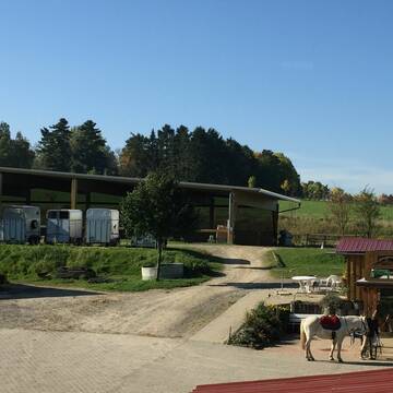

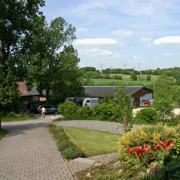
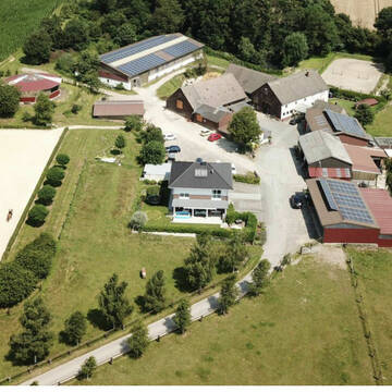
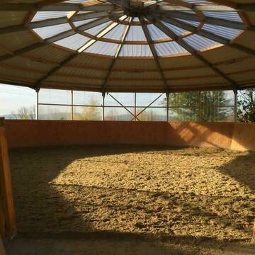
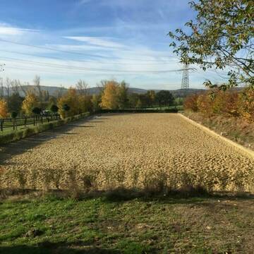
4 Sterne Aktivstall Gut Lieselühr
Schwerte
Gut Lieselühr
@Gut-Lieseluehr
FN-Mitglied
Freizeitstall
Hunde willkommen
Krankenbox
Notfallboxen
Zuchtstutenhaltung möglich
Außenbox mit Paddock
Bewegungsstall
24 weitere...
S
Deprecated: Creation of dynamic property Zend_View_Helper_Ads::$adLink is deprecated in /var/www/stall-frei/htdocs/staging.stall-frei.de/library/Psf/View/Helper/Ads.php on line 108

Futtersack HeuToy, Fressbremse in pink
Mechtersen
STALL-FREIde Marketing
@STALL-FREI-Marketing
Stundenlange Beschäftigung die
Koliken vorbeugt, geringe Staubinhalation mit
steuerbarer Futterentnahme


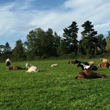
Offenstall Plätze auf Gut Krägeloh
Breckerfeld
Lisa Schlömer
@GutKraegeloh
Freizeitstall
Geländestrecke
Vermieten
Hunde willkommen
Paddock
Hufrehe geeignet
Notfallboxen
12 weitere...
P+

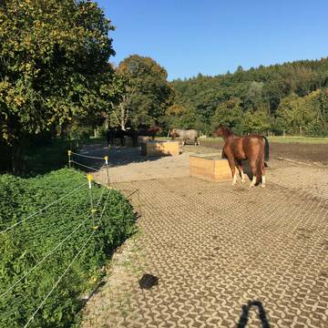
Hof Salmann
Hagen
Hof Salmann
@Jan-Salmann
Freizeitstall
Vermieten
Hunde willkommen
Paddock
Innenbox
7 weitere...
P

HippoHotel - Pferdepension (Becker&Grothmann...
Hagen
Hof-Becker
@Hof-Becker
Freizeitstall
Gastronomie
Vermieten
Hunde willkommen
Paddock
Allergikerstall
16 weitere...
aktuell
P


Paddockbox
Wetter (Ruhr)
Lindenhof
@Lindenhof-Wetter
Freizeitstall
Vermieten
Hunde willkommen
Paddock
Außenbox mit Paddock
Offenstall
10 weitere...
P+
Kleine Reitanlage
Hagen
Maybrechthof
@Maybrechthof
FN-Mitglied
Pferdeausbildung
Paddock
Reithalle
Außenbox mit Paddock
Außenboxen
Vollpension
7 weitere...
P

Heu und Heulage verkaufen
Mechtersen
STALL-FREIde Marketing
@STALL-FREI-Marketing
Verkaufen Sie Ihr Heu und Ihre Heulage direkt an Reiter, Pferdeställe und Reitanlagen

Stall Feldhaus in Hagen-Haspe
Hagen
Stall-Feldhaus
@Stall-Feldhaus
Freizeitstall
Pferdeausbildung
Vermieten
Hunde willkommen
Longierzirkel/Roundpen
Außenboxen
Innenbox
13 weitere...
P
Reitstall Schnepper
Wetter
Schnepper-GbR
@Schnepper-GbR
Geländestrecke
Pferdeausbildung
Vermieten
Hunde willkommen
Longierzirkel/Roundpen
Außenboxen
Innenbox
17 weitere...
P

Offenstall und Boxen frei
Hagen-Dahl
Düinghausen
@Dueinghausen
Freizeitstall
Geländestrecke
Vermieten
Hunde willkommen
Paddock
Außenboxen
Laufbox
15 weitere...
P

Reitanlage Fam. Sänger
Dortmund
Reitanlage-Familie-Saenger
@Reitanlage-Familie-Saenger
FN-Mitglied
Reitlehrer und -unterricht
Führanlage
Hunde willkommen
Allergikerstall
Außenboxen
Innenbox
14 weitere...
P+
Deprecated: Creation of dynamic property Zend_View::$pageCount is deprecated in /var/www/stall-frei/htdocs/staging.stall-frei.de/library/vendor/shardj/zf1-future/library/Zend/View/Abstract.php on line 308
Deprecated: Creation of dynamic property Zend_View::$itemCountPerPage is deprecated in /var/www/stall-frei/htdocs/staging.stall-frei.de/library/vendor/shardj/zf1-future/library/Zend/View/Abstract.php on line 308
Deprecated: Creation of dynamic property Zend_View::$first is deprecated in /var/www/stall-frei/htdocs/staging.stall-frei.de/library/vendor/shardj/zf1-future/library/Zend/View/Abstract.php on line 308
Deprecated: Creation of dynamic property Zend_View::$current is deprecated in /var/www/stall-frei/htdocs/staging.stall-frei.de/library/vendor/shardj/zf1-future/library/Zend/View/Abstract.php on line 308
Deprecated: Creation of dynamic property Zend_View::$last is deprecated in /var/www/stall-frei/htdocs/staging.stall-frei.de/library/vendor/shardj/zf1-future/library/Zend/View/Abstract.php on line 308
Deprecated: Creation of dynamic property Zend_View::$next is deprecated in /var/www/stall-frei/htdocs/staging.stall-frei.de/library/vendor/shardj/zf1-future/library/Zend/View/Abstract.php on line 308
Deprecated: Creation of dynamic property Zend_View::$pagesInRange is deprecated in /var/www/stall-frei/htdocs/staging.stall-frei.de/library/vendor/shardj/zf1-future/library/Zend/View/Abstract.php on line 308
Deprecated: Creation of dynamic property Zend_View::$firstPageInRange is deprecated in /var/www/stall-frei/htdocs/staging.stall-frei.de/library/vendor/shardj/zf1-future/library/Zend/View/Abstract.php on line 308
Deprecated: Creation of dynamic property Zend_View::$lastPageInRange is deprecated in /var/www/stall-frei/htdocs/staging.stall-frei.de/library/vendor/shardj/zf1-future/library/Zend/View/Abstract.php on line 308
Deprecated: Creation of dynamic property Zend_View::$currentItemCount is deprecated in /var/www/stall-frei/htdocs/staging.stall-frei.de/library/vendor/shardj/zf1-future/library/Zend/View/Abstract.php on line 308
Deprecated: Creation of dynamic property Zend_View::$totalItemCount is deprecated in /var/www/stall-frei/htdocs/staging.stall-frei.de/library/vendor/shardj/zf1-future/library/Zend/View/Abstract.php on line 308
Deprecated: Creation of dynamic property Zend_View::$firstItemNumber is deprecated in /var/www/stall-frei/htdocs/staging.stall-frei.de/library/vendor/shardj/zf1-future/library/Zend/View/Abstract.php on line 308
Deprecated: Creation of dynamic property Zend_View::$lastItemNumber is deprecated in /var/www/stall-frei/htdocs/staging.stall-frei.de/library/vendor/shardj/zf1-future/library/Zend/View/Abstract.php on line 308
Deprecated: Creation of dynamic property Zend_View::$router is deprecated in /var/www/stall-frei/htdocs/staging.stall-frei.de/library/vendor/shardj/zf1-future/library/Zend/View/Abstract.php on line 308
Deprecated: Creation of dynamic property Zend_View::$urlParams is deprecated in /var/www/stall-frei/htdocs/staging.stall-frei.de/library/vendor/shardj/zf1-future/library/Zend/View/Abstract.php on line 308
Deprecated: Creation of dynamic property Zend_View::$showAds is deprecated in /var/www/stall-frei/htdocs/staging.stall-frei.de/library/vendor/shardj/zf1-future/library/Zend/View/Abstract.php on line 308
Deprecated: Creation of dynamic property Zend_View::$objectIds is deprecated in /var/www/stall-frei/htdocs/staging.stall-frei.de/library/vendor/shardj/zf1-future/library/Zend/View/Abstract.php on line 308
Deprecated: Creation of dynamic property Zend_View::$showNavbar is deprecated in /var/www/stall-frei/htdocs/staging.stall-frei.de/library/vendor/shardj/zf1-future/library/Zend/View/Abstract.php on line 308
Deprecated: Creation of dynamic property Zend_View::$showBreadcrumb is deprecated in /var/www/stall-frei/htdocs/staging.stall-frei.de/library/vendor/shardj/zf1-future/library/Zend/View/Abstract.php on line 308
Deprecated: Creation of dynamic property Zend_View::$showFooter is deprecated in /var/www/stall-frei/htdocs/staging.stall-frei.de/library/vendor/shardj/zf1-future/library/Zend/View/Abstract.php on line 308
Deprecated: Creation of dynamic property Zend_View::$showInternalAds is deprecated in /var/www/stall-frei/htdocs/staging.stall-frei.de/library/vendor/shardj/zf1-future/library/Zend/View/Abstract.php on line 308
Deprecated: Creation of dynamic property Zend_View::$blNoContent is deprecated in /var/www/stall-frei/htdocs/staging.stall-frei.de/library/vendor/shardj/zf1-future/library/Zend/View/Abstract.php on line 308
Deprecated: Creation of dynamic property Zend_View::$sMetaDesc is deprecated in /var/www/stall-frei/htdocs/staging.stall-frei.de/library/vendor/shardj/zf1-future/library/Zend/View/Abstract.php on line 308
Deprecated: Creation of dynamic property Zend_View::$useGmaps is deprecated in /var/www/stall-frei/htdocs/staging.stall-frei.de/library/vendor/shardj/zf1-future/library/Zend/View/Abstract.php on line 308
Deprecated: Creation of dynamic property Zend_View::$touches is deprecated in /var/www/stall-frei/htdocs/staging.stall-frei.de/library/vendor/shardj/zf1-future/library/Zend/View/Abstract.php on line 308
Deprecated: Creation of dynamic property Zend_View::$oProject is deprecated in /var/www/stall-frei/htdocs/staging.stall-frei.de/library/vendor/shardj/zf1-future/library/Zend/View/Abstract.php on line 308
Deprecated: Creation of dynamic property Zend_View::$pageHeadline is deprecated in /var/www/stall-frei/htdocs/staging.stall-frei.de/library/vendor/shardj/zf1-future/library/Zend/View/Abstract.php on line 308
Deprecated: Creation of dynamic property Zend_View::$disableLocationField is deprecated in /var/www/stall-frei/htdocs/staging.stall-frei.de/library/vendor/shardj/zf1-future/library/Zend/View/Abstract.php on line 308
Deprecated: Creation of dynamic property Zend_View::$isSearch is deprecated in /var/www/stall-frei/htdocs/staging.stall-frei.de/library/vendor/shardj/zf1-future/library/Zend/View/Abstract.php on line 308
Deprecated: Creation of dynamic property Zend_View::$pageTitle is deprecated in /var/www/stall-frei/htdocs/staging.stall-frei.de/library/vendor/shardj/zf1-future/library/Zend/View/Abstract.php on line 308
Deprecated: Creation of dynamic property Psf_Form_Element_Text::$class is deprecated in /var/www/stall-frei/htdocs/staging.stall-frei.de/library/vendor/shardj/zf1-future/library/Zend/Form/Element.php on line 874
Deprecated: Creation of dynamic property Psf_Form_Element_Text::$size is deprecated in /var/www/stall-frei/htdocs/staging.stall-frei.de/library/vendor/shardj/zf1-future/library/Zend/Form/Element.php on line 874
Deprecated: Creation of dynamic property Psf_Form_Element_Text::$placeholder is deprecated in /var/www/stall-frei/htdocs/staging.stall-frei.de/library/vendor/shardj/zf1-future/library/Zend/Form/Element.php on line 874
Deprecated: Creation of dynamic property Psf_Form_Element_Hidden::$class is deprecated in /var/www/stall-frei/htdocs/staging.stall-frei.de/library/vendor/shardj/zf1-future/library/Zend/Form/Element.php on line 874
Deprecated: Creation of dynamic property Psf_Form_Element_Hidden::$class is deprecated in /var/www/stall-frei/htdocs/staging.stall-frei.de/library/vendor/shardj/zf1-future/library/Zend/Form/Element.php on line 874
Deprecated: Creation of dynamic property Psf_Form_Element_Hidden::$class is deprecated in /var/www/stall-frei/htdocs/staging.stall-frei.de/library/vendor/shardj/zf1-future/library/Zend/Form/Element.php on line 874
Deprecated: Creation of dynamic property Psf_Form_Element_Hidden::$class is deprecated in /var/www/stall-frei/htdocs/staging.stall-frei.de/library/vendor/shardj/zf1-future/library/Zend/Form/Element.php on line 874
Deprecated: Creation of dynamic property Psf_Form_Element_Select::$class is deprecated in /var/www/stall-frei/htdocs/staging.stall-frei.de/library/vendor/shardj/zf1-future/library/Zend/Form/Element.php on line 874
Deprecated: Creation of dynamic property Psf_Form_Element_Select::$class is deprecated in /var/www/stall-frei/htdocs/staging.stall-frei.de/library/vendor/shardj/zf1-future/library/Zend/Form/Element.php on line 874
Deprecated: Creation of dynamic property Psf_Form_Element_Select::$class is deprecated in /var/www/stall-frei/htdocs/staging.stall-frei.de/library/vendor/shardj/zf1-future/library/Zend/Form/Element.php on line 874
Deprecated: Creation of dynamic property Psf_Form_Element_Select::$class is deprecated in /var/www/stall-frei/htdocs/staging.stall-frei.de/library/vendor/shardj/zf1-future/library/Zend/Form/Element.php on line 874
Deprecated: Creation of dynamic property Psf_Form_Element_Text::$class is deprecated in /var/www/stall-frei/htdocs/staging.stall-frei.de/library/vendor/shardj/zf1-future/library/Zend/Form/Element.php on line 874
Deprecated: Creation of dynamic property Psf_Form_Element_Checkbox::$label is deprecated in /var/www/stall-frei/htdocs/staging.stall-frei.de/library/vendor/shardj/zf1-future/library/Zend/Form/Element.php on line 874
Deprecated: Creation of dynamic property Zend_View::$sort is deprecated in /var/www/stall-frei/htdocs/staging.stall-frei.de/library/vendor/shardj/zf1-future/library/Zend/View/Abstract.php on line 308
Deprecated: Creation of dynamic property Zend_View::$searchLocation is deprecated in /var/www/stall-frei/htdocs/staging.stall-frei.de/library/vendor/shardj/zf1-future/library/Zend/View/Abstract.php on line 308
Deprecated: Creation of dynamic property Zend_View::$locationHint is deprecated in /var/www/stall-frei/htdocs/staging.stall-frei.de/library/vendor/shardj/zf1-future/library/Zend/View/Abstract.php on line 308
Psf_GeoCoder_Abstract::getLocation: Oberhagen Get Location CachedOrLive
Psf_GeoCoder_Abstract::getCachedOrLive: Oberhagen
Psf_GeoCoder_OpenCageData::makeApiRequest: response:
Array
(
[documentation] => https://opencagedata.com/api
[licenses] => Array
(
[0] => Array
(
[name] => see attribution guide
[url] => https://opencagedata.com/credits
)
)
[results] => Array
(
[0] => Array
(
[bounds] => Array
(
[northeast] => Array
(
[lat] => 51.3736347
[lng] => 7.4971506
)
[southwest] => Array
(
[lat] => 51.3336347
[lng] => 7.4571506
)
)
[components] => Array
(
[ISO_3166-1_alpha-2] => DE
[ISO_3166-1_alpha-3] => DEU
[ISO_3166-2] => Array
(
[0] => DE-NW
)
[_category] => place
[_normalized_city] => Hagen
[_type] => neighbourhood
[city] => Hagen
[city_district] => Hagen-Mitte
[continent] => Europe
[country] => Deutschland
[country_code] => de
[political_union] => European Union
[postcode] => 58095
[state] => Nordrhein-Westfalen
[state_code] => NW
[suburb] => Oberhagen
)
[confidence] => 7
[formatted] => 58095 Hagen, Deutschland
[geometry] => Array
(
[lat] => 51.3536347
[lng] => 7.4771506
)
)
[1] => Array
(
[bounds] => Array
(
[northeast] => Array
(
[lat] => 51.4513403
[lng] => 8.3650397
)
[southwest] => Array
(
[lat] => 51.4476963
[lng] => 8.3573877
)
)
[components] => Array
(
[ISO_3166-1_alpha-2] => DE
[ISO_3166-1_alpha-3] => DEU
[ISO_3166-2] => Array
(
[0] => DE-NW
)
[_category] => natural/water
[_normalized_city] => Warstein
[_type] => wood
[continent] => Europe
[country] => Deutschland
[country_code] => de
[county] => Kreis Soest
[political_union] => European Union
[postcode] => 59581
[state] => Nordrhein-Westfalen
[state_code] => NW
[town] => Warstein
[wood] => Oberhagen
)
[confidence] => 9
[formatted] => Oberhagen, 59581 Warstein, Deutschland
[geometry] => Array
(
[lat] => 51.4495333
[lng] => 8.3608221
)
)
[2] => Array
(
[bounds] => Array
(
[northeast] => Array
(
[lat] => 51.5713637
[lng] => 8.941448
)
[southwest] => Array
(
[lat] => 51.5712637
[lng] => 8.941348
)
)
[components] => Array
(
[ISO_3166-1_alpha-2] => DE
[ISO_3166-1_alpha-3] => DEU
[ISO_3166-2] => Array
(
[0] => DE-NW
)
[_category] => natural/water
[_normalized_city] => Lichtenau
[_type] => peak
[continent] => Europe
[country] => Deutschland
[country_code] => de
[county] => Kreis Paderborn
[peak] => Oberhagen
[political_union] => European Union
[state] => Nordrhein-Westfalen
[state_code] => NW
[village] => Lichtenau
)
[confidence] => 9
[formatted] => Oberhagen, Lichtenau, Nordrhein-Westfalen, Deutschland
[geometry] => Array
(
[lat] => 51.5713137
[lng] => 8.941398
)
)
[3] => Array
(
[bounds] => Array
(
[northeast] => Array
(
[lat] => 54.0158539
[lng] => 11.9041359
)
[southwest] => Array
(
[lat] => 53.9758539
[lng] => 11.8641359
)
)
[components] => Array
(
[ISO_3166-1_alpha-2] => DE
[ISO_3166-1_alpha-3] => DEU
[ISO_3166-2] => Array
(
[0] => DE-MV
)
[_category] => place
[_normalized_city] => Satow
[_type] => hamlet
[continent] => Europe
[country] => Deutschland
[country_code] => de
[county] => Landkreis Rostock
[hamlet] => Oberhagen
[political_union] => European Union
[postcode] => 18239
[state] => Mecklenburg-Vorpommern
[state_code] => MV
[village] => Satow
)
[confidence] => 7
[formatted] => Oberhagen, 18239 Satow, Deutschland
[geometry] => Array
(
[lat] => 53.9958539
[lng] => 11.8841359
)
)
[4] => Array
(
[bounds] => Array
(
[northeast] => Array
(
[lat] => 51.1235712
[lng] => 7.3033244
)
[southwest] => Array
(
[lat] => 51.0835712
[lng] => 7.2633244
)
)
[components] => Array
(
[ISO_3166-1_alpha-2] => DE
[ISO_3166-1_alpha-3] => DEU
[ISO_3166-2] => Array
(
[0] => DE-NW
)
[_category] => place
[_normalized_city] => Wermelskirchen
[_type] => hamlet
[continent] => Europe
[country] => Deutschland
[country_code] => de
[county] => Rheinisch-Bergischer Kreis
[hamlet] => Oberhagen
[political_union] => European Union
[state] => Nordrhein-Westfalen
[state_code] => NW
[town] => Wermelskirchen
)
[confidence] => 7
[formatted] => Oberhagen, Wermelskirchen, Nordrhein-Westfalen, Deutschland
[geometry] => Array
(
[lat] => 51.1035712
[lng] => 7.2833244
)
)
[5] => Array
(
[bounds] => Array
(
[northeast] => Array
(
[lat] => 51.1078587
[lng] => 7.286955
)
[southwest] => Array
(
[lat] => 51.1020514
[lng] => 7.2823501
)
)
[components] => Array
(
[ISO_3166-1_alpha-2] => DE
[ISO_3166-1_alpha-3] => DEU
[ISO_3166-2] => Array
(
[0] => DE-NW
)
[_category] => road
[_normalized_city] => Wermelskirchen
[_type] => road
[continent] => Europe
[country] => Deutschland
[country_code] => de
[county] => Rheinisch-Bergischer Kreis
[hamlet] => Oberhagen
[political_union] => European Union
[postcode] => 42929
[road] => Oberhagen
[state] => Nordrhein-Westfalen
[state_code] => NW
[town] => Wermelskirchen
)
[confidence] => 9
[formatted] => Oberhagen, 42929 Wermelskirchen, Deutschland
[geometry] => Array
(
[lat] => 51.1035947
[lng] => 7.282488
)
)
[6] => Array
(
[bounds] => Array
(
[northeast] => Array
(
[lat] => 51.6080997
[lng] => 8.6664938
)
[southwest] => Array
(
[lat] => 51.6047833
[lng] => 8.6636102
)
)
[components] => Array
(
[ISO_3166-1_alpha-2] => DE
[ISO_3166-1_alpha-3] => DEU
[ISO_3166-2] => Array
(
[0] => DE-NW
)
[_category] => road
[_normalized_city] => Büren
[_type] => road
[continent] => Europe
[country] => Deutschland
[country_code] => de
[county] => Kreis Paderborn
[political_union] => European Union
[postcode] => 33142
[road] => Oberhagen
[road_type] => residential
[state] => Nordrhein-Westfalen
[state_code] => NW
[suburb] => Wewelsburg
[town] => Büren
)
[confidence] => 9
[formatted] => Oberhagen, 33142 Büren, Deutschland
[geometry] => Array
(
[lat] => 51.6064492
[lng] => 8.6650605
)
)
[7] => Array
(
[bounds] => Array
(
[northeast] => Array
(
[lat] => 54.173474
[lng] => 12.2717684
)
[southwest] => Array
(
[lat] => 54.1725494
[lng] => 12.2619629
)
)
[components] => Array
(
[ISO_3166-1_alpha-2] => DE
[ISO_3166-1_alpha-3] => DEU
[ISO_3166-2] => Array
(
[0] => DE-MV
)
[_category] => road
[_normalized_city] => Rövershagen
[_type] => road
[continent] => Europe
[country] => Deutschland
[country_code] => de
[county] => Landkreis Rostock
[municipality] => Rostocker Heide
[political_union] => European Union
[postcode] => 18182
[road] => Oberhagen
[road_type] => tertiary
[state] => Mecklenburg-Vorpommern
[state_code] => MV
[village] => Rövershagen
)
[confidence] => 9
[formatted] => Oberhagen, 18182 Rövershagen, Deutschland
[geometry] => Array
(
[lat] => 54.1734307
[lng] => 12.266909
)
)
[8] => Array
(
[components] => Array
(
[ISO_3166-1_alpha-2] => FR
[ISO_3166-1_alpha-3] => FRA
[ISO_3166-2] => Array
(
[0] => FR-IDF
[1] => FR-92
)
[_category] => road
[_normalized_city] => Levallois-Perret
[_type] => road
[city] => Levallois-Perret
[continent] => Europe
[country] => France
[country_code] => fr
[county] => Hauts-de-Seine
[local_authority] => Métropole du Grand Paris
[political_union] => European Union
[postcode] => 92300
[road] => Rue Charles Deutschmann
[state] => Île-de-France
[state_code] => IDF
)
[confidence] => 2
[formatted] => Rue Charles Deutschmann, 92300 Levallois-Perret, France
[geometry] => Array
(
[lat] => 48.900049
[lng] => 2.2842
)
)
[9] => Array
(
[bounds] => Array
(
[northeast] => Array
(
[lat] => 54.2190424
[lng] => 12.3229272
)
[southwest] => Array
(
[lat] => 54.1057729
[lng] => 12.2205298
)
)
[components] => Array
(
[ISO_3166-1_alpha-2] => DE
[ISO_3166-1_alpha-3] => DEU
[_category] => place
[_normalized_city] => Oberhagen
[_type] => city
[continent] => Europe
[country] => Deutschland
[country_code] => de
[political_union] => European Union
[state] => Mecklenburg-Vorpommern
[state_code] => MV
[town] => Oberhagen
)
[confidence] => 6
[formatted] => Oberhagen, Mecklenburg-Vorpommern, Deutschland
[geometry] => Array
(
[lat] => 54.17357
[lng] => 12.26554
)
)
)
[status] => Array
(
[code] => 200
[message] => OK
)
[stay_informed] => Array
(
[blog] => https://blog.opencagedata.com
[mastodon] => https://en.osm.town/@opencage
)
[thanks] => For using an OpenCage API
[timestamp] => Array
(
[created_http] => Sat, 07 Feb 2026 16:51:27 GMT
[created_unix] => 1770483087
)
[total_results] => 10
)
Psf_GeoCoder_Abstract::convertLocationResult
{"documentation":"https:\/\/opencagedata.com\/api","licenses":[{"name":"see attribution guide","url":"https:\/\/opencagedata.com\/credits"}],"results":[{"bounds":{"northeast":{"lat":51.3736347,"lng":7.4971506},"southwest":{"lat":51.3336347,"lng":7.4571506}},"components":{"ISO_3166-1_alpha-2":"DE","ISO_3166-1_alpha-3":"DEU","ISO_3166-2":["DE-NW"],"_category":"place","_normalized_city":"Hagen","_type":"neighbourhood","city":"Hagen","city_district":"Hagen-Mitte","continent":"Europe","country":"Deutschland","country_code":"de","political_union":"European Union","postcode":"58095","state":"Nordrhein-Westfalen","state_code":"NW","suburb":"Oberhagen"},"confidence":7,"formatted":"58095 Hagen, Deutschland","geometry":{"lat":51.3536347,"lng":7.4771506}},{"bounds":{"northeast":{"lat":51.4513403,"lng":8.3650397},"southwest":{"lat":51.4476963,"lng":8.3573877}},"components":{"ISO_3166-1_alpha-2":"DE","ISO_3166-1_alpha-3":"DEU","ISO_3166-2":["DE-NW"],"_category":"natural\/water","_normalized_city":"Warstein","_type":"wood","continent":"Europe","country":"Deutschland","country_code":"de","county":"Kreis Soest","political_union":"European Union","postcode":"59581","state":"Nordrhein-Westfalen","state_code":"NW","town":"Warstein","wood":"Oberhagen"},"confidence":9,"formatted":"Oberhagen, 59581 Warstein, Deutschland","geometry":{"lat":51.4495333,"lng":8.3608221}},{"bounds":{"northeast":{"lat":51.5713637,"lng":8.941448},"southwest":{"lat":51.5712637,"lng":8.941348}},"components":{"ISO_3166-1_alpha-2":"DE","ISO_3166-1_alpha-3":"DEU","ISO_3166-2":["DE-NW"],"_category":"natural\/water","_normalized_city":"Lichtenau","_type":"peak","continent":"Europe","country":"Deutschland","country_code":"de","county":"Kreis Paderborn","peak":"Oberhagen","political_union":"European Union","state":"Nordrhein-Westfalen","state_code":"NW","village":"Lichtenau"},"confidence":9,"formatted":"Oberhagen, Lichtenau, Nordrhein-Westfalen, Deutschland","geometry":{"lat":51.5713137,"lng":8.941398}},{"bounds":{"northeast":{"lat":54.0158539,"lng":11.9041359},"southwest":{"lat":53.9758539,"lng":11.8641359}},"components":{"ISO_3166-1_alpha-2":"DE","ISO_3166-1_alpha-3":"DEU","ISO_3166-2":["DE-MV"],"_category":"place","_normalized_city":"Satow","_type":"hamlet","continent":"Europe","country":"Deutschland","country_code":"de","county":"Landkreis Rostock","hamlet":"Oberhagen","political_union":"European Union","postcode":"18239","state":"Mecklenburg-Vorpommern","state_code":"MV","village":"Satow"},"confidence":7,"formatted":"Oberhagen, 18239 Satow, Deutschland","geometry":{"lat":53.9958539,"lng":11.8841359}},{"bounds":{"northeast":{"lat":51.1235712,"lng":7.3033244},"southwest":{"lat":51.0835712,"lng":7.2633244}},"components":{"ISO_3166-1_alpha-2":"DE","ISO_3166-1_alpha-3":"DEU","ISO_3166-2":["DE-NW"],"_category":"place","_normalized_city":"Wermelskirchen","_type":"hamlet","continent":"Europe","country":"Deutschland","country_code":"de","county":"Rheinisch-Bergischer Kreis","hamlet":"Oberhagen","political_union":"European Union","state":"Nordrhein-Westfalen","state_code":"NW","town":"Wermelskirchen"},"confidence":7,"formatted":"Oberhagen, Wermelskirchen, Nordrhein-Westfalen, Deutschland","geometry":{"lat":51.1035712,"lng":7.2833244}},{"bounds":{"northeast":{"lat":51.1078587,"lng":7.286955},"southwest":{"lat":51.1020514,"lng":7.2823501}},"components":{"ISO_3166-1_alpha-2":"DE","ISO_3166-1_alpha-3":"DEU","ISO_3166-2":["DE-NW"],"_category":"road","_normalized_city":"Wermelskirchen","_type":"road","continent":"Europe","country":"Deutschland","country_code":"de","county":"Rheinisch-Bergischer Kreis","hamlet":"Oberhagen","political_union":"European Union","postcode":"42929","road":"Oberhagen","state":"Nordrhein-Westfalen","state_code":"NW","town":"Wermelskirchen"},"confidence":9,"formatted":"Oberhagen, 42929 Wermelskirchen, Deutschland","geometry":{"lat":51.1035947,"lng":7.282488}},{"bounds":{"northeast":{"lat":51.6080997,"lng":8.6664938},"southwest":{"lat":51.6047833,"lng":8.6636102}},"components":{"ISO_3166-1_alpha-2":"DE","ISO_3166-1_alpha-3":"DEU","ISO_3166-2":["DE-NW"],"_category":"road","_normalized_city":"B\u00fcren","_type":"road","continent":"Europe","country":"Deutschland","country_code":"de","county":"Kreis Paderborn","political_union":"European Union","postcode":"33142","road":"Oberhagen","road_type":"residential","state":"Nordrhein-Westfalen","state_code":"NW","suburb":"Wewelsburg","town":"B\u00fcren"},"confidence":9,"formatted":"Oberhagen, 33142 B\u00fcren, Deutschland","geometry":{"lat":51.6064492,"lng":8.6650605}},{"bounds":{"northeast":{"lat":54.173474,"lng":12.2717684},"southwest":{"lat":54.1725494,"lng":12.2619629}},"components":{"ISO_3166-1_alpha-2":"DE","ISO_3166-1_alpha-3":"DEU","ISO_3166-2":["DE-MV"],"_category":"road","_normalized_city":"R\u00f6vershagen","_type":"road","continent":"Europe","country":"Deutschland","country_code":"de","county":"Landkreis Rostock","municipality":"Rostocker Heide","political_union":"European Union","postcode":"18182","road":"Oberhagen","road_type":"tertiary","state":"Mecklenburg-Vorpommern","state_code":"MV","village":"R\u00f6vershagen"},"confidence":9,"formatted":"Oberhagen, 18182 R\u00f6vershagen, Deutschland","geometry":{"lat":54.1734307,"lng":12.266909}},{"components":{"ISO_3166-1_alpha-2":"FR","ISO_3166-1_alpha-3":"FRA","ISO_3166-2":["FR-IDF","FR-92"],"_category":"road","_normalized_city":"Levallois-Perret","_type":"road","city":"Levallois-Perret","continent":"Europe","country":"France","country_code":"fr","county":"Hauts-de-Seine","local_authority":"M\u00e9tropole du Grand Paris","political_union":"European Union","postcode":"92300","road":"Rue Charles Deutschmann","state":"\u00cele-de-France","state_code":"IDF"},"confidence":2,"formatted":"Rue Charles Deutschmann, 92300 Levallois-Perret, France","geometry":{"lat":48.900049,"lng":2.2842}},{"bounds":{"northeast":{"lat":54.2190424,"lng":12.3229272},"southwest":{"lat":54.1057729,"lng":12.2205298}},"components":{"ISO_3166-1_alpha-2":"DE","ISO_3166-1_alpha-3":"DEU","_category":"place","_normalized_city":"Oberhagen","_type":"city","continent":"Europe","country":"Deutschland","country_code":"de","political_union":"European Union","state":"Mecklenburg-Vorpommern","state_code":"MV","town":"Oberhagen"},"confidence":6,"formatted":"Oberhagen, Mecklenburg-Vorpommern, Deutschland","geometry":{"lat":54.17357,"lng":12.26554}}],"status":{"code":200,"message":"OK"},"stay_informed":{"blog":"https:\/\/blog.opencagedata.com","mastodon":"https:\/\/en.osm.town\/@opencage"},"thanks":"For using an OpenCage API","timestamp":{"created_http":"Sat, 07 Feb 2026 16:51:27 GMT","created_unix":1770483087},"total_results":10}Array
(
[0] => stdClass Object
(
[bounds] => stdClass Object
(
[northeast] => stdClass Object
(
[lat] => 51.3736347
[lng] => 7.4971506
)
[southwest] => stdClass Object
(
[lat] => 51.3336347
[lng] => 7.4571506
)
)
[components] => stdClass Object
(
[ISO_3166-1_alpha-2] => DE
[ISO_3166-1_alpha-3] => DEU
[ISO_3166-2] => Array
(
[0] => DE-NW
)
[_category] => place
[_normalized_city] => Hagen
[_type] => neighbourhood
[city] => Hagen
[city_district] => Hagen-Mitte
[continent] => Europe
[country] => Deutschland
[country_code] => de
[political_union] => European Union
[postcode] => 58095
[state] => Nordrhein-Westfalen
[state_code] => NW
[suburb] => Oberhagen
)
[confidence] => 7
[formatted] => 58095 Hagen, Deutschland
[geometry] => stdClass Object
(
[lat] => 51.3536347
[lng] => 7.4771506
)
)
[1] => stdClass Object
(
[bounds] => stdClass Object
(
[northeast] => stdClass Object
(
[lat] => 51.4513403
[lng] => 8.3650397
)
[southwest] => stdClass Object
(
[lat] => 51.4476963
[lng] => 8.3573877
)
)
[components] => stdClass Object
(
[ISO_3166-1_alpha-2] => DE
[ISO_3166-1_alpha-3] => DEU
[ISO_3166-2] => Array
(
[0] => DE-NW
)
[_category] => natural/water
[_normalized_city] => Warstein
[_type] => wood
[continent] => Europe
[country] => Deutschland
[country_code] => de
[county] => Kreis Soest
[political_union] => European Union
[postcode] => 59581
[state] => Nordrhein-Westfalen
[state_code] => NW
[town] => Warstein
[wood] => Oberhagen
)
[confidence] => 9
[formatted] => Oberhagen, 59581 Warstein, Deutschland
[geometry] => stdClass Object
(
[lat] => 51.4495333
[lng] => 8.3608221
)
)
[2] => stdClass Object
(
[bounds] => stdClass Object
(
[northeast] => stdClass Object
(
[lat] => 51.5713637
[lng] => 8.941448
)
[southwest] => stdClass Object
(
[lat] => 51.5712637
[lng] => 8.941348
)
)
[components] => stdClass Object
(
[ISO_3166-1_alpha-2] => DE
[ISO_3166-1_alpha-3] => DEU
[ISO_3166-2] => Array
(
[0] => DE-NW
)
[_category] => natural/water
[_normalized_city] => Lichtenau
[_type] => peak
[continent] => Europe
[country] => Deutschland
[country_code] => de
[county] => Kreis Paderborn
[peak] => Oberhagen
[political_union] => European Union
[state] => Nordrhein-Westfalen
[state_code] => NW
[village] => Lichtenau
)
[confidence] => 9
[formatted] => Oberhagen, Lichtenau, Nordrhein-Westfalen, Deutschland
[geometry] => stdClass Object
(
[lat] => 51.5713137
[lng] => 8.941398
)
)
[3] => stdClass Object
(
[bounds] => stdClass Object
(
[northeast] => stdClass Object
(
[lat] => 54.0158539
[lng] => 11.9041359
)
[southwest] => stdClass Object
(
[lat] => 53.9758539
[lng] => 11.8641359
)
)
[components] => stdClass Object
(
[ISO_3166-1_alpha-2] => DE
[ISO_3166-1_alpha-3] => DEU
[ISO_3166-2] => Array
(
[0] => DE-MV
)
[_category] => place
[_normalized_city] => Satow
[_type] => hamlet
[continent] => Europe
[country] => Deutschland
[country_code] => de
[county] => Landkreis Rostock
[hamlet] => Oberhagen
[political_union] => European Union
[postcode] => 18239
[state] => Mecklenburg-Vorpommern
[state_code] => MV
[village] => Satow
)
[confidence] => 7
[formatted] => Oberhagen, 18239 Satow, Deutschland
[geometry] => stdClass Object
(
[lat] => 53.9958539
[lng] => 11.8841359
)
)
[4] => stdClass Object
(
[bounds] => stdClass Object
(
[northeast] => stdClass Object
(
[lat] => 51.1235712
[lng] => 7.3033244
)
[southwest] => stdClass Object
(
[lat] => 51.0835712
[lng] => 7.2633244
)
)
[components] => stdClass Object
(
[ISO_3166-1_alpha-2] => DE
[ISO_3166-1_alpha-3] => DEU
[ISO_3166-2] => Array
(
[0] => DE-NW
)
[_category] => place
[_normalized_city] => Wermelskirchen
[_type] => hamlet
[continent] => Europe
[country] => Deutschland
[country_code] => de
[county] => Rheinisch-Bergischer Kreis
[hamlet] => Oberhagen
[political_union] => European Union
[state] => Nordrhein-Westfalen
[state_code] => NW
[town] => Wermelskirchen
)
[confidence] => 7
[formatted] => Oberhagen, Wermelskirchen, Nordrhein-Westfalen, Deutschland
[geometry] => stdClass Object
(
[lat] => 51.1035712
[lng] => 7.2833244
)
)
[5] => stdClass Object
(
[bounds] => stdClass Object
(
[northeast] => stdClass Object
(
[lat] => 51.1078587
[lng] => 7.286955
)
[southwest] => stdClass Object
(
[lat] => 51.1020514
[lng] => 7.2823501
)
)
[components] => stdClass Object
(
[ISO_3166-1_alpha-2] => DE
[ISO_3166-1_alpha-3] => DEU
[ISO_3166-2] => Array
(
[0] => DE-NW
)
[_category] => road
[_normalized_city] => Wermelskirchen
[_type] => road
[continent] => Europe
[country] => Deutschland
[country_code] => de
[county] => Rheinisch-Bergischer Kreis
[hamlet] => Oberhagen
[political_union] => European Union
[postcode] => 42929
[road] => Oberhagen
[state] => Nordrhein-Westfalen
[state_code] => NW
[town] => Wermelskirchen
)
[confidence] => 9
[formatted] => Oberhagen, 42929 Wermelskirchen, Deutschland
[geometry] => stdClass Object
(
[lat] => 51.1035947
[lng] => 7.282488
)
)
[6] => stdClass Object
(
[bounds] => stdClass Object
(
[northeast] => stdClass Object
(
[lat] => 51.6080997
[lng] => 8.6664938
)
[southwest] => stdClass Object
(
[lat] => 51.6047833
[lng] => 8.6636102
)
)
[components] => stdClass Object
(
[ISO_3166-1_alpha-2] => DE
[ISO_3166-1_alpha-3] => DEU
[ISO_3166-2] => Array
(
[0] => DE-NW
)
[_category] => road
[_normalized_city] => Büren
[_type] => road
[continent] => Europe
[country] => Deutschland
[country_code] => de
[county] => Kreis Paderborn
[political_union] => European Union
[postcode] => 33142
[road] => Oberhagen
[road_type] => residential
[state] => Nordrhein-Westfalen
[state_code] => NW
[suburb] => Wewelsburg
[town] => Büren
)
[confidence] => 9
[formatted] => Oberhagen, 33142 Büren, Deutschland
[geometry] => stdClass Object
(
[lat] => 51.6064492
[lng] => 8.6650605
)
)
[7] => stdClass Object
(
[bounds] => stdClass Object
(
[northeast] => stdClass Object
(
[lat] => 54.173474
[lng] => 12.2717684
)
[southwest] => stdClass Object
(
[lat] => 54.1725494
[lng] => 12.2619629
)
)
[components] => stdClass Object
(
[ISO_3166-1_alpha-2] => DE
[ISO_3166-1_alpha-3] => DEU
[ISO_3166-2] => Array
(
[0] => DE-MV
)
[_category] => road
[_normalized_city] => Rövershagen
[_type] => road
[continent] => Europe
[country] => Deutschland
[country_code] => de
[county] => Landkreis Rostock
[municipality] => Rostocker Heide
[political_union] => European Union
[postcode] => 18182
[road] => Oberhagen
[road_type] => tertiary
[state] => Mecklenburg-Vorpommern
[state_code] => MV
[village] => Rövershagen
)
[confidence] => 9
[formatted] => Oberhagen, 18182 Rövershagen, Deutschland
[geometry] => stdClass Object
(
[lat] => 54.1734307
[lng] => 12.266909
)
)
[8] => stdClass Object
(
[components] => stdClass Object
(
[ISO_3166-1_alpha-2] => FR
[ISO_3166-1_alpha-3] => FRA
[ISO_3166-2] => Array
(
[0] => FR-IDF
[1] => FR-92
)
[_category] => road
[_normalized_city] => Levallois-Perret
[_type] => road
[city] => Levallois-Perret
[continent] => Europe
[country] => France
[country_code] => fr
[county] => Hauts-de-Seine
[local_authority] => Métropole du Grand Paris
[political_union] => European Union
[postcode] => 92300
[road] => Rue Charles Deutschmann
[state] => Île-de-France
[state_code] => IDF
)
[confidence] => 2
[formatted] => Rue Charles Deutschmann, 92300 Levallois-Perret, France
[geometry] => stdClass Object
(
[lat] => 48.900049
[lng] => 2.2842
)
)
[9] => stdClass Object
(
[bounds] => stdClass Object
(
[northeast] => stdClass Object
(
[lat] => 54.2190424
[lng] => 12.3229272
)
[southwest] => stdClass Object
(
[lat] => 54.1057729
[lng] => 12.2205298
)
)
[components] => stdClass Object
(
[ISO_3166-1_alpha-2] => DE
[ISO_3166-1_alpha-3] => DEU
[_category] => place
[_normalized_city] => Oberhagen
[_type] => city
[continent] => Europe
[country] => Deutschland
[country_code] => de
[political_union] => European Union
[state] => Mecklenburg-Vorpommern
[state_code] => MV
[town] => Oberhagen
)
[confidence] => 6
[formatted] => Oberhagen, Mecklenburg-Vorpommern, Deutschland
[geometry] => stdClass Object
(
[lat] => 54.17357
[lng] => 12.26554
)
)
)
Psf_GeoCoder_OpenCageData::getKeyMap: 0
stdClass Object
(
    [bounds] => stdClass Object
        (
            [northeast] => stdClass Object
                (
                    [lat] => 51.3736347
                    [lng] => 7.4971506
                )

            [southwest] => stdClass Object
                (
                    [lat] => 51.3336347
                    [lng] => 7.4571506
                )

        )

    [components] => stdClass Object
        (
            [ISO_3166-1_alpha-2] => DE
            [ISO_3166-1_alpha-3] => DEU
            [ISO_3166-2] => Array
                (
                    [0] => DE-NW
                )

            [_category] => place
            [_normalized_city] => Hagen
            [_type] => neighbourhood
            [city] => Hagen
            [city_district] => Hagen-Mitte
            [continent] => Europe
            [country] => Deutschland
            [country_code] => de
            [political_union] => European Union
            [postcode] => 58095
            [state] => Nordrhein-Westfalen
            [state_code] => NW
            [suburb] => Oberhagen
        )

    [confidence] => 7
    [formatted] => 58095 Hagen, Deutschland
    [geometry] => stdClass Object
        (
            [lat] => 51.3536347
            [lng] => 7.4771506
        )

)
Psf_GeoCoder_OpenCageData::getCounty: Hagen
Psf_GeoCoder_OpenCageData::addMissingData REFETCH!
Array
(
    [address] => 58095 Hagen, Deutschland
    [type] => neighbourhood
    [street] =>
    [city] => Oberhagen
    [county] => Hagen
    [state] => Nordrhein-Westfalen
    [zip] => 58095
    [country] => Deutschland
    [suburb] => Oberhagen
    [countrycode] => de
    [latitude] => 51.3536347
    [longitude] => 7.4771506
    [accuracy] => 1
    [confidence] => 7
    [bounds] => stdClass Object
        (
            [northeast] => stdClass Object
                (
                    [lat] => 51.3736347
                    [lng] => 7.4971506
                )

            [southwest] => stdClass Object
                (
                    [lat] => 51.3336347
                    [lng] => 7.4571506
                )

        )

)
reformat!
Array
(
    [address] => 58095 Oberhagen
    [type] => neighbourhood
    [street] =>
    [city] => Oberhagen
    [county] => Hagen
    [state] => Nordrhein-Westfalen
    [zip] => 58095
    [country] => Deutschland
    [suburb] => Oberhagen
    [countrycode] => de
    [latitude] => 51.3536347
    [longitude] => 7.4771506
    [accuracy] => 1
    [confidence] => 7
    [bounds] => stdClass Object
        (
            [northeast] => stdClass Object
                (
                    [lat] => 51.3736347
                    [lng] => 7.4971506
                )

            [southwest] => stdClass Object
                (
                    [lat] => 51.3336347
                    [lng] => 7.4571506
                )

        )

    [place] => 58095 Oberhagen, Nordrhein-Westfalen
    [hash] => 7e71807db89b8d7799f8f2d8fb579920
)
Psf_GeoCoder_OpenCageData::getKeyMap: 1
stdClass Object
(
    [bounds] => stdClass Object
        (
            [northeast] => stdClass Object
                (
                    [lat] => 51.4513403
                    [lng] => 8.3650397
                )

            [southwest] => stdClass Object
                (
                    [lat] => 51.4476963
                    [lng] => 8.3573877
                )

        )

    [components] => stdClass Object
        (
            [ISO_3166-1_alpha-2] => DE
            [ISO_3166-1_alpha-3] => DEU
            [ISO_3166-2] => Array
                (
                    [0] => DE-NW
                )

            [_category] => natural/water
            [_normalized_city] => Warstein
            [_type] => wood
            [continent] => Europe
            [country] => Deutschland
            [country_code] => de
            [county] => Kreis Soest
            [political_union] => European Union
            [postcode] => 59581
            [state] => Nordrhein-Westfalen
            [state_code] => NW
            [town] => Warstein
            [wood] => Oberhagen
        )

    [confidence] => 9
    [formatted] => Oberhagen, 59581 Warstein, Deutschland
    [geometry] => stdClass Object
        (
            [lat] => 51.4495333
            [lng] => 8.3608221
        )

)
Psf_GeoCoder_OpenCageData::getCounty: Soest
Psf_GeoCoder_OpenCageData::addMissingData REFETCH!
Array
(
    [address] => Oberhagen, 59581 Warstein, Deutschland
    [type] => wood
    [street] =>
    [city] => Warstein
    [county] => Soest
    [state] => Nordrhein-Westfalen
    [zip] => 59581
    [country] => Deutschland
    [suburb] =>
    [countrycode] => de
    [latitude] => 51.4495333
    [longitude] => 8.3608221
    [accuracy] => 1
    [confidence] => 9
    [bounds] => stdClass Object
        (
            [northeast] => stdClass Object
                (
                    [lat] => 51.4513403
                    [lng] => 8.3650397
                )

            [southwest] => stdClass Object
                (
                    [lat] => 51.4476963
                    [lng] => 8.3573877
                )

        )

)
reformat!
Array
(
    [address] => Oberhagen, 59581 Warstein, Deutschland
    [type] => wood
    [street] =>
    [city] => Warstein
    [county] => Soest
    [state] => Nordrhein-Westfalen
    [zip] => 59581
    [country] => Deutschland
    [suburb] =>
    [countrycode] => de
    [latitude] => 51.4495333
    [longitude] => 8.3608221
    [accuracy] => 1
    [confidence] => 9
    [bounds] => stdClass Object
        (
            [northeast] => stdClass Object
                (
                    [lat] => 51.4513403
                    [lng] => 8.3650397
                )

            [southwest] => stdClass Object
                (
                    [lat] => 51.4476963
                    [lng] => 8.3573877
                )

        )

    [place] => 59581 Warstein, Nordrhein-Westfalen
    [hash] => 92f511b90de33a68a67609696b7a9c90
)
Psf_GeoCoder_OpenCageData::getKeyMap: 2
stdClass Object
(
    [bounds] => stdClass Object
        (
            [northeast] => stdClass Object
                (
                    [lat] => 51.5713637
                    [lng] => 8.941448
                )

            [southwest] => stdClass Object
                (
                    [lat] => 51.5712637
                    [lng] => 8.941348
                )

        )

    [components] => stdClass Object
        (
            [ISO_3166-1_alpha-2] => DE
            [ISO_3166-1_alpha-3] => DEU
            [ISO_3166-2] => Array
                (
                    [0] => DE-NW
                )

            [_category] => natural/water
            [_normalized_city] => Lichtenau
            [_type] => peak
            [continent] => Europe
            [country] => Deutschland
            [country_code] => de
            [county] => Kreis Paderborn
            [peak] => Oberhagen
            [political_union] => European Union
            [state] => Nordrhein-Westfalen
            [state_code] => NW
            [village] => Lichtenau
        )

    [confidence] => 9
    [formatted] => Oberhagen, Lichtenau, Nordrhein-Westfalen, Deutschland
    [geometry] => stdClass Object
        (
            [lat] => 51.5713137
            [lng] => 8.941398
        )

)
Psf_GeoCoder_OpenCageData::getCounty: Paderborn
Psf_GeoCoder_OpenCageData::addMissingData REFETCH!
Array
(
    [address] => Oberhagen, Lichtenau, Nordrhein-Westfalen, Deutschland
    [type] => peak
    [street] =>
    [city] => Lichtenau
    [county] => Paderborn
    [state] => Nordrhein-Westfalen
    [zip] =>
    [country] => Deutschland
    [suburb] =>
    [countrycode] => de
    [latitude] => 51.5713137
    [longitude] => 8.941398
    [accuracy] => 1
    [confidence] => 9
    [bounds] => stdClass Object
        (
            [northeast] => stdClass Object
                (
                    [lat] => 51.5713637
                    [lng] => 8.941448
                )

            [southwest] => stdClass Object
                (
                    [lat] => 51.5712637
                    [lng] => 8.941348
                )

        )

)
reformat!
Array
(
    [address] => Oberhagen, Lichtenau, Nordrhein-Westfalen, Deutschland
    [type] => peak
    [street] =>
    [city] => Lichtenau
    [county] => Paderborn
    [state] => Nordrhein-Westfalen
    [zip] =>
    [country] => Deutschland
    [suburb] =>
    [countrycode] => de
    [latitude] => 51.5713137
    [longitude] => 8.941398
    [accuracy] => 1
    [confidence] => 9
    [bounds] => stdClass Object
        (
            [northeast] => stdClass Object
                (
                    [lat] => 51.5713637
                    [lng] => 8.941448
                )

            [southwest] => stdClass Object
                (
                    [lat] => 51.5712637
                    [lng] => 8.941348
                )

        )

    [place] => Lichtenau, Nordrhein-Westfalen
    [hash] => 1900147d87941200faf248f3416ab6b0
)
Psf_GeoCoder_OpenCageData::getKeyMap: 3
stdClass Object
(
    [bounds] => stdClass Object
        (
            [northeast] => stdClass Object
                (
                    [lat] => 54.0158539
                    [lng] => 11.9041359
                )

            [southwest] => stdClass Object
                (
                    [lat] => 53.9758539
                    [lng] => 11.8641359
                )

        )

    [components] => stdClass Object
        (
            [ISO_3166-1_alpha-2] => DE
            [ISO_3166-1_alpha-3] => DEU
            [ISO_3166-2] => Array
                (
                    [0] => DE-MV
                )

            [_category] => place
            [_normalized_city] => Satow
            [_type] => hamlet
            [continent] => Europe
            [country] => Deutschland
            [country_code] => de
            [county] => Landkreis Rostock
            [hamlet] => Oberhagen
            [political_union] => European Union
            [postcode] => 18239
            [state] => Mecklenburg-Vorpommern
            [state_code] => MV
            [village] => Satow
        )

    [confidence] => 7
    [formatted] => Oberhagen, 18239 Satow, Deutschland
    [geometry] => stdClass Object
        (
            [lat] => 53.9958539
            [lng] => 11.8841359
        )

)
Psf_GeoCoder_OpenCageData::getCounty: Rostock
Psf_GeoCoder_OpenCageData::addMissingData REFETCH!
Array
(
    [address] => Oberhagen, 18239 Satow, Deutschland
    [type] => hamlet
    [street] => Oberhagen
    [city] => Satow
    [county] => Rostock
    [state] => Mecklenburg-Vorpommern
    [zip] => 18239
    [country] => Deutschland
    [suburb] =>
    [countrycode] => de
    [latitude] => 53.9958539
    [longitude] => 11.8841359
    [accuracy] => 1
    [confidence] => 7
    [bounds] => stdClass Object
        (
            [northeast] => stdClass Object
                (
                    [lat] => 54.0158539
                    [lng] => 11.9041359
                )

            [southwest] => stdClass Object
                (
                    [lat] => 53.9758539
                    [lng] => 11.8641359
                )

        )

)
reformat!
Array
(
    [address] => Oberhagen, 18239 Satow, Deutschland
    [type] => hamlet
    [street] => Oberhagen
    [city] => Satow
    [county] => Rostock
    [state] => Mecklenburg-Vorpommern
    [zip] => 18239
    [country] => Deutschland
    [suburb] =>
    [countrycode] => de
    [latitude] => 53.9958539
    [longitude] => 11.8841359
    [accuracy] => 1
    [confidence] => 7
    [bounds] => stdClass Object
        (
            [northeast] => stdClass Object
                (
                    [lat] => 54.0158539
                    [lng] => 11.9041359
                )

            [southwest] => stdClass Object
                (
                    [lat] => 53.9758539
                    [lng] => 11.8641359
                )

        )

    [place] => Oberhagen, 18239 Satow, Mecklenburg-Vorpommern
    [hash] => ea33d02b3b48bdb0af8398339497f2ae
)
Psf_GeoCoder_OpenCageData::getKeyMap: 4
stdClass Object
(
    [bounds] => stdClass Object
        (
            [northeast] => stdClass Object
                (
                    [lat] => 51.1235712
                    [lng] => 7.3033244
                )

            [southwest] => stdClass Object
                (
                    [lat] => 51.0835712
                    [lng] => 7.2633244
                )

        )

    [components] => stdClass Object
        (
            [ISO_3166-1_alpha-2] => DE
            [ISO_3166-1_alpha-3] => DEU
            [ISO_3166-2] => Array
                (
                    [0] => DE-NW
                )

            [_category] => place
            [_normalized_city] => Wermelskirchen
            [_type] => hamlet
            [continent] => Europe
            [country] => Deutschland
            [country_code] => de
            [county] => Rheinisch-Bergischer Kreis
            [hamlet] => Oberhagen
            [political_union] => European Union
            [state] => Nordrhein-Westfalen
            [state_code] => NW
            [town] => Wermelskirchen
        )

    [confidence] => 7
    [formatted] => Oberhagen, Wermelskirchen, Nordrhein-Westfalen, Deutschland
    [geometry] => stdClass Object
        (
            [lat] => 51.1035712
            [lng] => 7.2833244
        )

)
Psf_GeoCoder_OpenCageData::getCounty: Rheinisch-Bergischer Kreis
Psf_GeoCoder_OpenCageData::addMissingData REFETCH!
Array
(
    [address] => Oberhagen, Wermelskirchen, Nordrhein-Westfalen, Deutschland
    [type] => hamlet
    [street] => Oberhagen
    [city] => Wermelskirchen
    [county] => Rheinisch-Bergischer Kreis
    [state] => Nordrhein-Westfalen
    [zip] =>
    [country] => Deutschland
    [suburb] =>
    [countrycode] => de
    [latitude] => 51.1035712
    [longitude] => 7.2833244
    [accuracy] => 1
    [confidence] => 7
    [bounds] => stdClass Object
        (
            [northeast] => stdClass Object
                (
                    [lat] => 51.1235712
                    [lng] => 7.3033244
                )

            [southwest] => stdClass Object
                (
                    [lat] => 51.0835712
                    [lng] => 7.2633244
                )

        )

)
reformat!
Array
(
    [address] => Oberhagen, Wermelskirchen, Nordrhein-Westfalen, Deutschland
    [type] => hamlet
    [street] => Oberhagen
    [city] => Wermelskirchen
    [county] => Rheinisch-Bergischer Kreis
    [state] => Nordrhein-Westfalen
    [zip] =>
    [country] => Deutschland
    [suburb] =>
    [countrycode] => de
    [latitude] => 51.1035712
    [longitude] => 7.2833244
    [accuracy] => 1
    [confidence] => 7
    [bounds] => stdClass Object
        (
            [northeast] => stdClass Object
                (
                    [lat] => 51.1235712
                    [lng] => 7.3033244
                )

            [southwest] => stdClass Object
                (
                    [lat] => 51.0835712
                    [lng] => 7.2633244
                )

        )

    [place] => Oberhagen, Wermelskirchen, Nordrhein-Westfalen
    [hash] => 4eb7b60d93756d0b14def1896161cceb
)
Psf_GeoCoder_OpenCageData::getKeyMap: 5
stdClass Object
(
    [bounds] => stdClass Object
        (
            [northeast] => stdClass Object
                (
                    [lat] => 51.1078587
                    [lng] => 7.286955
                )

            [southwest] => stdClass Object
                (
                    [lat] => 51.1020514
                    [lng] => 7.2823501
                )

        )

    [components] => stdClass Object
        (
            [ISO_3166-1_alpha-2] => DE
            [ISO_3166-1_alpha-3] => DEU
            [ISO_3166-2] => Array
                (
                    [0] => DE-NW
                )

            [_category] => road
            [_normalized_city] => Wermelskirchen
            [_type] => road
            [continent] => Europe
            [country] => Deutschland
            [country_code] => de
            [county] => Rheinisch-Bergischer Kreis
            [hamlet] => Oberhagen
            [political_union] => European Union
            [postcode] => 42929
            [road] => Oberhagen
            [state] => Nordrhein-Westfalen
            [state_code] => NW
            [town] => Wermelskirchen
        )

    [confidence] => 9
    [formatted] => Oberhagen, 42929 Wermelskirchen, Deutschland
    [geometry] => stdClass Object
        (
            [lat] => 51.1035947
            [lng] => 7.282488
        )

)
Psf_GeoCoder_OpenCageData::getCounty: Rheinisch-Bergischer Kreis
Psf_GeoCoder_OpenCageData::addMissingData REFETCH!
Array
(
    [address] => Oberhagen, 42929 Wermelskirchen, Deutschland
    [type] => road
    [street] => Oberhagen
    [city] => Wermelskirchen
    [county] => Rheinisch-Bergischer Kreis
    [state] => Nordrhein-Westfalen
    [zip] => 42929
    [country] => Deutschland
    [suburb] =>
    [countrycode] => de
    [latitude] => 51.1035947
    [longitude] => 7.282488
    [accuracy] => 1
    [confidence] => 9
    [bounds] => stdClass Object
        (
            [northeast] => stdClass Object
                (
                    [lat] => 51.1078587
                    [lng] => 7.286955
                )

            [southwest] => stdClass Object
                (
                    [lat] => 51.1020514
                    [lng] => 7.2823501
                )

        )

)
reformat!
Array
(
    [address] => Oberhagen, 42929 Wermelskirchen, Deutschland
    [type] => road
    [street] => Oberhagen
    [city] => Wermelskirchen
    [county] => Rheinisch-Bergischer Kreis
    [state] => Nordrhein-Westfalen
    [zip] => 42929
    [country] => Deutschland
    [suburb] =>
    [countrycode] => de
    [latitude] => 51.1035947
    [longitude] => 7.282488
    [accuracy] => 1
    [confidence] => 9
    [bounds] => stdClass Object
        (
            [northeast] => stdClass Object
                (
                    [lat] => 51.1078587
                    [lng] => 7.286955
                )

            [southwest] => stdClass Object
                (
                    [lat] => 51.1020514
                    [lng] => 7.2823501
                )

        )

    [place] => Oberhagen, 42929 Wermelskirchen, Nordrhein-Westfalen
    [hash] => 1f3d78eef49efbefa79c117ac04f25bf
)
Psf_GeoCoder_OpenCageData::getKeyMap: 6
stdClass Object
(
    [bounds] => stdClass Object
        (
            [northeast] => stdClass Object
                (
                    [lat] => 51.6080997
                    [lng] => 8.6664938
                )

            [southwest] => stdClass Object
                (
                    [lat] => 51.6047833
                    [lng] => 8.6636102
                )

        )

    [components] => stdClass Object
        (
            [ISO_3166-1_alpha-2] => DE
            [ISO_3166-1_alpha-3] => DEU
            [ISO_3166-2] => Array
                (
                    [0] => DE-NW
                )

            [_category] => road
            [_normalized_city] => Büren
            [_type] => road
            [continent] => Europe
            [country] => Deutschland
            [country_code] => de
            [county] => Kreis Paderborn
            [political_union] => European Union
            [postcode] => 33142
            [road] => Oberhagen
            [road_type] => residential
            [state] => Nordrhein-Westfalen
            [state_code] => NW
            [suburb] => Wewelsburg
            [town] => Büren
        )

    [confidence] => 9
    [formatted] => Oberhagen, 33142 Büren, Deutschland
    [geometry] => stdClass Object
        (
            [lat] => 51.6064492
            [lng] => 8.6650605
        )

)
Psf_GeoCoder_OpenCageData::getCounty: Paderborn
Psf_GeoCoder_OpenCageData::addMissingData REFETCH!
Array
(
    [address] => Oberhagen, 33142 Büren, Deutschland
    [type] => road
    [street] => Oberhagen
    [city] => Büren
    [county] => Paderborn
    [state] => Nordrhein-Westfalen
    [zip] => 33142
    [country] => Deutschland
    [suburb] => Wewelsburg
    [countrycode] => de
    [latitude] => 51.6064492
    [longitude] => 8.6650605
    [accuracy] => 1
    [confidence] => 9
    [bounds] => stdClass Object
        (
            [northeast] => stdClass Object
                (
                    [lat] => 51.6080997
                    [lng] => 8.6664938
                )

            [southwest] => stdClass Object
                (
                    [lat] => 51.6047833
                    [lng] => 8.6636102
                )

        )

)
reformat!
Array
(
    [address] => Oberhagen, 33142 Büren, Deutschland
    [type] => road
    [street] => Oberhagen
    [city] => Büren
    [county] => Paderborn
    [state] => Nordrhein-Westfalen
    [zip] => 33142
    [country] => Deutschland
    [suburb] => Wewelsburg
    [countrycode] => de
    [latitude] => 51.6064492
    [longitude] => 8.6650605
    [accuracy] => 1
    [confidence] => 9
    [bounds] => stdClass Object
        (
            [northeast] => stdClass Object
                (
                    [lat] => 51.6080997
                    [lng] => 8.6664938
                )

            [southwest] => stdClass Object
                (
                    [lat] => 51.6047833
                    [lng] => 8.6636102
                )

        )

    [place] => Oberhagen, 33142 Büren, Nordrhein-Westfalen
    [hash] => b248f1693cc45126061523122f7373f2
)
Psf_GeoCoder_OpenCageData::getKeyMap: 7
stdClass Object
(
    [bounds] => stdClass Object
        (
            [northeast] => stdClass Object
                (
                    [lat] => 54.173474
                    [lng] => 12.2717684
                )

            [southwest] => stdClass Object
                (
                    [lat] => 54.1725494
                    [lng] => 12.2619629
                )

        )

    [components] => stdClass Object
        (
            [ISO_3166-1_alpha-2] => DE
            [ISO_3166-1_alpha-3] => DEU
            [ISO_3166-2] => Array
                (
                    [0] => DE-MV
                )

            [_category] => road
            [_normalized_city] => Rövershagen
            [_type] => road
            [continent] => Europe
            [country] => Deutschland
            [country_code] => de
            [county] => Landkreis Rostock
            [municipality] => Rostocker Heide
            [political_union] => European Union
            [postcode] => 18182
            [road] => Oberhagen
            [road_type] => tertiary
            [state] => Mecklenburg-Vorpommern
            [state_code] => MV
            [village] => Rövershagen
        )

    [confidence] => 9
    [formatted] => Oberhagen, 18182 Rövershagen, Deutschland
    [geometry] => stdClass Object
        (
            [lat] => 54.1734307
            [lng] => 12.266909
        )

)
Psf_GeoCoder_OpenCageData::getCounty: Rostock
Psf_GeoCoder_OpenCageData::addMissingData REFETCH!
Array
(
    [address] => Oberhagen, 18182 Rövershagen, Deutschland
    [type] => road
    [street] => Oberhagen
    [city] => Rövershagen
    [county] => Rostock
    [state] => Mecklenburg-Vorpommern
    [zip] => 18182
    [country] => Deutschland
    [suburb] =>
    [countrycode] => de
    [latitude] => 54.1734307
    [longitude] => 12.266909
    [accuracy] => 1
    [confidence] => 9
    [bounds] => stdClass Object
        (
            [northeast] => stdClass Object
                (
                    [lat] => 54.173474
                    [lng] => 12.2717684
                )

            [southwest] => stdClass Object
                (
                    [lat] => 54.1725494
                    [lng] => 12.2619629
                )

        )

)
reformat!
Array
(
    [address] => Oberhagen, 18182 Rövershagen, Deutschland
    [type] => road
    [street] => Oberhagen
    [city] => Rövershagen
    [county] => Rostock
    [state] => Mecklenburg-Vorpommern
    [zip] => 18182
    [country] => Deutschland
    [suburb] =>
    [countrycode] => de
    [latitude] => 54.1734307
    [longitude] => 12.266909
    [accuracy] => 1
    [confidence] => 9
    [bounds] => stdClass Object
        (
            [northeast] => stdClass Object
                (
                    [lat] => 54.173474
                    [lng] => 12.2717684
                )

            [southwest] => stdClass Object
                (
                    [lat] => 54.1725494
                    [lng] => 12.2619629
                )

        )

    [place] => Oberhagen, 18182 Rövershagen, Mecklenburg-Vorpommern
    [hash] => 091d0214b7ebb7c8c7f68331fab4317a
)
Psf_GeoCoder_OpenCageData::getKeyMap: 8
stdClass Object
(
    [components] => stdClass Object
        (
            [ISO_3166-1_alpha-2] => FR
            [ISO_3166-1_alpha-3] => FRA
            [ISO_3166-2] => Array
                (
                    [0] => FR-IDF
                    [1] => FR-92
                )

            [_category] => road
            [_normalized_city] => Levallois-Perret
            [_type] => road
            [city] => Levallois-Perret
            [continent] => Europe
            [country] => France
            [country_code] => fr
            [county] => Hauts-de-Seine
            [local_authority] => Métropole du Grand Paris
            [political_union] => European Union
            [postcode] => 92300
            [road] => Rue Charles Deutschmann
            [state] => Île-de-France
            [state_code] => IDF
        )

    [confidence] => 2
    [formatted] => Rue Charles Deutschmann, 92300 Levallois-Perret, France
    [geometry] => stdClass Object
        (
            [lat] => 48.900049
            [lng] => 2.2842
        )

)
Psf_GeoCoder_OpenCageData::getCounty: Hauts-de-Seine
Psf_GeoCoder_OpenCageData::addMissingData REFETCH!
Array
(
    [address] => Rue Charles Deutschmann, 92300 Levallois-Perret, France
    [type] => road
    [street] => Rue Charles Deutschmann
    [city] => Levallois-Perret
    [county] => Hauts-de-Seine
    [state] => Île-de-France
    [zip] => 92300
    [country] => France
    [suburb] =>
    [countrycode] => fr
    [latitude] => 48.900049
    [longitude] => 2.2842
    [accuracy] => 1
    [confidence] => 2
    [bounds] =>
)
reformat!
Array
(
    [address] => Rue Charles Deutschmann, 92300 Levallois-Perret, France
    [type] => road
    [street] => Rue Charles Deutschmann
    [city] => Levallois-Perret
    [county] => Hauts-de-Seine
    [state] => Île-de-France
    [zip] => 92300
    [country] => France
    [suburb] =>
    [countrycode] => fr
    [latitude] => 48.900049
    [longitude] => 2.2842
    [accuracy] => 1
    [confidence] => 2
    [bounds] =>
    [place] => Rue Charles Deutschmann, 92300 Levallois-Perret, Île-de-France
    [hash] => b7dc44def3990e8a7eaf18e019eca466
)
Psf_GeoCoder_OpenCageData::getKeyMap: 9
stdClass Object
(
    [bounds] => stdClass Object
        (
            [northeast] => stdClass Object
                (
                    [lat] => 54.2190424
                    [lng] => 12.3229272
                )

            [southwest] => stdClass Object
                (
                    [lat] => 54.1057729
                    [lng] => 12.2205298
                )

        )

    [components] => stdClass Object
        (
            [ISO_3166-1_alpha-2] => DE
            [ISO_3166-1_alpha-3] => DEU
            [_category] => place
            [_normalized_city] => Oberhagen
            [_type] => city
            [continent] => Europe
            [country] => Deutschland
            [country_code] => de
            [political_union] => European Union
            [state] => Mecklenburg-Vorpommern
            [state_code] => MV
            [town] => Oberhagen
        )

    [confidence] => 6
    [formatted] => Oberhagen, Mecklenburg-Vorpommern, Deutschland
    [geometry] => stdClass Object
        (
            [lat] => 54.17357
            [lng] => 12.26554
        )

)
Psf_GeoCoder_OpenCageData::getCounty:
Psf_GeoCoder_OpenCageData::addMissingData REFETCH!
Array
(
    [address] => Oberhagen, Mecklenburg-Vorpommern, Deutschland
    [type] => city
    [street] =>
    [city] => Oberhagen
    [county] =>
    [state] => Mecklenburg-Vorpommern
    [zip] =>
    [country] => Deutschland
    [suburb] =>
    [countrycode] => de
    [latitude] => 54.17357
    [longitude] => 12.26554
    [accuracy] => 1
    [confidence] => 6
    [bounds] => stdClass Object
        (
            [northeast] => stdClass Object
                (
                    [lat] => 54.2190424
                    [lng] => 12.3229272
                )

            [southwest] => stdClass Object
                (
                    [lat] => 54.1057729
                    [lng] => 12.2205298
                )

        )

)
reformat!
Array
(
    [address] => Oberhagen, Mecklenburg-Vorpommern, Deutschland
    [type] => city
    [street] =>
    [city] => Oberhagen
    [county] =>
    [state] => Mecklenburg-Vorpommern
    [zip] =>
    [country] => Deutschland
    [suburb] =>
    [countrycode] => de
    [latitude] => 54.17357
    [longitude] => 12.26554
    [accuracy] => 1
    [confidence] => 6
    [bounds] => stdClass Object
        (
            [northeast] => stdClass Object
                (
                    [lat] => 54.2190424
                    [lng] => 12.3229272
                )

            [southwest] => stdClass Object
                (
                    [lat] => 54.1057729
                    [lng] => 12.2205298
                )

        )

    [place] => Oberhagen, Mecklenburg-Vorpommern
    [hash] => ce4d129b58f4d0e950d2626e8eb7631b
)
Deprecated: Creation of dynamic property Zend_View::$locationHintStyle is deprecated in /var/www/stall-frei/htdocs/staging.stall-frei.de/library/vendor/shardj/zf1-future/library/Zend/View/Abstract.php on line 308
Deprecated: Creation of dynamic property Zend_View::$adGeoLocation is deprecated in /var/www/stall-frei/htdocs/staging.stall-frei.de/library/vendor/shardj/zf1-future/library/Zend/View/Abstract.php on line 308
Deprecated: Creation of dynamic property Zend_View::$recordCount is deprecated in /var/www/stall-frei/htdocs/staging.stall-frei.de/library/vendor/shardj/zf1-future/library/Zend/View/Abstract.php on line 308
Deprecated: explode(): Passing null to parameter #2 ($string) of type string is deprecated in /var/www/stall-frei/htdocs/staging.stall-frei.de/application/models/SearchAgent.php on line 100
Deprecated: explode(): Passing null to parameter #2 ($string) of type string is deprecated in /var/www/stall-frei/htdocs/staging.stall-frei.de/application/models/SearchAgent.php on line 100
Deprecated: explode(): Passing null to parameter #2 ($string) of type string is deprecated in /var/www/stall-frei/htdocs/staging.stall-frei.de/application/models/SearchAgent.php on line 100
Deprecated: explode(): Passing null to parameter #2 ($string) of type string is deprecated in /var/www/stall-frei/htdocs/staging.stall-frei.de/application/models/SearchAgent.php on line 100
Deprecated: explode(): Passing null to parameter #2 ($string) of type string is deprecated in /var/www/stall-frei/htdocs/staging.stall-frei.de/application/models/SearchAgent.php on line 100
Deprecated: explode(): Passing null to parameter #2 ($string) of type string is deprecated in /var/www/stall-frei/htdocs/staging.stall-frei.de/application/models/SearchAgent.php on line 100
Deprecated: explode(): Passing null to parameter #2 ($string) of type string is deprecated in /var/www/stall-frei/htdocs/staging.stall-frei.de/application/models/SearchAgent.php on line 100
Deprecated: explode(): Passing null to parameter #2 ($string) of type string is deprecated in /var/www/stall-frei/htdocs/staging.stall-frei.de/application/models/SearchAgent.php on line 100
Deprecated: explode(): Passing null to parameter #2 ($string) of type string is deprecated in /var/www/stall-frei/htdocs/staging.stall-frei.de/application/models/SearchAgent.php on line 100
Deprecated: trim(): Passing null to parameter #1 ($string) of type string is deprecated in /var/www/stall-frei/htdocs/staging.stall-frei.de/application/models/Account/Search.php on line 82
Warning: Cannot modify header information - headers already sent by (output started at /var/www/stall-frei/htdocs/staging.stall-frei.de/library/vendor/shardj/zf1-future/library/Zend/View/Abstract.php:308) in /var/www/stall-frei/htdocs/staging.stall-frei.de/application/models/Account/Search.php on line 71
Deprecated: Creation of dynamic property Zend_View::$paginationParams is deprecated in /var/www/stall-frei/htdocs/staging.stall-frei.de/library/vendor/shardj/zf1-future/library/Zend/View/Abstract.php on line 308
Deprecated: Creation of dynamic property Zend_View::$objectPaginator is deprecated in /var/www/stall-frei/htdocs/staging.stall-frei.de/library/vendor/shardj/zf1-future/library/Zend/View/Abstract.php on line 308
Deprecated: Creation of dynamic property Zend_View::$featuredObjects is deprecated in /var/www/stall-frei/htdocs/staging.stall-frei.de/library/vendor/shardj/zf1-future/library/Zend/View/Abstract.php on line 308
Deprecated: Creation of dynamic property Zend_View::$hints is deprecated in /var/www/stall-frei/htdocs/staging.stall-frei.de/library/vendor/shardj/zf1-future/library/Zend/View/Abstract.php on line 308
Deprecated: Creation of dynamic property Zend_View::$attributeHints is deprecated in /var/www/stall-frei/htdocs/staging.stall-frei.de/library/vendor/shardj/zf1-future/library/Zend/View/Abstract.php on line 308
Deprecated: Creation of dynamic property Zend_View::$oSearchForm is deprecated in /var/www/stall-frei/htdocs/staging.stall-frei.de/library/vendor/shardj/zf1-future/library/Zend/View/Abstract.php on line 308