Deprecated: Creation of dynamic property Zend_View::$sMode is deprecated in /var/www/stall-frei/htdocs/staging.stall-frei.de/library/vendor/shardj/zf1-future/library/Zend/View/Abstract.php on line 308
Stallplatz oder Offenstall in Kohlgrund
Gesucht wird in "34454 Kohlgrund, Deutschland"
6.334 Einträge
Deprecated: Creation of dynamic property Zend_View::$listObjects is deprecated in /var/www/stall-frei/htdocs/staging.stall-frei.de/library/vendor/shardj/zf1-future/library/Zend/View/Abstract.php on line 308
Gesponsort


Deprecated: Creation of dynamic property Zend_View::$listMode is deprecated in /var/www/stall-frei/htdocs/staging.stall-frei.de/library/vendor/shardj/zf1-future/library/Zend/View/Abstract.php on line 308
Deprecated: Creation of dynamic property Zend_View::$renderedObjects is deprecated in /var/www/stall-frei/htdocs/staging.stall-frei.de/library/vendor/shardj/zf1-future/library/Zend/View/Abstract.php on line 308
Deprecated: Creation of dynamic property Zend_View::$index is deprecated in /var/www/stall-frei/htdocs/staging.stall-frei.de/library/vendor/shardj/zf1-future/library/Zend/View/Abstract.php on line 308
Deprecated: Creation of dynamic property Zend_View::$displayMode is deprecated in /var/www/stall-frei/htdocs/staging.stall-frei.de/library/vendor/shardj/zf1-future/library/Zend/View/Abstract.php on line 308
Deprecated: Creation of dynamic property Zend_View::$remarketingIds is deprecated in /var/www/stall-frei/htdocs/staging.stall-frei.de/library/vendor/shardj/zf1-future/library/Zend/View/Abstract.php on line 308
Deprecated: Creation of dynamic property Zend_View::$listItem is deprecated in /var/www/stall-frei/htdocs/staging.stall-frei.de/library/vendor/shardj/zf1-future/library/Zend/View/Abstract.php on line 308
Deprecated: Creation of dynamic property Zend_View::$object is deprecated in /var/www/stall-frei/htdocs/staging.stall-frei.de/library/vendor/shardj/zf1-future/library/Zend/View/Abstract.php on line 308
Deprecated: Creation of dynamic property Zend_View::$attributes is deprecated in /var/www/stall-frei/htdocs/staging.stall-frei.de/library/vendor/shardj/zf1-future/library/Zend/View/Abstract.php on line 308
Leider kein Vorschaubild
Leider kein Vorschaubild
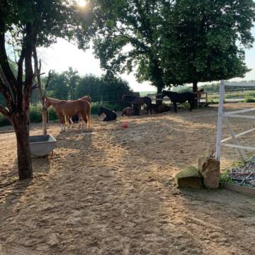
Offenstallplatz
Diemelsee Vasbeck
Fieseler-Becker
@Fieseler-Becker
Freizeitstall
Vermieten
Hunde willkommen
Krankenbox
Fohlenaufzucht möglich
Hufrehe geeignet
12 weitere...
B
Deprecated: Creation of dynamic property Zend_View_Helper_Ads::$adLink is deprecated in /var/www/stall-frei/htdocs/staging.stall-frei.de/library/Psf/View/Helper/Ads.php on line 108

Persönlichkeitsentwicklung mit Pferden
Bad Salzuflen
Katja Dors
@Pferdezeiten
Begleite andere auf ihrem Entwicklungsweg und entdecke die transformative Kraft der pferdegestützten Persönlichkeitsentwicklung !
neu
R
Leider kein Vorschaubild
Leider kein Vorschaubild
Vorbei kommen anschauen und dann entscheiden
Twistetal Gembeck
Maike Emde
@Micki
Freizeitstall
Gangpferdereiten
Vermieten
Hunde willkommen
Krankenbox
Allergikerstall
bedampftes/gewaschenes Heu
18 weitere...
B
Leider kein Vorschaubild
Leider kein Vorschaubild
Offenstall mit Paddocktrail-Eröffnung Mai/Juni
Twistetal
Pferdehof Paul
@PferdehofPaul
Freizeitstall
Vermieten
Hunde willkommen
Krankenbox
Notfallboxen
11 weitere...
brandneu
B
Leider kein Vorschaubild
Leider kein Vorschaubild
Boxen mit ganzjährigem, täglichem Weidegang
Volkmarsen
Stall Becker
@Christina144
Vermieten
Hunde willkommen
Sattelkammer/Sattelschränke
Innenbox
Vollpension
4 weitere...
B
LIEBLINGSPLATZ - Bewegungsstall mit Paddocktrail
Korbach
Elisabeth Rutz
@Elisabeth-Rutz
Freizeitstall
Reitlehrer und -unterricht
Vermieten
Hunde willkommen
Krankenbox
Allergikerstall
Hufrehe geeignet
20 weitere...
P

Das Beste für die Hufe
Mechtersen
STALL-FREIde Marketing
@STALL-FREI-Marketing
Hufschmiede und Hufpfleger in Ihrer Nähe

Boxen frei, teil m. Paddock, Weide, Reitplatz
Korbach
Zuchtgemeinschaft Franke
@ZGFranke
FN-Mitglied
Freizeitstall
Vermieten
Verpachten
Hunde willkommen
Krankenbox
Allergikerstall
Fohlenaufzucht möglich
24 weitere...
P
Leider kein Vorschaubild
Leider kein Vorschaubild
Offenstall-Vollpension: 1 Stutenplatz noch frei.
Warburg
Müller
@AraberStuten
Hunde willkommen
Pensions- und Gastboxen
Offenstall
Vollpension
7 weitere...
B
Leider kein Vorschaubild
Leider kein Vorschaubild
Pferdebox oder Offenstall Greitekenhof
Diemelsee-Sudeck
Lara Wiens
@Lara2609
Freizeitstall
Gangpferdereiten
Vermieten
Hunde willkommen
Krankenbox
Fohlenaufzucht möglich
Hufrehe geeignet
18 weitere...
B
Leider kein Vorschaubild
Leider kein Vorschaubild
Aktiv- Stall
Wolfhagen
Pferdepension Kalkhofsmühle
@JaninaBachmann
Freizeitstall
Geländestrecke
Vermieten
Hunde willkommen
Krankenbox
Allergikerstall
Notfallboxen
16 weitere...
B


Offenstall Wallache / Rentner - 24/7 Weide
Bad Emstal
Landgrebe Agrar GbR
@LandgrebeAgrar
Freizeitstall
Geländestrecke
Vermieten
Hunde willkommen
Krankenbox
Allergikerstall
Notfallboxen
23 weitere...
P+
Deprecated: Creation of dynamic property Zend_View::$pageCount is deprecated in /var/www/stall-frei/htdocs/staging.stall-frei.de/library/vendor/shardj/zf1-future/library/Zend/View/Abstract.php on line 308
Deprecated: Creation of dynamic property Zend_View::$itemCountPerPage is deprecated in /var/www/stall-frei/htdocs/staging.stall-frei.de/library/vendor/shardj/zf1-future/library/Zend/View/Abstract.php on line 308
Deprecated: Creation of dynamic property Zend_View::$first is deprecated in /var/www/stall-frei/htdocs/staging.stall-frei.de/library/vendor/shardj/zf1-future/library/Zend/View/Abstract.php on line 308
Deprecated: Creation of dynamic property Zend_View::$current is deprecated in /var/www/stall-frei/htdocs/staging.stall-frei.de/library/vendor/shardj/zf1-future/library/Zend/View/Abstract.php on line 308
Deprecated: Creation of dynamic property Zend_View::$last is deprecated in /var/www/stall-frei/htdocs/staging.stall-frei.de/library/vendor/shardj/zf1-future/library/Zend/View/Abstract.php on line 308
Deprecated: Creation of dynamic property Zend_View::$next is deprecated in /var/www/stall-frei/htdocs/staging.stall-frei.de/library/vendor/shardj/zf1-future/library/Zend/View/Abstract.php on line 308
Deprecated: Creation of dynamic property Zend_View::$pagesInRange is deprecated in /var/www/stall-frei/htdocs/staging.stall-frei.de/library/vendor/shardj/zf1-future/library/Zend/View/Abstract.php on line 308
Deprecated: Creation of dynamic property Zend_View::$firstPageInRange is deprecated in /var/www/stall-frei/htdocs/staging.stall-frei.de/library/vendor/shardj/zf1-future/library/Zend/View/Abstract.php on line 308
Deprecated: Creation of dynamic property Zend_View::$lastPageInRange is deprecated in /var/www/stall-frei/htdocs/staging.stall-frei.de/library/vendor/shardj/zf1-future/library/Zend/View/Abstract.php on line 308
Deprecated: Creation of dynamic property Zend_View::$currentItemCount is deprecated in /var/www/stall-frei/htdocs/staging.stall-frei.de/library/vendor/shardj/zf1-future/library/Zend/View/Abstract.php on line 308
Deprecated: Creation of dynamic property Zend_View::$totalItemCount is deprecated in /var/www/stall-frei/htdocs/staging.stall-frei.de/library/vendor/shardj/zf1-future/library/Zend/View/Abstract.php on line 308
Deprecated: Creation of dynamic property Zend_View::$firstItemNumber is deprecated in /var/www/stall-frei/htdocs/staging.stall-frei.de/library/vendor/shardj/zf1-future/library/Zend/View/Abstract.php on line 308
Deprecated: Creation of dynamic property Zend_View::$lastItemNumber is deprecated in /var/www/stall-frei/htdocs/staging.stall-frei.de/library/vendor/shardj/zf1-future/library/Zend/View/Abstract.php on line 308
Deprecated: Creation of dynamic property Zend_View::$router is deprecated in /var/www/stall-frei/htdocs/staging.stall-frei.de/library/vendor/shardj/zf1-future/library/Zend/View/Abstract.php on line 308
Deprecated: Creation of dynamic property Zend_View::$urlParams is deprecated in /var/www/stall-frei/htdocs/staging.stall-frei.de/library/vendor/shardj/zf1-future/library/Zend/View/Abstract.php on line 308
Deprecated: Creation of dynamic property Zend_View::$showAds is deprecated in /var/www/stall-frei/htdocs/staging.stall-frei.de/library/vendor/shardj/zf1-future/library/Zend/View/Abstract.php on line 308
Deprecated: Creation of dynamic property Zend_View::$objectIds is deprecated in /var/www/stall-frei/htdocs/staging.stall-frei.de/library/vendor/shardj/zf1-future/library/Zend/View/Abstract.php on line 308
Deprecated: Creation of dynamic property Zend_View::$showNavbar is deprecated in /var/www/stall-frei/htdocs/staging.stall-frei.de/library/vendor/shardj/zf1-future/library/Zend/View/Abstract.php on line 308
Deprecated: Creation of dynamic property Zend_View::$showBreadcrumb is deprecated in /var/www/stall-frei/htdocs/staging.stall-frei.de/library/vendor/shardj/zf1-future/library/Zend/View/Abstract.php on line 308
Deprecated: Creation of dynamic property Zend_View::$showFooter is deprecated in /var/www/stall-frei/htdocs/staging.stall-frei.de/library/vendor/shardj/zf1-future/library/Zend/View/Abstract.php on line 308
Deprecated: Creation of dynamic property Zend_View::$showInternalAds is deprecated in /var/www/stall-frei/htdocs/staging.stall-frei.de/library/vendor/shardj/zf1-future/library/Zend/View/Abstract.php on line 308
Deprecated: Creation of dynamic property Zend_View::$blNoContent is deprecated in /var/www/stall-frei/htdocs/staging.stall-frei.de/library/vendor/shardj/zf1-future/library/Zend/View/Abstract.php on line 308
Deprecated: Creation of dynamic property Zend_View::$sMetaDesc is deprecated in /var/www/stall-frei/htdocs/staging.stall-frei.de/library/vendor/shardj/zf1-future/library/Zend/View/Abstract.php on line 308
Deprecated: Creation of dynamic property Zend_View::$useGmaps is deprecated in /var/www/stall-frei/htdocs/staging.stall-frei.de/library/vendor/shardj/zf1-future/library/Zend/View/Abstract.php on line 308
Deprecated: Creation of dynamic property Zend_View::$touches is deprecated in /var/www/stall-frei/htdocs/staging.stall-frei.de/library/vendor/shardj/zf1-future/library/Zend/View/Abstract.php on line 308
Deprecated: Creation of dynamic property Zend_View::$oProject is deprecated in /var/www/stall-frei/htdocs/staging.stall-frei.de/library/vendor/shardj/zf1-future/library/Zend/View/Abstract.php on line 308
Deprecated: Creation of dynamic property Zend_View::$pageHeadline is deprecated in /var/www/stall-frei/htdocs/staging.stall-frei.de/library/vendor/shardj/zf1-future/library/Zend/View/Abstract.php on line 308
Deprecated: Creation of dynamic property Zend_View::$disableLocationField is deprecated in /var/www/stall-frei/htdocs/staging.stall-frei.de/library/vendor/shardj/zf1-future/library/Zend/View/Abstract.php on line 308
Deprecated: Creation of dynamic property Zend_View::$isSearch is deprecated in /var/www/stall-frei/htdocs/staging.stall-frei.de/library/vendor/shardj/zf1-future/library/Zend/View/Abstract.php on line 308
Deprecated: Creation of dynamic property Zend_View::$pageTitle is deprecated in /var/www/stall-frei/htdocs/staging.stall-frei.de/library/vendor/shardj/zf1-future/library/Zend/View/Abstract.php on line 308
Deprecated: Creation of dynamic property Psf_Form_Element_Text::$class is deprecated in /var/www/stall-frei/htdocs/staging.stall-frei.de/library/vendor/shardj/zf1-future/library/Zend/Form/Element.php on line 874
Deprecated: Creation of dynamic property Psf_Form_Element_Text::$size is deprecated in /var/www/stall-frei/htdocs/staging.stall-frei.de/library/vendor/shardj/zf1-future/library/Zend/Form/Element.php on line 874
Deprecated: Creation of dynamic property Psf_Form_Element_Text::$placeholder is deprecated in /var/www/stall-frei/htdocs/staging.stall-frei.de/library/vendor/shardj/zf1-future/library/Zend/Form/Element.php on line 874
Deprecated: Creation of dynamic property Psf_Form_Element_Hidden::$class is deprecated in /var/www/stall-frei/htdocs/staging.stall-frei.de/library/vendor/shardj/zf1-future/library/Zend/Form/Element.php on line 874
Deprecated: Creation of dynamic property Psf_Form_Element_Hidden::$class is deprecated in /var/www/stall-frei/htdocs/staging.stall-frei.de/library/vendor/shardj/zf1-future/library/Zend/Form/Element.php on line 874
Deprecated: Creation of dynamic property Psf_Form_Element_Hidden::$class is deprecated in /var/www/stall-frei/htdocs/staging.stall-frei.de/library/vendor/shardj/zf1-future/library/Zend/Form/Element.php on line 874
Deprecated: Creation of dynamic property Psf_Form_Element_Hidden::$class is deprecated in /var/www/stall-frei/htdocs/staging.stall-frei.de/library/vendor/shardj/zf1-future/library/Zend/Form/Element.php on line 874
Deprecated: Creation of dynamic property Psf_Form_Element_Select::$class is deprecated in /var/www/stall-frei/htdocs/staging.stall-frei.de/library/vendor/shardj/zf1-future/library/Zend/Form/Element.php on line 874
Deprecated: Creation of dynamic property Psf_Form_Element_Select::$class is deprecated in /var/www/stall-frei/htdocs/staging.stall-frei.de/library/vendor/shardj/zf1-future/library/Zend/Form/Element.php on line 874
Deprecated: Creation of dynamic property Psf_Form_Element_Select::$class is deprecated in /var/www/stall-frei/htdocs/staging.stall-frei.de/library/vendor/shardj/zf1-future/library/Zend/Form/Element.php on line 874
Deprecated: Creation of dynamic property Psf_Form_Element_Select::$class is deprecated in /var/www/stall-frei/htdocs/staging.stall-frei.de/library/vendor/shardj/zf1-future/library/Zend/Form/Element.php on line 874
Deprecated: Creation of dynamic property Psf_Form_Element_Text::$class is deprecated in /var/www/stall-frei/htdocs/staging.stall-frei.de/library/vendor/shardj/zf1-future/library/Zend/Form/Element.php on line 874
Deprecated: Creation of dynamic property Psf_Form_Element_Checkbox::$label is deprecated in /var/www/stall-frei/htdocs/staging.stall-frei.de/library/vendor/shardj/zf1-future/library/Zend/Form/Element.php on line 874
Deprecated: Creation of dynamic property Zend_View::$sort is deprecated in /var/www/stall-frei/htdocs/staging.stall-frei.de/library/vendor/shardj/zf1-future/library/Zend/View/Abstract.php on line 308
Deprecated: Creation of dynamic property Zend_View::$searchLocation is deprecated in /var/www/stall-frei/htdocs/staging.stall-frei.de/library/vendor/shardj/zf1-future/library/Zend/View/Abstract.php on line 308
Deprecated: Creation of dynamic property Zend_View::$locationHint is deprecated in /var/www/stall-frei/htdocs/staging.stall-frei.de/library/vendor/shardj/zf1-future/library/Zend/View/Abstract.php on line 308
Psf_GeoCoder_Abstract::getLocation: Kohlgrund Get Location CachedOrLive
Psf_GeoCoder_Abstract::getCachedOrLive: Kohlgrund
Psf_GeoCoder_OpenCageData::makeApiRequest: response:
Array
(
[documentation] => https://opencagedata.com/api
[licenses] => Array
(
[0] => Array
(
[name] => see attribution guide
[url] => https://opencagedata.com/credits
)
)
[results] => Array
(
[0] => Array
(
[bounds] => Array
(
[northeast] => Array
(
[lat] => 51.4480952
[lng] => 8.9974803
)
[southwest] => Array
(
[lat] => 51.4163255
[lng] => 8.9180417
)
)
[components] => Array
(
[ISO_3166-1_alpha-2] => DE
[ISO_3166-1_alpha-3] => DEU
[ISO_3166-2] => Array
(
[0] => DE-HE
)
[_category] => place
[_normalized_city] => Kohlgrund
[_type] => village
[continent] => Europe
[country] => Deutschland
[country_code] => de
[county] => Landkreis Waldeck-Frankenberg
[municipality] => Bad Arolsen
[political_union] => European Union
[postcode] => 34454
[state] => Hessen
[state_code] => HE
[village] => Kohlgrund
)
[confidence] => 7
[formatted] => 34454 Kohlgrund, Deutschland
[geometry] => Array
(
[lat] => 51.4350029
[lng] => 8.9415507
)
)
[1] => Array
(
[bounds] => Array
(
[northeast] => Array
(
[lat] => 50.530741
[lng] => 9.8107881
)
[southwest] => Array
(
[lat] => 50.5094824
[lng] => 9.76672
)
)
[components] => Array
(
[ISO_3166-1_alpha-2] => DE
[ISO_3166-1_alpha-3] => DEU
[ISO_3166-2] => Array
(
[0] => DE-HE
)
[_category] => place
[_normalized_city] => Kohlgrund
[_type] => village
[continent] => Europe
[country] => Deutschland
[country_code] => de
[county] => Landkreis Fulda
[municipality] => Dipperz
[political_union] => European Union
[state] => Hessen
[state_code] => HE
[village] => Kohlgrund
)
[confidence] => 7
[formatted] => Kohlgrund, Hessen, Deutschland
[geometry] => Array
(
[lat] => 50.5206714
[lng] => 9.7942257
)
)
[2] => Array
(
[bounds] => Array
(
[northeast] => Array
(
[lat] => 51.8958268
[lng] => 8.8165729
)
[southwest] => Array
(
[lat] => 51.892206
[lng] => 8.8005371
)
)
[components] => Array
(
[ISO_3166-1_alpha-2] => DE
[ISO_3166-1_alpha-3] => DEU
[ISO_3166-2] => Array
(
[0] => DE-NW
)
[_category] => natural/water
[_normalized_city] => Augustdorf
[_type] => valley
[continent] => Europe
[country] => Deutschland
[country_code] => de
[county] => Kreis Lippe
[political_union] => European Union
[postcode] => 32832
[state] => Nordrhein-Westfalen
[state_code] => NW
[valley] => Kohlgrund
[village] => Augustdorf
)
[confidence] => 9
[formatted] => Kohlgrund, 32832 Augustdorf, Deutschland
[geometry] => Array
(
[lat] => 51.8935428
[lng] => 8.8087244
)
)
[3] => Array
(
[bounds] => Array
(
[northeast] => Array
(
[lat] => 50.9758619
[lng] => 14.0482152
)
[southwest] => Array
(
[lat] => 50.9702005
[lng] => 14.0409035
)
)
[components] => Array
(
[ISO_3166-1_alpha-2] => DE
[ISO_3166-1_alpha-3] => DEU
[ISO_3166-2] => Array
(
[0] => DE-SN
)
[_category] => natural/water
[_normalized_city] => Lohmen
[_type] => valley
[city] => Lohmen
[continent] => Europe
[country] => Deutschland
[country_code] => de
[county] => Sächsische Schweiz-Osterzgebirge
[municipality] => Lohmen/Stadt Wehlen
[political_union] => European Union
[postcode] => 01847
[state] => Sachsen
[state_code] => SN
[valley] => Kohlgrund
)
[confidence] => 9
[formatted] => Kohlgrund, 01847 Lohmen, Deutschland
[geometry] => Array
(
[lat] => 50.9738215
[lng] => 14.0438888
)
)
[4] => Array
(
[bounds] => Array
(
[northeast] => Array
(
[lat] => 50.9747259
[lng] => 14.0461891
)
[southwest] => Array
(
[lat] => 50.9737259
[lng] => 14.0441562
)
)
[components] => Array
(
[ISO_3166-1_alpha-2] => DE
[ISO_3166-1_alpha-3] => DEU
[ISO_3166-2] => Array
(
[0] => DE-SN
)
[_category] => natural/water
[_normalized_city] => Lohmen
[_type] => stream
[city] => Lohmen
[continent] => Europe
[country] => Deutschland
[country_code] => de
[county] => Sächsische Schweiz-Osterzgebirge
[municipality] => Lohmen/Stadt Wehlen
[political_union] => European Union
[postcode] => 01847
[state] => Sachsen
[state_code] => SN
[stream] => Zscherregrund
)
[confidence] => 9
[formatted] => Zscherregrund, 01847 Lohmen, Deutschland
[geometry] => Array
(
[lat] => 50.9741053
[lng] => 14.0452712
)
)
[5] => Array
(
[bounds] => Array
(
[northeast] => Array
(
[lat] => 49.7185098
[lng] => 9.3418538
)
[southwest] => Array
(
[lat] => 49.7093828
[lng] => 9.3203634
)
)
[components] => Array
(
[ISO_3166-1_alpha-2] => DE
[ISO_3166-1_alpha-3] => DEU
[ISO_3166-2] => Array
(
[0] => DE-BY
)
[_category] => natural/water
[_normalized_city] => Eichenbühl
[_type] => meadow
[continent] => Europe
[country] => Deutschland
[country_code] => de
[county] => Landkreis Miltenberg
[meadow] => Kohlgrund
[political_union] => European Union
[postcode] => 63928
[state] => Bayern
[state_code] => BY
[suburb] => Eichenbühl
[village] => Eichenbühl
)
[confidence] => 8
[formatted] => Kohlgrund, 63928 Eichenbühl, Deutschland
[geometry] => Array
(
[lat] => 49.7139425
[lng] => 9.3291463
)
)
[6] => Array
(
[bounds] => Array
(
[northeast] => Array
(
[lat] => 50.9875221
[lng] => 14.045585
)
[southwest] => Array
(
[lat] => 50.9675221
[lng] => 14.025585
)
)
[components] => Array
(
[ISO_3166-1_alpha-2] => DE
[ISO_3166-1_alpha-3] => DEU
[ISO_3166-2] => Array
(
[0] => DE-SN
)
[_category] => place
[_normalized_city] => Lohmen
[_type] => hamlet
[city] => Lohmen
[continent] => Europe
[country] => Deutschland
[country_code] => de
[county] => Sächsische Schweiz-Osterzgebirge
[locality] => Kohlgrund
[municipality] => Lohmen/Stadt Wehlen
[political_union] => European Union
[postcode] => 01847
[state] => Sachsen
[state_code] => SN
)
[confidence] => 8
[formatted] => Kohlgrund, 01847 Lohmen, Deutschland
[geometry] => Array
(
[lat] => 50.9775221
[lng] => 14.035585
)
)
[7] => Array
(
[bounds] => Array
(
[northeast] => Array
(
[lat] => 49.8129294
[lng] => 9.3905677
)
[southwest] => Array
(
[lat] => 49.7929294
[lng] => 9.3705677
)
)
[components] => Array
(
[ISO_3166-1_alpha-2] => DE
[ISO_3166-1_alpha-3] => DEU
[ISO_3166-2] => Array
(
[0] => DE-BY
)
[_category] => place
[_normalized_city] => Dorfprozelten
[_type] => hamlet
[continent] => Europe
[country] => Deutschland
[country_code] => de
[county] => Landkreis Miltenberg
[locality] => Kohlgrund
[political_union] => European Union
[postcode] => 97904
[state] => Bayern
[state_code] => BY
[village] => Dorfprozelten
)
[confidence] => 8
[formatted] => Kohlgrund, 97904 Dorfprozelten, Deutschland
[geometry] => Array
(
[lat] => 49.8029294
[lng] => 9.3805677
)
)
[8] => Array
(
[bounds] => Array
(
[northeast] => Array
(
[lat] => 50.9149292
[lng] => 13.5531285
)
[southwest] => Array
(
[lat] => 50.8949292
[lng] => 13.5331285
)
)
[components] => Array
(
[ISO_3166-1_alpha-2] => DE
[ISO_3166-1_alpha-3] => DEU
[ISO_3166-2] => Array
(
[0] => DE-SN
)
[_category] => place
[_normalized_city] => Höckendorf
[_type] => hamlet
[continent] => Europe
[country] => Deutschland
[country_code] => de
[county] => Sächsische Schweiz-Osterzgebirge
[locality] => Kohlgrund
[municipality] => Klingenberg
[political_union] => European Union
[postcode] => 01774
[state] => Sachsen
[state_code] => SN
[village] => Höckendorf
)
[confidence] => 8
[formatted] => Kohlgrund, 01774 Höckendorf, Deutschland
[geometry] => Array
(
[lat] => 50.9049292
[lng] => 13.5431285
)
)
[9] => Array
(
[bounds] => Array
(
[northeast] => Array
(
[lat] => 51.544778
[lng] => 10.07308
)
[southwest] => Array
(
[lat] => 51.5426711
[lng] => 10.0679483
)
)
[components] => Array
(
[ISO_3166-1_alpha-2] => DE
[ISO_3166-1_alpha-3] => DEU
[ISO_3166-2] => Array
(
[0] => DE-NI
)
[_category] => road
[_normalized_city] => Waake
[_type] => road
[city] => Waake
[continent] => Europe
[country] => Deutschland
[country_code] => de
[county] => Landkreis Göttingen
[municipality] => Samtgemeinde Radolfshausen
[political_union] => European Union
[postcode] => 37136
[road] => Kohlgrund
[road_type] => track
[state] => Niedersachsen
[state_code] => NI
[village] => Waake
)
[confidence] => 9
[formatted] => Kohlgrund, 37136 Waake, Deutschland
[geometry] => Array
(
[lat] => 51.5431022
[lng] => 10.0708178
)
)
)
[status] => Array
(
[code] => 200
[message] => OK
)
[stay_informed] => Array
(
[blog] => https://blog.opencagedata.com
[mastodon] => https://en.osm.town/@opencage
)
[thanks] => For using an OpenCage API
[timestamp] => Array
(
[created_http] => Mon, 09 Feb 2026 04:33:43 GMT
[created_unix] => 1770611623
)
[total_results] => 10
)
Psf_GeoCoder_Abstract::convertLocationResult
{"documentation":"https:\/\/opencagedata.com\/api","licenses":[{"name":"see attribution guide","url":"https:\/\/opencagedata.com\/credits"}],"results":[{"bounds":{"northeast":{"lat":51.4480952,"lng":8.9974803},"southwest":{"lat":51.4163255,"lng":8.9180417}},"components":{"ISO_3166-1_alpha-2":"DE","ISO_3166-1_alpha-3":"DEU","ISO_3166-2":["DE-HE"],"_category":"place","_normalized_city":"Kohlgrund","_type":"village","continent":"Europe","country":"Deutschland","country_code":"de","county":"Landkreis Waldeck-Frankenberg","municipality":"Bad Arolsen","political_union":"European Union","postcode":"34454","state":"Hessen","state_code":"HE","village":"Kohlgrund"},"confidence":7,"formatted":"34454 Kohlgrund, Deutschland","geometry":{"lat":51.4350029,"lng":8.9415507}},{"bounds":{"northeast":{"lat":50.530741,"lng":9.8107881},"southwest":{"lat":50.5094824,"lng":9.76672}},"components":{"ISO_3166-1_alpha-2":"DE","ISO_3166-1_alpha-3":"DEU","ISO_3166-2":["DE-HE"],"_category":"place","_normalized_city":"Kohlgrund","_type":"village","continent":"Europe","country":"Deutschland","country_code":"de","county":"Landkreis Fulda","municipality":"Dipperz","political_union":"European Union","state":"Hessen","state_code":"HE","village":"Kohlgrund"},"confidence":7,"formatted":"Kohlgrund, Hessen, Deutschland","geometry":{"lat":50.5206714,"lng":9.7942257}},{"bounds":{"northeast":{"lat":51.8958268,"lng":8.8165729},"southwest":{"lat":51.892206,"lng":8.8005371}},"components":{"ISO_3166-1_alpha-2":"DE","ISO_3166-1_alpha-3":"DEU","ISO_3166-2":["DE-NW"],"_category":"natural\/water","_normalized_city":"Augustdorf","_type":"valley","continent":"Europe","country":"Deutschland","country_code":"de","county":"Kreis Lippe","political_union":"European Union","postcode":"32832","state":"Nordrhein-Westfalen","state_code":"NW","valley":"Kohlgrund","village":"Augustdorf"},"confidence":9,"formatted":"Kohlgrund, 32832 Augustdorf, Deutschland","geometry":{"lat":51.8935428,"lng":8.8087244}},{"bounds":{"northeast":{"lat":50.9758619,"lng":14.0482152},"southwest":{"lat":50.9702005,"lng":14.0409035}},"components":{"ISO_3166-1_alpha-2":"DE","ISO_3166-1_alpha-3":"DEU","ISO_3166-2":["DE-SN"],"_category":"natural\/water","_normalized_city":"Lohmen","_type":"valley","city":"Lohmen","continent":"Europe","country":"Deutschland","country_code":"de","county":"S\u00e4chsische Schweiz-Osterzgebirge","municipality":"Lohmen\/Stadt Wehlen","political_union":"European Union","postcode":"01847","state":"Sachsen","state_code":"SN","valley":"Kohlgrund"},"confidence":9,"formatted":"Kohlgrund, 01847 Lohmen, Deutschland","geometry":{"lat":50.9738215,"lng":14.0438888}},{"bounds":{"northeast":{"lat":50.9747259,"lng":14.0461891},"southwest":{"lat":50.9737259,"lng":14.0441562}},"components":{"ISO_3166-1_alpha-2":"DE","ISO_3166-1_alpha-3":"DEU","ISO_3166-2":["DE-SN"],"_category":"natural\/water","_normalized_city":"Lohmen","_type":"stream","city":"Lohmen","continent":"Europe","country":"Deutschland","country_code":"de","county":"S\u00e4chsische Schweiz-Osterzgebirge","municipality":"Lohmen\/Stadt Wehlen","political_union":"European Union","postcode":"01847","state":"Sachsen","state_code":"SN","stream":"Zscherregrund"},"confidence":9,"formatted":"Zscherregrund, 01847 Lohmen, Deutschland","geometry":{"lat":50.9741053,"lng":14.0452712}},{"bounds":{"northeast":{"lat":49.7185098,"lng":9.3418538},"southwest":{"lat":49.7093828,"lng":9.3203634}},"components":{"ISO_3166-1_alpha-2":"DE","ISO_3166-1_alpha-3":"DEU","ISO_3166-2":["DE-BY"],"_category":"natural\/water","_normalized_city":"Eichenb\u00fchl","_type":"meadow","continent":"Europe","country":"Deutschland","country_code":"de","county":"Landkreis Miltenberg","meadow":"Kohlgrund","political_union":"European Union","postcode":"63928","state":"Bayern","state_code":"BY","suburb":"Eichenb\u00fchl","village":"Eichenb\u00fchl"},"confidence":8,"formatted":"Kohlgrund, 63928 Eichenb\u00fchl, Deutschland","geometry":{"lat":49.7139425,"lng":9.3291463}},{"bounds":{"northeast":{"lat":50.9875221,"lng":14.045585},"southwest":{"lat":50.9675221,"lng":14.025585}},"components":{"ISO_3166-1_alpha-2":"DE","ISO_3166-1_alpha-3":"DEU","ISO_3166-2":["DE-SN"],"_category":"place","_normalized_city":"Lohmen","_type":"hamlet","city":"Lohmen","continent":"Europe","country":"Deutschland","country_code":"de","county":"S\u00e4chsische Schweiz-Osterzgebirge","locality":"Kohlgrund","municipality":"Lohmen\/Stadt Wehlen","political_union":"European Union","postcode":"01847","state":"Sachsen","state_code":"SN"},"confidence":8,"formatted":"Kohlgrund, 01847 Lohmen, Deutschland","geometry":{"lat":50.9775221,"lng":14.035585}},{"bounds":{"northeast":{"lat":49.8129294,"lng":9.3905677},"southwest":{"lat":49.7929294,"lng":9.3705677}},"components":{"ISO_3166-1_alpha-2":"DE","ISO_3166-1_alpha-3":"DEU","ISO_3166-2":["DE-BY"],"_category":"place","_normalized_city":"Dorfprozelten","_type":"hamlet","continent":"Europe","country":"Deutschland","country_code":"de","county":"Landkreis Miltenberg","locality":"Kohlgrund","political_union":"European Union","postcode":"97904","state":"Bayern","state_code":"BY","village":"Dorfprozelten"},"confidence":8,"formatted":"Kohlgrund, 97904 Dorfprozelten, Deutschland","geometry":{"lat":49.8029294,"lng":9.3805677}},{"bounds":{"northeast":{"lat":50.9149292,"lng":13.5531285},"southwest":{"lat":50.8949292,"lng":13.5331285}},"components":{"ISO_3166-1_alpha-2":"DE","ISO_3166-1_alpha-3":"DEU","ISO_3166-2":["DE-SN"],"_category":"place","_normalized_city":"H\u00f6ckendorf","_type":"hamlet","continent":"Europe","country":"Deutschland","country_code":"de","county":"S\u00e4chsische Schweiz-Osterzgebirge","locality":"Kohlgrund","municipality":"Klingenberg","political_union":"European Union","postcode":"01774","state":"Sachsen","state_code":"SN","village":"H\u00f6ckendorf"},"confidence":8,"formatted":"Kohlgrund, 01774 H\u00f6ckendorf, Deutschland","geometry":{"lat":50.9049292,"lng":13.5431285}},{"bounds":{"northeast":{"lat":51.544778,"lng":10.07308},"southwest":{"lat":51.5426711,"lng":10.0679483}},"components":{"ISO_3166-1_alpha-2":"DE","ISO_3166-1_alpha-3":"DEU","ISO_3166-2":["DE-NI"],"_category":"road","_normalized_city":"Waake","_type":"road","city":"Waake","continent":"Europe","country":"Deutschland","country_code":"de","county":"Landkreis G\u00f6ttingen","municipality":"Samtgemeinde Radolfshausen","political_union":"European Union","postcode":"37136","road":"Kohlgrund","road_type":"track","state":"Niedersachsen","state_code":"NI","village":"Waake"},"confidence":9,"formatted":"Kohlgrund, 37136 Waake, Deutschland","geometry":{"lat":51.5431022,"lng":10.0708178}}],"status":{"code":200,"message":"OK"},"stay_informed":{"blog":"https:\/\/blog.opencagedata.com","mastodon":"https:\/\/en.osm.town\/@opencage"},"thanks":"For using an OpenCage API","timestamp":{"created_http":"Mon, 09 Feb 2026 04:33:43 GMT","created_unix":1770611623},"total_results":10}Array
(
[0] => stdClass Object
(
[bounds] => stdClass Object
(
[northeast] => stdClass Object
(
[lat] => 51.4480952
[lng] => 8.9974803
)
[southwest] => stdClass Object
(
[lat] => 51.4163255
[lng] => 8.9180417
)
)
[components] => stdClass Object
(
[ISO_3166-1_alpha-2] => DE
[ISO_3166-1_alpha-3] => DEU
[ISO_3166-2] => Array
(
[0] => DE-HE
)
[_category] => place
[_normalized_city] => Kohlgrund
[_type] => village
[continent] => Europe
[country] => Deutschland
[country_code] => de
[county] => Landkreis Waldeck-Frankenberg
[municipality] => Bad Arolsen
[political_union] => European Union
[postcode] => 34454
[state] => Hessen
[state_code] => HE
[village] => Kohlgrund
)
[confidence] => 7
[formatted] => 34454 Kohlgrund, Deutschland
[geometry] => stdClass Object
(
[lat] => 51.4350029
[lng] => 8.9415507
)
)
[1] => stdClass Object
(
[bounds] => stdClass Object
(
[northeast] => stdClass Object
(
[lat] => 50.530741
[lng] => 9.8107881
)
[southwest] => stdClass Object
(
[lat] => 50.5094824
[lng] => 9.76672
)
)
[components] => stdClass Object
(
[ISO_3166-1_alpha-2] => DE
[ISO_3166-1_alpha-3] => DEU
[ISO_3166-2] => Array
(
[0] => DE-HE
)
[_category] => place
[_normalized_city] => Kohlgrund
[_type] => village
[continent] => Europe
[country] => Deutschland
[country_code] => de
[county] => Landkreis Fulda
[municipality] => Dipperz
[political_union] => European Union
[state] => Hessen
[state_code] => HE
[village] => Kohlgrund
)
[confidence] => 7
[formatted] => Kohlgrund, Hessen, Deutschland
[geometry] => stdClass Object
(
[lat] => 50.5206714
[lng] => 9.7942257
)
)
[2] => stdClass Object
(
[bounds] => stdClass Object
(
[northeast] => stdClass Object
(
[lat] => 51.8958268
[lng] => 8.8165729
)
[southwest] => stdClass Object
(
[lat] => 51.892206
[lng] => 8.8005371
)
)
[components] => stdClass Object
(
[ISO_3166-1_alpha-2] => DE
[ISO_3166-1_alpha-3] => DEU
[ISO_3166-2] => Array
(
[0] => DE-NW
)
[_category] => natural/water
[_normalized_city] => Augustdorf
[_type] => valley
[continent] => Europe
[country] => Deutschland
[country_code] => de
[county] => Kreis Lippe
[political_union] => European Union
[postcode] => 32832
[state] => Nordrhein-Westfalen
[state_code] => NW
[valley] => Kohlgrund
[village] => Augustdorf
)
[confidence] => 9
[formatted] => Kohlgrund, 32832 Augustdorf, Deutschland
[geometry] => stdClass Object
(
[lat] => 51.8935428
[lng] => 8.8087244
)
)
[3] => stdClass Object
(
[bounds] => stdClass Object
(
[northeast] => stdClass Object
(
[lat] => 50.9758619
[lng] => 14.0482152
)
[southwest] => stdClass Object
(
[lat] => 50.9702005
[lng] => 14.0409035
)
)
[components] => stdClass Object
(
[ISO_3166-1_alpha-2] => DE
[ISO_3166-1_alpha-3] => DEU
[ISO_3166-2] => Array
(
[0] => DE-SN
)
[_category] => natural/water
[_normalized_city] => Lohmen
[_type] => valley
[city] => Lohmen
[continent] => Europe
[country] => Deutschland
[country_code] => de
[county] => Sächsische Schweiz-Osterzgebirge
[municipality] => Lohmen/Stadt Wehlen
[political_union] => European Union
[postcode] => 01847
[state] => Sachsen
[state_code] => SN
[valley] => Kohlgrund
)
[confidence] => 9
[formatted] => Kohlgrund, 01847 Lohmen, Deutschland
[geometry] => stdClass Object
(
[lat] => 50.9738215
[lng] => 14.0438888
)
)
[4] => stdClass Object
(
[bounds] => stdClass Object
(
[northeast] => stdClass Object
(
[lat] => 50.9747259
[lng] => 14.0461891
)
[southwest] => stdClass Object
(
[lat] => 50.9737259
[lng] => 14.0441562
)
)
[components] => stdClass Object
(
[ISO_3166-1_alpha-2] => DE
[ISO_3166-1_alpha-3] => DEU
[ISO_3166-2] => Array
(
[0] => DE-SN
)
[_category] => natural/water
[_normalized_city] => Lohmen
[_type] => stream
[city] => Lohmen
[continent] => Europe
[country] => Deutschland
[country_code] => de
[county] => Sächsische Schweiz-Osterzgebirge
[municipality] => Lohmen/Stadt Wehlen
[political_union] => European Union
[postcode] => 01847
[state] => Sachsen
[state_code] => SN
[stream] => Zscherregrund
)
[confidence] => 9
[formatted] => Zscherregrund, 01847 Lohmen, Deutschland
[geometry] => stdClass Object
(
[lat] => 50.9741053
[lng] => 14.0452712
)
)
[5] => stdClass Object
(
[bounds] => stdClass Object
(
[northeast] => stdClass Object
(
[lat] => 49.7185098
[lng] => 9.3418538
)
[southwest] => stdClass Object
(
[lat] => 49.7093828
[lng] => 9.3203634
)
)
[components] => stdClass Object
(
[ISO_3166-1_alpha-2] => DE
[ISO_3166-1_alpha-3] => DEU
[ISO_3166-2] => Array
(
[0] => DE-BY
)
[_category] => natural/water
[_normalized_city] => Eichenbühl
[_type] => meadow
[continent] => Europe
[country] => Deutschland
[country_code] => de
[county] => Landkreis Miltenberg
[meadow] => Kohlgrund
[political_union] => European Union
[postcode] => 63928
[state] => Bayern
[state_code] => BY
[suburb] => Eichenbühl
[village] => Eichenbühl
)
[confidence] => 8
[formatted] => Kohlgrund, 63928 Eichenbühl, Deutschland
[geometry] => stdClass Object
(
[lat] => 49.7139425
[lng] => 9.3291463
)
)
[6] => stdClass Object
(
[bounds] => stdClass Object
(
[northeast] => stdClass Object
(
[lat] => 50.9875221
[lng] => 14.045585
)
[southwest] => stdClass Object
(
[lat] => 50.9675221
[lng] => 14.025585
)
)
[components] => stdClass Object
(
[ISO_3166-1_alpha-2] => DE
[ISO_3166-1_alpha-3] => DEU
[ISO_3166-2] => Array
(
[0] => DE-SN
)
[_category] => place
[_normalized_city] => Lohmen
[_type] => hamlet
[city] => Lohmen
[continent] => Europe
[country] => Deutschland
[country_code] => de
[county] => Sächsische Schweiz-Osterzgebirge
[locality] => Kohlgrund
[municipality] => Lohmen/Stadt Wehlen
[political_union] => European Union
[postcode] => 01847
[state] => Sachsen
[state_code] => SN
)
[confidence] => 8
[formatted] => Kohlgrund, 01847 Lohmen, Deutschland
[geometry] => stdClass Object
(
[lat] => 50.9775221
[lng] => 14.035585
)
)
[7] => stdClass Object
(
[bounds] => stdClass Object
(
[northeast] => stdClass Object
(
[lat] => 49.8129294
[lng] => 9.3905677
)
[southwest] => stdClass Object
(
[lat] => 49.7929294
[lng] => 9.3705677
)
)
[components] => stdClass Object
(
[ISO_3166-1_alpha-2] => DE
[ISO_3166-1_alpha-3] => DEU
[ISO_3166-2] => Array
(
[0] => DE-BY
)
[_category] => place
[_normalized_city] => Dorfprozelten
[_type] => hamlet
[continent] => Europe
[country] => Deutschland
[country_code] => de
[county] => Landkreis Miltenberg
[locality] => Kohlgrund
[political_union] => European Union
[postcode] => 97904
[state] => Bayern
[state_code] => BY
[village] => Dorfprozelten
)
[confidence] => 8
[formatted] => Kohlgrund, 97904 Dorfprozelten, Deutschland
[geometry] => stdClass Object
(
[lat] => 49.8029294
[lng] => 9.3805677
)
)
[8] => stdClass Object
(
[bounds] => stdClass Object
(
[northeast] => stdClass Object
(
[lat] => 50.9149292
[lng] => 13.5531285
)
[southwest] => stdClass Object
(
[lat] => 50.8949292
[lng] => 13.5331285
)
)
[components] => stdClass Object
(
[ISO_3166-1_alpha-2] => DE
[ISO_3166-1_alpha-3] => DEU
[ISO_3166-2] => Array
(
[0] => DE-SN
)
[_category] => place
[_normalized_city] => Höckendorf
[_type] => hamlet
[continent] => Europe
[country] => Deutschland
[country_code] => de
[county] => Sächsische Schweiz-Osterzgebirge
[locality] => Kohlgrund
[municipality] => Klingenberg
[political_union] => European Union
[postcode] => 01774
[state] => Sachsen
[state_code] => SN
[village] => Höckendorf
)
[confidence] => 8
[formatted] => Kohlgrund, 01774 Höckendorf, Deutschland
[geometry] => stdClass Object
(
[lat] => 50.9049292
[lng] => 13.5431285
)
)
[9] => stdClass Object
(
[bounds] => stdClass Object
(
[northeast] => stdClass Object
(
[lat] => 51.544778
[lng] => 10.07308
)
[southwest] => stdClass Object
(
[lat] => 51.5426711
[lng] => 10.0679483
)
)
[components] => stdClass Object
(
[ISO_3166-1_alpha-2] => DE
[ISO_3166-1_alpha-3] => DEU
[ISO_3166-2] => Array
(
[0] => DE-NI
)
[_category] => road
[_normalized_city] => Waake
[_type] => road
[city] => Waake
[continent] => Europe
[country] => Deutschland
[country_code] => de
[county] => Landkreis Göttingen
[municipality] => Samtgemeinde Radolfshausen
[political_union] => European Union
[postcode] => 37136
[road] => Kohlgrund
[road_type] => track
[state] => Niedersachsen
[state_code] => NI
[village] => Waake
)
[confidence] => 9
[formatted] => Kohlgrund, 37136 Waake, Deutschland
[geometry] => stdClass Object
(
[lat] => 51.5431022
[lng] => 10.0708178
)
)
)
Psf_GeoCoder_OpenCageData::getKeyMap: 0
stdClass Object
(
    [bounds] => stdClass Object
        (
            [northeast] => stdClass Object
                (
                    [lat] => 51.4480952
                    [lng] => 8.9974803
                )

            [southwest] => stdClass Object
                (
                    [lat] => 51.4163255
                    [lng] => 8.9180417
                )

        )

    [components] => stdClass Object
        (
            [ISO_3166-1_alpha-2] => DE
            [ISO_3166-1_alpha-3] => DEU
            [ISO_3166-2] => Array
                (
                    [0] => DE-HE
                )

            [_category] => place
            [_normalized_city] => Kohlgrund
            [_type] => village
            [continent] => Europe
            [country] => Deutschland
            [country_code] => de
            [county] => Landkreis Waldeck-Frankenberg
            [municipality] => Bad Arolsen
            [political_union] => European Union
            [postcode] => 34454
            [state] => Hessen
            [state_code] => HE
            [village] => Kohlgrund
        )

    [confidence] => 7
    [formatted] => 34454 Kohlgrund, Deutschland
    [geometry] => stdClass Object
        (
            [lat] => 51.4350029
            [lng] => 8.9415507
        )

)
Psf_GeoCoder_OpenCageData::getCounty: Waldeck-Frankenberg
Psf_GeoCoder_OpenCageData::addMissingData REFETCH!
Array
(
    [address] => 34454 Kohlgrund, Deutschland
    [type] => village
    [street] =>
    [city] => Kohlgrund
    [county] => Waldeck-Frankenberg
    [state] => Hessen
    [zip] => 34454
    [country] => Deutschland
    [suburb] =>
    [countrycode] => de
    [latitude] => 51.4350029
    [longitude] => 8.9415507
    [accuracy] => 1
    [confidence] => 7
    [bounds] => stdClass Object
        (
            [northeast] => stdClass Object
                (
                    [lat] => 51.4480952
                    [lng] => 8.9974803
                )

            [southwest] => stdClass Object
                (
                    [lat] => 51.4163255
                    [lng] => 8.9180417
                )

        )

)
reformat!
Array
(
    [address] => 34454 Kohlgrund, Deutschland
    [type] => village
    [street] =>
    [city] => Kohlgrund
    [county] => Waldeck-Frankenberg
    [state] => Hessen
    [zip] => 34454
    [country] => Deutschland
    [suburb] =>
    [countrycode] => de
    [latitude] => 51.4350029
    [longitude] => 8.9415507
    [accuracy] => 1
    [confidence] => 7
    [bounds] => stdClass Object
        (
            [northeast] => stdClass Object
                (
                    [lat] => 51.4480952
                    [lng] => 8.9974803
                )

            [southwest] => stdClass Object
                (
                    [lat] => 51.4163255
                    [lng] => 8.9180417
                )

        )

    [place] => 34454 Kohlgrund, Hessen
    [hash] => c550375f183a5cff92d9a44921003c38
)
Psf_GeoCoder_OpenCageData::getKeyMap: 1
stdClass Object
(
    [bounds] => stdClass Object
        (
            [northeast] => stdClass Object
                (
                    [lat] => 50.530741
                    [lng] => 9.8107881
                )

            [southwest] => stdClass Object
                (
                    [lat] => 50.5094824
                    [lng] => 9.76672
                )

        )

    [components] => stdClass Object
        (
            [ISO_3166-1_alpha-2] => DE
            [ISO_3166-1_alpha-3] => DEU
            [ISO_3166-2] => Array
                (
                    [0] => DE-HE
                )

            [_category] => place
            [_normalized_city] => Kohlgrund
            [_type] => village
            [continent] => Europe
            [country] => Deutschland
            [country_code] => de
            [county] => Landkreis Fulda
            [municipality] => Dipperz
            [political_union] => European Union
            [state] => Hessen
            [state_code] => HE
            [village] => Kohlgrund
        )

    [confidence] => 7
    [formatted] => Kohlgrund, Hessen, Deutschland
    [geometry] => stdClass Object
        (
            [lat] => 50.5206714
            [lng] => 9.7942257
        )

)
Psf_GeoCoder_OpenCageData::getCounty: Fulda
Psf_GeoCoder_OpenCageData::addMissingData REFETCH!
Array
(
    [address] => Kohlgrund, Hessen, Deutschland
    [type] => village
    [street] =>
    [city] => Kohlgrund
    [county] => Fulda
    [state] => Hessen
    [zip] =>
    [country] => Deutschland
    [suburb] =>
    [countrycode] => de
    [latitude] => 50.5206714
    [longitude] => 9.7942257
    [accuracy] => 1
    [confidence] => 7
    [bounds] => stdClass Object
        (
            [northeast] => stdClass Object
                (
                    [lat] => 50.530741
                    [lng] => 9.8107881
                )

            [southwest] => stdClass Object
                (
                    [lat] => 50.5094824
                    [lng] => 9.76672
                )

        )

)
reformat!
Array
(
    [address] => Kohlgrund, Hessen, Deutschland
    [type] => village
    [street] =>
    [city] => Kohlgrund
    [county] => Fulda
    [state] => Hessen
    [zip] =>
    [country] => Deutschland
    [suburb] =>
    [countrycode] => de
    [latitude] => 50.5206714
    [longitude] => 9.7942257
    [accuracy] => 1
    [confidence] => 7
    [bounds] => stdClass Object
        (
            [northeast] => stdClass Object
                (
                    [lat] => 50.530741
                    [lng] => 9.8107881
                )

            [southwest] => stdClass Object
                (
                    [lat] => 50.5094824
                    [lng] => 9.76672
                )

        )

    [place] => Kohlgrund, Hessen
    [hash] => 5e5ce5572e4b3ad9c394aa92becfdafd
)
Psf_GeoCoder_OpenCageData::getKeyMap: 2
stdClass Object
(
    [bounds] => stdClass Object
        (
            [northeast] => stdClass Object
                (
                    [lat] => 51.8958268
                    [lng] => 8.8165729
                )

            [southwest] => stdClass Object
                (
                    [lat] => 51.892206
                    [lng] => 8.8005371
                )

        )

    [components] => stdClass Object
        (
            [ISO_3166-1_alpha-2] => DE
            [ISO_3166-1_alpha-3] => DEU
            [ISO_3166-2] => Array
                (
                    [0] => DE-NW
                )

            [_category] => natural/water
            [_normalized_city] => Augustdorf
            [_type] => valley
            [continent] => Europe
            [country] => Deutschland
            [country_code] => de
            [county] => Kreis Lippe
            [political_union] => European Union
            [postcode] => 32832
            [state] => Nordrhein-Westfalen
            [state_code] => NW
            [valley] => Kohlgrund
            [village] => Augustdorf
        )

    [confidence] => 9
    [formatted] => Kohlgrund, 32832 Augustdorf, Deutschland
    [geometry] => stdClass Object
        (
            [lat] => 51.8935428
            [lng] => 8.8087244
        )

)
Psf_GeoCoder_OpenCageData::getCounty: Lippe
Psf_GeoCoder_OpenCageData::addMissingData REFETCH!
Array
(
    [address] => Kohlgrund, 32832 Augustdorf, Deutschland
    [type] => valley
    [street] =>
    [city] => Augustdorf
    [county] => Lippe
    [state] => Nordrhein-Westfalen
    [zip] => 32832
    [country] => Deutschland
    [suburb] =>
    [countrycode] => de
    [latitude] => 51.8935428
    [longitude] => 8.8087244
    [accuracy] => 1
    [confidence] => 9
    [bounds] => stdClass Object
        (
            [northeast] => stdClass Object
                (
                    [lat] => 51.8958268
                    [lng] => 8.8165729
                )

            [southwest] => stdClass Object
                (
                    [lat] => 51.892206
                    [lng] => 8.8005371
                )

        )

)
reformat!
Array
(
    [address] => Kohlgrund, 32832 Augustdorf, Deutschland
    [type] => valley
    [street] =>
    [city] => Augustdorf
    [county] => Lippe
    [state] => Nordrhein-Westfalen
    [zip] => 32832
    [country] => Deutschland
    [suburb] =>
    [countrycode] => de
    [latitude] => 51.8935428
    [longitude] => 8.8087244
    [accuracy] => 1
    [confidence] => 9
    [bounds] => stdClass Object
        (
            [northeast] => stdClass Object
                (
                    [lat] => 51.8958268
                    [lng] => 8.8165729
                )

            [southwest] => stdClass Object
                (
                    [lat] => 51.892206
                    [lng] => 8.8005371
                )

        )

    [place] => 32832 Augustdorf, Nordrhein-Westfalen
    [hash] => 8667ca70662efb14b562fae7c72aa1e3
)
Psf_GeoCoder_OpenCageData::getKeyMap: 3
stdClass Object
(
    [bounds] => stdClass Object
        (
            [northeast] => stdClass Object
                (
                    [lat] => 50.9758619
                    [lng] => 14.0482152
                )

            [southwest] => stdClass Object
                (
                    [lat] => 50.9702005
                    [lng] => 14.0409035
                )

        )

    [components] => stdClass Object
        (
            [ISO_3166-1_alpha-2] => DE
            [ISO_3166-1_alpha-3] => DEU
            [ISO_3166-2] => Array
                (
                    [0] => DE-SN
                )

            [_category] => natural/water
            [_normalized_city] => Lohmen
            [_type] => valley
            [city] => Lohmen
            [continent] => Europe
            [country] => Deutschland
            [country_code] => de
            [county] => Sächsische Schweiz-Osterzgebirge
            [municipality] => Lohmen/Stadt Wehlen
            [political_union] => European Union
            [postcode] => 01847
            [state] => Sachsen
            [state_code] => SN
            [valley] => Kohlgrund
        )

    [confidence] => 9
    [formatted] => Kohlgrund, 01847 Lohmen, Deutschland
    [geometry] => stdClass Object
        (
            [lat] => 50.9738215
            [lng] => 14.0438888
        )

)
Psf_GeoCoder_OpenCageData::getCounty: Sächsische Schweiz-Osterzgebirge
Psf_GeoCoder_OpenCageData::addMissingData REFETCH!
Array
(
    [address] => Kohlgrund, 01847 Lohmen, Deutschland
    [type] => valley
    [street] =>
    [city] => Lohmen
    [county] => Sächsische Schweiz-Osterzgebirge
    [state] => Sachsen
    [zip] => 01847
    [country] => Deutschland
    [suburb] =>
    [countrycode] => de
    [latitude] => 50.9738215
    [longitude] => 14.0438888
    [accuracy] => 1
    [confidence] => 9
    [bounds] => stdClass Object
        (
            [northeast] => stdClass Object
                (
                    [lat] => 50.9758619
                    [lng] => 14.0482152
                )

            [southwest] => stdClass Object
                (
                    [lat] => 50.9702005
                    [lng] => 14.0409035
                )

        )

)
reformat!
Array
(
    [address] => Kohlgrund, 01847 Lohmen, Deutschland
    [type] => valley
    [street] =>
    [city] => Lohmen
    [county] => Sächsische Schweiz-Osterzgebirge
    [state] => Sachsen
    [zip] => 01847
    [country] => Deutschland
    [suburb] =>
    [countrycode] => de
    [latitude] => 50.9738215
    [longitude] => 14.0438888
    [accuracy] => 1
    [confidence] => 9
    [bounds] => stdClass Object
        (
            [northeast] => stdClass Object
                (
                    [lat] => 50.9758619
                    [lng] => 14.0482152
                )

            [southwest] => stdClass Object
                (
                    [lat] => 50.9702005
                    [lng] => 14.0409035
                )

        )

    [place] => 01847 Lohmen, Sachsen
    [hash] => d063b565af97a966a8aacc0cf88103e5
)
Psf_GeoCoder_OpenCageData::getKeyMap: 4
stdClass Object
(
    [bounds] => stdClass Object
        (
            [northeast] => stdClass Object
                (
                    [lat] => 50.9747259
                    [lng] => 14.0461891
                )

            [southwest] => stdClass Object
                (
                    [lat] => 50.9737259
                    [lng] => 14.0441562
                )

        )

    [components] => stdClass Object
        (
            [ISO_3166-1_alpha-2] => DE
            [ISO_3166-1_alpha-3] => DEU
            [ISO_3166-2] => Array
                (
                    [0] => DE-SN
                )

            [_category] => natural/water
            [_normalized_city] => Lohmen
            [_type] => stream
            [city] => Lohmen
            [continent] => Europe
            [country] => Deutschland
            [country_code] => de
            [county] => Sächsische Schweiz-Osterzgebirge
            [municipality] => Lohmen/Stadt Wehlen
            [political_union] => European Union
            [postcode] => 01847
            [state] => Sachsen
            [state_code] => SN
            [stream] => Zscherregrund
        )

    [confidence] => 9
    [formatted] => Zscherregrund, 01847 Lohmen, Deutschland
    [geometry] => stdClass Object
        (
            [lat] => 50.9741053
            [lng] => 14.0452712
        )

)
Psf_GeoCoder_OpenCageData::getCounty: Sächsische Schweiz-Osterzgebirge
Psf_GeoCoder_OpenCageData::addMissingData REFETCH!
Array
(
    [address] => Zscherregrund, 01847 Lohmen, Deutschland
    [type] => stream
    [street] =>
    [city] => Lohmen
    [county] => Sächsische Schweiz-Osterzgebirge
    [state] => Sachsen
    [zip] => 01847
    [country] => Deutschland
    [suburb] =>
    [countrycode] => de
    [latitude] => 50.9741053
    [longitude] => 14.0452712
    [accuracy] => 1
    [confidence] => 9
    [bounds] => stdClass Object
        (
            [northeast] => stdClass Object
                (
                    [lat] => 50.9747259
                    [lng] => 14.0461891
                )

            [southwest] => stdClass Object
                (
                    [lat] => 50.9737259
                    [lng] => 14.0441562
                )

        )

)
reformat!
Array
(
    [address] => Zscherregrund, 01847 Lohmen, Deutschland
    [type] => stream
    [street] =>
    [city] => Lohmen
    [county] => Sächsische Schweiz-Osterzgebirge
    [state] => Sachsen
    [zip] => 01847
    [country] => Deutschland
    [suburb] =>
    [countrycode] => de
    [latitude] => 50.9741053
    [longitude] => 14.0452712
    [accuracy] => 1
    [confidence] => 9
    [bounds] => stdClass Object
        (
            [northeast] => stdClass Object
                (
                    [lat] => 50.9747259
                    [lng] => 14.0461891
                )

            [southwest] => stdClass Object
                (
                    [lat] => 50.9737259
                    [lng] => 14.0441562
                )

        )

    [place] => 01847 Lohmen, Sachsen
    [hash] => d063b565af97a966a8aacc0cf88103e5
)
Psf_GeoCoder_OpenCageData::getKeyMap: 5
stdClass Object
(
    [bounds] => stdClass Object
        (
            [northeast] => stdClass Object
                (
                    [lat] => 49.7185098
                    [lng] => 9.3418538
                )

            [southwest] => stdClass Object
                (
                    [lat] => 49.7093828
                    [lng] => 9.3203634
                )

        )

    [components] => stdClass Object
        (
            [ISO_3166-1_alpha-2] => DE
            [ISO_3166-1_alpha-3] => DEU
            [ISO_3166-2] => Array
                (
                    [0] => DE-BY
                )

            [_category] => natural/water
            [_normalized_city] => Eichenbühl
            [_type] => meadow
            [continent] => Europe
            [country] => Deutschland
            [country_code] => de
            [county] => Landkreis Miltenberg
            [meadow] => Kohlgrund
            [political_union] => European Union
            [postcode] => 63928
            [state] => Bayern
            [state_code] => BY
            [suburb] => Eichenbühl
            [village] => Eichenbühl
        )

    [confidence] => 8
    [formatted] => Kohlgrund, 63928 Eichenbühl, Deutschland
    [geometry] => stdClass Object
        (
            [lat] => 49.7139425
            [lng] => 9.3291463
        )

)
Psf_GeoCoder_OpenCageData::getCounty: Miltenberg
Psf_GeoCoder_OpenCageData::addMissingData REFETCH!
Array
(
    [address] => Kohlgrund, 63928 Eichenbühl, Deutschland
    [type] => meadow
    [street] =>
    [city] => Eichenbühl
    [county] => Miltenberg
    [state] => Bayern
    [zip] => 63928
    [country] => Deutschland
    [suburb] => Eichenbühl
    [countrycode] => de
    [latitude] => 49.7139425
    [longitude] => 9.3291463
    [accuracy] => 1
    [confidence] => 8
    [bounds] => stdClass Object
        (
            [northeast] => stdClass Object
                (
                    [lat] => 49.7185098
                    [lng] => 9.3418538
                )

            [southwest] => stdClass Object
                (
                    [lat] => 49.7093828
                    [lng] => 9.3203634
                )

        )

)
reformat!
Array
(
    [address] => Kohlgrund, 63928 Eichenbühl, Deutschland
    [type] => meadow
    [street] =>
    [city] => Eichenbühl
    [county] => Miltenberg
    [state] => Bayern
    [zip] => 63928
    [country] => Deutschland
    [suburb] => Eichenbühl
    [countrycode] => de
    [latitude] => 49.7139425
    [longitude] => 9.3291463
    [accuracy] => 1
    [confidence] => 8
    [bounds] => stdClass Object
        (
            [northeast] => stdClass Object
                (
                    [lat] => 49.7185098
                    [lng] => 9.3418538
                )

            [southwest] => stdClass Object
                (
                    [lat] => 49.7093828
                    [lng] => 9.3203634
                )

        )

    [place] => 63928 Eichenbühl, Bayern
    [hash] => f067a15925170cb3897a288401677418
)
Psf_GeoCoder_OpenCageData::getKeyMap: 6
stdClass Object
(
    [bounds] => stdClass Object
        (
            [northeast] => stdClass Object
                (
                    [lat] => 50.9875221
                    [lng] => 14.045585
                )

            [southwest] => stdClass Object
                (
                    [lat] => 50.9675221
                    [lng] => 14.025585
                )

        )

    [components] => stdClass Object
        (
            [ISO_3166-1_alpha-2] => DE
            [ISO_3166-1_alpha-3] => DEU
            [ISO_3166-2] => Array
                (
                    [0] => DE-SN
                )

            [_category] => place
            [_normalized_city] => Lohmen
            [_type] => hamlet
            [city] => Lohmen
            [continent] => Europe
            [country] => Deutschland
            [country_code] => de
            [county] => Sächsische Schweiz-Osterzgebirge
            [locality] => Kohlgrund
            [municipality] => Lohmen/Stadt Wehlen
            [political_union] => European Union
            [postcode] => 01847
            [state] => Sachsen
            [state_code] => SN
        )

    [confidence] => 8
    [formatted] => Kohlgrund, 01847 Lohmen, Deutschland
    [geometry] => stdClass Object
        (
            [lat] => 50.9775221
            [lng] => 14.035585
        )

)
Psf_GeoCoder_OpenCageData::getCounty: Sächsische Schweiz-Osterzgebirge
Psf_GeoCoder_OpenCageData::addMissingData REFETCH!
Array
(
    [address] => Kohlgrund, 01847 Lohmen, Deutschland
    [type] => hamlet
    [street] =>
    [city] => Lohmen
    [county] => Sächsische Schweiz-Osterzgebirge
    [state] => Sachsen
    [zip] => 01847
    [country] => Deutschland
    [suburb] =>
    [countrycode] => de
    [latitude] => 50.9775221
    [longitude] => 14.035585
    [accuracy] => 1
    [confidence] => 8
    [bounds] => stdClass Object
        (
            [northeast] => stdClass Object
                (
                    [lat] => 50.9875221
                    [lng] => 14.045585
                )

            [southwest] => stdClass Object
                (
                    [lat] => 50.9675221
                    [lng] => 14.025585
                )

        )

)
reformat!
Array
(
    [address] => Kohlgrund, 01847 Lohmen, Deutschland
    [type] => hamlet
    [street] =>
    [city] => Lohmen
    [county] => Sächsische Schweiz-Osterzgebirge
    [state] => Sachsen
    [zip] => 01847
    [country] => Deutschland
    [suburb] =>
    [countrycode] => de
    [latitude] => 50.9775221
    [longitude] => 14.035585
    [accuracy] => 1
    [confidence] => 8
    [bounds] => stdClass Object
        (
            [northeast] => stdClass Object
                (
                    [lat] => 50.9875221
                    [lng] => 14.045585
                )

            [southwest] => stdClass Object
                (
                    [lat] => 50.9675221
                    [lng] => 14.025585
                )

        )

    [place] => 01847 Lohmen, Sachsen
    [hash] => d063b565af97a966a8aacc0cf88103e5
)
Psf_GeoCoder_OpenCageData::getKeyMap: 7
stdClass Object
(
    [bounds] => stdClass Object
        (
            [northeast] => stdClass Object
                (
                    [lat] => 49.8129294
                    [lng] => 9.3905677
                )

            [southwest] => stdClass Object
                (
                    [lat] => 49.7929294
                    [lng] => 9.3705677
                )

        )

    [components] => stdClass Object
        (
            [ISO_3166-1_alpha-2] => DE
            [ISO_3166-1_alpha-3] => DEU
            [ISO_3166-2] => Array
                (
                    [0] => DE-BY
                )

            [_category] => place
            [_normalized_city] => Dorfprozelten
            [_type] => hamlet
            [continent] => Europe
            [country] => Deutschland
            [country_code] => de
            [county] => Landkreis Miltenberg
            [locality] => Kohlgrund
            [political_union] => European Union
            [postcode] => 97904
            [state] => Bayern
            [state_code] => BY
            [village] => Dorfprozelten
        )

    [confidence] => 8
    [formatted] => Kohlgrund, 97904 Dorfprozelten, Deutschland
    [geometry] => stdClass Object
        (
            [lat] => 49.8029294
            [lng] => 9.3805677
        )

)
Psf_GeoCoder_OpenCageData::getCounty: Miltenberg
Psf_GeoCoder_OpenCageData::addMissingData REFETCH!
Array
(
    [address] => Kohlgrund, 97904 Dorfprozelten, Deutschland
    [type] => hamlet
    [street] =>
    [city] => Dorfprozelten
    [county] => Miltenberg
    [state] => Bayern
    [zip] => 97904
    [country] => Deutschland
    [suburb] =>
    [countrycode] => de
    [latitude] => 49.8029294
    [longitude] => 9.3805677
    [accuracy] => 1
    [confidence] => 8
    [bounds] => stdClass Object
        (
            [northeast] => stdClass Object
                (
                    [lat] => 49.8129294
                    [lng] => 9.3905677
                )

            [southwest] => stdClass Object
                (
                    [lat] => 49.7929294
                    [lng] => 9.3705677
                )

        )

)
reformat!
Array
(
    [address] => Kohlgrund, 97904 Dorfprozelten, Deutschland
    [type] => hamlet
    [street] =>
    [city] => Dorfprozelten
    [county] => Miltenberg
    [state] => Bayern
    [zip] => 97904
    [country] => Deutschland
    [suburb] =>
    [countrycode] => de
    [latitude] => 49.8029294
    [longitude] => 9.3805677
    [accuracy] => 1
    [confidence] => 8
    [bounds] => stdClass Object
        (
            [northeast] => stdClass Object
                (
                    [lat] => 49.8129294
                    [lng] => 9.3905677
                )

            [southwest] => stdClass Object
                (
                    [lat] => 49.7929294
                    [lng] => 9.3705677
                )

        )

    [place] => 97904 Dorfprozelten, Bayern
    [hash] => aa053a9911e27db56c8ee8eebfeec39e
)
Psf_GeoCoder_OpenCageData::getKeyMap: 8
stdClass Object
(
    [bounds] => stdClass Object
        (
            [northeast] => stdClass Object
                (
                    [lat] => 50.9149292
                    [lng] => 13.5531285
                )

            [southwest] => stdClass Object
                (
                    [lat] => 50.8949292
                    [lng] => 13.5331285
                )

        )

    [components] => stdClass Object
        (
            [ISO_3166-1_alpha-2] => DE
            [ISO_3166-1_alpha-3] => DEU
            [ISO_3166-2] => Array
                (
                    [0] => DE-SN
                )

            [_category] => place
            [_normalized_city] => Höckendorf
            [_type] => hamlet
            [continent] => Europe
            [country] => Deutschland
            [country_code] => de
            [county] => Sächsische Schweiz-Osterzgebirge
            [locality] => Kohlgrund
            [municipality] => Klingenberg
            [political_union] => European Union
            [postcode] => 01774
            [state] => Sachsen
            [state_code] => SN
            [village] => Höckendorf
        )

    [confidence] => 8
    [formatted] => Kohlgrund, 01774 Höckendorf, Deutschland
    [geometry] => stdClass Object
        (
            [lat] => 50.9049292
            [lng] => 13.5431285
        )

)
Psf_GeoCoder_OpenCageData::getCounty: Sächsische Schweiz-Osterzgebirge
Psf_GeoCoder_OpenCageData::addMissingData REFETCH!
Array
(
    [address] => Kohlgrund, 01774 Höckendorf, Deutschland
    [type] => hamlet
    [street] =>
    [city] => Höckendorf
    [county] => Sächsische Schweiz-Osterzgebirge
    [state] => Sachsen
    [zip] => 01774
    [country] => Deutschland
    [suburb] =>
    [countrycode] => de
    [latitude] => 50.9049292
    [longitude] => 13.5431285
    [accuracy] => 1
    [confidence] => 8
    [bounds] => stdClass Object
        (
            [northeast] => stdClass Object
                (
                    [lat] => 50.9149292
                    [lng] => 13.5531285
                )

            [southwest] => stdClass Object
                (
                    [lat] => 50.8949292
                    [lng] => 13.5331285
                )

        )

)
reformat!
Array
(
    [address] => Kohlgrund, 01774 Höckendorf, Deutschland
    [type] => hamlet
    [street] =>
    [city] => Höckendorf
    [county] => Sächsische Schweiz-Osterzgebirge
    [state] => Sachsen
    [zip] => 01774
    [country] => Deutschland
    [suburb] =>
    [countrycode] => de
    [latitude] => 50.9049292
    [longitude] => 13.5431285
    [accuracy] => 1
    [confidence] => 8
    [bounds] => stdClass Object
        (
            [northeast] => stdClass Object
                (
                    [lat] => 50.9149292
                    [lng] => 13.5531285
                )

            [southwest] => stdClass Object
                (
                    [lat] => 50.8949292
                    [lng] => 13.5331285
                )

        )

    [place] => 01774 Höckendorf, Sachsen
    [hash] => a0a4aa99f7b8a5e9fd2d2c01ac33f20c
)
Psf_GeoCoder_OpenCageData::getKeyMap: 9
stdClass Object
(
    [bounds] => stdClass Object
        (
            [northeast] => stdClass Object
                (
                    [lat] => 51.544778
                    [lng] => 10.07308
                )

            [southwest] => stdClass Object
                (
                    [lat] => 51.5426711
                    [lng] => 10.0679483
                )

        )

    [components] => stdClass Object
        (
            [ISO_3166-1_alpha-2] => DE
            [ISO_3166-1_alpha-3] => DEU
            [ISO_3166-2] => Array
                (
                    [0] => DE-NI
                )

            [_category] => road
            [_normalized_city] => Waake
            [_type] => road
            [city] => Waake
            [continent] => Europe
            [country] => Deutschland
            [country_code] => de
            [county] => Landkreis Göttingen
            [municipality] => Samtgemeinde Radolfshausen
            [political_union] => European Union
            [postcode] => 37136
            [road] => Kohlgrund
            [road_type] => track
            [state] => Niedersachsen
            [state_code] => NI
            [village] => Waake
        )

    [confidence] => 9
    [formatted] => Kohlgrund, 37136 Waake, Deutschland
    [geometry] => stdClass Object
        (
            [lat] => 51.5431022
            [lng] => 10.0708178
        )

)
Psf_GeoCoder_OpenCageData::getCounty: Göttingen
Psf_GeoCoder_OpenCageData::addMissingData REFETCH!
Array
(
    [address] => Kohlgrund, 37136 Waake, Deutschland
    [type] => road
    [street] => Kohlgrund
    [city] => Waake
    [county] => Göttingen
    [state] => Niedersachsen
    [zip] => 37136
    [country] => Deutschland
    [suburb] =>
    [countrycode] => de
    [latitude] => 51.5431022
    [longitude] => 10.0708178
    [accuracy] => 1
    [confidence] => 9
    [bounds] => stdClass Object
        (
            [northeast] => stdClass Object
                (
                    [lat] => 51.544778
                    [lng] => 10.07308
                )

            [southwest] => stdClass Object
                (
                    [lat] => 51.5426711
                    [lng] => 10.0679483
                )

        )

)
reformat!
Array
(
    [address] => Kohlgrund, 37136 Waake, Deutschland
    [type] => road
    [street] => Kohlgrund
    [city] => Waake
    [county] => Göttingen
    [state] => Niedersachsen
    [zip] => 37136
    [country] => Deutschland
    [suburb] =>
    [countrycode] => de
    [latitude] => 51.5431022
    [longitude] => 10.0708178
    [accuracy] => 1
    [confidence] => 9
    [bounds] => stdClass Object
        (
            [northeast] => stdClass Object
                (
                    [lat] => 51.544778
                    [lng] => 10.07308
                )

            [southwest] => stdClass Object
                (
                    [lat] => 51.5426711
                    [lng] => 10.0679483
                )

        )

    [place] => Kohlgrund, 37136 Waake, Niedersachsen
    [hash] => 571fd05b25e92f5babfd4cc5611a3cf4
)
Deprecated: Creation of dynamic property Zend_View::$locationHintStyle is deprecated in /var/www/stall-frei/htdocs/staging.stall-frei.de/library/vendor/shardj/zf1-future/library/Zend/View/Abstract.php on line 308
Deprecated: Creation of dynamic property Zend_View::$adGeoLocation is deprecated in /var/www/stall-frei/htdocs/staging.stall-frei.de/library/vendor/shardj/zf1-future/library/Zend/View/Abstract.php on line 308
Deprecated: Creation of dynamic property Zend_View::$recordCount is deprecated in /var/www/stall-frei/htdocs/staging.stall-frei.de/library/vendor/shardj/zf1-future/library/Zend/View/Abstract.php on line 308
Deprecated: explode(): Passing null to parameter #2 ($string) of type string is deprecated in /var/www/stall-frei/htdocs/staging.stall-frei.de/application/models/SearchAgent.php on line 100
Deprecated: explode(): Passing null to parameter #2 ($string) of type string is deprecated in /var/www/stall-frei/htdocs/staging.stall-frei.de/application/models/SearchAgent.php on line 100
Deprecated: explode(): Passing null to parameter #2 ($string) of type string is deprecated in /var/www/stall-frei/htdocs/staging.stall-frei.de/application/models/SearchAgent.php on line 100
Deprecated: explode(): Passing null to parameter #2 ($string) of type string is deprecated in /var/www/stall-frei/htdocs/staging.stall-frei.de/application/models/SearchAgent.php on line 100
Deprecated: explode(): Passing null to parameter #2 ($string) of type string is deprecated in /var/www/stall-frei/htdocs/staging.stall-frei.de/application/models/SearchAgent.php on line 100
Deprecated: explode(): Passing null to parameter #2 ($string) of type string is deprecated in /var/www/stall-frei/htdocs/staging.stall-frei.de/application/models/SearchAgent.php on line 100
Deprecated: explode(): Passing null to parameter #2 ($string) of type string is deprecated in /var/www/stall-frei/htdocs/staging.stall-frei.de/application/models/SearchAgent.php on line 100
Deprecated: explode(): Passing null to parameter #2 ($string) of type string is deprecated in /var/www/stall-frei/htdocs/staging.stall-frei.de/application/models/SearchAgent.php on line 100
Deprecated: explode(): Passing null to parameter #2 ($string) of type string is deprecated in /var/www/stall-frei/htdocs/staging.stall-frei.de/application/models/SearchAgent.php on line 100
Deprecated: trim(): Passing null to parameter #1 ($string) of type string is deprecated in /var/www/stall-frei/htdocs/staging.stall-frei.de/application/models/Account/Search.php on line 82
Warning: Cannot modify header information - headers already sent by (output started at /var/www/stall-frei/htdocs/staging.stall-frei.de/library/vendor/shardj/zf1-future/library/Zend/View/Abstract.php:308) in /var/www/stall-frei/htdocs/staging.stall-frei.de/application/models/Account/Search.php on line 71
Deprecated: Creation of dynamic property Zend_View::$paginationParams is deprecated in /var/www/stall-frei/htdocs/staging.stall-frei.de/library/vendor/shardj/zf1-future/library/Zend/View/Abstract.php on line 308
Deprecated: Creation of dynamic property Zend_View::$objectPaginator is deprecated in /var/www/stall-frei/htdocs/staging.stall-frei.de/library/vendor/shardj/zf1-future/library/Zend/View/Abstract.php on line 308
Deprecated: Creation of dynamic property Zend_View::$featuredObjects is deprecated in /var/www/stall-frei/htdocs/staging.stall-frei.de/library/vendor/shardj/zf1-future/library/Zend/View/Abstract.php on line 308
Deprecated: Creation of dynamic property Zend_View::$hints is deprecated in /var/www/stall-frei/htdocs/staging.stall-frei.de/library/vendor/shardj/zf1-future/library/Zend/View/Abstract.php on line 308
Deprecated: Creation of dynamic property Zend_View::$attributeHints is deprecated in /var/www/stall-frei/htdocs/staging.stall-frei.de/library/vendor/shardj/zf1-future/library/Zend/View/Abstract.php on line 308
Deprecated: Creation of dynamic property Zend_View::$oSearchForm is deprecated in /var/www/stall-frei/htdocs/staging.stall-frei.de/library/vendor/shardj/zf1-future/library/Zend/View/Abstract.php on line 308