Deprecated: Creation of dynamic property Zend_View::$sMode is deprecated in /var/www/stall-frei/htdocs/staging.stall-frei.de/library/vendor/shardj/zf1-future/library/Zend/View/Abstract.php on line 308
Stallplatz oder Offenstall in Wipperfürth
Gesucht wird in "Sommerberg, Wipperfürth, Nordrhein-Westfalen, Deutschland"
6.333 Einträge
Deprecated: Creation of dynamic property Zend_View::$listObjects is deprecated in /var/www/stall-frei/htdocs/staging.stall-frei.de/library/vendor/shardj/zf1-future/library/Zend/View/Abstract.php on line 308
Gesponsort


Deprecated: Creation of dynamic property Zend_View::$listMode is deprecated in /var/www/stall-frei/htdocs/staging.stall-frei.de/library/vendor/shardj/zf1-future/library/Zend/View/Abstract.php on line 308
Deprecated: Creation of dynamic property Zend_View::$renderedObjects is deprecated in /var/www/stall-frei/htdocs/staging.stall-frei.de/library/vendor/shardj/zf1-future/library/Zend/View/Abstract.php on line 308
Deprecated: Creation of dynamic property Zend_View::$index is deprecated in /var/www/stall-frei/htdocs/staging.stall-frei.de/library/vendor/shardj/zf1-future/library/Zend/View/Abstract.php on line 308
Deprecated: Creation of dynamic property Zend_View::$displayMode is deprecated in /var/www/stall-frei/htdocs/staging.stall-frei.de/library/vendor/shardj/zf1-future/library/Zend/View/Abstract.php on line 308
Deprecated: Creation of dynamic property Zend_View::$remarketingIds is deprecated in /var/www/stall-frei/htdocs/staging.stall-frei.de/library/vendor/shardj/zf1-future/library/Zend/View/Abstract.php on line 308
Deprecated: Creation of dynamic property Zend_View::$listItem is deprecated in /var/www/stall-frei/htdocs/staging.stall-frei.de/library/vendor/shardj/zf1-future/library/Zend/View/Abstract.php on line 308
Deprecated: Creation of dynamic property Zend_View::$object is deprecated in /var/www/stall-frei/htdocs/staging.stall-frei.de/library/vendor/shardj/zf1-future/library/Zend/View/Abstract.php on line 308
Deprecated: Creation of dynamic property Zend_View::$attributes is deprecated in /var/www/stall-frei/htdocs/staging.stall-frei.de/library/vendor/shardj/zf1-future/library/Zend/View/Abstract.php on line 308


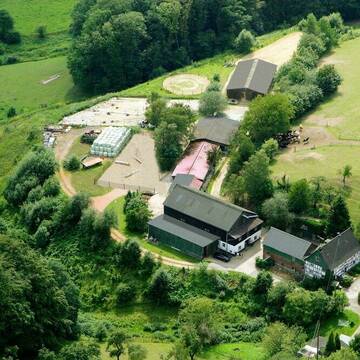
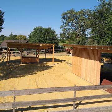
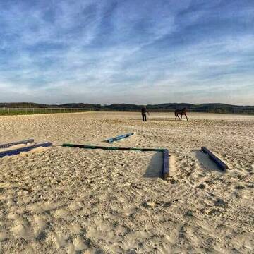
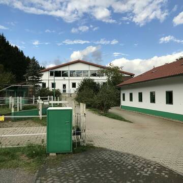
Offenstall Pferdefreunde Enkeln
Kürten
Pferdefreunde Enkeln
@Pferdefreunde-Enkeln
Freizeitstall
Vermieten
Hunde willkommen
Krankenbox
Notfallboxen
12 weitere...
P+
Deprecated: Creation of dynamic property Zend_View_Helper_Ads::$adLink is deprecated in /var/www/stall-frei/htdocs/staging.stall-frei.de/library/Psf/View/Helper/Ads.php on line 108

Heu und Heulage verkaufen
Mechtersen
STALL-FREIde Marketing
@STALL-FREI-Marketing
Verkaufen Sie Ihr Heu und Ihre Heulage direkt an Reiter, Pferdeställe und Reitanlagen


Bergische Weidegründe
Burscheid
Bergische Weidegründe
@HufRehastation-Allergiker
Freizeitstall
Geländestrecke
Hunde willkommen
Krankenbox
Allergikerstall
Gnadenbrothof
Bewegungsstall
Laufstall
28 weitere...
ganz aktuell
S


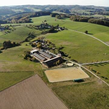
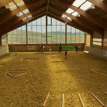
Pferdeland Leide Aktivstallhaltung
Leichlingen
Pferdeland Leide
@info2
FN-Mitglied
Freizeitstall
Hunde willkommen
Krankenbox
Allergikerstall
Hufrehe geeignet
Bewegungsstall
Laufstall
22 weitere...
S
Offenstall / Aktivstall Minzenbach
Kürten
H.Falke
@H.Falke
FN-Mitglied
Freizeitstall
Vermieten
Krankenbox
Longierzirkel/Roundpen
Gnadenbrothof
Hufrehe geeignet
22 weitere...
P
Silva N Stables Offenstall, Laufstall, Paddockbox
Lindlar
Silva-N-Stables-GbR
@Silva-N-Stables-GbR
FN-Mitglied
Freizeitstall
Vermieten
Krankenbox
Longierzirkel/Roundpen
Allergikerstall
Hufrehe geeignet
37 weitere...
P+
Reitstall Sachser - Wermelskirchen/Dhünn
Wermelskirchen
Reitstall-Sachser
@Reitstall-Sachser
FN-Mitglied
Freizeitstall
Vermieten
Führanlage
Hunde willkommen
Gnadenbrothof
Pferdezucht
28 weitere...
P


Historische Reitanlage in Köln-Dellbrück
Köln
RGS Kornspringer Köln e. V.
@Kornspringer
FN-Mitglied
Freizeitstall
Vermieten
Führanlage
Hunde willkommen
bedampftes/gewaschenes Heu
Notfallboxen
21 weitere...
S
Job gesucht?
Mechtersen
STALL-FREIde Marketing
@STALL-FREI-Marketing
Sie suchen einen Job und arbeiten gerne mit Pferden oder auf Reitanlagen?
Besuchen Sie jetzt unseren Stellenmarkt!
Pensionspferdestall Rolandshof
Lindlar
Rolandshof
@Rolandshof
Freizeitstall
Reitlehrer und -unterricht
Vermieten
Führanlage
Hunde willkommen
Außenbox mit Paddock
Außenboxen
13 weitere...
P


Offenstallplatz KLEINpferd frei!!!
Much
Trollwaldhof
@Trollwaldhof
Gangpferdereiten
Pferdeausbildung
Vermieten
Paddock
Reithalle
Allergikerstall
8 weitere...
S
Ponys und Kleinpferde willkommen
Wermelskirchen
Pferdepension-Lindepuetz
@Pferdepension-Lindepuetz
Freizeitstall
Wanderreiten
Vermieten
Verpachten
Krankenbox
Longierzirkel/Roundpen
Notfallboxen
15 weitere...
P
Deprecated: Creation of dynamic property Zend_View::$pageCount is deprecated in /var/www/stall-frei/htdocs/staging.stall-frei.de/library/vendor/shardj/zf1-future/library/Zend/View/Abstract.php on line 308
Deprecated: Creation of dynamic property Zend_View::$itemCountPerPage is deprecated in /var/www/stall-frei/htdocs/staging.stall-frei.de/library/vendor/shardj/zf1-future/library/Zend/View/Abstract.php on line 308
Deprecated: Creation of dynamic property Zend_View::$first is deprecated in /var/www/stall-frei/htdocs/staging.stall-frei.de/library/vendor/shardj/zf1-future/library/Zend/View/Abstract.php on line 308
Deprecated: Creation of dynamic property Zend_View::$current is deprecated in /var/www/stall-frei/htdocs/staging.stall-frei.de/library/vendor/shardj/zf1-future/library/Zend/View/Abstract.php on line 308
Deprecated: Creation of dynamic property Zend_View::$last is deprecated in /var/www/stall-frei/htdocs/staging.stall-frei.de/library/vendor/shardj/zf1-future/library/Zend/View/Abstract.php on line 308
Deprecated: Creation of dynamic property Zend_View::$next is deprecated in /var/www/stall-frei/htdocs/staging.stall-frei.de/library/vendor/shardj/zf1-future/library/Zend/View/Abstract.php on line 308
Deprecated: Creation of dynamic property Zend_View::$pagesInRange is deprecated in /var/www/stall-frei/htdocs/staging.stall-frei.de/library/vendor/shardj/zf1-future/library/Zend/View/Abstract.php on line 308
Deprecated: Creation of dynamic property Zend_View::$firstPageInRange is deprecated in /var/www/stall-frei/htdocs/staging.stall-frei.de/library/vendor/shardj/zf1-future/library/Zend/View/Abstract.php on line 308
Deprecated: Creation of dynamic property Zend_View::$lastPageInRange is deprecated in /var/www/stall-frei/htdocs/staging.stall-frei.de/library/vendor/shardj/zf1-future/library/Zend/View/Abstract.php on line 308
Deprecated: Creation of dynamic property Zend_View::$currentItemCount is deprecated in /var/www/stall-frei/htdocs/staging.stall-frei.de/library/vendor/shardj/zf1-future/library/Zend/View/Abstract.php on line 308
Deprecated: Creation of dynamic property Zend_View::$totalItemCount is deprecated in /var/www/stall-frei/htdocs/staging.stall-frei.de/library/vendor/shardj/zf1-future/library/Zend/View/Abstract.php on line 308
Deprecated: Creation of dynamic property Zend_View::$firstItemNumber is deprecated in /var/www/stall-frei/htdocs/staging.stall-frei.de/library/vendor/shardj/zf1-future/library/Zend/View/Abstract.php on line 308
Deprecated: Creation of dynamic property Zend_View::$lastItemNumber is deprecated in /var/www/stall-frei/htdocs/staging.stall-frei.de/library/vendor/shardj/zf1-future/library/Zend/View/Abstract.php on line 308
Deprecated: Creation of dynamic property Zend_View::$router is deprecated in /var/www/stall-frei/htdocs/staging.stall-frei.de/library/vendor/shardj/zf1-future/library/Zend/View/Abstract.php on line 308
Deprecated: Creation of dynamic property Zend_View::$urlParams is deprecated in /var/www/stall-frei/htdocs/staging.stall-frei.de/library/vendor/shardj/zf1-future/library/Zend/View/Abstract.php on line 308
Deprecated: Creation of dynamic property Zend_View::$showAds is deprecated in /var/www/stall-frei/htdocs/staging.stall-frei.de/library/vendor/shardj/zf1-future/library/Zend/View/Abstract.php on line 308
Deprecated: Creation of dynamic property Zend_View::$objectIds is deprecated in /var/www/stall-frei/htdocs/staging.stall-frei.de/library/vendor/shardj/zf1-future/library/Zend/View/Abstract.php on line 308
Deprecated: Creation of dynamic property Zend_View::$showNavbar is deprecated in /var/www/stall-frei/htdocs/staging.stall-frei.de/library/vendor/shardj/zf1-future/library/Zend/View/Abstract.php on line 308
Deprecated: Creation of dynamic property Zend_View::$showBreadcrumb is deprecated in /var/www/stall-frei/htdocs/staging.stall-frei.de/library/vendor/shardj/zf1-future/library/Zend/View/Abstract.php on line 308
Deprecated: Creation of dynamic property Zend_View::$showFooter is deprecated in /var/www/stall-frei/htdocs/staging.stall-frei.de/library/vendor/shardj/zf1-future/library/Zend/View/Abstract.php on line 308
Deprecated: Creation of dynamic property Zend_View::$showInternalAds is deprecated in /var/www/stall-frei/htdocs/staging.stall-frei.de/library/vendor/shardj/zf1-future/library/Zend/View/Abstract.php on line 308
Deprecated: Creation of dynamic property Zend_View::$blNoContent is deprecated in /var/www/stall-frei/htdocs/staging.stall-frei.de/library/vendor/shardj/zf1-future/library/Zend/View/Abstract.php on line 308
Deprecated: Creation of dynamic property Zend_View::$sMetaDesc is deprecated in /var/www/stall-frei/htdocs/staging.stall-frei.de/library/vendor/shardj/zf1-future/library/Zend/View/Abstract.php on line 308
Deprecated: Creation of dynamic property Zend_View::$useGmaps is deprecated in /var/www/stall-frei/htdocs/staging.stall-frei.de/library/vendor/shardj/zf1-future/library/Zend/View/Abstract.php on line 308
Deprecated: Creation of dynamic property Zend_View::$touches is deprecated in /var/www/stall-frei/htdocs/staging.stall-frei.de/library/vendor/shardj/zf1-future/library/Zend/View/Abstract.php on line 308
Deprecated: Creation of dynamic property Zend_View::$oProject is deprecated in /var/www/stall-frei/htdocs/staging.stall-frei.de/library/vendor/shardj/zf1-future/library/Zend/View/Abstract.php on line 308
Deprecated: Creation of dynamic property Zend_View::$pageHeadline is deprecated in /var/www/stall-frei/htdocs/staging.stall-frei.de/library/vendor/shardj/zf1-future/library/Zend/View/Abstract.php on line 308
Deprecated: Creation of dynamic property Zend_View::$disableLocationField is deprecated in /var/www/stall-frei/htdocs/staging.stall-frei.de/library/vendor/shardj/zf1-future/library/Zend/View/Abstract.php on line 308
Deprecated: Creation of dynamic property Zend_View::$isSearch is deprecated in /var/www/stall-frei/htdocs/staging.stall-frei.de/library/vendor/shardj/zf1-future/library/Zend/View/Abstract.php on line 308
Deprecated: Creation of dynamic property Zend_View::$pageTitle is deprecated in /var/www/stall-frei/htdocs/staging.stall-frei.de/library/vendor/shardj/zf1-future/library/Zend/View/Abstract.php on line 308
Deprecated: Creation of dynamic property Psf_Form_Element_Text::$class is deprecated in /var/www/stall-frei/htdocs/staging.stall-frei.de/library/vendor/shardj/zf1-future/library/Zend/Form/Element.php on line 874
Deprecated: Creation of dynamic property Psf_Form_Element_Text::$size is deprecated in /var/www/stall-frei/htdocs/staging.stall-frei.de/library/vendor/shardj/zf1-future/library/Zend/Form/Element.php on line 874
Deprecated: Creation of dynamic property Psf_Form_Element_Text::$placeholder is deprecated in /var/www/stall-frei/htdocs/staging.stall-frei.de/library/vendor/shardj/zf1-future/library/Zend/Form/Element.php on line 874
Deprecated: Creation of dynamic property Psf_Form_Element_Hidden::$class is deprecated in /var/www/stall-frei/htdocs/staging.stall-frei.de/library/vendor/shardj/zf1-future/library/Zend/Form/Element.php on line 874
Deprecated: Creation of dynamic property Psf_Form_Element_Hidden::$class is deprecated in /var/www/stall-frei/htdocs/staging.stall-frei.de/library/vendor/shardj/zf1-future/library/Zend/Form/Element.php on line 874
Deprecated: Creation of dynamic property Psf_Form_Element_Hidden::$class is deprecated in /var/www/stall-frei/htdocs/staging.stall-frei.de/library/vendor/shardj/zf1-future/library/Zend/Form/Element.php on line 874
Deprecated: Creation of dynamic property Psf_Form_Element_Hidden::$class is deprecated in /var/www/stall-frei/htdocs/staging.stall-frei.de/library/vendor/shardj/zf1-future/library/Zend/Form/Element.php on line 874
Deprecated: Creation of dynamic property Psf_Form_Element_Select::$class is deprecated in /var/www/stall-frei/htdocs/staging.stall-frei.de/library/vendor/shardj/zf1-future/library/Zend/Form/Element.php on line 874
Deprecated: Creation of dynamic property Psf_Form_Element_Select::$class is deprecated in /var/www/stall-frei/htdocs/staging.stall-frei.de/library/vendor/shardj/zf1-future/library/Zend/Form/Element.php on line 874
Deprecated: Creation of dynamic property Psf_Form_Element_Select::$class is deprecated in /var/www/stall-frei/htdocs/staging.stall-frei.de/library/vendor/shardj/zf1-future/library/Zend/Form/Element.php on line 874
Deprecated: Creation of dynamic property Psf_Form_Element_Select::$class is deprecated in /var/www/stall-frei/htdocs/staging.stall-frei.de/library/vendor/shardj/zf1-future/library/Zend/Form/Element.php on line 874
Deprecated: Creation of dynamic property Psf_Form_Element_Text::$class is deprecated in /var/www/stall-frei/htdocs/staging.stall-frei.de/library/vendor/shardj/zf1-future/library/Zend/Form/Element.php on line 874
Deprecated: Creation of dynamic property Psf_Form_Element_Checkbox::$label is deprecated in /var/www/stall-frei/htdocs/staging.stall-frei.de/library/vendor/shardj/zf1-future/library/Zend/Form/Element.php on line 874
Deprecated: Creation of dynamic property Zend_View::$sort is deprecated in /var/www/stall-frei/htdocs/staging.stall-frei.de/library/vendor/shardj/zf1-future/library/Zend/View/Abstract.php on line 308
Deprecated: Creation of dynamic property Zend_View::$searchLocation is deprecated in /var/www/stall-frei/htdocs/staging.stall-frei.de/library/vendor/shardj/zf1-future/library/Zend/View/Abstract.php on line 308
Deprecated: Creation of dynamic property Zend_View::$locationHint is deprecated in /var/www/stall-frei/htdocs/staging.stall-frei.de/library/vendor/shardj/zf1-future/library/Zend/View/Abstract.php on line 308
Psf_GeoCoder_Abstract::getLocation: Sommerberg Get Location CachedOrLive
Psf_GeoCoder_Abstract::getCachedOrLive: Sommerberg
Psf_GeoCoder_OpenCageData::makeApiRequest: response:
Array
(
[documentation] => https://opencagedata.com/api
[licenses] => Array
(
[0] => Array
(
[name] => see attribution guide
[url] => https://opencagedata.com/credits
)
)
[results] => Array
(
[0] => Array
(
[bounds] => Array
(
[northeast] => Array
(
[lat] => 51.096203
[lng] => 7.3157685
)
[southwest] => Array
(
[lat] => 51.056203
[lng] => 7.2757685
)
)
[components] => Array
(
[ISO_3166-1_alpha-2] => DE
[ISO_3166-1_alpha-3] => DEU
[ISO_3166-2] => Array
(
[0] => DE-NW
)
[_category] => place
[_normalized_city] => Wipperfürth
[_type] => hamlet
[continent] => Europe
[country] => Deutschland
[country_code] => de
[county] => Oberbergischer Kreis
[hamlet] => Sommerberg
[political_union] => European Union
[state] => Nordrhein-Westfalen
[state_code] => NW
[town] => Wipperfürth
)
[confidence] => 7
[formatted] => Sommerberg, Wipperfürth, Nordrhein-Westfalen, Deutschland
[geometry] => Array
(
[lat] => 51.076203
[lng] => 7.2957685
)
)
[1] => Array
(
[bounds] => Array
(
[northeast] => Array
(
[lat] => 50.8930805
[lng] => 10.5266765
)
[southwest] => Array
(
[lat] => 50.8929805
[lng] => 10.5265765
)
)
[components] => Array
(
[ISO_3166-1_alpha-2] => DE
[ISO_3166-1_alpha-3] => DEU
[ISO_3166-2] => Array
(
[0] => DE-TH
)
[_category] => natural/water
[_normalized_city] => Waltershausen
[_type] => peak
[continent] => Europe
[country] => Deutschland
[country_code] => de
[county] => Landkreis Gotha
[municipality] => Waltershausen
[peak] => Sommerberg
[political_union] => European Union
[postcode] => 99891
[state] => Thüringen
[state_code] => TH
)
[confidence] => 9
[formatted] => Sommerberg, 99891 Waltershausen, Deutschland
[geometry] => Array
(
[lat] => 50.8930305
[lng] => 10.5266265
)
)
[2] => Array
(
[bounds] => Array
(
[northeast] => Array
(
[lat] => 50.6197411
[lng] => 11.2922657
)
[southwest] => Array
(
[lat] => 50.6196411
[lng] => 11.2921657
)
)
[components] => Array
(
[ISO_3166-1_alpha-2] => DE
[ISO_3166-1_alpha-3] => DEU
[ISO_3166-2] => Array
(
[0] => DE-TH
)
[_category] => natural/water
[_normalized_city] => Saalfeld/Saale
[_type] => peak
[continent] => Europe
[country] => Deutschland
[country_code] => de
[county] => Landkreis Saalfeld-Rudolstadt
[municipality] => Probstzella
[peak] => Sommerberg
[political_union] => European Union
[state] => Thüringen
[state_code] => TH
[town] => Saalfeld/Saale
)
[confidence] => 9
[formatted] => Sommerberg, Saalfeld/Saale, Thüringen, Deutschland
[geometry] => Array
(
[lat] => 50.6196911
[lng] => 11.2922157
)
)
[3] => Array
(
[bounds] => Array
(
[northeast] => Array
(
[lat] => 47.8720225
[lng] => 8.212528
)
[southwest] => Array
(
[lat] => 47.8719225
[lng] => 8.212428
)
)
[components] => Array
(
[ISO_3166-1_alpha-2] => DE
[ISO_3166-1_alpha-3] => DEU
[ISO_3166-2] => Array
(
[0] => DE-BW
)
[_category] => natural/water
[_normalized_city] => Lenzkirch
[_type] => peak
[continent] => Europe
[country] => Deutschland
[country_code] => de
[county] => Landkreis Breisgau-Hochschwarzwald
[peak] => Sommerberg
[political_union] => European Union
[postcode] => 79853
[state] => Baden-Württemberg
[state_code] => BW
[village] => Lenzkirch
)
[confidence] => 9
[formatted] => Sommerberg, 79853 Lenzkirch, Deutschland
[geometry] => Array
(
[lat] => 47.8719725
[lng] => 8.212478
)
)
[4] => Array
(
[bounds] => Array
(
[northeast] => Array
(
[lat] => 50.435319
[lng] => 6.714369
)
[southwest] => Array
(
[lat] => 50.435219
[lng] => 6.714269
)
)
[components] => Array
(
[ISO_3166-1_alpha-2] => DE
[ISO_3166-1_alpha-3] => DEU
[ISO_3166-2] => Array
(
[0] => DE-NW
)
[_category] => natural/water
[_normalized_city] => Blankenheim
[_type] => peak
[continent] => Europe
[country] => Deutschland
[country_code] => de
[county] => Kreis Euskirchen
[peak] => Sommerberg
[political_union] => European Union
[postcode] => 53945
[state] => Nordrhein-Westfalen
[state_code] => NW
[village] => Blankenheim
)
[confidence] => 9
[formatted] => Sommerberg, 53945 Blankenheim, Deutschland
[geometry] => Array
(
[lat] => 50.435269
[lng] => 6.714319
)
)
[5] => Array
(
[bounds] => Array
(
[northeast] => Array
(
[lat] => 48.0311049
[lng] => 8.2422233
)
[southwest] => Array
(
[lat] => 48.0310049
[lng] => 8.2421233
)
)
[components] => Array
(
[ISO_3166-1_alpha-2] => DE
[ISO_3166-1_alpha-3] => DEU
[ISO_3166-2] => Array
(
[0] => DE-BW
)
[_category] => natural/water
[_normalized_city] => Furtwangen im Schwarzwald
[_type] => peak
[continent] => Europe
[country] => Deutschland
[country_code] => de
[county] => Schwarzwald-Baar-Kreis
[municipality] => VVG der Stadt Furtwangen im Schwarzwald
[peak] => Sommerberg
[political_union] => European Union
[postcode] => 78120
[state] => Baden-Württemberg
[state_code] => BW
[town] => Furtwangen im Schwarzwald
)
[confidence] => 9
[formatted] => Sommerberg, 78120 Furtwangen im Schwarzwald, Deutschland
[geometry] => Array
(
[lat] => 48.0310549
[lng] => 8.2421733
)
)
[6] => Array
(
[bounds] => Array
(
[northeast] => Array
(
[lat] => 48.44141
[lng] => 8.32479
)
[southwest] => Array
(
[lat] => 48.44131
[lng] => 8.32469
)
)
[components] => Array
(
[ISO_3166-1_alpha-2] => DE
[ISO_3166-1_alpha-3] => DEU
[ISO_3166-2] => Array
(
[0] => DE-BW
)
[_category] => natural/water
[_normalized_city] => Bad Rippoldsau-Schapbach
[_type] => peak
[continent] => Europe
[country] => Deutschland
[country_code] => de
[county] => Landkreis Freudenstadt
[municipality] => Bad Rippoldsau-Schapbach
[peak] => Sommerberg
[political_union] => European Union
[postcode] => 77776
[state] => Baden-Württemberg
[state_code] => BW
)
[confidence] => 9
[formatted] => Sommerberg, 77776 Bad Rippoldsau-Schapbach, Deutschland
[geometry] => Array
(
[lat] => 48.44136
[lng] => 8.32474
)
)
[7] => Array
(
[bounds] => Array
(
[northeast] => Array
(
[lat] => 50.6058403
[lng] => 11.2187218
)
[southwest] => Array
(
[lat] => 50.6057403
[lng] => 11.2186218
)
)
[components] => Array
(
[ISO_3166-1_alpha-2] => DE
[ISO_3166-1_alpha-3] => DEU
[ISO_3166-2] => Array
(
[0] => DE-TH
)
[_category] => natural/water
[_normalized_city] => Rohrbach
[_type] => peak
[continent] => Europe
[country] => Deutschland
[country_code] => de
[county] => Landkreis Saalfeld-Rudolstadt
[municipality] => Schwarzatal
[peak] => Sommerberg
[political_union] => European Union
[postcode] => 07429
[state] => Thüringen
[state_code] => TH
[village] => Rohrbach
)
[confidence] => 9
[formatted] => Sommerberg, 07429 Rohrbach, Deutschland
[geometry] => Array
(
[lat] => 50.6057903
[lng] => 11.2186718
)
)
[8] => Array
(
[bounds] => Array
(
[northeast] => Array
(
[lat] => 50.6390177
[lng] => 11.1685628
)
[southwest] => Array
(
[lat] => 50.6389177
[lng] => 11.1684628
)
)
[components] => Array
(
[ISO_3166-1_alpha-2] => DE
[ISO_3166-1_alpha-3] => DEU
[ISO_3166-2] => Array
(
[0] => DE-TH
)
[_category] => natural/water
[_normalized_city] => Schwarzburg
[_type] => peak
[continent] => Europe
[country] => Deutschland
[country_code] => de
[county] => Landkreis Saalfeld-Rudolstadt
[municipality] => Schwarzatal
[peak] => Sommerberg
[political_union] => European Union
[postcode] => 07427
[state] => Thüringen
[state_code] => TH
[village] => Schwarzburg
)
[confidence] => 9
[formatted] => Sommerberg, 07427 Schwarzburg, Deutschland
[geometry] => Array
(
[lat] => 50.6389677
[lng] => 11.1685128
)
)
[9] => Array
(
[bounds] => Array
(
[northeast] => Array
(
[lat] => 50.8205814
[lng] => 11.7334922
)
[southwest] => Array
(
[lat] => 50.8204814
[lng] => 11.7333922
)
)
[components] => Array
(
[ISO_3166-1_alpha-2] => DE
[ISO_3166-1_alpha-3] => DEU
[ISO_3166-2] => Array
(
[0] => DE-TH
)
[_category] => natural/water
[_normalized_city] => Meusebach
[_type] => peak
[continent] => Europe
[country] => Deutschland
[country_code] => de
[county] => Saale-Holzland-Kreis
[municipality] => Hügelland/Täler
[peak] => Sommerberg
[political_union] => European Union
[postcode] => 07646
[state] => Thüringen
[state_code] => TH
[village] => Meusebach
)
[confidence] => 9
[formatted] => Sommerberg, 07646 Meusebach, Deutschland
[geometry] => Array
(
[lat] => 50.8205314
[lng] => 11.7334422
)
)
)
[status] => Array
(
[code] => 200
[message] => OK
)
[stay_informed] => Array
(
[blog] => https://blog.opencagedata.com
[mastodon] => https://en.osm.town/@opencage
)
[thanks] => For using an OpenCage API
[timestamp] => Array
(
[created_http] => Sat, 07 Feb 2026 16:21:55 GMT
[created_unix] => 1770481315
)
[total_results] => 10
)
Psf_GeoCoder_Abstract::convertLocationResult
{"documentation":"https:\/\/opencagedata.com\/api","licenses":[{"name":"see attribution guide","url":"https:\/\/opencagedata.com\/credits"}],"results":[{"bounds":{"northeast":{"lat":51.096203,"lng":7.3157685},"southwest":{"lat":51.056203,"lng":7.2757685}},"components":{"ISO_3166-1_alpha-2":"DE","ISO_3166-1_alpha-3":"DEU","ISO_3166-2":["DE-NW"],"_category":"place","_normalized_city":"Wipperf\u00fcrth","_type":"hamlet","continent":"Europe","country":"Deutschland","country_code":"de","county":"Oberbergischer Kreis","hamlet":"Sommerberg","political_union":"European Union","state":"Nordrhein-Westfalen","state_code":"NW","town":"Wipperf\u00fcrth"},"confidence":7,"formatted":"Sommerberg, Wipperf\u00fcrth, Nordrhein-Westfalen, Deutschland","geometry":{"lat":51.076203,"lng":7.2957685}},{"bounds":{"northeast":{"lat":50.8930805,"lng":10.5266765},"southwest":{"lat":50.8929805,"lng":10.5265765}},"components":{"ISO_3166-1_alpha-2":"DE","ISO_3166-1_alpha-3":"DEU","ISO_3166-2":["DE-TH"],"_category":"natural\/water","_normalized_city":"Waltershausen","_type":"peak","continent":"Europe","country":"Deutschland","country_code":"de","county":"Landkreis Gotha","municipality":"Waltershausen","peak":"Sommerberg","political_union":"European Union","postcode":"99891","state":"Th\u00fcringen","state_code":"TH"},"confidence":9,"formatted":"Sommerberg, 99891 Waltershausen, Deutschland","geometry":{"lat":50.8930305,"lng":10.5266265}},{"bounds":{"northeast":{"lat":50.6197411,"lng":11.2922657},"southwest":{"lat":50.6196411,"lng":11.2921657}},"components":{"ISO_3166-1_alpha-2":"DE","ISO_3166-1_alpha-3":"DEU","ISO_3166-2":["DE-TH"],"_category":"natural\/water","_normalized_city":"Saalfeld\/Saale","_type":"peak","continent":"Europe","country":"Deutschland","country_code":"de","county":"Landkreis Saalfeld-Rudolstadt","municipality":"Probstzella","peak":"Sommerberg","political_union":"European Union","state":"Th\u00fcringen","state_code":"TH","town":"Saalfeld\/Saale"},"confidence":9,"formatted":"Sommerberg, Saalfeld\/Saale, Th\u00fcringen, Deutschland","geometry":{"lat":50.6196911,"lng":11.2922157}},{"bounds":{"northeast":{"lat":47.8720225,"lng":8.212528},"southwest":{"lat":47.8719225,"lng":8.212428}},"components":{"ISO_3166-1_alpha-2":"DE","ISO_3166-1_alpha-3":"DEU","ISO_3166-2":["DE-BW"],"_category":"natural\/water","_normalized_city":"Lenzkirch","_type":"peak","continent":"Europe","country":"Deutschland","country_code":"de","county":"Landkreis Breisgau-Hochschwarzwald","peak":"Sommerberg","political_union":"European Union","postcode":"79853","state":"Baden-W\u00fcrttemberg","state_code":"BW","village":"Lenzkirch"},"confidence":9,"formatted":"Sommerberg, 79853 Lenzkirch, Deutschland","geometry":{"lat":47.8719725,"lng":8.212478}},{"bounds":{"northeast":{"lat":50.435319,"lng":6.714369},"southwest":{"lat":50.435219,"lng":6.714269}},"components":{"ISO_3166-1_alpha-2":"DE","ISO_3166-1_alpha-3":"DEU","ISO_3166-2":["DE-NW"],"_category":"natural\/water","_normalized_city":"Blankenheim","_type":"peak","continent":"Europe","country":"Deutschland","country_code":"de","county":"Kreis Euskirchen","peak":"Sommerberg","political_union":"European Union","postcode":"53945","state":"Nordrhein-Westfalen","state_code":"NW","village":"Blankenheim"},"confidence":9,"formatted":"Sommerberg, 53945 Blankenheim, Deutschland","geometry":{"lat":50.435269,"lng":6.714319}},{"bounds":{"northeast":{"lat":48.0311049,"lng":8.2422233},"southwest":{"lat":48.0310049,"lng":8.2421233}},"components":{"ISO_3166-1_alpha-2":"DE","ISO_3166-1_alpha-3":"DEU","ISO_3166-2":["DE-BW"],"_category":"natural\/water","_normalized_city":"Furtwangen im Schwarzwald","_type":"peak","continent":"Europe","country":"Deutschland","country_code":"de","county":"Schwarzwald-Baar-Kreis","municipality":"VVG der Stadt Furtwangen im Schwarzwald","peak":"Sommerberg","political_union":"European Union","postcode":"78120","state":"Baden-W\u00fcrttemberg","state_code":"BW","town":"Furtwangen im Schwarzwald"},"confidence":9,"formatted":"Sommerberg, 78120 Furtwangen im Schwarzwald, Deutschland","geometry":{"lat":48.0310549,"lng":8.2421733}},{"bounds":{"northeast":{"lat":48.44141,"lng":8.32479},"southwest":{"lat":48.44131,"lng":8.32469}},"components":{"ISO_3166-1_alpha-2":"DE","ISO_3166-1_alpha-3":"DEU","ISO_3166-2":["DE-BW"],"_category":"natural\/water","_normalized_city":"Bad Rippoldsau-Schapbach","_type":"peak","continent":"Europe","country":"Deutschland","country_code":"de","county":"Landkreis Freudenstadt","municipality":"Bad Rippoldsau-Schapbach","peak":"Sommerberg","political_union":"European Union","postcode":"77776","state":"Baden-W\u00fcrttemberg","state_code":"BW"},"confidence":9,"formatted":"Sommerberg, 77776 Bad Rippoldsau-Schapbach, Deutschland","geometry":{"lat":48.44136,"lng":8.32474}},{"bounds":{"northeast":{"lat":50.6058403,"lng":11.2187218},"southwest":{"lat":50.6057403,"lng":11.2186218}},"components":{"ISO_3166-1_alpha-2":"DE","ISO_3166-1_alpha-3":"DEU","ISO_3166-2":["DE-TH"],"_category":"natural\/water","_normalized_city":"Rohrbach","_type":"peak","continent":"Europe","country":"Deutschland","country_code":"de","county":"Landkreis Saalfeld-Rudolstadt","municipality":"Schwarzatal","peak":"Sommerberg","political_union":"European Union","postcode":"07429","state":"Th\u00fcringen","state_code":"TH","village":"Rohrbach"},"confidence":9,"formatted":"Sommerberg, 07429 Rohrbach, Deutschland","geometry":{"lat":50.6057903,"lng":11.2186718}},{"bounds":{"northeast":{"lat":50.6390177,"lng":11.1685628},"southwest":{"lat":50.6389177,"lng":11.1684628}},"components":{"ISO_3166-1_alpha-2":"DE","ISO_3166-1_alpha-3":"DEU","ISO_3166-2":["DE-TH"],"_category":"natural\/water","_normalized_city":"Schwarzburg","_type":"peak","continent":"Europe","country":"Deutschland","country_code":"de","county":"Landkreis Saalfeld-Rudolstadt","municipality":"Schwarzatal","peak":"Sommerberg","political_union":"European Union","postcode":"07427","state":"Th\u00fcringen","state_code":"TH","village":"Schwarzburg"},"confidence":9,"formatted":"Sommerberg, 07427 Schwarzburg, Deutschland","geometry":{"lat":50.6389677,"lng":11.1685128}},{"bounds":{"northeast":{"lat":50.8205814,"lng":11.7334922},"southwest":{"lat":50.8204814,"lng":11.7333922}},"components":{"ISO_3166-1_alpha-2":"DE","ISO_3166-1_alpha-3":"DEU","ISO_3166-2":["DE-TH"],"_category":"natural\/water","_normalized_city":"Meusebach","_type":"peak","continent":"Europe","country":"Deutschland","country_code":"de","county":"Saale-Holzland-Kreis","municipality":"H\u00fcgelland\/T\u00e4ler","peak":"Sommerberg","political_union":"European Union","postcode":"07646","state":"Th\u00fcringen","state_code":"TH","village":"Meusebach"},"confidence":9,"formatted":"Sommerberg, 07646 Meusebach, Deutschland","geometry":{"lat":50.8205314,"lng":11.7334422}}],"status":{"code":200,"message":"OK"},"stay_informed":{"blog":"https:\/\/blog.opencagedata.com","mastodon":"https:\/\/en.osm.town\/@opencage"},"thanks":"For using an OpenCage API","timestamp":{"created_http":"Sat, 07 Feb 2026 16:21:55 GMT","created_unix":1770481315},"total_results":10}Array
(
[0] => stdClass Object
(
[bounds] => stdClass Object
(
[northeast] => stdClass Object
(
[lat] => 51.096203
[lng] => 7.3157685
)
[southwest] => stdClass Object
(
[lat] => 51.056203
[lng] => 7.2757685
)
)
[components] => stdClass Object
(
[ISO_3166-1_alpha-2] => DE
[ISO_3166-1_alpha-3] => DEU
[ISO_3166-2] => Array
(
[0] => DE-NW
)
[_category] => place
[_normalized_city] => Wipperfürth
[_type] => hamlet
[continent] => Europe
[country] => Deutschland
[country_code] => de
[county] => Oberbergischer Kreis
[hamlet] => Sommerberg
[political_union] => European Union
[state] => Nordrhein-Westfalen
[state_code] => NW
[town] => Wipperfürth
)
[confidence] => 7
[formatted] => Sommerberg, Wipperfürth, Nordrhein-Westfalen, Deutschland
[geometry] => stdClass Object
(
[lat] => 51.076203
[lng] => 7.2957685
)
)
[1] => stdClass Object
(
[bounds] => stdClass Object
(
[northeast] => stdClass Object
(
[lat] => 50.8930805
[lng] => 10.5266765
)
[southwest] => stdClass Object
(
[lat] => 50.8929805
[lng] => 10.5265765
)
)
[components] => stdClass Object
(
[ISO_3166-1_alpha-2] => DE
[ISO_3166-1_alpha-3] => DEU
[ISO_3166-2] => Array
(
[0] => DE-TH
)
[_category] => natural/water
[_normalized_city] => Waltershausen
[_type] => peak
[continent] => Europe
[country] => Deutschland
[country_code] => de
[county] => Landkreis Gotha
[municipality] => Waltershausen
[peak] => Sommerberg
[political_union] => European Union
[postcode] => 99891
[state] => Thüringen
[state_code] => TH
)
[confidence] => 9
[formatted] => Sommerberg, 99891 Waltershausen, Deutschland
[geometry] => stdClass Object
(
[lat] => 50.8930305
[lng] => 10.5266265
)
)
[2] => stdClass Object
(
[bounds] => stdClass Object
(
[northeast] => stdClass Object
(
[lat] => 50.6197411
[lng] => 11.2922657
)
[southwest] => stdClass Object
(
[lat] => 50.6196411
[lng] => 11.2921657
)
)
[components] => stdClass Object
(
[ISO_3166-1_alpha-2] => DE
[ISO_3166-1_alpha-3] => DEU
[ISO_3166-2] => Array
(
[0] => DE-TH
)
[_category] => natural/water
[_normalized_city] => Saalfeld/Saale
[_type] => peak
[continent] => Europe
[country] => Deutschland
[country_code] => de
[county] => Landkreis Saalfeld-Rudolstadt
[municipality] => Probstzella
[peak] => Sommerberg
[political_union] => European Union
[state] => Thüringen
[state_code] => TH
[town] => Saalfeld/Saale
)
[confidence] => 9
[formatted] => Sommerberg, Saalfeld/Saale, Thüringen, Deutschland
[geometry] => stdClass Object
(
[lat] => 50.6196911
[lng] => 11.2922157
)
)
[3] => stdClass Object
(
[bounds] => stdClass Object
(
[northeast] => stdClass Object
(
[lat] => 47.8720225
[lng] => 8.212528
)
[southwest] => stdClass Object
(
[lat] => 47.8719225
[lng] => 8.212428
)
)
[components] => stdClass Object
(
[ISO_3166-1_alpha-2] => DE
[ISO_3166-1_alpha-3] => DEU
[ISO_3166-2] => Array
(
[0] => DE-BW
)
[_category] => natural/water
[_normalized_city] => Lenzkirch
[_type] => peak
[continent] => Europe
[country] => Deutschland
[country_code] => de
[county] => Landkreis Breisgau-Hochschwarzwald
[peak] => Sommerberg
[political_union] => European Union
[postcode] => 79853
[state] => Baden-Württemberg
[state_code] => BW
[village] => Lenzkirch
)
[confidence] => 9
[formatted] => Sommerberg, 79853 Lenzkirch, Deutschland
[geometry] => stdClass Object
(
[lat] => 47.8719725
[lng] => 8.212478
)
)
[4] => stdClass Object
(
[bounds] => stdClass Object
(
[northeast] => stdClass Object
(
[lat] => 50.435319
[lng] => 6.714369
)
[southwest] => stdClass Object
(
[lat] => 50.435219
[lng] => 6.714269
)
)
[components] => stdClass Object
(
[ISO_3166-1_alpha-2] => DE
[ISO_3166-1_alpha-3] => DEU
[ISO_3166-2] => Array
(
[0] => DE-NW
)
[_category] => natural/water
[_normalized_city] => Blankenheim
[_type] => peak
[continent] => Europe
[country] => Deutschland
[country_code] => de
[county] => Kreis Euskirchen
[peak] => Sommerberg
[political_union] => European Union
[postcode] => 53945
[state] => Nordrhein-Westfalen
[state_code] => NW
[village] => Blankenheim
)
[confidence] => 9
[formatted] => Sommerberg, 53945 Blankenheim, Deutschland
[geometry] => stdClass Object
(
[lat] => 50.435269
[lng] => 6.714319
)
)
[5] => stdClass Object
(
[bounds] => stdClass Object
(
[northeast] => stdClass Object
(
[lat] => 48.0311049
[lng] => 8.2422233
)
[southwest] => stdClass Object
(
[lat] => 48.0310049
[lng] => 8.2421233
)
)
[components] => stdClass Object
(
[ISO_3166-1_alpha-2] => DE
[ISO_3166-1_alpha-3] => DEU
[ISO_3166-2] => Array
(
[0] => DE-BW
)
[_category] => natural/water
[_normalized_city] => Furtwangen im Schwarzwald
[_type] => peak
[continent] => Europe
[country] => Deutschland
[country_code] => de
[county] => Schwarzwald-Baar-Kreis
[municipality] => VVG der Stadt Furtwangen im Schwarzwald
[peak] => Sommerberg
[political_union] => European Union
[postcode] => 78120
[state] => Baden-Württemberg
[state_code] => BW
[town] => Furtwangen im Schwarzwald
)
[confidence] => 9
[formatted] => Sommerberg, 78120 Furtwangen im Schwarzwald, Deutschland
[geometry] => stdClass Object
(
[lat] => 48.0310549
[lng] => 8.2421733
)
)
[6] => stdClass Object
(
[bounds] => stdClass Object
(
[northeast] => stdClass Object
(
[lat] => 48.44141
[lng] => 8.32479
)
[southwest] => stdClass Object
(
[lat] => 48.44131
[lng] => 8.32469
)
)
[components] => stdClass Object
(
[ISO_3166-1_alpha-2] => DE
[ISO_3166-1_alpha-3] => DEU
[ISO_3166-2] => Array
(
[0] => DE-BW
)
[_category] => natural/water
[_normalized_city] => Bad Rippoldsau-Schapbach
[_type] => peak
[continent] => Europe
[country] => Deutschland
[country_code] => de
[county] => Landkreis Freudenstadt
[municipality] => Bad Rippoldsau-Schapbach
[peak] => Sommerberg
[political_union] => European Union
[postcode] => 77776
[state] => Baden-Württemberg
[state_code] => BW
)
[confidence] => 9
[formatted] => Sommerberg, 77776 Bad Rippoldsau-Schapbach, Deutschland
[geometry] => stdClass Object
(
[lat] => 48.44136
[lng] => 8.32474
)
)
[7] => stdClass Object
(
[bounds] => stdClass Object
(
[northeast] => stdClass Object
(
[lat] => 50.6058403
[lng] => 11.2187218
)
[southwest] => stdClass Object
(
[lat] => 50.6057403
[lng] => 11.2186218
)
)
[components] => stdClass Object
(
[ISO_3166-1_alpha-2] => DE
[ISO_3166-1_alpha-3] => DEU
[ISO_3166-2] => Array
(
[0] => DE-TH
)
[_category] => natural/water
[_normalized_city] => Rohrbach
[_type] => peak
[continent] => Europe
[country] => Deutschland
[country_code] => de
[county] => Landkreis Saalfeld-Rudolstadt
[municipality] => Schwarzatal
[peak] => Sommerberg
[political_union] => European Union
[postcode] => 07429
[state] => Thüringen
[state_code] => TH
[village] => Rohrbach
)
[confidence] => 9
[formatted] => Sommerberg, 07429 Rohrbach, Deutschland
[geometry] => stdClass Object
(
[lat] => 50.6057903
[lng] => 11.2186718
)
)
[8] => stdClass Object
(
[bounds] => stdClass Object
(
[northeast] => stdClass Object
(
[lat] => 50.6390177
[lng] => 11.1685628
)
[southwest] => stdClass Object
(
[lat] => 50.6389177
[lng] => 11.1684628
)
)
[components] => stdClass Object
(
[ISO_3166-1_alpha-2] => DE
[ISO_3166-1_alpha-3] => DEU
[ISO_3166-2] => Array
(
[0] => DE-TH
)
[_category] => natural/water
[_normalized_city] => Schwarzburg
[_type] => peak
[continent] => Europe
[country] => Deutschland
[country_code] => de
[county] => Landkreis Saalfeld-Rudolstadt
[municipality] => Schwarzatal
[peak] => Sommerberg
[political_union] => European Union
[postcode] => 07427
[state] => Thüringen
[state_code] => TH
[village] => Schwarzburg
)
[confidence] => 9
[formatted] => Sommerberg, 07427 Schwarzburg, Deutschland
[geometry] => stdClass Object
(
[lat] => 50.6389677
[lng] => 11.1685128
)
)
[9] => stdClass Object
(
[bounds] => stdClass Object
(
[northeast] => stdClass Object
(
[lat] => 50.8205814
[lng] => 11.7334922
)
[southwest] => stdClass Object
(
[lat] => 50.8204814
[lng] => 11.7333922
)
)
[components] => stdClass Object
(
[ISO_3166-1_alpha-2] => DE
[ISO_3166-1_alpha-3] => DEU
[ISO_3166-2] => Array
(
[0] => DE-TH
)
[_category] => natural/water
[_normalized_city] => Meusebach
[_type] => peak
[continent] => Europe
[country] => Deutschland
[country_code] => de
[county] => Saale-Holzland-Kreis
[municipality] => Hügelland/Täler
[peak] => Sommerberg
[political_union] => European Union
[postcode] => 07646
[state] => Thüringen
[state_code] => TH
[village] => Meusebach
)
[confidence] => 9
[formatted] => Sommerberg, 07646 Meusebach, Deutschland
[geometry] => stdClass Object
(
[lat] => 50.8205314
[lng] => 11.7334422
)
)
)
Psf_GeoCoder_OpenCageData::getKeyMap: 0
stdClass Object
(
    [bounds] => stdClass Object
        (
            [northeast] => stdClass Object
                (
                    [lat] => 51.096203
                    [lng] => 7.3157685
                )

            [southwest] => stdClass Object
                (
                    [lat] => 51.056203
                    [lng] => 7.2757685
                )

        )

    [components] => stdClass Object
        (
            [ISO_3166-1_alpha-2] => DE
            [ISO_3166-1_alpha-3] => DEU
            [ISO_3166-2] => Array
                (
                    [0] => DE-NW
                )

            [_category] => place
            [_normalized_city] => Wipperfürth
            [_type] => hamlet
            [continent] => Europe
            [country] => Deutschland
            [country_code] => de
            [county] => Oberbergischer Kreis
            [hamlet] => Sommerberg
            [political_union] => European Union
            [state] => Nordrhein-Westfalen
            [state_code] => NW
            [town] => Wipperfürth
        )

    [confidence] => 7
    [formatted] => Sommerberg, Wipperfürth, Nordrhein-Westfalen, Deutschland
    [geometry] => stdClass Object
        (
            [lat] => 51.076203
            [lng] => 7.2957685
        )

)
Psf_GeoCoder_OpenCageData::getCounty: Oberbergischer Kreis
Psf_GeoCoder_OpenCageData::addMissingData REFETCH!
Array
(
    [address] => Sommerberg, Wipperfürth, Nordrhein-Westfalen, Deutschland
    [type] => hamlet
    [street] => Sommerberg
    [city] => Wipperfürth
    [county] => Oberbergischer Kreis
    [state] => Nordrhein-Westfalen
    [zip] =>
    [country] => Deutschland
    [suburb] =>
    [countrycode] => de
    [latitude] => 51.076203
    [longitude] => 7.2957685
    [accuracy] => 1
    [confidence] => 7
    [bounds] => stdClass Object
        (
            [northeast] => stdClass Object
                (
                    [lat] => 51.096203
                    [lng] => 7.3157685
                )

            [southwest] => stdClass Object
                (
                    [lat] => 51.056203
                    [lng] => 7.2757685
                )

        )

)
reformat!
Array
(
    [address] => Sommerberg, Wipperfürth, Nordrhein-Westfalen, Deutschland
    [type] => hamlet
    [street] => Sommerberg
    [city] => Wipperfürth
    [county] => Oberbergischer Kreis
    [state] => Nordrhein-Westfalen
    [zip] =>
    [country] => Deutschland
    [suburb] =>
    [countrycode] => de
    [latitude] => 51.076203
    [longitude] => 7.2957685
    [accuracy] => 1
    [confidence] => 7
    [bounds] => stdClass Object
        (
            [northeast] => stdClass Object
                (
                    [lat] => 51.096203
                    [lng] => 7.3157685
                )

            [southwest] => stdClass Object
                (
                    [lat] => 51.056203
                    [lng] => 7.2757685
                )

        )

    [place] => Sommerberg, Wipperfürth, Nordrhein-Westfalen
    [hash] => 2b1138e3d3b9687e0be2f0afd91bc902
)
Psf_GeoCoder_OpenCageData::getKeyMap: 1
stdClass Object
(
    [bounds] => stdClass Object
        (
            [northeast] => stdClass Object
                (
                    [lat] => 50.8930805
                    [lng] => 10.5266765
                )

            [southwest] => stdClass Object
                (
                    [lat] => 50.8929805
                    [lng] => 10.5265765
                )

        )

    [components] => stdClass Object
        (
            [ISO_3166-1_alpha-2] => DE
            [ISO_3166-1_alpha-3] => DEU
            [ISO_3166-2] => Array
                (
                    [0] => DE-TH
                )

            [_category] => natural/water
            [_normalized_city] => Waltershausen
            [_type] => peak
            [continent] => Europe
            [country] => Deutschland
            [country_code] => de
            [county] => Landkreis Gotha
            [municipality] => Waltershausen
            [peak] => Sommerberg
            [political_union] => European Union
            [postcode] => 99891
            [state] => Thüringen
            [state_code] => TH
        )

    [confidence] => 9
    [formatted] => Sommerberg, 99891 Waltershausen, Deutschland
    [geometry] => stdClass Object
        (
            [lat] => 50.8930305
            [lng] => 10.5266265
        )

)
Psf_GeoCoder_OpenCageData::getCounty: Gotha
Psf_GeoCoder_OpenCageData::addMissingData REFETCH!
Array
(
    [address] => Sommerberg, 99891 Waltershausen, Deutschland
    [type] => peak
    [street] =>
    [city] =>
    [county] => Gotha
    [state] => Thüringen
    [zip] => 99891
    [country] => Deutschland
    [suburb] =>
    [countrycode] => de
    [latitude] => 50.8930305
    [longitude] => 10.5266265
    [accuracy] => 1
    [confidence] => 9
    [bounds] => stdClass Object
        (
            [northeast] => stdClass Object
                (
                    [lat] => 50.8930805
                    [lng] => 10.5266765
                )

            [southwest] => stdClass Object
                (
                    [lat] => 50.8929805
                    [lng] => 10.5265765
                )

        )

)
reformat!
Array
(
    [address] => Sommerberg, 99891 Waltershausen, Deutschland
    [type] => peak
    [street] =>
    [city] =>
    [county] => Gotha
    [state] => Thüringen
    [zip] => 99891
    [country] => Deutschland
    [suburb] =>
    [countrycode] => de
    [latitude] => 50.8930305
    [longitude] => 10.5266265
    [accuracy] => 1
    [confidence] => 9
    [bounds] => stdClass Object
        (
            [northeast] => stdClass Object
                (
                    [lat] => 50.8930805
                    [lng] => 10.5266765
                )

            [southwest] => stdClass Object
                (
                    [lat] => 50.8929805
                    [lng] => 10.5265765
                )

        )

    [place] => 99891 , Thüringen
    [hash] => a2e18d9f7a2f8f52b92444de39c820a4
)
Psf_GeoCoder_OpenCageData::getKeyMap: 2
stdClass Object
(
    [bounds] => stdClass Object
        (
            [northeast] => stdClass Object
                (
                    [lat] => 50.6197411
                    [lng] => 11.2922657
                )

            [southwest] => stdClass Object
                (
                    [lat] => 50.6196411
                    [lng] => 11.2921657
                )

        )

    [components] => stdClass Object
        (
            [ISO_3166-1_alpha-2] => DE
            [ISO_3166-1_alpha-3] => DEU
            [ISO_3166-2] => Array
                (
                    [0] => DE-TH
                )

            [_category] => natural/water
            [_normalized_city] => Saalfeld/Saale
            [_type] => peak
            [continent] => Europe
            [country] => Deutschland
            [country_code] => de
            [county] => Landkreis Saalfeld-Rudolstadt
            [municipality] => Probstzella
            [peak] => Sommerberg
            [political_union] => European Union
            [state] => Thüringen
            [state_code] => TH
            [town] => Saalfeld/Saale
        )

    [confidence] => 9
    [formatted] => Sommerberg, Saalfeld/Saale, Thüringen, Deutschland
    [geometry] => stdClass Object
        (
            [lat] => 50.6196911
            [lng] => 11.2922157
        )

)
Psf_GeoCoder_OpenCageData::getCounty: Saalfeld-Rudolstadt
Psf_GeoCoder_OpenCageData::addMissingData REFETCH!
Array
(
    [address] => Sommerberg, Saalfeld/Saale, Thüringen, Deutschland
    [type] => peak
    [street] =>
    [city] => Saalfeld/Saale
    [county] => Saalfeld-Rudolstadt
    [state] => Thüringen
    [zip] =>
    [country] => Deutschland
    [suburb] =>
    [countrycode] => de
    [latitude] => 50.6196911
    [longitude] => 11.2922157
    [accuracy] => 1
    [confidence] => 9
    [bounds] => stdClass Object
        (
            [northeast] => stdClass Object
                (
                    [lat] => 50.6197411
                    [lng] => 11.2922657
                )

            [southwest] => stdClass Object
                (
                    [lat] => 50.6196411
                    [lng] => 11.2921657
                )

        )

)
reformat!
Array
(
    [address] => Sommerberg, Saalfeld/Saale, Thüringen, Deutschland
    [type] => peak
    [street] =>
    [city] => Saalfeld/Saale
    [county] => Saalfeld-Rudolstadt
    [state] => Thüringen
    [zip] =>
    [country] => Deutschland
    [suburb] =>
    [countrycode] => de
    [latitude] => 50.6196911
    [longitude] => 11.2922157
    [accuracy] => 1
    [confidence] => 9
    [bounds] => stdClass Object
        (
            [northeast] => stdClass Object
                (
                    [lat] => 50.6197411
                    [lng] => 11.2922657
                )

            [southwest] => stdClass Object
                (
                    [lat] => 50.6196411
                    [lng] => 11.2921657
                )

        )

    [place] => Saalfeld/Saale, Thüringen
    [hash] => e51ad8433056c617d64148a13290b8ae
)
Psf_GeoCoder_OpenCageData::getKeyMap: 3
stdClass Object
(
    [bounds] => stdClass Object
        (
            [northeast] => stdClass Object
                (
                    [lat] => 47.8720225
                    [lng] => 8.212528
                )

            [southwest] => stdClass Object
                (
                    [lat] => 47.8719225
                    [lng] => 8.212428
                )

        )

    [components] => stdClass Object
        (
            [ISO_3166-1_alpha-2] => DE
            [ISO_3166-1_alpha-3] => DEU
            [ISO_3166-2] => Array
                (
                    [0] => DE-BW
                )

            [_category] => natural/water
            [_normalized_city] => Lenzkirch
            [_type] => peak
            [continent] => Europe
            [country] => Deutschland
            [country_code] => de
            [county] => Landkreis Breisgau-Hochschwarzwald
            [peak] => Sommerberg
            [political_union] => European Union
            [postcode] => 79853
            [state] => Baden-Württemberg
            [state_code] => BW
            [village] => Lenzkirch
        )

    [confidence] => 9
    [formatted] => Sommerberg, 79853 Lenzkirch, Deutschland
    [geometry] => stdClass Object
        (
            [lat] => 47.8719725
            [lng] => 8.212478
        )

)
Psf_GeoCoder_OpenCageData::getCounty: Breisgau-Hochschwarzwald
Psf_GeoCoder_OpenCageData::addMissingData REFETCH!
Array
(
    [address] => Sommerberg, 79853 Lenzkirch, Deutschland
    [type] => peak
    [street] =>
    [city] => Lenzkirch
    [county] => Breisgau-Hochschwarzwald
    [state] => Baden-Württemberg
    [zip] => 79853
    [country] => Deutschland
    [suburb] =>
    [countrycode] => de
    [latitude] => 47.8719725
    [longitude] => 8.212478
    [accuracy] => 1
    [confidence] => 9
    [bounds] => stdClass Object
        (
            [northeast] => stdClass Object
                (
                    [lat] => 47.8720225
                    [lng] => 8.212528
                )

            [southwest] => stdClass Object
                (
                    [lat] => 47.8719225
                    [lng] => 8.212428
                )

        )

)
reformat!
Array
(
    [address] => Sommerberg, 79853 Lenzkirch, Deutschland
    [type] => peak
    [street] =>
    [city] => Lenzkirch
    [county] => Breisgau-Hochschwarzwald
    [state] => Baden-Württemberg
    [zip] => 79853
    [country] => Deutschland
    [suburb] =>
    [countrycode] => de
    [latitude] => 47.8719725
    [longitude] => 8.212478
    [accuracy] => 1
    [confidence] => 9
    [bounds] => stdClass Object
        (
            [northeast] => stdClass Object
                (
                    [lat] => 47.8720225
                    [lng] => 8.212528
                )

            [southwest] => stdClass Object
                (
                    [lat] => 47.8719225
                    [lng] => 8.212428
                )

        )

    [place] => 79853 Lenzkirch, Baden-Württemberg
    [hash] => fdc8e5d8dec23d2cd2506604828fd2a9
)
Psf_GeoCoder_OpenCageData::getKeyMap: 4
stdClass Object
(
    [bounds] => stdClass Object
        (
            [northeast] => stdClass Object
                (
                    [lat] => 50.435319
                    [lng] => 6.714369
                )

            [southwest] => stdClass Object
                (
                    [lat] => 50.435219
                    [lng] => 6.714269
                )

        )

    [components] => stdClass Object
        (
            [ISO_3166-1_alpha-2] => DE
            [ISO_3166-1_alpha-3] => DEU
            [ISO_3166-2] => Array
                (
                    [0] => DE-NW
                )

            [_category] => natural/water
            [_normalized_city] => Blankenheim
            [_type] => peak
            [continent] => Europe
            [country] => Deutschland
            [country_code] => de
            [county] => Kreis Euskirchen
            [peak] => Sommerberg
            [political_union] => European Union
            [postcode] => 53945
            [state] => Nordrhein-Westfalen
            [state_code] => NW
            [village] => Blankenheim
        )

    [confidence] => 9
    [formatted] => Sommerberg, 53945 Blankenheim, Deutschland
    [geometry] => stdClass Object
        (
            [lat] => 50.435269
            [lng] => 6.714319
        )

)
Psf_GeoCoder_OpenCageData::getCounty: Euskirchen
Psf_GeoCoder_OpenCageData::addMissingData REFETCH!
Array
(
    [address] => Sommerberg, 53945 Blankenheim, Deutschland
    [type] => peak
    [street] =>
    [city] => Blankenheim
    [county] => Euskirchen
    [state] => Nordrhein-Westfalen
    [zip] => 53945
    [country] => Deutschland
    [suburb] =>
    [countrycode] => de
    [latitude] => 50.435269
    [longitude] => 6.714319
    [accuracy] => 1
    [confidence] => 9
    [bounds] => stdClass Object
        (
            [northeast] => stdClass Object
                (
                    [lat] => 50.435319
                    [lng] => 6.714369
                )

            [southwest] => stdClass Object
                (
                    [lat] => 50.435219
                    [lng] => 6.714269
                )

        )

)
reformat!
Array
(
    [address] => Sommerberg, 53945 Blankenheim, Deutschland
    [type] => peak
    [street] =>
    [city] => Blankenheim
    [county] => Euskirchen
    [state] => Nordrhein-Westfalen
    [zip] => 53945
    [country] => Deutschland
    [suburb] =>
    [countrycode] => de
    [latitude] => 50.435269
    [longitude] => 6.714319
    [accuracy] => 1
    [confidence] => 9
    [bounds] => stdClass Object
        (
            [northeast] => stdClass Object
                (
                    [lat] => 50.435319
                    [lng] => 6.714369
                )

            [southwest] => stdClass Object
                (
                    [lat] => 50.435219
                    [lng] => 6.714269
                )

        )

    [place] => 53945 Blankenheim, Nordrhein-Westfalen
    [hash] => ae6b4e405e384bd82571bf7a303d295b
)
Psf_GeoCoder_OpenCageData::getKeyMap: 5
stdClass Object
(
    [bounds] => stdClass Object
        (
            [northeast] => stdClass Object
                (
                    [lat] => 48.0311049
                    [lng] => 8.2422233
                )

            [southwest] => stdClass Object
                (
                    [lat] => 48.0310049
                    [lng] => 8.2421233
                )

        )

    [components] => stdClass Object
        (
            [ISO_3166-1_alpha-2] => DE
            [ISO_3166-1_alpha-3] => DEU
            [ISO_3166-2] => Array
                (
                    [0] => DE-BW
                )

            [_category] => natural/water
            [_normalized_city] => Furtwangen im Schwarzwald
            [_type] => peak
            [continent] => Europe
            [country] => Deutschland
            [country_code] => de
            [county] => Schwarzwald-Baar-Kreis
            [municipality] => VVG der Stadt Furtwangen im Schwarzwald
            [peak] => Sommerberg
            [political_union] => European Union
            [postcode] => 78120
            [state] => Baden-Württemberg
            [state_code] => BW
            [town] => Furtwangen im Schwarzwald
        )

    [confidence] => 9
    [formatted] => Sommerberg, 78120 Furtwangen im Schwarzwald, Deutschland
    [geometry] => stdClass Object
        (
            [lat] => 48.0310549
            [lng] => 8.2421733
        )

)
Psf_GeoCoder_OpenCageData::getCounty: Schwarzwald-Baar-Kreis
Psf_GeoCoder_OpenCageData::addMissingData REFETCH!
Array
(
    [address] => Sommerberg, 78120 Furtwangen im Schwarzwald, Deutschland
    [type] => peak
    [street] =>
    [city] => Furtwangen im Schwarzwald
    [county] => Schwarzwald-Baar-Kreis
    [state] => Baden-Württemberg
    [zip] => 78120
    [country] => Deutschland
    [suburb] =>
    [countrycode] => de
    [latitude] => 48.0310549
    [longitude] => 8.2421733
    [accuracy] => 1
    [confidence] => 9
    [bounds] => stdClass Object
        (
            [northeast] => stdClass Object
                (
                    [lat] => 48.0311049
                    [lng] => 8.2422233
                )

            [southwest] => stdClass Object
                (
                    [lat] => 48.0310049
                    [lng] => 8.2421233
                )

        )

)
reformat!
Array
(
    [address] => Sommerberg, 78120 Furtwangen im Schwarzwald, Deutschland
    [type] => peak
    [street] =>
    [city] => Furtwangen im Schwarzwald
    [county] => Schwarzwald-Baar-Kreis
    [state] => Baden-Württemberg
    [zip] => 78120
    [country] => Deutschland
    [suburb] =>
    [countrycode] => de
    [latitude] => 48.0310549
    [longitude] => 8.2421733
    [accuracy] => 1
    [confidence] => 9
    [bounds] => stdClass Object
        (
            [northeast] => stdClass Object
                (
                    [lat] => 48.0311049
                    [lng] => 8.2422233
                )

            [southwest] => stdClass Object
                (
                    [lat] => 48.0310049
                    [lng] => 8.2421233
                )

        )

    [place] => 78120 Furtwangen im Schwarzwald, Baden-Württemberg
    [hash] => c1e714e8ffb15fc0803eea9c44cd9737
)
Psf_GeoCoder_OpenCageData::getKeyMap: 6
stdClass Object
(
    [bounds] => stdClass Object
        (
            [northeast] => stdClass Object
                (
                    [lat] => 48.44141
                    [lng] => 8.32479
                )

            [southwest] => stdClass Object
                (
                    [lat] => 48.44131
                    [lng] => 8.32469
                )

        )

    [components] => stdClass Object
        (
            [ISO_3166-1_alpha-2] => DE
            [ISO_3166-1_alpha-3] => DEU
            [ISO_3166-2] => Array
                (
                    [0] => DE-BW
                )

            [_category] => natural/water
            [_normalized_city] => Bad Rippoldsau-Schapbach
            [_type] => peak
            [continent] => Europe
            [country] => Deutschland
            [country_code] => de
            [county] => Landkreis Freudenstadt
            [municipality] => Bad Rippoldsau-Schapbach
            [peak] => Sommerberg
            [political_union] => European Union
            [postcode] => 77776
            [state] => Baden-Württemberg
            [state_code] => BW
        )

    [confidence] => 9
    [formatted] => Sommerberg, 77776 Bad Rippoldsau-Schapbach, Deutschland
    [geometry] => stdClass Object
        (
            [lat] => 48.44136
            [lng] => 8.32474
        )

)
Psf_GeoCoder_OpenCageData::getCounty: Freudenstadt
Psf_GeoCoder_OpenCageData::addMissingData REFETCH!
Array
(
    [address] => Sommerberg, 77776 Bad Rippoldsau-Schapbach, Deutschland
    [type] => peak
    [street] =>
    [city] =>
    [county] => Freudenstadt
    [state] => Baden-Württemberg
    [zip] => 77776
    [country] => Deutschland
    [suburb] =>
    [countrycode] => de
    [latitude] => 48.44136
    [longitude] => 8.32474
    [accuracy] => 1
    [confidence] => 9
    [bounds] => stdClass Object
        (
            [northeast] => stdClass Object
                (
                    [lat] => 48.44141
                    [lng] => 8.32479
                )

            [southwest] => stdClass Object
                (
                    [lat] => 48.44131
                    [lng] => 8.32469
                )

        )

)
reformat!
Array
(
    [address] => Sommerberg, 77776 Bad Rippoldsau-Schapbach, Deutschland
    [type] => peak
    [street] =>
    [city] =>
    [county] => Freudenstadt
    [state] => Baden-Württemberg
    [zip] => 77776
    [country] => Deutschland
    [suburb] =>
    [countrycode] => de
    [latitude] => 48.44136
    [longitude] => 8.32474
    [accuracy] => 1
    [confidence] => 9
    [bounds] => stdClass Object
        (
            [northeast] => stdClass Object
                (
                    [lat] => 48.44141
                    [lng] => 8.32479
                )

            [southwest] => stdClass Object
                (
                    [lat] => 48.44131
                    [lng] => 8.32469
                )

        )

    [place] => 77776 , Baden-Württemberg
    [hash] => cf2103be196ca94968787f0854786842
)
Psf_GeoCoder_OpenCageData::getKeyMap: 7
stdClass Object
(
    [bounds] => stdClass Object
        (
            [northeast] => stdClass Object
                (
                    [lat] => 50.6058403
                    [lng] => 11.2187218
                )

            [southwest] => stdClass Object
                (
                    [lat] => 50.6057403
                    [lng] => 11.2186218
                )

        )

    [components] => stdClass Object
        (
            [ISO_3166-1_alpha-2] => DE
            [ISO_3166-1_alpha-3] => DEU
            [ISO_3166-2] => Array
                (
                    [0] => DE-TH
                )

            [_category] => natural/water
            [_normalized_city] => Rohrbach
            [_type] => peak
            [continent] => Europe
            [country] => Deutschland
            [country_code] => de
            [county] => Landkreis Saalfeld-Rudolstadt
            [municipality] => Schwarzatal
            [peak] => Sommerberg
            [political_union] => European Union
            [postcode] => 07429
            [state] => Thüringen
            [state_code] => TH
            [village] => Rohrbach
        )

    [confidence] => 9
    [formatted] => Sommerberg, 07429 Rohrbach, Deutschland
    [geometry] => stdClass Object
        (
            [lat] => 50.6057903
            [lng] => 11.2186718
        )

)
Psf_GeoCoder_OpenCageData::getCounty: Saalfeld-Rudolstadt
Psf_GeoCoder_OpenCageData::addMissingData REFETCH!
Array
(
    [address] => Sommerberg, 07429 Rohrbach, Deutschland
    [type] => peak
    [street] =>
    [city] => Rohrbach
    [county] => Saalfeld-Rudolstadt
    [state] => Thüringen
    [zip] => 07429
    [country] => Deutschland
    [suburb] =>
    [countrycode] => de
    [latitude] => 50.6057903
    [longitude] => 11.2186718
    [accuracy] => 1
    [confidence] => 9
    [bounds] => stdClass Object
        (
            [northeast] => stdClass Object
                (
                    [lat] => 50.6058403
                    [lng] => 11.2187218
                )

            [southwest] => stdClass Object
                (
                    [lat] => 50.6057403
                    [lng] => 11.2186218
                )

        )

)
reformat!
Array
(
    [address] => Sommerberg, 07429 Rohrbach, Deutschland
    [type] => peak
    [street] =>
    [city] => Rohrbach
    [county] => Saalfeld-Rudolstadt
    [state] => Thüringen
    [zip] => 07429
    [country] => Deutschland
    [suburb] =>
    [countrycode] => de
    [latitude] => 50.6057903
    [longitude] => 11.2186718
    [accuracy] => 1
    [confidence] => 9
    [bounds] => stdClass Object
        (
            [northeast] => stdClass Object
                (
                    [lat] => 50.6058403
                    [lng] => 11.2187218
                )

            [southwest] => stdClass Object
                (
                    [lat] => 50.6057403
                    [lng] => 11.2186218
                )

        )

    [place] => 07429 Rohrbach, Thüringen
    [hash] => e2abc99e926087b0fa7f1181c869124f
)
Psf_GeoCoder_OpenCageData::getKeyMap: 8
stdClass Object
(
    [bounds] => stdClass Object
        (
            [northeast] => stdClass Object
                (
                    [lat] => 50.6390177
                    [lng] => 11.1685628
                )

            [southwest] => stdClass Object
                (
                    [lat] => 50.6389177
                    [lng] => 11.1684628
                )

        )

    [components] => stdClass Object
        (
            [ISO_3166-1_alpha-2] => DE
            [ISO_3166-1_alpha-3] => DEU
            [ISO_3166-2] => Array
                (
                    [0] => DE-TH
                )

            [_category] => natural/water
            [_normalized_city] => Schwarzburg
            [_type] => peak
            [continent] => Europe
            [country] => Deutschland
            [country_code] => de
            [county] => Landkreis Saalfeld-Rudolstadt
            [municipality] => Schwarzatal
            [peak] => Sommerberg
            [political_union] => European Union
            [postcode] => 07427
            [state] => Thüringen
            [state_code] => TH
            [village] => Schwarzburg
        )

    [confidence] => 9
    [formatted] => Sommerberg, 07427 Schwarzburg, Deutschland
    [geometry] => stdClass Object
        (
            [lat] => 50.6389677
            [lng] => 11.1685128
        )

)
Psf_GeoCoder_OpenCageData::getCounty: Saalfeld-Rudolstadt
Psf_GeoCoder_OpenCageData::addMissingData REFETCH!
Array
(
    [address] => Sommerberg, 07427 Schwarzburg, Deutschland
    [type] => peak
    [street] =>
    [city] => Schwarzburg
    [county] => Saalfeld-Rudolstadt
    [state] => Thüringen
    [zip] => 07427
    [country] => Deutschland
    [suburb] =>
    [countrycode] => de
    [latitude] => 50.6389677
    [longitude] => 11.1685128
    [accuracy] => 1
    [confidence] => 9
    [bounds] => stdClass Object
        (
            [northeast] => stdClass Object
                (
                    [lat] => 50.6390177
                    [lng] => 11.1685628
                )

            [southwest] => stdClass Object
                (
                    [lat] => 50.6389177
                    [lng] => 11.1684628
                )

        )

)
reformat!
Array
(
    [address] => Sommerberg, 07427 Schwarzburg, Deutschland
    [type] => peak
    [street] =>
    [city] => Schwarzburg
    [county] => Saalfeld-Rudolstadt
    [state] => Thüringen
    [zip] => 07427
    [country] => Deutschland
    [suburb] =>
    [countrycode] => de
    [latitude] => 50.6389677
    [longitude] => 11.1685128
    [accuracy] => 1
    [confidence] => 9
    [bounds] => stdClass Object
        (
            [northeast] => stdClass Object
                (
                    [lat] => 50.6390177
                    [lng] => 11.1685628
                )

            [southwest] => stdClass Object
                (
                    [lat] => 50.6389177
                    [lng] => 11.1684628
                )

        )

    [place] => 07427 Schwarzburg, Thüringen
    [hash] => 62532d57c65729597c4b64752de83cb3
)
Psf_GeoCoder_OpenCageData::getKeyMap: 9
stdClass Object
(
    [bounds] => stdClass Object
        (
            [northeast] => stdClass Object
                (
                    [lat] => 50.8205814
                    [lng] => 11.7334922
                )

            [southwest] => stdClass Object
                (
                    [lat] => 50.8204814
                    [lng] => 11.7333922
                )

        )

    [components] => stdClass Object
        (
            [ISO_3166-1_alpha-2] => DE
            [ISO_3166-1_alpha-3] => DEU
            [ISO_3166-2] => Array
                (
                    [0] => DE-TH
                )

            [_category] => natural/water
            [_normalized_city] => Meusebach
            [_type] => peak
            [continent] => Europe
            [country] => Deutschland
            [country_code] => de
            [county] => Saale-Holzland-Kreis
            [municipality] => Hügelland/Täler
            [peak] => Sommerberg
            [political_union] => European Union
            [postcode] => 07646
            [state] => Thüringen
            [state_code] => TH
            [village] => Meusebach
        )

    [confidence] => 9
    [formatted] => Sommerberg, 07646 Meusebach, Deutschland
    [geometry] => stdClass Object
        (
            [lat] => 50.8205314
            [lng] => 11.7334422
        )

)
Psf_GeoCoder_OpenCageData::getCounty: Saale-Holzland-Kreis
Psf_GeoCoder_OpenCageData::addMissingData REFETCH!
Array
(
    [address] => Sommerberg, 07646 Meusebach, Deutschland
    [type] => peak
    [street] =>
    [city] => Meusebach
    [county] => Saale-Holzland-Kreis
    [state] => Thüringen
    [zip] => 07646
    [country] => Deutschland
    [suburb] =>
    [countrycode] => de
    [latitude] => 50.8205314
    [longitude] => 11.7334422
    [accuracy] => 1
    [confidence] => 9
    [bounds] => stdClass Object
        (
            [northeast] => stdClass Object
                (
                    [lat] => 50.8205814
                    [lng] => 11.7334922
                )

            [southwest] => stdClass Object
                (
                    [lat] => 50.8204814
                    [lng] => 11.7333922
                )

        )

)
reformat!
Array
(
    [address] => Sommerberg, 07646 Meusebach, Deutschland
    [type] => peak
    [street] =>
    [city] => Meusebach
    [county] => Saale-Holzland-Kreis
    [state] => Thüringen
    [zip] => 07646
    [country] => Deutschland
    [suburb] =>
    [countrycode] => de
    [latitude] => 50.8205314
    [longitude] => 11.7334422
    [accuracy] => 1
    [confidence] => 9
    [bounds] => stdClass Object
        (
            [northeast] => stdClass Object
                (
                    [lat] => 50.8205814
                    [lng] => 11.7334922
                )

            [southwest] => stdClass Object
                (
                    [lat] => 50.8204814
                    [lng] => 11.7333922
                )

        )

    [place] => 07646 Meusebach, Thüringen
    [hash] => 0586ffcb2f3a6ba5a9bef9da9a70d3f7
)
Deprecated: Creation of dynamic property Zend_View::$locationHintStyle is deprecated in /var/www/stall-frei/htdocs/staging.stall-frei.de/library/vendor/shardj/zf1-future/library/Zend/View/Abstract.php on line 308
Deprecated: Creation of dynamic property Zend_View::$adGeoLocation is deprecated in /var/www/stall-frei/htdocs/staging.stall-frei.de/library/vendor/shardj/zf1-future/library/Zend/View/Abstract.php on line 308
Deprecated: Creation of dynamic property Zend_View::$recordCount is deprecated in /var/www/stall-frei/htdocs/staging.stall-frei.de/library/vendor/shardj/zf1-future/library/Zend/View/Abstract.php on line 308
Deprecated: explode(): Passing null to parameter #2 ($string) of type string is deprecated in /var/www/stall-frei/htdocs/staging.stall-frei.de/application/models/SearchAgent.php on line 100
Deprecated: explode(): Passing null to parameter #2 ($string) of type string is deprecated in /var/www/stall-frei/htdocs/staging.stall-frei.de/application/models/SearchAgent.php on line 100
Deprecated: explode(): Passing null to parameter #2 ($string) of type string is deprecated in /var/www/stall-frei/htdocs/staging.stall-frei.de/application/models/SearchAgent.php on line 100
Deprecated: explode(): Passing null to parameter #2 ($string) of type string is deprecated in /var/www/stall-frei/htdocs/staging.stall-frei.de/application/models/SearchAgent.php on line 100
Deprecated: explode(): Passing null to parameter #2 ($string) of type string is deprecated in /var/www/stall-frei/htdocs/staging.stall-frei.de/application/models/SearchAgent.php on line 100
Deprecated: explode(): Passing null to parameter #2 ($string) of type string is deprecated in /var/www/stall-frei/htdocs/staging.stall-frei.de/application/models/SearchAgent.php on line 100
Deprecated: explode(): Passing null to parameter #2 ($string) of type string is deprecated in /var/www/stall-frei/htdocs/staging.stall-frei.de/application/models/SearchAgent.php on line 100
Deprecated: explode(): Passing null to parameter #2 ($string) of type string is deprecated in /var/www/stall-frei/htdocs/staging.stall-frei.de/application/models/SearchAgent.php on line 100
Deprecated: explode(): Passing null to parameter #2 ($string) of type string is deprecated in /var/www/stall-frei/htdocs/staging.stall-frei.de/application/models/SearchAgent.php on line 100
Deprecated: trim(): Passing null to parameter #1 ($string) of type string is deprecated in /var/www/stall-frei/htdocs/staging.stall-frei.de/application/models/Account/Search.php on line 82
Warning: Cannot modify header information - headers already sent by (output started at /var/www/stall-frei/htdocs/staging.stall-frei.de/library/vendor/shardj/zf1-future/library/Zend/View/Abstract.php:308) in /var/www/stall-frei/htdocs/staging.stall-frei.de/application/models/Account/Search.php on line 71
Deprecated: Creation of dynamic property Zend_View::$paginationParams is deprecated in /var/www/stall-frei/htdocs/staging.stall-frei.de/library/vendor/shardj/zf1-future/library/Zend/View/Abstract.php on line 308
Deprecated: Creation of dynamic property Zend_View::$objectPaginator is deprecated in /var/www/stall-frei/htdocs/staging.stall-frei.de/library/vendor/shardj/zf1-future/library/Zend/View/Abstract.php on line 308
Deprecated: Creation of dynamic property Zend_View::$featuredObjects is deprecated in /var/www/stall-frei/htdocs/staging.stall-frei.de/library/vendor/shardj/zf1-future/library/Zend/View/Abstract.php on line 308
Deprecated: Creation of dynamic property Zend_View::$hints is deprecated in /var/www/stall-frei/htdocs/staging.stall-frei.de/library/vendor/shardj/zf1-future/library/Zend/View/Abstract.php on line 308
Deprecated: Creation of dynamic property Zend_View::$attributeHints is deprecated in /var/www/stall-frei/htdocs/staging.stall-frei.de/library/vendor/shardj/zf1-future/library/Zend/View/Abstract.php on line 308
Deprecated: Creation of dynamic property Zend_View::$oSearchForm is deprecated in /var/www/stall-frei/htdocs/staging.stall-frei.de/library/vendor/shardj/zf1-future/library/Zend/View/Abstract.php on line 308