Deprecated: Creation of dynamic property Zend_View::$sMode is deprecated in /var/www/stall-frei/htdocs/staging.stall-frei.de/library/vendor/shardj/zf1-future/library/Zend/View/Abstract.php on line 308
Stallplatz oder Offenstall in Rheinkamp
Gesucht wird in "Rheinkamp, Moers, Nordrhein-Westfalen, Deutschland"
6.333 Einträge
Deprecated: Creation of dynamic property Zend_View::$listObjects is deprecated in /var/www/stall-frei/htdocs/staging.stall-frei.de/library/vendor/shardj/zf1-future/library/Zend/View/Abstract.php on line 308
Gesponsort


Deprecated: Creation of dynamic property Zend_View::$listMode is deprecated in /var/www/stall-frei/htdocs/staging.stall-frei.de/library/vendor/shardj/zf1-future/library/Zend/View/Abstract.php on line 308
Deprecated: Creation of dynamic property Zend_View::$renderedObjects is deprecated in /var/www/stall-frei/htdocs/staging.stall-frei.de/library/vendor/shardj/zf1-future/library/Zend/View/Abstract.php on line 308
Deprecated: Creation of dynamic property Zend_View::$index is deprecated in /var/www/stall-frei/htdocs/staging.stall-frei.de/library/vendor/shardj/zf1-future/library/Zend/View/Abstract.php on line 308
Deprecated: Creation of dynamic property Zend_View::$displayMode is deprecated in /var/www/stall-frei/htdocs/staging.stall-frei.de/library/vendor/shardj/zf1-future/library/Zend/View/Abstract.php on line 308
Deprecated: Creation of dynamic property Zend_View::$remarketingIds is deprecated in /var/www/stall-frei/htdocs/staging.stall-frei.de/library/vendor/shardj/zf1-future/library/Zend/View/Abstract.php on line 308
Deprecated: Creation of dynamic property Zend_View::$listItem is deprecated in /var/www/stall-frei/htdocs/staging.stall-frei.de/library/vendor/shardj/zf1-future/library/Zend/View/Abstract.php on line 308
Deprecated: Creation of dynamic property Zend_View::$object is deprecated in /var/www/stall-frei/htdocs/staging.stall-frei.de/library/vendor/shardj/zf1-future/library/Zend/View/Abstract.php on line 308
Deprecated: Creation of dynamic property Zend_View::$attributes is deprecated in /var/www/stall-frei/htdocs/staging.stall-frei.de/library/vendor/shardj/zf1-future/library/Zend/View/Abstract.php on line 308
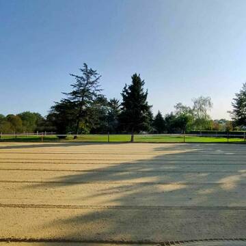
!!🐴 GIESENHOF !! 🐴
Moers
Zum-Giesenhof 21
@Zum-Giesenhof
Freizeitstall
Paddock
Parkplatz für Pferdeanhänger
Außenbox mit Paddock
Außenboxen
Selbstversorgung
7 weitere...
P
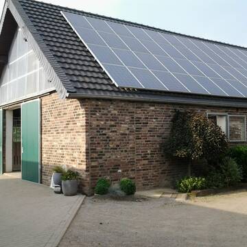
Große, helle Boxen, Paddockboxen,Offenstallhaltu...
Moers
Leimkuehler-KG
@Leimkuehler-KG
Freizeitstall
Reitlehrer und -unterricht
Vermieten
Longierzirkel/Roundpen
Paddock
Außenbox mit Paddock
Außenboxen
13 weitere...
P
Deprecated: Creation of dynamic property Zend_View_Helper_Ads::$adLink is deprecated in /var/www/stall-frei/htdocs/staging.stall-frei.de/library/Psf/View/Helper/Ads.php on line 108

Persönlichkeitsentwicklung mit Pferden
Bad Salzuflen
Katja Dors
@Pferdezeiten
Begleite andere auf ihrem Entwicklungsweg und entdecke die transformative Kraft der pferdegestützten Persönlichkeitsentwicklung !
neu
R
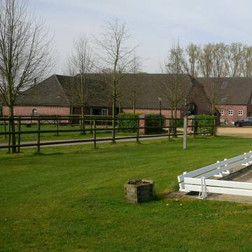
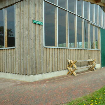
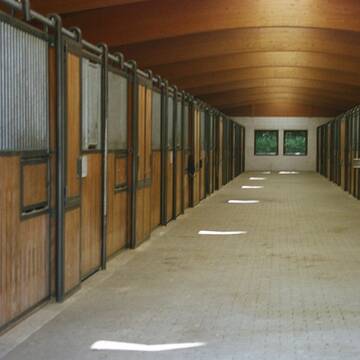
Reitanlage Wittenbergshof
Sonsbeck
Pferdepension Wittenbergshof
@Wolfgang-Schiruska
Freizeitstall
VFD-Mitglied
Vermieten
Paddock
Parkplatz für Pferdeanhänger
Außenbox mit Paddock
Innenbox
12 weitere...
S


Nachmieter für Tierarzt-/ Physiopraxis gesucht
Kevelaer
Holger Versteeg
@Versteeg
Rehabilitationsstall
Verpachten
Krankenbox
Innenbox
2 weitere...
S

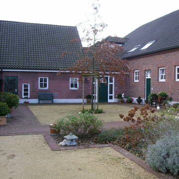
Selbstversorgerstall mit viel Freilauffläche
Kamp-Lintfort
Heitmannshof
@Katrin-Heitmann
Freizeitstall
Reitlehrer und -unterricht
Hunde willkommen
Paddock
Allergikerstall
Hufrehe geeignet
Außenbox mit Paddock
Außenboxen
9 weitere...
aktuell
P

Futtersack HeuToy, Fressbremse in pink
Mechtersen
STALL-FREIde Marketing
@STALL-FREI-Marketing
Stundenlange Beschäftigung die
Koliken vorbeugt, geringe Staubinhalation mit
steuerbarer Futterentnahme

1 freie Innenbox
Neukirchen Vluyn
Reiterverein_Neukirchen
@Reiterverein_Neukirchen
FN-Mitglied
Freizeitstall
Vermieten
Paddock
Parkplatz für Pferdeanhänger
Hufrehe geeignet
16 weitere...
aktuell
P

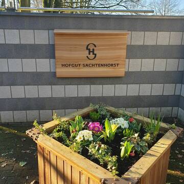

Hofgut Sachtenhorst - Pferdeliebe in Mülheim-Saa...
Mülheim an der Ruhr
Patrick-Hausmann
@Patrick-Hausmann
Freizeitstall
Geländestrecke
Führanlage
Hunde willkommen
Notfallboxen
Außenbox mit Paddock
Innenbox
15 weitere...
S

Pferdepension Gestüt Wiesenhof
Moers
Gestüt Wiesenhof
@ChristianSchrammen
Freizeitstall
Pferdeausbildung
Vermieten
Hunde willkommen
Longierzirkel/Roundpen
Allergikerstall
Hufrehe geeignet
17 weitere...
P
Boon Ranch Pensionsstall für Western & Freiz...
Neukirchen-Vluyn
Boon-Ranch
@Boon-Ranch
Freizeitstall
Geländestrecke
Vermieten
Hunde willkommen
Longierzirkel/Roundpen
Fohlenaufzucht möglich
Pferdezucht
18 weitere...
P

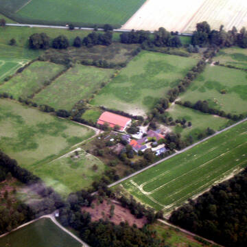
Gestüt Dachsberg hat z.Z. Boxen frei
Rheurdt
Gestuet-Dachsberg, in Rheurdt
@Gestuet-Dachsberg2
Freizeitstall
Vermieten
Verpachten
Hunde willkommen
Krankenbox
Allergikerstall
18 weitere...
P
Deprecated: Creation of dynamic property Zend_View::$pageCount is deprecated in /var/www/stall-frei/htdocs/staging.stall-frei.de/library/vendor/shardj/zf1-future/library/Zend/View/Abstract.php on line 308
Deprecated: Creation of dynamic property Zend_View::$itemCountPerPage is deprecated in /var/www/stall-frei/htdocs/staging.stall-frei.de/library/vendor/shardj/zf1-future/library/Zend/View/Abstract.php on line 308
Deprecated: Creation of dynamic property Zend_View::$first is deprecated in /var/www/stall-frei/htdocs/staging.stall-frei.de/library/vendor/shardj/zf1-future/library/Zend/View/Abstract.php on line 308
Deprecated: Creation of dynamic property Zend_View::$current is deprecated in /var/www/stall-frei/htdocs/staging.stall-frei.de/library/vendor/shardj/zf1-future/library/Zend/View/Abstract.php on line 308
Deprecated: Creation of dynamic property Zend_View::$last is deprecated in /var/www/stall-frei/htdocs/staging.stall-frei.de/library/vendor/shardj/zf1-future/library/Zend/View/Abstract.php on line 308
Deprecated: Creation of dynamic property Zend_View::$next is deprecated in /var/www/stall-frei/htdocs/staging.stall-frei.de/library/vendor/shardj/zf1-future/library/Zend/View/Abstract.php on line 308
Deprecated: Creation of dynamic property Zend_View::$pagesInRange is deprecated in /var/www/stall-frei/htdocs/staging.stall-frei.de/library/vendor/shardj/zf1-future/library/Zend/View/Abstract.php on line 308
Deprecated: Creation of dynamic property Zend_View::$firstPageInRange is deprecated in /var/www/stall-frei/htdocs/staging.stall-frei.de/library/vendor/shardj/zf1-future/library/Zend/View/Abstract.php on line 308
Deprecated: Creation of dynamic property Zend_View::$lastPageInRange is deprecated in /var/www/stall-frei/htdocs/staging.stall-frei.de/library/vendor/shardj/zf1-future/library/Zend/View/Abstract.php on line 308
Deprecated: Creation of dynamic property Zend_View::$currentItemCount is deprecated in /var/www/stall-frei/htdocs/staging.stall-frei.de/library/vendor/shardj/zf1-future/library/Zend/View/Abstract.php on line 308
Deprecated: Creation of dynamic property Zend_View::$totalItemCount is deprecated in /var/www/stall-frei/htdocs/staging.stall-frei.de/library/vendor/shardj/zf1-future/library/Zend/View/Abstract.php on line 308
Deprecated: Creation of dynamic property Zend_View::$firstItemNumber is deprecated in /var/www/stall-frei/htdocs/staging.stall-frei.de/library/vendor/shardj/zf1-future/library/Zend/View/Abstract.php on line 308
Deprecated: Creation of dynamic property Zend_View::$lastItemNumber is deprecated in /var/www/stall-frei/htdocs/staging.stall-frei.de/library/vendor/shardj/zf1-future/library/Zend/View/Abstract.php on line 308
Deprecated: Creation of dynamic property Zend_View::$router is deprecated in /var/www/stall-frei/htdocs/staging.stall-frei.de/library/vendor/shardj/zf1-future/library/Zend/View/Abstract.php on line 308
Deprecated: Creation of dynamic property Zend_View::$urlParams is deprecated in /var/www/stall-frei/htdocs/staging.stall-frei.de/library/vendor/shardj/zf1-future/library/Zend/View/Abstract.php on line 308
Deprecated: Creation of dynamic property Zend_View::$showAds is deprecated in /var/www/stall-frei/htdocs/staging.stall-frei.de/library/vendor/shardj/zf1-future/library/Zend/View/Abstract.php on line 308
Deprecated: Creation of dynamic property Zend_View::$objectIds is deprecated in /var/www/stall-frei/htdocs/staging.stall-frei.de/library/vendor/shardj/zf1-future/library/Zend/View/Abstract.php on line 308
Deprecated: Creation of dynamic property Zend_View::$showNavbar is deprecated in /var/www/stall-frei/htdocs/staging.stall-frei.de/library/vendor/shardj/zf1-future/library/Zend/View/Abstract.php on line 308
Deprecated: Creation of dynamic property Zend_View::$showBreadcrumb is deprecated in /var/www/stall-frei/htdocs/staging.stall-frei.de/library/vendor/shardj/zf1-future/library/Zend/View/Abstract.php on line 308
Deprecated: Creation of dynamic property Zend_View::$showFooter is deprecated in /var/www/stall-frei/htdocs/staging.stall-frei.de/library/vendor/shardj/zf1-future/library/Zend/View/Abstract.php on line 308
Deprecated: Creation of dynamic property Zend_View::$showInternalAds is deprecated in /var/www/stall-frei/htdocs/staging.stall-frei.de/library/vendor/shardj/zf1-future/library/Zend/View/Abstract.php on line 308
Deprecated: Creation of dynamic property Zend_View::$blNoContent is deprecated in /var/www/stall-frei/htdocs/staging.stall-frei.de/library/vendor/shardj/zf1-future/library/Zend/View/Abstract.php on line 308
Deprecated: Creation of dynamic property Zend_View::$sMetaDesc is deprecated in /var/www/stall-frei/htdocs/staging.stall-frei.de/library/vendor/shardj/zf1-future/library/Zend/View/Abstract.php on line 308
Deprecated: Creation of dynamic property Zend_View::$useGmaps is deprecated in /var/www/stall-frei/htdocs/staging.stall-frei.de/library/vendor/shardj/zf1-future/library/Zend/View/Abstract.php on line 308
Deprecated: Creation of dynamic property Zend_View::$touches is deprecated in /var/www/stall-frei/htdocs/staging.stall-frei.de/library/vendor/shardj/zf1-future/library/Zend/View/Abstract.php on line 308
Deprecated: Creation of dynamic property Zend_View::$oProject is deprecated in /var/www/stall-frei/htdocs/staging.stall-frei.de/library/vendor/shardj/zf1-future/library/Zend/View/Abstract.php on line 308
Deprecated: Creation of dynamic property Zend_View::$pageHeadline is deprecated in /var/www/stall-frei/htdocs/staging.stall-frei.de/library/vendor/shardj/zf1-future/library/Zend/View/Abstract.php on line 308
Deprecated: Creation of dynamic property Zend_View::$disableLocationField is deprecated in /var/www/stall-frei/htdocs/staging.stall-frei.de/library/vendor/shardj/zf1-future/library/Zend/View/Abstract.php on line 308
Deprecated: Creation of dynamic property Zend_View::$isSearch is deprecated in /var/www/stall-frei/htdocs/staging.stall-frei.de/library/vendor/shardj/zf1-future/library/Zend/View/Abstract.php on line 308
Deprecated: Creation of dynamic property Zend_View::$pageTitle is deprecated in /var/www/stall-frei/htdocs/staging.stall-frei.de/library/vendor/shardj/zf1-future/library/Zend/View/Abstract.php on line 308
Deprecated: Creation of dynamic property Psf_Form_Element_Text::$class is deprecated in /var/www/stall-frei/htdocs/staging.stall-frei.de/library/vendor/shardj/zf1-future/library/Zend/Form/Element.php on line 874
Deprecated: Creation of dynamic property Psf_Form_Element_Text::$size is deprecated in /var/www/stall-frei/htdocs/staging.stall-frei.de/library/vendor/shardj/zf1-future/library/Zend/Form/Element.php on line 874
Deprecated: Creation of dynamic property Psf_Form_Element_Text::$placeholder is deprecated in /var/www/stall-frei/htdocs/staging.stall-frei.de/library/vendor/shardj/zf1-future/library/Zend/Form/Element.php on line 874
Deprecated: Creation of dynamic property Psf_Form_Element_Hidden::$class is deprecated in /var/www/stall-frei/htdocs/staging.stall-frei.de/library/vendor/shardj/zf1-future/library/Zend/Form/Element.php on line 874
Deprecated: Creation of dynamic property Psf_Form_Element_Hidden::$class is deprecated in /var/www/stall-frei/htdocs/staging.stall-frei.de/library/vendor/shardj/zf1-future/library/Zend/Form/Element.php on line 874
Deprecated: Creation of dynamic property Psf_Form_Element_Hidden::$class is deprecated in /var/www/stall-frei/htdocs/staging.stall-frei.de/library/vendor/shardj/zf1-future/library/Zend/Form/Element.php on line 874
Deprecated: Creation of dynamic property Psf_Form_Element_Hidden::$class is deprecated in /var/www/stall-frei/htdocs/staging.stall-frei.de/library/vendor/shardj/zf1-future/library/Zend/Form/Element.php on line 874
Deprecated: Creation of dynamic property Psf_Form_Element_Select::$class is deprecated in /var/www/stall-frei/htdocs/staging.stall-frei.de/library/vendor/shardj/zf1-future/library/Zend/Form/Element.php on line 874
Deprecated: Creation of dynamic property Psf_Form_Element_Select::$class is deprecated in /var/www/stall-frei/htdocs/staging.stall-frei.de/library/vendor/shardj/zf1-future/library/Zend/Form/Element.php on line 874
Deprecated: Creation of dynamic property Psf_Form_Element_Select::$class is deprecated in /var/www/stall-frei/htdocs/staging.stall-frei.de/library/vendor/shardj/zf1-future/library/Zend/Form/Element.php on line 874
Deprecated: Creation of dynamic property Psf_Form_Element_Select::$class is deprecated in /var/www/stall-frei/htdocs/staging.stall-frei.de/library/vendor/shardj/zf1-future/library/Zend/Form/Element.php on line 874
Deprecated: Creation of dynamic property Psf_Form_Element_Text::$class is deprecated in /var/www/stall-frei/htdocs/staging.stall-frei.de/library/vendor/shardj/zf1-future/library/Zend/Form/Element.php on line 874
Deprecated: Creation of dynamic property Psf_Form_Element_Checkbox::$label is deprecated in /var/www/stall-frei/htdocs/staging.stall-frei.de/library/vendor/shardj/zf1-future/library/Zend/Form/Element.php on line 874
Deprecated: Creation of dynamic property Zend_View::$sort is deprecated in /var/www/stall-frei/htdocs/staging.stall-frei.de/library/vendor/shardj/zf1-future/library/Zend/View/Abstract.php on line 308
Deprecated: Creation of dynamic property Zend_View::$searchLocation is deprecated in /var/www/stall-frei/htdocs/staging.stall-frei.de/library/vendor/shardj/zf1-future/library/Zend/View/Abstract.php on line 308
Deprecated: Creation of dynamic property Zend_View::$locationHint is deprecated in /var/www/stall-frei/htdocs/staging.stall-frei.de/library/vendor/shardj/zf1-future/library/Zend/View/Abstract.php on line 308
Psf_GeoCoder_Abstract::getLocation: Genend Get Location CachedOrLive
Psf_GeoCoder_Abstract::getCachedOrLive: Genend
Psf_GeoCoder_OpenCageData::makeApiRequest: response:
Array
(
[documentation] => https://opencagedata.com/api
[licenses] => Array
(
[0] => Array
(
[name] => see attribution guide
[url] => https://opencagedata.com/credits
)
)
[results] => Array
(
[0] => Array
(
[bounds] => Array
(
[northeast] => Array
(
[lat] => 51.4969559
[lng] => 6.6164149
)
[southwest] => Array
(
[lat] => 51.4677826
[lng] => 6.571465
)
)
[components] => Array
(
[ISO_3166-1_alpha-2] => DE
[ISO_3166-1_alpha-3] => DEU
[ISO_3166-2] => Array
(
[0] => DE-NW
)
[_category] => place
[_normalized_city] => Moers
[_type] => neighbourhood
[city] => Moers
[continent] => Europe
[country] => Deutschland
[country_code] => de
[county] => Kreis Wesel
[neighbourhood] => Genend
[political_union] => European Union
[state] => Nordrhein-Westfalen
[state_code] => NW
[suburb] => Rheinkamp
)
[confidence] => 7
[formatted] => Rheinkamp, Moers, Nordrhein-Westfalen, Deutschland
[geometry] => Array
(
[lat] => 51.4824332
[lng] => 6.587377
)
)
[1] => Array
(
[bounds] => Array
(
[northeast] => Array
(
[lat] => 51.4959902
[lng] => 6.6204742
)
[southwest] => Array
(
[lat] => 51.4559902
[lng] => 6.5804742
)
)
[components] => Array
(
[ISO_3166-1_alpha-2] => DE
[ISO_3166-1_alpha-3] => DEU
[ISO_3166-2] => Array
(
[0] => DE-NW
)
[_category] => place
[_normalized_city] => Moers
[_type] => neighbourhood
[city] => Moers
[continent] => Europe
[country] => Deutschland
[country_code] => de
[county] => Kreis Wesel
[political_union] => European Union
[postcode] => 47445
[state] => Nordrhein-Westfalen
[state_code] => NW
[suburb] => Genend
)
[confidence] => 7
[formatted] => 47445 Moers, Deutschland
[geometry] => Array
(
[lat] => 51.4759902
[lng] => 6.6004742
)
)
[2] => Array
(
[bounds] => Array
(
[northeast] => Array
(
[lat] => 51.248133
[lng] => 6.2649751
)
[southwest] => Array
(
[lat] => 51.2479043
[lng] => 6.2604995
)
)
[components] => Array
(
[ISO_3166-1_alpha-2] => DE
[ISO_3166-1_alpha-3] => DEU
[ISO_3166-2] => Array
(
[0] => DE-NW
)
[_category] => road
[_normalized_city] => Schwalmtal
[_type] => road
[continent] => Europe
[country] => Deutschland
[country_code] => de
[county] => Kreis Viersen
[municipality] => Schwalmtal
[political_union] => European Union
[postcode] => 41366
[road] => Genend
[state] => Nordrhein-Westfalen
[state_code] => NW
)
[confidence] => 9
[formatted] => Genend, 41366 Schwalmtal, Deutschland
[geometry] => Array
(
[lat] => 51.2479125
[lng] => 6.2627272
)
)
[3] => Array
(
[components] => Array
(
[ISO_3166-1_alpha-2] => FR
[ISO_3166-1_alpha-3] => FRA
[ISO_3166-2] => Array
(
[0] => FR-OCC
[1] => FR-32
)
[_category] => road
[_normalized_city] => Montréal
[_type] => road
[city] => Montréal
[continent] => Europe
[country] => France
[country_code] => fr
[county] => Gers
[local_authority] => Communauté de communes de la Tenarèze
[political_union] => European Union
[postcode] => 32250
[road] => Route DE GENENS
[state] => Occitanie
[state_code] => OCC
)
[confidence] => 3
[formatted] => Route DE GENENS, 32250 Montréal, France
[geometry] => Array
(
[lat] => 43.945149
[lng] => 0.208059
)
)
[4] => Array
(
[components] => Array
(
[ISO_3166-1_alpha-2] => FR
[ISO_3166-1_alpha-3] => FRA
[ISO_3166-2] => Array
(
[0] => FR-ARA
[1] => FR-74
)
[_category] => road
[_normalized_city] => Chêne-en-Semine
[_type] => road
[city] => Chêne-en-Semine
[continent] => Europe
[country] => France
[country_code] => fr
[county] => Haute-Savoie
[local_authority] => Communauté de communes Usses et Rhône
[political_union] => European Union
[postcode] => 74270
[road] => Route de Foenens
[state] => Auvergne-Rhône-Alpes
[state_code] => ARA
)
[confidence] => 2
[formatted] => Route de Foenens, 74270 Chêne-en-Semine, France
[geometry] => Array
(
[lat] => 46.054156
[lng] => 5.840902
)
)
[5] => Array
(
[components] => Array
(
[ISO_3166-1_alpha-2] => FR
[ISO_3166-1_alpha-3] => FRA
[ISO_3166-2] => Array
(
[0] => FR-ARA
[1] => FR-01
)
[_category] => road
[_normalized_city] => La Burbanche
[_type] => road
[city] => La Burbanche
[continent] => Europe
[country] => France
[country_code] => fr
[county] => Ain
[local_authority] => Communauté de communes Bugey Sud
[political_union] => European Union
[postcode] => 01510
[road] => Rue du Genand
[state] => Auvergne-Rhône-Alpes
[state_code] => ARA
)
[confidence] => 2
[formatted] => Rue du Genand, 01510 La Burbanche, France
[geometry] => Array
(
[lat] => 45.846447
[lng] => 5.561107
)
)
[6] => Array
(
[components] => Array
(
[ISO_3166-1_alpha-2] => FR
[ISO_3166-1_alpha-3] => FRA
[ISO_3166-2] => Array
(
[0] => FR-ARA
[1] => FR-74
)
[_category] => road
[_normalized_city] => Saint-Germain-sur-Rhône
[_type] => road
[city] => Saint-Germain-sur-Rhône
[continent] => Europe
[country] => France
[country_code] => fr
[county] => Haute-Savoie
[local_authority] => Communauté de communes Usses et Rhône
[political_union] => European Union
[postcode] => 74910
[road] => Route de Foenens
[state] => Auvergne-Rhône-Alpes
[state_code] => ARA
)
[confidence] => 2
[formatted] => Route de Foenens, 74910 Saint-Germain-sur-Rhône, France
[geometry] => Array
(
[lat] => 46.05776
[lng] => 5.824439
)
)
[7] => Array
(
[components] => Array
(
[ISO_3166-1_alpha-2] => FR
[ISO_3166-1_alpha-3] => FRA
[ISO_3166-2] => Array
(
[0] => FR-BRE
[1] => FR-29
)
[_category] => road
[_normalized_city] => Combrit
[_type] => road
[city] => Combrit
[continent] => Europe
[country] => France
[country_code] => fr
[county] => Finistère
[local_authority] => Communauté de communes du Pays Bigouden Sud
[political_union] => European Union
[postcode] => 29120
[road] => Rue du Lieutenant Colonel Genin
[state] => Bretagne
[state_code] => BRE
)
[confidence] => 2
[formatted] => Rue du Lieutenant Colonel Genin, 29120 Combrit, France
[geometry] => Array
(
[lat] => 47.875094
[lng] => -4.124066
)
)
[8] => Array
(
[components] => Array
(
[ISO_3166-1_alpha-2] => FR
[ISO_3166-1_alpha-3] => FRA
[ISO_3166-2] => Array
(
[0] => FR-NAQ
[1] => FR-33
)
[_category] => road
[_normalized_city] => Saint-Mariens
[_type] => road
[city] => Saint-Mariens
[continent] => Europe
[country] => France
[country_code] => fr
[county] => Gironde
[local_authority] => Communauté de communes Latitude Nord Gironde
[political_union] => European Union
[postcode] => 33620
[road] => Route de Génin
[state] => Nouvelle-Aquitaine
[state_code] => NAQ
)
[confidence] => 2
[formatted] => Route de Génin, 33620 Saint-Mariens, France
[geometry] => Array
(
[lat] => 45.118929
[lng] => -0.425179
)
)
[9] => Array
(
[components] => Array
(
[ISO_3166-1_alpha-2] => FR
[ISO_3166-1_alpha-3] => FRA
[ISO_3166-2] => Array
(
[0] => FR-NAQ
[1] => FR-33
)
[_category] => road
[_normalized_city] => Lamothe-Landerron
[_type] => road
[city] => Lamothe-Landerron
[continent] => Europe
[country] => France
[country_code] => fr
[county] => Gironde
[local_authority] => Communauté de communes du Réolais en Sud Gironde
[political_union] => European Union
[postcode] => 33190
[road] => route des genins
[state] => Nouvelle-Aquitaine
[state_code] => NAQ
)
[confidence] => 2
[formatted] => route des genins, 33190 Lamothe-Landerron, France
[geometry] => Array
(
[lat] => 44.561153
[lng] => 0.056194
)
)
)
[status] => Array
(
[code] => 200
[message] => OK
)
[stay_informed] => Array
(
[blog] => https://blog.opencagedata.com
[mastodon] => https://en.osm.town/@opencage
)
[thanks] => For using an OpenCage API
[timestamp] => Array
(
[created_http] => Sat, 07 Feb 2026 17:29:41 GMT
[created_unix] => 1770485381
)
[total_results] => 10
)
Psf_GeoCoder_Abstract::convertLocationResult
{"documentation":"https:\/\/opencagedata.com\/api","licenses":[{"name":"see attribution guide","url":"https:\/\/opencagedata.com\/credits"}],"results":[{"bounds":{"northeast":{"lat":51.4969559,"lng":6.6164149},"southwest":{"lat":51.4677826,"lng":6.571465}},"components":{"ISO_3166-1_alpha-2":"DE","ISO_3166-1_alpha-3":"DEU","ISO_3166-2":["DE-NW"],"_category":"place","_normalized_city":"Moers","_type":"neighbourhood","city":"Moers","continent":"Europe","country":"Deutschland","country_code":"de","county":"Kreis Wesel","neighbourhood":"Genend","political_union":"European Union","state":"Nordrhein-Westfalen","state_code":"NW","suburb":"Rheinkamp"},"confidence":7,"formatted":"Rheinkamp, Moers, Nordrhein-Westfalen, Deutschland","geometry":{"lat":51.4824332,"lng":6.587377}},{"bounds":{"northeast":{"lat":51.4959902,"lng":6.6204742},"southwest":{"lat":51.4559902,"lng":6.5804742}},"components":{"ISO_3166-1_alpha-2":"DE","ISO_3166-1_alpha-3":"DEU","ISO_3166-2":["DE-NW"],"_category":"place","_normalized_city":"Moers","_type":"neighbourhood","city":"Moers","continent":"Europe","country":"Deutschland","country_code":"de","county":"Kreis Wesel","political_union":"European Union","postcode":"47445","state":"Nordrhein-Westfalen","state_code":"NW","suburb":"Genend"},"confidence":7,"formatted":"47445 Moers, Deutschland","geometry":{"lat":51.4759902,"lng":6.6004742}},{"bounds":{"northeast":{"lat":51.248133,"lng":6.2649751},"southwest":{"lat":51.2479043,"lng":6.2604995}},"components":{"ISO_3166-1_alpha-2":"DE","ISO_3166-1_alpha-3":"DEU","ISO_3166-2":["DE-NW"],"_category":"road","_normalized_city":"Schwalmtal","_type":"road","continent":"Europe","country":"Deutschland","country_code":"de","county":"Kreis Viersen","municipality":"Schwalmtal","political_union":"European Union","postcode":"41366","road":"Genend","state":"Nordrhein-Westfalen","state_code":"NW"},"confidence":9,"formatted":"Genend, 41366 Schwalmtal, Deutschland","geometry":{"lat":51.2479125,"lng":6.2627272}},{"components":{"ISO_3166-1_alpha-2":"FR","ISO_3166-1_alpha-3":"FRA","ISO_3166-2":["FR-OCC","FR-32"],"_category":"road","_normalized_city":"Montr\u00e9al","_type":"road","city":"Montr\u00e9al","continent":"Europe","country":"France","country_code":"fr","county":"Gers","local_authority":"Communaut\u00e9 de communes de la Tenar\u00e8ze","political_union":"European Union","postcode":"32250","road":"Route DE GENENS","state":"Occitanie","state_code":"OCC"},"confidence":3,"formatted":"Route DE GENENS, 32250 Montr\u00e9al, France","geometry":{"lat":43.945149,"lng":0.208059}},{"components":{"ISO_3166-1_alpha-2":"FR","ISO_3166-1_alpha-3":"FRA","ISO_3166-2":["FR-ARA","FR-74"],"_category":"road","_normalized_city":"Ch\u00eane-en-Semine","_type":"road","city":"Ch\u00eane-en-Semine","continent":"Europe","country":"France","country_code":"fr","county":"Haute-Savoie","local_authority":"Communaut\u00e9 de communes Usses et Rh\u00f4ne","political_union":"European Union","postcode":"74270","road":"Route de Foenens","state":"Auvergne-Rh\u00f4ne-Alpes","state_code":"ARA"},"confidence":2,"formatted":"Route de Foenens, 74270 Ch\u00eane-en-Semine, France","geometry":{"lat":46.054156,"lng":5.840902}},{"components":{"ISO_3166-1_alpha-2":"FR","ISO_3166-1_alpha-3":"FRA","ISO_3166-2":["FR-ARA","FR-01"],"_category":"road","_normalized_city":"La Burbanche","_type":"road","city":"La Burbanche","continent":"Europe","country":"France","country_code":"fr","county":"Ain","local_authority":"Communaut\u00e9 de communes Bugey Sud","political_union":"European Union","postcode":"01510","road":"Rue du Genand","state":"Auvergne-Rh\u00f4ne-Alpes","state_code":"ARA"},"confidence":2,"formatted":"Rue du Genand, 01510 La Burbanche, France","geometry":{"lat":45.846447,"lng":5.561107}},{"components":{"ISO_3166-1_alpha-2":"FR","ISO_3166-1_alpha-3":"FRA","ISO_3166-2":["FR-ARA","FR-74"],"_category":"road","_normalized_city":"Saint-Germain-sur-Rh\u00f4ne","_type":"road","city":"Saint-Germain-sur-Rh\u00f4ne","continent":"Europe","country":"France","country_code":"fr","county":"Haute-Savoie","local_authority":"Communaut\u00e9 de communes Usses et Rh\u00f4ne","political_union":"European Union","postcode":"74910","road":"Route de Foenens","state":"Auvergne-Rh\u00f4ne-Alpes","state_code":"ARA"},"confidence":2,"formatted":"Route de Foenens, 74910 Saint-Germain-sur-Rh\u00f4ne, France","geometry":{"lat":46.05776,"lng":5.824439}},{"components":{"ISO_3166-1_alpha-2":"FR","ISO_3166-1_alpha-3":"FRA","ISO_3166-2":["FR-BRE","FR-29"],"_category":"road","_normalized_city":"Combrit","_type":"road","city":"Combrit","continent":"Europe","country":"France","country_code":"fr","county":"Finist\u00e8re","local_authority":"Communaut\u00e9 de communes du Pays Bigouden Sud","political_union":"European Union","postcode":"29120","road":"Rue du Lieutenant Colonel Genin","state":"Bretagne","state_code":"BRE"},"confidence":2,"formatted":"Rue du Lieutenant Colonel Genin, 29120 Combrit, France","geometry":{"lat":47.875094,"lng":-4.124066}},{"components":{"ISO_3166-1_alpha-2":"FR","ISO_3166-1_alpha-3":"FRA","ISO_3166-2":["FR-NAQ","FR-33"],"_category":"road","_normalized_city":"Saint-Mariens","_type":"road","city":"Saint-Mariens","continent":"Europe","country":"France","country_code":"fr","county":"Gironde","local_authority":"Communaut\u00e9 de communes Latitude Nord Gironde","political_union":"European Union","postcode":"33620","road":"Route de G\u00e9nin","state":"Nouvelle-Aquitaine","state_code":"NAQ"},"confidence":2,"formatted":"Route de G\u00e9nin, 33620 Saint-Mariens, France","geometry":{"lat":45.118929,"lng":-0.425179}},{"components":{"ISO_3166-1_alpha-2":"FR","ISO_3166-1_alpha-3":"FRA","ISO_3166-2":["FR-NAQ","FR-33"],"_category":"road","_normalized_city":"Lamothe-Landerron","_type":"road","city":"Lamothe-Landerron","continent":"Europe","country":"France","country_code":"fr","county":"Gironde","local_authority":"Communaut\u00e9 de communes du R\u00e9olais en Sud Gironde","political_union":"European Union","postcode":"33190","road":"route des genins","state":"Nouvelle-Aquitaine","state_code":"NAQ"},"confidence":2,"formatted":"route des genins, 33190 Lamothe-Landerron, France","geometry":{"lat":44.561153,"lng":0.056194}}],"status":{"code":200,"message":"OK"},"stay_informed":{"blog":"https:\/\/blog.opencagedata.com","mastodon":"https:\/\/en.osm.town\/@opencage"},"thanks":"For using an OpenCage API","timestamp":{"created_http":"Sat, 07 Feb 2026 17:29:41 GMT","created_unix":1770485381},"total_results":10}Array
(
[0] => stdClass Object
(
[bounds] => stdClass Object
(
[northeast] => stdClass Object
(
[lat] => 51.4969559
[lng] => 6.6164149
)
[southwest] => stdClass Object
(
[lat] => 51.4677826
[lng] => 6.571465
)
)
[components] => stdClass Object
(
[ISO_3166-1_alpha-2] => DE
[ISO_3166-1_alpha-3] => DEU
[ISO_3166-2] => Array
(
[0] => DE-NW
)
[_category] => place
[_normalized_city] => Moers
[_type] => neighbourhood
[city] => Moers
[continent] => Europe
[country] => Deutschland
[country_code] => de
[county] => Kreis Wesel
[neighbourhood] => Genend
[political_union] => European Union
[state] => Nordrhein-Westfalen
[state_code] => NW
[suburb] => Rheinkamp
)
[confidence] => 7
[formatted] => Rheinkamp, Moers, Nordrhein-Westfalen, Deutschland
[geometry] => stdClass Object
(
[lat] => 51.4824332
[lng] => 6.587377
)
)
[1] => stdClass Object
(
[bounds] => stdClass Object
(
[northeast] => stdClass Object
(
[lat] => 51.4959902
[lng] => 6.6204742
)
[southwest] => stdClass Object
(
[lat] => 51.4559902
[lng] => 6.5804742
)
)
[components] => stdClass Object
(
[ISO_3166-1_alpha-2] => DE
[ISO_3166-1_alpha-3] => DEU
[ISO_3166-2] => Array
(
[0] => DE-NW
)
[_category] => place
[_normalized_city] => Moers
[_type] => neighbourhood
[city] => Moers
[continent] => Europe
[country] => Deutschland
[country_code] => de
[county] => Kreis Wesel
[political_union] => European Union
[postcode] => 47445
[state] => Nordrhein-Westfalen
[state_code] => NW
[suburb] => Genend
)
[confidence] => 7
[formatted] => 47445 Moers, Deutschland
[geometry] => stdClass Object
(
[lat] => 51.4759902
[lng] => 6.6004742
)
)
[2] => stdClass Object
(
[bounds] => stdClass Object
(
[northeast] => stdClass Object
(
[lat] => 51.248133
[lng] => 6.2649751
)
[southwest] => stdClass Object
(
[lat] => 51.2479043
[lng] => 6.2604995
)
)
[components] => stdClass Object
(
[ISO_3166-1_alpha-2] => DE
[ISO_3166-1_alpha-3] => DEU
[ISO_3166-2] => Array
(
[0] => DE-NW
)
[_category] => road
[_normalized_city] => Schwalmtal
[_type] => road
[continent] => Europe
[country] => Deutschland
[country_code] => de
[county] => Kreis Viersen
[municipality] => Schwalmtal
[political_union] => European Union
[postcode] => 41366
[road] => Genend
[state] => Nordrhein-Westfalen
[state_code] => NW
)
[confidence] => 9
[formatted] => Genend, 41366 Schwalmtal, Deutschland
[geometry] => stdClass Object
(
[lat] => 51.2479125
[lng] => 6.2627272
)
)
[3] => stdClass Object
(
[components] => stdClass Object
(
[ISO_3166-1_alpha-2] => FR
[ISO_3166-1_alpha-3] => FRA
[ISO_3166-2] => Array
(
[0] => FR-OCC
[1] => FR-32
)
[_category] => road
[_normalized_city] => Montréal
[_type] => road
[city] => Montréal
[continent] => Europe
[country] => France
[country_code] => fr
[county] => Gers
[local_authority] => Communauté de communes de la Tenarèze
[political_union] => European Union
[postcode] => 32250
[road] => Route DE GENENS
[state] => Occitanie
[state_code] => OCC
)
[confidence] => 3
[formatted] => Route DE GENENS, 32250 Montréal, France
[geometry] => stdClass Object
(
[lat] => 43.945149
[lng] => 0.208059
)
)
[4] => stdClass Object
(
[components] => stdClass Object
(
[ISO_3166-1_alpha-2] => FR
[ISO_3166-1_alpha-3] => FRA
[ISO_3166-2] => Array
(
[0] => FR-ARA
[1] => FR-74
)
[_category] => road
[_normalized_city] => Chêne-en-Semine
[_type] => road
[city] => Chêne-en-Semine
[continent] => Europe
[country] => France
[country_code] => fr
[county] => Haute-Savoie
[local_authority] => Communauté de communes Usses et Rhône
[political_union] => European Union
[postcode] => 74270
[road] => Route de Foenens
[state] => Auvergne-Rhône-Alpes
[state_code] => ARA
)
[confidence] => 2
[formatted] => Route de Foenens, 74270 Chêne-en-Semine, France
[geometry] => stdClass Object
(
[lat] => 46.054156
[lng] => 5.840902
)
)
[5] => stdClass Object
(
[components] => stdClass Object
(
[ISO_3166-1_alpha-2] => FR
[ISO_3166-1_alpha-3] => FRA
[ISO_3166-2] => Array
(
[0] => FR-ARA
[1] => FR-01
)
[_category] => road
[_normalized_city] => La Burbanche
[_type] => road
[city] => La Burbanche
[continent] => Europe
[country] => France
[country_code] => fr
[county] => Ain
[local_authority] => Communauté de communes Bugey Sud
[political_union] => European Union
[postcode] => 01510
[road] => Rue du Genand
[state] => Auvergne-Rhône-Alpes
[state_code] => ARA
)
[confidence] => 2
[formatted] => Rue du Genand, 01510 La Burbanche, France
[geometry] => stdClass Object
(
[lat] => 45.846447
[lng] => 5.561107
)
)
[6] => stdClass Object
(
[components] => stdClass Object
(
[ISO_3166-1_alpha-2] => FR
[ISO_3166-1_alpha-3] => FRA
[ISO_3166-2] => Array
(
[0] => FR-ARA
[1] => FR-74
)
[_category] => road
[_normalized_city] => Saint-Germain-sur-Rhône
[_type] => road
[city] => Saint-Germain-sur-Rhône
[continent] => Europe
[country] => France
[country_code] => fr
[county] => Haute-Savoie
[local_authority] => Communauté de communes Usses et Rhône
[political_union] => European Union
[postcode] => 74910
[road] => Route de Foenens
[state] => Auvergne-Rhône-Alpes
[state_code] => ARA
)
[confidence] => 2
[formatted] => Route de Foenens, 74910 Saint-Germain-sur-Rhône, France
[geometry] => stdClass Object
(
[lat] => 46.05776
[lng] => 5.824439
)
)
[7] => stdClass Object
(
[components] => stdClass Object
(
[ISO_3166-1_alpha-2] => FR
[ISO_3166-1_alpha-3] => FRA
[ISO_3166-2] => Array
(
[0] => FR-BRE
[1] => FR-29
)
[_category] => road
[_normalized_city] => Combrit
[_type] => road
[city] => Combrit
[continent] => Europe
[country] => France
[country_code] => fr
[county] => Finistère
[local_authority] => Communauté de communes du Pays Bigouden Sud
[political_union] => European Union
[postcode] => 29120
[road] => Rue du Lieutenant Colonel Genin
[state] => Bretagne
[state_code] => BRE
)
[confidence] => 2
[formatted] => Rue du Lieutenant Colonel Genin, 29120 Combrit, France
[geometry] => stdClass Object
(
[lat] => 47.875094
[lng] => -4.124066
)
)
[8] => stdClass Object
(
[components] => stdClass Object
(
[ISO_3166-1_alpha-2] => FR
[ISO_3166-1_alpha-3] => FRA
[ISO_3166-2] => Array
(
[0] => FR-NAQ
[1] => FR-33
)
[_category] => road
[_normalized_city] => Saint-Mariens
[_type] => road
[city] => Saint-Mariens
[continent] => Europe
[country] => France
[country_code] => fr
[county] => Gironde
[local_authority] => Communauté de communes Latitude Nord Gironde
[political_union] => European Union
[postcode] => 33620
[road] => Route de Génin
[state] => Nouvelle-Aquitaine
[state_code] => NAQ
)
[confidence] => 2
[formatted] => Route de Génin, 33620 Saint-Mariens, France
[geometry] => stdClass Object
(
[lat] => 45.118929
[lng] => -0.425179
)
)
[9] => stdClass Object
(
[components] => stdClass Object
(
[ISO_3166-1_alpha-2] => FR
[ISO_3166-1_alpha-3] => FRA
[ISO_3166-2] => Array
(
[0] => FR-NAQ
[1] => FR-33
)
[_category] => road
[_normalized_city] => Lamothe-Landerron
[_type] => road
[city] => Lamothe-Landerron
[continent] => Europe
[country] => France
[country_code] => fr
[county] => Gironde
[local_authority] => Communauté de communes du Réolais en Sud Gironde
[political_union] => European Union
[postcode] => 33190
[road] => route des genins
[state] => Nouvelle-Aquitaine
[state_code] => NAQ
)
[confidence] => 2
[formatted] => route des genins, 33190 Lamothe-Landerron, France
[geometry] => stdClass Object
(
[lat] => 44.561153
[lng] => 0.056194
)
)
)
Psf_GeoCoder_OpenCageData::getKeyMap: 0
stdClass Object
(
    [bounds] => stdClass Object
        (
            [northeast] => stdClass Object
                (
                    [lat] => 51.4969559
                    [lng] => 6.6164149
                )

            [southwest] => stdClass Object
                (
                    [lat] => 51.4677826
                    [lng] => 6.571465
                )

        )

    [components] => stdClass Object
        (
            [ISO_3166-1_alpha-2] => DE
            [ISO_3166-1_alpha-3] => DEU
            [ISO_3166-2] => Array
                (
                    [0] => DE-NW
                )

            [_category] => place
            [_normalized_city] => Moers
            [_type] => neighbourhood
            [city] => Moers
            [continent] => Europe
            [country] => Deutschland
            [country_code] => de
            [county] => Kreis Wesel
            [neighbourhood] => Genend
            [political_union] => European Union
            [state] => Nordrhein-Westfalen
            [state_code] => NW
            [suburb] => Rheinkamp
        )

    [confidence] => 7
    [formatted] => Rheinkamp, Moers, Nordrhein-Westfalen, Deutschland
    [geometry] => stdClass Object
        (
            [lat] => 51.4824332
            [lng] => 6.587377
        )

)
Psf_GeoCoder_OpenCageData::getCounty: Wesel
Psf_GeoCoder_OpenCageData::addMissingData REFETCH!
Array
(
    [address] => Rheinkamp, Moers, Nordrhein-Westfalen, Deutschland
    [type] => neighbourhood
    [street] =>
    [city] => Rheinkamp
    [county] => Wesel
    [state] => Nordrhein-Westfalen
    [zip] =>
    [country] => Deutschland
    [suburb] => Rheinkamp
    [countrycode] => de
    [latitude] => 51.4824332
    [longitude] => 6.587377
    [accuracy] => 1
    [confidence] => 7
    [bounds] => stdClass Object
        (
            [northeast] => stdClass Object
                (
                    [lat] => 51.4969559
                    [lng] => 6.6164149
                )

            [southwest] => stdClass Object
                (
                    [lat] => 51.4677826
                    [lng] => 6.571465
                )

        )

)
reformat!
Array
(
    [address] => Rheinkamp, Moers, Nordrhein-Westfalen, Deutschland
    [type] => neighbourhood
    [street] =>
    [city] => Rheinkamp
    [county] => Wesel
    [state] => Nordrhein-Westfalen
    [zip] =>
    [country] => Deutschland
    [suburb] => Rheinkamp
    [countrycode] => de
    [latitude] => 51.4824332
    [longitude] => 6.587377
    [accuracy] => 1
    [confidence] => 7
    [bounds] => stdClass Object
        (
            [northeast] => stdClass Object
                (
                    [lat] => 51.4969559
                    [lng] => 6.6164149
                )

            [southwest] => stdClass Object
                (
                    [lat] => 51.4677826
                    [lng] => 6.571465
                )

        )

    [place] => Rheinkamp, Nordrhein-Westfalen
    [hash] => d3fab1d3044141950df2fbe008be57f1
)
Psf_GeoCoder_OpenCageData::getKeyMap: 1
stdClass Object
(
    [bounds] => stdClass Object
        (
            [northeast] => stdClass Object
                (
                    [lat] => 51.4959902
                    [lng] => 6.6204742
                )

            [southwest] => stdClass Object
                (
                    [lat] => 51.4559902
                    [lng] => 6.5804742
                )

        )

    [components] => stdClass Object
        (
            [ISO_3166-1_alpha-2] => DE
            [ISO_3166-1_alpha-3] => DEU
            [ISO_3166-2] => Array
                (
                    [0] => DE-NW
                )

            [_category] => place
            [_normalized_city] => Moers
            [_type] => neighbourhood
            [city] => Moers
            [continent] => Europe
            [country] => Deutschland
            [country_code] => de
            [county] => Kreis Wesel
            [political_union] => European Union
            [postcode] => 47445
            [state] => Nordrhein-Westfalen
            [state_code] => NW
            [suburb] => Genend
        )

    [confidence] => 7
    [formatted] => 47445 Moers, Deutschland
    [geometry] => stdClass Object
        (
            [lat] => 51.4759902
            [lng] => 6.6004742
        )

)
Psf_GeoCoder_OpenCageData::getCounty: Wesel
Psf_GeoCoder_OpenCageData::addMissingData REFETCH!
Array
(
    [address] => 47445 Moers, Deutschland
    [type] => neighbourhood
    [street] =>
    [city] => Genend
    [county] => Wesel
    [state] => Nordrhein-Westfalen
    [zip] => 47445
    [country] => Deutschland
    [suburb] => Genend
    [countrycode] => de
    [latitude] => 51.4759902
    [longitude] => 6.6004742
    [accuracy] => 1
    [confidence] => 7
    [bounds] => stdClass Object
        (
            [northeast] => stdClass Object
                (
                    [lat] => 51.4959902
                    [lng] => 6.6204742
                )

            [southwest] => stdClass Object
                (
                    [lat] => 51.4559902
                    [lng] => 6.5804742
                )

        )

)
reformat!
Array
(
    [address] => 47445 Genend
    [type] => neighbourhood
    [street] =>
    [city] => Genend
    [county] => Wesel
    [state] => Nordrhein-Westfalen
    [zip] => 47445
    [country] => Deutschland
    [suburb] => Genend
    [countrycode] => de
    [latitude] => 51.4759902
    [longitude] => 6.6004742
    [accuracy] => 1
    [confidence] => 7
    [bounds] => stdClass Object
        (
            [northeast] => stdClass Object
                (
                    [lat] => 51.4959902
                    [lng] => 6.6204742
                )

            [southwest] => stdClass Object
                (
                    [lat] => 51.4559902
                    [lng] => 6.5804742
                )

        )

    [place] => 47445 Genend, Nordrhein-Westfalen
    [hash] => 30c98e1f051627dbe8f01e8ff98a01a6
)
Psf_GeoCoder_OpenCageData::getKeyMap: 2
stdClass Object
(
    [bounds] => stdClass Object
        (
            [northeast] => stdClass Object
                (
                    [lat] => 51.248133
                    [lng] => 6.2649751
                )

            [southwest] => stdClass Object
                (
                    [lat] => 51.2479043
                    [lng] => 6.2604995
                )

        )

    [components] => stdClass Object
        (
            [ISO_3166-1_alpha-2] => DE
            [ISO_3166-1_alpha-3] => DEU
            [ISO_3166-2] => Array
                (
                    [0] => DE-NW
                )

            [_category] => road
            [_normalized_city] => Schwalmtal
            [_type] => road
            [continent] => Europe
            [country] => Deutschland
            [country_code] => de
            [county] => Kreis Viersen
            [municipality] => Schwalmtal
            [political_union] => European Union
            [postcode] => 41366
            [road] => Genend
            [state] => Nordrhein-Westfalen
            [state_code] => NW
        )

    [confidence] => 9
    [formatted] => Genend, 41366 Schwalmtal, Deutschland
    [geometry] => stdClass Object
        (
            [lat] => 51.2479125
            [lng] => 6.2627272
        )

)
Psf_GeoCoder_OpenCageData::getCounty: Viersen
Psf_GeoCoder_OpenCageData::addMissingData REFETCH!
Array
(
    [address] => Genend, 41366 Schwalmtal, Deutschland
    [type] => road
    [street] => Genend
    [city] =>
    [county] => Viersen
    [state] => Nordrhein-Westfalen
    [zip] => 41366
    [country] => Deutschland
    [suburb] =>
    [countrycode] => de
    [latitude] => 51.2479125
    [longitude] => 6.2627272
    [accuracy] => 1
    [confidence] => 9
    [bounds] => stdClass Object
        (
            [northeast] => stdClass Object
                (
                    [lat] => 51.248133
                    [lng] => 6.2649751
                )

            [southwest] => stdClass Object
                (
                    [lat] => 51.2479043
                    [lng] => 6.2604995
                )

        )

)
reformat!
Array
(
    [address] => Genend, 41366 Schwalmtal, Deutschland
    [type] => road
    [street] => Genend
    [city] =>
    [county] => Viersen
    [state] => Nordrhein-Westfalen
    [zip] => 41366
    [country] => Deutschland
    [suburb] =>
    [countrycode] => de
    [latitude] => 51.2479125
    [longitude] => 6.2627272
    [accuracy] => 1
    [confidence] => 9
    [bounds] => stdClass Object
        (
            [northeast] => stdClass Object
                (
                    [lat] => 51.248133
                    [lng] => 6.2649751
                )

            [southwest] => stdClass Object
                (
                    [lat] => 51.2479043
                    [lng] => 6.2604995
                )

        )

    [place] => Genend, 41366 , Nordrhein-Westfalen
    [hash] => 19d1834e48c2bee63f329c0000e9e016
)
Psf_GeoCoder_OpenCageData::getKeyMap: 3
stdClass Object
(
    [components] => stdClass Object
        (
            [ISO_3166-1_alpha-2] => FR
            [ISO_3166-1_alpha-3] => FRA
            [ISO_3166-2] => Array
                (
                    [0] => FR-OCC
                    [1] => FR-32
                )

            [_category] => road
            [_normalized_city] => Montréal
            [_type] => road
            [city] => Montréal
            [continent] => Europe
            [country] => France
            [country_code] => fr
            [county] => Gers
            [local_authority] => Communauté de communes de la Tenarèze
            [political_union] => European Union
            [postcode] => 32250
            [road] => Route DE GENENS
            [state] => Occitanie
            [state_code] => OCC
        )

    [confidence] => 3
    [formatted] => Route DE GENENS, 32250 Montréal, France
    [geometry] => stdClass Object
        (
            [lat] => 43.945149
            [lng] => 0.208059
        )

)
Psf_GeoCoder_OpenCageData::getCounty: Gers
Psf_GeoCoder_OpenCageData::addMissingData REFETCH!
Array
(
    [address] => Route DE GENENS, 32250 Montréal, France
    [type] => road
    [street] => Route DE GENENS
    [city] => Montréal
    [county] => Gers
    [state] => Occitanie
    [zip] => 32250
    [country] => France
    [suburb] =>
    [countrycode] => fr
    [latitude] => 43.945149
    [longitude] => 0.208059
    [accuracy] => 1
    [confidence] => 3
    [bounds] =>
)
reformat!
Array
(
    [address] => Route DE GENENS, 32250 Montréal, France
    [type] => road
    [street] => Route DE GENENS
    [city] => Montréal
    [county] => Gers
    [state] => Occitanie
    [zip] => 32250
    [country] => France
    [suburb] =>
    [countrycode] => fr
    [latitude] => 43.945149
    [longitude] => 0.208059
    [accuracy] => 1
    [confidence] => 3
    [bounds] =>
    [place] => Route DE GENENS, 32250 Montréal, Occitanie
    [hash] => fa629eba463b31d549d41cf73c616a6c
)
Psf_GeoCoder_OpenCageData::getKeyMap: 4
stdClass Object
(
    [components] => stdClass Object
        (
            [ISO_3166-1_alpha-2] => FR
            [ISO_3166-1_alpha-3] => FRA
            [ISO_3166-2] => Array
                (
                    [0] => FR-ARA
                    [1] => FR-74
                )

            [_category] => road
            [_normalized_city] => Chêne-en-Semine
            [_type] => road
            [city] => Chêne-en-Semine
            [continent] => Europe
            [country] => France
            [country_code] => fr
            [county] => Haute-Savoie
            [local_authority] => Communauté de communes Usses et Rhône
            [political_union] => European Union
            [postcode] => 74270
            [road] => Route de Foenens
            [state] => Auvergne-Rhône-Alpes
            [state_code] => ARA
        )

    [confidence] => 2
    [formatted] => Route de Foenens, 74270 Chêne-en-Semine, France
    [geometry] => stdClass Object
        (
            [lat] => 46.054156
            [lng] => 5.840902
        )

)
Psf_GeoCoder_OpenCageData::getCounty: Haute-Savoie
Psf_GeoCoder_OpenCageData::addMissingData REFETCH!
Array
(
    [address] => Route de Foenens, 74270 Chêne-en-Semine, France
    [type] => road
    [street] => Route de Foenens
    [city] => Chêne-en-Semine
    [county] => Haute-Savoie
    [state] => Auvergne-Rhône-Alpes
    [zip] => 74270
    [country] => France
    [suburb] =>
    [countrycode] => fr
    [latitude] => 46.054156
    [longitude] => 5.840902
    [accuracy] => 1
    [confidence] => 2
    [bounds] =>
)
reformat!
Array
(
    [address] => Route de Foenens, 74270 Chêne-en-Semine, France
    [type] => road
    [street] => Route de Foenens
    [city] => Chêne-en-Semine
    [county] => Haute-Savoie
    [state] => Auvergne-Rhône-Alpes
    [zip] => 74270
    [country] => France
    [suburb] =>
    [countrycode] => fr
    [latitude] => 46.054156
    [longitude] => 5.840902
    [accuracy] => 1
    [confidence] => 2
    [bounds] =>
    [place] => Route de Foenens, 74270 Chêne-en-Semine, Auvergne-Rhône-Alpes
    [hash] => 710641037b1308e0a766e4f52b01d17f
)
Psf_GeoCoder_OpenCageData::getKeyMap: 5
stdClass Object
(
    [components] => stdClass Object
        (
            [ISO_3166-1_alpha-2] => FR
            [ISO_3166-1_alpha-3] => FRA
            [ISO_3166-2] => Array
                (
                    [0] => FR-ARA
                    [1] => FR-01
                )

            [_category] => road
            [_normalized_city] => La Burbanche
            [_type] => road
            [city] => La Burbanche
            [continent] => Europe
            [country] => France
            [country_code] => fr
            [county] => Ain
            [local_authority] => Communauté de communes Bugey Sud
            [political_union] => European Union
            [postcode] => 01510
            [road] => Rue du Genand
            [state] => Auvergne-Rhône-Alpes
            [state_code] => ARA
        )

    [confidence] => 2
    [formatted] => Rue du Genand, 01510 La Burbanche, France
    [geometry] => stdClass Object
        (
            [lat] => 45.846447
            [lng] => 5.561107
        )

)
Psf_GeoCoder_OpenCageData::getCounty: Ain
Psf_GeoCoder_OpenCageData::addMissingData REFETCH!
Array
(
    [address] => Rue du Genand, 01510 La Burbanche, France
    [type] => road
    [street] => Rue du Genand
    [city] => La Burbanche
    [county] => Ain
    [state] => Auvergne-Rhône-Alpes
    [zip] => 01510
    [country] => France
    [suburb] =>
    [countrycode] => fr
    [latitude] => 45.846447
    [longitude] => 5.561107
    [accuracy] => 1
    [confidence] => 2
    [bounds] =>
)
reformat!
Array
(
    [address] => Rue du Genand, 01510 La Burbanche, France
    [type] => road
    [street] => Rue du Genand
    [city] => La Burbanche
    [county] => Ain
    [state] => Auvergne-Rhône-Alpes
    [zip] => 01510
    [country] => France
    [suburb] =>
    [countrycode] => fr
    [latitude] => 45.846447
    [longitude] => 5.561107
    [accuracy] => 1
    [confidence] => 2
    [bounds] =>
    [place] => Rue du Genand, 01510 La Burbanche, Auvergne-Rhône-Alpes
    [hash] => e10ef2235836e9c87948a94bf81df551
)
Psf_GeoCoder_OpenCageData::getKeyMap: 6
stdClass Object
(
    [components] => stdClass Object
        (
            [ISO_3166-1_alpha-2] => FR
            [ISO_3166-1_alpha-3] => FRA
            [ISO_3166-2] => Array
                (
                    [0] => FR-ARA
                    [1] => FR-74
                )

            [_category] => road
            [_normalized_city] => Saint-Germain-sur-Rhône
            [_type] => road
            [city] => Saint-Germain-sur-Rhône
            [continent] => Europe
            [country] => France
            [country_code] => fr
            [county] => Haute-Savoie
            [local_authority] => Communauté de communes Usses et Rhône
            [political_union] => European Union
            [postcode] => 74910
            [road] => Route de Foenens
            [state] => Auvergne-Rhône-Alpes
            [state_code] => ARA
        )

    [confidence] => 2
    [formatted] => Route de Foenens, 74910 Saint-Germain-sur-Rhône, France
    [geometry] => stdClass Object
        (
            [lat] => 46.05776
            [lng] => 5.824439
        )

)
Psf_GeoCoder_OpenCageData::getCounty: Haute-Savoie
Psf_GeoCoder_OpenCageData::addMissingData REFETCH!
Array
(
    [address] => Route de Foenens, 74910 Saint-Germain-sur-Rhône, France
    [type] => road
    [street] => Route de Foenens
    [city] => Saint-Germain-sur-Rhône
    [county] => Haute-Savoie
    [state] => Auvergne-Rhône-Alpes
    [zip] => 74910
    [country] => France
    [suburb] =>
    [countrycode] => fr
    [latitude] => 46.05776
    [longitude] => 5.824439
    [accuracy] => 1
    [confidence] => 2
    [bounds] =>
)
reformat!
Array
(
    [address] => Route de Foenens, 74910 Saint-Germain-sur-Rhône, France
    [type] => road
    [street] => Route de Foenens
    [city] => Saint-Germain-sur-Rhône
    [county] => Haute-Savoie
    [state] => Auvergne-Rhône-Alpes
    [zip] => 74910
    [country] => France
    [suburb] =>
    [countrycode] => fr
    [latitude] => 46.05776
    [longitude] => 5.824439
    [accuracy] => 1
    [confidence] => 2
    [bounds] =>
    [place] => Route de Foenens, 74910 Saint-Germain-sur-Rhône, Auvergne-Rhône-Alpes
    [hash] => 7b1e50854a728b8a89cc318088a203c7
)
Psf_GeoCoder_OpenCageData::getKeyMap: 7
stdClass Object
(
    [components] => stdClass Object
        (
            [ISO_3166-1_alpha-2] => FR
            [ISO_3166-1_alpha-3] => FRA
            [ISO_3166-2] => Array
                (
                    [0] => FR-BRE
                    [1] => FR-29
                )

            [_category] => road
            [_normalized_city] => Combrit
            [_type] => road
            [city] => Combrit
            [continent] => Europe
            [country] => France
            [country_code] => fr
            [county] => Finistère
            [local_authority] => Communauté de communes du Pays Bigouden Sud
            [political_union] => European Union
            [postcode] => 29120
            [road] => Rue du Lieutenant Colonel Genin
            [state] => Bretagne
            [state_code] => BRE
        )

    [confidence] => 2
    [formatted] => Rue du Lieutenant Colonel Genin, 29120 Combrit, France
    [geometry] => stdClass Object
        (
            [lat] => 47.875094
            [lng] => -4.124066
        )

)
Psf_GeoCoder_OpenCageData::getCounty: Finistère
Psf_GeoCoder_OpenCageData::addMissingData REFETCH!
Array
(
    [address] => Rue du Lieutenant Colonel Genin, 29120 Combrit, France
    [type] => road
    [street] => Rue du Lieutenant Colonel Genin
    [city] => Combrit
    [county] => Finistère
    [state] => Bretagne
    [zip] => 29120
    [country] => France
    [suburb] =>
    [countrycode] => fr
    [latitude] => 47.875094
    [longitude] => -4.124066
    [accuracy] => 1
    [confidence] => 2
    [bounds] =>
)
reformat!
Array
(
    [address] => Rue du Lieutenant Colonel Genin, 29120 Combrit, France
    [type] => road
    [street] => Rue du Lieutenant Colonel Genin
    [city] => Combrit
    [county] => Finistère
    [state] => Bretagne
    [zip] => 29120
    [country] => France
    [suburb] =>
    [countrycode] => fr
    [latitude] => 47.875094
    [longitude] => -4.124066
    [accuracy] => 1
    [confidence] => 2
    [bounds] =>
    [place] => Rue du Lieutenant Colonel Genin, 29120 Combrit, Bretagne
    [hash] => 4e7f50338f83d1437bd904e8b7875061
)
Psf_GeoCoder_OpenCageData::getKeyMap: 8
stdClass Object
(
    [components] => stdClass Object
        (
            [ISO_3166-1_alpha-2] => FR
            [ISO_3166-1_alpha-3] => FRA
            [ISO_3166-2] => Array
                (
                    [0] => FR-NAQ
                    [1] => FR-33
                )

            [_category] => road
            [_normalized_city] => Saint-Mariens
            [_type] => road
            [city] => Saint-Mariens
            [continent] => Europe
            [country] => France
            [country_code] => fr
            [county] => Gironde
            [local_authority] => Communauté de communes Latitude Nord Gironde
            [political_union] => European Union
            [postcode] => 33620
            [road] => Route de Génin
            [state] => Nouvelle-Aquitaine
            [state_code] => NAQ
        )

    [confidence] => 2
    [formatted] => Route de Génin, 33620 Saint-Mariens, France
    [geometry] => stdClass Object
        (
            [lat] => 45.118929
            [lng] => -0.425179
        )

)
Psf_GeoCoder_OpenCageData::getCounty: Gironde
Psf_GeoCoder_OpenCageData::addMissingData REFETCH!
Array
(
    [address] => Route de Génin, 33620 Saint-Mariens, France
    [type] => road
    [street] => Route de Génin
    [city] => Saint-Mariens
    [county] => Gironde
    [state] => Nouvelle-Aquitaine
    [zip] => 33620
    [country] => France
    [suburb] =>
    [countrycode] => fr
    [latitude] => 45.118929
    [longitude] => -0.425179
    [accuracy] => 1
    [confidence] => 2
    [bounds] =>
)
reformat!
Array
(
    [address] => Route de Génin, 33620 Saint-Mariens, France
    [type] => road
    [street] => Route de Génin
    [city] => Saint-Mariens
    [county] => Gironde
    [state] => Nouvelle-Aquitaine
    [zip] => 33620
    [country] => France
    [suburb] =>
    [countrycode] => fr
    [latitude] => 45.118929
    [longitude] => -0.425179
    [accuracy] => 1
    [confidence] => 2
    [bounds] =>
    [place] => Route de Génin, 33620 Saint-Mariens, Nouvelle-Aquitaine
    [hash] => 18a81ae87c90f1025248a34b25cc132d
)
Psf_GeoCoder_OpenCageData::getKeyMap: 9
stdClass Object
(
    [components] => stdClass Object
        (
            [ISO_3166-1_alpha-2] => FR
            [ISO_3166-1_alpha-3] => FRA
            [ISO_3166-2] => Array
                (
                    [0] => FR-NAQ
                    [1] => FR-33
                )

            [_category] => road
            [_normalized_city] => Lamothe-Landerron
            [_type] => road
            [city] => Lamothe-Landerron
            [continent] => Europe
            [country] => France
            [country_code] => fr
            [county] => Gironde
            [local_authority] => Communauté de communes du Réolais en Sud Gironde
            [political_union] => European Union
            [postcode] => 33190
            [road] => route des genins
            [state] => Nouvelle-Aquitaine
            [state_code] => NAQ
        )

    [confidence] => 2
    [formatted] => route des genins, 33190 Lamothe-Landerron, France
    [geometry] => stdClass Object
        (
            [lat] => 44.561153
            [lng] => 0.056194
        )

)
Psf_GeoCoder_OpenCageData::getCounty: Gironde
Psf_GeoCoder_OpenCageData::addMissingData REFETCH!
Array
(
    [address] => route des genins, 33190 Lamothe-Landerron, France
    [type] => road
    [street] => route des genins
    [city] => Lamothe-Landerron
    [county] => Gironde
    [state] => Nouvelle-Aquitaine
    [zip] => 33190
    [country] => France
    [suburb] =>
    [countrycode] => fr
    [latitude] => 44.561153
    [longitude] => 0.056194
    [accuracy] => 1
    [confidence] => 2
    [bounds] =>
)
reformat!
Array
(
    [address] => route des genins, 33190 Lamothe-Landerron, France
    [type] => road
    [street] => route des genins
    [city] => Lamothe-Landerron
    [county] => Gironde
    [state] => Nouvelle-Aquitaine
    [zip] => 33190
    [country] => France
    [suburb] =>
    [countrycode] => fr
    [latitude] => 44.561153
    [longitude] => 0.056194
    [accuracy] => 1
    [confidence] => 2
    [bounds] =>
    [place] => route des genins, 33190 Lamothe-Landerron, Nouvelle-Aquitaine
    [hash] => 8e265bfd16281e14f0b6f58ccd0e276c
)
Deprecated: Creation of dynamic property Zend_View::$locationHintStyle is deprecated in /var/www/stall-frei/htdocs/staging.stall-frei.de/library/vendor/shardj/zf1-future/library/Zend/View/Abstract.php on line 308
Deprecated: Creation of dynamic property Zend_View::$adGeoLocation is deprecated in /var/www/stall-frei/htdocs/staging.stall-frei.de/library/vendor/shardj/zf1-future/library/Zend/View/Abstract.php on line 308
Deprecated: Creation of dynamic property Zend_View::$recordCount is deprecated in /var/www/stall-frei/htdocs/staging.stall-frei.de/library/vendor/shardj/zf1-future/library/Zend/View/Abstract.php on line 308
Deprecated: explode(): Passing null to parameter #2 ($string) of type string is deprecated in /var/www/stall-frei/htdocs/staging.stall-frei.de/application/models/SearchAgent.php on line 100
Deprecated: explode(): Passing null to parameter #2 ($string) of type string is deprecated in /var/www/stall-frei/htdocs/staging.stall-frei.de/application/models/SearchAgent.php on line 100
Deprecated: explode(): Passing null to parameter #2 ($string) of type string is deprecated in /var/www/stall-frei/htdocs/staging.stall-frei.de/application/models/SearchAgent.php on line 100
Deprecated: explode(): Passing null to parameter #2 ($string) of type string is deprecated in /var/www/stall-frei/htdocs/staging.stall-frei.de/application/models/SearchAgent.php on line 100
Deprecated: explode(): Passing null to parameter #2 ($string) of type string is deprecated in /var/www/stall-frei/htdocs/staging.stall-frei.de/application/models/SearchAgent.php on line 100
Deprecated: explode(): Passing null to parameter #2 ($string) of type string is deprecated in /var/www/stall-frei/htdocs/staging.stall-frei.de/application/models/SearchAgent.php on line 100
Deprecated: explode(): Passing null to parameter #2 ($string) of type string is deprecated in /var/www/stall-frei/htdocs/staging.stall-frei.de/application/models/SearchAgent.php on line 100
Deprecated: explode(): Passing null to parameter #2 ($string) of type string is deprecated in /var/www/stall-frei/htdocs/staging.stall-frei.de/application/models/SearchAgent.php on line 100
Deprecated: explode(): Passing null to parameter #2 ($string) of type string is deprecated in /var/www/stall-frei/htdocs/staging.stall-frei.de/application/models/SearchAgent.php on line 100
Deprecated: trim(): Passing null to parameter #1 ($string) of type string is deprecated in /var/www/stall-frei/htdocs/staging.stall-frei.de/application/models/Account/Search.php on line 82
Warning: Cannot modify header information - headers already sent by (output started at /var/www/stall-frei/htdocs/staging.stall-frei.de/library/vendor/shardj/zf1-future/library/Zend/View/Abstract.php:308) in /var/www/stall-frei/htdocs/staging.stall-frei.de/application/models/Account/Search.php on line 71
Deprecated: Creation of dynamic property Zend_View::$paginationParams is deprecated in /var/www/stall-frei/htdocs/staging.stall-frei.de/library/vendor/shardj/zf1-future/library/Zend/View/Abstract.php on line 308
Deprecated: Creation of dynamic property Zend_View::$objectPaginator is deprecated in /var/www/stall-frei/htdocs/staging.stall-frei.de/library/vendor/shardj/zf1-future/library/Zend/View/Abstract.php on line 308
Deprecated: Creation of dynamic property Zend_View::$featuredObjects is deprecated in /var/www/stall-frei/htdocs/staging.stall-frei.de/library/vendor/shardj/zf1-future/library/Zend/View/Abstract.php on line 308
Deprecated: Creation of dynamic property Zend_View::$hints is deprecated in /var/www/stall-frei/htdocs/staging.stall-frei.de/library/vendor/shardj/zf1-future/library/Zend/View/Abstract.php on line 308
Deprecated: Creation of dynamic property Zend_View::$attributeHints is deprecated in /var/www/stall-frei/htdocs/staging.stall-frei.de/library/vendor/shardj/zf1-future/library/Zend/View/Abstract.php on line 308
Deprecated: Creation of dynamic property Zend_View::$oSearchForm is deprecated in /var/www/stall-frei/htdocs/staging.stall-frei.de/library/vendor/shardj/zf1-future/library/Zend/View/Abstract.php on line 308