Deprecated: Creation of dynamic property Zend_View::$sMode is deprecated in /var/www/stall-frei/htdocs/staging.stall-frei.de/library/vendor/shardj/zf1-future/library/Zend/View/Abstract.php on line 308
Stallplatz oder Offenstall in Körbecke
Gesucht wird in "59519 Körbecke, Deutschland"
6.328 Einträge
Deprecated: Creation of dynamic property Zend_View::$listObjects is deprecated in /var/www/stall-frei/htdocs/staging.stall-frei.de/library/vendor/shardj/zf1-future/library/Zend/View/Abstract.php on line 308
Gesponsort


Deprecated: Creation of dynamic property Zend_View::$listMode is deprecated in /var/www/stall-frei/htdocs/staging.stall-frei.de/library/vendor/shardj/zf1-future/library/Zend/View/Abstract.php on line 308
Deprecated: Creation of dynamic property Zend_View::$renderedObjects is deprecated in /var/www/stall-frei/htdocs/staging.stall-frei.de/library/vendor/shardj/zf1-future/library/Zend/View/Abstract.php on line 308
Deprecated: Creation of dynamic property Zend_View::$index is deprecated in /var/www/stall-frei/htdocs/staging.stall-frei.de/library/vendor/shardj/zf1-future/library/Zend/View/Abstract.php on line 308
Deprecated: Creation of dynamic property Zend_View::$displayMode is deprecated in /var/www/stall-frei/htdocs/staging.stall-frei.de/library/vendor/shardj/zf1-future/library/Zend/View/Abstract.php on line 308
Deprecated: Creation of dynamic property Zend_View::$remarketingIds is deprecated in /var/www/stall-frei/htdocs/staging.stall-frei.de/library/vendor/shardj/zf1-future/library/Zend/View/Abstract.php on line 308
Deprecated: Creation of dynamic property Zend_View::$listItem is deprecated in /var/www/stall-frei/htdocs/staging.stall-frei.de/library/vendor/shardj/zf1-future/library/Zend/View/Abstract.php on line 308
Deprecated: Creation of dynamic property Zend_View::$object is deprecated in /var/www/stall-frei/htdocs/staging.stall-frei.de/library/vendor/shardj/zf1-future/library/Zend/View/Abstract.php on line 308
Deprecated: Creation of dynamic property Zend_View::$attributes is deprecated in /var/www/stall-frei/htdocs/staging.stall-frei.de/library/vendor/shardj/zf1-future/library/Zend/View/Abstract.php on line 308
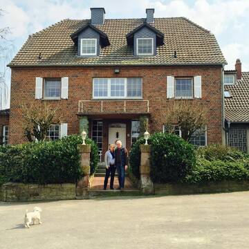
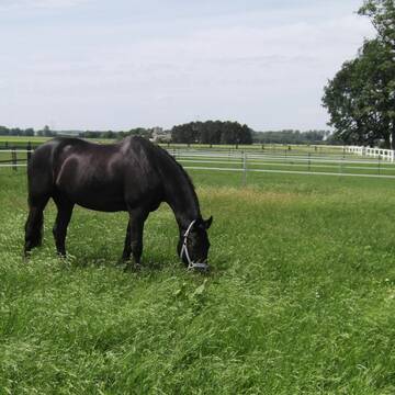
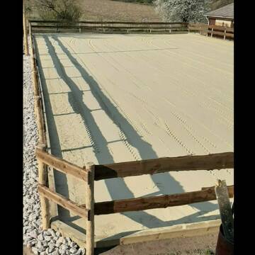
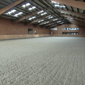
Zuchtstall Schäfers
Ense
Zuchtstall-Schaefers
@Zuchtstall-Schaefers
FN-Mitglied
Freizeitstall
Führanlage
Hunde willkommen
Pferdezucht
Zuchtstutenhaltung möglich
Außenbox mit Paddock
Außenboxen
17 weitere...
P+
Deprecated: Creation of dynamic property Zend_View_Helper_Ads::$adLink is deprecated in /var/www/stall-frei/htdocs/staging.stall-frei.de/library/Psf/View/Helper/Ads.php on line 108

Mitarbeiter gesucht?
Mechtersen
STALL-FREIde Marketing
@STALL-FREI-Marketing
Stellenangebote kostenlos veröffentlichen!

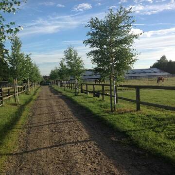
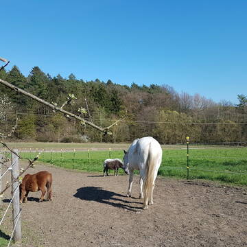
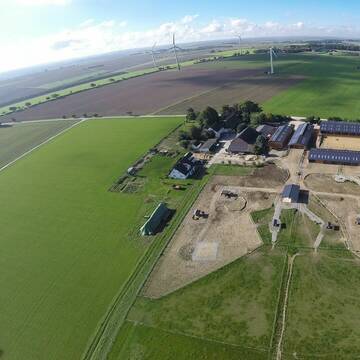
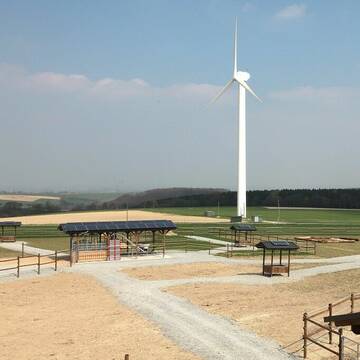
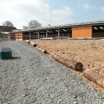
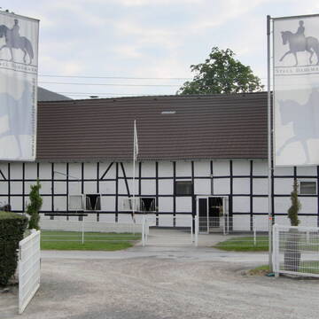
Reitanlage Gut Wulfshof
Möhnesee
Hathumar und Birgitta Rustige
@GutWulfshof
FN-Mitglied
Geländestrecke
Vermieten
Führanlage
Hunde willkommen
Außenbox mit Paddock
Außenboxen
17 weitere...
P


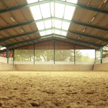
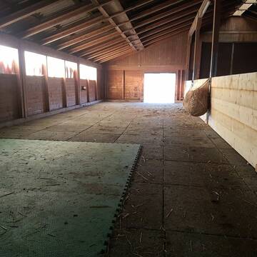
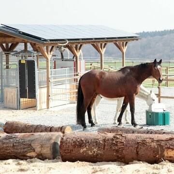
Aktiv- &Bewegungsstall-artgerechte Pferdehal...
Lippstadt
Aktivstall Bücker
@Aktivstall-Buecker
Freizeitstall
Vermieten
Hunde willkommen
Krankenbox
Allergikerstall
Hufrehe geeignet
19 weitere...
aktuell
S

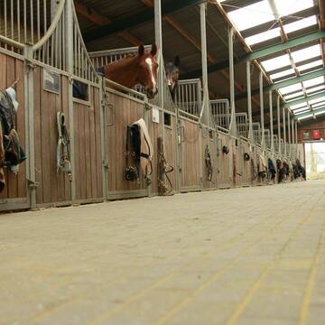
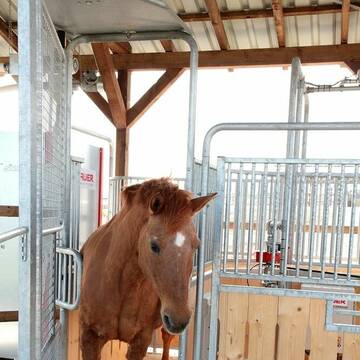
Bewegungsstall für Wallache, Stuten getrennt mög...
Menden
Nicole-Hoevelmann
@Nicole-Hoevelmann
Vermieten
Krankenbox
Paddock
Bewegungsstall
Innenbox
Einzelne Boxen oder Stallplätze
7 weitere...
S
Leider kein Vorschaubild
Leider kein Vorschaubild
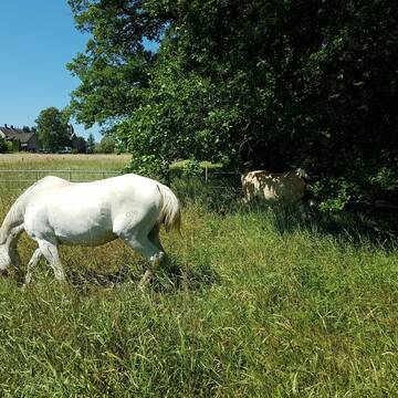
Offenstall„Hufhotel“Ponys u leichtfuttrige Pferd...
Möhnesee
Benutzer154
@Hufhotel
Freizeitstall
Vermieten
Hunde willkommen
Krankenbox
Hufrehe geeignet
Notfallboxen
10 weitere...
B
Aktivstall Springob - Ihr Offenstall in Anröchte
Anröchte-Altenmellrich
Aktivstall Springob
@Aktivstall-Springob
FN-Mitglied
Freizeitstall
Vermieten
Krankenbox
Longierzirkel/Roundpen
Allergikerstall
Hufrehe geeignet
24 weitere...
P+

Dressurstall, Jungpferde und Rentnerbetreuung
Ense
Emily Küppers
@emilykueppers
Pferdeausbildung
Führanlage
Paddock
bedampftes/gewaschenes Heu
Hengsthaltung möglich
Außenboxen
Innenbox
15 weitere...
P+

Futtersack HeuToy, Fressbremse in pink
Mechtersen
STALL-FREIde Marketing
@STALL-FREI-Marketing
Stundenlange Beschäftigung die
Koliken vorbeugt, geringe Staubinhalation mit
steuerbarer Futterentnahme

Reitstall Loagshof
Warstein-Niederbergheim
Langeneke
@Langeneke
Freizeitstall
Gastronomie
Vermieten
Führanlage
Hunde willkommen
Allergikerstall
bedampftes/gewaschenes Heu
25 weitere...
P
Pferdepension Detlef Franke
Bad Sassendorf Oberdorf 1
Franke-Detlef
@Franke-Detlef
Freizeitstall
Westernreiten
Longierzirkel/Roundpen
Parkplatz für Pferdeanhänger
Hengsthaltung möglich
Zuchtstutenhaltung möglich
Außenbox mit Paddock
Innenbox
10 weitere...
P
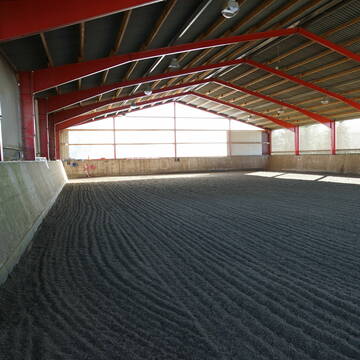
Reitsportanlage Neimen / Gut Dahlmann
Fröndenberg
Juliane-Dahlmann-Weber
@Juliane-Dahlmann-Weber
FN-Mitglied
Pferdeausbildung
Führanlage
Hunde willkommen
Außenboxen
Innenbox
Halbpension
Vollpension
19 weitere...
S
Deprecated: Creation of dynamic property Zend_View::$pageCount is deprecated in /var/www/stall-frei/htdocs/staging.stall-frei.de/library/vendor/shardj/zf1-future/library/Zend/View/Abstract.php on line 308
Deprecated: Creation of dynamic property Zend_View::$itemCountPerPage is deprecated in /var/www/stall-frei/htdocs/staging.stall-frei.de/library/vendor/shardj/zf1-future/library/Zend/View/Abstract.php on line 308
Deprecated: Creation of dynamic property Zend_View::$first is deprecated in /var/www/stall-frei/htdocs/staging.stall-frei.de/library/vendor/shardj/zf1-future/library/Zend/View/Abstract.php on line 308
Deprecated: Creation of dynamic property Zend_View::$current is deprecated in /var/www/stall-frei/htdocs/staging.stall-frei.de/library/vendor/shardj/zf1-future/library/Zend/View/Abstract.php on line 308
Deprecated: Creation of dynamic property Zend_View::$last is deprecated in /var/www/stall-frei/htdocs/staging.stall-frei.de/library/vendor/shardj/zf1-future/library/Zend/View/Abstract.php on line 308
Deprecated: Creation of dynamic property Zend_View::$next is deprecated in /var/www/stall-frei/htdocs/staging.stall-frei.de/library/vendor/shardj/zf1-future/library/Zend/View/Abstract.php on line 308
Deprecated: Creation of dynamic property Zend_View::$pagesInRange is deprecated in /var/www/stall-frei/htdocs/staging.stall-frei.de/library/vendor/shardj/zf1-future/library/Zend/View/Abstract.php on line 308
Deprecated: Creation of dynamic property Zend_View::$firstPageInRange is deprecated in /var/www/stall-frei/htdocs/staging.stall-frei.de/library/vendor/shardj/zf1-future/library/Zend/View/Abstract.php on line 308
Deprecated: Creation of dynamic property Zend_View::$lastPageInRange is deprecated in /var/www/stall-frei/htdocs/staging.stall-frei.de/library/vendor/shardj/zf1-future/library/Zend/View/Abstract.php on line 308
Deprecated: Creation of dynamic property Zend_View::$currentItemCount is deprecated in /var/www/stall-frei/htdocs/staging.stall-frei.de/library/vendor/shardj/zf1-future/library/Zend/View/Abstract.php on line 308
Deprecated: Creation of dynamic property Zend_View::$totalItemCount is deprecated in /var/www/stall-frei/htdocs/staging.stall-frei.de/library/vendor/shardj/zf1-future/library/Zend/View/Abstract.php on line 308
Deprecated: Creation of dynamic property Zend_View::$firstItemNumber is deprecated in /var/www/stall-frei/htdocs/staging.stall-frei.de/library/vendor/shardj/zf1-future/library/Zend/View/Abstract.php on line 308
Deprecated: Creation of dynamic property Zend_View::$lastItemNumber is deprecated in /var/www/stall-frei/htdocs/staging.stall-frei.de/library/vendor/shardj/zf1-future/library/Zend/View/Abstract.php on line 308
Deprecated: Creation of dynamic property Zend_View::$router is deprecated in /var/www/stall-frei/htdocs/staging.stall-frei.de/library/vendor/shardj/zf1-future/library/Zend/View/Abstract.php on line 308
Deprecated: Creation of dynamic property Zend_View::$urlParams is deprecated in /var/www/stall-frei/htdocs/staging.stall-frei.de/library/vendor/shardj/zf1-future/library/Zend/View/Abstract.php on line 308
Deprecated: Creation of dynamic property Zend_View::$showAds is deprecated in /var/www/stall-frei/htdocs/staging.stall-frei.de/library/vendor/shardj/zf1-future/library/Zend/View/Abstract.php on line 308
Deprecated: Creation of dynamic property Zend_View::$objectIds is deprecated in /var/www/stall-frei/htdocs/staging.stall-frei.de/library/vendor/shardj/zf1-future/library/Zend/View/Abstract.php on line 308
Deprecated: Creation of dynamic property Zend_View::$showNavbar is deprecated in /var/www/stall-frei/htdocs/staging.stall-frei.de/library/vendor/shardj/zf1-future/library/Zend/View/Abstract.php on line 308
Deprecated: Creation of dynamic property Zend_View::$showBreadcrumb is deprecated in /var/www/stall-frei/htdocs/staging.stall-frei.de/library/vendor/shardj/zf1-future/library/Zend/View/Abstract.php on line 308
Deprecated: Creation of dynamic property Zend_View::$showFooter is deprecated in /var/www/stall-frei/htdocs/staging.stall-frei.de/library/vendor/shardj/zf1-future/library/Zend/View/Abstract.php on line 308
Deprecated: Creation of dynamic property Zend_View::$showInternalAds is deprecated in /var/www/stall-frei/htdocs/staging.stall-frei.de/library/vendor/shardj/zf1-future/library/Zend/View/Abstract.php on line 308
Deprecated: Creation of dynamic property Zend_View::$blNoContent is deprecated in /var/www/stall-frei/htdocs/staging.stall-frei.de/library/vendor/shardj/zf1-future/library/Zend/View/Abstract.php on line 308
Deprecated: Creation of dynamic property Zend_View::$sMetaDesc is deprecated in /var/www/stall-frei/htdocs/staging.stall-frei.de/library/vendor/shardj/zf1-future/library/Zend/View/Abstract.php on line 308
Deprecated: Creation of dynamic property Zend_View::$useGmaps is deprecated in /var/www/stall-frei/htdocs/staging.stall-frei.de/library/vendor/shardj/zf1-future/library/Zend/View/Abstract.php on line 308
Deprecated: Creation of dynamic property Zend_View::$touches is deprecated in /var/www/stall-frei/htdocs/staging.stall-frei.de/library/vendor/shardj/zf1-future/library/Zend/View/Abstract.php on line 308
Deprecated: Creation of dynamic property Zend_View::$oProject is deprecated in /var/www/stall-frei/htdocs/staging.stall-frei.de/library/vendor/shardj/zf1-future/library/Zend/View/Abstract.php on line 308
Deprecated: Creation of dynamic property Zend_View::$pageHeadline is deprecated in /var/www/stall-frei/htdocs/staging.stall-frei.de/library/vendor/shardj/zf1-future/library/Zend/View/Abstract.php on line 308
Deprecated: Creation of dynamic property Zend_View::$disableLocationField is deprecated in /var/www/stall-frei/htdocs/staging.stall-frei.de/library/vendor/shardj/zf1-future/library/Zend/View/Abstract.php on line 308
Deprecated: Creation of dynamic property Zend_View::$isSearch is deprecated in /var/www/stall-frei/htdocs/staging.stall-frei.de/library/vendor/shardj/zf1-future/library/Zend/View/Abstract.php on line 308
Deprecated: Creation of dynamic property Zend_View::$pageTitle is deprecated in /var/www/stall-frei/htdocs/staging.stall-frei.de/library/vendor/shardj/zf1-future/library/Zend/View/Abstract.php on line 308
Deprecated: Creation of dynamic property Psf_Form_Element_Text::$class is deprecated in /var/www/stall-frei/htdocs/staging.stall-frei.de/library/vendor/shardj/zf1-future/library/Zend/Form/Element.php on line 874
Deprecated: Creation of dynamic property Psf_Form_Element_Text::$size is deprecated in /var/www/stall-frei/htdocs/staging.stall-frei.de/library/vendor/shardj/zf1-future/library/Zend/Form/Element.php on line 874
Deprecated: Creation of dynamic property Psf_Form_Element_Text::$placeholder is deprecated in /var/www/stall-frei/htdocs/staging.stall-frei.de/library/vendor/shardj/zf1-future/library/Zend/Form/Element.php on line 874
Deprecated: Creation of dynamic property Psf_Form_Element_Hidden::$class is deprecated in /var/www/stall-frei/htdocs/staging.stall-frei.de/library/vendor/shardj/zf1-future/library/Zend/Form/Element.php on line 874
Deprecated: Creation of dynamic property Psf_Form_Element_Hidden::$class is deprecated in /var/www/stall-frei/htdocs/staging.stall-frei.de/library/vendor/shardj/zf1-future/library/Zend/Form/Element.php on line 874
Deprecated: Creation of dynamic property Psf_Form_Element_Hidden::$class is deprecated in /var/www/stall-frei/htdocs/staging.stall-frei.de/library/vendor/shardj/zf1-future/library/Zend/Form/Element.php on line 874
Deprecated: Creation of dynamic property Psf_Form_Element_Hidden::$class is deprecated in /var/www/stall-frei/htdocs/staging.stall-frei.de/library/vendor/shardj/zf1-future/library/Zend/Form/Element.php on line 874
Deprecated: Creation of dynamic property Psf_Form_Element_Select::$class is deprecated in /var/www/stall-frei/htdocs/staging.stall-frei.de/library/vendor/shardj/zf1-future/library/Zend/Form/Element.php on line 874
Deprecated: Creation of dynamic property Psf_Form_Element_Select::$class is deprecated in /var/www/stall-frei/htdocs/staging.stall-frei.de/library/vendor/shardj/zf1-future/library/Zend/Form/Element.php on line 874
Deprecated: Creation of dynamic property Psf_Form_Element_Select::$class is deprecated in /var/www/stall-frei/htdocs/staging.stall-frei.de/library/vendor/shardj/zf1-future/library/Zend/Form/Element.php on line 874
Deprecated: Creation of dynamic property Psf_Form_Element_Select::$class is deprecated in /var/www/stall-frei/htdocs/staging.stall-frei.de/library/vendor/shardj/zf1-future/library/Zend/Form/Element.php on line 874
Deprecated: Creation of dynamic property Psf_Form_Element_Text::$class is deprecated in /var/www/stall-frei/htdocs/staging.stall-frei.de/library/vendor/shardj/zf1-future/library/Zend/Form/Element.php on line 874
Deprecated: Creation of dynamic property Psf_Form_Element_Checkbox::$label is deprecated in /var/www/stall-frei/htdocs/staging.stall-frei.de/library/vendor/shardj/zf1-future/library/Zend/Form/Element.php on line 874
Deprecated: Creation of dynamic property Zend_View::$sort is deprecated in /var/www/stall-frei/htdocs/staging.stall-frei.de/library/vendor/shardj/zf1-future/library/Zend/View/Abstract.php on line 308
Deprecated: Creation of dynamic property Zend_View::$searchLocation is deprecated in /var/www/stall-frei/htdocs/staging.stall-frei.de/library/vendor/shardj/zf1-future/library/Zend/View/Abstract.php on line 308
Deprecated: Creation of dynamic property Zend_View::$locationHint is deprecated in /var/www/stall-frei/htdocs/staging.stall-frei.de/library/vendor/shardj/zf1-future/library/Zend/View/Abstract.php on line 308
Psf_GeoCoder_Abstract::getLocation: Körbecke Get Location CachedOrLive
Psf_GeoCoder_Abstract::getCachedOrLive: Körbecke
Psf_GeoCoder_OpenCageData::makeApiRequest: response:
Array
(
[documentation] => https://opencagedata.com/api
[licenses] => Array
(
[0] => Array
(
[name] => see attribution guide
[url] => https://opencagedata.com/credits
)
)
[results] => Array
(
[0] => Array
(
[bounds] => Array
(
[northeast] => Array
(
[lat] => 51.5172473
[lng] => 8.1502214
)
[southwest] => Array
(
[lat] => 51.4772473
[lng] => 8.1102214
)
)
[components] => Array
(
[ISO_3166-1_alpha-2] => DE
[ISO_3166-1_alpha-3] => DEU
[ISO_3166-2] => Array
(
[0] => DE-NW
)
[_category] => place
[_normalized_city] => Möhnesee
[_type] => village
[city] => Möhnesee
[continent] => Europe
[country] => Deutschland
[country_code] => de
[county] => Kreis Soest
[political_union] => European Union
[postcode] => 59519
[state] => Nordrhein-Westfalen
[state_code] => NW
[village] => Körbecke
)
[confidence] => 7
[formatted] => 59519 Körbecke, Deutschland
[geometry] => Array
(
[lat] => 51.4972473
[lng] => 8.1302214
)
)
[1] => Array
(
[bounds] => Array
(
[northeast] => Array
(
[lat] => 51.5621371
[lng] => 9.3197425
)
[southwest] => Array
(
[lat] => 51.5051436
[lng] => 9.2550602
)
)
[components] => Array
(
[ISO_3166-1_alpha-2] => DE
[ISO_3166-1_alpha-3] => DEU
[ISO_3166-2] => Array
(
[0] => DE-NW
)
[_category] => place
[_normalized_city] => Borgentreich
[_type] => neighbourhood
[continent] => Europe
[country] => Deutschland
[country_code] => de
[county] => Kreis Höxter
[political_union] => European Union
[state] => Nordrhein-Westfalen
[state_code] => NW
[suburb] => Körbecke
[town] => Borgentreich
)
[confidence] => 7
[formatted] => Körbecke, Borgentreich, Nordrhein-Westfalen, Deutschland
[geometry] => Array
(
[lat] => 51.5335213
[lng] => 9.2864487
)
)
[2] => Array
(
[bounds] => Array
(
[northeast] => Array
(
[lat] => 51.5548975
[lng] => 9.3004177
)
[southwest] => Array
(
[lat] => 51.5148975
[lng] => 9.2604177
)
)
[components] => Array
(
[ISO_3166-1_alpha-2] => DE
[ISO_3166-1_alpha-3] => DEU
[ISO_3166-2] => Array
(
[0] => DE-NW
)
[_category] => place
[_normalized_city] => Borgentreich
[_type] => village
[continent] => Europe
[country] => Deutschland
[country_code] => de
[county] => Kreis Höxter
[political_union] => European Union
[postcode] => 34434
[state] => Nordrhein-Westfalen
[state_code] => NW
[town] => Borgentreich
[village] => Körbecke
)
[confidence] => 7
[formatted] => 34434 Körbecke, Deutschland
[geometry] => Array
(
[lat] => 51.5348975
[lng] => 9.2804177
)
)
[3] => Array
(
[bounds] => Array
(
[northeast] => Array
(
[lat] => 51.5046601
[lng] => 8.1516165
)
[southwest] => Array
(
[lat] => 51.4402603
[lng] => 8.1048967
)
)
[components] => Array
(
[ISO_3166-1_alpha-2] => DE
[ISO_3166-1_alpha-3] => DEU
[ISO_3166-2] => Array
(
[0] => DE-NW
)
[_category] => place
[_normalized_city] => Möhnesee
[_type] => village
[continent] => Europe
[country] => Deutschland
[country_code] => de
[county] => Kreis Soest
[political_union] => European Union
[postcode] => 59519
[state] => Nordrhein-Westfalen
[state_code] => NW
[suburb] => Körbecke
[village] => Möhnesee
)
[confidence] => 7
[formatted] => 59519 Möhnesee, Deutschland
[geometry] => Array
(
[lat] => 51.4721236
[lng] => 8.129569
)
)
[4] => Array
(
[bounds] => Array
(
[northeast] => Array
(
[lat] => 51.1298357
[lng] => 7.675905
)
[southwest] => Array
(
[lat] => 51.0898357
[lng] => 7.635905
)
)
[components] => Array
(
[ISO_3166-1_alpha-2] => DE
[ISO_3166-1_alpha-3] => DEU
[ISO_3166-2] => Array
(
[0] => DE-NW
)
[_category] => place
[_normalized_city] => Meinerzhagen
[_type] => city
[continent] => Europe
[country] => Deutschland
[country_code] => de
[county] => Märkischer Kreis
[political_union] => European Union
[postcode] => 58540
[state] => Nordrhein-Westfalen
[state_code] => NW
[town] => Meinerzhagen
)
[confidence] => 7
[formatted] => 58540 Meinerzhagen, Deutschland
[geometry] => Array
(
[lat] => 51.1098357
[lng] => 7.655905
)
)
[5] => Array
(
[bounds] => Array
(
[northeast] => Array
(
[lat] => 51.1126198
[lng] => 7.6654898
)
[southwest] => Array
(
[lat] => 51.1123131
[lng] => 7.663763
)
)
[components] => Array
(
[ISO_3166-1_alpha-2] => DE
[ISO_3166-1_alpha-3] => DEU
[ISO_3166-2] => Array
(
[0] => DE-NW
)
[_category] => natural/water
[_normalized_city] => Meinerzhagen
[_type] => stream
[continent] => Europe
[country] => Deutschland
[country_code] => de
[county] => Märkischer Kreis
[political_union] => European Union
[postcode] => 58540
[state] => Nordrhein-Westfalen
[state_code] => NW
[stream] => Korbecke
[town] => Meinerzhagen
)
[confidence] => 9
[formatted] => Korbecke, 58540 Meinerzhagen, Deutschland
[geometry] => Array
(
[lat] => 51.1124374
[lng] => 7.664651
)
)
[6] => Array
(
[components] => Array
(
[ISO_3166-1_alpha-2] => FR
[ISO_3166-1_alpha-3] => FRA
[ISO_3166-2] => Array
(
[0] => FR-CVL
[1] => FR-41
)
[_category] => road
[_normalized_city] => Pontlevoy
[_type] => road
[city] => Pontlevoy
[continent] => Europe
[country] => France
[country_code] => fr
[county] => Loir-et-Cher
[local_authority] => Communauté de communes Val-de-Cher-Controis
[political_union] => European Union
[postcode] => 41400
[road] => chemin de corbec
[state] => Centre-Val de Loire
[state_code] => CVL
)
[confidence] => 3
[formatted] => chemin de corbec, 41400 Pontlevoy, France
[geometry] => Array
(
[lat] => 47.404894
[lng] => 1.277055
)
)
[7] => Array
(
[components] => Array
(
[ISO_3166-1_alpha-2] => FR
[ISO_3166-1_alpha-3] => FRA
[ISO_3166-2] => Array
(
[0] => FR-NOR
[1] => FR-50
)
[_category] => road
[_normalized_city] => Avranches
[_type] => road
[city] => Avranches
[continent] => Europe
[country] => France
[country_code] => fr
[county] => Manche
[local_authority] => Communauté d'agglomération Mont-Saint-Michel-Normandie
[political_union] => European Union
[postcode] => 50300
[road] => Rue de Korbach
[state] => Normandie
[state_code] => NOR
)
[confidence] => 3
[formatted] => Rue de Korbach, 50300 Avranches, France
[geometry] => Array
(
[lat] => 48.682523
[lng] => -1.352574
)
)
[8] => Array
(
[components] => Array
(
[ISO_3166-1_alpha-2] => FR
[ISO_3166-1_alpha-3] => FRA
[ISO_3166-2] => Array
(
[0] => FR-GES
[1] => FR-54
)
[_category] => road
[_normalized_city] => Morfontaine
[_type] => road
[city] => Morfontaine
[continent] => Europe
[country] => France
[country_code] => fr
[county] => Meurthe-et-Moselle
[local_authority] => Grand Longwy Agglomération
[political_union] => European Union
[postcode] => 54920
[road] => Chemin de Corbey
[state] => Grand Est
[state_code] => GES
)
[confidence] => 2
[formatted] => Chemin de Corbey, 54920 Morfontaine, France
[geometry] => Array
(
[lat] => 49.443665
[lng] => 5.811404
)
)
[9] => Array
(
[components] => Array
(
[ISO_3166-1_alpha-2] => FR
[ISO_3166-1_alpha-3] => FRA
[ISO_3166-2] => Array
(
[0] => FR-BRE
[1] => FR-29
)
[_category] => road
[_normalized_city] => Landunvez
[_type] => road
[city] => Landunvez
[continent] => Europe
[country] => France
[country_code] => fr
[county] => Finistère
[local_authority] => Pays d'Iroise Communauté
[political_union] => European Union
[postcode] => 29840
[road] => Kerbec
[state] => Bretagne
[state_code] => BRE
)
[confidence] => 2
[formatted] => Kerbec, 29840 Landunvez, France
[geometry] => Array
(
[lat] => 48.518866
[lng] => -4.741959
)
)
)
[status] => Array
(
[code] => 200
[message] => OK
)
[stay_informed] => Array
(
[blog] => https://blog.opencagedata.com
[mastodon] => https://en.osm.town/@opencage
)
[thanks] => For using an OpenCage API
[timestamp] => Array
(
[created_http] => Sun, 08 Feb 2026 08:24:59 GMT
[created_unix] => 1770539099
)
[total_results] => 10
)
Psf_GeoCoder_Abstract::convertLocationResult
{"documentation":"https:\/\/opencagedata.com\/api","licenses":[{"name":"see attribution guide","url":"https:\/\/opencagedata.com\/credits"}],"results":[{"bounds":{"northeast":{"lat":51.5172473,"lng":8.1502214},"southwest":{"lat":51.4772473,"lng":8.1102214}},"components":{"ISO_3166-1_alpha-2":"DE","ISO_3166-1_alpha-3":"DEU","ISO_3166-2":["DE-NW"],"_category":"place","_normalized_city":"M\u00f6hnesee","_type":"village","city":"M\u00f6hnesee","continent":"Europe","country":"Deutschland","country_code":"de","county":"Kreis Soest","political_union":"European Union","postcode":"59519","state":"Nordrhein-Westfalen","state_code":"NW","village":"K\u00f6rbecke"},"confidence":7,"formatted":"59519 K\u00f6rbecke, Deutschland","geometry":{"lat":51.4972473,"lng":8.1302214}},{"bounds":{"northeast":{"lat":51.5621371,"lng":9.3197425},"southwest":{"lat":51.5051436,"lng":9.2550602}},"components":{"ISO_3166-1_alpha-2":"DE","ISO_3166-1_alpha-3":"DEU","ISO_3166-2":["DE-NW"],"_category":"place","_normalized_city":"Borgentreich","_type":"neighbourhood","continent":"Europe","country":"Deutschland","country_code":"de","county":"Kreis H\u00f6xter","political_union":"European Union","state":"Nordrhein-Westfalen","state_code":"NW","suburb":"K\u00f6rbecke","town":"Borgentreich"},"confidence":7,"formatted":"K\u00f6rbecke, Borgentreich, Nordrhein-Westfalen, Deutschland","geometry":{"lat":51.5335213,"lng":9.2864487}},{"bounds":{"northeast":{"lat":51.5548975,"lng":9.3004177},"southwest":{"lat":51.5148975,"lng":9.2604177}},"components":{"ISO_3166-1_alpha-2":"DE","ISO_3166-1_alpha-3":"DEU","ISO_3166-2":["DE-NW"],"_category":"place","_normalized_city":"Borgentreich","_type":"village","continent":"Europe","country":"Deutschland","country_code":"de","county":"Kreis H\u00f6xter","political_union":"European Union","postcode":"34434","state":"Nordrhein-Westfalen","state_code":"NW","town":"Borgentreich","village":"K\u00f6rbecke"},"confidence":7,"formatted":"34434 K\u00f6rbecke, Deutschland","geometry":{"lat":51.5348975,"lng":9.2804177}},{"bounds":{"northeast":{"lat":51.5046601,"lng":8.1516165},"southwest":{"lat":51.4402603,"lng":8.1048967}},"components":{"ISO_3166-1_alpha-2":"DE","ISO_3166-1_alpha-3":"DEU","ISO_3166-2":["DE-NW"],"_category":"place","_normalized_city":"M\u00f6hnesee","_type":"village","continent":"Europe","country":"Deutschland","country_code":"de","county":"Kreis Soest","political_union":"European Union","postcode":"59519","state":"Nordrhein-Westfalen","state_code":"NW","suburb":"K\u00f6rbecke","village":"M\u00f6hnesee"},"confidence":7,"formatted":"59519 M\u00f6hnesee, Deutschland","geometry":{"lat":51.4721236,"lng":8.129569}},{"bounds":{"northeast":{"lat":51.1298357,"lng":7.675905},"southwest":{"lat":51.0898357,"lng":7.635905}},"components":{"ISO_3166-1_alpha-2":"DE","ISO_3166-1_alpha-3":"DEU","ISO_3166-2":["DE-NW"],"_category":"place","_normalized_city":"Meinerzhagen","_type":"city","continent":"Europe","country":"Deutschland","country_code":"de","county":"M\u00e4rkischer Kreis","political_union":"European Union","postcode":"58540","state":"Nordrhein-Westfalen","state_code":"NW","town":"Meinerzhagen"},"confidence":7,"formatted":"58540 Meinerzhagen, Deutschland","geometry":{"lat":51.1098357,"lng":7.655905}},{"bounds":{"northeast":{"lat":51.1126198,"lng":7.6654898},"southwest":{"lat":51.1123131,"lng":7.663763}},"components":{"ISO_3166-1_alpha-2":"DE","ISO_3166-1_alpha-3":"DEU","ISO_3166-2":["DE-NW"],"_category":"natural\/water","_normalized_city":"Meinerzhagen","_type":"stream","continent":"Europe","country":"Deutschland","country_code":"de","county":"M\u00e4rkischer Kreis","political_union":"European Union","postcode":"58540","state":"Nordrhein-Westfalen","state_code":"NW","stream":"Korbecke","town":"Meinerzhagen"},"confidence":9,"formatted":"Korbecke, 58540 Meinerzhagen, Deutschland","geometry":{"lat":51.1124374,"lng":7.664651}},{"components":{"ISO_3166-1_alpha-2":"FR","ISO_3166-1_alpha-3":"FRA","ISO_3166-2":["FR-CVL","FR-41"],"_category":"road","_normalized_city":"Pontlevoy","_type":"road","city":"Pontlevoy","continent":"Europe","country":"France","country_code":"fr","county":"Loir-et-Cher","local_authority":"Communaut\u00e9 de communes Val-de-Cher-Controis","political_union":"European Union","postcode":"41400","road":"chemin de corbec","state":"Centre-Val de Loire","state_code":"CVL"},"confidence":3,"formatted":"chemin de corbec, 41400 Pontlevoy, France","geometry":{"lat":47.404894,"lng":1.277055}},{"components":{"ISO_3166-1_alpha-2":"FR","ISO_3166-1_alpha-3":"FRA","ISO_3166-2":["FR-NOR","FR-50"],"_category":"road","_normalized_city":"Avranches","_type":"road","city":"Avranches","continent":"Europe","country":"France","country_code":"fr","county":"Manche","local_authority":"Communaut\u00e9 d'agglom\u00e9ration Mont-Saint-Michel-Normandie","political_union":"European Union","postcode":"50300","road":"Rue de Korbach","state":"Normandie","state_code":"NOR"},"confidence":3,"formatted":"Rue de Korbach, 50300 Avranches, France","geometry":{"lat":48.682523,"lng":-1.352574}},{"components":{"ISO_3166-1_alpha-2":"FR","ISO_3166-1_alpha-3":"FRA","ISO_3166-2":["FR-GES","FR-54"],"_category":"road","_normalized_city":"Morfontaine","_type":"road","city":"Morfontaine","continent":"Europe","country":"France","country_code":"fr","county":"Meurthe-et-Moselle","local_authority":"Grand Longwy Agglom\u00e9ration","political_union":"European Union","postcode":"54920","road":"Chemin de Corbey","state":"Grand Est","state_code":"GES"},"confidence":2,"formatted":"Chemin de Corbey, 54920 Morfontaine, France","geometry":{"lat":49.443665,"lng":5.811404}},{"components":{"ISO_3166-1_alpha-2":"FR","ISO_3166-1_alpha-3":"FRA","ISO_3166-2":["FR-BRE","FR-29"],"_category":"road","_normalized_city":"Landunvez","_type":"road","city":"Landunvez","continent":"Europe","country":"France","country_code":"fr","county":"Finist\u00e8re","local_authority":"Pays d'Iroise Communaut\u00e9","political_union":"European Union","postcode":"29840","road":"Kerbec","state":"Bretagne","state_code":"BRE"},"confidence":2,"formatted":"Kerbec, 29840 Landunvez, France","geometry":{"lat":48.518866,"lng":-4.741959}}],"status":{"code":200,"message":"OK"},"stay_informed":{"blog":"https:\/\/blog.opencagedata.com","mastodon":"https:\/\/en.osm.town\/@opencage"},"thanks":"For using an OpenCage API","timestamp":{"created_http":"Sun, 08 Feb 2026 08:24:59 GMT","created_unix":1770539099},"total_results":10}Array
(
[0] => stdClass Object
(
[bounds] => stdClass Object
(
[northeast] => stdClass Object
(
[lat] => 51.5172473
[lng] => 8.1502214
)
[southwest] => stdClass Object
(
[lat] => 51.4772473
[lng] => 8.1102214
)
)
[components] => stdClass Object
(
[ISO_3166-1_alpha-2] => DE
[ISO_3166-1_alpha-3] => DEU
[ISO_3166-2] => Array
(
[0] => DE-NW
)
[_category] => place
[_normalized_city] => Möhnesee
[_type] => village
[city] => Möhnesee
[continent] => Europe
[country] => Deutschland
[country_code] => de
[county] => Kreis Soest
[political_union] => European Union
[postcode] => 59519
[state] => Nordrhein-Westfalen
[state_code] => NW
[village] => Körbecke
)
[confidence] => 7
[formatted] => 59519 Körbecke, Deutschland
[geometry] => stdClass Object
(
[lat] => 51.4972473
[lng] => 8.1302214
)
)
[1] => stdClass Object
(
[bounds] => stdClass Object
(
[northeast] => stdClass Object
(
[lat] => 51.5621371
[lng] => 9.3197425
)
[southwest] => stdClass Object
(
[lat] => 51.5051436
[lng] => 9.2550602
)
)
[components] => stdClass Object
(
[ISO_3166-1_alpha-2] => DE
[ISO_3166-1_alpha-3] => DEU
[ISO_3166-2] => Array
(
[0] => DE-NW
)
[_category] => place
[_normalized_city] => Borgentreich
[_type] => neighbourhood
[continent] => Europe
[country] => Deutschland
[country_code] => de
[county] => Kreis Höxter
[political_union] => European Union
[state] => Nordrhein-Westfalen
[state_code] => NW
[suburb] => Körbecke
[town] => Borgentreich
)
[confidence] => 7
[formatted] => Körbecke, Borgentreich, Nordrhein-Westfalen, Deutschland
[geometry] => stdClass Object
(
[lat] => 51.5335213
[lng] => 9.2864487
)
)
[2] => stdClass Object
(
[bounds] => stdClass Object
(
[northeast] => stdClass Object
(
[lat] => 51.5548975
[lng] => 9.3004177
)
[southwest] => stdClass Object
(
[lat] => 51.5148975
[lng] => 9.2604177
)
)
[components] => stdClass Object
(
[ISO_3166-1_alpha-2] => DE
[ISO_3166-1_alpha-3] => DEU
[ISO_3166-2] => Array
(
[0] => DE-NW
)
[_category] => place
[_normalized_city] => Borgentreich
[_type] => village
[continent] => Europe
[country] => Deutschland
[country_code] => de
[county] => Kreis Höxter
[political_union] => European Union
[postcode] => 34434
[state] => Nordrhein-Westfalen
[state_code] => NW
[town] => Borgentreich
[village] => Körbecke
)
[confidence] => 7
[formatted] => 34434 Körbecke, Deutschland
[geometry] => stdClass Object
(
[lat] => 51.5348975
[lng] => 9.2804177
)
)
[3] => stdClass Object
(
[bounds] => stdClass Object
(
[northeast] => stdClass Object
(
[lat] => 51.5046601
[lng] => 8.1516165
)
[southwest] => stdClass Object
(
[lat] => 51.4402603
[lng] => 8.1048967
)
)
[components] => stdClass Object
(
[ISO_3166-1_alpha-2] => DE
[ISO_3166-1_alpha-3] => DEU
[ISO_3166-2] => Array
(
[0] => DE-NW
)
[_category] => place
[_normalized_city] => Möhnesee
[_type] => village
[continent] => Europe
[country] => Deutschland
[country_code] => de
[county] => Kreis Soest
[political_union] => European Union
[postcode] => 59519
[state] => Nordrhein-Westfalen
[state_code] => NW
[suburb] => Körbecke
[village] => Möhnesee
)
[confidence] => 7
[formatted] => 59519 Möhnesee, Deutschland
[geometry] => stdClass Object
(
[lat] => 51.4721236
[lng] => 8.129569
)
)
[4] => stdClass Object
(
[bounds] => stdClass Object
(
[northeast] => stdClass Object
(
[lat] => 51.1298357
[lng] => 7.675905
)
[southwest] => stdClass Object
(
[lat] => 51.0898357
[lng] => 7.635905
)
)
[components] => stdClass Object
(
[ISO_3166-1_alpha-2] => DE
[ISO_3166-1_alpha-3] => DEU
[ISO_3166-2] => Array
(
[0] => DE-NW
)
[_category] => place
[_normalized_city] => Meinerzhagen
[_type] => city
[continent] => Europe
[country] => Deutschland
[country_code] => de
[county] => Märkischer Kreis
[political_union] => European Union
[postcode] => 58540
[state] => Nordrhein-Westfalen
[state_code] => NW
[town] => Meinerzhagen
)
[confidence] => 7
[formatted] => 58540 Meinerzhagen, Deutschland
[geometry] => stdClass Object
(
[lat] => 51.1098357
[lng] => 7.655905
)
)
[5] => stdClass Object
(
[bounds] => stdClass Object
(
[northeast] => stdClass Object
(
[lat] => 51.1126198
[lng] => 7.6654898
)
[southwest] => stdClass Object
(
[lat] => 51.1123131
[lng] => 7.663763
)
)
[components] => stdClass Object
(
[ISO_3166-1_alpha-2] => DE
[ISO_3166-1_alpha-3] => DEU
[ISO_3166-2] => Array
(
[0] => DE-NW
)
[_category] => natural/water
[_normalized_city] => Meinerzhagen
[_type] => stream
[continent] => Europe
[country] => Deutschland
[country_code] => de
[county] => Märkischer Kreis
[political_union] => European Union
[postcode] => 58540
[state] => Nordrhein-Westfalen
[state_code] => NW
[stream] => Korbecke
[town] => Meinerzhagen
)
[confidence] => 9
[formatted] => Korbecke, 58540 Meinerzhagen, Deutschland
[geometry] => stdClass Object
(
[lat] => 51.1124374
[lng] => 7.664651
)
)
[6] => stdClass Object
(
[components] => stdClass Object
(
[ISO_3166-1_alpha-2] => FR
[ISO_3166-1_alpha-3] => FRA
[ISO_3166-2] => Array
(
[0] => FR-CVL
[1] => FR-41
)
[_category] => road
[_normalized_city] => Pontlevoy
[_type] => road
[city] => Pontlevoy
[continent] => Europe
[country] => France
[country_code] => fr
[county] => Loir-et-Cher
[local_authority] => Communauté de communes Val-de-Cher-Controis
[political_union] => European Union
[postcode] => 41400
[road] => chemin de corbec
[state] => Centre-Val de Loire
[state_code] => CVL
)
[confidence] => 3
[formatted] => chemin de corbec, 41400 Pontlevoy, France
[geometry] => stdClass Object
(
[lat] => 47.404894
[lng] => 1.277055
)
)
[7] => stdClass Object
(
[components] => stdClass Object
(
[ISO_3166-1_alpha-2] => FR
[ISO_3166-1_alpha-3] => FRA
[ISO_3166-2] => Array
(
[0] => FR-NOR
[1] => FR-50
)
[_category] => road
[_normalized_city] => Avranches
[_type] => road
[city] => Avranches
[continent] => Europe
[country] => France
[country_code] => fr
[county] => Manche
[local_authority] => Communauté d'agglomération Mont-Saint-Michel-Normandie
[political_union] => European Union
[postcode] => 50300
[road] => Rue de Korbach
[state] => Normandie
[state_code] => NOR
)
[confidence] => 3
[formatted] => Rue de Korbach, 50300 Avranches, France
[geometry] => stdClass Object
(
[lat] => 48.682523
[lng] => -1.352574
)
)
[8] => stdClass Object
(
[components] => stdClass Object
(
[ISO_3166-1_alpha-2] => FR
[ISO_3166-1_alpha-3] => FRA
[ISO_3166-2] => Array
(
[0] => FR-GES
[1] => FR-54
)
[_category] => road
[_normalized_city] => Morfontaine
[_type] => road
[city] => Morfontaine
[continent] => Europe
[country] => France
[country_code] => fr
[county] => Meurthe-et-Moselle
[local_authority] => Grand Longwy Agglomération
[political_union] => European Union
[postcode] => 54920
[road] => Chemin de Corbey
[state] => Grand Est
[state_code] => GES
)
[confidence] => 2
[formatted] => Chemin de Corbey, 54920 Morfontaine, France
[geometry] => stdClass Object
(
[lat] => 49.443665
[lng] => 5.811404
)
)
[9] => stdClass Object
(
[components] => stdClass Object
(
[ISO_3166-1_alpha-2] => FR
[ISO_3166-1_alpha-3] => FRA
[ISO_3166-2] => Array
(
[0] => FR-BRE
[1] => FR-29
)
[_category] => road
[_normalized_city] => Landunvez
[_type] => road
[city] => Landunvez
[continent] => Europe
[country] => France
[country_code] => fr
[county] => Finistère
[local_authority] => Pays d'Iroise Communauté
[political_union] => European Union
[postcode] => 29840
[road] => Kerbec
[state] => Bretagne
[state_code] => BRE
)
[confidence] => 2
[formatted] => Kerbec, 29840 Landunvez, France
[geometry] => stdClass Object
(
[lat] => 48.518866
[lng] => -4.741959
)
)
)
Psf_GeoCoder_OpenCageData::getKeyMap: 0
stdClass Object
(
    [bounds] => stdClass Object
        (
            [northeast] => stdClass Object
                (
                    [lat] => 51.5172473
                    [lng] => 8.1502214
                )

            [southwest] => stdClass Object
                (
                    [lat] => 51.4772473
                    [lng] => 8.1102214
                )

        )

    [components] => stdClass Object
        (
            [ISO_3166-1_alpha-2] => DE
            [ISO_3166-1_alpha-3] => DEU
            [ISO_3166-2] => Array
                (
                    [0] => DE-NW
                )

            [_category] => place
            [_normalized_city] => Möhnesee
            [_type] => village
            [city] => Möhnesee
            [continent] => Europe
            [country] => Deutschland
            [country_code] => de
            [county] => Kreis Soest
            [political_union] => European Union
            [postcode] => 59519
            [state] => Nordrhein-Westfalen
            [state_code] => NW
            [village] => Körbecke
        )

    [confidence] => 7
    [formatted] => 59519 Körbecke, Deutschland
    [geometry] => stdClass Object
        (
            [lat] => 51.4972473
            [lng] => 8.1302214
        )

)
Psf_GeoCoder_OpenCageData::getCounty: Soest
Psf_GeoCoder_OpenCageData::addMissingData REFETCH!
Array
(
    [address] => 59519 Körbecke, Deutschland
    [type] => village
    [street] =>
    [city] => Körbecke
    [county] => Soest
    [state] => Nordrhein-Westfalen
    [zip] => 59519
    [country] => Deutschland
    [suburb] =>
    [countrycode] => de
    [latitude] => 51.4972473
    [longitude] => 8.1302214
    [accuracy] => 1
    [confidence] => 7
    [bounds] => stdClass Object
        (
            [northeast] => stdClass Object
                (
                    [lat] => 51.5172473
                    [lng] => 8.1502214
                )

            [southwest] => stdClass Object
                (
                    [lat] => 51.4772473
                    [lng] => 8.1102214
                )

        )

)
reformat!
Array
(
    [address] => 59519 Körbecke, Deutschland
    [type] => village
    [street] =>
    [city] => Körbecke
    [county] => Soest
    [state] => Nordrhein-Westfalen
    [zip] => 59519
    [country] => Deutschland
    [suburb] =>
    [countrycode] => de
    [latitude] => 51.4972473
    [longitude] => 8.1302214
    [accuracy] => 1
    [confidence] => 7
    [bounds] => stdClass Object
        (
            [northeast] => stdClass Object
                (
                    [lat] => 51.5172473
                    [lng] => 8.1502214
                )

            [southwest] => stdClass Object
                (
                    [lat] => 51.4772473
                    [lng] => 8.1102214
                )

        )

    [place] => 59519 Körbecke, Nordrhein-Westfalen
    [hash] => f08b9036d49dec6d452f9c22a4fae5c7
)
Psf_GeoCoder_OpenCageData::getKeyMap: 1
stdClass Object
(
    [bounds] => stdClass Object
        (
            [northeast] => stdClass Object
                (
                    [lat] => 51.5621371
                    [lng] => 9.3197425
                )

            [southwest] => stdClass Object
                (
                    [lat] => 51.5051436
                    [lng] => 9.2550602
                )

        )

    [components] => stdClass Object
        (
            [ISO_3166-1_alpha-2] => DE
            [ISO_3166-1_alpha-3] => DEU
            [ISO_3166-2] => Array
                (
                    [0] => DE-NW
                )

            [_category] => place
            [_normalized_city] => Borgentreich
            [_type] => neighbourhood
            [continent] => Europe
            [country] => Deutschland
            [country_code] => de
            [county] => Kreis Höxter
            [political_union] => European Union
            [state] => Nordrhein-Westfalen
            [state_code] => NW
            [suburb] => Körbecke
            [town] => Borgentreich
        )

    [confidence] => 7
    [formatted] => Körbecke, Borgentreich, Nordrhein-Westfalen, Deutschland
    [geometry] => stdClass Object
        (
            [lat] => 51.5335213
            [lng] => 9.2864487
        )

)
Psf_GeoCoder_OpenCageData::getCounty: Höxter
Psf_GeoCoder_OpenCageData::addMissingData REFETCH!
Array
(
    [address] => Körbecke, Borgentreich, Nordrhein-Westfalen, Deutschland
    [type] => neighbourhood
    [street] =>
    [city] => Borgentreich
    [county] => Höxter
    [state] => Nordrhein-Westfalen
    [zip] =>
    [country] => Deutschland
    [suburb] => Körbecke
    [countrycode] => de
    [latitude] => 51.5335213
    [longitude] => 9.2864487
    [accuracy] => 1
    [confidence] => 7
    [bounds] => stdClass Object
        (
            [northeast] => stdClass Object
                (
                    [lat] => 51.5621371
                    [lng] => 9.3197425
                )

            [southwest] => stdClass Object
                (
                    [lat] => 51.5051436
                    [lng] => 9.2550602
                )

        )

)
reformat!
Array
(
    [address] => Körbecke, Borgentreich, Nordrhein-Westfalen, Deutschland
    [type] => neighbourhood
    [street] =>
    [city] => Borgentreich
    [county] => Höxter
    [state] => Nordrhein-Westfalen
    [zip] =>
    [country] => Deutschland
    [suburb] => Körbecke
    [countrycode] => de
    [latitude] => 51.5335213
    [longitude] => 9.2864487
    [accuracy] => 1
    [confidence] => 7
    [bounds] => stdClass Object
        (
            [northeast] => stdClass Object
                (
                    [lat] => 51.5621371
                    [lng] => 9.3197425
                )

            [southwest] => stdClass Object
                (
                    [lat] => 51.5051436
                    [lng] => 9.2550602
                )

        )

    [place] => Borgentreich, Nordrhein-Westfalen
    [hash] => 16c745d93495c538da432ae6f807f830
)
Psf_GeoCoder_OpenCageData::getKeyMap: 2
stdClass Object
(
    [bounds] => stdClass Object
        (
            [northeast] => stdClass Object
                (
                    [lat] => 51.5548975
                    [lng] => 9.3004177
                )

            [southwest] => stdClass Object
                (
                    [lat] => 51.5148975
                    [lng] => 9.2604177
                )

        )

    [components] => stdClass Object
        (
            [ISO_3166-1_alpha-2] => DE
            [ISO_3166-1_alpha-3] => DEU
            [ISO_3166-2] => Array
                (
                    [0] => DE-NW
                )

            [_category] => place
            [_normalized_city] => Borgentreich
            [_type] => village
            [continent] => Europe
            [country] => Deutschland
            [country_code] => de
            [county] => Kreis Höxter
            [political_union] => European Union
            [postcode] => 34434
            [state] => Nordrhein-Westfalen
            [state_code] => NW
            [town] => Borgentreich
            [village] => Körbecke
        )

    [confidence] => 7
    [formatted] => 34434 Körbecke, Deutschland
    [geometry] => stdClass Object
        (
            [lat] => 51.5348975
            [lng] => 9.2804177
        )

)
Psf_GeoCoder_OpenCageData::getCounty: Höxter
Psf_GeoCoder_OpenCageData::addMissingData REFETCH!
Array
(
    [address] => 34434 Körbecke, Deutschland
    [type] => village
    [street] =>
    [city] => Borgentreich
    [county] => Höxter
    [state] => Nordrhein-Westfalen
    [zip] => 34434
    [country] => Deutschland
    [suburb] =>
    [countrycode] => de
    [latitude] => 51.5348975
    [longitude] => 9.2804177
    [accuracy] => 1
    [confidence] => 7
    [bounds] => stdClass Object
        (
            [northeast] => stdClass Object
                (
                    [lat] => 51.5548975
                    [lng] => 9.3004177
                )

            [southwest] => stdClass Object
                (
                    [lat] => 51.5148975
                    [lng] => 9.2604177
                )

        )

)
reformat!
Array
(
    [address] => 34434 Borgentreich
    [type] => village
    [street] =>
    [city] => Borgentreich
    [county] => Höxter
    [state] => Nordrhein-Westfalen
    [zip] => 34434
    [country] => Deutschland
    [suburb] =>
    [countrycode] => de
    [latitude] => 51.5348975
    [longitude] => 9.2804177
    [accuracy] => 1
    [confidence] => 7
    [bounds] => stdClass Object
        (
            [northeast] => stdClass Object
                (
                    [lat] => 51.5548975
                    [lng] => 9.3004177
                )

            [southwest] => stdClass Object
                (
                    [lat] => 51.5148975
                    [lng] => 9.2604177
                )

        )

    [place] => 34434 Borgentreich, Nordrhein-Westfalen
    [hash] => 920fe68d9c0b8633fe5e1d507d63d816
)
Psf_GeoCoder_OpenCageData::getKeyMap: 3
stdClass Object
(
    [bounds] => stdClass Object
        (
            [northeast] => stdClass Object
                (
                    [lat] => 51.5046601
                    [lng] => 8.1516165
                )

            [southwest] => stdClass Object
                (
                    [lat] => 51.4402603
                    [lng] => 8.1048967
                )

        )

    [components] => stdClass Object
        (
            [ISO_3166-1_alpha-2] => DE
            [ISO_3166-1_alpha-3] => DEU
            [ISO_3166-2] => Array
                (
                    [0] => DE-NW
                )

            [_category] => place
            [_normalized_city] => Möhnesee
            [_type] => village
            [continent] => Europe
            [country] => Deutschland
            [country_code] => de
            [county] => Kreis Soest
            [political_union] => European Union
            [postcode] => 59519
            [state] => Nordrhein-Westfalen
            [state_code] => NW
            [suburb] => Körbecke
            [village] => Möhnesee
        )

    [confidence] => 7
    [formatted] => 59519 Möhnesee, Deutschland
    [geometry] => stdClass Object
        (
            [lat] => 51.4721236
            [lng] => 8.129569
        )

)
Psf_GeoCoder_OpenCageData::getCounty: Soest
Psf_GeoCoder_OpenCageData::addMissingData REFETCH!
Array
(
    [address] => 59519 Möhnesee, Deutschland
    [type] => village
    [street] =>
    [city] => Möhnesee
    [county] => Soest
    [state] => Nordrhein-Westfalen
    [zip] => 59519
    [country] => Deutschland
    [suburb] => Körbecke
    [countrycode] => de
    [latitude] => 51.4721236
    [longitude] => 8.129569
    [accuracy] => 1
    [confidence] => 7
    [bounds] => stdClass Object
        (
            [northeast] => stdClass Object
                (
                    [lat] => 51.5046601
                    [lng] => 8.1516165
                )

            [southwest] => stdClass Object
                (
                    [lat] => 51.4402603
                    [lng] => 8.1048967
                )

        )

)
reformat!
Array
(
    [address] => 59519 Möhnesee, Deutschland
    [type] => village
    [street] =>
    [city] => Möhnesee
    [county] => Soest
    [state] => Nordrhein-Westfalen
    [zip] => 59519
    [country] => Deutschland
    [suburb] => Körbecke
    [countrycode] => de
    [latitude] => 51.4721236
    [longitude] => 8.129569
    [accuracy] => 1
    [confidence] => 7
    [bounds] => stdClass Object
        (
            [northeast] => stdClass Object
                (
                    [lat] => 51.5046601
                    [lng] => 8.1516165
                )

            [southwest] => stdClass Object
                (
                    [lat] => 51.4402603
                    [lng] => 8.1048967
                )

        )

    [place] => 59519 Möhnesee, Nordrhein-Westfalen
    [hash] => 74cc47bcf7b1cfb84a78df196ddbf889
)
Psf_GeoCoder_OpenCageData::getKeyMap: 4
stdClass Object
(
    [bounds] => stdClass Object
        (
            [northeast] => stdClass Object
                (
                    [lat] => 51.1298357
                    [lng] => 7.675905
                )

            [southwest] => stdClass Object
                (
                    [lat] => 51.0898357
                    [lng] => 7.635905
                )

        )

    [components] => stdClass Object
        (
            [ISO_3166-1_alpha-2] => DE
            [ISO_3166-1_alpha-3] => DEU
            [ISO_3166-2] => Array
                (
                    [0] => DE-NW
                )

            [_category] => place
            [_normalized_city] => Meinerzhagen
            [_type] => city
            [continent] => Europe
            [country] => Deutschland
            [country_code] => de
            [county] => Märkischer Kreis
            [political_union] => European Union
            [postcode] => 58540
            [state] => Nordrhein-Westfalen
            [state_code] => NW
            [town] => Meinerzhagen
        )

    [confidence] => 7
    [formatted] => 58540 Meinerzhagen, Deutschland
    [geometry] => stdClass Object
        (
            [lat] => 51.1098357
            [lng] => 7.655905
        )

)
Psf_GeoCoder_OpenCageData::getCounty: Märkischer Kreis
Psf_GeoCoder_OpenCageData::addMissingData REFETCH!
Array
(
    [address] => 58540 Meinerzhagen, Deutschland
    [type] => city
    [street] =>
    [city] => Meinerzhagen
    [county] => Märkischer Kreis
    [state] => Nordrhein-Westfalen
    [zip] => 58540
    [country] => Deutschland
    [suburb] =>
    [countrycode] => de
    [latitude] => 51.1098357
    [longitude] => 7.655905
    [accuracy] => 1
    [confidence] => 7
    [bounds] => stdClass Object
        (
            [northeast] => stdClass Object
                (
                    [lat] => 51.1298357
                    [lng] => 7.675905
                )

            [southwest] => stdClass Object
                (
                    [lat] => 51.0898357
                    [lng] => 7.635905
                )

        )

)
reformat!
Array
(
    [address] => 58540 Meinerzhagen, Deutschland
    [type] => city
    [street] =>
    [city] => Meinerzhagen
    [county] => Märkischer Kreis
    [state] => Nordrhein-Westfalen
    [zip] => 58540
    [country] => Deutschland
    [suburb] =>
    [countrycode] => de
    [latitude] => 51.1098357
    [longitude] => 7.655905
    [accuracy] => 1
    [confidence] => 7
    [bounds] => stdClass Object
        (
            [northeast] => stdClass Object
                (
                    [lat] => 51.1298357
                    [lng] => 7.675905
                )

            [southwest] => stdClass Object
                (
                    [lat] => 51.0898357
                    [lng] => 7.635905
                )

        )

    [place] => 58540 Meinerzhagen, Nordrhein-Westfalen
    [hash] => bf70c3ce2d4f3da18458061d6a68de23
)
Psf_GeoCoder_OpenCageData::getKeyMap: 5
stdClass Object
(
    [bounds] => stdClass Object
        (
            [northeast] => stdClass Object
                (
                    [lat] => 51.1126198
                    [lng] => 7.6654898
                )

            [southwest] => stdClass Object
                (
                    [lat] => 51.1123131
                    [lng] => 7.663763
                )

        )

    [components] => stdClass Object
        (
            [ISO_3166-1_alpha-2] => DE
            [ISO_3166-1_alpha-3] => DEU
            [ISO_3166-2] => Array
                (
                    [0] => DE-NW
                )

            [_category] => natural/water
            [_normalized_city] => Meinerzhagen
            [_type] => stream
            [continent] => Europe
            [country] => Deutschland
            [country_code] => de
            [county] => Märkischer Kreis
            [political_union] => European Union
            [postcode] => 58540
            [state] => Nordrhein-Westfalen
            [state_code] => NW
            [stream] => Korbecke
            [town] => Meinerzhagen
        )

    [confidence] => 9
    [formatted] => Korbecke, 58540 Meinerzhagen, Deutschland
    [geometry] => stdClass Object
        (
            [lat] => 51.1124374
            [lng] => 7.664651
        )

)
Psf_GeoCoder_OpenCageData::getCounty: Märkischer Kreis
Psf_GeoCoder_OpenCageData::addMissingData REFETCH!
Array
(
    [address] => Korbecke, 58540 Meinerzhagen, Deutschland
    [type] => stream
    [street] =>
    [city] => Meinerzhagen
    [county] => Märkischer Kreis
    [state] => Nordrhein-Westfalen
    [zip] => 58540
    [country] => Deutschland
    [suburb] =>
    [countrycode] => de
    [latitude] => 51.1124374
    [longitude] => 7.664651
    [accuracy] => 1
    [confidence] => 9
    [bounds] => stdClass Object
        (
            [northeast] => stdClass Object
                (
                    [lat] => 51.1126198
                    [lng] => 7.6654898
                )

            [southwest] => stdClass Object
                (
                    [lat] => 51.1123131
                    [lng] => 7.663763
                )

        )

)
reformat!
Array
(
    [address] => Korbecke, 58540 Meinerzhagen, Deutschland
    [type] => stream
    [street] =>
    [city] => Meinerzhagen
    [county] => Märkischer Kreis
    [state] => Nordrhein-Westfalen
    [zip] => 58540
    [country] => Deutschland
    [suburb] =>
    [countrycode] => de
    [latitude] => 51.1124374
    [longitude] => 7.664651
    [accuracy] => 1
    [confidence] => 9
    [bounds] => stdClass Object
        (
            [northeast] => stdClass Object
                (
                    [lat] => 51.1126198
                    [lng] => 7.6654898
                )

            [southwest] => stdClass Object
                (
                    [lat] => 51.1123131
                    [lng] => 7.663763
                )

        )

    [place] => 58540 Meinerzhagen, Nordrhein-Westfalen
    [hash] => bf70c3ce2d4f3da18458061d6a68de23
)
Psf_GeoCoder_OpenCageData::getKeyMap: 6
stdClass Object
(
    [components] => stdClass Object
        (
            [ISO_3166-1_alpha-2] => FR
            [ISO_3166-1_alpha-3] => FRA
            [ISO_3166-2] => Array
                (
                    [0] => FR-CVL
                    [1] => FR-41
                )

            [_category] => road
            [_normalized_city] => Pontlevoy
            [_type] => road
            [city] => Pontlevoy
            [continent] => Europe
            [country] => France
            [country_code] => fr
            [county] => Loir-et-Cher
            [local_authority] => Communauté de communes Val-de-Cher-Controis
            [political_union] => European Union
            [postcode] => 41400
            [road] => chemin de corbec
            [state] => Centre-Val de Loire
            [state_code] => CVL
        )

    [confidence] => 3
    [formatted] => chemin de corbec, 41400 Pontlevoy, France
    [geometry] => stdClass Object
        (
            [lat] => 47.404894
            [lng] => 1.277055
        )

)
Psf_GeoCoder_OpenCageData::getCounty: Loir-et-Cher
Psf_GeoCoder_OpenCageData::addMissingData REFETCH!
Array
(
    [address] => chemin de corbec, 41400 Pontlevoy, France
    [type] => road
    [street] => chemin de corbec
    [city] => Pontlevoy
    [county] => Loir-et-Cher
    [state] => Centre-Val de Loire
    [zip] => 41400
    [country] => France
    [suburb] =>
    [countrycode] => fr
    [latitude] => 47.404894
    [longitude] => 1.277055
    [accuracy] => 1
    [confidence] => 3
    [bounds] =>
)
reformat!
Array
(
    [address] => chemin de corbec, 41400 Pontlevoy, France
    [type] => road
    [street] => chemin de corbec
    [city] => Pontlevoy
    [county] => Loir-et-Cher
    [state] => Centre-Val de Loire
    [zip] => 41400
    [country] => France
    [suburb] =>
    [countrycode] => fr
    [latitude] => 47.404894
    [longitude] => 1.277055
    [accuracy] => 1
    [confidence] => 3
    [bounds] =>
    [place] => chemin de corbec, 41400 Pontlevoy, Centre-Val de Loire
    [hash] => 3ad923782cbe22a820d94b3305e4a66e
)
Psf_GeoCoder_OpenCageData::getKeyMap: 7
stdClass Object
(
    [components] => stdClass Object
        (
            [ISO_3166-1_alpha-2] => FR
            [ISO_3166-1_alpha-3] => FRA
            [ISO_3166-2] => Array
                (
                    [0] => FR-NOR
                    [1] => FR-50
                )

            [_category] => road
            [_normalized_city] => Avranches
            [_type] => road
            [city] => Avranches
            [continent] => Europe
            [country] => France
            [country_code] => fr
            [county] => Manche
            [local_authority] => Communauté d'agglomération Mont-Saint-Michel-Normandie
            [political_union] => European Union
            [postcode] => 50300
            [road] => Rue de Korbach
            [state] => Normandie
            [state_code] => NOR
        )

    [confidence] => 3
    [formatted] => Rue de Korbach, 50300 Avranches, France
    [geometry] => stdClass Object
        (
            [lat] => 48.682523
            [lng] => -1.352574
        )

)
Psf_GeoCoder_OpenCageData::getCounty: Manche
Psf_GeoCoder_OpenCageData::addMissingData REFETCH!
Array
(
    [address] => Rue de Korbach, 50300 Avranches, France
    [type] => road
    [street] => Rue de Korbach
    [city] => Avranches
    [county] => Manche
    [state] => Normandie
    [zip] => 50300
    [country] => France
    [suburb] =>
    [countrycode] => fr
    [latitude] => 48.682523
    [longitude] => -1.352574
    [accuracy] => 1
    [confidence] => 3
    [bounds] =>
)
reformat!
Array
(
    [address] => Rue de Korbach, 50300 Avranches, France
    [type] => road
    [street] => Rue de Korbach
    [city] => Avranches
    [county] => Manche
    [state] => Normandie
    [zip] => 50300
    [country] => France
    [suburb] =>
    [countrycode] => fr
    [latitude] => 48.682523
    [longitude] => -1.352574
    [accuracy] => 1
    [confidence] => 3
    [bounds] =>
    [place] => Rue de Korbach, 50300 Avranches, Normandie
    [hash] => 504f89f63c4b1fd4d6f7d610d638552a
)
Psf_GeoCoder_OpenCageData::getKeyMap: 8
stdClass Object
(
    [components] => stdClass Object
        (
            [ISO_3166-1_alpha-2] => FR
            [ISO_3166-1_alpha-3] => FRA
            [ISO_3166-2] => Array
                (
                    [0] => FR-GES
                    [1] => FR-54
                )

            [_category] => road
            [_normalized_city] => Morfontaine
            [_type] => road
            [city] => Morfontaine
            [continent] => Europe
            [country] => France
            [country_code] => fr
            [county] => Meurthe-et-Moselle
            [local_authority] => Grand Longwy Agglomération
            [political_union] => European Union
            [postcode] => 54920
            [road] => Chemin de Corbey
            [state] => Grand Est
            [state_code] => GES
        )

    [confidence] => 2
    [formatted] => Chemin de Corbey, 54920 Morfontaine, France
    [geometry] => stdClass Object
        (
            [lat] => 49.443665
            [lng] => 5.811404
        )

)
Psf_GeoCoder_OpenCageData::getCounty: Meurthe-et-Moselle
Psf_GeoCoder_OpenCageData::addMissingData REFETCH!
Array
(
    [address] => Chemin de Corbey, 54920 Morfontaine, France
    [type] => road
    [street] => Chemin de Corbey
    [city] => Morfontaine
    [county] => Meurthe-et-Moselle
    [state] => Grand Est
    [zip] => 54920
    [country] => France
    [suburb] =>
    [countrycode] => fr
    [latitude] => 49.443665
    [longitude] => 5.811404
    [accuracy] => 1
    [confidence] => 2
    [bounds] =>
)
reformat!
Array
(
    [address] => Chemin de Corbey, 54920 Morfontaine, France
    [type] => road
    [street] => Chemin de Corbey
    [city] => Morfontaine
    [county] => Meurthe-et-Moselle
    [state] => Grand Est
    [zip] => 54920
    [country] => France
    [suburb] =>
    [countrycode] => fr
    [latitude] => 49.443665
    [longitude] => 5.811404
    [accuracy] => 1
    [confidence] => 2
    [bounds] =>
    [place] => Chemin de Corbey, 54920 Morfontaine, Grand Est
    [hash] => cfeefcdcafb6f6576ce1ae6cb5c087d4
)
Psf_GeoCoder_OpenCageData::getKeyMap: 9
stdClass Object
(
    [components] => stdClass Object
        (
            [ISO_3166-1_alpha-2] => FR
            [ISO_3166-1_alpha-3] => FRA
            [ISO_3166-2] => Array
                (
                    [0] => FR-BRE
                    [1] => FR-29
                )

            [_category] => road
            [_normalized_city] => Landunvez
            [_type] => road
            [city] => Landunvez
            [continent] => Europe
            [country] => France
            [country_code] => fr
            [county] => Finistère
            [local_authority] => Pays d'Iroise Communauté
            [political_union] => European Union
            [postcode] => 29840
            [road] => Kerbec
            [state] => Bretagne
            [state_code] => BRE
        )

    [confidence] => 2
    [formatted] => Kerbec, 29840 Landunvez, France
    [geometry] => stdClass Object
        (
            [lat] => 48.518866
            [lng] => -4.741959
        )

)
Psf_GeoCoder_OpenCageData::getCounty: Finistère
Psf_GeoCoder_OpenCageData::addMissingData REFETCH!
Array
(
    [address] => Kerbec, 29840 Landunvez, France
    [type] => road
    [street] => Kerbec
    [city] => Landunvez
    [county] => Finistère
    [state] => Bretagne
    [zip] => 29840
    [country] => France
    [suburb] =>
    [countrycode] => fr
    [latitude] => 48.518866
    [longitude] => -4.741959
    [accuracy] => 1
    [confidence] => 2
    [bounds] =>
)
reformat!
Array
(
    [address] => Kerbec, 29840 Landunvez, France
    [type] => road
    [street] => Kerbec
    [city] => Landunvez
    [county] => Finistère
    [state] => Bretagne
    [zip] => 29840
    [country] => France
    [suburb] =>
    [countrycode] => fr
    [latitude] => 48.518866
    [longitude] => -4.741959
    [accuracy] => 1
    [confidence] => 2
    [bounds] =>
    [place] => Kerbec, 29840 Landunvez, Bretagne
    [hash] => 40053b304d88c53e8db3eb57ad9d9da9
)
Deprecated: Creation of dynamic property Zend_View::$locationHintStyle is deprecated in /var/www/stall-frei/htdocs/staging.stall-frei.de/library/vendor/shardj/zf1-future/library/Zend/View/Abstract.php on line 308
Deprecated: Creation of dynamic property Zend_View::$adGeoLocation is deprecated in /var/www/stall-frei/htdocs/staging.stall-frei.de/library/vendor/shardj/zf1-future/library/Zend/View/Abstract.php on line 308
Deprecated: Creation of dynamic property Zend_View::$recordCount is deprecated in /var/www/stall-frei/htdocs/staging.stall-frei.de/library/vendor/shardj/zf1-future/library/Zend/View/Abstract.php on line 308
Deprecated: explode(): Passing null to parameter #2 ($string) of type string is deprecated in /var/www/stall-frei/htdocs/staging.stall-frei.de/application/models/SearchAgent.php on line 100
Deprecated: explode(): Passing null to parameter #2 ($string) of type string is deprecated in /var/www/stall-frei/htdocs/staging.stall-frei.de/application/models/SearchAgent.php on line 100
Deprecated: explode(): Passing null to parameter #2 ($string) of type string is deprecated in /var/www/stall-frei/htdocs/staging.stall-frei.de/application/models/SearchAgent.php on line 100
Deprecated: explode(): Passing null to parameter #2 ($string) of type string is deprecated in /var/www/stall-frei/htdocs/staging.stall-frei.de/application/models/SearchAgent.php on line 100
Deprecated: explode(): Passing null to parameter #2 ($string) of type string is deprecated in /var/www/stall-frei/htdocs/staging.stall-frei.de/application/models/SearchAgent.php on line 100
Deprecated: explode(): Passing null to parameter #2 ($string) of type string is deprecated in /var/www/stall-frei/htdocs/staging.stall-frei.de/application/models/SearchAgent.php on line 100
Deprecated: explode(): Passing null to parameter #2 ($string) of type string is deprecated in /var/www/stall-frei/htdocs/staging.stall-frei.de/application/models/SearchAgent.php on line 100
Deprecated: explode(): Passing null to parameter #2 ($string) of type string is deprecated in /var/www/stall-frei/htdocs/staging.stall-frei.de/application/models/SearchAgent.php on line 100
Deprecated: explode(): Passing null to parameter #2 ($string) of type string is deprecated in /var/www/stall-frei/htdocs/staging.stall-frei.de/application/models/SearchAgent.php on line 100
Deprecated: trim(): Passing null to parameter #1 ($string) of type string is deprecated in /var/www/stall-frei/htdocs/staging.stall-frei.de/application/models/Account/Search.php on line 82
Warning: Cannot modify header information - headers already sent by (output started at /var/www/stall-frei/htdocs/staging.stall-frei.de/library/vendor/shardj/zf1-future/library/Zend/View/Abstract.php:308) in /var/www/stall-frei/htdocs/staging.stall-frei.de/application/models/Account/Search.php on line 71
Deprecated: Creation of dynamic property Zend_View::$paginationParams is deprecated in /var/www/stall-frei/htdocs/staging.stall-frei.de/library/vendor/shardj/zf1-future/library/Zend/View/Abstract.php on line 308
Deprecated: Creation of dynamic property Zend_View::$objectPaginator is deprecated in /var/www/stall-frei/htdocs/staging.stall-frei.de/library/vendor/shardj/zf1-future/library/Zend/View/Abstract.php on line 308
Deprecated: Creation of dynamic property Zend_View::$featuredObjects is deprecated in /var/www/stall-frei/htdocs/staging.stall-frei.de/library/vendor/shardj/zf1-future/library/Zend/View/Abstract.php on line 308
Deprecated: Creation of dynamic property Zend_View::$hints is deprecated in /var/www/stall-frei/htdocs/staging.stall-frei.de/library/vendor/shardj/zf1-future/library/Zend/View/Abstract.php on line 308
Deprecated: Creation of dynamic property Zend_View::$attributeHints is deprecated in /var/www/stall-frei/htdocs/staging.stall-frei.de/library/vendor/shardj/zf1-future/library/Zend/View/Abstract.php on line 308
Deprecated: Creation of dynamic property Zend_View::$oSearchForm is deprecated in /var/www/stall-frei/htdocs/staging.stall-frei.de/library/vendor/shardj/zf1-future/library/Zend/View/Abstract.php on line 308