Deprecated: Creation of dynamic property Zend_View::$sMode is deprecated in /var/www/stall-frei/htdocs/staging.stall-frei.de/library/vendor/shardj/zf1-future/library/Zend/View/Abstract.php on line 308
Stallplatz oder Offenstall in Warburg
Gesucht wird in "Warburg"
6.328 Einträge
Deprecated: Creation of dynamic property Zend_View::$listObjects is deprecated in /var/www/stall-frei/htdocs/staging.stall-frei.de/library/vendor/shardj/zf1-future/library/Zend/View/Abstract.php on line 308
Gesponsort


Deprecated: Creation of dynamic property Zend_View::$listMode is deprecated in /var/www/stall-frei/htdocs/staging.stall-frei.de/library/vendor/shardj/zf1-future/library/Zend/View/Abstract.php on line 308
Deprecated: Creation of dynamic property Zend_View::$renderedObjects is deprecated in /var/www/stall-frei/htdocs/staging.stall-frei.de/library/vendor/shardj/zf1-future/library/Zend/View/Abstract.php on line 308
Deprecated: Creation of dynamic property Zend_View::$index is deprecated in /var/www/stall-frei/htdocs/staging.stall-frei.de/library/vendor/shardj/zf1-future/library/Zend/View/Abstract.php on line 308
Deprecated: Creation of dynamic property Zend_View::$displayMode is deprecated in /var/www/stall-frei/htdocs/staging.stall-frei.de/library/vendor/shardj/zf1-future/library/Zend/View/Abstract.php on line 308
Deprecated: Creation of dynamic property Zend_View::$remarketingIds is deprecated in /var/www/stall-frei/htdocs/staging.stall-frei.de/library/vendor/shardj/zf1-future/library/Zend/View/Abstract.php on line 308
Deprecated: Creation of dynamic property Zend_View::$listItem is deprecated in /var/www/stall-frei/htdocs/staging.stall-frei.de/library/vendor/shardj/zf1-future/library/Zend/View/Abstract.php on line 308
Deprecated: Creation of dynamic property Zend_View::$object is deprecated in /var/www/stall-frei/htdocs/staging.stall-frei.de/library/vendor/shardj/zf1-future/library/Zend/View/Abstract.php on line 308
Deprecated: Creation of dynamic property Zend_View::$attributes is deprecated in /var/www/stall-frei/htdocs/staging.stall-frei.de/library/vendor/shardj/zf1-future/library/Zend/View/Abstract.php on line 308
Leider kein Vorschaubild
Leider kein Vorschaubild
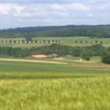
Offenstall-Vollpension: 1 Stutenplatz noch frei.
Warburg
Müller
@AraberStuten
Hunde willkommen
Pensions- und Gastboxen
Offenstall
Vollpension
7 weitere...
B
Leider kein Vorschaubild
Leider kein Vorschaubild
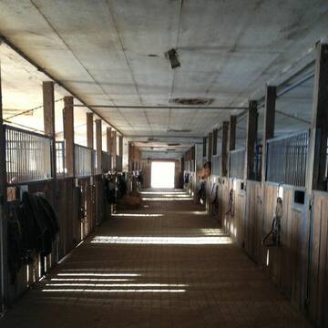
Boxen mit ganzjährigem, täglichem Weidegang
Volkmarsen
Stall Becker
@Christina144
Vermieten
Hunde willkommen
Sattelkammer/Sattelschränke
Innenbox
Vollpension
4 weitere...
B
Deprecated: Creation of dynamic property Zend_View_Helper_Ads::$adLink is deprecated in /var/www/stall-frei/htdocs/staging.stall-frei.de/library/Psf/View/Helper/Ads.php on line 108

Das Beste für die Hufe
Mechtersen
STALL-FREIde Marketing
@STALL-FREI-Marketing
Hufschmiede und Hufpfleger in Ihrer Nähe
Leider kein Vorschaubild
Leider kein Vorschaubild
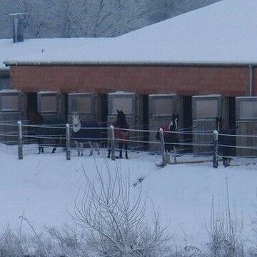
Große Box oder Offenstall
Borgentreich
MelV
@MelV
FN-Mitglied
Freizeitstall
Vermieten
Krankenbox
Paddock
Allergikerstall
bedampftes/gewaschenes Heu
18 weitere...
B


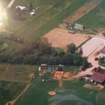
FN- Pensionsbetrieb ***
Hofgeismar
Soodehof-Hombressen
@Soodehof-Hombressen
FN-Mitglied
Geländestrecke
Paddock
Parkplatz für Pferdeanhänger
Allergikerstall
bedampftes/gewaschenes Heu
Außenbox mit Paddock
Außenboxen
22 weitere...
P+
Leider kein Vorschaubild
Leider kein Vorschaubild
Boxen und Offenstallplätze frei
Liebenau
Kathlin Rehrmann
@Rehrmann
Freizeitstall
Reitlehrer und -unterricht
Vermieten
Hunde willkommen
Krankenbox
Außenboxen
Offenstall
17 weitere...
B

Futtersack HeuToy, Fressbremse in pink
Mechtersen
STALL-FREIde Marketing
@STALL-FREI-Marketing
Stundenlange Beschäftigung die
Koliken vorbeugt, geringe Staubinhalation mit
steuerbarer Futterentnahme


Offenstall Selbstversorger
Ahnatal
Angela Klapp
@Angela50
Freizeitstall
Geländestrecke
Hunde willkommen
Parkplatz für Pferdeanhänger
Allergikerstall
Gnadenbrothof
Offenstall
9 weitere...
P+

Freie Plätze im Offenstall
Grebenstein
D. G.
@DaGrde
Freizeitstall
Vermieten
Longierzirkel/Roundpen
Paddock
Bewegungsstall
Offenstall
6 weitere...
P
Leider kein Vorschaubild
Leider kein Vorschaubild
Offenstallplatz
Diemelsee Vasbeck
Fieseler-Becker
@Fieseler-Becker
Freizeitstall
Vermieten
Hunde willkommen
Krankenbox
Fohlenaufzucht möglich
Hufrehe geeignet
12 weitere...
B
Leider kein Vorschaubild
Leider kein Vorschaubild
Artgerechte Pferdehaltung in Habichtswald
Habichtswald
Reitanlage-Lindenhof2
@Reitanlage-Lindenhof2
Paddock
Parkplatz für Pferdeanhänger
Außenboxen
Innenbox
Vollpension
Einzelne Boxen oder Stallplätze
8 weitere...
P
Leider kein Vorschaubild
Leider kein Vorschaubild
Aktiv- Stall
Wolfhagen
Pferdepension Kalkhofsmühle
@JaninaBachmann
Freizeitstall
Geländestrecke
Vermieten
Hunde willkommen
Krankenbox
Allergikerstall
Notfallboxen
16 weitere...
B
Deprecated: Creation of dynamic property Zend_View::$pageCount is deprecated in /var/www/stall-frei/htdocs/staging.stall-frei.de/library/vendor/shardj/zf1-future/library/Zend/View/Abstract.php on line 308
Deprecated: Creation of dynamic property Zend_View::$itemCountPerPage is deprecated in /var/www/stall-frei/htdocs/staging.stall-frei.de/library/vendor/shardj/zf1-future/library/Zend/View/Abstract.php on line 308
Deprecated: Creation of dynamic property Zend_View::$first is deprecated in /var/www/stall-frei/htdocs/staging.stall-frei.de/library/vendor/shardj/zf1-future/library/Zend/View/Abstract.php on line 308
Deprecated: Creation of dynamic property Zend_View::$current is deprecated in /var/www/stall-frei/htdocs/staging.stall-frei.de/library/vendor/shardj/zf1-future/library/Zend/View/Abstract.php on line 308
Deprecated: Creation of dynamic property Zend_View::$last is deprecated in /var/www/stall-frei/htdocs/staging.stall-frei.de/library/vendor/shardj/zf1-future/library/Zend/View/Abstract.php on line 308
Deprecated: Creation of dynamic property Zend_View::$next is deprecated in /var/www/stall-frei/htdocs/staging.stall-frei.de/library/vendor/shardj/zf1-future/library/Zend/View/Abstract.php on line 308
Deprecated: Creation of dynamic property Zend_View::$pagesInRange is deprecated in /var/www/stall-frei/htdocs/staging.stall-frei.de/library/vendor/shardj/zf1-future/library/Zend/View/Abstract.php on line 308
Deprecated: Creation of dynamic property Zend_View::$firstPageInRange is deprecated in /var/www/stall-frei/htdocs/staging.stall-frei.de/library/vendor/shardj/zf1-future/library/Zend/View/Abstract.php on line 308
Deprecated: Creation of dynamic property Zend_View::$lastPageInRange is deprecated in /var/www/stall-frei/htdocs/staging.stall-frei.de/library/vendor/shardj/zf1-future/library/Zend/View/Abstract.php on line 308
Deprecated: Creation of dynamic property Zend_View::$currentItemCount is deprecated in /var/www/stall-frei/htdocs/staging.stall-frei.de/library/vendor/shardj/zf1-future/library/Zend/View/Abstract.php on line 308
Deprecated: Creation of dynamic property Zend_View::$totalItemCount is deprecated in /var/www/stall-frei/htdocs/staging.stall-frei.de/library/vendor/shardj/zf1-future/library/Zend/View/Abstract.php on line 308
Deprecated: Creation of dynamic property Zend_View::$firstItemNumber is deprecated in /var/www/stall-frei/htdocs/staging.stall-frei.de/library/vendor/shardj/zf1-future/library/Zend/View/Abstract.php on line 308
Deprecated: Creation of dynamic property Zend_View::$lastItemNumber is deprecated in /var/www/stall-frei/htdocs/staging.stall-frei.de/library/vendor/shardj/zf1-future/library/Zend/View/Abstract.php on line 308
Deprecated: Creation of dynamic property Zend_View::$router is deprecated in /var/www/stall-frei/htdocs/staging.stall-frei.de/library/vendor/shardj/zf1-future/library/Zend/View/Abstract.php on line 308
Deprecated: Creation of dynamic property Zend_View::$urlParams is deprecated in /var/www/stall-frei/htdocs/staging.stall-frei.de/library/vendor/shardj/zf1-future/library/Zend/View/Abstract.php on line 308
Deprecated: Creation of dynamic property Zend_View::$showAds is deprecated in /var/www/stall-frei/htdocs/staging.stall-frei.de/library/vendor/shardj/zf1-future/library/Zend/View/Abstract.php on line 308
Deprecated: Creation of dynamic property Zend_View::$objectIds is deprecated in /var/www/stall-frei/htdocs/staging.stall-frei.de/library/vendor/shardj/zf1-future/library/Zend/View/Abstract.php on line 308
Deprecated: Creation of dynamic property Zend_View::$showNavbar is deprecated in /var/www/stall-frei/htdocs/staging.stall-frei.de/library/vendor/shardj/zf1-future/library/Zend/View/Abstract.php on line 308
Deprecated: Creation of dynamic property Zend_View::$showBreadcrumb is deprecated in /var/www/stall-frei/htdocs/staging.stall-frei.de/library/vendor/shardj/zf1-future/library/Zend/View/Abstract.php on line 308
Deprecated: Creation of dynamic property Zend_View::$showFooter is deprecated in /var/www/stall-frei/htdocs/staging.stall-frei.de/library/vendor/shardj/zf1-future/library/Zend/View/Abstract.php on line 308
Deprecated: Creation of dynamic property Zend_View::$showInternalAds is deprecated in /var/www/stall-frei/htdocs/staging.stall-frei.de/library/vendor/shardj/zf1-future/library/Zend/View/Abstract.php on line 308
Deprecated: Creation of dynamic property Zend_View::$blNoContent is deprecated in /var/www/stall-frei/htdocs/staging.stall-frei.de/library/vendor/shardj/zf1-future/library/Zend/View/Abstract.php on line 308
Deprecated: Creation of dynamic property Zend_View::$sMetaDesc is deprecated in /var/www/stall-frei/htdocs/staging.stall-frei.de/library/vendor/shardj/zf1-future/library/Zend/View/Abstract.php on line 308
Deprecated: Creation of dynamic property Zend_View::$useGmaps is deprecated in /var/www/stall-frei/htdocs/staging.stall-frei.de/library/vendor/shardj/zf1-future/library/Zend/View/Abstract.php on line 308
Deprecated: Creation of dynamic property Zend_View::$touches is deprecated in /var/www/stall-frei/htdocs/staging.stall-frei.de/library/vendor/shardj/zf1-future/library/Zend/View/Abstract.php on line 308
Deprecated: Creation of dynamic property Zend_View::$oProject is deprecated in /var/www/stall-frei/htdocs/staging.stall-frei.de/library/vendor/shardj/zf1-future/library/Zend/View/Abstract.php on line 308
Deprecated: Creation of dynamic property Zend_View::$pageHeadline is deprecated in /var/www/stall-frei/htdocs/staging.stall-frei.de/library/vendor/shardj/zf1-future/library/Zend/View/Abstract.php on line 308
Deprecated: Creation of dynamic property Zend_View::$disableLocationField is deprecated in /var/www/stall-frei/htdocs/staging.stall-frei.de/library/vendor/shardj/zf1-future/library/Zend/View/Abstract.php on line 308
Deprecated: Creation of dynamic property Zend_View::$isSearch is deprecated in /var/www/stall-frei/htdocs/staging.stall-frei.de/library/vendor/shardj/zf1-future/library/Zend/View/Abstract.php on line 308
Deprecated: Creation of dynamic property Zend_View::$pageTitle is deprecated in /var/www/stall-frei/htdocs/staging.stall-frei.de/library/vendor/shardj/zf1-future/library/Zend/View/Abstract.php on line 308
Deprecated: Creation of dynamic property Psf_Form_Element_Text::$class is deprecated in /var/www/stall-frei/htdocs/staging.stall-frei.de/library/vendor/shardj/zf1-future/library/Zend/Form/Element.php on line 874
Deprecated: Creation of dynamic property Psf_Form_Element_Text::$size is deprecated in /var/www/stall-frei/htdocs/staging.stall-frei.de/library/vendor/shardj/zf1-future/library/Zend/Form/Element.php on line 874
Deprecated: Creation of dynamic property Psf_Form_Element_Text::$placeholder is deprecated in /var/www/stall-frei/htdocs/staging.stall-frei.de/library/vendor/shardj/zf1-future/library/Zend/Form/Element.php on line 874
Deprecated: Creation of dynamic property Psf_Form_Element_Hidden::$class is deprecated in /var/www/stall-frei/htdocs/staging.stall-frei.de/library/vendor/shardj/zf1-future/library/Zend/Form/Element.php on line 874
Deprecated: Creation of dynamic property Psf_Form_Element_Hidden::$class is deprecated in /var/www/stall-frei/htdocs/staging.stall-frei.de/library/vendor/shardj/zf1-future/library/Zend/Form/Element.php on line 874
Deprecated: Creation of dynamic property Psf_Form_Element_Hidden::$class is deprecated in /var/www/stall-frei/htdocs/staging.stall-frei.de/library/vendor/shardj/zf1-future/library/Zend/Form/Element.php on line 874
Deprecated: Creation of dynamic property Psf_Form_Element_Hidden::$class is deprecated in /var/www/stall-frei/htdocs/staging.stall-frei.de/library/vendor/shardj/zf1-future/library/Zend/Form/Element.php on line 874
Deprecated: Creation of dynamic property Psf_Form_Element_Select::$class is deprecated in /var/www/stall-frei/htdocs/staging.stall-frei.de/library/vendor/shardj/zf1-future/library/Zend/Form/Element.php on line 874
Deprecated: Creation of dynamic property Psf_Form_Element_Select::$class is deprecated in /var/www/stall-frei/htdocs/staging.stall-frei.de/library/vendor/shardj/zf1-future/library/Zend/Form/Element.php on line 874
Deprecated: Creation of dynamic property Psf_Form_Element_Select::$class is deprecated in /var/www/stall-frei/htdocs/staging.stall-frei.de/library/vendor/shardj/zf1-future/library/Zend/Form/Element.php on line 874
Deprecated: Creation of dynamic property Psf_Form_Element_Select::$class is deprecated in /var/www/stall-frei/htdocs/staging.stall-frei.de/library/vendor/shardj/zf1-future/library/Zend/Form/Element.php on line 874
Deprecated: Creation of dynamic property Psf_Form_Element_Text::$class is deprecated in /var/www/stall-frei/htdocs/staging.stall-frei.de/library/vendor/shardj/zf1-future/library/Zend/Form/Element.php on line 874
Deprecated: Creation of dynamic property Psf_Form_Element_Checkbox::$label is deprecated in /var/www/stall-frei/htdocs/staging.stall-frei.de/library/vendor/shardj/zf1-future/library/Zend/Form/Element.php on line 874
Deprecated: Creation of dynamic property Zend_View::$sort is deprecated in /var/www/stall-frei/htdocs/staging.stall-frei.de/library/vendor/shardj/zf1-future/library/Zend/View/Abstract.php on line 308
Deprecated: Creation of dynamic property Zend_View::$searchLocation is deprecated in /var/www/stall-frei/htdocs/staging.stall-frei.de/library/vendor/shardj/zf1-future/library/Zend/View/Abstract.php on line 308
Deprecated: Creation of dynamic property Zend_View::$locationHint is deprecated in /var/www/stall-frei/htdocs/staging.stall-frei.de/library/vendor/shardj/zf1-future/library/Zend/View/Abstract.php on line 308
Psf_GeoCoder_Abstract::getLocation: Nörde Get Location CachedOrLive
Psf_GeoCoder_Abstract::getCachedOrLive: Nörde
Psf_GeoCoder_OpenCageData::makeApiRequest: response:
Array
(
[documentation] => https://opencagedata.com/api
[licenses] => Array
(
[0] => Array
(
[name] => see attribution guide
[url] => https://opencagedata.com/credits
)
)
[results] => Array
(
[0] => Array
(
[bounds] => Array
(
[northeast] => Array
(
[lat] => 51.5513324
[lng] => 9.10758
)
[southwest] => Array
(
[lat] => 51.5207773
[lng] => 9.0650385
)
)
[components] => Array
(
[ISO_3166-1_alpha-2] => DE
[ISO_3166-1_alpha-3] => DEU
[ISO_3166-2] => Array
(
[0] => DE-NW
)
[_category] => place
[_normalized_city] => Warburg
[_type] => village
[continent] => Europe
[country] => Deutschland
[country_code] => de
[county] => Kreis Höxter
[political_union] => European Union
[state] => Nordrhein-Westfalen
[state_code] => NW
[suburb] => Nörde
[town] => Warburg
[village] => Nörde
)
[confidence] => 7
[formatted] => Nörde, Nordrhein-Westfalen, Deutschland
[geometry] => Array
(
[lat] => 51.5359988
[lng] => 9.0884316
)
)
[1] => Array
(
[bounds] => Array
(
[northeast] => Array
(
[lat] => 51.5517855
[lng] => 9.1180951
)
[southwest] => Array
(
[lat] => 51.5117855
[lng] => 9.0780951
)
)
[components] => Array
(
[ISO_3166-1_alpha-2] => DE
[ISO_3166-1_alpha-3] => DEU
[ISO_3166-2] => Array
(
[0] => DE-NW
)
[_category] => place
[_normalized_city] => Warburg
[_type] => village
[continent] => Europe
[country] => Deutschland
[country_code] => de
[county] => Kreis Höxter
[political_union] => European Union
[postcode] => 34414
[state] => Nordrhein-Westfalen
[state_code] => NW
[town] => Warburg
[village] => Nörde
)
[confidence] => 7
[formatted] => 34414 Nörde, Deutschland
[geometry] => Array
(
[lat] => 51.5317855
[lng] => 9.0980951
)
)
[2] => Array
(
[bounds] => Array
(
[northeast] => Array
(
[lat] => 51.0215656
[lng] => 9.0429605
)
[southwest] => Array
(
[lat] => 51.0187202
[lng] => 9.0344671
)
)
[components] => Array
(
[ISO_3166-1_alpha-2] => DE
[ISO_3166-1_alpha-3] => DEU
[ISO_3166-2] => Array
(
[0] => DE-HE
)
[_category] => natural/water
[_normalized_city] => Dodenhausen
[_type] => stream
[continent] => Europe
[country] => Deutschland
[country_code] => de
[county] => Landkreis Waldeck-Frankenberg
[municipality] => Haina (Kloster)
[political_union] => European Union
[postcode] => 35114
[state] => Hessen
[state_code] => HE
[stream] => Norde
[village] => Dodenhausen
)
[confidence] => 9
[formatted] => Norde, 35114 Dodenhausen, Deutschland
[geometry] => Array
(
[lat] => 51.0206821
[lng] => 9.0389525
)
)
[3] => Array
(
[bounds] => Array
(
[northeast] => Array
(
[lat] => 51.0238719
[lng] => 9.034365
)
[southwest] => Array
(
[lat] => 51.0216286
[lng] => 9.0307393
)
)
[components] => Array
(
[ISO_3166-1_alpha-2] => DE
[ISO_3166-1_alpha-3] => DEU
[ISO_3166-2] => Array
(
[0] => DE-HE
)
[_category] => natural/water
[_normalized_city] => Haina (Kloster)
[_type] => stream
[continent] => Europe
[country] => Deutschland
[country_code] => de
[county] => Landkreis Waldeck-Frankenberg
[municipality] => Haina (Kloster)
[political_union] => European Union
[postcode] => 35114
[state] => Hessen
[state_code] => HE
[stream] => Norde
[village] => Haina (Kloster)
)
[confidence] => 9
[formatted] => Norde, 35114 Haina (Kloster), Deutschland
[geometry] => Array
(
[lat] => 51.0230191
[lng] => 9.032741
)
)
[4] => Array
(
[bounds] => Array
(
[northeast] => Array
(
[lat] => 50.9885615
[lng] => 9.0706598
)
[southwest] => Array
(
[lat] => 50.9882822
[lng] => 9.070272
)
)
[components] => Array
(
[ISO_3166-1_alpha-2] => DE
[ISO_3166-1_alpha-3] => DEU
[ISO_3166-2] => Array
(
[0] => DE-HE
)
[_category] => natural/water
[_normalized_city] => Schönstein
[_type] => stream
[continent] => Europe
[country] => Deutschland
[country_code] => de
[county] => Schwalm-Eder-Kreis
[municipality] => Gilserberg
[political_union] => European Union
[postcode] => 34630
[state] => Hessen
[state_code] => HE
[stream] => Norde
[village] => Schönstein
)
[confidence] => 9
[formatted] => Norde, 34630 Schönstein, Deutschland
[geometry] => Array
(
[lat] => 50.9884219
[lng] => 9.0704659
)
)
[5] => Array
(
[components] => Array
(
[ISO_3166-1_alpha-2] => GP
[ISO_3166-1_alpha-3] => GLP
[ISO_3166-2] => Array
(
[0] => FR-971
)
[_category] => road
[_normalized_city] => Le Moule
[_type] => road
[city] => Le Moule
[continent] => North America
[country] => France
[country_code] => fr
[county] => Guadeloupe
[local_authority] => Communauté d'agglomération du Nord Grande-Terre
[political_union] => European Union
[postcode] => 97160
[road] => Route de Nora
[state] =>
)
[confidence] => 3
[formatted] => Route de Nora, 97160 Le Moule, France
[geometry] => Array
(
[lat] => 16.304503
[lng] => -61.372055
)
)
[6] => Array
(
[components] => Array
(
[ISO_3166-1_alpha-2] => FR
[ISO_3166-1_alpha-3] => FRA
[ISO_3166-2] => Array
(
[0] => FR-HDF
[1] => FR-62
)
[_category] => road
[_normalized_city] => Tournehem-sur-la-Hem
[_type] => road
[city] => Tournehem-sur-la-Hem
[continent] => Europe
[country] => France
[country_code] => fr
[county] => Pas-de-Calais
[local_authority] => Communauté d'agglomération du Pays de Saint-Omer
[political_union] => European Union
[postcode] => 62890
[road] => Rue des Nordes Fosses
[state] => Hauts-de-France
[state_code] => HDF
)
[confidence] => 2
[formatted] => Rue des Nordes Fosses, 62890 Tournehem-sur-la-Hem, France
[geometry] => Array
(
[lat] => 50.811024
[lng] => 2.047946
)
)
[7] => Array
(
[components] => Array
(
[ISO_3166-1_alpha-2] => FR
[ISO_3166-1_alpha-3] => FRA
[ISO_3166-2] => Array
(
[0] => FR-OCC
[1] => FR-31
)
[_category] => road
[_normalized_city] => Saiguède
[_type] => road
[city] => Saiguède
[continent] => Europe
[country] => France
[country_code] => fr
[county] => Haute-Garonne
[local_authority] => Le Muretain Agglo
[political_union] => European Union
[postcode] => 31470
[road] => Chemin Della Nora
[state] => Occitanie
[state_code] => OCC
)
[confidence] => 2
[formatted] => Chemin Della Nora, 31470 Saiguède, France
[geometry] => Array
(
[lat] => 43.533796
[lng] => 1.161266
)
)
[8] => Array
(
[components] => Array
(
[ISO_3166-1_alpha-2] => FR
[ISO_3166-1_alpha-3] => FRA
[ISO_3166-2] => Array
(
[0] => FR-CVL
[1] => FR-45
)
[_category] => road
[_normalized_city] => Olivet
[_type] => road
[city] => Olivet
[continent] => Europe
[country] => France
[country_code] => fr
[county] => Loiret
[local_authority] => Orléans Métropole
[political_union] => European Union
[postcode] => 45160
[road] => Allée de Noras
[state] => Centre-Val de Loire
[state_code] => CVL
)
[confidence] => 2
[formatted] => Allée de Noras, 45160 Olivet, France
[geometry] => Array
(
[lat] => 47.843677
[lng] => 1.878493
)
)
[9] => Array
(
[components] => Array
(
[ISO_3166-1_alpha-2] => FR
[ISO_3166-1_alpha-3] => FRA
[ISO_3166-2] => Array
(
[0] => FR-HDF
[1] => FR-62
)
[_category] => road
[_normalized_city] => Tournehem-sur-la-Hem
[_type] => road
[city] => Tournehem-sur-la-Hem
[continent] => Europe
[country] => France
[country_code] => fr
[county] => Pas-de-Calais
[local_authority] => Communauté d'agglomération du Pays de Saint-Omer
[political_union] => European Union
[postcode] => 62890
[road] => Impasse des Nordes Fosses
[state] => Hauts-de-France
[state_code] => HDF
)
[confidence] => 2
[formatted] => Impasse des Nordes Fosses, 62890 Tournehem-sur-la-Hem, France
[geometry] => Array
(
[lat] => 50.812038
[lng] => 2.046077
)
)
)
[status] => Array
(
[code] => 200
[message] => OK
)
[stay_informed] => Array
(
[blog] => https://blog.opencagedata.com
[mastodon] => https://en.osm.town/@opencage
)
[thanks] => For using an OpenCage API
[timestamp] => Array
(
[created_http] => Mon, 09 Feb 2026 08:46:08 GMT
[created_unix] => 1770626768
)
[total_results] => 10
)
Psf_GeoCoder_Abstract::convertLocationResult
{"documentation":"https:\/\/opencagedata.com\/api","licenses":[{"name":"see attribution guide","url":"https:\/\/opencagedata.com\/credits"}],"results":[{"bounds":{"northeast":{"lat":51.5513324,"lng":9.10758},"southwest":{"lat":51.5207773,"lng":9.0650385}},"components":{"ISO_3166-1_alpha-2":"DE","ISO_3166-1_alpha-3":"DEU","ISO_3166-2":["DE-NW"],"_category":"place","_normalized_city":"Warburg","_type":"village","continent":"Europe","country":"Deutschland","country_code":"de","county":"Kreis H\u00f6xter","political_union":"European Union","state":"Nordrhein-Westfalen","state_code":"NW","suburb":"N\u00f6rde","town":"Warburg","village":"N\u00f6rde"},"confidence":7,"formatted":"N\u00f6rde, Nordrhein-Westfalen, Deutschland","geometry":{"lat":51.5359988,"lng":9.0884316}},{"bounds":{"northeast":{"lat":51.5517855,"lng":9.1180951},"southwest":{"lat":51.5117855,"lng":9.0780951}},"components":{"ISO_3166-1_alpha-2":"DE","ISO_3166-1_alpha-3":"DEU","ISO_3166-2":["DE-NW"],"_category":"place","_normalized_city":"Warburg","_type":"village","continent":"Europe","country":"Deutschland","country_code":"de","county":"Kreis H\u00f6xter","political_union":"European Union","postcode":"34414","state":"Nordrhein-Westfalen","state_code":"NW","town":"Warburg","village":"N\u00f6rde"},"confidence":7,"formatted":"34414 N\u00f6rde, Deutschland","geometry":{"lat":51.5317855,"lng":9.0980951}},{"bounds":{"northeast":{"lat":51.0215656,"lng":9.0429605},"southwest":{"lat":51.0187202,"lng":9.0344671}},"components":{"ISO_3166-1_alpha-2":"DE","ISO_3166-1_alpha-3":"DEU","ISO_3166-2":["DE-HE"],"_category":"natural\/water","_normalized_city":"Dodenhausen","_type":"stream","continent":"Europe","country":"Deutschland","country_code":"de","county":"Landkreis Waldeck-Frankenberg","municipality":"Haina (Kloster)","political_union":"European Union","postcode":"35114","state":"Hessen","state_code":"HE","stream":"Norde","village":"Dodenhausen"},"confidence":9,"formatted":"Norde, 35114 Dodenhausen, Deutschland","geometry":{"lat":51.0206821,"lng":9.0389525}},{"bounds":{"northeast":{"lat":51.0238719,"lng":9.034365},"southwest":{"lat":51.0216286,"lng":9.0307393}},"components":{"ISO_3166-1_alpha-2":"DE","ISO_3166-1_alpha-3":"DEU","ISO_3166-2":["DE-HE"],"_category":"natural\/water","_normalized_city":"Haina (Kloster)","_type":"stream","continent":"Europe","country":"Deutschland","country_code":"de","county":"Landkreis Waldeck-Frankenberg","municipality":"Haina (Kloster)","political_union":"European Union","postcode":"35114","state":"Hessen","state_code":"HE","stream":"Norde","village":"Haina (Kloster)"},"confidence":9,"formatted":"Norde, 35114 Haina (Kloster), Deutschland","geometry":{"lat":51.0230191,"lng":9.032741}},{"bounds":{"northeast":{"lat":50.9885615,"lng":9.0706598},"southwest":{"lat":50.9882822,"lng":9.070272}},"components":{"ISO_3166-1_alpha-2":"DE","ISO_3166-1_alpha-3":"DEU","ISO_3166-2":["DE-HE"],"_category":"natural\/water","_normalized_city":"Sch\u00f6nstein","_type":"stream","continent":"Europe","country":"Deutschland","country_code":"de","county":"Schwalm-Eder-Kreis","municipality":"Gilserberg","political_union":"European Union","postcode":"34630","state":"Hessen","state_code":"HE","stream":"Norde","village":"Sch\u00f6nstein"},"confidence":9,"formatted":"Norde, 34630 Sch\u00f6nstein, Deutschland","geometry":{"lat":50.9884219,"lng":9.0704659}},{"components":{"ISO_3166-1_alpha-2":"GP","ISO_3166-1_alpha-3":"GLP","ISO_3166-2":["FR-971"],"_category":"road","_normalized_city":"Le Moule","_type":"road","city":"Le Moule","continent":"North America","country":"France","country_code":"fr","county":"Guadeloupe","local_authority":"Communaut\u00e9 d'agglom\u00e9ration du Nord Grande-Terre","political_union":"European Union","postcode":"97160","road":"Route de Nora","state":null},"confidence":3,"formatted":"Route de Nora, 97160 Le Moule, France","geometry":{"lat":16.304503,"lng":-61.372055}},{"components":{"ISO_3166-1_alpha-2":"FR","ISO_3166-1_alpha-3":"FRA","ISO_3166-2":["FR-HDF","FR-62"],"_category":"road","_normalized_city":"Tournehem-sur-la-Hem","_type":"road","city":"Tournehem-sur-la-Hem","continent":"Europe","country":"France","country_code":"fr","county":"Pas-de-Calais","local_authority":"Communaut\u00e9 d'agglom\u00e9ration du Pays de Saint-Omer","political_union":"European Union","postcode":"62890","road":"Rue des Nordes Fosses","state":"Hauts-de-France","state_code":"HDF"},"confidence":2,"formatted":"Rue des Nordes Fosses, 62890 Tournehem-sur-la-Hem, France","geometry":{"lat":50.811024,"lng":2.047946}},{"components":{"ISO_3166-1_alpha-2":"FR","ISO_3166-1_alpha-3":"FRA","ISO_3166-2":["FR-OCC","FR-31"],"_category":"road","_normalized_city":"Saigu\u00e8de","_type":"road","city":"Saigu\u00e8de","continent":"Europe","country":"France","country_code":"fr","county":"Haute-Garonne","local_authority":"Le Muretain Agglo","political_union":"European Union","postcode":"31470","road":"Chemin Della Nora","state":"Occitanie","state_code":"OCC"},"confidence":2,"formatted":"Chemin Della Nora, 31470 Saigu\u00e8de, France","geometry":{"lat":43.533796,"lng":1.161266}},{"components":{"ISO_3166-1_alpha-2":"FR","ISO_3166-1_alpha-3":"FRA","ISO_3166-2":["FR-CVL","FR-45"],"_category":"road","_normalized_city":"Olivet","_type":"road","city":"Olivet","continent":"Europe","country":"France","country_code":"fr","county":"Loiret","local_authority":"Orl\u00e9ans M\u00e9tropole","political_union":"European Union","postcode":"45160","road":"All\u00e9e de Noras","state":"Centre-Val de Loire","state_code":"CVL"},"confidence":2,"formatted":"All\u00e9e de Noras, 45160 Olivet, France","geometry":{"lat":47.843677,"lng":1.878493}},{"components":{"ISO_3166-1_alpha-2":"FR","ISO_3166-1_alpha-3":"FRA","ISO_3166-2":["FR-HDF","FR-62"],"_category":"road","_normalized_city":"Tournehem-sur-la-Hem","_type":"road","city":"Tournehem-sur-la-Hem","continent":"Europe","country":"France","country_code":"fr","county":"Pas-de-Calais","local_authority":"Communaut\u00e9 d'agglom\u00e9ration du Pays de Saint-Omer","political_union":"European Union","postcode":"62890","road":"Impasse des Nordes Fosses","state":"Hauts-de-France","state_code":"HDF"},"confidence":2,"formatted":"Impasse des Nordes Fosses, 62890 Tournehem-sur-la-Hem, France","geometry":{"lat":50.812038,"lng":2.046077}}],"status":{"code":200,"message":"OK"},"stay_informed":{"blog":"https:\/\/blog.opencagedata.com","mastodon":"https:\/\/en.osm.town\/@opencage"},"thanks":"For using an OpenCage API","timestamp":{"created_http":"Mon, 09 Feb 2026 08:46:08 GMT","created_unix":1770626768},"total_results":10}Array
(
[0] => stdClass Object
(
[bounds] => stdClass Object
(
[northeast] => stdClass Object
(
[lat] => 51.5513324
[lng] => 9.10758
)
[southwest] => stdClass Object
(
[lat] => 51.5207773
[lng] => 9.0650385
)
)
[components] => stdClass Object
(
[ISO_3166-1_alpha-2] => DE
[ISO_3166-1_alpha-3] => DEU
[ISO_3166-2] => Array
(
[0] => DE-NW
)
[_category] => place
[_normalized_city] => Warburg
[_type] => village
[continent] => Europe
[country] => Deutschland
[country_code] => de
[county] => Kreis Höxter
[political_union] => European Union
[state] => Nordrhein-Westfalen
[state_code] => NW
[suburb] => Nörde
[town] => Warburg
[village] => Nörde
)
[confidence] => 7
[formatted] => Nörde, Nordrhein-Westfalen, Deutschland
[geometry] => stdClass Object
(
[lat] => 51.5359988
[lng] => 9.0884316
)
)
[1] => stdClass Object
(
[bounds] => stdClass Object
(
[northeast] => stdClass Object
(
[lat] => 51.5517855
[lng] => 9.1180951
)
[southwest] => stdClass Object
(
[lat] => 51.5117855
[lng] => 9.0780951
)
)
[components] => stdClass Object
(
[ISO_3166-1_alpha-2] => DE
[ISO_3166-1_alpha-3] => DEU
[ISO_3166-2] => Array
(
[0] => DE-NW
)
[_category] => place
[_normalized_city] => Warburg
[_type] => village
[continent] => Europe
[country] => Deutschland
[country_code] => de
[county] => Kreis Höxter
[political_union] => European Union
[postcode] => 34414
[state] => Nordrhein-Westfalen
[state_code] => NW
[town] => Warburg
[village] => Nörde
)
[confidence] => 7
[formatted] => 34414 Nörde, Deutschland
[geometry] => stdClass Object
(
[lat] => 51.5317855
[lng] => 9.0980951
)
)
[2] => stdClass Object
(
[bounds] => stdClass Object
(
[northeast] => stdClass Object
(
[lat] => 51.0215656
[lng] => 9.0429605
)
[southwest] => stdClass Object
(
[lat] => 51.0187202
[lng] => 9.0344671
)
)
[components] => stdClass Object
(
[ISO_3166-1_alpha-2] => DE
[ISO_3166-1_alpha-3] => DEU
[ISO_3166-2] => Array
(
[0] => DE-HE
)
[_category] => natural/water
[_normalized_city] => Dodenhausen
[_type] => stream
[continent] => Europe
[country] => Deutschland
[country_code] => de
[county] => Landkreis Waldeck-Frankenberg
[municipality] => Haina (Kloster)
[political_union] => European Union
[postcode] => 35114
[state] => Hessen
[state_code] => HE
[stream] => Norde
[village] => Dodenhausen
)
[confidence] => 9
[formatted] => Norde, 35114 Dodenhausen, Deutschland
[geometry] => stdClass Object
(
[lat] => 51.0206821
[lng] => 9.0389525
)
)
[3] => stdClass Object
(
[bounds] => stdClass Object
(
[northeast] => stdClass Object
(
[lat] => 51.0238719
[lng] => 9.034365
)
[southwest] => stdClass Object
(
[lat] => 51.0216286
[lng] => 9.0307393
)
)
[components] => stdClass Object
(
[ISO_3166-1_alpha-2] => DE
[ISO_3166-1_alpha-3] => DEU
[ISO_3166-2] => Array
(
[0] => DE-HE
)
[_category] => natural/water
[_normalized_city] => Haina (Kloster)
[_type] => stream
[continent] => Europe
[country] => Deutschland
[country_code] => de
[county] => Landkreis Waldeck-Frankenberg
[municipality] => Haina (Kloster)
[political_union] => European Union
[postcode] => 35114
[state] => Hessen
[state_code] => HE
[stream] => Norde
[village] => Haina (Kloster)
)
[confidence] => 9
[formatted] => Norde, 35114 Haina (Kloster), Deutschland
[geometry] => stdClass Object
(
[lat] => 51.0230191
[lng] => 9.032741
)
)
[4] => stdClass Object
(
[bounds] => stdClass Object
(
[northeast] => stdClass Object
(
[lat] => 50.9885615
[lng] => 9.0706598
)
[southwest] => stdClass Object
(
[lat] => 50.9882822
[lng] => 9.070272
)
)
[components] => stdClass Object
(
[ISO_3166-1_alpha-2] => DE
[ISO_3166-1_alpha-3] => DEU
[ISO_3166-2] => Array
(
[0] => DE-HE
)
[_category] => natural/water
[_normalized_city] => Schönstein
[_type] => stream
[continent] => Europe
[country] => Deutschland
[country_code] => de
[county] => Schwalm-Eder-Kreis
[municipality] => Gilserberg
[political_union] => European Union
[postcode] => 34630
[state] => Hessen
[state_code] => HE
[stream] => Norde
[village] => Schönstein
)
[confidence] => 9
[formatted] => Norde, 34630 Schönstein, Deutschland
[geometry] => stdClass Object
(
[lat] => 50.9884219
[lng] => 9.0704659
)
)
[5] => stdClass Object
(
[components] => stdClass Object
(
[ISO_3166-1_alpha-2] => GP
[ISO_3166-1_alpha-3] => GLP
[ISO_3166-2] => Array
(
[0] => FR-971
)
[_category] => road
[_normalized_city] => Le Moule
[_type] => road
[city] => Le Moule
[continent] => North America
[country] => France
[country_code] => fr
[county] => Guadeloupe
[local_authority] => Communauté d'agglomération du Nord Grande-Terre
[political_union] => European Union
[postcode] => 97160
[road] => Route de Nora
[state] =>
)
[confidence] => 3
[formatted] => Route de Nora, 97160 Le Moule, France
[geometry] => stdClass Object
(
[lat] => 16.304503
[lng] => -61.372055
)
)
[6] => stdClass Object
(
[components] => stdClass Object
(
[ISO_3166-1_alpha-2] => FR
[ISO_3166-1_alpha-3] => FRA
[ISO_3166-2] => Array
(
[0] => FR-HDF
[1] => FR-62
)
[_category] => road
[_normalized_city] => Tournehem-sur-la-Hem
[_type] => road
[city] => Tournehem-sur-la-Hem
[continent] => Europe
[country] => France
[country_code] => fr
[county] => Pas-de-Calais
[local_authority] => Communauté d'agglomération du Pays de Saint-Omer
[political_union] => European Union
[postcode] => 62890
[road] => Rue des Nordes Fosses
[state] => Hauts-de-France
[state_code] => HDF
)
[confidence] => 2
[formatted] => Rue des Nordes Fosses, 62890 Tournehem-sur-la-Hem, France
[geometry] => stdClass Object
(
[lat] => 50.811024
[lng] => 2.047946
)
)
[7] => stdClass Object
(
[components] => stdClass Object
(
[ISO_3166-1_alpha-2] => FR
[ISO_3166-1_alpha-3] => FRA
[ISO_3166-2] => Array
(
[0] => FR-OCC
[1] => FR-31
)
[_category] => road
[_normalized_city] => Saiguède
[_type] => road
[city] => Saiguède
[continent] => Europe
[country] => France
[country_code] => fr
[county] => Haute-Garonne
[local_authority] => Le Muretain Agglo
[political_union] => European Union
[postcode] => 31470
[road] => Chemin Della Nora
[state] => Occitanie
[state_code] => OCC
)
[confidence] => 2
[formatted] => Chemin Della Nora, 31470 Saiguède, France
[geometry] => stdClass Object
(
[lat] => 43.533796
[lng] => 1.161266
)
)
[8] => stdClass Object
(
[components] => stdClass Object
(
[ISO_3166-1_alpha-2] => FR
[ISO_3166-1_alpha-3] => FRA
[ISO_3166-2] => Array
(
[0] => FR-CVL
[1] => FR-45
)
[_category] => road
[_normalized_city] => Olivet
[_type] => road
[city] => Olivet
[continent] => Europe
[country] => France
[country_code] => fr
[county] => Loiret
[local_authority] => Orléans Métropole
[political_union] => European Union
[postcode] => 45160
[road] => Allée de Noras
[state] => Centre-Val de Loire
[state_code] => CVL
)
[confidence] => 2
[formatted] => Allée de Noras, 45160 Olivet, France
[geometry] => stdClass Object
(
[lat] => 47.843677
[lng] => 1.878493
)
)
[9] => stdClass Object
(
[components] => stdClass Object
(
[ISO_3166-1_alpha-2] => FR
[ISO_3166-1_alpha-3] => FRA
[ISO_3166-2] => Array
(
[0] => FR-HDF
[1] => FR-62
)
[_category] => road
[_normalized_city] => Tournehem-sur-la-Hem
[_type] => road
[city] => Tournehem-sur-la-Hem
[continent] => Europe
[country] => France
[country_code] => fr
[county] => Pas-de-Calais
[local_authority] => Communauté d'agglomération du Pays de Saint-Omer
[political_union] => European Union
[postcode] => 62890
[road] => Impasse des Nordes Fosses
[state] => Hauts-de-France
[state_code] => HDF
)
[confidence] => 2
[formatted] => Impasse des Nordes Fosses, 62890 Tournehem-sur-la-Hem, France
[geometry] => stdClass Object
(
[lat] => 50.812038
[lng] => 2.046077
)
)
)
Psf_GeoCoder_OpenCageData::getKeyMap: 0
stdClass Object
(
    [bounds] => stdClass Object
        (
            [northeast] => stdClass Object
                (
                    [lat] => 51.5513324
                    [lng] => 9.10758
                )

            [southwest] => stdClass Object
                (
                    [lat] => 51.5207773
                    [lng] => 9.0650385
                )

        )

    [components] => stdClass Object
        (
            [ISO_3166-1_alpha-2] => DE
            [ISO_3166-1_alpha-3] => DEU
            [ISO_3166-2] => Array
                (
                    [0] => DE-NW
                )

            [_category] => place
            [_normalized_city] => Warburg
            [_type] => village
            [continent] => Europe
            [country] => Deutschland
            [country_code] => de
            [county] => Kreis Höxter
            [political_union] => European Union
            [state] => Nordrhein-Westfalen
            [state_code] => NW
            [suburb] => Nörde
            [town] => Warburg
            [village] => Nörde
        )

    [confidence] => 7
    [formatted] => Nörde, Nordrhein-Westfalen, Deutschland
    [geometry] => stdClass Object
        (
            [lat] => 51.5359988
            [lng] => 9.0884316
        )

)
Psf_GeoCoder_OpenCageData::getCounty: Höxter
Psf_GeoCoder_OpenCageData::addMissingData REFETCH!
Array
(
    [address] => Nörde, Nordrhein-Westfalen, Deutschland
    [type] => village
    [street] =>
    [city] => Warburg
    [county] => Höxter
    [state] => Nordrhein-Westfalen
    [zip] =>
    [country] => Deutschland
    [suburb] => Nörde
    [countrycode] => de
    [latitude] => 51.5359988
    [longitude] => 9.0884316
    [accuracy] => 1
    [confidence] => 7
    [bounds] => stdClass Object
        (
            [northeast] => stdClass Object
                (
                    [lat] => 51.5513324
                    [lng] => 9.10758
                )

            [southwest] => stdClass Object
                (
                    [lat] => 51.5207773
                    [lng] => 9.0650385
                )

        )

)
reformat!
Array
(
    [address] => Warburg
    [type] => village
    [street] =>
    [city] => Warburg
    [county] => Höxter
    [state] => Nordrhein-Westfalen
    [zip] =>
    [country] => Deutschland
    [suburb] => Nörde
    [countrycode] => de
    [latitude] => 51.5359988
    [longitude] => 9.0884316
    [accuracy] => 1
    [confidence] => 7
    [bounds] => stdClass Object
        (
            [northeast] => stdClass Object
                (
                    [lat] => 51.5513324
                    [lng] => 9.10758
                )

            [southwest] => stdClass Object
                (
                    [lat] => 51.5207773
                    [lng] => 9.0650385
                )

        )

    [place] => Warburg, Nordrhein-Westfalen
    [hash] => cbadbcf1e273381e28610c514f805b0a
)
Psf_GeoCoder_OpenCageData::getKeyMap: 1
stdClass Object
(
    [bounds] => stdClass Object
        (
            [northeast] => stdClass Object
                (
                    [lat] => 51.5517855
                    [lng] => 9.1180951
                )

            [southwest] => stdClass Object
                (
                    [lat] => 51.5117855
                    [lng] => 9.0780951
                )

        )

    [components] => stdClass Object
        (
            [ISO_3166-1_alpha-2] => DE
            [ISO_3166-1_alpha-3] => DEU
            [ISO_3166-2] => Array
                (
                    [0] => DE-NW
                )

            [_category] => place
            [_normalized_city] => Warburg
            [_type] => village
            [continent] => Europe
            [country] => Deutschland
            [country_code] => de
            [county] => Kreis Höxter
            [political_union] => European Union
            [postcode] => 34414
            [state] => Nordrhein-Westfalen
            [state_code] => NW
            [town] => Warburg
            [village] => Nörde
        )

    [confidence] => 7
    [formatted] => 34414 Nörde, Deutschland
    [geometry] => stdClass Object
        (
            [lat] => 51.5317855
            [lng] => 9.0980951
        )

)
Psf_GeoCoder_OpenCageData::getCounty: Höxter
Psf_GeoCoder_OpenCageData::addMissingData REFETCH!
Array
(
    [address] => 34414 Nörde, Deutschland
    [type] => village
    [street] =>
    [city] => Warburg
    [county] => Höxter
    [state] => Nordrhein-Westfalen
    [zip] => 34414
    [country] => Deutschland
    [suburb] =>
    [countrycode] => de
    [latitude] => 51.5317855
    [longitude] => 9.0980951
    [accuracy] => 1
    [confidence] => 7
    [bounds] => stdClass Object
        (
            [northeast] => stdClass Object
                (
                    [lat] => 51.5517855
                    [lng] => 9.1180951
                )

            [southwest] => stdClass Object
                (
                    [lat] => 51.5117855
                    [lng] => 9.0780951
                )

        )

)
reformat!
Array
(
    [address] => 34414 Warburg
    [type] => village
    [street] =>
    [city] => Warburg
    [county] => Höxter
    [state] => Nordrhein-Westfalen
    [zip] => 34414
    [country] => Deutschland
    [suburb] =>
    [countrycode] => de
    [latitude] => 51.5317855
    [longitude] => 9.0980951
    [accuracy] => 1
    [confidence] => 7
    [bounds] => stdClass Object
        (
            [northeast] => stdClass Object
                (
                    [lat] => 51.5517855
                    [lng] => 9.1180951
                )

            [southwest] => stdClass Object
                (
                    [lat] => 51.5117855
                    [lng] => 9.0780951
                )

        )

    [place] => 34414 Warburg, Nordrhein-Westfalen
    [hash] => f3d484db1438dfcaeaa90d9c1237751f
)
Psf_GeoCoder_OpenCageData::getKeyMap: 2
stdClass Object
(
    [bounds] => stdClass Object
        (
            [northeast] => stdClass Object
                (
                    [lat] => 51.0215656
                    [lng] => 9.0429605
                )

            [southwest] => stdClass Object
                (
                    [lat] => 51.0187202
                    [lng] => 9.0344671
                )

        )

    [components] => stdClass Object
        (
            [ISO_3166-1_alpha-2] => DE
            [ISO_3166-1_alpha-3] => DEU
            [ISO_3166-2] => Array
                (
                    [0] => DE-HE
                )

            [_category] => natural/water
            [_normalized_city] => Dodenhausen
            [_type] => stream
            [continent] => Europe
            [country] => Deutschland
            [country_code] => de
            [county] => Landkreis Waldeck-Frankenberg
            [municipality] => Haina (Kloster)
            [political_union] => European Union
            [postcode] => 35114
            [state] => Hessen
            [state_code] => HE
            [stream] => Norde
            [village] => Dodenhausen
        )

    [confidence] => 9
    [formatted] => Norde, 35114 Dodenhausen, Deutschland
    [geometry] => stdClass Object
        (
            [lat] => 51.0206821
            [lng] => 9.0389525
        )

)
Psf_GeoCoder_OpenCageData::getCounty: Waldeck-Frankenberg
Psf_GeoCoder_OpenCageData::addMissingData REFETCH!
Array
(
    [address] => Norde, 35114 Dodenhausen, Deutschland
    [type] => stream
    [street] =>
    [city] => Dodenhausen
    [county] => Waldeck-Frankenberg
    [state] => Hessen
    [zip] => 35114
    [country] => Deutschland
    [suburb] =>
    [countrycode] => de
    [latitude] => 51.0206821
    [longitude] => 9.0389525
    [accuracy] => 1
    [confidence] => 9
    [bounds] => stdClass Object
        (
            [northeast] => stdClass Object
                (
                    [lat] => 51.0215656
                    [lng] => 9.0429605
                )

            [southwest] => stdClass Object
                (
                    [lat] => 51.0187202
                    [lng] => 9.0344671
                )

        )

)
reformat!
Array
(
    [address] => Norde, 35114 Dodenhausen, Deutschland
    [type] => stream
    [street] =>
    [city] => Dodenhausen
    [county] => Waldeck-Frankenberg
    [state] => Hessen
    [zip] => 35114
    [country] => Deutschland
    [suburb] =>
    [countrycode] => de
    [latitude] => 51.0206821
    [longitude] => 9.0389525
    [accuracy] => 1
    [confidence] => 9
    [bounds] => stdClass Object
        (
            [northeast] => stdClass Object
                (
                    [lat] => 51.0215656
                    [lng] => 9.0429605
                )

            [southwest] => stdClass Object
                (
                    [lat] => 51.0187202
                    [lng] => 9.0344671
                )

        )

    [place] => 35114 Dodenhausen, Hessen
    [hash] => 35d77ad81fb03a744df25658c30abcdf
)
Psf_GeoCoder_OpenCageData::getKeyMap: 3
stdClass Object
(
    [bounds] => stdClass Object
        (
            [northeast] => stdClass Object
                (
                    [lat] => 51.0238719
                    [lng] => 9.034365
                )

            [southwest] => stdClass Object
                (
                    [lat] => 51.0216286
                    [lng] => 9.0307393
                )

        )

    [components] => stdClass Object
        (
            [ISO_3166-1_alpha-2] => DE
            [ISO_3166-1_alpha-3] => DEU
            [ISO_3166-2] => Array
                (
                    [0] => DE-HE
                )

            [_category] => natural/water
            [_normalized_city] => Haina (Kloster)
            [_type] => stream
            [continent] => Europe
            [country] => Deutschland
            [country_code] => de
            [county] => Landkreis Waldeck-Frankenberg
            [municipality] => Haina (Kloster)
            [political_union] => European Union
            [postcode] => 35114
            [state] => Hessen
            [state_code] => HE
            [stream] => Norde
            [village] => Haina (Kloster)
        )

    [confidence] => 9
    [formatted] => Norde, 35114 Haina (Kloster), Deutschland
    [geometry] => stdClass Object
        (
            [lat] => 51.0230191
            [lng] => 9.032741
        )

)
Psf_GeoCoder_OpenCageData::getCounty: Waldeck-Frankenberg
Psf_GeoCoder_OpenCageData::addMissingData REFETCH!
Array
(
    [address] => Norde, 35114 Haina (Kloster), Deutschland
    [type] => stream
    [street] =>
    [city] => Haina (Kloster)
    [county] => Waldeck-Frankenberg
    [state] => Hessen
    [zip] => 35114
    [country] => Deutschland
    [suburb] =>
    [countrycode] => de
    [latitude] => 51.0230191
    [longitude] => 9.032741
    [accuracy] => 1
    [confidence] => 9
    [bounds] => stdClass Object
        (
            [northeast] => stdClass Object
                (
                    [lat] => 51.0238719
                    [lng] => 9.034365
                )

            [southwest] => stdClass Object
                (
                    [lat] => 51.0216286
                    [lng] => 9.0307393
                )

        )

)
reformat!
Array
(
    [address] => Norde, 35114 Haina (Kloster), Deutschland
    [type] => stream
    [street] =>
    [city] => Haina (Kloster)
    [county] => Waldeck-Frankenberg
    [state] => Hessen
    [zip] => 35114
    [country] => Deutschland
    [suburb] =>
    [countrycode] => de
    [latitude] => 51.0230191
    [longitude] => 9.032741
    [accuracy] => 1
    [confidence] => 9
    [bounds] => stdClass Object
        (
            [northeast] => stdClass Object
                (
                    [lat] => 51.0238719
                    [lng] => 9.034365
                )

            [southwest] => stdClass Object
                (
                    [lat] => 51.0216286
                    [lng] => 9.0307393
                )

        )

    [place] => 35114 Haina (Kloster), Hessen
    [hash] => 00c861b48624503819c609bc2b71e0f2
)
Psf_GeoCoder_OpenCageData::getKeyMap: 4
stdClass Object
(
    [bounds] => stdClass Object
        (
            [northeast] => stdClass Object
                (
                    [lat] => 50.9885615
                    [lng] => 9.0706598
                )

            [southwest] => stdClass Object
                (
                    [lat] => 50.9882822
                    [lng] => 9.070272
                )

        )

    [components] => stdClass Object
        (
            [ISO_3166-1_alpha-2] => DE
            [ISO_3166-1_alpha-3] => DEU
            [ISO_3166-2] => Array
                (
                    [0] => DE-HE
                )

            [_category] => natural/water
            [_normalized_city] => Schönstein
            [_type] => stream
            [continent] => Europe
            [country] => Deutschland
            [country_code] => de
            [county] => Schwalm-Eder-Kreis
            [municipality] => Gilserberg
            [political_union] => European Union
            [postcode] => 34630
            [state] => Hessen
            [state_code] => HE
            [stream] => Norde
            [village] => Schönstein
        )

    [confidence] => 9
    [formatted] => Norde, 34630 Schönstein, Deutschland
    [geometry] => stdClass Object
        (
            [lat] => 50.9884219
            [lng] => 9.0704659
        )

)
Psf_GeoCoder_OpenCageData::getCounty: Schwalm-Eder-Kreis
Psf_GeoCoder_OpenCageData::addMissingData REFETCH!
Array
(
    [address] => Norde, 34630 Schönstein, Deutschland
    [type] => stream
    [street] =>
    [city] => Schönstein
    [county] => Schwalm-Eder-Kreis
    [state] => Hessen
    [zip] => 34630
    [country] => Deutschland
    [suburb] =>
    [countrycode] => de
    [latitude] => 50.9884219
    [longitude] => 9.0704659
    [accuracy] => 1
    [confidence] => 9
    [bounds] => stdClass Object
        (
            [northeast] => stdClass Object
                (
                    [lat] => 50.9885615
                    [lng] => 9.0706598
                )

            [southwest] => stdClass Object
                (
                    [lat] => 50.9882822
                    [lng] => 9.070272
                )

        )

)
reformat!
Array
(
    [address] => Norde, 34630 Schönstein, Deutschland
    [type] => stream
    [street] =>
    [city] => Schönstein
    [county] => Schwalm-Eder-Kreis
    [state] => Hessen
    [zip] => 34630
    [country] => Deutschland
    [suburb] =>
    [countrycode] => de
    [latitude] => 50.9884219
    [longitude] => 9.0704659
    [accuracy] => 1
    [confidence] => 9
    [bounds] => stdClass Object
        (
            [northeast] => stdClass Object
                (
                    [lat] => 50.9885615
                    [lng] => 9.0706598
                )

            [southwest] => stdClass Object
                (
                    [lat] => 50.9882822
                    [lng] => 9.070272
                )

        )

    [place] => 34630 Schönstein, Hessen
    [hash] => e8c8569cbc16c4a6e7b51f37976cc667
)
Psf_GeoCoder_OpenCageData::getKeyMap: 5
stdClass Object
(
    [components] => stdClass Object
        (
            [ISO_3166-1_alpha-2] => GP
            [ISO_3166-1_alpha-3] => GLP
            [ISO_3166-2] => Array
                (
                    [0] => FR-971
                )

            [_category] => road
            [_normalized_city] => Le Moule
            [_type] => road
            [city] => Le Moule
            [continent] => North America
            [country] => France
            [country_code] => fr
            [county] => Guadeloupe
            [local_authority] => Communauté d'agglomération du Nord Grande-Terre
            [political_union] => European Union
            [postcode] => 97160
            [road] => Route de Nora
            [state] =>
        )

    [confidence] => 3
    [formatted] => Route de Nora, 97160 Le Moule, France
    [geometry] => stdClass Object
        (
            [lat] => 16.304503
            [lng] => -61.372055
        )

)
Psf_GeoCoder_OpenCageData::getCounty: Guadeloupe
Psf_GeoCoder_OpenCageData::addMissingData REFETCH!
Array
(
    [address] => Route de Nora, 97160 Le Moule, France
    [type] => road
    [street] => Route de Nora
    [city] => Le Moule
    [county] => Guadeloupe
    [state] =>
    [zip] => 97160
    [country] => France
    [suburb] =>
    [countrycode] => fr
    [latitude] => 16.304503
    [longitude] => -61.372055
    [accuracy] => 1
    [confidence] => 3
    [bounds] =>
)
reformat!
Array
(
    [address] => Route de Nora, 97160 Le Moule, France
    [type] => road
    [street] => Route de Nora
    [city] => Le Moule
    [county] => Guadeloupe
    [state] =>
    [zip] => 97160
    [country] => France
    [suburb] =>
    [countrycode] => fr
    [latitude] => 16.304503
    [longitude] => -61.372055
    [accuracy] => 1
    [confidence] => 3
    [bounds] =>
    [place] => Route de Nora, 97160 Le Moule, France
    [hash] => 9af3ac14fdf7a107ea0578d1c664893a
)
Psf_GeoCoder_OpenCageData::getKeyMap: 6
stdClass Object
(
    [components] => stdClass Object
        (
            [ISO_3166-1_alpha-2] => FR
            [ISO_3166-1_alpha-3] => FRA
            [ISO_3166-2] => Array
                (
                    [0] => FR-HDF
                    [1] => FR-62
                )

            [_category] => road
            [_normalized_city] => Tournehem-sur-la-Hem
            [_type] => road
            [city] => Tournehem-sur-la-Hem
            [continent] => Europe
            [country] => France
            [country_code] => fr
            [county] => Pas-de-Calais
            [local_authority] => Communauté d'agglomération du Pays de Saint-Omer
            [political_union] => European Union
            [postcode] => 62890
            [road] => Rue des Nordes Fosses
            [state] => Hauts-de-France
            [state_code] => HDF
        )

    [confidence] => 2
    [formatted] => Rue des Nordes Fosses, 62890 Tournehem-sur-la-Hem, France
    [geometry] => stdClass Object
        (
            [lat] => 50.811024
            [lng] => 2.047946
        )

)
Psf_GeoCoder_OpenCageData::getCounty: Pas-de-Calais
Psf_GeoCoder_OpenCageData::addMissingData REFETCH!
Array
(
    [address] => Rue des Nordes Fosses, 62890 Tournehem-sur-la-Hem, France
    [type] => road
    [street] => Rue des Nordes Fosses
    [city] => Tournehem-sur-la-Hem
    [county] => Pas-de-Calais
    [state] => Hauts-de-France
    [zip] => 62890
    [country] => France
    [suburb] =>
    [countrycode] => fr
    [latitude] => 50.811024
    [longitude] => 2.047946
    [accuracy] => 1
    [confidence] => 2
    [bounds] =>
)
reformat!
Array
(
    [address] => Rue des Nordes Fosses, 62890 Tournehem-sur-la-Hem, France
    [type] => road
    [street] => Rue des Nordes Fosses
    [city] => Tournehem-sur-la-Hem
    [county] => Pas-de-Calais
    [state] => Hauts-de-France
    [zip] => 62890
    [country] => France
    [suburb] =>
    [countrycode] => fr
    [latitude] => 50.811024
    [longitude] => 2.047946
    [accuracy] => 1
    [confidence] => 2
    [bounds] =>
    [place] => Rue des Nordes Fosses, 62890 Tournehem-sur-la-Hem, Hauts-de-France
    [hash] => 2add16673ef8588b60ec2340366dc6dc
)
Psf_GeoCoder_OpenCageData::getKeyMap: 7
stdClass Object
(
    [components] => stdClass Object
        (
            [ISO_3166-1_alpha-2] => FR
            [ISO_3166-1_alpha-3] => FRA
            [ISO_3166-2] => Array
                (
                    [0] => FR-OCC
                    [1] => FR-31
                )

            [_category] => road
            [_normalized_city] => Saiguède
            [_type] => road
            [city] => Saiguède
            [continent] => Europe
            [country] => France
            [country_code] => fr
            [county] => Haute-Garonne
            [local_authority] => Le Muretain Agglo
            [political_union] => European Union
            [postcode] => 31470
            [road] => Chemin Della Nora
            [state] => Occitanie
            [state_code] => OCC
        )

    [confidence] => 2
    [formatted] => Chemin Della Nora, 31470 Saiguède, France
    [geometry] => stdClass Object
        (
            [lat] => 43.533796
            [lng] => 1.161266
        )

)
Psf_GeoCoder_OpenCageData::getCounty: Haute-Garonne
Psf_GeoCoder_OpenCageData::addMissingData REFETCH!
Array
(
    [address] => Chemin Della Nora, 31470 Saiguède, France
    [type] => road
    [street] => Chemin Della Nora
    [city] => Saiguède
    [county] => Haute-Garonne
    [state] => Occitanie
    [zip] => 31470
    [country] => France
    [suburb] =>
    [countrycode] => fr
    [latitude] => 43.533796
    [longitude] => 1.161266
    [accuracy] => 1
    [confidence] => 2
    [bounds] =>
)
reformat!
Array
(
    [address] => Chemin Della Nora, 31470 Saiguède, France
    [type] => road
    [street] => Chemin Della Nora
    [city] => Saiguède
    [county] => Haute-Garonne
    [state] => Occitanie
    [zip] => 31470
    [country] => France
    [suburb] =>
    [countrycode] => fr
    [latitude] => 43.533796
    [longitude] => 1.161266
    [accuracy] => 1
    [confidence] => 2
    [bounds] =>
    [place] => Chemin Della Nora, 31470 Saiguède, Occitanie
    [hash] => f8019a648a5887ecd37eb3ec50167263
)
Psf_GeoCoder_OpenCageData::getKeyMap: 8
stdClass Object
(
    [components] => stdClass Object
        (
            [ISO_3166-1_alpha-2] => FR
            [ISO_3166-1_alpha-3] => FRA
            [ISO_3166-2] => Array
                (
                    [0] => FR-CVL
                    [1] => FR-45
                )

            [_category] => road
            [_normalized_city] => Olivet
            [_type] => road
            [city] => Olivet
            [continent] => Europe
            [country] => France
            [country_code] => fr
            [county] => Loiret
            [local_authority] => Orléans Métropole
            [political_union] => European Union
            [postcode] => 45160
            [road] => Allée de Noras
            [state] => Centre-Val de Loire
            [state_code] => CVL
        )

    [confidence] => 2
    [formatted] => Allée de Noras, 45160 Olivet, France
    [geometry] => stdClass Object
        (
            [lat] => 47.843677
            [lng] => 1.878493
        )

)
Psf_GeoCoder_OpenCageData::getCounty: Loiret
Psf_GeoCoder_OpenCageData::addMissingData REFETCH!
Array
(
    [address] => Allée de Noras, 45160 Olivet, France
    [type] => road
    [street] => Allée de Noras
    [city] => Olivet
    [county] => Loiret
    [state] => Centre-Val de Loire
    [zip] => 45160
    [country] => France
    [suburb] =>
    [countrycode] => fr
    [latitude] => 47.843677
    [longitude] => 1.878493
    [accuracy] => 1
    [confidence] => 2
    [bounds] =>
)
reformat!
Array
(
    [address] => Allée de Noras, 45160 Olivet, France
    [type] => road
    [street] => Allée de Noras
    [city] => Olivet
    [county] => Loiret
    [state] => Centre-Val de Loire
    [zip] => 45160
    [country] => France
    [suburb] =>
    [countrycode] => fr
    [latitude] => 47.843677
    [longitude] => 1.878493
    [accuracy] => 1
    [confidence] => 2
    [bounds] =>
    [place] => Allée de Noras, 45160 Olivet, Centre-Val de Loire
    [hash] => e0a30baf03880ef63b0267f8de512ae0
)
Psf_GeoCoder_OpenCageData::getKeyMap: 9
stdClass Object
(
    [components] => stdClass Object
        (
            [ISO_3166-1_alpha-2] => FR
            [ISO_3166-1_alpha-3] => FRA
            [ISO_3166-2] => Array
                (
                    [0] => FR-HDF
                    [1] => FR-62
                )

            [_category] => road
            [_normalized_city] => Tournehem-sur-la-Hem
            [_type] => road
            [city] => Tournehem-sur-la-Hem
            [continent] => Europe
            [country] => France
            [country_code] => fr
            [county] => Pas-de-Calais
            [local_authority] => Communauté d'agglomération du Pays de Saint-Omer
            [political_union] => European Union
            [postcode] => 62890
            [road] => Impasse des Nordes Fosses
            [state] => Hauts-de-France
            [state_code] => HDF
        )

    [confidence] => 2
    [formatted] => Impasse des Nordes Fosses, 62890 Tournehem-sur-la-Hem, France
    [geometry] => stdClass Object
        (
            [lat] => 50.812038
            [lng] => 2.046077
        )

)
Psf_GeoCoder_OpenCageData::getCounty: Pas-de-Calais
Psf_GeoCoder_OpenCageData::addMissingData REFETCH!
Array
(
    [address] => Impasse des Nordes Fosses, 62890 Tournehem-sur-la-Hem, France
    [type] => road
    [street] => Impasse des Nordes Fosses
    [city] => Tournehem-sur-la-Hem
    [county] => Pas-de-Calais
    [state] => Hauts-de-France
    [zip] => 62890
    [country] => France
    [suburb] =>
    [countrycode] => fr
    [latitude] => 50.812038
    [longitude] => 2.046077
    [accuracy] => 1
    [confidence] => 2
    [bounds] =>
)
reformat!
Array
(
    [address] => Impasse des Nordes Fosses, 62890 Tournehem-sur-la-Hem, France
    [type] => road
    [street] => Impasse des Nordes Fosses
    [city] => Tournehem-sur-la-Hem
    [county] => Pas-de-Calais
    [state] => Hauts-de-France
    [zip] => 62890
    [country] => France
    [suburb] =>
    [countrycode] => fr
    [latitude] => 50.812038
    [longitude] => 2.046077
    [accuracy] => 1
    [confidence] => 2
    [bounds] =>
    [place] => Impasse des Nordes Fosses, 62890 Tournehem-sur-la-Hem, Hauts-de-France
    [hash] => 5734754dd4c5d514c3c6795b5ad8dc31
)
Deprecated: Creation of dynamic property Zend_View::$locationHintStyle is deprecated in /var/www/stall-frei/htdocs/staging.stall-frei.de/library/vendor/shardj/zf1-future/library/Zend/View/Abstract.php on line 308
Deprecated: Creation of dynamic property Zend_View::$adGeoLocation is deprecated in /var/www/stall-frei/htdocs/staging.stall-frei.de/library/vendor/shardj/zf1-future/library/Zend/View/Abstract.php on line 308
Deprecated: Creation of dynamic property Zend_View::$recordCount is deprecated in /var/www/stall-frei/htdocs/staging.stall-frei.de/library/vendor/shardj/zf1-future/library/Zend/View/Abstract.php on line 308
Deprecated: explode(): Passing null to parameter #2 ($string) of type string is deprecated in /var/www/stall-frei/htdocs/staging.stall-frei.de/application/models/SearchAgent.php on line 100
Deprecated: explode(): Passing null to parameter #2 ($string) of type string is deprecated in /var/www/stall-frei/htdocs/staging.stall-frei.de/application/models/SearchAgent.php on line 100
Deprecated: explode(): Passing null to parameter #2 ($string) of type string is deprecated in /var/www/stall-frei/htdocs/staging.stall-frei.de/application/models/SearchAgent.php on line 100
Deprecated: explode(): Passing null to parameter #2 ($string) of type string is deprecated in /var/www/stall-frei/htdocs/staging.stall-frei.de/application/models/SearchAgent.php on line 100
Deprecated: explode(): Passing null to parameter #2 ($string) of type string is deprecated in /var/www/stall-frei/htdocs/staging.stall-frei.de/application/models/SearchAgent.php on line 100
Deprecated: explode(): Passing null to parameter #2 ($string) of type string is deprecated in /var/www/stall-frei/htdocs/staging.stall-frei.de/application/models/SearchAgent.php on line 100
Deprecated: explode(): Passing null to parameter #2 ($string) of type string is deprecated in /var/www/stall-frei/htdocs/staging.stall-frei.de/application/models/SearchAgent.php on line 100
Deprecated: explode(): Passing null to parameter #2 ($string) of type string is deprecated in /var/www/stall-frei/htdocs/staging.stall-frei.de/application/models/SearchAgent.php on line 100
Deprecated: explode(): Passing null to parameter #2 ($string) of type string is deprecated in /var/www/stall-frei/htdocs/staging.stall-frei.de/application/models/SearchAgent.php on line 100
Deprecated: trim(): Passing null to parameter #1 ($string) of type string is deprecated in /var/www/stall-frei/htdocs/staging.stall-frei.de/application/models/Account/Search.php on line 82
Warning: Cannot modify header information - headers already sent by (output started at /var/www/stall-frei/htdocs/staging.stall-frei.de/library/vendor/shardj/zf1-future/library/Zend/View/Abstract.php:308) in /var/www/stall-frei/htdocs/staging.stall-frei.de/application/models/Account/Search.php on line 71
Deprecated: Creation of dynamic property Zend_View::$paginationParams is deprecated in /var/www/stall-frei/htdocs/staging.stall-frei.de/library/vendor/shardj/zf1-future/library/Zend/View/Abstract.php on line 308
Deprecated: Creation of dynamic property Zend_View::$objectPaginator is deprecated in /var/www/stall-frei/htdocs/staging.stall-frei.de/library/vendor/shardj/zf1-future/library/Zend/View/Abstract.php on line 308
Deprecated: Creation of dynamic property Zend_View::$featuredObjects is deprecated in /var/www/stall-frei/htdocs/staging.stall-frei.de/library/vendor/shardj/zf1-future/library/Zend/View/Abstract.php on line 308
Deprecated: Creation of dynamic property Zend_View::$hints is deprecated in /var/www/stall-frei/htdocs/staging.stall-frei.de/library/vendor/shardj/zf1-future/library/Zend/View/Abstract.php on line 308
Deprecated: Creation of dynamic property Zend_View::$attributeHints is deprecated in /var/www/stall-frei/htdocs/staging.stall-frei.de/library/vendor/shardj/zf1-future/library/Zend/View/Abstract.php on line 308
Deprecated: Creation of dynamic property Zend_View::$oSearchForm is deprecated in /var/www/stall-frei/htdocs/staging.stall-frei.de/library/vendor/shardj/zf1-future/library/Zend/View/Abstract.php on line 308