Deprecated: Creation of dynamic property Zend_View::$sMode is deprecated in /var/www/stall-frei/htdocs/staging.stall-frei.de/library/vendor/shardj/zf1-future/library/Zend/View/Abstract.php on line 308
Stallplatz oder Offenstall in Klettenberg
Gesucht wird in "50939 Klettenberg"
6.334 Einträge
Deprecated: Creation of dynamic property Zend_View::$listObjects is deprecated in /var/www/stall-frei/htdocs/staging.stall-frei.de/library/vendor/shardj/zf1-future/library/Zend/View/Abstract.php on line 308
Gesponsort


Deprecated: Creation of dynamic property Zend_View::$listMode is deprecated in /var/www/stall-frei/htdocs/staging.stall-frei.de/library/vendor/shardj/zf1-future/library/Zend/View/Abstract.php on line 308
Deprecated: Creation of dynamic property Zend_View::$renderedObjects is deprecated in /var/www/stall-frei/htdocs/staging.stall-frei.de/library/vendor/shardj/zf1-future/library/Zend/View/Abstract.php on line 308
Deprecated: Creation of dynamic property Zend_View::$index is deprecated in /var/www/stall-frei/htdocs/staging.stall-frei.de/library/vendor/shardj/zf1-future/library/Zend/View/Abstract.php on line 308
Deprecated: Creation of dynamic property Zend_View::$displayMode is deprecated in /var/www/stall-frei/htdocs/staging.stall-frei.de/library/vendor/shardj/zf1-future/library/Zend/View/Abstract.php on line 308
Deprecated: Creation of dynamic property Zend_View::$remarketingIds is deprecated in /var/www/stall-frei/htdocs/staging.stall-frei.de/library/vendor/shardj/zf1-future/library/Zend/View/Abstract.php on line 308
Deprecated: Creation of dynamic property Zend_View::$listItem is deprecated in /var/www/stall-frei/htdocs/staging.stall-frei.de/library/vendor/shardj/zf1-future/library/Zend/View/Abstract.php on line 308
Deprecated: Creation of dynamic property Zend_View::$object is deprecated in /var/www/stall-frei/htdocs/staging.stall-frei.de/library/vendor/shardj/zf1-future/library/Zend/View/Abstract.php on line 308
Deprecated: Creation of dynamic property Zend_View::$attributes is deprecated in /var/www/stall-frei/htdocs/staging.stall-frei.de/library/vendor/shardj/zf1-future/library/Zend/View/Abstract.php on line 308
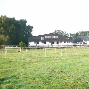
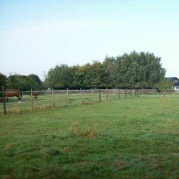
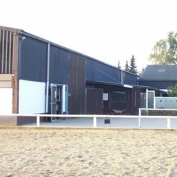
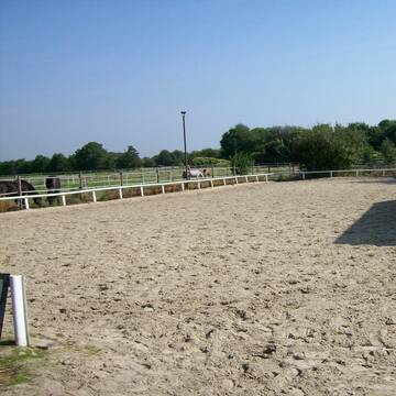
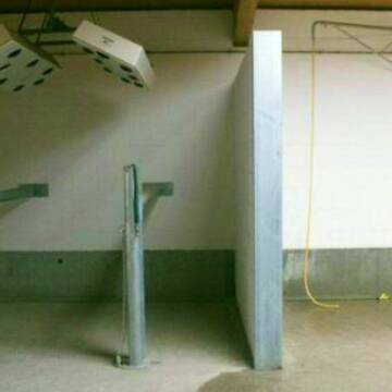
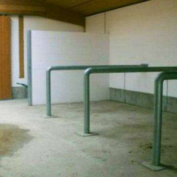
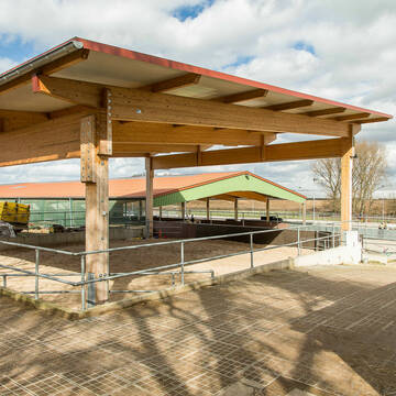
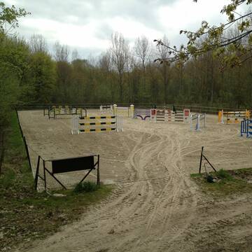
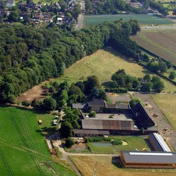
Reitstall Mühlenbeck
Hürth
Reitstall-Muehlenbeck
@Reitstall-Muehlenbeck
FN-Mitglied
Freizeitstall
Vermieten
Hunde willkommen
Longierzirkel/Roundpen
Außenbox mit Paddock
Außenboxen
19 weitere...
aktuell
S
Deprecated: Creation of dynamic property Zend_View_Helper_Ads::$adLink is deprecated in /var/www/stall-frei/htdocs/staging.stall-frei.de/library/Psf/View/Helper/Ads.php on line 108

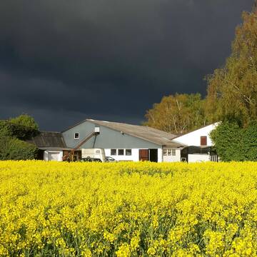
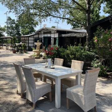
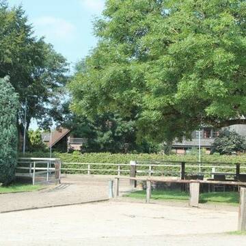
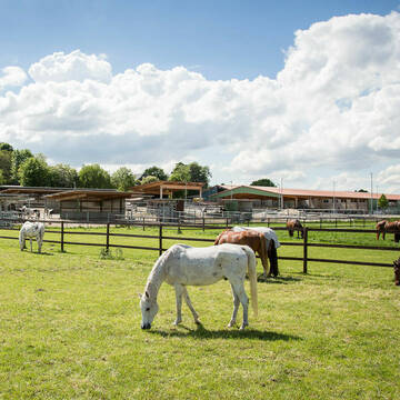
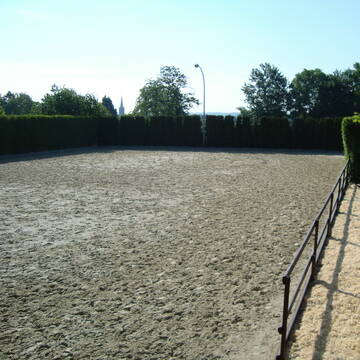
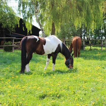
***Reitstall Birkenhof*** Pferdegerechte Haltung
Köln
Daniele-Fazzi
@Daniele-Fazzi
Herzlich Willkommen
auf dem Reitstall Birkenhof
Jetzt neu ‼️ auf dem Birkenhof:
Private Geländestrecke rund um unser


***Reitstall Birkenhof*** Pferdegerechte Haltung
Köln
Daniele-Fazzi
@Daniele-Fazzi
Freizeitstall
Geländestrecke
Vermieten
Verpachten
Hunde willkommen
Longierzirkel/Roundpen
Allergikerstall
Hufrehe geeignet
23 weitere...
ganz aktuell
S


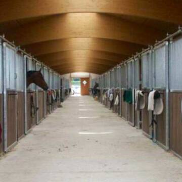
Historische Reitanlage in Köln-Dellbrück
Köln
RGS Kornspringer Köln e. V.
@Kornspringer
FN-Mitglied
Freizeitstall
Vermieten
Führanlage
Hunde willkommen
bedampftes/gewaschenes Heu
Notfallboxen
21 weitere...
S
Wir haben aktuell Paddockbox-Fensterbox frei
Pulheim
Schumacher
@Reitanlage-Junkerhof
FN-Mitglied
Pferdeausbildung
Führanlage
Hunde willkommen
Allergikerstall
bedampftes/gewaschenes Heu
Außenbox mit Paddock
Außenboxen
26 weitere...
aktuell
S

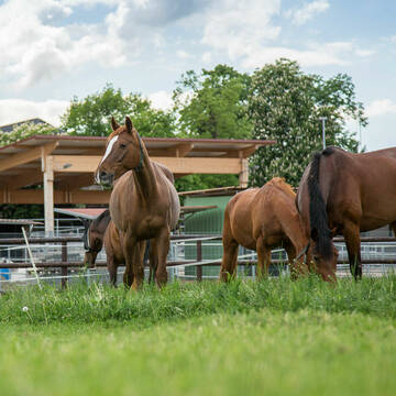
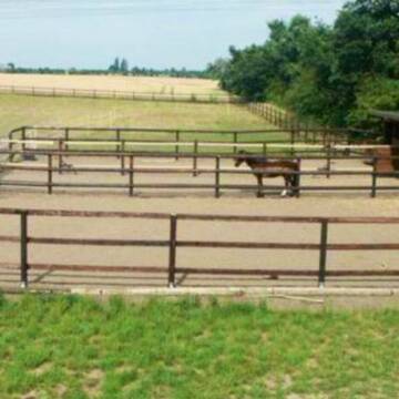
Heinrichshof Aktivstall
Köln Fühlingen
Frenger GbR - Heinrichshof
@Frenger-GbR
FN-Mitglied
Freizeitstall
Hunde willkommen
Krankenbox
Allergikerstall
bedampftes/gewaschenes Heu
Außenbox mit Paddock
Bewegungsstall
22 weitere...
S
Pensions und Sportstall Gestüt Lindenbusch
Frechen
Mercedes Fischer-Busse
@Mercedes Fischer-Busse
FN-Mitglied
Freizeitstall
Vermieten
Führanlage
Laufband
Pferdezucht
Zuchtstutenhaltung möglich
19 weitere...
P+

Heu und Heulage verkaufen
Mechtersen
STALL-FREIde Marketing
@STALL-FREI-Marketing
Verkaufen Sie Ihr Heu und Ihre Heulage direkt an Reiter, Pferdeställe und Reitanlagen

Hardthof Dellbrück Paddockbox frei
Köln
Laura Muysers
@Hardthof-Dellbrueck
Vermieten
Hunde willkommen
Longierzirkel/Roundpen
Hufrehe geeignet
Außenbox mit Paddock
Außenboxen
11 weitere...
P
Konraderhof
Köln
Konraderhof
@Konraderhof
FN-Mitglied
Freizeitstall
Vermieten
Hunde willkommen
Krankenbox
Außenboxen
Innenbox
17 weitere...
P


Exklusive Reitanlage in Kerpen
Kerpen
Reitanlage Im Jagdfeld
@Andrea77
Führanlage
Hunde willkommen
Hengsthaltung möglich
Halbpension
Vollpension
Einzelne Boxen oder Stallplätze
16 weitere...
S


nur 30 Pferde privat und pferdegerecht
Weilerswist
Beate Horn-Moll&Mike Horn
@SchwalbenhofGBR
Freizeitstall
Geländestrecke
Vermieten
Hunde willkommen
Longierzirkel/Roundpen
Fohlenaufzucht möglich
Notfallboxen
23 weitere...
S
Deprecated: Creation of dynamic property Zend_View::$pageCount is deprecated in /var/www/stall-frei/htdocs/staging.stall-frei.de/library/vendor/shardj/zf1-future/library/Zend/View/Abstract.php on line 308
Deprecated: Creation of dynamic property Zend_View::$itemCountPerPage is deprecated in /var/www/stall-frei/htdocs/staging.stall-frei.de/library/vendor/shardj/zf1-future/library/Zend/View/Abstract.php on line 308
Deprecated: Creation of dynamic property Zend_View::$first is deprecated in /var/www/stall-frei/htdocs/staging.stall-frei.de/library/vendor/shardj/zf1-future/library/Zend/View/Abstract.php on line 308
Deprecated: Creation of dynamic property Zend_View::$current is deprecated in /var/www/stall-frei/htdocs/staging.stall-frei.de/library/vendor/shardj/zf1-future/library/Zend/View/Abstract.php on line 308
Deprecated: Creation of dynamic property Zend_View::$last is deprecated in /var/www/stall-frei/htdocs/staging.stall-frei.de/library/vendor/shardj/zf1-future/library/Zend/View/Abstract.php on line 308
Deprecated: Creation of dynamic property Zend_View::$next is deprecated in /var/www/stall-frei/htdocs/staging.stall-frei.de/library/vendor/shardj/zf1-future/library/Zend/View/Abstract.php on line 308
Deprecated: Creation of dynamic property Zend_View::$pagesInRange is deprecated in /var/www/stall-frei/htdocs/staging.stall-frei.de/library/vendor/shardj/zf1-future/library/Zend/View/Abstract.php on line 308
Deprecated: Creation of dynamic property Zend_View::$firstPageInRange is deprecated in /var/www/stall-frei/htdocs/staging.stall-frei.de/library/vendor/shardj/zf1-future/library/Zend/View/Abstract.php on line 308
Deprecated: Creation of dynamic property Zend_View::$lastPageInRange is deprecated in /var/www/stall-frei/htdocs/staging.stall-frei.de/library/vendor/shardj/zf1-future/library/Zend/View/Abstract.php on line 308
Deprecated: Creation of dynamic property Zend_View::$currentItemCount is deprecated in /var/www/stall-frei/htdocs/staging.stall-frei.de/library/vendor/shardj/zf1-future/library/Zend/View/Abstract.php on line 308
Deprecated: Creation of dynamic property Zend_View::$totalItemCount is deprecated in /var/www/stall-frei/htdocs/staging.stall-frei.de/library/vendor/shardj/zf1-future/library/Zend/View/Abstract.php on line 308
Deprecated: Creation of dynamic property Zend_View::$firstItemNumber is deprecated in /var/www/stall-frei/htdocs/staging.stall-frei.de/library/vendor/shardj/zf1-future/library/Zend/View/Abstract.php on line 308
Deprecated: Creation of dynamic property Zend_View::$lastItemNumber is deprecated in /var/www/stall-frei/htdocs/staging.stall-frei.de/library/vendor/shardj/zf1-future/library/Zend/View/Abstract.php on line 308
Deprecated: Creation of dynamic property Zend_View::$router is deprecated in /var/www/stall-frei/htdocs/staging.stall-frei.de/library/vendor/shardj/zf1-future/library/Zend/View/Abstract.php on line 308
Deprecated: Creation of dynamic property Zend_View::$urlParams is deprecated in /var/www/stall-frei/htdocs/staging.stall-frei.de/library/vendor/shardj/zf1-future/library/Zend/View/Abstract.php on line 308
Deprecated: Creation of dynamic property Zend_View::$showAds is deprecated in /var/www/stall-frei/htdocs/staging.stall-frei.de/library/vendor/shardj/zf1-future/library/Zend/View/Abstract.php on line 308
Deprecated: Creation of dynamic property Zend_View::$objectIds is deprecated in /var/www/stall-frei/htdocs/staging.stall-frei.de/library/vendor/shardj/zf1-future/library/Zend/View/Abstract.php on line 308
Deprecated: Creation of dynamic property Zend_View::$showNavbar is deprecated in /var/www/stall-frei/htdocs/staging.stall-frei.de/library/vendor/shardj/zf1-future/library/Zend/View/Abstract.php on line 308
Deprecated: Creation of dynamic property Zend_View::$showBreadcrumb is deprecated in /var/www/stall-frei/htdocs/staging.stall-frei.de/library/vendor/shardj/zf1-future/library/Zend/View/Abstract.php on line 308
Deprecated: Creation of dynamic property Zend_View::$showFooter is deprecated in /var/www/stall-frei/htdocs/staging.stall-frei.de/library/vendor/shardj/zf1-future/library/Zend/View/Abstract.php on line 308
Deprecated: Creation of dynamic property Zend_View::$showInternalAds is deprecated in /var/www/stall-frei/htdocs/staging.stall-frei.de/library/vendor/shardj/zf1-future/library/Zend/View/Abstract.php on line 308
Deprecated: Creation of dynamic property Zend_View::$blNoContent is deprecated in /var/www/stall-frei/htdocs/staging.stall-frei.de/library/vendor/shardj/zf1-future/library/Zend/View/Abstract.php on line 308
Deprecated: Creation of dynamic property Zend_View::$sMetaDesc is deprecated in /var/www/stall-frei/htdocs/staging.stall-frei.de/library/vendor/shardj/zf1-future/library/Zend/View/Abstract.php on line 308
Deprecated: Creation of dynamic property Zend_View::$useGmaps is deprecated in /var/www/stall-frei/htdocs/staging.stall-frei.de/library/vendor/shardj/zf1-future/library/Zend/View/Abstract.php on line 308
Deprecated: Creation of dynamic property Zend_View::$touches is deprecated in /var/www/stall-frei/htdocs/staging.stall-frei.de/library/vendor/shardj/zf1-future/library/Zend/View/Abstract.php on line 308
Deprecated: Creation of dynamic property Zend_View::$oProject is deprecated in /var/www/stall-frei/htdocs/staging.stall-frei.de/library/vendor/shardj/zf1-future/library/Zend/View/Abstract.php on line 308
Deprecated: Creation of dynamic property Zend_View::$pageHeadline is deprecated in /var/www/stall-frei/htdocs/staging.stall-frei.de/library/vendor/shardj/zf1-future/library/Zend/View/Abstract.php on line 308
Deprecated: Creation of dynamic property Zend_View::$disableLocationField is deprecated in /var/www/stall-frei/htdocs/staging.stall-frei.de/library/vendor/shardj/zf1-future/library/Zend/View/Abstract.php on line 308
Deprecated: Creation of dynamic property Zend_View::$isSearch is deprecated in /var/www/stall-frei/htdocs/staging.stall-frei.de/library/vendor/shardj/zf1-future/library/Zend/View/Abstract.php on line 308
Deprecated: Creation of dynamic property Zend_View::$pageTitle is deprecated in /var/www/stall-frei/htdocs/staging.stall-frei.de/library/vendor/shardj/zf1-future/library/Zend/View/Abstract.php on line 308
Deprecated: Creation of dynamic property Psf_Form_Element_Text::$class is deprecated in /var/www/stall-frei/htdocs/staging.stall-frei.de/library/vendor/shardj/zf1-future/library/Zend/Form/Element.php on line 874
Deprecated: Creation of dynamic property Psf_Form_Element_Text::$size is deprecated in /var/www/stall-frei/htdocs/staging.stall-frei.de/library/vendor/shardj/zf1-future/library/Zend/Form/Element.php on line 874
Deprecated: Creation of dynamic property Psf_Form_Element_Text::$placeholder is deprecated in /var/www/stall-frei/htdocs/staging.stall-frei.de/library/vendor/shardj/zf1-future/library/Zend/Form/Element.php on line 874
Deprecated: Creation of dynamic property Psf_Form_Element_Hidden::$class is deprecated in /var/www/stall-frei/htdocs/staging.stall-frei.de/library/vendor/shardj/zf1-future/library/Zend/Form/Element.php on line 874
Deprecated: Creation of dynamic property Psf_Form_Element_Hidden::$class is deprecated in /var/www/stall-frei/htdocs/staging.stall-frei.de/library/vendor/shardj/zf1-future/library/Zend/Form/Element.php on line 874
Deprecated: Creation of dynamic property Psf_Form_Element_Hidden::$class is deprecated in /var/www/stall-frei/htdocs/staging.stall-frei.de/library/vendor/shardj/zf1-future/library/Zend/Form/Element.php on line 874
Deprecated: Creation of dynamic property Psf_Form_Element_Hidden::$class is deprecated in /var/www/stall-frei/htdocs/staging.stall-frei.de/library/vendor/shardj/zf1-future/library/Zend/Form/Element.php on line 874
Deprecated: Creation of dynamic property Psf_Form_Element_Select::$class is deprecated in /var/www/stall-frei/htdocs/staging.stall-frei.de/library/vendor/shardj/zf1-future/library/Zend/Form/Element.php on line 874
Deprecated: Creation of dynamic property Psf_Form_Element_Select::$class is deprecated in /var/www/stall-frei/htdocs/staging.stall-frei.de/library/vendor/shardj/zf1-future/library/Zend/Form/Element.php on line 874
Deprecated: Creation of dynamic property Psf_Form_Element_Select::$class is deprecated in /var/www/stall-frei/htdocs/staging.stall-frei.de/library/vendor/shardj/zf1-future/library/Zend/Form/Element.php on line 874
Deprecated: Creation of dynamic property Psf_Form_Element_Select::$class is deprecated in /var/www/stall-frei/htdocs/staging.stall-frei.de/library/vendor/shardj/zf1-future/library/Zend/Form/Element.php on line 874
Deprecated: Creation of dynamic property Psf_Form_Element_Text::$class is deprecated in /var/www/stall-frei/htdocs/staging.stall-frei.de/library/vendor/shardj/zf1-future/library/Zend/Form/Element.php on line 874
Deprecated: Creation of dynamic property Psf_Form_Element_Checkbox::$label is deprecated in /var/www/stall-frei/htdocs/staging.stall-frei.de/library/vendor/shardj/zf1-future/library/Zend/Form/Element.php on line 874
Deprecated: Creation of dynamic property Zend_View::$sort is deprecated in /var/www/stall-frei/htdocs/staging.stall-frei.de/library/vendor/shardj/zf1-future/library/Zend/View/Abstract.php on line 308
Deprecated: Creation of dynamic property Zend_View::$searchLocation is deprecated in /var/www/stall-frei/htdocs/staging.stall-frei.de/library/vendor/shardj/zf1-future/library/Zend/View/Abstract.php on line 308
Deprecated: Creation of dynamic property Zend_View::$locationHint is deprecated in /var/www/stall-frei/htdocs/staging.stall-frei.de/library/vendor/shardj/zf1-future/library/Zend/View/Abstract.php on line 308
Psf_GeoCoder_Abstract::getLocation: Klettenberg Get Location CachedOrLive
Psf_GeoCoder_Abstract::getCachedOrLive: Klettenberg
Psf_GeoCoder_OpenCageData::makeApiRequest: response:
Array
(
[documentation] => https://opencagedata.com/api
[licenses] => Array
(
[0] => Array
(
[name] => see attribution guide
[url] => https://opencagedata.com/credits
)
)
[results] => Array
(
[0] => Array
(
[bounds] => Array
(
[northeast] => Array
(
[lat] => 50.9158454
[lng] => 6.9338738
)
[southwest] => Array
(
[lat] => 50.8932448
[lng] => 6.907928
)
)
[components] => Array
(
[ISO_3166-1_alpha-2] => DE
[ISO_3166-1_alpha-3] => DEU
[ISO_3166-2] => Array
(
[0] => DE-NW
)
[_category] => place
[_normalized_city] => Köln
[_type] => neighbourhood
[city] => Köln
[city_district] => Lindenthal
[continent] => Europe
[country] => Deutschland
[country_code] => de
[political_union] => European Union
[postcode] => 50939
[state] => Nordrhein-Westfalen
[state_code] => NW
[suburb] => Klettenberg
)
[confidence] => 7
[formatted] => 50939 Köln, Deutschland
[geometry] => Array
(
[lat] => 50.9098095
[lng] => 6.924653
)
)
[1] => Array
(
[bounds] => Array
(
[northeast] => Array
(
[lat] => 51.5760447
[lng] => 10.6144003
)
[southwest] => Array
(
[lat] => 51.5360447
[lng] => 10.5744003
)
)
[components] => Array
(
[ISO_3166-1_alpha-2] => DE
[ISO_3166-1_alpha-3] => DEU
[ISO_3166-2] => Array
(
[0] => DE-TH
)
[_category] => place
[_normalized_city] => Hohenstein
[_type] => village
[city] => Hohenstein
[continent] => Europe
[country] => Deutschland
[country_code] => de
[county] => Landkreis Nordhausen
[political_union] => European Union
[postcode] => 99755
[state] => Thüringen
[state_code] => TH
[village] => Klettenberg
)
[confidence] => 7
[formatted] => 99755 Klettenberg, Deutschland
[geometry] => Array
(
[lat] => 51.5560447
[lng] => 10.5944003
)
)
[2] => Array
(
[bounds] => Array
(
[northeast] => Array
(
[lat] => 51.2550769
[lng] => 8.0726304
)
[southwest] => Array
(
[lat] => 51.2549769
[lng] => 8.0725304
)
)
[components] => Array
(
[ISO_3166-1_alpha-2] => DE
[ISO_3166-1_alpha-3] => DEU
[ISO_3166-2] => Array
(
[0] => DE-NW
)
[_category] => natural/water
[_normalized_city] => Eslohe
[_type] => peak
[continent] => Europe
[country] => Deutschland
[country_code] => de
[county] => Hochsauerlandkreis
[peak] => Klettenberg
[political_union] => European Union
[state] => Nordrhein-Westfalen
[state_code] => NW
[town] => Eslohe
)
[confidence] => 9
[formatted] => Klettenberg, Eslohe, Nordrhein-Westfalen, Deutschland
[geometry] => Array
(
[lat] => 51.2550269
[lng] => 8.0725804
)
)
[3] => Array
(
[bounds] => Array
(
[northeast] => Array
(
[lat] => 49.6243358
[lng] => 9.5083485
)
[southwest] => Array
(
[lat] => 49.6242358
[lng] => 9.5082485
)
)
[components] => Array
(
[ISO_3166-1_alpha-2] => DE
[ISO_3166-1_alpha-3] => DEU
[ISO_3166-2] => Array
(
[0] => DE-BW
)
[_category] => natural/water
[_normalized_city] => Hardheim
[_type] => peak
[continent] => Europe
[country] => Deutschland
[country_code] => de
[county] => Neckar-Odenwald-Kreis
[municipality] => GVV Hardheim-Walldürn
[peak] => Klettenberg
[political_union] => European Union
[postcode] => 74736
[state] => Baden-Württemberg
[state_code] => BW
[village] => Hardheim
)
[confidence] => 9
[formatted] => Klettenberg, 74736 Hardheim, Deutschland
[geometry] => Array
(
[lat] => 49.6242858
[lng] => 9.5082985
)
)
[4] => Array
(
[bounds] => Array
(
[northeast] => Array
(
[lat] => 49.9302622
[lng] => 9.713285
)
[southwest] => Array
(
[lat] => 49.9301622
[lng] => 9.713185
)
)
[components] => Array
(
[ISO_3166-1_alpha-2] => DE
[ISO_3166-1_alpha-3] => DEU
[ISO_3166-2] => Array
(
[0] => DE-BY
)
[_category] => natural/water
[_normalized_city] => Karlstadt
[_type] => peak
[continent] => Europe
[country] => Deutschland
[country_code] => de
[county] => Landkreis Main-Spessart
[peak] => Klettenberg
[political_union] => European Union
[state] => Bayern
[state_code] => BY
[town] => Karlstadt
)
[confidence] => 9
[formatted] => Klettenberg, Karlstadt, Bayern, Deutschland
[geometry] => Array
(
[lat] => 49.9302122
[lng] => 9.713235
)
)
[5] => Array
(
[bounds] => Array
(
[northeast] => Array
(
[lat] => 50.2820117
[lng] => 10.3259752
)
[southwest] => Array
(
[lat] => 50.2620117
[lng] => 10.3059752
)
)
[components] => Array
(
[ISO_3166-1_alpha-2] => DE
[ISO_3166-1_alpha-3] => DEU
[ISO_3166-2] => Array
(
[0] => DE-BY
)
[_category] => place
[_normalized_city] => Münnerstadt
[_type] => hamlet
[continent] => Europe
[country] => Deutschland
[country_code] => de
[county] => Landkreis Bad Kissingen
[locality] => Klettenberg
[political_union] => European Union
[postcode] => 97702
[state] => Bayern
[state_code] => BY
[town] => Münnerstadt
)
[confidence] => 8
[formatted] => Klettenberg, 97702 Münnerstadt, Deutschland
[geometry] => Array
(
[lat] => 50.2720117
[lng] => 10.3159752
)
)
[6] => Array
(
[bounds] => Array
(
[northeast] => Array
(
[lat] => 49.6281079
[lng] => 9.5198763
)
[southwest] => Array
(
[lat] => 49.6081079
[lng] => 9.4998763
)
)
[components] => Array
(
[ISO_3166-1_alpha-2] => DE
[ISO_3166-1_alpha-3] => DEU
[ISO_3166-2] => Array
(
[0] => DE-BW
)
[_category] => place
[_normalized_city] => Hardheim
[_type] => hamlet
[city] => Hardheim
[continent] => Europe
[country] => Deutschland
[country_code] => de
[county] => Neckar-Odenwald-Kreis
[locality] => Klettenberg
[municipality] => GVV Hardheim-Walldürn
[political_union] => European Union
[postcode] => 74736
[state] => Baden-Württemberg
[state_code] => BW
[village] => Schweinberg
)
[confidence] => 8
[formatted] => Klettenberg, 74736 Schweinberg, Deutschland
[geometry] => Array
(
[lat] => 49.6181079
[lng] => 9.5098763
)
)
[7] => Array
(
[bounds] => Array
(
[northeast] => Array
(
[lat] => 51.2594824
[lng] => 8.0775789
)
[southwest] => Array
(
[lat] => 51.2394824
[lng] => 8.0575789
)
)
[components] => Array
(
[ISO_3166-1_alpha-2] => DE
[ISO_3166-1_alpha-3] => DEU
[ISO_3166-2] => Array
(
[0] => DE-NW
)
[_category] => place
[_normalized_city] => Sundern
[_type] => hamlet
[continent] => Europe
[country] => Deutschland
[country_code] => de
[county] => Hochsauerlandkreis
[hamlet] => Kloster Brunnen
[locality] => Klettenberg
[political_union] => European Union
[postcode] => 59846
[state] => Nordrhein-Westfalen
[state_code] => NW
[town] => Sundern
)
[confidence] => 8
[formatted] => Kloster Brunnen, 59846 Sundern, Deutschland
[geometry] => Array
(
[lat] => 51.2494824
[lng] => 8.0675789
)
)
[8] => Array
(
[bounds] => Array
(
[northeast] => Array
(
[lat] => 48.9082291
[lng] => 8.6515242
)
[southwest] => Array
(
[lat] => 48.8882291
[lng] => 8.6315242
)
)
[components] => Array
(
[ISO_3166-1_alpha-2] => DE
[ISO_3166-1_alpha-3] => DEU
[ISO_3166-2] => Array
(
[0] => DE-BW
)
[_category] => place
[_normalized_city] => Pforzheim
[_type] => hamlet
[city] => Pforzheim
[continent] => Europe
[country] => Deutschland
[country_code] => de
[locality] => Klettenberg
[political_union] => European Union
[postcode] => 75179
[state] => Baden-Württemberg
[state_code] => BW
)
[confidence] => 8
[formatted] => Klettenberg, 75179 Pforzheim, Deutschland
[geometry] => Array
(
[lat] => 48.8982291
[lng] => 8.6415242
)
)
[9] => Array
(
[bounds] => Array
(
[northeast] => Array
(
[lat] => 49.7275308
[lng] => 10.192537
)
[southwest] => Array
(
[lat] => 49.724965
[lng] => 10.1893523
)
)
[components] => Array
(
[ISO_3166-1_alpha-2] => DE
[ISO_3166-1_alpha-3] => DEU
[ISO_3166-2] => Array
(
[0] => DE-BY
)
[_category] => road
[_normalized_city] => Kitzingen
[_type] => road
[continent] => Europe
[country] => Deutschland
[country_code] => de
[county] => Landkreis Kitzingen
[political_union] => European Union
[postcode] => 97318
[quarter] => Galgenmühle
[road] => Klettenberg
[road_type] => residential
[state] => Bayern
[state_code] => BY
[suburb] => Siedlung
[town] => Kitzingen
)
[confidence] => 9
[formatted] => Klettenberg, 97318 Kitzingen, Deutschland
[geometry] => Array
(
[lat] => 49.7253946
[lng] => 10.1902289
)
)
)
[status] => Array
(
[code] => 200
[message] => OK
)
[stay_informed] => Array
(
[blog] => https://blog.opencagedata.com
[mastodon] => https://en.osm.town/@opencage
)
[thanks] => For using an OpenCage API
[timestamp] => Array
(
[created_http] => Sun, 08 Feb 2026 14:58:53 GMT
[created_unix] => 1770562733
)
[total_results] => 10
)
Psf_GeoCoder_Abstract::convertLocationResult
{"documentation":"https:\/\/opencagedata.com\/api","licenses":[{"name":"see attribution guide","url":"https:\/\/opencagedata.com\/credits"}],"results":[{"bounds":{"northeast":{"lat":50.9158454,"lng":6.9338738},"southwest":{"lat":50.8932448,"lng":6.907928}},"components":{"ISO_3166-1_alpha-2":"DE","ISO_3166-1_alpha-3":"DEU","ISO_3166-2":["DE-NW"],"_category":"place","_normalized_city":"K\u00f6ln","_type":"neighbourhood","city":"K\u00f6ln","city_district":"Lindenthal","continent":"Europe","country":"Deutschland","country_code":"de","political_union":"European Union","postcode":"50939","state":"Nordrhein-Westfalen","state_code":"NW","suburb":"Klettenberg"},"confidence":7,"formatted":"50939 K\u00f6ln, Deutschland","geometry":{"lat":50.9098095,"lng":6.924653}},{"bounds":{"northeast":{"lat":51.5760447,"lng":10.6144003},"southwest":{"lat":51.5360447,"lng":10.5744003}},"components":{"ISO_3166-1_alpha-2":"DE","ISO_3166-1_alpha-3":"DEU","ISO_3166-2":["DE-TH"],"_category":"place","_normalized_city":"Hohenstein","_type":"village","city":"Hohenstein","continent":"Europe","country":"Deutschland","country_code":"de","county":"Landkreis Nordhausen","political_union":"European Union","postcode":"99755","state":"Th\u00fcringen","state_code":"TH","village":"Klettenberg"},"confidence":7,"formatted":"99755 Klettenberg, Deutschland","geometry":{"lat":51.5560447,"lng":10.5944003}},{"bounds":{"northeast":{"lat":51.2550769,"lng":8.0726304},"southwest":{"lat":51.2549769,"lng":8.0725304}},"components":{"ISO_3166-1_alpha-2":"DE","ISO_3166-1_alpha-3":"DEU","ISO_3166-2":["DE-NW"],"_category":"natural\/water","_normalized_city":"Eslohe","_type":"peak","continent":"Europe","country":"Deutschland","country_code":"de","county":"Hochsauerlandkreis","peak":"Klettenberg","political_union":"European Union","state":"Nordrhein-Westfalen","state_code":"NW","town":"Eslohe"},"confidence":9,"formatted":"Klettenberg, Eslohe, Nordrhein-Westfalen, Deutschland","geometry":{"lat":51.2550269,"lng":8.0725804}},{"bounds":{"northeast":{"lat":49.6243358,"lng":9.5083485},"southwest":{"lat":49.6242358,"lng":9.5082485}},"components":{"ISO_3166-1_alpha-2":"DE","ISO_3166-1_alpha-3":"DEU","ISO_3166-2":["DE-BW"],"_category":"natural\/water","_normalized_city":"Hardheim","_type":"peak","continent":"Europe","country":"Deutschland","country_code":"de","county":"Neckar-Odenwald-Kreis","municipality":"GVV Hardheim-Walld\u00fcrn","peak":"Klettenberg","political_union":"European Union","postcode":"74736","state":"Baden-W\u00fcrttemberg","state_code":"BW","village":"Hardheim"},"confidence":9,"formatted":"Klettenberg, 74736 Hardheim, Deutschland","geometry":{"lat":49.6242858,"lng":9.5082985}},{"bounds":{"northeast":{"lat":49.9302622,"lng":9.713285},"southwest":{"lat":49.9301622,"lng":9.713185}},"components":{"ISO_3166-1_alpha-2":"DE","ISO_3166-1_alpha-3":"DEU","ISO_3166-2":["DE-BY"],"_category":"natural\/water","_normalized_city":"Karlstadt","_type":"peak","continent":"Europe","country":"Deutschland","country_code":"de","county":"Landkreis Main-Spessart","peak":"Klettenberg","political_union":"European Union","state":"Bayern","state_code":"BY","town":"Karlstadt"},"confidence":9,"formatted":"Klettenberg, Karlstadt, Bayern, Deutschland","geometry":{"lat":49.9302122,"lng":9.713235}},{"bounds":{"northeast":{"lat":50.2820117,"lng":10.3259752},"southwest":{"lat":50.2620117,"lng":10.3059752}},"components":{"ISO_3166-1_alpha-2":"DE","ISO_3166-1_alpha-3":"DEU","ISO_3166-2":["DE-BY"],"_category":"place","_normalized_city":"M\u00fcnnerstadt","_type":"hamlet","continent":"Europe","country":"Deutschland","country_code":"de","county":"Landkreis Bad Kissingen","locality":"Klettenberg","political_union":"European Union","postcode":"97702","state":"Bayern","state_code":"BY","town":"M\u00fcnnerstadt"},"confidence":8,"formatted":"Klettenberg, 97702 M\u00fcnnerstadt, Deutschland","geometry":{"lat":50.2720117,"lng":10.3159752}},{"bounds":{"northeast":{"lat":49.6281079,"lng":9.5198763},"southwest":{"lat":49.6081079,"lng":9.4998763}},"components":{"ISO_3166-1_alpha-2":"DE","ISO_3166-1_alpha-3":"DEU","ISO_3166-2":["DE-BW"],"_category":"place","_normalized_city":"Hardheim","_type":"hamlet","city":"Hardheim","continent":"Europe","country":"Deutschland","country_code":"de","county":"Neckar-Odenwald-Kreis","locality":"Klettenberg","municipality":"GVV Hardheim-Walld\u00fcrn","political_union":"European Union","postcode":"74736","state":"Baden-W\u00fcrttemberg","state_code":"BW","village":"Schweinberg"},"confidence":8,"formatted":"Klettenberg, 74736 Schweinberg, Deutschland","geometry":{"lat":49.6181079,"lng":9.5098763}},{"bounds":{"northeast":{"lat":51.2594824,"lng":8.0775789},"southwest":{"lat":51.2394824,"lng":8.0575789}},"components":{"ISO_3166-1_alpha-2":"DE","ISO_3166-1_alpha-3":"DEU","ISO_3166-2":["DE-NW"],"_category":"place","_normalized_city":"Sundern","_type":"hamlet","continent":"Europe","country":"Deutschland","country_code":"de","county":"Hochsauerlandkreis","hamlet":"Kloster Brunnen","locality":"Klettenberg","political_union":"European Union","postcode":"59846","state":"Nordrhein-Westfalen","state_code":"NW","town":"Sundern"},"confidence":8,"formatted":"Kloster Brunnen, 59846 Sundern, Deutschland","geometry":{"lat":51.2494824,"lng":8.0675789}},{"bounds":{"northeast":{"lat":48.9082291,"lng":8.6515242},"southwest":{"lat":48.8882291,"lng":8.6315242}},"components":{"ISO_3166-1_alpha-2":"DE","ISO_3166-1_alpha-3":"DEU","ISO_3166-2":["DE-BW"],"_category":"place","_normalized_city":"Pforzheim","_type":"hamlet","city":"Pforzheim","continent":"Europe","country":"Deutschland","country_code":"de","locality":"Klettenberg","political_union":"European Union","postcode":"75179","state":"Baden-W\u00fcrttemberg","state_code":"BW"},"confidence":8,"formatted":"Klettenberg, 75179 Pforzheim, Deutschland","geometry":{"lat":48.8982291,"lng":8.6415242}},{"bounds":{"northeast":{"lat":49.7275308,"lng":10.192537},"southwest":{"lat":49.724965,"lng":10.1893523}},"components":{"ISO_3166-1_alpha-2":"DE","ISO_3166-1_alpha-3":"DEU","ISO_3166-2":["DE-BY"],"_category":"road","_normalized_city":"Kitzingen","_type":"road","continent":"Europe","country":"Deutschland","country_code":"de","county":"Landkreis Kitzingen","political_union":"European Union","postcode":"97318","quarter":"Galgenm\u00fchle","road":"Klettenberg","road_type":"residential","state":"Bayern","state_code":"BY","suburb":"Siedlung","town":"Kitzingen"},"confidence":9,"formatted":"Klettenberg, 97318 Kitzingen, Deutschland","geometry":{"lat":49.7253946,"lng":10.1902289}}],"status":{"code":200,"message":"OK"},"stay_informed":{"blog":"https:\/\/blog.opencagedata.com","mastodon":"https:\/\/en.osm.town\/@opencage"},"thanks":"For using an OpenCage API","timestamp":{"created_http":"Sun, 08 Feb 2026 14:58:53 GMT","created_unix":1770562733},"total_results":10}Array
(
[0] => stdClass Object
(
[bounds] => stdClass Object
(
[northeast] => stdClass Object
(
[lat] => 50.9158454
[lng] => 6.9338738
)
[southwest] => stdClass Object
(
[lat] => 50.8932448
[lng] => 6.907928
)
)
[components] => stdClass Object
(
[ISO_3166-1_alpha-2] => DE
[ISO_3166-1_alpha-3] => DEU
[ISO_3166-2] => Array
(
[0] => DE-NW
)
[_category] => place
[_normalized_city] => Köln
[_type] => neighbourhood
[city] => Köln
[city_district] => Lindenthal
[continent] => Europe
[country] => Deutschland
[country_code] => de
[political_union] => European Union
[postcode] => 50939
[state] => Nordrhein-Westfalen
[state_code] => NW
[suburb] => Klettenberg
)
[confidence] => 7
[formatted] => 50939 Köln, Deutschland
[geometry] => stdClass Object
(
[lat] => 50.9098095
[lng] => 6.924653
)
)
[1] => stdClass Object
(
[bounds] => stdClass Object
(
[northeast] => stdClass Object
(
[lat] => 51.5760447
[lng] => 10.6144003
)
[southwest] => stdClass Object
(
[lat] => 51.5360447
[lng] => 10.5744003
)
)
[components] => stdClass Object
(
[ISO_3166-1_alpha-2] => DE
[ISO_3166-1_alpha-3] => DEU
[ISO_3166-2] => Array
(
[0] => DE-TH
)
[_category] => place
[_normalized_city] => Hohenstein
[_type] => village
[city] => Hohenstein
[continent] => Europe
[country] => Deutschland
[country_code] => de
[county] => Landkreis Nordhausen
[political_union] => European Union
[postcode] => 99755
[state] => Thüringen
[state_code] => TH
[village] => Klettenberg
)
[confidence] => 7
[formatted] => 99755 Klettenberg, Deutschland
[geometry] => stdClass Object
(
[lat] => 51.5560447
[lng] => 10.5944003
)
)
[2] => stdClass Object
(
[bounds] => stdClass Object
(
[northeast] => stdClass Object
(
[lat] => 51.2550769
[lng] => 8.0726304
)
[southwest] => stdClass Object
(
[lat] => 51.2549769
[lng] => 8.0725304
)
)
[components] => stdClass Object
(
[ISO_3166-1_alpha-2] => DE
[ISO_3166-1_alpha-3] => DEU
[ISO_3166-2] => Array
(
[0] => DE-NW
)
[_category] => natural/water
[_normalized_city] => Eslohe
[_type] => peak
[continent] => Europe
[country] => Deutschland
[country_code] => de
[county] => Hochsauerlandkreis
[peak] => Klettenberg
[political_union] => European Union
[state] => Nordrhein-Westfalen
[state_code] => NW
[town] => Eslohe
)
[confidence] => 9
[formatted] => Klettenberg, Eslohe, Nordrhein-Westfalen, Deutschland
[geometry] => stdClass Object
(
[lat] => 51.2550269
[lng] => 8.0725804
)
)
[3] => stdClass Object
(
[bounds] => stdClass Object
(
[northeast] => stdClass Object
(
[lat] => 49.6243358
[lng] => 9.5083485
)
[southwest] => stdClass Object
(
[lat] => 49.6242358
[lng] => 9.5082485
)
)
[components] => stdClass Object
(
[ISO_3166-1_alpha-2] => DE
[ISO_3166-1_alpha-3] => DEU
[ISO_3166-2] => Array
(
[0] => DE-BW
)
[_category] => natural/water
[_normalized_city] => Hardheim
[_type] => peak
[continent] => Europe
[country] => Deutschland
[country_code] => de
[county] => Neckar-Odenwald-Kreis
[municipality] => GVV Hardheim-Walldürn
[peak] => Klettenberg
[political_union] => European Union
[postcode] => 74736
[state] => Baden-Württemberg
[state_code] => BW
[village] => Hardheim
)
[confidence] => 9
[formatted] => Klettenberg, 74736 Hardheim, Deutschland
[geometry] => stdClass Object
(
[lat] => 49.6242858
[lng] => 9.5082985
)
)
[4] => stdClass Object
(
[bounds] => stdClass Object
(
[northeast] => stdClass Object
(
[lat] => 49.9302622
[lng] => 9.713285
)
[southwest] => stdClass Object
(
[lat] => 49.9301622
[lng] => 9.713185
)
)
[components] => stdClass Object
(
[ISO_3166-1_alpha-2] => DE
[ISO_3166-1_alpha-3] => DEU
[ISO_3166-2] => Array
(
[0] => DE-BY
)
[_category] => natural/water
[_normalized_city] => Karlstadt
[_type] => peak
[continent] => Europe
[country] => Deutschland
[country_code] => de
[county] => Landkreis Main-Spessart
[peak] => Klettenberg
[political_union] => European Union
[state] => Bayern
[state_code] => BY
[town] => Karlstadt
)
[confidence] => 9
[formatted] => Klettenberg, Karlstadt, Bayern, Deutschland
[geometry] => stdClass Object
(
[lat] => 49.9302122
[lng] => 9.713235
)
)
[5] => stdClass Object
(
[bounds] => stdClass Object
(
[northeast] => stdClass Object
(
[lat] => 50.2820117
[lng] => 10.3259752
)
[southwest] => stdClass Object
(
[lat] => 50.2620117
[lng] => 10.3059752
)
)
[components] => stdClass Object
(
[ISO_3166-1_alpha-2] => DE
[ISO_3166-1_alpha-3] => DEU
[ISO_3166-2] => Array
(
[0] => DE-BY
)
[_category] => place
[_normalized_city] => Münnerstadt
[_type] => hamlet
[continent] => Europe
[country] => Deutschland
[country_code] => de
[county] => Landkreis Bad Kissingen
[locality] => Klettenberg
[political_union] => European Union
[postcode] => 97702
[state] => Bayern
[state_code] => BY
[town] => Münnerstadt
)
[confidence] => 8
[formatted] => Klettenberg, 97702 Münnerstadt, Deutschland
[geometry] => stdClass Object
(
[lat] => 50.2720117
[lng] => 10.3159752
)
)
[6] => stdClass Object
(
[bounds] => stdClass Object
(
[northeast] => stdClass Object
(
[lat] => 49.6281079
[lng] => 9.5198763
)
[southwest] => stdClass Object
(
[lat] => 49.6081079
[lng] => 9.4998763
)
)
[components] => stdClass Object
(
[ISO_3166-1_alpha-2] => DE
[ISO_3166-1_alpha-3] => DEU
[ISO_3166-2] => Array
(
[0] => DE-BW
)
[_category] => place
[_normalized_city] => Hardheim
[_type] => hamlet
[city] => Hardheim
[continent] => Europe
[country] => Deutschland
[country_code] => de
[county] => Neckar-Odenwald-Kreis
[locality] => Klettenberg
[municipality] => GVV Hardheim-Walldürn
[political_union] => European Union
[postcode] => 74736
[state] => Baden-Württemberg
[state_code] => BW
[village] => Schweinberg
)
[confidence] => 8
[formatted] => Klettenberg, 74736 Schweinberg, Deutschland
[geometry] => stdClass Object
(
[lat] => 49.6181079
[lng] => 9.5098763
)
)
[7] => stdClass Object
(
[bounds] => stdClass Object
(
[northeast] => stdClass Object
(
[lat] => 51.2594824
[lng] => 8.0775789
)
[southwest] => stdClass Object
(
[lat] => 51.2394824
[lng] => 8.0575789
)
)
[components] => stdClass Object
(
[ISO_3166-1_alpha-2] => DE
[ISO_3166-1_alpha-3] => DEU
[ISO_3166-2] => Array
(
[0] => DE-NW
)
[_category] => place
[_normalized_city] => Sundern
[_type] => hamlet
[continent] => Europe
[country] => Deutschland
[country_code] => de
[county] => Hochsauerlandkreis
[hamlet] => Kloster Brunnen
[locality] => Klettenberg
[political_union] => European Union
[postcode] => 59846
[state] => Nordrhein-Westfalen
[state_code] => NW
[town] => Sundern
)
[confidence] => 8
[formatted] => Kloster Brunnen, 59846 Sundern, Deutschland
[geometry] => stdClass Object
(
[lat] => 51.2494824
[lng] => 8.0675789
)
)
[8] => stdClass Object
(
[bounds] => stdClass Object
(
[northeast] => stdClass Object
(
[lat] => 48.9082291
[lng] => 8.6515242
)
[southwest] => stdClass Object
(
[lat] => 48.8882291
[lng] => 8.6315242
)
)
[components] => stdClass Object
(
[ISO_3166-1_alpha-2] => DE
[ISO_3166-1_alpha-3] => DEU
[ISO_3166-2] => Array
(
[0] => DE-BW
)
[_category] => place
[_normalized_city] => Pforzheim
[_type] => hamlet
[city] => Pforzheim
[continent] => Europe
[country] => Deutschland
[country_code] => de
[locality] => Klettenberg
[political_union] => European Union
[postcode] => 75179
[state] => Baden-Württemberg
[state_code] => BW
)
[confidence] => 8
[formatted] => Klettenberg, 75179 Pforzheim, Deutschland
[geometry] => stdClass Object
(
[lat] => 48.8982291
[lng] => 8.6415242
)
)
[9] => stdClass Object
(
[bounds] => stdClass Object
(
[northeast] => stdClass Object
(
[lat] => 49.7275308
[lng] => 10.192537
)
[southwest] => stdClass Object
(
[lat] => 49.724965
[lng] => 10.1893523
)
)
[components] => stdClass Object
(
[ISO_3166-1_alpha-2] => DE
[ISO_3166-1_alpha-3] => DEU
[ISO_3166-2] => Array
(
[0] => DE-BY
)
[_category] => road
[_normalized_city] => Kitzingen
[_type] => road
[continent] => Europe
[country] => Deutschland
[country_code] => de
[county] => Landkreis Kitzingen
[political_union] => European Union
[postcode] => 97318
[quarter] => Galgenmühle
[road] => Klettenberg
[road_type] => residential
[state] => Bayern
[state_code] => BY
[suburb] => Siedlung
[town] => Kitzingen
)
[confidence] => 9
[formatted] => Klettenberg, 97318 Kitzingen, Deutschland
[geometry] => stdClass Object
(
[lat] => 49.7253946
[lng] => 10.1902289
)
)
)
Psf_GeoCoder_OpenCageData::getKeyMap: 0
stdClass Object
(
    [bounds] => stdClass Object
        (
            [northeast] => stdClass Object
                (
                    [lat] => 50.9158454
                    [lng] => 6.9338738
                )

            [southwest] => stdClass Object
                (
                    [lat] => 50.8932448
                    [lng] => 6.907928
                )

        )

    [components] => stdClass Object
        (
            [ISO_3166-1_alpha-2] => DE
            [ISO_3166-1_alpha-3] => DEU
            [ISO_3166-2] => Array
                (
                    [0] => DE-NW
                )

            [_category] => place
            [_normalized_city] => Köln
            [_type] => neighbourhood
            [city] => Köln
            [city_district] => Lindenthal
            [continent] => Europe
            [country] => Deutschland
            [country_code] => de
            [political_union] => European Union
            [postcode] => 50939
            [state] => Nordrhein-Westfalen
            [state_code] => NW
            [suburb] => Klettenberg
        )

    [confidence] => 7
    [formatted] => 50939 Köln, Deutschland
    [geometry] => stdClass Object
        (
            [lat] => 50.9098095
            [lng] => 6.924653
        )

)
Psf_GeoCoder_OpenCageData::getCounty: Köln
Psf_GeoCoder_OpenCageData::addMissingData REFETCH!
Array
(
    [address] => 50939 Köln, Deutschland
    [type] => neighbourhood
    [street] =>
    [city] => Klettenberg
    [county] => Köln
    [state] => Nordrhein-Westfalen
    [zip] => 50939
    [country] => Deutschland
    [suburb] => Klettenberg
    [countrycode] => de
    [latitude] => 50.9098095
    [longitude] => 6.924653
    [accuracy] => 1
    [confidence] => 7
    [bounds] => stdClass Object
        (
            [northeast] => stdClass Object
                (
                    [lat] => 50.9158454
                    [lng] => 6.9338738
                )

            [southwest] => stdClass Object
                (
                    [lat] => 50.8932448
                    [lng] => 6.907928
                )

        )

)
reformat!
Array
(
    [address] => 50939 Klettenberg
    [type] => neighbourhood
    [street] =>
    [city] => Klettenberg
    [county] => Köln
    [state] => Nordrhein-Westfalen
    [zip] => 50939
    [country] => Deutschland
    [suburb] => Klettenberg
    [countrycode] => de
    [latitude] => 50.9098095
    [longitude] => 6.924653
    [accuracy] => 1
    [confidence] => 7
    [bounds] => stdClass Object
        (
            [northeast] => stdClass Object
                (
                    [lat] => 50.9158454
                    [lng] => 6.9338738
                )

            [southwest] => stdClass Object
                (
                    [lat] => 50.8932448
                    [lng] => 6.907928
                )

        )

    [place] => 50939 Klettenberg, Nordrhein-Westfalen
    [hash] => ab2913f2023a4240f61eddab66c04026
)
Psf_GeoCoder_OpenCageData::getKeyMap: 1
stdClass Object
(
    [bounds] => stdClass Object
        (
            [northeast] => stdClass Object
                (
                    [lat] => 51.5760447
                    [lng] => 10.6144003
                )

            [southwest] => stdClass Object
                (
                    [lat] => 51.5360447
                    [lng] => 10.5744003
                )

        )

    [components] => stdClass Object
        (
            [ISO_3166-1_alpha-2] => DE
            [ISO_3166-1_alpha-3] => DEU
            [ISO_3166-2] => Array
                (
                    [0] => DE-TH
                )

            [_category] => place
            [_normalized_city] => Hohenstein
            [_type] => village
            [city] => Hohenstein
            [continent] => Europe
            [country] => Deutschland
            [country_code] => de
            [county] => Landkreis Nordhausen
            [political_union] => European Union
            [postcode] => 99755
            [state] => Thüringen
            [state_code] => TH
            [village] => Klettenberg
        )

    [confidence] => 7
    [formatted] => 99755 Klettenberg, Deutschland
    [geometry] => stdClass Object
        (
            [lat] => 51.5560447
            [lng] => 10.5944003
        )

)
Psf_GeoCoder_OpenCageData::getCounty: Nordhausen
Psf_GeoCoder_OpenCageData::addMissingData REFETCH!
Array
(
    [address] => 99755 Klettenberg, Deutschland
    [type] => village
    [street] =>
    [city] => Klettenberg
    [county] => Nordhausen
    [state] => Thüringen
    [zip] => 99755
    [country] => Deutschland
    [suburb] =>
    [countrycode] => de
    [latitude] => 51.5560447
    [longitude] => 10.5944003
    [accuracy] => 1
    [confidence] => 7
    [bounds] => stdClass Object
        (
            [northeast] => stdClass Object
                (
                    [lat] => 51.5760447
                    [lng] => 10.6144003
                )

            [southwest] => stdClass Object
                (
                    [lat] => 51.5360447
                    [lng] => 10.5744003
                )

        )

)
reformat!
Array
(
    [address] => 99755 Klettenberg, Deutschland
    [type] => village
    [street] =>
    [city] => Klettenberg
    [county] => Nordhausen
    [state] => Thüringen
    [zip] => 99755
    [country] => Deutschland
    [suburb] =>
    [countrycode] => de
    [latitude] => 51.5560447
    [longitude] => 10.5944003
    [accuracy] => 1
    [confidence] => 7
    [bounds] => stdClass Object
        (
            [northeast] => stdClass Object
                (
                    [lat] => 51.5760447
                    [lng] => 10.6144003
                )

            [southwest] => stdClass Object
                (
                    [lat] => 51.5360447
                    [lng] => 10.5744003
                )

        )

    [place] => 99755 Klettenberg, Thüringen
    [hash] => 65065bc5a23c05a9415a2de8f9574893
)
Psf_GeoCoder_OpenCageData::getKeyMap: 2
stdClass Object
(
    [bounds] => stdClass Object
        (
            [northeast] => stdClass Object
                (
                    [lat] => 51.2550769
                    [lng] => 8.0726304
                )

            [southwest] => stdClass Object
                (
                    [lat] => 51.2549769
                    [lng] => 8.0725304
                )

        )

    [components] => stdClass Object
        (
            [ISO_3166-1_alpha-2] => DE
            [ISO_3166-1_alpha-3] => DEU
            [ISO_3166-2] => Array
                (
                    [0] => DE-NW
                )

            [_category] => natural/water
            [_normalized_city] => Eslohe
            [_type] => peak
            [continent] => Europe
            [country] => Deutschland
            [country_code] => de
            [county] => Hochsauerlandkreis
            [peak] => Klettenberg
            [political_union] => European Union
            [state] => Nordrhein-Westfalen
            [state_code] => NW
            [town] => Eslohe
        )

    [confidence] => 9
    [formatted] => Klettenberg, Eslohe, Nordrhein-Westfalen, Deutschland
    [geometry] => stdClass Object
        (
            [lat] => 51.2550269
            [lng] => 8.0725804
        )

)
Psf_GeoCoder_OpenCageData::getCounty: Hochsauerlandkreis
Psf_GeoCoder_OpenCageData::addMissingData REFETCH!
Array
(
    [address] => Klettenberg, Eslohe, Nordrhein-Westfalen, Deutschland
    [type] => peak
    [street] =>
    [city] => Eslohe
    [county] => Hochsauerlandkreis
    [state] => Nordrhein-Westfalen
    [zip] =>
    [country] => Deutschland
    [suburb] =>
    [countrycode] => de
    [latitude] => 51.2550269
    [longitude] => 8.0725804
    [accuracy] => 1
    [confidence] => 9
    [bounds] => stdClass Object
        (
            [northeast] => stdClass Object
                (
                    [lat] => 51.2550769
                    [lng] => 8.0726304
                )

            [southwest] => stdClass Object
                (
                    [lat] => 51.2549769
                    [lng] => 8.0725304
                )

        )

)
reformat!
Array
(
    [address] => Klettenberg, Eslohe, Nordrhein-Westfalen, Deutschland
    [type] => peak
    [street] =>
    [city] => Eslohe
    [county] => Hochsauerlandkreis
    [state] => Nordrhein-Westfalen
    [zip] =>
    [country] => Deutschland
    [suburb] =>
    [countrycode] => de
    [latitude] => 51.2550269
    [longitude] => 8.0725804
    [accuracy] => 1
    [confidence] => 9
    [bounds] => stdClass Object
        (
            [northeast] => stdClass Object
                (
                    [lat] => 51.2550769
                    [lng] => 8.0726304
                )

            [southwest] => stdClass Object
                (
                    [lat] => 51.2549769
                    [lng] => 8.0725304
                )

        )

    [place] => Eslohe, Nordrhein-Westfalen
    [hash] => 1a1eaee46c422346bf2ef45b1c8419eb
)
Psf_GeoCoder_OpenCageData::getKeyMap: 3
stdClass Object
(
    [bounds] => stdClass Object
        (
            [northeast] => stdClass Object
                (
                    [lat] => 49.6243358
                    [lng] => 9.5083485
                )

            [southwest] => stdClass Object
                (
                    [lat] => 49.6242358
                    [lng] => 9.5082485
                )

        )

    [components] => stdClass Object
        (
            [ISO_3166-1_alpha-2] => DE
            [ISO_3166-1_alpha-3] => DEU
            [ISO_3166-2] => Array
                (
                    [0] => DE-BW
                )

            [_category] => natural/water
            [_normalized_city] => Hardheim
            [_type] => peak
            [continent] => Europe
            [country] => Deutschland
            [country_code] => de
            [county] => Neckar-Odenwald-Kreis
            [municipality] => GVV Hardheim-Walldürn
            [peak] => Klettenberg
            [political_union] => European Union
            [postcode] => 74736
            [state] => Baden-Württemberg
            [state_code] => BW
            [village] => Hardheim
        )

    [confidence] => 9
    [formatted] => Klettenberg, 74736 Hardheim, Deutschland
    [geometry] => stdClass Object
        (
            [lat] => 49.6242858
            [lng] => 9.5082985
        )

)
Psf_GeoCoder_OpenCageData::getCounty: Neckar-Odenwald-Kreis
Psf_GeoCoder_OpenCageData::addMissingData REFETCH!
Array
(
    [address] => Klettenberg, 74736 Hardheim, Deutschland
    [type] => peak
    [street] =>
    [city] => Hardheim
    [county] => Neckar-Odenwald-Kreis
    [state] => Baden-Württemberg
    [zip] => 74736
    [country] => Deutschland
    [suburb] =>
    [countrycode] => de
    [latitude] => 49.6242858
    [longitude] => 9.5082985
    [accuracy] => 1
    [confidence] => 9
    [bounds] => stdClass Object
        (
            [northeast] => stdClass Object
                (
                    [lat] => 49.6243358
                    [lng] => 9.5083485
                )

            [southwest] => stdClass Object
                (
                    [lat] => 49.6242358
                    [lng] => 9.5082485
                )

        )

)
reformat!
Array
(
    [address] => Klettenberg, 74736 Hardheim, Deutschland
    [type] => peak
    [street] =>
    [city] => Hardheim
    [county] => Neckar-Odenwald-Kreis
    [state] => Baden-Württemberg
    [zip] => 74736
    [country] => Deutschland
    [suburb] =>
    [countrycode] => de
    [latitude] => 49.6242858
    [longitude] => 9.5082985
    [accuracy] => 1
    [confidence] => 9
    [bounds] => stdClass Object
        (
            [northeast] => stdClass Object
                (
                    [lat] => 49.6243358
                    [lng] => 9.5083485
                )

            [southwest] => stdClass Object
                (
                    [lat] => 49.6242358
                    [lng] => 9.5082485
                )

        )

    [place] => 74736 Hardheim, Baden-Württemberg
    [hash] => db9a048a48cd000efc53da1484ce2baf
)
Psf_GeoCoder_OpenCageData::getKeyMap: 4
stdClass Object
(
    [bounds] => stdClass Object
        (
            [northeast] => stdClass Object
                (
                    [lat] => 49.9302622
                    [lng] => 9.713285
                )

            [southwest] => stdClass Object
                (
                    [lat] => 49.9301622
                    [lng] => 9.713185
                )

        )

    [components] => stdClass Object
        (
            [ISO_3166-1_alpha-2] => DE
            [ISO_3166-1_alpha-3] => DEU
            [ISO_3166-2] => Array
                (
                    [0] => DE-BY
                )

            [_category] => natural/water
            [_normalized_city] => Karlstadt
            [_type] => peak
            [continent] => Europe
            [country] => Deutschland
            [country_code] => de
            [county] => Landkreis Main-Spessart
            [peak] => Klettenberg
            [political_union] => European Union
            [state] => Bayern
            [state_code] => BY
            [town] => Karlstadt
        )

    [confidence] => 9
    [formatted] => Klettenberg, Karlstadt, Bayern, Deutschland
    [geometry] => stdClass Object
        (
            [lat] => 49.9302122
            [lng] => 9.713235
        )

)
Psf_GeoCoder_OpenCageData::getCounty: Main-Spessart
Psf_GeoCoder_OpenCageData::addMissingData REFETCH!
Array
(
    [address] => Klettenberg, Karlstadt, Bayern, Deutschland
    [type] => peak
    [street] =>
    [city] => Karlstadt
    [county] => Main-Spessart
    [state] => Bayern
    [zip] =>
    [country] => Deutschland
    [suburb] =>
    [countrycode] => de
    [latitude] => 49.9302122
    [longitude] => 9.713235
    [accuracy] => 1
    [confidence] => 9
    [bounds] => stdClass Object
        (
            [northeast] => stdClass Object
                (
                    [lat] => 49.9302622
                    [lng] => 9.713285
                )

            [southwest] => stdClass Object
                (
                    [lat] => 49.9301622
                    [lng] => 9.713185
                )

        )

)
reformat!
Array
(
    [address] => Klettenberg, Karlstadt, Bayern, Deutschland
    [type] => peak
    [street] =>
    [city] => Karlstadt
    [county] => Main-Spessart
    [state] => Bayern
    [zip] =>
    [country] => Deutschland
    [suburb] =>
    [countrycode] => de
    [latitude] => 49.9302122
    [longitude] => 9.713235
    [accuracy] => 1
    [confidence] => 9
    [bounds] => stdClass Object
        (
            [northeast] => stdClass Object
                (
                    [lat] => 49.9302622
                    [lng] => 9.713285
                )

            [southwest] => stdClass Object
                (
                    [lat] => 49.9301622
                    [lng] => 9.713185
                )

        )

    [place] => Karlstadt, Bayern
    [hash] => 026cef2e624223c69f13ad80ae7c2e22
)
Psf_GeoCoder_OpenCageData::getKeyMap: 5
stdClass Object
(
    [bounds] => stdClass Object
        (
            [northeast] => stdClass Object
                (
                    [lat] => 50.2820117
                    [lng] => 10.3259752
                )

            [southwest] => stdClass Object
                (
                    [lat] => 50.2620117
                    [lng] => 10.3059752
                )

        )

    [components] => stdClass Object
        (
            [ISO_3166-1_alpha-2] => DE
            [ISO_3166-1_alpha-3] => DEU
            [ISO_3166-2] => Array
                (
                    [0] => DE-BY
                )

            [_category] => place
            [_normalized_city] => Münnerstadt
            [_type] => hamlet
            [continent] => Europe
            [country] => Deutschland
            [country_code] => de
            [county] => Landkreis Bad Kissingen
            [locality] => Klettenberg
            [political_union] => European Union
            [postcode] => 97702
            [state] => Bayern
            [state_code] => BY
            [town] => Münnerstadt
        )

    [confidence] => 8
    [formatted] => Klettenberg, 97702 Münnerstadt, Deutschland
    [geometry] => stdClass Object
        (
            [lat] => 50.2720117
            [lng] => 10.3159752
        )

)
Psf_GeoCoder_OpenCageData::getCounty: Bad Kissingen
Psf_GeoCoder_OpenCageData::addMissingData REFETCH!
Array
(
    [address] => Klettenberg, 97702 Münnerstadt, Deutschland
    [type] => hamlet
    [street] =>
    [city] => Münnerstadt
    [county] => Bad Kissingen
    [state] => Bayern
    [zip] => 97702
    [country] => Deutschland
    [suburb] =>
    [countrycode] => de
    [latitude] => 50.2720117
    [longitude] => 10.3159752
    [accuracy] => 1
    [confidence] => 8
    [bounds] => stdClass Object
        (
            [northeast] => stdClass Object
                (
                    [lat] => 50.2820117
                    [lng] => 10.3259752
                )

            [southwest] => stdClass Object
                (
                    [lat] => 50.2620117
                    [lng] => 10.3059752
                )

        )

)
reformat!
Array
(
    [address] => Klettenberg, 97702 Münnerstadt, Deutschland
    [type] => hamlet
    [street] =>
    [city] => Münnerstadt
    [county] => Bad Kissingen
    [state] => Bayern
    [zip] => 97702
    [country] => Deutschland
    [suburb] =>
    [countrycode] => de
    [latitude] => 50.2720117
    [longitude] => 10.3159752
    [accuracy] => 1
    [confidence] => 8
    [bounds] => stdClass Object
        (
            [northeast] => stdClass Object
                (
                    [lat] => 50.2820117
                    [lng] => 10.3259752
                )

            [southwest] => stdClass Object
                (
                    [lat] => 50.2620117
                    [lng] => 10.3059752
                )

        )

    [place] => 97702 Münnerstadt, Bayern
    [hash] => 171b174bcd95efae7c8347d87bbe5837
)
Psf_GeoCoder_OpenCageData::getKeyMap: 6
stdClass Object
(
    [bounds] => stdClass Object
        (
            [northeast] => stdClass Object
                (
                    [lat] => 49.6281079
                    [lng] => 9.5198763
                )

            [southwest] => stdClass Object
                (
                    [lat] => 49.6081079
                    [lng] => 9.4998763
                )

        )

    [components] => stdClass Object
        (
            [ISO_3166-1_alpha-2] => DE
            [ISO_3166-1_alpha-3] => DEU
            [ISO_3166-2] => Array
                (
                    [0] => DE-BW
                )

            [_category] => place
            [_normalized_city] => Hardheim
            [_type] => hamlet
            [city] => Hardheim
            [continent] => Europe
            [country] => Deutschland
            [country_code] => de
            [county] => Neckar-Odenwald-Kreis
            [locality] => Klettenberg
            [municipality] => GVV Hardheim-Walldürn
            [political_union] => European Union
            [postcode] => 74736
            [state] => Baden-Württemberg
            [state_code] => BW
            [village] => Schweinberg
        )

    [confidence] => 8
    [formatted] => Klettenberg, 74736 Schweinberg, Deutschland
    [geometry] => stdClass Object
        (
            [lat] => 49.6181079
            [lng] => 9.5098763
        )

)
Psf_GeoCoder_OpenCageData::getCounty: Neckar-Odenwald-Kreis
Psf_GeoCoder_OpenCageData::addMissingData REFETCH!
Array
(
    [address] => Klettenberg, 74736 Schweinberg, Deutschland
    [type] => hamlet
    [street] =>
    [city] => Schweinberg
    [county] => Neckar-Odenwald-Kreis
    [state] => Baden-Württemberg
    [zip] => 74736
    [country] => Deutschland
    [suburb] =>
    [countrycode] => de
    [latitude] => 49.6181079
    [longitude] => 9.5098763
    [accuracy] => 1
    [confidence] => 8
    [bounds] => stdClass Object
        (
            [northeast] => stdClass Object
                (
                    [lat] => 49.6281079
                    [lng] => 9.5198763
                )

            [southwest] => stdClass Object
                (
                    [lat] => 49.6081079
                    [lng] => 9.4998763
                )

        )

)
reformat!
Array
(
    [address] => Klettenberg, 74736 Schweinberg, Deutschland
    [type] => hamlet
    [street] =>
    [city] => Schweinberg
    [county] => Neckar-Odenwald-Kreis
    [state] => Baden-Württemberg
    [zip] => 74736
    [country] => Deutschland
    [suburb] =>
    [countrycode] => de
    [latitude] => 49.6181079
    [longitude] => 9.5098763
    [accuracy] => 1
    [confidence] => 8
    [bounds] => stdClass Object
        (
            [northeast] => stdClass Object
                (
                    [lat] => 49.6281079
                    [lng] => 9.5198763
                )

            [southwest] => stdClass Object
                (
                    [lat] => 49.6081079
                    [lng] => 9.4998763
                )

        )

    [place] => 74736 Schweinberg, Baden-Württemberg
    [hash] => 2de3c315382d0d71be01bc3284e7df2c
)
Psf_GeoCoder_OpenCageData::getKeyMap: 7
stdClass Object
(
    [bounds] => stdClass Object
        (
            [northeast] => stdClass Object
                (
                    [lat] => 51.2594824
                    [lng] => 8.0775789
                )

            [southwest] => stdClass Object
                (
                    [lat] => 51.2394824
                    [lng] => 8.0575789
                )

        )

    [components] => stdClass Object
        (
            [ISO_3166-1_alpha-2] => DE
            [ISO_3166-1_alpha-3] => DEU
            [ISO_3166-2] => Array
                (
                    [0] => DE-NW
                )

            [_category] => place
            [_normalized_city] => Sundern
            [_type] => hamlet
            [continent] => Europe
            [country] => Deutschland
            [country_code] => de
            [county] => Hochsauerlandkreis
            [hamlet] => Kloster Brunnen
            [locality] => Klettenberg
            [political_union] => European Union
            [postcode] => 59846
            [state] => Nordrhein-Westfalen
            [state_code] => NW
            [town] => Sundern
        )

    [confidence] => 8
    [formatted] => Kloster Brunnen, 59846 Sundern, Deutschland
    [geometry] => stdClass Object
        (
            [lat] => 51.2494824
            [lng] => 8.0675789
        )

)
Psf_GeoCoder_OpenCageData::getCounty: Hochsauerlandkreis
Psf_GeoCoder_OpenCageData::addMissingData REFETCH!
Array
(
    [address] => Kloster Brunnen, 59846 Sundern, Deutschland
    [type] => hamlet
    [street] => Kloster Brunnen
    [city] => Sundern
    [county] => Hochsauerlandkreis
    [state] => Nordrhein-Westfalen
    [zip] => 59846
    [country] => Deutschland
    [suburb] =>
    [countrycode] => de
    [latitude] => 51.2494824
    [longitude] => 8.0675789
    [accuracy] => 1
    [confidence] => 8
    [bounds] => stdClass Object
        (
            [northeast] => stdClass Object
                (
                    [lat] => 51.2594824
                    [lng] => 8.0775789
                )

            [southwest] => stdClass Object
                (
                    [lat] => 51.2394824
                    [lng] => 8.0575789
                )

        )

)
reformat!
Array
(
    [address] => Kloster Brunnen, 59846 Sundern, Deutschland
    [type] => hamlet
    [street] => Kloster Brunnen
    [city] => Sundern
    [county] => Hochsauerlandkreis
    [state] => Nordrhein-Westfalen
    [zip] => 59846
    [country] => Deutschland
    [suburb] =>
    [countrycode] => de
    [latitude] => 51.2494824
    [longitude] => 8.0675789
    [accuracy] => 1
    [confidence] => 8
    [bounds] => stdClass Object
        (
            [northeast] => stdClass Object
                (
                    [lat] => 51.2594824
                    [lng] => 8.0775789
                )

            [southwest] => stdClass Object
                (
                    [lat] => 51.2394824
                    [lng] => 8.0575789
                )

        )

    [place] => Kloster Brunnen, 59846 Sundern, Nordrhein-Westfalen
    [hash] => b96670e81b44df0dd31d4f1dc8c0dbc6
)
Psf_GeoCoder_OpenCageData::getKeyMap: 8
stdClass Object
(
    [bounds] => stdClass Object
        (
            [northeast] => stdClass Object
                (
                    [lat] => 48.9082291
                    [lng] => 8.6515242
                )

            [southwest] => stdClass Object
                (
                    [lat] => 48.8882291
                    [lng] => 8.6315242
                )

        )

    [components] => stdClass Object
        (
            [ISO_3166-1_alpha-2] => DE
            [ISO_3166-1_alpha-3] => DEU
            [ISO_3166-2] => Array
                (
                    [0] => DE-BW
                )

            [_category] => place
            [_normalized_city] => Pforzheim
            [_type] => hamlet
            [city] => Pforzheim
            [continent] => Europe
            [country] => Deutschland
            [country_code] => de
            [locality] => Klettenberg
            [political_union] => European Union
            [postcode] => 75179
            [state] => Baden-Württemberg
            [state_code] => BW
        )

    [confidence] => 8
    [formatted] => Klettenberg, 75179 Pforzheim, Deutschland
    [geometry] => stdClass Object
        (
            [lat] => 48.8982291
            [lng] => 8.6415242
        )

)
Psf_GeoCoder_OpenCageData::getCounty: Pforzheim
Psf_GeoCoder_OpenCageData::addMissingData REFETCH!
Array
(
    [address] => Klettenberg, 75179 Pforzheim, Deutschland
    [type] => hamlet
    [street] =>
    [city] => Pforzheim
    [county] => Pforzheim
    [state] => Baden-Württemberg
    [zip] => 75179
    [country] => Deutschland
    [suburb] =>
    [countrycode] => de
    [latitude] => 48.8982291
    [longitude] => 8.6415242
    [accuracy] => 1
    [confidence] => 8
    [bounds] => stdClass Object
        (
            [northeast] => stdClass Object
                (
                    [lat] => 48.9082291
                    [lng] => 8.6515242
                )

            [southwest] => stdClass Object
                (
                    [lat] => 48.8882291
                    [lng] => 8.6315242
                )

        )

)
reformat!
Array
(
    [address] => Klettenberg, 75179 Pforzheim, Deutschland
    [type] => hamlet
    [street] =>
    [city] => Pforzheim
    [county] => Pforzheim
    [state] => Baden-Württemberg
    [zip] => 75179
    [country] => Deutschland
    [suburb] =>
    [countrycode] => de
    [latitude] => 48.8982291
    [longitude] => 8.6415242
    [accuracy] => 1
    [confidence] => 8
    [bounds] => stdClass Object
        (
            [northeast] => stdClass Object
                (
                    [lat] => 48.9082291
                    [lng] => 8.6515242
                )

            [southwest] => stdClass Object
                (
                    [lat] => 48.8882291
                    [lng] => 8.6315242
                )

        )

    [place] => 75179 Pforzheim, Baden-Württemberg
    [hash] => 3541aeefeaf4745193f7653075da3dae
)
Psf_GeoCoder_OpenCageData::getKeyMap: 9
stdClass Object
(
    [bounds] => stdClass Object
        (
            [northeast] => stdClass Object
                (
                    [lat] => 49.7275308
                    [lng] => 10.192537
                )

            [southwest] => stdClass Object
                (
                    [lat] => 49.724965
                    [lng] => 10.1893523
                )

        )

    [components] => stdClass Object
        (
            [ISO_3166-1_alpha-2] => DE
            [ISO_3166-1_alpha-3] => DEU
            [ISO_3166-2] => Array
                (
                    [0] => DE-BY
                )

            [_category] => road
            [_normalized_city] => Kitzingen
            [_type] => road
            [continent] => Europe
            [country] => Deutschland
            [country_code] => de
            [county] => Landkreis Kitzingen
            [political_union] => European Union
            [postcode] => 97318
            [quarter] => Galgenmühle
            [road] => Klettenberg
            [road_type] => residential
            [state] => Bayern
            [state_code] => BY
            [suburb] => Siedlung
            [town] => Kitzingen
        )

    [confidence] => 9
    [formatted] => Klettenberg, 97318 Kitzingen, Deutschland
    [geometry] => stdClass Object
        (
            [lat] => 49.7253946
            [lng] => 10.1902289
        )

)
Psf_GeoCoder_OpenCageData::getCounty: Kitzingen
Psf_GeoCoder_OpenCageData::addMissingData REFETCH!
Array
(
    [address] => Klettenberg, 97318 Kitzingen, Deutschland
    [type] => road
    [street] => Klettenberg
    [city] => Kitzingen
    [county] => Kitzingen
    [state] => Bayern
    [zip] => 97318
    [country] => Deutschland
    [suburb] => Siedlung
    [countrycode] => de
    [latitude] => 49.7253946
    [longitude] => 10.1902289
    [accuracy] => 1
    [confidence] => 9
    [bounds] => stdClass Object
        (
            [northeast] => stdClass Object
                (
                    [lat] => 49.7275308
                    [lng] => 10.192537
                )

            [southwest] => stdClass Object
                (
                    [lat] => 49.724965
                    [lng] => 10.1893523
                )

        )

)
reformat!
Array
(
    [address] => Klettenberg, 97318 Kitzingen, Deutschland
    [type] => road
    [street] => Klettenberg
    [city] => Kitzingen
    [county] => Kitzingen
    [state] => Bayern
    [zip] => 97318
    [country] => Deutschland
    [suburb] => Siedlung
    [countrycode] => de
    [latitude] => 49.7253946
    [longitude] => 10.1902289
    [accuracy] => 1
    [confidence] => 9
    [bounds] => stdClass Object
        (
            [northeast] => stdClass Object
                (
                    [lat] => 49.7275308
                    [lng] => 10.192537
                )

            [southwest] => stdClass Object
                (
                    [lat] => 49.724965
                    [lng] => 10.1893523
                )

        )

    [place] => Klettenberg, 97318 Kitzingen, Bayern
    [hash] => ec11feb0e09276a2ada780b5baa80f17
)
Deprecated: Creation of dynamic property Zend_View::$locationHintStyle is deprecated in /var/www/stall-frei/htdocs/staging.stall-frei.de/library/vendor/shardj/zf1-future/library/Zend/View/Abstract.php on line 308
Deprecated: Creation of dynamic property Zend_View::$adGeoLocation is deprecated in /var/www/stall-frei/htdocs/staging.stall-frei.de/library/vendor/shardj/zf1-future/library/Zend/View/Abstract.php on line 308
Deprecated: Creation of dynamic property Zend_View::$recordCount is deprecated in /var/www/stall-frei/htdocs/staging.stall-frei.de/library/vendor/shardj/zf1-future/library/Zend/View/Abstract.php on line 308
Deprecated: explode(): Passing null to parameter #2 ($string) of type string is deprecated in /var/www/stall-frei/htdocs/staging.stall-frei.de/application/models/SearchAgent.php on line 100
Deprecated: explode(): Passing null to parameter #2 ($string) of type string is deprecated in /var/www/stall-frei/htdocs/staging.stall-frei.de/application/models/SearchAgent.php on line 100
Deprecated: explode(): Passing null to parameter #2 ($string) of type string is deprecated in /var/www/stall-frei/htdocs/staging.stall-frei.de/application/models/SearchAgent.php on line 100
Deprecated: explode(): Passing null to parameter #2 ($string) of type string is deprecated in /var/www/stall-frei/htdocs/staging.stall-frei.de/application/models/SearchAgent.php on line 100
Deprecated: explode(): Passing null to parameter #2 ($string) of type string is deprecated in /var/www/stall-frei/htdocs/staging.stall-frei.de/application/models/SearchAgent.php on line 100
Deprecated: explode(): Passing null to parameter #2 ($string) of type string is deprecated in /var/www/stall-frei/htdocs/staging.stall-frei.de/application/models/SearchAgent.php on line 100
Deprecated: explode(): Passing null to parameter #2 ($string) of type string is deprecated in /var/www/stall-frei/htdocs/staging.stall-frei.de/application/models/SearchAgent.php on line 100
Deprecated: explode(): Passing null to parameter #2 ($string) of type string is deprecated in /var/www/stall-frei/htdocs/staging.stall-frei.de/application/models/SearchAgent.php on line 100
Deprecated: explode(): Passing null to parameter #2 ($string) of type string is deprecated in /var/www/stall-frei/htdocs/staging.stall-frei.de/application/models/SearchAgent.php on line 100
Deprecated: trim(): Passing null to parameter #1 ($string) of type string is deprecated in /var/www/stall-frei/htdocs/staging.stall-frei.de/application/models/Account/Search.php on line 82
Warning: Cannot modify header information - headers already sent by (output started at /var/www/stall-frei/htdocs/staging.stall-frei.de/library/vendor/shardj/zf1-future/library/Zend/View/Abstract.php:308) in /var/www/stall-frei/htdocs/staging.stall-frei.de/application/models/Account/Search.php on line 71
Deprecated: Creation of dynamic property Zend_View::$paginationParams is deprecated in /var/www/stall-frei/htdocs/staging.stall-frei.de/library/vendor/shardj/zf1-future/library/Zend/View/Abstract.php on line 308
Deprecated: Creation of dynamic property Zend_View::$objectPaginator is deprecated in /var/www/stall-frei/htdocs/staging.stall-frei.de/library/vendor/shardj/zf1-future/library/Zend/View/Abstract.php on line 308
Deprecated: Creation of dynamic property Zend_View::$featuredObjects is deprecated in /var/www/stall-frei/htdocs/staging.stall-frei.de/library/vendor/shardj/zf1-future/library/Zend/View/Abstract.php on line 308
Deprecated: Creation of dynamic property Zend_View::$hints is deprecated in /var/www/stall-frei/htdocs/staging.stall-frei.de/library/vendor/shardj/zf1-future/library/Zend/View/Abstract.php on line 308
Deprecated: Creation of dynamic property Zend_View::$attributeHints is deprecated in /var/www/stall-frei/htdocs/staging.stall-frei.de/library/vendor/shardj/zf1-future/library/Zend/View/Abstract.php on line 308
Deprecated: Creation of dynamic property Zend_View::$oSearchForm is deprecated in /var/www/stall-frei/htdocs/staging.stall-frei.de/library/vendor/shardj/zf1-future/library/Zend/View/Abstract.php on line 308