Deprecated: Creation of dynamic property Zend_View::$sMode is deprecated in /var/www/stall-frei/htdocs/staging.stall-frei.de/library/vendor/shardj/zf1-future/library/Zend/View/Abstract.php on line 308
Stallplatz oder Offenstall in Mitte
Gesucht wird in "Langenstraße, 28195 Mitte"
6.341 Einträge
Deprecated: Creation of dynamic property Zend_View::$listObjects is deprecated in /var/www/stall-frei/htdocs/staging.stall-frei.de/library/vendor/shardj/zf1-future/library/Zend/View/Abstract.php on line 308
Gesponsort


Deprecated: Creation of dynamic property Zend_View::$listMode is deprecated in /var/www/stall-frei/htdocs/staging.stall-frei.de/library/vendor/shardj/zf1-future/library/Zend/View/Abstract.php on line 308
Deprecated: Creation of dynamic property Zend_View::$renderedObjects is deprecated in /var/www/stall-frei/htdocs/staging.stall-frei.de/library/vendor/shardj/zf1-future/library/Zend/View/Abstract.php on line 308
Deprecated: Creation of dynamic property Zend_View::$index is deprecated in /var/www/stall-frei/htdocs/staging.stall-frei.de/library/vendor/shardj/zf1-future/library/Zend/View/Abstract.php on line 308
Deprecated: Creation of dynamic property Zend_View::$displayMode is deprecated in /var/www/stall-frei/htdocs/staging.stall-frei.de/library/vendor/shardj/zf1-future/library/Zend/View/Abstract.php on line 308
Deprecated: Creation of dynamic property Zend_View::$remarketingIds is deprecated in /var/www/stall-frei/htdocs/staging.stall-frei.de/library/vendor/shardj/zf1-future/library/Zend/View/Abstract.php on line 308
Deprecated: Creation of dynamic property Zend_View::$listItem is deprecated in /var/www/stall-frei/htdocs/staging.stall-frei.de/library/vendor/shardj/zf1-future/library/Zend/View/Abstract.php on line 308
Deprecated: Creation of dynamic property Zend_View::$object is deprecated in /var/www/stall-frei/htdocs/staging.stall-frei.de/library/vendor/shardj/zf1-future/library/Zend/View/Abstract.php on line 308
Deprecated: Creation of dynamic property Zend_View::$attributes is deprecated in /var/www/stall-frei/htdocs/staging.stall-frei.de/library/vendor/shardj/zf1-future/library/Zend/View/Abstract.php on line 308
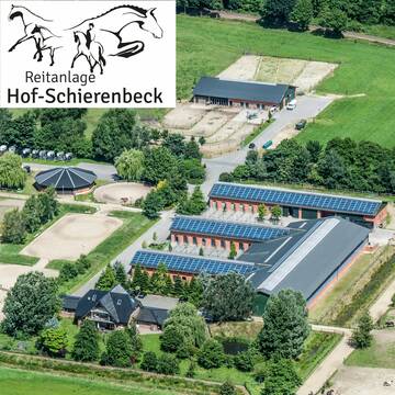
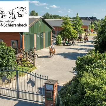
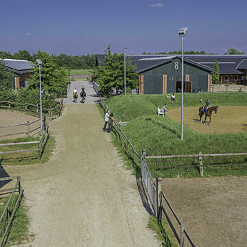
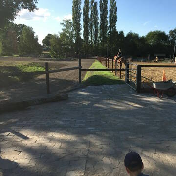
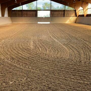
moderne Reitanlage in Weyhe (Bremen) -Schierenbeck
Weyhe
Hof-Schierenbeck
@Hof-Schierenbeck
FN-Mitglied
Geländestrecke
Vermieten
Hunde willkommen
Krankenbox
Pferdezucht
Zuchtstutenhaltung möglich
24 weitere...
S


Wittes Reitanlage
Riede
Wittes-Reitanlage
@Wittes-Reitanlage
FN-Mitglied
Geländestrecke
Vermieten
Krankenbox
Longierzirkel/Roundpen
Gnadenbrothof
Hufrehe geeignet
24 weitere...
aktuell
S
Deprecated: Creation of dynamic property Zend_View_Helper_Ads::$adLink is deprecated in /var/www/stall-frei/htdocs/staging.stall-frei.de/library/Psf/View/Helper/Ads.php on line 108

Futtersack HeuToy, Fressbremse in pink
Mechtersen
STALL-FREIde Marketing
@STALL-FREI-Marketing
Stundenlange Beschäftigung die
Koliken vorbeugt, geringe Staubinhalation mit
steuerbarer Futterentnahme

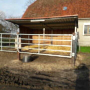
Offenstall in Bremen
Bremen
A.Bose
@HofBremen
Freizeitstall
Paddock
Reitplatz (z.B. Dressur, Springen, Reining)
Bewegungsstall
Offenstall
Halbpension
4 weitere...
P


freie Paddockboxen!
Bremen
Hubertus Reitverein Bremen e.V
@HubertusReitvereinBremen
FN-Mitglied
Freizeitstall
Vermieten
Longierzirkel/Roundpen
Paddock
Hufrehe geeignet
20 weitere...
P+


Offenstallplätze in Heilshorn/OHZ
Osterholz-Scharmbeck
Berend von Rex-Gröning
@Berend-von-Rex-Groening
Freizeitstall
Pferdeausbildung
Vermieten
Krankenbox
Longierzirkel/Roundpen
Offenstall
12 weitere...
S

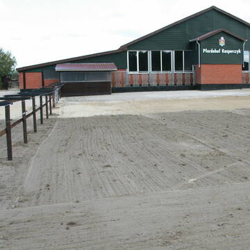
Islandpferdehof Kasperczyk bei Stuhr/Bremen
Stuhr/Heiligenrode
IPH Kasperczyk
@IslandlandhofKasperczyk
FN-Mitglied
Freizeitstall
Vermieten
Verpachten
Führanlage
Hunde willkommen
Hengsthaltung möglich
Hufrehe geeignet
34 weitere...
P+

Das Beste für die Hufe
Mechtersen
STALL-FREIde Marketing
@STALL-FREI-Marketing
Hufschmiede und Hufpfleger in Ihrer Nähe


Aktiv und Bewegungs Stall hat Plätze frei
Bremen Mahndorf
Koester
@Ylska
Freizeitstall
Geländestrecke
Vermieten
Krankenbox
Longierzirkel/Roundpen
Allergikerstall
Fohlenaufzucht möglich
17 weitere...
P+
Pferdepension Zur Wümme
Oyten nähe Bremen
Pferdepension Zur Wuemme
@Pferdepension-Zur-Wuemme
FN-Mitglied
Freizeitstall
Vermieten
Verpachten
Hunde willkommen
Krankenbox
Allergikerstall
bedampftes/gewaschenes Heu
31 weitere...
P+


Erstbezug auf neuer Reitanlage
Bremen
Heike Klatte
@HeikeKlatte
Vermieten
Paddock
Parkplatz für Pferdeanhänger
Allergikerstall
Biofutter
9 weitere...
aktuell
P+

Pferdebox/Einstellplatz in Del/Hasbergen f.1 Stute
Delmenhorst
Hof Hoheweide
@H.LoskampS.Faust
Vermieten
Paddock
Reitplatz (z.B. Dressur, Springen, Reining)
Einzelne Boxen oder Stallplätze
5 weitere...
P
Deprecated: Creation of dynamic property Zend_View::$pageCount is deprecated in /var/www/stall-frei/htdocs/staging.stall-frei.de/library/vendor/shardj/zf1-future/library/Zend/View/Abstract.php on line 308
Deprecated: Creation of dynamic property Zend_View::$itemCountPerPage is deprecated in /var/www/stall-frei/htdocs/staging.stall-frei.de/library/vendor/shardj/zf1-future/library/Zend/View/Abstract.php on line 308
Deprecated: Creation of dynamic property Zend_View::$first is deprecated in /var/www/stall-frei/htdocs/staging.stall-frei.de/library/vendor/shardj/zf1-future/library/Zend/View/Abstract.php on line 308
Deprecated: Creation of dynamic property Zend_View::$current is deprecated in /var/www/stall-frei/htdocs/staging.stall-frei.de/library/vendor/shardj/zf1-future/library/Zend/View/Abstract.php on line 308
Deprecated: Creation of dynamic property Zend_View::$last is deprecated in /var/www/stall-frei/htdocs/staging.stall-frei.de/library/vendor/shardj/zf1-future/library/Zend/View/Abstract.php on line 308
Deprecated: Creation of dynamic property Zend_View::$next is deprecated in /var/www/stall-frei/htdocs/staging.stall-frei.de/library/vendor/shardj/zf1-future/library/Zend/View/Abstract.php on line 308
Deprecated: Creation of dynamic property Zend_View::$pagesInRange is deprecated in /var/www/stall-frei/htdocs/staging.stall-frei.de/library/vendor/shardj/zf1-future/library/Zend/View/Abstract.php on line 308
Deprecated: Creation of dynamic property Zend_View::$firstPageInRange is deprecated in /var/www/stall-frei/htdocs/staging.stall-frei.de/library/vendor/shardj/zf1-future/library/Zend/View/Abstract.php on line 308
Deprecated: Creation of dynamic property Zend_View::$lastPageInRange is deprecated in /var/www/stall-frei/htdocs/staging.stall-frei.de/library/vendor/shardj/zf1-future/library/Zend/View/Abstract.php on line 308
Deprecated: Creation of dynamic property Zend_View::$currentItemCount is deprecated in /var/www/stall-frei/htdocs/staging.stall-frei.de/library/vendor/shardj/zf1-future/library/Zend/View/Abstract.php on line 308
Deprecated: Creation of dynamic property Zend_View::$totalItemCount is deprecated in /var/www/stall-frei/htdocs/staging.stall-frei.de/library/vendor/shardj/zf1-future/library/Zend/View/Abstract.php on line 308
Deprecated: Creation of dynamic property Zend_View::$firstItemNumber is deprecated in /var/www/stall-frei/htdocs/staging.stall-frei.de/library/vendor/shardj/zf1-future/library/Zend/View/Abstract.php on line 308
Deprecated: Creation of dynamic property Zend_View::$lastItemNumber is deprecated in /var/www/stall-frei/htdocs/staging.stall-frei.de/library/vendor/shardj/zf1-future/library/Zend/View/Abstract.php on line 308
Deprecated: Creation of dynamic property Zend_View::$router is deprecated in /var/www/stall-frei/htdocs/staging.stall-frei.de/library/vendor/shardj/zf1-future/library/Zend/View/Abstract.php on line 308
Deprecated: Creation of dynamic property Zend_View::$urlParams is deprecated in /var/www/stall-frei/htdocs/staging.stall-frei.de/library/vendor/shardj/zf1-future/library/Zend/View/Abstract.php on line 308
Deprecated: Creation of dynamic property Zend_View::$showAds is deprecated in /var/www/stall-frei/htdocs/staging.stall-frei.de/library/vendor/shardj/zf1-future/library/Zend/View/Abstract.php on line 308
Deprecated: Creation of dynamic property Zend_View::$objectIds is deprecated in /var/www/stall-frei/htdocs/staging.stall-frei.de/library/vendor/shardj/zf1-future/library/Zend/View/Abstract.php on line 308
Deprecated: Creation of dynamic property Zend_View::$showNavbar is deprecated in /var/www/stall-frei/htdocs/staging.stall-frei.de/library/vendor/shardj/zf1-future/library/Zend/View/Abstract.php on line 308
Deprecated: Creation of dynamic property Zend_View::$showBreadcrumb is deprecated in /var/www/stall-frei/htdocs/staging.stall-frei.de/library/vendor/shardj/zf1-future/library/Zend/View/Abstract.php on line 308
Deprecated: Creation of dynamic property Zend_View::$showFooter is deprecated in /var/www/stall-frei/htdocs/staging.stall-frei.de/library/vendor/shardj/zf1-future/library/Zend/View/Abstract.php on line 308
Deprecated: Creation of dynamic property Zend_View::$showInternalAds is deprecated in /var/www/stall-frei/htdocs/staging.stall-frei.de/library/vendor/shardj/zf1-future/library/Zend/View/Abstract.php on line 308
Deprecated: Creation of dynamic property Zend_View::$blNoContent is deprecated in /var/www/stall-frei/htdocs/staging.stall-frei.de/library/vendor/shardj/zf1-future/library/Zend/View/Abstract.php on line 308
Deprecated: Creation of dynamic property Zend_View::$sMetaDesc is deprecated in /var/www/stall-frei/htdocs/staging.stall-frei.de/library/vendor/shardj/zf1-future/library/Zend/View/Abstract.php on line 308
Deprecated: Creation of dynamic property Zend_View::$useGmaps is deprecated in /var/www/stall-frei/htdocs/staging.stall-frei.de/library/vendor/shardj/zf1-future/library/Zend/View/Abstract.php on line 308
Deprecated: Creation of dynamic property Zend_View::$touches is deprecated in /var/www/stall-frei/htdocs/staging.stall-frei.de/library/vendor/shardj/zf1-future/library/Zend/View/Abstract.php on line 308
Deprecated: Creation of dynamic property Zend_View::$oProject is deprecated in /var/www/stall-frei/htdocs/staging.stall-frei.de/library/vendor/shardj/zf1-future/library/Zend/View/Abstract.php on line 308
Deprecated: Creation of dynamic property Zend_View::$pageHeadline is deprecated in /var/www/stall-frei/htdocs/staging.stall-frei.de/library/vendor/shardj/zf1-future/library/Zend/View/Abstract.php on line 308
Deprecated: Creation of dynamic property Zend_View::$disableLocationField is deprecated in /var/www/stall-frei/htdocs/staging.stall-frei.de/library/vendor/shardj/zf1-future/library/Zend/View/Abstract.php on line 308
Deprecated: Creation of dynamic property Zend_View::$isSearch is deprecated in /var/www/stall-frei/htdocs/staging.stall-frei.de/library/vendor/shardj/zf1-future/library/Zend/View/Abstract.php on line 308
Deprecated: Creation of dynamic property Zend_View::$pageTitle is deprecated in /var/www/stall-frei/htdocs/staging.stall-frei.de/library/vendor/shardj/zf1-future/library/Zend/View/Abstract.php on line 308
Deprecated: Creation of dynamic property Psf_Form_Element_Text::$class is deprecated in /var/www/stall-frei/htdocs/staging.stall-frei.de/library/vendor/shardj/zf1-future/library/Zend/Form/Element.php on line 874
Deprecated: Creation of dynamic property Psf_Form_Element_Text::$size is deprecated in /var/www/stall-frei/htdocs/staging.stall-frei.de/library/vendor/shardj/zf1-future/library/Zend/Form/Element.php on line 874
Deprecated: Creation of dynamic property Psf_Form_Element_Text::$placeholder is deprecated in /var/www/stall-frei/htdocs/staging.stall-frei.de/library/vendor/shardj/zf1-future/library/Zend/Form/Element.php on line 874
Deprecated: Creation of dynamic property Psf_Form_Element_Hidden::$class is deprecated in /var/www/stall-frei/htdocs/staging.stall-frei.de/library/vendor/shardj/zf1-future/library/Zend/Form/Element.php on line 874
Deprecated: Creation of dynamic property Psf_Form_Element_Hidden::$class is deprecated in /var/www/stall-frei/htdocs/staging.stall-frei.de/library/vendor/shardj/zf1-future/library/Zend/Form/Element.php on line 874
Deprecated: Creation of dynamic property Psf_Form_Element_Hidden::$class is deprecated in /var/www/stall-frei/htdocs/staging.stall-frei.de/library/vendor/shardj/zf1-future/library/Zend/Form/Element.php on line 874
Deprecated: Creation of dynamic property Psf_Form_Element_Hidden::$class is deprecated in /var/www/stall-frei/htdocs/staging.stall-frei.de/library/vendor/shardj/zf1-future/library/Zend/Form/Element.php on line 874
Deprecated: Creation of dynamic property Psf_Form_Element_Select::$class is deprecated in /var/www/stall-frei/htdocs/staging.stall-frei.de/library/vendor/shardj/zf1-future/library/Zend/Form/Element.php on line 874
Deprecated: Creation of dynamic property Psf_Form_Element_Select::$class is deprecated in /var/www/stall-frei/htdocs/staging.stall-frei.de/library/vendor/shardj/zf1-future/library/Zend/Form/Element.php on line 874
Deprecated: Creation of dynamic property Psf_Form_Element_Select::$class is deprecated in /var/www/stall-frei/htdocs/staging.stall-frei.de/library/vendor/shardj/zf1-future/library/Zend/Form/Element.php on line 874
Deprecated: Creation of dynamic property Psf_Form_Element_Select::$class is deprecated in /var/www/stall-frei/htdocs/staging.stall-frei.de/library/vendor/shardj/zf1-future/library/Zend/Form/Element.php on line 874
Deprecated: Creation of dynamic property Psf_Form_Element_Text::$class is deprecated in /var/www/stall-frei/htdocs/staging.stall-frei.de/library/vendor/shardj/zf1-future/library/Zend/Form/Element.php on line 874
Deprecated: Creation of dynamic property Psf_Form_Element_Checkbox::$label is deprecated in /var/www/stall-frei/htdocs/staging.stall-frei.de/library/vendor/shardj/zf1-future/library/Zend/Form/Element.php on line 874
Deprecated: Creation of dynamic property Zend_View::$sort is deprecated in /var/www/stall-frei/htdocs/staging.stall-frei.de/library/vendor/shardj/zf1-future/library/Zend/View/Abstract.php on line 308
Deprecated: Creation of dynamic property Zend_View::$searchLocation is deprecated in /var/www/stall-frei/htdocs/staging.stall-frei.de/library/vendor/shardj/zf1-future/library/Zend/View/Abstract.php on line 308
Deprecated: Creation of dynamic property Zend_View::$locationHint is deprecated in /var/www/stall-frei/htdocs/staging.stall-frei.de/library/vendor/shardj/zf1-future/library/Zend/View/Abstract.php on line 308
Psf_GeoCoder_Abstract::getLocation: Langenstraße Get Location CachedOrLive
Psf_GeoCoder_Abstract::getCachedOrLive: Langenstraße
Psf_GeoCoder_OpenCageData::makeApiRequest: response:
Array
(
[documentation] => https://opencagedata.com/api
[licenses] => Array
(
[0] => Array
(
[name] => see attribution guide
[url] => https://opencagedata.com/credits
)
)
[results] => Array
(
[0] => Array
(
[bounds] => Array
(
[northeast] => Array
(
[lat] => 53.0764712
[lng] => 8.8061419
)
[southwest] => Array
(
[lat] => 53.0759584
[lng] => 8.8049944
)
)
[components] => Array
(
[ISO_3166-1_alpha-2] => DE
[ISO_3166-1_alpha-3] => DEU
[ISO_3166-2] => Array
(
[0] => DE-HB
)
[_category] => road
[_normalized_city] => Stadtgebiet Bremen
[_type] => road
[city] => Stadtgebiet Bremen
[city_district] => Bremen-Mitte
[continent] => Europe
[country] => Deutschland
[country_code] => de
[neighbourhood] => Ansgari-Viertel
[political_union] => European Union
[postcode] => 28195
[quarter] => Altstadt
[road] => Langenstraße
[road_type] => pedestrian
[state] => Bremen
[state_code] => HB
[suburb] => Mitte
)
[confidence] => 9
[formatted] => Langenstraße, 28195 Bremen, Deutschland
[geometry] => Array
(
[lat] => 53.0762144
[lng] => 8.805568
)
)
[1] => Array
(
[bounds] => Array
(
[northeast] => Array
(
[lat] => 51.5804072
[lng] => 8.4885346
)
[southwest] => Array
(
[lat] => 51.5296043
[lng] => 8.4497272
)
)
[components] => Array
(
[ISO_3166-1_alpha-2] => DE
[ISO_3166-1_alpha-3] => DEU
[ISO_3166-2] => Array
(
[0] => DE-NW
)
[_category] => place
[_normalized_city] => Rüthen
[_type] => city
[city] => Rüthen
[continent] => Europe
[country] => Deutschland
[country_code] => de
[county] => Kreis Soest
[political_union] => European Union
[state] => Nordrhein-Westfalen
[state_code] => NW
)
[confidence] => 7
[formatted] => Rüthen, Nordrhein-Westfalen, Deutschland
[geometry] => Array
(
[lat] => 51.5594516
[lng] => 8.4629314
)
)
[2] => Array
(
[bounds] => Array
(
[northeast] => Array
(
[lat] => 52.2985124
[lng] => 7.8331422
)
[southwest] => Array
(
[lat] => 52.2914909
[lng] => 7.8313439
)
)
[components] => Array
(
[ISO_3166-1_alpha-2] => DE
[ISO_3166-1_alpha-3] => DEU
[ISO_3166-2] => Array
(
[0] => DE-NW
)
[_category] => road
[_normalized_city] => Westerkappeln
[_type] => road
[continent] => Europe
[country] => Deutschland
[country_code] => de
[county] => Kreis Steinfurt
[hamlet] => Metten
[political_union] => European Union
[postcode] => 49492
[road] => Langenstraße
[state] => Nordrhein-Westfalen
[state_code] => NW
[village] => Westerkappeln
)
[confidence] => 9
[formatted] => Langenstraße, 49492 Westerkappeln, Deutschland
[geometry] => Array
(
[lat] => 52.2952958
[lng] => 7.8325308
)
)
[3] => Array
(
[bounds] => Array
(
[northeast] => Array
(
[lat] => 53.0117561
[lng] => 8.7831743
)
[southwest] => Array
(
[lat] => 53.0080826
[lng] => 8.7813446
)
)
[components] => Array
(
[ISO_3166-1_alpha-2] => DE
[ISO_3166-1_alpha-3] => DEU
[ISO_3166-2] => Array
(
[0] => DE-NI
)
[_category] => road
[_normalized_city] => Stuhr
[_type] => road
[continent] => Europe
[country] => Deutschland
[country_code] => de
[county] => Landkreis Diepholz
[neighbourhood] => Flüsseviertel
[political_union] => European Union
[postcode] => 28816
[road] => Langenstraße
[road_type] => residential
[state] => Niedersachsen
[state_code] => NI
[suburb] => Brinkum
[town] => Stuhr
)
[confidence] => 9
[formatted] => Langenstraße, 28816 Stuhr, Deutschland
[geometry] => Array
(
[lat] => 53.0099164
[lng] => 8.7822654
)
)
[4] => Array
(
[bounds] => Array
(
[northeast] => Array
(
[lat] => 51.8396353
[lng] => 7.8408679
)
[southwest] => Array
(
[lat] => 51.8390735
[lng] => 7.8361899
)
)
[components] => Array
(
[ISO_3166-1_alpha-2] => DE
[ISO_3166-1_alpha-3] => DEU
[ISO_3166-2] => Array
(
[0] => DE-NW
)
[_category] => road
[_normalized_city] => Sendenhorst
[_type] => road
[continent] => Europe
[country] => Deutschland
[country_code] => de
[county] => Kreis Warendorf
[political_union] => European Union
[postcode] => 48324
[road] => Langenstraße
[road_type] => residential
[state] => Nordrhein-Westfalen
[state_code] => NW
[town] => Sendenhorst
)
[confidence] => 9
[formatted] => Langenstraße, 48324 Sendenhorst, Deutschland
[geometry] => Array
(
[lat] => 51.8393275
[lng] => 7.8385296
)
)
[5] => Array
(
[bounds] => Array
(
[northeast] => Array
(
[lat] => 53.7682885
[lng] => 9.0567084
)
[southwest] => Array
(
[lat] => 53.7670689
[lng] => 9.0557628
)
)
[components] => Array
(
[ISO_3166-1_alpha-2] => DE
[ISO_3166-1_alpha-3] => DEU
[ISO_3166-2] => Array
(
[0] => DE-NI
)
[_category] => road
[_normalized_city] => Cadenberge
[_type] => road
[continent] => Europe
[country] => Deutschland
[country_code] => de
[county] => Landkreis Cuxhaven
[municipality] => Samtgemeinde Land Hadeln
[political_union] => European Union
[postcode] => 21781
[road] => Langenstraße
[road_type] => tertiary
[state] => Niedersachsen
[state_code] => NI
[village] => Cadenberge
)
[confidence] => 9
[formatted] => Langenstraße, 21781 Cadenberge, Deutschland
[geometry] => Array
(
[lat] => 53.7675837
[lng] => 9.0563594
)
)
[6] => Array
(
[bounds] => Array
(
[northeast] => Array
(
[lat] => 54.3118662
[lng] => 13.0901537
)
[southwest] => Array
(
[lat] => 54.3114197
[lng] => 13.0882586
)
)
[components] => Array
(
[ISO_3166-1_alpha-2] => DE
[ISO_3166-1_alpha-3] => DEU
[ISO_3166-2] => Array
(
[0] => DE-MV
)
[_category] => road
[_normalized_city] => Stralsund
[_type] => road
[continent] => Europe
[country] => Deutschland
[country_code] => de
[county] => Vorpommern-Rügen
[neighbourhood] => Altstadt
[political_union] => European Union
[postcode] => 18439
[road] => Langenstraße
[road_type] => residential
[state] => Mecklenburg-Vorpommern
[state_code] => MV
[suburb] => Altstadt
[town] => Stralsund
)
[confidence] => 9
[formatted] => Langenstraße, 18439 Stralsund, Deutschland
[geometry] => Array
(
[lat] => 54.3116273
[lng] => 13.0892097
)
)
[7] => Array
(
[components] => Array
(
[ISO_3166-1_alpha-2] => FR
[ISO_3166-1_alpha-3] => FRA
[ISO_3166-2] => Array
(
[0] => FR-IDF
[1] => FR-92
)
[_category] => road
[_normalized_city] => Levallois-Perret
[_type] => road
[city] => Levallois-Perret
[continent] => Europe
[country] => France
[country_code] => fr
[county] => Hauts-de-Seine
[local_authority] => Métropole du Grand Paris
[political_union] => European Union
[postcode] => 92300
[road] => Rue Charles Deutschmann
[state] => Île-de-France
[state_code] => IDF
)
[confidence] => 2
[formatted] => Rue Charles Deutschmann, 92300 Levallois-Perret, France
[geometry] => Array
(
[lat] => 48.900049
[lng] => 2.2842
)
)
)
[status] => Array
(
[code] => 200
[message] => OK
)
[stay_informed] => Array
(
[blog] => https://blog.opencagedata.com
[mastodon] => https://en.osm.town/@opencage
)
[thanks] => For using an OpenCage API
[timestamp] => Array
(
[created_http] => Sat, 07 Feb 2026 09:34:26 GMT
[created_unix] => 1770456866
)
[total_results] => 8
)
Psf_GeoCoder_Abstract::convertLocationResult
{"documentation":"https:\/\/opencagedata.com\/api","licenses":[{"name":"see attribution guide","url":"https:\/\/opencagedata.com\/credits"}],"results":[{"bounds":{"northeast":{"lat":53.0764712,"lng":8.8061419},"southwest":{"lat":53.0759584,"lng":8.8049944}},"components":{"ISO_3166-1_alpha-2":"DE","ISO_3166-1_alpha-3":"DEU","ISO_3166-2":["DE-HB"],"_category":"road","_normalized_city":"Stadtgebiet Bremen","_type":"road","city":"Stadtgebiet Bremen","city_district":"Bremen-Mitte","continent":"Europe","country":"Deutschland","country_code":"de","neighbourhood":"Ansgari-Viertel","political_union":"European Union","postcode":"28195","quarter":"Altstadt","road":"Langenstra\u00dfe","road_type":"pedestrian","state":"Bremen","state_code":"HB","suburb":"Mitte"},"confidence":9,"formatted":"Langenstra\u00dfe, 28195 Bremen, Deutschland","geometry":{"lat":53.0762144,"lng":8.805568}},{"bounds":{"northeast":{"lat":51.5804072,"lng":8.4885346},"southwest":{"lat":51.5296043,"lng":8.4497272}},"components":{"ISO_3166-1_alpha-2":"DE","ISO_3166-1_alpha-3":"DEU","ISO_3166-2":["DE-NW"],"_category":"place","_normalized_city":"R\u00fcthen","_type":"city","city":"R\u00fcthen","continent":"Europe","country":"Deutschland","country_code":"de","county":"Kreis Soest","political_union":"European Union","state":"Nordrhein-Westfalen","state_code":"NW"},"confidence":7,"formatted":"R\u00fcthen, Nordrhein-Westfalen, Deutschland","geometry":{"lat":51.5594516,"lng":8.4629314}},{"bounds":{"northeast":{"lat":52.2985124,"lng":7.8331422},"southwest":{"lat":52.2914909,"lng":7.8313439}},"components":{"ISO_3166-1_alpha-2":"DE","ISO_3166-1_alpha-3":"DEU","ISO_3166-2":["DE-NW"],"_category":"road","_normalized_city":"Westerkappeln","_type":"road","continent":"Europe","country":"Deutschland","country_code":"de","county":"Kreis Steinfurt","hamlet":"Metten","political_union":"European Union","postcode":"49492","road":"Langenstra\u00dfe","state":"Nordrhein-Westfalen","state_code":"NW","village":"Westerkappeln"},"confidence":9,"formatted":"Langenstra\u00dfe, 49492 Westerkappeln, Deutschland","geometry":{"lat":52.2952958,"lng":7.8325308}},{"bounds":{"northeast":{"lat":53.0117561,"lng":8.7831743},"southwest":{"lat":53.0080826,"lng":8.7813446}},"components":{"ISO_3166-1_alpha-2":"DE","ISO_3166-1_alpha-3":"DEU","ISO_3166-2":["DE-NI"],"_category":"road","_normalized_city":"Stuhr","_type":"road","continent":"Europe","country":"Deutschland","country_code":"de","county":"Landkreis Diepholz","neighbourhood":"Fl\u00fcsseviertel","political_union":"European Union","postcode":"28816","road":"Langenstra\u00dfe","road_type":"residential","state":"Niedersachsen","state_code":"NI","suburb":"Brinkum","town":"Stuhr"},"confidence":9,"formatted":"Langenstra\u00dfe, 28816 Stuhr, Deutschland","geometry":{"lat":53.0099164,"lng":8.7822654}},{"bounds":{"northeast":{"lat":51.8396353,"lng":7.8408679},"southwest":{"lat":51.8390735,"lng":7.8361899}},"components":{"ISO_3166-1_alpha-2":"DE","ISO_3166-1_alpha-3":"DEU","ISO_3166-2":["DE-NW"],"_category":"road","_normalized_city":"Sendenhorst","_type":"road","continent":"Europe","country":"Deutschland","country_code":"de","county":"Kreis Warendorf","political_union":"European Union","postcode":"48324","road":"Langenstra\u00dfe","road_type":"residential","state":"Nordrhein-Westfalen","state_code":"NW","town":"Sendenhorst"},"confidence":9,"formatted":"Langenstra\u00dfe, 48324 Sendenhorst, Deutschland","geometry":{"lat":51.8393275,"lng":7.8385296}},{"bounds":{"northeast":{"lat":53.7682885,"lng":9.0567084},"southwest":{"lat":53.7670689,"lng":9.0557628}},"components":{"ISO_3166-1_alpha-2":"DE","ISO_3166-1_alpha-3":"DEU","ISO_3166-2":["DE-NI"],"_category":"road","_normalized_city":"Cadenberge","_type":"road","continent":"Europe","country":"Deutschland","country_code":"de","county":"Landkreis Cuxhaven","municipality":"Samtgemeinde Land Hadeln","political_union":"European Union","postcode":"21781","road":"Langenstra\u00dfe","road_type":"tertiary","state":"Niedersachsen","state_code":"NI","village":"Cadenberge"},"confidence":9,"formatted":"Langenstra\u00dfe, 21781 Cadenberge, Deutschland","geometry":{"lat":53.7675837,"lng":9.0563594}},{"bounds":{"northeast":{"lat":54.3118662,"lng":13.0901537},"southwest":{"lat":54.3114197,"lng":13.0882586}},"components":{"ISO_3166-1_alpha-2":"DE","ISO_3166-1_alpha-3":"DEU","ISO_3166-2":["DE-MV"],"_category":"road","_normalized_city":"Stralsund","_type":"road","continent":"Europe","country":"Deutschland","country_code":"de","county":"Vorpommern-R\u00fcgen","neighbourhood":"Altstadt","political_union":"European Union","postcode":"18439","road":"Langenstra\u00dfe","road_type":"residential","state":"Mecklenburg-Vorpommern","state_code":"MV","suburb":"Altstadt","town":"Stralsund"},"confidence":9,"formatted":"Langenstra\u00dfe, 18439 Stralsund, Deutschland","geometry":{"lat":54.3116273,"lng":13.0892097}},{"components":{"ISO_3166-1_alpha-2":"FR","ISO_3166-1_alpha-3":"FRA","ISO_3166-2":["FR-IDF","FR-92"],"_category":"road","_normalized_city":"Levallois-Perret","_type":"road","city":"Levallois-Perret","continent":"Europe","country":"France","country_code":"fr","county":"Hauts-de-Seine","local_authority":"M\u00e9tropole du Grand Paris","political_union":"European Union","postcode":"92300","road":"Rue Charles Deutschmann","state":"\u00cele-de-France","state_code":"IDF"},"confidence":2,"formatted":"Rue Charles Deutschmann, 92300 Levallois-Perret, France","geometry":{"lat":48.900049,"lng":2.2842}}],"status":{"code":200,"message":"OK"},"stay_informed":{"blog":"https:\/\/blog.opencagedata.com","mastodon":"https:\/\/en.osm.town\/@opencage"},"thanks":"For using an OpenCage API","timestamp":{"created_http":"Sat, 07 Feb 2026 09:34:26 GMT","created_unix":1770456866},"total_results":8}Array
(
[0] => stdClass Object
(
[bounds] => stdClass Object
(
[northeast] => stdClass Object
(
[lat] => 53.0764712
[lng] => 8.8061419
)
[southwest] => stdClass Object
(
[lat] => 53.0759584
[lng] => 8.8049944
)
)
[components] => stdClass Object
(
[ISO_3166-1_alpha-2] => DE
[ISO_3166-1_alpha-3] => DEU
[ISO_3166-2] => Array
(
[0] => DE-HB
)
[_category] => road
[_normalized_city] => Stadtgebiet Bremen
[_type] => road
[city] => Stadtgebiet Bremen
[city_district] => Bremen-Mitte
[continent] => Europe
[country] => Deutschland
[country_code] => de
[neighbourhood] => Ansgari-Viertel
[political_union] => European Union
[postcode] => 28195
[quarter] => Altstadt
[road] => Langenstraße
[road_type] => pedestrian
[state] => Bremen
[state_code] => HB
[suburb] => Mitte
)
[confidence] => 9
[formatted] => Langenstraße, 28195 Bremen, Deutschland
[geometry] => stdClass Object
(
[lat] => 53.0762144
[lng] => 8.805568
)
)
[1] => stdClass Object
(
[bounds] => stdClass Object
(
[northeast] => stdClass Object
(
[lat] => 51.5804072
[lng] => 8.4885346
)
[southwest] => stdClass Object
(
[lat] => 51.5296043
[lng] => 8.4497272
)
)
[components] => stdClass Object
(
[ISO_3166-1_alpha-2] => DE
[ISO_3166-1_alpha-3] => DEU
[ISO_3166-2] => Array
(
[0] => DE-NW
)
[_category] => place
[_normalized_city] => Rüthen
[_type] => city
[city] => Rüthen
[continent] => Europe
[country] => Deutschland
[country_code] => de
[county] => Kreis Soest
[political_union] => European Union
[state] => Nordrhein-Westfalen
[state_code] => NW
)
[confidence] => 7
[formatted] => Rüthen, Nordrhein-Westfalen, Deutschland
[geometry] => stdClass Object
(
[lat] => 51.5594516
[lng] => 8.4629314
)
)
[2] => stdClass Object
(
[bounds] => stdClass Object
(
[northeast] => stdClass Object
(
[lat] => 52.2985124
[lng] => 7.8331422
)
[southwest] => stdClass Object
(
[lat] => 52.2914909
[lng] => 7.8313439
)
)
[components] => stdClass Object
(
[ISO_3166-1_alpha-2] => DE
[ISO_3166-1_alpha-3] => DEU
[ISO_3166-2] => Array
(
[0] => DE-NW
)
[_category] => road
[_normalized_city] => Westerkappeln
[_type] => road
[continent] => Europe
[country] => Deutschland
[country_code] => de
[county] => Kreis Steinfurt
[hamlet] => Metten
[political_union] => European Union
[postcode] => 49492
[road] => Langenstraße
[state] => Nordrhein-Westfalen
[state_code] => NW
[village] => Westerkappeln
)
[confidence] => 9
[formatted] => Langenstraße, 49492 Westerkappeln, Deutschland
[geometry] => stdClass Object
(
[lat] => 52.2952958
[lng] => 7.8325308
)
)
[3] => stdClass Object
(
[bounds] => stdClass Object
(
[northeast] => stdClass Object
(
[lat] => 53.0117561
[lng] => 8.7831743
)
[southwest] => stdClass Object
(
[lat] => 53.0080826
[lng] => 8.7813446
)
)
[components] => stdClass Object
(
[ISO_3166-1_alpha-2] => DE
[ISO_3166-1_alpha-3] => DEU
[ISO_3166-2] => Array
(
[0] => DE-NI
)
[_category] => road
[_normalized_city] => Stuhr
[_type] => road
[continent] => Europe
[country] => Deutschland
[country_code] => de
[county] => Landkreis Diepholz
[neighbourhood] => Flüsseviertel
[political_union] => European Union
[postcode] => 28816
[road] => Langenstraße
[road_type] => residential
[state] => Niedersachsen
[state_code] => NI
[suburb] => Brinkum
[town] => Stuhr
)
[confidence] => 9
[formatted] => Langenstraße, 28816 Stuhr, Deutschland
[geometry] => stdClass Object
(
[lat] => 53.0099164
[lng] => 8.7822654
)
)
[4] => stdClass Object
(
[bounds] => stdClass Object
(
[northeast] => stdClass Object
(
[lat] => 51.8396353
[lng] => 7.8408679
)
[southwest] => stdClass Object
(
[lat] => 51.8390735
[lng] => 7.8361899
)
)
[components] => stdClass Object
(
[ISO_3166-1_alpha-2] => DE
[ISO_3166-1_alpha-3] => DEU
[ISO_3166-2] => Array
(
[0] => DE-NW
)
[_category] => road
[_normalized_city] => Sendenhorst
[_type] => road
[continent] => Europe
[country] => Deutschland
[country_code] => de
[county] => Kreis Warendorf
[political_union] => European Union
[postcode] => 48324
[road] => Langenstraße
[road_type] => residential
[state] => Nordrhein-Westfalen
[state_code] => NW
[town] => Sendenhorst
)
[confidence] => 9
[formatted] => Langenstraße, 48324 Sendenhorst, Deutschland
[geometry] => stdClass Object
(
[lat] => 51.8393275
[lng] => 7.8385296
)
)
[5] => stdClass Object
(
[bounds] => stdClass Object
(
[northeast] => stdClass Object
(
[lat] => 53.7682885
[lng] => 9.0567084
)
[southwest] => stdClass Object
(
[lat] => 53.7670689
[lng] => 9.0557628
)
)
[components] => stdClass Object
(
[ISO_3166-1_alpha-2] => DE
[ISO_3166-1_alpha-3] => DEU
[ISO_3166-2] => Array
(
[0] => DE-NI
)
[_category] => road
[_normalized_city] => Cadenberge
[_type] => road
[continent] => Europe
[country] => Deutschland
[country_code] => de
[county] => Landkreis Cuxhaven
[municipality] => Samtgemeinde Land Hadeln
[political_union] => European Union
[postcode] => 21781
[road] => Langenstraße
[road_type] => tertiary
[state] => Niedersachsen
[state_code] => NI
[village] => Cadenberge
)
[confidence] => 9
[formatted] => Langenstraße, 21781 Cadenberge, Deutschland
[geometry] => stdClass Object
(
[lat] => 53.7675837
[lng] => 9.0563594
)
)
[6] => stdClass Object
(
[bounds] => stdClass Object
(
[northeast] => stdClass Object
(
[lat] => 54.3118662
[lng] => 13.0901537
)
[southwest] => stdClass Object
(
[lat] => 54.3114197
[lng] => 13.0882586
)
)
[components] => stdClass Object
(
[ISO_3166-1_alpha-2] => DE
[ISO_3166-1_alpha-3] => DEU
[ISO_3166-2] => Array
(
[0] => DE-MV
)
[_category] => road
[_normalized_city] => Stralsund
[_type] => road
[continent] => Europe
[country] => Deutschland
[country_code] => de
[county] => Vorpommern-Rügen
[neighbourhood] => Altstadt
[political_union] => European Union
[postcode] => 18439
[road] => Langenstraße
[road_type] => residential
[state] => Mecklenburg-Vorpommern
[state_code] => MV
[suburb] => Altstadt
[town] => Stralsund
)
[confidence] => 9
[formatted] => Langenstraße, 18439 Stralsund, Deutschland
[geometry] => stdClass Object
(
[lat] => 54.3116273
[lng] => 13.0892097
)
)
[7] => stdClass Object
(
[components] => stdClass Object
(
[ISO_3166-1_alpha-2] => FR
[ISO_3166-1_alpha-3] => FRA
[ISO_3166-2] => Array
(
[0] => FR-IDF
[1] => FR-92
)
[_category] => road
[_normalized_city] => Levallois-Perret
[_type] => road
[city] => Levallois-Perret
[continent] => Europe
[country] => France
[country_code] => fr
[county] => Hauts-de-Seine
[local_authority] => Métropole du Grand Paris
[political_union] => European Union
[postcode] => 92300
[road] => Rue Charles Deutschmann
[state] => Île-de-France
[state_code] => IDF
)
[confidence] => 2
[formatted] => Rue Charles Deutschmann, 92300 Levallois-Perret, France
[geometry] => stdClass Object
(
[lat] => 48.900049
[lng] => 2.2842
)
)
)
Psf_GeoCoder_OpenCageData::getKeyMap: 0
stdClass Object
(
    [bounds] => stdClass Object
        (
            [northeast] => stdClass Object
                (
                    [lat] => 53.0764712
                    [lng] => 8.8061419
                )

            [southwest] => stdClass Object
                (
                    [lat] => 53.0759584
                    [lng] => 8.8049944
                )

        )

    [components] => stdClass Object
        (
            [ISO_3166-1_alpha-2] => DE
            [ISO_3166-1_alpha-3] => DEU
            [ISO_3166-2] => Array
                (
                    [0] => DE-HB
                )

            [_category] => road
            [_normalized_city] => Stadtgebiet Bremen
            [_type] => road
            [city] => Stadtgebiet Bremen
            [city_district] => Bremen-Mitte
            [continent] => Europe
            [country] => Deutschland
            [country_code] => de
            [neighbourhood] => Ansgari-Viertel
            [political_union] => European Union
            [postcode] => 28195
            [quarter] => Altstadt
            [road] => Langenstraße
            [road_type] => pedestrian
            [state] => Bremen
            [state_code] => HB
            [suburb] => Mitte
        )

    [confidence] => 9
    [formatted] => Langenstraße, 28195 Bremen, Deutschland
    [geometry] => stdClass Object
        (
            [lat] => 53.0762144
            [lng] => 8.805568
        )

)
Psf_GeoCoder_OpenCageData::getCounty: Stadtgebiet Bremen
Psf_GeoCoder_OpenCageData::addMissingData REFETCH!
Array
(
    [address] => Langenstraße, 28195 Bremen, Deutschland
    [type] => road
    [street] => Langenstraße
    [city] => Mitte
    [county] => Stadtgebiet Bremen
    [state] => Bremen
    [zip] => 28195
    [country] => Deutschland
    [suburb] => Mitte
    [countrycode] => de
    [latitude] => 53.0762144
    [longitude] => 8.805568
    [accuracy] => 1
    [confidence] => 9
    [bounds] => stdClass Object
        (
            [northeast] => stdClass Object
                (
                    [lat] => 53.0764712
                    [lng] => 8.8061419
                )

            [southwest] => stdClass Object
                (
                    [lat] => 53.0759584
                    [lng] => 8.8049944
                )

        )

)
reformat!
Array
(
    [address] => Langenstraße, 28195 Mitte
    [type] => road
    [street] => Langenstraße
    [city] => Mitte
    [county] => Stadtgebiet Bremen
    [state] => Bremen
    [zip] => 28195
    [country] => Deutschland
    [suburb] => Mitte
    [countrycode] => de
    [latitude] => 53.0762144
    [longitude] => 8.805568
    [accuracy] => 1
    [confidence] => 9
    [bounds] => stdClass Object
        (
            [northeast] => stdClass Object
                (
                    [lat] => 53.0764712
                    [lng] => 8.8061419
                )

            [southwest] => stdClass Object
                (
                    [lat] => 53.0759584
                    [lng] => 8.8049944
                )

        )

    [place] => Langenstraße, 28195 Mitte, Bremen
    [hash] => 1c581b371855baf0344ea51e4be77381
)
Psf_GeoCoder_OpenCageData::getKeyMap: 1
stdClass Object
(
    [bounds] => stdClass Object
        (
            [northeast] => stdClass Object
                (
                    [lat] => 51.5804072
                    [lng] => 8.4885346
                )

            [southwest] => stdClass Object
                (
                    [lat] => 51.5296043
                    [lng] => 8.4497272
                )

        )

    [components] => stdClass Object
        (
            [ISO_3166-1_alpha-2] => DE
            [ISO_3166-1_alpha-3] => DEU
            [ISO_3166-2] => Array
                (
                    [0] => DE-NW
                )

            [_category] => place
            [_normalized_city] => Rüthen
            [_type] => city
            [city] => Rüthen
            [continent] => Europe
            [country] => Deutschland
            [country_code] => de
            [county] => Kreis Soest
            [political_union] => European Union
            [state] => Nordrhein-Westfalen
            [state_code] => NW
        )

    [confidence] => 7
    [formatted] => Rüthen, Nordrhein-Westfalen, Deutschland
    [geometry] => stdClass Object
        (
            [lat] => 51.5594516
            [lng] => 8.4629314
        )

)
Psf_GeoCoder_OpenCageData::getCounty: Soest
Psf_GeoCoder_OpenCageData::addMissingData REFETCH!
Array
(
    [address] => Rüthen, Nordrhein-Westfalen, Deutschland
    [type] => city
    [street] =>
    [city] => Rüthen
    [county] => Soest
    [state] => Nordrhein-Westfalen
    [zip] =>
    [country] => Deutschland
    [suburb] =>
    [countrycode] => de
    [latitude] => 51.5594516
    [longitude] => 8.4629314
    [accuracy] => 1
    [confidence] => 7
    [bounds] => stdClass Object
        (
            [northeast] => stdClass Object
                (
                    [lat] => 51.5804072
                    [lng] => 8.4885346
                )

            [southwest] => stdClass Object
                (
                    [lat] => 51.5296043
                    [lng] => 8.4497272
                )

        )

)
reformat!
Array
(
    [address] => Rüthen, Nordrhein-Westfalen, Deutschland
    [type] => city
    [street] =>
    [city] => Rüthen
    [county] => Soest
    [state] => Nordrhein-Westfalen
    [zip] =>
    [country] => Deutschland
    [suburb] =>
    [countrycode] => de
    [latitude] => 51.5594516
    [longitude] => 8.4629314
    [accuracy] => 1
    [confidence] => 7
    [bounds] => stdClass Object
        (
            [northeast] => stdClass Object
                (
                    [lat] => 51.5804072
                    [lng] => 8.4885346
                )

            [southwest] => stdClass Object
                (
                    [lat] => 51.5296043
                    [lng] => 8.4497272
                )

        )

    [place] => Rüthen, Nordrhein-Westfalen
    [hash] => e808951be111af54eedbbe95edd5f738
)
Psf_GeoCoder_OpenCageData::getKeyMap: 2
stdClass Object
(
    [bounds] => stdClass Object
        (
            [northeast] => stdClass Object
                (
                    [lat] => 52.2985124
                    [lng] => 7.8331422
                )

            [southwest] => stdClass Object
                (
                    [lat] => 52.2914909
                    [lng] => 7.8313439
                )

        )

    [components] => stdClass Object
        (
            [ISO_3166-1_alpha-2] => DE
            [ISO_3166-1_alpha-3] => DEU
            [ISO_3166-2] => Array
                (
                    [0] => DE-NW
                )

            [_category] => road
            [_normalized_city] => Westerkappeln
            [_type] => road
            [continent] => Europe
            [country] => Deutschland
            [country_code] => de
            [county] => Kreis Steinfurt
            [hamlet] => Metten
            [political_union] => European Union
            [postcode] => 49492
            [road] => Langenstraße
            [state] => Nordrhein-Westfalen
            [state_code] => NW
            [village] => Westerkappeln
        )

    [confidence] => 9
    [formatted] => Langenstraße, 49492 Westerkappeln, Deutschland
    [geometry] => stdClass Object
        (
            [lat] => 52.2952958
            [lng] => 7.8325308
        )

)
Psf_GeoCoder_OpenCageData::getCounty: Steinfurt
Psf_GeoCoder_OpenCageData::addMissingData REFETCH!
Array
(
    [address] => Langenstraße, 49492 Westerkappeln, Deutschland
    [type] => road
    [street] => Langenstraße
    [city] => Westerkappeln
    [county] => Steinfurt
    [state] => Nordrhein-Westfalen
    [zip] => 49492
    [country] => Deutschland
    [suburb] =>
    [countrycode] => de
    [latitude] => 52.2952958
    [longitude] => 7.8325308
    [accuracy] => 1
    [confidence] => 9
    [bounds] => stdClass Object
        (
            [northeast] => stdClass Object
                (
                    [lat] => 52.2985124
                    [lng] => 7.8331422
                )

            [southwest] => stdClass Object
                (
                    [lat] => 52.2914909
                    [lng] => 7.8313439
                )

        )

)
reformat!
Array
(
    [address] => Langenstraße, 49492 Westerkappeln, Deutschland
    [type] => road
    [street] => Langenstraße
    [city] => Westerkappeln
    [county] => Steinfurt
    [state] => Nordrhein-Westfalen
    [zip] => 49492
    [country] => Deutschland
    [suburb] =>
    [countrycode] => de
    [latitude] => 52.2952958
    [longitude] => 7.8325308
    [accuracy] => 1
    [confidence] => 9
    [bounds] => stdClass Object
        (
            [northeast] => stdClass Object
                (
                    [lat] => 52.2985124
                    [lng] => 7.8331422
                )

            [southwest] => stdClass Object
                (
                    [lat] => 52.2914909
                    [lng] => 7.8313439
                )

        )

    [place] => Langenstraße, 49492 Westerkappeln, Nordrhein-Westfalen
    [hash] => 38dd0e578b29621852288313e4b84aa7
)
Psf_GeoCoder_OpenCageData::getKeyMap: 3
stdClass Object
(
    [bounds] => stdClass Object
        (
            [northeast] => stdClass Object
                (
                    [lat] => 53.0117561
                    [lng] => 8.7831743
                )

            [southwest] => stdClass Object
                (
                    [lat] => 53.0080826
                    [lng] => 8.7813446
                )

        )

    [components] => stdClass Object
        (
            [ISO_3166-1_alpha-2] => DE
            [ISO_3166-1_alpha-3] => DEU
            [ISO_3166-2] => Array
                (
                    [0] => DE-NI
                )

            [_category] => road
            [_normalized_city] => Stuhr
            [_type] => road
            [continent] => Europe
            [country] => Deutschland
            [country_code] => de
            [county] => Landkreis Diepholz
            [neighbourhood] => Flüsseviertel
            [political_union] => European Union
            [postcode] => 28816
            [road] => Langenstraße
            [road_type] => residential
            [state] => Niedersachsen
            [state_code] => NI
            [suburb] => Brinkum
            [town] => Stuhr
        )

    [confidence] => 9
    [formatted] => Langenstraße, 28816 Stuhr, Deutschland
    [geometry] => stdClass Object
        (
            [lat] => 53.0099164
            [lng] => 8.7822654
        )

)
Psf_GeoCoder_OpenCageData::getCounty: Diepholz
Psf_GeoCoder_OpenCageData::addMissingData REFETCH!
Array
(
    [address] => Langenstraße, 28816 Stuhr, Deutschland
    [type] => road
    [street] => Langenstraße
    [city] => Stuhr
    [county] => Diepholz
    [state] => Niedersachsen
    [zip] => 28816
    [country] => Deutschland
    [suburb] => Brinkum
    [countrycode] => de
    [latitude] => 53.0099164
    [longitude] => 8.7822654
    [accuracy] => 1
    [confidence] => 9
    [bounds] => stdClass Object
        (
            [northeast] => stdClass Object
                (
                    [lat] => 53.0117561
                    [lng] => 8.7831743
                )

            [southwest] => stdClass Object
                (
                    [lat] => 53.0080826
                    [lng] => 8.7813446
                )

        )

)
reformat!
Array
(
    [address] => Langenstraße, 28816 Stuhr, Deutschland
    [type] => road
    [street] => Langenstraße
    [city] => Stuhr
    [county] => Diepholz
    [state] => Niedersachsen
    [zip] => 28816
    [country] => Deutschland
    [suburb] => Brinkum
    [countrycode] => de
    [latitude] => 53.0099164
    [longitude] => 8.7822654
    [accuracy] => 1
    [confidence] => 9
    [bounds] => stdClass Object
        (
            [northeast] => stdClass Object
                (
                    [lat] => 53.0117561
                    [lng] => 8.7831743
                )

            [southwest] => stdClass Object
                (
                    [lat] => 53.0080826
                    [lng] => 8.7813446
                )

        )

    [place] => Langenstraße, 28816 Stuhr, Niedersachsen
    [hash] => 2e651fbcc302087c0f9c966f9ed73842
)
Psf_GeoCoder_OpenCageData::getKeyMap: 4
stdClass Object
(
    [bounds] => stdClass Object
        (
            [northeast] => stdClass Object
                (
                    [lat] => 51.8396353
                    [lng] => 7.8408679
                )

            [southwest] => stdClass Object
                (
                    [lat] => 51.8390735
                    [lng] => 7.8361899
                )

        )

    [components] => stdClass Object
        (
            [ISO_3166-1_alpha-2] => DE
            [ISO_3166-1_alpha-3] => DEU
            [ISO_3166-2] => Array
                (
                    [0] => DE-NW
                )

            [_category] => road
            [_normalized_city] => Sendenhorst
            [_type] => road
            [continent] => Europe
            [country] => Deutschland
            [country_code] => de
            [county] => Kreis Warendorf
            [political_union] => European Union
            [postcode] => 48324
            [road] => Langenstraße
            [road_type] => residential
            [state] => Nordrhein-Westfalen
            [state_code] => NW
            [town] => Sendenhorst
        )

    [confidence] => 9
    [formatted] => Langenstraße, 48324 Sendenhorst, Deutschland
    [geometry] => stdClass Object
        (
            [lat] => 51.8393275
            [lng] => 7.8385296
        )

)
Psf_GeoCoder_OpenCageData::getCounty: Warendorf
Psf_GeoCoder_OpenCageData::addMissingData REFETCH!
Array
(
    [address] => Langenstraße, 48324 Sendenhorst, Deutschland
    [type] => road
    [street] => Langenstraße
    [city] => Sendenhorst
    [county] => Warendorf
    [state] => Nordrhein-Westfalen
    [zip] => 48324
    [country] => Deutschland
    [suburb] =>
    [countrycode] => de
    [latitude] => 51.8393275
    [longitude] => 7.8385296
    [accuracy] => 1
    [confidence] => 9
    [bounds] => stdClass Object
        (
            [northeast] => stdClass Object
                (
                    [lat] => 51.8396353
                    [lng] => 7.8408679
                )

            [southwest] => stdClass Object
                (
                    [lat] => 51.8390735
                    [lng] => 7.8361899
                )

        )

)
reformat!
Array
(
    [address] => Langenstraße, 48324 Sendenhorst, Deutschland
    [type] => road
    [street] => Langenstraße
    [city] => Sendenhorst
    [county] => Warendorf
    [state] => Nordrhein-Westfalen
    [zip] => 48324
    [country] => Deutschland
    [suburb] =>
    [countrycode] => de
    [latitude] => 51.8393275
    [longitude] => 7.8385296
    [accuracy] => 1
    [confidence] => 9
    [bounds] => stdClass Object
        (
            [northeast] => stdClass Object
                (
                    [lat] => 51.8396353
                    [lng] => 7.8408679
                )

            [southwest] => stdClass Object
                (
                    [lat] => 51.8390735
                    [lng] => 7.8361899
                )

        )

    [place] => Langenstraße, 48324 Sendenhorst, Nordrhein-Westfalen
    [hash] => 8800929867663b35971d53f96a641524
)
Psf_GeoCoder_OpenCageData::getKeyMap: 5
stdClass Object
(
    [bounds] => stdClass Object
        (
            [northeast] => stdClass Object
                (
                    [lat] => 53.7682885
                    [lng] => 9.0567084
                )

            [southwest] => stdClass Object
                (
                    [lat] => 53.7670689
                    [lng] => 9.0557628
                )

        )

    [components] => stdClass Object
        (
            [ISO_3166-1_alpha-2] => DE
            [ISO_3166-1_alpha-3] => DEU
            [ISO_3166-2] => Array
                (
                    [0] => DE-NI
                )

            [_category] => road
            [_normalized_city] => Cadenberge
            [_type] => road
            [continent] => Europe
            [country] => Deutschland
            [country_code] => de
            [county] => Landkreis Cuxhaven
            [municipality] => Samtgemeinde Land Hadeln
            [political_union] => European Union
            [postcode] => 21781
            [road] => Langenstraße
            [road_type] => tertiary
            [state] => Niedersachsen
            [state_code] => NI
            [village] => Cadenberge
        )

    [confidence] => 9
    [formatted] => Langenstraße, 21781 Cadenberge, Deutschland
    [geometry] => stdClass Object
        (
            [lat] => 53.7675837
            [lng] => 9.0563594
        )

)
Psf_GeoCoder_OpenCageData::getCounty: Cuxhaven
Psf_GeoCoder_OpenCageData::addMissingData REFETCH!
Array
(
    [address] => Langenstraße, 21781 Cadenberge, Deutschland
    [type] => road
    [street] => Langenstraße
    [city] => Cadenberge
    [county] => Cuxhaven
    [state] => Niedersachsen
    [zip] => 21781
    [country] => Deutschland
    [suburb] =>
    [countrycode] => de
    [latitude] => 53.7675837
    [longitude] => 9.0563594
    [accuracy] => 1
    [confidence] => 9
    [bounds] => stdClass Object
        (
            [northeast] => stdClass Object
                (
                    [lat] => 53.7682885
                    [lng] => 9.0567084
                )

            [southwest] => stdClass Object
                (
                    [lat] => 53.7670689
                    [lng] => 9.0557628
                )

        )

)
reformat!
Array
(
    [address] => Langenstraße, 21781 Cadenberge, Deutschland
    [type] => road
    [street] => Langenstraße
    [city] => Cadenberge
    [county] => Cuxhaven
    [state] => Niedersachsen
    [zip] => 21781
    [country] => Deutschland
    [suburb] =>
    [countrycode] => de
    [latitude] => 53.7675837
    [longitude] => 9.0563594
    [accuracy] => 1
    [confidence] => 9
    [bounds] => stdClass Object
        (
            [northeast] => stdClass Object
                (
                    [lat] => 53.7682885
                    [lng] => 9.0567084
                )

            [southwest] => stdClass Object
                (
                    [lat] => 53.7670689
                    [lng] => 9.0557628
                )

        )

    [place] => Langenstraße, 21781 Cadenberge, Niedersachsen
    [hash] => a6127ee9f421eedb94a24e5f2d8a5fd3
)
Psf_GeoCoder_OpenCageData::getKeyMap: 6
stdClass Object
(
    [bounds] => stdClass Object
        (
            [northeast] => stdClass Object
                (
                    [lat] => 54.3118662
                    [lng] => 13.0901537
                )

            [southwest] => stdClass Object
                (
                    [lat] => 54.3114197
                    [lng] => 13.0882586
                )

        )

    [components] => stdClass Object
        (
            [ISO_3166-1_alpha-2] => DE
            [ISO_3166-1_alpha-3] => DEU
            [ISO_3166-2] => Array
                (
                    [0] => DE-MV
                )

            [_category] => road
            [_normalized_city] => Stralsund
            [_type] => road
            [continent] => Europe
            [country] => Deutschland
            [country_code] => de
            [county] => Vorpommern-Rügen
            [neighbourhood] => Altstadt
            [political_union] => European Union
            [postcode] => 18439
            [road] => Langenstraße
            [road_type] => residential
            [state] => Mecklenburg-Vorpommern
            [state_code] => MV
            [suburb] => Altstadt
            [town] => Stralsund
        )

    [confidence] => 9
    [formatted] => Langenstraße, 18439 Stralsund, Deutschland
    [geometry] => stdClass Object
        (
            [lat] => 54.3116273
            [lng] => 13.0892097
        )

)
Psf_GeoCoder_OpenCageData::getCounty: Vorpommern-Rügen
Psf_GeoCoder_OpenCageData::addMissingData REFETCH!
Array
(
    [address] => Langenstraße, 18439 Stralsund, Deutschland
    [type] => road
    [street] => Langenstraße
    [city] => Stralsund
    [county] => Vorpommern-Rügen
    [state] => Mecklenburg-Vorpommern
    [zip] => 18439
    [country] => Deutschland
    [suburb] => Altstadt
    [countrycode] => de
    [latitude] => 54.3116273
    [longitude] => 13.0892097
    [accuracy] => 1
    [confidence] => 9
    [bounds] => stdClass Object
        (
            [northeast] => stdClass Object
                (
                    [lat] => 54.3118662
                    [lng] => 13.0901537
                )

            [southwest] => stdClass Object
                (
                    [lat] => 54.3114197
                    [lng] => 13.0882586
                )

        )

)
reformat!
Array
(
    [address] => Langenstraße, 18439 Stralsund, Deutschland
    [type] => road
    [street] => Langenstraße
    [city] => Stralsund
    [county] => Vorpommern-Rügen
    [state] => Mecklenburg-Vorpommern
    [zip] => 18439
    [country] => Deutschland
    [suburb] => Altstadt
    [countrycode] => de
    [latitude] => 54.3116273
    [longitude] => 13.0892097
    [accuracy] => 1
    [confidence] => 9
    [bounds] => stdClass Object
        (
            [northeast] => stdClass Object
                (
                    [lat] => 54.3118662
                    [lng] => 13.0901537
                )

            [southwest] => stdClass Object
                (
                    [lat] => 54.3114197
                    [lng] => 13.0882586
                )

        )

    [place] => Langenstraße, 18439 Stralsund, Mecklenburg-Vorpommern
    [hash] => 69c0a1190b5230f70a598c189c97e5b2
)
Psf_GeoCoder_OpenCageData::getKeyMap: 7
stdClass Object
(
    [components] => stdClass Object
        (
            [ISO_3166-1_alpha-2] => FR
            [ISO_3166-1_alpha-3] => FRA
            [ISO_3166-2] => Array
                (
                    [0] => FR-IDF
                    [1] => FR-92
                )

            [_category] => road
            [_normalized_city] => Levallois-Perret
            [_type] => road
            [city] => Levallois-Perret
            [continent] => Europe
            [country] => France
            [country_code] => fr
            [county] => Hauts-de-Seine
            [local_authority] => Métropole du Grand Paris
            [political_union] => European Union
            [postcode] => 92300
            [road] => Rue Charles Deutschmann
            [state] => Île-de-France
            [state_code] => IDF
        )

    [confidence] => 2
    [formatted] => Rue Charles Deutschmann, 92300 Levallois-Perret, France
    [geometry] => stdClass Object
        (
            [lat] => 48.900049
            [lng] => 2.2842
        )

)
Psf_GeoCoder_OpenCageData::getCounty: Hauts-de-Seine
Psf_GeoCoder_OpenCageData::addMissingData REFETCH!
Array
(
    [address] => Rue Charles Deutschmann, 92300 Levallois-Perret, France
    [type] => road
    [street] => Rue Charles Deutschmann
    [city] => Levallois-Perret
    [county] => Hauts-de-Seine
    [state] => Île-de-France
    [zip] => 92300
    [country] => France
    [suburb] =>
    [countrycode] => fr
    [latitude] => 48.900049
    [longitude] => 2.2842
    [accuracy] => 1
    [confidence] => 2
    [bounds] =>
)
reformat!
Array
(
    [address] => Rue Charles Deutschmann, 92300 Levallois-Perret, France
    [type] => road
    [street] => Rue Charles Deutschmann
    [city] => Levallois-Perret
    [county] => Hauts-de-Seine
    [state] => Île-de-France
    [zip] => 92300
    [country] => France
    [suburb] =>
    [countrycode] => fr
    [latitude] => 48.900049
    [longitude] => 2.2842
    [accuracy] => 1
    [confidence] => 2
    [bounds] =>
    [place] => Rue Charles Deutschmann, 92300 Levallois-Perret, Île-de-France
    [hash] => b7dc44def3990e8a7eaf18e019eca466
)
Deprecated: Creation of dynamic property Zend_View::$locationHintStyle is deprecated in /var/www/stall-frei/htdocs/staging.stall-frei.de/library/vendor/shardj/zf1-future/library/Zend/View/Abstract.php on line 308
Deprecated: Creation of dynamic property Zend_View::$adGeoLocation is deprecated in /var/www/stall-frei/htdocs/staging.stall-frei.de/library/vendor/shardj/zf1-future/library/Zend/View/Abstract.php on line 308
Deprecated: Creation of dynamic property Zend_View::$recordCount is deprecated in /var/www/stall-frei/htdocs/staging.stall-frei.de/library/vendor/shardj/zf1-future/library/Zend/View/Abstract.php on line 308
Deprecated: explode(): Passing null to parameter #2 ($string) of type string is deprecated in /var/www/stall-frei/htdocs/staging.stall-frei.de/application/models/SearchAgent.php on line 100
Deprecated: explode(): Passing null to parameter #2 ($string) of type string is deprecated in /var/www/stall-frei/htdocs/staging.stall-frei.de/application/models/SearchAgent.php on line 100
Deprecated: explode(): Passing null to parameter #2 ($string) of type string is deprecated in /var/www/stall-frei/htdocs/staging.stall-frei.de/application/models/SearchAgent.php on line 100
Deprecated: explode(): Passing null to parameter #2 ($string) of type string is deprecated in /var/www/stall-frei/htdocs/staging.stall-frei.de/application/models/SearchAgent.php on line 100
Deprecated: explode(): Passing null to parameter #2 ($string) of type string is deprecated in /var/www/stall-frei/htdocs/staging.stall-frei.de/application/models/SearchAgent.php on line 100
Deprecated: explode(): Passing null to parameter #2 ($string) of type string is deprecated in /var/www/stall-frei/htdocs/staging.stall-frei.de/application/models/SearchAgent.php on line 100
Deprecated: explode(): Passing null to parameter #2 ($string) of type string is deprecated in /var/www/stall-frei/htdocs/staging.stall-frei.de/application/models/SearchAgent.php on line 100
Deprecated: explode(): Passing null to parameter #2 ($string) of type string is deprecated in /var/www/stall-frei/htdocs/staging.stall-frei.de/application/models/SearchAgent.php on line 100
Deprecated: explode(): Passing null to parameter #2 ($string) of type string is deprecated in /var/www/stall-frei/htdocs/staging.stall-frei.de/application/models/SearchAgent.php on line 100
Deprecated: trim(): Passing null to parameter #1 ($string) of type string is deprecated in /var/www/stall-frei/htdocs/staging.stall-frei.de/application/models/Account/Search.php on line 82
Warning: Cannot modify header information - headers already sent by (output started at /var/www/stall-frei/htdocs/staging.stall-frei.de/library/vendor/shardj/zf1-future/library/Zend/View/Abstract.php:308) in /var/www/stall-frei/htdocs/staging.stall-frei.de/application/models/Account/Search.php on line 71
Deprecated: Creation of dynamic property Zend_View::$paginationParams is deprecated in /var/www/stall-frei/htdocs/staging.stall-frei.de/library/vendor/shardj/zf1-future/library/Zend/View/Abstract.php on line 308
Deprecated: Creation of dynamic property Zend_View::$objectPaginator is deprecated in /var/www/stall-frei/htdocs/staging.stall-frei.de/library/vendor/shardj/zf1-future/library/Zend/View/Abstract.php on line 308
Deprecated: Creation of dynamic property Zend_View::$featuredObjects is deprecated in /var/www/stall-frei/htdocs/staging.stall-frei.de/library/vendor/shardj/zf1-future/library/Zend/View/Abstract.php on line 308
Deprecated: Creation of dynamic property Zend_View::$hints is deprecated in /var/www/stall-frei/htdocs/staging.stall-frei.de/library/vendor/shardj/zf1-future/library/Zend/View/Abstract.php on line 308
Deprecated: Creation of dynamic property Zend_View::$attributeHints is deprecated in /var/www/stall-frei/htdocs/staging.stall-frei.de/library/vendor/shardj/zf1-future/library/Zend/View/Abstract.php on line 308
Deprecated: Creation of dynamic property Zend_View::$oSearchForm is deprecated in /var/www/stall-frei/htdocs/staging.stall-frei.de/library/vendor/shardj/zf1-future/library/Zend/View/Abstract.php on line 308