Deprecated: Creation of dynamic property Zend_View::$sMode is deprecated in /var/www/stall-frei/htdocs/staging.stall-frei.de/library/vendor/shardj/zf1-future/library/Zend/View/Abstract.php on line 308
Stallplatz oder Offenstall in Werl
Gesucht wird in "Werl"
6.328 Einträge
Deprecated: Creation of dynamic property Zend_View::$listObjects is deprecated in /var/www/stall-frei/htdocs/staging.stall-frei.de/library/vendor/shardj/zf1-future/library/Zend/View/Abstract.php on line 308
Gesponsort


Deprecated: Creation of dynamic property Zend_View::$listMode is deprecated in /var/www/stall-frei/htdocs/staging.stall-frei.de/library/vendor/shardj/zf1-future/library/Zend/View/Abstract.php on line 308
Deprecated: Creation of dynamic property Zend_View::$renderedObjects is deprecated in /var/www/stall-frei/htdocs/staging.stall-frei.de/library/vendor/shardj/zf1-future/library/Zend/View/Abstract.php on line 308
Deprecated: Creation of dynamic property Zend_View::$index is deprecated in /var/www/stall-frei/htdocs/staging.stall-frei.de/library/vendor/shardj/zf1-future/library/Zend/View/Abstract.php on line 308
Deprecated: Creation of dynamic property Zend_View::$displayMode is deprecated in /var/www/stall-frei/htdocs/staging.stall-frei.de/library/vendor/shardj/zf1-future/library/Zend/View/Abstract.php on line 308
Deprecated: Creation of dynamic property Zend_View::$remarketingIds is deprecated in /var/www/stall-frei/htdocs/staging.stall-frei.de/library/vendor/shardj/zf1-future/library/Zend/View/Abstract.php on line 308
Deprecated: Creation of dynamic property Zend_View::$listItem is deprecated in /var/www/stall-frei/htdocs/staging.stall-frei.de/library/vendor/shardj/zf1-future/library/Zend/View/Abstract.php on line 308
Deprecated: Creation of dynamic property Zend_View::$object is deprecated in /var/www/stall-frei/htdocs/staging.stall-frei.de/library/vendor/shardj/zf1-future/library/Zend/View/Abstract.php on line 308
Deprecated: Creation of dynamic property Zend_View::$attributes is deprecated in /var/www/stall-frei/htdocs/staging.stall-frei.de/library/vendor/shardj/zf1-future/library/Zend/View/Abstract.php on line 308


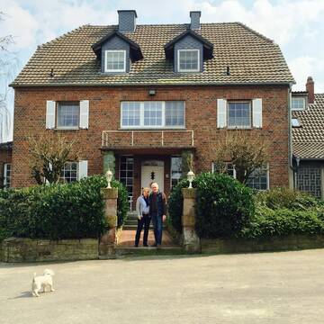
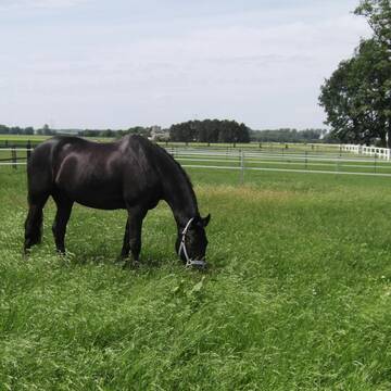
Pensionsbetrieb Rittergut Haus Koeningen
Welver
Stephan von Papen-Koeningen
@Rittergut_Haus_Koeningen
Fahrstall, Kutschwagen
Freizeitstall
Vermieten
Hunde willkommen
Krankenbox
Hufrehe geeignet
Notfallboxen
28 weitere...
P+


LebensRaum DraußenPferd
Bönen
LebensRaum-DraussenPferd
@LebensRaum-DraussenPferd
Freizeitstall
Hunde willkommen
Krankenbox
Allergikerstall
Hufrehe geeignet
Bewegungsstall
Laufstall
15 weitere...
S
Deprecated: Creation of dynamic property Zend_View_Helper_Ads::$adLink is deprecated in /var/www/stall-frei/htdocs/staging.stall-frei.de/library/Psf/View/Helper/Ads.php on line 108

Mitarbeiter gesucht?
Mechtersen
STALL-FREIde Marketing
@STALL-FREI-Marketing
Stellenangebote kostenlos veröffentlichen!
Zuchtstall Schäfers
Ense
Zuchtstall-Schaefers
@Zuchtstall-Schaefers
FN-Mitglied
Freizeitstall
Führanlage
Hunde willkommen
Pferdezucht
Zuchtstutenhaltung möglich
Außenbox mit Paddock
Außenboxen
17 weitere...
P+


Reitsport&Pferdezucht Lutter
Welver
Reitsport&Pferdezucht Lutter
@Reitanlage_Welver
Freizeitstall
Geländestrecke
Vermieten
Führanlage
Hunde willkommen
Allergikerstall
Fohlenaufzucht möglich
27 weitere...
P+

Reitsportanlage Neimen / Gut Dahlmann
Fröndenberg
Juliane-Dahlmann-Weber
@Juliane-Dahlmann-Weber
FN-Mitglied
Pferdeausbildung
Führanlage
Hunde willkommen
Außenboxen
Innenbox
Halbpension
Vollpension
19 weitere...
S

Dressurstall, Jungpferde und Rentnerbetreuung
Ense
Emily Küppers
@emilykueppers
Pferdeausbildung
Führanlage
Paddock
bedampftes/gewaschenes Heu
Hengsthaltung möglich
Außenboxen
Innenbox
15 weitere...
P+

Bewegungsstall für Wallache, Stuten getrennt mög...
Menden
Nicole-Hoevelmann
@Nicole-Hoevelmann
Vermieten
Krankenbox
Paddock
Bewegungsstall
Innenbox
Einzelne Boxen oder Stallplätze
7 weitere...
S
Hof Scheffer
Welver
Rita Scheffer
@Pensionstall-Scheffer
Freizeitstall
Vermieten
Hunde willkommen
Paddock
Pferdezucht
Zuchtstutenhaltung möglich
14 weitere...
P

Futtersack HeuToy, Fressbremse in pink
Mechtersen
STALL-FREIde Marketing
@STALL-FREI-Marketing
Stundenlange Beschäftigung die
Koliken vorbeugt, geringe Staubinhalation mit
steuerbarer Futterentnahme


Reitanlage am Bornekamp hat noch Boxen frei
Unna
Reitanlage Coester
@reitanlage.coester
Freizeitstall
Geländestrecke
Vermieten
Hunde willkommen
Longierzirkel/Roundpen
Allergikerstall
Hufrehe geeignet
14 weitere...
S
Reitstall Bockholt
Soest
Reitanlage-Bockholt
@Reitanlage-Bockholt
FN-Mitglied
Freizeitstall
Führanlage
Longierzirkel/Roundpen
Pferdezucht
zuckerreduziertes Heu
Außenbox mit Paddock
Außenboxen
20 weitere...
P
Deprecated: Creation of dynamic property Zend_View::$pageCount is deprecated in /var/www/stall-frei/htdocs/staging.stall-frei.de/library/vendor/shardj/zf1-future/library/Zend/View/Abstract.php on line 308
Deprecated: Creation of dynamic property Zend_View::$itemCountPerPage is deprecated in /var/www/stall-frei/htdocs/staging.stall-frei.de/library/vendor/shardj/zf1-future/library/Zend/View/Abstract.php on line 308
Deprecated: Creation of dynamic property Zend_View::$first is deprecated in /var/www/stall-frei/htdocs/staging.stall-frei.de/library/vendor/shardj/zf1-future/library/Zend/View/Abstract.php on line 308
Deprecated: Creation of dynamic property Zend_View::$current is deprecated in /var/www/stall-frei/htdocs/staging.stall-frei.de/library/vendor/shardj/zf1-future/library/Zend/View/Abstract.php on line 308
Deprecated: Creation of dynamic property Zend_View::$last is deprecated in /var/www/stall-frei/htdocs/staging.stall-frei.de/library/vendor/shardj/zf1-future/library/Zend/View/Abstract.php on line 308
Deprecated: Creation of dynamic property Zend_View::$next is deprecated in /var/www/stall-frei/htdocs/staging.stall-frei.de/library/vendor/shardj/zf1-future/library/Zend/View/Abstract.php on line 308
Deprecated: Creation of dynamic property Zend_View::$pagesInRange is deprecated in /var/www/stall-frei/htdocs/staging.stall-frei.de/library/vendor/shardj/zf1-future/library/Zend/View/Abstract.php on line 308
Deprecated: Creation of dynamic property Zend_View::$firstPageInRange is deprecated in /var/www/stall-frei/htdocs/staging.stall-frei.de/library/vendor/shardj/zf1-future/library/Zend/View/Abstract.php on line 308
Deprecated: Creation of dynamic property Zend_View::$lastPageInRange is deprecated in /var/www/stall-frei/htdocs/staging.stall-frei.de/library/vendor/shardj/zf1-future/library/Zend/View/Abstract.php on line 308
Deprecated: Creation of dynamic property Zend_View::$currentItemCount is deprecated in /var/www/stall-frei/htdocs/staging.stall-frei.de/library/vendor/shardj/zf1-future/library/Zend/View/Abstract.php on line 308
Deprecated: Creation of dynamic property Zend_View::$totalItemCount is deprecated in /var/www/stall-frei/htdocs/staging.stall-frei.de/library/vendor/shardj/zf1-future/library/Zend/View/Abstract.php on line 308
Deprecated: Creation of dynamic property Zend_View::$firstItemNumber is deprecated in /var/www/stall-frei/htdocs/staging.stall-frei.de/library/vendor/shardj/zf1-future/library/Zend/View/Abstract.php on line 308
Deprecated: Creation of dynamic property Zend_View::$lastItemNumber is deprecated in /var/www/stall-frei/htdocs/staging.stall-frei.de/library/vendor/shardj/zf1-future/library/Zend/View/Abstract.php on line 308
Deprecated: Creation of dynamic property Zend_View::$router is deprecated in /var/www/stall-frei/htdocs/staging.stall-frei.de/library/vendor/shardj/zf1-future/library/Zend/View/Abstract.php on line 308
Deprecated: Creation of dynamic property Zend_View::$urlParams is deprecated in /var/www/stall-frei/htdocs/staging.stall-frei.de/library/vendor/shardj/zf1-future/library/Zend/View/Abstract.php on line 308
Deprecated: Creation of dynamic property Zend_View::$showAds is deprecated in /var/www/stall-frei/htdocs/staging.stall-frei.de/library/vendor/shardj/zf1-future/library/Zend/View/Abstract.php on line 308
Deprecated: Creation of dynamic property Zend_View::$objectIds is deprecated in /var/www/stall-frei/htdocs/staging.stall-frei.de/library/vendor/shardj/zf1-future/library/Zend/View/Abstract.php on line 308
Deprecated: Creation of dynamic property Zend_View::$showNavbar is deprecated in /var/www/stall-frei/htdocs/staging.stall-frei.de/library/vendor/shardj/zf1-future/library/Zend/View/Abstract.php on line 308
Deprecated: Creation of dynamic property Zend_View::$showBreadcrumb is deprecated in /var/www/stall-frei/htdocs/staging.stall-frei.de/library/vendor/shardj/zf1-future/library/Zend/View/Abstract.php on line 308
Deprecated: Creation of dynamic property Zend_View::$showFooter is deprecated in /var/www/stall-frei/htdocs/staging.stall-frei.de/library/vendor/shardj/zf1-future/library/Zend/View/Abstract.php on line 308
Deprecated: Creation of dynamic property Zend_View::$showInternalAds is deprecated in /var/www/stall-frei/htdocs/staging.stall-frei.de/library/vendor/shardj/zf1-future/library/Zend/View/Abstract.php on line 308
Deprecated: Creation of dynamic property Zend_View::$blNoContent is deprecated in /var/www/stall-frei/htdocs/staging.stall-frei.de/library/vendor/shardj/zf1-future/library/Zend/View/Abstract.php on line 308
Deprecated: Creation of dynamic property Zend_View::$sMetaDesc is deprecated in /var/www/stall-frei/htdocs/staging.stall-frei.de/library/vendor/shardj/zf1-future/library/Zend/View/Abstract.php on line 308
Deprecated: Creation of dynamic property Zend_View::$useGmaps is deprecated in /var/www/stall-frei/htdocs/staging.stall-frei.de/library/vendor/shardj/zf1-future/library/Zend/View/Abstract.php on line 308
Deprecated: Creation of dynamic property Zend_View::$touches is deprecated in /var/www/stall-frei/htdocs/staging.stall-frei.de/library/vendor/shardj/zf1-future/library/Zend/View/Abstract.php on line 308
Deprecated: Creation of dynamic property Zend_View::$oProject is deprecated in /var/www/stall-frei/htdocs/staging.stall-frei.de/library/vendor/shardj/zf1-future/library/Zend/View/Abstract.php on line 308
Deprecated: Creation of dynamic property Zend_View::$pageHeadline is deprecated in /var/www/stall-frei/htdocs/staging.stall-frei.de/library/vendor/shardj/zf1-future/library/Zend/View/Abstract.php on line 308
Deprecated: Creation of dynamic property Zend_View::$disableLocationField is deprecated in /var/www/stall-frei/htdocs/staging.stall-frei.de/library/vendor/shardj/zf1-future/library/Zend/View/Abstract.php on line 308
Deprecated: Creation of dynamic property Zend_View::$isSearch is deprecated in /var/www/stall-frei/htdocs/staging.stall-frei.de/library/vendor/shardj/zf1-future/library/Zend/View/Abstract.php on line 308
Deprecated: Creation of dynamic property Zend_View::$pageTitle is deprecated in /var/www/stall-frei/htdocs/staging.stall-frei.de/library/vendor/shardj/zf1-future/library/Zend/View/Abstract.php on line 308
Deprecated: Creation of dynamic property Psf_Form_Element_Text::$class is deprecated in /var/www/stall-frei/htdocs/staging.stall-frei.de/library/vendor/shardj/zf1-future/library/Zend/Form/Element.php on line 874
Deprecated: Creation of dynamic property Psf_Form_Element_Text::$size is deprecated in /var/www/stall-frei/htdocs/staging.stall-frei.de/library/vendor/shardj/zf1-future/library/Zend/Form/Element.php on line 874
Deprecated: Creation of dynamic property Psf_Form_Element_Text::$placeholder is deprecated in /var/www/stall-frei/htdocs/staging.stall-frei.de/library/vendor/shardj/zf1-future/library/Zend/Form/Element.php on line 874
Deprecated: Creation of dynamic property Psf_Form_Element_Hidden::$class is deprecated in /var/www/stall-frei/htdocs/staging.stall-frei.de/library/vendor/shardj/zf1-future/library/Zend/Form/Element.php on line 874
Deprecated: Creation of dynamic property Psf_Form_Element_Hidden::$class is deprecated in /var/www/stall-frei/htdocs/staging.stall-frei.de/library/vendor/shardj/zf1-future/library/Zend/Form/Element.php on line 874
Deprecated: Creation of dynamic property Psf_Form_Element_Hidden::$class is deprecated in /var/www/stall-frei/htdocs/staging.stall-frei.de/library/vendor/shardj/zf1-future/library/Zend/Form/Element.php on line 874
Deprecated: Creation of dynamic property Psf_Form_Element_Hidden::$class is deprecated in /var/www/stall-frei/htdocs/staging.stall-frei.de/library/vendor/shardj/zf1-future/library/Zend/Form/Element.php on line 874
Deprecated: Creation of dynamic property Psf_Form_Element_Select::$class is deprecated in /var/www/stall-frei/htdocs/staging.stall-frei.de/library/vendor/shardj/zf1-future/library/Zend/Form/Element.php on line 874
Deprecated: Creation of dynamic property Psf_Form_Element_Select::$class is deprecated in /var/www/stall-frei/htdocs/staging.stall-frei.de/library/vendor/shardj/zf1-future/library/Zend/Form/Element.php on line 874
Deprecated: Creation of dynamic property Psf_Form_Element_Select::$class is deprecated in /var/www/stall-frei/htdocs/staging.stall-frei.de/library/vendor/shardj/zf1-future/library/Zend/Form/Element.php on line 874
Deprecated: Creation of dynamic property Psf_Form_Element_Select::$class is deprecated in /var/www/stall-frei/htdocs/staging.stall-frei.de/library/vendor/shardj/zf1-future/library/Zend/Form/Element.php on line 874
Deprecated: Creation of dynamic property Psf_Form_Element_Text::$class is deprecated in /var/www/stall-frei/htdocs/staging.stall-frei.de/library/vendor/shardj/zf1-future/library/Zend/Form/Element.php on line 874
Deprecated: Creation of dynamic property Psf_Form_Element_Checkbox::$label is deprecated in /var/www/stall-frei/htdocs/staging.stall-frei.de/library/vendor/shardj/zf1-future/library/Zend/Form/Element.php on line 874
Deprecated: Creation of dynamic property Zend_View::$sort is deprecated in /var/www/stall-frei/htdocs/staging.stall-frei.de/library/vendor/shardj/zf1-future/library/Zend/View/Abstract.php on line 308
Deprecated: Creation of dynamic property Zend_View::$searchLocation is deprecated in /var/www/stall-frei/htdocs/staging.stall-frei.de/library/vendor/shardj/zf1-future/library/Zend/View/Abstract.php on line 308
Deprecated: Creation of dynamic property Zend_View::$locationHint is deprecated in /var/www/stall-frei/htdocs/staging.stall-frei.de/library/vendor/shardj/zf1-future/library/Zend/View/Abstract.php on line 308
Psf_GeoCoder_Abstract::getLocation: Oberbergstraße Get Location CachedOrLive
Psf_GeoCoder_Abstract::getCachedOrLive: Oberbergstraße
Psf_GeoCoder_OpenCageData::makeApiRequest: response:
Array
(
[documentation] => https://opencagedata.com/api
[licenses] => Array
(
[0] => Array
(
[name] => see attribution guide
[url] => https://opencagedata.com/credits
)
)
[results] => Array
(
[0] => Array
(
[bounds] => Array
(
[northeast] => Array
(
[lat] => 51.5750034
[lng] => 7.9918603
)
[southwest] => Array
(
[lat] => 51.5618015
[lng] => 7.95496
)
)
[components] => Array
(
[ISO_3166-1_alpha-2] => DE
[ISO_3166-1_alpha-3] => DEU
[ISO_3166-2] => Array
(
[0] => DE-NW
)
[_category] => place
[_normalized_city] => Werl
[_type] => village
[continent] => Europe
[country] => Deutschland
[country_code] => de
[county] => Kreis Soest
[political_union] => European Union
[state] => Nordrhein-Westfalen
[state_code] => NW
[town] => Werl
[village] => Oberbergstraße
)
[confidence] => 7
[formatted] => Oberbergstraße, Nordrhein-Westfalen, Deutschland
[geometry] => Array
(
[lat] => 51.5677016
[lng] => 7.9746315
)
)
[1] => Array
(
[bounds] => Array
(
[northeast] => Array
(
[lat] => 50.2128667
[lng] => 6.4286514
)
[southwest] => Array
(
[lat] => 50.2102818
[lng] => 6.4244275
)
)
[components] => Array
(
[ISO_3166-1_alpha-2] => DE
[ISO_3166-1_alpha-3] => DEU
[ISO_3166-2] => Array
(
[0] => DE-RP
)
[_category] => road
[_normalized_city] => Prüm
[_type] => road
[continent] => Europe
[country] => Deutschland
[country_code] => de
[county] => Eifelkreis Bitburg-Prüm
[municipality] => Prüm
[political_union] => European Union
[postcode] => 54595
[road] => Oberbergstraße
[road_type] => tertiary
[state] => Rheinland-Pfalz
[state_code] => RP
[town] => Prüm
)
[confidence] => 9
[formatted] => Oberbergstraße, 54595 Prüm, Deutschland
[geometry] => Array
(
[lat] => 50.2115034
[lng] => 6.4265805
)
)
[2] => Array
(
[bounds] => Array
(
[northeast] => Array
(
[lat] => 50.7511763
[lng] => 7.8598788
)
[southwest] => Array
(
[lat] => 50.7495901
[lng] => 7.8546238
)
)
[components] => Array
(
[ISO_3166-1_alpha-2] => DE
[ISO_3166-1_alpha-3] => DEU
[ISO_3166-2] => Array
(
[0] => DE-RP
)
[_category] => road
[_normalized_city] => Molzhain
[_type] => road
[continent] => Europe
[country] => Deutschland
[country_code] => de
[county] => Landkreis Altenkirchen (Westerwald)
[municipality] => Betzdorf-Gebhardshain
[political_union] => European Union
[postcode] => 57520
[road] => Oberbergstraße
[road_type] => residential
[state] => Rheinland-Pfalz
[state_code] => RP
[village] => Molzhain
)
[confidence] => 9
[formatted] => Oberbergstraße, 57520 Molzhain, Deutschland
[geometry] => Array
(
[lat] => 50.7509249
[lng] => 7.8571888
)
)
[3] => Array
(
[bounds] => Array
(
[northeast] => Array
(
[lat] => 48.1388001
[lng] => 7.8403273
)
[southwest] => Array
(
[lat] => 48.1372119
[lng] => 7.8369302
)
)
[components] => Array
(
[ISO_3166-1_alpha-2] => DE
[ISO_3166-1_alpha-3] => DEU
[ISO_3166-2] => Array
(
[0] => DE-BW
)
[_category] => road
[_normalized_city] => Emmendingen
[_type] => road
[continent] => Europe
[country] => Deutschland
[country_code] => de
[county] => Landkreis Emmendingen
[municipality] => VVG der Stadt Emmendingen
[political_union] => European Union
[postcode] => 79312
[road] => Oberbergstraße
[road_type] => residential
[state] => Baden-Württemberg
[state_code] => BW
[town] => Emmendingen
[village] => Mundingen
)
[confidence] => 9
[formatted] => Oberbergstraße, 79312 Mundingen, Deutschland
[geometry] => Array
(
[lat] => 48.1378261
[lng] => 7.8387143
)
)
[4] => Array
(
[bounds] => Array
(
[northeast] => Array
(
[lat] => 50.1152751
[lng] => 8.338803
)
[southwest] => Array
(
[lat] => 50.1102464
[lng] => 8.3377807
)
)
[components] => Array
(
[ISO_3166-1_alpha-2] => DE
[ISO_3166-1_alpha-3] => DEU
[ISO_3166-2] => Array
(
[0] => DE-HE
)
[_category] => road
[_normalized_city] => Wiesbaden
[_type] => road
[city] => Wiesbaden
[continent] => Europe
[country] => Deutschland
[country_code] => de
[political_union] => European Union
[postcode] => 65207
[road] => Oberbergstraße
[road_type] => residential
[state] => Hessen
[state_code] => HE
[village] => Medenbach
)
[confidence] => 9
[formatted] => Oberbergstraße, 65207 Medenbach, Deutschland
[geometry] => Array
(
[lat] => 50.112812
[lng] => 8.3383834
)
)
[5] => Array
(
[bounds] => Array
(
[northeast] => Array
(
[lat] => 50.2399331
[lng] => 6.2963034
)
[southwest] => Array
(
[lat] => 50.2393277
[lng] => 6.2884322
)
)
[components] => Array
(
[ISO_3166-1_alpha-2] => DE
[ISO_3166-1_alpha-3] => DEU
[ISO_3166-2] => Array
(
[0] => DE-RP
)
[_category] => road
[_normalized_city] => Bleialf
[_type] => road
[continent] => Europe
[country] => Deutschland
[country_code] => de
[county] => Eifelkreis Bitburg-Prüm
[hamlet] => Wippelsbach
[municipality] => Prüm
[political_union] => European Union
[postcode] => 54608
[road] => Oberbergstraße
[road_type] => residential
[state] => Rheinland-Pfalz
[state_code] => RP
[village] => Bleialf
)
[confidence] => 9
[formatted] => Oberbergstraße, 54608 Bleialf, Deutschland
[geometry] => Array
(
[lat] => 50.2394113
[lng] => 6.2924162
)
)
[6] => Array
(
[bounds] => Array
(
[northeast] => Array
(
[lat] => 53.9364822
[lng] => 10.3192781
)
[southwest] => Array
(
[lat] => 53.9354842
[lng] => 10.3166371
)
)
[components] => Array
(
[ISO_3166-1_alpha-2] => DE
[ISO_3166-1_alpha-3] => DEU
[ISO_3166-2] => Array
(
[0] => DE-SH
)
[_category] => road
[_normalized_city] => Bad Segeberg
[_type] => road
[continent] => Europe
[country] => Deutschland
[country_code] => de
[county] => Kreis Segeberg
[political_union] => European Union
[postcode] => 23795
[road] => Oberbergstraße
[road_type] => residential
[state] => Schleswig-Holstein
[state_code] => SH
[town] => Bad Segeberg
)
[confidence] => 9
[formatted] => Oberbergstraße, 23795 Bad Segeberg, Deutschland
[geometry] => Array
(
[lat] => 53.9362269
[lng] => 10.3180536
)
)
[7] => Array
(
[bounds] => Array
(
[northeast] => Array
(
[lat] => 48.3248472
[lng] => 10.5789481
)
[southwest] => Array
(
[lat] => 48.3241913
[lng] => 10.5752913
)
)
[components] => Array
(
[ISO_3166-1_alpha-2] => DE
[ISO_3166-1_alpha-3] => DEU
[ISO_3166-2] => Array
(
[0] => DE-BY
)
[_category] => road
[_normalized_city] => Dinkelscherben
[_type] => road
[continent] => Europe
[country] => Deutschland
[country_code] => de
[county] => Landkreis Augsburg
[hamlet] => Reischenau
[political_union] => European Union
[postcode] => 86424
[road] => Oberbergstraße
[road_type] => residential
[state] => Bayern
[state_code] => BY
[town] => Dinkelscherben
)
[confidence] => 9
[formatted] => Oberbergstraße, 86424 Dinkelscherben, Deutschland
[geometry] => Array
(
[lat] => 48.324298
[lng] => 10.5771848
)
)
[8] => Array
(
[components] => Array
(
[ISO_3166-1_alpha-2] => FR
[ISO_3166-1_alpha-3] => FRA
[ISO_3166-2] => Array
(
[0] => FR-IDF
[1] => FR-92
)
[_category] => road
[_normalized_city] => Levallois-Perret
[_type] => road
[city] => Levallois-Perret
[continent] => Europe
[country] => France
[country_code] => fr
[county] => Hauts-de-Seine
[local_authority] => Métropole du Grand Paris
[political_union] => European Union
[postcode] => 92300
[road] => Rue Charles Deutschmann
[state] => Île-de-France
[state_code] => IDF
)
[confidence] => 2
[formatted] => Rue Charles Deutschmann, 92300 Levallois-Perret, France
[geometry] => Array
(
[lat] => 48.900049
[lng] => 2.2842
)
)
)
[status] => Array
(
[code] => 200
[message] => OK
)
[stay_informed] => Array
(
[blog] => https://blog.opencagedata.com
[mastodon] => https://en.osm.town/@opencage
)
[thanks] => For using an OpenCage API
[timestamp] => Array
(
[created_http] => Sun, 08 Feb 2026 00:06:02 GMT
[created_unix] => 1770509162
)
[total_results] => 9
)
Psf_GeoCoder_Abstract::convertLocationResult
{"documentation":"https:\/\/opencagedata.com\/api","licenses":[{"name":"see attribution guide","url":"https:\/\/opencagedata.com\/credits"}],"results":[{"bounds":{"northeast":{"lat":51.5750034,"lng":7.9918603},"southwest":{"lat":51.5618015,"lng":7.95496}},"components":{"ISO_3166-1_alpha-2":"DE","ISO_3166-1_alpha-3":"DEU","ISO_3166-2":["DE-NW"],"_category":"place","_normalized_city":"Werl","_type":"village","continent":"Europe","country":"Deutschland","country_code":"de","county":"Kreis Soest","political_union":"European Union","state":"Nordrhein-Westfalen","state_code":"NW","town":"Werl","village":"Oberbergstra\u00dfe"},"confidence":7,"formatted":"Oberbergstra\u00dfe, Nordrhein-Westfalen, Deutschland","geometry":{"lat":51.5677016,"lng":7.9746315}},{"bounds":{"northeast":{"lat":50.2128667,"lng":6.4286514},"southwest":{"lat":50.2102818,"lng":6.4244275}},"components":{"ISO_3166-1_alpha-2":"DE","ISO_3166-1_alpha-3":"DEU","ISO_3166-2":["DE-RP"],"_category":"road","_normalized_city":"Pr\u00fcm","_type":"road","continent":"Europe","country":"Deutschland","country_code":"de","county":"Eifelkreis Bitburg-Pr\u00fcm","municipality":"Pr\u00fcm","political_union":"European Union","postcode":"54595","road":"Oberbergstra\u00dfe","road_type":"tertiary","state":"Rheinland-Pfalz","state_code":"RP","town":"Pr\u00fcm"},"confidence":9,"formatted":"Oberbergstra\u00dfe, 54595 Pr\u00fcm, Deutschland","geometry":{"lat":50.2115034,"lng":6.4265805}},{"bounds":{"northeast":{"lat":50.7511763,"lng":7.8598788},"southwest":{"lat":50.7495901,"lng":7.8546238}},"components":{"ISO_3166-1_alpha-2":"DE","ISO_3166-1_alpha-3":"DEU","ISO_3166-2":["DE-RP"],"_category":"road","_normalized_city":"Molzhain","_type":"road","continent":"Europe","country":"Deutschland","country_code":"de","county":"Landkreis Altenkirchen (Westerwald)","municipality":"Betzdorf-Gebhardshain","political_union":"European Union","postcode":"57520","road":"Oberbergstra\u00dfe","road_type":"residential","state":"Rheinland-Pfalz","state_code":"RP","village":"Molzhain"},"confidence":9,"formatted":"Oberbergstra\u00dfe, 57520 Molzhain, Deutschland","geometry":{"lat":50.7509249,"lng":7.8571888}},{"bounds":{"northeast":{"lat":48.1388001,"lng":7.8403273},"southwest":{"lat":48.1372119,"lng":7.8369302}},"components":{"ISO_3166-1_alpha-2":"DE","ISO_3166-1_alpha-3":"DEU","ISO_3166-2":["DE-BW"],"_category":"road","_normalized_city":"Emmendingen","_type":"road","continent":"Europe","country":"Deutschland","country_code":"de","county":"Landkreis Emmendingen","municipality":"VVG der Stadt Emmendingen","political_union":"European Union","postcode":"79312","road":"Oberbergstra\u00dfe","road_type":"residential","state":"Baden-W\u00fcrttemberg","state_code":"BW","town":"Emmendingen","village":"Mundingen"},"confidence":9,"formatted":"Oberbergstra\u00dfe, 79312 Mundingen, Deutschland","geometry":{"lat":48.1378261,"lng":7.8387143}},{"bounds":{"northeast":{"lat":50.1152751,"lng":8.338803},"southwest":{"lat":50.1102464,"lng":8.3377807}},"components":{"ISO_3166-1_alpha-2":"DE","ISO_3166-1_alpha-3":"DEU","ISO_3166-2":["DE-HE"],"_category":"road","_normalized_city":"Wiesbaden","_type":"road","city":"Wiesbaden","continent":"Europe","country":"Deutschland","country_code":"de","political_union":"European Union","postcode":"65207","road":"Oberbergstra\u00dfe","road_type":"residential","state":"Hessen","state_code":"HE","village":"Medenbach"},"confidence":9,"formatted":"Oberbergstra\u00dfe, 65207 Medenbach, Deutschland","geometry":{"lat":50.112812,"lng":8.3383834}},{"bounds":{"northeast":{"lat":50.2399331,"lng":6.2963034},"southwest":{"lat":50.2393277,"lng":6.2884322}},"components":{"ISO_3166-1_alpha-2":"DE","ISO_3166-1_alpha-3":"DEU","ISO_3166-2":["DE-RP"],"_category":"road","_normalized_city":"Bleialf","_type":"road","continent":"Europe","country":"Deutschland","country_code":"de","county":"Eifelkreis Bitburg-Pr\u00fcm","hamlet":"Wippelsbach","municipality":"Pr\u00fcm","political_union":"European Union","postcode":"54608","road":"Oberbergstra\u00dfe","road_type":"residential","state":"Rheinland-Pfalz","state_code":"RP","village":"Bleialf"},"confidence":9,"formatted":"Oberbergstra\u00dfe, 54608 Bleialf, Deutschland","geometry":{"lat":50.2394113,"lng":6.2924162}},{"bounds":{"northeast":{"lat":53.9364822,"lng":10.3192781},"southwest":{"lat":53.9354842,"lng":10.3166371}},"components":{"ISO_3166-1_alpha-2":"DE","ISO_3166-1_alpha-3":"DEU","ISO_3166-2":["DE-SH"],"_category":"road","_normalized_city":"Bad Segeberg","_type":"road","continent":"Europe","country":"Deutschland","country_code":"de","county":"Kreis Segeberg","political_union":"European Union","postcode":"23795","road":"Oberbergstra\u00dfe","road_type":"residential","state":"Schleswig-Holstein","state_code":"SH","town":"Bad Segeberg"},"confidence":9,"formatted":"Oberbergstra\u00dfe, 23795 Bad Segeberg, Deutschland","geometry":{"lat":53.9362269,"lng":10.3180536}},{"bounds":{"northeast":{"lat":48.3248472,"lng":10.5789481},"southwest":{"lat":48.3241913,"lng":10.5752913}},"components":{"ISO_3166-1_alpha-2":"DE","ISO_3166-1_alpha-3":"DEU","ISO_3166-2":["DE-BY"],"_category":"road","_normalized_city":"Dinkelscherben","_type":"road","continent":"Europe","country":"Deutschland","country_code":"de","county":"Landkreis Augsburg","hamlet":"Reischenau","political_union":"European Union","postcode":"86424","road":"Oberbergstra\u00dfe","road_type":"residential","state":"Bayern","state_code":"BY","town":"Dinkelscherben"},"confidence":9,"formatted":"Oberbergstra\u00dfe, 86424 Dinkelscherben, Deutschland","geometry":{"lat":48.324298,"lng":10.5771848}},{"components":{"ISO_3166-1_alpha-2":"FR","ISO_3166-1_alpha-3":"FRA","ISO_3166-2":["FR-IDF","FR-92"],"_category":"road","_normalized_city":"Levallois-Perret","_type":"road","city":"Levallois-Perret","continent":"Europe","country":"France","country_code":"fr","county":"Hauts-de-Seine","local_authority":"M\u00e9tropole du Grand Paris","political_union":"European Union","postcode":"92300","road":"Rue Charles Deutschmann","state":"\u00cele-de-France","state_code":"IDF"},"confidence":2,"formatted":"Rue Charles Deutschmann, 92300 Levallois-Perret, France","geometry":{"lat":48.900049,"lng":2.2842}}],"status":{"code":200,"message":"OK"},"stay_informed":{"blog":"https:\/\/blog.opencagedata.com","mastodon":"https:\/\/en.osm.town\/@opencage"},"thanks":"For using an OpenCage API","timestamp":{"created_http":"Sun, 08 Feb 2026 00:06:02 GMT","created_unix":1770509162},"total_results":9}Array
(
[0] => stdClass Object
(
[bounds] => stdClass Object
(
[northeast] => stdClass Object
(
[lat] => 51.5750034
[lng] => 7.9918603
)
[southwest] => stdClass Object
(
[lat] => 51.5618015
[lng] => 7.95496
)
)
[components] => stdClass Object
(
[ISO_3166-1_alpha-2] => DE
[ISO_3166-1_alpha-3] => DEU
[ISO_3166-2] => Array
(
[0] => DE-NW
)
[_category] => place
[_normalized_city] => Werl
[_type] => village
[continent] => Europe
[country] => Deutschland
[country_code] => de
[county] => Kreis Soest
[political_union] => European Union
[state] => Nordrhein-Westfalen
[state_code] => NW
[town] => Werl
[village] => Oberbergstraße
)
[confidence] => 7
[formatted] => Oberbergstraße, Nordrhein-Westfalen, Deutschland
[geometry] => stdClass Object
(
[lat] => 51.5677016
[lng] => 7.9746315
)
)
[1] => stdClass Object
(
[bounds] => stdClass Object
(
[northeast] => stdClass Object
(
[lat] => 50.2128667
[lng] => 6.4286514
)
[southwest] => stdClass Object
(
[lat] => 50.2102818
[lng] => 6.4244275
)
)
[components] => stdClass Object
(
[ISO_3166-1_alpha-2] => DE
[ISO_3166-1_alpha-3] => DEU
[ISO_3166-2] => Array
(
[0] => DE-RP
)
[_category] => road
[_normalized_city] => Prüm
[_type] => road
[continent] => Europe
[country] => Deutschland
[country_code] => de
[county] => Eifelkreis Bitburg-Prüm
[municipality] => Prüm
[political_union] => European Union
[postcode] => 54595
[road] => Oberbergstraße
[road_type] => tertiary
[state] => Rheinland-Pfalz
[state_code] => RP
[town] => Prüm
)
[confidence] => 9
[formatted] => Oberbergstraße, 54595 Prüm, Deutschland
[geometry] => stdClass Object
(
[lat] => 50.2115034
[lng] => 6.4265805
)
)
[2] => stdClass Object
(
[bounds] => stdClass Object
(
[northeast] => stdClass Object
(
[lat] => 50.7511763
[lng] => 7.8598788
)
[southwest] => stdClass Object
(
[lat] => 50.7495901
[lng] => 7.8546238
)
)
[components] => stdClass Object
(
[ISO_3166-1_alpha-2] => DE
[ISO_3166-1_alpha-3] => DEU
[ISO_3166-2] => Array
(
[0] => DE-RP
)
[_category] => road
[_normalized_city] => Molzhain
[_type] => road
[continent] => Europe
[country] => Deutschland
[country_code] => de
[county] => Landkreis Altenkirchen (Westerwald)
[municipality] => Betzdorf-Gebhardshain
[political_union] => European Union
[postcode] => 57520
[road] => Oberbergstraße
[road_type] => residential
[state] => Rheinland-Pfalz
[state_code] => RP
[village] => Molzhain
)
[confidence] => 9
[formatted] => Oberbergstraße, 57520 Molzhain, Deutschland
[geometry] => stdClass Object
(
[lat] => 50.7509249
[lng] => 7.8571888
)
)
[3] => stdClass Object
(
[bounds] => stdClass Object
(
[northeast] => stdClass Object
(
[lat] => 48.1388001
[lng] => 7.8403273
)
[southwest] => stdClass Object
(
[lat] => 48.1372119
[lng] => 7.8369302
)
)
[components] => stdClass Object
(
[ISO_3166-1_alpha-2] => DE
[ISO_3166-1_alpha-3] => DEU
[ISO_3166-2] => Array
(
[0] => DE-BW
)
[_category] => road
[_normalized_city] => Emmendingen
[_type] => road
[continent] => Europe
[country] => Deutschland
[country_code] => de
[county] => Landkreis Emmendingen
[municipality] => VVG der Stadt Emmendingen
[political_union] => European Union
[postcode] => 79312
[road] => Oberbergstraße
[road_type] => residential
[state] => Baden-Württemberg
[state_code] => BW
[town] => Emmendingen
[village] => Mundingen
)
[confidence] => 9
[formatted] => Oberbergstraße, 79312 Mundingen, Deutschland
[geometry] => stdClass Object
(
[lat] => 48.1378261
[lng] => 7.8387143
)
)
[4] => stdClass Object
(
[bounds] => stdClass Object
(
[northeast] => stdClass Object
(
[lat] => 50.1152751
[lng] => 8.338803
)
[southwest] => stdClass Object
(
[lat] => 50.1102464
[lng] => 8.3377807
)
)
[components] => stdClass Object
(
[ISO_3166-1_alpha-2] => DE
[ISO_3166-1_alpha-3] => DEU
[ISO_3166-2] => Array
(
[0] => DE-HE
)
[_category] => road
[_normalized_city] => Wiesbaden
[_type] => road
[city] => Wiesbaden
[continent] => Europe
[country] => Deutschland
[country_code] => de
[political_union] => European Union
[postcode] => 65207
[road] => Oberbergstraße
[road_type] => residential
[state] => Hessen
[state_code] => HE
[village] => Medenbach
)
[confidence] => 9
[formatted] => Oberbergstraße, 65207 Medenbach, Deutschland
[geometry] => stdClass Object
(
[lat] => 50.112812
[lng] => 8.3383834
)
)
[5] => stdClass Object
(
[bounds] => stdClass Object
(
[northeast] => stdClass Object
(
[lat] => 50.2399331
[lng] => 6.2963034
)
[southwest] => stdClass Object
(
[lat] => 50.2393277
[lng] => 6.2884322
)
)
[components] => stdClass Object
(
[ISO_3166-1_alpha-2] => DE
[ISO_3166-1_alpha-3] => DEU
[ISO_3166-2] => Array
(
[0] => DE-RP
)
[_category] => road
[_normalized_city] => Bleialf
[_type] => road
[continent] => Europe
[country] => Deutschland
[country_code] => de
[county] => Eifelkreis Bitburg-Prüm
[hamlet] => Wippelsbach
[municipality] => Prüm
[political_union] => European Union
[postcode] => 54608
[road] => Oberbergstraße
[road_type] => residential
[state] => Rheinland-Pfalz
[state_code] => RP
[village] => Bleialf
)
[confidence] => 9
[formatted] => Oberbergstraße, 54608 Bleialf, Deutschland
[geometry] => stdClass Object
(
[lat] => 50.2394113
[lng] => 6.2924162
)
)
[6] => stdClass Object
(
[bounds] => stdClass Object
(
[northeast] => stdClass Object
(
[lat] => 53.9364822
[lng] => 10.3192781
)
[southwest] => stdClass Object
(
[lat] => 53.9354842
[lng] => 10.3166371
)
)
[components] => stdClass Object
(
[ISO_3166-1_alpha-2] => DE
[ISO_3166-1_alpha-3] => DEU
[ISO_3166-2] => Array
(
[0] => DE-SH
)
[_category] => road
[_normalized_city] => Bad Segeberg
[_type] => road
[continent] => Europe
[country] => Deutschland
[country_code] => de
[county] => Kreis Segeberg
[political_union] => European Union
[postcode] => 23795
[road] => Oberbergstraße
[road_type] => residential
[state] => Schleswig-Holstein
[state_code] => SH
[town] => Bad Segeberg
)
[confidence] => 9
[formatted] => Oberbergstraße, 23795 Bad Segeberg, Deutschland
[geometry] => stdClass Object
(
[lat] => 53.9362269
[lng] => 10.3180536
)
)
[7] => stdClass Object
(
[bounds] => stdClass Object
(
[northeast] => stdClass Object
(
[lat] => 48.3248472
[lng] => 10.5789481
)
[southwest] => stdClass Object
(
[lat] => 48.3241913
[lng] => 10.5752913
)
)
[components] => stdClass Object
(
[ISO_3166-1_alpha-2] => DE
[ISO_3166-1_alpha-3] => DEU
[ISO_3166-2] => Array
(
[0] => DE-BY
)
[_category] => road
[_normalized_city] => Dinkelscherben
[_type] => road
[continent] => Europe
[country] => Deutschland
[country_code] => de
[county] => Landkreis Augsburg
[hamlet] => Reischenau
[political_union] => European Union
[postcode] => 86424
[road] => Oberbergstraße
[road_type] => residential
[state] => Bayern
[state_code] => BY
[town] => Dinkelscherben
)
[confidence] => 9
[formatted] => Oberbergstraße, 86424 Dinkelscherben, Deutschland
[geometry] => stdClass Object
(
[lat] => 48.324298
[lng] => 10.5771848
)
)
[8] => stdClass Object
(
[components] => stdClass Object
(
[ISO_3166-1_alpha-2] => FR
[ISO_3166-1_alpha-3] => FRA
[ISO_3166-2] => Array
(
[0] => FR-IDF
[1] => FR-92
)
[_category] => road
[_normalized_city] => Levallois-Perret
[_type] => road
[city] => Levallois-Perret
[continent] => Europe
[country] => France
[country_code] => fr
[county] => Hauts-de-Seine
[local_authority] => Métropole du Grand Paris
[political_union] => European Union
[postcode] => 92300
[road] => Rue Charles Deutschmann
[state] => Île-de-France
[state_code] => IDF
)
[confidence] => 2
[formatted] => Rue Charles Deutschmann, 92300 Levallois-Perret, France
[geometry] => stdClass Object
(
[lat] => 48.900049
[lng] => 2.2842
)
)
)
Psf_GeoCoder_OpenCageData::getKeyMap: 0
stdClass Object
(
    [bounds] => stdClass Object
        (
            [northeast] => stdClass Object
                (
                    [lat] => 51.5750034
                    [lng] => 7.9918603
                )

            [southwest] => stdClass Object
                (
                    [lat] => 51.5618015
                    [lng] => 7.95496
                )

        )

    [components] => stdClass Object
        (
            [ISO_3166-1_alpha-2] => DE
            [ISO_3166-1_alpha-3] => DEU
            [ISO_3166-2] => Array
                (
                    [0] => DE-NW
                )

            [_category] => place
            [_normalized_city] => Werl
            [_type] => village
            [continent] => Europe
            [country] => Deutschland
            [country_code] => de
            [county] => Kreis Soest
            [political_union] => European Union
            [state] => Nordrhein-Westfalen
            [state_code] => NW
            [town] => Werl
            [village] => Oberbergstraße
        )

    [confidence] => 7
    [formatted] => Oberbergstraße, Nordrhein-Westfalen, Deutschland
    [geometry] => stdClass Object
        (
            [lat] => 51.5677016
            [lng] => 7.9746315
        )

)
Psf_GeoCoder_OpenCageData::getCounty: Soest
Psf_GeoCoder_OpenCageData::addMissingData REFETCH!
Array
(
    [address] => Oberbergstraße, Nordrhein-Westfalen, Deutschland
    [type] => village
    [street] =>
    [city] => Werl
    [county] => Soest
    [state] => Nordrhein-Westfalen
    [zip] =>
    [country] => Deutschland
    [suburb] =>
    [countrycode] => de
    [latitude] => 51.5677016
    [longitude] => 7.9746315
    [accuracy] => 1
    [confidence] => 7
    [bounds] => stdClass Object
        (
            [northeast] => stdClass Object
                (
                    [lat] => 51.5750034
                    [lng] => 7.9918603
                )

            [southwest] => stdClass Object
                (
                    [lat] => 51.5618015
                    [lng] => 7.95496
                )

        )

)
reformat!
Array
(
    [address] => Werl
    [type] => village
    [street] =>
    [city] => Werl
    [county] => Soest
    [state] => Nordrhein-Westfalen
    [zip] =>
    [country] => Deutschland
    [suburb] =>
    [countrycode] => de
    [latitude] => 51.5677016
    [longitude] => 7.9746315
    [accuracy] => 1
    [confidence] => 7
    [bounds] => stdClass Object
        (
            [northeast] => stdClass Object
                (
                    [lat] => 51.5750034
                    [lng] => 7.9918603
                )

            [southwest] => stdClass Object
                (
                    [lat] => 51.5618015
                    [lng] => 7.95496
                )

        )

    [place] => Werl, Nordrhein-Westfalen
    [hash] => bf1c4f3fe46cd65488d691c82ca4b660
)
Psf_GeoCoder_OpenCageData::getKeyMap: 1
stdClass Object
(
    [bounds] => stdClass Object
        (
            [northeast] => stdClass Object
                (
                    [lat] => 50.2128667
                    [lng] => 6.4286514
                )

            [southwest] => stdClass Object
                (
                    [lat] => 50.2102818
                    [lng] => 6.4244275
                )

        )

    [components] => stdClass Object
        (
            [ISO_3166-1_alpha-2] => DE
            [ISO_3166-1_alpha-3] => DEU
            [ISO_3166-2] => Array
                (
                    [0] => DE-RP
                )

            [_category] => road
            [_normalized_city] => Prüm
            [_type] => road
            [continent] => Europe
            [country] => Deutschland
            [country_code] => de
            [county] => Eifelkreis Bitburg-Prüm
            [municipality] => Prüm
            [political_union] => European Union
            [postcode] => 54595
            [road] => Oberbergstraße
            [road_type] => tertiary
            [state] => Rheinland-Pfalz
            [state_code] => RP
            [town] => Prüm
        )

    [confidence] => 9
    [formatted] => Oberbergstraße, 54595 Prüm, Deutschland
    [geometry] => stdClass Object
        (
            [lat] => 50.2115034
            [lng] => 6.4265805
        )

)
Psf_GeoCoder_OpenCageData::getCounty: Eifelkreis Bitburg-Prüm
Psf_GeoCoder_OpenCageData::addMissingData REFETCH!
Array
(
    [address] => Oberbergstraße, 54595 Prüm, Deutschland
    [type] => road
    [street] => Oberbergstraße
    [city] => Prüm
    [county] => Eifelkreis Bitburg-Prüm
    [state] => Rheinland-Pfalz
    [zip] => 54595
    [country] => Deutschland
    [suburb] =>
    [countrycode] => de
    [latitude] => 50.2115034
    [longitude] => 6.4265805
    [accuracy] => 1
    [confidence] => 9
    [bounds] => stdClass Object
        (
            [northeast] => stdClass Object
                (
                    [lat] => 50.2128667
                    [lng] => 6.4286514
                )

            [southwest] => stdClass Object
                (
                    [lat] => 50.2102818
                    [lng] => 6.4244275
                )

        )

)
reformat!
Array
(
    [address] => Oberbergstraße, 54595 Prüm, Deutschland
    [type] => road
    [street] => Oberbergstraße
    [city] => Prüm
    [county] => Eifelkreis Bitburg-Prüm
    [state] => Rheinland-Pfalz
    [zip] => 54595
    [country] => Deutschland
    [suburb] =>
    [countrycode] => de
    [latitude] => 50.2115034
    [longitude] => 6.4265805
    [accuracy] => 1
    [confidence] => 9
    [bounds] => stdClass Object
        (
            [northeast] => stdClass Object
                (
                    [lat] => 50.2128667
                    [lng] => 6.4286514
                )

            [southwest] => stdClass Object
                (
                    [lat] => 50.2102818
                    [lng] => 6.4244275
                )

        )

    [place] => Oberbergstraße, 54595 Prüm, Rheinland-Pfalz
    [hash] => 0a4b5b8212eb81b2cc50bb3bdc95d51d
)
Psf_GeoCoder_OpenCageData::getKeyMap: 2
stdClass Object
(
    [bounds] => stdClass Object
        (
            [northeast] => stdClass Object
                (
                    [lat] => 50.7511763
                    [lng] => 7.8598788
                )

            [southwest] => stdClass Object
                (
                    [lat] => 50.7495901
                    [lng] => 7.8546238
                )

        )

    [components] => stdClass Object
        (
            [ISO_3166-1_alpha-2] => DE
            [ISO_3166-1_alpha-3] => DEU
            [ISO_3166-2] => Array
                (
                    [0] => DE-RP
                )

            [_category] => road
            [_normalized_city] => Molzhain
            [_type] => road
            [continent] => Europe
            [country] => Deutschland
            [country_code] => de
            [county] => Landkreis Altenkirchen (Westerwald)
            [municipality] => Betzdorf-Gebhardshain
            [political_union] => European Union
            [postcode] => 57520
            [road] => Oberbergstraße
            [road_type] => residential
            [state] => Rheinland-Pfalz
            [state_code] => RP
            [village] => Molzhain
        )

    [confidence] => 9
    [formatted] => Oberbergstraße, 57520 Molzhain, Deutschland
    [geometry] => stdClass Object
        (
            [lat] => 50.7509249
            [lng] => 7.8571888
        )

)
Psf_GeoCoder_OpenCageData::getCounty: Altenkirchen (Westerwald)
Psf_GeoCoder_OpenCageData::addMissingData REFETCH!
Array
(
    [address] => Oberbergstraße, 57520 Molzhain, Deutschland
    [type] => road
    [street] => Oberbergstraße
    [city] => Molzhain
    [county] => Altenkirchen (Westerwald)
    [state] => Rheinland-Pfalz
    [zip] => 57520
    [country] => Deutschland
    [suburb] =>
    [countrycode] => de
    [latitude] => 50.7509249
    [longitude] => 7.8571888
    [accuracy] => 1
    [confidence] => 9
    [bounds] => stdClass Object
        (
            [northeast] => stdClass Object
                (
                    [lat] => 50.7511763
                    [lng] => 7.8598788
                )

            [southwest] => stdClass Object
                (
                    [lat] => 50.7495901
                    [lng] => 7.8546238
                )

        )

)
reformat!
Array
(
    [address] => Oberbergstraße, 57520 Molzhain, Deutschland
    [type] => road
    [street] => Oberbergstraße
    [city] => Molzhain
    [county] => Altenkirchen (Westerwald)
    [state] => Rheinland-Pfalz
    [zip] => 57520
    [country] => Deutschland
    [suburb] =>
    [countrycode] => de
    [latitude] => 50.7509249
    [longitude] => 7.8571888
    [accuracy] => 1
    [confidence] => 9
    [bounds] => stdClass Object
        (
            [northeast] => stdClass Object
                (
                    [lat] => 50.7511763
                    [lng] => 7.8598788
                )

            [southwest] => stdClass Object
                (
                    [lat] => 50.7495901
                    [lng] => 7.8546238
                )

        )

    [place] => Oberbergstraße, 57520 Molzhain, Rheinland-Pfalz
    [hash] => ac25a6e0c4cd35afb59cb56ebbed0f77
)
Psf_GeoCoder_OpenCageData::getKeyMap: 3
stdClass Object
(
    [bounds] => stdClass Object
        (
            [northeast] => stdClass Object
                (
                    [lat] => 48.1388001
                    [lng] => 7.8403273
                )

            [southwest] => stdClass Object
                (
                    [lat] => 48.1372119
                    [lng] => 7.8369302
                )

        )

    [components] => stdClass Object
        (
            [ISO_3166-1_alpha-2] => DE
            [ISO_3166-1_alpha-3] => DEU
            [ISO_3166-2] => Array
                (
                    [0] => DE-BW
                )

            [_category] => road
            [_normalized_city] => Emmendingen
            [_type] => road
            [continent] => Europe
            [country] => Deutschland
            [country_code] => de
            [county] => Landkreis Emmendingen
            [municipality] => VVG der Stadt Emmendingen
            [political_union] => European Union
            [postcode] => 79312
            [road] => Oberbergstraße
            [road_type] => residential
            [state] => Baden-Württemberg
            [state_code] => BW
            [town] => Emmendingen
            [village] => Mundingen
        )

    [confidence] => 9
    [formatted] => Oberbergstraße, 79312 Mundingen, Deutschland
    [geometry] => stdClass Object
        (
            [lat] => 48.1378261
            [lng] => 7.8387143
        )

)
Psf_GeoCoder_OpenCageData::getCounty: Emmendingen
Psf_GeoCoder_OpenCageData::addMissingData REFETCH!
Array
(
    [address] => Oberbergstraße, 79312 Mundingen, Deutschland
    [type] => road
    [street] => Oberbergstraße
    [city] => Emmendingen
    [county] => Emmendingen
    [state] => Baden-Württemberg
    [zip] => 79312
    [country] => Deutschland
    [suburb] =>
    [countrycode] => de
    [latitude] => 48.1378261
    [longitude] => 7.8387143
    [accuracy] => 1
    [confidence] => 9
    [bounds] => stdClass Object
        (
            [northeast] => stdClass Object
                (
                    [lat] => 48.1388001
                    [lng] => 7.8403273
                )

            [southwest] => stdClass Object
                (
                    [lat] => 48.1372119
                    [lng] => 7.8369302
                )

        )

)
reformat!
Array
(
    [address] => Oberbergstraße, 79312 Emmendingen
    [type] => road
    [street] => Oberbergstraße
    [city] => Emmendingen
    [county] => Emmendingen
    [state] => Baden-Württemberg
    [zip] => 79312
    [country] => Deutschland
    [suburb] =>
    [countrycode] => de
    [latitude] => 48.1378261
    [longitude] => 7.8387143
    [accuracy] => 1
    [confidence] => 9
    [bounds] => stdClass Object
        (
            [northeast] => stdClass Object
                (
                    [lat] => 48.1388001
                    [lng] => 7.8403273
                )

            [southwest] => stdClass Object
                (
                    [lat] => 48.1372119
                    [lng] => 7.8369302
                )

        )

    [place] => Oberbergstraße, 79312 Emmendingen, Baden-Württemberg
    [hash] => 68f669f879b2e1d2e5b3900dd096f29e
)
Psf_GeoCoder_OpenCageData::getKeyMap: 4
stdClass Object
(
    [bounds] => stdClass Object
        (
            [northeast] => stdClass Object
                (
                    [lat] => 50.1152751
                    [lng] => 8.338803
                )

            [southwest] => stdClass Object
                (
                    [lat] => 50.1102464
                    [lng] => 8.3377807
                )

        )

    [components] => stdClass Object
        (
            [ISO_3166-1_alpha-2] => DE
            [ISO_3166-1_alpha-3] => DEU
            [ISO_3166-2] => Array
                (
                    [0] => DE-HE
                )

            [_category] => road
            [_normalized_city] => Wiesbaden
            [_type] => road
            [city] => Wiesbaden
            [continent] => Europe
            [country] => Deutschland
            [country_code] => de
            [political_union] => European Union
            [postcode] => 65207
            [road] => Oberbergstraße
            [road_type] => residential
            [state] => Hessen
            [state_code] => HE
            [village] => Medenbach
        )

    [confidence] => 9
    [formatted] => Oberbergstraße, 65207 Medenbach, Deutschland
    [geometry] => stdClass Object
        (
            [lat] => 50.112812
            [lng] => 8.3383834
        )

)
Psf_GeoCoder_OpenCageData::getCounty: Wiesbaden
Psf_GeoCoder_OpenCageData::addMissingData REFETCH!
Array
(
    [address] => Oberbergstraße, 65207 Medenbach, Deutschland
    [type] => road
    [street] => Oberbergstraße
    [city] => Medenbach
    [county] => Wiesbaden
    [state] => Hessen
    [zip] => 65207
    [country] => Deutschland
    [suburb] =>
    [countrycode] => de
    [latitude] => 50.112812
    [longitude] => 8.3383834
    [accuracy] => 1
    [confidence] => 9
    [bounds] => stdClass Object
        (
            [northeast] => stdClass Object
                (
                    [lat] => 50.1152751
                    [lng] => 8.338803
                )

            [southwest] => stdClass Object
                (
                    [lat] => 50.1102464
                    [lng] => 8.3377807
                )

        )

)
reformat!
Array
(
    [address] => Oberbergstraße, 65207 Medenbach, Deutschland
    [type] => road
    [street] => Oberbergstraße
    [city] => Medenbach
    [county] => Wiesbaden
    [state] => Hessen
    [zip] => 65207
    [country] => Deutschland
    [suburb] =>
    [countrycode] => de
    [latitude] => 50.112812
    [longitude] => 8.3383834
    [accuracy] => 1
    [confidence] => 9
    [bounds] => stdClass Object
        (
            [northeast] => stdClass Object
                (
                    [lat] => 50.1152751
                    [lng] => 8.338803
                )

            [southwest] => stdClass Object
                (
                    [lat] => 50.1102464
                    [lng] => 8.3377807
                )

        )

    [place] => Oberbergstraße, 65207 Medenbach, Hessen
    [hash] => c94d08c6f32556921ea146f77cad9faf
)
Psf_GeoCoder_OpenCageData::getKeyMap: 5
stdClass Object
(
    [bounds] => stdClass Object
        (
            [northeast] => stdClass Object
                (
                    [lat] => 50.2399331
                    [lng] => 6.2963034
                )

            [southwest] => stdClass Object
                (
                    [lat] => 50.2393277
                    [lng] => 6.2884322
                )

        )

    [components] => stdClass Object
        (
            [ISO_3166-1_alpha-2] => DE
            [ISO_3166-1_alpha-3] => DEU
            [ISO_3166-2] => Array
                (
                    [0] => DE-RP
                )

            [_category] => road
            [_normalized_city] => Bleialf
            [_type] => road
            [continent] => Europe
            [country] => Deutschland
            [country_code] => de
            [county] => Eifelkreis Bitburg-Prüm
            [hamlet] => Wippelsbach
            [municipality] => Prüm
            [political_union] => European Union
            [postcode] => 54608
            [road] => Oberbergstraße
            [road_type] => residential
            [state] => Rheinland-Pfalz
            [state_code] => RP
            [village] => Bleialf
        )

    [confidence] => 9
    [formatted] => Oberbergstraße, 54608 Bleialf, Deutschland
    [geometry] => stdClass Object
        (
            [lat] => 50.2394113
            [lng] => 6.2924162
        )

)
Psf_GeoCoder_OpenCageData::getCounty: Eifelkreis Bitburg-Prüm
Psf_GeoCoder_OpenCageData::addMissingData REFETCH!
Array
(
    [address] => Oberbergstraße, 54608 Bleialf, Deutschland
    [type] => road
    [street] => Oberbergstraße
    [city] => Bleialf
    [county] => Eifelkreis Bitburg-Prüm
    [state] => Rheinland-Pfalz
    [zip] => 54608
    [country] => Deutschland
    [suburb] =>
    [countrycode] => de
    [latitude] => 50.2394113
    [longitude] => 6.2924162
    [accuracy] => 1
    [confidence] => 9
    [bounds] => stdClass Object
        (
            [northeast] => stdClass Object
                (
                    [lat] => 50.2399331
                    [lng] => 6.2963034
                )

            [southwest] => stdClass Object
                (
                    [lat] => 50.2393277
                    [lng] => 6.2884322
                )

        )

)
reformat!
Array
(
    [address] => Oberbergstraße, 54608 Bleialf, Deutschland
    [type] => road
    [street] => Oberbergstraße
    [city] => Bleialf
    [county] => Eifelkreis Bitburg-Prüm
    [state] => Rheinland-Pfalz
    [zip] => 54608
    [country] => Deutschland
    [suburb] =>
    [countrycode] => de
    [latitude] => 50.2394113
    [longitude] => 6.2924162
    [accuracy] => 1
    [confidence] => 9
    [bounds] => stdClass Object
        (
            [northeast] => stdClass Object
                (
                    [lat] => 50.2399331
                    [lng] => 6.2963034
                )

            [southwest] => stdClass Object
                (
                    [lat] => 50.2393277
                    [lng] => 6.2884322
                )

        )

    [place] => Oberbergstraße, 54608 Bleialf, Rheinland-Pfalz
    [hash] => aad24e01f11732b9c6a5dc6fb1f566ad
)
Psf_GeoCoder_OpenCageData::getKeyMap: 6
stdClass Object
(
    [bounds] => stdClass Object
        (
            [northeast] => stdClass Object
                (
                    [lat] => 53.9364822
                    [lng] => 10.3192781
                )

            [southwest] => stdClass Object
                (
                    [lat] => 53.9354842
                    [lng] => 10.3166371
                )

        )

    [components] => stdClass Object
        (
            [ISO_3166-1_alpha-2] => DE
            [ISO_3166-1_alpha-3] => DEU
            [ISO_3166-2] => Array
                (
                    [0] => DE-SH
                )

            [_category] => road
            [_normalized_city] => Bad Segeberg
            [_type] => road
            [continent] => Europe
            [country] => Deutschland
            [country_code] => de
            [county] => Kreis Segeberg
            [political_union] => European Union
            [postcode] => 23795
            [road] => Oberbergstraße
            [road_type] => residential
            [state] => Schleswig-Holstein
            [state_code] => SH
            [town] => Bad Segeberg
        )

    [confidence] => 9
    [formatted] => Oberbergstraße, 23795 Bad Segeberg, Deutschland
    [geometry] => stdClass Object
        (
            [lat] => 53.9362269
            [lng] => 10.3180536
        )

)
Psf_GeoCoder_OpenCageData::getCounty: Segeberg
Psf_GeoCoder_OpenCageData::addMissingData REFETCH!
Array
(
    [address] => Oberbergstraße, 23795 Bad Segeberg, Deutschland
    [type] => road
    [street] => Oberbergstraße
    [city] => Bad Segeberg
    [county] => Segeberg
    [state] => Schleswig-Holstein
    [zip] => 23795
    [country] => Deutschland
    [suburb] =>
    [countrycode] => de
    [latitude] => 53.9362269
    [longitude] => 10.3180536
    [accuracy] => 1
    [confidence] => 9
    [bounds] => stdClass Object
        (
            [northeast] => stdClass Object
                (
                    [lat] => 53.9364822
                    [lng] => 10.3192781
                )

            [southwest] => stdClass Object
                (
                    [lat] => 53.9354842
                    [lng] => 10.3166371
                )

        )

)
reformat!
Array
(
    [address] => Oberbergstraße, 23795 Bad Segeberg, Deutschland
    [type] => road
    [street] => Oberbergstraße
    [city] => Bad Segeberg
    [county] => Segeberg
    [state] => Schleswig-Holstein
    [zip] => 23795
    [country] => Deutschland
    [suburb] =>
    [countrycode] => de
    [latitude] => 53.9362269
    [longitude] => 10.3180536
    [accuracy] => 1
    [confidence] => 9
    [bounds] => stdClass Object
        (
            [northeast] => stdClass Object
                (
                    [lat] => 53.9364822
                    [lng] => 10.3192781
                )

            [southwest] => stdClass Object
                (
                    [lat] => 53.9354842
                    [lng] => 10.3166371
                )

        )

    [place] => Oberbergstraße, 23795 Bad Segeberg, Schleswig-Holstein
    [hash] => ad383ceeb22a412da4bfaefdf6ab6887
)
Psf_GeoCoder_OpenCageData::getKeyMap: 7
stdClass Object
(
    [bounds] => stdClass Object
        (
            [northeast] => stdClass Object
                (
                    [lat] => 48.3248472
                    [lng] => 10.5789481
                )

            [southwest] => stdClass Object
                (
                    [lat] => 48.3241913
                    [lng] => 10.5752913
                )

        )

    [components] => stdClass Object
        (
            [ISO_3166-1_alpha-2] => DE
            [ISO_3166-1_alpha-3] => DEU
            [ISO_3166-2] => Array
                (
                    [0] => DE-BY
                )

            [_category] => road
            [_normalized_city] => Dinkelscherben
            [_type] => road
            [continent] => Europe
            [country] => Deutschland
            [country_code] => de
            [county] => Landkreis Augsburg
            [hamlet] => Reischenau
            [political_union] => European Union
            [postcode] => 86424
            [road] => Oberbergstraße
            [road_type] => residential
            [state] => Bayern
            [state_code] => BY
            [town] => Dinkelscherben
        )

    [confidence] => 9
    [formatted] => Oberbergstraße, 86424 Dinkelscherben, Deutschland
    [geometry] => stdClass Object
        (
            [lat] => 48.324298
            [lng] => 10.5771848
        )

)
Psf_GeoCoder_OpenCageData::getCounty: Augsburg
Psf_GeoCoder_OpenCageData::addMissingData REFETCH!
Array
(
    [address] => Oberbergstraße, 86424 Dinkelscherben, Deutschland
    [type] => road
    [street] => Oberbergstraße
    [city] => Dinkelscherben
    [county] => Augsburg
    [state] => Bayern
    [zip] => 86424
    [country] => Deutschland
    [suburb] =>
    [countrycode] => de
    [latitude] => 48.324298
    [longitude] => 10.5771848
    [accuracy] => 1
    [confidence] => 9
    [bounds] => stdClass Object
        (
            [northeast] => stdClass Object
                (
                    [lat] => 48.3248472
                    [lng] => 10.5789481
                )

            [southwest] => stdClass Object
                (
                    [lat] => 48.3241913
                    [lng] => 10.5752913
                )

        )

)
reformat!
Array
(
    [address] => Oberbergstraße, 86424 Dinkelscherben, Deutschland
    [type] => road
    [street] => Oberbergstraße
    [city] => Dinkelscherben
    [county] => Augsburg
    [state] => Bayern
    [zip] => 86424
    [country] => Deutschland
    [suburb] =>
    [countrycode] => de
    [latitude] => 48.324298
    [longitude] => 10.5771848
    [accuracy] => 1
    [confidence] => 9
    [bounds] => stdClass Object
        (
            [northeast] => stdClass Object
                (
                    [lat] => 48.3248472
                    [lng] => 10.5789481
                )

            [southwest] => stdClass Object
                (
                    [lat] => 48.3241913
                    [lng] => 10.5752913
                )

        )

    [place] => Oberbergstraße, 86424 Dinkelscherben, Bayern
    [hash] => 980e9c8d649afc1594d228a4a0f5da95
)
Psf_GeoCoder_OpenCageData::getKeyMap: 8
stdClass Object
(
    [components] => stdClass Object
        (
            [ISO_3166-1_alpha-2] => FR
            [ISO_3166-1_alpha-3] => FRA
            [ISO_3166-2] => Array
                (
                    [0] => FR-IDF
                    [1] => FR-92
                )

            [_category] => road
            [_normalized_city] => Levallois-Perret
            [_type] => road
            [city] => Levallois-Perret
            [continent] => Europe
            [country] => France
            [country_code] => fr
            [county] => Hauts-de-Seine
            [local_authority] => Métropole du Grand Paris
            [political_union] => European Union
            [postcode] => 92300
            [road] => Rue Charles Deutschmann
            [state] => Île-de-France
            [state_code] => IDF
        )

    [confidence] => 2
    [formatted] => Rue Charles Deutschmann, 92300 Levallois-Perret, France
    [geometry] => stdClass Object
        (
            [lat] => 48.900049
            [lng] => 2.2842
        )

)
Psf_GeoCoder_OpenCageData::getCounty: Hauts-de-Seine
Psf_GeoCoder_OpenCageData::addMissingData REFETCH!
Array
(
    [address] => Rue Charles Deutschmann, 92300 Levallois-Perret, France
    [type] => road
    [street] => Rue Charles Deutschmann
    [city] => Levallois-Perret
    [county] => Hauts-de-Seine
    [state] => Île-de-France
    [zip] => 92300
    [country] => France
    [suburb] =>
    [countrycode] => fr
    [latitude] => 48.900049
    [longitude] => 2.2842
    [accuracy] => 1
    [confidence] => 2
    [bounds] =>
)
reformat!
Array
(
    [address] => Rue Charles Deutschmann, 92300 Levallois-Perret, France
    [type] => road
    [street] => Rue Charles Deutschmann
    [city] => Levallois-Perret
    [county] => Hauts-de-Seine
    [state] => Île-de-France
    [zip] => 92300
    [country] => France
    [suburb] =>
    [countrycode] => fr
    [latitude] => 48.900049
    [longitude] => 2.2842
    [accuracy] => 1
    [confidence] => 2
    [bounds] =>
    [place] => Rue Charles Deutschmann, 92300 Levallois-Perret, Île-de-France
    [hash] => b7dc44def3990e8a7eaf18e019eca466
)
Deprecated: Creation of dynamic property Zend_View::$locationHintStyle is deprecated in /var/www/stall-frei/htdocs/staging.stall-frei.de/library/vendor/shardj/zf1-future/library/Zend/View/Abstract.php on line 308
Deprecated: Creation of dynamic property Zend_View::$adGeoLocation is deprecated in /var/www/stall-frei/htdocs/staging.stall-frei.de/library/vendor/shardj/zf1-future/library/Zend/View/Abstract.php on line 308
Deprecated: Creation of dynamic property Zend_View::$recordCount is deprecated in /var/www/stall-frei/htdocs/staging.stall-frei.de/library/vendor/shardj/zf1-future/library/Zend/View/Abstract.php on line 308
Deprecated: explode(): Passing null to parameter #2 ($string) of type string is deprecated in /var/www/stall-frei/htdocs/staging.stall-frei.de/application/models/SearchAgent.php on line 100
Deprecated: explode(): Passing null to parameter #2 ($string) of type string is deprecated in /var/www/stall-frei/htdocs/staging.stall-frei.de/application/models/SearchAgent.php on line 100
Deprecated: explode(): Passing null to parameter #2 ($string) of type string is deprecated in /var/www/stall-frei/htdocs/staging.stall-frei.de/application/models/SearchAgent.php on line 100
Deprecated: explode(): Passing null to parameter #2 ($string) of type string is deprecated in /var/www/stall-frei/htdocs/staging.stall-frei.de/application/models/SearchAgent.php on line 100
Deprecated: explode(): Passing null to parameter #2 ($string) of type string is deprecated in /var/www/stall-frei/htdocs/staging.stall-frei.de/application/models/SearchAgent.php on line 100
Deprecated: explode(): Passing null to parameter #2 ($string) of type string is deprecated in /var/www/stall-frei/htdocs/staging.stall-frei.de/application/models/SearchAgent.php on line 100
Deprecated: explode(): Passing null to parameter #2 ($string) of type string is deprecated in /var/www/stall-frei/htdocs/staging.stall-frei.de/application/models/SearchAgent.php on line 100
Deprecated: explode(): Passing null to parameter #2 ($string) of type string is deprecated in /var/www/stall-frei/htdocs/staging.stall-frei.de/application/models/SearchAgent.php on line 100
Deprecated: explode(): Passing null to parameter #2 ($string) of type string is deprecated in /var/www/stall-frei/htdocs/staging.stall-frei.de/application/models/SearchAgent.php on line 100
Deprecated: trim(): Passing null to parameter #1 ($string) of type string is deprecated in /var/www/stall-frei/htdocs/staging.stall-frei.de/application/models/Account/Search.php on line 82
Warning: Cannot modify header information - headers already sent by (output started at /var/www/stall-frei/htdocs/staging.stall-frei.de/library/vendor/shardj/zf1-future/library/Zend/View/Abstract.php:308) in /var/www/stall-frei/htdocs/staging.stall-frei.de/application/models/Account/Search.php on line 71
Deprecated: Creation of dynamic property Zend_View::$paginationParams is deprecated in /var/www/stall-frei/htdocs/staging.stall-frei.de/library/vendor/shardj/zf1-future/library/Zend/View/Abstract.php on line 308
Deprecated: Creation of dynamic property Zend_View::$objectPaginator is deprecated in /var/www/stall-frei/htdocs/staging.stall-frei.de/library/vendor/shardj/zf1-future/library/Zend/View/Abstract.php on line 308
Deprecated: Creation of dynamic property Zend_View::$featuredObjects is deprecated in /var/www/stall-frei/htdocs/staging.stall-frei.de/library/vendor/shardj/zf1-future/library/Zend/View/Abstract.php on line 308
Deprecated: Creation of dynamic property Zend_View::$hints is deprecated in /var/www/stall-frei/htdocs/staging.stall-frei.de/library/vendor/shardj/zf1-future/library/Zend/View/Abstract.php on line 308
Deprecated: Creation of dynamic property Zend_View::$attributeHints is deprecated in /var/www/stall-frei/htdocs/staging.stall-frei.de/library/vendor/shardj/zf1-future/library/Zend/View/Abstract.php on line 308
Deprecated: Creation of dynamic property Zend_View::$oSearchForm is deprecated in /var/www/stall-frei/htdocs/staging.stall-frei.de/library/vendor/shardj/zf1-future/library/Zend/View/Abstract.php on line 308