Deprecated: Creation of dynamic property Zend_View::$sMode is deprecated in /var/www/stall-frei/htdocs/staging.stall-frei.de/library/vendor/shardj/zf1-future/library/Zend/View/Abstract.php on line 308
Stallplatz oder Offenstall in Kalkar
Gesucht wird in "47546 Kalkar, Deutschland"
6.333 Einträge
Deprecated: Creation of dynamic property Zend_View::$listObjects is deprecated in /var/www/stall-frei/htdocs/staging.stall-frei.de/library/vendor/shardj/zf1-future/library/Zend/View/Abstract.php on line 308
Gesponsort


Deprecated: Creation of dynamic property Zend_View::$listMode is deprecated in /var/www/stall-frei/htdocs/staging.stall-frei.de/library/vendor/shardj/zf1-future/library/Zend/View/Abstract.php on line 308
Deprecated: Creation of dynamic property Zend_View::$renderedObjects is deprecated in /var/www/stall-frei/htdocs/staging.stall-frei.de/library/vendor/shardj/zf1-future/library/Zend/View/Abstract.php on line 308
Deprecated: Creation of dynamic property Zend_View::$index is deprecated in /var/www/stall-frei/htdocs/staging.stall-frei.de/library/vendor/shardj/zf1-future/library/Zend/View/Abstract.php on line 308
Deprecated: Creation of dynamic property Zend_View::$displayMode is deprecated in /var/www/stall-frei/htdocs/staging.stall-frei.de/library/vendor/shardj/zf1-future/library/Zend/View/Abstract.php on line 308
Deprecated: Creation of dynamic property Zend_View::$remarketingIds is deprecated in /var/www/stall-frei/htdocs/staging.stall-frei.de/library/vendor/shardj/zf1-future/library/Zend/View/Abstract.php on line 308
Deprecated: Creation of dynamic property Zend_View::$listItem is deprecated in /var/www/stall-frei/htdocs/staging.stall-frei.de/library/vendor/shardj/zf1-future/library/Zend/View/Abstract.php on line 308
Deprecated: Creation of dynamic property Zend_View::$object is deprecated in /var/www/stall-frei/htdocs/staging.stall-frei.de/library/vendor/shardj/zf1-future/library/Zend/View/Abstract.php on line 308
Deprecated: Creation of dynamic property Zend_View::$attributes is deprecated in /var/www/stall-frei/htdocs/staging.stall-frei.de/library/vendor/shardj/zf1-future/library/Zend/View/Abstract.php on line 308


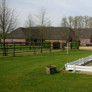
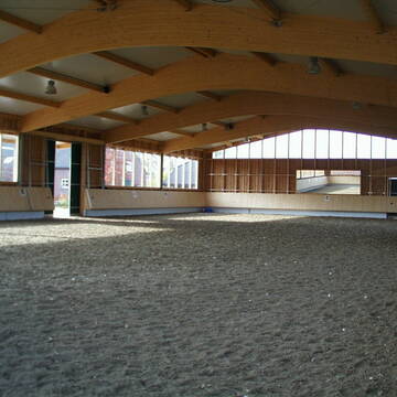
Pferde-Oase am Niederrhein
Uedem
Bernd Verhasselt
@BerndVerhasselt
Freizeitstall
Führanlage
Hunde willkommen
Allergikerstall
Hufrehe geeignet
Außenbox mit Paddock
Außenboxen
19 weitere...
S
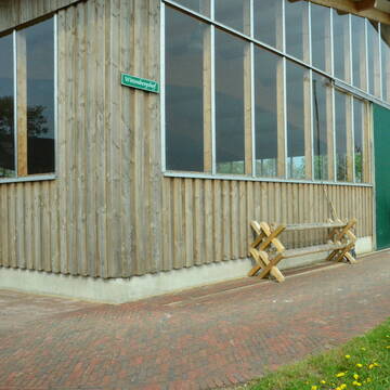
Reitanlage Wittenbergshof
Sonsbeck
Pferdepension Wittenbergshof
@Wolfgang-Schiruska
Freizeitstall
VFD-Mitglied
Vermieten
Paddock
Parkplatz für Pferdeanhänger
Außenbox mit Paddock
Innenbox
12 weitere...
S
Deprecated: Creation of dynamic property Zend_View_Helper_Ads::$adLink is deprecated in /var/www/stall-frei/htdocs/staging.stall-frei.de/library/Psf/View/Helper/Ads.php on line 108

Job gesucht?
Mechtersen
STALL-FREIde Marketing
@STALL-FREI-Marketing
Sie suchen einen Job und arbeiten gerne mit Pferden oder auf Reitanlagen?
Besuchen Sie jetzt unseren Stellenmarkt!


Stallgasse 10 Boxen
Hamminkeln
Cornelia Dyhr
@Reitsportzentrum_Lichtenholz
FN-Mitglied
Verpachten
Parkplatz für Pferdeanhänger
Pensions- und Gastboxen
Hengsthaltung möglich
12 weitere...
S


Nachmieter für Tierarzt-/ Physiopraxis gesucht
Kevelaer
Holger Versteeg
@Versteeg
Rehabilitationsstall
Verpachten
Krankenbox
Innenbox
2 weitere...
S
Leider kein Vorschaubild
Leider kein Vorschaubild
Pferdebox/ Außenbox frei (Zweierherde)
47546
Anne Reuvers
@Anne_Reuvers
Freizeitstall
Vermieten
Longierzirkel/Roundpen
Paddock
Allergikerstall
bedampftes/gewaschenes Heu
8 weitere...
neu
B

Heu aus neuer Ernte
Mechtersen
STALL-FREIde Marketing
@STALL-FREI-Marketing
Heulage und Pferdeheu aus der neuen Ernte findest du in unserem Futtermarkt
Leider kein Vorschaubild
Leider kein Vorschaubild
Pony/shetty box haltergemeinschaft
Kalkar
Eymanns
@J.janssen
Freizeitstall
Longierzirkel/Roundpen
Paddock
Hufrehe geeignet
Innenbox
8 weitere...
B
Helle , luftige und große Box in Rees-Mehr
Rees
Andreas-Scholl
@Andreas-Scholl
Freizeitstall
Vermieten
Ovalbahn
Paddock
Außenbox mit Paddock
Außenboxen
14 weitere...
P


Bewegungsstall individueller geht´s nicht.
Rees
Corinna Boland
@Pensionsstall.boland
Freizeitstall
Pferdeverleih
Verpachten
Hunde willkommen
Krankenbox
Gnadenbrothof
Hengsthaltung möglich
23 weitere...
P+

Paddockboxen Offenstallbox neu
Xanten
Marschenhof
@Marschenhof
Fahrstall, Kutschwagen
FN-Mitglied
Vermieten
Krankenbox
Longierzirkel/Roundpen
Allergikerstall
Gnadenbrothof
30 weitere...
P


Boxen / Stall frei / Allergiker & Rehe geeig...
Kevelaer
Sabrina Lange-Möller
@Nibbanad
Freizeitstall
Pferdeausbildung
Führanlage
Hunde willkommen
Allergikerstall
Hengsthaltung möglich
Vollpension
18 weitere...
P+
Deprecated: Creation of dynamic property Zend_View::$pageCount is deprecated in /var/www/stall-frei/htdocs/staging.stall-frei.de/library/vendor/shardj/zf1-future/library/Zend/View/Abstract.php on line 308
Deprecated: Creation of dynamic property Zend_View::$itemCountPerPage is deprecated in /var/www/stall-frei/htdocs/staging.stall-frei.de/library/vendor/shardj/zf1-future/library/Zend/View/Abstract.php on line 308
Deprecated: Creation of dynamic property Zend_View::$first is deprecated in /var/www/stall-frei/htdocs/staging.stall-frei.de/library/vendor/shardj/zf1-future/library/Zend/View/Abstract.php on line 308
Deprecated: Creation of dynamic property Zend_View::$current is deprecated in /var/www/stall-frei/htdocs/staging.stall-frei.de/library/vendor/shardj/zf1-future/library/Zend/View/Abstract.php on line 308
Deprecated: Creation of dynamic property Zend_View::$last is deprecated in /var/www/stall-frei/htdocs/staging.stall-frei.de/library/vendor/shardj/zf1-future/library/Zend/View/Abstract.php on line 308
Deprecated: Creation of dynamic property Zend_View::$next is deprecated in /var/www/stall-frei/htdocs/staging.stall-frei.de/library/vendor/shardj/zf1-future/library/Zend/View/Abstract.php on line 308
Deprecated: Creation of dynamic property Zend_View::$pagesInRange is deprecated in /var/www/stall-frei/htdocs/staging.stall-frei.de/library/vendor/shardj/zf1-future/library/Zend/View/Abstract.php on line 308
Deprecated: Creation of dynamic property Zend_View::$firstPageInRange is deprecated in /var/www/stall-frei/htdocs/staging.stall-frei.de/library/vendor/shardj/zf1-future/library/Zend/View/Abstract.php on line 308
Deprecated: Creation of dynamic property Zend_View::$lastPageInRange is deprecated in /var/www/stall-frei/htdocs/staging.stall-frei.de/library/vendor/shardj/zf1-future/library/Zend/View/Abstract.php on line 308
Deprecated: Creation of dynamic property Zend_View::$currentItemCount is deprecated in /var/www/stall-frei/htdocs/staging.stall-frei.de/library/vendor/shardj/zf1-future/library/Zend/View/Abstract.php on line 308
Deprecated: Creation of dynamic property Zend_View::$totalItemCount is deprecated in /var/www/stall-frei/htdocs/staging.stall-frei.de/library/vendor/shardj/zf1-future/library/Zend/View/Abstract.php on line 308
Deprecated: Creation of dynamic property Zend_View::$firstItemNumber is deprecated in /var/www/stall-frei/htdocs/staging.stall-frei.de/library/vendor/shardj/zf1-future/library/Zend/View/Abstract.php on line 308
Deprecated: Creation of dynamic property Zend_View::$lastItemNumber is deprecated in /var/www/stall-frei/htdocs/staging.stall-frei.de/library/vendor/shardj/zf1-future/library/Zend/View/Abstract.php on line 308
Deprecated: Creation of dynamic property Zend_View::$router is deprecated in /var/www/stall-frei/htdocs/staging.stall-frei.de/library/vendor/shardj/zf1-future/library/Zend/View/Abstract.php on line 308
Deprecated: Creation of dynamic property Zend_View::$urlParams is deprecated in /var/www/stall-frei/htdocs/staging.stall-frei.de/library/vendor/shardj/zf1-future/library/Zend/View/Abstract.php on line 308
Deprecated: Creation of dynamic property Zend_View::$showAds is deprecated in /var/www/stall-frei/htdocs/staging.stall-frei.de/library/vendor/shardj/zf1-future/library/Zend/View/Abstract.php on line 308
Deprecated: Creation of dynamic property Zend_View::$objectIds is deprecated in /var/www/stall-frei/htdocs/staging.stall-frei.de/library/vendor/shardj/zf1-future/library/Zend/View/Abstract.php on line 308
Deprecated: Creation of dynamic property Zend_View::$showNavbar is deprecated in /var/www/stall-frei/htdocs/staging.stall-frei.de/library/vendor/shardj/zf1-future/library/Zend/View/Abstract.php on line 308
Deprecated: Creation of dynamic property Zend_View::$showBreadcrumb is deprecated in /var/www/stall-frei/htdocs/staging.stall-frei.de/library/vendor/shardj/zf1-future/library/Zend/View/Abstract.php on line 308
Deprecated: Creation of dynamic property Zend_View::$showFooter is deprecated in /var/www/stall-frei/htdocs/staging.stall-frei.de/library/vendor/shardj/zf1-future/library/Zend/View/Abstract.php on line 308
Deprecated: Creation of dynamic property Zend_View::$showInternalAds is deprecated in /var/www/stall-frei/htdocs/staging.stall-frei.de/library/vendor/shardj/zf1-future/library/Zend/View/Abstract.php on line 308
Deprecated: Creation of dynamic property Zend_View::$blNoContent is deprecated in /var/www/stall-frei/htdocs/staging.stall-frei.de/library/vendor/shardj/zf1-future/library/Zend/View/Abstract.php on line 308
Deprecated: Creation of dynamic property Zend_View::$sMetaDesc is deprecated in /var/www/stall-frei/htdocs/staging.stall-frei.de/library/vendor/shardj/zf1-future/library/Zend/View/Abstract.php on line 308
Deprecated: Creation of dynamic property Zend_View::$useGmaps is deprecated in /var/www/stall-frei/htdocs/staging.stall-frei.de/library/vendor/shardj/zf1-future/library/Zend/View/Abstract.php on line 308
Deprecated: Creation of dynamic property Zend_View::$touches is deprecated in /var/www/stall-frei/htdocs/staging.stall-frei.de/library/vendor/shardj/zf1-future/library/Zend/View/Abstract.php on line 308
Deprecated: Creation of dynamic property Zend_View::$oProject is deprecated in /var/www/stall-frei/htdocs/staging.stall-frei.de/library/vendor/shardj/zf1-future/library/Zend/View/Abstract.php on line 308
Deprecated: Creation of dynamic property Zend_View::$pageHeadline is deprecated in /var/www/stall-frei/htdocs/staging.stall-frei.de/library/vendor/shardj/zf1-future/library/Zend/View/Abstract.php on line 308
Deprecated: Creation of dynamic property Zend_View::$disableLocationField is deprecated in /var/www/stall-frei/htdocs/staging.stall-frei.de/library/vendor/shardj/zf1-future/library/Zend/View/Abstract.php on line 308
Deprecated: Creation of dynamic property Zend_View::$isSearch is deprecated in /var/www/stall-frei/htdocs/staging.stall-frei.de/library/vendor/shardj/zf1-future/library/Zend/View/Abstract.php on line 308
Deprecated: Creation of dynamic property Zend_View::$pageTitle is deprecated in /var/www/stall-frei/htdocs/staging.stall-frei.de/library/vendor/shardj/zf1-future/library/Zend/View/Abstract.php on line 308
Deprecated: Creation of dynamic property Psf_Form_Element_Text::$class is deprecated in /var/www/stall-frei/htdocs/staging.stall-frei.de/library/vendor/shardj/zf1-future/library/Zend/Form/Element.php on line 874
Deprecated: Creation of dynamic property Psf_Form_Element_Text::$size is deprecated in /var/www/stall-frei/htdocs/staging.stall-frei.de/library/vendor/shardj/zf1-future/library/Zend/Form/Element.php on line 874
Deprecated: Creation of dynamic property Psf_Form_Element_Text::$placeholder is deprecated in /var/www/stall-frei/htdocs/staging.stall-frei.de/library/vendor/shardj/zf1-future/library/Zend/Form/Element.php on line 874
Deprecated: Creation of dynamic property Psf_Form_Element_Hidden::$class is deprecated in /var/www/stall-frei/htdocs/staging.stall-frei.de/library/vendor/shardj/zf1-future/library/Zend/Form/Element.php on line 874
Deprecated: Creation of dynamic property Psf_Form_Element_Hidden::$class is deprecated in /var/www/stall-frei/htdocs/staging.stall-frei.de/library/vendor/shardj/zf1-future/library/Zend/Form/Element.php on line 874
Deprecated: Creation of dynamic property Psf_Form_Element_Hidden::$class is deprecated in /var/www/stall-frei/htdocs/staging.stall-frei.de/library/vendor/shardj/zf1-future/library/Zend/Form/Element.php on line 874
Deprecated: Creation of dynamic property Psf_Form_Element_Hidden::$class is deprecated in /var/www/stall-frei/htdocs/staging.stall-frei.de/library/vendor/shardj/zf1-future/library/Zend/Form/Element.php on line 874
Deprecated: Creation of dynamic property Psf_Form_Element_Select::$class is deprecated in /var/www/stall-frei/htdocs/staging.stall-frei.de/library/vendor/shardj/zf1-future/library/Zend/Form/Element.php on line 874
Deprecated: Creation of dynamic property Psf_Form_Element_Select::$class is deprecated in /var/www/stall-frei/htdocs/staging.stall-frei.de/library/vendor/shardj/zf1-future/library/Zend/Form/Element.php on line 874
Deprecated: Creation of dynamic property Psf_Form_Element_Select::$class is deprecated in /var/www/stall-frei/htdocs/staging.stall-frei.de/library/vendor/shardj/zf1-future/library/Zend/Form/Element.php on line 874
Deprecated: Creation of dynamic property Psf_Form_Element_Select::$class is deprecated in /var/www/stall-frei/htdocs/staging.stall-frei.de/library/vendor/shardj/zf1-future/library/Zend/Form/Element.php on line 874
Deprecated: Creation of dynamic property Psf_Form_Element_Text::$class is deprecated in /var/www/stall-frei/htdocs/staging.stall-frei.de/library/vendor/shardj/zf1-future/library/Zend/Form/Element.php on line 874
Deprecated: Creation of dynamic property Psf_Form_Element_Checkbox::$label is deprecated in /var/www/stall-frei/htdocs/staging.stall-frei.de/library/vendor/shardj/zf1-future/library/Zend/Form/Element.php on line 874
Deprecated: Creation of dynamic property Zend_View::$sort is deprecated in /var/www/stall-frei/htdocs/staging.stall-frei.de/library/vendor/shardj/zf1-future/library/Zend/View/Abstract.php on line 308
Deprecated: Creation of dynamic property Zend_View::$searchLocation is deprecated in /var/www/stall-frei/htdocs/staging.stall-frei.de/library/vendor/shardj/zf1-future/library/Zend/View/Abstract.php on line 308
Deprecated: Creation of dynamic property Zend_View::$locationHint is deprecated in /var/www/stall-frei/htdocs/staging.stall-frei.de/library/vendor/shardj/zf1-future/library/Zend/View/Abstract.php on line 308
Psf_GeoCoder_Abstract::getLocation: Kalkar Get Location CachedOrLive
Psf_GeoCoder_Abstract::getCachedOrLive: Kalkar
Psf_GeoCoder_OpenCageData::makeApiRequest: response:
Array
(
[documentation] => https://opencagedata.com/api
[licenses] => Array
(
[0] => Array
(
[name] => see attribution guide
[url] => https://opencagedata.com/credits
)
)
[results] => Array
(
[0] => Array
(
[bounds] => Array
(
[northeast] => Array
(
[lat] => 51.8278322
[lng] => 6.4113303
)
[southwest] => Array
(
[lat] => 51.6872332
[lng] => 6.2356097
)
)
[components] => Array
(
[ISO_3166-1_alpha-2] => DE
[ISO_3166-1_alpha-3] => DEU
[ISO_3166-2] => Array
(
[0] => DE-NW
)
[_category] => place
[_normalized_city] => Kalkar
[_type] => city
[continent] => Europe
[country] => Deutschland
[country_code] => de
[county] => Kreis Kleve
[political_union] => European Union
[postcode] => 47546
[state] => Nordrhein-Westfalen
[state_code] => NW
[town] => Kalkar
)
[confidence] => 6
[formatted] => 47546 Kalkar, Deutschland
[geometry] => Array
(
[lat] => 51.7388793
[lng] => 6.2927546
)
)
[1] => Array
(
[bounds] => Array
(
[northeast] => Array
(
[lat] => 50.6169355
[lng] => 6.7924078
)
[southwest] => Array
(
[lat] => 50.5769355
[lng] => 6.7524078
)
)
[components] => Array
(
[ISO_3166-1_alpha-2] => DE
[ISO_3166-1_alpha-3] => DEU
[ISO_3166-2] => Array
(
[0] => DE-NW
)
[_category] => place
[_normalized_city] => Bad Münstereifel
[_type] => village
[continent] => Europe
[country] => Deutschland
[country_code] => de
[county] => Kreis Euskirchen
[political_union] => European Union
[state] => Nordrhein-Westfalen
[state_code] => NW
[town] => Bad Münstereifel
[village] => Kalkar
)
[confidence] => 7
[formatted] => Kalkar, Nordrhein-Westfalen, Deutschland
[geometry] => Array
(
[lat] => 50.5969355
[lng] => 6.7724078
)
)
[2] => Array
(
[bounds] => Array
(
[northeast] => Array
(
[lat] => 50.6041006
[lng] => 6.7803709
)
[southwest] => Array
(
[lat] => 50.590126
[lng] => 6.7584394
)
)
[components] => Array
(
[ISO_3166-1_alpha-2] => DE
[ISO_3166-1_alpha-3] => DEU
[ISO_3166-2] => Array
(
[0] => DE-NW
)
[_category] => place
[_normalized_city] => Bad Münstereifel
[_type] => neighbourhood
[city_district] => Kalkar
[continent] => Europe
[country] => Deutschland
[country_code] => de
[county] => Kreis Euskirchen
[political_union] => European Union
[state] => Nordrhein-Westfalen
[state_code] => NW
[town] => Bad Münstereifel
)
[confidence] => 8
[formatted] => Kalkar, Bad Münstereifel, Nordrhein-Westfalen, Deutschland
[geometry] => Array
(
[lat] => 50.5970741
[lng] => 6.7707627
)
)
[3] => Array
(
[components] => Array
(
[ISO_3166-1_alpha-2] => FR
[ISO_3166-1_alpha-3] => FRA
[ISO_3166-2] => Array
(
[0] => FR-OCC
[1] => FR-34
)
[_category] => road
[_normalized_city] => Juvignac
[_type] => road
[city] => Juvignac
[continent] => Europe
[country] => France
[country_code] => fr
[county] => Hérault
[local_authority] => Montpellier Méditerranée Métropole
[political_union] => European Union
[postcode] => 34990
[road] => Rue de Kalkar
[state] => Occitanie
[state_code] => OCC
)
[confidence] => 3
[formatted] => Rue de Kalkar, 34990 Juvignac, France
[geometry] => Array
(
[lat] => 43.620181
[lng] => 3.79008
)
)
[4] => Array
(
[components] => Array
(
[ISO_3166-1_alpha-2] => FR
[ISO_3166-1_alpha-3] => FRA
[ISO_3166-2] => Array
(
[0] => FR-NAQ
[1] => FR-23
)
[_category] => road
[_normalized_city] => Moutier-Malcard
[_type] => road
[city] => Moutier-Malcard
[continent] => Europe
[country] => France
[country_code] => fr
[county] => Creuse
[local_authority] => Communauté de communes Portes de la Creuse en Marche
[political_union] => European Union
[postcode] => 23220
[road] => Place des Tilleuls
[state] => Nouvelle-Aquitaine
[state_code] => NAQ
)
[confidence] => 2
[formatted] => Place des Tilleuls, 23220 Moutier-Malcard, France
[geometry] => Array
(
[lat] => 46.393861
[lng] => 1.945839
)
)
[5] => Array
(
[components] => Array
(
[ISO_3166-1_alpha-2] => FR
[ISO_3166-1_alpha-3] => FRA
[ISO_3166-2] => Array
(
[0] => FR-NAQ
[1] => FR-23
)
[_category] => road
[_normalized_city] => Moutier-Malcard
[_type] => road
[city] => Moutier-Malcard
[continent] => Europe
[country] => France
[country_code] => fr
[county] => Creuse
[local_authority] => Communauté de communes Portes de la Creuse en Marche
[political_union] => European Union
[postcode] => 23220
[road] => La Roche
[state] => Nouvelle-Aquitaine
[state_code] => NAQ
)
[confidence] => 10
[formatted] => La Roche, 23220 Moutier-Malcard, France
[geometry] => Array
(
[lat] => 46.395318
[lng] => 1.974943
)
)
[6] => Array
(
[components] => Array
(
[ISO_3166-1_alpha-2] => FR
[ISO_3166-1_alpha-3] => FRA
[ISO_3166-2] => Array
(
[0] => FR-NAQ
[1] => FR-23
)
[_category] => road
[_normalized_city] => Moutier-Malcard
[_type] => road
[city] => Moutier-Malcard
[continent] => Europe
[country] => France
[country_code] => fr
[county] => Creuse
[local_authority] => Communauté de communes Portes de la Creuse en Marche
[political_union] => European Union
[postcode] => 23220
[road] => Laboutant
[state] => Nouvelle-Aquitaine
[state_code] => NAQ
)
[confidence] => 10
[formatted] => Laboutant, 23220 Moutier-Malcard, France
[geometry] => Array
(
[lat] => 46.362894
[lng] => 1.961127
)
)
[7] => Array
(
[components] => Array
(
[ISO_3166-1_alpha-2] => FR
[ISO_3166-1_alpha-3] => FRA
[ISO_3166-2] => Array
(
[0] => FR-NAQ
[1] => FR-23
)
[_category] => road
[_normalized_city] => Moutier-Malcard
[_type] => road
[city] => Moutier-Malcard
[continent] => Europe
[country] => France
[country_code] => fr
[county] => Creuse
[local_authority] => Communauté de communes Portes de la Creuse en Marche
[political_union] => European Union
[postcode] => 23220
[road] => Place du Marche
[state] => Nouvelle-Aquitaine
[state_code] => NAQ
)
[confidence] => 10
[formatted] => Place du Marche, 23220 Moutier-Malcard, France
[geometry] => Array
(
[lat] => 46.392971
[lng] => 1.944818
)
)
[8] => Array
(
[components] => Array
(
[ISO_3166-1_alpha-2] => FR
[ISO_3166-1_alpha-3] => FRA
[ISO_3166-2] => Array
(
[0] => FR-OCC
[1] => FR-81
)
[_category] => road
[_normalized_city] => Mirandol-Bourgnounac
[_type] => road
[city] => Mirandol-Bourgnounac
[continent] => Europe
[country] => France
[country_code] => fr
[county] => Tarn
[local_authority] => Communauté de communes Carmausin-Ségala
[political_union] => European Union
[postcode] => 81190
[road] => Chemin de Calbarès
[state] => Occitanie
[state_code] => OCC
)
[confidence] => 10
[formatted] => Chemin de Calbarès, 81190 Mirandol-Bourgnounac, France
[geometry] => Array
(
[lat] => 44.134326
[lng] => 2.13684
)
)
[9] => Array
(
[components] => Array
(
[ISO_3166-1_alpha-2] => FR
[ISO_3166-1_alpha-3] => FRA
[ISO_3166-2] => Array
(
[0] => FR-NAQ
[1] => FR-23
)
[_category] => road
[_normalized_city] => Moutier-Malcard
[_type] => road
[city] => Moutier-Malcard
[continent] => Europe
[country] => France
[country_code] => fr
[county] => Creuse
[local_authority] => Communauté de communes Portes de la Creuse en Marche
[political_union] => European Union
[postcode] => 23220
[road] => La Taille de la Fleur
[state] => Nouvelle-Aquitaine
[state_code] => NAQ
)
[confidence] => 10
[formatted] => La Taille de la Fleur, 23220 Moutier-Malcard, France
[geometry] => Array
(
[lat] => 46.395222
[lng] => 1.939305
)
)
)
[status] => Array
(
[code] => 200
[message] => OK
)
[stay_informed] => Array
(
[blog] => https://blog.opencagedata.com
[mastodon] => https://en.osm.town/@opencage
)
[thanks] => For using an OpenCage API
[timestamp] => Array
(
[created_http] => Sun, 08 Feb 2026 14:39:28 GMT
[created_unix] => 1770561568
)
[total_results] => 10
)
Psf_GeoCoder_Abstract::convertLocationResult
{"documentation":"https:\/\/opencagedata.com\/api","licenses":[{"name":"see attribution guide","url":"https:\/\/opencagedata.com\/credits"}],"results":[{"bounds":{"northeast":{"lat":51.8278322,"lng":6.4113303},"southwest":{"lat":51.6872332,"lng":6.2356097}},"components":{"ISO_3166-1_alpha-2":"DE","ISO_3166-1_alpha-3":"DEU","ISO_3166-2":["DE-NW"],"_category":"place","_normalized_city":"Kalkar","_type":"city","continent":"Europe","country":"Deutschland","country_code":"de","county":"Kreis Kleve","political_union":"European Union","postcode":"47546","state":"Nordrhein-Westfalen","state_code":"NW","town":"Kalkar"},"confidence":6,"formatted":"47546 Kalkar, Deutschland","geometry":{"lat":51.7388793,"lng":6.2927546}},{"bounds":{"northeast":{"lat":50.6169355,"lng":6.7924078},"southwest":{"lat":50.5769355,"lng":6.7524078}},"components":{"ISO_3166-1_alpha-2":"DE","ISO_3166-1_alpha-3":"DEU","ISO_3166-2":["DE-NW"],"_category":"place","_normalized_city":"Bad M\u00fcnstereifel","_type":"village","continent":"Europe","country":"Deutschland","country_code":"de","county":"Kreis Euskirchen","political_union":"European Union","state":"Nordrhein-Westfalen","state_code":"NW","town":"Bad M\u00fcnstereifel","village":"Kalkar"},"confidence":7,"formatted":"Kalkar, Nordrhein-Westfalen, Deutschland","geometry":{"lat":50.5969355,"lng":6.7724078}},{"bounds":{"northeast":{"lat":50.6041006,"lng":6.7803709},"southwest":{"lat":50.590126,"lng":6.7584394}},"components":{"ISO_3166-1_alpha-2":"DE","ISO_3166-1_alpha-3":"DEU","ISO_3166-2":["DE-NW"],"_category":"place","_normalized_city":"Bad M\u00fcnstereifel","_type":"neighbourhood","city_district":"Kalkar","continent":"Europe","country":"Deutschland","country_code":"de","county":"Kreis Euskirchen","political_union":"European Union","state":"Nordrhein-Westfalen","state_code":"NW","town":"Bad M\u00fcnstereifel"},"confidence":8,"formatted":"Kalkar, Bad M\u00fcnstereifel, Nordrhein-Westfalen, Deutschland","geometry":{"lat":50.5970741,"lng":6.7707627}},{"components":{"ISO_3166-1_alpha-2":"FR","ISO_3166-1_alpha-3":"FRA","ISO_3166-2":["FR-OCC","FR-34"],"_category":"road","_normalized_city":"Juvignac","_type":"road","city":"Juvignac","continent":"Europe","country":"France","country_code":"fr","county":"H\u00e9rault","local_authority":"Montpellier M\u00e9diterran\u00e9e M\u00e9tropole","political_union":"European Union","postcode":"34990","road":"Rue de Kalkar","state":"Occitanie","state_code":"OCC"},"confidence":3,"formatted":"Rue de Kalkar, 34990 Juvignac, France","geometry":{"lat":43.620181,"lng":3.79008}},{"components":{"ISO_3166-1_alpha-2":"FR","ISO_3166-1_alpha-3":"FRA","ISO_3166-2":["FR-NAQ","FR-23"],"_category":"road","_normalized_city":"Moutier-Malcard","_type":"road","city":"Moutier-Malcard","continent":"Europe","country":"France","country_code":"fr","county":"Creuse","local_authority":"Communaut\u00e9 de communes Portes de la Creuse en Marche","political_union":"European Union","postcode":"23220","road":"Place des Tilleuls","state":"Nouvelle-Aquitaine","state_code":"NAQ"},"confidence":2,"formatted":"Place des Tilleuls, 23220 Moutier-Malcard, France","geometry":{"lat":46.393861,"lng":1.945839}},{"components":{"ISO_3166-1_alpha-2":"FR","ISO_3166-1_alpha-3":"FRA","ISO_3166-2":["FR-NAQ","FR-23"],"_category":"road","_normalized_city":"Moutier-Malcard","_type":"road","city":"Moutier-Malcard","continent":"Europe","country":"France","country_code":"fr","county":"Creuse","local_authority":"Communaut\u00e9 de communes Portes de la Creuse en Marche","political_union":"European Union","postcode":"23220","road":"La Roche","state":"Nouvelle-Aquitaine","state_code":"NAQ"},"confidence":10,"formatted":"La Roche, 23220 Moutier-Malcard, France","geometry":{"lat":46.395318,"lng":1.974943}},{"components":{"ISO_3166-1_alpha-2":"FR","ISO_3166-1_alpha-3":"FRA","ISO_3166-2":["FR-NAQ","FR-23"],"_category":"road","_normalized_city":"Moutier-Malcard","_type":"road","city":"Moutier-Malcard","continent":"Europe","country":"France","country_code":"fr","county":"Creuse","local_authority":"Communaut\u00e9 de communes Portes de la Creuse en Marche","political_union":"European Union","postcode":"23220","road":"Laboutant","state":"Nouvelle-Aquitaine","state_code":"NAQ"},"confidence":10,"formatted":"Laboutant, 23220 Moutier-Malcard, France","geometry":{"lat":46.362894,"lng":1.961127}},{"components":{"ISO_3166-1_alpha-2":"FR","ISO_3166-1_alpha-3":"FRA","ISO_3166-2":["FR-NAQ","FR-23"],"_category":"road","_normalized_city":"Moutier-Malcard","_type":"road","city":"Moutier-Malcard","continent":"Europe","country":"France","country_code":"fr","county":"Creuse","local_authority":"Communaut\u00e9 de communes Portes de la Creuse en Marche","political_union":"European Union","postcode":"23220","road":"Place du Marche","state":"Nouvelle-Aquitaine","state_code":"NAQ"},"confidence":10,"formatted":"Place du Marche, 23220 Moutier-Malcard, France","geometry":{"lat":46.392971,"lng":1.944818}},{"components":{"ISO_3166-1_alpha-2":"FR","ISO_3166-1_alpha-3":"FRA","ISO_3166-2":["FR-OCC","FR-81"],"_category":"road","_normalized_city":"Mirandol-Bourgnounac","_type":"road","city":"Mirandol-Bourgnounac","continent":"Europe","country":"France","country_code":"fr","county":"Tarn","local_authority":"Communaut\u00e9 de communes Carmausin-S\u00e9gala","political_union":"European Union","postcode":"81190","road":"Chemin de Calbar\u00e8s","state":"Occitanie","state_code":"OCC"},"confidence":10,"formatted":"Chemin de Calbar\u00e8s, 81190 Mirandol-Bourgnounac, France","geometry":{"lat":44.134326,"lng":2.13684}},{"components":{"ISO_3166-1_alpha-2":"FR","ISO_3166-1_alpha-3":"FRA","ISO_3166-2":["FR-NAQ","FR-23"],"_category":"road","_normalized_city":"Moutier-Malcard","_type":"road","city":"Moutier-Malcard","continent":"Europe","country":"France","country_code":"fr","county":"Creuse","local_authority":"Communaut\u00e9 de communes Portes de la Creuse en Marche","political_union":"European Union","postcode":"23220","road":"La Taille de la Fleur","state":"Nouvelle-Aquitaine","state_code":"NAQ"},"confidence":10,"formatted":"La Taille de la Fleur, 23220 Moutier-Malcard, France","geometry":{"lat":46.395222,"lng":1.939305}}],"status":{"code":200,"message":"OK"},"stay_informed":{"blog":"https:\/\/blog.opencagedata.com","mastodon":"https:\/\/en.osm.town\/@opencage"},"thanks":"For using an OpenCage API","timestamp":{"created_http":"Sun, 08 Feb 2026 14:39:28 GMT","created_unix":1770561568},"total_results":10}Array
(
[0] => stdClass Object
(
[bounds] => stdClass Object
(
[northeast] => stdClass Object
(
[lat] => 51.8278322
[lng] => 6.4113303
)
[southwest] => stdClass Object
(
[lat] => 51.6872332
[lng] => 6.2356097
)
)
[components] => stdClass Object
(
[ISO_3166-1_alpha-2] => DE
[ISO_3166-1_alpha-3] => DEU
[ISO_3166-2] => Array
(
[0] => DE-NW
)
[_category] => place
[_normalized_city] => Kalkar
[_type] => city
[continent] => Europe
[country] => Deutschland
[country_code] => de
[county] => Kreis Kleve
[political_union] => European Union
[postcode] => 47546
[state] => Nordrhein-Westfalen
[state_code] => NW
[town] => Kalkar
)
[confidence] => 6
[formatted] => 47546 Kalkar, Deutschland
[geometry] => stdClass Object
(
[lat] => 51.7388793
[lng] => 6.2927546
)
)
[1] => stdClass Object
(
[bounds] => stdClass Object
(
[northeast] => stdClass Object
(
[lat] => 50.6169355
[lng] => 6.7924078
)
[southwest] => stdClass Object
(
[lat] => 50.5769355
[lng] => 6.7524078
)
)
[components] => stdClass Object
(
[ISO_3166-1_alpha-2] => DE
[ISO_3166-1_alpha-3] => DEU
[ISO_3166-2] => Array
(
[0] => DE-NW
)
[_category] => place
[_normalized_city] => Bad Münstereifel
[_type] => village
[continent] => Europe
[country] => Deutschland
[country_code] => de
[county] => Kreis Euskirchen
[political_union] => European Union
[state] => Nordrhein-Westfalen
[state_code] => NW
[town] => Bad Münstereifel
[village] => Kalkar
)
[confidence] => 7
[formatted] => Kalkar, Nordrhein-Westfalen, Deutschland
[geometry] => stdClass Object
(
[lat] => 50.5969355
[lng] => 6.7724078
)
)
[2] => stdClass Object
(
[bounds] => stdClass Object
(
[northeast] => stdClass Object
(
[lat] => 50.6041006
[lng] => 6.7803709
)
[southwest] => stdClass Object
(
[lat] => 50.590126
[lng] => 6.7584394
)
)
[components] => stdClass Object
(
[ISO_3166-1_alpha-2] => DE
[ISO_3166-1_alpha-3] => DEU
[ISO_3166-2] => Array
(
[0] => DE-NW
)
[_category] => place
[_normalized_city] => Bad Münstereifel
[_type] => neighbourhood
[city_district] => Kalkar
[continent] => Europe
[country] => Deutschland
[country_code] => de
[county] => Kreis Euskirchen
[political_union] => European Union
[state] => Nordrhein-Westfalen
[state_code] => NW
[town] => Bad Münstereifel
)
[confidence] => 8
[formatted] => Kalkar, Bad Münstereifel, Nordrhein-Westfalen, Deutschland
[geometry] => stdClass Object
(
[lat] => 50.5970741
[lng] => 6.7707627
)
)
[3] => stdClass Object
(
[components] => stdClass Object
(
[ISO_3166-1_alpha-2] => FR
[ISO_3166-1_alpha-3] => FRA
[ISO_3166-2] => Array
(
[0] => FR-OCC
[1] => FR-34
)
[_category] => road
[_normalized_city] => Juvignac
[_type] => road
[city] => Juvignac
[continent] => Europe
[country] => France
[country_code] => fr
[county] => Hérault
[local_authority] => Montpellier Méditerranée Métropole
[political_union] => European Union
[postcode] => 34990
[road] => Rue de Kalkar
[state] => Occitanie
[state_code] => OCC
)
[confidence] => 3
[formatted] => Rue de Kalkar, 34990 Juvignac, France
[geometry] => stdClass Object
(
[lat] => 43.620181
[lng] => 3.79008
)
)
[4] => stdClass Object
(
[components] => stdClass Object
(
[ISO_3166-1_alpha-2] => FR
[ISO_3166-1_alpha-3] => FRA
[ISO_3166-2] => Array
(
[0] => FR-NAQ
[1] => FR-23
)
[_category] => road
[_normalized_city] => Moutier-Malcard
[_type] => road
[city] => Moutier-Malcard
[continent] => Europe
[country] => France
[country_code] => fr
[county] => Creuse
[local_authority] => Communauté de communes Portes de la Creuse en Marche
[political_union] => European Union
[postcode] => 23220
[road] => Place des Tilleuls
[state] => Nouvelle-Aquitaine
[state_code] => NAQ
)
[confidence] => 2
[formatted] => Place des Tilleuls, 23220 Moutier-Malcard, France
[geometry] => stdClass Object
(
[lat] => 46.393861
[lng] => 1.945839
)
)
[5] => stdClass Object
(
[components] => stdClass Object
(
[ISO_3166-1_alpha-2] => FR
[ISO_3166-1_alpha-3] => FRA
[ISO_3166-2] => Array
(
[0] => FR-NAQ
[1] => FR-23
)
[_category] => road
[_normalized_city] => Moutier-Malcard
[_type] => road
[city] => Moutier-Malcard
[continent] => Europe
[country] => France
[country_code] => fr
[county] => Creuse
[local_authority] => Communauté de communes Portes de la Creuse en Marche
[political_union] => European Union
[postcode] => 23220
[road] => La Roche
[state] => Nouvelle-Aquitaine
[state_code] => NAQ
)
[confidence] => 10
[formatted] => La Roche, 23220 Moutier-Malcard, France
[geometry] => stdClass Object
(
[lat] => 46.395318
[lng] => 1.974943
)
)
[6] => stdClass Object
(
[components] => stdClass Object
(
[ISO_3166-1_alpha-2] => FR
[ISO_3166-1_alpha-3] => FRA
[ISO_3166-2] => Array
(
[0] => FR-NAQ
[1] => FR-23
)
[_category] => road
[_normalized_city] => Moutier-Malcard
[_type] => road
[city] => Moutier-Malcard
[continent] => Europe
[country] => France
[country_code] => fr
[county] => Creuse
[local_authority] => Communauté de communes Portes de la Creuse en Marche
[political_union] => European Union
[postcode] => 23220
[road] => Laboutant
[state] => Nouvelle-Aquitaine
[state_code] => NAQ
)
[confidence] => 10
[formatted] => Laboutant, 23220 Moutier-Malcard, France
[geometry] => stdClass Object
(
[lat] => 46.362894
[lng] => 1.961127
)
)
[7] => stdClass Object
(
[components] => stdClass Object
(
[ISO_3166-1_alpha-2] => FR
[ISO_3166-1_alpha-3] => FRA
[ISO_3166-2] => Array
(
[0] => FR-NAQ
[1] => FR-23
)
[_category] => road
[_normalized_city] => Moutier-Malcard
[_type] => road
[city] => Moutier-Malcard
[continent] => Europe
[country] => France
[country_code] => fr
[county] => Creuse
[local_authority] => Communauté de communes Portes de la Creuse en Marche
[political_union] => European Union
[postcode] => 23220
[road] => Place du Marche
[state] => Nouvelle-Aquitaine
[state_code] => NAQ
)
[confidence] => 10
[formatted] => Place du Marche, 23220 Moutier-Malcard, France
[geometry] => stdClass Object
(
[lat] => 46.392971
[lng] => 1.944818
)
)
[8] => stdClass Object
(
[components] => stdClass Object
(
[ISO_3166-1_alpha-2] => FR
[ISO_3166-1_alpha-3] => FRA
[ISO_3166-2] => Array
(
[0] => FR-OCC
[1] => FR-81
)
[_category] => road
[_normalized_city] => Mirandol-Bourgnounac
[_type] => road
[city] => Mirandol-Bourgnounac
[continent] => Europe
[country] => France
[country_code] => fr
[county] => Tarn
[local_authority] => Communauté de communes Carmausin-Ségala
[political_union] => European Union
[postcode] => 81190
[road] => Chemin de Calbarès
[state] => Occitanie
[state_code] => OCC
)
[confidence] => 10
[formatted] => Chemin de Calbarès, 81190 Mirandol-Bourgnounac, France
[geometry] => stdClass Object
(
[lat] => 44.134326
[lng] => 2.13684
)
)
[9] => stdClass Object
(
[components] => stdClass Object
(
[ISO_3166-1_alpha-2] => FR
[ISO_3166-1_alpha-3] => FRA
[ISO_3166-2] => Array
(
[0] => FR-NAQ
[1] => FR-23
)
[_category] => road
[_normalized_city] => Moutier-Malcard
[_type] => road
[city] => Moutier-Malcard
[continent] => Europe
[country] => France
[country_code] => fr
[county] => Creuse
[local_authority] => Communauté de communes Portes de la Creuse en Marche
[political_union] => European Union
[postcode] => 23220
[road] => La Taille de la Fleur
[state] => Nouvelle-Aquitaine
[state_code] => NAQ
)
[confidence] => 10
[formatted] => La Taille de la Fleur, 23220 Moutier-Malcard, France
[geometry] => stdClass Object
(
[lat] => 46.395222
[lng] => 1.939305
)
)
)
Psf_GeoCoder_OpenCageData::getKeyMap: 0
stdClass Object
(
    [bounds] => stdClass Object
        (
            [northeast] => stdClass Object
                (
                    [lat] => 51.8278322
                    [lng] => 6.4113303
                )

            [southwest] => stdClass Object
                (
                    [lat] => 51.6872332
                    [lng] => 6.2356097
                )

        )

    [components] => stdClass Object
        (
            [ISO_3166-1_alpha-2] => DE
            [ISO_3166-1_alpha-3] => DEU
            [ISO_3166-2] => Array
                (
                    [0] => DE-NW
                )

            [_category] => place
            [_normalized_city] => Kalkar
            [_type] => city
            [continent] => Europe
            [country] => Deutschland
            [country_code] => de
            [county] => Kreis Kleve
            [political_union] => European Union
            [postcode] => 47546
            [state] => Nordrhein-Westfalen
            [state_code] => NW
            [town] => Kalkar
        )

    [confidence] => 6
    [formatted] => 47546 Kalkar, Deutschland
    [geometry] => stdClass Object
        (
            [lat] => 51.7388793
            [lng] => 6.2927546
        )

)
Psf_GeoCoder_OpenCageData::getCounty: Kleve
Psf_GeoCoder_OpenCageData::addMissingData REFETCH!
Array
(
    [address] => 47546 Kalkar, Deutschland
    [type] => city
    [street] =>
    [city] => Kalkar
    [county] => Kleve
    [state] => Nordrhein-Westfalen
    [zip] => 47546
    [country] => Deutschland
    [suburb] =>
    [countrycode] => de
    [latitude] => 51.7388793
    [longitude] => 6.2927546
    [accuracy] => 1
    [confidence] => 6
    [bounds] => stdClass Object
        (
            [northeast] => stdClass Object
                (
                    [lat] => 51.8278322
                    [lng] => 6.4113303
                )

            [southwest] => stdClass Object
                (
                    [lat] => 51.6872332
                    [lng] => 6.2356097
                )

        )

)
reformat!
Array
(
    [address] => 47546 Kalkar, Deutschland
    [type] => city
    [street] =>
    [city] => Kalkar
    [county] => Kleve
    [state] => Nordrhein-Westfalen
    [zip] => 47546
    [country] => Deutschland
    [suburb] =>
    [countrycode] => de
    [latitude] => 51.7388793
    [longitude] => 6.2927546
    [accuracy] => 1
    [confidence] => 6
    [bounds] => stdClass Object
        (
            [northeast] => stdClass Object
                (
                    [lat] => 51.8278322
                    [lng] => 6.4113303
                )

            [southwest] => stdClass Object
                (
                    [lat] => 51.6872332
                    [lng] => 6.2356097
                )

        )

    [place] => 47546 Kalkar, Nordrhein-Westfalen
    [hash] => 78061b5d940d325e4b0b474f61811ac0
)
Psf_GeoCoder_OpenCageData::getKeyMap: 1
stdClass Object
(
    [bounds] => stdClass Object
        (
            [northeast] => stdClass Object
                (
                    [lat] => 50.6169355
                    [lng] => 6.7924078
                )

            [southwest] => stdClass Object
                (
                    [lat] => 50.5769355
                    [lng] => 6.7524078
                )

        )

    [components] => stdClass Object
        (
            [ISO_3166-1_alpha-2] => DE
            [ISO_3166-1_alpha-3] => DEU
            [ISO_3166-2] => Array
                (
                    [0] => DE-NW
                )

            [_category] => place
            [_normalized_city] => Bad Münstereifel
            [_type] => village
            [continent] => Europe
            [country] => Deutschland
            [country_code] => de
            [county] => Kreis Euskirchen
            [political_union] => European Union
            [state] => Nordrhein-Westfalen
            [state_code] => NW
            [town] => Bad Münstereifel
            [village] => Kalkar
        )

    [confidence] => 7
    [formatted] => Kalkar, Nordrhein-Westfalen, Deutschland
    [geometry] => stdClass Object
        (
            [lat] => 50.5969355
            [lng] => 6.7724078
        )

)
Psf_GeoCoder_OpenCageData::getCounty: Euskirchen
Psf_GeoCoder_OpenCageData::addMissingData REFETCH!
Array
(
    [address] => Kalkar, Nordrhein-Westfalen, Deutschland
    [type] => village
    [street] =>
    [city] => Bad Münstereifel
    [county] => Euskirchen
    [state] => Nordrhein-Westfalen
    [zip] =>
    [country] => Deutschland
    [suburb] =>
    [countrycode] => de
    [latitude] => 50.5969355
    [longitude] => 6.7724078
    [accuracy] => 1
    [confidence] => 7
    [bounds] => stdClass Object
        (
            [northeast] => stdClass Object
                (
                    [lat] => 50.6169355
                    [lng] => 6.7924078
                )

            [southwest] => stdClass Object
                (
                    [lat] => 50.5769355
                    [lng] => 6.7524078
                )

        )

)
reformat!
Array
(
    [address] => Bad Münstereifel
    [type] => village
    [street] =>
    [city] => Bad Münstereifel
    [county] => Euskirchen
    [state] => Nordrhein-Westfalen
    [zip] =>
    [country] => Deutschland
    [suburb] =>
    [countrycode] => de
    [latitude] => 50.5969355
    [longitude] => 6.7724078
    [accuracy] => 1
    [confidence] => 7
    [bounds] => stdClass Object
        (
            [northeast] => stdClass Object
                (
                    [lat] => 50.6169355
                    [lng] => 6.7924078
                )

            [southwest] => stdClass Object
                (
                    [lat] => 50.5769355
                    [lng] => 6.7524078
                )

        )

    [place] => Bad Münstereifel, Nordrhein-Westfalen
    [hash] => 27acbc26d9d405931ec68f29e745109b
)
Psf_GeoCoder_OpenCageData::getKeyMap: 2
stdClass Object
(
    [bounds] => stdClass Object
        (
            [northeast] => stdClass Object
                (
                    [lat] => 50.6041006
                    [lng] => 6.7803709
                )

            [southwest] => stdClass Object
                (
                    [lat] => 50.590126
                    [lng] => 6.7584394
                )

        )

    [components] => stdClass Object
        (
            [ISO_3166-1_alpha-2] => DE
            [ISO_3166-1_alpha-3] => DEU
            [ISO_3166-2] => Array
                (
                    [0] => DE-NW
                )

            [_category] => place
            [_normalized_city] => Bad Münstereifel
            [_type] => neighbourhood
            [city_district] => Kalkar
            [continent] => Europe
            [country] => Deutschland
            [country_code] => de
            [county] => Kreis Euskirchen
            [political_union] => European Union
            [state] => Nordrhein-Westfalen
            [state_code] => NW
            [town] => Bad Münstereifel
        )

    [confidence] => 8
    [formatted] => Kalkar, Bad Münstereifel, Nordrhein-Westfalen, Deutschland
    [geometry] => stdClass Object
        (
            [lat] => 50.5970741
            [lng] => 6.7707627
        )

)
Psf_GeoCoder_OpenCageData::getCounty: Euskirchen
Psf_GeoCoder_OpenCageData::addMissingData REFETCH!
Array
(
    [address] => Kalkar, Bad Münstereifel, Nordrhein-Westfalen, Deutschland
    [type] => neighbourhood
    [street] =>
    [city] => Bad Münstereifel
    [county] => Euskirchen
    [state] => Nordrhein-Westfalen
    [zip] =>
    [country] => Deutschland
    [suburb] =>
    [countrycode] => de
    [latitude] => 50.5970741
    [longitude] => 6.7707627
    [accuracy] => 1
    [confidence] => 8
    [bounds] => stdClass Object
        (
            [northeast] => stdClass Object
                (
                    [lat] => 50.6041006
                    [lng] => 6.7803709
                )

            [southwest] => stdClass Object
                (
                    [lat] => 50.590126
                    [lng] => 6.7584394
                )

        )

)
reformat!
Array
(
    [address] => Kalkar, Bad Münstereifel, Nordrhein-Westfalen, Deutschland
    [type] => neighbourhood
    [street] =>
    [city] => Bad Münstereifel
    [county] => Euskirchen
    [state] => Nordrhein-Westfalen
    [zip] =>
    [country] => Deutschland
    [suburb] =>
    [countrycode] => de
    [latitude] => 50.5970741
    [longitude] => 6.7707627
    [accuracy] => 1
    [confidence] => 8
    [bounds] => stdClass Object
        (
            [northeast] => stdClass Object
                (
                    [lat] => 50.6041006
                    [lng] => 6.7803709
                )

            [southwest] => stdClass Object
                (
                    [lat] => 50.590126
                    [lng] => 6.7584394
                )

        )

    [place] => Bad Münstereifel, Nordrhein-Westfalen
    [hash] => 27acbc26d9d405931ec68f29e745109b
)
Psf_GeoCoder_OpenCageData::getKeyMap: 3
stdClass Object
(
    [components] => stdClass Object
        (
            [ISO_3166-1_alpha-2] => FR
            [ISO_3166-1_alpha-3] => FRA
            [ISO_3166-2] => Array
                (
                    [0] => FR-OCC
                    [1] => FR-34
                )

            [_category] => road
            [_normalized_city] => Juvignac
            [_type] => road
            [city] => Juvignac
            [continent] => Europe
            [country] => France
            [country_code] => fr
            [county] => Hérault
            [local_authority] => Montpellier Méditerranée Métropole
            [political_union] => European Union
            [postcode] => 34990
            [road] => Rue de Kalkar
            [state] => Occitanie
            [state_code] => OCC
        )

    [confidence] => 3
    [formatted] => Rue de Kalkar, 34990 Juvignac, France
    [geometry] => stdClass Object
        (
            [lat] => 43.620181
            [lng] => 3.79008
        )

)
Psf_GeoCoder_OpenCageData::getCounty: Hérault
Psf_GeoCoder_OpenCageData::addMissingData REFETCH!
Array
(
    [address] => Rue de Kalkar, 34990 Juvignac, France
    [type] => road
    [street] => Rue de Kalkar
    [city] => Juvignac
    [county] => Hérault
    [state] => Occitanie
    [zip] => 34990
    [country] => France
    [suburb] =>
    [countrycode] => fr
    [latitude] => 43.620181
    [longitude] => 3.79008
    [accuracy] => 1
    [confidence] => 3
    [bounds] =>
)
reformat!
Array
(
    [address] => Rue de Kalkar, 34990 Juvignac, France
    [type] => road
    [street] => Rue de Kalkar
    [city] => Juvignac
    [county] => Hérault
    [state] => Occitanie
    [zip] => 34990
    [country] => France
    [suburb] =>
    [countrycode] => fr
    [latitude] => 43.620181
    [longitude] => 3.79008
    [accuracy] => 1
    [confidence] => 3
    [bounds] =>
    [place] => Rue de Kalkar, 34990 Juvignac, Occitanie
    [hash] => d173a8a2bebd22ff2884f59f021cb662
)
Psf_GeoCoder_OpenCageData::getKeyMap: 4
stdClass Object
(
    [components] => stdClass Object
        (
            [ISO_3166-1_alpha-2] => FR
            [ISO_3166-1_alpha-3] => FRA
            [ISO_3166-2] => Array
                (
                    [0] => FR-NAQ
                    [1] => FR-23
                )

            [_category] => road
            [_normalized_city] => Moutier-Malcard
            [_type] => road
            [city] => Moutier-Malcard
            [continent] => Europe
            [country] => France
            [country_code] => fr
            [county] => Creuse
            [local_authority] => Communauté de communes Portes de la Creuse en Marche
            [political_union] => European Union
            [postcode] => 23220
            [road] => Place des Tilleuls
            [state] => Nouvelle-Aquitaine
            [state_code] => NAQ
        )

    [confidence] => 2
    [formatted] => Place des Tilleuls, 23220 Moutier-Malcard, France
    [geometry] => stdClass Object
        (
            [lat] => 46.393861
            [lng] => 1.945839
        )

)
Psf_GeoCoder_OpenCageData::getCounty: Creuse
Psf_GeoCoder_OpenCageData::addMissingData REFETCH!
Array
(
    [address] => Place des Tilleuls, 23220 Moutier-Malcard, France
    [type] => road
    [street] => Place des Tilleuls
    [city] => Moutier-Malcard
    [county] => Creuse
    [state] => Nouvelle-Aquitaine
    [zip] => 23220
    [country] => France
    [suburb] =>
    [countrycode] => fr
    [latitude] => 46.393861
    [longitude] => 1.945839
    [accuracy] => 1
    [confidence] => 2
    [bounds] =>
)
reformat!
Array
(
    [address] => Place des Tilleuls, 23220 Moutier-Malcard, France
    [type] => road
    [street] => Place des Tilleuls
    [city] => Moutier-Malcard
    [county] => Creuse
    [state] => Nouvelle-Aquitaine
    [zip] => 23220
    [country] => France
    [suburb] =>
    [countrycode] => fr
    [latitude] => 46.393861
    [longitude] => 1.945839
    [accuracy] => 1
    [confidence] => 2
    [bounds] =>
    [place] => Place des Tilleuls, 23220 Moutier-Malcard, Nouvelle-Aquitaine
    [hash] => 75f07ddf92e69b42d45cff9464f68df0
)
Psf_GeoCoder_OpenCageData::getKeyMap: 5
stdClass Object
(
    [components] => stdClass Object
        (
            [ISO_3166-1_alpha-2] => FR
            [ISO_3166-1_alpha-3] => FRA
            [ISO_3166-2] => Array
                (
                    [0] => FR-NAQ
                    [1] => FR-23
                )

            [_category] => road
            [_normalized_city] => Moutier-Malcard
            [_type] => road
            [city] => Moutier-Malcard
            [continent] => Europe
            [country] => France
            [country_code] => fr
            [county] => Creuse
            [local_authority] => Communauté de communes Portes de la Creuse en Marche
            [political_union] => European Union
            [postcode] => 23220
            [road] => La Roche
            [state] => Nouvelle-Aquitaine
            [state_code] => NAQ
        )

    [confidence] => 10
    [formatted] => La Roche, 23220 Moutier-Malcard, France
    [geometry] => stdClass Object
        (
            [lat] => 46.395318
            [lng] => 1.974943
        )

)
Psf_GeoCoder_OpenCageData::getCounty: Creuse
Psf_GeoCoder_OpenCageData::addMissingData REFETCH!
Array
(
    [address] => La Roche, 23220 Moutier-Malcard, France
    [type] => road
    [street] => La Roche
    [city] => Moutier-Malcard
    [county] => Creuse
    [state] => Nouvelle-Aquitaine
    [zip] => 23220
    [country] => France
    [suburb] =>
    [countrycode] => fr
    [latitude] => 46.395318
    [longitude] => 1.974943
    [accuracy] => 1
    [confidence] => 10
    [bounds] =>
)
reformat!
Array
(
    [address] => La Roche, 23220 Moutier-Malcard, France
    [type] => road
    [street] => La Roche
    [city] => Moutier-Malcard
    [county] => Creuse
    [state] => Nouvelle-Aquitaine
    [zip] => 23220
    [country] => France
    [suburb] =>
    [countrycode] => fr
    [latitude] => 46.395318
    [longitude] => 1.974943
    [accuracy] => 1
    [confidence] => 10
    [bounds] =>
    [place] => La Roche, 23220 Moutier-Malcard, Nouvelle-Aquitaine
    [hash] => a46dd4c1fab1696635e850076af0a98f
)
Psf_GeoCoder_OpenCageData::getKeyMap: 6
stdClass Object
(
    [components] => stdClass Object
        (
            [ISO_3166-1_alpha-2] => FR
            [ISO_3166-1_alpha-3] => FRA
            [ISO_3166-2] => Array
                (
                    [0] => FR-NAQ
                    [1] => FR-23
                )

            [_category] => road
            [_normalized_city] => Moutier-Malcard
            [_type] => road
            [city] => Moutier-Malcard
            [continent] => Europe
            [country] => France
            [country_code] => fr
            [county] => Creuse
            [local_authority] => Communauté de communes Portes de la Creuse en Marche
            [political_union] => European Union
            [postcode] => 23220
            [road] => Laboutant
            [state] => Nouvelle-Aquitaine
            [state_code] => NAQ
        )

    [confidence] => 10
    [formatted] => Laboutant, 23220 Moutier-Malcard, France
    [geometry] => stdClass Object
        (
            [lat] => 46.362894
            [lng] => 1.961127
        )

)
Psf_GeoCoder_OpenCageData::getCounty: Creuse
Psf_GeoCoder_OpenCageData::addMissingData REFETCH!
Array
(
    [address] => Laboutant, 23220 Moutier-Malcard, France
    [type] => road
    [street] => Laboutant
    [city] => Moutier-Malcard
    [county] => Creuse
    [state] => Nouvelle-Aquitaine
    [zip] => 23220
    [country] => France
    [suburb] =>
    [countrycode] => fr
    [latitude] => 46.362894
    [longitude] => 1.961127
    [accuracy] => 1
    [confidence] => 10
    [bounds] =>
)
reformat!
Array
(
    [address] => Laboutant, 23220 Moutier-Malcard, France
    [type] => road
    [street] => Laboutant
    [city] => Moutier-Malcard
    [county] => Creuse
    [state] => Nouvelle-Aquitaine
    [zip] => 23220
    [country] => France
    [suburb] =>
    [countrycode] => fr
    [latitude] => 46.362894
    [longitude] => 1.961127
    [accuracy] => 1
    [confidence] => 10
    [bounds] =>
    [place] => Laboutant, 23220 Moutier-Malcard, Nouvelle-Aquitaine
    [hash] => b61ae5cfd03ded63aae1bb352d6c7318
)
Psf_GeoCoder_OpenCageData::getKeyMap: 7
stdClass Object
(
    [components] => stdClass Object
        (
            [ISO_3166-1_alpha-2] => FR
            [ISO_3166-1_alpha-3] => FRA
            [ISO_3166-2] => Array
                (
                    [0] => FR-NAQ
                    [1] => FR-23
                )

            [_category] => road
            [_normalized_city] => Moutier-Malcard
            [_type] => road
            [city] => Moutier-Malcard
            [continent] => Europe
            [country] => France
            [country_code] => fr
            [county] => Creuse
            [local_authority] => Communauté de communes Portes de la Creuse en Marche
            [political_union] => European Union
            [postcode] => 23220
            [road] => Place du Marche
            [state] => Nouvelle-Aquitaine
            [state_code] => NAQ
        )

    [confidence] => 10
    [formatted] => Place du Marche, 23220 Moutier-Malcard, France
    [geometry] => stdClass Object
        (
            [lat] => 46.392971
            [lng] => 1.944818
        )

)
Psf_GeoCoder_OpenCageData::getCounty: Creuse
Psf_GeoCoder_OpenCageData::addMissingData REFETCH!
Array
(
    [address] => Place du Marche, 23220 Moutier-Malcard, France
    [type] => road
    [street] => Place du Marche
    [city] => Moutier-Malcard
    [county] => Creuse
    [state] => Nouvelle-Aquitaine
    [zip] => 23220
    [country] => France
    [suburb] =>
    [countrycode] => fr
    [latitude] => 46.392971
    [longitude] => 1.944818
    [accuracy] => 1
    [confidence] => 10
    [bounds] =>
)
reformat!
Array
(
    [address] => Place du Marche, 23220 Moutier-Malcard, France
    [type] => road
    [street] => Place du Marche
    [city] => Moutier-Malcard
    [county] => Creuse
    [state] => Nouvelle-Aquitaine
    [zip] => 23220
    [country] => France
    [suburb] =>
    [countrycode] => fr
    [latitude] => 46.392971
    [longitude] => 1.944818
    [accuracy] => 1
    [confidence] => 10
    [bounds] =>
    [place] => Place du Marche, 23220 Moutier-Malcard, Nouvelle-Aquitaine
    [hash] => b0621ead68fd1c512933636ab574af7e
)
Psf_GeoCoder_OpenCageData::getKeyMap: 8
stdClass Object
(
    [components] => stdClass Object
        (
            [ISO_3166-1_alpha-2] => FR
            [ISO_3166-1_alpha-3] => FRA
            [ISO_3166-2] => Array
                (
                    [0] => FR-OCC
                    [1] => FR-81
                )

            [_category] => road
            [_normalized_city] => Mirandol-Bourgnounac
            [_type] => road
            [city] => Mirandol-Bourgnounac
            [continent] => Europe
            [country] => France
            [country_code] => fr
            [county] => Tarn
            [local_authority] => Communauté de communes Carmausin-Ségala
            [political_union] => European Union
            [postcode] => 81190
            [road] => Chemin de Calbarès
            [state] => Occitanie
            [state_code] => OCC
        )

    [confidence] => 10
    [formatted] => Chemin de Calbarès, 81190 Mirandol-Bourgnounac, France
    [geometry] => stdClass Object
        (
            [lat] => 44.134326
            [lng] => 2.13684
        )

)
Psf_GeoCoder_OpenCageData::getCounty: Tarn
Psf_GeoCoder_OpenCageData::addMissingData REFETCH!
Array
(
    [address] => Chemin de Calbarès, 81190 Mirandol-Bourgnounac, France
    [type] => road
    [street] => Chemin de Calbarès
    [city] => Mirandol-Bourgnounac
    [county] => Tarn
    [state] => Occitanie
    [zip] => 81190
    [country] => France
    [suburb] =>
    [countrycode] => fr
    [latitude] => 44.134326
    [longitude] => 2.13684
    [accuracy] => 1
    [confidence] => 10
    [bounds] =>
)
reformat!
Array
(
    [address] => Chemin de Calbarès, 81190 Mirandol-Bourgnounac, France
    [type] => road
    [street] => Chemin de Calbarès
    [city] => Mirandol-Bourgnounac
    [county] => Tarn
    [state] => Occitanie
    [zip] => 81190
    [country] => France
    [suburb] =>
    [countrycode] => fr
    [latitude] => 44.134326
    [longitude] => 2.13684
    [accuracy] => 1
    [confidence] => 10
    [bounds] =>
    [place] => Chemin de Calbarès, 81190 Mirandol-Bourgnounac, Occitanie
    [hash] => dc063852f6e7d60bae65ebf6e8a5f1f8
)
Psf_GeoCoder_OpenCageData::getKeyMap: 9
stdClass Object
(
    [components] => stdClass Object
        (
            [ISO_3166-1_alpha-2] => FR
            [ISO_3166-1_alpha-3] => FRA
            [ISO_3166-2] => Array
                (
                    [0] => FR-NAQ
                    [1] => FR-23
                )

            [_category] => road
            [_normalized_city] => Moutier-Malcard
            [_type] => road
            [city] => Moutier-Malcard
            [continent] => Europe
            [country] => France
            [country_code] => fr
            [county] => Creuse
            [local_authority] => Communauté de communes Portes de la Creuse en Marche
            [political_union] => European Union
            [postcode] => 23220
            [road] => La Taille de la Fleur
            [state] => Nouvelle-Aquitaine
            [state_code] => NAQ
        )

    [confidence] => 10
    [formatted] => La Taille de la Fleur, 23220 Moutier-Malcard, France
    [geometry] => stdClass Object
        (
            [lat] => 46.395222
            [lng] => 1.939305
        )

)
Psf_GeoCoder_OpenCageData::getCounty: Creuse
Psf_GeoCoder_OpenCageData::addMissingData REFETCH!
Array
(
    [address] => La Taille de la Fleur, 23220 Moutier-Malcard, France
    [type] => road
    [street] => La Taille de la Fleur
    [city] => Moutier-Malcard
    [county] => Creuse
    [state] => Nouvelle-Aquitaine
    [zip] => 23220
    [country] => France
    [suburb] =>
    [countrycode] => fr
    [latitude] => 46.395222
    [longitude] => 1.939305
    [accuracy] => 1
    [confidence] => 10
    [bounds] =>
)
reformat!
Array
(
    [address] => La Taille de la Fleur, 23220 Moutier-Malcard, France
    [type] => road
    [street] => La Taille de la Fleur
    [city] => Moutier-Malcard
    [county] => Creuse
    [state] => Nouvelle-Aquitaine
    [zip] => 23220
    [country] => France
    [suburb] =>
    [countrycode] => fr
    [latitude] => 46.395222
    [longitude] => 1.939305
    [accuracy] => 1
    [confidence] => 10
    [bounds] =>
    [place] => La Taille de la Fleur, 23220 Moutier-Malcard, Nouvelle-Aquitaine
    [hash] => 3eccab801177fdf2492af0fc6675f0ec
)
Deprecated: Creation of dynamic property Zend_View::$locationHintStyle is deprecated in /var/www/stall-frei/htdocs/staging.stall-frei.de/library/vendor/shardj/zf1-future/library/Zend/View/Abstract.php on line 308
Deprecated: Creation of dynamic property Zend_View::$adGeoLocation is deprecated in /var/www/stall-frei/htdocs/staging.stall-frei.de/library/vendor/shardj/zf1-future/library/Zend/View/Abstract.php on line 308
Deprecated: Creation of dynamic property Zend_View::$recordCount is deprecated in /var/www/stall-frei/htdocs/staging.stall-frei.de/library/vendor/shardj/zf1-future/library/Zend/View/Abstract.php on line 308
Deprecated: explode(): Passing null to parameter #2 ($string) of type string is deprecated in /var/www/stall-frei/htdocs/staging.stall-frei.de/application/models/SearchAgent.php on line 100
Deprecated: explode(): Passing null to parameter #2 ($string) of type string is deprecated in /var/www/stall-frei/htdocs/staging.stall-frei.de/application/models/SearchAgent.php on line 100
Deprecated: explode(): Passing null to parameter #2 ($string) of type string is deprecated in /var/www/stall-frei/htdocs/staging.stall-frei.de/application/models/SearchAgent.php on line 100
Deprecated: explode(): Passing null to parameter #2 ($string) of type string is deprecated in /var/www/stall-frei/htdocs/staging.stall-frei.de/application/models/SearchAgent.php on line 100
Deprecated: explode(): Passing null to parameter #2 ($string) of type string is deprecated in /var/www/stall-frei/htdocs/staging.stall-frei.de/application/models/SearchAgent.php on line 100
Deprecated: explode(): Passing null to parameter #2 ($string) of type string is deprecated in /var/www/stall-frei/htdocs/staging.stall-frei.de/application/models/SearchAgent.php on line 100
Deprecated: explode(): Passing null to parameter #2 ($string) of type string is deprecated in /var/www/stall-frei/htdocs/staging.stall-frei.de/application/models/SearchAgent.php on line 100
Deprecated: explode(): Passing null to parameter #2 ($string) of type string is deprecated in /var/www/stall-frei/htdocs/staging.stall-frei.de/application/models/SearchAgent.php on line 100
Deprecated: explode(): Passing null to parameter #2 ($string) of type string is deprecated in /var/www/stall-frei/htdocs/staging.stall-frei.de/application/models/SearchAgent.php on line 100
Deprecated: trim(): Passing null to parameter #1 ($string) of type string is deprecated in /var/www/stall-frei/htdocs/staging.stall-frei.de/application/models/Account/Search.php on line 82
Warning: Cannot modify header information - headers already sent by (output started at /var/www/stall-frei/htdocs/staging.stall-frei.de/library/vendor/shardj/zf1-future/library/Zend/View/Abstract.php:308) in /var/www/stall-frei/htdocs/staging.stall-frei.de/application/models/Account/Search.php on line 71
Deprecated: Creation of dynamic property Zend_View::$paginationParams is deprecated in /var/www/stall-frei/htdocs/staging.stall-frei.de/library/vendor/shardj/zf1-future/library/Zend/View/Abstract.php on line 308
Deprecated: Creation of dynamic property Zend_View::$objectPaginator is deprecated in /var/www/stall-frei/htdocs/staging.stall-frei.de/library/vendor/shardj/zf1-future/library/Zend/View/Abstract.php on line 308
Deprecated: Creation of dynamic property Zend_View::$featuredObjects is deprecated in /var/www/stall-frei/htdocs/staging.stall-frei.de/library/vendor/shardj/zf1-future/library/Zend/View/Abstract.php on line 308
Deprecated: Creation of dynamic property Zend_View::$hints is deprecated in /var/www/stall-frei/htdocs/staging.stall-frei.de/library/vendor/shardj/zf1-future/library/Zend/View/Abstract.php on line 308
Deprecated: Creation of dynamic property Zend_View::$attributeHints is deprecated in /var/www/stall-frei/htdocs/staging.stall-frei.de/library/vendor/shardj/zf1-future/library/Zend/View/Abstract.php on line 308
Deprecated: Creation of dynamic property Zend_View::$oSearchForm is deprecated in /var/www/stall-frei/htdocs/staging.stall-frei.de/library/vendor/shardj/zf1-future/library/Zend/View/Abstract.php on line 308