Deprecated: Creation of dynamic property Zend_View::$sMode is deprecated in /var/www/stall-frei/htdocs/staging.stall-frei.de/library/vendor/shardj/zf1-future/library/Zend/View/Abstract.php on line 308
Stallplatz oder Offenstall in Ramsdorf
Gesucht wird in "46342 Ramsdorf, Deutschland"
6.349 Einträge
Deprecated: Creation of dynamic property Zend_View::$listObjects is deprecated in /var/www/stall-frei/htdocs/staging.stall-frei.de/library/vendor/shardj/zf1-future/library/Zend/View/Abstract.php on line 308
Gesponsort


Deprecated: Creation of dynamic property Zend_View::$listMode is deprecated in /var/www/stall-frei/htdocs/staging.stall-frei.de/library/vendor/shardj/zf1-future/library/Zend/View/Abstract.php on line 308
Deprecated: Creation of dynamic property Zend_View::$renderedObjects is deprecated in /var/www/stall-frei/htdocs/staging.stall-frei.de/library/vendor/shardj/zf1-future/library/Zend/View/Abstract.php on line 308
Deprecated: Creation of dynamic property Zend_View::$index is deprecated in /var/www/stall-frei/htdocs/staging.stall-frei.de/library/vendor/shardj/zf1-future/library/Zend/View/Abstract.php on line 308
Deprecated: Creation of dynamic property Zend_View::$displayMode is deprecated in /var/www/stall-frei/htdocs/staging.stall-frei.de/library/vendor/shardj/zf1-future/library/Zend/View/Abstract.php on line 308
Deprecated: Creation of dynamic property Zend_View::$remarketingIds is deprecated in /var/www/stall-frei/htdocs/staging.stall-frei.de/library/vendor/shardj/zf1-future/library/Zend/View/Abstract.php on line 308
Deprecated: Creation of dynamic property Zend_View::$listItem is deprecated in /var/www/stall-frei/htdocs/staging.stall-frei.de/library/vendor/shardj/zf1-future/library/Zend/View/Abstract.php on line 308
Deprecated: Creation of dynamic property Zend_View::$object is deprecated in /var/www/stall-frei/htdocs/staging.stall-frei.de/library/vendor/shardj/zf1-future/library/Zend/View/Abstract.php on line 308
Deprecated: Creation of dynamic property Zend_View::$attributes is deprecated in /var/www/stall-frei/htdocs/staging.stall-frei.de/library/vendor/shardj/zf1-future/library/Zend/View/Abstract.php on line 308
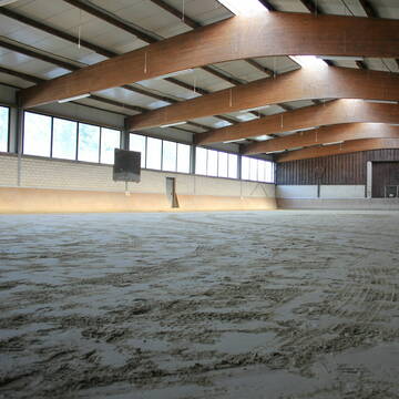
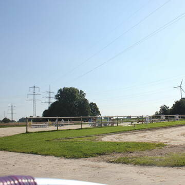
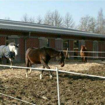
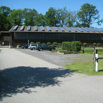
Reitanlage Eßmann
Gescher
Annette-Essmann
@Annette-Essmann
FN-Mitglied
Pferdeausbildung
Longierzirkel/Roundpen
Paddock
Gnadenbrothof
Pferdezucht
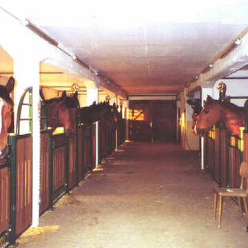
Innenbox
Laufstall
11 weitere...
S
Deprecated: Creation of dynamic property Zend_View_Helper_Ads::$adLink is deprecated in /var/www/stall-frei/htdocs/staging.stall-frei.de/library/Psf/View/Helper/Ads.php on line 108

Futtersack HeuToy, Fressbremse in pink
Mechtersen
STALL-FREIde Marketing
@STALL-FREI-Marketing
Stundenlange Beschäftigung die
Koliken vorbeugt, geringe Staubinhalation mit
steuerbarer Futterentnahme


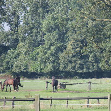
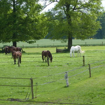
Aktivlaufstall am Sonnenbrink - Platz frei
Borken
Alina Passerschroer
@Sonnenbrink
Freizeitstall
Hunde willkommen
Krankenbox
Allergikerstall
Hufrehe geeignet
Laufstall
Offenstall
13 weitere...
P+


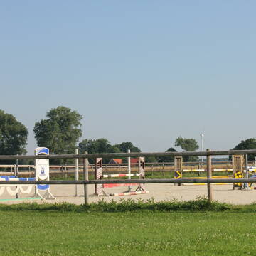
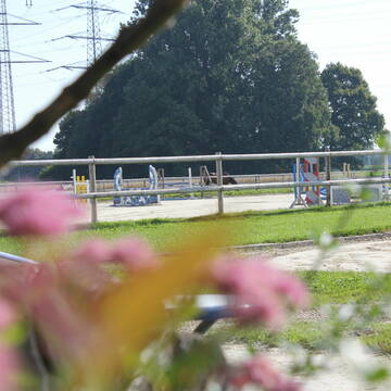
Offenstallplatz / Boxenplatz
Borken
Roosenhof
@Roosenhof
Freizeitstall
Vermieten
Hunde willkommen
Reitplatz (z.B. Dressur, Springen, Reining)
Allergikerstall
Notfallboxen
12 weitere...
P+

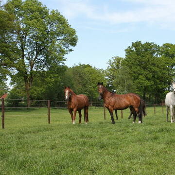
Rentner-, Gnadenbrotpferde und Rekonvaleszenz
Billerbeck
Gestüt Gerleve
@Gestuet-Gerleve
Rehabilitationsstall
Vermieten
Hunde willkommen
Krankenbox
Allergikerstall
Gnadenbrothof
16 weitere...
S
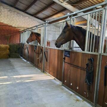
Große Pferdeboxen mit Paddock
Oeding
danielalichtendahl
@danielalichtendahl
Führanlage
Hunde willkommen
8 weitere...
P
Großzügiger, heller und moderner Pensionsstall
Heiden
Hof-Eiling
@Hof-Eiling
FN-Mitglied
Pferdeausbildung
Vermieten
Führanlage
Hunde willkommen
Allergikerstall
Fohlenaufzucht möglich
19 weitere...
P
Betreutes Wohnen für Ihr Rentnerpferd
Reken
Pferdepension-Korte
@Pferdepension-Korte
Rehabilitationsstall
Vermieten
Hunde willkommen
Paddock
Allergikerstall
Gnadenbrothof
14 weitere...
P


Ein Ort für die Pferdeseele
Borken
Ein Ort für die Pferdeseele
@Ein-Ort-fuer-die-Pferdeseele1
Freizeitstall
Vermieten
Verpachten
Hunde willkommen
Paddock
Gnadenbrothof
14 weitere...
aktuell
P
Reiterhof Inholte
Reken
Reiterhof-Inholte
@Reiterhof-Inholte
FN-Mitglied
Freizeitstall
Vermieten
Longierzirkel/Roundpen
Paddock
Innenbox
13 weitere...
P
Leider kein Vorschaubild
Leider kein Vorschaubild
Pferdepensionsstall Weigelt
Velen
Klaus-Weigelt
@Klaus-Weigelt
Freizeitstall
Vermieten
Paddock
Parkplatz für Pferdeanhänger
Außenboxen
Innenbox
9 weitere...
B
Deprecated: Creation of dynamic property Zend_View::$pageCount is deprecated in /var/www/stall-frei/htdocs/staging.stall-frei.de/library/vendor/shardj/zf1-future/library/Zend/View/Abstract.php on line 308
Deprecated: Creation of dynamic property Zend_View::$itemCountPerPage is deprecated in /var/www/stall-frei/htdocs/staging.stall-frei.de/library/vendor/shardj/zf1-future/library/Zend/View/Abstract.php on line 308
Deprecated: Creation of dynamic property Zend_View::$first is deprecated in /var/www/stall-frei/htdocs/staging.stall-frei.de/library/vendor/shardj/zf1-future/library/Zend/View/Abstract.php on line 308
Deprecated: Creation of dynamic property Zend_View::$current is deprecated in /var/www/stall-frei/htdocs/staging.stall-frei.de/library/vendor/shardj/zf1-future/library/Zend/View/Abstract.php on line 308
Deprecated: Creation of dynamic property Zend_View::$last is deprecated in /var/www/stall-frei/htdocs/staging.stall-frei.de/library/vendor/shardj/zf1-future/library/Zend/View/Abstract.php on line 308
Deprecated: Creation of dynamic property Zend_View::$next is deprecated in /var/www/stall-frei/htdocs/staging.stall-frei.de/library/vendor/shardj/zf1-future/library/Zend/View/Abstract.php on line 308
Deprecated: Creation of dynamic property Zend_View::$pagesInRange is deprecated in /var/www/stall-frei/htdocs/staging.stall-frei.de/library/vendor/shardj/zf1-future/library/Zend/View/Abstract.php on line 308
Deprecated: Creation of dynamic property Zend_View::$firstPageInRange is deprecated in /var/www/stall-frei/htdocs/staging.stall-frei.de/library/vendor/shardj/zf1-future/library/Zend/View/Abstract.php on line 308
Deprecated: Creation of dynamic property Zend_View::$lastPageInRange is deprecated in /var/www/stall-frei/htdocs/staging.stall-frei.de/library/vendor/shardj/zf1-future/library/Zend/View/Abstract.php on line 308
Deprecated: Creation of dynamic property Zend_View::$currentItemCount is deprecated in /var/www/stall-frei/htdocs/staging.stall-frei.de/library/vendor/shardj/zf1-future/library/Zend/View/Abstract.php on line 308
Deprecated: Creation of dynamic property Zend_View::$totalItemCount is deprecated in /var/www/stall-frei/htdocs/staging.stall-frei.de/library/vendor/shardj/zf1-future/library/Zend/View/Abstract.php on line 308
Deprecated: Creation of dynamic property Zend_View::$firstItemNumber is deprecated in /var/www/stall-frei/htdocs/staging.stall-frei.de/library/vendor/shardj/zf1-future/library/Zend/View/Abstract.php on line 308
Deprecated: Creation of dynamic property Zend_View::$lastItemNumber is deprecated in /var/www/stall-frei/htdocs/staging.stall-frei.de/library/vendor/shardj/zf1-future/library/Zend/View/Abstract.php on line 308
Deprecated: Creation of dynamic property Zend_View::$router is deprecated in /var/www/stall-frei/htdocs/staging.stall-frei.de/library/vendor/shardj/zf1-future/library/Zend/View/Abstract.php on line 308
Deprecated: Creation of dynamic property Zend_View::$urlParams is deprecated in /var/www/stall-frei/htdocs/staging.stall-frei.de/library/vendor/shardj/zf1-future/library/Zend/View/Abstract.php on line 308
Deprecated: Creation of dynamic property Zend_View::$showAds is deprecated in /var/www/stall-frei/htdocs/staging.stall-frei.de/library/vendor/shardj/zf1-future/library/Zend/View/Abstract.php on line 308
Deprecated: Creation of dynamic property Zend_View::$objectIds is deprecated in /var/www/stall-frei/htdocs/staging.stall-frei.de/library/vendor/shardj/zf1-future/library/Zend/View/Abstract.php on line 308
Deprecated: Creation of dynamic property Zend_View::$showNavbar is deprecated in /var/www/stall-frei/htdocs/staging.stall-frei.de/library/vendor/shardj/zf1-future/library/Zend/View/Abstract.php on line 308
Deprecated: Creation of dynamic property Zend_View::$showBreadcrumb is deprecated in /var/www/stall-frei/htdocs/staging.stall-frei.de/library/vendor/shardj/zf1-future/library/Zend/View/Abstract.php on line 308
Deprecated: Creation of dynamic property Zend_View::$showFooter is deprecated in /var/www/stall-frei/htdocs/staging.stall-frei.de/library/vendor/shardj/zf1-future/library/Zend/View/Abstract.php on line 308
Deprecated: Creation of dynamic property Zend_View::$showInternalAds is deprecated in /var/www/stall-frei/htdocs/staging.stall-frei.de/library/vendor/shardj/zf1-future/library/Zend/View/Abstract.php on line 308
Deprecated: Creation of dynamic property Zend_View::$blNoContent is deprecated in /var/www/stall-frei/htdocs/staging.stall-frei.de/library/vendor/shardj/zf1-future/library/Zend/View/Abstract.php on line 308
Deprecated: Creation of dynamic property Zend_View::$sMetaDesc is deprecated in /var/www/stall-frei/htdocs/staging.stall-frei.de/library/vendor/shardj/zf1-future/library/Zend/View/Abstract.php on line 308
Deprecated: Creation of dynamic property Zend_View::$useGmaps is deprecated in /var/www/stall-frei/htdocs/staging.stall-frei.de/library/vendor/shardj/zf1-future/library/Zend/View/Abstract.php on line 308
Deprecated: Creation of dynamic property Zend_View::$touches is deprecated in /var/www/stall-frei/htdocs/staging.stall-frei.de/library/vendor/shardj/zf1-future/library/Zend/View/Abstract.php on line 308
Deprecated: Creation of dynamic property Zend_View::$oProject is deprecated in /var/www/stall-frei/htdocs/staging.stall-frei.de/library/vendor/shardj/zf1-future/library/Zend/View/Abstract.php on line 308
Deprecated: Creation of dynamic property Zend_View::$pageHeadline is deprecated in /var/www/stall-frei/htdocs/staging.stall-frei.de/library/vendor/shardj/zf1-future/library/Zend/View/Abstract.php on line 308
Deprecated: Creation of dynamic property Zend_View::$disableLocationField is deprecated in /var/www/stall-frei/htdocs/staging.stall-frei.de/library/vendor/shardj/zf1-future/library/Zend/View/Abstract.php on line 308
Deprecated: Creation of dynamic property Zend_View::$isSearch is deprecated in /var/www/stall-frei/htdocs/staging.stall-frei.de/library/vendor/shardj/zf1-future/library/Zend/View/Abstract.php on line 308
Deprecated: Creation of dynamic property Zend_View::$pageTitle is deprecated in /var/www/stall-frei/htdocs/staging.stall-frei.de/library/vendor/shardj/zf1-future/library/Zend/View/Abstract.php on line 308
Deprecated: Creation of dynamic property Psf_Form_Element_Text::$class is deprecated in /var/www/stall-frei/htdocs/staging.stall-frei.de/library/vendor/shardj/zf1-future/library/Zend/Form/Element.php on line 874
Deprecated: Creation of dynamic property Psf_Form_Element_Text::$size is deprecated in /var/www/stall-frei/htdocs/staging.stall-frei.de/library/vendor/shardj/zf1-future/library/Zend/Form/Element.php on line 874
Deprecated: Creation of dynamic property Psf_Form_Element_Text::$placeholder is deprecated in /var/www/stall-frei/htdocs/staging.stall-frei.de/library/vendor/shardj/zf1-future/library/Zend/Form/Element.php on line 874
Deprecated: Creation of dynamic property Psf_Form_Element_Hidden::$class is deprecated in /var/www/stall-frei/htdocs/staging.stall-frei.de/library/vendor/shardj/zf1-future/library/Zend/Form/Element.php on line 874
Deprecated: Creation of dynamic property Psf_Form_Element_Hidden::$class is deprecated in /var/www/stall-frei/htdocs/staging.stall-frei.de/library/vendor/shardj/zf1-future/library/Zend/Form/Element.php on line 874
Deprecated: Creation of dynamic property Psf_Form_Element_Hidden::$class is deprecated in /var/www/stall-frei/htdocs/staging.stall-frei.de/library/vendor/shardj/zf1-future/library/Zend/Form/Element.php on line 874
Deprecated: Creation of dynamic property Psf_Form_Element_Hidden::$class is deprecated in /var/www/stall-frei/htdocs/staging.stall-frei.de/library/vendor/shardj/zf1-future/library/Zend/Form/Element.php on line 874
Deprecated: Creation of dynamic property Psf_Form_Element_Select::$class is deprecated in /var/www/stall-frei/htdocs/staging.stall-frei.de/library/vendor/shardj/zf1-future/library/Zend/Form/Element.php on line 874
Deprecated: Creation of dynamic property Psf_Form_Element_Select::$class is deprecated in /var/www/stall-frei/htdocs/staging.stall-frei.de/library/vendor/shardj/zf1-future/library/Zend/Form/Element.php on line 874
Deprecated: Creation of dynamic property Psf_Form_Element_Select::$class is deprecated in /var/www/stall-frei/htdocs/staging.stall-frei.de/library/vendor/shardj/zf1-future/library/Zend/Form/Element.php on line 874
Deprecated: Creation of dynamic property Psf_Form_Element_Select::$class is deprecated in /var/www/stall-frei/htdocs/staging.stall-frei.de/library/vendor/shardj/zf1-future/library/Zend/Form/Element.php on line 874
Deprecated: Creation of dynamic property Psf_Form_Element_Text::$class is deprecated in /var/www/stall-frei/htdocs/staging.stall-frei.de/library/vendor/shardj/zf1-future/library/Zend/Form/Element.php on line 874
Deprecated: Creation of dynamic property Psf_Form_Element_Checkbox::$label is deprecated in /var/www/stall-frei/htdocs/staging.stall-frei.de/library/vendor/shardj/zf1-future/library/Zend/Form/Element.php on line 874
Deprecated: Creation of dynamic property Zend_View::$sort is deprecated in /var/www/stall-frei/htdocs/staging.stall-frei.de/library/vendor/shardj/zf1-future/library/Zend/View/Abstract.php on line 308
Deprecated: Creation of dynamic property Zend_View::$searchLocation is deprecated in /var/www/stall-frei/htdocs/staging.stall-frei.de/library/vendor/shardj/zf1-future/library/Zend/View/Abstract.php on line 308
Deprecated: Creation of dynamic property Zend_View::$locationHint is deprecated in /var/www/stall-frei/htdocs/staging.stall-frei.de/library/vendor/shardj/zf1-future/library/Zend/View/Abstract.php on line 308
Psf_GeoCoder_Abstract::getLocation: Ramsdorf Get Location CachedOrLive
Psf_GeoCoder_Abstract::getCachedOrLive: Ramsdorf
Psf_GeoCoder_OpenCageData::makeApiRequest: response:
Array
(
[documentation] => https://opencagedata.com/api
[licenses] => Array
(
[0] => Array
(
[name] => see attribution guide
[url] => https://opencagedata.com/credits
)
)
[results] => Array
(
[0] => Array
(
[bounds] => Array
(
[northeast] => Array
(
[lat] => 51.9102663
[lng] => 6.9415629
)
[southwest] => Array
(
[lat] => 51.8702663
[lng] => 6.9015629
)
)
[components] => Array
(
[ISO_3166-1_alpha-2] => DE
[ISO_3166-1_alpha-3] => DEU
[ISO_3166-2] => Array
(
[0] => DE-NW
)
[_category] => place
[_normalized_city] => Velen
[_type] => village
[city] => Velen
[continent] => Europe
[country] => Deutschland
[country_code] => de
[county] => Kreis Borken
[political_union] => European Union
[postcode] => 46342
[state] => Nordrhein-Westfalen
[state_code] => NW
[village] => Ramsdorf
)
[confidence] => 7
[formatted] => 46342 Ramsdorf, Deutschland
[geometry] => Array
(
[lat] => 51.8902663
[lng] => 6.9215629
)
)
[1] => Array
(
[bounds] => Array
(
[northeast] => Array
(
[lat] => 51.1111711
[lng] => 12.393854
)
[southwest] => Array
(
[lat] => 51.0711711
[lng] => 12.353854
)
)
[components] => Array
(
[ISO_3166-1_alpha-2] => DE
[ISO_3166-1_alpha-3] => DEU
[ISO_3166-2] => Array
(
[0] => DE-SN
)
[_category] => place
[_normalized_city] => Regis-Breitingen
[_type] => village
[continent] => Europe
[country] => Deutschland
[country_code] => de
[county] => Landkreis Leipzig
[political_union] => European Union
[postcode] => 04565
[state] => Sachsen
[state_code] => SN
[town] => Regis-Breitingen
[village] => Ramsdorf
)
[confidence] => 7
[formatted] => 04565 Ramsdorf, Deutschland
[geometry] => Array
(
[lat] => 51.0911711
[lng] => 12.373854
)
)
[2] => Array
(
[bounds] => Array
(
[northeast] => Array
(
[lat] => 48.7025916
[lng] => 12.9159093
)
[southwest] => Array
(
[lat] => 48.6625916
[lng] => 12.8759093
)
)
[components] => Array
(
[ISO_3166-1_alpha-2] => DE
[ISO_3166-1_alpha-3] => DEU
[ISO_3166-2] => Array
(
[0] => DE-BY
)
[_category] => place
[_normalized_city] => Wallerfing
[_type] => village
[city] => Wallerfing
[continent] => Europe
[country] => Deutschland
[country_code] => de
[county] => Landkreis Deggendorf
[municipality] => Oberpöring (VGem)
[political_union] => European Union
[postcode] => 94574
[state] => Bayern
[state_code] => BY
[village] => Ramsdorf
)
[confidence] => 7
[formatted] => 94574 Ramsdorf, Deutschland
[geometry] => Array
(
[lat] => 48.6825916
[lng] => 12.8959093
)
)
[3] => Array
(
[bounds] => Array
(
[northeast] => Array
(
[lat] => 51.9421051
[lng] => 6.9675663
)
[southwest] => Array
(
[lat] => 51.8509458
[lng] => 6.8813387
)
)
[components] => Array
(
[ISO_3166-1_alpha-2] => DE
[ISO_3166-1_alpha-3] => DEU
[ISO_3166-2] => Array
(
[0] => DE-NW
)
[_category] => place
[_normalized_city] => Velen
[_type] => village
[city_district] => Ramsdorf
[continent] => Europe
[country] => Deutschland
[country_code] => de
[county] => Kreis Borken
[political_union] => European Union
[state] => Nordrhein-Westfalen
[state_code] => NW
[village] => Velen
)
[confidence] => 7
[formatted] => Ramsdorf, Velen, Nordrhein-Westfalen, Deutschland
[geometry] => Array
(
[lat] => 51.896379
[lng] => 6.9202673
)
)
[4] => Array
(
[bounds] => Array
(
[northeast] => Array
(
[lat] => 54.420851
[lng] => 9.6324742
)
[southwest] => Array
(
[lat] => 54.380851
[lng] => 9.5924742
)
)
[components] => Array
(
[ISO_3166-1_alpha-2] => DE
[ISO_3166-1_alpha-3] => DEU
[ISO_3166-2] => Array
(
[0] => DE-SH
)
[_category] => place
[_normalized_city] => Owschlag
[_type] => hamlet
[continent] => Europe
[country] => Deutschland
[country_code] => de
[county] => Kreis Rendsburg-Eckernförde
[hamlet] => Ramsdorf
[municipality] => Hüttener Berge
[political_union] => European Union
[postcode] => 24811
[state] => Schleswig-Holstein
[state_code] => SH
[village] => Owschlag
)
[confidence] => 7
[formatted] => Ramsdorf, 24811 Owschlag, Deutschland
[geometry] => Array
(
[lat] => 54.400851
[lng] => 9.6124742
)
)
[5] => Array
(
[bounds] => Array
(
[northeast] => Array
(
[lat] => 48.0483548
[lng] => 12.7770313
)
[southwest] => Array
(
[lat] => 48.0083548
[lng] => 12.7370313
)
)
[components] => Array
(
[ISO_3166-1_alpha-2] => DE
[ISO_3166-1_alpha-3] => DEU
[ISO_3166-2] => Array
(
[0] => DE-BY
)
[_category] => place
[_normalized_city] => Tittmoning
[_type] => hamlet
[continent] => Europe
[country] => Deutschland
[country_code] => de
[county] => Landkreis Traunstein
[hamlet] => Ramsdorf
[political_union] => European Union
[postcode] => 84529
[state] => Bayern
[state_code] => BY
[town] => Tittmoning
)
[confidence] => 7
[formatted] => Ramsdorf, 84529 Tittmoning, Deutschland
[geometry] => Array
(
[lat] => 48.0283548
[lng] => 12.7570313
)
)
[6] => Array
(
[components] => Array
(
[ISO_3166-1_alpha-2] => FR
[ISO_3166-1_alpha-3] => FRA
[ISO_3166-2] => Array
(
[0] => FR-GES
[1] => FR-6AE
[2] => FR-67
)
[_category] => road
[_normalized_city] => Sarre-Union
[_type] => road
[city] => Sarre-Union
[continent] => Europe
[country] => France
[country_code] => fr
[county] => Bas-Rhin
[local_authority] => Communauté de communes de l'Alsace Bossue
[political_union] => European Union
[postcode] => 67260
[road] => Rue de Rimsdorf
[state] => Grand Est
[state_code] => GES
)
[confidence] => 2
[formatted] => Rue de Rimsdorf, 67260 Sarre-Union, France
[geometry] => Array
(
[lat] => 48.938554
[lng] => 7.095418
)
)
[7] => Array
(
[components] => Array
(
[ISO_3166-1_alpha-2] => FR
[ISO_3166-1_alpha-3] => FRA
[ISO_3166-2] => Array
(
[0] => FR-GES
[1] => FR-6AE
[2] => FR-67
)
[_category] => road
[_normalized_city] => Sarrewerden
[_type] => road
[city] => Sarrewerden
[continent] => Europe
[country] => France
[country_code] => fr
[county] => Bas-Rhin
[local_authority] => Communauté de communes de l'Alsace Bossue
[political_union] => European Union
[postcode] => 67260
[road] => Rue de Rimsdorf
[state] => Grand Est
[state_code] => GES
)
[confidence] => 2
[formatted] => Rue de Rimsdorf, 67260 Sarrewerden, France
[geometry] => Array
(
[lat] => 48.900924
[lng] => 7.073749
)
)
[8] => Array
(
[components] => Array
(
[ISO_3166-1_alpha-2] => FR
[ISO_3166-1_alpha-3] => FRA
[ISO_3166-2] => Array
(
[0] => FR-GES
[1] => FR-6AE
[2] => FR-67
)
[_category] => road
[_normalized_city] => Domfessel
[_type] => road
[city] => Domfessel
[continent] => Europe
[country] => France
[country_code] => fr
[county] => Bas-Rhin
[local_authority] => Communauté de communes de l'Alsace Bossue
[political_union] => European Union
[postcode] => 67430
[road] => Rue de Rimsdorf
[state] => Grand Est
[state_code] => GES
)
[confidence] => 2
[formatted] => Rue de Rimsdorf, 67430 Domfessel, France
[geometry] => Array
(
[lat] => 48.949179
[lng] => 7.152809
)
)
[9] => Array
(
[components] => Array
(
[ISO_3166-1_alpha-2] => FR
[ISO_3166-1_alpha-3] => FRA
[ISO_3166-2] => Array
(
[0] => FR-IDF
[1] => FR-92
)
[_category] => road
[_normalized_city] => Levallois-Perret
[_type] => road
[city] => Levallois-Perret
[continent] => Europe
[country] => France
[country_code] => fr
[county] => Hauts-de-Seine
[local_authority] => Métropole du Grand Paris
[political_union] => European Union
[postcode] => 92300
[road] => Rue Charles Deutschmann
[state] => Île-de-France
[state_code] => IDF
)
[confidence] => 2
[formatted] => Rue Charles Deutschmann, 92300 Levallois-Perret, France
[geometry] => Array
(
[lat] => 48.900049
[lng] => 2.2842
)
)
)
[status] => Array
(
[code] => 200
[message] => OK
)
[stay_informed] => Array
(
[blog] => https://blog.opencagedata.com
[mastodon] => https://en.osm.town/@opencage
)
[thanks] => For using an OpenCage API
[timestamp] => Array
(
[created_http] => Sat, 07 Feb 2026 05:48:40 GMT
[created_unix] => 1770443320
)
[total_results] => 10
)
Psf_GeoCoder_Abstract::convertLocationResult
{"documentation":"https:\/\/opencagedata.com\/api","licenses":[{"name":"see attribution guide","url":"https:\/\/opencagedata.com\/credits"}],"results":[{"bounds":{"northeast":{"lat":51.9102663,"lng":6.9415629},"southwest":{"lat":51.8702663,"lng":6.9015629}},"components":{"ISO_3166-1_alpha-2":"DE","ISO_3166-1_alpha-3":"DEU","ISO_3166-2":["DE-NW"],"_category":"place","_normalized_city":"Velen","_type":"village","city":"Velen","continent":"Europe","country":"Deutschland","country_code":"de","county":"Kreis Borken","political_union":"European Union","postcode":"46342","state":"Nordrhein-Westfalen","state_code":"NW","village":"Ramsdorf"},"confidence":7,"formatted":"46342 Ramsdorf, Deutschland","geometry":{"lat":51.8902663,"lng":6.9215629}},{"bounds":{"northeast":{"lat":51.1111711,"lng":12.393854},"southwest":{"lat":51.0711711,"lng":12.353854}},"components":{"ISO_3166-1_alpha-2":"DE","ISO_3166-1_alpha-3":"DEU","ISO_3166-2":["DE-SN"],"_category":"place","_normalized_city":"Regis-Breitingen","_type":"village","continent":"Europe","country":"Deutschland","country_code":"de","county":"Landkreis Leipzig","political_union":"European Union","postcode":"04565","state":"Sachsen","state_code":"SN","town":"Regis-Breitingen","village":"Ramsdorf"},"confidence":7,"formatted":"04565 Ramsdorf, Deutschland","geometry":{"lat":51.0911711,"lng":12.373854}},{"bounds":{"northeast":{"lat":48.7025916,"lng":12.9159093},"southwest":{"lat":48.6625916,"lng":12.8759093}},"components":{"ISO_3166-1_alpha-2":"DE","ISO_3166-1_alpha-3":"DEU","ISO_3166-2":["DE-BY"],"_category":"place","_normalized_city":"Wallerfing","_type":"village","city":"Wallerfing","continent":"Europe","country":"Deutschland","country_code":"de","county":"Landkreis Deggendorf","municipality":"Oberp\u00f6ring (VGem)","political_union":"European Union","postcode":"94574","state":"Bayern","state_code":"BY","village":"Ramsdorf"},"confidence":7,"formatted":"94574 Ramsdorf, Deutschland","geometry":{"lat":48.6825916,"lng":12.8959093}},{"bounds":{"northeast":{"lat":51.9421051,"lng":6.9675663},"southwest":{"lat":51.8509458,"lng":6.8813387}},"components":{"ISO_3166-1_alpha-2":"DE","ISO_3166-1_alpha-3":"DEU","ISO_3166-2":["DE-NW"],"_category":"place","_normalized_city":"Velen","_type":"village","city_district":"Ramsdorf","continent":"Europe","country":"Deutschland","country_code":"de","county":"Kreis Borken","political_union":"European Union","state":"Nordrhein-Westfalen","state_code":"NW","village":"Velen"},"confidence":7,"formatted":"Ramsdorf, Velen, Nordrhein-Westfalen, Deutschland","geometry":{"lat":51.896379,"lng":6.9202673}},{"bounds":{"northeast":{"lat":54.420851,"lng":9.6324742},"southwest":{"lat":54.380851,"lng":9.5924742}},"components":{"ISO_3166-1_alpha-2":"DE","ISO_3166-1_alpha-3":"DEU","ISO_3166-2":["DE-SH"],"_category":"place","_normalized_city":"Owschlag","_type":"hamlet","continent":"Europe","country":"Deutschland","country_code":"de","county":"Kreis Rendsburg-Eckernf\u00f6rde","hamlet":"Ramsdorf","municipality":"H\u00fcttener Berge","political_union":"European Union","postcode":"24811","state":"Schleswig-Holstein","state_code":"SH","village":"Owschlag"},"confidence":7,"formatted":"Ramsdorf, 24811 Owschlag, Deutschland","geometry":{"lat":54.400851,"lng":9.6124742}},{"bounds":{"northeast":{"lat":48.0483548,"lng":12.7770313},"southwest":{"lat":48.0083548,"lng":12.7370313}},"components":{"ISO_3166-1_alpha-2":"DE","ISO_3166-1_alpha-3":"DEU","ISO_3166-2":["DE-BY"],"_category":"place","_normalized_city":"Tittmoning","_type":"hamlet","continent":"Europe","country":"Deutschland","country_code":"de","county":"Landkreis Traunstein","hamlet":"Ramsdorf","political_union":"European Union","postcode":"84529","state":"Bayern","state_code":"BY","town":"Tittmoning"},"confidence":7,"formatted":"Ramsdorf, 84529 Tittmoning, Deutschland","geometry":{"lat":48.0283548,"lng":12.7570313}},{"components":{"ISO_3166-1_alpha-2":"FR","ISO_3166-1_alpha-3":"FRA","ISO_3166-2":["FR-GES","FR-6AE","FR-67"],"_category":"road","_normalized_city":"Sarre-Union","_type":"road","city":"Sarre-Union","continent":"Europe","country":"France","country_code":"fr","county":"Bas-Rhin","local_authority":"Communaut\u00e9 de communes de l'Alsace Bossue","political_union":"European Union","postcode":"67260","road":"Rue de Rimsdorf","state":"Grand Est","state_code":"GES"},"confidence":2,"formatted":"Rue de Rimsdorf, 67260 Sarre-Union, France","geometry":{"lat":48.938554,"lng":7.095418}},{"components":{"ISO_3166-1_alpha-2":"FR","ISO_3166-1_alpha-3":"FRA","ISO_3166-2":["FR-GES","FR-6AE","FR-67"],"_category":"road","_normalized_city":"Sarrewerden","_type":"road","city":"Sarrewerden","continent":"Europe","country":"France","country_code":"fr","county":"Bas-Rhin","local_authority":"Communaut\u00e9 de communes de l'Alsace Bossue","political_union":"European Union","postcode":"67260","road":"Rue de Rimsdorf","state":"Grand Est","state_code":"GES"},"confidence":2,"formatted":"Rue de Rimsdorf, 67260 Sarrewerden, France","geometry":{"lat":48.900924,"lng":7.073749}},{"components":{"ISO_3166-1_alpha-2":"FR","ISO_3166-1_alpha-3":"FRA","ISO_3166-2":["FR-GES","FR-6AE","FR-67"],"_category":"road","_normalized_city":"Domfessel","_type":"road","city":"Domfessel","continent":"Europe","country":"France","country_code":"fr","county":"Bas-Rhin","local_authority":"Communaut\u00e9 de communes de l'Alsace Bossue","political_union":"European Union","postcode":"67430","road":"Rue de Rimsdorf","state":"Grand Est","state_code":"GES"},"confidence":2,"formatted":"Rue de Rimsdorf, 67430 Domfessel, France","geometry":{"lat":48.949179,"lng":7.152809}},{"components":{"ISO_3166-1_alpha-2":"FR","ISO_3166-1_alpha-3":"FRA","ISO_3166-2":["FR-IDF","FR-92"],"_category":"road","_normalized_city":"Levallois-Perret","_type":"road","city":"Levallois-Perret","continent":"Europe","country":"France","country_code":"fr","county":"Hauts-de-Seine","local_authority":"M\u00e9tropole du Grand Paris","political_union":"European Union","postcode":"92300","road":"Rue Charles Deutschmann","state":"\u00cele-de-France","state_code":"IDF"},"confidence":2,"formatted":"Rue Charles Deutschmann, 92300 Levallois-Perret, France","geometry":{"lat":48.900049,"lng":2.2842}}],"status":{"code":200,"message":"OK"},"stay_informed":{"blog":"https:\/\/blog.opencagedata.com","mastodon":"https:\/\/en.osm.town\/@opencage"},"thanks":"For using an OpenCage API","timestamp":{"created_http":"Sat, 07 Feb 2026 05:48:40 GMT","created_unix":1770443320},"total_results":10}Array
(
[0] => stdClass Object
(
[bounds] => stdClass Object
(
[northeast] => stdClass Object
(
[lat] => 51.9102663
[lng] => 6.9415629
)
[southwest] => stdClass Object
(
[lat] => 51.8702663
[lng] => 6.9015629
)
)
[components] => stdClass Object
(
[ISO_3166-1_alpha-2] => DE
[ISO_3166-1_alpha-3] => DEU
[ISO_3166-2] => Array
(
[0] => DE-NW
)
[_category] => place
[_normalized_city] => Velen
[_type] => village
[city] => Velen
[continent] => Europe
[country] => Deutschland
[country_code] => de
[county] => Kreis Borken
[political_union] => European Union
[postcode] => 46342
[state] => Nordrhein-Westfalen
[state_code] => NW
[village] => Ramsdorf
)
[confidence] => 7
[formatted] => 46342 Ramsdorf, Deutschland
[geometry] => stdClass Object
(
[lat] => 51.8902663
[lng] => 6.9215629
)
)
[1] => stdClass Object
(
[bounds] => stdClass Object
(
[northeast] => stdClass Object
(
[lat] => 51.1111711
[lng] => 12.393854
)
[southwest] => stdClass Object
(
[lat] => 51.0711711
[lng] => 12.353854
)
)
[components] => stdClass Object
(
[ISO_3166-1_alpha-2] => DE
[ISO_3166-1_alpha-3] => DEU
[ISO_3166-2] => Array
(
[0] => DE-SN
)
[_category] => place
[_normalized_city] => Regis-Breitingen
[_type] => village
[continent] => Europe
[country] => Deutschland
[country_code] => de
[county] => Landkreis Leipzig
[political_union] => European Union
[postcode] => 04565
[state] => Sachsen
[state_code] => SN
[town] => Regis-Breitingen
[village] => Ramsdorf
)
[confidence] => 7
[formatted] => 04565 Ramsdorf, Deutschland
[geometry] => stdClass Object
(
[lat] => 51.0911711
[lng] => 12.373854
)
)
[2] => stdClass Object
(
[bounds] => stdClass Object
(
[northeast] => stdClass Object
(
[lat] => 48.7025916
[lng] => 12.9159093
)
[southwest] => stdClass Object
(
[lat] => 48.6625916
[lng] => 12.8759093
)
)
[components] => stdClass Object
(
[ISO_3166-1_alpha-2] => DE
[ISO_3166-1_alpha-3] => DEU
[ISO_3166-2] => Array
(
[0] => DE-BY
)
[_category] => place
[_normalized_city] => Wallerfing
[_type] => village
[city] => Wallerfing
[continent] => Europe
[country] => Deutschland
[country_code] => de
[county] => Landkreis Deggendorf
[municipality] => Oberpöring (VGem)
[political_union] => European Union
[postcode] => 94574
[state] => Bayern
[state_code] => BY
[village] => Ramsdorf
)
[confidence] => 7
[formatted] => 94574 Ramsdorf, Deutschland
[geometry] => stdClass Object
(
[lat] => 48.6825916
[lng] => 12.8959093
)
)
[3] => stdClass Object
(
[bounds] => stdClass Object
(
[northeast] => stdClass Object
(
[lat] => 51.9421051
[lng] => 6.9675663
)
[southwest] => stdClass Object
(
[lat] => 51.8509458
[lng] => 6.8813387
)
)
[components] => stdClass Object
(
[ISO_3166-1_alpha-2] => DE
[ISO_3166-1_alpha-3] => DEU
[ISO_3166-2] => Array
(
[0] => DE-NW
)
[_category] => place
[_normalized_city] => Velen
[_type] => village
[city_district] => Ramsdorf
[continent] => Europe
[country] => Deutschland
[country_code] => de
[county] => Kreis Borken
[political_union] => European Union
[state] => Nordrhein-Westfalen
[state_code] => NW
[village] => Velen
)
[confidence] => 7
[formatted] => Ramsdorf, Velen, Nordrhein-Westfalen, Deutschland
[geometry] => stdClass Object
(
[lat] => 51.896379
[lng] => 6.9202673
)
)
[4] => stdClass Object
(
[bounds] => stdClass Object
(
[northeast] => stdClass Object
(
[lat] => 54.420851
[lng] => 9.6324742
)
[southwest] => stdClass Object
(
[lat] => 54.380851
[lng] => 9.5924742
)
)
[components] => stdClass Object
(
[ISO_3166-1_alpha-2] => DE
[ISO_3166-1_alpha-3] => DEU
[ISO_3166-2] => Array
(
[0] => DE-SH
)
[_category] => place
[_normalized_city] => Owschlag
[_type] => hamlet
[continent] => Europe
[country] => Deutschland
[country_code] => de
[county] => Kreis Rendsburg-Eckernförde
[hamlet] => Ramsdorf
[municipality] => Hüttener Berge
[political_union] => European Union
[postcode] => 24811
[state] => Schleswig-Holstein
[state_code] => SH
[village] => Owschlag
)
[confidence] => 7
[formatted] => Ramsdorf, 24811 Owschlag, Deutschland
[geometry] => stdClass Object
(
[lat] => 54.400851
[lng] => 9.6124742
)
)
[5] => stdClass Object
(
[bounds] => stdClass Object
(
[northeast] => stdClass Object
(
[lat] => 48.0483548
[lng] => 12.7770313
)
[southwest] => stdClass Object
(
[lat] => 48.0083548
[lng] => 12.7370313
)
)
[components] => stdClass Object
(
[ISO_3166-1_alpha-2] => DE
[ISO_3166-1_alpha-3] => DEU
[ISO_3166-2] => Array
(
[0] => DE-BY
)
[_category] => place
[_normalized_city] => Tittmoning
[_type] => hamlet
[continent] => Europe
[country] => Deutschland
[country_code] => de
[county] => Landkreis Traunstein
[hamlet] => Ramsdorf
[political_union] => European Union
[postcode] => 84529
[state] => Bayern
[state_code] => BY
[town] => Tittmoning
)
[confidence] => 7
[formatted] => Ramsdorf, 84529 Tittmoning, Deutschland
[geometry] => stdClass Object
(
[lat] => 48.0283548
[lng] => 12.7570313
)
)
[6] => stdClass Object
(
[components] => stdClass Object
(
[ISO_3166-1_alpha-2] => FR
[ISO_3166-1_alpha-3] => FRA
[ISO_3166-2] => Array
(
[0] => FR-GES
[1] => FR-6AE
[2] => FR-67
)
[_category] => road
[_normalized_city] => Sarre-Union
[_type] => road
[city] => Sarre-Union
[continent] => Europe
[country] => France
[country_code] => fr
[county] => Bas-Rhin
[local_authority] => Communauté de communes de l'Alsace Bossue
[political_union] => European Union
[postcode] => 67260
[road] => Rue de Rimsdorf
[state] => Grand Est
[state_code] => GES
)
[confidence] => 2
[formatted] => Rue de Rimsdorf, 67260 Sarre-Union, France
[geometry] => stdClass Object
(
[lat] => 48.938554
[lng] => 7.095418
)
)
[7] => stdClass Object
(
[components] => stdClass Object
(
[ISO_3166-1_alpha-2] => FR
[ISO_3166-1_alpha-3] => FRA
[ISO_3166-2] => Array
(
[0] => FR-GES
[1] => FR-6AE
[2] => FR-67
)
[_category] => road
[_normalized_city] => Sarrewerden
[_type] => road
[city] => Sarrewerden
[continent] => Europe
[country] => France
[country_code] => fr
[county] => Bas-Rhin
[local_authority] => Communauté de communes de l'Alsace Bossue
[political_union] => European Union
[postcode] => 67260
[road] => Rue de Rimsdorf
[state] => Grand Est
[state_code] => GES
)
[confidence] => 2
[formatted] => Rue de Rimsdorf, 67260 Sarrewerden, France
[geometry] => stdClass Object
(
[lat] => 48.900924
[lng] => 7.073749
)
)
[8] => stdClass Object
(
[components] => stdClass Object
(
[ISO_3166-1_alpha-2] => FR
[ISO_3166-1_alpha-3] => FRA
[ISO_3166-2] => Array
(
[0] => FR-GES
[1] => FR-6AE
[2] => FR-67
)
[_category] => road
[_normalized_city] => Domfessel
[_type] => road
[city] => Domfessel
[continent] => Europe
[country] => France
[country_code] => fr
[county] => Bas-Rhin
[local_authority] => Communauté de communes de l'Alsace Bossue
[political_union] => European Union
[postcode] => 67430
[road] => Rue de Rimsdorf
[state] => Grand Est
[state_code] => GES
)
[confidence] => 2
[formatted] => Rue de Rimsdorf, 67430 Domfessel, France
[geometry] => stdClass Object
(
[lat] => 48.949179
[lng] => 7.152809
)
)
[9] => stdClass Object
(
[components] => stdClass Object
(
[ISO_3166-1_alpha-2] => FR
[ISO_3166-1_alpha-3] => FRA
[ISO_3166-2] => Array
(
[0] => FR-IDF
[1] => FR-92
)
[_category] => road
[_normalized_city] => Levallois-Perret
[_type] => road
[city] => Levallois-Perret
[continent] => Europe
[country] => France
[country_code] => fr
[county] => Hauts-de-Seine
[local_authority] => Métropole du Grand Paris
[political_union] => European Union
[postcode] => 92300
[road] => Rue Charles Deutschmann
[state] => Île-de-France
[state_code] => IDF
)
[confidence] => 2
[formatted] => Rue Charles Deutschmann, 92300 Levallois-Perret, France
[geometry] => stdClass Object
(
[lat] => 48.900049
[lng] => 2.2842
)
)
)
Psf_GeoCoder_OpenCageData::getKeyMap: 0
stdClass Object
(
    [bounds] => stdClass Object
        (
            [northeast] => stdClass Object
                (
                    [lat] => 51.9102663
                    [lng] => 6.9415629
                )

            [southwest] => stdClass Object
                (
                    [lat] => 51.8702663
                    [lng] => 6.9015629
                )

        )

    [components] => stdClass Object
        (
            [ISO_3166-1_alpha-2] => DE
            [ISO_3166-1_alpha-3] => DEU
            [ISO_3166-2] => Array
                (
                    [0] => DE-NW
                )

            [_category] => place
            [_normalized_city] => Velen
            [_type] => village
            [city] => Velen
            [continent] => Europe
            [country] => Deutschland
            [country_code] => de
            [county] => Kreis Borken
            [political_union] => European Union
            [postcode] => 46342
            [state] => Nordrhein-Westfalen
            [state_code] => NW
            [village] => Ramsdorf
        )

    [confidence] => 7
    [formatted] => 46342 Ramsdorf, Deutschland
    [geometry] => stdClass Object
        (
            [lat] => 51.8902663
            [lng] => 6.9215629
        )

)
Psf_GeoCoder_OpenCageData::getCounty: Borken
Psf_GeoCoder_OpenCageData::addMissingData REFETCH!
Array
(
    [address] => 46342 Ramsdorf, Deutschland
    [type] => village
    [street] =>
    [city] => Ramsdorf
    [county] => Borken
    [state] => Nordrhein-Westfalen
    [zip] => 46342
    [country] => Deutschland
    [suburb] =>
    [countrycode] => de
    [latitude] => 51.8902663
    [longitude] => 6.9215629
    [accuracy] => 1
    [confidence] => 7
    [bounds] => stdClass Object
        (
            [northeast] => stdClass Object
                (
                    [lat] => 51.9102663
                    [lng] => 6.9415629
                )

            [southwest] => stdClass Object
                (
                    [lat] => 51.8702663
                    [lng] => 6.9015629
                )

        )

)
reformat!
Array
(
    [address] => 46342 Ramsdorf, Deutschland
    [type] => village
    [street] =>
    [city] => Ramsdorf
    [county] => Borken
    [state] => Nordrhein-Westfalen
    [zip] => 46342
    [country] => Deutschland
    [suburb] =>
    [countrycode] => de
    [latitude] => 51.8902663
    [longitude] => 6.9215629
    [accuracy] => 1
    [confidence] => 7
    [bounds] => stdClass Object
        (
            [northeast] => stdClass Object
                (
                    [lat] => 51.9102663
                    [lng] => 6.9415629
                )

            [southwest] => stdClass Object
                (
                    [lat] => 51.8702663
                    [lng] => 6.9015629
                )

        )

    [place] => 46342 Ramsdorf, Nordrhein-Westfalen
    [hash] => 39e52f8da78c6755a417348d64b420fd
)
Psf_GeoCoder_OpenCageData::getKeyMap: 1
stdClass Object
(
    [bounds] => stdClass Object
        (
            [northeast] => stdClass Object
                (
                    [lat] => 51.1111711
                    [lng] => 12.393854
                )

            [southwest] => stdClass Object
                (
                    [lat] => 51.0711711
                    [lng] => 12.353854
                )

        )

    [components] => stdClass Object
        (
            [ISO_3166-1_alpha-2] => DE
            [ISO_3166-1_alpha-3] => DEU
            [ISO_3166-2] => Array
                (
                    [0] => DE-SN
                )

            [_category] => place
            [_normalized_city] => Regis-Breitingen
            [_type] => village
            [continent] => Europe
            [country] => Deutschland
            [country_code] => de
            [county] => Landkreis Leipzig
            [political_union] => European Union
            [postcode] => 04565
            [state] => Sachsen
            [state_code] => SN
            [town] => Regis-Breitingen
            [village] => Ramsdorf
        )

    [confidence] => 7
    [formatted] => 04565 Ramsdorf, Deutschland
    [geometry] => stdClass Object
        (
            [lat] => 51.0911711
            [lng] => 12.373854
        )

)
Psf_GeoCoder_OpenCageData::getCounty: Leipzig
Psf_GeoCoder_OpenCageData::addMissingData REFETCH!
Array
(
    [address] => 04565 Ramsdorf, Deutschland
    [type] => village
    [street] =>
    [city] => Regis-Breitingen
    [county] => Leipzig
    [state] => Sachsen
    [zip] => 04565
    [country] => Deutschland
    [suburb] =>
    [countrycode] => de
    [latitude] => 51.0911711
    [longitude] => 12.373854
    [accuracy] => 1
    [confidence] => 7
    [bounds] => stdClass Object
        (
            [northeast] => stdClass Object
                (
                    [lat] => 51.1111711
                    [lng] => 12.393854
                )

            [southwest] => stdClass Object
                (
                    [lat] => 51.0711711
                    [lng] => 12.353854
                )

        )

)
reformat!
Array
(
    [address] => 04565 Regis-Breitingen
    [type] => village
    [street] =>
    [city] => Regis-Breitingen
    [county] => Leipzig
    [state] => Sachsen
    [zip] => 04565
    [country] => Deutschland
    [suburb] =>
    [countrycode] => de
    [latitude] => 51.0911711
    [longitude] => 12.373854
    [accuracy] => 1
    [confidence] => 7
    [bounds] => stdClass Object
        (
            [northeast] => stdClass Object
                (
                    [lat] => 51.1111711
                    [lng] => 12.393854
                )

            [southwest] => stdClass Object
                (
                    [lat] => 51.0711711
                    [lng] => 12.353854
                )

        )

    [place] => 04565 Regis-Breitingen, Sachsen
    [hash] => 9e2787787dfdea9ebcdb5332fba47014
)
Psf_GeoCoder_OpenCageData::getKeyMap: 2
stdClass Object
(
    [bounds] => stdClass Object
        (
            [northeast] => stdClass Object
                (
                    [lat] => 48.7025916
                    [lng] => 12.9159093
                )

            [southwest] => stdClass Object
                (
                    [lat] => 48.6625916
                    [lng] => 12.8759093
                )

        )

    [components] => stdClass Object
        (
            [ISO_3166-1_alpha-2] => DE
            [ISO_3166-1_alpha-3] => DEU
            [ISO_3166-2] => Array
                (
                    [0] => DE-BY
                )

            [_category] => place
            [_normalized_city] => Wallerfing
            [_type] => village
            [city] => Wallerfing
            [continent] => Europe
            [country] => Deutschland
            [country_code] => de
            [county] => Landkreis Deggendorf
            [municipality] => Oberpöring (VGem)
            [political_union] => European Union
            [postcode] => 94574
            [state] => Bayern
            [state_code] => BY
            [village] => Ramsdorf
        )

    [confidence] => 7
    [formatted] => 94574 Ramsdorf, Deutschland
    [geometry] => stdClass Object
        (
            [lat] => 48.6825916
            [lng] => 12.8959093
        )

)
Psf_GeoCoder_OpenCageData::getCounty: Deggendorf
Psf_GeoCoder_OpenCageData::addMissingData REFETCH!
Array
(
    [address] => 94574 Ramsdorf, Deutschland
    [type] => village
    [street] =>
    [city] => Ramsdorf
    [county] => Deggendorf
    [state] => Bayern
    [zip] => 94574
    [country] => Deutschland
    [suburb] =>
    [countrycode] => de
    [latitude] => 48.6825916
    [longitude] => 12.8959093
    [accuracy] => 1
    [confidence] => 7
    [bounds] => stdClass Object
        (
            [northeast] => stdClass Object
                (
                    [lat] => 48.7025916
                    [lng] => 12.9159093
                )

            [southwest] => stdClass Object
                (
                    [lat] => 48.6625916
                    [lng] => 12.8759093
                )

        )

)
reformat!
Array
(
    [address] => 94574 Ramsdorf, Deutschland
    [type] => village
    [street] =>
    [city] => Ramsdorf
    [county] => Deggendorf
    [state] => Bayern
    [zip] => 94574
    [country] => Deutschland
    [suburb] =>
    [countrycode] => de
    [latitude] => 48.6825916
    [longitude] => 12.8959093
    [accuracy] => 1
    [confidence] => 7
    [bounds] => stdClass Object
        (
            [northeast] => stdClass Object
                (
                    [lat] => 48.7025916
                    [lng] => 12.9159093
                )

            [southwest] => stdClass Object
                (
                    [lat] => 48.6625916
                    [lng] => 12.8759093
                )

        )

    [place] => 94574 Ramsdorf, Bayern
    [hash] => a66d23889ece2d964b8ef32e79f241da
)
Psf_GeoCoder_OpenCageData::getKeyMap: 3
stdClass Object
(
    [bounds] => stdClass Object
        (
            [northeast] => stdClass Object
                (
                    [lat] => 51.9421051
                    [lng] => 6.9675663
                )

            [southwest] => stdClass Object
                (
                    [lat] => 51.8509458
                    [lng] => 6.8813387
                )

        )

    [components] => stdClass Object
        (
            [ISO_3166-1_alpha-2] => DE
            [ISO_3166-1_alpha-3] => DEU
            [ISO_3166-2] => Array
                (
                    [0] => DE-NW
                )

            [_category] => place
            [_normalized_city] => Velen
            [_type] => village
            [city_district] => Ramsdorf
            [continent] => Europe
            [country] => Deutschland
            [country_code] => de
            [county] => Kreis Borken
            [political_union] => European Union
            [state] => Nordrhein-Westfalen
            [state_code] => NW
            [village] => Velen
        )

    [confidence] => 7
    [formatted] => Ramsdorf, Velen, Nordrhein-Westfalen, Deutschland
    [geometry] => stdClass Object
        (
            [lat] => 51.896379
            [lng] => 6.9202673
        )

)
Psf_GeoCoder_OpenCageData::getCounty: Borken
Psf_GeoCoder_OpenCageData::addMissingData REFETCH!
Array
(
    [address] => Ramsdorf, Velen, Nordrhein-Westfalen, Deutschland
    [type] => village
    [street] =>
    [city] => Velen
    [county] => Borken
    [state] => Nordrhein-Westfalen
    [zip] =>
    [country] => Deutschland
    [suburb] =>
    [countrycode] => de
    [latitude] => 51.896379
    [longitude] => 6.9202673
    [accuracy] => 1
    [confidence] => 7
    [bounds] => stdClass Object
        (
            [northeast] => stdClass Object
                (
                    [lat] => 51.9421051
                    [lng] => 6.9675663
                )

            [southwest] => stdClass Object
                (
                    [lat] => 51.8509458
                    [lng] => 6.8813387
                )

        )

)
reformat!
Array
(
    [address] => Ramsdorf, Velen, Nordrhein-Westfalen, Deutschland
    [type] => village
    [street] =>
    [city] => Velen
    [county] => Borken
    [state] => Nordrhein-Westfalen
    [zip] =>
    [country] => Deutschland
    [suburb] =>
    [countrycode] => de
    [latitude] => 51.896379
    [longitude] => 6.9202673
    [accuracy] => 1
    [confidence] => 7
    [bounds] => stdClass Object
        (
            [northeast] => stdClass Object
                (
                    [lat] => 51.9421051
                    [lng] => 6.9675663
                )

            [southwest] => stdClass Object
                (
                    [lat] => 51.8509458
                    [lng] => 6.8813387
                )

        )

    [place] => Velen, Nordrhein-Westfalen
    [hash] => 278fa704432e546d3c35b2b37d4eb475
)
Psf_GeoCoder_OpenCageData::getKeyMap: 4
stdClass Object
(
    [bounds] => stdClass Object
        (
            [northeast] => stdClass Object
                (
                    [lat] => 54.420851
                    [lng] => 9.6324742
                )

            [southwest] => stdClass Object
                (
                    [lat] => 54.380851
                    [lng] => 9.5924742
                )

        )

    [components] => stdClass Object
        (
            [ISO_3166-1_alpha-2] => DE
            [ISO_3166-1_alpha-3] => DEU
            [ISO_3166-2] => Array
                (
                    [0] => DE-SH
                )

            [_category] => place
            [_normalized_city] => Owschlag
            [_type] => hamlet
            [continent] => Europe
            [country] => Deutschland
            [country_code] => de
            [county] => Kreis Rendsburg-Eckernförde
            [hamlet] => Ramsdorf
            [municipality] => Hüttener Berge
            [political_union] => European Union
            [postcode] => 24811
            [state] => Schleswig-Holstein
            [state_code] => SH
            [village] => Owschlag
        )

    [confidence] => 7
    [formatted] => Ramsdorf, 24811 Owschlag, Deutschland
    [geometry] => stdClass Object
        (
            [lat] => 54.400851
            [lng] => 9.6124742
        )

)
Psf_GeoCoder_OpenCageData::getCounty: Rendsburg-Eckernförde
Psf_GeoCoder_OpenCageData::addMissingData REFETCH!
Array
(
    [address] => Ramsdorf, 24811 Owschlag, Deutschland
    [type] => hamlet
    [street] => Ramsdorf
    [city] => Owschlag
    [county] => Rendsburg-Eckernförde
    [state] => Schleswig-Holstein
    [zip] => 24811
    [country] => Deutschland
    [suburb] =>
    [countrycode] => de
    [latitude] => 54.400851
    [longitude] => 9.6124742
    [accuracy] => 1
    [confidence] => 7
    [bounds] => stdClass Object
        (
            [northeast] => stdClass Object
                (
                    [lat] => 54.420851
                    [lng] => 9.6324742
                )

            [southwest] => stdClass Object
                (
                    [lat] => 54.380851
                    [lng] => 9.5924742
                )

        )

)
reformat!
Array
(
    [address] => Ramsdorf, 24811 Owschlag, Deutschland
    [type] => hamlet
    [street] => Ramsdorf
    [city] => Owschlag
    [county] => Rendsburg-Eckernförde
    [state] => Schleswig-Holstein
    [zip] => 24811
    [country] => Deutschland
    [suburb] =>
    [countrycode] => de
    [latitude] => 54.400851
    [longitude] => 9.6124742
    [accuracy] => 1
    [confidence] => 7
    [bounds] => stdClass Object
        (
            [northeast] => stdClass Object
                (
                    [lat] => 54.420851
                    [lng] => 9.6324742
                )

            [southwest] => stdClass Object
                (
                    [lat] => 54.380851
                    [lng] => 9.5924742
                )

        )

    [place] => Ramsdorf, 24811 Owschlag, Schleswig-Holstein
    [hash] => 86c6a82bdef605919763f4379580b5e7
)
Psf_GeoCoder_OpenCageData::getKeyMap: 5
stdClass Object
(
    [bounds] => stdClass Object
        (
            [northeast] => stdClass Object
                (
                    [lat] => 48.0483548
                    [lng] => 12.7770313
                )

            [southwest] => stdClass Object
                (
                    [lat] => 48.0083548
                    [lng] => 12.7370313
                )

        )

    [components] => stdClass Object
        (
            [ISO_3166-1_alpha-2] => DE
            [ISO_3166-1_alpha-3] => DEU
            [ISO_3166-2] => Array
                (
                    [0] => DE-BY
                )

            [_category] => place
            [_normalized_city] => Tittmoning
            [_type] => hamlet
            [continent] => Europe
            [country] => Deutschland
            [country_code] => de
            [county] => Landkreis Traunstein
            [hamlet] => Ramsdorf
            [political_union] => European Union
            [postcode] => 84529
            [state] => Bayern
            [state_code] => BY
            [town] => Tittmoning
        )

    [confidence] => 7
    [formatted] => Ramsdorf, 84529 Tittmoning, Deutschland
    [geometry] => stdClass Object
        (
            [lat] => 48.0283548
            [lng] => 12.7570313
        )

)
Psf_GeoCoder_OpenCageData::getCounty: Traunstein
Psf_GeoCoder_OpenCageData::addMissingData REFETCH!
Array
(
    [address] => Ramsdorf, 84529 Tittmoning, Deutschland
    [type] => hamlet
    [street] => Ramsdorf
    [city] => Tittmoning
    [county] => Traunstein
    [state] => Bayern
    [zip] => 84529
    [country] => Deutschland
    [suburb] =>
    [countrycode] => de
    [latitude] => 48.0283548
    [longitude] => 12.7570313
    [accuracy] => 1
    [confidence] => 7
    [bounds] => stdClass Object
        (
            [northeast] => stdClass Object
                (
                    [lat] => 48.0483548
                    [lng] => 12.7770313
                )

            [southwest] => stdClass Object
                (
                    [lat] => 48.0083548
                    [lng] => 12.7370313
                )

        )

)
reformat!
Array
(
    [address] => Ramsdorf, 84529 Tittmoning, Deutschland
    [type] => hamlet
    [street] => Ramsdorf
    [city] => Tittmoning
    [county] => Traunstein
    [state] => Bayern
    [zip] => 84529
    [country] => Deutschland
    [suburb] =>
    [countrycode] => de
    [latitude] => 48.0283548
    [longitude] => 12.7570313
    [accuracy] => 1
    [confidence] => 7
    [bounds] => stdClass Object
        (
            [northeast] => stdClass Object
                (
                    [lat] => 48.0483548
                    [lng] => 12.7770313
                )

            [southwest] => stdClass Object
                (
                    [lat] => 48.0083548
                    [lng] => 12.7370313
                )

        )

    [place] => Ramsdorf, 84529 Tittmoning, Bayern
    [hash] => ea1ec097f8d72d1887a0ae881ee84ce1
)
Psf_GeoCoder_OpenCageData::getKeyMap: 6
stdClass Object
(
    [components] => stdClass Object
        (
            [ISO_3166-1_alpha-2] => FR
            [ISO_3166-1_alpha-3] => FRA
            [ISO_3166-2] => Array
                (
                    [0] => FR-GES
                    [1] => FR-6AE
                    [2] => FR-67
                )

            [_category] => road
            [_normalized_city] => Sarre-Union
            [_type] => road
            [city] => Sarre-Union
            [continent] => Europe
            [country] => France
            [country_code] => fr
            [county] => Bas-Rhin
            [local_authority] => Communauté de communes de l'Alsace Bossue
            [political_union] => European Union
            [postcode] => 67260
            [road] => Rue de Rimsdorf
            [state] => Grand Est
            [state_code] => GES
        )

    [confidence] => 2
    [formatted] => Rue de Rimsdorf, 67260 Sarre-Union, France
    [geometry] => stdClass Object
        (
            [lat] => 48.938554
            [lng] => 7.095418
        )

)
Psf_GeoCoder_OpenCageData::getCounty: Bas-Rhin
Psf_GeoCoder_OpenCageData::addMissingData REFETCH!
Array
(
    [address] => Rue de Rimsdorf, 67260 Sarre-Union, France
    [type] => road
    [street] => Rue de Rimsdorf
    [city] => Sarre-Union
    [county] => Bas-Rhin
    [state] => Grand Est
    [zip] => 67260
    [country] => France
    [suburb] =>
    [countrycode] => fr
    [latitude] => 48.938554
    [longitude] => 7.095418
    [accuracy] => 1
    [confidence] => 2
    [bounds] =>
)
reformat!
Array
(
    [address] => Rue de Rimsdorf, 67260 Sarre-Union, France
    [type] => road
    [street] => Rue de Rimsdorf
    [city] => Sarre-Union
    [county] => Bas-Rhin
    [state] => Grand Est
    [zip] => 67260
    [country] => France
    [suburb] =>
    [countrycode] => fr
    [latitude] => 48.938554
    [longitude] => 7.095418
    [accuracy] => 1
    [confidence] => 2
    [bounds] =>
    [place] => Rue de Rimsdorf, 67260 Sarre-Union, Grand Est
    [hash] => 16fc3f1512f03975ba5a90674d7a4805
)
Psf_GeoCoder_OpenCageData::getKeyMap: 7
stdClass Object
(
    [components] => stdClass Object
        (
            [ISO_3166-1_alpha-2] => FR
            [ISO_3166-1_alpha-3] => FRA
            [ISO_3166-2] => Array
                (
                    [0] => FR-GES
                    [1] => FR-6AE
                    [2] => FR-67
                )

            [_category] => road
            [_normalized_city] => Sarrewerden
            [_type] => road
            [city] => Sarrewerden
            [continent] => Europe
            [country] => France
            [country_code] => fr
            [county] => Bas-Rhin
            [local_authority] => Communauté de communes de l'Alsace Bossue
            [political_union] => European Union
            [postcode] => 67260
            [road] => Rue de Rimsdorf
            [state] => Grand Est
            [state_code] => GES
        )

    [confidence] => 2
    [formatted] => Rue de Rimsdorf, 67260 Sarrewerden, France
    [geometry] => stdClass Object
        (
            [lat] => 48.900924
            [lng] => 7.073749
        )

)
Psf_GeoCoder_OpenCageData::getCounty: Bas-Rhin
Psf_GeoCoder_OpenCageData::addMissingData REFETCH!
Array
(
    [address] => Rue de Rimsdorf, 67260 Sarrewerden, France
    [type] => road
    [street] => Rue de Rimsdorf
    [city] => Sarrewerden
    [county] => Bas-Rhin
    [state] => Grand Est
    [zip] => 67260
    [country] => France
    [suburb] =>
    [countrycode] => fr
    [latitude] => 48.900924
    [longitude] => 7.073749
    [accuracy] => 1
    [confidence] => 2
    [bounds] =>
)
reformat!
Array
(
    [address] => Rue de Rimsdorf, 67260 Sarrewerden, France
    [type] => road
    [street] => Rue de Rimsdorf
    [city] => Sarrewerden
    [county] => Bas-Rhin
    [state] => Grand Est
    [zip] => 67260
    [country] => France
    [suburb] =>
    [countrycode] => fr
    [latitude] => 48.900924
    [longitude] => 7.073749
    [accuracy] => 1
    [confidence] => 2
    [bounds] =>
    [place] => Rue de Rimsdorf, 67260 Sarrewerden, Grand Est
    [hash] => 1294cc4ce8084fb868932f66e20d3a5c
)
Psf_GeoCoder_OpenCageData::getKeyMap: 8
stdClass Object
(
    [components] => stdClass Object
        (
            [ISO_3166-1_alpha-2] => FR
            [ISO_3166-1_alpha-3] => FRA
            [ISO_3166-2] => Array
                (
                    [0] => FR-GES
                    [1] => FR-6AE
                    [2] => FR-67
                )

            [_category] => road
            [_normalized_city] => Domfessel
            [_type] => road
            [city] => Domfessel
            [continent] => Europe
            [country] => France
            [country_code] => fr
            [county] => Bas-Rhin
            [local_authority] => Communauté de communes de l'Alsace Bossue
            [political_union] => European Union
            [postcode] => 67430
            [road] => Rue de Rimsdorf
            [state] => Grand Est
            [state_code] => GES
        )

    [confidence] => 2
    [formatted] => Rue de Rimsdorf, 67430 Domfessel, France
    [geometry] => stdClass Object
        (
            [lat] => 48.949179
            [lng] => 7.152809
        )

)
Psf_GeoCoder_OpenCageData::getCounty: Bas-Rhin
Psf_GeoCoder_OpenCageData::addMissingData REFETCH!
Array
(
    [address] => Rue de Rimsdorf, 67430 Domfessel, France
    [type] => road
    [street] => Rue de Rimsdorf
    [city] => Domfessel
    [county] => Bas-Rhin
    [state] => Grand Est
    [zip] => 67430
    [country] => France
    [suburb] =>
    [countrycode] => fr
    [latitude] => 48.949179
    [longitude] => 7.152809
    [accuracy] => 1
    [confidence] => 2
    [bounds] =>
)
reformat!
Array
(
    [address] => Rue de Rimsdorf, 67430 Domfessel, France
    [type] => road
    [street] => Rue de Rimsdorf
    [city] => Domfessel
    [county] => Bas-Rhin
    [state] => Grand Est
    [zip] => 67430
    [country] => France
    [suburb] =>
    [countrycode] => fr
    [latitude] => 48.949179
    [longitude] => 7.152809
    [accuracy] => 1
    [confidence] => 2
    [bounds] =>
    [place] => Rue de Rimsdorf, 67430 Domfessel, Grand Est
    [hash] => 85aee99e761b2cb248219d040bd4e743
)
Psf_GeoCoder_OpenCageData::getKeyMap: 9
stdClass Object
(
    [components] => stdClass Object
        (
            [ISO_3166-1_alpha-2] => FR
            [ISO_3166-1_alpha-3] => FRA
            [ISO_3166-2] => Array
                (
                    [0] => FR-IDF
                    [1] => FR-92
                )

            [_category] => road
            [_normalized_city] => Levallois-Perret
            [_type] => road
            [city] => Levallois-Perret
            [continent] => Europe
            [country] => France
            [country_code] => fr
            [county] => Hauts-de-Seine
            [local_authority] => Métropole du Grand Paris
            [political_union] => European Union
            [postcode] => 92300
            [road] => Rue Charles Deutschmann
            [state] => Île-de-France
            [state_code] => IDF
        )

    [confidence] => 2
    [formatted] => Rue Charles Deutschmann, 92300 Levallois-Perret, France
    [geometry] => stdClass Object
        (
            [lat] => 48.900049
            [lng] => 2.2842
        )

)
Psf_GeoCoder_OpenCageData::getCounty: Hauts-de-Seine
Psf_GeoCoder_OpenCageData::addMissingData REFETCH!
Array
(
    [address] => Rue Charles Deutschmann, 92300 Levallois-Perret, France
    [type] => road
    [street] => Rue Charles Deutschmann
    [city] => Levallois-Perret
    [county] => Hauts-de-Seine
    [state] => Île-de-France
    [zip] => 92300
    [country] => France
    [suburb] =>
    [countrycode] => fr
    [latitude] => 48.900049
    [longitude] => 2.2842
    [accuracy] => 1
    [confidence] => 2
    [bounds] =>
)
reformat!
Array
(
    [address] => Rue Charles Deutschmann, 92300 Levallois-Perret, France
    [type] => road
    [street] => Rue Charles Deutschmann
    [city] => Levallois-Perret
    [county] => Hauts-de-Seine
    [state] => Île-de-France
    [zip] => 92300
    [country] => France
    [suburb] =>
    [countrycode] => fr
    [latitude] => 48.900049
    [longitude] => 2.2842
    [accuracy] => 1
    [confidence] => 2
    [bounds] =>
    [place] => Rue Charles Deutschmann, 92300 Levallois-Perret, Île-de-France
    [hash] => b7dc44def3990e8a7eaf18e019eca466
)
Deprecated: Creation of dynamic property Zend_View::$locationHintStyle is deprecated in /var/www/stall-frei/htdocs/staging.stall-frei.de/library/vendor/shardj/zf1-future/library/Zend/View/Abstract.php on line 308
Deprecated: Creation of dynamic property Zend_View::$adGeoLocation is deprecated in /var/www/stall-frei/htdocs/staging.stall-frei.de/library/vendor/shardj/zf1-future/library/Zend/View/Abstract.php on line 308
Deprecated: Creation of dynamic property Zend_View::$recordCount is deprecated in /var/www/stall-frei/htdocs/staging.stall-frei.de/library/vendor/shardj/zf1-future/library/Zend/View/Abstract.php on line 308
Deprecated: explode(): Passing null to parameter #2 ($string) of type string is deprecated in /var/www/stall-frei/htdocs/staging.stall-frei.de/application/models/SearchAgent.php on line 100
Deprecated: explode(): Passing null to parameter #2 ($string) of type string is deprecated in /var/www/stall-frei/htdocs/staging.stall-frei.de/application/models/SearchAgent.php on line 100
Deprecated: explode(): Passing null to parameter #2 ($string) of type string is deprecated in /var/www/stall-frei/htdocs/staging.stall-frei.de/application/models/SearchAgent.php on line 100
Deprecated: explode(): Passing null to parameter #2 ($string) of type string is deprecated in /var/www/stall-frei/htdocs/staging.stall-frei.de/application/models/SearchAgent.php on line 100
Deprecated: explode(): Passing null to parameter #2 ($string) of type string is deprecated in /var/www/stall-frei/htdocs/staging.stall-frei.de/application/models/SearchAgent.php on line 100
Deprecated: explode(): Passing null to parameter #2 ($string) of type string is deprecated in /var/www/stall-frei/htdocs/staging.stall-frei.de/application/models/SearchAgent.php on line 100
Deprecated: explode(): Passing null to parameter #2 ($string) of type string is deprecated in /var/www/stall-frei/htdocs/staging.stall-frei.de/application/models/SearchAgent.php on line 100
Deprecated: explode(): Passing null to parameter #2 ($string) of type string is deprecated in /var/www/stall-frei/htdocs/staging.stall-frei.de/application/models/SearchAgent.php on line 100
Deprecated: explode(): Passing null to parameter #2 ($string) of type string is deprecated in /var/www/stall-frei/htdocs/staging.stall-frei.de/application/models/SearchAgent.php on line 100
Deprecated: trim(): Passing null to parameter #1 ($string) of type string is deprecated in /var/www/stall-frei/htdocs/staging.stall-frei.de/application/models/Account/Search.php on line 82
Warning: Cannot modify header information - headers already sent by (output started at /var/www/stall-frei/htdocs/staging.stall-frei.de/library/vendor/shardj/zf1-future/library/Zend/View/Abstract.php:308) in /var/www/stall-frei/htdocs/staging.stall-frei.de/application/models/Account/Search.php on line 71
Deprecated: Creation of dynamic property Zend_View::$paginationParams is deprecated in /var/www/stall-frei/htdocs/staging.stall-frei.de/library/vendor/shardj/zf1-future/library/Zend/View/Abstract.php on line 308
Deprecated: Creation of dynamic property Zend_View::$objectPaginator is deprecated in /var/www/stall-frei/htdocs/staging.stall-frei.de/library/vendor/shardj/zf1-future/library/Zend/View/Abstract.php on line 308
Deprecated: Creation of dynamic property Zend_View::$featuredObjects is deprecated in /var/www/stall-frei/htdocs/staging.stall-frei.de/library/vendor/shardj/zf1-future/library/Zend/View/Abstract.php on line 308
Deprecated: Creation of dynamic property Zend_View::$hints is deprecated in /var/www/stall-frei/htdocs/staging.stall-frei.de/library/vendor/shardj/zf1-future/library/Zend/View/Abstract.php on line 308
Deprecated: Creation of dynamic property Zend_View::$attributeHints is deprecated in /var/www/stall-frei/htdocs/staging.stall-frei.de/library/vendor/shardj/zf1-future/library/Zend/View/Abstract.php on line 308
Deprecated: Creation of dynamic property Zend_View::$oSearchForm is deprecated in /var/www/stall-frei/htdocs/staging.stall-frei.de/library/vendor/shardj/zf1-future/library/Zend/View/Abstract.php on line 308