Deprecated: Creation of dynamic property Zend_View::$sMode is deprecated in /var/www/stall-frei/htdocs/staging.stall-frei.de/library/vendor/shardj/zf1-future/library/Zend/View/Abstract.php on line 308
Stallplatz oder Offenstall in Handorf
Gesucht wird in "21447 Handorf, Deutschland"
6.347 Einträge
Deprecated: Creation of dynamic property Zend_View::$listObjects is deprecated in /var/www/stall-frei/htdocs/staging.stall-frei.de/library/vendor/shardj/zf1-future/library/Zend/View/Abstract.php on line 308
Gesponsort


Deprecated: Creation of dynamic property Zend_View::$listMode is deprecated in /var/www/stall-frei/htdocs/staging.stall-frei.de/library/vendor/shardj/zf1-future/library/Zend/View/Abstract.php on line 308
Deprecated: Creation of dynamic property Zend_View::$renderedObjects is deprecated in /var/www/stall-frei/htdocs/staging.stall-frei.de/library/vendor/shardj/zf1-future/library/Zend/View/Abstract.php on line 308
Deprecated: Creation of dynamic property Zend_View::$index is deprecated in /var/www/stall-frei/htdocs/staging.stall-frei.de/library/vendor/shardj/zf1-future/library/Zend/View/Abstract.php on line 308
Deprecated: Creation of dynamic property Zend_View::$displayMode is deprecated in /var/www/stall-frei/htdocs/staging.stall-frei.de/library/vendor/shardj/zf1-future/library/Zend/View/Abstract.php on line 308
Deprecated: Creation of dynamic property Zend_View::$remarketingIds is deprecated in /var/www/stall-frei/htdocs/staging.stall-frei.de/library/vendor/shardj/zf1-future/library/Zend/View/Abstract.php on line 308
Deprecated: Creation of dynamic property Zend_View::$listItem is deprecated in /var/www/stall-frei/htdocs/staging.stall-frei.de/library/vendor/shardj/zf1-future/library/Zend/View/Abstract.php on line 308
Deprecated: Creation of dynamic property Zend_View::$object is deprecated in /var/www/stall-frei/htdocs/staging.stall-frei.de/library/vendor/shardj/zf1-future/library/Zend/View/Abstract.php on line 308
Deprecated: Creation of dynamic property Zend_View::$attributes is deprecated in /var/www/stall-frei/htdocs/staging.stall-frei.de/library/vendor/shardj/zf1-future/library/Zend/View/Abstract.php on line 308
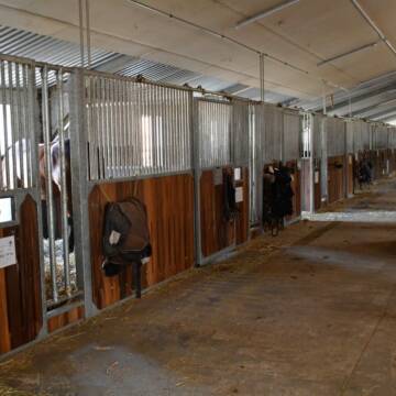
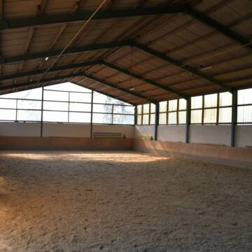
Ausbildungs- und TherapieZentrum Handorf
Handorf
ATZ Handorf
@Mathias-Bauch
Freizeitstall
Geländestrecke
Führanlage
Hunde willkommen
Allergikerstall
Fohlenaufzucht möglich
Außenbox mit Paddock
Außenboxen
35 weitere...
S
Reitsportanlage und Zuchthof Rabeler
Winsen/Luhe
Hof Rabeler
@Hof-Rabeler
FN-Mitglied
Pferdeausbildung
Vermieten
Führanlage
Longierzirkel/Roundpen
Fohlenaufzucht möglich
Notfallboxen
23 weitere...
S
Deprecated: Creation of dynamic property Zend_View_Helper_Ads::$adLink is deprecated in /var/www/stall-frei/htdocs/staging.stall-frei.de/library/Psf/View/Helper/Ads.php on line 108

Heu aus neuer Ernte
Mechtersen
STALL-FREIde Marketing
@STALL-FREI-Marketing
Heulage und Pferdeheu aus der neuen Ernte findest du in unserem Futtermarkt


Heiners Reiterhof hat Plätze frei 💕
Vierhöfen
Cord Vick
@HeinersReiterhof
FN-Mitglied
Freizeitstall
Hunde willkommen
Longierzirkel/Roundpen
Außenbox mit Paddock
Innenbox
Halbpension
Selbstversorgung
17 weitere...
S


Reit- und Traberhof Meyer
Geesthacht
Reit-und-Traberhof-Kurt-Meyer
@Reit-und-Traberhof-Kurt-Meyer
Fahrstall, Kutschwagen
FN-Mitglied
Führanlage
Hunde willkommen
Allergikerstall
Hufrehe geeignet
Außenboxen
Offenstall
19 weitere...
S

Boxen frei - Winsen / Rottorf
Winsen Rottorf
Rottorf
@Rottorf
Freizeitstall
Vermieten
Verpachten
Hunde willkommen
Paddock
Außenboxen
12 weitere...
P

Frisches Stroh zu verkaufen!
Mechtersen
STALL-FREIde Marketing
@STALL-FREI-Marketing
Kaufe frisches Stroh für dein Pferd!


Soorbeckenhof Vierhöfen Offenstall Solekamm...
Vierhöfen
Klaus-Peter-Albers
@Klaus-Peter-Albers
FN-Mitglied
Freizeitstall
Hunde willkommen
Longierzirkel/Roundpen
Allergikerstall
Hufrehe geeignet
Bewegungsstall
Laufstall
16 weitere...
P+

1 Platz für Hengstfohlen/Absetzer frei
Barum
Familie Peters
@Familie_Peters1
Paddock
Sommerweide
Pferdezucht
Innenbox
Vollpension
1 weitere...
P
Freie Boxen in Reitanlage in Mover
Drage
Reiterhof Mover
@Reiterhof-Mover
Fahrstall, Kutschwagen
Freizeitstall
Vermieten
Hunde willkommen
Krankenbox
Hengsthaltung möglich
Hufrehe geeignet
23 weitere...
P
Leider kein Vorschaubild
Leider kein Vorschaubild
Aufztplätze SF in übersichtlicher Gruppe Privats...
Handorf
natalie-doering
@natalie-doering
Hunde willkommen
Longierzirkel/Roundpen
Pferdezucht
Zuchtstutenhaltung möglich
Laufstall
Offenstall
8 weitere...
B


Reitanlage Gut Hasenthal
Geesthacht
Gut-Hasenthal
@Gut-Hasenthal
FN-Mitglied
Geländestrecke
Hunde willkommen
Paddock
Außenboxen
Innenbox
Vollpension
13 weitere...
P+
Deprecated: Creation of dynamic property Zend_View::$pageCount is deprecated in /var/www/stall-frei/htdocs/staging.stall-frei.de/library/vendor/shardj/zf1-future/library/Zend/View/Abstract.php on line 308
Deprecated: Creation of dynamic property Zend_View::$itemCountPerPage is deprecated in /var/www/stall-frei/htdocs/staging.stall-frei.de/library/vendor/shardj/zf1-future/library/Zend/View/Abstract.php on line 308
Deprecated: Creation of dynamic property Zend_View::$first is deprecated in /var/www/stall-frei/htdocs/staging.stall-frei.de/library/vendor/shardj/zf1-future/library/Zend/View/Abstract.php on line 308
Deprecated: Creation of dynamic property Zend_View::$current is deprecated in /var/www/stall-frei/htdocs/staging.stall-frei.de/library/vendor/shardj/zf1-future/library/Zend/View/Abstract.php on line 308
Deprecated: Creation of dynamic property Zend_View::$last is deprecated in /var/www/stall-frei/htdocs/staging.stall-frei.de/library/vendor/shardj/zf1-future/library/Zend/View/Abstract.php on line 308
Deprecated: Creation of dynamic property Zend_View::$next is deprecated in /var/www/stall-frei/htdocs/staging.stall-frei.de/library/vendor/shardj/zf1-future/library/Zend/View/Abstract.php on line 308
Deprecated: Creation of dynamic property Zend_View::$pagesInRange is deprecated in /var/www/stall-frei/htdocs/staging.stall-frei.de/library/vendor/shardj/zf1-future/library/Zend/View/Abstract.php on line 308
Deprecated: Creation of dynamic property Zend_View::$firstPageInRange is deprecated in /var/www/stall-frei/htdocs/staging.stall-frei.de/library/vendor/shardj/zf1-future/library/Zend/View/Abstract.php on line 308
Deprecated: Creation of dynamic property Zend_View::$lastPageInRange is deprecated in /var/www/stall-frei/htdocs/staging.stall-frei.de/library/vendor/shardj/zf1-future/library/Zend/View/Abstract.php on line 308
Deprecated: Creation of dynamic property Zend_View::$currentItemCount is deprecated in /var/www/stall-frei/htdocs/staging.stall-frei.de/library/vendor/shardj/zf1-future/library/Zend/View/Abstract.php on line 308
Deprecated: Creation of dynamic property Zend_View::$totalItemCount is deprecated in /var/www/stall-frei/htdocs/staging.stall-frei.de/library/vendor/shardj/zf1-future/library/Zend/View/Abstract.php on line 308
Deprecated: Creation of dynamic property Zend_View::$firstItemNumber is deprecated in /var/www/stall-frei/htdocs/staging.stall-frei.de/library/vendor/shardj/zf1-future/library/Zend/View/Abstract.php on line 308
Deprecated: Creation of dynamic property Zend_View::$lastItemNumber is deprecated in /var/www/stall-frei/htdocs/staging.stall-frei.de/library/vendor/shardj/zf1-future/library/Zend/View/Abstract.php on line 308
Deprecated: Creation of dynamic property Zend_View::$router is deprecated in /var/www/stall-frei/htdocs/staging.stall-frei.de/library/vendor/shardj/zf1-future/library/Zend/View/Abstract.php on line 308
Deprecated: Creation of dynamic property Zend_View::$urlParams is deprecated in /var/www/stall-frei/htdocs/staging.stall-frei.de/library/vendor/shardj/zf1-future/library/Zend/View/Abstract.php on line 308
Deprecated: Creation of dynamic property Zend_View::$showAds is deprecated in /var/www/stall-frei/htdocs/staging.stall-frei.de/library/vendor/shardj/zf1-future/library/Zend/View/Abstract.php on line 308
Deprecated: Creation of dynamic property Zend_View::$objectIds is deprecated in /var/www/stall-frei/htdocs/staging.stall-frei.de/library/vendor/shardj/zf1-future/library/Zend/View/Abstract.php on line 308
Deprecated: Creation of dynamic property Zend_View::$showNavbar is deprecated in /var/www/stall-frei/htdocs/staging.stall-frei.de/library/vendor/shardj/zf1-future/library/Zend/View/Abstract.php on line 308
Deprecated: Creation of dynamic property Zend_View::$showBreadcrumb is deprecated in /var/www/stall-frei/htdocs/staging.stall-frei.de/library/vendor/shardj/zf1-future/library/Zend/View/Abstract.php on line 308
Deprecated: Creation of dynamic property Zend_View::$showFooter is deprecated in /var/www/stall-frei/htdocs/staging.stall-frei.de/library/vendor/shardj/zf1-future/library/Zend/View/Abstract.php on line 308
Deprecated: Creation of dynamic property Zend_View::$showInternalAds is deprecated in /var/www/stall-frei/htdocs/staging.stall-frei.de/library/vendor/shardj/zf1-future/library/Zend/View/Abstract.php on line 308
Deprecated: Creation of dynamic property Zend_View::$blNoContent is deprecated in /var/www/stall-frei/htdocs/staging.stall-frei.de/library/vendor/shardj/zf1-future/library/Zend/View/Abstract.php on line 308
Deprecated: Creation of dynamic property Zend_View::$sMetaDesc is deprecated in /var/www/stall-frei/htdocs/staging.stall-frei.de/library/vendor/shardj/zf1-future/library/Zend/View/Abstract.php on line 308
Deprecated: Creation of dynamic property Zend_View::$useGmaps is deprecated in /var/www/stall-frei/htdocs/staging.stall-frei.de/library/vendor/shardj/zf1-future/library/Zend/View/Abstract.php on line 308
Deprecated: Creation of dynamic property Zend_View::$touches is deprecated in /var/www/stall-frei/htdocs/staging.stall-frei.de/library/vendor/shardj/zf1-future/library/Zend/View/Abstract.php on line 308
Deprecated: Creation of dynamic property Zend_View::$oProject is deprecated in /var/www/stall-frei/htdocs/staging.stall-frei.de/library/vendor/shardj/zf1-future/library/Zend/View/Abstract.php on line 308
Deprecated: Creation of dynamic property Zend_View::$pageHeadline is deprecated in /var/www/stall-frei/htdocs/staging.stall-frei.de/library/vendor/shardj/zf1-future/library/Zend/View/Abstract.php on line 308
Deprecated: Creation of dynamic property Zend_View::$disableLocationField is deprecated in /var/www/stall-frei/htdocs/staging.stall-frei.de/library/vendor/shardj/zf1-future/library/Zend/View/Abstract.php on line 308
Deprecated: Creation of dynamic property Zend_View::$isSearch is deprecated in /var/www/stall-frei/htdocs/staging.stall-frei.de/library/vendor/shardj/zf1-future/library/Zend/View/Abstract.php on line 308
Deprecated: Creation of dynamic property Zend_View::$pageTitle is deprecated in /var/www/stall-frei/htdocs/staging.stall-frei.de/library/vendor/shardj/zf1-future/library/Zend/View/Abstract.php on line 308
Deprecated: Creation of dynamic property Psf_Form_Element_Text::$class is deprecated in /var/www/stall-frei/htdocs/staging.stall-frei.de/library/vendor/shardj/zf1-future/library/Zend/Form/Element.php on line 874
Deprecated: Creation of dynamic property Psf_Form_Element_Text::$size is deprecated in /var/www/stall-frei/htdocs/staging.stall-frei.de/library/vendor/shardj/zf1-future/library/Zend/Form/Element.php on line 874
Deprecated: Creation of dynamic property Psf_Form_Element_Text::$placeholder is deprecated in /var/www/stall-frei/htdocs/staging.stall-frei.de/library/vendor/shardj/zf1-future/library/Zend/Form/Element.php on line 874
Deprecated: Creation of dynamic property Psf_Form_Element_Hidden::$class is deprecated in /var/www/stall-frei/htdocs/staging.stall-frei.de/library/vendor/shardj/zf1-future/library/Zend/Form/Element.php on line 874
Deprecated: Creation of dynamic property Psf_Form_Element_Hidden::$class is deprecated in /var/www/stall-frei/htdocs/staging.stall-frei.de/library/vendor/shardj/zf1-future/library/Zend/Form/Element.php on line 874
Deprecated: Creation of dynamic property Psf_Form_Element_Hidden::$class is deprecated in /var/www/stall-frei/htdocs/staging.stall-frei.de/library/vendor/shardj/zf1-future/library/Zend/Form/Element.php on line 874
Deprecated: Creation of dynamic property Psf_Form_Element_Hidden::$class is deprecated in /var/www/stall-frei/htdocs/staging.stall-frei.de/library/vendor/shardj/zf1-future/library/Zend/Form/Element.php on line 874
Deprecated: Creation of dynamic property Psf_Form_Element_Select::$class is deprecated in /var/www/stall-frei/htdocs/staging.stall-frei.de/library/vendor/shardj/zf1-future/library/Zend/Form/Element.php on line 874
Deprecated: Creation of dynamic property Psf_Form_Element_Select::$class is deprecated in /var/www/stall-frei/htdocs/staging.stall-frei.de/library/vendor/shardj/zf1-future/library/Zend/Form/Element.php on line 874
Deprecated: Creation of dynamic property Psf_Form_Element_Select::$class is deprecated in /var/www/stall-frei/htdocs/staging.stall-frei.de/library/vendor/shardj/zf1-future/library/Zend/Form/Element.php on line 874
Deprecated: Creation of dynamic property Psf_Form_Element_Select::$class is deprecated in /var/www/stall-frei/htdocs/staging.stall-frei.de/library/vendor/shardj/zf1-future/library/Zend/Form/Element.php on line 874
Deprecated: Creation of dynamic property Psf_Form_Element_Text::$class is deprecated in /var/www/stall-frei/htdocs/staging.stall-frei.de/library/vendor/shardj/zf1-future/library/Zend/Form/Element.php on line 874
Deprecated: Creation of dynamic property Psf_Form_Element_Checkbox::$label is deprecated in /var/www/stall-frei/htdocs/staging.stall-frei.de/library/vendor/shardj/zf1-future/library/Zend/Form/Element.php on line 874
Deprecated: Creation of dynamic property Zend_View::$sort is deprecated in /var/www/stall-frei/htdocs/staging.stall-frei.de/library/vendor/shardj/zf1-future/library/Zend/View/Abstract.php on line 308
Deprecated: Creation of dynamic property Zend_View::$searchLocation is deprecated in /var/www/stall-frei/htdocs/staging.stall-frei.de/library/vendor/shardj/zf1-future/library/Zend/View/Abstract.php on line 308
Deprecated: Creation of dynamic property Zend_View::$locationHint is deprecated in /var/www/stall-frei/htdocs/staging.stall-frei.de/library/vendor/shardj/zf1-future/library/Zend/View/Abstract.php on line 308
Psf_GeoCoder_Abstract::getLocation: Handorf Get Location CachedOrLive
Psf_GeoCoder_Abstract::getCachedOrLive: Handorf
Psf_GeoCoder_OpenCageData::makeApiRequest: response:
Array
(
[documentation] => https://opencagedata.com/api
[licenses] => Array
(
[0] => Array
(
[name] => see attribution guide
[url] => https://opencagedata.com/credits
)
)
[results] => Array
(
[0] => Array
(
[bounds] => Array
(
[northeast] => Array
(
[lat] => 53.3600221
[lng] => 10.3659245
)
[southwest] => Array
(
[lat] => 53.3229701
[lng] => 10.3064697
)
)
[components] => Array
(
[ISO_3166-1_alpha-2] => DE
[ISO_3166-1_alpha-3] => DEU
[ISO_3166-2] => Array
(
[0] => DE-NI
)
[_category] => place
[_normalized_city] => Handorf
[_type] => village
[continent] => Europe
[country] => Deutschland
[country_code] => de
[county] => Landkreis Lüneburg
[municipality] => Samtgemeinde Bardowick
[political_union] => European Union
[postcode] => 21447
[state] => Niedersachsen
[state_code] => NI
[village] => Handorf
)
[confidence] => 7
[formatted] => 21447 Handorf, Deutschland
[geometry] => Array
(
[lat] => 53.3410313
[lng] => 10.348257
)
)
[1] => Array
(
[bounds] => Array
(
[northeast] => Array
(
[lat] => 52.0352802
[lng] => 7.7474321
)
[southwest] => Array
(
[lat] => 51.9398493
[lng] => 7.6746889
)
)
[components] => Array
(
[ISO_3166-1_alpha-2] => DE
[ISO_3166-1_alpha-3] => DEU
[ISO_3166-2] => Array
(
[0] => DE-NW
)
[_category] => place
[_normalized_city] => Münster
[_type] => neighbourhood
[city] => Münster
[city_district] => Münster-Ost
[continent] => Europe
[country] => Deutschland
[country_code] => de
[political_union] => European Union
[state] => Nordrhein-Westfalen
[state_code] => NW
[suburb] => Handorf
)
[confidence] => 7
[formatted] => Handorf, Münster, Nordrhein-Westfalen, Deutschland
[geometry] => Array
(
[lat] => 51.9882099
[lng] => 7.6998213
)
)
[2] => Array
(
[bounds] => Array
(
[northeast] => Array
(
[lat] => 52.3125122
[lng] => 10.2320317
)
[southwest] => Array
(
[lat] => 52.2725122
[lng] => 10.1920317
)
)
[components] => Array
(
[ISO_3166-1_alpha-2] => DE
[ISO_3166-1_alpha-3] => DEU
[ISO_3166-2] => Array
(
[0] => DE-NI
)
[_category] => place
[_normalized_city] => Peine
[_type] => village
[continent] => Europe
[country] => Deutschland
[country_code] => de
[county] => Landkreis Peine
[political_union] => European Union
[postcode] => 31226
[state] => Niedersachsen
[state_code] => NI
[town] => Peine
[village] => Handorf
)
[confidence] => 7
[formatted] => 31226 Handorf, Deutschland
[geometry] => Array
(
[lat] => 52.2925122
[lng] => 10.2120317
)
)
[3] => Array
(
[bounds] => Array
(
[northeast] => Array
(
[lat] => 52.574195
[lng] => 8.1770895
)
[southwest] => Array
(
[lat] => 52.534195
[lng] => 8.1370895
)
)
[components] => Array
(
[ISO_3166-1_alpha-2] => DE
[ISO_3166-1_alpha-3] => DEU
[ISO_3166-2] => Array
(
[0] => DE-NI
)
[_category] => place
[_normalized_city] => Holdorf
[_type] => hamlet
[city] => Holdorf
[continent] => Europe
[country] => Deutschland
[country_code] => de
[county] => Landkreis Vechta
[hamlet] => Handorf
[political_union] => European Union
[postcode] => 49451
[state] => Niedersachsen
[state_code] => NI
)
[confidence] => 7
[formatted] => Handorf, 49451 Holdorf, Deutschland
[geometry] => Array
(
[lat] => 52.554195
[lng] => 8.1570895
)
)
[4] => Array
(
[components] => Array
(
[ISO_3166-1_alpha-2] => FR
[ISO_3166-1_alpha-3] => FRA
[ISO_3166-2] => Array
(
[0] => FR-IDF
[1] => FR-92
)
[_category] => road
[_normalized_city] => Levallois-Perret
[_type] => road
[city] => Levallois-Perret
[continent] => Europe
[country] => France
[country_code] => fr
[county] => Hauts-de-Seine
[local_authority] => Métropole du Grand Paris
[political_union] => European Union
[postcode] => 92300
[road] => Rue Charles Deutschmann
[state] => Île-de-France
[state_code] => IDF
)
[confidence] => 3
[formatted] => Rue Charles Deutschmann, 92300 Levallois-Perret, France
[geometry] => Array
(
[lat] => 48.900049
[lng] => 2.2842
)
)
[5] => Array
(
[components] => Array
(
[ISO_3166-1_alpha-2] => FR
[ISO_3166-1_alpha-3] => FRA
[ISO_3166-2] => Array
(
[0] => FR-OCC
[1] => FR-09
)
[_category] => road
[_normalized_city] => Ascou
[_type] => road
[city] => Ascou
[continent] => Europe
[country] => France
[country_code] => fr
[county] => Ariège
[local_authority] => Communauté de communes de la Haute Ariège
[political_union] => European Union
[postcode] => 09110
[road] => Soula de l’Andorra
[state] => Occitanie
[state_code] => OCC
)
[confidence] => 2
[formatted] => Soula de l’Andorra, 09110 Ascou, France
[geometry] => Array
(
[lat] => 42.730471
[lng] => 1.950017
)
)
[6] => Array
(
[components] => Array
(
[ISO_3166-1_alpha-2] => FR
[ISO_3166-1_alpha-3] => FRA
[ISO_3166-2] => Array
(
[0] => FR-OCC
[1] => FR-48
)
[_category] => road
[_normalized_city] => Saint-Julien-des-Points
[_type] => road
[city] => Saint-Julien-des-Points
[continent] => Europe
[country] => France
[country_code] => fr
[county] => Lozère
[local_authority] => Communauté de communes des Cévennes au Mont Lozère
[political_union] => European Union
[postcode] => 48160
[road] => Chemin de l'Andorge
[state] => Occitanie
[state_code] => OCC
)
[confidence] => 2
[formatted] => Chemin de l'Andorge, 48160 Saint-Julien-des-Points, France
[geometry] => Array
(
[lat] => 44.254793
[lng] => 3.97156
)
)
[7] => Array
(
[components] => Array
(
[ISO_3166-1_alpha-2] => FR
[ISO_3166-1_alpha-3] => FRA
[ISO_3166-2] => Array
(
[0] => FR-OCC
[1] => FR-30
)
[_category] => road
[_normalized_city] => Sainte-Cécile-d'Andorge
[_type] => road
[city] => Sainte-Cécile-d'Andorge
[continent] => Europe
[country] => France
[country_code] => fr
[county] => Gard
[local_authority] => Alès Agglomération
[political_union] => European Union
[postcode] => 30110
[road] => Chemin de la Haute Levade
[state] => Occitanie
[state_code] => OCC
)
[confidence] => 2
[formatted] => Chemin de la Haute Levade, 30110 Sainte-Cécile-d'Andorge, France
[geometry] => Array
(
[lat] => 44.231621
[lng] => 4.002716
)
)
[8] => Array
(
[components] => Array
(
[ISO_3166-1_alpha-2] => FR
[ISO_3166-1_alpha-3] => FRA
[ISO_3166-2] => Array
(
[0] => FR-OCC
[1] => FR-30
)
[_category] => road
[_normalized_city] => Sainte-Cécile-d'Andorge
[_type] => road
[city] => Sainte-Cécile-d'Andorge
[continent] => Europe
[country] => France
[country_code] => fr
[county] => Gard
[local_authority] => Alès Agglomération
[political_union] => European Union
[postcode] => 30110
[road] => Route de Chaurage
[state] => Occitanie
[state_code] => OCC
)
[confidence] => 2
[formatted] => Route de Chaurage, 30110 Sainte-Cécile-d'Andorge, France
[geometry] => Array
(
[lat] => 44.273194
[lng] => 3.967515
)
)
[9] => Array
(
[components] => Array
(
[ISO_3166-1_alpha-2] => FR
[ISO_3166-1_alpha-3] => FRA
[ISO_3166-2] => Array
(
[0] => FR-OCC
[1] => FR-66
)
[_category] => road
[_normalized_city] => Formiguères
[_type] => road
[city] => Formiguères
[continent] => Europe
[country] => France
[country_code] => fr
[county] => Pyrénées-Orientales
[local_authority] => Communauté de communes Pyrénées catalanes
[political_union] => European Union
[postcode] => 66210
[road] => Carrer d’Andorra
[state] => Occitanie
[state_code] => OCC
)
[confidence] => 2
[formatted] => Carrer d’Andorra, 66210 Formiguères, France
[geometry] => Array
(
[lat] => 42.614566
[lng] => 2.096963
)
)
)
[status] => Array
(
[code] => 200
[message] => OK
)
[stay_informed] => Array
(
[blog] => https://blog.opencagedata.com
[mastodon] => https://en.osm.town/@opencage
)
[thanks] => For using an OpenCage API
[timestamp] => Array
(
[created_http] => Thu, 05 Feb 2026 12:08:39 GMT
[created_unix] => 1770293319
)
[total_results] => 10
)
Psf_GeoCoder_Abstract::convertLocationResult
{"documentation":"https:\/\/opencagedata.com\/api","licenses":[{"name":"see attribution guide","url":"https:\/\/opencagedata.com\/credits"}],"results":[{"bounds":{"northeast":{"lat":53.3600221,"lng":10.3659245},"southwest":{"lat":53.3229701,"lng":10.3064697}},"components":{"ISO_3166-1_alpha-2":"DE","ISO_3166-1_alpha-3":"DEU","ISO_3166-2":["DE-NI"],"_category":"place","_normalized_city":"Handorf","_type":"village","continent":"Europe","country":"Deutschland","country_code":"de","county":"Landkreis L\u00fcneburg","municipality":"Samtgemeinde Bardowick","political_union":"European Union","postcode":"21447","state":"Niedersachsen","state_code":"NI","village":"Handorf"},"confidence":7,"formatted":"21447 Handorf, Deutschland","geometry":{"lat":53.3410313,"lng":10.348257}},{"bounds":{"northeast":{"lat":52.0352802,"lng":7.7474321},"southwest":{"lat":51.9398493,"lng":7.6746889}},"components":{"ISO_3166-1_alpha-2":"DE","ISO_3166-1_alpha-3":"DEU","ISO_3166-2":["DE-NW"],"_category":"place","_normalized_city":"M\u00fcnster","_type":"neighbourhood","city":"M\u00fcnster","city_district":"M\u00fcnster-Ost","continent":"Europe","country":"Deutschland","country_code":"de","political_union":"European Union","state":"Nordrhein-Westfalen","state_code":"NW","suburb":"Handorf"},"confidence":7,"formatted":"Handorf, M\u00fcnster, Nordrhein-Westfalen, Deutschland","geometry":{"lat":51.9882099,"lng":7.6998213}},{"bounds":{"northeast":{"lat":52.3125122,"lng":10.2320317},"southwest":{"lat":52.2725122,"lng":10.1920317}},"components":{"ISO_3166-1_alpha-2":"DE","ISO_3166-1_alpha-3":"DEU","ISO_3166-2":["DE-NI"],"_category":"place","_normalized_city":"Peine","_type":"village","continent":"Europe","country":"Deutschland","country_code":"de","county":"Landkreis Peine","political_union":"European Union","postcode":"31226","state":"Niedersachsen","state_code":"NI","town":"Peine","village":"Handorf"},"confidence":7,"formatted":"31226 Handorf, Deutschland","geometry":{"lat":52.2925122,"lng":10.2120317}},{"bounds":{"northeast":{"lat":52.574195,"lng":8.1770895},"southwest":{"lat":52.534195,"lng":8.1370895}},"components":{"ISO_3166-1_alpha-2":"DE","ISO_3166-1_alpha-3":"DEU","ISO_3166-2":["DE-NI"],"_category":"place","_normalized_city":"Holdorf","_type":"hamlet","city":"Holdorf","continent":"Europe","country":"Deutschland","country_code":"de","county":"Landkreis Vechta","hamlet":"Handorf","political_union":"European Union","postcode":"49451","state":"Niedersachsen","state_code":"NI"},"confidence":7,"formatted":"Handorf, 49451 Holdorf, Deutschland","geometry":{"lat":52.554195,"lng":8.1570895}},{"components":{"ISO_3166-1_alpha-2":"FR","ISO_3166-1_alpha-3":"FRA","ISO_3166-2":["FR-IDF","FR-92"],"_category":"road","_normalized_city":"Levallois-Perret","_type":"road","city":"Levallois-Perret","continent":"Europe","country":"France","country_code":"fr","county":"Hauts-de-Seine","local_authority":"M\u00e9tropole du Grand Paris","political_union":"European Union","postcode":"92300","road":"Rue Charles Deutschmann","state":"\u00cele-de-France","state_code":"IDF"},"confidence":3,"formatted":"Rue Charles Deutschmann, 92300 Levallois-Perret, France","geometry":{"lat":48.900049,"lng":2.2842}},{"components":{"ISO_3166-1_alpha-2":"FR","ISO_3166-1_alpha-3":"FRA","ISO_3166-2":["FR-OCC","FR-09"],"_category":"road","_normalized_city":"Ascou","_type":"road","city":"Ascou","continent":"Europe","country":"France","country_code":"fr","county":"Ari\u00e8ge","local_authority":"Communaut\u00e9 de communes de la Haute Ari\u00e8ge","political_union":"European Union","postcode":"09110","road":"Soula de l\u2019Andorra","state":"Occitanie","state_code":"OCC"},"confidence":2,"formatted":"Soula de l\u2019Andorra, 09110 Ascou, France","geometry":{"lat":42.730471,"lng":1.950017}},{"components":{"ISO_3166-1_alpha-2":"FR","ISO_3166-1_alpha-3":"FRA","ISO_3166-2":["FR-OCC","FR-48"],"_category":"road","_normalized_city":"Saint-Julien-des-Points","_type":"road","city":"Saint-Julien-des-Points","continent":"Europe","country":"France","country_code":"fr","county":"Loz\u00e8re","local_authority":"Communaut\u00e9 de communes des C\u00e9vennes au Mont Loz\u00e8re","political_union":"European Union","postcode":"48160","road":"Chemin de l'Andorge","state":"Occitanie","state_code":"OCC"},"confidence":2,"formatted":"Chemin de l'Andorge, 48160 Saint-Julien-des-Points, France","geometry":{"lat":44.254793,"lng":3.97156}},{"components":{"ISO_3166-1_alpha-2":"FR","ISO_3166-1_alpha-3":"FRA","ISO_3166-2":["FR-OCC","FR-30"],"_category":"road","_normalized_city":"Sainte-C\u00e9cile-d'Andorge","_type":"road","city":"Sainte-C\u00e9cile-d'Andorge","continent":"Europe","country":"France","country_code":"fr","county":"Gard","local_authority":"Al\u00e8s Agglom\u00e9ration","political_union":"European Union","postcode":"30110","road":"Chemin de la Haute Levade","state":"Occitanie","state_code":"OCC"},"confidence":2,"formatted":"Chemin de la Haute Levade, 30110 Sainte-C\u00e9cile-d'Andorge, France","geometry":{"lat":44.231621,"lng":4.002716}},{"components":{"ISO_3166-1_alpha-2":"FR","ISO_3166-1_alpha-3":"FRA","ISO_3166-2":["FR-OCC","FR-30"],"_category":"road","_normalized_city":"Sainte-C\u00e9cile-d'Andorge","_type":"road","city":"Sainte-C\u00e9cile-d'Andorge","continent":"Europe","country":"France","country_code":"fr","county":"Gard","local_authority":"Al\u00e8s Agglom\u00e9ration","political_union":"European Union","postcode":"30110","road":"Route de Chaurage","state":"Occitanie","state_code":"OCC"},"confidence":2,"formatted":"Route de Chaurage, 30110 Sainte-C\u00e9cile-d'Andorge, France","geometry":{"lat":44.273194,"lng":3.967515}},{"components":{"ISO_3166-1_alpha-2":"FR","ISO_3166-1_alpha-3":"FRA","ISO_3166-2":["FR-OCC","FR-66"],"_category":"road","_normalized_city":"Formigu\u00e8res","_type":"road","city":"Formigu\u00e8res","continent":"Europe","country":"France","country_code":"fr","county":"Pyr\u00e9n\u00e9es-Orientales","local_authority":"Communaut\u00e9 de communes Pyr\u00e9n\u00e9es catalanes","political_union":"European Union","postcode":"66210","road":"Carrer d\u2019Andorra","state":"Occitanie","state_code":"OCC"},"confidence":2,"formatted":"Carrer d\u2019Andorra, 66210 Formigu\u00e8res, France","geometry":{"lat":42.614566,"lng":2.096963}}],"status":{"code":200,"message":"OK"},"stay_informed":{"blog":"https:\/\/blog.opencagedata.com","mastodon":"https:\/\/en.osm.town\/@opencage"},"thanks":"For using an OpenCage API","timestamp":{"created_http":"Thu, 05 Feb 2026 12:08:39 GMT","created_unix":1770293319},"total_results":10}Array
(
[0] => stdClass Object
(
[bounds] => stdClass Object
(
[northeast] => stdClass Object
(
[lat] => 53.3600221
[lng] => 10.3659245
)
[southwest] => stdClass Object
(
[lat] => 53.3229701
[lng] => 10.3064697
)
)
[components] => stdClass Object
(
[ISO_3166-1_alpha-2] => DE
[ISO_3166-1_alpha-3] => DEU
[ISO_3166-2] => Array
(
[0] => DE-NI
)
[_category] => place
[_normalized_city] => Handorf
[_type] => village
[continent] => Europe
[country] => Deutschland
[country_code] => de
[county] => Landkreis Lüneburg
[municipality] => Samtgemeinde Bardowick
[political_union] => European Union
[postcode] => 21447
[state] => Niedersachsen
[state_code] => NI
[village] => Handorf
)
[confidence] => 7
[formatted] => 21447 Handorf, Deutschland
[geometry] => stdClass Object
(
[lat] => 53.3410313
[lng] => 10.348257
)
)
[1] => stdClass Object
(
[bounds] => stdClass Object
(
[northeast] => stdClass Object
(
[lat] => 52.0352802
[lng] => 7.7474321
)
[southwest] => stdClass Object
(
[lat] => 51.9398493
[lng] => 7.6746889
)
)
[components] => stdClass Object
(
[ISO_3166-1_alpha-2] => DE
[ISO_3166-1_alpha-3] => DEU
[ISO_3166-2] => Array
(
[0] => DE-NW
)
[_category] => place
[_normalized_city] => Münster
[_type] => neighbourhood
[city] => Münster
[city_district] => Münster-Ost
[continent] => Europe
[country] => Deutschland
[country_code] => de
[political_union] => European Union
[state] => Nordrhein-Westfalen
[state_code] => NW
[suburb] => Handorf
)
[confidence] => 7
[formatted] => Handorf, Münster, Nordrhein-Westfalen, Deutschland
[geometry] => stdClass Object
(
[lat] => 51.9882099
[lng] => 7.6998213
)
)
[2] => stdClass Object
(
[bounds] => stdClass Object
(
[northeast] => stdClass Object
(
[lat] => 52.3125122
[lng] => 10.2320317
)
[southwest] => stdClass Object
(
[lat] => 52.2725122
[lng] => 10.1920317
)
)
[components] => stdClass Object
(
[ISO_3166-1_alpha-2] => DE
[ISO_3166-1_alpha-3] => DEU
[ISO_3166-2] => Array
(
[0] => DE-NI
)
[_category] => place
[_normalized_city] => Peine
[_type] => village
[continent] => Europe
[country] => Deutschland
[country_code] => de
[county] => Landkreis Peine
[political_union] => European Union
[postcode] => 31226
[state] => Niedersachsen
[state_code] => NI
[town] => Peine
[village] => Handorf
)
[confidence] => 7
[formatted] => 31226 Handorf, Deutschland
[geometry] => stdClass Object
(
[lat] => 52.2925122
[lng] => 10.2120317
)
)
[3] => stdClass Object
(
[bounds] => stdClass Object
(
[northeast] => stdClass Object
(
[lat] => 52.574195
[lng] => 8.1770895
)
[southwest] => stdClass Object
(
[lat] => 52.534195
[lng] => 8.1370895
)
)
[components] => stdClass Object
(
[ISO_3166-1_alpha-2] => DE
[ISO_3166-1_alpha-3] => DEU
[ISO_3166-2] => Array
(
[0] => DE-NI
)
[_category] => place
[_normalized_city] => Holdorf
[_type] => hamlet
[city] => Holdorf
[continent] => Europe
[country] => Deutschland
[country_code] => de
[county] => Landkreis Vechta
[hamlet] => Handorf
[political_union] => European Union
[postcode] => 49451
[state] => Niedersachsen
[state_code] => NI
)
[confidence] => 7
[formatted] => Handorf, 49451 Holdorf, Deutschland
[geometry] => stdClass Object
(
[lat] => 52.554195
[lng] => 8.1570895
)
)
[4] => stdClass Object
(
[components] => stdClass Object
(
[ISO_3166-1_alpha-2] => FR
[ISO_3166-1_alpha-3] => FRA
[ISO_3166-2] => Array
(
[0] => FR-IDF
[1] => FR-92
)
[_category] => road
[_normalized_city] => Levallois-Perret
[_type] => road
[city] => Levallois-Perret
[continent] => Europe
[country] => France
[country_code] => fr
[county] => Hauts-de-Seine
[local_authority] => Métropole du Grand Paris
[political_union] => European Union
[postcode] => 92300
[road] => Rue Charles Deutschmann
[state] => Île-de-France
[state_code] => IDF
)
[confidence] => 3
[formatted] => Rue Charles Deutschmann, 92300 Levallois-Perret, France
[geometry] => stdClass Object
(
[lat] => 48.900049
[lng] => 2.2842
)
)
[5] => stdClass Object
(
[components] => stdClass Object
(
[ISO_3166-1_alpha-2] => FR
[ISO_3166-1_alpha-3] => FRA
[ISO_3166-2] => Array
(
[0] => FR-OCC
[1] => FR-09
)
[_category] => road
[_normalized_city] => Ascou
[_type] => road
[city] => Ascou
[continent] => Europe
[country] => France
[country_code] => fr
[county] => Ariège
[local_authority] => Communauté de communes de la Haute Ariège
[political_union] => European Union
[postcode] => 09110
[road] => Soula de l’Andorra
[state] => Occitanie
[state_code] => OCC
)
[confidence] => 2
[formatted] => Soula de l’Andorra, 09110 Ascou, France
[geometry] => stdClass Object
(
[lat] => 42.730471
[lng] => 1.950017
)
)
[6] => stdClass Object
(
[components] => stdClass Object
(
[ISO_3166-1_alpha-2] => FR
[ISO_3166-1_alpha-3] => FRA
[ISO_3166-2] => Array
(
[0] => FR-OCC
[1] => FR-48
)
[_category] => road
[_normalized_city] => Saint-Julien-des-Points
[_type] => road
[city] => Saint-Julien-des-Points
[continent] => Europe
[country] => France
[country_code] => fr
[county] => Lozère
[local_authority] => Communauté de communes des Cévennes au Mont Lozère
[political_union] => European Union
[postcode] => 48160
[road] => Chemin de l'Andorge
[state] => Occitanie
[state_code] => OCC
)
[confidence] => 2
[formatted] => Chemin de l'Andorge, 48160 Saint-Julien-des-Points, France
[geometry] => stdClass Object
(
[lat] => 44.254793
[lng] => 3.97156
)
)
[7] => stdClass Object
(
[components] => stdClass Object
(
[ISO_3166-1_alpha-2] => FR
[ISO_3166-1_alpha-3] => FRA
[ISO_3166-2] => Array
(
[0] => FR-OCC
[1] => FR-30
)
[_category] => road
[_normalized_city] => Sainte-Cécile-d'Andorge
[_type] => road
[city] => Sainte-Cécile-d'Andorge
[continent] => Europe
[country] => France
[country_code] => fr
[county] => Gard
[local_authority] => Alès Agglomération
[political_union] => European Union
[postcode] => 30110
[road] => Chemin de la Haute Levade
[state] => Occitanie
[state_code] => OCC
)
[confidence] => 2
[formatted] => Chemin de la Haute Levade, 30110 Sainte-Cécile-d'Andorge, France
[geometry] => stdClass Object
(
[lat] => 44.231621
[lng] => 4.002716
)
)
[8] => stdClass Object
(
[components] => stdClass Object
(
[ISO_3166-1_alpha-2] => FR
[ISO_3166-1_alpha-3] => FRA
[ISO_3166-2] => Array
(
[0] => FR-OCC
[1] => FR-30
)
[_category] => road
[_normalized_city] => Sainte-Cécile-d'Andorge
[_type] => road
[city] => Sainte-Cécile-d'Andorge
[continent] => Europe
[country] => France
[country_code] => fr
[county] => Gard
[local_authority] => Alès Agglomération
[political_union] => European Union
[postcode] => 30110
[road] => Route de Chaurage
[state] => Occitanie
[state_code] => OCC
)
[confidence] => 2
[formatted] => Route de Chaurage, 30110 Sainte-Cécile-d'Andorge, France
[geometry] => stdClass Object
(
[lat] => 44.273194
[lng] => 3.967515
)
)
[9] => stdClass Object
(
[components] => stdClass Object
(
[ISO_3166-1_alpha-2] => FR
[ISO_3166-1_alpha-3] => FRA
[ISO_3166-2] => Array
(
[0] => FR-OCC
[1] => FR-66
)
[_category] => road
[_normalized_city] => Formiguères
[_type] => road
[city] => Formiguères
[continent] => Europe
[country] => France
[country_code] => fr
[county] => Pyrénées-Orientales
[local_authority] => Communauté de communes Pyrénées catalanes
[political_union] => European Union
[postcode] => 66210
[road] => Carrer d’Andorra
[state] => Occitanie
[state_code] => OCC
)
[confidence] => 2
[formatted] => Carrer d’Andorra, 66210 Formiguères, France
[geometry] => stdClass Object
(
[lat] => 42.614566
[lng] => 2.096963
)
)
)
Psf_GeoCoder_OpenCageData::getKeyMap: 0
stdClass Object
(
    [bounds] => stdClass Object
        (
            [northeast] => stdClass Object
                (
                    [lat] => 53.3600221
                    [lng] => 10.3659245
                )

            [southwest] => stdClass Object
                (
                    [lat] => 53.3229701
                    [lng] => 10.3064697
                )

        )

    [components] => stdClass Object
        (
            [ISO_3166-1_alpha-2] => DE
            [ISO_3166-1_alpha-3] => DEU
            [ISO_3166-2] => Array
                (
                    [0] => DE-NI
                )

            [_category] => place
            [_normalized_city] => Handorf
            [_type] => village
            [continent] => Europe
            [country] => Deutschland
            [country_code] => de
            [county] => Landkreis Lüneburg
            [municipality] => Samtgemeinde Bardowick
            [political_union] => European Union
            [postcode] => 21447
            [state] => Niedersachsen
            [state_code] => NI
            [village] => Handorf
        )

    [confidence] => 7
    [formatted] => 21447 Handorf, Deutschland
    [geometry] => stdClass Object
        (
            [lat] => 53.3410313
            [lng] => 10.348257
        )

)
Psf_GeoCoder_OpenCageData::getCounty: Lüneburg
Psf_GeoCoder_OpenCageData::addMissingData REFETCH!
Array
(
    [address] => 21447 Handorf, Deutschland
    [type] => village
    [street] =>
    [city] => Handorf
    [county] => Lüneburg
    [state] => Niedersachsen
    [zip] => 21447
    [country] => Deutschland
    [suburb] =>
    [countrycode] => de
    [latitude] => 53.3410313
    [longitude] => 10.348257
    [accuracy] => 1
    [confidence] => 7
    [bounds] => stdClass Object
        (
            [northeast] => stdClass Object
                (
                    [lat] => 53.3600221
                    [lng] => 10.3659245
                )

            [southwest] => stdClass Object
                (
                    [lat] => 53.3229701
                    [lng] => 10.3064697
                )

        )

)
reformat!
Array
(
    [address] => 21447 Handorf, Deutschland
    [type] => village
    [street] =>
    [city] => Handorf
    [county] => Lüneburg
    [state] => Niedersachsen
    [zip] => 21447
    [country] => Deutschland
    [suburb] =>
    [countrycode] => de
    [latitude] => 53.3410313
    [longitude] => 10.348257
    [accuracy] => 1
    [confidence] => 7
    [bounds] => stdClass Object
        (
            [northeast] => stdClass Object
                (
                    [lat] => 53.3600221
                    [lng] => 10.3659245
                )

            [southwest] => stdClass Object
                (
                    [lat] => 53.3229701
                    [lng] => 10.3064697
                )

        )

    [place] => 21447 Handorf, Niedersachsen
    [hash] => 2958c1617d4bb686fc9b4aa8506b8589
)
Psf_GeoCoder_OpenCageData::getKeyMap: 1
stdClass Object
(
    [bounds] => stdClass Object
        (
            [northeast] => stdClass Object
                (
                    [lat] => 52.0352802
                    [lng] => 7.7474321
                )

            [southwest] => stdClass Object
                (
                    [lat] => 51.9398493
                    [lng] => 7.6746889
                )

        )

    [components] => stdClass Object
        (
            [ISO_3166-1_alpha-2] => DE
            [ISO_3166-1_alpha-3] => DEU
            [ISO_3166-2] => Array
                (
                    [0] => DE-NW
                )

            [_category] => place
            [_normalized_city] => Münster
            [_type] => neighbourhood
            [city] => Münster
            [city_district] => Münster-Ost
            [continent] => Europe
            [country] => Deutschland
            [country_code] => de
            [political_union] => European Union
            [state] => Nordrhein-Westfalen
            [state_code] => NW
            [suburb] => Handorf
        )

    [confidence] => 7
    [formatted] => Handorf, Münster, Nordrhein-Westfalen, Deutschland
    [geometry] => stdClass Object
        (
            [lat] => 51.9882099
            [lng] => 7.6998213
        )

)
Psf_GeoCoder_OpenCageData::getCounty: Münster
Psf_GeoCoder_OpenCageData::addMissingData REFETCH!
Array
(
    [address] => Handorf, Münster, Nordrhein-Westfalen, Deutschland
    [type] => neighbourhood
    [street] =>
    [city] => Handorf
    [county] => Münster
    [state] => Nordrhein-Westfalen
    [zip] =>
    [country] => Deutschland
    [suburb] => Handorf
    [countrycode] => de
    [latitude] => 51.9882099
    [longitude] => 7.6998213
    [accuracy] => 1
    [confidence] => 7
    [bounds] => stdClass Object
        (
            [northeast] => stdClass Object
                (
                    [lat] => 52.0352802
                    [lng] => 7.7474321
                )

            [southwest] => stdClass Object
                (
                    [lat] => 51.9398493
                    [lng] => 7.6746889
                )

        )

)
reformat!
Array
(
    [address] => Handorf, Münster, Nordrhein-Westfalen, Deutschland
    [type] => neighbourhood
    [street] =>
    [city] => Handorf
    [county] => Münster
    [state] => Nordrhein-Westfalen
    [zip] =>
    [country] => Deutschland
    [suburb] => Handorf
    [countrycode] => de
    [latitude] => 51.9882099
    [longitude] => 7.6998213
    [accuracy] => 1
    [confidence] => 7
    [bounds] => stdClass Object
        (
            [northeast] => stdClass Object
                (
                    [lat] => 52.0352802
                    [lng] => 7.7474321
                )

            [southwest] => stdClass Object
                (
                    [lat] => 51.9398493
                    [lng] => 7.6746889
                )

        )

    [place] => Handorf, Nordrhein-Westfalen
    [hash] => 2c2227e1fab28d1e81be3b7c7d026bb5
)
Psf_GeoCoder_OpenCageData::getKeyMap: 2
stdClass Object
(
    [bounds] => stdClass Object
        (
            [northeast] => stdClass Object
                (
                    [lat] => 52.3125122
                    [lng] => 10.2320317
                )

            [southwest] => stdClass Object
                (
                    [lat] => 52.2725122
                    [lng] => 10.1920317
                )

        )

    [components] => stdClass Object
        (
            [ISO_3166-1_alpha-2] => DE
            [ISO_3166-1_alpha-3] => DEU
            [ISO_3166-2] => Array
                (
                    [0] => DE-NI
                )

            [_category] => place
            [_normalized_city] => Peine
            [_type] => village
            [continent] => Europe
            [country] => Deutschland
            [country_code] => de
            [county] => Landkreis Peine
            [political_union] => European Union
            [postcode] => 31226
            [state] => Niedersachsen
            [state_code] => NI
            [town] => Peine
            [village] => Handorf
        )

    [confidence] => 7
    [formatted] => 31226 Handorf, Deutschland
    [geometry] => stdClass Object
        (
            [lat] => 52.2925122
            [lng] => 10.2120317
        )

)
Psf_GeoCoder_OpenCageData::getCounty: Peine
Psf_GeoCoder_OpenCageData::addMissingData REFETCH!
Array
(
    [address] => 31226 Handorf, Deutschland
    [type] => village
    [street] =>
    [city] => Peine
    [county] => Peine
    [state] => Niedersachsen
    [zip] => 31226
    [country] => Deutschland
    [suburb] =>
    [countrycode] => de
    [latitude] => 52.2925122
    [longitude] => 10.2120317
    [accuracy] => 1
    [confidence] => 7
    [bounds] => stdClass Object
        (
            [northeast] => stdClass Object
                (
                    [lat] => 52.3125122
                    [lng] => 10.2320317
                )

            [southwest] => stdClass Object
                (
                    [lat] => 52.2725122
                    [lng] => 10.1920317
                )

        )

)
reformat!
Array
(
    [address] => 31226 Peine
    [type] => village
    [street] =>
    [city] => Peine
    [county] => Peine
    [state] => Niedersachsen
    [zip] => 31226
    [country] => Deutschland
    [suburb] =>
    [countrycode] => de
    [latitude] => 52.2925122
    [longitude] => 10.2120317
    [accuracy] => 1
    [confidence] => 7
    [bounds] => stdClass Object
        (
            [northeast] => stdClass Object
                (
                    [lat] => 52.3125122
                    [lng] => 10.2320317
                )

            [southwest] => stdClass Object
                (
                    [lat] => 52.2725122
                    [lng] => 10.1920317
                )

        )

    [place] => 31226 Peine, Niedersachsen
    [hash] => 658d1389ef7288b9eefbed57fd885192
)
Psf_GeoCoder_OpenCageData::getKeyMap: 3
stdClass Object
(
    [bounds] => stdClass Object
        (
            [northeast] => stdClass Object
                (
                    [lat] => 52.574195
                    [lng] => 8.1770895
                )

            [southwest] => stdClass Object
                (
                    [lat] => 52.534195
                    [lng] => 8.1370895
                )

        )

    [components] => stdClass Object
        (
            [ISO_3166-1_alpha-2] => DE
            [ISO_3166-1_alpha-3] => DEU
            [ISO_3166-2] => Array
                (
                    [0] => DE-NI
                )

            [_category] => place
            [_normalized_city] => Holdorf
            [_type] => hamlet
            [city] => Holdorf
            [continent] => Europe
            [country] => Deutschland
            [country_code] => de
            [county] => Landkreis Vechta
            [hamlet] => Handorf
            [political_union] => European Union
            [postcode] => 49451
            [state] => Niedersachsen
            [state_code] => NI
        )

    [confidence] => 7
    [formatted] => Handorf, 49451 Holdorf, Deutschland
    [geometry] => stdClass Object
        (
            [lat] => 52.554195
            [lng] => 8.1570895
        )

)
Psf_GeoCoder_OpenCageData::getCounty: Vechta
Psf_GeoCoder_OpenCageData::addMissingData REFETCH!
Array
(
    [address] => Handorf, 49451 Holdorf, Deutschland
    [type] => hamlet
    [street] => Handorf
    [city] => Holdorf
    [county] => Vechta
    [state] => Niedersachsen
    [zip] => 49451
    [country] => Deutschland
    [suburb] =>
    [countrycode] => de
    [latitude] => 52.554195
    [longitude] => 8.1570895
    [accuracy] => 1
    [confidence] => 7
    [bounds] => stdClass Object
        (
            [northeast] => stdClass Object
                (
                    [lat] => 52.574195
                    [lng] => 8.1770895
                )

            [southwest] => stdClass Object
                (
                    [lat] => 52.534195
                    [lng] => 8.1370895
                )

        )

)
reformat!
Array
(
    [address] => Handorf, 49451 Holdorf, Deutschland
    [type] => hamlet
    [street] => Handorf
    [city] => Holdorf
    [county] => Vechta
    [state] => Niedersachsen
    [zip] => 49451
    [country] => Deutschland
    [suburb] =>
    [countrycode] => de
    [latitude] => 52.554195
    [longitude] => 8.1570895
    [accuracy] => 1
    [confidence] => 7
    [bounds] => stdClass Object
        (
            [northeast] => stdClass Object
                (
                    [lat] => 52.574195
                    [lng] => 8.1770895
                )

            [southwest] => stdClass Object
                (
                    [lat] => 52.534195
                    [lng] => 8.1370895
                )

        )

    [place] => Handorf, 49451 Holdorf, Niedersachsen
    [hash] => 5db747976f8520e8adb496235fa8e185
)
Psf_GeoCoder_OpenCageData::getKeyMap: 4
stdClass Object
(
    [components] => stdClass Object
        (
            [ISO_3166-1_alpha-2] => FR
            [ISO_3166-1_alpha-3] => FRA
            [ISO_3166-2] => Array
                (
                    [0] => FR-IDF
                    [1] => FR-92
                )

            [_category] => road
            [_normalized_city] => Levallois-Perret
            [_type] => road
            [city] => Levallois-Perret
            [continent] => Europe
            [country] => France
            [country_code] => fr
            [county] => Hauts-de-Seine
            [local_authority] => Métropole du Grand Paris
            [political_union] => European Union
            [postcode] => 92300
            [road] => Rue Charles Deutschmann
            [state] => Île-de-France
            [state_code] => IDF
        )

    [confidence] => 3
    [formatted] => Rue Charles Deutschmann, 92300 Levallois-Perret, France
    [geometry] => stdClass Object
        (
            [lat] => 48.900049
            [lng] => 2.2842
        )

)
Psf_GeoCoder_OpenCageData::getCounty: Hauts-de-Seine
Psf_GeoCoder_OpenCageData::addMissingData REFETCH!
Array
(
    [address] => Rue Charles Deutschmann, 92300 Levallois-Perret, France
    [type] => road
    [street] => Rue Charles Deutschmann
    [city] => Levallois-Perret
    [county] => Hauts-de-Seine
    [state] => Île-de-France
    [zip] => 92300
    [country] => France
    [suburb] =>
    [countrycode] => fr
    [latitude] => 48.900049
    [longitude] => 2.2842
    [accuracy] => 1
    [confidence] => 3
    [bounds] =>
)
reformat!
Array
(
    [address] => Rue Charles Deutschmann, 92300 Levallois-Perret, France
    [type] => road
    [street] => Rue Charles Deutschmann
    [city] => Levallois-Perret
    [county] => Hauts-de-Seine
    [state] => Île-de-France
    [zip] => 92300
    [country] => France
    [suburb] =>
    [countrycode] => fr
    [latitude] => 48.900049
    [longitude] => 2.2842
    [accuracy] => 1
    [confidence] => 3
    [bounds] =>
    [place] => Rue Charles Deutschmann, 92300 Levallois-Perret, Île-de-France
    [hash] => b7dc44def3990e8a7eaf18e019eca466
)
Psf_GeoCoder_OpenCageData::getKeyMap: 5
stdClass Object
(
    [components] => stdClass Object
        (
            [ISO_3166-1_alpha-2] => FR
            [ISO_3166-1_alpha-3] => FRA
            [ISO_3166-2] => Array
                (
                    [0] => FR-OCC
                    [1] => FR-09
                )

            [_category] => road
            [_normalized_city] => Ascou
            [_type] => road
            [city] => Ascou
            [continent] => Europe
            [country] => France
            [country_code] => fr
            [county] => Ariège
            [local_authority] => Communauté de communes de la Haute Ariège
            [political_union] => European Union
            [postcode] => 09110
            [road] => Soula de l’Andorra
            [state] => Occitanie
            [state_code] => OCC
        )

    [confidence] => 2
    [formatted] => Soula de l’Andorra, 09110 Ascou, France
    [geometry] => stdClass Object
        (
            [lat] => 42.730471
            [lng] => 1.950017
        )

)
Psf_GeoCoder_OpenCageData::getCounty: Ariège
Psf_GeoCoder_OpenCageData::addMissingData REFETCH!
Array
(
    [address] => Soula de l’Andorra, 09110 Ascou, France
    [type] => road
    [street] => Soula de l’Andorra
    [city] => Ascou
    [county] => Ariège
    [state] => Occitanie
    [zip] => 09110
    [country] => France
    [suburb] =>
    [countrycode] => fr
    [latitude] => 42.730471
    [longitude] => 1.950017
    [accuracy] => 1
    [confidence] => 2
    [bounds] =>
)
reformat!
Array
(
    [address] => Soula de l’Andorra, 09110 Ascou, France
    [type] => road
    [street] => Soula de l’Andorra
    [city] => Ascou
    [county] => Ariège
    [state] => Occitanie
    [zip] => 09110
    [country] => France
    [suburb] =>
    [countrycode] => fr
    [latitude] => 42.730471
    [longitude] => 1.950017
    [accuracy] => 1
    [confidence] => 2
    [bounds] =>
    [place] => Soula de l’Andorra, 09110 Ascou, Occitanie
    [hash] => 7935337979679f32cfb0be2ed2dc6fa3
)
Psf_GeoCoder_OpenCageData::getKeyMap: 6
stdClass Object
(
    [components] => stdClass Object
        (
            [ISO_3166-1_alpha-2] => FR
            [ISO_3166-1_alpha-3] => FRA
            [ISO_3166-2] => Array
                (
                    [0] => FR-OCC
                    [1] => FR-48
                )

            [_category] => road
            [_normalized_city] => Saint-Julien-des-Points
            [_type] => road
            [city] => Saint-Julien-des-Points
            [continent] => Europe
            [country] => France
            [country_code] => fr
            [county] => Lozère
            [local_authority] => Communauté de communes des Cévennes au Mont Lozère
            [political_union] => European Union
            [postcode] => 48160
            [road] => Chemin de l'Andorge
            [state] => Occitanie
            [state_code] => OCC
        )

    [confidence] => 2
    [formatted] => Chemin de l'Andorge, 48160 Saint-Julien-des-Points, France
    [geometry] => stdClass Object
        (
            [lat] => 44.254793
            [lng] => 3.97156
        )

)
Psf_GeoCoder_OpenCageData::getCounty: Lozère
Psf_GeoCoder_OpenCageData::addMissingData REFETCH!
Array
(
    [address] => Chemin de l'Andorge, 48160 Saint-Julien-des-Points, France
    [type] => road
    [street] => Chemin de l'Andorge
    [city] => Saint-Julien-des-Points
    [county] => Lozère
    [state] => Occitanie
    [zip] => 48160
    [country] => France
    [suburb] =>
    [countrycode] => fr
    [latitude] => 44.254793
    [longitude] => 3.97156
    [accuracy] => 1
    [confidence] => 2
    [bounds] =>
)
reformat!
Array
(
    [address] => Chemin de l'Andorge, 48160 Saint-Julien-des-Points, France
    [type] => road
    [street] => Chemin de l'Andorge
    [city] => Saint-Julien-des-Points
    [county] => Lozère
    [state] => Occitanie
    [zip] => 48160
    [country] => France
    [suburb] =>
    [countrycode] => fr
    [latitude] => 44.254793
    [longitude] => 3.97156
    [accuracy] => 1
    [confidence] => 2
    [bounds] =>
    [place] => Chemin de l'Andorge, 48160 Saint-Julien-des-Points, Occitanie
    [hash] => 4d43df734a47dfae7977c1c217d8c9fd
)
Psf_GeoCoder_OpenCageData::getKeyMap: 7
stdClass Object
(
    [components] => stdClass Object
        (
            [ISO_3166-1_alpha-2] => FR
            [ISO_3166-1_alpha-3] => FRA
            [ISO_3166-2] => Array
                (
                    [0] => FR-OCC
                    [1] => FR-30
                )

            [_category] => road
            [_normalized_city] => Sainte-Cécile-d'Andorge
            [_type] => road
            [city] => Sainte-Cécile-d'Andorge
            [continent] => Europe
            [country] => France
            [country_code] => fr
            [county] => Gard
            [local_authority] => Alès Agglomération
            [political_union] => European Union
            [postcode] => 30110
            [road] => Chemin de la Haute Levade
            [state] => Occitanie
            [state_code] => OCC
        )

    [confidence] => 2
    [formatted] => Chemin de la Haute Levade, 30110 Sainte-Cécile-d'Andorge, France
    [geometry] => stdClass Object
        (
            [lat] => 44.231621
            [lng] => 4.002716
        )

)
Psf_GeoCoder_OpenCageData::getCounty: Gard
Psf_GeoCoder_OpenCageData::addMissingData REFETCH!
Array
(
    [address] => Chemin de la Haute Levade, 30110 Sainte-Cécile-d'Andorge, France
    [type] => road
    [street] => Chemin de la Haute Levade
    [city] => Sainte-Cécile-d'Andorge
    [county] => Gard
    [state] => Occitanie
    [zip] => 30110
    [country] => France
    [suburb] =>
    [countrycode] => fr
    [latitude] => 44.231621
    [longitude] => 4.002716
    [accuracy] => 1
    [confidence] => 2
    [bounds] =>
)
reformat!
Array
(
    [address] => Chemin de la Haute Levade, 30110 Sainte-Cécile-d'Andorge, France
    [type] => road
    [street] => Chemin de la Haute Levade
    [city] => Sainte-Cécile-d'Andorge
    [county] => Gard
    [state] => Occitanie
    [zip] => 30110
    [country] => France
    [suburb] =>
    [countrycode] => fr
    [latitude] => 44.231621
    [longitude] => 4.002716
    [accuracy] => 1
    [confidence] => 2
    [bounds] =>
    [place] => Chemin de la Haute Levade, 30110 Sainte-Cécile-d'Andorge, Occitanie
    [hash] => a1bd0ff21dd78ab36957774b9fff76e7
)
Psf_GeoCoder_OpenCageData::getKeyMap: 8
stdClass Object
(
    [components] => stdClass Object
        (
            [ISO_3166-1_alpha-2] => FR
            [ISO_3166-1_alpha-3] => FRA
            [ISO_3166-2] => Array
                (
                    [0] => FR-OCC
                    [1] => FR-30
                )

            [_category] => road
            [_normalized_city] => Sainte-Cécile-d'Andorge
            [_type] => road
            [city] => Sainte-Cécile-d'Andorge
            [continent] => Europe
            [country] => France
            [country_code] => fr
            [county] => Gard
            [local_authority] => Alès Agglomération
            [political_union] => European Union
            [postcode] => 30110
            [road] => Route de Chaurage
            [state] => Occitanie
            [state_code] => OCC
        )

    [confidence] => 2
    [formatted] => Route de Chaurage, 30110 Sainte-Cécile-d'Andorge, France
    [geometry] => stdClass Object
        (
            [lat] => 44.273194
            [lng] => 3.967515
        )

)
Psf_GeoCoder_OpenCageData::getCounty: Gard
Psf_GeoCoder_OpenCageData::addMissingData REFETCH!
Array
(
    [address] => Route de Chaurage, 30110 Sainte-Cécile-d'Andorge, France
    [type] => road
    [street] => Route de Chaurage
    [city] => Sainte-Cécile-d'Andorge
    [county] => Gard
    [state] => Occitanie
    [zip] => 30110
    [country] => France
    [suburb] =>
    [countrycode] => fr
    [latitude] => 44.273194
    [longitude] => 3.967515
    [accuracy] => 1
    [confidence] => 2
    [bounds] =>
)
reformat!
Array
(
    [address] => Route de Chaurage, 30110 Sainte-Cécile-d'Andorge, France
    [type] => road
    [street] => Route de Chaurage
    [city] => Sainte-Cécile-d'Andorge
    [county] => Gard
    [state] => Occitanie
    [zip] => 30110
    [country] => France
    [suburb] =>
    [countrycode] => fr
    [latitude] => 44.273194
    [longitude] => 3.967515
    [accuracy] => 1
    [confidence] => 2
    [bounds] =>
    [place] => Route de Chaurage, 30110 Sainte-Cécile-d'Andorge, Occitanie
    [hash] => 3496782f5aabc3887b51595b555920e4
)
Psf_GeoCoder_OpenCageData::getKeyMap: 9
stdClass Object
(
    [components] => stdClass Object
        (
            [ISO_3166-1_alpha-2] => FR
            [ISO_3166-1_alpha-3] => FRA
            [ISO_3166-2] => Array
                (
                    [0] => FR-OCC
                    [1] => FR-66
                )

            [_category] => road
            [_normalized_city] => Formiguères
            [_type] => road
            [city] => Formiguères
            [continent] => Europe
            [country] => France
            [country_code] => fr
            [county] => Pyrénées-Orientales
            [local_authority] => Communauté de communes Pyrénées catalanes
            [political_union] => European Union
            [postcode] => 66210
            [road] => Carrer d’Andorra
            [state] => Occitanie
            [state_code] => OCC
        )

    [confidence] => 2
    [formatted] => Carrer d’Andorra, 66210 Formiguères, France
    [geometry] => stdClass Object
        (
            [lat] => 42.614566
            [lng] => 2.096963
        )

)
Psf_GeoCoder_OpenCageData::getCounty: Pyrénées-Orientales
Psf_GeoCoder_OpenCageData::addMissingData REFETCH!
Array
(
    [address] => Carrer d’Andorra, 66210 Formiguères, France
    [type] => road
    [street] => Carrer d’Andorra
    [city] => Formiguères
    [county] => Pyrénées-Orientales
    [state] => Occitanie
    [zip] => 66210
    [country] => France
    [suburb] =>
    [countrycode] => fr
    [latitude] => 42.614566
    [longitude] => 2.096963
    [accuracy] => 1
    [confidence] => 2
    [bounds] =>
)
reformat!
Array
(
    [address] => Carrer d’Andorra, 66210 Formiguères, France
    [type] => road
    [street] => Carrer d’Andorra
    [city] => Formiguères
    [county] => Pyrénées-Orientales
    [state] => Occitanie
    [zip] => 66210
    [country] => France
    [suburb] =>
    [countrycode] => fr
    [latitude] => 42.614566
    [longitude] => 2.096963
    [accuracy] => 1
    [confidence] => 2
    [bounds] =>
    [place] => Carrer d’Andorra, 66210 Formiguères, Occitanie
    [hash] => 57f8e66d278f0039a702d1352ed17c7e
)
Deprecated: Creation of dynamic property Zend_View::$locationHintStyle is deprecated in /var/www/stall-frei/htdocs/staging.stall-frei.de/library/vendor/shardj/zf1-future/library/Zend/View/Abstract.php on line 308
Deprecated: Creation of dynamic property Zend_View::$adGeoLocation is deprecated in /var/www/stall-frei/htdocs/staging.stall-frei.de/library/vendor/shardj/zf1-future/library/Zend/View/Abstract.php on line 308
Deprecated: Creation of dynamic property Zend_View::$recordCount is deprecated in /var/www/stall-frei/htdocs/staging.stall-frei.de/library/vendor/shardj/zf1-future/library/Zend/View/Abstract.php on line 308
Deprecated: explode(): Passing null to parameter #2 ($string) of type string is deprecated in /var/www/stall-frei/htdocs/staging.stall-frei.de/application/models/SearchAgent.php on line 100
Deprecated: explode(): Passing null to parameter #2 ($string) of type string is deprecated in /var/www/stall-frei/htdocs/staging.stall-frei.de/application/models/SearchAgent.php on line 100
Deprecated: explode(): Passing null to parameter #2 ($string) of type string is deprecated in /var/www/stall-frei/htdocs/staging.stall-frei.de/application/models/SearchAgent.php on line 100
Deprecated: explode(): Passing null to parameter #2 ($string) of type string is deprecated in /var/www/stall-frei/htdocs/staging.stall-frei.de/application/models/SearchAgent.php on line 100
Deprecated: explode(): Passing null to parameter #2 ($string) of type string is deprecated in /var/www/stall-frei/htdocs/staging.stall-frei.de/application/models/SearchAgent.php on line 100
Deprecated: explode(): Passing null to parameter #2 ($string) of type string is deprecated in /var/www/stall-frei/htdocs/staging.stall-frei.de/application/models/SearchAgent.php on line 100
Deprecated: explode(): Passing null to parameter #2 ($string) of type string is deprecated in /var/www/stall-frei/htdocs/staging.stall-frei.de/application/models/SearchAgent.php on line 100
Deprecated: explode(): Passing null to parameter #2 ($string) of type string is deprecated in /var/www/stall-frei/htdocs/staging.stall-frei.de/application/models/SearchAgent.php on line 100
Deprecated: explode(): Passing null to parameter #2 ($string) of type string is deprecated in /var/www/stall-frei/htdocs/staging.stall-frei.de/application/models/SearchAgent.php on line 100
Deprecated: trim(): Passing null to parameter #1 ($string) of type string is deprecated in /var/www/stall-frei/htdocs/staging.stall-frei.de/application/models/Account/Search.php on line 82
Warning: Cannot modify header information - headers already sent by (output started at /var/www/stall-frei/htdocs/staging.stall-frei.de/library/vendor/shardj/zf1-future/library/Zend/View/Abstract.php:308) in /var/www/stall-frei/htdocs/staging.stall-frei.de/application/models/Account/Search.php on line 71
Deprecated: Creation of dynamic property Zend_View::$paginationParams is deprecated in /var/www/stall-frei/htdocs/staging.stall-frei.de/library/vendor/shardj/zf1-future/library/Zend/View/Abstract.php on line 308
Deprecated: Creation of dynamic property Zend_View::$objectPaginator is deprecated in /var/www/stall-frei/htdocs/staging.stall-frei.de/library/vendor/shardj/zf1-future/library/Zend/View/Abstract.php on line 308
Deprecated: Creation of dynamic property Zend_View::$featuredObjects is deprecated in /var/www/stall-frei/htdocs/staging.stall-frei.de/library/vendor/shardj/zf1-future/library/Zend/View/Abstract.php on line 308
Deprecated: Creation of dynamic property Zend_View::$hints is deprecated in /var/www/stall-frei/htdocs/staging.stall-frei.de/library/vendor/shardj/zf1-future/library/Zend/View/Abstract.php on line 308
Deprecated: Creation of dynamic property Zend_View::$attributeHints is deprecated in /var/www/stall-frei/htdocs/staging.stall-frei.de/library/vendor/shardj/zf1-future/library/Zend/View/Abstract.php on line 308
Deprecated: Creation of dynamic property Zend_View::$oSearchForm is deprecated in /var/www/stall-frei/htdocs/staging.stall-frei.de/library/vendor/shardj/zf1-future/library/Zend/View/Abstract.php on line 308