Deprecated: Creation of dynamic property Zend_View::$sMode is deprecated in /var/www/stall-frei/htdocs/staging.stall-frei.de/library/vendor/shardj/zf1-future/library/Zend/View/Abstract.php on line 308
Stallplatz oder Offenstall in Warendorf
Gesucht wird in "Warendorf, Nordrhein-Westfalen, Deutschland"
6.331 Einträge
Deprecated: Creation of dynamic property Zend_View::$listObjects is deprecated in /var/www/stall-frei/htdocs/staging.stall-frei.de/library/vendor/shardj/zf1-future/library/Zend/View/Abstract.php on line 308
Gesponsort


Deprecated: Creation of dynamic property Zend_View::$listMode is deprecated in /var/www/stall-frei/htdocs/staging.stall-frei.de/library/vendor/shardj/zf1-future/library/Zend/View/Abstract.php on line 308
Deprecated: Creation of dynamic property Zend_View::$renderedObjects is deprecated in /var/www/stall-frei/htdocs/staging.stall-frei.de/library/vendor/shardj/zf1-future/library/Zend/View/Abstract.php on line 308
Deprecated: Creation of dynamic property Zend_View::$index is deprecated in /var/www/stall-frei/htdocs/staging.stall-frei.de/library/vendor/shardj/zf1-future/library/Zend/View/Abstract.php on line 308
Deprecated: Creation of dynamic property Zend_View::$displayMode is deprecated in /var/www/stall-frei/htdocs/staging.stall-frei.de/library/vendor/shardj/zf1-future/library/Zend/View/Abstract.php on line 308
Deprecated: Creation of dynamic property Zend_View::$remarketingIds is deprecated in /var/www/stall-frei/htdocs/staging.stall-frei.de/library/vendor/shardj/zf1-future/library/Zend/View/Abstract.php on line 308
Deprecated: Creation of dynamic property Zend_View::$listItem is deprecated in /var/www/stall-frei/htdocs/staging.stall-frei.de/library/vendor/shardj/zf1-future/library/Zend/View/Abstract.php on line 308
Deprecated: Creation of dynamic property Zend_View::$object is deprecated in /var/www/stall-frei/htdocs/staging.stall-frei.de/library/vendor/shardj/zf1-future/library/Zend/View/Abstract.php on line 308
Deprecated: Creation of dynamic property Zend_View::$attributes is deprecated in /var/www/stall-frei/htdocs/staging.stall-frei.de/library/vendor/shardj/zf1-future/library/Zend/View/Abstract.php on line 308


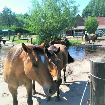
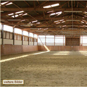
Außenboxen frei - kleiner Privatstall viel Ausla...
Warendorf
EquiFM Pferdephysiotherapie
@EquiFM-Pferdephysiotherapie
Freizeitstall
Pferdeausbildung
Vermieten
Führanlage
Hunde willkommen
Allergikerstall
Hufrehe geeignet
18 weitere...
S

Paddock-/ und Aussenboxen zu vermieten
Everswinkel
Ponyhof Georgenbruch
@SchulzeZurmussen
FN-Mitglied
Freizeitstall
Vermieten
Longierzirkel/Roundpen
Paddock
Allergikerstall
25 weitere...
P
Deprecated: Creation of dynamic property Zend_View_Helper_Ads::$adLink is deprecated in /var/www/stall-frei/htdocs/staging.stall-frei.de/library/Psf/View/Helper/Ads.php on line 108

Futtersack HeuToy, Fressbremse in pink
Mechtersen
STALL-FREIde Marketing
@STALL-FREI-Marketing
Stundenlange Beschäftigung die
Koliken vorbeugt, geringe Staubinhalation mit
steuerbarer Futterentnahme
Paddock Trail - Anlage (Freizeit- / Horsemanship)
Warendorf
DreamWest
@DreamWest
Freizeitstall
Pferdeausbildung
Longierzirkel/Roundpen
Paddock
Innenbox
Paddock Trail
Halbpension
13 weitere...
P
Hof Wilhelmer
Telgte
Burghard Wilhelmer
@Wilhelmer
FN-Mitglied
Freizeitstall
Longierzirkel/Roundpen
Ovalbahn
Außenboxen
Innenbox
Vollpension
13 weitere...
P+


Große Boxen frei
Bad Iburg
Familie Averdiek-Bolwin
@Reiterhof-Bad-Iburg
FN-Mitglied
Freizeitstall
Vermieten
Paddock
Parkplatz für Pferdeanhänger
Hufrehe geeignet
23 weitere...
S
Meister geführter Pension und Zuchtbetrieb
Ostbevern
Christina-Becker
@Christina-Becker
Freizeitstall
Geländestrecke
Vermieten
Hunde willkommen
Paddock
Allergikerstall
Hengsthaltung möglich
22 weitere...
P

Pferdeboxen in Warendorf/Milte
Warendorf
Zuchtgemeinschaft-Reth
@Zuchtgemeinschaft-Reth
Freizeitstall
Geländestrecke
Vermieten
Führanlage
Longierzirkel/Roundpen
Fohlenaufzucht möglich
Gnadenbrothof
21 weitere...
P

Das Beste für die Hufe
Mechtersen
STALL-FREIde Marketing
@STALL-FREI-Marketing
Hufschmiede und Hufpfleger in Ihrer Nähe

Ab dem 1.2 Paddockbox frei!
Warendorf
Karsten Schulze Vohren
@SchulzeVohren
Freizeitstall
Vermieten
Longierzirkel/Roundpen
Parkplatz für Pferdeanhänger
Außenbox mit Paddock
Außenboxen
11 weitere...
P

Isländer Wallachherde Offenstall.
Telgte
Stefan Wilhelmer
@Stefan83
Freizeitstall
Geländestrecke
Krankenbox
Paddock
Offenstall
Halbpension
6 weitere...
aktuell
P
Reitanlage Gäher
Sassenberg
Reitanlage-Gaeher
@Reitanlage-Gaeher
Pferdeausbildung
Führanlage
Hunde willkommen
Hengsthaltung möglich
Außenboxen
13 weitere...
P
Deprecated: Creation of dynamic property Zend_View::$pageCount is deprecated in /var/www/stall-frei/htdocs/staging.stall-frei.de/library/vendor/shardj/zf1-future/library/Zend/View/Abstract.php on line 308
Deprecated: Creation of dynamic property Zend_View::$itemCountPerPage is deprecated in /var/www/stall-frei/htdocs/staging.stall-frei.de/library/vendor/shardj/zf1-future/library/Zend/View/Abstract.php on line 308
Deprecated: Creation of dynamic property Zend_View::$first is deprecated in /var/www/stall-frei/htdocs/staging.stall-frei.de/library/vendor/shardj/zf1-future/library/Zend/View/Abstract.php on line 308
Deprecated: Creation of dynamic property Zend_View::$current is deprecated in /var/www/stall-frei/htdocs/staging.stall-frei.de/library/vendor/shardj/zf1-future/library/Zend/View/Abstract.php on line 308
Deprecated: Creation of dynamic property Zend_View::$last is deprecated in /var/www/stall-frei/htdocs/staging.stall-frei.de/library/vendor/shardj/zf1-future/library/Zend/View/Abstract.php on line 308
Deprecated: Creation of dynamic property Zend_View::$next is deprecated in /var/www/stall-frei/htdocs/staging.stall-frei.de/library/vendor/shardj/zf1-future/library/Zend/View/Abstract.php on line 308
Deprecated: Creation of dynamic property Zend_View::$pagesInRange is deprecated in /var/www/stall-frei/htdocs/staging.stall-frei.de/library/vendor/shardj/zf1-future/library/Zend/View/Abstract.php on line 308
Deprecated: Creation of dynamic property Zend_View::$firstPageInRange is deprecated in /var/www/stall-frei/htdocs/staging.stall-frei.de/library/vendor/shardj/zf1-future/library/Zend/View/Abstract.php on line 308
Deprecated: Creation of dynamic property Zend_View::$lastPageInRange is deprecated in /var/www/stall-frei/htdocs/staging.stall-frei.de/library/vendor/shardj/zf1-future/library/Zend/View/Abstract.php on line 308
Deprecated: Creation of dynamic property Zend_View::$currentItemCount is deprecated in /var/www/stall-frei/htdocs/staging.stall-frei.de/library/vendor/shardj/zf1-future/library/Zend/View/Abstract.php on line 308
Deprecated: Creation of dynamic property Zend_View::$totalItemCount is deprecated in /var/www/stall-frei/htdocs/staging.stall-frei.de/library/vendor/shardj/zf1-future/library/Zend/View/Abstract.php on line 308
Deprecated: Creation of dynamic property Zend_View::$firstItemNumber is deprecated in /var/www/stall-frei/htdocs/staging.stall-frei.de/library/vendor/shardj/zf1-future/library/Zend/View/Abstract.php on line 308
Deprecated: Creation of dynamic property Zend_View::$lastItemNumber is deprecated in /var/www/stall-frei/htdocs/staging.stall-frei.de/library/vendor/shardj/zf1-future/library/Zend/View/Abstract.php on line 308
Deprecated: Creation of dynamic property Zend_View::$router is deprecated in /var/www/stall-frei/htdocs/staging.stall-frei.de/library/vendor/shardj/zf1-future/library/Zend/View/Abstract.php on line 308
Deprecated: Creation of dynamic property Zend_View::$urlParams is deprecated in /var/www/stall-frei/htdocs/staging.stall-frei.de/library/vendor/shardj/zf1-future/library/Zend/View/Abstract.php on line 308
Deprecated: Creation of dynamic property Zend_View::$showAds is deprecated in /var/www/stall-frei/htdocs/staging.stall-frei.de/library/vendor/shardj/zf1-future/library/Zend/View/Abstract.php on line 308
Deprecated: Creation of dynamic property Zend_View::$objectIds is deprecated in /var/www/stall-frei/htdocs/staging.stall-frei.de/library/vendor/shardj/zf1-future/library/Zend/View/Abstract.php on line 308
Deprecated: Creation of dynamic property Zend_View::$showNavbar is deprecated in /var/www/stall-frei/htdocs/staging.stall-frei.de/library/vendor/shardj/zf1-future/library/Zend/View/Abstract.php on line 308
Deprecated: Creation of dynamic property Zend_View::$showBreadcrumb is deprecated in /var/www/stall-frei/htdocs/staging.stall-frei.de/library/vendor/shardj/zf1-future/library/Zend/View/Abstract.php on line 308
Deprecated: Creation of dynamic property Zend_View::$showFooter is deprecated in /var/www/stall-frei/htdocs/staging.stall-frei.de/library/vendor/shardj/zf1-future/library/Zend/View/Abstract.php on line 308
Deprecated: Creation of dynamic property Zend_View::$showInternalAds is deprecated in /var/www/stall-frei/htdocs/staging.stall-frei.de/library/vendor/shardj/zf1-future/library/Zend/View/Abstract.php on line 308
Deprecated: Creation of dynamic property Zend_View::$blNoContent is deprecated in /var/www/stall-frei/htdocs/staging.stall-frei.de/library/vendor/shardj/zf1-future/library/Zend/View/Abstract.php on line 308
Deprecated: Creation of dynamic property Zend_View::$sMetaDesc is deprecated in /var/www/stall-frei/htdocs/staging.stall-frei.de/library/vendor/shardj/zf1-future/library/Zend/View/Abstract.php on line 308
Deprecated: Creation of dynamic property Zend_View::$useGmaps is deprecated in /var/www/stall-frei/htdocs/staging.stall-frei.de/library/vendor/shardj/zf1-future/library/Zend/View/Abstract.php on line 308
Deprecated: Creation of dynamic property Zend_View::$touches is deprecated in /var/www/stall-frei/htdocs/staging.stall-frei.de/library/vendor/shardj/zf1-future/library/Zend/View/Abstract.php on line 308
Deprecated: Creation of dynamic property Zend_View::$oProject is deprecated in /var/www/stall-frei/htdocs/staging.stall-frei.de/library/vendor/shardj/zf1-future/library/Zend/View/Abstract.php on line 308
Deprecated: Creation of dynamic property Zend_View::$pageHeadline is deprecated in /var/www/stall-frei/htdocs/staging.stall-frei.de/library/vendor/shardj/zf1-future/library/Zend/View/Abstract.php on line 308
Deprecated: Creation of dynamic property Zend_View::$disableLocationField is deprecated in /var/www/stall-frei/htdocs/staging.stall-frei.de/library/vendor/shardj/zf1-future/library/Zend/View/Abstract.php on line 308
Deprecated: Creation of dynamic property Zend_View::$isSearch is deprecated in /var/www/stall-frei/htdocs/staging.stall-frei.de/library/vendor/shardj/zf1-future/library/Zend/View/Abstract.php on line 308
Deprecated: Creation of dynamic property Zend_View::$pageTitle is deprecated in /var/www/stall-frei/htdocs/staging.stall-frei.de/library/vendor/shardj/zf1-future/library/Zend/View/Abstract.php on line 308
Deprecated: Creation of dynamic property Psf_Form_Element_Text::$class is deprecated in /var/www/stall-frei/htdocs/staging.stall-frei.de/library/vendor/shardj/zf1-future/library/Zend/Form/Element.php on line 874
Deprecated: Creation of dynamic property Psf_Form_Element_Text::$size is deprecated in /var/www/stall-frei/htdocs/staging.stall-frei.de/library/vendor/shardj/zf1-future/library/Zend/Form/Element.php on line 874
Deprecated: Creation of dynamic property Psf_Form_Element_Text::$placeholder is deprecated in /var/www/stall-frei/htdocs/staging.stall-frei.de/library/vendor/shardj/zf1-future/library/Zend/Form/Element.php on line 874
Deprecated: Creation of dynamic property Psf_Form_Element_Hidden::$class is deprecated in /var/www/stall-frei/htdocs/staging.stall-frei.de/library/vendor/shardj/zf1-future/library/Zend/Form/Element.php on line 874
Deprecated: Creation of dynamic property Psf_Form_Element_Hidden::$class is deprecated in /var/www/stall-frei/htdocs/staging.stall-frei.de/library/vendor/shardj/zf1-future/library/Zend/Form/Element.php on line 874
Deprecated: Creation of dynamic property Psf_Form_Element_Hidden::$class is deprecated in /var/www/stall-frei/htdocs/staging.stall-frei.de/library/vendor/shardj/zf1-future/library/Zend/Form/Element.php on line 874
Deprecated: Creation of dynamic property Psf_Form_Element_Hidden::$class is deprecated in /var/www/stall-frei/htdocs/staging.stall-frei.de/library/vendor/shardj/zf1-future/library/Zend/Form/Element.php on line 874
Deprecated: Creation of dynamic property Psf_Form_Element_Select::$class is deprecated in /var/www/stall-frei/htdocs/staging.stall-frei.de/library/vendor/shardj/zf1-future/library/Zend/Form/Element.php on line 874
Deprecated: Creation of dynamic property Psf_Form_Element_Select::$class is deprecated in /var/www/stall-frei/htdocs/staging.stall-frei.de/library/vendor/shardj/zf1-future/library/Zend/Form/Element.php on line 874
Deprecated: Creation of dynamic property Psf_Form_Element_Select::$class is deprecated in /var/www/stall-frei/htdocs/staging.stall-frei.de/library/vendor/shardj/zf1-future/library/Zend/Form/Element.php on line 874
Deprecated: Creation of dynamic property Psf_Form_Element_Select::$class is deprecated in /var/www/stall-frei/htdocs/staging.stall-frei.de/library/vendor/shardj/zf1-future/library/Zend/Form/Element.php on line 874
Deprecated: Creation of dynamic property Psf_Form_Element_Text::$class is deprecated in /var/www/stall-frei/htdocs/staging.stall-frei.de/library/vendor/shardj/zf1-future/library/Zend/Form/Element.php on line 874
Deprecated: Creation of dynamic property Psf_Form_Element_Checkbox::$label is deprecated in /var/www/stall-frei/htdocs/staging.stall-frei.de/library/vendor/shardj/zf1-future/library/Zend/Form/Element.php on line 874
Deprecated: Creation of dynamic property Zend_View::$sort is deprecated in /var/www/stall-frei/htdocs/staging.stall-frei.de/library/vendor/shardj/zf1-future/library/Zend/View/Abstract.php on line 308
Deprecated: Creation of dynamic property Zend_View::$searchLocation is deprecated in /var/www/stall-frei/htdocs/staging.stall-frei.de/library/vendor/shardj/zf1-future/library/Zend/View/Abstract.php on line 308
Deprecated: Creation of dynamic property Zend_View::$locationHint is deprecated in /var/www/stall-frei/htdocs/staging.stall-frei.de/library/vendor/shardj/zf1-future/library/Zend/View/Abstract.php on line 308
Psf_GeoCoder_Abstract::getLocation: Einen Get Location CachedOrLive
Psf_GeoCoder_Abstract::getCachedOrLive: Einen
Psf_GeoCoder_OpenCageData::makeApiRequest: response:
Array
(
[documentation] => https://opencagedata.com/api
[licenses] => Array
(
[0] => Array
(
[name] => see attribution guide
[url] => https://opencagedata.com/credits
)
)
[results] => Array
(
[0] => Array
(
[bounds] => Array
(
[northeast] => Array
(
[lat] => 51.9953428
[lng] => 7.9248566
)
[southwest] => Array
(
[lat] => 51.9681686
[lng] => 7.8658186
)
)
[components] => Array
(
[ISO_3166-1_alpha-2] => DE
[ISO_3166-1_alpha-3] => DEU
[ISO_3166-2] => Array
(
[0] => DE-NW
)
[_category] => place
[_normalized_city] => Warendorf
[_type] => city
[continent] => Europe
[country] => Deutschland
[country_code] => de
[county] => Kreis Warendorf
[political_union] => European Union
[state] => Nordrhein-Westfalen
[state_code] => NW
[town] => Warendorf
)
[confidence] => 7
[formatted] => Warendorf, Nordrhein-Westfalen, Deutschland
[geometry] => Array
(
[lat] => 51.9761643
[lng] => 7.9001199
)
)
[1] => Array
(
[bounds] => Array
(
[northeast] => Array
(
[lat] => 52.8269278
[lng] => 8.4769475
)
[southwest] => Array
(
[lat] => 52.7869278
[lng] => 8.4369475
)
)
[components] => Array
(
[ISO_3166-1_alpha-2] => DE
[ISO_3166-1_alpha-3] => DEU
[ISO_3166-2] => Array
(
[0] => DE-NI
)
[_category] => place
[_normalized_city] => Goldenstedt
[_type] => hamlet
[continent] => Europe
[country] => Deutschland
[country_code] => de
[county] => Landkreis Vechta
[hamlet] => Einen
[political_union] => European Union
[state] => Niedersachsen
[state_code] => NI
[village] => Goldenstedt
)
[confidence] => 7
[formatted] => Einen, Goldenstedt, Niedersachsen, Deutschland
[geometry] => Array
(
[lat] => 52.8069278
[lng] => 8.4569475
)
)
[2] => Array
(
[components] => Array
(
[ISO_3166-1_alpha-2] => FR
[ISO_3166-1_alpha-3] => FRA
[ISO_3166-2] => Array
(
[0] => FR-GES
[1] => FR-6AE
[2] => FR-68
)
[_category] => road
[_normalized_city] => Colmar
[_type] => road
[city] => Colmar
[continent] => Europe
[country] => France
[country_code] => fr
[county] => Haut-Rhin
[local_authority] => Colmar Agglomération
[political_union] => European Union
[postcode] => 68000
[road] => Einen-Maeuerlein-Pfad
[state] => Grand Est
[state_code] => GES
)
[confidence] => 2
[formatted] => Einen-Maeuerlein-Pfad, 68000 Colmar, France
[geometry] => Array
(
[lat] => 48.064285
[lng] => 7.366225
)
)
[3] => Array
(
[components] => Array
(
[ISO_3166-1_alpha-2] => FR
[ISO_3166-1_alpha-3] => FRA
[ISO_3166-2] => Array
(
[0] => FR-BRE
[1] => FR-22
)
[_category] => road
[_normalized_city] => Penvénan
[_type] => road
[city] => Penvénan
[continent] => Europe
[country] => France
[country_code] => fr
[county] => Côtes-d'Armor
[local_authority] => Lannion-Trégor Communauté
[political_union] => European Union
[postcode] => 22710
[road] => Binen
[state] => Bretagne
[state_code] => BRE
)
[confidence] => 2
[formatted] => Binen, 22710 Penvénan, France
[geometry] => Array
(
[lat] => 48.799699
[lng] => -3.308782
)
)
[4] => Array
(
[components] => Array
(
[ISO_3166-1_alpha-2] => FR
[ISO_3166-1_alpha-3] => FRA
[ISO_3166-2] => Array
(
[0] => FR-GES
[1] => FR-6AE
[2] => FR-68
)
[_category] => road
[_normalized_city] => Mooslargue
[_type] => road
[city] => Mooslargue
[continent] => Europe
[country] => France
[country_code] => fr
[county] => Haut-Rhin
[local_authority] => Communauté de communes Sud Alsace Largue
[political_union] => European Union
[postcode] => 68580
[road] => Rue des Binnen
[state] => Grand Est
[state_code] => GES
)
[confidence] => 2
[formatted] => Rue des Binnen, 68580 Mooslargue, France
[geometry] => Array
(
[lat] => 47.518533
[lng] => 7.210134
)
)
[5] => Array
(
[components] => Array
(
[ISO_3166-1_alpha-2] => FR
[ISO_3166-1_alpha-3] => FRA
[ISO_3166-2] => Array
(
[0] => FR-BRE
[1] => FR-22
)
[_category] => road
[_normalized_city] => Minihy-Tréguier
[_type] => road
[city] => Minihy-Tréguier
[continent] => Europe
[country] => France
[country_code] => fr
[county] => Côtes-d'Armor
[local_authority] => Lannion-Trégor Communauté
[political_union] => European Union
[postcode] => 22220
[road] => Rue du Binen
[state] => Bretagne
[state_code] => BRE
)
[confidence] => 10
[formatted] => Rue du Binen, 22220 Minihy-Tréguier, France
[geometry] => Array
(
[lat] => 48.770746
[lng] => -3.236352
)
)
[6] => Array
(
[components] => Array
(
[ISO_3166-1_alpha-2] => FR
[ISO_3166-1_alpha-3] => FRA
[ISO_3166-2] => Array
(
[0] => FR-PDL
[1] => FR-44
)
[_category] => road
[_normalized_city] => Batz-sur-Mer
[_type] => road
[city] => Batz-sur-Mer
[continent] => Europe
[country] => France
[country_code] => fr
[county] => Loire-Atlantique
[local_authority] => Communauté d'agglomération de la Presqu'île de Guérande - Atlantique
[political_union] => European Union
[postcode] => 44740
[road] => Impasse de l'Etang du Binen
[state] => Pays de la Loire
[state_code] => PDL
)
[confidence] => 10
[formatted] => Impasse de l'Etang du Binen, 44740 Batz-sur-Mer, France
[geometry] => Array
(
[lat] => 47.277301
[lng] => -2.455227
)
)
[7] => Array
(
[components] => Array
(
[ISO_3166-1_alpha-2] => FR
[ISO_3166-1_alpha-3] => FRA
[ISO_3166-2] => Array
(
[0] => FR-GES
[1] => FR-6AE
[2] => FR-67
)
[_category] => road
[_normalized_city] => Limersheim
[_type] => road
[city] => Limersheim
[continent] => Europe
[country] => France
[country_code] => fr
[county] => Bas-Rhin
[local_authority] => Communauté de communes du Canton d'Erstein
[political_union] => European Union
[postcode] => 67150
[road] => Rue Binnen
[state] => Grand Est
[state_code] => GES
)
[confidence] => 10
[formatted] => Rue Binnen, 67150 Limersheim, France
[geometry] => Array
(
[lat] => 48.453782
[lng] => 7.642219
)
)
[8] => Array
(
[components] => Array
(
[ISO_3166-1_alpha-2] => FR
[ISO_3166-1_alpha-3] => FRA
[ISO_3166-2] => Array
(
[0] => FR-GES
[1] => FR-6AE
[2] => FR-68
)
[_category] => road
[_normalized_city] => Burnhaupt-le-Haut
[_type] => road
[city] => Burnhaupt-le-Haut
[continent] => Europe
[country] => France
[country_code] => fr
[county] => Haut-Rhin
[local_authority] => Communauté de communes de la Vallée de la Doller et du Soultzbach
[political_union] => European Union
[postcode] => 68520
[road] => Rue Binnen
[state] => Grand Est
[state_code] => GES
)
[confidence] => 10
[formatted] => Rue Binnen, 68520 Burnhaupt-le-Haut, France
[geometry] => Array
(
[lat] => 47.730438
[lng] => 7.14766
)
)
[9] => Array
(
[components] => Array
(
[ISO_3166-1_alpha-2] => FR
[ISO_3166-1_alpha-3] => FRA
[ISO_3166-2] => Array
(
[0] => FR-BRE
[1] => FR-22
)
[_category] => road
[_normalized_city] => Minihy-Tréguier
[_type] => road
[city] => Minihy-Tréguier
[continent] => Europe
[country] => France
[country_code] => fr
[county] => Côtes-d'Armor
[local_authority] => Lannion-Trégor Communauté
[political_union] => European Union
[postcode] => 22220
[road] => Le Binen
[state] => Bretagne
[state_code] => BRE
)
[confidence] => 10
[formatted] => Le Binen, 22220 Minihy-Tréguier, France
[geometry] => Array
(
[lat] => 48.769249
[lng] => -3.261595
)
)
)
[status] => Array
(
[code] => 200
[message] => OK
)
[stay_informed] => Array
(
[blog] => https://blog.opencagedata.com
[mastodon] => https://en.osm.town/@opencage
)
[thanks] => For using an OpenCage API
[timestamp] => Array
(
[created_http] => Sun, 08 Feb 2026 14:31:23 GMT
[created_unix] => 1770561083
)
[total_results] => 10
)
Psf_GeoCoder_Abstract::convertLocationResult
{"documentation":"https:\/\/opencagedata.com\/api","licenses":[{"name":"see attribution guide","url":"https:\/\/opencagedata.com\/credits"}],"results":[{"bounds":{"northeast":{"lat":51.9953428,"lng":7.9248566},"southwest":{"lat":51.9681686,"lng":7.8658186}},"components":{"ISO_3166-1_alpha-2":"DE","ISO_3166-1_alpha-3":"DEU","ISO_3166-2":["DE-NW"],"_category":"place","_normalized_city":"Warendorf","_type":"city","continent":"Europe","country":"Deutschland","country_code":"de","county":"Kreis Warendorf","political_union":"European Union","state":"Nordrhein-Westfalen","state_code":"NW","town":"Warendorf"},"confidence":7,"formatted":"Warendorf, Nordrhein-Westfalen, Deutschland","geometry":{"lat":51.9761643,"lng":7.9001199}},{"bounds":{"northeast":{"lat":52.8269278,"lng":8.4769475},"southwest":{"lat":52.7869278,"lng":8.4369475}},"components":{"ISO_3166-1_alpha-2":"DE","ISO_3166-1_alpha-3":"DEU","ISO_3166-2":["DE-NI"],"_category":"place","_normalized_city":"Goldenstedt","_type":"hamlet","continent":"Europe","country":"Deutschland","country_code":"de","county":"Landkreis Vechta","hamlet":"Einen","political_union":"European Union","state":"Niedersachsen","state_code":"NI","village":"Goldenstedt"},"confidence":7,"formatted":"Einen, Goldenstedt, Niedersachsen, Deutschland","geometry":{"lat":52.8069278,"lng":8.4569475}},{"components":{"ISO_3166-1_alpha-2":"FR","ISO_3166-1_alpha-3":"FRA","ISO_3166-2":["FR-GES","FR-6AE","FR-68"],"_category":"road","_normalized_city":"Colmar","_type":"road","city":"Colmar","continent":"Europe","country":"France","country_code":"fr","county":"Haut-Rhin","local_authority":"Colmar Agglom\u00e9ration","political_union":"European Union","postcode":"68000","road":"Einen-Maeuerlein-Pfad","state":"Grand Est","state_code":"GES"},"confidence":2,"formatted":"Einen-Maeuerlein-Pfad, 68000 Colmar, France","geometry":{"lat":48.064285,"lng":7.366225}},{"components":{"ISO_3166-1_alpha-2":"FR","ISO_3166-1_alpha-3":"FRA","ISO_3166-2":["FR-BRE","FR-22"],"_category":"road","_normalized_city":"Penv\u00e9nan","_type":"road","city":"Penv\u00e9nan","continent":"Europe","country":"France","country_code":"fr","county":"C\u00f4tes-d'Armor","local_authority":"Lannion-Tr\u00e9gor Communaut\u00e9","political_union":"European Union","postcode":"22710","road":"Binen","state":"Bretagne","state_code":"BRE"},"confidence":2,"formatted":"Binen, 22710 Penv\u00e9nan, France","geometry":{"lat":48.799699,"lng":-3.308782}},{"components":{"ISO_3166-1_alpha-2":"FR","ISO_3166-1_alpha-3":"FRA","ISO_3166-2":["FR-GES","FR-6AE","FR-68"],"_category":"road","_normalized_city":"Mooslargue","_type":"road","city":"Mooslargue","continent":"Europe","country":"France","country_code":"fr","county":"Haut-Rhin","local_authority":"Communaut\u00e9 de communes Sud Alsace Largue","political_union":"European Union","postcode":"68580","road":"Rue des Binnen","state":"Grand Est","state_code":"GES"},"confidence":2,"formatted":"Rue des Binnen, 68580 Mooslargue, France","geometry":{"lat":47.518533,"lng":7.210134}},{"components":{"ISO_3166-1_alpha-2":"FR","ISO_3166-1_alpha-3":"FRA","ISO_3166-2":["FR-BRE","FR-22"],"_category":"road","_normalized_city":"Minihy-Tr\u00e9guier","_type":"road","city":"Minihy-Tr\u00e9guier","continent":"Europe","country":"France","country_code":"fr","county":"C\u00f4tes-d'Armor","local_authority":"Lannion-Tr\u00e9gor Communaut\u00e9","political_union":"European Union","postcode":"22220","road":"Rue du Binen","state":"Bretagne","state_code":"BRE"},"confidence":10,"formatted":"Rue du Binen, 22220 Minihy-Tr\u00e9guier, France","geometry":{"lat":48.770746,"lng":-3.236352}},{"components":{"ISO_3166-1_alpha-2":"FR","ISO_3166-1_alpha-3":"FRA","ISO_3166-2":["FR-PDL","FR-44"],"_category":"road","_normalized_city":"Batz-sur-Mer","_type":"road","city":"Batz-sur-Mer","continent":"Europe","country":"France","country_code":"fr","county":"Loire-Atlantique","local_authority":"Communaut\u00e9 d'agglom\u00e9ration de la Presqu'\u00eele de Gu\u00e9rande - Atlantique","political_union":"European Union","postcode":"44740","road":"Impasse de l'Etang du Binen","state":"Pays de la Loire","state_code":"PDL"},"confidence":10,"formatted":"Impasse de l'Etang du Binen, 44740 Batz-sur-Mer, France","geometry":{"lat":47.277301,"lng":-2.455227}},{"components":{"ISO_3166-1_alpha-2":"FR","ISO_3166-1_alpha-3":"FRA","ISO_3166-2":["FR-GES","FR-6AE","FR-67"],"_category":"road","_normalized_city":"Limersheim","_type":"road","city":"Limersheim","continent":"Europe","country":"France","country_code":"fr","county":"Bas-Rhin","local_authority":"Communaut\u00e9 de communes du Canton d'Erstein","political_union":"European Union","postcode":"67150","road":"Rue Binnen","state":"Grand Est","state_code":"GES"},"confidence":10,"formatted":"Rue Binnen, 67150 Limersheim, France","geometry":{"lat":48.453782,"lng":7.642219}},{"components":{"ISO_3166-1_alpha-2":"FR","ISO_3166-1_alpha-3":"FRA","ISO_3166-2":["FR-GES","FR-6AE","FR-68"],"_category":"road","_normalized_city":"Burnhaupt-le-Haut","_type":"road","city":"Burnhaupt-le-Haut","continent":"Europe","country":"France","country_code":"fr","county":"Haut-Rhin","local_authority":"Communaut\u00e9 de communes de la Vall\u00e9e de la Doller et du Soultzbach","political_union":"European Union","postcode":"68520","road":"Rue Binnen","state":"Grand Est","state_code":"GES"},"confidence":10,"formatted":"Rue Binnen, 68520 Burnhaupt-le-Haut, France","geometry":{"lat":47.730438,"lng":7.14766}},{"components":{"ISO_3166-1_alpha-2":"FR","ISO_3166-1_alpha-3":"FRA","ISO_3166-2":["FR-BRE","FR-22"],"_category":"road","_normalized_city":"Minihy-Tr\u00e9guier","_type":"road","city":"Minihy-Tr\u00e9guier","continent":"Europe","country":"France","country_code":"fr","county":"C\u00f4tes-d'Armor","local_authority":"Lannion-Tr\u00e9gor Communaut\u00e9","political_union":"European Union","postcode":"22220","road":"Le Binen","state":"Bretagne","state_code":"BRE"},"confidence":10,"formatted":"Le Binen, 22220 Minihy-Tr\u00e9guier, France","geometry":{"lat":48.769249,"lng":-3.261595}}],"status":{"code":200,"message":"OK"},"stay_informed":{"blog":"https:\/\/blog.opencagedata.com","mastodon":"https:\/\/en.osm.town\/@opencage"},"thanks":"For using an OpenCage API","timestamp":{"created_http":"Sun, 08 Feb 2026 14:31:23 GMT","created_unix":1770561083},"total_results":10}Array
(
[0] => stdClass Object
(
[bounds] => stdClass Object
(
[northeast] => stdClass Object
(
[lat] => 51.9953428
[lng] => 7.9248566
)
[southwest] => stdClass Object
(
[lat] => 51.9681686
[lng] => 7.8658186
)
)
[components] => stdClass Object
(
[ISO_3166-1_alpha-2] => DE
[ISO_3166-1_alpha-3] => DEU
[ISO_3166-2] => Array
(
[0] => DE-NW
)
[_category] => place
[_normalized_city] => Warendorf
[_type] => city
[continent] => Europe
[country] => Deutschland
[country_code] => de
[county] => Kreis Warendorf
[political_union] => European Union
[state] => Nordrhein-Westfalen
[state_code] => NW
[town] => Warendorf
)
[confidence] => 7
[formatted] => Warendorf, Nordrhein-Westfalen, Deutschland
[geometry] => stdClass Object
(
[lat] => 51.9761643
[lng] => 7.9001199
)
)
[1] => stdClass Object
(
[bounds] => stdClass Object
(
[northeast] => stdClass Object
(
[lat] => 52.8269278
[lng] => 8.4769475
)
[southwest] => stdClass Object
(
[lat] => 52.7869278
[lng] => 8.4369475
)
)
[components] => stdClass Object
(
[ISO_3166-1_alpha-2] => DE
[ISO_3166-1_alpha-3] => DEU
[ISO_3166-2] => Array
(
[0] => DE-NI
)
[_category] => place
[_normalized_city] => Goldenstedt
[_type] => hamlet
[continent] => Europe
[country] => Deutschland
[country_code] => de
[county] => Landkreis Vechta
[hamlet] => Einen
[political_union] => European Union
[state] => Niedersachsen
[state_code] => NI
[village] => Goldenstedt
)
[confidence] => 7
[formatted] => Einen, Goldenstedt, Niedersachsen, Deutschland
[geometry] => stdClass Object
(
[lat] => 52.8069278
[lng] => 8.4569475
)
)
[2] => stdClass Object
(
[components] => stdClass Object
(
[ISO_3166-1_alpha-2] => FR
[ISO_3166-1_alpha-3] => FRA
[ISO_3166-2] => Array
(
[0] => FR-GES
[1] => FR-6AE
[2] => FR-68
)
[_category] => road
[_normalized_city] => Colmar
[_type] => road
[city] => Colmar
[continent] => Europe
[country] => France
[country_code] => fr
[county] => Haut-Rhin
[local_authority] => Colmar Agglomération
[political_union] => European Union
[postcode] => 68000
[road] => Einen-Maeuerlein-Pfad
[state] => Grand Est
[state_code] => GES
)
[confidence] => 2
[formatted] => Einen-Maeuerlein-Pfad, 68000 Colmar, France
[geometry] => stdClass Object
(
[lat] => 48.064285
[lng] => 7.366225
)
)
[3] => stdClass Object
(
[components] => stdClass Object
(
[ISO_3166-1_alpha-2] => FR
[ISO_3166-1_alpha-3] => FRA
[ISO_3166-2] => Array
(
[0] => FR-BRE
[1] => FR-22
)
[_category] => road
[_normalized_city] => Penvénan
[_type] => road
[city] => Penvénan
[continent] => Europe
[country] => France
[country_code] => fr
[county] => Côtes-d'Armor
[local_authority] => Lannion-Trégor Communauté
[political_union] => European Union
[postcode] => 22710
[road] => Binen
[state] => Bretagne
[state_code] => BRE
)
[confidence] => 2
[formatted] => Binen, 22710 Penvénan, France
[geometry] => stdClass Object
(
[lat] => 48.799699
[lng] => -3.308782
)
)
[4] => stdClass Object
(
[components] => stdClass Object
(
[ISO_3166-1_alpha-2] => FR
[ISO_3166-1_alpha-3] => FRA
[ISO_3166-2] => Array
(
[0] => FR-GES
[1] => FR-6AE
[2] => FR-68
)
[_category] => road
[_normalized_city] => Mooslargue
[_type] => road
[city] => Mooslargue
[continent] => Europe
[country] => France
[country_code] => fr
[county] => Haut-Rhin
[local_authority] => Communauté de communes Sud Alsace Largue
[political_union] => European Union
[postcode] => 68580
[road] => Rue des Binnen
[state] => Grand Est
[state_code] => GES
)
[confidence] => 2
[formatted] => Rue des Binnen, 68580 Mooslargue, France
[geometry] => stdClass Object
(
[lat] => 47.518533
[lng] => 7.210134
)
)
[5] => stdClass Object
(
[components] => stdClass Object
(
[ISO_3166-1_alpha-2] => FR
[ISO_3166-1_alpha-3] => FRA
[ISO_3166-2] => Array
(
[0] => FR-BRE
[1] => FR-22
)
[_category] => road
[_normalized_city] => Minihy-Tréguier
[_type] => road
[city] => Minihy-Tréguier
[continent] => Europe
[country] => France
[country_code] => fr
[county] => Côtes-d'Armor
[local_authority] => Lannion-Trégor Communauté
[political_union] => European Union
[postcode] => 22220
[road] => Rue du Binen
[state] => Bretagne
[state_code] => BRE
)
[confidence] => 10
[formatted] => Rue du Binen, 22220 Minihy-Tréguier, France
[geometry] => stdClass Object
(
[lat] => 48.770746
[lng] => -3.236352
)
)
[6] => stdClass Object
(
[components] => stdClass Object
(
[ISO_3166-1_alpha-2] => FR
[ISO_3166-1_alpha-3] => FRA
[ISO_3166-2] => Array
(
[0] => FR-PDL
[1] => FR-44
)
[_category] => road
[_normalized_city] => Batz-sur-Mer
[_type] => road
[city] => Batz-sur-Mer
[continent] => Europe
[country] => France
[country_code] => fr
[county] => Loire-Atlantique
[local_authority] => Communauté d'agglomération de la Presqu'île de Guérande - Atlantique
[political_union] => European Union
[postcode] => 44740
[road] => Impasse de l'Etang du Binen
[state] => Pays de la Loire
[state_code] => PDL
)
[confidence] => 10
[formatted] => Impasse de l'Etang du Binen, 44740 Batz-sur-Mer, France
[geometry] => stdClass Object
(
[lat] => 47.277301
[lng] => -2.455227
)
)
[7] => stdClass Object
(
[components] => stdClass Object
(
[ISO_3166-1_alpha-2] => FR
[ISO_3166-1_alpha-3] => FRA
[ISO_3166-2] => Array
(
[0] => FR-GES
[1] => FR-6AE
[2] => FR-67
)
[_category] => road
[_normalized_city] => Limersheim
[_type] => road
[city] => Limersheim
[continent] => Europe
[country] => France
[country_code] => fr
[county] => Bas-Rhin
[local_authority] => Communauté de communes du Canton d'Erstein
[political_union] => European Union
[postcode] => 67150
[road] => Rue Binnen
[state] => Grand Est
[state_code] => GES
)
[confidence] => 10
[formatted] => Rue Binnen, 67150 Limersheim, France
[geometry] => stdClass Object
(
[lat] => 48.453782
[lng] => 7.642219
)
)
[8] => stdClass Object
(
[components] => stdClass Object
(
[ISO_3166-1_alpha-2] => FR
[ISO_3166-1_alpha-3] => FRA
[ISO_3166-2] => Array
(
[0] => FR-GES
[1] => FR-6AE
[2] => FR-68
)
[_category] => road
[_normalized_city] => Burnhaupt-le-Haut
[_type] => road
[city] => Burnhaupt-le-Haut
[continent] => Europe
[country] => France
[country_code] => fr
[county] => Haut-Rhin
[local_authority] => Communauté de communes de la Vallée de la Doller et du Soultzbach
[political_union] => European Union
[postcode] => 68520
[road] => Rue Binnen
[state] => Grand Est
[state_code] => GES
)
[confidence] => 10
[formatted] => Rue Binnen, 68520 Burnhaupt-le-Haut, France
[geometry] => stdClass Object
(
[lat] => 47.730438
[lng] => 7.14766
)
)
[9] => stdClass Object
(
[components] => stdClass Object
(
[ISO_3166-1_alpha-2] => FR
[ISO_3166-1_alpha-3] => FRA
[ISO_3166-2] => Array
(
[0] => FR-BRE
[1] => FR-22
)
[_category] => road
[_normalized_city] => Minihy-Tréguier
[_type] => road
[city] => Minihy-Tréguier
[continent] => Europe
[country] => France
[country_code] => fr
[county] => Côtes-d'Armor
[local_authority] => Lannion-Trégor Communauté
[political_union] => European Union
[postcode] => 22220
[road] => Le Binen
[state] => Bretagne
[state_code] => BRE
)
[confidence] => 10
[formatted] => Le Binen, 22220 Minihy-Tréguier, France
[geometry] => stdClass Object
(
[lat] => 48.769249
[lng] => -3.261595
)
)
)
Psf_GeoCoder_OpenCageData::getKeyMap: 0
stdClass Object
(
    [bounds] => stdClass Object
        (
            [northeast] => stdClass Object
                (
                    [lat] => 51.9953428
                    [lng] => 7.9248566
                )

            [southwest] => stdClass Object
                (
                    [lat] => 51.9681686
                    [lng] => 7.8658186
                )

        )

    [components] => stdClass Object
        (
            [ISO_3166-1_alpha-2] => DE
            [ISO_3166-1_alpha-3] => DEU
            [ISO_3166-2] => Array
                (
                    [0] => DE-NW
                )

            [_category] => place
            [_normalized_city] => Warendorf
            [_type] => city
            [continent] => Europe
            [country] => Deutschland
            [country_code] => de
            [county] => Kreis Warendorf
            [political_union] => European Union
            [state] => Nordrhein-Westfalen
            [state_code] => NW
            [town] => Warendorf
        )

    [confidence] => 7
    [formatted] => Warendorf, Nordrhein-Westfalen, Deutschland
    [geometry] => stdClass Object
        (
            [lat] => 51.9761643
            [lng] => 7.9001199
        )

)
Psf_GeoCoder_OpenCageData::getCounty: Warendorf
Psf_GeoCoder_OpenCageData::addMissingData REFETCH!
Array
(
    [address] => Warendorf, Nordrhein-Westfalen, Deutschland
    [type] => city
    [street] =>
    [city] => Warendorf
    [county] => Warendorf
    [state] => Nordrhein-Westfalen
    [zip] =>
    [country] => Deutschland
    [suburb] =>
    [countrycode] => de
    [latitude] => 51.9761643
    [longitude] => 7.9001199
    [accuracy] => 1
    [confidence] => 7
    [bounds] => stdClass Object
        (
            [northeast] => stdClass Object
                (
                    [lat] => 51.9953428
                    [lng] => 7.9248566
                )

            [southwest] => stdClass Object
                (
                    [lat] => 51.9681686
                    [lng] => 7.8658186
                )

        )

)
reformat!
Array
(
    [address] => Warendorf, Nordrhein-Westfalen, Deutschland
    [type] => city
    [street] =>
    [city] => Warendorf
    [county] => Warendorf
    [state] => Nordrhein-Westfalen
    [zip] =>
    [country] => Deutschland
    [suburb] =>
    [countrycode] => de
    [latitude] => 51.9761643
    [longitude] => 7.9001199
    [accuracy] => 1
    [confidence] => 7
    [bounds] => stdClass Object
        (
            [northeast] => stdClass Object
                (
                    [lat] => 51.9953428
                    [lng] => 7.9248566
                )

            [southwest] => stdClass Object
                (
                    [lat] => 51.9681686
                    [lng] => 7.8658186
                )

        )

    [place] => Warendorf, Nordrhein-Westfalen
    [hash] => ad79984864e126980793cd8cc856c3e0
)
Psf_GeoCoder_OpenCageData::getKeyMap: 1
stdClass Object
(
    [bounds] => stdClass Object
        (
            [northeast] => stdClass Object
                (
                    [lat] => 52.8269278
                    [lng] => 8.4769475
                )

            [southwest] => stdClass Object
                (
                    [lat] => 52.7869278
                    [lng] => 8.4369475
                )

        )

    [components] => stdClass Object
        (
            [ISO_3166-1_alpha-2] => DE
            [ISO_3166-1_alpha-3] => DEU
            [ISO_3166-2] => Array
                (
                    [0] => DE-NI
                )

            [_category] => place
            [_normalized_city] => Goldenstedt
            [_type] => hamlet
            [continent] => Europe
            [country] => Deutschland
            [country_code] => de
            [county] => Landkreis Vechta
            [hamlet] => Einen
            [political_union] => European Union
            [state] => Niedersachsen
            [state_code] => NI
            [village] => Goldenstedt
        )

    [confidence] => 7
    [formatted] => Einen, Goldenstedt, Niedersachsen, Deutschland
    [geometry] => stdClass Object
        (
            [lat] => 52.8069278
            [lng] => 8.4569475
        )

)
Psf_GeoCoder_OpenCageData::getCounty: Vechta
Psf_GeoCoder_OpenCageData::addMissingData REFETCH!
Array
(
    [address] => Einen, Goldenstedt, Niedersachsen, Deutschland
    [type] => hamlet
    [street] => Einen
    [city] => Goldenstedt
    [county] => Vechta
    [state] => Niedersachsen
    [zip] =>
    [country] => Deutschland
    [suburb] =>
    [countrycode] => de
    [latitude] => 52.8069278
    [longitude] => 8.4569475
    [accuracy] => 1
    [confidence] => 7
    [bounds] => stdClass Object
        (
            [northeast] => stdClass Object
                (
                    [lat] => 52.8269278
                    [lng] => 8.4769475
                )

            [southwest] => stdClass Object
                (
                    [lat] => 52.7869278
                    [lng] => 8.4369475
                )

        )

)
reformat!
Array
(
    [address] => Einen, Goldenstedt, Niedersachsen, Deutschland
    [type] => hamlet
    [street] => Einen
    [city] => Goldenstedt
    [county] => Vechta
    [state] => Niedersachsen
    [zip] =>
    [country] => Deutschland
    [suburb] =>
    [countrycode] => de
    [latitude] => 52.8069278
    [longitude] => 8.4569475
    [accuracy] => 1
    [confidence] => 7
    [bounds] => stdClass Object
        (
            [northeast] => stdClass Object
                (
                    [lat] => 52.8269278
                    [lng] => 8.4769475
                )

            [southwest] => stdClass Object
                (
                    [lat] => 52.7869278
                    [lng] => 8.4369475
                )

        )

    [place] => Einen, Goldenstedt, Niedersachsen
    [hash] => 271de5b1ed7e5cb4f1a88e84c38aaa30
)
Psf_GeoCoder_OpenCageData::getKeyMap: 2
stdClass Object
(
    [components] => stdClass Object
        (
            [ISO_3166-1_alpha-2] => FR
            [ISO_3166-1_alpha-3] => FRA
            [ISO_3166-2] => Array
                (
                    [0] => FR-GES
                    [1] => FR-6AE
                    [2] => FR-68
                )

            [_category] => road
            [_normalized_city] => Colmar
            [_type] => road
            [city] => Colmar
            [continent] => Europe
            [country] => France
            [country_code] => fr
            [county] => Haut-Rhin
            [local_authority] => Colmar Agglomération
            [political_union] => European Union
            [postcode] => 68000
            [road] => Einen-Maeuerlein-Pfad
            [state] => Grand Est
            [state_code] => GES
        )

    [confidence] => 2
    [formatted] => Einen-Maeuerlein-Pfad, 68000 Colmar, France
    [geometry] => stdClass Object
        (
            [lat] => 48.064285
            [lng] => 7.366225
        )

)
Psf_GeoCoder_OpenCageData::getCounty: Haut-Rhin
Psf_GeoCoder_OpenCageData::addMissingData REFETCH!
Array
(
    [address] => Einen-Maeuerlein-Pfad, 68000 Colmar, France
    [type] => road
    [street] => Einen-Maeuerlein-Pfad
    [city] => Colmar
    [county] => Haut-Rhin
    [state] => Grand Est
    [zip] => 68000
    [country] => France
    [suburb] =>
    [countrycode] => fr
    [latitude] => 48.064285
    [longitude] => 7.366225
    [accuracy] => 1
    [confidence] => 2
    [bounds] =>
)
reformat!
Array
(
    [address] => Einen-Maeuerlein-Pfad, 68000 Colmar, France
    [type] => road
    [street] => Einen-Maeuerlein-Pfad
    [city] => Colmar
    [county] => Haut-Rhin
    [state] => Grand Est
    [zip] => 68000
    [country] => France
    [suburb] =>
    [countrycode] => fr
    [latitude] => 48.064285
    [longitude] => 7.366225
    [accuracy] => 1
    [confidence] => 2
    [bounds] =>
    [place] => Einen-Maeuerlein-Pfad, 68000 Colmar, Grand Est
    [hash] => 9ad3d0fdc44ad3699814dedf96e580f0
)
Psf_GeoCoder_OpenCageData::getKeyMap: 3
stdClass Object
(
    [components] => stdClass Object
        (
            [ISO_3166-1_alpha-2] => FR
            [ISO_3166-1_alpha-3] => FRA
            [ISO_3166-2] => Array
                (
                    [0] => FR-BRE
                    [1] => FR-22
                )

            [_category] => road
            [_normalized_city] => Penvénan
            [_type] => road
            [city] => Penvénan
            [continent] => Europe
            [country] => France
            [country_code] => fr
            [county] => Côtes-d'Armor
            [local_authority] => Lannion-Trégor Communauté
            [political_union] => European Union
            [postcode] => 22710
            [road] => Binen
            [state] => Bretagne
            [state_code] => BRE
        )

    [confidence] => 2
    [formatted] => Binen, 22710 Penvénan, France
    [geometry] => stdClass Object
        (
            [lat] => 48.799699
            [lng] => -3.308782
        )

)
Psf_GeoCoder_OpenCageData::getCounty: Côtes-d'Armor
Psf_GeoCoder_OpenCageData::addMissingData REFETCH!
Array
(
    [address] => Binen, 22710 Penvénan, France
    [type] => road
    [street] => Binen
    [city] => Penvénan
    [county] => Côtes-d'Armor
    [state] => Bretagne
    [zip] => 22710
    [country] => France
    [suburb] =>
    [countrycode] => fr
    [latitude] => 48.799699
    [longitude] => -3.308782
    [accuracy] => 1
    [confidence] => 2
    [bounds] =>
)
reformat!
Array
(
    [address] => Binen, 22710 Penvénan, France
    [type] => road
    [street] => Binen
    [city] => Penvénan
    [county] => Côtes-d'Armor
    [state] => Bretagne
    [zip] => 22710
    [country] => France
    [suburb] =>
    [countrycode] => fr
    [latitude] => 48.799699
    [longitude] => -3.308782
    [accuracy] => 1
    [confidence] => 2
    [bounds] =>
    [place] => Binen, 22710 Penvénan, Bretagne
    [hash] => ca06ab016ce88ed0a2131f857aa00c28
)
Psf_GeoCoder_OpenCageData::getKeyMap: 4
stdClass Object
(
    [components] => stdClass Object
        (
            [ISO_3166-1_alpha-2] => FR
            [ISO_3166-1_alpha-3] => FRA
            [ISO_3166-2] => Array
                (
                    [0] => FR-GES
                    [1] => FR-6AE
                    [2] => FR-68
                )

            [_category] => road
            [_normalized_city] => Mooslargue
            [_type] => road
            [city] => Mooslargue
            [continent] => Europe
            [country] => France
            [country_code] => fr
            [county] => Haut-Rhin
            [local_authority] => Communauté de communes Sud Alsace Largue
            [political_union] => European Union
            [postcode] => 68580
            [road] => Rue des Binnen
            [state] => Grand Est
            [state_code] => GES
        )

    [confidence] => 2
    [formatted] => Rue des Binnen, 68580 Mooslargue, France
    [geometry] => stdClass Object
        (
            [lat] => 47.518533
            [lng] => 7.210134
        )

)
Psf_GeoCoder_OpenCageData::getCounty: Haut-Rhin
Psf_GeoCoder_OpenCageData::addMissingData REFETCH!
Array
(
    [address] => Rue des Binnen, 68580 Mooslargue, France
    [type] => road
    [street] => Rue des Binnen
    [city] => Mooslargue
    [county] => Haut-Rhin
    [state] => Grand Est
    [zip] => 68580
    [country] => France
    [suburb] =>
    [countrycode] => fr
    [latitude] => 47.518533
    [longitude] => 7.210134
    [accuracy] => 1
    [confidence] => 2
    [bounds] =>
)
reformat!
Array
(
    [address] => Rue des Binnen, 68580 Mooslargue, France
    [type] => road
    [street] => Rue des Binnen
    [city] => Mooslargue
    [county] => Haut-Rhin
    [state] => Grand Est
    [zip] => 68580
    [country] => France
    [suburb] =>
    [countrycode] => fr
    [latitude] => 47.518533
    [longitude] => 7.210134
    [accuracy] => 1
    [confidence] => 2
    [bounds] =>
    [place] => Rue des Binnen, 68580 Mooslargue, Grand Est
    [hash] => 50516ae963a446ccdae8d50eaa9f2415
)
Psf_GeoCoder_OpenCageData::getKeyMap: 5
stdClass Object
(
    [components] => stdClass Object
        (
            [ISO_3166-1_alpha-2] => FR
            [ISO_3166-1_alpha-3] => FRA
            [ISO_3166-2] => Array
                (
                    [0] => FR-BRE
                    [1] => FR-22
                )

            [_category] => road
            [_normalized_city] => Minihy-Tréguier
            [_type] => road
            [city] => Minihy-Tréguier
            [continent] => Europe
            [country] => France
            [country_code] => fr
            [county] => Côtes-d'Armor
            [local_authority] => Lannion-Trégor Communauté
            [political_union] => European Union
            [postcode] => 22220
            [road] => Rue du Binen
            [state] => Bretagne
            [state_code] => BRE
        )

    [confidence] => 10
    [formatted] => Rue du Binen, 22220 Minihy-Tréguier, France
    [geometry] => stdClass Object
        (
            [lat] => 48.770746
            [lng] => -3.236352
        )

)
Psf_GeoCoder_OpenCageData::getCounty: Côtes-d'Armor
Psf_GeoCoder_OpenCageData::addMissingData REFETCH!
Array
(
    [address] => Rue du Binen, 22220 Minihy-Tréguier, France
    [type] => road
    [street] => Rue du Binen
    [city] => Minihy-Tréguier
    [county] => Côtes-d'Armor
    [state] => Bretagne
    [zip] => 22220
    [country] => France
    [suburb] =>
    [countrycode] => fr
    [latitude] => 48.770746
    [longitude] => -3.236352
    [accuracy] => 1
    [confidence] => 10
    [bounds] =>
)
reformat!
Array
(
    [address] => Rue du Binen, 22220 Minihy-Tréguier, France
    [type] => road
    [street] => Rue du Binen
    [city] => Minihy-Tréguier
    [county] => Côtes-d'Armor
    [state] => Bretagne
    [zip] => 22220
    [country] => France
    [suburb] =>
    [countrycode] => fr
    [latitude] => 48.770746
    [longitude] => -3.236352
    [accuracy] => 1
    [confidence] => 10
    [bounds] =>
    [place] => Rue du Binen, 22220 Minihy-Tréguier, Bretagne
    [hash] => 1f4a0c573ce0182c8f07e10ba58f3255
)
Psf_GeoCoder_OpenCageData::getKeyMap: 6
stdClass Object
(
    [components] => stdClass Object
        (
            [ISO_3166-1_alpha-2] => FR
            [ISO_3166-1_alpha-3] => FRA
            [ISO_3166-2] => Array
                (
                    [0] => FR-PDL
                    [1] => FR-44
                )

            [_category] => road
            [_normalized_city] => Batz-sur-Mer
            [_type] => road
            [city] => Batz-sur-Mer
            [continent] => Europe
            [country] => France
            [country_code] => fr
            [county] => Loire-Atlantique
            [local_authority] => Communauté d'agglomération de la Presqu'île de Guérande - Atlantique
            [political_union] => European Union
            [postcode] => 44740
            [road] => Impasse de l'Etang du Binen
            [state] => Pays de la Loire
            [state_code] => PDL
        )

    [confidence] => 10
    [formatted] => Impasse de l'Etang du Binen, 44740 Batz-sur-Mer, France
    [geometry] => stdClass Object
        (
            [lat] => 47.277301
            [lng] => -2.455227
        )

)
Psf_GeoCoder_OpenCageData::getCounty: Loire-Atlantique
Psf_GeoCoder_OpenCageData::addMissingData REFETCH!
Array
(
    [address] => Impasse de l'Etang du Binen, 44740 Batz-sur-Mer, France
    [type] => road
    [street] => Impasse de l'Etang du Binen
    [city] => Batz-sur-Mer
    [county] => Loire-Atlantique
    [state] => Pays de la Loire
    [zip] => 44740
    [country] => France
    [suburb] =>
    [countrycode] => fr
    [latitude] => 47.277301
    [longitude] => -2.455227
    [accuracy] => 1
    [confidence] => 10
    [bounds] =>
)
reformat!
Array
(
    [address] => Impasse de l'Etang du Binen, 44740 Batz-sur-Mer, France
    [type] => road
    [street] => Impasse de l'Etang du Binen
    [city] => Batz-sur-Mer
    [county] => Loire-Atlantique
    [state] => Pays de la Loire
    [zip] => 44740
    [country] => France
    [suburb] =>
    [countrycode] => fr
    [latitude] => 47.277301
    [longitude] => -2.455227
    [accuracy] => 1
    [confidence] => 10
    [bounds] =>
    [place] => Impasse de l'Etang du Binen, 44740 Batz-sur-Mer, Pays de la Loire
    [hash] => 02a6ec3c862426a8bc7dfc7da99cbd2d
)
Psf_GeoCoder_OpenCageData::getKeyMap: 7
stdClass Object
(
    [components] => stdClass Object
        (
            [ISO_3166-1_alpha-2] => FR
            [ISO_3166-1_alpha-3] => FRA
            [ISO_3166-2] => Array
                (
                    [0] => FR-GES
                    [1] => FR-6AE
                    [2] => FR-67
                )

            [_category] => road
            [_normalized_city] => Limersheim
            [_type] => road
            [city] => Limersheim
            [continent] => Europe
            [country] => France
            [country_code] => fr
            [county] => Bas-Rhin
            [local_authority] => Communauté de communes du Canton d'Erstein
            [political_union] => European Union
            [postcode] => 67150
            [road] => Rue Binnen
            [state] => Grand Est
            [state_code] => GES
        )

    [confidence] => 10
    [formatted] => Rue Binnen, 67150 Limersheim, France
    [geometry] => stdClass Object
        (
            [lat] => 48.453782
            [lng] => 7.642219
        )

)
Psf_GeoCoder_OpenCageData::getCounty: Bas-Rhin
Psf_GeoCoder_OpenCageData::addMissingData REFETCH!
Array
(
    [address] => Rue Binnen, 67150 Limersheim, France
    [type] => road
    [street] => Rue Binnen
    [city] => Limersheim
    [county] => Bas-Rhin
    [state] => Grand Est
    [zip] => 67150
    [country] => France
    [suburb] =>
    [countrycode] => fr
    [latitude] => 48.453782
    [longitude] => 7.642219
    [accuracy] => 1
    [confidence] => 10
    [bounds] =>
)
reformat!
Array
(
    [address] => Rue Binnen, 67150 Limersheim, France
    [type] => road
    [street] => Rue Binnen
    [city] => Limersheim
    [county] => Bas-Rhin
    [state] => Grand Est
    [zip] => 67150
    [country] => France
    [suburb] =>
    [countrycode] => fr
    [latitude] => 48.453782
    [longitude] => 7.642219
    [accuracy] => 1
    [confidence] => 10
    [bounds] =>
    [place] => Rue Binnen, 67150 Limersheim, Grand Est
    [hash] => d427af25d22fe992211eccba76bd482e
)
Psf_GeoCoder_OpenCageData::getKeyMap: 8
stdClass Object
(
    [components] => stdClass Object
        (
            [ISO_3166-1_alpha-2] => FR
            [ISO_3166-1_alpha-3] => FRA
            [ISO_3166-2] => Array
                (
                    [0] => FR-GES
                    [1] => FR-6AE
                    [2] => FR-68
                )

            [_category] => road
            [_normalized_city] => Burnhaupt-le-Haut
            [_type] => road
            [city] => Burnhaupt-le-Haut
            [continent] => Europe
            [country] => France
            [country_code] => fr
            [county] => Haut-Rhin
            [local_authority] => Communauté de communes de la Vallée de la Doller et du Soultzbach
            [political_union] => European Union
            [postcode] => 68520
            [road] => Rue Binnen
            [state] => Grand Est
            [state_code] => GES
        )

    [confidence] => 10
    [formatted] => Rue Binnen, 68520 Burnhaupt-le-Haut, France
    [geometry] => stdClass Object
        (
            [lat] => 47.730438
            [lng] => 7.14766
        )

)
Psf_GeoCoder_OpenCageData::getCounty: Haut-Rhin
Psf_GeoCoder_OpenCageData::addMissingData REFETCH!
Array
(
    [address] => Rue Binnen, 68520 Burnhaupt-le-Haut, France
    [type] => road
    [street] => Rue Binnen
    [city] => Burnhaupt-le-Haut
    [county] => Haut-Rhin
    [state] => Grand Est
    [zip] => 68520
    [country] => France
    [suburb] =>
    [countrycode] => fr
    [latitude] => 47.730438
    [longitude] => 7.14766
    [accuracy] => 1
    [confidence] => 10
    [bounds] =>
)
reformat!
Array
(
    [address] => Rue Binnen, 68520 Burnhaupt-le-Haut, France
    [type] => road
    [street] => Rue Binnen
    [city] => Burnhaupt-le-Haut
    [county] => Haut-Rhin
    [state] => Grand Est
    [zip] => 68520
    [country] => France
    [suburb] =>
    [countrycode] => fr
    [latitude] => 47.730438
    [longitude] => 7.14766
    [accuracy] => 1
    [confidence] => 10
    [bounds] =>
    [place] => Rue Binnen, 68520 Burnhaupt-le-Haut, Grand Est
    [hash] => 66becd539f8cc4e8da669b293d8b9368
)
Psf_GeoCoder_OpenCageData::getKeyMap: 9
stdClass Object
(
    [components] => stdClass Object
        (
            [ISO_3166-1_alpha-2] => FR
            [ISO_3166-1_alpha-3] => FRA
            [ISO_3166-2] => Array
                (
                    [0] => FR-BRE
                    [1] => FR-22
                )

            [_category] => road
            [_normalized_city] => Minihy-Tréguier
            [_type] => road
            [city] => Minihy-Tréguier
            [continent] => Europe
            [country] => France
            [country_code] => fr
            [county] => Côtes-d'Armor
            [local_authority] => Lannion-Trégor Communauté
            [political_union] => European Union
            [postcode] => 22220
            [road] => Le Binen
            [state] => Bretagne
            [state_code] => BRE
        )

    [confidence] => 10
    [formatted] => Le Binen, 22220 Minihy-Tréguier, France
    [geometry] => stdClass Object
        (
            [lat] => 48.769249
            [lng] => -3.261595
        )

)
Psf_GeoCoder_OpenCageData::getCounty: Côtes-d'Armor
Psf_GeoCoder_OpenCageData::addMissingData REFETCH!
Array
(
    [address] => Le Binen, 22220 Minihy-Tréguier, France
    [type] => road
    [street] => Le Binen
    [city] => Minihy-Tréguier
    [county] => Côtes-d'Armor
    [state] => Bretagne
    [zip] => 22220
    [country] => France
    [suburb] =>
    [countrycode] => fr
    [latitude] => 48.769249
    [longitude] => -3.261595
    [accuracy] => 1
    [confidence] => 10
    [bounds] =>
)
reformat!
Array
(
    [address] => Le Binen, 22220 Minihy-Tréguier, France
    [type] => road
    [street] => Le Binen
    [city] => Minihy-Tréguier
    [county] => Côtes-d'Armor
    [state] => Bretagne
    [zip] => 22220
    [country] => France
    [suburb] =>
    [countrycode] => fr
    [latitude] => 48.769249
    [longitude] => -3.261595
    [accuracy] => 1
    [confidence] => 10
    [bounds] =>
    [place] => Le Binen, 22220 Minihy-Tréguier, Bretagne
    [hash] => cf0f5b2ea0b1a3d4f476e569025a2d8f
)
Deprecated: Creation of dynamic property Zend_View::$locationHintStyle is deprecated in /var/www/stall-frei/htdocs/staging.stall-frei.de/library/vendor/shardj/zf1-future/library/Zend/View/Abstract.php on line 308
Deprecated: Creation of dynamic property Zend_View::$adGeoLocation is deprecated in /var/www/stall-frei/htdocs/staging.stall-frei.de/library/vendor/shardj/zf1-future/library/Zend/View/Abstract.php on line 308
Deprecated: Creation of dynamic property Zend_View::$recordCount is deprecated in /var/www/stall-frei/htdocs/staging.stall-frei.de/library/vendor/shardj/zf1-future/library/Zend/View/Abstract.php on line 308
Deprecated: explode(): Passing null to parameter #2 ($string) of type string is deprecated in /var/www/stall-frei/htdocs/staging.stall-frei.de/application/models/SearchAgent.php on line 100
Deprecated: explode(): Passing null to parameter #2 ($string) of type string is deprecated in /var/www/stall-frei/htdocs/staging.stall-frei.de/application/models/SearchAgent.php on line 100
Deprecated: explode(): Passing null to parameter #2 ($string) of type string is deprecated in /var/www/stall-frei/htdocs/staging.stall-frei.de/application/models/SearchAgent.php on line 100
Deprecated: explode(): Passing null to parameter #2 ($string) of type string is deprecated in /var/www/stall-frei/htdocs/staging.stall-frei.de/application/models/SearchAgent.php on line 100
Deprecated: explode(): Passing null to parameter #2 ($string) of type string is deprecated in /var/www/stall-frei/htdocs/staging.stall-frei.de/application/models/SearchAgent.php on line 100
Deprecated: explode(): Passing null to parameter #2 ($string) of type string is deprecated in /var/www/stall-frei/htdocs/staging.stall-frei.de/application/models/SearchAgent.php on line 100
Deprecated: explode(): Passing null to parameter #2 ($string) of type string is deprecated in /var/www/stall-frei/htdocs/staging.stall-frei.de/application/models/SearchAgent.php on line 100
Deprecated: explode(): Passing null to parameter #2 ($string) of type string is deprecated in /var/www/stall-frei/htdocs/staging.stall-frei.de/application/models/SearchAgent.php on line 100
Deprecated: explode(): Passing null to parameter #2 ($string) of type string is deprecated in /var/www/stall-frei/htdocs/staging.stall-frei.de/application/models/SearchAgent.php on line 100
Deprecated: trim(): Passing null to parameter #1 ($string) of type string is deprecated in /var/www/stall-frei/htdocs/staging.stall-frei.de/application/models/Account/Search.php on line 82
Warning: Cannot modify header information - headers already sent by (output started at /var/www/stall-frei/htdocs/staging.stall-frei.de/library/vendor/shardj/zf1-future/library/Zend/View/Abstract.php:308) in /var/www/stall-frei/htdocs/staging.stall-frei.de/application/models/Account/Search.php on line 71
Deprecated: Creation of dynamic property Zend_View::$paginationParams is deprecated in /var/www/stall-frei/htdocs/staging.stall-frei.de/library/vendor/shardj/zf1-future/library/Zend/View/Abstract.php on line 308
Deprecated: Creation of dynamic property Zend_View::$objectPaginator is deprecated in /var/www/stall-frei/htdocs/staging.stall-frei.de/library/vendor/shardj/zf1-future/library/Zend/View/Abstract.php on line 308
Deprecated: Creation of dynamic property Zend_View::$featuredObjects is deprecated in /var/www/stall-frei/htdocs/staging.stall-frei.de/library/vendor/shardj/zf1-future/library/Zend/View/Abstract.php on line 308
Deprecated: Creation of dynamic property Zend_View::$hints is deprecated in /var/www/stall-frei/htdocs/staging.stall-frei.de/library/vendor/shardj/zf1-future/library/Zend/View/Abstract.php on line 308
Deprecated: Creation of dynamic property Zend_View::$attributeHints is deprecated in /var/www/stall-frei/htdocs/staging.stall-frei.de/library/vendor/shardj/zf1-future/library/Zend/View/Abstract.php on line 308
Deprecated: Creation of dynamic property Zend_View::$oSearchForm is deprecated in /var/www/stall-frei/htdocs/staging.stall-frei.de/library/vendor/shardj/zf1-future/library/Zend/View/Abstract.php on line 308