Deprecated: Creation of dynamic property Zend_View::$sMode is deprecated in /var/www/stall-frei/htdocs/staging.stall-frei.de/library/vendor/shardj/zf1-future/library/Zend/View/Abstract.php on line 308
Stallplatz oder Offenstall in Uehrde
Gesucht wird in "Uehrde, Niedersachsen, Deutschland"
6.328 Einträge
Deprecated: Creation of dynamic property Zend_View::$listObjects is deprecated in /var/www/stall-frei/htdocs/staging.stall-frei.de/library/vendor/shardj/zf1-future/library/Zend/View/Abstract.php on line 308
Gesponsort


Deprecated: Creation of dynamic property Zend_View::$listMode is deprecated in /var/www/stall-frei/htdocs/staging.stall-frei.de/library/vendor/shardj/zf1-future/library/Zend/View/Abstract.php on line 308
Deprecated: Creation of dynamic property Zend_View::$renderedObjects is deprecated in /var/www/stall-frei/htdocs/staging.stall-frei.de/library/vendor/shardj/zf1-future/library/Zend/View/Abstract.php on line 308
Deprecated: Creation of dynamic property Zend_View::$index is deprecated in /var/www/stall-frei/htdocs/staging.stall-frei.de/library/vendor/shardj/zf1-future/library/Zend/View/Abstract.php on line 308
Deprecated: Creation of dynamic property Zend_View::$displayMode is deprecated in /var/www/stall-frei/htdocs/staging.stall-frei.de/library/vendor/shardj/zf1-future/library/Zend/View/Abstract.php on line 308
Deprecated: Creation of dynamic property Zend_View::$remarketingIds is deprecated in /var/www/stall-frei/htdocs/staging.stall-frei.de/library/vendor/shardj/zf1-future/library/Zend/View/Abstract.php on line 308
Deprecated: Creation of dynamic property Zend_View::$listItem is deprecated in /var/www/stall-frei/htdocs/staging.stall-frei.de/library/vendor/shardj/zf1-future/library/Zend/View/Abstract.php on line 308
Deprecated: Creation of dynamic property Zend_View::$object is deprecated in /var/www/stall-frei/htdocs/staging.stall-frei.de/library/vendor/shardj/zf1-future/library/Zend/View/Abstract.php on line 308
Deprecated: Creation of dynamic property Zend_View::$attributes is deprecated in /var/www/stall-frei/htdocs/staging.stall-frei.de/library/vendor/shardj/zf1-future/library/Zend/View/Abstract.php on line 308
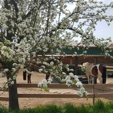
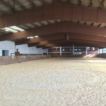
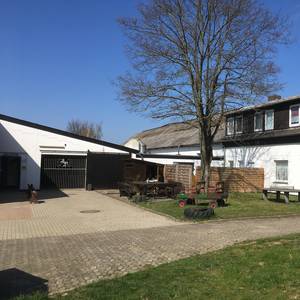
Reitsportanlage Kapusta
Klein vahlberg
Reitsportanlage Kapusta
@Reitanlage-klein-vahlberg
Freizeitstall
Rehabilitationsstall
Vermieten
Hunde willkommen
Krankenbox
Hufrehe geeignet
Notfallboxen
18 weitere...
P
Deprecated: Creation of dynamic property Zend_View_Helper_Ads::$adLink is deprecated in /var/www/stall-frei/htdocs/staging.stall-frei.de/library/Psf/View/Helper/Ads.php on line 108

Das Beste für die Hufe
Mechtersen
STALL-FREIde Marketing
@STALL-FREI-Marketing
Hufschmiede und Hufpfleger in Ihrer Nähe
Leider kein Vorschaubild
Leider kein Vorschaubild
Offenstall mit Trail und Sommerweide
Schöppenstedt
Anni
@Anni.Nuni
Freizeitstall
Vermieten
Hunde willkommen
Sattelkammer/Sattelschränke
Allergikerstall
Notfallboxen
7 weitere...
B
Leider kein Vorschaubild
Leider kein Vorschaubild
Offenstall mit Bewegungsanreizen
Berklingen
Susanne-Froboese
@Susanne-Froboese
Freizeitstall
Hunde willkommen
Krankenbox
Notfallboxen
Bewegungsstall
Laufstall
10 weitere...
B
Leider kein Vorschaubild
Leider kein Vorschaubild
Box im kleinen Privatstall frei
Vahlberg
Britta Brühl
@Stallgemeinschaft-am-Rittergut
Freizeitstall
Geländestrecke
Vermieten
Hunde willkommen
Paddock
Allergikerstall
12 weitere...
B

Aktivstall m. Paddocktrail, Reithalle, Außenplät...
Jerxheim
Jasperhof-Jerxheim
@Jasperhof-Jerxheim
Reitlehrer und -unterricht
Vermieten
Hunde willkommen
Krankenbox
Notfallboxen
17 weitere...
P


Offenstall, Boxen, Allergiker, Reithalle
Lehre
Niclas Lange
@Niclas_Lange
Freizeitstall
Gangpferdereiten
Vermieten
Hunde willkommen
Krankenbox
Allergikerstall
bedampftes/gewaschenes Heu
25 weitere...
S
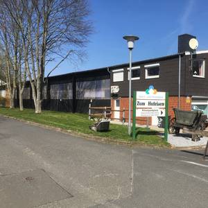
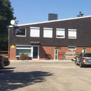

Reitanlage Mahner Berg
Salzgitter
Reitanlage-Mahner-Berg
@Reitanlage-Mahner-Berg
Freizeitstall
Gastronomie
Vermieten
Hunde willkommen
Longierzirkel/Roundpen
Hengsthaltung möglich
25 weitere...
aktuell
S

Leider kein Vorschaubild
Leider kein Vorschaubild
OFFENSTALLPLATZ frei! Inkl Müsli und 24 Std. Heu!
Hedeper
Pferdefarmy
@Pferdefarmy
FN-Mitglied
Freizeitstall
Hunde willkommen
Longierzirkel/Roundpen
Hufrehe geeignet
Notfallboxen
Laufstall
Offenstall
11 weitere...
B
Leider kein Vorschaubild
Leider kein Vorschaubild
Gr. Box mit viel Auslauf in Stutenherde frei
Evessen
Bogedain, Sandra
@Bogedain
Freizeitstall
VFD-Mitglied
Vermieten
Hunde willkommen
Longierzirkel/Roundpen
Hufrehe geeignet
8 weitere...
B
Leider kein Vorschaubild
Leider kein Vorschaubild
Pferdebox für Großpferd oder Pony
Denkte
RSG Asse e.V.
@RSG-Asse
FN-Mitglied
Freizeitstall
Vermieten
Hunde willkommen
Paddock
Innenbox
15 weitere...
B
Deprecated: Creation of dynamic property Zend_View::$pageCount is deprecated in /var/www/stall-frei/htdocs/staging.stall-frei.de/library/vendor/shardj/zf1-future/library/Zend/View/Abstract.php on line 308
Deprecated: Creation of dynamic property Zend_View::$itemCountPerPage is deprecated in /var/www/stall-frei/htdocs/staging.stall-frei.de/library/vendor/shardj/zf1-future/library/Zend/View/Abstract.php on line 308
Deprecated: Creation of dynamic property Zend_View::$first is deprecated in /var/www/stall-frei/htdocs/staging.stall-frei.de/library/vendor/shardj/zf1-future/library/Zend/View/Abstract.php on line 308
Deprecated: Creation of dynamic property Zend_View::$current is deprecated in /var/www/stall-frei/htdocs/staging.stall-frei.de/library/vendor/shardj/zf1-future/library/Zend/View/Abstract.php on line 308
Deprecated: Creation of dynamic property Zend_View::$last is deprecated in /var/www/stall-frei/htdocs/staging.stall-frei.de/library/vendor/shardj/zf1-future/library/Zend/View/Abstract.php on line 308
Deprecated: Creation of dynamic property Zend_View::$next is deprecated in /var/www/stall-frei/htdocs/staging.stall-frei.de/library/vendor/shardj/zf1-future/library/Zend/View/Abstract.php on line 308
Deprecated: Creation of dynamic property Zend_View::$pagesInRange is deprecated in /var/www/stall-frei/htdocs/staging.stall-frei.de/library/vendor/shardj/zf1-future/library/Zend/View/Abstract.php on line 308
Deprecated: Creation of dynamic property Zend_View::$firstPageInRange is deprecated in /var/www/stall-frei/htdocs/staging.stall-frei.de/library/vendor/shardj/zf1-future/library/Zend/View/Abstract.php on line 308
Deprecated: Creation of dynamic property Zend_View::$lastPageInRange is deprecated in /var/www/stall-frei/htdocs/staging.stall-frei.de/library/vendor/shardj/zf1-future/library/Zend/View/Abstract.php on line 308
Deprecated: Creation of dynamic property Zend_View::$currentItemCount is deprecated in /var/www/stall-frei/htdocs/staging.stall-frei.de/library/vendor/shardj/zf1-future/library/Zend/View/Abstract.php on line 308
Deprecated: Creation of dynamic property Zend_View::$totalItemCount is deprecated in /var/www/stall-frei/htdocs/staging.stall-frei.de/library/vendor/shardj/zf1-future/library/Zend/View/Abstract.php on line 308
Deprecated: Creation of dynamic property Zend_View::$firstItemNumber is deprecated in /var/www/stall-frei/htdocs/staging.stall-frei.de/library/vendor/shardj/zf1-future/library/Zend/View/Abstract.php on line 308
Deprecated: Creation of dynamic property Zend_View::$lastItemNumber is deprecated in /var/www/stall-frei/htdocs/staging.stall-frei.de/library/vendor/shardj/zf1-future/library/Zend/View/Abstract.php on line 308
Deprecated: Creation of dynamic property Zend_View::$router is deprecated in /var/www/stall-frei/htdocs/staging.stall-frei.de/library/vendor/shardj/zf1-future/library/Zend/View/Abstract.php on line 308
Deprecated: Creation of dynamic property Zend_View::$urlParams is deprecated in /var/www/stall-frei/htdocs/staging.stall-frei.de/library/vendor/shardj/zf1-future/library/Zend/View/Abstract.php on line 308
Deprecated: Creation of dynamic property Zend_View::$showAds is deprecated in /var/www/stall-frei/htdocs/staging.stall-frei.de/library/vendor/shardj/zf1-future/library/Zend/View/Abstract.php on line 308
Deprecated: Creation of dynamic property Zend_View::$objectIds is deprecated in /var/www/stall-frei/htdocs/staging.stall-frei.de/library/vendor/shardj/zf1-future/library/Zend/View/Abstract.php on line 308
Deprecated: Creation of dynamic property Zend_View::$showNavbar is deprecated in /var/www/stall-frei/htdocs/staging.stall-frei.de/library/vendor/shardj/zf1-future/library/Zend/View/Abstract.php on line 308
Deprecated: Creation of dynamic property Zend_View::$showBreadcrumb is deprecated in /var/www/stall-frei/htdocs/staging.stall-frei.de/library/vendor/shardj/zf1-future/library/Zend/View/Abstract.php on line 308
Deprecated: Creation of dynamic property Zend_View::$showFooter is deprecated in /var/www/stall-frei/htdocs/staging.stall-frei.de/library/vendor/shardj/zf1-future/library/Zend/View/Abstract.php on line 308
Deprecated: Creation of dynamic property Zend_View::$showInternalAds is deprecated in /var/www/stall-frei/htdocs/staging.stall-frei.de/library/vendor/shardj/zf1-future/library/Zend/View/Abstract.php on line 308
Deprecated: Creation of dynamic property Zend_View::$blNoContent is deprecated in /var/www/stall-frei/htdocs/staging.stall-frei.de/library/vendor/shardj/zf1-future/library/Zend/View/Abstract.php on line 308
Deprecated: Creation of dynamic property Zend_View::$sMetaDesc is deprecated in /var/www/stall-frei/htdocs/staging.stall-frei.de/library/vendor/shardj/zf1-future/library/Zend/View/Abstract.php on line 308
Deprecated: Creation of dynamic property Zend_View::$useGmaps is deprecated in /var/www/stall-frei/htdocs/staging.stall-frei.de/library/vendor/shardj/zf1-future/library/Zend/View/Abstract.php on line 308
Deprecated: Creation of dynamic property Zend_View::$touches is deprecated in /var/www/stall-frei/htdocs/staging.stall-frei.de/library/vendor/shardj/zf1-future/library/Zend/View/Abstract.php on line 308
Deprecated: Creation of dynamic property Zend_View::$oProject is deprecated in /var/www/stall-frei/htdocs/staging.stall-frei.de/library/vendor/shardj/zf1-future/library/Zend/View/Abstract.php on line 308
Deprecated: Creation of dynamic property Zend_View::$pageHeadline is deprecated in /var/www/stall-frei/htdocs/staging.stall-frei.de/library/vendor/shardj/zf1-future/library/Zend/View/Abstract.php on line 308
Deprecated: Creation of dynamic property Zend_View::$disableLocationField is deprecated in /var/www/stall-frei/htdocs/staging.stall-frei.de/library/vendor/shardj/zf1-future/library/Zend/View/Abstract.php on line 308
Deprecated: Creation of dynamic property Zend_View::$isSearch is deprecated in /var/www/stall-frei/htdocs/staging.stall-frei.de/library/vendor/shardj/zf1-future/library/Zend/View/Abstract.php on line 308
Deprecated: Creation of dynamic property Zend_View::$pageTitle is deprecated in /var/www/stall-frei/htdocs/staging.stall-frei.de/library/vendor/shardj/zf1-future/library/Zend/View/Abstract.php on line 308
Deprecated: Creation of dynamic property Psf_Form_Element_Text::$class is deprecated in /var/www/stall-frei/htdocs/staging.stall-frei.de/library/vendor/shardj/zf1-future/library/Zend/Form/Element.php on line 874
Deprecated: Creation of dynamic property Psf_Form_Element_Text::$size is deprecated in /var/www/stall-frei/htdocs/staging.stall-frei.de/library/vendor/shardj/zf1-future/library/Zend/Form/Element.php on line 874
Deprecated: Creation of dynamic property Psf_Form_Element_Text::$placeholder is deprecated in /var/www/stall-frei/htdocs/staging.stall-frei.de/library/vendor/shardj/zf1-future/library/Zend/Form/Element.php on line 874
Deprecated: Creation of dynamic property Psf_Form_Element_Hidden::$class is deprecated in /var/www/stall-frei/htdocs/staging.stall-frei.de/library/vendor/shardj/zf1-future/library/Zend/Form/Element.php on line 874
Deprecated: Creation of dynamic property Psf_Form_Element_Hidden::$class is deprecated in /var/www/stall-frei/htdocs/staging.stall-frei.de/library/vendor/shardj/zf1-future/library/Zend/Form/Element.php on line 874
Deprecated: Creation of dynamic property Psf_Form_Element_Hidden::$class is deprecated in /var/www/stall-frei/htdocs/staging.stall-frei.de/library/vendor/shardj/zf1-future/library/Zend/Form/Element.php on line 874
Deprecated: Creation of dynamic property Psf_Form_Element_Hidden::$class is deprecated in /var/www/stall-frei/htdocs/staging.stall-frei.de/library/vendor/shardj/zf1-future/library/Zend/Form/Element.php on line 874
Deprecated: Creation of dynamic property Psf_Form_Element_Select::$class is deprecated in /var/www/stall-frei/htdocs/staging.stall-frei.de/library/vendor/shardj/zf1-future/library/Zend/Form/Element.php on line 874
Deprecated: Creation of dynamic property Psf_Form_Element_Select::$class is deprecated in /var/www/stall-frei/htdocs/staging.stall-frei.de/library/vendor/shardj/zf1-future/library/Zend/Form/Element.php on line 874
Deprecated: Creation of dynamic property Psf_Form_Element_Select::$class is deprecated in /var/www/stall-frei/htdocs/staging.stall-frei.de/library/vendor/shardj/zf1-future/library/Zend/Form/Element.php on line 874
Deprecated: Creation of dynamic property Psf_Form_Element_Select::$class is deprecated in /var/www/stall-frei/htdocs/staging.stall-frei.de/library/vendor/shardj/zf1-future/library/Zend/Form/Element.php on line 874
Deprecated: Creation of dynamic property Psf_Form_Element_Text::$class is deprecated in /var/www/stall-frei/htdocs/staging.stall-frei.de/library/vendor/shardj/zf1-future/library/Zend/Form/Element.php on line 874
Deprecated: Creation of dynamic property Psf_Form_Element_Checkbox::$label is deprecated in /var/www/stall-frei/htdocs/staging.stall-frei.de/library/vendor/shardj/zf1-future/library/Zend/Form/Element.php on line 874
Deprecated: Creation of dynamic property Zend_View::$sort is deprecated in /var/www/stall-frei/htdocs/staging.stall-frei.de/library/vendor/shardj/zf1-future/library/Zend/View/Abstract.php on line 308
Deprecated: Creation of dynamic property Zend_View::$searchLocation is deprecated in /var/www/stall-frei/htdocs/staging.stall-frei.de/library/vendor/shardj/zf1-future/library/Zend/View/Abstract.php on line 308
Deprecated: Creation of dynamic property Zend_View::$locationHint is deprecated in /var/www/stall-frei/htdocs/staging.stall-frei.de/library/vendor/shardj/zf1-future/library/Zend/View/Abstract.php on line 308
Psf_GeoCoder_Abstract::getLocation: Uehrde Get Location CachedOrLive
Psf_GeoCoder_Abstract::getCachedOrLive: Uehrde
Psf_GeoCoder_OpenCageData::makeApiRequest: response:
Array
(
[documentation] => https://opencagedata.com/api
[licenses] => Array
(
[0] => Array
(
[name] => see attribution guide
[url] => https://opencagedata.com/credits
)
)
[results] => Array
(
[0] => Array
(
[bounds] => Array
(
[northeast] => Array
(
[lat] => 52.1260894
[lng] => 10.8433326
)
[southwest] => Array
(
[lat] => 52.075665
[lng] => 10.7320585
)
)
[components] => Array
(
[ISO_3166-1_alpha-2] => DE
[ISO_3166-1_alpha-3] => DEU
[ISO_3166-2] => Array
(
[0] => DE-NI
)
[_category] => place
[_normalized_city] => Uehrde
[_type] => village
[continent] => Europe
[country] => Deutschland
[country_code] => de
[county] => Landkreis Wolfenbüttel
[municipality] => Samtgemeinde Elm-Asse
[political_union] => European Union
[state] => Niedersachsen
[state_code] => NI
[village] => Uehrde
)
[confidence] => 7
[formatted] => Uehrde, Niedersachsen, Deutschland
[geometry] => Array
(
[lat] => 52.0999198
[lng] => 10.7641184
)
)
[1] => Array
(
[bounds] => Array
(
[northeast] => Array
(
[lat] => 51.725683
[lng] => 10.2280422
)
[southwest] => Array
(
[lat] => 51.685683
[lng] => 10.1880422
)
)
[components] => Array
(
[ISO_3166-1_alpha-2] => DE
[ISO_3166-1_alpha-3] => DEU
[ISO_3166-2] => Array
(
[0] => DE-NI
)
[_category] => place
[_normalized_city] => Osterode am Harz
[_type] => city
[continent] => Europe
[country] => Deutschland
[country_code] => de
[county] => Landkreis Göttingen
[political_union] => European Union
[postcode] => 37520
[state] => Niedersachsen
[state_code] => NI
[town] => Osterode am Harz
)
[confidence] => 7
[formatted] => 37520 Osterode am Harz, Deutschland
[geometry] => Array
(
[lat] => 51.705683
[lng] => 10.2080422
)
)
[2] => Array
(
[components] => Array
(
[ISO_3166-1_alpha-2] => FR
[ISO_3166-1_alpha-3] => FRA
[ISO_3166-2] => Array
(
[0] => FR-IDF
[1] => FR-92
)
[_category] => road
[_normalized_city] => Levallois-Perret
[_type] => road
[city] => Levallois-Perret
[continent] => Europe
[country] => France
[country_code] => fr
[county] => Hauts-de-Seine
[local_authority] => Métropole du Grand Paris
[political_union] => European Union
[postcode] => 92300
[road] => Rue Charles Deutschmann
[state] => Île-de-France
[state_code] => IDF
)
[confidence] => 3
[formatted] => Rue Charles Deutschmann, 92300 Levallois-Perret, France
[geometry] => Array
(
[lat] => 48.900049
[lng] => 2.2842
)
)
[3] => Array
(
[components] => Array
(
[ISO_3166-1_alpha-2] => FR
[ISO_3166-1_alpha-3] => FRA
[ISO_3166-2] => Array
(
[0] => FR-PAC
[1] => FR-84
)
[_category] => road
[_normalized_city] => Caderousse
[_type] => road
[city] => Caderousse
[continent] => Europe
[country] => France
[country_code] => fr
[county] => Vaucluse
[local_authority] => Communauté de communes Pays d'Orange en Provence
[political_union] => European Union
[postcode] => 84860
[road] => Route de la Grange Boerde
[state] => Provence-Alpes-Côte d'Azur
[state_code] => PAC
)
[confidence] => 2
[formatted] => Route de la Grange Boerde, 84860 Caderousse, France
[geometry] => Array
(
[lat] => 44.130984
[lng] => 4.753407
)
)
[4] => Array
(
[components] => Array
(
[ISO_3166-1_alpha-2] => FR
[ISO_3166-1_alpha-3] => FRA
[ISO_3166-2] => Array
(
[0] => FR-GES
[1] => FR-08
)
[_category] => road
[_normalized_city] => Singly
[_type] => road
[city] => Singly
[continent] => Europe
[country] => France
[country_code] => fr
[county] => Ardennes
[local_authority] => Communauté de communes des Crêtes Préardennaises
[political_union] => European Union
[postcode] => 08430
[road] => Chemin de la Huarde
[state] => Grand Est
[state_code] => GES
)
[confidence] => 2
[formatted] => Chemin de la Huarde, 08430 Singly, France
[geometry] => Array
(
[lat] => 49.640942
[lng] => 4.695895
)
)
[5] => Array
(
[components] => Array
(
[ISO_3166-1_alpha-2] => FR
[ISO_3166-1_alpha-3] => FRA
[ISO_3166-2] => Array
(
[0] => FR-NOR
[1] => FR-50
)
[_category] => road
[_normalized_city] => Besneville
[_type] => road
[city] => Besneville
[continent] => Europe
[country] => France
[country_code] => fr
[county] => Manche
[local_authority] => Communauté d'agglomération du Cotentin
[political_union] => European Union
[postcode] => 50390
[road] => Route de la Huerie
[state] => Normandie
[state_code] => NOR
)
[confidence] => 2
[formatted] => Route de la Huerie, 50390 Besneville, France
[geometry] => Array
(
[lat] => 49.393081
[lng] => -1.634027
)
)
[6] => Array
(
[components] => Array
(
[ISO_3166-1_alpha-2] => FR
[ISO_3166-1_alpha-3] => FRA
[ISO_3166-2] => Array
(
[0] => FR-GES
[1] => FR-55
)
[_category] => road
[_normalized_city] => Spincourt
[_type] => road
[city] => Spincourt
[continent] => Europe
[country] => France
[country_code] => fr
[county] => Meuse
[local_authority] => Communauté de communes de Damvillers Spincourt
[political_union] => European Union
[postcode] => 55230
[road] => Ferme de la Huarde
[state] => Grand Est
[state_code] => GES
)
[confidence] => 2
[formatted] => Ferme de la Huarde, 55230 Spincourt, France
[geometry] => Array
(
[lat] => 49.316962
[lng] => 5.660622
)
)
[7] => Array
(
[components] => Array
(
[ISO_3166-1_alpha-2] => FR
[ISO_3166-1_alpha-3] => FRA
[ISO_3166-2] => Array
(
[0] => FR-PAC
[1] => FR-06
)
[_category] => road
[_normalized_city] => Péone
[_type] => road
[city] => Péone
[continent] => Europe
[country] => France
[country_code] => fr
[county] => Alpes-Maritimes
[local_authority] => Communauté de communes Alpes d'Azur
[political_union] => European Union
[postcode] => 06470
[road] => Route des Huerris
[state] => Provence-Alpes-Côte d'Azur
[state_code] => PAC
)
[confidence] => 2
[formatted] => Route des Huerris, 06470 Péone, France
[geometry] => Array
(
[lat] => 44.094648
[lng] => 6.937697
)
)
[8] => Array
(
[components] => Array
(
[ISO_3166-1_alpha-2] => FR
[ISO_3166-1_alpha-3] => FRA
[ISO_3166-2] => Array
(
[0] => FR-NOR
[1] => FR-50
)
[_category] => road
[_normalized_city] => Saint-Sauveur-Villages
[_type] => road
[city] => Saint-Sauveur-Villages
[continent] => Europe
[country] => France
[country_code] => fr
[county] => Manche
[local_authority] => Communauté de communes Coutances Mer et Bocage
[political_union] => European Union
[postcode] => 50490
[road] => Impasse de la Huerie
[state] => Normandie
[state_code] => NOR
)
[confidence] => 10
[formatted] => Impasse de la Huerie, 50490 Saint-Sauveur-Villages, France
[geometry] => Array
(
[lat] => 49.105053
[lng] => -1.425365
)
)
[9] => Array
(
[components] => Array
(
[ISO_3166-1_alpha-2] => RE
[ISO_3166-1_alpha-3] => REU
[ISO_3166-2] => Array
(
[0] => FR-974
)
[_category] => road
[_normalized_city] => Saint-Pierre
[_type] => road
[city] => Saint-Pierre
[continent] => Africa
[country] => France
[country_code] => fr
[county] => La Réunion
[local_authority] => Communauté intercommunale des Villes solidaires
[political_union] => European Union
[postcode] => 97432
[road] => Impasse Ferde
[state] =>
)
[confidence] => 10
[formatted] => Impasse Ferde, 97432 Saint-Pierre, France
[geometry] => Array
(
[lat] => -21.286772
[lng] => 55.462567
)
)
)
[status] => Array
(
[code] => 200
[message] => OK
)
[stay_informed] => Array
(
[blog] => https://blog.opencagedata.com
[mastodon] => https://en.osm.town/@opencage
)
[thanks] => For using an OpenCage API
[timestamp] => Array
(
[created_http] => Sat, 07 Feb 2026 19:32:00 GMT
[created_unix] => 1770492720
)
[total_results] => 10
)
Psf_GeoCoder_Abstract::convertLocationResult
{"documentation":"https:\/\/opencagedata.com\/api","licenses":[{"name":"see attribution guide","url":"https:\/\/opencagedata.com\/credits"}],"results":[{"bounds":{"northeast":{"lat":52.1260894,"lng":10.8433326},"southwest":{"lat":52.075665,"lng":10.7320585}},"components":{"ISO_3166-1_alpha-2":"DE","ISO_3166-1_alpha-3":"DEU","ISO_3166-2":["DE-NI"],"_category":"place","_normalized_city":"Uehrde","_type":"village","continent":"Europe","country":"Deutschland","country_code":"de","county":"Landkreis Wolfenb\u00fcttel","municipality":"Samtgemeinde Elm-Asse","political_union":"European Union","state":"Niedersachsen","state_code":"NI","village":"Uehrde"},"confidence":7,"formatted":"Uehrde, Niedersachsen, Deutschland","geometry":{"lat":52.0999198,"lng":10.7641184}},{"bounds":{"northeast":{"lat":51.725683,"lng":10.2280422},"southwest":{"lat":51.685683,"lng":10.1880422}},"components":{"ISO_3166-1_alpha-2":"DE","ISO_3166-1_alpha-3":"DEU","ISO_3166-2":["DE-NI"],"_category":"place","_normalized_city":"Osterode am Harz","_type":"city","continent":"Europe","country":"Deutschland","country_code":"de","county":"Landkreis G\u00f6ttingen","political_union":"European Union","postcode":"37520","state":"Niedersachsen","state_code":"NI","town":"Osterode am Harz"},"confidence":7,"formatted":"37520 Osterode am Harz, Deutschland","geometry":{"lat":51.705683,"lng":10.2080422}},{"components":{"ISO_3166-1_alpha-2":"FR","ISO_3166-1_alpha-3":"FRA","ISO_3166-2":["FR-IDF","FR-92"],"_category":"road","_normalized_city":"Levallois-Perret","_type":"road","city":"Levallois-Perret","continent":"Europe","country":"France","country_code":"fr","county":"Hauts-de-Seine","local_authority":"M\u00e9tropole du Grand Paris","political_union":"European Union","postcode":"92300","road":"Rue Charles Deutschmann","state":"\u00cele-de-France","state_code":"IDF"},"confidence":3,"formatted":"Rue Charles Deutschmann, 92300 Levallois-Perret, France","geometry":{"lat":48.900049,"lng":2.2842}},{"components":{"ISO_3166-1_alpha-2":"FR","ISO_3166-1_alpha-3":"FRA","ISO_3166-2":["FR-PAC","FR-84"],"_category":"road","_normalized_city":"Caderousse","_type":"road","city":"Caderousse","continent":"Europe","country":"France","country_code":"fr","county":"Vaucluse","local_authority":"Communaut\u00e9 de communes Pays d'Orange en Provence","political_union":"European Union","postcode":"84860","road":"Route de la Grange Boerde","state":"Provence-Alpes-C\u00f4te d'Azur","state_code":"PAC"},"confidence":2,"formatted":"Route de la Grange Boerde, 84860 Caderousse, France","geometry":{"lat":44.130984,"lng":4.753407}},{"components":{"ISO_3166-1_alpha-2":"FR","ISO_3166-1_alpha-3":"FRA","ISO_3166-2":["FR-GES","FR-08"],"_category":"road","_normalized_city":"Singly","_type":"road","city":"Singly","continent":"Europe","country":"France","country_code":"fr","county":"Ardennes","local_authority":"Communaut\u00e9 de communes des Cr\u00eates Pr\u00e9ardennaises","political_union":"European Union","postcode":"08430","road":"Chemin de la Huarde","state":"Grand Est","state_code":"GES"},"confidence":2,"formatted":"Chemin de la Huarde, 08430 Singly, France","geometry":{"lat":49.640942,"lng":4.695895}},{"components":{"ISO_3166-1_alpha-2":"FR","ISO_3166-1_alpha-3":"FRA","ISO_3166-2":["FR-NOR","FR-50"],"_category":"road","_normalized_city":"Besneville","_type":"road","city":"Besneville","continent":"Europe","country":"France","country_code":"fr","county":"Manche","local_authority":"Communaut\u00e9 d'agglom\u00e9ration du Cotentin","political_union":"European Union","postcode":"50390","road":"Route de la Huerie","state":"Normandie","state_code":"NOR"},"confidence":2,"formatted":"Route de la Huerie, 50390 Besneville, France","geometry":{"lat":49.393081,"lng":-1.634027}},{"components":{"ISO_3166-1_alpha-2":"FR","ISO_3166-1_alpha-3":"FRA","ISO_3166-2":["FR-GES","FR-55"],"_category":"road","_normalized_city":"Spincourt","_type":"road","city":"Spincourt","continent":"Europe","country":"France","country_code":"fr","county":"Meuse","local_authority":"Communaut\u00e9 de communes de Damvillers Spincourt","political_union":"European Union","postcode":"55230","road":"Ferme de la Huarde","state":"Grand Est","state_code":"GES"},"confidence":2,"formatted":"Ferme de la Huarde, 55230 Spincourt, France","geometry":{"lat":49.316962,"lng":5.660622}},{"components":{"ISO_3166-1_alpha-2":"FR","ISO_3166-1_alpha-3":"FRA","ISO_3166-2":["FR-PAC","FR-06"],"_category":"road","_normalized_city":"P\u00e9one","_type":"road","city":"P\u00e9one","continent":"Europe","country":"France","country_code":"fr","county":"Alpes-Maritimes","local_authority":"Communaut\u00e9 de communes Alpes d'Azur","political_union":"European Union","postcode":"06470","road":"Route des Huerris","state":"Provence-Alpes-C\u00f4te d'Azur","state_code":"PAC"},"confidence":2,"formatted":"Route des Huerris, 06470 P\u00e9one, France","geometry":{"lat":44.094648,"lng":6.937697}},{"components":{"ISO_3166-1_alpha-2":"FR","ISO_3166-1_alpha-3":"FRA","ISO_3166-2":["FR-NOR","FR-50"],"_category":"road","_normalized_city":"Saint-Sauveur-Villages","_type":"road","city":"Saint-Sauveur-Villages","continent":"Europe","country":"France","country_code":"fr","county":"Manche","local_authority":"Communaut\u00e9 de communes Coutances Mer et Bocage","political_union":"European Union","postcode":"50490","road":"Impasse de la Huerie","state":"Normandie","state_code":"NOR"},"confidence":10,"formatted":"Impasse de la Huerie, 50490 Saint-Sauveur-Villages, France","geometry":{"lat":49.105053,"lng":-1.425365}},{"components":{"ISO_3166-1_alpha-2":"RE","ISO_3166-1_alpha-3":"REU","ISO_3166-2":["FR-974"],"_category":"road","_normalized_city":"Saint-Pierre","_type":"road","city":"Saint-Pierre","continent":"Africa","country":"France","country_code":"fr","county":"La R\u00e9union","local_authority":"Communaut\u00e9 intercommunale des Villes solidaires","political_union":"European Union","postcode":"97432","road":"Impasse Ferde","state":null},"confidence":10,"formatted":"Impasse Ferde, 97432 Saint-Pierre, France","geometry":{"lat":-21.286772,"lng":55.462567}}],"status":{"code":200,"message":"OK"},"stay_informed":{"blog":"https:\/\/blog.opencagedata.com","mastodon":"https:\/\/en.osm.town\/@opencage"},"thanks":"For using an OpenCage API","timestamp":{"created_http":"Sat, 07 Feb 2026 19:32:00 GMT","created_unix":1770492720},"total_results":10}Array
(
[0] => stdClass Object
(
[bounds] => stdClass Object
(
[northeast] => stdClass Object
(
[lat] => 52.1260894
[lng] => 10.8433326
)
[southwest] => stdClass Object
(
[lat] => 52.075665
[lng] => 10.7320585
)
)
[components] => stdClass Object
(
[ISO_3166-1_alpha-2] => DE
[ISO_3166-1_alpha-3] => DEU
[ISO_3166-2] => Array
(
[0] => DE-NI
)
[_category] => place
[_normalized_city] => Uehrde
[_type] => village
[continent] => Europe
[country] => Deutschland
[country_code] => de
[county] => Landkreis Wolfenbüttel
[municipality] => Samtgemeinde Elm-Asse
[political_union] => European Union
[state] => Niedersachsen
[state_code] => NI
[village] => Uehrde
)
[confidence] => 7
[formatted] => Uehrde, Niedersachsen, Deutschland
[geometry] => stdClass Object
(
[lat] => 52.0999198
[lng] => 10.7641184
)
)
[1] => stdClass Object
(
[bounds] => stdClass Object
(
[northeast] => stdClass Object
(
[lat] => 51.725683
[lng] => 10.2280422
)
[southwest] => stdClass Object
(
[lat] => 51.685683
[lng] => 10.1880422
)
)
[components] => stdClass Object
(
[ISO_3166-1_alpha-2] => DE
[ISO_3166-1_alpha-3] => DEU
[ISO_3166-2] => Array
(
[0] => DE-NI
)
[_category] => place
[_normalized_city] => Osterode am Harz
[_type] => city
[continent] => Europe
[country] => Deutschland
[country_code] => de
[county] => Landkreis Göttingen
[political_union] => European Union
[postcode] => 37520
[state] => Niedersachsen
[state_code] => NI
[town] => Osterode am Harz
)
[confidence] => 7
[formatted] => 37520 Osterode am Harz, Deutschland
[geometry] => stdClass Object
(
[lat] => 51.705683
[lng] => 10.2080422
)
)
[2] => stdClass Object
(
[components] => stdClass Object
(
[ISO_3166-1_alpha-2] => FR
[ISO_3166-1_alpha-3] => FRA
[ISO_3166-2] => Array
(
[0] => FR-IDF
[1] => FR-92
)
[_category] => road
[_normalized_city] => Levallois-Perret
[_type] => road
[city] => Levallois-Perret
[continent] => Europe
[country] => France
[country_code] => fr
[county] => Hauts-de-Seine
[local_authority] => Métropole du Grand Paris
[political_union] => European Union
[postcode] => 92300
[road] => Rue Charles Deutschmann
[state] => Île-de-France
[state_code] => IDF
)
[confidence] => 3
[formatted] => Rue Charles Deutschmann, 92300 Levallois-Perret, France
[geometry] => stdClass Object
(
[lat] => 48.900049
[lng] => 2.2842
)
)
[3] => stdClass Object
(
[components] => stdClass Object
(
[ISO_3166-1_alpha-2] => FR
[ISO_3166-1_alpha-3] => FRA
[ISO_3166-2] => Array
(
[0] => FR-PAC
[1] => FR-84
)
[_category] => road
[_normalized_city] => Caderousse
[_type] => road
[city] => Caderousse
[continent] => Europe
[country] => France
[country_code] => fr
[county] => Vaucluse
[local_authority] => Communauté de communes Pays d'Orange en Provence
[political_union] => European Union
[postcode] => 84860
[road] => Route de la Grange Boerde
[state] => Provence-Alpes-Côte d'Azur
[state_code] => PAC
)
[confidence] => 2
[formatted] => Route de la Grange Boerde, 84860 Caderousse, France
[geometry] => stdClass Object
(
[lat] => 44.130984
[lng] => 4.753407
)
)
[4] => stdClass Object
(
[components] => stdClass Object
(
[ISO_3166-1_alpha-2] => FR
[ISO_3166-1_alpha-3] => FRA
[ISO_3166-2] => Array
(
[0] => FR-GES
[1] => FR-08
)
[_category] => road
[_normalized_city] => Singly
[_type] => road
[city] => Singly
[continent] => Europe
[country] => France
[country_code] => fr
[county] => Ardennes
[local_authority] => Communauté de communes des Crêtes Préardennaises
[political_union] => European Union
[postcode] => 08430
[road] => Chemin de la Huarde
[state] => Grand Est
[state_code] => GES
)
[confidence] => 2
[formatted] => Chemin de la Huarde, 08430 Singly, France
[geometry] => stdClass Object
(
[lat] => 49.640942
[lng] => 4.695895
)
)
[5] => stdClass Object
(
[components] => stdClass Object
(
[ISO_3166-1_alpha-2] => FR
[ISO_3166-1_alpha-3] => FRA
[ISO_3166-2] => Array
(
[0] => FR-NOR
[1] => FR-50
)
[_category] => road
[_normalized_city] => Besneville
[_type] => road
[city] => Besneville
[continent] => Europe
[country] => France
[country_code] => fr
[county] => Manche
[local_authority] => Communauté d'agglomération du Cotentin
[political_union] => European Union
[postcode] => 50390
[road] => Route de la Huerie
[state] => Normandie
[state_code] => NOR
)
[confidence] => 2
[formatted] => Route de la Huerie, 50390 Besneville, France
[geometry] => stdClass Object
(
[lat] => 49.393081
[lng] => -1.634027
)
)
[6] => stdClass Object
(
[components] => stdClass Object
(
[ISO_3166-1_alpha-2] => FR
[ISO_3166-1_alpha-3] => FRA
[ISO_3166-2] => Array
(
[0] => FR-GES
[1] => FR-55
)
[_category] => road
[_normalized_city] => Spincourt
[_type] => road
[city] => Spincourt
[continent] => Europe
[country] => France
[country_code] => fr
[county] => Meuse
[local_authority] => Communauté de communes de Damvillers Spincourt
[political_union] => European Union
[postcode] => 55230
[road] => Ferme de la Huarde
[state] => Grand Est
[state_code] => GES
)
[confidence] => 2
[formatted] => Ferme de la Huarde, 55230 Spincourt, France
[geometry] => stdClass Object
(
[lat] => 49.316962
[lng] => 5.660622
)
)
[7] => stdClass Object
(
[components] => stdClass Object
(
[ISO_3166-1_alpha-2] => FR
[ISO_3166-1_alpha-3] => FRA
[ISO_3166-2] => Array
(
[0] => FR-PAC
[1] => FR-06
)
[_category] => road
[_normalized_city] => Péone
[_type] => road
[city] => Péone
[continent] => Europe
[country] => France
[country_code] => fr
[county] => Alpes-Maritimes
[local_authority] => Communauté de communes Alpes d'Azur
[political_union] => European Union
[postcode] => 06470
[road] => Route des Huerris
[state] => Provence-Alpes-Côte d'Azur
[state_code] => PAC
)
[confidence] => 2
[formatted] => Route des Huerris, 06470 Péone, France
[geometry] => stdClass Object
(
[lat] => 44.094648
[lng] => 6.937697
)
)
[8] => stdClass Object
(
[components] => stdClass Object
(
[ISO_3166-1_alpha-2] => FR
[ISO_3166-1_alpha-3] => FRA
[ISO_3166-2] => Array
(
[0] => FR-NOR
[1] => FR-50
)
[_category] => road
[_normalized_city] => Saint-Sauveur-Villages
[_type] => road
[city] => Saint-Sauveur-Villages
[continent] => Europe
[country] => France
[country_code] => fr
[county] => Manche
[local_authority] => Communauté de communes Coutances Mer et Bocage
[political_union] => European Union
[postcode] => 50490
[road] => Impasse de la Huerie
[state] => Normandie
[state_code] => NOR
)
[confidence] => 10
[formatted] => Impasse de la Huerie, 50490 Saint-Sauveur-Villages, France
[geometry] => stdClass Object
(
[lat] => 49.105053
[lng] => -1.425365
)
)
[9] => stdClass Object
(
[components] => stdClass Object
(
[ISO_3166-1_alpha-2] => RE
[ISO_3166-1_alpha-3] => REU
[ISO_3166-2] => Array
(
[0] => FR-974
)
[_category] => road
[_normalized_city] => Saint-Pierre
[_type] => road
[city] => Saint-Pierre
[continent] => Africa
[country] => France
[country_code] => fr
[county] => La Réunion
[local_authority] => Communauté intercommunale des Villes solidaires
[political_union] => European Union
[postcode] => 97432
[road] => Impasse Ferde
[state] =>
)
[confidence] => 10
[formatted] => Impasse Ferde, 97432 Saint-Pierre, France
[geometry] => stdClass Object
(
[lat] => -21.286772
[lng] => 55.462567
)
)
)
Psf_GeoCoder_OpenCageData::getKeyMap: 0
stdClass Object
(
    [bounds] => stdClass Object
        (
            [northeast] => stdClass Object
                (
                    [lat] => 52.1260894
                    [lng] => 10.8433326
                )

            [southwest] => stdClass Object
                (
                    [lat] => 52.075665
                    [lng] => 10.7320585
                )

        )

    [components] => stdClass Object
        (
            [ISO_3166-1_alpha-2] => DE
            [ISO_3166-1_alpha-3] => DEU
            [ISO_3166-2] => Array
                (
                    [0] => DE-NI
                )

            [_category] => place
            [_normalized_city] => Uehrde
            [_type] => village
            [continent] => Europe
            [country] => Deutschland
            [country_code] => de
            [county] => Landkreis Wolfenbüttel
            [municipality] => Samtgemeinde Elm-Asse
            [political_union] => European Union
            [state] => Niedersachsen
            [state_code] => NI
            [village] => Uehrde
        )

    [confidence] => 7
    [formatted] => Uehrde, Niedersachsen, Deutschland
    [geometry] => stdClass Object
        (
            [lat] => 52.0999198
            [lng] => 10.7641184
        )

)
Psf_GeoCoder_OpenCageData::getCounty: Wolfenbüttel
Psf_GeoCoder_OpenCageData::addMissingData REFETCH!
Array
(
    [address] => Uehrde, Niedersachsen, Deutschland
    [type] => village
    [street] =>
    [city] => Uehrde
    [county] => Wolfenbüttel
    [state] => Niedersachsen
    [zip] =>
    [country] => Deutschland
    [suburb] =>
    [countrycode] => de
    [latitude] => 52.0999198
    [longitude] => 10.7641184
    [accuracy] => 1
    [confidence] => 7
    [bounds] => stdClass Object
        (
            [northeast] => stdClass Object
                (
                    [lat] => 52.1260894
                    [lng] => 10.8433326
                )

            [southwest] => stdClass Object
                (
                    [lat] => 52.075665
                    [lng] => 10.7320585
                )

        )

)
reformat!
Array
(
    [address] => Uehrde, Niedersachsen, Deutschland
    [type] => village
    [street] =>
    [city] => Uehrde
    [county] => Wolfenbüttel
    [state] => Niedersachsen
    [zip] =>
    [country] => Deutschland
    [suburb] =>
    [countrycode] => de
    [latitude] => 52.0999198
    [longitude] => 10.7641184
    [accuracy] => 1
    [confidence] => 7
    [bounds] => stdClass Object
        (
            [northeast] => stdClass Object
                (
                    [lat] => 52.1260894
                    [lng] => 10.8433326
                )

            [southwest] => stdClass Object
                (
                    [lat] => 52.075665
                    [lng] => 10.7320585
                )

        )

    [place] => Uehrde, Niedersachsen
    [hash] => 24abe1e001044ec44326bdfd71a915de
)
Psf_GeoCoder_OpenCageData::getKeyMap: 1
stdClass Object
(
    [bounds] => stdClass Object
        (
            [northeast] => stdClass Object
                (
                    [lat] => 51.725683
                    [lng] => 10.2280422
                )

            [southwest] => stdClass Object
                (
                    [lat] => 51.685683
                    [lng] => 10.1880422
                )

        )

    [components] => stdClass Object
        (
            [ISO_3166-1_alpha-2] => DE
            [ISO_3166-1_alpha-3] => DEU
            [ISO_3166-2] => Array
                (
                    [0] => DE-NI
                )

            [_category] => place
            [_normalized_city] => Osterode am Harz
            [_type] => city
            [continent] => Europe
            [country] => Deutschland
            [country_code] => de
            [county] => Landkreis Göttingen
            [political_union] => European Union
            [postcode] => 37520
            [state] => Niedersachsen
            [state_code] => NI
            [town] => Osterode am Harz
        )

    [confidence] => 7
    [formatted] => 37520 Osterode am Harz, Deutschland
    [geometry] => stdClass Object
        (
            [lat] => 51.705683
            [lng] => 10.2080422
        )

)
Psf_GeoCoder_OpenCageData::getCounty: Göttingen
Psf_GeoCoder_OpenCageData::addMissingData REFETCH!
Array
(
    [address] => 37520 Osterode am Harz, Deutschland
    [type] => city
    [street] =>
    [city] => Osterode am Harz
    [county] => Göttingen
    [state] => Niedersachsen
    [zip] => 37520
    [country] => Deutschland
    [suburb] =>
    [countrycode] => de
    [latitude] => 51.705683
    [longitude] => 10.2080422
    [accuracy] => 1
    [confidence] => 7
    [bounds] => stdClass Object
        (
            [northeast] => stdClass Object
                (
                    [lat] => 51.725683
                    [lng] => 10.2280422
                )

            [southwest] => stdClass Object
                (
                    [lat] => 51.685683
                    [lng] => 10.1880422
                )

        )

)
reformat!
Array
(
    [address] => 37520 Osterode am Harz, Deutschland
    [type] => city
    [street] =>
    [city] => Osterode am Harz
    [county] => Göttingen
    [state] => Niedersachsen
    [zip] => 37520
    [country] => Deutschland
    [suburb] =>
    [countrycode] => de
    [latitude] => 51.705683
    [longitude] => 10.2080422
    [accuracy] => 1
    [confidence] => 7
    [bounds] => stdClass Object
        (
            [northeast] => stdClass Object
                (
                    [lat] => 51.725683
                    [lng] => 10.2280422
                )

            [southwest] => stdClass Object
                (
                    [lat] => 51.685683
                    [lng] => 10.1880422
                )

        )

    [place] => 37520 Osterode am Harz, Niedersachsen
    [hash] => 7b5664604e257bc51937dc7f4ea8ae5d
)
Psf_GeoCoder_OpenCageData::getKeyMap: 2
stdClass Object
(
    [components] => stdClass Object
        (
            [ISO_3166-1_alpha-2] => FR
            [ISO_3166-1_alpha-3] => FRA
            [ISO_3166-2] => Array
                (
                    [0] => FR-IDF
                    [1] => FR-92
                )

            [_category] => road
            [_normalized_city] => Levallois-Perret
            [_type] => road
            [city] => Levallois-Perret
            [continent] => Europe
            [country] => France
            [country_code] => fr
            [county] => Hauts-de-Seine
            [local_authority] => Métropole du Grand Paris
            [political_union] => European Union
            [postcode] => 92300
            [road] => Rue Charles Deutschmann
            [state] => Île-de-France
            [state_code] => IDF
        )

    [confidence] => 3
    [formatted] => Rue Charles Deutschmann, 92300 Levallois-Perret, France
    [geometry] => stdClass Object
        (
            [lat] => 48.900049
            [lng] => 2.2842
        )

)
Psf_GeoCoder_OpenCageData::getCounty: Hauts-de-Seine
Psf_GeoCoder_OpenCageData::addMissingData REFETCH!
Array
(
    [address] => Rue Charles Deutschmann, 92300 Levallois-Perret, France
    [type] => road
    [street] => Rue Charles Deutschmann
    [city] => Levallois-Perret
    [county] => Hauts-de-Seine
    [state] => Île-de-France
    [zip] => 92300
    [country] => France
    [suburb] =>
    [countrycode] => fr
    [latitude] => 48.900049
    [longitude] => 2.2842
    [accuracy] => 1
    [confidence] => 3
    [bounds] =>
)
reformat!
Array
(
    [address] => Rue Charles Deutschmann, 92300 Levallois-Perret, France
    [type] => road
    [street] => Rue Charles Deutschmann
    [city] => Levallois-Perret
    [county] => Hauts-de-Seine
    [state] => Île-de-France
    [zip] => 92300
    [country] => France
    [suburb] =>
    [countrycode] => fr
    [latitude] => 48.900049
    [longitude] => 2.2842
    [accuracy] => 1
    [confidence] => 3
    [bounds] =>
    [place] => Rue Charles Deutschmann, 92300 Levallois-Perret, Île-de-France
    [hash] => b7dc44def3990e8a7eaf18e019eca466
)
Psf_GeoCoder_OpenCageData::getKeyMap: 3
stdClass Object
(
    [components] => stdClass Object
        (
            [ISO_3166-1_alpha-2] => FR
            [ISO_3166-1_alpha-3] => FRA
            [ISO_3166-2] => Array
                (
                    [0] => FR-PAC
                    [1] => FR-84
                )

            [_category] => road
            [_normalized_city] => Caderousse
            [_type] => road
            [city] => Caderousse
            [continent] => Europe
            [country] => France
            [country_code] => fr
            [county] => Vaucluse
            [local_authority] => Communauté de communes Pays d'Orange en Provence
            [political_union] => European Union
            [postcode] => 84860
            [road] => Route de la Grange Boerde
            [state] => Provence-Alpes-Côte d'Azur
            [state_code] => PAC
        )

    [confidence] => 2
    [formatted] => Route de la Grange Boerde, 84860 Caderousse, France
    [geometry] => stdClass Object
        (
            [lat] => 44.130984
            [lng] => 4.753407
        )

)
Psf_GeoCoder_OpenCageData::getCounty: Vaucluse
Psf_GeoCoder_OpenCageData::addMissingData REFETCH!
Array
(
    [address] => Route de la Grange Boerde, 84860 Caderousse, France
    [type] => road
    [street] => Route de la Grange Boerde
    [city] => Caderousse
    [county] => Vaucluse
    [state] => Provence-Alpes-Côte d'Azur
    [zip] => 84860
    [country] => France
    [suburb] =>
    [countrycode] => fr
    [latitude] => 44.130984
    [longitude] => 4.753407
    [accuracy] => 1
    [confidence] => 2
    [bounds] =>
)
reformat!
Array
(
    [address] => Route de la Grange Boerde, 84860 Caderousse, France
    [type] => road
    [street] => Route de la Grange Boerde
    [city] => Caderousse
    [county] => Vaucluse
    [state] => Provence-Alpes-Côte d'Azur
    [zip] => 84860
    [country] => France
    [suburb] =>
    [countrycode] => fr
    [latitude] => 44.130984
    [longitude] => 4.753407
    [accuracy] => 1
    [confidence] => 2
    [bounds] =>
    [place] => Route de la Grange Boerde, 84860 Caderousse, Provence-Alpes-Côte d'Azur
    [hash] => 3d4dd344d54fe55ec605ece345bb809f
)
Psf_GeoCoder_OpenCageData::getKeyMap: 4
stdClass Object
(
    [components] => stdClass Object
        (
            [ISO_3166-1_alpha-2] => FR
            [ISO_3166-1_alpha-3] => FRA
            [ISO_3166-2] => Array
                (
                    [0] => FR-GES
                    [1] => FR-08
                )

            [_category] => road
            [_normalized_city] => Singly
            [_type] => road
            [city] => Singly
            [continent] => Europe
            [country] => France
            [country_code] => fr
            [county] => Ardennes
            [local_authority] => Communauté de communes des Crêtes Préardennaises
            [political_union] => European Union
            [postcode] => 08430
            [road] => Chemin de la Huarde
            [state] => Grand Est
            [state_code] => GES
        )

    [confidence] => 2
    [formatted] => Chemin de la Huarde, 08430 Singly, France
    [geometry] => stdClass Object
        (
            [lat] => 49.640942
            [lng] => 4.695895
        )

)
Psf_GeoCoder_OpenCageData::getCounty: Ardennes
Psf_GeoCoder_OpenCageData::addMissingData REFETCH!
Array
(
    [address] => Chemin de la Huarde, 08430 Singly, France
    [type] => road
    [street] => Chemin de la Huarde
    [city] => Singly
    [county] => Ardennes
    [state] => Grand Est
    [zip] => 08430
    [country] => France
    [suburb] =>
    [countrycode] => fr
    [latitude] => 49.640942
    [longitude] => 4.695895
    [accuracy] => 1
    [confidence] => 2
    [bounds] =>
)
reformat!
Array
(
    [address] => Chemin de la Huarde, 08430 Singly, France
    [type] => road
    [street] => Chemin de la Huarde
    [city] => Singly
    [county] => Ardennes
    [state] => Grand Est
    [zip] => 08430
    [country] => France
    [suburb] =>
    [countrycode] => fr
    [latitude] => 49.640942
    [longitude] => 4.695895
    [accuracy] => 1
    [confidence] => 2
    [bounds] =>
    [place] => Chemin de la Huarde, 08430 Singly, Grand Est
    [hash] => 82ad19f8141704b14530ce4cf8fc60f7
)
Psf_GeoCoder_OpenCageData::getKeyMap: 5
stdClass Object
(
    [components] => stdClass Object
        (
            [ISO_3166-1_alpha-2] => FR
            [ISO_3166-1_alpha-3] => FRA
            [ISO_3166-2] => Array
                (
                    [0] => FR-NOR
                    [1] => FR-50
                )

            [_category] => road
            [_normalized_city] => Besneville
            [_type] => road
            [city] => Besneville
            [continent] => Europe
            [country] => France
            [country_code] => fr
            [county] => Manche
            [local_authority] => Communauté d'agglomération du Cotentin
            [political_union] => European Union
            [postcode] => 50390
            [road] => Route de la Huerie
            [state] => Normandie
            [state_code] => NOR
        )

    [confidence] => 2
    [formatted] => Route de la Huerie, 50390 Besneville, France
    [geometry] => stdClass Object
        (
            [lat] => 49.393081
            [lng] => -1.634027
        )

)
Psf_GeoCoder_OpenCageData::getCounty: Manche
Psf_GeoCoder_OpenCageData::addMissingData REFETCH!
Array
(
    [address] => Route de la Huerie, 50390 Besneville, France
    [type] => road
    [street] => Route de la Huerie
    [city] => Besneville
    [county] => Manche
    [state] => Normandie
    [zip] => 50390
    [country] => France
    [suburb] =>
    [countrycode] => fr
    [latitude] => 49.393081
    [longitude] => -1.634027
    [accuracy] => 1
    [confidence] => 2
    [bounds] =>
)
reformat!
Array
(
    [address] => Route de la Huerie, 50390 Besneville, France
    [type] => road
    [street] => Route de la Huerie
    [city] => Besneville
    [county] => Manche
    [state] => Normandie
    [zip] => 50390
    [country] => France
    [suburb] =>
    [countrycode] => fr
    [latitude] => 49.393081
    [longitude] => -1.634027
    [accuracy] => 1
    [confidence] => 2
    [bounds] =>
    [place] => Route de la Huerie, 50390 Besneville, Normandie
    [hash] => 5c52e91ef71d55d55328f9f9a0c1b159
)
Psf_GeoCoder_OpenCageData::getKeyMap: 6
stdClass Object
(
    [components] => stdClass Object
        (
            [ISO_3166-1_alpha-2] => FR
            [ISO_3166-1_alpha-3] => FRA
            [ISO_3166-2] => Array
                (
                    [0] => FR-GES
                    [1] => FR-55
                )

            [_category] => road
            [_normalized_city] => Spincourt
            [_type] => road
            [city] => Spincourt
            [continent] => Europe
            [country] => France
            [country_code] => fr
            [county] => Meuse
            [local_authority] => Communauté de communes de Damvillers Spincourt
            [political_union] => European Union
            [postcode] => 55230
            [road] => Ferme de la Huarde
            [state] => Grand Est
            [state_code] => GES
        )

    [confidence] => 2
    [formatted] => Ferme de la Huarde, 55230 Spincourt, France
    [geometry] => stdClass Object
        (
            [lat] => 49.316962
            [lng] => 5.660622
        )

)
Psf_GeoCoder_OpenCageData::getCounty: Meuse
Psf_GeoCoder_OpenCageData::addMissingData REFETCH!
Array
(
    [address] => Ferme de la Huarde, 55230 Spincourt, France
    [type] => road
    [street] => Ferme de la Huarde
    [city] => Spincourt
    [county] => Meuse
    [state] => Grand Est
    [zip] => 55230
    [country] => France
    [suburb] =>
    [countrycode] => fr
    [latitude] => 49.316962
    [longitude] => 5.660622
    [accuracy] => 1
    [confidence] => 2
    [bounds] =>
)
reformat!
Array
(
    [address] => Ferme de la Huarde, 55230 Spincourt, France
    [type] => road
    [street] => Ferme de la Huarde
    [city] => Spincourt
    [county] => Meuse
    [state] => Grand Est
    [zip] => 55230
    [country] => France
    [suburb] =>
    [countrycode] => fr
    [latitude] => 49.316962
    [longitude] => 5.660622
    [accuracy] => 1
    [confidence] => 2
    [bounds] =>
    [place] => Ferme de la Huarde, 55230 Spincourt, Grand Est
    [hash] => c68d1d9fa1430ddeeb44651af4f05170
)
Psf_GeoCoder_OpenCageData::getKeyMap: 7
stdClass Object
(
    [components] => stdClass Object
        (
            [ISO_3166-1_alpha-2] => FR
            [ISO_3166-1_alpha-3] => FRA
            [ISO_3166-2] => Array
                (
                    [0] => FR-PAC
                    [1] => FR-06
                )

            [_category] => road
            [_normalized_city] => Péone
            [_type] => road
            [city] => Péone
            [continent] => Europe
            [country] => France
            [country_code] => fr
            [county] => Alpes-Maritimes
            [local_authority] => Communauté de communes Alpes d'Azur
            [political_union] => European Union
            [postcode] => 06470
            [road] => Route des Huerris
            [state] => Provence-Alpes-Côte d'Azur
            [state_code] => PAC
        )

    [confidence] => 2
    [formatted] => Route des Huerris, 06470 Péone, France
    [geometry] => stdClass Object
        (
            [lat] => 44.094648
            [lng] => 6.937697
        )

)
Psf_GeoCoder_OpenCageData::getCounty: Alpes-Maritimes
Psf_GeoCoder_OpenCageData::addMissingData REFETCH!
Array
(
    [address] => Route des Huerris, 06470 Péone, France
    [type] => road
    [street] => Route des Huerris
    [city] => Péone
    [county] => Alpes-Maritimes
    [state] => Provence-Alpes-Côte d'Azur
    [zip] => 06470
    [country] => France
    [suburb] =>
    [countrycode] => fr
    [latitude] => 44.094648
    [longitude] => 6.937697
    [accuracy] => 1
    [confidence] => 2
    [bounds] =>
)
reformat!
Array
(
    [address] => Route des Huerris, 06470 Péone, France
    [type] => road
    [street] => Route des Huerris
    [city] => Péone
    [county] => Alpes-Maritimes
    [state] => Provence-Alpes-Côte d'Azur
    [zip] => 06470
    [country] => France
    [suburb] =>
    [countrycode] => fr
    [latitude] => 44.094648
    [longitude] => 6.937697
    [accuracy] => 1
    [confidence] => 2
    [bounds] =>
    [place] => Route des Huerris, 06470 Péone, Provence-Alpes-Côte d'Azur
    [hash] => 024366285272d611315f9101c6f8ce2f
)
Psf_GeoCoder_OpenCageData::getKeyMap: 8
stdClass Object
(
    [components] => stdClass Object
        (
            [ISO_3166-1_alpha-2] => FR
            [ISO_3166-1_alpha-3] => FRA
            [ISO_3166-2] => Array
                (
                    [0] => FR-NOR
                    [1] => FR-50
                )

            [_category] => road
            [_normalized_city] => Saint-Sauveur-Villages
            [_type] => road
            [city] => Saint-Sauveur-Villages
            [continent] => Europe
            [country] => France
            [country_code] => fr
            [county] => Manche
            [local_authority] => Communauté de communes Coutances Mer et Bocage
            [political_union] => European Union
            [postcode] => 50490
            [road] => Impasse de la Huerie
            [state] => Normandie
            [state_code] => NOR
        )

    [confidence] => 10
    [formatted] => Impasse de la Huerie, 50490 Saint-Sauveur-Villages, France
    [geometry] => stdClass Object
        (
            [lat] => 49.105053
            [lng] => -1.425365
        )

)
Psf_GeoCoder_OpenCageData::getCounty: Manche
Psf_GeoCoder_OpenCageData::addMissingData REFETCH!
Array
(
    [address] => Impasse de la Huerie, 50490 Saint-Sauveur-Villages, France
    [type] => road
    [street] => Impasse de la Huerie
    [city] => Saint-Sauveur-Villages
    [county] => Manche
    [state] => Normandie
    [zip] => 50490
    [country] => France
    [suburb] =>
    [countrycode] => fr
    [latitude] => 49.105053
    [longitude] => -1.425365
    [accuracy] => 1
    [confidence] => 10
    [bounds] =>
)
reformat!
Array
(
    [address] => Impasse de la Huerie, 50490 Saint-Sauveur-Villages, France
    [type] => road
    [street] => Impasse de la Huerie
    [city] => Saint-Sauveur-Villages
    [county] => Manche
    [state] => Normandie
    [zip] => 50490
    [country] => France
    [suburb] =>
    [countrycode] => fr
    [latitude] => 49.105053
    [longitude] => -1.425365
    [accuracy] => 1
    [confidence] => 10
    [bounds] =>
    [place] => Impasse de la Huerie, 50490 Saint-Sauveur-Villages, Normandie
    [hash] => de76682c81a89084067a5672eec97f18
)
Psf_GeoCoder_OpenCageData::getKeyMap: 9
stdClass Object
(
    [components] => stdClass Object
        (
            [ISO_3166-1_alpha-2] => RE
            [ISO_3166-1_alpha-3] => REU
            [ISO_3166-2] => Array
                (
                    [0] => FR-974
                )

            [_category] => road
            [_normalized_city] => Saint-Pierre
            [_type] => road
            [city] => Saint-Pierre
            [continent] => Africa
            [country] => France
            [country_code] => fr
            [county] => La Réunion
            [local_authority] => Communauté intercommunale des Villes solidaires
            [political_union] => European Union
            [postcode] => 97432
            [road] => Impasse Ferde
            [state] =>
        )

    [confidence] => 10
    [formatted] => Impasse Ferde, 97432 Saint-Pierre, France
    [geometry] => stdClass Object
        (
            [lat] => -21.286772
            [lng] => 55.462567
        )

)
Psf_GeoCoder_OpenCageData::getCounty: La Réunion
Psf_GeoCoder_OpenCageData::addMissingData REFETCH!
Array
(
    [address] => Impasse Ferde, 97432 Saint-Pierre, France
    [type] => road
    [street] => Impasse Ferde
    [city] => Saint-Pierre
    [county] => La Réunion
    [state] =>
    [zip] => 97432
    [country] => France
    [suburb] =>
    [countrycode] => fr
    [latitude] => -21.286772
    [longitude] => 55.462567
    [accuracy] => 1
    [confidence] => 10
    [bounds] =>
)
reformat!
Array
(
    [address] => Impasse Ferde, 97432 Saint-Pierre, France
    [type] => road
    [street] => Impasse Ferde
    [city] => Saint-Pierre
    [county] => La Réunion
    [state] =>
    [zip] => 97432
    [country] => France
    [suburb] =>
    [countrycode] => fr
    [latitude] => -21.286772
    [longitude] => 55.462567
    [accuracy] => 1
    [confidence] => 10
    [bounds] =>
    [place] => Impasse Ferde, 97432 Saint-Pierre, France
    [hash] => da5181e62076bca106a56c8572647ac8
)
Deprecated: Creation of dynamic property Zend_View::$locationHintStyle is deprecated in /var/www/stall-frei/htdocs/staging.stall-frei.de/library/vendor/shardj/zf1-future/library/Zend/View/Abstract.php on line 308
Deprecated: Creation of dynamic property Zend_View::$adGeoLocation is deprecated in /var/www/stall-frei/htdocs/staging.stall-frei.de/library/vendor/shardj/zf1-future/library/Zend/View/Abstract.php on line 308
Deprecated: Creation of dynamic property Zend_View::$recordCount is deprecated in /var/www/stall-frei/htdocs/staging.stall-frei.de/library/vendor/shardj/zf1-future/library/Zend/View/Abstract.php on line 308
Deprecated: explode(): Passing null to parameter #2 ($string) of type string is deprecated in /var/www/stall-frei/htdocs/staging.stall-frei.de/application/models/SearchAgent.php on line 100
Deprecated: explode(): Passing null to parameter #2 ($string) of type string is deprecated in /var/www/stall-frei/htdocs/staging.stall-frei.de/application/models/SearchAgent.php on line 100
Deprecated: explode(): Passing null to parameter #2 ($string) of type string is deprecated in /var/www/stall-frei/htdocs/staging.stall-frei.de/application/models/SearchAgent.php on line 100
Deprecated: explode(): Passing null to parameter #2 ($string) of type string is deprecated in /var/www/stall-frei/htdocs/staging.stall-frei.de/application/models/SearchAgent.php on line 100
Deprecated: explode(): Passing null to parameter #2 ($string) of type string is deprecated in /var/www/stall-frei/htdocs/staging.stall-frei.de/application/models/SearchAgent.php on line 100
Deprecated: explode(): Passing null to parameter #2 ($string) of type string is deprecated in /var/www/stall-frei/htdocs/staging.stall-frei.de/application/models/SearchAgent.php on line 100
Deprecated: explode(): Passing null to parameter #2 ($string) of type string is deprecated in /var/www/stall-frei/htdocs/staging.stall-frei.de/application/models/SearchAgent.php on line 100
Deprecated: explode(): Passing null to parameter #2 ($string) of type string is deprecated in /var/www/stall-frei/htdocs/staging.stall-frei.de/application/models/SearchAgent.php on line 100
Deprecated: explode(): Passing null to parameter #2 ($string) of type string is deprecated in /var/www/stall-frei/htdocs/staging.stall-frei.de/application/models/SearchAgent.php on line 100
Deprecated: trim(): Passing null to parameter #1 ($string) of type string is deprecated in /var/www/stall-frei/htdocs/staging.stall-frei.de/application/models/Account/Search.php on line 82
Warning: Cannot modify header information - headers already sent by (output started at /var/www/stall-frei/htdocs/staging.stall-frei.de/library/vendor/shardj/zf1-future/library/Zend/View/Abstract.php:308) in /var/www/stall-frei/htdocs/staging.stall-frei.de/application/models/Account/Search.php on line 71
Deprecated: Creation of dynamic property Zend_View::$paginationParams is deprecated in /var/www/stall-frei/htdocs/staging.stall-frei.de/library/vendor/shardj/zf1-future/library/Zend/View/Abstract.php on line 308
Deprecated: Creation of dynamic property Zend_View::$objectPaginator is deprecated in /var/www/stall-frei/htdocs/staging.stall-frei.de/library/vendor/shardj/zf1-future/library/Zend/View/Abstract.php on line 308
Deprecated: Creation of dynamic property Zend_View::$featuredObjects is deprecated in /var/www/stall-frei/htdocs/staging.stall-frei.de/library/vendor/shardj/zf1-future/library/Zend/View/Abstract.php on line 308
Deprecated: Creation of dynamic property Zend_View::$hints is deprecated in /var/www/stall-frei/htdocs/staging.stall-frei.de/library/vendor/shardj/zf1-future/library/Zend/View/Abstract.php on line 308
Deprecated: Creation of dynamic property Zend_View::$attributeHints is deprecated in /var/www/stall-frei/htdocs/staging.stall-frei.de/library/vendor/shardj/zf1-future/library/Zend/View/Abstract.php on line 308
Deprecated: Creation of dynamic property Zend_View::$oSearchForm is deprecated in /var/www/stall-frei/htdocs/staging.stall-frei.de/library/vendor/shardj/zf1-future/library/Zend/View/Abstract.php on line 308