Deprecated: Creation of dynamic property Zend_View::$sMode is deprecated in /var/www/stall-frei/htdocs/staging.stall-frei.de/library/vendor/shardj/zf1-future/library/Zend/View/Abstract.php on line 308
Stallplatz oder Offenstall in Enger
Gesucht wird in "32130 Enger, Deutschland"
6.341 Einträge
Deprecated: Creation of dynamic property Zend_View::$listObjects is deprecated in /var/www/stall-frei/htdocs/staging.stall-frei.de/library/vendor/shardj/zf1-future/library/Zend/View/Abstract.php on line 308
Gesponsort


Deprecated: Creation of dynamic property Zend_View::$listMode is deprecated in /var/www/stall-frei/htdocs/staging.stall-frei.de/library/vendor/shardj/zf1-future/library/Zend/View/Abstract.php on line 308
Deprecated: Creation of dynamic property Zend_View::$renderedObjects is deprecated in /var/www/stall-frei/htdocs/staging.stall-frei.de/library/vendor/shardj/zf1-future/library/Zend/View/Abstract.php on line 308
Deprecated: Creation of dynamic property Zend_View::$index is deprecated in /var/www/stall-frei/htdocs/staging.stall-frei.de/library/vendor/shardj/zf1-future/library/Zend/View/Abstract.php on line 308
Deprecated: Creation of dynamic property Zend_View::$displayMode is deprecated in /var/www/stall-frei/htdocs/staging.stall-frei.de/library/vendor/shardj/zf1-future/library/Zend/View/Abstract.php on line 308
Deprecated: Creation of dynamic property Zend_View::$remarketingIds is deprecated in /var/www/stall-frei/htdocs/staging.stall-frei.de/library/vendor/shardj/zf1-future/library/Zend/View/Abstract.php on line 308
Deprecated: Creation of dynamic property Zend_View::$listItem is deprecated in /var/www/stall-frei/htdocs/staging.stall-frei.de/library/vendor/shardj/zf1-future/library/Zend/View/Abstract.php on line 308
Deprecated: Creation of dynamic property Zend_View::$object is deprecated in /var/www/stall-frei/htdocs/staging.stall-frei.de/library/vendor/shardj/zf1-future/library/Zend/View/Abstract.php on line 308
Deprecated: Creation of dynamic property Zend_View::$attributes is deprecated in /var/www/stall-frei/htdocs/staging.stall-frei.de/library/vendor/shardj/zf1-future/library/Zend/View/Abstract.php on line 308


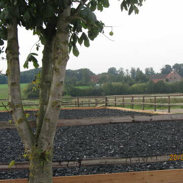
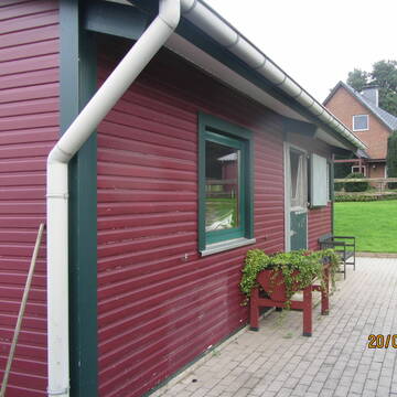
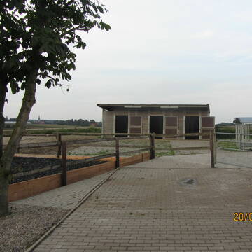
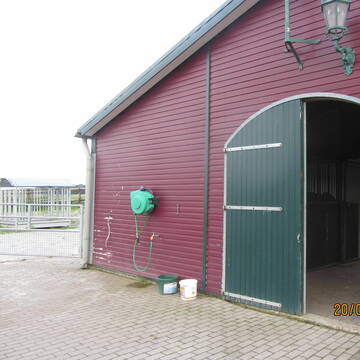
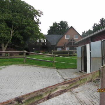
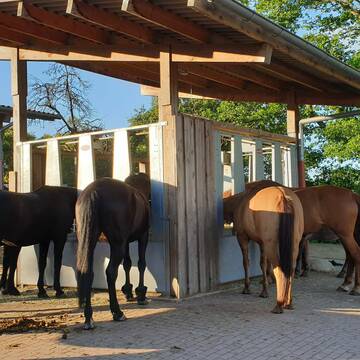
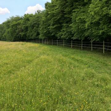
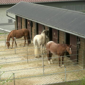
Reitsportanlage Berg in Hiddenhausen
Hiddenhausen
Reitsportanlage Berg
@Reitsportanlage-Berg
Freizeitstall
Geländestrecke
Vermieten
Führanlage
Hunde willkommen
Fohlenaufzucht möglich
Hengsthaltung möglich
21 weitere...
P+
Deprecated: Creation of dynamic property Zend_View_Helper_Ads::$adLink is deprecated in /var/www/stall-frei/htdocs/staging.stall-frei.de/library/Psf/View/Helper/Ads.php on line 108

Futtersack HeuToy, Fressbremse in pink
Mechtersen
STALL-FREIde Marketing
@STALL-FREI-Marketing
Stundenlange Beschäftigung die
Koliken vorbeugt, geringe Staubinhalation mit
steuerbarer Futterentnahme
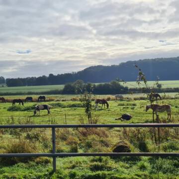
Offenstall für Wallache
Spenge
Heins
@Heins
Freizeitstall
Geländestrecke
Vermieten
Hunde willkommen
Krankenbox
Gnadenbrothof
Notfallboxen
18 weitere...
P+


Hof Hagemann-Krystosek - pferdegerecht
Melle
Hof-Hagemann-Krystosek
@Hof-Hagemann-Krystosek
FN-Mitglied
Freizeitstall
Vermieten
Verpachten
Hunde willkommen
Krankenbox
Allergikerstall
Gnadenbrothof
35 weitere...
P+

Paddockboxen auf wunderschöner Anlage zu vermiet...
Bünde
Reitanlage Bausch
@Sebastian-Bausch
Freizeitstall
Reitlehrer und -unterricht
Vermieten
Führanlage
Hunde willkommen
bedampftes/gewaschenes Heu
Hengsthaltung möglich
23 weitere...
P
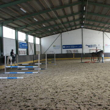
Reitanlage Heyderhof
Herford
Reitanlage Heyderhof
@Reitanlage_Heyderhof
Geländestrecke
Pferdeausbildung
Longierzirkel/Roundpen
Paddock
Außenbox mit Paddock
Außenboxen
Vollpension
11 weitere...
aktuell
P


Frischluftbegeisterte Stallgemeinschaft sucht Ein.
Deutschland
Sophie89
@Sophie89
Freizeitstall
Geländestrecke
Hunde willkommen
Paddock
Allergikerstall
Hufrehe geeignet
Innenbox
14 weitere...
P+
Western-und Freizeit-Reitanlage Niederbäumer
Hiddenhausen
Reitanlage-Niederbaeumer
@Reitanlage-Niederbaeumer
Freizeitstall
Geländestrecke
Vermieten
Hunde willkommen
Longierzirkel/Roundpen
Hufrehe geeignet
15 weitere...
P

RV Bünde - Boxen frei
Bünde
Reit- u. Fahrverein Buende
@rv-buende
Reitlehrer und -unterricht
Reitschule
Paddock
Parkplatz für Pferdeanhänger
Notfallboxen
Außenboxen
Innenbox
9 weitere...
P

***Reitstall Birkenhof*** Pferdegerechte Haltung
Köln
Daniele-Fazzi
@Daniele-Fazzi
Herzlich Willkommen
auf dem Reitstall Birkenhof
Jetzt neu ‼️ auf dem Birkenhof:
Private Geländestrecke rund um unser
Reit- und Voltigierverein Vilsendorf e.V.
Bielefeld
Reitverein Vilsendorf e.V.
@Reit-und-Voltigierverein-Vils.
FN-Mitglied
Pferdeausbildung
Hunde willkommen
Longierzirkel/Roundpen
Außenbox mit Paddock
Außenboxen
Vollpension
15 weitere...
P

Stall/Offenstall frei
Bünde
Weinzierl
@PferdepensionWeinzierl
Freizeitstall
Vermieten
Hunde willkommen
Krankenbox
Notfallboxen
13 weitere...
P
Deprecated: Creation of dynamic property Zend_View::$pageCount is deprecated in /var/www/stall-frei/htdocs/staging.stall-frei.de/library/vendor/shardj/zf1-future/library/Zend/View/Abstract.php on line 308
Deprecated: Creation of dynamic property Zend_View::$itemCountPerPage is deprecated in /var/www/stall-frei/htdocs/staging.stall-frei.de/library/vendor/shardj/zf1-future/library/Zend/View/Abstract.php on line 308
Deprecated: Creation of dynamic property Zend_View::$first is deprecated in /var/www/stall-frei/htdocs/staging.stall-frei.de/library/vendor/shardj/zf1-future/library/Zend/View/Abstract.php on line 308
Deprecated: Creation of dynamic property Zend_View::$current is deprecated in /var/www/stall-frei/htdocs/staging.stall-frei.de/library/vendor/shardj/zf1-future/library/Zend/View/Abstract.php on line 308
Deprecated: Creation of dynamic property Zend_View::$last is deprecated in /var/www/stall-frei/htdocs/staging.stall-frei.de/library/vendor/shardj/zf1-future/library/Zend/View/Abstract.php on line 308
Deprecated: Creation of dynamic property Zend_View::$next is deprecated in /var/www/stall-frei/htdocs/staging.stall-frei.de/library/vendor/shardj/zf1-future/library/Zend/View/Abstract.php on line 308
Deprecated: Creation of dynamic property Zend_View::$pagesInRange is deprecated in /var/www/stall-frei/htdocs/staging.stall-frei.de/library/vendor/shardj/zf1-future/library/Zend/View/Abstract.php on line 308
Deprecated: Creation of dynamic property Zend_View::$firstPageInRange is deprecated in /var/www/stall-frei/htdocs/staging.stall-frei.de/library/vendor/shardj/zf1-future/library/Zend/View/Abstract.php on line 308
Deprecated: Creation of dynamic property Zend_View::$lastPageInRange is deprecated in /var/www/stall-frei/htdocs/staging.stall-frei.de/library/vendor/shardj/zf1-future/library/Zend/View/Abstract.php on line 308
Deprecated: Creation of dynamic property Zend_View::$currentItemCount is deprecated in /var/www/stall-frei/htdocs/staging.stall-frei.de/library/vendor/shardj/zf1-future/library/Zend/View/Abstract.php on line 308
Deprecated: Creation of dynamic property Zend_View::$totalItemCount is deprecated in /var/www/stall-frei/htdocs/staging.stall-frei.de/library/vendor/shardj/zf1-future/library/Zend/View/Abstract.php on line 308
Deprecated: Creation of dynamic property Zend_View::$firstItemNumber is deprecated in /var/www/stall-frei/htdocs/staging.stall-frei.de/library/vendor/shardj/zf1-future/library/Zend/View/Abstract.php on line 308
Deprecated: Creation of dynamic property Zend_View::$lastItemNumber is deprecated in /var/www/stall-frei/htdocs/staging.stall-frei.de/library/vendor/shardj/zf1-future/library/Zend/View/Abstract.php on line 308
Deprecated: Creation of dynamic property Zend_View::$router is deprecated in /var/www/stall-frei/htdocs/staging.stall-frei.de/library/vendor/shardj/zf1-future/library/Zend/View/Abstract.php on line 308
Deprecated: Creation of dynamic property Zend_View::$urlParams is deprecated in /var/www/stall-frei/htdocs/staging.stall-frei.de/library/vendor/shardj/zf1-future/library/Zend/View/Abstract.php on line 308
Deprecated: Creation of dynamic property Zend_View::$showAds is deprecated in /var/www/stall-frei/htdocs/staging.stall-frei.de/library/vendor/shardj/zf1-future/library/Zend/View/Abstract.php on line 308
Deprecated: Creation of dynamic property Zend_View::$objectIds is deprecated in /var/www/stall-frei/htdocs/staging.stall-frei.de/library/vendor/shardj/zf1-future/library/Zend/View/Abstract.php on line 308
Deprecated: Creation of dynamic property Zend_View::$showNavbar is deprecated in /var/www/stall-frei/htdocs/staging.stall-frei.de/library/vendor/shardj/zf1-future/library/Zend/View/Abstract.php on line 308
Deprecated: Creation of dynamic property Zend_View::$showBreadcrumb is deprecated in /var/www/stall-frei/htdocs/staging.stall-frei.de/library/vendor/shardj/zf1-future/library/Zend/View/Abstract.php on line 308
Deprecated: Creation of dynamic property Zend_View::$showFooter is deprecated in /var/www/stall-frei/htdocs/staging.stall-frei.de/library/vendor/shardj/zf1-future/library/Zend/View/Abstract.php on line 308
Deprecated: Creation of dynamic property Zend_View::$showInternalAds is deprecated in /var/www/stall-frei/htdocs/staging.stall-frei.de/library/vendor/shardj/zf1-future/library/Zend/View/Abstract.php on line 308
Deprecated: Creation of dynamic property Zend_View::$blNoContent is deprecated in /var/www/stall-frei/htdocs/staging.stall-frei.de/library/vendor/shardj/zf1-future/library/Zend/View/Abstract.php on line 308
Deprecated: Creation of dynamic property Zend_View::$sMetaDesc is deprecated in /var/www/stall-frei/htdocs/staging.stall-frei.de/library/vendor/shardj/zf1-future/library/Zend/View/Abstract.php on line 308
Deprecated: Creation of dynamic property Zend_View::$useGmaps is deprecated in /var/www/stall-frei/htdocs/staging.stall-frei.de/library/vendor/shardj/zf1-future/library/Zend/View/Abstract.php on line 308
Deprecated: Creation of dynamic property Zend_View::$touches is deprecated in /var/www/stall-frei/htdocs/staging.stall-frei.de/library/vendor/shardj/zf1-future/library/Zend/View/Abstract.php on line 308
Deprecated: Creation of dynamic property Zend_View::$oProject is deprecated in /var/www/stall-frei/htdocs/staging.stall-frei.de/library/vendor/shardj/zf1-future/library/Zend/View/Abstract.php on line 308
Deprecated: Creation of dynamic property Zend_View::$pageHeadline is deprecated in /var/www/stall-frei/htdocs/staging.stall-frei.de/library/vendor/shardj/zf1-future/library/Zend/View/Abstract.php on line 308
Deprecated: Creation of dynamic property Zend_View::$disableLocationField is deprecated in /var/www/stall-frei/htdocs/staging.stall-frei.de/library/vendor/shardj/zf1-future/library/Zend/View/Abstract.php on line 308
Deprecated: Creation of dynamic property Zend_View::$isSearch is deprecated in /var/www/stall-frei/htdocs/staging.stall-frei.de/library/vendor/shardj/zf1-future/library/Zend/View/Abstract.php on line 308
Deprecated: Creation of dynamic property Zend_View::$pageTitle is deprecated in /var/www/stall-frei/htdocs/staging.stall-frei.de/library/vendor/shardj/zf1-future/library/Zend/View/Abstract.php on line 308
Deprecated: Creation of dynamic property Psf_Form_Element_Text::$class is deprecated in /var/www/stall-frei/htdocs/staging.stall-frei.de/library/vendor/shardj/zf1-future/library/Zend/Form/Element.php on line 874
Deprecated: Creation of dynamic property Psf_Form_Element_Text::$size is deprecated in /var/www/stall-frei/htdocs/staging.stall-frei.de/library/vendor/shardj/zf1-future/library/Zend/Form/Element.php on line 874
Deprecated: Creation of dynamic property Psf_Form_Element_Text::$placeholder is deprecated in /var/www/stall-frei/htdocs/staging.stall-frei.de/library/vendor/shardj/zf1-future/library/Zend/Form/Element.php on line 874
Deprecated: Creation of dynamic property Psf_Form_Element_Hidden::$class is deprecated in /var/www/stall-frei/htdocs/staging.stall-frei.de/library/vendor/shardj/zf1-future/library/Zend/Form/Element.php on line 874
Deprecated: Creation of dynamic property Psf_Form_Element_Hidden::$class is deprecated in /var/www/stall-frei/htdocs/staging.stall-frei.de/library/vendor/shardj/zf1-future/library/Zend/Form/Element.php on line 874
Deprecated: Creation of dynamic property Psf_Form_Element_Hidden::$class is deprecated in /var/www/stall-frei/htdocs/staging.stall-frei.de/library/vendor/shardj/zf1-future/library/Zend/Form/Element.php on line 874
Deprecated: Creation of dynamic property Psf_Form_Element_Hidden::$class is deprecated in /var/www/stall-frei/htdocs/staging.stall-frei.de/library/vendor/shardj/zf1-future/library/Zend/Form/Element.php on line 874
Deprecated: Creation of dynamic property Psf_Form_Element_Select::$class is deprecated in /var/www/stall-frei/htdocs/staging.stall-frei.de/library/vendor/shardj/zf1-future/library/Zend/Form/Element.php on line 874
Deprecated: Creation of dynamic property Psf_Form_Element_Select::$class is deprecated in /var/www/stall-frei/htdocs/staging.stall-frei.de/library/vendor/shardj/zf1-future/library/Zend/Form/Element.php on line 874
Deprecated: Creation of dynamic property Psf_Form_Element_Select::$class is deprecated in /var/www/stall-frei/htdocs/staging.stall-frei.de/library/vendor/shardj/zf1-future/library/Zend/Form/Element.php on line 874
Deprecated: Creation of dynamic property Psf_Form_Element_Select::$class is deprecated in /var/www/stall-frei/htdocs/staging.stall-frei.de/library/vendor/shardj/zf1-future/library/Zend/Form/Element.php on line 874
Deprecated: Creation of dynamic property Psf_Form_Element_Text::$class is deprecated in /var/www/stall-frei/htdocs/staging.stall-frei.de/library/vendor/shardj/zf1-future/library/Zend/Form/Element.php on line 874
Deprecated: Creation of dynamic property Psf_Form_Element_Checkbox::$label is deprecated in /var/www/stall-frei/htdocs/staging.stall-frei.de/library/vendor/shardj/zf1-future/library/Zend/Form/Element.php on line 874
Deprecated: Creation of dynamic property Zend_View::$sort is deprecated in /var/www/stall-frei/htdocs/staging.stall-frei.de/library/vendor/shardj/zf1-future/library/Zend/View/Abstract.php on line 308
Deprecated: Creation of dynamic property Zend_View::$searchLocation is deprecated in /var/www/stall-frei/htdocs/staging.stall-frei.de/library/vendor/shardj/zf1-future/library/Zend/View/Abstract.php on line 308
Deprecated: Creation of dynamic property Zend_View::$locationHint is deprecated in /var/www/stall-frei/htdocs/staging.stall-frei.de/library/vendor/shardj/zf1-future/library/Zend/View/Abstract.php on line 308
Psf_GeoCoder_Abstract::getLocation: Enger Get Location CachedOrLive
Psf_GeoCoder_Abstract::getCachedOrLive: Enger
Psf_GeoCoder_OpenCageData::makeApiRequest: response:
Array
(
[documentation] => https://opencagedata.com/api
[licenses] => Array
(
[0] => Array
(
[name] => see attribution guide
[url] => https://opencagedata.com/credits
)
)
[results] => Array
(
[0] => Array
(
[bounds] => Array
(
[northeast] => Array
(
[lat] => 52.1715845
[lng] => 8.6170596
)
[southwest] => Array
(
[lat] => 52.1015005
[lng] => 8.4980724
)
)
[components] => Array
(
[ISO_3166-1_alpha-2] => DE
[ISO_3166-1_alpha-3] => DEU
[ISO_3166-2] => Array
(
[0] => DE-NW
)
[_category] => place
[_normalized_city] => Enger
[_type] => city
[continent] => Europe
[country] => Deutschland
[country_code] => de
[county] => Kreis Herford
[political_union] => European Union
[postcode] => 32130
[state] => Nordrhein-Westfalen
[state_code] => NW
[town] => Enger
)
[confidence] => 7
[formatted] => 32130 Enger, Deutschland
[geometry] => Array
(
[lat] => 52.1394015
[lng] => 8.5588818
)
)
[1] => Array
(
[bounds] => Array
(
[northeast] => Array
(
[lat] => 52.1538046
[lng] => 8.5822972
)
[southwest] => Array
(
[lat] => 52.1300873
[lng] => 8.5306272
)
)
[components] => Array
(
[ISO_3166-1_alpha-2] => DE
[ISO_3166-1_alpha-3] => DEU
[ISO_3166-2] => Array
(
[0] => DE-NW
)
[_category] => place
[_normalized_city] => Enger
[_type] => neighbourhood
[continent] => Europe
[country] => Deutschland
[country_code] => de
[county] => Kreis Herford
[political_union] => European Union
[postcode] => 32130
[state] => Nordrhein-Westfalen
[state_code] => NW
[suburb] => Enger
[town] => Enger
)
[confidence] => 7
[formatted] => 32130 Enger, Deutschland
[geometry] => Array
(
[lat] => 52.1420003
[lng] => 8.5539771
)
)
[2] => Array
(
[components] => Array
(
[ISO_3166-1_alpha-2] => FR
[ISO_3166-1_alpha-3] => FRA
[ISO_3166-2] => Array
(
[0] => FR-OCC
[1] => FR-32
)
[_category] => place
[_normalized_city] => Mauvezin
[_type] => place
[city] => Mauvezin
[continent] => Europe
[country] => France
[country_code] => fr
[county] => Gers
[local_authority] => Communauté de communes Bastides de Lomagne
[place] => À Enger de Haut
[political_union] => European Union
[postcode] => 32120
[state] => Occitanie
[state_code] => OCC
)
[confidence] => 3
[formatted] => À Enger de Haut, 32120 Mauvezin, France
[geometry] => Array
(
[lat] => 43.70818
[lng] => 0.861431
)
)
[3] => Array
(
[components] => Array
(
[ISO_3166-1_alpha-2] => FR
[ISO_3166-1_alpha-3] => FRA
[ISO_3166-2] => Array
(
[0] => FR-OCC
[1] => FR-32
)
[_category] => place
[_normalized_city] => Mauvezin
[_type] => place
[city] => Mauvezin
[continent] => Europe
[country] => France
[country_code] => fr
[county] => Gers
[local_authority] => Communauté de communes Bastides de Lomagne
[place] => À Enger de Bas
[political_union] => European Union
[postcode] => 32120
[state] => Occitanie
[state_code] => OCC
)
[confidence] => 3
[formatted] => À Enger de Bas, 32120 Mauvezin, France
[geometry] => Array
(
[lat] => 43.708068
[lng] => 0.860258
)
)
[4] => Array
(
[components] => Array
(
[ISO_3166-1_alpha-2] => FR
[ISO_3166-1_alpha-3] => FRA
[ISO_3166-2] => Array
(
[0] => FR-PDL
[1] => FR-49
)
[_category] => road
[_normalized_city] => Candé
[_type] => road
[city] => Candé
[continent] => Europe
[country] => France
[country_code] => fr
[county] => Maine-et-Loire
[local_authority] => Anjou Bleu Communauté
[political_union] => European Union
[postcode] => 49440
[road] => Route d’angers
[state] => Pays de la Loire
[state_code] => PDL
)
[confidence] => 3
[formatted] => Route d’angers, 49440 Candé, France
[geometry] => Array
(
[lat] => 47.560223
[lng] => -1.028856
)
)
[5] => Array
(
[components] => Array
(
[ISO_3166-1_alpha-2] => FR
[ISO_3166-1_alpha-3] => FRA
[ISO_3166-2] => Array
(
[0] => FR-PDL
[1] => FR-49
)
[_category] => road
[_normalized_city] => Denée
[_type] => road
[city] => Denée
[continent] => Europe
[country] => France
[country_code] => fr
[county] => Maine-et-Loire
[local_authority] => Communauté de communes Loire Layon Aubance
[political_union] => European Union
[postcode] => 49190
[road] => Route d'Angers
[state] => Pays de la Loire
[state_code] => PDL
)
[confidence] => 3
[formatted] => Route d'Angers, 49190 Denée, France
[geometry] => Array
(
[lat] => 47.381763
[lng] => -0.602284
)
)
[6] => Array
(
[components] => Array
(
[ISO_3166-1_alpha-2] => FR
[ISO_3166-1_alpha-3] => FRA
[ISO_3166-2] => Array
(
[0] => FR-ARA
[1] => FR-38
)
[_category] => road
[_normalized_city] => Saint-Martin-d'Uriage
[_type] => road
[city] => Saint-Martin-d'Uriage
[continent] => Europe
[country] => France
[country_code] => fr
[county] => Isère
[local_authority] => Communauté de communes Le Grésivaudan
[political_union] => European Union
[postcode] => 38410
[road] => Route des Angères
[state] => Auvergne-Rhône-Alpes
[state_code] => ARA
)
[confidence] => 3
[formatted] => Route des Angères, 38410 Saint-Martin-d'Uriage, France
[geometry] => Array
(
[lat] => 45.150166
[lng] => 5.848309
)
)
[7] => Array
(
[components] => Array
(
[ISO_3166-1_alpha-2] => FR
[ISO_3166-1_alpha-3] => FRA
[ISO_3166-2] => Array
(
[0] => FR-PDL
[1] => FR-49
)
[_category] => road
[_normalized_city] => Angers
[_type] => road
[city] => Angers
[continent] => Europe
[country] => France
[country_code] => fr
[county] => Maine-et-Loire
[local_authority] => Angers Loire Métropole
[political_union] => European Union
[postcode] => 49000
[road] => Rue de Frémur
[state] => Pays de la Loire
[state_code] => PDL
)
[confidence] => 2
[formatted] => Rue de Frémur, 49000 Angers, France
[geometry] => Array
(
[lat] => 47.457808
[lng] => -0.560653
)
)
[8] => Array
(
[components] => Array
(
[ISO_3166-1_alpha-2] => FR
[ISO_3166-1_alpha-3] => FRA
[ISO_3166-2] => Array
(
[0] => FR-PDL
[1] => FR-53
)
[_category] => road
[_normalized_city] => Laval
[_type] => road
[city] => Laval
[continent] => Europe
[country] => France
[country_code] => fr
[county] => Mayenne
[local_authority] => Laval Agglomération
[political_union] => European Union
[postcode] => 53000
[road] => Route d'Angers
[state] => Pays de la Loire
[state_code] => PDL
)
[confidence] => 2
[formatted] => Route d'Angers, 53000 Laval, France
[geometry] => Array
(
[lat] => 48.040461
[lng] => -0.741813
)
)
[9] => Array
(
[components] => Array
(
[ISO_3166-1_alpha-2] => FR
[ISO_3166-1_alpha-3] => FRA
[ISO_3166-2] => Array
(
[0] => FR-PDL
[1] => FR-49
)
[_category] => road
[_normalized_city] => Angers
[_type] => road
[city] => Angers
[continent] => Europe
[country] => France
[country_code] => fr
[county] => Maine-et-Loire
[local_authority] => Angers Loire Métropole
[political_union] => European Union
[postcode] => 49100
[road] => Avenue Pasteur
[state] => Pays de la Loire
[state_code] => PDL
)
[confidence] => 2
[formatted] => Avenue Pasteur, 49100 Angers, France
[geometry] => Array
(
[lat] => 47.476505
[lng] => -0.532871
)
)
)
[status] => Array
(
[code] => 200
[message] => OK
)
[stay_informed] => Array
(
[blog] => https://blog.opencagedata.com
[mastodon] => https://en.osm.town/@opencage
)
[thanks] => For using an OpenCage API
[timestamp] => Array
(
[created_http] => Sat, 07 Feb 2026 09:40:31 GMT
[created_unix] => 1770457231
)
[total_results] => 10
)
Psf_GeoCoder_Abstract::convertLocationResult
{"documentation":"https:\/\/opencagedata.com\/api","licenses":[{"name":"see attribution guide","url":"https:\/\/opencagedata.com\/credits"}],"results":[{"bounds":{"northeast":{"lat":52.1715845,"lng":8.6170596},"southwest":{"lat":52.1015005,"lng":8.4980724}},"components":{"ISO_3166-1_alpha-2":"DE","ISO_3166-1_alpha-3":"DEU","ISO_3166-2":["DE-NW"],"_category":"place","_normalized_city":"Enger","_type":"city","continent":"Europe","country":"Deutschland","country_code":"de","county":"Kreis Herford","political_union":"European Union","postcode":"32130","state":"Nordrhein-Westfalen","state_code":"NW","town":"Enger"},"confidence":7,"formatted":"32130 Enger, Deutschland","geometry":{"lat":52.1394015,"lng":8.5588818}},{"bounds":{"northeast":{"lat":52.1538046,"lng":8.5822972},"southwest":{"lat":52.1300873,"lng":8.5306272}},"components":{"ISO_3166-1_alpha-2":"DE","ISO_3166-1_alpha-3":"DEU","ISO_3166-2":["DE-NW"],"_category":"place","_normalized_city":"Enger","_type":"neighbourhood","continent":"Europe","country":"Deutschland","country_code":"de","county":"Kreis Herford","political_union":"European Union","postcode":"32130","state":"Nordrhein-Westfalen","state_code":"NW","suburb":"Enger","town":"Enger"},"confidence":7,"formatted":"32130 Enger, Deutschland","geometry":{"lat":52.1420003,"lng":8.5539771}},{"components":{"ISO_3166-1_alpha-2":"FR","ISO_3166-1_alpha-3":"FRA","ISO_3166-2":["FR-OCC","FR-32"],"_category":"place","_normalized_city":"Mauvezin","_type":"place","city":"Mauvezin","continent":"Europe","country":"France","country_code":"fr","county":"Gers","local_authority":"Communaut\u00e9 de communes Bastides de Lomagne","place":"\u00c0 Enger de Haut","political_union":"European Union","postcode":"32120","state":"Occitanie","state_code":"OCC"},"confidence":3,"formatted":"\u00c0 Enger de Haut, 32120 Mauvezin, France","geometry":{"lat":43.70818,"lng":0.861431}},{"components":{"ISO_3166-1_alpha-2":"FR","ISO_3166-1_alpha-3":"FRA","ISO_3166-2":["FR-OCC","FR-32"],"_category":"place","_normalized_city":"Mauvezin","_type":"place","city":"Mauvezin","continent":"Europe","country":"France","country_code":"fr","county":"Gers","local_authority":"Communaut\u00e9 de communes Bastides de Lomagne","place":"\u00c0 Enger de Bas","political_union":"European Union","postcode":"32120","state":"Occitanie","state_code":"OCC"},"confidence":3,"formatted":"\u00c0 Enger de Bas, 32120 Mauvezin, France","geometry":{"lat":43.708068,"lng":0.860258}},{"components":{"ISO_3166-1_alpha-2":"FR","ISO_3166-1_alpha-3":"FRA","ISO_3166-2":["FR-PDL","FR-49"],"_category":"road","_normalized_city":"Cand\u00e9","_type":"road","city":"Cand\u00e9","continent":"Europe","country":"France","country_code":"fr","county":"Maine-et-Loire","local_authority":"Anjou Bleu Communaut\u00e9","political_union":"European Union","postcode":"49440","road":"Route d\u2019angers","state":"Pays de la Loire","state_code":"PDL"},"confidence":3,"formatted":"Route d\u2019angers, 49440 Cand\u00e9, France","geometry":{"lat":47.560223,"lng":-1.028856}},{"components":{"ISO_3166-1_alpha-2":"FR","ISO_3166-1_alpha-3":"FRA","ISO_3166-2":["FR-PDL","FR-49"],"_category":"road","_normalized_city":"Den\u00e9e","_type":"road","city":"Den\u00e9e","continent":"Europe","country":"France","country_code":"fr","county":"Maine-et-Loire","local_authority":"Communaut\u00e9 de communes Loire Layon Aubance","political_union":"European Union","postcode":"49190","road":"Route d'Angers","state":"Pays de la Loire","state_code":"PDL"},"confidence":3,"formatted":"Route d'Angers, 49190 Den\u00e9e, France","geometry":{"lat":47.381763,"lng":-0.602284}},{"components":{"ISO_3166-1_alpha-2":"FR","ISO_3166-1_alpha-3":"FRA","ISO_3166-2":["FR-ARA","FR-38"],"_category":"road","_normalized_city":"Saint-Martin-d'Uriage","_type":"road","city":"Saint-Martin-d'Uriage","continent":"Europe","country":"France","country_code":"fr","county":"Is\u00e8re","local_authority":"Communaut\u00e9 de communes Le Gr\u00e9sivaudan","political_union":"European Union","postcode":"38410","road":"Route des Ang\u00e8res","state":"Auvergne-Rh\u00f4ne-Alpes","state_code":"ARA"},"confidence":3,"formatted":"Route des Ang\u00e8res, 38410 Saint-Martin-d'Uriage, France","geometry":{"lat":45.150166,"lng":5.848309}},{"components":{"ISO_3166-1_alpha-2":"FR","ISO_3166-1_alpha-3":"FRA","ISO_3166-2":["FR-PDL","FR-49"],"_category":"road","_normalized_city":"Angers","_type":"road","city":"Angers","continent":"Europe","country":"France","country_code":"fr","county":"Maine-et-Loire","local_authority":"Angers Loire M\u00e9tropole","political_union":"European Union","postcode":"49000","road":"Rue de Fr\u00e9mur","state":"Pays de la Loire","state_code":"PDL"},"confidence":2,"formatted":"Rue de Fr\u00e9mur, 49000 Angers, France","geometry":{"lat":47.457808,"lng":-0.560653}},{"components":{"ISO_3166-1_alpha-2":"FR","ISO_3166-1_alpha-3":"FRA","ISO_3166-2":["FR-PDL","FR-53"],"_category":"road","_normalized_city":"Laval","_type":"road","city":"Laval","continent":"Europe","country":"France","country_code":"fr","county":"Mayenne","local_authority":"Laval Agglom\u00e9ration","political_union":"European Union","postcode":"53000","road":"Route d'Angers","state":"Pays de la Loire","state_code":"PDL"},"confidence":2,"formatted":"Route d'Angers, 53000 Laval, France","geometry":{"lat":48.040461,"lng":-0.741813}},{"components":{"ISO_3166-1_alpha-2":"FR","ISO_3166-1_alpha-3":"FRA","ISO_3166-2":["FR-PDL","FR-49"],"_category":"road","_normalized_city":"Angers","_type":"road","city":"Angers","continent":"Europe","country":"France","country_code":"fr","county":"Maine-et-Loire","local_authority":"Angers Loire M\u00e9tropole","political_union":"European Union","postcode":"49100","road":"Avenue Pasteur","state":"Pays de la Loire","state_code":"PDL"},"confidence":2,"formatted":"Avenue Pasteur, 49100 Angers, France","geometry":{"lat":47.476505,"lng":-0.532871}}],"status":{"code":200,"message":"OK"},"stay_informed":{"blog":"https:\/\/blog.opencagedata.com","mastodon":"https:\/\/en.osm.town\/@opencage"},"thanks":"For using an OpenCage API","timestamp":{"created_http":"Sat, 07 Feb 2026 09:40:31 GMT","created_unix":1770457231},"total_results":10}Array
(
[0] => stdClass Object
(
[bounds] => stdClass Object
(
[northeast] => stdClass Object
(
[lat] => 52.1715845
[lng] => 8.6170596
)
[southwest] => stdClass Object
(
[lat] => 52.1015005
[lng] => 8.4980724
)
)
[components] => stdClass Object
(
[ISO_3166-1_alpha-2] => DE
[ISO_3166-1_alpha-3] => DEU
[ISO_3166-2] => Array
(
[0] => DE-NW
)
[_category] => place
[_normalized_city] => Enger
[_type] => city
[continent] => Europe
[country] => Deutschland
[country_code] => de
[county] => Kreis Herford
[political_union] => European Union
[postcode] => 32130
[state] => Nordrhein-Westfalen
[state_code] => NW
[town] => Enger
)
[confidence] => 7
[formatted] => 32130 Enger, Deutschland
[geometry] => stdClass Object
(
[lat] => 52.1394015
[lng] => 8.5588818
)
)
[1] => stdClass Object
(
[bounds] => stdClass Object
(
[northeast] => stdClass Object
(
[lat] => 52.1538046
[lng] => 8.5822972
)
[southwest] => stdClass Object
(
[lat] => 52.1300873
[lng] => 8.5306272
)
)
[components] => stdClass Object
(
[ISO_3166-1_alpha-2] => DE
[ISO_3166-1_alpha-3] => DEU
[ISO_3166-2] => Array
(
[0] => DE-NW
)
[_category] => place
[_normalized_city] => Enger
[_type] => neighbourhood
[continent] => Europe
[country] => Deutschland
[country_code] => de
[county] => Kreis Herford
[political_union] => European Union
[postcode] => 32130
[state] => Nordrhein-Westfalen
[state_code] => NW
[suburb] => Enger
[town] => Enger
)
[confidence] => 7
[formatted] => 32130 Enger, Deutschland
[geometry] => stdClass Object
(
[lat] => 52.1420003
[lng] => 8.5539771
)
)
[2] => stdClass Object
(
[components] => stdClass Object
(
[ISO_3166-1_alpha-2] => FR
[ISO_3166-1_alpha-3] => FRA
[ISO_3166-2] => Array
(
[0] => FR-OCC
[1] => FR-32
)
[_category] => place
[_normalized_city] => Mauvezin
[_type] => place
[city] => Mauvezin
[continent] => Europe
[country] => France
[country_code] => fr
[county] => Gers
[local_authority] => Communauté de communes Bastides de Lomagne
[place] => À Enger de Haut
[political_union] => European Union
[postcode] => 32120
[state] => Occitanie
[state_code] => OCC
)
[confidence] => 3
[formatted] => À Enger de Haut, 32120 Mauvezin, France
[geometry] => stdClass Object
(
[lat] => 43.70818
[lng] => 0.861431
)
)
[3] => stdClass Object
(
[components] => stdClass Object
(
[ISO_3166-1_alpha-2] => FR
[ISO_3166-1_alpha-3] => FRA
[ISO_3166-2] => Array
(
[0] => FR-OCC
[1] => FR-32
)
[_category] => place
[_normalized_city] => Mauvezin
[_type] => place
[city] => Mauvezin
[continent] => Europe
[country] => France
[country_code] => fr
[county] => Gers
[local_authority] => Communauté de communes Bastides de Lomagne
[place] => À Enger de Bas
[political_union] => European Union
[postcode] => 32120
[state] => Occitanie
[state_code] => OCC
)
[confidence] => 3
[formatted] => À Enger de Bas, 32120 Mauvezin, France
[geometry] => stdClass Object
(
[lat] => 43.708068
[lng] => 0.860258
)
)
[4] => stdClass Object
(
[components] => stdClass Object
(
[ISO_3166-1_alpha-2] => FR
[ISO_3166-1_alpha-3] => FRA
[ISO_3166-2] => Array
(
[0] => FR-PDL
[1] => FR-49
)
[_category] => road
[_normalized_city] => Candé
[_type] => road
[city] => Candé
[continent] => Europe
[country] => France
[country_code] => fr
[county] => Maine-et-Loire
[local_authority] => Anjou Bleu Communauté
[political_union] => European Union
[postcode] => 49440
[road] => Route d’angers
[state] => Pays de la Loire
[state_code] => PDL
)
[confidence] => 3
[formatted] => Route d’angers, 49440 Candé, France
[geometry] => stdClass Object
(
[lat] => 47.560223
[lng] => -1.028856
)
)
[5] => stdClass Object
(
[components] => stdClass Object
(
[ISO_3166-1_alpha-2] => FR
[ISO_3166-1_alpha-3] => FRA
[ISO_3166-2] => Array
(
[0] => FR-PDL
[1] => FR-49
)
[_category] => road
[_normalized_city] => Denée
[_type] => road
[city] => Denée
[continent] => Europe
[country] => France
[country_code] => fr
[county] => Maine-et-Loire
[local_authority] => Communauté de communes Loire Layon Aubance
[political_union] => European Union
[postcode] => 49190
[road] => Route d'Angers
[state] => Pays de la Loire
[state_code] => PDL
)
[confidence] => 3
[formatted] => Route d'Angers, 49190 Denée, France
[geometry] => stdClass Object
(
[lat] => 47.381763
[lng] => -0.602284
)
)
[6] => stdClass Object
(
[components] => stdClass Object
(
[ISO_3166-1_alpha-2] => FR
[ISO_3166-1_alpha-3] => FRA
[ISO_3166-2] => Array
(
[0] => FR-ARA
[1] => FR-38
)
[_category] => road
[_normalized_city] => Saint-Martin-d'Uriage
[_type] => road
[city] => Saint-Martin-d'Uriage
[continent] => Europe
[country] => France
[country_code] => fr
[county] => Isère
[local_authority] => Communauté de communes Le Grésivaudan
[political_union] => European Union
[postcode] => 38410
[road] => Route des Angères
[state] => Auvergne-Rhône-Alpes
[state_code] => ARA
)
[confidence] => 3
[formatted] => Route des Angères, 38410 Saint-Martin-d'Uriage, France
[geometry] => stdClass Object
(
[lat] => 45.150166
[lng] => 5.848309
)
)
[7] => stdClass Object
(
[components] => stdClass Object
(
[ISO_3166-1_alpha-2] => FR
[ISO_3166-1_alpha-3] => FRA
[ISO_3166-2] => Array
(
[0] => FR-PDL
[1] => FR-49
)
[_category] => road
[_normalized_city] => Angers
[_type] => road
[city] => Angers
[continent] => Europe
[country] => France
[country_code] => fr
[county] => Maine-et-Loire
[local_authority] => Angers Loire Métropole
[political_union] => European Union
[postcode] => 49000
[road] => Rue de Frémur
[state] => Pays de la Loire
[state_code] => PDL
)
[confidence] => 2
[formatted] => Rue de Frémur, 49000 Angers, France
[geometry] => stdClass Object
(
[lat] => 47.457808
[lng] => -0.560653
)
)
[8] => stdClass Object
(
[components] => stdClass Object
(
[ISO_3166-1_alpha-2] => FR
[ISO_3166-1_alpha-3] => FRA
[ISO_3166-2] => Array
(
[0] => FR-PDL
[1] => FR-53
)
[_category] => road
[_normalized_city] => Laval
[_type] => road
[city] => Laval
[continent] => Europe
[country] => France
[country_code] => fr
[county] => Mayenne
[local_authority] => Laval Agglomération
[political_union] => European Union
[postcode] => 53000
[road] => Route d'Angers
[state] => Pays de la Loire
[state_code] => PDL
)
[confidence] => 2
[formatted] => Route d'Angers, 53000 Laval, France
[geometry] => stdClass Object
(
[lat] => 48.040461
[lng] => -0.741813
)
)
[9] => stdClass Object
(
[components] => stdClass Object
(
[ISO_3166-1_alpha-2] => FR
[ISO_3166-1_alpha-3] => FRA
[ISO_3166-2] => Array
(
[0] => FR-PDL
[1] => FR-49
)
[_category] => road
[_normalized_city] => Angers
[_type] => road
[city] => Angers
[continent] => Europe
[country] => France
[country_code] => fr
[county] => Maine-et-Loire
[local_authority] => Angers Loire Métropole
[political_union] => European Union
[postcode] => 49100
[road] => Avenue Pasteur
[state] => Pays de la Loire
[state_code] => PDL
)
[confidence] => 2
[formatted] => Avenue Pasteur, 49100 Angers, France
[geometry] => stdClass Object
(
[lat] => 47.476505
[lng] => -0.532871
)
)
)
Psf_GeoCoder_OpenCageData::getKeyMap: 0
stdClass Object
(
    [bounds] => stdClass Object
        (
            [northeast] => stdClass Object
                (
                    [lat] => 52.1715845
                    [lng] => 8.6170596
                )

            [southwest] => stdClass Object
                (
                    [lat] => 52.1015005
                    [lng] => 8.4980724
                )

        )

    [components] => stdClass Object
        (
            [ISO_3166-1_alpha-2] => DE
            [ISO_3166-1_alpha-3] => DEU
            [ISO_3166-2] => Array
                (
                    [0] => DE-NW
                )

            [_category] => place
            [_normalized_city] => Enger
            [_type] => city
            [continent] => Europe
            [country] => Deutschland
            [country_code] => de
            [county] => Kreis Herford
            [political_union] => European Union
            [postcode] => 32130
            [state] => Nordrhein-Westfalen
            [state_code] => NW
            [town] => Enger
        )

    [confidence] => 7
    [formatted] => 32130 Enger, Deutschland
    [geometry] => stdClass Object
        (
            [lat] => 52.1394015
            [lng] => 8.5588818
        )

)
Psf_GeoCoder_OpenCageData::getCounty: Herford
Psf_GeoCoder_OpenCageData::addMissingData REFETCH!
Array
(
    [address] => 32130 Enger, Deutschland
    [type] => city
    [street] =>
    [city] => Enger
    [county] => Herford
    [state] => Nordrhein-Westfalen
    [zip] => 32130
    [country] => Deutschland
    [suburb] =>
    [countrycode] => de
    [latitude] => 52.1394015
    [longitude] => 8.5588818
    [accuracy] => 1
    [confidence] => 7
    [bounds] => stdClass Object
        (
            [northeast] => stdClass Object
                (
                    [lat] => 52.1715845
                    [lng] => 8.6170596
                )

            [southwest] => stdClass Object
                (
                    [lat] => 52.1015005
                    [lng] => 8.4980724
                )

        )

)
reformat!
Array
(
    [address] => 32130 Enger, Deutschland
    [type] => city
    [street] =>
    [city] => Enger
    [county] => Herford
    [state] => Nordrhein-Westfalen
    [zip] => 32130
    [country] => Deutschland
    [suburb] =>
    [countrycode] => de
    [latitude] => 52.1394015
    [longitude] => 8.5588818
    [accuracy] => 1
    [confidence] => 7
    [bounds] => stdClass Object
        (
            [northeast] => stdClass Object
                (
                    [lat] => 52.1715845
                    [lng] => 8.6170596
                )

            [southwest] => stdClass Object
                (
                    [lat] => 52.1015005
                    [lng] => 8.4980724
                )

        )

    [place] => 32130 Enger, Nordrhein-Westfalen
    [hash] => 82859111e6eed0df0dffc52eb28088ad
)
Psf_GeoCoder_OpenCageData::getKeyMap: 1
stdClass Object
(
    [bounds] => stdClass Object
        (
            [northeast] => stdClass Object
                (
                    [lat] => 52.1538046
                    [lng] => 8.5822972
                )

            [southwest] => stdClass Object
                (
                    [lat] => 52.1300873
                    [lng] => 8.5306272
                )

        )

    [components] => stdClass Object
        (
            [ISO_3166-1_alpha-2] => DE
            [ISO_3166-1_alpha-3] => DEU
            [ISO_3166-2] => Array
                (
                    [0] => DE-NW
                )

            [_category] => place
            [_normalized_city] => Enger
            [_type] => neighbourhood
            [continent] => Europe
            [country] => Deutschland
            [country_code] => de
            [county] => Kreis Herford
            [political_union] => European Union
            [postcode] => 32130
            [state] => Nordrhein-Westfalen
            [state_code] => NW
            [suburb] => Enger
            [town] => Enger
        )

    [confidence] => 7
    [formatted] => 32130 Enger, Deutschland
    [geometry] => stdClass Object
        (
            [lat] => 52.1420003
            [lng] => 8.5539771
        )

)
Psf_GeoCoder_OpenCageData::getCounty: Herford
Psf_GeoCoder_OpenCageData::addMissingData REFETCH!
Array
(
    [address] => 32130 Enger, Deutschland
    [type] => neighbourhood
    [street] =>
    [city] => Enger
    [county] => Herford
    [state] => Nordrhein-Westfalen
    [zip] => 32130
    [country] => Deutschland
    [suburb] => Enger
    [countrycode] => de
    [latitude] => 52.1420003
    [longitude] => 8.5539771
    [accuracy] => 1
    [confidence] => 7
    [bounds] => stdClass Object
        (
            [northeast] => stdClass Object
                (
                    [lat] => 52.1538046
                    [lng] => 8.5822972
                )

            [southwest] => stdClass Object
                (
                    [lat] => 52.1300873
                    [lng] => 8.5306272
                )

        )

)
reformat!
Array
(
    [address] => 32130 Enger, Deutschland
    [type] => neighbourhood
    [street] =>
    [city] => Enger
    [county] => Herford
    [state] => Nordrhein-Westfalen
    [zip] => 32130
    [country] => Deutschland
    [suburb] => Enger
    [countrycode] => de
    [latitude] => 52.1420003
    [longitude] => 8.5539771
    [accuracy] => 1
    [confidence] => 7
    [bounds] => stdClass Object
        (
            [northeast] => stdClass Object
                (
                    [lat] => 52.1538046
                    [lng] => 8.5822972
                )

            [southwest] => stdClass Object
                (
                    [lat] => 52.1300873
                    [lng] => 8.5306272
                )

        )

    [place] => 32130 Enger, Nordrhein-Westfalen
    [hash] => 82859111e6eed0df0dffc52eb28088ad
)
Psf_GeoCoder_OpenCageData::getKeyMap: 2
stdClass Object
(
    [components] => stdClass Object
        (
            [ISO_3166-1_alpha-2] => FR
            [ISO_3166-1_alpha-3] => FRA
            [ISO_3166-2] => Array
                (
                    [0] => FR-OCC
                    [1] => FR-32
                )

            [_category] => place
            [_normalized_city] => Mauvezin
            [_type] => place
            [city] => Mauvezin
            [continent] => Europe
            [country] => France
            [country_code] => fr
            [county] => Gers
            [local_authority] => Communauté de communes Bastides de Lomagne
            [place] => À Enger de Haut
            [political_union] => European Union
            [postcode] => 32120
            [state] => Occitanie
            [state_code] => OCC
        )

    [confidence] => 3
    [formatted] => À Enger de Haut, 32120 Mauvezin, France
    [geometry] => stdClass Object
        (
            [lat] => 43.70818
            [lng] => 0.861431
        )

)
Psf_GeoCoder_OpenCageData::getCounty: Gers
Psf_GeoCoder_OpenCageData::addMissingData REFETCH!
Array
(
    [address] => À Enger de Haut, 32120 Mauvezin, France
    [type] => place
    [street] =>
    [city] => Mauvezin
    [county] => Gers
    [state] => Occitanie
    [zip] => 32120
    [country] => France
    [suburb] =>
    [countrycode] => fr
    [latitude] => 43.70818
    [longitude] => 0.861431
    [accuracy] => 1
    [confidence] => 3
    [bounds] =>
)
reformat!
Array
(
    [address] => À Enger de Haut, 32120 Mauvezin, France
    [type] => place
    [street] =>
    [city] => Mauvezin
    [county] => Gers
    [state] => Occitanie
    [zip] => 32120
    [country] => France
    [suburb] =>
    [countrycode] => fr
    [latitude] => 43.70818
    [longitude] => 0.861431
    [accuracy] => 1
    [confidence] => 3
    [bounds] =>
    [place] => 32120 Mauvezin, Occitanie
    [hash] => 901d21eef6a14353f3d2efb9e5f932f3
)
Psf_GeoCoder_OpenCageData::getKeyMap: 3
stdClass Object
(
    [components] => stdClass Object
        (
            [ISO_3166-1_alpha-2] => FR
            [ISO_3166-1_alpha-3] => FRA
            [ISO_3166-2] => Array
                (
                    [0] => FR-OCC
                    [1] => FR-32
                )

            [_category] => place
            [_normalized_city] => Mauvezin
            [_type] => place
            [city] => Mauvezin
            [continent] => Europe
            [country] => France
            [country_code] => fr
            [county] => Gers
            [local_authority] => Communauté de communes Bastides de Lomagne
            [place] => À Enger de Bas
            [political_union] => European Union
            [postcode] => 32120
            [state] => Occitanie
            [state_code] => OCC
        )

    [confidence] => 3
    [formatted] => À Enger de Bas, 32120 Mauvezin, France
    [geometry] => stdClass Object
        (
            [lat] => 43.708068
            [lng] => 0.860258
        )

)
Psf_GeoCoder_OpenCageData::getCounty: Gers
Psf_GeoCoder_OpenCageData::addMissingData REFETCH!
Array
(
    [address] => À Enger de Bas, 32120 Mauvezin, France
    [type] => place
    [street] =>
    [city] => Mauvezin
    [county] => Gers
    [state] => Occitanie
    [zip] => 32120
    [country] => France
    [suburb] =>
    [countrycode] => fr
    [latitude] => 43.708068
    [longitude] => 0.860258
    [accuracy] => 1
    [confidence] => 3
    [bounds] =>
)
reformat!
Array
(
    [address] => À Enger de Bas, 32120 Mauvezin, France
    [type] => place
    [street] =>
    [city] => Mauvezin
    [county] => Gers
    [state] => Occitanie
    [zip] => 32120
    [country] => France
    [suburb] =>
    [countrycode] => fr
    [latitude] => 43.708068
    [longitude] => 0.860258
    [accuracy] => 1
    [confidence] => 3
    [bounds] =>
    [place] => 32120 Mauvezin, Occitanie
    [hash] => 901d21eef6a14353f3d2efb9e5f932f3
)
Psf_GeoCoder_OpenCageData::getKeyMap: 4
stdClass Object
(
    [components] => stdClass Object
        (
            [ISO_3166-1_alpha-2] => FR
            [ISO_3166-1_alpha-3] => FRA
            [ISO_3166-2] => Array
                (
                    [0] => FR-PDL
                    [1] => FR-49
                )

            [_category] => road
            [_normalized_city] => Candé
            [_type] => road
            [city] => Candé
            [continent] => Europe
            [country] => France
            [country_code] => fr
            [county] => Maine-et-Loire
            [local_authority] => Anjou Bleu Communauté
            [political_union] => European Union
            [postcode] => 49440
            [road] => Route  d’angers
            [state] => Pays de la Loire
            [state_code] => PDL
        )

    [confidence] => 3
    [formatted] => Route d’angers, 49440 Candé, France
    [geometry] => stdClass Object
        (
            [lat] => 47.560223
            [lng] => -1.028856
        )

)
Psf_GeoCoder_OpenCageData::getCounty: Maine-et-Loire
Psf_GeoCoder_OpenCageData::addMissingData REFETCH!
Array
(
    [address] => Route d’angers, 49440 Candé, France
    [type] => road
    [street] => Route  d’angers
    [city] => Candé
    [county] => Maine-et-Loire
    [state] => Pays de la Loire
    [zip] => 49440
    [country] => France
    [suburb] =>
    [countrycode] => fr
    [latitude] => 47.560223
    [longitude] => -1.028856
    [accuracy] => 1
    [confidence] => 3
    [bounds] =>
)
reformat!
Array
(
    [address] => Route d’angers, 49440 Candé, France
    [type] => road
    [street] => Route  d’angers
    [city] => Candé
    [county] => Maine-et-Loire
    [state] => Pays de la Loire
    [zip] => 49440
    [country] => France
    [suburb] =>
    [countrycode] => fr
    [latitude] => 47.560223
    [longitude] => -1.028856
    [accuracy] => 1
    [confidence] => 3
    [bounds] =>
    [place] => Route  d’angers, 49440 Candé, Pays de la Loire
    [hash] => b688dceff6eb144269e2bcf848764945
)
Psf_GeoCoder_OpenCageData::getKeyMap: 5
stdClass Object
(
    [components] => stdClass Object
        (
            [ISO_3166-1_alpha-2] => FR
            [ISO_3166-1_alpha-3] => FRA
            [ISO_3166-2] => Array
                (
                    [0] => FR-PDL
                    [1] => FR-49
                )

            [_category] => road
            [_normalized_city] => Denée
            [_type] => road
            [city] => Denée
            [continent] => Europe
            [country] => France
            [country_code] => fr
            [county] => Maine-et-Loire
            [local_authority] => Communauté de communes Loire Layon Aubance
            [political_union] => European Union
            [postcode] => 49190
            [road] => Route d'Angers
            [state] => Pays de la Loire
            [state_code] => PDL
        )

    [confidence] => 3
    [formatted] => Route d'Angers, 49190 Denée, France
    [geometry] => stdClass Object
        (
            [lat] => 47.381763
            [lng] => -0.602284
        )

)
Psf_GeoCoder_OpenCageData::getCounty: Maine-et-Loire
Psf_GeoCoder_OpenCageData::addMissingData REFETCH!
Array
(
    [address] => Route d'Angers, 49190 Denée, France
    [type] => road
    [street] => Route d'Angers
    [city] => Denée
    [county] => Maine-et-Loire
    [state] => Pays de la Loire
    [zip] => 49190
    [country] => France
    [suburb] =>
    [countrycode] => fr
    [latitude] => 47.381763
    [longitude] => -0.602284
    [accuracy] => 1
    [confidence] => 3
    [bounds] =>
)
reformat!
Array
(
    [address] => Route d'Angers, 49190 Denée, France
    [type] => road
    [street] => Route d'Angers
    [city] => Denée
    [county] => Maine-et-Loire
    [state] => Pays de la Loire
    [zip] => 49190
    [country] => France
    [suburb] =>
    [countrycode] => fr
    [latitude] => 47.381763
    [longitude] => -0.602284
    [accuracy] => 1
    [confidence] => 3
    [bounds] =>
    [place] => Route d'Angers, 49190 Denée, Pays de la Loire
    [hash] => 9538134a929e3f989e9289fa7cf242d9
)
Psf_GeoCoder_OpenCageData::getKeyMap: 6
stdClass Object
(
    [components] => stdClass Object
        (
            [ISO_3166-1_alpha-2] => FR
            [ISO_3166-1_alpha-3] => FRA
            [ISO_3166-2] => Array
                (
                    [0] => FR-ARA
                    [1] => FR-38
                )

            [_category] => road
            [_normalized_city] => Saint-Martin-d'Uriage
            [_type] => road
            [city] => Saint-Martin-d'Uriage
            [continent] => Europe
            [country] => France
            [country_code] => fr
            [county] => Isère
            [local_authority] => Communauté de communes Le Grésivaudan
            [political_union] => European Union
            [postcode] => 38410
            [road] => Route des Angères
            [state] => Auvergne-Rhône-Alpes
            [state_code] => ARA
        )

    [confidence] => 3
    [formatted] => Route des Angères, 38410 Saint-Martin-d'Uriage, France
    [geometry] => stdClass Object
        (
            [lat] => 45.150166
            [lng] => 5.848309
        )

)
Psf_GeoCoder_OpenCageData::getCounty: Isère
Psf_GeoCoder_OpenCageData::addMissingData REFETCH!
Array
(
    [address] => Route des Angères, 38410 Saint-Martin-d'Uriage, France
    [type] => road
    [street] => Route des Angères
    [city] => Saint-Martin-d'Uriage
    [county] => Isère
    [state] => Auvergne-Rhône-Alpes
    [zip] => 38410
    [country] => France
    [suburb] =>
    [countrycode] => fr
    [latitude] => 45.150166
    [longitude] => 5.848309
    [accuracy] => 1
    [confidence] => 3
    [bounds] =>
)
reformat!
Array
(
    [address] => Route des Angères, 38410 Saint-Martin-d'Uriage, France
    [type] => road
    [street] => Route des Angères
    [city] => Saint-Martin-d'Uriage
    [county] => Isère
    [state] => Auvergne-Rhône-Alpes
    [zip] => 38410
    [country] => France
    [suburb] =>
    [countrycode] => fr
    [latitude] => 45.150166
    [longitude] => 5.848309
    [accuracy] => 1
    [confidence] => 3
    [bounds] =>
    [place] => Route des Angères, 38410 Saint-Martin-d'Uriage, Auvergne-Rhône-Alpes
    [hash] => 0aa8f61fc74c70ce293a687e45f43b88
)
Psf_GeoCoder_OpenCageData::getKeyMap: 7
stdClass Object
(
    [components] => stdClass Object
        (
            [ISO_3166-1_alpha-2] => FR
            [ISO_3166-1_alpha-3] => FRA
            [ISO_3166-2] => Array
                (
                    [0] => FR-PDL
                    [1] => FR-49
                )

            [_category] => road
            [_normalized_city] => Angers
            [_type] => road
            [city] => Angers
            [continent] => Europe
            [country] => France
            [country_code] => fr
            [county] => Maine-et-Loire
            [local_authority] => Angers Loire Métropole
            [political_union] => European Union
            [postcode] => 49000
            [road] => Rue de Frémur
            [state] => Pays de la Loire
            [state_code] => PDL
        )

    [confidence] => 2
    [formatted] => Rue de Frémur, 49000 Angers, France
    [geometry] => stdClass Object
        (
            [lat] => 47.457808
            [lng] => -0.560653
        )

)
Psf_GeoCoder_OpenCageData::getCounty: Maine-et-Loire
Psf_GeoCoder_OpenCageData::addMissingData REFETCH!
Array
(
    [address] => Rue de Frémur, 49000 Angers, France
    [type] => road
    [street] => Rue de Frémur
    [city] => Angers
    [county] => Maine-et-Loire
    [state] => Pays de la Loire
    [zip] => 49000
    [country] => France
    [suburb] =>
    [countrycode] => fr
    [latitude] => 47.457808
    [longitude] => -0.560653
    [accuracy] => 1
    [confidence] => 2
    [bounds] =>
)
reformat!
Array
(
    [address] => Rue de Frémur, 49000 Angers, France
    [type] => road
    [street] => Rue de Frémur
    [city] => Angers
    [county] => Maine-et-Loire
    [state] => Pays de la Loire
    [zip] => 49000
    [country] => France
    [suburb] =>
    [countrycode] => fr
    [latitude] => 47.457808
    [longitude] => -0.560653
    [accuracy] => 1
    [confidence] => 2
    [bounds] =>
    [place] => Rue de Frémur, 49000 Angers, Pays de la Loire
    [hash] => 01a396e8e40e5fec44fae4353e1746cf
)
Psf_GeoCoder_OpenCageData::getKeyMap: 8
stdClass Object
(
    [components] => stdClass Object
        (
            [ISO_3166-1_alpha-2] => FR
            [ISO_3166-1_alpha-3] => FRA
            [ISO_3166-2] => Array
                (
                    [0] => FR-PDL
                    [1] => FR-53
                )

            [_category] => road
            [_normalized_city] => Laval
            [_type] => road
            [city] => Laval
            [continent] => Europe
            [country] => France
            [country_code] => fr
            [county] => Mayenne
            [local_authority] => Laval Agglomération
            [political_union] => European Union
            [postcode] => 53000
            [road] => Route d'Angers
            [state] => Pays de la Loire
            [state_code] => PDL
        )

    [confidence] => 2
    [formatted] => Route d'Angers, 53000 Laval, France
    [geometry] => stdClass Object
        (
            [lat] => 48.040461
            [lng] => -0.741813
        )

)
Psf_GeoCoder_OpenCageData::getCounty: Mayenne
Psf_GeoCoder_OpenCageData::addMissingData REFETCH!
Array
(
    [address] => Route d'Angers, 53000 Laval, France
    [type] => road
    [street] => Route d'Angers
    [city] => Laval
    [county] => Mayenne
    [state] => Pays de la Loire
    [zip] => 53000
    [country] => France
    [suburb] =>
    [countrycode] => fr
    [latitude] => 48.040461
    [longitude] => -0.741813
    [accuracy] => 1
    [confidence] => 2
    [bounds] =>
)
reformat!
Array
(
    [address] => Route d'Angers, 53000 Laval, France
    [type] => road
    [street] => Route d'Angers
    [city] => Laval
    [county] => Mayenne
    [state] => Pays de la Loire
    [zip] => 53000
    [country] => France
    [suburb] =>
    [countrycode] => fr
    [latitude] => 48.040461
    [longitude] => -0.741813
    [accuracy] => 1
    [confidence] => 2
    [bounds] =>
    [place] => Route d'Angers, 53000 Laval, Pays de la Loire
    [hash] => 25fcaee11c958154face5c376cd728c3
)
Psf_GeoCoder_OpenCageData::getKeyMap: 9
stdClass Object
(
    [components] => stdClass Object
        (
            [ISO_3166-1_alpha-2] => FR
            [ISO_3166-1_alpha-3] => FRA
            [ISO_3166-2] => Array
                (
                    [0] => FR-PDL
                    [1] => FR-49
                )

            [_category] => road
            [_normalized_city] => Angers
            [_type] => road
            [city] => Angers
            [continent] => Europe
            [country] => France
            [country_code] => fr
            [county] => Maine-et-Loire
            [local_authority] => Angers Loire Métropole
            [political_union] => European Union
            [postcode] => 49100
            [road] => Avenue Pasteur
            [state] => Pays de la Loire
            [state_code] => PDL
        )

    [confidence] => 2
    [formatted] => Avenue Pasteur, 49100 Angers, France
    [geometry] => stdClass Object
        (
            [lat] => 47.476505
            [lng] => -0.532871
        )

)
Psf_GeoCoder_OpenCageData::getCounty: Maine-et-Loire
Psf_GeoCoder_OpenCageData::addMissingData REFETCH!
Array
(
    [address] => Avenue Pasteur, 49100 Angers, France
    [type] => road
    [street] => Avenue Pasteur
    [city] => Angers
    [county] => Maine-et-Loire
    [state] => Pays de la Loire
    [zip] => 49100
    [country] => France
    [suburb] =>
    [countrycode] => fr
    [latitude] => 47.476505
    [longitude] => -0.532871
    [accuracy] => 1
    [confidence] => 2
    [bounds] =>
)
reformat!
Array
(
    [address] => Avenue Pasteur, 49100 Angers, France
    [type] => road
    [street] => Avenue Pasteur
    [city] => Angers
    [county] => Maine-et-Loire
    [state] => Pays de la Loire
    [zip] => 49100
    [country] => France
    [suburb] =>
    [countrycode] => fr
    [latitude] => 47.476505
    [longitude] => -0.532871
    [accuracy] => 1
    [confidence] => 2
    [bounds] =>
    [place] => Avenue Pasteur, 49100 Angers, Pays de la Loire
    [hash] => 91cca2f7a65a6127cb236101de19bbb3
)
Deprecated: Creation of dynamic property Zend_View::$locationHintStyle is deprecated in /var/www/stall-frei/htdocs/staging.stall-frei.de/library/vendor/shardj/zf1-future/library/Zend/View/Abstract.php on line 308
Deprecated: Creation of dynamic property Zend_View::$adGeoLocation is deprecated in /var/www/stall-frei/htdocs/staging.stall-frei.de/library/vendor/shardj/zf1-future/library/Zend/View/Abstract.php on line 308
Deprecated: Creation of dynamic property Zend_View::$recordCount is deprecated in /var/www/stall-frei/htdocs/staging.stall-frei.de/library/vendor/shardj/zf1-future/library/Zend/View/Abstract.php on line 308
Deprecated: explode(): Passing null to parameter #2 ($string) of type string is deprecated in /var/www/stall-frei/htdocs/staging.stall-frei.de/application/models/SearchAgent.php on line 100
Deprecated: explode(): Passing null to parameter #2 ($string) of type string is deprecated in /var/www/stall-frei/htdocs/staging.stall-frei.de/application/models/SearchAgent.php on line 100
Deprecated: explode(): Passing null to parameter #2 ($string) of type string is deprecated in /var/www/stall-frei/htdocs/staging.stall-frei.de/application/models/SearchAgent.php on line 100
Deprecated: explode(): Passing null to parameter #2 ($string) of type string is deprecated in /var/www/stall-frei/htdocs/staging.stall-frei.de/application/models/SearchAgent.php on line 100
Deprecated: explode(): Passing null to parameter #2 ($string) of type string is deprecated in /var/www/stall-frei/htdocs/staging.stall-frei.de/application/models/SearchAgent.php on line 100
Deprecated: explode(): Passing null to parameter #2 ($string) of type string is deprecated in /var/www/stall-frei/htdocs/staging.stall-frei.de/application/models/SearchAgent.php on line 100
Deprecated: explode(): Passing null to parameter #2 ($string) of type string is deprecated in /var/www/stall-frei/htdocs/staging.stall-frei.de/application/models/SearchAgent.php on line 100
Deprecated: explode(): Passing null to parameter #2 ($string) of type string is deprecated in /var/www/stall-frei/htdocs/staging.stall-frei.de/application/models/SearchAgent.php on line 100
Deprecated: explode(): Passing null to parameter #2 ($string) of type string is deprecated in /var/www/stall-frei/htdocs/staging.stall-frei.de/application/models/SearchAgent.php on line 100
Deprecated: trim(): Passing null to parameter #1 ($string) of type string is deprecated in /var/www/stall-frei/htdocs/staging.stall-frei.de/application/models/Account/Search.php on line 82
Warning: Cannot modify header information - headers already sent by (output started at /var/www/stall-frei/htdocs/staging.stall-frei.de/library/vendor/shardj/zf1-future/library/Zend/View/Abstract.php:308) in /var/www/stall-frei/htdocs/staging.stall-frei.de/application/models/Account/Search.php on line 71
Deprecated: Creation of dynamic property Zend_View::$paginationParams is deprecated in /var/www/stall-frei/htdocs/staging.stall-frei.de/library/vendor/shardj/zf1-future/library/Zend/View/Abstract.php on line 308
Deprecated: Creation of dynamic property Zend_View::$objectPaginator is deprecated in /var/www/stall-frei/htdocs/staging.stall-frei.de/library/vendor/shardj/zf1-future/library/Zend/View/Abstract.php on line 308
Deprecated: Creation of dynamic property Zend_View::$featuredObjects is deprecated in /var/www/stall-frei/htdocs/staging.stall-frei.de/library/vendor/shardj/zf1-future/library/Zend/View/Abstract.php on line 308
Deprecated: Creation of dynamic property Zend_View::$hints is deprecated in /var/www/stall-frei/htdocs/staging.stall-frei.de/library/vendor/shardj/zf1-future/library/Zend/View/Abstract.php on line 308
Deprecated: Creation of dynamic property Zend_View::$attributeHints is deprecated in /var/www/stall-frei/htdocs/staging.stall-frei.de/library/vendor/shardj/zf1-future/library/Zend/View/Abstract.php on line 308
Deprecated: Creation of dynamic property Zend_View::$oSearchForm is deprecated in /var/www/stall-frei/htdocs/staging.stall-frei.de/library/vendor/shardj/zf1-future/library/Zend/View/Abstract.php on line 308