Deprecated: Creation of dynamic property Zend_View::$sMode is deprecated in /var/www/stall-frei/htdocs/staging.stall-frei.de/library/vendor/shardj/zf1-future/library/Zend/View/Abstract.php on line 308
Stallplatz oder Offenstall in Dorst
Gesucht wird in "Dorst, Sachsen-Anhalt, Deutschland"
6.331 Einträge
Deprecated: Creation of dynamic property Zend_View::$listObjects is deprecated in /var/www/stall-frei/htdocs/staging.stall-frei.de/library/vendor/shardj/zf1-future/library/Zend/View/Abstract.php on line 308
Gesponsort


Deprecated: Creation of dynamic property Zend_View::$listMode is deprecated in /var/www/stall-frei/htdocs/staging.stall-frei.de/library/vendor/shardj/zf1-future/library/Zend/View/Abstract.php on line 308
Deprecated: Creation of dynamic property Zend_View::$renderedObjects is deprecated in /var/www/stall-frei/htdocs/staging.stall-frei.de/library/vendor/shardj/zf1-future/library/Zend/View/Abstract.php on line 308
Deprecated: Creation of dynamic property Zend_View::$index is deprecated in /var/www/stall-frei/htdocs/staging.stall-frei.de/library/vendor/shardj/zf1-future/library/Zend/View/Abstract.php on line 308
Deprecated: Creation of dynamic property Zend_View::$displayMode is deprecated in /var/www/stall-frei/htdocs/staging.stall-frei.de/library/vendor/shardj/zf1-future/library/Zend/View/Abstract.php on line 308
Deprecated: Creation of dynamic property Zend_View::$remarketingIds is deprecated in /var/www/stall-frei/htdocs/staging.stall-frei.de/library/vendor/shardj/zf1-future/library/Zend/View/Abstract.php on line 308
Deprecated: Creation of dynamic property Zend_View::$listItem is deprecated in /var/www/stall-frei/htdocs/staging.stall-frei.de/library/vendor/shardj/zf1-future/library/Zend/View/Abstract.php on line 308
Deprecated: Creation of dynamic property Zend_View::$object is deprecated in /var/www/stall-frei/htdocs/staging.stall-frei.de/library/vendor/shardj/zf1-future/library/Zend/View/Abstract.php on line 308
Deprecated: Creation of dynamic property Zend_View::$attributes is deprecated in /var/www/stall-frei/htdocs/staging.stall-frei.de/library/vendor/shardj/zf1-future/library/Zend/View/Abstract.php on line 308
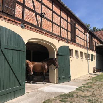
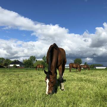
Offenstall/Bewegungsstall in gemischter Herde
Vahldorf
K-Marx
@K-Marx
Freizeitstall
Geländestrecke
Vermieten
Hunde willkommen
Krankenbox
Bewegungsstall
Laufstall
12 weitere...
P+
Deprecated: Creation of dynamic property Zend_View_Helper_Ads::$adLink is deprecated in /var/www/stall-frei/htdocs/staging.stall-frei.de/library/Psf/View/Helper/Ads.php on line 108

Leider kein Vorschaubild
Leider kein Vorschaubild
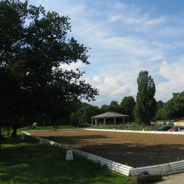
Paddock-Trail bei Magdeburg
Dolle
Heide-Trail Dolle
@Pferdezentrum-Dolle
Freizeitstall
Pferdeausbildung
Vermieten
Hunde willkommen
Krankenbox
Notfallboxen
19 weitere...
B

Paddockbox in Reitsportanlage frei , Stall frei
Oebisfelde Ortsteil Niendorf
Alina Bogner
@ReitsportanlageBogner
Freizeitstall
Reitlehrer und -unterricht
Vermieten
Krankenbox
Longierzirkel/Roundpen
Allergikerstall
Zuchtstutenhaltung möglich
16 weitere...
P
Leider kein Vorschaubild
Leider kein Vorschaubild
Platz im offenstall
Samswegen
Nancy
@Nancy2
Geländestrecke
Paddock
Sattelkammer/Sattelschränke
Offenstall
Selbstversorgung
5 weitere...
B
Leider kein Vorschaubild
Leider kein Vorschaubild
Paddockboxen, Außenboxen
Schwanefeld
Reitstall
@Reitstall
Freizeitstall
Reitlehrer und -unterricht
Paddock
Parkplatz für Pferdeanhänger
Allergikerstall
Hengsthaltung möglich
Außenbox mit Paddock
Außenboxen
10 weitere...
B

Futtersack HeuToy, Fressbremse in pink
Mechtersen
STALL-FREIde Marketing
@STALL-FREI-Marketing
Stundenlange Beschäftigung die
Koliken vorbeugt, geringe Staubinhalation mit
steuerbarer Futterentnahme

Pensionsstall Schulz&Kaltenbrunn
Breitenrode
Schulz/Kaltenbrunn
@PSKSchulzKaltenbrunn
Freizeitstall
Geländestrecke
Hunde willkommen
Krankenbox
Allergikerstall
bedampftes/gewaschenes Heu
Außenboxen
Innenbox
22 weitere...
P
Es ist zur Zeit keine Box frei
Magdeburg
Reitclub-Herrenkrug-e-V
@Reitclub-Herrenkrug-e-V
FN-Mitglied
Geländestrecke
Longierzirkel/Roundpen
Paddock
Außenboxen
Vollpension
12 weitere...
P
Leider kein Vorschaubild
Leider kein Vorschaubild
Aufzuchtsplatz all inklusive, Heu satt, viel Platz
Oebisfelde
Daniela Pauls
@DanielaPauls
Freizeitstall
Pferdeausbildung
Vermieten
Krankenbox
Parkplatz für Pferdeanhänger
Allergikerstall
Fohlenaufzucht möglich
14 weitere...
B

RFV Magdeburg (Herrenkrug)- derzeit keine Box frei
Magdeburg
RFV Magdeburg e.V.
@RFV-MD-eV
FN-Mitglied
Freizeitstall
Krankenbox
Paddock
Notfallboxen
Außenboxen
Innenbox
14 weitere...
P
Leider kein Vorschaubild
Leider kein Vorschaubild
Zuchtstuten Plätze
Oebisfelde
Daniela Pauls
@DanielaPauls
FN-Mitglied
Freizeitstall
Vermieten
Krankenbox
Paddock
Fohlenaufzucht möglich
Notfallboxen
16 weitere...
B
Deprecated: Creation of dynamic property Zend_View::$pageCount is deprecated in /var/www/stall-frei/htdocs/staging.stall-frei.de/library/vendor/shardj/zf1-future/library/Zend/View/Abstract.php on line 308
Deprecated: Creation of dynamic property Zend_View::$itemCountPerPage is deprecated in /var/www/stall-frei/htdocs/staging.stall-frei.de/library/vendor/shardj/zf1-future/library/Zend/View/Abstract.php on line 308
Deprecated: Creation of dynamic property Zend_View::$first is deprecated in /var/www/stall-frei/htdocs/staging.stall-frei.de/library/vendor/shardj/zf1-future/library/Zend/View/Abstract.php on line 308
Deprecated: Creation of dynamic property Zend_View::$current is deprecated in /var/www/stall-frei/htdocs/staging.stall-frei.de/library/vendor/shardj/zf1-future/library/Zend/View/Abstract.php on line 308
Deprecated: Creation of dynamic property Zend_View::$last is deprecated in /var/www/stall-frei/htdocs/staging.stall-frei.de/library/vendor/shardj/zf1-future/library/Zend/View/Abstract.php on line 308
Deprecated: Creation of dynamic property Zend_View::$next is deprecated in /var/www/stall-frei/htdocs/staging.stall-frei.de/library/vendor/shardj/zf1-future/library/Zend/View/Abstract.php on line 308
Deprecated: Creation of dynamic property Zend_View::$pagesInRange is deprecated in /var/www/stall-frei/htdocs/staging.stall-frei.de/library/vendor/shardj/zf1-future/library/Zend/View/Abstract.php on line 308
Deprecated: Creation of dynamic property Zend_View::$firstPageInRange is deprecated in /var/www/stall-frei/htdocs/staging.stall-frei.de/library/vendor/shardj/zf1-future/library/Zend/View/Abstract.php on line 308
Deprecated: Creation of dynamic property Zend_View::$lastPageInRange is deprecated in /var/www/stall-frei/htdocs/staging.stall-frei.de/library/vendor/shardj/zf1-future/library/Zend/View/Abstract.php on line 308
Deprecated: Creation of dynamic property Zend_View::$currentItemCount is deprecated in /var/www/stall-frei/htdocs/staging.stall-frei.de/library/vendor/shardj/zf1-future/library/Zend/View/Abstract.php on line 308
Deprecated: Creation of dynamic property Zend_View::$totalItemCount is deprecated in /var/www/stall-frei/htdocs/staging.stall-frei.de/library/vendor/shardj/zf1-future/library/Zend/View/Abstract.php on line 308
Deprecated: Creation of dynamic property Zend_View::$firstItemNumber is deprecated in /var/www/stall-frei/htdocs/staging.stall-frei.de/library/vendor/shardj/zf1-future/library/Zend/View/Abstract.php on line 308
Deprecated: Creation of dynamic property Zend_View::$lastItemNumber is deprecated in /var/www/stall-frei/htdocs/staging.stall-frei.de/library/vendor/shardj/zf1-future/library/Zend/View/Abstract.php on line 308
Deprecated: Creation of dynamic property Zend_View::$router is deprecated in /var/www/stall-frei/htdocs/staging.stall-frei.de/library/vendor/shardj/zf1-future/library/Zend/View/Abstract.php on line 308
Deprecated: Creation of dynamic property Zend_View::$urlParams is deprecated in /var/www/stall-frei/htdocs/staging.stall-frei.de/library/vendor/shardj/zf1-future/library/Zend/View/Abstract.php on line 308
Deprecated: Creation of dynamic property Zend_View::$showAds is deprecated in /var/www/stall-frei/htdocs/staging.stall-frei.de/library/vendor/shardj/zf1-future/library/Zend/View/Abstract.php on line 308
Deprecated: Creation of dynamic property Zend_View::$objectIds is deprecated in /var/www/stall-frei/htdocs/staging.stall-frei.de/library/vendor/shardj/zf1-future/library/Zend/View/Abstract.php on line 308
Deprecated: Creation of dynamic property Zend_View::$showNavbar is deprecated in /var/www/stall-frei/htdocs/staging.stall-frei.de/library/vendor/shardj/zf1-future/library/Zend/View/Abstract.php on line 308
Deprecated: Creation of dynamic property Zend_View::$showBreadcrumb is deprecated in /var/www/stall-frei/htdocs/staging.stall-frei.de/library/vendor/shardj/zf1-future/library/Zend/View/Abstract.php on line 308
Deprecated: Creation of dynamic property Zend_View::$showFooter is deprecated in /var/www/stall-frei/htdocs/staging.stall-frei.de/library/vendor/shardj/zf1-future/library/Zend/View/Abstract.php on line 308
Deprecated: Creation of dynamic property Zend_View::$showInternalAds is deprecated in /var/www/stall-frei/htdocs/staging.stall-frei.de/library/vendor/shardj/zf1-future/library/Zend/View/Abstract.php on line 308
Deprecated: Creation of dynamic property Zend_View::$blNoContent is deprecated in /var/www/stall-frei/htdocs/staging.stall-frei.de/library/vendor/shardj/zf1-future/library/Zend/View/Abstract.php on line 308
Deprecated: Creation of dynamic property Zend_View::$sMetaDesc is deprecated in /var/www/stall-frei/htdocs/staging.stall-frei.de/library/vendor/shardj/zf1-future/library/Zend/View/Abstract.php on line 308
Deprecated: Creation of dynamic property Zend_View::$useGmaps is deprecated in /var/www/stall-frei/htdocs/staging.stall-frei.de/library/vendor/shardj/zf1-future/library/Zend/View/Abstract.php on line 308
Deprecated: Creation of dynamic property Zend_View::$touches is deprecated in /var/www/stall-frei/htdocs/staging.stall-frei.de/library/vendor/shardj/zf1-future/library/Zend/View/Abstract.php on line 308
Deprecated: Creation of dynamic property Zend_View::$oProject is deprecated in /var/www/stall-frei/htdocs/staging.stall-frei.de/library/vendor/shardj/zf1-future/library/Zend/View/Abstract.php on line 308
Deprecated: Creation of dynamic property Zend_View::$pageHeadline is deprecated in /var/www/stall-frei/htdocs/staging.stall-frei.de/library/vendor/shardj/zf1-future/library/Zend/View/Abstract.php on line 308
Deprecated: Creation of dynamic property Zend_View::$disableLocationField is deprecated in /var/www/stall-frei/htdocs/staging.stall-frei.de/library/vendor/shardj/zf1-future/library/Zend/View/Abstract.php on line 308
Deprecated: Creation of dynamic property Zend_View::$isSearch is deprecated in /var/www/stall-frei/htdocs/staging.stall-frei.de/library/vendor/shardj/zf1-future/library/Zend/View/Abstract.php on line 308
Deprecated: Creation of dynamic property Zend_View::$pageTitle is deprecated in /var/www/stall-frei/htdocs/staging.stall-frei.de/library/vendor/shardj/zf1-future/library/Zend/View/Abstract.php on line 308
Deprecated: Creation of dynamic property Psf_Form_Element_Text::$class is deprecated in /var/www/stall-frei/htdocs/staging.stall-frei.de/library/vendor/shardj/zf1-future/library/Zend/Form/Element.php on line 874
Deprecated: Creation of dynamic property Psf_Form_Element_Text::$size is deprecated in /var/www/stall-frei/htdocs/staging.stall-frei.de/library/vendor/shardj/zf1-future/library/Zend/Form/Element.php on line 874
Deprecated: Creation of dynamic property Psf_Form_Element_Text::$placeholder is deprecated in /var/www/stall-frei/htdocs/staging.stall-frei.de/library/vendor/shardj/zf1-future/library/Zend/Form/Element.php on line 874
Deprecated: Creation of dynamic property Psf_Form_Element_Hidden::$class is deprecated in /var/www/stall-frei/htdocs/staging.stall-frei.de/library/vendor/shardj/zf1-future/library/Zend/Form/Element.php on line 874
Deprecated: Creation of dynamic property Psf_Form_Element_Hidden::$class is deprecated in /var/www/stall-frei/htdocs/staging.stall-frei.de/library/vendor/shardj/zf1-future/library/Zend/Form/Element.php on line 874
Deprecated: Creation of dynamic property Psf_Form_Element_Hidden::$class is deprecated in /var/www/stall-frei/htdocs/staging.stall-frei.de/library/vendor/shardj/zf1-future/library/Zend/Form/Element.php on line 874
Deprecated: Creation of dynamic property Psf_Form_Element_Hidden::$class is deprecated in /var/www/stall-frei/htdocs/staging.stall-frei.de/library/vendor/shardj/zf1-future/library/Zend/Form/Element.php on line 874
Deprecated: Creation of dynamic property Psf_Form_Element_Select::$class is deprecated in /var/www/stall-frei/htdocs/staging.stall-frei.de/library/vendor/shardj/zf1-future/library/Zend/Form/Element.php on line 874
Deprecated: Creation of dynamic property Psf_Form_Element_Select::$class is deprecated in /var/www/stall-frei/htdocs/staging.stall-frei.de/library/vendor/shardj/zf1-future/library/Zend/Form/Element.php on line 874
Deprecated: Creation of dynamic property Psf_Form_Element_Select::$class is deprecated in /var/www/stall-frei/htdocs/staging.stall-frei.de/library/vendor/shardj/zf1-future/library/Zend/Form/Element.php on line 874
Deprecated: Creation of dynamic property Psf_Form_Element_Select::$class is deprecated in /var/www/stall-frei/htdocs/staging.stall-frei.de/library/vendor/shardj/zf1-future/library/Zend/Form/Element.php on line 874
Deprecated: Creation of dynamic property Psf_Form_Element_Text::$class is deprecated in /var/www/stall-frei/htdocs/staging.stall-frei.de/library/vendor/shardj/zf1-future/library/Zend/Form/Element.php on line 874
Deprecated: Creation of dynamic property Psf_Form_Element_Checkbox::$label is deprecated in /var/www/stall-frei/htdocs/staging.stall-frei.de/library/vendor/shardj/zf1-future/library/Zend/Form/Element.php on line 874
Deprecated: Creation of dynamic property Zend_View::$sort is deprecated in /var/www/stall-frei/htdocs/staging.stall-frei.de/library/vendor/shardj/zf1-future/library/Zend/View/Abstract.php on line 308
Deprecated: Creation of dynamic property Zend_View::$searchLocation is deprecated in /var/www/stall-frei/htdocs/staging.stall-frei.de/library/vendor/shardj/zf1-future/library/Zend/View/Abstract.php on line 308
Deprecated: Creation of dynamic property Zend_View::$locationHint is deprecated in /var/www/stall-frei/htdocs/staging.stall-frei.de/library/vendor/shardj/zf1-future/library/Zend/View/Abstract.php on line 308
Psf_GeoCoder_Abstract::getLocation: Dorst Get Location CachedOrLive
Psf_GeoCoder_Abstract::getCachedOrLive: Dorst
Psf_GeoCoder_OpenCageData::makeApiRequest: response:
Array
(
[documentation] => https://opencagedata.com/api
[licenses] => Array
(
[0] => Array
(
[name] => see attribution guide
[url] => https://opencagedata.com/credits
)
)
[results] => Array
(
[0] => Array
(
[bounds] => Array
(
[northeast] => Array
(
[lat] => 52.3950508
[lng] => 11.4072749
)
[southwest] => Array
(
[lat] => 52.3709334
[lng] => 11.369359
)
)
[components] => Array
(
[ISO_3166-1_alpha-2] => DE
[ISO_3166-1_alpha-3] => DEU
[ISO_3166-2] => Array
(
[0] => DE-ST
)
[_category] => place
[_normalized_city] => Dorst
[_type] => village
[continent] => Europe
[country] => Deutschland
[country_code] => de
[county] => Börde
[municipality] => Flechtingen
[political_union] => European Union
[state] => Sachsen-Anhalt
[state_code] => ST
[village] => Dorst
)
[confidence] => 7
[formatted] => Dorst, Sachsen-Anhalt, Deutschland
[geometry] => Array
(
[lat] => 52.3828385
[lng] => 11.3875507
)
)
[1] => Array
(
[bounds] => Array
(
[northeast] => Array
(
[lat] => 47.6470226
[lng] => 11.3658383
)
[southwest] => Array
(
[lat] => 47.6450766
[lng] => 11.3626227
)
)
[components] => Array
(
[ISO_3166-1_alpha-2] => DE
[ISO_3166-1_alpha-3] => DEU
[ISO_3166-2] => Array
(
[0] => DE-BY
)
[_category] => place
[_normalized_city] => Kochel am See
[_type] => village
[continent] => Europe
[country] => Deutschland
[country_code] => de
[county] => Landkreis Bad Tölz-Wolfratshausen
[industrial] => Dorst
[municipality] => Kochel am See (VGem)
[political_union] => European Union
[postcode] => 82431
[state] => Bayern
[state_code] => BY
[village] => Kochel am See
)
[confidence] => 9
[formatted] => 82431 Kochel am See, Deutschland
[geometry] => Array
(
[lat] => 47.6460969
[lng] => 11.3641104
)
)
[2] => Array
(
[components] => Array
(
[ISO_3166-1_alpha-2] => FR
[ISO_3166-1_alpha-3] => FRA
[ISO_3166-2] => Array
(
[0] => FR-OCC
[1] => FR-31
)
[_category] => road
[_normalized_city] => Gratentour
[_type] => road
[city] => Gratentour
[continent] => Europe
[country] => France
[country_code] => fr
[county] => Haute-Garonne
[local_authority] => Toulouse Métropole
[political_union] => European Union
[postcode] => 31150
[road] => Rue jean Dorst
[state] => Occitanie
[state_code] => OCC
)
[confidence] => 2
[formatted] => Rue jean Dorst, 31150 Gratentour, France
[geometry] => Array
(
[lat] => 43.718047
[lng] => 1.447351
)
)
[3] => Array
(
[components] => Array
(
[ISO_3166-1_alpha-2] => FR
[ISO_3166-1_alpha-3] => FRA
[ISO_3166-2] => Array
(
[0] => FR-OCC
[1] => FR-31
)
[_category] => road
[_normalized_city] => Grépiac
[_type] => road
[city] => Grépiac
[continent] => Europe
[country] => France
[country_code] => fr
[county] => Haute-Garonne
[local_authority] => Communauté de communes du Bassin Auterivain Haut-Garonnais
[political_union] => European Union
[postcode] => 31190
[road] => Route de Labruyère Dorsa
[state] => Occitanie
[state_code] => OCC
)
[confidence] => 2
[formatted] => Route de Labruyère Dorsa, 31190 Grépiac, France
[geometry] => Array
(
[lat] => 43.407685
[lng] => 1.454362
)
)
[4] => Array
(
[components] => Array
(
[ISO_3166-1_alpha-2] => FR
[ISO_3166-1_alpha-3] => FRA
[ISO_3166-2] => Array
(
[0] => FR-NAQ
[1] => FR-17
)
[_category] => road
[_normalized_city] => Vouhé
[_type] => road
[city] => Vouhé
[continent] => Europe
[country] => France
[country_code] => fr
[county] => Charente-Maritime
[local_authority] => Communauté de communes Aunis Sud
[political_union] => European Union
[postcode] => 17700
[road] => Chemin de la Dorate
[state] => Nouvelle-Aquitaine
[state_code] => NAQ
)
[confidence] => 2
[formatted] => Chemin de la Dorate, 17700 Vouhé, France
[geometry] => Array
(
[lat] => 46.15036
[lng] => -0.798424
)
)
[5] => Array
(
[components] => Array
(
[ISO_3166-1_alpha-2] => FR
[ISO_3166-1_alpha-3] => FRA
[ISO_3166-2] => Array
(
[0] => FR-OCC
[1] => FR-31
)
[_category] => road
[_normalized_city] => Labruyère-Dorsa
[_type] => road
[city] => Labruyère-Dorsa
[continent] => Europe
[country] => France
[country_code] => fr
[county] => Haute-Garonne
[local_authority] => Communauté de communes du Bassin Auterivain Haut-Garonnais
[political_union] => European Union
[postcode] => 31190
[road] => Route du Pech
[state] => Occitanie
[state_code] => OCC
)
[confidence] => 2
[formatted] => Route du Pech, 31190 Labruyère-Dorsa, France
[geometry] => Array
(
[lat] => 43.408346
[lng] => 1.467522
)
)
[6] => Array
(
[components] => Array
(
[ISO_3166-1_alpha-2] => FR
[ISO_3166-1_alpha-3] => FRA
[ISO_3166-2] => Array
(
[0] => FR-OCC
[1] => FR-31
)
[_category] => place
[_normalized_city] => Labruyère-Dorsa
[_type] => city
[city] => Labruyère-Dorsa
[continent] => Europe
[country] => France
[country_code] => fr
[county] => Haute-Garonne
[local_authority] => Communauté de communes du Bassin Auterivain Haut-Garonnais
[political_union] => European Union
[postcode] => 31190
[state] => Occitanie
[state_code] => OCC
)
[confidence] => 2
[formatted] => Labruyère-Dorsa, Haute-Garonne, France
[geometry] => Array
(
[lat] => 43.406651
[lng] => 1.47151
)
)
[7] => Array
(
[components] => Array
(
[ISO_3166-1_alpha-2] => FR
[ISO_3166-1_alpha-3] => FRA
[ISO_3166-2] => Array
(
[0] => FR-OCC
[1] => FR-31
)
[_category] => road
[_normalized_city] => Labruyère-Dorsa
[_type] => road
[city] => Labruyère-Dorsa
[continent] => Europe
[country] => France
[country_code] => fr
[county] => Haute-Garonne
[local_authority] => Communauté de communes du Bassin Auterivain Haut-Garonnais
[political_union] => European Union
[postcode] => 31190
[road] => Chemin de Rivel
[state] => Occitanie
[state_code] => OCC
)
[confidence] => 10
[formatted] => Chemin de Rivel, 31190 Labruyère-Dorsa, France
[geometry] => Array
(
[lat] => 43.405358
[lng] => 1.46922
)
)
[8] => Array
(
[components] => Array
(
[ISO_3166-1_alpha-2] => FR
[ISO_3166-1_alpha-3] => FRA
[ISO_3166-2] => Array
(
[0] => FR-OCC
[1] => FR-31
)
[_category] => place
[_normalized_city] => Labruyère-Dorsa
[_type] => place
[city] => Labruyère-Dorsa
[continent] => Europe
[country] => France
[country_code] => fr
[county] => Haute-Garonne
[local_authority] => Communauté de communes du Bassin Auterivain Haut-Garonnais
[place] => Lieu dit Rivel
[political_union] => European Union
[postcode] => 31190
[state] => Occitanie
[state_code] => OCC
)
[confidence] => 10
[formatted] => Lieu dit Rivel, 31190 Labruyère-Dorsa, France
[geometry] => Array
(
[lat] => 43.403574
[lng] => 1.469418
)
)
[9] => Array
(
[components] => Array
(
[ISO_3166-1_alpha-2] => FR
[ISO_3166-1_alpha-3] => FRA
[ISO_3166-2] => Array
(
[0] => FR-OCC
[1] => FR-31
)
[_category] => place
[_normalized_city] => Labruyère-Dorsa
[_type] => place
[city] => Labruyère-Dorsa
[continent] => Europe
[country] => France
[country_code] => fr
[county] => Haute-Garonne
[local_authority] => Communauté de communes du Bassin Auterivain Haut-Garonnais
[place] => Lieu dit Lagrave
[political_union] => European Union
[postcode] => 31190
[state] => Occitanie
[state_code] => OCC
)
[confidence] => 10
[formatted] => Lieu dit Lagrave, 31190 Labruyère-Dorsa, France
[geometry] => Array
(
[lat] => 43.40666
[lng] => 1.479455
)
)
)
[status] => Array
(
[code] => 200
[message] => OK
)
[stay_informed] => Array
(
[blog] => https://blog.opencagedata.com
[mastodon] => https://en.osm.town/@opencage
)
[thanks] => For using an OpenCage API
[timestamp] => Array
(
[created_http] => Sun, 08 Feb 2026 14:31:32 GMT
[created_unix] => 1770561092
)
[total_results] => 10
)
Psf_GeoCoder_Abstract::convertLocationResult
{"documentation":"https:\/\/opencagedata.com\/api","licenses":[{"name":"see attribution guide","url":"https:\/\/opencagedata.com\/credits"}],"results":[{"bounds":{"northeast":{"lat":52.3950508,"lng":11.4072749},"southwest":{"lat":52.3709334,"lng":11.369359}},"components":{"ISO_3166-1_alpha-2":"DE","ISO_3166-1_alpha-3":"DEU","ISO_3166-2":["DE-ST"],"_category":"place","_normalized_city":"Dorst","_type":"village","continent":"Europe","country":"Deutschland","country_code":"de","county":"B\u00f6rde","municipality":"Flechtingen","political_union":"European Union","state":"Sachsen-Anhalt","state_code":"ST","village":"Dorst"},"confidence":7,"formatted":"Dorst, Sachsen-Anhalt, Deutschland","geometry":{"lat":52.3828385,"lng":11.3875507}},{"bounds":{"northeast":{"lat":47.6470226,"lng":11.3658383},"southwest":{"lat":47.6450766,"lng":11.3626227}},"components":{"ISO_3166-1_alpha-2":"DE","ISO_3166-1_alpha-3":"DEU","ISO_3166-2":["DE-BY"],"_category":"place","_normalized_city":"Kochel am See","_type":"village","continent":"Europe","country":"Deutschland","country_code":"de","county":"Landkreis Bad T\u00f6lz-Wolfratshausen","industrial":"Dorst","municipality":"Kochel am See (VGem)","political_union":"European Union","postcode":"82431","state":"Bayern","state_code":"BY","village":"Kochel am See"},"confidence":9,"formatted":"82431 Kochel am See, Deutschland","geometry":{"lat":47.6460969,"lng":11.3641104}},{"components":{"ISO_3166-1_alpha-2":"FR","ISO_3166-1_alpha-3":"FRA","ISO_3166-2":["FR-OCC","FR-31"],"_category":"road","_normalized_city":"Gratentour","_type":"road","city":"Gratentour","continent":"Europe","country":"France","country_code":"fr","county":"Haute-Garonne","local_authority":"Toulouse M\u00e9tropole","political_union":"European Union","postcode":"31150","road":"Rue jean Dorst","state":"Occitanie","state_code":"OCC"},"confidence":2,"formatted":"Rue jean Dorst, 31150 Gratentour, France","geometry":{"lat":43.718047,"lng":1.447351}},{"components":{"ISO_3166-1_alpha-2":"FR","ISO_3166-1_alpha-3":"FRA","ISO_3166-2":["FR-OCC","FR-31"],"_category":"road","_normalized_city":"Gr\u00e9piac","_type":"road","city":"Gr\u00e9piac","continent":"Europe","country":"France","country_code":"fr","county":"Haute-Garonne","local_authority":"Communaut\u00e9 de communes du Bassin Auterivain Haut-Garonnais","political_union":"European Union","postcode":"31190","road":"Route de Labruy\u00e8re Dorsa","state":"Occitanie","state_code":"OCC"},"confidence":2,"formatted":"Route de Labruy\u00e8re Dorsa, 31190 Gr\u00e9piac, France","geometry":{"lat":43.407685,"lng":1.454362}},{"components":{"ISO_3166-1_alpha-2":"FR","ISO_3166-1_alpha-3":"FRA","ISO_3166-2":["FR-NAQ","FR-17"],"_category":"road","_normalized_city":"Vouh\u00e9","_type":"road","city":"Vouh\u00e9","continent":"Europe","country":"France","country_code":"fr","county":"Charente-Maritime","local_authority":"Communaut\u00e9 de communes Aunis Sud","political_union":"European Union","postcode":"17700","road":"Chemin de la Dorate","state":"Nouvelle-Aquitaine","state_code":"NAQ"},"confidence":2,"formatted":"Chemin de la Dorate, 17700 Vouh\u00e9, France","geometry":{"lat":46.15036,"lng":-0.798424}},{"components":{"ISO_3166-1_alpha-2":"FR","ISO_3166-1_alpha-3":"FRA","ISO_3166-2":["FR-OCC","FR-31"],"_category":"road","_normalized_city":"Labruy\u00e8re-Dorsa","_type":"road","city":"Labruy\u00e8re-Dorsa","continent":"Europe","country":"France","country_code":"fr","county":"Haute-Garonne","local_authority":"Communaut\u00e9 de communes du Bassin Auterivain Haut-Garonnais","political_union":"European Union","postcode":"31190","road":"Route du Pech","state":"Occitanie","state_code":"OCC"},"confidence":2,"formatted":"Route du Pech, 31190 Labruy\u00e8re-Dorsa, France","geometry":{"lat":43.408346,"lng":1.467522}},{"components":{"ISO_3166-1_alpha-2":"FR","ISO_3166-1_alpha-3":"FRA","ISO_3166-2":["FR-OCC","FR-31"],"_category":"place","_normalized_city":"Labruy\u00e8re-Dorsa","_type":"city","city":"Labruy\u00e8re-Dorsa","continent":"Europe","country":"France","country_code":"fr","county":"Haute-Garonne","local_authority":"Communaut\u00e9 de communes du Bassin Auterivain Haut-Garonnais","political_union":"European Union","postcode":"31190","state":"Occitanie","state_code":"OCC"},"confidence":2,"formatted":"Labruy\u00e8re-Dorsa, Haute-Garonne, France","geometry":{"lat":43.406651,"lng":1.47151}},{"components":{"ISO_3166-1_alpha-2":"FR","ISO_3166-1_alpha-3":"FRA","ISO_3166-2":["FR-OCC","FR-31"],"_category":"road","_normalized_city":"Labruy\u00e8re-Dorsa","_type":"road","city":"Labruy\u00e8re-Dorsa","continent":"Europe","country":"France","country_code":"fr","county":"Haute-Garonne","local_authority":"Communaut\u00e9 de communes du Bassin Auterivain Haut-Garonnais","political_union":"European Union","postcode":"31190","road":"Chemin de Rivel","state":"Occitanie","state_code":"OCC"},"confidence":10,"formatted":"Chemin de Rivel, 31190 Labruy\u00e8re-Dorsa, France","geometry":{"lat":43.405358,"lng":1.46922}},{"components":{"ISO_3166-1_alpha-2":"FR","ISO_3166-1_alpha-3":"FRA","ISO_3166-2":["FR-OCC","FR-31"],"_category":"place","_normalized_city":"Labruy\u00e8re-Dorsa","_type":"place","city":"Labruy\u00e8re-Dorsa","continent":"Europe","country":"France","country_code":"fr","county":"Haute-Garonne","local_authority":"Communaut\u00e9 de communes du Bassin Auterivain Haut-Garonnais","place":"Lieu dit Rivel","political_union":"European Union","postcode":"31190","state":"Occitanie","state_code":"OCC"},"confidence":10,"formatted":"Lieu dit Rivel, 31190 Labruy\u00e8re-Dorsa, France","geometry":{"lat":43.403574,"lng":1.469418}},{"components":{"ISO_3166-1_alpha-2":"FR","ISO_3166-1_alpha-3":"FRA","ISO_3166-2":["FR-OCC","FR-31"],"_category":"place","_normalized_city":"Labruy\u00e8re-Dorsa","_type":"place","city":"Labruy\u00e8re-Dorsa","continent":"Europe","country":"France","country_code":"fr","county":"Haute-Garonne","local_authority":"Communaut\u00e9 de communes du Bassin Auterivain Haut-Garonnais","place":"Lieu dit Lagrave","political_union":"European Union","postcode":"31190","state":"Occitanie","state_code":"OCC"},"confidence":10,"formatted":"Lieu dit Lagrave, 31190 Labruy\u00e8re-Dorsa, France","geometry":{"lat":43.40666,"lng":1.479455}}],"status":{"code":200,"message":"OK"},"stay_informed":{"blog":"https:\/\/blog.opencagedata.com","mastodon":"https:\/\/en.osm.town\/@opencage"},"thanks":"For using an OpenCage API","timestamp":{"created_http":"Sun, 08 Feb 2026 14:31:32 GMT","created_unix":1770561092},"total_results":10}Array
(
[0] => stdClass Object
(
[bounds] => stdClass Object
(
[northeast] => stdClass Object
(
[lat] => 52.3950508
[lng] => 11.4072749
)
[southwest] => stdClass Object
(
[lat] => 52.3709334
[lng] => 11.369359
)
)
[components] => stdClass Object
(
[ISO_3166-1_alpha-2] => DE
[ISO_3166-1_alpha-3] => DEU
[ISO_3166-2] => Array
(
[0] => DE-ST
)
[_category] => place
[_normalized_city] => Dorst
[_type] => village
[continent] => Europe
[country] => Deutschland
[country_code] => de
[county] => Börde
[municipality] => Flechtingen
[political_union] => European Union
[state] => Sachsen-Anhalt
[state_code] => ST
[village] => Dorst
)
[confidence] => 7
[formatted] => Dorst, Sachsen-Anhalt, Deutschland
[geometry] => stdClass Object
(
[lat] => 52.3828385
[lng] => 11.3875507
)
)
[1] => stdClass Object
(
[bounds] => stdClass Object
(
[northeast] => stdClass Object
(
[lat] => 47.6470226
[lng] => 11.3658383
)
[southwest] => stdClass Object
(
[lat] => 47.6450766
[lng] => 11.3626227
)
)
[components] => stdClass Object
(
[ISO_3166-1_alpha-2] => DE
[ISO_3166-1_alpha-3] => DEU
[ISO_3166-2] => Array
(
[0] => DE-BY
)
[_category] => place
[_normalized_city] => Kochel am See
[_type] => village
[continent] => Europe
[country] => Deutschland
[country_code] => de
[county] => Landkreis Bad Tölz-Wolfratshausen
[industrial] => Dorst
[municipality] => Kochel am See (VGem)
[political_union] => European Union
[postcode] => 82431
[state] => Bayern
[state_code] => BY
[village] => Kochel am See
)
[confidence] => 9
[formatted] => 82431 Kochel am See, Deutschland
[geometry] => stdClass Object
(
[lat] => 47.6460969
[lng] => 11.3641104
)
)
[2] => stdClass Object
(
[components] => stdClass Object
(
[ISO_3166-1_alpha-2] => FR
[ISO_3166-1_alpha-3] => FRA
[ISO_3166-2] => Array
(
[0] => FR-OCC
[1] => FR-31
)
[_category] => road
[_normalized_city] => Gratentour
[_type] => road
[city] => Gratentour
[continent] => Europe
[country] => France
[country_code] => fr
[county] => Haute-Garonne
[local_authority] => Toulouse Métropole
[political_union] => European Union
[postcode] => 31150
[road] => Rue jean Dorst
[state] => Occitanie
[state_code] => OCC
)
[confidence] => 2
[formatted] => Rue jean Dorst, 31150 Gratentour, France
[geometry] => stdClass Object
(
[lat] => 43.718047
[lng] => 1.447351
)
)
[3] => stdClass Object
(
[components] => stdClass Object
(
[ISO_3166-1_alpha-2] => FR
[ISO_3166-1_alpha-3] => FRA
[ISO_3166-2] => Array
(
[0] => FR-OCC
[1] => FR-31
)
[_category] => road
[_normalized_city] => Grépiac
[_type] => road
[city] => Grépiac
[continent] => Europe
[country] => France
[country_code] => fr
[county] => Haute-Garonne
[local_authority] => Communauté de communes du Bassin Auterivain Haut-Garonnais
[political_union] => European Union
[postcode] => 31190
[road] => Route de Labruyère Dorsa
[state] => Occitanie
[state_code] => OCC
)
[confidence] => 2
[formatted] => Route de Labruyère Dorsa, 31190 Grépiac, France
[geometry] => stdClass Object
(
[lat] => 43.407685
[lng] => 1.454362
)
)
[4] => stdClass Object
(
[components] => stdClass Object
(
[ISO_3166-1_alpha-2] => FR
[ISO_3166-1_alpha-3] => FRA
[ISO_3166-2] => Array
(
[0] => FR-NAQ
[1] => FR-17
)
[_category] => road
[_normalized_city] => Vouhé
[_type] => road
[city] => Vouhé
[continent] => Europe
[country] => France
[country_code] => fr
[county] => Charente-Maritime
[local_authority] => Communauté de communes Aunis Sud
[political_union] => European Union
[postcode] => 17700
[road] => Chemin de la Dorate
[state] => Nouvelle-Aquitaine
[state_code] => NAQ
)
[confidence] => 2
[formatted] => Chemin de la Dorate, 17700 Vouhé, France
[geometry] => stdClass Object
(
[lat] => 46.15036
[lng] => -0.798424
)
)
[5] => stdClass Object
(
[components] => stdClass Object
(
[ISO_3166-1_alpha-2] => FR
[ISO_3166-1_alpha-3] => FRA
[ISO_3166-2] => Array
(
[0] => FR-OCC
[1] => FR-31
)
[_category] => road
[_normalized_city] => Labruyère-Dorsa
[_type] => road
[city] => Labruyère-Dorsa
[continent] => Europe
[country] => France
[country_code] => fr
[county] => Haute-Garonne
[local_authority] => Communauté de communes du Bassin Auterivain Haut-Garonnais
[political_union] => European Union
[postcode] => 31190
[road] => Route du Pech
[state] => Occitanie
[state_code] => OCC
)
[confidence] => 2
[formatted] => Route du Pech, 31190 Labruyère-Dorsa, France
[geometry] => stdClass Object
(
[lat] => 43.408346
[lng] => 1.467522
)
)
[6] => stdClass Object
(
[components] => stdClass Object
(
[ISO_3166-1_alpha-2] => FR
[ISO_3166-1_alpha-3] => FRA
[ISO_3166-2] => Array
(
[0] => FR-OCC
[1] => FR-31
)
[_category] => place
[_normalized_city] => Labruyère-Dorsa
[_type] => city
[city] => Labruyère-Dorsa
[continent] => Europe
[country] => France
[country_code] => fr
[county] => Haute-Garonne
[local_authority] => Communauté de communes du Bassin Auterivain Haut-Garonnais
[political_union] => European Union
[postcode] => 31190
[state] => Occitanie
[state_code] => OCC
)
[confidence] => 2
[formatted] => Labruyère-Dorsa, Haute-Garonne, France
[geometry] => stdClass Object
(
[lat] => 43.406651
[lng] => 1.47151
)
)
[7] => stdClass Object
(
[components] => stdClass Object
(
[ISO_3166-1_alpha-2] => FR
[ISO_3166-1_alpha-3] => FRA
[ISO_3166-2] => Array
(
[0] => FR-OCC
[1] => FR-31
)
[_category] => road
[_normalized_city] => Labruyère-Dorsa
[_type] => road
[city] => Labruyère-Dorsa
[continent] => Europe
[country] => France
[country_code] => fr
[county] => Haute-Garonne
[local_authority] => Communauté de communes du Bassin Auterivain Haut-Garonnais
[political_union] => European Union
[postcode] => 31190
[road] => Chemin de Rivel
[state] => Occitanie
[state_code] => OCC
)
[confidence] => 10
[formatted] => Chemin de Rivel, 31190 Labruyère-Dorsa, France
[geometry] => stdClass Object
(
[lat] => 43.405358
[lng] => 1.46922
)
)
[8] => stdClass Object
(
[components] => stdClass Object
(
[ISO_3166-1_alpha-2] => FR
[ISO_3166-1_alpha-3] => FRA
[ISO_3166-2] => Array
(
[0] => FR-OCC
[1] => FR-31
)
[_category] => place
[_normalized_city] => Labruyère-Dorsa
[_type] => place
[city] => Labruyère-Dorsa
[continent] => Europe
[country] => France
[country_code] => fr
[county] => Haute-Garonne
[local_authority] => Communauté de communes du Bassin Auterivain Haut-Garonnais
[place] => Lieu dit Rivel
[political_union] => European Union
[postcode] => 31190
[state] => Occitanie
[state_code] => OCC
)
[confidence] => 10
[formatted] => Lieu dit Rivel, 31190 Labruyère-Dorsa, France
[geometry] => stdClass Object
(
[lat] => 43.403574
[lng] => 1.469418
)
)
[9] => stdClass Object
(
[components] => stdClass Object
(
[ISO_3166-1_alpha-2] => FR
[ISO_3166-1_alpha-3] => FRA
[ISO_3166-2] => Array
(
[0] => FR-OCC
[1] => FR-31
)
[_category] => place
[_normalized_city] => Labruyère-Dorsa
[_type] => place
[city] => Labruyère-Dorsa
[continent] => Europe
[country] => France
[country_code] => fr
[county] => Haute-Garonne
[local_authority] => Communauté de communes du Bassin Auterivain Haut-Garonnais
[place] => Lieu dit Lagrave
[political_union] => European Union
[postcode] => 31190
[state] => Occitanie
[state_code] => OCC
)
[confidence] => 10
[formatted] => Lieu dit Lagrave, 31190 Labruyère-Dorsa, France
[geometry] => stdClass Object
(
[lat] => 43.40666
[lng] => 1.479455
)
)
)
Psf_GeoCoder_OpenCageData::getKeyMap: 0
stdClass Object
(
    [bounds] => stdClass Object
        (
            [northeast] => stdClass Object
                (
                    [lat] => 52.3950508
                    [lng] => 11.4072749
                )

            [southwest] => stdClass Object
                (
                    [lat] => 52.3709334
                    [lng] => 11.369359
                )

        )

    [components] => stdClass Object
        (
            [ISO_3166-1_alpha-2] => DE
            [ISO_3166-1_alpha-3] => DEU
            [ISO_3166-2] => Array
                (
                    [0] => DE-ST
                )

            [_category] => place
            [_normalized_city] => Dorst
            [_type] => village
            [continent] => Europe
            [country] => Deutschland
            [country_code] => de
            [county] => Börde
            [municipality] => Flechtingen
            [political_union] => European Union
            [state] => Sachsen-Anhalt
            [state_code] => ST
            [village] => Dorst
        )

    [confidence] => 7
    [formatted] => Dorst, Sachsen-Anhalt, Deutschland
    [geometry] => stdClass Object
        (
            [lat] => 52.3828385
            [lng] => 11.3875507
        )

)
Psf_GeoCoder_OpenCageData::getCounty: Börde
Psf_GeoCoder_OpenCageData::addMissingData REFETCH!
Array
(
    [address] => Dorst, Sachsen-Anhalt, Deutschland
    [type] => village
    [street] =>
    [city] => Dorst
    [county] => Börde
    [state] => Sachsen-Anhalt
    [zip] =>
    [country] => Deutschland
    [suburb] =>
    [countrycode] => de
    [latitude] => 52.3828385
    [longitude] => 11.3875507
    [accuracy] => 1
    [confidence] => 7
    [bounds] => stdClass Object
        (
            [northeast] => stdClass Object
                (
                    [lat] => 52.3950508
                    [lng] => 11.4072749
                )

            [southwest] => stdClass Object
                (
                    [lat] => 52.3709334
                    [lng] => 11.369359
                )

        )

)
reformat!
Array
(
    [address] => Dorst, Sachsen-Anhalt, Deutschland
    [type] => village
    [street] =>
    [city] => Dorst
    [county] => Börde
    [state] => Sachsen-Anhalt
    [zip] =>
    [country] => Deutschland
    [suburb] =>
    [countrycode] => de
    [latitude] => 52.3828385
    [longitude] => 11.3875507
    [accuracy] => 1
    [confidence] => 7
    [bounds] => stdClass Object
        (
            [northeast] => stdClass Object
                (
                    [lat] => 52.3950508
                    [lng] => 11.4072749
                )

            [southwest] => stdClass Object
                (
                    [lat] => 52.3709334
                    [lng] => 11.369359
                )

        )

    [place] => Dorst, Sachsen-Anhalt
    [hash] => c102938eac6c0a69673e25bfaa84fa02
)
Psf_GeoCoder_OpenCageData::getKeyMap: 1
stdClass Object
(
    [bounds] => stdClass Object
        (
            [northeast] => stdClass Object
                (
                    [lat] => 47.6470226
                    [lng] => 11.3658383
                )

            [southwest] => stdClass Object
                (
                    [lat] => 47.6450766
                    [lng] => 11.3626227
                )

        )

    [components] => stdClass Object
        (
            [ISO_3166-1_alpha-2] => DE
            [ISO_3166-1_alpha-3] => DEU
            [ISO_3166-2] => Array
                (
                    [0] => DE-BY
                )

            [_category] => place
            [_normalized_city] => Kochel am See
            [_type] => village
            [continent] => Europe
            [country] => Deutschland
            [country_code] => de
            [county] => Landkreis Bad Tölz-Wolfratshausen
            [industrial] => Dorst
            [municipality] => Kochel am See (VGem)
            [political_union] => European Union
            [postcode] => 82431
            [state] => Bayern
            [state_code] => BY
            [village] => Kochel am See
        )

    [confidence] => 9
    [formatted] => 82431 Kochel am See, Deutschland
    [geometry] => stdClass Object
        (
            [lat] => 47.6460969
            [lng] => 11.3641104
        )

)
Psf_GeoCoder_OpenCageData::getCounty: Bad Tölz-Wolfratshausen
Psf_GeoCoder_OpenCageData::addMissingData REFETCH!
Array
(
    [address] => 82431 Kochel am See, Deutschland
    [type] => village
    [street] =>
    [city] => Kochel am See
    [county] => Bad Tölz-Wolfratshausen
    [state] => Bayern
    [zip] => 82431
    [country] => Deutschland
    [suburb] =>
    [countrycode] => de
    [latitude] => 47.6460969
    [longitude] => 11.3641104
    [accuracy] => 1
    [confidence] => 9
    [bounds] => stdClass Object
        (
            [northeast] => stdClass Object
                (
                    [lat] => 47.6470226
                    [lng] => 11.3658383
                )

            [southwest] => stdClass Object
                (
                    [lat] => 47.6450766
                    [lng] => 11.3626227
                )

        )

)
reformat!
Array
(
    [address] => 82431 Kochel am See, Deutschland
    [type] => village
    [street] =>
    [city] => Kochel am See
    [county] => Bad Tölz-Wolfratshausen
    [state] => Bayern
    [zip] => 82431
    [country] => Deutschland
    [suburb] =>
    [countrycode] => de
    [latitude] => 47.6460969
    [longitude] => 11.3641104
    [accuracy] => 1
    [confidence] => 9
    [bounds] => stdClass Object
        (
            [northeast] => stdClass Object
                (
                    [lat] => 47.6470226
                    [lng] => 11.3658383
                )

            [southwest] => stdClass Object
                (
                    [lat] => 47.6450766
                    [lng] => 11.3626227
                )

        )

    [place] => 82431 Kochel am See, Bayern
    [hash] => 73bbe6676395f6d41b3386e2e99fbfff
)
Psf_GeoCoder_OpenCageData::getKeyMap: 2
stdClass Object
(
    [components] => stdClass Object
        (
            [ISO_3166-1_alpha-2] => FR
            [ISO_3166-1_alpha-3] => FRA
            [ISO_3166-2] => Array
                (
                    [0] => FR-OCC
                    [1] => FR-31
                )

            [_category] => road
            [_normalized_city] => Gratentour
            [_type] => road
            [city] => Gratentour
            [continent] => Europe
            [country] => France
            [country_code] => fr
            [county] => Haute-Garonne
            [local_authority] => Toulouse Métropole
            [political_union] => European Union
            [postcode] => 31150
            [road] => Rue jean Dorst
            [state] => Occitanie
            [state_code] => OCC
        )

    [confidence] => 2
    [formatted] => Rue jean Dorst, 31150 Gratentour, France
    [geometry] => stdClass Object
        (
            [lat] => 43.718047
            [lng] => 1.447351
        )

)
Psf_GeoCoder_OpenCageData::getCounty: Haute-Garonne
Psf_GeoCoder_OpenCageData::addMissingData REFETCH!
Array
(
    [address] => Rue jean Dorst, 31150 Gratentour, France
    [type] => road
    [street] => Rue jean Dorst
    [city] => Gratentour
    [county] => Haute-Garonne
    [state] => Occitanie
    [zip] => 31150
    [country] => France
    [suburb] =>
    [countrycode] => fr
    [latitude] => 43.718047
    [longitude] => 1.447351
    [accuracy] => 1
    [confidence] => 2
    [bounds] =>
)
reformat!
Array
(
    [address] => Rue jean Dorst, 31150 Gratentour, France
    [type] => road
    [street] => Rue jean Dorst
    [city] => Gratentour
    [county] => Haute-Garonne
    [state] => Occitanie
    [zip] => 31150
    [country] => France
    [suburb] =>
    [countrycode] => fr
    [latitude] => 43.718047
    [longitude] => 1.447351
    [accuracy] => 1
    [confidence] => 2
    [bounds] =>
    [place] => Rue jean Dorst, 31150 Gratentour, Occitanie
    [hash] => 02569e8b8a2340cfb807445f4e51121d
)
Psf_GeoCoder_OpenCageData::getKeyMap: 3
stdClass Object
(
    [components] => stdClass Object
        (
            [ISO_3166-1_alpha-2] => FR
            [ISO_3166-1_alpha-3] => FRA
            [ISO_3166-2] => Array
                (
                    [0] => FR-OCC
                    [1] => FR-31
                )

            [_category] => road
            [_normalized_city] => Grépiac
            [_type] => road
            [city] => Grépiac
            [continent] => Europe
            [country] => France
            [country_code] => fr
            [county] => Haute-Garonne
            [local_authority] => Communauté de communes du Bassin Auterivain Haut-Garonnais
            [political_union] => European Union
            [postcode] => 31190
            [road] => Route de Labruyère Dorsa
            [state] => Occitanie
            [state_code] => OCC
        )

    [confidence] => 2
    [formatted] => Route de Labruyère Dorsa, 31190 Grépiac, France
    [geometry] => stdClass Object
        (
            [lat] => 43.407685
            [lng] => 1.454362
        )

)
Psf_GeoCoder_OpenCageData::getCounty: Haute-Garonne
Psf_GeoCoder_OpenCageData::addMissingData REFETCH!
Array
(
    [address] => Route de Labruyère Dorsa, 31190 Grépiac, France
    [type] => road
    [street] => Route de Labruyère Dorsa
    [city] => Grépiac
    [county] => Haute-Garonne
    [state] => Occitanie
    [zip] => 31190
    [country] => France
    [suburb] =>
    [countrycode] => fr
    [latitude] => 43.407685
    [longitude] => 1.454362
    [accuracy] => 1
    [confidence] => 2
    [bounds] =>
)
reformat!
Array
(
    [address] => Route de Labruyère Dorsa, 31190 Grépiac, France
    [type] => road
    [street] => Route de Labruyère Dorsa
    [city] => Grépiac
    [county] => Haute-Garonne
    [state] => Occitanie
    [zip] => 31190
    [country] => France
    [suburb] =>
    [countrycode] => fr
    [latitude] => 43.407685
    [longitude] => 1.454362
    [accuracy] => 1
    [confidence] => 2
    [bounds] =>
    [place] => Route de Labruyère Dorsa, 31190 Grépiac, Occitanie
    [hash] => 40baf3964f85770c8fa4b2546891e1fb
)
Psf_GeoCoder_OpenCageData::getKeyMap: 4
stdClass Object
(
    [components] => stdClass Object
        (
            [ISO_3166-1_alpha-2] => FR
            [ISO_3166-1_alpha-3] => FRA
            [ISO_3166-2] => Array
                (
                    [0] => FR-NAQ
                    [1] => FR-17
                )

            [_category] => road
            [_normalized_city] => Vouhé
            [_type] => road
            [city] => Vouhé
            [continent] => Europe
            [country] => France
            [country_code] => fr
            [county] => Charente-Maritime
            [local_authority] => Communauté de communes Aunis Sud
            [political_union] => European Union
            [postcode] => 17700
            [road] => Chemin de la Dorate
            [state] => Nouvelle-Aquitaine
            [state_code] => NAQ
        )

    [confidence] => 2
    [formatted] => Chemin de la Dorate, 17700 Vouhé, France
    [geometry] => stdClass Object
        (
            [lat] => 46.15036
            [lng] => -0.798424
        )

)
Psf_GeoCoder_OpenCageData::getCounty: Charente-Maritime
Psf_GeoCoder_OpenCageData::addMissingData REFETCH!
Array
(
    [address] => Chemin de la Dorate, 17700 Vouhé, France
    [type] => road
    [street] => Chemin de la Dorate
    [city] => Vouhé
    [county] => Charente-Maritime
    [state] => Nouvelle-Aquitaine
    [zip] => 17700
    [country] => France
    [suburb] =>
    [countrycode] => fr
    [latitude] => 46.15036
    [longitude] => -0.798424
    [accuracy] => 1
    [confidence] => 2
    [bounds] =>
)
reformat!
Array
(
    [address] => Chemin de la Dorate, 17700 Vouhé, France
    [type] => road
    [street] => Chemin de la Dorate
    [city] => Vouhé
    [county] => Charente-Maritime
    [state] => Nouvelle-Aquitaine
    [zip] => 17700
    [country] => France
    [suburb] =>
    [countrycode] => fr
    [latitude] => 46.15036
    [longitude] => -0.798424
    [accuracy] => 1
    [confidence] => 2
    [bounds] =>
    [place] => Chemin de la Dorate, 17700 Vouhé, Nouvelle-Aquitaine
    [hash] => c19480f50d4fb02a8a9531f172b43de8
)
Psf_GeoCoder_OpenCageData::getKeyMap: 5
stdClass Object
(
    [components] => stdClass Object
        (
            [ISO_3166-1_alpha-2] => FR
            [ISO_3166-1_alpha-3] => FRA
            [ISO_3166-2] => Array
                (
                    [0] => FR-OCC
                    [1] => FR-31
                )

            [_category] => road
            [_normalized_city] => Labruyère-Dorsa
            [_type] => road
            [city] => Labruyère-Dorsa
            [continent] => Europe
            [country] => France
            [country_code] => fr
            [county] => Haute-Garonne
            [local_authority] => Communauté de communes du Bassin Auterivain Haut-Garonnais
            [political_union] => European Union
            [postcode] => 31190
            [road] => Route du Pech
            [state] => Occitanie
            [state_code] => OCC
        )

    [confidence] => 2
    [formatted] => Route du Pech, 31190 Labruyère-Dorsa, France
    [geometry] => stdClass Object
        (
            [lat] => 43.408346
            [lng] => 1.467522
        )

)
Psf_GeoCoder_OpenCageData::getCounty: Haute-Garonne
Psf_GeoCoder_OpenCageData::addMissingData REFETCH!
Array
(
    [address] => Route du Pech, 31190 Labruyère-Dorsa, France
    [type] => road
    [street] => Route du Pech
    [city] => Labruyère-Dorsa
    [county] => Haute-Garonne
    [state] => Occitanie
    [zip] => 31190
    [country] => France
    [suburb] =>
    [countrycode] => fr
    [latitude] => 43.408346
    [longitude] => 1.467522
    [accuracy] => 1
    [confidence] => 2
    [bounds] =>
)
reformat!
Array
(
    [address] => Route du Pech, 31190 Labruyère-Dorsa, France
    [type] => road
    [street] => Route du Pech
    [city] => Labruyère-Dorsa
    [county] => Haute-Garonne
    [state] => Occitanie
    [zip] => 31190
    [country] => France
    [suburb] =>
    [countrycode] => fr
    [latitude] => 43.408346
    [longitude] => 1.467522
    [accuracy] => 1
    [confidence] => 2
    [bounds] =>
    [place] => Route du Pech, 31190 Labruyère-Dorsa, Occitanie
    [hash] => 8bda42efc98bdb363333f85629f42723
)
Psf_GeoCoder_OpenCageData::getKeyMap: 6
stdClass Object
(
    [components] => stdClass Object
        (
            [ISO_3166-1_alpha-2] => FR
            [ISO_3166-1_alpha-3] => FRA
            [ISO_3166-2] => Array
                (
                    [0] => FR-OCC
                    [1] => FR-31
                )

            [_category] => place
            [_normalized_city] => Labruyère-Dorsa
            [_type] => city
            [city] => Labruyère-Dorsa
            [continent] => Europe
            [country] => France
            [country_code] => fr
            [county] => Haute-Garonne
            [local_authority] => Communauté de communes du Bassin Auterivain Haut-Garonnais
            [political_union] => European Union
            [postcode] => 31190
            [state] => Occitanie
            [state_code] => OCC
        )

    [confidence] => 2
    [formatted] => Labruyère-Dorsa, Haute-Garonne, France
    [geometry] => stdClass Object
        (
            [lat] => 43.406651
            [lng] => 1.47151
        )

)
Psf_GeoCoder_OpenCageData::getCounty: Haute-Garonne
Psf_GeoCoder_OpenCageData::addMissingData REFETCH!
Array
(
    [address] => Labruyère-Dorsa, Haute-Garonne, France
    [type] => city
    [street] =>
    [city] => Labruyère-Dorsa
    [county] => Haute-Garonne
    [state] => Occitanie
    [zip] => 31190
    [country] => France
    [suburb] =>
    [countrycode] => fr
    [latitude] => 43.406651
    [longitude] => 1.47151
    [accuracy] => 1
    [confidence] => 2
    [bounds] =>
)
reformat!
Array
(
    [address] => Labruyère-Dorsa, Haute-Garonne, France
    [type] => city
    [street] =>
    [city] => Labruyère-Dorsa
    [county] => Haute-Garonne
    [state] => Occitanie
    [zip] => 31190
    [country] => France
    [suburb] =>
    [countrycode] => fr
    [latitude] => 43.406651
    [longitude] => 1.47151
    [accuracy] => 1
    [confidence] => 2
    [bounds] =>
    [place] => 31190 Labruyère-Dorsa, Occitanie
    [hash] => eb839c1d4e0ff909c95e7343f475395f
)
Psf_GeoCoder_OpenCageData::getKeyMap: 7
stdClass Object
(
    [components] => stdClass Object
        (
            [ISO_3166-1_alpha-2] => FR
            [ISO_3166-1_alpha-3] => FRA
            [ISO_3166-2] => Array
                (
                    [0] => FR-OCC
                    [1] => FR-31
                )

            [_category] => road
            [_normalized_city] => Labruyère-Dorsa
            [_type] => road
            [city] => Labruyère-Dorsa
            [continent] => Europe
            [country] => France
            [country_code] => fr
            [county] => Haute-Garonne
            [local_authority] => Communauté de communes du Bassin Auterivain Haut-Garonnais
            [political_union] => European Union
            [postcode] => 31190
            [road] => Chemin de Rivel
            [state] => Occitanie
            [state_code] => OCC
        )

    [confidence] => 10
    [formatted] => Chemin de Rivel, 31190 Labruyère-Dorsa, France
    [geometry] => stdClass Object
        (
            [lat] => 43.405358
            [lng] => 1.46922
        )

)
Psf_GeoCoder_OpenCageData::getCounty: Haute-Garonne
Psf_GeoCoder_OpenCageData::addMissingData REFETCH!
Array
(
    [address] => Chemin de Rivel, 31190 Labruyère-Dorsa, France
    [type] => road
    [street] => Chemin de Rivel
    [city] => Labruyère-Dorsa
    [county] => Haute-Garonne
    [state] => Occitanie
    [zip] => 31190
    [country] => France
    [suburb] =>
    [countrycode] => fr
    [latitude] => 43.405358
    [longitude] => 1.46922
    [accuracy] => 1
    [confidence] => 10
    [bounds] =>
)
reformat!
Array
(
    [address] => Chemin de Rivel, 31190 Labruyère-Dorsa, France
    [type] => road
    [street] => Chemin de Rivel
    [city] => Labruyère-Dorsa
    [county] => Haute-Garonne
    [state] => Occitanie
    [zip] => 31190
    [country] => France
    [suburb] =>
    [countrycode] => fr
    [latitude] => 43.405358
    [longitude] => 1.46922
    [accuracy] => 1
    [confidence] => 10
    [bounds] =>
    [place] => Chemin de Rivel, 31190 Labruyère-Dorsa, Occitanie
    [hash] => f8bdf47943a28b6272f3321accb6aa28
)
Psf_GeoCoder_OpenCageData::getKeyMap: 8
stdClass Object
(
    [components] => stdClass Object
        (
            [ISO_3166-1_alpha-2] => FR
            [ISO_3166-1_alpha-3] => FRA
            [ISO_3166-2] => Array
                (
                    [0] => FR-OCC
                    [1] => FR-31
                )

            [_category] => place
            [_normalized_city] => Labruyère-Dorsa
            [_type] => place
            [city] => Labruyère-Dorsa
            [continent] => Europe
            [country] => France
            [country_code] => fr
            [county] => Haute-Garonne
            [local_authority] => Communauté de communes du Bassin Auterivain Haut-Garonnais
            [place] => Lieu dit Rivel
            [political_union] => European Union
            [postcode] => 31190
            [state] => Occitanie
            [state_code] => OCC
        )

    [confidence] => 10
    [formatted] => Lieu dit Rivel, 31190 Labruyère-Dorsa, France
    [geometry] => stdClass Object
        (
            [lat] => 43.403574
            [lng] => 1.469418
        )

)
Psf_GeoCoder_OpenCageData::getCounty: Haute-Garonne
Psf_GeoCoder_OpenCageData::addMissingData REFETCH!
Array
(
    [address] => Lieu dit Rivel, 31190 Labruyère-Dorsa, France
    [type] => place
    [street] =>
    [city] => Labruyère-Dorsa
    [county] => Haute-Garonne
    [state] => Occitanie
    [zip] => 31190
    [country] => France
    [suburb] =>
    [countrycode] => fr
    [latitude] => 43.403574
    [longitude] => 1.469418
    [accuracy] => 1
    [confidence] => 10
    [bounds] =>
)
reformat!
Array
(
    [address] => Lieu dit Rivel, 31190 Labruyère-Dorsa, France
    [type] => place
    [street] =>
    [city] => Labruyère-Dorsa
    [county] => Haute-Garonne
    [state] => Occitanie
    [zip] => 31190
    [country] => France
    [suburb] =>
    [countrycode] => fr
    [latitude] => 43.403574
    [longitude] => 1.469418
    [accuracy] => 1
    [confidence] => 10
    [bounds] =>
    [place] => 31190 Labruyère-Dorsa, Occitanie
    [hash] => eb839c1d4e0ff909c95e7343f475395f
)
Psf_GeoCoder_OpenCageData::getKeyMap: 9
stdClass Object
(
    [components] => stdClass Object
        (
            [ISO_3166-1_alpha-2] => FR
            [ISO_3166-1_alpha-3] => FRA
            [ISO_3166-2] => Array
                (
                    [0] => FR-OCC
                    [1] => FR-31
                )

            [_category] => place
            [_normalized_city] => Labruyère-Dorsa
            [_type] => place
            [city] => Labruyère-Dorsa
            [continent] => Europe
            [country] => France
            [country_code] => fr
            [county] => Haute-Garonne
            [local_authority] => Communauté de communes du Bassin Auterivain Haut-Garonnais
            [place] => Lieu dit Lagrave
            [political_union] => European Union
            [postcode] => 31190
            [state] => Occitanie
            [state_code] => OCC
        )

    [confidence] => 10
    [formatted] => Lieu dit Lagrave, 31190 Labruyère-Dorsa, France
    [geometry] => stdClass Object
        (
            [lat] => 43.40666
            [lng] => 1.479455
        )

)
Psf_GeoCoder_OpenCageData::getCounty: Haute-Garonne
Psf_GeoCoder_OpenCageData::addMissingData REFETCH!
Array
(
    [address] => Lieu dit Lagrave, 31190 Labruyère-Dorsa, France
    [type] => place
    [street] =>
    [city] => Labruyère-Dorsa
    [county] => Haute-Garonne
    [state] => Occitanie
    [zip] => 31190
    [country] => France
    [suburb] =>
    [countrycode] => fr
    [latitude] => 43.40666
    [longitude] => 1.479455
    [accuracy] => 1
    [confidence] => 10
    [bounds] =>
)
reformat!
Array
(
    [address] => Lieu dit Lagrave, 31190 Labruyère-Dorsa, France
    [type] => place
    [street] =>
    [city] => Labruyère-Dorsa
    [county] => Haute-Garonne
    [state] => Occitanie
    [zip] => 31190
    [country] => France
    [suburb] =>
    [countrycode] => fr
    [latitude] => 43.40666
    [longitude] => 1.479455
    [accuracy] => 1
    [confidence] => 10
    [bounds] =>
    [place] => 31190 Labruyère-Dorsa, Occitanie
    [hash] => eb839c1d4e0ff909c95e7343f475395f
)
Deprecated: Creation of dynamic property Zend_View::$locationHintStyle is deprecated in /var/www/stall-frei/htdocs/staging.stall-frei.de/library/vendor/shardj/zf1-future/library/Zend/View/Abstract.php on line 308
Deprecated: Creation of dynamic property Zend_View::$adGeoLocation is deprecated in /var/www/stall-frei/htdocs/staging.stall-frei.de/library/vendor/shardj/zf1-future/library/Zend/View/Abstract.php on line 308
Deprecated: Creation of dynamic property Zend_View::$recordCount is deprecated in /var/www/stall-frei/htdocs/staging.stall-frei.de/library/vendor/shardj/zf1-future/library/Zend/View/Abstract.php on line 308
Deprecated: explode(): Passing null to parameter #2 ($string) of type string is deprecated in /var/www/stall-frei/htdocs/staging.stall-frei.de/application/models/SearchAgent.php on line 100
Deprecated: explode(): Passing null to parameter #2 ($string) of type string is deprecated in /var/www/stall-frei/htdocs/staging.stall-frei.de/application/models/SearchAgent.php on line 100
Deprecated: explode(): Passing null to parameter #2 ($string) of type string is deprecated in /var/www/stall-frei/htdocs/staging.stall-frei.de/application/models/SearchAgent.php on line 100
Deprecated: explode(): Passing null to parameter #2 ($string) of type string is deprecated in /var/www/stall-frei/htdocs/staging.stall-frei.de/application/models/SearchAgent.php on line 100
Deprecated: explode(): Passing null to parameter #2 ($string) of type string is deprecated in /var/www/stall-frei/htdocs/staging.stall-frei.de/application/models/SearchAgent.php on line 100
Deprecated: explode(): Passing null to parameter #2 ($string) of type string is deprecated in /var/www/stall-frei/htdocs/staging.stall-frei.de/application/models/SearchAgent.php on line 100
Deprecated: explode(): Passing null to parameter #2 ($string) of type string is deprecated in /var/www/stall-frei/htdocs/staging.stall-frei.de/application/models/SearchAgent.php on line 100
Deprecated: explode(): Passing null to parameter #2 ($string) of type string is deprecated in /var/www/stall-frei/htdocs/staging.stall-frei.de/application/models/SearchAgent.php on line 100
Deprecated: explode(): Passing null to parameter #2 ($string) of type string is deprecated in /var/www/stall-frei/htdocs/staging.stall-frei.de/application/models/SearchAgent.php on line 100
Deprecated: trim(): Passing null to parameter #1 ($string) of type string is deprecated in /var/www/stall-frei/htdocs/staging.stall-frei.de/application/models/Account/Search.php on line 82
Warning: Cannot modify header information - headers already sent by (output started at /var/www/stall-frei/htdocs/staging.stall-frei.de/library/vendor/shardj/zf1-future/library/Zend/View/Abstract.php:308) in /var/www/stall-frei/htdocs/staging.stall-frei.de/application/models/Account/Search.php on line 71
Deprecated: Creation of dynamic property Zend_View::$paginationParams is deprecated in /var/www/stall-frei/htdocs/staging.stall-frei.de/library/vendor/shardj/zf1-future/library/Zend/View/Abstract.php on line 308
Deprecated: Creation of dynamic property Zend_View::$objectPaginator is deprecated in /var/www/stall-frei/htdocs/staging.stall-frei.de/library/vendor/shardj/zf1-future/library/Zend/View/Abstract.php on line 308
Deprecated: Creation of dynamic property Zend_View::$featuredObjects is deprecated in /var/www/stall-frei/htdocs/staging.stall-frei.de/library/vendor/shardj/zf1-future/library/Zend/View/Abstract.php on line 308
Deprecated: Creation of dynamic property Zend_View::$hints is deprecated in /var/www/stall-frei/htdocs/staging.stall-frei.de/library/vendor/shardj/zf1-future/library/Zend/View/Abstract.php on line 308
Deprecated: Creation of dynamic property Zend_View::$attributeHints is deprecated in /var/www/stall-frei/htdocs/staging.stall-frei.de/library/vendor/shardj/zf1-future/library/Zend/View/Abstract.php on line 308
Deprecated: Creation of dynamic property Zend_View::$oSearchForm is deprecated in /var/www/stall-frei/htdocs/staging.stall-frei.de/library/vendor/shardj/zf1-future/library/Zend/View/Abstract.php on line 308