Deprecated: Creation of dynamic property Zend_View::$sMode is deprecated in /var/www/stall-frei/htdocs/staging.stall-frei.de/library/vendor/shardj/zf1-future/library/Zend/View/Abstract.php on line 308
Stallplatz oder Offenstall in Oelerse
Gesucht wird in "Oelerse, Niedersachsen, Deutschland"
6.333 Einträge
Deprecated: Creation of dynamic property Zend_View::$listObjects is deprecated in /var/www/stall-frei/htdocs/staging.stall-frei.de/library/vendor/shardj/zf1-future/library/Zend/View/Abstract.php on line 308
Gesponsort


Deprecated: Creation of dynamic property Zend_View::$listMode is deprecated in /var/www/stall-frei/htdocs/staging.stall-frei.de/library/vendor/shardj/zf1-future/library/Zend/View/Abstract.php on line 308
Deprecated: Creation of dynamic property Zend_View::$renderedObjects is deprecated in /var/www/stall-frei/htdocs/staging.stall-frei.de/library/vendor/shardj/zf1-future/library/Zend/View/Abstract.php on line 308
Deprecated: Creation of dynamic property Zend_View::$index is deprecated in /var/www/stall-frei/htdocs/staging.stall-frei.de/library/vendor/shardj/zf1-future/library/Zend/View/Abstract.php on line 308
Deprecated: Creation of dynamic property Zend_View::$displayMode is deprecated in /var/www/stall-frei/htdocs/staging.stall-frei.de/library/vendor/shardj/zf1-future/library/Zend/View/Abstract.php on line 308
Deprecated: Creation of dynamic property Zend_View::$remarketingIds is deprecated in /var/www/stall-frei/htdocs/staging.stall-frei.de/library/vendor/shardj/zf1-future/library/Zend/View/Abstract.php on line 308
Deprecated: Creation of dynamic property Zend_View::$listItem is deprecated in /var/www/stall-frei/htdocs/staging.stall-frei.de/library/vendor/shardj/zf1-future/library/Zend/View/Abstract.php on line 308
Deprecated: Creation of dynamic property Zend_View::$object is deprecated in /var/www/stall-frei/htdocs/staging.stall-frei.de/library/vendor/shardj/zf1-future/library/Zend/View/Abstract.php on line 308
Deprecated: Creation of dynamic property Zend_View::$attributes is deprecated in /var/www/stall-frei/htdocs/staging.stall-frei.de/library/vendor/shardj/zf1-future/library/Zend/View/Abstract.php on line 308

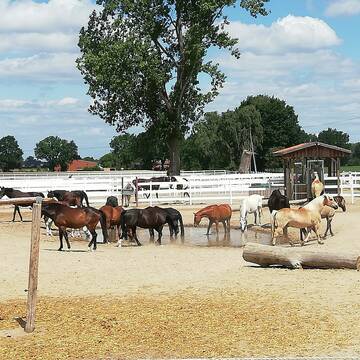
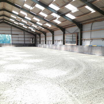
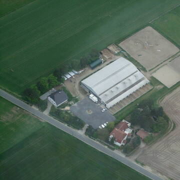
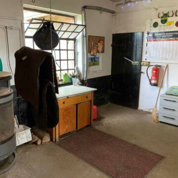
Gut Backhausenhof -
Burgdorf
Gut Backhausenhof Hansen
@Gut-Backhausenhof
Fahrstall, Kutschwagen
FN-Mitglied
Vermieten
Krankenbox
Laufband
Allergikerstall
Fohlenaufzucht möglich
44 weitere...
S


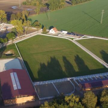
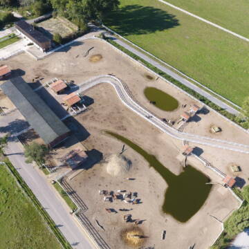
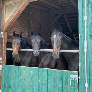
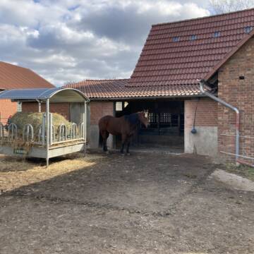
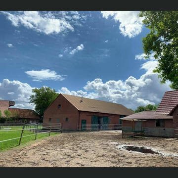
Offenstallplätze und Paddockboxen
Altmerdingsen
Reitanlage am Beerbusch
@Reitanlage-am-Beerbusch
Vermieten
Hunde willkommen
Krankenbox
Allergikerstall
Hufrehe geeignet
Außenbox mit Paddock
Bewegungsstall
21 weitere...
P+
Deprecated: Creation of dynamic property Zend_View_Helper_Ads::$adLink is deprecated in /var/www/stall-frei/htdocs/staging.stall-frei.de/library/Psf/View/Helper/Ads.php on line 108

Heu aus neuer Ernte
Mechtersen
STALL-FREIde Marketing
@STALL-FREI-Marketing
Heulage und Pferdeheu aus der neuen Ernte findest du in unserem Futtermarkt
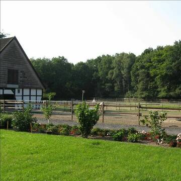
Privater Stall viel Komfort, Vollpension,Halle
Uetze
Frauke Pinkert
@Lars-Pinkert
FN-Mitglied
Freizeitstall
Führanlage
Longierzirkel/Roundpen
Allergikerstall
Hufrehe geeignet
Außenbox mit Paddock
Außenboxen
20 weitere...
P

Freie Boxen in Hämelerwald
Hämelerwald
Reitverein Hämelerwald
@ReitvereinHaemelerwald
FN-Mitglied
Freizeitstall
Vermieten
Hunde willkommen
Paddock
Außenboxen
Innenbox
13 weitere...
P

Offenstall Auf Hof Habermann in Hänigsen
Hänigsen
Benutzer113
@FrankHabermann
Freizeitstall
Hunde willkommen
Krankenbox
Notfallboxen
Laufstall
Offenstall
10 weitere...
P+


Boxen frei im RV St. Georg Burgdorf
Burgdorf
Katja Groß
@winchesse
Freizeitstall
Reitlehrer und -unterricht
Vermieten
Krankenbox
Longierzirkel/Roundpen
Hengsthaltung möglich
Hufrehe geeignet
14 weitere...
P+

Persönlichkeitsentwicklung mit Pferden
Bad Salzuflen
Katja Dors
@Pferdezeiten
Begleite andere auf ihrem Entwicklungsweg und entdecke die transformative Kraft der pferdegestützten Persönlichkeitsentwicklung !
neu
R


Freie Boxen, mit täglich Paddockgang oder Wiese
Groß Solschen
Pensionsstall Böker
@PensionsstallBoeker
Freizeitstall
Pferdeausbildung
Vermieten
Hunde willkommen
Paddock
Innenbox
11 weitere...
P+
Pensionsstall Eichenhof-Burgdorf
Burgdorf
eichenhof-burgdorf
@eichenhof-burgdorf
Freizeitstall
Geländestrecke
Vermieten
Paddock
Parkplatz für Pferdeanhänger
Innenbox
Offenstall
6 weitere...
P
Leider kein Vorschaubild
Leider kein Vorschaubild
Offenstallplatz
Edemissen
Fischer
@YFischer
Freizeitstall
Vermieten
Paddock
Parkplatz für Pferdeanhänger
Notfallboxen
Zuchtstutenhaltung möglich
10 weitere...
B

Platz für verspielten Wallach frei
Peine
Pensionsstall-Kolshorn
@Pensionsstall-Kolshorn
Freizeitstall
Vermieten
Paddock
Reithalle
Hufrehe geeignet
10 weitere...
P
Deprecated: Creation of dynamic property Zend_View::$pageCount is deprecated in /var/www/stall-frei/htdocs/staging.stall-frei.de/library/vendor/shardj/zf1-future/library/Zend/View/Abstract.php on line 308
Deprecated: Creation of dynamic property Zend_View::$itemCountPerPage is deprecated in /var/www/stall-frei/htdocs/staging.stall-frei.de/library/vendor/shardj/zf1-future/library/Zend/View/Abstract.php on line 308
Deprecated: Creation of dynamic property Zend_View::$first is deprecated in /var/www/stall-frei/htdocs/staging.stall-frei.de/library/vendor/shardj/zf1-future/library/Zend/View/Abstract.php on line 308
Deprecated: Creation of dynamic property Zend_View::$current is deprecated in /var/www/stall-frei/htdocs/staging.stall-frei.de/library/vendor/shardj/zf1-future/library/Zend/View/Abstract.php on line 308
Deprecated: Creation of dynamic property Zend_View::$last is deprecated in /var/www/stall-frei/htdocs/staging.stall-frei.de/library/vendor/shardj/zf1-future/library/Zend/View/Abstract.php on line 308
Deprecated: Creation of dynamic property Zend_View::$next is deprecated in /var/www/stall-frei/htdocs/staging.stall-frei.de/library/vendor/shardj/zf1-future/library/Zend/View/Abstract.php on line 308
Deprecated: Creation of dynamic property Zend_View::$pagesInRange is deprecated in /var/www/stall-frei/htdocs/staging.stall-frei.de/library/vendor/shardj/zf1-future/library/Zend/View/Abstract.php on line 308
Deprecated: Creation of dynamic property Zend_View::$firstPageInRange is deprecated in /var/www/stall-frei/htdocs/staging.stall-frei.de/library/vendor/shardj/zf1-future/library/Zend/View/Abstract.php on line 308
Deprecated: Creation of dynamic property Zend_View::$lastPageInRange is deprecated in /var/www/stall-frei/htdocs/staging.stall-frei.de/library/vendor/shardj/zf1-future/library/Zend/View/Abstract.php on line 308
Deprecated: Creation of dynamic property Zend_View::$currentItemCount is deprecated in /var/www/stall-frei/htdocs/staging.stall-frei.de/library/vendor/shardj/zf1-future/library/Zend/View/Abstract.php on line 308
Deprecated: Creation of dynamic property Zend_View::$totalItemCount is deprecated in /var/www/stall-frei/htdocs/staging.stall-frei.de/library/vendor/shardj/zf1-future/library/Zend/View/Abstract.php on line 308
Deprecated: Creation of dynamic property Zend_View::$firstItemNumber is deprecated in /var/www/stall-frei/htdocs/staging.stall-frei.de/library/vendor/shardj/zf1-future/library/Zend/View/Abstract.php on line 308
Deprecated: Creation of dynamic property Zend_View::$lastItemNumber is deprecated in /var/www/stall-frei/htdocs/staging.stall-frei.de/library/vendor/shardj/zf1-future/library/Zend/View/Abstract.php on line 308
Deprecated: Creation of dynamic property Zend_View::$router is deprecated in /var/www/stall-frei/htdocs/staging.stall-frei.de/library/vendor/shardj/zf1-future/library/Zend/View/Abstract.php on line 308
Deprecated: Creation of dynamic property Zend_View::$urlParams is deprecated in /var/www/stall-frei/htdocs/staging.stall-frei.de/library/vendor/shardj/zf1-future/library/Zend/View/Abstract.php on line 308
Deprecated: Creation of dynamic property Zend_View::$showAds is deprecated in /var/www/stall-frei/htdocs/staging.stall-frei.de/library/vendor/shardj/zf1-future/library/Zend/View/Abstract.php on line 308
Deprecated: Creation of dynamic property Zend_View::$objectIds is deprecated in /var/www/stall-frei/htdocs/staging.stall-frei.de/library/vendor/shardj/zf1-future/library/Zend/View/Abstract.php on line 308
Deprecated: Creation of dynamic property Zend_View::$showNavbar is deprecated in /var/www/stall-frei/htdocs/staging.stall-frei.de/library/vendor/shardj/zf1-future/library/Zend/View/Abstract.php on line 308
Deprecated: Creation of dynamic property Zend_View::$showBreadcrumb is deprecated in /var/www/stall-frei/htdocs/staging.stall-frei.de/library/vendor/shardj/zf1-future/library/Zend/View/Abstract.php on line 308
Deprecated: Creation of dynamic property Zend_View::$showFooter is deprecated in /var/www/stall-frei/htdocs/staging.stall-frei.de/library/vendor/shardj/zf1-future/library/Zend/View/Abstract.php on line 308
Deprecated: Creation of dynamic property Zend_View::$showInternalAds is deprecated in /var/www/stall-frei/htdocs/staging.stall-frei.de/library/vendor/shardj/zf1-future/library/Zend/View/Abstract.php on line 308
Deprecated: Creation of dynamic property Zend_View::$blNoContent is deprecated in /var/www/stall-frei/htdocs/staging.stall-frei.de/library/vendor/shardj/zf1-future/library/Zend/View/Abstract.php on line 308
Deprecated: Creation of dynamic property Zend_View::$sMetaDesc is deprecated in /var/www/stall-frei/htdocs/staging.stall-frei.de/library/vendor/shardj/zf1-future/library/Zend/View/Abstract.php on line 308
Deprecated: Creation of dynamic property Zend_View::$useGmaps is deprecated in /var/www/stall-frei/htdocs/staging.stall-frei.de/library/vendor/shardj/zf1-future/library/Zend/View/Abstract.php on line 308
Deprecated: Creation of dynamic property Zend_View::$touches is deprecated in /var/www/stall-frei/htdocs/staging.stall-frei.de/library/vendor/shardj/zf1-future/library/Zend/View/Abstract.php on line 308
Deprecated: Creation of dynamic property Zend_View::$oProject is deprecated in /var/www/stall-frei/htdocs/staging.stall-frei.de/library/vendor/shardj/zf1-future/library/Zend/View/Abstract.php on line 308
Deprecated: Creation of dynamic property Zend_View::$pageHeadline is deprecated in /var/www/stall-frei/htdocs/staging.stall-frei.de/library/vendor/shardj/zf1-future/library/Zend/View/Abstract.php on line 308
Deprecated: Creation of dynamic property Zend_View::$disableLocationField is deprecated in /var/www/stall-frei/htdocs/staging.stall-frei.de/library/vendor/shardj/zf1-future/library/Zend/View/Abstract.php on line 308
Deprecated: Creation of dynamic property Zend_View::$isSearch is deprecated in /var/www/stall-frei/htdocs/staging.stall-frei.de/library/vendor/shardj/zf1-future/library/Zend/View/Abstract.php on line 308
Deprecated: Creation of dynamic property Zend_View::$pageTitle is deprecated in /var/www/stall-frei/htdocs/staging.stall-frei.de/library/vendor/shardj/zf1-future/library/Zend/View/Abstract.php on line 308
Deprecated: Creation of dynamic property Psf_Form_Element_Text::$class is deprecated in /var/www/stall-frei/htdocs/staging.stall-frei.de/library/vendor/shardj/zf1-future/library/Zend/Form/Element.php on line 874
Deprecated: Creation of dynamic property Psf_Form_Element_Text::$size is deprecated in /var/www/stall-frei/htdocs/staging.stall-frei.de/library/vendor/shardj/zf1-future/library/Zend/Form/Element.php on line 874
Deprecated: Creation of dynamic property Psf_Form_Element_Text::$placeholder is deprecated in /var/www/stall-frei/htdocs/staging.stall-frei.de/library/vendor/shardj/zf1-future/library/Zend/Form/Element.php on line 874
Deprecated: Creation of dynamic property Psf_Form_Element_Hidden::$class is deprecated in /var/www/stall-frei/htdocs/staging.stall-frei.de/library/vendor/shardj/zf1-future/library/Zend/Form/Element.php on line 874
Deprecated: Creation of dynamic property Psf_Form_Element_Hidden::$class is deprecated in /var/www/stall-frei/htdocs/staging.stall-frei.de/library/vendor/shardj/zf1-future/library/Zend/Form/Element.php on line 874
Deprecated: Creation of dynamic property Psf_Form_Element_Hidden::$class is deprecated in /var/www/stall-frei/htdocs/staging.stall-frei.de/library/vendor/shardj/zf1-future/library/Zend/Form/Element.php on line 874
Deprecated: Creation of dynamic property Psf_Form_Element_Hidden::$class is deprecated in /var/www/stall-frei/htdocs/staging.stall-frei.de/library/vendor/shardj/zf1-future/library/Zend/Form/Element.php on line 874
Deprecated: Creation of dynamic property Psf_Form_Element_Select::$class is deprecated in /var/www/stall-frei/htdocs/staging.stall-frei.de/library/vendor/shardj/zf1-future/library/Zend/Form/Element.php on line 874
Deprecated: Creation of dynamic property Psf_Form_Element_Select::$class is deprecated in /var/www/stall-frei/htdocs/staging.stall-frei.de/library/vendor/shardj/zf1-future/library/Zend/Form/Element.php on line 874
Deprecated: Creation of dynamic property Psf_Form_Element_Select::$class is deprecated in /var/www/stall-frei/htdocs/staging.stall-frei.de/library/vendor/shardj/zf1-future/library/Zend/Form/Element.php on line 874
Deprecated: Creation of dynamic property Psf_Form_Element_Select::$class is deprecated in /var/www/stall-frei/htdocs/staging.stall-frei.de/library/vendor/shardj/zf1-future/library/Zend/Form/Element.php on line 874
Deprecated: Creation of dynamic property Psf_Form_Element_Text::$class is deprecated in /var/www/stall-frei/htdocs/staging.stall-frei.de/library/vendor/shardj/zf1-future/library/Zend/Form/Element.php on line 874
Deprecated: Creation of dynamic property Psf_Form_Element_Checkbox::$label is deprecated in /var/www/stall-frei/htdocs/staging.stall-frei.de/library/vendor/shardj/zf1-future/library/Zend/Form/Element.php on line 874
Deprecated: Creation of dynamic property Zend_View::$sort is deprecated in /var/www/stall-frei/htdocs/staging.stall-frei.de/library/vendor/shardj/zf1-future/library/Zend/View/Abstract.php on line 308
Deprecated: Creation of dynamic property Zend_View::$searchLocation is deprecated in /var/www/stall-frei/htdocs/staging.stall-frei.de/library/vendor/shardj/zf1-future/library/Zend/View/Abstract.php on line 308
Deprecated: Creation of dynamic property Zend_View::$locationHint is deprecated in /var/www/stall-frei/htdocs/staging.stall-frei.de/library/vendor/shardj/zf1-future/library/Zend/View/Abstract.php on line 308
Psf_GeoCoder_Abstract::getLocation: Oelerse Get Location CachedOrLive
Psf_GeoCoder_Abstract::getCachedOrLive: Oelerse
Psf_GeoCoder_OpenCageData::makeApiRequest: response:
Array
(
[documentation] => https://opencagedata.com/api
[licenses] => Array
(
[0] => Array
(
[name] => see attribution guide
[url] => https://opencagedata.com/credits
)
)
[results] => Array
(
[0] => Array
(
[bounds] => Array
(
[northeast] => Array
(
[lat] => 52.399074
[lng] => 10.1816517
)
[southwest] => Array
(
[lat] => 52.3741274
[lng] => 10.1298255
)
)
[components] => Array
(
[ISO_3166-1_alpha-2] => DE
[ISO_3166-1_alpha-3] => DEU
[ISO_3166-2] => Array
(
[0] => DE-NI
)
[_category] => place
[_normalized_city] => Edemissen
[_type] => village
[city] => Edemissen
[continent] => Europe
[country] => Deutschland
[country_code] => de
[county] => Landkreis Peine
[political_union] => European Union
[state] => Niedersachsen
[state_code] => NI
[village] => Oelerse
)
[confidence] => 7
[formatted] => Oelerse, Niedersachsen, Deutschland
[geometry] => Array
(
[lat] => 52.3860228
[lng] => 10.17307
)
)
[1] => Array
(
[components] => Array
(
[ISO_3166-1_alpha-2] => FR
[ISO_3166-1_alpha-3] => FRA
[ISO_3166-2] => Array
(
[0] => FR-IDF
[1] => FR-92
)
[_category] => road
[_normalized_city] => Levallois-Perret
[_type] => road
[city] => Levallois-Perret
[continent] => Europe
[country] => France
[country_code] => fr
[county] => Hauts-de-Seine
[local_authority] => Métropole du Grand Paris
[political_union] => European Union
[postcode] => 92300
[road] => Rue Charles Deutschmann
[state] => Île-de-France
[state_code] => IDF
)
[confidence] => 3
[formatted] => Rue Charles Deutschmann, 92300 Levallois-Perret, France
[geometry] => Array
(
[lat] => 48.900049
[lng] => 2.2842
)
)
[2] => Array
(
[components] => Array
(
[ISO_3166-1_alpha-2] => FR
[ISO_3166-1_alpha-3] => FRA
[ISO_3166-2] => Array
(
[0] => FR-PDL
[1] => FR-72
)
[_category] => road
[_normalized_city] => Coulans-sur-Gée
[_type] => road
[city] => Coulans-sur-Gée
[continent] => Europe
[country] => France
[country_code] => fr
[county] => Sarthe
[local_authority] => LBN Communauté
[political_union] => European Union
[postcode] => 72550
[road] => Route de la Hélerie
[state] => Pays de la Loire
[state_code] => PDL
)
[confidence] => 3
[formatted] => Route de la Hélerie, 72550 Coulans-sur-Gée, France
[geometry] => Array
(
[lat] => 47.985187
[lng] => 0.022592
)
)
[3] => Array
(
[components] => Array
(
[ISO_3166-1_alpha-2] => FR
[ISO_3166-1_alpha-3] => FRA
[ISO_3166-2] => Array
(
[0] => FR-BRE
[1] => FR-35
)
[_category] => road
[_normalized_city] => Luitré-Dompierre
[_type] => road
[city] => Luitré-Dompierre
[continent] => Europe
[country] => France
[country_code] => fr
[county] => Ille-et-Vilaine
[local_authority] => Fougères Agglomération
[political_union] => European Union
[postcode] => 35210
[road] => Impasse de la Hellerie
[state] => Bretagne
[state_code] => BRE
)
[confidence] => 2
[formatted] => Impasse de la Hellerie, 35210 Luitré-Dompierre, France
[geometry] => Array
(
[lat] => 48.267339
[lng] => -1.142834
)
)
[4] => Array
(
[components] => Array
(
[ISO_3166-1_alpha-2] => FR
[ISO_3166-1_alpha-3] => FRA
[ISO_3166-2] => Array
(
[0] => FR-OCC
[1] => FR-48
)
[_category] => road
[_normalized_city] => Saint-Alban-sur-Limagnole
[_type] => road
[city] => Saint-Alban-sur-Limagnole
[continent] => Europe
[country] => France
[country_code] => fr
[county] => Lozère
[local_authority] => Communauté de communes des Terres d'Apcher-Margeride-Aubrac
[political_union] => European Union
[postcode] => 48120
[road] => Chemin de Coste Heberse
[state] => Occitanie
[state_code] => OCC
)
[confidence] => 2
[formatted] => Chemin de Coste Heberse, 48120 Saint-Alban-sur-Limagnole, France
[geometry] => Array
(
[lat] => 44.801414
[lng] => 3.422252
)
)
[5] => Array
(
[components] => Array
(
[ISO_3166-1_alpha-2] => FR
[ISO_3166-1_alpha-3] => FRA
[ISO_3166-2] => Array
(
[0] => FR-PDL
[1] => FR-72
)
[_category] => road
[_normalized_city] => Parigné-l'Évêque
[_type] => road
[city] => Parigné-l'Évêque
[continent] => Europe
[country] => France
[country_code] => fr
[county] => Sarthe
[local_authority] => Communauté de communes du Sud-Est Manceau
[political_union] => European Union
[postcode] => 72250
[road] => Lieu Dit La Hellerie
[state] => Pays de la Loire
[state_code] => PDL
)
[confidence] => 2
[formatted] => Lieu Dit La Hellerie, 72250 Parigné-l'Évêque, France
[geometry] => Array
(
[lat] => 47.943753
[lng] => 0.370205
)
)
[6] => Array
(
[components] => Array
(
[ISO_3166-1_alpha-2] => FR
[ISO_3166-1_alpha-3] => FRA
[ISO_3166-2] => Array
(
[0] => FR-NOR
[1] => FR-14
)
[_category] => road
[_normalized_city] => Amfreville
[_type] => road
[city] => Amfreville
[continent] => Europe
[country] => France
[country_code] => fr
[county] => Calvados
[local_authority] => Communauté de communes Normandie-Cabourg-Pays d'Auge
[political_union] => European Union
[postcode] => 14860
[road] => Impasse Hillerse
[state] => Normandie
[state_code] => NOR
)
[confidence] => 2
[formatted] => Impasse Hillerse, 14860 Amfreville, France
[geometry] => Array
(
[lat] => 49.250377
[lng] => -0.22856
)
)
[7] => Array
(
[components] => Array
(
[ISO_3166-1_alpha-2] => FR
[ISO_3166-1_alpha-3] => FRA
[ISO_3166-2] => Array
(
[0] => FR-NOR
[1] => FR-14
)
[_category] => road
[_normalized_city] => Bernesq
[_type] => road
[city] => Bernesq
[continent] => Europe
[country] => France
[country_code] => fr
[county] => Calvados
[local_authority] => Isigny Omaha Intercom
[political_union] => European Union
[postcode] => 14710
[road] => Chemin des Helleries
[state] => Normandie
[state_code] => NOR
)
[confidence] => 10
[formatted] => Chemin des Helleries, 14710 Bernesq, France
[geometry] => Array
(
[lat] => 49.268472
[lng] => -0.932073
)
)
[8] => Array
(
[components] => Array
(
[ISO_3166-1_alpha-2] => FR
[ISO_3166-1_alpha-3] => FRA
[ISO_3166-2] => Array
(
[0] => FR-BRE
[1] => FR-35
)
[_category] => road
[_normalized_city] => Vitré
[_type] => road
[city] => Vitré
[continent] => Europe
[country] => France
[country_code] => fr
[county] => Ille-et-Vilaine
[local_authority] => Vitré Communauté
[political_union] => European Union
[postcode] => 35500
[road] => Rue Hellerie
[state] => Bretagne
[state_code] => BRE
)
[confidence] => 10
[formatted] => Rue Hellerie, 35500 Vitré, France
[geometry] => Array
(
[lat] => 48.123609
[lng] => -1.207737
)
)
[9] => Array
(
[components] => Array
(
[ISO_3166-1_alpha-2] => FR
[ISO_3166-1_alpha-3] => FRA
[ISO_3166-2] => Array
(
[0] => FR-PDL
[1] => FR-72
)
[_category] => road
[_normalized_city] => Arçonnay
[_type] => road
[city] => Arçonnay
[continent] => Europe
[country] => France
[country_code] => fr
[county] => Sarthe
[local_authority] => Communauté urbaine d'Alençon
[political_union] => European Union
[postcode] => 72610
[road] => La Hellerie
[state] => Pays de la Loire
[state_code] => PDL
)
[confidence] => 10
[formatted] => La Hellerie, 72610 Arçonnay, France
[geometry] => Array
(
[lat] => 48.397372
[lng] => 0.074585
)
)
)
[status] => Array
(
[code] => 200
[message] => OK
)
[stay_informed] => Array
(
[blog] => https://blog.opencagedata.com
[mastodon] => https://en.osm.town/@opencage
)
[thanks] => For using an OpenCage API
[timestamp] => Array
(
[created_http] => Sat, 07 Feb 2026 16:41:41 GMT
[created_unix] => 1770482501
)
[total_results] => 10
)
Psf_GeoCoder_Abstract::convertLocationResult
{"documentation":"https:\/\/opencagedata.com\/api","licenses":[{"name":"see attribution guide","url":"https:\/\/opencagedata.com\/credits"}],"results":[{"bounds":{"northeast":{"lat":52.399074,"lng":10.1816517},"southwest":{"lat":52.3741274,"lng":10.1298255}},"components":{"ISO_3166-1_alpha-2":"DE","ISO_3166-1_alpha-3":"DEU","ISO_3166-2":["DE-NI"],"_category":"place","_normalized_city":"Edemissen","_type":"village","city":"Edemissen","continent":"Europe","country":"Deutschland","country_code":"de","county":"Landkreis Peine","political_union":"European Union","state":"Niedersachsen","state_code":"NI","village":"Oelerse"},"confidence":7,"formatted":"Oelerse, Niedersachsen, Deutschland","geometry":{"lat":52.3860228,"lng":10.17307}},{"components":{"ISO_3166-1_alpha-2":"FR","ISO_3166-1_alpha-3":"FRA","ISO_3166-2":["FR-IDF","FR-92"],"_category":"road","_normalized_city":"Levallois-Perret","_type":"road","city":"Levallois-Perret","continent":"Europe","country":"France","country_code":"fr","county":"Hauts-de-Seine","local_authority":"M\u00e9tropole du Grand Paris","political_union":"European Union","postcode":"92300","road":"Rue Charles Deutschmann","state":"\u00cele-de-France","state_code":"IDF"},"confidence":3,"formatted":"Rue Charles Deutschmann, 92300 Levallois-Perret, France","geometry":{"lat":48.900049,"lng":2.2842}},{"components":{"ISO_3166-1_alpha-2":"FR","ISO_3166-1_alpha-3":"FRA","ISO_3166-2":["FR-PDL","FR-72"],"_category":"road","_normalized_city":"Coulans-sur-G\u00e9e","_type":"road","city":"Coulans-sur-G\u00e9e","continent":"Europe","country":"France","country_code":"fr","county":"Sarthe","local_authority":"LBN Communaut\u00e9","political_union":"European Union","postcode":"72550","road":"Route de la H\u00e9lerie","state":"Pays de la Loire","state_code":"PDL"},"confidence":3,"formatted":"Route de la H\u00e9lerie, 72550 Coulans-sur-G\u00e9e, France","geometry":{"lat":47.985187,"lng":0.022592}},{"components":{"ISO_3166-1_alpha-2":"FR","ISO_3166-1_alpha-3":"FRA","ISO_3166-2":["FR-BRE","FR-35"],"_category":"road","_normalized_city":"Luitr\u00e9-Dompierre","_type":"road","city":"Luitr\u00e9-Dompierre","continent":"Europe","country":"France","country_code":"fr","county":"Ille-et-Vilaine","local_authority":"Foug\u00e8res Agglom\u00e9ration","political_union":"European Union","postcode":"35210","road":"Impasse de la Hellerie","state":"Bretagne","state_code":"BRE"},"confidence":2,"formatted":"Impasse de la Hellerie, 35210 Luitr\u00e9-Dompierre, France","geometry":{"lat":48.267339,"lng":-1.142834}},{"components":{"ISO_3166-1_alpha-2":"FR","ISO_3166-1_alpha-3":"FRA","ISO_3166-2":["FR-OCC","FR-48"],"_category":"road","_normalized_city":"Saint-Alban-sur-Limagnole","_type":"road","city":"Saint-Alban-sur-Limagnole","continent":"Europe","country":"France","country_code":"fr","county":"Loz\u00e8re","local_authority":"Communaut\u00e9 de communes des Terres d'Apcher-Margeride-Aubrac","political_union":"European Union","postcode":"48120","road":"Chemin de Coste Heberse","state":"Occitanie","state_code":"OCC"},"confidence":2,"formatted":"Chemin de Coste Heberse, 48120 Saint-Alban-sur-Limagnole, France","geometry":{"lat":44.801414,"lng":3.422252}},{"components":{"ISO_3166-1_alpha-2":"FR","ISO_3166-1_alpha-3":"FRA","ISO_3166-2":["FR-PDL","FR-72"],"_category":"road","_normalized_city":"Parign\u00e9-l'\u00c9v\u00eaque","_type":"road","city":"Parign\u00e9-l'\u00c9v\u00eaque","continent":"Europe","country":"France","country_code":"fr","county":"Sarthe","local_authority":"Communaut\u00e9 de communes du Sud-Est Manceau","political_union":"European Union","postcode":"72250","road":"Lieu Dit La Hellerie","state":"Pays de la Loire","state_code":"PDL"},"confidence":2,"formatted":"Lieu Dit La Hellerie, 72250 Parign\u00e9-l'\u00c9v\u00eaque, France","geometry":{"lat":47.943753,"lng":0.370205}},{"components":{"ISO_3166-1_alpha-2":"FR","ISO_3166-1_alpha-3":"FRA","ISO_3166-2":["FR-NOR","FR-14"],"_category":"road","_normalized_city":"Amfreville","_type":"road","city":"Amfreville","continent":"Europe","country":"France","country_code":"fr","county":"Calvados","local_authority":"Communaut\u00e9 de communes Normandie-Cabourg-Pays d'Auge","political_union":"European Union","postcode":"14860","road":"Impasse Hillerse","state":"Normandie","state_code":"NOR"},"confidence":2,"formatted":"Impasse Hillerse, 14860 Amfreville, France","geometry":{"lat":49.250377,"lng":-0.22856}},{"components":{"ISO_3166-1_alpha-2":"FR","ISO_3166-1_alpha-3":"FRA","ISO_3166-2":["FR-NOR","FR-14"],"_category":"road","_normalized_city":"Bernesq","_type":"road","city":"Bernesq","continent":"Europe","country":"France","country_code":"fr","county":"Calvados","local_authority":"Isigny Omaha Intercom","political_union":"European Union","postcode":"14710","road":"Chemin des Helleries","state":"Normandie","state_code":"NOR"},"confidence":10,"formatted":"Chemin des Helleries, 14710 Bernesq, France","geometry":{"lat":49.268472,"lng":-0.932073}},{"components":{"ISO_3166-1_alpha-2":"FR","ISO_3166-1_alpha-3":"FRA","ISO_3166-2":["FR-BRE","FR-35"],"_category":"road","_normalized_city":"Vitr\u00e9","_type":"road","city":"Vitr\u00e9","continent":"Europe","country":"France","country_code":"fr","county":"Ille-et-Vilaine","local_authority":"Vitr\u00e9 Communaut\u00e9","political_union":"European Union","postcode":"35500","road":"Rue Hellerie","state":"Bretagne","state_code":"BRE"},"confidence":10,"formatted":"Rue Hellerie, 35500 Vitr\u00e9, France","geometry":{"lat":48.123609,"lng":-1.207737}},{"components":{"ISO_3166-1_alpha-2":"FR","ISO_3166-1_alpha-3":"FRA","ISO_3166-2":["FR-PDL","FR-72"],"_category":"road","_normalized_city":"Ar\u00e7onnay","_type":"road","city":"Ar\u00e7onnay","continent":"Europe","country":"France","country_code":"fr","county":"Sarthe","local_authority":"Communaut\u00e9 urbaine d'Alen\u00e7on","political_union":"European Union","postcode":"72610","road":"La Hellerie","state":"Pays de la Loire","state_code":"PDL"},"confidence":10,"formatted":"La Hellerie, 72610 Ar\u00e7onnay, France","geometry":{"lat":48.397372,"lng":0.074585}}],"status":{"code":200,"message":"OK"},"stay_informed":{"blog":"https:\/\/blog.opencagedata.com","mastodon":"https:\/\/en.osm.town\/@opencage"},"thanks":"For using an OpenCage API","timestamp":{"created_http":"Sat, 07 Feb 2026 16:41:41 GMT","created_unix":1770482501},"total_results":10}Array
(
[0] => stdClass Object
(
[bounds] => stdClass Object
(
[northeast] => stdClass Object
(
[lat] => 52.399074
[lng] => 10.1816517
)
[southwest] => stdClass Object
(
[lat] => 52.3741274
[lng] => 10.1298255
)
)
[components] => stdClass Object
(
[ISO_3166-1_alpha-2] => DE
[ISO_3166-1_alpha-3] => DEU
[ISO_3166-2] => Array
(
[0] => DE-NI
)
[_category] => place
[_normalized_city] => Edemissen
[_type] => village
[city] => Edemissen
[continent] => Europe
[country] => Deutschland
[country_code] => de
[county] => Landkreis Peine
[political_union] => European Union
[state] => Niedersachsen
[state_code] => NI
[village] => Oelerse
)
[confidence] => 7
[formatted] => Oelerse, Niedersachsen, Deutschland
[geometry] => stdClass Object
(
[lat] => 52.3860228
[lng] => 10.17307
)
)
[1] => stdClass Object
(
[components] => stdClass Object
(
[ISO_3166-1_alpha-2] => FR
[ISO_3166-1_alpha-3] => FRA
[ISO_3166-2] => Array
(
[0] => FR-IDF
[1] => FR-92
)
[_category] => road
[_normalized_city] => Levallois-Perret
[_type] => road
[city] => Levallois-Perret
[continent] => Europe
[country] => France
[country_code] => fr
[county] => Hauts-de-Seine
[local_authority] => Métropole du Grand Paris
[political_union] => European Union
[postcode] => 92300
[road] => Rue Charles Deutschmann
[state] => Île-de-France
[state_code] => IDF
)
[confidence] => 3
[formatted] => Rue Charles Deutschmann, 92300 Levallois-Perret, France
[geometry] => stdClass Object
(
[lat] => 48.900049
[lng] => 2.2842
)
)
[2] => stdClass Object
(
[components] => stdClass Object
(
[ISO_3166-1_alpha-2] => FR
[ISO_3166-1_alpha-3] => FRA
[ISO_3166-2] => Array
(
[0] => FR-PDL
[1] => FR-72
)
[_category] => road
[_normalized_city] => Coulans-sur-Gée
[_type] => road
[city] => Coulans-sur-Gée
[continent] => Europe
[country] => France
[country_code] => fr
[county] => Sarthe
[local_authority] => LBN Communauté
[political_union] => European Union
[postcode] => 72550
[road] => Route de la Hélerie
[state] => Pays de la Loire
[state_code] => PDL
)
[confidence] => 3
[formatted] => Route de la Hélerie, 72550 Coulans-sur-Gée, France
[geometry] => stdClass Object
(
[lat] => 47.985187
[lng] => 0.022592
)
)
[3] => stdClass Object
(
[components] => stdClass Object
(
[ISO_3166-1_alpha-2] => FR
[ISO_3166-1_alpha-3] => FRA
[ISO_3166-2] => Array
(
[0] => FR-BRE
[1] => FR-35
)
[_category] => road
[_normalized_city] => Luitré-Dompierre
[_type] => road
[city] => Luitré-Dompierre
[continent] => Europe
[country] => France
[country_code] => fr
[county] => Ille-et-Vilaine
[local_authority] => Fougères Agglomération
[political_union] => European Union
[postcode] => 35210
[road] => Impasse de la Hellerie
[state] => Bretagne
[state_code] => BRE
)
[confidence] => 2
[formatted] => Impasse de la Hellerie, 35210 Luitré-Dompierre, France
[geometry] => stdClass Object
(
[lat] => 48.267339
[lng] => -1.142834
)
)
[4] => stdClass Object
(
[components] => stdClass Object
(
[ISO_3166-1_alpha-2] => FR
[ISO_3166-1_alpha-3] => FRA
[ISO_3166-2] => Array
(
[0] => FR-OCC
[1] => FR-48
)
[_category] => road
[_normalized_city] => Saint-Alban-sur-Limagnole
[_type] => road
[city] => Saint-Alban-sur-Limagnole
[continent] => Europe
[country] => France
[country_code] => fr
[county] => Lozère
[local_authority] => Communauté de communes des Terres d'Apcher-Margeride-Aubrac
[political_union] => European Union
[postcode] => 48120
[road] => Chemin de Coste Heberse
[state] => Occitanie
[state_code] => OCC
)
[confidence] => 2
[formatted] => Chemin de Coste Heberse, 48120 Saint-Alban-sur-Limagnole, France
[geometry] => stdClass Object
(
[lat] => 44.801414
[lng] => 3.422252
)
)
[5] => stdClass Object
(
[components] => stdClass Object
(
[ISO_3166-1_alpha-2] => FR
[ISO_3166-1_alpha-3] => FRA
[ISO_3166-2] => Array
(
[0] => FR-PDL
[1] => FR-72
)
[_category] => road
[_normalized_city] => Parigné-l'Évêque
[_type] => road
[city] => Parigné-l'Évêque
[continent] => Europe
[country] => France
[country_code] => fr
[county] => Sarthe
[local_authority] => Communauté de communes du Sud-Est Manceau
[political_union] => European Union
[postcode] => 72250
[road] => Lieu Dit La Hellerie
[state] => Pays de la Loire
[state_code] => PDL
)
[confidence] => 2
[formatted] => Lieu Dit La Hellerie, 72250 Parigné-l'Évêque, France
[geometry] => stdClass Object
(
[lat] => 47.943753
[lng] => 0.370205
)
)
[6] => stdClass Object
(
[components] => stdClass Object
(
[ISO_3166-1_alpha-2] => FR
[ISO_3166-1_alpha-3] => FRA
[ISO_3166-2] => Array
(
[0] => FR-NOR
[1] => FR-14
)
[_category] => road
[_normalized_city] => Amfreville
[_type] => road
[city] => Amfreville
[continent] => Europe
[country] => France
[country_code] => fr
[county] => Calvados
[local_authority] => Communauté de communes Normandie-Cabourg-Pays d'Auge
[political_union] => European Union
[postcode] => 14860
[road] => Impasse Hillerse
[state] => Normandie
[state_code] => NOR
)
[confidence] => 2
[formatted] => Impasse Hillerse, 14860 Amfreville, France
[geometry] => stdClass Object
(
[lat] => 49.250377
[lng] => -0.22856
)
)
[7] => stdClass Object
(
[components] => stdClass Object
(
[ISO_3166-1_alpha-2] => FR
[ISO_3166-1_alpha-3] => FRA
[ISO_3166-2] => Array
(
[0] => FR-NOR
[1] => FR-14
)
[_category] => road
[_normalized_city] => Bernesq
[_type] => road
[city] => Bernesq
[continent] => Europe
[country] => France
[country_code] => fr
[county] => Calvados
[local_authority] => Isigny Omaha Intercom
[political_union] => European Union
[postcode] => 14710
[road] => Chemin des Helleries
[state] => Normandie
[state_code] => NOR
)
[confidence] => 10
[formatted] => Chemin des Helleries, 14710 Bernesq, France
[geometry] => stdClass Object
(
[lat] => 49.268472
[lng] => -0.932073
)
)
[8] => stdClass Object
(
[components] => stdClass Object
(
[ISO_3166-1_alpha-2] => FR
[ISO_3166-1_alpha-3] => FRA
[ISO_3166-2] => Array
(
[0] => FR-BRE
[1] => FR-35
)
[_category] => road
[_normalized_city] => Vitré
[_type] => road
[city] => Vitré
[continent] => Europe
[country] => France
[country_code] => fr
[county] => Ille-et-Vilaine
[local_authority] => Vitré Communauté
[political_union] => European Union
[postcode] => 35500
[road] => Rue Hellerie
[state] => Bretagne
[state_code] => BRE
)
[confidence] => 10
[formatted] => Rue Hellerie, 35500 Vitré, France
[geometry] => stdClass Object
(
[lat] => 48.123609
[lng] => -1.207737
)
)
[9] => stdClass Object
(
[components] => stdClass Object
(
[ISO_3166-1_alpha-2] => FR
[ISO_3166-1_alpha-3] => FRA
[ISO_3166-2] => Array
(
[0] => FR-PDL
[1] => FR-72
)
[_category] => road
[_normalized_city] => Arçonnay
[_type] => road
[city] => Arçonnay
[continent] => Europe
[country] => France
[country_code] => fr
[county] => Sarthe
[local_authority] => Communauté urbaine d'Alençon
[political_union] => European Union
[postcode] => 72610
[road] => La Hellerie
[state] => Pays de la Loire
[state_code] => PDL
)
[confidence] => 10
[formatted] => La Hellerie, 72610 Arçonnay, France
[geometry] => stdClass Object
(
[lat] => 48.397372
[lng] => 0.074585
)
)
)
Psf_GeoCoder_OpenCageData::getKeyMap: 0
stdClass Object
(
    [bounds] => stdClass Object
        (
            [northeast] => stdClass Object
                (
                    [lat] => 52.399074
                    [lng] => 10.1816517
                )

            [southwest] => stdClass Object
                (
                    [lat] => 52.3741274
                    [lng] => 10.1298255
                )

        )

    [components] => stdClass Object
        (
            [ISO_3166-1_alpha-2] => DE
            [ISO_3166-1_alpha-3] => DEU
            [ISO_3166-2] => Array
                (
                    [0] => DE-NI
                )

            [_category] => place
            [_normalized_city] => Edemissen
            [_type] => village
            [city] => Edemissen
            [continent] => Europe
            [country] => Deutschland
            [country_code] => de
            [county] => Landkreis Peine
            [political_union] => European Union
            [state] => Niedersachsen
            [state_code] => NI
            [village] => Oelerse
        )

    [confidence] => 7
    [formatted] => Oelerse, Niedersachsen, Deutschland
    [geometry] => stdClass Object
        (
            [lat] => 52.3860228
            [lng] => 10.17307
        )

)
Psf_GeoCoder_OpenCageData::getCounty: Peine
Psf_GeoCoder_OpenCageData::addMissingData REFETCH!
Array
(
    [address] => Oelerse, Niedersachsen, Deutschland
    [type] => village
    [street] =>
    [city] => Oelerse
    [county] => Peine
    [state] => Niedersachsen
    [zip] =>
    [country] => Deutschland
    [suburb] =>
    [countrycode] => de
    [latitude] => 52.3860228
    [longitude] => 10.17307
    [accuracy] => 1
    [confidence] => 7
    [bounds] => stdClass Object
        (
            [northeast] => stdClass Object
                (
                    [lat] => 52.399074
                    [lng] => 10.1816517
                )

            [southwest] => stdClass Object
                (
                    [lat] => 52.3741274
                    [lng] => 10.1298255
                )

        )

)
reformat!
Array
(
    [address] => Oelerse, Niedersachsen, Deutschland
    [type] => village
    [street] =>
    [city] => Oelerse
    [county] => Peine
    [state] => Niedersachsen
    [zip] =>
    [country] => Deutschland
    [suburb] =>
    [countrycode] => de
    [latitude] => 52.3860228
    [longitude] => 10.17307
    [accuracy] => 1
    [confidence] => 7
    [bounds] => stdClass Object
        (
            [northeast] => stdClass Object
                (
                    [lat] => 52.399074
                    [lng] => 10.1816517
                )

            [southwest] => stdClass Object
                (
                    [lat] => 52.3741274
                    [lng] => 10.1298255
                )

        )

    [place] => Oelerse, Niedersachsen
    [hash] => a2fb01a55b48a99185ae062fa38313dd
)
Psf_GeoCoder_OpenCageData::getKeyMap: 1
stdClass Object
(
    [components] => stdClass Object
        (
            [ISO_3166-1_alpha-2] => FR
            [ISO_3166-1_alpha-3] => FRA
            [ISO_3166-2] => Array
                (
                    [0] => FR-IDF
                    [1] => FR-92
                )

            [_category] => road
            [_normalized_city] => Levallois-Perret
            [_type] => road
            [city] => Levallois-Perret
            [continent] => Europe
            [country] => France
            [country_code] => fr
            [county] => Hauts-de-Seine
            [local_authority] => Métropole du Grand Paris
            [political_union] => European Union
            [postcode] => 92300
            [road] => Rue Charles Deutschmann
            [state] => Île-de-France
            [state_code] => IDF
        )

    [confidence] => 3
    [formatted] => Rue Charles Deutschmann, 92300 Levallois-Perret, France
    [geometry] => stdClass Object
        (
            [lat] => 48.900049
            [lng] => 2.2842
        )

)
Psf_GeoCoder_OpenCageData::getCounty: Hauts-de-Seine
Psf_GeoCoder_OpenCageData::addMissingData REFETCH!
Array
(
    [address] => Rue Charles Deutschmann, 92300 Levallois-Perret, France
    [type] => road
    [street] => Rue Charles Deutschmann
    [city] => Levallois-Perret
    [county] => Hauts-de-Seine
    [state] => Île-de-France
    [zip] => 92300
    [country] => France
    [suburb] =>
    [countrycode] => fr
    [latitude] => 48.900049
    [longitude] => 2.2842
    [accuracy] => 1
    [confidence] => 3
    [bounds] =>
)
reformat!
Array
(
    [address] => Rue Charles Deutschmann, 92300 Levallois-Perret, France
    [type] => road
    [street] => Rue Charles Deutschmann
    [city] => Levallois-Perret
    [county] => Hauts-de-Seine
    [state] => Île-de-France
    [zip] => 92300
    [country] => France
    [suburb] =>
    [countrycode] => fr
    [latitude] => 48.900049
    [longitude] => 2.2842
    [accuracy] => 1
    [confidence] => 3
    [bounds] =>
    [place] => Rue Charles Deutschmann, 92300 Levallois-Perret, Île-de-France
    [hash] => b7dc44def3990e8a7eaf18e019eca466
)
Psf_GeoCoder_OpenCageData::getKeyMap: 2
stdClass Object
(
    [components] => stdClass Object
        (
            [ISO_3166-1_alpha-2] => FR
            [ISO_3166-1_alpha-3] => FRA
            [ISO_3166-2] => Array
                (
                    [0] => FR-PDL
                    [1] => FR-72
                )

            [_category] => road
            [_normalized_city] => Coulans-sur-Gée
            [_type] => road
            [city] => Coulans-sur-Gée
            [continent] => Europe
            [country] => France
            [country_code] => fr
            [county] => Sarthe
            [local_authority] => LBN Communauté
            [political_union] => European Union
            [postcode] => 72550
            [road] => Route de la Hélerie
            [state] => Pays de la Loire
            [state_code] => PDL
        )

    [confidence] => 3
    [formatted] => Route de la Hélerie, 72550 Coulans-sur-Gée, France
    [geometry] => stdClass Object
        (
            [lat] => 47.985187
            [lng] => 0.022592
        )

)
Psf_GeoCoder_OpenCageData::getCounty: Sarthe
Psf_GeoCoder_OpenCageData::addMissingData REFETCH!
Array
(
    [address] => Route de la Hélerie, 72550 Coulans-sur-Gée, France
    [type] => road
    [street] => Route de la Hélerie
    [city] => Coulans-sur-Gée
    [county] => Sarthe
    [state] => Pays de la Loire
    [zip] => 72550
    [country] => France
    [suburb] =>
    [countrycode] => fr
    [latitude] => 47.985187
    [longitude] => 0.022592
    [accuracy] => 1
    [confidence] => 3
    [bounds] =>
)
reformat!
Array
(
    [address] => Route de la Hélerie, 72550 Coulans-sur-Gée, France
    [type] => road
    [street] => Route de la Hélerie
    [city] => Coulans-sur-Gée
    [county] => Sarthe
    [state] => Pays de la Loire
    [zip] => 72550
    [country] => France
    [suburb] =>
    [countrycode] => fr
    [latitude] => 47.985187
    [longitude] => 0.022592
    [accuracy] => 1
    [confidence] => 3
    [bounds] =>
    [place] => Route de la Hélerie, 72550 Coulans-sur-Gée, Pays de la Loire
    [hash] => cdfd748c53a0bab733d9abbee4bc12d9
)
Psf_GeoCoder_OpenCageData::getKeyMap: 3
stdClass Object
(
    [components] => stdClass Object
        (
            [ISO_3166-1_alpha-2] => FR
            [ISO_3166-1_alpha-3] => FRA
            [ISO_3166-2] => Array
                (
                    [0] => FR-BRE
                    [1] => FR-35
                )

            [_category] => road
            [_normalized_city] => Luitré-Dompierre
            [_type] => road
            [city] => Luitré-Dompierre
            [continent] => Europe
            [country] => France
            [country_code] => fr
            [county] => Ille-et-Vilaine
            [local_authority] => Fougères Agglomération
            [political_union] => European Union
            [postcode] => 35210
            [road] => Impasse de la Hellerie
            [state] => Bretagne
            [state_code] => BRE
        )

    [confidence] => 2
    [formatted] => Impasse de la Hellerie, 35210 Luitré-Dompierre, France
    [geometry] => stdClass Object
        (
            [lat] => 48.267339
            [lng] => -1.142834
        )

)
Psf_GeoCoder_OpenCageData::getCounty: Ille-et-Vilaine
Psf_GeoCoder_OpenCageData::addMissingData REFETCH!
Array
(
    [address] => Impasse de la Hellerie, 35210 Luitré-Dompierre, France
    [type] => road
    [street] => Impasse de la Hellerie
    [city] => Luitré-Dompierre
    [county] => Ille-et-Vilaine
    [state] => Bretagne
    [zip] => 35210
    [country] => France
    [suburb] =>
    [countrycode] => fr
    [latitude] => 48.267339
    [longitude] => -1.142834
    [accuracy] => 1
    [confidence] => 2
    [bounds] =>
)
reformat!
Array
(
    [address] => Impasse de la Hellerie, 35210 Luitré-Dompierre, France
    [type] => road
    [street] => Impasse de la Hellerie
    [city] => Luitré-Dompierre
    [county] => Ille-et-Vilaine
    [state] => Bretagne
    [zip] => 35210
    [country] => France
    [suburb] =>
    [countrycode] => fr
    [latitude] => 48.267339
    [longitude] => -1.142834
    [accuracy] => 1
    [confidence] => 2
    [bounds] =>
    [place] => Impasse de la Hellerie, 35210 Luitré-Dompierre, Bretagne
    [hash] => e9b12e20ea1db7637cf6ef2a09ad41dd
)
Psf_GeoCoder_OpenCageData::getKeyMap: 4
stdClass Object
(
    [components] => stdClass Object
        (
            [ISO_3166-1_alpha-2] => FR
            [ISO_3166-1_alpha-3] => FRA
            [ISO_3166-2] => Array
                (
                    [0] => FR-OCC
                    [1] => FR-48
                )

            [_category] => road
            [_normalized_city] => Saint-Alban-sur-Limagnole
            [_type] => road
            [city] => Saint-Alban-sur-Limagnole
            [continent] => Europe
            [country] => France
            [country_code] => fr
            [county] => Lozère
            [local_authority] => Communauté de communes des Terres d'Apcher-Margeride-Aubrac
            [political_union] => European Union
            [postcode] => 48120
            [road] => Chemin de Coste Heberse
            [state] => Occitanie
            [state_code] => OCC
        )

    [confidence] => 2
    [formatted] => Chemin de Coste Heberse, 48120 Saint-Alban-sur-Limagnole, France
    [geometry] => stdClass Object
        (
            [lat] => 44.801414
            [lng] => 3.422252
        )

)
Psf_GeoCoder_OpenCageData::getCounty: Lozère
Psf_GeoCoder_OpenCageData::addMissingData REFETCH!
Array
(
    [address] => Chemin de Coste Heberse, 48120 Saint-Alban-sur-Limagnole, France
    [type] => road
    [street] => Chemin de Coste Heberse
    [city] => Saint-Alban-sur-Limagnole
    [county] => Lozère
    [state] => Occitanie
    [zip] => 48120
    [country] => France
    [suburb] =>
    [countrycode] => fr
    [latitude] => 44.801414
    [longitude] => 3.422252
    [accuracy] => 1
    [confidence] => 2
    [bounds] =>
)
reformat!
Array
(
    [address] => Chemin de Coste Heberse, 48120 Saint-Alban-sur-Limagnole, France
    [type] => road
    [street] => Chemin de Coste Heberse
    [city] => Saint-Alban-sur-Limagnole
    [county] => Lozère
    [state] => Occitanie
    [zip] => 48120
    [country] => France
    [suburb] =>
    [countrycode] => fr
    [latitude] => 44.801414
    [longitude] => 3.422252
    [accuracy] => 1
    [confidence] => 2
    [bounds] =>
    [place] => Chemin de Coste Heberse, 48120 Saint-Alban-sur-Limagnole, Occitanie
    [hash] => 602cb943225b0f3040b500321702a701
)
Psf_GeoCoder_OpenCageData::getKeyMap: 5
stdClass Object
(
    [components] => stdClass Object
        (
            [ISO_3166-1_alpha-2] => FR
            [ISO_3166-1_alpha-3] => FRA
            [ISO_3166-2] => Array
                (
                    [0] => FR-PDL
                    [1] => FR-72
                )

            [_category] => road
            [_normalized_city] => Parigné-l'Évêque
            [_type] => road
            [city] => Parigné-l'Évêque
            [continent] => Europe
            [country] => France
            [country_code] => fr
            [county] => Sarthe
            [local_authority] => Communauté de communes du Sud-Est Manceau
            [political_union] => European Union
            [postcode] => 72250
            [road] => Lieu Dit La Hellerie
            [state] => Pays de la Loire
            [state_code] => PDL
        )

    [confidence] => 2
    [formatted] => Lieu Dit La Hellerie, 72250 Parigné-l'Évêque, France
    [geometry] => stdClass Object
        (
            [lat] => 47.943753
            [lng] => 0.370205
        )

)
Psf_GeoCoder_OpenCageData::getCounty: Sarthe
Psf_GeoCoder_OpenCageData::addMissingData REFETCH!
Array
(
    [address] => Lieu Dit La Hellerie, 72250 Parigné-l'Évêque, France
    [type] => road
    [street] => Lieu Dit La Hellerie
    [city] => Parigné-l'Évêque
    [county] => Sarthe
    [state] => Pays de la Loire
    [zip] => 72250
    [country] => France
    [suburb] =>
    [countrycode] => fr
    [latitude] => 47.943753
    [longitude] => 0.370205
    [accuracy] => 1
    [confidence] => 2
    [bounds] =>
)
reformat!
Array
(
    [address] => Lieu Dit La Hellerie, 72250 Parigné-l'Évêque, France
    [type] => road
    [street] => Lieu Dit La Hellerie
    [city] => Parigné-l'Évêque
    [county] => Sarthe
    [state] => Pays de la Loire
    [zip] => 72250
    [country] => France
    [suburb] =>
    [countrycode] => fr
    [latitude] => 47.943753
    [longitude] => 0.370205
    [accuracy] => 1
    [confidence] => 2
    [bounds] =>
    [place] => Lieu Dit La Hellerie, 72250 Parigné-l'Évêque, Pays de la Loire
    [hash] => 23e6740f6ad5cdf640aa93655c7b5050
)
Psf_GeoCoder_OpenCageData::getKeyMap: 6
stdClass Object
(
    [components] => stdClass Object
        (
            [ISO_3166-1_alpha-2] => FR
            [ISO_3166-1_alpha-3] => FRA
            [ISO_3166-2] => Array
                (
                    [0] => FR-NOR
                    [1] => FR-14
                )

            [_category] => road
            [_normalized_city] => Amfreville
            [_type] => road
            [city] => Amfreville
            [continent] => Europe
            [country] => France
            [country_code] => fr
            [county] => Calvados
            [local_authority] => Communauté de communes Normandie-Cabourg-Pays d'Auge
            [political_union] => European Union
            [postcode] => 14860
            [road] => Impasse Hillerse
            [state] => Normandie
            [state_code] => NOR
        )

    [confidence] => 2
    [formatted] => Impasse Hillerse, 14860 Amfreville, France
    [geometry] => stdClass Object
        (
            [lat] => 49.250377
            [lng] => -0.22856
        )

)
Psf_GeoCoder_OpenCageData::getCounty: Calvados
Psf_GeoCoder_OpenCageData::addMissingData REFETCH!
Array
(
    [address] => Impasse Hillerse, 14860 Amfreville, France
    [type] => road
    [street] => Impasse Hillerse
    [city] => Amfreville
    [county] => Calvados
    [state] => Normandie
    [zip] => 14860
    [country] => France
    [suburb] =>
    [countrycode] => fr
    [latitude] => 49.250377
    [longitude] => -0.22856
    [accuracy] => 1
    [confidence] => 2
    [bounds] =>
)
reformat!
Array
(
    [address] => Impasse Hillerse, 14860 Amfreville, France
    [type] => road
    [street] => Impasse Hillerse
    [city] => Amfreville
    [county] => Calvados
    [state] => Normandie
    [zip] => 14860
    [country] => France
    [suburb] =>
    [countrycode] => fr
    [latitude] => 49.250377
    [longitude] => -0.22856
    [accuracy] => 1
    [confidence] => 2
    [bounds] =>
    [place] => Impasse Hillerse, 14860 Amfreville, Normandie
    [hash] => 25cf23a6da6247e180493c075fc5e0aa
)
Psf_GeoCoder_OpenCageData::getKeyMap: 7
stdClass Object
(
    [components] => stdClass Object
        (
            [ISO_3166-1_alpha-2] => FR
            [ISO_3166-1_alpha-3] => FRA
            [ISO_3166-2] => Array
                (
                    [0] => FR-NOR
                    [1] => FR-14
                )

            [_category] => road
            [_normalized_city] => Bernesq
            [_type] => road
            [city] => Bernesq
            [continent] => Europe
            [country] => France
            [country_code] => fr
            [county] => Calvados
            [local_authority] => Isigny Omaha Intercom
            [political_union] => European Union
            [postcode] => 14710
            [road] => Chemin des Helleries
            [state] => Normandie
            [state_code] => NOR
        )

    [confidence] => 10
    [formatted] => Chemin des Helleries, 14710 Bernesq, France
    [geometry] => stdClass Object
        (
            [lat] => 49.268472
            [lng] => -0.932073
        )

)
Psf_GeoCoder_OpenCageData::getCounty: Calvados
Psf_GeoCoder_OpenCageData::addMissingData REFETCH!
Array
(
    [address] => Chemin des Helleries, 14710 Bernesq, France
    [type] => road
    [street] => Chemin des Helleries
    [city] => Bernesq
    [county] => Calvados
    [state] => Normandie
    [zip] => 14710
    [country] => France
    [suburb] =>
    [countrycode] => fr
    [latitude] => 49.268472
    [longitude] => -0.932073
    [accuracy] => 1
    [confidence] => 10
    [bounds] =>
)
reformat!
Array
(
    [address] => Chemin des Helleries, 14710 Bernesq, France
    [type] => road
    [street] => Chemin des Helleries
    [city] => Bernesq
    [county] => Calvados
    [state] => Normandie
    [zip] => 14710
    [country] => France
    [suburb] =>
    [countrycode] => fr
    [latitude] => 49.268472
    [longitude] => -0.932073
    [accuracy] => 1
    [confidence] => 10
    [bounds] =>
    [place] => Chemin des Helleries, 14710 Bernesq, Normandie
    [hash] => 18cad68dc4772fcd59ff19c963f65398
)
Psf_GeoCoder_OpenCageData::getKeyMap: 8
stdClass Object
(
    [components] => stdClass Object
        (
            [ISO_3166-1_alpha-2] => FR
            [ISO_3166-1_alpha-3] => FRA
            [ISO_3166-2] => Array
                (
                    [0] => FR-BRE
                    [1] => FR-35
                )

            [_category] => road
            [_normalized_city] => Vitré
            [_type] => road
            [city] => Vitré
            [continent] => Europe
            [country] => France
            [country_code] => fr
            [county] => Ille-et-Vilaine
            [local_authority] => Vitré Communauté
            [political_union] => European Union
            [postcode] => 35500
            [road] => Rue Hellerie
            [state] => Bretagne
            [state_code] => BRE
        )

    [confidence] => 10
    [formatted] => Rue Hellerie, 35500 Vitré, France
    [geometry] => stdClass Object
        (
            [lat] => 48.123609
            [lng] => -1.207737
        )

)
Psf_GeoCoder_OpenCageData::getCounty: Ille-et-Vilaine
Psf_GeoCoder_OpenCageData::addMissingData REFETCH!
Array
(
    [address] => Rue Hellerie, 35500 Vitré, France
    [type] => road
    [street] => Rue Hellerie
    [city] => Vitré
    [county] => Ille-et-Vilaine
    [state] => Bretagne
    [zip] => 35500
    [country] => France
    [suburb] =>
    [countrycode] => fr
    [latitude] => 48.123609
    [longitude] => -1.207737
    [accuracy] => 1
    [confidence] => 10
    [bounds] =>
)
reformat!
Array
(
    [address] => Rue Hellerie, 35500 Vitré, France
    [type] => road
    [street] => Rue Hellerie
    [city] => Vitré
    [county] => Ille-et-Vilaine
    [state] => Bretagne
    [zip] => 35500
    [country] => France
    [suburb] =>
    [countrycode] => fr
    [latitude] => 48.123609
    [longitude] => -1.207737
    [accuracy] => 1
    [confidence] => 10
    [bounds] =>
    [place] => Rue Hellerie, 35500 Vitré, Bretagne
    [hash] => 5ddef1442c9d13b6b17895cee4fce126
)
Psf_GeoCoder_OpenCageData::getKeyMap: 9
stdClass Object
(
    [components] => stdClass Object
        (
            [ISO_3166-1_alpha-2] => FR
            [ISO_3166-1_alpha-3] => FRA
            [ISO_3166-2] => Array
                (
                    [0] => FR-PDL
                    [1] => FR-72
                )

            [_category] => road
            [_normalized_city] => Arçonnay
            [_type] => road
            [city] => Arçonnay
            [continent] => Europe
            [country] => France
            [country_code] => fr
            [county] => Sarthe
            [local_authority] => Communauté urbaine d'Alençon
            [political_union] => European Union
            [postcode] => 72610
            [road] => La Hellerie
            [state] => Pays de la Loire
            [state_code] => PDL
        )

    [confidence] => 10
    [formatted] => La Hellerie, 72610 Arçonnay, France
    [geometry] => stdClass Object
        (
            [lat] => 48.397372
            [lng] => 0.074585
        )

)
Psf_GeoCoder_OpenCageData::getCounty: Sarthe
Psf_GeoCoder_OpenCageData::addMissingData REFETCH!
Array
(
    [address] => La Hellerie, 72610 Arçonnay, France
    [type] => road
    [street] => La Hellerie
    [city] => Arçonnay
    [county] => Sarthe
    [state] => Pays de la Loire
    [zip] => 72610
    [country] => France
    [suburb] =>
    [countrycode] => fr
    [latitude] => 48.397372
    [longitude] => 0.074585
    [accuracy] => 1
    [confidence] => 10
    [bounds] =>
)
reformat!
Array
(
    [address] => La Hellerie, 72610 Arçonnay, France
    [type] => road
    [street] => La Hellerie
    [city] => Arçonnay
    [county] => Sarthe
    [state] => Pays de la Loire
    [zip] => 72610
    [country] => France
    [suburb] =>
    [countrycode] => fr
    [latitude] => 48.397372
    [longitude] => 0.074585
    [accuracy] => 1
    [confidence] => 10
    [bounds] =>
    [place] => La Hellerie, 72610 Arçonnay, Pays de la Loire
    [hash] => 5ed686573aa5bedff9b0d58d23739dd4
)
Deprecated: Creation of dynamic property Zend_View::$locationHintStyle is deprecated in /var/www/stall-frei/htdocs/staging.stall-frei.de/library/vendor/shardj/zf1-future/library/Zend/View/Abstract.php on line 308
Deprecated: Creation of dynamic property Zend_View::$adGeoLocation is deprecated in /var/www/stall-frei/htdocs/staging.stall-frei.de/library/vendor/shardj/zf1-future/library/Zend/View/Abstract.php on line 308
Deprecated: Creation of dynamic property Zend_View::$recordCount is deprecated in /var/www/stall-frei/htdocs/staging.stall-frei.de/library/vendor/shardj/zf1-future/library/Zend/View/Abstract.php on line 308
Deprecated: explode(): Passing null to parameter #2 ($string) of type string is deprecated in /var/www/stall-frei/htdocs/staging.stall-frei.de/application/models/SearchAgent.php on line 100
Deprecated: explode(): Passing null to parameter #2 ($string) of type string is deprecated in /var/www/stall-frei/htdocs/staging.stall-frei.de/application/models/SearchAgent.php on line 100
Deprecated: explode(): Passing null to parameter #2 ($string) of type string is deprecated in /var/www/stall-frei/htdocs/staging.stall-frei.de/application/models/SearchAgent.php on line 100
Deprecated: explode(): Passing null to parameter #2 ($string) of type string is deprecated in /var/www/stall-frei/htdocs/staging.stall-frei.de/application/models/SearchAgent.php on line 100
Deprecated: explode(): Passing null to parameter #2 ($string) of type string is deprecated in /var/www/stall-frei/htdocs/staging.stall-frei.de/application/models/SearchAgent.php on line 100
Deprecated: explode(): Passing null to parameter #2 ($string) of type string is deprecated in /var/www/stall-frei/htdocs/staging.stall-frei.de/application/models/SearchAgent.php on line 100
Deprecated: explode(): Passing null to parameter #2 ($string) of type string is deprecated in /var/www/stall-frei/htdocs/staging.stall-frei.de/application/models/SearchAgent.php on line 100
Deprecated: explode(): Passing null to parameter #2 ($string) of type string is deprecated in /var/www/stall-frei/htdocs/staging.stall-frei.de/application/models/SearchAgent.php on line 100
Deprecated: explode(): Passing null to parameter #2 ($string) of type string is deprecated in /var/www/stall-frei/htdocs/staging.stall-frei.de/application/models/SearchAgent.php on line 100
Deprecated: trim(): Passing null to parameter #1 ($string) of type string is deprecated in /var/www/stall-frei/htdocs/staging.stall-frei.de/application/models/Account/Search.php on line 82
Warning: Cannot modify header information - headers already sent by (output started at /var/www/stall-frei/htdocs/staging.stall-frei.de/library/vendor/shardj/zf1-future/library/Zend/View/Abstract.php:308) in /var/www/stall-frei/htdocs/staging.stall-frei.de/application/models/Account/Search.php on line 71
Deprecated: Creation of dynamic property Zend_View::$paginationParams is deprecated in /var/www/stall-frei/htdocs/staging.stall-frei.de/library/vendor/shardj/zf1-future/library/Zend/View/Abstract.php on line 308
Deprecated: Creation of dynamic property Zend_View::$objectPaginator is deprecated in /var/www/stall-frei/htdocs/staging.stall-frei.de/library/vendor/shardj/zf1-future/library/Zend/View/Abstract.php on line 308
Deprecated: Creation of dynamic property Zend_View::$featuredObjects is deprecated in /var/www/stall-frei/htdocs/staging.stall-frei.de/library/vendor/shardj/zf1-future/library/Zend/View/Abstract.php on line 308
Deprecated: Creation of dynamic property Zend_View::$hints is deprecated in /var/www/stall-frei/htdocs/staging.stall-frei.de/library/vendor/shardj/zf1-future/library/Zend/View/Abstract.php on line 308
Deprecated: Creation of dynamic property Zend_View::$attributeHints is deprecated in /var/www/stall-frei/htdocs/staging.stall-frei.de/library/vendor/shardj/zf1-future/library/Zend/View/Abstract.php on line 308
Deprecated: Creation of dynamic property Zend_View::$oSearchForm is deprecated in /var/www/stall-frei/htdocs/staging.stall-frei.de/library/vendor/shardj/zf1-future/library/Zend/View/Abstract.php on line 308