Deprecated: Creation of dynamic property Zend_View::$sMode is deprecated in /var/www/stall-frei/htdocs/staging.stall-frei.de/library/vendor/shardj/zf1-future/library/Zend/View/Abstract.php on line 308
Stallplatz oder Offenstall in Drohne
Gesucht wird in "Drohne, Nordrhein-Westfalen, Deutschland"
6.333 Einträge
Deprecated: Creation of dynamic property Zend_View::$listObjects is deprecated in /var/www/stall-frei/htdocs/staging.stall-frei.de/library/vendor/shardj/zf1-future/library/Zend/View/Abstract.php on line 308
Gesponsort


Deprecated: Creation of dynamic property Zend_View::$listMode is deprecated in /var/www/stall-frei/htdocs/staging.stall-frei.de/library/vendor/shardj/zf1-future/library/Zend/View/Abstract.php on line 308
Deprecated: Creation of dynamic property Zend_View::$renderedObjects is deprecated in /var/www/stall-frei/htdocs/staging.stall-frei.de/library/vendor/shardj/zf1-future/library/Zend/View/Abstract.php on line 308
Deprecated: Creation of dynamic property Zend_View::$index is deprecated in /var/www/stall-frei/htdocs/staging.stall-frei.de/library/vendor/shardj/zf1-future/library/Zend/View/Abstract.php on line 308
Deprecated: Creation of dynamic property Zend_View::$displayMode is deprecated in /var/www/stall-frei/htdocs/staging.stall-frei.de/library/vendor/shardj/zf1-future/library/Zend/View/Abstract.php on line 308
Deprecated: Creation of dynamic property Zend_View::$remarketingIds is deprecated in /var/www/stall-frei/htdocs/staging.stall-frei.de/library/vendor/shardj/zf1-future/library/Zend/View/Abstract.php on line 308
Deprecated: Creation of dynamic property Zend_View::$listItem is deprecated in /var/www/stall-frei/htdocs/staging.stall-frei.de/library/vendor/shardj/zf1-future/library/Zend/View/Abstract.php on line 308
Deprecated: Creation of dynamic property Zend_View::$object is deprecated in /var/www/stall-frei/htdocs/staging.stall-frei.de/library/vendor/shardj/zf1-future/library/Zend/View/Abstract.php on line 308
Deprecated: Creation of dynamic property Zend_View::$attributes is deprecated in /var/www/stall-frei/htdocs/staging.stall-frei.de/library/vendor/shardj/zf1-future/library/Zend/View/Abstract.php on line 308
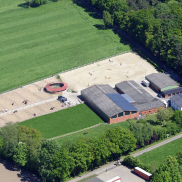


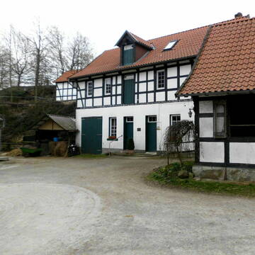
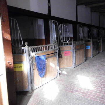
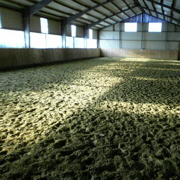
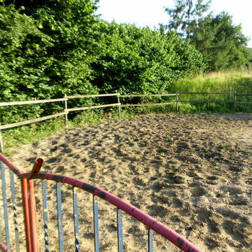
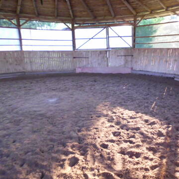
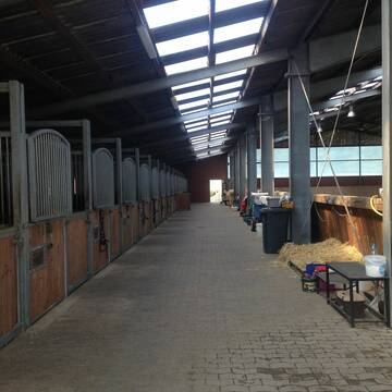
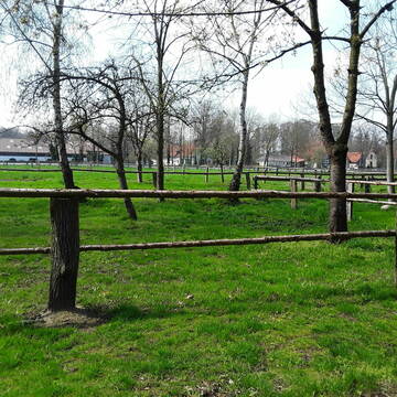
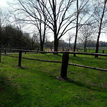
Idyllische Reitanlage in Ostercappeln
Ostercappeln
Melissa Glaap
@MelissaGlaap
Vermieten
Führanlage
Hunde willkommen
Außenbox mit Paddock
Innenbox
Vollpension
10 weitere...
P+
Deprecated: Creation of dynamic property Zend_View_Helper_Ads::$adLink is deprecated in /var/www/stall-frei/htdocs/staging.stall-frei.de/library/Psf/View/Helper/Ads.php on line 108

Persönlichkeitsentwicklung mit Pferden
Bad Salzuflen
Katja Dors
@Pferdezeiten
Begleite andere auf ihrem Entwicklungsweg und entdecke die transformative Kraft der pferdegestützten Persönlichkeitsentwicklung !
neu
R
schöne Boxen und jeden Tag Weidegang satt!!!!
Bissendorf
Pferdepension Ellinghaus
@Pferdepension-Ellinghaus1
FN-Mitglied
Freizeitstall
Vermieten
Hunde willkommen
Longierzirkel/Roundpen
Außenbox mit Paddock
Außenboxen
20 weitere...
S
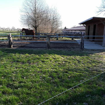
Pferdehof Rottmann in Venne
Ostercappeln
Pferdehof Rottmann
@Pferdehof-Rottmann
Pferdeausbildung
Reitlehrer und -unterricht
Vermieten
Longierzirkel/Roundpen
Paddock
Allergikerstall
Hufrehe geeignet
16 weitere...
P
Leider kein Vorschaubild
Leider kein Vorschaubild
Boxen mit Fenster frei
Bohmte
Reit-und Fahrverein Bohmte
@RuFVBohmte
Vermieten
Führanlage
Longierzirkel/Roundpen
Halbpension
Einzelne Boxen oder Stallplätze
10 weitere...
neu
B
Pferdepension Bringmann
Bissendorf
Bringmann-Pferdepension
@Bringmann-Pferdepension
Vermieten
Hunde willkommen
Krankenbox
Hufrehe geeignet
Außenbox mit Paddock
Laufbox
14 weitere...
P+

Offenstall- und Boxenplätze frei
Bissendorf
Halterbergshof
@Sandra76
FN-Mitglied
Freizeitstall
Vermieten
Hunde willkommen
Krankenbox
Allergikerstall
Gnadenbrothof
35 weitere...
P


Pferdebox frei – Platz in artgerechter Haltung
Rahden
Pferdehof Weddingfeld
@PferdehofWeddingfeld
Geländestrecke
Reitlehrer und -unterricht
Vermieten
Hunde willkommen
Paddock
Allergikerstall
bedampftes/gewaschenes Heu
19 weitere...
P+
Job gesucht?
Mechtersen
STALL-FREIde Marketing
@STALL-FREI-Marketing
Sie suchen einen Job und arbeiten gerne mit Pferden oder auf Reitanlagen?
Besuchen Sie jetzt unseren Stellenmarkt!

Vermietung von Pferdeboxen mit oder ohne Paddock
Espelkamp
Martin Haverkamp
@Reiterhof_Haverkamp
Freizeitstall
Reitlehrer und -unterricht
Paddock
Parkplatz für Pferdeanhänger
Außenbox mit Paddock
Außenboxen
Einzelne Boxen oder Stallplätze
9 weitere...
P
Leider kein Vorschaubild
Leider kein Vorschaubild
Offenstall
Bad Essen
Pferdefreunde
@Riepe
Freizeitstall
Vermieten
Hunde willkommen
Krankenbox
Gnadenbrothof
Hufrehe geeignet
8 weitere...
B
Leider kein Vorschaubild
Leider kein Vorschaubild
Offenstallplatz frei
Ostercappeln
S_Mosel
@S_Mosel
Freizeitstall
Geländestrecke
Hunde willkommen
Krankenbox
Hufrehe geeignet
Notfallboxen
Offenstall
10 weitere...
B
Deprecated: Creation of dynamic property Zend_View::$pageCount is deprecated in /var/www/stall-frei/htdocs/staging.stall-frei.de/library/vendor/shardj/zf1-future/library/Zend/View/Abstract.php on line 308
Deprecated: Creation of dynamic property Zend_View::$itemCountPerPage is deprecated in /var/www/stall-frei/htdocs/staging.stall-frei.de/library/vendor/shardj/zf1-future/library/Zend/View/Abstract.php on line 308
Deprecated: Creation of dynamic property Zend_View::$first is deprecated in /var/www/stall-frei/htdocs/staging.stall-frei.de/library/vendor/shardj/zf1-future/library/Zend/View/Abstract.php on line 308
Deprecated: Creation of dynamic property Zend_View::$current is deprecated in /var/www/stall-frei/htdocs/staging.stall-frei.de/library/vendor/shardj/zf1-future/library/Zend/View/Abstract.php on line 308
Deprecated: Creation of dynamic property Zend_View::$last is deprecated in /var/www/stall-frei/htdocs/staging.stall-frei.de/library/vendor/shardj/zf1-future/library/Zend/View/Abstract.php on line 308
Deprecated: Creation of dynamic property Zend_View::$next is deprecated in /var/www/stall-frei/htdocs/staging.stall-frei.de/library/vendor/shardj/zf1-future/library/Zend/View/Abstract.php on line 308
Deprecated: Creation of dynamic property Zend_View::$pagesInRange is deprecated in /var/www/stall-frei/htdocs/staging.stall-frei.de/library/vendor/shardj/zf1-future/library/Zend/View/Abstract.php on line 308
Deprecated: Creation of dynamic property Zend_View::$firstPageInRange is deprecated in /var/www/stall-frei/htdocs/staging.stall-frei.de/library/vendor/shardj/zf1-future/library/Zend/View/Abstract.php on line 308
Deprecated: Creation of dynamic property Zend_View::$lastPageInRange is deprecated in /var/www/stall-frei/htdocs/staging.stall-frei.de/library/vendor/shardj/zf1-future/library/Zend/View/Abstract.php on line 308
Deprecated: Creation of dynamic property Zend_View::$currentItemCount is deprecated in /var/www/stall-frei/htdocs/staging.stall-frei.de/library/vendor/shardj/zf1-future/library/Zend/View/Abstract.php on line 308
Deprecated: Creation of dynamic property Zend_View::$totalItemCount is deprecated in /var/www/stall-frei/htdocs/staging.stall-frei.de/library/vendor/shardj/zf1-future/library/Zend/View/Abstract.php on line 308
Deprecated: Creation of dynamic property Zend_View::$firstItemNumber is deprecated in /var/www/stall-frei/htdocs/staging.stall-frei.de/library/vendor/shardj/zf1-future/library/Zend/View/Abstract.php on line 308
Deprecated: Creation of dynamic property Zend_View::$lastItemNumber is deprecated in /var/www/stall-frei/htdocs/staging.stall-frei.de/library/vendor/shardj/zf1-future/library/Zend/View/Abstract.php on line 308
Deprecated: Creation of dynamic property Zend_View::$router is deprecated in /var/www/stall-frei/htdocs/staging.stall-frei.de/library/vendor/shardj/zf1-future/library/Zend/View/Abstract.php on line 308
Deprecated: Creation of dynamic property Zend_View::$urlParams is deprecated in /var/www/stall-frei/htdocs/staging.stall-frei.de/library/vendor/shardj/zf1-future/library/Zend/View/Abstract.php on line 308
Deprecated: Creation of dynamic property Zend_View::$showAds is deprecated in /var/www/stall-frei/htdocs/staging.stall-frei.de/library/vendor/shardj/zf1-future/library/Zend/View/Abstract.php on line 308
Deprecated: Creation of dynamic property Zend_View::$objectIds is deprecated in /var/www/stall-frei/htdocs/staging.stall-frei.de/library/vendor/shardj/zf1-future/library/Zend/View/Abstract.php on line 308
Deprecated: Creation of dynamic property Zend_View::$showNavbar is deprecated in /var/www/stall-frei/htdocs/staging.stall-frei.de/library/vendor/shardj/zf1-future/library/Zend/View/Abstract.php on line 308
Deprecated: Creation of dynamic property Zend_View::$showBreadcrumb is deprecated in /var/www/stall-frei/htdocs/staging.stall-frei.de/library/vendor/shardj/zf1-future/library/Zend/View/Abstract.php on line 308
Deprecated: Creation of dynamic property Zend_View::$showFooter is deprecated in /var/www/stall-frei/htdocs/staging.stall-frei.de/library/vendor/shardj/zf1-future/library/Zend/View/Abstract.php on line 308
Deprecated: Creation of dynamic property Zend_View::$showInternalAds is deprecated in /var/www/stall-frei/htdocs/staging.stall-frei.de/library/vendor/shardj/zf1-future/library/Zend/View/Abstract.php on line 308
Deprecated: Creation of dynamic property Zend_View::$blNoContent is deprecated in /var/www/stall-frei/htdocs/staging.stall-frei.de/library/vendor/shardj/zf1-future/library/Zend/View/Abstract.php on line 308
Deprecated: Creation of dynamic property Zend_View::$sMetaDesc is deprecated in /var/www/stall-frei/htdocs/staging.stall-frei.de/library/vendor/shardj/zf1-future/library/Zend/View/Abstract.php on line 308
Deprecated: Creation of dynamic property Zend_View::$useGmaps is deprecated in /var/www/stall-frei/htdocs/staging.stall-frei.de/library/vendor/shardj/zf1-future/library/Zend/View/Abstract.php on line 308
Deprecated: Creation of dynamic property Zend_View::$touches is deprecated in /var/www/stall-frei/htdocs/staging.stall-frei.de/library/vendor/shardj/zf1-future/library/Zend/View/Abstract.php on line 308
Deprecated: Creation of dynamic property Zend_View::$oProject is deprecated in /var/www/stall-frei/htdocs/staging.stall-frei.de/library/vendor/shardj/zf1-future/library/Zend/View/Abstract.php on line 308
Deprecated: Creation of dynamic property Zend_View::$pageHeadline is deprecated in /var/www/stall-frei/htdocs/staging.stall-frei.de/library/vendor/shardj/zf1-future/library/Zend/View/Abstract.php on line 308
Deprecated: Creation of dynamic property Zend_View::$disableLocationField is deprecated in /var/www/stall-frei/htdocs/staging.stall-frei.de/library/vendor/shardj/zf1-future/library/Zend/View/Abstract.php on line 308
Deprecated: Creation of dynamic property Zend_View::$isSearch is deprecated in /var/www/stall-frei/htdocs/staging.stall-frei.de/library/vendor/shardj/zf1-future/library/Zend/View/Abstract.php on line 308
Deprecated: Creation of dynamic property Zend_View::$pageTitle is deprecated in /var/www/stall-frei/htdocs/staging.stall-frei.de/library/vendor/shardj/zf1-future/library/Zend/View/Abstract.php on line 308
Deprecated: Creation of dynamic property Psf_Form_Element_Text::$class is deprecated in /var/www/stall-frei/htdocs/staging.stall-frei.de/library/vendor/shardj/zf1-future/library/Zend/Form/Element.php on line 874
Deprecated: Creation of dynamic property Psf_Form_Element_Text::$size is deprecated in /var/www/stall-frei/htdocs/staging.stall-frei.de/library/vendor/shardj/zf1-future/library/Zend/Form/Element.php on line 874
Deprecated: Creation of dynamic property Psf_Form_Element_Text::$placeholder is deprecated in /var/www/stall-frei/htdocs/staging.stall-frei.de/library/vendor/shardj/zf1-future/library/Zend/Form/Element.php on line 874
Deprecated: Creation of dynamic property Psf_Form_Element_Hidden::$class is deprecated in /var/www/stall-frei/htdocs/staging.stall-frei.de/library/vendor/shardj/zf1-future/library/Zend/Form/Element.php on line 874
Deprecated: Creation of dynamic property Psf_Form_Element_Hidden::$class is deprecated in /var/www/stall-frei/htdocs/staging.stall-frei.de/library/vendor/shardj/zf1-future/library/Zend/Form/Element.php on line 874
Deprecated: Creation of dynamic property Psf_Form_Element_Hidden::$class is deprecated in /var/www/stall-frei/htdocs/staging.stall-frei.de/library/vendor/shardj/zf1-future/library/Zend/Form/Element.php on line 874
Deprecated: Creation of dynamic property Psf_Form_Element_Hidden::$class is deprecated in /var/www/stall-frei/htdocs/staging.stall-frei.de/library/vendor/shardj/zf1-future/library/Zend/Form/Element.php on line 874
Deprecated: Creation of dynamic property Psf_Form_Element_Select::$class is deprecated in /var/www/stall-frei/htdocs/staging.stall-frei.de/library/vendor/shardj/zf1-future/library/Zend/Form/Element.php on line 874
Deprecated: Creation of dynamic property Psf_Form_Element_Select::$class is deprecated in /var/www/stall-frei/htdocs/staging.stall-frei.de/library/vendor/shardj/zf1-future/library/Zend/Form/Element.php on line 874
Deprecated: Creation of dynamic property Psf_Form_Element_Select::$class is deprecated in /var/www/stall-frei/htdocs/staging.stall-frei.de/library/vendor/shardj/zf1-future/library/Zend/Form/Element.php on line 874
Deprecated: Creation of dynamic property Psf_Form_Element_Select::$class is deprecated in /var/www/stall-frei/htdocs/staging.stall-frei.de/library/vendor/shardj/zf1-future/library/Zend/Form/Element.php on line 874
Deprecated: Creation of dynamic property Psf_Form_Element_Text::$class is deprecated in /var/www/stall-frei/htdocs/staging.stall-frei.de/library/vendor/shardj/zf1-future/library/Zend/Form/Element.php on line 874
Deprecated: Creation of dynamic property Psf_Form_Element_Checkbox::$label is deprecated in /var/www/stall-frei/htdocs/staging.stall-frei.de/library/vendor/shardj/zf1-future/library/Zend/Form/Element.php on line 874
Deprecated: Creation of dynamic property Zend_View::$sort is deprecated in /var/www/stall-frei/htdocs/staging.stall-frei.de/library/vendor/shardj/zf1-future/library/Zend/View/Abstract.php on line 308
Deprecated: Creation of dynamic property Zend_View::$searchLocation is deprecated in /var/www/stall-frei/htdocs/staging.stall-frei.de/library/vendor/shardj/zf1-future/library/Zend/View/Abstract.php on line 308
Deprecated: Creation of dynamic property Zend_View::$locationHint is deprecated in /var/www/stall-frei/htdocs/staging.stall-frei.de/library/vendor/shardj/zf1-future/library/Zend/View/Abstract.php on line 308
Psf_GeoCoder_Abstract::getLocation: Drohne Get Location CachedOrLive
Psf_GeoCoder_Abstract::getCachedOrLive: Drohne
Psf_GeoCoder_OpenCageData::makeApiRequest: response:
Array
(
[documentation] => https://opencagedata.com/api
[licenses] => Array
(
[0] => Array
(
[name] => see attribution guide
[url] => https://opencagedata.com/credits
)
)
[results] => Array
(
[0] => Array
(
[bounds] => Array
(
[northeast] => Array
(
[lat] => 52.436702
[lng] => 8.363839
)
[southwest] => Array
(
[lat] => 52.3932221
[lng] => 8.3120684
)
)
[components] => Array
(
[ISO_3166-1_alpha-2] => DE
[ISO_3166-1_alpha-3] => DEU
[ISO_3166-2] => Array
(
[0] => DE-NW
)
[_category] => place
[_normalized_city] => Drohne
[_type] => village
[continent] => Europe
[country] => Deutschland
[country_code] => de
[county] => Kreis Minden-Lübbecke
[municipality] => Stemwede
[political_union] => European Union
[state] => Nordrhein-Westfalen
[state_code] => NW
[village] => Drohne
)
[confidence] => 7
[formatted] => Drohne, Nordrhein-Westfalen, Deutschland
[geometry] => Array
(
[lat] => 52.4316401
[lng] => 8.3356959
)
)
[1] => Array
(
[bounds] => Array
(
[northeast] => Array
(
[lat] => 50.9128182
[lng] => 14.2021241
)
[southwest] => Array
(
[lat] => 50.9127182
[lng] => 14.2020241
)
)
[components] => Array
(
[ISO_3166-1_alpha-2] => DE
[ISO_3166-1_alpha-3] => DEU
[ISO_3166-2] => Array
(
[0] => DE-SN
)
[_category] => natural/water
[_normalized_city] => Bad Schandau
[_type] => peak
[continent] => Europe
[country] => Deutschland
[country_code] => de
[county] => Sächsische Schweiz-Osterzgebirge
[municipality] => Bad Schandau
[peak] => Drohne
[political_union] => European Union
[postcode] => 01814
[state] => Sachsen
[state_code] => SN
[town] => Bad Schandau
)
[confidence] => 9
[formatted] => Drohne, 01814 Bad Schandau, Deutschland
[geometry] => Array
(
[lat] => 50.9127682
[lng] => 14.2020741
)
)
[2] => Array
(
[bounds] => Array
(
[northeast] => Array
(
[lat] => 52.4348247
[lng] => 8.3437052
)
[southwest] => Array
(
[lat] => 52.4297269
[lng] => 8.3315259
)
)
[components] => Array
(
[ISO_3166-1_alpha-2] => DE
[ISO_3166-1_alpha-3] => DEU
[ISO_3166-2] => Array
(
[0] => DE-NW
)
[_category] => place
[_normalized_city] => Drohne
[_type] => village
[continent] => Europe
[country] => Deutschland
[country_code] => de
[county] => Kreis Minden-Lübbecke
[municipality] => Stemwede
[political_union] => European Union
[postcode] => 32351
[residential] => Drohne
[state] => Nordrhein-Westfalen
[state_code] => NW
[village] => Drohne
)
[confidence] => 9
[formatted] => 32351 Drohne, Deutschland
[geometry] => Array
(
[lat] => 52.4322511
[lng] => 8.338723
)
)
[3] => Array
(
[components] => Array
(
[ISO_3166-1_alpha-2] => FR
[ISO_3166-1_alpha-3] => FRA
[ISO_3166-2] => Array
(
[0] => FR-NAQ
[1] => FR-24
)
[_category] => road
[_normalized_city] => Ribérac
[_type] => road
[city] => Ribérac
[continent] => Europe
[country] => France
[country_code] => fr
[county] => Dordogne
[local_authority] => Communauté de communes du Périgord Ribéracois
[political_union] => European Union
[postcode] => 24600
[road] => Route de la Dronne
[state] => Nouvelle-Aquitaine
[state_code] => NAQ
)
[confidence] => 3
[formatted] => Route de la Dronne, 24600 Ribérac, France
[geometry] => Array
(
[lat] => 45.256967
[lng] => 0.289705
)
)
[4] => Array
(
[components] => Array
(
[ISO_3166-1_alpha-2] => FR
[ISO_3166-1_alpha-3] => FRA
[ISO_3166-2] => Array
(
[0] => FR-NAQ
[1] => FR-24
)
[_category] => road
[_normalized_city] => Saint-Front-la-Rivière
[_type] => road
[city] => Saint-Front-la-Rivière
[continent] => Europe
[country] => France
[country_code] => fr
[county] => Dordogne
[local_authority] => Communauté de communes du Périgord Nontronnais
[political_union] => European Union
[postcode] => 24300
[road] => Route de la Dronne
[state] => Nouvelle-Aquitaine
[state_code] => NAQ
)
[confidence] => 3
[formatted] => Route de la Dronne, 24300 Saint-Front-la-Rivière, France
[geometry] => Array
(
[lat] => 45.474657
[lng] => 0.72516
)
)
[5] => Array
(
[components] => Array
(
[ISO_3166-1_alpha-2] => FR
[ISO_3166-1_alpha-3] => FRA
[ISO_3166-2] => Array
(
[0] => FR-NAQ
[1] => FR-33
)
[_category] => road
[_normalized_city] => Chamadelle
[_type] => road
[city] => Chamadelle
[continent] => Europe
[country] => France
[country_code] => fr
[county] => Gironde
[local_authority] => Communauté d'agglomération du Libournais
[political_union] => European Union
[postcode] => 33230
[road] => Route de la Dronne
[state] => Nouvelle-Aquitaine
[state_code] => NAQ
)
[confidence] => 3
[formatted] => Route de la Dronne, 33230 Chamadelle, France
[geometry] => Array
(
[lat] => 45.08646
[lng] => -0.081834
)
)
[6] => Array
(
[components] => Array
(
[ISO_3166-1_alpha-2] => FR
[ISO_3166-1_alpha-3] => FRA
[ISO_3166-2] => Array
(
[0] => FR-NAQ
[1] => FR-24
)
[_category] => road
[_normalized_city] => Milhac-de-Nontron
[_type] => road
[city] => Milhac-de-Nontron
[continent] => Europe
[country] => France
[country_code] => fr
[county] => Dordogne
[local_authority] => Communauté de communes du Périgord Nontronnais
[political_union] => European Union
[postcode] => 24470
[road] => Route de la Dronne
[state] => Nouvelle-Aquitaine
[state_code] => NAQ
)
[confidence] => 3
[formatted] => Route de la Dronne, 24470 Milhac-de-Nontron, France
[geometry] => Array
(
[lat] => 45.480383
[lng] => 0.776309
)
)
[7] => Array
(
[components] => Array
(
[ISO_3166-1_alpha-2] => FR
[ISO_3166-1_alpha-3] => FRA
[ISO_3166-2] => Array
(
[0] => FR-NAQ
[1] => FR-24
)
[_category] => road
[_normalized_city] => Vanxains
[_type] => road
[city] => Vanxains
[continent] => Europe
[country] => France
[country_code] => fr
[county] => Dordogne
[local_authority] => Communauté de communes du Périgord Ribéracois
[political_union] => European Union
[postcode] => 24600
[road] => Route de la Dronne
[state] => Nouvelle-Aquitaine
[state_code] => NAQ
)
[confidence] => 3
[formatted] => Route de la Dronne, 24600 Vanxains, France
[geometry] => Array
(
[lat] => 45.25144
[lng] => 0.287858
)
)
[8] => Array
(
[components] => Array
(
[ISO_3166-1_alpha-2] => FR
[ISO_3166-1_alpha-3] => FRA
[ISO_3166-2] => Array
(
[0] => FR-PDL
[1] => FR-72
)
[_category] => road
[_normalized_city] => Ruaudin
[_type] => road
[city] => Ruaudin
[continent] => Europe
[country] => France
[country_code] => fr
[county] => Sarthe
[local_authority] => Le Mans Métropole
[political_union] => European Union
[postcode] => 72230
[road] => Chemin de la Dronne
[state] => Pays de la Loire
[state_code] => PDL
)
[confidence] => 3
[formatted] => Chemin de la Dronne, 72230 Ruaudin, France
[geometry] => Array
(
[lat] => 47.937011
[lng] => 0.281789
)
)
[9] => Array
(
[components] => Array
(
[ISO_3166-1_alpha-2] => FR
[ISO_3166-1_alpha-3] => FRA
[ISO_3166-2] => Array
(
[0] => FR-NAQ
[1] => FR-24
)
[_category] => road
[_normalized_city] => Montagrier
[_type] => road
[city] => Montagrier
[continent] => Europe
[country] => France
[country_code] => fr
[county] => Dordogne
[local_authority] => Communauté de communes du Périgord Ribéracois
[political_union] => European Union
[postcode] => 24350
[road] => Route de la Dronne
[state] => Nouvelle-Aquitaine
[state_code] => NAQ
)
[confidence] => 3
[formatted] => Route de la Dronne, 24350 Montagrier, France
[geometry] => Array
(
[lat] => 45.264094
[lng] => 0.498098
)
)
)
[status] => Array
(
[code] => 200
[message] => OK
)
[stay_informed] => Array
(
[blog] => https://blog.opencagedata.com
[mastodon] => https://en.osm.town/@opencage
)
[thanks] => For using an OpenCage API
[timestamp] => Array
(
[created_http] => Sun, 08 Feb 2026 20:17:50 GMT
[created_unix] => 1770581870
)
[total_results] => 10
)
Psf_GeoCoder_Abstract::convertLocationResult
{"documentation":"https:\/\/opencagedata.com\/api","licenses":[{"name":"see attribution guide","url":"https:\/\/opencagedata.com\/credits"}],"results":[{"bounds":{"northeast":{"lat":52.436702,"lng":8.363839},"southwest":{"lat":52.3932221,"lng":8.3120684}},"components":{"ISO_3166-1_alpha-2":"DE","ISO_3166-1_alpha-3":"DEU","ISO_3166-2":["DE-NW"],"_category":"place","_normalized_city":"Drohne","_type":"village","continent":"Europe","country":"Deutschland","country_code":"de","county":"Kreis Minden-L\u00fcbbecke","municipality":"Stemwede","political_union":"European Union","state":"Nordrhein-Westfalen","state_code":"NW","village":"Drohne"},"confidence":7,"formatted":"Drohne, Nordrhein-Westfalen, Deutschland","geometry":{"lat":52.4316401,"lng":8.3356959}},{"bounds":{"northeast":{"lat":50.9128182,"lng":14.2021241},"southwest":{"lat":50.9127182,"lng":14.2020241}},"components":{"ISO_3166-1_alpha-2":"DE","ISO_3166-1_alpha-3":"DEU","ISO_3166-2":["DE-SN"],"_category":"natural\/water","_normalized_city":"Bad Schandau","_type":"peak","continent":"Europe","country":"Deutschland","country_code":"de","county":"S\u00e4chsische Schweiz-Osterzgebirge","municipality":"Bad Schandau","peak":"Drohne","political_union":"European Union","postcode":"01814","state":"Sachsen","state_code":"SN","town":"Bad Schandau"},"confidence":9,"formatted":"Drohne, 01814 Bad Schandau, Deutschland","geometry":{"lat":50.9127682,"lng":14.2020741}},{"bounds":{"northeast":{"lat":52.4348247,"lng":8.3437052},"southwest":{"lat":52.4297269,"lng":8.3315259}},"components":{"ISO_3166-1_alpha-2":"DE","ISO_3166-1_alpha-3":"DEU","ISO_3166-2":["DE-NW"],"_category":"place","_normalized_city":"Drohne","_type":"village","continent":"Europe","country":"Deutschland","country_code":"de","county":"Kreis Minden-L\u00fcbbecke","municipality":"Stemwede","political_union":"European Union","postcode":"32351","residential":"Drohne","state":"Nordrhein-Westfalen","state_code":"NW","village":"Drohne"},"confidence":9,"formatted":"32351 Drohne, Deutschland","geometry":{"lat":52.4322511,"lng":8.338723}},{"components":{"ISO_3166-1_alpha-2":"FR","ISO_3166-1_alpha-3":"FRA","ISO_3166-2":["FR-NAQ","FR-24"],"_category":"road","_normalized_city":"Rib\u00e9rac","_type":"road","city":"Rib\u00e9rac","continent":"Europe","country":"France","country_code":"fr","county":"Dordogne","local_authority":"Communaut\u00e9 de communes du P\u00e9rigord Rib\u00e9racois","political_union":"European Union","postcode":"24600","road":"Route de la Dronne","state":"Nouvelle-Aquitaine","state_code":"NAQ"},"confidence":3,"formatted":"Route de la Dronne, 24600 Rib\u00e9rac, France","geometry":{"lat":45.256967,"lng":0.289705}},{"components":{"ISO_3166-1_alpha-2":"FR","ISO_3166-1_alpha-3":"FRA","ISO_3166-2":["FR-NAQ","FR-24"],"_category":"road","_normalized_city":"Saint-Front-la-Rivi\u00e8re","_type":"road","city":"Saint-Front-la-Rivi\u00e8re","continent":"Europe","country":"France","country_code":"fr","county":"Dordogne","local_authority":"Communaut\u00e9 de communes du P\u00e9rigord Nontronnais","political_union":"European Union","postcode":"24300","road":"Route de la Dronne","state":"Nouvelle-Aquitaine","state_code":"NAQ"},"confidence":3,"formatted":"Route de la Dronne, 24300 Saint-Front-la-Rivi\u00e8re, France","geometry":{"lat":45.474657,"lng":0.72516}},{"components":{"ISO_3166-1_alpha-2":"FR","ISO_3166-1_alpha-3":"FRA","ISO_3166-2":["FR-NAQ","FR-33"],"_category":"road","_normalized_city":"Chamadelle","_type":"road","city":"Chamadelle","continent":"Europe","country":"France","country_code":"fr","county":"Gironde","local_authority":"Communaut\u00e9 d'agglom\u00e9ration du Libournais","political_union":"European Union","postcode":"33230","road":"Route de la Dronne","state":"Nouvelle-Aquitaine","state_code":"NAQ"},"confidence":3,"formatted":"Route de la Dronne, 33230 Chamadelle, France","geometry":{"lat":45.08646,"lng":-0.081834}},{"components":{"ISO_3166-1_alpha-2":"FR","ISO_3166-1_alpha-3":"FRA","ISO_3166-2":["FR-NAQ","FR-24"],"_category":"road","_normalized_city":"Milhac-de-Nontron","_type":"road","city":"Milhac-de-Nontron","continent":"Europe","country":"France","country_code":"fr","county":"Dordogne","local_authority":"Communaut\u00e9 de communes du P\u00e9rigord Nontronnais","political_union":"European Union","postcode":"24470","road":"Route de la Dronne","state":"Nouvelle-Aquitaine","state_code":"NAQ"},"confidence":3,"formatted":"Route de la Dronne, 24470 Milhac-de-Nontron, France","geometry":{"lat":45.480383,"lng":0.776309}},{"components":{"ISO_3166-1_alpha-2":"FR","ISO_3166-1_alpha-3":"FRA","ISO_3166-2":["FR-NAQ","FR-24"],"_category":"road","_normalized_city":"Vanxains","_type":"road","city":"Vanxains","continent":"Europe","country":"France","country_code":"fr","county":"Dordogne","local_authority":"Communaut\u00e9 de communes du P\u00e9rigord Rib\u00e9racois","political_union":"European Union","postcode":"24600","road":"Route de la Dronne","state":"Nouvelle-Aquitaine","state_code":"NAQ"},"confidence":3,"formatted":"Route de la Dronne, 24600 Vanxains, France","geometry":{"lat":45.25144,"lng":0.287858}},{"components":{"ISO_3166-1_alpha-2":"FR","ISO_3166-1_alpha-3":"FRA","ISO_3166-2":["FR-PDL","FR-72"],"_category":"road","_normalized_city":"Ruaudin","_type":"road","city":"Ruaudin","continent":"Europe","country":"France","country_code":"fr","county":"Sarthe","local_authority":"Le Mans M\u00e9tropole","political_union":"European Union","postcode":"72230","road":"Chemin de la Dronne","state":"Pays de la Loire","state_code":"PDL"},"confidence":3,"formatted":"Chemin de la Dronne, 72230 Ruaudin, France","geometry":{"lat":47.937011,"lng":0.281789}},{"components":{"ISO_3166-1_alpha-2":"FR","ISO_3166-1_alpha-3":"FRA","ISO_3166-2":["FR-NAQ","FR-24"],"_category":"road","_normalized_city":"Montagrier","_type":"road","city":"Montagrier","continent":"Europe","country":"France","country_code":"fr","county":"Dordogne","local_authority":"Communaut\u00e9 de communes du P\u00e9rigord Rib\u00e9racois","political_union":"European Union","postcode":"24350","road":"Route de la Dronne","state":"Nouvelle-Aquitaine","state_code":"NAQ"},"confidence":3,"formatted":"Route de la Dronne, 24350 Montagrier, France","geometry":{"lat":45.264094,"lng":0.498098}}],"status":{"code":200,"message":"OK"},"stay_informed":{"blog":"https:\/\/blog.opencagedata.com","mastodon":"https:\/\/en.osm.town\/@opencage"},"thanks":"For using an OpenCage API","timestamp":{"created_http":"Sun, 08 Feb 2026 20:17:50 GMT","created_unix":1770581870},"total_results":10}Array
(
[0] => stdClass Object
(
[bounds] => stdClass Object
(
[northeast] => stdClass Object
(
[lat] => 52.436702
[lng] => 8.363839
)
[southwest] => stdClass Object
(
[lat] => 52.3932221
[lng] => 8.3120684
)
)
[components] => stdClass Object
(
[ISO_3166-1_alpha-2] => DE
[ISO_3166-1_alpha-3] => DEU
[ISO_3166-2] => Array
(
[0] => DE-NW
)
[_category] => place
[_normalized_city] => Drohne
[_type] => village
[continent] => Europe
[country] => Deutschland
[country_code] => de
[county] => Kreis Minden-Lübbecke
[municipality] => Stemwede
[political_union] => European Union
[state] => Nordrhein-Westfalen
[state_code] => NW
[village] => Drohne
)
[confidence] => 7
[formatted] => Drohne, Nordrhein-Westfalen, Deutschland
[geometry] => stdClass Object
(
[lat] => 52.4316401
[lng] => 8.3356959
)
)
[1] => stdClass Object
(
[bounds] => stdClass Object
(
[northeast] => stdClass Object
(
[lat] => 50.9128182
[lng] => 14.2021241
)
[southwest] => stdClass Object
(
[lat] => 50.9127182
[lng] => 14.2020241
)
)
[components] => stdClass Object
(
[ISO_3166-1_alpha-2] => DE
[ISO_3166-1_alpha-3] => DEU
[ISO_3166-2] => Array
(
[0] => DE-SN
)
[_category] => natural/water
[_normalized_city] => Bad Schandau
[_type] => peak
[continent] => Europe
[country] => Deutschland
[country_code] => de
[county] => Sächsische Schweiz-Osterzgebirge
[municipality] => Bad Schandau
[peak] => Drohne
[political_union] => European Union
[postcode] => 01814
[state] => Sachsen
[state_code] => SN
[town] => Bad Schandau
)
[confidence] => 9
[formatted] => Drohne, 01814 Bad Schandau, Deutschland
[geometry] => stdClass Object
(
[lat] => 50.9127682
[lng] => 14.2020741
)
)
[2] => stdClass Object
(
[bounds] => stdClass Object
(
[northeast] => stdClass Object
(
[lat] => 52.4348247
[lng] => 8.3437052
)
[southwest] => stdClass Object
(
[lat] => 52.4297269
[lng] => 8.3315259
)
)
[components] => stdClass Object
(
[ISO_3166-1_alpha-2] => DE
[ISO_3166-1_alpha-3] => DEU
[ISO_3166-2] => Array
(
[0] => DE-NW
)
[_category] => place
[_normalized_city] => Drohne
[_type] => village
[continent] => Europe
[country] => Deutschland
[country_code] => de
[county] => Kreis Minden-Lübbecke
[municipality] => Stemwede
[political_union] => European Union
[postcode] => 32351
[residential] => Drohne
[state] => Nordrhein-Westfalen
[state_code] => NW
[village] => Drohne
)
[confidence] => 9
[formatted] => 32351 Drohne, Deutschland
[geometry] => stdClass Object
(
[lat] => 52.4322511
[lng] => 8.338723
)
)
[3] => stdClass Object
(
[components] => stdClass Object
(
[ISO_3166-1_alpha-2] => FR
[ISO_3166-1_alpha-3] => FRA
[ISO_3166-2] => Array
(
[0] => FR-NAQ
[1] => FR-24
)
[_category] => road
[_normalized_city] => Ribérac
[_type] => road
[city] => Ribérac
[continent] => Europe
[country] => France
[country_code] => fr
[county] => Dordogne
[local_authority] => Communauté de communes du Périgord Ribéracois
[political_union] => European Union
[postcode] => 24600
[road] => Route de la Dronne
[state] => Nouvelle-Aquitaine
[state_code] => NAQ
)
[confidence] => 3
[formatted] => Route de la Dronne, 24600 Ribérac, France
[geometry] => stdClass Object
(
[lat] => 45.256967
[lng] => 0.289705
)
)
[4] => stdClass Object
(
[components] => stdClass Object
(
[ISO_3166-1_alpha-2] => FR
[ISO_3166-1_alpha-3] => FRA
[ISO_3166-2] => Array
(
[0] => FR-NAQ
[1] => FR-24
)
[_category] => road
[_normalized_city] => Saint-Front-la-Rivière
[_type] => road
[city] => Saint-Front-la-Rivière
[continent] => Europe
[country] => France
[country_code] => fr
[county] => Dordogne
[local_authority] => Communauté de communes du Périgord Nontronnais
[political_union] => European Union
[postcode] => 24300
[road] => Route de la Dronne
[state] => Nouvelle-Aquitaine
[state_code] => NAQ
)
[confidence] => 3
[formatted] => Route de la Dronne, 24300 Saint-Front-la-Rivière, France
[geometry] => stdClass Object
(
[lat] => 45.474657
[lng] => 0.72516
)
)
[5] => stdClass Object
(
[components] => stdClass Object
(
[ISO_3166-1_alpha-2] => FR
[ISO_3166-1_alpha-3] => FRA
[ISO_3166-2] => Array
(
[0] => FR-NAQ
[1] => FR-33
)
[_category] => road
[_normalized_city] => Chamadelle
[_type] => road
[city] => Chamadelle
[continent] => Europe
[country] => France
[country_code] => fr
[county] => Gironde
[local_authority] => Communauté d'agglomération du Libournais
[political_union] => European Union
[postcode] => 33230
[road] => Route de la Dronne
[state] => Nouvelle-Aquitaine
[state_code] => NAQ
)
[confidence] => 3
[formatted] => Route de la Dronne, 33230 Chamadelle, France
[geometry] => stdClass Object
(
[lat] => 45.08646
[lng] => -0.081834
)
)
[6] => stdClass Object
(
[components] => stdClass Object
(
[ISO_3166-1_alpha-2] => FR
[ISO_3166-1_alpha-3] => FRA
[ISO_3166-2] => Array
(
[0] => FR-NAQ
[1] => FR-24
)
[_category] => road
[_normalized_city] => Milhac-de-Nontron
[_type] => road
[city] => Milhac-de-Nontron
[continent] => Europe
[country] => France
[country_code] => fr
[county] => Dordogne
[local_authority] => Communauté de communes du Périgord Nontronnais
[political_union] => European Union
[postcode] => 24470
[road] => Route de la Dronne
[state] => Nouvelle-Aquitaine
[state_code] => NAQ
)
[confidence] => 3
[formatted] => Route de la Dronne, 24470 Milhac-de-Nontron, France
[geometry] => stdClass Object
(
[lat] => 45.480383
[lng] => 0.776309
)
)
[7] => stdClass Object
(
[components] => stdClass Object
(
[ISO_3166-1_alpha-2] => FR
[ISO_3166-1_alpha-3] => FRA
[ISO_3166-2] => Array
(
[0] => FR-NAQ
[1] => FR-24
)
[_category] => road
[_normalized_city] => Vanxains
[_type] => road
[city] => Vanxains
[continent] => Europe
[country] => France
[country_code] => fr
[county] => Dordogne
[local_authority] => Communauté de communes du Périgord Ribéracois
[political_union] => European Union
[postcode] => 24600
[road] => Route de la Dronne
[state] => Nouvelle-Aquitaine
[state_code] => NAQ
)
[confidence] => 3
[formatted] => Route de la Dronne, 24600 Vanxains, France
[geometry] => stdClass Object
(
[lat] => 45.25144
[lng] => 0.287858
)
)
[8] => stdClass Object
(
[components] => stdClass Object
(
[ISO_3166-1_alpha-2] => FR
[ISO_3166-1_alpha-3] => FRA
[ISO_3166-2] => Array
(
[0] => FR-PDL
[1] => FR-72
)
[_category] => road
[_normalized_city] => Ruaudin
[_type] => road
[city] => Ruaudin
[continent] => Europe
[country] => France
[country_code] => fr
[county] => Sarthe
[local_authority] => Le Mans Métropole
[political_union] => European Union
[postcode] => 72230
[road] => Chemin de la Dronne
[state] => Pays de la Loire
[state_code] => PDL
)
[confidence] => 3
[formatted] => Chemin de la Dronne, 72230 Ruaudin, France
[geometry] => stdClass Object
(
[lat] => 47.937011
[lng] => 0.281789
)
)
[9] => stdClass Object
(
[components] => stdClass Object
(
[ISO_3166-1_alpha-2] => FR
[ISO_3166-1_alpha-3] => FRA
[ISO_3166-2] => Array
(
[0] => FR-NAQ
[1] => FR-24
)
[_category] => road
[_normalized_city] => Montagrier
[_type] => road
[city] => Montagrier
[continent] => Europe
[country] => France
[country_code] => fr
[county] => Dordogne
[local_authority] => Communauté de communes du Périgord Ribéracois
[political_union] => European Union
[postcode] => 24350
[road] => Route de la Dronne
[state] => Nouvelle-Aquitaine
[state_code] => NAQ
)
[confidence] => 3
[formatted] => Route de la Dronne, 24350 Montagrier, France
[geometry] => stdClass Object
(
[lat] => 45.264094
[lng] => 0.498098
)
)
)
Psf_GeoCoder_OpenCageData::getKeyMap: 0
stdClass Object
(
    [bounds] => stdClass Object
        (
            [northeast] => stdClass Object
                (
                    [lat] => 52.436702
                    [lng] => 8.363839
                )

            [southwest] => stdClass Object
                (
                    [lat] => 52.3932221
                    [lng] => 8.3120684
                )

        )

    [components] => stdClass Object
        (
            [ISO_3166-1_alpha-2] => DE
            [ISO_3166-1_alpha-3] => DEU
            [ISO_3166-2] => Array
                (
                    [0] => DE-NW
                )

            [_category] => place
            [_normalized_city] => Drohne
            [_type] => village
            [continent] => Europe
            [country] => Deutschland
            [country_code] => de
            [county] => Kreis Minden-Lübbecke
            [municipality] => Stemwede
            [political_union] => European Union
            [state] => Nordrhein-Westfalen
            [state_code] => NW
            [village] => Drohne
        )

    [confidence] => 7
    [formatted] => Drohne, Nordrhein-Westfalen, Deutschland
    [geometry] => stdClass Object
        (
            [lat] => 52.4316401
            [lng] => 8.3356959
        )

)
Psf_GeoCoder_OpenCageData::getCounty: Minden-Lübbecke
Psf_GeoCoder_OpenCageData::addMissingData REFETCH!
Array
(
    [address] => Drohne, Nordrhein-Westfalen, Deutschland
    [type] => village
    [street] =>
    [city] => Drohne
    [county] => Minden-Lübbecke
    [state] => Nordrhein-Westfalen
    [zip] =>
    [country] => Deutschland
    [suburb] =>
    [countrycode] => de
    [latitude] => 52.4316401
    [longitude] => 8.3356959
    [accuracy] => 1
    [confidence] => 7
    [bounds] => stdClass Object
        (
            [northeast] => stdClass Object
                (
                    [lat] => 52.436702
                    [lng] => 8.363839
                )

            [southwest] => stdClass Object
                (
                    [lat] => 52.3932221
                    [lng] => 8.3120684
                )

        )

)
reformat!
Array
(
    [address] => Drohne, Nordrhein-Westfalen, Deutschland
    [type] => village
    [street] =>
    [city] => Drohne
    [county] => Minden-Lübbecke
    [state] => Nordrhein-Westfalen
    [zip] =>
    [country] => Deutschland
    [suburb] =>
    [countrycode] => de
    [latitude] => 52.4316401
    [longitude] => 8.3356959
    [accuracy] => 1
    [confidence] => 7
    [bounds] => stdClass Object
        (
            [northeast] => stdClass Object
                (
                    [lat] => 52.436702
                    [lng] => 8.363839
                )

            [southwest] => stdClass Object
                (
                    [lat] => 52.3932221
                    [lng] => 8.3120684
                )

        )

    [place] => Drohne, Nordrhein-Westfalen
    [hash] => 95efd681cd18a8b6e4555d4891929e8b
)
Psf_GeoCoder_OpenCageData::getKeyMap: 1
stdClass Object
(
    [bounds] => stdClass Object
        (
            [northeast] => stdClass Object
                (
                    [lat] => 50.9128182
                    [lng] => 14.2021241
                )

            [southwest] => stdClass Object
                (
                    [lat] => 50.9127182
                    [lng] => 14.2020241
                )

        )

    [components] => stdClass Object
        (
            [ISO_3166-1_alpha-2] => DE
            [ISO_3166-1_alpha-3] => DEU
            [ISO_3166-2] => Array
                (
                    [0] => DE-SN
                )

            [_category] => natural/water
            [_normalized_city] => Bad Schandau
            [_type] => peak
            [continent] => Europe
            [country] => Deutschland
            [country_code] => de
            [county] => Sächsische Schweiz-Osterzgebirge
            [municipality] => Bad Schandau
            [peak] => Drohne
            [political_union] => European Union
            [postcode] => 01814
            [state] => Sachsen
            [state_code] => SN
            [town] => Bad Schandau
        )

    [confidence] => 9
    [formatted] => Drohne, 01814 Bad Schandau, Deutschland
    [geometry] => stdClass Object
        (
            [lat] => 50.9127682
            [lng] => 14.2020741
        )

)
Psf_GeoCoder_OpenCageData::getCounty: Sächsische Schweiz-Osterzgebirge
Psf_GeoCoder_OpenCageData::addMissingData REFETCH!
Array
(
    [address] => Drohne, 01814 Bad Schandau, Deutschland
    [type] => peak
    [street] =>
    [city] => Bad Schandau
    [county] => Sächsische Schweiz-Osterzgebirge
    [state] => Sachsen
    [zip] => 01814
    [country] => Deutschland
    [suburb] =>
    [countrycode] => de
    [latitude] => 50.9127682
    [longitude] => 14.2020741
    [accuracy] => 1
    [confidence] => 9
    [bounds] => stdClass Object
        (
            [northeast] => stdClass Object
                (
                    [lat] => 50.9128182
                    [lng] => 14.2021241
                )

            [southwest] => stdClass Object
                (
                    [lat] => 50.9127182
                    [lng] => 14.2020241
                )

        )

)
reformat!
Array
(
    [address] => Drohne, 01814 Bad Schandau, Deutschland
    [type] => peak
    [street] =>
    [city] => Bad Schandau
    [county] => Sächsische Schweiz-Osterzgebirge
    [state] => Sachsen
    [zip] => 01814
    [country] => Deutschland
    [suburb] =>
    [countrycode] => de
    [latitude] => 50.9127682
    [longitude] => 14.2020741
    [accuracy] => 1
    [confidence] => 9
    [bounds] => stdClass Object
        (
            [northeast] => stdClass Object
                (
                    [lat] => 50.9128182
                    [lng] => 14.2021241
                )

            [southwest] => stdClass Object
                (
                    [lat] => 50.9127182
                    [lng] => 14.2020241
                )

        )

    [place] => 01814 Bad Schandau, Sachsen
    [hash] => cb42277cc0f277a7b668eb289a551e87
)
Psf_GeoCoder_OpenCageData::getKeyMap: 2
stdClass Object
(
    [bounds] => stdClass Object
        (
            [northeast] => stdClass Object
                (
                    [lat] => 52.4348247
                    [lng] => 8.3437052
                )

            [southwest] => stdClass Object
                (
                    [lat] => 52.4297269
                    [lng] => 8.3315259
                )

        )

    [components] => stdClass Object
        (
            [ISO_3166-1_alpha-2] => DE
            [ISO_3166-1_alpha-3] => DEU
            [ISO_3166-2] => Array
                (
                    [0] => DE-NW
                )

            [_category] => place
            [_normalized_city] => Drohne
            [_type] => village
            [continent] => Europe
            [country] => Deutschland
            [country_code] => de
            [county] => Kreis Minden-Lübbecke
            [municipality] => Stemwede
            [political_union] => European Union
            [postcode] => 32351
            [residential] => Drohne
            [state] => Nordrhein-Westfalen
            [state_code] => NW
            [village] => Drohne
        )

    [confidence] => 9
    [formatted] => 32351 Drohne, Deutschland
    [geometry] => stdClass Object
        (
            [lat] => 52.4322511
            [lng] => 8.338723
        )

)
Psf_GeoCoder_OpenCageData::getCounty: Minden-Lübbecke
Psf_GeoCoder_OpenCageData::addMissingData REFETCH!
Array
(
    [address] => 32351 Drohne, Deutschland
    [type] => village
    [street] =>
    [city] => Drohne
    [county] => Minden-Lübbecke
    [state] => Nordrhein-Westfalen
    [zip] => 32351
    [country] => Deutschland
    [suburb] =>
    [countrycode] => de
    [latitude] => 52.4322511
    [longitude] => 8.338723
    [accuracy] => 1
    [confidence] => 9
    [bounds] => stdClass Object
        (
            [northeast] => stdClass Object
                (
                    [lat] => 52.4348247
                    [lng] => 8.3437052
                )

            [southwest] => stdClass Object
                (
                    [lat] => 52.4297269
                    [lng] => 8.3315259
                )

        )

)
reformat!
Array
(
    [address] => 32351 Drohne, Deutschland
    [type] => village
    [street] =>
    [city] => Drohne
    [county] => Minden-Lübbecke
    [state] => Nordrhein-Westfalen
    [zip] => 32351
    [country] => Deutschland
    [suburb] =>
    [countrycode] => de
    [latitude] => 52.4322511
    [longitude] => 8.338723
    [accuracy] => 1
    [confidence] => 9
    [bounds] => stdClass Object
        (
            [northeast] => stdClass Object
                (
                    [lat] => 52.4348247
                    [lng] => 8.3437052
                )

            [southwest] => stdClass Object
                (
                    [lat] => 52.4297269
                    [lng] => 8.3315259
                )

        )

    [place] => 32351 Drohne, Nordrhein-Westfalen
    [hash] => 4e9f89b0747f0f45aaafac84123afdbe
)
Psf_GeoCoder_OpenCageData::getKeyMap: 3
stdClass Object
(
    [components] => stdClass Object
        (
            [ISO_3166-1_alpha-2] => FR
            [ISO_3166-1_alpha-3] => FRA
            [ISO_3166-2] => Array
                (
                    [0] => FR-NAQ
                    [1] => FR-24
                )

            [_category] => road
            [_normalized_city] => Ribérac
            [_type] => road
            [city] => Ribérac
            [continent] => Europe
            [country] => France
            [country_code] => fr
            [county] => Dordogne
            [local_authority] => Communauté de communes du Périgord Ribéracois
            [political_union] => European Union
            [postcode] => 24600
            [road] => Route de la Dronne
            [state] => Nouvelle-Aquitaine
            [state_code] => NAQ
        )

    [confidence] => 3
    [formatted] => Route de la Dronne, 24600 Ribérac, France
    [geometry] => stdClass Object
        (
            [lat] => 45.256967
            [lng] => 0.289705
        )

)
Psf_GeoCoder_OpenCageData::getCounty: Dordogne
Psf_GeoCoder_OpenCageData::addMissingData REFETCH!
Array
(
    [address] => Route de la Dronne, 24600 Ribérac, France
    [type] => road
    [street] => Route de la Dronne
    [city] => Ribérac
    [county] => Dordogne
    [state] => Nouvelle-Aquitaine
    [zip] => 24600
    [country] => France
    [suburb] =>
    [countrycode] => fr
    [latitude] => 45.256967
    [longitude] => 0.289705
    [accuracy] => 1
    [confidence] => 3
    [bounds] =>
)
reformat!
Array
(
    [address] => Route de la Dronne, 24600 Ribérac, France
    [type] => road
    [street] => Route de la Dronne
    [city] => Ribérac
    [county] => Dordogne
    [state] => Nouvelle-Aquitaine
    [zip] => 24600
    [country] => France
    [suburb] =>
    [countrycode] => fr
    [latitude] => 45.256967
    [longitude] => 0.289705
    [accuracy] => 1
    [confidence] => 3
    [bounds] =>
    [place] => Route de la Dronne, 24600 Ribérac, Nouvelle-Aquitaine
    [hash] => 7b14797eb2f78974d3b01f0b18bb6aea
)
Psf_GeoCoder_OpenCageData::getKeyMap: 4
stdClass Object
(
    [components] => stdClass Object
        (
            [ISO_3166-1_alpha-2] => FR
            [ISO_3166-1_alpha-3] => FRA
            [ISO_3166-2] => Array
                (
                    [0] => FR-NAQ
                    [1] => FR-24
                )

            [_category] => road
            [_normalized_city] => Saint-Front-la-Rivière
            [_type] => road
            [city] => Saint-Front-la-Rivière
            [continent] => Europe
            [country] => France
            [country_code] => fr
            [county] => Dordogne
            [local_authority] => Communauté de communes du Périgord Nontronnais
            [political_union] => European Union
            [postcode] => 24300
            [road] => Route de la Dronne
            [state] => Nouvelle-Aquitaine
            [state_code] => NAQ
        )

    [confidence] => 3
    [formatted] => Route de la Dronne, 24300 Saint-Front-la-Rivière, France
    [geometry] => stdClass Object
        (
            [lat] => 45.474657
            [lng] => 0.72516
        )

)
Psf_GeoCoder_OpenCageData::getCounty: Dordogne
Psf_GeoCoder_OpenCageData::addMissingData REFETCH!
Array
(
    [address] => Route de la Dronne, 24300 Saint-Front-la-Rivière, France
    [type] => road
    [street] => Route de la Dronne
    [city] => Saint-Front-la-Rivière
    [county] => Dordogne
    [state] => Nouvelle-Aquitaine
    [zip] => 24300
    [country] => France
    [suburb] =>
    [countrycode] => fr
    [latitude] => 45.474657
    [longitude] => 0.72516
    [accuracy] => 1
    [confidence] => 3
    [bounds] =>
)
reformat!
Array
(
    [address] => Route de la Dronne, 24300 Saint-Front-la-Rivière, France
    [type] => road
    [street] => Route de la Dronne
    [city] => Saint-Front-la-Rivière
    [county] => Dordogne
    [state] => Nouvelle-Aquitaine
    [zip] => 24300
    [country] => France
    [suburb] =>
    [countrycode] => fr
    [latitude] => 45.474657
    [longitude] => 0.72516
    [accuracy] => 1
    [confidence] => 3
    [bounds] =>
    [place] => Route de la Dronne, 24300 Saint-Front-la-Rivière, Nouvelle-Aquitaine
    [hash] => f6be358619c54c9c685b8cd73dc1b237
)
Psf_GeoCoder_OpenCageData::getKeyMap: 5
stdClass Object
(
    [components] => stdClass Object
        (
            [ISO_3166-1_alpha-2] => FR
            [ISO_3166-1_alpha-3] => FRA
            [ISO_3166-2] => Array
                (
                    [0] => FR-NAQ
                    [1] => FR-33
                )

            [_category] => road
            [_normalized_city] => Chamadelle
            [_type] => road
            [city] => Chamadelle
            [continent] => Europe
            [country] => France
            [country_code] => fr
            [county] => Gironde
            [local_authority] => Communauté d'agglomération du Libournais
            [political_union] => European Union
            [postcode] => 33230
            [road] => Route de la Dronne
            [state] => Nouvelle-Aquitaine
            [state_code] => NAQ
        )

    [confidence] => 3
    [formatted] => Route de la Dronne, 33230 Chamadelle, France
    [geometry] => stdClass Object
        (
            [lat] => 45.08646
            [lng] => -0.081834
        )

)
Psf_GeoCoder_OpenCageData::getCounty: Gironde
Psf_GeoCoder_OpenCageData::addMissingData REFETCH!
Array
(
    [address] => Route de la Dronne, 33230 Chamadelle, France
    [type] => road
    [street] => Route de la Dronne
    [city] => Chamadelle
    [county] => Gironde
    [state] => Nouvelle-Aquitaine
    [zip] => 33230
    [country] => France
    [suburb] =>
    [countrycode] => fr
    [latitude] => 45.08646
    [longitude] => -0.081834
    [accuracy] => 1
    [confidence] => 3
    [bounds] =>
)
reformat!
Array
(
    [address] => Route de la Dronne, 33230 Chamadelle, France
    [type] => road
    [street] => Route de la Dronne
    [city] => Chamadelle
    [county] => Gironde
    [state] => Nouvelle-Aquitaine
    [zip] => 33230
    [country] => France
    [suburb] =>
    [countrycode] => fr
    [latitude] => 45.08646
    [longitude] => -0.081834
    [accuracy] => 1
    [confidence] => 3
    [bounds] =>
    [place] => Route de la Dronne, 33230 Chamadelle, Nouvelle-Aquitaine
    [hash] => b2bc6a7c2844d948d54a65d62fcebb44
)
Psf_GeoCoder_OpenCageData::getKeyMap: 6
stdClass Object
(
    [components] => stdClass Object
        (
            [ISO_3166-1_alpha-2] => FR
            [ISO_3166-1_alpha-3] => FRA
            [ISO_3166-2] => Array
                (
                    [0] => FR-NAQ
                    [1] => FR-24
                )

            [_category] => road
            [_normalized_city] => Milhac-de-Nontron
            [_type] => road
            [city] => Milhac-de-Nontron
            [continent] => Europe
            [country] => France
            [country_code] => fr
            [county] => Dordogne
            [local_authority] => Communauté de communes du Périgord Nontronnais
            [political_union] => European Union
            [postcode] => 24470
            [road] => Route de la Dronne
            [state] => Nouvelle-Aquitaine
            [state_code] => NAQ
        )

    [confidence] => 3
    [formatted] => Route de la Dronne, 24470 Milhac-de-Nontron, France
    [geometry] => stdClass Object
        (
            [lat] => 45.480383
            [lng] => 0.776309
        )

)
Psf_GeoCoder_OpenCageData::getCounty: Dordogne
Psf_GeoCoder_OpenCageData::addMissingData REFETCH!
Array
(
    [address] => Route de la Dronne, 24470 Milhac-de-Nontron, France
    [type] => road
    [street] => Route de la Dronne
    [city] => Milhac-de-Nontron
    [county] => Dordogne
    [state] => Nouvelle-Aquitaine
    [zip] => 24470
    [country] => France
    [suburb] =>
    [countrycode] => fr
    [latitude] => 45.480383
    [longitude] => 0.776309
    [accuracy] => 1
    [confidence] => 3
    [bounds] =>
)
reformat!
Array
(
    [address] => Route de la Dronne, 24470 Milhac-de-Nontron, France
    [type] => road
    [street] => Route de la Dronne
    [city] => Milhac-de-Nontron
    [county] => Dordogne
    [state] => Nouvelle-Aquitaine
    [zip] => 24470
    [country] => France
    [suburb] =>
    [countrycode] => fr
    [latitude] => 45.480383
    [longitude] => 0.776309
    [accuracy] => 1
    [confidence] => 3
    [bounds] =>
    [place] => Route de la Dronne, 24470 Milhac-de-Nontron, Nouvelle-Aquitaine
    [hash] => 9e311b23d5644e37e9029e77ed74061c
)
Psf_GeoCoder_OpenCageData::getKeyMap: 7
stdClass Object
(
    [components] => stdClass Object
        (
            [ISO_3166-1_alpha-2] => FR
            [ISO_3166-1_alpha-3] => FRA
            [ISO_3166-2] => Array
                (
                    [0] => FR-NAQ
                    [1] => FR-24
                )

            [_category] => road
            [_normalized_city] => Vanxains
            [_type] => road
            [city] => Vanxains
            [continent] => Europe
            [country] => France
            [country_code] => fr
            [county] => Dordogne
            [local_authority] => Communauté de communes du Périgord Ribéracois
            [political_union] => European Union
            [postcode] => 24600
            [road] => Route de la Dronne
            [state] => Nouvelle-Aquitaine
            [state_code] => NAQ
        )

    [confidence] => 3
    [formatted] => Route de la Dronne, 24600 Vanxains, France
    [geometry] => stdClass Object
        (
            [lat] => 45.25144
            [lng] => 0.287858
        )

)
Psf_GeoCoder_OpenCageData::getCounty: Dordogne
Psf_GeoCoder_OpenCageData::addMissingData REFETCH!
Array
(
    [address] => Route de la Dronne, 24600 Vanxains, France
    [type] => road
    [street] => Route de la Dronne
    [city] => Vanxains
    [county] => Dordogne
    [state] => Nouvelle-Aquitaine
    [zip] => 24600
    [country] => France
    [suburb] =>
    [countrycode] => fr
    [latitude] => 45.25144
    [longitude] => 0.287858
    [accuracy] => 1
    [confidence] => 3
    [bounds] =>
)
reformat!
Array
(
    [address] => Route de la Dronne, 24600 Vanxains, France
    [type] => road
    [street] => Route de la Dronne
    [city] => Vanxains
    [county] => Dordogne
    [state] => Nouvelle-Aquitaine
    [zip] => 24600
    [country] => France
    [suburb] =>
    [countrycode] => fr
    [latitude] => 45.25144
    [longitude] => 0.287858
    [accuracy] => 1
    [confidence] => 3
    [bounds] =>
    [place] => Route de la Dronne, 24600 Vanxains, Nouvelle-Aquitaine
    [hash] => 76e8d56bb5344aa50019e804d9e48655
)
Psf_GeoCoder_OpenCageData::getKeyMap: 8
stdClass Object
(
    [components] => stdClass Object
        (
            [ISO_3166-1_alpha-2] => FR
            [ISO_3166-1_alpha-3] => FRA
            [ISO_3166-2] => Array
                (
                    [0] => FR-PDL
                    [1] => FR-72
                )

            [_category] => road
            [_normalized_city] => Ruaudin
            [_type] => road
            [city] => Ruaudin
            [continent] => Europe
            [country] => France
            [country_code] => fr
            [county] => Sarthe
            [local_authority] => Le Mans Métropole
            [political_union] => European Union
            [postcode] => 72230
            [road] => Chemin de la Dronne
            [state] => Pays de la Loire
            [state_code] => PDL
        )

    [confidence] => 3
    [formatted] => Chemin de la Dronne, 72230 Ruaudin, France
    [geometry] => stdClass Object
        (
            [lat] => 47.937011
            [lng] => 0.281789
        )

)
Psf_GeoCoder_OpenCageData::getCounty: Sarthe
Psf_GeoCoder_OpenCageData::addMissingData REFETCH!
Array
(
    [address] => Chemin de la Dronne, 72230 Ruaudin, France
    [type] => road
    [street] => Chemin de la Dronne
    [city] => Ruaudin
    [county] => Sarthe
    [state] => Pays de la Loire
    [zip] => 72230
    [country] => France
    [suburb] =>
    [countrycode] => fr
    [latitude] => 47.937011
    [longitude] => 0.281789
    [accuracy] => 1
    [confidence] => 3
    [bounds] =>
)
reformat!
Array
(
    [address] => Chemin de la Dronne, 72230 Ruaudin, France
    [type] => road
    [street] => Chemin de la Dronne
    [city] => Ruaudin
    [county] => Sarthe
    [state] => Pays de la Loire
    [zip] => 72230
    [country] => France
    [suburb] =>
    [countrycode] => fr
    [latitude] => 47.937011
    [longitude] => 0.281789
    [accuracy] => 1
    [confidence] => 3
    [bounds] =>
    [place] => Chemin de la Dronne, 72230 Ruaudin, Pays de la Loire
    [hash] => 864b829d7d77ffd355c5f0a59221012b
)
Psf_GeoCoder_OpenCageData::getKeyMap: 9
stdClass Object
(
    [components] => stdClass Object
        (
            [ISO_3166-1_alpha-2] => FR
            [ISO_3166-1_alpha-3] => FRA
            [ISO_3166-2] => Array
                (
                    [0] => FR-NAQ
                    [1] => FR-24
                )

            [_category] => road
            [_normalized_city] => Montagrier
            [_type] => road
            [city] => Montagrier
            [continent] => Europe
            [country] => France
            [country_code] => fr
            [county] => Dordogne
            [local_authority] => Communauté de communes du Périgord Ribéracois
            [political_union] => European Union
            [postcode] => 24350
            [road] => Route de la Dronne
            [state] => Nouvelle-Aquitaine
            [state_code] => NAQ
        )

    [confidence] => 3
    [formatted] => Route de la Dronne, 24350 Montagrier, France
    [geometry] => stdClass Object
        (
            [lat] => 45.264094
            [lng] => 0.498098
        )

)
Psf_GeoCoder_OpenCageData::getCounty: Dordogne
Psf_GeoCoder_OpenCageData::addMissingData REFETCH!
Array
(
    [address] => Route de la Dronne, 24350 Montagrier, France
    [type] => road
    [street] => Route de la Dronne
    [city] => Montagrier
    [county] => Dordogne
    [state] => Nouvelle-Aquitaine
    [zip] => 24350
    [country] => France
    [suburb] =>
    [countrycode] => fr
    [latitude] => 45.264094
    [longitude] => 0.498098
    [accuracy] => 1
    [confidence] => 3
    [bounds] =>
)
reformat!
Array
(
    [address] => Route de la Dronne, 24350 Montagrier, France
    [type] => road
    [street] => Route de la Dronne
    [city] => Montagrier
    [county] => Dordogne
    [state] => Nouvelle-Aquitaine
    [zip] => 24350
    [country] => France
    [suburb] =>
    [countrycode] => fr
    [latitude] => 45.264094
    [longitude] => 0.498098
    [accuracy] => 1
    [confidence] => 3
    [bounds] =>
    [place] => Route de la Dronne, 24350 Montagrier, Nouvelle-Aquitaine
    [hash] => 340e2e8644cecd5349006088fedd3042
)
Deprecated: Creation of dynamic property Zend_View::$locationHintStyle is deprecated in /var/www/stall-frei/htdocs/staging.stall-frei.de/library/vendor/shardj/zf1-future/library/Zend/View/Abstract.php on line 308
Deprecated: Creation of dynamic property Zend_View::$adGeoLocation is deprecated in /var/www/stall-frei/htdocs/staging.stall-frei.de/library/vendor/shardj/zf1-future/library/Zend/View/Abstract.php on line 308
Deprecated: Creation of dynamic property Zend_View::$recordCount is deprecated in /var/www/stall-frei/htdocs/staging.stall-frei.de/library/vendor/shardj/zf1-future/library/Zend/View/Abstract.php on line 308
Deprecated: explode(): Passing null to parameter #2 ($string) of type string is deprecated in /var/www/stall-frei/htdocs/staging.stall-frei.de/application/models/SearchAgent.php on line 100
Deprecated: explode(): Passing null to parameter #2 ($string) of type string is deprecated in /var/www/stall-frei/htdocs/staging.stall-frei.de/application/models/SearchAgent.php on line 100
Deprecated: explode(): Passing null to parameter #2 ($string) of type string is deprecated in /var/www/stall-frei/htdocs/staging.stall-frei.de/application/models/SearchAgent.php on line 100
Deprecated: explode(): Passing null to parameter #2 ($string) of type string is deprecated in /var/www/stall-frei/htdocs/staging.stall-frei.de/application/models/SearchAgent.php on line 100
Deprecated: explode(): Passing null to parameter #2 ($string) of type string is deprecated in /var/www/stall-frei/htdocs/staging.stall-frei.de/application/models/SearchAgent.php on line 100
Deprecated: explode(): Passing null to parameter #2 ($string) of type string is deprecated in /var/www/stall-frei/htdocs/staging.stall-frei.de/application/models/SearchAgent.php on line 100
Deprecated: explode(): Passing null to parameter #2 ($string) of type string is deprecated in /var/www/stall-frei/htdocs/staging.stall-frei.de/application/models/SearchAgent.php on line 100
Deprecated: explode(): Passing null to parameter #2 ($string) of type string is deprecated in /var/www/stall-frei/htdocs/staging.stall-frei.de/application/models/SearchAgent.php on line 100
Deprecated: explode(): Passing null to parameter #2 ($string) of type string is deprecated in /var/www/stall-frei/htdocs/staging.stall-frei.de/application/models/SearchAgent.php on line 100
Deprecated: trim(): Passing null to parameter #1 ($string) of type string is deprecated in /var/www/stall-frei/htdocs/staging.stall-frei.de/application/models/Account/Search.php on line 82
Warning: Cannot modify header information - headers already sent by (output started at /var/www/stall-frei/htdocs/staging.stall-frei.de/library/vendor/shardj/zf1-future/library/Zend/View/Abstract.php:308) in /var/www/stall-frei/htdocs/staging.stall-frei.de/application/models/Account/Search.php on line 71
Deprecated: Creation of dynamic property Zend_View::$paginationParams is deprecated in /var/www/stall-frei/htdocs/staging.stall-frei.de/library/vendor/shardj/zf1-future/library/Zend/View/Abstract.php on line 308
Deprecated: Creation of dynamic property Zend_View::$objectPaginator is deprecated in /var/www/stall-frei/htdocs/staging.stall-frei.de/library/vendor/shardj/zf1-future/library/Zend/View/Abstract.php on line 308
Deprecated: Creation of dynamic property Zend_View::$featuredObjects is deprecated in /var/www/stall-frei/htdocs/staging.stall-frei.de/library/vendor/shardj/zf1-future/library/Zend/View/Abstract.php on line 308
Deprecated: Creation of dynamic property Zend_View::$hints is deprecated in /var/www/stall-frei/htdocs/staging.stall-frei.de/library/vendor/shardj/zf1-future/library/Zend/View/Abstract.php on line 308
Deprecated: Creation of dynamic property Zend_View::$attributeHints is deprecated in /var/www/stall-frei/htdocs/staging.stall-frei.de/library/vendor/shardj/zf1-future/library/Zend/View/Abstract.php on line 308
Deprecated: Creation of dynamic property Zend_View::$oSearchForm is deprecated in /var/www/stall-frei/htdocs/staging.stall-frei.de/library/vendor/shardj/zf1-future/library/Zend/View/Abstract.php on line 308