Deprecated: Creation of dynamic property Zend_View::$sMode is deprecated in /var/www/stall-frei/htdocs/staging.stall-frei.de/library/vendor/shardj/zf1-future/library/Zend/View/Abstract.php on line 308
Stallplatz oder Offenstall in Tülau
Gesucht wird in "38474 Tülau, Deutschland"
6.333 Einträge
Deprecated: Creation of dynamic property Zend_View::$listObjects is deprecated in /var/www/stall-frei/htdocs/staging.stall-frei.de/library/vendor/shardj/zf1-future/library/Zend/View/Abstract.php on line 308
Gesponsort


Deprecated: Creation of dynamic property Zend_View::$listMode is deprecated in /var/www/stall-frei/htdocs/staging.stall-frei.de/library/vendor/shardj/zf1-future/library/Zend/View/Abstract.php on line 308
Deprecated: Creation of dynamic property Zend_View::$renderedObjects is deprecated in /var/www/stall-frei/htdocs/staging.stall-frei.de/library/vendor/shardj/zf1-future/library/Zend/View/Abstract.php on line 308
Deprecated: Creation of dynamic property Zend_View::$index is deprecated in /var/www/stall-frei/htdocs/staging.stall-frei.de/library/vendor/shardj/zf1-future/library/Zend/View/Abstract.php on line 308
Deprecated: Creation of dynamic property Zend_View::$displayMode is deprecated in /var/www/stall-frei/htdocs/staging.stall-frei.de/library/vendor/shardj/zf1-future/library/Zend/View/Abstract.php on line 308
Deprecated: Creation of dynamic property Zend_View::$remarketingIds is deprecated in /var/www/stall-frei/htdocs/staging.stall-frei.de/library/vendor/shardj/zf1-future/library/Zend/View/Abstract.php on line 308
Deprecated: Creation of dynamic property Zend_View::$listItem is deprecated in /var/www/stall-frei/htdocs/staging.stall-frei.de/library/vendor/shardj/zf1-future/library/Zend/View/Abstract.php on line 308
Deprecated: Creation of dynamic property Zend_View::$object is deprecated in /var/www/stall-frei/htdocs/staging.stall-frei.de/library/vendor/shardj/zf1-future/library/Zend/View/Abstract.php on line 308
Deprecated: Creation of dynamic property Zend_View::$attributes is deprecated in /var/www/stall-frei/htdocs/staging.stall-frei.de/library/vendor/shardj/zf1-future/library/Zend/View/Abstract.php on line 308

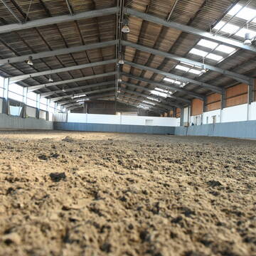
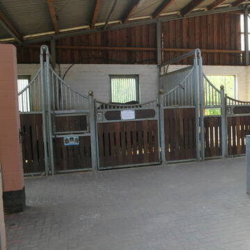
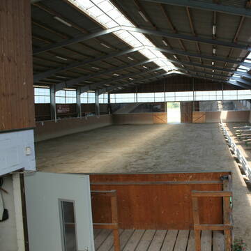
Selbstvers. od. HP,Stallgasse,Offenstall,Box frei
Wittingen OT Schneflingen
Gut Schneflingen
@Gut-Schneflingen
Freizeitstall
Vermieten
Verpachten
Longierzirkel/Roundpen
Parkplatz für Pferdeanhänger
Außenbox mit Paddock
Außenboxen
15 weitere...
P
freie Einstellplätze
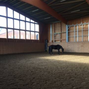
Tiddische
Weidenhof-GAUS-GmbH
@Weidenhof-GAUS-GmbH
Freizeitstall
Pferdeausbildung
Vermieten
Führanlage
Longierzirkel/Roundpen
Außenboxen
Innenbox
12 weitere...
P
Deprecated: Creation of dynamic property Zend_View_Helper_Ads::$adLink is deprecated in /var/www/stall-frei/htdocs/staging.stall-frei.de/library/Psf/View/Helper/Ads.php on line 108

Futtersack HeuToy, Fressbremse in pink
Mechtersen
STALL-FREIde Marketing
@STALL-FREI-Marketing
Stundenlange Beschäftigung die
Koliken vorbeugt, geringe Staubinhalation mit
steuerbarer Futterentnahme
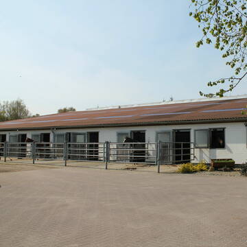
Pferdeboxen Reitanlage mit großen Wiesen
Brechtorf
Reitstall Hoppe Brechtorf
@Hoppe
Reitlehrer und -unterricht
Longierzirkel/Roundpen
Paddock
Außenbox mit Paddock
Vollpension
11 weitere...
P
Leider kein Vorschaubild
Leider kein Vorschaubild
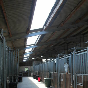
Box Pferdebox frei auf Reitsportanlage
Ehra-Lessien
katrin-kloer
@katrin-kloer
Freizeitstall
Vermieten
Führanlage
Hunde willkommen
Hengsthaltung möglich
Hufrehe geeignet
20 weitere...
B

Eine pferdegerechte Reitanlage bei Wolfsburg
Weyhausen
Reitstall-Probst
@Reitstall-Probst
FN-Mitglied
Freizeitstall
Vermieten
Longierzirkel/Roundpen
Paddock
Allergikerstall
Gnadenbrothof
27 weitere...
P+
Leider kein Vorschaubild
Leider kein Vorschaubild
Moderne, luftige Boxen frei
Lessien
Reitanlage-Unter-den-Eichen
@Reitanlage-Unter-den-Eichen
Freizeitstall
Pferdeausbildung
Vermieten
Krankenbox
Longierzirkel/Roundpen
Allergikerstall
Gnadenbrothof
18 weitere...
aktuell
B
Leider kein Vorschaubild
Leider kein Vorschaubild
Aufzuchtplätze für Stuten aus 2024 & 2025 fr...
Lessien
Reitanlage-Unter-den-Eichen
@Reitanlage-Unter-den-Eichen
FN-Mitglied
Vermieten
Paddock
Pensions- und Gastboxen
Allergikerstall
Fohlenaufzucht möglich
10 weitere...
B
Leider kein Vorschaubild
Leider kein Vorschaubild
Reitanlage unter den Eichen hat noch Boxen frei
Ehra-Lessien
Reitanlage-Unter-den-Eichen
@Reitanlage-Unter-den-Eichen
FN-Mitglied
Freizeitstall
Vermieten
Longierzirkel/Roundpen
Paddock
Allergikerstall
Hufrehe geeignet
23 weitere...
B

Heu aus neuer Ernte
Mechtersen
STALL-FREIde Marketing
@STALL-FREI-Marketing
Heulage und Pferdeheu aus der neuen Ernte findest du in unserem Futtermarkt

Offenstall Platz für ein Pony/Pferd
Wolfsburg
Hinrichs
@Pferdeglueck5
Freizeitstall
Longierzirkel/Roundpen
Paddock
Hufrehe geeignet
Offenstall
4 weitere...
P

Pensionsstall Schulz&Kaltenbrunn
Breitenrode
Schulz/Kaltenbrunn
@PSKSchulzKaltenbrunn
Freizeitstall
Geländestrecke
Hunde willkommen
Krankenbox
Allergikerstall
bedampftes/gewaschenes Heu
Außenboxen
Innenbox
22 weitere...
P
Deprecated: Creation of dynamic property Zend_View::$pageCount is deprecated in /var/www/stall-frei/htdocs/staging.stall-frei.de/library/vendor/shardj/zf1-future/library/Zend/View/Abstract.php on line 308
Deprecated: Creation of dynamic property Zend_View::$itemCountPerPage is deprecated in /var/www/stall-frei/htdocs/staging.stall-frei.de/library/vendor/shardj/zf1-future/library/Zend/View/Abstract.php on line 308
Deprecated: Creation of dynamic property Zend_View::$first is deprecated in /var/www/stall-frei/htdocs/staging.stall-frei.de/library/vendor/shardj/zf1-future/library/Zend/View/Abstract.php on line 308
Deprecated: Creation of dynamic property Zend_View::$current is deprecated in /var/www/stall-frei/htdocs/staging.stall-frei.de/library/vendor/shardj/zf1-future/library/Zend/View/Abstract.php on line 308
Deprecated: Creation of dynamic property Zend_View::$last is deprecated in /var/www/stall-frei/htdocs/staging.stall-frei.de/library/vendor/shardj/zf1-future/library/Zend/View/Abstract.php on line 308
Deprecated: Creation of dynamic property Zend_View::$next is deprecated in /var/www/stall-frei/htdocs/staging.stall-frei.de/library/vendor/shardj/zf1-future/library/Zend/View/Abstract.php on line 308
Deprecated: Creation of dynamic property Zend_View::$pagesInRange is deprecated in /var/www/stall-frei/htdocs/staging.stall-frei.de/library/vendor/shardj/zf1-future/library/Zend/View/Abstract.php on line 308
Deprecated: Creation of dynamic property Zend_View::$firstPageInRange is deprecated in /var/www/stall-frei/htdocs/staging.stall-frei.de/library/vendor/shardj/zf1-future/library/Zend/View/Abstract.php on line 308
Deprecated: Creation of dynamic property Zend_View::$lastPageInRange is deprecated in /var/www/stall-frei/htdocs/staging.stall-frei.de/library/vendor/shardj/zf1-future/library/Zend/View/Abstract.php on line 308
Deprecated: Creation of dynamic property Zend_View::$currentItemCount is deprecated in /var/www/stall-frei/htdocs/staging.stall-frei.de/library/vendor/shardj/zf1-future/library/Zend/View/Abstract.php on line 308
Deprecated: Creation of dynamic property Zend_View::$totalItemCount is deprecated in /var/www/stall-frei/htdocs/staging.stall-frei.de/library/vendor/shardj/zf1-future/library/Zend/View/Abstract.php on line 308
Deprecated: Creation of dynamic property Zend_View::$firstItemNumber is deprecated in /var/www/stall-frei/htdocs/staging.stall-frei.de/library/vendor/shardj/zf1-future/library/Zend/View/Abstract.php on line 308
Deprecated: Creation of dynamic property Zend_View::$lastItemNumber is deprecated in /var/www/stall-frei/htdocs/staging.stall-frei.de/library/vendor/shardj/zf1-future/library/Zend/View/Abstract.php on line 308
Deprecated: Creation of dynamic property Zend_View::$router is deprecated in /var/www/stall-frei/htdocs/staging.stall-frei.de/library/vendor/shardj/zf1-future/library/Zend/View/Abstract.php on line 308
Deprecated: Creation of dynamic property Zend_View::$urlParams is deprecated in /var/www/stall-frei/htdocs/staging.stall-frei.de/library/vendor/shardj/zf1-future/library/Zend/View/Abstract.php on line 308
Deprecated: Creation of dynamic property Zend_View::$showAds is deprecated in /var/www/stall-frei/htdocs/staging.stall-frei.de/library/vendor/shardj/zf1-future/library/Zend/View/Abstract.php on line 308
Deprecated: Creation of dynamic property Zend_View::$objectIds is deprecated in /var/www/stall-frei/htdocs/staging.stall-frei.de/library/vendor/shardj/zf1-future/library/Zend/View/Abstract.php on line 308
Deprecated: Creation of dynamic property Zend_View::$showNavbar is deprecated in /var/www/stall-frei/htdocs/staging.stall-frei.de/library/vendor/shardj/zf1-future/library/Zend/View/Abstract.php on line 308
Deprecated: Creation of dynamic property Zend_View::$showBreadcrumb is deprecated in /var/www/stall-frei/htdocs/staging.stall-frei.de/library/vendor/shardj/zf1-future/library/Zend/View/Abstract.php on line 308
Deprecated: Creation of dynamic property Zend_View::$showFooter is deprecated in /var/www/stall-frei/htdocs/staging.stall-frei.de/library/vendor/shardj/zf1-future/library/Zend/View/Abstract.php on line 308
Deprecated: Creation of dynamic property Zend_View::$showInternalAds is deprecated in /var/www/stall-frei/htdocs/staging.stall-frei.de/library/vendor/shardj/zf1-future/library/Zend/View/Abstract.php on line 308
Deprecated: Creation of dynamic property Zend_View::$blNoContent is deprecated in /var/www/stall-frei/htdocs/staging.stall-frei.de/library/vendor/shardj/zf1-future/library/Zend/View/Abstract.php on line 308
Deprecated: Creation of dynamic property Zend_View::$sMetaDesc is deprecated in /var/www/stall-frei/htdocs/staging.stall-frei.de/library/vendor/shardj/zf1-future/library/Zend/View/Abstract.php on line 308
Deprecated: Creation of dynamic property Zend_View::$useGmaps is deprecated in /var/www/stall-frei/htdocs/staging.stall-frei.de/library/vendor/shardj/zf1-future/library/Zend/View/Abstract.php on line 308
Deprecated: Creation of dynamic property Zend_View::$touches is deprecated in /var/www/stall-frei/htdocs/staging.stall-frei.de/library/vendor/shardj/zf1-future/library/Zend/View/Abstract.php on line 308
Deprecated: Creation of dynamic property Zend_View::$oProject is deprecated in /var/www/stall-frei/htdocs/staging.stall-frei.de/library/vendor/shardj/zf1-future/library/Zend/View/Abstract.php on line 308
Deprecated: Creation of dynamic property Zend_View::$pageHeadline is deprecated in /var/www/stall-frei/htdocs/staging.stall-frei.de/library/vendor/shardj/zf1-future/library/Zend/View/Abstract.php on line 308
Deprecated: Creation of dynamic property Zend_View::$disableLocationField is deprecated in /var/www/stall-frei/htdocs/staging.stall-frei.de/library/vendor/shardj/zf1-future/library/Zend/View/Abstract.php on line 308
Deprecated: Creation of dynamic property Zend_View::$isSearch is deprecated in /var/www/stall-frei/htdocs/staging.stall-frei.de/library/vendor/shardj/zf1-future/library/Zend/View/Abstract.php on line 308
Deprecated: Creation of dynamic property Zend_View::$pageTitle is deprecated in /var/www/stall-frei/htdocs/staging.stall-frei.de/library/vendor/shardj/zf1-future/library/Zend/View/Abstract.php on line 308
Deprecated: Creation of dynamic property Psf_Form_Element_Text::$class is deprecated in /var/www/stall-frei/htdocs/staging.stall-frei.de/library/vendor/shardj/zf1-future/library/Zend/Form/Element.php on line 874
Deprecated: Creation of dynamic property Psf_Form_Element_Text::$size is deprecated in /var/www/stall-frei/htdocs/staging.stall-frei.de/library/vendor/shardj/zf1-future/library/Zend/Form/Element.php on line 874
Deprecated: Creation of dynamic property Psf_Form_Element_Text::$placeholder is deprecated in /var/www/stall-frei/htdocs/staging.stall-frei.de/library/vendor/shardj/zf1-future/library/Zend/Form/Element.php on line 874
Deprecated: Creation of dynamic property Psf_Form_Element_Hidden::$class is deprecated in /var/www/stall-frei/htdocs/staging.stall-frei.de/library/vendor/shardj/zf1-future/library/Zend/Form/Element.php on line 874
Deprecated: Creation of dynamic property Psf_Form_Element_Hidden::$class is deprecated in /var/www/stall-frei/htdocs/staging.stall-frei.de/library/vendor/shardj/zf1-future/library/Zend/Form/Element.php on line 874
Deprecated: Creation of dynamic property Psf_Form_Element_Hidden::$class is deprecated in /var/www/stall-frei/htdocs/staging.stall-frei.de/library/vendor/shardj/zf1-future/library/Zend/Form/Element.php on line 874
Deprecated: Creation of dynamic property Psf_Form_Element_Hidden::$class is deprecated in /var/www/stall-frei/htdocs/staging.stall-frei.de/library/vendor/shardj/zf1-future/library/Zend/Form/Element.php on line 874
Deprecated: Creation of dynamic property Psf_Form_Element_Select::$class is deprecated in /var/www/stall-frei/htdocs/staging.stall-frei.de/library/vendor/shardj/zf1-future/library/Zend/Form/Element.php on line 874
Deprecated: Creation of dynamic property Psf_Form_Element_Select::$class is deprecated in /var/www/stall-frei/htdocs/staging.stall-frei.de/library/vendor/shardj/zf1-future/library/Zend/Form/Element.php on line 874
Deprecated: Creation of dynamic property Psf_Form_Element_Select::$class is deprecated in /var/www/stall-frei/htdocs/staging.stall-frei.de/library/vendor/shardj/zf1-future/library/Zend/Form/Element.php on line 874
Deprecated: Creation of dynamic property Psf_Form_Element_Select::$class is deprecated in /var/www/stall-frei/htdocs/staging.stall-frei.de/library/vendor/shardj/zf1-future/library/Zend/Form/Element.php on line 874
Deprecated: Creation of dynamic property Psf_Form_Element_Text::$class is deprecated in /var/www/stall-frei/htdocs/staging.stall-frei.de/library/vendor/shardj/zf1-future/library/Zend/Form/Element.php on line 874
Deprecated: Creation of dynamic property Psf_Form_Element_Checkbox::$label is deprecated in /var/www/stall-frei/htdocs/staging.stall-frei.de/library/vendor/shardj/zf1-future/library/Zend/Form/Element.php on line 874
Deprecated: Creation of dynamic property Zend_View::$sort is deprecated in /var/www/stall-frei/htdocs/staging.stall-frei.de/library/vendor/shardj/zf1-future/library/Zend/View/Abstract.php on line 308
Deprecated: Creation of dynamic property Zend_View::$searchLocation is deprecated in /var/www/stall-frei/htdocs/staging.stall-frei.de/library/vendor/shardj/zf1-future/library/Zend/View/Abstract.php on line 308
Deprecated: Creation of dynamic property Zend_View::$locationHint is deprecated in /var/www/stall-frei/htdocs/staging.stall-frei.de/library/vendor/shardj/zf1-future/library/Zend/View/Abstract.php on line 308
Psf_GeoCoder_Abstract::getLocation: Tülau Get Location CachedOrLive
Psf_GeoCoder_Abstract::getCachedOrLive: Tülau
Psf_GeoCoder_OpenCageData::makeApiRequest: response:
Array
(
[documentation] => https://opencagedata.com/api
[licenses] => Array
(
[0] => Array
(
[name] => see attribution guide
[url] => https://opencagedata.com/credits
)
)
[results] => Array
(
[0] => Array
(
[bounds] => Array
(
[northeast] => Array
(
[lat] => 52.610671
[lng] => 10.9138326
)
[southwest] => Array
(
[lat] => 52.5515289
[lng] => 10.8326341
)
)
[components] => Array
(
[ISO_3166-1_alpha-2] => DE
[ISO_3166-1_alpha-3] => DEU
[ISO_3166-2] => Array
(
[0] => DE-NI
)
[_category] => place
[_normalized_city] => Tülau
[_type] => village
[continent] => Europe
[country] => Deutschland
[country_code] => de
[county] => Landkreis Gifhorn
[municipality] => Samtgemeinde Brome
[political_union] => European Union
[postcode] => 38474
[state] => Niedersachsen
[state_code] => NI
[village] => Tülau
)
[confidence] => 7
[formatted] => 38474 Tülau, Deutschland
[geometry] => Array
(
[lat] => 52.5762638
[lng] => 10.8769375
)
)
[1] => Array
(
[components] => Array
(
[ISO_3166-1_alpha-2] => FR
[ISO_3166-1_alpha-3] => FRA
[ISO_3166-2] => Array
(
[0] => FR-PAC
[1] => FR-84
)
[_category] => road
[_normalized_city] => Carpentras
[_type] => road
[city] => Carpentras
[continent] => Europe
[country] => France
[country_code] => fr
[county] => Vaucluse
[local_authority] => Communauté d'agglomération Ventoux-Comtat Venaissin
[political_union] => European Union
[postcode] => 84200
[road] => Chemin de Talaud
[state] => Provence-Alpes-Côte d'Azur
[state_code] => PAC
)
[confidence] => 2
[formatted] => Chemin de Talaud, 84200 Carpentras, France
[geometry] => Array
(
[lat] => 44.060151
[lng] => 5.025879
)
)
[2] => Array
(
[components] => Array
(
[ISO_3166-1_alpha-2] => FR
[ISO_3166-1_alpha-3] => FRA
[ISO_3166-2] => Array
(
[0] => FR-PAC
[1] => FR-84
)
[_category] => road
[_normalized_city] => Monteux
[_type] => road
[city] => Monteux
[continent] => Europe
[country] => France
[country_code] => fr
[county] => Vaucluse
[local_authority] => Communauté d'agglomération Les Sorgues du Comtat
[political_union] => European Union
[postcode] => 84170
[road] => Chemin de Talaud
[state] => Provence-Alpes-Côte d'Azur
[state_code] => PAC
)
[confidence] => 2
[formatted] => Chemin de Talaud, 84170 Monteux, France
[geometry] => Array
(
[lat] => 44.055004
[lng] => 4.995404
)
)
[3] => Array
(
[components] => Array
(
[ISO_3166-1_alpha-2] => FR
[ISO_3166-1_alpha-3] => FRA
[ISO_3166-2] => Array
(
[0] => FR-PAC
[1] => FR-84
)
[_category] => road
[_normalized_city] => Loriol-du-Comtat
[_type] => road
[city] => Loriol-du-Comtat
[continent] => Europe
[country] => France
[country_code] => fr
[county] => Vaucluse
[local_authority] => Communauté d'agglomération Ventoux-Comtat Venaissin
[political_union] => European Union
[postcode] => 84870
[road] => Chemin de Talaud
[state] => Provence-Alpes-Côte d'Azur
[state_code] => PAC
)
[confidence] => 2
[formatted] => Chemin de Talaud, 84870 Loriol-du-Comtat, France
[geometry] => Array
(
[lat] => 44.067476
[lng] => 4.994928
)
)
[4] => Array
(
[components] => Array
(
[ISO_3166-1_alpha-2] => FR
[ISO_3166-1_alpha-3] => FRA
[ISO_3166-2] => Array
(
[0] => FR-OCC
[1] => FR-66
)
[_category] => road
[_normalized_city] => Ayguatébia-Talau
[_type] => road
[city] => Ayguatébia-Talau
[continent] => Europe
[country] => France
[country_code] => fr
[county] => Pyrénées-Orientales
[local_authority] => Communauté de communes Pyrénées catalanes
[political_union] => European Union
[postcode] => 66360
[road] => Carrer Del Flandis
[state] => Occitanie
[state_code] => OCC
)
[confidence] => 10
[formatted] => Carrer Del Flandis, 66360 Ayguatébia-Talau, France
[geometry] => Array
(
[lat] => 42.572656
[lng] => 2.185142
)
)
[5] => Array
(
[components] => Array
(
[ISO_3166-1_alpha-2] => FR
[ISO_3166-1_alpha-3] => FRA
[ISO_3166-2] => Array
(
[0] => FR-PAC
[1] => FR-84
)
[_category] => road
[_normalized_city] => Monteux
[_type] => road
[city] => Monteux
[continent] => Europe
[country] => France
[country_code] => fr
[county] => Vaucluse
[local_authority] => Communauté d'agglomération Les Sorgues du Comtat
[political_union] => European Union
[postcode] => 84170
[road] => Chemin de la traversée de Talaud
[state] => Provence-Alpes-Côte d'Azur
[state_code] => PAC
)
[confidence] => 10
[formatted] => Chemin de la traversée de Talaud, 84170 Monteux, France
[geometry] => Array
(
[lat] => 44.055197
[lng] => 4.997419
)
)
[6] => Array
(
[components] => Array
(
[ISO_3166-1_alpha-2] => FR
[ISO_3166-1_alpha-3] => FRA
[ISO_3166-2] => Array
(
[0] => FR-OCC
[1] => FR-66
)
[_category] => road
[_normalized_city] => Ayguatébia-Talau
[_type] => road
[city] => Ayguatébia-Talau
[continent] => Europe
[country] => France
[country_code] => fr
[county] => Pyrénées-Orientales
[local_authority] => Communauté de communes Pyrénées catalanes
[political_union] => European Union
[postcode] => 66360
[road] => Mas des Plans
[state] => Occitanie
[state_code] => OCC
)
[confidence] => 10
[formatted] => Mas des Plans, 66360 Ayguatébia-Talau, France
[geometry] => Array
(
[lat] => 42.556688
[lng] => 2.214863
)
)
[7] => Array
(
[components] => Array
(
[ISO_3166-1_alpha-2] => FR
[ISO_3166-1_alpha-3] => FRA
[ISO_3166-2] => Array
(
[0] => FR-NAQ
[1] => FR-17
)
[_category] => road
[_normalized_city] => Les Portes-en-Ré
[_type] => road
[city] => Les Portes-en-Ré
[continent] => Europe
[country] => France
[country_code] => fr
[county] => Charente-Maritime
[local_authority] => Communauté de communes de l'Île de Ré
[political_union] => European Union
[postcode] => 17880
[road] => Ruelle Thulau
[state] => Nouvelle-Aquitaine
[state_code] => NAQ
)
[confidence] => 10
[formatted] => Ruelle Thulau, 17880 Les Portes-en-Ré, France
[geometry] => Array
(
[lat] => 46.248613
[lng] => -1.499003
)
)
[8] => Array
(
[components] => Array
(
[ISO_3166-1_alpha-2] => FR
[ISO_3166-1_alpha-3] => FRA
[ISO_3166-2] => Array
(
[0] => FR-OCC
[1] => FR-66
)
[_category] => road
[_normalized_city] => Ayguatébia-Talau
[_type] => road
[city] => Ayguatébia-Talau
[continent] => Europe
[country] => France
[country_code] => fr
[county] => Pyrénées-Orientales
[local_authority] => Communauté de communes Pyrénées catalanes
[political_union] => European Union
[postcode] => 66360
[road] => Carrer Del Cantou
[state] => Occitanie
[state_code] => OCC
)
[confidence] => 10
[formatted] => Carrer Del Cantou, 66360 Ayguatébia-Talau, France
[geometry] => Array
(
[lat] => 42.573568
[lng] => 2.184882
)
)
[9] => Array
(
[components] => Array
(
[ISO_3166-1_alpha-2] => FR
[ISO_3166-1_alpha-3] => FRA
[ISO_3166-2] => Array
(
[0] => FR-OCC
[1] => FR-66
)
[_category] => road
[_normalized_city] => Ayguatébia-Talau
[_type] => road
[city] => Ayguatébia-Talau
[continent] => Europe
[country] => France
[country_code] => fr
[county] => Pyrénées-Orientales
[local_authority] => Communauté de communes Pyrénées catalanes
[political_union] => European Union
[postcode] => 66360
[road] => Coillade Del Bailladou
[state] => Occitanie
[state_code] => OCC
)
[confidence] => 10
[formatted] => Coillade Del Bailladou, 66360 Ayguatébia-Talau, France
[geometry] => Array
(
[lat] => 42.551707
[lng] => 2.16692
)
)
)
[status] => Array
(
[code] => 200
[message] => OK
)
[stay_informed] => Array
(
[blog] => https://blog.opencagedata.com
[mastodon] => https://en.osm.town/@opencage
)
[thanks] => For using an OpenCage API
[timestamp] => Array
(
[created_http] => Sat, 07 Feb 2026 16:09:49 GMT
[created_unix] => 1770480589
)
[total_results] => 10
)
Psf_GeoCoder_Abstract::convertLocationResult
{"documentation":"https:\/\/opencagedata.com\/api","licenses":[{"name":"see attribution guide","url":"https:\/\/opencagedata.com\/credits"}],"results":[{"bounds":{"northeast":{"lat":52.610671,"lng":10.9138326},"southwest":{"lat":52.5515289,"lng":10.8326341}},"components":{"ISO_3166-1_alpha-2":"DE","ISO_3166-1_alpha-3":"DEU","ISO_3166-2":["DE-NI"],"_category":"place","_normalized_city":"T\u00fclau","_type":"village","continent":"Europe","country":"Deutschland","country_code":"de","county":"Landkreis Gifhorn","municipality":"Samtgemeinde Brome","political_union":"European Union","postcode":"38474","state":"Niedersachsen","state_code":"NI","village":"T\u00fclau"},"confidence":7,"formatted":"38474 T\u00fclau, Deutschland","geometry":{"lat":52.5762638,"lng":10.8769375}},{"components":{"ISO_3166-1_alpha-2":"FR","ISO_3166-1_alpha-3":"FRA","ISO_3166-2":["FR-PAC","FR-84"],"_category":"road","_normalized_city":"Carpentras","_type":"road","city":"Carpentras","continent":"Europe","country":"France","country_code":"fr","county":"Vaucluse","local_authority":"Communaut\u00e9 d'agglom\u00e9ration Ventoux-Comtat Venaissin","political_union":"European Union","postcode":"84200","road":"Chemin de Talaud","state":"Provence-Alpes-C\u00f4te d'Azur","state_code":"PAC"},"confidence":2,"formatted":"Chemin de Talaud, 84200 Carpentras, France","geometry":{"lat":44.060151,"lng":5.025879}},{"components":{"ISO_3166-1_alpha-2":"FR","ISO_3166-1_alpha-3":"FRA","ISO_3166-2":["FR-PAC","FR-84"],"_category":"road","_normalized_city":"Monteux","_type":"road","city":"Monteux","continent":"Europe","country":"France","country_code":"fr","county":"Vaucluse","local_authority":"Communaut\u00e9 d'agglom\u00e9ration Les Sorgues du Comtat","political_union":"European Union","postcode":"84170","road":"Chemin de Talaud","state":"Provence-Alpes-C\u00f4te d'Azur","state_code":"PAC"},"confidence":2,"formatted":"Chemin de Talaud, 84170 Monteux, France","geometry":{"lat":44.055004,"lng":4.995404}},{"components":{"ISO_3166-1_alpha-2":"FR","ISO_3166-1_alpha-3":"FRA","ISO_3166-2":["FR-PAC","FR-84"],"_category":"road","_normalized_city":"Loriol-du-Comtat","_type":"road","city":"Loriol-du-Comtat","continent":"Europe","country":"France","country_code":"fr","county":"Vaucluse","local_authority":"Communaut\u00e9 d'agglom\u00e9ration Ventoux-Comtat Venaissin","political_union":"European Union","postcode":"84870","road":"Chemin de Talaud","state":"Provence-Alpes-C\u00f4te d'Azur","state_code":"PAC"},"confidence":2,"formatted":"Chemin de Talaud, 84870 Loriol-du-Comtat, France","geometry":{"lat":44.067476,"lng":4.994928}},{"components":{"ISO_3166-1_alpha-2":"FR","ISO_3166-1_alpha-3":"FRA","ISO_3166-2":["FR-OCC","FR-66"],"_category":"road","_normalized_city":"Ayguat\u00e9bia-Talau","_type":"road","city":"Ayguat\u00e9bia-Talau","continent":"Europe","country":"France","country_code":"fr","county":"Pyr\u00e9n\u00e9es-Orientales","local_authority":"Communaut\u00e9 de communes Pyr\u00e9n\u00e9es catalanes","political_union":"European Union","postcode":"66360","road":"Carrer Del Flandis","state":"Occitanie","state_code":"OCC"},"confidence":10,"formatted":"Carrer Del Flandis, 66360 Ayguat\u00e9bia-Talau, France","geometry":{"lat":42.572656,"lng":2.185142}},{"components":{"ISO_3166-1_alpha-2":"FR","ISO_3166-1_alpha-3":"FRA","ISO_3166-2":["FR-PAC","FR-84"],"_category":"road","_normalized_city":"Monteux","_type":"road","city":"Monteux","continent":"Europe","country":"France","country_code":"fr","county":"Vaucluse","local_authority":"Communaut\u00e9 d'agglom\u00e9ration Les Sorgues du Comtat","political_union":"European Union","postcode":"84170","road":"Chemin de la travers\u00e9e de Talaud","state":"Provence-Alpes-C\u00f4te d'Azur","state_code":"PAC"},"confidence":10,"formatted":"Chemin de la travers\u00e9e de Talaud, 84170 Monteux, France","geometry":{"lat":44.055197,"lng":4.997419}},{"components":{"ISO_3166-1_alpha-2":"FR","ISO_3166-1_alpha-3":"FRA","ISO_3166-2":["FR-OCC","FR-66"],"_category":"road","_normalized_city":"Ayguat\u00e9bia-Talau","_type":"road","city":"Ayguat\u00e9bia-Talau","continent":"Europe","country":"France","country_code":"fr","county":"Pyr\u00e9n\u00e9es-Orientales","local_authority":"Communaut\u00e9 de communes Pyr\u00e9n\u00e9es catalanes","political_union":"European Union","postcode":"66360","road":"Mas des Plans","state":"Occitanie","state_code":"OCC"},"confidence":10,"formatted":"Mas des Plans, 66360 Ayguat\u00e9bia-Talau, France","geometry":{"lat":42.556688,"lng":2.214863}},{"components":{"ISO_3166-1_alpha-2":"FR","ISO_3166-1_alpha-3":"FRA","ISO_3166-2":["FR-NAQ","FR-17"],"_category":"road","_normalized_city":"Les Portes-en-R\u00e9","_type":"road","city":"Les Portes-en-R\u00e9","continent":"Europe","country":"France","country_code":"fr","county":"Charente-Maritime","local_authority":"Communaut\u00e9 de communes de l'\u00cele de R\u00e9","political_union":"European Union","postcode":"17880","road":"Ruelle Thulau","state":"Nouvelle-Aquitaine","state_code":"NAQ"},"confidence":10,"formatted":"Ruelle Thulau, 17880 Les Portes-en-R\u00e9, France","geometry":{"lat":46.248613,"lng":-1.499003}},{"components":{"ISO_3166-1_alpha-2":"FR","ISO_3166-1_alpha-3":"FRA","ISO_3166-2":["FR-OCC","FR-66"],"_category":"road","_normalized_city":"Ayguat\u00e9bia-Talau","_type":"road","city":"Ayguat\u00e9bia-Talau","continent":"Europe","country":"France","country_code":"fr","county":"Pyr\u00e9n\u00e9es-Orientales","local_authority":"Communaut\u00e9 de communes Pyr\u00e9n\u00e9es catalanes","political_union":"European Union","postcode":"66360","road":"Carrer Del Cantou","state":"Occitanie","state_code":"OCC"},"confidence":10,"formatted":"Carrer Del Cantou, 66360 Ayguat\u00e9bia-Talau, France","geometry":{"lat":42.573568,"lng":2.184882}},{"components":{"ISO_3166-1_alpha-2":"FR","ISO_3166-1_alpha-3":"FRA","ISO_3166-2":["FR-OCC","FR-66"],"_category":"road","_normalized_city":"Ayguat\u00e9bia-Talau","_type":"road","city":"Ayguat\u00e9bia-Talau","continent":"Europe","country":"France","country_code":"fr","county":"Pyr\u00e9n\u00e9es-Orientales","local_authority":"Communaut\u00e9 de communes Pyr\u00e9n\u00e9es catalanes","political_union":"European Union","postcode":"66360","road":"Coillade Del Bailladou","state":"Occitanie","state_code":"OCC"},"confidence":10,"formatted":"Coillade Del Bailladou, 66360 Ayguat\u00e9bia-Talau, France","geometry":{"lat":42.551707,"lng":2.16692}}],"status":{"code":200,"message":"OK"},"stay_informed":{"blog":"https:\/\/blog.opencagedata.com","mastodon":"https:\/\/en.osm.town\/@opencage"},"thanks":"For using an OpenCage API","timestamp":{"created_http":"Sat, 07 Feb 2026 16:09:49 GMT","created_unix":1770480589},"total_results":10}Array
(
[0] => stdClass Object
(
[bounds] => stdClass Object
(
[northeast] => stdClass Object
(
[lat] => 52.610671
[lng] => 10.9138326
)
[southwest] => stdClass Object
(
[lat] => 52.5515289
[lng] => 10.8326341
)
)
[components] => stdClass Object
(
[ISO_3166-1_alpha-2] => DE
[ISO_3166-1_alpha-3] => DEU
[ISO_3166-2] => Array
(
[0] => DE-NI
)
[_category] => place
[_normalized_city] => Tülau
[_type] => village
[continent] => Europe
[country] => Deutschland
[country_code] => de
[county] => Landkreis Gifhorn
[municipality] => Samtgemeinde Brome
[political_union] => European Union
[postcode] => 38474
[state] => Niedersachsen
[state_code] => NI
[village] => Tülau
)
[confidence] => 7
[formatted] => 38474 Tülau, Deutschland
[geometry] => stdClass Object
(
[lat] => 52.5762638
[lng] => 10.8769375
)
)
[1] => stdClass Object
(
[components] => stdClass Object
(
[ISO_3166-1_alpha-2] => FR
[ISO_3166-1_alpha-3] => FRA
[ISO_3166-2] => Array
(
[0] => FR-PAC
[1] => FR-84
)
[_category] => road
[_normalized_city] => Carpentras
[_type] => road
[city] => Carpentras
[continent] => Europe
[country] => France
[country_code] => fr
[county] => Vaucluse
[local_authority] => Communauté d'agglomération Ventoux-Comtat Venaissin
[political_union] => European Union
[postcode] => 84200
[road] => Chemin de Talaud
[state] => Provence-Alpes-Côte d'Azur
[state_code] => PAC
)
[confidence] => 2
[formatted] => Chemin de Talaud, 84200 Carpentras, France
[geometry] => stdClass Object
(
[lat] => 44.060151
[lng] => 5.025879
)
)
[2] => stdClass Object
(
[components] => stdClass Object
(
[ISO_3166-1_alpha-2] => FR
[ISO_3166-1_alpha-3] => FRA
[ISO_3166-2] => Array
(
[0] => FR-PAC
[1] => FR-84
)
[_category] => road
[_normalized_city] => Monteux
[_type] => road
[city] => Monteux
[continent] => Europe
[country] => France
[country_code] => fr
[county] => Vaucluse
[local_authority] => Communauté d'agglomération Les Sorgues du Comtat
[political_union] => European Union
[postcode] => 84170
[road] => Chemin de Talaud
[state] => Provence-Alpes-Côte d'Azur
[state_code] => PAC
)
[confidence] => 2
[formatted] => Chemin de Talaud, 84170 Monteux, France
[geometry] => stdClass Object
(
[lat] => 44.055004
[lng] => 4.995404
)
)
[3] => stdClass Object
(
[components] => stdClass Object
(
[ISO_3166-1_alpha-2] => FR
[ISO_3166-1_alpha-3] => FRA
[ISO_3166-2] => Array
(
[0] => FR-PAC
[1] => FR-84
)
[_category] => road
[_normalized_city] => Loriol-du-Comtat
[_type] => road
[city] => Loriol-du-Comtat
[continent] => Europe
[country] => France
[country_code] => fr
[county] => Vaucluse
[local_authority] => Communauté d'agglomération Ventoux-Comtat Venaissin
[political_union] => European Union
[postcode] => 84870
[road] => Chemin de Talaud
[state] => Provence-Alpes-Côte d'Azur
[state_code] => PAC
)
[confidence] => 2
[formatted] => Chemin de Talaud, 84870 Loriol-du-Comtat, France
[geometry] => stdClass Object
(
[lat] => 44.067476
[lng] => 4.994928
)
)
[4] => stdClass Object
(
[components] => stdClass Object
(
[ISO_3166-1_alpha-2] => FR
[ISO_3166-1_alpha-3] => FRA
[ISO_3166-2] => Array
(
[0] => FR-OCC
[1] => FR-66
)
[_category] => road
[_normalized_city] => Ayguatébia-Talau
[_type] => road
[city] => Ayguatébia-Talau
[continent] => Europe
[country] => France
[country_code] => fr
[county] => Pyrénées-Orientales
[local_authority] => Communauté de communes Pyrénées catalanes
[political_union] => European Union
[postcode] => 66360
[road] => Carrer Del Flandis
[state] => Occitanie
[state_code] => OCC
)
[confidence] => 10
[formatted] => Carrer Del Flandis, 66360 Ayguatébia-Talau, France
[geometry] => stdClass Object
(
[lat] => 42.572656
[lng] => 2.185142
)
)
[5] => stdClass Object
(
[components] => stdClass Object
(
[ISO_3166-1_alpha-2] => FR
[ISO_3166-1_alpha-3] => FRA
[ISO_3166-2] => Array
(
[0] => FR-PAC
[1] => FR-84
)
[_category] => road
[_normalized_city] => Monteux
[_type] => road
[city] => Monteux
[continent] => Europe
[country] => France
[country_code] => fr
[county] => Vaucluse
[local_authority] => Communauté d'agglomération Les Sorgues du Comtat
[political_union] => European Union
[postcode] => 84170
[road] => Chemin de la traversée de Talaud
[state] => Provence-Alpes-Côte d'Azur
[state_code] => PAC
)
[confidence] => 10
[formatted] => Chemin de la traversée de Talaud, 84170 Monteux, France
[geometry] => stdClass Object
(
[lat] => 44.055197
[lng] => 4.997419
)
)
[6] => stdClass Object
(
[components] => stdClass Object
(
[ISO_3166-1_alpha-2] => FR
[ISO_3166-1_alpha-3] => FRA
[ISO_3166-2] => Array
(
[0] => FR-OCC
[1] => FR-66
)
[_category] => road
[_normalized_city] => Ayguatébia-Talau
[_type] => road
[city] => Ayguatébia-Talau
[continent] => Europe
[country] => France
[country_code] => fr
[county] => Pyrénées-Orientales
[local_authority] => Communauté de communes Pyrénées catalanes
[political_union] => European Union
[postcode] => 66360
[road] => Mas des Plans
[state] => Occitanie
[state_code] => OCC
)
[confidence] => 10
[formatted] => Mas des Plans, 66360 Ayguatébia-Talau, France
[geometry] => stdClass Object
(
[lat] => 42.556688
[lng] => 2.214863
)
)
[7] => stdClass Object
(
[components] => stdClass Object
(
[ISO_3166-1_alpha-2] => FR
[ISO_3166-1_alpha-3] => FRA
[ISO_3166-2] => Array
(
[0] => FR-NAQ
[1] => FR-17
)
[_category] => road
[_normalized_city] => Les Portes-en-Ré
[_type] => road
[city] => Les Portes-en-Ré
[continent] => Europe
[country] => France
[country_code] => fr
[county] => Charente-Maritime
[local_authority] => Communauté de communes de l'Île de Ré
[political_union] => European Union
[postcode] => 17880
[road] => Ruelle Thulau
[state] => Nouvelle-Aquitaine
[state_code] => NAQ
)
[confidence] => 10
[formatted] => Ruelle Thulau, 17880 Les Portes-en-Ré, France
[geometry] => stdClass Object
(
[lat] => 46.248613
[lng] => -1.499003
)
)
[8] => stdClass Object
(
[components] => stdClass Object
(
[ISO_3166-1_alpha-2] => FR
[ISO_3166-1_alpha-3] => FRA
[ISO_3166-2] => Array
(
[0] => FR-OCC
[1] => FR-66
)
[_category] => road
[_normalized_city] => Ayguatébia-Talau
[_type] => road
[city] => Ayguatébia-Talau
[continent] => Europe
[country] => France
[country_code] => fr
[county] => Pyrénées-Orientales
[local_authority] => Communauté de communes Pyrénées catalanes
[political_union] => European Union
[postcode] => 66360
[road] => Carrer Del Cantou
[state] => Occitanie
[state_code] => OCC
)
[confidence] => 10
[formatted] => Carrer Del Cantou, 66360 Ayguatébia-Talau, France
[geometry] => stdClass Object
(
[lat] => 42.573568
[lng] => 2.184882
)
)
[9] => stdClass Object
(
[components] => stdClass Object
(
[ISO_3166-1_alpha-2] => FR
[ISO_3166-1_alpha-3] => FRA
[ISO_3166-2] => Array
(
[0] => FR-OCC
[1] => FR-66
)
[_category] => road
[_normalized_city] => Ayguatébia-Talau
[_type] => road
[city] => Ayguatébia-Talau
[continent] => Europe
[country] => France
[country_code] => fr
[county] => Pyrénées-Orientales
[local_authority] => Communauté de communes Pyrénées catalanes
[political_union] => European Union
[postcode] => 66360
[road] => Coillade Del Bailladou
[state] => Occitanie
[state_code] => OCC
)
[confidence] => 10
[formatted] => Coillade Del Bailladou, 66360 Ayguatébia-Talau, France
[geometry] => stdClass Object
(
[lat] => 42.551707
[lng] => 2.16692
)
)
)
Psf_GeoCoder_OpenCageData::getKeyMap: 0
stdClass Object
(
    [bounds] => stdClass Object
        (
            [northeast] => stdClass Object
                (
                    [lat] => 52.610671
                    [lng] => 10.9138326
                )

            [southwest] => stdClass Object
                (
                    [lat] => 52.5515289
                    [lng] => 10.8326341
                )

        )

    [components] => stdClass Object
        (
            [ISO_3166-1_alpha-2] => DE
            [ISO_3166-1_alpha-3] => DEU
            [ISO_3166-2] => Array
                (
                    [0] => DE-NI
                )

            [_category] => place
            [_normalized_city] => Tülau
            [_type] => village
            [continent] => Europe
            [country] => Deutschland
            [country_code] => de
            [county] => Landkreis Gifhorn
            [municipality] => Samtgemeinde Brome
            [political_union] => European Union
            [postcode] => 38474
            [state] => Niedersachsen
            [state_code] => NI
            [village] => Tülau
        )

    [confidence] => 7
    [formatted] => 38474 Tülau, Deutschland
    [geometry] => stdClass Object
        (
            [lat] => 52.5762638
            [lng] => 10.8769375
        )

)
Psf_GeoCoder_OpenCageData::getCounty: Gifhorn
Psf_GeoCoder_OpenCageData::addMissingData REFETCH!
Array
(
    [address] => 38474 Tülau, Deutschland
    [type] => village
    [street] =>
    [city] => Tülau
    [county] => Gifhorn
    [state] => Niedersachsen
    [zip] => 38474
    [country] => Deutschland
    [suburb] =>
    [countrycode] => de
    [latitude] => 52.5762638
    [longitude] => 10.8769375
    [accuracy] => 1
    [confidence] => 7
    [bounds] => stdClass Object
        (
            [northeast] => stdClass Object
                (
                    [lat] => 52.610671
                    [lng] => 10.9138326
                )

            [southwest] => stdClass Object
                (
                    [lat] => 52.5515289
                    [lng] => 10.8326341
                )

        )

)
reformat!
Array
(
    [address] => 38474 Tülau, Deutschland
    [type] => village
    [street] =>
    [city] => Tülau
    [county] => Gifhorn
    [state] => Niedersachsen
    [zip] => 38474
    [country] => Deutschland
    [suburb] =>
    [countrycode] => de
    [latitude] => 52.5762638
    [longitude] => 10.8769375
    [accuracy] => 1
    [confidence] => 7
    [bounds] => stdClass Object
        (
            [northeast] => stdClass Object
                (
                    [lat] => 52.610671
                    [lng] => 10.9138326
                )

            [southwest] => stdClass Object
                (
                    [lat] => 52.5515289
                    [lng] => 10.8326341
                )

        )

    [place] => 38474 Tülau, Niedersachsen
    [hash] => 1213d1f4c7498e4f4489cc36e3992846
)
Psf_GeoCoder_OpenCageData::getKeyMap: 1
stdClass Object
(
    [components] => stdClass Object
        (
            [ISO_3166-1_alpha-2] => FR
            [ISO_3166-1_alpha-3] => FRA
            [ISO_3166-2] => Array
                (
                    [0] => FR-PAC
                    [1] => FR-84
                )

            [_category] => road
            [_normalized_city] => Carpentras
            [_type] => road
            [city] => Carpentras
            [continent] => Europe
            [country] => France
            [country_code] => fr
            [county] => Vaucluse
            [local_authority] => Communauté d'agglomération Ventoux-Comtat Venaissin
            [political_union] => European Union
            [postcode] => 84200
            [road] => Chemin de Talaud
            [state] => Provence-Alpes-Côte d'Azur
            [state_code] => PAC
        )

    [confidence] => 2
    [formatted] => Chemin de Talaud, 84200 Carpentras, France
    [geometry] => stdClass Object
        (
            [lat] => 44.060151
            [lng] => 5.025879
        )

)
Psf_GeoCoder_OpenCageData::getCounty: Vaucluse
Psf_GeoCoder_OpenCageData::addMissingData REFETCH!
Array
(
    [address] => Chemin de Talaud, 84200 Carpentras, France
    [type] => road
    [street] => Chemin de Talaud
    [city] => Carpentras
    [county] => Vaucluse
    [state] => Provence-Alpes-Côte d'Azur
    [zip] => 84200
    [country] => France
    [suburb] =>
    [countrycode] => fr
    [latitude] => 44.060151
    [longitude] => 5.025879
    [accuracy] => 1
    [confidence] => 2
    [bounds] =>
)
reformat!
Array
(
    [address] => Chemin de Talaud, 84200 Carpentras, France
    [type] => road
    [street] => Chemin de Talaud
    [city] => Carpentras
    [county] => Vaucluse
    [state] => Provence-Alpes-Côte d'Azur
    [zip] => 84200
    [country] => France
    [suburb] =>
    [countrycode] => fr
    [latitude] => 44.060151
    [longitude] => 5.025879
    [accuracy] => 1
    [confidence] => 2
    [bounds] =>
    [place] => Chemin de Talaud, 84200 Carpentras, Provence-Alpes-Côte d'Azur
    [hash] => 3f2a2393ebe4acd6a202f9bc0d6a2ee8
)
Psf_GeoCoder_OpenCageData::getKeyMap: 2
stdClass Object
(
    [components] => stdClass Object
        (
            [ISO_3166-1_alpha-2] => FR
            [ISO_3166-1_alpha-3] => FRA
            [ISO_3166-2] => Array
                (
                    [0] => FR-PAC
                    [1] => FR-84
                )

            [_category] => road
            [_normalized_city] => Monteux
            [_type] => road
            [city] => Monteux
            [continent] => Europe
            [country] => France
            [country_code] => fr
            [county] => Vaucluse
            [local_authority] => Communauté d'agglomération Les Sorgues du Comtat
            [political_union] => European Union
            [postcode] => 84170
            [road] => Chemin de Talaud
            [state] => Provence-Alpes-Côte d'Azur
            [state_code] => PAC
        )

    [confidence] => 2
    [formatted] => Chemin de Talaud, 84170 Monteux, France
    [geometry] => stdClass Object
        (
            [lat] => 44.055004
            [lng] => 4.995404
        )

)
Psf_GeoCoder_OpenCageData::getCounty: Vaucluse
Psf_GeoCoder_OpenCageData::addMissingData REFETCH!
Array
(
    [address] => Chemin de Talaud, 84170 Monteux, France
    [type] => road
    [street] => Chemin de Talaud
    [city] => Monteux
    [county] => Vaucluse
    [state] => Provence-Alpes-Côte d'Azur
    [zip] => 84170
    [country] => France
    [suburb] =>
    [countrycode] => fr
    [latitude] => 44.055004
    [longitude] => 4.995404
    [accuracy] => 1
    [confidence] => 2
    [bounds] =>
)
reformat!
Array
(
    [address] => Chemin de Talaud, 84170 Monteux, France
    [type] => road
    [street] => Chemin de Talaud
    [city] => Monteux
    [county] => Vaucluse
    [state] => Provence-Alpes-Côte d'Azur
    [zip] => 84170
    [country] => France
    [suburb] =>
    [countrycode] => fr
    [latitude] => 44.055004
    [longitude] => 4.995404
    [accuracy] => 1
    [confidence] => 2
    [bounds] =>
    [place] => Chemin de Talaud, 84170 Monteux, Provence-Alpes-Côte d'Azur
    [hash] => 9da18daa492fa4e2997e999aa7b17a28
)
Psf_GeoCoder_OpenCageData::getKeyMap: 3
stdClass Object
(
    [components] => stdClass Object
        (
            [ISO_3166-1_alpha-2] => FR
            [ISO_3166-1_alpha-3] => FRA
            [ISO_3166-2] => Array
                (
                    [0] => FR-PAC
                    [1] => FR-84
                )

            [_category] => road
            [_normalized_city] => Loriol-du-Comtat
            [_type] => road
            [city] => Loriol-du-Comtat
            [continent] => Europe
            [country] => France
            [country_code] => fr
            [county] => Vaucluse
            [local_authority] => Communauté d'agglomération Ventoux-Comtat Venaissin
            [political_union] => European Union
            [postcode] => 84870
            [road] => Chemin de Talaud
            [state] => Provence-Alpes-Côte d'Azur
            [state_code] => PAC
        )

    [confidence] => 2
    [formatted] => Chemin de Talaud, 84870 Loriol-du-Comtat, France
    [geometry] => stdClass Object
        (
            [lat] => 44.067476
            [lng] => 4.994928
        )

)
Psf_GeoCoder_OpenCageData::getCounty: Vaucluse
Psf_GeoCoder_OpenCageData::addMissingData REFETCH!
Array
(
    [address] => Chemin de Talaud, 84870 Loriol-du-Comtat, France
    [type] => road
    [street] => Chemin de Talaud
    [city] => Loriol-du-Comtat
    [county] => Vaucluse
    [state] => Provence-Alpes-Côte d'Azur
    [zip] => 84870
    [country] => France
    [suburb] =>
    [countrycode] => fr
    [latitude] => 44.067476
    [longitude] => 4.994928
    [accuracy] => 1
    [confidence] => 2
    [bounds] =>
)
reformat!
Array
(
    [address] => Chemin de Talaud, 84870 Loriol-du-Comtat, France
    [type] => road
    [street] => Chemin de Talaud
    [city] => Loriol-du-Comtat
    [county] => Vaucluse
    [state] => Provence-Alpes-Côte d'Azur
    [zip] => 84870
    [country] => France
    [suburb] =>
    [countrycode] => fr
    [latitude] => 44.067476
    [longitude] => 4.994928
    [accuracy] => 1
    [confidence] => 2
    [bounds] =>
    [place] => Chemin de Talaud, 84870 Loriol-du-Comtat, Provence-Alpes-Côte d'Azur
    [hash] => b80427343291091c811f2fe5334d78c9
)
Psf_GeoCoder_OpenCageData::getKeyMap: 4
stdClass Object
(
    [components] => stdClass Object
        (
            [ISO_3166-1_alpha-2] => FR
            [ISO_3166-1_alpha-3] => FRA
            [ISO_3166-2] => Array
                (
                    [0] => FR-OCC
                    [1] => FR-66
                )

            [_category] => road
            [_normalized_city] => Ayguatébia-Talau
            [_type] => road
            [city] => Ayguatébia-Talau
            [continent] => Europe
            [country] => France
            [country_code] => fr
            [county] => Pyrénées-Orientales
            [local_authority] => Communauté de communes Pyrénées catalanes
            [political_union] => European Union
            [postcode] => 66360
            [road] => Carrer Del Flandis
            [state] => Occitanie
            [state_code] => OCC
        )

    [confidence] => 10
    [formatted] => Carrer Del Flandis, 66360 Ayguatébia-Talau, France
    [geometry] => stdClass Object
        (
            [lat] => 42.572656
            [lng] => 2.185142
        )

)
Psf_GeoCoder_OpenCageData::getCounty: Pyrénées-Orientales
Psf_GeoCoder_OpenCageData::addMissingData REFETCH!
Array
(
    [address] => Carrer Del Flandis, 66360 Ayguatébia-Talau, France
    [type] => road
    [street] => Carrer Del Flandis
    [city] => Ayguatébia-Talau
    [county] => Pyrénées-Orientales
    [state] => Occitanie
    [zip] => 66360
    [country] => France
    [suburb] =>
    [countrycode] => fr
    [latitude] => 42.572656
    [longitude] => 2.185142
    [accuracy] => 1
    [confidence] => 10
    [bounds] =>
)
reformat!
Array
(
    [address] => Carrer Del Flandis, 66360 Ayguatébia-Talau, France
    [type] => road
    [street] => Carrer Del Flandis
    [city] => Ayguatébia-Talau
    [county] => Pyrénées-Orientales
    [state] => Occitanie
    [zip] => 66360
    [country] => France
    [suburb] =>
    [countrycode] => fr
    [latitude] => 42.572656
    [longitude] => 2.185142
    [accuracy] => 1
    [confidence] => 10
    [bounds] =>
    [place] => Carrer Del Flandis, 66360 Ayguatébia-Talau, Occitanie
    [hash] => c18040ccca2ab1e136fda3bb60a5d7ee
)
Psf_GeoCoder_OpenCageData::getKeyMap: 5
stdClass Object
(
    [components] => stdClass Object
        (
            [ISO_3166-1_alpha-2] => FR
            [ISO_3166-1_alpha-3] => FRA
            [ISO_3166-2] => Array
                (
                    [0] => FR-PAC
                    [1] => FR-84
                )

            [_category] => road
            [_normalized_city] => Monteux
            [_type] => road
            [city] => Monteux
            [continent] => Europe
            [country] => France
            [country_code] => fr
            [county] => Vaucluse
            [local_authority] => Communauté d'agglomération Les Sorgues du Comtat
            [political_union] => European Union
            [postcode] => 84170
            [road] => Chemin de la traversée de Talaud
            [state] => Provence-Alpes-Côte d'Azur
            [state_code] => PAC
        )

    [confidence] => 10
    [formatted] => Chemin de la traversée de Talaud, 84170 Monteux, France
    [geometry] => stdClass Object
        (
            [lat] => 44.055197
            [lng] => 4.997419
        )

)
Psf_GeoCoder_OpenCageData::getCounty: Vaucluse
Psf_GeoCoder_OpenCageData::addMissingData REFETCH!
Array
(
    [address] => Chemin de la traversée de Talaud, 84170 Monteux, France
    [type] => road
    [street] => Chemin de la traversée de Talaud
    [city] => Monteux
    [county] => Vaucluse
    [state] => Provence-Alpes-Côte d'Azur
    [zip] => 84170
    [country] => France
    [suburb] =>
    [countrycode] => fr
    [latitude] => 44.055197
    [longitude] => 4.997419
    [accuracy] => 1
    [confidence] => 10
    [bounds] =>
)
reformat!
Array
(
    [address] => Chemin de la traversée de Talaud, 84170 Monteux, France
    [type] => road
    [street] => Chemin de la traversée de Talaud
    [city] => Monteux
    [county] => Vaucluse
    [state] => Provence-Alpes-Côte d'Azur
    [zip] => 84170
    [country] => France
    [suburb] =>
    [countrycode] => fr
    [latitude] => 44.055197
    [longitude] => 4.997419
    [accuracy] => 1
    [confidence] => 10
    [bounds] =>
    [place] => Chemin de la traversée de Talaud, 84170 Monteux, Provence-Alpes-Côte d'Azur
    [hash] => 3bc491bff6ab2af3bc3440b4d2d8dcfa
)
Psf_GeoCoder_OpenCageData::getKeyMap: 6
stdClass Object
(
    [components] => stdClass Object
        (
            [ISO_3166-1_alpha-2] => FR
            [ISO_3166-1_alpha-3] => FRA
            [ISO_3166-2] => Array
                (
                    [0] => FR-OCC
                    [1] => FR-66
                )

            [_category] => road
            [_normalized_city] => Ayguatébia-Talau
            [_type] => road
            [city] => Ayguatébia-Talau
            [continent] => Europe
            [country] => France
            [country_code] => fr
            [county] => Pyrénées-Orientales
            [local_authority] => Communauté de communes Pyrénées catalanes
            [political_union] => European Union
            [postcode] => 66360
            [road] => Mas des Plans
            [state] => Occitanie
            [state_code] => OCC
        )

    [confidence] => 10
    [formatted] => Mas des Plans, 66360 Ayguatébia-Talau, France
    [geometry] => stdClass Object
        (
            [lat] => 42.556688
            [lng] => 2.214863
        )

)
Psf_GeoCoder_OpenCageData::getCounty: Pyrénées-Orientales
Psf_GeoCoder_OpenCageData::addMissingData REFETCH!
Array
(
    [address] => Mas des Plans, 66360 Ayguatébia-Talau, France
    [type] => road
    [street] => Mas des Plans
    [city] => Ayguatébia-Talau
    [county] => Pyrénées-Orientales
    [state] => Occitanie
    [zip] => 66360
    [country] => France
    [suburb] =>
    [countrycode] => fr
    [latitude] => 42.556688
    [longitude] => 2.214863
    [accuracy] => 1
    [confidence] => 10
    [bounds] =>
)
reformat!
Array
(
    [address] => Mas des Plans, 66360 Ayguatébia-Talau, France
    [type] => road
    [street] => Mas des Plans
    [city] => Ayguatébia-Talau
    [county] => Pyrénées-Orientales
    [state] => Occitanie
    [zip] => 66360
    [country] => France
    [suburb] =>
    [countrycode] => fr
    [latitude] => 42.556688
    [longitude] => 2.214863
    [accuracy] => 1
    [confidence] => 10
    [bounds] =>
    [place] => Mas des Plans, 66360 Ayguatébia-Talau, Occitanie
    [hash] => 76532b4a34096be10733cf83b4ab2ac3
)
Psf_GeoCoder_OpenCageData::getKeyMap: 7
stdClass Object
(
    [components] => stdClass Object
        (
            [ISO_3166-1_alpha-2] => FR
            [ISO_3166-1_alpha-3] => FRA
            [ISO_3166-2] => Array
                (
                    [0] => FR-NAQ
                    [1] => FR-17
                )

            [_category] => road
            [_normalized_city] => Les Portes-en-Ré
            [_type] => road
            [city] => Les Portes-en-Ré
            [continent] => Europe
            [country] => France
            [country_code] => fr
            [county] => Charente-Maritime
            [local_authority] => Communauté de communes de l'Île de Ré
            [political_union] => European Union
            [postcode] => 17880
            [road] => Ruelle Thulau
            [state] => Nouvelle-Aquitaine
            [state_code] => NAQ
        )

    [confidence] => 10
    [formatted] => Ruelle Thulau, 17880 Les Portes-en-Ré, France
    [geometry] => stdClass Object
        (
            [lat] => 46.248613
            [lng] => -1.499003
        )

)
Psf_GeoCoder_OpenCageData::getCounty: Charente-Maritime
Psf_GeoCoder_OpenCageData::addMissingData REFETCH!
Array
(
    [address] => Ruelle Thulau, 17880 Les Portes-en-Ré, France
    [type] => road
    [street] => Ruelle Thulau
    [city] => Les Portes-en-Ré
    [county] => Charente-Maritime
    [state] => Nouvelle-Aquitaine
    [zip] => 17880
    [country] => France
    [suburb] =>
    [countrycode] => fr
    [latitude] => 46.248613
    [longitude] => -1.499003
    [accuracy] => 1
    [confidence] => 10
    [bounds] =>
)
reformat!
Array
(
    [address] => Ruelle Thulau, 17880 Les Portes-en-Ré, France
    [type] => road
    [street] => Ruelle Thulau
    [city] => Les Portes-en-Ré
    [county] => Charente-Maritime
    [state] => Nouvelle-Aquitaine
    [zip] => 17880
    [country] => France
    [suburb] =>
    [countrycode] => fr
    [latitude] => 46.248613
    [longitude] => -1.499003
    [accuracy] => 1
    [confidence] => 10
    [bounds] =>
    [place] => Ruelle Thulau, 17880 Les Portes-en-Ré, Nouvelle-Aquitaine
    [hash] => bffc052965fbf60882a0820c0f265914
)
Psf_GeoCoder_OpenCageData::getKeyMap: 8
stdClass Object
(
    [components] => stdClass Object
        (
            [ISO_3166-1_alpha-2] => FR
            [ISO_3166-1_alpha-3] => FRA
            [ISO_3166-2] => Array
                (
                    [0] => FR-OCC
                    [1] => FR-66
                )

            [_category] => road
            [_normalized_city] => Ayguatébia-Talau
            [_type] => road
            [city] => Ayguatébia-Talau
            [continent] => Europe
            [country] => France
            [country_code] => fr
            [county] => Pyrénées-Orientales
            [local_authority] => Communauté de communes Pyrénées catalanes
            [political_union] => European Union
            [postcode] => 66360
            [road] => Carrer Del Cantou
            [state] => Occitanie
            [state_code] => OCC
        )

    [confidence] => 10
    [formatted] => Carrer Del Cantou, 66360 Ayguatébia-Talau, France
    [geometry] => stdClass Object
        (
            [lat] => 42.573568
            [lng] => 2.184882
        )

)
Psf_GeoCoder_OpenCageData::getCounty: Pyrénées-Orientales
Psf_GeoCoder_OpenCageData::addMissingData REFETCH!
Array
(
    [address] => Carrer Del Cantou, 66360 Ayguatébia-Talau, France
    [type] => road
    [street] => Carrer Del Cantou
    [city] => Ayguatébia-Talau
    [county] => Pyrénées-Orientales
    [state] => Occitanie
    [zip] => 66360
    [country] => France
    [suburb] =>
    [countrycode] => fr
    [latitude] => 42.573568
    [longitude] => 2.184882
    [accuracy] => 1
    [confidence] => 10
    [bounds] =>
)
reformat!
Array
(
    [address] => Carrer Del Cantou, 66360 Ayguatébia-Talau, France
    [type] => road
    [street] => Carrer Del Cantou
    [city] => Ayguatébia-Talau
    [county] => Pyrénées-Orientales
    [state] => Occitanie
    [zip] => 66360
    [country] => France
    [suburb] =>
    [countrycode] => fr
    [latitude] => 42.573568
    [longitude] => 2.184882
    [accuracy] => 1
    [confidence] => 10
    [bounds] =>
    [place] => Carrer Del Cantou, 66360 Ayguatébia-Talau, Occitanie
    [hash] => a0fbb70098b2552514fe2663a7de25f4
)
Psf_GeoCoder_OpenCageData::getKeyMap: 9
stdClass Object
(
    [components] => stdClass Object
        (
            [ISO_3166-1_alpha-2] => FR
            [ISO_3166-1_alpha-3] => FRA
            [ISO_3166-2] => Array
                (
                    [0] => FR-OCC
                    [1] => FR-66
                )

            [_category] => road
            [_normalized_city] => Ayguatébia-Talau
            [_type] => road
            [city] => Ayguatébia-Talau
            [continent] => Europe
            [country] => France
            [country_code] => fr
            [county] => Pyrénées-Orientales
            [local_authority] => Communauté de communes Pyrénées catalanes
            [political_union] => European Union
            [postcode] => 66360
            [road] => Coillade Del Bailladou
            [state] => Occitanie
            [state_code] => OCC
        )

    [confidence] => 10
    [formatted] => Coillade Del Bailladou, 66360 Ayguatébia-Talau, France
    [geometry] => stdClass Object
        (
            [lat] => 42.551707
            [lng] => 2.16692
        )

)
Psf_GeoCoder_OpenCageData::getCounty: Pyrénées-Orientales
Psf_GeoCoder_OpenCageData::addMissingData REFETCH!
Array
(
    [address] => Coillade Del Bailladou, 66360 Ayguatébia-Talau, France
    [type] => road
    [street] => Coillade Del Bailladou
    [city] => Ayguatébia-Talau
    [county] => Pyrénées-Orientales
    [state] => Occitanie
    [zip] => 66360
    [country] => France
    [suburb] =>
    [countrycode] => fr
    [latitude] => 42.551707
    [longitude] => 2.16692
    [accuracy] => 1
    [confidence] => 10
    [bounds] =>
)
reformat!
Array
(
    [address] => Coillade Del Bailladou, 66360 Ayguatébia-Talau, France
    [type] => road
    [street] => Coillade Del Bailladou
    [city] => Ayguatébia-Talau
    [county] => Pyrénées-Orientales
    [state] => Occitanie
    [zip] => 66360
    [country] => France
    [suburb] =>
    [countrycode] => fr
    [latitude] => 42.551707
    [longitude] => 2.16692
    [accuracy] => 1
    [confidence] => 10
    [bounds] =>
    [place] => Coillade Del Bailladou, 66360 Ayguatébia-Talau, Occitanie
    [hash] => 920405c0ccca7a7ba95e32f3f699c635
)
Deprecated: Creation of dynamic property Zend_View::$locationHintStyle is deprecated in /var/www/stall-frei/htdocs/staging.stall-frei.de/library/vendor/shardj/zf1-future/library/Zend/View/Abstract.php on line 308
Deprecated: Creation of dynamic property Zend_View::$adGeoLocation is deprecated in /var/www/stall-frei/htdocs/staging.stall-frei.de/library/vendor/shardj/zf1-future/library/Zend/View/Abstract.php on line 308
Deprecated: Creation of dynamic property Zend_View::$recordCount is deprecated in /var/www/stall-frei/htdocs/staging.stall-frei.de/library/vendor/shardj/zf1-future/library/Zend/View/Abstract.php on line 308
Deprecated: explode(): Passing null to parameter #2 ($string) of type string is deprecated in /var/www/stall-frei/htdocs/staging.stall-frei.de/application/models/SearchAgent.php on line 100
Deprecated: explode(): Passing null to parameter #2 ($string) of type string is deprecated in /var/www/stall-frei/htdocs/staging.stall-frei.de/application/models/SearchAgent.php on line 100
Deprecated: explode(): Passing null to parameter #2 ($string) of type string is deprecated in /var/www/stall-frei/htdocs/staging.stall-frei.de/application/models/SearchAgent.php on line 100
Deprecated: explode(): Passing null to parameter #2 ($string) of type string is deprecated in /var/www/stall-frei/htdocs/staging.stall-frei.de/application/models/SearchAgent.php on line 100
Deprecated: explode(): Passing null to parameter #2 ($string) of type string is deprecated in /var/www/stall-frei/htdocs/staging.stall-frei.de/application/models/SearchAgent.php on line 100
Deprecated: explode(): Passing null to parameter #2 ($string) of type string is deprecated in /var/www/stall-frei/htdocs/staging.stall-frei.de/application/models/SearchAgent.php on line 100
Deprecated: explode(): Passing null to parameter #2 ($string) of type string is deprecated in /var/www/stall-frei/htdocs/staging.stall-frei.de/application/models/SearchAgent.php on line 100
Deprecated: explode(): Passing null to parameter #2 ($string) of type string is deprecated in /var/www/stall-frei/htdocs/staging.stall-frei.de/application/models/SearchAgent.php on line 100
Deprecated: explode(): Passing null to parameter #2 ($string) of type string is deprecated in /var/www/stall-frei/htdocs/staging.stall-frei.de/application/models/SearchAgent.php on line 100
Deprecated: trim(): Passing null to parameter #1 ($string) of type string is deprecated in /var/www/stall-frei/htdocs/staging.stall-frei.de/application/models/Account/Search.php on line 82
Warning: Cannot modify header information - headers already sent by (output started at /var/www/stall-frei/htdocs/staging.stall-frei.de/library/vendor/shardj/zf1-future/library/Zend/View/Abstract.php:308) in /var/www/stall-frei/htdocs/staging.stall-frei.de/application/models/Account/Search.php on line 71
Deprecated: Creation of dynamic property Zend_View::$paginationParams is deprecated in /var/www/stall-frei/htdocs/staging.stall-frei.de/library/vendor/shardj/zf1-future/library/Zend/View/Abstract.php on line 308
Deprecated: Creation of dynamic property Zend_View::$objectPaginator is deprecated in /var/www/stall-frei/htdocs/staging.stall-frei.de/library/vendor/shardj/zf1-future/library/Zend/View/Abstract.php on line 308
Deprecated: Creation of dynamic property Zend_View::$featuredObjects is deprecated in /var/www/stall-frei/htdocs/staging.stall-frei.de/library/vendor/shardj/zf1-future/library/Zend/View/Abstract.php on line 308
Deprecated: Creation of dynamic property Zend_View::$hints is deprecated in /var/www/stall-frei/htdocs/staging.stall-frei.de/library/vendor/shardj/zf1-future/library/Zend/View/Abstract.php on line 308
Deprecated: Creation of dynamic property Zend_View::$attributeHints is deprecated in /var/www/stall-frei/htdocs/staging.stall-frei.de/library/vendor/shardj/zf1-future/library/Zend/View/Abstract.php on line 308
Deprecated: Creation of dynamic property Zend_View::$oSearchForm is deprecated in /var/www/stall-frei/htdocs/staging.stall-frei.de/library/vendor/shardj/zf1-future/library/Zend/View/Abstract.php on line 308