Deprecated: Creation of dynamic property Zend_View::$sMode is deprecated in /var/www/stall-frei/htdocs/staging.stall-frei.de/library/vendor/shardj/zf1-future/library/Zend/View/Abstract.php on line 308
Stallplatz oder Offenstall in Rohrberg
Gesucht wird in "Rohrberg, Thüringen, Deutschland"
6.328 Einträge
Deprecated: Creation of dynamic property Zend_View::$listObjects is deprecated in /var/www/stall-frei/htdocs/staging.stall-frei.de/library/vendor/shardj/zf1-future/library/Zend/View/Abstract.php on line 308
Gesponsort


Deprecated: Creation of dynamic property Zend_View::$listMode is deprecated in /var/www/stall-frei/htdocs/staging.stall-frei.de/library/vendor/shardj/zf1-future/library/Zend/View/Abstract.php on line 308
Deprecated: Creation of dynamic property Zend_View::$renderedObjects is deprecated in /var/www/stall-frei/htdocs/staging.stall-frei.de/library/vendor/shardj/zf1-future/library/Zend/View/Abstract.php on line 308
Deprecated: Creation of dynamic property Zend_View::$index is deprecated in /var/www/stall-frei/htdocs/staging.stall-frei.de/library/vendor/shardj/zf1-future/library/Zend/View/Abstract.php on line 308
Deprecated: Creation of dynamic property Zend_View::$displayMode is deprecated in /var/www/stall-frei/htdocs/staging.stall-frei.de/library/vendor/shardj/zf1-future/library/Zend/View/Abstract.php on line 308
Deprecated: Creation of dynamic property Zend_View::$remarketingIds is deprecated in /var/www/stall-frei/htdocs/staging.stall-frei.de/library/vendor/shardj/zf1-future/library/Zend/View/Abstract.php on line 308
Deprecated: Creation of dynamic property Zend_View::$listItem is deprecated in /var/www/stall-frei/htdocs/staging.stall-frei.de/library/vendor/shardj/zf1-future/library/Zend/View/Abstract.php on line 308
Deprecated: Creation of dynamic property Zend_View::$object is deprecated in /var/www/stall-frei/htdocs/staging.stall-frei.de/library/vendor/shardj/zf1-future/library/Zend/View/Abstract.php on line 308
Deprecated: Creation of dynamic property Zend_View::$attributes is deprecated in /var/www/stall-frei/htdocs/staging.stall-frei.de/library/vendor/shardj/zf1-future/library/Zend/View/Abstract.php on line 308


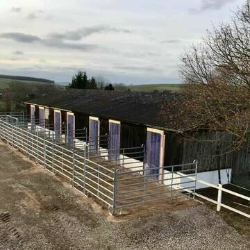
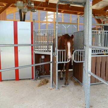
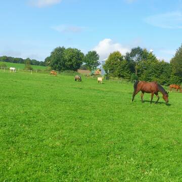
Reit- & Pensionsstall Wackelburg
Diemarden
Jan Pieper
@Laura92
Freizeitstall
Westernreiten
Vermieten
Hunde willkommen
Longierzirkel/Roundpen
Hufrehe geeignet
15 weitere...
P+
Deprecated: Creation of dynamic property Zend_View_Helper_Ads::$adLink is deprecated in /var/www/stall-frei/htdocs/staging.stall-frei.de/library/Psf/View/Helper/Ads.php on line 108

Frisches Stroh zu verkaufen!
Mechtersen
STALL-FREIde Marketing
@STALL-FREI-Marketing
Kaufe frisches Stroh für dein Pferd!

Boxen und Offenstall frei
Gleichen
Unity-Fellponys
@Unity-Fellponys
Geländestrecke
Reitlehrer und -unterricht
Vermieten
Hunde willkommen
Paddock
Pferdezucht
16 weitere...
P

Reitanlage Klostergut Diemarden
Gleichen
Klostergut-Diemarden
@Klostergut-Diemarden
Freizeitstall
Reitlehrer und -unterricht
Vermieten
Longierzirkel/Roundpen
Paddock
Allergikerstall
Hufrehe geeignet
17 weitere...
P+
Wellenreiter Seeburg - Pensionsstall und mehr...
Seeburg
Wellenreiter-Seeburg
@Wellenreiter-Seeburg
Freizeitstall
Gastronomie
Hunde willkommen
Krankenbox
bedampftes/gewaschenes Heu
Hufrehe geeignet
Außenbox mit Paddock
Außenboxen
34 weitere...
S


Reiterhof Unterm Dün in Westhausen
Bodenrode-Westhausen
Reiterhof Riethmüller
@riethmueller-westhausen
Freizeitstall
Geländestrecke
Hunde willkommen
Paddock
Hengsthaltung möglich
Pferdezucht
Außenbox mit Paddock
Außenboxen
16 weitere...
P+
Hof Herbst = Pro Pferd
Gleichen Gelliehausen
Hof-Herbst=Pro-Pferd
@Hof-Herbst-Pro-Pferd
Freizeitstall
Reitlehrer und -unterricht
Vermieten
Krankenbox
Longierzirkel/Roundpen
Gnadenbrothof
16 weitere...
P

Privat Stall familiär geführt
Klein-Schneen
Julia Vogeley
@JuliaVogeley
FN-Mitglied
Freizeitstall
Vermieten
Hunde willkommen
Paddock
Allergikerstall
Hufrehe geeignet
18 weitere...
P
Pferde am Arkusberg
Beienrode
Franziska-Herbst
@Franziska-Herbst
Freizeitstall
Geländestrecke
Vermieten
Hunde willkommen
Krankenbox
Allergikerstall
Hufrehe geeignet
27 weitere...
P

***Reitstall Birkenhof*** Pferdegerechte Haltung
Köln
Daniele-Fazzi
@Daniele-Fazzi
Herzlich Willkommen
auf dem Reitstall Birkenhof
Jetzt neu ‼️ auf dem Birkenhof:
Private Geländestrecke rund um unser
Leider kein Vorschaubild
Leider kein Vorschaubild
Offenstallplatz
Göttingen
Göttinger Birkenhof
@Birkenhof1
FN-Mitglied
Freizeitstall
Vermieten
Verpachten
Longierzirkel/Roundpen
Paddock
Notfallboxen
26 weitere...
P

Bewegungsstall Nähe Göttingen / Witzenhausen
Hermannrode
Swantje-Schroeter
@Swantje-Schroeter
Pferdeausbildung
Reitlehrer und -unterricht
Vermieten
Krankenbox
Longierzirkel/Roundpen
Hufrehe geeignet
Notfallboxen
17 weitere...
P
Deprecated: Creation of dynamic property Zend_View::$pageCount is deprecated in /var/www/stall-frei/htdocs/staging.stall-frei.de/library/vendor/shardj/zf1-future/library/Zend/View/Abstract.php on line 308
Deprecated: Creation of dynamic property Zend_View::$itemCountPerPage is deprecated in /var/www/stall-frei/htdocs/staging.stall-frei.de/library/vendor/shardj/zf1-future/library/Zend/View/Abstract.php on line 308
Deprecated: Creation of dynamic property Zend_View::$first is deprecated in /var/www/stall-frei/htdocs/staging.stall-frei.de/library/vendor/shardj/zf1-future/library/Zend/View/Abstract.php on line 308
Deprecated: Creation of dynamic property Zend_View::$current is deprecated in /var/www/stall-frei/htdocs/staging.stall-frei.de/library/vendor/shardj/zf1-future/library/Zend/View/Abstract.php on line 308
Deprecated: Creation of dynamic property Zend_View::$last is deprecated in /var/www/stall-frei/htdocs/staging.stall-frei.de/library/vendor/shardj/zf1-future/library/Zend/View/Abstract.php on line 308
Deprecated: Creation of dynamic property Zend_View::$next is deprecated in /var/www/stall-frei/htdocs/staging.stall-frei.de/library/vendor/shardj/zf1-future/library/Zend/View/Abstract.php on line 308
Deprecated: Creation of dynamic property Zend_View::$pagesInRange is deprecated in /var/www/stall-frei/htdocs/staging.stall-frei.de/library/vendor/shardj/zf1-future/library/Zend/View/Abstract.php on line 308
Deprecated: Creation of dynamic property Zend_View::$firstPageInRange is deprecated in /var/www/stall-frei/htdocs/staging.stall-frei.de/library/vendor/shardj/zf1-future/library/Zend/View/Abstract.php on line 308
Deprecated: Creation of dynamic property Zend_View::$lastPageInRange is deprecated in /var/www/stall-frei/htdocs/staging.stall-frei.de/library/vendor/shardj/zf1-future/library/Zend/View/Abstract.php on line 308
Deprecated: Creation of dynamic property Zend_View::$currentItemCount is deprecated in /var/www/stall-frei/htdocs/staging.stall-frei.de/library/vendor/shardj/zf1-future/library/Zend/View/Abstract.php on line 308
Deprecated: Creation of dynamic property Zend_View::$totalItemCount is deprecated in /var/www/stall-frei/htdocs/staging.stall-frei.de/library/vendor/shardj/zf1-future/library/Zend/View/Abstract.php on line 308
Deprecated: Creation of dynamic property Zend_View::$firstItemNumber is deprecated in /var/www/stall-frei/htdocs/staging.stall-frei.de/library/vendor/shardj/zf1-future/library/Zend/View/Abstract.php on line 308
Deprecated: Creation of dynamic property Zend_View::$lastItemNumber is deprecated in /var/www/stall-frei/htdocs/staging.stall-frei.de/library/vendor/shardj/zf1-future/library/Zend/View/Abstract.php on line 308
Deprecated: Creation of dynamic property Zend_View::$router is deprecated in /var/www/stall-frei/htdocs/staging.stall-frei.de/library/vendor/shardj/zf1-future/library/Zend/View/Abstract.php on line 308
Deprecated: Creation of dynamic property Zend_View::$urlParams is deprecated in /var/www/stall-frei/htdocs/staging.stall-frei.de/library/vendor/shardj/zf1-future/library/Zend/View/Abstract.php on line 308
Deprecated: Creation of dynamic property Zend_View::$showAds is deprecated in /var/www/stall-frei/htdocs/staging.stall-frei.de/library/vendor/shardj/zf1-future/library/Zend/View/Abstract.php on line 308
Deprecated: Creation of dynamic property Zend_View::$objectIds is deprecated in /var/www/stall-frei/htdocs/staging.stall-frei.de/library/vendor/shardj/zf1-future/library/Zend/View/Abstract.php on line 308
Deprecated: Creation of dynamic property Zend_View::$showNavbar is deprecated in /var/www/stall-frei/htdocs/staging.stall-frei.de/library/vendor/shardj/zf1-future/library/Zend/View/Abstract.php on line 308
Deprecated: Creation of dynamic property Zend_View::$showBreadcrumb is deprecated in /var/www/stall-frei/htdocs/staging.stall-frei.de/library/vendor/shardj/zf1-future/library/Zend/View/Abstract.php on line 308
Deprecated: Creation of dynamic property Zend_View::$showFooter is deprecated in /var/www/stall-frei/htdocs/staging.stall-frei.de/library/vendor/shardj/zf1-future/library/Zend/View/Abstract.php on line 308
Deprecated: Creation of dynamic property Zend_View::$showInternalAds is deprecated in /var/www/stall-frei/htdocs/staging.stall-frei.de/library/vendor/shardj/zf1-future/library/Zend/View/Abstract.php on line 308
Deprecated: Creation of dynamic property Zend_View::$blNoContent is deprecated in /var/www/stall-frei/htdocs/staging.stall-frei.de/library/vendor/shardj/zf1-future/library/Zend/View/Abstract.php on line 308
Deprecated: Creation of dynamic property Zend_View::$sMetaDesc is deprecated in /var/www/stall-frei/htdocs/staging.stall-frei.de/library/vendor/shardj/zf1-future/library/Zend/View/Abstract.php on line 308
Deprecated: Creation of dynamic property Zend_View::$useGmaps is deprecated in /var/www/stall-frei/htdocs/staging.stall-frei.de/library/vendor/shardj/zf1-future/library/Zend/View/Abstract.php on line 308
Deprecated: Creation of dynamic property Zend_View::$touches is deprecated in /var/www/stall-frei/htdocs/staging.stall-frei.de/library/vendor/shardj/zf1-future/library/Zend/View/Abstract.php on line 308
Deprecated: Creation of dynamic property Zend_View::$oProject is deprecated in /var/www/stall-frei/htdocs/staging.stall-frei.de/library/vendor/shardj/zf1-future/library/Zend/View/Abstract.php on line 308
Deprecated: Creation of dynamic property Zend_View::$pageHeadline is deprecated in /var/www/stall-frei/htdocs/staging.stall-frei.de/library/vendor/shardj/zf1-future/library/Zend/View/Abstract.php on line 308
Deprecated: Creation of dynamic property Zend_View::$disableLocationField is deprecated in /var/www/stall-frei/htdocs/staging.stall-frei.de/library/vendor/shardj/zf1-future/library/Zend/View/Abstract.php on line 308
Deprecated: Creation of dynamic property Zend_View::$isSearch is deprecated in /var/www/stall-frei/htdocs/staging.stall-frei.de/library/vendor/shardj/zf1-future/library/Zend/View/Abstract.php on line 308
Deprecated: Creation of dynamic property Zend_View::$pageTitle is deprecated in /var/www/stall-frei/htdocs/staging.stall-frei.de/library/vendor/shardj/zf1-future/library/Zend/View/Abstract.php on line 308
Deprecated: Creation of dynamic property Psf_Form_Element_Text::$class is deprecated in /var/www/stall-frei/htdocs/staging.stall-frei.de/library/vendor/shardj/zf1-future/library/Zend/Form/Element.php on line 874
Deprecated: Creation of dynamic property Psf_Form_Element_Text::$size is deprecated in /var/www/stall-frei/htdocs/staging.stall-frei.de/library/vendor/shardj/zf1-future/library/Zend/Form/Element.php on line 874
Deprecated: Creation of dynamic property Psf_Form_Element_Text::$placeholder is deprecated in /var/www/stall-frei/htdocs/staging.stall-frei.de/library/vendor/shardj/zf1-future/library/Zend/Form/Element.php on line 874
Deprecated: Creation of dynamic property Psf_Form_Element_Hidden::$class is deprecated in /var/www/stall-frei/htdocs/staging.stall-frei.de/library/vendor/shardj/zf1-future/library/Zend/Form/Element.php on line 874
Deprecated: Creation of dynamic property Psf_Form_Element_Hidden::$class is deprecated in /var/www/stall-frei/htdocs/staging.stall-frei.de/library/vendor/shardj/zf1-future/library/Zend/Form/Element.php on line 874
Deprecated: Creation of dynamic property Psf_Form_Element_Hidden::$class is deprecated in /var/www/stall-frei/htdocs/staging.stall-frei.de/library/vendor/shardj/zf1-future/library/Zend/Form/Element.php on line 874
Deprecated: Creation of dynamic property Psf_Form_Element_Hidden::$class is deprecated in /var/www/stall-frei/htdocs/staging.stall-frei.de/library/vendor/shardj/zf1-future/library/Zend/Form/Element.php on line 874
Deprecated: Creation of dynamic property Psf_Form_Element_Select::$class is deprecated in /var/www/stall-frei/htdocs/staging.stall-frei.de/library/vendor/shardj/zf1-future/library/Zend/Form/Element.php on line 874
Deprecated: Creation of dynamic property Psf_Form_Element_Select::$class is deprecated in /var/www/stall-frei/htdocs/staging.stall-frei.de/library/vendor/shardj/zf1-future/library/Zend/Form/Element.php on line 874
Deprecated: Creation of dynamic property Psf_Form_Element_Select::$class is deprecated in /var/www/stall-frei/htdocs/staging.stall-frei.de/library/vendor/shardj/zf1-future/library/Zend/Form/Element.php on line 874
Deprecated: Creation of dynamic property Psf_Form_Element_Select::$class is deprecated in /var/www/stall-frei/htdocs/staging.stall-frei.de/library/vendor/shardj/zf1-future/library/Zend/Form/Element.php on line 874
Deprecated: Creation of dynamic property Psf_Form_Element_Text::$class is deprecated in /var/www/stall-frei/htdocs/staging.stall-frei.de/library/vendor/shardj/zf1-future/library/Zend/Form/Element.php on line 874
Deprecated: Creation of dynamic property Psf_Form_Element_Checkbox::$label is deprecated in /var/www/stall-frei/htdocs/staging.stall-frei.de/library/vendor/shardj/zf1-future/library/Zend/Form/Element.php on line 874
Deprecated: Creation of dynamic property Zend_View::$sort is deprecated in /var/www/stall-frei/htdocs/staging.stall-frei.de/library/vendor/shardj/zf1-future/library/Zend/View/Abstract.php on line 308
Deprecated: Creation of dynamic property Zend_View::$searchLocation is deprecated in /var/www/stall-frei/htdocs/staging.stall-frei.de/library/vendor/shardj/zf1-future/library/Zend/View/Abstract.php on line 308
Deprecated: Creation of dynamic property Zend_View::$locationHint is deprecated in /var/www/stall-frei/htdocs/staging.stall-frei.de/library/vendor/shardj/zf1-future/library/Zend/View/Abstract.php on line 308
Psf_GeoCoder_Abstract::getLocation: Rohrberg Get Location CachedOrLive
Psf_GeoCoder_Abstract::getCachedOrLive: Rohrberg
Psf_GeoCoder_OpenCageData::makeApiRequest: response:
Array
(
[documentation] => https://opencagedata.com/api
[licenses] => Array
(
[0] => Array
(
[name] => see attribution guide
[url] => https://opencagedata.com/credits
)
)
[results] => Array
(
[0] => Array
(
[bounds] => Array
(
[northeast] => Array
(
[lat] => 51.4231513
[lng] => 10.0434376
)
[southwest] => Array
(
[lat] => 51.4016417
[lng] => 10.0062719
)
)
[components] => Array
(
[ISO_3166-1_alpha-2] => DE
[ISO_3166-1_alpha-3] => DEU
[ISO_3166-2] => Array
(
[0] => DE-TH
)
[_category] => place
[_normalized_city] => Rohrberg
[_type] => village
[continent] => Europe
[country] => Deutschland
[country_code] => de
[county] => Landkreis Eichsfeld
[municipality] => Hanstein-Rusteberg
[political_union] => European Union
[state] => Thüringen
[state_code] => TH
[village] => Rohrberg
)
[confidence] => 7
[formatted] => Rohrberg, Thüringen, Deutschland
[geometry] => Array
(
[lat] => 51.4115906
[lng] => 10.022482
)
)
[1] => Array
(
[bounds] => Array
(
[northeast] => Array
(
[lat] => 52.7558667
[lng] => 11.0876993
)
[southwest] => Array
(
[lat] => 52.6685907
[lng] => 10.9662885
)
)
[components] => Array
(
[ISO_3166-1_alpha-2] => DE
[ISO_3166-1_alpha-3] => DEU
[ISO_3166-2] => Array
(
[0] => DE-ST
)
[_category] => place
[_normalized_city] => Rohrberg
[_type] => village
[continent] => Europe
[country] => Deutschland
[country_code] => de
[county] => Altmarkkreis Salzwedel
[municipality] => Beetzendorf-Diesdorf
[political_union] => European Union
[postcode] => 38489
[state] => Sachsen-Anhalt
[state_code] => ST
[village] => Rohrberg
)
[confidence] => 7
[formatted] => 38489 Rohrberg, Deutschland
[geometry] => Array
(
[lat] => 52.7066051
[lng] => 11.0403477
)
)
[2] => Array
(
[bounds] => Array
(
[northeast] => Array
(
[lat] => 49.0446508
[lng] => 11.0084436
)
[southwest] => Array
(
[lat] => 49.0445508
[lng] => 11.0083436
)
)
[components] => Array
(
[ISO_3166-1_alpha-2] => DE
[ISO_3166-1_alpha-3] => DEU
[ISO_3166-2] => Array
(
[0] => DE-BY
)
[_category] => natural/water
[_normalized_city] => Höttingen
[_type] => peak
[continent] => Europe
[country] => Deutschland
[country_code] => de
[county] => Landkreis Weißenburg-Gunzenhausen
[municipality] => Ellingen (VGem)
[peak] => Rohrberg
[political_union] => European Union
[postcode] => 91798
[state] => Bayern
[state_code] => BY
[village] => Höttingen
)
[confidence] => 9
[formatted] => Rohrberg, 91798 Höttingen, Deutschland
[geometry] => Array
(
[lat] => 49.0446008
[lng] => 11.0083936
)
)
[3] => Array
(
[bounds] => Array
(
[northeast] => Array
(
[lat] => 51.2366468
[lng] => 9.7086608
)
[southwest] => Array
(
[lat] => 51.2365468
[lng] => 9.7085608
)
)
[components] => Array
(
[ISO_3166-1_alpha-2] => DE
[ISO_3166-1_alpha-3] => DEU
[ISO_3166-2] => Array
(
[0] => DE-HE
)
[_category] => natural/water
[_normalized_city] => Hessisch Lichtenau
[_type] => peak
[continent] => Europe
[country] => Deutschland
[country_code] => de
[county] => Werra-Meißner-Kreis
[municipality] => Hessisch Lichtenau
[peak] => Rohrberg
[political_union] => European Union
[postcode] => 34298
[state] => Hessen
[state_code] => HE
[town] => Hessisch Lichtenau
)
[confidence] => 9
[formatted] => Rohrberg, 34298 Hessisch Lichtenau, Deutschland
[geometry] => Array
(
[lat] => 51.2365968
[lng] => 9.7086108
)
)
[4] => Array
(
[bounds] => Array
(
[northeast] => Array
(
[lat] => 52.7263397
[lng] => 12.4672847
)
[southwest] => Array
(
[lat] => 52.7262397
[lng] => 12.4671847
)
)
[components] => Array
(
[ISO_3166-1_alpha-2] => DE
[ISO_3166-1_alpha-3] => DEU
[ISO_3166-2] => Array
(
[0] => DE-BB
)
[_category] => natural/water
[_normalized_city] => Rhinow
[_type] => peak
[continent] => Europe
[country] => Deutschland
[country_code] => de
[county] => Havelland
[peak] => Rohrberg
[political_union] => European Union
[state] => Brandenburg
[state_code] => BB
[town] => Rhinow
)
[confidence] => 9
[formatted] => Rohrberg, Rhinow, Brandenburg, Deutschland
[geometry] => Array
(
[lat] => 52.7262897
[lng] => 12.4672347
)
)
[5] => Array
(
[bounds] => Array
(
[northeast] => Array
(
[lat] => 49.8043916
[lng] => 12.0795285
)
[southwest] => Array
(
[lat] => 49.8042916
[lng] => 12.0794285
)
)
[components] => Array
(
[ISO_3166-1_alpha-2] => DE
[ISO_3166-1_alpha-3] => DEU
[ISO_3166-2] => Array
(
[0] => DE-BY
)
[_category] => natural/water
[_normalized_city] => Erbendorf
[_type] => peak
[continent] => Europe
[country] => Deutschland
[country_code] => de
[county] => Landkreis Tirschenreuth
[peak] => Rohrberg
[political_union] => European Union
[postcode] => 92681
[state] => Bayern
[state_code] => BY
[town] => Erbendorf
)
[confidence] => 9
[formatted] => Rohrberg, 92681 Erbendorf, Deutschland
[geometry] => Array
(
[lat] => 49.8043416
[lng] => 12.0794785
)
)
[6] => Array
(
[bounds] => Array
(
[northeast] => Array
(
[lat] => 48.7771546
[lng] => 13.0544449
)
[southwest] => Array
(
[lat] => 48.7770546
[lng] => 13.0543449
)
)
[components] => Array
(
[ISO_3166-1_alpha-2] => DE
[ISO_3166-1_alpha-3] => DEU
[ISO_3166-2] => Array
(
[0] => DE-BY
)
[_category] => natural/water
[_normalized_city] => Hengersberg
[_type] => peak
[continent] => Europe
[country] => Deutschland
[country_code] => de
[county] => Landkreis Deggendorf
[peak] => Rohrberg
[political_union] => European Union
[postcode] => 94491
[state] => Bayern
[state_code] => BY
[village] => Hengersberg
)
[confidence] => 9
[formatted] => Rohrberg, 94491 Hengersberg, Deutschland
[geometry] => Array
(
[lat] => 48.7771046
[lng] => 13.0543949
)
)
[7] => Array
(
[bounds] => Array
(
[northeast] => Array
(
[lat] => 51.9528185
[lng] => 10.1645996
)
[southwest] => Array
(
[lat] => 51.9527185
[lng] => 10.1644996
)
)
[components] => Array
(
[ISO_3166-1_alpha-2] => DE
[ISO_3166-1_alpha-3] => DEU
[ISO_3166-2] => Array
(
[0] => DE-NI
)
[_category] => natural/water
[_normalized_city] => Seesen
[_type] => peak
[continent] => Europe
[country] => Deutschland
[country_code] => de
[county] => Landkreis Goslar
[peak] => Rohrberg
[political_union] => European Union
[state] => Niedersachsen
[state_code] => NI
[town] => Seesen
)
[confidence] => 9
[formatted] => Rohrberg, Seesen, Niedersachsen, Deutschland
[geometry] => Array
(
[lat] => 51.9527685
[lng] => 10.1645496
)
)
[8] => Array
(
[bounds] => Array
(
[northeast] => Array
(
[lat] => 49.1640628
[lng] => 9.0874744
)
[southwest] => Array
(
[lat] => 49.1639628
[lng] => 9.0873744
)
)
[components] => Array
(
[ISO_3166-1_alpha-2] => DE
[ISO_3166-1_alpha-3] => DEU
[ISO_3166-2] => Array
(
[0] => DE-BW
)
[_category] => natural/water
[_normalized_city] => Schwaigern
[_type] => peak
[continent] => Europe
[country] => Deutschland
[country_code] => de
[county] => Landkreis Heilbronn
[municipality] => VVG der Stadt Schwaigern
[peak] => Rohrberg
[political_union] => European Union
[postcode] => 74211
[state] => Baden-Württemberg
[state_code] => BW
[town] => Schwaigern
)
[confidence] => 9
[formatted] => Rohrberg, 74211 Schwaigern, Deutschland
[geometry] => Array
(
[lat] => 49.1640128
[lng] => 9.0874244
)
)
[9] => Array
(
[components] => Array
(
[ISO_3166-1_alpha-2] => FR
[ISO_3166-1_alpha-3] => FRA
[ISO_3166-2] => Array
(
[0] => FR-OCC
[1] => FR-66
)
[_category] => road
[_normalized_city] => Ille-sur-Têt
[_type] => road
[city] => Ille-sur-Têt
[continent] => Europe
[country] => France
[country_code] => fr
[county] => Pyrénées-Orientales
[local_authority] => Communauté de communes Roussillon Conflent
[political_union] => European Union
[postcode] => 66130
[road] => Route de Corbere
[state] => Occitanie
[state_code] => OCC
)
[confidence] => 2
[formatted] => Route de Corbere, 66130 Ille-sur-Têt, France
[geometry] => Array
(
[lat] => 42.663227
[lng] => 2.635073
)
)
)
[status] => Array
(
[code] => 200
[message] => OK
)
[stay_informed] => Array
(
[blog] => https://blog.opencagedata.com
[mastodon] => https://en.osm.town/@opencage
)
[thanks] => For using an OpenCage API
[timestamp] => Array
(
[created_http] => Sun, 08 Feb 2026 08:43:51 GMT
[created_unix] => 1770540231
)
[total_results] => 10
)
Psf_GeoCoder_Abstract::convertLocationResult
{"documentation":"https:\/\/opencagedata.com\/api","licenses":[{"name":"see attribution guide","url":"https:\/\/opencagedata.com\/credits"}],"results":[{"bounds":{"northeast":{"lat":51.4231513,"lng":10.0434376},"southwest":{"lat":51.4016417,"lng":10.0062719}},"components":{"ISO_3166-1_alpha-2":"DE","ISO_3166-1_alpha-3":"DEU","ISO_3166-2":["DE-TH"],"_category":"place","_normalized_city":"Rohrberg","_type":"village","continent":"Europe","country":"Deutschland","country_code":"de","county":"Landkreis Eichsfeld","municipality":"Hanstein-Rusteberg","political_union":"European Union","state":"Th\u00fcringen","state_code":"TH","village":"Rohrberg"},"confidence":7,"formatted":"Rohrberg, Th\u00fcringen, Deutschland","geometry":{"lat":51.4115906,"lng":10.022482}},{"bounds":{"northeast":{"lat":52.7558667,"lng":11.0876993},"southwest":{"lat":52.6685907,"lng":10.9662885}},"components":{"ISO_3166-1_alpha-2":"DE","ISO_3166-1_alpha-3":"DEU","ISO_3166-2":["DE-ST"],"_category":"place","_normalized_city":"Rohrberg","_type":"village","continent":"Europe","country":"Deutschland","country_code":"de","county":"Altmarkkreis Salzwedel","municipality":"Beetzendorf-Diesdorf","political_union":"European Union","postcode":"38489","state":"Sachsen-Anhalt","state_code":"ST","village":"Rohrberg"},"confidence":7,"formatted":"38489 Rohrberg, Deutschland","geometry":{"lat":52.7066051,"lng":11.0403477}},{"bounds":{"northeast":{"lat":49.0446508,"lng":11.0084436},"southwest":{"lat":49.0445508,"lng":11.0083436}},"components":{"ISO_3166-1_alpha-2":"DE","ISO_3166-1_alpha-3":"DEU","ISO_3166-2":["DE-BY"],"_category":"natural\/water","_normalized_city":"H\u00f6ttingen","_type":"peak","continent":"Europe","country":"Deutschland","country_code":"de","county":"Landkreis Wei\u00dfenburg-Gunzenhausen","municipality":"Ellingen (VGem)","peak":"Rohrberg","political_union":"European Union","postcode":"91798","state":"Bayern","state_code":"BY","village":"H\u00f6ttingen"},"confidence":9,"formatted":"Rohrberg, 91798 H\u00f6ttingen, Deutschland","geometry":{"lat":49.0446008,"lng":11.0083936}},{"bounds":{"northeast":{"lat":51.2366468,"lng":9.7086608},"southwest":{"lat":51.2365468,"lng":9.7085608}},"components":{"ISO_3166-1_alpha-2":"DE","ISO_3166-1_alpha-3":"DEU","ISO_3166-2":["DE-HE"],"_category":"natural\/water","_normalized_city":"Hessisch Lichtenau","_type":"peak","continent":"Europe","country":"Deutschland","country_code":"de","county":"Werra-Mei\u00dfner-Kreis","municipality":"Hessisch Lichtenau","peak":"Rohrberg","political_union":"European Union","postcode":"34298","state":"Hessen","state_code":"HE","town":"Hessisch Lichtenau"},"confidence":9,"formatted":"Rohrberg, 34298 Hessisch Lichtenau, Deutschland","geometry":{"lat":51.2365968,"lng":9.7086108}},{"bounds":{"northeast":{"lat":52.7263397,"lng":12.4672847},"southwest":{"lat":52.7262397,"lng":12.4671847}},"components":{"ISO_3166-1_alpha-2":"DE","ISO_3166-1_alpha-3":"DEU","ISO_3166-2":["DE-BB"],"_category":"natural\/water","_normalized_city":"Rhinow","_type":"peak","continent":"Europe","country":"Deutschland","country_code":"de","county":"Havelland","peak":"Rohrberg","political_union":"European Union","state":"Brandenburg","state_code":"BB","town":"Rhinow"},"confidence":9,"formatted":"Rohrberg, Rhinow, Brandenburg, Deutschland","geometry":{"lat":52.7262897,"lng":12.4672347}},{"bounds":{"northeast":{"lat":49.8043916,"lng":12.0795285},"southwest":{"lat":49.8042916,"lng":12.0794285}},"components":{"ISO_3166-1_alpha-2":"DE","ISO_3166-1_alpha-3":"DEU","ISO_3166-2":["DE-BY"],"_category":"natural\/water","_normalized_city":"Erbendorf","_type":"peak","continent":"Europe","country":"Deutschland","country_code":"de","county":"Landkreis Tirschenreuth","peak":"Rohrberg","political_union":"European Union","postcode":"92681","state":"Bayern","state_code":"BY","town":"Erbendorf"},"confidence":9,"formatted":"Rohrberg, 92681 Erbendorf, Deutschland","geometry":{"lat":49.8043416,"lng":12.0794785}},{"bounds":{"northeast":{"lat":48.7771546,"lng":13.0544449},"southwest":{"lat":48.7770546,"lng":13.0543449}},"components":{"ISO_3166-1_alpha-2":"DE","ISO_3166-1_alpha-3":"DEU","ISO_3166-2":["DE-BY"],"_category":"natural\/water","_normalized_city":"Hengersberg","_type":"peak","continent":"Europe","country":"Deutschland","country_code":"de","county":"Landkreis Deggendorf","peak":"Rohrberg","political_union":"European Union","postcode":"94491","state":"Bayern","state_code":"BY","village":"Hengersberg"},"confidence":9,"formatted":"Rohrberg, 94491 Hengersberg, Deutschland","geometry":{"lat":48.7771046,"lng":13.0543949}},{"bounds":{"northeast":{"lat":51.9528185,"lng":10.1645996},"southwest":{"lat":51.9527185,"lng":10.1644996}},"components":{"ISO_3166-1_alpha-2":"DE","ISO_3166-1_alpha-3":"DEU","ISO_3166-2":["DE-NI"],"_category":"natural\/water","_normalized_city":"Seesen","_type":"peak","continent":"Europe","country":"Deutschland","country_code":"de","county":"Landkreis Goslar","peak":"Rohrberg","political_union":"European Union","state":"Niedersachsen","state_code":"NI","town":"Seesen"},"confidence":9,"formatted":"Rohrberg, Seesen, Niedersachsen, Deutschland","geometry":{"lat":51.9527685,"lng":10.1645496}},{"bounds":{"northeast":{"lat":49.1640628,"lng":9.0874744},"southwest":{"lat":49.1639628,"lng":9.0873744}},"components":{"ISO_3166-1_alpha-2":"DE","ISO_3166-1_alpha-3":"DEU","ISO_3166-2":["DE-BW"],"_category":"natural\/water","_normalized_city":"Schwaigern","_type":"peak","continent":"Europe","country":"Deutschland","country_code":"de","county":"Landkreis Heilbronn","municipality":"VVG der Stadt Schwaigern","peak":"Rohrberg","political_union":"European Union","postcode":"74211","state":"Baden-W\u00fcrttemberg","state_code":"BW","town":"Schwaigern"},"confidence":9,"formatted":"Rohrberg, 74211 Schwaigern, Deutschland","geometry":{"lat":49.1640128,"lng":9.0874244}},{"components":{"ISO_3166-1_alpha-2":"FR","ISO_3166-1_alpha-3":"FRA","ISO_3166-2":["FR-OCC","FR-66"],"_category":"road","_normalized_city":"Ille-sur-T\u00eat","_type":"road","city":"Ille-sur-T\u00eat","continent":"Europe","country":"France","country_code":"fr","county":"Pyr\u00e9n\u00e9es-Orientales","local_authority":"Communaut\u00e9 de communes Roussillon Conflent","political_union":"European Union","postcode":"66130","road":"Route de Corbere","state":"Occitanie","state_code":"OCC"},"confidence":2,"formatted":"Route de Corbere, 66130 Ille-sur-T\u00eat, France","geometry":{"lat":42.663227,"lng":2.635073}}],"status":{"code":200,"message":"OK"},"stay_informed":{"blog":"https:\/\/blog.opencagedata.com","mastodon":"https:\/\/en.osm.town\/@opencage"},"thanks":"For using an OpenCage API","timestamp":{"created_http":"Sun, 08 Feb 2026 08:43:51 GMT","created_unix":1770540231},"total_results":10}Array
(
[0] => stdClass Object
(
[bounds] => stdClass Object
(
[northeast] => stdClass Object
(
[lat] => 51.4231513
[lng] => 10.0434376
)
[southwest] => stdClass Object
(
[lat] => 51.4016417
[lng] => 10.0062719
)
)
[components] => stdClass Object
(
[ISO_3166-1_alpha-2] => DE
[ISO_3166-1_alpha-3] => DEU
[ISO_3166-2] => Array
(
[0] => DE-TH
)
[_category] => place
[_normalized_city] => Rohrberg
[_type] => village
[continent] => Europe
[country] => Deutschland
[country_code] => de
[county] => Landkreis Eichsfeld
[municipality] => Hanstein-Rusteberg
[political_union] => European Union
[state] => Thüringen
[state_code] => TH
[village] => Rohrberg
)
[confidence] => 7
[formatted] => Rohrberg, Thüringen, Deutschland
[geometry] => stdClass Object
(
[lat] => 51.4115906
[lng] => 10.022482
)
)
[1] => stdClass Object
(
[bounds] => stdClass Object
(
[northeast] => stdClass Object
(
[lat] => 52.7558667
[lng] => 11.0876993
)
[southwest] => stdClass Object
(
[lat] => 52.6685907
[lng] => 10.9662885
)
)
[components] => stdClass Object
(
[ISO_3166-1_alpha-2] => DE
[ISO_3166-1_alpha-3] => DEU
[ISO_3166-2] => Array
(
[0] => DE-ST
)
[_category] => place
[_normalized_city] => Rohrberg
[_type] => village
[continent] => Europe
[country] => Deutschland
[country_code] => de
[county] => Altmarkkreis Salzwedel
[municipality] => Beetzendorf-Diesdorf
[political_union] => European Union
[postcode] => 38489
[state] => Sachsen-Anhalt
[state_code] => ST
[village] => Rohrberg
)
[confidence] => 7
[formatted] => 38489 Rohrberg, Deutschland
[geometry] => stdClass Object
(
[lat] => 52.7066051
[lng] => 11.0403477
)
)
[2] => stdClass Object
(
[bounds] => stdClass Object
(
[northeast] => stdClass Object
(
[lat] => 49.0446508
[lng] => 11.0084436
)
[southwest] => stdClass Object
(
[lat] => 49.0445508
[lng] => 11.0083436
)
)
[components] => stdClass Object
(
[ISO_3166-1_alpha-2] => DE
[ISO_3166-1_alpha-3] => DEU
[ISO_3166-2] => Array
(
[0] => DE-BY
)
[_category] => natural/water
[_normalized_city] => Höttingen
[_type] => peak
[continent] => Europe
[country] => Deutschland
[country_code] => de
[county] => Landkreis Weißenburg-Gunzenhausen
[municipality] => Ellingen (VGem)
[peak] => Rohrberg
[political_union] => European Union
[postcode] => 91798
[state] => Bayern
[state_code] => BY
[village] => Höttingen
)
[confidence] => 9
[formatted] => Rohrberg, 91798 Höttingen, Deutschland
[geometry] => stdClass Object
(
[lat] => 49.0446008
[lng] => 11.0083936
)
)
[3] => stdClass Object
(
[bounds] => stdClass Object
(
[northeast] => stdClass Object
(
[lat] => 51.2366468
[lng] => 9.7086608
)
[southwest] => stdClass Object
(
[lat] => 51.2365468
[lng] => 9.7085608
)
)
[components] => stdClass Object
(
[ISO_3166-1_alpha-2] => DE
[ISO_3166-1_alpha-3] => DEU
[ISO_3166-2] => Array
(
[0] => DE-HE
)
[_category] => natural/water
[_normalized_city] => Hessisch Lichtenau
[_type] => peak
[continent] => Europe
[country] => Deutschland
[country_code] => de
[county] => Werra-Meißner-Kreis
[municipality] => Hessisch Lichtenau
[peak] => Rohrberg
[political_union] => European Union
[postcode] => 34298
[state] => Hessen
[state_code] => HE
[town] => Hessisch Lichtenau
)
[confidence] => 9
[formatted] => Rohrberg, 34298 Hessisch Lichtenau, Deutschland
[geometry] => stdClass Object
(
[lat] => 51.2365968
[lng] => 9.7086108
)
)
[4] => stdClass Object
(
[bounds] => stdClass Object
(
[northeast] => stdClass Object
(
[lat] => 52.7263397
[lng] => 12.4672847
)
[southwest] => stdClass Object
(
[lat] => 52.7262397
[lng] => 12.4671847
)
)
[components] => stdClass Object
(
[ISO_3166-1_alpha-2] => DE
[ISO_3166-1_alpha-3] => DEU
[ISO_3166-2] => Array
(
[0] => DE-BB
)
[_category] => natural/water
[_normalized_city] => Rhinow
[_type] => peak
[continent] => Europe
[country] => Deutschland
[country_code] => de
[county] => Havelland
[peak] => Rohrberg
[political_union] => European Union
[state] => Brandenburg
[state_code] => BB
[town] => Rhinow
)
[confidence] => 9
[formatted] => Rohrberg, Rhinow, Brandenburg, Deutschland
[geometry] => stdClass Object
(
[lat] => 52.7262897
[lng] => 12.4672347
)
)
[5] => stdClass Object
(
[bounds] => stdClass Object
(
[northeast] => stdClass Object
(
[lat] => 49.8043916
[lng] => 12.0795285
)
[southwest] => stdClass Object
(
[lat] => 49.8042916
[lng] => 12.0794285
)
)
[components] => stdClass Object
(
[ISO_3166-1_alpha-2] => DE
[ISO_3166-1_alpha-3] => DEU
[ISO_3166-2] => Array
(
[0] => DE-BY
)
[_category] => natural/water
[_normalized_city] => Erbendorf
[_type] => peak
[continent] => Europe
[country] => Deutschland
[country_code] => de
[county] => Landkreis Tirschenreuth
[peak] => Rohrberg
[political_union] => European Union
[postcode] => 92681
[state] => Bayern
[state_code] => BY
[town] => Erbendorf
)
[confidence] => 9
[formatted] => Rohrberg, 92681 Erbendorf, Deutschland
[geometry] => stdClass Object
(
[lat] => 49.8043416
[lng] => 12.0794785
)
)
[6] => stdClass Object
(
[bounds] => stdClass Object
(
[northeast] => stdClass Object
(
[lat] => 48.7771546
[lng] => 13.0544449
)
[southwest] => stdClass Object
(
[lat] => 48.7770546
[lng] => 13.0543449
)
)
[components] => stdClass Object
(
[ISO_3166-1_alpha-2] => DE
[ISO_3166-1_alpha-3] => DEU
[ISO_3166-2] => Array
(
[0] => DE-BY
)
[_category] => natural/water
[_normalized_city] => Hengersberg
[_type] => peak
[continent] => Europe
[country] => Deutschland
[country_code] => de
[county] => Landkreis Deggendorf
[peak] => Rohrberg
[political_union] => European Union
[postcode] => 94491
[state] => Bayern
[state_code] => BY
[village] => Hengersberg
)
[confidence] => 9
[formatted] => Rohrberg, 94491 Hengersberg, Deutschland
[geometry] => stdClass Object
(
[lat] => 48.7771046
[lng] => 13.0543949
)
)
[7] => stdClass Object
(
[bounds] => stdClass Object
(
[northeast] => stdClass Object
(
[lat] => 51.9528185
[lng] => 10.1645996
)
[southwest] => stdClass Object
(
[lat] => 51.9527185
[lng] => 10.1644996
)
)
[components] => stdClass Object
(
[ISO_3166-1_alpha-2] => DE
[ISO_3166-1_alpha-3] => DEU
[ISO_3166-2] => Array
(
[0] => DE-NI
)
[_category] => natural/water
[_normalized_city] => Seesen
[_type] => peak
[continent] => Europe
[country] => Deutschland
[country_code] => de
[county] => Landkreis Goslar
[peak] => Rohrberg
[political_union] => European Union
[state] => Niedersachsen
[state_code] => NI
[town] => Seesen
)
[confidence] => 9
[formatted] => Rohrberg, Seesen, Niedersachsen, Deutschland
[geometry] => stdClass Object
(
[lat] => 51.9527685
[lng] => 10.1645496
)
)
[8] => stdClass Object
(
[bounds] => stdClass Object
(
[northeast] => stdClass Object
(
[lat] => 49.1640628
[lng] => 9.0874744
)
[southwest] => stdClass Object
(
[lat] => 49.1639628
[lng] => 9.0873744
)
)
[components] => stdClass Object
(
[ISO_3166-1_alpha-2] => DE
[ISO_3166-1_alpha-3] => DEU
[ISO_3166-2] => Array
(
[0] => DE-BW
)
[_category] => natural/water
[_normalized_city] => Schwaigern
[_type] => peak
[continent] => Europe
[country] => Deutschland
[country_code] => de
[county] => Landkreis Heilbronn
[municipality] => VVG der Stadt Schwaigern
[peak] => Rohrberg
[political_union] => European Union
[postcode] => 74211
[state] => Baden-Württemberg
[state_code] => BW
[town] => Schwaigern
)
[confidence] => 9
[formatted] => Rohrberg, 74211 Schwaigern, Deutschland
[geometry] => stdClass Object
(
[lat] => 49.1640128
[lng] => 9.0874244
)
)
[9] => stdClass Object
(
[components] => stdClass Object
(
[ISO_3166-1_alpha-2] => FR
[ISO_3166-1_alpha-3] => FRA
[ISO_3166-2] => Array
(
[0] => FR-OCC
[1] => FR-66
)
[_category] => road
[_normalized_city] => Ille-sur-Têt
[_type] => road
[city] => Ille-sur-Têt
[continent] => Europe
[country] => France
[country_code] => fr
[county] => Pyrénées-Orientales
[local_authority] => Communauté de communes Roussillon Conflent
[political_union] => European Union
[postcode] => 66130
[road] => Route de Corbere
[state] => Occitanie
[state_code] => OCC
)
[confidence] => 2
[formatted] => Route de Corbere, 66130 Ille-sur-Têt, France
[geometry] => stdClass Object
(
[lat] => 42.663227
[lng] => 2.635073
)
)
)
Psf_GeoCoder_OpenCageData::getKeyMap: 0
stdClass Object
(
    [bounds] => stdClass Object
        (
            [northeast] => stdClass Object
                (
                    [lat] => 51.4231513
                    [lng] => 10.0434376
                )

            [southwest] => stdClass Object
                (
                    [lat] => 51.4016417
                    [lng] => 10.0062719
                )

        )

    [components] => stdClass Object
        (
            [ISO_3166-1_alpha-2] => DE
            [ISO_3166-1_alpha-3] => DEU
            [ISO_3166-2] => Array
                (
                    [0] => DE-TH
                )

            [_category] => place
            [_normalized_city] => Rohrberg
            [_type] => village
            [continent] => Europe
            [country] => Deutschland
            [country_code] => de
            [county] => Landkreis Eichsfeld
            [municipality] => Hanstein-Rusteberg
            [political_union] => European Union
            [state] => Thüringen
            [state_code] => TH
            [village] => Rohrberg
        )

    [confidence] => 7
    [formatted] => Rohrberg, Thüringen, Deutschland
    [geometry] => stdClass Object
        (
            [lat] => 51.4115906
            [lng] => 10.022482
        )

)
Psf_GeoCoder_OpenCageData::getCounty: Eichsfeld
Psf_GeoCoder_OpenCageData::addMissingData REFETCH!
Array
(
    [address] => Rohrberg, Thüringen, Deutschland
    [type] => village
    [street] =>
    [city] => Rohrberg
    [county] => Eichsfeld
    [state] => Thüringen
    [zip] =>
    [country] => Deutschland
    [suburb] =>
    [countrycode] => de
    [latitude] => 51.4115906
    [longitude] => 10.022482
    [accuracy] => 1
    [confidence] => 7
    [bounds] => stdClass Object
        (
            [northeast] => stdClass Object
                (
                    [lat] => 51.4231513
                    [lng] => 10.0434376
                )

            [southwest] => stdClass Object
                (
                    [lat] => 51.4016417
                    [lng] => 10.0062719
                )

        )

)
reformat!
Array
(
    [address] => Rohrberg, Thüringen, Deutschland
    [type] => village
    [street] =>
    [city] => Rohrberg
    [county] => Eichsfeld
    [state] => Thüringen
    [zip] =>
    [country] => Deutschland
    [suburb] =>
    [countrycode] => de
    [latitude] => 51.4115906
    [longitude] => 10.022482
    [accuracy] => 1
    [confidence] => 7
    [bounds] => stdClass Object
        (
            [northeast] => stdClass Object
                (
                    [lat] => 51.4231513
                    [lng] => 10.0434376
                )

            [southwest] => stdClass Object
                (
                    [lat] => 51.4016417
                    [lng] => 10.0062719
                )

        )

    [place] => Rohrberg, Thüringen
    [hash] => 17c245e00b270239d2f5f96165b5eb7e
)
Psf_GeoCoder_OpenCageData::getKeyMap: 1
stdClass Object
(
    [bounds] => stdClass Object
        (
            [northeast] => stdClass Object
                (
                    [lat] => 52.7558667
                    [lng] => 11.0876993
                )

            [southwest] => stdClass Object
                (
                    [lat] => 52.6685907
                    [lng] => 10.9662885
                )

        )

    [components] => stdClass Object
        (
            [ISO_3166-1_alpha-2] => DE
            [ISO_3166-1_alpha-3] => DEU
            [ISO_3166-2] => Array
                (
                    [0] => DE-ST
                )

            [_category] => place
            [_normalized_city] => Rohrberg
            [_type] => village
            [continent] => Europe
            [country] => Deutschland
            [country_code] => de
            [county] => Altmarkkreis Salzwedel
            [municipality] => Beetzendorf-Diesdorf
            [political_union] => European Union
            [postcode] => 38489
            [state] => Sachsen-Anhalt
            [state_code] => ST
            [village] => Rohrberg
        )

    [confidence] => 7
    [formatted] => 38489 Rohrberg, Deutschland
    [geometry] => stdClass Object
        (
            [lat] => 52.7066051
            [lng] => 11.0403477
        )

)
Psf_GeoCoder_OpenCageData::getCounty: Altmarkkreis Salzwedel
Psf_GeoCoder_OpenCageData::addMissingData REFETCH!
Array
(
    [address] => 38489 Rohrberg, Deutschland
    [type] => village
    [street] =>
    [city] => Rohrberg
    [county] => Altmarkkreis Salzwedel
    [state] => Sachsen-Anhalt
    [zip] => 38489
    [country] => Deutschland
    [suburb] =>
    [countrycode] => de
    [latitude] => 52.7066051
    [longitude] => 11.0403477
    [accuracy] => 1
    [confidence] => 7
    [bounds] => stdClass Object
        (
            [northeast] => stdClass Object
                (
                    [lat] => 52.7558667
                    [lng] => 11.0876993
                )

            [southwest] => stdClass Object
                (
                    [lat] => 52.6685907
                    [lng] => 10.9662885
                )

        )

)
reformat!
Array
(
    [address] => 38489 Rohrberg, Deutschland
    [type] => village
    [street] =>
    [city] => Rohrberg
    [county] => Altmarkkreis Salzwedel
    [state] => Sachsen-Anhalt
    [zip] => 38489
    [country] => Deutschland
    [suburb] =>
    [countrycode] => de
    [latitude] => 52.7066051
    [longitude] => 11.0403477
    [accuracy] => 1
    [confidence] => 7
    [bounds] => stdClass Object
        (
            [northeast] => stdClass Object
                (
                    [lat] => 52.7558667
                    [lng] => 11.0876993
                )

            [southwest] => stdClass Object
                (
                    [lat] => 52.6685907
                    [lng] => 10.9662885
                )

        )

    [place] => 38489 Rohrberg, Sachsen-Anhalt
    [hash] => 563820baa0a2a133e9d3a21f4cb565c2
)
Psf_GeoCoder_OpenCageData::getKeyMap: 2
stdClass Object
(
    [bounds] => stdClass Object
        (
            [northeast] => stdClass Object
                (
                    [lat] => 49.0446508
                    [lng] => 11.0084436
                )

            [southwest] => stdClass Object
                (
                    [lat] => 49.0445508
                    [lng] => 11.0083436
                )

        )

    [components] => stdClass Object
        (
            [ISO_3166-1_alpha-2] => DE
            [ISO_3166-1_alpha-3] => DEU
            [ISO_3166-2] => Array
                (
                    [0] => DE-BY
                )

            [_category] => natural/water
            [_normalized_city] => Höttingen
            [_type] => peak
            [continent] => Europe
            [country] => Deutschland
            [country_code] => de
            [county] => Landkreis Weißenburg-Gunzenhausen
            [municipality] => Ellingen (VGem)
            [peak] => Rohrberg
            [political_union] => European Union
            [postcode] => 91798
            [state] => Bayern
            [state_code] => BY
            [village] => Höttingen
        )

    [confidence] => 9
    [formatted] => Rohrberg, 91798 Höttingen, Deutschland
    [geometry] => stdClass Object
        (
            [lat] => 49.0446008
            [lng] => 11.0083936
        )

)
Psf_GeoCoder_OpenCageData::getCounty: Weißenburg-Gunzenhausen
Psf_GeoCoder_OpenCageData::addMissingData REFETCH!
Array
(
    [address] => Rohrberg, 91798 Höttingen, Deutschland
    [type] => peak
    [street] =>
    [city] => Höttingen
    [county] => Weißenburg-Gunzenhausen
    [state] => Bayern
    [zip] => 91798
    [country] => Deutschland
    [suburb] =>
    [countrycode] => de
    [latitude] => 49.0446008
    [longitude] => 11.0083936
    [accuracy] => 1
    [confidence] => 9
    [bounds] => stdClass Object
        (
            [northeast] => stdClass Object
                (
                    [lat] => 49.0446508
                    [lng] => 11.0084436
                )

            [southwest] => stdClass Object
                (
                    [lat] => 49.0445508
                    [lng] => 11.0083436
                )

        )

)
reformat!
Array
(
    [address] => Rohrberg, 91798 Höttingen, Deutschland
    [type] => peak
    [street] =>
    [city] => Höttingen
    [county] => Weißenburg-Gunzenhausen
    [state] => Bayern
    [zip] => 91798
    [country] => Deutschland
    [suburb] =>
    [countrycode] => de
    [latitude] => 49.0446008
    [longitude] => 11.0083936
    [accuracy] => 1
    [confidence] => 9
    [bounds] => stdClass Object
        (
            [northeast] => stdClass Object
                (
                    [lat] => 49.0446508
                    [lng] => 11.0084436
                )

            [southwest] => stdClass Object
                (
                    [lat] => 49.0445508
                    [lng] => 11.0083436
                )

        )

    [place] => 91798 Höttingen, Bayern
    [hash] => 9a3cdda39af59387f5422b97f7dba5eb
)
Psf_GeoCoder_OpenCageData::getKeyMap: 3
stdClass Object
(
    [bounds] => stdClass Object
        (
            [northeast] => stdClass Object
                (
                    [lat] => 51.2366468
                    [lng] => 9.7086608
                )

            [southwest] => stdClass Object
                (
                    [lat] => 51.2365468
                    [lng] => 9.7085608
                )

        )

    [components] => stdClass Object
        (
            [ISO_3166-1_alpha-2] => DE
            [ISO_3166-1_alpha-3] => DEU
            [ISO_3166-2] => Array
                (
                    [0] => DE-HE
                )

            [_category] => natural/water
            [_normalized_city] => Hessisch Lichtenau
            [_type] => peak
            [continent] => Europe
            [country] => Deutschland
            [country_code] => de
            [county] => Werra-Meißner-Kreis
            [municipality] => Hessisch Lichtenau
            [peak] => Rohrberg
            [political_union] => European Union
            [postcode] => 34298
            [state] => Hessen
            [state_code] => HE
            [town] => Hessisch Lichtenau
        )

    [confidence] => 9
    [formatted] => Rohrberg, 34298 Hessisch Lichtenau, Deutschland
    [geometry] => stdClass Object
        (
            [lat] => 51.2365968
            [lng] => 9.7086108
        )

)
Psf_GeoCoder_OpenCageData::getCounty: Werra-Meißner-Kreis
Psf_GeoCoder_OpenCageData::addMissingData REFETCH!
Array
(
    [address] => Rohrberg, 34298 Hessisch Lichtenau, Deutschland
    [type] => peak
    [street] =>
    [city] => Hessisch Lichtenau
    [county] => Werra-Meißner-Kreis
    [state] => Hessen
    [zip] => 34298
    [country] => Deutschland
    [suburb] =>
    [countrycode] => de
    [latitude] => 51.2365968
    [longitude] => 9.7086108
    [accuracy] => 1
    [confidence] => 9
    [bounds] => stdClass Object
        (
            [northeast] => stdClass Object
                (
                    [lat] => 51.2366468
                    [lng] => 9.7086608
                )

            [southwest] => stdClass Object
                (
                    [lat] => 51.2365468
                    [lng] => 9.7085608
                )

        )

)
reformat!
Array
(
    [address] => Rohrberg, 34298 Hessisch Lichtenau, Deutschland
    [type] => peak
    [street] =>
    [city] => Hessisch Lichtenau
    [county] => Werra-Meißner-Kreis
    [state] => Hessen
    [zip] => 34298
    [country] => Deutschland
    [suburb] =>
    [countrycode] => de
    [latitude] => 51.2365968
    [longitude] => 9.7086108
    [accuracy] => 1
    [confidence] => 9
    [bounds] => stdClass Object
        (
            [northeast] => stdClass Object
                (
                    [lat] => 51.2366468
                    [lng] => 9.7086608
                )

            [southwest] => stdClass Object
                (
                    [lat] => 51.2365468
                    [lng] => 9.7085608
                )

        )

    [place] => 34298 Hessisch Lichtenau, Hessen
    [hash] => 5aa6e0d5f7dd7accdb23be20894fde61
)
Psf_GeoCoder_OpenCageData::getKeyMap: 4
stdClass Object
(
    [bounds] => stdClass Object
        (
            [northeast] => stdClass Object
                (
                    [lat] => 52.7263397
                    [lng] => 12.4672847
                )

            [southwest] => stdClass Object
                (
                    [lat] => 52.7262397
                    [lng] => 12.4671847
                )

        )

    [components] => stdClass Object
        (
            [ISO_3166-1_alpha-2] => DE
            [ISO_3166-1_alpha-3] => DEU
            [ISO_3166-2] => Array
                (
                    [0] => DE-BB
                )

            [_category] => natural/water
            [_normalized_city] => Rhinow
            [_type] => peak
            [continent] => Europe
            [country] => Deutschland
            [country_code] => de
            [county] => Havelland
            [peak] => Rohrberg
            [political_union] => European Union
            [state] => Brandenburg
            [state_code] => BB
            [town] => Rhinow
        )

    [confidence] => 9
    [formatted] => Rohrberg, Rhinow, Brandenburg, Deutschland
    [geometry] => stdClass Object
        (
            [lat] => 52.7262897
            [lng] => 12.4672347
        )

)
Psf_GeoCoder_OpenCageData::getCounty: Havelland
Psf_GeoCoder_OpenCageData::addMissingData REFETCH!
Array
(
    [address] => Rohrberg, Rhinow, Brandenburg, Deutschland
    [type] => peak
    [street] =>
    [city] => Rhinow
    [county] => Havelland
    [state] => Brandenburg
    [zip] =>
    [country] => Deutschland
    [suburb] =>
    [countrycode] => de
    [latitude] => 52.7262897
    [longitude] => 12.4672347
    [accuracy] => 1
    [confidence] => 9
    [bounds] => stdClass Object
        (
            [northeast] => stdClass Object
                (
                    [lat] => 52.7263397
                    [lng] => 12.4672847
                )

            [southwest] => stdClass Object
                (
                    [lat] => 52.7262397
                    [lng] => 12.4671847
                )

        )

)
reformat!
Array
(
    [address] => Rohrberg, Rhinow, Brandenburg, Deutschland
    [type] => peak
    [street] =>
    [city] => Rhinow
    [county] => Havelland
    [state] => Brandenburg
    [zip] =>
    [country] => Deutschland
    [suburb] =>
    [countrycode] => de
    [latitude] => 52.7262897
    [longitude] => 12.4672347
    [accuracy] => 1
    [confidence] => 9
    [bounds] => stdClass Object
        (
            [northeast] => stdClass Object
                (
                    [lat] => 52.7263397
                    [lng] => 12.4672847
                )

            [southwest] => stdClass Object
                (
                    [lat] => 52.7262397
                    [lng] => 12.4671847
                )

        )

    [place] => Rhinow, Brandenburg
    [hash] => dccf588d0e9d3a059e4de7b93222564d
)
Psf_GeoCoder_OpenCageData::getKeyMap: 5
stdClass Object
(
    [bounds] => stdClass Object
        (
            [northeast] => stdClass Object
                (
                    [lat] => 49.8043916
                    [lng] => 12.0795285
                )

            [southwest] => stdClass Object
                (
                    [lat] => 49.8042916
                    [lng] => 12.0794285
                )

        )

    [components] => stdClass Object
        (
            [ISO_3166-1_alpha-2] => DE
            [ISO_3166-1_alpha-3] => DEU
            [ISO_3166-2] => Array
                (
                    [0] => DE-BY
                )

            [_category] => natural/water
            [_normalized_city] => Erbendorf
            [_type] => peak
            [continent] => Europe
            [country] => Deutschland
            [country_code] => de
            [county] => Landkreis Tirschenreuth
            [peak] => Rohrberg
            [political_union] => European Union
            [postcode] => 92681
            [state] => Bayern
            [state_code] => BY
            [town] => Erbendorf
        )

    [confidence] => 9
    [formatted] => Rohrberg, 92681 Erbendorf, Deutschland
    [geometry] => stdClass Object
        (
            [lat] => 49.8043416
            [lng] => 12.0794785
        )

)
Psf_GeoCoder_OpenCageData::getCounty: Tirschenreuth
Psf_GeoCoder_OpenCageData::addMissingData REFETCH!
Array
(
    [address] => Rohrberg, 92681 Erbendorf, Deutschland
    [type] => peak
    [street] =>
    [city] => Erbendorf
    [county] => Tirschenreuth
    [state] => Bayern
    [zip] => 92681
    [country] => Deutschland
    [suburb] =>
    [countrycode] => de
    [latitude] => 49.8043416
    [longitude] => 12.0794785
    [accuracy] => 1
    [confidence] => 9
    [bounds] => stdClass Object
        (
            [northeast] => stdClass Object
                (
                    [lat] => 49.8043916
                    [lng] => 12.0795285
                )

            [southwest] => stdClass Object
                (
                    [lat] => 49.8042916
                    [lng] => 12.0794285
                )

        )

)
reformat!
Array
(
    [address] => Rohrberg, 92681 Erbendorf, Deutschland
    [type] => peak
    [street] =>
    [city] => Erbendorf
    [county] => Tirschenreuth
    [state] => Bayern
    [zip] => 92681
    [country] => Deutschland
    [suburb] =>
    [countrycode] => de
    [latitude] => 49.8043416
    [longitude] => 12.0794785
    [accuracy] => 1
    [confidence] => 9
    [bounds] => stdClass Object
        (
            [northeast] => stdClass Object
                (
                    [lat] => 49.8043916
                    [lng] => 12.0795285
                )

            [southwest] => stdClass Object
                (
                    [lat] => 49.8042916
                    [lng] => 12.0794285
                )

        )

    [place] => 92681 Erbendorf, Bayern
    [hash] => 017c2c29fd5459a57e339d493935872e
)
Psf_GeoCoder_OpenCageData::getKeyMap: 6
stdClass Object
(
    [bounds] => stdClass Object
        (
            [northeast] => stdClass Object
                (
                    [lat] => 48.7771546
                    [lng] => 13.0544449
                )

            [southwest] => stdClass Object
                (
                    [lat] => 48.7770546
                    [lng] => 13.0543449
                )

        )

    [components] => stdClass Object
        (
            [ISO_3166-1_alpha-2] => DE
            [ISO_3166-1_alpha-3] => DEU
            [ISO_3166-2] => Array
                (
                    [0] => DE-BY
                )

            [_category] => natural/water
            [_normalized_city] => Hengersberg
            [_type] => peak
            [continent] => Europe
            [country] => Deutschland
            [country_code] => de
            [county] => Landkreis Deggendorf
            [peak] => Rohrberg
            [political_union] => European Union
            [postcode] => 94491
            [state] => Bayern
            [state_code] => BY
            [village] => Hengersberg
        )

    [confidence] => 9
    [formatted] => Rohrberg, 94491 Hengersberg, Deutschland
    [geometry] => stdClass Object
        (
            [lat] => 48.7771046
            [lng] => 13.0543949
        )

)
Psf_GeoCoder_OpenCageData::getCounty: Deggendorf
Psf_GeoCoder_OpenCageData::addMissingData REFETCH!
Array
(
    [address] => Rohrberg, 94491 Hengersberg, Deutschland
    [type] => peak
    [street] =>
    [city] => Hengersberg
    [county] => Deggendorf
    [state] => Bayern
    [zip] => 94491
    [country] => Deutschland
    [suburb] =>
    [countrycode] => de
    [latitude] => 48.7771046
    [longitude] => 13.0543949
    [accuracy] => 1
    [confidence] => 9
    [bounds] => stdClass Object
        (
            [northeast] => stdClass Object
                (
                    [lat] => 48.7771546
                    [lng] => 13.0544449
                )

            [southwest] => stdClass Object
                (
                    [lat] => 48.7770546
                    [lng] => 13.0543449
                )

        )

)
reformat!
Array
(
    [address] => Rohrberg, 94491 Hengersberg, Deutschland
    [type] => peak
    [street] =>
    [city] => Hengersberg
    [county] => Deggendorf
    [state] => Bayern
    [zip] => 94491
    [country] => Deutschland
    [suburb] =>
    [countrycode] => de
    [latitude] => 48.7771046
    [longitude] => 13.0543949
    [accuracy] => 1
    [confidence] => 9
    [bounds] => stdClass Object
        (
            [northeast] => stdClass Object
                (
                    [lat] => 48.7771546
                    [lng] => 13.0544449
                )

            [southwest] => stdClass Object
                (
                    [lat] => 48.7770546
                    [lng] => 13.0543449
                )

        )

    [place] => 94491 Hengersberg, Bayern
    [hash] => 2bac0102d00909d5ee63c1614942ee9a
)
Psf_GeoCoder_OpenCageData::getKeyMap: 7
stdClass Object
(
    [bounds] => stdClass Object
        (
            [northeast] => stdClass Object
                (
                    [lat] => 51.9528185
                    [lng] => 10.1645996
                )

            [southwest] => stdClass Object
                (
                    [lat] => 51.9527185
                    [lng] => 10.1644996
                )

        )

    [components] => stdClass Object
        (
            [ISO_3166-1_alpha-2] => DE
            [ISO_3166-1_alpha-3] => DEU
            [ISO_3166-2] => Array
                (
                    [0] => DE-NI
                )

            [_category] => natural/water
            [_normalized_city] => Seesen
            [_type] => peak
            [continent] => Europe
            [country] => Deutschland
            [country_code] => de
            [county] => Landkreis Goslar
            [peak] => Rohrberg
            [political_union] => European Union
            [state] => Niedersachsen
            [state_code] => NI
            [town] => Seesen
        )

    [confidence] => 9
    [formatted] => Rohrberg, Seesen, Niedersachsen, Deutschland
    [geometry] => stdClass Object
        (
            [lat] => 51.9527685
            [lng] => 10.1645496
        )

)
Psf_GeoCoder_OpenCageData::getCounty: Goslar
Psf_GeoCoder_OpenCageData::addMissingData REFETCH!
Array
(
    [address] => Rohrberg, Seesen, Niedersachsen, Deutschland
    [type] => peak
    [street] =>
    [city] => Seesen
    [county] => Goslar
    [state] => Niedersachsen
    [zip] =>
    [country] => Deutschland
    [suburb] =>
    [countrycode] => de
    [latitude] => 51.9527685
    [longitude] => 10.1645496
    [accuracy] => 1
    [confidence] => 9
    [bounds] => stdClass Object
        (
            [northeast] => stdClass Object
                (
                    [lat] => 51.9528185
                    [lng] => 10.1645996
                )

            [southwest] => stdClass Object
                (
                    [lat] => 51.9527185
                    [lng] => 10.1644996
                )

        )

)
reformat!
Array
(
    [address] => Rohrberg, Seesen, Niedersachsen, Deutschland
    [type] => peak
    [street] =>
    [city] => Seesen
    [county] => Goslar
    [state] => Niedersachsen
    [zip] =>
    [country] => Deutschland
    [suburb] =>
    [countrycode] => de
    [latitude] => 51.9527685
    [longitude] => 10.1645496
    [accuracy] => 1
    [confidence] => 9
    [bounds] => stdClass Object
        (
            [northeast] => stdClass Object
                (
                    [lat] => 51.9528185
                    [lng] => 10.1645996
                )

            [southwest] => stdClass Object
                (
                    [lat] => 51.9527185
                    [lng] => 10.1644996
                )

        )

    [place] => Seesen, Niedersachsen
    [hash] => 79c274ca38c7fd9aba61143ffe44fe02
)
Psf_GeoCoder_OpenCageData::getKeyMap: 8
stdClass Object
(
    [bounds] => stdClass Object
        (
            [northeast] => stdClass Object
                (
                    [lat] => 49.1640628
                    [lng] => 9.0874744
                )

            [southwest] => stdClass Object
                (
                    [lat] => 49.1639628
                    [lng] => 9.0873744
                )

        )

    [components] => stdClass Object
        (
            [ISO_3166-1_alpha-2] => DE
            [ISO_3166-1_alpha-3] => DEU
            [ISO_3166-2] => Array
                (
                    [0] => DE-BW
                )

            [_category] => natural/water
            [_normalized_city] => Schwaigern
            [_type] => peak
            [continent] => Europe
            [country] => Deutschland
            [country_code] => de
            [county] => Landkreis Heilbronn
            [municipality] => VVG der Stadt Schwaigern
            [peak] => Rohrberg
            [political_union] => European Union
            [postcode] => 74211
            [state] => Baden-Württemberg
            [state_code] => BW
            [town] => Schwaigern
        )

    [confidence] => 9
    [formatted] => Rohrberg, 74211 Schwaigern, Deutschland
    [geometry] => stdClass Object
        (
            [lat] => 49.1640128
            [lng] => 9.0874244
        )

)
Psf_GeoCoder_OpenCageData::getCounty: Heilbronn
Psf_GeoCoder_OpenCageData::addMissingData REFETCH!
Array
(
    [address] => Rohrberg, 74211 Schwaigern, Deutschland
    [type] => peak
    [street] =>
    [city] => Schwaigern
    [county] => Heilbronn
    [state] => Baden-Württemberg
    [zip] => 74211
    [country] => Deutschland
    [suburb] =>
    [countrycode] => de
    [latitude] => 49.1640128
    [longitude] => 9.0874244
    [accuracy] => 1
    [confidence] => 9
    [bounds] => stdClass Object
        (
            [northeast] => stdClass Object
                (
                    [lat] => 49.1640628
                    [lng] => 9.0874744
                )

            [southwest] => stdClass Object
                (
                    [lat] => 49.1639628
                    [lng] => 9.0873744
                )

        )

)
reformat!
Array
(
    [address] => Rohrberg, 74211 Schwaigern, Deutschland
    [type] => peak
    [street] =>
    [city] => Schwaigern
    [county] => Heilbronn
    [state] => Baden-Württemberg
    [zip] => 74211
    [country] => Deutschland
    [suburb] =>
    [countrycode] => de
    [latitude] => 49.1640128
    [longitude] => 9.0874244
    [accuracy] => 1
    [confidence] => 9
    [bounds] => stdClass Object
        (
            [northeast] => stdClass Object
                (
                    [lat] => 49.1640628
                    [lng] => 9.0874744
                )

            [southwest] => stdClass Object
                (
                    [lat] => 49.1639628
                    [lng] => 9.0873744
                )

        )

    [place] => 74211 Schwaigern, Baden-Württemberg
    [hash] => e282661eb1f7b4b83218b1858bf6ed4a
)
Psf_GeoCoder_OpenCageData::getKeyMap: 9
stdClass Object
(
    [components] => stdClass Object
        (
            [ISO_3166-1_alpha-2] => FR
            [ISO_3166-1_alpha-3] => FRA
            [ISO_3166-2] => Array
                (
                    [0] => FR-OCC
                    [1] => FR-66
                )

            [_category] => road
            [_normalized_city] => Ille-sur-Têt
            [_type] => road
            [city] => Ille-sur-Têt
            [continent] => Europe
            [country] => France
            [country_code] => fr
            [county] => Pyrénées-Orientales
            [local_authority] => Communauté de communes Roussillon Conflent
            [political_union] => European Union
            [postcode] => 66130
            [road] => Route de Corbere
            [state] => Occitanie
            [state_code] => OCC
        )

    [confidence] => 2
    [formatted] => Route de Corbere, 66130 Ille-sur-Têt, France
    [geometry] => stdClass Object
        (
            [lat] => 42.663227
            [lng] => 2.635073
        )

)
Psf_GeoCoder_OpenCageData::getCounty: Pyrénées-Orientales
Psf_GeoCoder_OpenCageData::addMissingData REFETCH!
Array
(
    [address] => Route de Corbere, 66130 Ille-sur-Têt, France
    [type] => road
    [street] => Route de Corbere
    [city] => Ille-sur-Têt
    [county] => Pyrénées-Orientales
    [state] => Occitanie
    [zip] => 66130
    [country] => France
    [suburb] =>
    [countrycode] => fr
    [latitude] => 42.663227
    [longitude] => 2.635073
    [accuracy] => 1
    [confidence] => 2
    [bounds] =>
)
reformat!
Array
(
    [address] => Route de Corbere, 66130 Ille-sur-Têt, France
    [type] => road
    [street] => Route de Corbere
    [city] => Ille-sur-Têt
    [county] => Pyrénées-Orientales
    [state] => Occitanie
    [zip] => 66130
    [country] => France
    [suburb] =>
    [countrycode] => fr
    [latitude] => 42.663227
    [longitude] => 2.635073
    [accuracy] => 1
    [confidence] => 2
    [bounds] =>
    [place] => Route de Corbere, 66130 Ille-sur-Têt, Occitanie
    [hash] => 0d8df19b832363e2d2e7eae512524318
)
Deprecated: Creation of dynamic property Zend_View::$locationHintStyle is deprecated in /var/www/stall-frei/htdocs/staging.stall-frei.de/library/vendor/shardj/zf1-future/library/Zend/View/Abstract.php on line 308
Deprecated: Creation of dynamic property Zend_View::$adGeoLocation is deprecated in /var/www/stall-frei/htdocs/staging.stall-frei.de/library/vendor/shardj/zf1-future/library/Zend/View/Abstract.php on line 308
Deprecated: Creation of dynamic property Zend_View::$recordCount is deprecated in /var/www/stall-frei/htdocs/staging.stall-frei.de/library/vendor/shardj/zf1-future/library/Zend/View/Abstract.php on line 308
Deprecated: explode(): Passing null to parameter #2 ($string) of type string is deprecated in /var/www/stall-frei/htdocs/staging.stall-frei.de/application/models/SearchAgent.php on line 100
Deprecated: explode(): Passing null to parameter #2 ($string) of type string is deprecated in /var/www/stall-frei/htdocs/staging.stall-frei.de/application/models/SearchAgent.php on line 100
Deprecated: explode(): Passing null to parameter #2 ($string) of type string is deprecated in /var/www/stall-frei/htdocs/staging.stall-frei.de/application/models/SearchAgent.php on line 100
Deprecated: explode(): Passing null to parameter #2 ($string) of type string is deprecated in /var/www/stall-frei/htdocs/staging.stall-frei.de/application/models/SearchAgent.php on line 100
Deprecated: explode(): Passing null to parameter #2 ($string) of type string is deprecated in /var/www/stall-frei/htdocs/staging.stall-frei.de/application/models/SearchAgent.php on line 100
Deprecated: explode(): Passing null to parameter #2 ($string) of type string is deprecated in /var/www/stall-frei/htdocs/staging.stall-frei.de/application/models/SearchAgent.php on line 100
Deprecated: explode(): Passing null to parameter #2 ($string) of type string is deprecated in /var/www/stall-frei/htdocs/staging.stall-frei.de/application/models/SearchAgent.php on line 100
Deprecated: explode(): Passing null to parameter #2 ($string) of type string is deprecated in /var/www/stall-frei/htdocs/staging.stall-frei.de/application/models/SearchAgent.php on line 100
Deprecated: explode(): Passing null to parameter #2 ($string) of type string is deprecated in /var/www/stall-frei/htdocs/staging.stall-frei.de/application/models/SearchAgent.php on line 100
Deprecated: trim(): Passing null to parameter #1 ($string) of type string is deprecated in /var/www/stall-frei/htdocs/staging.stall-frei.de/application/models/Account/Search.php on line 82
Warning: Cannot modify header information - headers already sent by (output started at /var/www/stall-frei/htdocs/staging.stall-frei.de/library/vendor/shardj/zf1-future/library/Zend/View/Abstract.php:308) in /var/www/stall-frei/htdocs/staging.stall-frei.de/application/models/Account/Search.php on line 71
Deprecated: Creation of dynamic property Zend_View::$paginationParams is deprecated in /var/www/stall-frei/htdocs/staging.stall-frei.de/library/vendor/shardj/zf1-future/library/Zend/View/Abstract.php on line 308
Deprecated: Creation of dynamic property Zend_View::$objectPaginator is deprecated in /var/www/stall-frei/htdocs/staging.stall-frei.de/library/vendor/shardj/zf1-future/library/Zend/View/Abstract.php on line 308
Deprecated: Creation of dynamic property Zend_View::$featuredObjects is deprecated in /var/www/stall-frei/htdocs/staging.stall-frei.de/library/vendor/shardj/zf1-future/library/Zend/View/Abstract.php on line 308
Deprecated: Creation of dynamic property Zend_View::$hints is deprecated in /var/www/stall-frei/htdocs/staging.stall-frei.de/library/vendor/shardj/zf1-future/library/Zend/View/Abstract.php on line 308
Deprecated: Creation of dynamic property Zend_View::$attributeHints is deprecated in /var/www/stall-frei/htdocs/staging.stall-frei.de/library/vendor/shardj/zf1-future/library/Zend/View/Abstract.php on line 308
Deprecated: Creation of dynamic property Zend_View::$oSearchForm is deprecated in /var/www/stall-frei/htdocs/staging.stall-frei.de/library/vendor/shardj/zf1-future/library/Zend/View/Abstract.php on line 308