Deprecated: Creation of dynamic property Zend_View::$sMode is deprecated in /var/www/stall-frei/htdocs/staging.stall-frei.de/library/vendor/shardj/zf1-future/library/Zend/View/Abstract.php on line 308
Stallplatz oder Offenstall in Lüsche
Gesucht wird in "49456 Lüsche, Deutschland"
6.328 Einträge
Deprecated: Creation of dynamic property Zend_View::$listObjects is deprecated in /var/www/stall-frei/htdocs/staging.stall-frei.de/library/vendor/shardj/zf1-future/library/Zend/View/Abstract.php on line 308
Gesponsort


Deprecated: Creation of dynamic property Zend_View::$listMode is deprecated in /var/www/stall-frei/htdocs/staging.stall-frei.de/library/vendor/shardj/zf1-future/library/Zend/View/Abstract.php on line 308
Deprecated: Creation of dynamic property Zend_View::$renderedObjects is deprecated in /var/www/stall-frei/htdocs/staging.stall-frei.de/library/vendor/shardj/zf1-future/library/Zend/View/Abstract.php on line 308
Deprecated: Creation of dynamic property Zend_View::$index is deprecated in /var/www/stall-frei/htdocs/staging.stall-frei.de/library/vendor/shardj/zf1-future/library/Zend/View/Abstract.php on line 308
Deprecated: Creation of dynamic property Zend_View::$displayMode is deprecated in /var/www/stall-frei/htdocs/staging.stall-frei.de/library/vendor/shardj/zf1-future/library/Zend/View/Abstract.php on line 308
Deprecated: Creation of dynamic property Zend_View::$remarketingIds is deprecated in /var/www/stall-frei/htdocs/staging.stall-frei.de/library/vendor/shardj/zf1-future/library/Zend/View/Abstract.php on line 308
Deprecated: Creation of dynamic property Zend_View::$listItem is deprecated in /var/www/stall-frei/htdocs/staging.stall-frei.de/library/vendor/shardj/zf1-future/library/Zend/View/Abstract.php on line 308
Deprecated: Creation of dynamic property Zend_View::$object is deprecated in /var/www/stall-frei/htdocs/staging.stall-frei.de/library/vendor/shardj/zf1-future/library/Zend/View/Abstract.php on line 308
Deprecated: Creation of dynamic property Zend_View::$attributes is deprecated in /var/www/stall-frei/htdocs/staging.stall-frei.de/library/vendor/shardj/zf1-future/library/Zend/View/Abstract.php on line 308
Leider kein Vorschaubild
Leider kein Vorschaubild
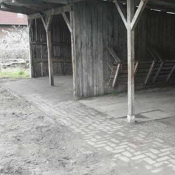
Offenstallplatz
Essen (Oldenburg)
Miriam Menefy
@Mimis
Freizeitstall
Geländestrecke
Longierzirkel/Roundpen
Reitplatz (z.B. Dressur, Springen, Reining)
Allergikerstall
Notfallboxen
Bewegungsstall
Offenstall
8 weitere...
B
Deprecated: Creation of dynamic property Zend_View_Helper_Ads::$adLink is deprecated in /var/www/stall-frei/htdocs/staging.stall-frei.de/library/Psf/View/Helper/Ads.php on line 108

Das Beste für die Hufe
Mechtersen
STALL-FREIde Marketing
@STALL-FREI-Marketing
Hufschmiede und Hufpfleger in Ihrer Nähe
Leider kein Vorschaubild
Leider kein Vorschaubild
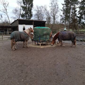
Pferdeboxen frei ab März
Lohne
Kerstin
@Kerle
Freizeitstall
Vermieten
Hunde willkommen
Paddock
Einzelne Boxen oder Stallplätze
5 weitere...
B


Reitanlage Matthiesen
Großenkneten
Reitanlage Matthiesen
@Reitsportanlage-Matthiesen
Freizeitstall
Vermieten
Verpachten
Führanlage
Longierzirkel/Roundpen
Allergikerstall
bedampftes/gewaschenes Heu
19 weitere...
P+
Leider kein Vorschaubild
Leider kein Vorschaubild
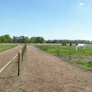
Paddockbox frei - täglich Weide/Paddock möglich
Menslage
Lisa Barlage
@Lisa_Gut.Vahlkamp
Freizeitstall
Vermieten
Paddock
Parkplatz für Pferdeanhänger
Außenbox mit Paddock
11 weitere...
B
Leider kein Vorschaubild
Leider kein Vorschaubild
Durchdachter offener Stall (Warteliste)
Cloppenburg/Staatsforsten
Auszeit
@Nicole_2025
Freizeitstall
Vermieten
Hunde willkommen
Krankenbox
Allergikerstall
Gnadenbrothof
15 weitere...
B


Plätze frei für Stuten
Hatten
Nicks-Lodge
@Nicks-Lodge
Freizeitstall
Reitlehrer und -unterricht
Vermieten
Verpachten
Hunde willkommen
Krankenbox
Allergikerstall
Hufrehe geeignet
19 weitere...
S
Pferdepension Bakenhus
Hatten
Kai-Bakenhus
@Kai-Bakenhus
Freizeitstall
Longierzirkel/Roundpen
Paddock
Gnadenbrothof
Laufstall
Offenstall
11 weitere...
S

Heu aus neuer Ernte
Mechtersen
STALL-FREIde Marketing
@STALL-FREI-Marketing
Heulage und Pferdeheu aus der neuen Ernte findest du in unserem Futtermarkt
Leider kein Vorschaubild
Leider kein Vorschaubild
Pensionsstall Spicker
Großenkneten
Heinrich-Spicker
@Heinrich-Spicker
Freizeitstall
Geländestrecke
Vermieten
Hunde willkommen
Longierzirkel/Roundpen
bedampftes/gewaschenes Heu
Gnadenbrothof
15 weitere...
aktuell
B

Paddock Trail / Offenstall / Auch Allergiker etc.
Barnstorf
Vogelsang Ranch
@VogelsangRanch
Freizeitstall
Pferdeausbildung
Hunde willkommen
Krankenbox
Allergikerstall
bedampftes/gewaschenes Heu
Bewegungsstall
Offenstall
15 weitere...
P

Reitanlage Rosenhof
Großenkneten
Reitanlage-Rosenhof
@Reitanlage-Rosenhof
Freizeitstall
Vermieten
Führanlage
Hunde willkommen
Allergikerstall
bedampftes/gewaschenes Heu
15 weitere...
aktuell
P
Deprecated: Creation of dynamic property Zend_View::$pageCount is deprecated in /var/www/stall-frei/htdocs/staging.stall-frei.de/library/vendor/shardj/zf1-future/library/Zend/View/Abstract.php on line 308
Deprecated: Creation of dynamic property Zend_View::$itemCountPerPage is deprecated in /var/www/stall-frei/htdocs/staging.stall-frei.de/library/vendor/shardj/zf1-future/library/Zend/View/Abstract.php on line 308
Deprecated: Creation of dynamic property Zend_View::$first is deprecated in /var/www/stall-frei/htdocs/staging.stall-frei.de/library/vendor/shardj/zf1-future/library/Zend/View/Abstract.php on line 308
Deprecated: Creation of dynamic property Zend_View::$current is deprecated in /var/www/stall-frei/htdocs/staging.stall-frei.de/library/vendor/shardj/zf1-future/library/Zend/View/Abstract.php on line 308
Deprecated: Creation of dynamic property Zend_View::$last is deprecated in /var/www/stall-frei/htdocs/staging.stall-frei.de/library/vendor/shardj/zf1-future/library/Zend/View/Abstract.php on line 308
Deprecated: Creation of dynamic property Zend_View::$next is deprecated in /var/www/stall-frei/htdocs/staging.stall-frei.de/library/vendor/shardj/zf1-future/library/Zend/View/Abstract.php on line 308
Deprecated: Creation of dynamic property Zend_View::$pagesInRange is deprecated in /var/www/stall-frei/htdocs/staging.stall-frei.de/library/vendor/shardj/zf1-future/library/Zend/View/Abstract.php on line 308
Deprecated: Creation of dynamic property Zend_View::$firstPageInRange is deprecated in /var/www/stall-frei/htdocs/staging.stall-frei.de/library/vendor/shardj/zf1-future/library/Zend/View/Abstract.php on line 308
Deprecated: Creation of dynamic property Zend_View::$lastPageInRange is deprecated in /var/www/stall-frei/htdocs/staging.stall-frei.de/library/vendor/shardj/zf1-future/library/Zend/View/Abstract.php on line 308
Deprecated: Creation of dynamic property Zend_View::$currentItemCount is deprecated in /var/www/stall-frei/htdocs/staging.stall-frei.de/library/vendor/shardj/zf1-future/library/Zend/View/Abstract.php on line 308
Deprecated: Creation of dynamic property Zend_View::$totalItemCount is deprecated in /var/www/stall-frei/htdocs/staging.stall-frei.de/library/vendor/shardj/zf1-future/library/Zend/View/Abstract.php on line 308
Deprecated: Creation of dynamic property Zend_View::$firstItemNumber is deprecated in /var/www/stall-frei/htdocs/staging.stall-frei.de/library/vendor/shardj/zf1-future/library/Zend/View/Abstract.php on line 308
Deprecated: Creation of dynamic property Zend_View::$lastItemNumber is deprecated in /var/www/stall-frei/htdocs/staging.stall-frei.de/library/vendor/shardj/zf1-future/library/Zend/View/Abstract.php on line 308
Deprecated: Creation of dynamic property Zend_View::$router is deprecated in /var/www/stall-frei/htdocs/staging.stall-frei.de/library/vendor/shardj/zf1-future/library/Zend/View/Abstract.php on line 308
Deprecated: Creation of dynamic property Zend_View::$urlParams is deprecated in /var/www/stall-frei/htdocs/staging.stall-frei.de/library/vendor/shardj/zf1-future/library/Zend/View/Abstract.php on line 308
Deprecated: Creation of dynamic property Zend_View::$showAds is deprecated in /var/www/stall-frei/htdocs/staging.stall-frei.de/library/vendor/shardj/zf1-future/library/Zend/View/Abstract.php on line 308
Deprecated: Creation of dynamic property Zend_View::$objectIds is deprecated in /var/www/stall-frei/htdocs/staging.stall-frei.de/library/vendor/shardj/zf1-future/library/Zend/View/Abstract.php on line 308
Deprecated: Creation of dynamic property Zend_View::$showNavbar is deprecated in /var/www/stall-frei/htdocs/staging.stall-frei.de/library/vendor/shardj/zf1-future/library/Zend/View/Abstract.php on line 308
Deprecated: Creation of dynamic property Zend_View::$showBreadcrumb is deprecated in /var/www/stall-frei/htdocs/staging.stall-frei.de/library/vendor/shardj/zf1-future/library/Zend/View/Abstract.php on line 308
Deprecated: Creation of dynamic property Zend_View::$showFooter is deprecated in /var/www/stall-frei/htdocs/staging.stall-frei.de/library/vendor/shardj/zf1-future/library/Zend/View/Abstract.php on line 308
Deprecated: Creation of dynamic property Zend_View::$showInternalAds is deprecated in /var/www/stall-frei/htdocs/staging.stall-frei.de/library/vendor/shardj/zf1-future/library/Zend/View/Abstract.php on line 308
Deprecated: Creation of dynamic property Zend_View::$blNoContent is deprecated in /var/www/stall-frei/htdocs/staging.stall-frei.de/library/vendor/shardj/zf1-future/library/Zend/View/Abstract.php on line 308
Deprecated: Creation of dynamic property Zend_View::$sMetaDesc is deprecated in /var/www/stall-frei/htdocs/staging.stall-frei.de/library/vendor/shardj/zf1-future/library/Zend/View/Abstract.php on line 308
Deprecated: Creation of dynamic property Zend_View::$useGmaps is deprecated in /var/www/stall-frei/htdocs/staging.stall-frei.de/library/vendor/shardj/zf1-future/library/Zend/View/Abstract.php on line 308
Deprecated: Creation of dynamic property Zend_View::$touches is deprecated in /var/www/stall-frei/htdocs/staging.stall-frei.de/library/vendor/shardj/zf1-future/library/Zend/View/Abstract.php on line 308
Deprecated: Creation of dynamic property Zend_View::$oProject is deprecated in /var/www/stall-frei/htdocs/staging.stall-frei.de/library/vendor/shardj/zf1-future/library/Zend/View/Abstract.php on line 308
Deprecated: Creation of dynamic property Zend_View::$pageHeadline is deprecated in /var/www/stall-frei/htdocs/staging.stall-frei.de/library/vendor/shardj/zf1-future/library/Zend/View/Abstract.php on line 308
Deprecated: Creation of dynamic property Zend_View::$disableLocationField is deprecated in /var/www/stall-frei/htdocs/staging.stall-frei.de/library/vendor/shardj/zf1-future/library/Zend/View/Abstract.php on line 308
Deprecated: Creation of dynamic property Zend_View::$isSearch is deprecated in /var/www/stall-frei/htdocs/staging.stall-frei.de/library/vendor/shardj/zf1-future/library/Zend/View/Abstract.php on line 308
Deprecated: Creation of dynamic property Zend_View::$pageTitle is deprecated in /var/www/stall-frei/htdocs/staging.stall-frei.de/library/vendor/shardj/zf1-future/library/Zend/View/Abstract.php on line 308
Deprecated: Creation of dynamic property Psf_Form_Element_Text::$class is deprecated in /var/www/stall-frei/htdocs/staging.stall-frei.de/library/vendor/shardj/zf1-future/library/Zend/Form/Element.php on line 874
Deprecated: Creation of dynamic property Psf_Form_Element_Text::$size is deprecated in /var/www/stall-frei/htdocs/staging.stall-frei.de/library/vendor/shardj/zf1-future/library/Zend/Form/Element.php on line 874
Deprecated: Creation of dynamic property Psf_Form_Element_Text::$placeholder is deprecated in /var/www/stall-frei/htdocs/staging.stall-frei.de/library/vendor/shardj/zf1-future/library/Zend/Form/Element.php on line 874
Deprecated: Creation of dynamic property Psf_Form_Element_Hidden::$class is deprecated in /var/www/stall-frei/htdocs/staging.stall-frei.de/library/vendor/shardj/zf1-future/library/Zend/Form/Element.php on line 874
Deprecated: Creation of dynamic property Psf_Form_Element_Hidden::$class is deprecated in /var/www/stall-frei/htdocs/staging.stall-frei.de/library/vendor/shardj/zf1-future/library/Zend/Form/Element.php on line 874
Deprecated: Creation of dynamic property Psf_Form_Element_Hidden::$class is deprecated in /var/www/stall-frei/htdocs/staging.stall-frei.de/library/vendor/shardj/zf1-future/library/Zend/Form/Element.php on line 874
Deprecated: Creation of dynamic property Psf_Form_Element_Hidden::$class is deprecated in /var/www/stall-frei/htdocs/staging.stall-frei.de/library/vendor/shardj/zf1-future/library/Zend/Form/Element.php on line 874
Deprecated: Creation of dynamic property Psf_Form_Element_Select::$class is deprecated in /var/www/stall-frei/htdocs/staging.stall-frei.de/library/vendor/shardj/zf1-future/library/Zend/Form/Element.php on line 874
Deprecated: Creation of dynamic property Psf_Form_Element_Select::$class is deprecated in /var/www/stall-frei/htdocs/staging.stall-frei.de/library/vendor/shardj/zf1-future/library/Zend/Form/Element.php on line 874
Deprecated: Creation of dynamic property Psf_Form_Element_Select::$class is deprecated in /var/www/stall-frei/htdocs/staging.stall-frei.de/library/vendor/shardj/zf1-future/library/Zend/Form/Element.php on line 874
Deprecated: Creation of dynamic property Psf_Form_Element_Select::$class is deprecated in /var/www/stall-frei/htdocs/staging.stall-frei.de/library/vendor/shardj/zf1-future/library/Zend/Form/Element.php on line 874
Deprecated: Creation of dynamic property Psf_Form_Element_Text::$class is deprecated in /var/www/stall-frei/htdocs/staging.stall-frei.de/library/vendor/shardj/zf1-future/library/Zend/Form/Element.php on line 874
Deprecated: Creation of dynamic property Psf_Form_Element_Checkbox::$label is deprecated in /var/www/stall-frei/htdocs/staging.stall-frei.de/library/vendor/shardj/zf1-future/library/Zend/Form/Element.php on line 874
Deprecated: Creation of dynamic property Zend_View::$sort is deprecated in /var/www/stall-frei/htdocs/staging.stall-frei.de/library/vendor/shardj/zf1-future/library/Zend/View/Abstract.php on line 308
Deprecated: Creation of dynamic property Zend_View::$searchLocation is deprecated in /var/www/stall-frei/htdocs/staging.stall-frei.de/library/vendor/shardj/zf1-future/library/Zend/View/Abstract.php on line 308
Deprecated: Creation of dynamic property Zend_View::$locationHint is deprecated in /var/www/stall-frei/htdocs/staging.stall-frei.de/library/vendor/shardj/zf1-future/library/Zend/View/Abstract.php on line 308
Psf_GeoCoder_Abstract::getLocation: Lüsche Get Location CachedOrLive
Psf_GeoCoder_Abstract::getCachedOrLive: Lüsche
Psf_GeoCoder_OpenCageData::makeApiRequest: response:
Array
(
[documentation] => https://opencagedata.com/api
[licenses] => Array
(
[0] => Array
(
[name] => see attribution guide
[url] => https://opencagedata.com/credits
)
)
[results] => Array
(
[0] => Array
(
[bounds] => Array
(
[northeast] => Array
(
[lat] => 52.7532243
[lng] => 8.0997796
)
[southwest] => Array
(
[lat] => 52.7132243
[lng] => 8.0597796
)
)
[components] => Array
(
[ISO_3166-1_alpha-2] => DE
[ISO_3166-1_alpha-3] => DEU
[ISO_3166-2] => Array
(
[0] => DE-NI
)
[_category] => place
[_normalized_city] => Bakum
[_type] => village
[city] => Bakum
[continent] => Europe
[country] => Deutschland
[country_code] => de
[county] => Landkreis Vechta
[political_union] => European Union
[postcode] => 49456
[state] => Niedersachsen
[state_code] => NI
[village] => Lüsche
)
[confidence] => 7
[formatted] => 49456 Lüsche, Deutschland
[geometry] => Array
(
[lat] => 52.7332243
[lng] => 8.0797796
)
)
[1] => Array
(
[bounds] => Array
(
[northeast] => Array
(
[lat] => 52.7552769
[lng] => 10.4829302
)
[southwest] => Array
(
[lat] => 52.7070839
[lng] => 10.4053476
)
)
[components] => Array
(
[ISO_3166-1_alpha-2] => DE
[ISO_3166-1_alpha-3] => DEU
[ISO_3166-2] => Array
(
[0] => DE-NI
)
[_category] => place
[_normalized_city] => Steinhorst
[_type] => village
[city] => Steinhorst
[continent] => Europe
[country] => Deutschland
[country_code] => de
[county] => Landkreis Gifhorn
[municipality] => Samtgemeinde Hankensbüttel
[political_union] => European Union
[state] => Niedersachsen
[state_code] => NI
[village] => Lüsche
)
[confidence] => 7
[formatted] => Lüsche, Niedersachsen, Deutschland
[geometry] => Array
(
[lat] => 52.7257136
[lng] => 10.4423957
)
)
[2] => Array
(
[bounds] => Array
(
[northeast] => Array
(
[lat] => 52.7191949
[lng] => 7.6725178
)
[southwest] => Array
(
[lat] => 52.7168913
[lng] => 7.6693045
)
)
[components] => Array
(
[ISO_3166-1_alpha-2] => DE
[ISO_3166-1_alpha-3] => DEU
[ISO_3166-2] => Array
(
[0] => DE-NI
)
[_category] => natural/water
[_normalized_city] => Löningen
[_type] => stream
[continent] => Europe
[country] => Deutschland
[country_code] => de
[county] => Landkreis Cloppenburg
[hamlet] => Lewinghausen
[political_union] => European Union
[postcode] => 49624
[state] => Niedersachsen
[state_code] => NI
[stream] => Lüsche
[town] => Löningen
)
[confidence] => 9
[formatted] => Lüsche, Lewinghausen, 49624 Löningen, Deutschland
[geometry] => Array
(
[lat] => 52.7176883
[lng] => 7.671749
)
)
[3] => Array
(
[bounds] => Array
(
[northeast] => Array
(
[lat] => 52.70972
[lng] => 7.6715901
)
[southwest] => Array
(
[lat] => 52.7066618
[lng] => 7.6692519
)
)
[components] => Array
(
[ISO_3166-1_alpha-2] => DE
[ISO_3166-1_alpha-3] => DEU
[ISO_3166-2] => Array
(
[0] => DE-NI
)
[_category] => natural/water
[_normalized_city] => Löningen
[_type] => stream
[continent] => Europe
[country] => Deutschland
[country_code] => de
[county] => Landkreis Cloppenburg
[hamlet] => Düenkamp
[political_union] => European Union
[postcode] => 49624
[state] => Niedersachsen
[state_code] => NI
[stream] => Lüsche
[town] => Löningen
)
[confidence] => 9
[formatted] => Lüsche, Düenkamp, 49624 Löningen, Deutschland
[geometry] => Array
(
[lat] => 52.70867
[lng] => 7.6712861
)
)
[4] => Array
(
[bounds] => Array
(
[northeast] => Array
(
[lat] => 52.7204719
[lng] => 7.6726566
)
[southwest] => Array
(
[lat] => 52.7204137
[lng] => 7.6725813
)
)
[components] => Array
(
[ISO_3166-1_alpha-2] => DE
[ISO_3166-1_alpha-3] => DEU
[ISO_3166-2] => Array
(
[0] => DE-NI
)
[_category] => natural/water
[_normalized_city] => Löningen
[_type] => stream
[continent] => Europe
[country] => Deutschland
[country_code] => de
[county] => Landkreis Cloppenburg
[political_union] => European Union
[postcode] => 49624
[state] => Niedersachsen
[state_code] => NI
[stream] => Lüsche
[town] => Löningen
)
[confidence] => 9
[formatted] => Lüsche, 49624 Löningen, Deutschland
[geometry] => Array
(
[lat] => 52.7204428
[lng] => 7.672619
)
)
[5] => Array
(
[components] => Array
(
[ISO_3166-1_alpha-2] => FR
[ISO_3166-1_alpha-3] => FRA
[ISO_3166-2] => Array
(
[0] => FR-ARA
[1] => FR-74
)
[_category] => road
[_normalized_city] => Cornier
[_type] => road
[city] => Cornier
[continent] => Europe
[country] => France
[country_code] => fr
[county] => Haute-Savoie
[local_authority] => Le Pays Rochois
[political_union] => European Union
[postcode] => 74800
[road] => Chemin de la Luche
[state] => Auvergne-Rhône-Alpes
[state_code] => ARA
)
[confidence] => 3
[formatted] => Chemin de la Luche, 74800 Cornier, France
[geometry] => Array
(
[lat] => 46.084387
[lng] => 6.272908
)
)
[6] => Array
(
[components] => Array
(
[ISO_3166-1_alpha-2] => FR
[ISO_3166-1_alpha-3] => FRA
[ISO_3166-2] => Array
(
[0] => FR-ARA
[1] => FR-74
)
[_category] => road
[_normalized_city] => Vulbens
[_type] => road
[city] => Vulbens
[continent] => Europe
[country] => France
[country_code] => fr
[county] => Haute-Savoie
[local_authority] => Communauté de communes du Genevois
[political_union] => European Union
[postcode] => 74520
[road] => Chemin de la luche
[state] => Auvergne-Rhône-Alpes
[state_code] => ARA
)
[confidence] => 3
[formatted] => Chemin de la luche, 74520 Vulbens, France
[geometry] => Array
(
[lat] => 46.103575
[lng] => 5.927062
)
)
[7] => Array
(
[components] => Array
(
[ISO_3166-1_alpha-2] => FR
[ISO_3166-1_alpha-3] => FRA
[ISO_3166-2] => Array
(
[0] => FR-PDL
[1] => FR-72
)
[_category] => road
[_normalized_city] => Mansigné
[_type] => road
[city] => Mansigné
[continent] => Europe
[country] => France
[country_code] => fr
[county] => Sarthe
[local_authority] => Communauté de communes Sud Sarthe
[political_union] => European Union
[postcode] => 72510
[road] => Route de Luche
[state] => Pays de la Loire
[state_code] => PDL
)
[confidence] => 3
[formatted] => Route de Luche, 72510 Mansigné, France
[geometry] => Array
(
[lat] => 47.740344
[lng] => 0.1266
)
)
[8] => Array
(
[components] => Array
(
[ISO_3166-1_alpha-2] => FR
[ISO_3166-1_alpha-3] => FRA
[ISO_3166-2] => Array
(
[0] => FR-NAQ
[1] => FR-86
)
[_category] => road
[_normalized_city] => Saint-Martin-la-Pallu
[_type] => road
[city] => Saint-Martin-la-Pallu
[continent] => Europe
[country] => France
[country_code] => fr
[county] => Vienne
[local_authority] => Communauté de communes du Haut-Poitou
[political_union] => European Union
[postcode] => 86110
[road] => Route de Luché
[state] => Nouvelle-Aquitaine
[state_code] => NAQ
)
[confidence] => 3
[formatted] => Route de Luché, 86110 Saint-Martin-la-Pallu, France
[geometry] => Array
(
[lat] => 46.777749
[lng] => 0.220349
)
)
[9] => Array
(
[components] => Array
(
[ISO_3166-1_alpha-2] => FR
[ISO_3166-1_alpha-3] => FRA
[ISO_3166-2] => Array
(
[0] => FR-ARA
[1] => FR-74
)
[_category] => road
[_normalized_city] => Taninges
[_type] => road
[city] => Taninges
[continent] => Europe
[country] => France
[country_code] => fr
[county] => Haute-Savoie
[local_authority] => Communauté de communes des Montagnes du Giffre
[political_union] => European Union
[postcode] => 74440
[road] => Route de luche
[state] => Auvergne-Rhône-Alpes
[state_code] => ARA
)
[confidence] => 3
[formatted] => Route de luche, 74440 Taninges, France
[geometry] => Array
(
[lat] => 46.098066
[lng] => 6.660414
)
)
)
[status] => Array
(
[code] => 200
[message] => OK
)
[stay_informed] => Array
(
[blog] => https://blog.opencagedata.com
[mastodon] => https://en.osm.town/@opencage
)
[thanks] => For using an OpenCage API
[timestamp] => Array
(
[created_http] => Sun, 08 Feb 2026 04:15:03 GMT
[created_unix] => 1770524103
)
[total_results] => 10
)
Psf_GeoCoder_Abstract::convertLocationResult
{"documentation":"https:\/\/opencagedata.com\/api","licenses":[{"name":"see attribution guide","url":"https:\/\/opencagedata.com\/credits"}],"results":[{"bounds":{"northeast":{"lat":52.7532243,"lng":8.0997796},"southwest":{"lat":52.7132243,"lng":8.0597796}},"components":{"ISO_3166-1_alpha-2":"DE","ISO_3166-1_alpha-3":"DEU","ISO_3166-2":["DE-NI"],"_category":"place","_normalized_city":"Bakum","_type":"village","city":"Bakum","continent":"Europe","country":"Deutschland","country_code":"de","county":"Landkreis Vechta","political_union":"European Union","postcode":"49456","state":"Niedersachsen","state_code":"NI","village":"L\u00fcsche"},"confidence":7,"formatted":"49456 L\u00fcsche, Deutschland","geometry":{"lat":52.7332243,"lng":8.0797796}},{"bounds":{"northeast":{"lat":52.7552769,"lng":10.4829302},"southwest":{"lat":52.7070839,"lng":10.4053476}},"components":{"ISO_3166-1_alpha-2":"DE","ISO_3166-1_alpha-3":"DEU","ISO_3166-2":["DE-NI"],"_category":"place","_normalized_city":"Steinhorst","_type":"village","city":"Steinhorst","continent":"Europe","country":"Deutschland","country_code":"de","county":"Landkreis Gifhorn","municipality":"Samtgemeinde Hankensb\u00fcttel","political_union":"European Union","state":"Niedersachsen","state_code":"NI","village":"L\u00fcsche"},"confidence":7,"formatted":"L\u00fcsche, Niedersachsen, Deutschland","geometry":{"lat":52.7257136,"lng":10.4423957}},{"bounds":{"northeast":{"lat":52.7191949,"lng":7.6725178},"southwest":{"lat":52.7168913,"lng":7.6693045}},"components":{"ISO_3166-1_alpha-2":"DE","ISO_3166-1_alpha-3":"DEU","ISO_3166-2":["DE-NI"],"_category":"natural\/water","_normalized_city":"L\u00f6ningen","_type":"stream","continent":"Europe","country":"Deutschland","country_code":"de","county":"Landkreis Cloppenburg","hamlet":"Lewinghausen","political_union":"European Union","postcode":"49624","state":"Niedersachsen","state_code":"NI","stream":"L\u00fcsche","town":"L\u00f6ningen"},"confidence":9,"formatted":"L\u00fcsche, Lewinghausen, 49624 L\u00f6ningen, Deutschland","geometry":{"lat":52.7176883,"lng":7.671749}},{"bounds":{"northeast":{"lat":52.70972,"lng":7.6715901},"southwest":{"lat":52.7066618,"lng":7.6692519}},"components":{"ISO_3166-1_alpha-2":"DE","ISO_3166-1_alpha-3":"DEU","ISO_3166-2":["DE-NI"],"_category":"natural\/water","_normalized_city":"L\u00f6ningen","_type":"stream","continent":"Europe","country":"Deutschland","country_code":"de","county":"Landkreis Cloppenburg","hamlet":"D\u00fcenkamp","political_union":"European Union","postcode":"49624","state":"Niedersachsen","state_code":"NI","stream":"L\u00fcsche","town":"L\u00f6ningen"},"confidence":9,"formatted":"L\u00fcsche, D\u00fcenkamp, 49624 L\u00f6ningen, Deutschland","geometry":{"lat":52.70867,"lng":7.6712861}},{"bounds":{"northeast":{"lat":52.7204719,"lng":7.6726566},"southwest":{"lat":52.7204137,"lng":7.6725813}},"components":{"ISO_3166-1_alpha-2":"DE","ISO_3166-1_alpha-3":"DEU","ISO_3166-2":["DE-NI"],"_category":"natural\/water","_normalized_city":"L\u00f6ningen","_type":"stream","continent":"Europe","country":"Deutschland","country_code":"de","county":"Landkreis Cloppenburg","political_union":"European Union","postcode":"49624","state":"Niedersachsen","state_code":"NI","stream":"L\u00fcsche","town":"L\u00f6ningen"},"confidence":9,"formatted":"L\u00fcsche, 49624 L\u00f6ningen, Deutschland","geometry":{"lat":52.7204428,"lng":7.672619}},{"components":{"ISO_3166-1_alpha-2":"FR","ISO_3166-1_alpha-3":"FRA","ISO_3166-2":["FR-ARA","FR-74"],"_category":"road","_normalized_city":"Cornier","_type":"road","city":"Cornier","continent":"Europe","country":"France","country_code":"fr","county":"Haute-Savoie","local_authority":"Le Pays Rochois","political_union":"European Union","postcode":"74800","road":"Chemin de la Luche","state":"Auvergne-Rh\u00f4ne-Alpes","state_code":"ARA"},"confidence":3,"formatted":"Chemin de la Luche, 74800 Cornier, France","geometry":{"lat":46.084387,"lng":6.272908}},{"components":{"ISO_3166-1_alpha-2":"FR","ISO_3166-1_alpha-3":"FRA","ISO_3166-2":["FR-ARA","FR-74"],"_category":"road","_normalized_city":"Vulbens","_type":"road","city":"Vulbens","continent":"Europe","country":"France","country_code":"fr","county":"Haute-Savoie","local_authority":"Communaut\u00e9 de communes du Genevois","political_union":"European Union","postcode":"74520","road":"Chemin de la luche","state":"Auvergne-Rh\u00f4ne-Alpes","state_code":"ARA"},"confidence":3,"formatted":"Chemin de la luche, 74520 Vulbens, France","geometry":{"lat":46.103575,"lng":5.927062}},{"components":{"ISO_3166-1_alpha-2":"FR","ISO_3166-1_alpha-3":"FRA","ISO_3166-2":["FR-PDL","FR-72"],"_category":"road","_normalized_city":"Mansign\u00e9","_type":"road","city":"Mansign\u00e9","continent":"Europe","country":"France","country_code":"fr","county":"Sarthe","local_authority":"Communaut\u00e9 de communes Sud Sarthe","political_union":"European Union","postcode":"72510","road":"Route de Luche","state":"Pays de la Loire","state_code":"PDL"},"confidence":3,"formatted":"Route de Luche, 72510 Mansign\u00e9, France","geometry":{"lat":47.740344,"lng":0.1266}},{"components":{"ISO_3166-1_alpha-2":"FR","ISO_3166-1_alpha-3":"FRA","ISO_3166-2":["FR-NAQ","FR-86"],"_category":"road","_normalized_city":"Saint-Martin-la-Pallu","_type":"road","city":"Saint-Martin-la-Pallu","continent":"Europe","country":"France","country_code":"fr","county":"Vienne","local_authority":"Communaut\u00e9 de communes du Haut-Poitou","political_union":"European Union","postcode":"86110","road":"Route de Luch\u00e9","state":"Nouvelle-Aquitaine","state_code":"NAQ"},"confidence":3,"formatted":"Route de Luch\u00e9, 86110 Saint-Martin-la-Pallu, France","geometry":{"lat":46.777749,"lng":0.220349}},{"components":{"ISO_3166-1_alpha-2":"FR","ISO_3166-1_alpha-3":"FRA","ISO_3166-2":["FR-ARA","FR-74"],"_category":"road","_normalized_city":"Taninges","_type":"road","city":"Taninges","continent":"Europe","country":"France","country_code":"fr","county":"Haute-Savoie","local_authority":"Communaut\u00e9 de communes des Montagnes du Giffre","political_union":"European Union","postcode":"74440","road":"Route de luche","state":"Auvergne-Rh\u00f4ne-Alpes","state_code":"ARA"},"confidence":3,"formatted":"Route de luche, 74440 Taninges, France","geometry":{"lat":46.098066,"lng":6.660414}}],"status":{"code":200,"message":"OK"},"stay_informed":{"blog":"https:\/\/blog.opencagedata.com","mastodon":"https:\/\/en.osm.town\/@opencage"},"thanks":"For using an OpenCage API","timestamp":{"created_http":"Sun, 08 Feb 2026 04:15:03 GMT","created_unix":1770524103},"total_results":10}Array
(
[0] => stdClass Object
(
[bounds] => stdClass Object
(
[northeast] => stdClass Object
(
[lat] => 52.7532243
[lng] => 8.0997796
)
[southwest] => stdClass Object
(
[lat] => 52.7132243
[lng] => 8.0597796
)
)
[components] => stdClass Object
(
[ISO_3166-1_alpha-2] => DE
[ISO_3166-1_alpha-3] => DEU
[ISO_3166-2] => Array
(
[0] => DE-NI
)
[_category] => place
[_normalized_city] => Bakum
[_type] => village
[city] => Bakum
[continent] => Europe
[country] => Deutschland
[country_code] => de
[county] => Landkreis Vechta
[political_union] => European Union
[postcode] => 49456
[state] => Niedersachsen
[state_code] => NI
[village] => Lüsche
)
[confidence] => 7
[formatted] => 49456 Lüsche, Deutschland
[geometry] => stdClass Object
(
[lat] => 52.7332243
[lng] => 8.0797796
)
)
[1] => stdClass Object
(
[bounds] => stdClass Object
(
[northeast] => stdClass Object
(
[lat] => 52.7552769
[lng] => 10.4829302
)
[southwest] => stdClass Object
(
[lat] => 52.7070839
[lng] => 10.4053476
)
)
[components] => stdClass Object
(
[ISO_3166-1_alpha-2] => DE
[ISO_3166-1_alpha-3] => DEU
[ISO_3166-2] => Array
(
[0] => DE-NI
)
[_category] => place
[_normalized_city] => Steinhorst
[_type] => village
[city] => Steinhorst
[continent] => Europe
[country] => Deutschland
[country_code] => de
[county] => Landkreis Gifhorn
[municipality] => Samtgemeinde Hankensbüttel
[political_union] => European Union
[state] => Niedersachsen
[state_code] => NI
[village] => Lüsche
)
[confidence] => 7
[formatted] => Lüsche, Niedersachsen, Deutschland
[geometry] => stdClass Object
(
[lat] => 52.7257136
[lng] => 10.4423957
)
)
[2] => stdClass Object
(
[bounds] => stdClass Object
(
[northeast] => stdClass Object
(
[lat] => 52.7191949
[lng] => 7.6725178
)
[southwest] => stdClass Object
(
[lat] => 52.7168913
[lng] => 7.6693045
)
)
[components] => stdClass Object
(
[ISO_3166-1_alpha-2] => DE
[ISO_3166-1_alpha-3] => DEU
[ISO_3166-2] => Array
(
[0] => DE-NI
)
[_category] => natural/water
[_normalized_city] => Löningen
[_type] => stream
[continent] => Europe
[country] => Deutschland
[country_code] => de
[county] => Landkreis Cloppenburg
[hamlet] => Lewinghausen
[political_union] => European Union
[postcode] => 49624
[state] => Niedersachsen
[state_code] => NI
[stream] => Lüsche
[town] => Löningen
)
[confidence] => 9
[formatted] => Lüsche, Lewinghausen, 49624 Löningen, Deutschland
[geometry] => stdClass Object
(
[lat] => 52.7176883
[lng] => 7.671749
)
)
[3] => stdClass Object
(
[bounds] => stdClass Object
(
[northeast] => stdClass Object
(
[lat] => 52.70972
[lng] => 7.6715901
)
[southwest] => stdClass Object
(
[lat] => 52.7066618
[lng] => 7.6692519
)
)
[components] => stdClass Object
(
[ISO_3166-1_alpha-2] => DE
[ISO_3166-1_alpha-3] => DEU
[ISO_3166-2] => Array
(
[0] => DE-NI
)
[_category] => natural/water
[_normalized_city] => Löningen
[_type] => stream
[continent] => Europe
[country] => Deutschland
[country_code] => de
[county] => Landkreis Cloppenburg
[hamlet] => Düenkamp
[political_union] => European Union
[postcode] => 49624
[state] => Niedersachsen
[state_code] => NI
[stream] => Lüsche
[town] => Löningen
)
[confidence] => 9
[formatted] => Lüsche, Düenkamp, 49624 Löningen, Deutschland
[geometry] => stdClass Object
(
[lat] => 52.70867
[lng] => 7.6712861
)
)
[4] => stdClass Object
(
[bounds] => stdClass Object
(
[northeast] => stdClass Object
(
[lat] => 52.7204719
[lng] => 7.6726566
)
[southwest] => stdClass Object
(
[lat] => 52.7204137
[lng] => 7.6725813
)
)
[components] => stdClass Object
(
[ISO_3166-1_alpha-2] => DE
[ISO_3166-1_alpha-3] => DEU
[ISO_3166-2] => Array
(
[0] => DE-NI
)
[_category] => natural/water
[_normalized_city] => Löningen
[_type] => stream
[continent] => Europe
[country] => Deutschland
[country_code] => de
[county] => Landkreis Cloppenburg
[political_union] => European Union
[postcode] => 49624
[state] => Niedersachsen
[state_code] => NI
[stream] => Lüsche
[town] => Löningen
)
[confidence] => 9
[formatted] => Lüsche, 49624 Löningen, Deutschland
[geometry] => stdClass Object
(
[lat] => 52.7204428
[lng] => 7.672619
)
)
[5] => stdClass Object
(
[components] => stdClass Object
(
[ISO_3166-1_alpha-2] => FR
[ISO_3166-1_alpha-3] => FRA
[ISO_3166-2] => Array
(
[0] => FR-ARA
[1] => FR-74
)
[_category] => road
[_normalized_city] => Cornier
[_type] => road
[city] => Cornier
[continent] => Europe
[country] => France
[country_code] => fr
[county] => Haute-Savoie
[local_authority] => Le Pays Rochois
[political_union] => European Union
[postcode] => 74800
[road] => Chemin de la Luche
[state] => Auvergne-Rhône-Alpes
[state_code] => ARA
)
[confidence] => 3
[formatted] => Chemin de la Luche, 74800 Cornier, France
[geometry] => stdClass Object
(
[lat] => 46.084387
[lng] => 6.272908
)
)
[6] => stdClass Object
(
[components] => stdClass Object
(
[ISO_3166-1_alpha-2] => FR
[ISO_3166-1_alpha-3] => FRA
[ISO_3166-2] => Array
(
[0] => FR-ARA
[1] => FR-74
)
[_category] => road
[_normalized_city] => Vulbens
[_type] => road
[city] => Vulbens
[continent] => Europe
[country] => France
[country_code] => fr
[county] => Haute-Savoie
[local_authority] => Communauté de communes du Genevois
[political_union] => European Union
[postcode] => 74520
[road] => Chemin de la luche
[state] => Auvergne-Rhône-Alpes
[state_code] => ARA
)
[confidence] => 3
[formatted] => Chemin de la luche, 74520 Vulbens, France
[geometry] => stdClass Object
(
[lat] => 46.103575
[lng] => 5.927062
)
)
[7] => stdClass Object
(
[components] => stdClass Object
(
[ISO_3166-1_alpha-2] => FR
[ISO_3166-1_alpha-3] => FRA
[ISO_3166-2] => Array
(
[0] => FR-PDL
[1] => FR-72
)
[_category] => road
[_normalized_city] => Mansigné
[_type] => road
[city] => Mansigné
[continent] => Europe
[country] => France
[country_code] => fr
[county] => Sarthe
[local_authority] => Communauté de communes Sud Sarthe
[political_union] => European Union
[postcode] => 72510
[road] => Route de Luche
[state] => Pays de la Loire
[state_code] => PDL
)
[confidence] => 3
[formatted] => Route de Luche, 72510 Mansigné, France
[geometry] => stdClass Object
(
[lat] => 47.740344
[lng] => 0.1266
)
)
[8] => stdClass Object
(
[components] => stdClass Object
(
[ISO_3166-1_alpha-2] => FR
[ISO_3166-1_alpha-3] => FRA
[ISO_3166-2] => Array
(
[0] => FR-NAQ
[1] => FR-86
)
[_category] => road
[_normalized_city] => Saint-Martin-la-Pallu
[_type] => road
[city] => Saint-Martin-la-Pallu
[continent] => Europe
[country] => France
[country_code] => fr
[county] => Vienne
[local_authority] => Communauté de communes du Haut-Poitou
[political_union] => European Union
[postcode] => 86110
[road] => Route de Luché
[state] => Nouvelle-Aquitaine
[state_code] => NAQ
)
[confidence] => 3
[formatted] => Route de Luché, 86110 Saint-Martin-la-Pallu, France
[geometry] => stdClass Object
(
[lat] => 46.777749
[lng] => 0.220349
)
)
[9] => stdClass Object
(
[components] => stdClass Object
(
[ISO_3166-1_alpha-2] => FR
[ISO_3166-1_alpha-3] => FRA
[ISO_3166-2] => Array
(
[0] => FR-ARA
[1] => FR-74
)
[_category] => road
[_normalized_city] => Taninges
[_type] => road
[city] => Taninges
[continent] => Europe
[country] => France
[country_code] => fr
[county] => Haute-Savoie
[local_authority] => Communauté de communes des Montagnes du Giffre
[political_union] => European Union
[postcode] => 74440
[road] => Route de luche
[state] => Auvergne-Rhône-Alpes
[state_code] => ARA
)
[confidence] => 3
[formatted] => Route de luche, 74440 Taninges, France
[geometry] => stdClass Object
(
[lat] => 46.098066
[lng] => 6.660414
)
)
)
Psf_GeoCoder_OpenCageData::getKeyMap: 0
stdClass Object
(
    [bounds] => stdClass Object
        (
            [northeast] => stdClass Object
                (
                    [lat] => 52.7532243
                    [lng] => 8.0997796
                )

            [southwest] => stdClass Object
                (
                    [lat] => 52.7132243
                    [lng] => 8.0597796
                )

        )

    [components] => stdClass Object
        (
            [ISO_3166-1_alpha-2] => DE
            [ISO_3166-1_alpha-3] => DEU
            [ISO_3166-2] => Array
                (
                    [0] => DE-NI
                )

            [_category] => place
            [_normalized_city] => Bakum
            [_type] => village
            [city] => Bakum
            [continent] => Europe
            [country] => Deutschland
            [country_code] => de
            [county] => Landkreis Vechta
            [political_union] => European Union
            [postcode] => 49456
            [state] => Niedersachsen
            [state_code] => NI
            [village] => Lüsche
        )

    [confidence] => 7
    [formatted] => 49456 Lüsche, Deutschland
    [geometry] => stdClass Object
        (
            [lat] => 52.7332243
            [lng] => 8.0797796
        )

)
Psf_GeoCoder_OpenCageData::getCounty: Vechta
Psf_GeoCoder_OpenCageData::addMissingData REFETCH!
Array
(
    [address] => 49456 Lüsche, Deutschland
    [type] => village
    [street] =>
    [city] => Lüsche
    [county] => Vechta
    [state] => Niedersachsen
    [zip] => 49456
    [country] => Deutschland
    [suburb] =>
    [countrycode] => de
    [latitude] => 52.7332243
    [longitude] => 8.0797796
    [accuracy] => 1
    [confidence] => 7
    [bounds] => stdClass Object
        (
            [northeast] => stdClass Object
                (
                    [lat] => 52.7532243
                    [lng] => 8.0997796
                )

            [southwest] => stdClass Object
                (
                    [lat] => 52.7132243
                    [lng] => 8.0597796
                )

        )

)
reformat!
Array
(
    [address] => 49456 Lüsche, Deutschland
    [type] => village
    [street] =>
    [city] => Lüsche
    [county] => Vechta
    [state] => Niedersachsen
    [zip] => 49456
    [country] => Deutschland
    [suburb] =>
    [countrycode] => de
    [latitude] => 52.7332243
    [longitude] => 8.0797796
    [accuracy] => 1
    [confidence] => 7
    [bounds] => stdClass Object
        (
            [northeast] => stdClass Object
                (
                    [lat] => 52.7532243
                    [lng] => 8.0997796
                )

            [southwest] => stdClass Object
                (
                    [lat] => 52.7132243
                    [lng] => 8.0597796
                )

        )

    [place] => 49456 Lüsche, Niedersachsen
    [hash] => ffe4c4b12897a7bd74d845886ae91898
)
Psf_GeoCoder_OpenCageData::getKeyMap: 1
stdClass Object
(
    [bounds] => stdClass Object
        (
            [northeast] => stdClass Object
                (
                    [lat] => 52.7552769
                    [lng] => 10.4829302
                )

            [southwest] => stdClass Object
                (
                    [lat] => 52.7070839
                    [lng] => 10.4053476
                )

        )

    [components] => stdClass Object
        (
            [ISO_3166-1_alpha-2] => DE
            [ISO_3166-1_alpha-3] => DEU
            [ISO_3166-2] => Array
                (
                    [0] => DE-NI
                )

            [_category] => place
            [_normalized_city] => Steinhorst
            [_type] => village
            [city] => Steinhorst
            [continent] => Europe
            [country] => Deutschland
            [country_code] => de
            [county] => Landkreis Gifhorn
            [municipality] => Samtgemeinde Hankensbüttel
            [political_union] => European Union
            [state] => Niedersachsen
            [state_code] => NI
            [village] => Lüsche
        )

    [confidence] => 7
    [formatted] => Lüsche, Niedersachsen, Deutschland
    [geometry] => stdClass Object
        (
            [lat] => 52.7257136
            [lng] => 10.4423957
        )

)
Psf_GeoCoder_OpenCageData::getCounty: Gifhorn
Psf_GeoCoder_OpenCageData::addMissingData REFETCH!
Array
(
    [address] => Lüsche, Niedersachsen, Deutschland
    [type] => village
    [street] =>
    [city] => Lüsche
    [county] => Gifhorn
    [state] => Niedersachsen
    [zip] =>
    [country] => Deutschland
    [suburb] =>
    [countrycode] => de
    [latitude] => 52.7257136
    [longitude] => 10.4423957
    [accuracy] => 1
    [confidence] => 7
    [bounds] => stdClass Object
        (
            [northeast] => stdClass Object
                (
                    [lat] => 52.7552769
                    [lng] => 10.4829302
                )

            [southwest] => stdClass Object
                (
                    [lat] => 52.7070839
                    [lng] => 10.4053476
                )

        )

)
reformat!
Array
(
    [address] => Lüsche, Niedersachsen, Deutschland
    [type] => village
    [street] =>
    [city] => Lüsche
    [county] => Gifhorn
    [state] => Niedersachsen
    [zip] =>
    [country] => Deutschland
    [suburb] =>
    [countrycode] => de
    [latitude] => 52.7257136
    [longitude] => 10.4423957
    [accuracy] => 1
    [confidence] => 7
    [bounds] => stdClass Object
        (
            [northeast] => stdClass Object
                (
                    [lat] => 52.7552769
                    [lng] => 10.4829302
                )

            [southwest] => stdClass Object
                (
                    [lat] => 52.7070839
                    [lng] => 10.4053476
                )

        )

    [place] => Lüsche, Niedersachsen
    [hash] => 4903ae5c6ca466a67ca2c60802a58b91
)
Psf_GeoCoder_OpenCageData::getKeyMap: 2
stdClass Object
(
    [bounds] => stdClass Object
        (
            [northeast] => stdClass Object
                (
                    [lat] => 52.7191949
                    [lng] => 7.6725178
                )

            [southwest] => stdClass Object
                (
                    [lat] => 52.7168913
                    [lng] => 7.6693045
                )

        )

    [components] => stdClass Object
        (
            [ISO_3166-1_alpha-2] => DE
            [ISO_3166-1_alpha-3] => DEU
            [ISO_3166-2] => Array
                (
                    [0] => DE-NI
                )

            [_category] => natural/water
            [_normalized_city] => Löningen
            [_type] => stream
            [continent] => Europe
            [country] => Deutschland
            [country_code] => de
            [county] => Landkreis Cloppenburg
            [hamlet] => Lewinghausen
            [political_union] => European Union
            [postcode] => 49624
            [state] => Niedersachsen
            [state_code] => NI
            [stream] => Lüsche
            [town] => Löningen
        )

    [confidence] => 9
    [formatted] => Lüsche, Lewinghausen, 49624 Löningen, Deutschland
    [geometry] => stdClass Object
        (
            [lat] => 52.7176883
            [lng] => 7.671749
        )

)
Psf_GeoCoder_OpenCageData::getCounty: Cloppenburg
Psf_GeoCoder_OpenCageData::addMissingData REFETCH!
Array
(
    [address] => Lüsche, Lewinghausen, 49624 Löningen, Deutschland
    [type] => stream
    [street] => Lewinghausen
    [city] => Löningen
    [county] => Cloppenburg
    [state] => Niedersachsen
    [zip] => 49624
    [country] => Deutschland
    [suburb] =>
    [countrycode] => de
    [latitude] => 52.7176883
    [longitude] => 7.671749
    [accuracy] => 1
    [confidence] => 9
    [bounds] => stdClass Object
        (
            [northeast] => stdClass Object
                (
                    [lat] => 52.7191949
                    [lng] => 7.6725178
                )

            [southwest] => stdClass Object
                (
                    [lat] => 52.7168913
                    [lng] => 7.6693045
                )

        )

)
reformat!
Array
(
    [address] => Lüsche, Lewinghausen, 49624 Löningen, Deutschland
    [type] => stream
    [street] => Lewinghausen
    [city] => Löningen
    [county] => Cloppenburg
    [state] => Niedersachsen
    [zip] => 49624
    [country] => Deutschland
    [suburb] =>
    [countrycode] => de
    [latitude] => 52.7176883
    [longitude] => 7.671749
    [accuracy] => 1
    [confidence] => 9
    [bounds] => stdClass Object
        (
            [northeast] => stdClass Object
                (
                    [lat] => 52.7191949
                    [lng] => 7.6725178
                )

            [southwest] => stdClass Object
                (
                    [lat] => 52.7168913
                    [lng] => 7.6693045
                )

        )

    [place] => Lewinghausen, 49624 Löningen, Niedersachsen
    [hash] => 15d99630a8746a666073e39cb6ccc495
)
Psf_GeoCoder_OpenCageData::getKeyMap: 3
stdClass Object
(
    [bounds] => stdClass Object
        (
            [northeast] => stdClass Object
                (
                    [lat] => 52.70972
                    [lng] => 7.6715901
                )

            [southwest] => stdClass Object
                (
                    [lat] => 52.7066618
                    [lng] => 7.6692519
                )

        )

    [components] => stdClass Object
        (
            [ISO_3166-1_alpha-2] => DE
            [ISO_3166-1_alpha-3] => DEU
            [ISO_3166-2] => Array
                (
                    [0] => DE-NI
                )

            [_category] => natural/water
            [_normalized_city] => Löningen
            [_type] => stream
            [continent] => Europe
            [country] => Deutschland
            [country_code] => de
            [county] => Landkreis Cloppenburg
            [hamlet] => Düenkamp
            [political_union] => European Union
            [postcode] => 49624
            [state] => Niedersachsen
            [state_code] => NI
            [stream] => Lüsche
            [town] => Löningen
        )

    [confidence] => 9
    [formatted] => Lüsche, Düenkamp, 49624 Löningen, Deutschland
    [geometry] => stdClass Object
        (
            [lat] => 52.70867
            [lng] => 7.6712861
        )

)
Psf_GeoCoder_OpenCageData::getCounty: Cloppenburg
Psf_GeoCoder_OpenCageData::addMissingData REFETCH!
Array
(
    [address] => Lüsche, Düenkamp, 49624 Löningen, Deutschland
    [type] => stream
    [street] => Düenkamp
    [city] => Löningen
    [county] => Cloppenburg
    [state] => Niedersachsen
    [zip] => 49624
    [country] => Deutschland
    [suburb] =>
    [countrycode] => de
    [latitude] => 52.70867
    [longitude] => 7.6712861
    [accuracy] => 1
    [confidence] => 9
    [bounds] => stdClass Object
        (
            [northeast] => stdClass Object
                (
                    [lat] => 52.70972
                    [lng] => 7.6715901
                )

            [southwest] => stdClass Object
                (
                    [lat] => 52.7066618
                    [lng] => 7.6692519
                )

        )

)
reformat!
Array
(
    [address] => Lüsche, Düenkamp, 49624 Löningen, Deutschland
    [type] => stream
    [street] => Düenkamp
    [city] => Löningen
    [county] => Cloppenburg
    [state] => Niedersachsen
    [zip] => 49624
    [country] => Deutschland
    [suburb] =>
    [countrycode] => de
    [latitude] => 52.70867
    [longitude] => 7.6712861
    [accuracy] => 1
    [confidence] => 9
    [bounds] => stdClass Object
        (
            [northeast] => stdClass Object
                (
                    [lat] => 52.70972
                    [lng] => 7.6715901
                )

            [southwest] => stdClass Object
                (
                    [lat] => 52.7066618
                    [lng] => 7.6692519
                )

        )

    [place] => Düenkamp, 49624 Löningen, Niedersachsen
    [hash] => d85db57d79e71e3b266d45d7ecc1c940
)
Psf_GeoCoder_OpenCageData::getKeyMap: 4
stdClass Object
(
    [bounds] => stdClass Object
        (
            [northeast] => stdClass Object
                (
                    [lat] => 52.7204719
                    [lng] => 7.6726566
                )

            [southwest] => stdClass Object
                (
                    [lat] => 52.7204137
                    [lng] => 7.6725813
                )

        )

    [components] => stdClass Object
        (
            [ISO_3166-1_alpha-2] => DE
            [ISO_3166-1_alpha-3] => DEU
            [ISO_3166-2] => Array
                (
                    [0] => DE-NI
                )

            [_category] => natural/water
            [_normalized_city] => Löningen
            [_type] => stream
            [continent] => Europe
            [country] => Deutschland
            [country_code] => de
            [county] => Landkreis Cloppenburg
            [political_union] => European Union
            [postcode] => 49624
            [state] => Niedersachsen
            [state_code] => NI
            [stream] => Lüsche
            [town] => Löningen
        )

    [confidence] => 9
    [formatted] => Lüsche, 49624 Löningen, Deutschland
    [geometry] => stdClass Object
        (
            [lat] => 52.7204428
            [lng] => 7.672619
        )

)
Psf_GeoCoder_OpenCageData::getCounty: Cloppenburg
Psf_GeoCoder_OpenCageData::addMissingData REFETCH!
Array
(
    [address] => Lüsche, 49624 Löningen, Deutschland
    [type] => stream
    [street] =>
    [city] => Löningen
    [county] => Cloppenburg
    [state] => Niedersachsen
    [zip] => 49624
    [country] => Deutschland
    [suburb] =>
    [countrycode] => de
    [latitude] => 52.7204428
    [longitude] => 7.672619
    [accuracy] => 1
    [confidence] => 9
    [bounds] => stdClass Object
        (
            [northeast] => stdClass Object
                (
                    [lat] => 52.7204719
                    [lng] => 7.6726566
                )

            [southwest] => stdClass Object
                (
                    [lat] => 52.7204137
                    [lng] => 7.6725813
                )

        )

)
reformat!
Array
(
    [address] => Lüsche, 49624 Löningen, Deutschland
    [type] => stream
    [street] =>
    [city] => Löningen
    [county] => Cloppenburg
    [state] => Niedersachsen
    [zip] => 49624
    [country] => Deutschland
    [suburb] =>
    [countrycode] => de
    [latitude] => 52.7204428
    [longitude] => 7.672619
    [accuracy] => 1
    [confidence] => 9
    [bounds] => stdClass Object
        (
            [northeast] => stdClass Object
                (
                    [lat] => 52.7204719
                    [lng] => 7.6726566
                )

            [southwest] => stdClass Object
                (
                    [lat] => 52.7204137
                    [lng] => 7.6725813
                )

        )

    [place] => 49624 Löningen, Niedersachsen
    [hash] => 4b2e53f464276f7e51b718f57364dfb8
)
Psf_GeoCoder_OpenCageData::getKeyMap: 5
stdClass Object
(
    [components] => stdClass Object
        (
            [ISO_3166-1_alpha-2] => FR
            [ISO_3166-1_alpha-3] => FRA
            [ISO_3166-2] => Array
                (
                    [0] => FR-ARA
                    [1] => FR-74
                )

            [_category] => road
            [_normalized_city] => Cornier
            [_type] => road
            [city] => Cornier
            [continent] => Europe
            [country] => France
            [country_code] => fr
            [county] => Haute-Savoie
            [local_authority] => Le Pays Rochois
            [political_union] => European Union
            [postcode] => 74800
            [road] => Chemin de la Luche
            [state] => Auvergne-Rhône-Alpes
            [state_code] => ARA
        )

    [confidence] => 3
    [formatted] => Chemin de la Luche, 74800 Cornier, France
    [geometry] => stdClass Object
        (
            [lat] => 46.084387
            [lng] => 6.272908
        )

)
Psf_GeoCoder_OpenCageData::getCounty: Haute-Savoie
Psf_GeoCoder_OpenCageData::addMissingData REFETCH!
Array
(
    [address] => Chemin de la Luche, 74800 Cornier, France
    [type] => road
    [street] => Chemin de la Luche
    [city] => Cornier
    [county] => Haute-Savoie
    [state] => Auvergne-Rhône-Alpes
    [zip] => 74800
    [country] => France
    [suburb] =>
    [countrycode] => fr
    [latitude] => 46.084387
    [longitude] => 6.272908
    [accuracy] => 1
    [confidence] => 3
    [bounds] =>
)
reformat!
Array
(
    [address] => Chemin de la Luche, 74800 Cornier, France
    [type] => road
    [street] => Chemin de la Luche
    [city] => Cornier
    [county] => Haute-Savoie
    [state] => Auvergne-Rhône-Alpes
    [zip] => 74800
    [country] => France
    [suburb] =>
    [countrycode] => fr
    [latitude] => 46.084387
    [longitude] => 6.272908
    [accuracy] => 1
    [confidence] => 3
    [bounds] =>
    [place] => Chemin de la Luche, 74800 Cornier, Auvergne-Rhône-Alpes
    [hash] => 0b7c0732f902e1b4189c0c270b5b92be
)
Psf_GeoCoder_OpenCageData::getKeyMap: 6
stdClass Object
(
    [components] => stdClass Object
        (
            [ISO_3166-1_alpha-2] => FR
            [ISO_3166-1_alpha-3] => FRA
            [ISO_3166-2] => Array
                (
                    [0] => FR-ARA
                    [1] => FR-74
                )

            [_category] => road
            [_normalized_city] => Vulbens
            [_type] => road
            [city] => Vulbens
            [continent] => Europe
            [country] => France
            [country_code] => fr
            [county] => Haute-Savoie
            [local_authority] => Communauté de communes du Genevois
            [political_union] => European Union
            [postcode] => 74520
            [road] => Chemin de la luche
            [state] => Auvergne-Rhône-Alpes
            [state_code] => ARA
        )

    [confidence] => 3
    [formatted] => Chemin de la luche, 74520 Vulbens, France
    [geometry] => stdClass Object
        (
            [lat] => 46.103575
            [lng] => 5.927062
        )

)
Psf_GeoCoder_OpenCageData::getCounty: Haute-Savoie
Psf_GeoCoder_OpenCageData::addMissingData REFETCH!
Array
(
    [address] => Chemin de la luche, 74520 Vulbens, France
    [type] => road
    [street] => Chemin de la luche
    [city] => Vulbens
    [county] => Haute-Savoie
    [state] => Auvergne-Rhône-Alpes
    [zip] => 74520
    [country] => France
    [suburb] =>
    [countrycode] => fr
    [latitude] => 46.103575
    [longitude] => 5.927062
    [accuracy] => 1
    [confidence] => 3
    [bounds] =>
)
reformat!
Array
(
    [address] => Chemin de la luche, 74520 Vulbens, France
    [type] => road
    [street] => Chemin de la luche
    [city] => Vulbens
    [county] => Haute-Savoie
    [state] => Auvergne-Rhône-Alpes
    [zip] => 74520
    [country] => France
    [suburb] =>
    [countrycode] => fr
    [latitude] => 46.103575
    [longitude] => 5.927062
    [accuracy] => 1
    [confidence] => 3
    [bounds] =>
    [place] => Chemin de la luche, 74520 Vulbens, Auvergne-Rhône-Alpes
    [hash] => b76ba327a9a3090372d6eebb5128520b
)
Psf_GeoCoder_OpenCageData::getKeyMap: 7
stdClass Object
(
    [components] => stdClass Object
        (
            [ISO_3166-1_alpha-2] => FR
            [ISO_3166-1_alpha-3] => FRA
            [ISO_3166-2] => Array
                (
                    [0] => FR-PDL
                    [1] => FR-72
                )

            [_category] => road
            [_normalized_city] => Mansigné
            [_type] => road
            [city] => Mansigné
            [continent] => Europe
            [country] => France
            [country_code] => fr
            [county] => Sarthe
            [local_authority] => Communauté de communes Sud Sarthe
            [political_union] => European Union
            [postcode] => 72510
            [road] => Route de Luche
            [state] => Pays de la Loire
            [state_code] => PDL
        )

    [confidence] => 3
    [formatted] => Route de Luche, 72510 Mansigné, France
    [geometry] => stdClass Object
        (
            [lat] => 47.740344
            [lng] => 0.1266
        )

)
Psf_GeoCoder_OpenCageData::getCounty: Sarthe
Psf_GeoCoder_OpenCageData::addMissingData REFETCH!
Array
(
    [address] => Route de Luche, 72510 Mansigné, France
    [type] => road
    [street] => Route de Luche
    [city] => Mansigné
    [county] => Sarthe
    [state] => Pays de la Loire
    [zip] => 72510
    [country] => France
    [suburb] =>
    [countrycode] => fr
    [latitude] => 47.740344
    [longitude] => 0.1266
    [accuracy] => 1
    [confidence] => 3
    [bounds] =>
)
reformat!
Array
(
    [address] => Route de Luche, 72510 Mansigné, France
    [type] => road
    [street] => Route de Luche
    [city] => Mansigné
    [county] => Sarthe
    [state] => Pays de la Loire
    [zip] => 72510
    [country] => France
    [suburb] =>
    [countrycode] => fr
    [latitude] => 47.740344
    [longitude] => 0.1266
    [accuracy] => 1
    [confidence] => 3
    [bounds] =>
    [place] => Route de Luche, 72510 Mansigné, Pays de la Loire
    [hash] => b9f3309ebf42a223f62ac39cbf8e3d57
)
Psf_GeoCoder_OpenCageData::getKeyMap: 8
stdClass Object
(
    [components] => stdClass Object
        (
            [ISO_3166-1_alpha-2] => FR
            [ISO_3166-1_alpha-3] => FRA
            [ISO_3166-2] => Array
                (
                    [0] => FR-NAQ
                    [1] => FR-86
                )

            [_category] => road
            [_normalized_city] => Saint-Martin-la-Pallu
            [_type] => road
            [city] => Saint-Martin-la-Pallu
            [continent] => Europe
            [country] => France
            [country_code] => fr
            [county] => Vienne
            [local_authority] => Communauté de communes du Haut-Poitou
            [political_union] => European Union
            [postcode] => 86110
            [road] => Route de Luché
            [state] => Nouvelle-Aquitaine
            [state_code] => NAQ
        )

    [confidence] => 3
    [formatted] => Route de Luché, 86110 Saint-Martin-la-Pallu, France
    [geometry] => stdClass Object
        (
            [lat] => 46.777749
            [lng] => 0.220349
        )

)
Psf_GeoCoder_OpenCageData::getCounty: Vienne
Psf_GeoCoder_OpenCageData::addMissingData REFETCH!
Array
(
    [address] => Route de Luché, 86110 Saint-Martin-la-Pallu, France
    [type] => road
    [street] => Route de Luché
    [city] => Saint-Martin-la-Pallu
    [county] => Vienne
    [state] => Nouvelle-Aquitaine
    [zip] => 86110
    [country] => France
    [suburb] =>
    [countrycode] => fr
    [latitude] => 46.777749
    [longitude] => 0.220349
    [accuracy] => 1
    [confidence] => 3
    [bounds] =>
)
reformat!
Array
(
    [address] => Route de Luché, 86110 Saint-Martin-la-Pallu, France
    [type] => road
    [street] => Route de Luché
    [city] => Saint-Martin-la-Pallu
    [county] => Vienne
    [state] => Nouvelle-Aquitaine
    [zip] => 86110
    [country] => France
    [suburb] =>
    [countrycode] => fr
    [latitude] => 46.777749
    [longitude] => 0.220349
    [accuracy] => 1
    [confidence] => 3
    [bounds] =>
    [place] => Route de Luché, 86110 Saint-Martin-la-Pallu, Nouvelle-Aquitaine
    [hash] => 028d10f4ac891a7838bf397225934987
)
Psf_GeoCoder_OpenCageData::getKeyMap: 9
stdClass Object
(
    [components] => stdClass Object
        (
            [ISO_3166-1_alpha-2] => FR
            [ISO_3166-1_alpha-3] => FRA
            [ISO_3166-2] => Array
                (
                    [0] => FR-ARA
                    [1] => FR-74
                )

            [_category] => road
            [_normalized_city] => Taninges
            [_type] => road
            [city] => Taninges
            [continent] => Europe
            [country] => France
            [country_code] => fr
            [county] => Haute-Savoie
            [local_authority] => Communauté de communes des Montagnes du Giffre
            [political_union] => European Union
            [postcode] => 74440
            [road] => Route de luche
            [state] => Auvergne-Rhône-Alpes
            [state_code] => ARA
        )

    [confidence] => 3
    [formatted] => Route de luche, 74440 Taninges, France
    [geometry] => stdClass Object
        (
            [lat] => 46.098066
            [lng] => 6.660414
        )

)
Psf_GeoCoder_OpenCageData::getCounty: Haute-Savoie
Psf_GeoCoder_OpenCageData::addMissingData REFETCH!
Array
(
    [address] => Route de luche, 74440 Taninges, France
    [type] => road
    [street] => Route de luche
    [city] => Taninges
    [county] => Haute-Savoie
    [state] => Auvergne-Rhône-Alpes
    [zip] => 74440
    [country] => France
    [suburb] =>
    [countrycode] => fr
    [latitude] => 46.098066
    [longitude] => 6.660414
    [accuracy] => 1
    [confidence] => 3
    [bounds] =>
)
reformat!
Array
(
    [address] => Route de luche, 74440 Taninges, France
    [type] => road
    [street] => Route de luche
    [city] => Taninges
    [county] => Haute-Savoie
    [state] => Auvergne-Rhône-Alpes
    [zip] => 74440
    [country] => France
    [suburb] =>
    [countrycode] => fr
    [latitude] => 46.098066
    [longitude] => 6.660414
    [accuracy] => 1
    [confidence] => 3
    [bounds] =>
    [place] => Route de luche, 74440 Taninges, Auvergne-Rhône-Alpes
    [hash] => fcd94dac02051535edbd0dc4ff98d3bd
)
Deprecated: Creation of dynamic property Zend_View::$locationHintStyle is deprecated in /var/www/stall-frei/htdocs/staging.stall-frei.de/library/vendor/shardj/zf1-future/library/Zend/View/Abstract.php on line 308
Deprecated: Creation of dynamic property Zend_View::$adGeoLocation is deprecated in /var/www/stall-frei/htdocs/staging.stall-frei.de/library/vendor/shardj/zf1-future/library/Zend/View/Abstract.php on line 308
Deprecated: Creation of dynamic property Zend_View::$recordCount is deprecated in /var/www/stall-frei/htdocs/staging.stall-frei.de/library/vendor/shardj/zf1-future/library/Zend/View/Abstract.php on line 308
Deprecated: explode(): Passing null to parameter #2 ($string) of type string is deprecated in /var/www/stall-frei/htdocs/staging.stall-frei.de/application/models/SearchAgent.php on line 100
Deprecated: explode(): Passing null to parameter #2 ($string) of type string is deprecated in /var/www/stall-frei/htdocs/staging.stall-frei.de/application/models/SearchAgent.php on line 100
Deprecated: explode(): Passing null to parameter #2 ($string) of type string is deprecated in /var/www/stall-frei/htdocs/staging.stall-frei.de/application/models/SearchAgent.php on line 100
Deprecated: explode(): Passing null to parameter #2 ($string) of type string is deprecated in /var/www/stall-frei/htdocs/staging.stall-frei.de/application/models/SearchAgent.php on line 100
Deprecated: explode(): Passing null to parameter #2 ($string) of type string is deprecated in /var/www/stall-frei/htdocs/staging.stall-frei.de/application/models/SearchAgent.php on line 100
Deprecated: explode(): Passing null to parameter #2 ($string) of type string is deprecated in /var/www/stall-frei/htdocs/staging.stall-frei.de/application/models/SearchAgent.php on line 100
Deprecated: explode(): Passing null to parameter #2 ($string) of type string is deprecated in /var/www/stall-frei/htdocs/staging.stall-frei.de/application/models/SearchAgent.php on line 100
Deprecated: explode(): Passing null to parameter #2 ($string) of type string is deprecated in /var/www/stall-frei/htdocs/staging.stall-frei.de/application/models/SearchAgent.php on line 100
Deprecated: explode(): Passing null to parameter #2 ($string) of type string is deprecated in /var/www/stall-frei/htdocs/staging.stall-frei.de/application/models/SearchAgent.php on line 100
Deprecated: trim(): Passing null to parameter #1 ($string) of type string is deprecated in /var/www/stall-frei/htdocs/staging.stall-frei.de/application/models/Account/Search.php on line 82
Warning: Cannot modify header information - headers already sent by (output started at /var/www/stall-frei/htdocs/staging.stall-frei.de/library/vendor/shardj/zf1-future/library/Zend/View/Abstract.php:308) in /var/www/stall-frei/htdocs/staging.stall-frei.de/application/models/Account/Search.php on line 71
Deprecated: Creation of dynamic property Zend_View::$paginationParams is deprecated in /var/www/stall-frei/htdocs/staging.stall-frei.de/library/vendor/shardj/zf1-future/library/Zend/View/Abstract.php on line 308
Deprecated: Creation of dynamic property Zend_View::$objectPaginator is deprecated in /var/www/stall-frei/htdocs/staging.stall-frei.de/library/vendor/shardj/zf1-future/library/Zend/View/Abstract.php on line 308
Deprecated: Creation of dynamic property Zend_View::$featuredObjects is deprecated in /var/www/stall-frei/htdocs/staging.stall-frei.de/library/vendor/shardj/zf1-future/library/Zend/View/Abstract.php on line 308
Deprecated: Creation of dynamic property Zend_View::$hints is deprecated in /var/www/stall-frei/htdocs/staging.stall-frei.de/library/vendor/shardj/zf1-future/library/Zend/View/Abstract.php on line 308
Deprecated: Creation of dynamic property Zend_View::$attributeHints is deprecated in /var/www/stall-frei/htdocs/staging.stall-frei.de/library/vendor/shardj/zf1-future/library/Zend/View/Abstract.php on line 308
Deprecated: Creation of dynamic property Zend_View::$oSearchForm is deprecated in /var/www/stall-frei/htdocs/staging.stall-frei.de/library/vendor/shardj/zf1-future/library/Zend/View/Abstract.php on line 308