Deprecated: Creation of dynamic property Zend_View::$sMode is deprecated in /var/www/stall-frei/htdocs/staging.stall-frei.de/library/vendor/shardj/zf1-future/library/Zend/View/Abstract.php on line 308
Stallplatz oder Offenstall in Hassel (Weser)
Gesucht wird in "Hassel (Weser), Niedersachsen, Deutschland"
6.334 Einträge
Deprecated: Creation of dynamic property Zend_View::$listObjects is deprecated in /var/www/stall-frei/htdocs/staging.stall-frei.de/library/vendor/shardj/zf1-future/library/Zend/View/Abstract.php on line 308
Gesponsort


Deprecated: Creation of dynamic property Zend_View::$listMode is deprecated in /var/www/stall-frei/htdocs/staging.stall-frei.de/library/vendor/shardj/zf1-future/library/Zend/View/Abstract.php on line 308
Deprecated: Creation of dynamic property Zend_View::$renderedObjects is deprecated in /var/www/stall-frei/htdocs/staging.stall-frei.de/library/vendor/shardj/zf1-future/library/Zend/View/Abstract.php on line 308
Deprecated: Creation of dynamic property Zend_View::$index is deprecated in /var/www/stall-frei/htdocs/staging.stall-frei.de/library/vendor/shardj/zf1-future/library/Zend/View/Abstract.php on line 308
Deprecated: Creation of dynamic property Zend_View::$displayMode is deprecated in /var/www/stall-frei/htdocs/staging.stall-frei.de/library/vendor/shardj/zf1-future/library/Zend/View/Abstract.php on line 308
Deprecated: Creation of dynamic property Zend_View::$remarketingIds is deprecated in /var/www/stall-frei/htdocs/staging.stall-frei.de/library/vendor/shardj/zf1-future/library/Zend/View/Abstract.php on line 308
Deprecated: Creation of dynamic property Zend_View::$listItem is deprecated in /var/www/stall-frei/htdocs/staging.stall-frei.de/library/vendor/shardj/zf1-future/library/Zend/View/Abstract.php on line 308
Deprecated: Creation of dynamic property Zend_View::$object is deprecated in /var/www/stall-frei/htdocs/staging.stall-frei.de/library/vendor/shardj/zf1-future/library/Zend/View/Abstract.php on line 308
Deprecated: Creation of dynamic property Zend_View::$attributes is deprecated in /var/www/stall-frei/htdocs/staging.stall-frei.de/library/vendor/shardj/zf1-future/library/Zend/View/Abstract.php on line 308
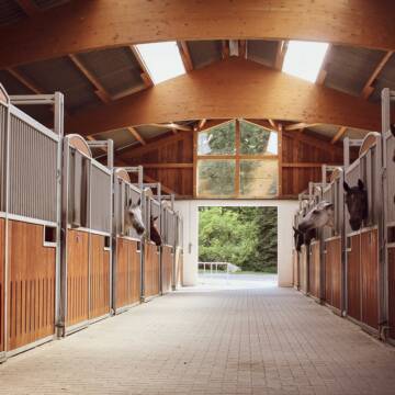

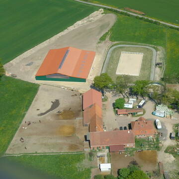
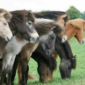
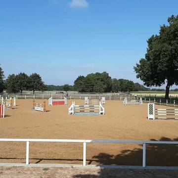
Reitanlage Alte Eichen
Kirchlinteln
Dr. Andreas Fryen
@Dr-Andreas-Fryen
FN-Mitglied
Freizeitstall
Vermieten
Paddock
Parkplatz für Pferdeanhänger
bedampftes/gewaschenes Heu
Notfallboxen
15 weitere...
S
Deprecated: Creation of dynamic property Zend_View_Helper_Ads::$adLink is deprecated in /var/www/stall-frei/htdocs/staging.stall-frei.de/library/Psf/View/Helper/Ads.php on line 108

Mitarbeiter gesucht?
Mechtersen
STALL-FREIde Marketing
@STALL-FREI-Marketing
Stellenangebote kostenlos veröffentlichen!

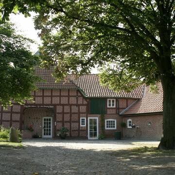
Pferde auf Uhlenborg
Dörverden
Pferde-auf-Uhlenborg
@Pferde-auf-Uhlenborg
Fahrstall, Kutschwagen
FN-Mitglied
Vermieten
Verpachten
Hunde willkommen
Krankenbox
Allergikerstall
bedampftes/gewaschenes Heu
30 weitere...
P+
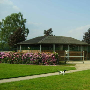
Islandpferdegestüt Vatlaboe; Vatla-Horse Spa
Bücken
Islandpferdegestuet-Vatlaboe
@Islandpferdegestuet-Vatlaboe
FN-Mitglied
Freizeitstall
Vermieten
Führanlage
Krankenbox
Allergikerstall
Gnadenbrothof
40 weitere...
P+
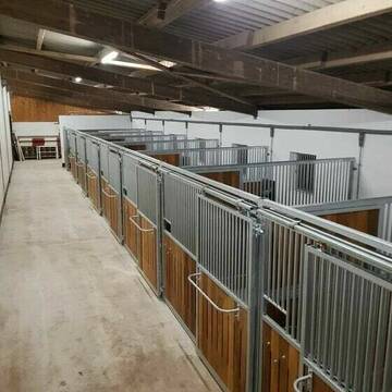
Stall Hohenholz hat Boxen frei!
Hämelhausen
Stall-Hohenholz
@Stall-Hohenholz
Pferdeausbildung
Pflegepferd
Vermieten
Hunde willkommen
Longierzirkel/Roundpen
Hufrehe geeignet
16 weitere...
P
Leider kein Vorschaubild
Leider kein Vorschaubild
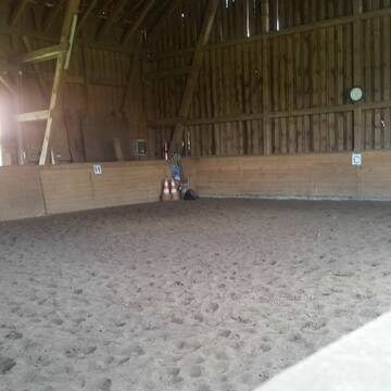
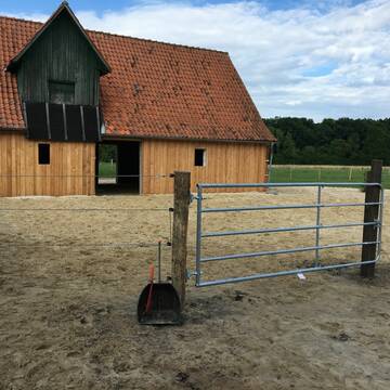
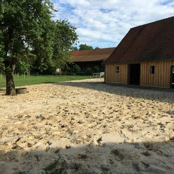
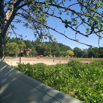
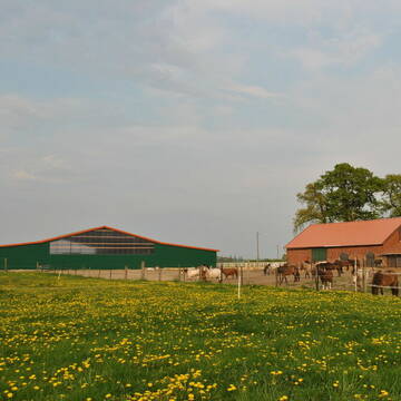
Pferdebox frei
Hassel
Katrin Koldewei
@K.Koldewei
Freizeitstall
Vermieten
Paddock
Reitplatz (z.B. Dressur, Springen, Reining)
Innenbox
Paddock Trail
5 weitere...
B
Leider kein Vorschaubild
Leider kein Vorschaubild
Boxfrei in kleiner Stall gemeinschaft
Eystrup
Stall-oestmann
@Stall-oestmann
Freizeitstall
Gangpferdereiten
Vermieten
Führanlage
Hunde willkommen
bedampftes/gewaschenes Heu
Notfallboxen
25 weitere...
B

Futtersack HeuToy, Fressbremse in pink
Mechtersen
STALL-FREIde Marketing
@STALL-FREI-Marketing
Stundenlange Beschäftigung die
Koliken vorbeugt, geringe Staubinhalation mit
steuerbarer Futterentnahme


Wittes Reitanlage
Riede
Wittes-Reitanlage
@Wittes-Reitanlage
FN-Mitglied
Geländestrecke
Vermieten
Krankenbox
Longierzirkel/Roundpen
Gnadenbrothof
Hufrehe geeignet
24 weitere...
S

Eine Box auf kleiner Reitanlage
Heemsen
hechtanke
@hechtanke
Vermieten
Führanlage
Krankenbox
Allergikerstall
Zuchtstutenhaltung möglich
Außenbox mit Paddock
Offenstall
11 weitere...
P

Pferdeboxen in Luttum bei Verden
Niedersachsen - Kirchlinteln
Reitstall Hans Mahnke
@Mahnke.1
Vermieten
Krankenbox
Longierzirkel/Roundpen
Hufrehe geeignet
Notfallboxen
Außenbox mit Paddock
Außenboxen
14 weitere...
P
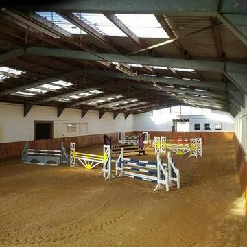
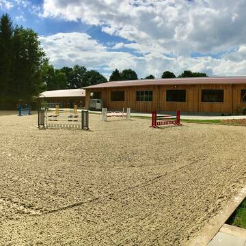
Moderne Reitanlage ideal f. Springreiter
Nienburg
Hans-Joachim-Langemeyer
@Hans-Joachim-Langemeyer
Pferdeausbildung
Reitlehrer und -unterricht
Führanlage
Paddock
Hengsthaltung möglich
Hufrehe geeignet
Außenboxen
Innenbox
12 weitere...
P+
Deprecated: Creation of dynamic property Zend_View::$pageCount is deprecated in /var/www/stall-frei/htdocs/staging.stall-frei.de/library/vendor/shardj/zf1-future/library/Zend/View/Abstract.php on line 308
Deprecated: Creation of dynamic property Zend_View::$itemCountPerPage is deprecated in /var/www/stall-frei/htdocs/staging.stall-frei.de/library/vendor/shardj/zf1-future/library/Zend/View/Abstract.php on line 308
Deprecated: Creation of dynamic property Zend_View::$first is deprecated in /var/www/stall-frei/htdocs/staging.stall-frei.de/library/vendor/shardj/zf1-future/library/Zend/View/Abstract.php on line 308
Deprecated: Creation of dynamic property Zend_View::$current is deprecated in /var/www/stall-frei/htdocs/staging.stall-frei.de/library/vendor/shardj/zf1-future/library/Zend/View/Abstract.php on line 308
Deprecated: Creation of dynamic property Zend_View::$last is deprecated in /var/www/stall-frei/htdocs/staging.stall-frei.de/library/vendor/shardj/zf1-future/library/Zend/View/Abstract.php on line 308
Deprecated: Creation of dynamic property Zend_View::$next is deprecated in /var/www/stall-frei/htdocs/staging.stall-frei.de/library/vendor/shardj/zf1-future/library/Zend/View/Abstract.php on line 308
Deprecated: Creation of dynamic property Zend_View::$pagesInRange is deprecated in /var/www/stall-frei/htdocs/staging.stall-frei.de/library/vendor/shardj/zf1-future/library/Zend/View/Abstract.php on line 308
Deprecated: Creation of dynamic property Zend_View::$firstPageInRange is deprecated in /var/www/stall-frei/htdocs/staging.stall-frei.de/library/vendor/shardj/zf1-future/library/Zend/View/Abstract.php on line 308
Deprecated: Creation of dynamic property Zend_View::$lastPageInRange is deprecated in /var/www/stall-frei/htdocs/staging.stall-frei.de/library/vendor/shardj/zf1-future/library/Zend/View/Abstract.php on line 308
Deprecated: Creation of dynamic property Zend_View::$currentItemCount is deprecated in /var/www/stall-frei/htdocs/staging.stall-frei.de/library/vendor/shardj/zf1-future/library/Zend/View/Abstract.php on line 308
Deprecated: Creation of dynamic property Zend_View::$totalItemCount is deprecated in /var/www/stall-frei/htdocs/staging.stall-frei.de/library/vendor/shardj/zf1-future/library/Zend/View/Abstract.php on line 308
Deprecated: Creation of dynamic property Zend_View::$firstItemNumber is deprecated in /var/www/stall-frei/htdocs/staging.stall-frei.de/library/vendor/shardj/zf1-future/library/Zend/View/Abstract.php on line 308
Deprecated: Creation of dynamic property Zend_View::$lastItemNumber is deprecated in /var/www/stall-frei/htdocs/staging.stall-frei.de/library/vendor/shardj/zf1-future/library/Zend/View/Abstract.php on line 308
Deprecated: Creation of dynamic property Zend_View::$router is deprecated in /var/www/stall-frei/htdocs/staging.stall-frei.de/library/vendor/shardj/zf1-future/library/Zend/View/Abstract.php on line 308
Deprecated: Creation of dynamic property Zend_View::$urlParams is deprecated in /var/www/stall-frei/htdocs/staging.stall-frei.de/library/vendor/shardj/zf1-future/library/Zend/View/Abstract.php on line 308
Deprecated: Creation of dynamic property Zend_View::$showAds is deprecated in /var/www/stall-frei/htdocs/staging.stall-frei.de/library/vendor/shardj/zf1-future/library/Zend/View/Abstract.php on line 308
Deprecated: Creation of dynamic property Zend_View::$objectIds is deprecated in /var/www/stall-frei/htdocs/staging.stall-frei.de/library/vendor/shardj/zf1-future/library/Zend/View/Abstract.php on line 308
Deprecated: Creation of dynamic property Zend_View::$showNavbar is deprecated in /var/www/stall-frei/htdocs/staging.stall-frei.de/library/vendor/shardj/zf1-future/library/Zend/View/Abstract.php on line 308
Deprecated: Creation of dynamic property Zend_View::$showBreadcrumb is deprecated in /var/www/stall-frei/htdocs/staging.stall-frei.de/library/vendor/shardj/zf1-future/library/Zend/View/Abstract.php on line 308
Deprecated: Creation of dynamic property Zend_View::$showFooter is deprecated in /var/www/stall-frei/htdocs/staging.stall-frei.de/library/vendor/shardj/zf1-future/library/Zend/View/Abstract.php on line 308
Deprecated: Creation of dynamic property Zend_View::$showInternalAds is deprecated in /var/www/stall-frei/htdocs/staging.stall-frei.de/library/vendor/shardj/zf1-future/library/Zend/View/Abstract.php on line 308
Deprecated: Creation of dynamic property Zend_View::$blNoContent is deprecated in /var/www/stall-frei/htdocs/staging.stall-frei.de/library/vendor/shardj/zf1-future/library/Zend/View/Abstract.php on line 308
Deprecated: Creation of dynamic property Zend_View::$sMetaDesc is deprecated in /var/www/stall-frei/htdocs/staging.stall-frei.de/library/vendor/shardj/zf1-future/library/Zend/View/Abstract.php on line 308
Deprecated: Creation of dynamic property Zend_View::$useGmaps is deprecated in /var/www/stall-frei/htdocs/staging.stall-frei.de/library/vendor/shardj/zf1-future/library/Zend/View/Abstract.php on line 308
Deprecated: Creation of dynamic property Zend_View::$touches is deprecated in /var/www/stall-frei/htdocs/staging.stall-frei.de/library/vendor/shardj/zf1-future/library/Zend/View/Abstract.php on line 308
Deprecated: Creation of dynamic property Zend_View::$oProject is deprecated in /var/www/stall-frei/htdocs/staging.stall-frei.de/library/vendor/shardj/zf1-future/library/Zend/View/Abstract.php on line 308
Deprecated: Creation of dynamic property Zend_View::$pageHeadline is deprecated in /var/www/stall-frei/htdocs/staging.stall-frei.de/library/vendor/shardj/zf1-future/library/Zend/View/Abstract.php on line 308
Deprecated: Creation of dynamic property Zend_View::$disableLocationField is deprecated in /var/www/stall-frei/htdocs/staging.stall-frei.de/library/vendor/shardj/zf1-future/library/Zend/View/Abstract.php on line 308
Deprecated: Creation of dynamic property Zend_View::$isSearch is deprecated in /var/www/stall-frei/htdocs/staging.stall-frei.de/library/vendor/shardj/zf1-future/library/Zend/View/Abstract.php on line 308
Deprecated: Creation of dynamic property Zend_View::$pageTitle is deprecated in /var/www/stall-frei/htdocs/staging.stall-frei.de/library/vendor/shardj/zf1-future/library/Zend/View/Abstract.php on line 308
Deprecated: Creation of dynamic property Psf_Form_Element_Text::$class is deprecated in /var/www/stall-frei/htdocs/staging.stall-frei.de/library/vendor/shardj/zf1-future/library/Zend/Form/Element.php on line 874
Deprecated: Creation of dynamic property Psf_Form_Element_Text::$size is deprecated in /var/www/stall-frei/htdocs/staging.stall-frei.de/library/vendor/shardj/zf1-future/library/Zend/Form/Element.php on line 874
Deprecated: Creation of dynamic property Psf_Form_Element_Text::$placeholder is deprecated in /var/www/stall-frei/htdocs/staging.stall-frei.de/library/vendor/shardj/zf1-future/library/Zend/Form/Element.php on line 874
Deprecated: Creation of dynamic property Psf_Form_Element_Hidden::$class is deprecated in /var/www/stall-frei/htdocs/staging.stall-frei.de/library/vendor/shardj/zf1-future/library/Zend/Form/Element.php on line 874
Deprecated: Creation of dynamic property Psf_Form_Element_Hidden::$class is deprecated in /var/www/stall-frei/htdocs/staging.stall-frei.de/library/vendor/shardj/zf1-future/library/Zend/Form/Element.php on line 874
Deprecated: Creation of dynamic property Psf_Form_Element_Hidden::$class is deprecated in /var/www/stall-frei/htdocs/staging.stall-frei.de/library/vendor/shardj/zf1-future/library/Zend/Form/Element.php on line 874
Deprecated: Creation of dynamic property Psf_Form_Element_Hidden::$class is deprecated in /var/www/stall-frei/htdocs/staging.stall-frei.de/library/vendor/shardj/zf1-future/library/Zend/Form/Element.php on line 874
Deprecated: Creation of dynamic property Psf_Form_Element_Select::$class is deprecated in /var/www/stall-frei/htdocs/staging.stall-frei.de/library/vendor/shardj/zf1-future/library/Zend/Form/Element.php on line 874
Deprecated: Creation of dynamic property Psf_Form_Element_Select::$class is deprecated in /var/www/stall-frei/htdocs/staging.stall-frei.de/library/vendor/shardj/zf1-future/library/Zend/Form/Element.php on line 874
Deprecated: Creation of dynamic property Psf_Form_Element_Select::$class is deprecated in /var/www/stall-frei/htdocs/staging.stall-frei.de/library/vendor/shardj/zf1-future/library/Zend/Form/Element.php on line 874
Deprecated: Creation of dynamic property Psf_Form_Element_Select::$class is deprecated in /var/www/stall-frei/htdocs/staging.stall-frei.de/library/vendor/shardj/zf1-future/library/Zend/Form/Element.php on line 874
Deprecated: Creation of dynamic property Psf_Form_Element_Text::$class is deprecated in /var/www/stall-frei/htdocs/staging.stall-frei.de/library/vendor/shardj/zf1-future/library/Zend/Form/Element.php on line 874
Deprecated: Creation of dynamic property Psf_Form_Element_Checkbox::$label is deprecated in /var/www/stall-frei/htdocs/staging.stall-frei.de/library/vendor/shardj/zf1-future/library/Zend/Form/Element.php on line 874
Deprecated: Creation of dynamic property Zend_View::$sort is deprecated in /var/www/stall-frei/htdocs/staging.stall-frei.de/library/vendor/shardj/zf1-future/library/Zend/View/Abstract.php on line 308
Deprecated: Creation of dynamic property Zend_View::$searchLocation is deprecated in /var/www/stall-frei/htdocs/staging.stall-frei.de/library/vendor/shardj/zf1-future/library/Zend/View/Abstract.php on line 308
Deprecated: Creation of dynamic property Zend_View::$locationHint is deprecated in /var/www/stall-frei/htdocs/staging.stall-frei.de/library/vendor/shardj/zf1-future/library/Zend/View/Abstract.php on line 308
Psf_GeoCoder_Abstract::getLocation: Hassel (Weser) Get Location CachedOrLive
Psf_GeoCoder_Abstract::getCachedOrLive: Hassel (Weser)
Psf_GeoCoder_OpenCageData::makeApiRequest: response:
Array
(
[documentation] => https://opencagedata.com/api
[licenses] => Array
(
[0] => Array
(
[name] => see attribution guide
[url] => https://opencagedata.com/credits
)
)
[results] => Array
(
[0] => Array
(
[bounds] => Array
(
[northeast] => Array
(
[lat] => 52.8224796
[lng] => 9.3258832
)
[southwest] => Array
(
[lat] => 52.759512
[lng] => 9.1674607
)
)
[components] => Array
(
[ISO_3166-1_alpha-2] => DE
[ISO_3166-1_alpha-3] => DEU
[ISO_3166-2] => Array
(
[0] => DE-NI
)
[_category] => place
[_normalized_city] => Hassel (Weser)
[_type] => village
[continent] => Europe
[country] => Deutschland
[country_code] => de
[county] => Landkreis Nienburg/Weser
[municipality] => Samtgemeinde Grafschaft Hoya
[political_union] => European Union
[state] => Niedersachsen
[state_code] => NI
[village] => Hassel (Weser)
)
[confidence] => 7
[formatted] => Hassel (Weser), Niedersachsen, Deutschland
[geometry] => Array
(
[lat] => 52.8031396
[lng] => 9.2034462
)
)
[1] => Array
(
[components] => Array
(
[ISO_3166-1_alpha-2] => FR
[ISO_3166-1_alpha-3] => FRA
[ISO_3166-2] => Array
(
[0] => FR-GES
[1] => FR-57
)
[_category] => place
[_normalized_city] => Bitche
[_type] => place
[city] => Bitche
[continent] => Europe
[country] => France
[country_code] => fr
[county] => Moselle
[local_authority] => Communauté de communes du Pays de Bitche
[place] => Hassel Biel
[political_union] => European Union
[postcode] => 57230
[state] => Grand Est
[state_code] => GES
)
[confidence] => 3
[formatted] => Hassel Biel, 57230 Bitche, France
[geometry] => Array
(
[lat] => 49.038188
[lng] => 7.440459
)
)
[2] => Array
(
[components] => Array
(
[ISO_3166-1_alpha-2] => FR
[ISO_3166-1_alpha-3] => FRA
[ISO_3166-2] => Array
(
[0] => FR-NAQ
[1] => FR-16
)
[_category] => road
[_normalized_city] => Angoulême
[_type] => road
[city] => Angoulême
[continent] => Europe
[country] => France
[country_code] => fr
[county] => Charente
[local_authority] => Communauté d'agglomération du Grand Angoulême
[political_union] => European Union
[postcode] => 16000
[road] => Rue Hassel
[state] => Nouvelle-Aquitaine
[state_code] => NAQ
)
[confidence] => 3
[formatted] => Rue Hassel, 16000 Angoulême, France
[geometry] => Array
(
[lat] => 45.636854
[lng] => 0.152679
)
)
[3] => Array
(
[components] => Array
(
[ISO_3166-1_alpha-2] => FR
[ISO_3166-1_alpha-3] => FRA
[ISO_3166-2] => Array
(
[0] => FR-GES
[1] => FR-57
)
[_category] => road
[_normalized_city] => Hagondange
[_type] => road
[city] => Hagondange
[continent] => Europe
[country] => France
[country_code] => fr
[county] => Moselle
[local_authority] => Rives de Moselle
[political_union] => European Union
[postcode] => 57300
[road] => Rue du Hassel
[state] => Grand Est
[state_code] => GES
)
[confidence] => 2
[formatted] => Rue du Hassel, 57300 Hagondange, France
[geometry] => Array
(
[lat] => 49.250847
[lng] => 6.155442
)
)
[4] => Array
(
[components] => Array
(
[ISO_3166-1_alpha-2] => FR
[ISO_3166-1_alpha-3] => FRA
[ISO_3166-2] => Array
(
[0] => FR-HDF
[1] => FR-80
)
[_category] => road
[_normalized_city] => Rosières-en-Santerre
[_type] => road
[city] => Rosières-en-Santerre
[continent] => Europe
[country] => France
[country_code] => fr
[county] => Somme
[local_authority] => Communauté de communes Terre de Picardie
[political_union] => European Union
[postcode] => 80170
[road] => Rue d’Assel
[state] => Hauts-de-France
[state_code] => HDF
)
[confidence] => 2
[formatted] => Rue d’Assel, 80170 Rosières-en-Santerre, France
[geometry] => Array
(
[lat] => 49.818939
[lng] => 2.714217
)
)
[5] => Array
(
[components] => Array
(
[ISO_3166-1_alpha-2] => FR
[ISO_3166-1_alpha-3] => FRA
[ISO_3166-2] => Array
(
[0] => FR-NAQ
[1] => FR-24
)
[_category] => road
[_normalized_city] => Condat-sur-Vézère
[_type] => road
[city] => Condat-sur-Vézère
[continent] => Europe
[country] => France
[country_code] => fr
[county] => Dordogne
[local_authority] => Communauté de communes Terrassonnais Haut Périgord Noir
[political_union] => European Union
[postcode] => 24570
[road] => Impasse du Chapial
[state] => Nouvelle-Aquitaine
[state_code] => NAQ
)
[confidence] => 10
[formatted] => Impasse du Chapial, 24570 Condat-sur-Vézère, France
[geometry] => Array
(
[lat] => 45.115731
[lng] => 1.23026
)
)
[6] => Array
(
[components] => Array
(
[ISO_3166-1_alpha-2] => FR
[ISO_3166-1_alpha-3] => FRA
[ISO_3166-2] => Array
(
[0] => FR-OCC
[1] => FR-31
)
[_category] => road
[_normalized_city] => La Salvetat-Saint-Gilles
[_type] => road
[city] => La Salvetat-Saint-Gilles
[continent] => Europe
[country] => France
[country_code] => fr
[county] => Haute-Garonne
[local_authority] => Le Grand Ouest Toulousain
[political_union] => European Union
[postcode] => 31880
[road] => Impasse de la Vezere
[state] => Occitanie
[state_code] => OCC
)
[confidence] => 10
[formatted] => Impasse de la Vezere, 31880 La Salvetat-Saint-Gilles, France
[geometry] => Array
(
[lat] => 43.581826
[lng] => 1.251677
)
)
[7] => Array
(
[components] => Array
(
[ISO_3166-1_alpha-2] => FR
[ISO_3166-1_alpha-3] => FRA
[ISO_3166-2] => Array
(
[0] => FR-NAQ
[1] => FR-24
)
[_category] => road
[_normalized_city] => Condat-sur-Vézère
[_type] => road
[city] => Condat-sur-Vézère
[continent] => Europe
[country] => France
[country_code] => fr
[county] => Dordogne
[local_authority] => Communauté de communes Terrassonnais Haut Périgord Noir
[political_union] => European Union
[postcode] => 24570
[road] => Impasse des Escures
[state] => Nouvelle-Aquitaine
[state_code] => NAQ
)
[confidence] => 10
[formatted] => Impasse des Escures, 24570 Condat-sur-Vézère, France
[geometry] => Array
(
[lat] => 45.119474
[lng] => 1.232071
)
)
[8] => Array
(
[components] => Array
(
[ISO_3166-1_alpha-2] => FR
[ISO_3166-1_alpha-3] => FRA
[ISO_3166-2] => Array
(
[0] => FR-NAQ
[1] => FR-24
)
[_category] => road
[_normalized_city] => Pazayac
[_type] => road
[city] => Pazayac
[continent] => Europe
[country] => France
[country_code] => fr
[county] => Dordogne
[local_authority] => Communauté de communes Terrassonnais Haut Périgord Noir
[political_union] => European Union
[postcode] => 24120
[road] => Impasse de la Vézère
[state] => Nouvelle-Aquitaine
[state_code] => NAQ
)
[confidence] => 10
[formatted] => Impasse de la Vézère, 24120 Pazayac, France
[geometry] => Array
(
[lat] => 45.130299
[lng] => 1.389061
)
)
[9] => Array
(
[components] => Array
(
[ISO_3166-1_alpha-2] => FR
[ISO_3166-1_alpha-3] => FRA
[ISO_3166-2] => Array
(
[0] => FR-NAQ
[1] => FR-24
)
[_category] => road
[_normalized_city] => Aubas
[_type] => road
[city] => Aubas
[continent] => Europe
[country] => France
[country_code] => fr
[county] => Dordogne
[local_authority] => Communauté de communes de la Vallée de l'Homme
[political_union] => European Union
[postcode] => 24290
[road] => Impasse de la Vézère
[state] => Nouvelle-Aquitaine
[state_code] => NAQ
)
[confidence] => 10
[formatted] => Impasse de la Vézère, 24290 Aubas, France
[geometry] => Array
(
[lat] => 45.087953
[lng] => 1.194162
)
)
)
[status] => Array
(
[code] => 200
[message] => OK
)
[stay_informed] => Array
(
[blog] => https://blog.opencagedata.com
[mastodon] => https://en.osm.town/@opencage
)
[thanks] => For using an OpenCage API
[timestamp] => Array
(
[created_http] => Sun, 08 Feb 2026 14:47:36 GMT
[created_unix] => 1770562056
)
[total_results] => 10
)
Psf_GeoCoder_Abstract::convertLocationResult
{"documentation":"https:\/\/opencagedata.com\/api","licenses":[{"name":"see attribution guide","url":"https:\/\/opencagedata.com\/credits"}],"results":[{"bounds":{"northeast":{"lat":52.8224796,"lng":9.3258832},"southwest":{"lat":52.759512,"lng":9.1674607}},"components":{"ISO_3166-1_alpha-2":"DE","ISO_3166-1_alpha-3":"DEU","ISO_3166-2":["DE-NI"],"_category":"place","_normalized_city":"Hassel (Weser)","_type":"village","continent":"Europe","country":"Deutschland","country_code":"de","county":"Landkreis Nienburg\/Weser","municipality":"Samtgemeinde Grafschaft Hoya","political_union":"European Union","state":"Niedersachsen","state_code":"NI","village":"Hassel (Weser)"},"confidence":7,"formatted":"Hassel (Weser), Niedersachsen, Deutschland","geometry":{"lat":52.8031396,"lng":9.2034462}},{"components":{"ISO_3166-1_alpha-2":"FR","ISO_3166-1_alpha-3":"FRA","ISO_3166-2":["FR-GES","FR-57"],"_category":"place","_normalized_city":"Bitche","_type":"place","city":"Bitche","continent":"Europe","country":"France","country_code":"fr","county":"Moselle","local_authority":"Communaut\u00e9 de communes du Pays de Bitche","place":"Hassel Biel","political_union":"European Union","postcode":"57230","state":"Grand Est","state_code":"GES"},"confidence":3,"formatted":"Hassel Biel, 57230 Bitche, France","geometry":{"lat":49.038188,"lng":7.440459}},{"components":{"ISO_3166-1_alpha-2":"FR","ISO_3166-1_alpha-3":"FRA","ISO_3166-2":["FR-NAQ","FR-16"],"_category":"road","_normalized_city":"Angoul\u00eame","_type":"road","city":"Angoul\u00eame","continent":"Europe","country":"France","country_code":"fr","county":"Charente","local_authority":"Communaut\u00e9 d'agglom\u00e9ration du Grand Angoul\u00eame","political_union":"European Union","postcode":"16000","road":"Rue Hassel","state":"Nouvelle-Aquitaine","state_code":"NAQ"},"confidence":3,"formatted":"Rue Hassel, 16000 Angoul\u00eame, France","geometry":{"lat":45.636854,"lng":0.152679}},{"components":{"ISO_3166-1_alpha-2":"FR","ISO_3166-1_alpha-3":"FRA","ISO_3166-2":["FR-GES","FR-57"],"_category":"road","_normalized_city":"Hagondange","_type":"road","city":"Hagondange","continent":"Europe","country":"France","country_code":"fr","county":"Moselle","local_authority":"Rives de Moselle","political_union":"European Union","postcode":"57300","road":"Rue du Hassel","state":"Grand Est","state_code":"GES"},"confidence":2,"formatted":"Rue du Hassel, 57300 Hagondange, France","geometry":{"lat":49.250847,"lng":6.155442}},{"components":{"ISO_3166-1_alpha-2":"FR","ISO_3166-1_alpha-3":"FRA","ISO_3166-2":["FR-HDF","FR-80"],"_category":"road","_normalized_city":"Rosi\u00e8res-en-Santerre","_type":"road","city":"Rosi\u00e8res-en-Santerre","continent":"Europe","country":"France","country_code":"fr","county":"Somme","local_authority":"Communaut\u00e9 de communes Terre de Picardie","political_union":"European Union","postcode":"80170","road":"Rue d\u2019Assel","state":"Hauts-de-France","state_code":"HDF"},"confidence":2,"formatted":"Rue d\u2019Assel, 80170 Rosi\u00e8res-en-Santerre, France","geometry":{"lat":49.818939,"lng":2.714217}},{"components":{"ISO_3166-1_alpha-2":"FR","ISO_3166-1_alpha-3":"FRA","ISO_3166-2":["FR-NAQ","FR-24"],"_category":"road","_normalized_city":"Condat-sur-V\u00e9z\u00e8re","_type":"road","city":"Condat-sur-V\u00e9z\u00e8re","continent":"Europe","country":"France","country_code":"fr","county":"Dordogne","local_authority":"Communaut\u00e9 de communes Terrassonnais Haut P\u00e9rigord Noir","political_union":"European Union","postcode":"24570","road":"Impasse du Chapial","state":"Nouvelle-Aquitaine","state_code":"NAQ"},"confidence":10,"formatted":"Impasse du Chapial, 24570 Condat-sur-V\u00e9z\u00e8re, France","geometry":{"lat":45.115731,"lng":1.23026}},{"components":{"ISO_3166-1_alpha-2":"FR","ISO_3166-1_alpha-3":"FRA","ISO_3166-2":["FR-OCC","FR-31"],"_category":"road","_normalized_city":"La Salvetat-Saint-Gilles","_type":"road","city":"La Salvetat-Saint-Gilles","continent":"Europe","country":"France","country_code":"fr","county":"Haute-Garonne","local_authority":"Le Grand Ouest Toulousain","political_union":"European Union","postcode":"31880","road":"Impasse de la Vezere","state":"Occitanie","state_code":"OCC"},"confidence":10,"formatted":"Impasse de la Vezere, 31880 La Salvetat-Saint-Gilles, France","geometry":{"lat":43.581826,"lng":1.251677}},{"components":{"ISO_3166-1_alpha-2":"FR","ISO_3166-1_alpha-3":"FRA","ISO_3166-2":["FR-NAQ","FR-24"],"_category":"road","_normalized_city":"Condat-sur-V\u00e9z\u00e8re","_type":"road","city":"Condat-sur-V\u00e9z\u00e8re","continent":"Europe","country":"France","country_code":"fr","county":"Dordogne","local_authority":"Communaut\u00e9 de communes Terrassonnais Haut P\u00e9rigord Noir","political_union":"European Union","postcode":"24570","road":"Impasse des Escures","state":"Nouvelle-Aquitaine","state_code":"NAQ"},"confidence":10,"formatted":"Impasse des Escures, 24570 Condat-sur-V\u00e9z\u00e8re, France","geometry":{"lat":45.119474,"lng":1.232071}},{"components":{"ISO_3166-1_alpha-2":"FR","ISO_3166-1_alpha-3":"FRA","ISO_3166-2":["FR-NAQ","FR-24"],"_category":"road","_normalized_city":"Pazayac","_type":"road","city":"Pazayac","continent":"Europe","country":"France","country_code":"fr","county":"Dordogne","local_authority":"Communaut\u00e9 de communes Terrassonnais Haut P\u00e9rigord Noir","political_union":"European Union","postcode":"24120","road":"Impasse de la V\u00e9z\u00e8re","state":"Nouvelle-Aquitaine","state_code":"NAQ"},"confidence":10,"formatted":"Impasse de la V\u00e9z\u00e8re, 24120 Pazayac, France","geometry":{"lat":45.130299,"lng":1.389061}},{"components":{"ISO_3166-1_alpha-2":"FR","ISO_3166-1_alpha-3":"FRA","ISO_3166-2":["FR-NAQ","FR-24"],"_category":"road","_normalized_city":"Aubas","_type":"road","city":"Aubas","continent":"Europe","country":"France","country_code":"fr","county":"Dordogne","local_authority":"Communaut\u00e9 de communes de la Vall\u00e9e de l'Homme","political_union":"European Union","postcode":"24290","road":"Impasse de la V\u00e9z\u00e8re","state":"Nouvelle-Aquitaine","state_code":"NAQ"},"confidence":10,"formatted":"Impasse de la V\u00e9z\u00e8re, 24290 Aubas, France","geometry":{"lat":45.087953,"lng":1.194162}}],"status":{"code":200,"message":"OK"},"stay_informed":{"blog":"https:\/\/blog.opencagedata.com","mastodon":"https:\/\/en.osm.town\/@opencage"},"thanks":"For using an OpenCage API","timestamp":{"created_http":"Sun, 08 Feb 2026 14:47:36 GMT","created_unix":1770562056},"total_results":10}Array
(
[0] => stdClass Object
(
[bounds] => stdClass Object
(
[northeast] => stdClass Object
(
[lat] => 52.8224796
[lng] => 9.3258832
)
[southwest] => stdClass Object
(
[lat] => 52.759512
[lng] => 9.1674607
)
)
[components] => stdClass Object
(
[ISO_3166-1_alpha-2] => DE
[ISO_3166-1_alpha-3] => DEU
[ISO_3166-2] => Array
(
[0] => DE-NI
)
[_category] => place
[_normalized_city] => Hassel (Weser)
[_type] => village
[continent] => Europe
[country] => Deutschland
[country_code] => de
[county] => Landkreis Nienburg/Weser
[municipality] => Samtgemeinde Grafschaft Hoya
[political_union] => European Union
[state] => Niedersachsen
[state_code] => NI
[village] => Hassel (Weser)
)
[confidence] => 7
[formatted] => Hassel (Weser), Niedersachsen, Deutschland
[geometry] => stdClass Object
(
[lat] => 52.8031396
[lng] => 9.2034462
)
)
[1] => stdClass Object
(
[components] => stdClass Object
(
[ISO_3166-1_alpha-2] => FR
[ISO_3166-1_alpha-3] => FRA
[ISO_3166-2] => Array
(
[0] => FR-GES
[1] => FR-57
)
[_category] => place
[_normalized_city] => Bitche
[_type] => place
[city] => Bitche
[continent] => Europe
[country] => France
[country_code] => fr
[county] => Moselle
[local_authority] => Communauté de communes du Pays de Bitche
[place] => Hassel Biel
[political_union] => European Union
[postcode] => 57230
[state] => Grand Est
[state_code] => GES
)
[confidence] => 3
[formatted] => Hassel Biel, 57230 Bitche, France
[geometry] => stdClass Object
(
[lat] => 49.038188
[lng] => 7.440459
)
)
[2] => stdClass Object
(
[components] => stdClass Object
(
[ISO_3166-1_alpha-2] => FR
[ISO_3166-1_alpha-3] => FRA
[ISO_3166-2] => Array
(
[0] => FR-NAQ
[1] => FR-16
)
[_category] => road
[_normalized_city] => Angoulême
[_type] => road
[city] => Angoulême
[continent] => Europe
[country] => France
[country_code] => fr
[county] => Charente
[local_authority] => Communauté d'agglomération du Grand Angoulême
[political_union] => European Union
[postcode] => 16000
[road] => Rue Hassel
[state] => Nouvelle-Aquitaine
[state_code] => NAQ
)
[confidence] => 3
[formatted] => Rue Hassel, 16000 Angoulême, France
[geometry] => stdClass Object
(
[lat] => 45.636854
[lng] => 0.152679
)
)
[3] => stdClass Object
(
[components] => stdClass Object
(
[ISO_3166-1_alpha-2] => FR
[ISO_3166-1_alpha-3] => FRA
[ISO_3166-2] => Array
(
[0] => FR-GES
[1] => FR-57
)
[_category] => road
[_normalized_city] => Hagondange
[_type] => road
[city] => Hagondange
[continent] => Europe
[country] => France
[country_code] => fr
[county] => Moselle
[local_authority] => Rives de Moselle
[political_union] => European Union
[postcode] => 57300
[road] => Rue du Hassel
[state] => Grand Est
[state_code] => GES
)
[confidence] => 2
[formatted] => Rue du Hassel, 57300 Hagondange, France
[geometry] => stdClass Object
(
[lat] => 49.250847
[lng] => 6.155442
)
)
[4] => stdClass Object
(
[components] => stdClass Object
(
[ISO_3166-1_alpha-2] => FR
[ISO_3166-1_alpha-3] => FRA
[ISO_3166-2] => Array
(
[0] => FR-HDF
[1] => FR-80
)
[_category] => road
[_normalized_city] => Rosières-en-Santerre
[_type] => road
[city] => Rosières-en-Santerre
[continent] => Europe
[country] => France
[country_code] => fr
[county] => Somme
[local_authority] => Communauté de communes Terre de Picardie
[political_union] => European Union
[postcode] => 80170
[road] => Rue d’Assel
[state] => Hauts-de-France
[state_code] => HDF
)
[confidence] => 2
[formatted] => Rue d’Assel, 80170 Rosières-en-Santerre, France
[geometry] => stdClass Object
(
[lat] => 49.818939
[lng] => 2.714217
)
)
[5] => stdClass Object
(
[components] => stdClass Object
(
[ISO_3166-1_alpha-2] => FR
[ISO_3166-1_alpha-3] => FRA
[ISO_3166-2] => Array
(
[0] => FR-NAQ
[1] => FR-24
)
[_category] => road
[_normalized_city] => Condat-sur-Vézère
[_type] => road
[city] => Condat-sur-Vézère
[continent] => Europe
[country] => France
[country_code] => fr
[county] => Dordogne
[local_authority] => Communauté de communes Terrassonnais Haut Périgord Noir
[political_union] => European Union
[postcode] => 24570
[road] => Impasse du Chapial
[state] => Nouvelle-Aquitaine
[state_code] => NAQ
)
[confidence] => 10
[formatted] => Impasse du Chapial, 24570 Condat-sur-Vézère, France
[geometry] => stdClass Object
(
[lat] => 45.115731
[lng] => 1.23026
)
)
[6] => stdClass Object
(
[components] => stdClass Object
(
[ISO_3166-1_alpha-2] => FR
[ISO_3166-1_alpha-3] => FRA
[ISO_3166-2] => Array
(
[0] => FR-OCC
[1] => FR-31
)
[_category] => road
[_normalized_city] => La Salvetat-Saint-Gilles
[_type] => road
[city] => La Salvetat-Saint-Gilles
[continent] => Europe
[country] => France
[country_code] => fr
[county] => Haute-Garonne
[local_authority] => Le Grand Ouest Toulousain
[political_union] => European Union
[postcode] => 31880
[road] => Impasse de la Vezere
[state] => Occitanie
[state_code] => OCC
)
[confidence] => 10
[formatted] => Impasse de la Vezere, 31880 La Salvetat-Saint-Gilles, France
[geometry] => stdClass Object
(
[lat] => 43.581826
[lng] => 1.251677
)
)
[7] => stdClass Object
(
[components] => stdClass Object
(
[ISO_3166-1_alpha-2] => FR
[ISO_3166-1_alpha-3] => FRA
[ISO_3166-2] => Array
(
[0] => FR-NAQ
[1] => FR-24
)
[_category] => road
[_normalized_city] => Condat-sur-Vézère
[_type] => road
[city] => Condat-sur-Vézère
[continent] => Europe
[country] => France
[country_code] => fr
[county] => Dordogne
[local_authority] => Communauté de communes Terrassonnais Haut Périgord Noir
[political_union] => European Union
[postcode] => 24570
[road] => Impasse des Escures
[state] => Nouvelle-Aquitaine
[state_code] => NAQ
)
[confidence] => 10
[formatted] => Impasse des Escures, 24570 Condat-sur-Vézère, France
[geometry] => stdClass Object
(
[lat] => 45.119474
[lng] => 1.232071
)
)
[8] => stdClass Object
(
[components] => stdClass Object
(
[ISO_3166-1_alpha-2] => FR
[ISO_3166-1_alpha-3] => FRA
[ISO_3166-2] => Array
(
[0] => FR-NAQ
[1] => FR-24
)
[_category] => road
[_normalized_city] => Pazayac
[_type] => road
[city] => Pazayac
[continent] => Europe
[country] => France
[country_code] => fr
[county] => Dordogne
[local_authority] => Communauté de communes Terrassonnais Haut Périgord Noir
[political_union] => European Union
[postcode] => 24120
[road] => Impasse de la Vézère
[state] => Nouvelle-Aquitaine
[state_code] => NAQ
)
[confidence] => 10
[formatted] => Impasse de la Vézère, 24120 Pazayac, France
[geometry] => stdClass Object
(
[lat] => 45.130299
[lng] => 1.389061
)
)
[9] => stdClass Object
(
[components] => stdClass Object
(
[ISO_3166-1_alpha-2] => FR
[ISO_3166-1_alpha-3] => FRA
[ISO_3166-2] => Array
(
[0] => FR-NAQ
[1] => FR-24
)
[_category] => road
[_normalized_city] => Aubas
[_type] => road
[city] => Aubas
[continent] => Europe
[country] => France
[country_code] => fr
[county] => Dordogne
[local_authority] => Communauté de communes de la Vallée de l'Homme
[political_union] => European Union
[postcode] => 24290
[road] => Impasse de la Vézère
[state] => Nouvelle-Aquitaine
[state_code] => NAQ
)
[confidence] => 10
[formatted] => Impasse de la Vézère, 24290 Aubas, France
[geometry] => stdClass Object
(
[lat] => 45.087953
[lng] => 1.194162
)
)
)
Psf_GeoCoder_OpenCageData::getKeyMap: 0
stdClass Object
(
    [bounds] => stdClass Object
        (
            [northeast] => stdClass Object
                (
                    [lat] => 52.8224796
                    [lng] => 9.3258832
                )

            [southwest] => stdClass Object
                (
                    [lat] => 52.759512
                    [lng] => 9.1674607
                )

        )

    [components] => stdClass Object
        (
            [ISO_3166-1_alpha-2] => DE
            [ISO_3166-1_alpha-3] => DEU
            [ISO_3166-2] => Array
                (
                    [0] => DE-NI
                )

            [_category] => place
            [_normalized_city] => Hassel (Weser)
            [_type] => village
            [continent] => Europe
            [country] => Deutschland
            [country_code] => de
            [county] => Landkreis Nienburg/Weser
            [municipality] => Samtgemeinde Grafschaft Hoya
            [political_union] => European Union
            [state] => Niedersachsen
            [state_code] => NI
            [village] => Hassel (Weser)
        )

    [confidence] => 7
    [formatted] => Hassel (Weser), Niedersachsen, Deutschland
    [geometry] => stdClass Object
        (
            [lat] => 52.8031396
            [lng] => 9.2034462
        )

)
Psf_GeoCoder_OpenCageData::getCounty: Nienburg/Weser
Psf_GeoCoder_OpenCageData::addMissingData REFETCH!
Array
(
    [address] => Hassel (Weser), Niedersachsen, Deutschland
    [type] => village
    [street] =>
    [city] => Hassel (Weser)
    [county] => Nienburg/Weser
    [state] => Niedersachsen
    [zip] =>
    [country] => Deutschland
    [suburb] =>
    [countrycode] => de
    [latitude] => 52.8031396
    [longitude] => 9.2034462
    [accuracy] => 1
    [confidence] => 7
    [bounds] => stdClass Object
        (
            [northeast] => stdClass Object
                (
                    [lat] => 52.8224796
                    [lng] => 9.3258832
                )

            [southwest] => stdClass Object
                (
                    [lat] => 52.759512
                    [lng] => 9.1674607
                )

        )

)
reformat!
Array
(
    [address] => Hassel (Weser), Niedersachsen, Deutschland
    [type] => village
    [street] =>
    [city] => Hassel (Weser)
    [county] => Nienburg/Weser
    [state] => Niedersachsen
    [zip] =>
    [country] => Deutschland
    [suburb] =>
    [countrycode] => de
    [latitude] => 52.8031396
    [longitude] => 9.2034462
    [accuracy] => 1
    [confidence] => 7
    [bounds] => stdClass Object
        (
            [northeast] => stdClass Object
                (
                    [lat] => 52.8224796
                    [lng] => 9.3258832
                )

            [southwest] => stdClass Object
                (
                    [lat] => 52.759512
                    [lng] => 9.1674607
                )

        )

    [place] => Hassel (Weser), Niedersachsen
    [hash] => 373bce9dfed5e1fbb858018e6fc047c0
)
Psf_GeoCoder_OpenCageData::getKeyMap: 1
stdClass Object
(
    [components] => stdClass Object
        (
            [ISO_3166-1_alpha-2] => FR
            [ISO_3166-1_alpha-3] => FRA
            [ISO_3166-2] => Array
                (
                    [0] => FR-GES
                    [1] => FR-57
                )

            [_category] => place
            [_normalized_city] => Bitche
            [_type] => place
            [city] => Bitche
            [continent] => Europe
            [country] => France
            [country_code] => fr
            [county] => Moselle
            [local_authority] => Communauté de communes du Pays de Bitche
            [place] => Hassel Biel
            [political_union] => European Union
            [postcode] => 57230
            [state] => Grand Est
            [state_code] => GES
        )

    [confidence] => 3
    [formatted] => Hassel Biel, 57230 Bitche, France
    [geometry] => stdClass Object
        (
            [lat] => 49.038188
            [lng] => 7.440459
        )

)
Psf_GeoCoder_OpenCageData::getCounty: Moselle
Psf_GeoCoder_OpenCageData::addMissingData REFETCH!
Array
(
    [address] => Hassel Biel, 57230 Bitche, France
    [type] => place
    [street] =>
    [city] => Bitche
    [county] => Moselle
    [state] => Grand Est
    [zip] => 57230
    [country] => France
    [suburb] =>
    [countrycode] => fr
    [latitude] => 49.038188
    [longitude] => 7.440459
    [accuracy] => 1
    [confidence] => 3
    [bounds] =>
)
reformat!
Array
(
    [address] => Hassel Biel, 57230 Bitche, France
    [type] => place
    [street] =>
    [city] => Bitche
    [county] => Moselle
    [state] => Grand Est
    [zip] => 57230
    [country] => France
    [suburb] =>
    [countrycode] => fr
    [latitude] => 49.038188
    [longitude] => 7.440459
    [accuracy] => 1
    [confidence] => 3
    [bounds] =>
    [place] => 57230 Bitche, Grand Est
    [hash] => f9c4ac1d406c85622fa723e4278eb072
)
Psf_GeoCoder_OpenCageData::getKeyMap: 2
stdClass Object
(
    [components] => stdClass Object
        (
            [ISO_3166-1_alpha-2] => FR
            [ISO_3166-1_alpha-3] => FRA
            [ISO_3166-2] => Array
                (
                    [0] => FR-NAQ
                    [1] => FR-16
                )

            [_category] => road
            [_normalized_city] => Angoulême
            [_type] => road
            [city] => Angoulême
            [continent] => Europe
            [country] => France
            [country_code] => fr
            [county] => Charente
            [local_authority] => Communauté d'agglomération du Grand Angoulême
            [political_union] => European Union
            [postcode] => 16000
            [road] => Rue Hassel
            [state] => Nouvelle-Aquitaine
            [state_code] => NAQ
        )

    [confidence] => 3
    [formatted] => Rue Hassel, 16000 Angoulême, France
    [geometry] => stdClass Object
        (
            [lat] => 45.636854
            [lng] => 0.152679
        )

)
Psf_GeoCoder_OpenCageData::getCounty: Charente
Psf_GeoCoder_OpenCageData::addMissingData REFETCH!
Array
(
    [address] => Rue Hassel, 16000 Angoulême, France
    [type] => road
    [street] => Rue Hassel
    [city] => Angoulême
    [county] => Charente
    [state] => Nouvelle-Aquitaine
    [zip] => 16000
    [country] => France
    [suburb] =>
    [countrycode] => fr
    [latitude] => 45.636854
    [longitude] => 0.152679
    [accuracy] => 1
    [confidence] => 3
    [bounds] =>
)
reformat!
Array
(
    [address] => Rue Hassel, 16000 Angoulême, France
    [type] => road
    [street] => Rue Hassel
    [city] => Angoulême
    [county] => Charente
    [state] => Nouvelle-Aquitaine
    [zip] => 16000
    [country] => France
    [suburb] =>
    [countrycode] => fr
    [latitude] => 45.636854
    [longitude] => 0.152679
    [accuracy] => 1
    [confidence] => 3
    [bounds] =>
    [place] => Rue Hassel, 16000 Angoulême, Nouvelle-Aquitaine
    [hash] => b31fb4a28fc41099b9fa9ac7d9356d3e
)
Psf_GeoCoder_OpenCageData::getKeyMap: 3
stdClass Object
(
    [components] => stdClass Object
        (
            [ISO_3166-1_alpha-2] => FR
            [ISO_3166-1_alpha-3] => FRA
            [ISO_3166-2] => Array
                (
                    [0] => FR-GES
                    [1] => FR-57
                )

            [_category] => road
            [_normalized_city] => Hagondange
            [_type] => road
            [city] => Hagondange
            [continent] => Europe
            [country] => France
            [country_code] => fr
            [county] => Moselle
            [local_authority] => Rives de Moselle
            [political_union] => European Union
            [postcode] => 57300
            [road] => Rue du Hassel
            [state] => Grand Est
            [state_code] => GES
        )

    [confidence] => 2
    [formatted] => Rue du Hassel, 57300 Hagondange, France
    [geometry] => stdClass Object
        (
            [lat] => 49.250847
            [lng] => 6.155442
        )

)
Psf_GeoCoder_OpenCageData::getCounty: Moselle
Psf_GeoCoder_OpenCageData::addMissingData REFETCH!
Array
(
    [address] => Rue du Hassel, 57300 Hagondange, France
    [type] => road
    [street] => Rue du Hassel
    [city] => Hagondange
    [county] => Moselle
    [state] => Grand Est
    [zip] => 57300
    [country] => France
    [suburb] =>
    [countrycode] => fr
    [latitude] => 49.250847
    [longitude] => 6.155442
    [accuracy] => 1
    [confidence] => 2
    [bounds] =>
)
reformat!
Array
(
    [address] => Rue du Hassel, 57300 Hagondange, France
    [type] => road
    [street] => Rue du Hassel
    [city] => Hagondange
    [county] => Moselle
    [state] => Grand Est
    [zip] => 57300
    [country] => France
    [suburb] =>
    [countrycode] => fr
    [latitude] => 49.250847
    [longitude] => 6.155442
    [accuracy] => 1
    [confidence] => 2
    [bounds] =>
    [place] => Rue du Hassel, 57300 Hagondange, Grand Est
    [hash] => 62e04c794a7274c56348f719afd7c116
)
Psf_GeoCoder_OpenCageData::getKeyMap: 4
stdClass Object
(
    [components] => stdClass Object
        (
            [ISO_3166-1_alpha-2] => FR
            [ISO_3166-1_alpha-3] => FRA
            [ISO_3166-2] => Array
                (
                    [0] => FR-HDF
                    [1] => FR-80
                )

            [_category] => road
            [_normalized_city] => Rosières-en-Santerre
            [_type] => road
            [city] => Rosières-en-Santerre
            [continent] => Europe
            [country] => France
            [country_code] => fr
            [county] => Somme
            [local_authority] => Communauté de communes Terre de Picardie
            [political_union] => European Union
            [postcode] => 80170
            [road] => Rue d’Assel
            [state] => Hauts-de-France
            [state_code] => HDF
        )

    [confidence] => 2
    [formatted] => Rue d’Assel, 80170 Rosières-en-Santerre, France
    [geometry] => stdClass Object
        (
            [lat] => 49.818939
            [lng] => 2.714217
        )

)
Psf_GeoCoder_OpenCageData::getCounty: Somme
Psf_GeoCoder_OpenCageData::addMissingData REFETCH!
Array
(
    [address] => Rue d’Assel, 80170 Rosières-en-Santerre, France
    [type] => road
    [street] => Rue d’Assel
    [city] => Rosières-en-Santerre
    [county] => Somme
    [state] => Hauts-de-France
    [zip] => 80170
    [country] => France
    [suburb] =>
    [countrycode] => fr
    [latitude] => 49.818939
    [longitude] => 2.714217
    [accuracy] => 1
    [confidence] => 2
    [bounds] =>
)
reformat!
Array
(
    [address] => Rue d’Assel, 80170 Rosières-en-Santerre, France
    [type] => road
    [street] => Rue d’Assel
    [city] => Rosières-en-Santerre
    [county] => Somme
    [state] => Hauts-de-France
    [zip] => 80170
    [country] => France
    [suburb] =>
    [countrycode] => fr
    [latitude] => 49.818939
    [longitude] => 2.714217
    [accuracy] => 1
    [confidence] => 2
    [bounds] =>
    [place] => Rue d’Assel, 80170 Rosières-en-Santerre, Hauts-de-France
    [hash] => 59509a935058bbcfaa9a73cdad3f086c
)
Psf_GeoCoder_OpenCageData::getKeyMap: 5
stdClass Object
(
    [components] => stdClass Object
        (
            [ISO_3166-1_alpha-2] => FR
            [ISO_3166-1_alpha-3] => FRA
            [ISO_3166-2] => Array
                (
                    [0] => FR-NAQ
                    [1] => FR-24
                )

            [_category] => road
            [_normalized_city] => Condat-sur-Vézère
            [_type] => road
            [city] => Condat-sur-Vézère
            [continent] => Europe
            [country] => France
            [country_code] => fr
            [county] => Dordogne
            [local_authority] => Communauté de communes Terrassonnais Haut Périgord Noir
            [political_union] => European Union
            [postcode] => 24570
            [road] => Impasse du Chapial
            [state] => Nouvelle-Aquitaine
            [state_code] => NAQ
        )

    [confidence] => 10
    [formatted] => Impasse du Chapial, 24570 Condat-sur-Vézère, France
    [geometry] => stdClass Object
        (
            [lat] => 45.115731
            [lng] => 1.23026
        )

)
Psf_GeoCoder_OpenCageData::getCounty: Dordogne
Psf_GeoCoder_OpenCageData::addMissingData REFETCH!
Array
(
    [address] => Impasse du Chapial, 24570 Condat-sur-Vézère, France
    [type] => road
    [street] => Impasse du Chapial
    [city] => Condat-sur-Vézère
    [county] => Dordogne
    [state] => Nouvelle-Aquitaine
    [zip] => 24570
    [country] => France
    [suburb] =>
    [countrycode] => fr
    [latitude] => 45.115731
    [longitude] => 1.23026
    [accuracy] => 1
    [confidence] => 10
    [bounds] =>
)
reformat!
Array
(
    [address] => Impasse du Chapial, 24570 Condat-sur-Vézère, France
    [type] => road
    [street] => Impasse du Chapial
    [city] => Condat-sur-Vézère
    [county] => Dordogne
    [state] => Nouvelle-Aquitaine
    [zip] => 24570
    [country] => France
    [suburb] =>
    [countrycode] => fr
    [latitude] => 45.115731
    [longitude] => 1.23026
    [accuracy] => 1
    [confidence] => 10
    [bounds] =>
    [place] => Impasse du Chapial, 24570 Condat-sur-Vézère, Nouvelle-Aquitaine
    [hash] => a4924757a1e7d6bbaf9913fbe008d219
)
Psf_GeoCoder_OpenCageData::getKeyMap: 6
stdClass Object
(
    [components] => stdClass Object
        (
            [ISO_3166-1_alpha-2] => FR
            [ISO_3166-1_alpha-3] => FRA
            [ISO_3166-2] => Array
                (
                    [0] => FR-OCC
                    [1] => FR-31
                )

            [_category] => road
            [_normalized_city] => La Salvetat-Saint-Gilles
            [_type] => road
            [city] => La Salvetat-Saint-Gilles
            [continent] => Europe
            [country] => France
            [country_code] => fr
            [county] => Haute-Garonne
            [local_authority] => Le Grand Ouest Toulousain
            [political_union] => European Union
            [postcode] => 31880
            [road] => Impasse de la Vezere
            [state] => Occitanie
            [state_code] => OCC
        )

    [confidence] => 10
    [formatted] => Impasse de la Vezere, 31880 La Salvetat-Saint-Gilles, France
    [geometry] => stdClass Object
        (
            [lat] => 43.581826
            [lng] => 1.251677
        )

)
Psf_GeoCoder_OpenCageData::getCounty: Haute-Garonne
Psf_GeoCoder_OpenCageData::addMissingData REFETCH!
Array
(
    [address] => Impasse de la Vezere, 31880 La Salvetat-Saint-Gilles, France
    [type] => road
    [street] => Impasse de la Vezere
    [city] => La Salvetat-Saint-Gilles
    [county] => Haute-Garonne
    [state] => Occitanie
    [zip] => 31880
    [country] => France
    [suburb] =>
    [countrycode] => fr
    [latitude] => 43.581826
    [longitude] => 1.251677
    [accuracy] => 1
    [confidence] => 10
    [bounds] =>
)
reformat!
Array
(
    [address] => Impasse de la Vezere, 31880 La Salvetat-Saint-Gilles, France
    [type] => road
    [street] => Impasse de la Vezere
    [city] => La Salvetat-Saint-Gilles
    [county] => Haute-Garonne
    [state] => Occitanie
    [zip] => 31880
    [country] => France
    [suburb] =>
    [countrycode] => fr
    [latitude] => 43.581826
    [longitude] => 1.251677
    [accuracy] => 1
    [confidence] => 10
    [bounds] =>
    [place] => Impasse de la Vezere, 31880 La Salvetat-Saint-Gilles, Occitanie
    [hash] => 063b2856635dedd71a3761e5deaf4061
)
Psf_GeoCoder_OpenCageData::getKeyMap: 7
stdClass Object
(
    [components] => stdClass Object
        (
            [ISO_3166-1_alpha-2] => FR
            [ISO_3166-1_alpha-3] => FRA
            [ISO_3166-2] => Array
                (
                    [0] => FR-NAQ
                    [1] => FR-24
                )

            [_category] => road
            [_normalized_city] => Condat-sur-Vézère
            [_type] => road
            [city] => Condat-sur-Vézère
            [continent] => Europe
            [country] => France
            [country_code] => fr
            [county] => Dordogne
            [local_authority] => Communauté de communes Terrassonnais Haut Périgord Noir
            [political_union] => European Union
            [postcode] => 24570
            [road] => Impasse des Escures
            [state] => Nouvelle-Aquitaine
            [state_code] => NAQ
        )

    [confidence] => 10
    [formatted] => Impasse des Escures, 24570 Condat-sur-Vézère, France
    [geometry] => stdClass Object
        (
            [lat] => 45.119474
            [lng] => 1.232071
        )

)
Psf_GeoCoder_OpenCageData::getCounty: Dordogne
Psf_GeoCoder_OpenCageData::addMissingData REFETCH!
Array
(
    [address] => Impasse des Escures, 24570 Condat-sur-Vézère, France
    [type] => road
    [street] => Impasse des Escures
    [city] => Condat-sur-Vézère
    [county] => Dordogne
    [state] => Nouvelle-Aquitaine
    [zip] => 24570
    [country] => France
    [suburb] =>
    [countrycode] => fr
    [latitude] => 45.119474
    [longitude] => 1.232071
    [accuracy] => 1
    [confidence] => 10
    [bounds] =>
)
reformat!
Array
(
    [address] => Impasse des Escures, 24570 Condat-sur-Vézère, France
    [type] => road
    [street] => Impasse des Escures
    [city] => Condat-sur-Vézère
    [county] => Dordogne
    [state] => Nouvelle-Aquitaine
    [zip] => 24570
    [country] => France
    [suburb] =>
    [countrycode] => fr
    [latitude] => 45.119474
    [longitude] => 1.232071
    [accuracy] => 1
    [confidence] => 10
    [bounds] =>
    [place] => Impasse des Escures, 24570 Condat-sur-Vézère, Nouvelle-Aquitaine
    [hash] => 68e1ebea69693af06d7558a5fcd0b2a3
)
Psf_GeoCoder_OpenCageData::getKeyMap: 8
stdClass Object
(
    [components] => stdClass Object
        (
            [ISO_3166-1_alpha-2] => FR
            [ISO_3166-1_alpha-3] => FRA
            [ISO_3166-2] => Array
                (
                    [0] => FR-NAQ
                    [1] => FR-24
                )

            [_category] => road
            [_normalized_city] => Pazayac
            [_type] => road
            [city] => Pazayac
            [continent] => Europe
            [country] => France
            [country_code] => fr
            [county] => Dordogne
            [local_authority] => Communauté de communes Terrassonnais Haut Périgord Noir
            [political_union] => European Union
            [postcode] => 24120
            [road] => Impasse de la Vézère
            [state] => Nouvelle-Aquitaine
            [state_code] => NAQ
        )

    [confidence] => 10
    [formatted] => Impasse de la Vézère, 24120 Pazayac, France
    [geometry] => stdClass Object
        (
            [lat] => 45.130299
            [lng] => 1.389061
        )

)
Psf_GeoCoder_OpenCageData::getCounty: Dordogne
Psf_GeoCoder_OpenCageData::addMissingData REFETCH!
Array
(
    [address] => Impasse de la Vézère, 24120 Pazayac, France
    [type] => road
    [street] => Impasse de la Vézère
    [city] => Pazayac
    [county] => Dordogne
    [state] => Nouvelle-Aquitaine
    [zip] => 24120
    [country] => France
    [suburb] =>
    [countrycode] => fr
    [latitude] => 45.130299
    [longitude] => 1.389061
    [accuracy] => 1
    [confidence] => 10
    [bounds] =>
)
reformat!
Array
(
    [address] => Impasse de la Vézère, 24120 Pazayac, France
    [type] => road
    [street] => Impasse de la Vézère
    [city] => Pazayac
    [county] => Dordogne
    [state] => Nouvelle-Aquitaine
    [zip] => 24120
    [country] => France
    [suburb] =>
    [countrycode] => fr
    [latitude] => 45.130299
    [longitude] => 1.389061
    [accuracy] => 1
    [confidence] => 10
    [bounds] =>
    [place] => Impasse de la Vézère, 24120 Pazayac, Nouvelle-Aquitaine
    [hash] => 25741e7d3a23ce34a83999241c62677e
)
Psf_GeoCoder_OpenCageData::getKeyMap: 9
stdClass Object
(
    [components] => stdClass Object
        (
            [ISO_3166-1_alpha-2] => FR
            [ISO_3166-1_alpha-3] => FRA
            [ISO_3166-2] => Array
                (
                    [0] => FR-NAQ
                    [1] => FR-24
                )

            [_category] => road
            [_normalized_city] => Aubas
            [_type] => road
            [city] => Aubas
            [continent] => Europe
            [country] => France
            [country_code] => fr
            [county] => Dordogne
            [local_authority] => Communauté de communes de la Vallée de l'Homme
            [political_union] => European Union
            [postcode] => 24290
            [road] => Impasse de la Vézère
            [state] => Nouvelle-Aquitaine
            [state_code] => NAQ
        )

    [confidence] => 10
    [formatted] => Impasse de la Vézère, 24290 Aubas, France
    [geometry] => stdClass Object
        (
            [lat] => 45.087953
            [lng] => 1.194162
        )

)
Psf_GeoCoder_OpenCageData::getCounty: Dordogne
Psf_GeoCoder_OpenCageData::addMissingData REFETCH!
Array
(
    [address] => Impasse de la Vézère, 24290 Aubas, France
    [type] => road
    [street] => Impasse de la Vézère
    [city] => Aubas
    [county] => Dordogne
    [state] => Nouvelle-Aquitaine
    [zip] => 24290
    [country] => France
    [suburb] =>
    [countrycode] => fr
    [latitude] => 45.087953
    [longitude] => 1.194162
    [accuracy] => 1
    [confidence] => 10
    [bounds] =>
)
reformat!
Array
(
    [address] => Impasse de la Vézère, 24290 Aubas, France
    [type] => road
    [street] => Impasse de la Vézère
    [city] => Aubas
    [county] => Dordogne
    [state] => Nouvelle-Aquitaine
    [zip] => 24290
    [country] => France
    [suburb] =>
    [countrycode] => fr
    [latitude] => 45.087953
    [longitude] => 1.194162
    [accuracy] => 1
    [confidence] => 10
    [bounds] =>
    [place] => Impasse de la Vézère, 24290 Aubas, Nouvelle-Aquitaine
    [hash] => c21b49e9234564bbdb48495c958348eb
)
Deprecated: Creation of dynamic property Zend_View::$locationHintStyle is deprecated in /var/www/stall-frei/htdocs/staging.stall-frei.de/library/vendor/shardj/zf1-future/library/Zend/View/Abstract.php on line 308
Deprecated: Creation of dynamic property Zend_View::$adGeoLocation is deprecated in /var/www/stall-frei/htdocs/staging.stall-frei.de/library/vendor/shardj/zf1-future/library/Zend/View/Abstract.php on line 308
Deprecated: Creation of dynamic property Zend_View::$recordCount is deprecated in /var/www/stall-frei/htdocs/staging.stall-frei.de/library/vendor/shardj/zf1-future/library/Zend/View/Abstract.php on line 308
Deprecated: explode(): Passing null to parameter #2 ($string) of type string is deprecated in /var/www/stall-frei/htdocs/staging.stall-frei.de/application/models/SearchAgent.php on line 100
Deprecated: explode(): Passing null to parameter #2 ($string) of type string is deprecated in /var/www/stall-frei/htdocs/staging.stall-frei.de/application/models/SearchAgent.php on line 100
Deprecated: explode(): Passing null to parameter #2 ($string) of type string is deprecated in /var/www/stall-frei/htdocs/staging.stall-frei.de/application/models/SearchAgent.php on line 100
Deprecated: explode(): Passing null to parameter #2 ($string) of type string is deprecated in /var/www/stall-frei/htdocs/staging.stall-frei.de/application/models/SearchAgent.php on line 100
Deprecated: explode(): Passing null to parameter #2 ($string) of type string is deprecated in /var/www/stall-frei/htdocs/staging.stall-frei.de/application/models/SearchAgent.php on line 100
Deprecated: explode(): Passing null to parameter #2 ($string) of type string is deprecated in /var/www/stall-frei/htdocs/staging.stall-frei.de/application/models/SearchAgent.php on line 100
Deprecated: explode(): Passing null to parameter #2 ($string) of type string is deprecated in /var/www/stall-frei/htdocs/staging.stall-frei.de/application/models/SearchAgent.php on line 100
Deprecated: explode(): Passing null to parameter #2 ($string) of type string is deprecated in /var/www/stall-frei/htdocs/staging.stall-frei.de/application/models/SearchAgent.php on line 100
Deprecated: explode(): Passing null to parameter #2 ($string) of type string is deprecated in /var/www/stall-frei/htdocs/staging.stall-frei.de/application/models/SearchAgent.php on line 100
Deprecated: trim(): Passing null to parameter #1 ($string) of type string is deprecated in /var/www/stall-frei/htdocs/staging.stall-frei.de/application/models/Account/Search.php on line 82
Warning: Cannot modify header information - headers already sent by (output started at /var/www/stall-frei/htdocs/staging.stall-frei.de/library/vendor/shardj/zf1-future/library/Zend/View/Abstract.php:308) in /var/www/stall-frei/htdocs/staging.stall-frei.de/application/models/Account/Search.php on line 71
Deprecated: Creation of dynamic property Zend_View::$paginationParams is deprecated in /var/www/stall-frei/htdocs/staging.stall-frei.de/library/vendor/shardj/zf1-future/library/Zend/View/Abstract.php on line 308
Deprecated: Creation of dynamic property Zend_View::$objectPaginator is deprecated in /var/www/stall-frei/htdocs/staging.stall-frei.de/library/vendor/shardj/zf1-future/library/Zend/View/Abstract.php on line 308
Deprecated: Creation of dynamic property Zend_View::$featuredObjects is deprecated in /var/www/stall-frei/htdocs/staging.stall-frei.de/library/vendor/shardj/zf1-future/library/Zend/View/Abstract.php on line 308
Deprecated: Creation of dynamic property Zend_View::$hints is deprecated in /var/www/stall-frei/htdocs/staging.stall-frei.de/library/vendor/shardj/zf1-future/library/Zend/View/Abstract.php on line 308
Deprecated: Creation of dynamic property Zend_View::$attributeHints is deprecated in /var/www/stall-frei/htdocs/staging.stall-frei.de/library/vendor/shardj/zf1-future/library/Zend/View/Abstract.php on line 308
Deprecated: Creation of dynamic property Zend_View::$oSearchForm is deprecated in /var/www/stall-frei/htdocs/staging.stall-frei.de/library/vendor/shardj/zf1-future/library/Zend/View/Abstract.php on line 308