Deprecated: Creation of dynamic property Zend_View::$sMode is deprecated in /var/www/stall-frei/htdocs/staging.stall-frei.de/library/vendor/shardj/zf1-future/library/Zend/View/Abstract.php on line 308
Stallplatz oder Offenstall in Wietzendorf
Gesucht wird in "29649 Wietzendorf, Deutschland"
6.344 Einträge
Deprecated: Creation of dynamic property Zend_View::$listObjects is deprecated in /var/www/stall-frei/htdocs/staging.stall-frei.de/library/vendor/shardj/zf1-future/library/Zend/View/Abstract.php on line 308
Gesponsort


Deprecated: Creation of dynamic property Zend_View::$listMode is deprecated in /var/www/stall-frei/htdocs/staging.stall-frei.de/library/vendor/shardj/zf1-future/library/Zend/View/Abstract.php on line 308
Deprecated: Creation of dynamic property Zend_View::$renderedObjects is deprecated in /var/www/stall-frei/htdocs/staging.stall-frei.de/library/vendor/shardj/zf1-future/library/Zend/View/Abstract.php on line 308
Deprecated: Creation of dynamic property Zend_View::$index is deprecated in /var/www/stall-frei/htdocs/staging.stall-frei.de/library/vendor/shardj/zf1-future/library/Zend/View/Abstract.php on line 308
Deprecated: Creation of dynamic property Zend_View::$displayMode is deprecated in /var/www/stall-frei/htdocs/staging.stall-frei.de/library/vendor/shardj/zf1-future/library/Zend/View/Abstract.php on line 308
Deprecated: Creation of dynamic property Zend_View::$remarketingIds is deprecated in /var/www/stall-frei/htdocs/staging.stall-frei.de/library/vendor/shardj/zf1-future/library/Zend/View/Abstract.php on line 308
Deprecated: Creation of dynamic property Zend_View::$listItem is deprecated in /var/www/stall-frei/htdocs/staging.stall-frei.de/library/vendor/shardj/zf1-future/library/Zend/View/Abstract.php on line 308
Deprecated: Creation of dynamic property Zend_View::$object is deprecated in /var/www/stall-frei/htdocs/staging.stall-frei.de/library/vendor/shardj/zf1-future/library/Zend/View/Abstract.php on line 308
Deprecated: Creation of dynamic property Zend_View::$attributes is deprecated in /var/www/stall-frei/htdocs/staging.stall-frei.de/library/vendor/shardj/zf1-future/library/Zend/View/Abstract.php on line 308


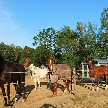
Einstellplätze auf Traumreitanlage zu vergeben ⭐...
Soltau
Sina Günther
@Sina_Guenther
Hunde willkommen
Krankenbox
Hengsthaltung möglich
Hufrehe geeignet
Außenbox mit Paddock
Außenboxen
Vollpension
18 weitere...
P+


Aktivstall Soltau
Soltau
Aktivstall-Soltau
@Aktivstall-Soltau
Freizeitstall
Vermieten
Hunde willkommen
Longierzirkel/Roundpen
Notfallboxen
17 weitere...
P+
Deprecated: Creation of dynamic property Zend_View_Helper_Ads::$adLink is deprecated in /var/www/stall-frei/htdocs/staging.stall-frei.de/library/Psf/View/Helper/Ads.php on line 108

Futtersack HeuToy, Fressbremse in pink
Mechtersen
STALL-FREIde Marketing
@STALL-FREI-Marketing
Stundenlange Beschäftigung die
Koliken vorbeugt, geringe Staubinhalation mit
steuerbarer Futterentnahme
Leider kein Vorschaubild
Leider kein Vorschaubild
neue Plätze im Paddocktrail frei
Soltau
Osteo & Hoof Care
@Christina-Grefe-Flessner
Fahrstall, Kutschwagen
Freizeitstall
Vermieten
Führanlage
Hunde willkommen
Allergikerstall
Notfallboxen
25 weitere...
B
Leider kein Vorschaubild
Leider kein Vorschaubild
Paddocktrail, Aktivstall, Pferdepension
Soltau
Osteo & Hoof Care
@Christina-Grefe-Flessner
Freizeitstall
Geländestrecke
Vermieten
Führanlage
Hunde willkommen
Allergikerstall
Notfallboxen
21 weitere...
B
Leider kein Vorschaubild
Leider kein Vorschaubild
Pferdebox auf dem Oehlshof
Soltau
Janina
@Janina77
Geländestrecke
Vermieten
Krankenbox
Longierzirkel/Roundpen
Notfallboxen
15 weitere...
B


Top Reitanlage mit besten Trainingsmöglichkeiten
Schneverdingen
Hof Schultenwede
@Hof-Schultenwede
Geländestrecke
Pferdeausbildung
Führanlage
Hunde willkommen
bedampftes/gewaschenes Heu
Außenboxen
Innenbox
22 weitere...
S

Frisches Stroh zu verkaufen!
Mechtersen
STALL-FREIde Marketing
@STALL-FREI-Marketing
Kaufe frisches Stroh für dein Pferd!

Box frei
Munster
Tanja21
@Tanja21
Freizeitstall
Geländestrecke
Vermieten
Parkplatz für Pferdeanhänger
Reitplatz (z.B. Dressur, Springen, Reining)
Innenbox
6 weitere...
P

Offenstall,Rentner,Allergiker,Weide,Vollpension
Bergen
Sandra-Gralher
@Sandra-Gralher
Weide
Allergikerstall
Offenstall
Vollpension
P


Exclusive Hospizplätze
Schneverdingen
TheHorseCare
@TheHorseCare
FN-Mitglied
Freizeitstall
Vermieten
Führanlage
Hunde willkommen
Allergikerstall
Gnadenbrothof
27 weitere...
S


Paddockboxen für Selbstversorger plus
Schneverdingen
TheHorseCare
@TheHorseCare
Freizeitstall
Gangpferdereiten
Vermieten
Führanlage
Hunde willkommen
Allergikerstall
Fohlenaufzucht möglich
25 weitere...
S
Deprecated: Creation of dynamic property Zend_View::$pageCount is deprecated in /var/www/stall-frei/htdocs/staging.stall-frei.de/library/vendor/shardj/zf1-future/library/Zend/View/Abstract.php on line 308
Deprecated: Creation of dynamic property Zend_View::$itemCountPerPage is deprecated in /var/www/stall-frei/htdocs/staging.stall-frei.de/library/vendor/shardj/zf1-future/library/Zend/View/Abstract.php on line 308
Deprecated: Creation of dynamic property Zend_View::$first is deprecated in /var/www/stall-frei/htdocs/staging.stall-frei.de/library/vendor/shardj/zf1-future/library/Zend/View/Abstract.php on line 308
Deprecated: Creation of dynamic property Zend_View::$current is deprecated in /var/www/stall-frei/htdocs/staging.stall-frei.de/library/vendor/shardj/zf1-future/library/Zend/View/Abstract.php on line 308
Deprecated: Creation of dynamic property Zend_View::$last is deprecated in /var/www/stall-frei/htdocs/staging.stall-frei.de/library/vendor/shardj/zf1-future/library/Zend/View/Abstract.php on line 308
Deprecated: Creation of dynamic property Zend_View::$next is deprecated in /var/www/stall-frei/htdocs/staging.stall-frei.de/library/vendor/shardj/zf1-future/library/Zend/View/Abstract.php on line 308
Deprecated: Creation of dynamic property Zend_View::$pagesInRange is deprecated in /var/www/stall-frei/htdocs/staging.stall-frei.de/library/vendor/shardj/zf1-future/library/Zend/View/Abstract.php on line 308
Deprecated: Creation of dynamic property Zend_View::$firstPageInRange is deprecated in /var/www/stall-frei/htdocs/staging.stall-frei.de/library/vendor/shardj/zf1-future/library/Zend/View/Abstract.php on line 308
Deprecated: Creation of dynamic property Zend_View::$lastPageInRange is deprecated in /var/www/stall-frei/htdocs/staging.stall-frei.de/library/vendor/shardj/zf1-future/library/Zend/View/Abstract.php on line 308
Deprecated: Creation of dynamic property Zend_View::$currentItemCount is deprecated in /var/www/stall-frei/htdocs/staging.stall-frei.de/library/vendor/shardj/zf1-future/library/Zend/View/Abstract.php on line 308
Deprecated: Creation of dynamic property Zend_View::$totalItemCount is deprecated in /var/www/stall-frei/htdocs/staging.stall-frei.de/library/vendor/shardj/zf1-future/library/Zend/View/Abstract.php on line 308
Deprecated: Creation of dynamic property Zend_View::$firstItemNumber is deprecated in /var/www/stall-frei/htdocs/staging.stall-frei.de/library/vendor/shardj/zf1-future/library/Zend/View/Abstract.php on line 308
Deprecated: Creation of dynamic property Zend_View::$lastItemNumber is deprecated in /var/www/stall-frei/htdocs/staging.stall-frei.de/library/vendor/shardj/zf1-future/library/Zend/View/Abstract.php on line 308
Deprecated: Creation of dynamic property Zend_View::$router is deprecated in /var/www/stall-frei/htdocs/staging.stall-frei.de/library/vendor/shardj/zf1-future/library/Zend/View/Abstract.php on line 308
Deprecated: Creation of dynamic property Zend_View::$urlParams is deprecated in /var/www/stall-frei/htdocs/staging.stall-frei.de/library/vendor/shardj/zf1-future/library/Zend/View/Abstract.php on line 308
Deprecated: Creation of dynamic property Zend_View::$showAds is deprecated in /var/www/stall-frei/htdocs/staging.stall-frei.de/library/vendor/shardj/zf1-future/library/Zend/View/Abstract.php on line 308
Deprecated: Creation of dynamic property Zend_View::$objectIds is deprecated in /var/www/stall-frei/htdocs/staging.stall-frei.de/library/vendor/shardj/zf1-future/library/Zend/View/Abstract.php on line 308
Deprecated: Creation of dynamic property Zend_View::$showNavbar is deprecated in /var/www/stall-frei/htdocs/staging.stall-frei.de/library/vendor/shardj/zf1-future/library/Zend/View/Abstract.php on line 308
Deprecated: Creation of dynamic property Zend_View::$showBreadcrumb is deprecated in /var/www/stall-frei/htdocs/staging.stall-frei.de/library/vendor/shardj/zf1-future/library/Zend/View/Abstract.php on line 308
Deprecated: Creation of dynamic property Zend_View::$showFooter is deprecated in /var/www/stall-frei/htdocs/staging.stall-frei.de/library/vendor/shardj/zf1-future/library/Zend/View/Abstract.php on line 308
Deprecated: Creation of dynamic property Zend_View::$showInternalAds is deprecated in /var/www/stall-frei/htdocs/staging.stall-frei.de/library/vendor/shardj/zf1-future/library/Zend/View/Abstract.php on line 308
Deprecated: Creation of dynamic property Zend_View::$blNoContent is deprecated in /var/www/stall-frei/htdocs/staging.stall-frei.de/library/vendor/shardj/zf1-future/library/Zend/View/Abstract.php on line 308
Deprecated: Creation of dynamic property Zend_View::$sMetaDesc is deprecated in /var/www/stall-frei/htdocs/staging.stall-frei.de/library/vendor/shardj/zf1-future/library/Zend/View/Abstract.php on line 308
Deprecated: Creation of dynamic property Zend_View::$useGmaps is deprecated in /var/www/stall-frei/htdocs/staging.stall-frei.de/library/vendor/shardj/zf1-future/library/Zend/View/Abstract.php on line 308
Deprecated: Creation of dynamic property Zend_View::$touches is deprecated in /var/www/stall-frei/htdocs/staging.stall-frei.de/library/vendor/shardj/zf1-future/library/Zend/View/Abstract.php on line 308
Deprecated: Creation of dynamic property Zend_View::$oProject is deprecated in /var/www/stall-frei/htdocs/staging.stall-frei.de/library/vendor/shardj/zf1-future/library/Zend/View/Abstract.php on line 308
Deprecated: Creation of dynamic property Zend_View::$pageHeadline is deprecated in /var/www/stall-frei/htdocs/staging.stall-frei.de/library/vendor/shardj/zf1-future/library/Zend/View/Abstract.php on line 308
Deprecated: Creation of dynamic property Zend_View::$disableLocationField is deprecated in /var/www/stall-frei/htdocs/staging.stall-frei.de/library/vendor/shardj/zf1-future/library/Zend/View/Abstract.php on line 308
Deprecated: Creation of dynamic property Zend_View::$isSearch is deprecated in /var/www/stall-frei/htdocs/staging.stall-frei.de/library/vendor/shardj/zf1-future/library/Zend/View/Abstract.php on line 308
Deprecated: Creation of dynamic property Zend_View::$pageTitle is deprecated in /var/www/stall-frei/htdocs/staging.stall-frei.de/library/vendor/shardj/zf1-future/library/Zend/View/Abstract.php on line 308
Deprecated: Creation of dynamic property Psf_Form_Element_Text::$class is deprecated in /var/www/stall-frei/htdocs/staging.stall-frei.de/library/vendor/shardj/zf1-future/library/Zend/Form/Element.php on line 874
Deprecated: Creation of dynamic property Psf_Form_Element_Text::$size is deprecated in /var/www/stall-frei/htdocs/staging.stall-frei.de/library/vendor/shardj/zf1-future/library/Zend/Form/Element.php on line 874
Deprecated: Creation of dynamic property Psf_Form_Element_Text::$placeholder is deprecated in /var/www/stall-frei/htdocs/staging.stall-frei.de/library/vendor/shardj/zf1-future/library/Zend/Form/Element.php on line 874
Deprecated: Creation of dynamic property Psf_Form_Element_Hidden::$class is deprecated in /var/www/stall-frei/htdocs/staging.stall-frei.de/library/vendor/shardj/zf1-future/library/Zend/Form/Element.php on line 874
Deprecated: Creation of dynamic property Psf_Form_Element_Hidden::$class is deprecated in /var/www/stall-frei/htdocs/staging.stall-frei.de/library/vendor/shardj/zf1-future/library/Zend/Form/Element.php on line 874
Deprecated: Creation of dynamic property Psf_Form_Element_Hidden::$class is deprecated in /var/www/stall-frei/htdocs/staging.stall-frei.de/library/vendor/shardj/zf1-future/library/Zend/Form/Element.php on line 874
Deprecated: Creation of dynamic property Psf_Form_Element_Hidden::$class is deprecated in /var/www/stall-frei/htdocs/staging.stall-frei.de/library/vendor/shardj/zf1-future/library/Zend/Form/Element.php on line 874
Deprecated: Creation of dynamic property Psf_Form_Element_Select::$class is deprecated in /var/www/stall-frei/htdocs/staging.stall-frei.de/library/vendor/shardj/zf1-future/library/Zend/Form/Element.php on line 874
Deprecated: Creation of dynamic property Psf_Form_Element_Select::$class is deprecated in /var/www/stall-frei/htdocs/staging.stall-frei.de/library/vendor/shardj/zf1-future/library/Zend/Form/Element.php on line 874
Deprecated: Creation of dynamic property Psf_Form_Element_Select::$class is deprecated in /var/www/stall-frei/htdocs/staging.stall-frei.de/library/vendor/shardj/zf1-future/library/Zend/Form/Element.php on line 874
Deprecated: Creation of dynamic property Psf_Form_Element_Select::$class is deprecated in /var/www/stall-frei/htdocs/staging.stall-frei.de/library/vendor/shardj/zf1-future/library/Zend/Form/Element.php on line 874
Deprecated: Creation of dynamic property Psf_Form_Element_Text::$class is deprecated in /var/www/stall-frei/htdocs/staging.stall-frei.de/library/vendor/shardj/zf1-future/library/Zend/Form/Element.php on line 874
Deprecated: Creation of dynamic property Psf_Form_Element_Checkbox::$label is deprecated in /var/www/stall-frei/htdocs/staging.stall-frei.de/library/vendor/shardj/zf1-future/library/Zend/Form/Element.php on line 874
Deprecated: Creation of dynamic property Zend_View::$sort is deprecated in /var/www/stall-frei/htdocs/staging.stall-frei.de/library/vendor/shardj/zf1-future/library/Zend/View/Abstract.php on line 308
Deprecated: Creation of dynamic property Zend_View::$searchLocation is deprecated in /var/www/stall-frei/htdocs/staging.stall-frei.de/library/vendor/shardj/zf1-future/library/Zend/View/Abstract.php on line 308
Deprecated: Creation of dynamic property Zend_View::$locationHint is deprecated in /var/www/stall-frei/htdocs/staging.stall-frei.de/library/vendor/shardj/zf1-future/library/Zend/View/Abstract.php on line 308
Psf_GeoCoder_Abstract::getLocation: Bockel Get Location CachedOrLive
Psf_GeoCoder_Abstract::getCachedOrLive: Bockel
Psf_GeoCoder_OpenCageData::makeApiRequest: response:
Array
(
[documentation] => https://opencagedata.com/api
[licenses] => Array
(
[0] => Array
(
[name] => see attribution guide
[url] => https://opencagedata.com/credits
)
)
[results] => Array
(
[0] => Array
(
[bounds] => Array
(
[northeast] => Array
(
[lat] => 52.954045
[lng] => 9.9528574
)
[southwest] => Array
(
[lat] => 52.8883967
[lng] => 9.8559405
)
)
[components] => Array
(
[ISO_3166-1_alpha-2] => DE
[ISO_3166-1_alpha-3] => DEU
[ISO_3166-2] => Array
(
[0] => DE-NI
)
[_category] => place
[_normalized_city] => Wietzendorf
[_type] => village
[city_district] => Bockel
[continent] => Europe
[country] => Deutschland
[country_code] => de
[county] => Heidekreis
[political_union] => European Union
[postcode] => 29649
[state] => Niedersachsen
[state_code] => NI
[village] => Wietzendorf
)
[confidence] => 7
[formatted] => 29649 Wietzendorf, Deutschland
[geometry] => Array
(
[lat] => 52.9208891
[lng] => 9.9316792
)
)
[1] => Array
(
[bounds] => Array
(
[northeast] => Array
(
[lat] => 52.9385088
[lng] => 9.936752
)
[southwest] => Array
(
[lat] => 52.8985088
[lng] => 9.896752
)
)
[components] => Array
(
[ISO_3166-1_alpha-2] => DE
[ISO_3166-1_alpha-3] => DEU
[ISO_3166-2] => Array
(
[0] => DE-NI
)
[_category] => place
[_normalized_city] => Wietzendorf
[_type] => village
[city] => Wietzendorf
[continent] => Europe
[country] => Deutschland
[country_code] => de
[county] => Heidekreis
[political_union] => European Union
[postcode] => 29649
[state] => Niedersachsen
[state_code] => NI
[village] => Bockel
)
[confidence] => 7
[formatted] => 29649 Bockel, Deutschland
[geometry] => Array
(
[lat] => 52.9185088
[lng] => 9.916752
)
)
[2] => Array
(
[bounds] => Array
(
[northeast] => Array
(
[lat] => 51.1840302
[lng] => 7.3641338
)
[southwest] => Array
(
[lat] => 51.1440302
[lng] => 7.3241338
)
)
[components] => Array
(
[ISO_3166-1_alpha-2] => DE
[ISO_3166-1_alpha-3] => DEU
[ISO_3166-2] => Array
(
[0] => DE-NW
)
[_category] => place
[_normalized_city] => Hückeswagen
[_type] => hamlet
[continent] => Europe
[country] => Deutschland
[country_code] => de
[county] => Oberbergischer Kreis
[hamlet] => Böckel
[political_union] => European Union
[postcode] => 42499
[state] => Nordrhein-Westfalen
[state_code] => NW
[town] => Hückeswagen
)
[confidence] => 7
[formatted] => Böckel, 42499 Hückeswagen, Deutschland
[geometry] => Array
(
[lat] => 51.1640302
[lng] => 7.3441338
)
)
[3] => Array
(
[bounds] => Array
(
[northeast] => Array
(
[lat] => 52.0536155
[lng] => 8.3578231
)
[southwest] => Array
(
[lat] => 52.0155181
[lng] => 8.2841292
)
)
[components] => Array
(
[ISO_3166-1_alpha-2] => DE
[ISO_3166-1_alpha-3] => DEU
[ISO_3166-2] => Array
(
[0] => DE-NW
)
[_category] => place
[_normalized_city] => Halle (Westf.)
[_type] => neighbourhood
[continent] => Europe
[country] => Deutschland
[country_code] => de
[county] => Kreis Gütersloh
[political_union] => European Union
[state] => Nordrhein-Westfalen
[state_code] => NW
[suburb] => Bockel
[town] => Halle (Westf.)
)
[confidence] => 7
[formatted] => Bockel, Halle (Westf.), Nordrhein-Westfalen, Deutschland
[geometry] => Array
(
[lat] => 52.0391035
[lng] => 8.3282491
)
)
[4] => Array
(
[bounds] => Array
(
[northeast] => Array
(
[lat] => 53.2227104
[lng] => 9.3062099
)
[southwest] => Array
(
[lat] => 53.1827104
[lng] => 9.2662099
)
)
[components] => Array
(
[ISO_3166-1_alpha-2] => DE
[ISO_3166-1_alpha-3] => DEU
[ISO_3166-2] => Array
(
[0] => DE-NI
)
[_category] => place
[_normalized_city] => Gyhum
[_type] => village
[city] => Gyhum
[continent] => Europe
[country] => Deutschland
[country_code] => de
[county] => Landkreis Rotenburg (Wümme)
[municipality] => Samtgemeinde Zeven
[political_union] => European Union
[state] => Niedersachsen
[state_code] => NI
[village] => Bockel
)
[confidence] => 7
[formatted] => Bockel, Niedersachsen, Deutschland
[geometry] => Array
(
[lat] => 53.2027104
[lng] => 9.2862099
)
)
[5] => Array
(
[bounds] => Array
(
[northeast] => Array
(
[lat] => 52.5884924
[lng] => 8.5952427
)
[southwest] => Array
(
[lat] => 52.5438447
[lng] => 8.5106426
)
)
[components] => Array
(
[ISO_3166-1_alpha-2] => DE
[ISO_3166-1_alpha-3] => DEU
[ISO_3166-2] => Array
(
[0] => DE-NI
)
[_category] => place
[_normalized_city] => Wagenfeld
[_type] => hamlet
[city_district] => Wagenfeld
[continent] => Europe
[country] => Deutschland
[country_code] => de
[county] => Landkreis Diepholz
[hamlet] => Bockel
[political_union] => European Union
[state] => Niedersachsen
[state_code] => NI
[village] => Wagenfeld
)
[confidence] => 7
[formatted] => Bockel, Wagenfeld, Niedersachsen, Deutschland
[geometry] => Array
(
[lat] => 52.5650939
[lng] => 8.5635134
)
)
[6] => Array
(
[bounds] => Array
(
[northeast] => Array
(
[lat] => 53.5251438
[lng] => 9.3803175
)
[southwest] => Array
(
[lat] => 53.4851438
[lng] => 9.3403175
)
)
[components] => Array
(
[ISO_3166-1_alpha-2] => DE
[ISO_3166-1_alpha-3] => DEU
[ISO_3166-2] => Array
(
[0] => DE-NI
)
[_category] => place
[_normalized_city] => Fredenbeck
[_type] => hamlet
[continent] => Europe
[country] => Deutschland
[country_code] => de
[county] => Landkreis Stade
[hamlet] => Bockel
[municipality] => Samtgemeinde Fredenbeck
[political_union] => European Union
[state] => Niedersachsen
[state_code] => NI
[town] => Fredenbeck
)
[confidence] => 7
[formatted] => Bockel, Fredenbeck, Niedersachsen, Deutschland
[geometry] => Array
(
[lat] => 53.5051438
[lng] => 9.3603175
)
)
[7] => Array
(
[bounds] => Array
(
[northeast] => Array
(
[lat] => 53.0685525
[lng] => 9.3070096
)
[southwest] => Array
(
[lat] => 53.0285525
[lng] => 9.2670096
)
)
[components] => Array
(
[ISO_3166-1_alpha-2] => DE
[ISO_3166-1_alpha-3] => DEU
[ISO_3166-2] => Array
(
[0] => DE-NI
)
[_category] => place
[_normalized_city] => Ahausen
[_type] => hamlet
[continent] => Europe
[country] => Deutschland
[country_code] => de
[county] => Landkreis Rotenburg (Wümme)
[hamlet] => Bockel
[municipality] => Samtgemeinde Sottrum
[political_union] => European Union
[state] => Niedersachsen
[state_code] => NI
[village] => Ahausen
)
[confidence] => 7
[formatted] => Bockel, Ahausen, Niedersachsen, Deutschland
[geometry] => Array
(
[lat] => 53.0485525
[lng] => 9.2870096
)
)
[8] => Array
(
[bounds] => Array
(
[northeast] => Array
(
[lat] => 53.027693
[lng] => 9.7843612
)
[southwest] => Array
(
[lat] => 53.0249348
[lng] => 9.7798445
)
)
[components] => Array
(
[ISO_3166-1_alpha-2] => DE
[ISO_3166-1_alpha-3] => DEU
[ISO_3166-2] => Array
(
[0] => DE-NI
)
[_category] => agriculture
[_normalized_city] => Soltau
[_type] => farmland
[continent] => Europe
[country] => Deutschland
[country_code] => de
[county] => Heidekreis
[farmland] => Bockel
[hamlet] => Ellingen
[political_union] => European Union
[postcode] => 29614
[state] => Niedersachsen
[state_code] => NI
[town] => Soltau
[village] => Wiedingen
)
[confidence] => 9
[formatted] => Bockel, 29614 Wiedingen, Deutschland
[geometry] => Array
(
[lat] => 53.0258132
[lng] => 9.7820499
)
)
[9] => Array
(
[bounds] => Array
(
[northeast] => Array
(
[lat] => 53.0544868
[lng] => 9.2918181
)
[southwest] => Array
(
[lat] => 53.0525165
[lng] => 9.2728929
)
)
[components] => Array
(
[ISO_3166-1_alpha-2] => DE
[ISO_3166-1_alpha-3] => DEU
[ISO_3166-2] => Array
(
[0] => DE-NI
)
[_category] => road
[_normalized_city] => Ahausen
[_type] => road
[continent] => Europe
[country] => Deutschland
[country_code] => de
[county] => Landkreis Rotenburg (Wümme)
[hamlet] => Bockel
[municipality] => Samtgemeinde Sottrum
[political_union] => European Union
[postcode] => 27367
[road] => Bockel
[state] => Niedersachsen
[state_code] => NI
[village] => Ahausen
)
[confidence] => 9
[formatted] => Bockel, 27367 Ahausen, Deutschland
[geometry] => Array
(
[lat] => 53.0541896
[lng] => 9.2823119
)
)
)
[status] => Array
(
[code] => 200
[message] => OK
)
[stay_informed] => Array
(
[blog] => https://blog.opencagedata.com
[mastodon] => https://en.osm.town/@opencage
)
[thanks] => For using an OpenCage API
[timestamp] => Array
(
[created_http] => Sat, 07 Feb 2026 09:33:36 GMT
[created_unix] => 1770456816
)
[total_results] => 10
)
Psf_GeoCoder_Abstract::convertLocationResult
{"documentation":"https:\/\/opencagedata.com\/api","licenses":[{"name":"see attribution guide","url":"https:\/\/opencagedata.com\/credits"}],"results":[{"bounds":{"northeast":{"lat":52.954045,"lng":9.9528574},"southwest":{"lat":52.8883967,"lng":9.8559405}},"components":{"ISO_3166-1_alpha-2":"DE","ISO_3166-1_alpha-3":"DEU","ISO_3166-2":["DE-NI"],"_category":"place","_normalized_city":"Wietzendorf","_type":"village","city_district":"Bockel","continent":"Europe","country":"Deutschland","country_code":"de","county":"Heidekreis","political_union":"European Union","postcode":"29649","state":"Niedersachsen","state_code":"NI","village":"Wietzendorf"},"confidence":7,"formatted":"29649 Wietzendorf, Deutschland","geometry":{"lat":52.9208891,"lng":9.9316792}},{"bounds":{"northeast":{"lat":52.9385088,"lng":9.936752},"southwest":{"lat":52.8985088,"lng":9.896752}},"components":{"ISO_3166-1_alpha-2":"DE","ISO_3166-1_alpha-3":"DEU","ISO_3166-2":["DE-NI"],"_category":"place","_normalized_city":"Wietzendorf","_type":"village","city":"Wietzendorf","continent":"Europe","country":"Deutschland","country_code":"de","county":"Heidekreis","political_union":"European Union","postcode":"29649","state":"Niedersachsen","state_code":"NI","village":"Bockel"},"confidence":7,"formatted":"29649 Bockel, Deutschland","geometry":{"lat":52.9185088,"lng":9.916752}},{"bounds":{"northeast":{"lat":51.1840302,"lng":7.3641338},"southwest":{"lat":51.1440302,"lng":7.3241338}},"components":{"ISO_3166-1_alpha-2":"DE","ISO_3166-1_alpha-3":"DEU","ISO_3166-2":["DE-NW"],"_category":"place","_normalized_city":"H\u00fcckeswagen","_type":"hamlet","continent":"Europe","country":"Deutschland","country_code":"de","county":"Oberbergischer Kreis","hamlet":"B\u00f6ckel","political_union":"European Union","postcode":"42499","state":"Nordrhein-Westfalen","state_code":"NW","town":"H\u00fcckeswagen"},"confidence":7,"formatted":"B\u00f6ckel, 42499 H\u00fcckeswagen, Deutschland","geometry":{"lat":51.1640302,"lng":7.3441338}},{"bounds":{"northeast":{"lat":52.0536155,"lng":8.3578231},"southwest":{"lat":52.0155181,"lng":8.2841292}},"components":{"ISO_3166-1_alpha-2":"DE","ISO_3166-1_alpha-3":"DEU","ISO_3166-2":["DE-NW"],"_category":"place","_normalized_city":"Halle (Westf.)","_type":"neighbourhood","continent":"Europe","country":"Deutschland","country_code":"de","county":"Kreis G\u00fctersloh","political_union":"European Union","state":"Nordrhein-Westfalen","state_code":"NW","suburb":"Bockel","town":"Halle (Westf.)"},"confidence":7,"formatted":"Bockel, Halle (Westf.), Nordrhein-Westfalen, Deutschland","geometry":{"lat":52.0391035,"lng":8.3282491}},{"bounds":{"northeast":{"lat":53.2227104,"lng":9.3062099},"southwest":{"lat":53.1827104,"lng":9.2662099}},"components":{"ISO_3166-1_alpha-2":"DE","ISO_3166-1_alpha-3":"DEU","ISO_3166-2":["DE-NI"],"_category":"place","_normalized_city":"Gyhum","_type":"village","city":"Gyhum","continent":"Europe","country":"Deutschland","country_code":"de","county":"Landkreis Rotenburg (W\u00fcmme)","municipality":"Samtgemeinde Zeven","political_union":"European Union","state":"Niedersachsen","state_code":"NI","village":"Bockel"},"confidence":7,"formatted":"Bockel, Niedersachsen, Deutschland","geometry":{"lat":53.2027104,"lng":9.2862099}},{"bounds":{"northeast":{"lat":52.5884924,"lng":8.5952427},"southwest":{"lat":52.5438447,"lng":8.5106426}},"components":{"ISO_3166-1_alpha-2":"DE","ISO_3166-1_alpha-3":"DEU","ISO_3166-2":["DE-NI"],"_category":"place","_normalized_city":"Wagenfeld","_type":"hamlet","city_district":"Wagenfeld","continent":"Europe","country":"Deutschland","country_code":"de","county":"Landkreis Diepholz","hamlet":"Bockel","political_union":"European Union","state":"Niedersachsen","state_code":"NI","village":"Wagenfeld"},"confidence":7,"formatted":"Bockel, Wagenfeld, Niedersachsen, Deutschland","geometry":{"lat":52.5650939,"lng":8.5635134}},{"bounds":{"northeast":{"lat":53.5251438,"lng":9.3803175},"southwest":{"lat":53.4851438,"lng":9.3403175}},"components":{"ISO_3166-1_alpha-2":"DE","ISO_3166-1_alpha-3":"DEU","ISO_3166-2":["DE-NI"],"_category":"place","_normalized_city":"Fredenbeck","_type":"hamlet","continent":"Europe","country":"Deutschland","country_code":"de","county":"Landkreis Stade","hamlet":"Bockel","municipality":"Samtgemeinde Fredenbeck","political_union":"European Union","state":"Niedersachsen","state_code":"NI","town":"Fredenbeck"},"confidence":7,"formatted":"Bockel, Fredenbeck, Niedersachsen, Deutschland","geometry":{"lat":53.5051438,"lng":9.3603175}},{"bounds":{"northeast":{"lat":53.0685525,"lng":9.3070096},"southwest":{"lat":53.0285525,"lng":9.2670096}},"components":{"ISO_3166-1_alpha-2":"DE","ISO_3166-1_alpha-3":"DEU","ISO_3166-2":["DE-NI"],"_category":"place","_normalized_city":"Ahausen","_type":"hamlet","continent":"Europe","country":"Deutschland","country_code":"de","county":"Landkreis Rotenburg (W\u00fcmme)","hamlet":"Bockel","municipality":"Samtgemeinde Sottrum","political_union":"European Union","state":"Niedersachsen","state_code":"NI","village":"Ahausen"},"confidence":7,"formatted":"Bockel, Ahausen, Niedersachsen, Deutschland","geometry":{"lat":53.0485525,"lng":9.2870096}},{"bounds":{"northeast":{"lat":53.027693,"lng":9.7843612},"southwest":{"lat":53.0249348,"lng":9.7798445}},"components":{"ISO_3166-1_alpha-2":"DE","ISO_3166-1_alpha-3":"DEU","ISO_3166-2":["DE-NI"],"_category":"agriculture","_normalized_city":"Soltau","_type":"farmland","continent":"Europe","country":"Deutschland","country_code":"de","county":"Heidekreis","farmland":"Bockel","hamlet":"Ellingen","political_union":"European Union","postcode":"29614","state":"Niedersachsen","state_code":"NI","town":"Soltau","village":"Wiedingen"},"confidence":9,"formatted":"Bockel, 29614 Wiedingen, Deutschland","geometry":{"lat":53.0258132,"lng":9.7820499}},{"bounds":{"northeast":{"lat":53.0544868,"lng":9.2918181},"southwest":{"lat":53.0525165,"lng":9.2728929}},"components":{"ISO_3166-1_alpha-2":"DE","ISO_3166-1_alpha-3":"DEU","ISO_3166-2":["DE-NI"],"_category":"road","_normalized_city":"Ahausen","_type":"road","continent":"Europe","country":"Deutschland","country_code":"de","county":"Landkreis Rotenburg (W\u00fcmme)","hamlet":"Bockel","municipality":"Samtgemeinde Sottrum","political_union":"European Union","postcode":"27367","road":"Bockel","state":"Niedersachsen","state_code":"NI","village":"Ahausen"},"confidence":9,"formatted":"Bockel, 27367 Ahausen, Deutschland","geometry":{"lat":53.0541896,"lng":9.2823119}}],"status":{"code":200,"message":"OK"},"stay_informed":{"blog":"https:\/\/blog.opencagedata.com","mastodon":"https:\/\/en.osm.town\/@opencage"},"thanks":"For using an OpenCage API","timestamp":{"created_http":"Sat, 07 Feb 2026 09:33:36 GMT","created_unix":1770456816},"total_results":10}Array
(
[0] => stdClass Object
(
[bounds] => stdClass Object
(
[northeast] => stdClass Object
(
[lat] => 52.954045
[lng] => 9.9528574
)
[southwest] => stdClass Object
(
[lat] => 52.8883967
[lng] => 9.8559405
)
)
[components] => stdClass Object
(
[ISO_3166-1_alpha-2] => DE
[ISO_3166-1_alpha-3] => DEU
[ISO_3166-2] => Array
(
[0] => DE-NI
)
[_category] => place
[_normalized_city] => Wietzendorf
[_type] => village
[city_district] => Bockel
[continent] => Europe
[country] => Deutschland
[country_code] => de
[county] => Heidekreis
[political_union] => European Union
[postcode] => 29649
[state] => Niedersachsen
[state_code] => NI
[village] => Wietzendorf
)
[confidence] => 7
[formatted] => 29649 Wietzendorf, Deutschland
[geometry] => stdClass Object
(
[lat] => 52.9208891
[lng] => 9.9316792
)
)
[1] => stdClass Object
(
[bounds] => stdClass Object
(
[northeast] => stdClass Object
(
[lat] => 52.9385088
[lng] => 9.936752
)
[southwest] => stdClass Object
(
[lat] => 52.8985088
[lng] => 9.896752
)
)
[components] => stdClass Object
(
[ISO_3166-1_alpha-2] => DE
[ISO_3166-1_alpha-3] => DEU
[ISO_3166-2] => Array
(
[0] => DE-NI
)
[_category] => place
[_normalized_city] => Wietzendorf
[_type] => village
[city] => Wietzendorf
[continent] => Europe
[country] => Deutschland
[country_code] => de
[county] => Heidekreis
[political_union] => European Union
[postcode] => 29649
[state] => Niedersachsen
[state_code] => NI
[village] => Bockel
)
[confidence] => 7
[formatted] => 29649 Bockel, Deutschland
[geometry] => stdClass Object
(
[lat] => 52.9185088
[lng] => 9.916752
)
)
[2] => stdClass Object
(
[bounds] => stdClass Object
(
[northeast] => stdClass Object
(
[lat] => 51.1840302
[lng] => 7.3641338
)
[southwest] => stdClass Object
(
[lat] => 51.1440302
[lng] => 7.3241338
)
)
[components] => stdClass Object
(
[ISO_3166-1_alpha-2] => DE
[ISO_3166-1_alpha-3] => DEU
[ISO_3166-2] => Array
(
[0] => DE-NW
)
[_category] => place
[_normalized_city] => Hückeswagen
[_type] => hamlet
[continent] => Europe
[country] => Deutschland
[country_code] => de
[county] => Oberbergischer Kreis
[hamlet] => Böckel
[political_union] => European Union
[postcode] => 42499
[state] => Nordrhein-Westfalen
[state_code] => NW
[town] => Hückeswagen
)
[confidence] => 7
[formatted] => Böckel, 42499 Hückeswagen, Deutschland
[geometry] => stdClass Object
(
[lat] => 51.1640302
[lng] => 7.3441338
)
)
[3] => stdClass Object
(
[bounds] => stdClass Object
(
[northeast] => stdClass Object
(
[lat] => 52.0536155
[lng] => 8.3578231
)
[southwest] => stdClass Object
(
[lat] => 52.0155181
[lng] => 8.2841292
)
)
[components] => stdClass Object
(
[ISO_3166-1_alpha-2] => DE
[ISO_3166-1_alpha-3] => DEU
[ISO_3166-2] => Array
(
[0] => DE-NW
)
[_category] => place
[_normalized_city] => Halle (Westf.)
[_type] => neighbourhood
[continent] => Europe
[country] => Deutschland
[country_code] => de
[county] => Kreis Gütersloh
[political_union] => European Union
[state] => Nordrhein-Westfalen
[state_code] => NW
[suburb] => Bockel
[town] => Halle (Westf.)
)
[confidence] => 7
[formatted] => Bockel, Halle (Westf.), Nordrhein-Westfalen, Deutschland
[geometry] => stdClass Object
(
[lat] => 52.0391035
[lng] => 8.3282491
)
)
[4] => stdClass Object
(
[bounds] => stdClass Object
(
[northeast] => stdClass Object
(
[lat] => 53.2227104
[lng] => 9.3062099
)
[southwest] => stdClass Object
(
[lat] => 53.1827104
[lng] => 9.2662099
)
)
[components] => stdClass Object
(
[ISO_3166-1_alpha-2] => DE
[ISO_3166-1_alpha-3] => DEU
[ISO_3166-2] => Array
(
[0] => DE-NI
)
[_category] => place
[_normalized_city] => Gyhum
[_type] => village
[city] => Gyhum
[continent] => Europe
[country] => Deutschland
[country_code] => de
[county] => Landkreis Rotenburg (Wümme)
[municipality] => Samtgemeinde Zeven
[political_union] => European Union
[state] => Niedersachsen
[state_code] => NI
[village] => Bockel
)
[confidence] => 7
[formatted] => Bockel, Niedersachsen, Deutschland
[geometry] => stdClass Object
(
[lat] => 53.2027104
[lng] => 9.2862099
)
)
[5] => stdClass Object
(
[bounds] => stdClass Object
(
[northeast] => stdClass Object
(
[lat] => 52.5884924
[lng] => 8.5952427
)
[southwest] => stdClass Object
(
[lat] => 52.5438447
[lng] => 8.5106426
)
)
[components] => stdClass Object
(
[ISO_3166-1_alpha-2] => DE
[ISO_3166-1_alpha-3] => DEU
[ISO_3166-2] => Array
(
[0] => DE-NI
)
[_category] => place
[_normalized_city] => Wagenfeld
[_type] => hamlet
[city_district] => Wagenfeld
[continent] => Europe
[country] => Deutschland
[country_code] => de
[county] => Landkreis Diepholz
[hamlet] => Bockel
[political_union] => European Union
[state] => Niedersachsen
[state_code] => NI
[village] => Wagenfeld
)
[confidence] => 7
[formatted] => Bockel, Wagenfeld, Niedersachsen, Deutschland
[geometry] => stdClass Object
(
[lat] => 52.5650939
[lng] => 8.5635134
)
)
[6] => stdClass Object
(
[bounds] => stdClass Object
(
[northeast] => stdClass Object
(
[lat] => 53.5251438
[lng] => 9.3803175
)
[southwest] => stdClass Object
(
[lat] => 53.4851438
[lng] => 9.3403175
)
)
[components] => stdClass Object
(
[ISO_3166-1_alpha-2] => DE
[ISO_3166-1_alpha-3] => DEU
[ISO_3166-2] => Array
(
[0] => DE-NI
)
[_category] => place
[_normalized_city] => Fredenbeck
[_type] => hamlet
[continent] => Europe
[country] => Deutschland
[country_code] => de
[county] => Landkreis Stade
[hamlet] => Bockel
[municipality] => Samtgemeinde Fredenbeck
[political_union] => European Union
[state] => Niedersachsen
[state_code] => NI
[town] => Fredenbeck
)
[confidence] => 7
[formatted] => Bockel, Fredenbeck, Niedersachsen, Deutschland
[geometry] => stdClass Object
(
[lat] => 53.5051438
[lng] => 9.3603175
)
)
[7] => stdClass Object
(
[bounds] => stdClass Object
(
[northeast] => stdClass Object
(
[lat] => 53.0685525
[lng] => 9.3070096
)
[southwest] => stdClass Object
(
[lat] => 53.0285525
[lng] => 9.2670096
)
)
[components] => stdClass Object
(
[ISO_3166-1_alpha-2] => DE
[ISO_3166-1_alpha-3] => DEU
[ISO_3166-2] => Array
(
[0] => DE-NI
)
[_category] => place
[_normalized_city] => Ahausen
[_type] => hamlet
[continent] => Europe
[country] => Deutschland
[country_code] => de
[county] => Landkreis Rotenburg (Wümme)
[hamlet] => Bockel
[municipality] => Samtgemeinde Sottrum
[political_union] => European Union
[state] => Niedersachsen
[state_code] => NI
[village] => Ahausen
)
[confidence] => 7
[formatted] => Bockel, Ahausen, Niedersachsen, Deutschland
[geometry] => stdClass Object
(
[lat] => 53.0485525
[lng] => 9.2870096
)
)
[8] => stdClass Object
(
[bounds] => stdClass Object
(
[northeast] => stdClass Object
(
[lat] => 53.027693
[lng] => 9.7843612
)
[southwest] => stdClass Object
(
[lat] => 53.0249348
[lng] => 9.7798445
)
)
[components] => stdClass Object
(
[ISO_3166-1_alpha-2] => DE
[ISO_3166-1_alpha-3] => DEU
[ISO_3166-2] => Array
(
[0] => DE-NI
)
[_category] => agriculture
[_normalized_city] => Soltau
[_type] => farmland
[continent] => Europe
[country] => Deutschland
[country_code] => de
[county] => Heidekreis
[farmland] => Bockel
[hamlet] => Ellingen
[political_union] => European Union
[postcode] => 29614
[state] => Niedersachsen
[state_code] => NI
[town] => Soltau
[village] => Wiedingen
)
[confidence] => 9
[formatted] => Bockel, 29614 Wiedingen, Deutschland
[geometry] => stdClass Object
(
[lat] => 53.0258132
[lng] => 9.7820499
)
)
[9] => stdClass Object
(
[bounds] => stdClass Object
(
[northeast] => stdClass Object
(
[lat] => 53.0544868
[lng] => 9.2918181
)
[southwest] => stdClass Object
(
[lat] => 53.0525165
[lng] => 9.2728929
)
)
[components] => stdClass Object
(
[ISO_3166-1_alpha-2] => DE
[ISO_3166-1_alpha-3] => DEU
[ISO_3166-2] => Array
(
[0] => DE-NI
)
[_category] => road
[_normalized_city] => Ahausen
[_type] => road
[continent] => Europe
[country] => Deutschland
[country_code] => de
[county] => Landkreis Rotenburg (Wümme)
[hamlet] => Bockel
[municipality] => Samtgemeinde Sottrum
[political_union] => European Union
[postcode] => 27367
[road] => Bockel
[state] => Niedersachsen
[state_code] => NI
[village] => Ahausen
)
[confidence] => 9
[formatted] => Bockel, 27367 Ahausen, Deutschland
[geometry] => stdClass Object
(
[lat] => 53.0541896
[lng] => 9.2823119
)
)
)
Psf_GeoCoder_OpenCageData::getKeyMap: 0
stdClass Object
(
    [bounds] => stdClass Object
        (
            [northeast] => stdClass Object
                (
                    [lat] => 52.954045
                    [lng] => 9.9528574
                )

            [southwest] => stdClass Object
                (
                    [lat] => 52.8883967
                    [lng] => 9.8559405
                )

        )

    [components] => stdClass Object
        (
            [ISO_3166-1_alpha-2] => DE
            [ISO_3166-1_alpha-3] => DEU
            [ISO_3166-2] => Array
                (
                    [0] => DE-NI
                )

            [_category] => place
            [_normalized_city] => Wietzendorf
            [_type] => village
            [city_district] => Bockel
            [continent] => Europe
            [country] => Deutschland
            [country_code] => de
            [county] => Heidekreis
            [political_union] => European Union
            [postcode] => 29649
            [state] => Niedersachsen
            [state_code] => NI
            [village] => Wietzendorf
        )

    [confidence] => 7
    [formatted] => 29649 Wietzendorf, Deutschland
    [geometry] => stdClass Object
        (
            [lat] => 52.9208891
            [lng] => 9.9316792
        )

)
Psf_GeoCoder_OpenCageData::getCounty: Heidekreis
Psf_GeoCoder_OpenCageData::addMissingData REFETCH!
Array
(
    [address] => 29649 Wietzendorf, Deutschland
    [type] => village
    [street] =>
    [city] => Wietzendorf
    [county] => Heidekreis
    [state] => Niedersachsen
    [zip] => 29649
    [country] => Deutschland
    [suburb] =>
    [countrycode] => de
    [latitude] => 52.9208891
    [longitude] => 9.9316792
    [accuracy] => 1
    [confidence] => 7
    [bounds] => stdClass Object
        (
            [northeast] => stdClass Object
                (
                    [lat] => 52.954045
                    [lng] => 9.9528574
                )

            [southwest] => stdClass Object
                (
                    [lat] => 52.8883967
                    [lng] => 9.8559405
                )

        )

)
reformat!
Array
(
    [address] => 29649 Wietzendorf, Deutschland
    [type] => village
    [street] =>
    [city] => Wietzendorf
    [county] => Heidekreis
    [state] => Niedersachsen
    [zip] => 29649
    [country] => Deutschland
    [suburb] =>
    [countrycode] => de
    [latitude] => 52.9208891
    [longitude] => 9.9316792
    [accuracy] => 1
    [confidence] => 7
    [bounds] => stdClass Object
        (
            [northeast] => stdClass Object
                (
                    [lat] => 52.954045
                    [lng] => 9.9528574
                )

            [southwest] => stdClass Object
                (
                    [lat] => 52.8883967
                    [lng] => 9.8559405
                )

        )

    [place] => 29649 Wietzendorf, Niedersachsen
    [hash] => b5640871a8fe558d9cc705bb3bfd37a0
)
Psf_GeoCoder_OpenCageData::getKeyMap: 1
stdClass Object
(
    [bounds] => stdClass Object
        (
            [northeast] => stdClass Object
                (
                    [lat] => 52.9385088
                    [lng] => 9.936752
                )

            [southwest] => stdClass Object
                (
                    [lat] => 52.8985088
                    [lng] => 9.896752
                )

        )

    [components] => stdClass Object
        (
            [ISO_3166-1_alpha-2] => DE
            [ISO_3166-1_alpha-3] => DEU
            [ISO_3166-2] => Array
                (
                    [0] => DE-NI
                )

            [_category] => place
            [_normalized_city] => Wietzendorf
            [_type] => village
            [city] => Wietzendorf
            [continent] => Europe
            [country] => Deutschland
            [country_code] => de
            [county] => Heidekreis
            [political_union] => European Union
            [postcode] => 29649
            [state] => Niedersachsen
            [state_code] => NI
            [village] => Bockel
        )

    [confidence] => 7
    [formatted] => 29649 Bockel, Deutschland
    [geometry] => stdClass Object
        (
            [lat] => 52.9185088
            [lng] => 9.916752
        )

)
Psf_GeoCoder_OpenCageData::getCounty: Heidekreis
Psf_GeoCoder_OpenCageData::addMissingData REFETCH!
Array
(
    [address] => 29649 Bockel, Deutschland
    [type] => village
    [street] =>
    [city] => Bockel
    [county] => Heidekreis
    [state] => Niedersachsen
    [zip] => 29649
    [country] => Deutschland
    [suburb] =>
    [countrycode] => de
    [latitude] => 52.9185088
    [longitude] => 9.916752
    [accuracy] => 1
    [confidence] => 7
    [bounds] => stdClass Object
        (
            [northeast] => stdClass Object
                (
                    [lat] => 52.9385088
                    [lng] => 9.936752
                )

            [southwest] => stdClass Object
                (
                    [lat] => 52.8985088
                    [lng] => 9.896752
                )

        )

)
reformat!
Array
(
    [address] => 29649 Bockel, Deutschland
    [type] => village
    [street] =>
    [city] => Bockel
    [county] => Heidekreis
    [state] => Niedersachsen
    [zip] => 29649
    [country] => Deutschland
    [suburb] =>
    [countrycode] => de
    [latitude] => 52.9185088
    [longitude] => 9.916752
    [accuracy] => 1
    [confidence] => 7
    [bounds] => stdClass Object
        (
            [northeast] => stdClass Object
                (
                    [lat] => 52.9385088
                    [lng] => 9.936752
                )

            [southwest] => stdClass Object
                (
                    [lat] => 52.8985088
                    [lng] => 9.896752
                )

        )

    [place] => 29649 Bockel, Niedersachsen
    [hash] => 539bb1ee4b5b58f8edd98f5528925096
)
Psf_GeoCoder_OpenCageData::getKeyMap: 2
stdClass Object
(
    [bounds] => stdClass Object
        (
            [northeast] => stdClass Object
                (
                    [lat] => 51.1840302
                    [lng] => 7.3641338
                )

            [southwest] => stdClass Object
                (
                    [lat] => 51.1440302
                    [lng] => 7.3241338
                )

        )

    [components] => stdClass Object
        (
            [ISO_3166-1_alpha-2] => DE
            [ISO_3166-1_alpha-3] => DEU
            [ISO_3166-2] => Array
                (
                    [0] => DE-NW
                )

            [_category] => place
            [_normalized_city] => Hückeswagen
            [_type] => hamlet
            [continent] => Europe
            [country] => Deutschland
            [country_code] => de
            [county] => Oberbergischer Kreis
            [hamlet] => Böckel
            [political_union] => European Union
            [postcode] => 42499
            [state] => Nordrhein-Westfalen
            [state_code] => NW
            [town] => Hückeswagen
        )

    [confidence] => 7
    [formatted] => Böckel, 42499 Hückeswagen, Deutschland
    [geometry] => stdClass Object
        (
            [lat] => 51.1640302
            [lng] => 7.3441338
        )

)
Psf_GeoCoder_OpenCageData::getCounty: Oberbergischer Kreis
Psf_GeoCoder_OpenCageData::addMissingData REFETCH!
Array
(
    [address] => Böckel, 42499 Hückeswagen, Deutschland
    [type] => hamlet
    [street] => Böckel
    [city] => Hückeswagen
    [county] => Oberbergischer Kreis
    [state] => Nordrhein-Westfalen
    [zip] => 42499
    [country] => Deutschland
    [suburb] =>
    [countrycode] => de
    [latitude] => 51.1640302
    [longitude] => 7.3441338
    [accuracy] => 1
    [confidence] => 7
    [bounds] => stdClass Object
        (
            [northeast] => stdClass Object
                (
                    [lat] => 51.1840302
                    [lng] => 7.3641338
                )

            [southwest] => stdClass Object
                (
                    [lat] => 51.1440302
                    [lng] => 7.3241338
                )

        )

)
reformat!
Array
(
    [address] => Böckel, 42499 Hückeswagen, Deutschland
    [type] => hamlet
    [street] => Böckel
    [city] => Hückeswagen
    [county] => Oberbergischer Kreis
    [state] => Nordrhein-Westfalen
    [zip] => 42499
    [country] => Deutschland
    [suburb] =>
    [countrycode] => de
    [latitude] => 51.1640302
    [longitude] => 7.3441338
    [accuracy] => 1
    [confidence] => 7
    [bounds] => stdClass Object
        (
            [northeast] => stdClass Object
                (
                    [lat] => 51.1840302
                    [lng] => 7.3641338
                )

            [southwest] => stdClass Object
                (
                    [lat] => 51.1440302
                    [lng] => 7.3241338
                )

        )

    [place] => Böckel, 42499 Hückeswagen, Nordrhein-Westfalen
    [hash] => 9f60ff21f63dffe38a17fb62852bd803
)
Psf_GeoCoder_OpenCageData::getKeyMap: 3
stdClass Object
(
    [bounds] => stdClass Object
        (
            [northeast] => stdClass Object
                (
                    [lat] => 52.0536155
                    [lng] => 8.3578231
                )

            [southwest] => stdClass Object
                (
                    [lat] => 52.0155181
                    [lng] => 8.2841292
                )

        )

    [components] => stdClass Object
        (
            [ISO_3166-1_alpha-2] => DE
            [ISO_3166-1_alpha-3] => DEU
            [ISO_3166-2] => Array
                (
                    [0] => DE-NW
                )

            [_category] => place
            [_normalized_city] => Halle (Westf.)
            [_type] => neighbourhood
            [continent] => Europe
            [country] => Deutschland
            [country_code] => de
            [county] => Kreis Gütersloh
            [political_union] => European Union
            [state] => Nordrhein-Westfalen
            [state_code] => NW
            [suburb] => Bockel
            [town] => Halle (Westf.)
        )

    [confidence] => 7
    [formatted] => Bockel, Halle (Westf.), Nordrhein-Westfalen, Deutschland
    [geometry] => stdClass Object
        (
            [lat] => 52.0391035
            [lng] => 8.3282491
        )

)
Psf_GeoCoder_OpenCageData::getCounty: Gütersloh
Psf_GeoCoder_OpenCageData::addMissingData REFETCH!
Array
(
    [address] => Bockel, Halle (Westf.), Nordrhein-Westfalen, Deutschland
    [type] => neighbourhood
    [street] =>
    [city] => Halle (Westf.)
    [county] => Gütersloh
    [state] => Nordrhein-Westfalen
    [zip] =>
    [country] => Deutschland
    [suburb] => Bockel
    [countrycode] => de
    [latitude] => 52.0391035
    [longitude] => 8.3282491
    [accuracy] => 1
    [confidence] => 7
    [bounds] => stdClass Object
        (
            [northeast] => stdClass Object
                (
                    [lat] => 52.0536155
                    [lng] => 8.3578231
                )

            [southwest] => stdClass Object
                (
                    [lat] => 52.0155181
                    [lng] => 8.2841292
                )

        )

)
reformat!
Array
(
    [address] => Bockel, Halle (Westf.), Nordrhein-Westfalen, Deutschland
    [type] => neighbourhood
    [street] =>
    [city] => Halle (Westf.)
    [county] => Gütersloh
    [state] => Nordrhein-Westfalen
    [zip] =>
    [country] => Deutschland
    [suburb] => Bockel
    [countrycode] => de
    [latitude] => 52.0391035
    [longitude] => 8.3282491
    [accuracy] => 1
    [confidence] => 7
    [bounds] => stdClass Object
        (
            [northeast] => stdClass Object
                (
                    [lat] => 52.0536155
                    [lng] => 8.3578231
                )

            [southwest] => stdClass Object
                (
                    [lat] => 52.0155181
                    [lng] => 8.2841292
                )

        )

    [place] => Halle (Westf.), Nordrhein-Westfalen
    [hash] => 9ae7b287f8db9b1a26c74937c8339a22
)
Psf_GeoCoder_OpenCageData::getKeyMap: 4
stdClass Object
(
    [bounds] => stdClass Object
        (
            [northeast] => stdClass Object
                (
                    [lat] => 53.2227104
                    [lng] => 9.3062099
                )

            [southwest] => stdClass Object
                (
                    [lat] => 53.1827104
                    [lng] => 9.2662099
                )

        )

    [components] => stdClass Object
        (
            [ISO_3166-1_alpha-2] => DE
            [ISO_3166-1_alpha-3] => DEU
            [ISO_3166-2] => Array
                (
                    [0] => DE-NI
                )

            [_category] => place
            [_normalized_city] => Gyhum
            [_type] => village
            [city] => Gyhum
            [continent] => Europe
            [country] => Deutschland
            [country_code] => de
            [county] => Landkreis Rotenburg (Wümme)
            [municipality] => Samtgemeinde Zeven
            [political_union] => European Union
            [state] => Niedersachsen
            [state_code] => NI
            [village] => Bockel
        )

    [confidence] => 7
    [formatted] => Bockel, Niedersachsen, Deutschland
    [geometry] => stdClass Object
        (
            [lat] => 53.2027104
            [lng] => 9.2862099
        )

)
Psf_GeoCoder_OpenCageData::getCounty: Rotenburg (Wümme)
Psf_GeoCoder_OpenCageData::addMissingData REFETCH!
Array
(
    [address] => Bockel, Niedersachsen, Deutschland
    [type] => village
    [street] =>
    [city] => Bockel
    [county] => Rotenburg (Wümme)
    [state] => Niedersachsen
    [zip] =>
    [country] => Deutschland
    [suburb] =>
    [countrycode] => de
    [latitude] => 53.2027104
    [longitude] => 9.2862099
    [accuracy] => 1
    [confidence] => 7
    [bounds] => stdClass Object
        (
            [northeast] => stdClass Object
                (
                    [lat] => 53.2227104
                    [lng] => 9.3062099
                )

            [southwest] => stdClass Object
                (
                    [lat] => 53.1827104
                    [lng] => 9.2662099
                )

        )

)
reformat!
Array
(
    [address] => Bockel, Niedersachsen, Deutschland
    [type] => village
    [street] =>
    [city] => Bockel
    [county] => Rotenburg (Wümme)
    [state] => Niedersachsen
    [zip] =>
    [country] => Deutschland
    [suburb] =>
    [countrycode] => de
    [latitude] => 53.2027104
    [longitude] => 9.2862099
    [accuracy] => 1
    [confidence] => 7
    [bounds] => stdClass Object
        (
            [northeast] => stdClass Object
                (
                    [lat] => 53.2227104
                    [lng] => 9.3062099
                )

            [southwest] => stdClass Object
                (
                    [lat] => 53.1827104
                    [lng] => 9.2662099
                )

        )

    [place] => Bockel, Niedersachsen
    [hash] => 49a6224617d4251a1ab97bb425378330
)
Psf_GeoCoder_OpenCageData::getKeyMap: 5
stdClass Object
(
    [bounds] => stdClass Object
        (
            [northeast] => stdClass Object
                (
                    [lat] => 52.5884924
                    [lng] => 8.5952427
                )

            [southwest] => stdClass Object
                (
                    [lat] => 52.5438447
                    [lng] => 8.5106426
                )

        )

    [components] => stdClass Object
        (
            [ISO_3166-1_alpha-2] => DE
            [ISO_3166-1_alpha-3] => DEU
            [ISO_3166-2] => Array
                (
                    [0] => DE-NI
                )

            [_category] => place
            [_normalized_city] => Wagenfeld
            [_type] => hamlet
            [city_district] => Wagenfeld
            [continent] => Europe
            [country] => Deutschland
            [country_code] => de
            [county] => Landkreis Diepholz
            [hamlet] => Bockel
            [political_union] => European Union
            [state] => Niedersachsen
            [state_code] => NI
            [village] => Wagenfeld
        )

    [confidence] => 7
    [formatted] => Bockel, Wagenfeld, Niedersachsen, Deutschland
    [geometry] => stdClass Object
        (
            [lat] => 52.5650939
            [lng] => 8.5635134
        )

)
Psf_GeoCoder_OpenCageData::getCounty: Diepholz
Psf_GeoCoder_OpenCageData::addMissingData REFETCH!
Array
(
    [address] => Bockel, Wagenfeld, Niedersachsen, Deutschland
    [type] => hamlet
    [street] => Bockel
    [city] => Wagenfeld
    [county] => Diepholz
    [state] => Niedersachsen
    [zip] =>
    [country] => Deutschland
    [suburb] =>
    [countrycode] => de
    [latitude] => 52.5650939
    [longitude] => 8.5635134
    [accuracy] => 1
    [confidence] => 7
    [bounds] => stdClass Object
        (
            [northeast] => stdClass Object
                (
                    [lat] => 52.5884924
                    [lng] => 8.5952427
                )

            [southwest] => stdClass Object
                (
                    [lat] => 52.5438447
                    [lng] => 8.5106426
                )

        )

)
reformat!
Array
(
    [address] => Bockel, Wagenfeld, Niedersachsen, Deutschland
    [type] => hamlet
    [street] => Bockel
    [city] => Wagenfeld
    [county] => Diepholz
    [state] => Niedersachsen
    [zip] =>
    [country] => Deutschland
    [suburb] =>
    [countrycode] => de
    [latitude] => 52.5650939
    [longitude] => 8.5635134
    [accuracy] => 1
    [confidence] => 7
    [bounds] => stdClass Object
        (
            [northeast] => stdClass Object
                (
                    [lat] => 52.5884924
                    [lng] => 8.5952427
                )

            [southwest] => stdClass Object
                (
                    [lat] => 52.5438447
                    [lng] => 8.5106426
                )

        )

    [place] => Bockel, Wagenfeld, Niedersachsen
    [hash] => 304de009de74b45a9850bebd6728ff15
)
Psf_GeoCoder_OpenCageData::getKeyMap: 6
stdClass Object
(
    [bounds] => stdClass Object
        (
            [northeast] => stdClass Object
                (
                    [lat] => 53.5251438
                    [lng] => 9.3803175
                )

            [southwest] => stdClass Object
                (
                    [lat] => 53.4851438
                    [lng] => 9.3403175
                )

        )

    [components] => stdClass Object
        (
            [ISO_3166-1_alpha-2] => DE
            [ISO_3166-1_alpha-3] => DEU
            [ISO_3166-2] => Array
                (
                    [0] => DE-NI
                )

            [_category] => place
            [_normalized_city] => Fredenbeck
            [_type] => hamlet
            [continent] => Europe
            [country] => Deutschland
            [country_code] => de
            [county] => Landkreis Stade
            [hamlet] => Bockel
            [municipality] => Samtgemeinde Fredenbeck
            [political_union] => European Union
            [state] => Niedersachsen
            [state_code] => NI
            [town] => Fredenbeck
        )

    [confidence] => 7
    [formatted] => Bockel, Fredenbeck, Niedersachsen, Deutschland
    [geometry] => stdClass Object
        (
            [lat] => 53.5051438
            [lng] => 9.3603175
        )

)
Psf_GeoCoder_OpenCageData::getCounty: Stade
Psf_GeoCoder_OpenCageData::addMissingData REFETCH!
Array
(
    [address] => Bockel, Fredenbeck, Niedersachsen, Deutschland
    [type] => hamlet
    [street] => Bockel
    [city] => Fredenbeck
    [county] => Stade
    [state] => Niedersachsen
    [zip] =>
    [country] => Deutschland
    [suburb] =>
    [countrycode] => de
    [latitude] => 53.5051438
    [longitude] => 9.3603175
    [accuracy] => 1
    [confidence] => 7
    [bounds] => stdClass Object
        (
            [northeast] => stdClass Object
                (
                    [lat] => 53.5251438
                    [lng] => 9.3803175
                )

            [southwest] => stdClass Object
                (
                    [lat] => 53.4851438
                    [lng] => 9.3403175
                )

        )

)
reformat!
Array
(
    [address] => Bockel, Fredenbeck, Niedersachsen, Deutschland
    [type] => hamlet
    [street] => Bockel
    [city] => Fredenbeck
    [county] => Stade
    [state] => Niedersachsen
    [zip] =>
    [country] => Deutschland
    [suburb] =>
    [countrycode] => de
    [latitude] => 53.5051438
    [longitude] => 9.3603175
    [accuracy] => 1
    [confidence] => 7
    [bounds] => stdClass Object
        (
            [northeast] => stdClass Object
                (
                    [lat] => 53.5251438
                    [lng] => 9.3803175
                )

            [southwest] => stdClass Object
                (
                    [lat] => 53.4851438
                    [lng] => 9.3403175
                )

        )

    [place] => Bockel, Fredenbeck, Niedersachsen
    [hash] => 843631270f3c98e6a142e39ae4ae16cd
)
Psf_GeoCoder_OpenCageData::getKeyMap: 7
stdClass Object
(
    [bounds] => stdClass Object
        (
            [northeast] => stdClass Object
                (
                    [lat] => 53.0685525
                    [lng] => 9.3070096
                )

            [southwest] => stdClass Object
                (
                    [lat] => 53.0285525
                    [lng] => 9.2670096
                )

        )

    [components] => stdClass Object
        (
            [ISO_3166-1_alpha-2] => DE
            [ISO_3166-1_alpha-3] => DEU
            [ISO_3166-2] => Array
                (
                    [0] => DE-NI
                )

            [_category] => place
            [_normalized_city] => Ahausen
            [_type] => hamlet
            [continent] => Europe
            [country] => Deutschland
            [country_code] => de
            [county] => Landkreis Rotenburg (Wümme)
            [hamlet] => Bockel
            [municipality] => Samtgemeinde Sottrum
            [political_union] => European Union
            [state] => Niedersachsen
            [state_code] => NI
            [village] => Ahausen
        )

    [confidence] => 7
    [formatted] => Bockel, Ahausen, Niedersachsen, Deutschland
    [geometry] => stdClass Object
        (
            [lat] => 53.0485525
            [lng] => 9.2870096
        )

)
Psf_GeoCoder_OpenCageData::getCounty: Rotenburg (Wümme)
Psf_GeoCoder_OpenCageData::addMissingData REFETCH!
Array
(
    [address] => Bockel, Ahausen, Niedersachsen, Deutschland
    [type] => hamlet
    [street] => Bockel
    [city] => Ahausen
    [county] => Rotenburg (Wümme)
    [state] => Niedersachsen
    [zip] =>
    [country] => Deutschland
    [suburb] =>
    [countrycode] => de
    [latitude] => 53.0485525
    [longitude] => 9.2870096
    [accuracy] => 1
    [confidence] => 7
    [bounds] => stdClass Object
        (
            [northeast] => stdClass Object
                (
                    [lat] => 53.0685525
                    [lng] => 9.3070096
                )

            [southwest] => stdClass Object
                (
                    [lat] => 53.0285525
                    [lng] => 9.2670096
                )

        )

)
reformat!
Array
(
    [address] => Bockel, Ahausen, Niedersachsen, Deutschland
    [type] => hamlet
    [street] => Bockel
    [city] => Ahausen
    [county] => Rotenburg (Wümme)
    [state] => Niedersachsen
    [zip] =>
    [country] => Deutschland
    [suburb] =>
    [countrycode] => de
    [latitude] => 53.0485525
    [longitude] => 9.2870096
    [accuracy] => 1
    [confidence] => 7
    [bounds] => stdClass Object
        (
            [northeast] => stdClass Object
                (
                    [lat] => 53.0685525
                    [lng] => 9.3070096
                )

            [southwest] => stdClass Object
                (
                    [lat] => 53.0285525
                    [lng] => 9.2670096
                )

        )

    [place] => Bockel, Ahausen, Niedersachsen
    [hash] => 8509f05c2549bd0d6f2279ab78e0d619
)
Psf_GeoCoder_OpenCageData::getKeyMap: 8
stdClass Object
(
    [bounds] => stdClass Object
        (
            [northeast] => stdClass Object
                (
                    [lat] => 53.027693
                    [lng] => 9.7843612
                )

            [southwest] => stdClass Object
                (
                    [lat] => 53.0249348
                    [lng] => 9.7798445
                )

        )

    [components] => stdClass Object
        (
            [ISO_3166-1_alpha-2] => DE
            [ISO_3166-1_alpha-3] => DEU
            [ISO_3166-2] => Array
                (
                    [0] => DE-NI
                )

            [_category] => agriculture
            [_normalized_city] => Soltau
            [_type] => farmland
            [continent] => Europe
            [country] => Deutschland
            [country_code] => de
            [county] => Heidekreis
            [farmland] => Bockel
            [hamlet] => Ellingen
            [political_union] => European Union
            [postcode] => 29614
            [state] => Niedersachsen
            [state_code] => NI
            [town] => Soltau
            [village] => Wiedingen
        )

    [confidence] => 9
    [formatted] => Bockel, 29614 Wiedingen, Deutschland
    [geometry] => stdClass Object
        (
            [lat] => 53.0258132
            [lng] => 9.7820499
        )

)
Psf_GeoCoder_OpenCageData::getCounty: Heidekreis
Psf_GeoCoder_OpenCageData::addMissingData REFETCH!
Array
(
    [address] => Bockel, 29614 Wiedingen, Deutschland
    [type] => farmland
    [street] => Ellingen
    [city] => Soltau
    [county] => Heidekreis
    [state] => Niedersachsen
    [zip] => 29614
    [country] => Deutschland
    [suburb] =>
    [countrycode] => de
    [latitude] => 53.0258132
    [longitude] => 9.7820499
    [accuracy] => 1
    [confidence] => 9
    [bounds] => stdClass Object
        (
            [northeast] => stdClass Object
                (
                    [lat] => 53.027693
                    [lng] => 9.7843612
                )

            [southwest] => stdClass Object
                (
                    [lat] => 53.0249348
                    [lng] => 9.7798445
                )

        )

)
reformat!
Array
(
    [address] => Ellingen, 29614 Soltau
    [type] => farmland
    [street] => Ellingen
    [city] => Soltau
    [county] => Heidekreis
    [state] => Niedersachsen
    [zip] => 29614
    [country] => Deutschland
    [suburb] =>
    [countrycode] => de
    [latitude] => 53.0258132
    [longitude] => 9.7820499
    [accuracy] => 1
    [confidence] => 9
    [bounds] => stdClass Object
        (
            [northeast] => stdClass Object
                (
                    [lat] => 53.027693
                    [lng] => 9.7843612
                )

            [southwest] => stdClass Object
                (
                    [lat] => 53.0249348
                    [lng] => 9.7798445
                )

        )

    [place] => Ellingen, 29614 Soltau, Niedersachsen
    [hash] => 5c62c97211e5298fb6142b0173083615
)
Psf_GeoCoder_OpenCageData::getKeyMap: 9
stdClass Object
(
    [bounds] => stdClass Object
        (
            [northeast] => stdClass Object
                (
                    [lat] => 53.0544868
                    [lng] => 9.2918181
                )

            [southwest] => stdClass Object
                (
                    [lat] => 53.0525165
                    [lng] => 9.2728929
                )

        )

    [components] => stdClass Object
        (
            [ISO_3166-1_alpha-2] => DE
            [ISO_3166-1_alpha-3] => DEU
            [ISO_3166-2] => Array
                (
                    [0] => DE-NI
                )

            [_category] => road
            [_normalized_city] => Ahausen
            [_type] => road
            [continent] => Europe
            [country] => Deutschland
            [country_code] => de
            [county] => Landkreis Rotenburg (Wümme)
            [hamlet] => Bockel
            [municipality] => Samtgemeinde Sottrum
            [political_union] => European Union
            [postcode] => 27367
            [road] => Bockel
            [state] => Niedersachsen
            [state_code] => NI
            [village] => Ahausen
        )

    [confidence] => 9
    [formatted] => Bockel, 27367 Ahausen, Deutschland
    [geometry] => stdClass Object
        (
            [lat] => 53.0541896
            [lng] => 9.2823119
        )

)
Psf_GeoCoder_OpenCageData::getCounty: Rotenburg (Wümme)
Psf_GeoCoder_OpenCageData::addMissingData REFETCH!
Array
(
    [address] => Bockel, 27367 Ahausen, Deutschland
    [type] => road
    [street] => Bockel
    [city] => Ahausen
    [county] => Rotenburg (Wümme)
    [state] => Niedersachsen
    [zip] => 27367
    [country] => Deutschland
    [suburb] =>
    [countrycode] => de
    [latitude] => 53.0541896
    [longitude] => 9.2823119
    [accuracy] => 1
    [confidence] => 9
    [bounds] => stdClass Object
        (
            [northeast] => stdClass Object
                (
                    [lat] => 53.0544868
                    [lng] => 9.2918181
                )

            [southwest] => stdClass Object
                (
                    [lat] => 53.0525165
                    [lng] => 9.2728929
                )

        )

)
reformat!
Array
(
    [address] => Bockel, 27367 Ahausen, Deutschland
    [type] => road
    [street] => Bockel
    [city] => Ahausen
    [county] => Rotenburg (Wümme)
    [state] => Niedersachsen
    [zip] => 27367
    [country] => Deutschland
    [suburb] =>
    [countrycode] => de
    [latitude] => 53.0541896
    [longitude] => 9.2823119
    [accuracy] => 1
    [confidence] => 9
    [bounds] => stdClass Object
        (
            [northeast] => stdClass Object
                (
                    [lat] => 53.0544868
                    [lng] => 9.2918181
                )

            [southwest] => stdClass Object
                (
                    [lat] => 53.0525165
                    [lng] => 9.2728929
                )

        )

    [place] => Bockel, 27367 Ahausen, Niedersachsen
    [hash] => 15e45d1cebe9c5984b0cceb504f7ded8
)
Deprecated: Creation of dynamic property Zend_View::$locationHintStyle is deprecated in /var/www/stall-frei/htdocs/staging.stall-frei.de/library/vendor/shardj/zf1-future/library/Zend/View/Abstract.php on line 308
Deprecated: Creation of dynamic property Zend_View::$adGeoLocation is deprecated in /var/www/stall-frei/htdocs/staging.stall-frei.de/library/vendor/shardj/zf1-future/library/Zend/View/Abstract.php on line 308
Deprecated: Creation of dynamic property Zend_View::$recordCount is deprecated in /var/www/stall-frei/htdocs/staging.stall-frei.de/library/vendor/shardj/zf1-future/library/Zend/View/Abstract.php on line 308
Deprecated: explode(): Passing null to parameter #2 ($string) of type string is deprecated in /var/www/stall-frei/htdocs/staging.stall-frei.de/application/models/SearchAgent.php on line 100
Deprecated: explode(): Passing null to parameter #2 ($string) of type string is deprecated in /var/www/stall-frei/htdocs/staging.stall-frei.de/application/models/SearchAgent.php on line 100
Deprecated: explode(): Passing null to parameter #2 ($string) of type string is deprecated in /var/www/stall-frei/htdocs/staging.stall-frei.de/application/models/SearchAgent.php on line 100
Deprecated: explode(): Passing null to parameter #2 ($string) of type string is deprecated in /var/www/stall-frei/htdocs/staging.stall-frei.de/application/models/SearchAgent.php on line 100
Deprecated: explode(): Passing null to parameter #2 ($string) of type string is deprecated in /var/www/stall-frei/htdocs/staging.stall-frei.de/application/models/SearchAgent.php on line 100
Deprecated: explode(): Passing null to parameter #2 ($string) of type string is deprecated in /var/www/stall-frei/htdocs/staging.stall-frei.de/application/models/SearchAgent.php on line 100
Deprecated: explode(): Passing null to parameter #2 ($string) of type string is deprecated in /var/www/stall-frei/htdocs/staging.stall-frei.de/application/models/SearchAgent.php on line 100
Deprecated: explode(): Passing null to parameter #2 ($string) of type string is deprecated in /var/www/stall-frei/htdocs/staging.stall-frei.de/application/models/SearchAgent.php on line 100
Deprecated: explode(): Passing null to parameter #2 ($string) of type string is deprecated in /var/www/stall-frei/htdocs/staging.stall-frei.de/application/models/SearchAgent.php on line 100
Deprecated: trim(): Passing null to parameter #1 ($string) of type string is deprecated in /var/www/stall-frei/htdocs/staging.stall-frei.de/application/models/Account/Search.php on line 82
Warning: Cannot modify header information - headers already sent by (output started at /var/www/stall-frei/htdocs/staging.stall-frei.de/library/vendor/shardj/zf1-future/library/Zend/View/Abstract.php:308) in /var/www/stall-frei/htdocs/staging.stall-frei.de/application/models/Account/Search.php on line 71
Deprecated: Creation of dynamic property Zend_View::$paginationParams is deprecated in /var/www/stall-frei/htdocs/staging.stall-frei.de/library/vendor/shardj/zf1-future/library/Zend/View/Abstract.php on line 308
Deprecated: Creation of dynamic property Zend_View::$objectPaginator is deprecated in /var/www/stall-frei/htdocs/staging.stall-frei.de/library/vendor/shardj/zf1-future/library/Zend/View/Abstract.php on line 308
Deprecated: Creation of dynamic property Zend_View::$featuredObjects is deprecated in /var/www/stall-frei/htdocs/staging.stall-frei.de/library/vendor/shardj/zf1-future/library/Zend/View/Abstract.php on line 308
Deprecated: Creation of dynamic property Zend_View::$hints is deprecated in /var/www/stall-frei/htdocs/staging.stall-frei.de/library/vendor/shardj/zf1-future/library/Zend/View/Abstract.php on line 308
Deprecated: Creation of dynamic property Zend_View::$attributeHints is deprecated in /var/www/stall-frei/htdocs/staging.stall-frei.de/library/vendor/shardj/zf1-future/library/Zend/View/Abstract.php on line 308
Deprecated: Creation of dynamic property Zend_View::$oSearchForm is deprecated in /var/www/stall-frei/htdocs/staging.stall-frei.de/library/vendor/shardj/zf1-future/library/Zend/View/Abstract.php on line 308