Deprecated: Creation of dynamic property Zend_View::$sMode is deprecated in /var/www/stall-frei/htdocs/staging.stall-frei.de/library/vendor/shardj/zf1-future/library/Zend/View/Abstract.php on line 308
Stallplatz oder Offenstall in Neustadt am Rübenberge
Gesucht wird in "Neustadt am Rübenberge"
6.333 Einträge
Deprecated: Creation of dynamic property Zend_View::$listObjects is deprecated in /var/www/stall-frei/htdocs/staging.stall-frei.de/library/vendor/shardj/zf1-future/library/Zend/View/Abstract.php on line 308
Gesponsort


Deprecated: Creation of dynamic property Zend_View::$listMode is deprecated in /var/www/stall-frei/htdocs/staging.stall-frei.de/library/vendor/shardj/zf1-future/library/Zend/View/Abstract.php on line 308
Deprecated: Creation of dynamic property Zend_View::$renderedObjects is deprecated in /var/www/stall-frei/htdocs/staging.stall-frei.de/library/vendor/shardj/zf1-future/library/Zend/View/Abstract.php on line 308
Deprecated: Creation of dynamic property Zend_View::$index is deprecated in /var/www/stall-frei/htdocs/staging.stall-frei.de/library/vendor/shardj/zf1-future/library/Zend/View/Abstract.php on line 308
Deprecated: Creation of dynamic property Zend_View::$displayMode is deprecated in /var/www/stall-frei/htdocs/staging.stall-frei.de/library/vendor/shardj/zf1-future/library/Zend/View/Abstract.php on line 308
Deprecated: Creation of dynamic property Zend_View::$remarketingIds is deprecated in /var/www/stall-frei/htdocs/staging.stall-frei.de/library/vendor/shardj/zf1-future/library/Zend/View/Abstract.php on line 308
Deprecated: Creation of dynamic property Zend_View::$listItem is deprecated in /var/www/stall-frei/htdocs/staging.stall-frei.de/library/vendor/shardj/zf1-future/library/Zend/View/Abstract.php on line 308
Deprecated: Creation of dynamic property Zend_View::$object is deprecated in /var/www/stall-frei/htdocs/staging.stall-frei.de/library/vendor/shardj/zf1-future/library/Zend/View/Abstract.php on line 308
Deprecated: Creation of dynamic property Zend_View::$attributes is deprecated in /var/www/stall-frei/htdocs/staging.stall-frei.de/library/vendor/shardj/zf1-future/library/Zend/View/Abstract.php on line 308


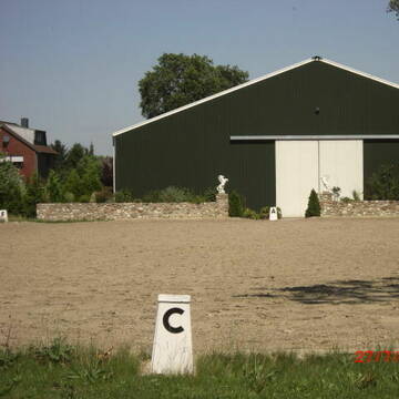
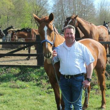
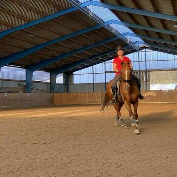
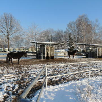
Reitanlage Stehr
Wedemark OT Negenborn
Reitanlage Stehr
@Reitanlage_Stehr
Vermieten
Hunde willkommen
Longierzirkel/Roundpen
Außenbox mit Paddock
Außenboxen
Vollpension
11 weitere...
P+
Deprecated: Creation of dynamic property Zend_View_Helper_Ads::$adLink is deprecated in /var/www/stall-frei/htdocs/staging.stall-frei.de/library/Psf/View/Helper/Ads.php on line 108

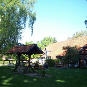
***Reitstall Birkenhof*** Pferdegerechte Haltung
Köln
Daniele-Fazzi
@Daniele-Fazzi
Herzlich Willkommen
auf dem Reitstall Birkenhof
Jetzt neu ‼️ auf dem Birkenhof:
Private Geländestrecke rund um unser


STALL - NEUBAU- REITHALLE 2023
Garbsen
Ebbecke Pferdepension
@Ebbecke
Pflegepferd
Vermieten
Longierzirkel/Roundpen
Paddock
Hufrehe geeignet
Pferdezucht
16 weitere...
P+


Hof Körber
Garbsen
Koerber
@Koerber
FN-Mitglied
Freizeitstall
Vermieten
Verpachten
Hunde willkommen
Krankenbox
Fohlenaufzucht möglich
Hufrehe geeignet
30 weitere...
P+


Reitstall Bremer - Ein Besuch lohnt sich!
Barsinghausen
Familie Wiedemann
@Familie_Wiedemann
Pferdeausbildung
Reitlehrer und -unterricht
Vermieten
Hunde willkommen
Krankenbox
Fohlenaufzucht möglich
Hengsthaltung möglich
20 weitere...
S
Pensionspferdebetrieb Less ?
Stelingen
Pensionspferdebetrieb-Less
@Pensionspferdebetrieb-Less
FN-Mitglied
Freizeitstall
Vermieten
Führanlage
Krankenbox
Außenbox mit Paddock
Außenboxen
24 weitere...
aktuell
P+

Aktiv- u. Bewegungsstall mit Gastboxen
Garbsen / Stelingen
Rust-Heinfried
@Rust-Heinfried
FN-Mitglied
Freizeitstall
Krankenbox
Longierzirkel/Roundpen
Notfallboxen
Bewegungsstall
13 weitere...
P+

Offenstall Plätze frei in 30900 Wedemark/Abbensen
Wedemark
Sören Deeke
@SoerenDeeke
Freizeitstall
Offenstall
Halbpension
Vollpension
aktuell
P
6 Offenstallplätze frei mit Reithallennutzung
Neustadt am Rübenberge
Brunnenhof-Welze
@Brunnenhof-Welze
Fahrstall, Kutschwagen
Pferdeausbildung
Vermieten
Paddock
Pensions- und Gastboxen
Allergikerstall
14 weitere...
P
Freie Aussenboxen
Neustadt
Reiner-Benecke
@Reiner-Benecke
Freizeitstall
Vermieten
Paddock
Parkplatz für Pferdeanhänger
Außenboxen
Innenbox
9 weitere...
P

Neue und moderne Reitanlage mit Gruppenhaltung
Garbsen
Hof Buchholz
@Hof-Buchholz
Vermieten
Krankenbox
Paddock
Allergikerstall
Notfallboxen
Laufstall
Paddock Trail
11 weitere...
P
Deprecated: Creation of dynamic property Zend_View::$pageCount is deprecated in /var/www/stall-frei/htdocs/staging.stall-frei.de/library/vendor/shardj/zf1-future/library/Zend/View/Abstract.php on line 308
Deprecated: Creation of dynamic property Zend_View::$itemCountPerPage is deprecated in /var/www/stall-frei/htdocs/staging.stall-frei.de/library/vendor/shardj/zf1-future/library/Zend/View/Abstract.php on line 308
Deprecated: Creation of dynamic property Zend_View::$first is deprecated in /var/www/stall-frei/htdocs/staging.stall-frei.de/library/vendor/shardj/zf1-future/library/Zend/View/Abstract.php on line 308
Deprecated: Creation of dynamic property Zend_View::$current is deprecated in /var/www/stall-frei/htdocs/staging.stall-frei.de/library/vendor/shardj/zf1-future/library/Zend/View/Abstract.php on line 308
Deprecated: Creation of dynamic property Zend_View::$last is deprecated in /var/www/stall-frei/htdocs/staging.stall-frei.de/library/vendor/shardj/zf1-future/library/Zend/View/Abstract.php on line 308
Deprecated: Creation of dynamic property Zend_View::$next is deprecated in /var/www/stall-frei/htdocs/staging.stall-frei.de/library/vendor/shardj/zf1-future/library/Zend/View/Abstract.php on line 308
Deprecated: Creation of dynamic property Zend_View::$pagesInRange is deprecated in /var/www/stall-frei/htdocs/staging.stall-frei.de/library/vendor/shardj/zf1-future/library/Zend/View/Abstract.php on line 308
Deprecated: Creation of dynamic property Zend_View::$firstPageInRange is deprecated in /var/www/stall-frei/htdocs/staging.stall-frei.de/library/vendor/shardj/zf1-future/library/Zend/View/Abstract.php on line 308
Deprecated: Creation of dynamic property Zend_View::$lastPageInRange is deprecated in /var/www/stall-frei/htdocs/staging.stall-frei.de/library/vendor/shardj/zf1-future/library/Zend/View/Abstract.php on line 308
Deprecated: Creation of dynamic property Zend_View::$currentItemCount is deprecated in /var/www/stall-frei/htdocs/staging.stall-frei.de/library/vendor/shardj/zf1-future/library/Zend/View/Abstract.php on line 308
Deprecated: Creation of dynamic property Zend_View::$totalItemCount is deprecated in /var/www/stall-frei/htdocs/staging.stall-frei.de/library/vendor/shardj/zf1-future/library/Zend/View/Abstract.php on line 308
Deprecated: Creation of dynamic property Zend_View::$firstItemNumber is deprecated in /var/www/stall-frei/htdocs/staging.stall-frei.de/library/vendor/shardj/zf1-future/library/Zend/View/Abstract.php on line 308
Deprecated: Creation of dynamic property Zend_View::$lastItemNumber is deprecated in /var/www/stall-frei/htdocs/staging.stall-frei.de/library/vendor/shardj/zf1-future/library/Zend/View/Abstract.php on line 308
Deprecated: Creation of dynamic property Zend_View::$router is deprecated in /var/www/stall-frei/htdocs/staging.stall-frei.de/library/vendor/shardj/zf1-future/library/Zend/View/Abstract.php on line 308
Deprecated: Creation of dynamic property Zend_View::$urlParams is deprecated in /var/www/stall-frei/htdocs/staging.stall-frei.de/library/vendor/shardj/zf1-future/library/Zend/View/Abstract.php on line 308
Deprecated: Creation of dynamic property Zend_View::$showAds is deprecated in /var/www/stall-frei/htdocs/staging.stall-frei.de/library/vendor/shardj/zf1-future/library/Zend/View/Abstract.php on line 308
Deprecated: Creation of dynamic property Zend_View::$objectIds is deprecated in /var/www/stall-frei/htdocs/staging.stall-frei.de/library/vendor/shardj/zf1-future/library/Zend/View/Abstract.php on line 308
Deprecated: Creation of dynamic property Zend_View::$showNavbar is deprecated in /var/www/stall-frei/htdocs/staging.stall-frei.de/library/vendor/shardj/zf1-future/library/Zend/View/Abstract.php on line 308
Deprecated: Creation of dynamic property Zend_View::$showBreadcrumb is deprecated in /var/www/stall-frei/htdocs/staging.stall-frei.de/library/vendor/shardj/zf1-future/library/Zend/View/Abstract.php on line 308
Deprecated: Creation of dynamic property Zend_View::$showFooter is deprecated in /var/www/stall-frei/htdocs/staging.stall-frei.de/library/vendor/shardj/zf1-future/library/Zend/View/Abstract.php on line 308
Deprecated: Creation of dynamic property Zend_View::$showInternalAds is deprecated in /var/www/stall-frei/htdocs/staging.stall-frei.de/library/vendor/shardj/zf1-future/library/Zend/View/Abstract.php on line 308
Deprecated: Creation of dynamic property Zend_View::$blNoContent is deprecated in /var/www/stall-frei/htdocs/staging.stall-frei.de/library/vendor/shardj/zf1-future/library/Zend/View/Abstract.php on line 308
Deprecated: Creation of dynamic property Zend_View::$sMetaDesc is deprecated in /var/www/stall-frei/htdocs/staging.stall-frei.de/library/vendor/shardj/zf1-future/library/Zend/View/Abstract.php on line 308
Deprecated: Creation of dynamic property Zend_View::$useGmaps is deprecated in /var/www/stall-frei/htdocs/staging.stall-frei.de/library/vendor/shardj/zf1-future/library/Zend/View/Abstract.php on line 308
Deprecated: Creation of dynamic property Zend_View::$touches is deprecated in /var/www/stall-frei/htdocs/staging.stall-frei.de/library/vendor/shardj/zf1-future/library/Zend/View/Abstract.php on line 308
Deprecated: Creation of dynamic property Zend_View::$oProject is deprecated in /var/www/stall-frei/htdocs/staging.stall-frei.de/library/vendor/shardj/zf1-future/library/Zend/View/Abstract.php on line 308
Deprecated: Creation of dynamic property Zend_View::$pageHeadline is deprecated in /var/www/stall-frei/htdocs/staging.stall-frei.de/library/vendor/shardj/zf1-future/library/Zend/View/Abstract.php on line 308
Deprecated: Creation of dynamic property Zend_View::$disableLocationField is deprecated in /var/www/stall-frei/htdocs/staging.stall-frei.de/library/vendor/shardj/zf1-future/library/Zend/View/Abstract.php on line 308
Deprecated: Creation of dynamic property Zend_View::$isSearch is deprecated in /var/www/stall-frei/htdocs/staging.stall-frei.de/library/vendor/shardj/zf1-future/library/Zend/View/Abstract.php on line 308
Deprecated: Creation of dynamic property Zend_View::$pageTitle is deprecated in /var/www/stall-frei/htdocs/staging.stall-frei.de/library/vendor/shardj/zf1-future/library/Zend/View/Abstract.php on line 308
Deprecated: Creation of dynamic property Psf_Form_Element_Text::$class is deprecated in /var/www/stall-frei/htdocs/staging.stall-frei.de/library/vendor/shardj/zf1-future/library/Zend/Form/Element.php on line 874
Deprecated: Creation of dynamic property Psf_Form_Element_Text::$size is deprecated in /var/www/stall-frei/htdocs/staging.stall-frei.de/library/vendor/shardj/zf1-future/library/Zend/Form/Element.php on line 874
Deprecated: Creation of dynamic property Psf_Form_Element_Text::$placeholder is deprecated in /var/www/stall-frei/htdocs/staging.stall-frei.de/library/vendor/shardj/zf1-future/library/Zend/Form/Element.php on line 874
Deprecated: Creation of dynamic property Psf_Form_Element_Hidden::$class is deprecated in /var/www/stall-frei/htdocs/staging.stall-frei.de/library/vendor/shardj/zf1-future/library/Zend/Form/Element.php on line 874
Deprecated: Creation of dynamic property Psf_Form_Element_Hidden::$class is deprecated in /var/www/stall-frei/htdocs/staging.stall-frei.de/library/vendor/shardj/zf1-future/library/Zend/Form/Element.php on line 874
Deprecated: Creation of dynamic property Psf_Form_Element_Hidden::$class is deprecated in /var/www/stall-frei/htdocs/staging.stall-frei.de/library/vendor/shardj/zf1-future/library/Zend/Form/Element.php on line 874
Deprecated: Creation of dynamic property Psf_Form_Element_Hidden::$class is deprecated in /var/www/stall-frei/htdocs/staging.stall-frei.de/library/vendor/shardj/zf1-future/library/Zend/Form/Element.php on line 874
Deprecated: Creation of dynamic property Psf_Form_Element_Select::$class is deprecated in /var/www/stall-frei/htdocs/staging.stall-frei.de/library/vendor/shardj/zf1-future/library/Zend/Form/Element.php on line 874
Deprecated: Creation of dynamic property Psf_Form_Element_Select::$class is deprecated in /var/www/stall-frei/htdocs/staging.stall-frei.de/library/vendor/shardj/zf1-future/library/Zend/Form/Element.php on line 874
Deprecated: Creation of dynamic property Psf_Form_Element_Select::$class is deprecated in /var/www/stall-frei/htdocs/staging.stall-frei.de/library/vendor/shardj/zf1-future/library/Zend/Form/Element.php on line 874
Deprecated: Creation of dynamic property Psf_Form_Element_Select::$class is deprecated in /var/www/stall-frei/htdocs/staging.stall-frei.de/library/vendor/shardj/zf1-future/library/Zend/Form/Element.php on line 874
Deprecated: Creation of dynamic property Psf_Form_Element_Text::$class is deprecated in /var/www/stall-frei/htdocs/staging.stall-frei.de/library/vendor/shardj/zf1-future/library/Zend/Form/Element.php on line 874
Deprecated: Creation of dynamic property Psf_Form_Element_Checkbox::$label is deprecated in /var/www/stall-frei/htdocs/staging.stall-frei.de/library/vendor/shardj/zf1-future/library/Zend/Form/Element.php on line 874
Deprecated: Creation of dynamic property Zend_View::$sort is deprecated in /var/www/stall-frei/htdocs/staging.stall-frei.de/library/vendor/shardj/zf1-future/library/Zend/View/Abstract.php on line 308
Deprecated: Creation of dynamic property Zend_View::$searchLocation is deprecated in /var/www/stall-frei/htdocs/staging.stall-frei.de/library/vendor/shardj/zf1-future/library/Zend/View/Abstract.php on line 308
Deprecated: Creation of dynamic property Zend_View::$locationHint is deprecated in /var/www/stall-frei/htdocs/staging.stall-frei.de/library/vendor/shardj/zf1-future/library/Zend/View/Abstract.php on line 308
Psf_GeoCoder_Abstract::getLocation: Scharrel Get Location CachedOrLive
Psf_GeoCoder_Abstract::getCachedOrLive: Scharrel
Psf_GeoCoder_OpenCageData::makeApiRequest: response:
Array
(
[documentation] => https://opencagedata.com/api
[licenses] => Array
(
[0] => Array
(
[name] => see attribution guide
[url] => https://opencagedata.com/credits
)
)
[results] => Array
(
[0] => Array
(
[bounds] => Array
(
[northeast] => Array
(
[lat] => 52.5427973
[lng] => 9.6018633
)
[southwest] => Array
(
[lat] => 52.5101181
[lng] => 9.5352445
)
)
[components] => Array
(
[ISO_3166-1_alpha-2] => DE
[ISO_3166-1_alpha-3] => DEU
[ISO_3166-2] => Array
(
[0] => DE-NI
)
[_category] => place
[_normalized_city] => Neustadt am Rübenberge
[_type] => village
[continent] => Europe
[country] => Deutschland
[country_code] => de
[county] => Region Hannover
[political_union] => European Union
[state] => Niedersachsen
[state_code] => NI
[suburb] => Scharrel
[town] => Neustadt am Rübenberge
[village] => Otternhagen
)
[confidence] => 7
[formatted] => Scharrel, Otternhagen, Niedersachsen, Deutschland
[geometry] => Array
(
[lat] => 52.5264175
[lng] => 9.568145
)
)
[1] => Array
(
[bounds] => Array
(
[northeast] => Array
(
[lat] => 53.091733
[lng] => 7.7273541
)
[southwest] => Array
(
[lat] => 53.051733
[lng] => 7.6873541
)
)
[components] => Array
(
[ISO_3166-1_alpha-2] => DE
[ISO_3166-1_alpha-3] => DEU
[ISO_3166-2] => Array
(
[0] => DE-NI
)
[_category] => place
[_normalized_city] => Scharrel
[_type] => village
[continent] => Europe
[country] => Deutschland
[country_code] => de
[county] => Landkreis Cloppenburg
[municipality] => Saterland
[political_union] => European Union
[postcode] => 26683
[state] => Niedersachsen
[state_code] => NI
[village] => Scharrel
)
[confidence] => 7
[formatted] => 26683 Scharrel, Deutschland
[geometry] => Array
(
[lat] => 53.071733
[lng] => 7.7073541
)
)
[2] => Array
(
[bounds] => Array
(
[northeast] => Array
(
[lat] => 53.0940209
[lng] => 7.7702993
)
[southwest] => Array
(
[lat] => 53.0314764
[lng] => 7.6121266
)
)
[components] => Array
(
[ISO_3166-1_alpha-2] => DE
[ISO_3166-1_alpha-3] => DEU
[ISO_3166-2] => Array
(
[0] => DE-NI
)
[_category] => place
[_normalized_city] => Saterland
[_type] => neighbourhood
[city_district] => Scharrel
[continent] => Europe
[country] => Deutschland
[country_code] => de
[county] => Landkreis Cloppenburg
[municipality] => Saterland
[political_union] => European Union
[state] => Niedersachsen
[state_code] => NI
)
[confidence] => 7
[formatted] => Scharrel, Saterland, Niedersachsen, Deutschland
[geometry] => Array
(
[lat] => 53.0622604
[lng] => 7.6817824
)
)
[3] => Array
(
[bounds] => Array
(
[northeast] => Array
(
[lat] => 52.7143784
[lng] => 8.6296068
)
[southwest] => Array
(
[lat] => 52.6743784
[lng] => 8.5896068
)
)
[components] => Array
(
[ISO_3166-1_alpha-2] => DE
[ISO_3166-1_alpha-3] => DEU
[ISO_3166-2] => Array
(
[0] => DE-NI
)
[_category] => place
[_normalized_city] => Dörpel
[_type] => hamlet
[continent] => Europe
[country] => Deutschland
[country_code] => de
[county] => Landkreis Diepholz
[hamlet] => Scharrel
[municipality] => Samtgemeinde Barnstorf
[political_union] => European Union
[postcode] => 49406
[state] => Niedersachsen
[state_code] => NI
[town] => Dörpel
[village] => Eydelstedt
)
[confidence] => 7
[formatted] => Scharrel, 49406 Eydelstedt, Deutschland
[geometry] => Array
(
[lat] => 52.6943784
[lng] => 8.6096068
)
)
[4] => Array
(
[bounds] => Array
(
[northeast] => Array
(
[lat] => 52.530617
[lng] => 9.5676012
)
[southwest] => Array
(
[lat] => 52.5237989
[lng] => 9.5493363
)
)
[components] => Array
(
[ISO_3166-1_alpha-2] => DE
[ISO_3166-1_alpha-3] => DEU
[ISO_3166-2] => Array
(
[0] => DE-NI
)
[_category] => place
[_normalized_city] => Neustadt am Rübenberge
[_type] => village
[continent] => Europe
[country] => Deutschland
[country_code] => de
[county] => Region Hannover
[political_union] => European Union
[postcode] => 31535
[residential] => Scharrel
[state] => Niedersachsen
[state_code] => NI
[suburb] => Scharrel
[town] => Neustadt am Rübenberge
[village] => Otternhagen
)
[confidence] => 8
[formatted] => 31535 Otternhagen, Deutschland
[geometry] => Array
(
[lat] => 52.5272094
[lng] => 9.557987
)
)
[5] => Array
(
[bounds] => Array
(
[northeast] => Array
(
[lat] => 52.6943748
[lng] => 8.6161404
)
[southwest] => Array
(
[lat] => 52.692399
[lng] => 8.6125212
)
)
[components] => Array
(
[ISO_3166-1_alpha-2] => DE
[ISO_3166-1_alpha-3] => DEU
[ISO_3166-2] => Array
(
[0] => DE-NI
)
[_category] => road
[_normalized_city] => Dörpel
[_type] => road
[continent] => Europe
[country] => Deutschland
[country_code] => de
[county] => Landkreis Diepholz
[hamlet] => Scharrel
[municipality] => Samtgemeinde Barnstorf
[political_union] => European Union
[postcode] => 49406
[road] => Scharrel
[state] => Niedersachsen
[state_code] => NI
[town] => Dörpel
[village] => Eydelstedt
)
[confidence] => 9
[formatted] => Scharrel, 49406 Eydelstedt, Deutschland
[geometry] => Array
(
[lat] => 52.6933048
[lng] => 8.6142807
)
)
[6] => Array
(
[components] => Array
(
[ISO_3166-1_alpha-2] => FR
[ISO_3166-1_alpha-3] => FRA
[ISO_3166-2] => Array
(
[0] => FR-PAC
[1] => FR-13
)
[_category] => road
[_normalized_city] => Aubagne
[_type] => road
[city] => Aubagne
[continent] => Europe
[country] => France
[country_code] => fr
[county] => Bouches-du-Rhône
[local_authority] => Aix-Marseille-Provence
[political_union] => European Union
[postcode] => 13400
[road] => Chemin du Charrel
[state] => Provence-Alpes-Côte d'Azur
[state_code] => PAC
)
[confidence] => 3
[formatted] => Chemin du Charrel, 13400 Aubagne, France
[geometry] => Array
(
[lat] => 43.27867
[lng] => 5.557353
)
)
[7] => Array
(
[components] => Array
(
[ISO_3166-1_alpha-2] => FR
[ISO_3166-1_alpha-3] => FRA
[ISO_3166-2] => Array
(
[0] => FR-ARA
[1] => FR-07
)
[_category] => road
[_normalized_city] => Peaugres
[_type] => road
[city] => Peaugres
[continent] => Europe
[country] => France
[country_code] => fr
[county] => Ardèche
[local_authority] => Annonay Rhône Agglo
[political_union] => European Union
[postcode] => 07340
[road] => Route de la Charelle
[state] => Auvergne-Rhône-Alpes
[state_code] => ARA
)
[confidence] => 3
[formatted] => Route de la Charelle, 07340 Peaugres, France
[geometry] => Array
(
[lat] => 45.293228
[lng] => 4.712638
)
)
[8] => Array
(
[components] => Array
(
[ISO_3166-1_alpha-2] => FR
[ISO_3166-1_alpha-3] => FRA
[ISO_3166-2] => Array
(
[0] => FR-ARA
[1] => FR-43
)
[_category] => road
[_normalized_city] => Le Chambon-sur-Lignon
[_type] => road
[city] => Le Chambon-sur-Lignon
[continent] => Europe
[country] => France
[country_code] => fr
[county] => Haute-Loire
[local_authority] => Haut-Lignon
[political_union] => European Union
[postcode] => 43400
[road] => Chemin de Charel
[state] => Auvergne-Rhône-Alpes
[state_code] => ARA
)
[confidence] => 3
[formatted] => Chemin de Charel, 43400 Le Chambon-sur-Lignon, France
[geometry] => Array
(
[lat] => 45.078179
[lng] => 4.290733
)
)
[9] => Array
(
[components] => Array
(
[ISO_3166-1_alpha-2] => FR
[ISO_3166-1_alpha-3] => FRA
[ISO_3166-2] => Array
(
[0] => FR-NAQ
[1] => FR-19
)
[_category] => road
[_normalized_city] => Rilhac-Xaintrie
[_type] => road
[city] => Rilhac-Xaintrie
[continent] => Europe
[country] => France
[country_code] => fr
[county] => Corrèze
[local_authority] => Communauté de communes Xaintrie Val'dordogne
[political_union] => European Union
[postcode] => 19220
[road] => Route de Charel
[state] => Nouvelle-Aquitaine
[state_code] => NAQ
)
[confidence] => 3
[formatted] => Route de Charel, 19220 Rilhac-Xaintrie, France
[geometry] => Array
(
[lat] => 45.214402
[lng] => 2.186509
)
)
)
[status] => Array
(
[code] => 200
[message] => OK
)
[stay_informed] => Array
(
[blog] => https://blog.opencagedata.com
[mastodon] => https://en.osm.town/@opencage
)
[thanks] => For using an OpenCage API
[timestamp] => Array
(
[created_http] => Mon, 09 Feb 2026 04:00:35 GMT
[created_unix] => 1770609635
)
[total_results] => 10
)
Psf_GeoCoder_Abstract::convertLocationResult
{"documentation":"https:\/\/opencagedata.com\/api","licenses":[{"name":"see attribution guide","url":"https:\/\/opencagedata.com\/credits"}],"results":[{"bounds":{"northeast":{"lat":52.5427973,"lng":9.6018633},"southwest":{"lat":52.5101181,"lng":9.5352445}},"components":{"ISO_3166-1_alpha-2":"DE","ISO_3166-1_alpha-3":"DEU","ISO_3166-2":["DE-NI"],"_category":"place","_normalized_city":"Neustadt am R\u00fcbenberge","_type":"village","continent":"Europe","country":"Deutschland","country_code":"de","county":"Region Hannover","political_union":"European Union","state":"Niedersachsen","state_code":"NI","suburb":"Scharrel","town":"Neustadt am R\u00fcbenberge","village":"Otternhagen"},"confidence":7,"formatted":"Scharrel, Otternhagen, Niedersachsen, Deutschland","geometry":{"lat":52.5264175,"lng":9.568145}},{"bounds":{"northeast":{"lat":53.091733,"lng":7.7273541},"southwest":{"lat":53.051733,"lng":7.6873541}},"components":{"ISO_3166-1_alpha-2":"DE","ISO_3166-1_alpha-3":"DEU","ISO_3166-2":["DE-NI"],"_category":"place","_normalized_city":"Scharrel","_type":"village","continent":"Europe","country":"Deutschland","country_code":"de","county":"Landkreis Cloppenburg","municipality":"Saterland","political_union":"European Union","postcode":"26683","state":"Niedersachsen","state_code":"NI","village":"Scharrel"},"confidence":7,"formatted":"26683 Scharrel, Deutschland","geometry":{"lat":53.071733,"lng":7.7073541}},{"bounds":{"northeast":{"lat":53.0940209,"lng":7.7702993},"southwest":{"lat":53.0314764,"lng":7.6121266}},"components":{"ISO_3166-1_alpha-2":"DE","ISO_3166-1_alpha-3":"DEU","ISO_3166-2":["DE-NI"],"_category":"place","_normalized_city":"Saterland","_type":"neighbourhood","city_district":"Scharrel","continent":"Europe","country":"Deutschland","country_code":"de","county":"Landkreis Cloppenburg","municipality":"Saterland","political_union":"European Union","state":"Niedersachsen","state_code":"NI"},"confidence":7,"formatted":"Scharrel, Saterland, Niedersachsen, Deutschland","geometry":{"lat":53.0622604,"lng":7.6817824}},{"bounds":{"northeast":{"lat":52.7143784,"lng":8.6296068},"southwest":{"lat":52.6743784,"lng":8.5896068}},"components":{"ISO_3166-1_alpha-2":"DE","ISO_3166-1_alpha-3":"DEU","ISO_3166-2":["DE-NI"],"_category":"place","_normalized_city":"D\u00f6rpel","_type":"hamlet","continent":"Europe","country":"Deutschland","country_code":"de","county":"Landkreis Diepholz","hamlet":"Scharrel","municipality":"Samtgemeinde Barnstorf","political_union":"European Union","postcode":"49406","state":"Niedersachsen","state_code":"NI","town":"D\u00f6rpel","village":"Eydelstedt"},"confidence":7,"formatted":"Scharrel, 49406 Eydelstedt, Deutschland","geometry":{"lat":52.6943784,"lng":8.6096068}},{"bounds":{"northeast":{"lat":52.530617,"lng":9.5676012},"southwest":{"lat":52.5237989,"lng":9.5493363}},"components":{"ISO_3166-1_alpha-2":"DE","ISO_3166-1_alpha-3":"DEU","ISO_3166-2":["DE-NI"],"_category":"place","_normalized_city":"Neustadt am R\u00fcbenberge","_type":"village","continent":"Europe","country":"Deutschland","country_code":"de","county":"Region Hannover","political_union":"European Union","postcode":"31535","residential":"Scharrel","state":"Niedersachsen","state_code":"NI","suburb":"Scharrel","town":"Neustadt am R\u00fcbenberge","village":"Otternhagen"},"confidence":8,"formatted":"31535 Otternhagen, Deutschland","geometry":{"lat":52.5272094,"lng":9.557987}},{"bounds":{"northeast":{"lat":52.6943748,"lng":8.6161404},"southwest":{"lat":52.692399,"lng":8.6125212}},"components":{"ISO_3166-1_alpha-2":"DE","ISO_3166-1_alpha-3":"DEU","ISO_3166-2":["DE-NI"],"_category":"road","_normalized_city":"D\u00f6rpel","_type":"road","continent":"Europe","country":"Deutschland","country_code":"de","county":"Landkreis Diepholz","hamlet":"Scharrel","municipality":"Samtgemeinde Barnstorf","political_union":"European Union","postcode":"49406","road":"Scharrel","state":"Niedersachsen","state_code":"NI","town":"D\u00f6rpel","village":"Eydelstedt"},"confidence":9,"formatted":"Scharrel, 49406 Eydelstedt, Deutschland","geometry":{"lat":52.6933048,"lng":8.6142807}},{"components":{"ISO_3166-1_alpha-2":"FR","ISO_3166-1_alpha-3":"FRA","ISO_3166-2":["FR-PAC","FR-13"],"_category":"road","_normalized_city":"Aubagne","_type":"road","city":"Aubagne","continent":"Europe","country":"France","country_code":"fr","county":"Bouches-du-Rh\u00f4ne","local_authority":"Aix-Marseille-Provence","political_union":"European Union","postcode":"13400","road":"Chemin du Charrel","state":"Provence-Alpes-C\u00f4te d'Azur","state_code":"PAC"},"confidence":3,"formatted":"Chemin du Charrel, 13400 Aubagne, France","geometry":{"lat":43.27867,"lng":5.557353}},{"components":{"ISO_3166-1_alpha-2":"FR","ISO_3166-1_alpha-3":"FRA","ISO_3166-2":["FR-ARA","FR-07"],"_category":"road","_normalized_city":"Peaugres","_type":"road","city":"Peaugres","continent":"Europe","country":"France","country_code":"fr","county":"Ard\u00e8che","local_authority":"Annonay Rh\u00f4ne Agglo","political_union":"European Union","postcode":"07340","road":"Route de la Charelle","state":"Auvergne-Rh\u00f4ne-Alpes","state_code":"ARA"},"confidence":3,"formatted":"Route de la Charelle, 07340 Peaugres, France","geometry":{"lat":45.293228,"lng":4.712638}},{"components":{"ISO_3166-1_alpha-2":"FR","ISO_3166-1_alpha-3":"FRA","ISO_3166-2":["FR-ARA","FR-43"],"_category":"road","_normalized_city":"Le Chambon-sur-Lignon","_type":"road","city":"Le Chambon-sur-Lignon","continent":"Europe","country":"France","country_code":"fr","county":"Haute-Loire","local_authority":"Haut-Lignon","political_union":"European Union","postcode":"43400","road":"Chemin de Charel","state":"Auvergne-Rh\u00f4ne-Alpes","state_code":"ARA"},"confidence":3,"formatted":"Chemin de Charel, 43400 Le Chambon-sur-Lignon, France","geometry":{"lat":45.078179,"lng":4.290733}},{"components":{"ISO_3166-1_alpha-2":"FR","ISO_3166-1_alpha-3":"FRA","ISO_3166-2":["FR-NAQ","FR-19"],"_category":"road","_normalized_city":"Rilhac-Xaintrie","_type":"road","city":"Rilhac-Xaintrie","continent":"Europe","country":"France","country_code":"fr","county":"Corr\u00e8ze","local_authority":"Communaut\u00e9 de communes Xaintrie Val'dordogne","political_union":"European Union","postcode":"19220","road":"Route de Charel","state":"Nouvelle-Aquitaine","state_code":"NAQ"},"confidence":3,"formatted":"Route de Charel, 19220 Rilhac-Xaintrie, France","geometry":{"lat":45.214402,"lng":2.186509}}],"status":{"code":200,"message":"OK"},"stay_informed":{"blog":"https:\/\/blog.opencagedata.com","mastodon":"https:\/\/en.osm.town\/@opencage"},"thanks":"For using an OpenCage API","timestamp":{"created_http":"Mon, 09 Feb 2026 04:00:35 GMT","created_unix":1770609635},"total_results":10}Array
(
[0] => stdClass Object
(
[bounds] => stdClass Object
(
[northeast] => stdClass Object
(
[lat] => 52.5427973
[lng] => 9.6018633
)
[southwest] => stdClass Object
(
[lat] => 52.5101181
[lng] => 9.5352445
)
)
[components] => stdClass Object
(
[ISO_3166-1_alpha-2] => DE
[ISO_3166-1_alpha-3] => DEU
[ISO_3166-2] => Array
(
[0] => DE-NI
)
[_category] => place
[_normalized_city] => Neustadt am Rübenberge
[_type] => village
[continent] => Europe
[country] => Deutschland
[country_code] => de
[county] => Region Hannover
[political_union] => European Union
[state] => Niedersachsen
[state_code] => NI
[suburb] => Scharrel
[town] => Neustadt am Rübenberge
[village] => Otternhagen
)
[confidence] => 7
[formatted] => Scharrel, Otternhagen, Niedersachsen, Deutschland
[geometry] => stdClass Object
(
[lat] => 52.5264175
[lng] => 9.568145
)
)
[1] => stdClass Object
(
[bounds] => stdClass Object
(
[northeast] => stdClass Object
(
[lat] => 53.091733
[lng] => 7.7273541
)
[southwest] => stdClass Object
(
[lat] => 53.051733
[lng] => 7.6873541
)
)
[components] => stdClass Object
(
[ISO_3166-1_alpha-2] => DE
[ISO_3166-1_alpha-3] => DEU
[ISO_3166-2] => Array
(
[0] => DE-NI
)
[_category] => place
[_normalized_city] => Scharrel
[_type] => village
[continent] => Europe
[country] => Deutschland
[country_code] => de
[county] => Landkreis Cloppenburg
[municipality] => Saterland
[political_union] => European Union
[postcode] => 26683
[state] => Niedersachsen
[state_code] => NI
[village] => Scharrel
)
[confidence] => 7
[formatted] => 26683 Scharrel, Deutschland
[geometry] => stdClass Object
(
[lat] => 53.071733
[lng] => 7.7073541
)
)
[2] => stdClass Object
(
[bounds] => stdClass Object
(
[northeast] => stdClass Object
(
[lat] => 53.0940209
[lng] => 7.7702993
)
[southwest] => stdClass Object
(
[lat] => 53.0314764
[lng] => 7.6121266
)
)
[components] => stdClass Object
(
[ISO_3166-1_alpha-2] => DE
[ISO_3166-1_alpha-3] => DEU
[ISO_3166-2] => Array
(
[0] => DE-NI
)
[_category] => place
[_normalized_city] => Saterland
[_type] => neighbourhood
[city_district] => Scharrel
[continent] => Europe
[country] => Deutschland
[country_code] => de
[county] => Landkreis Cloppenburg
[municipality] => Saterland
[political_union] => European Union
[state] => Niedersachsen
[state_code] => NI
)
[confidence] => 7
[formatted] => Scharrel, Saterland, Niedersachsen, Deutschland
[geometry] => stdClass Object
(
[lat] => 53.0622604
[lng] => 7.6817824
)
)
[3] => stdClass Object
(
[bounds] => stdClass Object
(
[northeast] => stdClass Object
(
[lat] => 52.7143784
[lng] => 8.6296068
)
[southwest] => stdClass Object
(
[lat] => 52.6743784
[lng] => 8.5896068
)
)
[components] => stdClass Object
(
[ISO_3166-1_alpha-2] => DE
[ISO_3166-1_alpha-3] => DEU
[ISO_3166-2] => Array
(
[0] => DE-NI
)
[_category] => place
[_normalized_city] => Dörpel
[_type] => hamlet
[continent] => Europe
[country] => Deutschland
[country_code] => de
[county] => Landkreis Diepholz
[hamlet] => Scharrel
[municipality] => Samtgemeinde Barnstorf
[political_union] => European Union
[postcode] => 49406
[state] => Niedersachsen
[state_code] => NI
[town] => Dörpel
[village] => Eydelstedt
)
[confidence] => 7
[formatted] => Scharrel, 49406 Eydelstedt, Deutschland
[geometry] => stdClass Object
(
[lat] => 52.6943784
[lng] => 8.6096068
)
)
[4] => stdClass Object
(
[bounds] => stdClass Object
(
[northeast] => stdClass Object
(
[lat] => 52.530617
[lng] => 9.5676012
)
[southwest] => stdClass Object
(
[lat] => 52.5237989
[lng] => 9.5493363
)
)
[components] => stdClass Object
(
[ISO_3166-1_alpha-2] => DE
[ISO_3166-1_alpha-3] => DEU
[ISO_3166-2] => Array
(
[0] => DE-NI
)
[_category] => place
[_normalized_city] => Neustadt am Rübenberge
[_type] => village
[continent] => Europe
[country] => Deutschland
[country_code] => de
[county] => Region Hannover
[political_union] => European Union
[postcode] => 31535
[residential] => Scharrel
[state] => Niedersachsen
[state_code] => NI
[suburb] => Scharrel
[town] => Neustadt am Rübenberge
[village] => Otternhagen
)
[confidence] => 8
[formatted] => 31535 Otternhagen, Deutschland
[geometry] => stdClass Object
(
[lat] => 52.5272094
[lng] => 9.557987
)
)
[5] => stdClass Object
(
[bounds] => stdClass Object
(
[northeast] => stdClass Object
(
[lat] => 52.6943748
[lng] => 8.6161404
)
[southwest] => stdClass Object
(
[lat] => 52.692399
[lng] => 8.6125212
)
)
[components] => stdClass Object
(
[ISO_3166-1_alpha-2] => DE
[ISO_3166-1_alpha-3] => DEU
[ISO_3166-2] => Array
(
[0] => DE-NI
)
[_category] => road
[_normalized_city] => Dörpel
[_type] => road
[continent] => Europe
[country] => Deutschland
[country_code] => de
[county] => Landkreis Diepholz
[hamlet] => Scharrel
[municipality] => Samtgemeinde Barnstorf
[political_union] => European Union
[postcode] => 49406
[road] => Scharrel
[state] => Niedersachsen
[state_code] => NI
[town] => Dörpel
[village] => Eydelstedt
)
[confidence] => 9
[formatted] => Scharrel, 49406 Eydelstedt, Deutschland
[geometry] => stdClass Object
(
[lat] => 52.6933048
[lng] => 8.6142807
)
)
[6] => stdClass Object
(
[components] => stdClass Object
(
[ISO_3166-1_alpha-2] => FR
[ISO_3166-1_alpha-3] => FRA
[ISO_3166-2] => Array
(
[0] => FR-PAC
[1] => FR-13
)
[_category] => road
[_normalized_city] => Aubagne
[_type] => road
[city] => Aubagne
[continent] => Europe
[country] => France
[country_code] => fr
[county] => Bouches-du-Rhône
[local_authority] => Aix-Marseille-Provence
[political_union] => European Union
[postcode] => 13400
[road] => Chemin du Charrel
[state] => Provence-Alpes-Côte d'Azur
[state_code] => PAC
)
[confidence] => 3
[formatted] => Chemin du Charrel, 13400 Aubagne, France
[geometry] => stdClass Object
(
[lat] => 43.27867
[lng] => 5.557353
)
)
[7] => stdClass Object
(
[components] => stdClass Object
(
[ISO_3166-1_alpha-2] => FR
[ISO_3166-1_alpha-3] => FRA
[ISO_3166-2] => Array
(
[0] => FR-ARA
[1] => FR-07
)
[_category] => road
[_normalized_city] => Peaugres
[_type] => road
[city] => Peaugres
[continent] => Europe
[country] => France
[country_code] => fr
[county] => Ardèche
[local_authority] => Annonay Rhône Agglo
[political_union] => European Union
[postcode] => 07340
[road] => Route de la Charelle
[state] => Auvergne-Rhône-Alpes
[state_code] => ARA
)
[confidence] => 3
[formatted] => Route de la Charelle, 07340 Peaugres, France
[geometry] => stdClass Object
(
[lat] => 45.293228
[lng] => 4.712638
)
)
[8] => stdClass Object
(
[components] => stdClass Object
(
[ISO_3166-1_alpha-2] => FR
[ISO_3166-1_alpha-3] => FRA
[ISO_3166-2] => Array
(
[0] => FR-ARA
[1] => FR-43
)
[_category] => road
[_normalized_city] => Le Chambon-sur-Lignon
[_type] => road
[city] => Le Chambon-sur-Lignon
[continent] => Europe
[country] => France
[country_code] => fr
[county] => Haute-Loire
[local_authority] => Haut-Lignon
[political_union] => European Union
[postcode] => 43400
[road] => Chemin de Charel
[state] => Auvergne-Rhône-Alpes
[state_code] => ARA
)
[confidence] => 3
[formatted] => Chemin de Charel, 43400 Le Chambon-sur-Lignon, France
[geometry] => stdClass Object
(
[lat] => 45.078179
[lng] => 4.290733
)
)
[9] => stdClass Object
(
[components] => stdClass Object
(
[ISO_3166-1_alpha-2] => FR
[ISO_3166-1_alpha-3] => FRA
[ISO_3166-2] => Array
(
[0] => FR-NAQ
[1] => FR-19
)
[_category] => road
[_normalized_city] => Rilhac-Xaintrie
[_type] => road
[city] => Rilhac-Xaintrie
[continent] => Europe
[country] => France
[country_code] => fr
[county] => Corrèze
[local_authority] => Communauté de communes Xaintrie Val'dordogne
[political_union] => European Union
[postcode] => 19220
[road] => Route de Charel
[state] => Nouvelle-Aquitaine
[state_code] => NAQ
)
[confidence] => 3
[formatted] => Route de Charel, 19220 Rilhac-Xaintrie, France
[geometry] => stdClass Object
(
[lat] => 45.214402
[lng] => 2.186509
)
)
)
Psf_GeoCoder_OpenCageData::getKeyMap: 0
stdClass Object
(
    [bounds] => stdClass Object
        (
            [northeast] => stdClass Object
                (
                    [lat] => 52.5427973
                    [lng] => 9.6018633
                )

            [southwest] => stdClass Object
                (
                    [lat] => 52.5101181
                    [lng] => 9.5352445
                )

        )

    [components] => stdClass Object
        (
            [ISO_3166-1_alpha-2] => DE
            [ISO_3166-1_alpha-3] => DEU
            [ISO_3166-2] => Array
                (
                    [0] => DE-NI
                )

            [_category] => place
            [_normalized_city] => Neustadt am Rübenberge
            [_type] => village
            [continent] => Europe
            [country] => Deutschland
            [country_code] => de
            [county] => Region Hannover
            [political_union] => European Union
            [state] => Niedersachsen
            [state_code] => NI
            [suburb] => Scharrel
            [town] => Neustadt am Rübenberge
            [village] => Otternhagen
        )

    [confidence] => 7
    [formatted] => Scharrel, Otternhagen, Niedersachsen, Deutschland
    [geometry] => stdClass Object
        (
            [lat] => 52.5264175
            [lng] => 9.568145
        )

)
Psf_GeoCoder_OpenCageData::getCounty: Hannover
Psf_GeoCoder_OpenCageData::addMissingData REFETCH!
Array
(
    [address] => Scharrel, Otternhagen, Niedersachsen, Deutschland
    [type] => village
    [street] =>
    [city] => Neustadt am Rübenberge
    [county] => Hannover
    [state] => Niedersachsen
    [zip] =>
    [country] => Deutschland
    [suburb] => Scharrel
    [countrycode] => de
    [latitude] => 52.5264175
    [longitude] => 9.568145
    [accuracy] => 1
    [confidence] => 7
    [bounds] => stdClass Object
        (
            [northeast] => stdClass Object
                (
                    [lat] => 52.5427973
                    [lng] => 9.6018633
                )

            [southwest] => stdClass Object
                (
                    [lat] => 52.5101181
                    [lng] => 9.5352445
                )

        )

)
reformat!
Array
(
    [address] => Neustadt am Rübenberge
    [type] => village
    [street] =>
    [city] => Neustadt am Rübenberge
    [county] => Hannover
    [state] => Niedersachsen
    [zip] =>
    [country] => Deutschland
    [suburb] => Scharrel
    [countrycode] => de
    [latitude] => 52.5264175
    [longitude] => 9.568145
    [accuracy] => 1
    [confidence] => 7
    [bounds] => stdClass Object
        (
            [northeast] => stdClass Object
                (
                    [lat] => 52.5427973
                    [lng] => 9.6018633
                )

            [southwest] => stdClass Object
                (
                    [lat] => 52.5101181
                    [lng] => 9.5352445
                )

        )

    [place] => Neustadt am Rübenberge, Niedersachsen
    [hash] => 69c47e57af38d3c33668f844fc9fd8e4
)
Psf_GeoCoder_OpenCageData::getKeyMap: 1
stdClass Object
(
    [bounds] => stdClass Object
        (
            [northeast] => stdClass Object
                (
                    [lat] => 53.091733
                    [lng] => 7.7273541
                )

            [southwest] => stdClass Object
                (
                    [lat] => 53.051733
                    [lng] => 7.6873541
                )

        )

    [components] => stdClass Object
        (
            [ISO_3166-1_alpha-2] => DE
            [ISO_3166-1_alpha-3] => DEU
            [ISO_3166-2] => Array
                (
                    [0] => DE-NI
                )

            [_category] => place
            [_normalized_city] => Scharrel
            [_type] => village
            [continent] => Europe
            [country] => Deutschland
            [country_code] => de
            [county] => Landkreis Cloppenburg
            [municipality] => Saterland
            [political_union] => European Union
            [postcode] => 26683
            [state] => Niedersachsen
            [state_code] => NI
            [village] => Scharrel
        )

    [confidence] => 7
    [formatted] => 26683 Scharrel, Deutschland
    [geometry] => stdClass Object
        (
            [lat] => 53.071733
            [lng] => 7.7073541
        )

)
Psf_GeoCoder_OpenCageData::getCounty: Cloppenburg
Psf_GeoCoder_OpenCageData::addMissingData REFETCH!
Array
(
    [address] => 26683 Scharrel, Deutschland
    [type] => village
    [street] =>
    [city] => Scharrel
    [county] => Cloppenburg
    [state] => Niedersachsen
    [zip] => 26683
    [country] => Deutschland
    [suburb] =>
    [countrycode] => de
    [latitude] => 53.071733
    [longitude] => 7.7073541
    [accuracy] => 1
    [confidence] => 7
    [bounds] => stdClass Object
        (
            [northeast] => stdClass Object
                (
                    [lat] => 53.091733
                    [lng] => 7.7273541
                )

            [southwest] => stdClass Object
                (
                    [lat] => 53.051733
                    [lng] => 7.6873541
                )

        )

)
reformat!
Array
(
    [address] => 26683 Scharrel, Deutschland
    [type] => village
    [street] =>
    [city] => Scharrel
    [county] => Cloppenburg
    [state] => Niedersachsen
    [zip] => 26683
    [country] => Deutschland
    [suburb] =>
    [countrycode] => de
    [latitude] => 53.071733
    [longitude] => 7.7073541
    [accuracy] => 1
    [confidence] => 7
    [bounds] => stdClass Object
        (
            [northeast] => stdClass Object
                (
                    [lat] => 53.091733
                    [lng] => 7.7273541
                )

            [southwest] => stdClass Object
                (
                    [lat] => 53.051733
                    [lng] => 7.6873541
                )

        )

    [place] => 26683 Scharrel, Niedersachsen
    [hash] => a0217a7d4101697b4aed22d5ad34a48c
)
Psf_GeoCoder_OpenCageData::getKeyMap: 2
stdClass Object
(
    [bounds] => stdClass Object
        (
            [northeast] => stdClass Object
                (
                    [lat] => 53.0940209
                    [lng] => 7.7702993
                )

            [southwest] => stdClass Object
                (
                    [lat] => 53.0314764
                    [lng] => 7.6121266
                )

        )

    [components] => stdClass Object
        (
            [ISO_3166-1_alpha-2] => DE
            [ISO_3166-1_alpha-3] => DEU
            [ISO_3166-2] => Array
                (
                    [0] => DE-NI
                )

            [_category] => place
            [_normalized_city] => Saterland
            [_type] => neighbourhood
            [city_district] => Scharrel
            [continent] => Europe
            [country] => Deutschland
            [country_code] => de
            [county] => Landkreis Cloppenburg
            [municipality] => Saterland
            [political_union] => European Union
            [state] => Niedersachsen
            [state_code] => NI
        )

    [confidence] => 7
    [formatted] => Scharrel, Saterland, Niedersachsen, Deutschland
    [geometry] => stdClass Object
        (
            [lat] => 53.0622604
            [lng] => 7.6817824
        )

)
Psf_GeoCoder_OpenCageData::getCounty: Cloppenburg
Psf_GeoCoder_OpenCageData::addMissingData REFETCH!
Array
(
    [address] => Scharrel, Saterland, Niedersachsen, Deutschland
    [type] => neighbourhood
    [street] =>
    [city] => Scharrel
    [county] => Cloppenburg
    [state] => Niedersachsen
    [zip] =>
    [country] => Deutschland
    [suburb] =>
    [countrycode] => de
    [latitude] => 53.0622604
    [longitude] => 7.6817824
    [accuracy] => 1
    [confidence] => 7
    [bounds] => stdClass Object
        (
            [northeast] => stdClass Object
                (
                    [lat] => 53.0940209
                    [lng] => 7.7702993
                )

            [southwest] => stdClass Object
                (
                    [lat] => 53.0314764
                    [lng] => 7.6121266
                )

        )

)
reformat!
Array
(
    [address] => Scharrel, Saterland, Niedersachsen, Deutschland
    [type] => neighbourhood
    [street] =>
    [city] => Scharrel
    [county] => Cloppenburg
    [state] => Niedersachsen
    [zip] =>
    [country] => Deutschland
    [suburb] =>
    [countrycode] => de
    [latitude] => 53.0622604
    [longitude] => 7.6817824
    [accuracy] => 1
    [confidence] => 7
    [bounds] => stdClass Object
        (
            [northeast] => stdClass Object
                (
                    [lat] => 53.0940209
                    [lng] => 7.7702993
                )

            [southwest] => stdClass Object
                (
                    [lat] => 53.0314764
                    [lng] => 7.6121266
                )

        )

    [place] => Scharrel, Niedersachsen
    [hash] => f031910e6f446fb33897d48dc4aecb41
)
Psf_GeoCoder_OpenCageData::getKeyMap: 3
stdClass Object
(
    [bounds] => stdClass Object
        (
            [northeast] => stdClass Object
                (
                    [lat] => 52.7143784
                    [lng] => 8.6296068
                )

            [southwest] => stdClass Object
                (
                    [lat] => 52.6743784
                    [lng] => 8.5896068
                )

        )

    [components] => stdClass Object
        (
            [ISO_3166-1_alpha-2] => DE
            [ISO_3166-1_alpha-3] => DEU
            [ISO_3166-2] => Array
                (
                    [0] => DE-NI
                )

            [_category] => place
            [_normalized_city] => Dörpel
            [_type] => hamlet
            [continent] => Europe
            [country] => Deutschland
            [country_code] => de
            [county] => Landkreis Diepholz
            [hamlet] => Scharrel
            [municipality] => Samtgemeinde Barnstorf
            [political_union] => European Union
            [postcode] => 49406
            [state] => Niedersachsen
            [state_code] => NI
            [town] => Dörpel
            [village] => Eydelstedt
        )

    [confidence] => 7
    [formatted] => Scharrel, 49406 Eydelstedt, Deutschland
    [geometry] => stdClass Object
        (
            [lat] => 52.6943784
            [lng] => 8.6096068
        )

)
Psf_GeoCoder_OpenCageData::getCounty: Diepholz
Psf_GeoCoder_OpenCageData::addMissingData REFETCH!
Array
(
    [address] => Scharrel, 49406 Eydelstedt, Deutschland
    [type] => hamlet
    [street] => Scharrel
    [city] => Dörpel
    [county] => Diepholz
    [state] => Niedersachsen
    [zip] => 49406
    [country] => Deutschland
    [suburb] =>
    [countrycode] => de
    [latitude] => 52.6943784
    [longitude] => 8.6096068
    [accuracy] => 1
    [confidence] => 7
    [bounds] => stdClass Object
        (
            [northeast] => stdClass Object
                (
                    [lat] => 52.7143784
                    [lng] => 8.6296068
                )

            [southwest] => stdClass Object
                (
                    [lat] => 52.6743784
                    [lng] => 8.5896068
                )

        )

)
reformat!
Array
(
    [address] => Scharrel, 49406 Dörpel
    [type] => hamlet
    [street] => Scharrel
    [city] => Dörpel
    [county] => Diepholz
    [state] => Niedersachsen
    [zip] => 49406
    [country] => Deutschland
    [suburb] =>
    [countrycode] => de
    [latitude] => 52.6943784
    [longitude] => 8.6096068
    [accuracy] => 1
    [confidence] => 7
    [bounds] => stdClass Object
        (
            [northeast] => stdClass Object
                (
                    [lat] => 52.7143784
                    [lng] => 8.6296068
                )

            [southwest] => stdClass Object
                (
                    [lat] => 52.6743784
                    [lng] => 8.5896068
                )

        )

    [place] => Scharrel, 49406 Dörpel, Niedersachsen
    [hash] => a068fedd36a5b3aef25cedaef342754c
)
Psf_GeoCoder_OpenCageData::getKeyMap: 4
stdClass Object
(
    [bounds] => stdClass Object
        (
            [northeast] => stdClass Object
                (
                    [lat] => 52.530617
                    [lng] => 9.5676012
                )

            [southwest] => stdClass Object
                (
                    [lat] => 52.5237989
                    [lng] => 9.5493363
                )

        )

    [components] => stdClass Object
        (
            [ISO_3166-1_alpha-2] => DE
            [ISO_3166-1_alpha-3] => DEU
            [ISO_3166-2] => Array
                (
                    [0] => DE-NI
                )

            [_category] => place
            [_normalized_city] => Neustadt am Rübenberge
            [_type] => village
            [continent] => Europe
            [country] => Deutschland
            [country_code] => de
            [county] => Region Hannover
            [political_union] => European Union
            [postcode] => 31535
            [residential] => Scharrel
            [state] => Niedersachsen
            [state_code] => NI
            [suburb] => Scharrel
            [town] => Neustadt am Rübenberge
            [village] => Otternhagen
        )

    [confidence] => 8
    [formatted] => 31535 Otternhagen, Deutschland
    [geometry] => stdClass Object
        (
            [lat] => 52.5272094
            [lng] => 9.557987
        )

)
Psf_GeoCoder_OpenCageData::getCounty: Hannover
Psf_GeoCoder_OpenCageData::addMissingData REFETCH!
Array
(
    [address] => 31535 Otternhagen, Deutschland
    [type] => village
    [street] =>
    [city] => Neustadt am Rübenberge
    [county] => Hannover
    [state] => Niedersachsen
    [zip] => 31535
    [country] => Deutschland
    [suburb] => Scharrel
    [countrycode] => de
    [latitude] => 52.5272094
    [longitude] => 9.557987
    [accuracy] => 1
    [confidence] => 8
    [bounds] => stdClass Object
        (
            [northeast] => stdClass Object
                (
                    [lat] => 52.530617
                    [lng] => 9.5676012
                )

            [southwest] => stdClass Object
                (
                    [lat] => 52.5237989
                    [lng] => 9.5493363
                )

        )

)
reformat!
Array
(
    [address] => 31535 Neustadt am Rübenberge
    [type] => village
    [street] =>
    [city] => Neustadt am Rübenberge
    [county] => Hannover
    [state] => Niedersachsen
    [zip] => 31535
    [country] => Deutschland
    [suburb] => Scharrel
    [countrycode] => de
    [latitude] => 52.5272094
    [longitude] => 9.557987
    [accuracy] => 1
    [confidence] => 8
    [bounds] => stdClass Object
        (
            [northeast] => stdClass Object
                (
                    [lat] => 52.530617
                    [lng] => 9.5676012
                )

            [southwest] => stdClass Object
                (
                    [lat] => 52.5237989
                    [lng] => 9.5493363
                )

        )

    [place] => 31535 Neustadt am Rübenberge, Niedersachsen
    [hash] => a999e10b4ee14703f9b3c24e67be622c
)
Psf_GeoCoder_OpenCageData::getKeyMap: 5
stdClass Object
(
    [bounds] => stdClass Object
        (
            [northeast] => stdClass Object
                (
                    [lat] => 52.6943748
                    [lng] => 8.6161404
                )

            [southwest] => stdClass Object
                (
                    [lat] => 52.692399
                    [lng] => 8.6125212
                )

        )

    [components] => stdClass Object
        (
            [ISO_3166-1_alpha-2] => DE
            [ISO_3166-1_alpha-3] => DEU
            [ISO_3166-2] => Array
                (
                    [0] => DE-NI
                )

            [_category] => road
            [_normalized_city] => Dörpel
            [_type] => road
            [continent] => Europe
            [country] => Deutschland
            [country_code] => de
            [county] => Landkreis Diepholz
            [hamlet] => Scharrel
            [municipality] => Samtgemeinde Barnstorf
            [political_union] => European Union
            [postcode] => 49406
            [road] => Scharrel
            [state] => Niedersachsen
            [state_code] => NI
            [town] => Dörpel
            [village] => Eydelstedt
        )

    [confidence] => 9
    [formatted] => Scharrel, 49406 Eydelstedt, Deutschland
    [geometry] => stdClass Object
        (
            [lat] => 52.6933048
            [lng] => 8.6142807
        )

)
Psf_GeoCoder_OpenCageData::getCounty: Diepholz
Psf_GeoCoder_OpenCageData::addMissingData REFETCH!
Array
(
    [address] => Scharrel, 49406 Eydelstedt, Deutschland
    [type] => road
    [street] => Scharrel
    [city] => Dörpel
    [county] => Diepholz
    [state] => Niedersachsen
    [zip] => 49406
    [country] => Deutschland
    [suburb] =>
    [countrycode] => de
    [latitude] => 52.6933048
    [longitude] => 8.6142807
    [accuracy] => 1
    [confidence] => 9
    [bounds] => stdClass Object
        (
            [northeast] => stdClass Object
                (
                    [lat] => 52.6943748
                    [lng] => 8.6161404
                )

            [southwest] => stdClass Object
                (
                    [lat] => 52.692399
                    [lng] => 8.6125212
                )

        )

)
reformat!
Array
(
    [address] => Scharrel, 49406 Dörpel
    [type] => road
    [street] => Scharrel
    [city] => Dörpel
    [county] => Diepholz
    [state] => Niedersachsen
    [zip] => 49406
    [country] => Deutschland
    [suburb] =>
    [countrycode] => de
    [latitude] => 52.6933048
    [longitude] => 8.6142807
    [accuracy] => 1
    [confidence] => 9
    [bounds] => stdClass Object
        (
            [northeast] => stdClass Object
                (
                    [lat] => 52.6943748
                    [lng] => 8.6161404
                )

            [southwest] => stdClass Object
                (
                    [lat] => 52.692399
                    [lng] => 8.6125212
                )

        )

    [place] => Scharrel, 49406 Dörpel, Niedersachsen
    [hash] => a068fedd36a5b3aef25cedaef342754c
)
Psf_GeoCoder_OpenCageData::getKeyMap: 6
stdClass Object
(
    [components] => stdClass Object
        (
            [ISO_3166-1_alpha-2] => FR
            [ISO_3166-1_alpha-3] => FRA
            [ISO_3166-2] => Array
                (
                    [0] => FR-PAC
                    [1] => FR-13
                )

            [_category] => road
            [_normalized_city] => Aubagne
            [_type] => road
            [city] => Aubagne
            [continent] => Europe
            [country] => France
            [country_code] => fr
            [county] => Bouches-du-Rhône
            [local_authority] => Aix-Marseille-Provence
            [political_union] => European Union
            [postcode] => 13400
            [road] => Chemin du Charrel
            [state] => Provence-Alpes-Côte d'Azur
            [state_code] => PAC
        )

    [confidence] => 3
    [formatted] => Chemin du Charrel, 13400 Aubagne, France
    [geometry] => stdClass Object
        (
            [lat] => 43.27867
            [lng] => 5.557353
        )

)
Psf_GeoCoder_OpenCageData::getCounty: Bouches-du-Rhône
Psf_GeoCoder_OpenCageData::addMissingData REFETCH!
Array
(
    [address] => Chemin du Charrel, 13400 Aubagne, France
    [type] => road
    [street] => Chemin du Charrel
    [city] => Aubagne
    [county] => Bouches-du-Rhône
    [state] => Provence-Alpes-Côte d'Azur
    [zip] => 13400
    [country] => France
    [suburb] =>
    [countrycode] => fr
    [latitude] => 43.27867
    [longitude] => 5.557353
    [accuracy] => 1
    [confidence] => 3
    [bounds] =>
)
reformat!
Array
(
    [address] => Chemin du Charrel, 13400 Aubagne, France
    [type] => road
    [street] => Chemin du Charrel
    [city] => Aubagne
    [county] => Bouches-du-Rhône
    [state] => Provence-Alpes-Côte d'Azur
    [zip] => 13400
    [country] => France
    [suburb] =>
    [countrycode] => fr
    [latitude] => 43.27867
    [longitude] => 5.557353
    [accuracy] => 1
    [confidence] => 3
    [bounds] =>
    [place] => Chemin du Charrel, 13400 Aubagne, Provence-Alpes-Côte d'Azur
    [hash] => 17ea784e0cb2a79e21e8923515509d4d
)
Psf_GeoCoder_OpenCageData::getKeyMap: 7
stdClass Object
(
    [components] => stdClass Object
        (
            [ISO_3166-1_alpha-2] => FR
            [ISO_3166-1_alpha-3] => FRA
            [ISO_3166-2] => Array
                (
                    [0] => FR-ARA
                    [1] => FR-07
                )

            [_category] => road
            [_normalized_city] => Peaugres
            [_type] => road
            [city] => Peaugres
            [continent] => Europe
            [country] => France
            [country_code] => fr
            [county] => Ardèche
            [local_authority] => Annonay Rhône Agglo
            [political_union] => European Union
            [postcode] => 07340
            [road] => Route de la Charelle
            [state] => Auvergne-Rhône-Alpes
            [state_code] => ARA
        )

    [confidence] => 3
    [formatted] => Route de la Charelle, 07340 Peaugres, France
    [geometry] => stdClass Object
        (
            [lat] => 45.293228
            [lng] => 4.712638
        )

)
Psf_GeoCoder_OpenCageData::getCounty: Ardèche
Psf_GeoCoder_OpenCageData::addMissingData REFETCH!
Array
(
    [address] => Route de la Charelle, 07340 Peaugres, France
    [type] => road
    [street] => Route de la Charelle
    [city] => Peaugres
    [county] => Ardèche
    [state] => Auvergne-Rhône-Alpes
    [zip] => 07340
    [country] => France
    [suburb] =>
    [countrycode] => fr
    [latitude] => 45.293228
    [longitude] => 4.712638
    [accuracy] => 1
    [confidence] => 3
    [bounds] =>
)
reformat!
Array
(
    [address] => Route de la Charelle, 07340 Peaugres, France
    [type] => road
    [street] => Route de la Charelle
    [city] => Peaugres
    [county] => Ardèche
    [state] => Auvergne-Rhône-Alpes
    [zip] => 07340
    [country] => France
    [suburb] =>
    [countrycode] => fr
    [latitude] => 45.293228
    [longitude] => 4.712638
    [accuracy] => 1
    [confidence] => 3
    [bounds] =>
    [place] => Route de la Charelle, 07340 Peaugres, Auvergne-Rhône-Alpes
    [hash] => b29b1025665051216cefa5bdc95b80f2
)
Psf_GeoCoder_OpenCageData::getKeyMap: 8
stdClass Object
(
    [components] => stdClass Object
        (
            [ISO_3166-1_alpha-2] => FR
            [ISO_3166-1_alpha-3] => FRA
            [ISO_3166-2] => Array
                (
                    [0] => FR-ARA
                    [1] => FR-43
                )

            [_category] => road
            [_normalized_city] => Le Chambon-sur-Lignon
            [_type] => road
            [city] => Le Chambon-sur-Lignon
            [continent] => Europe
            [country] => France
            [country_code] => fr
            [county] => Haute-Loire
            [local_authority] => Haut-Lignon
            [political_union] => European Union
            [postcode] => 43400
            [road] => Chemin de Charel
            [state] => Auvergne-Rhône-Alpes
            [state_code] => ARA
        )

    [confidence] => 3
    [formatted] => Chemin de Charel, 43400 Le Chambon-sur-Lignon, France
    [geometry] => stdClass Object
        (
            [lat] => 45.078179
            [lng] => 4.290733
        )

)
Psf_GeoCoder_OpenCageData::getCounty: Haute-Loire
Psf_GeoCoder_OpenCageData::addMissingData REFETCH!
Array
(
    [address] => Chemin de Charel, 43400 Le Chambon-sur-Lignon, France
    [type] => road
    [street] => Chemin de Charel
    [city] => Le Chambon-sur-Lignon
    [county] => Haute-Loire
    [state] => Auvergne-Rhône-Alpes
    [zip] => 43400
    [country] => France
    [suburb] =>
    [countrycode] => fr
    [latitude] => 45.078179
    [longitude] => 4.290733
    [accuracy] => 1
    [confidence] => 3
    [bounds] =>
)
reformat!
Array
(
    [address] => Chemin de Charel, 43400 Le Chambon-sur-Lignon, France
    [type] => road
    [street] => Chemin de Charel
    [city] => Le Chambon-sur-Lignon
    [county] => Haute-Loire
    [state] => Auvergne-Rhône-Alpes
    [zip] => 43400
    [country] => France
    [suburb] =>
    [countrycode] => fr
    [latitude] => 45.078179
    [longitude] => 4.290733
    [accuracy] => 1
    [confidence] => 3
    [bounds] =>
    [place] => Chemin de Charel, 43400 Le Chambon-sur-Lignon, Auvergne-Rhône-Alpes
    [hash] => 1e99dd53f1d4a1bdf7031c98f80aed99
)
Psf_GeoCoder_OpenCageData::getKeyMap: 9
stdClass Object
(
    [components] => stdClass Object
        (
            [ISO_3166-1_alpha-2] => FR
            [ISO_3166-1_alpha-3] => FRA
            [ISO_3166-2] => Array
                (
                    [0] => FR-NAQ
                    [1] => FR-19
                )

            [_category] => road
            [_normalized_city] => Rilhac-Xaintrie
            [_type] => road
            [city] => Rilhac-Xaintrie
            [continent] => Europe
            [country] => France
            [country_code] => fr
            [county] => Corrèze
            [local_authority] => Communauté de communes Xaintrie Val'dordogne
            [political_union] => European Union
            [postcode] => 19220
            [road] => Route de Charel
            [state] => Nouvelle-Aquitaine
            [state_code] => NAQ
        )

    [confidence] => 3
    [formatted] => Route de Charel, 19220 Rilhac-Xaintrie, France
    [geometry] => stdClass Object
        (
            [lat] => 45.214402
            [lng] => 2.186509
        )

)
Psf_GeoCoder_OpenCageData::getCounty: Corrèze
Psf_GeoCoder_OpenCageData::addMissingData REFETCH!
Array
(
    [address] => Route de Charel, 19220 Rilhac-Xaintrie, France
    [type] => road
    [street] => Route de Charel
    [city] => Rilhac-Xaintrie
    [county] => Corrèze
    [state] => Nouvelle-Aquitaine
    [zip] => 19220
    [country] => France
    [suburb] =>
    [countrycode] => fr
    [latitude] => 45.214402
    [longitude] => 2.186509
    [accuracy] => 1
    [confidence] => 3
    [bounds] =>
)
reformat!
Array
(
    [address] => Route de Charel, 19220 Rilhac-Xaintrie, France
    [type] => road
    [street] => Route de Charel
    [city] => Rilhac-Xaintrie
    [county] => Corrèze
    [state] => Nouvelle-Aquitaine
    [zip] => 19220
    [country] => France
    [suburb] =>
    [countrycode] => fr
    [latitude] => 45.214402
    [longitude] => 2.186509
    [accuracy] => 1
    [confidence] => 3
    [bounds] =>
    [place] => Route de Charel, 19220 Rilhac-Xaintrie, Nouvelle-Aquitaine
    [hash] => f33082a818715d6271b56772f939f439
)
Deprecated: Creation of dynamic property Zend_View::$locationHintStyle is deprecated in /var/www/stall-frei/htdocs/staging.stall-frei.de/library/vendor/shardj/zf1-future/library/Zend/View/Abstract.php on line 308
Deprecated: Creation of dynamic property Zend_View::$adGeoLocation is deprecated in /var/www/stall-frei/htdocs/staging.stall-frei.de/library/vendor/shardj/zf1-future/library/Zend/View/Abstract.php on line 308
Deprecated: Creation of dynamic property Zend_View::$recordCount is deprecated in /var/www/stall-frei/htdocs/staging.stall-frei.de/library/vendor/shardj/zf1-future/library/Zend/View/Abstract.php on line 308
Deprecated: explode(): Passing null to parameter #2 ($string) of type string is deprecated in /var/www/stall-frei/htdocs/staging.stall-frei.de/application/models/SearchAgent.php on line 100
Deprecated: explode(): Passing null to parameter #2 ($string) of type string is deprecated in /var/www/stall-frei/htdocs/staging.stall-frei.de/application/models/SearchAgent.php on line 100
Deprecated: explode(): Passing null to parameter #2 ($string) of type string is deprecated in /var/www/stall-frei/htdocs/staging.stall-frei.de/application/models/SearchAgent.php on line 100
Deprecated: explode(): Passing null to parameter #2 ($string) of type string is deprecated in /var/www/stall-frei/htdocs/staging.stall-frei.de/application/models/SearchAgent.php on line 100
Deprecated: explode(): Passing null to parameter #2 ($string) of type string is deprecated in /var/www/stall-frei/htdocs/staging.stall-frei.de/application/models/SearchAgent.php on line 100
Deprecated: explode(): Passing null to parameter #2 ($string) of type string is deprecated in /var/www/stall-frei/htdocs/staging.stall-frei.de/application/models/SearchAgent.php on line 100
Deprecated: explode(): Passing null to parameter #2 ($string) of type string is deprecated in /var/www/stall-frei/htdocs/staging.stall-frei.de/application/models/SearchAgent.php on line 100
Deprecated: explode(): Passing null to parameter #2 ($string) of type string is deprecated in /var/www/stall-frei/htdocs/staging.stall-frei.de/application/models/SearchAgent.php on line 100
Deprecated: explode(): Passing null to parameter #2 ($string) of type string is deprecated in /var/www/stall-frei/htdocs/staging.stall-frei.de/application/models/SearchAgent.php on line 100
Deprecated: trim(): Passing null to parameter #1 ($string) of type string is deprecated in /var/www/stall-frei/htdocs/staging.stall-frei.de/application/models/Account/Search.php on line 82
Warning: Cannot modify header information - headers already sent by (output started at /var/www/stall-frei/htdocs/staging.stall-frei.de/library/vendor/shardj/zf1-future/library/Zend/View/Abstract.php:308) in /var/www/stall-frei/htdocs/staging.stall-frei.de/application/models/Account/Search.php on line 71
Deprecated: Creation of dynamic property Zend_View::$paginationParams is deprecated in /var/www/stall-frei/htdocs/staging.stall-frei.de/library/vendor/shardj/zf1-future/library/Zend/View/Abstract.php on line 308
Deprecated: Creation of dynamic property Zend_View::$objectPaginator is deprecated in /var/www/stall-frei/htdocs/staging.stall-frei.de/library/vendor/shardj/zf1-future/library/Zend/View/Abstract.php on line 308
Deprecated: Creation of dynamic property Zend_View::$featuredObjects is deprecated in /var/www/stall-frei/htdocs/staging.stall-frei.de/library/vendor/shardj/zf1-future/library/Zend/View/Abstract.php on line 308
Deprecated: Creation of dynamic property Zend_View::$hints is deprecated in /var/www/stall-frei/htdocs/staging.stall-frei.de/library/vendor/shardj/zf1-future/library/Zend/View/Abstract.php on line 308
Deprecated: Creation of dynamic property Zend_View::$attributeHints is deprecated in /var/www/stall-frei/htdocs/staging.stall-frei.de/library/vendor/shardj/zf1-future/library/Zend/View/Abstract.php on line 308
Deprecated: Creation of dynamic property Zend_View::$oSearchForm is deprecated in /var/www/stall-frei/htdocs/staging.stall-frei.de/library/vendor/shardj/zf1-future/library/Zend/View/Abstract.php on line 308