Deprecated: Creation of dynamic property Zend_View::$sMode is deprecated in /var/www/stall-frei/htdocs/staging.stall-frei.de/library/vendor/shardj/zf1-future/library/Zend/View/Abstract.php on line 308
Stallplatz oder Offenstall in Worth
Gesucht wird in "Worth, Schleswig-Holstein, Deutschland"
6.349 Einträge
Deprecated: Creation of dynamic property Zend_View::$listObjects is deprecated in /var/www/stall-frei/htdocs/staging.stall-frei.de/library/vendor/shardj/zf1-future/library/Zend/View/Abstract.php on line 308
Gesponsort


Deprecated: Creation of dynamic property Zend_View::$listMode is deprecated in /var/www/stall-frei/htdocs/staging.stall-frei.de/library/vendor/shardj/zf1-future/library/Zend/View/Abstract.php on line 308
Deprecated: Creation of dynamic property Zend_View::$renderedObjects is deprecated in /var/www/stall-frei/htdocs/staging.stall-frei.de/library/vendor/shardj/zf1-future/library/Zend/View/Abstract.php on line 308
Deprecated: Creation of dynamic property Zend_View::$index is deprecated in /var/www/stall-frei/htdocs/staging.stall-frei.de/library/vendor/shardj/zf1-future/library/Zend/View/Abstract.php on line 308
Deprecated: Creation of dynamic property Zend_View::$displayMode is deprecated in /var/www/stall-frei/htdocs/staging.stall-frei.de/library/vendor/shardj/zf1-future/library/Zend/View/Abstract.php on line 308
Deprecated: Creation of dynamic property Zend_View::$remarketingIds is deprecated in /var/www/stall-frei/htdocs/staging.stall-frei.de/library/vendor/shardj/zf1-future/library/Zend/View/Abstract.php on line 308
Deprecated: Creation of dynamic property Zend_View::$listItem is deprecated in /var/www/stall-frei/htdocs/staging.stall-frei.de/library/vendor/shardj/zf1-future/library/Zend/View/Abstract.php on line 308
Deprecated: Creation of dynamic property Zend_View::$object is deprecated in /var/www/stall-frei/htdocs/staging.stall-frei.de/library/vendor/shardj/zf1-future/library/Zend/View/Abstract.php on line 308
Deprecated: Creation of dynamic property Zend_View::$attributes is deprecated in /var/www/stall-frei/htdocs/staging.stall-frei.de/library/vendor/shardj/zf1-future/library/Zend/View/Abstract.php on line 308


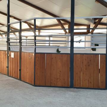
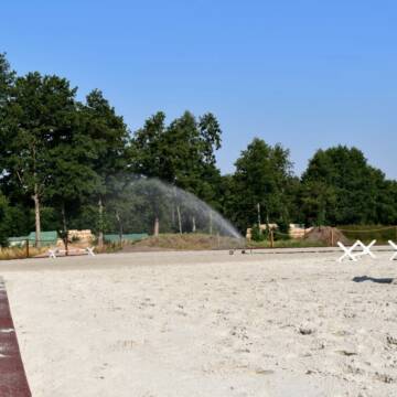
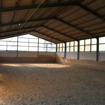
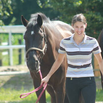
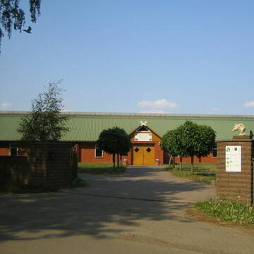
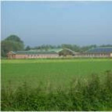
Reit- und Traberhof Meyer
Geesthacht
Reit-und-Traberhof-Kurt-Meyer
@Reit-und-Traberhof-Kurt-Meyer
Fahrstall, Kutschwagen
FN-Mitglied
Führanlage
Hunde willkommen
Allergikerstall
Hufrehe geeignet
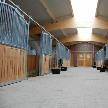
Außenboxen
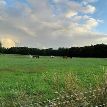
Offenstall
19 weitere...
S
Deprecated: Creation of dynamic property Zend_View_Helper_Ads::$adLink is deprecated in /var/www/stall-frei/htdocs/staging.stall-frei.de/library/Psf/View/Helper/Ads.php on line 108

Persönlichkeitsentwicklung mit Pferden
Bad Salzuflen
Katja Dors
@Pferdezeiten
Begleite andere auf ihrem Entwicklungsweg und entdecke die transformative Kraft der pferdegestützten Persönlichkeitsentwicklung !
neu
R


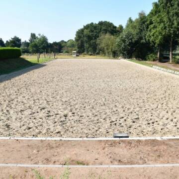
Reitanlage Zukowski
Grande
Reitanlage-Zukowski
@Reitanlage-Zukowski
FN-Mitglied
Freizeitstall
Vermieten
Hunde willkommen
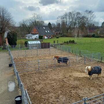
Paddock
Allergikerstall
Einhornhaltung möglich
19 weitere...
S


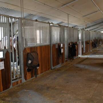
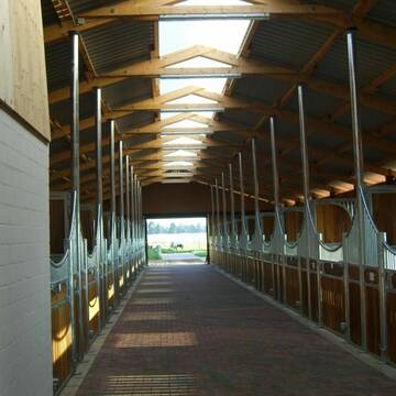
Reitanlage Gut Hasenthal
Geesthacht
Gut-Hasenthal
@Gut-Hasenthal
FN-Mitglied
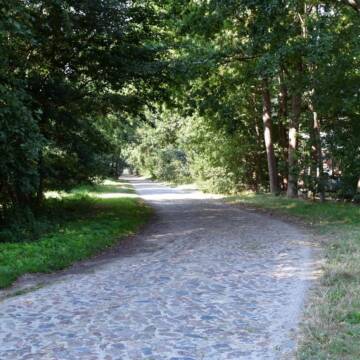
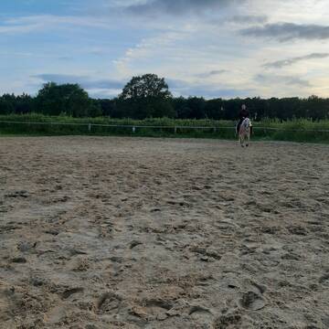
Geländestrecke
Hunde willkommen
Paddock
Außenboxen
Innenbox
Vollpension
13 weitere...
P+
Ausbildungs- und TherapieZentrum Handorf
Handorf
ATZ Handorf
@Mathias-Bauch
Freizeitstall
Geländestrecke
Führanlage
Hunde willkommen
Allergikerstall
Fohlenaufzucht möglich
Außenbox mit Paddock
Außenboxen
35 weitere...
S


Reitstall Schloh / innen-/ außen Boxen
Oststeinbek
Familie Schloh
@Schloh
FN-Mitglied
Freizeitstall
Vermieten
Hunde willkommen
Krankenbox
Hufrehe geeignet
Notfallboxen
19 weitere...
S

Mitarbeiter gesucht?
Mechtersen
STALL-FREIde Marketing
@STALL-FREI-Marketing
Stellenangebote kostenlos veröffentlichen!
Reitsportanlage und Zuchthof Rabeler
Winsen/Luhe
Hof Rabeler
@Hof-Rabeler
FN-Mitglied
Pferdeausbildung
Vermieten
Führanlage
Longierzirkel/Roundpen
Fohlenaufzucht möglich
Notfallboxen
23 weitere...
S

Boxen und Offenstall frei
Kollow
Hof -Linautal
@Hof-Linautal
FN-Mitglied
Freizeitstall
Vermieten
Hunde willkommen
Krankenbox
Gnadenbrothof
Hengsthaltung möglich
27 weitere...
P
Stall Dassau
Dassendorf
Carsten-Dassau
@Carsten-Dassau
Freizeitstall
Geländestrecke
Paddock
Parkplatz für Pferdeanhänger
Außenboxen
Innenbox
Halbpension
11 weitere...
ganz aktuell
P

Kiehns Hof - Ganzjähriger Weidegang (Sommer 24h)
Wohltorf
Kiehns Hof
@Kiehns_Hof
Freizeitstall
Vermieten
Paddock
Parkplatz für Pferdeanhänger
Außenboxen
8 weitere...
P+
Reitanlage Pfeiffer
Escheburg
Britta-Pfeiffer
@Britta-Pfeiffer
FN-Mitglied
Freizeitstall
Verkauf
Vermieten
Hunde willkommen
Krankenbox
Allergikerstall
Fohlenaufzucht möglich
35 weitere...
aktuell
P
Deprecated: Creation of dynamic property Zend_View::$pageCount is deprecated in /var/www/stall-frei/htdocs/staging.stall-frei.de/library/vendor/shardj/zf1-future/library/Zend/View/Abstract.php on line 308
Deprecated: Creation of dynamic property Zend_View::$itemCountPerPage is deprecated in /var/www/stall-frei/htdocs/staging.stall-frei.de/library/vendor/shardj/zf1-future/library/Zend/View/Abstract.php on line 308
Deprecated: Creation of dynamic property Zend_View::$first is deprecated in /var/www/stall-frei/htdocs/staging.stall-frei.de/library/vendor/shardj/zf1-future/library/Zend/View/Abstract.php on line 308
Deprecated: Creation of dynamic property Zend_View::$current is deprecated in /var/www/stall-frei/htdocs/staging.stall-frei.de/library/vendor/shardj/zf1-future/library/Zend/View/Abstract.php on line 308
Deprecated: Creation of dynamic property Zend_View::$last is deprecated in /var/www/stall-frei/htdocs/staging.stall-frei.de/library/vendor/shardj/zf1-future/library/Zend/View/Abstract.php on line 308
Deprecated: Creation of dynamic property Zend_View::$next is deprecated in /var/www/stall-frei/htdocs/staging.stall-frei.de/library/vendor/shardj/zf1-future/library/Zend/View/Abstract.php on line 308
Deprecated: Creation of dynamic property Zend_View::$pagesInRange is deprecated in /var/www/stall-frei/htdocs/staging.stall-frei.de/library/vendor/shardj/zf1-future/library/Zend/View/Abstract.php on line 308
Deprecated: Creation of dynamic property Zend_View::$firstPageInRange is deprecated in /var/www/stall-frei/htdocs/staging.stall-frei.de/library/vendor/shardj/zf1-future/library/Zend/View/Abstract.php on line 308
Deprecated: Creation of dynamic property Zend_View::$lastPageInRange is deprecated in /var/www/stall-frei/htdocs/staging.stall-frei.de/library/vendor/shardj/zf1-future/library/Zend/View/Abstract.php on line 308
Deprecated: Creation of dynamic property Zend_View::$currentItemCount is deprecated in /var/www/stall-frei/htdocs/staging.stall-frei.de/library/vendor/shardj/zf1-future/library/Zend/View/Abstract.php on line 308
Deprecated: Creation of dynamic property Zend_View::$totalItemCount is deprecated in /var/www/stall-frei/htdocs/staging.stall-frei.de/library/vendor/shardj/zf1-future/library/Zend/View/Abstract.php on line 308
Deprecated: Creation of dynamic property Zend_View::$firstItemNumber is deprecated in /var/www/stall-frei/htdocs/staging.stall-frei.de/library/vendor/shardj/zf1-future/library/Zend/View/Abstract.php on line 308
Deprecated: Creation of dynamic property Zend_View::$lastItemNumber is deprecated in /var/www/stall-frei/htdocs/staging.stall-frei.de/library/vendor/shardj/zf1-future/library/Zend/View/Abstract.php on line 308
Deprecated: Creation of dynamic property Zend_View::$router is deprecated in /var/www/stall-frei/htdocs/staging.stall-frei.de/library/vendor/shardj/zf1-future/library/Zend/View/Abstract.php on line 308
Deprecated: Creation of dynamic property Zend_View::$urlParams is deprecated in /var/www/stall-frei/htdocs/staging.stall-frei.de/library/vendor/shardj/zf1-future/library/Zend/View/Abstract.php on line 308
Deprecated: Creation of dynamic property Zend_View::$showAds is deprecated in /var/www/stall-frei/htdocs/staging.stall-frei.de/library/vendor/shardj/zf1-future/library/Zend/View/Abstract.php on line 308
Deprecated: Creation of dynamic property Zend_View::$objectIds is deprecated in /var/www/stall-frei/htdocs/staging.stall-frei.de/library/vendor/shardj/zf1-future/library/Zend/View/Abstract.php on line 308
Deprecated: Creation of dynamic property Zend_View::$showNavbar is deprecated in /var/www/stall-frei/htdocs/staging.stall-frei.de/library/vendor/shardj/zf1-future/library/Zend/View/Abstract.php on line 308
Deprecated: Creation of dynamic property Zend_View::$showBreadcrumb is deprecated in /var/www/stall-frei/htdocs/staging.stall-frei.de/library/vendor/shardj/zf1-future/library/Zend/View/Abstract.php on line 308
Deprecated: Creation of dynamic property Zend_View::$showFooter is deprecated in /var/www/stall-frei/htdocs/staging.stall-frei.de/library/vendor/shardj/zf1-future/library/Zend/View/Abstract.php on line 308
Deprecated: Creation of dynamic property Zend_View::$showInternalAds is deprecated in /var/www/stall-frei/htdocs/staging.stall-frei.de/library/vendor/shardj/zf1-future/library/Zend/View/Abstract.php on line 308
Deprecated: Creation of dynamic property Zend_View::$blNoContent is deprecated in /var/www/stall-frei/htdocs/staging.stall-frei.de/library/vendor/shardj/zf1-future/library/Zend/View/Abstract.php on line 308
Deprecated: Creation of dynamic property Zend_View::$sMetaDesc is deprecated in /var/www/stall-frei/htdocs/staging.stall-frei.de/library/vendor/shardj/zf1-future/library/Zend/View/Abstract.php on line 308
Deprecated: Creation of dynamic property Zend_View::$useGmaps is deprecated in /var/www/stall-frei/htdocs/staging.stall-frei.de/library/vendor/shardj/zf1-future/library/Zend/View/Abstract.php on line 308
Deprecated: Creation of dynamic property Zend_View::$touches is deprecated in /var/www/stall-frei/htdocs/staging.stall-frei.de/library/vendor/shardj/zf1-future/library/Zend/View/Abstract.php on line 308
Deprecated: Creation of dynamic property Zend_View::$oProject is deprecated in /var/www/stall-frei/htdocs/staging.stall-frei.de/library/vendor/shardj/zf1-future/library/Zend/View/Abstract.php on line 308
Deprecated: Creation of dynamic property Zend_View::$pageHeadline is deprecated in /var/www/stall-frei/htdocs/staging.stall-frei.de/library/vendor/shardj/zf1-future/library/Zend/View/Abstract.php on line 308
Deprecated: Creation of dynamic property Zend_View::$disableLocationField is deprecated in /var/www/stall-frei/htdocs/staging.stall-frei.de/library/vendor/shardj/zf1-future/library/Zend/View/Abstract.php on line 308
Deprecated: Creation of dynamic property Zend_View::$isSearch is deprecated in /var/www/stall-frei/htdocs/staging.stall-frei.de/library/vendor/shardj/zf1-future/library/Zend/View/Abstract.php on line 308
Deprecated: Creation of dynamic property Zend_View::$pageTitle is deprecated in /var/www/stall-frei/htdocs/staging.stall-frei.de/library/vendor/shardj/zf1-future/library/Zend/View/Abstract.php on line 308
Deprecated: Creation of dynamic property Psf_Form_Element_Text::$class is deprecated in /var/www/stall-frei/htdocs/staging.stall-frei.de/library/vendor/shardj/zf1-future/library/Zend/Form/Element.php on line 874
Deprecated: Creation of dynamic property Psf_Form_Element_Text::$size is deprecated in /var/www/stall-frei/htdocs/staging.stall-frei.de/library/vendor/shardj/zf1-future/library/Zend/Form/Element.php on line 874
Deprecated: Creation of dynamic property Psf_Form_Element_Text::$placeholder is deprecated in /var/www/stall-frei/htdocs/staging.stall-frei.de/library/vendor/shardj/zf1-future/library/Zend/Form/Element.php on line 874
Deprecated: Creation of dynamic property Psf_Form_Element_Hidden::$class is deprecated in /var/www/stall-frei/htdocs/staging.stall-frei.de/library/vendor/shardj/zf1-future/library/Zend/Form/Element.php on line 874
Deprecated: Creation of dynamic property Psf_Form_Element_Hidden::$class is deprecated in /var/www/stall-frei/htdocs/staging.stall-frei.de/library/vendor/shardj/zf1-future/library/Zend/Form/Element.php on line 874
Deprecated: Creation of dynamic property Psf_Form_Element_Hidden::$class is deprecated in /var/www/stall-frei/htdocs/staging.stall-frei.de/library/vendor/shardj/zf1-future/library/Zend/Form/Element.php on line 874
Deprecated: Creation of dynamic property Psf_Form_Element_Hidden::$class is deprecated in /var/www/stall-frei/htdocs/staging.stall-frei.de/library/vendor/shardj/zf1-future/library/Zend/Form/Element.php on line 874
Deprecated: Creation of dynamic property Psf_Form_Element_Select::$class is deprecated in /var/www/stall-frei/htdocs/staging.stall-frei.de/library/vendor/shardj/zf1-future/library/Zend/Form/Element.php on line 874
Deprecated: Creation of dynamic property Psf_Form_Element_Select::$class is deprecated in /var/www/stall-frei/htdocs/staging.stall-frei.de/library/vendor/shardj/zf1-future/library/Zend/Form/Element.php on line 874
Deprecated: Creation of dynamic property Psf_Form_Element_Select::$class is deprecated in /var/www/stall-frei/htdocs/staging.stall-frei.de/library/vendor/shardj/zf1-future/library/Zend/Form/Element.php on line 874
Deprecated: Creation of dynamic property Psf_Form_Element_Select::$class is deprecated in /var/www/stall-frei/htdocs/staging.stall-frei.de/library/vendor/shardj/zf1-future/library/Zend/Form/Element.php on line 874
Deprecated: Creation of dynamic property Psf_Form_Element_Text::$class is deprecated in /var/www/stall-frei/htdocs/staging.stall-frei.de/library/vendor/shardj/zf1-future/library/Zend/Form/Element.php on line 874
Deprecated: Creation of dynamic property Psf_Form_Element_Checkbox::$label is deprecated in /var/www/stall-frei/htdocs/staging.stall-frei.de/library/vendor/shardj/zf1-future/library/Zend/Form/Element.php on line 874
Deprecated: Creation of dynamic property Zend_View::$sort is deprecated in /var/www/stall-frei/htdocs/staging.stall-frei.de/library/vendor/shardj/zf1-future/library/Zend/View/Abstract.php on line 308
Deprecated: Creation of dynamic property Zend_View::$searchLocation is deprecated in /var/www/stall-frei/htdocs/staging.stall-frei.de/library/vendor/shardj/zf1-future/library/Zend/View/Abstract.php on line 308
Deprecated: Creation of dynamic property Zend_View::$locationHint is deprecated in /var/www/stall-frei/htdocs/staging.stall-frei.de/library/vendor/shardj/zf1-future/library/Zend/View/Abstract.php on line 308
Psf_GeoCoder_Abstract::getLocation: Worth Get Location CachedOrLive
Psf_GeoCoder_Abstract::getCachedOrLive: Worth
Psf_GeoCoder_OpenCageData::makeApiRequest: response:
Array
(
[documentation] => https://opencagedata.com/api
[licenses] => Array
(
[0] => Array
(
[name] => see attribution guide
[url] => https://opencagedata.com/credits
)
)
[results] => Array
(
[0] => Array
(
[bounds] => Array
(
[northeast] => Array
(
[lat] => 53.4852292
[lng] => 10.4366264
)
[southwest] => Array
(
[lat] => 53.4548832
[lng] => 10.3914187
)
)
[components] => Array
(
[ISO_3166-1_alpha-2] => DE
[ISO_3166-1_alpha-3] => DEU
[ISO_3166-2] => Array
(
[0] => DE-SH
)
[_category] => place
[_normalized_city] => Worth
[_type] => village
[continent] => Europe
[country] => Deutschland
[country_code] => de
[county] => Kreis Herzogtum Lauenburg
[municipality] => Hohe Elbgeest
[political_union] => European Union
[state] => Schleswig-Holstein
[state_code] => SH
[village] => Worth
)
[confidence] => 7
[formatted] => Worth, Schleswig-Holstein, Deutschland
[geometry] => Array
(
[lat] => 53.4684056
[lng] => 10.4092105
)
)
[1] => Array
(
[bounds] => Array
(
[northeast] => Array
(
[lat] => 53.8192549
[lng] => 8.7774811
)
[southwest] => Array
(
[lat] => 53.7792549
[lng] => 8.7374811
)
)
[components] => Array
(
[ISO_3166-1_alpha-2] => DE
[ISO_3166-1_alpha-3] => DEU
[ISO_3166-2] => Array
(
[0] => DE-NI
)
[_category] => place
[_normalized_city] => Cuxhaven
[_type] => neighbourhood
[continent] => Europe
[country] => Deutschland
[country_code] => de
[county] => Landkreis Cuxhaven
[political_union] => European Union
[state] => Niedersachsen
[state_code] => NI
[suburb] => Lüdingworth
[town] => Cuxhaven
)
[confidence] => 7
[formatted] => Lüdingworth, Cuxhaven, Niedersachsen, Deutschland
[geometry] => Array
(
[lat] => 53.7992549
[lng] => 8.7574811
)
)
[2] => Array
(
[bounds] => Array
(
[northeast] => Array
(
[lat] => 49.0926751
[lng] => 8.3507426
)
[southwest] => Array
(
[lat] => 48.980197
[lng] => 8.066126
)
)
[components] => Array
(
[ISO_3166-1_alpha-2] => DE
[ISO_3166-1_alpha-3] => DEU
[ISO_3166-2] => Array
(
[0] => DE-RP
)
[_category] => place
[_normalized_city] => Wörth am Rhein
[_type] => city
[continent] => Europe
[country] => Deutschland
[country_code] => de
[county] => Landkreis Germersheim
[political_union] => European Union
[postcode] => 76744
[state] => Rheinland-Pfalz
[state_code] => RP
[town] => Wörth am Rhein
)
[confidence] => 5
[formatted] => 76744 Wörth am Rhein, Deutschland
[geometry] => Array
(
[lat] => 49.0543232
[lng] => 8.2667399
)
)
[3] => Array
(
[bounds] => Array
(
[northeast] => Array
(
[lat] => 49.8109123
[lng] => 9.1763869
)
[southwest] => Array
(
[lat] => 49.7552381
[lng] => 9.1068885
)
)
[components] => Array
(
[ISO_3166-1_alpha-2] => DE
[ISO_3166-1_alpha-3] => DEU
[ISO_3166-2] => Array
(
[0] => DE-BY
)
[_category] => place
[_normalized_city] => Wörth am Main
[_type] => city
[continent] => Europe
[country] => Deutschland
[country_code] => de
[county] => Landkreis Miltenberg
[political_union] => European Union
[postcode] => 63939
[state] => Bayern
[state_code] => BY
[town] => Wörth am Main
)
[confidence] => 7
[formatted] => 63939 Wörth am Main, Deutschland
[geometry] => Array
(
[lat] => 49.7955109
[lng] => 9.1574558
)
)
[4] => Array
(
[bounds] => Array
(
[northeast] => Array
(
[lat] => 48.266717
[lng] => 11.9701949
)
[southwest] => Array
(
[lat] => 48.2230791
[lng] => 11.8696977
)
)
[components] => Array
(
[ISO_3166-1_alpha-2] => DE
[ISO_3166-1_alpha-3] => DEU
[ISO_3166-2] => Array
(
[0] => DE-BY
)
[_category] => place
[_normalized_city] => Wörth
[_type] => village
[continent] => Europe
[country] => Deutschland
[country_code] => de
[county] => Landkreis Erding
[municipality] => Hörlkofen (VGem)
[political_union] => European Union
[postcode] => 85457
[state] => Bayern
[state_code] => BY
[village] => Wörth
)
[confidence] => 7
[formatted] => 85457 Wörth, Deutschland
[geometry] => Array
(
[lat] => 48.2455026
[lng] => 11.9026032
)
)
[5] => Array
(
[bounds] => Array
(
[northeast] => Array
(
[lat] => 51.2464447
[lng] => 7.6692837
)
[southwest] => Array
(
[lat] => 51.2064447
[lng] => 7.6292837
)
)
[components] => Array
(
[ISO_3166-1_alpha-2] => DE
[ISO_3166-1_alpha-3] => DEU
[ISO_3166-2] => Array
(
[0] => DE-NW
)
[_category] => place
[_normalized_city] => Lüdenscheid
[_type] => neighbourhood
[continent] => Europe
[country] => Deutschland
[country_code] => de
[county] => Märkischer Kreis
[political_union] => European Union
[postcode] => 58511
[state] => Nordrhein-Westfalen
[state_code] => NW
[suburb] => Worth
[town] => Lüdenscheid
)
[confidence] => 7
[formatted] => 58511 Lüdenscheid, Deutschland
[geometry] => Array
(
[lat] => 51.2264447
[lng] => 7.6492837
)
)
[6] => Array
(
[bounds] => Array
(
[northeast] => Array
(
[lat] => 53.1067925
[lng] => 9.4707652
)
[southwest] => Array
(
[lat] => 53.0667925
[lng] => 9.4307652
)
)
[components] => Array
(
[ISO_3166-1_alpha-2] => DE
[ISO_3166-1_alpha-3] => DEU
[ISO_3166-2] => Array
(
[0] => DE-NI
)
[_category] => place
[_normalized_city] => Hemsbünde
[_type] => village
[city] => Hemsbünde
[continent] => Europe
[country] => Deutschland
[country_code] => de
[county] => Landkreis Rotenburg (Wümme)
[municipality] => Samtgemeinde Bothel
[political_union] => European Union
[postcode] => 27386
[state] => Niedersachsen
[state_code] => NI
[village] => Worth
)
[confidence] => 7
[formatted] => 27386 Worth, Deutschland
[geometry] => Array
(
[lat] => 53.0867925
[lng] => 9.4507652
)
)
[7] => Array
(
[bounds] => Array
(
[northeast] => Array
(
[lat] => 51.2821592
[lng] => 7.6223281
)
[southwest] => Array
(
[lat] => 51.2421592
[lng] => 7.5823281
)
)
[components] => Array
(
[ISO_3166-1_alpha-2] => DE
[ISO_3166-1_alpha-3] => DEU
[ISO_3166-2] => Array
(
[0] => DE-NW
)
[_category] => place
[_normalized_city] => Schalksmühle
[_type] => hamlet
[continent] => Europe
[country] => Deutschland
[country_code] => de
[county] => Märkischer Kreis
[hamlet] => Worth
[political_union] => European Union
[postcode] => 58507
[state] => Nordrhein-Westfalen
[state_code] => NW
[town] => Schalksmühle
)
[confidence] => 7
[formatted] => Worth, 58507 Schalksmühle, Deutschland
[geometry] => Array
(
[lat] => 51.2621592
[lng] => 7.6023281
)
)
[8] => Array
(
[components] => Array
(
[ISO_3166-1_alpha-2] => FR
[ISO_3166-1_alpha-3] => FRA
[ISO_3166-2] => Array
(
[0] => FR-NOR
[1] => FR-14
)
[_category] => road
[_normalized_city] => Honfleur
[_type] => road
[city] => Honfleur
[continent] => Europe
[country] => France
[country_code] => fr
[county] => Calvados
[local_authority] => Communauté de communes du pays de Honfleur-Beuzeville
[political_union] => European Union
[postcode] => 14600
[road] => Rue de Worth
[state] => Normandie
[state_code] => NOR
)
[confidence] => 3
[formatted] => Rue de Worth, 14600 Honfleur, France
[geometry] => Array
(
[lat] => 49.393875
[lng] => 0.240461
)
)
[9] => Array
(
[components] => Array
(
[ISO_3166-1_alpha-2] => FR
[ISO_3166-1_alpha-3] => FRA
[ISO_3166-2] => Array
(
[0] => FR-IDF
[1] => FR-92
)
[_category] => road
[_normalized_city] => Suresnes
[_type] => road
[city] => Suresnes
[continent] => Europe
[country] => France
[country_code] => fr
[county] => Hauts-de-Seine
[local_authority] => Métropole du Grand Paris
[political_union] => European Union
[postcode] => 92150
[road] => Rue Worth
[state] => Île-de-France
[state_code] => IDF
)
[confidence] => 2
[formatted] => Rue Worth, 92150 Suresnes, France
[geometry] => Array
(
[lat] => 48.869411
[lng] => 2.220555
)
)
)
[status] => Array
(
[code] => 200
[message] => OK
)
[stay_informed] => Array
(
[blog] => https://blog.opencagedata.com
[mastodon] => https://en.osm.town/@opencage
)
[thanks] => For using an OpenCage API
[timestamp] => Array
(
[created_http] => Sat, 07 Feb 2026 00:55:33 GMT
[created_unix] => 1770425733
)
[total_results] => 10
)
Psf_GeoCoder_Abstract::convertLocationResult
{"documentation":"https:\/\/opencagedata.com\/api","licenses":[{"name":"see attribution guide","url":"https:\/\/opencagedata.com\/credits"}],"results":[{"bounds":{"northeast":{"lat":53.4852292,"lng":10.4366264},"southwest":{"lat":53.4548832,"lng":10.3914187}},"components":{"ISO_3166-1_alpha-2":"DE","ISO_3166-1_alpha-3":"DEU","ISO_3166-2":["DE-SH"],"_category":"place","_normalized_city":"Worth","_type":"village","continent":"Europe","country":"Deutschland","country_code":"de","county":"Kreis Herzogtum Lauenburg","municipality":"Hohe Elbgeest","political_union":"European Union","state":"Schleswig-Holstein","state_code":"SH","village":"Worth"},"confidence":7,"formatted":"Worth, Schleswig-Holstein, Deutschland","geometry":{"lat":53.4684056,"lng":10.4092105}},{"bounds":{"northeast":{"lat":53.8192549,"lng":8.7774811},"southwest":{"lat":53.7792549,"lng":8.7374811}},"components":{"ISO_3166-1_alpha-2":"DE","ISO_3166-1_alpha-3":"DEU","ISO_3166-2":["DE-NI"],"_category":"place","_normalized_city":"Cuxhaven","_type":"neighbourhood","continent":"Europe","country":"Deutschland","country_code":"de","county":"Landkreis Cuxhaven","political_union":"European Union","state":"Niedersachsen","state_code":"NI","suburb":"L\u00fcdingworth","town":"Cuxhaven"},"confidence":7,"formatted":"L\u00fcdingworth, Cuxhaven, Niedersachsen, Deutschland","geometry":{"lat":53.7992549,"lng":8.7574811}},{"bounds":{"northeast":{"lat":49.0926751,"lng":8.3507426},"southwest":{"lat":48.980197,"lng":8.066126}},"components":{"ISO_3166-1_alpha-2":"DE","ISO_3166-1_alpha-3":"DEU","ISO_3166-2":["DE-RP"],"_category":"place","_normalized_city":"W\u00f6rth am Rhein","_type":"city","continent":"Europe","country":"Deutschland","country_code":"de","county":"Landkreis Germersheim","political_union":"European Union","postcode":"76744","state":"Rheinland-Pfalz","state_code":"RP","town":"W\u00f6rth am Rhein"},"confidence":5,"formatted":"76744 W\u00f6rth am Rhein, Deutschland","geometry":{"lat":49.0543232,"lng":8.2667399}},{"bounds":{"northeast":{"lat":49.8109123,"lng":9.1763869},"southwest":{"lat":49.7552381,"lng":9.1068885}},"components":{"ISO_3166-1_alpha-2":"DE","ISO_3166-1_alpha-3":"DEU","ISO_3166-2":["DE-BY"],"_category":"place","_normalized_city":"W\u00f6rth am Main","_type":"city","continent":"Europe","country":"Deutschland","country_code":"de","county":"Landkreis Miltenberg","political_union":"European Union","postcode":"63939","state":"Bayern","state_code":"BY","town":"W\u00f6rth am Main"},"confidence":7,"formatted":"63939 W\u00f6rth am Main, Deutschland","geometry":{"lat":49.7955109,"lng":9.1574558}},{"bounds":{"northeast":{"lat":48.266717,"lng":11.9701949},"southwest":{"lat":48.2230791,"lng":11.8696977}},"components":{"ISO_3166-1_alpha-2":"DE","ISO_3166-1_alpha-3":"DEU","ISO_3166-2":["DE-BY"],"_category":"place","_normalized_city":"W\u00f6rth","_type":"village","continent":"Europe","country":"Deutschland","country_code":"de","county":"Landkreis Erding","municipality":"H\u00f6rlkofen (VGem)","political_union":"European Union","postcode":"85457","state":"Bayern","state_code":"BY","village":"W\u00f6rth"},"confidence":7,"formatted":"85457 W\u00f6rth, Deutschland","geometry":{"lat":48.2455026,"lng":11.9026032}},{"bounds":{"northeast":{"lat":51.2464447,"lng":7.6692837},"southwest":{"lat":51.2064447,"lng":7.6292837}},"components":{"ISO_3166-1_alpha-2":"DE","ISO_3166-1_alpha-3":"DEU","ISO_3166-2":["DE-NW"],"_category":"place","_normalized_city":"L\u00fcdenscheid","_type":"neighbourhood","continent":"Europe","country":"Deutschland","country_code":"de","county":"M\u00e4rkischer Kreis","political_union":"European Union","postcode":"58511","state":"Nordrhein-Westfalen","state_code":"NW","suburb":"Worth","town":"L\u00fcdenscheid"},"confidence":7,"formatted":"58511 L\u00fcdenscheid, Deutschland","geometry":{"lat":51.2264447,"lng":7.6492837}},{"bounds":{"northeast":{"lat":53.1067925,"lng":9.4707652},"southwest":{"lat":53.0667925,"lng":9.4307652}},"components":{"ISO_3166-1_alpha-2":"DE","ISO_3166-1_alpha-3":"DEU","ISO_3166-2":["DE-NI"],"_category":"place","_normalized_city":"Hemsb\u00fcnde","_type":"village","city":"Hemsb\u00fcnde","continent":"Europe","country":"Deutschland","country_code":"de","county":"Landkreis Rotenburg (W\u00fcmme)","municipality":"Samtgemeinde Bothel","political_union":"European Union","postcode":"27386","state":"Niedersachsen","state_code":"NI","village":"Worth"},"confidence":7,"formatted":"27386 Worth, Deutschland","geometry":{"lat":53.0867925,"lng":9.4507652}},{"bounds":{"northeast":{"lat":51.2821592,"lng":7.6223281},"southwest":{"lat":51.2421592,"lng":7.5823281}},"components":{"ISO_3166-1_alpha-2":"DE","ISO_3166-1_alpha-3":"DEU","ISO_3166-2":["DE-NW"],"_category":"place","_normalized_city":"Schalksm\u00fchle","_type":"hamlet","continent":"Europe","country":"Deutschland","country_code":"de","county":"M\u00e4rkischer Kreis","hamlet":"Worth","political_union":"European Union","postcode":"58507","state":"Nordrhein-Westfalen","state_code":"NW","town":"Schalksm\u00fchle"},"confidence":7,"formatted":"Worth, 58507 Schalksm\u00fchle, Deutschland","geometry":{"lat":51.2621592,"lng":7.6023281}},{"components":{"ISO_3166-1_alpha-2":"FR","ISO_3166-1_alpha-3":"FRA","ISO_3166-2":["FR-NOR","FR-14"],"_category":"road","_normalized_city":"Honfleur","_type":"road","city":"Honfleur","continent":"Europe","country":"France","country_code":"fr","county":"Calvados","local_authority":"Communaut\u00e9 de communes du pays de Honfleur-Beuzeville","political_union":"European Union","postcode":"14600","road":"Rue de Worth","state":"Normandie","state_code":"NOR"},"confidence":3,"formatted":"Rue de Worth, 14600 Honfleur, France","geometry":{"lat":49.393875,"lng":0.240461}},{"components":{"ISO_3166-1_alpha-2":"FR","ISO_3166-1_alpha-3":"FRA","ISO_3166-2":["FR-IDF","FR-92"],"_category":"road","_normalized_city":"Suresnes","_type":"road","city":"Suresnes","continent":"Europe","country":"France","country_code":"fr","county":"Hauts-de-Seine","local_authority":"M\u00e9tropole du Grand Paris","political_union":"European Union","postcode":"92150","road":"Rue Worth","state":"\u00cele-de-France","state_code":"IDF"},"confidence":2,"formatted":"Rue Worth, 92150 Suresnes, France","geometry":{"lat":48.869411,"lng":2.220555}}],"status":{"code":200,"message":"OK"},"stay_informed":{"blog":"https:\/\/blog.opencagedata.com","mastodon":"https:\/\/en.osm.town\/@opencage"},"thanks":"For using an OpenCage API","timestamp":{"created_http":"Sat, 07 Feb 2026 00:55:33 GMT","created_unix":1770425733},"total_results":10}Array
(
[0] => stdClass Object
(
[bounds] => stdClass Object
(
[northeast] => stdClass Object
(
[lat] => 53.4852292
[lng] => 10.4366264
)
[southwest] => stdClass Object
(
[lat] => 53.4548832
[lng] => 10.3914187
)
)
[components] => stdClass Object
(
[ISO_3166-1_alpha-2] => DE
[ISO_3166-1_alpha-3] => DEU
[ISO_3166-2] => Array
(
[0] => DE-SH
)
[_category] => place
[_normalized_city] => Worth
[_type] => village
[continent] => Europe
[country] => Deutschland
[country_code] => de
[county] => Kreis Herzogtum Lauenburg
[municipality] => Hohe Elbgeest
[political_union] => European Union
[state] => Schleswig-Holstein
[state_code] => SH
[village] => Worth
)
[confidence] => 7
[formatted] => Worth, Schleswig-Holstein, Deutschland
[geometry] => stdClass Object
(
[lat] => 53.4684056
[lng] => 10.4092105
)
)
[1] => stdClass Object
(
[bounds] => stdClass Object
(
[northeast] => stdClass Object
(
[lat] => 53.8192549
[lng] => 8.7774811
)
[southwest] => stdClass Object
(
[lat] => 53.7792549
[lng] => 8.7374811
)
)
[components] => stdClass Object
(
[ISO_3166-1_alpha-2] => DE
[ISO_3166-1_alpha-3] => DEU
[ISO_3166-2] => Array
(
[0] => DE-NI
)
[_category] => place
[_normalized_city] => Cuxhaven
[_type] => neighbourhood
[continent] => Europe
[country] => Deutschland
[country_code] => de
[county] => Landkreis Cuxhaven
[political_union] => European Union
[state] => Niedersachsen
[state_code] => NI
[suburb] => Lüdingworth
[town] => Cuxhaven
)
[confidence] => 7
[formatted] => Lüdingworth, Cuxhaven, Niedersachsen, Deutschland
[geometry] => stdClass Object
(
[lat] => 53.7992549
[lng] => 8.7574811
)
)
[2] => stdClass Object
(
[bounds] => stdClass Object
(
[northeast] => stdClass Object
(
[lat] => 49.0926751
[lng] => 8.3507426
)
[southwest] => stdClass Object
(
[lat] => 48.980197
[lng] => 8.066126
)
)
[components] => stdClass Object
(
[ISO_3166-1_alpha-2] => DE
[ISO_3166-1_alpha-3] => DEU
[ISO_3166-2] => Array
(
[0] => DE-RP
)
[_category] => place
[_normalized_city] => Wörth am Rhein
[_type] => city
[continent] => Europe
[country] => Deutschland
[country_code] => de
[county] => Landkreis Germersheim
[political_union] => European Union
[postcode] => 76744
[state] => Rheinland-Pfalz
[state_code] => RP
[town] => Wörth am Rhein
)
[confidence] => 5
[formatted] => 76744 Wörth am Rhein, Deutschland
[geometry] => stdClass Object
(
[lat] => 49.0543232
[lng] => 8.2667399
)
)
[3] => stdClass Object
(
[bounds] => stdClass Object
(
[northeast] => stdClass Object
(
[lat] => 49.8109123
[lng] => 9.1763869
)
[southwest] => stdClass Object
(
[lat] => 49.7552381
[lng] => 9.1068885
)
)
[components] => stdClass Object
(
[ISO_3166-1_alpha-2] => DE
[ISO_3166-1_alpha-3] => DEU
[ISO_3166-2] => Array
(
[0] => DE-BY
)
[_category] => place
[_normalized_city] => Wörth am Main
[_type] => city
[continent] => Europe
[country] => Deutschland
[country_code] => de
[county] => Landkreis Miltenberg
[political_union] => European Union
[postcode] => 63939
[state] => Bayern
[state_code] => BY
[town] => Wörth am Main
)
[confidence] => 7
[formatted] => 63939 Wörth am Main, Deutschland
[geometry] => stdClass Object
(
[lat] => 49.7955109
[lng] => 9.1574558
)
)
[4] => stdClass Object
(
[bounds] => stdClass Object
(
[northeast] => stdClass Object
(
[lat] => 48.266717
[lng] => 11.9701949
)
[southwest] => stdClass Object
(
[lat] => 48.2230791
[lng] => 11.8696977
)
)
[components] => stdClass Object
(
[ISO_3166-1_alpha-2] => DE
[ISO_3166-1_alpha-3] => DEU
[ISO_3166-2] => Array
(
[0] => DE-BY
)
[_category] => place
[_normalized_city] => Wörth
[_type] => village
[continent] => Europe
[country] => Deutschland
[country_code] => de
[county] => Landkreis Erding
[municipality] => Hörlkofen (VGem)
[political_union] => European Union
[postcode] => 85457
[state] => Bayern
[state_code] => BY
[village] => Wörth
)
[confidence] => 7
[formatted] => 85457 Wörth, Deutschland
[geometry] => stdClass Object
(
[lat] => 48.2455026
[lng] => 11.9026032
)
)
[5] => stdClass Object
(
[bounds] => stdClass Object
(
[northeast] => stdClass Object
(
[lat] => 51.2464447
[lng] => 7.6692837
)
[southwest] => stdClass Object
(
[lat] => 51.2064447
[lng] => 7.6292837
)
)
[components] => stdClass Object
(
[ISO_3166-1_alpha-2] => DE
[ISO_3166-1_alpha-3] => DEU
[ISO_3166-2] => Array
(
[0] => DE-NW
)
[_category] => place
[_normalized_city] => Lüdenscheid
[_type] => neighbourhood
[continent] => Europe
[country] => Deutschland
[country_code] => de
[county] => Märkischer Kreis
[political_union] => European Union
[postcode] => 58511
[state] => Nordrhein-Westfalen
[state_code] => NW
[suburb] => Worth
[town] => Lüdenscheid
)
[confidence] => 7
[formatted] => 58511 Lüdenscheid, Deutschland
[geometry] => stdClass Object
(
[lat] => 51.2264447
[lng] => 7.6492837
)
)
[6] => stdClass Object
(
[bounds] => stdClass Object
(
[northeast] => stdClass Object
(
[lat] => 53.1067925
[lng] => 9.4707652
)
[southwest] => stdClass Object
(
[lat] => 53.0667925
[lng] => 9.4307652
)
)
[components] => stdClass Object
(
[ISO_3166-1_alpha-2] => DE
[ISO_3166-1_alpha-3] => DEU
[ISO_3166-2] => Array
(
[0] => DE-NI
)
[_category] => place
[_normalized_city] => Hemsbünde
[_type] => village
[city] => Hemsbünde
[continent] => Europe
[country] => Deutschland
[country_code] => de
[county] => Landkreis Rotenburg (Wümme)
[municipality] => Samtgemeinde Bothel
[political_union] => European Union
[postcode] => 27386
[state] => Niedersachsen
[state_code] => NI
[village] => Worth
)
[confidence] => 7
[formatted] => 27386 Worth, Deutschland
[geometry] => stdClass Object
(
[lat] => 53.0867925
[lng] => 9.4507652
)
)
[7] => stdClass Object
(
[bounds] => stdClass Object
(
[northeast] => stdClass Object
(
[lat] => 51.2821592
[lng] => 7.6223281
)
[southwest] => stdClass Object
(
[lat] => 51.2421592
[lng] => 7.5823281
)
)
[components] => stdClass Object
(
[ISO_3166-1_alpha-2] => DE
[ISO_3166-1_alpha-3] => DEU
[ISO_3166-2] => Array
(
[0] => DE-NW
)
[_category] => place
[_normalized_city] => Schalksmühle
[_type] => hamlet
[continent] => Europe
[country] => Deutschland
[country_code] => de
[county] => Märkischer Kreis
[hamlet] => Worth
[political_union] => European Union
[postcode] => 58507
[state] => Nordrhein-Westfalen
[state_code] => NW
[town] => Schalksmühle
)
[confidence] => 7
[formatted] => Worth, 58507 Schalksmühle, Deutschland
[geometry] => stdClass Object
(
[lat] => 51.2621592
[lng] => 7.6023281
)
)
[8] => stdClass Object
(
[components] => stdClass Object
(
[ISO_3166-1_alpha-2] => FR
[ISO_3166-1_alpha-3] => FRA
[ISO_3166-2] => Array
(
[0] => FR-NOR
[1] => FR-14
)
[_category] => road
[_normalized_city] => Honfleur
[_type] => road
[city] => Honfleur
[continent] => Europe
[country] => France
[country_code] => fr
[county] => Calvados
[local_authority] => Communauté de communes du pays de Honfleur-Beuzeville
[political_union] => European Union
[postcode] => 14600
[road] => Rue de Worth
[state] => Normandie
[state_code] => NOR
)
[confidence] => 3
[formatted] => Rue de Worth, 14600 Honfleur, France
[geometry] => stdClass Object
(
[lat] => 49.393875
[lng] => 0.240461
)
)
[9] => stdClass Object
(
[components] => stdClass Object
(
[ISO_3166-1_alpha-2] => FR
[ISO_3166-1_alpha-3] => FRA
[ISO_3166-2] => Array
(
[0] => FR-IDF
[1] => FR-92
)
[_category] => road
[_normalized_city] => Suresnes
[_type] => road
[city] => Suresnes
[continent] => Europe
[country] => France
[country_code] => fr
[county] => Hauts-de-Seine
[local_authority] => Métropole du Grand Paris
[political_union] => European Union
[postcode] => 92150
[road] => Rue Worth
[state] => Île-de-France
[state_code] => IDF
)
[confidence] => 2
[formatted] => Rue Worth, 92150 Suresnes, France
[geometry] => stdClass Object
(
[lat] => 48.869411
[lng] => 2.220555
)
)
)
Psf_GeoCoder_OpenCageData::getKeyMap: 0
stdClass Object
(
    [bounds] => stdClass Object
        (
            [northeast] => stdClass Object
                (
                    [lat] => 53.4852292
                    [lng] => 10.4366264
                )

            [southwest] => stdClass Object
                (
                    [lat] => 53.4548832
                    [lng] => 10.3914187
                )

        )

    [components] => stdClass Object
        (
            [ISO_3166-1_alpha-2] => DE
            [ISO_3166-1_alpha-3] => DEU
            [ISO_3166-2] => Array
                (
                    [0] => DE-SH
                )

            [_category] => place
            [_normalized_city] => Worth
            [_type] => village
            [continent] => Europe
            [country] => Deutschland
            [country_code] => de
            [county] => Kreis Herzogtum Lauenburg
            [municipality] => Hohe Elbgeest
            [political_union] => European Union
            [state] => Schleswig-Holstein
            [state_code] => SH
            [village] => Worth
        )

    [confidence] => 7
    [formatted] => Worth, Schleswig-Holstein, Deutschland
    [geometry] => stdClass Object
        (
            [lat] => 53.4684056
            [lng] => 10.4092105
        )

)
Psf_GeoCoder_OpenCageData::getCounty: Herzogtum Lauenburg
Psf_GeoCoder_OpenCageData::addMissingData REFETCH!
Array
(
    [address] => Worth, Schleswig-Holstein, Deutschland
    [type] => village
    [street] =>
    [city] => Worth
    [county] => Herzogtum Lauenburg
    [state] => Schleswig-Holstein
    [zip] =>
    [country] => Deutschland
    [suburb] =>
    [countrycode] => de
    [latitude] => 53.4684056
    [longitude] => 10.4092105
    [accuracy] => 1
    [confidence] => 7
    [bounds] => stdClass Object
        (
            [northeast] => stdClass Object
                (
                    [lat] => 53.4852292
                    [lng] => 10.4366264
                )

            [southwest] => stdClass Object
                (
                    [lat] => 53.4548832
                    [lng] => 10.3914187
                )

        )

)
reformat!
Array
(
    [address] => Worth, Schleswig-Holstein, Deutschland
    [type] => village
    [street] =>
    [city] => Worth
    [county] => Herzogtum Lauenburg
    [state] => Schleswig-Holstein
    [zip] =>
    [country] => Deutschland
    [suburb] =>
    [countrycode] => de
    [latitude] => 53.4684056
    [longitude] => 10.4092105
    [accuracy] => 1
    [confidence] => 7
    [bounds] => stdClass Object
        (
            [northeast] => stdClass Object
                (
                    [lat] => 53.4852292
                    [lng] => 10.4366264
                )

            [southwest] => stdClass Object
                (
                    [lat] => 53.4548832
                    [lng] => 10.3914187
                )

        )

    [place] => Worth, Schleswig-Holstein
    [hash] => 77d943fd9f035e155731dd6db449ef9d
)
Psf_GeoCoder_OpenCageData::getKeyMap: 1
stdClass Object
(
    [bounds] => stdClass Object
        (
            [northeast] => stdClass Object
                (
                    [lat] => 53.8192549
                    [lng] => 8.7774811
                )

            [southwest] => stdClass Object
                (
                    [lat] => 53.7792549
                    [lng] => 8.7374811
                )

        )

    [components] => stdClass Object
        (
            [ISO_3166-1_alpha-2] => DE
            [ISO_3166-1_alpha-3] => DEU
            [ISO_3166-2] => Array
                (
                    [0] => DE-NI
                )

            [_category] => place
            [_normalized_city] => Cuxhaven
            [_type] => neighbourhood
            [continent] => Europe
            [country] => Deutschland
            [country_code] => de
            [county] => Landkreis Cuxhaven
            [political_union] => European Union
            [state] => Niedersachsen
            [state_code] => NI
            [suburb] => Lüdingworth
            [town] => Cuxhaven
        )

    [confidence] => 7
    [formatted] => Lüdingworth, Cuxhaven, Niedersachsen, Deutschland
    [geometry] => stdClass Object
        (
            [lat] => 53.7992549
            [lng] => 8.7574811
        )

)
Psf_GeoCoder_OpenCageData::getCounty: Cuxhaven
Psf_GeoCoder_OpenCageData::addMissingData REFETCH!
Array
(
    [address] => Lüdingworth, Cuxhaven, Niedersachsen, Deutschland
    [type] => neighbourhood
    [street] =>
    [city] => Cuxhaven
    [county] => Cuxhaven
    [state] => Niedersachsen
    [zip] =>
    [country] => Deutschland
    [suburb] => Lüdingworth
    [countrycode] => de
    [latitude] => 53.7992549
    [longitude] => 8.7574811
    [accuracy] => 1
    [confidence] => 7
    [bounds] => stdClass Object
        (
            [northeast] => stdClass Object
                (
                    [lat] => 53.8192549
                    [lng] => 8.7774811
                )

            [southwest] => stdClass Object
                (
                    [lat] => 53.7792549
                    [lng] => 8.7374811
                )

        )

)
reformat!
Array
(
    [address] => Lüdingworth, Cuxhaven, Niedersachsen, Deutschland
    [type] => neighbourhood
    [street] =>
    [city] => Cuxhaven
    [county] => Cuxhaven
    [state] => Niedersachsen
    [zip] =>
    [country] => Deutschland
    [suburb] => Lüdingworth
    [countrycode] => de
    [latitude] => 53.7992549
    [longitude] => 8.7574811
    [accuracy] => 1
    [confidence] => 7
    [bounds] => stdClass Object
        (
            [northeast] => stdClass Object
                (
                    [lat] => 53.8192549
                    [lng] => 8.7774811
                )

            [southwest] => stdClass Object
                (
                    [lat] => 53.7792549
                    [lng] => 8.7374811
                )

        )

    [place] => Cuxhaven, Niedersachsen
    [hash] => 011648a66e642ddbf7d35e56759a97db
)
Psf_GeoCoder_OpenCageData::getKeyMap: 2
stdClass Object
(
    [bounds] => stdClass Object
        (
            [northeast] => stdClass Object
                (
                    [lat] => 49.0926751
                    [lng] => 8.3507426
                )

            [southwest] => stdClass Object
                (
                    [lat] => 48.980197
                    [lng] => 8.066126
                )

        )

    [components] => stdClass Object
        (
            [ISO_3166-1_alpha-2] => DE
            [ISO_3166-1_alpha-3] => DEU
            [ISO_3166-2] => Array
                (
                    [0] => DE-RP
                )

            [_category] => place
            [_normalized_city] => Wörth am Rhein
            [_type] => city
            [continent] => Europe
            [country] => Deutschland
            [country_code] => de
            [county] => Landkreis Germersheim
            [political_union] => European Union
            [postcode] => 76744
            [state] => Rheinland-Pfalz
            [state_code] => RP
            [town] => Wörth am Rhein
        )

    [confidence] => 5
    [formatted] => 76744 Wörth am Rhein, Deutschland
    [geometry] => stdClass Object
        (
            [lat] => 49.0543232
            [lng] => 8.2667399
        )

)
Psf_GeoCoder_OpenCageData::getCounty: Germersheim
Psf_GeoCoder_OpenCageData::addMissingData REFETCH!
Array
(
    [address] => 76744 Wörth am Rhein, Deutschland
    [type] => city
    [street] =>
    [city] => Wörth am Rhein
    [county] => Germersheim
    [state] => Rheinland-Pfalz
    [zip] => 76744
    [country] => Deutschland
    [suburb] =>
    [countrycode] => de
    [latitude] => 49.0543232
    [longitude] => 8.2667399
    [accuracy] => 1
    [confidence] => 5
    [bounds] => stdClass Object
        (
            [northeast] => stdClass Object
                (
                    [lat] => 49.0926751
                    [lng] => 8.3507426
                )

            [southwest] => stdClass Object
                (
                    [lat] => 48.980197
                    [lng] => 8.066126
                )

        )

)
reformat!
Array
(
    [address] => 76744 Wörth am Rhein, Deutschland
    [type] => city
    [street] =>
    [city] => Wörth am Rhein
    [county] => Germersheim
    [state] => Rheinland-Pfalz
    [zip] => 76744
    [country] => Deutschland
    [suburb] =>
    [countrycode] => de
    [latitude] => 49.0543232
    [longitude] => 8.2667399
    [accuracy] => 1
    [confidence] => 5
    [bounds] => stdClass Object
        (
            [northeast] => stdClass Object
                (
                    [lat] => 49.0926751
                    [lng] => 8.3507426
                )

            [southwest] => stdClass Object
                (
                    [lat] => 48.980197
                    [lng] => 8.066126
                )

        )

    [place] => 76744 Wörth am Rhein, Rheinland-Pfalz
    [hash] => 2012c7e51d82e48737d796c9afc5d1db
)
Psf_GeoCoder_OpenCageData::getKeyMap: 3
stdClass Object
(
    [bounds] => stdClass Object
        (
            [northeast] => stdClass Object
                (
                    [lat] => 49.8109123
                    [lng] => 9.1763869
                )

            [southwest] => stdClass Object
                (
                    [lat] => 49.7552381
                    [lng] => 9.1068885
                )

        )

    [components] => stdClass Object
        (
            [ISO_3166-1_alpha-2] => DE
            [ISO_3166-1_alpha-3] => DEU
            [ISO_3166-2] => Array
                (
                    [0] => DE-BY
                )

            [_category] => place
            [_normalized_city] => Wörth am Main
            [_type] => city
            [continent] => Europe
            [country] => Deutschland
            [country_code] => de
            [county] => Landkreis Miltenberg
            [political_union] => European Union
            [postcode] => 63939
            [state] => Bayern
            [state_code] => BY
            [town] => Wörth am Main
        )

    [confidence] => 7
    [formatted] => 63939 Wörth am Main, Deutschland
    [geometry] => stdClass Object
        (
            [lat] => 49.7955109
            [lng] => 9.1574558
        )

)
Psf_GeoCoder_OpenCageData::getCounty: Miltenberg
Psf_GeoCoder_OpenCageData::addMissingData REFETCH!
Array
(
    [address] => 63939 Wörth am Main, Deutschland
    [type] => city
    [street] =>
    [city] => Wörth am Main
    [county] => Miltenberg
    [state] => Bayern
    [zip] => 63939
    [country] => Deutschland
    [suburb] =>
    [countrycode] => de
    [latitude] => 49.7955109
    [longitude] => 9.1574558
    [accuracy] => 1
    [confidence] => 7
    [bounds] => stdClass Object
        (
            [northeast] => stdClass Object
                (
                    [lat] => 49.8109123
                    [lng] => 9.1763869
                )

            [southwest] => stdClass Object
                (
                    [lat] => 49.7552381
                    [lng] => 9.1068885
                )

        )

)
reformat!
Array
(
    [address] => 63939 Wörth am Main, Deutschland
    [type] => city
    [street] =>
    [city] => Wörth am Main
    [county] => Miltenberg
    [state] => Bayern
    [zip] => 63939
    [country] => Deutschland
    [suburb] =>
    [countrycode] => de
    [latitude] => 49.7955109
    [longitude] => 9.1574558
    [accuracy] => 1
    [confidence] => 7
    [bounds] => stdClass Object
        (
            [northeast] => stdClass Object
                (
                    [lat] => 49.8109123
                    [lng] => 9.1763869
                )

            [southwest] => stdClass Object
                (
                    [lat] => 49.7552381
                    [lng] => 9.1068885
                )

        )

    [place] => 63939 Wörth am Main, Bayern
    [hash] => 57712afbb047789058c68f2e6a66a3ad
)
Psf_GeoCoder_OpenCageData::getKeyMap: 4
stdClass Object
(
    [bounds] => stdClass Object
        (
            [northeast] => stdClass Object
                (
                    [lat] => 48.266717
                    [lng] => 11.9701949
                )

            [southwest] => stdClass Object
                (
                    [lat] => 48.2230791
                    [lng] => 11.8696977
                )

        )

    [components] => stdClass Object
        (
            [ISO_3166-1_alpha-2] => DE
            [ISO_3166-1_alpha-3] => DEU
            [ISO_3166-2] => Array
                (
                    [0] => DE-BY
                )

            [_category] => place
            [_normalized_city] => Wörth
            [_type] => village
            [continent] => Europe
            [country] => Deutschland
            [country_code] => de
            [county] => Landkreis Erding
            [municipality] => Hörlkofen (VGem)
            [political_union] => European Union
            [postcode] => 85457
            [state] => Bayern
            [state_code] => BY
            [village] => Wörth
        )

    [confidence] => 7
    [formatted] => 85457 Wörth, Deutschland
    [geometry] => stdClass Object
        (
            [lat] => 48.2455026
            [lng] => 11.9026032
        )

)
Psf_GeoCoder_OpenCageData::getCounty: Erding
Psf_GeoCoder_OpenCageData::addMissingData REFETCH!
Array
(
    [address] => 85457 Wörth, Deutschland
    [type] => village
    [street] =>
    [city] => Wörth
    [county] => Erding
    [state] => Bayern
    [zip] => 85457
    [country] => Deutschland
    [suburb] =>
    [countrycode] => de
    [latitude] => 48.2455026
    [longitude] => 11.9026032
    [accuracy] => 1
    [confidence] => 7
    [bounds] => stdClass Object
        (
            [northeast] => stdClass Object
                (
                    [lat] => 48.266717
                    [lng] => 11.9701949
                )

            [southwest] => stdClass Object
                (
                    [lat] => 48.2230791
                    [lng] => 11.8696977
                )

        )

)
reformat!
Array
(
    [address] => 85457 Wörth, Deutschland
    [type] => village
    [street] =>
    [city] => Wörth
    [county] => Erding
    [state] => Bayern
    [zip] => 85457
    [country] => Deutschland
    [suburb] =>
    [countrycode] => de
    [latitude] => 48.2455026
    [longitude] => 11.9026032
    [accuracy] => 1
    [confidence] => 7
    [bounds] => stdClass Object
        (
            [northeast] => stdClass Object
                (
                    [lat] => 48.266717
                    [lng] => 11.9701949
                )

            [southwest] => stdClass Object
                (
                    [lat] => 48.2230791
                    [lng] => 11.8696977
                )

        )

    [place] => 85457 Wörth, Bayern
    [hash] => 09ad528dbc52c1441bfcdbd10512b5dd
)
Psf_GeoCoder_OpenCageData::getKeyMap: 5
stdClass Object
(
    [bounds] => stdClass Object
        (
            [northeast] => stdClass Object
                (
                    [lat] => 51.2464447
                    [lng] => 7.6692837
                )

            [southwest] => stdClass Object
                (
                    [lat] => 51.2064447
                    [lng] => 7.6292837
                )

        )

    [components] => stdClass Object
        (
            [ISO_3166-1_alpha-2] => DE
            [ISO_3166-1_alpha-3] => DEU
            [ISO_3166-2] => Array
                (
                    [0] => DE-NW
                )

            [_category] => place
            [_normalized_city] => Lüdenscheid
            [_type] => neighbourhood
            [continent] => Europe
            [country] => Deutschland
            [country_code] => de
            [county] => Märkischer Kreis
            [political_union] => European Union
            [postcode] => 58511
            [state] => Nordrhein-Westfalen
            [state_code] => NW
            [suburb] => Worth
            [town] => Lüdenscheid
        )

    [confidence] => 7
    [formatted] => 58511 Lüdenscheid, Deutschland
    [geometry] => stdClass Object
        (
            [lat] => 51.2264447
            [lng] => 7.6492837
        )

)
Psf_GeoCoder_OpenCageData::getCounty: Märkischer Kreis
Psf_GeoCoder_OpenCageData::addMissingData REFETCH!
Array
(
    [address] => 58511 Lüdenscheid, Deutschland
    [type] => neighbourhood
    [street] =>
    [city] => Lüdenscheid
    [county] => Märkischer Kreis
    [state] => Nordrhein-Westfalen
    [zip] => 58511
    [country] => Deutschland
    [suburb] => Worth
    [countrycode] => de
    [latitude] => 51.2264447
    [longitude] => 7.6492837
    [accuracy] => 1
    [confidence] => 7
    [bounds] => stdClass Object
        (
            [northeast] => stdClass Object
                (
                    [lat] => 51.2464447
                    [lng] => 7.6692837
                )

            [southwest] => stdClass Object
                (
                    [lat] => 51.2064447
                    [lng] => 7.6292837
                )

        )

)
reformat!
Array
(
    [address] => 58511 Lüdenscheid, Deutschland
    [type] => neighbourhood
    [street] =>
    [city] => Lüdenscheid
    [county] => Märkischer Kreis
    [state] => Nordrhein-Westfalen
    [zip] => 58511
    [country] => Deutschland
    [suburb] => Worth
    [countrycode] => de
    [latitude] => 51.2264447
    [longitude] => 7.6492837
    [accuracy] => 1
    [confidence] => 7
    [bounds] => stdClass Object
        (
            [northeast] => stdClass Object
                (
                    [lat] => 51.2464447
                    [lng] => 7.6692837
                )

            [southwest] => stdClass Object
                (
                    [lat] => 51.2064447
                    [lng] => 7.6292837
                )

        )

    [place] => 58511 Lüdenscheid, Nordrhein-Westfalen
    [hash] => 8442d39c138ad2d019a949e8639f2dfd
)
Psf_GeoCoder_OpenCageData::getKeyMap: 6
stdClass Object
(
    [bounds] => stdClass Object
        (
            [northeast] => stdClass Object
                (
                    [lat] => 53.1067925
                    [lng] => 9.4707652
                )

            [southwest] => stdClass Object
                (
                    [lat] => 53.0667925
                    [lng] => 9.4307652
                )

        )

    [components] => stdClass Object
        (
            [ISO_3166-1_alpha-2] => DE
            [ISO_3166-1_alpha-3] => DEU
            [ISO_3166-2] => Array
                (
                    [0] => DE-NI
                )

            [_category] => place
            [_normalized_city] => Hemsbünde
            [_type] => village
            [city] => Hemsbünde
            [continent] => Europe
            [country] => Deutschland
            [country_code] => de
            [county] => Landkreis Rotenburg (Wümme)
            [municipality] => Samtgemeinde Bothel
            [political_union] => European Union
            [postcode] => 27386
            [state] => Niedersachsen
            [state_code] => NI
            [village] => Worth
        )

    [confidence] => 7
    [formatted] => 27386 Worth, Deutschland
    [geometry] => stdClass Object
        (
            [lat] => 53.0867925
            [lng] => 9.4507652
        )

)
Psf_GeoCoder_OpenCageData::getCounty: Rotenburg (Wümme)
Psf_GeoCoder_OpenCageData::addMissingData REFETCH!
Array
(
    [address] => 27386 Worth, Deutschland
    [type] => village
    [street] =>
    [city] => Worth
    [county] => Rotenburg (Wümme)
    [state] => Niedersachsen
    [zip] => 27386
    [country] => Deutschland
    [suburb] =>
    [countrycode] => de
    [latitude] => 53.0867925
    [longitude] => 9.4507652
    [accuracy] => 1
    [confidence] => 7
    [bounds] => stdClass Object
        (
            [northeast] => stdClass Object
                (
                    [lat] => 53.1067925
                    [lng] => 9.4707652
                )

            [southwest] => stdClass Object
                (
                    [lat] => 53.0667925
                    [lng] => 9.4307652
                )

        )

)
reformat!
Array
(
    [address] => 27386 Worth, Deutschland
    [type] => village
    [street] =>
    [city] => Worth
    [county] => Rotenburg (Wümme)
    [state] => Niedersachsen
    [zip] => 27386
    [country] => Deutschland
    [suburb] =>
    [countrycode] => de
    [latitude] => 53.0867925
    [longitude] => 9.4507652
    [accuracy] => 1
    [confidence] => 7
    [bounds] => stdClass Object
        (
            [northeast] => stdClass Object
                (
                    [lat] => 53.1067925
                    [lng] => 9.4707652
                )

            [southwest] => stdClass Object
                (
                    [lat] => 53.0667925
                    [lng] => 9.4307652
                )

        )

    [place] => 27386 Worth, Niedersachsen
    [hash] => a8708f00e75445b66fc502e3dec6dd69
)
Psf_GeoCoder_OpenCageData::getKeyMap: 7
stdClass Object
(
    [bounds] => stdClass Object
        (
            [northeast] => stdClass Object
                (
                    [lat] => 51.2821592
                    [lng] => 7.6223281
                )

            [southwest] => stdClass Object
                (
                    [lat] => 51.2421592
                    [lng] => 7.5823281
                )

        )

    [components] => stdClass Object
        (
            [ISO_3166-1_alpha-2] => DE
            [ISO_3166-1_alpha-3] => DEU
            [ISO_3166-2] => Array
                (
                    [0] => DE-NW
                )

            [_category] => place
            [_normalized_city] => Schalksmühle
            [_type] => hamlet
            [continent] => Europe
            [country] => Deutschland
            [country_code] => de
            [county] => Märkischer Kreis
            [hamlet] => Worth
            [political_union] => European Union
            [postcode] => 58507
            [state] => Nordrhein-Westfalen
            [state_code] => NW
            [town] => Schalksmühle
        )

    [confidence] => 7
    [formatted] => Worth, 58507 Schalksmühle, Deutschland
    [geometry] => stdClass Object
        (
            [lat] => 51.2621592
            [lng] => 7.6023281
        )

)
Psf_GeoCoder_OpenCageData::getCounty: Märkischer Kreis
Psf_GeoCoder_OpenCageData::addMissingData REFETCH!
Array
(
    [address] => Worth, 58507 Schalksmühle, Deutschland
    [type] => hamlet
    [street] => Worth
    [city] => Schalksmühle
    [county] => Märkischer Kreis
    [state] => Nordrhein-Westfalen
    [zip] => 58507
    [country] => Deutschland
    [suburb] =>
    [countrycode] => de
    [latitude] => 51.2621592
    [longitude] => 7.6023281
    [accuracy] => 1
    [confidence] => 7
    [bounds] => stdClass Object
        (
            [northeast] => stdClass Object
                (
                    [lat] => 51.2821592
                    [lng] => 7.6223281
                )

            [southwest] => stdClass Object
                (
                    [lat] => 51.2421592
                    [lng] => 7.5823281
                )

        )

)
reformat!
Array
(
    [address] => Worth, 58507 Schalksmühle, Deutschland
    [type] => hamlet
    [street] => Worth
    [city] => Schalksmühle
    [county] => Märkischer Kreis
    [state] => Nordrhein-Westfalen
    [zip] => 58507
    [country] => Deutschland
    [suburb] =>
    [countrycode] => de
    [latitude] => 51.2621592
    [longitude] => 7.6023281
    [accuracy] => 1
    [confidence] => 7
    [bounds] => stdClass Object
        (
            [northeast] => stdClass Object
                (
                    [lat] => 51.2821592
                    [lng] => 7.6223281
                )

            [southwest] => stdClass Object
                (
                    [lat] => 51.2421592
                    [lng] => 7.5823281
                )

        )

    [place] => Worth, 58507 Schalksmühle, Nordrhein-Westfalen
    [hash] => b24a368e5d0364731b2d08b47f3584c1
)
Psf_GeoCoder_OpenCageData::getKeyMap: 8
stdClass Object
(
    [components] => stdClass Object
        (
            [ISO_3166-1_alpha-2] => FR
            [ISO_3166-1_alpha-3] => FRA
            [ISO_3166-2] => Array
                (
                    [0] => FR-NOR
                    [1] => FR-14
                )

            [_category] => road
            [_normalized_city] => Honfleur
            [_type] => road
            [city] => Honfleur
            [continent] => Europe
            [country] => France
            [country_code] => fr
            [county] => Calvados
            [local_authority] => Communauté de communes du pays de Honfleur-Beuzeville
            [political_union] => European Union
            [postcode] => 14600
            [road] => Rue de Worth
            [state] => Normandie
            [state_code] => NOR
        )

    [confidence] => 3
    [formatted] => Rue de Worth, 14600 Honfleur, France
    [geometry] => stdClass Object
        (
            [lat] => 49.393875
            [lng] => 0.240461
        )

)
Psf_GeoCoder_OpenCageData::getCounty: Calvados
Psf_GeoCoder_OpenCageData::addMissingData REFETCH!
Array
(
    [address] => Rue de Worth, 14600 Honfleur, France
    [type] => road
    [street] => Rue de Worth
    [city] => Honfleur
    [county] => Calvados
    [state] => Normandie
    [zip] => 14600
    [country] => France
    [suburb] =>
    [countrycode] => fr
    [latitude] => 49.393875
    [longitude] => 0.240461
    [accuracy] => 1
    [confidence] => 3
    [bounds] =>
)
reformat!
Array
(
    [address] => Rue de Worth, 14600 Honfleur, France
    [type] => road
    [street] => Rue de Worth
    [city] => Honfleur
    [county] => Calvados
    [state] => Normandie
    [zip] => 14600
    [country] => France
    [suburb] =>
    [countrycode] => fr
    [latitude] => 49.393875
    [longitude] => 0.240461
    [accuracy] => 1
    [confidence] => 3
    [bounds] =>
    [place] => Rue de Worth, 14600 Honfleur, Normandie
    [hash] => 107b8f6c62884f932aba7f40c29806d6
)
Psf_GeoCoder_OpenCageData::getKeyMap: 9
stdClass Object
(
    [components] => stdClass Object
        (
            [ISO_3166-1_alpha-2] => FR
            [ISO_3166-1_alpha-3] => FRA
            [ISO_3166-2] => Array
                (
                    [0] => FR-IDF
                    [1] => FR-92
                )

            [_category] => road
            [_normalized_city] => Suresnes
            [_type] => road
            [city] => Suresnes
            [continent] => Europe
            [country] => France
            [country_code] => fr
            [county] => Hauts-de-Seine
            [local_authority] => Métropole du Grand Paris
            [political_union] => European Union
            [postcode] => 92150
            [road] => Rue Worth
            [state] => Île-de-France
            [state_code] => IDF
        )

    [confidence] => 2
    [formatted] => Rue Worth, 92150 Suresnes, France
    [geometry] => stdClass Object
        (
            [lat] => 48.869411
            [lng] => 2.220555
        )

)
Psf_GeoCoder_OpenCageData::getCounty: Hauts-de-Seine
Psf_GeoCoder_OpenCageData::addMissingData REFETCH!
Array
(
    [address] => Rue Worth, 92150 Suresnes, France
    [type] => road
    [street] => Rue Worth
    [city] => Suresnes
    [county] => Hauts-de-Seine
    [state] => Île-de-France
    [zip] => 92150
    [country] => France
    [suburb] =>
    [countrycode] => fr
    [latitude] => 48.869411
    [longitude] => 2.220555
    [accuracy] => 1
    [confidence] => 2
    [bounds] =>
)
reformat!
Array
(
    [address] => Rue Worth, 92150 Suresnes, France
    [type] => road
    [street] => Rue Worth
    [city] => Suresnes
    [county] => Hauts-de-Seine
    [state] => Île-de-France
    [zip] => 92150
    [country] => France
    [suburb] =>
    [countrycode] => fr
    [latitude] => 48.869411
    [longitude] => 2.220555
    [accuracy] => 1
    [confidence] => 2
    [bounds] =>
    [place] => Rue Worth, 92150 Suresnes, Île-de-France
    [hash] => 00683f1c99f633421671236ccc5cb673
)
Deprecated: Creation of dynamic property Zend_View::$locationHintStyle is deprecated in /var/www/stall-frei/htdocs/staging.stall-frei.de/library/vendor/shardj/zf1-future/library/Zend/View/Abstract.php on line 308
Deprecated: Creation of dynamic property Zend_View::$adGeoLocation is deprecated in /var/www/stall-frei/htdocs/staging.stall-frei.de/library/vendor/shardj/zf1-future/library/Zend/View/Abstract.php on line 308
Deprecated: Creation of dynamic property Zend_View::$recordCount is deprecated in /var/www/stall-frei/htdocs/staging.stall-frei.de/library/vendor/shardj/zf1-future/library/Zend/View/Abstract.php on line 308
Deprecated: explode(): Passing null to parameter #2 ($string) of type string is deprecated in /var/www/stall-frei/htdocs/staging.stall-frei.de/application/models/SearchAgent.php on line 100
Deprecated: explode(): Passing null to parameter #2 ($string) of type string is deprecated in /var/www/stall-frei/htdocs/staging.stall-frei.de/application/models/SearchAgent.php on line 100
Deprecated: explode(): Passing null to parameter #2 ($string) of type string is deprecated in /var/www/stall-frei/htdocs/staging.stall-frei.de/application/models/SearchAgent.php on line 100
Deprecated: explode(): Passing null to parameter #2 ($string) of type string is deprecated in /var/www/stall-frei/htdocs/staging.stall-frei.de/application/models/SearchAgent.php on line 100
Deprecated: explode(): Passing null to parameter #2 ($string) of type string is deprecated in /var/www/stall-frei/htdocs/staging.stall-frei.de/application/models/SearchAgent.php on line 100
Deprecated: explode(): Passing null to parameter #2 ($string) of type string is deprecated in /var/www/stall-frei/htdocs/staging.stall-frei.de/application/models/SearchAgent.php on line 100
Deprecated: explode(): Passing null to parameter #2 ($string) of type string is deprecated in /var/www/stall-frei/htdocs/staging.stall-frei.de/application/models/SearchAgent.php on line 100
Deprecated: explode(): Passing null to parameter #2 ($string) of type string is deprecated in /var/www/stall-frei/htdocs/staging.stall-frei.de/application/models/SearchAgent.php on line 100
Deprecated: explode(): Passing null to parameter #2 ($string) of type string is deprecated in /var/www/stall-frei/htdocs/staging.stall-frei.de/application/models/SearchAgent.php on line 100
Deprecated: trim(): Passing null to parameter #1 ($string) of type string is deprecated in /var/www/stall-frei/htdocs/staging.stall-frei.de/application/models/Account/Search.php on line 82
Warning: Cannot modify header information - headers already sent by (output started at /var/www/stall-frei/htdocs/staging.stall-frei.de/library/vendor/shardj/zf1-future/library/Zend/View/Abstract.php:308) in /var/www/stall-frei/htdocs/staging.stall-frei.de/application/models/Account/Search.php on line 71
Deprecated: Creation of dynamic property Zend_View::$paginationParams is deprecated in /var/www/stall-frei/htdocs/staging.stall-frei.de/library/vendor/shardj/zf1-future/library/Zend/View/Abstract.php on line 308
Deprecated: Creation of dynamic property Zend_View::$objectPaginator is deprecated in /var/www/stall-frei/htdocs/staging.stall-frei.de/library/vendor/shardj/zf1-future/library/Zend/View/Abstract.php on line 308
Deprecated: Creation of dynamic property Zend_View::$featuredObjects is deprecated in /var/www/stall-frei/htdocs/staging.stall-frei.de/library/vendor/shardj/zf1-future/library/Zend/View/Abstract.php on line 308
Deprecated: Creation of dynamic property Zend_View::$hints is deprecated in /var/www/stall-frei/htdocs/staging.stall-frei.de/library/vendor/shardj/zf1-future/library/Zend/View/Abstract.php on line 308
Deprecated: Creation of dynamic property Zend_View::$attributeHints is deprecated in /var/www/stall-frei/htdocs/staging.stall-frei.de/library/vendor/shardj/zf1-future/library/Zend/View/Abstract.php on line 308
Deprecated: Creation of dynamic property Zend_View::$oSearchForm is deprecated in /var/www/stall-frei/htdocs/staging.stall-frei.de/library/vendor/shardj/zf1-future/library/Zend/View/Abstract.php on line 308