Deprecated: Creation of dynamic property Zend_View::$sMode is deprecated in /var/www/stall-frei/htdocs/staging.stall-frei.de/library/vendor/shardj/zf1-future/library/Zend/View/Abstract.php on line 308
Stallplatz oder Offenstall in Ramberg
Gesucht wird in "Frankenburg, K 6, 76829 Ramberg, Deutschland"
6.331 Einträge
Deprecated: Creation of dynamic property Zend_View::$listObjects is deprecated in /var/www/stall-frei/htdocs/staging.stall-frei.de/library/vendor/shardj/zf1-future/library/Zend/View/Abstract.php on line 308
Gesponsort


Deprecated: Creation of dynamic property Zend_View::$listMode is deprecated in /var/www/stall-frei/htdocs/staging.stall-frei.de/library/vendor/shardj/zf1-future/library/Zend/View/Abstract.php on line 308
Deprecated: Creation of dynamic property Zend_View::$renderedObjects is deprecated in /var/www/stall-frei/htdocs/staging.stall-frei.de/library/vendor/shardj/zf1-future/library/Zend/View/Abstract.php on line 308
Deprecated: Creation of dynamic property Zend_View::$index is deprecated in /var/www/stall-frei/htdocs/staging.stall-frei.de/library/vendor/shardj/zf1-future/library/Zend/View/Abstract.php on line 308
Deprecated: Creation of dynamic property Zend_View::$displayMode is deprecated in /var/www/stall-frei/htdocs/staging.stall-frei.de/library/vendor/shardj/zf1-future/library/Zend/View/Abstract.php on line 308
Deprecated: Creation of dynamic property Zend_View::$remarketingIds is deprecated in /var/www/stall-frei/htdocs/staging.stall-frei.de/library/vendor/shardj/zf1-future/library/Zend/View/Abstract.php on line 308
Deprecated: Creation of dynamic property Zend_View::$listItem is deprecated in /var/www/stall-frei/htdocs/staging.stall-frei.de/library/vendor/shardj/zf1-future/library/Zend/View/Abstract.php on line 308
Deprecated: Creation of dynamic property Zend_View::$object is deprecated in /var/www/stall-frei/htdocs/staging.stall-frei.de/library/vendor/shardj/zf1-future/library/Zend/View/Abstract.php on line 308
Deprecated: Creation of dynamic property Zend_View::$attributes is deprecated in /var/www/stall-frei/htdocs/staging.stall-frei.de/library/vendor/shardj/zf1-future/library/Zend/View/Abstract.php on line 308

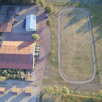
Modenbacher Hof in toller Lage
Modenbacherhof
Modenbacherhof
@Modenbacherhof
Freizeitstall
Geländestrecke
Verpachten
Hunde willkommen
Parkplatz für Pferdeanhänger
Allergikerstall
Hufrehe geeignet
15 weitere...
P


Stall Offenstall + Auslauf, Weid 24/7 Heu, Heulage
Großfischlingen
Fam-Spiegel
@Fam-Spiegel
Freizeitstall
Vermieten
Hunde willkommen
Krankenbox
Allergikerstall
Notfallboxen
14 weitere...
P+
Deprecated: Creation of dynamic property Zend_View_Helper_Ads::$adLink is deprecated in /var/www/stall-frei/htdocs/staging.stall-frei.de/library/Psf/View/Helper/Ads.php on line 108

Das Beste für die Hufe
Mechtersen
STALL-FREIde Marketing
@STALL-FREI-Marketing
Hufschmiede und Hufpfleger in Ihrer Nähe
Bewegungsstall mit Vollpension
Haßloch
Gestuet-von-Erden
@Gestuet-von-Erden
FN-Mitglied
Freizeitstall
Vermieten
Krankenbox
Laufband
Allergikerstall
bedampftes/gewaschenes Heu
27 weitere...
aktuell
S
Leider kein Vorschaubild
Leider kein Vorschaubild
Stallboxen frei
Burrweiler
Martinshof Böchingen
@CarmenMartin
Freizeitstall
Vermieten
Hunde willkommen
Pensions- und Gastboxen
Außenbox mit Paddock
Innenbox
6 weitere...
B
Leider kein Vorschaubild
Leider kein Vorschaubild
Offenstallplatz f. Kleinpferde/Isländer etc.
Böchingen
Duehr-Bien
@Duehr-Bien
Freizeitstall
Reitplatz (z.B. Dressur, Springen, Reining)
Sommerweide
Bewegungsstall
Offenstall
Vollpension
2 weitere...
B

Frisches Stroh zu verkaufen!
Mechtersen
STALL-FREIde Marketing
@STALL-FREI-Marketing
Kaufe frisches Stroh für dein Pferd!
Leider kein Vorschaubild
Leider kein Vorschaubild
Offenstallplatz Isländer, Kleinpferde
Böchingen
Duehr-Bien
@Duehr-Bien
Freizeitstall
Krankenbox
Longierzirkel/Roundpen
Offenstall
Halbpension
6 weitere...
B

Pferdeboxen mit Paddocks in Freilufthalle
Landau
Jochem Rahm
@ProkopHof
Vermieten
Paddock
Reitplatz (z.B. Dressur, Springen, Reining)
Einzelne Boxen oder Stallplätze
3 weitere...
P


Pferdepension Rosenhof
Niederkirchen
Pferdepension Rosenhof
@Christine.Rau
Freizeitstall
Krankenbox
Parkplatz für Pferdeanhänger
Notfallboxen
Bewegungsstall
Laufstall
6 weitere...
P+

Großzügige Paddock Box für Wallach frei
Neustadt
Gaby Klehr
@Gaby-KLEHR
Freizeitstall
Pferdeausbildung
Vermieten
Verpachten
Longierzirkel/Roundpen
Paddock
Allergikerstall
Hengsthaltung möglich
18 weitere...
P

Stall Roth hat 2 geräumige Boxen ab 15.02.26 frei
Insheim
Christian Roth _ C. Rühling
@Stall.C.Roth-C.Rhlng
Freizeitstall
Geländestrecke
Vermieten
Hunde willkommen
Krankenbox
bedampftes/gewaschenes Heu
Gnadenbrothof
20 weitere...
aktuell
P
Deprecated: Creation of dynamic property Zend_View::$pageCount is deprecated in /var/www/stall-frei/htdocs/staging.stall-frei.de/library/vendor/shardj/zf1-future/library/Zend/View/Abstract.php on line 308
Deprecated: Creation of dynamic property Zend_View::$itemCountPerPage is deprecated in /var/www/stall-frei/htdocs/staging.stall-frei.de/library/vendor/shardj/zf1-future/library/Zend/View/Abstract.php on line 308
Deprecated: Creation of dynamic property Zend_View::$first is deprecated in /var/www/stall-frei/htdocs/staging.stall-frei.de/library/vendor/shardj/zf1-future/library/Zend/View/Abstract.php on line 308
Deprecated: Creation of dynamic property Zend_View::$current is deprecated in /var/www/stall-frei/htdocs/staging.stall-frei.de/library/vendor/shardj/zf1-future/library/Zend/View/Abstract.php on line 308
Deprecated: Creation of dynamic property Zend_View::$last is deprecated in /var/www/stall-frei/htdocs/staging.stall-frei.de/library/vendor/shardj/zf1-future/library/Zend/View/Abstract.php on line 308
Deprecated: Creation of dynamic property Zend_View::$next is deprecated in /var/www/stall-frei/htdocs/staging.stall-frei.de/library/vendor/shardj/zf1-future/library/Zend/View/Abstract.php on line 308
Deprecated: Creation of dynamic property Zend_View::$pagesInRange is deprecated in /var/www/stall-frei/htdocs/staging.stall-frei.de/library/vendor/shardj/zf1-future/library/Zend/View/Abstract.php on line 308
Deprecated: Creation of dynamic property Zend_View::$firstPageInRange is deprecated in /var/www/stall-frei/htdocs/staging.stall-frei.de/library/vendor/shardj/zf1-future/library/Zend/View/Abstract.php on line 308
Deprecated: Creation of dynamic property Zend_View::$lastPageInRange is deprecated in /var/www/stall-frei/htdocs/staging.stall-frei.de/library/vendor/shardj/zf1-future/library/Zend/View/Abstract.php on line 308
Deprecated: Creation of dynamic property Zend_View::$currentItemCount is deprecated in /var/www/stall-frei/htdocs/staging.stall-frei.de/library/vendor/shardj/zf1-future/library/Zend/View/Abstract.php on line 308
Deprecated: Creation of dynamic property Zend_View::$totalItemCount is deprecated in /var/www/stall-frei/htdocs/staging.stall-frei.de/library/vendor/shardj/zf1-future/library/Zend/View/Abstract.php on line 308
Deprecated: Creation of dynamic property Zend_View::$firstItemNumber is deprecated in /var/www/stall-frei/htdocs/staging.stall-frei.de/library/vendor/shardj/zf1-future/library/Zend/View/Abstract.php on line 308
Deprecated: Creation of dynamic property Zend_View::$lastItemNumber is deprecated in /var/www/stall-frei/htdocs/staging.stall-frei.de/library/vendor/shardj/zf1-future/library/Zend/View/Abstract.php on line 308
Deprecated: Creation of dynamic property Zend_View::$router is deprecated in /var/www/stall-frei/htdocs/staging.stall-frei.de/library/vendor/shardj/zf1-future/library/Zend/View/Abstract.php on line 308
Deprecated: Creation of dynamic property Zend_View::$urlParams is deprecated in /var/www/stall-frei/htdocs/staging.stall-frei.de/library/vendor/shardj/zf1-future/library/Zend/View/Abstract.php on line 308
Deprecated: Creation of dynamic property Zend_View::$showAds is deprecated in /var/www/stall-frei/htdocs/staging.stall-frei.de/library/vendor/shardj/zf1-future/library/Zend/View/Abstract.php on line 308
Deprecated: Creation of dynamic property Zend_View::$objectIds is deprecated in /var/www/stall-frei/htdocs/staging.stall-frei.de/library/vendor/shardj/zf1-future/library/Zend/View/Abstract.php on line 308
Deprecated: Creation of dynamic property Zend_View::$showNavbar is deprecated in /var/www/stall-frei/htdocs/staging.stall-frei.de/library/vendor/shardj/zf1-future/library/Zend/View/Abstract.php on line 308
Deprecated: Creation of dynamic property Zend_View::$showBreadcrumb is deprecated in /var/www/stall-frei/htdocs/staging.stall-frei.de/library/vendor/shardj/zf1-future/library/Zend/View/Abstract.php on line 308
Deprecated: Creation of dynamic property Zend_View::$showFooter is deprecated in /var/www/stall-frei/htdocs/staging.stall-frei.de/library/vendor/shardj/zf1-future/library/Zend/View/Abstract.php on line 308
Deprecated: Creation of dynamic property Zend_View::$showInternalAds is deprecated in /var/www/stall-frei/htdocs/staging.stall-frei.de/library/vendor/shardj/zf1-future/library/Zend/View/Abstract.php on line 308
Deprecated: Creation of dynamic property Zend_View::$blNoContent is deprecated in /var/www/stall-frei/htdocs/staging.stall-frei.de/library/vendor/shardj/zf1-future/library/Zend/View/Abstract.php on line 308
Deprecated: Creation of dynamic property Zend_View::$sMetaDesc is deprecated in /var/www/stall-frei/htdocs/staging.stall-frei.de/library/vendor/shardj/zf1-future/library/Zend/View/Abstract.php on line 308
Deprecated: Creation of dynamic property Zend_View::$useGmaps is deprecated in /var/www/stall-frei/htdocs/staging.stall-frei.de/library/vendor/shardj/zf1-future/library/Zend/View/Abstract.php on line 308
Deprecated: Creation of dynamic property Zend_View::$touches is deprecated in /var/www/stall-frei/htdocs/staging.stall-frei.de/library/vendor/shardj/zf1-future/library/Zend/View/Abstract.php on line 308
Deprecated: Creation of dynamic property Zend_View::$oProject is deprecated in /var/www/stall-frei/htdocs/staging.stall-frei.de/library/vendor/shardj/zf1-future/library/Zend/View/Abstract.php on line 308
Deprecated: Creation of dynamic property Zend_View::$pageHeadline is deprecated in /var/www/stall-frei/htdocs/staging.stall-frei.de/library/vendor/shardj/zf1-future/library/Zend/View/Abstract.php on line 308
Deprecated: Creation of dynamic property Zend_View::$disableLocationField is deprecated in /var/www/stall-frei/htdocs/staging.stall-frei.de/library/vendor/shardj/zf1-future/library/Zend/View/Abstract.php on line 308
Deprecated: Creation of dynamic property Zend_View::$isSearch is deprecated in /var/www/stall-frei/htdocs/staging.stall-frei.de/library/vendor/shardj/zf1-future/library/Zend/View/Abstract.php on line 308
Deprecated: Creation of dynamic property Zend_View::$pageTitle is deprecated in /var/www/stall-frei/htdocs/staging.stall-frei.de/library/vendor/shardj/zf1-future/library/Zend/View/Abstract.php on line 308
Deprecated: Creation of dynamic property Psf_Form_Element_Text::$class is deprecated in /var/www/stall-frei/htdocs/staging.stall-frei.de/library/vendor/shardj/zf1-future/library/Zend/Form/Element.php on line 874
Deprecated: Creation of dynamic property Psf_Form_Element_Text::$size is deprecated in /var/www/stall-frei/htdocs/staging.stall-frei.de/library/vendor/shardj/zf1-future/library/Zend/Form/Element.php on line 874
Deprecated: Creation of dynamic property Psf_Form_Element_Text::$placeholder is deprecated in /var/www/stall-frei/htdocs/staging.stall-frei.de/library/vendor/shardj/zf1-future/library/Zend/Form/Element.php on line 874
Deprecated: Creation of dynamic property Psf_Form_Element_Hidden::$class is deprecated in /var/www/stall-frei/htdocs/staging.stall-frei.de/library/vendor/shardj/zf1-future/library/Zend/Form/Element.php on line 874
Deprecated: Creation of dynamic property Psf_Form_Element_Hidden::$class is deprecated in /var/www/stall-frei/htdocs/staging.stall-frei.de/library/vendor/shardj/zf1-future/library/Zend/Form/Element.php on line 874
Deprecated: Creation of dynamic property Psf_Form_Element_Hidden::$class is deprecated in /var/www/stall-frei/htdocs/staging.stall-frei.de/library/vendor/shardj/zf1-future/library/Zend/Form/Element.php on line 874
Deprecated: Creation of dynamic property Psf_Form_Element_Hidden::$class is deprecated in /var/www/stall-frei/htdocs/staging.stall-frei.de/library/vendor/shardj/zf1-future/library/Zend/Form/Element.php on line 874
Deprecated: Creation of dynamic property Psf_Form_Element_Select::$class is deprecated in /var/www/stall-frei/htdocs/staging.stall-frei.de/library/vendor/shardj/zf1-future/library/Zend/Form/Element.php on line 874
Deprecated: Creation of dynamic property Psf_Form_Element_Select::$class is deprecated in /var/www/stall-frei/htdocs/staging.stall-frei.de/library/vendor/shardj/zf1-future/library/Zend/Form/Element.php on line 874
Deprecated: Creation of dynamic property Psf_Form_Element_Select::$class is deprecated in /var/www/stall-frei/htdocs/staging.stall-frei.de/library/vendor/shardj/zf1-future/library/Zend/Form/Element.php on line 874
Deprecated: Creation of dynamic property Psf_Form_Element_Select::$class is deprecated in /var/www/stall-frei/htdocs/staging.stall-frei.de/library/vendor/shardj/zf1-future/library/Zend/Form/Element.php on line 874
Deprecated: Creation of dynamic property Psf_Form_Element_Text::$class is deprecated in /var/www/stall-frei/htdocs/staging.stall-frei.de/library/vendor/shardj/zf1-future/library/Zend/Form/Element.php on line 874
Deprecated: Creation of dynamic property Psf_Form_Element_Checkbox::$label is deprecated in /var/www/stall-frei/htdocs/staging.stall-frei.de/library/vendor/shardj/zf1-future/library/Zend/Form/Element.php on line 874
Deprecated: Creation of dynamic property Zend_View::$sort is deprecated in /var/www/stall-frei/htdocs/staging.stall-frei.de/library/vendor/shardj/zf1-future/library/Zend/View/Abstract.php on line 308
Deprecated: Creation of dynamic property Zend_View::$searchLocation is deprecated in /var/www/stall-frei/htdocs/staging.stall-frei.de/library/vendor/shardj/zf1-future/library/Zend/View/Abstract.php on line 308
Deprecated: Creation of dynamic property Zend_View::$locationHint is deprecated in /var/www/stall-frei/htdocs/staging.stall-frei.de/library/vendor/shardj/zf1-future/library/Zend/View/Abstract.php on line 308
Psf_GeoCoder_Abstract::getLocation: Frankenburg Get Location CachedOrLive
Psf_GeoCoder_Abstract::getCachedOrLive: Frankenburg
Psf_GeoCoder_OpenCageData::makeApiRequest: response:
Array
(
[documentation] => https://opencagedata.com/api
[licenses] => Array
(
[0] => Array
(
[name] => see attribution guide
[url] => https://opencagedata.com/credits
)
)
[results] => Array
(
[0] => Array
(
[bounds] => Array
(
[northeast] => Array
(
[lat] => 49.2766897
[lng] => 8.0389755
)
[southwest] => Array
(
[lat] => 49.2763817
[lng] => 8.0384963
)
)
[components] => Array
(
[ISO_3166-1_alpha-2] => DE
[ISO_3166-1_alpha-3] => DEU
[ISO_3166-2] => Array
(
[0] => DE-RP
)
[_category] => travel/tourism
[_normalized_city] => Ramberg
[_type] => ruins
[continent] => Europe
[country] => Deutschland
[country_code] => de
[county] => Landkreis Südliche Weinstraße
[municipality] => Edenkoben
[political_union] => European Union
[postcode] => 76829
[road] => K 6
[ruins] => Frankenburg
[state] => Rheinland-Pfalz
[state_code] => RP
[village] => Ramberg
)
[confidence] => 9
[formatted] => Frankenburg, K 6, 76829 Ramberg, Deutschland
[geometry] => Array
(
[lat] => 49.2765555
[lng] => 8.0387063
)
)
[1] => Array
(
[bounds] => Array
(
[northeast] => Array
(
[lat] => 53.1927355
[lng] => 8.9229428
)
[southwest] => Array
(
[lat] => 53.1527355
[lng] => 8.8829428
)
)
[components] => Array
(
[ISO_3166-1_alpha-2] => DE
[ISO_3166-1_alpha-3] => DEU
[ISO_3166-2] => Array
(
[0] => DE-NI
)
[_category] => place
[_normalized_city] => Lilienthal
[_type] => village
[continent] => Europe
[country] => Deutschland
[country_code] => de
[county] => Landkreis Osterholz
[political_union] => European Union
[postcode] => 28865
[state] => Niedersachsen
[state_code] => NI
[town] => Lilienthal
[village] => Frankenburg
)
[confidence] => 7
[formatted] => 28865 Frankenburg, Deutschland
[geometry] => Array
(
[lat] => 53.1727355
[lng] => 8.9029428
)
)
[2] => Array
(
[bounds] => Array
(
[northeast] => Array
(
[lat] => 52.2136598
[lng] => 9.0760483
)
[southwest] => Array
(
[lat] => 52.2128377
[lng] => 9.0745732
)
)
[components] => Array
(
[ISO_3166-1_alpha-2] => DE
[ISO_3166-1_alpha-3] => DEU
[ISO_3166-2] => Array
(
[0] => DE-NI
)
[_category] => travel/tourism
[_normalized_city] => Rinteln
[_type] => archaeological_site
[archaeological_site] => Die Hünenburg bei Todenmann
[continent] => Europe
[country] => Deutschland
[country_code] => de
[county] => Landkreis Schaumburg
[political_union] => European Union
[postcode] => 31737
[road] => Lange Wand - Hainholz
[state] => Niedersachsen
[state_code] => NI
[suburb] => Todenmann
[town] => Rinteln
)
[confidence] => 9
[formatted] => Die Hünenburg bei Todenmann, Lange Wand - Hainholz, 31737 Rinteln, Deutschland
[geometry] => Array
(
[lat] => 52.2132161
[lng] => 9.0752844
)
)
[3] => Array
(
[bounds] => Array
(
[northeast] => Array
(
[lat] => 52.2206295
[lng] => 9.086362
)
[southwest] => Array
(
[lat] => 52.2006295
[lng] => 9.066362
)
)
[components] => Array
(
[ISO_3166-1_alpha-2] => DE
[ISO_3166-1_alpha-3] => DEU
[ISO_3166-2] => Array
(
[0] => DE-NI
)
[_category] => place
[_normalized_city] => Rinteln
[_type] => hamlet
[continent] => Europe
[country] => Deutschland
[country_code] => de
[county] => Landkreis Schaumburg
[locality] => Frankenburg
[political_union] => European Union
[postcode] => 31737
[state] => Niedersachsen
[state_code] => NI
[town] => Rinteln
)
[confidence] => 8
[formatted] => Frankenburg, 31737 Rinteln, Deutschland
[geometry] => Array
(
[lat] => 52.2106295
[lng] => 9.076362
)
)
[4] => Array
(
[bounds] => Array
(
[northeast] => Array
(
[lat] => 53.1736432
[lng] => 8.9009079
)
[southwest] => Array
(
[lat] => 53.1726363
[lng] => 8.8938415
)
)
[components] => Array
(
[ISO_3166-1_alpha-2] => DE
[ISO_3166-1_alpha-3] => DEU
[ISO_3166-2] => Array
(
[0] => DE-NI
)
[_category] => road
[_normalized_city] => Lilienthal
[_type] => road
[continent] => Europe
[country] => Deutschland
[country_code] => de
[county] => Landkreis Osterholz
[political_union] => European Union
[postcode] => 28865
[road] => Frankenburg
[road_type] => tertiary
[state] => Niedersachsen
[state_code] => NI
[town] => Lilienthal
[village] => Frankenburg
)
[confidence] => 9
[formatted] => Frankenburg, 28865 Frankenburg, Deutschland
[geometry] => Array
(
[lat] => 53.1730939
[lng] => 8.8973663
)
)
[5] => Array
(
[components] => Array
(
[ISO_3166-1_alpha-2] => FR
[ISO_3166-1_alpha-3] => FRA
[ISO_3166-2] => Array
(
[0] => FR-GES
[1] => FR-6AE
[2] => FR-67
)
[_category] => road
[_normalized_city] => Sélestat
[_type] => road
[city] => Sélestat
[continent] => Europe
[country] => France
[country_code] => fr
[county] => Bas-Rhin
[local_authority] => Communauté de communes de Sélestat
[political_union] => European Union
[postcode] => 67600
[road] => Rue du Frankenbourg
[state] => Grand Est
[state_code] => GES
)
[confidence] => 3
[formatted] => Rue du Frankenbourg, 67600 Sélestat, France
[geometry] => Array
(
[lat] => 48.265891
[lng] => 7.440477
)
)
[6] => Array
(
[components] => Array
(
[ISO_3166-1_alpha-2] => FR
[ISO_3166-1_alpha-3] => FRA
[ISO_3166-2] => Array
(
[0] => FR-GES
[1] => FR-6AE
[2] => FR-67
)
[_category] => road
[_normalized_city] => Mundolsheim
[_type] => road
[city] => Mundolsheim
[continent] => Europe
[country] => France
[country_code] => fr
[county] => Bas-Rhin
[local_authority] => Strasbourg Eurométropole
[political_union] => European Union
[postcode] => 67450
[road] => Rue du Frankenbourg
[state] => Grand Est
[state_code] => GES
)
[confidence] => 3
[formatted] => Rue du Frankenbourg, 67450 Mundolsheim, France
[geometry] => Array
(
[lat] => 48.634713
[lng] => 7.706013
)
)
[7] => Array
(
[components] => Array
(
[ISO_3166-1_alpha-2] => FR
[ISO_3166-1_alpha-3] => FRA
[ISO_3166-2] => Array
(
[0] => FR-GES
[1] => FR-6AE
[2] => FR-67
)
[_category] => road
[_normalized_city] => Châtenois
[_type] => road
[city] => Châtenois
[continent] => Europe
[country] => France
[country_code] => fr
[county] => Bas-Rhin
[local_authority] => Communauté de communes de Sélestat
[political_union] => European Union
[postcode] => 67730
[road] => Rue du Frankenbourg
[state] => Grand Est
[state_code] => GES
)
[confidence] => 3
[formatted] => Rue du Frankenbourg, 67730 Châtenois, France
[geometry] => Array
(
[lat] => 48.276296
[lng] => 7.397032
)
)
[8] => Array
(
[components] => Array
(
[ISO_3166-1_alpha-2] => FR
[ISO_3166-1_alpha-3] => FRA
[ISO_3166-2] => Array
(
[0] => FR-GES
[1] => FR-6AE
[2] => FR-68
)
[_category] => road
[_normalized_city] => Lièpvre
[_type] => road
[city] => Lièpvre
[continent] => Europe
[country] => France
[country_code] => fr
[county] => Haut-Rhin
[local_authority] => Communauté de communes du Val d'Argent
[political_union] => European Union
[postcode] => 68660
[road] => Rue du Frankenbourg
[state] => Grand Est
[state_code] => GES
)
[confidence] => 3
[formatted] => Rue du Frankenbourg, 68660 Lièpvre, France
[geometry] => Array
(
[lat] => 48.270209
[lng] => 7.288902
)
)
[9] => Array
(
[components] => Array
(
[ISO_3166-1_alpha-2] => FR
[ISO_3166-1_alpha-3] => FRA
[ISO_3166-2] => Array
(
[0] => FR-GES
[1] => FR-6AE
[2] => FR-67
)
[_category] => road
[_normalized_city] => Neubois
[_type] => road
[city] => Neubois
[continent] => Europe
[country] => France
[country_code] => fr
[county] => Bas-Rhin
[local_authority] => Communauté de communes de la Vallée de Villé
[political_union] => European Union
[postcode] => 67220
[road] => Rue du Frankenbourg
[state] => Grand Est
[state_code] => GES
)
[confidence] => 3
[formatted] => Rue du Frankenbourg, 67220 Neubois, France
[geometry] => Array
(
[lat] => 48.305634
[lng] => 7.336708
)
)
)
[status] => Array
(
[code] => 200
[message] => OK
)
[stay_informed] => Array
(
[blog] => https://blog.opencagedata.com
[mastodon] => https://en.osm.town/@opencage
)
[thanks] => For using an OpenCage API
[timestamp] => Array
(
[created_http] => Sat, 07 Feb 2026 18:03:09 GMT
[created_unix] => 1770487389
)
[total_results] => 10
)
Psf_GeoCoder_Abstract::convertLocationResult
{"documentation":"https:\/\/opencagedata.com\/api","licenses":[{"name":"see attribution guide","url":"https:\/\/opencagedata.com\/credits"}],"results":[{"bounds":{"northeast":{"lat":49.2766897,"lng":8.0389755},"southwest":{"lat":49.2763817,"lng":8.0384963}},"components":{"ISO_3166-1_alpha-2":"DE","ISO_3166-1_alpha-3":"DEU","ISO_3166-2":["DE-RP"],"_category":"travel\/tourism","_normalized_city":"Ramberg","_type":"ruins","continent":"Europe","country":"Deutschland","country_code":"de","county":"Landkreis S\u00fcdliche Weinstra\u00dfe","municipality":"Edenkoben","political_union":"European Union","postcode":"76829","road":"K 6","ruins":"Frankenburg","state":"Rheinland-Pfalz","state_code":"RP","village":"Ramberg"},"confidence":9,"formatted":"Frankenburg, K 6, 76829 Ramberg, Deutschland","geometry":{"lat":49.2765555,"lng":8.0387063}},{"bounds":{"northeast":{"lat":53.1927355,"lng":8.9229428},"southwest":{"lat":53.1527355,"lng":8.8829428}},"components":{"ISO_3166-1_alpha-2":"DE","ISO_3166-1_alpha-3":"DEU","ISO_3166-2":["DE-NI"],"_category":"place","_normalized_city":"Lilienthal","_type":"village","continent":"Europe","country":"Deutschland","country_code":"de","county":"Landkreis Osterholz","political_union":"European Union","postcode":"28865","state":"Niedersachsen","state_code":"NI","town":"Lilienthal","village":"Frankenburg"},"confidence":7,"formatted":"28865 Frankenburg, Deutschland","geometry":{"lat":53.1727355,"lng":8.9029428}},{"bounds":{"northeast":{"lat":52.2136598,"lng":9.0760483},"southwest":{"lat":52.2128377,"lng":9.0745732}},"components":{"ISO_3166-1_alpha-2":"DE","ISO_3166-1_alpha-3":"DEU","ISO_3166-2":["DE-NI"],"_category":"travel\/tourism","_normalized_city":"Rinteln","_type":"archaeological_site","archaeological_site":"Die H\u00fcnenburg bei Todenmann","continent":"Europe","country":"Deutschland","country_code":"de","county":"Landkreis Schaumburg","political_union":"European Union","postcode":"31737","road":"Lange Wand - Hainholz","state":"Niedersachsen","state_code":"NI","suburb":"Todenmann","town":"Rinteln"},"confidence":9,"formatted":"Die H\u00fcnenburg bei Todenmann, Lange Wand - Hainholz, 31737 Rinteln, Deutschland","geometry":{"lat":52.2132161,"lng":9.0752844}},{"bounds":{"northeast":{"lat":52.2206295,"lng":9.086362},"southwest":{"lat":52.2006295,"lng":9.066362}},"components":{"ISO_3166-1_alpha-2":"DE","ISO_3166-1_alpha-3":"DEU","ISO_3166-2":["DE-NI"],"_category":"place","_normalized_city":"Rinteln","_type":"hamlet","continent":"Europe","country":"Deutschland","country_code":"de","county":"Landkreis Schaumburg","locality":"Frankenburg","political_union":"European Union","postcode":"31737","state":"Niedersachsen","state_code":"NI","town":"Rinteln"},"confidence":8,"formatted":"Frankenburg, 31737 Rinteln, Deutschland","geometry":{"lat":52.2106295,"lng":9.076362}},{"bounds":{"northeast":{"lat":53.1736432,"lng":8.9009079},"southwest":{"lat":53.1726363,"lng":8.8938415}},"components":{"ISO_3166-1_alpha-2":"DE","ISO_3166-1_alpha-3":"DEU","ISO_3166-2":["DE-NI"],"_category":"road","_normalized_city":"Lilienthal","_type":"road","continent":"Europe","country":"Deutschland","country_code":"de","county":"Landkreis Osterholz","political_union":"European Union","postcode":"28865","road":"Frankenburg","road_type":"tertiary","state":"Niedersachsen","state_code":"NI","town":"Lilienthal","village":"Frankenburg"},"confidence":9,"formatted":"Frankenburg, 28865 Frankenburg, Deutschland","geometry":{"lat":53.1730939,"lng":8.8973663}},{"components":{"ISO_3166-1_alpha-2":"FR","ISO_3166-1_alpha-3":"FRA","ISO_3166-2":["FR-GES","FR-6AE","FR-67"],"_category":"road","_normalized_city":"S\u00e9lestat","_type":"road","city":"S\u00e9lestat","continent":"Europe","country":"France","country_code":"fr","county":"Bas-Rhin","local_authority":"Communaut\u00e9 de communes de S\u00e9lestat","political_union":"European Union","postcode":"67600","road":"Rue du Frankenbourg","state":"Grand Est","state_code":"GES"},"confidence":3,"formatted":"Rue du Frankenbourg, 67600 S\u00e9lestat, France","geometry":{"lat":48.265891,"lng":7.440477}},{"components":{"ISO_3166-1_alpha-2":"FR","ISO_3166-1_alpha-3":"FRA","ISO_3166-2":["FR-GES","FR-6AE","FR-67"],"_category":"road","_normalized_city":"Mundolsheim","_type":"road","city":"Mundolsheim","continent":"Europe","country":"France","country_code":"fr","county":"Bas-Rhin","local_authority":"Strasbourg Eurom\u00e9tropole","political_union":"European Union","postcode":"67450","road":"Rue du Frankenbourg","state":"Grand Est","state_code":"GES"},"confidence":3,"formatted":"Rue du Frankenbourg, 67450 Mundolsheim, France","geometry":{"lat":48.634713,"lng":7.706013}},{"components":{"ISO_3166-1_alpha-2":"FR","ISO_3166-1_alpha-3":"FRA","ISO_3166-2":["FR-GES","FR-6AE","FR-67"],"_category":"road","_normalized_city":"Ch\u00e2tenois","_type":"road","city":"Ch\u00e2tenois","continent":"Europe","country":"France","country_code":"fr","county":"Bas-Rhin","local_authority":"Communaut\u00e9 de communes de S\u00e9lestat","political_union":"European Union","postcode":"67730","road":"Rue du Frankenbourg","state":"Grand Est","state_code":"GES"},"confidence":3,"formatted":"Rue du Frankenbourg, 67730 Ch\u00e2tenois, France","geometry":{"lat":48.276296,"lng":7.397032}},{"components":{"ISO_3166-1_alpha-2":"FR","ISO_3166-1_alpha-3":"FRA","ISO_3166-2":["FR-GES","FR-6AE","FR-68"],"_category":"road","_normalized_city":"Li\u00e8pvre","_type":"road","city":"Li\u00e8pvre","continent":"Europe","country":"France","country_code":"fr","county":"Haut-Rhin","local_authority":"Communaut\u00e9 de communes du Val d'Argent","political_union":"European Union","postcode":"68660","road":"Rue du Frankenbourg","state":"Grand Est","state_code":"GES"},"confidence":3,"formatted":"Rue du Frankenbourg, 68660 Li\u00e8pvre, France","geometry":{"lat":48.270209,"lng":7.288902}},{"components":{"ISO_3166-1_alpha-2":"FR","ISO_3166-1_alpha-3":"FRA","ISO_3166-2":["FR-GES","FR-6AE","FR-67"],"_category":"road","_normalized_city":"Neubois","_type":"road","city":"Neubois","continent":"Europe","country":"France","country_code":"fr","county":"Bas-Rhin","local_authority":"Communaut\u00e9 de communes de la Vall\u00e9e de Vill\u00e9","political_union":"European Union","postcode":"67220","road":"Rue du Frankenbourg","state":"Grand Est","state_code":"GES"},"confidence":3,"formatted":"Rue du Frankenbourg, 67220 Neubois, France","geometry":{"lat":48.305634,"lng":7.336708}}],"status":{"code":200,"message":"OK"},"stay_informed":{"blog":"https:\/\/blog.opencagedata.com","mastodon":"https:\/\/en.osm.town\/@opencage"},"thanks":"For using an OpenCage API","timestamp":{"created_http":"Sat, 07 Feb 2026 18:03:09 GMT","created_unix":1770487389},"total_results":10}Array
(
[0] => stdClass Object
(
[bounds] => stdClass Object
(
[northeast] => stdClass Object
(
[lat] => 49.2766897
[lng] => 8.0389755
)
[southwest] => stdClass Object
(
[lat] => 49.2763817
[lng] => 8.0384963
)
)
[components] => stdClass Object
(
[ISO_3166-1_alpha-2] => DE
[ISO_3166-1_alpha-3] => DEU
[ISO_3166-2] => Array
(
[0] => DE-RP
)
[_category] => travel/tourism
[_normalized_city] => Ramberg
[_type] => ruins
[continent] => Europe
[country] => Deutschland
[country_code] => de
[county] => Landkreis Südliche Weinstraße
[municipality] => Edenkoben
[political_union] => European Union
[postcode] => 76829
[road] => K 6
[ruins] => Frankenburg
[state] => Rheinland-Pfalz
[state_code] => RP
[village] => Ramberg
)
[confidence] => 9
[formatted] => Frankenburg, K 6, 76829 Ramberg, Deutschland
[geometry] => stdClass Object
(
[lat] => 49.2765555
[lng] => 8.0387063
)
)
[1] => stdClass Object
(
[bounds] => stdClass Object
(
[northeast] => stdClass Object
(
[lat] => 53.1927355
[lng] => 8.9229428
)
[southwest] => stdClass Object
(
[lat] => 53.1527355
[lng] => 8.8829428
)
)
[components] => stdClass Object
(
[ISO_3166-1_alpha-2] => DE
[ISO_3166-1_alpha-3] => DEU
[ISO_3166-2] => Array
(
[0] => DE-NI
)
[_category] => place
[_normalized_city] => Lilienthal
[_type] => village
[continent] => Europe
[country] => Deutschland
[country_code] => de
[county] => Landkreis Osterholz
[political_union] => European Union
[postcode] => 28865
[state] => Niedersachsen
[state_code] => NI
[town] => Lilienthal
[village] => Frankenburg
)
[confidence] => 7
[formatted] => 28865 Frankenburg, Deutschland
[geometry] => stdClass Object
(
[lat] => 53.1727355
[lng] => 8.9029428
)
)
[2] => stdClass Object
(
[bounds] => stdClass Object
(
[northeast] => stdClass Object
(
[lat] => 52.2136598
[lng] => 9.0760483
)
[southwest] => stdClass Object
(
[lat] => 52.2128377
[lng] => 9.0745732
)
)
[components] => stdClass Object
(
[ISO_3166-1_alpha-2] => DE
[ISO_3166-1_alpha-3] => DEU
[ISO_3166-2] => Array
(
[0] => DE-NI
)
[_category] => travel/tourism
[_normalized_city] => Rinteln
[_type] => archaeological_site
[archaeological_site] => Die Hünenburg bei Todenmann
[continent] => Europe
[country] => Deutschland
[country_code] => de
[county] => Landkreis Schaumburg
[political_union] => European Union
[postcode] => 31737
[road] => Lange Wand - Hainholz
[state] => Niedersachsen
[state_code] => NI
[suburb] => Todenmann
[town] => Rinteln
)
[confidence] => 9
[formatted] => Die Hünenburg bei Todenmann, Lange Wand - Hainholz, 31737 Rinteln, Deutschland
[geometry] => stdClass Object
(
[lat] => 52.2132161
[lng] => 9.0752844
)
)
[3] => stdClass Object
(
[bounds] => stdClass Object
(
[northeast] => stdClass Object
(
[lat] => 52.2206295
[lng] => 9.086362
)
[southwest] => stdClass Object
(
[lat] => 52.2006295
[lng] => 9.066362
)
)
[components] => stdClass Object
(
[ISO_3166-1_alpha-2] => DE
[ISO_3166-1_alpha-3] => DEU
[ISO_3166-2] => Array
(
[0] => DE-NI
)
[_category] => place
[_normalized_city] => Rinteln
[_type] => hamlet
[continent] => Europe
[country] => Deutschland
[country_code] => de
[county] => Landkreis Schaumburg
[locality] => Frankenburg
[political_union] => European Union
[postcode] => 31737
[state] => Niedersachsen
[state_code] => NI
[town] => Rinteln
)
[confidence] => 8
[formatted] => Frankenburg, 31737 Rinteln, Deutschland
[geometry] => stdClass Object
(
[lat] => 52.2106295
[lng] => 9.076362
)
)
[4] => stdClass Object
(
[bounds] => stdClass Object
(
[northeast] => stdClass Object
(
[lat] => 53.1736432
[lng] => 8.9009079
)
[southwest] => stdClass Object
(
[lat] => 53.1726363
[lng] => 8.8938415
)
)
[components] => stdClass Object
(
[ISO_3166-1_alpha-2] => DE
[ISO_3166-1_alpha-3] => DEU
[ISO_3166-2] => Array
(
[0] => DE-NI
)
[_category] => road
[_normalized_city] => Lilienthal
[_type] => road
[continent] => Europe
[country] => Deutschland
[country_code] => de
[county] => Landkreis Osterholz
[political_union] => European Union
[postcode] => 28865
[road] => Frankenburg
[road_type] => tertiary
[state] => Niedersachsen
[state_code] => NI
[town] => Lilienthal
[village] => Frankenburg
)
[confidence] => 9
[formatted] => Frankenburg, 28865 Frankenburg, Deutschland
[geometry] => stdClass Object
(
[lat] => 53.1730939
[lng] => 8.8973663
)
)
[5] => stdClass Object
(
[components] => stdClass Object
(
[ISO_3166-1_alpha-2] => FR
[ISO_3166-1_alpha-3] => FRA
[ISO_3166-2] => Array
(
[0] => FR-GES
[1] => FR-6AE
[2] => FR-67
)
[_category] => road
[_normalized_city] => Sélestat
[_type] => road
[city] => Sélestat
[continent] => Europe
[country] => France
[country_code] => fr
[county] => Bas-Rhin
[local_authority] => Communauté de communes de Sélestat
[political_union] => European Union
[postcode] => 67600
[road] => Rue du Frankenbourg
[state] => Grand Est
[state_code] => GES
)
[confidence] => 3
[formatted] => Rue du Frankenbourg, 67600 Sélestat, France
[geometry] => stdClass Object
(
[lat] => 48.265891
[lng] => 7.440477
)
)
[6] => stdClass Object
(
[components] => stdClass Object
(
[ISO_3166-1_alpha-2] => FR
[ISO_3166-1_alpha-3] => FRA
[ISO_3166-2] => Array
(
[0] => FR-GES
[1] => FR-6AE
[2] => FR-67
)
[_category] => road
[_normalized_city] => Mundolsheim
[_type] => road
[city] => Mundolsheim
[continent] => Europe
[country] => France
[country_code] => fr
[county] => Bas-Rhin
[local_authority] => Strasbourg Eurométropole
[political_union] => European Union
[postcode] => 67450
[road] => Rue du Frankenbourg
[state] => Grand Est
[state_code] => GES
)
[confidence] => 3
[formatted] => Rue du Frankenbourg, 67450 Mundolsheim, France
[geometry] => stdClass Object
(
[lat] => 48.634713
[lng] => 7.706013
)
)
[7] => stdClass Object
(
[components] => stdClass Object
(
[ISO_3166-1_alpha-2] => FR
[ISO_3166-1_alpha-3] => FRA
[ISO_3166-2] => Array
(
[0] => FR-GES
[1] => FR-6AE
[2] => FR-67
)
[_category] => road
[_normalized_city] => Châtenois
[_type] => road
[city] => Châtenois
[continent] => Europe
[country] => France
[country_code] => fr
[county] => Bas-Rhin
[local_authority] => Communauté de communes de Sélestat
[political_union] => European Union
[postcode] => 67730
[road] => Rue du Frankenbourg
[state] => Grand Est
[state_code] => GES
)
[confidence] => 3
[formatted] => Rue du Frankenbourg, 67730 Châtenois, France
[geometry] => stdClass Object
(
[lat] => 48.276296
[lng] => 7.397032
)
)
[8] => stdClass Object
(
[components] => stdClass Object
(
[ISO_3166-1_alpha-2] => FR
[ISO_3166-1_alpha-3] => FRA
[ISO_3166-2] => Array
(
[0] => FR-GES
[1] => FR-6AE
[2] => FR-68
)
[_category] => road
[_normalized_city] => Lièpvre
[_type] => road
[city] => Lièpvre
[continent] => Europe
[country] => France
[country_code] => fr
[county] => Haut-Rhin
[local_authority] => Communauté de communes du Val d'Argent
[political_union] => European Union
[postcode] => 68660
[road] => Rue du Frankenbourg
[state] => Grand Est
[state_code] => GES
)
[confidence] => 3
[formatted] => Rue du Frankenbourg, 68660 Lièpvre, France
[geometry] => stdClass Object
(
[lat] => 48.270209
[lng] => 7.288902
)
)
[9] => stdClass Object
(
[components] => stdClass Object
(
[ISO_3166-1_alpha-2] => FR
[ISO_3166-1_alpha-3] => FRA
[ISO_3166-2] => Array
(
[0] => FR-GES
[1] => FR-6AE
[2] => FR-67
)
[_category] => road
[_normalized_city] => Neubois
[_type] => road
[city] => Neubois
[continent] => Europe
[country] => France
[country_code] => fr
[county] => Bas-Rhin
[local_authority] => Communauté de communes de la Vallée de Villé
[political_union] => European Union
[postcode] => 67220
[road] => Rue du Frankenbourg
[state] => Grand Est
[state_code] => GES
)
[confidence] => 3
[formatted] => Rue du Frankenbourg, 67220 Neubois, France
[geometry] => stdClass Object
(
[lat] => 48.305634
[lng] => 7.336708
)
)
)
Psf_GeoCoder_OpenCageData::getKeyMap: 0
stdClass Object
(
    [bounds] => stdClass Object
        (
            [northeast] => stdClass Object
                (
                    [lat] => 49.2766897
                    [lng] => 8.0389755
                )

            [southwest] => stdClass Object
                (
                    [lat] => 49.2763817
                    [lng] => 8.0384963
                )

        )

    [components] => stdClass Object
        (
            [ISO_3166-1_alpha-2] => DE
            [ISO_3166-1_alpha-3] => DEU
            [ISO_3166-2] => Array
                (
                    [0] => DE-RP
                )

            [_category] => travel/tourism
            [_normalized_city] => Ramberg
            [_type] => ruins
            [continent] => Europe
            [country] => Deutschland
            [country_code] => de
            [county] => Landkreis Südliche Weinstraße
            [municipality] => Edenkoben
            [political_union] => European Union
            [postcode] => 76829
            [road] => K 6
            [ruins] => Frankenburg
            [state] => Rheinland-Pfalz
            [state_code] => RP
            [village] => Ramberg
        )

    [confidence] => 9
    [formatted] => Frankenburg, K 6, 76829 Ramberg, Deutschland
    [geometry] => stdClass Object
        (
            [lat] => 49.2765555
            [lng] => 8.0387063
        )

)
Psf_GeoCoder_OpenCageData::getCounty: Südliche Weinstraße
Psf_GeoCoder_OpenCageData::addMissingData REFETCH!
Array
(
    [address] => Frankenburg, K 6, 76829 Ramberg, Deutschland
    [type] => ruins
    [street] => K 6
    [city] => Ramberg
    [county] => Südliche Weinstraße
    [state] => Rheinland-Pfalz
    [zip] => 76829
    [country] => Deutschland
    [suburb] =>
    [countrycode] => de
    [latitude] => 49.2765555
    [longitude] => 8.0387063
    [accuracy] => 1
    [confidence] => 9
    [bounds] => stdClass Object
        (
            [northeast] => stdClass Object
                (
                    [lat] => 49.2766897
                    [lng] => 8.0389755
                )

            [southwest] => stdClass Object
                (
                    [lat] => 49.2763817
                    [lng] => 8.0384963
                )

        )

)
reformat!
Array
(
    [address] => Frankenburg, K 6, 76829 Ramberg, Deutschland
    [type] => ruins
    [street] => K 6
    [city] => Ramberg
    [county] => Südliche Weinstraße
    [state] => Rheinland-Pfalz
    [zip] => 76829
    [country] => Deutschland
    [suburb] =>
    [countrycode] => de
    [latitude] => 49.2765555
    [longitude] => 8.0387063
    [accuracy] => 1
    [confidence] => 9
    [bounds] => stdClass Object
        (
            [northeast] => stdClass Object
                (
                    [lat] => 49.2766897
                    [lng] => 8.0389755
                )

            [southwest] => stdClass Object
                (
                    [lat] => 49.2763817
                    [lng] => 8.0384963
                )

        )

    [place] => K 6, 76829 Ramberg, Rheinland-Pfalz
    [hash] => 9e6ce2b62dd5a4c789eb2ab314361ffe
)
Psf_GeoCoder_OpenCageData::getKeyMap: 1
stdClass Object
(
    [bounds] => stdClass Object
        (
            [northeast] => stdClass Object
                (
                    [lat] => 53.1927355
                    [lng] => 8.9229428
                )

            [southwest] => stdClass Object
                (
                    [lat] => 53.1527355
                    [lng] => 8.8829428
                )

        )

    [components] => stdClass Object
        (
            [ISO_3166-1_alpha-2] => DE
            [ISO_3166-1_alpha-3] => DEU
            [ISO_3166-2] => Array
                (
                    [0] => DE-NI
                )

            [_category] => place
            [_normalized_city] => Lilienthal
            [_type] => village
            [continent] => Europe
            [country] => Deutschland
            [country_code] => de
            [county] => Landkreis Osterholz
            [political_union] => European Union
            [postcode] => 28865
            [state] => Niedersachsen
            [state_code] => NI
            [town] => Lilienthal
            [village] => Frankenburg
        )

    [confidence] => 7
    [formatted] => 28865 Frankenburg, Deutschland
    [geometry] => stdClass Object
        (
            [lat] => 53.1727355
            [lng] => 8.9029428
        )

)
Psf_GeoCoder_OpenCageData::getCounty: Osterholz
Psf_GeoCoder_OpenCageData::addMissingData REFETCH!
Array
(
    [address] => 28865 Frankenburg, Deutschland
    [type] => village
    [street] =>
    [city] => Lilienthal
    [county] => Osterholz
    [state] => Niedersachsen
    [zip] => 28865
    [country] => Deutschland
    [suburb] =>
    [countrycode] => de
    [latitude] => 53.1727355
    [longitude] => 8.9029428
    [accuracy] => 1
    [confidence] => 7
    [bounds] => stdClass Object
        (
            [northeast] => stdClass Object
                (
                    [lat] => 53.1927355
                    [lng] => 8.9229428
                )

            [southwest] => stdClass Object
                (
                    [lat] => 53.1527355
                    [lng] => 8.8829428
                )

        )

)
reformat!
Array
(
    [address] => 28865 Lilienthal
    [type] => village
    [street] =>
    [city] => Lilienthal
    [county] => Osterholz
    [state] => Niedersachsen
    [zip] => 28865
    [country] => Deutschland
    [suburb] =>
    [countrycode] => de
    [latitude] => 53.1727355
    [longitude] => 8.9029428
    [accuracy] => 1
    [confidence] => 7
    [bounds] => stdClass Object
        (
            [northeast] => stdClass Object
                (
                    [lat] => 53.1927355
                    [lng] => 8.9229428
                )

            [southwest] => stdClass Object
                (
                    [lat] => 53.1527355
                    [lng] => 8.8829428
                )

        )

    [place] => 28865 Lilienthal, Niedersachsen
    [hash] => d5b2781d7faa3aba642217d032f38290
)
Psf_GeoCoder_OpenCageData::getKeyMap: 2
stdClass Object
(
    [bounds] => stdClass Object
        (
            [northeast] => stdClass Object
                (
                    [lat] => 52.2136598
                    [lng] => 9.0760483
                )

            [southwest] => stdClass Object
                (
                    [lat] => 52.2128377
                    [lng] => 9.0745732
                )

        )

    [components] => stdClass Object
        (
            [ISO_3166-1_alpha-2] => DE
            [ISO_3166-1_alpha-3] => DEU
            [ISO_3166-2] => Array
                (
                    [0] => DE-NI
                )

            [_category] => travel/tourism
            [_normalized_city] => Rinteln
            [_type] => archaeological_site
            [archaeological_site] => Die Hünenburg bei Todenmann
            [continent] => Europe
            [country] => Deutschland
            [country_code] => de
            [county] => Landkreis Schaumburg
            [political_union] => European Union
            [postcode] => 31737
            [road] => Lange Wand - Hainholz
            [state] => Niedersachsen
            [state_code] => NI
            [suburb] => Todenmann
            [town] => Rinteln
        )

    [confidence] => 9
    [formatted] => Die Hünenburg bei Todenmann, Lange Wand - Hainholz, 31737 Rinteln, Deutschland
    [geometry] => stdClass Object
        (
            [lat] => 52.2132161
            [lng] => 9.0752844
        )

)
Psf_GeoCoder_OpenCageData::getCounty: Schaumburg
Psf_GeoCoder_OpenCageData::addMissingData REFETCH!
Array
(
    [address] => Die Hünenburg bei Todenmann, Lange Wand - Hainholz, 31737 Rinteln, Deutschland
    [type] => archaeological_site
    [street] => Lange Wand - Hainholz
    [city] => Rinteln
    [county] => Schaumburg
    [state] => Niedersachsen
    [zip] => 31737
    [country] => Deutschland
    [suburb] => Todenmann
    [countrycode] => de
    [latitude] => 52.2132161
    [longitude] => 9.0752844
    [accuracy] => 1
    [confidence] => 9
    [bounds] => stdClass Object
        (
            [northeast] => stdClass Object
                (
                    [lat] => 52.2136598
                    [lng] => 9.0760483
                )

            [southwest] => stdClass Object
                (
                    [lat] => 52.2128377
                    [lng] => 9.0745732
                )

        )

)
reformat!
Array
(
    [address] => Die Hünenburg bei Todenmann, Lange Wand - Hainholz, 31737 Rinteln, Deutschland
    [type] => archaeological_site
    [street] => Lange Wand - Hainholz
    [city] => Rinteln
    [county] => Schaumburg
    [state] => Niedersachsen
    [zip] => 31737
    [country] => Deutschland
    [suburb] => Todenmann
    [countrycode] => de
    [latitude] => 52.2132161
    [longitude] => 9.0752844
    [accuracy] => 1
    [confidence] => 9
    [bounds] => stdClass Object
        (
            [northeast] => stdClass Object
                (
                    [lat] => 52.2136598
                    [lng] => 9.0760483
                )

            [southwest] => stdClass Object
                (
                    [lat] => 52.2128377
                    [lng] => 9.0745732
                )

        )

    [place] => Lange Wand - Hainholz, 31737 Rinteln, Niedersachsen
    [hash] => 9533175a833effd346bd78fc95c3d436
)
Psf_GeoCoder_OpenCageData::getKeyMap: 3
stdClass Object
(
    [bounds] => stdClass Object
        (
            [northeast] => stdClass Object
                (
                    [lat] => 52.2206295
                    [lng] => 9.086362
                )

            [southwest] => stdClass Object
                (
                    [lat] => 52.2006295
                    [lng] => 9.066362
                )

        )

    [components] => stdClass Object
        (
            [ISO_3166-1_alpha-2] => DE
            [ISO_3166-1_alpha-3] => DEU
            [ISO_3166-2] => Array
                (
                    [0] => DE-NI
                )

            [_category] => place
            [_normalized_city] => Rinteln
            [_type] => hamlet
            [continent] => Europe
            [country] => Deutschland
            [country_code] => de
            [county] => Landkreis Schaumburg
            [locality] => Frankenburg
            [political_union] => European Union
            [postcode] => 31737
            [state] => Niedersachsen
            [state_code] => NI
            [town] => Rinteln
        )

    [confidence] => 8
    [formatted] => Frankenburg, 31737 Rinteln, Deutschland
    [geometry] => stdClass Object
        (
            [lat] => 52.2106295
            [lng] => 9.076362
        )

)
Psf_GeoCoder_OpenCageData::getCounty: Schaumburg
Psf_GeoCoder_OpenCageData::addMissingData REFETCH!
Array
(
    [address] => Frankenburg, 31737 Rinteln, Deutschland
    [type] => hamlet
    [street] =>
    [city] => Rinteln
    [county] => Schaumburg
    [state] => Niedersachsen
    [zip] => 31737
    [country] => Deutschland
    [suburb] =>
    [countrycode] => de
    [latitude] => 52.2106295
    [longitude] => 9.076362
    [accuracy] => 1
    [confidence] => 8
    [bounds] => stdClass Object
        (
            [northeast] => stdClass Object
                (
                    [lat] => 52.2206295
                    [lng] => 9.086362
                )

            [southwest] => stdClass Object
                (
                    [lat] => 52.2006295
                    [lng] => 9.066362
                )

        )

)
reformat!
Array
(
    [address] => Frankenburg, 31737 Rinteln, Deutschland
    [type] => hamlet
    [street] =>
    [city] => Rinteln
    [county] => Schaumburg
    [state] => Niedersachsen
    [zip] => 31737
    [country] => Deutschland
    [suburb] =>
    [countrycode] => de
    [latitude] => 52.2106295
    [longitude] => 9.076362
    [accuracy] => 1
    [confidence] => 8
    [bounds] => stdClass Object
        (
            [northeast] => stdClass Object
                (
                    [lat] => 52.2206295
                    [lng] => 9.086362
                )

            [southwest] => stdClass Object
                (
                    [lat] => 52.2006295
                    [lng] => 9.066362
                )

        )

    [place] => 31737 Rinteln, Niedersachsen
    [hash] => 96c423ac6382c4f1764660d535b9f73e
)
Psf_GeoCoder_OpenCageData::getKeyMap: 4
stdClass Object
(
    [bounds] => stdClass Object
        (
            [northeast] => stdClass Object
                (
                    [lat] => 53.1736432
                    [lng] => 8.9009079
                )

            [southwest] => stdClass Object
                (
                    [lat] => 53.1726363
                    [lng] => 8.8938415
                )

        )

    [components] => stdClass Object
        (
            [ISO_3166-1_alpha-2] => DE
            [ISO_3166-1_alpha-3] => DEU
            [ISO_3166-2] => Array
                (
                    [0] => DE-NI
                )

            [_category] => road
            [_normalized_city] => Lilienthal
            [_type] => road
            [continent] => Europe
            [country] => Deutschland
            [country_code] => de
            [county] => Landkreis Osterholz
            [political_union] => European Union
            [postcode] => 28865
            [road] => Frankenburg
            [road_type] => tertiary
            [state] => Niedersachsen
            [state_code] => NI
            [town] => Lilienthal
            [village] => Frankenburg
        )

    [confidence] => 9
    [formatted] => Frankenburg, 28865 Frankenburg, Deutschland
    [geometry] => stdClass Object
        (
            [lat] => 53.1730939
            [lng] => 8.8973663
        )

)
Psf_GeoCoder_OpenCageData::getCounty: Osterholz
Psf_GeoCoder_OpenCageData::addMissingData REFETCH!
Array
(
    [address] => Frankenburg, 28865 Frankenburg, Deutschland
    [type] => road
    [street] => Frankenburg
    [city] => Lilienthal
    [county] => Osterholz
    [state] => Niedersachsen
    [zip] => 28865
    [country] => Deutschland
    [suburb] =>
    [countrycode] => de
    [latitude] => 53.1730939
    [longitude] => 8.8973663
    [accuracy] => 1
    [confidence] => 9
    [bounds] => stdClass Object
        (
            [northeast] => stdClass Object
                (
                    [lat] => 53.1736432
                    [lng] => 8.9009079
                )

            [southwest] => stdClass Object
                (
                    [lat] => 53.1726363
                    [lng] => 8.8938415
                )

        )

)
reformat!
Array
(
    [address] => Frankenburg, 28865 Lilienthal
    [type] => road
    [street] => Frankenburg
    [city] => Lilienthal
    [county] => Osterholz
    [state] => Niedersachsen
    [zip] => 28865
    [country] => Deutschland
    [suburb] =>
    [countrycode] => de
    [latitude] => 53.1730939
    [longitude] => 8.8973663
    [accuracy] => 1
    [confidence] => 9
    [bounds] => stdClass Object
        (
            [northeast] => stdClass Object
                (
                    [lat] => 53.1736432
                    [lng] => 8.9009079
                )

            [southwest] => stdClass Object
                (
                    [lat] => 53.1726363
                    [lng] => 8.8938415
                )

        )

    [place] => Frankenburg, 28865 Lilienthal, Niedersachsen
    [hash] => 6c8749d17b334bce54aa7893e78f3bf4
)
Psf_GeoCoder_OpenCageData::getKeyMap: 5
stdClass Object
(
    [components] => stdClass Object
        (
            [ISO_3166-1_alpha-2] => FR
            [ISO_3166-1_alpha-3] => FRA
            [ISO_3166-2] => Array
                (
                    [0] => FR-GES
                    [1] => FR-6AE
                    [2] => FR-67
                )

            [_category] => road
            [_normalized_city] => Sélestat
            [_type] => road
            [city] => Sélestat
            [continent] => Europe
            [country] => France
            [country_code] => fr
            [county] => Bas-Rhin
            [local_authority] => Communauté de communes de Sélestat
            [political_union] => European Union
            [postcode] => 67600
            [road] => Rue du Frankenbourg
            [state] => Grand Est
            [state_code] => GES
        )

    [confidence] => 3
    [formatted] => Rue du Frankenbourg, 67600 Sélestat, France
    [geometry] => stdClass Object
        (
            [lat] => 48.265891
            [lng] => 7.440477
        )

)
Psf_GeoCoder_OpenCageData::getCounty: Bas-Rhin
Psf_GeoCoder_OpenCageData::addMissingData REFETCH!
Array
(
    [address] => Rue du Frankenbourg, 67600 Sélestat, France
    [type] => road
    [street] => Rue du Frankenbourg
    [city] => Sélestat
    [county] => Bas-Rhin
    [state] => Grand Est
    [zip] => 67600
    [country] => France
    [suburb] =>
    [countrycode] => fr
    [latitude] => 48.265891
    [longitude] => 7.440477
    [accuracy] => 1
    [confidence] => 3
    [bounds] =>
)
reformat!
Array
(
    [address] => Rue du Frankenbourg, 67600 Sélestat, France
    [type] => road
    [street] => Rue du Frankenbourg
    [city] => Sélestat
    [county] => Bas-Rhin
    [state] => Grand Est
    [zip] => 67600
    [country] => France
    [suburb] =>
    [countrycode] => fr
    [latitude] => 48.265891
    [longitude] => 7.440477
    [accuracy] => 1
    [confidence] => 3
    [bounds] =>
    [place] => Rue du Frankenbourg, 67600 Sélestat, Grand Est
    [hash] => 83270177ae3255ea46105d0f809b0882
)
Psf_GeoCoder_OpenCageData::getKeyMap: 6
stdClass Object
(
    [components] => stdClass Object
        (
            [ISO_3166-1_alpha-2] => FR
            [ISO_3166-1_alpha-3] => FRA
            [ISO_3166-2] => Array
                (
                    [0] => FR-GES
                    [1] => FR-6AE
                    [2] => FR-67
                )

            [_category] => road
            [_normalized_city] => Mundolsheim
            [_type] => road
            [city] => Mundolsheim
            [continent] => Europe
            [country] => France
            [country_code] => fr
            [county] => Bas-Rhin
            [local_authority] => Strasbourg Eurométropole
            [political_union] => European Union
            [postcode] => 67450
            [road] => Rue du Frankenbourg
            [state] => Grand Est
            [state_code] => GES
        )

    [confidence] => 3
    [formatted] => Rue du Frankenbourg, 67450 Mundolsheim, France
    [geometry] => stdClass Object
        (
            [lat] => 48.634713
            [lng] => 7.706013
        )

)
Psf_GeoCoder_OpenCageData::getCounty: Bas-Rhin
Psf_GeoCoder_OpenCageData::addMissingData REFETCH!
Array
(
    [address] => Rue du Frankenbourg, 67450 Mundolsheim, France
    [type] => road
    [street] => Rue du Frankenbourg
    [city] => Mundolsheim
    [county] => Bas-Rhin
    [state] => Grand Est
    [zip] => 67450
    [country] => France
    [suburb] =>
    [countrycode] => fr
    [latitude] => 48.634713
    [longitude] => 7.706013
    [accuracy] => 1
    [confidence] => 3
    [bounds] =>
)
reformat!
Array
(
    [address] => Rue du Frankenbourg, 67450 Mundolsheim, France
    [type] => road
    [street] => Rue du Frankenbourg
    [city] => Mundolsheim
    [county] => Bas-Rhin
    [state] => Grand Est
    [zip] => 67450
    [country] => France
    [suburb] =>
    [countrycode] => fr
    [latitude] => 48.634713
    [longitude] => 7.706013
    [accuracy] => 1
    [confidence] => 3
    [bounds] =>
    [place] => Rue du Frankenbourg, 67450 Mundolsheim, Grand Est
    [hash] => 2cb20be304458a2649b10dae569765cc
)
Psf_GeoCoder_OpenCageData::getKeyMap: 7
stdClass Object
(
    [components] => stdClass Object
        (
            [ISO_3166-1_alpha-2] => FR
            [ISO_3166-1_alpha-3] => FRA
            [ISO_3166-2] => Array
                (
                    [0] => FR-GES
                    [1] => FR-6AE
                    [2] => FR-67
                )

            [_category] => road
            [_normalized_city] => Châtenois
            [_type] => road
            [city] => Châtenois
            [continent] => Europe
            [country] => France
            [country_code] => fr
            [county] => Bas-Rhin
            [local_authority] => Communauté de communes de Sélestat
            [political_union] => European Union
            [postcode] => 67730
            [road] => Rue du Frankenbourg
            [state] => Grand Est
            [state_code] => GES
        )

    [confidence] => 3
    [formatted] => Rue du Frankenbourg, 67730 Châtenois, France
    [geometry] => stdClass Object
        (
            [lat] => 48.276296
            [lng] => 7.397032
        )

)
Psf_GeoCoder_OpenCageData::getCounty: Bas-Rhin
Psf_GeoCoder_OpenCageData::addMissingData REFETCH!
Array
(
    [address] => Rue du Frankenbourg, 67730 Châtenois, France
    [type] => road
    [street] => Rue du Frankenbourg
    [city] => Châtenois
    [county] => Bas-Rhin
    [state] => Grand Est
    [zip] => 67730
    [country] => France
    [suburb] =>
    [countrycode] => fr
    [latitude] => 48.276296
    [longitude] => 7.397032
    [accuracy] => 1
    [confidence] => 3
    [bounds] =>
)
reformat!
Array
(
    [address] => Rue du Frankenbourg, 67730 Châtenois, France
    [type] => road
    [street] => Rue du Frankenbourg
    [city] => Châtenois
    [county] => Bas-Rhin
    [state] => Grand Est
    [zip] => 67730
    [country] => France
    [suburb] =>
    [countrycode] => fr
    [latitude] => 48.276296
    [longitude] => 7.397032
    [accuracy] => 1
    [confidence] => 3
    [bounds] =>
    [place] => Rue du Frankenbourg, 67730 Châtenois, Grand Est
    [hash] => 2e556900c8e0fe8063669bb12101ca9d
)
Psf_GeoCoder_OpenCageData::getKeyMap: 8
stdClass Object
(
    [components] => stdClass Object
        (
            [ISO_3166-1_alpha-2] => FR
            [ISO_3166-1_alpha-3] => FRA
            [ISO_3166-2] => Array
                (
                    [0] => FR-GES
                    [1] => FR-6AE
                    [2] => FR-68
                )

            [_category] => road
            [_normalized_city] => Lièpvre
            [_type] => road
            [city] => Lièpvre
            [continent] => Europe
            [country] => France
            [country_code] => fr
            [county] => Haut-Rhin
            [local_authority] => Communauté de communes du Val d'Argent
            [political_union] => European Union
            [postcode] => 68660
            [road] => Rue du Frankenbourg
            [state] => Grand Est
            [state_code] => GES
        )

    [confidence] => 3
    [formatted] => Rue du Frankenbourg, 68660 Lièpvre, France
    [geometry] => stdClass Object
        (
            [lat] => 48.270209
            [lng] => 7.288902
        )

)
Psf_GeoCoder_OpenCageData::getCounty: Haut-Rhin
Psf_GeoCoder_OpenCageData::addMissingData REFETCH!
Array
(
    [address] => Rue du Frankenbourg, 68660 Lièpvre, France
    [type] => road
    [street] => Rue du Frankenbourg
    [city] => Lièpvre
    [county] => Haut-Rhin
    [state] => Grand Est
    [zip] => 68660
    [country] => France
    [suburb] =>
    [countrycode] => fr
    [latitude] => 48.270209
    [longitude] => 7.288902
    [accuracy] => 1
    [confidence] => 3
    [bounds] =>
)
reformat!
Array
(
    [address] => Rue du Frankenbourg, 68660 Lièpvre, France
    [type] => road
    [street] => Rue du Frankenbourg
    [city] => Lièpvre
    [county] => Haut-Rhin
    [state] => Grand Est
    [zip] => 68660
    [country] => France
    [suburb] =>
    [countrycode] => fr
    [latitude] => 48.270209
    [longitude] => 7.288902
    [accuracy] => 1
    [confidence] => 3
    [bounds] =>
    [place] => Rue du Frankenbourg, 68660 Lièpvre, Grand Est
    [hash] => 09628ba1510aa3575b97a3cef7e2d617
)
Psf_GeoCoder_OpenCageData::getKeyMap: 9
stdClass Object
(
    [components] => stdClass Object
        (
            [ISO_3166-1_alpha-2] => FR
            [ISO_3166-1_alpha-3] => FRA
            [ISO_3166-2] => Array
                (
                    [0] => FR-GES
                    [1] => FR-6AE
                    [2] => FR-67
                )

            [_category] => road
            [_normalized_city] => Neubois
            [_type] => road
            [city] => Neubois
            [continent] => Europe
            [country] => France
            [country_code] => fr
            [county] => Bas-Rhin
            [local_authority] => Communauté de communes de la Vallée de Villé
            [political_union] => European Union
            [postcode] => 67220
            [road] => Rue du Frankenbourg
            [state] => Grand Est
            [state_code] => GES
        )

    [confidence] => 3
    [formatted] => Rue du Frankenbourg, 67220 Neubois, France
    [geometry] => stdClass Object
        (
            [lat] => 48.305634
            [lng] => 7.336708
        )

)
Psf_GeoCoder_OpenCageData::getCounty: Bas-Rhin
Psf_GeoCoder_OpenCageData::addMissingData REFETCH!
Array
(
    [address] => Rue du Frankenbourg, 67220 Neubois, France
    [type] => road
    [street] => Rue du Frankenbourg
    [city] => Neubois
    [county] => Bas-Rhin
    [state] => Grand Est
    [zip] => 67220
    [country] => France
    [suburb] =>
    [countrycode] => fr
    [latitude] => 48.305634
    [longitude] => 7.336708
    [accuracy] => 1
    [confidence] => 3
    [bounds] =>
)
reformat!
Array
(
    [address] => Rue du Frankenbourg, 67220 Neubois, France
    [type] => road
    [street] => Rue du Frankenbourg
    [city] => Neubois
    [county] => Bas-Rhin
    [state] => Grand Est
    [zip] => 67220
    [country] => France
    [suburb] =>
    [countrycode] => fr
    [latitude] => 48.305634
    [longitude] => 7.336708
    [accuracy] => 1
    [confidence] => 3
    [bounds] =>
    [place] => Rue du Frankenbourg, 67220 Neubois, Grand Est
    [hash] => c85a4568d4bf21570ce8fef5d3dee802
)
Deprecated: Creation of dynamic property Zend_View::$locationHintStyle is deprecated in /var/www/stall-frei/htdocs/staging.stall-frei.de/library/vendor/shardj/zf1-future/library/Zend/View/Abstract.php on line 308
Deprecated: Creation of dynamic property Zend_View::$adGeoLocation is deprecated in /var/www/stall-frei/htdocs/staging.stall-frei.de/library/vendor/shardj/zf1-future/library/Zend/View/Abstract.php on line 308
Deprecated: Creation of dynamic property Zend_View::$recordCount is deprecated in /var/www/stall-frei/htdocs/staging.stall-frei.de/library/vendor/shardj/zf1-future/library/Zend/View/Abstract.php on line 308
Deprecated: explode(): Passing null to parameter #2 ($string) of type string is deprecated in /var/www/stall-frei/htdocs/staging.stall-frei.de/application/models/SearchAgent.php on line 100
Deprecated: explode(): Passing null to parameter #2 ($string) of type string is deprecated in /var/www/stall-frei/htdocs/staging.stall-frei.de/application/models/SearchAgent.php on line 100
Deprecated: explode(): Passing null to parameter #2 ($string) of type string is deprecated in /var/www/stall-frei/htdocs/staging.stall-frei.de/application/models/SearchAgent.php on line 100
Deprecated: explode(): Passing null to parameter #2 ($string) of type string is deprecated in /var/www/stall-frei/htdocs/staging.stall-frei.de/application/models/SearchAgent.php on line 100
Deprecated: explode(): Passing null to parameter #2 ($string) of type string is deprecated in /var/www/stall-frei/htdocs/staging.stall-frei.de/application/models/SearchAgent.php on line 100
Deprecated: explode(): Passing null to parameter #2 ($string) of type string is deprecated in /var/www/stall-frei/htdocs/staging.stall-frei.de/application/models/SearchAgent.php on line 100
Deprecated: explode(): Passing null to parameter #2 ($string) of type string is deprecated in /var/www/stall-frei/htdocs/staging.stall-frei.de/application/models/SearchAgent.php on line 100
Deprecated: explode(): Passing null to parameter #2 ($string) of type string is deprecated in /var/www/stall-frei/htdocs/staging.stall-frei.de/application/models/SearchAgent.php on line 100
Deprecated: explode(): Passing null to parameter #2 ($string) of type string is deprecated in /var/www/stall-frei/htdocs/staging.stall-frei.de/application/models/SearchAgent.php on line 100
Deprecated: trim(): Passing null to parameter #1 ($string) of type string is deprecated in /var/www/stall-frei/htdocs/staging.stall-frei.de/application/models/Account/Search.php on line 82
Warning: Cannot modify header information - headers already sent by (output started at /var/www/stall-frei/htdocs/staging.stall-frei.de/library/vendor/shardj/zf1-future/library/Zend/View/Abstract.php:308) in /var/www/stall-frei/htdocs/staging.stall-frei.de/application/models/Account/Search.php on line 71
Deprecated: Creation of dynamic property Zend_View::$paginationParams is deprecated in /var/www/stall-frei/htdocs/staging.stall-frei.de/library/vendor/shardj/zf1-future/library/Zend/View/Abstract.php on line 308
Deprecated: Creation of dynamic property Zend_View::$objectPaginator is deprecated in /var/www/stall-frei/htdocs/staging.stall-frei.de/library/vendor/shardj/zf1-future/library/Zend/View/Abstract.php on line 308
Deprecated: Creation of dynamic property Zend_View::$featuredObjects is deprecated in /var/www/stall-frei/htdocs/staging.stall-frei.de/library/vendor/shardj/zf1-future/library/Zend/View/Abstract.php on line 308
Deprecated: Creation of dynamic property Zend_View::$hints is deprecated in /var/www/stall-frei/htdocs/staging.stall-frei.de/library/vendor/shardj/zf1-future/library/Zend/View/Abstract.php on line 308
Deprecated: Creation of dynamic property Zend_View::$attributeHints is deprecated in /var/www/stall-frei/htdocs/staging.stall-frei.de/library/vendor/shardj/zf1-future/library/Zend/View/Abstract.php on line 308
Deprecated: Creation of dynamic property Zend_View::$oSearchForm is deprecated in /var/www/stall-frei/htdocs/staging.stall-frei.de/library/vendor/shardj/zf1-future/library/Zend/View/Abstract.php on line 308