Deprecated: Creation of dynamic property Zend_View::$sMode is deprecated in /var/www/stall-frei/htdocs/staging.stall-frei.de/library/vendor/shardj/zf1-future/library/Zend/View/Abstract.php on line 308
Stallplatz oder Offenstall in Grasberg
Gesucht wird in "28879 Grasberg, Deutschland"
6.331 Einträge
Deprecated: Creation of dynamic property Zend_View::$listObjects is deprecated in /var/www/stall-frei/htdocs/staging.stall-frei.de/library/vendor/shardj/zf1-future/library/Zend/View/Abstract.php on line 308
Gesponsort


Deprecated: Creation of dynamic property Zend_View::$listMode is deprecated in /var/www/stall-frei/htdocs/staging.stall-frei.de/library/vendor/shardj/zf1-future/library/Zend/View/Abstract.php on line 308
Deprecated: Creation of dynamic property Zend_View::$renderedObjects is deprecated in /var/www/stall-frei/htdocs/staging.stall-frei.de/library/vendor/shardj/zf1-future/library/Zend/View/Abstract.php on line 308
Deprecated: Creation of dynamic property Zend_View::$index is deprecated in /var/www/stall-frei/htdocs/staging.stall-frei.de/library/vendor/shardj/zf1-future/library/Zend/View/Abstract.php on line 308
Deprecated: Creation of dynamic property Zend_View::$displayMode is deprecated in /var/www/stall-frei/htdocs/staging.stall-frei.de/library/vendor/shardj/zf1-future/library/Zend/View/Abstract.php on line 308
Deprecated: Creation of dynamic property Zend_View::$remarketingIds is deprecated in /var/www/stall-frei/htdocs/staging.stall-frei.de/library/vendor/shardj/zf1-future/library/Zend/View/Abstract.php on line 308
Deprecated: Creation of dynamic property Zend_View::$listItem is deprecated in /var/www/stall-frei/htdocs/staging.stall-frei.de/library/vendor/shardj/zf1-future/library/Zend/View/Abstract.php on line 308
Deprecated: Creation of dynamic property Zend_View::$object is deprecated in /var/www/stall-frei/htdocs/staging.stall-frei.de/library/vendor/shardj/zf1-future/library/Zend/View/Abstract.php on line 308
Deprecated: Creation of dynamic property Zend_View::$attributes is deprecated in /var/www/stall-frei/htdocs/staging.stall-frei.de/library/vendor/shardj/zf1-future/library/Zend/View/Abstract.php on line 308


Pferdeboxen/Offenstall in Worpswede
Worpswede
Hof-Geffken
@Hof-Geffken
Freizeitstall
Gangpferdereiten
Hunde willkommen
Krankenbox
Allergikerstall
Gnadenbrothof
Außenbox mit Paddock
Außenboxen
20 weitere...
P+
Deprecated: Creation of dynamic property Zend_View_Helper_Ads::$adLink is deprecated in /var/www/stall-frei/htdocs/staging.stall-frei.de/library/Psf/View/Helper/Ads.php on line 108


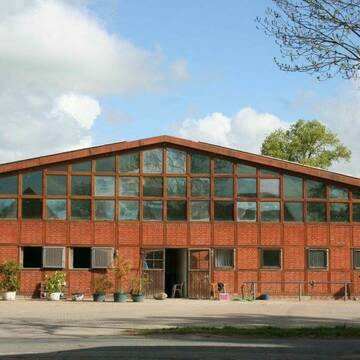
Erstbezug auf neuer Reitanlage
Bremen
Heike Klatte
@HeikeKlatte
Vermieten
Paddock
Parkplatz für Pferdeanhänger
Allergikerstall
Biofutter
9 weitere...
aktuell
P+


Offenstallplätze in Heilshorn/OHZ
Osterholz-Scharmbeck
Berend von Rex-Gröning
@Berend-von-Rex-Groening
Freizeitstall
Pferdeausbildung
Vermieten
Krankenbox
Longierzirkel/Roundpen
Offenstall
12 weitere...
S

Bremen-Borgfeld:traumhafte Idylle für Pferd+Reit...
Bremen
Dreamland
@Dreamland
Freizeitstall
Geländestrecke
Vermieten
Hunde willkommen
Longierzirkel/Roundpen
Pferdezucht
Zuchtstutenhaltung möglich
19 weitere...
ganz aktuell
P


freie Paddockboxen!
Bremen
Hubertus Reitverein Bremen e.V
@HubertusReitvereinBremen
FN-Mitglied
Freizeitstall
Vermieten
Longierzirkel/Roundpen
Paddock
Hufrehe geeignet
20 weitere...
P+

Boxenplatz und Offenstallplatz für Stute frei
Grasberg
Hof-Müller
@Hof-Mueller
Vermieten
Longierzirkel/Roundpen
Paddock
Offenstall
Halbpension
6 weitere...
P

Futtersack HeuToy, Fressbremse in pink
Mechtersen
STALL-FREIde Marketing
@STALL-FREI-Marketing
Stundenlange Beschäftigung die
Koliken vorbeugt, geringe Staubinhalation mit
steuerbarer Futterentnahme
Pferdepension Zur Wümme
Oyten nähe Bremen
Pferdepension Zur Wuemme
@Pferdepension-Zur-Wuemme
FN-Mitglied
Freizeitstall
Vermieten
Verpachten
Hunde willkommen
Krankenbox
Allergikerstall
bedampftes/gewaschenes Heu
31 weitere...
P+

Pferdezucht- / Springstall Bremen Timmersloh
Bremen
Fritz Tietjen
@HaferundHeu
Pferdeausbildung
Vermieten
Hunde willkommen
Krankenbox
Fohlenaufzucht möglich
Hengsthaltung möglich
18 weitere...
P

2 freie Offenstallplätze bei Worpswede
Worpswede
Herzfeldhof Worpswede
@Herzfeldhof-Worpswede
Offenstall
Paddock Trail
Vollpension
P

Traumanlage in Lilienthal hat Boxen frei!
Lilienthal
Veltenhof Stadtlander
@Veltenhof_Stadtlander
Freizeitstall
Gangpferdereiten
Vermieten
Führanlage
Laufband
Fohlenaufzucht möglich
Hengsthaltung möglich
23 weitere...
P
Deprecated: Creation of dynamic property Zend_View::$pageCount is deprecated in /var/www/stall-frei/htdocs/staging.stall-frei.de/library/vendor/shardj/zf1-future/library/Zend/View/Abstract.php on line 308
Deprecated: Creation of dynamic property Zend_View::$itemCountPerPage is deprecated in /var/www/stall-frei/htdocs/staging.stall-frei.de/library/vendor/shardj/zf1-future/library/Zend/View/Abstract.php on line 308
Deprecated: Creation of dynamic property Zend_View::$first is deprecated in /var/www/stall-frei/htdocs/staging.stall-frei.de/library/vendor/shardj/zf1-future/library/Zend/View/Abstract.php on line 308
Deprecated: Creation of dynamic property Zend_View::$current is deprecated in /var/www/stall-frei/htdocs/staging.stall-frei.de/library/vendor/shardj/zf1-future/library/Zend/View/Abstract.php on line 308
Deprecated: Creation of dynamic property Zend_View::$last is deprecated in /var/www/stall-frei/htdocs/staging.stall-frei.de/library/vendor/shardj/zf1-future/library/Zend/View/Abstract.php on line 308
Deprecated: Creation of dynamic property Zend_View::$next is deprecated in /var/www/stall-frei/htdocs/staging.stall-frei.de/library/vendor/shardj/zf1-future/library/Zend/View/Abstract.php on line 308
Deprecated: Creation of dynamic property Zend_View::$pagesInRange is deprecated in /var/www/stall-frei/htdocs/staging.stall-frei.de/library/vendor/shardj/zf1-future/library/Zend/View/Abstract.php on line 308
Deprecated: Creation of dynamic property Zend_View::$firstPageInRange is deprecated in /var/www/stall-frei/htdocs/staging.stall-frei.de/library/vendor/shardj/zf1-future/library/Zend/View/Abstract.php on line 308
Deprecated: Creation of dynamic property Zend_View::$lastPageInRange is deprecated in /var/www/stall-frei/htdocs/staging.stall-frei.de/library/vendor/shardj/zf1-future/library/Zend/View/Abstract.php on line 308
Deprecated: Creation of dynamic property Zend_View::$currentItemCount is deprecated in /var/www/stall-frei/htdocs/staging.stall-frei.de/library/vendor/shardj/zf1-future/library/Zend/View/Abstract.php on line 308
Deprecated: Creation of dynamic property Zend_View::$totalItemCount is deprecated in /var/www/stall-frei/htdocs/staging.stall-frei.de/library/vendor/shardj/zf1-future/library/Zend/View/Abstract.php on line 308
Deprecated: Creation of dynamic property Zend_View::$firstItemNumber is deprecated in /var/www/stall-frei/htdocs/staging.stall-frei.de/library/vendor/shardj/zf1-future/library/Zend/View/Abstract.php on line 308
Deprecated: Creation of dynamic property Zend_View::$lastItemNumber is deprecated in /var/www/stall-frei/htdocs/staging.stall-frei.de/library/vendor/shardj/zf1-future/library/Zend/View/Abstract.php on line 308
Deprecated: Creation of dynamic property Zend_View::$router is deprecated in /var/www/stall-frei/htdocs/staging.stall-frei.de/library/vendor/shardj/zf1-future/library/Zend/View/Abstract.php on line 308
Deprecated: Creation of dynamic property Zend_View::$urlParams is deprecated in /var/www/stall-frei/htdocs/staging.stall-frei.de/library/vendor/shardj/zf1-future/library/Zend/View/Abstract.php on line 308
Deprecated: Creation of dynamic property Zend_View::$showAds is deprecated in /var/www/stall-frei/htdocs/staging.stall-frei.de/library/vendor/shardj/zf1-future/library/Zend/View/Abstract.php on line 308
Deprecated: Creation of dynamic property Zend_View::$objectIds is deprecated in /var/www/stall-frei/htdocs/staging.stall-frei.de/library/vendor/shardj/zf1-future/library/Zend/View/Abstract.php on line 308
Deprecated: Creation of dynamic property Zend_View::$showNavbar is deprecated in /var/www/stall-frei/htdocs/staging.stall-frei.de/library/vendor/shardj/zf1-future/library/Zend/View/Abstract.php on line 308
Deprecated: Creation of dynamic property Zend_View::$showBreadcrumb is deprecated in /var/www/stall-frei/htdocs/staging.stall-frei.de/library/vendor/shardj/zf1-future/library/Zend/View/Abstract.php on line 308
Deprecated: Creation of dynamic property Zend_View::$showFooter is deprecated in /var/www/stall-frei/htdocs/staging.stall-frei.de/library/vendor/shardj/zf1-future/library/Zend/View/Abstract.php on line 308
Deprecated: Creation of dynamic property Zend_View::$showInternalAds is deprecated in /var/www/stall-frei/htdocs/staging.stall-frei.de/library/vendor/shardj/zf1-future/library/Zend/View/Abstract.php on line 308
Deprecated: Creation of dynamic property Zend_View::$blNoContent is deprecated in /var/www/stall-frei/htdocs/staging.stall-frei.de/library/vendor/shardj/zf1-future/library/Zend/View/Abstract.php on line 308
Deprecated: Creation of dynamic property Zend_View::$sMetaDesc is deprecated in /var/www/stall-frei/htdocs/staging.stall-frei.de/library/vendor/shardj/zf1-future/library/Zend/View/Abstract.php on line 308
Deprecated: Creation of dynamic property Zend_View::$useGmaps is deprecated in /var/www/stall-frei/htdocs/staging.stall-frei.de/library/vendor/shardj/zf1-future/library/Zend/View/Abstract.php on line 308
Deprecated: Creation of dynamic property Zend_View::$touches is deprecated in /var/www/stall-frei/htdocs/staging.stall-frei.de/library/vendor/shardj/zf1-future/library/Zend/View/Abstract.php on line 308
Deprecated: Creation of dynamic property Zend_View::$oProject is deprecated in /var/www/stall-frei/htdocs/staging.stall-frei.de/library/vendor/shardj/zf1-future/library/Zend/View/Abstract.php on line 308
Deprecated: Creation of dynamic property Zend_View::$pageHeadline is deprecated in /var/www/stall-frei/htdocs/staging.stall-frei.de/library/vendor/shardj/zf1-future/library/Zend/View/Abstract.php on line 308
Deprecated: Creation of dynamic property Zend_View::$disableLocationField is deprecated in /var/www/stall-frei/htdocs/staging.stall-frei.de/library/vendor/shardj/zf1-future/library/Zend/View/Abstract.php on line 308
Deprecated: Creation of dynamic property Zend_View::$isSearch is deprecated in /var/www/stall-frei/htdocs/staging.stall-frei.de/library/vendor/shardj/zf1-future/library/Zend/View/Abstract.php on line 308
Deprecated: Creation of dynamic property Zend_View::$pageTitle is deprecated in /var/www/stall-frei/htdocs/staging.stall-frei.de/library/vendor/shardj/zf1-future/library/Zend/View/Abstract.php on line 308
Deprecated: Creation of dynamic property Psf_Form_Element_Text::$class is deprecated in /var/www/stall-frei/htdocs/staging.stall-frei.de/library/vendor/shardj/zf1-future/library/Zend/Form/Element.php on line 874
Deprecated: Creation of dynamic property Psf_Form_Element_Text::$size is deprecated in /var/www/stall-frei/htdocs/staging.stall-frei.de/library/vendor/shardj/zf1-future/library/Zend/Form/Element.php on line 874
Deprecated: Creation of dynamic property Psf_Form_Element_Text::$placeholder is deprecated in /var/www/stall-frei/htdocs/staging.stall-frei.de/library/vendor/shardj/zf1-future/library/Zend/Form/Element.php on line 874
Deprecated: Creation of dynamic property Psf_Form_Element_Hidden::$class is deprecated in /var/www/stall-frei/htdocs/staging.stall-frei.de/library/vendor/shardj/zf1-future/library/Zend/Form/Element.php on line 874
Deprecated: Creation of dynamic property Psf_Form_Element_Hidden::$class is deprecated in /var/www/stall-frei/htdocs/staging.stall-frei.de/library/vendor/shardj/zf1-future/library/Zend/Form/Element.php on line 874
Deprecated: Creation of dynamic property Psf_Form_Element_Hidden::$class is deprecated in /var/www/stall-frei/htdocs/staging.stall-frei.de/library/vendor/shardj/zf1-future/library/Zend/Form/Element.php on line 874
Deprecated: Creation of dynamic property Psf_Form_Element_Hidden::$class is deprecated in /var/www/stall-frei/htdocs/staging.stall-frei.de/library/vendor/shardj/zf1-future/library/Zend/Form/Element.php on line 874
Deprecated: Creation of dynamic property Psf_Form_Element_Select::$class is deprecated in /var/www/stall-frei/htdocs/staging.stall-frei.de/library/vendor/shardj/zf1-future/library/Zend/Form/Element.php on line 874
Deprecated: Creation of dynamic property Psf_Form_Element_Select::$class is deprecated in /var/www/stall-frei/htdocs/staging.stall-frei.de/library/vendor/shardj/zf1-future/library/Zend/Form/Element.php on line 874
Deprecated: Creation of dynamic property Psf_Form_Element_Select::$class is deprecated in /var/www/stall-frei/htdocs/staging.stall-frei.de/library/vendor/shardj/zf1-future/library/Zend/Form/Element.php on line 874
Deprecated: Creation of dynamic property Psf_Form_Element_Select::$class is deprecated in /var/www/stall-frei/htdocs/staging.stall-frei.de/library/vendor/shardj/zf1-future/library/Zend/Form/Element.php on line 874
Deprecated: Creation of dynamic property Psf_Form_Element_Text::$class is deprecated in /var/www/stall-frei/htdocs/staging.stall-frei.de/library/vendor/shardj/zf1-future/library/Zend/Form/Element.php on line 874
Deprecated: Creation of dynamic property Psf_Form_Element_Checkbox::$label is deprecated in /var/www/stall-frei/htdocs/staging.stall-frei.de/library/vendor/shardj/zf1-future/library/Zend/Form/Element.php on line 874
Deprecated: Creation of dynamic property Zend_View::$sort is deprecated in /var/www/stall-frei/htdocs/staging.stall-frei.de/library/vendor/shardj/zf1-future/library/Zend/View/Abstract.php on line 308
Deprecated: Creation of dynamic property Zend_View::$searchLocation is deprecated in /var/www/stall-frei/htdocs/staging.stall-frei.de/library/vendor/shardj/zf1-future/library/Zend/View/Abstract.php on line 308
Deprecated: Creation of dynamic property Zend_View::$locationHint is deprecated in /var/www/stall-frei/htdocs/staging.stall-frei.de/library/vendor/shardj/zf1-future/library/Zend/View/Abstract.php on line 308
Psf_GeoCoder_Abstract::getLocation: Grasberg Get Location CachedOrLive
Psf_GeoCoder_Abstract::getCachedOrLive: Grasberg
Psf_GeoCoder_OpenCageData::makeApiRequest: response:
Array
(
[documentation] => https://opencagedata.com/api
[licenses] => Array
(
[0] => Array
(
[name] => see attribution guide
[url] => https://opencagedata.com/credits
)
)
[results] => Array
(
[0] => Array
(
[bounds] => Array
(
[northeast] => Array
(
[lat] => 53.2422592
[lng] => 9.071352
)
[southwest] => Array
(
[lat] => 53.1259641
[lng] => 8.9557715
)
)
[components] => Array
(
[ISO_3166-1_alpha-2] => DE
[ISO_3166-1_alpha-3] => DEU
[ISO_3166-2] => Array
(
[0] => DE-NI
)
[_category] => place
[_normalized_city] => Grasberg
[_type] => village
[continent] => Europe
[country] => Deutschland
[country_code] => de
[county] => Landkreis Osterholz
[political_union] => European Union
[postcode] => 28879
[state] => Niedersachsen
[state_code] => NI
[village] => Grasberg
)
[confidence] => 6
[formatted] => 28879 Grasberg, Deutschland
[geometry] => Array
(
[lat] => 53.1833007
[lng] => 8.9833276
)
)
[1] => Array
(
[bounds] => Array
(
[northeast] => Array
(
[lat] => 52.1649237
[lng] => 9.5644919
)
[southwest] => Array
(
[lat] => 52.1648237
[lng] => 9.5643919
)
)
[components] => Array
(
[ISO_3166-1_alpha-2] => DE
[ISO_3166-1_alpha-3] => DEU
[ISO_3166-2] => Array
(
[0] => DE-NI
)
[_category] => natural/water
[_normalized_city] => Springe
[_type] => peak
[continent] => Europe
[country] => Deutschland
[country_code] => de
[county] => Region Hannover
[peak] => Grasberg
[political_union] => European Union
[state] => Niedersachsen
[state_code] => NI
[town] => Springe
)
[confidence] => 9
[formatted] => Grasberg, Springe, Niedersachsen, Deutschland
[geometry] => Array
(
[lat] => 52.1648737
[lng] => 9.5644419
)
)
[2] => Array
(
[bounds] => Array
(
[northeast] => Array
(
[lat] => 47.5378561
[lng] => 11.3990734
)
[southwest] => Array
(
[lat] => 47.5377561
[lng] => 11.3989734
)
)
[components] => Array
(
[ISO_3166-1_alpha-2] => DE
[ISO_3166-1_alpha-3] => DEU
[ISO_3166-2] => Array
(
[0] => DE-BY
)
[_category] => natural/water
[_normalized_city] => Lenggries
[_type] => peak
[continent] => Europe
[country] => Deutschland
[country_code] => de
[county] => Landkreis Bad Tölz-Wolfratshausen
[peak] => Grasberg
[political_union] => European Union
[state] => Bayern
[state_code] => BY
[town] => Lenggries
)
[confidence] => 9
[formatted] => Grasberg, Lenggries, Bayern, Deutschland
[geometry] => Array
(
[lat] => 47.5378061
[lng] => 11.3990234
)
)
[3] => Array
(
[bounds] => Array
(
[northeast] => Array
(
[lat] => 50.6700376
[lng] => 10.3058258
)
[southwest] => Array
(
[lat] => 50.6699376
[lng] => 10.3057258
)
)
[components] => Array
(
[ISO_3166-1_alpha-2] => DE
[ISO_3166-1_alpha-3] => DEU
[ISO_3166-2] => Array
(
[0] => DE-TH
)
[_category] => natural/water
[_normalized_city] => Schwallungen
[_type] => peak
[continent] => Europe
[country] => Deutschland
[country_code] => de
[county] => Landkreis Schmalkalden-Meiningen
[municipality] => Wasungen-Amt Sand
[peak] => Grasberg
[political_union] => European Union
[postcode] => 98590
[state] => Thüringen
[state_code] => TH
[town] => Schwallungen
)
[confidence] => 9
[formatted] => Grasberg, 98590 Schwallungen, Deutschland
[geometry] => Array
(
[lat] => 50.6699876
[lng] => 10.3057758
)
)
[4] => Array
(
[bounds] => Array
(
[northeast] => Array
(
[lat] => 50.61535
[lng] => 6.3882233
)
[southwest] => Array
(
[lat] => 50.61525
[lng] => 6.3881233
)
)
[components] => Array
(
[ISO_3166-1_alpha-2] => DE
[ISO_3166-1_alpha-3] => DEU
[ISO_3166-2] => Array
(
[0] => DE-NW
)
[_category] => natural/water
[_normalized_city] => Simmerath
[_type] => peak
[continent] => Europe
[country] => Deutschland
[country_code] => de
[county] => Städteregion Aachen
[peak] => Grasberg
[political_union] => European Union
[state] => Nordrhein-Westfalen
[state_code] => NW
[town] => Simmerath
)
[confidence] => 9
[formatted] => Grasberg, Simmerath, Nordrhein-Westfalen, Deutschland
[geometry] => Array
(
[lat] => 50.6153
[lng] => 6.3881733
)
)
[5] => Array
(
[bounds] => Array
(
[northeast] => Array
(
[lat] => 48.4986744
[lng] => 9.2980098
)
[southwest] => Array
(
[lat] => 48.4985744
[lng] => 9.2979098
)
)
[components] => Array
(
[ISO_3166-1_alpha-2] => DE
[ISO_3166-1_alpha-3] => DEU
[ISO_3166-2] => Array
(
[0] => DE-BW
)
[_category] => natural/water
[_normalized_city] => Metzingen
[_type] => peak
[continent] => Europe
[country] => Deutschland
[country_code] => de
[county] => Landkreis Reutlingen
[municipality] => VVG der Stadt Metzingen
[peak] => Grasberg
[political_union] => European Union
[postcode] => 72555
[state] => Baden-Württemberg
[state_code] => BW
[town] => Metzingen
)
[confidence] => 9
[formatted] => Grasberg, 72555 Metzingen, Deutschland
[geometry] => Array
(
[lat] => 48.4986244
[lng] => 9.2979598
)
)
[6] => Array
(
[bounds] => Array
(
[northeast] => Array
(
[lat] => 50.4886032
[lng] => 7.603176
)
[southwest] => Array
(
[lat] => 50.4885032
[lng] => 7.603076
)
)
[components] => Array
(
[ISO_3166-1_alpha-2] => DE
[ISO_3166-1_alpha-3] => DEU
[ISO_3166-2] => Array
(
[0] => DE-RP
)
[_category] => natural/water
[_normalized_city] => Großmaischeid
[_type] => peak
[continent] => Europe
[country] => Deutschland
[country_code] => de
[county] => Landkreis Neuwied
[municipality] => Dierdorf
[peak] => Grasberg
[political_union] => European Union
[postcode] => 56276
[state] => Rheinland-Pfalz
[state_code] => RP
[village] => Großmaischeid
)
[confidence] => 9
[formatted] => Grasberg, 56276 Großmaischeid, Deutschland
[geometry] => Array
(
[lat] => 50.4885532
[lng] => 7.603126
)
)
[7] => Array
(
[bounds] => Array
(
[northeast] => Array
(
[lat] => 49.5863153
[lng] => 9.6446354
)
[southwest] => Array
(
[lat] => 49.5862153
[lng] => 9.6445354
)
)
[components] => Array
(
[ISO_3166-1_alpha-2] => DE
[ISO_3166-1_alpha-3] => DEU
[ISO_3166-2] => Array
(
[0] => DE-BW
)
[_category] => natural/water
[_normalized_city] => Tauberbischofsheim
[_type] => peak
[continent] => Europe
[country] => Deutschland
[country_code] => de
[county] => Main-Tauber-Kreis
[municipality] => VVG der Stadt Tauberbischofsheim
[peak] => Grasberg
[political_union] => European Union
[postcode] => 97941
[state] => Baden-Württemberg
[state_code] => BW
[town] => Tauberbischofsheim
)
[confidence] => 9
[formatted] => Grasberg, 97941 Tauberbischofsheim, Deutschland
[geometry] => Array
(
[lat] => 49.5862653
[lng] => 9.6445854
)
)
[8] => Array
(
[bounds] => Array
(
[northeast] => Array
(
[lat] => 49.7818369
[lng] => 8.7823102
)
[southwest] => Array
(
[lat] => 49.7817369
[lng] => 8.7822102
)
)
[components] => Array
(
[ISO_3166-1_alpha-2] => DE
[ISO_3166-1_alpha-3] => DEU
[ISO_3166-2] => Array
(
[0] => DE-HE
)
[_category] => natural/water
[_normalized_city] => Rodau
[_type] => peak
[continent] => Europe
[country] => Deutschland
[country_code] => de
[county] => Landkreis Darmstadt-Dieburg
[municipality] => Groß-Bieberau
[peak] => Grasberg
[political_union] => European Union
[postcode] => 64405
[state] => Hessen
[state_code] => HE
[village] => Rodau
)
[confidence] => 9
[formatted] => Grasberg, 64405 Rodau, Deutschland
[geometry] => Array
(
[lat] => 49.7817869
[lng] => 8.7822602
)
)
[9] => Array
(
[bounds] => Array
(
[northeast] => Array
(
[lat] => 50.7145371
[lng] => 10.4544719
)
[southwest] => Array
(
[lat] => 50.7144371
[lng] => 10.4543719
)
)
[components] => Array
(
[ISO_3166-1_alpha-2] => DE
[ISO_3166-1_alpha-3] => DEU
[ISO_3166-2] => Array
(
[0] => DE-TH
)
[_category] => natural/water
[_normalized_city] => Schmalkalden
[_type] => peak
[continent] => Europe
[country] => Deutschland
[country_code] => de
[county] => Landkreis Schmalkalden-Meiningen
[peak] => Grasberg
[political_union] => European Union
[postcode] => 98574
[state] => Thüringen
[state_code] => TH
[town] => Schmalkalden
)
[confidence] => 9
[formatted] => Grasberg, 98574 Schmalkalden, Deutschland
[geometry] => Array
(
[lat] => 50.7144871
[lng] => 10.4544219
)
)
)
[status] => Array
(
[code] => 200
[message] => OK
)
[stay_informed] => Array
(
[blog] => https://blog.opencagedata.com
[mastodon] => https://en.osm.town/@opencage
)
[thanks] => For using an OpenCage API
[timestamp] => Array
(
[created_http] => Sun, 08 Feb 2026 14:23:42 GMT
[created_unix] => 1770560622
)
[total_results] => 10
)
Psf_GeoCoder_Abstract::convertLocationResult
{"documentation":"https:\/\/opencagedata.com\/api","licenses":[{"name":"see attribution guide","url":"https:\/\/opencagedata.com\/credits"}],"results":[{"bounds":{"northeast":{"lat":53.2422592,"lng":9.071352},"southwest":{"lat":53.1259641,"lng":8.9557715}},"components":{"ISO_3166-1_alpha-2":"DE","ISO_3166-1_alpha-3":"DEU","ISO_3166-2":["DE-NI"],"_category":"place","_normalized_city":"Grasberg","_type":"village","continent":"Europe","country":"Deutschland","country_code":"de","county":"Landkreis Osterholz","political_union":"European Union","postcode":"28879","state":"Niedersachsen","state_code":"NI","village":"Grasberg"},"confidence":6,"formatted":"28879 Grasberg, Deutschland","geometry":{"lat":53.1833007,"lng":8.9833276}},{"bounds":{"northeast":{"lat":52.1649237,"lng":9.5644919},"southwest":{"lat":52.1648237,"lng":9.5643919}},"components":{"ISO_3166-1_alpha-2":"DE","ISO_3166-1_alpha-3":"DEU","ISO_3166-2":["DE-NI"],"_category":"natural\/water","_normalized_city":"Springe","_type":"peak","continent":"Europe","country":"Deutschland","country_code":"de","county":"Region Hannover","peak":"Grasberg","political_union":"European Union","state":"Niedersachsen","state_code":"NI","town":"Springe"},"confidence":9,"formatted":"Grasberg, Springe, Niedersachsen, Deutschland","geometry":{"lat":52.1648737,"lng":9.5644419}},{"bounds":{"northeast":{"lat":47.5378561,"lng":11.3990734},"southwest":{"lat":47.5377561,"lng":11.3989734}},"components":{"ISO_3166-1_alpha-2":"DE","ISO_3166-1_alpha-3":"DEU","ISO_3166-2":["DE-BY"],"_category":"natural\/water","_normalized_city":"Lenggries","_type":"peak","continent":"Europe","country":"Deutschland","country_code":"de","county":"Landkreis Bad T\u00f6lz-Wolfratshausen","peak":"Grasberg","political_union":"European Union","state":"Bayern","state_code":"BY","town":"Lenggries"},"confidence":9,"formatted":"Grasberg, Lenggries, Bayern, Deutschland","geometry":{"lat":47.5378061,"lng":11.3990234}},{"bounds":{"northeast":{"lat":50.6700376,"lng":10.3058258},"southwest":{"lat":50.6699376,"lng":10.3057258}},"components":{"ISO_3166-1_alpha-2":"DE","ISO_3166-1_alpha-3":"DEU","ISO_3166-2":["DE-TH"],"_category":"natural\/water","_normalized_city":"Schwallungen","_type":"peak","continent":"Europe","country":"Deutschland","country_code":"de","county":"Landkreis Schmalkalden-Meiningen","municipality":"Wasungen-Amt Sand","peak":"Grasberg","political_union":"European Union","postcode":"98590","state":"Th\u00fcringen","state_code":"TH","town":"Schwallungen"},"confidence":9,"formatted":"Grasberg, 98590 Schwallungen, Deutschland","geometry":{"lat":50.6699876,"lng":10.3057758}},{"bounds":{"northeast":{"lat":50.61535,"lng":6.3882233},"southwest":{"lat":50.61525,"lng":6.3881233}},"components":{"ISO_3166-1_alpha-2":"DE","ISO_3166-1_alpha-3":"DEU","ISO_3166-2":["DE-NW"],"_category":"natural\/water","_normalized_city":"Simmerath","_type":"peak","continent":"Europe","country":"Deutschland","country_code":"de","county":"St\u00e4dteregion Aachen","peak":"Grasberg","political_union":"European Union","state":"Nordrhein-Westfalen","state_code":"NW","town":"Simmerath"},"confidence":9,"formatted":"Grasberg, Simmerath, Nordrhein-Westfalen, Deutschland","geometry":{"lat":50.6153,"lng":6.3881733}},{"bounds":{"northeast":{"lat":48.4986744,"lng":9.2980098},"southwest":{"lat":48.4985744,"lng":9.2979098}},"components":{"ISO_3166-1_alpha-2":"DE","ISO_3166-1_alpha-3":"DEU","ISO_3166-2":["DE-BW"],"_category":"natural\/water","_normalized_city":"Metzingen","_type":"peak","continent":"Europe","country":"Deutschland","country_code":"de","county":"Landkreis Reutlingen","municipality":"VVG der Stadt Metzingen","peak":"Grasberg","political_union":"European Union","postcode":"72555","state":"Baden-W\u00fcrttemberg","state_code":"BW","town":"Metzingen"},"confidence":9,"formatted":"Grasberg, 72555 Metzingen, Deutschland","geometry":{"lat":48.4986244,"lng":9.2979598}},{"bounds":{"northeast":{"lat":50.4886032,"lng":7.603176},"southwest":{"lat":50.4885032,"lng":7.603076}},"components":{"ISO_3166-1_alpha-2":"DE","ISO_3166-1_alpha-3":"DEU","ISO_3166-2":["DE-RP"],"_category":"natural\/water","_normalized_city":"Gro\u00dfmaischeid","_type":"peak","continent":"Europe","country":"Deutschland","country_code":"de","county":"Landkreis Neuwied","municipality":"Dierdorf","peak":"Grasberg","political_union":"European Union","postcode":"56276","state":"Rheinland-Pfalz","state_code":"RP","village":"Gro\u00dfmaischeid"},"confidence":9,"formatted":"Grasberg, 56276 Gro\u00dfmaischeid, Deutschland","geometry":{"lat":50.4885532,"lng":7.603126}},{"bounds":{"northeast":{"lat":49.5863153,"lng":9.6446354},"southwest":{"lat":49.5862153,"lng":9.6445354}},"components":{"ISO_3166-1_alpha-2":"DE","ISO_3166-1_alpha-3":"DEU","ISO_3166-2":["DE-BW"],"_category":"natural\/water","_normalized_city":"Tauberbischofsheim","_type":"peak","continent":"Europe","country":"Deutschland","country_code":"de","county":"Main-Tauber-Kreis","municipality":"VVG der Stadt Tauberbischofsheim","peak":"Grasberg","political_union":"European Union","postcode":"97941","state":"Baden-W\u00fcrttemberg","state_code":"BW","town":"Tauberbischofsheim"},"confidence":9,"formatted":"Grasberg, 97941 Tauberbischofsheim, Deutschland","geometry":{"lat":49.5862653,"lng":9.6445854}},{"bounds":{"northeast":{"lat":49.7818369,"lng":8.7823102},"southwest":{"lat":49.7817369,"lng":8.7822102}},"components":{"ISO_3166-1_alpha-2":"DE","ISO_3166-1_alpha-3":"DEU","ISO_3166-2":["DE-HE"],"_category":"natural\/water","_normalized_city":"Rodau","_type":"peak","continent":"Europe","country":"Deutschland","country_code":"de","county":"Landkreis Darmstadt-Dieburg","municipality":"Gro\u00df-Bieberau","peak":"Grasberg","political_union":"European Union","postcode":"64405","state":"Hessen","state_code":"HE","village":"Rodau"},"confidence":9,"formatted":"Grasberg, 64405 Rodau, Deutschland","geometry":{"lat":49.7817869,"lng":8.7822602}},{"bounds":{"northeast":{"lat":50.7145371,"lng":10.4544719},"southwest":{"lat":50.7144371,"lng":10.4543719}},"components":{"ISO_3166-1_alpha-2":"DE","ISO_3166-1_alpha-3":"DEU","ISO_3166-2":["DE-TH"],"_category":"natural\/water","_normalized_city":"Schmalkalden","_type":"peak","continent":"Europe","country":"Deutschland","country_code":"de","county":"Landkreis Schmalkalden-Meiningen","peak":"Grasberg","political_union":"European Union","postcode":"98574","state":"Th\u00fcringen","state_code":"TH","town":"Schmalkalden"},"confidence":9,"formatted":"Grasberg, 98574 Schmalkalden, Deutschland","geometry":{"lat":50.7144871,"lng":10.4544219}}],"status":{"code":200,"message":"OK"},"stay_informed":{"blog":"https:\/\/blog.opencagedata.com","mastodon":"https:\/\/en.osm.town\/@opencage"},"thanks":"For using an OpenCage API","timestamp":{"created_http":"Sun, 08 Feb 2026 14:23:42 GMT","created_unix":1770560622},"total_results":10}Array
(
[0] => stdClass Object
(
[bounds] => stdClass Object
(
[northeast] => stdClass Object
(
[lat] => 53.2422592
[lng] => 9.071352
)
[southwest] => stdClass Object
(
[lat] => 53.1259641
[lng] => 8.9557715
)
)
[components] => stdClass Object
(
[ISO_3166-1_alpha-2] => DE
[ISO_3166-1_alpha-3] => DEU
[ISO_3166-2] => Array
(
[0] => DE-NI
)
[_category] => place
[_normalized_city] => Grasberg
[_type] => village
[continent] => Europe
[country] => Deutschland
[country_code] => de
[county] => Landkreis Osterholz
[political_union] => European Union
[postcode] => 28879
[state] => Niedersachsen
[state_code] => NI
[village] => Grasberg
)
[confidence] => 6
[formatted] => 28879 Grasberg, Deutschland
[geometry] => stdClass Object
(
[lat] => 53.1833007
[lng] => 8.9833276
)
)
[1] => stdClass Object
(
[bounds] => stdClass Object
(
[northeast] => stdClass Object
(
[lat] => 52.1649237
[lng] => 9.5644919
)
[southwest] => stdClass Object
(
[lat] => 52.1648237
[lng] => 9.5643919
)
)
[components] => stdClass Object
(
[ISO_3166-1_alpha-2] => DE
[ISO_3166-1_alpha-3] => DEU
[ISO_3166-2] => Array
(
[0] => DE-NI
)
[_category] => natural/water
[_normalized_city] => Springe
[_type] => peak
[continent] => Europe
[country] => Deutschland
[country_code] => de
[county] => Region Hannover
[peak] => Grasberg
[political_union] => European Union
[state] => Niedersachsen
[state_code] => NI
[town] => Springe
)
[confidence] => 9
[formatted] => Grasberg, Springe, Niedersachsen, Deutschland
[geometry] => stdClass Object
(
[lat] => 52.1648737
[lng] => 9.5644419
)
)
[2] => stdClass Object
(
[bounds] => stdClass Object
(
[northeast] => stdClass Object
(
[lat] => 47.5378561
[lng] => 11.3990734
)
[southwest] => stdClass Object
(
[lat] => 47.5377561
[lng] => 11.3989734
)
)
[components] => stdClass Object
(
[ISO_3166-1_alpha-2] => DE
[ISO_3166-1_alpha-3] => DEU
[ISO_3166-2] => Array
(
[0] => DE-BY
)
[_category] => natural/water
[_normalized_city] => Lenggries
[_type] => peak
[continent] => Europe
[country] => Deutschland
[country_code] => de
[county] => Landkreis Bad Tölz-Wolfratshausen
[peak] => Grasberg
[political_union] => European Union
[state] => Bayern
[state_code] => BY
[town] => Lenggries
)
[confidence] => 9
[formatted] => Grasberg, Lenggries, Bayern, Deutschland
[geometry] => stdClass Object
(
[lat] => 47.5378061
[lng] => 11.3990234
)
)
[3] => stdClass Object
(
[bounds] => stdClass Object
(
[northeast] => stdClass Object
(
[lat] => 50.6700376
[lng] => 10.3058258
)
[southwest] => stdClass Object
(
[lat] => 50.6699376
[lng] => 10.3057258
)
)
[components] => stdClass Object
(
[ISO_3166-1_alpha-2] => DE
[ISO_3166-1_alpha-3] => DEU
[ISO_3166-2] => Array
(
[0] => DE-TH
)
[_category] => natural/water
[_normalized_city] => Schwallungen
[_type] => peak
[continent] => Europe
[country] => Deutschland
[country_code] => de
[county] => Landkreis Schmalkalden-Meiningen
[municipality] => Wasungen-Amt Sand
[peak] => Grasberg
[political_union] => European Union
[postcode] => 98590
[state] => Thüringen
[state_code] => TH
[town] => Schwallungen
)
[confidence] => 9
[formatted] => Grasberg, 98590 Schwallungen, Deutschland
[geometry] => stdClass Object
(
[lat] => 50.6699876
[lng] => 10.3057758
)
)
[4] => stdClass Object
(
[bounds] => stdClass Object
(
[northeast] => stdClass Object
(
[lat] => 50.61535
[lng] => 6.3882233
)
[southwest] => stdClass Object
(
[lat] => 50.61525
[lng] => 6.3881233
)
)
[components] => stdClass Object
(
[ISO_3166-1_alpha-2] => DE
[ISO_3166-1_alpha-3] => DEU
[ISO_3166-2] => Array
(
[0] => DE-NW
)
[_category] => natural/water
[_normalized_city] => Simmerath
[_type] => peak
[continent] => Europe
[country] => Deutschland
[country_code] => de
[county] => Städteregion Aachen
[peak] => Grasberg
[political_union] => European Union
[state] => Nordrhein-Westfalen
[state_code] => NW
[town] => Simmerath
)
[confidence] => 9
[formatted] => Grasberg, Simmerath, Nordrhein-Westfalen, Deutschland
[geometry] => stdClass Object
(
[lat] => 50.6153
[lng] => 6.3881733
)
)
[5] => stdClass Object
(
[bounds] => stdClass Object
(
[northeast] => stdClass Object
(
[lat] => 48.4986744
[lng] => 9.2980098
)
[southwest] => stdClass Object
(
[lat] => 48.4985744
[lng] => 9.2979098
)
)
[components] => stdClass Object
(
[ISO_3166-1_alpha-2] => DE
[ISO_3166-1_alpha-3] => DEU
[ISO_3166-2] => Array
(
[0] => DE-BW
)
[_category] => natural/water
[_normalized_city] => Metzingen
[_type] => peak
[continent] => Europe
[country] => Deutschland
[country_code] => de
[county] => Landkreis Reutlingen
[municipality] => VVG der Stadt Metzingen
[peak] => Grasberg
[political_union] => European Union
[postcode] => 72555
[state] => Baden-Württemberg
[state_code] => BW
[town] => Metzingen
)
[confidence] => 9
[formatted] => Grasberg, 72555 Metzingen, Deutschland
[geometry] => stdClass Object
(
[lat] => 48.4986244
[lng] => 9.2979598
)
)
[6] => stdClass Object
(
[bounds] => stdClass Object
(
[northeast] => stdClass Object
(
[lat] => 50.4886032
[lng] => 7.603176
)
[southwest] => stdClass Object
(
[lat] => 50.4885032
[lng] => 7.603076
)
)
[components] => stdClass Object
(
[ISO_3166-1_alpha-2] => DE
[ISO_3166-1_alpha-3] => DEU
[ISO_3166-2] => Array
(
[0] => DE-RP
)
[_category] => natural/water
[_normalized_city] => Großmaischeid
[_type] => peak
[continent] => Europe
[country] => Deutschland
[country_code] => de
[county] => Landkreis Neuwied
[municipality] => Dierdorf
[peak] => Grasberg
[political_union] => European Union
[postcode] => 56276
[state] => Rheinland-Pfalz
[state_code] => RP
[village] => Großmaischeid
)
[confidence] => 9
[formatted] => Grasberg, 56276 Großmaischeid, Deutschland
[geometry] => stdClass Object
(
[lat] => 50.4885532
[lng] => 7.603126
)
)
[7] => stdClass Object
(
[bounds] => stdClass Object
(
[northeast] => stdClass Object
(
[lat] => 49.5863153
[lng] => 9.6446354
)
[southwest] => stdClass Object
(
[lat] => 49.5862153
[lng] => 9.6445354
)
)
[components] => stdClass Object
(
[ISO_3166-1_alpha-2] => DE
[ISO_3166-1_alpha-3] => DEU
[ISO_3166-2] => Array
(
[0] => DE-BW
)
[_category] => natural/water
[_normalized_city] => Tauberbischofsheim
[_type] => peak
[continent] => Europe
[country] => Deutschland
[country_code] => de
[county] => Main-Tauber-Kreis
[municipality] => VVG der Stadt Tauberbischofsheim
[peak] => Grasberg
[political_union] => European Union
[postcode] => 97941
[state] => Baden-Württemberg
[state_code] => BW
[town] => Tauberbischofsheim
)
[confidence] => 9
[formatted] => Grasberg, 97941 Tauberbischofsheim, Deutschland
[geometry] => stdClass Object
(
[lat] => 49.5862653
[lng] => 9.6445854
)
)
[8] => stdClass Object
(
[bounds] => stdClass Object
(
[northeast] => stdClass Object
(
[lat] => 49.7818369
[lng] => 8.7823102
)
[southwest] => stdClass Object
(
[lat] => 49.7817369
[lng] => 8.7822102
)
)
[components] => stdClass Object
(
[ISO_3166-1_alpha-2] => DE
[ISO_3166-1_alpha-3] => DEU
[ISO_3166-2] => Array
(
[0] => DE-HE
)
[_category] => natural/water
[_normalized_city] => Rodau
[_type] => peak
[continent] => Europe
[country] => Deutschland
[country_code] => de
[county] => Landkreis Darmstadt-Dieburg
[municipality] => Groß-Bieberau
[peak] => Grasberg
[political_union] => European Union
[postcode] => 64405
[state] => Hessen
[state_code] => HE
[village] => Rodau
)
[confidence] => 9
[formatted] => Grasberg, 64405 Rodau, Deutschland
[geometry] => stdClass Object
(
[lat] => 49.7817869
[lng] => 8.7822602
)
)
[9] => stdClass Object
(
[bounds] => stdClass Object
(
[northeast] => stdClass Object
(
[lat] => 50.7145371
[lng] => 10.4544719
)
[southwest] => stdClass Object
(
[lat] => 50.7144371
[lng] => 10.4543719
)
)
[components] => stdClass Object
(
[ISO_3166-1_alpha-2] => DE
[ISO_3166-1_alpha-3] => DEU
[ISO_3166-2] => Array
(
[0] => DE-TH
)
[_category] => natural/water
[_normalized_city] => Schmalkalden
[_type] => peak
[continent] => Europe
[country] => Deutschland
[country_code] => de
[county] => Landkreis Schmalkalden-Meiningen
[peak] => Grasberg
[political_union] => European Union
[postcode] => 98574
[state] => Thüringen
[state_code] => TH
[town] => Schmalkalden
)
[confidence] => 9
[formatted] => Grasberg, 98574 Schmalkalden, Deutschland
[geometry] => stdClass Object
(
[lat] => 50.7144871
[lng] => 10.4544219
)
)
)
Psf_GeoCoder_OpenCageData::getKeyMap: 0
stdClass Object
(
    [bounds] => stdClass Object
        (
            [northeast] => stdClass Object
                (
                    [lat] => 53.2422592
                    [lng] => 9.071352
                )

            [southwest] => stdClass Object
                (
                    [lat] => 53.1259641
                    [lng] => 8.9557715
                )

        )

    [components] => stdClass Object
        (
            [ISO_3166-1_alpha-2] => DE
            [ISO_3166-1_alpha-3] => DEU
            [ISO_3166-2] => Array
                (
                    [0] => DE-NI
                )

            [_category] => place
            [_normalized_city] => Grasberg
            [_type] => village
            [continent] => Europe
            [country] => Deutschland
            [country_code] => de
            [county] => Landkreis Osterholz
            [political_union] => European Union
            [postcode] => 28879
            [state] => Niedersachsen
            [state_code] => NI
            [village] => Grasberg
        )

    [confidence] => 6
    [formatted] => 28879 Grasberg, Deutschland
    [geometry] => stdClass Object
        (
            [lat] => 53.1833007
            [lng] => 8.9833276
        )

)
Psf_GeoCoder_OpenCageData::getCounty: Osterholz
Psf_GeoCoder_OpenCageData::addMissingData REFETCH!
Array
(
    [address] => 28879 Grasberg, Deutschland
    [type] => village
    [street] =>
    [city] => Grasberg
    [county] => Osterholz
    [state] => Niedersachsen
    [zip] => 28879
    [country] => Deutschland
    [suburb] =>
    [countrycode] => de
    [latitude] => 53.1833007
    [longitude] => 8.9833276
    [accuracy] => 1
    [confidence] => 6
    [bounds] => stdClass Object
        (
            [northeast] => stdClass Object
                (
                    [lat] => 53.2422592
                    [lng] => 9.071352
                )

            [southwest] => stdClass Object
                (
                    [lat] => 53.1259641
                    [lng] => 8.9557715
                )

        )

)
reformat!
Array
(
    [address] => 28879 Grasberg, Deutschland
    [type] => village
    [street] =>
    [city] => Grasberg
    [county] => Osterholz
    [state] => Niedersachsen
    [zip] => 28879
    [country] => Deutschland
    [suburb] =>
    [countrycode] => de
    [latitude] => 53.1833007
    [longitude] => 8.9833276
    [accuracy] => 1
    [confidence] => 6
    [bounds] => stdClass Object
        (
            [northeast] => stdClass Object
                (
                    [lat] => 53.2422592
                    [lng] => 9.071352
                )

            [southwest] => stdClass Object
                (
                    [lat] => 53.1259641
                    [lng] => 8.9557715
                )

        )

    [place] => 28879 Grasberg, Niedersachsen
    [hash] => c38822f68785c80b9a2fe0df9cc7af3b
)
Psf_GeoCoder_OpenCageData::getKeyMap: 1
stdClass Object
(
    [bounds] => stdClass Object
        (
            [northeast] => stdClass Object
                (
                    [lat] => 52.1649237
                    [lng] => 9.5644919
                )

            [southwest] => stdClass Object
                (
                    [lat] => 52.1648237
                    [lng] => 9.5643919
                )

        )

    [components] => stdClass Object
        (
            [ISO_3166-1_alpha-2] => DE
            [ISO_3166-1_alpha-3] => DEU
            [ISO_3166-2] => Array
                (
                    [0] => DE-NI
                )

            [_category] => natural/water
            [_normalized_city] => Springe
            [_type] => peak
            [continent] => Europe
            [country] => Deutschland
            [country_code] => de
            [county] => Region Hannover
            [peak] => Grasberg
            [political_union] => European Union
            [state] => Niedersachsen
            [state_code] => NI
            [town] => Springe
        )

    [confidence] => 9
    [formatted] => Grasberg, Springe, Niedersachsen, Deutschland
    [geometry] => stdClass Object
        (
            [lat] => 52.1648737
            [lng] => 9.5644419
        )

)
Psf_GeoCoder_OpenCageData::getCounty: Hannover
Psf_GeoCoder_OpenCageData::addMissingData REFETCH!
Array
(
    [address] => Grasberg, Springe, Niedersachsen, Deutschland
    [type] => peak
    [street] =>
    [city] => Springe
    [county] => Hannover
    [state] => Niedersachsen
    [zip] =>
    [country] => Deutschland
    [suburb] =>
    [countrycode] => de
    [latitude] => 52.1648737
    [longitude] => 9.5644419
    [accuracy] => 1
    [confidence] => 9
    [bounds] => stdClass Object
        (
            [northeast] => stdClass Object
                (
                    [lat] => 52.1649237
                    [lng] => 9.5644919
                )

            [southwest] => stdClass Object
                (
                    [lat] => 52.1648237
                    [lng] => 9.5643919
                )

        )

)
reformat!
Array
(
    [address] => Grasberg, Springe, Niedersachsen, Deutschland
    [type] => peak
    [street] =>
    [city] => Springe
    [county] => Hannover
    [state] => Niedersachsen
    [zip] =>
    [country] => Deutschland
    [suburb] =>
    [countrycode] => de
    [latitude] => 52.1648737
    [longitude] => 9.5644419
    [accuracy] => 1
    [confidence] => 9
    [bounds] => stdClass Object
        (
            [northeast] => stdClass Object
                (
                    [lat] => 52.1649237
                    [lng] => 9.5644919
                )

            [southwest] => stdClass Object
                (
                    [lat] => 52.1648237
                    [lng] => 9.5643919
                )

        )

    [place] => Springe, Niedersachsen
    [hash] => be1a1d1477d1dd93bee24fdca61a38a1
)
Psf_GeoCoder_OpenCageData::getKeyMap: 2
stdClass Object
(
    [bounds] => stdClass Object
        (
            [northeast] => stdClass Object
                (
                    [lat] => 47.5378561
                    [lng] => 11.3990734
                )

            [southwest] => stdClass Object
                (
                    [lat] => 47.5377561
                    [lng] => 11.3989734
                )

        )

    [components] => stdClass Object
        (
            [ISO_3166-1_alpha-2] => DE
            [ISO_3166-1_alpha-3] => DEU
            [ISO_3166-2] => Array
                (
                    [0] => DE-BY
                )

            [_category] => natural/water
            [_normalized_city] => Lenggries
            [_type] => peak
            [continent] => Europe
            [country] => Deutschland
            [country_code] => de
            [county] => Landkreis Bad Tölz-Wolfratshausen
            [peak] => Grasberg
            [political_union] => European Union
            [state] => Bayern
            [state_code] => BY
            [town] => Lenggries
        )

    [confidence] => 9
    [formatted] => Grasberg, Lenggries, Bayern, Deutschland
    [geometry] => stdClass Object
        (
            [lat] => 47.5378061
            [lng] => 11.3990234
        )

)
Psf_GeoCoder_OpenCageData::getCounty: Bad Tölz-Wolfratshausen
Psf_GeoCoder_OpenCageData::addMissingData REFETCH!
Array
(
    [address] => Grasberg, Lenggries, Bayern, Deutschland
    [type] => peak
    [street] =>
    [city] => Lenggries
    [county] => Bad Tölz-Wolfratshausen
    [state] => Bayern
    [zip] =>
    [country] => Deutschland
    [suburb] =>
    [countrycode] => de
    [latitude] => 47.5378061
    [longitude] => 11.3990234
    [accuracy] => 1
    [confidence] => 9
    [bounds] => stdClass Object
        (
            [northeast] => stdClass Object
                (
                    [lat] => 47.5378561
                    [lng] => 11.3990734
                )

            [southwest] => stdClass Object
                (
                    [lat] => 47.5377561
                    [lng] => 11.3989734
                )

        )

)
reformat!
Array
(
    [address] => Grasberg, Lenggries, Bayern, Deutschland
    [type] => peak
    [street] =>
    [city] => Lenggries
    [county] => Bad Tölz-Wolfratshausen
    [state] => Bayern
    [zip] =>
    [country] => Deutschland
    [suburb] =>
    [countrycode] => de
    [latitude] => 47.5378061
    [longitude] => 11.3990234
    [accuracy] => 1
    [confidence] => 9
    [bounds] => stdClass Object
        (
            [northeast] => stdClass Object
                (
                    [lat] => 47.5378561
                    [lng] => 11.3990734
                )

            [southwest] => stdClass Object
                (
                    [lat] => 47.5377561
                    [lng] => 11.3989734
                )

        )

    [place] => Lenggries, Bayern
    [hash] => 7b83c4d250f724db7e3f92a0cb6ae9af
)
Psf_GeoCoder_OpenCageData::getKeyMap: 3
stdClass Object
(
    [bounds] => stdClass Object
        (
            [northeast] => stdClass Object
                (
                    [lat] => 50.6700376
                    [lng] => 10.3058258
                )

            [southwest] => stdClass Object
                (
                    [lat] => 50.6699376
                    [lng] => 10.3057258
                )

        )

    [components] => stdClass Object
        (
            [ISO_3166-1_alpha-2] => DE
            [ISO_3166-1_alpha-3] => DEU
            [ISO_3166-2] => Array
                (
                    [0] => DE-TH
                )

            [_category] => natural/water
            [_normalized_city] => Schwallungen
            [_type] => peak
            [continent] => Europe
            [country] => Deutschland
            [country_code] => de
            [county] => Landkreis Schmalkalden-Meiningen
            [municipality] => Wasungen-Amt Sand
            [peak] => Grasberg
            [political_union] => European Union
            [postcode] => 98590
            [state] => Thüringen
            [state_code] => TH
            [town] => Schwallungen
        )

    [confidence] => 9
    [formatted] => Grasberg, 98590 Schwallungen, Deutschland
    [geometry] => stdClass Object
        (
            [lat] => 50.6699876
            [lng] => 10.3057758
        )

)
Psf_GeoCoder_OpenCageData::getCounty: Schmalkalden-Meiningen
Psf_GeoCoder_OpenCageData::addMissingData REFETCH!
Array
(
    [address] => Grasberg, 98590 Schwallungen, Deutschland
    [type] => peak
    [street] =>
    [city] => Schwallungen
    [county] => Schmalkalden-Meiningen
    [state] => Thüringen
    [zip] => 98590
    [country] => Deutschland
    [suburb] =>
    [countrycode] => de
    [latitude] => 50.6699876
    [longitude] => 10.3057758
    [accuracy] => 1
    [confidence] => 9
    [bounds] => stdClass Object
        (
            [northeast] => stdClass Object
                (
                    [lat] => 50.6700376
                    [lng] => 10.3058258
                )

            [southwest] => stdClass Object
                (
                    [lat] => 50.6699376
                    [lng] => 10.3057258
                )

        )

)
reformat!
Array
(
    [address] => Grasberg, 98590 Schwallungen, Deutschland
    [type] => peak
    [street] =>
    [city] => Schwallungen
    [county] => Schmalkalden-Meiningen
    [state] => Thüringen
    [zip] => 98590
    [country] => Deutschland
    [suburb] =>
    [countrycode] => de
    [latitude] => 50.6699876
    [longitude] => 10.3057758
    [accuracy] => 1
    [confidence] => 9
    [bounds] => stdClass Object
        (
            [northeast] => stdClass Object
                (
                    [lat] => 50.6700376
                    [lng] => 10.3058258
                )

            [southwest] => stdClass Object
                (
                    [lat] => 50.6699376
                    [lng] => 10.3057258
                )

        )

    [place] => 98590 Schwallungen, Thüringen
    [hash] => 9df38b6c732feb5e68ef3b3975bfe067
)
Psf_GeoCoder_OpenCageData::getKeyMap: 4
stdClass Object
(
    [bounds] => stdClass Object
        (
            [northeast] => stdClass Object
                (
                    [lat] => 50.61535
                    [lng] => 6.3882233
                )

            [southwest] => stdClass Object
                (
                    [lat] => 50.61525
                    [lng] => 6.3881233
                )

        )

    [components] => stdClass Object
        (
            [ISO_3166-1_alpha-2] => DE
            [ISO_3166-1_alpha-3] => DEU
            [ISO_3166-2] => Array
                (
                    [0] => DE-NW
                )

            [_category] => natural/water
            [_normalized_city] => Simmerath
            [_type] => peak
            [continent] => Europe
            [country] => Deutschland
            [country_code] => de
            [county] => Städteregion Aachen
            [peak] => Grasberg
            [political_union] => European Union
            [state] => Nordrhein-Westfalen
            [state_code] => NW
            [town] => Simmerath
        )

    [confidence] => 9
    [formatted] => Grasberg, Simmerath, Nordrhein-Westfalen, Deutschland
    [geometry] => stdClass Object
        (
            [lat] => 50.6153
            [lng] => 6.3881733
        )

)
Psf_GeoCoder_OpenCageData::getCounty: Städteregion Aachen
Psf_GeoCoder_OpenCageData::addMissingData REFETCH!
Array
(
    [address] => Grasberg, Simmerath, Nordrhein-Westfalen, Deutschland
    [type] => peak
    [street] =>
    [city] => Simmerath
    [county] => Städteregion Aachen
    [state] => Nordrhein-Westfalen
    [zip] =>
    [country] => Deutschland
    [suburb] =>
    [countrycode] => de
    [latitude] => 50.6153
    [longitude] => 6.3881733
    [accuracy] => 1
    [confidence] => 9
    [bounds] => stdClass Object
        (
            [northeast] => stdClass Object
                (
                    [lat] => 50.61535
                    [lng] => 6.3882233
                )

            [southwest] => stdClass Object
                (
                    [lat] => 50.61525
                    [lng] => 6.3881233
                )

        )

)
reformat!
Array
(
    [address] => Grasberg, Simmerath, Nordrhein-Westfalen, Deutschland
    [type] => peak
    [street] =>
    [city] => Simmerath
    [county] => Städteregion Aachen
    [state] => Nordrhein-Westfalen
    [zip] =>
    [country] => Deutschland
    [suburb] =>
    [countrycode] => de
    [latitude] => 50.6153
    [longitude] => 6.3881733
    [accuracy] => 1
    [confidence] => 9
    [bounds] => stdClass Object
        (
            [northeast] => stdClass Object
                (
                    [lat] => 50.61535
                    [lng] => 6.3882233
                )

            [southwest] => stdClass Object
                (
                    [lat] => 50.61525
                    [lng] => 6.3881233
                )

        )

    [place] => Simmerath, Nordrhein-Westfalen
    [hash] => de1be920027b66340dc071b6ffece6bd
)
Psf_GeoCoder_OpenCageData::getKeyMap: 5
stdClass Object
(
    [bounds] => stdClass Object
        (
            [northeast] => stdClass Object
                (
                    [lat] => 48.4986744
                    [lng] => 9.2980098
                )

            [southwest] => stdClass Object
                (
                    [lat] => 48.4985744
                    [lng] => 9.2979098
                )

        )

    [components] => stdClass Object
        (
            [ISO_3166-1_alpha-2] => DE
            [ISO_3166-1_alpha-3] => DEU
            [ISO_3166-2] => Array
                (
                    [0] => DE-BW
                )

            [_category] => natural/water
            [_normalized_city] => Metzingen
            [_type] => peak
            [continent] => Europe
            [country] => Deutschland
            [country_code] => de
            [county] => Landkreis Reutlingen
            [municipality] => VVG der Stadt Metzingen
            [peak] => Grasberg
            [political_union] => European Union
            [postcode] => 72555
            [state] => Baden-Württemberg
            [state_code] => BW
            [town] => Metzingen
        )

    [confidence] => 9
    [formatted] => Grasberg, 72555 Metzingen, Deutschland
    [geometry] => stdClass Object
        (
            [lat] => 48.4986244
            [lng] => 9.2979598
        )

)
Psf_GeoCoder_OpenCageData::getCounty: Reutlingen
Psf_GeoCoder_OpenCageData::addMissingData REFETCH!
Array
(
    [address] => Grasberg, 72555 Metzingen, Deutschland
    [type] => peak
    [street] =>
    [city] => Metzingen
    [county] => Reutlingen
    [state] => Baden-Württemberg
    [zip] => 72555
    [country] => Deutschland
    [suburb] =>
    [countrycode] => de
    [latitude] => 48.4986244
    [longitude] => 9.2979598
    [accuracy] => 1
    [confidence] => 9
    [bounds] => stdClass Object
        (
            [northeast] => stdClass Object
                (
                    [lat] => 48.4986744
                    [lng] => 9.2980098
                )

            [southwest] => stdClass Object
                (
                    [lat] => 48.4985744
                    [lng] => 9.2979098
                )

        )

)
reformat!
Array
(
    [address] => Grasberg, 72555 Metzingen, Deutschland
    [type] => peak
    [street] =>
    [city] => Metzingen
    [county] => Reutlingen
    [state] => Baden-Württemberg
    [zip] => 72555
    [country] => Deutschland
    [suburb] =>
    [countrycode] => de
    [latitude] => 48.4986244
    [longitude] => 9.2979598
    [accuracy] => 1
    [confidence] => 9
    [bounds] => stdClass Object
        (
            [northeast] => stdClass Object
                (
                    [lat] => 48.4986744
                    [lng] => 9.2980098
                )

            [southwest] => stdClass Object
                (
                    [lat] => 48.4985744
                    [lng] => 9.2979098
                )

        )

    [place] => 72555 Metzingen, Baden-Württemberg
    [hash] => 9040f2b12fc9a565a6b640e9c9e16ce8
)
Psf_GeoCoder_OpenCageData::getKeyMap: 6
stdClass Object
(
    [bounds] => stdClass Object
        (
            [northeast] => stdClass Object
                (
                    [lat] => 50.4886032
                    [lng] => 7.603176
                )

            [southwest] => stdClass Object
                (
                    [lat] => 50.4885032
                    [lng] => 7.603076
                )

        )

    [components] => stdClass Object
        (
            [ISO_3166-1_alpha-2] => DE
            [ISO_3166-1_alpha-3] => DEU
            [ISO_3166-2] => Array
                (
                    [0] => DE-RP
                )

            [_category] => natural/water
            [_normalized_city] => Großmaischeid
            [_type] => peak
            [continent] => Europe
            [country] => Deutschland
            [country_code] => de
            [county] => Landkreis Neuwied
            [municipality] => Dierdorf
            [peak] => Grasberg
            [political_union] => European Union
            [postcode] => 56276
            [state] => Rheinland-Pfalz
            [state_code] => RP
            [village] => Großmaischeid
        )

    [confidence] => 9
    [formatted] => Grasberg, 56276 Großmaischeid, Deutschland
    [geometry] => stdClass Object
        (
            [lat] => 50.4885532
            [lng] => 7.603126
        )

)
Psf_GeoCoder_OpenCageData::getCounty: Neuwied
Psf_GeoCoder_OpenCageData::addMissingData REFETCH!
Array
(
    [address] => Grasberg, 56276 Großmaischeid, Deutschland
    [type] => peak
    [street] =>
    [city] => Großmaischeid
    [county] => Neuwied
    [state] => Rheinland-Pfalz
    [zip] => 56276
    [country] => Deutschland
    [suburb] =>
    [countrycode] => de
    [latitude] => 50.4885532
    [longitude] => 7.603126
    [accuracy] => 1
    [confidence] => 9
    [bounds] => stdClass Object
        (
            [northeast] => stdClass Object
                (
                    [lat] => 50.4886032
                    [lng] => 7.603176
                )

            [southwest] => stdClass Object
                (
                    [lat] => 50.4885032
                    [lng] => 7.603076
                )

        )

)
reformat!
Array
(
    [address] => Grasberg, 56276 Großmaischeid, Deutschland
    [type] => peak
    [street] =>
    [city] => Großmaischeid
    [county] => Neuwied
    [state] => Rheinland-Pfalz
    [zip] => 56276
    [country] => Deutschland
    [suburb] =>
    [countrycode] => de
    [latitude] => 50.4885532
    [longitude] => 7.603126
    [accuracy] => 1
    [confidence] => 9
    [bounds] => stdClass Object
        (
            [northeast] => stdClass Object
                (
                    [lat] => 50.4886032
                    [lng] => 7.603176
                )

            [southwest] => stdClass Object
                (
                    [lat] => 50.4885032
                    [lng] => 7.603076
                )

        )

    [place] => 56276 Großmaischeid, Rheinland-Pfalz
    [hash] => f581389a0cf7c95ec98bab2f4d33a91a
)
Psf_GeoCoder_OpenCageData::getKeyMap: 7
stdClass Object
(
    [bounds] => stdClass Object
        (
            [northeast] => stdClass Object
                (
                    [lat] => 49.5863153
                    [lng] => 9.6446354
                )

            [southwest] => stdClass Object
                (
                    [lat] => 49.5862153
                    [lng] => 9.6445354
                )

        )

    [components] => stdClass Object
        (
            [ISO_3166-1_alpha-2] => DE
            [ISO_3166-1_alpha-3] => DEU
            [ISO_3166-2] => Array
                (
                    [0] => DE-BW
                )

            [_category] => natural/water
            [_normalized_city] => Tauberbischofsheim
            [_type] => peak
            [continent] => Europe
            [country] => Deutschland
            [country_code] => de
            [county] => Main-Tauber-Kreis
            [municipality] => VVG der Stadt Tauberbischofsheim
            [peak] => Grasberg
            [political_union] => European Union
            [postcode] => 97941
            [state] => Baden-Württemberg
            [state_code] => BW
            [town] => Tauberbischofsheim
        )

    [confidence] => 9
    [formatted] => Grasberg, 97941 Tauberbischofsheim, Deutschland
    [geometry] => stdClass Object
        (
            [lat] => 49.5862653
            [lng] => 9.6445854
        )

)
Psf_GeoCoder_OpenCageData::getCounty: Main-Tauber-Kreis
Psf_GeoCoder_OpenCageData::addMissingData REFETCH!
Array
(
    [address] => Grasberg, 97941 Tauberbischofsheim, Deutschland
    [type] => peak
    [street] =>
    [city] => Tauberbischofsheim
    [county] => Main-Tauber-Kreis
    [state] => Baden-Württemberg
    [zip] => 97941
    [country] => Deutschland
    [suburb] =>
    [countrycode] => de
    [latitude] => 49.5862653
    [longitude] => 9.6445854
    [accuracy] => 1
    [confidence] => 9
    [bounds] => stdClass Object
        (
            [northeast] => stdClass Object
                (
                    [lat] => 49.5863153
                    [lng] => 9.6446354
                )

            [southwest] => stdClass Object
                (
                    [lat] => 49.5862153
                    [lng] => 9.6445354
                )

        )

)
reformat!
Array
(
    [address] => Grasberg, 97941 Tauberbischofsheim, Deutschland
    [type] => peak
    [street] =>
    [city] => Tauberbischofsheim
    [county] => Main-Tauber-Kreis
    [state] => Baden-Württemberg
    [zip] => 97941
    [country] => Deutschland
    [suburb] =>
    [countrycode] => de
    [latitude] => 49.5862653
    [longitude] => 9.6445854
    [accuracy] => 1
    [confidence] => 9
    [bounds] => stdClass Object
        (
            [northeast] => stdClass Object
                (
                    [lat] => 49.5863153
                    [lng] => 9.6446354
                )

            [southwest] => stdClass Object
                (
                    [lat] => 49.5862153
                    [lng] => 9.6445354
                )

        )

    [place] => 97941 Tauberbischofsheim, Baden-Württemberg
    [hash] => 1b3839ebc46f1dd727cbec5982457ec4
)
Psf_GeoCoder_OpenCageData::getKeyMap: 8
stdClass Object
(
    [bounds] => stdClass Object
        (
            [northeast] => stdClass Object
                (
                    [lat] => 49.7818369
                    [lng] => 8.7823102
                )

            [southwest] => stdClass Object
                (
                    [lat] => 49.7817369
                    [lng] => 8.7822102
                )

        )

    [components] => stdClass Object
        (
            [ISO_3166-1_alpha-2] => DE
            [ISO_3166-1_alpha-3] => DEU
            [ISO_3166-2] => Array
                (
                    [0] => DE-HE
                )

            [_category] => natural/water
            [_normalized_city] => Rodau
            [_type] => peak
            [continent] => Europe
            [country] => Deutschland
            [country_code] => de
            [county] => Landkreis Darmstadt-Dieburg
            [municipality] => Groß-Bieberau
            [peak] => Grasberg
            [political_union] => European Union
            [postcode] => 64405
            [state] => Hessen
            [state_code] => HE
            [village] => Rodau
        )

    [confidence] => 9
    [formatted] => Grasberg, 64405 Rodau, Deutschland
    [geometry] => stdClass Object
        (
            [lat] => 49.7817869
            [lng] => 8.7822602
        )

)
Psf_GeoCoder_OpenCageData::getCounty: Darmstadt-Dieburg
Psf_GeoCoder_OpenCageData::addMissingData REFETCH!
Array
(
    [address] => Grasberg, 64405 Rodau, Deutschland
    [type] => peak
    [street] =>
    [city] => Rodau
    [county] => Darmstadt-Dieburg
    [state] => Hessen
    [zip] => 64405
    [country] => Deutschland
    [suburb] =>
    [countrycode] => de
    [latitude] => 49.7817869
    [longitude] => 8.7822602
    [accuracy] => 1
    [confidence] => 9
    [bounds] => stdClass Object
        (
            [northeast] => stdClass Object
                (
                    [lat] => 49.7818369
                    [lng] => 8.7823102
                )

            [southwest] => stdClass Object
                (
                    [lat] => 49.7817369
                    [lng] => 8.7822102
                )

        )

)
reformat!
Array
(
    [address] => Grasberg, 64405 Rodau, Deutschland
    [type] => peak
    [street] =>
    [city] => Rodau
    [county] => Darmstadt-Dieburg
    [state] => Hessen
    [zip] => 64405
    [country] => Deutschland
    [suburb] =>
    [countrycode] => de
    [latitude] => 49.7817869
    [longitude] => 8.7822602
    [accuracy] => 1
    [confidence] => 9
    [bounds] => stdClass Object
        (
            [northeast] => stdClass Object
                (
                    [lat] => 49.7818369
                    [lng] => 8.7823102
                )

            [southwest] => stdClass Object
                (
                    [lat] => 49.7817369
                    [lng] => 8.7822102
                )

        )

    [place] => 64405 Rodau, Hessen
    [hash] => 31e9f7104c9b167d319d24a15ba2d5a0
)
Psf_GeoCoder_OpenCageData::getKeyMap: 9
stdClass Object
(
    [bounds] => stdClass Object
        (
            [northeast] => stdClass Object
                (
                    [lat] => 50.7145371
                    [lng] => 10.4544719
                )

            [southwest] => stdClass Object
                (
                    [lat] => 50.7144371
                    [lng] => 10.4543719
                )

        )

    [components] => stdClass Object
        (
            [ISO_3166-1_alpha-2] => DE
            [ISO_3166-1_alpha-3] => DEU
            [ISO_3166-2] => Array
                (
                    [0] => DE-TH
                )

            [_category] => natural/water
            [_normalized_city] => Schmalkalden
            [_type] => peak
            [continent] => Europe
            [country] => Deutschland
            [country_code] => de
            [county] => Landkreis Schmalkalden-Meiningen
            [peak] => Grasberg
            [political_union] => European Union
            [postcode] => 98574
            [state] => Thüringen
            [state_code] => TH
            [town] => Schmalkalden
        )

    [confidence] => 9
    [formatted] => Grasberg, 98574 Schmalkalden, Deutschland
    [geometry] => stdClass Object
        (
            [lat] => 50.7144871
            [lng] => 10.4544219
        )

)
Psf_GeoCoder_OpenCageData::getCounty: Schmalkalden-Meiningen
Psf_GeoCoder_OpenCageData::addMissingData REFETCH!
Array
(
    [address] => Grasberg, 98574 Schmalkalden, Deutschland
    [type] => peak
    [street] =>
    [city] => Schmalkalden
    [county] => Schmalkalden-Meiningen
    [state] => Thüringen
    [zip] => 98574
    [country] => Deutschland
    [suburb] =>
    [countrycode] => de
    [latitude] => 50.7144871
    [longitude] => 10.4544219
    [accuracy] => 1
    [confidence] => 9
    [bounds] => stdClass Object
        (
            [northeast] => stdClass Object
                (
                    [lat] => 50.7145371
                    [lng] => 10.4544719
                )

            [southwest] => stdClass Object
                (
                    [lat] => 50.7144371
                    [lng] => 10.4543719
                )

        )

)
reformat!
Array
(
    [address] => Grasberg, 98574 Schmalkalden, Deutschland
    [type] => peak
    [street] =>
    [city] => Schmalkalden
    [county] => Schmalkalden-Meiningen
    [state] => Thüringen
    [zip] => 98574
    [country] => Deutschland
    [suburb] =>
    [countrycode] => de
    [latitude] => 50.7144871
    [longitude] => 10.4544219
    [accuracy] => 1
    [confidence] => 9
    [bounds] => stdClass Object
        (
            [northeast] => stdClass Object
                (
                    [lat] => 50.7145371
                    [lng] => 10.4544719
                )

            [southwest] => stdClass Object
                (
                    [lat] => 50.7144371
                    [lng] => 10.4543719
                )

        )

    [place] => 98574 Schmalkalden, Thüringen
    [hash] => d5eb4005365dcd7a15f36fd8651b38bd
)
Deprecated: Creation of dynamic property Zend_View::$locationHintStyle is deprecated in /var/www/stall-frei/htdocs/staging.stall-frei.de/library/vendor/shardj/zf1-future/library/Zend/View/Abstract.php on line 308
Deprecated: Creation of dynamic property Zend_View::$adGeoLocation is deprecated in /var/www/stall-frei/htdocs/staging.stall-frei.de/library/vendor/shardj/zf1-future/library/Zend/View/Abstract.php on line 308
Deprecated: Creation of dynamic property Zend_View::$recordCount is deprecated in /var/www/stall-frei/htdocs/staging.stall-frei.de/library/vendor/shardj/zf1-future/library/Zend/View/Abstract.php on line 308
Deprecated: explode(): Passing null to parameter #2 ($string) of type string is deprecated in /var/www/stall-frei/htdocs/staging.stall-frei.de/application/models/SearchAgent.php on line 100
Deprecated: explode(): Passing null to parameter #2 ($string) of type string is deprecated in /var/www/stall-frei/htdocs/staging.stall-frei.de/application/models/SearchAgent.php on line 100
Deprecated: explode(): Passing null to parameter #2 ($string) of type string is deprecated in /var/www/stall-frei/htdocs/staging.stall-frei.de/application/models/SearchAgent.php on line 100
Deprecated: explode(): Passing null to parameter #2 ($string) of type string is deprecated in /var/www/stall-frei/htdocs/staging.stall-frei.de/application/models/SearchAgent.php on line 100
Deprecated: explode(): Passing null to parameter #2 ($string) of type string is deprecated in /var/www/stall-frei/htdocs/staging.stall-frei.de/application/models/SearchAgent.php on line 100
Deprecated: explode(): Passing null to parameter #2 ($string) of type string is deprecated in /var/www/stall-frei/htdocs/staging.stall-frei.de/application/models/SearchAgent.php on line 100
Deprecated: explode(): Passing null to parameter #2 ($string) of type string is deprecated in /var/www/stall-frei/htdocs/staging.stall-frei.de/application/models/SearchAgent.php on line 100
Deprecated: explode(): Passing null to parameter #2 ($string) of type string is deprecated in /var/www/stall-frei/htdocs/staging.stall-frei.de/application/models/SearchAgent.php on line 100
Deprecated: explode(): Passing null to parameter #2 ($string) of type string is deprecated in /var/www/stall-frei/htdocs/staging.stall-frei.de/application/models/SearchAgent.php on line 100
Deprecated: trim(): Passing null to parameter #1 ($string) of type string is deprecated in /var/www/stall-frei/htdocs/staging.stall-frei.de/application/models/Account/Search.php on line 82
Warning: Cannot modify header information - headers already sent by (output started at /var/www/stall-frei/htdocs/staging.stall-frei.de/library/vendor/shardj/zf1-future/library/Zend/View/Abstract.php:308) in /var/www/stall-frei/htdocs/staging.stall-frei.de/application/models/Account/Search.php on line 71
Deprecated: Creation of dynamic property Zend_View::$paginationParams is deprecated in /var/www/stall-frei/htdocs/staging.stall-frei.de/library/vendor/shardj/zf1-future/library/Zend/View/Abstract.php on line 308
Deprecated: Creation of dynamic property Zend_View::$objectPaginator is deprecated in /var/www/stall-frei/htdocs/staging.stall-frei.de/library/vendor/shardj/zf1-future/library/Zend/View/Abstract.php on line 308
Deprecated: Creation of dynamic property Zend_View::$featuredObjects is deprecated in /var/www/stall-frei/htdocs/staging.stall-frei.de/library/vendor/shardj/zf1-future/library/Zend/View/Abstract.php on line 308
Deprecated: Creation of dynamic property Zend_View::$hints is deprecated in /var/www/stall-frei/htdocs/staging.stall-frei.de/library/vendor/shardj/zf1-future/library/Zend/View/Abstract.php on line 308
Deprecated: Creation of dynamic property Zend_View::$attributeHints is deprecated in /var/www/stall-frei/htdocs/staging.stall-frei.de/library/vendor/shardj/zf1-future/library/Zend/View/Abstract.php on line 308
Deprecated: Creation of dynamic property Zend_View::$oSearchForm is deprecated in /var/www/stall-frei/htdocs/staging.stall-frei.de/library/vendor/shardj/zf1-future/library/Zend/View/Abstract.php on line 308