Deprecated: Creation of dynamic property Zend_View::$sMode is deprecated in /var/www/stall-frei/htdocs/staging.stall-frei.de/library/vendor/shardj/zf1-future/library/Zend/View/Abstract.php on line 308
Stallplatz oder Offenstall in Barendorf
Gesucht wird in "21397 Barendorf, Deutschland"
6.333 Einträge
Deprecated: Creation of dynamic property Zend_View::$listObjects is deprecated in /var/www/stall-frei/htdocs/staging.stall-frei.de/library/vendor/shardj/zf1-future/library/Zend/View/Abstract.php on line 308
Gesponsort


Deprecated: Creation of dynamic property Zend_View::$listMode is deprecated in /var/www/stall-frei/htdocs/staging.stall-frei.de/library/vendor/shardj/zf1-future/library/Zend/View/Abstract.php on line 308
Deprecated: Creation of dynamic property Zend_View::$renderedObjects is deprecated in /var/www/stall-frei/htdocs/staging.stall-frei.de/library/vendor/shardj/zf1-future/library/Zend/View/Abstract.php on line 308
Deprecated: Creation of dynamic property Zend_View::$index is deprecated in /var/www/stall-frei/htdocs/staging.stall-frei.de/library/vendor/shardj/zf1-future/library/Zend/View/Abstract.php on line 308
Deprecated: Creation of dynamic property Zend_View::$displayMode is deprecated in /var/www/stall-frei/htdocs/staging.stall-frei.de/library/vendor/shardj/zf1-future/library/Zend/View/Abstract.php on line 308
Deprecated: Creation of dynamic property Zend_View::$remarketingIds is deprecated in /var/www/stall-frei/htdocs/staging.stall-frei.de/library/vendor/shardj/zf1-future/library/Zend/View/Abstract.php on line 308
Deprecated: Creation of dynamic property Zend_View::$listItem is deprecated in /var/www/stall-frei/htdocs/staging.stall-frei.de/library/vendor/shardj/zf1-future/library/Zend/View/Abstract.php on line 308
Deprecated: Creation of dynamic property Zend_View::$object is deprecated in /var/www/stall-frei/htdocs/staging.stall-frei.de/library/vendor/shardj/zf1-future/library/Zend/View/Abstract.php on line 308
Deprecated: Creation of dynamic property Zend_View::$attributes is deprecated in /var/www/stall-frei/htdocs/staging.stall-frei.de/library/vendor/shardj/zf1-future/library/Zend/View/Abstract.php on line 308
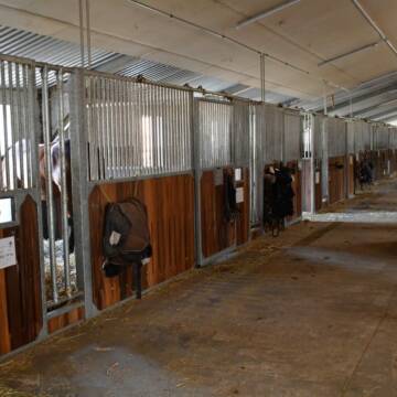
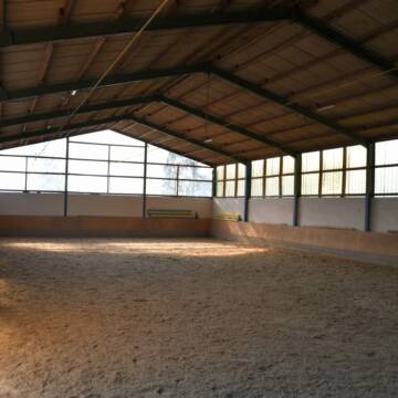
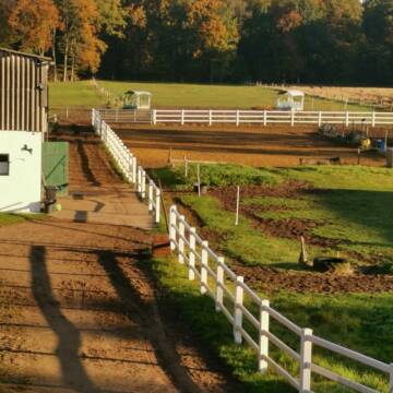
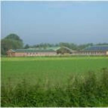
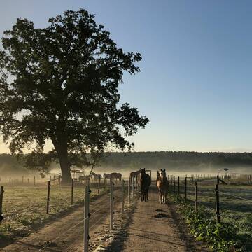
Ausbildungs- und TherapieZentrum Handorf
Handorf
ATZ Handorf
@Mathias-Bauch
Freizeitstall
Geländestrecke
Führanlage
Hunde willkommen
Allergikerstall
Fohlenaufzucht möglich
Außenbox mit Paddock
Außenboxen
35 weitere...
S
Deprecated: Creation of dynamic property Zend_View_Helper_Ads::$adLink is deprecated in /var/www/stall-frei/htdocs/staging.stall-frei.de/library/Psf/View/Helper/Ads.php on line 108

Heu und Heulage verkaufen
Mechtersen
STALL-FREIde Marketing
@STALL-FREI-Marketing
Verkaufen Sie Ihr Heu und Ihre Heulage direkt an Reiter, Pferdeställe und Reitanlagen

Offenstall /Stall
Vastorf
Schucht
@Schucht
Freizeitstall
Vermieten
Hunde willkommen
Longierzirkel/Roundpen
Allergikerstall
13 weitere...
P


Heiners Reiterhof hat Plätze frei 💕
Vierhöfen
Cord Vick
@HeinersReiterhof
FN-Mitglied
Freizeitstall
Hunde willkommen
Longierzirkel/Roundpen
Außenbox mit Paddock
Innenbox
Halbpension
Selbstversorgung
17 weitere...
ganz aktuell
S


Aufzuchtplatz für Hengstfohlen aus 2025 frei
Bleckede
Bonny-Island
@Bonny-Island
Longierzirkel/Roundpen
Paddock
Fohlenaufzucht möglich
Pferdezucht
Bewegungsstall
Offenstall
6 weitere...
P+
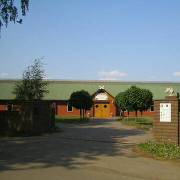
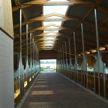
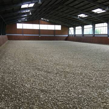
Reitanlage Vogelsang, familiärer Pensionsstall
Rullstorf
Reitstall-Vogelsang
@Reitstall-Vogelsang
FN-Mitglied
Freizeitstall
Pensions- und Gastboxen
Reithalle
Allergikerstall
10 weitere...
P
Reitsportanlage und Zuchthof Rabeler
Winsen/Luhe
Hof Rabeler
@Hof-Rabeler
FN-Mitglied
Pferdeausbildung
Vermieten
Führanlage
Longierzirkel/Roundpen
Fohlenaufzucht möglich
Notfallboxen
23 weitere...
S
Pferdehof Fricke
Lüneburg
Pferdehof-Fricke
@Pferdehof-Fricke
FN-Mitglied
Freizeitstall
Vermieten
Longierzirkel/Roundpen
Paddock
Außenboxen
Innenbox
9 weitere...
P

2 Pl. im Offenst. u. 1 Pl. im Allergikertrail frei
Melbeck
Stall-Drewes
@Stall-Drewes
Freizeitstall
Reitlehrer und -unterricht
Vermieten
Krankenbox
Paddock
Allergikerstall
Hufrehe geeignet
13 weitere...
P
Reitsportanlage Franke - Stille Heide
Bienenbüttel
Familie Franke
@FamilieFranke
Vermieten
Verpachten
Hunde willkommen
Longierzirkel/Roundpen
Zuchtstutenhaltung möglich
Außenboxen
Innenbox
15 weitere...
aktuell
P

Freier Platze im familiärem Pferdestall
Altenmedingen
Louis Müller
@MStiftung
Vermieten
Führanlage
Hunde willkommen
Notfallboxen
Innenbox
19 weitere...
P
Deprecated: Creation of dynamic property Zend_View::$pageCount is deprecated in /var/www/stall-frei/htdocs/staging.stall-frei.de/library/vendor/shardj/zf1-future/library/Zend/View/Abstract.php on line 308
Deprecated: Creation of dynamic property Zend_View::$itemCountPerPage is deprecated in /var/www/stall-frei/htdocs/staging.stall-frei.de/library/vendor/shardj/zf1-future/library/Zend/View/Abstract.php on line 308
Deprecated: Creation of dynamic property Zend_View::$first is deprecated in /var/www/stall-frei/htdocs/staging.stall-frei.de/library/vendor/shardj/zf1-future/library/Zend/View/Abstract.php on line 308
Deprecated: Creation of dynamic property Zend_View::$current is deprecated in /var/www/stall-frei/htdocs/staging.stall-frei.de/library/vendor/shardj/zf1-future/library/Zend/View/Abstract.php on line 308
Deprecated: Creation of dynamic property Zend_View::$last is deprecated in /var/www/stall-frei/htdocs/staging.stall-frei.de/library/vendor/shardj/zf1-future/library/Zend/View/Abstract.php on line 308
Deprecated: Creation of dynamic property Zend_View::$next is deprecated in /var/www/stall-frei/htdocs/staging.stall-frei.de/library/vendor/shardj/zf1-future/library/Zend/View/Abstract.php on line 308
Deprecated: Creation of dynamic property Zend_View::$pagesInRange is deprecated in /var/www/stall-frei/htdocs/staging.stall-frei.de/library/vendor/shardj/zf1-future/library/Zend/View/Abstract.php on line 308
Deprecated: Creation of dynamic property Zend_View::$firstPageInRange is deprecated in /var/www/stall-frei/htdocs/staging.stall-frei.de/library/vendor/shardj/zf1-future/library/Zend/View/Abstract.php on line 308
Deprecated: Creation of dynamic property Zend_View::$lastPageInRange is deprecated in /var/www/stall-frei/htdocs/staging.stall-frei.de/library/vendor/shardj/zf1-future/library/Zend/View/Abstract.php on line 308
Deprecated: Creation of dynamic property Zend_View::$currentItemCount is deprecated in /var/www/stall-frei/htdocs/staging.stall-frei.de/library/vendor/shardj/zf1-future/library/Zend/View/Abstract.php on line 308
Deprecated: Creation of dynamic property Zend_View::$totalItemCount is deprecated in /var/www/stall-frei/htdocs/staging.stall-frei.de/library/vendor/shardj/zf1-future/library/Zend/View/Abstract.php on line 308
Deprecated: Creation of dynamic property Zend_View::$firstItemNumber is deprecated in /var/www/stall-frei/htdocs/staging.stall-frei.de/library/vendor/shardj/zf1-future/library/Zend/View/Abstract.php on line 308
Deprecated: Creation of dynamic property Zend_View::$lastItemNumber is deprecated in /var/www/stall-frei/htdocs/staging.stall-frei.de/library/vendor/shardj/zf1-future/library/Zend/View/Abstract.php on line 308
Deprecated: Creation of dynamic property Zend_View::$router is deprecated in /var/www/stall-frei/htdocs/staging.stall-frei.de/library/vendor/shardj/zf1-future/library/Zend/View/Abstract.php on line 308
Deprecated: Creation of dynamic property Zend_View::$urlParams is deprecated in /var/www/stall-frei/htdocs/staging.stall-frei.de/library/vendor/shardj/zf1-future/library/Zend/View/Abstract.php on line 308
Deprecated: Creation of dynamic property Zend_View::$showAds is deprecated in /var/www/stall-frei/htdocs/staging.stall-frei.de/library/vendor/shardj/zf1-future/library/Zend/View/Abstract.php on line 308
Deprecated: Creation of dynamic property Zend_View::$objectIds is deprecated in /var/www/stall-frei/htdocs/staging.stall-frei.de/library/vendor/shardj/zf1-future/library/Zend/View/Abstract.php on line 308
Deprecated: Creation of dynamic property Zend_View::$showNavbar is deprecated in /var/www/stall-frei/htdocs/staging.stall-frei.de/library/vendor/shardj/zf1-future/library/Zend/View/Abstract.php on line 308
Deprecated: Creation of dynamic property Zend_View::$showBreadcrumb is deprecated in /var/www/stall-frei/htdocs/staging.stall-frei.de/library/vendor/shardj/zf1-future/library/Zend/View/Abstract.php on line 308
Deprecated: Creation of dynamic property Zend_View::$showFooter is deprecated in /var/www/stall-frei/htdocs/staging.stall-frei.de/library/vendor/shardj/zf1-future/library/Zend/View/Abstract.php on line 308
Deprecated: Creation of dynamic property Zend_View::$showInternalAds is deprecated in /var/www/stall-frei/htdocs/staging.stall-frei.de/library/vendor/shardj/zf1-future/library/Zend/View/Abstract.php on line 308
Deprecated: Creation of dynamic property Zend_View::$blNoContent is deprecated in /var/www/stall-frei/htdocs/staging.stall-frei.de/library/vendor/shardj/zf1-future/library/Zend/View/Abstract.php on line 308
Deprecated: Creation of dynamic property Zend_View::$sMetaDesc is deprecated in /var/www/stall-frei/htdocs/staging.stall-frei.de/library/vendor/shardj/zf1-future/library/Zend/View/Abstract.php on line 308
Deprecated: Creation of dynamic property Zend_View::$useGmaps is deprecated in /var/www/stall-frei/htdocs/staging.stall-frei.de/library/vendor/shardj/zf1-future/library/Zend/View/Abstract.php on line 308
Deprecated: Creation of dynamic property Zend_View::$touches is deprecated in /var/www/stall-frei/htdocs/staging.stall-frei.de/library/vendor/shardj/zf1-future/library/Zend/View/Abstract.php on line 308
Deprecated: Creation of dynamic property Zend_View::$oProject is deprecated in /var/www/stall-frei/htdocs/staging.stall-frei.de/library/vendor/shardj/zf1-future/library/Zend/View/Abstract.php on line 308
Deprecated: Creation of dynamic property Zend_View::$pageHeadline is deprecated in /var/www/stall-frei/htdocs/staging.stall-frei.de/library/vendor/shardj/zf1-future/library/Zend/View/Abstract.php on line 308
Deprecated: Creation of dynamic property Zend_View::$disableLocationField is deprecated in /var/www/stall-frei/htdocs/staging.stall-frei.de/library/vendor/shardj/zf1-future/library/Zend/View/Abstract.php on line 308
Deprecated: Creation of dynamic property Zend_View::$isSearch is deprecated in /var/www/stall-frei/htdocs/staging.stall-frei.de/library/vendor/shardj/zf1-future/library/Zend/View/Abstract.php on line 308
Deprecated: Creation of dynamic property Zend_View::$pageTitle is deprecated in /var/www/stall-frei/htdocs/staging.stall-frei.de/library/vendor/shardj/zf1-future/library/Zend/View/Abstract.php on line 308
Deprecated: Creation of dynamic property Psf_Form_Element_Text::$class is deprecated in /var/www/stall-frei/htdocs/staging.stall-frei.de/library/vendor/shardj/zf1-future/library/Zend/Form/Element.php on line 874
Deprecated: Creation of dynamic property Psf_Form_Element_Text::$size is deprecated in /var/www/stall-frei/htdocs/staging.stall-frei.de/library/vendor/shardj/zf1-future/library/Zend/Form/Element.php on line 874
Deprecated: Creation of dynamic property Psf_Form_Element_Text::$placeholder is deprecated in /var/www/stall-frei/htdocs/staging.stall-frei.de/library/vendor/shardj/zf1-future/library/Zend/Form/Element.php on line 874
Deprecated: Creation of dynamic property Psf_Form_Element_Hidden::$class is deprecated in /var/www/stall-frei/htdocs/staging.stall-frei.de/library/vendor/shardj/zf1-future/library/Zend/Form/Element.php on line 874
Deprecated: Creation of dynamic property Psf_Form_Element_Hidden::$class is deprecated in /var/www/stall-frei/htdocs/staging.stall-frei.de/library/vendor/shardj/zf1-future/library/Zend/Form/Element.php on line 874
Deprecated: Creation of dynamic property Psf_Form_Element_Hidden::$class is deprecated in /var/www/stall-frei/htdocs/staging.stall-frei.de/library/vendor/shardj/zf1-future/library/Zend/Form/Element.php on line 874
Deprecated: Creation of dynamic property Psf_Form_Element_Hidden::$class is deprecated in /var/www/stall-frei/htdocs/staging.stall-frei.de/library/vendor/shardj/zf1-future/library/Zend/Form/Element.php on line 874
Deprecated: Creation of dynamic property Psf_Form_Element_Select::$class is deprecated in /var/www/stall-frei/htdocs/staging.stall-frei.de/library/vendor/shardj/zf1-future/library/Zend/Form/Element.php on line 874
Deprecated: Creation of dynamic property Psf_Form_Element_Select::$class is deprecated in /var/www/stall-frei/htdocs/staging.stall-frei.de/library/vendor/shardj/zf1-future/library/Zend/Form/Element.php on line 874
Deprecated: Creation of dynamic property Psf_Form_Element_Select::$class is deprecated in /var/www/stall-frei/htdocs/staging.stall-frei.de/library/vendor/shardj/zf1-future/library/Zend/Form/Element.php on line 874
Deprecated: Creation of dynamic property Psf_Form_Element_Select::$class is deprecated in /var/www/stall-frei/htdocs/staging.stall-frei.de/library/vendor/shardj/zf1-future/library/Zend/Form/Element.php on line 874
Deprecated: Creation of dynamic property Psf_Form_Element_Text::$class is deprecated in /var/www/stall-frei/htdocs/staging.stall-frei.de/library/vendor/shardj/zf1-future/library/Zend/Form/Element.php on line 874
Deprecated: Creation of dynamic property Psf_Form_Element_Checkbox::$label is deprecated in /var/www/stall-frei/htdocs/staging.stall-frei.de/library/vendor/shardj/zf1-future/library/Zend/Form/Element.php on line 874
Deprecated: Creation of dynamic property Zend_View::$sort is deprecated in /var/www/stall-frei/htdocs/staging.stall-frei.de/library/vendor/shardj/zf1-future/library/Zend/View/Abstract.php on line 308
Deprecated: Creation of dynamic property Zend_View::$searchLocation is deprecated in /var/www/stall-frei/htdocs/staging.stall-frei.de/library/vendor/shardj/zf1-future/library/Zend/View/Abstract.php on line 308
Deprecated: Creation of dynamic property Zend_View::$locationHint is deprecated in /var/www/stall-frei/htdocs/staging.stall-frei.de/library/vendor/shardj/zf1-future/library/Zend/View/Abstract.php on line 308
Psf_GeoCoder_Abstract::getLocation: Barendorf Get Location CachedOrLive
Psf_GeoCoder_Abstract::getCachedOrLive: Barendorf
Psf_GeoCoder_OpenCageData::makeApiRequest: response:
Array
(
[documentation] => https://opencagedata.com/api
[licenses] => Array
(
[0] => Array
(
[name] => see attribution guide
[url] => https://opencagedata.com/credits
)
)
[results] => Array
(
[0] => Array
(
[bounds] => Array
(
[northeast] => Array
(
[lat] => 53.2437564
[lng] => 10.5609269
)
[southwest] => Array
(
[lat] => 53.2114881
[lng] => 10.4945401
)
)
[components] => Array
(
[ISO_3166-1_alpha-2] => DE
[ISO_3166-1_alpha-3] => DEU
[ISO_3166-2] => Array
(
[0] => DE-NI
)
[_category] => place
[_normalized_city] => Barendorf
[_type] => village
[continent] => Europe
[country] => Deutschland
[country_code] => de
[county] => Landkreis Lüneburg
[municipality] => Samtgemeinde Ostheide
[political_union] => European Union
[postcode] => 21397
[state] => Niedersachsen
[state_code] => NI
[village] => Barendorf
)
[confidence] => 7
[formatted] => 21397 Barendorf, Deutschland
[geometry] => Array
(
[lat] => 53.2294643
[lng] => 10.5212912
)
)
[1] => Array
(
[bounds] => Array
(
[northeast] => Array
(
[lat] => 53.8955937
[lng] => 11.3046915
)
[southwest] => Array
(
[lat] => 53.8555937
[lng] => 11.2646915
)
)
[components] => Array
(
[ISO_3166-1_alpha-2] => DE
[ISO_3166-1_alpha-3] => DEU
[ISO_3166-2] => Array
(
[0] => DE-MV
)
[_category] => place
[_normalized_city] => Grevesmühlen
[_type] => hamlet
[continent] => Europe
[country] => Deutschland
[country_code] => de
[county] => Nordwestmecklenburg
[hamlet] => Barendorf
[political_union] => European Union
[state] => Mecklenburg-Vorpommern
[state_code] => MV
[town] => Grevesmühlen
)
[confidence] => 7
[formatted] => Barendorf, Grevesmühlen, Mecklenburg-Vorpommern, Deutschland
[geometry] => Array
(
[lat] => 53.8755937
[lng] => 11.2846915
)
)
[2] => Array
(
[bounds] => Array
(
[northeast] => Array
(
[lat] => 53.9874502
[lng] => 10.9829763
)
[southwest] => Array
(
[lat] => 53.9474502
[lng] => 10.9429763
)
)
[components] => Array
(
[ISO_3166-1_alpha-2] => DE
[ISO_3166-1_alpha-3] => DEU
[ISO_3166-2] => Array
(
[0] => DE-MV
)
[_category] => place
[_normalized_city] => Dassow
[_type] => hamlet
[continent] => Europe
[country] => Deutschland
[country_code] => de
[county] => Nordwestmecklenburg
[hamlet] => Barendorf
[municipality] => Schönberger Land
[political_union] => European Union
[postcode] => 23942
[state] => Mecklenburg-Vorpommern
[state_code] => MV
[town] => Dassow
)
[confidence] => 7
[formatted] => Barendorf, 23942 Dassow, Deutschland
[geometry] => Array
(
[lat] => 53.9674502
[lng] => 10.9629763
)
)
[3] => Array
(
[bounds] => Array
(
[northeast] => Array
(
[lat] => 50.2121226
[lng] => 12.308513
)
[southwest] => Array
(
[lat] => 50.1721226
[lng] => 12.268513
)
)
[components] => Array
(
[ISO_3166-1_alpha-2] => DE
[ISO_3166-1_alpha-3] => DEU
[ISO_3166-2] => Array
(
[0] => DE-SN
)
[_category] => place
[_normalized_city] => Bad Brambach
[_type] => city
[continent] => Europe
[country] => Deutschland
[country_code] => de
[county] => Vogtlandkreis
[political_union] => European Union
[postcode] => 08648
[state] => Sachsen
[state_code] => SN
[town] => Bad Brambach
)
[confidence] => 7
[formatted] => 08648 Bad Brambach, Deutschland
[geometry] => Array
(
[lat] => 50.1921226
[lng] => 12.288513
)
)
[4] => Array
(
[components] => Array
(
[ISO_3166-1_alpha-2] => FR
[ISO_3166-1_alpha-3] => FRA
[ISO_3166-2] => Array
(
[0] => FR-GES
[1] => FR-6AE
[2] => FR-67
)
[_category] => road
[_normalized_city] => Hirschland
[_type] => road
[city] => Hirschland
[continent] => Europe
[country] => France
[country_code] => fr
[county] => Bas-Rhin
[local_authority] => Communauté de communes de l'Alsace Bossue
[political_union] => European Union
[postcode] => 67320
[road] => Rue de Baerendorf
[state] => Grand Est
[state_code] => GES
)
[confidence] => 5
[formatted] => Rue de Baerendorf, 67320 Hirschland, France
[geometry] => Array
(
[lat] => 48.836783
[lng] => 7.109002
)
)
[5] => Array
(
[components] => Array
(
[ISO_3166-1_alpha-2] => FR
[ISO_3166-1_alpha-3] => FRA
[ISO_3166-2] => Array
(
[0] => FR-GES
[1] => FR-6AE
[2] => FR-67
)
[_category] => road
[_normalized_city] => Baerendorf
[_type] => road
[city] => Baerendorf
[continent] => Europe
[country] => France
[country_code] => fr
[county] => Bas-Rhin
[local_authority] => Communauté de communes de l'Alsace Bossue
[political_union] => European Union
[postcode] => 67320
[road] => Rue de Hirschland
[state] => Grand Est
[state_code] => GES
)
[confidence] => 4
[formatted] => Rue de Hirschland, 67320 Baerendorf, France
[geometry] => Array
(
[lat] => 48.838484
[lng] => 7.08752
)
)
[6] => Array
(
[components] => Array
(
[ISO_3166-1_alpha-2] => FR
[ISO_3166-1_alpha-3] => FRA
[ISO_3166-2] => Array
(
[0] => FR-NOR
[1] => FR-76
)
[_category] => road
[_normalized_city] => Barentin
[_type] => road
[city] => Barentin
[continent] => Europe
[country] => France
[country_code] => fr
[county] => Seine-Maritime
[local_authority] => Communauté de communes Caux-Austreberthe
[political_union] => European Union
[postcode] => 76360
[road] => Rue de Warendorf
[state] => Normandie
[state_code] => NOR
)
[confidence] => 3
[formatted] => Rue de Warendorf, 76360 Barentin, France
[geometry] => Array
(
[lat] => 49.554109
[lng] => 0.936306
)
)
[7] => Array
(
[components] => Array
(
[ISO_3166-1_alpha-2] => FR
[ISO_3166-1_alpha-3] => FRA
[ISO_3166-2] => Array
(
[0] => FR-GES
[1] => FR-6AE
[2] => FR-67
)
[_category] => road
[_normalized_city] => Baerendorf
[_type] => road
[city] => Baerendorf
[continent] => Europe
[country] => France
[country_code] => fr
[county] => Bas-Rhin
[local_authority] => Communauté de communes de l'Alsace Bossue
[political_union] => European Union
[postcode] => 67320
[road] => Rue de l'Isch
[state] => Grand Est
[state_code] => GES
)
[confidence] => 3
[formatted] => Rue de l'Isch, 67320 Baerendorf, France
[geometry] => Array
(
[lat] => 48.83797
[lng] => 7.088766
)
)
[8] => Array
(
[components] => Array
(
[ISO_3166-1_alpha-2] => FR
[ISO_3166-1_alpha-3] => FRA
[ISO_3166-2] => Array
(
[0] => FR-GES
[1] => FR-6AE
[2] => FR-67
)
[_category] => road
[_normalized_city] => Rauwiller
[_type] => road
[city] => Rauwiller
[continent] => Europe
[country] => France
[country_code] => fr
[county] => Bas-Rhin
[local_authority] => Communauté de communes de l'Alsace Bossue
[political_union] => European Union
[postcode] => 67320
[road] => Rue de Baerendorf
[state] => Grand Est
[state_code] => GES
)
[confidence] => 3
[formatted] => Rue de Baerendorf, 67320 Rauwiller, France
[geometry] => Array
(
[lat] => 48.812665
[lng] => 7.104776
)
)
[9] => Array
(
[components] => Array
(
[ISO_3166-1_alpha-2] => FR
[ISO_3166-1_alpha-3] => FRA
[ISO_3166-2] => Array
(
[0] => FR-GES
[1] => FR-6AE
[2] => FR-67
)
[_category] => road
[_normalized_city] => Kirrberg
[_type] => road
[city] => Kirrberg
[continent] => Europe
[country] => France
[country_code] => fr
[county] => Bas-Rhin
[local_authority] => Communauté de communes de l'Alsace Bossue
[political_union] => European Union
[postcode] => 67320
[road] => Rue de Baerendorf
[state] => Grand Est
[state_code] => GES
)
[confidence] => 3
[formatted] => Rue de Baerendorf, 67320 Kirrberg, France
[geometry] => Array
(
[lat] => 48.823226
[lng] => 7.065602
)
)
)
[status] => Array
(
[code] => 200
[message] => OK
)
[stay_informed] => Array
(
[blog] => https://blog.opencagedata.com
[mastodon] => https://en.osm.town/@opencage
)
[thanks] => For using an OpenCage API
[timestamp] => Array
(
[created_http] => Sun, 08 Feb 2026 23:21:54 GMT
[created_unix] => 1770592914
)
[total_results] => 10
)
Psf_GeoCoder_Abstract::convertLocationResult
{"documentation":"https:\/\/opencagedata.com\/api","licenses":[{"name":"see attribution guide","url":"https:\/\/opencagedata.com\/credits"}],"results":[{"bounds":{"northeast":{"lat":53.2437564,"lng":10.5609269},"southwest":{"lat":53.2114881,"lng":10.4945401}},"components":{"ISO_3166-1_alpha-2":"DE","ISO_3166-1_alpha-3":"DEU","ISO_3166-2":["DE-NI"],"_category":"place","_normalized_city":"Barendorf","_type":"village","continent":"Europe","country":"Deutschland","country_code":"de","county":"Landkreis L\u00fcneburg","municipality":"Samtgemeinde Ostheide","political_union":"European Union","postcode":"21397","state":"Niedersachsen","state_code":"NI","village":"Barendorf"},"confidence":7,"formatted":"21397 Barendorf, Deutschland","geometry":{"lat":53.2294643,"lng":10.5212912}},{"bounds":{"northeast":{"lat":53.8955937,"lng":11.3046915},"southwest":{"lat":53.8555937,"lng":11.2646915}},"components":{"ISO_3166-1_alpha-2":"DE","ISO_3166-1_alpha-3":"DEU","ISO_3166-2":["DE-MV"],"_category":"place","_normalized_city":"Grevesm\u00fchlen","_type":"hamlet","continent":"Europe","country":"Deutschland","country_code":"de","county":"Nordwestmecklenburg","hamlet":"Barendorf","political_union":"European Union","state":"Mecklenburg-Vorpommern","state_code":"MV","town":"Grevesm\u00fchlen"},"confidence":7,"formatted":"Barendorf, Grevesm\u00fchlen, Mecklenburg-Vorpommern, Deutschland","geometry":{"lat":53.8755937,"lng":11.2846915}},{"bounds":{"northeast":{"lat":53.9874502,"lng":10.9829763},"southwest":{"lat":53.9474502,"lng":10.9429763}},"components":{"ISO_3166-1_alpha-2":"DE","ISO_3166-1_alpha-3":"DEU","ISO_3166-2":["DE-MV"],"_category":"place","_normalized_city":"Dassow","_type":"hamlet","continent":"Europe","country":"Deutschland","country_code":"de","county":"Nordwestmecklenburg","hamlet":"Barendorf","municipality":"Sch\u00f6nberger Land","political_union":"European Union","postcode":"23942","state":"Mecklenburg-Vorpommern","state_code":"MV","town":"Dassow"},"confidence":7,"formatted":"Barendorf, 23942 Dassow, Deutschland","geometry":{"lat":53.9674502,"lng":10.9629763}},{"bounds":{"northeast":{"lat":50.2121226,"lng":12.308513},"southwest":{"lat":50.1721226,"lng":12.268513}},"components":{"ISO_3166-1_alpha-2":"DE","ISO_3166-1_alpha-3":"DEU","ISO_3166-2":["DE-SN"],"_category":"place","_normalized_city":"Bad Brambach","_type":"city","continent":"Europe","country":"Deutschland","country_code":"de","county":"Vogtlandkreis","political_union":"European Union","postcode":"08648","state":"Sachsen","state_code":"SN","town":"Bad Brambach"},"confidence":7,"formatted":"08648 Bad Brambach, Deutschland","geometry":{"lat":50.1921226,"lng":12.288513}},{"components":{"ISO_3166-1_alpha-2":"FR","ISO_3166-1_alpha-3":"FRA","ISO_3166-2":["FR-GES","FR-6AE","FR-67"],"_category":"road","_normalized_city":"Hirschland","_type":"road","city":"Hirschland","continent":"Europe","country":"France","country_code":"fr","county":"Bas-Rhin","local_authority":"Communaut\u00e9 de communes de l'Alsace Bossue","political_union":"European Union","postcode":"67320","road":"Rue de Baerendorf","state":"Grand Est","state_code":"GES"},"confidence":5,"formatted":"Rue de Baerendorf, 67320 Hirschland, France","geometry":{"lat":48.836783,"lng":7.109002}},{"components":{"ISO_3166-1_alpha-2":"FR","ISO_3166-1_alpha-3":"FRA","ISO_3166-2":["FR-GES","FR-6AE","FR-67"],"_category":"road","_normalized_city":"Baerendorf","_type":"road","city":"Baerendorf","continent":"Europe","country":"France","country_code":"fr","county":"Bas-Rhin","local_authority":"Communaut\u00e9 de communes de l'Alsace Bossue","political_union":"European Union","postcode":"67320","road":"Rue de Hirschland","state":"Grand Est","state_code":"GES"},"confidence":4,"formatted":"Rue de Hirschland, 67320 Baerendorf, France","geometry":{"lat":48.838484,"lng":7.08752}},{"components":{"ISO_3166-1_alpha-2":"FR","ISO_3166-1_alpha-3":"FRA","ISO_3166-2":["FR-NOR","FR-76"],"_category":"road","_normalized_city":"Barentin","_type":"road","city":"Barentin","continent":"Europe","country":"France","country_code":"fr","county":"Seine-Maritime","local_authority":"Communaut\u00e9 de communes Caux-Austreberthe","political_union":"European Union","postcode":"76360","road":"Rue de Warendorf","state":"Normandie","state_code":"NOR"},"confidence":3,"formatted":"Rue de Warendorf, 76360 Barentin, France","geometry":{"lat":49.554109,"lng":0.936306}},{"components":{"ISO_3166-1_alpha-2":"FR","ISO_3166-1_alpha-3":"FRA","ISO_3166-2":["FR-GES","FR-6AE","FR-67"],"_category":"road","_normalized_city":"Baerendorf","_type":"road","city":"Baerendorf","continent":"Europe","country":"France","country_code":"fr","county":"Bas-Rhin","local_authority":"Communaut\u00e9 de communes de l'Alsace Bossue","political_union":"European Union","postcode":"67320","road":"Rue de l'Isch","state":"Grand Est","state_code":"GES"},"confidence":3,"formatted":"Rue de l'Isch, 67320 Baerendorf, France","geometry":{"lat":48.83797,"lng":7.088766}},{"components":{"ISO_3166-1_alpha-2":"FR","ISO_3166-1_alpha-3":"FRA","ISO_3166-2":["FR-GES","FR-6AE","FR-67"],"_category":"road","_normalized_city":"Rauwiller","_type":"road","city":"Rauwiller","continent":"Europe","country":"France","country_code":"fr","county":"Bas-Rhin","local_authority":"Communaut\u00e9 de communes de l'Alsace Bossue","political_union":"European Union","postcode":"67320","road":"Rue de Baerendorf","state":"Grand Est","state_code":"GES"},"confidence":3,"formatted":"Rue de Baerendorf, 67320 Rauwiller, France","geometry":{"lat":48.812665,"lng":7.104776}},{"components":{"ISO_3166-1_alpha-2":"FR","ISO_3166-1_alpha-3":"FRA","ISO_3166-2":["FR-GES","FR-6AE","FR-67"],"_category":"road","_normalized_city":"Kirrberg","_type":"road","city":"Kirrberg","continent":"Europe","country":"France","country_code":"fr","county":"Bas-Rhin","local_authority":"Communaut\u00e9 de communes de l'Alsace Bossue","political_union":"European Union","postcode":"67320","road":"Rue de Baerendorf","state":"Grand Est","state_code":"GES"},"confidence":3,"formatted":"Rue de Baerendorf, 67320 Kirrberg, France","geometry":{"lat":48.823226,"lng":7.065602}}],"status":{"code":200,"message":"OK"},"stay_informed":{"blog":"https:\/\/blog.opencagedata.com","mastodon":"https:\/\/en.osm.town\/@opencage"},"thanks":"For using an OpenCage API","timestamp":{"created_http":"Sun, 08 Feb 2026 23:21:54 GMT","created_unix":1770592914},"total_results":10}Array
(
[0] => stdClass Object
(
[bounds] => stdClass Object
(
[northeast] => stdClass Object
(
[lat] => 53.2437564
[lng] => 10.5609269
)
[southwest] => stdClass Object
(
[lat] => 53.2114881
[lng] => 10.4945401
)
)
[components] => stdClass Object
(
[ISO_3166-1_alpha-2] => DE
[ISO_3166-1_alpha-3] => DEU
[ISO_3166-2] => Array
(
[0] => DE-NI
)
[_category] => place
[_normalized_city] => Barendorf
[_type] => village
[continent] => Europe
[country] => Deutschland
[country_code] => de
[county] => Landkreis Lüneburg
[municipality] => Samtgemeinde Ostheide
[political_union] => European Union
[postcode] => 21397
[state] => Niedersachsen
[state_code] => NI
[village] => Barendorf
)
[confidence] => 7
[formatted] => 21397 Barendorf, Deutschland
[geometry] => stdClass Object
(
[lat] => 53.2294643
[lng] => 10.5212912
)
)
[1] => stdClass Object
(
[bounds] => stdClass Object
(
[northeast] => stdClass Object
(
[lat] => 53.8955937
[lng] => 11.3046915
)
[southwest] => stdClass Object
(
[lat] => 53.8555937
[lng] => 11.2646915
)
)
[components] => stdClass Object
(
[ISO_3166-1_alpha-2] => DE
[ISO_3166-1_alpha-3] => DEU
[ISO_3166-2] => Array
(
[0] => DE-MV
)
[_category] => place
[_normalized_city] => Grevesmühlen
[_type] => hamlet
[continent] => Europe
[country] => Deutschland
[country_code] => de
[county] => Nordwestmecklenburg
[hamlet] => Barendorf
[political_union] => European Union
[state] => Mecklenburg-Vorpommern
[state_code] => MV
[town] => Grevesmühlen
)
[confidence] => 7
[formatted] => Barendorf, Grevesmühlen, Mecklenburg-Vorpommern, Deutschland
[geometry] => stdClass Object
(
[lat] => 53.8755937
[lng] => 11.2846915
)
)
[2] => stdClass Object
(
[bounds] => stdClass Object
(
[northeast] => stdClass Object
(
[lat] => 53.9874502
[lng] => 10.9829763
)
[southwest] => stdClass Object
(
[lat] => 53.9474502
[lng] => 10.9429763
)
)
[components] => stdClass Object
(
[ISO_3166-1_alpha-2] => DE
[ISO_3166-1_alpha-3] => DEU
[ISO_3166-2] => Array
(
[0] => DE-MV
)
[_category] => place
[_normalized_city] => Dassow
[_type] => hamlet
[continent] => Europe
[country] => Deutschland
[country_code] => de
[county] => Nordwestmecklenburg
[hamlet] => Barendorf
[municipality] => Schönberger Land
[political_union] => European Union
[postcode] => 23942
[state] => Mecklenburg-Vorpommern
[state_code] => MV
[town] => Dassow
)
[confidence] => 7
[formatted] => Barendorf, 23942 Dassow, Deutschland
[geometry] => stdClass Object
(
[lat] => 53.9674502
[lng] => 10.9629763
)
)
[3] => stdClass Object
(
[bounds] => stdClass Object
(
[northeast] => stdClass Object
(
[lat] => 50.2121226
[lng] => 12.308513
)
[southwest] => stdClass Object
(
[lat] => 50.1721226
[lng] => 12.268513
)
)
[components] => stdClass Object
(
[ISO_3166-1_alpha-2] => DE
[ISO_3166-1_alpha-3] => DEU
[ISO_3166-2] => Array
(
[0] => DE-SN
)
[_category] => place
[_normalized_city] => Bad Brambach
[_type] => city
[continent] => Europe
[country] => Deutschland
[country_code] => de
[county] => Vogtlandkreis
[political_union] => European Union
[postcode] => 08648
[state] => Sachsen
[state_code] => SN
[town] => Bad Brambach
)
[confidence] => 7
[formatted] => 08648 Bad Brambach, Deutschland
[geometry] => stdClass Object
(
[lat] => 50.1921226
[lng] => 12.288513
)
)
[4] => stdClass Object
(
[components] => stdClass Object
(
[ISO_3166-1_alpha-2] => FR
[ISO_3166-1_alpha-3] => FRA
[ISO_3166-2] => Array
(
[0] => FR-GES
[1] => FR-6AE
[2] => FR-67
)
[_category] => road
[_normalized_city] => Hirschland
[_type] => road
[city] => Hirschland
[continent] => Europe
[country] => France
[country_code] => fr
[county] => Bas-Rhin
[local_authority] => Communauté de communes de l'Alsace Bossue
[political_union] => European Union
[postcode] => 67320
[road] => Rue de Baerendorf
[state] => Grand Est
[state_code] => GES
)
[confidence] => 5
[formatted] => Rue de Baerendorf, 67320 Hirschland, France
[geometry] => stdClass Object
(
[lat] => 48.836783
[lng] => 7.109002
)
)
[5] => stdClass Object
(
[components] => stdClass Object
(
[ISO_3166-1_alpha-2] => FR
[ISO_3166-1_alpha-3] => FRA
[ISO_3166-2] => Array
(
[0] => FR-GES
[1] => FR-6AE
[2] => FR-67
)
[_category] => road
[_normalized_city] => Baerendorf
[_type] => road
[city] => Baerendorf
[continent] => Europe
[country] => France
[country_code] => fr
[county] => Bas-Rhin
[local_authority] => Communauté de communes de l'Alsace Bossue
[political_union] => European Union
[postcode] => 67320
[road] => Rue de Hirschland
[state] => Grand Est
[state_code] => GES
)
[confidence] => 4
[formatted] => Rue de Hirschland, 67320 Baerendorf, France
[geometry] => stdClass Object
(
[lat] => 48.838484
[lng] => 7.08752
)
)
[6] => stdClass Object
(
[components] => stdClass Object
(
[ISO_3166-1_alpha-2] => FR
[ISO_3166-1_alpha-3] => FRA
[ISO_3166-2] => Array
(
[0] => FR-NOR
[1] => FR-76
)
[_category] => road
[_normalized_city] => Barentin
[_type] => road
[city] => Barentin
[continent] => Europe
[country] => France
[country_code] => fr
[county] => Seine-Maritime
[local_authority] => Communauté de communes Caux-Austreberthe
[political_union] => European Union
[postcode] => 76360
[road] => Rue de Warendorf
[state] => Normandie
[state_code] => NOR
)
[confidence] => 3
[formatted] => Rue de Warendorf, 76360 Barentin, France
[geometry] => stdClass Object
(
[lat] => 49.554109
[lng] => 0.936306
)
)
[7] => stdClass Object
(
[components] => stdClass Object
(
[ISO_3166-1_alpha-2] => FR
[ISO_3166-1_alpha-3] => FRA
[ISO_3166-2] => Array
(
[0] => FR-GES
[1] => FR-6AE
[2] => FR-67
)
[_category] => road
[_normalized_city] => Baerendorf
[_type] => road
[city] => Baerendorf
[continent] => Europe
[country] => France
[country_code] => fr
[county] => Bas-Rhin
[local_authority] => Communauté de communes de l'Alsace Bossue
[political_union] => European Union
[postcode] => 67320
[road] => Rue de l'Isch
[state] => Grand Est
[state_code] => GES
)
[confidence] => 3
[formatted] => Rue de l'Isch, 67320 Baerendorf, France
[geometry] => stdClass Object
(
[lat] => 48.83797
[lng] => 7.088766
)
)
[8] => stdClass Object
(
[components] => stdClass Object
(
[ISO_3166-1_alpha-2] => FR
[ISO_3166-1_alpha-3] => FRA
[ISO_3166-2] => Array
(
[0] => FR-GES
[1] => FR-6AE
[2] => FR-67
)
[_category] => road
[_normalized_city] => Rauwiller
[_type] => road
[city] => Rauwiller
[continent] => Europe
[country] => France
[country_code] => fr
[county] => Bas-Rhin
[local_authority] => Communauté de communes de l'Alsace Bossue
[political_union] => European Union
[postcode] => 67320
[road] => Rue de Baerendorf
[state] => Grand Est
[state_code] => GES
)
[confidence] => 3
[formatted] => Rue de Baerendorf, 67320 Rauwiller, France
[geometry] => stdClass Object
(
[lat] => 48.812665
[lng] => 7.104776
)
)
[9] => stdClass Object
(
[components] => stdClass Object
(
[ISO_3166-1_alpha-2] => FR
[ISO_3166-1_alpha-3] => FRA
[ISO_3166-2] => Array
(
[0] => FR-GES
[1] => FR-6AE
[2] => FR-67
)
[_category] => road
[_normalized_city] => Kirrberg
[_type] => road
[city] => Kirrberg
[continent] => Europe
[country] => France
[country_code] => fr
[county] => Bas-Rhin
[local_authority] => Communauté de communes de l'Alsace Bossue
[political_union] => European Union
[postcode] => 67320
[road] => Rue de Baerendorf
[state] => Grand Est
[state_code] => GES
)
[confidence] => 3
[formatted] => Rue de Baerendorf, 67320 Kirrberg, France
[geometry] => stdClass Object
(
[lat] => 48.823226
[lng] => 7.065602
)
)
)
Psf_GeoCoder_OpenCageData::getKeyMap: 0
stdClass Object
(
    [bounds] => stdClass Object
        (
            [northeast] => stdClass Object
                (
                    [lat] => 53.2437564
                    [lng] => 10.5609269
                )

            [southwest] => stdClass Object
                (
                    [lat] => 53.2114881
                    [lng] => 10.4945401
                )

        )

    [components] => stdClass Object
        (
            [ISO_3166-1_alpha-2] => DE
            [ISO_3166-1_alpha-3] => DEU
            [ISO_3166-2] => Array
                (
                    [0] => DE-NI
                )

            [_category] => place
            [_normalized_city] => Barendorf
            [_type] => village
            [continent] => Europe
            [country] => Deutschland
            [country_code] => de
            [county] => Landkreis Lüneburg
            [municipality] => Samtgemeinde Ostheide
            [political_union] => European Union
            [postcode] => 21397
            [state] => Niedersachsen
            [state_code] => NI
            [village] => Barendorf
        )

    [confidence] => 7
    [formatted] => 21397 Barendorf, Deutschland
    [geometry] => stdClass Object
        (
            [lat] => 53.2294643
            [lng] => 10.5212912
        )

)
Psf_GeoCoder_OpenCageData::getCounty: Lüneburg
Psf_GeoCoder_OpenCageData::addMissingData REFETCH!
Array
(
    [address] => 21397 Barendorf, Deutschland
    [type] => village
    [street] =>
    [city] => Barendorf
    [county] => Lüneburg
    [state] => Niedersachsen
    [zip] => 21397
    [country] => Deutschland
    [suburb] =>
    [countrycode] => de
    [latitude] => 53.2294643
    [longitude] => 10.5212912
    [accuracy] => 1
    [confidence] => 7
    [bounds] => stdClass Object
        (
            [northeast] => stdClass Object
                (
                    [lat] => 53.2437564
                    [lng] => 10.5609269
                )

            [southwest] => stdClass Object
                (
                    [lat] => 53.2114881
                    [lng] => 10.4945401
                )

        )

)
reformat!
Array
(
    [address] => 21397 Barendorf, Deutschland
    [type] => village
    [street] =>
    [city] => Barendorf
    [county] => Lüneburg
    [state] => Niedersachsen
    [zip] => 21397
    [country] => Deutschland
    [suburb] =>
    [countrycode] => de
    [latitude] => 53.2294643
    [longitude] => 10.5212912
    [accuracy] => 1
    [confidence] => 7
    [bounds] => stdClass Object
        (
            [northeast] => stdClass Object
                (
                    [lat] => 53.2437564
                    [lng] => 10.5609269
                )

            [southwest] => stdClass Object
                (
                    [lat] => 53.2114881
                    [lng] => 10.4945401
                )

        )

    [place] => 21397 Barendorf, Niedersachsen
    [hash] => c62015389298ffa76665b5cde2c03674
)
Psf_GeoCoder_OpenCageData::getKeyMap: 1
stdClass Object
(
    [bounds] => stdClass Object
        (
            [northeast] => stdClass Object
                (
                    [lat] => 53.8955937
                    [lng] => 11.3046915
                )

            [southwest] => stdClass Object
                (
                    [lat] => 53.8555937
                    [lng] => 11.2646915
                )

        )

    [components] => stdClass Object
        (
            [ISO_3166-1_alpha-2] => DE
            [ISO_3166-1_alpha-3] => DEU
            [ISO_3166-2] => Array
                (
                    [0] => DE-MV
                )

            [_category] => place
            [_normalized_city] => Grevesmühlen
            [_type] => hamlet
            [continent] => Europe
            [country] => Deutschland
            [country_code] => de
            [county] => Nordwestmecklenburg
            [hamlet] => Barendorf
            [political_union] => European Union
            [state] => Mecklenburg-Vorpommern
            [state_code] => MV
            [town] => Grevesmühlen
        )

    [confidence] => 7
    [formatted] => Barendorf, Grevesmühlen, Mecklenburg-Vorpommern, Deutschland
    [geometry] => stdClass Object
        (
            [lat] => 53.8755937
            [lng] => 11.2846915
        )

)
Psf_GeoCoder_OpenCageData::getCounty: Nordwestmecklenburg
Psf_GeoCoder_OpenCageData::addMissingData REFETCH!
Array
(
    [address] => Barendorf, Grevesmühlen, Mecklenburg-Vorpommern, Deutschland
    [type] => hamlet
    [street] => Barendorf
    [city] => Grevesmühlen
    [county] => Nordwestmecklenburg
    [state] => Mecklenburg-Vorpommern
    [zip] =>
    [country] => Deutschland
    [suburb] =>
    [countrycode] => de
    [latitude] => 53.8755937
    [longitude] => 11.2846915
    [accuracy] => 1
    [confidence] => 7
    [bounds] => stdClass Object
        (
            [northeast] => stdClass Object
                (
                    [lat] => 53.8955937
                    [lng] => 11.3046915
                )

            [southwest] => stdClass Object
                (
                    [lat] => 53.8555937
                    [lng] => 11.2646915
                )

        )

)
reformat!
Array
(
    [address] => Barendorf, Grevesmühlen, Mecklenburg-Vorpommern, Deutschland
    [type] => hamlet
    [street] => Barendorf
    [city] => Grevesmühlen
    [county] => Nordwestmecklenburg
    [state] => Mecklenburg-Vorpommern
    [zip] =>
    [country] => Deutschland
    [suburb] =>
    [countrycode] => de
    [latitude] => 53.8755937
    [longitude] => 11.2846915
    [accuracy] => 1
    [confidence] => 7
    [bounds] => stdClass Object
        (
            [northeast] => stdClass Object
                (
                    [lat] => 53.8955937
                    [lng] => 11.3046915
                )

            [southwest] => stdClass Object
                (
                    [lat] => 53.8555937
                    [lng] => 11.2646915
                )

        )

    [place] => Barendorf, Grevesmühlen, Mecklenburg-Vorpommern
    [hash] => 8a41aa7c52b9f027ef31a11664c4e6b4
)
Psf_GeoCoder_OpenCageData::getKeyMap: 2
stdClass Object
(
    [bounds] => stdClass Object
        (
            [northeast] => stdClass Object
                (
                    [lat] => 53.9874502
                    [lng] => 10.9829763
                )

            [southwest] => stdClass Object
                (
                    [lat] => 53.9474502
                    [lng] => 10.9429763
                )

        )

    [components] => stdClass Object
        (
            [ISO_3166-1_alpha-2] => DE
            [ISO_3166-1_alpha-3] => DEU
            [ISO_3166-2] => Array
                (
                    [0] => DE-MV
                )

            [_category] => place
            [_normalized_city] => Dassow
            [_type] => hamlet
            [continent] => Europe
            [country] => Deutschland
            [country_code] => de
            [county] => Nordwestmecklenburg
            [hamlet] => Barendorf
            [municipality] => Schönberger Land
            [political_union] => European Union
            [postcode] => 23942
            [state] => Mecklenburg-Vorpommern
            [state_code] => MV
            [town] => Dassow
        )

    [confidence] => 7
    [formatted] => Barendorf, 23942 Dassow, Deutschland
    [geometry] => stdClass Object
        (
            [lat] => 53.9674502
            [lng] => 10.9629763
        )

)
Psf_GeoCoder_OpenCageData::getCounty: Nordwestmecklenburg
Psf_GeoCoder_OpenCageData::addMissingData REFETCH!
Array
(
    [address] => Barendorf, 23942 Dassow, Deutschland
    [type] => hamlet
    [street] => Barendorf
    [city] => Dassow
    [county] => Nordwestmecklenburg
    [state] => Mecklenburg-Vorpommern
    [zip] => 23942
    [country] => Deutschland
    [suburb] =>
    [countrycode] => de
    [latitude] => 53.9674502
    [longitude] => 10.9629763
    [accuracy] => 1
    [confidence] => 7
    [bounds] => stdClass Object
        (
            [northeast] => stdClass Object
                (
                    [lat] => 53.9874502
                    [lng] => 10.9829763
                )

            [southwest] => stdClass Object
                (
                    [lat] => 53.9474502
                    [lng] => 10.9429763
                )

        )

)
reformat!
Array
(
    [address] => Barendorf, 23942 Dassow, Deutschland
    [type] => hamlet
    [street] => Barendorf
    [city] => Dassow
    [county] => Nordwestmecklenburg
    [state] => Mecklenburg-Vorpommern
    [zip] => 23942
    [country] => Deutschland
    [suburb] =>
    [countrycode] => de
    [latitude] => 53.9674502
    [longitude] => 10.9629763
    [accuracy] => 1
    [confidence] => 7
    [bounds] => stdClass Object
        (
            [northeast] => stdClass Object
                (
                    [lat] => 53.9874502
                    [lng] => 10.9829763
                )

            [southwest] => stdClass Object
                (
                    [lat] => 53.9474502
                    [lng] => 10.9429763
                )

        )

    [place] => Barendorf, 23942 Dassow, Mecklenburg-Vorpommern
    [hash] => 3ea36642f8d9b8fe9394c52f0216c09f
)
Psf_GeoCoder_OpenCageData::getKeyMap: 3
stdClass Object
(
    [bounds] => stdClass Object
        (
            [northeast] => stdClass Object
                (
                    [lat] => 50.2121226
                    [lng] => 12.308513
                )

            [southwest] => stdClass Object
                (
                    [lat] => 50.1721226
                    [lng] => 12.268513
                )

        )

    [components] => stdClass Object
        (
            [ISO_3166-1_alpha-2] => DE
            [ISO_3166-1_alpha-3] => DEU
            [ISO_3166-2] => Array
                (
                    [0] => DE-SN
                )

            [_category] => place
            [_normalized_city] => Bad Brambach
            [_type] => city
            [continent] => Europe
            [country] => Deutschland
            [country_code] => de
            [county] => Vogtlandkreis
            [political_union] => European Union
            [postcode] => 08648
            [state] => Sachsen
            [state_code] => SN
            [town] => Bad Brambach
        )

    [confidence] => 7
    [formatted] => 08648 Bad Brambach, Deutschland
    [geometry] => stdClass Object
        (
            [lat] => 50.1921226
            [lng] => 12.288513
        )

)
Psf_GeoCoder_OpenCageData::getCounty: Vogtlandkreis
Psf_GeoCoder_OpenCageData::addMissingData REFETCH!
Array
(
    [address] => 08648 Bad Brambach, Deutschland
    [type] => city
    [street] =>
    [city] => Bad Brambach
    [county] => Vogtlandkreis
    [state] => Sachsen
    [zip] => 08648
    [country] => Deutschland
    [suburb] =>
    [countrycode] => de
    [latitude] => 50.1921226
    [longitude] => 12.288513
    [accuracy] => 1
    [confidence] => 7
    [bounds] => stdClass Object
        (
            [northeast] => stdClass Object
                (
                    [lat] => 50.2121226
                    [lng] => 12.308513
                )

            [southwest] => stdClass Object
                (
                    [lat] => 50.1721226
                    [lng] => 12.268513
                )

        )

)
reformat!
Array
(
    [address] => 08648 Bad Brambach, Deutschland
    [type] => city
    [street] =>
    [city] => Bad Brambach
    [county] => Vogtlandkreis
    [state] => Sachsen
    [zip] => 08648
    [country] => Deutschland
    [suburb] =>
    [countrycode] => de
    [latitude] => 50.1921226
    [longitude] => 12.288513
    [accuracy] => 1
    [confidence] => 7
    [bounds] => stdClass Object
        (
            [northeast] => stdClass Object
                (
                    [lat] => 50.2121226
                    [lng] => 12.308513
                )

            [southwest] => stdClass Object
                (
                    [lat] => 50.1721226
                    [lng] => 12.268513
                )

        )

    [place] => 08648 Bad Brambach, Sachsen
    [hash] => ba54475f0dc28f234b48019242075e9d
)
Psf_GeoCoder_OpenCageData::getKeyMap: 4
stdClass Object
(
    [components] => stdClass Object
        (
            [ISO_3166-1_alpha-2] => FR
            [ISO_3166-1_alpha-3] => FRA
            [ISO_3166-2] => Array
                (
                    [0] => FR-GES
                    [1] => FR-6AE
                    [2] => FR-67
                )

            [_category] => road
            [_normalized_city] => Hirschland
            [_type] => road
            [city] => Hirschland
            [continent] => Europe
            [country] => France
            [country_code] => fr
            [county] => Bas-Rhin
            [local_authority] => Communauté de communes de l'Alsace Bossue
            [political_union] => European Union
            [postcode] => 67320
            [road] => Rue de Baerendorf
            [state] => Grand Est
            [state_code] => GES
        )

    [confidence] => 5
    [formatted] => Rue de Baerendorf, 67320 Hirschland, France
    [geometry] => stdClass Object
        (
            [lat] => 48.836783
            [lng] => 7.109002
        )

)
Psf_GeoCoder_OpenCageData::getCounty: Bas-Rhin
Psf_GeoCoder_OpenCageData::addMissingData REFETCH!
Array
(
    [address] => Rue de Baerendorf, 67320 Hirschland, France
    [type] => road
    [street] => Rue de Baerendorf
    [city] => Hirschland
    [county] => Bas-Rhin
    [state] => Grand Est
    [zip] => 67320
    [country] => France
    [suburb] =>
    [countrycode] => fr
    [latitude] => 48.836783
    [longitude] => 7.109002
    [accuracy] => 1
    [confidence] => 5
    [bounds] =>
)
reformat!
Array
(
    [address] => Rue de Baerendorf, 67320 Hirschland, France
    [type] => road
    [street] => Rue de Baerendorf
    [city] => Hirschland
    [county] => Bas-Rhin
    [state] => Grand Est
    [zip] => 67320
    [country] => France
    [suburb] =>
    [countrycode] => fr
    [latitude] => 48.836783
    [longitude] => 7.109002
    [accuracy] => 1
    [confidence] => 5
    [bounds] =>
    [place] => Rue de Baerendorf, 67320 Hirschland, Grand Est
    [hash] => 1ad350e922158616c3d7d01b1ee40af6
)
Psf_GeoCoder_OpenCageData::getKeyMap: 5
stdClass Object
(
    [components] => stdClass Object
        (
            [ISO_3166-1_alpha-2] => FR
            [ISO_3166-1_alpha-3] => FRA
            [ISO_3166-2] => Array
                (
                    [0] => FR-GES
                    [1] => FR-6AE
                    [2] => FR-67
                )

            [_category] => road
            [_normalized_city] => Baerendorf
            [_type] => road
            [city] => Baerendorf
            [continent] => Europe
            [country] => France
            [country_code] => fr
            [county] => Bas-Rhin
            [local_authority] => Communauté de communes de l'Alsace Bossue
            [political_union] => European Union
            [postcode] => 67320
            [road] => Rue de Hirschland
            [state] => Grand Est
            [state_code] => GES
        )

    [confidence] => 4
    [formatted] => Rue de Hirschland, 67320 Baerendorf, France
    [geometry] => stdClass Object
        (
            [lat] => 48.838484
            [lng] => 7.08752
        )

)
Psf_GeoCoder_OpenCageData::getCounty: Bas-Rhin
Psf_GeoCoder_OpenCageData::addMissingData REFETCH!
Array
(
    [address] => Rue de Hirschland, 67320 Baerendorf, France
    [type] => road
    [street] => Rue de Hirschland
    [city] => Baerendorf
    [county] => Bas-Rhin
    [state] => Grand Est
    [zip] => 67320
    [country] => France
    [suburb] =>
    [countrycode] => fr
    [latitude] => 48.838484
    [longitude] => 7.08752
    [accuracy] => 1
    [confidence] => 4
    [bounds] =>
)
reformat!
Array
(
    [address] => Rue de Hirschland, 67320 Baerendorf, France
    [type] => road
    [street] => Rue de Hirschland
    [city] => Baerendorf
    [county] => Bas-Rhin
    [state] => Grand Est
    [zip] => 67320
    [country] => France
    [suburb] =>
    [countrycode] => fr
    [latitude] => 48.838484
    [longitude] => 7.08752
    [accuracy] => 1
    [confidence] => 4
    [bounds] =>
    [place] => Rue de Hirschland, 67320 Baerendorf, Grand Est
    [hash] => 70e23fe0eb7fafa016a064fa6b5c09dd
)
Psf_GeoCoder_OpenCageData::getKeyMap: 6
stdClass Object
(
    [components] => stdClass Object
        (
            [ISO_3166-1_alpha-2] => FR
            [ISO_3166-1_alpha-3] => FRA
            [ISO_3166-2] => Array
                (
                    [0] => FR-NOR
                    [1] => FR-76
                )

            [_category] => road
            [_normalized_city] => Barentin
            [_type] => road
            [city] => Barentin
            [continent] => Europe
            [country] => France
            [country_code] => fr
            [county] => Seine-Maritime
            [local_authority] => Communauté de communes Caux-Austreberthe
            [political_union] => European Union
            [postcode] => 76360
            [road] => Rue de Warendorf
            [state] => Normandie
            [state_code] => NOR
        )

    [confidence] => 3
    [formatted] => Rue de Warendorf, 76360 Barentin, France
    [geometry] => stdClass Object
        (
            [lat] => 49.554109
            [lng] => 0.936306
        )

)
Psf_GeoCoder_OpenCageData::getCounty: Seine-Maritime
Psf_GeoCoder_OpenCageData::addMissingData REFETCH!
Array
(
    [address] => Rue de Warendorf, 76360 Barentin, France
    [type] => road
    [street] => Rue de Warendorf
    [city] => Barentin
    [county] => Seine-Maritime
    [state] => Normandie
    [zip] => 76360
    [country] => France
    [suburb] =>
    [countrycode] => fr
    [latitude] => 49.554109
    [longitude] => 0.936306
    [accuracy] => 1
    [confidence] => 3
    [bounds] =>
)
reformat!
Array
(
    [address] => Rue de Warendorf, 76360 Barentin, France
    [type] => road
    [street] => Rue de Warendorf
    [city] => Barentin
    [county] => Seine-Maritime
    [state] => Normandie
    [zip] => 76360
    [country] => France
    [suburb] =>
    [countrycode] => fr
    [latitude] => 49.554109
    [longitude] => 0.936306
    [accuracy] => 1
    [confidence] => 3
    [bounds] =>
    [place] => Rue de Warendorf, 76360 Barentin, Normandie
    [hash] => de1dc32200b7a5b009450e5b22ae9040
)
Psf_GeoCoder_OpenCageData::getKeyMap: 7
stdClass Object
(
    [components] => stdClass Object
        (
            [ISO_3166-1_alpha-2] => FR
            [ISO_3166-1_alpha-3] => FRA
            [ISO_3166-2] => Array
                (
                    [0] => FR-GES
                    [1] => FR-6AE
                    [2] => FR-67
                )

            [_category] => road
            [_normalized_city] => Baerendorf
            [_type] => road
            [city] => Baerendorf
            [continent] => Europe
            [country] => France
            [country_code] => fr
            [county] => Bas-Rhin
            [local_authority] => Communauté de communes de l'Alsace Bossue
            [political_union] => European Union
            [postcode] => 67320
            [road] => Rue de l'Isch
            [state] => Grand Est
            [state_code] => GES
        )

    [confidence] => 3
    [formatted] => Rue de l'Isch, 67320 Baerendorf, France
    [geometry] => stdClass Object
        (
            [lat] => 48.83797
            [lng] => 7.088766
        )

)
Psf_GeoCoder_OpenCageData::getCounty: Bas-Rhin
Psf_GeoCoder_OpenCageData::addMissingData REFETCH!
Array
(
    [address] => Rue de l'Isch, 67320 Baerendorf, France
    [type] => road
    [street] => Rue de l'Isch
    [city] => Baerendorf
    [county] => Bas-Rhin
    [state] => Grand Est
    [zip] => 67320
    [country] => France
    [suburb] =>
    [countrycode] => fr
    [latitude] => 48.83797
    [longitude] => 7.088766
    [accuracy] => 1
    [confidence] => 3
    [bounds] =>
)
reformat!
Array
(
    [address] => Rue de l'Isch, 67320 Baerendorf, France
    [type] => road
    [street] => Rue de l'Isch
    [city] => Baerendorf
    [county] => Bas-Rhin
    [state] => Grand Est
    [zip] => 67320
    [country] => France
    [suburb] =>
    [countrycode] => fr
    [latitude] => 48.83797
    [longitude] => 7.088766
    [accuracy] => 1
    [confidence] => 3
    [bounds] =>
    [place] => Rue de l'Isch, 67320 Baerendorf, Grand Est
    [hash] => bc5dcdc6f75f70a131ab597dd3eca2b0
)
Psf_GeoCoder_OpenCageData::getKeyMap: 8
stdClass Object
(
    [components] => stdClass Object
        (
            [ISO_3166-1_alpha-2] => FR
            [ISO_3166-1_alpha-3] => FRA
            [ISO_3166-2] => Array
                (
                    [0] => FR-GES
                    [1] => FR-6AE
                    [2] => FR-67
                )

            [_category] => road
            [_normalized_city] => Rauwiller
            [_type] => road
            [city] => Rauwiller
            [continent] => Europe
            [country] => France
            [country_code] => fr
            [county] => Bas-Rhin
            [local_authority] => Communauté de communes de l'Alsace Bossue
            [political_union] => European Union
            [postcode] => 67320
            [road] => Rue de Baerendorf
            [state] => Grand Est
            [state_code] => GES
        )

    [confidence] => 3
    [formatted] => Rue de Baerendorf, 67320 Rauwiller, France
    [geometry] => stdClass Object
        (
            [lat] => 48.812665
            [lng] => 7.104776
        )

)
Psf_GeoCoder_OpenCageData::getCounty: Bas-Rhin
Psf_GeoCoder_OpenCageData::addMissingData REFETCH!
Array
(
    [address] => Rue de Baerendorf, 67320 Rauwiller, France
    [type] => road
    [street] => Rue de Baerendorf
    [city] => Rauwiller
    [county] => Bas-Rhin
    [state] => Grand Est
    [zip] => 67320
    [country] => France
    [suburb] =>
    [countrycode] => fr
    [latitude] => 48.812665
    [longitude] => 7.104776
    [accuracy] => 1
    [confidence] => 3
    [bounds] =>
)
reformat!
Array
(
    [address] => Rue de Baerendorf, 67320 Rauwiller, France
    [type] => road
    [street] => Rue de Baerendorf
    [city] => Rauwiller
    [county] => Bas-Rhin
    [state] => Grand Est
    [zip] => 67320
    [country] => France
    [suburb] =>
    [countrycode] => fr
    [latitude] => 48.812665
    [longitude] => 7.104776
    [accuracy] => 1
    [confidence] => 3
    [bounds] =>
    [place] => Rue de Baerendorf, 67320 Rauwiller, Grand Est
    [hash] => 323a64891d65a914fc5b97f3b14bc058
)
Psf_GeoCoder_OpenCageData::getKeyMap: 9
stdClass Object
(
    [components] => stdClass Object
        (
            [ISO_3166-1_alpha-2] => FR
            [ISO_3166-1_alpha-3] => FRA
            [ISO_3166-2] => Array
                (
                    [0] => FR-GES
                    [1] => FR-6AE
                    [2] => FR-67
                )

            [_category] => road
            [_normalized_city] => Kirrberg
            [_type] => road
            [city] => Kirrberg
            [continent] => Europe
            [country] => France
            [country_code] => fr
            [county] => Bas-Rhin
            [local_authority] => Communauté de communes de l'Alsace Bossue
            [political_union] => European Union
            [postcode] => 67320
            [road] => Rue de Baerendorf
            [state] => Grand Est
            [state_code] => GES
        )

    [confidence] => 3
    [formatted] => Rue de Baerendorf, 67320 Kirrberg, France
    [geometry] => stdClass Object
        (
            [lat] => 48.823226
            [lng] => 7.065602
        )

)
Psf_GeoCoder_OpenCageData::getCounty: Bas-Rhin
Psf_GeoCoder_OpenCageData::addMissingData REFETCH!
Array
(
    [address] => Rue de Baerendorf, 67320 Kirrberg, France
    [type] => road
    [street] => Rue de Baerendorf
    [city] => Kirrberg
    [county] => Bas-Rhin
    [state] => Grand Est
    [zip] => 67320
    [country] => France
    [suburb] =>
    [countrycode] => fr
    [latitude] => 48.823226
    [longitude] => 7.065602
    [accuracy] => 1
    [confidence] => 3
    [bounds] =>
)
reformat!
Array
(
    [address] => Rue de Baerendorf, 67320 Kirrberg, France
    [type] => road
    [street] => Rue de Baerendorf
    [city] => Kirrberg
    [county] => Bas-Rhin
    [state] => Grand Est
    [zip] => 67320
    [country] => France
    [suburb] =>
    [countrycode] => fr
    [latitude] => 48.823226
    [longitude] => 7.065602
    [accuracy] => 1
    [confidence] => 3
    [bounds] =>
    [place] => Rue de Baerendorf, 67320 Kirrberg, Grand Est
    [hash] => 874967fed12917f1ea6841d0140a48b6
)
Deprecated: Creation of dynamic property Zend_View::$locationHintStyle is deprecated in /var/www/stall-frei/htdocs/staging.stall-frei.de/library/vendor/shardj/zf1-future/library/Zend/View/Abstract.php on line 308
Deprecated: Creation of dynamic property Zend_View::$adGeoLocation is deprecated in /var/www/stall-frei/htdocs/staging.stall-frei.de/library/vendor/shardj/zf1-future/library/Zend/View/Abstract.php on line 308
Deprecated: Creation of dynamic property Zend_View::$recordCount is deprecated in /var/www/stall-frei/htdocs/staging.stall-frei.de/library/vendor/shardj/zf1-future/library/Zend/View/Abstract.php on line 308
Deprecated: explode(): Passing null to parameter #2 ($string) of type string is deprecated in /var/www/stall-frei/htdocs/staging.stall-frei.de/application/models/SearchAgent.php on line 100
Deprecated: explode(): Passing null to parameter #2 ($string) of type string is deprecated in /var/www/stall-frei/htdocs/staging.stall-frei.de/application/models/SearchAgent.php on line 100
Deprecated: explode(): Passing null to parameter #2 ($string) of type string is deprecated in /var/www/stall-frei/htdocs/staging.stall-frei.de/application/models/SearchAgent.php on line 100
Deprecated: explode(): Passing null to parameter #2 ($string) of type string is deprecated in /var/www/stall-frei/htdocs/staging.stall-frei.de/application/models/SearchAgent.php on line 100
Deprecated: explode(): Passing null to parameter #2 ($string) of type string is deprecated in /var/www/stall-frei/htdocs/staging.stall-frei.de/application/models/SearchAgent.php on line 100
Deprecated: explode(): Passing null to parameter #2 ($string) of type string is deprecated in /var/www/stall-frei/htdocs/staging.stall-frei.de/application/models/SearchAgent.php on line 100
Deprecated: explode(): Passing null to parameter #2 ($string) of type string is deprecated in /var/www/stall-frei/htdocs/staging.stall-frei.de/application/models/SearchAgent.php on line 100
Deprecated: explode(): Passing null to parameter #2 ($string) of type string is deprecated in /var/www/stall-frei/htdocs/staging.stall-frei.de/application/models/SearchAgent.php on line 100
Deprecated: explode(): Passing null to parameter #2 ($string) of type string is deprecated in /var/www/stall-frei/htdocs/staging.stall-frei.de/application/models/SearchAgent.php on line 100
Deprecated: trim(): Passing null to parameter #1 ($string) of type string is deprecated in /var/www/stall-frei/htdocs/staging.stall-frei.de/application/models/Account/Search.php on line 82
Warning: Cannot modify header information - headers already sent by (output started at /var/www/stall-frei/htdocs/staging.stall-frei.de/library/vendor/shardj/zf1-future/library/Zend/View/Abstract.php:308) in /var/www/stall-frei/htdocs/staging.stall-frei.de/application/models/Account/Search.php on line 71
Deprecated: Creation of dynamic property Zend_View::$paginationParams is deprecated in /var/www/stall-frei/htdocs/staging.stall-frei.de/library/vendor/shardj/zf1-future/library/Zend/View/Abstract.php on line 308
Deprecated: Creation of dynamic property Zend_View::$objectPaginator is deprecated in /var/www/stall-frei/htdocs/staging.stall-frei.de/library/vendor/shardj/zf1-future/library/Zend/View/Abstract.php on line 308
Deprecated: Creation of dynamic property Zend_View::$featuredObjects is deprecated in /var/www/stall-frei/htdocs/staging.stall-frei.de/library/vendor/shardj/zf1-future/library/Zend/View/Abstract.php on line 308
Deprecated: Creation of dynamic property Zend_View::$hints is deprecated in /var/www/stall-frei/htdocs/staging.stall-frei.de/library/vendor/shardj/zf1-future/library/Zend/View/Abstract.php on line 308
Deprecated: Creation of dynamic property Zend_View::$attributeHints is deprecated in /var/www/stall-frei/htdocs/staging.stall-frei.de/library/vendor/shardj/zf1-future/library/Zend/View/Abstract.php on line 308
Deprecated: Creation of dynamic property Zend_View::$oSearchForm is deprecated in /var/www/stall-frei/htdocs/staging.stall-frei.de/library/vendor/shardj/zf1-future/library/Zend/View/Abstract.php on line 308