Deprecated: Creation of dynamic property Zend_View::$sMode is deprecated in /var/www/stall-frei/htdocs/staging.stall-frei.de/library/vendor/shardj/zf1-future/library/Zend/View/Abstract.php on line 308
Stallplatz oder Offenstall in Otter
Gesucht wird in "21259 Otter, Deutschland"
6.332 Einträge
Deprecated: Creation of dynamic property Zend_View::$listObjects is deprecated in /var/www/stall-frei/htdocs/staging.stall-frei.de/library/vendor/shardj/zf1-future/library/Zend/View/Abstract.php on line 308
Gesponsort


Deprecated: Creation of dynamic property Zend_View::$listMode is deprecated in /var/www/stall-frei/htdocs/staging.stall-frei.de/library/vendor/shardj/zf1-future/library/Zend/View/Abstract.php on line 308
Deprecated: Creation of dynamic property Zend_View::$renderedObjects is deprecated in /var/www/stall-frei/htdocs/staging.stall-frei.de/library/vendor/shardj/zf1-future/library/Zend/View/Abstract.php on line 308
Deprecated: Creation of dynamic property Zend_View::$index is deprecated in /var/www/stall-frei/htdocs/staging.stall-frei.de/library/vendor/shardj/zf1-future/library/Zend/View/Abstract.php on line 308
Deprecated: Creation of dynamic property Zend_View::$displayMode is deprecated in /var/www/stall-frei/htdocs/staging.stall-frei.de/library/vendor/shardj/zf1-future/library/Zend/View/Abstract.php on line 308
Deprecated: Creation of dynamic property Zend_View::$remarketingIds is deprecated in /var/www/stall-frei/htdocs/staging.stall-frei.de/library/vendor/shardj/zf1-future/library/Zend/View/Abstract.php on line 308
Deprecated: Creation of dynamic property Zend_View::$listItem is deprecated in /var/www/stall-frei/htdocs/staging.stall-frei.de/library/vendor/shardj/zf1-future/library/Zend/View/Abstract.php on line 308
Deprecated: Creation of dynamic property Zend_View::$object is deprecated in /var/www/stall-frei/htdocs/staging.stall-frei.de/library/vendor/shardj/zf1-future/library/Zend/View/Abstract.php on line 308
Deprecated: Creation of dynamic property Zend_View::$attributes is deprecated in /var/www/stall-frei/htdocs/staging.stall-frei.de/library/vendor/shardj/zf1-future/library/Zend/View/Abstract.php on line 308


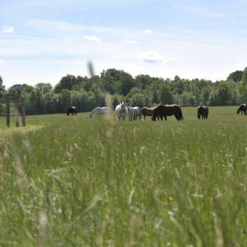
Schanzenhof Handeloh Offenstallhaltung und Boxen
Handeloh
Schanzenhof
@Schanzenhof
FN-Mitglied
Freizeitstall
Hunde willkommen
Krankenbox
Allergikerstall
Hufrehe geeignet
Außenbox mit Paddock
Außenboxen
22 weitere...
ganz aktuell
S
Deprecated: Creation of dynamic property Zend_View_Helper_Ads::$adLink is deprecated in /var/www/stall-frei/htdocs/staging.stall-frei.de/library/Psf/View/Helper/Ads.php on line 108

Futtersack HeuToy, Fressbremse in pink
Mechtersen
STALL-FREIde Marketing
@STALL-FREI-Marketing
Stundenlange Beschäftigung die
Koliken vorbeugt, geringe Staubinhalation mit
steuerbarer Futterentnahme


Top Reitanlage mit besten Trainingsmöglichkeiten
Schneverdingen
Hof Schultenwede
@Hof-Schultenwede
Geländestrecke
Pferdeausbildung
Führanlage
Hunde willkommen
bedampftes/gewaschenes Heu
Außenboxen
Innenbox
22 weitere...
S


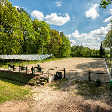
Paddockboxen für Selbstversorger plus
Schneverdingen
TheHorseCare
@TheHorseCare
Freizeitstall
Gangpferdereiten
Vermieten
Führanlage
Hunde willkommen
Allergikerstall
Fohlenaufzucht möglich
25 weitere...
S


Exclusive Hospizplätze
Schneverdingen
TheHorseCare
@TheHorseCare
FN-Mitglied
Freizeitstall
Vermieten
Führanlage
Hunde willkommen
Allergikerstall
Gnadenbrothof
27 weitere...
S


Pensionsstall Riepshof
Tostedt
Pensionsstall-Riepshof
@Pensionsstall-Riepshof
Freizeitstall
Geländestrecke
Vermieten
Krankenbox
Longierzirkel/Roundpen
Außenbox mit Paddock
Außenboxen
16 weitere...
P
Hof Buschbur - Pensionspferdehaltung
Handeloh
Hof Buschbur
@Hof-Buschbur
FN-Mitglied
Freizeitstall
Führanlage
Hunde willkommen
Notfallboxen
Außenbox mit Paddock
Außenboxen
23 weitere...
P
Thomashof
Schneverdingen
Thomashof
@Thomashof
Pferdeausbildung
Reitlehrer und -unterricht
Hunde willkommen
Longierzirkel/Roundpen
Allergikerstall
Hengsthaltung möglich
Außenbox mit Paddock
14 weitere...
P

Mitarbeiter gesucht?
Mechtersen
STALL-FREIde Marketing
@STALL-FREI-Marketing
Stellenangebote kostenlos veröffentlichen!

Einstellplätze im Offenstall frei
Kakenstorf
Familie-Singer
@Familie-Singer
Freizeitstall
Gangpferdereiten
Vermieten
Hunde willkommen
Krankenbox
Offenstall
10 weitere...
P

Jobenshof mit Reithalle, Reitplatz u. Longierhalle
Handeloh-Inzmühlen
Jobenshof
@Jobenshof
Freizeitstall
Longierzirkel/Roundpen
Reithalle
Offenstall
Schauer-Bewegungsstall
2 weitere...
P
Deprecated: Creation of dynamic property Zend_View::$pageCount is deprecated in /var/www/stall-frei/htdocs/staging.stall-frei.de/library/vendor/shardj/zf1-future/library/Zend/View/Abstract.php on line 308
Deprecated: Creation of dynamic property Zend_View::$itemCountPerPage is deprecated in /var/www/stall-frei/htdocs/staging.stall-frei.de/library/vendor/shardj/zf1-future/library/Zend/View/Abstract.php on line 308
Deprecated: Creation of dynamic property Zend_View::$first is deprecated in /var/www/stall-frei/htdocs/staging.stall-frei.de/library/vendor/shardj/zf1-future/library/Zend/View/Abstract.php on line 308
Deprecated: Creation of dynamic property Zend_View::$current is deprecated in /var/www/stall-frei/htdocs/staging.stall-frei.de/library/vendor/shardj/zf1-future/library/Zend/View/Abstract.php on line 308
Deprecated: Creation of dynamic property Zend_View::$last is deprecated in /var/www/stall-frei/htdocs/staging.stall-frei.de/library/vendor/shardj/zf1-future/library/Zend/View/Abstract.php on line 308
Deprecated: Creation of dynamic property Zend_View::$next is deprecated in /var/www/stall-frei/htdocs/staging.stall-frei.de/library/vendor/shardj/zf1-future/library/Zend/View/Abstract.php on line 308
Deprecated: Creation of dynamic property Zend_View::$pagesInRange is deprecated in /var/www/stall-frei/htdocs/staging.stall-frei.de/library/vendor/shardj/zf1-future/library/Zend/View/Abstract.php on line 308
Deprecated: Creation of dynamic property Zend_View::$firstPageInRange is deprecated in /var/www/stall-frei/htdocs/staging.stall-frei.de/library/vendor/shardj/zf1-future/library/Zend/View/Abstract.php on line 308
Deprecated: Creation of dynamic property Zend_View::$lastPageInRange is deprecated in /var/www/stall-frei/htdocs/staging.stall-frei.de/library/vendor/shardj/zf1-future/library/Zend/View/Abstract.php on line 308
Deprecated: Creation of dynamic property Zend_View::$currentItemCount is deprecated in /var/www/stall-frei/htdocs/staging.stall-frei.de/library/vendor/shardj/zf1-future/library/Zend/View/Abstract.php on line 308
Deprecated: Creation of dynamic property Zend_View::$totalItemCount is deprecated in /var/www/stall-frei/htdocs/staging.stall-frei.de/library/vendor/shardj/zf1-future/library/Zend/View/Abstract.php on line 308
Deprecated: Creation of dynamic property Zend_View::$firstItemNumber is deprecated in /var/www/stall-frei/htdocs/staging.stall-frei.de/library/vendor/shardj/zf1-future/library/Zend/View/Abstract.php on line 308
Deprecated: Creation of dynamic property Zend_View::$lastItemNumber is deprecated in /var/www/stall-frei/htdocs/staging.stall-frei.de/library/vendor/shardj/zf1-future/library/Zend/View/Abstract.php on line 308
Deprecated: Creation of dynamic property Zend_View::$router is deprecated in /var/www/stall-frei/htdocs/staging.stall-frei.de/library/vendor/shardj/zf1-future/library/Zend/View/Abstract.php on line 308
Deprecated: Creation of dynamic property Zend_View::$urlParams is deprecated in /var/www/stall-frei/htdocs/staging.stall-frei.de/library/vendor/shardj/zf1-future/library/Zend/View/Abstract.php on line 308
Deprecated: Creation of dynamic property Zend_View::$showAds is deprecated in /var/www/stall-frei/htdocs/staging.stall-frei.de/library/vendor/shardj/zf1-future/library/Zend/View/Abstract.php on line 308
Deprecated: Creation of dynamic property Zend_View::$objectIds is deprecated in /var/www/stall-frei/htdocs/staging.stall-frei.de/library/vendor/shardj/zf1-future/library/Zend/View/Abstract.php on line 308
Deprecated: Creation of dynamic property Zend_View::$showNavbar is deprecated in /var/www/stall-frei/htdocs/staging.stall-frei.de/library/vendor/shardj/zf1-future/library/Zend/View/Abstract.php on line 308
Deprecated: Creation of dynamic property Zend_View::$showBreadcrumb is deprecated in /var/www/stall-frei/htdocs/staging.stall-frei.de/library/vendor/shardj/zf1-future/library/Zend/View/Abstract.php on line 308
Deprecated: Creation of dynamic property Zend_View::$showFooter is deprecated in /var/www/stall-frei/htdocs/staging.stall-frei.de/library/vendor/shardj/zf1-future/library/Zend/View/Abstract.php on line 308
Deprecated: Creation of dynamic property Zend_View::$showInternalAds is deprecated in /var/www/stall-frei/htdocs/staging.stall-frei.de/library/vendor/shardj/zf1-future/library/Zend/View/Abstract.php on line 308
Deprecated: Creation of dynamic property Zend_View::$blNoContent is deprecated in /var/www/stall-frei/htdocs/staging.stall-frei.de/library/vendor/shardj/zf1-future/library/Zend/View/Abstract.php on line 308
Deprecated: Creation of dynamic property Zend_View::$sMetaDesc is deprecated in /var/www/stall-frei/htdocs/staging.stall-frei.de/library/vendor/shardj/zf1-future/library/Zend/View/Abstract.php on line 308
Deprecated: Creation of dynamic property Zend_View::$useGmaps is deprecated in /var/www/stall-frei/htdocs/staging.stall-frei.de/library/vendor/shardj/zf1-future/library/Zend/View/Abstract.php on line 308
Deprecated: Creation of dynamic property Zend_View::$touches is deprecated in /var/www/stall-frei/htdocs/staging.stall-frei.de/library/vendor/shardj/zf1-future/library/Zend/View/Abstract.php on line 308
Deprecated: Creation of dynamic property Zend_View::$oProject is deprecated in /var/www/stall-frei/htdocs/staging.stall-frei.de/library/vendor/shardj/zf1-future/library/Zend/View/Abstract.php on line 308
Deprecated: Creation of dynamic property Zend_View::$pageHeadline is deprecated in /var/www/stall-frei/htdocs/staging.stall-frei.de/library/vendor/shardj/zf1-future/library/Zend/View/Abstract.php on line 308
Deprecated: Creation of dynamic property Zend_View::$disableLocationField is deprecated in /var/www/stall-frei/htdocs/staging.stall-frei.de/library/vendor/shardj/zf1-future/library/Zend/View/Abstract.php on line 308
Deprecated: Creation of dynamic property Zend_View::$isSearch is deprecated in /var/www/stall-frei/htdocs/staging.stall-frei.de/library/vendor/shardj/zf1-future/library/Zend/View/Abstract.php on line 308
Deprecated: Creation of dynamic property Zend_View::$pageTitle is deprecated in /var/www/stall-frei/htdocs/staging.stall-frei.de/library/vendor/shardj/zf1-future/library/Zend/View/Abstract.php on line 308
Deprecated: Creation of dynamic property Psf_Form_Element_Text::$class is deprecated in /var/www/stall-frei/htdocs/staging.stall-frei.de/library/vendor/shardj/zf1-future/library/Zend/Form/Element.php on line 874
Deprecated: Creation of dynamic property Psf_Form_Element_Text::$size is deprecated in /var/www/stall-frei/htdocs/staging.stall-frei.de/library/vendor/shardj/zf1-future/library/Zend/Form/Element.php on line 874
Deprecated: Creation of dynamic property Psf_Form_Element_Text::$placeholder is deprecated in /var/www/stall-frei/htdocs/staging.stall-frei.de/library/vendor/shardj/zf1-future/library/Zend/Form/Element.php on line 874
Deprecated: Creation of dynamic property Psf_Form_Element_Hidden::$class is deprecated in /var/www/stall-frei/htdocs/staging.stall-frei.de/library/vendor/shardj/zf1-future/library/Zend/Form/Element.php on line 874
Deprecated: Creation of dynamic property Psf_Form_Element_Hidden::$class is deprecated in /var/www/stall-frei/htdocs/staging.stall-frei.de/library/vendor/shardj/zf1-future/library/Zend/Form/Element.php on line 874
Deprecated: Creation of dynamic property Psf_Form_Element_Hidden::$class is deprecated in /var/www/stall-frei/htdocs/staging.stall-frei.de/library/vendor/shardj/zf1-future/library/Zend/Form/Element.php on line 874
Deprecated: Creation of dynamic property Psf_Form_Element_Hidden::$class is deprecated in /var/www/stall-frei/htdocs/staging.stall-frei.de/library/vendor/shardj/zf1-future/library/Zend/Form/Element.php on line 874
Deprecated: Creation of dynamic property Psf_Form_Element_Select::$class is deprecated in /var/www/stall-frei/htdocs/staging.stall-frei.de/library/vendor/shardj/zf1-future/library/Zend/Form/Element.php on line 874
Deprecated: Creation of dynamic property Psf_Form_Element_Select::$class is deprecated in /var/www/stall-frei/htdocs/staging.stall-frei.de/library/vendor/shardj/zf1-future/library/Zend/Form/Element.php on line 874
Deprecated: Creation of dynamic property Psf_Form_Element_Select::$class is deprecated in /var/www/stall-frei/htdocs/staging.stall-frei.de/library/vendor/shardj/zf1-future/library/Zend/Form/Element.php on line 874
Deprecated: Creation of dynamic property Psf_Form_Element_Select::$class is deprecated in /var/www/stall-frei/htdocs/staging.stall-frei.de/library/vendor/shardj/zf1-future/library/Zend/Form/Element.php on line 874
Deprecated: Creation of dynamic property Psf_Form_Element_Text::$class is deprecated in /var/www/stall-frei/htdocs/staging.stall-frei.de/library/vendor/shardj/zf1-future/library/Zend/Form/Element.php on line 874
Deprecated: Creation of dynamic property Psf_Form_Element_Checkbox::$label is deprecated in /var/www/stall-frei/htdocs/staging.stall-frei.de/library/vendor/shardj/zf1-future/library/Zend/Form/Element.php on line 874
Deprecated: Creation of dynamic property Zend_View::$sort is deprecated in /var/www/stall-frei/htdocs/staging.stall-frei.de/library/vendor/shardj/zf1-future/library/Zend/View/Abstract.php on line 308
Deprecated: Creation of dynamic property Zend_View::$searchLocation is deprecated in /var/www/stall-frei/htdocs/staging.stall-frei.de/library/vendor/shardj/zf1-future/library/Zend/View/Abstract.php on line 308
Deprecated: Creation of dynamic property Zend_View::$locationHint is deprecated in /var/www/stall-frei/htdocs/staging.stall-frei.de/library/vendor/shardj/zf1-future/library/Zend/View/Abstract.php on line 308
Psf_GeoCoder_Abstract::getLocation: Otter Get Location CachedOrLive
Psf_GeoCoder_Abstract::getCachedOrLive: Otter
Psf_GeoCoder_OpenCageData::makeApiRequest: response:
Array
(
[documentation] => https://opencagedata.com/api
[licenses] => Array
(
[0] => Array
(
[name] => see attribution guide
[url] => https://opencagedata.com/credits
)
)
[results] => Array
(
[0] => Array
(
[bounds] => Array
(
[northeast] => Array
(
[lat] => 53.2642458
[lng] => 9.8074865
)
[southwest] => Array
(
[lat] => 53.1869189
[lng] => 9.6637811
)
)
[components] => Array
(
[ISO_3166-1_alpha-2] => DE
[ISO_3166-1_alpha-3] => DEU
[ISO_3166-2] => Array
(
[0] => DE-NI
)
[_category] => place
[_normalized_city] => Otter
[_type] => village
[continent] => Europe
[country] => Deutschland
[country_code] => de
[county] => Landkreis Harburg
[municipality] => Samtgemeinde Tostedt
[political_union] => European Union
[postcode] => 21259
[state] => Niedersachsen
[state_code] => NI
[village] => Otter
)
[confidence] => 7
[formatted] => 21259 Otter, Deutschland
[geometry] => Array
(
[lat] => 53.2404775
[lng] => 9.7413015
)
)
[1] => Array
(
[bounds] => Array
(
[northeast] => Array
(
[lat] => 53.500054
[lng] => 9.368285
)
[southwest] => Array
(
[lat] => 53.428675
[lng] => 9.2423453
)
)
[components] => Array
(
[ISO_3166-1_alpha-2] => DE
[ISO_3166-1_alpha-3] => DEU
[ISO_3166-2] => Array
(
[0] => DE-NI
)
[_category] => natural/water
[_normalized_city] => Kutenholz
[_type] => river
[continent] => Europe
[country] => Deutschland
[country_code] => de
[county] => Landkreis Stade
[municipality] => Samtgemeinde Fredenbeck
[political_union] => European Union
[river] => Otter
[state] => Niedersachsen
[state_code] => NI
[village] => Kutenholz
)
[confidence] => 7
[formatted] => Otter, Kutenholz, Niedersachsen, Deutschland
[geometry] => Array
(
[lat] => 53.4793737
[lng] => 9.2920317
)
)
[2] => Array
(
[bounds] => Array
(
[northeast] => Array
(
[lat] => 50.8245522
[lng] => 9.3915744
)
[southwest] => Array
(
[lat] => 50.7890761
[lng] => 9.3751955
)
)
[components] => Array
(
[ISO_3166-1_alpha-2] => DE
[ISO_3166-1_alpha-3] => DEU
[ISO_3166-2] => Array
(
[0] => DE-HE
)
[_category] => natural/water
[_normalized_city] => Ottrau
[_type] => stream
[continent] => Europe
[country] => Deutschland
[country_code] => de
[county] => Schwalm-Eder-Kreis
[municipality] => Ottrau
[political_union] => European Union
[state] => Hessen
[state_code] => HE
[stream] => Otter
)
[confidence] => 7
[formatted] => Otter, Ottrau, Hessen, Deutschland
[geometry] => Array
(
[lat] => 50.8055059
[lng] => 9.386495
)
)
[3] => Array
(
[bounds] => Array
(
[northeast] => Array
(
[lat] => 50.7908297
[lng] => 9.3799189
)
[southwest] => Array
(
[lat] => 50.7891025
[lng] => 9.3785734
)
)
[components] => Array
(
[ISO_3166-1_alpha-2] => DE
[ISO_3166-1_alpha-3] => DEU
[ISO_3166-2] => Array
(
[0] => DE-HE
)
[_category] => natural/water
[_normalized_city] => Ottrau
[_type] => stream
[continent] => Europe
[country] => Deutschland
[country_code] => de
[county] => Schwalm-Eder-Kreis
[municipality] => Ottrau
[political_union] => European Union
[postcode] => 34633
[state] => Hessen
[state_code] => HE
[stream] => Otter
[village] => Ottrau
)
[confidence] => 9
[formatted] => Otter, 34633 Ottrau, Deutschland
[geometry] => Array
(
[lat] => 50.7898619
[lng] => 9.3790789
)
)
[4] => Array
(
[bounds] => Array
(
[northeast] => Array
(
[lat] => 51.4913246
[lng] => 6.8547082
)
[southwest] => Array
(
[lat] => 51.4911794
[lng] => 6.8545008
)
)
[components] => Array
(
[ISO_3166-1_alpha-2] => DE
[ISO_3166-1_alpha-3] => DEU
[ISO_3166-2] => Array
(
[0] => DE-NW
)
[_category] => natural/water
[_normalized_city] => Oberhausen
[_type] => wetland
[city] => Oberhausen
[city_district] => Alt-Oberhausen
[continent] => Europe
[country] => Deutschland
[country_code] => de
[political_union] => European Union
[postcode] => 46049
[state] => Nordrhein-Westfalen
[state_code] => NW
[suburb] => Neue Mitte
[wetland] => Otter
)
[confidence] => 9
[formatted] => Otter, 46049 Oberhausen, Deutschland
[geometry] => Array
(
[lat] => 51.49125
[lng] => 6.854623
)
)
[5] => Array
(
[bounds] => Array
(
[northeast] => Array
(
[lat] => 49.0901522
[lng] => 8.0273473
)
[southwest] => Array
(
[lat] => 49.0601097
[lng] => 7.8930673
)
)
[components] => Array
(
[ISO_3166-1_alpha-2] => DE
[ISO_3166-1_alpha-3] => DEU
[ISO_3166-2] => Array
(
[0] => DE-RP
)
[_category] => place
[_normalized_city] => Oberotterbach
[_type] => village
[continent] => Europe
[country] => Deutschland
[country_code] => de
[county] => Landkreis Südliche Weinstraße
[municipality] => Bad Bergzabern
[political_union] => European Union
[state] => Rheinland-Pfalz
[state_code] => RP
[village] => Oberotterbach
)
[confidence] => 7
[formatted] => Oberotterbach, Rheinland-Pfalz, Deutschland
[geometry] => Array
(
[lat] => 49.0704303
[lng] => 7.9707656
)
)
[6] => Array
(
[bounds] => Array
(
[northeast] => Array
(
[lat] => 49.5026075
[lng] => 7.757785
)
[southwest] => Array
(
[lat] => 49.4726598
[lng] => 7.7031141
)
)
[components] => Array
(
[ISO_3166-1_alpha-2] => DE
[ISO_3166-1_alpha-3] => DEU
[ISO_3166-2] => Array
(
[0] => DE-RP
)
[_category] => place
[_normalized_city] => Otterbach
[_type] => village
[continent] => Europe
[country] => Deutschland
[country_code] => de
[county] => Landkreis Kaiserslautern
[municipality] => Otterbach-Otterberg
[political_union] => European Union
[postcode] => 67731
[state] => Rheinland-Pfalz
[state_code] => RP
[village] => Otterbach
)
[confidence] => 7
[formatted] => 67731 Otterbach, Deutschland
[geometry] => Array
(
[lat] => 49.4859015
[lng] => 7.736859
)
)
[7] => Array
(
[components] => Array
(
[ISO_3166-1_alpha-2] => FR
[ISO_3166-1_alpha-3] => FRA
[ISO_3166-2] => Array
(
[0] => FR-NOR
[1] => FR-27
)
[_category] => road
[_normalized_city] => Vesly
[_type] => road
[city] => Vesly
[continent] => Europe
[country] => France
[country_code] => fr
[county] => Eure
[local_authority] => Communauté de communes du Vexin Normand
[political_union] => European Union
[postcode] => 27870
[road] => Rue de l'Abbé Otter
[state] => Normandie
[state_code] => NOR
)
[confidence] => 2
[formatted] => Rue de l'Abbé Otter, 27870 Vesly, France
[geometry] => Array
(
[lat] => 49.242925
[lng] => 1.659146
)
)
[8] => Array
(
[components] => Array
(
[ISO_3166-1_alpha-2] => FR
[ISO_3166-1_alpha-3] => FRA
[ISO_3166-2] => Array
(
[0] => FR-GES
[1] => FR-6AE
[2] => FR-68
)
[_category] => place
[_normalized_city] => Hirsingue
[_type] => place
[city] => Hirsingue
[continent] => Europe
[country] => France
[country_code] => fr
[county] => Haut-Rhin
[local_authority] => Communauté de communes Sundgau
[place] => Ober Dem Brandwinkel
[political_union] => European Union
[postcode] => 68560
[state] => Grand Est
[state_code] => GES
)
[confidence] => 2
[formatted] => Ober Dem Brandwinkel, 68560 Hirsingue, France
[geometry] => Array
(
[lat] => 47.595541
[lng] => 7.244854
)
)
[9] => Array
(
[components] => Array
(
[ISO_3166-1_alpha-2] => FR
[ISO_3166-1_alpha-3] => FRA
[ISO_3166-2] => Array
(
[0] => FR-GES
[1] => FR-6AE
[2] => FR-68
)
[_category] => place
[_normalized_city] => Soultz-Haut-Rhin
[_type] => place
[city] => Soultz-Haut-Rhin
[continent] => Europe
[country] => France
[country_code] => fr
[county] => Haut-Rhin
[local_authority] => Communauté de communes de la Région de Guebwiller
[place] => Obere Ruetschmatt
[political_union] => European Union
[postcode] => 68360
[state] => Grand Est
[state_code] => GES
)
[confidence] => 2
[formatted] => Obere Ruetschmatt, 68360 Soultz-Haut-Rhin, France
[geometry] => Array
(
[lat] => 47.889506
[lng] => 7.215989
)
)
)
[status] => Array
(
[code] => 200
[message] => OK
)
[stay_informed] => Array
(
[blog] => https://blog.opencagedata.com
[mastodon] => https://en.osm.town/@opencage
)
[thanks] => For using an OpenCage API
[timestamp] => Array
(
[created_http] => Sun, 08 Feb 2026 14:01:53 GMT
[created_unix] => 1770559313
)
[total_results] => 10
)
Psf_GeoCoder_Abstract::convertLocationResult
{"documentation":"https:\/\/opencagedata.com\/api","licenses":[{"name":"see attribution guide","url":"https:\/\/opencagedata.com\/credits"}],"results":[{"bounds":{"northeast":{"lat":53.2642458,"lng":9.8074865},"southwest":{"lat":53.1869189,"lng":9.6637811}},"components":{"ISO_3166-1_alpha-2":"DE","ISO_3166-1_alpha-3":"DEU","ISO_3166-2":["DE-NI"],"_category":"place","_normalized_city":"Otter","_type":"village","continent":"Europe","country":"Deutschland","country_code":"de","county":"Landkreis Harburg","municipality":"Samtgemeinde Tostedt","political_union":"European Union","postcode":"21259","state":"Niedersachsen","state_code":"NI","village":"Otter"},"confidence":7,"formatted":"21259 Otter, Deutschland","geometry":{"lat":53.2404775,"lng":9.7413015}},{"bounds":{"northeast":{"lat":53.500054,"lng":9.368285},"southwest":{"lat":53.428675,"lng":9.2423453}},"components":{"ISO_3166-1_alpha-2":"DE","ISO_3166-1_alpha-3":"DEU","ISO_3166-2":["DE-NI"],"_category":"natural\/water","_normalized_city":"Kutenholz","_type":"river","continent":"Europe","country":"Deutschland","country_code":"de","county":"Landkreis Stade","municipality":"Samtgemeinde Fredenbeck","political_union":"European Union","river":"Otter","state":"Niedersachsen","state_code":"NI","village":"Kutenholz"},"confidence":7,"formatted":"Otter, Kutenholz, Niedersachsen, Deutschland","geometry":{"lat":53.4793737,"lng":9.2920317}},{"bounds":{"northeast":{"lat":50.8245522,"lng":9.3915744},"southwest":{"lat":50.7890761,"lng":9.3751955}},"components":{"ISO_3166-1_alpha-2":"DE","ISO_3166-1_alpha-3":"DEU","ISO_3166-2":["DE-HE"],"_category":"natural\/water","_normalized_city":"Ottrau","_type":"stream","continent":"Europe","country":"Deutschland","country_code":"de","county":"Schwalm-Eder-Kreis","municipality":"Ottrau","political_union":"European Union","state":"Hessen","state_code":"HE","stream":"Otter"},"confidence":7,"formatted":"Otter, Ottrau, Hessen, Deutschland","geometry":{"lat":50.8055059,"lng":9.386495}},{"bounds":{"northeast":{"lat":50.7908297,"lng":9.3799189},"southwest":{"lat":50.7891025,"lng":9.3785734}},"components":{"ISO_3166-1_alpha-2":"DE","ISO_3166-1_alpha-3":"DEU","ISO_3166-2":["DE-HE"],"_category":"natural\/water","_normalized_city":"Ottrau","_type":"stream","continent":"Europe","country":"Deutschland","country_code":"de","county":"Schwalm-Eder-Kreis","municipality":"Ottrau","political_union":"European Union","postcode":"34633","state":"Hessen","state_code":"HE","stream":"Otter","village":"Ottrau"},"confidence":9,"formatted":"Otter, 34633 Ottrau, Deutschland","geometry":{"lat":50.7898619,"lng":9.3790789}},{"bounds":{"northeast":{"lat":51.4913246,"lng":6.8547082},"southwest":{"lat":51.4911794,"lng":6.8545008}},"components":{"ISO_3166-1_alpha-2":"DE","ISO_3166-1_alpha-3":"DEU","ISO_3166-2":["DE-NW"],"_category":"natural\/water","_normalized_city":"Oberhausen","_type":"wetland","city":"Oberhausen","city_district":"Alt-Oberhausen","continent":"Europe","country":"Deutschland","country_code":"de","political_union":"European Union","postcode":"46049","state":"Nordrhein-Westfalen","state_code":"NW","suburb":"Neue Mitte","wetland":"Otter"},"confidence":9,"formatted":"Otter, 46049 Oberhausen, Deutschland","geometry":{"lat":51.49125,"lng":6.854623}},{"bounds":{"northeast":{"lat":49.0901522,"lng":8.0273473},"southwest":{"lat":49.0601097,"lng":7.8930673}},"components":{"ISO_3166-1_alpha-2":"DE","ISO_3166-1_alpha-3":"DEU","ISO_3166-2":["DE-RP"],"_category":"place","_normalized_city":"Oberotterbach","_type":"village","continent":"Europe","country":"Deutschland","country_code":"de","county":"Landkreis S\u00fcdliche Weinstra\u00dfe","municipality":"Bad Bergzabern","political_union":"European Union","state":"Rheinland-Pfalz","state_code":"RP","village":"Oberotterbach"},"confidence":7,"formatted":"Oberotterbach, Rheinland-Pfalz, Deutschland","geometry":{"lat":49.0704303,"lng":7.9707656}},{"bounds":{"northeast":{"lat":49.5026075,"lng":7.757785},"southwest":{"lat":49.4726598,"lng":7.7031141}},"components":{"ISO_3166-1_alpha-2":"DE","ISO_3166-1_alpha-3":"DEU","ISO_3166-2":["DE-RP"],"_category":"place","_normalized_city":"Otterbach","_type":"village","continent":"Europe","country":"Deutschland","country_code":"de","county":"Landkreis Kaiserslautern","municipality":"Otterbach-Otterberg","political_union":"European Union","postcode":"67731","state":"Rheinland-Pfalz","state_code":"RP","village":"Otterbach"},"confidence":7,"formatted":"67731 Otterbach, Deutschland","geometry":{"lat":49.4859015,"lng":7.736859}},{"components":{"ISO_3166-1_alpha-2":"FR","ISO_3166-1_alpha-3":"FRA","ISO_3166-2":["FR-NOR","FR-27"],"_category":"road","_normalized_city":"Vesly","_type":"road","city":"Vesly","continent":"Europe","country":"France","country_code":"fr","county":"Eure","local_authority":"Communaut\u00e9 de communes du Vexin Normand","political_union":"European Union","postcode":"27870","road":"Rue de l'Abb\u00e9 Otter","state":"Normandie","state_code":"NOR"},"confidence":2,"formatted":"Rue de l'Abb\u00e9 Otter, 27870 Vesly, France","geometry":{"lat":49.242925,"lng":1.659146}},{"components":{"ISO_3166-1_alpha-2":"FR","ISO_3166-1_alpha-3":"FRA","ISO_3166-2":["FR-GES","FR-6AE","FR-68"],"_category":"place","_normalized_city":"Hirsingue","_type":"place","city":"Hirsingue","continent":"Europe","country":"France","country_code":"fr","county":"Haut-Rhin","local_authority":"Communaut\u00e9 de communes Sundgau","place":"Ober Dem Brandwinkel","political_union":"European Union","postcode":"68560","state":"Grand Est","state_code":"GES"},"confidence":2,"formatted":"Ober Dem Brandwinkel, 68560 Hirsingue, France","geometry":{"lat":47.595541,"lng":7.244854}},{"components":{"ISO_3166-1_alpha-2":"FR","ISO_3166-1_alpha-3":"FRA","ISO_3166-2":["FR-GES","FR-6AE","FR-68"],"_category":"place","_normalized_city":"Soultz-Haut-Rhin","_type":"place","city":"Soultz-Haut-Rhin","continent":"Europe","country":"France","country_code":"fr","county":"Haut-Rhin","local_authority":"Communaut\u00e9 de communes de la R\u00e9gion de Guebwiller","place":"Obere Ruetschmatt","political_union":"European Union","postcode":"68360","state":"Grand Est","state_code":"GES"},"confidence":2,"formatted":"Obere Ruetschmatt, 68360 Soultz-Haut-Rhin, France","geometry":{"lat":47.889506,"lng":7.215989}}],"status":{"code":200,"message":"OK"},"stay_informed":{"blog":"https:\/\/blog.opencagedata.com","mastodon":"https:\/\/en.osm.town\/@opencage"},"thanks":"For using an OpenCage API","timestamp":{"created_http":"Sun, 08 Feb 2026 14:01:53 GMT","created_unix":1770559313},"total_results":10}Array
(
[0] => stdClass Object
(
[bounds] => stdClass Object
(
[northeast] => stdClass Object
(
[lat] => 53.2642458
[lng] => 9.8074865
)
[southwest] => stdClass Object
(
[lat] => 53.1869189
[lng] => 9.6637811
)
)
[components] => stdClass Object
(
[ISO_3166-1_alpha-2] => DE
[ISO_3166-1_alpha-3] => DEU
[ISO_3166-2] => Array
(
[0] => DE-NI
)
[_category] => place
[_normalized_city] => Otter
[_type] => village
[continent] => Europe
[country] => Deutschland
[country_code] => de
[county] => Landkreis Harburg
[municipality] => Samtgemeinde Tostedt
[political_union] => European Union
[postcode] => 21259
[state] => Niedersachsen
[state_code] => NI
[village] => Otter
)
[confidence] => 7
[formatted] => 21259 Otter, Deutschland
[geometry] => stdClass Object
(
[lat] => 53.2404775
[lng] => 9.7413015
)
)
[1] => stdClass Object
(
[bounds] => stdClass Object
(
[northeast] => stdClass Object
(
[lat] => 53.500054
[lng] => 9.368285
)
[southwest] => stdClass Object
(
[lat] => 53.428675
[lng] => 9.2423453
)
)
[components] => stdClass Object
(
[ISO_3166-1_alpha-2] => DE
[ISO_3166-1_alpha-3] => DEU
[ISO_3166-2] => Array
(
[0] => DE-NI
)
[_category] => natural/water
[_normalized_city] => Kutenholz
[_type] => river
[continent] => Europe
[country] => Deutschland
[country_code] => de
[county] => Landkreis Stade
[municipality] => Samtgemeinde Fredenbeck
[political_union] => European Union
[river] => Otter
[state] => Niedersachsen
[state_code] => NI
[village] => Kutenholz
)
[confidence] => 7
[formatted] => Otter, Kutenholz, Niedersachsen, Deutschland
[geometry] => stdClass Object
(
[lat] => 53.4793737
[lng] => 9.2920317
)
)
[2] => stdClass Object
(
[bounds] => stdClass Object
(
[northeast] => stdClass Object
(
[lat] => 50.8245522
[lng] => 9.3915744
)
[southwest] => stdClass Object
(
[lat] => 50.7890761
[lng] => 9.3751955
)
)
[components] => stdClass Object
(
[ISO_3166-1_alpha-2] => DE
[ISO_3166-1_alpha-3] => DEU
[ISO_3166-2] => Array
(
[0] => DE-HE
)
[_category] => natural/water
[_normalized_city] => Ottrau
[_type] => stream
[continent] => Europe
[country] => Deutschland
[country_code] => de
[county] => Schwalm-Eder-Kreis
[municipality] => Ottrau
[political_union] => European Union
[state] => Hessen
[state_code] => HE
[stream] => Otter
)
[confidence] => 7
[formatted] => Otter, Ottrau, Hessen, Deutschland
[geometry] => stdClass Object
(
[lat] => 50.8055059
[lng] => 9.386495
)
)
[3] => stdClass Object
(
[bounds] => stdClass Object
(
[northeast] => stdClass Object
(
[lat] => 50.7908297
[lng] => 9.3799189
)
[southwest] => stdClass Object
(
[lat] => 50.7891025
[lng] => 9.3785734
)
)
[components] => stdClass Object
(
[ISO_3166-1_alpha-2] => DE
[ISO_3166-1_alpha-3] => DEU
[ISO_3166-2] => Array
(
[0] => DE-HE
)
[_category] => natural/water
[_normalized_city] => Ottrau
[_type] => stream
[continent] => Europe
[country] => Deutschland
[country_code] => de
[county] => Schwalm-Eder-Kreis
[municipality] => Ottrau
[political_union] => European Union
[postcode] => 34633
[state] => Hessen
[state_code] => HE
[stream] => Otter
[village] => Ottrau
)
[confidence] => 9
[formatted] => Otter, 34633 Ottrau, Deutschland
[geometry] => stdClass Object
(
[lat] => 50.7898619
[lng] => 9.3790789
)
)
[4] => stdClass Object
(
[bounds] => stdClass Object
(
[northeast] => stdClass Object
(
[lat] => 51.4913246
[lng] => 6.8547082
)
[southwest] => stdClass Object
(
[lat] => 51.4911794
[lng] => 6.8545008
)
)
[components] => stdClass Object
(
[ISO_3166-1_alpha-2] => DE
[ISO_3166-1_alpha-3] => DEU
[ISO_3166-2] => Array
(
[0] => DE-NW
)
[_category] => natural/water
[_normalized_city] => Oberhausen
[_type] => wetland
[city] => Oberhausen
[city_district] => Alt-Oberhausen
[continent] => Europe
[country] => Deutschland
[country_code] => de
[political_union] => European Union
[postcode] => 46049
[state] => Nordrhein-Westfalen
[state_code] => NW
[suburb] => Neue Mitte
[wetland] => Otter
)
[confidence] => 9
[formatted] => Otter, 46049 Oberhausen, Deutschland
[geometry] => stdClass Object
(
[lat] => 51.49125
[lng] => 6.854623
)
)
[5] => stdClass Object
(
[bounds] => stdClass Object
(
[northeast] => stdClass Object
(
[lat] => 49.0901522
[lng] => 8.0273473
)
[southwest] => stdClass Object
(
[lat] => 49.0601097
[lng] => 7.8930673
)
)
[components] => stdClass Object
(
[ISO_3166-1_alpha-2] => DE
[ISO_3166-1_alpha-3] => DEU
[ISO_3166-2] => Array
(
[0] => DE-RP
)
[_category] => place
[_normalized_city] => Oberotterbach
[_type] => village
[continent] => Europe
[country] => Deutschland
[country_code] => de
[county] => Landkreis Südliche Weinstraße
[municipality] => Bad Bergzabern
[political_union] => European Union
[state] => Rheinland-Pfalz
[state_code] => RP
[village] => Oberotterbach
)
[confidence] => 7
[formatted] => Oberotterbach, Rheinland-Pfalz, Deutschland
[geometry] => stdClass Object
(
[lat] => 49.0704303
[lng] => 7.9707656
)
)
[6] => stdClass Object
(
[bounds] => stdClass Object
(
[northeast] => stdClass Object
(
[lat] => 49.5026075
[lng] => 7.757785
)
[southwest] => stdClass Object
(
[lat] => 49.4726598
[lng] => 7.7031141
)
)
[components] => stdClass Object
(
[ISO_3166-1_alpha-2] => DE
[ISO_3166-1_alpha-3] => DEU
[ISO_3166-2] => Array
(
[0] => DE-RP
)
[_category] => place
[_normalized_city] => Otterbach
[_type] => village
[continent] => Europe
[country] => Deutschland
[country_code] => de
[county] => Landkreis Kaiserslautern
[municipality] => Otterbach-Otterberg
[political_union] => European Union
[postcode] => 67731
[state] => Rheinland-Pfalz
[state_code] => RP
[village] => Otterbach
)
[confidence] => 7
[formatted] => 67731 Otterbach, Deutschland
[geometry] => stdClass Object
(
[lat] => 49.4859015
[lng] => 7.736859
)
)
[7] => stdClass Object
(
[components] => stdClass Object
(
[ISO_3166-1_alpha-2] => FR
[ISO_3166-1_alpha-3] => FRA
[ISO_3166-2] => Array
(
[0] => FR-NOR
[1] => FR-27
)
[_category] => road
[_normalized_city] => Vesly
[_type] => road
[city] => Vesly
[continent] => Europe
[country] => France
[country_code] => fr
[county] => Eure
[local_authority] => Communauté de communes du Vexin Normand
[political_union] => European Union
[postcode] => 27870
[road] => Rue de l'Abbé Otter
[state] => Normandie
[state_code] => NOR
)
[confidence] => 2
[formatted] => Rue de l'Abbé Otter, 27870 Vesly, France
[geometry] => stdClass Object
(
[lat] => 49.242925
[lng] => 1.659146
)
)
[8] => stdClass Object
(
[components] => stdClass Object
(
[ISO_3166-1_alpha-2] => FR
[ISO_3166-1_alpha-3] => FRA
[ISO_3166-2] => Array
(
[0] => FR-GES
[1] => FR-6AE
[2] => FR-68
)
[_category] => place
[_normalized_city] => Hirsingue
[_type] => place
[city] => Hirsingue
[continent] => Europe
[country] => France
[country_code] => fr
[county] => Haut-Rhin
[local_authority] => Communauté de communes Sundgau
[place] => Ober Dem Brandwinkel
[political_union] => European Union
[postcode] => 68560
[state] => Grand Est
[state_code] => GES
)
[confidence] => 2
[formatted] => Ober Dem Brandwinkel, 68560 Hirsingue, France
[geometry] => stdClass Object
(
[lat] => 47.595541
[lng] => 7.244854
)
)
[9] => stdClass Object
(
[components] => stdClass Object
(
[ISO_3166-1_alpha-2] => FR
[ISO_3166-1_alpha-3] => FRA
[ISO_3166-2] => Array
(
[0] => FR-GES
[1] => FR-6AE
[2] => FR-68
)
[_category] => place
[_normalized_city] => Soultz-Haut-Rhin
[_type] => place
[city] => Soultz-Haut-Rhin
[continent] => Europe
[country] => France
[country_code] => fr
[county] => Haut-Rhin
[local_authority] => Communauté de communes de la Région de Guebwiller
[place] => Obere Ruetschmatt
[political_union] => European Union
[postcode] => 68360
[state] => Grand Est
[state_code] => GES
)
[confidence] => 2
[formatted] => Obere Ruetschmatt, 68360 Soultz-Haut-Rhin, France
[geometry] => stdClass Object
(
[lat] => 47.889506
[lng] => 7.215989
)
)
)
Psf_GeoCoder_OpenCageData::getKeyMap: 0
stdClass Object
(
    [bounds] => stdClass Object
        (
            [northeast] => stdClass Object
                (
                    [lat] => 53.2642458
                    [lng] => 9.8074865
                )

            [southwest] => stdClass Object
                (
                    [lat] => 53.1869189
                    [lng] => 9.6637811
                )

        )

    [components] => stdClass Object
        (
            [ISO_3166-1_alpha-2] => DE
            [ISO_3166-1_alpha-3] => DEU
            [ISO_3166-2] => Array
                (
                    [0] => DE-NI
                )

            [_category] => place
            [_normalized_city] => Otter
            [_type] => village
            [continent] => Europe
            [country] => Deutschland
            [country_code] => de
            [county] => Landkreis Harburg
            [municipality] => Samtgemeinde Tostedt
            [political_union] => European Union
            [postcode] => 21259
            [state] => Niedersachsen
            [state_code] => NI
            [village] => Otter
        )

    [confidence] => 7
    [formatted] => 21259 Otter, Deutschland
    [geometry] => stdClass Object
        (
            [lat] => 53.2404775
            [lng] => 9.7413015
        )

)
Psf_GeoCoder_OpenCageData::getCounty: Harburg
Psf_GeoCoder_OpenCageData::addMissingData REFETCH!
Array
(
    [address] => 21259 Otter, Deutschland
    [type] => village
    [street] =>
    [city] => Otter
    [county] => Harburg
    [state] => Niedersachsen
    [zip] => 21259
    [country] => Deutschland
    [suburb] =>
    [countrycode] => de
    [latitude] => 53.2404775
    [longitude] => 9.7413015
    [accuracy] => 1
    [confidence] => 7
    [bounds] => stdClass Object
        (
            [northeast] => stdClass Object
                (
                    [lat] => 53.2642458
                    [lng] => 9.8074865
                )

            [southwest] => stdClass Object
                (
                    [lat] => 53.1869189
                    [lng] => 9.6637811
                )

        )

)
reformat!
Array
(
    [address] => 21259 Otter, Deutschland
    [type] => village
    [street] =>
    [city] => Otter
    [county] => Harburg
    [state] => Niedersachsen
    [zip] => 21259
    [country] => Deutschland
    [suburb] =>
    [countrycode] => de
    [latitude] => 53.2404775
    [longitude] => 9.7413015
    [accuracy] => 1
    [confidence] => 7
    [bounds] => stdClass Object
        (
            [northeast] => stdClass Object
                (
                    [lat] => 53.2642458
                    [lng] => 9.8074865
                )

            [southwest] => stdClass Object
                (
                    [lat] => 53.1869189
                    [lng] => 9.6637811
                )

        )

    [place] => 21259 Otter, Niedersachsen
    [hash] => 82a9fa2653731e24442456e260d510e2
)
Psf_GeoCoder_OpenCageData::getKeyMap: 1
stdClass Object
(
    [bounds] => stdClass Object
        (
            [northeast] => stdClass Object
                (
                    [lat] => 53.500054
                    [lng] => 9.368285
                )

            [southwest] => stdClass Object
                (
                    [lat] => 53.428675
                    [lng] => 9.2423453
                )

        )

    [components] => stdClass Object
        (
            [ISO_3166-1_alpha-2] => DE
            [ISO_3166-1_alpha-3] => DEU
            [ISO_3166-2] => Array
                (
                    [0] => DE-NI
                )

            [_category] => natural/water
            [_normalized_city] => Kutenholz
            [_type] => river
            [continent] => Europe
            [country] => Deutschland
            [country_code] => de
            [county] => Landkreis Stade
            [municipality] => Samtgemeinde Fredenbeck
            [political_union] => European Union
            [river] => Otter
            [state] => Niedersachsen
            [state_code] => NI
            [village] => Kutenholz
        )

    [confidence] => 7
    [formatted] => Otter, Kutenholz, Niedersachsen, Deutschland
    [geometry] => stdClass Object
        (
            [lat] => 53.4793737
            [lng] => 9.2920317
        )

)
Psf_GeoCoder_OpenCageData::getCounty: Stade
Psf_GeoCoder_OpenCageData::addMissingData REFETCH!
Array
(
    [address] => Otter, Kutenholz, Niedersachsen, Deutschland
    [type] => river
    [street] =>
    [city] => Kutenholz
    [county] => Stade
    [state] => Niedersachsen
    [zip] =>
    [country] => Deutschland
    [suburb] =>
    [countrycode] => de
    [latitude] => 53.4793737
    [longitude] => 9.2920317
    [accuracy] => 1
    [confidence] => 7
    [bounds] => stdClass Object
        (
            [northeast] => stdClass Object
                (
                    [lat] => 53.500054
                    [lng] => 9.368285
                )

            [southwest] => stdClass Object
                (
                    [lat] => 53.428675
                    [lng] => 9.2423453
                )

        )

)
reformat!
Array
(
    [address] => Otter, Kutenholz, Niedersachsen, Deutschland
    [type] => river
    [street] =>
    [city] => Kutenholz
    [county] => Stade
    [state] => Niedersachsen
    [zip] =>
    [country] => Deutschland
    [suburb] =>
    [countrycode] => de
    [latitude] => 53.4793737
    [longitude] => 9.2920317
    [accuracy] => 1
    [confidence] => 7
    [bounds] => stdClass Object
        (
            [northeast] => stdClass Object
                (
                    [lat] => 53.500054
                    [lng] => 9.368285
                )

            [southwest] => stdClass Object
                (
                    [lat] => 53.428675
                    [lng] => 9.2423453
                )

        )

    [place] => Kutenholz, Niedersachsen
    [hash] => 81c7bef5bdaf032218a28325a8e6a7b2
)
Psf_GeoCoder_OpenCageData::getKeyMap: 2
stdClass Object
(
    [bounds] => stdClass Object
        (
            [northeast] => stdClass Object
                (
                    [lat] => 50.8245522
                    [lng] => 9.3915744
                )

            [southwest] => stdClass Object
                (
                    [lat] => 50.7890761
                    [lng] => 9.3751955
                )

        )

    [components] => stdClass Object
        (
            [ISO_3166-1_alpha-2] => DE
            [ISO_3166-1_alpha-3] => DEU
            [ISO_3166-2] => Array
                (
                    [0] => DE-HE
                )

            [_category] => natural/water
            [_normalized_city] => Ottrau
            [_type] => stream
            [continent] => Europe
            [country] => Deutschland
            [country_code] => de
            [county] => Schwalm-Eder-Kreis
            [municipality] => Ottrau
            [political_union] => European Union
            [state] => Hessen
            [state_code] => HE
            [stream] => Otter
        )

    [confidence] => 7
    [formatted] => Otter, Ottrau, Hessen, Deutschland
    [geometry] => stdClass Object
        (
            [lat] => 50.8055059
            [lng] => 9.386495
        )

)
Psf_GeoCoder_OpenCageData::getCounty: Schwalm-Eder-Kreis
Psf_GeoCoder_OpenCageData::addMissingData REFETCH!
Array
(
    [address] => Otter, Ottrau, Hessen, Deutschland
    [type] => stream
    [street] =>
    [city] =>
    [county] => Schwalm-Eder-Kreis
    [state] => Hessen
    [zip] =>
    [country] => Deutschland
    [suburb] =>
    [countrycode] => de
    [latitude] => 50.8055059
    [longitude] => 9.386495
    [accuracy] => 1
    [confidence] => 7
    [bounds] => stdClass Object
        (
            [northeast] => stdClass Object
                (
                    [lat] => 50.8245522
                    [lng] => 9.3915744
                )

            [southwest] => stdClass Object
                (
                    [lat] => 50.7890761
                    [lng] => 9.3751955
                )

        )

)
reformat!
Array
(
    [address] => Otter, Ottrau, Hessen, Deutschland
    [type] => stream
    [street] =>
    [city] =>
    [county] => Schwalm-Eder-Kreis
    [state] => Hessen
    [zip] =>
    [country] => Deutschland
    [suburb] =>
    [countrycode] => de
    [latitude] => 50.8055059
    [longitude] => 9.386495
    [accuracy] => 1
    [confidence] => 7
    [bounds] => stdClass Object
        (
            [northeast] => stdClass Object
                (
                    [lat] => 50.8245522
                    [lng] => 9.3915744
                )

            [southwest] => stdClass Object
                (
                    [lat] => 50.7890761
                    [lng] => 9.3751955
                )

        )

    [place] => , Hessen
    [hash] => 61e28d1e986546c74d36de69ad5618a0
)
Psf_GeoCoder_OpenCageData::getKeyMap: 3
stdClass Object
(
    [bounds] => stdClass Object
        (
            [northeast] => stdClass Object
                (
                    [lat] => 50.7908297
                    [lng] => 9.3799189
                )

            [southwest] => stdClass Object
                (
                    [lat] => 50.7891025
                    [lng] => 9.3785734
                )

        )

    [components] => stdClass Object
        (
            [ISO_3166-1_alpha-2] => DE
            [ISO_3166-1_alpha-3] => DEU
            [ISO_3166-2] => Array
                (
                    [0] => DE-HE
                )

            [_category] => natural/water
            [_normalized_city] => Ottrau
            [_type] => stream
            [continent] => Europe
            [country] => Deutschland
            [country_code] => de
            [county] => Schwalm-Eder-Kreis
            [municipality] => Ottrau
            [political_union] => European Union
            [postcode] => 34633
            [state] => Hessen
            [state_code] => HE
            [stream] => Otter
            [village] => Ottrau
        )

    [confidence] => 9
    [formatted] => Otter, 34633 Ottrau, Deutschland
    [geometry] => stdClass Object
        (
            [lat] => 50.7898619
            [lng] => 9.3790789
        )

)
Psf_GeoCoder_OpenCageData::getCounty: Schwalm-Eder-Kreis
Psf_GeoCoder_OpenCageData::addMissingData REFETCH!
Array
(
    [address] => Otter, 34633 Ottrau, Deutschland
    [type] => stream
    [street] =>
    [city] => Ottrau
    [county] => Schwalm-Eder-Kreis
    [state] => Hessen
    [zip] => 34633
    [country] => Deutschland
    [suburb] =>
    [countrycode] => de
    [latitude] => 50.7898619
    [longitude] => 9.3790789
    [accuracy] => 1
    [confidence] => 9
    [bounds] => stdClass Object
        (
            [northeast] => stdClass Object
                (
                    [lat] => 50.7908297
                    [lng] => 9.3799189
                )

            [southwest] => stdClass Object
                (
                    [lat] => 50.7891025
                    [lng] => 9.3785734
                )

        )

)
reformat!
Array
(
    [address] => Otter, 34633 Ottrau, Deutschland
    [type] => stream
    [street] =>
    [city] => Ottrau
    [county] => Schwalm-Eder-Kreis
    [state] => Hessen
    [zip] => 34633
    [country] => Deutschland
    [suburb] =>
    [countrycode] => de
    [latitude] => 50.7898619
    [longitude] => 9.3790789
    [accuracy] => 1
    [confidence] => 9
    [bounds] => stdClass Object
        (
            [northeast] => stdClass Object
                (
                    [lat] => 50.7908297
                    [lng] => 9.3799189
                )

            [southwest] => stdClass Object
                (
                    [lat] => 50.7891025
                    [lng] => 9.3785734
                )

        )

    [place] => 34633 Ottrau, Hessen
    [hash] => 3c6e7809dd9aa1e5d8321cade1978128
)
Psf_GeoCoder_OpenCageData::getKeyMap: 4
stdClass Object
(
    [bounds] => stdClass Object
        (
            [northeast] => stdClass Object
                (
                    [lat] => 51.4913246
                    [lng] => 6.8547082
                )

            [southwest] => stdClass Object
                (
                    [lat] => 51.4911794
                    [lng] => 6.8545008
                )

        )

    [components] => stdClass Object
        (
            [ISO_3166-1_alpha-2] => DE
            [ISO_3166-1_alpha-3] => DEU
            [ISO_3166-2] => Array
                (
                    [0] => DE-NW
                )

            [_category] => natural/water
            [_normalized_city] => Oberhausen
            [_type] => wetland
            [city] => Oberhausen
            [city_district] => Alt-Oberhausen
            [continent] => Europe
            [country] => Deutschland
            [country_code] => de
            [political_union] => European Union
            [postcode] => 46049
            [state] => Nordrhein-Westfalen
            [state_code] => NW
            [suburb] => Neue Mitte
            [wetland] => Otter
        )

    [confidence] => 9
    [formatted] => Otter, 46049 Oberhausen, Deutschland
    [geometry] => stdClass Object
        (
            [lat] => 51.49125
            [lng] => 6.854623
        )

)
Psf_GeoCoder_OpenCageData::getCounty: Oberhausen
Psf_GeoCoder_OpenCageData::addMissingData REFETCH!
Array
(
    [address] => Otter, 46049 Oberhausen, Deutschland
    [type] => wetland
    [street] =>
    [city] => Neue Mitte
    [county] => Oberhausen
    [state] => Nordrhein-Westfalen
    [zip] => 46049
    [country] => Deutschland
    [suburb] => Neue Mitte
    [countrycode] => de
    [latitude] => 51.49125
    [longitude] => 6.854623
    [accuracy] => 1
    [confidence] => 9
    [bounds] => stdClass Object
        (
            [northeast] => stdClass Object
                (
                    [lat] => 51.4913246
                    [lng] => 6.8547082
                )

            [southwest] => stdClass Object
                (
                    [lat] => 51.4911794
                    [lng] => 6.8545008
                )

        )

)
reformat!
Array
(
    [address] => 46049 Neue Mitte
    [type] => wetland
    [street] =>
    [city] => Neue Mitte
    [county] => Oberhausen
    [state] => Nordrhein-Westfalen
    [zip] => 46049
    [country] => Deutschland
    [suburb] => Neue Mitte
    [countrycode] => de
    [latitude] => 51.49125
    [longitude] => 6.854623
    [accuracy] => 1
    [confidence] => 9
    [bounds] => stdClass Object
        (
            [northeast] => stdClass Object
                (
                    [lat] => 51.4913246
                    [lng] => 6.8547082
                )

            [southwest] => stdClass Object
                (
                    [lat] => 51.4911794
                    [lng] => 6.8545008
                )

        )

    [place] => 46049 Neue Mitte, Nordrhein-Westfalen
    [hash] => d80337e99a081d133a7e4f33be0363f3
)
Psf_GeoCoder_OpenCageData::getKeyMap: 5
stdClass Object
(
    [bounds] => stdClass Object
        (
            [northeast] => stdClass Object
                (
                    [lat] => 49.0901522
                    [lng] => 8.0273473
                )

            [southwest] => stdClass Object
                (
                    [lat] => 49.0601097
                    [lng] => 7.8930673
                )

        )

    [components] => stdClass Object
        (
            [ISO_3166-1_alpha-2] => DE
            [ISO_3166-1_alpha-3] => DEU
            [ISO_3166-2] => Array
                (
                    [0] => DE-RP
                )

            [_category] => place
            [_normalized_city] => Oberotterbach
            [_type] => village
            [continent] => Europe
            [country] => Deutschland
            [country_code] => de
            [county] => Landkreis Südliche Weinstraße
            [municipality] => Bad Bergzabern
            [political_union] => European Union
            [state] => Rheinland-Pfalz
            [state_code] => RP
            [village] => Oberotterbach
        )

    [confidence] => 7
    [formatted] => Oberotterbach, Rheinland-Pfalz, Deutschland
    [geometry] => stdClass Object
        (
            [lat] => 49.0704303
            [lng] => 7.9707656
        )

)
Psf_GeoCoder_OpenCageData::getCounty: Südliche Weinstraße
Psf_GeoCoder_OpenCageData::addMissingData REFETCH!
Array
(
    [address] => Oberotterbach, Rheinland-Pfalz, Deutschland
    [type] => village
    [street] =>
    [city] => Oberotterbach
    [county] => Südliche Weinstraße
    [state] => Rheinland-Pfalz
    [zip] =>
    [country] => Deutschland
    [suburb] =>
    [countrycode] => de
    [latitude] => 49.0704303
    [longitude] => 7.9707656
    [accuracy] => 1
    [confidence] => 7
    [bounds] => stdClass Object
        (
            [northeast] => stdClass Object
                (
                    [lat] => 49.0901522
                    [lng] => 8.0273473
                )

            [southwest] => stdClass Object
                (
                    [lat] => 49.0601097
                    [lng] => 7.8930673
                )

        )

)
reformat!
Array
(
    [address] => Oberotterbach, Rheinland-Pfalz, Deutschland
    [type] => village
    [street] =>
    [city] => Oberotterbach
    [county] => Südliche Weinstraße
    [state] => Rheinland-Pfalz
    [zip] =>
    [country] => Deutschland
    [suburb] =>
    [countrycode] => de
    [latitude] => 49.0704303
    [longitude] => 7.9707656
    [accuracy] => 1
    [confidence] => 7
    [bounds] => stdClass Object
        (
            [northeast] => stdClass Object
                (
                    [lat] => 49.0901522
                    [lng] => 8.0273473
                )

            [southwest] => stdClass Object
                (
                    [lat] => 49.0601097
                    [lng] => 7.8930673
                )

        )

    [place] => Oberotterbach, Rheinland-Pfalz
    [hash] => bf625c1c70bc6bf54f554b73220ccd26
)
Psf_GeoCoder_OpenCageData::getKeyMap: 6
stdClass Object
(
    [bounds] => stdClass Object
        (
            [northeast] => stdClass Object
                (
                    [lat] => 49.5026075
                    [lng] => 7.757785
                )

            [southwest] => stdClass Object
                (
                    [lat] => 49.4726598
                    [lng] => 7.7031141
                )

        )

    [components] => stdClass Object
        (
            [ISO_3166-1_alpha-2] => DE
            [ISO_3166-1_alpha-3] => DEU
            [ISO_3166-2] => Array
                (
                    [0] => DE-RP
                )

            [_category] => place
            [_normalized_city] => Otterbach
            [_type] => village
            [continent] => Europe
            [country] => Deutschland
            [country_code] => de
            [county] => Landkreis Kaiserslautern
            [municipality] => Otterbach-Otterberg
            [political_union] => European Union
            [postcode] => 67731
            [state] => Rheinland-Pfalz
            [state_code] => RP
            [village] => Otterbach
        )

    [confidence] => 7
    [formatted] => 67731 Otterbach, Deutschland
    [geometry] => stdClass Object
        (
            [lat] => 49.4859015
            [lng] => 7.736859
        )

)
Psf_GeoCoder_OpenCageData::getCounty: Kaiserslautern
Psf_GeoCoder_OpenCageData::addMissingData REFETCH!
Array
(
    [address] => 67731 Otterbach, Deutschland
    [type] => village
    [street] =>
    [city] => Otterbach
    [county] => Kaiserslautern
    [state] => Rheinland-Pfalz
    [zip] => 67731
    [country] => Deutschland
    [suburb] =>
    [countrycode] => de
    [latitude] => 49.4859015
    [longitude] => 7.736859
    [accuracy] => 1
    [confidence] => 7
    [bounds] => stdClass Object
        (
            [northeast] => stdClass Object
                (
                    [lat] => 49.5026075
                    [lng] => 7.757785
                )

            [southwest] => stdClass Object
                (
                    [lat] => 49.4726598
                    [lng] => 7.7031141
                )

        )

)
reformat!
Array
(
    [address] => 67731 Otterbach, Deutschland
    [type] => village
    [street] =>
    [city] => Otterbach
    [county] => Kaiserslautern
    [state] => Rheinland-Pfalz
    [zip] => 67731
    [country] => Deutschland
    [suburb] =>
    [countrycode] => de
    [latitude] => 49.4859015
    [longitude] => 7.736859
    [accuracy] => 1
    [confidence] => 7
    [bounds] => stdClass Object
        (
            [northeast] => stdClass Object
                (
                    [lat] => 49.5026075
                    [lng] => 7.757785
                )

            [southwest] => stdClass Object
                (
                    [lat] => 49.4726598
                    [lng] => 7.7031141
                )

        )

    [place] => 67731 Otterbach, Rheinland-Pfalz
    [hash] => 7b76e08c87752dd078b6818347b0b3fc
)
Psf_GeoCoder_OpenCageData::getKeyMap: 7
stdClass Object
(
    [components] => stdClass Object
        (
            [ISO_3166-1_alpha-2] => FR
            [ISO_3166-1_alpha-3] => FRA
            [ISO_3166-2] => Array
                (
                    [0] => FR-NOR
                    [1] => FR-27
                )

            [_category] => road
            [_normalized_city] => Vesly
            [_type] => road
            [city] => Vesly
            [continent] => Europe
            [country] => France
            [country_code] => fr
            [county] => Eure
            [local_authority] => Communauté de communes du Vexin Normand
            [political_union] => European Union
            [postcode] => 27870
            [road] => Rue de l'Abbé Otter
            [state] => Normandie
            [state_code] => NOR
        )

    [confidence] => 2
    [formatted] => Rue de l'Abbé Otter, 27870 Vesly, France
    [geometry] => stdClass Object
        (
            [lat] => 49.242925
            [lng] => 1.659146
        )

)
Psf_GeoCoder_OpenCageData::getCounty: Eure
Psf_GeoCoder_OpenCageData::addMissingData REFETCH!
Array
(
    [address] => Rue de l'Abbé Otter, 27870 Vesly, France
    [type] => road
    [street] => Rue de l'Abbé Otter
    [city] => Vesly
    [county] => Eure
    [state] => Normandie
    [zip] => 27870
    [country] => France
    [suburb] =>
    [countrycode] => fr
    [latitude] => 49.242925
    [longitude] => 1.659146
    [accuracy] => 1
    [confidence] => 2
    [bounds] =>
)
reformat!
Array
(
    [address] => Rue de l'Abbé Otter, 27870 Vesly, France
    [type] => road
    [street] => Rue de l'Abbé Otter
    [city] => Vesly
    [county] => Eure
    [state] => Normandie
    [zip] => 27870
    [country] => France
    [suburb] =>
    [countrycode] => fr
    [latitude] => 49.242925
    [longitude] => 1.659146
    [accuracy] => 1
    [confidence] => 2
    [bounds] =>
    [place] => Rue de l'Abbé Otter, 27870 Vesly, Normandie
    [hash] => d3a67f75c78f8813a0619f6ade6cb58d
)
Psf_GeoCoder_OpenCageData::getKeyMap: 8
stdClass Object
(
    [components] => stdClass Object
        (
            [ISO_3166-1_alpha-2] => FR
            [ISO_3166-1_alpha-3] => FRA
            [ISO_3166-2] => Array
                (
                    [0] => FR-GES
                    [1] => FR-6AE
                    [2] => FR-68
                )

            [_category] => place
            [_normalized_city] => Hirsingue
            [_type] => place
            [city] => Hirsingue
            [continent] => Europe
            [country] => France
            [country_code] => fr
            [county] => Haut-Rhin
            [local_authority] => Communauté de communes Sundgau
            [place] => Ober Dem Brandwinkel
            [political_union] => European Union
            [postcode] => 68560
            [state] => Grand Est
            [state_code] => GES
        )

    [confidence] => 2
    [formatted] => Ober Dem Brandwinkel, 68560 Hirsingue, France
    [geometry] => stdClass Object
        (
            [lat] => 47.595541
            [lng] => 7.244854
        )

)
Psf_GeoCoder_OpenCageData::getCounty: Haut-Rhin
Psf_GeoCoder_OpenCageData::addMissingData REFETCH!
Array
(
    [address] => Ober Dem Brandwinkel, 68560 Hirsingue, France
    [type] => place
    [street] =>
    [city] => Hirsingue
    [county] => Haut-Rhin
    [state] => Grand Est
    [zip] => 68560
    [country] => France
    [suburb] =>
    [countrycode] => fr
    [latitude] => 47.595541
    [longitude] => 7.244854
    [accuracy] => 1
    [confidence] => 2
    [bounds] =>
)
reformat!
Array
(
    [address] => Ober Dem Brandwinkel, 68560 Hirsingue, France
    [type] => place
    [street] =>
    [city] => Hirsingue
    [county] => Haut-Rhin
    [state] => Grand Est
    [zip] => 68560
    [country] => France
    [suburb] =>
    [countrycode] => fr
    [latitude] => 47.595541
    [longitude] => 7.244854
    [accuracy] => 1
    [confidence] => 2
    [bounds] =>
    [place] => 68560 Hirsingue, Grand Est
    [hash] => da5852c38a81eedbb6d470fa23db60ce
)
Psf_GeoCoder_OpenCageData::getKeyMap: 9
stdClass Object
(
    [components] => stdClass Object
        (
            [ISO_3166-1_alpha-2] => FR
            [ISO_3166-1_alpha-3] => FRA
            [ISO_3166-2] => Array
                (
                    [0] => FR-GES
                    [1] => FR-6AE
                    [2] => FR-68
                )

            [_category] => place
            [_normalized_city] => Soultz-Haut-Rhin
            [_type] => place
            [city] => Soultz-Haut-Rhin
            [continent] => Europe
            [country] => France
            [country_code] => fr
            [county] => Haut-Rhin
            [local_authority] => Communauté de communes de la Région de Guebwiller
            [place] => Obere Ruetschmatt
            [political_union] => European Union
            [postcode] => 68360
            [state] => Grand Est
            [state_code] => GES
        )

    [confidence] => 2
    [formatted] => Obere Ruetschmatt, 68360 Soultz-Haut-Rhin, France
    [geometry] => stdClass Object
        (
            [lat] => 47.889506
            [lng] => 7.215989
        )

)
Psf_GeoCoder_OpenCageData::getCounty: Haut-Rhin
Psf_GeoCoder_OpenCageData::addMissingData REFETCH!
Array
(
    [address] => Obere Ruetschmatt, 68360 Soultz-Haut-Rhin, France
    [type] => place
    [street] =>
    [city] => Soultz-Haut-Rhin
    [county] => Haut-Rhin
    [state] => Grand Est
    [zip] => 68360
    [country] => France
    [suburb] =>
    [countrycode] => fr
    [latitude] => 47.889506
    [longitude] => 7.215989
    [accuracy] => 1
    [confidence] => 2
    [bounds] =>
)
reformat!
Array
(
    [address] => Obere Ruetschmatt, 68360 Soultz-Haut-Rhin, France
    [type] => place
    [street] =>
    [city] => Soultz-Haut-Rhin
    [county] => Haut-Rhin
    [state] => Grand Est
    [zip] => 68360
    [country] => France
    [suburb] =>
    [countrycode] => fr
    [latitude] => 47.889506
    [longitude] => 7.215989
    [accuracy] => 1
    [confidence] => 2
    [bounds] =>
    [place] => 68360 Soultz-Haut-Rhin, Grand Est
    [hash] => 989c5797ae3c85d80e4a88c248b0dd4c
)
Deprecated: Creation of dynamic property Zend_View::$locationHintStyle is deprecated in /var/www/stall-frei/htdocs/staging.stall-frei.de/library/vendor/shardj/zf1-future/library/Zend/View/Abstract.php on line 308
Deprecated: Creation of dynamic property Zend_View::$adGeoLocation is deprecated in /var/www/stall-frei/htdocs/staging.stall-frei.de/library/vendor/shardj/zf1-future/library/Zend/View/Abstract.php on line 308
Deprecated: Creation of dynamic property Zend_View::$recordCount is deprecated in /var/www/stall-frei/htdocs/staging.stall-frei.de/library/vendor/shardj/zf1-future/library/Zend/View/Abstract.php on line 308
Deprecated: explode(): Passing null to parameter #2 ($string) of type string is deprecated in /var/www/stall-frei/htdocs/staging.stall-frei.de/application/models/SearchAgent.php on line 100
Deprecated: explode(): Passing null to parameter #2 ($string) of type string is deprecated in /var/www/stall-frei/htdocs/staging.stall-frei.de/application/models/SearchAgent.php on line 100
Deprecated: explode(): Passing null to parameter #2 ($string) of type string is deprecated in /var/www/stall-frei/htdocs/staging.stall-frei.de/application/models/SearchAgent.php on line 100
Deprecated: explode(): Passing null to parameter #2 ($string) of type string is deprecated in /var/www/stall-frei/htdocs/staging.stall-frei.de/application/models/SearchAgent.php on line 100
Deprecated: explode(): Passing null to parameter #2 ($string) of type string is deprecated in /var/www/stall-frei/htdocs/staging.stall-frei.de/application/models/SearchAgent.php on line 100
Deprecated: explode(): Passing null to parameter #2 ($string) of type string is deprecated in /var/www/stall-frei/htdocs/staging.stall-frei.de/application/models/SearchAgent.php on line 100
Deprecated: explode(): Passing null to parameter #2 ($string) of type string is deprecated in /var/www/stall-frei/htdocs/staging.stall-frei.de/application/models/SearchAgent.php on line 100
Deprecated: explode(): Passing null to parameter #2 ($string) of type string is deprecated in /var/www/stall-frei/htdocs/staging.stall-frei.de/application/models/SearchAgent.php on line 100
Deprecated: explode(): Passing null to parameter #2 ($string) of type string is deprecated in /var/www/stall-frei/htdocs/staging.stall-frei.de/application/models/SearchAgent.php on line 100
Deprecated: trim(): Passing null to parameter #1 ($string) of type string is deprecated in /var/www/stall-frei/htdocs/staging.stall-frei.de/application/models/Account/Search.php on line 82
Warning: Cannot modify header information - headers already sent by (output started at /var/www/stall-frei/htdocs/staging.stall-frei.de/library/vendor/shardj/zf1-future/library/Zend/View/Abstract.php:308) in /var/www/stall-frei/htdocs/staging.stall-frei.de/application/models/Account/Search.php on line 71
Deprecated: Creation of dynamic property Zend_View::$paginationParams is deprecated in /var/www/stall-frei/htdocs/staging.stall-frei.de/library/vendor/shardj/zf1-future/library/Zend/View/Abstract.php on line 308
Deprecated: Creation of dynamic property Zend_View::$objectPaginator is deprecated in /var/www/stall-frei/htdocs/staging.stall-frei.de/library/vendor/shardj/zf1-future/library/Zend/View/Abstract.php on line 308
Deprecated: Creation of dynamic property Zend_View::$featuredObjects is deprecated in /var/www/stall-frei/htdocs/staging.stall-frei.de/library/vendor/shardj/zf1-future/library/Zend/View/Abstract.php on line 308
Deprecated: Creation of dynamic property Zend_View::$hints is deprecated in /var/www/stall-frei/htdocs/staging.stall-frei.de/library/vendor/shardj/zf1-future/library/Zend/View/Abstract.php on line 308
Deprecated: Creation of dynamic property Zend_View::$attributeHints is deprecated in /var/www/stall-frei/htdocs/staging.stall-frei.de/library/vendor/shardj/zf1-future/library/Zend/View/Abstract.php on line 308
Deprecated: Creation of dynamic property Zend_View::$oSearchForm is deprecated in /var/www/stall-frei/htdocs/staging.stall-frei.de/library/vendor/shardj/zf1-future/library/Zend/View/Abstract.php on line 308