Deprecated: Creation of dynamic property Zend_View::$sMode is deprecated in /var/www/stall-frei/htdocs/staging.stall-frei.de/library/vendor/shardj/zf1-future/library/Zend/View/Abstract.php on line 308
Stallplatz oder Offenstall in Osterberg
Gesucht wird in "89296 Osterberg, Deutschland"
6.331 Einträge
Deprecated: Creation of dynamic property Zend_View::$listObjects is deprecated in /var/www/stall-frei/htdocs/staging.stall-frei.de/library/vendor/shardj/zf1-future/library/Zend/View/Abstract.php on line 308
Gesponsort


Deprecated: Creation of dynamic property Zend_View::$listMode is deprecated in /var/www/stall-frei/htdocs/staging.stall-frei.de/library/vendor/shardj/zf1-future/library/Zend/View/Abstract.php on line 308
Deprecated: Creation of dynamic property Zend_View::$renderedObjects is deprecated in /var/www/stall-frei/htdocs/staging.stall-frei.de/library/vendor/shardj/zf1-future/library/Zend/View/Abstract.php on line 308
Deprecated: Creation of dynamic property Zend_View::$index is deprecated in /var/www/stall-frei/htdocs/staging.stall-frei.de/library/vendor/shardj/zf1-future/library/Zend/View/Abstract.php on line 308
Deprecated: Creation of dynamic property Zend_View::$displayMode is deprecated in /var/www/stall-frei/htdocs/staging.stall-frei.de/library/vendor/shardj/zf1-future/library/Zend/View/Abstract.php on line 308
Deprecated: Creation of dynamic property Zend_View::$remarketingIds is deprecated in /var/www/stall-frei/htdocs/staging.stall-frei.de/library/vendor/shardj/zf1-future/library/Zend/View/Abstract.php on line 308
Deprecated: Creation of dynamic property Zend_View::$listItem is deprecated in /var/www/stall-frei/htdocs/staging.stall-frei.de/library/vendor/shardj/zf1-future/library/Zend/View/Abstract.php on line 308
Deprecated: Creation of dynamic property Zend_View::$object is deprecated in /var/www/stall-frei/htdocs/staging.stall-frei.de/library/vendor/shardj/zf1-future/library/Zend/View/Abstract.php on line 308
Deprecated: Creation of dynamic property Zend_View::$attributes is deprecated in /var/www/stall-frei/htdocs/staging.stall-frei.de/library/vendor/shardj/zf1-future/library/Zend/View/Abstract.php on line 308
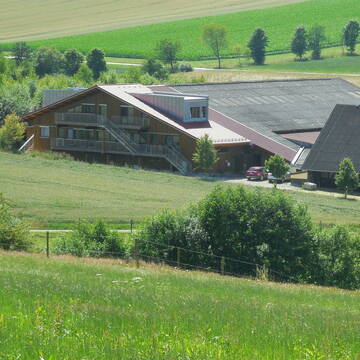
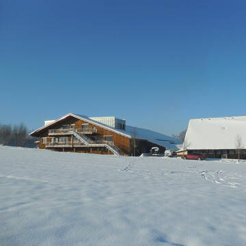
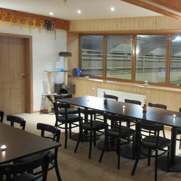
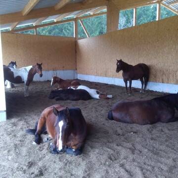
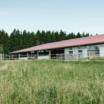
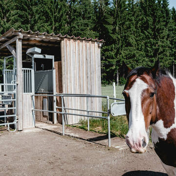
Hillsight Ranch
Buch-Rennertshofen
Hillsight-Ranch
@Hillsight-Ranch
Geländestrecke
Westernreiten
Longierzirkel/Roundpen
Paddock
Hengsthaltung möglich
Außenbox mit Paddock
Außenboxen
13 weitere...
P+
Leider kein Vorschaubild
Leider kein Vorschaubild
Pferdebox für Selbstversorger
Altenstadt Illereichen
Bernert Philipp
@Weidehof
Freizeitstall
Parkplatz für Pferdeanhänger
Reitplatz (z.B. Dressur, Springen, Reining)
Innenbox
Selbstversorgung
4 weitere...
B
Deprecated: Creation of dynamic property Zend_View_Helper_Ads::$adLink is deprecated in /var/www/stall-frei/htdocs/staging.stall-frei.de/library/Psf/View/Helper/Ads.php on line 108
MOBILE PFERDEWAAGE
Walddorfhäslach
ReitFein
@ReitFein
Kennst du das genaue Gewicht deines Pferdes? Mit uns erfährst du es - ohne viel Aufwand.
Umso mehr ihr seit, desto günstiger wird es.
aktuell
R

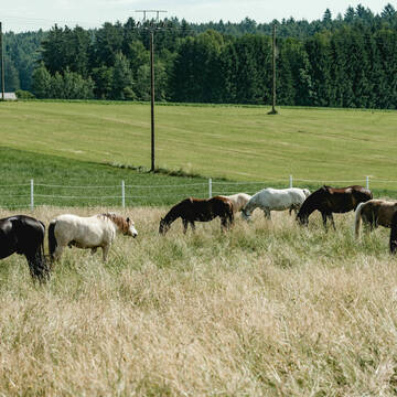
Pleasure-Ranch Otterwald
Niederrieden
Stephan. Walter
@Familie-Walter2
Vermieten
Longierzirkel/Roundpen
Paddock
Allergikerstall
Fohlenaufzucht möglich
Außenbox mit Paddock
Innenbox
15 weitere...
aktuell
P


Schöne Privatanlage bei Erkheim!
Arlesried
Familie-Eggart
@Familie-Eggart
Freizeitstall
Gastronomie
Vermieten
Hunde willkommen
Krankenbox
Allergikerstall
Hufrehe geeignet
24 weitere...
P+
Aktivstall Allgäu "Selbstversorger" be...
Bayern - Holzgünz
Robby Quaeck
@Robby-Quaeck
Hunde willkommen
Krankenbox
Bewegungsstall
Laufstall
HIT-Aktivstall
Selbstversorgung
9 weitere...
P+
Leider kein Vorschaubild
Leider kein Vorschaubild
Rothtal Ranch Buch,
Buch
Rothtal-Ranch
@Rothtal-Ranch
Parkplatz für Pferdeanhänger
Reitplatz (z.B. Dressur, Springen, Reining)
Hufrehe geeignet
Außenbox mit Paddock
Halbpension
3 weitere...
B

Offenstall Steinheim
Memmingen Steinheim
Offenstall-MM
@Offenstall-MM
Freizeitstall
Vermieten
Hunde willkommen
Longierzirkel/Roundpen
Hengsthaltung möglich
Notfallboxen
12 weitere...
P

Heu aus neuer Ernte
Mechtersen
STALL-FREIde Marketing
@STALL-FREI-Marketing
Heulage und Pferdeheu aus der neuen Ernte findest du in unserem Futtermarkt
Leider kein Vorschaubild
Leider kein Vorschaubild
Offenstall 4 Plätze frei
Egg
Jochen_Schoenhoefer
@Jochen_Schoenhoefer
Freizeitstall
Geländestrecke
Hunde willkommen
Krankenbox
Fohlenaufzucht möglich
Notfallboxen
Offenstall
9 weitere...
B
Leider kein Vorschaubild
Leider kein Vorschaubild
Pferdestall Selbstversorger
Illertissen OT Tiefenbach
larissa.stoeckner
@Huebner2
Vermieten
Longierzirkel/Roundpen
Paddock
Außenbox mit Paddock
Innenbox
Selbstversorgung
4 weitere...
aktuell
B
Leider kein Vorschaubild
Leider kein Vorschaubild
Offenstall
Deisenhausen
Pferdehof-Thalhofer
@Franz-Thalhofer
Geländestrecke
Vermieten
Reithalle
Toilette vorhanden
Bewegungsstall
Offenstall
5 weitere...
P
Deprecated: Creation of dynamic property Zend_View::$pageCount is deprecated in /var/www/stall-frei/htdocs/staging.stall-frei.de/library/vendor/shardj/zf1-future/library/Zend/View/Abstract.php on line 308
Deprecated: Creation of dynamic property Zend_View::$itemCountPerPage is deprecated in /var/www/stall-frei/htdocs/staging.stall-frei.de/library/vendor/shardj/zf1-future/library/Zend/View/Abstract.php on line 308
Deprecated: Creation of dynamic property Zend_View::$first is deprecated in /var/www/stall-frei/htdocs/staging.stall-frei.de/library/vendor/shardj/zf1-future/library/Zend/View/Abstract.php on line 308
Deprecated: Creation of dynamic property Zend_View::$current is deprecated in /var/www/stall-frei/htdocs/staging.stall-frei.de/library/vendor/shardj/zf1-future/library/Zend/View/Abstract.php on line 308
Deprecated: Creation of dynamic property Zend_View::$last is deprecated in /var/www/stall-frei/htdocs/staging.stall-frei.de/library/vendor/shardj/zf1-future/library/Zend/View/Abstract.php on line 308
Deprecated: Creation of dynamic property Zend_View::$next is deprecated in /var/www/stall-frei/htdocs/staging.stall-frei.de/library/vendor/shardj/zf1-future/library/Zend/View/Abstract.php on line 308
Deprecated: Creation of dynamic property Zend_View::$pagesInRange is deprecated in /var/www/stall-frei/htdocs/staging.stall-frei.de/library/vendor/shardj/zf1-future/library/Zend/View/Abstract.php on line 308
Deprecated: Creation of dynamic property Zend_View::$firstPageInRange is deprecated in /var/www/stall-frei/htdocs/staging.stall-frei.de/library/vendor/shardj/zf1-future/library/Zend/View/Abstract.php on line 308
Deprecated: Creation of dynamic property Zend_View::$lastPageInRange is deprecated in /var/www/stall-frei/htdocs/staging.stall-frei.de/library/vendor/shardj/zf1-future/library/Zend/View/Abstract.php on line 308
Deprecated: Creation of dynamic property Zend_View::$currentItemCount is deprecated in /var/www/stall-frei/htdocs/staging.stall-frei.de/library/vendor/shardj/zf1-future/library/Zend/View/Abstract.php on line 308
Deprecated: Creation of dynamic property Zend_View::$totalItemCount is deprecated in /var/www/stall-frei/htdocs/staging.stall-frei.de/library/vendor/shardj/zf1-future/library/Zend/View/Abstract.php on line 308
Deprecated: Creation of dynamic property Zend_View::$firstItemNumber is deprecated in /var/www/stall-frei/htdocs/staging.stall-frei.de/library/vendor/shardj/zf1-future/library/Zend/View/Abstract.php on line 308
Deprecated: Creation of dynamic property Zend_View::$lastItemNumber is deprecated in /var/www/stall-frei/htdocs/staging.stall-frei.de/library/vendor/shardj/zf1-future/library/Zend/View/Abstract.php on line 308
Deprecated: Creation of dynamic property Zend_View::$router is deprecated in /var/www/stall-frei/htdocs/staging.stall-frei.de/library/vendor/shardj/zf1-future/library/Zend/View/Abstract.php on line 308
Deprecated: Creation of dynamic property Zend_View::$urlParams is deprecated in /var/www/stall-frei/htdocs/staging.stall-frei.de/library/vendor/shardj/zf1-future/library/Zend/View/Abstract.php on line 308
Deprecated: Creation of dynamic property Zend_View::$showAds is deprecated in /var/www/stall-frei/htdocs/staging.stall-frei.de/library/vendor/shardj/zf1-future/library/Zend/View/Abstract.php on line 308
Deprecated: Creation of dynamic property Zend_View::$objectIds is deprecated in /var/www/stall-frei/htdocs/staging.stall-frei.de/library/vendor/shardj/zf1-future/library/Zend/View/Abstract.php on line 308
Deprecated: Creation of dynamic property Zend_View::$showNavbar is deprecated in /var/www/stall-frei/htdocs/staging.stall-frei.de/library/vendor/shardj/zf1-future/library/Zend/View/Abstract.php on line 308
Deprecated: Creation of dynamic property Zend_View::$showBreadcrumb is deprecated in /var/www/stall-frei/htdocs/staging.stall-frei.de/library/vendor/shardj/zf1-future/library/Zend/View/Abstract.php on line 308
Deprecated: Creation of dynamic property Zend_View::$showFooter is deprecated in /var/www/stall-frei/htdocs/staging.stall-frei.de/library/vendor/shardj/zf1-future/library/Zend/View/Abstract.php on line 308
Deprecated: Creation of dynamic property Zend_View::$showInternalAds is deprecated in /var/www/stall-frei/htdocs/staging.stall-frei.de/library/vendor/shardj/zf1-future/library/Zend/View/Abstract.php on line 308
Deprecated: Creation of dynamic property Zend_View::$blNoContent is deprecated in /var/www/stall-frei/htdocs/staging.stall-frei.de/library/vendor/shardj/zf1-future/library/Zend/View/Abstract.php on line 308
Deprecated: Creation of dynamic property Zend_View::$sMetaDesc is deprecated in /var/www/stall-frei/htdocs/staging.stall-frei.de/library/vendor/shardj/zf1-future/library/Zend/View/Abstract.php on line 308
Deprecated: Creation of dynamic property Zend_View::$useGmaps is deprecated in /var/www/stall-frei/htdocs/staging.stall-frei.de/library/vendor/shardj/zf1-future/library/Zend/View/Abstract.php on line 308
Deprecated: Creation of dynamic property Zend_View::$touches is deprecated in /var/www/stall-frei/htdocs/staging.stall-frei.de/library/vendor/shardj/zf1-future/library/Zend/View/Abstract.php on line 308
Deprecated: Creation of dynamic property Zend_View::$oProject is deprecated in /var/www/stall-frei/htdocs/staging.stall-frei.de/library/vendor/shardj/zf1-future/library/Zend/View/Abstract.php on line 308
Deprecated: Creation of dynamic property Zend_View::$pageHeadline is deprecated in /var/www/stall-frei/htdocs/staging.stall-frei.de/library/vendor/shardj/zf1-future/library/Zend/View/Abstract.php on line 308
Deprecated: Creation of dynamic property Zend_View::$disableLocationField is deprecated in /var/www/stall-frei/htdocs/staging.stall-frei.de/library/vendor/shardj/zf1-future/library/Zend/View/Abstract.php on line 308
Deprecated: Creation of dynamic property Zend_View::$isSearch is deprecated in /var/www/stall-frei/htdocs/staging.stall-frei.de/library/vendor/shardj/zf1-future/library/Zend/View/Abstract.php on line 308
Deprecated: Creation of dynamic property Zend_View::$pageTitle is deprecated in /var/www/stall-frei/htdocs/staging.stall-frei.de/library/vendor/shardj/zf1-future/library/Zend/View/Abstract.php on line 308
Deprecated: Creation of dynamic property Psf_Form_Element_Text::$class is deprecated in /var/www/stall-frei/htdocs/staging.stall-frei.de/library/vendor/shardj/zf1-future/library/Zend/Form/Element.php on line 874
Deprecated: Creation of dynamic property Psf_Form_Element_Text::$size is deprecated in /var/www/stall-frei/htdocs/staging.stall-frei.de/library/vendor/shardj/zf1-future/library/Zend/Form/Element.php on line 874
Deprecated: Creation of dynamic property Psf_Form_Element_Text::$placeholder is deprecated in /var/www/stall-frei/htdocs/staging.stall-frei.de/library/vendor/shardj/zf1-future/library/Zend/Form/Element.php on line 874
Deprecated: Creation of dynamic property Psf_Form_Element_Hidden::$class is deprecated in /var/www/stall-frei/htdocs/staging.stall-frei.de/library/vendor/shardj/zf1-future/library/Zend/Form/Element.php on line 874
Deprecated: Creation of dynamic property Psf_Form_Element_Hidden::$class is deprecated in /var/www/stall-frei/htdocs/staging.stall-frei.de/library/vendor/shardj/zf1-future/library/Zend/Form/Element.php on line 874
Deprecated: Creation of dynamic property Psf_Form_Element_Hidden::$class is deprecated in /var/www/stall-frei/htdocs/staging.stall-frei.de/library/vendor/shardj/zf1-future/library/Zend/Form/Element.php on line 874
Deprecated: Creation of dynamic property Psf_Form_Element_Hidden::$class is deprecated in /var/www/stall-frei/htdocs/staging.stall-frei.de/library/vendor/shardj/zf1-future/library/Zend/Form/Element.php on line 874
Deprecated: Creation of dynamic property Psf_Form_Element_Select::$class is deprecated in /var/www/stall-frei/htdocs/staging.stall-frei.de/library/vendor/shardj/zf1-future/library/Zend/Form/Element.php on line 874
Deprecated: Creation of dynamic property Psf_Form_Element_Select::$class is deprecated in /var/www/stall-frei/htdocs/staging.stall-frei.de/library/vendor/shardj/zf1-future/library/Zend/Form/Element.php on line 874
Deprecated: Creation of dynamic property Psf_Form_Element_Select::$class is deprecated in /var/www/stall-frei/htdocs/staging.stall-frei.de/library/vendor/shardj/zf1-future/library/Zend/Form/Element.php on line 874
Deprecated: Creation of dynamic property Psf_Form_Element_Select::$class is deprecated in /var/www/stall-frei/htdocs/staging.stall-frei.de/library/vendor/shardj/zf1-future/library/Zend/Form/Element.php on line 874
Deprecated: Creation of dynamic property Psf_Form_Element_Text::$class is deprecated in /var/www/stall-frei/htdocs/staging.stall-frei.de/library/vendor/shardj/zf1-future/library/Zend/Form/Element.php on line 874
Deprecated: Creation of dynamic property Psf_Form_Element_Checkbox::$label is deprecated in /var/www/stall-frei/htdocs/staging.stall-frei.de/library/vendor/shardj/zf1-future/library/Zend/Form/Element.php on line 874
Deprecated: Creation of dynamic property Zend_View::$sort is deprecated in /var/www/stall-frei/htdocs/staging.stall-frei.de/library/vendor/shardj/zf1-future/library/Zend/View/Abstract.php on line 308
Deprecated: Creation of dynamic property Zend_View::$searchLocation is deprecated in /var/www/stall-frei/htdocs/staging.stall-frei.de/library/vendor/shardj/zf1-future/library/Zend/View/Abstract.php on line 308
Deprecated: Creation of dynamic property Zend_View::$locationHint is deprecated in /var/www/stall-frei/htdocs/staging.stall-frei.de/library/vendor/shardj/zf1-future/library/Zend/View/Abstract.php on line 308
Psf_GeoCoder_Abstract::getLocation: Osterberg Get Location CachedOrLive
Psf_GeoCoder_Abstract::getCachedOrLive: Osterberg
Psf_GeoCoder_OpenCageData::makeApiRequest: response:
Array
(
[documentation] => https://opencagedata.com/api
[licenses] => Array
(
[0] => Array
(
[name] => see attribution guide
[url] => https://opencagedata.com/credits
)
)
[results] => Array
(
[0] => Array
(
[bounds] => Array
(
[northeast] => Array
(
[lat] => 48.164802
[lng] => 10.2151099
)
[southwest] => Array
(
[lat] => 48.1177926
[lng] => 10.1469481
)
)
[components] => Array
(
[ISO_3166-1_alpha-2] => DE
[ISO_3166-1_alpha-3] => DEU
[ISO_3166-2] => Array
(
[0] => DE-BY
)
[_category] => place
[_normalized_city] => Osterberg
[_type] => village
[continent] => Europe
[country] => Deutschland
[country_code] => de
[county] => Landkreis Neu-Ulm
[municipality] => Altenstadt (VGem)
[political_union] => European Union
[postcode] => 89296
[state] => Bayern
[state_code] => BY
[village] => Osterberg
)
[confidence] => 7
[formatted] => 89296 Osterberg, Deutschland
[geometry] => Array
(
[lat] => 48.1460838
[lng] => 10.1709699
)
)
[1] => Array
(
[bounds] => Array
(
[northeast] => Array
(
[lat] => 53.2633362
[lng] => 9.8962667
)
[southwest] => Array
(
[lat] => 53.2632362
[lng] => 9.8961667
)
)
[components] => Array
(
[ISO_3166-1_alpha-2] => DE
[ISO_3166-1_alpha-3] => DEU
[ISO_3166-2] => Array
(
[0] => DE-NI
)
[_category] => natural/water
[_normalized_city] => Hanstedt
[_type] => peak
[continent] => Europe
[country] => Deutschland
[country_code] => de
[county] => Landkreis Harburg
[municipality] => Samtgemeinde Hanstedt
[peak] => Osterberg
[political_union] => European Union
[state] => Niedersachsen
[state_code] => NI
[village] => Hanstedt
)
[confidence] => 9
[formatted] => Osterberg, Hanstedt, Niedersachsen, Deutschland
[geometry] => Array
(
[lat] => 53.2632862
[lng] => 9.8962167
)
)
[2] => Array
(
[bounds] => Array
(
[northeast] => Array
(
[lat] => 53.238551
[lng] => 10.3238644
)
[southwest] => Array
(
[lat] => 53.238451
[lng] => 10.3237644
)
)
[components] => Array
(
[ISO_3166-1_alpha-2] => DE
[ISO_3166-1_alpha-3] => DEU
[ISO_3166-2] => Array
(
[0] => DE-NI
)
[_category] => natural/water
[_normalized_city] => Kirchgellersen
[_type] => peak
[continent] => Europe
[country] => Deutschland
[country_code] => de
[county] => Landkreis Lüneburg
[municipality] => Samtgemeinde Gellersen
[peak] => Osterberg
[political_union] => European Union
[postcode] => 21391
[state] => Niedersachsen
[state_code] => NI
[village] => Kirchgellersen
)
[confidence] => 9
[formatted] => Osterberg, 21391 Kirchgellersen, Deutschland
[geometry] => Array
(
[lat] => 53.238501
[lng] => 10.3238144
)
)
[3] => Array
(
[bounds] => Array
(
[northeast] => Array
(
[lat] => 53.3389825
[lng] => 9.6867942
)
[southwest] => Array
(
[lat] => 53.3388825
[lng] => 9.6866942
)
)
[components] => Array
(
[ISO_3166-1_alpha-2] => DE
[ISO_3166-1_alpha-3] => DEU
[ISO_3166-2] => Array
(
[0] => DE-NI
)
[_category] => natural/water
[_normalized_city] => Hollenstedt
[_type] => peak
[continent] => Europe
[country] => Deutschland
[country_code] => de
[county] => Landkreis Harburg
[municipality] => Samtgemeinde Hollenstedt
[peak] => Osterberg
[political_union] => European Union
[postcode] => 21258
[state] => Niedersachsen
[state_code] => NI
[village] => Hollenstedt
)
[confidence] => 9
[formatted] => Osterberg, 21258 Hollenstedt, Deutschland
[geometry] => Array
(
[lat] => 53.3389325
[lng] => 9.6867442
)
)
[4] => Array
(
[bounds] => Array
(
[northeast] => Array
(
[lat] => 52.0389036
[lng] => 11.5460354
)
[southwest] => Array
(
[lat] => 52.0388036
[lng] => 11.5459354
)
)
[components] => Array
(
[ISO_3166-1_alpha-2] => DE
[ISO_3166-1_alpha-3] => DEU
[ISO_3166-2] => Array
(
[0] => DE-ST
)
[_category] => natural/water
[_normalized_city] => Sülzetal
[_type] => peak
[continent] => Europe
[country] => Deutschland
[country_code] => de
[county] => Börde
[municipality] => Sülzetal
[peak] => Osterberg
[political_union] => European Union
[postcode] => 39171
[state] => Sachsen-Anhalt
[state_code] => ST
)
[confidence] => 9
[formatted] => Osterberg, 39171 Sülzetal, Deutschland
[geometry] => Array
(
[lat] => 52.0388536
[lng] => 11.5459854
)
)
[5] => Array
(
[bounds] => Array
(
[northeast] => Array
(
[lat] => 51.5115892
[lng] => 10.194917
)
[southwest] => Array
(
[lat] => 51.5114892
[lng] => 10.194817
)
)
[components] => Array
(
[ISO_3166-1_alpha-2] => DE
[ISO_3166-1_alpha-3] => DEU
[ISO_3166-2] => Array
(
[0] => DE-NI
)
[_category] => natural/water
[_normalized_city] => Duderstadt
[_type] => peak
[continent] => Europe
[country] => Deutschland
[country_code] => de
[county] => Landkreis Göttingen
[municipality] => Radolfshausen
[peak] => Osterberg
[political_union] => European Union
[state] => Niedersachsen
[state_code] => NI
[town] => Duderstadt
)
[confidence] => 9
[formatted] => Osterberg, Duderstadt, Niedersachsen, Deutschland
[geometry] => Array
(
[lat] => 51.5115392
[lng] => 10.194867
)
)
[6] => Array
(
[bounds] => Array
(
[northeast] => Array
(
[lat] => 52.6593611
[lng] => 10.1480989
)
[southwest] => Array
(
[lat] => 52.6592611
[lng] => 10.1479989
)
)
[components] => Array
(
[ISO_3166-1_alpha-2] => DE
[ISO_3166-1_alpha-3] => DEU
[ISO_3166-2] => Array
(
[0] => DE-NI
)
[_category] => natural/water
[_normalized_city] => Celle
[_type] => peak
[continent] => Europe
[country] => Deutschland
[country_code] => de
[county] => Landkreis Celle
[peak] => Osterberg
[political_union] => European Union
[state] => Niedersachsen
[state_code] => NI
[town] => Celle
)
[confidence] => 9
[formatted] => Osterberg, Celle, Niedersachsen, Deutschland
[geometry] => Array
(
[lat] => 52.6593111
[lng] => 10.1480489
)
)
[7] => Array
(
[bounds] => Array
(
[northeast] => Array
(
[lat] => 51.5890666
[lng] => 9.8201951
)
[southwest] => Array
(
[lat] => 51.5889666
[lng] => 9.8200951
)
)
[components] => Array
(
[ISO_3166-1_alpha-2] => DE
[ISO_3166-1_alpha-3] => DEU
[ISO_3166-2] => Array
(
[0] => DE-NI
)
[_category] => natural/water
[_normalized_city] => Adelebsen
[_type] => peak
[continent] => Europe
[country] => Deutschland
[country_code] => de
[county] => Landkreis Göttingen
[peak] => Osterberg
[political_union] => European Union
[state] => Niedersachsen
[state_code] => NI
[town] => Adelebsen
)
[confidence] => 9
[formatted] => Osterberg, Adelebsen, Niedersachsen, Deutschland
[geometry] => Array
(
[lat] => 51.5890166
[lng] => 9.8201451
)
)
[8] => Array
(
[components] => Array
(
[ISO_3166-1_alpha-2] => FR
[ISO_3166-1_alpha-3] => FRA
[ISO_3166-2] => Array
(
[0] => FR-GES
[1] => FR-6AE
[2] => FR-67
)
[_category] => road
[_normalized_city] => Landersheim
[_type] => road
[city] => Landersheim
[continent] => Europe
[country] => France
[country_code] => fr
[county] => Bas-Rhin
[local_authority] => Communauté de communes du Pays de Saverne
[political_union] => European Union
[postcode] => 67700
[road] => Rue de l’Osterberg
[state] => Grand Est
[state_code] => GES
)
[confidence] => 3
[formatted] => Rue de l’Osterberg, 67700 Landersheim, France
[geometry] => Array
(
[lat] => 48.689417
[lng] => 7.490751
)
)
[9] => Array
(
[components] => Array
(
[ISO_3166-1_alpha-2] => FR
[ISO_3166-1_alpha-3] => FRA
[ISO_3166-2] => Array
(
[0] => FR-GES
[1] => FR-6AE
[2] => FR-67
)
[_category] => road
[_normalized_city] => Niederlauterbach
[_type] => road
[city] => Niederlauterbach
[continent] => Europe
[country] => France
[country_code] => fr
[county] => Bas-Rhin
[local_authority] => Communauté de communes de la Plaine du Rhin
[political_union] => European Union
[postcode] => 67630
[road] => Rue du Hostenberg
[state] => Grand Est
[state_code] => GES
)
[confidence] => 3
[formatted] => Rue du Hostenberg, 67630 Niederlauterbach, France
[geometry] => Array
(
[lat] => 48.970906
[lng] => 8.102619
)
)
)
[status] => Array
(
[code] => 200
[message] => OK
)
[stay_informed] => Array
(
[blog] => https://blog.opencagedata.com
[mastodon] => https://en.osm.town/@opencage
)
[thanks] => For using an OpenCage API
[timestamp] => Array
(
[created_http] => Sun, 08 Feb 2026 14:23:08 GMT
[created_unix] => 1770560588
)
[total_results] => 10
)
Psf_GeoCoder_Abstract::convertLocationResult
{"documentation":"https:\/\/opencagedata.com\/api","licenses":[{"name":"see attribution guide","url":"https:\/\/opencagedata.com\/credits"}],"results":[{"bounds":{"northeast":{"lat":48.164802,"lng":10.2151099},"southwest":{"lat":48.1177926,"lng":10.1469481}},"components":{"ISO_3166-1_alpha-2":"DE","ISO_3166-1_alpha-3":"DEU","ISO_3166-2":["DE-BY"],"_category":"place","_normalized_city":"Osterberg","_type":"village","continent":"Europe","country":"Deutschland","country_code":"de","county":"Landkreis Neu-Ulm","municipality":"Altenstadt (VGem)","political_union":"European Union","postcode":"89296","state":"Bayern","state_code":"BY","village":"Osterberg"},"confidence":7,"formatted":"89296 Osterberg, Deutschland","geometry":{"lat":48.1460838,"lng":10.1709699}},{"bounds":{"northeast":{"lat":53.2633362,"lng":9.8962667},"southwest":{"lat":53.2632362,"lng":9.8961667}},"components":{"ISO_3166-1_alpha-2":"DE","ISO_3166-1_alpha-3":"DEU","ISO_3166-2":["DE-NI"],"_category":"natural\/water","_normalized_city":"Hanstedt","_type":"peak","continent":"Europe","country":"Deutschland","country_code":"de","county":"Landkreis Harburg","municipality":"Samtgemeinde Hanstedt","peak":"Osterberg","political_union":"European Union","state":"Niedersachsen","state_code":"NI","village":"Hanstedt"},"confidence":9,"formatted":"Osterberg, Hanstedt, Niedersachsen, Deutschland","geometry":{"lat":53.2632862,"lng":9.8962167}},{"bounds":{"northeast":{"lat":53.238551,"lng":10.3238644},"southwest":{"lat":53.238451,"lng":10.3237644}},"components":{"ISO_3166-1_alpha-2":"DE","ISO_3166-1_alpha-3":"DEU","ISO_3166-2":["DE-NI"],"_category":"natural\/water","_normalized_city":"Kirchgellersen","_type":"peak","continent":"Europe","country":"Deutschland","country_code":"de","county":"Landkreis L\u00fcneburg","municipality":"Samtgemeinde Gellersen","peak":"Osterberg","political_union":"European Union","postcode":"21391","state":"Niedersachsen","state_code":"NI","village":"Kirchgellersen"},"confidence":9,"formatted":"Osterberg, 21391 Kirchgellersen, Deutschland","geometry":{"lat":53.238501,"lng":10.3238144}},{"bounds":{"northeast":{"lat":53.3389825,"lng":9.6867942},"southwest":{"lat":53.3388825,"lng":9.6866942}},"components":{"ISO_3166-1_alpha-2":"DE","ISO_3166-1_alpha-3":"DEU","ISO_3166-2":["DE-NI"],"_category":"natural\/water","_normalized_city":"Hollenstedt","_type":"peak","continent":"Europe","country":"Deutschland","country_code":"de","county":"Landkreis Harburg","municipality":"Samtgemeinde Hollenstedt","peak":"Osterberg","political_union":"European Union","postcode":"21258","state":"Niedersachsen","state_code":"NI","village":"Hollenstedt"},"confidence":9,"formatted":"Osterberg, 21258 Hollenstedt, Deutschland","geometry":{"lat":53.3389325,"lng":9.6867442}},{"bounds":{"northeast":{"lat":52.0389036,"lng":11.5460354},"southwest":{"lat":52.0388036,"lng":11.5459354}},"components":{"ISO_3166-1_alpha-2":"DE","ISO_3166-1_alpha-3":"DEU","ISO_3166-2":["DE-ST"],"_category":"natural\/water","_normalized_city":"S\u00fclzetal","_type":"peak","continent":"Europe","country":"Deutschland","country_code":"de","county":"B\u00f6rde","municipality":"S\u00fclzetal","peak":"Osterberg","political_union":"European Union","postcode":"39171","state":"Sachsen-Anhalt","state_code":"ST"},"confidence":9,"formatted":"Osterberg, 39171 S\u00fclzetal, Deutschland","geometry":{"lat":52.0388536,"lng":11.5459854}},{"bounds":{"northeast":{"lat":51.5115892,"lng":10.194917},"southwest":{"lat":51.5114892,"lng":10.194817}},"components":{"ISO_3166-1_alpha-2":"DE","ISO_3166-1_alpha-3":"DEU","ISO_3166-2":["DE-NI"],"_category":"natural\/water","_normalized_city":"Duderstadt","_type":"peak","continent":"Europe","country":"Deutschland","country_code":"de","county":"Landkreis G\u00f6ttingen","municipality":"Radolfshausen","peak":"Osterberg","political_union":"European Union","state":"Niedersachsen","state_code":"NI","town":"Duderstadt"},"confidence":9,"formatted":"Osterberg, Duderstadt, Niedersachsen, Deutschland","geometry":{"lat":51.5115392,"lng":10.194867}},{"bounds":{"northeast":{"lat":52.6593611,"lng":10.1480989},"southwest":{"lat":52.6592611,"lng":10.1479989}},"components":{"ISO_3166-1_alpha-2":"DE","ISO_3166-1_alpha-3":"DEU","ISO_3166-2":["DE-NI"],"_category":"natural\/water","_normalized_city":"Celle","_type":"peak","continent":"Europe","country":"Deutschland","country_code":"de","county":"Landkreis Celle","peak":"Osterberg","political_union":"European Union","state":"Niedersachsen","state_code":"NI","town":"Celle"},"confidence":9,"formatted":"Osterberg, Celle, Niedersachsen, Deutschland","geometry":{"lat":52.6593111,"lng":10.1480489}},{"bounds":{"northeast":{"lat":51.5890666,"lng":9.8201951},"southwest":{"lat":51.5889666,"lng":9.8200951}},"components":{"ISO_3166-1_alpha-2":"DE","ISO_3166-1_alpha-3":"DEU","ISO_3166-2":["DE-NI"],"_category":"natural\/water","_normalized_city":"Adelebsen","_type":"peak","continent":"Europe","country":"Deutschland","country_code":"de","county":"Landkreis G\u00f6ttingen","peak":"Osterberg","political_union":"European Union","state":"Niedersachsen","state_code":"NI","town":"Adelebsen"},"confidence":9,"formatted":"Osterberg, Adelebsen, Niedersachsen, Deutschland","geometry":{"lat":51.5890166,"lng":9.8201451}},{"components":{"ISO_3166-1_alpha-2":"FR","ISO_3166-1_alpha-3":"FRA","ISO_3166-2":["FR-GES","FR-6AE","FR-67"],"_category":"road","_normalized_city":"Landersheim","_type":"road","city":"Landersheim","continent":"Europe","country":"France","country_code":"fr","county":"Bas-Rhin","local_authority":"Communaut\u00e9 de communes du Pays de Saverne","political_union":"European Union","postcode":"67700","road":"Rue de l\u2019Osterberg","state":"Grand Est","state_code":"GES"},"confidence":3,"formatted":"Rue de l\u2019Osterberg, 67700 Landersheim, France","geometry":{"lat":48.689417,"lng":7.490751}},{"components":{"ISO_3166-1_alpha-2":"FR","ISO_3166-1_alpha-3":"FRA","ISO_3166-2":["FR-GES","FR-6AE","FR-67"],"_category":"road","_normalized_city":"Niederlauterbach","_type":"road","city":"Niederlauterbach","continent":"Europe","country":"France","country_code":"fr","county":"Bas-Rhin","local_authority":"Communaut\u00e9 de communes de la Plaine du Rhin","political_union":"European Union","postcode":"67630","road":"Rue du Hostenberg","state":"Grand Est","state_code":"GES"},"confidence":3,"formatted":"Rue du Hostenberg, 67630 Niederlauterbach, France","geometry":{"lat":48.970906,"lng":8.102619}}],"status":{"code":200,"message":"OK"},"stay_informed":{"blog":"https:\/\/blog.opencagedata.com","mastodon":"https:\/\/en.osm.town\/@opencage"},"thanks":"For using an OpenCage API","timestamp":{"created_http":"Sun, 08 Feb 2026 14:23:08 GMT","created_unix":1770560588},"total_results":10}Array
(
[0] => stdClass Object
(
[bounds] => stdClass Object
(
[northeast] => stdClass Object
(
[lat] => 48.164802
[lng] => 10.2151099
)
[southwest] => stdClass Object
(
[lat] => 48.1177926
[lng] => 10.1469481
)
)
[components] => stdClass Object
(
[ISO_3166-1_alpha-2] => DE
[ISO_3166-1_alpha-3] => DEU
[ISO_3166-2] => Array
(
[0] => DE-BY
)
[_category] => place
[_normalized_city] => Osterberg
[_type] => village
[continent] => Europe
[country] => Deutschland
[country_code] => de
[county] => Landkreis Neu-Ulm
[municipality] => Altenstadt (VGem)
[political_union] => European Union
[postcode] => 89296
[state] => Bayern
[state_code] => BY
[village] => Osterberg
)
[confidence] => 7
[formatted] => 89296 Osterberg, Deutschland
[geometry] => stdClass Object
(
[lat] => 48.1460838
[lng] => 10.1709699
)
)
[1] => stdClass Object
(
[bounds] => stdClass Object
(
[northeast] => stdClass Object
(
[lat] => 53.2633362
[lng] => 9.8962667
)
[southwest] => stdClass Object
(
[lat] => 53.2632362
[lng] => 9.8961667
)
)
[components] => stdClass Object
(
[ISO_3166-1_alpha-2] => DE
[ISO_3166-1_alpha-3] => DEU
[ISO_3166-2] => Array
(
[0] => DE-NI
)
[_category] => natural/water
[_normalized_city] => Hanstedt
[_type] => peak
[continent] => Europe
[country] => Deutschland
[country_code] => de
[county] => Landkreis Harburg
[municipality] => Samtgemeinde Hanstedt
[peak] => Osterberg
[political_union] => European Union
[state] => Niedersachsen
[state_code] => NI
[village] => Hanstedt
)
[confidence] => 9
[formatted] => Osterberg, Hanstedt, Niedersachsen, Deutschland
[geometry] => stdClass Object
(
[lat] => 53.2632862
[lng] => 9.8962167
)
)
[2] => stdClass Object
(
[bounds] => stdClass Object
(
[northeast] => stdClass Object
(
[lat] => 53.238551
[lng] => 10.3238644
)
[southwest] => stdClass Object
(
[lat] => 53.238451
[lng] => 10.3237644
)
)
[components] => stdClass Object
(
[ISO_3166-1_alpha-2] => DE
[ISO_3166-1_alpha-3] => DEU
[ISO_3166-2] => Array
(
[0] => DE-NI
)
[_category] => natural/water
[_normalized_city] => Kirchgellersen
[_type] => peak
[continent] => Europe
[country] => Deutschland
[country_code] => de
[county] => Landkreis Lüneburg
[municipality] => Samtgemeinde Gellersen
[peak] => Osterberg
[political_union] => European Union
[postcode] => 21391
[state] => Niedersachsen
[state_code] => NI
[village] => Kirchgellersen
)
[confidence] => 9
[formatted] => Osterberg, 21391 Kirchgellersen, Deutschland
[geometry] => stdClass Object
(
[lat] => 53.238501
[lng] => 10.3238144
)
)
[3] => stdClass Object
(
[bounds] => stdClass Object
(
[northeast] => stdClass Object
(
[lat] => 53.3389825
[lng] => 9.6867942
)
[southwest] => stdClass Object
(
[lat] => 53.3388825
[lng] => 9.6866942
)
)
[components] => stdClass Object
(
[ISO_3166-1_alpha-2] => DE
[ISO_3166-1_alpha-3] => DEU
[ISO_3166-2] => Array
(
[0] => DE-NI
)
[_category] => natural/water
[_normalized_city] => Hollenstedt
[_type] => peak
[continent] => Europe
[country] => Deutschland
[country_code] => de
[county] => Landkreis Harburg
[municipality] => Samtgemeinde Hollenstedt
[peak] => Osterberg
[political_union] => European Union
[postcode] => 21258
[state] => Niedersachsen
[state_code] => NI
[village] => Hollenstedt
)
[confidence] => 9
[formatted] => Osterberg, 21258 Hollenstedt, Deutschland
[geometry] => stdClass Object
(
[lat] => 53.3389325
[lng] => 9.6867442
)
)
[4] => stdClass Object
(
[bounds] => stdClass Object
(
[northeast] => stdClass Object
(
[lat] => 52.0389036
[lng] => 11.5460354
)
[southwest] => stdClass Object
(
[lat] => 52.0388036
[lng] => 11.5459354
)
)
[components] => stdClass Object
(
[ISO_3166-1_alpha-2] => DE
[ISO_3166-1_alpha-3] => DEU
[ISO_3166-2] => Array
(
[0] => DE-ST
)
[_category] => natural/water
[_normalized_city] => Sülzetal
[_type] => peak
[continent] => Europe
[country] => Deutschland
[country_code] => de
[county] => Börde
[municipality] => Sülzetal
[peak] => Osterberg
[political_union] => European Union
[postcode] => 39171
[state] => Sachsen-Anhalt
[state_code] => ST
)
[confidence] => 9
[formatted] => Osterberg, 39171 Sülzetal, Deutschland
[geometry] => stdClass Object
(
[lat] => 52.0388536
[lng] => 11.5459854
)
)
[5] => stdClass Object
(
[bounds] => stdClass Object
(
[northeast] => stdClass Object
(
[lat] => 51.5115892
[lng] => 10.194917
)
[southwest] => stdClass Object
(
[lat] => 51.5114892
[lng] => 10.194817
)
)
[components] => stdClass Object
(
[ISO_3166-1_alpha-2] => DE
[ISO_3166-1_alpha-3] => DEU
[ISO_3166-2] => Array
(
[0] => DE-NI
)
[_category] => natural/water
[_normalized_city] => Duderstadt
[_type] => peak
[continent] => Europe
[country] => Deutschland
[country_code] => de
[county] => Landkreis Göttingen
[municipality] => Radolfshausen
[peak] => Osterberg
[political_union] => European Union
[state] => Niedersachsen
[state_code] => NI
[town] => Duderstadt
)
[confidence] => 9
[formatted] => Osterberg, Duderstadt, Niedersachsen, Deutschland
[geometry] => stdClass Object
(
[lat] => 51.5115392
[lng] => 10.194867
)
)
[6] => stdClass Object
(
[bounds] => stdClass Object
(
[northeast] => stdClass Object
(
[lat] => 52.6593611
[lng] => 10.1480989
)
[southwest] => stdClass Object
(
[lat] => 52.6592611
[lng] => 10.1479989
)
)
[components] => stdClass Object
(
[ISO_3166-1_alpha-2] => DE
[ISO_3166-1_alpha-3] => DEU
[ISO_3166-2] => Array
(
[0] => DE-NI
)
[_category] => natural/water
[_normalized_city] => Celle
[_type] => peak
[continent] => Europe
[country] => Deutschland
[country_code] => de
[county] => Landkreis Celle
[peak] => Osterberg
[political_union] => European Union
[state] => Niedersachsen
[state_code] => NI
[town] => Celle
)
[confidence] => 9
[formatted] => Osterberg, Celle, Niedersachsen, Deutschland
[geometry] => stdClass Object
(
[lat] => 52.6593111
[lng] => 10.1480489
)
)
[7] => stdClass Object
(
[bounds] => stdClass Object
(
[northeast] => stdClass Object
(
[lat] => 51.5890666
[lng] => 9.8201951
)
[southwest] => stdClass Object
(
[lat] => 51.5889666
[lng] => 9.8200951
)
)
[components] => stdClass Object
(
[ISO_3166-1_alpha-2] => DE
[ISO_3166-1_alpha-3] => DEU
[ISO_3166-2] => Array
(
[0] => DE-NI
)
[_category] => natural/water
[_normalized_city] => Adelebsen
[_type] => peak
[continent] => Europe
[country] => Deutschland
[country_code] => de
[county] => Landkreis Göttingen
[peak] => Osterberg
[political_union] => European Union
[state] => Niedersachsen
[state_code] => NI
[town] => Adelebsen
)
[confidence] => 9
[formatted] => Osterberg, Adelebsen, Niedersachsen, Deutschland
[geometry] => stdClass Object
(
[lat] => 51.5890166
[lng] => 9.8201451
)
)
[8] => stdClass Object
(
[components] => stdClass Object
(
[ISO_3166-1_alpha-2] => FR
[ISO_3166-1_alpha-3] => FRA
[ISO_3166-2] => Array
(
[0] => FR-GES
[1] => FR-6AE
[2] => FR-67
)
[_category] => road
[_normalized_city] => Landersheim
[_type] => road
[city] => Landersheim
[continent] => Europe
[country] => France
[country_code] => fr
[county] => Bas-Rhin
[local_authority] => Communauté de communes du Pays de Saverne
[political_union] => European Union
[postcode] => 67700
[road] => Rue de l’Osterberg
[state] => Grand Est
[state_code] => GES
)
[confidence] => 3
[formatted] => Rue de l’Osterberg, 67700 Landersheim, France
[geometry] => stdClass Object
(
[lat] => 48.689417
[lng] => 7.490751
)
)
[9] => stdClass Object
(
[components] => stdClass Object
(
[ISO_3166-1_alpha-2] => FR
[ISO_3166-1_alpha-3] => FRA
[ISO_3166-2] => Array
(
[0] => FR-GES
[1] => FR-6AE
[2] => FR-67
)
[_category] => road
[_normalized_city] => Niederlauterbach
[_type] => road
[city] => Niederlauterbach
[continent] => Europe
[country] => France
[country_code] => fr
[county] => Bas-Rhin
[local_authority] => Communauté de communes de la Plaine du Rhin
[political_union] => European Union
[postcode] => 67630
[road] => Rue du Hostenberg
[state] => Grand Est
[state_code] => GES
)
[confidence] => 3
[formatted] => Rue du Hostenberg, 67630 Niederlauterbach, France
[geometry] => stdClass Object
(
[lat] => 48.970906
[lng] => 8.102619
)
)
)
Psf_GeoCoder_OpenCageData::getKeyMap: 0
stdClass Object
(
    [bounds] => stdClass Object
        (
            [northeast] => stdClass Object
                (
                    [lat] => 48.164802
                    [lng] => 10.2151099
                )

            [southwest] => stdClass Object
                (
                    [lat] => 48.1177926
                    [lng] => 10.1469481
                )

        )

    [components] => stdClass Object
        (
            [ISO_3166-1_alpha-2] => DE
            [ISO_3166-1_alpha-3] => DEU
            [ISO_3166-2] => Array
                (
                    [0] => DE-BY
                )

            [_category] => place
            [_normalized_city] => Osterberg
            [_type] => village
            [continent] => Europe
            [country] => Deutschland
            [country_code] => de
            [county] => Landkreis Neu-Ulm
            [municipality] => Altenstadt (VGem)
            [political_union] => European Union
            [postcode] => 89296
            [state] => Bayern
            [state_code] => BY
            [village] => Osterberg
        )

    [confidence] => 7
    [formatted] => 89296 Osterberg, Deutschland
    [geometry] => stdClass Object
        (
            [lat] => 48.1460838
            [lng] => 10.1709699
        )

)
Psf_GeoCoder_OpenCageData::getCounty: Neu-Ulm
Psf_GeoCoder_OpenCageData::addMissingData REFETCH!
Array
(
    [address] => 89296 Osterberg, Deutschland
    [type] => village
    [street] =>
    [city] => Osterberg
    [county] => Neu-Ulm
    [state] => Bayern
    [zip] => 89296
    [country] => Deutschland
    [suburb] =>
    [countrycode] => de
    [latitude] => 48.1460838
    [longitude] => 10.1709699
    [accuracy] => 1
    [confidence] => 7
    [bounds] => stdClass Object
        (
            [northeast] => stdClass Object
                (
                    [lat] => 48.164802
                    [lng] => 10.2151099
                )

            [southwest] => stdClass Object
                (
                    [lat] => 48.1177926
                    [lng] => 10.1469481
                )

        )

)
reformat!
Array
(
    [address] => 89296 Osterberg, Deutschland
    [type] => village
    [street] =>
    [city] => Osterberg
    [county] => Neu-Ulm
    [state] => Bayern
    [zip] => 89296
    [country] => Deutschland
    [suburb] =>
    [countrycode] => de
    [latitude] => 48.1460838
    [longitude] => 10.1709699
    [accuracy] => 1
    [confidence] => 7
    [bounds] => stdClass Object
        (
            [northeast] => stdClass Object
                (
                    [lat] => 48.164802
                    [lng] => 10.2151099
                )

            [southwest] => stdClass Object
                (
                    [lat] => 48.1177926
                    [lng] => 10.1469481
                )

        )

    [place] => 89296 Osterberg, Bayern
    [hash] => 63304ec3f0b0118be4f18adc0e462c29
)
Psf_GeoCoder_OpenCageData::getKeyMap: 1
stdClass Object
(
    [bounds] => stdClass Object
        (
            [northeast] => stdClass Object
                (
                    [lat] => 53.2633362
                    [lng] => 9.8962667
                )

            [southwest] => stdClass Object
                (
                    [lat] => 53.2632362
                    [lng] => 9.8961667
                )

        )

    [components] => stdClass Object
        (
            [ISO_3166-1_alpha-2] => DE
            [ISO_3166-1_alpha-3] => DEU
            [ISO_3166-2] => Array
                (
                    [0] => DE-NI
                )

            [_category] => natural/water
            [_normalized_city] => Hanstedt
            [_type] => peak
            [continent] => Europe
            [country] => Deutschland
            [country_code] => de
            [county] => Landkreis Harburg
            [municipality] => Samtgemeinde Hanstedt
            [peak] => Osterberg
            [political_union] => European Union
            [state] => Niedersachsen
            [state_code] => NI
            [village] => Hanstedt
        )

    [confidence] => 9
    [formatted] => Osterberg, Hanstedt, Niedersachsen, Deutschland
    [geometry] => stdClass Object
        (
            [lat] => 53.2632862
            [lng] => 9.8962167
        )

)
Psf_GeoCoder_OpenCageData::getCounty: Harburg
Psf_GeoCoder_OpenCageData::addMissingData REFETCH!
Array
(
    [address] => Osterberg, Hanstedt, Niedersachsen, Deutschland
    [type] => peak
    [street] =>
    [city] => Hanstedt
    [county] => Harburg
    [state] => Niedersachsen
    [zip] =>
    [country] => Deutschland
    [suburb] =>
    [countrycode] => de
    [latitude] => 53.2632862
    [longitude] => 9.8962167
    [accuracy] => 1
    [confidence] => 9
    [bounds] => stdClass Object
        (
            [northeast] => stdClass Object
                (
                    [lat] => 53.2633362
                    [lng] => 9.8962667
                )

            [southwest] => stdClass Object
                (
                    [lat] => 53.2632362
                    [lng] => 9.8961667
                )

        )

)
reformat!
Array
(
    [address] => Osterberg, Hanstedt, Niedersachsen, Deutschland
    [type] => peak
    [street] =>
    [city] => Hanstedt
    [county] => Harburg
    [state] => Niedersachsen
    [zip] =>
    [country] => Deutschland
    [suburb] =>
    [countrycode] => de
    [latitude] => 53.2632862
    [longitude] => 9.8962167
    [accuracy] => 1
    [confidence] => 9
    [bounds] => stdClass Object
        (
            [northeast] => stdClass Object
                (
                    [lat] => 53.2633362
                    [lng] => 9.8962667
                )

            [southwest] => stdClass Object
                (
                    [lat] => 53.2632362
                    [lng] => 9.8961667
                )

        )

    [place] => Hanstedt, Niedersachsen
    [hash] => cbe734bc54d893d387e5b78f077b7824
)
Psf_GeoCoder_OpenCageData::getKeyMap: 2
stdClass Object
(
    [bounds] => stdClass Object
        (
            [northeast] => stdClass Object
                (
                    [lat] => 53.238551
                    [lng] => 10.3238644
                )

            [southwest] => stdClass Object
                (
                    [lat] => 53.238451
                    [lng] => 10.3237644
                )

        )

    [components] => stdClass Object
        (
            [ISO_3166-1_alpha-2] => DE
            [ISO_3166-1_alpha-3] => DEU
            [ISO_3166-2] => Array
                (
                    [0] => DE-NI
                )

            [_category] => natural/water
            [_normalized_city] => Kirchgellersen
            [_type] => peak
            [continent] => Europe
            [country] => Deutschland
            [country_code] => de
            [county] => Landkreis Lüneburg
            [municipality] => Samtgemeinde Gellersen
            [peak] => Osterberg
            [political_union] => European Union
            [postcode] => 21391
            [state] => Niedersachsen
            [state_code] => NI
            [village] => Kirchgellersen
        )

    [confidence] => 9
    [formatted] => Osterberg, 21391 Kirchgellersen, Deutschland
    [geometry] => stdClass Object
        (
            [lat] => 53.238501
            [lng] => 10.3238144
        )

)
Psf_GeoCoder_OpenCageData::getCounty: Lüneburg
Psf_GeoCoder_OpenCageData::addMissingData REFETCH!
Array
(
    [address] => Osterberg, 21391 Kirchgellersen, Deutschland
    [type] => peak
    [street] =>
    [city] => Kirchgellersen
    [county] => Lüneburg
    [state] => Niedersachsen
    [zip] => 21391
    [country] => Deutschland
    [suburb] =>
    [countrycode] => de
    [latitude] => 53.238501
    [longitude] => 10.3238144
    [accuracy] => 1
    [confidence] => 9
    [bounds] => stdClass Object
        (
            [northeast] => stdClass Object
                (
                    [lat] => 53.238551
                    [lng] => 10.3238644
                )

            [southwest] => stdClass Object
                (
                    [lat] => 53.238451
                    [lng] => 10.3237644
                )

        )

)
reformat!
Array
(
    [address] => Osterberg, 21391 Kirchgellersen, Deutschland
    [type] => peak
    [street] =>
    [city] => Kirchgellersen
    [county] => Lüneburg
    [state] => Niedersachsen
    [zip] => 21391
    [country] => Deutschland
    [suburb] =>
    [countrycode] => de
    [latitude] => 53.238501
    [longitude] => 10.3238144
    [accuracy] => 1
    [confidence] => 9
    [bounds] => stdClass Object
        (
            [northeast] => stdClass Object
                (
                    [lat] => 53.238551
                    [lng] => 10.3238644
                )

            [southwest] => stdClass Object
                (
                    [lat] => 53.238451
                    [lng] => 10.3237644
                )

        )

    [place] => 21391 Kirchgellersen, Niedersachsen
    [hash] => 274f149c33e97daf7eafcacc31f66b4d
)
Psf_GeoCoder_OpenCageData::getKeyMap: 3
stdClass Object
(
    [bounds] => stdClass Object
        (
            [northeast] => stdClass Object
                (
                    [lat] => 53.3389825
                    [lng] => 9.6867942
                )

            [southwest] => stdClass Object
                (
                    [lat] => 53.3388825
                    [lng] => 9.6866942
                )

        )

    [components] => stdClass Object
        (
            [ISO_3166-1_alpha-2] => DE
            [ISO_3166-1_alpha-3] => DEU
            [ISO_3166-2] => Array
                (
                    [0] => DE-NI
                )

            [_category] => natural/water
            [_normalized_city] => Hollenstedt
            [_type] => peak
            [continent] => Europe
            [country] => Deutschland
            [country_code] => de
            [county] => Landkreis Harburg
            [municipality] => Samtgemeinde Hollenstedt
            [peak] => Osterberg
            [political_union] => European Union
            [postcode] => 21258
            [state] => Niedersachsen
            [state_code] => NI
            [village] => Hollenstedt
        )

    [confidence] => 9
    [formatted] => Osterberg, 21258 Hollenstedt, Deutschland
    [geometry] => stdClass Object
        (
            [lat] => 53.3389325
            [lng] => 9.6867442
        )

)
Psf_GeoCoder_OpenCageData::getCounty: Harburg
Psf_GeoCoder_OpenCageData::addMissingData REFETCH!
Array
(
    [address] => Osterberg, 21258 Hollenstedt, Deutschland
    [type] => peak
    [street] =>
    [city] => Hollenstedt
    [county] => Harburg
    [state] => Niedersachsen
    [zip] => 21258
    [country] => Deutschland
    [suburb] =>
    [countrycode] => de
    [latitude] => 53.3389325
    [longitude] => 9.6867442
    [accuracy] => 1
    [confidence] => 9
    [bounds] => stdClass Object
        (
            [northeast] => stdClass Object
                (
                    [lat] => 53.3389825
                    [lng] => 9.6867942
                )

            [southwest] => stdClass Object
                (
                    [lat] => 53.3388825
                    [lng] => 9.6866942
                )

        )

)
reformat!
Array
(
    [address] => Osterberg, 21258 Hollenstedt, Deutschland
    [type] => peak
    [street] =>
    [city] => Hollenstedt
    [county] => Harburg
    [state] => Niedersachsen
    [zip] => 21258
    [country] => Deutschland
    [suburb] =>
    [countrycode] => de
    [latitude] => 53.3389325
    [longitude] => 9.6867442
    [accuracy] => 1
    [confidence] => 9
    [bounds] => stdClass Object
        (
            [northeast] => stdClass Object
                (
                    [lat] => 53.3389825
                    [lng] => 9.6867942
                )

            [southwest] => stdClass Object
                (
                    [lat] => 53.3388825
                    [lng] => 9.6866942
                )

        )

    [place] => 21258 Hollenstedt, Niedersachsen
    [hash] => 1e1dd72a94e4fc6b24fe295b62f329a4
)
Psf_GeoCoder_OpenCageData::getKeyMap: 4
stdClass Object
(
    [bounds] => stdClass Object
        (
            [northeast] => stdClass Object
                (
                    [lat] => 52.0389036
                    [lng] => 11.5460354
                )

            [southwest] => stdClass Object
                (
                    [lat] => 52.0388036
                    [lng] => 11.5459354
                )

        )

    [components] => stdClass Object
        (
            [ISO_3166-1_alpha-2] => DE
            [ISO_3166-1_alpha-3] => DEU
            [ISO_3166-2] => Array
                (
                    [0] => DE-ST
                )

            [_category] => natural/water
            [_normalized_city] => Sülzetal
            [_type] => peak
            [continent] => Europe
            [country] => Deutschland
            [country_code] => de
            [county] => Börde
            [municipality] => Sülzetal
            [peak] => Osterberg
            [political_union] => European Union
            [postcode] => 39171
            [state] => Sachsen-Anhalt
            [state_code] => ST
        )

    [confidence] => 9
    [formatted] => Osterberg, 39171 Sülzetal, Deutschland
    [geometry] => stdClass Object
        (
            [lat] => 52.0388536
            [lng] => 11.5459854
        )

)
Psf_GeoCoder_OpenCageData::getCounty: Börde
Psf_GeoCoder_OpenCageData::addMissingData REFETCH!
Array
(
    [address] => Osterberg, 39171 Sülzetal, Deutschland
    [type] => peak
    [street] =>
    [city] =>
    [county] => Börde
    [state] => Sachsen-Anhalt
    [zip] => 39171
    [country] => Deutschland
    [suburb] =>
    [countrycode] => de
    [latitude] => 52.0388536
    [longitude] => 11.5459854
    [accuracy] => 1
    [confidence] => 9
    [bounds] => stdClass Object
        (
            [northeast] => stdClass Object
                (
                    [lat] => 52.0389036
                    [lng] => 11.5460354
                )

            [southwest] => stdClass Object
                (
                    [lat] => 52.0388036
                    [lng] => 11.5459354
                )

        )

)
reformat!
Array
(
    [address] => Osterberg, 39171 Sülzetal, Deutschland
    [type] => peak
    [street] =>
    [city] =>
    [county] => Börde
    [state] => Sachsen-Anhalt
    [zip] => 39171
    [country] => Deutschland
    [suburb] =>
    [countrycode] => de
    [latitude] => 52.0388536
    [longitude] => 11.5459854
    [accuracy] => 1
    [confidence] => 9
    [bounds] => stdClass Object
        (
            [northeast] => stdClass Object
                (
                    [lat] => 52.0389036
                    [lng] => 11.5460354
                )

            [southwest] => stdClass Object
                (
                    [lat] => 52.0388036
                    [lng] => 11.5459354
                )

        )

    [place] => 39171 , Sachsen-Anhalt
    [hash] => 616585c6a574bdf9c344fc59724c141d
)
Psf_GeoCoder_OpenCageData::getKeyMap: 5
stdClass Object
(
    [bounds] => stdClass Object
        (
            [northeast] => stdClass Object
                (
                    [lat] => 51.5115892
                    [lng] => 10.194917
                )

            [southwest] => stdClass Object
                (
                    [lat] => 51.5114892
                    [lng] => 10.194817
                )

        )

    [components] => stdClass Object
        (
            [ISO_3166-1_alpha-2] => DE
            [ISO_3166-1_alpha-3] => DEU
            [ISO_3166-2] => Array
                (
                    [0] => DE-NI
                )

            [_category] => natural/water
            [_normalized_city] => Duderstadt
            [_type] => peak
            [continent] => Europe
            [country] => Deutschland
            [country_code] => de
            [county] => Landkreis Göttingen
            [municipality] => Radolfshausen
            [peak] => Osterberg
            [political_union] => European Union
            [state] => Niedersachsen
            [state_code] => NI
            [town] => Duderstadt
        )

    [confidence] => 9
    [formatted] => Osterberg, Duderstadt, Niedersachsen, Deutschland
    [geometry] => stdClass Object
        (
            [lat] => 51.5115392
            [lng] => 10.194867
        )

)
Psf_GeoCoder_OpenCageData::getCounty: Göttingen
Psf_GeoCoder_OpenCageData::addMissingData REFETCH!
Array
(
    [address] => Osterberg, Duderstadt, Niedersachsen, Deutschland
    [type] => peak
    [street] =>
    [city] => Duderstadt
    [county] => Göttingen
    [state] => Niedersachsen
    [zip] =>
    [country] => Deutschland
    [suburb] =>
    [countrycode] => de
    [latitude] => 51.5115392
    [longitude] => 10.194867
    [accuracy] => 1
    [confidence] => 9
    [bounds] => stdClass Object
        (
            [northeast] => stdClass Object
                (
                    [lat] => 51.5115892
                    [lng] => 10.194917
                )

            [southwest] => stdClass Object
                (
                    [lat] => 51.5114892
                    [lng] => 10.194817
                )

        )

)
reformat!
Array
(
    [address] => Osterberg, Duderstadt, Niedersachsen, Deutschland
    [type] => peak
    [street] =>
    [city] => Duderstadt
    [county] => Göttingen
    [state] => Niedersachsen
    [zip] =>
    [country] => Deutschland
    [suburb] =>
    [countrycode] => de
    [latitude] => 51.5115392
    [longitude] => 10.194867
    [accuracy] => 1
    [confidence] => 9
    [bounds] => stdClass Object
        (
            [northeast] => stdClass Object
                (
                    [lat] => 51.5115892
                    [lng] => 10.194917
                )

            [southwest] => stdClass Object
                (
                    [lat] => 51.5114892
                    [lng] => 10.194817
                )

        )

    [place] => Duderstadt, Niedersachsen
    [hash] => 98d205bbae17c89145cc6ed69369fce1
)
Psf_GeoCoder_OpenCageData::getKeyMap: 6
stdClass Object
(
    [bounds] => stdClass Object
        (
            [northeast] => stdClass Object
                (
                    [lat] => 52.6593611
                    [lng] => 10.1480989
                )

            [southwest] => stdClass Object
                (
                    [lat] => 52.6592611
                    [lng] => 10.1479989
                )

        )

    [components] => stdClass Object
        (
            [ISO_3166-1_alpha-2] => DE
            [ISO_3166-1_alpha-3] => DEU
            [ISO_3166-2] => Array
                (
                    [0] => DE-NI
                )

            [_category] => natural/water
            [_normalized_city] => Celle
            [_type] => peak
            [continent] => Europe
            [country] => Deutschland
            [country_code] => de
            [county] => Landkreis Celle
            [peak] => Osterberg
            [political_union] => European Union
            [state] => Niedersachsen
            [state_code] => NI
            [town] => Celle
        )

    [confidence] => 9
    [formatted] => Osterberg, Celle, Niedersachsen, Deutschland
    [geometry] => stdClass Object
        (
            [lat] => 52.6593111
            [lng] => 10.1480489
        )

)
Psf_GeoCoder_OpenCageData::getCounty: Celle
Psf_GeoCoder_OpenCageData::addMissingData REFETCH!
Array
(
    [address] => Osterberg, Celle, Niedersachsen, Deutschland
    [type] => peak
    [street] =>
    [city] => Celle
    [county] => Celle
    [state] => Niedersachsen
    [zip] =>
    [country] => Deutschland
    [suburb] =>
    [countrycode] => de
    [latitude] => 52.6593111
    [longitude] => 10.1480489
    [accuracy] => 1
    [confidence] => 9
    [bounds] => stdClass Object
        (
            [northeast] => stdClass Object
                (
                    [lat] => 52.6593611
                    [lng] => 10.1480989
                )

            [southwest] => stdClass Object
                (
                    [lat] => 52.6592611
                    [lng] => 10.1479989
                )

        )

)
reformat!
Array
(
    [address] => Osterberg, Celle, Niedersachsen, Deutschland
    [type] => peak
    [street] =>
    [city] => Celle
    [county] => Celle
    [state] => Niedersachsen
    [zip] =>
    [country] => Deutschland
    [suburb] =>
    [countrycode] => de
    [latitude] => 52.6593111
    [longitude] => 10.1480489
    [accuracy] => 1
    [confidence] => 9
    [bounds] => stdClass Object
        (
            [northeast] => stdClass Object
                (
                    [lat] => 52.6593611
                    [lng] => 10.1480989
                )

            [southwest] => stdClass Object
                (
                    [lat] => 52.6592611
                    [lng] => 10.1479989
                )

        )

    [place] => Celle, Niedersachsen
    [hash] => a6928bb64606d0cf0684e0801a18a908
)
Psf_GeoCoder_OpenCageData::getKeyMap: 7
stdClass Object
(
    [bounds] => stdClass Object
        (
            [northeast] => stdClass Object
                (
                    [lat] => 51.5890666
                    [lng] => 9.8201951
                )

            [southwest] => stdClass Object
                (
                    [lat] => 51.5889666
                    [lng] => 9.8200951
                )

        )

    [components] => stdClass Object
        (
            [ISO_3166-1_alpha-2] => DE
            [ISO_3166-1_alpha-3] => DEU
            [ISO_3166-2] => Array
                (
                    [0] => DE-NI
                )

            [_category] => natural/water
            [_normalized_city] => Adelebsen
            [_type] => peak
            [continent] => Europe
            [country] => Deutschland
            [country_code] => de
            [county] => Landkreis Göttingen
            [peak] => Osterberg
            [political_union] => European Union
            [state] => Niedersachsen
            [state_code] => NI
            [town] => Adelebsen
        )

    [confidence] => 9
    [formatted] => Osterberg, Adelebsen, Niedersachsen, Deutschland
    [geometry] => stdClass Object
        (
            [lat] => 51.5890166
            [lng] => 9.8201451
        )

)
Psf_GeoCoder_OpenCageData::getCounty: Göttingen
Psf_GeoCoder_OpenCageData::addMissingData REFETCH!
Array
(
    [address] => Osterberg, Adelebsen, Niedersachsen, Deutschland
    [type] => peak
    [street] =>
    [city] => Adelebsen
    [county] => Göttingen
    [state] => Niedersachsen
    [zip] =>
    [country] => Deutschland
    [suburb] =>
    [countrycode] => de
    [latitude] => 51.5890166
    [longitude] => 9.8201451
    [accuracy] => 1
    [confidence] => 9
    [bounds] => stdClass Object
        (
            [northeast] => stdClass Object
                (
                    [lat] => 51.5890666
                    [lng] => 9.8201951
                )

            [southwest] => stdClass Object
                (
                    [lat] => 51.5889666
                    [lng] => 9.8200951
                )

        )

)
reformat!
Array
(
    [address] => Osterberg, Adelebsen, Niedersachsen, Deutschland
    [type] => peak
    [street] =>
    [city] => Adelebsen
    [county] => Göttingen
    [state] => Niedersachsen
    [zip] =>
    [country] => Deutschland
    [suburb] =>
    [countrycode] => de
    [latitude] => 51.5890166
    [longitude] => 9.8201451
    [accuracy] => 1
    [confidence] => 9
    [bounds] => stdClass Object
        (
            [northeast] => stdClass Object
                (
                    [lat] => 51.5890666
                    [lng] => 9.8201951
                )

            [southwest] => stdClass Object
                (
                    [lat] => 51.5889666
                    [lng] => 9.8200951
                )

        )

    [place] => Adelebsen, Niedersachsen
    [hash] => b7685ff6769cd90d00c40e92344b5ab9
)
Psf_GeoCoder_OpenCageData::getKeyMap: 8
stdClass Object
(
    [components] => stdClass Object
        (
            [ISO_3166-1_alpha-2] => FR
            [ISO_3166-1_alpha-3] => FRA
            [ISO_3166-2] => Array
                (
                    [0] => FR-GES
                    [1] => FR-6AE
                    [2] => FR-67
                )

            [_category] => road
            [_normalized_city] => Landersheim
            [_type] => road
            [city] => Landersheim
            [continent] => Europe
            [country] => France
            [country_code] => fr
            [county] => Bas-Rhin
            [local_authority] => Communauté de communes du Pays de Saverne
            [political_union] => European Union
            [postcode] => 67700
            [road] => Rue de l’Osterberg
            [state] => Grand Est
            [state_code] => GES
        )

    [confidence] => 3
    [formatted] => Rue de l’Osterberg, 67700 Landersheim, France
    [geometry] => stdClass Object
        (
            [lat] => 48.689417
            [lng] => 7.490751
        )

)
Psf_GeoCoder_OpenCageData::getCounty: Bas-Rhin
Psf_GeoCoder_OpenCageData::addMissingData REFETCH!
Array
(
    [address] => Rue de l’Osterberg, 67700 Landersheim, France
    [type] => road
    [street] => Rue de l’Osterberg
    [city] => Landersheim
    [county] => Bas-Rhin
    [state] => Grand Est
    [zip] => 67700
    [country] => France
    [suburb] =>
    [countrycode] => fr
    [latitude] => 48.689417
    [longitude] => 7.490751
    [accuracy] => 1
    [confidence] => 3
    [bounds] =>
)
reformat!
Array
(
    [address] => Rue de l’Osterberg, 67700 Landersheim, France
    [type] => road
    [street] => Rue de l’Osterberg
    [city] => Landersheim
    [county] => Bas-Rhin
    [state] => Grand Est
    [zip] => 67700
    [country] => France
    [suburb] =>
    [countrycode] => fr
    [latitude] => 48.689417
    [longitude] => 7.490751
    [accuracy] => 1
    [confidence] => 3
    [bounds] =>
    [place] => Rue de l’Osterberg, 67700 Landersheim, Grand Est
    [hash] => 1f8db4d1ff70ea20993beb20adb92aa1
)
Psf_GeoCoder_OpenCageData::getKeyMap: 9
stdClass Object
(
    [components] => stdClass Object
        (
            [ISO_3166-1_alpha-2] => FR
            [ISO_3166-1_alpha-3] => FRA
            [ISO_3166-2] => Array
                (
                    [0] => FR-GES
                    [1] => FR-6AE
                    [2] => FR-67
                )

            [_category] => road
            [_normalized_city] => Niederlauterbach
            [_type] => road
            [city] => Niederlauterbach
            [continent] => Europe
            [country] => France
            [country_code] => fr
            [county] => Bas-Rhin
            [local_authority] => Communauté de communes de la Plaine du Rhin
            [political_union] => European Union
            [postcode] => 67630
            [road] => Rue du Hostenberg
            [state] => Grand Est
            [state_code] => GES
        )

    [confidence] => 3
    [formatted] => Rue du Hostenberg, 67630 Niederlauterbach, France
    [geometry] => stdClass Object
        (
            [lat] => 48.970906
            [lng] => 8.102619
        )

)
Psf_GeoCoder_OpenCageData::getCounty: Bas-Rhin
Psf_GeoCoder_OpenCageData::addMissingData REFETCH!
Array
(
    [address] => Rue du Hostenberg, 67630 Niederlauterbach, France
    [type] => road
    [street] => Rue du Hostenberg
    [city] => Niederlauterbach
    [county] => Bas-Rhin
    [state] => Grand Est
    [zip] => 67630
    [country] => France
    [suburb] =>
    [countrycode] => fr
    [latitude] => 48.970906
    [longitude] => 8.102619
    [accuracy] => 1
    [confidence] => 3
    [bounds] =>
)
reformat!
Array
(
    [address] => Rue du Hostenberg, 67630 Niederlauterbach, France
    [type] => road
    [street] => Rue du Hostenberg
    [city] => Niederlauterbach
    [county] => Bas-Rhin
    [state] => Grand Est
    [zip] => 67630
    [country] => France
    [suburb] =>
    [countrycode] => fr
    [latitude] => 48.970906
    [longitude] => 8.102619
    [accuracy] => 1
    [confidence] => 3
    [bounds] =>
    [place] => Rue du Hostenberg, 67630 Niederlauterbach, Grand Est
    [hash] => bc5fb6ad6ed20c759bfd9baf73bc74c0
)
Deprecated: Creation of dynamic property Zend_View::$locationHintStyle is deprecated in /var/www/stall-frei/htdocs/staging.stall-frei.de/library/vendor/shardj/zf1-future/library/Zend/View/Abstract.php on line 308
Deprecated: Creation of dynamic property Zend_View::$adGeoLocation is deprecated in /var/www/stall-frei/htdocs/staging.stall-frei.de/library/vendor/shardj/zf1-future/library/Zend/View/Abstract.php on line 308
Deprecated: Creation of dynamic property Zend_View::$recordCount is deprecated in /var/www/stall-frei/htdocs/staging.stall-frei.de/library/vendor/shardj/zf1-future/library/Zend/View/Abstract.php on line 308
Deprecated: explode(): Passing null to parameter #2 ($string) of type string is deprecated in /var/www/stall-frei/htdocs/staging.stall-frei.de/application/models/SearchAgent.php on line 100
Deprecated: explode(): Passing null to parameter #2 ($string) of type string is deprecated in /var/www/stall-frei/htdocs/staging.stall-frei.de/application/models/SearchAgent.php on line 100
Deprecated: explode(): Passing null to parameter #2 ($string) of type string is deprecated in /var/www/stall-frei/htdocs/staging.stall-frei.de/application/models/SearchAgent.php on line 100
Deprecated: explode(): Passing null to parameter #2 ($string) of type string is deprecated in /var/www/stall-frei/htdocs/staging.stall-frei.de/application/models/SearchAgent.php on line 100
Deprecated: explode(): Passing null to parameter #2 ($string) of type string is deprecated in /var/www/stall-frei/htdocs/staging.stall-frei.de/application/models/SearchAgent.php on line 100
Deprecated: explode(): Passing null to parameter #2 ($string) of type string is deprecated in /var/www/stall-frei/htdocs/staging.stall-frei.de/application/models/SearchAgent.php on line 100
Deprecated: explode(): Passing null to parameter #2 ($string) of type string is deprecated in /var/www/stall-frei/htdocs/staging.stall-frei.de/application/models/SearchAgent.php on line 100
Deprecated: explode(): Passing null to parameter #2 ($string) of type string is deprecated in /var/www/stall-frei/htdocs/staging.stall-frei.de/application/models/SearchAgent.php on line 100
Deprecated: explode(): Passing null to parameter #2 ($string) of type string is deprecated in /var/www/stall-frei/htdocs/staging.stall-frei.de/application/models/SearchAgent.php on line 100
Deprecated: trim(): Passing null to parameter #1 ($string) of type string is deprecated in /var/www/stall-frei/htdocs/staging.stall-frei.de/application/models/Account/Search.php on line 82
Warning: Cannot modify header information - headers already sent by (output started at /var/www/stall-frei/htdocs/staging.stall-frei.de/library/vendor/shardj/zf1-future/library/Zend/View/Abstract.php:308) in /var/www/stall-frei/htdocs/staging.stall-frei.de/application/models/Account/Search.php on line 71
Deprecated: Creation of dynamic property Zend_View::$paginationParams is deprecated in /var/www/stall-frei/htdocs/staging.stall-frei.de/library/vendor/shardj/zf1-future/library/Zend/View/Abstract.php on line 308
Deprecated: Creation of dynamic property Zend_View::$objectPaginator is deprecated in /var/www/stall-frei/htdocs/staging.stall-frei.de/library/vendor/shardj/zf1-future/library/Zend/View/Abstract.php on line 308
Deprecated: Creation of dynamic property Zend_View::$featuredObjects is deprecated in /var/www/stall-frei/htdocs/staging.stall-frei.de/library/vendor/shardj/zf1-future/library/Zend/View/Abstract.php on line 308
Deprecated: Creation of dynamic property Zend_View::$hints is deprecated in /var/www/stall-frei/htdocs/staging.stall-frei.de/library/vendor/shardj/zf1-future/library/Zend/View/Abstract.php on line 308
Deprecated: Creation of dynamic property Zend_View::$attributeHints is deprecated in /var/www/stall-frei/htdocs/staging.stall-frei.de/library/vendor/shardj/zf1-future/library/Zend/View/Abstract.php on line 308
Deprecated: Creation of dynamic property Zend_View::$oSearchForm is deprecated in /var/www/stall-frei/htdocs/staging.stall-frei.de/library/vendor/shardj/zf1-future/library/Zend/View/Abstract.php on line 308