Deprecated: Creation of dynamic property Zend_View::$sMode is deprecated in /var/www/stall-frei/htdocs/staging.stall-frei.de/library/vendor/shardj/zf1-future/library/Zend/View/Abstract.php on line 308
Stallplatz oder Offenstall in Nenndorf
Gesucht wird in "Nenndorf, Niedersachsen, Deutschland"
6.329 Einträge
Deprecated: Creation of dynamic property Zend_View::$listObjects is deprecated in /var/www/stall-frei/htdocs/staging.stall-frei.de/library/vendor/shardj/zf1-future/library/Zend/View/Abstract.php on line 308
Gesponsort


Deprecated: Creation of dynamic property Zend_View::$listMode is deprecated in /var/www/stall-frei/htdocs/staging.stall-frei.de/library/vendor/shardj/zf1-future/library/Zend/View/Abstract.php on line 308
Deprecated: Creation of dynamic property Zend_View::$renderedObjects is deprecated in /var/www/stall-frei/htdocs/staging.stall-frei.de/library/vendor/shardj/zf1-future/library/Zend/View/Abstract.php on line 308
Deprecated: Creation of dynamic property Zend_View::$index is deprecated in /var/www/stall-frei/htdocs/staging.stall-frei.de/library/vendor/shardj/zf1-future/library/Zend/View/Abstract.php on line 308
Deprecated: Creation of dynamic property Zend_View::$displayMode is deprecated in /var/www/stall-frei/htdocs/staging.stall-frei.de/library/vendor/shardj/zf1-future/library/Zend/View/Abstract.php on line 308
Deprecated: Creation of dynamic property Zend_View::$remarketingIds is deprecated in /var/www/stall-frei/htdocs/staging.stall-frei.de/library/vendor/shardj/zf1-future/library/Zend/View/Abstract.php on line 308
Deprecated: Creation of dynamic property Zend_View::$listItem is deprecated in /var/www/stall-frei/htdocs/staging.stall-frei.de/library/vendor/shardj/zf1-future/library/Zend/View/Abstract.php on line 308
Deprecated: Creation of dynamic property Zend_View::$object is deprecated in /var/www/stall-frei/htdocs/staging.stall-frei.de/library/vendor/shardj/zf1-future/library/Zend/View/Abstract.php on line 308
Deprecated: Creation of dynamic property Zend_View::$attributes is deprecated in /var/www/stall-frei/htdocs/staging.stall-frei.de/library/vendor/shardj/zf1-future/library/Zend/View/Abstract.php on line 308


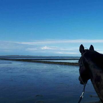
Reha-Stall Danecki Kurstall Horsemanship
Leezdorf
Nastasia-Danecki
@Nastasia-Danecki
Freizeitstall
Pferdeausbildung
Vermieten
Hunde willkommen
Krankenbox
Allergikerstall
Gnadenbrothof
27 weitere...
P+
Deprecated: Creation of dynamic property Zend_View_Helper_Ads::$adLink is deprecated in /var/www/stall-frei/htdocs/staging.stall-frei.de/library/Psf/View/Helper/Ads.php on line 108

Frisches Stroh zu verkaufen!
Mechtersen
STALL-FREIde Marketing
@STALL-FREI-Marketing
Kaufe frisches Stroh für dein Pferd!

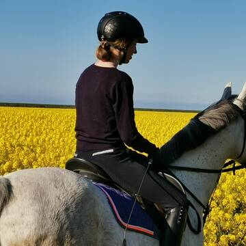
Pferdepension direkt an der Nordsee
Dornum
Pferdepension-Dühringshof
@Pferdepension-Duehringshof
Pensions- und Gastboxen
Reitplatz (z.B. Dressur, Springen, Reining)
Außenbox mit Paddock
Innenbox
1 weitere...
P+
Leider kein Vorschaubild
Leider kein Vorschaubild
Einstellplatz / Box zu vergeben
Großheide
Louisa Certain
@LouisaCtn
FN-Mitglied
Freizeitstall
Vermieten
Hunde willkommen
Krankenbox
Gnadenbrothof
17 weitere...
neu
B
Leider kein Vorschaubild
Leider kein Vorschaubild
Offenstallplätze zu vergeben
Großheide
Louisa Certain
@LouisaCtn
Freizeitstall
Geländestrecke
Vermieten
Hunde willkommen
Paddock
Allergikerstall
Hufrehe geeignet
20 weitere...
B
Leider kein Vorschaubild
Leider kein Vorschaubild
Offenstall Allergiker freundlich
Neuschoo
Schawe
@FellAktiv-Ostfriesland
Allergikerstall
Notfallboxen
B


Nordsee! Allergiker, Rentner, Pferde aller Art
Großefehn
Möwenhof GbR
@Moewenhof
Rehabilitationsstall
VFD-Mitglied
Vermieten
Hunde willkommen
Krankenbox
Allergikerstall
bedampftes/gewaschenes Heu
20 weitere...
S
Leider kein Vorschaubild
Leider kein Vorschaubild
Boxen frei, Reithalle, Reitplatz, Westernreiten
Neuschoo
Voßhörnerhof
@Vosshoernerhof
Freizeitstall
Geländestrecke
Vermieten
Hunde willkommen
Krankenbox
Außenbox mit Paddock
Außenboxen
19 weitere...
B


Paddocktrailplatz für Wallach frei
Großefehn
Michael Sund
@Pianova_reitakademie
Freizeitstall
Geländestrecke
Vermieten
Hunde willkommen
Krankenbox
Allergikerstall
Fohlenaufzucht möglich
27 weitere...
P+

Leider kein Vorschaubild
Leider kein Vorschaubild
Stutenplatz Offenstall
Lena Rücker
@Lena_6
Freizeitstall
Vermieten
Krankenbox
Reitplatz (z.B. Dressur, Springen, Reining)
Allergikerstall
Notfallboxen
4 weitere...
aktuell
B

Bewegungsstall/Offenstall
Aurich
Bewegungsstall-Wiesens
@Bewegungsstall-Wiesens
Freizeitstall
Vermieten
Hunde willkommen
Krankenbox
Notfallboxen
12 weitere...
P
Deprecated: Creation of dynamic property Zend_View::$pageCount is deprecated in /var/www/stall-frei/htdocs/staging.stall-frei.de/library/vendor/shardj/zf1-future/library/Zend/View/Abstract.php on line 308
Deprecated: Creation of dynamic property Zend_View::$itemCountPerPage is deprecated in /var/www/stall-frei/htdocs/staging.stall-frei.de/library/vendor/shardj/zf1-future/library/Zend/View/Abstract.php on line 308
Deprecated: Creation of dynamic property Zend_View::$first is deprecated in /var/www/stall-frei/htdocs/staging.stall-frei.de/library/vendor/shardj/zf1-future/library/Zend/View/Abstract.php on line 308
Deprecated: Creation of dynamic property Zend_View::$current is deprecated in /var/www/stall-frei/htdocs/staging.stall-frei.de/library/vendor/shardj/zf1-future/library/Zend/View/Abstract.php on line 308
Deprecated: Creation of dynamic property Zend_View::$last is deprecated in /var/www/stall-frei/htdocs/staging.stall-frei.de/library/vendor/shardj/zf1-future/library/Zend/View/Abstract.php on line 308
Deprecated: Creation of dynamic property Zend_View::$next is deprecated in /var/www/stall-frei/htdocs/staging.stall-frei.de/library/vendor/shardj/zf1-future/library/Zend/View/Abstract.php on line 308
Deprecated: Creation of dynamic property Zend_View::$pagesInRange is deprecated in /var/www/stall-frei/htdocs/staging.stall-frei.de/library/vendor/shardj/zf1-future/library/Zend/View/Abstract.php on line 308
Deprecated: Creation of dynamic property Zend_View::$firstPageInRange is deprecated in /var/www/stall-frei/htdocs/staging.stall-frei.de/library/vendor/shardj/zf1-future/library/Zend/View/Abstract.php on line 308
Deprecated: Creation of dynamic property Zend_View::$lastPageInRange is deprecated in /var/www/stall-frei/htdocs/staging.stall-frei.de/library/vendor/shardj/zf1-future/library/Zend/View/Abstract.php on line 308
Deprecated: Creation of dynamic property Zend_View::$currentItemCount is deprecated in /var/www/stall-frei/htdocs/staging.stall-frei.de/library/vendor/shardj/zf1-future/library/Zend/View/Abstract.php on line 308
Deprecated: Creation of dynamic property Zend_View::$totalItemCount is deprecated in /var/www/stall-frei/htdocs/staging.stall-frei.de/library/vendor/shardj/zf1-future/library/Zend/View/Abstract.php on line 308
Deprecated: Creation of dynamic property Zend_View::$firstItemNumber is deprecated in /var/www/stall-frei/htdocs/staging.stall-frei.de/library/vendor/shardj/zf1-future/library/Zend/View/Abstract.php on line 308
Deprecated: Creation of dynamic property Zend_View::$lastItemNumber is deprecated in /var/www/stall-frei/htdocs/staging.stall-frei.de/library/vendor/shardj/zf1-future/library/Zend/View/Abstract.php on line 308
Deprecated: Creation of dynamic property Zend_View::$router is deprecated in /var/www/stall-frei/htdocs/staging.stall-frei.de/library/vendor/shardj/zf1-future/library/Zend/View/Abstract.php on line 308
Deprecated: Creation of dynamic property Zend_View::$urlParams is deprecated in /var/www/stall-frei/htdocs/staging.stall-frei.de/library/vendor/shardj/zf1-future/library/Zend/View/Abstract.php on line 308
Deprecated: Creation of dynamic property Zend_View::$showAds is deprecated in /var/www/stall-frei/htdocs/staging.stall-frei.de/library/vendor/shardj/zf1-future/library/Zend/View/Abstract.php on line 308
Deprecated: Creation of dynamic property Zend_View::$objectIds is deprecated in /var/www/stall-frei/htdocs/staging.stall-frei.de/library/vendor/shardj/zf1-future/library/Zend/View/Abstract.php on line 308
Deprecated: Creation of dynamic property Zend_View::$showNavbar is deprecated in /var/www/stall-frei/htdocs/staging.stall-frei.de/library/vendor/shardj/zf1-future/library/Zend/View/Abstract.php on line 308
Deprecated: Creation of dynamic property Zend_View::$showBreadcrumb is deprecated in /var/www/stall-frei/htdocs/staging.stall-frei.de/library/vendor/shardj/zf1-future/library/Zend/View/Abstract.php on line 308
Deprecated: Creation of dynamic property Zend_View::$showFooter is deprecated in /var/www/stall-frei/htdocs/staging.stall-frei.de/library/vendor/shardj/zf1-future/library/Zend/View/Abstract.php on line 308
Deprecated: Creation of dynamic property Zend_View::$showInternalAds is deprecated in /var/www/stall-frei/htdocs/staging.stall-frei.de/library/vendor/shardj/zf1-future/library/Zend/View/Abstract.php on line 308
Deprecated: Creation of dynamic property Zend_View::$blNoContent is deprecated in /var/www/stall-frei/htdocs/staging.stall-frei.de/library/vendor/shardj/zf1-future/library/Zend/View/Abstract.php on line 308
Deprecated: Creation of dynamic property Zend_View::$sMetaDesc is deprecated in /var/www/stall-frei/htdocs/staging.stall-frei.de/library/vendor/shardj/zf1-future/library/Zend/View/Abstract.php on line 308
Deprecated: Creation of dynamic property Zend_View::$useGmaps is deprecated in /var/www/stall-frei/htdocs/staging.stall-frei.de/library/vendor/shardj/zf1-future/library/Zend/View/Abstract.php on line 308
Deprecated: Creation of dynamic property Zend_View::$touches is deprecated in /var/www/stall-frei/htdocs/staging.stall-frei.de/library/vendor/shardj/zf1-future/library/Zend/View/Abstract.php on line 308
Deprecated: Creation of dynamic property Zend_View::$oProject is deprecated in /var/www/stall-frei/htdocs/staging.stall-frei.de/library/vendor/shardj/zf1-future/library/Zend/View/Abstract.php on line 308
Deprecated: Creation of dynamic property Zend_View::$pageHeadline is deprecated in /var/www/stall-frei/htdocs/staging.stall-frei.de/library/vendor/shardj/zf1-future/library/Zend/View/Abstract.php on line 308
Deprecated: Creation of dynamic property Zend_View::$disableLocationField is deprecated in /var/www/stall-frei/htdocs/staging.stall-frei.de/library/vendor/shardj/zf1-future/library/Zend/View/Abstract.php on line 308
Deprecated: Creation of dynamic property Zend_View::$isSearch is deprecated in /var/www/stall-frei/htdocs/staging.stall-frei.de/library/vendor/shardj/zf1-future/library/Zend/View/Abstract.php on line 308
Deprecated: Creation of dynamic property Zend_View::$pageTitle is deprecated in /var/www/stall-frei/htdocs/staging.stall-frei.de/library/vendor/shardj/zf1-future/library/Zend/View/Abstract.php on line 308
Deprecated: Creation of dynamic property Psf_Form_Element_Text::$class is deprecated in /var/www/stall-frei/htdocs/staging.stall-frei.de/library/vendor/shardj/zf1-future/library/Zend/Form/Element.php on line 874
Deprecated: Creation of dynamic property Psf_Form_Element_Text::$size is deprecated in /var/www/stall-frei/htdocs/staging.stall-frei.de/library/vendor/shardj/zf1-future/library/Zend/Form/Element.php on line 874
Deprecated: Creation of dynamic property Psf_Form_Element_Text::$placeholder is deprecated in /var/www/stall-frei/htdocs/staging.stall-frei.de/library/vendor/shardj/zf1-future/library/Zend/Form/Element.php on line 874
Deprecated: Creation of dynamic property Psf_Form_Element_Hidden::$class is deprecated in /var/www/stall-frei/htdocs/staging.stall-frei.de/library/vendor/shardj/zf1-future/library/Zend/Form/Element.php on line 874
Deprecated: Creation of dynamic property Psf_Form_Element_Hidden::$class is deprecated in /var/www/stall-frei/htdocs/staging.stall-frei.de/library/vendor/shardj/zf1-future/library/Zend/Form/Element.php on line 874
Deprecated: Creation of dynamic property Psf_Form_Element_Hidden::$class is deprecated in /var/www/stall-frei/htdocs/staging.stall-frei.de/library/vendor/shardj/zf1-future/library/Zend/Form/Element.php on line 874
Deprecated: Creation of dynamic property Psf_Form_Element_Hidden::$class is deprecated in /var/www/stall-frei/htdocs/staging.stall-frei.de/library/vendor/shardj/zf1-future/library/Zend/Form/Element.php on line 874
Deprecated: Creation of dynamic property Psf_Form_Element_Select::$class is deprecated in /var/www/stall-frei/htdocs/staging.stall-frei.de/library/vendor/shardj/zf1-future/library/Zend/Form/Element.php on line 874
Deprecated: Creation of dynamic property Psf_Form_Element_Select::$class is deprecated in /var/www/stall-frei/htdocs/staging.stall-frei.de/library/vendor/shardj/zf1-future/library/Zend/Form/Element.php on line 874
Deprecated: Creation of dynamic property Psf_Form_Element_Select::$class is deprecated in /var/www/stall-frei/htdocs/staging.stall-frei.de/library/vendor/shardj/zf1-future/library/Zend/Form/Element.php on line 874
Deprecated: Creation of dynamic property Psf_Form_Element_Select::$class is deprecated in /var/www/stall-frei/htdocs/staging.stall-frei.de/library/vendor/shardj/zf1-future/library/Zend/Form/Element.php on line 874
Deprecated: Creation of dynamic property Psf_Form_Element_Text::$class is deprecated in /var/www/stall-frei/htdocs/staging.stall-frei.de/library/vendor/shardj/zf1-future/library/Zend/Form/Element.php on line 874
Deprecated: Creation of dynamic property Psf_Form_Element_Checkbox::$label is deprecated in /var/www/stall-frei/htdocs/staging.stall-frei.de/library/vendor/shardj/zf1-future/library/Zend/Form/Element.php on line 874
Deprecated: Creation of dynamic property Zend_View::$sort is deprecated in /var/www/stall-frei/htdocs/staging.stall-frei.de/library/vendor/shardj/zf1-future/library/Zend/View/Abstract.php on line 308
Deprecated: Creation of dynamic property Zend_View::$searchLocation is deprecated in /var/www/stall-frei/htdocs/staging.stall-frei.de/library/vendor/shardj/zf1-future/library/Zend/View/Abstract.php on line 308
Deprecated: Creation of dynamic property Zend_View::$locationHint is deprecated in /var/www/stall-frei/htdocs/staging.stall-frei.de/library/vendor/shardj/zf1-future/library/Zend/View/Abstract.php on line 308
Psf_GeoCoder_Abstract::getLocation: Nenndorf Get Location CachedOrLive
Psf_GeoCoder_Abstract::getCachedOrLive: Nenndorf
Psf_GeoCoder_OpenCageData::makeApiRequest: response:
Array
(
[documentation] => https://opencagedata.com/api
[licenses] => Array
(
[0] => Array
(
[name] => see attribution guide
[url] => https://opencagedata.com/credits
)
)
[results] => Array
(
[0] => Array
(
[bounds] => Array
(
[northeast] => Array
(
[lat] => 53.6219125
[lng] => 7.4496288
)
[southwest] => Array
(
[lat] => 53.5766826
[lng] => 7.4081723
)
)
[components] => Array
(
[ISO_3166-1_alpha-2] => DE
[ISO_3166-1_alpha-3] => DEU
[ISO_3166-2] => Array
(
[0] => DE-NI
)
[_category] => place
[_normalized_city] => Nenndorf
[_type] => village
[continent] => Europe
[country] => Deutschland
[country_code] => de
[county] => Landkreis Wittmund
[municipality] => Samtgemeinde Holtriem
[political_union] => European Union
[state] => Niedersachsen
[state_code] => NI
[village] => Nenndorf
)
[confidence] => 7
[formatted] => Nenndorf, Niedersachsen, Deutschland
[geometry] => Array
(
[lat] => 53.586704
[lng] => 7.4333726
)
)
[1] => Array
(
[bounds] => Array
(
[northeast] => Array
(
[lat] => 53.6165935
[lng] => 7.8069607
)
[southwest] => Array
(
[lat] => 53.5765935
[lng] => 7.7669607
)
)
[components] => Array
(
[ISO_3166-1_alpha-2] => DE
[ISO_3166-1_alpha-3] => DEU
[ISO_3166-2] => Array
(
[0] => DE-NI
)
[_category] => place
[_normalized_city] => Wittmund
[_type] => village
[continent] => Europe
[country] => Deutschland
[country_code] => de
[county] => Landkreis Wittmund
[political_union] => European Union
[postcode] => 26409
[state] => Niedersachsen
[state_code] => NI
[town] => Wittmund
[village] => Nenndorf
)
[confidence] => 7
[formatted] => 26409 Nenndorf, Deutschland
[geometry] => Array
(
[lat] => 53.5965935
[lng] => 7.7869607
)
)
[2] => Array
(
[bounds] => Array
(
[northeast] => Array
(
[lat] => 53.4004231
[lng] => 9.9118881
)
[southwest] => Array
(
[lat] => 53.3604231
[lng] => 9.8718881
)
)
[components] => Array
(
[ISO_3166-1_alpha-2] => DE
[ISO_3166-1_alpha-3] => DEU
[ISO_3166-2] => Array
(
[0] => DE-NI
)
[_category] => place
[_normalized_city] => Nenndorf
[_type] => village
[continent] => Europe
[country] => Deutschland
[country_code] => de
[county] => Landkreis Harburg
[municipality] => Rosengarten
[political_union] => European Union
[postcode] => 21224
[state] => Niedersachsen
[state_code] => NI
[village] => Nenndorf
)
[confidence] => 7
[formatted] => 21224 Nenndorf, Deutschland
[geometry] => Array
(
[lat] => 53.3804231
[lng] => 9.8918881
)
)
[3] => Array
(
[bounds] => Array
(
[northeast] => Array
(
[lat] => 53.1099492
[lng] => 7.34999
)
[southwest] => Array
(
[lat] => 53.0699492
[lng] => 7.30999
)
)
[components] => Array
(
[ISO_3166-1_alpha-2] => DE
[ISO_3166-1_alpha-3] => DEU
[ISO_3166-2] => Array
(
[0] => DE-NI
)
[_category] => place
[_normalized_city] => Papenburg
[_type] => village
[continent] => Europe
[country] => Deutschland
[country_code] => de
[county] => Landkreis Emsland
[political_union] => European Union
[state] => Niedersachsen
[state_code] => NI
[town] => Papenburg
[village] => Nenndorf
)
[confidence] => 7
[formatted] => Nenndorf, Niedersachsen, Deutschland
[geometry] => Array
(
[lat] => 53.0899492
[lng] => 7.32999
)
)
[4] => Array
(
[bounds] => Array
(
[northeast] => Array
(
[lat] => 53.1029389
[lng] => 7.3520615
)
[southwest] => Array
(
[lat] => 53.0712338
[lng] => 7.3205114
)
)
[components] => Array
(
[ISO_3166-1_alpha-2] => DE
[ISO_3166-1_alpha-3] => DEU
[ISO_3166-2] => Array
(
[0] => DE-NI
)
[_category] => place
[_normalized_city] => Papenburg
[_type] => neighbourhood
[continent] => Europe
[country] => Deutschland
[country_code] => de
[county] => Landkreis Emsland
[political_union] => European Union
[state] => Niedersachsen
[state_code] => NI
[suburb] => Nenndorf
[town] => Papenburg
)
[confidence] => 7
[formatted] => Nenndorf, Papenburg, Niedersachsen, Deutschland
[geometry] => Array
(
[lat] => 53.0866332
[lng] => 7.3354654
)
)
[5] => Array
(
[bounds] => Array
(
[northeast] => Array
(
[lat] => 53.6365084
[lng] => 7.9554532
)
[southwest] => Array
(
[lat] => 53.5965084
[lng] => 7.9154532
)
)
[components] => Array
(
[ISO_3166-1_alpha-2] => DE
[ISO_3166-1_alpha-3] => DEU
[ISO_3166-2] => Array
(
[0] => DE-NI
)
[_category] => place
[_normalized_city] => Wangerland
[_type] => hamlet
[city] => Wangerland
[continent] => Europe
[country] => Deutschland
[country_code] => de
[county] => Landkreis Friesland
[hamlet] => Nenndorf
[municipality] => Wangerland
[political_union] => European Union
[postcode] => 26434
[state] => Niedersachsen
[state_code] => NI
)
[confidence] => 7
[formatted] => Nenndorf, 26434 Wangerland, Deutschland
[geometry] => Array
(
[lat] => 53.6165084
[lng] => 7.9354532
)
)
[6] => Array
(
[bounds] => Array
(
[northeast] => Array
(
[lat] => 52.3882863
[lng] => 9.438382
)
[southwest] => Array
(
[lat] => 52.2943313
[lng] => 9.3159476
)
)
[components] => Array
(
[ISO_3166-1_alpha-2] => DE
[ISO_3166-1_alpha-3] => DEU
[ISO_3166-2] => Array
(
[0] => DE-NI
)
[_category] => place
[_normalized_city] => Bad Nenndorf
[_type] => city
[continent] => Europe
[country] => Deutschland
[country_code] => de
[county] => Landkreis Schaumburg
[municipality] => Samtgemeinde Nenndorf
[political_union] => European Union
[state] => Niedersachsen
[state_code] => NI
[town] => Bad Nenndorf
)
[confidence] => 7
[formatted] => Bad Nenndorf, Niedersachsen, Deutschland
[geometry] => Array
(
[lat] => 52.3355031
[lng] => 9.3771476
)
)
[7] => Array
(
[components] => Array
(
[ISO_3166-1_alpha-2] => FR
[ISO_3166-1_alpha-3] => FRA
[ISO_3166-2] => Array
(
[0] => FR-ARA
[1] => FR-03
)
[_category] => road
[_normalized_city] => Yzeure
[_type] => road
[city] => Yzeure
[continent] => Europe
[country] => France
[country_code] => fr
[county] => Allier
[local_authority] => Moulins Communauté
[political_union] => European Union
[postcode] => 03400
[road] => Place de Bendorf
[state] => Auvergne-Rhône-Alpes
[state_code] => ARA
)
[confidence] => 3
[formatted] => Place de Bendorf, 03400 Yzeure, France
[geometry] => Array
(
[lat] => 46.56566
[lng] => 3.354504
)
)
[8] => Array
(
[components] => Array
(
[ISO_3166-1_alpha-2] => FR
[ISO_3166-1_alpha-3] => FRA
[ISO_3166-2] => Array
(
[0] => FR-NOR
[1] => FR-76
)
[_category] => road
[_normalized_city] => Doudeville
[_type] => road
[city] => Doudeville
[continent] => Europe
[country] => France
[country_code] => fr
[county] => Seine-Maritime
[local_authority] => Communauté de communes Plateau de Caux
[political_union] => European Union
[postcode] => 76560
[road] => Rue de Bad Nenndorf
[state] => Normandie
[state_code] => NOR
)
[confidence] => 3
[formatted] => Rue de Bad Nenndorf, 76560 Doudeville, France
[geometry] => Array
(
[lat] => 49.722587
[lng] => 0.779885
)
)
[9] => Array
(
[components] => Array
(
[ISO_3166-1_alpha-2] => FR
[ISO_3166-1_alpha-3] => FRA
[ISO_3166-2] => Array
(
[0] => FR-GES
[1] => FR-6AE
[2] => FR-68
)
[_category] => road
[_normalized_city] => Vieux-Ferrette
[_type] => road
[city] => Vieux-Ferrette
[continent] => Europe
[country] => France
[country_code] => fr
[county] => Haut-Rhin
[local_authority] => Communauté de communes Sundgau
[political_union] => European Union
[postcode] => 68480
[road] => Chemin de Bendorf
[state] => Grand Est
[state_code] => GES
)
[confidence] => 3
[formatted] => Chemin de Bendorf, 68480 Vieux-Ferrette, France
[geometry] => Array
(
[lat] => 47.499015
[lng] => 7.299227
)
)
)
[status] => Array
(
[code] => 200
[message] => OK
)
[stay_informed] => Array
(
[blog] => https://blog.opencagedata.com
[mastodon] => https://en.osm.town/@opencage
)
[thanks] => For using an OpenCage API
[timestamp] => Array
(
[created_http] => Sat, 07 Feb 2026 19:52:48 GMT
[created_unix] => 1770493968
)
[total_results] => 10
)
Psf_GeoCoder_Abstract::convertLocationResult
{"documentation":"https:\/\/opencagedata.com\/api","licenses":[{"name":"see attribution guide","url":"https:\/\/opencagedata.com\/credits"}],"results":[{"bounds":{"northeast":{"lat":53.6219125,"lng":7.4496288},"southwest":{"lat":53.5766826,"lng":7.4081723}},"components":{"ISO_3166-1_alpha-2":"DE","ISO_3166-1_alpha-3":"DEU","ISO_3166-2":["DE-NI"],"_category":"place","_normalized_city":"Nenndorf","_type":"village","continent":"Europe","country":"Deutschland","country_code":"de","county":"Landkreis Wittmund","municipality":"Samtgemeinde Holtriem","political_union":"European Union","state":"Niedersachsen","state_code":"NI","village":"Nenndorf"},"confidence":7,"formatted":"Nenndorf, Niedersachsen, Deutschland","geometry":{"lat":53.586704,"lng":7.4333726}},{"bounds":{"northeast":{"lat":53.6165935,"lng":7.8069607},"southwest":{"lat":53.5765935,"lng":7.7669607}},"components":{"ISO_3166-1_alpha-2":"DE","ISO_3166-1_alpha-3":"DEU","ISO_3166-2":["DE-NI"],"_category":"place","_normalized_city":"Wittmund","_type":"village","continent":"Europe","country":"Deutschland","country_code":"de","county":"Landkreis Wittmund","political_union":"European Union","postcode":"26409","state":"Niedersachsen","state_code":"NI","town":"Wittmund","village":"Nenndorf"},"confidence":7,"formatted":"26409 Nenndorf, Deutschland","geometry":{"lat":53.5965935,"lng":7.7869607}},{"bounds":{"northeast":{"lat":53.4004231,"lng":9.9118881},"southwest":{"lat":53.3604231,"lng":9.8718881}},"components":{"ISO_3166-1_alpha-2":"DE","ISO_3166-1_alpha-3":"DEU","ISO_3166-2":["DE-NI"],"_category":"place","_normalized_city":"Nenndorf","_type":"village","continent":"Europe","country":"Deutschland","country_code":"de","county":"Landkreis Harburg","municipality":"Rosengarten","political_union":"European Union","postcode":"21224","state":"Niedersachsen","state_code":"NI","village":"Nenndorf"},"confidence":7,"formatted":"21224 Nenndorf, Deutschland","geometry":{"lat":53.3804231,"lng":9.8918881}},{"bounds":{"northeast":{"lat":53.1099492,"lng":7.34999},"southwest":{"lat":53.0699492,"lng":7.30999}},"components":{"ISO_3166-1_alpha-2":"DE","ISO_3166-1_alpha-3":"DEU","ISO_3166-2":["DE-NI"],"_category":"place","_normalized_city":"Papenburg","_type":"village","continent":"Europe","country":"Deutschland","country_code":"de","county":"Landkreis Emsland","political_union":"European Union","state":"Niedersachsen","state_code":"NI","town":"Papenburg","village":"Nenndorf"},"confidence":7,"formatted":"Nenndorf, Niedersachsen, Deutschland","geometry":{"lat":53.0899492,"lng":7.32999}},{"bounds":{"northeast":{"lat":53.1029389,"lng":7.3520615},"southwest":{"lat":53.0712338,"lng":7.3205114}},"components":{"ISO_3166-1_alpha-2":"DE","ISO_3166-1_alpha-3":"DEU","ISO_3166-2":["DE-NI"],"_category":"place","_normalized_city":"Papenburg","_type":"neighbourhood","continent":"Europe","country":"Deutschland","country_code":"de","county":"Landkreis Emsland","political_union":"European Union","state":"Niedersachsen","state_code":"NI","suburb":"Nenndorf","town":"Papenburg"},"confidence":7,"formatted":"Nenndorf, Papenburg, Niedersachsen, Deutschland","geometry":{"lat":53.0866332,"lng":7.3354654}},{"bounds":{"northeast":{"lat":53.6365084,"lng":7.9554532},"southwest":{"lat":53.5965084,"lng":7.9154532}},"components":{"ISO_3166-1_alpha-2":"DE","ISO_3166-1_alpha-3":"DEU","ISO_3166-2":["DE-NI"],"_category":"place","_normalized_city":"Wangerland","_type":"hamlet","city":"Wangerland","continent":"Europe","country":"Deutschland","country_code":"de","county":"Landkreis Friesland","hamlet":"Nenndorf","municipality":"Wangerland","political_union":"European Union","postcode":"26434","state":"Niedersachsen","state_code":"NI"},"confidence":7,"formatted":"Nenndorf, 26434 Wangerland, Deutschland","geometry":{"lat":53.6165084,"lng":7.9354532}},{"bounds":{"northeast":{"lat":52.3882863,"lng":9.438382},"southwest":{"lat":52.2943313,"lng":9.3159476}},"components":{"ISO_3166-1_alpha-2":"DE","ISO_3166-1_alpha-3":"DEU","ISO_3166-2":["DE-NI"],"_category":"place","_normalized_city":"Bad Nenndorf","_type":"city","continent":"Europe","country":"Deutschland","country_code":"de","county":"Landkreis Schaumburg","municipality":"Samtgemeinde Nenndorf","political_union":"European Union","state":"Niedersachsen","state_code":"NI","town":"Bad Nenndorf"},"confidence":7,"formatted":"Bad Nenndorf, Niedersachsen, Deutschland","geometry":{"lat":52.3355031,"lng":9.3771476}},{"components":{"ISO_3166-1_alpha-2":"FR","ISO_3166-1_alpha-3":"FRA","ISO_3166-2":["FR-ARA","FR-03"],"_category":"road","_normalized_city":"Yzeure","_type":"road","city":"Yzeure","continent":"Europe","country":"France","country_code":"fr","county":"Allier","local_authority":"Moulins Communaut\u00e9","political_union":"European Union","postcode":"03400","road":"Place de Bendorf","state":"Auvergne-Rh\u00f4ne-Alpes","state_code":"ARA"},"confidence":3,"formatted":"Place de Bendorf, 03400 Yzeure, France","geometry":{"lat":46.56566,"lng":3.354504}},{"components":{"ISO_3166-1_alpha-2":"FR","ISO_3166-1_alpha-3":"FRA","ISO_3166-2":["FR-NOR","FR-76"],"_category":"road","_normalized_city":"Doudeville","_type":"road","city":"Doudeville","continent":"Europe","country":"France","country_code":"fr","county":"Seine-Maritime","local_authority":"Communaut\u00e9 de communes Plateau de Caux","political_union":"European Union","postcode":"76560","road":"Rue de Bad Nenndorf","state":"Normandie","state_code":"NOR"},"confidence":3,"formatted":"Rue de Bad Nenndorf, 76560 Doudeville, France","geometry":{"lat":49.722587,"lng":0.779885}},{"components":{"ISO_3166-1_alpha-2":"FR","ISO_3166-1_alpha-3":"FRA","ISO_3166-2":["FR-GES","FR-6AE","FR-68"],"_category":"road","_normalized_city":"Vieux-Ferrette","_type":"road","city":"Vieux-Ferrette","continent":"Europe","country":"France","country_code":"fr","county":"Haut-Rhin","local_authority":"Communaut\u00e9 de communes Sundgau","political_union":"European Union","postcode":"68480","road":"Chemin de Bendorf","state":"Grand Est","state_code":"GES"},"confidence":3,"formatted":"Chemin de Bendorf, 68480 Vieux-Ferrette, France","geometry":{"lat":47.499015,"lng":7.299227}}],"status":{"code":200,"message":"OK"},"stay_informed":{"blog":"https:\/\/blog.opencagedata.com","mastodon":"https:\/\/en.osm.town\/@opencage"},"thanks":"For using an OpenCage API","timestamp":{"created_http":"Sat, 07 Feb 2026 19:52:48 GMT","created_unix":1770493968},"total_results":10}Array
(
[0] => stdClass Object
(
[bounds] => stdClass Object
(
[northeast] => stdClass Object
(
[lat] => 53.6219125
[lng] => 7.4496288
)
[southwest] => stdClass Object
(
[lat] => 53.5766826
[lng] => 7.4081723
)
)
[components] => stdClass Object
(
[ISO_3166-1_alpha-2] => DE
[ISO_3166-1_alpha-3] => DEU
[ISO_3166-2] => Array
(
[0] => DE-NI
)
[_category] => place
[_normalized_city] => Nenndorf
[_type] => village
[continent] => Europe
[country] => Deutschland
[country_code] => de
[county] => Landkreis Wittmund
[municipality] => Samtgemeinde Holtriem
[political_union] => European Union
[state] => Niedersachsen
[state_code] => NI
[village] => Nenndorf
)
[confidence] => 7
[formatted] => Nenndorf, Niedersachsen, Deutschland
[geometry] => stdClass Object
(
[lat] => 53.586704
[lng] => 7.4333726
)
)
[1] => stdClass Object
(
[bounds] => stdClass Object
(
[northeast] => stdClass Object
(
[lat] => 53.6165935
[lng] => 7.8069607
)
[southwest] => stdClass Object
(
[lat] => 53.5765935
[lng] => 7.7669607
)
)
[components] => stdClass Object
(
[ISO_3166-1_alpha-2] => DE
[ISO_3166-1_alpha-3] => DEU
[ISO_3166-2] => Array
(
[0] => DE-NI
)
[_category] => place
[_normalized_city] => Wittmund
[_type] => village
[continent] => Europe
[country] => Deutschland
[country_code] => de
[county] => Landkreis Wittmund
[political_union] => European Union
[postcode] => 26409
[state] => Niedersachsen
[state_code] => NI
[town] => Wittmund
[village] => Nenndorf
)
[confidence] => 7
[formatted] => 26409 Nenndorf, Deutschland
[geometry] => stdClass Object
(
[lat] => 53.5965935
[lng] => 7.7869607
)
)
[2] => stdClass Object
(
[bounds] => stdClass Object
(
[northeast] => stdClass Object
(
[lat] => 53.4004231
[lng] => 9.9118881
)
[southwest] => stdClass Object
(
[lat] => 53.3604231
[lng] => 9.8718881
)
)
[components] => stdClass Object
(
[ISO_3166-1_alpha-2] => DE
[ISO_3166-1_alpha-3] => DEU
[ISO_3166-2] => Array
(
[0] => DE-NI
)
[_category] => place
[_normalized_city] => Nenndorf
[_type] => village
[continent] => Europe
[country] => Deutschland
[country_code] => de
[county] => Landkreis Harburg
[municipality] => Rosengarten
[political_union] => European Union
[postcode] => 21224
[state] => Niedersachsen
[state_code] => NI
[village] => Nenndorf
)
[confidence] => 7
[formatted] => 21224 Nenndorf, Deutschland
[geometry] => stdClass Object
(
[lat] => 53.3804231
[lng] => 9.8918881
)
)
[3] => stdClass Object
(
[bounds] => stdClass Object
(
[northeast] => stdClass Object
(
[lat] => 53.1099492
[lng] => 7.34999
)
[southwest] => stdClass Object
(
[lat] => 53.0699492
[lng] => 7.30999
)
)
[components] => stdClass Object
(
[ISO_3166-1_alpha-2] => DE
[ISO_3166-1_alpha-3] => DEU
[ISO_3166-2] => Array
(
[0] => DE-NI
)
[_category] => place
[_normalized_city] => Papenburg
[_type] => village
[continent] => Europe
[country] => Deutschland
[country_code] => de
[county] => Landkreis Emsland
[political_union] => European Union
[state] => Niedersachsen
[state_code] => NI
[town] => Papenburg
[village] => Nenndorf
)
[confidence] => 7
[formatted] => Nenndorf, Niedersachsen, Deutschland
[geometry] => stdClass Object
(
[lat] => 53.0899492
[lng] => 7.32999
)
)
[4] => stdClass Object
(
[bounds] => stdClass Object
(
[northeast] => stdClass Object
(
[lat] => 53.1029389
[lng] => 7.3520615
)
[southwest] => stdClass Object
(
[lat] => 53.0712338
[lng] => 7.3205114
)
)
[components] => stdClass Object
(
[ISO_3166-1_alpha-2] => DE
[ISO_3166-1_alpha-3] => DEU
[ISO_3166-2] => Array
(
[0] => DE-NI
)
[_category] => place
[_normalized_city] => Papenburg
[_type] => neighbourhood
[continent] => Europe
[country] => Deutschland
[country_code] => de
[county] => Landkreis Emsland
[political_union] => European Union
[state] => Niedersachsen
[state_code] => NI
[suburb] => Nenndorf
[town] => Papenburg
)
[confidence] => 7
[formatted] => Nenndorf, Papenburg, Niedersachsen, Deutschland
[geometry] => stdClass Object
(
[lat] => 53.0866332
[lng] => 7.3354654
)
)
[5] => stdClass Object
(
[bounds] => stdClass Object
(
[northeast] => stdClass Object
(
[lat] => 53.6365084
[lng] => 7.9554532
)
[southwest] => stdClass Object
(
[lat] => 53.5965084
[lng] => 7.9154532
)
)
[components] => stdClass Object
(
[ISO_3166-1_alpha-2] => DE
[ISO_3166-1_alpha-3] => DEU
[ISO_3166-2] => Array
(
[0] => DE-NI
)
[_category] => place
[_normalized_city] => Wangerland
[_type] => hamlet
[city] => Wangerland
[continent] => Europe
[country] => Deutschland
[country_code] => de
[county] => Landkreis Friesland
[hamlet] => Nenndorf
[municipality] => Wangerland
[political_union] => European Union
[postcode] => 26434
[state] => Niedersachsen
[state_code] => NI
)
[confidence] => 7
[formatted] => Nenndorf, 26434 Wangerland, Deutschland
[geometry] => stdClass Object
(
[lat] => 53.6165084
[lng] => 7.9354532
)
)
[6] => stdClass Object
(
[bounds] => stdClass Object
(
[northeast] => stdClass Object
(
[lat] => 52.3882863
[lng] => 9.438382
)
[southwest] => stdClass Object
(
[lat] => 52.2943313
[lng] => 9.3159476
)
)
[components] => stdClass Object
(
[ISO_3166-1_alpha-2] => DE
[ISO_3166-1_alpha-3] => DEU
[ISO_3166-2] => Array
(
[0] => DE-NI
)
[_category] => place
[_normalized_city] => Bad Nenndorf
[_type] => city
[continent] => Europe
[country] => Deutschland
[country_code] => de
[county] => Landkreis Schaumburg
[municipality] => Samtgemeinde Nenndorf
[political_union] => European Union
[state] => Niedersachsen
[state_code] => NI
[town] => Bad Nenndorf
)
[confidence] => 7
[formatted] => Bad Nenndorf, Niedersachsen, Deutschland
[geometry] => stdClass Object
(
[lat] => 52.3355031
[lng] => 9.3771476
)
)
[7] => stdClass Object
(
[components] => stdClass Object
(
[ISO_3166-1_alpha-2] => FR
[ISO_3166-1_alpha-3] => FRA
[ISO_3166-2] => Array
(
[0] => FR-ARA
[1] => FR-03
)
[_category] => road
[_normalized_city] => Yzeure
[_type] => road
[city] => Yzeure
[continent] => Europe
[country] => France
[country_code] => fr
[county] => Allier
[local_authority] => Moulins Communauté
[political_union] => European Union
[postcode] => 03400
[road] => Place de Bendorf
[state] => Auvergne-Rhône-Alpes
[state_code] => ARA
)
[confidence] => 3
[formatted] => Place de Bendorf, 03400 Yzeure, France
[geometry] => stdClass Object
(
[lat] => 46.56566
[lng] => 3.354504
)
)
[8] => stdClass Object
(
[components] => stdClass Object
(
[ISO_3166-1_alpha-2] => FR
[ISO_3166-1_alpha-3] => FRA
[ISO_3166-2] => Array
(
[0] => FR-NOR
[1] => FR-76
)
[_category] => road
[_normalized_city] => Doudeville
[_type] => road
[city] => Doudeville
[continent] => Europe
[country] => France
[country_code] => fr
[county] => Seine-Maritime
[local_authority] => Communauté de communes Plateau de Caux
[political_union] => European Union
[postcode] => 76560
[road] => Rue de Bad Nenndorf
[state] => Normandie
[state_code] => NOR
)
[confidence] => 3
[formatted] => Rue de Bad Nenndorf, 76560 Doudeville, France
[geometry] => stdClass Object
(
[lat] => 49.722587
[lng] => 0.779885
)
)
[9] => stdClass Object
(
[components] => stdClass Object
(
[ISO_3166-1_alpha-2] => FR
[ISO_3166-1_alpha-3] => FRA
[ISO_3166-2] => Array
(
[0] => FR-GES
[1] => FR-6AE
[2] => FR-68
)
[_category] => road
[_normalized_city] => Vieux-Ferrette
[_type] => road
[city] => Vieux-Ferrette
[continent] => Europe
[country] => France
[country_code] => fr
[county] => Haut-Rhin
[local_authority] => Communauté de communes Sundgau
[political_union] => European Union
[postcode] => 68480
[road] => Chemin de Bendorf
[state] => Grand Est
[state_code] => GES
)
[confidence] => 3
[formatted] => Chemin de Bendorf, 68480 Vieux-Ferrette, France
[geometry] => stdClass Object
(
[lat] => 47.499015
[lng] => 7.299227
)
)
)
Psf_GeoCoder_OpenCageData::getKeyMap: 0
stdClass Object
(
    [bounds] => stdClass Object
        (
            [northeast] => stdClass Object
                (
                    [lat] => 53.6219125
                    [lng] => 7.4496288
                )

            [southwest] => stdClass Object
                (
                    [lat] => 53.5766826
                    [lng] => 7.4081723
                )

        )

    [components] => stdClass Object
        (
            [ISO_3166-1_alpha-2] => DE
            [ISO_3166-1_alpha-3] => DEU
            [ISO_3166-2] => Array
                (
                    [0] => DE-NI
                )

            [_category] => place
            [_normalized_city] => Nenndorf
            [_type] => village
            [continent] => Europe
            [country] => Deutschland
            [country_code] => de
            [county] => Landkreis Wittmund
            [municipality] => Samtgemeinde Holtriem
            [political_union] => European Union
            [state] => Niedersachsen
            [state_code] => NI
            [village] => Nenndorf
        )

    [confidence] => 7
    [formatted] => Nenndorf, Niedersachsen, Deutschland
    [geometry] => stdClass Object
        (
            [lat] => 53.586704
            [lng] => 7.4333726
        )

)
Psf_GeoCoder_OpenCageData::getCounty: Wittmund
Psf_GeoCoder_OpenCageData::addMissingData REFETCH!
Array
(
    [address] => Nenndorf, Niedersachsen, Deutschland
    [type] => village
    [street] =>
    [city] => Nenndorf
    [county] => Wittmund
    [state] => Niedersachsen
    [zip] =>
    [country] => Deutschland
    [suburb] =>
    [countrycode] => de
    [latitude] => 53.586704
    [longitude] => 7.4333726
    [accuracy] => 1
    [confidence] => 7
    [bounds] => stdClass Object
        (
            [northeast] => stdClass Object
                (
                    [lat] => 53.6219125
                    [lng] => 7.4496288
                )

            [southwest] => stdClass Object
                (
                    [lat] => 53.5766826
                    [lng] => 7.4081723
                )

        )

)
reformat!
Array
(
    [address] => Nenndorf, Niedersachsen, Deutschland
    [type] => village
    [street] =>
    [city] => Nenndorf
    [county] => Wittmund
    [state] => Niedersachsen
    [zip] =>
    [country] => Deutschland
    [suburb] =>
    [countrycode] => de
    [latitude] => 53.586704
    [longitude] => 7.4333726
    [accuracy] => 1
    [confidence] => 7
    [bounds] => stdClass Object
        (
            [northeast] => stdClass Object
                (
                    [lat] => 53.6219125
                    [lng] => 7.4496288
                )

            [southwest] => stdClass Object
                (
                    [lat] => 53.5766826
                    [lng] => 7.4081723
                )

        )

    [place] => Nenndorf, Niedersachsen
    [hash] => 1fee8df02db32d33ecfae83318622a67
)
Psf_GeoCoder_OpenCageData::getKeyMap: 1
stdClass Object
(
    [bounds] => stdClass Object
        (
            [northeast] => stdClass Object
                (
                    [lat] => 53.6165935
                    [lng] => 7.8069607
                )

            [southwest] => stdClass Object
                (
                    [lat] => 53.5765935
                    [lng] => 7.7669607
                )

        )

    [components] => stdClass Object
        (
            [ISO_3166-1_alpha-2] => DE
            [ISO_3166-1_alpha-3] => DEU
            [ISO_3166-2] => Array
                (
                    [0] => DE-NI
                )

            [_category] => place
            [_normalized_city] => Wittmund
            [_type] => village
            [continent] => Europe
            [country] => Deutschland
            [country_code] => de
            [county] => Landkreis Wittmund
            [political_union] => European Union
            [postcode] => 26409
            [state] => Niedersachsen
            [state_code] => NI
            [town] => Wittmund
            [village] => Nenndorf
        )

    [confidence] => 7
    [formatted] => 26409 Nenndorf, Deutschland
    [geometry] => stdClass Object
        (
            [lat] => 53.5965935
            [lng] => 7.7869607
        )

)
Psf_GeoCoder_OpenCageData::getCounty: Wittmund
Psf_GeoCoder_OpenCageData::addMissingData REFETCH!
Array
(
    [address] => 26409 Nenndorf, Deutschland
    [type] => village
    [street] =>
    [city] => Wittmund
    [county] => Wittmund
    [state] => Niedersachsen
    [zip] => 26409
    [country] => Deutschland
    [suburb] =>
    [countrycode] => de
    [latitude] => 53.5965935
    [longitude] => 7.7869607
    [accuracy] => 1
    [confidence] => 7
    [bounds] => stdClass Object
        (
            [northeast] => stdClass Object
                (
                    [lat] => 53.6165935
                    [lng] => 7.8069607
                )

            [southwest] => stdClass Object
                (
                    [lat] => 53.5765935
                    [lng] => 7.7669607
                )

        )

)
reformat!
Array
(
    [address] => 26409 Wittmund
    [type] => village
    [street] =>
    [city] => Wittmund
    [county] => Wittmund
    [state] => Niedersachsen
    [zip] => 26409
    [country] => Deutschland
    [suburb] =>
    [countrycode] => de
    [latitude] => 53.5965935
    [longitude] => 7.7869607
    [accuracy] => 1
    [confidence] => 7
    [bounds] => stdClass Object
        (
            [northeast] => stdClass Object
                (
                    [lat] => 53.6165935
                    [lng] => 7.8069607
                )

            [southwest] => stdClass Object
                (
                    [lat] => 53.5765935
                    [lng] => 7.7669607
                )

        )

    [place] => 26409 Wittmund, Niedersachsen
    [hash] => b5a71736f9969d4a7362476aac3379cc
)
Psf_GeoCoder_OpenCageData::getKeyMap: 2
stdClass Object
(
    [bounds] => stdClass Object
        (
            [northeast] => stdClass Object
                (
                    [lat] => 53.4004231
                    [lng] => 9.9118881
                )

            [southwest] => stdClass Object
                (
                    [lat] => 53.3604231
                    [lng] => 9.8718881
                )

        )

    [components] => stdClass Object
        (
            [ISO_3166-1_alpha-2] => DE
            [ISO_3166-1_alpha-3] => DEU
            [ISO_3166-2] => Array
                (
                    [0] => DE-NI
                )

            [_category] => place
            [_normalized_city] => Nenndorf
            [_type] => village
            [continent] => Europe
            [country] => Deutschland
            [country_code] => de
            [county] => Landkreis Harburg
            [municipality] => Rosengarten
            [political_union] => European Union
            [postcode] => 21224
            [state] => Niedersachsen
            [state_code] => NI
            [village] => Nenndorf
        )

    [confidence] => 7
    [formatted] => 21224 Nenndorf, Deutschland
    [geometry] => stdClass Object
        (
            [lat] => 53.3804231
            [lng] => 9.8918881
        )

)
Psf_GeoCoder_OpenCageData::getCounty: Harburg
Psf_GeoCoder_OpenCageData::addMissingData REFETCH!
Array
(
    [address] => 21224 Nenndorf, Deutschland
    [type] => village
    [street] =>
    [city] => Nenndorf
    [county] => Harburg
    [state] => Niedersachsen
    [zip] => 21224
    [country] => Deutschland
    [suburb] =>
    [countrycode] => de
    [latitude] => 53.3804231
    [longitude] => 9.8918881
    [accuracy] => 1
    [confidence] => 7
    [bounds] => stdClass Object
        (
            [northeast] => stdClass Object
                (
                    [lat] => 53.4004231
                    [lng] => 9.9118881
                )

            [southwest] => stdClass Object
                (
                    [lat] => 53.3604231
                    [lng] => 9.8718881
                )

        )

)
reformat!
Array
(
    [address] => 21224 Nenndorf, Deutschland
    [type] => village
    [street] =>
    [city] => Nenndorf
    [county] => Harburg
    [state] => Niedersachsen
    [zip] => 21224
    [country] => Deutschland
    [suburb] =>
    [countrycode] => de
    [latitude] => 53.3804231
    [longitude] => 9.8918881
    [accuracy] => 1
    [confidence] => 7
    [bounds] => stdClass Object
        (
            [northeast] => stdClass Object
                (
                    [lat] => 53.4004231
                    [lng] => 9.9118881
                )

            [southwest] => stdClass Object
                (
                    [lat] => 53.3604231
                    [lng] => 9.8718881
                )

        )

    [place] => 21224 Nenndorf, Niedersachsen
    [hash] => 5e72ffb8c580b574121a185645ed4059
)
Psf_GeoCoder_OpenCageData::getKeyMap: 3
stdClass Object
(
    [bounds] => stdClass Object
        (
            [northeast] => stdClass Object
                (
                    [lat] => 53.1099492
                    [lng] => 7.34999
                )

            [southwest] => stdClass Object
                (
                    [lat] => 53.0699492
                    [lng] => 7.30999
                )

        )

    [components] => stdClass Object
        (
            [ISO_3166-1_alpha-2] => DE
            [ISO_3166-1_alpha-3] => DEU
            [ISO_3166-2] => Array
                (
                    [0] => DE-NI
                )

            [_category] => place
            [_normalized_city] => Papenburg
            [_type] => village
            [continent] => Europe
            [country] => Deutschland
            [country_code] => de
            [county] => Landkreis Emsland
            [political_union] => European Union
            [state] => Niedersachsen
            [state_code] => NI
            [town] => Papenburg
            [village] => Nenndorf
        )

    [confidence] => 7
    [formatted] => Nenndorf, Niedersachsen, Deutschland
    [geometry] => stdClass Object
        (
            [lat] => 53.0899492
            [lng] => 7.32999
        )

)
Psf_GeoCoder_OpenCageData::getCounty: Emsland
Psf_GeoCoder_OpenCageData::addMissingData REFETCH!
Array
(
    [address] => Nenndorf, Niedersachsen, Deutschland
    [type] => village
    [street] =>
    [city] => Papenburg
    [county] => Emsland
    [state] => Niedersachsen
    [zip] =>
    [country] => Deutschland
    [suburb] =>
    [countrycode] => de
    [latitude] => 53.0899492
    [longitude] => 7.32999
    [accuracy] => 1
    [confidence] => 7
    [bounds] => stdClass Object
        (
            [northeast] => stdClass Object
                (
                    [lat] => 53.1099492
                    [lng] => 7.34999
                )

            [southwest] => stdClass Object
                (
                    [lat] => 53.0699492
                    [lng] => 7.30999
                )

        )

)
reformat!
Array
(
    [address] => Papenburg
    [type] => village
    [street] =>
    [city] => Papenburg
    [county] => Emsland
    [state] => Niedersachsen
    [zip] =>
    [country] => Deutschland
    [suburb] =>
    [countrycode] => de
    [latitude] => 53.0899492
    [longitude] => 7.32999
    [accuracy] => 1
    [confidence] => 7
    [bounds] => stdClass Object
        (
            [northeast] => stdClass Object
                (
                    [lat] => 53.1099492
                    [lng] => 7.34999
                )

            [southwest] => stdClass Object
                (
                    [lat] => 53.0699492
                    [lng] => 7.30999
                )

        )

    [place] => Papenburg, Niedersachsen
    [hash] => 6d5df6870e05a09c1634bce061b47a2b
)
Psf_GeoCoder_OpenCageData::getKeyMap: 4
stdClass Object
(
    [bounds] => stdClass Object
        (
            [northeast] => stdClass Object
                (
                    [lat] => 53.1029389
                    [lng] => 7.3520615
                )

            [southwest] => stdClass Object
                (
                    [lat] => 53.0712338
                    [lng] => 7.3205114
                )

        )

    [components] => stdClass Object
        (
            [ISO_3166-1_alpha-2] => DE
            [ISO_3166-1_alpha-3] => DEU
            [ISO_3166-2] => Array
                (
                    [0] => DE-NI
                )

            [_category] => place
            [_normalized_city] => Papenburg
            [_type] => neighbourhood
            [continent] => Europe
            [country] => Deutschland
            [country_code] => de
            [county] => Landkreis Emsland
            [political_union] => European Union
            [state] => Niedersachsen
            [state_code] => NI
            [suburb] => Nenndorf
            [town] => Papenburg
        )

    [confidence] => 7
    [formatted] => Nenndorf, Papenburg, Niedersachsen, Deutschland
    [geometry] => stdClass Object
        (
            [lat] => 53.0866332
            [lng] => 7.3354654
        )

)
Psf_GeoCoder_OpenCageData::getCounty: Emsland
Psf_GeoCoder_OpenCageData::addMissingData REFETCH!
Array
(
    [address] => Nenndorf, Papenburg, Niedersachsen, Deutschland
    [type] => neighbourhood
    [street] =>
    [city] => Papenburg
    [county] => Emsland
    [state] => Niedersachsen
    [zip] =>
    [country] => Deutschland
    [suburb] => Nenndorf
    [countrycode] => de
    [latitude] => 53.0866332
    [longitude] => 7.3354654
    [accuracy] => 1
    [confidence] => 7
    [bounds] => stdClass Object
        (
            [northeast] => stdClass Object
                (
                    [lat] => 53.1029389
                    [lng] => 7.3520615
                )

            [southwest] => stdClass Object
                (
                    [lat] => 53.0712338
                    [lng] => 7.3205114
                )

        )

)
reformat!
Array
(
    [address] => Nenndorf, Papenburg, Niedersachsen, Deutschland
    [type] => neighbourhood
    [street] =>
    [city] => Papenburg
    [county] => Emsland
    [state] => Niedersachsen
    [zip] =>
    [country] => Deutschland
    [suburb] => Nenndorf
    [countrycode] => de
    [latitude] => 53.0866332
    [longitude] => 7.3354654
    [accuracy] => 1
    [confidence] => 7
    [bounds] => stdClass Object
        (
            [northeast] => stdClass Object
                (
                    [lat] => 53.1029389
                    [lng] => 7.3520615
                )

            [southwest] => stdClass Object
                (
                    [lat] => 53.0712338
                    [lng] => 7.3205114
                )

        )

    [place] => Papenburg, Niedersachsen
    [hash] => 6d5df6870e05a09c1634bce061b47a2b
)
Psf_GeoCoder_OpenCageData::getKeyMap: 5
stdClass Object
(
    [bounds] => stdClass Object
        (
            [northeast] => stdClass Object
                (
                    [lat] => 53.6365084
                    [lng] => 7.9554532
                )

            [southwest] => stdClass Object
                (
                    [lat] => 53.5965084
                    [lng] => 7.9154532
                )

        )

    [components] => stdClass Object
        (
            [ISO_3166-1_alpha-2] => DE
            [ISO_3166-1_alpha-3] => DEU
            [ISO_3166-2] => Array
                (
                    [0] => DE-NI
                )

            [_category] => place
            [_normalized_city] => Wangerland
            [_type] => hamlet
            [city] => Wangerland
            [continent] => Europe
            [country] => Deutschland
            [country_code] => de
            [county] => Landkreis Friesland
            [hamlet] => Nenndorf
            [municipality] => Wangerland
            [political_union] => European Union
            [postcode] => 26434
            [state] => Niedersachsen
            [state_code] => NI
        )

    [confidence] => 7
    [formatted] => Nenndorf, 26434 Wangerland, Deutschland
    [geometry] => stdClass Object
        (
            [lat] => 53.6165084
            [lng] => 7.9354532
        )

)
Psf_GeoCoder_OpenCageData::getCounty: Friesland
Psf_GeoCoder_OpenCageData::addMissingData REFETCH!
Array
(
    [address] => Nenndorf, 26434 Wangerland, Deutschland
    [type] => hamlet
    [street] => Nenndorf
    [city] => Wangerland
    [county] => Friesland
    [state] => Niedersachsen
    [zip] => 26434
    [country] => Deutschland
    [suburb] =>
    [countrycode] => de
    [latitude] => 53.6165084
    [longitude] => 7.9354532
    [accuracy] => 1
    [confidence] => 7
    [bounds] => stdClass Object
        (
            [northeast] => stdClass Object
                (
                    [lat] => 53.6365084
                    [lng] => 7.9554532
                )

            [southwest] => stdClass Object
                (
                    [lat] => 53.5965084
                    [lng] => 7.9154532
                )

        )

)
reformat!
Array
(
    [address] => Nenndorf, 26434 Wangerland, Deutschland
    [type] => hamlet
    [street] => Nenndorf
    [city] => Wangerland
    [county] => Friesland
    [state] => Niedersachsen
    [zip] => 26434
    [country] => Deutschland
    [suburb] =>
    [countrycode] => de
    [latitude] => 53.6165084
    [longitude] => 7.9354532
    [accuracy] => 1
    [confidence] => 7
    [bounds] => stdClass Object
        (
            [northeast] => stdClass Object
                (
                    [lat] => 53.6365084
                    [lng] => 7.9554532
                )

            [southwest] => stdClass Object
                (
                    [lat] => 53.5965084
                    [lng] => 7.9154532
                )

        )

    [place] => Nenndorf, 26434 Wangerland, Niedersachsen
    [hash] => b2ddd17ba28cd3aa1a62b1f8aa33ed7f
)
Psf_GeoCoder_OpenCageData::getKeyMap: 6
stdClass Object
(
    [bounds] => stdClass Object
        (
            [northeast] => stdClass Object
                (
                    [lat] => 52.3882863
                    [lng] => 9.438382
                )

            [southwest] => stdClass Object
                (
                    [lat] => 52.2943313
                    [lng] => 9.3159476
                )

        )

    [components] => stdClass Object
        (
            [ISO_3166-1_alpha-2] => DE
            [ISO_3166-1_alpha-3] => DEU
            [ISO_3166-2] => Array
                (
                    [0] => DE-NI
                )

            [_category] => place
            [_normalized_city] => Bad Nenndorf
            [_type] => city
            [continent] => Europe
            [country] => Deutschland
            [country_code] => de
            [county] => Landkreis Schaumburg
            [municipality] => Samtgemeinde Nenndorf
            [political_union] => European Union
            [state] => Niedersachsen
            [state_code] => NI
            [town] => Bad Nenndorf
        )

    [confidence] => 7
    [formatted] => Bad Nenndorf, Niedersachsen, Deutschland
    [geometry] => stdClass Object
        (
            [lat] => 52.3355031
            [lng] => 9.3771476
        )

)
Psf_GeoCoder_OpenCageData::getCounty: Schaumburg
Psf_GeoCoder_OpenCageData::addMissingData REFETCH!
Array
(
    [address] => Bad Nenndorf, Niedersachsen, Deutschland
    [type] => city
    [street] =>
    [city] => Bad Nenndorf
    [county] => Schaumburg
    [state] => Niedersachsen
    [zip] =>
    [country] => Deutschland
    [suburb] =>
    [countrycode] => de
    [latitude] => 52.3355031
    [longitude] => 9.3771476
    [accuracy] => 1
    [confidence] => 7
    [bounds] => stdClass Object
        (
            [northeast] => stdClass Object
                (
                    [lat] => 52.3882863
                    [lng] => 9.438382
                )

            [southwest] => stdClass Object
                (
                    [lat] => 52.2943313
                    [lng] => 9.3159476
                )

        )

)
reformat!
Array
(
    [address] => Bad Nenndorf, Niedersachsen, Deutschland
    [type] => city
    [street] =>
    [city] => Bad Nenndorf
    [county] => Schaumburg
    [state] => Niedersachsen
    [zip] =>
    [country] => Deutschland
    [suburb] =>
    [countrycode] => de
    [latitude] => 52.3355031
    [longitude] => 9.3771476
    [accuracy] => 1
    [confidence] => 7
    [bounds] => stdClass Object
        (
            [northeast] => stdClass Object
                (
                    [lat] => 52.3882863
                    [lng] => 9.438382
                )

            [southwest] => stdClass Object
                (
                    [lat] => 52.2943313
                    [lng] => 9.3159476
                )

        )

    [place] => Bad Nenndorf, Niedersachsen
    [hash] => a1cf4bc032b8a12021d792304225cfb5
)
Psf_GeoCoder_OpenCageData::getKeyMap: 7
stdClass Object
(
    [components] => stdClass Object
        (
            [ISO_3166-1_alpha-2] => FR
            [ISO_3166-1_alpha-3] => FRA
            [ISO_3166-2] => Array
                (
                    [0] => FR-ARA
                    [1] => FR-03
                )

            [_category] => road
            [_normalized_city] => Yzeure
            [_type] => road
            [city] => Yzeure
            [continent] => Europe
            [country] => France
            [country_code] => fr
            [county] => Allier
            [local_authority] => Moulins Communauté
            [political_union] => European Union
            [postcode] => 03400
            [road] => Place de Bendorf
            [state] => Auvergne-Rhône-Alpes
            [state_code] => ARA
        )

    [confidence] => 3
    [formatted] => Place de Bendorf, 03400 Yzeure, France
    [geometry] => stdClass Object
        (
            [lat] => 46.56566
            [lng] => 3.354504
        )

)
Psf_GeoCoder_OpenCageData::getCounty: Allier
Psf_GeoCoder_OpenCageData::addMissingData REFETCH!
Array
(
    [address] => Place de Bendorf, 03400 Yzeure, France
    [type] => road
    [street] => Place de Bendorf
    [city] => Yzeure
    [county] => Allier
    [state] => Auvergne-Rhône-Alpes
    [zip] => 03400
    [country] => France
    [suburb] =>
    [countrycode] => fr
    [latitude] => 46.56566
    [longitude] => 3.354504
    [accuracy] => 1
    [confidence] => 3
    [bounds] =>
)
reformat!
Array
(
    [address] => Place de Bendorf, 03400 Yzeure, France
    [type] => road
    [street] => Place de Bendorf
    [city] => Yzeure
    [county] => Allier
    [state] => Auvergne-Rhône-Alpes
    [zip] => 03400
    [country] => France
    [suburb] =>
    [countrycode] => fr
    [latitude] => 46.56566
    [longitude] => 3.354504
    [accuracy] => 1
    [confidence] => 3
    [bounds] =>
    [place] => Place de Bendorf, 03400 Yzeure, Auvergne-Rhône-Alpes
    [hash] => b228260116f479b05d366ffe43176e41
)
Psf_GeoCoder_OpenCageData::getKeyMap: 8
stdClass Object
(
    [components] => stdClass Object
        (
            [ISO_3166-1_alpha-2] => FR
            [ISO_3166-1_alpha-3] => FRA
            [ISO_3166-2] => Array
                (
                    [0] => FR-NOR
                    [1] => FR-76
                )

            [_category] => road
            [_normalized_city] => Doudeville
            [_type] => road
            [city] => Doudeville
            [continent] => Europe
            [country] => France
            [country_code] => fr
            [county] => Seine-Maritime
            [local_authority] => Communauté de communes Plateau de Caux
            [political_union] => European Union
            [postcode] => 76560
            [road] => Rue de Bad Nenndorf
            [state] => Normandie
            [state_code] => NOR
        )

    [confidence] => 3
    [formatted] => Rue de Bad Nenndorf, 76560 Doudeville, France
    [geometry] => stdClass Object
        (
            [lat] => 49.722587
            [lng] => 0.779885
        )

)
Psf_GeoCoder_OpenCageData::getCounty: Seine-Maritime
Psf_GeoCoder_OpenCageData::addMissingData REFETCH!
Array
(
    [address] => Rue de Bad Nenndorf, 76560 Doudeville, France
    [type] => road
    [street] => Rue de Bad Nenndorf
    [city] => Doudeville
    [county] => Seine-Maritime
    [state] => Normandie
    [zip] => 76560
    [country] => France
    [suburb] =>
    [countrycode] => fr
    [latitude] => 49.722587
    [longitude] => 0.779885
    [accuracy] => 1
    [confidence] => 3
    [bounds] =>
)
reformat!
Array
(
    [address] => Rue de Bad Nenndorf, 76560 Doudeville, France
    [type] => road
    [street] => Rue de Bad Nenndorf
    [city] => Doudeville
    [county] => Seine-Maritime
    [state] => Normandie
    [zip] => 76560
    [country] => France
    [suburb] =>
    [countrycode] => fr
    [latitude] => 49.722587
    [longitude] => 0.779885
    [accuracy] => 1
    [confidence] => 3
    [bounds] =>
    [place] => Rue de Bad Nenndorf, 76560 Doudeville, Normandie
    [hash] => d27962aff7594bd2d482e96292a419ed
)
Psf_GeoCoder_OpenCageData::getKeyMap: 9
stdClass Object
(
    [components] => stdClass Object
        (
            [ISO_3166-1_alpha-2] => FR
            [ISO_3166-1_alpha-3] => FRA
            [ISO_3166-2] => Array
                (
                    [0] => FR-GES
                    [1] => FR-6AE
                    [2] => FR-68
                )

            [_category] => road
            [_normalized_city] => Vieux-Ferrette
            [_type] => road
            [city] => Vieux-Ferrette
            [continent] => Europe
            [country] => France
            [country_code] => fr
            [county] => Haut-Rhin
            [local_authority] => Communauté de communes Sundgau
            [political_union] => European Union
            [postcode] => 68480
            [road] => Chemin de Bendorf
            [state] => Grand Est
            [state_code] => GES
        )

    [confidence] => 3
    [formatted] => Chemin de Bendorf, 68480 Vieux-Ferrette, France
    [geometry] => stdClass Object
        (
            [lat] => 47.499015
            [lng] => 7.299227
        )

)
Psf_GeoCoder_OpenCageData::getCounty: Haut-Rhin
Psf_GeoCoder_OpenCageData::addMissingData REFETCH!
Array
(
    [address] => Chemin de Bendorf, 68480 Vieux-Ferrette, France
    [type] => road
    [street] => Chemin de Bendorf
    [city] => Vieux-Ferrette
    [county] => Haut-Rhin
    [state] => Grand Est
    [zip] => 68480
    [country] => France
    [suburb] =>
    [countrycode] => fr
    [latitude] => 47.499015
    [longitude] => 7.299227
    [accuracy] => 1
    [confidence] => 3
    [bounds] =>
)
reformat!
Array
(
    [address] => Chemin de Bendorf, 68480 Vieux-Ferrette, France
    [type] => road
    [street] => Chemin de Bendorf
    [city] => Vieux-Ferrette
    [county] => Haut-Rhin
    [state] => Grand Est
    [zip] => 68480
    [country] => France
    [suburb] =>
    [countrycode] => fr
    [latitude] => 47.499015
    [longitude] => 7.299227
    [accuracy] => 1
    [confidence] => 3
    [bounds] =>
    [place] => Chemin de Bendorf, 68480 Vieux-Ferrette, Grand Est
    [hash] => 35d1ad270c379d4295791cc3be830227
)
Deprecated: Creation of dynamic property Zend_View::$locationHintStyle is deprecated in /var/www/stall-frei/htdocs/staging.stall-frei.de/library/vendor/shardj/zf1-future/library/Zend/View/Abstract.php on line 308
Deprecated: Creation of dynamic property Zend_View::$adGeoLocation is deprecated in /var/www/stall-frei/htdocs/staging.stall-frei.de/library/vendor/shardj/zf1-future/library/Zend/View/Abstract.php on line 308
Deprecated: Creation of dynamic property Zend_View::$recordCount is deprecated in /var/www/stall-frei/htdocs/staging.stall-frei.de/library/vendor/shardj/zf1-future/library/Zend/View/Abstract.php on line 308
Deprecated: explode(): Passing null to parameter #2 ($string) of type string is deprecated in /var/www/stall-frei/htdocs/staging.stall-frei.de/application/models/SearchAgent.php on line 100
Deprecated: explode(): Passing null to parameter #2 ($string) of type string is deprecated in /var/www/stall-frei/htdocs/staging.stall-frei.de/application/models/SearchAgent.php on line 100
Deprecated: explode(): Passing null to parameter #2 ($string) of type string is deprecated in /var/www/stall-frei/htdocs/staging.stall-frei.de/application/models/SearchAgent.php on line 100
Deprecated: explode(): Passing null to parameter #2 ($string) of type string is deprecated in /var/www/stall-frei/htdocs/staging.stall-frei.de/application/models/SearchAgent.php on line 100
Deprecated: explode(): Passing null to parameter #2 ($string) of type string is deprecated in /var/www/stall-frei/htdocs/staging.stall-frei.de/application/models/SearchAgent.php on line 100
Deprecated: explode(): Passing null to parameter #2 ($string) of type string is deprecated in /var/www/stall-frei/htdocs/staging.stall-frei.de/application/models/SearchAgent.php on line 100
Deprecated: explode(): Passing null to parameter #2 ($string) of type string is deprecated in /var/www/stall-frei/htdocs/staging.stall-frei.de/application/models/SearchAgent.php on line 100
Deprecated: explode(): Passing null to parameter #2 ($string) of type string is deprecated in /var/www/stall-frei/htdocs/staging.stall-frei.de/application/models/SearchAgent.php on line 100
Deprecated: explode(): Passing null to parameter #2 ($string) of type string is deprecated in /var/www/stall-frei/htdocs/staging.stall-frei.de/application/models/SearchAgent.php on line 100
Deprecated: trim(): Passing null to parameter #1 ($string) of type string is deprecated in /var/www/stall-frei/htdocs/staging.stall-frei.de/application/models/Account/Search.php on line 82
Warning: Cannot modify header information - headers already sent by (output started at /var/www/stall-frei/htdocs/staging.stall-frei.de/library/vendor/shardj/zf1-future/library/Zend/View/Abstract.php:308) in /var/www/stall-frei/htdocs/staging.stall-frei.de/application/models/Account/Search.php on line 71
Deprecated: Creation of dynamic property Zend_View::$paginationParams is deprecated in /var/www/stall-frei/htdocs/staging.stall-frei.de/library/vendor/shardj/zf1-future/library/Zend/View/Abstract.php on line 308
Deprecated: Creation of dynamic property Zend_View::$objectPaginator is deprecated in /var/www/stall-frei/htdocs/staging.stall-frei.de/library/vendor/shardj/zf1-future/library/Zend/View/Abstract.php on line 308
Deprecated: Creation of dynamic property Zend_View::$featuredObjects is deprecated in /var/www/stall-frei/htdocs/staging.stall-frei.de/library/vendor/shardj/zf1-future/library/Zend/View/Abstract.php on line 308
Deprecated: Creation of dynamic property Zend_View::$hints is deprecated in /var/www/stall-frei/htdocs/staging.stall-frei.de/library/vendor/shardj/zf1-future/library/Zend/View/Abstract.php on line 308
Deprecated: Creation of dynamic property Zend_View::$attributeHints is deprecated in /var/www/stall-frei/htdocs/staging.stall-frei.de/library/vendor/shardj/zf1-future/library/Zend/View/Abstract.php on line 308
Deprecated: Creation of dynamic property Zend_View::$oSearchForm is deprecated in /var/www/stall-frei/htdocs/staging.stall-frei.de/library/vendor/shardj/zf1-future/library/Zend/View/Abstract.php on line 308