Deprecated: Creation of dynamic property Zend_View::$sMode is deprecated in /var/www/stall-frei/htdocs/staging.stall-frei.de/library/vendor/shardj/zf1-future/library/Zend/View/Abstract.php on line 308
Stallplatz oder Offenstall
Gesucht wird in "Hörsten, Schleswig-Holstein, Deutschland"
6.335 Einträge
Deprecated: Creation of dynamic property Zend_View::$listObjects is deprecated in /var/www/stall-frei/htdocs/staging.stall-frei.de/library/vendor/shardj/zf1-future/library/Zend/View/Abstract.php on line 308
Gesponsort


Deprecated: Creation of dynamic property Zend_View::$listMode is deprecated in /var/www/stall-frei/htdocs/staging.stall-frei.de/library/vendor/shardj/zf1-future/library/Zend/View/Abstract.php on line 308
Deprecated: Creation of dynamic property Zend_View::$renderedObjects is deprecated in /var/www/stall-frei/htdocs/staging.stall-frei.de/library/vendor/shardj/zf1-future/library/Zend/View/Abstract.php on line 308
Deprecated: Creation of dynamic property Zend_View::$index is deprecated in /var/www/stall-frei/htdocs/staging.stall-frei.de/library/vendor/shardj/zf1-future/library/Zend/View/Abstract.php on line 308
Deprecated: Creation of dynamic property Zend_View::$displayMode is deprecated in /var/www/stall-frei/htdocs/staging.stall-frei.de/library/vendor/shardj/zf1-future/library/Zend/View/Abstract.php on line 308
Deprecated: Creation of dynamic property Zend_View::$remarketingIds is deprecated in /var/www/stall-frei/htdocs/staging.stall-frei.de/library/vendor/shardj/zf1-future/library/Zend/View/Abstract.php on line 308
Deprecated: Creation of dynamic property Zend_View::$listItem is deprecated in /var/www/stall-frei/htdocs/staging.stall-frei.de/library/vendor/shardj/zf1-future/library/Zend/View/Abstract.php on line 308
Deprecated: Creation of dynamic property Zend_View::$object is deprecated in /var/www/stall-frei/htdocs/staging.stall-frei.de/library/vendor/shardj/zf1-future/library/Zend/View/Abstract.php on line 308
Deprecated: Creation of dynamic property Zend_View::$attributes is deprecated in /var/www/stall-frei/htdocs/staging.stall-frei.de/library/vendor/shardj/zf1-future/library/Zend/View/Abstract.php on line 308
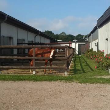


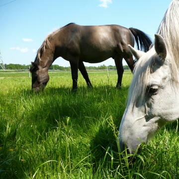
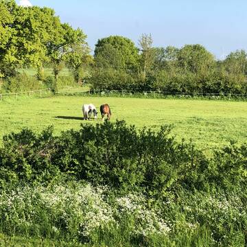
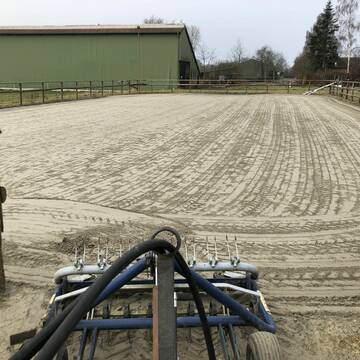
Pensionstall Rühmann /Paddockboxen /Offenstall
Todenbüttel
Ruehmann Pensionsstall
@Gabi-Ruehmann-Pensionsstall
Freizeitstall
Geländestrecke
Vermieten
Hunde willkommen
Paddock
bedampftes/gewaschenes Heu
Hufrehe geeignet
18 weitere...
aktuell
P+
Deprecated: Creation of dynamic property Zend_View_Helper_Ads::$adLink is deprecated in /var/www/stall-frei/htdocs/staging.stall-frei.de/library/Psf/View/Helper/Ads.php on line 108

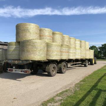
Futtersack HeuToy, Fressbremse in pink
Mechtersen
STALL-FREIde Marketing
@STALL-FREI-Marketing
Stundenlange Beschäftigung die
Koliken vorbeugt, geringe Staubinhalation mit
steuerbarer Futterentnahme

freier Platz im Offenstallbereich
Emkendorf
Michael-Schween-RS- Mohnblume
@reitstall-mohnblume
Freizeitstall
Geländestrecke
Vermieten
Hunde willkommen
Krankenbox
Gnadenbrothof
Hufrehe geeignet
22 weitere...
P+
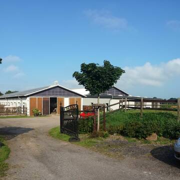
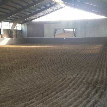
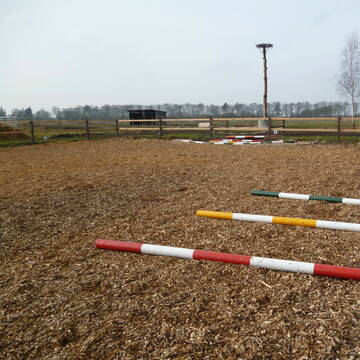
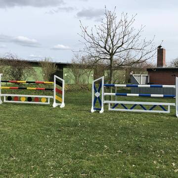
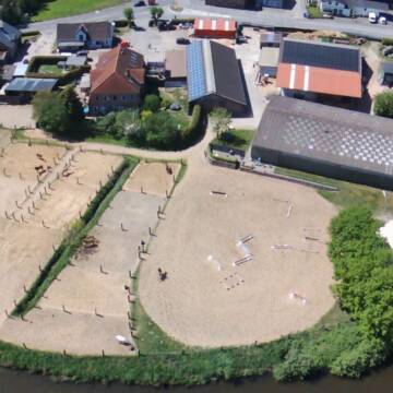
Reitanlage am Barris
Fockbek
Reitsport-Walther-Finger-GbR
@Reitsport-Walther-Finger-GbR
FN-Mitglied
Freizeitstall
Vermieten
Hunde willkommen
Longierzirkel/Roundpen
Allergikerstall
20 weitere...
P

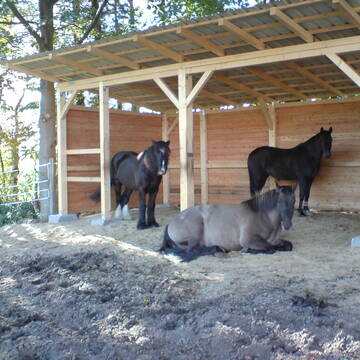
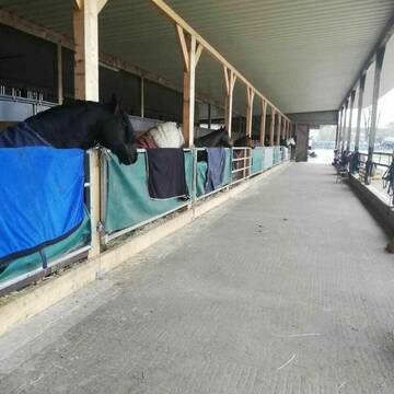
Pferdepension/Zucht Hof Wettersberg in 24819 Haale
Haale
Frau Zur Weihen
@Frau-Zur-Weihen
Freizeitstall
Pferdeausbildung
Paddock
Parkplatz für Pferdeanhänger
Allergikerstall
Fohlenaufzucht möglich
Außenboxen
Offenstall
18 weitere...
P

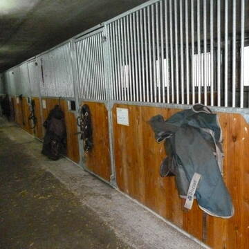
Reitanlage Kolb Pferdeboxen ab 400,00 €
Sophienhamm
Herr-Kolb
@Herr-Kolb
FN-Mitglied
Freizeitstall
Vermieten
Longierzirkel/Roundpen
Paddock
Hufrehe geeignet
zuckerreduziertes Heu
24 weitere...
ganz aktuell
P
Leider kein Vorschaubild
Leider kein Vorschaubild
Box frei VP, HP o. SV
Hamweddel
Laura38
@Laura38
Freizeitstall
Vermieten
Krankenbox
Paddock
Gnadenbrothof
Hengsthaltung möglich
12 weitere...
ganz aktuell
B

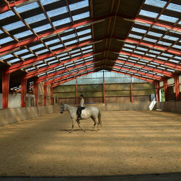
Reit- und Pensionsstall Mißfeldt
Tensbüttel-Röst
Andrea Mißfeldt
@Missfeldt250477
FN-Mitglied
Freizeitstall
Vermieten
Hunde willkommen
Krankenbox
Allergikerstall
bedampftes/gewaschenes Heu
33 weitere...
S


Boxen frei, Offenstall Plätze frei
Willenscharen
Yvonne-Thun
@Yvonne-Thun
FN-Mitglied
Freizeitstall
Führanlage
Hunde willkommen
Allergikerstall
Pferdezucht
Außenboxen
Innenbox
27 weitere...
aktuell
S
Leider kein Vorschaubild
Leider kein Vorschaubild
Boxen frei
Rendsburg
Reitanlage Klint
@RV_St-Hubertus_RD
Reitlehrer und -unterricht
Führanlage
Longierzirkel/Roundpen
Außenboxen
Innenbox
Halbpension
11 weitere...
B


Box frei für älteren Wallach bis 150 Stockmass
Groß Vollstedt
Otto Christophersen
@Otto_christ
Fahrstall, Kutschwagen
Vermieten
Hunde willkommen
Parkplatz für Pferdeanhänger
Gnadenbrothof
Hufrehe geeignet
10 weitere...
P+
Deprecated: Creation of dynamic property Zend_View::$pageCount is deprecated in /var/www/stall-frei/htdocs/staging.stall-frei.de/library/vendor/shardj/zf1-future/library/Zend/View/Abstract.php on line 308
Deprecated: Creation of dynamic property Zend_View::$itemCountPerPage is deprecated in /var/www/stall-frei/htdocs/staging.stall-frei.de/library/vendor/shardj/zf1-future/library/Zend/View/Abstract.php on line 308
Deprecated: Creation of dynamic property Zend_View::$first is deprecated in /var/www/stall-frei/htdocs/staging.stall-frei.de/library/vendor/shardj/zf1-future/library/Zend/View/Abstract.php on line 308
Deprecated: Creation of dynamic property Zend_View::$current is deprecated in /var/www/stall-frei/htdocs/staging.stall-frei.de/library/vendor/shardj/zf1-future/library/Zend/View/Abstract.php on line 308
Deprecated: Creation of dynamic property Zend_View::$last is deprecated in /var/www/stall-frei/htdocs/staging.stall-frei.de/library/vendor/shardj/zf1-future/library/Zend/View/Abstract.php on line 308
Deprecated: Creation of dynamic property Zend_View::$next is deprecated in /var/www/stall-frei/htdocs/staging.stall-frei.de/library/vendor/shardj/zf1-future/library/Zend/View/Abstract.php on line 308
Deprecated: Creation of dynamic property Zend_View::$pagesInRange is deprecated in /var/www/stall-frei/htdocs/staging.stall-frei.de/library/vendor/shardj/zf1-future/library/Zend/View/Abstract.php on line 308
Deprecated: Creation of dynamic property Zend_View::$firstPageInRange is deprecated in /var/www/stall-frei/htdocs/staging.stall-frei.de/library/vendor/shardj/zf1-future/library/Zend/View/Abstract.php on line 308
Deprecated: Creation of dynamic property Zend_View::$lastPageInRange is deprecated in /var/www/stall-frei/htdocs/staging.stall-frei.de/library/vendor/shardj/zf1-future/library/Zend/View/Abstract.php on line 308
Deprecated: Creation of dynamic property Zend_View::$currentItemCount is deprecated in /var/www/stall-frei/htdocs/staging.stall-frei.de/library/vendor/shardj/zf1-future/library/Zend/View/Abstract.php on line 308
Deprecated: Creation of dynamic property Zend_View::$totalItemCount is deprecated in /var/www/stall-frei/htdocs/staging.stall-frei.de/library/vendor/shardj/zf1-future/library/Zend/View/Abstract.php on line 308
Deprecated: Creation of dynamic property Zend_View::$firstItemNumber is deprecated in /var/www/stall-frei/htdocs/staging.stall-frei.de/library/vendor/shardj/zf1-future/library/Zend/View/Abstract.php on line 308
Deprecated: Creation of dynamic property Zend_View::$lastItemNumber is deprecated in /var/www/stall-frei/htdocs/staging.stall-frei.de/library/vendor/shardj/zf1-future/library/Zend/View/Abstract.php on line 308
Deprecated: Creation of dynamic property Zend_View::$router is deprecated in /var/www/stall-frei/htdocs/staging.stall-frei.de/library/vendor/shardj/zf1-future/library/Zend/View/Abstract.php on line 308
Deprecated: Creation of dynamic property Zend_View::$urlParams is deprecated in /var/www/stall-frei/htdocs/staging.stall-frei.de/library/vendor/shardj/zf1-future/library/Zend/View/Abstract.php on line 308
Deprecated: Creation of dynamic property Zend_View::$showAds is deprecated in /var/www/stall-frei/htdocs/staging.stall-frei.de/library/vendor/shardj/zf1-future/library/Zend/View/Abstract.php on line 308
Deprecated: Creation of dynamic property Zend_View::$objectIds is deprecated in /var/www/stall-frei/htdocs/staging.stall-frei.de/library/vendor/shardj/zf1-future/library/Zend/View/Abstract.php on line 308
Deprecated: Creation of dynamic property Zend_View::$showNavbar is deprecated in /var/www/stall-frei/htdocs/staging.stall-frei.de/library/vendor/shardj/zf1-future/library/Zend/View/Abstract.php on line 308
Deprecated: Creation of dynamic property Zend_View::$showBreadcrumb is deprecated in /var/www/stall-frei/htdocs/staging.stall-frei.de/library/vendor/shardj/zf1-future/library/Zend/View/Abstract.php on line 308
Deprecated: Creation of dynamic property Zend_View::$showFooter is deprecated in /var/www/stall-frei/htdocs/staging.stall-frei.de/library/vendor/shardj/zf1-future/library/Zend/View/Abstract.php on line 308
Deprecated: Creation of dynamic property Zend_View::$showInternalAds is deprecated in /var/www/stall-frei/htdocs/staging.stall-frei.de/library/vendor/shardj/zf1-future/library/Zend/View/Abstract.php on line 308
Deprecated: Creation of dynamic property Zend_View::$blNoContent is deprecated in /var/www/stall-frei/htdocs/staging.stall-frei.de/library/vendor/shardj/zf1-future/library/Zend/View/Abstract.php on line 308
Deprecated: Creation of dynamic property Zend_View::$sMetaDesc is deprecated in /var/www/stall-frei/htdocs/staging.stall-frei.de/library/vendor/shardj/zf1-future/library/Zend/View/Abstract.php on line 308
Deprecated: Creation of dynamic property Zend_View::$useGmaps is deprecated in /var/www/stall-frei/htdocs/staging.stall-frei.de/library/vendor/shardj/zf1-future/library/Zend/View/Abstract.php on line 308
Deprecated: Creation of dynamic property Zend_View::$touches is deprecated in /var/www/stall-frei/htdocs/staging.stall-frei.de/library/vendor/shardj/zf1-future/library/Zend/View/Abstract.php on line 308
Deprecated: Creation of dynamic property Zend_View::$oProject is deprecated in /var/www/stall-frei/htdocs/staging.stall-frei.de/library/vendor/shardj/zf1-future/library/Zend/View/Abstract.php on line 308
Deprecated: Creation of dynamic property Zend_View::$pageHeadline is deprecated in /var/www/stall-frei/htdocs/staging.stall-frei.de/library/vendor/shardj/zf1-future/library/Zend/View/Abstract.php on line 308
Deprecated: Creation of dynamic property Zend_View::$disableLocationField is deprecated in /var/www/stall-frei/htdocs/staging.stall-frei.de/library/vendor/shardj/zf1-future/library/Zend/View/Abstract.php on line 308
Deprecated: Creation of dynamic property Zend_View::$isSearch is deprecated in /var/www/stall-frei/htdocs/staging.stall-frei.de/library/vendor/shardj/zf1-future/library/Zend/View/Abstract.php on line 308
Deprecated: Creation of dynamic property Zend_View::$pageTitle is deprecated in /var/www/stall-frei/htdocs/staging.stall-frei.de/library/vendor/shardj/zf1-future/library/Zend/View/Abstract.php on line 308
Deprecated: Creation of dynamic property Psf_Form_Element_Text::$class is deprecated in /var/www/stall-frei/htdocs/staging.stall-frei.de/library/vendor/shardj/zf1-future/library/Zend/Form/Element.php on line 874
Deprecated: Creation of dynamic property Psf_Form_Element_Text::$size is deprecated in /var/www/stall-frei/htdocs/staging.stall-frei.de/library/vendor/shardj/zf1-future/library/Zend/Form/Element.php on line 874
Deprecated: Creation of dynamic property Psf_Form_Element_Text::$placeholder is deprecated in /var/www/stall-frei/htdocs/staging.stall-frei.de/library/vendor/shardj/zf1-future/library/Zend/Form/Element.php on line 874
Deprecated: Creation of dynamic property Psf_Form_Element_Hidden::$class is deprecated in /var/www/stall-frei/htdocs/staging.stall-frei.de/library/vendor/shardj/zf1-future/library/Zend/Form/Element.php on line 874
Deprecated: Creation of dynamic property Psf_Form_Element_Hidden::$class is deprecated in /var/www/stall-frei/htdocs/staging.stall-frei.de/library/vendor/shardj/zf1-future/library/Zend/Form/Element.php on line 874
Deprecated: Creation of dynamic property Psf_Form_Element_Hidden::$class is deprecated in /var/www/stall-frei/htdocs/staging.stall-frei.de/library/vendor/shardj/zf1-future/library/Zend/Form/Element.php on line 874
Deprecated: Creation of dynamic property Psf_Form_Element_Hidden::$class is deprecated in /var/www/stall-frei/htdocs/staging.stall-frei.de/library/vendor/shardj/zf1-future/library/Zend/Form/Element.php on line 874
Deprecated: Creation of dynamic property Psf_Form_Element_Select::$class is deprecated in /var/www/stall-frei/htdocs/staging.stall-frei.de/library/vendor/shardj/zf1-future/library/Zend/Form/Element.php on line 874
Deprecated: Creation of dynamic property Psf_Form_Element_Select::$class is deprecated in /var/www/stall-frei/htdocs/staging.stall-frei.de/library/vendor/shardj/zf1-future/library/Zend/Form/Element.php on line 874
Deprecated: Creation of dynamic property Psf_Form_Element_Select::$class is deprecated in /var/www/stall-frei/htdocs/staging.stall-frei.de/library/vendor/shardj/zf1-future/library/Zend/Form/Element.php on line 874
Deprecated: Creation of dynamic property Psf_Form_Element_Select::$class is deprecated in /var/www/stall-frei/htdocs/staging.stall-frei.de/library/vendor/shardj/zf1-future/library/Zend/Form/Element.php on line 874
Deprecated: Creation of dynamic property Psf_Form_Element_Text::$class is deprecated in /var/www/stall-frei/htdocs/staging.stall-frei.de/library/vendor/shardj/zf1-future/library/Zend/Form/Element.php on line 874
Deprecated: Creation of dynamic property Psf_Form_Element_Checkbox::$label is deprecated in /var/www/stall-frei/htdocs/staging.stall-frei.de/library/vendor/shardj/zf1-future/library/Zend/Form/Element.php on line 874
Deprecated: Creation of dynamic property Zend_View::$sort is deprecated in /var/www/stall-frei/htdocs/staging.stall-frei.de/library/vendor/shardj/zf1-future/library/Zend/View/Abstract.php on line 308
Deprecated: Creation of dynamic property Zend_View::$searchLocation is deprecated in /var/www/stall-frei/htdocs/staging.stall-frei.de/library/vendor/shardj/zf1-future/library/Zend/View/Abstract.php on line 308
Deprecated: Creation of dynamic property Zend_View::$locationHint is deprecated in /var/www/stall-frei/htdocs/staging.stall-frei.de/library/vendor/shardj/zf1-future/library/Zend/View/Abstract.php on line 308
Psf_GeoCoder_Abstract::getLocation: Horsten Get Location CachedOrLive
Psf_GeoCoder_Abstract::getCachedOrLive: Horsten
Psf_GeoCoder_OpenCageData::makeApiRequest: response:
Array
(
[documentation] => https://opencagedata.com/api
[licenses] => Array
(
[0] => Array
(
[name] => see attribution guide
[url] => https://opencagedata.com/credits
)
)
[results] => Array
(
[0] => Array
(
[bounds] => Array
(
[northeast] => Array
(
[lat] => 54.2370511
[lng] => 9.6217121
)
[southwest] => Array
(
[lat] => 54.2014681
[lng] => 9.5575162
)
)
[components] => Array
(
[ISO_3166-1_alpha-2] => DE
[ISO_3166-1_alpha-3] => DEU
[ISO_3166-2] => Array
(
[0] => DE-SH
)
[_category] => place
[_normalized_city] => Amt Jevenstedt
[_type] => hamlet
[continent] => Europe
[country] => Deutschland
[country_code] => de
[county] => Kreis Rendsburg-Eckernförde
[hamlet] => Hörsten
[municipality] => Amt Jevenstedt
[political_union] => European Union
[state] => Schleswig-Holstein
[state_code] => SH
)
[confidence] => 7
[formatted] => Hörsten, Schleswig-Holstein, Deutschland
[geometry] => Array
(
[lat] => 54.2268598
[lng] => 9.579301
)
)
[1] => Array
(
[bounds] => Array
(
[northeast] => Array
(
[lat] => 53.4832117
[lng] => 7.9750866
)
[southwest] => Array
(
[lat] => 53.4213426
[lng] => 7.878566
)
)
[components] => Array
(
[ISO_3166-1_alpha-2] => DE
[ISO_3166-1_alpha-3] => DEU
[ISO_3166-2] => Array
(
[0] => DE-NI
)
[_category] => place
[_normalized_city] => Friedeburg
[_type] => village
[continent] => Europe
[country] => Deutschland
[country_code] => de
[county] => Landkreis Wittmund
[political_union] => European Union
[state] => Niedersachsen
[state_code] => NI
[suburb] => Horsten
[village] => Friedeburg
)
[confidence] => 7
[formatted] => Horsten, Friedeburg, Niedersachsen, Deutschland
[geometry] => Array
(
[lat] => 53.4515303
[lng] => 7.9386985
)
)
[2] => Array
(
[bounds] => Array
(
[northeast] => Array
(
[lat] => 52.3593
[lng] => 9.37182
)
[southwest] => Array
(
[lat] => 52.3193
[lng] => 9.33182
)
)
[components] => Array
(
[ISO_3166-1_alpha-2] => DE
[ISO_3166-1_alpha-3] => DEU
[ISO_3166-2] => Array
(
[0] => DE-NI
)
[_category] => place
[_normalized_city] => Bad Nenndorf
[_type] => neighbourhood
[continent] => Europe
[country] => Deutschland
[country_code] => de
[county] => Landkreis Schaumburg
[municipality] => Samtgemeinde Nenndorf
[political_union] => European Union
[postcode] => 31542
[state] => Niedersachsen
[state_code] => NI
[suburb] => Horsten
[town] => Bad Nenndorf
)
[confidence] => 7
[formatted] => 31542 Bad Nenndorf, Deutschland
[geometry] => Array
(
[lat] => 52.3393
[lng] => 9.35182
)
)
[3] => Array
(
[bounds] => Array
(
[northeast] => Array
(
[lat] => 53.4316427
[lng] => 10.0857761
)
[southwest] => Array
(
[lat] => 53.3916427
[lng] => 10.0457761
)
)
[components] => Array
(
[ISO_3166-1_alpha-2] => DE
[ISO_3166-1_alpha-3] => DEU
[ISO_3166-2] => Array
(
[0] => DE-NI
)
[_category] => place
[_normalized_city] => Seevetal
[_type] => city
[continent] => Europe
[country] => Deutschland
[country_code] => de
[county] => Landkreis Harburg
[political_union] => European Union
[postcode] => 21217
[state] => Niedersachsen
[state_code] => NI
[town] => Seevetal
)
[confidence] => 7
[formatted] => 21217 Seevetal, Deutschland
[geometry] => Array
(
[lat] => 53.4116427
[lng] => 10.0657761
)
)
[4] => Array
(
[bounds] => Array
(
[northeast] => Array
(
[lat] => 52.796846
[lng] => 9.9237305
)
[southwest] => Array
(
[lat] => 52.756846
[lng] => 9.8837305
)
)
[components] => Array
(
[ISO_3166-1_alpha-2] => DE
[ISO_3166-1_alpha-3] => DEU
[ISO_3166-2] => Array
(
[0] => DE-NI
)
[_category] => place
[_normalized_city] => Lohheide
[_type] => city
[city] => Lohheide
[continent] => Europe
[country] => Deutschland
[country_code] => de
[county] => Landkreis Celle
[political_union] => European Union
[state] => Niedersachsen
[state_code] => NI
)
[confidence] => 7
[formatted] => Lohheide, Niedersachsen, Deutschland
[geometry] => Array
(
[lat] => 52.776846
[lng] => 9.9037305
)
)
[5] => Array
(
[bounds] => Array
(
[northeast] => Array
(
[lat] => 52.5124528
[lng] => 8.1032807
)
[southwest] => Array
(
[lat] => 52.4724528
[lng] => 8.0632807
)
)
[components] => Array
(
[ISO_3166-1_alpha-2] => DE
[ISO_3166-1_alpha-3] => DEU
[ISO_3166-2] => Array
(
[0] => DE-NI
)
[_category] => place
[_normalized_city] => Neuenkirchen-Vörden
[_type] => hamlet
[city] => Neuenkirchen-Vörden
[city_district] => Vörden
[continent] => Europe
[country] => Deutschland
[country_code] => de
[county] => Landkreis Vechta
[hamlet] => Hörsten
[political_union] => European Union
[postcode] => 49434
[state] => Niedersachsen
[state_code] => NI
)
[confidence] => 7
[formatted] => Hörsten, 49434 Neuenkirchen-Vörden, Deutschland
[geometry] => Array
(
[lat] => 52.4924528
[lng] => 8.0832807
)
)
[6] => Array
(
[bounds] => Array
(
[northeast] => Array
(
[lat] => 54.0272591
[lng] => 10.5720175
)
[southwest] => Array
(
[lat] => 53.9872591
[lng] => 10.5320175
)
)
[components] => Array
(
[ISO_3166-1_alpha-2] => DE
[ISO_3166-1_alpha-3] => DEU
[ISO_3166-2] => Array
(
[0] => DE-SH
)
[_category] => place
[_normalized_city] => Ahrensbök
[_type] => hamlet
[continent] => Europe
[country] => Deutschland
[country_code] => de
[county] => Kreis Ostholstein
[hamlet] => Hörsten
[political_union] => European Union
[postcode] => 23623
[state] => Schleswig-Holstein
[state_code] => SH
[village] => Ahrensbök
)
[confidence] => 7
[formatted] => Hörsten, 23623 Ahrensbök, Deutschland
[geometry] => Array
(
[lat] => 54.0072591
[lng] => 10.5520175
)
)
[7] => Array
(
[components] => Array
(
[ISO_3166-1_alpha-2] => FR
[ISO_3166-1_alpha-3] => FRA
[ISO_3166-2] => Array
(
[0] => FR-GES
[1] => FR-51
)
[_category] => road
[_normalized_city] => Dormans
[_type] => road
[city] => Dormans
[continent] => Europe
[country] => France
[country_code] => fr
[county] => Marne
[local_authority] => Communauté de communes des Paysages de la Champagne
[political_union] => European Union
[postcode] => 51700
[road] => Rue de Dorsten
[state] => Grand Est
[state_code] => GES
)
[confidence] => 3
[formatted] => Rue de Dorsten, 51700 Dormans, France
[geometry] => Array
(
[lat] => 49.080129
[lng] => 3.651668
)
)
[8] => Array
(
[components] => Array
(
[ISO_3166-1_alpha-2] => FR
[ISO_3166-1_alpha-3] => FRA
[ISO_3166-2] => Array
(
[0] => FR-NAQ
[1] => FR-33
)
[_category] => road
[_normalized_city] => Belin-Béliet
[_type] => road
[city] => Belin-Béliet
[continent] => Europe
[country] => France
[country_code] => fr
[county] => Gironde
[local_authority] => Communauté de communes du Val de l'Eyre
[political_union] => European Union
[postcode] => 33830
[road] => Route de Hostens
[state] => Nouvelle-Aquitaine
[state_code] => NAQ
)
[confidence] => 2
[formatted] => Route de Hostens, 33830 Belin-Béliet, France
[geometry] => Array
(
[lat] => 44.475551
[lng] => -0.724267
)
)
[9] => Array
(
[components] => Array
(
[ISO_3166-1_alpha-2] => FR
[ISO_3166-1_alpha-3] => FRA
[ISO_3166-2] => Array
(
[0] => FR-NAQ
[1] => FR-33
)
[_category] => road
[_normalized_city] => Hostens
[_type] => road
[city] => Hostens
[continent] => Europe
[country] => France
[country_code] => fr
[county] => Gironde
[local_authority] => Communauté de communes du Sud-Gironde
[political_union] => European Union
[postcode] => 33125
[road] => Rue des Pêcheurs
[state] => Nouvelle-Aquitaine
[state_code] => NAQ
)
[confidence] => 2
[formatted] => Rue des Pêcheurs, 33125 Hostens, France
[geometry] => Array
(
[lat] => 44.494571
[lng] => -0.643348
)
)
)
[status] => Array
(
[code] => 200
[message] => OK
)
[stay_informed] => Array
(
[blog] => https://blog.opencagedata.com
[mastodon] => https://en.osm.town/@opencage
)
[thanks] => For using an OpenCage API
[timestamp] => Array
(
[created_http] => Sun, 08 Feb 2026 13:46:40 GMT
[created_unix] => 1770558400
)
[total_results] => 10
)
Psf_GeoCoder_Abstract::convertLocationResult
{"documentation":"https:\/\/opencagedata.com\/api","licenses":[{"name":"see attribution guide","url":"https:\/\/opencagedata.com\/credits"}],"results":[{"bounds":{"northeast":{"lat":54.2370511,"lng":9.6217121},"southwest":{"lat":54.2014681,"lng":9.5575162}},"components":{"ISO_3166-1_alpha-2":"DE","ISO_3166-1_alpha-3":"DEU","ISO_3166-2":["DE-SH"],"_category":"place","_normalized_city":"Amt Jevenstedt","_type":"hamlet","continent":"Europe","country":"Deutschland","country_code":"de","county":"Kreis Rendsburg-Eckernf\u00f6rde","hamlet":"H\u00f6rsten","municipality":"Amt Jevenstedt","political_union":"European Union","state":"Schleswig-Holstein","state_code":"SH"},"confidence":7,"formatted":"H\u00f6rsten, Schleswig-Holstein, Deutschland","geometry":{"lat":54.2268598,"lng":9.579301}},{"bounds":{"northeast":{"lat":53.4832117,"lng":7.9750866},"southwest":{"lat":53.4213426,"lng":7.878566}},"components":{"ISO_3166-1_alpha-2":"DE","ISO_3166-1_alpha-3":"DEU","ISO_3166-2":["DE-NI"],"_category":"place","_normalized_city":"Friedeburg","_type":"village","continent":"Europe","country":"Deutschland","country_code":"de","county":"Landkreis Wittmund","political_union":"European Union","state":"Niedersachsen","state_code":"NI","suburb":"Horsten","village":"Friedeburg"},"confidence":7,"formatted":"Horsten, Friedeburg, Niedersachsen, Deutschland","geometry":{"lat":53.4515303,"lng":7.9386985}},{"bounds":{"northeast":{"lat":52.3593,"lng":9.37182},"southwest":{"lat":52.3193,"lng":9.33182}},"components":{"ISO_3166-1_alpha-2":"DE","ISO_3166-1_alpha-3":"DEU","ISO_3166-2":["DE-NI"],"_category":"place","_normalized_city":"Bad Nenndorf","_type":"neighbourhood","continent":"Europe","country":"Deutschland","country_code":"de","county":"Landkreis Schaumburg","municipality":"Samtgemeinde Nenndorf","political_union":"European Union","postcode":"31542","state":"Niedersachsen","state_code":"NI","suburb":"Horsten","town":"Bad Nenndorf"},"confidence":7,"formatted":"31542 Bad Nenndorf, Deutschland","geometry":{"lat":52.3393,"lng":9.35182}},{"bounds":{"northeast":{"lat":53.4316427,"lng":10.0857761},"southwest":{"lat":53.3916427,"lng":10.0457761}},"components":{"ISO_3166-1_alpha-2":"DE","ISO_3166-1_alpha-3":"DEU","ISO_3166-2":["DE-NI"],"_category":"place","_normalized_city":"Seevetal","_type":"city","continent":"Europe","country":"Deutschland","country_code":"de","county":"Landkreis Harburg","political_union":"European Union","postcode":"21217","state":"Niedersachsen","state_code":"NI","town":"Seevetal"},"confidence":7,"formatted":"21217 Seevetal, Deutschland","geometry":{"lat":53.4116427,"lng":10.0657761}},{"bounds":{"northeast":{"lat":52.796846,"lng":9.9237305},"southwest":{"lat":52.756846,"lng":9.8837305}},"components":{"ISO_3166-1_alpha-2":"DE","ISO_3166-1_alpha-3":"DEU","ISO_3166-2":["DE-NI"],"_category":"place","_normalized_city":"Lohheide","_type":"city","city":"Lohheide","continent":"Europe","country":"Deutschland","country_code":"de","county":"Landkreis Celle","political_union":"European Union","state":"Niedersachsen","state_code":"NI"},"confidence":7,"formatted":"Lohheide, Niedersachsen, Deutschland","geometry":{"lat":52.776846,"lng":9.9037305}},{"bounds":{"northeast":{"lat":52.5124528,"lng":8.1032807},"southwest":{"lat":52.4724528,"lng":8.0632807}},"components":{"ISO_3166-1_alpha-2":"DE","ISO_3166-1_alpha-3":"DEU","ISO_3166-2":["DE-NI"],"_category":"place","_normalized_city":"Neuenkirchen-V\u00f6rden","_type":"hamlet","city":"Neuenkirchen-V\u00f6rden","city_district":"V\u00f6rden","continent":"Europe","country":"Deutschland","country_code":"de","county":"Landkreis Vechta","hamlet":"H\u00f6rsten","political_union":"European Union","postcode":"49434","state":"Niedersachsen","state_code":"NI"},"confidence":7,"formatted":"H\u00f6rsten, 49434 Neuenkirchen-V\u00f6rden, Deutschland","geometry":{"lat":52.4924528,"lng":8.0832807}},{"bounds":{"northeast":{"lat":54.0272591,"lng":10.5720175},"southwest":{"lat":53.9872591,"lng":10.5320175}},"components":{"ISO_3166-1_alpha-2":"DE","ISO_3166-1_alpha-3":"DEU","ISO_3166-2":["DE-SH"],"_category":"place","_normalized_city":"Ahrensb\u00f6k","_type":"hamlet","continent":"Europe","country":"Deutschland","country_code":"de","county":"Kreis Ostholstein","hamlet":"H\u00f6rsten","political_union":"European Union","postcode":"23623","state":"Schleswig-Holstein","state_code":"SH","village":"Ahrensb\u00f6k"},"confidence":7,"formatted":"H\u00f6rsten, 23623 Ahrensb\u00f6k, Deutschland","geometry":{"lat":54.0072591,"lng":10.5520175}},{"components":{"ISO_3166-1_alpha-2":"FR","ISO_3166-1_alpha-3":"FRA","ISO_3166-2":["FR-GES","FR-51"],"_category":"road","_normalized_city":"Dormans","_type":"road","city":"Dormans","continent":"Europe","country":"France","country_code":"fr","county":"Marne","local_authority":"Communaut\u00e9 de communes des Paysages de la Champagne","political_union":"European Union","postcode":"51700","road":"Rue de Dorsten","state":"Grand Est","state_code":"GES"},"confidence":3,"formatted":"Rue de Dorsten, 51700 Dormans, France","geometry":{"lat":49.080129,"lng":3.651668}},{"components":{"ISO_3166-1_alpha-2":"FR","ISO_3166-1_alpha-3":"FRA","ISO_3166-2":["FR-NAQ","FR-33"],"_category":"road","_normalized_city":"Belin-B\u00e9liet","_type":"road","city":"Belin-B\u00e9liet","continent":"Europe","country":"France","country_code":"fr","county":"Gironde","local_authority":"Communaut\u00e9 de communes du Val de l'Eyre","political_union":"European Union","postcode":"33830","road":"Route de Hostens","state":"Nouvelle-Aquitaine","state_code":"NAQ"},"confidence":2,"formatted":"Route de Hostens, 33830 Belin-B\u00e9liet, France","geometry":{"lat":44.475551,"lng":-0.724267}},{"components":{"ISO_3166-1_alpha-2":"FR","ISO_3166-1_alpha-3":"FRA","ISO_3166-2":["FR-NAQ","FR-33"],"_category":"road","_normalized_city":"Hostens","_type":"road","city":"Hostens","continent":"Europe","country":"France","country_code":"fr","county":"Gironde","local_authority":"Communaut\u00e9 de communes du Sud-Gironde","political_union":"European Union","postcode":"33125","road":"Rue des P\u00eacheurs","state":"Nouvelle-Aquitaine","state_code":"NAQ"},"confidence":2,"formatted":"Rue des P\u00eacheurs, 33125 Hostens, France","geometry":{"lat":44.494571,"lng":-0.643348}}],"status":{"code":200,"message":"OK"},"stay_informed":{"blog":"https:\/\/blog.opencagedata.com","mastodon":"https:\/\/en.osm.town\/@opencage"},"thanks":"For using an OpenCage API","timestamp":{"created_http":"Sun, 08 Feb 2026 13:46:40 GMT","created_unix":1770558400},"total_results":10}Array
(
[0] => stdClass Object
(
[bounds] => stdClass Object
(
[northeast] => stdClass Object
(
[lat] => 54.2370511
[lng] => 9.6217121
)
[southwest] => stdClass Object
(
[lat] => 54.2014681
[lng] => 9.5575162
)
)
[components] => stdClass Object
(
[ISO_3166-1_alpha-2] => DE
[ISO_3166-1_alpha-3] => DEU
[ISO_3166-2] => Array
(
[0] => DE-SH
)
[_category] => place
[_normalized_city] => Amt Jevenstedt
[_type] => hamlet
[continent] => Europe
[country] => Deutschland
[country_code] => de
[county] => Kreis Rendsburg-Eckernförde
[hamlet] => Hörsten
[municipality] => Amt Jevenstedt
[political_union] => European Union
[state] => Schleswig-Holstein
[state_code] => SH
)
[confidence] => 7
[formatted] => Hörsten, Schleswig-Holstein, Deutschland
[geometry] => stdClass Object
(
[lat] => 54.2268598
[lng] => 9.579301
)
)
[1] => stdClass Object
(
[bounds] => stdClass Object
(
[northeast] => stdClass Object
(
[lat] => 53.4832117
[lng] => 7.9750866
)
[southwest] => stdClass Object
(
[lat] => 53.4213426
[lng] => 7.878566
)
)
[components] => stdClass Object
(
[ISO_3166-1_alpha-2] => DE
[ISO_3166-1_alpha-3] => DEU
[ISO_3166-2] => Array
(
[0] => DE-NI
)
[_category] => place
[_normalized_city] => Friedeburg
[_type] => village
[continent] => Europe
[country] => Deutschland
[country_code] => de
[county] => Landkreis Wittmund
[political_union] => European Union
[state] => Niedersachsen
[state_code] => NI
[suburb] => Horsten
[village] => Friedeburg
)
[confidence] => 7
[formatted] => Horsten, Friedeburg, Niedersachsen, Deutschland
[geometry] => stdClass Object
(
[lat] => 53.4515303
[lng] => 7.9386985
)
)
[2] => stdClass Object
(
[bounds] => stdClass Object
(
[northeast] => stdClass Object
(
[lat] => 52.3593
[lng] => 9.37182
)
[southwest] => stdClass Object
(
[lat] => 52.3193
[lng] => 9.33182
)
)
[components] => stdClass Object
(
[ISO_3166-1_alpha-2] => DE
[ISO_3166-1_alpha-3] => DEU
[ISO_3166-2] => Array
(
[0] => DE-NI
)
[_category] => place
[_normalized_city] => Bad Nenndorf
[_type] => neighbourhood
[continent] => Europe
[country] => Deutschland
[country_code] => de
[county] => Landkreis Schaumburg
[municipality] => Samtgemeinde Nenndorf
[political_union] => European Union
[postcode] => 31542
[state] => Niedersachsen
[state_code] => NI
[suburb] => Horsten
[town] => Bad Nenndorf
)
[confidence] => 7
[formatted] => 31542 Bad Nenndorf, Deutschland
[geometry] => stdClass Object
(
[lat] => 52.3393
[lng] => 9.35182
)
)
[3] => stdClass Object
(
[bounds] => stdClass Object
(
[northeast] => stdClass Object
(
[lat] => 53.4316427
[lng] => 10.0857761
)
[southwest] => stdClass Object
(
[lat] => 53.3916427
[lng] => 10.0457761
)
)
[components] => stdClass Object
(
[ISO_3166-1_alpha-2] => DE
[ISO_3166-1_alpha-3] => DEU
[ISO_3166-2] => Array
(
[0] => DE-NI
)
[_category] => place
[_normalized_city] => Seevetal
[_type] => city
[continent] => Europe
[country] => Deutschland
[country_code] => de
[county] => Landkreis Harburg
[political_union] => European Union
[postcode] => 21217
[state] => Niedersachsen
[state_code] => NI
[town] => Seevetal
)
[confidence] => 7
[formatted] => 21217 Seevetal, Deutschland
[geometry] => stdClass Object
(
[lat] => 53.4116427
[lng] => 10.0657761
)
)
[4] => stdClass Object
(
[bounds] => stdClass Object
(
[northeast] => stdClass Object
(
[lat] => 52.796846
[lng] => 9.9237305
)
[southwest] => stdClass Object
(
[lat] => 52.756846
[lng] => 9.8837305
)
)
[components] => stdClass Object
(
[ISO_3166-1_alpha-2] => DE
[ISO_3166-1_alpha-3] => DEU
[ISO_3166-2] => Array
(
[0] => DE-NI
)
[_category] => place
[_normalized_city] => Lohheide
[_type] => city
[city] => Lohheide
[continent] => Europe
[country] => Deutschland
[country_code] => de
[county] => Landkreis Celle
[political_union] => European Union
[state] => Niedersachsen
[state_code] => NI
)
[confidence] => 7
[formatted] => Lohheide, Niedersachsen, Deutschland
[geometry] => stdClass Object
(
[lat] => 52.776846
[lng] => 9.9037305
)
)
[5] => stdClass Object
(
[bounds] => stdClass Object
(
[northeast] => stdClass Object
(
[lat] => 52.5124528
[lng] => 8.1032807
)
[southwest] => stdClass Object
(
[lat] => 52.4724528
[lng] => 8.0632807
)
)
[components] => stdClass Object
(
[ISO_3166-1_alpha-2] => DE
[ISO_3166-1_alpha-3] => DEU
[ISO_3166-2] => Array
(
[0] => DE-NI
)
[_category] => place
[_normalized_city] => Neuenkirchen-Vörden
[_type] => hamlet
[city] => Neuenkirchen-Vörden
[city_district] => Vörden
[continent] => Europe
[country] => Deutschland
[country_code] => de
[county] => Landkreis Vechta
[hamlet] => Hörsten
[political_union] => European Union
[postcode] => 49434
[state] => Niedersachsen
[state_code] => NI
)
[confidence] => 7
[formatted] => Hörsten, 49434 Neuenkirchen-Vörden, Deutschland
[geometry] => stdClass Object
(
[lat] => 52.4924528
[lng] => 8.0832807
)
)
[6] => stdClass Object
(
[bounds] => stdClass Object
(
[northeast] => stdClass Object
(
[lat] => 54.0272591
[lng] => 10.5720175
)
[southwest] => stdClass Object
(
[lat] => 53.9872591
[lng] => 10.5320175
)
)
[components] => stdClass Object
(
[ISO_3166-1_alpha-2] => DE
[ISO_3166-1_alpha-3] => DEU
[ISO_3166-2] => Array
(
[0] => DE-SH
)
[_category] => place
[_normalized_city] => Ahrensbök
[_type] => hamlet
[continent] => Europe
[country] => Deutschland
[country_code] => de
[county] => Kreis Ostholstein
[hamlet] => Hörsten
[political_union] => European Union
[postcode] => 23623
[state] => Schleswig-Holstein
[state_code] => SH
[village] => Ahrensbök
)
[confidence] => 7
[formatted] => Hörsten, 23623 Ahrensbök, Deutschland
[geometry] => stdClass Object
(
[lat] => 54.0072591
[lng] => 10.5520175
)
)
[7] => stdClass Object
(
[components] => stdClass Object
(
[ISO_3166-1_alpha-2] => FR
[ISO_3166-1_alpha-3] => FRA
[ISO_3166-2] => Array
(
[0] => FR-GES
[1] => FR-51
)
[_category] => road
[_normalized_city] => Dormans
[_type] => road
[city] => Dormans
[continent] => Europe
[country] => France
[country_code] => fr
[county] => Marne
[local_authority] => Communauté de communes des Paysages de la Champagne
[political_union] => European Union
[postcode] => 51700
[road] => Rue de Dorsten
[state] => Grand Est
[state_code] => GES
)
[confidence] => 3
[formatted] => Rue de Dorsten, 51700 Dormans, France
[geometry] => stdClass Object
(
[lat] => 49.080129
[lng] => 3.651668
)
)
[8] => stdClass Object
(
[components] => stdClass Object
(
[ISO_3166-1_alpha-2] => FR
[ISO_3166-1_alpha-3] => FRA
[ISO_3166-2] => Array
(
[0] => FR-NAQ
[1] => FR-33
)
[_category] => road
[_normalized_city] => Belin-Béliet
[_type] => road
[city] => Belin-Béliet
[continent] => Europe
[country] => France
[country_code] => fr
[county] => Gironde
[local_authority] => Communauté de communes du Val de l'Eyre
[political_union] => European Union
[postcode] => 33830
[road] => Route de Hostens
[state] => Nouvelle-Aquitaine
[state_code] => NAQ
)
[confidence] => 2
[formatted] => Route de Hostens, 33830 Belin-Béliet, France
[geometry] => stdClass Object
(
[lat] => 44.475551
[lng] => -0.724267
)
)
[9] => stdClass Object
(
[components] => stdClass Object
(
[ISO_3166-1_alpha-2] => FR
[ISO_3166-1_alpha-3] => FRA
[ISO_3166-2] => Array
(
[0] => FR-NAQ
[1] => FR-33
)
[_category] => road
[_normalized_city] => Hostens
[_type] => road
[city] => Hostens
[continent] => Europe
[country] => France
[country_code] => fr
[county] => Gironde
[local_authority] => Communauté de communes du Sud-Gironde
[political_union] => European Union
[postcode] => 33125
[road] => Rue des Pêcheurs
[state] => Nouvelle-Aquitaine
[state_code] => NAQ
)
[confidence] => 2
[formatted] => Rue des Pêcheurs, 33125 Hostens, France
[geometry] => stdClass Object
(
[lat] => 44.494571
[lng] => -0.643348
)
)
)
Psf_GeoCoder_OpenCageData::getKeyMap: 0
stdClass Object
(
    [bounds] => stdClass Object
        (
            [northeast] => stdClass Object
                (
                    [lat] => 54.2370511
                    [lng] => 9.6217121
                )

            [southwest] => stdClass Object
                (
                    [lat] => 54.2014681
                    [lng] => 9.5575162
                )

        )

    [components] => stdClass Object
        (
            [ISO_3166-1_alpha-2] => DE
            [ISO_3166-1_alpha-3] => DEU
            [ISO_3166-2] => Array
                (
                    [0] => DE-SH
                )

            [_category] => place
            [_normalized_city] => Amt Jevenstedt
            [_type] => hamlet
            [continent] => Europe
            [country] => Deutschland
            [country_code] => de
            [county] => Kreis Rendsburg-Eckernförde
            [hamlet] => Hörsten
            [municipality] => Amt Jevenstedt
            [political_union] => European Union
            [state] => Schleswig-Holstein
            [state_code] => SH
        )

    [confidence] => 7
    [formatted] => Hörsten, Schleswig-Holstein, Deutschland
    [geometry] => stdClass Object
        (
            [lat] => 54.2268598
            [lng] => 9.579301
        )

)
Psf_GeoCoder_OpenCageData::getCounty: Rendsburg-Eckernförde
Psf_GeoCoder_OpenCageData::addMissingData REFETCH!
Array
(
    [address] => Hörsten, Schleswig-Holstein, Deutschland
    [type] => hamlet
    [street] => Hörsten
    [city] =>
    [county] => Rendsburg-Eckernförde
    [state] => Schleswig-Holstein
    [zip] =>
    [country] => Deutschland
    [suburb] =>
    [countrycode] => de
    [latitude] => 54.2268598
    [longitude] => 9.579301
    [accuracy] => 1
    [confidence] => 7
    [bounds] => stdClass Object
        (
            [northeast] => stdClass Object
                (
                    [lat] => 54.2370511
                    [lng] => 9.6217121
                )

            [southwest] => stdClass Object
                (
                    [lat] => 54.2014681
                    [lng] => 9.5575162
                )

        )

)
reformat!
Array
(
    [address] => Hörsten, Schleswig-Holstein, Deutschland
    [type] => hamlet
    [street] => Hörsten
    [city] =>
    [county] => Rendsburg-Eckernförde
    [state] => Schleswig-Holstein
    [zip] =>
    [country] => Deutschland
    [suburb] =>
    [countrycode] => de
    [latitude] => 54.2268598
    [longitude] => 9.579301
    [accuracy] => 1
    [confidence] => 7
    [bounds] => stdClass Object
        (
            [northeast] => stdClass Object
                (
                    [lat] => 54.2370511
                    [lng] => 9.6217121
                )

            [southwest] => stdClass Object
                (
                    [lat] => 54.2014681
                    [lng] => 9.5575162
                )

        )

    [place] => Hörsten, , Schleswig-Holstein
    [hash] => d3268acb19f6941dc914c1cf3f9782f9
)
Psf_GeoCoder_OpenCageData::getKeyMap: 1
stdClass Object
(
    [bounds] => stdClass Object
        (
            [northeast] => stdClass Object
                (
                    [lat] => 53.4832117
                    [lng] => 7.9750866
                )

            [southwest] => stdClass Object
                (
                    [lat] => 53.4213426
                    [lng] => 7.878566
                )

        )

    [components] => stdClass Object
        (
            [ISO_3166-1_alpha-2] => DE
            [ISO_3166-1_alpha-3] => DEU
            [ISO_3166-2] => Array
                (
                    [0] => DE-NI
                )

            [_category] => place
            [_normalized_city] => Friedeburg
            [_type] => village
            [continent] => Europe
            [country] => Deutschland
            [country_code] => de
            [county] => Landkreis Wittmund
            [political_union] => European Union
            [state] => Niedersachsen
            [state_code] => NI
            [suburb] => Horsten
            [village] => Friedeburg
        )

    [confidence] => 7
    [formatted] => Horsten, Friedeburg, Niedersachsen, Deutschland
    [geometry] => stdClass Object
        (
            [lat] => 53.4515303
            [lng] => 7.9386985
        )

)
Psf_GeoCoder_OpenCageData::getCounty: Wittmund
Psf_GeoCoder_OpenCageData::addMissingData REFETCH!
Array
(
    [address] => Horsten, Friedeburg, Niedersachsen, Deutschland
    [type] => village
    [street] =>
    [city] => Friedeburg
    [county] => Wittmund
    [state] => Niedersachsen
    [zip] =>
    [country] => Deutschland
    [suburb] => Horsten
    [countrycode] => de
    [latitude] => 53.4515303
    [longitude] => 7.9386985
    [accuracy] => 1
    [confidence] => 7
    [bounds] => stdClass Object
        (
            [northeast] => stdClass Object
                (
                    [lat] => 53.4832117
                    [lng] => 7.9750866
                )

            [southwest] => stdClass Object
                (
                    [lat] => 53.4213426
                    [lng] => 7.878566
                )

        )

)
reformat!
Array
(
    [address] => Horsten, Friedeburg, Niedersachsen, Deutschland
    [type] => village
    [street] =>
    [city] => Friedeburg
    [county] => Wittmund
    [state] => Niedersachsen
    [zip] =>
    [country] => Deutschland
    [suburb] => Horsten
    [countrycode] => de
    [latitude] => 53.4515303
    [longitude] => 7.9386985
    [accuracy] => 1
    [confidence] => 7
    [bounds] => stdClass Object
        (
            [northeast] => stdClass Object
                (
                    [lat] => 53.4832117
                    [lng] => 7.9750866
                )

            [southwest] => stdClass Object
                (
                    [lat] => 53.4213426
                    [lng] => 7.878566
                )

        )

    [place] => Friedeburg, Niedersachsen
    [hash] => 221b43353f95d571493e38b8db08dc4c
)
Psf_GeoCoder_OpenCageData::getKeyMap: 2
stdClass Object
(
    [bounds] => stdClass Object
        (
            [northeast] => stdClass Object
                (
                    [lat] => 52.3593
                    [lng] => 9.37182
                )

            [southwest] => stdClass Object
                (
                    [lat] => 52.3193
                    [lng] => 9.33182
                )

        )

    [components] => stdClass Object
        (
            [ISO_3166-1_alpha-2] => DE
            [ISO_3166-1_alpha-3] => DEU
            [ISO_3166-2] => Array
                (
                    [0] => DE-NI
                )

            [_category] => place
            [_normalized_city] => Bad Nenndorf
            [_type] => neighbourhood
            [continent] => Europe
            [country] => Deutschland
            [country_code] => de
            [county] => Landkreis Schaumburg
            [municipality] => Samtgemeinde Nenndorf
            [political_union] => European Union
            [postcode] => 31542
            [state] => Niedersachsen
            [state_code] => NI
            [suburb] => Horsten
            [town] => Bad Nenndorf
        )

    [confidence] => 7
    [formatted] => 31542 Bad Nenndorf, Deutschland
    [geometry] => stdClass Object
        (
            [lat] => 52.3393
            [lng] => 9.35182
        )

)
Psf_GeoCoder_OpenCageData::getCounty: Schaumburg
Psf_GeoCoder_OpenCageData::addMissingData REFETCH!
Array
(
    [address] => 31542 Bad Nenndorf, Deutschland
    [type] => neighbourhood
    [street] =>
    [city] => Bad Nenndorf
    [county] => Schaumburg
    [state] => Niedersachsen
    [zip] => 31542
    [country] => Deutschland
    [suburb] => Horsten
    [countrycode] => de
    [latitude] => 52.3393
    [longitude] => 9.35182
    [accuracy] => 1
    [confidence] => 7
    [bounds] => stdClass Object
        (
            [northeast] => stdClass Object
                (
                    [lat] => 52.3593
                    [lng] => 9.37182
                )

            [southwest] => stdClass Object
                (
                    [lat] => 52.3193
                    [lng] => 9.33182
                )

        )

)
reformat!
Array
(
    [address] => 31542 Bad Nenndorf, Deutschland
    [type] => neighbourhood
    [street] =>
    [city] => Bad Nenndorf
    [county] => Schaumburg
    [state] => Niedersachsen
    [zip] => 31542
    [country] => Deutschland
    [suburb] => Horsten
    [countrycode] => de
    [latitude] => 52.3393
    [longitude] => 9.35182
    [accuracy] => 1
    [confidence] => 7
    [bounds] => stdClass Object
        (
            [northeast] => stdClass Object
                (
                    [lat] => 52.3593
                    [lng] => 9.37182
                )

            [southwest] => stdClass Object
                (
                    [lat] => 52.3193
                    [lng] => 9.33182
                )

        )

    [place] => 31542 Bad Nenndorf, Niedersachsen
    [hash] => 7267c4f2d6dcb077d81ccaccbfd50e2d
)
Psf_GeoCoder_OpenCageData::getKeyMap: 3
stdClass Object
(
    [bounds] => stdClass Object
        (
            [northeast] => stdClass Object
                (
                    [lat] => 53.4316427
                    [lng] => 10.0857761
                )

            [southwest] => stdClass Object
                (
                    [lat] => 53.3916427
                    [lng] => 10.0457761
                )

        )

    [components] => stdClass Object
        (
            [ISO_3166-1_alpha-2] => DE
            [ISO_3166-1_alpha-3] => DEU
            [ISO_3166-2] => Array
                (
                    [0] => DE-NI
                )

            [_category] => place
            [_normalized_city] => Seevetal
            [_type] => city
            [continent] => Europe
            [country] => Deutschland
            [country_code] => de
            [county] => Landkreis Harburg
            [political_union] => European Union
            [postcode] => 21217
            [state] => Niedersachsen
            [state_code] => NI
            [town] => Seevetal
        )

    [confidence] => 7
    [formatted] => 21217 Seevetal, Deutschland
    [geometry] => stdClass Object
        (
            [lat] => 53.4116427
            [lng] => 10.0657761
        )

)
Psf_GeoCoder_OpenCageData::getCounty: Harburg
Psf_GeoCoder_OpenCageData::addMissingData REFETCH!
Array
(
    [address] => 21217 Seevetal, Deutschland
    [type] => city
    [street] =>
    [city] => Seevetal
    [county] => Harburg
    [state] => Niedersachsen
    [zip] => 21217
    [country] => Deutschland
    [suburb] =>
    [countrycode] => de
    [latitude] => 53.4116427
    [longitude] => 10.0657761
    [accuracy] => 1
    [confidence] => 7
    [bounds] => stdClass Object
        (
            [northeast] => stdClass Object
                (
                    [lat] => 53.4316427
                    [lng] => 10.0857761
                )

            [southwest] => stdClass Object
                (
                    [lat] => 53.3916427
                    [lng] => 10.0457761
                )

        )

)
reformat!
Array
(
    [address] => 21217 Seevetal, Deutschland
    [type] => city
    [street] =>
    [city] => Seevetal
    [county] => Harburg
    [state] => Niedersachsen
    [zip] => 21217
    [country] => Deutschland
    [suburb] =>
    [countrycode] => de
    [latitude] => 53.4116427
    [longitude] => 10.0657761
    [accuracy] => 1
    [confidence] => 7
    [bounds] => stdClass Object
        (
            [northeast] => stdClass Object
                (
                    [lat] => 53.4316427
                    [lng] => 10.0857761
                )

            [southwest] => stdClass Object
                (
                    [lat] => 53.3916427
                    [lng] => 10.0457761
                )

        )

    [place] => 21217 Seevetal, Niedersachsen
    [hash] => 17574337380c2fb899b613b282ed6ff6
)
Psf_GeoCoder_OpenCageData::getKeyMap: 4
stdClass Object
(
    [bounds] => stdClass Object
        (
            [northeast] => stdClass Object
                (
                    [lat] => 52.796846
                    [lng] => 9.9237305
                )

            [southwest] => stdClass Object
                (
                    [lat] => 52.756846
                    [lng] => 9.8837305
                )

        )

    [components] => stdClass Object
        (
            [ISO_3166-1_alpha-2] => DE
            [ISO_3166-1_alpha-3] => DEU
            [ISO_3166-2] => Array
                (
                    [0] => DE-NI
                )

            [_category] => place
            [_normalized_city] => Lohheide
            [_type] => city
            [city] => Lohheide
            [continent] => Europe
            [country] => Deutschland
            [country_code] => de
            [county] => Landkreis Celle
            [political_union] => European Union
            [state] => Niedersachsen
            [state_code] => NI
        )

    [confidence] => 7
    [formatted] => Lohheide, Niedersachsen, Deutschland
    [geometry] => stdClass Object
        (
            [lat] => 52.776846
            [lng] => 9.9037305
        )

)
Psf_GeoCoder_OpenCageData::getCounty: Celle
Psf_GeoCoder_OpenCageData::addMissingData REFETCH!
Array
(
    [address] => Lohheide, Niedersachsen, Deutschland
    [type] => city
    [street] =>
    [city] => Lohheide
    [county] => Celle
    [state] => Niedersachsen
    [zip] =>
    [country] => Deutschland
    [suburb] =>
    [countrycode] => de
    [latitude] => 52.776846
    [longitude] => 9.9037305
    [accuracy] => 1
    [confidence] => 7
    [bounds] => stdClass Object
        (
            [northeast] => stdClass Object
                (
                    [lat] => 52.796846
                    [lng] => 9.9237305
                )

            [southwest] => stdClass Object
                (
                    [lat] => 52.756846
                    [lng] => 9.8837305
                )

        )

)
reformat!
Array
(
    [address] => Lohheide, Niedersachsen, Deutschland
    [type] => city
    [street] =>
    [city] => Lohheide
    [county] => Celle
    [state] => Niedersachsen
    [zip] =>
    [country] => Deutschland
    [suburb] =>
    [countrycode] => de
    [latitude] => 52.776846
    [longitude] => 9.9037305
    [accuracy] => 1
    [confidence] => 7
    [bounds] => stdClass Object
        (
            [northeast] => stdClass Object
                (
                    [lat] => 52.796846
                    [lng] => 9.9237305
                )

            [southwest] => stdClass Object
                (
                    [lat] => 52.756846
                    [lng] => 9.8837305
                )

        )

    [place] => Lohheide, Niedersachsen
    [hash] => b19232858415065bc71dc716b1cdf589
)
Psf_GeoCoder_OpenCageData::getKeyMap: 5
stdClass Object
(
    [bounds] => stdClass Object
        (
            [northeast] => stdClass Object
                (
                    [lat] => 52.5124528
                    [lng] => 8.1032807
                )

            [southwest] => stdClass Object
                (
                    [lat] => 52.4724528
                    [lng] => 8.0632807
                )

        )

    [components] => stdClass Object
        (
            [ISO_3166-1_alpha-2] => DE
            [ISO_3166-1_alpha-3] => DEU
            [ISO_3166-2] => Array
                (
                    [0] => DE-NI
                )

            [_category] => place
            [_normalized_city] => Neuenkirchen-Vörden
            [_type] => hamlet
            [city] => Neuenkirchen-Vörden
            [city_district] => Vörden
            [continent] => Europe
            [country] => Deutschland
            [country_code] => de
            [county] => Landkreis Vechta
            [hamlet] => Hörsten
            [political_union] => European Union
            [postcode] => 49434
            [state] => Niedersachsen
            [state_code] => NI
        )

    [confidence] => 7
    [formatted] => Hörsten, 49434 Neuenkirchen-Vörden, Deutschland
    [geometry] => stdClass Object
        (
            [lat] => 52.4924528
            [lng] => 8.0832807
        )

)
Psf_GeoCoder_OpenCageData::getCounty: Vechta
Psf_GeoCoder_OpenCageData::addMissingData REFETCH!
Array
(
    [address] => Hörsten, 49434 Neuenkirchen-Vörden, Deutschland
    [type] => hamlet
    [street] => Hörsten
    [city] => Neuenkirchen-Vörden
    [county] => Vechta
    [state] => Niedersachsen
    [zip] => 49434
    [country] => Deutschland
    [suburb] =>
    [countrycode] => de
    [latitude] => 52.4924528
    [longitude] => 8.0832807
    [accuracy] => 1
    [confidence] => 7
    [bounds] => stdClass Object
        (
            [northeast] => stdClass Object
                (
                    [lat] => 52.5124528
                    [lng] => 8.1032807
                )

            [southwest] => stdClass Object
                (
                    [lat] => 52.4724528
                    [lng] => 8.0632807
                )

        )

)
reformat!
Array
(
    [address] => Hörsten, 49434 Neuenkirchen-Vörden, Deutschland
    [type] => hamlet
    [street] => Hörsten
    [city] => Neuenkirchen-Vörden
    [county] => Vechta
    [state] => Niedersachsen
    [zip] => 49434
    [country] => Deutschland
    [suburb] =>
    [countrycode] => de
    [latitude] => 52.4924528
    [longitude] => 8.0832807
    [accuracy] => 1
    [confidence] => 7
    [bounds] => stdClass Object
        (
            [northeast] => stdClass Object
                (
                    [lat] => 52.5124528
                    [lng] => 8.1032807
                )

            [southwest] => stdClass Object
                (
                    [lat] => 52.4724528
                    [lng] => 8.0632807
                )

        )

    [place] => Hörsten, 49434 Neuenkirchen-Vörden, Niedersachsen
    [hash] => b4197082a20de7ae381caffabebef276
)
Psf_GeoCoder_OpenCageData::getKeyMap: 6
stdClass Object
(
    [bounds] => stdClass Object
        (
            [northeast] => stdClass Object
                (
                    [lat] => 54.0272591
                    [lng] => 10.5720175
                )

            [southwest] => stdClass Object
                (
                    [lat] => 53.9872591
                    [lng] => 10.5320175
                )

        )

    [components] => stdClass Object
        (
            [ISO_3166-1_alpha-2] => DE
            [ISO_3166-1_alpha-3] => DEU
            [ISO_3166-2] => Array
                (
                    [0] => DE-SH
                )

            [_category] => place
            [_normalized_city] => Ahrensbök
            [_type] => hamlet
            [continent] => Europe
            [country] => Deutschland
            [country_code] => de
            [county] => Kreis Ostholstein
            [hamlet] => Hörsten
            [political_union] => European Union
            [postcode] => 23623
            [state] => Schleswig-Holstein
            [state_code] => SH
            [village] => Ahrensbök
        )

    [confidence] => 7
    [formatted] => Hörsten, 23623 Ahrensbök, Deutschland
    [geometry] => stdClass Object
        (
            [lat] => 54.0072591
            [lng] => 10.5520175
        )

)
Psf_GeoCoder_OpenCageData::getCounty: Ostholstein
Psf_GeoCoder_OpenCageData::addMissingData REFETCH!
Array
(
    [address] => Hörsten, 23623 Ahrensbök, Deutschland
    [type] => hamlet
    [street] => Hörsten
    [city] => Ahrensbök
    [county] => Ostholstein
    [state] => Schleswig-Holstein
    [zip] => 23623
    [country] => Deutschland
    [suburb] =>
    [countrycode] => de
    [latitude] => 54.0072591
    [longitude] => 10.5520175
    [accuracy] => 1
    [confidence] => 7
    [bounds] => stdClass Object
        (
            [northeast] => stdClass Object
                (
                    [lat] => 54.0272591
                    [lng] => 10.5720175
                )

            [southwest] => stdClass Object
                (
                    [lat] => 53.9872591
                    [lng] => 10.5320175
                )

        )

)
reformat!
Array
(
    [address] => Hörsten, 23623 Ahrensbök, Deutschland
    [type] => hamlet
    [street] => Hörsten
    [city] => Ahrensbök
    [county] => Ostholstein
    [state] => Schleswig-Holstein
    [zip] => 23623
    [country] => Deutschland
    [suburb] =>
    [countrycode] => de
    [latitude] => 54.0072591
    [longitude] => 10.5520175
    [accuracy] => 1
    [confidence] => 7
    [bounds] => stdClass Object
        (
            [northeast] => stdClass Object
                (
                    [lat] => 54.0272591
                    [lng] => 10.5720175
                )

            [southwest] => stdClass Object
                (
                    [lat] => 53.9872591
                    [lng] => 10.5320175
                )

        )

    [place] => Hörsten, 23623 Ahrensbök, Schleswig-Holstein
    [hash] => bf7af0be3512c82bf922efcc4dac51cf
)
Psf_GeoCoder_OpenCageData::getKeyMap: 7
stdClass Object
(
    [components] => stdClass Object
        (
            [ISO_3166-1_alpha-2] => FR
            [ISO_3166-1_alpha-3] => FRA
            [ISO_3166-2] => Array
                (
                    [0] => FR-GES
                    [1] => FR-51
                )

            [_category] => road
            [_normalized_city] => Dormans
            [_type] => road
            [city] => Dormans
            [continent] => Europe
            [country] => France
            [country_code] => fr
            [county] => Marne
            [local_authority] => Communauté de communes des Paysages de la Champagne
            [political_union] => European Union
            [postcode] => 51700
            [road] => Rue de Dorsten
            [state] => Grand Est
            [state_code] => GES
        )

    [confidence] => 3
    [formatted] => Rue de Dorsten, 51700 Dormans, France
    [geometry] => stdClass Object
        (
            [lat] => 49.080129
            [lng] => 3.651668
        )

)
Psf_GeoCoder_OpenCageData::getCounty: Marne
Psf_GeoCoder_OpenCageData::addMissingData REFETCH!
Array
(
    [address] => Rue de Dorsten, 51700 Dormans, France
    [type] => road
    [street] => Rue de Dorsten
    [city] => Dormans
    [county] => Marne
    [state] => Grand Est
    [zip] => 51700
    [country] => France
    [suburb] =>
    [countrycode] => fr
    [latitude] => 49.080129
    [longitude] => 3.651668
    [accuracy] => 1
    [confidence] => 3
    [bounds] =>
)
reformat!
Array
(
    [address] => Rue de Dorsten, 51700 Dormans, France
    [type] => road
    [street] => Rue de Dorsten
    [city] => Dormans
    [county] => Marne
    [state] => Grand Est
    [zip] => 51700
    [country] => France
    [suburb] =>
    [countrycode] => fr
    [latitude] => 49.080129
    [longitude] => 3.651668
    [accuracy] => 1
    [confidence] => 3
    [bounds] =>
    [place] => Rue de Dorsten, 51700 Dormans, Grand Est
    [hash] => 67d2e6c4891c2d7cdf53d79f577d7212
)
Psf_GeoCoder_OpenCageData::getKeyMap: 8
stdClass Object
(
    [components] => stdClass Object
        (
            [ISO_3166-1_alpha-2] => FR
            [ISO_3166-1_alpha-3] => FRA
            [ISO_3166-2] => Array
                (
                    [0] => FR-NAQ
                    [1] => FR-33
                )

            [_category] => road
            [_normalized_city] => Belin-Béliet
            [_type] => road
            [city] => Belin-Béliet
            [continent] => Europe
            [country] => France
            [country_code] => fr
            [county] => Gironde
            [local_authority] => Communauté de communes du Val de l'Eyre
            [political_union] => European Union
            [postcode] => 33830
            [road] => Route de Hostens
            [state] => Nouvelle-Aquitaine
            [state_code] => NAQ
        )

    [confidence] => 2
    [formatted] => Route de Hostens, 33830 Belin-Béliet, France
    [geometry] => stdClass Object
        (
            [lat] => 44.475551
            [lng] => -0.724267
        )

)
Psf_GeoCoder_OpenCageData::getCounty: Gironde
Psf_GeoCoder_OpenCageData::addMissingData REFETCH!
Array
(
    [address] => Route de Hostens, 33830 Belin-Béliet, France
    [type] => road
    [street] => Route de Hostens
    [city] => Belin-Béliet
    [county] => Gironde
    [state] => Nouvelle-Aquitaine
    [zip] => 33830
    [country] => France
    [suburb] =>
    [countrycode] => fr
    [latitude] => 44.475551
    [longitude] => -0.724267
    [accuracy] => 1
    [confidence] => 2
    [bounds] =>
)
reformat!
Array
(
    [address] => Route de Hostens, 33830 Belin-Béliet, France
    [type] => road
    [street] => Route de Hostens
    [city] => Belin-Béliet
    [county] => Gironde
    [state] => Nouvelle-Aquitaine
    [zip] => 33830
    [country] => France
    [suburb] =>
    [countrycode] => fr
    [latitude] => 44.475551
    [longitude] => -0.724267
    [accuracy] => 1
    [confidence] => 2
    [bounds] =>
    [place] => Route de Hostens, 33830 Belin-Béliet, Nouvelle-Aquitaine
    [hash] => 90fc0cd0cbe7f2252b83e09f59fd0b2e
)
Psf_GeoCoder_OpenCageData::getKeyMap: 9
stdClass Object
(
    [components] => stdClass Object
        (
            [ISO_3166-1_alpha-2] => FR
            [ISO_3166-1_alpha-3] => FRA
            [ISO_3166-2] => Array
                (
                    [0] => FR-NAQ
                    [1] => FR-33
                )

            [_category] => road
            [_normalized_city] => Hostens
            [_type] => road
            [city] => Hostens
            [continent] => Europe
            [country] => France
            [country_code] => fr
            [county] => Gironde
            [local_authority] => Communauté de communes du Sud-Gironde
            [political_union] => European Union
            [postcode] => 33125
            [road] => Rue des Pêcheurs
            [state] => Nouvelle-Aquitaine
            [state_code] => NAQ
        )

    [confidence] => 2
    [formatted] => Rue des Pêcheurs, 33125 Hostens, France
    [geometry] => stdClass Object
        (
            [lat] => 44.494571
            [lng] => -0.643348
        )

)
Psf_GeoCoder_OpenCageData::getCounty: Gironde
Psf_GeoCoder_OpenCageData::addMissingData REFETCH!
Array
(
    [address] => Rue des Pêcheurs, 33125 Hostens, France
    [type] => road
    [street] => Rue des Pêcheurs
    [city] => Hostens
    [county] => Gironde
    [state] => Nouvelle-Aquitaine
    [zip] => 33125
    [country] => France
    [suburb] =>
    [countrycode] => fr
    [latitude] => 44.494571
    [longitude] => -0.643348
    [accuracy] => 1
    [confidence] => 2
    [bounds] =>
)
reformat!
Array
(
    [address] => Rue des Pêcheurs, 33125 Hostens, France
    [type] => road
    [street] => Rue des Pêcheurs
    [city] => Hostens
    [county] => Gironde
    [state] => Nouvelle-Aquitaine
    [zip] => 33125
    [country] => France
    [suburb] =>
    [countrycode] => fr
    [latitude] => 44.494571
    [longitude] => -0.643348
    [accuracy] => 1
    [confidence] => 2
    [bounds] =>
    [place] => Rue des Pêcheurs, 33125 Hostens, Nouvelle-Aquitaine
    [hash] => 0825e41e48f043011fd1583a847949d1
)
Deprecated: Creation of dynamic property Zend_View::$locationHintStyle is deprecated in /var/www/stall-frei/htdocs/staging.stall-frei.de/library/vendor/shardj/zf1-future/library/Zend/View/Abstract.php on line 308
Deprecated: Creation of dynamic property Zend_View::$adGeoLocation is deprecated in /var/www/stall-frei/htdocs/staging.stall-frei.de/library/vendor/shardj/zf1-future/library/Zend/View/Abstract.php on line 308
Deprecated: Creation of dynamic property Zend_View::$recordCount is deprecated in /var/www/stall-frei/htdocs/staging.stall-frei.de/library/vendor/shardj/zf1-future/library/Zend/View/Abstract.php on line 308
Deprecated: explode(): Passing null to parameter #2 ($string) of type string is deprecated in /var/www/stall-frei/htdocs/staging.stall-frei.de/application/models/SearchAgent.php on line 100
Deprecated: explode(): Passing null to parameter #2 ($string) of type string is deprecated in /var/www/stall-frei/htdocs/staging.stall-frei.de/application/models/SearchAgent.php on line 100
Deprecated: explode(): Passing null to parameter #2 ($string) of type string is deprecated in /var/www/stall-frei/htdocs/staging.stall-frei.de/application/models/SearchAgent.php on line 100
Deprecated: explode(): Passing null to parameter #2 ($string) of type string is deprecated in /var/www/stall-frei/htdocs/staging.stall-frei.de/application/models/SearchAgent.php on line 100
Deprecated: explode(): Passing null to parameter #2 ($string) of type string is deprecated in /var/www/stall-frei/htdocs/staging.stall-frei.de/application/models/SearchAgent.php on line 100
Deprecated: explode(): Passing null to parameter #2 ($string) of type string is deprecated in /var/www/stall-frei/htdocs/staging.stall-frei.de/application/models/SearchAgent.php on line 100
Deprecated: explode(): Passing null to parameter #2 ($string) of type string is deprecated in /var/www/stall-frei/htdocs/staging.stall-frei.de/application/models/SearchAgent.php on line 100
Deprecated: explode(): Passing null to parameter #2 ($string) of type string is deprecated in /var/www/stall-frei/htdocs/staging.stall-frei.de/application/models/SearchAgent.php on line 100
Deprecated: explode(): Passing null to parameter #2 ($string) of type string is deprecated in /var/www/stall-frei/htdocs/staging.stall-frei.de/application/models/SearchAgent.php on line 100
Deprecated: trim(): Passing null to parameter #1 ($string) of type string is deprecated in /var/www/stall-frei/htdocs/staging.stall-frei.de/application/models/Account/Search.php on line 82
Warning: Cannot modify header information - headers already sent by (output started at /var/www/stall-frei/htdocs/staging.stall-frei.de/library/vendor/shardj/zf1-future/library/Zend/View/Abstract.php:308) in /var/www/stall-frei/htdocs/staging.stall-frei.de/application/models/Account/Search.php on line 71
Deprecated: Creation of dynamic property Zend_View::$paginationParams is deprecated in /var/www/stall-frei/htdocs/staging.stall-frei.de/library/vendor/shardj/zf1-future/library/Zend/View/Abstract.php on line 308
Deprecated: Creation of dynamic property Zend_View::$objectPaginator is deprecated in /var/www/stall-frei/htdocs/staging.stall-frei.de/library/vendor/shardj/zf1-future/library/Zend/View/Abstract.php on line 308
Deprecated: Creation of dynamic property Zend_View::$featuredObjects is deprecated in /var/www/stall-frei/htdocs/staging.stall-frei.de/library/vendor/shardj/zf1-future/library/Zend/View/Abstract.php on line 308
Deprecated: Creation of dynamic property Zend_View::$hints is deprecated in /var/www/stall-frei/htdocs/staging.stall-frei.de/library/vendor/shardj/zf1-future/library/Zend/View/Abstract.php on line 308
Deprecated: Creation of dynamic property Zend_View::$attributeHints is deprecated in /var/www/stall-frei/htdocs/staging.stall-frei.de/library/vendor/shardj/zf1-future/library/Zend/View/Abstract.php on line 308
Deprecated: Creation of dynamic property Zend_View::$oSearchForm is deprecated in /var/www/stall-frei/htdocs/staging.stall-frei.de/library/vendor/shardj/zf1-future/library/Zend/View/Abstract.php on line 308