Deprecated: Creation of dynamic property Zend_View::$sMode is deprecated in /var/www/stall-frei/htdocs/staging.stall-frei.de/library/vendor/shardj/zf1-future/library/Zend/View/Abstract.php on line 308
Stallplatz oder Offenstall in Howe
Gesucht wird in "21037 Howe, Deutschland"
6.331 Einträge
Deprecated: Creation of dynamic property Zend_View::$listObjects is deprecated in /var/www/stall-frei/htdocs/staging.stall-frei.de/library/vendor/shardj/zf1-future/library/Zend/View/Abstract.php on line 308
Gesponsort


Deprecated: Creation of dynamic property Zend_View::$listMode is deprecated in /var/www/stall-frei/htdocs/staging.stall-frei.de/library/vendor/shardj/zf1-future/library/Zend/View/Abstract.php on line 308
Deprecated: Creation of dynamic property Zend_View::$renderedObjects is deprecated in /var/www/stall-frei/htdocs/staging.stall-frei.de/library/vendor/shardj/zf1-future/library/Zend/View/Abstract.php on line 308
Deprecated: Creation of dynamic property Zend_View::$index is deprecated in /var/www/stall-frei/htdocs/staging.stall-frei.de/library/vendor/shardj/zf1-future/library/Zend/View/Abstract.php on line 308
Deprecated: Creation of dynamic property Zend_View::$displayMode is deprecated in /var/www/stall-frei/htdocs/staging.stall-frei.de/library/vendor/shardj/zf1-future/library/Zend/View/Abstract.php on line 308
Deprecated: Creation of dynamic property Zend_View::$remarketingIds is deprecated in /var/www/stall-frei/htdocs/staging.stall-frei.de/library/vendor/shardj/zf1-future/library/Zend/View/Abstract.php on line 308
Deprecated: Creation of dynamic property Zend_View::$listItem is deprecated in /var/www/stall-frei/htdocs/staging.stall-frei.de/library/vendor/shardj/zf1-future/library/Zend/View/Abstract.php on line 308
Deprecated: Creation of dynamic property Zend_View::$object is deprecated in /var/www/stall-frei/htdocs/staging.stall-frei.de/library/vendor/shardj/zf1-future/library/Zend/View/Abstract.php on line 308
Deprecated: Creation of dynamic property Zend_View::$attributes is deprecated in /var/www/stall-frei/htdocs/staging.stall-frei.de/library/vendor/shardj/zf1-future/library/Zend/View/Abstract.php on line 308
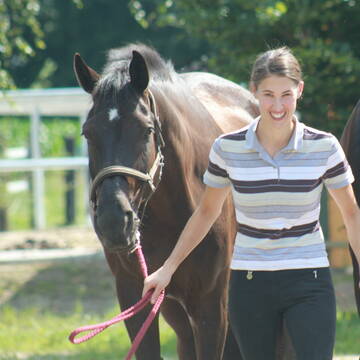
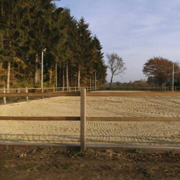
Reitsportanlage und Zuchthof Rabeler
Winsen/Luhe
Hof Rabeler
@Hof-Rabeler
FN-Mitglied
Pferdeausbildung
Vermieten
Führanlage
Longierzirkel/Roundpen
Fohlenaufzucht möglich
Notfallboxen
23 weitere...
S


Reitstall Schloh / innen-/ außen Boxen
Oststeinbek
Familie Schloh
@Schloh
FN-Mitglied
Freizeitstall
Vermieten
Hunde willkommen
Krankenbox
Hufrehe geeignet
Notfallboxen
19 weitere...
S
Deprecated: Creation of dynamic property Zend_View_Helper_Ads::$adLink is deprecated in /var/www/stall-frei/htdocs/staging.stall-frei.de/library/Psf/View/Helper/Ads.php on line 108

Mitarbeiter gesucht?
Mechtersen
STALL-FREIde Marketing
@STALL-FREI-Marketing
Stellenangebote kostenlos veröffentlichen!


Reit- und Traberhof Meyer
Geesthacht
Reit-und-Traberhof-Kurt-Meyer
@Reit-und-Traberhof-Kurt-Meyer
Fahrstall, Kutschwagen
FN-Mitglied
Führanlage
Hunde willkommen
Allergikerstall
Hufrehe geeignet
Außenboxen
Offenstall
19 weitere...
S
Ausbildungs- und TherapieZentrum Handorf
Handorf
ATZ Handorf
@Mathias-Bauch
Freizeitstall
Geländestrecke
Führanlage
Hunde willkommen
Allergikerstall
Fohlenaufzucht möglich
Außenbox mit Paddock
Außenboxen
35 weitere...
S


Stall Appenstedt Seevetal - Paddockbox frei
Seevetal
Melina Artzenroth
@Melina-Peters
Vermieten
Verpachten
Longierzirkel/Roundpen
Paddock
Außenbox mit Paddock
Außenboxen
Biofutter
Vollpension
16 weitere...
P+

Das Beste für die Hufe
Mechtersen
STALL-FREIde Marketing
@STALL-FREI-Marketing
Hufschmiede und Hufpfleger in Ihrer Nähe


Heiners Reiterhof hat Plätze frei 💕
Vierhöfen
Cord Vick
@HeinersReiterhof
FN-Mitglied
Freizeitstall
Hunde willkommen
Longierzirkel/Roundpen
Außenbox mit Paddock
Innenbox
Halbpension
Selbstversorgung
17 weitere...
ganz aktuell
S

Stallplätze in Neuengamme
Hamburg
Reitstall Reimers
@Reitstall-Reimers
FN-Mitglied
Pferdeausbildung
Vermieten
Führanlage
Krankenbox
Allergikerstall
Fohlenaufzucht möglich
19 weitere...
P

Hof am Wiesengrund
Seevetal
Hof-am-Wiesengrund
@Hof-am-Wiesengrund
FN-Mitglied
Freizeitstall
Vermieten
Longierzirkel/Roundpen
Paddock
Allergikerstall
Hufrehe geeignet
17 weitere...
P+


Reitstall Am Burgberg Rönneburg
Hamburg
Frederic Wübbe
@Stall_Am_Burgberg
Fahrstall, Kutschwagen
Freizeitstall
Vermieten
Hunde willkommen
Krankenbox
Allergikerstall
Gnadenbrothof
22 weitere...
P+

2 freie Plätze in Laufbox oder als alleine XXL
Hamburg
Oest-GbR
@Oest-GbR
Freizeitstall
Pflegepferd
Vermieten
Paddock
Parkplatz für Pferdeanhänger
Gnadenbrothof
Hufrehe geeignet
18 weitere...
P
Deprecated: Creation of dynamic property Zend_View::$pageCount is deprecated in /var/www/stall-frei/htdocs/staging.stall-frei.de/library/vendor/shardj/zf1-future/library/Zend/View/Abstract.php on line 308
Deprecated: Creation of dynamic property Zend_View::$itemCountPerPage is deprecated in /var/www/stall-frei/htdocs/staging.stall-frei.de/library/vendor/shardj/zf1-future/library/Zend/View/Abstract.php on line 308
Deprecated: Creation of dynamic property Zend_View::$first is deprecated in /var/www/stall-frei/htdocs/staging.stall-frei.de/library/vendor/shardj/zf1-future/library/Zend/View/Abstract.php on line 308
Deprecated: Creation of dynamic property Zend_View::$current is deprecated in /var/www/stall-frei/htdocs/staging.stall-frei.de/library/vendor/shardj/zf1-future/library/Zend/View/Abstract.php on line 308
Deprecated: Creation of dynamic property Zend_View::$last is deprecated in /var/www/stall-frei/htdocs/staging.stall-frei.de/library/vendor/shardj/zf1-future/library/Zend/View/Abstract.php on line 308
Deprecated: Creation of dynamic property Zend_View::$next is deprecated in /var/www/stall-frei/htdocs/staging.stall-frei.de/library/vendor/shardj/zf1-future/library/Zend/View/Abstract.php on line 308
Deprecated: Creation of dynamic property Zend_View::$pagesInRange is deprecated in /var/www/stall-frei/htdocs/staging.stall-frei.de/library/vendor/shardj/zf1-future/library/Zend/View/Abstract.php on line 308
Deprecated: Creation of dynamic property Zend_View::$firstPageInRange is deprecated in /var/www/stall-frei/htdocs/staging.stall-frei.de/library/vendor/shardj/zf1-future/library/Zend/View/Abstract.php on line 308
Deprecated: Creation of dynamic property Zend_View::$lastPageInRange is deprecated in /var/www/stall-frei/htdocs/staging.stall-frei.de/library/vendor/shardj/zf1-future/library/Zend/View/Abstract.php on line 308
Deprecated: Creation of dynamic property Zend_View::$currentItemCount is deprecated in /var/www/stall-frei/htdocs/staging.stall-frei.de/library/vendor/shardj/zf1-future/library/Zend/View/Abstract.php on line 308
Deprecated: Creation of dynamic property Zend_View::$totalItemCount is deprecated in /var/www/stall-frei/htdocs/staging.stall-frei.de/library/vendor/shardj/zf1-future/library/Zend/View/Abstract.php on line 308
Deprecated: Creation of dynamic property Zend_View::$firstItemNumber is deprecated in /var/www/stall-frei/htdocs/staging.stall-frei.de/library/vendor/shardj/zf1-future/library/Zend/View/Abstract.php on line 308
Deprecated: Creation of dynamic property Zend_View::$lastItemNumber is deprecated in /var/www/stall-frei/htdocs/staging.stall-frei.de/library/vendor/shardj/zf1-future/library/Zend/View/Abstract.php on line 308
Deprecated: Creation of dynamic property Zend_View::$router is deprecated in /var/www/stall-frei/htdocs/staging.stall-frei.de/library/vendor/shardj/zf1-future/library/Zend/View/Abstract.php on line 308
Deprecated: Creation of dynamic property Zend_View::$urlParams is deprecated in /var/www/stall-frei/htdocs/staging.stall-frei.de/library/vendor/shardj/zf1-future/library/Zend/View/Abstract.php on line 308
Deprecated: Creation of dynamic property Zend_View::$showAds is deprecated in /var/www/stall-frei/htdocs/staging.stall-frei.de/library/vendor/shardj/zf1-future/library/Zend/View/Abstract.php on line 308
Deprecated: Creation of dynamic property Zend_View::$objectIds is deprecated in /var/www/stall-frei/htdocs/staging.stall-frei.de/library/vendor/shardj/zf1-future/library/Zend/View/Abstract.php on line 308
Deprecated: Creation of dynamic property Zend_View::$showNavbar is deprecated in /var/www/stall-frei/htdocs/staging.stall-frei.de/library/vendor/shardj/zf1-future/library/Zend/View/Abstract.php on line 308
Deprecated: Creation of dynamic property Zend_View::$showBreadcrumb is deprecated in /var/www/stall-frei/htdocs/staging.stall-frei.de/library/vendor/shardj/zf1-future/library/Zend/View/Abstract.php on line 308
Deprecated: Creation of dynamic property Zend_View::$showFooter is deprecated in /var/www/stall-frei/htdocs/staging.stall-frei.de/library/vendor/shardj/zf1-future/library/Zend/View/Abstract.php on line 308
Deprecated: Creation of dynamic property Zend_View::$showInternalAds is deprecated in /var/www/stall-frei/htdocs/staging.stall-frei.de/library/vendor/shardj/zf1-future/library/Zend/View/Abstract.php on line 308
Deprecated: Creation of dynamic property Zend_View::$blNoContent is deprecated in /var/www/stall-frei/htdocs/staging.stall-frei.de/library/vendor/shardj/zf1-future/library/Zend/View/Abstract.php on line 308
Deprecated: Creation of dynamic property Zend_View::$sMetaDesc is deprecated in /var/www/stall-frei/htdocs/staging.stall-frei.de/library/vendor/shardj/zf1-future/library/Zend/View/Abstract.php on line 308
Deprecated: Creation of dynamic property Zend_View::$useGmaps is deprecated in /var/www/stall-frei/htdocs/staging.stall-frei.de/library/vendor/shardj/zf1-future/library/Zend/View/Abstract.php on line 308
Deprecated: Creation of dynamic property Zend_View::$touches is deprecated in /var/www/stall-frei/htdocs/staging.stall-frei.de/library/vendor/shardj/zf1-future/library/Zend/View/Abstract.php on line 308
Deprecated: Creation of dynamic property Zend_View::$oProject is deprecated in /var/www/stall-frei/htdocs/staging.stall-frei.de/library/vendor/shardj/zf1-future/library/Zend/View/Abstract.php on line 308
Deprecated: Creation of dynamic property Zend_View::$pageHeadline is deprecated in /var/www/stall-frei/htdocs/staging.stall-frei.de/library/vendor/shardj/zf1-future/library/Zend/View/Abstract.php on line 308
Deprecated: Creation of dynamic property Zend_View::$disableLocationField is deprecated in /var/www/stall-frei/htdocs/staging.stall-frei.de/library/vendor/shardj/zf1-future/library/Zend/View/Abstract.php on line 308
Deprecated: Creation of dynamic property Zend_View::$isSearch is deprecated in /var/www/stall-frei/htdocs/staging.stall-frei.de/library/vendor/shardj/zf1-future/library/Zend/View/Abstract.php on line 308
Deprecated: Creation of dynamic property Zend_View::$pageTitle is deprecated in /var/www/stall-frei/htdocs/staging.stall-frei.de/library/vendor/shardj/zf1-future/library/Zend/View/Abstract.php on line 308
Deprecated: Creation of dynamic property Psf_Form_Element_Text::$class is deprecated in /var/www/stall-frei/htdocs/staging.stall-frei.de/library/vendor/shardj/zf1-future/library/Zend/Form/Element.php on line 874
Deprecated: Creation of dynamic property Psf_Form_Element_Text::$size is deprecated in /var/www/stall-frei/htdocs/staging.stall-frei.de/library/vendor/shardj/zf1-future/library/Zend/Form/Element.php on line 874
Deprecated: Creation of dynamic property Psf_Form_Element_Text::$placeholder is deprecated in /var/www/stall-frei/htdocs/staging.stall-frei.de/library/vendor/shardj/zf1-future/library/Zend/Form/Element.php on line 874
Deprecated: Creation of dynamic property Psf_Form_Element_Hidden::$class is deprecated in /var/www/stall-frei/htdocs/staging.stall-frei.de/library/vendor/shardj/zf1-future/library/Zend/Form/Element.php on line 874
Deprecated: Creation of dynamic property Psf_Form_Element_Hidden::$class is deprecated in /var/www/stall-frei/htdocs/staging.stall-frei.de/library/vendor/shardj/zf1-future/library/Zend/Form/Element.php on line 874
Deprecated: Creation of dynamic property Psf_Form_Element_Hidden::$class is deprecated in /var/www/stall-frei/htdocs/staging.stall-frei.de/library/vendor/shardj/zf1-future/library/Zend/Form/Element.php on line 874
Deprecated: Creation of dynamic property Psf_Form_Element_Hidden::$class is deprecated in /var/www/stall-frei/htdocs/staging.stall-frei.de/library/vendor/shardj/zf1-future/library/Zend/Form/Element.php on line 874
Deprecated: Creation of dynamic property Psf_Form_Element_Select::$class is deprecated in /var/www/stall-frei/htdocs/staging.stall-frei.de/library/vendor/shardj/zf1-future/library/Zend/Form/Element.php on line 874
Deprecated: Creation of dynamic property Psf_Form_Element_Select::$class is deprecated in /var/www/stall-frei/htdocs/staging.stall-frei.de/library/vendor/shardj/zf1-future/library/Zend/Form/Element.php on line 874
Deprecated: Creation of dynamic property Psf_Form_Element_Select::$class is deprecated in /var/www/stall-frei/htdocs/staging.stall-frei.de/library/vendor/shardj/zf1-future/library/Zend/Form/Element.php on line 874
Deprecated: Creation of dynamic property Psf_Form_Element_Select::$class is deprecated in /var/www/stall-frei/htdocs/staging.stall-frei.de/library/vendor/shardj/zf1-future/library/Zend/Form/Element.php on line 874
Deprecated: Creation of dynamic property Psf_Form_Element_Text::$class is deprecated in /var/www/stall-frei/htdocs/staging.stall-frei.de/library/vendor/shardj/zf1-future/library/Zend/Form/Element.php on line 874
Deprecated: Creation of dynamic property Psf_Form_Element_Checkbox::$label is deprecated in /var/www/stall-frei/htdocs/staging.stall-frei.de/library/vendor/shardj/zf1-future/library/Zend/Form/Element.php on line 874
Deprecated: Creation of dynamic property Zend_View::$sort is deprecated in /var/www/stall-frei/htdocs/staging.stall-frei.de/library/vendor/shardj/zf1-future/library/Zend/View/Abstract.php on line 308
Deprecated: Creation of dynamic property Zend_View::$searchLocation is deprecated in /var/www/stall-frei/htdocs/staging.stall-frei.de/library/vendor/shardj/zf1-future/library/Zend/View/Abstract.php on line 308
Deprecated: Creation of dynamic property Zend_View::$locationHint is deprecated in /var/www/stall-frei/htdocs/staging.stall-frei.de/library/vendor/shardj/zf1-future/library/Zend/View/Abstract.php on line 308
Psf_GeoCoder_Abstract::getLocation: Howe Get Location CachedOrLive
Psf_GeoCoder_Abstract::getCachedOrLive: Howe
Psf_GeoCoder_OpenCageData::makeApiRequest: response:
Array
(
[documentation] => https://opencagedata.com/api
[licenses] => Array
(
[0] => Array
(
[name] => see attribution guide
[url] => https://opencagedata.com/credits
)
)
[results] => Array
(
[0] => Array
(
[bounds] => Array
(
[northeast] => Array
(
[lat] => 53.4416114
[lng] => 10.1673699
)
[southwest] => Array
(
[lat] => 53.4016114
[lng] => 10.1273699
)
)
[components] => Array
(
[ISO_3166-1_alpha-2] => DE
[ISO_3166-1_alpha-3] => DEU
[ISO_3166-2] => Array
(
[0] => DE-HH
)
[_category] => place
[_normalized_city] => Hamburg
[_type] => village
[city] => Hamburg
[continent] => Europe
[country] => Deutschland
[country_code] => de
[political_union] => European Union
[postcode] => 21037
[state] => Hamburg
[state_code] => HH
[village] => Howe
)
[confidence] => 7
[formatted] => 21037 Howe, Deutschland
[geometry] => Array
(
[lat] => 53.4216114
[lng] => 10.1473699
)
)
[1] => Array
(
[bounds] => Array
(
[northeast] => Array
(
[lat] => 53.3868918
[lng] => 10.4305833
)
[southwest] => Array
(
[lat] => 53.38279
[lng] => 10.424499
)
)
[components] => Array
(
[ISO_3166-1_alpha-2] => DE
[ISO_3166-1_alpha-3] => DEU
[ISO_3166-2] => Array
(
[0] => DE-NI
)
[_category] => agriculture
[_normalized_city] => Tespe
[_type] => farmland
[city] => Tespe
[continent] => Europe
[country] => Deutschland
[country_code] => de
[county] => Landkreis Harburg
[farmland] => Howe
[municipality] => Samtgemeinde Elbmarsch
[political_union] => European Union
[postcode] => 21395
[state] => Niedersachsen
[state_code] => NI
)
[confidence] => 9
[formatted] => Howe, 21395 Tespe, Deutschland
[geometry] => Array
(
[lat] => 53.3848128
[lng] => 10.4275308
)
)
[2] => Array
(
[bounds] => Array
(
[northeast] => Array
(
[lat] => 53.4117272
[lng] => 10.1522536
)
[southwest] => Array
(
[lat] => 53.4116272
[lng] => 10.1521536
)
)
[components] => Array
(
[ISO_3166-1_alpha-2] => DE
[ISO_3166-1_alpha-3] => DEU
[ISO_3166-2] => Array
(
[0] => DE-HH
)
[_category] => transportation
[_normalized_city] => Hamburg
[_type] => bus_stop
[city] => Hamburg
[continent] => Europe
[country] => Deutschland
[country_code] => de
[highway] => Howe (Ost)
[political_union] => European Union
[postcode] => 21037
[road] => Hower Hauptdeich
[state] => Hamburg
[state_code] => HH
[suburb] => Kirchwerder
[village] => Howe
)
[confidence] => 9
[formatted] => Howe (Ost), Hower Hauptdeich, 21037 Howe, Deutschland
[geometry] => Array
(
[lat] => 53.4116772
[lng] => 10.1522036
)
)
[3] => Array
(
[bounds] => Array
(
[northeast] => Array
(
[lat] => 53.4202316
[lng] => 10.1478538
)
[southwest] => Array
(
[lat] => 53.4201316
[lng] => 10.1477538
)
)
[components] => Array
(
[ISO_3166-1_alpha-2] => DE
[ISO_3166-1_alpha-3] => DEU
[ISO_3166-2] => Array
(
[0] => DE-HH
)
[_category] => transportation
[_normalized_city] => Hamburg
[_type] => bus_stop
[city] => Hamburg
[continent] => Europe
[country] => Deutschland
[country_code] => de
[highway] => Howe
[political_union] => European Union
[postcode] => 21037
[road] => Süderquerweg
[state] => Hamburg
[state_code] => HH
[suburb] => Kirchwerder
[village] => Howe
)
[confidence] => 9
[formatted] => Howe, Süderquerweg, 21037 Howe, Deutschland
[geometry] => Array
(
[lat] => 53.4201816
[lng] => 10.1478038
)
)
[4] => Array
(
[bounds] => Array
(
[northeast] => Array
(
[lat] => 53.4206581
[lng] => 10.1486654
)
[southwest] => Array
(
[lat] => 53.4205581
[lng] => 10.1485654
)
)
[components] => Array
(
[ISO_3166-1_alpha-2] => DE
[ISO_3166-1_alpha-3] => DEU
[ISO_3166-2] => Array
(
[0] => DE-HH
)
[_category] => transportation
[_normalized_city] => Hamburg
[_type] => bus_stop
[city] => Hamburg
[continent] => Europe
[country] => Deutschland
[country_code] => de
[highway] => Howe
[political_union] => European Union
[postcode] => 21037
[road] => Kirchwerder Landweg
[state] => Hamburg
[state_code] => HH
[suburb] => Kirchwerder
[village] => Howe
)
[confidence] => 9
[formatted] => Howe, Kirchwerder Landweg, 21037 Howe, Deutschland
[geometry] => Array
(
[lat] => 53.4206081
[lng] => 10.1486154
)
)
[5] => Array
(
[bounds] => Array
(
[northeast] => Array
(
[lat] => 51.9634496
[lng] => 7.8290124
)
[southwest] => Array
(
[lat] => 51.9633496
[lng] => 7.8289124
)
)
[components] => Array
(
[ISO_3166-1_alpha-2] => DE
[ISO_3166-1_alpha-3] => DEU
[ISO_3166-2] => Array
(
[0] => DE-NW
)
[_category] => transportation
[_normalized_city] => Telgte
[_type] => bus_stop
[continent] => Europe
[country] => Deutschland
[country_code] => de
[county] => Kreis Warendorf
[highway] => Howe
[political_union] => European Union
[postcode] => 48291
[road] => Besterfeld
[state] => Nordrhein-Westfalen
[state_code] => NW
[town] => Telgte
)
[confidence] => 9
[formatted] => Howe, Besterfeld, 48291 Telgte, Deutschland
[geometry] => Array
(
[lat] => 51.9633996
[lng] => 7.8289624
)
)
[6] => Array
(
[bounds] => Array
(
[northeast] => Array
(
[lat] => 52.1609873
[lng] => 7.3344511
)
[southwest] => Array
(
[lat] => 52.1608873
[lng] => 7.3343511
)
)
[components] => Array
(
[ISO_3166-1_alpha-2] => DE
[ISO_3166-1_alpha-3] => DEU
[ISO_3166-2] => Array
(
[0] => DE-NW
)
[_category] => transportation
[_normalized_city] => Burgsteinfurt
[_type] => bus_stop
[continent] => Europe
[country] => Deutschland
[country_code] => de
[county] => Kreis Steinfurt
[hamlet] => Wedelingskamp
[highway] => Howe
[municipality] => Steinfurt
[political_union] => European Union
[postcode] => 48565
[road] => Lange Stiege
[state] => Nordrhein-Westfalen
[state_code] => NW
[town] => Burgsteinfurt
)
[confidence] => 9
[formatted] => Howe, Lange Stiege, 48565 Burgsteinfurt, Deutschland
[geometry] => Array
(
[lat] => 52.1609373
[lng] => 7.3344011
)
)
[7] => Array
(
[components] => Array
(
[ISO_3166-1_alpha-2] => FR
[ISO_3166-1_alpha-3] => FRA
[ISO_3166-2] => Array
(
[0] => FR-IDF
[1] => FR-94
)
[_category] => road
[_normalized_city] => Saint-Maur-des-Fossés
[_type] => road
[city] => Saint-Maur-des-Fossés
[continent] => Europe
[country] => France
[country_code] => fr
[county] => Val-de-Marne
[local_authority] => Métropole du Grand Paris
[political_union] => European Union
[postcode] => 94100
[road] => Rue Elias Howe
[state] => Île-de-France
[state_code] => IDF
)
[confidence] => 2
[formatted] => Rue Elias Howe, 94100 Saint-Maur-des-Fossés, France
[geometry] => Array
(
[lat] => 48.79301
[lng] => 2.482828
)
)
[8] => Array
(
[components] => Array
(
[ISO_3166-1_alpha-2] => FR
[ISO_3166-1_alpha-3] => FRA
[ISO_3166-2] => Array
(
[0] => FR-ARA
[1] => FR-69
)
[_category] => road
[_normalized_city] => Beauvallon
[_type] => road
[city] => Beauvallon
[continent] => Europe
[country] => France
[country_code] => fr
[county] => Rhône
[local_authority] => Communauté de communes du Pays Mornantais
[political_union] => European Union
[postcode] => 69700
[road] => Chemin de l’Ove
[state] => Auvergne-Rhône-Alpes
[state_code] => ARA
)
[confidence] => 10
[formatted] => Chemin de l’Ove, 69700 Beauvallon, France
[geometry] => Array
(
[lat] => 45.603932
[lng] => 4.739765
)
)
[9] => Array
(
[components] => Array
(
[ISO_3166-1_alpha-2] => FR
[ISO_3166-1_alpha-3] => FRA
[ISO_3166-2] => Array
(
[0] => FR-IDF
[1] => FR-94
)
[_category] => road
[_normalized_city] => Saint-Maur-des-Fossés
[_type] => road
[city] => Saint-Maur-des-Fossés
[continent] => Europe
[country] => France
[country_code] => fr
[county] => Val-de-Marne
[local_authority] => Métropole du Grand Paris
[political_union] => European Union
[postcode] => 94100
[road] => Impasse Elias Howe
[state] => Île-de-France
[state_code] => IDF
)
[confidence] => 10
[formatted] => Impasse Elias Howe, 94100 Saint-Maur-des-Fossés, France
[geometry] => Array
(
[lat] => 48.792836
[lng] => 2.48401
)
)
)
[status] => Array
(
[code] => 200
[message] => OK
)
[stay_informed] => Array
(
[blog] => https://blog.opencagedata.com
[mastodon] => https://en.osm.town/@opencage
)
[thanks] => For using an OpenCage API
[timestamp] => Array
(
[created_http] => Sun, 08 Feb 2026 22:00:58 GMT
[created_unix] => 1770588058
)
[total_results] => 10
)
Psf_GeoCoder_Abstract::convertLocationResult
{"documentation":"https:\/\/opencagedata.com\/api","licenses":[{"name":"see attribution guide","url":"https:\/\/opencagedata.com\/credits"}],"results":[{"bounds":{"northeast":{"lat":53.4416114,"lng":10.1673699},"southwest":{"lat":53.4016114,"lng":10.1273699}},"components":{"ISO_3166-1_alpha-2":"DE","ISO_3166-1_alpha-3":"DEU","ISO_3166-2":["DE-HH"],"_category":"place","_normalized_city":"Hamburg","_type":"village","city":"Hamburg","continent":"Europe","country":"Deutschland","country_code":"de","political_union":"European Union","postcode":"21037","state":"Hamburg","state_code":"HH","village":"Howe"},"confidence":7,"formatted":"21037 Howe, Deutschland","geometry":{"lat":53.4216114,"lng":10.1473699}},{"bounds":{"northeast":{"lat":53.3868918,"lng":10.4305833},"southwest":{"lat":53.38279,"lng":10.424499}},"components":{"ISO_3166-1_alpha-2":"DE","ISO_3166-1_alpha-3":"DEU","ISO_3166-2":["DE-NI"],"_category":"agriculture","_normalized_city":"Tespe","_type":"farmland","city":"Tespe","continent":"Europe","country":"Deutschland","country_code":"de","county":"Landkreis Harburg","farmland":"Howe","municipality":"Samtgemeinde Elbmarsch","political_union":"European Union","postcode":"21395","state":"Niedersachsen","state_code":"NI"},"confidence":9,"formatted":"Howe, 21395 Tespe, Deutschland","geometry":{"lat":53.3848128,"lng":10.4275308}},{"bounds":{"northeast":{"lat":53.4117272,"lng":10.1522536},"southwest":{"lat":53.4116272,"lng":10.1521536}},"components":{"ISO_3166-1_alpha-2":"DE","ISO_3166-1_alpha-3":"DEU","ISO_3166-2":["DE-HH"],"_category":"transportation","_normalized_city":"Hamburg","_type":"bus_stop","city":"Hamburg","continent":"Europe","country":"Deutschland","country_code":"de","highway":"Howe (Ost)","political_union":"European Union","postcode":"21037","road":"Hower Hauptdeich","state":"Hamburg","state_code":"HH","suburb":"Kirchwerder","village":"Howe"},"confidence":9,"formatted":"Howe (Ost), Hower Hauptdeich, 21037 Howe, Deutschland","geometry":{"lat":53.4116772,"lng":10.1522036}},{"bounds":{"northeast":{"lat":53.4202316,"lng":10.1478538},"southwest":{"lat":53.4201316,"lng":10.1477538}},"components":{"ISO_3166-1_alpha-2":"DE","ISO_3166-1_alpha-3":"DEU","ISO_3166-2":["DE-HH"],"_category":"transportation","_normalized_city":"Hamburg","_type":"bus_stop","city":"Hamburg","continent":"Europe","country":"Deutschland","country_code":"de","highway":"Howe","political_union":"European Union","postcode":"21037","road":"S\u00fcderquerweg","state":"Hamburg","state_code":"HH","suburb":"Kirchwerder","village":"Howe"},"confidence":9,"formatted":"Howe, S\u00fcderquerweg, 21037 Howe, Deutschland","geometry":{"lat":53.4201816,"lng":10.1478038}},{"bounds":{"northeast":{"lat":53.4206581,"lng":10.1486654},"southwest":{"lat":53.4205581,"lng":10.1485654}},"components":{"ISO_3166-1_alpha-2":"DE","ISO_3166-1_alpha-3":"DEU","ISO_3166-2":["DE-HH"],"_category":"transportation","_normalized_city":"Hamburg","_type":"bus_stop","city":"Hamburg","continent":"Europe","country":"Deutschland","country_code":"de","highway":"Howe","political_union":"European Union","postcode":"21037","road":"Kirchwerder Landweg","state":"Hamburg","state_code":"HH","suburb":"Kirchwerder","village":"Howe"},"confidence":9,"formatted":"Howe, Kirchwerder Landweg, 21037 Howe, Deutschland","geometry":{"lat":53.4206081,"lng":10.1486154}},{"bounds":{"northeast":{"lat":51.9634496,"lng":7.8290124},"southwest":{"lat":51.9633496,"lng":7.8289124}},"components":{"ISO_3166-1_alpha-2":"DE","ISO_3166-1_alpha-3":"DEU","ISO_3166-2":["DE-NW"],"_category":"transportation","_normalized_city":"Telgte","_type":"bus_stop","continent":"Europe","country":"Deutschland","country_code":"de","county":"Kreis Warendorf","highway":"Howe","political_union":"European Union","postcode":"48291","road":"Besterfeld","state":"Nordrhein-Westfalen","state_code":"NW","town":"Telgte"},"confidence":9,"formatted":"Howe, Besterfeld, 48291 Telgte, Deutschland","geometry":{"lat":51.9633996,"lng":7.8289624}},{"bounds":{"northeast":{"lat":52.1609873,"lng":7.3344511},"southwest":{"lat":52.1608873,"lng":7.3343511}},"components":{"ISO_3166-1_alpha-2":"DE","ISO_3166-1_alpha-3":"DEU","ISO_3166-2":["DE-NW"],"_category":"transportation","_normalized_city":"Burgsteinfurt","_type":"bus_stop","continent":"Europe","country":"Deutschland","country_code":"de","county":"Kreis Steinfurt","hamlet":"Wedelingskamp","highway":"Howe","municipality":"Steinfurt","political_union":"European Union","postcode":"48565","road":"Lange Stiege","state":"Nordrhein-Westfalen","state_code":"NW","town":"Burgsteinfurt"},"confidence":9,"formatted":"Howe, Lange Stiege, 48565 Burgsteinfurt, Deutschland","geometry":{"lat":52.1609373,"lng":7.3344011}},{"components":{"ISO_3166-1_alpha-2":"FR","ISO_3166-1_alpha-3":"FRA","ISO_3166-2":["FR-IDF","FR-94"],"_category":"road","_normalized_city":"Saint-Maur-des-Foss\u00e9s","_type":"road","city":"Saint-Maur-des-Foss\u00e9s","continent":"Europe","country":"France","country_code":"fr","county":"Val-de-Marne","local_authority":"M\u00e9tropole du Grand Paris","political_union":"European Union","postcode":"94100","road":"Rue Elias Howe","state":"\u00cele-de-France","state_code":"IDF"},"confidence":2,"formatted":"Rue Elias Howe, 94100 Saint-Maur-des-Foss\u00e9s, France","geometry":{"lat":48.79301,"lng":2.482828}},{"components":{"ISO_3166-1_alpha-2":"FR","ISO_3166-1_alpha-3":"FRA","ISO_3166-2":["FR-ARA","FR-69"],"_category":"road","_normalized_city":"Beauvallon","_type":"road","city":"Beauvallon","continent":"Europe","country":"France","country_code":"fr","county":"Rh\u00f4ne","local_authority":"Communaut\u00e9 de communes du Pays Mornantais","political_union":"European Union","postcode":"69700","road":"Chemin de l\u2019Ove","state":"Auvergne-Rh\u00f4ne-Alpes","state_code":"ARA"},"confidence":10,"formatted":"Chemin de l\u2019Ove, 69700 Beauvallon, France","geometry":{"lat":45.603932,"lng":4.739765}},{"components":{"ISO_3166-1_alpha-2":"FR","ISO_3166-1_alpha-3":"FRA","ISO_3166-2":["FR-IDF","FR-94"],"_category":"road","_normalized_city":"Saint-Maur-des-Foss\u00e9s","_type":"road","city":"Saint-Maur-des-Foss\u00e9s","continent":"Europe","country":"France","country_code":"fr","county":"Val-de-Marne","local_authority":"M\u00e9tropole du Grand Paris","political_union":"European Union","postcode":"94100","road":"Impasse Elias Howe","state":"\u00cele-de-France","state_code":"IDF"},"confidence":10,"formatted":"Impasse Elias Howe, 94100 Saint-Maur-des-Foss\u00e9s, France","geometry":{"lat":48.792836,"lng":2.48401}}],"status":{"code":200,"message":"OK"},"stay_informed":{"blog":"https:\/\/blog.opencagedata.com","mastodon":"https:\/\/en.osm.town\/@opencage"},"thanks":"For using an OpenCage API","timestamp":{"created_http":"Sun, 08 Feb 2026 22:00:58 GMT","created_unix":1770588058},"total_results":10}Array
(
[0] => stdClass Object
(
[bounds] => stdClass Object
(
[northeast] => stdClass Object
(
[lat] => 53.4416114
[lng] => 10.1673699
)
[southwest] => stdClass Object
(
[lat] => 53.4016114
[lng] => 10.1273699
)
)
[components] => stdClass Object
(
[ISO_3166-1_alpha-2] => DE
[ISO_3166-1_alpha-3] => DEU
[ISO_3166-2] => Array
(
[0] => DE-HH
)
[_category] => place
[_normalized_city] => Hamburg
[_type] => village
[city] => Hamburg
[continent] => Europe
[country] => Deutschland
[country_code] => de
[political_union] => European Union
[postcode] => 21037
[state] => Hamburg
[state_code] => HH
[village] => Howe
)
[confidence] => 7
[formatted] => 21037 Howe, Deutschland
[geometry] => stdClass Object
(
[lat] => 53.4216114
[lng] => 10.1473699
)
)
[1] => stdClass Object
(
[bounds] => stdClass Object
(
[northeast] => stdClass Object
(
[lat] => 53.3868918
[lng] => 10.4305833
)
[southwest] => stdClass Object
(
[lat] => 53.38279
[lng] => 10.424499
)
)
[components] => stdClass Object
(
[ISO_3166-1_alpha-2] => DE
[ISO_3166-1_alpha-3] => DEU
[ISO_3166-2] => Array
(
[0] => DE-NI
)
[_category] => agriculture
[_normalized_city] => Tespe
[_type] => farmland
[city] => Tespe
[continent] => Europe
[country] => Deutschland
[country_code] => de
[county] => Landkreis Harburg
[farmland] => Howe
[municipality] => Samtgemeinde Elbmarsch
[political_union] => European Union
[postcode] => 21395
[state] => Niedersachsen
[state_code] => NI
)
[confidence] => 9
[formatted] => Howe, 21395 Tespe, Deutschland
[geometry] => stdClass Object
(
[lat] => 53.3848128
[lng] => 10.4275308
)
)
[2] => stdClass Object
(
[bounds] => stdClass Object
(
[northeast] => stdClass Object
(
[lat] => 53.4117272
[lng] => 10.1522536
)
[southwest] => stdClass Object
(
[lat] => 53.4116272
[lng] => 10.1521536
)
)
[components] => stdClass Object
(
[ISO_3166-1_alpha-2] => DE
[ISO_3166-1_alpha-3] => DEU
[ISO_3166-2] => Array
(
[0] => DE-HH
)
[_category] => transportation
[_normalized_city] => Hamburg
[_type] => bus_stop
[city] => Hamburg
[continent] => Europe
[country] => Deutschland
[country_code] => de
[highway] => Howe (Ost)
[political_union] => European Union
[postcode] => 21037
[road] => Hower Hauptdeich
[state] => Hamburg
[state_code] => HH
[suburb] => Kirchwerder
[village] => Howe
)
[confidence] => 9
[formatted] => Howe (Ost), Hower Hauptdeich, 21037 Howe, Deutschland
[geometry] => stdClass Object
(
[lat] => 53.4116772
[lng] => 10.1522036
)
)
[3] => stdClass Object
(
[bounds] => stdClass Object
(
[northeast] => stdClass Object
(
[lat] => 53.4202316
[lng] => 10.1478538
)
[southwest] => stdClass Object
(
[lat] => 53.4201316
[lng] => 10.1477538
)
)
[components] => stdClass Object
(
[ISO_3166-1_alpha-2] => DE
[ISO_3166-1_alpha-3] => DEU
[ISO_3166-2] => Array
(
[0] => DE-HH
)
[_category] => transportation
[_normalized_city] => Hamburg
[_type] => bus_stop
[city] => Hamburg
[continent] => Europe
[country] => Deutschland
[country_code] => de
[highway] => Howe
[political_union] => European Union
[postcode] => 21037
[road] => Süderquerweg
[state] => Hamburg
[state_code] => HH
[suburb] => Kirchwerder
[village] => Howe
)
[confidence] => 9
[formatted] => Howe, Süderquerweg, 21037 Howe, Deutschland
[geometry] => stdClass Object
(
[lat] => 53.4201816
[lng] => 10.1478038
)
)
[4] => stdClass Object
(
[bounds] => stdClass Object
(
[northeast] => stdClass Object
(
[lat] => 53.4206581
[lng] => 10.1486654
)
[southwest] => stdClass Object
(
[lat] => 53.4205581
[lng] => 10.1485654
)
)
[components] => stdClass Object
(
[ISO_3166-1_alpha-2] => DE
[ISO_3166-1_alpha-3] => DEU
[ISO_3166-2] => Array
(
[0] => DE-HH
)
[_category] => transportation
[_normalized_city] => Hamburg
[_type] => bus_stop
[city] => Hamburg
[continent] => Europe
[country] => Deutschland
[country_code] => de
[highway] => Howe
[political_union] => European Union
[postcode] => 21037
[road] => Kirchwerder Landweg
[state] => Hamburg
[state_code] => HH
[suburb] => Kirchwerder
[village] => Howe
)
[confidence] => 9
[formatted] => Howe, Kirchwerder Landweg, 21037 Howe, Deutschland
[geometry] => stdClass Object
(
[lat] => 53.4206081
[lng] => 10.1486154
)
)
[5] => stdClass Object
(
[bounds] => stdClass Object
(
[northeast] => stdClass Object
(
[lat] => 51.9634496
[lng] => 7.8290124
)
[southwest] => stdClass Object
(
[lat] => 51.9633496
[lng] => 7.8289124
)
)
[components] => stdClass Object
(
[ISO_3166-1_alpha-2] => DE
[ISO_3166-1_alpha-3] => DEU
[ISO_3166-2] => Array
(
[0] => DE-NW
)
[_category] => transportation
[_normalized_city] => Telgte
[_type] => bus_stop
[continent] => Europe
[country] => Deutschland
[country_code] => de
[county] => Kreis Warendorf
[highway] => Howe
[political_union] => European Union
[postcode] => 48291
[road] => Besterfeld
[state] => Nordrhein-Westfalen
[state_code] => NW
[town] => Telgte
)
[confidence] => 9
[formatted] => Howe, Besterfeld, 48291 Telgte, Deutschland
[geometry] => stdClass Object
(
[lat] => 51.9633996
[lng] => 7.8289624
)
)
[6] => stdClass Object
(
[bounds] => stdClass Object
(
[northeast] => stdClass Object
(
[lat] => 52.1609873
[lng] => 7.3344511
)
[southwest] => stdClass Object
(
[lat] => 52.1608873
[lng] => 7.3343511
)
)
[components] => stdClass Object
(
[ISO_3166-1_alpha-2] => DE
[ISO_3166-1_alpha-3] => DEU
[ISO_3166-2] => Array
(
[0] => DE-NW
)
[_category] => transportation
[_normalized_city] => Burgsteinfurt
[_type] => bus_stop
[continent] => Europe
[country] => Deutschland
[country_code] => de
[county] => Kreis Steinfurt
[hamlet] => Wedelingskamp
[highway] => Howe
[municipality] => Steinfurt
[political_union] => European Union
[postcode] => 48565
[road] => Lange Stiege
[state] => Nordrhein-Westfalen
[state_code] => NW
[town] => Burgsteinfurt
)
[confidence] => 9
[formatted] => Howe, Lange Stiege, 48565 Burgsteinfurt, Deutschland
[geometry] => stdClass Object
(
[lat] => 52.1609373
[lng] => 7.3344011
)
)
[7] => stdClass Object
(
[components] => stdClass Object
(
[ISO_3166-1_alpha-2] => FR
[ISO_3166-1_alpha-3] => FRA
[ISO_3166-2] => Array
(
[0] => FR-IDF
[1] => FR-94
)
[_category] => road
[_normalized_city] => Saint-Maur-des-Fossés
[_type] => road
[city] => Saint-Maur-des-Fossés
[continent] => Europe
[country] => France
[country_code] => fr
[county] => Val-de-Marne
[local_authority] => Métropole du Grand Paris
[political_union] => European Union
[postcode] => 94100
[road] => Rue Elias Howe
[state] => Île-de-France
[state_code] => IDF
)
[confidence] => 2
[formatted] => Rue Elias Howe, 94100 Saint-Maur-des-Fossés, France
[geometry] => stdClass Object
(
[lat] => 48.79301
[lng] => 2.482828
)
)
[8] => stdClass Object
(
[components] => stdClass Object
(
[ISO_3166-1_alpha-2] => FR
[ISO_3166-1_alpha-3] => FRA
[ISO_3166-2] => Array
(
[0] => FR-ARA
[1] => FR-69
)
[_category] => road
[_normalized_city] => Beauvallon
[_type] => road
[city] => Beauvallon
[continent] => Europe
[country] => France
[country_code] => fr
[county] => Rhône
[local_authority] => Communauté de communes du Pays Mornantais
[political_union] => European Union
[postcode] => 69700
[road] => Chemin de l’Ove
[state] => Auvergne-Rhône-Alpes
[state_code] => ARA
)
[confidence] => 10
[formatted] => Chemin de l’Ove, 69700 Beauvallon, France
[geometry] => stdClass Object
(
[lat] => 45.603932
[lng] => 4.739765
)
)
[9] => stdClass Object
(
[components] => stdClass Object
(
[ISO_3166-1_alpha-2] => FR
[ISO_3166-1_alpha-3] => FRA
[ISO_3166-2] => Array
(
[0] => FR-IDF
[1] => FR-94
)
[_category] => road
[_normalized_city] => Saint-Maur-des-Fossés
[_type] => road
[city] => Saint-Maur-des-Fossés
[continent] => Europe
[country] => France
[country_code] => fr
[county] => Val-de-Marne
[local_authority] => Métropole du Grand Paris
[political_union] => European Union
[postcode] => 94100
[road] => Impasse Elias Howe
[state] => Île-de-France
[state_code] => IDF
)
[confidence] => 10
[formatted] => Impasse Elias Howe, 94100 Saint-Maur-des-Fossés, France
[geometry] => stdClass Object
(
[lat] => 48.792836
[lng] => 2.48401
)
)
)
Psf_GeoCoder_OpenCageData::getKeyMap: 0
stdClass Object
(
    [bounds] => stdClass Object
        (
            [northeast] => stdClass Object
                (
                    [lat] => 53.4416114
                    [lng] => 10.1673699
                )

            [southwest] => stdClass Object
                (
                    [lat] => 53.4016114
                    [lng] => 10.1273699
                )

        )

    [components] => stdClass Object
        (
            [ISO_3166-1_alpha-2] => DE
            [ISO_3166-1_alpha-3] => DEU
            [ISO_3166-2] => Array
                (
                    [0] => DE-HH
                )

            [_category] => place
            [_normalized_city] => Hamburg
            [_type] => village
            [city] => Hamburg
            [continent] => Europe
            [country] => Deutschland
            [country_code] => de
            [political_union] => European Union
            [postcode] => 21037
            [state] => Hamburg
            [state_code] => HH
            [village] => Howe
        )

    [confidence] => 7
    [formatted] => 21037 Howe, Deutschland
    [geometry] => stdClass Object
        (
            [lat] => 53.4216114
            [lng] => 10.1473699
        )

)
Psf_GeoCoder_OpenCageData::getCounty: Hamburg
Psf_GeoCoder_OpenCageData::addMissingData REFETCH!
Array
(
    [address] => 21037 Howe, Deutschland
    [type] => village
    [street] =>
    [city] => Howe
    [county] => Hamburg
    [state] => Hamburg
    [zip] => 21037
    [country] => Deutschland
    [suburb] =>
    [countrycode] => de
    [latitude] => 53.4216114
    [longitude] => 10.1473699
    [accuracy] => 1
    [confidence] => 7
    [bounds] => stdClass Object
        (
            [northeast] => stdClass Object
                (
                    [lat] => 53.4416114
                    [lng] => 10.1673699
                )

            [southwest] => stdClass Object
                (
                    [lat] => 53.4016114
                    [lng] => 10.1273699
                )

        )

)
reformat!
Array
(
    [address] => 21037 Howe, Deutschland
    [type] => village
    [street] =>
    [city] => Howe
    [county] => Hamburg
    [state] => Hamburg
    [zip] => 21037
    [country] => Deutschland
    [suburb] =>
    [countrycode] => de
    [latitude] => 53.4216114
    [longitude] => 10.1473699
    [accuracy] => 1
    [confidence] => 7
    [bounds] => stdClass Object
        (
            [northeast] => stdClass Object
                (
                    [lat] => 53.4416114
                    [lng] => 10.1673699
                )

            [southwest] => stdClass Object
                (
                    [lat] => 53.4016114
                    [lng] => 10.1273699
                )

        )

    [place] => 21037 Howe, Hamburg
    [hash] => 71baf460dc8f1a2c5026b7b6576436ef
)
Psf_GeoCoder_OpenCageData::getKeyMap: 1
stdClass Object
(
    [bounds] => stdClass Object
        (
            [northeast] => stdClass Object
                (
                    [lat] => 53.3868918
                    [lng] => 10.4305833
                )

            [southwest] => stdClass Object
                (
                    [lat] => 53.38279
                    [lng] => 10.424499
                )

        )

    [components] => stdClass Object
        (
            [ISO_3166-1_alpha-2] => DE
            [ISO_3166-1_alpha-3] => DEU
            [ISO_3166-2] => Array
                (
                    [0] => DE-NI
                )

            [_category] => agriculture
            [_normalized_city] => Tespe
            [_type] => farmland
            [city] => Tespe
            [continent] => Europe
            [country] => Deutschland
            [country_code] => de
            [county] => Landkreis Harburg
            [farmland] => Howe
            [municipality] => Samtgemeinde Elbmarsch
            [political_union] => European Union
            [postcode] => 21395
            [state] => Niedersachsen
            [state_code] => NI
        )

    [confidence] => 9
    [formatted] => Howe, 21395 Tespe, Deutschland
    [geometry] => stdClass Object
        (
            [lat] => 53.3848128
            [lng] => 10.4275308
        )

)
Psf_GeoCoder_OpenCageData::getCounty: Harburg
Psf_GeoCoder_OpenCageData::addMissingData REFETCH!
Array
(
    [address] => Howe, 21395 Tespe, Deutschland
    [type] => farmland
    [street] =>
    [city] => Tespe
    [county] => Harburg
    [state] => Niedersachsen
    [zip] => 21395
    [country] => Deutschland
    [suburb] =>
    [countrycode] => de
    [latitude] => 53.3848128
    [longitude] => 10.4275308
    [accuracy] => 1
    [confidence] => 9
    [bounds] => stdClass Object
        (
            [northeast] => stdClass Object
                (
                    [lat] => 53.3868918
                    [lng] => 10.4305833
                )

            [southwest] => stdClass Object
                (
                    [lat] => 53.38279
                    [lng] => 10.424499
                )

        )

)
reformat!
Array
(
    [address] => Howe, 21395 Tespe, Deutschland
    [type] => farmland
    [street] =>
    [city] => Tespe
    [county] => Harburg
    [state] => Niedersachsen
    [zip] => 21395
    [country] => Deutschland
    [suburb] =>
    [countrycode] => de
    [latitude] => 53.3848128
    [longitude] => 10.4275308
    [accuracy] => 1
    [confidence] => 9
    [bounds] => stdClass Object
        (
            [northeast] => stdClass Object
                (
                    [lat] => 53.3868918
                    [lng] => 10.4305833
                )

            [southwest] => stdClass Object
                (
                    [lat] => 53.38279
                    [lng] => 10.424499
                )

        )

    [place] => 21395 Tespe, Niedersachsen
    [hash] => e5eacd40a19461d4e35c816af4e04b16
)
Psf_GeoCoder_OpenCageData::getKeyMap: 2
stdClass Object
(
    [bounds] => stdClass Object
        (
            [northeast] => stdClass Object
                (
                    [lat] => 53.4117272
                    [lng] => 10.1522536
                )

            [southwest] => stdClass Object
                (
                    [lat] => 53.4116272
                    [lng] => 10.1521536
                )

        )

    [components] => stdClass Object
        (
            [ISO_3166-1_alpha-2] => DE
            [ISO_3166-1_alpha-3] => DEU
            [ISO_3166-2] => Array
                (
                    [0] => DE-HH
                )

            [_category] => transportation
            [_normalized_city] => Hamburg
            [_type] => bus_stop
            [city] => Hamburg
            [continent] => Europe
            [country] => Deutschland
            [country_code] => de
            [highway] => Howe (Ost)
            [political_union] => European Union
            [postcode] => 21037
            [road] => Hower Hauptdeich
            [state] => Hamburg
            [state_code] => HH
            [suburb] => Kirchwerder
            [village] => Howe
        )

    [confidence] => 9
    [formatted] => Howe (Ost), Hower Hauptdeich, 21037 Howe, Deutschland
    [geometry] => stdClass Object
        (
            [lat] => 53.4116772
            [lng] => 10.1522036
        )

)
Psf_GeoCoder_OpenCageData::getCounty: Hamburg
Psf_GeoCoder_OpenCageData::addMissingData REFETCH!
Array
(
    [address] => Howe (Ost), Hower Hauptdeich, 21037 Howe, Deutschland
    [type] => bus_stop
    [street] => Hower Hauptdeich
    [city] => Howe
    [county] => Hamburg
    [state] => Hamburg
    [zip] => 21037
    [country] => Deutschland
    [suburb] => Kirchwerder
    [countrycode] => de
    [latitude] => 53.4116772
    [longitude] => 10.1522036
    [accuracy] => 1
    [confidence] => 9
    [bounds] => stdClass Object
        (
            [northeast] => stdClass Object
                (
                    [lat] => 53.4117272
                    [lng] => 10.1522536
                )

            [southwest] => stdClass Object
                (
                    [lat] => 53.4116272
                    [lng] => 10.1521536
                )

        )

)
reformat!
Array
(
    [address] => Howe (Ost), Hower Hauptdeich, 21037 Howe, Deutschland
    [type] => bus_stop
    [street] => Hower Hauptdeich
    [city] => Howe
    [county] => Hamburg
    [state] => Hamburg
    [zip] => 21037
    [country] => Deutschland
    [suburb] => Kirchwerder
    [countrycode] => de
    [latitude] => 53.4116772
    [longitude] => 10.1522036
    [accuracy] => 1
    [confidence] => 9
    [bounds] => stdClass Object
        (
            [northeast] => stdClass Object
                (
                    [lat] => 53.4117272
                    [lng] => 10.1522536
                )

            [southwest] => stdClass Object
                (
                    [lat] => 53.4116272
                    [lng] => 10.1521536
                )

        )

    [place] => Hower Hauptdeich, 21037 Howe, Hamburg
    [hash] => ddef4d9297c8041db4dff8e056ce62ec
)
Psf_GeoCoder_OpenCageData::getKeyMap: 3
stdClass Object
(
    [bounds] => stdClass Object
        (
            [northeast] => stdClass Object
                (
                    [lat] => 53.4202316
                    [lng] => 10.1478538
                )

            [southwest] => stdClass Object
                (
                    [lat] => 53.4201316
                    [lng] => 10.1477538
                )

        )

    [components] => stdClass Object
        (
            [ISO_3166-1_alpha-2] => DE
            [ISO_3166-1_alpha-3] => DEU
            [ISO_3166-2] => Array
                (
                    [0] => DE-HH
                )

            [_category] => transportation
            [_normalized_city] => Hamburg
            [_type] => bus_stop
            [city] => Hamburg
            [continent] => Europe
            [country] => Deutschland
            [country_code] => de
            [highway] => Howe
            [political_union] => European Union
            [postcode] => 21037
            [road] => Süderquerweg
            [state] => Hamburg
            [state_code] => HH
            [suburb] => Kirchwerder
            [village] => Howe
        )

    [confidence] => 9
    [formatted] => Howe, Süderquerweg, 21037 Howe, Deutschland
    [geometry] => stdClass Object
        (
            [lat] => 53.4201816
            [lng] => 10.1478038
        )

)
Psf_GeoCoder_OpenCageData::getCounty: Hamburg
Psf_GeoCoder_OpenCageData::addMissingData REFETCH!
Array
(
    [address] => Howe, Süderquerweg, 21037 Howe, Deutschland
    [type] => bus_stop
    [street] => Süderquerweg
    [city] => Howe
    [county] => Hamburg
    [state] => Hamburg
    [zip] => 21037
    [country] => Deutschland
    [suburb] => Kirchwerder
    [countrycode] => de
    [latitude] => 53.4201816
    [longitude] => 10.1478038
    [accuracy] => 1
    [confidence] => 9
    [bounds] => stdClass Object
        (
            [northeast] => stdClass Object
                (
                    [lat] => 53.4202316
                    [lng] => 10.1478538
                )

            [southwest] => stdClass Object
                (
                    [lat] => 53.4201316
                    [lng] => 10.1477538
                )

        )

)
reformat!
Array
(
    [address] => Howe, Süderquerweg, 21037 Howe, Deutschland
    [type] => bus_stop
    [street] => Süderquerweg
    [city] => Howe
    [county] => Hamburg
    [state] => Hamburg
    [zip] => 21037
    [country] => Deutschland
    [suburb] => Kirchwerder
    [countrycode] => de
    [latitude] => 53.4201816
    [longitude] => 10.1478038
    [accuracy] => 1
    [confidence] => 9
    [bounds] => stdClass Object
        (
            [northeast] => stdClass Object
                (
                    [lat] => 53.4202316
                    [lng] => 10.1478538
                )

            [southwest] => stdClass Object
                (
                    [lat] => 53.4201316
                    [lng] => 10.1477538
                )

        )

    [place] => Süderquerweg, 21037 Howe, Hamburg
    [hash] => 0404474b806ebb32207dc0aaa2b5823c
)
Psf_GeoCoder_OpenCageData::getKeyMap: 4
stdClass Object
(
    [bounds] => stdClass Object
        (
            [northeast] => stdClass Object
                (
                    [lat] => 53.4206581
                    [lng] => 10.1486654
                )

            [southwest] => stdClass Object
                (
                    [lat] => 53.4205581
                    [lng] => 10.1485654
                )

        )

    [components] => stdClass Object
        (
            [ISO_3166-1_alpha-2] => DE
            [ISO_3166-1_alpha-3] => DEU
            [ISO_3166-2] => Array
                (
                    [0] => DE-HH
                )

            [_category] => transportation
            [_normalized_city] => Hamburg
            [_type] => bus_stop
            [city] => Hamburg
            [continent] => Europe
            [country] => Deutschland
            [country_code] => de
            [highway] => Howe
            [political_union] => European Union
            [postcode] => 21037
            [road] => Kirchwerder Landweg
            [state] => Hamburg
            [state_code] => HH
            [suburb] => Kirchwerder
            [village] => Howe
        )

    [confidence] => 9
    [formatted] => Howe, Kirchwerder Landweg, 21037 Howe, Deutschland
    [geometry] => stdClass Object
        (
            [lat] => 53.4206081
            [lng] => 10.1486154
        )

)
Psf_GeoCoder_OpenCageData::getCounty: Hamburg
Psf_GeoCoder_OpenCageData::addMissingData REFETCH!
Array
(
    [address] => Howe, Kirchwerder Landweg, 21037 Howe, Deutschland
    [type] => bus_stop
    [street] => Kirchwerder Landweg
    [city] => Howe
    [county] => Hamburg
    [state] => Hamburg
    [zip] => 21037
    [country] => Deutschland
    [suburb] => Kirchwerder
    [countrycode] => de
    [latitude] => 53.4206081
    [longitude] => 10.1486154
    [accuracy] => 1
    [confidence] => 9
    [bounds] => stdClass Object
        (
            [northeast] => stdClass Object
                (
                    [lat] => 53.4206581
                    [lng] => 10.1486654
                )

            [southwest] => stdClass Object
                (
                    [lat] => 53.4205581
                    [lng] => 10.1485654
                )

        )

)
reformat!
Array
(
    [address] => Howe, Kirchwerder Landweg, 21037 Howe, Deutschland
    [type] => bus_stop
    [street] => Kirchwerder Landweg
    [city] => Howe
    [county] => Hamburg
    [state] => Hamburg
    [zip] => 21037
    [country] => Deutschland
    [suburb] => Kirchwerder
    [countrycode] => de
    [latitude] => 53.4206081
    [longitude] => 10.1486154
    [accuracy] => 1
    [confidence] => 9
    [bounds] => stdClass Object
        (
            [northeast] => stdClass Object
                (
                    [lat] => 53.4206581
                    [lng] => 10.1486654
                )

            [southwest] => stdClass Object
                (
                    [lat] => 53.4205581
                    [lng] => 10.1485654
                )

        )

    [place] => Kirchwerder Landweg, 21037 Howe, Hamburg
    [hash] => f995fd88f309e7431b8183a567a4dce8
)
Psf_GeoCoder_OpenCageData::getKeyMap: 5
stdClass Object
(
    [bounds] => stdClass Object
        (
            [northeast] => stdClass Object
                (
                    [lat] => 51.9634496
                    [lng] => 7.8290124
                )

            [southwest] => stdClass Object
                (
                    [lat] => 51.9633496
                    [lng] => 7.8289124
                )

        )

    [components] => stdClass Object
        (
            [ISO_3166-1_alpha-2] => DE
            [ISO_3166-1_alpha-3] => DEU
            [ISO_3166-2] => Array
                (
                    [0] => DE-NW
                )

            [_category] => transportation
            [_normalized_city] => Telgte
            [_type] => bus_stop
            [continent] => Europe
            [country] => Deutschland
            [country_code] => de
            [county] => Kreis Warendorf
            [highway] => Howe
            [political_union] => European Union
            [postcode] => 48291
            [road] => Besterfeld
            [state] => Nordrhein-Westfalen
            [state_code] => NW
            [town] => Telgte
        )

    [confidence] => 9
    [formatted] => Howe, Besterfeld, 48291 Telgte, Deutschland
    [geometry] => stdClass Object
        (
            [lat] => 51.9633996
            [lng] => 7.8289624
        )

)
Psf_GeoCoder_OpenCageData::getCounty: Warendorf
Psf_GeoCoder_OpenCageData::addMissingData REFETCH!
Array
(
    [address] => Howe, Besterfeld, 48291 Telgte, Deutschland
    [type] => bus_stop
    [street] => Besterfeld
    [city] => Telgte
    [county] => Warendorf
    [state] => Nordrhein-Westfalen
    [zip] => 48291
    [country] => Deutschland
    [suburb] =>
    [countrycode] => de
    [latitude] => 51.9633996
    [longitude] => 7.8289624
    [accuracy] => 1
    [confidence] => 9
    [bounds] => stdClass Object
        (
            [northeast] => stdClass Object
                (
                    [lat] => 51.9634496
                    [lng] => 7.8290124
                )

            [southwest] => stdClass Object
                (
                    [lat] => 51.9633496
                    [lng] => 7.8289124
                )

        )

)
reformat!
Array
(
    [address] => Howe, Besterfeld, 48291 Telgte, Deutschland
    [type] => bus_stop
    [street] => Besterfeld
    [city] => Telgte
    [county] => Warendorf
    [state] => Nordrhein-Westfalen
    [zip] => 48291
    [country] => Deutschland
    [suburb] =>
    [countrycode] => de
    [latitude] => 51.9633996
    [longitude] => 7.8289624
    [accuracy] => 1
    [confidence] => 9
    [bounds] => stdClass Object
        (
            [northeast] => stdClass Object
                (
                    [lat] => 51.9634496
                    [lng] => 7.8290124
                )

            [southwest] => stdClass Object
                (
                    [lat] => 51.9633496
                    [lng] => 7.8289124
                )

        )

    [place] => Besterfeld, 48291 Telgte, Nordrhein-Westfalen
    [hash] => 72ddaff09de26940ddeca8cb713202f9
)
Psf_GeoCoder_OpenCageData::getKeyMap: 6
stdClass Object
(
    [bounds] => stdClass Object
        (
            [northeast] => stdClass Object
                (
                    [lat] => 52.1609873
                    [lng] => 7.3344511
                )

            [southwest] => stdClass Object
                (
                    [lat] => 52.1608873
                    [lng] => 7.3343511
                )

        )

    [components] => stdClass Object
        (
            [ISO_3166-1_alpha-2] => DE
            [ISO_3166-1_alpha-3] => DEU
            [ISO_3166-2] => Array
                (
                    [0] => DE-NW
                )

            [_category] => transportation
            [_normalized_city] => Burgsteinfurt
            [_type] => bus_stop
            [continent] => Europe
            [country] => Deutschland
            [country_code] => de
            [county] => Kreis Steinfurt
            [hamlet] => Wedelingskamp
            [highway] => Howe
            [municipality] => Steinfurt
            [political_union] => European Union
            [postcode] => 48565
            [road] => Lange Stiege
            [state] => Nordrhein-Westfalen
            [state_code] => NW
            [town] => Burgsteinfurt
        )

    [confidence] => 9
    [formatted] => Howe, Lange Stiege, 48565 Burgsteinfurt, Deutschland
    [geometry] => stdClass Object
        (
            [lat] => 52.1609373
            [lng] => 7.3344011
        )

)
Psf_GeoCoder_OpenCageData::getCounty: Steinfurt
Psf_GeoCoder_OpenCageData::addMissingData REFETCH!
Array
(
    [address] => Howe, Lange Stiege, 48565 Burgsteinfurt, Deutschland
    [type] => bus_stop
    [street] => Lange Stiege
    [city] => Burgsteinfurt
    [county] => Steinfurt
    [state] => Nordrhein-Westfalen
    [zip] => 48565
    [country] => Deutschland
    [suburb] =>
    [countrycode] => de
    [latitude] => 52.1609373
    [longitude] => 7.3344011
    [accuracy] => 1
    [confidence] => 9
    [bounds] => stdClass Object
        (
            [northeast] => stdClass Object
                (
                    [lat] => 52.1609873
                    [lng] => 7.3344511
                )

            [southwest] => stdClass Object
                (
                    [lat] => 52.1608873
                    [lng] => 7.3343511
                )

        )

)
reformat!
Array
(
    [address] => Howe, Lange Stiege, 48565 Burgsteinfurt, Deutschland
    [type] => bus_stop
    [street] => Lange Stiege
    [city] => Burgsteinfurt
    [county] => Steinfurt
    [state] => Nordrhein-Westfalen
    [zip] => 48565
    [country] => Deutschland
    [suburb] =>
    [countrycode] => de
    [latitude] => 52.1609373
    [longitude] => 7.3344011
    [accuracy] => 1
    [confidence] => 9
    [bounds] => stdClass Object
        (
            [northeast] => stdClass Object
                (
                    [lat] => 52.1609873
                    [lng] => 7.3344511
                )

            [southwest] => stdClass Object
                (
                    [lat] => 52.1608873
                    [lng] => 7.3343511
                )

        )

    [place] => Lange Stiege, 48565 Burgsteinfurt, Nordrhein-Westfalen
    [hash] => a9f1ea8f95972e6bb477d5871ab07037
)
Psf_GeoCoder_OpenCageData::getKeyMap: 7
stdClass Object
(
    [components] => stdClass Object
        (
            [ISO_3166-1_alpha-2] => FR
            [ISO_3166-1_alpha-3] => FRA
            [ISO_3166-2] => Array
                (
                    [0] => FR-IDF
                    [1] => FR-94
                )

            [_category] => road
            [_normalized_city] => Saint-Maur-des-Fossés
            [_type] => road
            [city] => Saint-Maur-des-Fossés
            [continent] => Europe
            [country] => France
            [country_code] => fr
            [county] => Val-de-Marne
            [local_authority] => Métropole du Grand Paris
            [political_union] => European Union
            [postcode] => 94100
            [road] => Rue Elias Howe
            [state] => Île-de-France
            [state_code] => IDF
        )

    [confidence] => 2
    [formatted] => Rue Elias Howe, 94100 Saint-Maur-des-Fossés, France
    [geometry] => stdClass Object
        (
            [lat] => 48.79301
            [lng] => 2.482828
        )

)
Psf_GeoCoder_OpenCageData::getCounty: Val-de-Marne
Psf_GeoCoder_OpenCageData::addMissingData REFETCH!
Array
(
    [address] => Rue Elias Howe, 94100 Saint-Maur-des-Fossés, France
    [type] => road
    [street] => Rue Elias Howe
    [city] => Saint-Maur-des-Fossés
    [county] => Val-de-Marne
    [state] => Île-de-France
    [zip] => 94100
    [country] => France
    [suburb] =>
    [countrycode] => fr
    [latitude] => 48.79301
    [longitude] => 2.482828
    [accuracy] => 1
    [confidence] => 2
    [bounds] =>
)
reformat!
Array
(
    [address] => Rue Elias Howe, 94100 Saint-Maur-des-Fossés, France
    [type] => road
    [street] => Rue Elias Howe
    [city] => Saint-Maur-des-Fossés
    [county] => Val-de-Marne
    [state] => Île-de-France
    [zip] => 94100
    [country] => France
    [suburb] =>
    [countrycode] => fr
    [latitude] => 48.79301
    [longitude] => 2.482828
    [accuracy] => 1
    [confidence] => 2
    [bounds] =>
    [place] => Rue Elias Howe, 94100 Saint-Maur-des-Fossés, Île-de-France
    [hash] => 3f49da8fd482b4f9ae3944457a4b63cf
)
Psf_GeoCoder_OpenCageData::getKeyMap: 8
stdClass Object
(
    [components] => stdClass Object
        (
            [ISO_3166-1_alpha-2] => FR
            [ISO_3166-1_alpha-3] => FRA
            [ISO_3166-2] => Array
                (
                    [0] => FR-ARA
                    [1] => FR-69
                )

            [_category] => road
            [_normalized_city] => Beauvallon
            [_type] => road
            [city] => Beauvallon
            [continent] => Europe
            [country] => France
            [country_code] => fr
            [county] => Rhône
            [local_authority] => Communauté de communes du Pays Mornantais
            [political_union] => European Union
            [postcode] => 69700
            [road] => Chemin de l’Ove
            [state] => Auvergne-Rhône-Alpes
            [state_code] => ARA
        )

    [confidence] => 10
    [formatted] => Chemin de l’Ove, 69700 Beauvallon, France
    [geometry] => stdClass Object
        (
            [lat] => 45.603932
            [lng] => 4.739765
        )

)
Psf_GeoCoder_OpenCageData::getCounty: Rhône
Psf_GeoCoder_OpenCageData::addMissingData REFETCH!
Array
(
    [address] => Chemin de l’Ove, 69700 Beauvallon, France
    [type] => road
    [street] => Chemin de l’Ove
    [city] => Beauvallon
    [county] => Rhône
    [state] => Auvergne-Rhône-Alpes
    [zip] => 69700
    [country] => France
    [suburb] =>
    [countrycode] => fr
    [latitude] => 45.603932
    [longitude] => 4.739765
    [accuracy] => 1
    [confidence] => 10
    [bounds] =>
)
reformat!
Array
(
    [address] => Chemin de l’Ove, 69700 Beauvallon, France
    [type] => road
    [street] => Chemin de l’Ove
    [city] => Beauvallon
    [county] => Rhône
    [state] => Auvergne-Rhône-Alpes
    [zip] => 69700
    [country] => France
    [suburb] =>
    [countrycode] => fr
    [latitude] => 45.603932
    [longitude] => 4.739765
    [accuracy] => 1
    [confidence] => 10
    [bounds] =>
    [place] => Chemin de l’Ove, 69700 Beauvallon, Auvergne-Rhône-Alpes
    [hash] => 584e56d89b501befb22f405534d18681
)
Psf_GeoCoder_OpenCageData::getKeyMap: 9
stdClass Object
(
    [components] => stdClass Object
        (
            [ISO_3166-1_alpha-2] => FR
            [ISO_3166-1_alpha-3] => FRA
            [ISO_3166-2] => Array
                (
                    [0] => FR-IDF
                    [1] => FR-94
                )

            [_category] => road
            [_normalized_city] => Saint-Maur-des-Fossés
            [_type] => road
            [city] => Saint-Maur-des-Fossés
            [continent] => Europe
            [country] => France
            [country_code] => fr
            [county] => Val-de-Marne
            [local_authority] => Métropole du Grand Paris
            [political_union] => European Union
            [postcode] => 94100
            [road] => Impasse Elias Howe
            [state] => Île-de-France
            [state_code] => IDF
        )

    [confidence] => 10
    [formatted] => Impasse Elias Howe, 94100 Saint-Maur-des-Fossés, France
    [geometry] => stdClass Object
        (
            [lat] => 48.792836
            [lng] => 2.48401
        )

)
Psf_GeoCoder_OpenCageData::getCounty: Val-de-Marne
Psf_GeoCoder_OpenCageData::addMissingData REFETCH!
Array
(
    [address] => Impasse Elias Howe, 94100 Saint-Maur-des-Fossés, France
    [type] => road
    [street] => Impasse Elias Howe
    [city] => Saint-Maur-des-Fossés
    [county] => Val-de-Marne
    [state] => Île-de-France
    [zip] => 94100
    [country] => France
    [suburb] =>
    [countrycode] => fr
    [latitude] => 48.792836
    [longitude] => 2.48401
    [accuracy] => 1
    [confidence] => 10
    [bounds] =>
)
reformat!
Array
(
    [address] => Impasse Elias Howe, 94100 Saint-Maur-des-Fossés, France
    [type] => road
    [street] => Impasse Elias Howe
    [city] => Saint-Maur-des-Fossés
    [county] => Val-de-Marne
    [state] => Île-de-France
    [zip] => 94100
    [country] => France
    [suburb] =>
    [countrycode] => fr
    [latitude] => 48.792836
    [longitude] => 2.48401
    [accuracy] => 1
    [confidence] => 10
    [bounds] =>
    [place] => Impasse Elias Howe, 94100 Saint-Maur-des-Fossés, Île-de-France
    [hash] => 051bac4124dc23920c3388a5d23d55dd
)
Deprecated: Creation of dynamic property Zend_View::$locationHintStyle is deprecated in /var/www/stall-frei/htdocs/staging.stall-frei.de/library/vendor/shardj/zf1-future/library/Zend/View/Abstract.php on line 308
Deprecated: Creation of dynamic property Zend_View::$adGeoLocation is deprecated in /var/www/stall-frei/htdocs/staging.stall-frei.de/library/vendor/shardj/zf1-future/library/Zend/View/Abstract.php on line 308
Deprecated: Creation of dynamic property Zend_View::$recordCount is deprecated in /var/www/stall-frei/htdocs/staging.stall-frei.de/library/vendor/shardj/zf1-future/library/Zend/View/Abstract.php on line 308
Deprecated: explode(): Passing null to parameter #2 ($string) of type string is deprecated in /var/www/stall-frei/htdocs/staging.stall-frei.de/application/models/SearchAgent.php on line 100
Deprecated: explode(): Passing null to parameter #2 ($string) of type string is deprecated in /var/www/stall-frei/htdocs/staging.stall-frei.de/application/models/SearchAgent.php on line 100
Deprecated: explode(): Passing null to parameter #2 ($string) of type string is deprecated in /var/www/stall-frei/htdocs/staging.stall-frei.de/application/models/SearchAgent.php on line 100
Deprecated: explode(): Passing null to parameter #2 ($string) of type string is deprecated in /var/www/stall-frei/htdocs/staging.stall-frei.de/application/models/SearchAgent.php on line 100
Deprecated: explode(): Passing null to parameter #2 ($string) of type string is deprecated in /var/www/stall-frei/htdocs/staging.stall-frei.de/application/models/SearchAgent.php on line 100
Deprecated: explode(): Passing null to parameter #2 ($string) of type string is deprecated in /var/www/stall-frei/htdocs/staging.stall-frei.de/application/models/SearchAgent.php on line 100
Deprecated: explode(): Passing null to parameter #2 ($string) of type string is deprecated in /var/www/stall-frei/htdocs/staging.stall-frei.de/application/models/SearchAgent.php on line 100
Deprecated: explode(): Passing null to parameter #2 ($string) of type string is deprecated in /var/www/stall-frei/htdocs/staging.stall-frei.de/application/models/SearchAgent.php on line 100
Deprecated: explode(): Passing null to parameter #2 ($string) of type string is deprecated in /var/www/stall-frei/htdocs/staging.stall-frei.de/application/models/SearchAgent.php on line 100
Deprecated: trim(): Passing null to parameter #1 ($string) of type string is deprecated in /var/www/stall-frei/htdocs/staging.stall-frei.de/application/models/Account/Search.php on line 82
Warning: Cannot modify header information - headers already sent by (output started at /var/www/stall-frei/htdocs/staging.stall-frei.de/library/vendor/shardj/zf1-future/library/Zend/View/Abstract.php:308) in /var/www/stall-frei/htdocs/staging.stall-frei.de/application/models/Account/Search.php on line 71
Deprecated: Creation of dynamic property Zend_View::$paginationParams is deprecated in /var/www/stall-frei/htdocs/staging.stall-frei.de/library/vendor/shardj/zf1-future/library/Zend/View/Abstract.php on line 308
Deprecated: Creation of dynamic property Zend_View::$objectPaginator is deprecated in /var/www/stall-frei/htdocs/staging.stall-frei.de/library/vendor/shardj/zf1-future/library/Zend/View/Abstract.php on line 308
Deprecated: Creation of dynamic property Zend_View::$featuredObjects is deprecated in /var/www/stall-frei/htdocs/staging.stall-frei.de/library/vendor/shardj/zf1-future/library/Zend/View/Abstract.php on line 308
Deprecated: Creation of dynamic property Zend_View::$hints is deprecated in /var/www/stall-frei/htdocs/staging.stall-frei.de/library/vendor/shardj/zf1-future/library/Zend/View/Abstract.php on line 308
Deprecated: Creation of dynamic property Zend_View::$attributeHints is deprecated in /var/www/stall-frei/htdocs/staging.stall-frei.de/library/vendor/shardj/zf1-future/library/Zend/View/Abstract.php on line 308
Deprecated: Creation of dynamic property Zend_View::$oSearchForm is deprecated in /var/www/stall-frei/htdocs/staging.stall-frei.de/library/vendor/shardj/zf1-future/library/Zend/View/Abstract.php on line 308