Deprecated: Creation of dynamic property Zend_View::$sMode is deprecated in /var/www/stall-frei/htdocs/staging.stall-frei.de/library/vendor/shardj/zf1-future/library/Zend/View/Abstract.php on line 308
Stallplatz oder Offenstall in Herzberg am Harz
Gesucht wird in "Herzberg am Harz, Niedersachsen, Deutschland"
6.328 Einträge
Deprecated: Creation of dynamic property Zend_View::$listObjects is deprecated in /var/www/stall-frei/htdocs/staging.stall-frei.de/library/vendor/shardj/zf1-future/library/Zend/View/Abstract.php on line 308
Gesponsort


Deprecated: Creation of dynamic property Zend_View::$listMode is deprecated in /var/www/stall-frei/htdocs/staging.stall-frei.de/library/vendor/shardj/zf1-future/library/Zend/View/Abstract.php on line 308
Deprecated: Creation of dynamic property Zend_View::$renderedObjects is deprecated in /var/www/stall-frei/htdocs/staging.stall-frei.de/library/vendor/shardj/zf1-future/library/Zend/View/Abstract.php on line 308
Deprecated: Creation of dynamic property Zend_View::$index is deprecated in /var/www/stall-frei/htdocs/staging.stall-frei.de/library/vendor/shardj/zf1-future/library/Zend/View/Abstract.php on line 308
Deprecated: Creation of dynamic property Zend_View::$displayMode is deprecated in /var/www/stall-frei/htdocs/staging.stall-frei.de/library/vendor/shardj/zf1-future/library/Zend/View/Abstract.php on line 308
Deprecated: Creation of dynamic property Zend_View::$remarketingIds is deprecated in /var/www/stall-frei/htdocs/staging.stall-frei.de/library/vendor/shardj/zf1-future/library/Zend/View/Abstract.php on line 308
Deprecated: Creation of dynamic property Zend_View::$listItem is deprecated in /var/www/stall-frei/htdocs/staging.stall-frei.de/library/vendor/shardj/zf1-future/library/Zend/View/Abstract.php on line 308
Deprecated: Creation of dynamic property Zend_View::$object is deprecated in /var/www/stall-frei/htdocs/staging.stall-frei.de/library/vendor/shardj/zf1-future/library/Zend/View/Abstract.php on line 308
Deprecated: Creation of dynamic property Zend_View::$attributes is deprecated in /var/www/stall-frei/htdocs/staging.stall-frei.de/library/vendor/shardj/zf1-future/library/Zend/View/Abstract.php on line 308
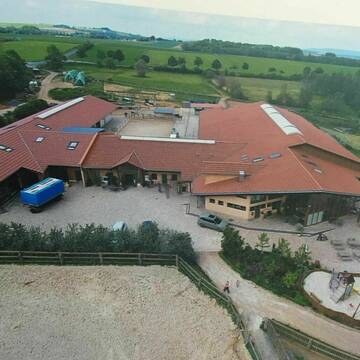
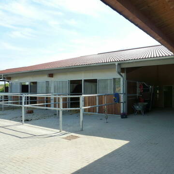
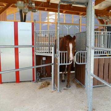
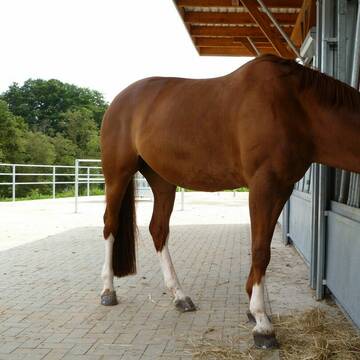
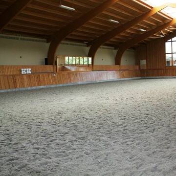
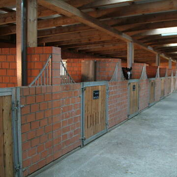
Wellenreiter Seeburg - Pensionsstall und mehr...
Seeburg
Wellenreiter-Seeburg
@Wellenreiter-Seeburg
Freizeitstall
Gastronomie
Hunde willkommen
Krankenbox
bedampftes/gewaschenes Heu
Hufrehe geeignet
Außenbox mit Paddock
Außenboxen
34 weitere...
S
Deprecated: Creation of dynamic property Zend_View_Helper_Ads::$adLink is deprecated in /var/www/stall-frei/htdocs/staging.stall-frei.de/library/Psf/View/Helper/Ads.php on line 108

Heu aus neuer Ernte
Mechtersen
STALL-FREIde Marketing
@STALL-FREI-Marketing
Heulage und Pferdeheu aus der neuen Ernte findest du in unserem Futtermarkt


Outback Corona
Willich/ Schiefbahn
Outback-Corona
@Outback-Corona
FN-Mitglied
Freizeitstall
Vermieten
Führanlage
Hunde willkommen
Allergikerstall
bedampftes/gewaschenes Heu
32 weitere...
S

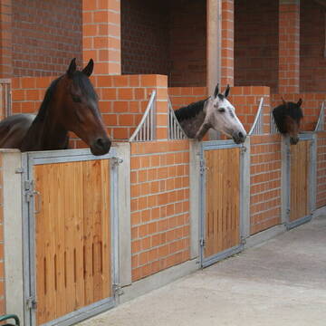
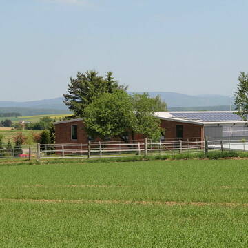
Pferdestall Wiedenbrügge
Wollershausen
Pferdestall-Wiedenbruegge
@Pferdestall-Wiedenbruegge
Freizeitstall
Geländestrecke
Vermieten
Hunde willkommen
Longierzirkel/Roundpen
bedampftes/gewaschenes Heu
Fohlenaufzucht möglich
24 weitere...
P
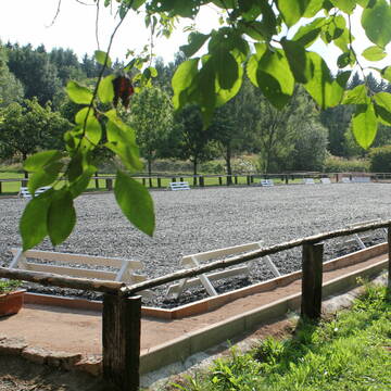
Reitanlage Eichenhof
Krebeck
Gisbert-Hann
@Gisbert-Hann
Freizeitstall
Reitlehrer und -unterricht
Longierzirkel/Roundpen
Paddock
Außenbox mit Paddock
Außenboxen
Vollpension
10 weitere...
P+
Leider kein Vorschaubild
Leider kein Vorschaubild
Offenstallplatz frei
Hattorf
Mona, Annabell & Henning
@Ponyhof-Kopperschmidt
Freizeitstall
Vermieten
Hunde willkommen
Krankenbox
Fohlenaufzucht möglich
11 weitere...
B
Rhumetalhof Jünemann
Bilshausen
Rhumetalhof-Juenemann
@Rhumetalhof-Juenemann
Freizeitstall
Vermieten
Hunde willkommen
Paddock
Gnadenbrothof
Hufrehe geeignet
12 weitere...
P

Mitarbeiter gesucht?
Mechtersen
STALL-FREIde Marketing
@STALL-FREI-Marketing
Stellenangebote kostenlos veröffentlichen!

Boxen frei
Osterode am Harz / Förste
Westernreiten K&K
@WesternreitenKundK
Freizeitstall
Pferdeausbildung
Vermieten
Hunde willkommen
Krankenbox
Fohlenaufzucht möglich
Hufrehe geeignet
25 weitere...
P

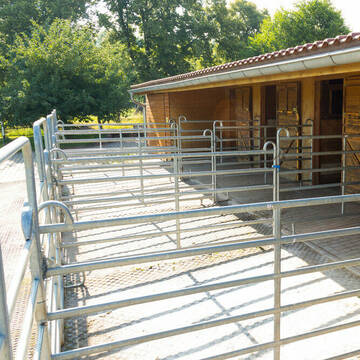
Außenboxen, Paddockboxen im ruhigen Stall
Clausthal-Zellerfeld
Werk-Tanne
@Werk-Tanne
Freizeitstall
Gangpferdereiten
Vermieten
Führanlage
Hunde willkommen
Allergikerstall
Hengsthaltung möglich
20 weitere...
P
Leider kein Vorschaubild
Leider kein Vorschaubild
Platz frei für Haltergemeinschaft/Selbstversorger
Katlenburg-Lindau
Pferdefreunde Ellernbach
@Claudia70
Freizeitstall
Gangpferdereiten
Hunde willkommen
Krankenbox
Notfallboxen
Offenstall
8 weitere...
B
Leider kein Vorschaubild
Leider kein Vorschaubild
Offenstall Platz frei-24/7Wiese kl.Reitplatz
37191
Carolin
@Carolin17
Vermieten
Hunde willkommen
Longierzirkel/Roundpen
Gnadenbrothof
Offenstall
Paddock Trail
7 weitere...
B
Deprecated: Creation of dynamic property Zend_View::$pageCount is deprecated in /var/www/stall-frei/htdocs/staging.stall-frei.de/library/vendor/shardj/zf1-future/library/Zend/View/Abstract.php on line 308
Deprecated: Creation of dynamic property Zend_View::$itemCountPerPage is deprecated in /var/www/stall-frei/htdocs/staging.stall-frei.de/library/vendor/shardj/zf1-future/library/Zend/View/Abstract.php on line 308
Deprecated: Creation of dynamic property Zend_View::$first is deprecated in /var/www/stall-frei/htdocs/staging.stall-frei.de/library/vendor/shardj/zf1-future/library/Zend/View/Abstract.php on line 308
Deprecated: Creation of dynamic property Zend_View::$current is deprecated in /var/www/stall-frei/htdocs/staging.stall-frei.de/library/vendor/shardj/zf1-future/library/Zend/View/Abstract.php on line 308
Deprecated: Creation of dynamic property Zend_View::$last is deprecated in /var/www/stall-frei/htdocs/staging.stall-frei.de/library/vendor/shardj/zf1-future/library/Zend/View/Abstract.php on line 308
Deprecated: Creation of dynamic property Zend_View::$next is deprecated in /var/www/stall-frei/htdocs/staging.stall-frei.de/library/vendor/shardj/zf1-future/library/Zend/View/Abstract.php on line 308
Deprecated: Creation of dynamic property Zend_View::$pagesInRange is deprecated in /var/www/stall-frei/htdocs/staging.stall-frei.de/library/vendor/shardj/zf1-future/library/Zend/View/Abstract.php on line 308
Deprecated: Creation of dynamic property Zend_View::$firstPageInRange is deprecated in /var/www/stall-frei/htdocs/staging.stall-frei.de/library/vendor/shardj/zf1-future/library/Zend/View/Abstract.php on line 308
Deprecated: Creation of dynamic property Zend_View::$lastPageInRange is deprecated in /var/www/stall-frei/htdocs/staging.stall-frei.de/library/vendor/shardj/zf1-future/library/Zend/View/Abstract.php on line 308
Deprecated: Creation of dynamic property Zend_View::$currentItemCount is deprecated in /var/www/stall-frei/htdocs/staging.stall-frei.de/library/vendor/shardj/zf1-future/library/Zend/View/Abstract.php on line 308
Deprecated: Creation of dynamic property Zend_View::$totalItemCount is deprecated in /var/www/stall-frei/htdocs/staging.stall-frei.de/library/vendor/shardj/zf1-future/library/Zend/View/Abstract.php on line 308
Deprecated: Creation of dynamic property Zend_View::$firstItemNumber is deprecated in /var/www/stall-frei/htdocs/staging.stall-frei.de/library/vendor/shardj/zf1-future/library/Zend/View/Abstract.php on line 308
Deprecated: Creation of dynamic property Zend_View::$lastItemNumber is deprecated in /var/www/stall-frei/htdocs/staging.stall-frei.de/library/vendor/shardj/zf1-future/library/Zend/View/Abstract.php on line 308
Deprecated: Creation of dynamic property Zend_View::$router is deprecated in /var/www/stall-frei/htdocs/staging.stall-frei.de/library/vendor/shardj/zf1-future/library/Zend/View/Abstract.php on line 308
Deprecated: Creation of dynamic property Zend_View::$urlParams is deprecated in /var/www/stall-frei/htdocs/staging.stall-frei.de/library/vendor/shardj/zf1-future/library/Zend/View/Abstract.php on line 308
Deprecated: Creation of dynamic property Zend_View::$showAds is deprecated in /var/www/stall-frei/htdocs/staging.stall-frei.de/library/vendor/shardj/zf1-future/library/Zend/View/Abstract.php on line 308
Deprecated: Creation of dynamic property Zend_View::$objectIds is deprecated in /var/www/stall-frei/htdocs/staging.stall-frei.de/library/vendor/shardj/zf1-future/library/Zend/View/Abstract.php on line 308
Deprecated: Creation of dynamic property Zend_View::$showNavbar is deprecated in /var/www/stall-frei/htdocs/staging.stall-frei.de/library/vendor/shardj/zf1-future/library/Zend/View/Abstract.php on line 308
Deprecated: Creation of dynamic property Zend_View::$showBreadcrumb is deprecated in /var/www/stall-frei/htdocs/staging.stall-frei.de/library/vendor/shardj/zf1-future/library/Zend/View/Abstract.php on line 308
Deprecated: Creation of dynamic property Zend_View::$showFooter is deprecated in /var/www/stall-frei/htdocs/staging.stall-frei.de/library/vendor/shardj/zf1-future/library/Zend/View/Abstract.php on line 308
Deprecated: Creation of dynamic property Zend_View::$showInternalAds is deprecated in /var/www/stall-frei/htdocs/staging.stall-frei.de/library/vendor/shardj/zf1-future/library/Zend/View/Abstract.php on line 308
Deprecated: Creation of dynamic property Zend_View::$blNoContent is deprecated in /var/www/stall-frei/htdocs/staging.stall-frei.de/library/vendor/shardj/zf1-future/library/Zend/View/Abstract.php on line 308
Deprecated: Creation of dynamic property Zend_View::$sMetaDesc is deprecated in /var/www/stall-frei/htdocs/staging.stall-frei.de/library/vendor/shardj/zf1-future/library/Zend/View/Abstract.php on line 308
Deprecated: Creation of dynamic property Zend_View::$useGmaps is deprecated in /var/www/stall-frei/htdocs/staging.stall-frei.de/library/vendor/shardj/zf1-future/library/Zend/View/Abstract.php on line 308
Deprecated: Creation of dynamic property Zend_View::$touches is deprecated in /var/www/stall-frei/htdocs/staging.stall-frei.de/library/vendor/shardj/zf1-future/library/Zend/View/Abstract.php on line 308
Deprecated: Creation of dynamic property Zend_View::$oProject is deprecated in /var/www/stall-frei/htdocs/staging.stall-frei.de/library/vendor/shardj/zf1-future/library/Zend/View/Abstract.php on line 308
Deprecated: Creation of dynamic property Zend_View::$pageHeadline is deprecated in /var/www/stall-frei/htdocs/staging.stall-frei.de/library/vendor/shardj/zf1-future/library/Zend/View/Abstract.php on line 308
Deprecated: Creation of dynamic property Zend_View::$disableLocationField is deprecated in /var/www/stall-frei/htdocs/staging.stall-frei.de/library/vendor/shardj/zf1-future/library/Zend/View/Abstract.php on line 308
Deprecated: Creation of dynamic property Zend_View::$isSearch is deprecated in /var/www/stall-frei/htdocs/staging.stall-frei.de/library/vendor/shardj/zf1-future/library/Zend/View/Abstract.php on line 308
Deprecated: Creation of dynamic property Zend_View::$pageTitle is deprecated in /var/www/stall-frei/htdocs/staging.stall-frei.de/library/vendor/shardj/zf1-future/library/Zend/View/Abstract.php on line 308
Deprecated: Creation of dynamic property Psf_Form_Element_Text::$class is deprecated in /var/www/stall-frei/htdocs/staging.stall-frei.de/library/vendor/shardj/zf1-future/library/Zend/Form/Element.php on line 874
Deprecated: Creation of dynamic property Psf_Form_Element_Text::$size is deprecated in /var/www/stall-frei/htdocs/staging.stall-frei.de/library/vendor/shardj/zf1-future/library/Zend/Form/Element.php on line 874
Deprecated: Creation of dynamic property Psf_Form_Element_Text::$placeholder is deprecated in /var/www/stall-frei/htdocs/staging.stall-frei.de/library/vendor/shardj/zf1-future/library/Zend/Form/Element.php on line 874
Deprecated: Creation of dynamic property Psf_Form_Element_Hidden::$class is deprecated in /var/www/stall-frei/htdocs/staging.stall-frei.de/library/vendor/shardj/zf1-future/library/Zend/Form/Element.php on line 874
Deprecated: Creation of dynamic property Psf_Form_Element_Hidden::$class is deprecated in /var/www/stall-frei/htdocs/staging.stall-frei.de/library/vendor/shardj/zf1-future/library/Zend/Form/Element.php on line 874
Deprecated: Creation of dynamic property Psf_Form_Element_Hidden::$class is deprecated in /var/www/stall-frei/htdocs/staging.stall-frei.de/library/vendor/shardj/zf1-future/library/Zend/Form/Element.php on line 874
Deprecated: Creation of dynamic property Psf_Form_Element_Hidden::$class is deprecated in /var/www/stall-frei/htdocs/staging.stall-frei.de/library/vendor/shardj/zf1-future/library/Zend/Form/Element.php on line 874
Deprecated: Creation of dynamic property Psf_Form_Element_Select::$class is deprecated in /var/www/stall-frei/htdocs/staging.stall-frei.de/library/vendor/shardj/zf1-future/library/Zend/Form/Element.php on line 874
Deprecated: Creation of dynamic property Psf_Form_Element_Select::$class is deprecated in /var/www/stall-frei/htdocs/staging.stall-frei.de/library/vendor/shardj/zf1-future/library/Zend/Form/Element.php on line 874
Deprecated: Creation of dynamic property Psf_Form_Element_Select::$class is deprecated in /var/www/stall-frei/htdocs/staging.stall-frei.de/library/vendor/shardj/zf1-future/library/Zend/Form/Element.php on line 874
Deprecated: Creation of dynamic property Psf_Form_Element_Select::$class is deprecated in /var/www/stall-frei/htdocs/staging.stall-frei.de/library/vendor/shardj/zf1-future/library/Zend/Form/Element.php on line 874
Deprecated: Creation of dynamic property Psf_Form_Element_Text::$class is deprecated in /var/www/stall-frei/htdocs/staging.stall-frei.de/library/vendor/shardj/zf1-future/library/Zend/Form/Element.php on line 874
Deprecated: Creation of dynamic property Psf_Form_Element_Checkbox::$label is deprecated in /var/www/stall-frei/htdocs/staging.stall-frei.de/library/vendor/shardj/zf1-future/library/Zend/Form/Element.php on line 874
Deprecated: Creation of dynamic property Zend_View::$sort is deprecated in /var/www/stall-frei/htdocs/staging.stall-frei.de/library/vendor/shardj/zf1-future/library/Zend/View/Abstract.php on line 308
Deprecated: Creation of dynamic property Zend_View::$searchLocation is deprecated in /var/www/stall-frei/htdocs/staging.stall-frei.de/library/vendor/shardj/zf1-future/library/Zend/View/Abstract.php on line 308
Deprecated: Creation of dynamic property Zend_View::$locationHint is deprecated in /var/www/stall-frei/htdocs/staging.stall-frei.de/library/vendor/shardj/zf1-future/library/Zend/View/Abstract.php on line 308
Psf_GeoCoder_Abstract::getLocation: Herzberg Get Location CachedOrLive
Psf_GeoCoder_Abstract::getCachedOrLive: Herzberg
Psf_GeoCoder_OpenCageData::makeApiRequest: response:
Array
(
[documentation] => https://opencagedata.com/api
[licenses] => Array
(
[0] => Array
(
[name] => see attribution guide
[url] => https://opencagedata.com/credits
)
)
[results] => Array
(
[0] => Array
(
[bounds] => Array
(
[northeast] => Array
(
[lat] => 51.6827723
[lng] => 10.3800609
)
[southwest] => Array
(
[lat] => 51.629815
[lng] => 10.2788048
)
)
[components] => Array
(
[ISO_3166-1_alpha-2] => DE
[ISO_3166-1_alpha-3] => DEU
[ISO_3166-2] => Array
(
[0] => DE-NI
)
[_category] => place
[_normalized_city] => Herzberg am Harz
[_type] => city
[city] => Herzberg am Harz
[continent] => Europe
[country] => Deutschland
[country_code] => de
[county] => Landkreis Göttingen
[political_union] => European Union
[postcode] => 37412
[state] => Niedersachsen
[state_code] => NI
[town] => Herzberg am Harz
)
[confidence] => 7
[formatted] => Herzberg am Harz, Niedersachsen, Deutschland
[geometry] => Array
(
[lat] => 51.6565219
[lng] => 10.3428415
)
)
[1] => Array
(
[bounds] => Array
(
[northeast] => Array
(
[lat] => 51.7600245
[lng] => 13.3344845
)
[southwest] => Array
(
[lat] => 51.5978837
[lng] => 13.0508856
)
)
[components] => Array
(
[ISO_3166-1_alpha-2] => DE
[ISO_3166-1_alpha-3] => DEU
[ISO_3166-2] => Array
(
[0] => DE-BB
)
[_category] => place
[_normalized_city] => Herzberg (Elster)
[_type] => city
[continent] => Europe
[country] => Deutschland
[country_code] => de
[county] => Elbe-Elster
[political_union] => European Union
[postcode] => 04916
[state] => Brandenburg
[state_code] => BB
[town] => Herzberg (Elster)
)
[confidence] => 5
[formatted] => 04916 Herzberg (Elster), Deutschland
[geometry] => Array
(
[lat] => 51.6924078
[lng] => 13.2358585
)
)
[2] => Array
(
[bounds] => Array
(
[northeast] => Array
(
[lat] => 52.9232944
[lng] => 13.0256067
)
[southwest] => Array
(
[lat] => 52.8422035
[lng] => 12.9330562
)
)
[components] => Array
(
[ISO_3166-1_alpha-2] => DE
[ISO_3166-1_alpha-3] => DEU
[ISO_3166-2] => Array
(
[0] => DE-BB
)
[_category] => place
[_normalized_city] => Herzberg (Mark)
[_type] => village
[continent] => Europe
[country] => Deutschland
[country_code] => de
[county] => Ostprignitz-Ruppin
[municipality] => Lindow (Mark)
[political_union] => European Union
[state] => Brandenburg
[state_code] => BB
[village] => Herzberg (Mark)
)
[confidence] => 7
[formatted] => Herzberg (Mark), Brandenburg, Deutschland
[geometry] => Array
(
[lat] => 52.9004778
[lng] => 12.968977
)
)
[3] => Array
(
[bounds] => Array
(
[northeast] => Array
(
[lat] => 53.561781
[lng] => 11.975209
)
[southwest] => Array
(
[lat] => 53.509393
[lng] => 11.868181
)
)
[components] => Array
(
[ISO_3166-1_alpha-2] => DE
[ISO_3166-1_alpha-3] => DEU
[ISO_3166-2] => Array
(
[0] => DE-MV
)
[_category] => place
[_normalized_city] => Herzberg
[_type] => hamlet
[continent] => Europe
[country] => Deutschland
[country_code] => de
[county] => Ludwigslust-Parchim
[hamlet] => Obere Warnow
[municipality] => Parchimer Umland
[political_union] => European Union
[state] => Mecklenburg-Vorpommern
[state_code] => MV
[village] => Herzberg
)
[confidence] => 7
[formatted] => Obere Warnow, Herzberg, Mecklenburg-Vorpommern, Deutschland
[geometry] => Array
(
[lat] => 53.529308
[lng] => 11.9282058
)
)
[4] => Array
(
[bounds] => Array
(
[northeast] => Array
(
[lat] => 52.2608731
[lng] => 14.1780514
)
[southwest] => Array
(
[lat] => 52.1973063
[lng] => 14.0819
)
)
[components] => Array
(
[ISO_3166-1_alpha-2] => DE
[ISO_3166-1_alpha-3] => DEU
[ISO_3166-2] => Array
(
[0] => DE-BB
)
[_category] => place
[_normalized_city] => Rietz-Neuendorf
[_type] => village
[city] => Rietz-Neuendorf
[continent] => Europe
[country] => Deutschland
[country_code] => de
[county] => Oder-Spree
[political_union] => European Union
[state] => Brandenburg
[state_code] => BB
[village] => Herzberg
)
[confidence] => 7
[formatted] => Herzberg, Brandenburg, Deutschland
[geometry] => Array
(
[lat] => 52.2169067
[lng] => 14.1181174
)
)
[5] => Array
(
[bounds] => Array
(
[northeast] => Array
(
[lat] => 50.2555276
[lng] => 8.5441892
)
[southwest] => Array
(
[lat] => 50.2554276
[lng] => 8.5440892
)
)
[components] => Array
(
[ISO_3166-1_alpha-2] => DE
[ISO_3166-1_alpha-3] => DEU
[ISO_3166-2] => Array
(
[0] => DE-HE
)
[_category] => natural/water
[_normalized_city] => Bad Homburg vor der Höhe
[_type] => peak
[continent] => Europe
[country] => Deutschland
[country_code] => de
[county] => Hochtaunuskreis
[peak] => Herzberg
[political_union] => European Union
[state] => Hessen
[state_code] => HE
[town] => Bad Homburg vor der Höhe
)
[confidence] => 9
[formatted] => Herzberg, Bad Homburg vor der Höhe, Hessen, Deutschland
[geometry] => Array
(
[lat] => 50.2554776
[lng] => 8.5441392
)
)
[6] => Array
(
[bounds] => Array
(
[northeast] => Array
(
[lat] => 51.0012183
[lng] => 9.9559106
)
[southwest] => Array
(
[lat] => 51.0011183
[lng] => 9.9558106
)
)
[components] => Array
(
[ISO_3166-1_alpha-2] => DE
[ISO_3166-1_alpha-3] => DEU
[ISO_3166-2] => Array
(
[0] => DE-HE
)
[_category] => natural/water
[_normalized_city] => Nentershausen
[_type] => peak
[continent] => Europe
[country] => Deutschland
[country_code] => de
[county] => Landkreis Hersfeld-Rotenburg
[municipality] => Nentershausen
[peak] => Herzberg
[political_union] => European Union
[postcode] => 36214
[state] => Hessen
[state_code] => HE
[village] => Nentershausen
)
[confidence] => 9
[formatted] => Herzberg, 36214 Nentershausen, Deutschland
[geometry] => Array
(
[lat] => 51.0011683
[lng] => 9.9558606
)
)
[7] => Array
(
[bounds] => Array
(
[northeast] => Array
(
[lat] => 50.3292057
[lng] => 9.2326855
)
[southwest] => Array
(
[lat] => 50.3291057
[lng] => 9.2325855
)
)
[components] => Array
(
[ISO_3166-1_alpha-2] => DE
[ISO_3166-1_alpha-3] => DEU
[ISO_3166-2] => Array
(
[0] => DE-HE
)
[_category] => natural/water
[_normalized_city] => Leisenwald
[_type] => peak
[continent] => Europe
[country] => Deutschland
[country_code] => de
[county] => Main-Kinzig-Kreis
[municipality] => Wächtersbach
[peak] => Herzberg
[political_union] => European Union
[postcode] => 63699
[state] => Hessen
[state_code] => HE
[village] => Leisenwald
)
[confidence] => 9
[formatted] => Herzberg, 63699 Leisenwald, Deutschland
[geometry] => Array
(
[lat] => 50.3291557
[lng] => 9.2326355
)
)
[8] => Array
(
[bounds] => Array
(
[northeast] => Array
(
[lat] => 51.8818167
[lng] => 10.4117667
)
[southwest] => Array
(
[lat] => 51.8817167
[lng] => 10.4116667
)
)
[components] => Array
(
[ISO_3166-1_alpha-2] => DE
[ISO_3166-1_alpha-3] => DEU
[ISO_3166-2] => Array
(
[0] => DE-NI
)
[_category] => natural/water
[_normalized_city] => Goslar
[_type] => peak
[continent] => Europe
[country] => Deutschland
[country_code] => de
[county] => Landkreis Goslar
[peak] => Herzberg
[political_union] => European Union
[postcode] => 38640
[state] => Niedersachsen
[state_code] => NI
[town] => Goslar
)
[confidence] => 9
[formatted] => Herzberg, 38640 Goslar, Deutschland
[geometry] => Array
(
[lat] => 51.8817667
[lng] => 10.4117167
)
)
[9] => Array
(
[bounds] => Array
(
[northeast] => Array
(
[lat] => 50.2124103
[lng] => 9.1509648
)
[southwest] => Array
(
[lat] => 50.2123103
[lng] => 9.1508648
)
)
[components] => Array
(
[ISO_3166-1_alpha-2] => DE
[ISO_3166-1_alpha-3] => DEU
[ISO_3166-2] => Array
(
[0] => DE-HE
)
[_category] => natural/water
[_normalized_city] => Gelnhausen
[_type] => peak
[continent] => Europe
[country] => Deutschland
[country_code] => de
[county] => Main-Kinzig-Kreis
[peak] => Herzberg
[political_union] => European Union
[postcode] => 63584
[state] => Hessen
[state_code] => HE
[town] => Gelnhausen
)
[confidence] => 9
[formatted] => Herzberg, 63584 Gelnhausen, Deutschland
[geometry] => Array
(
[lat] => 50.2123603
[lng] => 9.1509148
)
)
)
[status] => Array
(
[code] => 200
[message] => OK
)
[stay_informed] => Array
(
[blog] => https://blog.opencagedata.com
[mastodon] => https://en.osm.town/@opencage
)
[thanks] => For using an OpenCage API
[timestamp] => Array
(
[created_http] => Sun, 08 Feb 2026 07:04:51 GMT
[created_unix] => 1770534291
)
[total_results] => 10
)
Psf_GeoCoder_Abstract::convertLocationResult
{"documentation":"https:\/\/opencagedata.com\/api","licenses":[{"name":"see attribution guide","url":"https:\/\/opencagedata.com\/credits"}],"results":[{"bounds":{"northeast":{"lat":51.6827723,"lng":10.3800609},"southwest":{"lat":51.629815,"lng":10.2788048}},"components":{"ISO_3166-1_alpha-2":"DE","ISO_3166-1_alpha-3":"DEU","ISO_3166-2":["DE-NI"],"_category":"place","_normalized_city":"Herzberg am Harz","_type":"city","city":"Herzberg am Harz","continent":"Europe","country":"Deutschland","country_code":"de","county":"Landkreis G\u00f6ttingen","political_union":"European Union","postcode":"37412","state":"Niedersachsen","state_code":"NI","town":"Herzberg am Harz"},"confidence":7,"formatted":"Herzberg am Harz, Niedersachsen, Deutschland","geometry":{"lat":51.6565219,"lng":10.3428415}},{"bounds":{"northeast":{"lat":51.7600245,"lng":13.3344845},"southwest":{"lat":51.5978837,"lng":13.0508856}},"components":{"ISO_3166-1_alpha-2":"DE","ISO_3166-1_alpha-3":"DEU","ISO_3166-2":["DE-BB"],"_category":"place","_normalized_city":"Herzberg (Elster)","_type":"city","continent":"Europe","country":"Deutschland","country_code":"de","county":"Elbe-Elster","political_union":"European Union","postcode":"04916","state":"Brandenburg","state_code":"BB","town":"Herzberg (Elster)"},"confidence":5,"formatted":"04916 Herzberg (Elster), Deutschland","geometry":{"lat":51.6924078,"lng":13.2358585}},{"bounds":{"northeast":{"lat":52.9232944,"lng":13.0256067},"southwest":{"lat":52.8422035,"lng":12.9330562}},"components":{"ISO_3166-1_alpha-2":"DE","ISO_3166-1_alpha-3":"DEU","ISO_3166-2":["DE-BB"],"_category":"place","_normalized_city":"Herzberg (Mark)","_type":"village","continent":"Europe","country":"Deutschland","country_code":"de","county":"Ostprignitz-Ruppin","municipality":"Lindow (Mark)","political_union":"European Union","state":"Brandenburg","state_code":"BB","village":"Herzberg (Mark)"},"confidence":7,"formatted":"Herzberg (Mark), Brandenburg, Deutschland","geometry":{"lat":52.9004778,"lng":12.968977}},{"bounds":{"northeast":{"lat":53.561781,"lng":11.975209},"southwest":{"lat":53.509393,"lng":11.868181}},"components":{"ISO_3166-1_alpha-2":"DE","ISO_3166-1_alpha-3":"DEU","ISO_3166-2":["DE-MV"],"_category":"place","_normalized_city":"Herzberg","_type":"hamlet","continent":"Europe","country":"Deutschland","country_code":"de","county":"Ludwigslust-Parchim","hamlet":"Obere Warnow","municipality":"Parchimer Umland","political_union":"European Union","state":"Mecklenburg-Vorpommern","state_code":"MV","village":"Herzberg"},"confidence":7,"formatted":"Obere Warnow, Herzberg, Mecklenburg-Vorpommern, Deutschland","geometry":{"lat":53.529308,"lng":11.9282058}},{"bounds":{"northeast":{"lat":52.2608731,"lng":14.1780514},"southwest":{"lat":52.1973063,"lng":14.0819}},"components":{"ISO_3166-1_alpha-2":"DE","ISO_3166-1_alpha-3":"DEU","ISO_3166-2":["DE-BB"],"_category":"place","_normalized_city":"Rietz-Neuendorf","_type":"village","city":"Rietz-Neuendorf","continent":"Europe","country":"Deutschland","country_code":"de","county":"Oder-Spree","political_union":"European Union","state":"Brandenburg","state_code":"BB","village":"Herzberg"},"confidence":7,"formatted":"Herzberg, Brandenburg, Deutschland","geometry":{"lat":52.2169067,"lng":14.1181174}},{"bounds":{"northeast":{"lat":50.2555276,"lng":8.5441892},"southwest":{"lat":50.2554276,"lng":8.5440892}},"components":{"ISO_3166-1_alpha-2":"DE","ISO_3166-1_alpha-3":"DEU","ISO_3166-2":["DE-HE"],"_category":"natural\/water","_normalized_city":"Bad Homburg vor der H\u00f6he","_type":"peak","continent":"Europe","country":"Deutschland","country_code":"de","county":"Hochtaunuskreis","peak":"Herzberg","political_union":"European Union","state":"Hessen","state_code":"HE","town":"Bad Homburg vor der H\u00f6he"},"confidence":9,"formatted":"Herzberg, Bad Homburg vor der H\u00f6he, Hessen, Deutschland","geometry":{"lat":50.2554776,"lng":8.5441392}},{"bounds":{"northeast":{"lat":51.0012183,"lng":9.9559106},"southwest":{"lat":51.0011183,"lng":9.9558106}},"components":{"ISO_3166-1_alpha-2":"DE","ISO_3166-1_alpha-3":"DEU","ISO_3166-2":["DE-HE"],"_category":"natural\/water","_normalized_city":"Nentershausen","_type":"peak","continent":"Europe","country":"Deutschland","country_code":"de","county":"Landkreis Hersfeld-Rotenburg","municipality":"Nentershausen","peak":"Herzberg","political_union":"European Union","postcode":"36214","state":"Hessen","state_code":"HE","village":"Nentershausen"},"confidence":9,"formatted":"Herzberg, 36214 Nentershausen, Deutschland","geometry":{"lat":51.0011683,"lng":9.9558606}},{"bounds":{"northeast":{"lat":50.3292057,"lng":9.2326855},"southwest":{"lat":50.3291057,"lng":9.2325855}},"components":{"ISO_3166-1_alpha-2":"DE","ISO_3166-1_alpha-3":"DEU","ISO_3166-2":["DE-HE"],"_category":"natural\/water","_normalized_city":"Leisenwald","_type":"peak","continent":"Europe","country":"Deutschland","country_code":"de","county":"Main-Kinzig-Kreis","municipality":"W\u00e4chtersbach","peak":"Herzberg","political_union":"European Union","postcode":"63699","state":"Hessen","state_code":"HE","village":"Leisenwald"},"confidence":9,"formatted":"Herzberg, 63699 Leisenwald, Deutschland","geometry":{"lat":50.3291557,"lng":9.2326355}},{"bounds":{"northeast":{"lat":51.8818167,"lng":10.4117667},"southwest":{"lat":51.8817167,"lng":10.4116667}},"components":{"ISO_3166-1_alpha-2":"DE","ISO_3166-1_alpha-3":"DEU","ISO_3166-2":["DE-NI"],"_category":"natural\/water","_normalized_city":"Goslar","_type":"peak","continent":"Europe","country":"Deutschland","country_code":"de","county":"Landkreis Goslar","peak":"Herzberg","political_union":"European Union","postcode":"38640","state":"Niedersachsen","state_code":"NI","town":"Goslar"},"confidence":9,"formatted":"Herzberg, 38640 Goslar, Deutschland","geometry":{"lat":51.8817667,"lng":10.4117167}},{"bounds":{"northeast":{"lat":50.2124103,"lng":9.1509648},"southwest":{"lat":50.2123103,"lng":9.1508648}},"components":{"ISO_3166-1_alpha-2":"DE","ISO_3166-1_alpha-3":"DEU","ISO_3166-2":["DE-HE"],"_category":"natural\/water","_normalized_city":"Gelnhausen","_type":"peak","continent":"Europe","country":"Deutschland","country_code":"de","county":"Main-Kinzig-Kreis","peak":"Herzberg","political_union":"European Union","postcode":"63584","state":"Hessen","state_code":"HE","town":"Gelnhausen"},"confidence":9,"formatted":"Herzberg, 63584 Gelnhausen, Deutschland","geometry":{"lat":50.2123603,"lng":9.1509148}}],"status":{"code":200,"message":"OK"},"stay_informed":{"blog":"https:\/\/blog.opencagedata.com","mastodon":"https:\/\/en.osm.town\/@opencage"},"thanks":"For using an OpenCage API","timestamp":{"created_http":"Sun, 08 Feb 2026 07:04:51 GMT","created_unix":1770534291},"total_results":10}Array
(
[0] => stdClass Object
(
[bounds] => stdClass Object
(
[northeast] => stdClass Object
(
[lat] => 51.6827723
[lng] => 10.3800609
)
[southwest] => stdClass Object
(
[lat] => 51.629815
[lng] => 10.2788048
)
)
[components] => stdClass Object
(
[ISO_3166-1_alpha-2] => DE
[ISO_3166-1_alpha-3] => DEU
[ISO_3166-2] => Array
(
[0] => DE-NI
)
[_category] => place
[_normalized_city] => Herzberg am Harz
[_type] => city
[city] => Herzberg am Harz
[continent] => Europe
[country] => Deutschland
[country_code] => de
[county] => Landkreis Göttingen
[political_union] => European Union
[postcode] => 37412
[state] => Niedersachsen
[state_code] => NI
[town] => Herzberg am Harz
)
[confidence] => 7
[formatted] => Herzberg am Harz, Niedersachsen, Deutschland
[geometry] => stdClass Object
(
[lat] => 51.6565219
[lng] => 10.3428415
)
)
[1] => stdClass Object
(
[bounds] => stdClass Object
(
[northeast] => stdClass Object
(
[lat] => 51.7600245
[lng] => 13.3344845
)
[southwest] => stdClass Object
(
[lat] => 51.5978837
[lng] => 13.0508856
)
)
[components] => stdClass Object
(
[ISO_3166-1_alpha-2] => DE
[ISO_3166-1_alpha-3] => DEU
[ISO_3166-2] => Array
(
[0] => DE-BB
)
[_category] => place
[_normalized_city] => Herzberg (Elster)
[_type] => city
[continent] => Europe
[country] => Deutschland
[country_code] => de
[county] => Elbe-Elster
[political_union] => European Union
[postcode] => 04916
[state] => Brandenburg
[state_code] => BB
[town] => Herzberg (Elster)
)
[confidence] => 5
[formatted] => 04916 Herzberg (Elster), Deutschland
[geometry] => stdClass Object
(
[lat] => 51.6924078
[lng] => 13.2358585
)
)
[2] => stdClass Object
(
[bounds] => stdClass Object
(
[northeast] => stdClass Object
(
[lat] => 52.9232944
[lng] => 13.0256067
)
[southwest] => stdClass Object
(
[lat] => 52.8422035
[lng] => 12.9330562
)
)
[components] => stdClass Object
(
[ISO_3166-1_alpha-2] => DE
[ISO_3166-1_alpha-3] => DEU
[ISO_3166-2] => Array
(
[0] => DE-BB
)
[_category] => place
[_normalized_city] => Herzberg (Mark)
[_type] => village
[continent] => Europe
[country] => Deutschland
[country_code] => de
[county] => Ostprignitz-Ruppin
[municipality] => Lindow (Mark)
[political_union] => European Union
[state] => Brandenburg
[state_code] => BB
[village] => Herzberg (Mark)
)
[confidence] => 7
[formatted] => Herzberg (Mark), Brandenburg, Deutschland
[geometry] => stdClass Object
(
[lat] => 52.9004778
[lng] => 12.968977
)
)
[3] => stdClass Object
(
[bounds] => stdClass Object
(
[northeast] => stdClass Object
(
[lat] => 53.561781
[lng] => 11.975209
)
[southwest] => stdClass Object
(
[lat] => 53.509393
[lng] => 11.868181
)
)
[components] => stdClass Object
(
[ISO_3166-1_alpha-2] => DE
[ISO_3166-1_alpha-3] => DEU
[ISO_3166-2] => Array
(
[0] => DE-MV
)
[_category] => place
[_normalized_city] => Herzberg
[_type] => hamlet
[continent] => Europe
[country] => Deutschland
[country_code] => de
[county] => Ludwigslust-Parchim
[hamlet] => Obere Warnow
[municipality] => Parchimer Umland
[political_union] => European Union
[state] => Mecklenburg-Vorpommern
[state_code] => MV
[village] => Herzberg
)
[confidence] => 7
[formatted] => Obere Warnow, Herzberg, Mecklenburg-Vorpommern, Deutschland
[geometry] => stdClass Object
(
[lat] => 53.529308
[lng] => 11.9282058
)
)
[4] => stdClass Object
(
[bounds] => stdClass Object
(
[northeast] => stdClass Object
(
[lat] => 52.2608731
[lng] => 14.1780514
)
[southwest] => stdClass Object
(
[lat] => 52.1973063
[lng] => 14.0819
)
)
[components] => stdClass Object
(
[ISO_3166-1_alpha-2] => DE
[ISO_3166-1_alpha-3] => DEU
[ISO_3166-2] => Array
(
[0] => DE-BB
)
[_category] => place
[_normalized_city] => Rietz-Neuendorf
[_type] => village
[city] => Rietz-Neuendorf
[continent] => Europe
[country] => Deutschland
[country_code] => de
[county] => Oder-Spree
[political_union] => European Union
[state] => Brandenburg
[state_code] => BB
[village] => Herzberg
)
[confidence] => 7
[formatted] => Herzberg, Brandenburg, Deutschland
[geometry] => stdClass Object
(
[lat] => 52.2169067
[lng] => 14.1181174
)
)
[5] => stdClass Object
(
[bounds] => stdClass Object
(
[northeast] => stdClass Object
(
[lat] => 50.2555276
[lng] => 8.5441892
)
[southwest] => stdClass Object
(
[lat] => 50.2554276
[lng] => 8.5440892
)
)
[components] => stdClass Object
(
[ISO_3166-1_alpha-2] => DE
[ISO_3166-1_alpha-3] => DEU
[ISO_3166-2] => Array
(
[0] => DE-HE
)
[_category] => natural/water
[_normalized_city] => Bad Homburg vor der Höhe
[_type] => peak
[continent] => Europe
[country] => Deutschland
[country_code] => de
[county] => Hochtaunuskreis
[peak] => Herzberg
[political_union] => European Union
[state] => Hessen
[state_code] => HE
[town] => Bad Homburg vor der Höhe
)
[confidence] => 9
[formatted] => Herzberg, Bad Homburg vor der Höhe, Hessen, Deutschland
[geometry] => stdClass Object
(
[lat] => 50.2554776
[lng] => 8.5441392
)
)
[6] => stdClass Object
(
[bounds] => stdClass Object
(
[northeast] => stdClass Object
(
[lat] => 51.0012183
[lng] => 9.9559106
)
[southwest] => stdClass Object
(
[lat] => 51.0011183
[lng] => 9.9558106
)
)
[components] => stdClass Object
(
[ISO_3166-1_alpha-2] => DE
[ISO_3166-1_alpha-3] => DEU
[ISO_3166-2] => Array
(
[0] => DE-HE
)
[_category] => natural/water
[_normalized_city] => Nentershausen
[_type] => peak
[continent] => Europe
[country] => Deutschland
[country_code] => de
[county] => Landkreis Hersfeld-Rotenburg
[municipality] => Nentershausen
[peak] => Herzberg
[political_union] => European Union
[postcode] => 36214
[state] => Hessen
[state_code] => HE
[village] => Nentershausen
)
[confidence] => 9
[formatted] => Herzberg, 36214 Nentershausen, Deutschland
[geometry] => stdClass Object
(
[lat] => 51.0011683
[lng] => 9.9558606
)
)
[7] => stdClass Object
(
[bounds] => stdClass Object
(
[northeast] => stdClass Object
(
[lat] => 50.3292057
[lng] => 9.2326855
)
[southwest] => stdClass Object
(
[lat] => 50.3291057
[lng] => 9.2325855
)
)
[components] => stdClass Object
(
[ISO_3166-1_alpha-2] => DE
[ISO_3166-1_alpha-3] => DEU
[ISO_3166-2] => Array
(
[0] => DE-HE
)
[_category] => natural/water
[_normalized_city] => Leisenwald
[_type] => peak
[continent] => Europe
[country] => Deutschland
[country_code] => de
[county] => Main-Kinzig-Kreis
[municipality] => Wächtersbach
[peak] => Herzberg
[political_union] => European Union
[postcode] => 63699
[state] => Hessen
[state_code] => HE
[village] => Leisenwald
)
[confidence] => 9
[formatted] => Herzberg, 63699 Leisenwald, Deutschland
[geometry] => stdClass Object
(
[lat] => 50.3291557
[lng] => 9.2326355
)
)
[8] => stdClass Object
(
[bounds] => stdClass Object
(
[northeast] => stdClass Object
(
[lat] => 51.8818167
[lng] => 10.4117667
)
[southwest] => stdClass Object
(
[lat] => 51.8817167
[lng] => 10.4116667
)
)
[components] => stdClass Object
(
[ISO_3166-1_alpha-2] => DE
[ISO_3166-1_alpha-3] => DEU
[ISO_3166-2] => Array
(
[0] => DE-NI
)
[_category] => natural/water
[_normalized_city] => Goslar
[_type] => peak
[continent] => Europe
[country] => Deutschland
[country_code] => de
[county] => Landkreis Goslar
[peak] => Herzberg
[political_union] => European Union
[postcode] => 38640
[state] => Niedersachsen
[state_code] => NI
[town] => Goslar
)
[confidence] => 9
[formatted] => Herzberg, 38640 Goslar, Deutschland
[geometry] => stdClass Object
(
[lat] => 51.8817667
[lng] => 10.4117167
)
)
[9] => stdClass Object
(
[bounds] => stdClass Object
(
[northeast] => stdClass Object
(
[lat] => 50.2124103
[lng] => 9.1509648
)
[southwest] => stdClass Object
(
[lat] => 50.2123103
[lng] => 9.1508648
)
)
[components] => stdClass Object
(
[ISO_3166-1_alpha-2] => DE
[ISO_3166-1_alpha-3] => DEU
[ISO_3166-2] => Array
(
[0] => DE-HE
)
[_category] => natural/water
[_normalized_city] => Gelnhausen
[_type] => peak
[continent] => Europe
[country] => Deutschland
[country_code] => de
[county] => Main-Kinzig-Kreis
[peak] => Herzberg
[political_union] => European Union
[postcode] => 63584
[state] => Hessen
[state_code] => HE
[town] => Gelnhausen
)
[confidence] => 9
[formatted] => Herzberg, 63584 Gelnhausen, Deutschland
[geometry] => stdClass Object
(
[lat] => 50.2123603
[lng] => 9.1509148
)
)
)
Psf_GeoCoder_OpenCageData::getKeyMap: 0
stdClass Object
(
    [bounds] => stdClass Object
        (
            [northeast] => stdClass Object
                (
                    [lat] => 51.6827723
                    [lng] => 10.3800609
                )

            [southwest] => stdClass Object
                (
                    [lat] => 51.629815
                    [lng] => 10.2788048
                )

        )

    [components] => stdClass Object
        (
            [ISO_3166-1_alpha-2] => DE
            [ISO_3166-1_alpha-3] => DEU
            [ISO_3166-2] => Array
                (
                    [0] => DE-NI
                )

            [_category] => place
            [_normalized_city] => Herzberg am Harz
            [_type] => city
            [city] => Herzberg am Harz
            [continent] => Europe
            [country] => Deutschland
            [country_code] => de
            [county] => Landkreis Göttingen
            [political_union] => European Union
            [postcode] => 37412
            [state] => Niedersachsen
            [state_code] => NI
            [town] => Herzberg am Harz
        )

    [confidence] => 7
    [formatted] => Herzberg am Harz, Niedersachsen, Deutschland
    [geometry] => stdClass Object
        (
            [lat] => 51.6565219
            [lng] => 10.3428415
        )

)
Psf_GeoCoder_OpenCageData::getCounty: Göttingen
Psf_GeoCoder_OpenCageData::addMissingData REFETCH!
Array
(
    [address] => Herzberg am Harz, Niedersachsen, Deutschland
    [type] => city
    [street] =>
    [city] => Herzberg am Harz
    [county] => Göttingen
    [state] => Niedersachsen
    [zip] => 37412
    [country] => Deutschland
    [suburb] =>
    [countrycode] => de
    [latitude] => 51.6565219
    [longitude] => 10.3428415
    [accuracy] => 1
    [confidence] => 7
    [bounds] => stdClass Object
        (
            [northeast] => stdClass Object
                (
                    [lat] => 51.6827723
                    [lng] => 10.3800609
                )

            [southwest] => stdClass Object
                (
                    [lat] => 51.629815
                    [lng] => 10.2788048
                )

        )

)
reformat!
Array
(
    [address] => Herzberg am Harz, Niedersachsen, Deutschland
    [type] => city
    [street] =>
    [city] => Herzberg am Harz
    [county] => Göttingen
    [state] => Niedersachsen
    [zip] => 37412
    [country] => Deutschland
    [suburb] =>
    [countrycode] => de
    [latitude] => 51.6565219
    [longitude] => 10.3428415
    [accuracy] => 1
    [confidence] => 7
    [bounds] => stdClass Object
        (
            [northeast] => stdClass Object
                (
                    [lat] => 51.6827723
                    [lng] => 10.3800609
                )

            [southwest] => stdClass Object
                (
                    [lat] => 51.629815
                    [lng] => 10.2788048
                )

        )

    [place] => 37412 Herzberg am Harz, Niedersachsen
    [hash] => 51cc6db5b3121d0886bbb946a23deb94
)
Psf_GeoCoder_OpenCageData::getKeyMap: 1
stdClass Object
(
    [bounds] => stdClass Object
        (
            [northeast] => stdClass Object
                (
                    [lat] => 51.7600245
                    [lng] => 13.3344845
                )

            [southwest] => stdClass Object
                (
                    [lat] => 51.5978837
                    [lng] => 13.0508856
                )

        )

    [components] => stdClass Object
        (
            [ISO_3166-1_alpha-2] => DE
            [ISO_3166-1_alpha-3] => DEU
            [ISO_3166-2] => Array
                (
                    [0] => DE-BB
                )

            [_category] => place
            [_normalized_city] => Herzberg (Elster)
            [_type] => city
            [continent] => Europe
            [country] => Deutschland
            [country_code] => de
            [county] => Elbe-Elster
            [political_union] => European Union
            [postcode] => 04916
            [state] => Brandenburg
            [state_code] => BB
            [town] => Herzberg (Elster)
        )

    [confidence] => 5
    [formatted] => 04916 Herzberg (Elster), Deutschland
    [geometry] => stdClass Object
        (
            [lat] => 51.6924078
            [lng] => 13.2358585
        )

)
Psf_GeoCoder_OpenCageData::getCounty: Elbe-Elster
Psf_GeoCoder_OpenCageData::addMissingData REFETCH!
Array
(
    [address] => 04916 Herzberg (Elster), Deutschland
    [type] => city
    [street] =>
    [city] => Herzberg (Elster)
    [county] => Elbe-Elster
    [state] => Brandenburg
    [zip] => 04916
    [country] => Deutschland
    [suburb] =>
    [countrycode] => de
    [latitude] => 51.6924078
    [longitude] => 13.2358585
    [accuracy] => 1
    [confidence] => 5
    [bounds] => stdClass Object
        (
            [northeast] => stdClass Object
                (
                    [lat] => 51.7600245
                    [lng] => 13.3344845
                )

            [southwest] => stdClass Object
                (
                    [lat] => 51.5978837
                    [lng] => 13.0508856
                )

        )

)
reformat!
Array
(
    [address] => 04916 Herzberg (Elster), Deutschland
    [type] => city
    [street] =>
    [city] => Herzberg (Elster)
    [county] => Elbe-Elster
    [state] => Brandenburg
    [zip] => 04916
    [country] => Deutschland
    [suburb] =>
    [countrycode] => de
    [latitude] => 51.6924078
    [longitude] => 13.2358585
    [accuracy] => 1
    [confidence] => 5
    [bounds] => stdClass Object
        (
            [northeast] => stdClass Object
                (
                    [lat] => 51.7600245
                    [lng] => 13.3344845
                )

            [southwest] => stdClass Object
                (
                    [lat] => 51.5978837
                    [lng] => 13.0508856
                )

        )

    [place] => 04916 Herzberg (Elster), Brandenburg
    [hash] => 98895fa6b7bc188af881f984ccfc1ccc
)
Psf_GeoCoder_OpenCageData::getKeyMap: 2
stdClass Object
(
    [bounds] => stdClass Object
        (
            [northeast] => stdClass Object
                (
                    [lat] => 52.9232944
                    [lng] => 13.0256067
                )

            [southwest] => stdClass Object
                (
                    [lat] => 52.8422035
                    [lng] => 12.9330562
                )

        )

    [components] => stdClass Object
        (
            [ISO_3166-1_alpha-2] => DE
            [ISO_3166-1_alpha-3] => DEU
            [ISO_3166-2] => Array
                (
                    [0] => DE-BB
                )

            [_category] => place
            [_normalized_city] => Herzberg (Mark)
            [_type] => village
            [continent] => Europe
            [country] => Deutschland
            [country_code] => de
            [county] => Ostprignitz-Ruppin
            [municipality] => Lindow (Mark)
            [political_union] => European Union
            [state] => Brandenburg
            [state_code] => BB
            [village] => Herzberg (Mark)
        )

    [confidence] => 7
    [formatted] => Herzberg (Mark), Brandenburg, Deutschland
    [geometry] => stdClass Object
        (
            [lat] => 52.9004778
            [lng] => 12.968977
        )

)
Psf_GeoCoder_OpenCageData::getCounty: Ostprignitz-Ruppin
Psf_GeoCoder_OpenCageData::addMissingData REFETCH!
Array
(
    [address] => Herzberg (Mark), Brandenburg, Deutschland
    [type] => village
    [street] =>
    [city] => Herzberg (Mark)
    [county] => Ostprignitz-Ruppin
    [state] => Brandenburg
    [zip] =>
    [country] => Deutschland
    [suburb] =>
    [countrycode] => de
    [latitude] => 52.9004778
    [longitude] => 12.968977
    [accuracy] => 1
    [confidence] => 7
    [bounds] => stdClass Object
        (
            [northeast] => stdClass Object
                (
                    [lat] => 52.9232944
                    [lng] => 13.0256067
                )

            [southwest] => stdClass Object
                (
                    [lat] => 52.8422035
                    [lng] => 12.9330562
                )

        )

)
reformat!
Array
(
    [address] => Herzberg (Mark), Brandenburg, Deutschland
    [type] => village
    [street] =>
    [city] => Herzberg (Mark)
    [county] => Ostprignitz-Ruppin
    [state] => Brandenburg
    [zip] =>
    [country] => Deutschland
    [suburb] =>
    [countrycode] => de
    [latitude] => 52.9004778
    [longitude] => 12.968977
    [accuracy] => 1
    [confidence] => 7
    [bounds] => stdClass Object
        (
            [northeast] => stdClass Object
                (
                    [lat] => 52.9232944
                    [lng] => 13.0256067
                )

            [southwest] => stdClass Object
                (
                    [lat] => 52.8422035
                    [lng] => 12.9330562
                )

        )

    [place] => Herzberg (Mark), Brandenburg
    [hash] => 20a833f7cce19036e8f9beb72875e80c
)
Psf_GeoCoder_OpenCageData::getKeyMap: 3
stdClass Object
(
    [bounds] => stdClass Object
        (
            [northeast] => stdClass Object
                (
                    [lat] => 53.561781
                    [lng] => 11.975209
                )

            [southwest] => stdClass Object
                (
                    [lat] => 53.509393
                    [lng] => 11.868181
                )

        )

    [components] => stdClass Object
        (
            [ISO_3166-1_alpha-2] => DE
            [ISO_3166-1_alpha-3] => DEU
            [ISO_3166-2] => Array
                (
                    [0] => DE-MV
                )

            [_category] => place
            [_normalized_city] => Herzberg
            [_type] => hamlet
            [continent] => Europe
            [country] => Deutschland
            [country_code] => de
            [county] => Ludwigslust-Parchim
            [hamlet] => Obere Warnow
            [municipality] => Parchimer Umland
            [political_union] => European Union
            [state] => Mecklenburg-Vorpommern
            [state_code] => MV
            [village] => Herzberg
        )

    [confidence] => 7
    [formatted] => Obere Warnow, Herzberg, Mecklenburg-Vorpommern, Deutschland
    [geometry] => stdClass Object
        (
            [lat] => 53.529308
            [lng] => 11.9282058
        )

)
Psf_GeoCoder_OpenCageData::getCounty: Ludwigslust-Parchim
Psf_GeoCoder_OpenCageData::addMissingData REFETCH!
Array
(
    [address] => Obere Warnow, Herzberg, Mecklenburg-Vorpommern, Deutschland
    [type] => hamlet
    [street] => Obere Warnow
    [city] => Herzberg
    [county] => Ludwigslust-Parchim
    [state] => Mecklenburg-Vorpommern
    [zip] =>
    [country] => Deutschland
    [suburb] =>
    [countrycode] => de
    [latitude] => 53.529308
    [longitude] => 11.9282058
    [accuracy] => 1
    [confidence] => 7
    [bounds] => stdClass Object
        (
            [northeast] => stdClass Object
                (
                    [lat] => 53.561781
                    [lng] => 11.975209
                )

            [southwest] => stdClass Object
                (
                    [lat] => 53.509393
                    [lng] => 11.868181
                )

        )

)
reformat!
Array
(
    [address] => Obere Warnow, Herzberg, Mecklenburg-Vorpommern, Deutschland
    [type] => hamlet
    [street] => Obere Warnow
    [city] => Herzberg
    [county] => Ludwigslust-Parchim
    [state] => Mecklenburg-Vorpommern
    [zip] =>
    [country] => Deutschland
    [suburb] =>
    [countrycode] => de
    [latitude] => 53.529308
    [longitude] => 11.9282058
    [accuracy] => 1
    [confidence] => 7
    [bounds] => stdClass Object
        (
            [northeast] => stdClass Object
                (
                    [lat] => 53.561781
                    [lng] => 11.975209
                )

            [southwest] => stdClass Object
                (
                    [lat] => 53.509393
                    [lng] => 11.868181
                )

        )

    [place] => Obere Warnow, Herzberg, Mecklenburg-Vorpommern
    [hash] => 792e7a8d85ea525fc2f790d0589f94d5
)
Psf_GeoCoder_OpenCageData::getKeyMap: 4
stdClass Object
(
    [bounds] => stdClass Object
        (
            [northeast] => stdClass Object
                (
                    [lat] => 52.2608731
                    [lng] => 14.1780514
                )

            [southwest] => stdClass Object
                (
                    [lat] => 52.1973063
                    [lng] => 14.0819
                )

        )

    [components] => stdClass Object
        (
            [ISO_3166-1_alpha-2] => DE
            [ISO_3166-1_alpha-3] => DEU
            [ISO_3166-2] => Array
                (
                    [0] => DE-BB
                )

            [_category] => place
            [_normalized_city] => Rietz-Neuendorf
            [_type] => village
            [city] => Rietz-Neuendorf
            [continent] => Europe
            [country] => Deutschland
            [country_code] => de
            [county] => Oder-Spree
            [political_union] => European Union
            [state] => Brandenburg
            [state_code] => BB
            [village] => Herzberg
        )

    [confidence] => 7
    [formatted] => Herzberg, Brandenburg, Deutschland
    [geometry] => stdClass Object
        (
            [lat] => 52.2169067
            [lng] => 14.1181174
        )

)
Psf_GeoCoder_OpenCageData::getCounty: Oder-Spree
Psf_GeoCoder_OpenCageData::addMissingData REFETCH!
Array
(
    [address] => Herzberg, Brandenburg, Deutschland
    [type] => village
    [street] =>
    [city] => Herzberg
    [county] => Oder-Spree
    [state] => Brandenburg
    [zip] =>
    [country] => Deutschland
    [suburb] =>
    [countrycode] => de
    [latitude] => 52.2169067
    [longitude] => 14.1181174
    [accuracy] => 1
    [confidence] => 7
    [bounds] => stdClass Object
        (
            [northeast] => stdClass Object
                (
                    [lat] => 52.2608731
                    [lng] => 14.1780514
                )

            [southwest] => stdClass Object
                (
                    [lat] => 52.1973063
                    [lng] => 14.0819
                )

        )

)
reformat!
Array
(
    [address] => Herzberg, Brandenburg, Deutschland
    [type] => village
    [street] =>
    [city] => Herzberg
    [county] => Oder-Spree
    [state] => Brandenburg
    [zip] =>
    [country] => Deutschland
    [suburb] =>
    [countrycode] => de
    [latitude] => 52.2169067
    [longitude] => 14.1181174
    [accuracy] => 1
    [confidence] => 7
    [bounds] => stdClass Object
        (
            [northeast] => stdClass Object
                (
                    [lat] => 52.2608731
                    [lng] => 14.1780514
                )

            [southwest] => stdClass Object
                (
                    [lat] => 52.1973063
                    [lng] => 14.0819
                )

        )

    [place] => Herzberg, Brandenburg
    [hash] => 6e6ab0402cf39ba36feeea14c756e669
)
Psf_GeoCoder_OpenCageData::getKeyMap: 5
stdClass Object
(
    [bounds] => stdClass Object
        (
            [northeast] => stdClass Object
                (
                    [lat] => 50.2555276
                    [lng] => 8.5441892
                )

            [southwest] => stdClass Object
                (
                    [lat] => 50.2554276
                    [lng] => 8.5440892
                )

        )

    [components] => stdClass Object
        (
            [ISO_3166-1_alpha-2] => DE
            [ISO_3166-1_alpha-3] => DEU
            [ISO_3166-2] => Array
                (
                    [0] => DE-HE
                )

            [_category] => natural/water
            [_normalized_city] => Bad Homburg vor der Höhe
            [_type] => peak
            [continent] => Europe
            [country] => Deutschland
            [country_code] => de
            [county] => Hochtaunuskreis
            [peak] => Herzberg
            [political_union] => European Union
            [state] => Hessen
            [state_code] => HE
            [town] => Bad Homburg vor der Höhe
        )

    [confidence] => 9
    [formatted] => Herzberg, Bad Homburg vor der Höhe, Hessen, Deutschland
    [geometry] => stdClass Object
        (
            [lat] => 50.2554776
            [lng] => 8.5441392
        )

)
Psf_GeoCoder_OpenCageData::getCounty: Hochtaunuskreis
Psf_GeoCoder_OpenCageData::addMissingData REFETCH!
Array
(
    [address] => Herzberg, Bad Homburg vor der Höhe, Hessen, Deutschland
    [type] => peak
    [street] =>
    [city] => Bad Homburg vor der Höhe
    [county] => Hochtaunuskreis
    [state] => Hessen
    [zip] =>
    [country] => Deutschland
    [suburb] =>
    [countrycode] => de
    [latitude] => 50.2554776
    [longitude] => 8.5441392
    [accuracy] => 1
    [confidence] => 9
    [bounds] => stdClass Object
        (
            [northeast] => stdClass Object
                (
                    [lat] => 50.2555276
                    [lng] => 8.5441892
                )

            [southwest] => stdClass Object
                (
                    [lat] => 50.2554276
                    [lng] => 8.5440892
                )

        )

)
reformat!
Array
(
    [address] => Herzberg, Bad Homburg vor der Höhe, Hessen, Deutschland
    [type] => peak
    [street] =>
    [city] => Bad Homburg vor der Höhe
    [county] => Hochtaunuskreis
    [state] => Hessen
    [zip] =>
    [country] => Deutschland
    [suburb] =>
    [countrycode] => de
    [latitude] => 50.2554776
    [longitude] => 8.5441392
    [accuracy] => 1
    [confidence] => 9
    [bounds] => stdClass Object
        (
            [northeast] => stdClass Object
                (
                    [lat] => 50.2555276
                    [lng] => 8.5441892
                )

            [southwest] => stdClass Object
                (
                    [lat] => 50.2554276
                    [lng] => 8.5440892
                )

        )

    [place] => Bad Homburg vor der Höhe, Hessen
    [hash] => e2f0e3bdf1e4323d7b01d1618190f05f
)
Psf_GeoCoder_OpenCageData::getKeyMap: 6
stdClass Object
(
    [bounds] => stdClass Object
        (
            [northeast] => stdClass Object
                (
                    [lat] => 51.0012183
                    [lng] => 9.9559106
                )

            [southwest] => stdClass Object
                (
                    [lat] => 51.0011183
                    [lng] => 9.9558106
                )

        )

    [components] => stdClass Object
        (
            [ISO_3166-1_alpha-2] => DE
            [ISO_3166-1_alpha-3] => DEU
            [ISO_3166-2] => Array
                (
                    [0] => DE-HE
                )

            [_category] => natural/water
            [_normalized_city] => Nentershausen
            [_type] => peak
            [continent] => Europe
            [country] => Deutschland
            [country_code] => de
            [county] => Landkreis Hersfeld-Rotenburg
            [municipality] => Nentershausen
            [peak] => Herzberg
            [political_union] => European Union
            [postcode] => 36214
            [state] => Hessen
            [state_code] => HE
            [village] => Nentershausen
        )

    [confidence] => 9
    [formatted] => Herzberg, 36214 Nentershausen, Deutschland
    [geometry] => stdClass Object
        (
            [lat] => 51.0011683
            [lng] => 9.9558606
        )

)
Psf_GeoCoder_OpenCageData::getCounty: Hersfeld-Rotenburg
Psf_GeoCoder_OpenCageData::addMissingData REFETCH!
Array
(
    [address] => Herzberg, 36214 Nentershausen, Deutschland
    [type] => peak
    [street] =>
    [city] => Nentershausen
    [county] => Hersfeld-Rotenburg
    [state] => Hessen
    [zip] => 36214
    [country] => Deutschland
    [suburb] =>
    [countrycode] => de
    [latitude] => 51.0011683
    [longitude] => 9.9558606
    [accuracy] => 1
    [confidence] => 9
    [bounds] => stdClass Object
        (
            [northeast] => stdClass Object
                (
                    [lat] => 51.0012183
                    [lng] => 9.9559106
                )

            [southwest] => stdClass Object
                (
                    [lat] => 51.0011183
                    [lng] => 9.9558106
                )

        )

)
reformat!
Array
(
    [address] => Herzberg, 36214 Nentershausen, Deutschland
    [type] => peak
    [street] =>
    [city] => Nentershausen
    [county] => Hersfeld-Rotenburg
    [state] => Hessen
    [zip] => 36214
    [country] => Deutschland
    [suburb] =>
    [countrycode] => de
    [latitude] => 51.0011683
    [longitude] => 9.9558606
    [accuracy] => 1
    [confidence] => 9
    [bounds] => stdClass Object
        (
            [northeast] => stdClass Object
                (
                    [lat] => 51.0012183
                    [lng] => 9.9559106
                )

            [southwest] => stdClass Object
                (
                    [lat] => 51.0011183
                    [lng] => 9.9558106
                )

        )

    [place] => 36214 Nentershausen, Hessen
    [hash] => b422c48366f3cf29791c7e55f1526049
)
Psf_GeoCoder_OpenCageData::getKeyMap: 7
stdClass Object
(
    [bounds] => stdClass Object
        (
            [northeast] => stdClass Object
                (
                    [lat] => 50.3292057
                    [lng] => 9.2326855
                )

            [southwest] => stdClass Object
                (
                    [lat] => 50.3291057
                    [lng] => 9.2325855
                )

        )

    [components] => stdClass Object
        (
            [ISO_3166-1_alpha-2] => DE
            [ISO_3166-1_alpha-3] => DEU
            [ISO_3166-2] => Array
                (
                    [0] => DE-HE
                )

            [_category] => natural/water
            [_normalized_city] => Leisenwald
            [_type] => peak
            [continent] => Europe
            [country] => Deutschland
            [country_code] => de
            [county] => Main-Kinzig-Kreis
            [municipality] => Wächtersbach
            [peak] => Herzberg
            [political_union] => European Union
            [postcode] => 63699
            [state] => Hessen
            [state_code] => HE
            [village] => Leisenwald
        )

    [confidence] => 9
    [formatted] => Herzberg, 63699 Leisenwald, Deutschland
    [geometry] => stdClass Object
        (
            [lat] => 50.3291557
            [lng] => 9.2326355
        )

)
Psf_GeoCoder_OpenCageData::getCounty: Main-Kinzig-Kreis
Psf_GeoCoder_OpenCageData::addMissingData REFETCH!
Array
(
    [address] => Herzberg, 63699 Leisenwald, Deutschland
    [type] => peak
    [street] =>
    [city] => Leisenwald
    [county] => Main-Kinzig-Kreis
    [state] => Hessen
    [zip] => 63699
    [country] => Deutschland
    [suburb] =>
    [countrycode] => de
    [latitude] => 50.3291557
    [longitude] => 9.2326355
    [accuracy] => 1
    [confidence] => 9
    [bounds] => stdClass Object
        (
            [northeast] => stdClass Object
                (
                    [lat] => 50.3292057
                    [lng] => 9.2326855
                )

            [southwest] => stdClass Object
                (
                    [lat] => 50.3291057
                    [lng] => 9.2325855
                )

        )

)
reformat!
Array
(
    [address] => Herzberg, 63699 Leisenwald, Deutschland
    [type] => peak
    [street] =>
    [city] => Leisenwald
    [county] => Main-Kinzig-Kreis
    [state] => Hessen
    [zip] => 63699
    [country] => Deutschland
    [suburb] =>
    [countrycode] => de
    [latitude] => 50.3291557
    [longitude] => 9.2326355
    [accuracy] => 1
    [confidence] => 9
    [bounds] => stdClass Object
        (
            [northeast] => stdClass Object
                (
                    [lat] => 50.3292057
                    [lng] => 9.2326855
                )

            [southwest] => stdClass Object
                (
                    [lat] => 50.3291057
                    [lng] => 9.2325855
                )

        )

    [place] => 63699 Leisenwald, Hessen
    [hash] => ddace1d48dc2301950f5436b64dbc09e
)
Psf_GeoCoder_OpenCageData::getKeyMap: 8
stdClass Object
(
    [bounds] => stdClass Object
        (
            [northeast] => stdClass Object
                (
                    [lat] => 51.8818167
                    [lng] => 10.4117667
                )

            [southwest] => stdClass Object
                (
                    [lat] => 51.8817167
                    [lng] => 10.4116667
                )

        )

    [components] => stdClass Object
        (
            [ISO_3166-1_alpha-2] => DE
            [ISO_3166-1_alpha-3] => DEU
            [ISO_3166-2] => Array
                (
                    [0] => DE-NI
                )

            [_category] => natural/water
            [_normalized_city] => Goslar
            [_type] => peak
            [continent] => Europe
            [country] => Deutschland
            [country_code] => de
            [county] => Landkreis Goslar
            [peak] => Herzberg
            [political_union] => European Union
            [postcode] => 38640
            [state] => Niedersachsen
            [state_code] => NI
            [town] => Goslar
        )

    [confidence] => 9
    [formatted] => Herzberg, 38640 Goslar, Deutschland
    [geometry] => stdClass Object
        (
            [lat] => 51.8817667
            [lng] => 10.4117167
        )

)
Psf_GeoCoder_OpenCageData::getCounty: Goslar
Psf_GeoCoder_OpenCageData::addMissingData REFETCH!
Array
(
    [address] => Herzberg, 38640 Goslar, Deutschland
    [type] => peak
    [street] =>
    [city] => Goslar
    [county] => Goslar
    [state] => Niedersachsen
    [zip] => 38640
    [country] => Deutschland
    [suburb] =>
    [countrycode] => de
    [latitude] => 51.8817667
    [longitude] => 10.4117167
    [accuracy] => 1
    [confidence] => 9
    [bounds] => stdClass Object
        (
            [northeast] => stdClass Object
                (
                    [lat] => 51.8818167
                    [lng] => 10.4117667
                )

            [southwest] => stdClass Object
                (
                    [lat] => 51.8817167
                    [lng] => 10.4116667
                )

        )

)
reformat!
Array
(
    [address] => Herzberg, 38640 Goslar, Deutschland
    [type] => peak
    [street] =>
    [city] => Goslar
    [county] => Goslar
    [state] => Niedersachsen
    [zip] => 38640
    [country] => Deutschland
    [suburb] =>
    [countrycode] => de
    [latitude] => 51.8817667
    [longitude] => 10.4117167
    [accuracy] => 1
    [confidence] => 9
    [bounds] => stdClass Object
        (
            [northeast] => stdClass Object
                (
                    [lat] => 51.8818167
                    [lng] => 10.4117667
                )

            [southwest] => stdClass Object
                (
                    [lat] => 51.8817167
                    [lng] => 10.4116667
                )

        )

    [place] => 38640 Goslar, Niedersachsen
    [hash] => 92063aa6941ce4f9c11fa9d19120b38d
)
Psf_GeoCoder_OpenCageData::getKeyMap: 9
stdClass Object
(
    [bounds] => stdClass Object
        (
            [northeast] => stdClass Object
                (
                    [lat] => 50.2124103
                    [lng] => 9.1509648
                )

            [southwest] => stdClass Object
                (
                    [lat] => 50.2123103
                    [lng] => 9.1508648
                )

        )

    [components] => stdClass Object
        (
            [ISO_3166-1_alpha-2] => DE
            [ISO_3166-1_alpha-3] => DEU
            [ISO_3166-2] => Array
                (
                    [0] => DE-HE
                )

            [_category] => natural/water
            [_normalized_city] => Gelnhausen
            [_type] => peak
            [continent] => Europe
            [country] => Deutschland
            [country_code] => de
            [county] => Main-Kinzig-Kreis
            [peak] => Herzberg
            [political_union] => European Union
            [postcode] => 63584
            [state] => Hessen
            [state_code] => HE
            [town] => Gelnhausen
        )

    [confidence] => 9
    [formatted] => Herzberg, 63584 Gelnhausen, Deutschland
    [geometry] => stdClass Object
        (
            [lat] => 50.2123603
            [lng] => 9.1509148
        )

)
Psf_GeoCoder_OpenCageData::getCounty: Main-Kinzig-Kreis
Psf_GeoCoder_OpenCageData::addMissingData REFETCH!
Array
(
    [address] => Herzberg, 63584 Gelnhausen, Deutschland
    [type] => peak
    [street] =>
    [city] => Gelnhausen
    [county] => Main-Kinzig-Kreis
    [state] => Hessen
    [zip] => 63584
    [country] => Deutschland
    [suburb] =>
    [countrycode] => de
    [latitude] => 50.2123603
    [longitude] => 9.1509148
    [accuracy] => 1
    [confidence] => 9
    [bounds] => stdClass Object
        (
            [northeast] => stdClass Object
                (
                    [lat] => 50.2124103
                    [lng] => 9.1509648
                )

            [southwest] => stdClass Object
                (
                    [lat] => 50.2123103
                    [lng] => 9.1508648
                )

        )

)
reformat!
Array
(
    [address] => Herzberg, 63584 Gelnhausen, Deutschland
    [type] => peak
    [street] =>
    [city] => Gelnhausen
    [county] => Main-Kinzig-Kreis
    [state] => Hessen
    [zip] => 63584
    [country] => Deutschland
    [suburb] =>
    [countrycode] => de
    [latitude] => 50.2123603
    [longitude] => 9.1509148
    [accuracy] => 1
    [confidence] => 9
    [bounds] => stdClass Object
        (
            [northeast] => stdClass Object
                (
                    [lat] => 50.2124103
                    [lng] => 9.1509648
                )

            [southwest] => stdClass Object
                (
                    [lat] => 50.2123103
                    [lng] => 9.1508648
                )

        )

    [place] => 63584 Gelnhausen, Hessen
    [hash] => d5b8760e327689e05886add0368ec4dc
)
Deprecated: Creation of dynamic property Zend_View::$locationHintStyle is deprecated in /var/www/stall-frei/htdocs/staging.stall-frei.de/library/vendor/shardj/zf1-future/library/Zend/View/Abstract.php on line 308
Deprecated: Creation of dynamic property Zend_View::$adGeoLocation is deprecated in /var/www/stall-frei/htdocs/staging.stall-frei.de/library/vendor/shardj/zf1-future/library/Zend/View/Abstract.php on line 308
Deprecated: Creation of dynamic property Zend_View::$recordCount is deprecated in /var/www/stall-frei/htdocs/staging.stall-frei.de/library/vendor/shardj/zf1-future/library/Zend/View/Abstract.php on line 308
Deprecated: explode(): Passing null to parameter #2 ($string) of type string is deprecated in /var/www/stall-frei/htdocs/staging.stall-frei.de/application/models/SearchAgent.php on line 100
Deprecated: explode(): Passing null to parameter #2 ($string) of type string is deprecated in /var/www/stall-frei/htdocs/staging.stall-frei.de/application/models/SearchAgent.php on line 100
Deprecated: explode(): Passing null to parameter #2 ($string) of type string is deprecated in /var/www/stall-frei/htdocs/staging.stall-frei.de/application/models/SearchAgent.php on line 100
Deprecated: explode(): Passing null to parameter #2 ($string) of type string is deprecated in /var/www/stall-frei/htdocs/staging.stall-frei.de/application/models/SearchAgent.php on line 100
Deprecated: explode(): Passing null to parameter #2 ($string) of type string is deprecated in /var/www/stall-frei/htdocs/staging.stall-frei.de/application/models/SearchAgent.php on line 100
Deprecated: explode(): Passing null to parameter #2 ($string) of type string is deprecated in /var/www/stall-frei/htdocs/staging.stall-frei.de/application/models/SearchAgent.php on line 100
Deprecated: explode(): Passing null to parameter #2 ($string) of type string is deprecated in /var/www/stall-frei/htdocs/staging.stall-frei.de/application/models/SearchAgent.php on line 100
Deprecated: explode(): Passing null to parameter #2 ($string) of type string is deprecated in /var/www/stall-frei/htdocs/staging.stall-frei.de/application/models/SearchAgent.php on line 100
Deprecated: explode(): Passing null to parameter #2 ($string) of type string is deprecated in /var/www/stall-frei/htdocs/staging.stall-frei.de/application/models/SearchAgent.php on line 100
Deprecated: trim(): Passing null to parameter #1 ($string) of type string is deprecated in /var/www/stall-frei/htdocs/staging.stall-frei.de/application/models/Account/Search.php on line 82
Warning: Cannot modify header information - headers already sent by (output started at /var/www/stall-frei/htdocs/staging.stall-frei.de/library/vendor/shardj/zf1-future/library/Zend/View/Abstract.php:308) in /var/www/stall-frei/htdocs/staging.stall-frei.de/application/models/Account/Search.php on line 71
Deprecated: Creation of dynamic property Zend_View::$paginationParams is deprecated in /var/www/stall-frei/htdocs/staging.stall-frei.de/library/vendor/shardj/zf1-future/library/Zend/View/Abstract.php on line 308
Deprecated: Creation of dynamic property Zend_View::$objectPaginator is deprecated in /var/www/stall-frei/htdocs/staging.stall-frei.de/library/vendor/shardj/zf1-future/library/Zend/View/Abstract.php on line 308
Deprecated: Creation of dynamic property Zend_View::$featuredObjects is deprecated in /var/www/stall-frei/htdocs/staging.stall-frei.de/library/vendor/shardj/zf1-future/library/Zend/View/Abstract.php on line 308
Deprecated: Creation of dynamic property Zend_View::$hints is deprecated in /var/www/stall-frei/htdocs/staging.stall-frei.de/library/vendor/shardj/zf1-future/library/Zend/View/Abstract.php on line 308
Deprecated: Creation of dynamic property Zend_View::$attributeHints is deprecated in /var/www/stall-frei/htdocs/staging.stall-frei.de/library/vendor/shardj/zf1-future/library/Zend/View/Abstract.php on line 308
Deprecated: Creation of dynamic property Zend_View::$oSearchForm is deprecated in /var/www/stall-frei/htdocs/staging.stall-frei.de/library/vendor/shardj/zf1-future/library/Zend/View/Abstract.php on line 308