Deprecated: Creation of dynamic property Zend_View::$sMode is deprecated in /var/www/stall-frei/htdocs/staging.stall-frei.de/library/vendor/shardj/zf1-future/library/Zend/View/Abstract.php on line 308
Stallplatz oder Offenstall in Köthel (Lauenburg)
Gesucht wird in "Köthel (Lauenburg), Schleswig-Holstein, Deutschland"
6.329 Einträge
Deprecated: Creation of dynamic property Zend_View::$listObjects is deprecated in /var/www/stall-frei/htdocs/staging.stall-frei.de/library/vendor/shardj/zf1-future/library/Zend/View/Abstract.php on line 308
Gesponsort


Deprecated: Creation of dynamic property Zend_View::$listMode is deprecated in /var/www/stall-frei/htdocs/staging.stall-frei.de/library/vendor/shardj/zf1-future/library/Zend/View/Abstract.php on line 308
Deprecated: Creation of dynamic property Zend_View::$renderedObjects is deprecated in /var/www/stall-frei/htdocs/staging.stall-frei.de/library/vendor/shardj/zf1-future/library/Zend/View/Abstract.php on line 308
Deprecated: Creation of dynamic property Zend_View::$index is deprecated in /var/www/stall-frei/htdocs/staging.stall-frei.de/library/vendor/shardj/zf1-future/library/Zend/View/Abstract.php on line 308
Deprecated: Creation of dynamic property Zend_View::$displayMode is deprecated in /var/www/stall-frei/htdocs/staging.stall-frei.de/library/vendor/shardj/zf1-future/library/Zend/View/Abstract.php on line 308
Deprecated: Creation of dynamic property Zend_View::$remarketingIds is deprecated in /var/www/stall-frei/htdocs/staging.stall-frei.de/library/vendor/shardj/zf1-future/library/Zend/View/Abstract.php on line 308
Deprecated: Creation of dynamic property Zend_View::$listItem is deprecated in /var/www/stall-frei/htdocs/staging.stall-frei.de/library/vendor/shardj/zf1-future/library/Zend/View/Abstract.php on line 308
Deprecated: Creation of dynamic property Zend_View::$object is deprecated in /var/www/stall-frei/htdocs/staging.stall-frei.de/library/vendor/shardj/zf1-future/library/Zend/View/Abstract.php on line 308
Deprecated: Creation of dynamic property Zend_View::$attributes is deprecated in /var/www/stall-frei/htdocs/staging.stall-frei.de/library/vendor/shardj/zf1-future/library/Zend/View/Abstract.php on line 308


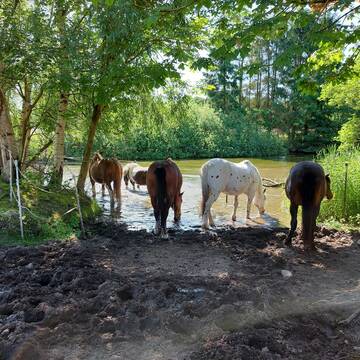
Reitanlage Zukowski
Grande
Reitanlage-Zukowski
@Reitanlage-Zukowski
FN-Mitglied
Freizeitstall
Vermieten
Hunde willkommen
Paddock
Allergikerstall
Einhornhaltung möglich
19 weitere...
S


4 bis 5 Boxen mit eigenem Paddock
Steinburg/ OT Eichede
Bärbel Tretau
@Christinenhof-Eichede
Verpachten
Longierzirkel/Roundpen
Paddock
Außenboxen
Innenbox
Selbstversorgung
10 weitere...
S
Deprecated: Creation of dynamic property Zend_View_Helper_Ads::$adLink is deprecated in /var/www/stall-frei/htdocs/staging.stall-frei.de/library/Psf/View/Helper/Ads.php on line 108

Heu aus neuer Ernte
Mechtersen
STALL-FREIde Marketing
@STALL-FREI-Marketing
Heulage und Pferdeheu aus der neuen Ernte findest du in unserem Futtermarkt

Ein schönes Pferdeleben
Schretstaken
Jessica Siemers
@Springstall
Freizeitstall
Reitlehrer und -unterricht
Vermieten
Führanlage
Krankenbox
Allergikerstall
Hengsthaltung möglich
19 weitere...
P

Offenstallplatz mit Reithalle, Trail u.v.m. frei
Gr Schretstaken
Hof am Hegesahl
@A.Papendick
Hunde willkommen
Krankenbox
Fohlenaufzucht möglich
Hengsthaltung möglich
Bewegungsstall
Laufstall
Vollpension
15 weitere...
P


Hof Meyn Reitanlage
Duvensee
Hof Meyn
@Plueschau
Freizeitstall
Vermieten
Hunde willkommen
Paddock
Zuchtstutenhaltung möglich
17 weitere...
P+

Futtersack HeuToy, Fressbremse in pink
Mechtersen
STALL-FREIde Marketing
@STALL-FREI-Marketing
Stundenlange Beschäftigung die
Koliken vorbeugt, geringe Staubinhalation mit
steuerbarer Futterentnahme
Offenstall mit Paddock-Trail
Talkau
Janina-Woller
@Janina-Woller
FN-Mitglied
Freizeitstall
Vermieten
Hunde willkommen
Krankenbox
Allergikerstall
Hufrehe geeignet
14 weitere...
P


Reit- und Traberhof Meyer
Geesthacht
Reit-und-Traberhof-Kurt-Meyer
@Reit-und-Traberhof-Kurt-Meyer
Fahrstall, Kutschwagen
FN-Mitglied
Führanlage
Hunde willkommen
Allergikerstall
Hufrehe geeignet
Außenboxen
Offenstall
19 weitere...
S

Aktivstall Boxen Offenstall Allergiker Rehe Oldies
Möhnsen
Niemanns-Peerhoff
@Niemanns-Peerhoff
Freizeitstall
Rehabilitationsstall
Vermieten
Krankenbox
Longierzirkel/Roundpen
Allergikerstall
Gnadenbrothof
26 weitere...
P

Offenstall und Box frei
Sirksfelde
Pony & Pferdeland
@Hamann
Freizeitstall
Geländestrecke
Hunde willkommen
Krankenbox
Innenbox
Offenstall
Halbpension
Vollpension
11 weitere...
P


Wir bieten ein schönes zu Hause für Ihren Liebli...
Witzhave
Hof Roßenlager
@Alexander-Feldhusen
Freizeitstall
Vermieten
Hunde willkommen
Longierzirkel/Roundpen
Außenboxen
15 weitere...
P+
Deprecated: Creation of dynamic property Zend_View::$pageCount is deprecated in /var/www/stall-frei/htdocs/staging.stall-frei.de/library/vendor/shardj/zf1-future/library/Zend/View/Abstract.php on line 308
Deprecated: Creation of dynamic property Zend_View::$itemCountPerPage is deprecated in /var/www/stall-frei/htdocs/staging.stall-frei.de/library/vendor/shardj/zf1-future/library/Zend/View/Abstract.php on line 308
Deprecated: Creation of dynamic property Zend_View::$first is deprecated in /var/www/stall-frei/htdocs/staging.stall-frei.de/library/vendor/shardj/zf1-future/library/Zend/View/Abstract.php on line 308
Deprecated: Creation of dynamic property Zend_View::$current is deprecated in /var/www/stall-frei/htdocs/staging.stall-frei.de/library/vendor/shardj/zf1-future/library/Zend/View/Abstract.php on line 308
Deprecated: Creation of dynamic property Zend_View::$last is deprecated in /var/www/stall-frei/htdocs/staging.stall-frei.de/library/vendor/shardj/zf1-future/library/Zend/View/Abstract.php on line 308
Deprecated: Creation of dynamic property Zend_View::$next is deprecated in /var/www/stall-frei/htdocs/staging.stall-frei.de/library/vendor/shardj/zf1-future/library/Zend/View/Abstract.php on line 308
Deprecated: Creation of dynamic property Zend_View::$pagesInRange is deprecated in /var/www/stall-frei/htdocs/staging.stall-frei.de/library/vendor/shardj/zf1-future/library/Zend/View/Abstract.php on line 308
Deprecated: Creation of dynamic property Zend_View::$firstPageInRange is deprecated in /var/www/stall-frei/htdocs/staging.stall-frei.de/library/vendor/shardj/zf1-future/library/Zend/View/Abstract.php on line 308
Deprecated: Creation of dynamic property Zend_View::$lastPageInRange is deprecated in /var/www/stall-frei/htdocs/staging.stall-frei.de/library/vendor/shardj/zf1-future/library/Zend/View/Abstract.php on line 308
Deprecated: Creation of dynamic property Zend_View::$currentItemCount is deprecated in /var/www/stall-frei/htdocs/staging.stall-frei.de/library/vendor/shardj/zf1-future/library/Zend/View/Abstract.php on line 308
Deprecated: Creation of dynamic property Zend_View::$totalItemCount is deprecated in /var/www/stall-frei/htdocs/staging.stall-frei.de/library/vendor/shardj/zf1-future/library/Zend/View/Abstract.php on line 308
Deprecated: Creation of dynamic property Zend_View::$firstItemNumber is deprecated in /var/www/stall-frei/htdocs/staging.stall-frei.de/library/vendor/shardj/zf1-future/library/Zend/View/Abstract.php on line 308
Deprecated: Creation of dynamic property Zend_View::$lastItemNumber is deprecated in /var/www/stall-frei/htdocs/staging.stall-frei.de/library/vendor/shardj/zf1-future/library/Zend/View/Abstract.php on line 308
Deprecated: Creation of dynamic property Zend_View::$router is deprecated in /var/www/stall-frei/htdocs/staging.stall-frei.de/library/vendor/shardj/zf1-future/library/Zend/View/Abstract.php on line 308
Deprecated: Creation of dynamic property Zend_View::$urlParams is deprecated in /var/www/stall-frei/htdocs/staging.stall-frei.de/library/vendor/shardj/zf1-future/library/Zend/View/Abstract.php on line 308
Deprecated: Creation of dynamic property Zend_View::$showAds is deprecated in /var/www/stall-frei/htdocs/staging.stall-frei.de/library/vendor/shardj/zf1-future/library/Zend/View/Abstract.php on line 308
Deprecated: Creation of dynamic property Zend_View::$objectIds is deprecated in /var/www/stall-frei/htdocs/staging.stall-frei.de/library/vendor/shardj/zf1-future/library/Zend/View/Abstract.php on line 308
Deprecated: Creation of dynamic property Zend_View::$showNavbar is deprecated in /var/www/stall-frei/htdocs/staging.stall-frei.de/library/vendor/shardj/zf1-future/library/Zend/View/Abstract.php on line 308
Deprecated: Creation of dynamic property Zend_View::$showBreadcrumb is deprecated in /var/www/stall-frei/htdocs/staging.stall-frei.de/library/vendor/shardj/zf1-future/library/Zend/View/Abstract.php on line 308
Deprecated: Creation of dynamic property Zend_View::$showFooter is deprecated in /var/www/stall-frei/htdocs/staging.stall-frei.de/library/vendor/shardj/zf1-future/library/Zend/View/Abstract.php on line 308
Deprecated: Creation of dynamic property Zend_View::$showInternalAds is deprecated in /var/www/stall-frei/htdocs/staging.stall-frei.de/library/vendor/shardj/zf1-future/library/Zend/View/Abstract.php on line 308
Deprecated: Creation of dynamic property Zend_View::$blNoContent is deprecated in /var/www/stall-frei/htdocs/staging.stall-frei.de/library/vendor/shardj/zf1-future/library/Zend/View/Abstract.php on line 308
Deprecated: Creation of dynamic property Zend_View::$sMetaDesc is deprecated in /var/www/stall-frei/htdocs/staging.stall-frei.de/library/vendor/shardj/zf1-future/library/Zend/View/Abstract.php on line 308
Deprecated: Creation of dynamic property Zend_View::$useGmaps is deprecated in /var/www/stall-frei/htdocs/staging.stall-frei.de/library/vendor/shardj/zf1-future/library/Zend/View/Abstract.php on line 308
Deprecated: Creation of dynamic property Zend_View::$touches is deprecated in /var/www/stall-frei/htdocs/staging.stall-frei.de/library/vendor/shardj/zf1-future/library/Zend/View/Abstract.php on line 308
Deprecated: Creation of dynamic property Zend_View::$oProject is deprecated in /var/www/stall-frei/htdocs/staging.stall-frei.de/library/vendor/shardj/zf1-future/library/Zend/View/Abstract.php on line 308
Deprecated: Creation of dynamic property Zend_View::$pageHeadline is deprecated in /var/www/stall-frei/htdocs/staging.stall-frei.de/library/vendor/shardj/zf1-future/library/Zend/View/Abstract.php on line 308
Deprecated: Creation of dynamic property Zend_View::$disableLocationField is deprecated in /var/www/stall-frei/htdocs/staging.stall-frei.de/library/vendor/shardj/zf1-future/library/Zend/View/Abstract.php on line 308
Deprecated: Creation of dynamic property Zend_View::$isSearch is deprecated in /var/www/stall-frei/htdocs/staging.stall-frei.de/library/vendor/shardj/zf1-future/library/Zend/View/Abstract.php on line 308
Deprecated: Creation of dynamic property Zend_View::$pageTitle is deprecated in /var/www/stall-frei/htdocs/staging.stall-frei.de/library/vendor/shardj/zf1-future/library/Zend/View/Abstract.php on line 308
Deprecated: Creation of dynamic property Psf_Form_Element_Text::$class is deprecated in /var/www/stall-frei/htdocs/staging.stall-frei.de/library/vendor/shardj/zf1-future/library/Zend/Form/Element.php on line 874
Deprecated: Creation of dynamic property Psf_Form_Element_Text::$size is deprecated in /var/www/stall-frei/htdocs/staging.stall-frei.de/library/vendor/shardj/zf1-future/library/Zend/Form/Element.php on line 874
Deprecated: Creation of dynamic property Psf_Form_Element_Text::$placeholder is deprecated in /var/www/stall-frei/htdocs/staging.stall-frei.de/library/vendor/shardj/zf1-future/library/Zend/Form/Element.php on line 874
Deprecated: Creation of dynamic property Psf_Form_Element_Hidden::$class is deprecated in /var/www/stall-frei/htdocs/staging.stall-frei.de/library/vendor/shardj/zf1-future/library/Zend/Form/Element.php on line 874
Deprecated: Creation of dynamic property Psf_Form_Element_Hidden::$class is deprecated in /var/www/stall-frei/htdocs/staging.stall-frei.de/library/vendor/shardj/zf1-future/library/Zend/Form/Element.php on line 874
Deprecated: Creation of dynamic property Psf_Form_Element_Hidden::$class is deprecated in /var/www/stall-frei/htdocs/staging.stall-frei.de/library/vendor/shardj/zf1-future/library/Zend/Form/Element.php on line 874
Deprecated: Creation of dynamic property Psf_Form_Element_Hidden::$class is deprecated in /var/www/stall-frei/htdocs/staging.stall-frei.de/library/vendor/shardj/zf1-future/library/Zend/Form/Element.php on line 874
Deprecated: Creation of dynamic property Psf_Form_Element_Select::$class is deprecated in /var/www/stall-frei/htdocs/staging.stall-frei.de/library/vendor/shardj/zf1-future/library/Zend/Form/Element.php on line 874
Deprecated: Creation of dynamic property Psf_Form_Element_Select::$class is deprecated in /var/www/stall-frei/htdocs/staging.stall-frei.de/library/vendor/shardj/zf1-future/library/Zend/Form/Element.php on line 874
Deprecated: Creation of dynamic property Psf_Form_Element_Select::$class is deprecated in /var/www/stall-frei/htdocs/staging.stall-frei.de/library/vendor/shardj/zf1-future/library/Zend/Form/Element.php on line 874
Deprecated: Creation of dynamic property Psf_Form_Element_Select::$class is deprecated in /var/www/stall-frei/htdocs/staging.stall-frei.de/library/vendor/shardj/zf1-future/library/Zend/Form/Element.php on line 874
Deprecated: Creation of dynamic property Psf_Form_Element_Text::$class is deprecated in /var/www/stall-frei/htdocs/staging.stall-frei.de/library/vendor/shardj/zf1-future/library/Zend/Form/Element.php on line 874
Deprecated: Creation of dynamic property Psf_Form_Element_Checkbox::$label is deprecated in /var/www/stall-frei/htdocs/staging.stall-frei.de/library/vendor/shardj/zf1-future/library/Zend/Form/Element.php on line 874
Deprecated: Creation of dynamic property Zend_View::$sort is deprecated in /var/www/stall-frei/htdocs/staging.stall-frei.de/library/vendor/shardj/zf1-future/library/Zend/View/Abstract.php on line 308
Deprecated: Creation of dynamic property Zend_View::$searchLocation is deprecated in /var/www/stall-frei/htdocs/staging.stall-frei.de/library/vendor/shardj/zf1-future/library/Zend/View/Abstract.php on line 308
Deprecated: Creation of dynamic property Zend_View::$locationHint is deprecated in /var/www/stall-frei/htdocs/staging.stall-frei.de/library/vendor/shardj/zf1-future/library/Zend/View/Abstract.php on line 308
Psf_GeoCoder_Abstract::getLocation: Köthel Get Location CachedOrLive
Psf_GeoCoder_Abstract::getCachedOrLive: Köthel
Psf_GeoCoder_OpenCageData::makeApiRequest: response:
Array
(
[documentation] => https://opencagedata.com/api
[licenses] => Array
(
[0] => Array
(
[name] => see attribution guide
[url] => https://opencagedata.com/credits
)
)
[results] => Array
(
[0] => Array
(
[bounds] => Array
(
[northeast] => Array
(
[lat] => 53.6179612
[lng] => 10.5305044
)
[southwest] => Array
(
[lat] => 53.6017277
[lng] => 10.4943629
)
)
[components] => Array
(
[ISO_3166-1_alpha-2] => DE
[ISO_3166-1_alpha-3] => DEU
[ISO_3166-2] => Array
(
[0] => DE-SH
)
[_category] => place
[_normalized_city] => Köthel (Lauenburg)
[_type] => village
[continent] => Europe
[country] => Deutschland
[country_code] => de
[county] => Kreis Herzogtum Lauenburg
[municipality] => Schwarzenbek-Land
[political_union] => European Union
[state] => Schleswig-Holstein
[state_code] => SH
[village] => Köthel (Lauenburg)
)
[confidence] => 7
[formatted] => Köthel (Lauenburg), Schleswig-Holstein, Deutschland
[geometry] => Array
(
[lat] => 53.6082248
[lng] => 10.5105236
)
)
[1] => Array
(
[bounds] => Array
(
[northeast] => Array
(
[lat] => 53.6292888
[lng] => 10.5154914
)
[southwest] => Array
(
[lat] => 53.600297
[lng] => 10.4793214
)
)
[components] => Array
(
[ISO_3166-1_alpha-2] => DE
[ISO_3166-1_alpha-3] => DEU
[ISO_3166-2] => Array
(
[0] => DE-SH
)
[_category] => place
[_normalized_city] => Köthel (Stormarn)
[_type] => village
[continent] => Europe
[country] => Deutschland
[country_code] => de
[county] => Kreis Stormarn
[municipality] => Trittau
[political_union] => European Union
[state] => Schleswig-Holstein
[state_code] => SH
[village] => Köthel (Stormarn)
)
[confidence] => 7
[formatted] => Köthel (Stormarn), Schleswig-Holstein, Deutschland
[geometry] => Array
(
[lat] => 53.6096353
[lng] => 10.5084507
)
)
[2] => Array
(
[bounds] => Array
(
[northeast] => Array
(
[lat] => 50.8937146
[lng] => 12.4929886
)
[southwest] => Array
(
[lat] => 50.8537146
[lng] => 12.4529886
)
)
[components] => Array
(
[ISO_3166-1_alpha-2] => DE
[ISO_3166-1_alpha-3] => DEU
[ISO_3166-2] => Array
(
[0] => DE-SN
)
[_category] => place
[_normalized_city] => Köthel
[_type] => village
[continent] => Europe
[country] => Deutschland
[country_code] => de
[county] => Zwickau
[municipality] => Meerane-Schönberg
[political_union] => European Union
[postcode] => 08393
[state] => Sachsen
[state_code] => SN
[town] => Köthel
[village] => Schönberg
)
[confidence] => 7
[formatted] => 08393 Schönberg, Deutschland
[geometry] => Array
(
[lat] => 50.8737146
[lng] => 12.4729886
)
)
[3] => Array
(
[components] => Array
(
[ISO_3166-1_alpha-2] => FR
[ISO_3166-1_alpha-3] => FRA
[ISO_3166-2] => Array
(
[0] => FR-BFC
[1] => FR-25
)
[_category] => road
[_normalized_city] => Montperreux
[_type] => road
[city] => Montperreux
[continent] => Europe
[country] => France
[country_code] => fr
[county] => Doubs
[local_authority] => Communauté de communes des Lacs et Montagnes du Haut-Doubs
[political_union] => European Union
[postcode] => 25160
[road] => Chemin de la Cotelle
[state] => Bourgogne-Franche-Comté
[state_code] => BFC
)
[confidence] => 2
[formatted] => Chemin de la Cotelle, 25160 Montperreux, France
[geometry] => Array
(
[lat] => 46.811835
[lng] => 6.32162
)
)
[4] => Array
(
[components] => Array
(
[ISO_3166-1_alpha-2] => FR
[ISO_3166-1_alpha-3] => FRA
[ISO_3166-2] => Array
(
[0] => FR-GES
[1] => FR-54
)
[_category] => road
[_normalized_city] => Lay-Saint-Christophe
[_type] => road
[city] => Lay-Saint-Christophe
[continent] => Europe
[country] => France
[country_code] => fr
[county] => Meurthe-et-Moselle
[local_authority] => Communauté de communes du Bassin de Pompey
[political_union] => European Union
[postcode] => 54690
[road] => Chemin des Cotel
[state] => Grand Est
[state_code] => GES
)
[confidence] => 2
[formatted] => Chemin des Cotel, 54690 Lay-Saint-Christophe, France
[geometry] => Array
(
[lat] => 48.75477
[lng] => 6.198481
)
)
[5] => Array
(
[components] => Array
(
[ISO_3166-1_alpha-2] => FR
[ISO_3166-1_alpha-3] => FRA
[ISO_3166-2] => Array
(
[0] => FR-GES
[1] => FR-10
)
[_category] => road
[_normalized_city] => Thieffrain
[_type] => road
[city] => Thieffrain
[continent] => Europe
[country] => France
[country_code] => fr
[county] => Aube
[local_authority] => Communauté de communes du Barséquanais en Champagne
[political_union] => European Union
[postcode] => 10140
[road] => Chemin de la Cotelle
[state] => Grand Est
[state_code] => GES
)
[confidence] => 2
[formatted] => Chemin de la Cotelle, 10140 Thieffrain, France
[geometry] => Array
(
[lat] => 48.196684
[lng] => 4.438589
)
)
[6] => Array
(
[components] => Array
(
[ISO_3166-1_alpha-2] => FR
[ISO_3166-1_alpha-3] => FRA
[ISO_3166-2] => Array
(
[0] => FR-GES
[1] => FR-51
)
[_category] => road
[_normalized_city] => Épernay
[_type] => road
[city] => Épernay
[continent] => Europe
[country] => France
[country_code] => fr
[county] => Marne
[local_authority] => Communauté d'agglomération Épernay, Coteaux et Plaine de Champagne
[political_union] => European Union
[postcode] => 51200
[road] => Chemin des Cotelles
[state] => Grand Est
[state_code] => GES
)
[confidence] => 2
[formatted] => Chemin des Cotelles, 51200 Épernay, France
[geometry] => Array
(
[lat] => 49.042857
[lng] => 3.945897
)
)
[7] => Array
(
[components] => Array
(
[ISO_3166-1_alpha-2] => FR
[ISO_3166-1_alpha-3] => FRA
[ISO_3166-2] => Array
(
[0] => FR-GES
[1] => FR-54
)
[_category] => road
[_normalized_city] => Lagney
[_type] => road
[city] => Lagney
[continent] => Europe
[country] => France
[country_code] => fr
[county] => Meurthe-et-Moselle
[local_authority] => Communauté de communes Terres Touloises
[political_union] => European Union
[postcode] => 54200
[road] => Chemin des Côtelles
[state] => Grand Est
[state_code] => GES
)
[confidence] => 2
[formatted] => Chemin des Côtelles, 54200 Lagney, France
[geometry] => Array
(
[lat] => 48.730371
[lng] => 5.837841
)
)
[8] => Array
(
[components] => Array
(
[ISO_3166-1_alpha-2] => FR
[ISO_3166-1_alpha-3] => FRA
[ISO_3166-2] => Array
(
[0] => FR-GES
[1] => FR-10
)
[_category] => road
[_normalized_city] => Bossancourt
[_type] => road
[city] => Bossancourt
[continent] => Europe
[country] => France
[country_code] => fr
[county] => Aube
[local_authority] => Communauté de communes de Vendeuvre-Soulaines
[political_union] => European Union
[postcode] => 10140
[road] => Chemin des Cotelles
[state] => Grand Est
[state_code] => GES
)
[confidence] => 2
[formatted] => Chemin des Cotelles, 10140 Bossancourt, France
[geometry] => Array
(
[lat] => 48.284395
[lng] => 4.600805
)
)
[9] => Array
(
[components] => Array
(
[ISO_3166-1_alpha-2] => FR
[ISO_3166-1_alpha-3] => FRA
[ISO_3166-2] => Array
(
[0] => FR-GES
[1] => FR-88
)
[_category] => road
[_normalized_city] => Éloyes
[_type] => road
[city] => Éloyes
[continent] => Europe
[country] => France
[country_code] => fr
[county] => Vosges
[local_authority] => Communauté de communes de la Porte des Vosges Méridionales
[political_union] => European Union
[postcode] => 88510
[road] => Rue de la Cotelle
[state] => Grand Est
[state_code] => GES
)
[confidence] => 2
[formatted] => Rue de la Cotelle, 88510 Éloyes, France
[geometry] => Array
(
[lat] => 48.097331
[lng] => 6.603491
)
)
)
[status] => Array
(
[code] => 200
[message] => OK
)
[stay_informed] => Array
(
[blog] => https://blog.opencagedata.com
[mastodon] => https://en.osm.town/@opencage
)
[thanks] => For using an OpenCage API
[timestamp] => Array
(
[created_http] => Sun, 08 Feb 2026 11:55:31 GMT
[created_unix] => 1770551731
)
[total_results] => 10
)
Psf_GeoCoder_Abstract::convertLocationResult
{"documentation":"https:\/\/opencagedata.com\/api","licenses":[{"name":"see attribution guide","url":"https:\/\/opencagedata.com\/credits"}],"results":[{"bounds":{"northeast":{"lat":53.6179612,"lng":10.5305044},"southwest":{"lat":53.6017277,"lng":10.4943629}},"components":{"ISO_3166-1_alpha-2":"DE","ISO_3166-1_alpha-3":"DEU","ISO_3166-2":["DE-SH"],"_category":"place","_normalized_city":"K\u00f6thel (Lauenburg)","_type":"village","continent":"Europe","country":"Deutschland","country_code":"de","county":"Kreis Herzogtum Lauenburg","municipality":"Schwarzenbek-Land","political_union":"European Union","state":"Schleswig-Holstein","state_code":"SH","village":"K\u00f6thel (Lauenburg)"},"confidence":7,"formatted":"K\u00f6thel (Lauenburg), Schleswig-Holstein, Deutschland","geometry":{"lat":53.6082248,"lng":10.5105236}},{"bounds":{"northeast":{"lat":53.6292888,"lng":10.5154914},"southwest":{"lat":53.600297,"lng":10.4793214}},"components":{"ISO_3166-1_alpha-2":"DE","ISO_3166-1_alpha-3":"DEU","ISO_3166-2":["DE-SH"],"_category":"place","_normalized_city":"K\u00f6thel (Stormarn)","_type":"village","continent":"Europe","country":"Deutschland","country_code":"de","county":"Kreis Stormarn","municipality":"Trittau","political_union":"European Union","state":"Schleswig-Holstein","state_code":"SH","village":"K\u00f6thel (Stormarn)"},"confidence":7,"formatted":"K\u00f6thel (Stormarn), Schleswig-Holstein, Deutschland","geometry":{"lat":53.6096353,"lng":10.5084507}},{"bounds":{"northeast":{"lat":50.8937146,"lng":12.4929886},"southwest":{"lat":50.8537146,"lng":12.4529886}},"components":{"ISO_3166-1_alpha-2":"DE","ISO_3166-1_alpha-3":"DEU","ISO_3166-2":["DE-SN"],"_category":"place","_normalized_city":"K\u00f6thel","_type":"village","continent":"Europe","country":"Deutschland","country_code":"de","county":"Zwickau","municipality":"Meerane-Sch\u00f6nberg","political_union":"European Union","postcode":"08393","state":"Sachsen","state_code":"SN","town":"K\u00f6thel","village":"Sch\u00f6nberg"},"confidence":7,"formatted":"08393 Sch\u00f6nberg, Deutschland","geometry":{"lat":50.8737146,"lng":12.4729886}},{"components":{"ISO_3166-1_alpha-2":"FR","ISO_3166-1_alpha-3":"FRA","ISO_3166-2":["FR-BFC","FR-25"],"_category":"road","_normalized_city":"Montperreux","_type":"road","city":"Montperreux","continent":"Europe","country":"France","country_code":"fr","county":"Doubs","local_authority":"Communaut\u00e9 de communes des Lacs et Montagnes du Haut-Doubs","political_union":"European Union","postcode":"25160","road":"Chemin de la Cotelle","state":"Bourgogne-Franche-Comt\u00e9","state_code":"BFC"},"confidence":2,"formatted":"Chemin de la Cotelle, 25160 Montperreux, France","geometry":{"lat":46.811835,"lng":6.32162}},{"components":{"ISO_3166-1_alpha-2":"FR","ISO_3166-1_alpha-3":"FRA","ISO_3166-2":["FR-GES","FR-54"],"_category":"road","_normalized_city":"Lay-Saint-Christophe","_type":"road","city":"Lay-Saint-Christophe","continent":"Europe","country":"France","country_code":"fr","county":"Meurthe-et-Moselle","local_authority":"Communaut\u00e9 de communes du Bassin de Pompey","political_union":"European Union","postcode":"54690","road":"Chemin des Cotel","state":"Grand Est","state_code":"GES"},"confidence":2,"formatted":"Chemin des Cotel, 54690 Lay-Saint-Christophe, France","geometry":{"lat":48.75477,"lng":6.198481}},{"components":{"ISO_3166-1_alpha-2":"FR","ISO_3166-1_alpha-3":"FRA","ISO_3166-2":["FR-GES","FR-10"],"_category":"road","_normalized_city":"Thieffrain","_type":"road","city":"Thieffrain","continent":"Europe","country":"France","country_code":"fr","county":"Aube","local_authority":"Communaut\u00e9 de communes du Bars\u00e9quanais en Champagne","political_union":"European Union","postcode":"10140","road":"Chemin de la Cotelle","state":"Grand Est","state_code":"GES"},"confidence":2,"formatted":"Chemin de la Cotelle, 10140 Thieffrain, France","geometry":{"lat":48.196684,"lng":4.438589}},{"components":{"ISO_3166-1_alpha-2":"FR","ISO_3166-1_alpha-3":"FRA","ISO_3166-2":["FR-GES","FR-51"],"_category":"road","_normalized_city":"\u00c9pernay","_type":"road","city":"\u00c9pernay","continent":"Europe","country":"France","country_code":"fr","county":"Marne","local_authority":"Communaut\u00e9 d'agglom\u00e9ration \u00c9pernay, Coteaux et Plaine de Champagne","political_union":"European Union","postcode":"51200","road":"Chemin des Cotelles","state":"Grand Est","state_code":"GES"},"confidence":2,"formatted":"Chemin des Cotelles, 51200 \u00c9pernay, France","geometry":{"lat":49.042857,"lng":3.945897}},{"components":{"ISO_3166-1_alpha-2":"FR","ISO_3166-1_alpha-3":"FRA","ISO_3166-2":["FR-GES","FR-54"],"_category":"road","_normalized_city":"Lagney","_type":"road","city":"Lagney","continent":"Europe","country":"France","country_code":"fr","county":"Meurthe-et-Moselle","local_authority":"Communaut\u00e9 de communes Terres Touloises","political_union":"European Union","postcode":"54200","road":"Chemin des C\u00f4telles","state":"Grand Est","state_code":"GES"},"confidence":2,"formatted":"Chemin des C\u00f4telles, 54200 Lagney, France","geometry":{"lat":48.730371,"lng":5.837841}},{"components":{"ISO_3166-1_alpha-2":"FR","ISO_3166-1_alpha-3":"FRA","ISO_3166-2":["FR-GES","FR-10"],"_category":"road","_normalized_city":"Bossancourt","_type":"road","city":"Bossancourt","continent":"Europe","country":"France","country_code":"fr","county":"Aube","local_authority":"Communaut\u00e9 de communes de Vendeuvre-Soulaines","political_union":"European Union","postcode":"10140","road":"Chemin des Cotelles","state":"Grand Est","state_code":"GES"},"confidence":2,"formatted":"Chemin des Cotelles, 10140 Bossancourt, France","geometry":{"lat":48.284395,"lng":4.600805}},{"components":{"ISO_3166-1_alpha-2":"FR","ISO_3166-1_alpha-3":"FRA","ISO_3166-2":["FR-GES","FR-88"],"_category":"road","_normalized_city":"\u00c9loyes","_type":"road","city":"\u00c9loyes","continent":"Europe","country":"France","country_code":"fr","county":"Vosges","local_authority":"Communaut\u00e9 de communes de la Porte des Vosges M\u00e9ridionales","political_union":"European Union","postcode":"88510","road":"Rue de la Cotelle","state":"Grand Est","state_code":"GES"},"confidence":2,"formatted":"Rue de la Cotelle, 88510 \u00c9loyes, France","geometry":{"lat":48.097331,"lng":6.603491}}],"status":{"code":200,"message":"OK"},"stay_informed":{"blog":"https:\/\/blog.opencagedata.com","mastodon":"https:\/\/en.osm.town\/@opencage"},"thanks":"For using an OpenCage API","timestamp":{"created_http":"Sun, 08 Feb 2026 11:55:31 GMT","created_unix":1770551731},"total_results":10}Array
(
[0] => stdClass Object
(
[bounds] => stdClass Object
(
[northeast] => stdClass Object
(
[lat] => 53.6179612
[lng] => 10.5305044
)
[southwest] => stdClass Object
(
[lat] => 53.6017277
[lng] => 10.4943629
)
)
[components] => stdClass Object
(
[ISO_3166-1_alpha-2] => DE
[ISO_3166-1_alpha-3] => DEU
[ISO_3166-2] => Array
(
[0] => DE-SH
)
[_category] => place
[_normalized_city] => Köthel (Lauenburg)
[_type] => village
[continent] => Europe
[country] => Deutschland
[country_code] => de
[county] => Kreis Herzogtum Lauenburg
[municipality] => Schwarzenbek-Land
[political_union] => European Union
[state] => Schleswig-Holstein
[state_code] => SH
[village] => Köthel (Lauenburg)
)
[confidence] => 7
[formatted] => Köthel (Lauenburg), Schleswig-Holstein, Deutschland
[geometry] => stdClass Object
(
[lat] => 53.6082248
[lng] => 10.5105236
)
)
[1] => stdClass Object
(
[bounds] => stdClass Object
(
[northeast] => stdClass Object
(
[lat] => 53.6292888
[lng] => 10.5154914
)
[southwest] => stdClass Object
(
[lat] => 53.600297
[lng] => 10.4793214
)
)
[components] => stdClass Object
(
[ISO_3166-1_alpha-2] => DE
[ISO_3166-1_alpha-3] => DEU
[ISO_3166-2] => Array
(
[0] => DE-SH
)
[_category] => place
[_normalized_city] => Köthel (Stormarn)
[_type] => village
[continent] => Europe
[country] => Deutschland
[country_code] => de
[county] => Kreis Stormarn
[municipality] => Trittau
[political_union] => European Union
[state] => Schleswig-Holstein
[state_code] => SH
[village] => Köthel (Stormarn)
)
[confidence] => 7
[formatted] => Köthel (Stormarn), Schleswig-Holstein, Deutschland
[geometry] => stdClass Object
(
[lat] => 53.6096353
[lng] => 10.5084507
)
)
[2] => stdClass Object
(
[bounds] => stdClass Object
(
[northeast] => stdClass Object
(
[lat] => 50.8937146
[lng] => 12.4929886
)
[southwest] => stdClass Object
(
[lat] => 50.8537146
[lng] => 12.4529886
)
)
[components] => stdClass Object
(
[ISO_3166-1_alpha-2] => DE
[ISO_3166-1_alpha-3] => DEU
[ISO_3166-2] => Array
(
[0] => DE-SN
)
[_category] => place
[_normalized_city] => Köthel
[_type] => village
[continent] => Europe
[country] => Deutschland
[country_code] => de
[county] => Zwickau
[municipality] => Meerane-Schönberg
[political_union] => European Union
[postcode] => 08393
[state] => Sachsen
[state_code] => SN
[town] => Köthel
[village] => Schönberg
)
[confidence] => 7
[formatted] => 08393 Schönberg, Deutschland
[geometry] => stdClass Object
(
[lat] => 50.8737146
[lng] => 12.4729886
)
)
[3] => stdClass Object
(
[components] => stdClass Object
(
[ISO_3166-1_alpha-2] => FR
[ISO_3166-1_alpha-3] => FRA
[ISO_3166-2] => Array
(
[0] => FR-BFC
[1] => FR-25
)
[_category] => road
[_normalized_city] => Montperreux
[_type] => road
[city] => Montperreux
[continent] => Europe
[country] => France
[country_code] => fr
[county] => Doubs
[local_authority] => Communauté de communes des Lacs et Montagnes du Haut-Doubs
[political_union] => European Union
[postcode] => 25160
[road] => Chemin de la Cotelle
[state] => Bourgogne-Franche-Comté
[state_code] => BFC
)
[confidence] => 2
[formatted] => Chemin de la Cotelle, 25160 Montperreux, France
[geometry] => stdClass Object
(
[lat] => 46.811835
[lng] => 6.32162
)
)
[4] => stdClass Object
(
[components] => stdClass Object
(
[ISO_3166-1_alpha-2] => FR
[ISO_3166-1_alpha-3] => FRA
[ISO_3166-2] => Array
(
[0] => FR-GES
[1] => FR-54
)
[_category] => road
[_normalized_city] => Lay-Saint-Christophe
[_type] => road
[city] => Lay-Saint-Christophe
[continent] => Europe
[country] => France
[country_code] => fr
[county] => Meurthe-et-Moselle
[local_authority] => Communauté de communes du Bassin de Pompey
[political_union] => European Union
[postcode] => 54690
[road] => Chemin des Cotel
[state] => Grand Est
[state_code] => GES
)
[confidence] => 2
[formatted] => Chemin des Cotel, 54690 Lay-Saint-Christophe, France
[geometry] => stdClass Object
(
[lat] => 48.75477
[lng] => 6.198481
)
)
[5] => stdClass Object
(
[components] => stdClass Object
(
[ISO_3166-1_alpha-2] => FR
[ISO_3166-1_alpha-3] => FRA
[ISO_3166-2] => Array
(
[0] => FR-GES
[1] => FR-10
)
[_category] => road
[_normalized_city] => Thieffrain
[_type] => road
[city] => Thieffrain
[continent] => Europe
[country] => France
[country_code] => fr
[county] => Aube
[local_authority] => Communauté de communes du Barséquanais en Champagne
[political_union] => European Union
[postcode] => 10140
[road] => Chemin de la Cotelle
[state] => Grand Est
[state_code] => GES
)
[confidence] => 2
[formatted] => Chemin de la Cotelle, 10140 Thieffrain, France
[geometry] => stdClass Object
(
[lat] => 48.196684
[lng] => 4.438589
)
)
[6] => stdClass Object
(
[components] => stdClass Object
(
[ISO_3166-1_alpha-2] => FR
[ISO_3166-1_alpha-3] => FRA
[ISO_3166-2] => Array
(
[0] => FR-GES
[1] => FR-51
)
[_category] => road
[_normalized_city] => Épernay
[_type] => road
[city] => Épernay
[continent] => Europe
[country] => France
[country_code] => fr
[county] => Marne
[local_authority] => Communauté d'agglomération Épernay, Coteaux et Plaine de Champagne
[political_union] => European Union
[postcode] => 51200
[road] => Chemin des Cotelles
[state] => Grand Est
[state_code] => GES
)
[confidence] => 2
[formatted] => Chemin des Cotelles, 51200 Épernay, France
[geometry] => stdClass Object
(
[lat] => 49.042857
[lng] => 3.945897
)
)
[7] => stdClass Object
(
[components] => stdClass Object
(
[ISO_3166-1_alpha-2] => FR
[ISO_3166-1_alpha-3] => FRA
[ISO_3166-2] => Array
(
[0] => FR-GES
[1] => FR-54
)
[_category] => road
[_normalized_city] => Lagney
[_type] => road
[city] => Lagney
[continent] => Europe
[country] => France
[country_code] => fr
[county] => Meurthe-et-Moselle
[local_authority] => Communauté de communes Terres Touloises
[political_union] => European Union
[postcode] => 54200
[road] => Chemin des Côtelles
[state] => Grand Est
[state_code] => GES
)
[confidence] => 2
[formatted] => Chemin des Côtelles, 54200 Lagney, France
[geometry] => stdClass Object
(
[lat] => 48.730371
[lng] => 5.837841
)
)
[8] => stdClass Object
(
[components] => stdClass Object
(
[ISO_3166-1_alpha-2] => FR
[ISO_3166-1_alpha-3] => FRA
[ISO_3166-2] => Array
(
[0] => FR-GES
[1] => FR-10
)
[_category] => road
[_normalized_city] => Bossancourt
[_type] => road
[city] => Bossancourt
[continent] => Europe
[country] => France
[country_code] => fr
[county] => Aube
[local_authority] => Communauté de communes de Vendeuvre-Soulaines
[political_union] => European Union
[postcode] => 10140
[road] => Chemin des Cotelles
[state] => Grand Est
[state_code] => GES
)
[confidence] => 2
[formatted] => Chemin des Cotelles, 10140 Bossancourt, France
[geometry] => stdClass Object
(
[lat] => 48.284395
[lng] => 4.600805
)
)
[9] => stdClass Object
(
[components] => stdClass Object
(
[ISO_3166-1_alpha-2] => FR
[ISO_3166-1_alpha-3] => FRA
[ISO_3166-2] => Array
(
[0] => FR-GES
[1] => FR-88
)
[_category] => road
[_normalized_city] => Éloyes
[_type] => road
[city] => Éloyes
[continent] => Europe
[country] => France
[country_code] => fr
[county] => Vosges
[local_authority] => Communauté de communes de la Porte des Vosges Méridionales
[political_union] => European Union
[postcode] => 88510
[road] => Rue de la Cotelle
[state] => Grand Est
[state_code] => GES
)
[confidence] => 2
[formatted] => Rue de la Cotelle, 88510 Éloyes, France
[geometry] => stdClass Object
(
[lat] => 48.097331
[lng] => 6.603491
)
)
)
Psf_GeoCoder_OpenCageData::getKeyMap: 0
stdClass Object
(
    [bounds] => stdClass Object
        (
            [northeast] => stdClass Object
                (
                    [lat] => 53.6179612
                    [lng] => 10.5305044
                )

            [southwest] => stdClass Object
                (
                    [lat] => 53.6017277
                    [lng] => 10.4943629
                )

        )

    [components] => stdClass Object
        (
            [ISO_3166-1_alpha-2] => DE
            [ISO_3166-1_alpha-3] => DEU
            [ISO_3166-2] => Array
                (
                    [0] => DE-SH
                )

            [_category] => place
            [_normalized_city] => Köthel (Lauenburg)
            [_type] => village
            [continent] => Europe
            [country] => Deutschland
            [country_code] => de
            [county] => Kreis Herzogtum Lauenburg
            [municipality] => Schwarzenbek-Land
            [political_union] => European Union
            [state] => Schleswig-Holstein
            [state_code] => SH
            [village] => Köthel (Lauenburg)
        )

    [confidence] => 7
    [formatted] => Köthel (Lauenburg), Schleswig-Holstein, Deutschland
    [geometry] => stdClass Object
        (
            [lat] => 53.6082248
            [lng] => 10.5105236
        )

)
Psf_GeoCoder_OpenCageData::getCounty: Herzogtum Lauenburg
Psf_GeoCoder_OpenCageData::addMissingData REFETCH!
Array
(
    [address] => Köthel (Lauenburg), Schleswig-Holstein, Deutschland
    [type] => village
    [street] =>
    [city] => Köthel (Lauenburg)
    [county] => Herzogtum Lauenburg
    [state] => Schleswig-Holstein
    [zip] =>
    [country] => Deutschland
    [suburb] =>
    [countrycode] => de
    [latitude] => 53.6082248
    [longitude] => 10.5105236
    [accuracy] => 1
    [confidence] => 7
    [bounds] => stdClass Object
        (
            [northeast] => stdClass Object
                (
                    [lat] => 53.6179612
                    [lng] => 10.5305044
                )

            [southwest] => stdClass Object
                (
                    [lat] => 53.6017277
                    [lng] => 10.4943629
                )

        )

)
reformat!
Array
(
    [address] => Köthel (Lauenburg), Schleswig-Holstein, Deutschland
    [type] => village
    [street] =>
    [city] => Köthel (Lauenburg)
    [county] => Herzogtum Lauenburg
    [state] => Schleswig-Holstein
    [zip] =>
    [country] => Deutschland
    [suburb] =>
    [countrycode] => de
    [latitude] => 53.6082248
    [longitude] => 10.5105236
    [accuracy] => 1
    [confidence] => 7
    [bounds] => stdClass Object
        (
            [northeast] => stdClass Object
                (
                    [lat] => 53.6179612
                    [lng] => 10.5305044
                )

            [southwest] => stdClass Object
                (
                    [lat] => 53.6017277
                    [lng] => 10.4943629
                )

        )

    [place] => Köthel (Lauenburg), Schleswig-Holstein
    [hash] => 447c5d72ff3653eb8f18cebefdc53b00
)
Psf_GeoCoder_OpenCageData::getKeyMap: 1
stdClass Object
(
    [bounds] => stdClass Object
        (
            [northeast] => stdClass Object
                (
                    [lat] => 53.6292888
                    [lng] => 10.5154914
                )

            [southwest] => stdClass Object
                (
                    [lat] => 53.600297
                    [lng] => 10.4793214
                )

        )

    [components] => stdClass Object
        (
            [ISO_3166-1_alpha-2] => DE
            [ISO_3166-1_alpha-3] => DEU
            [ISO_3166-2] => Array
                (
                    [0] => DE-SH
                )

            [_category] => place
            [_normalized_city] => Köthel (Stormarn)
            [_type] => village
            [continent] => Europe
            [country] => Deutschland
            [country_code] => de
            [county] => Kreis Stormarn
            [municipality] => Trittau
            [political_union] => European Union
            [state] => Schleswig-Holstein
            [state_code] => SH
            [village] => Köthel (Stormarn)
        )

    [confidence] => 7
    [formatted] => Köthel (Stormarn), Schleswig-Holstein, Deutschland
    [geometry] => stdClass Object
        (
            [lat] => 53.6096353
            [lng] => 10.5084507
        )

)
Psf_GeoCoder_OpenCageData::getCounty: Stormarn
Psf_GeoCoder_OpenCageData::addMissingData REFETCH!
Array
(
    [address] => Köthel (Stormarn), Schleswig-Holstein, Deutschland
    [type] => village
    [street] =>
    [city] => Köthel (Stormarn)
    [county] => Stormarn
    [state] => Schleswig-Holstein
    [zip] =>
    [country] => Deutschland
    [suburb] =>
    [countrycode] => de
    [latitude] => 53.6096353
    [longitude] => 10.5084507
    [accuracy] => 1
    [confidence] => 7
    [bounds] => stdClass Object
        (
            [northeast] => stdClass Object
                (
                    [lat] => 53.6292888
                    [lng] => 10.5154914
                )

            [southwest] => stdClass Object
                (
                    [lat] => 53.600297
                    [lng] => 10.4793214
                )

        )

)
reformat!
Array
(
    [address] => Köthel (Stormarn), Schleswig-Holstein, Deutschland
    [type] => village
    [street] =>
    [city] => Köthel (Stormarn)
    [county] => Stormarn
    [state] => Schleswig-Holstein
    [zip] =>
    [country] => Deutschland
    [suburb] =>
    [countrycode] => de
    [latitude] => 53.6096353
    [longitude] => 10.5084507
    [accuracy] => 1
    [confidence] => 7
    [bounds] => stdClass Object
        (
            [northeast] => stdClass Object
                (
                    [lat] => 53.6292888
                    [lng] => 10.5154914
                )

            [southwest] => stdClass Object
                (
                    [lat] => 53.600297
                    [lng] => 10.4793214
                )

        )

    [place] => Köthel (Stormarn), Schleswig-Holstein
    [hash] => a8a12e808ca4e3b463dff87c1439939c
)
Psf_GeoCoder_OpenCageData::getKeyMap: 2
stdClass Object
(
    [bounds] => stdClass Object
        (
            [northeast] => stdClass Object
                (
                    [lat] => 50.8937146
                    [lng] => 12.4929886
                )

            [southwest] => stdClass Object
                (
                    [lat] => 50.8537146
                    [lng] => 12.4529886
                )

        )

    [components] => stdClass Object
        (
            [ISO_3166-1_alpha-2] => DE
            [ISO_3166-1_alpha-3] => DEU
            [ISO_3166-2] => Array
                (
                    [0] => DE-SN
                )

            [_category] => place
            [_normalized_city] => Köthel
            [_type] => village
            [continent] => Europe
            [country] => Deutschland
            [country_code] => de
            [county] => Zwickau
            [municipality] => Meerane-Schönberg
            [political_union] => European Union
            [postcode] => 08393
            [state] => Sachsen
            [state_code] => SN
            [town] => Köthel
            [village] => Schönberg
        )

    [confidence] => 7
    [formatted] => 08393 Schönberg, Deutschland
    [geometry] => stdClass Object
        (
            [lat] => 50.8737146
            [lng] => 12.4729886
        )

)
Psf_GeoCoder_OpenCageData::getCounty: Zwickau
Psf_GeoCoder_OpenCageData::addMissingData REFETCH!
Array
(
    [address] => 08393 Schönberg, Deutschland
    [type] => village
    [street] =>
    [city] => Köthel
    [county] => Zwickau
    [state] => Sachsen
    [zip] => 08393
    [country] => Deutschland
    [suburb] =>
    [countrycode] => de
    [latitude] => 50.8737146
    [longitude] => 12.4729886
    [accuracy] => 1
    [confidence] => 7
    [bounds] => stdClass Object
        (
            [northeast] => stdClass Object
                (
                    [lat] => 50.8937146
                    [lng] => 12.4929886
                )

            [southwest] => stdClass Object
                (
                    [lat] => 50.8537146
                    [lng] => 12.4529886
                )

        )

)
reformat!
Array
(
    [address] => 08393 Köthel
    [type] => village
    [street] =>
    [city] => Köthel
    [county] => Zwickau
    [state] => Sachsen
    [zip] => 08393
    [country] => Deutschland
    [suburb] =>
    [countrycode] => de
    [latitude] => 50.8737146
    [longitude] => 12.4729886
    [accuracy] => 1
    [confidence] => 7
    [bounds] => stdClass Object
        (
            [northeast] => stdClass Object
                (
                    [lat] => 50.8937146
                    [lng] => 12.4929886
                )

            [southwest] => stdClass Object
                (
                    [lat] => 50.8537146
                    [lng] => 12.4529886
                )

        )

    [place] => 08393 Köthel, Sachsen
    [hash] => a22655119ef523bae7bd5ac933d82b20
)
Psf_GeoCoder_OpenCageData::getKeyMap: 3
stdClass Object
(
    [components] => stdClass Object
        (
            [ISO_3166-1_alpha-2] => FR
            [ISO_3166-1_alpha-3] => FRA
            [ISO_3166-2] => Array
                (
                    [0] => FR-BFC
                    [1] => FR-25
                )

            [_category] => road
            [_normalized_city] => Montperreux
            [_type] => road
            [city] => Montperreux
            [continent] => Europe
            [country] => France
            [country_code] => fr
            [county] => Doubs
            [local_authority] => Communauté de communes des Lacs et Montagnes du Haut-Doubs
            [political_union] => European Union
            [postcode] => 25160
            [road] => Chemin de la Cotelle
            [state] => Bourgogne-Franche-Comté
            [state_code] => BFC
        )

    [confidence] => 2
    [formatted] => Chemin de la Cotelle, 25160 Montperreux, France
    [geometry] => stdClass Object
        (
            [lat] => 46.811835
            [lng] => 6.32162
        )

)
Psf_GeoCoder_OpenCageData::getCounty: Doubs
Psf_GeoCoder_OpenCageData::addMissingData REFETCH!
Array
(
    [address] => Chemin de la Cotelle, 25160 Montperreux, France
    [type] => road
    [street] => Chemin de la Cotelle
    [city] => Montperreux
    [county] => Doubs
    [state] => Bourgogne-Franche-Comté
    [zip] => 25160
    [country] => France
    [suburb] =>
    [countrycode] => fr
    [latitude] => 46.811835
    [longitude] => 6.32162
    [accuracy] => 1
    [confidence] => 2
    [bounds] =>
)
reformat!
Array
(
    [address] => Chemin de la Cotelle, 25160 Montperreux, France
    [type] => road
    [street] => Chemin de la Cotelle
    [city] => Montperreux
    [county] => Doubs
    [state] => Bourgogne-Franche-Comté
    [zip] => 25160
    [country] => France
    [suburb] =>
    [countrycode] => fr
    [latitude] => 46.811835
    [longitude] => 6.32162
    [accuracy] => 1
    [confidence] => 2
    [bounds] =>
    [place] => Chemin de la Cotelle, 25160 Montperreux, Bourgogne-Franche-Comté
    [hash] => 57a2c521031438e78f660bb86ff47050
)
Psf_GeoCoder_OpenCageData::getKeyMap: 4
stdClass Object
(
    [components] => stdClass Object
        (
            [ISO_3166-1_alpha-2] => FR
            [ISO_3166-1_alpha-3] => FRA
            [ISO_3166-2] => Array
                (
                    [0] => FR-GES
                    [1] => FR-54
                )

            [_category] => road
            [_normalized_city] => Lay-Saint-Christophe
            [_type] => road
            [city] => Lay-Saint-Christophe
            [continent] => Europe
            [country] => France
            [country_code] => fr
            [county] => Meurthe-et-Moselle
            [local_authority] => Communauté de communes du Bassin de Pompey
            [political_union] => European Union
            [postcode] => 54690
            [road] => Chemin des Cotel
            [state] => Grand Est
            [state_code] => GES
        )

    [confidence] => 2
    [formatted] => Chemin des Cotel, 54690 Lay-Saint-Christophe, France
    [geometry] => stdClass Object
        (
            [lat] => 48.75477
            [lng] => 6.198481
        )

)
Psf_GeoCoder_OpenCageData::getCounty: Meurthe-et-Moselle
Psf_GeoCoder_OpenCageData::addMissingData REFETCH!
Array
(
    [address] => Chemin des Cotel, 54690 Lay-Saint-Christophe, France
    [type] => road
    [street] => Chemin des Cotel
    [city] => Lay-Saint-Christophe
    [county] => Meurthe-et-Moselle
    [state] => Grand Est
    [zip] => 54690
    [country] => France
    [suburb] =>
    [countrycode] => fr
    [latitude] => 48.75477
    [longitude] => 6.198481
    [accuracy] => 1
    [confidence] => 2
    [bounds] =>
)
reformat!
Array
(
    [address] => Chemin des Cotel, 54690 Lay-Saint-Christophe, France
    [type] => road
    [street] => Chemin des Cotel
    [city] => Lay-Saint-Christophe
    [county] => Meurthe-et-Moselle
    [state] => Grand Est
    [zip] => 54690
    [country] => France
    [suburb] =>
    [countrycode] => fr
    [latitude] => 48.75477
    [longitude] => 6.198481
    [accuracy] => 1
    [confidence] => 2
    [bounds] =>
    [place] => Chemin des Cotel, 54690 Lay-Saint-Christophe, Grand Est
    [hash] => 526a6e4c3b0b054875c64a05cf3cb4a6
)
Psf_GeoCoder_OpenCageData::getKeyMap: 5
stdClass Object
(
    [components] => stdClass Object
        (
            [ISO_3166-1_alpha-2] => FR
            [ISO_3166-1_alpha-3] => FRA
            [ISO_3166-2] => Array
                (
                    [0] => FR-GES
                    [1] => FR-10
                )

            [_category] => road
            [_normalized_city] => Thieffrain
            [_type] => road
            [city] => Thieffrain
            [continent] => Europe
            [country] => France
            [country_code] => fr
            [county] => Aube
            [local_authority] => Communauté de communes du Barséquanais en Champagne
            [political_union] => European Union
            [postcode] => 10140
            [road] => Chemin de la Cotelle
            [state] => Grand Est
            [state_code] => GES
        )

    [confidence] => 2
    [formatted] => Chemin de la Cotelle, 10140 Thieffrain, France
    [geometry] => stdClass Object
        (
            [lat] => 48.196684
            [lng] => 4.438589
        )

)
Psf_GeoCoder_OpenCageData::getCounty: Aube
Psf_GeoCoder_OpenCageData::addMissingData REFETCH!
Array
(
    [address] => Chemin de la Cotelle, 10140 Thieffrain, France
    [type] => road
    [street] => Chemin de la Cotelle
    [city] => Thieffrain
    [county] => Aube
    [state] => Grand Est
    [zip] => 10140
    [country] => France
    [suburb] =>
    [countrycode] => fr
    [latitude] => 48.196684
    [longitude] => 4.438589
    [accuracy] => 1
    [confidence] => 2
    [bounds] =>
)
reformat!
Array
(
    [address] => Chemin de la Cotelle, 10140 Thieffrain, France
    [type] => road
    [street] => Chemin de la Cotelle
    [city] => Thieffrain
    [county] => Aube
    [state] => Grand Est
    [zip] => 10140
    [country] => France
    [suburb] =>
    [countrycode] => fr
    [latitude] => 48.196684
    [longitude] => 4.438589
    [accuracy] => 1
    [confidence] => 2
    [bounds] =>
    [place] => Chemin de la Cotelle, 10140 Thieffrain, Grand Est
    [hash] => 9f06f200a207a84d4a7e53a70b8f1003
)
Psf_GeoCoder_OpenCageData::getKeyMap: 6
stdClass Object
(
    [components] => stdClass Object
        (
            [ISO_3166-1_alpha-2] => FR
            [ISO_3166-1_alpha-3] => FRA
            [ISO_3166-2] => Array
                (
                    [0] => FR-GES
                    [1] => FR-51
                )

            [_category] => road
            [_normalized_city] => Épernay
            [_type] => road
            [city] => Épernay
            [continent] => Europe
            [country] => France
            [country_code] => fr
            [county] => Marne
            [local_authority] => Communauté d'agglomération Épernay, Coteaux et Plaine de Champagne
            [political_union] => European Union
            [postcode] => 51200
            [road] => Chemin des Cotelles
            [state] => Grand Est
            [state_code] => GES
        )

    [confidence] => 2
    [formatted] => Chemin des Cotelles, 51200 Épernay, France
    [geometry] => stdClass Object
        (
            [lat] => 49.042857
            [lng] => 3.945897
        )

)
Psf_GeoCoder_OpenCageData::getCounty: Marne
Psf_GeoCoder_OpenCageData::addMissingData REFETCH!
Array
(
    [address] => Chemin des Cotelles, 51200 Épernay, France
    [type] => road
    [street] => Chemin des Cotelles
    [city] => Épernay
    [county] => Marne
    [state] => Grand Est
    [zip] => 51200
    [country] => France
    [suburb] =>
    [countrycode] => fr
    [latitude] => 49.042857
    [longitude] => 3.945897
    [accuracy] => 1
    [confidence] => 2
    [bounds] =>
)
reformat!
Array
(
    [address] => Chemin des Cotelles, 51200 Épernay, France
    [type] => road
    [street] => Chemin des Cotelles
    [city] => Épernay
    [county] => Marne
    [state] => Grand Est
    [zip] => 51200
    [country] => France
    [suburb] =>
    [countrycode] => fr
    [latitude] => 49.042857
    [longitude] => 3.945897
    [accuracy] => 1
    [confidence] => 2
    [bounds] =>
    [place] => Chemin des Cotelles, 51200 Épernay, Grand Est
    [hash] => 1cdfc532bc5616baf3bcedac3a0f9da7
)
Psf_GeoCoder_OpenCageData::getKeyMap: 7
stdClass Object
(
    [components] => stdClass Object
        (
            [ISO_3166-1_alpha-2] => FR
            [ISO_3166-1_alpha-3] => FRA
            [ISO_3166-2] => Array
                (
                    [0] => FR-GES
                    [1] => FR-54
                )

            [_category] => road
            [_normalized_city] => Lagney
            [_type] => road
            [city] => Lagney
            [continent] => Europe
            [country] => France
            [country_code] => fr
            [county] => Meurthe-et-Moselle
            [local_authority] => Communauté de communes Terres Touloises
            [political_union] => European Union
            [postcode] => 54200
            [road] => Chemin des Côtelles
            [state] => Grand Est
            [state_code] => GES
        )

    [confidence] => 2
    [formatted] => Chemin des Côtelles, 54200 Lagney, France
    [geometry] => stdClass Object
        (
            [lat] => 48.730371
            [lng] => 5.837841
        )

)
Psf_GeoCoder_OpenCageData::getCounty: Meurthe-et-Moselle
Psf_GeoCoder_OpenCageData::addMissingData REFETCH!
Array
(
    [address] => Chemin des Côtelles, 54200 Lagney, France
    [type] => road
    [street] => Chemin des Côtelles
    [city] => Lagney
    [county] => Meurthe-et-Moselle
    [state] => Grand Est
    [zip] => 54200
    [country] => France
    [suburb] =>
    [countrycode] => fr
    [latitude] => 48.730371
    [longitude] => 5.837841
    [accuracy] => 1
    [confidence] => 2
    [bounds] =>
)
reformat!
Array
(
    [address] => Chemin des Côtelles, 54200 Lagney, France
    [type] => road
    [street] => Chemin des Côtelles
    [city] => Lagney
    [county] => Meurthe-et-Moselle
    [state] => Grand Est
    [zip] => 54200
    [country] => France
    [suburb] =>
    [countrycode] => fr
    [latitude] => 48.730371
    [longitude] => 5.837841
    [accuracy] => 1
    [confidence] => 2
    [bounds] =>
    [place] => Chemin des Côtelles, 54200 Lagney, Grand Est
    [hash] => b36ecd1429a6f54dad8f74c859959729
)
Psf_GeoCoder_OpenCageData::getKeyMap: 8
stdClass Object
(
    [components] => stdClass Object
        (
            [ISO_3166-1_alpha-2] => FR
            [ISO_3166-1_alpha-3] => FRA
            [ISO_3166-2] => Array
                (
                    [0] => FR-GES
                    [1] => FR-10
                )

            [_category] => road
            [_normalized_city] => Bossancourt
            [_type] => road
            [city] => Bossancourt
            [continent] => Europe
            [country] => France
            [country_code] => fr
            [county] => Aube
            [local_authority] => Communauté de communes de Vendeuvre-Soulaines
            [political_union] => European Union
            [postcode] => 10140
            [road] => Chemin des Cotelles
            [state] => Grand Est
            [state_code] => GES
        )

    [confidence] => 2
    [formatted] => Chemin des Cotelles, 10140 Bossancourt, France
    [geometry] => stdClass Object
        (
            [lat] => 48.284395
            [lng] => 4.600805
        )

)
Psf_GeoCoder_OpenCageData::getCounty: Aube
Psf_GeoCoder_OpenCageData::addMissingData REFETCH!
Array
(
    [address] => Chemin des Cotelles, 10140 Bossancourt, France
    [type] => road
    [street] => Chemin des Cotelles
    [city] => Bossancourt
    [county] => Aube
    [state] => Grand Est
    [zip] => 10140
    [country] => France
    [suburb] =>
    [countrycode] => fr
    [latitude] => 48.284395
    [longitude] => 4.600805
    [accuracy] => 1
    [confidence] => 2
    [bounds] =>
)
reformat!
Array
(
    [address] => Chemin des Cotelles, 10140 Bossancourt, France
    [type] => road
    [street] => Chemin des Cotelles
    [city] => Bossancourt
    [county] => Aube
    [state] => Grand Est
    [zip] => 10140
    [country] => France
    [suburb] =>
    [countrycode] => fr
    [latitude] => 48.284395
    [longitude] => 4.600805
    [accuracy] => 1
    [confidence] => 2
    [bounds] =>
    [place] => Chemin des Cotelles, 10140 Bossancourt, Grand Est
    [hash] => 0f3002d97fb505db0cb461f68ce35cff
)
Psf_GeoCoder_OpenCageData::getKeyMap: 9
stdClass Object
(
    [components] => stdClass Object
        (
            [ISO_3166-1_alpha-2] => FR
            [ISO_3166-1_alpha-3] => FRA
            [ISO_3166-2] => Array
                (
                    [0] => FR-GES
                    [1] => FR-88
                )

            [_category] => road
            [_normalized_city] => Éloyes
            [_type] => road
            [city] => Éloyes
            [continent] => Europe
            [country] => France
            [country_code] => fr
            [county] => Vosges
            [local_authority] => Communauté de communes de la Porte des Vosges Méridionales
            [political_union] => European Union
            [postcode] => 88510
            [road] => Rue de la Cotelle
            [state] => Grand Est
            [state_code] => GES
        )

    [confidence] => 2
    [formatted] => Rue de la Cotelle, 88510 Éloyes, France
    [geometry] => stdClass Object
        (
            [lat] => 48.097331
            [lng] => 6.603491
        )

)
Psf_GeoCoder_OpenCageData::getCounty: Vosges
Psf_GeoCoder_OpenCageData::addMissingData REFETCH!
Array
(
    [address] => Rue de la Cotelle, 88510 Éloyes, France
    [type] => road
    [street] => Rue de la Cotelle
    [city] => Éloyes
    [county] => Vosges
    [state] => Grand Est
    [zip] => 88510
    [country] => France
    [suburb] =>
    [countrycode] => fr
    [latitude] => 48.097331
    [longitude] => 6.603491
    [accuracy] => 1
    [confidence] => 2
    [bounds] =>
)
reformat!
Array
(
    [address] => Rue de la Cotelle, 88510 Éloyes, France
    [type] => road
    [street] => Rue de la Cotelle
    [city] => Éloyes
    [county] => Vosges
    [state] => Grand Est
    [zip] => 88510
    [country] => France
    [suburb] =>
    [countrycode] => fr
    [latitude] => 48.097331
    [longitude] => 6.603491
    [accuracy] => 1
    [confidence] => 2
    [bounds] =>
    [place] => Rue de la Cotelle, 88510 Éloyes, Grand Est
    [hash] => 0fe9bb13b16c0348a9fb18c659d7f6b5
)
Deprecated: Creation of dynamic property Zend_View::$locationHintStyle is deprecated in /var/www/stall-frei/htdocs/staging.stall-frei.de/library/vendor/shardj/zf1-future/library/Zend/View/Abstract.php on line 308
Deprecated: Creation of dynamic property Zend_View::$adGeoLocation is deprecated in /var/www/stall-frei/htdocs/staging.stall-frei.de/library/vendor/shardj/zf1-future/library/Zend/View/Abstract.php on line 308
Deprecated: Creation of dynamic property Zend_View::$recordCount is deprecated in /var/www/stall-frei/htdocs/staging.stall-frei.de/library/vendor/shardj/zf1-future/library/Zend/View/Abstract.php on line 308
Deprecated: explode(): Passing null to parameter #2 ($string) of type string is deprecated in /var/www/stall-frei/htdocs/staging.stall-frei.de/application/models/SearchAgent.php on line 100
Deprecated: explode(): Passing null to parameter #2 ($string) of type string is deprecated in /var/www/stall-frei/htdocs/staging.stall-frei.de/application/models/SearchAgent.php on line 100
Deprecated: explode(): Passing null to parameter #2 ($string) of type string is deprecated in /var/www/stall-frei/htdocs/staging.stall-frei.de/application/models/SearchAgent.php on line 100
Deprecated: explode(): Passing null to parameter #2 ($string) of type string is deprecated in /var/www/stall-frei/htdocs/staging.stall-frei.de/application/models/SearchAgent.php on line 100
Deprecated: explode(): Passing null to parameter #2 ($string) of type string is deprecated in /var/www/stall-frei/htdocs/staging.stall-frei.de/application/models/SearchAgent.php on line 100
Deprecated: explode(): Passing null to parameter #2 ($string) of type string is deprecated in /var/www/stall-frei/htdocs/staging.stall-frei.de/application/models/SearchAgent.php on line 100
Deprecated: explode(): Passing null to parameter #2 ($string) of type string is deprecated in /var/www/stall-frei/htdocs/staging.stall-frei.de/application/models/SearchAgent.php on line 100
Deprecated: explode(): Passing null to parameter #2 ($string) of type string is deprecated in /var/www/stall-frei/htdocs/staging.stall-frei.de/application/models/SearchAgent.php on line 100
Deprecated: explode(): Passing null to parameter #2 ($string) of type string is deprecated in /var/www/stall-frei/htdocs/staging.stall-frei.de/application/models/SearchAgent.php on line 100
Deprecated: trim(): Passing null to parameter #1 ($string) of type string is deprecated in /var/www/stall-frei/htdocs/staging.stall-frei.de/application/models/Account/Search.php on line 82
Warning: Cannot modify header information - headers already sent by (output started at /var/www/stall-frei/htdocs/staging.stall-frei.de/library/vendor/shardj/zf1-future/library/Zend/View/Abstract.php:308) in /var/www/stall-frei/htdocs/staging.stall-frei.de/application/models/Account/Search.php on line 71
Deprecated: Creation of dynamic property Zend_View::$paginationParams is deprecated in /var/www/stall-frei/htdocs/staging.stall-frei.de/library/vendor/shardj/zf1-future/library/Zend/View/Abstract.php on line 308
Deprecated: Creation of dynamic property Zend_View::$objectPaginator is deprecated in /var/www/stall-frei/htdocs/staging.stall-frei.de/library/vendor/shardj/zf1-future/library/Zend/View/Abstract.php on line 308
Deprecated: Creation of dynamic property Zend_View::$featuredObjects is deprecated in /var/www/stall-frei/htdocs/staging.stall-frei.de/library/vendor/shardj/zf1-future/library/Zend/View/Abstract.php on line 308
Deprecated: Creation of dynamic property Zend_View::$hints is deprecated in /var/www/stall-frei/htdocs/staging.stall-frei.de/library/vendor/shardj/zf1-future/library/Zend/View/Abstract.php on line 308
Deprecated: Creation of dynamic property Zend_View::$attributeHints is deprecated in /var/www/stall-frei/htdocs/staging.stall-frei.de/library/vendor/shardj/zf1-future/library/Zend/View/Abstract.php on line 308
Deprecated: Creation of dynamic property Zend_View::$oSearchForm is deprecated in /var/www/stall-frei/htdocs/staging.stall-frei.de/library/vendor/shardj/zf1-future/library/Zend/View/Abstract.php on line 308